moenjodaro: archaeological preservation and documentation: pakistan...
TRANSCRIPT
‘1
F’IT/536/PAW71 FOR INTERNAL USE ONLY: Assignment Report Japanese Trust Fund Project for the Conservation of the Monuments of Moenjodaro
NOT FOR GENERAL DISTRIBUTION
PAKISTAN
Moenjodaro - Archaeological Preservation and Documentation
bY
M. Jansen
The views expressed are those of the author and not necessarily those of UNESCO
UNITED NATIONS EDUCATIONAL, SCIENTIFIC AND CULTURAL ORGANIZATION (UNESCO)
Paris, 1993
Serial No: FlMR/CLT/CH/93/222(FIT)

c
FIT/536/PAK/71 Assignment Report(Jansen) FMR/CLT/CH/93/222(FIT) Pans, 19 October 1993
CONTENTS
Dage
Preface i
I. INTRODUCTION 1
11. WORKING DOCUMENT TO BE SUBMITTED TO THE PARTICIPANTS OF THE WORKSHOP 1
2 111. FINDINGS AND RECOMMENDATIONS FOR THE DEVELOPMENT OF ARCHAEOLOGICAL DOCUMENTATION CENTRE
IV. ADDITIONAL DOCUMENT PREPARED FOR THE TOURIST PAMPHLET
3
7 V. REVISED SCHEME OF THE CONDITION REPORT 1987
Annexes
A. Detailed Work Programme
B. Programme of Workshop and Meetings in Pakistan
C. Outline of Working Document
D. Bibliography: Condition Report
19
20
22
26

PREFACE 9
The implementation of the UNESCO/Japan Trust Fund Project 536/PAK/71 entitled 'Conservation of Moenjodaro' started in 1991
of the project is to contribute, within the framework of the International Safeguarding Campaign for Moenjodaro, to the effective preservation of the archaeological remains. Moenjodaro, a site inscribed on the World Heritage List, is a unique urban settlement developed during the third millennium BC on the western bank of the Indus River, which is a good illustration of the Indus Civilization. About ten per cent of this archaeological site was excavated during the period from 1922 to the 1960s, resulting in the acquisition of considerable scientific knowledge on the 4,500 year old site and its civilization.
L (total donor contribution for 1991-93: US$ 339,000). The purpose
The exposed structural remains are made of baked and unbaked mud bricks. The remains together with the historical environment, are deteriorating rapidly due to salt reaction and harsh climatic conditions. At the same time, the River Indus constitutes a threat to the safety of the site.
In order to complement the above-mentioned Japan Trust Fund Project and to strengthen the capacity of the Authority for the Preservation of Moenjodaro, in particular in management, planning and conservation, UNESCO/UNDP project PAK/89/031 entitled 'International Support for the International Safeguarding Campaign for Moenjodaro' was approved in 1991 (UNDP contribution: US$ 595,300 for 1991-94). It was decided that these two extra- budgetary projects should be implemented concurrently.
Since the 1960s, the Government of Pakistan has made efforts to preserve this site, and in 1962, it requested UNESCO to assist in finding a solution to these problems. Several UNESCO technical missions were sent to the site since then (for ex-ample, the mission in 1962 by H. Plenderleith, Director of ICCROM ). As a result, in 1972, the Government of Pakistan, in collaboration with UNESCO, formulated a master plan for the preservation and development of Moenjodaro. This master plan covers four main aspects of works, namely the river training, the lowering of the underground water levels in order to prevent capillary action of salt-laden underground water, the conservation of structural remains, landscaping and tourism development. The cost for the works under the master plan was estimated at US$ 5 million for a period of 5 years.
t
ICCROM: International Centre for the Study for the Preservation and Restoration of Cultural Property, Rome
Prior to the master plan, at its 16th session in 1970, the UNESCO General Conference adopted Resolution 3.431 authorizing the Director-General to assist Member States, at their request, in direct operations for the preservation and presentation of sites, monuments and works of art of special significance by, among other means, mobilizing international assistance to contribute to the preservation of Borobodur (Indonesia), Moenjodaro (Pakistan) and Philae (Egypt).
Subsequently, by Resolution 3.421 adopted at the 17th session of the General Conference in 1972, the Director-General was authorized to promote the preservation and presentation of sites, monuments and landscapes representative of the civilizations of mankind, taking due account both of their possible contributions to the development of tourism and the importance of preventing tourism from causing havoc to the environment of sites and monuments. Three more sites were mentioned in the Resolution, namely Bamiyan (Afghanistan), Venice (Italy) and Tabqa and Bosra (Syria). UNESCO's possible collaboration to be provided at the request df Member States, was further specified:
L
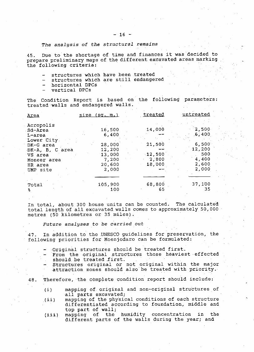
(a) by providing Member States with technical assistance in the form of expert services, fellowships, documentation and equipment, and by assisting them to secure means of financing the projects carried out with the assistance of the Organization;
(b) by carrying out, in co-operation with international and non-governmental organizations, operational projects to enlist the support of the younger generation in the preservation and presentation of cultural property;
(c) by carrying out major promotional and operational projects and particularly by mobilizing international assistance to contribute to the preservation and presentation of the above-mentioned monuments and sites (including Moenjodaro);
(d) by giving emergency assistance to rescue or repair cultural property damaged or endangered by natural or man-made catastrophes;
(e) by carrying out field projects for restoring and preserving monuments and sites as well as projects of cultural tourism, and by helping Member States to obtain for archaeological and restoration work the co- operation of competent public and private .: institutions.
On the basis of the master plan and the above-mentioned b
Resolutions, the Director-General launched an international campaign in 1974 and 1983 calling for international solidarity for the preservation and development of Moenjodaro. At the special request of Pakistan, in 1990 he sent an additional letter
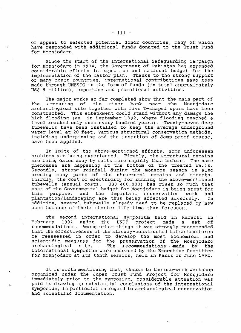
of appeal to selected potential donor countries, many of which have responded with additional funds donated to the Trust Fund for Moenjodaro.
Since the start of the International Safeguarding Campaign for Moenjodaro in 1974, the Government of Pakistan has expended considerable efforts in expertise and national budget for the implementation of the master plan. Thanks to the strong support of many donor countries, international contributions have been made through UNESCO in the form of funds (in total approximately US$ 9 million), expertise and promotional activities.
The major works so far completed show that the main part of the armouring of the river bank near the Moenjodaro archaeological site together with five T-shaped spurs have been constructed. This embankment could stand without any damage the high flooding (as in September 1992, where flooding reached a level reached only once every hundred years). Twenty-seven deep tubewells have been installed to keep the average underground water level at 20 feet. Various structural conservation methods, including underpinning and the insertion of damp-proof course, have been applied.
In spite of the above-mentioned efforts, some unforeseen problems are being experienced. Firstly, the structural remains are being eaten away by salts more rapidly than before. The same phenomena are happening at the bottom of the treated walls. Secondly, strong rainfall during the monsoon season is also eroding many parts of the structural remains and streets. Thirdly, the cost of electricity for running the above-mentioned tubewells (annual costs: US$ 400,000) has risen so much that most of the Governmental budget for Moenjodaro is being spent for this purpose, and the important conservation work and plantation/landscaping are thus being affected adversely. In addition, several tubewells already need to be replaced by new ones because of their shorter life-time than foreseen.
The second international symposium held in Karachi in February 1992 under the UNDP project made a set of recommendations. Among other things it was strongly recommended that the effectiveness of the already-constructed infrastructures be reassessed in order to develop the most economical and scientific measures for the preservation of the Moenjodaro archaeological .site. The .recommendations -made by the international symposium were endorsed by the Executive Committee for Moenjodaro at its tenth session, held in Paris in June 1992.
It is worth mentioning that, thanks to the one-week workshop organized under the Japan Trust Fund Project for Moenjodaro immediately prior to the symposium, considerable attention was paid to drawing up substantial conclusions of the international symposium, in particular in regard to archaeological conservation and scientific documentation.

- iv - In order to preserve the important archaeological remains
more effectively, it is essential to develop firstly, the scientific documentation of the remains and their historical environment and secondly, the most economical and scientific conservation methods. In compliance with the recommendation of the above-mentioned international symposium and the Executive Committee of June 1992, the Authority for the Preservation of Moenjodaro has recently upheld further installation of additional tubewells until more precise data have been obtained on their effect to slow the structural destruction by way of stopping capillary action of salt-laden underground water. It is hoped that sufficient data can be collected in 1993 under the two extra-budgetary projects.
With the above-mentioned background in mind, the present report deals mainly with outlines for the archaeological documentation on the basis of the author’s experience at Moenjodaro. The preservation strategy and programme, which are being developed in close collaboration with the author, another UNESCO consultant (Mr. Richard Hughes, Conservator) and the UNESCO Programme Specialist responsible for the Moenjodaro Campaign, are also one of the bases for the report. In particular, in this report the past archaeological excavations and conservation efforts are reviewed. It should be underlined that the recommendations in Parts I11 and V will be very useful for the advancement of the recording of the present conditions and treatments on the archaeological remains at Moenjodaro.
Although the initial assignment did not include this part, at the request of Moenjodaro Authority, Part IV (Draft for a Tourist Pamphlet) provides readers of the report with the salient features of Moenjodaro and an studies carried out.
(Preface by H. Noguchi, responsible
historical outline of scientific
UNESCO Programme Specialist for Moen j odaro)
- 1 -
I. INTRODUCTION
1. In deviation from the Workshop which was planned September 1992 was cancelled authorities, so the programme planned.
original contract programme, the to take place in Moenjodaro in at short notice by the Pakistani could not be executed as originally
2. According to the Pakistani authorities, the main reasons for the cancellation were the security situation around Moenjodaro (and Sindh) and problems of the recruitment of staff for the workshop and local preparations. Finally, and shortly before the planned departure, UNESCO Headquarters accordingly ordered the cancellation of the programme for September.
3. After intensive correspondence and massive interventions also based on the pressure by the UNDP programme timetable, a revised concept was decided and agreed upon which, in principle, was based on the restabilization of the local conditions to allow the execution of the urgently needed workshop as soon as possible.
4. To compensate the dropped workshop it was decided to intensify the preparatory work in Europe. Within this concept two int-ensive working meetings took place at Aachen University with Mr. Hughes (UNESCO consultant, Conservator) and Mr. Noguchi (UNESCO Headquarters, Division of Physical Heritage) as participants. A new strategy was developed based on principles of 'catastrophe planning'.
5. The reason for the above was that hypothetically, it was anticipated that there might be little progress at the action level in Pakistan.
6. From what could be observed during the year 1992- it became very clear that not only the planning of the physical programme had to be carried out, but also the local management planning in Pakistan.
7. This was, therefore, the aim of the activities under this contract and the visit .to .Pakistan .at .the end..of- November 1992 resulted in the decision of a workshop in February 1993.
11. WORKING DOCUMENT TO BE SUBMITTED TO THE PARTICIPANTS IN THE WORKSHOP
8. The working document which was drafted for the Workshop, could not be submitted to the participants due to the cancellation of the Workshop by the Government of Pakistan. The outline of this document, however, is given in Annex C.
- 2 -
9. The working document is based on observations by the author, who worked for several years at Moenjodaro. According to the complexity of the problem, it can only reflect a general approach towards the problem of conservation. Therefore, each individual case will need its own individual solution. The didactic strategy is to develop a dynamic model of approach based on the discussions in situ by both the UNESCO experts (Hughes, Jansen, Noguchi) and the participants in the workshop.
10. The aim is a long-term strategy for the physical conservation and preservation of the archaeological site of Moenjodaro based on locally available material, technology and manpower.
111. FINDINGS AND RECOMMENDATIONS FOR THE DEVELOPMENT OF THE ARCHAEOLOGICAL DOCUMENTATION CENTRE
11. In accordance with the terms of reference of the mission, the consultant prepared the following findings and recommendations for the development of the Archaeological documentation centre.
A. Functions of the Documentation Centre
12. In general, the documentation centre (DC) will be required to perform the following functions:
- storage of incoming data; - administration of stored data; - provision of user access to stored data for the
- processing of stored data (e.g. combining graphic and experts involved in the saving of Moenjodaro; and
textual data).
The computer processing of stored data would mark phase I1 of the UNDP project after the completion of Phase I.
13. The DC would, therefore, consist of the following sections:
- a photographic section; - a plans section; - a text section; - a preservation section; and - an information section (library).
For each of these sections, the above-mentioned functions of storage, administration, user access and processing have to be taken into consideration.
B. Sussested List of EcruiDment (not repeated here in detail as it is already available)
14. The list of equipment is differentiated according to :
- 3 -
a) equipment for the execution of the documentation in situ; and
b) equipment for the documentation centre.
15. As regards (a), once the full preservation work is in progress the documentation of structures treated has to be carried out simultaneously in different areas. The author anticipates that for the maintenance of each area (Citadel, DKG- North, DKG-South, VS, HR, Moneer DK-A, B, C) one permanent working group consisting of one or two foremen and 15-20 workmen will be responsible. To guarantee regular documentation, a total of four sets of documentation equipment each shared by two maintenance groups is recommended.
16. If funds permit, the four sets should be purchased as soon as possible to permit early training of the groups. The documentation should be dealt with by the foremen who will be specially trained for it. Alternatively, the senior officer in charge of the area has to deal with the documentation. Most of the equipment can be purchased locally.
IV. ADDITIONAL DOCUMENTS PREPARED FOR THE TOURIST PAMPHLET
General text on.the Indus Civilization
17. The following general text on the Indus Civilization, which would figure on the outside cover of the pamphlet, has been prepared:
"The Indus Civilization, along with those of Egypt and Mesopotamia,is one of the three earliest civilizations in history. While the latter two have been known throughout history, knowledge about the Indus Civilization has disappeared, as no records whatsoever of this area survived in later cultures. Only 'by chance' excavation in the year 1922, almost simultaneously, at Harappa, in today's Punjab and Moenjodaro in Sindh, brought to light the exciting remains of this third early civilization of mankind. Major excavations, particularly at Moenjodaro in the following years, quickly showed the picture of a large urban compound, densely covered by hundreds of houses built of burnt brick of today's size and proportion. A larger, lower area, with a predominantly residential character, was separated by a non-inhabited area of approximately 200 metres from a smaller but high place in the west, with a large bath, individual bathrooms, an assembly hall and, in later excavations, a 'granary'. To the great surprise of the excavators, neither a temple complex nor a palace was found.
- 4 -
Excavations at Harappa were not as successful, as the site had been robbed of most of its burnt bricks by British railway constructors for the Lahore-Multan Railway shortly after 1857.
In 1925, the Director-General of the Archaeological Survey of India, Sir John Marshall, called th,e American archaeologist Ernest H. Mackay to continue the excavations at Moenjodaro. After 1929, N.G. Majumdar started to explore the region of Sindh and the western areas of Manchhar Lake and Sind Kohistan. There he discovered several important prehistoric sites like Amri, Damb Bhuti and All Murad. He also identified Chanhu Daro as an Indus Civilization site. Parallel to his ongoing research Sir Aurel Stein started in 1926 to carry out further exploration in the Zhob Valley, Waziristan and Gedrosia. Later research was carried out in the Bahawalpur district. At the end of the 1920s, not only was a first chronology established, dating the Indus Civilization into the third millennium BC, but also a first interregional network of sites had been formulated from the Baluchistan mountains to the river basin of the Indus, showing the complexity of a widely- distributed cultural phenomenon.
L
A new impetus appeared with Mortimer Wheeler, who in 1944 became Director-General of the Archaeological Survey of India. His short but very intensive presence in India not only reformed and modernized the Archaeological Survey of India but also led to further major discoveries at Harappa and Moenjodaro. At Harappa in 1945 he excavated the fortification of the citadel and in 1950 in Moenjodaro the 'granary'. After partition in 1947, the interregional research, both in the Indian Union and Pakistan, was intensified.
Today, more than 1000 sites belonging to the Indus Civilization are known, covering approximately 1 million square kilometres in the northwest of the Indian sub-continent, most of it in Pakistan. Recent research has shown that the history of sedentary life in Pakistan can be es.tablished,back to almost the 8th millennium BC, with a continuous development from village cultures to the large urban cities of the Indus Civilization. Today it is also understood that the Indus Civilization developed out of the earlier cultures of the early 3rd millennium BC, like the Amri-, Kot-Diji- and Sothi-Cultures in the Indus valley proper. In the later stage, around 2100 BC, the Indus people were in contact with Mesopotamia and the Arabian Peninsula. They had a high standard of living and complex socio-economic forms of organization, also expressed by a form of writing not yet deciphered. The reasons for the final decline and

- 5 -
collapse of this civilization remains one of many questions of the big riddle, as yet unanswered. Moenjodaro is until today the largest of the Indus Valley cities and seems to have been its centre, from which the large state was managed. Therefore, it remains the most important archaeological source for the study of one of our earliest civilizations."
Moenjodaro Text for Pamphlet
21. The following text has been drafted for the tourist pamphlet:
"Moenjodaro was first visited and described in 1912 by the archaeologist D.R. Bhandarkar. Ten years later, in the winter of 1922-23, his successor as Director of the 'Western Circle', R.D. Banerji, started with excavations on what he had thought to be one of the largest Buddhist stupas in Sindh. At first glance his assumption was justified in excavating a monastery with a stupa in its central courtyard. He could date this into the 2nd Century AD by coins of the Kushana King, Vasudeva I, found in a pot in one of the cells.
Digging deeper, he very soon came across hitherto unknown artefacts, especially small square seals with an unknown script. In the same year, similar seals had been found at Harappa, 600 kilometres north in the Punjab. This discovery was the rebirth of the Indus Civilization.
Today 100,000 square metres, or 10 per cent of Moenjodaro, has been excavated. Moenjodaro is probably even bigger, as the ancient ruins are not limited to the mounds which are visible today. It continues underground, probably up to the Indus River. This would make Moenjodaro the largest known Bronze Age city of the world, covering more than 4 million square metres.
The major excavations were carried out between 1924 and 1931. A smaller excavation at Moneer site was carried out in 1936. In 1950, Mortimer Wheeler excavated the so-called granary west of .the Great Bath. The American archaeologist George Dales in 1965 was the latest archaeologist to have carried out excavations at Moenjodaro (UPM or Dales area west of HR area). Since 1979, a German team headed by Michael Jansen has been reviewing a11 excavations.
The Citadel
Arriving from the entrance to Moenjodaro, the citadel is the first prominent feature to be seen. Rising as a gigantic platform for more than twenty metres above today's alluvial ground it must have been even more
- 6 -
prominent 4500 years ago, when the surrounding plain was more than seven metres lower. Ascending the hill to the left we find the Buddhist monastery with the stupa in the centre of the courtyard dated to the 2nd Century AD. From here one has an overwhelming view not only over the whole citadel but also over the major parts of the lower city to the east. The Great Bath at the foot of the stupa is one of the largest structures of the -city measuring approximately 25 x 70 metres. Its centre consists of a courtyard surrounded by a cloister with big square pillars and a large basin in the middle, measuring 7 x 12 metres and entered by two flights of steps in the north and the south. A corbelled arch covers an almost 1.8 metre high drain to the west, which cuts a corner of the large granary. North of the Great Bath one finds a row of drained bathrooms which are thought to be 'private baths'. In the south of the citadel, in the L-shaped area, to your right you will find a row of square pillar bases belonging to the 'assembly hall'.
The lower city is transversed by its 'backbone', the 'First Street'. The lower citadel, like the citadel, was obviously planned. All houses are more or less oriented towards the cardinal directions (north-south, east-west). Most houses have their own well, indicating not only a high water consumption but also a high standard of civil engineering. No other civilization of the world at that time had such a. sophisticated system of water supply and drainage. In almost every street and lane one comes across the drains running along one of the sides.
Most impressive stand the walls in the DK-G area excavated between 1927 and 1931 by Ernest H. Mackay. Here we find more than three major building phases of the city which can be studied by the many walls showing entrances and drain outlets, sometimes at a considerable height. Wells stand like pre-industrial chimneys after having been excavated up to a height of six metres. They descend to 20 metres below the present surface. In a remote area, DK-B, the famous 'priest-king', was found in 1925. The excavation reports of Marshall and Mackay .are -full ~ of exciting stories about the discoveries of more than 50,000 registered objects, among them thousands of seals, terracotta figurines, household objects, bronze figurines and jewellery.
However, Moenjodaro is now endangered. Since 1979 an international campaign for the safeguarding of Moenjodaro has been launched under UNESCO's patronage. The 4500-year-old walls will disappear within the near future if mankind does not conserve its most precious property. With most modern scientific techniques the process of decay has been studied and new methods of

- 7 -
V.
18. its
treatment have been applied. With the help of international UNESCO consultants, the site has now been stabilized. You as a visitor can also contribute to the safeguarding. We request you to keep to the marked paths, and you must not climb the walls, which will be further damaged by your action. In addition, help us to save at least one brick through your contribution. Donate generously to the account: ..."
REVISED SCHEME OF THE CONDITION REPORT 1987 MOENJODARO: THE PROBLEM OF THE PRESERVATION OF A BRONZE-AGE CITY
History of Research
The archaeological research carried out at Moenjodaro since discovery in 1922 can be divided into six phases:
The initial research under Sir John Marshall marked by large horizontal excavations, during which most of the structures visible today in the northern citadel and the sou,thern lower town with VS and HR area were excavated.
The research under Ernest H. Mackay after 1926 in DK-G area to trace the vertical extent of the site marked by a deep digging of more than 6 metres with more than 150,000 cubic metres of excavated. ground and zmarked by several test trenches outside the daro .
The research under Sir Mortimer Wheeler in 1950 in the west and southeast of $he citadel to trace the fortification of Moenjodaro .
The research of George Dales in 1964-65 to study the slope si>uation west of HR area in the search for the port.
The research of the Aachen University Mission to Moenjodaro from 1979 to 1987 which concentrated on
1. Marshall, Sir J. 1931.
2. Mackay, E.J.H. 1937.
3. Wheeler, Sir M. 1968.
4. Dales, G. 1965. New Investigations at Moenjodaro. In: Archaeology 18/2:-145-150.

- 8 -
the copplete redocumentation of the excavated remains
(vi) The research of the joint Aachen University-IsMEO Rome Mission from 1983 to 1986, based on geophysifal, geobotanical surveys and surface analyses , structurally resulting in the discovery of the supporting substructures today covered by $he alluvium and a detailed study of the forma urbis .
19. The interim results at present point towards a gigantic system of substructures which seem to have been erected in a perfectly planned manner to support the habitational zone on top. At least for the citadel area, a mud brick platform, 200 x 400 metres, today approximately 7 metres in the alluvium, could be traced. With dry core drilling pure alluvium soil under the mudbrick wall excavated by Wheeler could be reached at
20. With these results, Moenjodaro has become a unique research object in the world, not only for Bronze Age city planning but also for developing adequate analytical methods to deal with such an extraordinary structural phenomenon. The general structural study of such a site covering, according to latest research results, at least 400 hectares, the lower part of which is covered by approximately six to seven metres of alluvium of the Indus River cannot be carried out anymore with conventional archaeological methods.
pproximately 9 metres depth (40 metres amsl).
21. In 1982-83 the Aachen University Mission developed an unmanned hot-air balloon for taking aerial stereo photos, in 1983-85 tests with geophysical methods were carried out by IsMEO and in 1986 the methods were finally improved with Pirckhauer subsurface-drilling and plane.
22. Starting with horizontal random excavations in the early 1920s, Mackay continued in 1927 with a systematic approach to
5. Jansen, M. 1983. Preliminary Results of Three Years’ Documentation in Moenjodaro. In: Jansen, M. and Urban, G. (eds.), Rokumentation.in.der7Archaol-ogie,.-Aachen; and Jansen, M. 1984. Architectural Remains in Moenjodaro. In: Frontiers of the Indus Civilization, New Delhi.
6. See contributions of M. Cucazi, M. Vidale and M. Halim and M. Tosi in: Jansen, M. and Urban, G. (eds) 1984. Interim Reports, Vol. 1.
7. e.g.: Jansen, M. 1985. Mohenjodaro, Cite de 1’Indus. In: La Recherche 163/16: 166-176, Paris, translated into English (Endeavor) and into Italian (Scienza Duemilla); and Cucarzi, M. 1984. Geophysical Investigations at Moenjodaro. In: Interim Reports Vol. 1, Aachen.
- 9 -
build up a Somplete chronology without having been able to reach virgin soil .
23. A second attempt by Wheeler in 1950 to reach the lowest levels also failed. Wheeler added to tge already-known structures of the citadel known as the granary.
24. Wheeler’s search for the fortifications within the citadel area was not as successful as expected. He final-ly was unable to prove that the discovered structure in the southeast part of the citadel was, as discovered in Harappa in 1946, the fortification. From a present-day point of view his most important discovery was a big mud brick wall west of the granary starting immediately below the surface (48.5 metres amsl) and continuing down for more than seven metres .
25. Dales’ attempt to build up a new chronology and to solve the problem of the sloping area west of the HR area was interrupted by the war between Pakistan and India in 1966. Although researching only for less than three mo,qths, he collected excellent data which were published in 1986 .
26. With the Aachen University Project at Moenjodaro a new type of field studies was introduced in redocumenting already- excavated structures of an archaeological site. In six years 300 house units, covering more than 100,000 square metres, were redocumented, measured, photographed and levelled.
27. The documentation was finally the basis for the study and interprehation of the three-dimensional growth of architectural clusters in relation to the distribution of,_ their excavated artefacts according to computer interpretation’”.
8. Mackay’s chronology consisted of three periods (early, middle and late) differentiated into three phases (I,II, 111) each, based on a horizontal growth model.
9. All his unpublished plans of the excavation are due to the help of Dr. Hammond, London and Professor Tosi, Rome, available with the Aachen University Mission.
10. Wheeler :1968: 45.
11. Dales, G.F., Kenoyer, J.M. 1986 Excavations at Moenjodaro, Pakistan: The Pottery, Pennsylvania.
12. Jansen, M. 1984 Theoretical Aspects of Structural Analyses for Moenjodaro. In: Interim Reports Vol. 1, Aachen; and Jansen, M. 1986 House I, HR A a Temple? In: South Asian Archaeology 1983, Brussels.
13. Jansen, M., Urban, G. 1985 Moenjodaro. Data Collection Vol. 1, Field Books and Concordance of HR Area, Leiden, Brill.
- 10 - 28. A further major step forward was undertaken, when the Government of Pakistan issued in 1983 an additional licence to the joint Aachen University-IsMEO Rome Mission to Moenjodaro to carry out surface surveys in the non-excavated areas, as well as geophysical and geobotanical surveys for further studies and to improve non-destructive methods of archaeological research.
29. This research soon showed the huge potential of the archaeological site, both on its unexcavated surface and below it, clearly indicating that Moenjodaro is a monument of unique importance which has to be protected not only in its excavated parts but as a whole, including all archaeological and structural aspects.
Preservation reports carried out up to the present
30. The reports on the physical preservation of walls carried out up to the present by experts dealt with the problems of conservation in general, differentiated according to:
- rise of humidity in walls - affection through salts - erosion forms - problems of standing water in the ruins after rains
Executed conservation programmes: results and problems
31. The main conservation measures being applied until today (according to the report submitted by the Government of Pakistan UNESCO/MO/EX-V111/3:5) are:
A. Conservation of remains (to keeD them in the condition they are without further structural construction)
- The main conservation methods applied are: (1) underpinning of endangered walls; (ii) provision of horizontal and vertical damp-
proof courses (DPC); (iii) brickwork on edge flooring in the rooms of the
houses ; (iv) mudbrick capping of excavated walls; (VI removing and replacing sal t-af f ected soil with
sweet earth and river.sand; (vi) making sound and proper drainage arrangements
for rainwater all over the sites; and (vii) removal of debris lying adjacent to the
excavated remains.
In addition to the conservation measure.s, restoration measures have also been carried out as follows:
B. Restoration (to reDlace destroyed Darts by reconstructionl
- The main restoration methods applied are:
- 11 - (1) re-building of collapsed walls; (ii) replacing and exchange of bricks in still-
existing walls, especially in the bottom part (during the process of introduction of DPC) and on the top of the walls; and
(iii) consolidation of wall tops with bricks in cement mortar.
According to this condition report the following comments on the execution of the different points can be made:
A. (i) The underpinning has to be carried out in a bonding method with the remaining wall. Otherwise the underpinned part will bulge out after a short period.
A.(ii) With the introduction of DPC the rising water capillarity should be stopped.
- The common method applied is to introduce bitumen coated concrete slabs in the walls, in removing about 5 layers of bricks to enable proper installation. This results in the destruction of a part of the wall. - In some cases (e.g. the Moneer area), holes which had been broken in the walls had not been refilled again, resulting in the deterioration of the wall. - To avoid further destruction more sensitive cutting devices should be introduced to bring in the DPC, which should be a polymer sheet. - Almost everywhere, the DPC has been installed at the wrong height (in other words, approximately 50 to 100 centimetres above-ground) instead of placing it much lower (see also: Clifton 1980: fig 1). A DPC above-ground results in an extraordinary high concentration of salts and humidity below the DPC, causing the more rapid destruction of this part of the wall which finally tilts as a whole (see e.g. Clifton 1980: .A, report of R. Oswald, Appendix 3). - The proposal by UNESCO (e.g. Clifton 1980:7) to introduce vertical DPCs leads to serious destruction in unexcavated ground and partly to even faster deterioration of structures.
A. (iii) A brickwork on edge flooring inside rooms might not be advisable as non-experts might think the flooring is original. Already the brick paving in the streets creates confusion,
- 12 - as originally none of the streets were paved with bricks.
A. (iv)
A. (vi)
This method, already introduced in the 1950s, has been one of the most effective ones. Walls protected by mud-coating deriving from mudcapping (floating of mud after ,Eain) show an excellent state of preservation .
The removal of salt-affected soil should be concentrated only on the uppermost layers which are already in a secondary position to avoid the penetration in archaeological ground. One should never forget that original archaeological layers to be protected as a part of the Moenjodaro monument are continuing immediately below the surface.
The draining of rainwater inside the ruins is, besides the protection of the walls against rising humidity, one of the most important measures to be undertaken. Especially in depressions such as the DK-G area which, in the lowest part is only 47 metres amsl, water collects after rains like a mudhole and creates heavy destruction. In these cases, an outlet (if possible through a drain along the first street to the north of the DK-G area which is connected with the channel) for the standing water has to be arranged. For each of the other sites (100,000 square metres) a net of inter-connected drains has to be planned which allows proper draining without major destruction of archaeological ground.
A. (vii) Archaeologically speaking, it is extremely difficult (as can be studied in areas of Moenjodaro that have already been "cleaned up") to remove debris of former excavations as, after so many years, it is hardly possible to differentiate between primary and secondary deposits. Only by careful studies of the topographic change between the original (1925) topographic map (Francis map) and the latest (1968) topographic map (Wanzke plan) can the deposit mounds be traced. A plan (Khan 1970: opposite page 40) showing the mounds of debris is partly wrong. It therefore has to be revised if further debris is to be removed.
14. It is therefore advisable to rethink Clifton's comment (1980:4) that the discolouring by mud film on the walls is felt to be aesthetically unacceptable. Scientifically speaking, most of the walls were originally covered by a mud coating.
- 13 - B. (i)
B. (ii)
B. (iii)
The rebuilding of collapsed walls is a tradition which goes back to the 1920s (e.g. Urban, T. 1983). Not only the Great Bath in its whole western part (about 40 per cent of the structure) had been conjecturally reconstructed by Marshall in 1926, but also the Buddhist monastery. In the early 1950s, major parts of walls in the First Street and HR area were replaced by new ones. Often the masons did not follow the original pattern as can be proved by the older original photographs. The tradition of rebuilding walls is still practiced today. The restoration should be executed according to the original structure. Therefore in each case a study is advisable and a drawing should show how the walls have to be reconstructed.
The same accounts for the replacing of bricks in walls, as the bonding technique is an important indicator for the archaeologist to date a wall.
The consolidation of wall tops with bricks laid in a mixed cement-lime mortar is basically very successful. It is advisable to keep a natural 'ruinous' silhouette instead of a straight one and the visitors off the walls.
32. If one goes through the different reports of UNESCO experts dealing with the preservation of the archaeological remains, one seems to be missing (besides a comment on the importance of the archaeological site as a whole, including the non-excavated areas, horizontally as well as vertically): a detailed study in situ of the areas to be treated, and a systematic approach towards specific treatments according to different physical conditions. The optimal treatment of the site is dependent on different parameters of these diagrams. A simplified version shows the relation between the chemical agent (mostly the sodium sulphate mineral phase thenardite) which under specific climatic conditions (see diagram below) and with the help of water destroys mechanically the building material (in this case, burnt bricks).
chemical agents
Water (soil) Climate building material
33. As J. Clifton (1980:5) has already shown, the maia destruction agent is the sodium sulphate mineral thenardite after the hydration reaction. U. Ludwig came to the same
15. Mirabilite (Na,SO, 10 H,O), not thenardite (Na,SO,) is the destructive agent.
- 14 - conclusion in 1983 after a brick had been analyzed at Aachen University (Ludwig, U. 1983). According to Ludwig (1983: Abb. 15) the crystallization pressure is at 32.38' C equal to zero and increases in lower temperatures (and not in higher ones as mentioned by Clifton (1980: 5). The hydration reaction is dependent on temperature and humidity. Even in winter and early spring heavy dew occurs in the morning hours where the temperature can fall to 0' C. As this situation is repeated daily in the winter season, this seems to be the most dangerous period.
34. We can differentiate the process into the following facts:
a. The destruction of bricks is a primary danger for Moenjodaro.
b. This destruction is caused by the change of the mineral phase thenardite of the sodium sulphate into mirabilite, which is formed under specific climatic conditions.
c.
To conserve the archaeological structures, therefore, two
a.
b.
The sodium sulphate is in the bricks.
35. measures have to be undertaken:
to avoid further transport of salts into the walls;
to remove the existing salts from the structures.
36. A further protection against other agents and further consolidation of weak material is a question which cannot be dealt with here.
37. Measures which have been undertaken up to now to avoid further salt transport into the bricks are:
a. lowering of the water table
b. installation of damp-proof courses;
c. treatment of bricks with chemicals for consolidation purposes;
d. exchange of salty soil;
e. planting of trees (not yet executed);
f. draining of areas after rain.
38. Water plays an extraordinary role in the whole process. At first it transports the salts, not only from the lower underground levels, but also from the core of the structures to their surface. Secondly, water acts as the main agent in the changing of the mineral phase fromthenardite to mirabilite which
- 15 - finally causes the destruction. As Ludwig has shown (1983: Table 5) there is a clear concentration of salts near the surface.
39. While further transport of water through rising capillarity can be controlled, the influence of dew on the surface is hardly controllable. This water source seems to be the most dangerous one, as it forms the mirabilite.
40. If we pinpoint actions as close as possible to the parts to be treated, at a wall we can differentiate: (i) the parts in direct contact with the soil from where the capillarity action comes and (ii) the surface, where the salts concentrate and from where the dew and rain can enter the wall.
41. If the problem of stopping water transport within the walls and from earth contact zones into the walls is already recognized in principle, the problem of the wall surface with its salt concentrations and water penetration, mainly through dew, has hardly been recognized at all.
42. As there is no adequate technical solution (especially for the enormous amount of 50 kilometres of walls) either to avoid evaporation of water from the inside of the bricks on their surface or to avoid the penetration of water (dew or rain) into the brick, there seems to be only one possible solution for the time being, that is, to change the surface of the walls by clay packing16 during specific periods of the year where the site is most endangered.
43. This has a double effect: the salts crystallize not on the brick surface but on the clay surface, and the clay packing can be used at the same time for the leaching of salts. A regular exchange of the clay packing results in a reduction of salts under the condition that no further salt is transported into the wall.
The -qualitative-quantitative condition report of 1987’7
44. Based on the documentation prepared by ARPM RWTH and in close co-operation with the Pakistani authorities involved, an adequate analysis of the structural remains of Moenjodaro could be executed and maps be prepared showing the state of the walls. Besides the mapping of the wall conditions some smaller tests on the applicability of-.mudpacking for ..the-extracting of salts on the surface and subsurface had been carried out with the representative of the chemical laboratory at Moenjodaro.
16. J. Bunse made some tests with different clay packings in co- operation with the site laboratory at Moenjodaro. The best results were obtained with a sand-tempered or straw-tempered packing which has to be kept slightly moist.
17. This report is based on a set of maps (in its App. 1) of all excavated remains documented by the Aachen Research Project Moenjodaro carried out from 1979 to 1985.
- 16 - The analysis of the structural remains
45. Due to the shortage of time and finances it was decided to prepare preliminary maps of the different excavated areas marking the following criteria:
P
- structures which have been treated - structures which are still endangered - horizontal DPCs - vertical DPCs
The Condition Report is based on the following parameters: treated walls and endangered walls.
Area
Acropolis Sd-Area L-area Lower City DK-G area DK-A, B, C area VS area Moneer area HR area UMP site
size (su. m.)
16,500 6,400
28,000 12,200 13,000 7,200
20,600 2,000
treated
14,000 -- 21,500
12,500 2,800
18,000
--
--
Total %
105,900 100
68,800 65
untreated
2,500 6,400
6,500 12,200
500 4,400 2,600 2,000
37, 1'00 35
In total, about 300 house units can be counted. The calculated total length of all excavated walls comes to approximately 50,000 metres (50 kilometres or 35 miles).
Future analyses to be carried out
47. In addition to the UNESCO guidelines for preservation, the following priorities for Moenjodaro can be formulated:
- Original structures should be treated first. - From the original structures those heaviest effected
- Structures original or not original within the major should be treated first.
attraction zones should also be treated with priority.
48. Therefore, the complete condition report should include:
(i) mapping of original and non-original structures of all parts excavated;
(ii) mapping of the physical conditions of each structure differentiated according to foundation, middle and top part of wall;
(iii) mapping of the humidity concentration in the different parts of the walls during the year; and
- 17 - (iv) recording of salt concentration.
Ad(i) For the mapping of original and non-original structures the following sources are available:
- the original site-plans of the excavations; - the original photos of the excavations.
Ad(ii) For the mapping of the physical conditions of the walls, a wall-by-wall survey is suggested.
Ad(iii) For the mapping of the humidity in walls without salt a humidity-metre could be used otherwise sample testing is suggested.
Ad(iv) The concentration of salts could be registered by leaching under similar conditions.
49. To carry out the above-mentioned mappings the house units have to be numbered and each wall specified. The mapping should be accompanied by an index card system in which the observed criteria are entered. Observations could be accompanied by photography. Once the inventory system is built up it can easily be used and results of treatments, etc. can be checked.
50. Three aspects are of the utmost importance:
a. Moenjodaro exceeds by far the size of a '.normal' monument (at least 100 hectares, of which 10 hectares have been excavated.
b. Moenjodaro is an archaeological site with more than 90 per cent unexcavated area. Also within the excavated area (to be treated) invaluable archaeological remains are still in situ which should not be destroyed through improper conservation measures (e.g. vertical DPC connected with uncontrolled fresh digging).
c. Moenjodaro is a primary archaeological source which has to be conserved in its original setting (e.g. walls which have to be replaced [in restoration] should be replaced according to their original appearance) .
51. The basis for long-term scientific preservation is referred to in the condition report and the wall inventory.
Conclusion
52. Moenjodaro, even in its present condition, obviously represents a unique archaeological site in the world for the study of a typical Bronze Age metropolis.

- 18 - 53. It is worth noting that the homogeneity in the cultural assemblage and the unique structural concept are easy to interpret due to the burnt brick structures, the protected situation since 1923 and the recent national and international attempts to save it. The availability of all former research data with more than 5,000 old photos, 38,000 field book registrations and all original plans only adds to this.
54. The research of Aachen University, with more than 600 aerial photos taken from a hot-air balloon, more than 100 plans of the excavated structures, including a complete levelling with about 500,000 level points and a photo documentation of more than 15,000 new photos has added a documentation of the excavated structures to be preserved, which is also unique in the world.
55. The above-mentioned research has added new aspects regarding the archaeological surface, the horizontal and vertical extent, the inner orientation and environmental conditions.
56. Taking all these facts into consideration, the research on the historical data (old photographs, field books, etc.) of Aachen University, the redocumentation of the excavated remains and the environmental and structural studies by the mission seem to be strongly interrelated with the task of physically preserving Moenjodaro.
57. The scientific physical preservation of the site should be based on the study of the historical data including a careful analysis of the old photos to guarantee a critical preservation. Before starting the preservation work according to international standards, plans should be presented, showing the preservation activities. The study of the historical data should be accompanied by the direct study of the physical remains according to physical conditions (collapsing walls, etc.), different water concentration (humidity metre) and resulting from this, concentration of salts.
58. For this programme the extensive studies of the site carried out in the past can be used and should be continued for this specific purpose. It should be carried out as a condition report of the structural remains marking the conditions and their change in the site maps (1:200). For each house or wall, index cards should be prepared to register activities and their..results. The environmental and structural studies should be continued for this purpose, envisaging the joint interest in the site. In future research to be carried out at Moenjodaro the aspects of both science and preservation should be directly kept in mind as there is only one common aim: the deep understanding and the presentation of Moenjodaro as a unique cultural property of mankind to the world.
,

- 19 - ANNEX A
Detailed Work Procrramme
Programme foreseen according to the contract (13.07.92):
- One month mission to Pakistan - 3-day visit to UNESCO, Paris (briefing); - 4-day visit to UNESCO, Paris (debriefing); - 3 weeks additional work for preparing a working
document and final report (total of two months).
Revised programme in agreement with UNESCO and the Government of Pakistan due to the cancellation of the workshop in September 1992 by the Government of Pakistan:
- 12-day mission to Pakistan - 10-day visit to UNESCO (briefing and de-briefing) with a total of 4 journeys - in addition to the 3 weeks, an additional 5 days had to be invested to continue the preparation for the working documents in order to meet additional requirements, thus totalling 65 working days .
Executed programme:
Travel to Paris duration 24.-26.07.92 3 days 15.-16.09.92 2 days 08.-10.10.92 3 days 01.11.-02.11.92 2 days
Travel details:
Travel by car due to heavy equipment: Aachen- Paris- Aachen 1000 km
Workshops and preparatory meetings:
30.09.-03.10.92 UNESCO Aachen meeting 4 days 25.10.-28.10.92 UNESCO Aachen meeting 4 days 26.11.-07.12.92 Pakistan 12 days Working days at -Paris (see .above) 10 days 35 additional working days at Aachen 35 days
65 days Travel to Pakistan: 1. ticket Dusseldorf- Karachi- Diisseldorf economy 2. per diem 12 days Pakistan
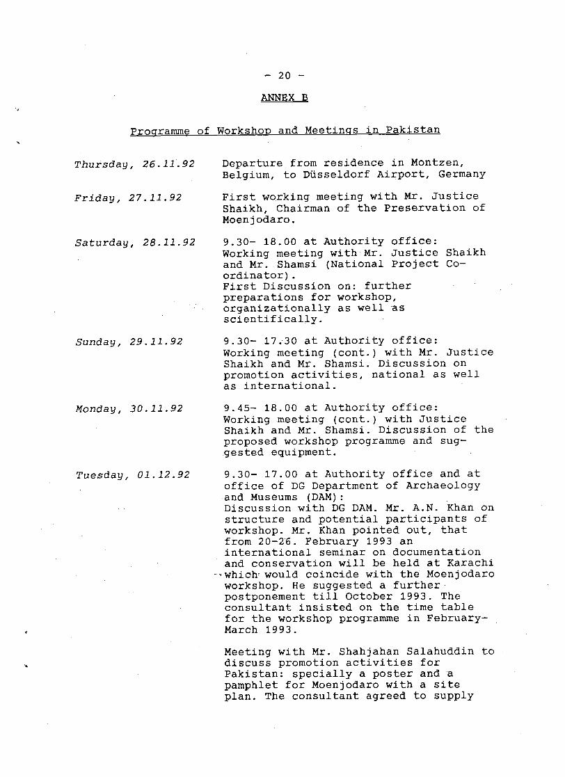
- 20 - ANNEX B
J
Thursday, 26.11.92 Departure from residence in Montzen, Belgium, to Dusseldorf Airport, Germany
Friday, 27.11.92 First working meeting with Mr. Justice Shaikh, Chairman of the Preservation of Moenjodaro.
Saturday, 28.11.92 9.30- 18.00 at Authority office: Working meeting with Mr. Justice Shaikh and Mr. Shamsi (National Project Co- ordinator). First Discussion on: further preparations for workshop, organizationally as well as scientifically.
Sunday, 29.11.92 9.30- 17.30 at Authority office: Working meeting (cont.) with Mr. Justice Shaikh and Mr. Shamsi. Discussion on promotion activities, national as well as international.
Monday, 30.11.92 9.45- 18.00 at Authority office: Working meeting (cont.) with Justice Shaikh and Mr. Shamsi. Discussion of the proposed workshop programme and sug- gested equipment.
Tuesday, 01.12.92 9.30- 17.00 at Authority office and at office of DG Department of Archaeology and Museums (DAM): Discussion with DG DAM. Mr. A.N. Khan on structure and potential participants of workshop. Mr. Khan pointed out, that from 20-26. February 1993 an international seminar on documentation and conservation will be held at Karachi
- 1 which- would coincide with the Moenjodaro workshop. He suggested a further postponement till October 1993. The consultant insisted on the time table for the workshop programme in February- March 1993.
Meeting with Mr. Shahjahan Salahuddin to discuss promotion activities for Pakistan: specially a poster and a pamphlet for Moenjodaro with a site plan. The consultant agreed to supply
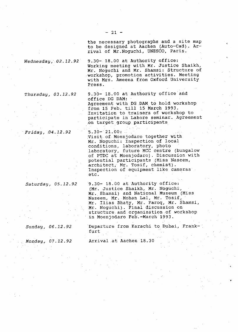
- 21 - the necessary photographs and a site map to be designed at Aachen (Auto-Cad). Ar- rival of Mr.Noguchi, UNESCO, Paris.
Wednesday, 02.12.92 9.30- 18.00 at Authority office: Working meeting with Mr. Justice Shaikh, Mr. Noguchi and Mr. Shamsi: Structure of workshop, promotion activities. Meeting with Mrs. Ameena from Oxford University Press.
Thursday, 03.12.92 9.30- 18.00 at Authority office and office DG DAM: Agreement with DG DAM to hold workshop from 15 Feb. till 15 March 1993. Invitation to trainers of workshop to participate in Lahore seminar. Agreement on target group participants
Friday, 04.12.92
Saturday, 05.12.92
Sunday, 06.12.92
5.30- 21.00: Visit of Moenjodaro together with Mr. Noguchi: Inspection of local conditions, laboratory, photo laboratory, future MCC centre (bungalow of PTDC at Moenjodaro). Discussion with potential participants (Miss Naseem, architect, Mr. Tosif , chemist). Inspection of equipment like cameras etc.
9.30- 18.00 at Authority office: (Mr. Justice Shaikh, Mr. Noguchi, Mr. Shamsi) and National Museum (Miss Naseem, Mr. Mohan Lal, Mr. Tosif, Mr. Ilias Bhaty, Mr. Faroq, Mr. Shamsi, Mr. Noguchi). Final discussion on structure and organization of workshop in Moenjodaro Feb.-March 1993.
Departure from Karachi to Dubai, Frank- furt
Monday, 07.12.92 Arrival at Aachen 18.30
,

- 22 - ANNEX C
Qutline of Workinu Document
A. Classification of the archaeological remains
1. The excavated remains
1.1 The excavated remains in situ (in original
1.2 The excavated remains in situ (in non- original
1.3 The excavated remains disappeared (disintegrated,
condition)
condition)
destroyed etc.)
2. The non-excavated remains
2.1 Archaeological remains within the former excavations 2.2 The archaeological surface 2.3 Archaeological remains beyond the 'daros' beneath
2.4 mud-brick platforms the recent (4500 years) alluvial plain
B. Conservation programme
1. Completion of the scientific documentation of the excavated remains
1.1 All remains in situ
1.1.1 ground plans: approx. 50 kilometres of standing walls over an area of 100.000 square meters for the areas Sd, L, DK-G north, DK-G south, VS, HR, Moneer, DK-A,-B,-C, Dales; about 300 houses
1.1.2 elevations: levelling of all structures 1.1.3 prospections (views) of walls: approx: 50
kilometres of walls;
1.2 Comparative study wall by wall in situ with original documents (photographic collection of the original excavations 1924-1931), 1950 (Wheeler), 1964 (Dales).
2. Classification of conservation programme according to: - Class A (most urgent): original structures in situ,
- Class B original structures in situ, not endangered - Class C partly original structures, endangered - Class D non-original structures, endangered - Class E non-original structures, not endangered
endangered

- 23 - 3. Development of methods for the conservation in principle
3.1 Analysis bl
3.1.1 sub-soil conditions - soil analysis (physical and chemical i
analysis, capillarity, salt concentration etc.)
3.1.2 - typology of bricks (analysis of material, burning temperature, capillarity etc.)
3.1.3 - typology of mud bricks (production (sun- dried), material (grain etc),
3.1.4 - typology of mortars 3.1.5 - analysis of destructive agents (glauber
salt etc.) and their mechanisms (chemical reaction, physical actions)
3.1.6 human-, animal-, plants- action - human: (tourists, locals, 'experts', local traffic, airport etc.) - animals: (wild animals, domesticated animals: sheep, cows, camels etc.) - plants: (pro and contra) geo-botanical (holophyte etc.)
3.2 Conservation methods (in principle)
3.3
3.2.1 subsoil- water- salts- wall relation (from bottom to top, inside- outside) prevention of movement of salts into the walls, control of water-table (effectiveness of pump-system) 3.2.1.1 checking of DPC conservation
programme (executed) 3.2.1.2 alternative methods for horizontal-
vertical DPCs 3.2.1.3 extraction of salts in walls
(chemical treatment, mud plastering etc.) reduction of salts in walls
3.2.2 water (rain)- wind erosion, dew 3.2.2.1 protection of tops (mud capping,
cement mortar etc) 3.2.2.2 protection of wall-sides
(consolidation of bricks, mortar etc. )
3.2.2.3 plantation programme
Conservation methods in situ
3.3.1 3.3.2 3.3.3 3.3.4 3.3.5 3.3.6 3.3.7 3.3.8 3.3.9
SD area L area and 'fortification' DK-G area VS area HR area Moneer area DK-A, B, C area unexcavated surface areas beyond the daros
I
c,
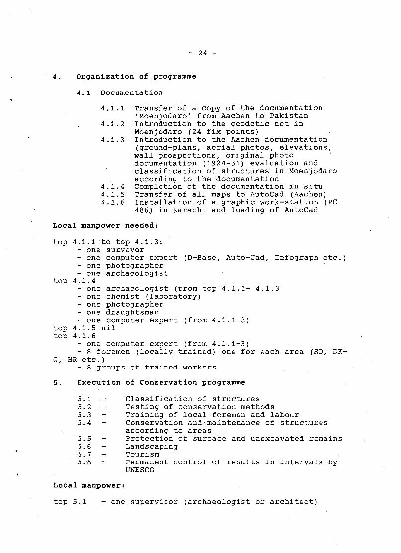
- 24 - 4. Organization of programme
4.1 Documentation
4.1.1 Transfer of a copy of the documentation 'Moenjodaro' from Aachen to Pakistan
4.1.2 Introduction to the geodetic net in Moenjodaro (24 fix points)
4-1.3 Introduction to the Aachen documentation (ground-plans, aerial photos, elevations, wall prospections, original photo documentation (1924-31) evaluation and classification of structures in Moenjodaro according to the documentation
4.1.4 Completion of the documentation in situ 4.1.5 Transfer of all maps to AutoCad (Aachen) 4.1.6 Installation of a graphic work-station (PC
486) in Karachi and loading of AutoCad
Local manpower needed:
top 4.1.1 to top 4.1.3: - one surveyor - one computer expert (D-Base, Auto-Cad, Infograph etc.) - one photographer - one archaeologist - one archaeologist (from top 4.1.1- 4.1.3 - one chemist (laboratory) - one photographer - one draughtsman - one computer expert (from 4.1.1-3)
top 4.1.4
top 4.1.5 nil top 4.1.6
G, HR etc.)
- one computer expert (from 4.1.1-3) - 8 foremen (locally trained) one for each area (SD, DK- - 8 groups of trained workers
5. Execution of Conservation programme
5.1 - 5.2 - 5.3 - 5.4 - 5.5 - 5.6 - 5.7 - 5.8 -
Local manpower:
Classification of structures Testing of conservation methods Training of local foremen and labour Conservation and maintenance of structures according to areas Protection of surface and unexcavated remains Landscaping Tourism Permanent control of results in intervals by UNESCO
top 5.1 - one supervisor (archaeologist or architect)
- 25 - Y
- 8 foremen - one chemist - 8 foremen - 8 groups of workers
top 5.3 - see top 5.2 top 5.4 - see top 5.2 top 5.5 - see top 5.2 top 5.6 - one landscaping engineer - 6 gardeners top 5.7 - a group of experts from Pakistan Tourism
Development Corporation (PTDC)
top 5.2 - one archaeologist
- 26 - ANNEX D
BiblioaraDhv: Condition Report
Aryne, S.A. 1972 Khan, M.H.
Ascon-Bolan 1979
Baloch, N.A., (ed) 1978
Boekwijt, W.O. 1979
Clifton, J.R. 1980
Conservation Conference 1970
Dales, G.F. 1986 Kenoyer , M. J.
Davey, N.
Fosberg, F.R. 1980
Goudie, A.S. 1977
Hasan, K. 1981 Ashfaque, S.
Hasan, K. 1986
Hunting 1962
Hunting 1966
The Control of Groundwater Table at Moenjodaro, Karachi
Project Report River Training Works Moen j oaaro, Karachi
Symposium on Plant Community and Landscaping of Moenjodaro, Karachi
A Critical Review of the Brick Conservation Programme of Moenjodaro, UNESCO, No. FMR/CC/CH/79/304, Paris
Preservation of Structural Remains at Moenjodaro. Restricted Technical Report RP/1979-80/4/7. 6/05 UNESCO Serial Number FMR/CC/CH/80/104, Paris
Decay of Stone. New York
Excavations at Moenjodaro, Pakistan: The Pottery. Philadelphia
A History of Building Materials
The Plant Ecosystem for Moenjodaro. Paris UNESCO FMR/CC/CH/80/189
Sodium Sulphate Weathering and the Disintegration of Moenjodaro, Pakistan. In: Earth Surface Processes, Vol. 2:75-86
Moenjodaro - a 5000 Year Old Legacy UNESCO Publication, Paris
Conservation of Structural Remains Moenjodaro..Depar-tment of Archaeology. Karachi
Moenjodaro: An Interim Report on Investigations of Deterioration of Brickwork through Dampness and Salinity, August 1962. Hunting Technical Service, London
Lower Indus Project Report. Messrs Hunting Technical Services Ltd., Sir M. McDonald. London
. . .
Jansen, M. 1976-77
Jansen, M. 1979a
Jansen, M. 1983a Urban, G. (eds.)
Jansen, M. 1983c
Jansen, M. 1983d
Jansen, M. 1984a Field Urban, G. (eds.)
Jansen, M. 1984c
Jansen, M. 1984d
Jansen, M. 1986
Jansen, M. 1987c Field Urban, G. (eds. )
- 27 - Moenjodaro - 5000 Jahre Keramik im Kanalbau. I + 11. In: Steinzeug Information Ausgabe 24 and 25, Hrsg.: Fachverband Steinzeugindustriee. V. I
Koln
I
Architektur in der Harappakultur. Eine kritische Betrachtung zum umbauten Raum im Industal des 3.-2. Jahrtausend. (Dissertation). In: Reihe B Antiquitates Orientales Band 2, R. Habelt, Bonn
Dokumentation in der Archaologie. Techniken, Methoden, Analysen. Veroffentlichungen der Seminarberichte vom 5.-6. Dezember 1981, Aachen. Veroffentlichungen des Geodatischen Instituts der RWTH Aachen, Nr. 34
Preliminary Results of Three Years Documentation in Moenjodaro. In: Urban, G. Jansen, M. (eds.) 1983:21- 36.
Preservation as a Way of Planning. In: International Seminar Preservation and Documentation of Traditional Architecture 24-27 March 1982 Karachi. (ea. K.H. Buschmann): 71-77.
Interim Reports Vol. 1. Reports on
Work Carried Out at Moenjodaro, Pakistan 1982-83. Is MEO-Aachen University Mission. Aachen.
Theoretical Aspects of Structural Analyses for Moenjodaro. In: Jansen, M., Urban, G. (eds.) 1984a: 39-62
Preliminary Results of Two Years ' Documentation in Moenjodaro. In: SAA 1981, Cambridge: 135-153
Die Indus-Zivilisation- Wiederentdeckung einer fruhen , Hochkultur. Dumont Dokumente 'Archaologie', Koln
Interim Reports Vol. 2. Reports on Work Carried Out at Moenjodaro, Pakistan, 1983-84. Is MEO-Aachen- University Mission. Aachen.
k
- 28 - Jansen, M. 1991a Mulloy, M. Urban, G. (eds.)
Jenkins, W.J. 1983
Khan, A.N. 1975 (ed.)
Khan, F.A. 1964
Ludwig, U. 1983
Massari, G.
Mortensen, H. 1933
NEDECO 1967
Pakistan Archaeology 1968
Pakistan Archaeology IX. 1972
Forgotten Cities of the Indus. Mainz (Erweiterte Englische Version des Ausstellungskataloges 1987)
Annual Report of the Department of Agriculture in Sindh. Bombay
Proceedings of International Symposium on Moenjodaro 1973
The Indus Valley and Early Iran. Karachi
Die Zerstorung von Ziegel durch Salze.. In: Urban, G., Jansen, M. (eds. ) 1983: 153-165
Humidity in Monuments, Rome
Die 'Salzsprengung' und ihre Bedeutung fur die regionalklimatische Gliederung der Wusten. In: Petermanns Geographische mitteilungen, Vol. 79: 130-135
Pakistan Report on the Desalinization of the Monuments of Moenjodaro
Conservation: Moenjodaro. In: PA 5: 224-227
Conservation of Ancient Monuments. Moenjodaro Remains. In: PA 7: 119
Plenderleith, H.J. 1964 Preservation of the Monument of Voute, C.; Moenjodaro, Pakistan. UNESCO Beaufort, de Th.
Torraca, G. 1972 Report on Mud Brick Preservation. In: Chiari, G.; Gullini, G. Mesopotamia VII: 259-287
Torraca, G. o.J.
Urban, Th. 1983
Masonry and Masonry Materials Brick, Adobe, Stone and Architectural Ceramics-Deterioration Processes and Conservation Practices. Manuscript Library ICCROM, Rome
Some Problems Concerning the Evaluation of Wall Structures in Moenjodaro. In: Urban, G. Jansen, M. (eds.) 1983: 21-37
Wheeler, Sir M. 19870 UNESCO Mission to Moenjodaro, Pakistan 1965-69