module 2: rocky shores - department of primary industries · module 2: rocky shores. ... life can...
TRANSCRIPT

NSW MARINE PARKS EDUCATION KIT LORD HOWE ISLAND MARINE PARK 23
Module 2: Rocky Shores

NSW MARINE PARKS EDUCATION KIT24 LORD HOWE ISLAND MARINE PARK
NSW Rocky Shores
Rocky shores are unique habitats full of a variety of animals and plants. Due to the variation in rock composition on NSW rocky shores, there are five major habitat types – pools, cobbles, boulders, crevices and platforms – with each providing a living space for different types of plants and animals.
Rock pools retain water at low tide and often contain a high diversity of plants and animals. Cobbled areas often retain moisture when the tide is out, and provide habitat for smaller animals. Boulder fields provide shelter from pounding waves and shelter from the sun and wind. Crevices provide many sheltering and hiding places for a variety of animals. Platforms are often the most exposed habitats, and their most common inhabitants are lichens and hard-shelled animals.
A harsh lifeLife can be challenging for the creatures that live on the rocky shore, as organisms must cope with pounding waves, the harsh sun, fluctuating tides, wind, salt and rapid temperature changes. Rocky shore plants and animals have developed many adaptations to cope with these fluctuations.
Animals that live in the highest part of the rocky shore are out of the water for the longest time, and must deal with being dried out by the sun, wind and salt, but are able to survive by using a combination of adaptations. Being a light colour helps to reflect the sun’s rays; grouping together is a strategy used to retain what little water is left after the last high tide; and the trap door (or operculum) to the entrance of the shell helps to retain water inside the shell between high tides, as well as safeguard against some predators.
Animals and plants that live in the lower reaches need to be able to cope with pounding waves. Limpets and chitons are well adapted to strong waves as they have a very strong muscular foot that helps them to firmly clamp to the rocks.
They also have to cope with occasional drying out, and have shells or hard external surfaces to help with this.
Tidal zonesWithin the five major rocky shore types there are several further habitat distinctions on the rocky shore. These are based on tidal levels and can be broken into three general zones: the lower littoral zone, the mid littoral zone and the upper littoral zone. In some areas, these zones can be distinctly identified by the animals that live there, while adaptations of the animals correspond to how they are able to survive in those locations.
TEACHER FACT SHEET

NSW MARINE PARKS EDUCATION KIT LORD HOWE ISLAND MARINE PARK 25
The upper littoral zoneBlue-grey periwinkles (Austrolittorina spp.) are especially adapted to the harsh conditions of the dry upper littoral zone. They are able to trap water inside their shell to prevent moisture escaping, and cling to the rock face while the tide is out. When the tide is high, they move around “grazing” on tiny plants growing on the rock surface.
The mid littoral zoneThis zone is frequently dominated by the white tube worm (Galeolaria spp.) which needs access to the water yet has the ability to lock water into the tube by closing its operculum so that it can survive the low tide. When the tide is high, the worm feeds on tiny plants and animals which it filters from the water. Many creatures that occupy this zone have similar adaptations.
The lower littoral zoneCunjevoi (Pyura stolonifera) are common animals in the lower zone. These animals are filter feeders and play an important role in cleaning the ocean’s waters. They retain water inside them at low tide to prevent them from drying out. Most species in this zone need to be constantly covered by seawater and cannot survive for long if exposed to the sun for an extended time.
Dangerous animalsThere are also some animals on the rocky shore that should not be touched, as they are quite dangerous, such as the cone shell, the sea urchin and the blue-ringed octopus. It is important to know what they look like and to AVOID THEM!!!
TEACHER FACT SHEET

NSW MARINE PARKS EDUCATION KIT26 LORD HOWE ISLAND MARINE PARK
Enjoy and protectMany visitors to marine parks enjoy snorkelling, exploring rock pools, and collecting and fishing from rocky shores. While the plants and animals on rocky shores in marine park sanctuary zones cannot be collected, the majority are within habitat protection zones that generally allow for a range of activities. For more information, check the local marine park zoning guide.
Many small animals may be crushed or damaged by people walking on them, and also by turning over or removing the rocks which are their home. Rocky shores are also important feeding and nesting areas for some threatened bird species, such as sooty oystercatchers, and disturbance by humans and animals can interfere with their breeding cycles.
Safety for you and the environmentHere are some tips to use when visiting rocky shores that will help to keep them healthy and interesting areas for a long time to come:
Leave the plants and animals in their homes rather than take •them to yours. Take your rubbish with you when you leave.• Return overturned rocks to their original positions.• Try to retrieve fishing line and other rubbish off snags to help •clean up the rock platform. Tread carefully so as not to damage plants, animals and their •habitats. Remember: take nothing but photographs, leave nothing but •footprints!
You should also remember to stay safe when you are visiting the rocky shore. You should always:
stay away from the edge• look out to sea so you know when waves are coming• wear sunscreen and cover up to avoid sunburn• wear safe shoes that will stop you from slipping• take lots of water to drink.•
TEACHER FACT SHEET

NSW MARINE PARKS EDUCATION KIT LORD HOWE ISLAND MARINE PARK 27
Rocky Shores of the Lord Howe Island Marine Park
TEACHER FACT SHEET
Extensive and diverse rocky shores can be found on either side of Lord Howe Island and make up a significant component of the intertidal zone within the Lord Howe Island Marine Park. There are several different forms of rocky shores that can be easily accessed.
The intertidal reefs of Lord Howe Island are home to a vast number of mobile and sessile animals, and support dense algal cover in lower sections of the shore. As well as supporting a high abundance of herbivorous fishes and invertebrates, they are also the only known habitats of a range of endemic species. Coastal rocky and coral rubble shores are important roosting and feeding habitat for many birds, such as noddys, terns and other protected seabird species that reside at Lord Howe Island or visit seasonally.
Neds BeachNeds Beach is a popular site to go rock pool rambling (right), as it is both easily accessible and a unique and species-rich platform. Located within a sanctuary zone, collecting is not permitted so as to preserve the pristine environment. A diverse range of coral and algal reef habitat can also be explored here by snorkelling close to shore where large kingfish, trevally, bluefish, spangled emperor and other tropical species of fishes and invertebrates are found.
A diverse range of sea shells can be seen at Neds Beach rock platform, including black nerites (Nerita atramentosa), various cone shells, cowrie shells, and moon snails with shiny, white shells. Commonly seen on Neds Beach intertidal platform, the Lord Howe Island turban shell (Turbo cepoides – left)is an orange or green, turban-shaped shell only found on Lord Howe Island and Elizabeth and Middleton reefs.
The rock platform also contains a diverse range of algae, including Caulerpa racemosa (left), or sea grapes, a plant with long fronds covered in round, grape-like balls; leaf-like sea lettuce (Ulva ranunculata); and, in deeper pools, the lush, bright green turtle weed Chlorodesmis major.
Large brown and red, thick-spined urchins (Heliocidaris tuberculata) are commonly seen, as is the burrowing urchin (Echinometra mathaei – left), a smaller, white-spined urchin that burrows into the calcarenite rock.

NSW MARINE PARKS EDUCATION KIT28 LORD HOWE ISLAND MARINE PARK
Middle BeachMiddle Beach is an excellent example of a wave-cut platform of calcarenite rock (right) that has been eroded to a terrace-like platform. Covered in algae and sand, it supports a diverse range of marine life. At low tide there are shallow pools where it is possible to observe colourful creatures such as the rock crab (Leptograpsus variegatus), the hermit crab – the most commonly seen is the imperial hermit crab (Calcinus imperialis) – and small shrimps. Other creatures living on the Middle Beach rock platform are the endemic Lord Howe Island limpet (Cellana howensis – below), carnivorous gastropods (Morula spp.), sea snails (Strombus spp.), rock oysters (Saccostrea cucullata) and rock barnacles (Tesseropora wireni).
Lagoon ReefsLocated at the southern end of the island, South Reef can be accessed from the end of the Little Island track. This coral rubble reef platform provides a unique and diverse area for rock pool exploring (below). Accessible only at low tide and when the swell is small, it also has some very significant species, such as the multi-coloured giant clam (Tridacna maxima – bottom right), as well as intertidal rock pool occurrences in the deeper pools of some hard corals, such as Acropora spp. and Pocillopora damicornis (far bottom right). Other beautiful species that can also be spotted at this site include the murex shell (Pterotyphis angasi) and the biscuit urchin (Clypeaster australasiae), a flatter urchin with a five-lobed petal shape on its a upper side.
TEACHER FACT SHEET

NSW MARINE PARKS EDUCATION KIT LORD HOWE ISLAND MARINE PARK 29
Blue-grey periwinkle
Mulberryoyster borer
Sea squirt (cunjevoi)
Turban snail
Whitetube worms
Anemone
Barnacle
Seaurchin
Morayeel
LOW
ER L
ITTO
RAL
ZON
EM
ID L
ITTO
RAL
ZON
EUP
PER
LIT
TORA
L Z
ONE
Life on the Rocky ShoreSTUDENT IDENTIFICATION GUIDE
Artwork by Anne Willman

NSW MARINE PARKS EDUCATION KIT30 LORD HOWE ISLAND MARINE PARK
STUDENT IDENTIFICATION GUIDE
Rocky Shore Organisms of the Lord Howe Island Marine Park
Black nerite(Nerita atramentosa)
A common gastropod found in dense aggregations in rock crevices.
Lord Howe limpet(Cellana howensis)
The Lord Howe limpet is an algal grazer, and it has an oval-shaped shell.
Lord Howe abalone(Haliotis rubiginosa)
This abalone is only found at Lord Howe Island, usually under rocks feeding on macroalgae.Small giant clam(Tridacna maxima)
This clam can be various colours and sizes, and it has microscopic algae living within its fleshy tissue.Reticulated sea hare(Aplysia dactylomela)
A snail-like herbivore that feeds on seaweed and releases purple ink when threatened.Black sea cucumber(Holothuria leucospilota)
A soft, worm-shaped filter feeder that is usually found on sand.
Spanish dancer(Hexabranchus sanguineus)
A bright red and white carnivorous sea slug that swims using an undulating, whirling motion.
Whimbrel(Numenius phaeopus)
This bird breeds above the Artic Circle and migrates to Lord Howe Island during the warmer months.Ruddy turnstone(Arenaria interpres)
The ruddy turnstone feeds on insects, worms, crustaceans and molluscs.Grey-tailed tattler(Tringa brevipes)
This bird feeds at low tide on rocky shores and seagrass beds in warmer months.Flatworm(Platyhelminthes)
The bright colours of these carnivorous worms warn predators that they may be poisonous to eat.Encrustingzoanthid(Palythoa caesia)
The tentacles of the zoanthid trap and move small particles of food into their tissue.Variegatedshore crab(Leptograpsus variegatus)
A purple coloured crab that is often camouflaged against the rocks.Lord Howe Island turban(Turbo cepoides)
This sea snail secretes a hard calcium carbonate shell which can be orange or green.
Sea lettuce(Ulva rigida)
A widespread green seaweed that is a popular source of food for many species.
Padina(Padina spp.)
Padina is a brown seaweed that is calcified and has a chemical defence to stop it being eaten.Crustose coralline algae(Mesophyllum incisum)
A calcified red algae that is pink to burgundy in colour.
Polychaeteworm(Spirorbids)
This worm lives within a spirally-coiled, calcareous tube attached to rock surfaces.Pacific sea urchin(Echinometra mathaei)
A burrowing urchin that uses its white spines for protection and movement.
Waratahanemone(Actinia tenebrosa)
This anemone has a red, flower-like structure and stinging tentacles that are used to catch food.
Green sponge weed(Codium spongiosum)
This weed is most often attached to rocks or found washed up on the shore.
NSW MARINE PARKS EDUCATION KIT LORD HOWE ISLAND MARINE PARK 31
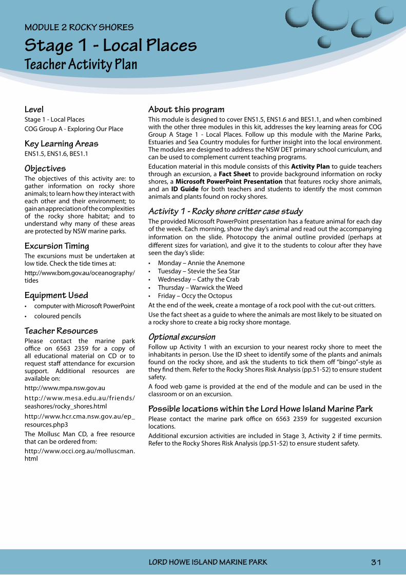
Stage 1 - Local Places Teacher Activity Plan
About this programThis module is designed to cover ENS1.5, ENS1.6 and BES1.1, and when combined with the other three modules in this kit, addresses the key learning areas for COG Group A Stage 1 - Local Places. Follow up this module with the Marine Parks, Estuaries and Sea Country modules for further insight into the local environment. The modules are designed to address the NSW DET primary school curriculum, and can be used to complement current teaching programs.Education material in this module consists of this Activity Plan to guide teachers through an excursion, a Fact Sheet to provide background information on rocky shores, a Microsoft PowerPoint Presentation that features rocky shore animals, and an ID Guide for both teachers and students to identify the most common animals and plants found on rocky shores.
Activity 1 - Rocky shore critter case studyThe provided Microsoft PowerPoint presentation has a feature animal for each day of the week. Each morning, show the day’s animal and read out the accompanying information on the slide. Photocopy the animal outline provided (perhaps at different sizes for variation), and give it to the students to colour after they have seen the day’s slide:
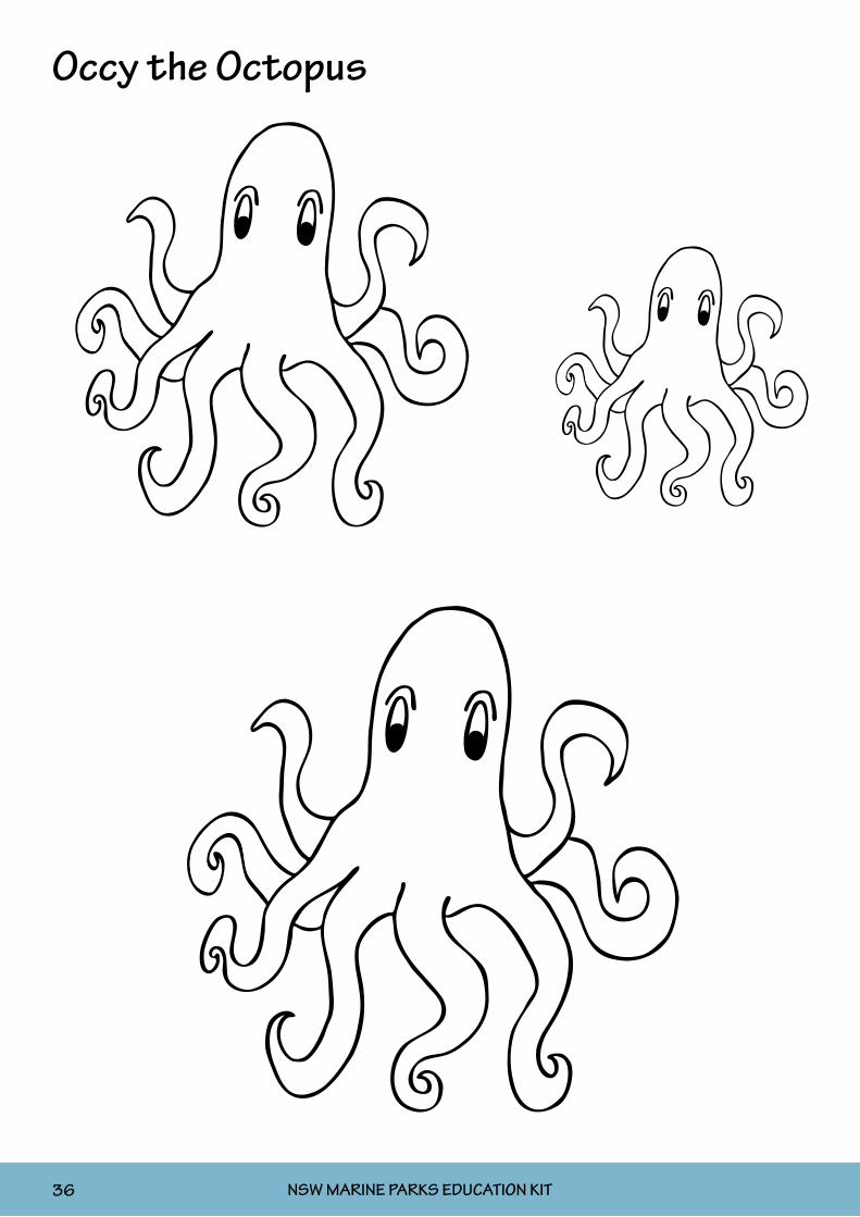
Monday – Annie the Anemone• Tuesday – Stevie the Sea Star• Wednesday – Cathy the Crab• Thursday – Warwick the Weed• Friday – Occy the Octopus•
At the end of the week, create a montage of a rock pool with the cut-out critters.Use the fact sheet as a guide to where the animals are most likely to be situated on a rocky shore to create a big rocky shore montage.
Optional excursionFollow up Activity 1 with an excursion to your nearest rocky shore to meet the inhabitants in person. Use the ID sheet to identify some of the plants and animals found on the rocky shore, and ask the students to tick them off “bingo”-style as they find them. Refer to the Rocky Shores Risk Analysis (pp.51-52) to ensure student safety.A food web game is provided at the end of the module and can be used in the classroom or on an excursion.
Possible locations within the Lord Howe Island Marine ParkPlease contact the marine park office on 6563 2359 for suggested excursion locations.Additional excursion activities are included in Stage 3, Activity 2 if time permits. Refer to the Rocky Shores Risk Analysis (pp.51-52) to ensure student safety.
LevelStage 1 - Local PlacesCOG Group A - Exploring Our Place
Key Learning AreasENS1.5, ENS1.6, BES1.1
ObjectivesThe objectives of this activity are: to gather information on rocky shore animals; to learn how they interact with each other and their environment; to gain an appreciation of the complexities of the rocky shore habitat; and to understand why many of these areas are protected by NSW marine parks.
Excursion TimingThe excursions must be undertaken at low tide. Check the tide times at:http://www.bom.gov.au/oceanography/tides
Equipment Usedcomputer with Microsoft PowerPoint•coloured pencils•
Teacher ResourcesPlease contact the marine park office on 6563 2359 for a copy of all educational material on CD or to request staff attendance for excursion support. Additional resources are available on:http://www.mpa.nsw.gov.auhttp://www.mesa.edu.au/friends/seashores/rocky_shores.htmlhttp://www.hcr.cma.nsw.gov.au/ep_resources.php3The Mollusc Man CD, a free resource that can be ordered from:http://www.occi.org.au/molluscman.html
MODULE 2 ROCKY SHORES

NSW MARINE PARKS EDUCATION KIT32 LORD HOWE ISLAND MARINE PARK
Annie the Anemone

NSW MARINE PARKS EDUCATION KIT LORD HOWE ISLAND MARINE PARK 33
Stevie the Sea Star

NSW MARINE PARKS EDUCATION KIT34 LORD HOWE ISLAND MARINE PARK
Cathy the Crab

NSW MARINE PARKS EDUCATION KIT LORD HOWE ISLAND MARINE PARK 35
Warwick the Weed
NSW MARINE PARKS EDUCATION KIT36 LORD HOWE ISLAND MARINE PARK
Occy the Octopus

NSW MARINE PARKS EDUCATION KIT LORD HOWE ISLAND MARINE PARK 37
Stage 2 - Local Environments Teacher Activity Plan
About this programThis module is designed to cover ENS2.5 and ENS2.6, and when combined with the other three modules in this kit, addresses the key learning areas for COG Group A, Stage 2 - Local Environments. Follow up this module with the Marine Parks, Estuaries and Sea Country modules for further insight into the local environment. The modules are designed to address the NSW DET primary school curriculum, and can be used to complement current teaching programs.Education material in this module consists of this Activity Plan to guide teachers through an activity, a Fact Sheet to provide background information on rocky shores, a student Work Sheet to record information, and an ID Guide for both teachers and students to identify the most common animals and plants found on rocky shores.
Activity 1To “make” a rock pool, students will need the items listed on the left under “Equipment Used”. Before they begin, place the tub in a spot outside the classroom that will get the full sun during the day. Once the tub is full of rocks and water it will not be easy to move. Use a lid to cover the tub at night.Start by making the seawater: In the tub add 35 grams of salt to 1000 grams of fresh water and mix until dissolved. For accuracy, use a specific gravity meter/hydrometer. (Inexpensive meters are available at aquarium shops.) Seawater is 35ppt (35 parts of salt dissolved in 1000 parts of water, or 35 parts per thousand); fresh water is 0.5ppt. Show the students the difference on the meter, or even get them to taste the difference.Line the bottom of the tub with gravel, sand or rocks. Then, on a sloping angle, build up the sides of the tub with the rocks. Ensure that some of the rocks are out of the water so that they will stay dry. Mark the waterline on the tub with a permanent marker to monitor the water level.Now students can start using man-made items to represent the animals that live on the rocky shore and place them accordingly. Use the fact sheets and ID guide to help. For example, use bottle caps as snails that live just near the water (white = white-topped periwinkle, black = black Nerita), and Blu-Tack them down onto the rocks. Use wool as seaweed and wedge it under the rocks in the water to let it float. Get the students to use their imagination to see what they can come up with.Use art classes to make some fish, anemones, urchins or other critters with material such as clay, Blu-Tack, etc. to decorate the rock pool.When the rock pool is finished, begin measuring the temperature changes. Use the Rock Pool Data sheet to record the changes over a few days. Measure the temperature of the water in the morning, at midday, and again in the afternoon. Use the hydrometer to measure the salinity over the same time, and watch to see if water is evaporating and if there is a salt line left on the rocks. Get the students to feel the difference in the temperature of the rocks in the morning and at midday. During the study, discuss the difference between having a white or a black shell as a home when living out in the sun; where the animals would hide from predators; and how we should responsibly interact with the rocky shore (turn rocks back over so the animals are not left exposed, remove rubbish, etc.). On day five, note your observations over the five days and discuss as a class.
Optional excursionFollow up this activity with a trip to your local rocky shore to study a real rock pool. Use the same Rock Pool Data sheet to measure the salinity and temperature, and note where the animals are in the rock pool. Use the ID sheet to identify any animals and plants. If time permits, additional excursion activities are included in Stage 3, Activity 2. Refer to the Rocky Shores Risk Analysis (pp.51-52) to ensure student safety.
LevelStage 2 - Local EnvironmentsCOG Group A - Exploring Our Place
Key Learning AreasENS2.5, ENS2.6
ObjectivesThe objectives of this activity are: to create and study a rock pool-type environment at school; to look at some of the challenges rocky shore marine life experiences; to identify key rocky shore organisms; and to develop an understanding of how to care for the rocky shore environment.
Excursion TimingThe excursion must be undertaken at low tide. Check the tide times at:http://www.bom.gov.au/oceanography/tides
Equipment Usedlarge plastic storage tub•gravel/sand•rocks•water•salt•specific gravity meter/hydrometer•black and white bottle caps•Blu-Tack•wool (green is best)•permanent marker•thermometer•
Teacher ResourcesPlease contact the marine park office on 6563 2359 for a copy of all educational material on CD or to request staff attendance for excursion support. Additional resources are available on:http://www.mpa.nsw.gov.auhttp://www.mesa.edu.au/friends/seashores/rocky_shores.htmlhttp://www.hcr.cma.nsw.gov.au/ep_resources.php3The Mollusc Man CD, a free resource that can be ordered from:http://www.occi.org.au/molluscman.html
MODULE 2 ROCKY SHORES

NSW MARINE PARKS EDUCATION KIT38 LORD HOWE ISLAND MARINE PARK
Activity Sheet - Rock Pool Data
Name: . . . . . . . . . . . . . . . . . . . . . . . . . . . . . . . . . . . . . . . . . . . Date commenced: . . . . . . . . . . . . . . . . . .
DAY 1 Result How hot do the dry rocks feel?
Morning water temperature Cold Warm Hot
Midday water temperature Cold Warm Hot
Afternoon water temperature Cold Warm Hot
Afternoon water salinity (saltiness)
Has the water level changed?
Is there a salt line on the rocks?
DAY 2 Result How hot do the dry rocks feel?
Morning water temperature Cold Warm Hot
Midday water temperature Cold Warm Hot
Afternoon water temperature Cold Warm Hot
Afternoon water salinity (saltiness)
Has the water level changed?
Is there a salt line on the rocks?
DAY 3 Result How hot do the dry rocks feel?
Morning water temperature Cold Warm Hot
Midday water temperature Cold Warm Hot
Afternoon water temperature Cold Warm Hot
Afternoon water salinity (saltiness)
Has the water level changed?
Is there a salt line on the rocks?

NSW MARINE PARKS EDUCATION KIT LORD HOWE ISLAND MARINE PARK 39
DAY 4 Result How hot do the dry rocks feel?
Morning water temperature Cold Warm Hot
Midday water temperature Cold Warm Hot
Afternoon water temperature Cold Warm Hot
Afternoon water salinity (saltiness)
Has the water level changed?
Is there a salt line on the rocks?
DAY 5 Result How hot do the dry rocks feel?
Morning water temperature Cold Warm Hot
Midday water temperature Cold Warm Hot
Afternoon water temperature Cold Warm Hot
Afternoon water salinity (saltiness)
Has the water level changed?
Is there a salt line on the rocks?
What is the difference between having a white shell or a black shell as a home when living out in the sun?
. . . . . . . . . . . . . . . . . . . . . . . . . . . . . . . . . . . . . . . . . . . . . . . . . . . . . . . . . . . . . . . .
. . . . . . . . . . . . . . . . . . . . . . . . . . . . . . . . . . . . . . . . . . . . . . . . . . . . . . . . . . . . . . . .
. . . . . . . . . . . . . . . . . . . . . . . . . . . . . . . . . . . . . . . . . . . . . . . . . . . . . . . . . . . . . . . .
. . . . . . . . . . . . . . . . . . . . . . . . . . . . . . . . . . . . . . . . . . . . . . . . . . . . . . . . . . . . . . . .
What other observations can you record from this activity?
. . . . . . . . . . . . . . . . . . . . . . . . . . . . . . . . . . . . . . . . . . . . . . . . . . . . . . . . . . . . . . . .
. . . . . . . . . . . . . . . . . . . . . . . . . . . . . . . . . . . . . . . . . . . . . . . . . . . . . . . . . . . . . . . .
. . . . . . . . . . . . . . . . . . . . . . . . . . . . . . . . . . . . . . . . . . . . . . . . . . . . . . . . . . . . . . . .
. . . . . . . . . . . . . . . . . . . . . . . . . . . . . . . . . . . . . . . . . . . . . . . . . . . . . . . . . . . . . . . .
. . . . . . . . . . . . . . . . . . . . . . . . . . . . . . . . . . . . . . . . . . . . . . . . . . . . . . . . . . . . . . . .
NSW MARINE PARKS EDUCATION KIT40 LORD HOWE ISLAND MARINE PARK
Stage 3 - Living Land Teacher Activity Plan
About this programThis module is designed to cover ENS3.5, ENS3.6, DMS3.8, BES3.1 and UTS3.9, and when combined with the other three modules in this kit, addresses the key learning areas for COG Group A, Stage 3 - Living Land. Follow up this module with the Marine Parks, Estuaries and Sea Country modules for further insight into the local environment. The modules are designed to address the NSW DET primary school curriculum, and can be used to complement current teaching programs.Education material in this module consists of this Activity Plan to guide teachers through an excursion, a Fact Sheet to provide background information on rocky shores, a Work Sheet for the students to use to gather the information in the field, and an ID Guide for both teachers and students to identify the most common animals and plants found on rocky shores.
Activity 1To refresh students about the animals of the rocky shore, refer to the fact sheets and Stage 1 Microsoft PowerPoint presentation. Hand out large sheets of paper, then get the students to draw a rocky shore, including animals and zonation they may expect to see on the excursion. Use the ID guides for inspiration.
Activity 2 - ExcursionTake the students to a local rocky shore and conduct quadrat sampling to determine species distribution and abundance. Use the student ID guides to determine what plants and animals can be found in the different littoral zones on the rocky shore.
Introduce the program.•Give a safety brief using • the Rocky Shores Risk Analysis (pp.51-52).Break the class into small groups.•Explain the methods:•
Each group is to place the quadrats* in four locations from the low tide zone •up to the high tide zone.Use the ID guides to identify and tick off the animals that are found in each •quadrat.Record the numbers of each animal found in the quadrats on Activity Sheet 1.•Use the activity sheets to discover the differences in the animal distribution •from the high tide mark to the low water mark. These activity sheets should be used as a guide only. Have students answer all questions for a thorough study, or a small selection for an overview study.
*The use of quadrats is recommended to help count the plants and animals in a designated area; however, if 1m2 quadrats are not available, then use alternate measuring devices such as hula hoops. An easy way to make a quadrat is by joining 4 x 1m pieces of poly pipe with poly pipe elbows, either glued together for strength or left unglued so they can be disassembled and stored easily.
In groups, students should calculate averages of species numbers in their •quadrats for each of the four locations.These results should be pooled for the class.•
Optional activitiesA food web game is provided at the end of the module, and can be used in the classroom or on an excursion.If time permits, an additional excursion can be conducted using Activity Sheet 2. Refer to the Rocky Shores Risk Analysis (pp.51-52) to ensure student safety.
LevelStage 3 - Living Land
COG Group A - Exploring Our Place
Key Learning AreasENS3.5, ENS3.6, DMS3.8, BES3.1, UTS3.9
ObjectivesThe objectives of this activity are: to identify key organisms on the rocky shore; to understand how they interact with each other and their environment; to appreciate the complexities of the rocky shore habitat; and to discover why many of these areas are protected by NSW marine parks.
Excursion TimingThe excursions must be undertaken at low tide. Check the tide times at:http://www.bom.gov.au/oceanography/tides
Equipment Used1m• 2 quadratspencils•thermometer•large sheets of paper•
Teacher ResourcesPlease contact the marine park office on 6563 2359 for a copy of all educational material on CD or to request staff attendance for excursion support. Additional resources are available on:http://www.mpa.nsw.gov.auhttp://www.mesa.edu.au/friends/seashores/rocky_shores.htmlhttp://www.hcr.cma.nsw.gov.au/ep_resources.php3The Mollusc Man CD, a free resource that can be ordered from:http://www.occi.org.au/molluscman.html
MODULE 2 ROCKY SHORES

NSW MARINE PARKS EDUCATION KIT LORD HOWE ISLAND MARINE PARK 41
Activity Sheet 1 - Explore the Rocky ShoreUsing Quadrats on the Rocky Shore
Some animals have adapted to living where they do not get much access to water, and some have adapted to the strong waves that crash over them most of the time. In this activity, we will discover which animals can live in which areas.
Method: Working in small groups, put the quadrats at intervals across the rock platform from near the water’s edge (lower littoral zone) to the upper littoral zone. Have one person act as a “lookout” by always watching the waves.
Use the ID guide to identify any animals and plants you can see inside your quadrat, count how many there are, and record your results in the table below. (If you are unaware of what it is, you can describe it and research it later.)
Results:1. Record the total number of each animal or plant that is present in your quadrat:
Quadrat Plant Number Animal Number
1
e.g. Neptune’s necklace 3 e.g. Octopus 1
2
3
4
Notes:
NSW MARINE PARKS EDUCATION KIT42 LORD HOWE ISLAND MARINE PARK
2. Which animal did you see the most in each quadrat?
Quadrat 1: . . . . . . . . . . . . . . . . . . . . . . . . . . . . . . . .
Quadrat 2: . . . . . . . . . . . . . . . . . . . . . . . . . . . . . . . .
Quadrat 3: . . . . . . . . . . . . . . . . . . . . . . . . . . . . . . . .
Quadrat 4: . . . . . . . . . . . . . . . . . . . . . . . . . . . . . . . .
3. Are there any changes as you move away from the water’s edge?
. . . . . . . . . . . . . . . . . . . . . . . . . . . . . . . . . . . . . . . . . . .
. . . . . . . . . . . . . . . . . . . . . . . . . . . . . . . . . . . . . . . . . . .
. . . . . . . . . . . . . . . . . . . . . . . . . . . . . . . . . . . . . . . . . . .
4. How do you think the animals close to the waves can survive without being washed off?
. . . . . . . . . . . . . . . . . . . . . . . . . . . . . . . . . . . . . . . . . . .
. . . . . . . . . . . . . . . . . . . . . . . . . . . . . . . . . . . . . . . . . . .
. . . . . . . . . . . . . . . . . . . . . . . . . . . . . . . . . . . . . . . . . . .
5. How do you think the animals living near the high tide mark can survive long periods without water?
. . . . . . . . . . . . . . . . . . . . . . . . . . . . . . . . . . . . . . . . . . .
. . . . . . . . . . . . . . . . . . . . . . . . . . . . . . . . . . . . . . . . . . .
. . . . . . . . . . . . . . . . . . . . . . . . . . . . . . . . . . . . . . . . . . .
Conclusion:Why do you think the types of animals and plants change as you move away from the water?
. . . . . . . . . . . . . . . . . . . . . . . . . . . . . . . . . . . . . . . . . . . . . . . . .
. . . . . . . . . . . . . . . . . . . . . . . . . . . . . . . . . . . . . . . . . . . . . . . . .
. . . . . . . . . . . . . . . . . . . . . . . . . . . . . . . . . . . . . . . . . . . . . . . . .
. . . . . . . . . . . . . . . . . . . . . . . . . . . . . . . . . . . . . . . . . . . . . . . . .
Why are rock platforms important?
. . . . . . . . . . . . . . . . . . . . . . . . . . . . . . . . . . . . . . . . . . . . . . . . .
. . . . . . . . . . . . . . . . . . . . . . . . . . . . . . . . . . . . . . . . . . . . . . . . .
. . . . . . . . . . . . . . . . . . . . . . . . . . . . . . . . . . . . . . . . . . . . . . . . .
The Rocky Shore Environment
Why do you think it is important to look after our rocky shores?
. . . . . . . . . . . . . . . . . . . . . . . . . . . . . . . . . . . . . . . . . . . . . . . . .
. . . . . . . . . . . . . . . . . . . . . . . . . . . . . . . . . . . . . . . . . . . . . . . . .
. . . . . . . . . . . . . . . . . . . . . . . . . . . . . . . . . . . . . . . . . . . . . . . . .
. . . . . . . . . . . . . . . . . . . . . . . . . . . . . . . . . . . . . . . . . . . . . . . . .
. . . . . . . . . . . . . . . . . . . . . . . . . . . . . . . . . . . . . . . . . . . . . . . . .
. . . . . . . . . . . . . . . . . . . . . . . . . . . . . . . . . . . . . . . . . . . . . . . . .
. . . . . . . . . . . . . . . . . . . . . . . . . . . . . . . . . . . . . . . . . . . . . . . . .
What do you think the benefits of marine parks would bring to the rocky shores?
. . . . . . . . . . . . . . . . . . . . . . . . . . . . . . . . . . . . . . . . . . . . . . . . .
. . . . . . . . . . . . . . . . . . . . . . . . . . . . . . . . . . . . . . . . . . . . . . . . .
. . . . . . . . . . . . . . . . . . . . . . . . . . . . . . . . . . . . . . . . . . . . . . . . .
. . . . . . . . . . . . . . . . . . . . . . . . . . . . . . . . . . . . . . . . . . . . . . . . .
. . . . . . . . . . . . . . . . . . . . . . . . . . . . . . . . . . . . . . . . . . . . . . . . .
. . . . . . . . . . . . . . . . . . . . . . . . . . . . . . . . . . . . . . . . . . . . . . . . .
. . . . . . . . . . . . . . . . . . . . . . . . . . . . . . . . . . . . . . . . . . . . . . . . .
. . . . . . . . . . . . . . . . . . . . . . . . . . . . . . . . . . . . . . . . . . . . . . . . .
NSW MARINE PARKS EDUCATION KIT LORD HOWE ISLAND MARINE PARK 43
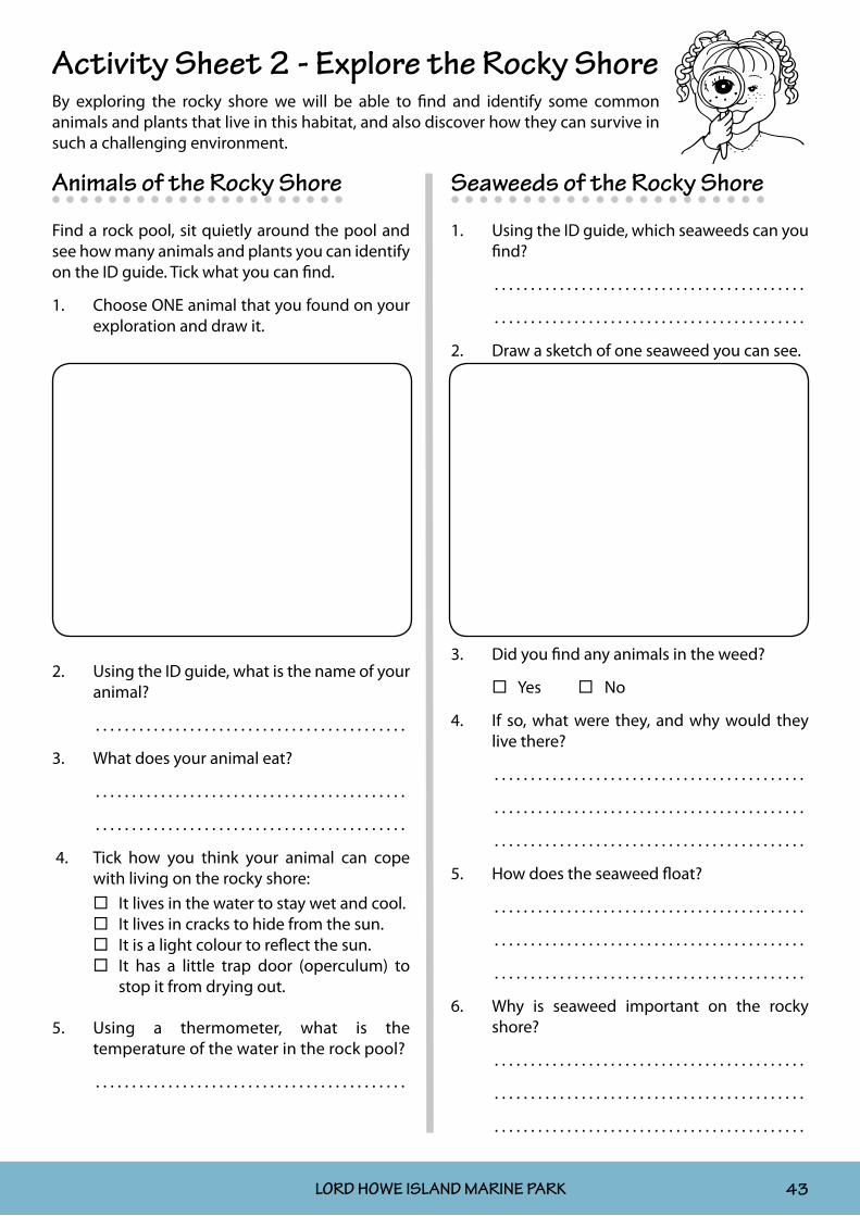
Animals of the Rocky Shore
Find a rock pool, sit quietly around the pool and see how many animals and plants you can identify on the ID guide. Tick what you can find.
1. Choose ONE animal that you found on your exploration and draw it.
2. Using the ID guide, what is the name of your animal?
. . . . . . . . . . . . . . . . . . . . . . . . . . . . . . . . . . . . . . . . . . .
3. What does your animal eat?
. . . . . . . . . . . . . . . . . . . . . . . . . . . . . . . . . . . . . . . . . . .
. . . . . . . . . . . . . . . . . . . . . . . . . . . . . . . . . . . . . . . . . . .
4. Tick how you think your animal can cope with living on the rocky shore:
It lives in the water to stay wet and cool. It lives in cracks to hide from the sun. It is a light colour to reflect the sun. It has a little trap door (operculum) to
stop it from drying out.
5. Using a thermometer, what is the temperature of the water in the rock pool?
. . . . . . . . . . . . . . . . . . . . . . . . . . . . . . . . . . . . . . . . . . .
Seaweeds of the Rocky Shore
1. Using the ID guide, which seaweeds can you find?
. . . . . . . . . . . . . . . . . . . . . . . . . . . . . . . . . . . . . . . . . . .
. . . . . . . . . . . . . . . . . . . . . . . . . . . . . . . . . . . . . . . . . . .
2. Draw a sketch of one seaweed you can see.
3. Did you find any animals in the weed?
Yes No
4. If so, what were they, and why would they live there?
. . . . . . . . . . . . . . . . . . . . . . . . . . . . . . . . . . . . . . . . . . .
. . . . . . . . . . . . . . . . . . . . . . . . . . . . . . . . . . . . . . . . . . .
. . . . . . . . . . . . . . . . . . . . . . . . . . . . . . . . . . . . . . . . . . .
5. How does the seaweed float?
. . . . . . . . . . . . . . . . . . . . . . . . . . . . . . . . . . . . . . . . . . .
. . . . . . . . . . . . . . . . . . . . . . . . . . . . . . . . . . . . . . . . . . .
. . . . . . . . . . . . . . . . . . . . . . . . . . . . . . . . . . . . . . . . . . .
6. Why is seaweed important on the rocky shore?
. . . . . . . . . . . . . . . . . . . . . . . . . . . . . . . . . . . . . . . . . . .
. . . . . . . . . . . . . . . . . . . . . . . . . . . . . . . . . . . . . . . . . . .
. . . . . . . . . . . . . . . . . . . . . . . . . . . . . . . . . . . . . . . . . . .
Activity Sheet 2 - Explore the Rocky ShoreBy exploring the rocky shore we will be able to find and identify some common animals and plants that live in this habitat, and also discover how they can survive in such a challenging environment.

NSW MARINE PARKS EDUCATION KIT44 LORD HOWE ISLAND MARINE PARK
Seashells of the Rocky Shore
Observe some seashells from an area near the rock platform and answer the following questions:
1. What are seashells?
. . . . . . . . . . . . . . . . . . . . . . . . . . . . . . . . . . . . . . . . . . .
. . . . . . . . . . . . . . . . . . . . . . . . . . . . . . . . . . . . . . . . . . .
. . . . . . . . . . . . . . . . . . . . . . . . . . . . . . . . . . . . . . . . . . .
2. Using the ID guide, which shells have you observed?
. . . . . . . . . . . . . . . . . . . . . . . . . . . . . . . . . . . . . . . . . . .
. . . . . . . . . . . . . . . . . . . . . . . . . . . . . . . . . . . . . . . . . . .
. . . . . . . . . . . . . . . . . . . . . . . . . . . . . . . . . . . . . . . . . . .
. . . . . . . . . . . . . . . . . . . . . . . . . . . . . . . . . . . . . . . . . . .
3. Draw a sketch of your favourite shell.
4. What colour is it? . . . . . . . . . . . . . . . . . . . . . . . . . .
. . . . . . . . . . . . . . . . . . . . . . . . . . . . . . . . . . . . . . . . . . .
5. What would be a benefit of being a light colour on the rocky shore?
. . . . . . . . . . . . . . . . . . . . . . . . . . . . . . . . . . . . . . . . . . .
. . . . . . . . . . . . . . . . . . . . . . . . . . . . . . . . . . . . . . . . . . .
6. Would humans collect your shell? If so, why?
. . . . . . . . . . . . . . . . . . . . . . . . . . . . . . . . . . . . . . . . . . .
. . . . . . . . . . . . . . . . . . . . . . . . . . . . . . . . . . . . . . . . . . .
. . . . . . . . . . . . . . . . . . . . . . . . . . . . . . . . . . . . . . . . . . .
7. What would happen if everyone collected shells from the rocky shore?
. . . . . . . . . . . . . . . . . . . . . . . . . . . . . . . . . . . . . . . . . . .
. . . . . . . . . . . . . . . . . . . . . . . . . . . . . . . . . . . . . . . . . . .
8. How would the animal that lives inside your shell move?
. . . . . . . . . . . . . . . . . . . . . . . . . . . . . . . . . . . . . . . . . . .
. . . . . . . . . . . . . . . . . . . . . . . . . . . . . . . . . . . . . . . . . . .
. . . . . . . . . . . . . . . . . . . . . . . . . . . . . . . . . . . . . . . . . . .
. . . . . . . . . . . . . . . . . . . . . . . . . . . . . . . . . . . . . . . . . . .
9. Where on the rocky shore did you find this shell?
. . . . . . . . . . . . . . . . . . . . . . . . . . . . . . . . . . . . . . . . . . .
. . . . . . . . . . . . . . . . . . . . . . . . . . . . . . . . . . . . . . . . . . .
. . . . . . . . . . . . . . . . . . . . . . . . . . . . . . . . . . . . . . . . . . .
10. Why are shells important for the rocky shore?
. . . . . . . . . . . . . . . . . . . . . . . . . . . . . . . . . . . . . . . . . . .
. . . . . . . . . . . . . . . . . . . . . . . . . . . . . . . . . . . . . . . . . . .
. . . . . . . . . . . . . . . . . . . . . . . . . . . . . . . . . . . . . . . . . . .
. . . . . . . . . . . . . . . . . . . . . . . . . . . . . . . . . . . . . . . . . . .
. . . . . . . . . . . . . . . . . . . . . . . . . . . . . . . . . . . . . . . . . . .
. . . . . . . . . . . . . . . . . . . . . . . . . . . . . . . . . . . . . . . . . . .
. . . . . . . . . . . . . . . . . . . . . . . . . . . . . . . . . . . . . . . . . . .

NSW MARINE PARKS EDUCATION KIT LORD HOWE ISLAND MARINE PARK 45
Food Web GameExplain a food web to the students using the points below.
As high as 90% of young animals will not make adulthood because they are eaten by other animals in •the food chain.
Understanding food chains is important to work out how animals interact in a natural environment.•
A combination of food chains is called a food web, and each animal or plant in the web is generally •dependent on the other.
The diagram below shows how energy from the sun moves through different levels of the food chain.•
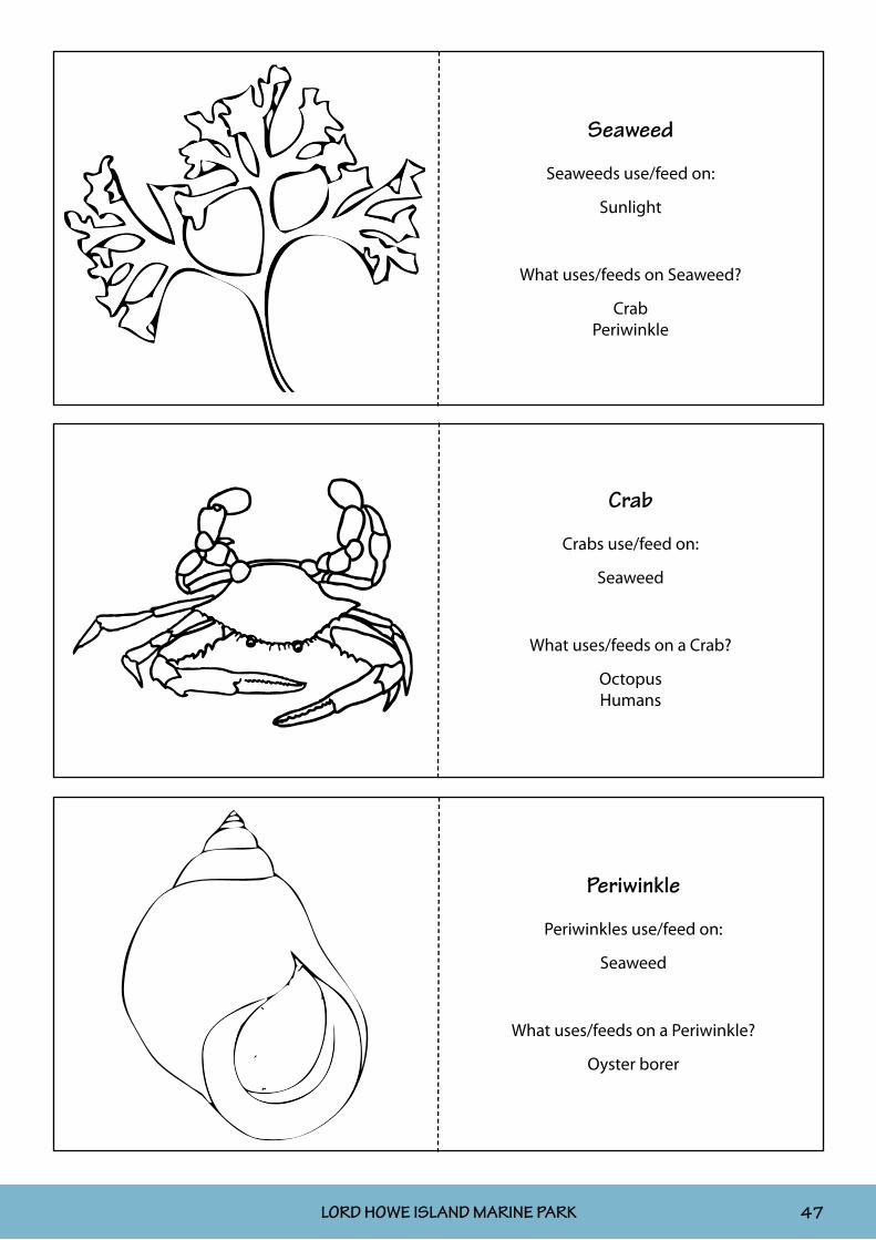
Cut out the flash cards on the following pages and give them to the students who then become that plant or animal. (This may need to be done in smaller groups.) Get them to find their food source on the food web diagram. The arrows represent “is eaten/used by”. The flash cards also identify what their animal’s food source is. Once the students have found their “food” (i.e. another student), get them to attach to it by putting their arm on that student’s shoulder.
If one link was removed from the food chain, think about how it would effect the whole ecosystem. For example, if the seagrass was removed from a mudflat, then small fishes, mudwhelks, worms, large fishes and turtles would be affected. Try this with your food chain: ask seaweed to sit down, then whoever is attached to seaweed sits down, and so on.
SUN
PHYTOPLANKTONSEAWEED
SEA SQUIRTANEMONE
ZOOPLANKTON
OYSTERS
OYSTERCATCHER
OYSTERBORER
CRAB
HUMANS
OCTOPUS OSPREY
FISH
PERIWINKLE
SUITABLE FOR ALL STAGES

NSW MARINE PARKS EDUCATION KIT46 LORD HOWE ISLAND MARINE PARK
Phytoplankton
Phytoplankton use/feed on:
Sunlight
What uses/feeds on Phytoplankton?
ZooplanktonAnemoneSea squirt
Zooplankton
Zooplankton use/feed on:
Phytoplankton
What uses/feeds on Zooplankton?
AnemoneOyster
Fish
Sunlight
What uses/feeds on Sunlight?
PhytoplanktonSeaweed
NSW MARINE PARKS EDUCATION KIT LORD HOWE ISLAND MARINE PARK 47
Seaweed
Seaweeds use/feed on:
Sunlight
What uses/feeds on Seaweed?
CrabPeriwinkle
Crab
Crabs use/feed on:
Seaweed
What uses/feeds on a Crab?
OctopusHumans
Periwinkle
Periwinkles use/feed on:
Seaweed
What uses/feeds on a Periwinkle?
Oyster borer

NSW MARINE PARKS EDUCATION KIT48 LORD HOWE ISLAND MARINE PARK
Oyster
Oysters use/feed on:
Phytoplankton Zooplankton
What uses/feeds on Oysters?
Oyster borerOystercatcher
Humans
Anemone
Anemones use/feed on:
PhytoplanktonZooplankton
What uses/feeds on an Anemone?
nothing
Sea squirt
Sea squirts use/feed on:
Phytoplankton
What uses/feeds on a Sea squirt?
Humans

NSW MARINE PARKS EDUCATION KIT LORD HOWE ISLAND MARINE PARK 49
Oyster borer
Oyster borers use/feed on:
OystersPeriwinkles
What uses/feeds on an Oyster borer?
nothing
Oystercatcher
Oystercatchers use/feed on:
OystersPeriwinkles
What uses/feeds on an Oystercatcher?
nothing
Fish
Fish use/feed on:
ZooplanktonCrabs
OctopusesFish
What uses/feeds on Fish?
OctopusOsprey
Humans

NSW MARINE PARKS EDUCATION KIT50 LORD HOWE ISLAND MARINE PARK
Octopus
Octopuses use/feed on:
FishCrab
What uses/feeds on an Octopus?
HumansFish
Osprey
Osprey use/feed on:
Fish
What uses/feeds on an Osprey?
nothing
Humans
Humans use/feed on:
Sea squirtsOystersCrabs
Octopuses Fish
What uses/feeds on a Human?
nothing

NSW MARINE PARKS EDUCATION KIT LORD HOWE ISLAND MARINE PARK 51
Rocky Shores Risk Analysis
Location: Project/Job Name/No: Date:
Work Activity/Task: School excursion to rocky shore; rock pool study; quadrat study.
Staff consulted: Signature:
Item Job step
Break the job down into steps.
Potential dangers and incidents
Risk rating
Controls to prevent incidents
What will be done to make the job as safe as reasonably practicable.
Person who will ensure this happens
1 Communications with staff
Participant gets lost/Accident/ Other unforeseen event
M Make role calls at regular intervals, •including commencement and finish, and implement a buddy system setup.
Give a safety brief to participants at the •beginning of the activity.
Advise administration staff of departure •and arrival times.
Ensure at least one staff member has •relevant first aid certification.
Carry a mobile phone, map and first aid •kit.
Ensure mobile phones are charged before •departure.
Teaching staff
2 Weather conditions
Storm conditions/ Exposure
M Check the weather and tides prior to •leaving for the activity. (The activity must be undertaken at low tide.)
Ensure participants are correctly attired •(i.e. with a hat, long-sleeved shirt, or a jacket if it is cold or rainy), and include such needs on the excursion consent form.
Have sunscreen and water available for •participants, and include such needs on the excursion consent form.
Teaching staff
3 Wet, slippery rock platform
Falling over and subsequent injury, such as cuts or sprains
M Brief participants on the care needed •when walking on rock platforms.
Review the study area and identify •slippery patches, trip hazards and deep pools.
Ensure that all participants have •appropriate footwear, and include such needs on the excursion consent form.
Teaching staff

NSW MARINE PARKS EDUCATION KIT52 LORD HOWE ISLAND MARINE PARK
Risk Assessment Rating:E Extreme risk; immediate action requiredH High risk; senior management attention neededM Moderate risk; management responsibility must be specifiedL Low risk; manage by routine procedures.
Item Job step
Break the job down into steps.
Potential dangers and incidents
Risk rating
Controls to prevent incidents
What will be done to make the job as safe as reasonably practicable.
Person who will ensure this happens
4 Waves washing over rock platform
Drowning H Plan the activity for low tide by checking •the tide times at: http://www.bom.gov.au/oceanography/tides
Ensure sufficient staff are in attendance to •provide the appropriate “high risk” level of supervision.
Brief participants on the care needed near •the ocean (e.g. don’t turn your back on the sea; stay away from the edge of the ocean; and make sure a “buddy” system is implemented).
Ensure participants are at least 3m from •the edge of the ocean and gutters at all times.
Ensure participants are visible at all times.•
Teaching staff
5 Dangerous fauna Stings from blue-ringed octopus, cone shells, sea anemones or blue bottles
M Warn children not to put their hands into •rocky crevices.
Explain that many creatures on the •rock pools use stinging as a defence mechanism.
Show pictures of any dangerous sea •creatures which might be encountered.
Teaching staff
6 Cuts Broken glass M Make children aware of any broken glass, •tell them not to touch it, and let the staff pick it up.
Wear appropriate footwear.•
Teaching staff
Reviewed by: ______________________________________________
Principal/Executive
______________________________________________ ________/_______/_________
Signature Date