memorandum 4 3 district corchiarino, district dumenil, l
TRANSCRIPT
QueenJ4nne’sCounty
County Commissioners:James J. Moran, At LargeJack N. Wilson, Jr., District IStephen Wilson, District 2Philip L, Dumenil, District 3Christopher M. Corchiarino, District 4
Date: January 12, 2021 INFORMATIONAL ITEM
To: County Commissioners
From: Steve Cohoon, Public Facilities Planner
0)
Re: Bay Crossing Study Update
The Chesapeake Bay Crossing Study: Tier I NEPA (Bay Crossing Study) is a NationalEnvironmental Policy Act (NEPA) study that will result in the identification of a preferredcorridor alternative to address congestion at the Chesapeake Bay Bridge and evaluation of itsfinancial feasibility.
Funded by toll dollars, the Bay Crossing Study Tier 1 began in 2016 and is expected to becomplete in 2021. Below are the steps in the process to complete the Tier I NEPA.
Completed Steps• Project scoping and public scoping meetings• Develop the purpose and need study and hold public outreach meetings• Develop a range of 14 potential corridors• Narrow the 14 corridors to 3 corridors for additional study
Remaining Steps• Identify and study the 3 corridors retained — in process• Identify MDTA’s recommended preferred corridor alternative• Publish Draft Tier 1 Environmental Impact Statement (DEIS)• Hold public hearings• Publish Final Tier I Environmental Impact Statement(FEIS)• Record of Decision for the selected corridor.
Following the completion of Tier I NEPA process a Tier II NEPA study will need to becompleted to identify the detailed alignment of a future bay crossing. The Tier II NEPA is notscheduled or funded at this time. Once funded the Tier II NEPA is anticipated to takeapproximately 4 years to complete.
1
DEPARTMENT OF PUBLIC WORKS312 Safety Drive
Centreville, MD 21617Telephone: (410) 758-0925
MEMORANDUM

QueenAnne ‘sCounty
County Commissioners:James J. Moran, At LargeJack N. Wilson, Jr., District 1Stephen Wilson, District 2Philip L. Dumenil, District 3Christopher M. Corchiarino, District 4
MEMORANDUM
DEPARTMENT OF PUBLIC WORKS312 Safety Drive
CentrevlUe, MD 21617Telephone: (410) 758-0925
Date: January 12, 2021 INFORMATIONAL ITEM
To: County Commissioners
From: Steve Cohoon, Public Facilities Planner
RE: Dynamic Tolling
With dynamic tolling, also known as congestion pricing, tolls are continually adjusted according
to traffic conditions to maintain a free-flowing level of traffic. Under this system, prices increase
when the tolled lanes get relatively full and decrease when the tolled lanes get less ulill. Thecurrent price is displayed on electronic signs prior to the beginning of the tolled section. This
system is more complex and less predictable than using a fixed-price table, but its flexibilityhelps to consistently maintain the optimal traffic flow. Motorists are usually guaranteed that they
will not be charged more than a pre-set maximum price under any circumstances. There aremany examples of dynamic tolling throughout the country successfully changing driver traveltimes and improving congestion at peak travel times.
To implement dynamic tolling there are a number of considerations that would require studysuch as:
• The viability and impacts of adjusting toll rates• The potential revenue that could be generated• The structure of setting new rates and when rates are adjusted based on congestion
• How toll rates would apply to different size vehicles during times of congestion
• How different toll rates may apply to different drivers such as commuters and shoppers
• How rates apply for different electronic tolling methods (e-z pass, video tolling, pay byplate)
• Improved safety and by reducing congestion• Implementation with changing traffic patterns such as contraflow on the Bay Bridge
• The cost associated with implementation. For example, the Bay Bridge collects one tollfor eastbound traffic. New electronic toll collection equipment, policies and procedures
would need to be put in place for implementation
2
Maryland Transportation Authority (MDTA) comprehensively manages all the toll facilities inMaryland. MDTA is governed by a citizen board that approves the capital budget for MDTA aswell as project funding. To explore Dynamic Tolling the MDTA Board would need to approve
funding for a study to change from current set rate tolls to dynamic tolling. Once the study iscompleted, based on the study findings the MDTA Board could consider changing toll rates.The board would propose a plan supported by the study and conduct public hearings in multiplelocations to receive public input. Based on the input a Final Public Comment Summary Reportand final proposal would be considered for a vote by the MDTA Board. It is my understanding
the Board is the public body that can initiate and approve changes to toll rates.
In 2019 the MDTA Board followed this process to implement All Electronic Tolling (ART) and
to adjust toll rates at several facilities in Maryland. The board held 9 public hearings inMaryland including one at Kent Island High School. The board voted to revise and implement
toll changes on November 7, 2019.
0
3

DEPARTMENT OF PUBLIC WORKS312 Safety Drive
Centreville, MD 21617
Telephone: (410) 758-0925Fax: (410) 758-3341
www.qac.org
MEMORANDUM
Date: January 12, 2021
To: County Commissioners ACTION ITEM
From: R. Shane Moore, PE
Subject: Public Hearing - Abandon Portion of Kent Narrows Way South
Pursuant to the County Code § 12-512, the Commissioners held a public hearing for November 1 0th at 6:30pm, regarding the transfer of the end portion of Kent Narrows Way South to Schulz Development LLC.Please see the attached Plat for review.
Following the November 1 0th hearing the public record was left open for a period of two weeks Insummary there has been no testimony from the public as part of this project beyond the outreach torepresentatives of the Narrows Restaurant, which was presented at the hearing by staff.
If agreeable to the transfer of a portion of Kent Narrows Way South to Schulz Development LLC, pleasefind the attached Resolution prepared by the County Attorney for signature.
Action Request:
Execute Resolution
QueenAnne ‘sCounty
County Commissioners:James J. Moran, At LargeJack N. Wilson, Jr., District IStephen Wilson, District 2Philip U, ijumenh), District 3Christopher M. Corchiarino, District 4
Cc Patrick Thompson
LIVE •WORK• PLAY in QA‘: : -- 9i’& visHqueenunne.cor
things to do...places to go...ways to grow your business.. .scan for info
4

NO TITLE EXAMINATION
THIS QUITCLAIM DEED, made this
______
day of ,2020, byand between THE COUNTY COMMISSIONERS OF QUEEN ANNE’S COUNTY, party ofthe first part, hereinafter Grantor; and SCHULZ DEVELOPMENT, LLC, a MarylandLimited Liability Company, party of the second part, hereinafter Grantee.
WITNESSETH, that for and in consideration of the sum of NO DOLLARS($0.00), the receipt of which is hereby acknowledged, the said party of the first partdoes hereby grant, convey and quitclaim unto the party of the second part, itssuccessors andlor assigns, in fee simple, all the following described real estate, towit:
ALL that part or parcel of land situate, lying and being at the terminus of Kent
Narrows Way South in the Fifth Election District, Queen Anne’s County and
designated as “Right-of-Way to be Abandoned and Transferred to Schulz
Development, LLC, Area = 4,493 sq. ft. 0.103 acres ±“ as more particularly set forth
and shown on the plat attached as Exhibit “A” entitled “SPECIAL PURPOSE PLAT
FOR THE ABANDONMENT OF A PORTION OF KENT NARROWS WAY SOUTH, NEAR
THE VILLAGE OF GRASONVILLE, FIFTH ELECTION DISTRICT, QUEEN ANNE’S
COUNTY, MARYLAND,” dated June 2020.
BEING the same land and premises which was closed by the Grantor as apublic road by Resolution dated contemporaneously herewith.
RESERVING UNTO the Grantor an easement for the placement and the repairand maintenance of public sewer and water lines over, under or across the areadescribed above.
FURTHER RESERVING unto the general public the right to access the areadescribed above to permit normal passenger vehicles to enter from the newterminus of Kent Narrows Way South and to turn around for purposes of reversingdirection.
THIS CONVEYANCE, is subject to the existing restrictive covenants,easements, rights of way and agreements for roadways, electric transmissionlines and telephone lines and the service and maintenance thereof.
5

TOGETHER with the buildings and improvements thereupon erected, made orbeing, and all and every the rights, alleys, ways, waters, privileges, appurtenancesand advantages, to the same belonging or in any way appertaining.
TO HAVE AND TO HOLD the said lot ofground and premises, above describedand mentioned, and hereby intended to be conveyed, together with the rights,privileges, appurtenances and advantages thereto belonging or appertaining untoand to the proper use and benefit of the Grantee, its successors andlor assigns, infee simple, forever.
AND the said party of the first part hereby covenants that it has not done orsuffered to be done any act, matter or thing whatsoever to encumber the propertyhereby conveyed; that it will warrant specially the property granted and that it willexecute such further assurances of the land as may be requisite.
WITNESS the hand and seal of the said Grantor.
WiTNESS: THE COUNTY COMMISSIONERS OFQUEEN ANNE’S COUNTY
Christopher M. Corchiarino, President
Stephen K. Wilson
Margie Houck James J. Moran
Jack N. Wilson, Jr.
Phillip L Dumenil
STATE OF MARYLAND, QUEEN ANNE’S COUNTY, TO WIT:
I HEREBY CERTIFY, that on this day of
___________________,
2020,before me, the subscriber, a Notary Public of the State and County aforesaid,
6

personally appeared CHRISTOPHER M. CORCHIARINO, STEPHEN K WILSON,JAMES J. MORAN, JACK N. WILSON, JR., and PHILLIP L. OUMEN1L, whoacknowledged themselves to be THE COUNTY COMMISSIONERS OF QUEENANNE’S COUNTY, and that they as such County Commissioners, beingauthorized to do so, executed the foregoing instrument for the purposes thereincontained.
WITNESS my hand and Notarial Seal.
Notary PublicMy commission expires:
This document was prepared under the supervision of theundersigned, an attorney admitted to practice before the Court of Appeals ofMaryland.
Patrick E. Thompson
7

STA
TF1I
ENT
OF
PUF?
POSE
AN
DIN
JEN
JTh
ISPU
RPO
SEO
FTI
lEF
LA
TIS
TOSA
ND
DI4
APO
N1I
ON
OF
RE
NT
NA
.RR
ovS
WAY
SOO
TH(4
.493
oq.
LS
.0.
103
oro
o*)
LOC
ATE
DN
EAR
7115
I4LL
AC
EO
FG
RA
EON
NLL
E.TH
EA
8AN
DC
WEO
PON
lION
OF
OF
KEN
TM
AR
RO
BS
WA
YSO
UTH
THA
TIS
70B
EA
BA
ND
ON
ED.
TILL
BE
AD
DED
7011
151.
4110
5O
FSQ
IIJL
.ZO
ED
PM
BA
T.
LLC
(P.
529)
.C
OU
RSE
S.1
)10
DIS
TAN
CES
SOO
TH
HER
EOPI
AR
ETA
llER
FRO
MA
FIA
TE
N7f
lW)
SUIT
hA.
OF
1115
LTH
CIS
OF
SEN
ULZ
DSS
LC
I’U
OV
T.
a0
PRE
PAR
ED
BY
WC
HA
JLA
.S
Cal
EIN
OIN
AU
C1J
SE20
10A
ND
BED
OR
DED
INP
L4
BO
OK
USE
R1(
11.5
48.
FOLi
O11
7.
P.32
91.
6110
9S
CH
UL
ZD
EV
EL
OPM
EN
T,
LL
CL
a142/1
47
47 /
1.6
755N
OF
THE
NA
RRO
WS
REA
L!—
REA
LE
STA
TE
LL
C/
SM.
613)
16J..
SPEC
IAL
PUR
POSE
PLA
TbA
itbC
M.L
.4.6
530
1’.
.29
300
IlL
061000
610
20
70
30
4.7
MeE
TS
tIIW
L$
LII
,
57.2
070904
SHEE
TN
o.—
CA
IID
PIE
—5
04
112-B
eST
4
LlL
AR
E).
8110
4WD
EPIC
TSA
UT1
LIET
EA
SDA
EII
T70
FESN
AR
lED
TO
QU
EEN
AN
NC
SC
OU
NFr
CO
MM
ISSI
ON
ERS
FOR
PUB
LiC
SE
TS
?.4
,610
WA
ISR
LilIE
S
P.
32
91.
4005
Ct
SCH
ULZ
DEVE
LOPM
ENT.
LLC
5.60
76
42
/ElI
I’
—T
h
El’ I-I
I4
CO
TS
RIG
HT—
0F—
WA
YTO
BE
ABA
IIIDO
WED
AN
DFR
AN
SFER
RED
TOSC
HU
LZ
DE
VE
LO
PME
NT
,L
LC
AR
EA=
4,4
93
sq.
ft.±
.103
Ocre
s±
KE
NT
NA
RR
OW
SW
AY
SOU
THRI
GH
T—O
F—W
AY
AB
AN
DO
NM
ENT
FIP
PST
An
1307
556/0
OF
THE
NA
RRO
WS
REAL
ESTA
TE.
LLC
SM
.613/1
9
:B
EAR
ING
DIS
TAN
CE
I42
73’4
057
W41
.48’
B—
T22Z
rS
—41
.40
2N
5O
4336
WT
2D
’.3
N445’4
9W
1.47
’-
It It —
S3
_-—
24.5
3
i!!I
7.3
.08
/*4l
730
P—
79
07
00
183.0
6
—‘
OR
E).
—4,
493
RA
o(0
.703
66±
)”’
2370
97.3
/
//
Tho
W,d
.T66
1k6N
d‘O
WB
PP
’oF
fibpr
qoib
rty
dohot.
by
woo
l‘TA
So
RaI
l-P
IoM
3y-C
oN.’
Anf
loto
t48-
-of’
Ma,d
5o
ati
.3.7
O5T
(t)(
0TO
OLth
lp
lot
doo.
oo
l,P
qMT
o‘W
bdM
Illf
lp
prr
no
l.
/ /
I-FO
R17
45A
SAN
OD
NM
ENT
OF
APO
RTI
ON
02’
KE
NT
NA
RR
OW
SW
AY
SOU
TH
070.1
1?D
IEII
LI.A
GE
OF
GR
ASO
I174
LLE
FIFT
HEL
ECD
IDN
DIE
lIE
CT
.(5
)550
7A
NN
ES
((O
NlY
..V
AR
ItAN
L)
PRE
PAPE
CFO
REC
7-4L
lLZ
D5S
O,O
P?IO
Nl
SIC
• L{eznLutam
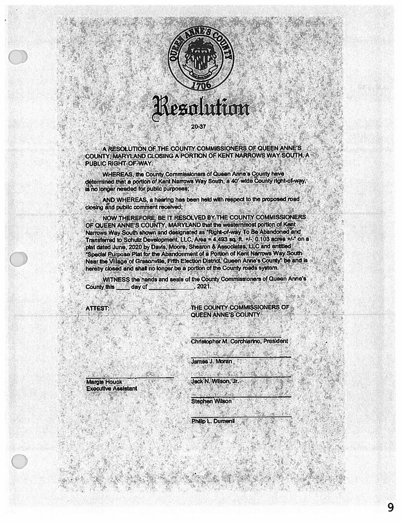
20-37
A RESOLUTION OF THE COUNTY COMMISSIONERS OF QUEEN ANNESCOUNTY, MARYLAND CLOSING A PORTION OF KENT NARROWS WAY SOUTH, APUBLIC RIGHT-OF-WAY.
WHEREAS, the County CommIssioners of Queen Anne’s County havedetermined that a portion of Kent Narrowä Way South, a 40’ wIde County right-of-way,Is no longer needed for public purposes;
AND WHEREAS, a hearing has been held with respect to the proposed roadclosing and public comment received;
NOW THEREFORE, BE IT RESOLVED BYJHE cpuNw cOMMISSIONERSOF QUEEN ANNE’S COUNTY, MARYLAND that the westernmost portion of KentNarrows Way South shown and designated as Right-of-wajTo Be Abandoned andTranéferred toSctiulz Development, LLC, Area = 4,493 sq.ft. +1., 0.103 acres +I- on aplat dated June, 2020 by Davis, Moore, Shearon & Associates, LLC and entitledSpecial Purpose Plat for the Abandonment of a Pàrtion of Kent Narrows Way SouthNear the Village of Grasonville, Filth Election District, Queen Anne’s County be and Ishereby closed and shall no longer be a portion of the County roads system.
WITNESS the hands and seals of the County CommissIoners of Queen Anne’sCounty this — day of
______________,
2021.
ATTEST: THE COUNTY COMMISSIONERS OFQUEEN ANNE’S COUNTY
Christopher M. Corchiarlrio, President
James J. Moran
Margie Houck JackN Wilson, Jr.• Executive Assistant
Stephen Wi!son
Philip L. Dumenil •
• •
-
:, -
: .•: ‘
. —
I
.‘ - I .,
9