measurement of smallholder tree farms in leyte island108374/n31_glen_short... · to which barangay...
TRANSCRIPT

31. MEASUREMENT OF SMALLHOLDER TREE FARMS ON LEYTE ISLAND
Jose Glenn Noel Monterola, Florante Morales, John Herbohn, Jerome Vanclay, Grant Wardell-Johnson, Eduardo Mangaoang and Steve Harrison
This paper describes the field techniques used to measure timber volume and log quality (including straightness, forking, appearance of defects, and knots) of timber from smallholder tree farms on Leyte Island conducted as part of the ACIAR project ASEM/2003/052, Improving Financial Returns from Smallholder Tree Farms in the Philippines. Tree farms were included in the sample if they were 0.1 ha or greater and contained 100 trees or more. Often tree farms had several ‘blocks’ of trees (e.g. different species or ages) and within each block two circular plots were established − one in the centre and one on the edge. For each tree over 10 cm diameter at breast height (dbh) in the plot, measurements were made of dbh, diameter at the base (db), tree height, location, crown depth, crown radius, bearing and distance of each tree with reference to the plot centre. Estimates of log lengths and grade that each tree was expected to yield were also recorded, along with a sketch of each tree. In addition, data were collected on tree farm, block and plot characteristics, and then entered into an ACCESS database for subsequent analysis. These data are currently being analysed. INTRODUCTION
Tree measurement on smallholder tree farms has been one of the major activities of ACIAR
project ASEM/2003/052, Improving Financial Returns from Smallholder Tree Farms in the Philippines. The project was designed to improve the livelihoods of smallholder tree farmers in Leyte province through investigating ways to improve financial returns from forestry, and promote the adoption of these improved management methods (Herbohn and Harrison 2005, Herbohn et al. 2007). One of the project objectives is to assist smallholder tree growers to satisfy market requirements and improve productivity. The preliminary step in helping tree farmers to access formal timber markets is to identify the market requirements for timber in terms of species, type, quantity and quality of timber required by the processors (Herbohn and Harrison 2005). When sufficient data are available, the construction of a yield table for an established plantation is a relatively easy matter (Vanclay and Baynes 2005). A yield table can be created by measuring the volume per plot on a range of plantings, and fitting the yield function using linear regression.
The objective to assist smallholder tree growers to satisfy market requirements and improve productivity was addressed partly through the assessment of timber quality (i.e. physical features, including straightness, forking, appearance of defects and knots) and timber volume of tree farms on Leyte Island. Constructing a yield table for a smallholder plantation in Leyte is challenging because there are few old plantations, and because the large range of sites (e.g. geology, topography, elevation) and stand conditions (spacing, thinning, fertilizing and pest control) means that yields may vary greatly from one smallholder plantation to another (Vanclay and Baynes 2005). Information gathered from tree farms will contribute to improving the knowledge on silvicultural requirements and tree farm systems suitable for smallholders. Plantation silviculture is defined to include management activities including site-species selection, choice of seeds provenance, site preparation, initial spacing, weed control, fertilization, pruning and thinning. Most of the capital expense and labour requirement is required in the first year of the plantation’s life (Baynes 2005). The timber quality information will be used to identify ‘higher-value’ products obtained from tree farms. Timber yield data will also be used to identify management strategies that would give improved returns to smallholder tree farmers.
This paper outlines the field procedures used to collect biophysical data from smallholder tree farms on Leyte Island. In the following sections, the objectives of the study are first stated along with the criteria for selecting tree farms in the study. The methods used to collect data are then outlined, followed by a brief outline and discussion of preliminary results.

Measurement of Smallholder Tree Farms in Leyte Island
RESEARCH OBJECTIVES The main objective of this study is to determine the yield and quality of timber in smallholder
tree farms on Leyte Island. Specifically, this study aims to:
1. Develop volume and yield tables for smallholder tree farms on Leyte Island; 2. Determine the quality of timber that can be obtained from smallholder tree farms; and 3. Develop a tree farm system model common to tree farms on Leyte Island.
Selecting Tree farms to be Sampled
The areas on Leyte suitable for smallholder forestry were identified using a geographical information system (GIS). A two-stage, probability proportional to size (PPS) sampling framework was used to select municipalities and then barangays from which tree farms were selected (as described in Herbohn et al. 2005). The seven municipalities selected were Anahawan and Libagon in Southern Leyte Province, and Bato, Hindang, Isabel, Leyte and Dulag in Leyte Province. In addition to the sample tree farms, rainforestation farms established with the assistance by the Institute of Tropical Ecology of Leyte State University, were measured as subsamples for tree farms planted to indigenous species.
Focus group discussions (FGDs) were then conducted in the seven municipalities to be sampled, to which barangay captains or their representative, municipal LGU officials and other stakeholders were invited. At these FGDs, a list of all tree farms in a municipality/barangay within their jurisdiction was compiled in consultation with barangay captain and municipal officials, particularly those from the Municipal Agricultural Office (MAO) and Department of Environment and Natural Resources (DENR). The tree farms identified through this process formed the tentative list of tree farms on which plots were to be established. Included also in the tree measurement activities is a small number of tree farms from Baybay, Albuera, Ormoc, Matalom, Mahaplag, Abuyog and Jaro in the province of Leyte and from Maasin and Macrohon from Southern Leyte province that were identified as part of other project activities, namely the trialling of bus tours as a means of providing extension advice (Baynes 2007).
A tree farm qualified for inclusion in the sample if it had an area of 0.1 ha or greater and contained 100 trees or more. Often tree farms had several distinct ‘blocks’ of trees (e.g. different species or ages) and within each block two circular plots were established. Each block was required to be able to accommodate two non-overlapping circular plots. In order to assess potentially significant edge effects, one plot was located in the plot centroid and the other on the edge. Each plot was required to have at least seven trees with a dbh of at least 10 cm within the five metres radius. If this was not the case then the plot radius was extended to 10 m to accommodate seven trees. The farm also needed to be accessible, and a maximum of an hour normal walking was set as the upper limit for the accessibility criteria.
Gaining Access to Tree Farms
All tree farms were located on private land and to gain access it was necessary to consult with the owners and various elected officials at the municipality and barangay level. A courtesy visit was made to the municipal mayor and barangay captain, at which time a letter from the country project leader was presented.
Each tree farmer was visited at their house asking their permission and personally and thoroughly explained to them the purpose and importance of the study. A letter from the country project leader also handed over to support our explanation. As soon as the owner understood the project and approved activities to be undertaken, a farm boundary and tree survey was undertaken using a hand-held GPS (Garmin 76) receiver. Subject to the tree farms meeting the selection criteria, blocks and plots were then delineated and tree measurement undertaken. Additional tree farms were sometime identified within a barangay when field visits were made.
Data Collection Methods
Two field teams were established. The first team (referred to as the survey team) comprised of two people (one of whom was an experienced surveyor and proficient in the use of GPS and Mapsource), who were responsible for the survey of the perimeters of the tree farm and blocks within the tree farm. A second team (referred to as the tree measurement team) consisted of three enumerators, who established the plots and collected site and tree data.
284

Improving the Triple Bottom line Returns from Small-scale Forestry
In most instances the survey team surveyed the tree farms accompanied by a guide (a tenant, owner or owner’s relative) ahead of the tree measurement team and identified those tree farms which qualified for inclusion. This facilitated in the preparation of the itinerary of the tree measurement team. The typical smallholder farm has a combination of various agricultural activities including coconuts, small crops, tree farms (tree blocks or plantations) and rice. A photo of the whole farm was taken featuring the farming activities and landscapes of the farm. As part of the survey, a sketch map of the farm was prepared which recorded the location of the farming activities and outlining the features of the tree blocks. GPS information was downloaded to a computer, through which a sketch map could easily be generated. Trees within the tree farms were blocked according to homogeneity of its attributes. Tree blocks were determined based on the following criteria: species, age, size and form, topography, aspect, slope and natural divide. In every block at least two plots were established − the centroid and edge plots. Where the block was large and heterogenous, an additional one or two plots were established usually at the opposite side from the established edge plot situated more or less between the centroid and the boundaries.
The waypoint of each plot was recorded and was marked witplot centre for easy locating by the tree measurement team.12.5 mm diameter and 30 cm long PVC pipe driven in the sogr
n
ound. Also, each plot was photo documented with respect todirections, due north and due south, four photos being taken fo
All trees with a dbh greater than 5 cm were numberedNumbering started at the tree closest to due north at the permanner until the reference point was reached. Numbering duplication of measurement of a single tree within the plot and
Data recording sheets were developed for recording informthe block (Appendix B), the plot (Appendix C), and log size and
The name and contact details of the farm owner, along withon each farm data sheet. The farm code comprised the first thfollowed the first two letters of name of the barangay where tdigit number preceded by a letter F for tree farm and IT forthe third tree farm measured in Barangay Tigbao in the municLibTi F003. Block 1 in this barangay would be coded as LibTi tree number 8 would be coded as LibTi F003B01P02T08. Ablocks were also recorded on the farm sheet, along withboundaries.
A separate data sheet was used to record information abouGPS waypoints. In addition, information about biophysical p(Appendix B).
Plot sheets were used to record details about edaphic chagroundcover abundance, and stem tally of tree, bamboo, palm2.5 cm (Appendix C). In addition, all trees with dbh 5 cm and athe individual tree data sheet (Appendix C.1). From the cendirection of each tree were recorded. Total height of every pa
285
PVC pipe rked theplot centre used to ma
Red ribbon tied at the plot centre for easy locating by the tree measurement
h a ribbon being tied to a tree at the The plot centre was marked with a
Ribbo il leaving about 50 to 75 mm above ground and canopy cover from two r each plot. using red or orange spray paint. iphery and proceeded in a clockwise was particularly useful for avoiding facilitating rapid data collection. ation about the farm (Appendix A), quality (Appendix D). a unique farm code, were recordedree letters of the municipality name, he tree farm is located, then a three rainforestation farms. For example, ipality of Libagon would be coded as F003B01. Block 1 and the plot 2 for sketch of the farm and the various the GPS waypoints for the farm
t each block, including a sketch and roperties and species was recorded
racteristics of the plot, along with and cycads with dbh of not less than bove were measured and recorded in tre point of the plot, distance and lm was recorded, but for trees, only

Measurement of Smallholder Tree Farms in Leyte Island
the tallest specimen was measured. Using a bark thickness gauge, bark thickness was recorded at 10 cm below breast height at the two opposite sides aligned to the centre of the plot. Bend or lean of trees was noted. The length of the trunk up to the first branch was measured, and crown depth and radii from four cardinal directions were also recorded. The radii were taken from the crown edge with reference from four cardinal directions, siting the hypsometer to the base of the tree and reading the horizontal distance. Trees on the plot edge were also recorded. Aluminium coded ta
of the log section total volume, with 0.5 m
to their respective residences for safe keeping. Dr Herbohn’s copy is st
material, equipment and instruments used in this study as well as the short description on its
Table 1. Material, equipment and instruments and its corresponding
uipment used
gs were attached to the base of each measured tree using concrete nails, with the tag always facing the centre of the plot.
Details of the logs expected to be produced from each tree with a dbh of 10 cm or more were recorded on the log data sheet (Appendix D). Trees considered for log sectioning were sketched (stick drawing only) taking note of their worst form, viewed from any side. The stem was divided into sections based on its general form and straightness. In every section of the tree, large and small end diameters (LED and SED) and length were recorded. In most cases the SED of the lower section of the tree becomes the LED of the next upper section. A third diameter was recorded when forking was present. Sectioning took place up to the stem or branch with LED of 10 cm. Four log grades were recorded: A = at least 70% timber recovery of the log section total volume, with minimum length of 1.2 m, B = at least 50% timber recovery of the log section total volume, with minimum length of 1 m, C = at least 30% timber recovery
minimum length, and D = at least 10% timber recovery of the log section total volume, with no minimum length. For forking a grade of D was automatic.
Data were encoded and entered into Access, a relational database manager. The original data sheets were photocopied in triplicate. The original forms are held in the ACIAR project office at LSU, with copies being held by Dr Mangaoang, Dr Gregorio and Dr Herbohn. Dr Mangaoang and Dr Gregorio’s copies were taken
ored in his office at The University of Queensland. In addition, another electronic file was kept in an external computer drive.
Theutility are presented in Table 1.
functions
Material, instruments and eq Functions
1. GPS receiver Mainly for referencing farms and mapping of the tree farm 2. Laser Ace Hypsometer d),
plot centre
nce to the plot centre
rk at least one foot below breast height of the tree
7. Aluminium tags, set of letter and number punches, hammer and concrete nails
8. Spray paint
9. Data sheets and miscellaneous materials
re printed on substance 20 book paper 8.5’ by 11’ using a photocopier. Mongol #2 pencils were used for writing.
To collect data for diameter (large end and small enlog-sections and branches, height, crown radius and distance of each tree with reference to the
3. Compass To obtain bearings of each sample tree in the plot with refere
4. Diameter tape Mainly used to collect dbh data and diameter at the tree base
5. Bark thickness gauge To obtain data on the thickness of ba
6. Digital camera Mainly used for photo documentation
Made from aluminium sheet gauge 28 and cut into about 2cm by 5 cm lengths. Letter and number punches were used to engrave farm codes, which were attached to eachtree with diameter 5cm and above. The tag was driven into the base or buttress of the tree with a concrete nail. Mainly used for assigning tree numbers for data collection purposes. Colours are mainly orange and red, and sprayed above breast height facing always to the reference point to avoid duplication of tress to be sampled and for easy and facilitates faster during measurement. Data sheets carefully designed to capture inventory data are equally important to data collection instruments. Data sheets we
286

Improving the Triple Bottom line Returns from Small-scale Forestry So
tions have also been collected. All ata has now been entered into an ACCESS database (Figure 1).
S database illustrating key site, plot, tree and log data collected from smallholder tree farms.
s with the tree farm owners and biodiversity data (see Herbohn et al. 2007 for further discussion).
me Results and Discussions The assessment of timber quality and yield has been completed. Data have been collected on
5664 trees from 532 plots established on 119 tree farms and socio-economic data have been collected from each of the tree farmers. Data on 10,565 log secd
119
10,665
5664
532235
Figure 1. Screenshot of ACCES
Data collected from the tree farms are currently being analysed and used to develop yield tables
and growth models for the key species grown by smallholders, including Gmelina arborea, Swietenia mahogani and Acacia mangium. Figure 2 provides estimates of the gross and merchantable volumes of timber from tree farms in Leyte based on data collected as part of the current study. Notably, there is a large difference between municipalities in the volume of timber currently in smallholder tree farms. Further, there is a large difference between the gross volume of timber and the merchantable volume. This result confirms field observations that poor silviculture by smallholders has meant that they have failed to capture anywhere near the full potential of their sites. On average, the merchantable volume is only 37.4% of the gross volume (Table 2). The data indicate that improved silviculture could considerably improve the yield of merchantable timber and hence the financial returns to smallholders. Some other early results from the analysis of the tree farm data are presented in Vanclay et al. (2007). The tree farm data is also being linked with other data sets including socio-economic data collected from interview
287

Measurement of Smallholder Tree Farms in Leyte Island
Table 2. Tree volume (gross and merchantable) per sampling municipalities
Municipality Municipality code Gross volume (m3) Merchantable volume (m3)
Merchantable timber to gross volume (%)
1. Isabel Isa 5958 2364 39.7
2. Leyte Ley 4396 1610 36.6
3. Hindang Hin 812 382 47.0
4. Bato Bat 1,6031 5315 33.2
5. Libagon Lib 5960 2415 40.5
6. Anahawan Ana 2332 1038 44.5
7. Dulag Dul 468 235 50.2
8. Albuera Alb 49.83 20.06 40.3
9. Baybay Bay 771.94 275.34 35.7
10. Matalom Mtl 481.27 150.29 31.2
11. Maasin Maa 284.22 90.81 32.0
12. Macrohon Mch 130.04 59.48 45.7
13. Mahaplag Mah 2998 1,286.24 42.9
14. Abuyog Abu 342.71 113.35 33.1
15. Jaro Jar 22.87 11.48 50.2
Total 41,037.91 15,366.05 37.4
0.00
2,000.00
4,000.00
6,000.00
8,000.00
10,000.00
12,000.00
14,000.00
16,000.00
18,000.00
Gro
ss V
ol. a
nd M
erch
anta
ble
Vol.
(cu.
m.)
Isa Ley Hin Bat Lib Ana Dul Alb Bay Mtl Maa Mch Mah Abu JarSampling Municipalities
Gross Vol.Merchantable Vol.
Figure 2. Gross and merchantable volumes of timber from tree farms in Leyte Province.
288

Improving the Triple Bottom line Returns from Small-scale Forestry REFERENCES Baynes, J. (2005), ‘The Silvicultural of small-scale forest plantation in Leyte, the Philippines: A
preliminary survey’, in J. Suh, S.R. Harrison, J.L. Herbohn, E.O. Mangaoang and J.K. Vanclay (eds), ACIAR Smallholder Forestry Project ASEM/2003/052, Project Planning Workshop, Ormoc City, Leyte, 15−17 February 2005.
Baynes, J. (2007), ‘Evaluating the effectiveness of a small-scale forest extension program on Leyte Island, the Philippines’, these Proceedings.
Cedamon, E.D. (2006), ACIAR (rev. 2006), Project Proposal, Measurement of Smallholder Tree Farms in Leyte Island.
Herbohn, J.L. and Harrison, S.R. (2005), ‘Improving financial returns to smallholder tree farmers in the Philippines: Issues and way forward’, in J. Suh, S.R. Harrison, J.L. Herbohn, E.O. Mangaoang and J.K. Vanclay (eds.), ACIAR Smallholder Forestry Project ASEM/2003/052, Project Planning Workshop, Ormoc City, Leyte, 15−17 February 2005.
Herbohn, J.L., Harrison, S.R., Vanclay, J, and Wardell-Johnson, G. (2005), ‘Designing a strategy to sample tree farms on Leyte’, in J. Suh, S.R. Harrison, J.L. Herbohn, E.O. Mangaoang and J. Vanclay (eds), ACIAR Smallholder Forestry Project, ASEM/2003/052, Improving Financial Returns to Smallholder Tree Farmer in the Philippines, Proceedings from the Planning Workshop held in Ormoc City, the Philippines, 15−17 February 2005.
Herbohn, J.L., Harrison, S.R., Mangaoang, E.O. Gregorio, N., Cedamon, E.D., Russell, I. and Vanclay, J.K. (2007), ‘Improving the triple bottom line returns from smallholder tree farms in the Philippines: A systems approach’ these Proceedings.
Vanclay, J.K. and Baynes, J. (2005), ‘Constructing a Yield Table for Smallholder Forests’, in J. Suh, S.R. Harrison, J.L. Herbohn, E.O. Mangaoang and J.K. Vanclay (eds), ACIAR Smallholder Forestry Project ASEM/2003/052, Project Planning Workshop, Ormoc City, Leyte, 15−17 February 2005.
289

Measurement of Smallholder Tree Farms in Leyte Island
Appendix A. Farm sheet for Tree Measurement Study of ACIAR/ASEM/2003/052 Project
Date : ___________________ Zone: _____ Owner : ___________________ GPS coordinates: E ____________ W ____________ Home address : ___________________ Altitude (m): _____ Area (ha): _____ Tel/Mobile Perimeter (m): _____ Phone number : ___________________ No. of blocks: _____ Farm address : ___________________ Measurer/s: Remarks:
(NORTH) 1. Farm Sheet - sketch plan of farm and blocks FARM REF. NUMBER:_ _ _ _ _ F_ _ _
Node East West Elev. Remarks Node East West Elev. Remarks
1 11 2 12 3 13 4 14 5 15 6 16 7 17 8 18 9 19 10
20
290
Improving the Triple Bottom line Returns from Small-scale Forestry Appendix B. Block sheet for Tree Measurement Study of ACIAR/ASEM/2003/052 Project
Node East West Elevation Remarks 1 2 3 4 5 6 7 8 9
10 Plot Zone East West Elev. Accu. Plot Zone East West Elev. Accu.
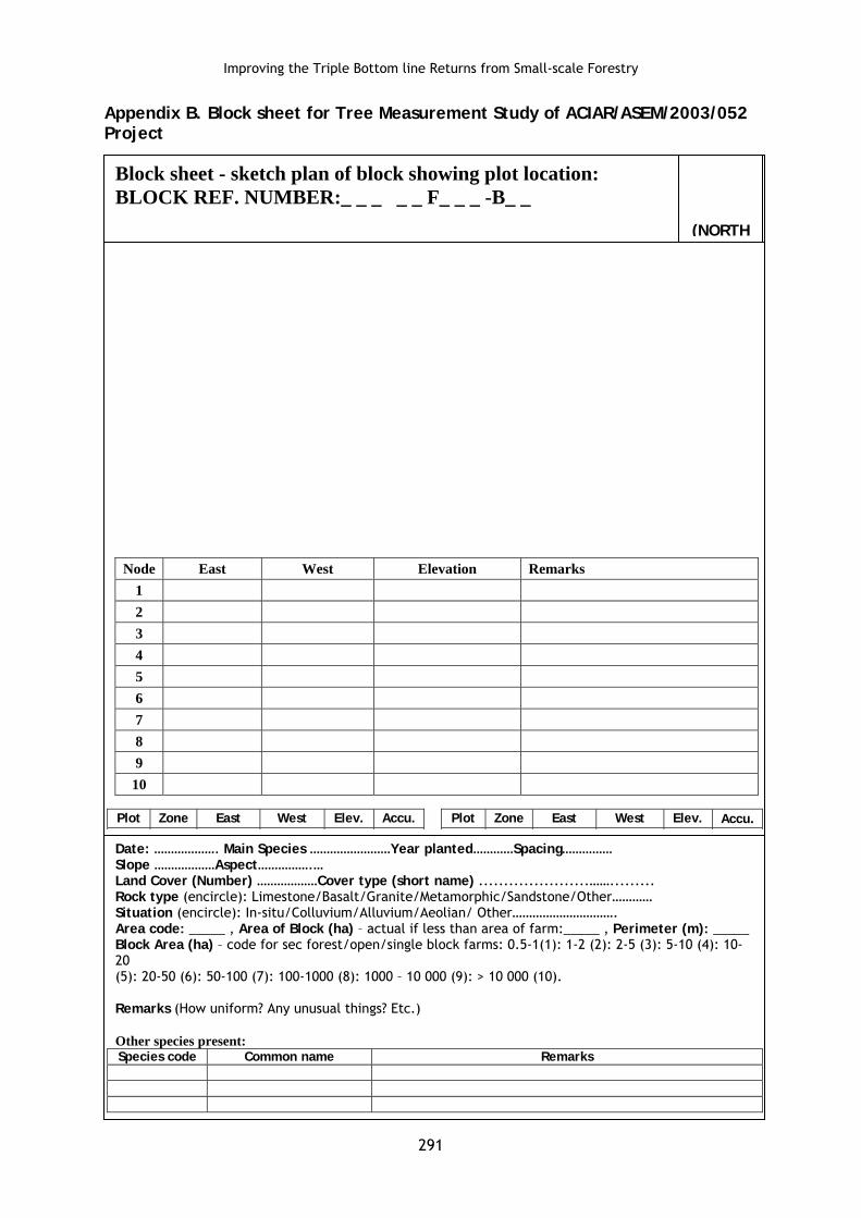
Block sheet - sketch plan of block showing plot location: BLOCK REF. NUMBER:_ _ _ _ _ F_ _ _ -B_ _
Date: ………………. Main Species ……………………Year planted…………Spacing…………… Slope ………………Aspect…………….… Land Cover (Number) ………………Cover type (short name) ......................……......... Rock type (encircle): Limestone/Basalt/Granite/Metamorphic/Sandstone/Other………… Situation (encircle): In-situ/Colluvium/Alluvium/Aeolian/ Other…………………………. Area code: _____ , Area of Block (ha) – actual if less than area of farm:_____ , Perimeter (m): _____ Block Area (ha) – code for sec forest/open/single block farms: 0.5-1(1): 1-2 (2): 2-5 (3): 5-10 (4): 10-20 (5): 20-50 (6): 50-100 (7): 100-1000 (8): 1000 – 10 000 (9): > 10 000 (10). Remarks (How uniform? Any unusual things? Etc.) Other species present: Species code Common name Remarks
(NORTH
291

Measurement of Smallholder Tree Farms in Leyte Island
Land Cover types (Number and Short name) Tree farms 1 TF A. mangium 11 MAN Gmelina arborea 12 GME Mahogany 13 MAH Mixed intro species 14 MIS Mixed native species 15 MNS Orchards and fruit trees 2 O Coconut 21 COC Mango/Durian/Mangosteen/ MFS Marang/Lansones/Kalamansi 22 Abaca 23 ABA Banana 24 BAN Fallow and grazing land 3 F Grasslands 31 GRS Early regeneration 32 ERE Late regeneration 33 LRE Secondary forest 34 SFO Agriculture and Horticulture 4 AH Rice 41 RIC Sweet potato 42 SPO Pineapple 43 PIA Cassava 44 CAS Misc vegetables 45 MVE Home gardens 46 HGA Other 5 O Bamboo 51 BMB Palm 52 PAM Riparian 53 RPR Note: Enter only one option based on tallest stratum. Categories in bold are general categories, only to be used if land cover type fits general category but differs from others within the section
Situation (Substrate)
In situ – substrate not transported (e.g. soil derived from rock of local environment, outcrop etc) Colluvium – substrate transported to site by gravity (e.g. rock deposit at base of steep slope) Alluvium – substrate transported to site by water (e.g. sediments along river terraces) Aeolian – substrate transported to site by wind (e.g. sand dunes)
292

Improving the Triple Bottom line Returns from Small-scale Forestry Appendix C. Plot sheet for Tree Measurement Study of ACIAR/ASEM/2003/052 Project
3. Plot Sheet
3.1 Plot profile
Plot reference number _ _ _ _ _ F _ _ _ - B _ _ - P _ _ Date:
Location of plot (encircle): centroid/edge/other: Distance to nearest edge (m) ________
Slope: Level 0-3° (1): Gentle 4-8° (2): Mod 9-16° (3): Steep 17-26° (4): V.steep.27-45o (5): Precipitous >45° (6).
Topo position: Crest/plateau (1): Upper slope (2): Midslope (3): Lower slope (4): Simple slope (5): low flat (6): Open depn (7): Closed depn (8). Aspect: _____ degrees
Drainage: Rapid drained (1): Well drained (2): Mod well drained (3): Poorly drained (4): V poor drained (5).
Surf cond. (dry): Cracking (1): Loose (2): Self mulching (3): Eroded (4): Hardsetting (5): >50% Stone (6).
Soil depth in m: Skeletal: < 0.05 (1): Shallow: 0.05-0.15 (2): Medium: 0.15-1.00 (3): Deep >1.00 (4).
Impeding layer: Bedrock (1): Heavy massive clay (2): Water Table (3): Hardpan (4): Stone (5).
Soil texture: Clay (1): Sandy clay (2): Clay loam (3): Loam (4): Sandy loam (5): Fine sand (6): Coarse sand (7)
Cover abundance ratings within 5 m radius plot (1-6)
Cover abundance values 1 <1%: 2 - 1-5 %: 3 - 5-25 %: 4 - 25-50 %: 5 - 50-75 %: 6 - > 75 %
Rock cover: gravel (2-4 cm)__: pebbles (4-20 cm)__: stones (20-50 cm)__: boulders (>50 cm)__: bed-rock __
Ground cover ; Bare soil ___: Leaf litter total ___: Grass___: Ferns ___: Herbs ___
Coarse litter by diameter: 2.5-10 cm ___: 10-50 cm ___: > 50 cm ___
Shrub cover: Woody vegetation <2.5 cm diameter or dbh, including seedlings: < 1 m___1-2 m ___> 2 m ___
Canopy cover ____ visual estimate above 2 m height
Clumping epiphytes < 0.001 m3___; 0.001-1 m3____; > 1 m3____ : Stem-clasping plants ___
Vines <1 cm___ : 1-5 cm ___ : > 5 cm ___ : Scramblers (multi stemmed thorny shrubs)____
Stem tally - 5 m radius plot: dicot tree (t): bamboo (b): palm (p) cycad (c).
2.5-10 cm D 11-20 cm D 21-50 cm D >50cm D
2-5 m Ht
6-10 m Ht
11-20 m Ht
> 20 m Ht
Measurer/s:
293

Measurement of Smallholder Tree Farms in Leyte Island
Appendix C.1. Plot sheet for Tree Measurement Study of ACIAR/ASEM/2003/052 Project. (3.2 Tree profile)
Plot reference number _ _ _ _ _ F _ _ _ - B _ _ - P _ _
Graph locations of all trees >5 cm and show any stand edge. Start from North and work clockwise Must have at least 7 target trees >10 cm dbh
Height of tallest tree: Tree number __ Height (m) __ Plot radius __m
GPS Zone: ___ East ___________ West __________ Elevation (m) ___ Accuracy (m) ___
Stem Species Age E/R DBH DB BT1 BT2 Ht Dir Dist B/L Dir Dist L CD CR1 CR2 CR3 CR4
1
2
3
4
5
6
7
8
9
10
11
12
13
14
15
16
17
18
19
20
21
22
23
24
25
Measurer/s:
294

Improving the Triple Bottom line Returns from Small-scale Forestry Appendix D. Tree sheet for the Tree Measurement Study of ACIAR/ASEM/2003/052. (4. Tree Sheet) Plot reference number _ _ _ _ _ F _ _ _ - B _ _ - P _ _
Draw sketch of tree showing piece numbers
Tree no.: T _ _ Tree no.: T _ _ Tree no.: T _ _ Tree no.: T _ _
# D1 Len D2 Gr./D3 D1 Len D2 Gr./D3 D1 Len D2 Gr./D3 D1 Len D2 Gr./D3 1
2
3
4
5
6
7
8
9
10
Measurer/s:
295