mdp3-remote sensing concepts
TRANSCRIPT
8/7/2019 MDP3-Remote Sensing Concepts
http://slidepdf.com/reader/full/mdp3-remote-sensing-concepts 1/40
Remote Sensing•Remote Sensing is the science of acquiring information about
the earth surface without actually being in contact with it.
•The method is commonly restricted to employ
electromagnetic energy (such as light, heat and radio waves)
as the means of detecting and measuring targets.• •Remote Sensing is an advanced form of Surveying in which
land surveying has been replaced by aerial photographs &
satellite images.
•Applications whether it is geographical, geological,
oceanographic or cartographic, Remote Sensing is the
essential tool for all application areas.
8/7/2019 MDP3-Remote Sensing Concepts
http://slidepdf.com/reader/full/mdp3-remote-sensing-concepts 2/40
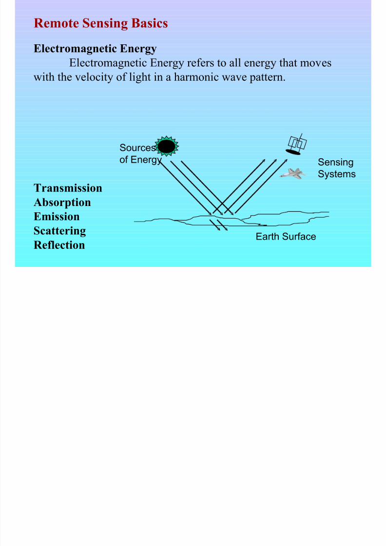
Earth Surface
Sources
of Energy Sensing
Systems
TransmissionAbsorption
Emission
Scattering
Reflection
Remote Sensing Basics
Electromagnetic Energy
Electromagnetic Energy refers to all energy that moveswith the velocity of light in a harmonic wave pattern.
8/7/2019 MDP3-Remote Sensing Concepts
http://slidepdf.com/reader/full/mdp3-remote-sensing-concepts 3/40
V
isible
Light
n
earinf ra
red
m
idinfr a
red
thermal
infrared
U
l t r a
v i o l e t (
U V
)
m
icrowa
ve
TVand
radio
X
r a y
s
γ
r a y
s
b l u
e
g r e e n
r e
d UV near
infrared
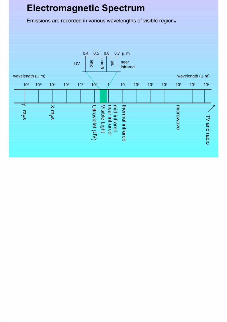
110-110-210-310-410-510-6 10410310210 107106105
wavelength (µ m) wavelength (µ m)
0.4 0.5 0.6 0.7 µ m
Electromagnetic Spectrum
Emissions are recorded in various wavelengths of visible region.
8/7/2019 MDP3-Remote Sensing Concepts
http://slidepdf.com/reader/full/mdp3-remote-sensing-concepts 4/40
Based on source of energy, Remote Sensing can be broadly
divided in two categories.
(i) Passive Remote Sensing(ii) Active Remote Sensing
When remote sensing instruments both generate and detect their
own source of radiation, the process is called Active remotesensing. i.e.Aerial Photography, Microwave remote sensing etc.
In case of Passive remote sensing sensors detect and recordvariation of solar or terrestrial origin in the visible, infra-red and
microwave wave bands.
8/7/2019 MDP3-Remote Sensing Concepts
http://slidepdf.com/reader/full/mdp3-remote-sensing-concepts 5/40
Aerial Photography is the original form of remote sensing
and remains the most widely used methods. Aerial
Photography analyses have played major roles in discovery
of many oil and mineral deposits around the world.
Aerial photographs are acquired with the help of specially
designed cameras which are mounted on the aircraft. These
aircrafts fly over the ground and record the photographs of
the area.
Based on technology used, Remote Sensing can be broadly
divided in two categories.
(i) Aerial Photography(ii) Satellite Remote Sensing

8/7/2019 MDP3-Remote Sensing Concepts
http://slidepdf.com/reader/full/mdp3-remote-sensing-concepts 6/40
In case of Satellite remote sensing, sensors are mounted on
the satellites which record the reflectance value from various
objects and forms a digital image. The satellites revolvearound the earth at several hundred kilometers from the
earth’s surface. This can be treated a form of active remote
sensing.
8/7/2019 MDP3-Remote Sensing Concepts
http://slidepdf.com/reader/full/mdp3-remote-sensing-concepts 7/40
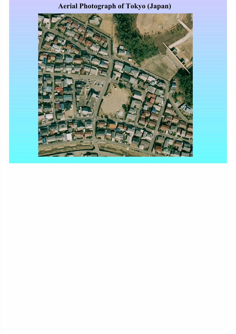
Aerial Photograph of Tokyo (Japan)
8/7/2019 MDP3-Remote Sensing Concepts
http://slidepdf.com/reader/full/mdp3-remote-sensing-concepts 8/40
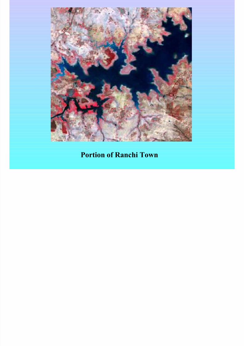
Portion of Ranchi Town
8/7/2019 MDP3-Remote Sensing Concepts
http://slidepdf.com/reader/full/mdp3-remote-sensing-concepts 9/40
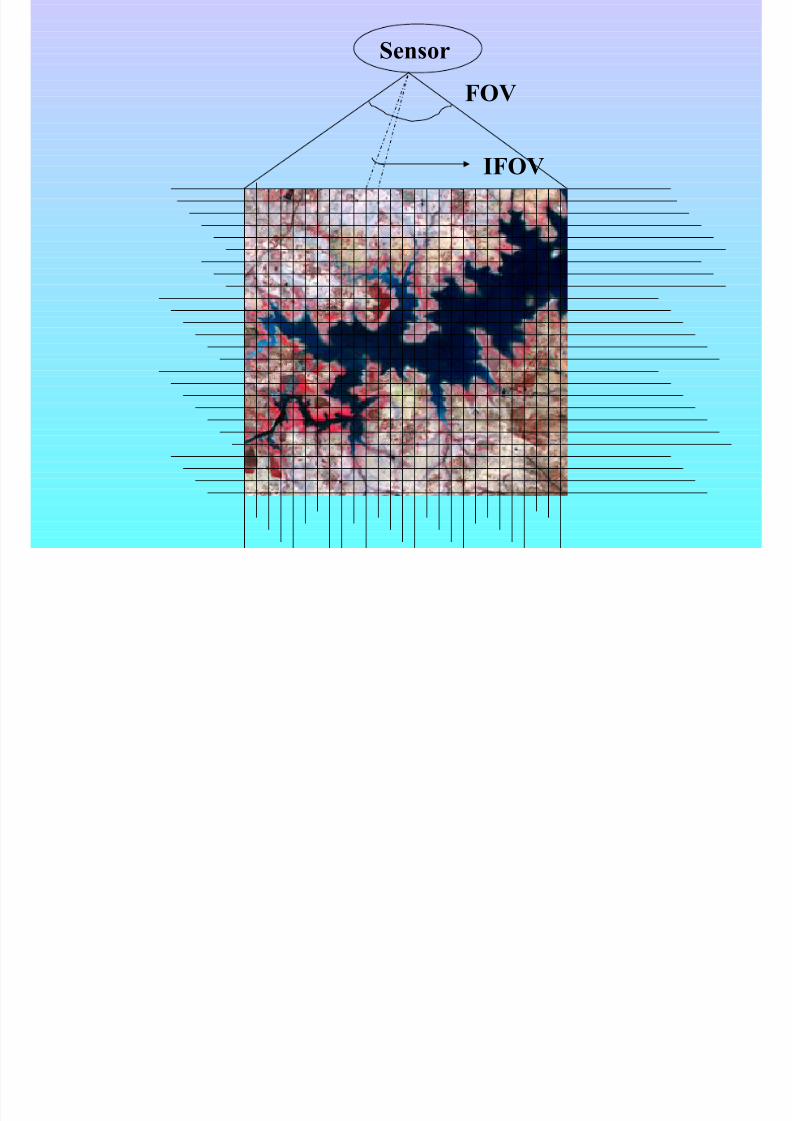
Sensor
IFOV
FOV
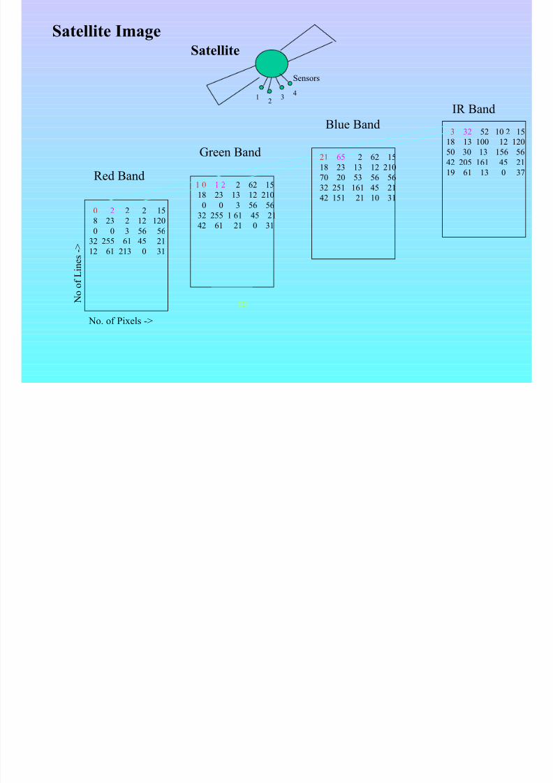
8/7/2019 MDP3-Remote Sensing Concepts
http://slidepdf.com/reader/full/mdp3-remote-sensing-concepts 10/40
0 2 2 2 15
8 23 2 12 120
0 0 3 56 56
32 255 61 45 21
12 61 213 0 31
1 0 1 2 2 62 15
18 23 13 12 210
0 0 3 56 56
32 255 1 61 45 21
42 61 21 0 31
No. of Pixels ->
NoofLines->
Red Band
12
4
Sensors
Satellite
Green Band
3
21 65 2 62 15
18 23 13 12 210
70 20 53 56 5632 251 161 45 21
42 151 21 10 31
Blue Band3 32 52 10 2 15
18 13 100 12 120
50 30 13 156 56
42 205 161 45 21
19 61 13 0 37
Satellite Image
IR Band
8/7/2019 MDP3-Remote Sensing Concepts
http://slidepdf.com/reader/full/mdp3-remote-sensing-concepts 11/40
Each scan line of a remotely sensed image is
a digital or numerical record of radiance
measurements made at regular intervalalong the line. A set of consecutive scan lines
thus forms an image.
Image data thus numerical in nature can be
processed with the help of computers to
derive the meaningful information.
8/7/2019 MDP3-Remote Sensing Concepts
http://slidepdf.com/reader/full/mdp3-remote-sensing-concepts 12/40
Geo-Stationary Satellite
The satellite’s orbital velocity is just sufficient to
keep pace with the rotation of earth.
Sun-Synchronous SatelliteThey acquire the image of specific portion of the
earth at a fixed local sun time.
8/7/2019 MDP3-Remote Sensing Concepts
http://slidepdf.com/reader/full/mdp3-remote-sensing-concepts 13/40
Satellite Data Format : BIP (Band Interleaved by Pixel)
BIL (Band Interleaved by Line)
BSQ (Band Sequential)
Histogram : A graph between the Grey-Values (intensity values)
& corresponding frequencies
Signal : Actual radiations measured in the image.
Noise : Unwanted signals recorded in the image.
8/7/2019 MDP3-Remote Sensing Concepts
http://slidepdf.com/reader/full/mdp3-remote-sensing-concepts 14/40
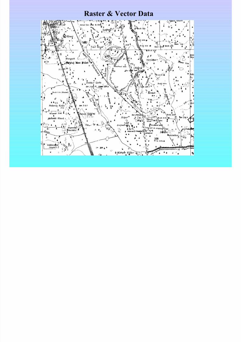
Raster & Vector Data
8/7/2019 MDP3-Remote Sensing Concepts
http://slidepdf.com/reader/full/mdp3-remote-sensing-concepts 15/40
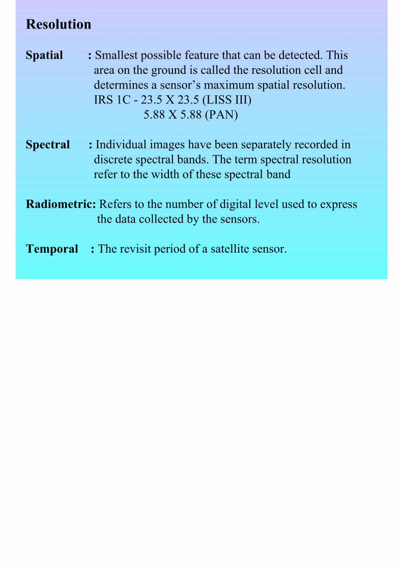
Resolution
Spatial : Smallest possible feature that can be detected. This
area on the ground is called the resolution cell anddetermines a sensor’s maximum spatial resolution.
IRS 1C - 23.5 X 23.5 (LISS III)
5.88 X 5.88 (PAN)
Spectral : Individual images have been separately recorded in
discrete spectral bands. The term spectral resolution
refer to the width of these spectral band
Radiometric: Refers to the number of digital level used to express
the data collected by the sensors.
Temporal : The revisit period of a satellite sensor.
8/7/2019 MDP3-Remote Sensing Concepts
http://slidepdf.com/reader/full/mdp3-remote-sensing-concepts 16/40
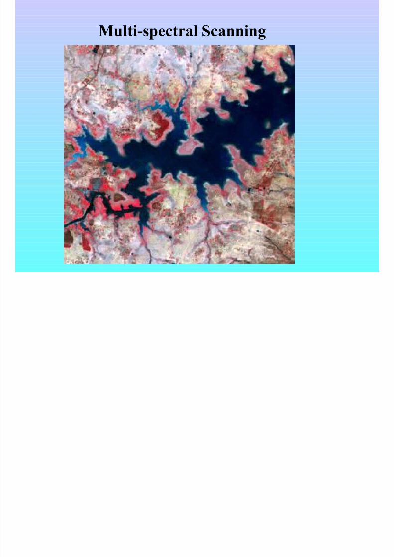
Multi-spectral Scanning
8/7/2019 MDP3-Remote Sensing Concepts
http://slidepdf.com/reader/full/mdp3-remote-sensing-concepts 17/40
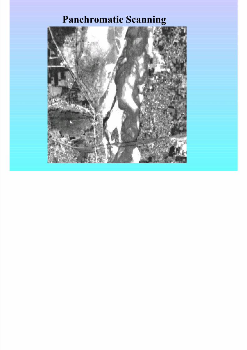
Panchromatic Scanning

8/7/2019 MDP3-Remote Sensing Concepts
http://slidepdf.com/reader/full/mdp3-remote-sensing-concepts 18/40
Satellite Image of Patna as viewed By IKONOS
8/7/2019 MDP3-Remote Sensing Concepts
http://slidepdf.com/reader/full/mdp3-remote-sensing-concepts 19/40
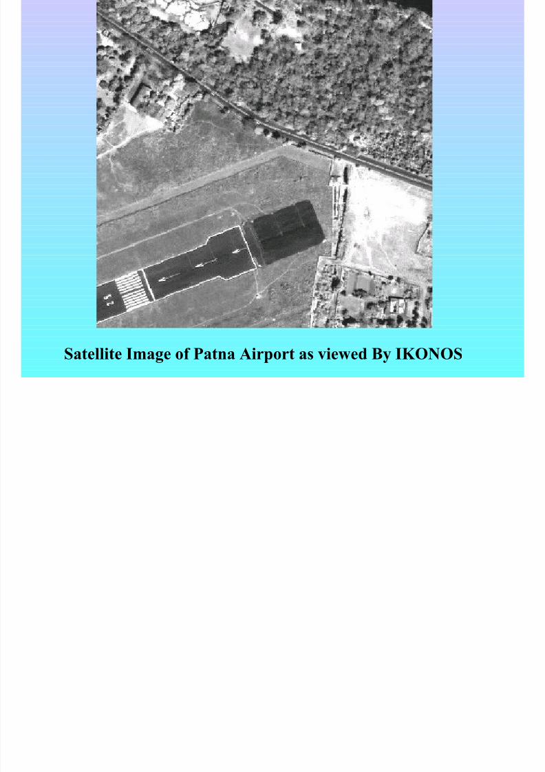
Satellite Image of Patna Airport as viewed By IKONOS
8/7/2019 MDP3-Remote Sensing Concepts
http://slidepdf.com/reader/full/mdp3-remote-sensing-concepts 20/40
Digital Image Processing
• Image Pre-processing
• Image Enhancements
•Image Classification
8/7/2019 MDP3-Remote Sensing Concepts
http://slidepdf.com/reader/full/mdp3-remote-sensing-concepts 21/40
IMAGE PRE-PROCESSING
Remote Sensing image, acquired by satellite/aircraft
have various geometric distortions.
These errors may be due to :
• the curvature and rotation of the earth• the motion of the scanning system• the motion and (in)stability of the platform

8/7/2019 MDP3-Remote Sensing Concepts
http://slidepdf.com/reader/full/mdp3-remote-sensing-concepts 22/40
Pre-processing operation :
•Radiometric Correction [ For Sensor & Platform
specific errors]
•systematic striping or banding and dropped lines.
•Geometric Correction/Registration [ for Geo-metric
distortion of data ].

8/7/2019 MDP3-Remote Sensing Concepts
http://slidepdf.com/reader/full/mdp3-remote-sensing-concepts 23/40
8/7/2019 MDP3-Remote Sensing Concepts
http://slidepdf.com/reader/full/mdp3-remote-sensing-concepts 24/40
IMAGE ENHANCEMENT
Used to make it easier for visual interpretation and analysis of
imagery.
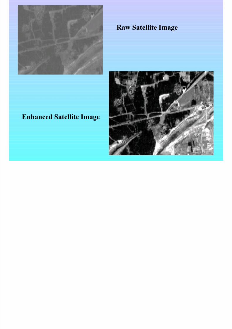
Contrast Enhancement : The visual quality of an image can be
improved if the contrast (intensity values) between the darkest and
the lightest parts of image is enhanced.
Raw Image, having contrast values between 17-80, If we map these
intensity values on 0-255 scale , the visual quality of image will
enhanced.
8/7/2019 MDP3-Remote Sensing Concepts
http://slidepdf.com/reader/full/mdp3-remote-sensing-concepts 25/40
Raw Satellite Image
Enhanced Satellite Image
8/7/2019 MDP3-Remote Sensing Concepts
http://slidepdf.com/reader/full/mdp3-remote-sensing-concepts 26/40
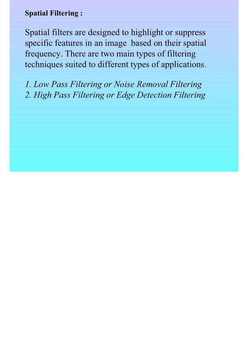
Spatial Filtering :
Spatial filters are designed to highlight or suppress
specific features in an image based on their spatialfrequency. There are two main types of filtering
techniques suited to different types of applications.
1. Low Pass Filtering or Noise Removal Filtering 2. High Pass Filtering or Edge Detection Filtering

8/7/2019 MDP3-Remote Sensing Concepts
http://slidepdf.com/reader/full/mdp3-remote-sensing-concepts 27/40
Low Pass Filtering or Noise Removal Filtering
A Low-pass filter is designed to remove the noise/lowfrequency components from the image. These filters
are also called smoothing filters. These are :
• Mean• Mode• Median

8/7/2019 MDP3-Remote Sensing Concepts
http://slidepdf.com/reader/full/mdp3-remote-sensing-concepts 28/40
High Pass Filtering or Edge Detection
FilteringA High-pass filter is designed to suppress high frequency
components from the image. Directional, or edge detection filtersare designed to highlight linear features, such as roads,fields or
water body boundaries.
Some of these filters are :• Laplacian• Robert• Kirsch• Sobel
• Prewitt• Highboost
8/7/2019 MDP3-Remote Sensing Concepts
http://slidepdf.com/reader/full/mdp3-remote-sensing-concepts 29/40
IMAGE CLASSIFICATION
Image classification is used to classify the satellite imagery into
actual land classes/categories. Classification may be very useful for the identification of different kind of crops, different forest types or
tree species, different geologic units or rock type, water spread, etc.
Classification is divided into two broad categories, these are :-
Supervised classification : In this method the analyst provide/
identify representative samples (also referred to as training sample
area) of different surface cover type of interest. Based on the
training sample area the processing is done over the imagery to getthe classified image.
8/7/2019 MDP3-Remote Sensing Concepts
http://slidepdf.com/reader/full/mdp3-remote-sensing-concepts 30/40
Unsupervised Classification :
In this method the programs, called clustering algorithms,are used to determine the natural (statistical) grouping or
structures in the data. Usually in this process the analyst
specify only the desired number of classes. In addition the
analyst may specify parameters related to the separation
distance among the clusters and the variation within each
cluster. If the image geometry is transformed so as to
match a known coordinate system, the resultant classified
image is in form of a thematic map and is suitable for
export as an input to a digital Geographical informationsystem (GIS).
8/7/2019 MDP3-Remote Sensing Concepts
http://slidepdf.com/reader/full/mdp3-remote-sensing-concepts 31/40
Spatial Data Infrastructure for
Multi-layer GIS Planning
8/7/2019 MDP3-Remote Sensing Concepts
http://slidepdf.com/reader/full/mdp3-remote-sensing-concepts 32/40
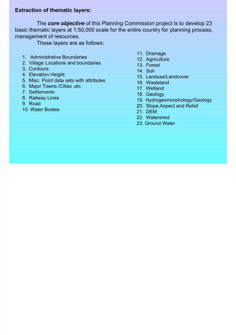
11. Drainage
12. Agriculture
13. Forest
14. Soil
15. Landuse/Landcover 16. Wasteland
17. Wetland
18. Geology
19. Hydrogeomorphology/Geology
20. Slope,Aspect and Relief
21. DEM
22. Watershed23. Ground Water
Extraction of thematic layers:
The core objective of this Planning Commission project is to develop 23
basic thematic layers at 1:50,000 scale for the entire country for planning process,
management of resources.
These layers are as follows:
1. Administrative Boundaries
2. Village Locations and boundaries
3. Contours
4. Elevation Height
5. Misc. Point data sets with attributes
6. Major Towns /Cities ,etc
7. Settlements
8. Railway Lines
9. Road
10. Water Bodies
8/7/2019 MDP3-Remote Sensing Concepts
http://slidepdf.com/reader/full/mdp3-remote-sensing-concepts 33/40
Satellite data is an important source of informationabout land cover and land use. The layers extracted from it either form an end layer or an input layer for further analysis
into GIS. The data from IRS series satellites are supplied by NRSA, Hyderabad. Following datasets from different types of sensors been procured for this project:
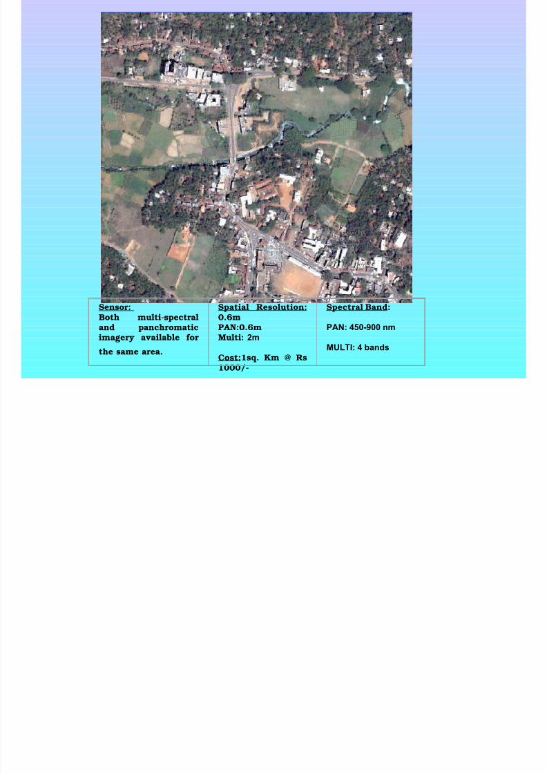
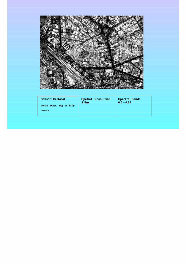
AWIFS - Covering entire country LISS-III - Covering entire country PAN - Covering entire country Quickbird - Selective areas, covering the Distt. Hdqrs.
Cartosat-1 – Selective areas - few hilly terrains
8/7/2019 MDP3-Remote Sensing Concepts
http://slidepdf.com/reader/full/mdp3-remote-sensing-concepts 34/40
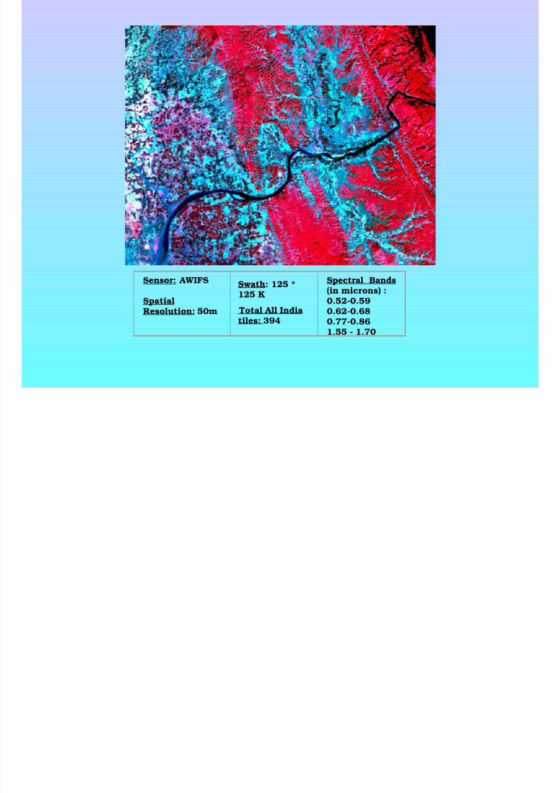
Sensor: AWIFS
SpatialResolution: 50m
Spectral Bands(in microns) :0.52-0.590.62-0.680.77-0.861.55 - 1.70
Swath: 125 *125 K
Total All Indiatiles: 394
8/7/2019 MDP3-Remote Sensing Concepts
http://slidepdf.com/reader/full/mdp3-remote-sensing-concepts 35/40
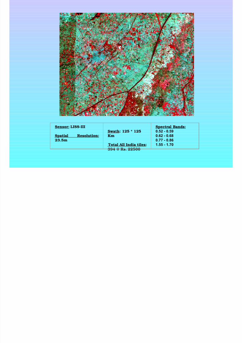
Sensor: LISS-III
Spatial Resolution:23.5m
Swath: 125 * 125Km
Total All India tiles:394 @ Rs. 22500
Spectral Bands:0.52 - 0.59
0.62 - 0.68
0.77 - 0.86
1.55 - 1.70
8/7/2019 MDP3-Remote Sensing Concepts
http://slidepdf.com/reader/full/mdp3-remote-sensing-concepts 36/40
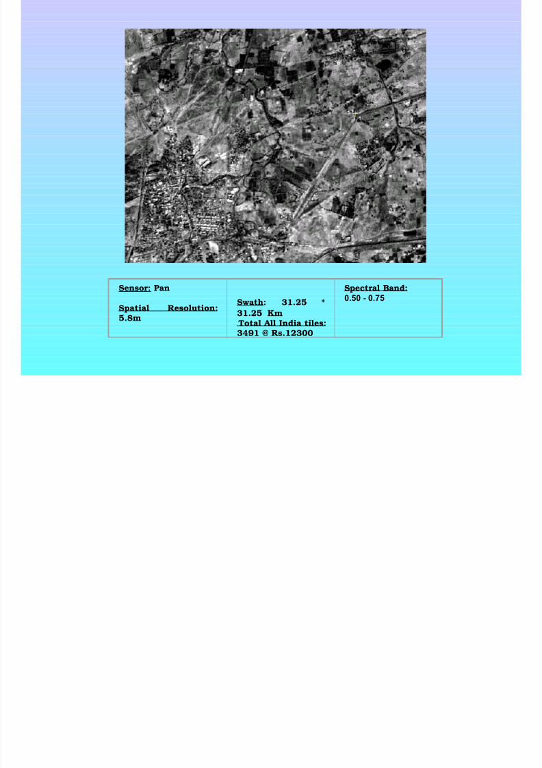
Sensor: Pan
Spatial Resolution:5.8m
Swath: 31.25 *
31.25 Km Total All India tiles:3491 @ Rs.12300
Spectral Band:0.50 - 0.75
8/7/2019 MDP3-Remote Sensing Concepts
http://slidepdf.com/reader/full/mdp3-remote-sensing-concepts 37/40
8/7/2019 MDP3-Remote Sensing Concepts
http://slidepdf.com/reader/full/mdp3-remote-sensing-concepts 38/40
Sensor: Cartosat
20-24 Distt. HQ of hilly
terrain
Spatial Resolution:2.5m
Spectral Band:0.5 – 0.85
8/7/2019 MDP3-Remote Sensing Concepts
http://slidepdf.com/reader/full/mdp3-remote-sensing-concepts 39/40
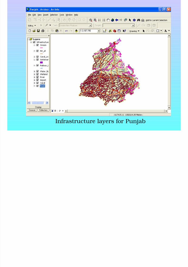
Infrastructure layers for Punjab

8/7/2019 MDP3-Remote Sensing Concepts
http://slidepdf.com/reader/full/mdp3-remote-sensing-concepts 40/40
Guidelines for Data ordering
To obtain satellite data, users have to specify their area of interest.
This may be:a city a district
a stateany contiguous area
This can also be specified in terms of:latitude / longitude of corners of a polygonpath / row number (obtained from a referencing scheme map)map sheet number (as per Survey of India SOI nomenclature)
For more information on the procedure to procure, visit the link:http://www.nrsa.gov.in/products/area_coverage.html