little qualicum river watershed plan; a feasibility study
TRANSCRIPT
Little Qualicum River Watershed Plan;
A Feasibility Study
By Michele Deakin
For Qualicum Beach Streamkeepers
Funded by The Real Estate Foundation of British Columbia

Little Qualicum River Watershed Plan – Feasibility Study 1
Feasibility Study
Little Qualicum River Watershed Plan
Background
When the Qualicum Beach Streamkeepers initiated conversations with stakeholders two
years ago regarding a watershed plan for the Little Qualicum River, they were supportive
of a feasibility study in order to determine the interest and support for a plan by the
public, but also other government or industrial stakeholders.
Qualicum Beach Streamkeepers have conducted the feasibility study with the Real Estate
Foundation of B.C. The concept of the feasibility study was to identify issues to be
covered by a watershed plan, identify a level of support in the community for this work to
continue, and make recommendations on how a planning process should be facilitated.
All stakeholders were contacted and asked three questions. They were: first “What issues
do you think a watershed plan for the Little Qualicum River should address?”, and
second “Are there any solutions to any issue that you would like to recommend?”. The
third question was regarding a vision for the watershed 50 years from now.
Based on these consultations, issues were identified and a draft vision for the watershed
was created. This study has created interest in the community and the general consensus
is that such a plan is late – community members want to see the results tomorrow!
Suggestions were strong to get some action happening immediately and not wait 1-2
years for a plan to be produced.
To preserve the important values of the Little Qualicum River watershed, the Qualicum
Beach Streamkeepers are proposing that a community-based watershed management plan
be created.
A community-based watershed plan gives all stakeholders a broad understanding of their
natural systems in the region, and permits a tracking of changes to that system. It will
encourage the collection of scientific, and community-based information for informed
decision-making, information sharing, education and best practices. A community
coordinated plan also provides a venue for stakeholders to work out solutions to
competing interests without having to worry about a certain agency’s priorities.
A community-based watershed plan ensures that systems that are valued or needed by the
community are not compromised, but maintained or protected. The value of natural
systems is significant and by identifying them the community and the residents benefit
socially and economically. This can include the increase in property values, or the value
of natural services provided (e.g. estuaries naturally provide approximately $23,000 of
services per hectare per year, based on a study by The Land Trust of B.C.).

Little Qualicum River Watershed Plan – Feasibility Study 2
Watershed planning usually draws a line between the major watersheds and includes
those smaller areas in the major watershed plans. The reason for this arrangement is to
ensure capture of all watersheds into plans, but also those people living in those adjacent
areas will both benefit from, and impact the watershed being discussed.
In this situation the next major watershed with a plan is the Englishman River. French
Creek, in the middle of the two, has been assessed but has no plan. There is however, a
stewardship group working on activities related to addressing the assessment findings.
For this report, the area of discussion will refer to the Little Qualicum River Watershed
and the area between French Creek and the Little Qualicum. This means that included are
Labour Day Lake, Cameron River, Cameron Lake, Little Qualicum River mainstem,
Whisky Creek, Kinkade Creek, Spider and Illusion Lakes, and the Town of Qualicum
Beach.
This watershed plan will be written with large scale goals first. Specific goals and
objectives will then be included to guide the implementation to achieve the larger or
broader goals.
Context
Stakeholders were very clear about issues that need to be addressed. Everyone accepts
that what is upstream impacts everybody and everything downstream. Some common
threads ran through the comments, regardless of who the stakeholder was. Those
common threads have shaped the content of this report.
Climate Change is coming, and some impacts are being felt now. A typical planning
approach of a five-year window will not address the needs of the community to be ready
for the implications of this new reality. This plan, when used effectively, will be a tool to
ensure the citizens of this area are prepared to address the changes that will happen as a
result of global climate change. Climate models suggest we can expect increased winter
flooding, summer droughts, extreme vegetation changes involving the loss of western red
cedar and other trees, and a significant increase in grasslands. Rising sea levels will have
altered the estuary and shorelines, affecting waterfront dwellings, burying archaeological
sites and moving food and shelter for fish and birds further inland.
The plan will address many water related issues, but also the changes that result from
land use development and activities.
Various stakeholders have cited examples of services from nature that we need to value
and maintain as the area develops. These include the provision of water, food, a
sustainable economic base, buffering against storm and drought, and using nature to help
buffer us from the impacts of climate change as much as possible. These services depend
on healthy ecosystems and their associated biodiversity. Without the range of plants and
animals that ensure the functioning of our ecosystems, many of these services will be

Little Qualicum River Watershed Plan – Feasibility Study 3
reduced or won’t be available at all. This plan will address biodiversity loss in the
watershed area.
Vision Statement for the Little Qualicum River Watershed Plan
A draft vision statement was created based on discussions with the various stakeholders.
This draft vision was presented at the public meeting in order to gain response to the
vision and request changes. It was also sent to the stakeholders unable to make the public
meeting but interested in being involved. Little change was suggested to the Vision
statement.
Comments included:
Most points excellent
General support
Not urgent enough! Tomorrow!
Could identify steps – various visions at milestones, descriptions
Need to have vision for every 5 years so public can buy into plan, and understand
it.
With population increases, septic systems may not be useful at all – remove?
Weak statement and not agree with natural management (e.g. blackberry fences) –
stick to bigger issues for vision.
The Vision Statement has been written based on comments received from stakeholders in
answer to the question “What is your vision of the watershed in 50 years?” Stakeholders
were given an opportunity to comment on the vision and were very supportive. This
version reflects the changes requested by the participants for the main vision statement.
There is a need however to develop similar vision statements for 5-10 year periods to
help create public understanding and support of the specific goals this watershed plan
will achieve.
Vision for 2056
Communities in the watershed are planned and managed within a defined carrying
capacity sufficiently below the ecosystem limits, thereby ensuring a consistent water and
food supply. Water supplies and flows are well-mapped and are managed to retain a high
percentage of clean water. Water licences do not exceed the carrying capacity and salinity
levels in the wells have dropped and are almost nil. People and businesses practice water
conservation, planning ahead for maximum water conservation in all construction,
development, gardening, and household and business practices. Water cisterns are a
common sight. Septic tanks have been reduced and/or replaced with new systems that
ensure only clean water is flowing into the aquifers and river. Housing codes have been
modified to separate grey water from sewage so the former can be reused effectively.
Sustainable logging has been a part of the watershed use for over 30 years and timber is
harvested at a rate that is within the regenerative capacity of the forested ecosystems.
This allows much of the standing forest to continue to provide its many ecosystem

Little Qualicum River Watershed Plan – Feasibility Study 4
services, including the storing, cleansing and slow release of water, wildlife habitat
ecotourism, and recreational access.
Farmers manage their fields in ways that build the soils and prevent damaging run off,
which improves the habitat for fish. Due to the incredibly high cost of fuel, an increase in
local-based industries has occurred in both value-added forestry and local food
production.
Protected areas have been established including forests and wetlands that preserve a gene
pool but also help maintain the water table and reduce impacts of climate change. Those
estuarine areas that remain are protected and some have been created to maintain bird
populations and accommodate the natural shifting of the river. Seawalls and rip-rap
shores have been minimized and many shorelines have been recovered and fluctuate
naturally as sea level rise claims more and more former human developments. This has
permitted eelgrass and other species to adapt to climate change, thereby ensuring the
continuation of the intertidal food chain, which will improve the marine survival of a
myriad of species including the 5 species of salmon that are so integral to the coastal
ecology.
Healthy riparian areas include old-growth trees and a variety of ages of trees and shrubs.
Almost all of the fish species have returned to the area. Wildlife, once disappearing, has
returned to their former numbers in the area.
Stream enhancement and other watershed rehabilitation have left a healthy ecosystem.
Monitoring and maintenance of the watershed still occurs through a partnership of forest
companies, individuals, government agencies, volunteers, developers, and First Nations.
By-laws now reflect the community values and priorities and include riparian set-backs,
limits on development on watercourses and floodplains, limits on development based on
water supply regardless of source, etc.
As a major contributor to the quality of life and economic health of the community,
tourism and local use is practiced in a manner that is respectful of ecosystems.
A corridor of parks, trails and green space stretch from the estuary of the LQR to
Clayoquot Sound. This corridor, connecting two Biosphere Reserves, helps maintain
local quality of life as well as water level and quality. It supports First Nations food
harvesting and other cultural uses, and a tourism industry based on a variety of low
impact eco-tourism and aboriginal tourism companies. This area also helps maintain the
wildlife and vegetation gene pools that contribute to the community’s ability to adapt to
climate change and biodiversity loss.
As a result of the well-managed watershed, the Little Qualicum River and surrounding
area remains a healthy region in which to live helping and supporting the communities as
they adapt to the new realities of climate change.

Little Qualicum River Watershed Plan – Feasibility Study 5
Issues - Major
Climate change
Some had predicted that the Pacific Oscillating Trend would reduce water temperatures
and slow down the impacts of climate change. It is not clear that this is happening.
Baseline information will be needed –climate records, monitoring snowpacks,
temperature change, numbers of creeks drying up, information on the major rivers. All
the water information will have to be put together so that scientists can look at trends.
Some information says that our cedar trees will be gone in 60 years. We are changing
from a forest system to a grassland similar to earlier ecosystems that once existed here.
Simple computer modelling exists that can also be used to show the impacts of the
flooding etc. and these tools should be used in order to educate the public and develop
solutions to fit the local situation.
Carrying Capacity
Several stakeholders brought up the concept of carrying capacity. There is a general
understanding that we have limited water resource and wetlands. There are also concerns
about limited opportunities to maintain the few protected areas and green spaces and that
these limited resources need to define the carrying capacity of the region – first. Based on
this carrying capacity the watershed plan should proceed and put actions, policies and
other tools into place that ensure that residential and commercial development in the
region does not exceed its own carrying capacity – a real challenge given that almost all
the land is privately owned.
Balance uses
There was a strong message of the need to balance uses, and that in some cases this might
mean no development zones in order to get an overall balance between wetland, riparian,
old-growth, housing, farming, etc.
Biodiversity Loss
Some stakeholders were able to identify species that have disappeared, or are so few that
they soon will disappear. This list includes wildlife and plant species. There is need for
an inventory of species on the decline or disappeared. Some of these will already be on
the COSEWIC listing as threatened or endangered.
The concern is that as biodiversity decreases, the ecosystem’s ability to function also
decreases. This means that services we receive from the ecosystems start to decline. This
then translates into increased costs for us to try and copy those services nature supplies.
For example, the loss of eelgrass means a loss of fish and crab species and a loss of
erosion control.
Another example is the loss of trees. This can lead to a decrease in the water table and an
increase in water temperature. It also increases the sunshine to the soil which increases
the drying rate and the temperature resulting in less water, and lower survival rates for
fish and vegetation, leading then to increased erosion and other impacts.

Little Qualicum River Watershed Plan – Feasibility Study 6
Issues - Other These next issues have all been identified through consultation with stakeholders and on
secondary research. This is not a comprehensive list, as issues will come up as the
assessment work and further discussion occurs. They do however give a good idea of the
range of issues and the breadth of work required in order to ensure a healthy watershed.
Assessment of Watershed
There are many aspects of the watershed that will need to be inventoried and ground-
truthed. Also history of the watershed will be very useful for planning for the future.
The following is a list of ideas suggested for an assessment, but there would need be
further assessments done, for example the estuary needs a considerable amount of
assessment as do other issues identified through this report.
An inventory of all legal and illegal water withdrawals
Identify surreptitious water withdrawals i.e. wells drilled within a few feet
of the river
Mapping - aerial interpretation, ground-truthing of randomly selected
features. Identify all tributaries especially seasonal ones
Assemble and analyze all applicable land use regulations that apply to the
watershed, identify gaps
Compile the historical condition of the watershed - pre European contact,
late 1800's, late 1900's through aerial photographs, early maps, interviews,
etc.
History of logging in the watershed
History of farming in the watershed
Complete inventory and history of all land parcels within the watershed
Complete an inventory of all excavated lands - farm dug outs, borrow pits,
gravel pits
Sensitive Ecosystem Inventory - ground truthing of selected areas
Current aerial photos- identify man made works i.e. ditching. Create
program to provide riparian zones on all man made features
Inventory all the uses of the water in the watershed - recreation, irrigation,
domestic, aesthetic.
Complete understanding of water chemistry
Consider the benefits of winter flow impoundment and then challenge it
Describe and illustrate the geology of the watershed. What are the acquifer
flows, recharge mechanisms, artesian supplies to the river
Inventory all old growth areas within the watershed and in particular those
within a reasonable riparian area on all watercourses in the watershed.

Little Qualicum River Watershed Plan – Feasibility Study 7
Private Land Owners
Most of the watershed is privately owned, making it cumbersome, but not impossible, to
develop a community-based watershed plan. In fact this is the reason a community-based
plan would work best, so that it is created through community partnership and based on
the development of a shared vision and values.
With support of government agencies however, it can provide for interesting and creative
tools to achieve the vision of the plan. Covenants, land trades, or gifts to land trusts are
some of the tools used elsewhere and would be obvious methods to try here as well.
There may also be some solutions that can be developed to meet local needs.
One of the issues here with the number of new residents, is that most of these people
come from different environments. They come to this area and have a perception that
they are on the west coast and it rains a lot and so there is a lot of water. They also come
from urban areas and may not appreciate the workings of the ecosystems in this region.
This is where public education and possibly government regulations have been suggested
by stakeholders to help prevent problems from developing.
Water
Drinking Water Quality and Quantity
The quality and quantity of drinking water is paramount to all stakeholders. There are
concerns regarding the current number of water licences exceeding the available amount
of water if all licence holders withdrew their allotment – and more licences are being
issued. The water allocation plan was to be updated five years ago and was not, and so
information that is 10years old is being used. Considering the explosive population
growth since that time, the information in that plan should be totally reviewed. This plan
must be updated.
Salinity in wells for the Town of Qualicum Beach (QB) and the Dashwood area is
increasing. This indicates that the system of fresh water has been drawn down so low that
the salt water is now creeping in. Dashwood residents and others get their drinking water
directly from the Little Qualicum River (LQR) and they are very concerned. This
drawing down of the water may also be contributing to the changes in the nationally
significant estuary, where it has gone from being a brackish marsh to a salt marsh.
Water for Fish
The water quantity and quality also relates to water for fish. Though people often say it is
about water for fish, the fish are actually an indicator. If there is enough water for the
fish, then there is enough water flowing throughout the year that people can access for
drinking and irrigation.
The overall concern about water quantity and quality however is that with the ever
increasing population, the area will reach a point where there is not enough water for all
users.

Little Qualicum River Watershed Plan – Feasibility Study 8
Storage has been an issue to ensure sufficient water flows in the summer to serve the
needs of fish, and the residents. There is a potential partnership being developed between
DFO, MOE and the Arrowsmith Water Service (including Town of QB, Regional District
of Nanaimo (RDN), and City of Parksville) that may lead to the increase in water storage
on the Cameron River Dam. If completed, this work will increase the storage of winter
rains so it can be held and released more slowly. This is only one form of storage
however and will not address the long term needs of fish or residents. Other solutions
such as cisterns, raingardens, and other water storage solutions need to be examined. Also
water conservation projects and education are extremely important to reduce the use of
water by residents and commercial interests so that storage facilities can better meet the
needs of the community.
Stream flows is related to drainage and storage. In some areas there is no more stream
flow, and in others there is new stream flow. The amount of flow year round in all
streams and rivers is of concern for humans and for fish.
Flooding in winter is expected to become more of an issue with climate change. Also
there is now flooding occurring in areas not suited to managing water flow. Changing of
watercourses due to development has created flooding issues where water has not
naturally flowed in the past. This is creating spin-off issues about where to direct this new
water flow to minimize issues developing such as erosion, sediment, flooding of
property, etc.
Run off and discharge is an issue throughout the watershed, including problems with
sediments and toxins entering the aquatic system. There is a need for integrated storm
water planning especially at a tributary level. Some questions were raised about storm
water from the Little Qualicum Village and where it goes to and the impacts of that, and
any future development. It was also suggested that mapping be done to show throughout
the watershed, where water comes from and where it goes to.
The province has produced a book on Stormwater Management Best Practices which is a
current resource available, but there is still a need for the collection of specific
information as it pertains to this particular watershed, and the sharing of information and
problem-solving between all the stakeholders, including governments, developers,
industry, and farmers.
Septic systems
Used by a lot of residents, including some of the upper end residential developments.
Though some users properly care for and use a septic system, many septic systems are
not maintained correctly. They are often used incorrectly by urban dwellers used to city
sewer systems, moving to a more rural setting. Also, the older technology was not
designed to properly treat sewage in such dense living situations. Given the huge
potential for impacts to drinking water quality, this issue needs to be researched further
and addressed. Regulations for new residential and commercial developments may be
required, and some way to deal with the houses on older systems. Suggestions were made
to require newer systems that can also recycle the grey water through the house at the

Little Qualicum River Watershed Plan – Feasibility Study 9
same time as dealing properly with the waste. Many of the new systems do not require
digging and have smaller leach fields and so installation challenges may be fewer than
some might think.
Drainage patterns
Drainage patterns are being changed by development. In discussions with those involved
in subdivision approvals, and others busy with landscaping work, changes in drainage
patterns were noted. We now have flooding where water did not flow, streams have been
moved and re-directed and now water does not flow where it should. Also the drainage
time has changed. In one conversation it was stated that 30 years ago it took 3-4 months
for the land to drain, and now it is two weeks! Policies between levels of government and
various departments were blamed in part for this. There are too many grey areas in
jurisdiction and regulation and policy. A study needs to be made of this situation and
recommendations made for new policies/bylaws and other tools to ensure the water
resources are properly understood and drainage issues solved.
Water licences/withdrawals
Current licences apparently exceed the amount of water actually available, if all the users
chose to draw their maximum amount. This needs to be clarified as different information
was received from different people. There is a water allocation plan that was developed
for the Little Qualicum but it is many years old and should have been updated about five
years ago. Since that plan was first drafted the population has increased significantly and
drought conditions have increased. A new plan is necessary as soon as possible.
Railway spraying
The spraying on the E&N Railroad will create issues related to water quality for all users.
Public opinion has been clearly opposed to this spraying of the railroad bed. Despite
public opinion, the provincial government has given approval to spray. The existence of a
watershed plan can give some added profile to this issue, though it may be too late for the
initial decisions.
Fish
Species
There are five species of salmon, steelhead and cutthroat trout in the Little Qualicum
River. There is a need to understand the historic quantities of these species, as it was
apparently quite significant in pre-contact periods. These numbers would indicate the
potential wealth of the watershed should it be restored to a fully functioning level.
Recovery approaches on river
Recovery work is needed throughout the system. Some work has started but a Watershed
Plan would give more people and agencies the ability to put the LQR watershed on their
work plans. This watershed is not as compromised as the Englishman River was and so
the priorities on this watershed will not be as high for government agencies as the
Englishman River. The lessons learned on the Englishman however could be directly

Little Qualicum River Watershed Plan – Feasibility Study 10
applied to the work on the LQR, and the same experts involved thereby reducing the
costs and time needed to recovery the watershed.
In-stream restoration and stock assessment is also needed along the rivers and tributaries.
This work will need to involve partnerships between various government agencies,
volunteers and landowners.
Fish are important
An indicator of watershed health, healthy fish populations mean that many other aspects
of the natural system are in good working order. Fish also clean the water through the
creation of their redds and their movement in the water, and they provide essential
nutrients to the system. They are a necessary component of the river ecosystem.
Cutthroat Trout
A special consideration may be needed for this species as it is being considered for
endangered species status. Should this occur there would be many requirements
throughout the watershed in order to maintain this population. The benefits would then
accrue to other fish species and the system.
Barriers and access
A dam was removed on Whisky Creek and culverts have been enhanced as well resulting
in easier passage for fish. The need for more of this type of work will need to be assessed.
Riparian Health Health of the riparian areas impacts estuary health and river health and also our ability to
adapt to climate change. Suggestions were made to protect it all as it represents too much
and is key to the future of the watershed. It helps maintain cooler water temperatures, and
prevents evaporation. It holds water and so provides the “lifeblood” of the community. It
provides wildlife corridors, low impact tourism opportunities, and contributes
significantly to the maintenance of salmon stocks. Some fear that the only wild places left
will be parks, and there are only a few, and very well-used parks. Protection of riparian
areas would address this fear.
Forestry Issues
Many issues were named by community members and the forest industry themselves.
Generally there is an interest by forestry companies to participate in, and support, a
watershed planning process. The two most significant landowners in the watershed are
Timberwest and Island Timberlands. Timberwest are interested to participate and
cooperate with actions if they are good for fish and water quality. Island Timberlands
also expressed interest in a watershed assessment and planning work on the Little
Qualicum.

Little Qualicum River Watershed Plan – Feasibility Study 11
There is no order of priority to the list below.
Private logging regulations
There is a need for these regulations to be reviewed and then endorsed by all involved.
Since the logging areas are privately owned, there is concern within the community about
the regulations that companies are expected to follow. People and businesses are
concerned that impacts will be felt throughout the watershed including environmental,
economic and social factors. One forestry company, Hancock Logging, exceed the
expectations of the regulations regarding environmental protection. Another forestry
company has already stated at a public meeting that they may not entertain any discussion
about this topic should a plan proceed.
Access
An issue for individuals and tourism companies. Many areas that provide hiking, biking,
swimming, and wildlife viewing opportunities are accessed by crossing lands owned by
forestry companies. There are concerns that the act of logging is reducing areas to go,
and also that the companies have limited access in general. From the forestry companies’
perspectives there are liability concerns if they permit community members to use their
land. Some have suggested alternatives be examined whether a local group offers its
members an insurance plan in order to access the forestry company lands. There is also
new insurance for outdoor adventure activities through the Council of Tourism
Associations.
Lot 10
This is a specific area that was mentioned by a few stakeholders. This lot supports a mix
of old-growth and second growth. It is a Douglas fir –Arbutus community which is very
endangered. The 3rd
tallest Spruce in the province is here and is a potential source of
special seed. Ninety-nine percent of the old-growth is gone on Vancouver Island and only
2% is protected. Many endangered plant and amphibian species live here. It is a place
used by Golden Eagles on their migration and large mammals (wolf, bear, cougar) use
this area as a corridor. It is also connected to the water sources for both the Town of
Qualicum Beach and Dashwood. Stakeholders point out that if the area is logged it will
further affect water wells that are already showing high signs of salinity, indicating that
too much fresh water has been removed from the acquifer. There are specific ecological
reasons for protecting this area. There are also community health, quality of life and
tourism reasons to ensure this area is set aside. There had been an agreement in place to
set this area aside, but before it could actually be signed Weyerhaueser forestry company
was sold and also Regional District staff changed. The community has continued to press
for the protection. Discussions have been ongoing between the Town of Qualicum Beach,
Regional District of Nanaimo and the forestry companies.
Impacts on water quality and water supply
Forestry companies are aware of, their potential impacts on water quality and quantity
and would evaluate that, should a plan be initiated. They don’t want to impact the water

Little Qualicum River Watershed Plan – Feasibility Study 12
quality. If a watershed plan was initiated, they would likely put the resources into
evaluating various aspects of their operation including those that can impact water
quality.
Others asked that vegetation in areas like the Beaufort Range that help maintain water
and moisture levels be left alone. This included providing shade so the snowpack won’t
melt as fast, ensuring a longer melt as summer droughts increase. Snowpack is the major
source of water to the rivers in this region.
Adapting to climate change
Protection of some forestry areas can assist adaptation to climate change. These forest
areas keep the water table up and capture and hold moisture through their root systems,
mosses and lichens and thick vegetation. This is important especially in this
Mediterranean climate that we have here. They also provide support to many species to
help ensure the survival of ecosystems and the services we are provided with by those
systems. Gene pools will be needed for systems to draw from in order to adequately adapt
to changes in temperatures and water supply.
Clear cut areas
A concern to the public, the forestry companies are aware of the impacts of clear cut
areas. Island Timberlands pointed out their vision is to log sustainably and to implement
long term planting so that 50 years out they are still logging, they want to see multiple
generations on the land. Harvesting is only one component of their business. Managing
the resources they impact is the other part. With the removal of the Forest Practices Code,
some companies have apparently gone back to clear cuts. There were various concerns
mentioned with this including the loss of water, loss of wildlife corridors, and loss of old-
growth.
Sustainable logging/Selective logging
Several stakeholders recommended sustainable logging and/or selective logging.
Harvesting is one component of the long term vision for forestry companies and for two
companies was described as being done with the goal of sustainable logging. Community
members and environmental groups were not anti-logging but do want to see a
sustainable approach to the industry, and the possibility of stopping logging in some
areas. The concerns listed were from an environmental and economic perspective
including jobs for local people. Some are interested in looking into alternative forms of
logging like that achieved at Wildwood, or horse logging or other approaches.
Buffer zones
Buffer zones need to be examined to be sure they are sufficient to protect the water
sources, but also protect nearby protected areas and provide valuable wildlife corridors.
One private logging company maintains buffer zones wider than required but is up for
sale and this could change with a new owner.

Little Qualicum River Watershed Plan – Feasibility Study 13
Sediment sources
Sources of sediment are an issue that forestry companies and the community want to
ensure are identified and removed or controlled.
The Riparian Zone
Of major importance to the maintenance of a healthy watershed, the riparian area also
provides vegetation to keep water temperatures down and other ecological services. It
also provides areas for wildlife and human movement and could contribute to the tourism
potential and wildlife viewing opportunities.
There is a desire by some to inventory all old growth areas within the watershed and in
particular those within a reasonable riparian area on all watercourses in the watershed.
Private lands in the U.S. Northwest and Alaska call for 15 to 20 metre wide riparian
buffer on each bank of a watercourse. This is the kind of consideration some stakeholders
would like to see implemented here.
"Cherry picking" of choice trees from the riparian when logging is an issue for overall
health of the riparian, but also for the river, as there is need for these larger trees to
eventually fall into the river in order to provide large woody debris and habitat for fish,
and also stabilize the streambanks. Some forestry companies have policies even when
they have set land aside, they reserve the right to remove single choice trees at their
discretion.
The history of land use and historical aerial photos can provide key information on what
the riparian area should look like. Some changes on the river due to impacts in the
riparian area may not otherwise be evident. For example if there has been a lot of use
near the riparian, erosion will create cobble that falls into the creek and then results in
gravel areas at the mouth. To a resident today, this may appear normal, yet if this
happens, then the estuary health is impacted. Eelgrass, for example, may never grow
there again and this plant is a key plant for ocean survival of salmon, herring, and 80%
of species in the commercial and shellfish fishery, as well as Black Brant geese and other
birds.
Landslides
The existence of, and the potential for, landslides also needs to be identified. This is
another area the forestry companies would need to look at should a plan be initiated. As a
major source of sediment into the river and tributaries this is a concern for water quality
for people but also for the fish and aquatic system. Once a slide has occurred,
re-vegetation can sometimes take an exceptionally long time.
Assessment of land base needed
The forestry companies would initiate this on their lands if a plan was put in place.
Assessment is also needed throughout the rest of the watershed including to determine
the impacts of forestry downstream, so that the whole picture can be determined and
solutions discussed. This has been referred to above.
Little Qualicum River Watershed Plan – Feasibility Study 14
There is a need to test the changes in the system using aerial photos to identify channel
width and other indicators of what is happening in the watershed. Similar studies have
been done in the Englishman River Watershed and can provide a model for this work.
Wildlife habitat
Much of the habitat has disappeared on the east side of Vancouver Island. This means a
reduction in wildlife viewing opportunities, but also indicates that if there are not enough
natural areas to support the movement of wildlife, then there are potential impacts to
quality of life for humans as well. Forestry lands provide an opportunity to help ensure
there are corridors provided for wildlife movement and other needs.
Soil productivity
Soil productivity is another issue that needs to be examined, determining current levels
and what needs to be done to maintain or improve soil productivity, without impacting
water quality and other ecological concerns.
Estuary
Issues raised in the estuary include water quality, water temperature, the need for healthy
eelgrass, re-establishment of plant species that have or are disappearing, protection of
unique plant species in the area and the bird nesting and fly-through areas.
Access to some of the estuary is protected through a National Wildlife Refuge and should
stay that way. Walking and cycling access however can be an issue as it is virtually
uncontrolled. Homeowners live along the shoreline for a large part of the estuary and
have impacts on the area including sewage from aging septic systems, pesticides,
fertilizers and other chemicals in run-off from homeowners and industrial greenhouses.
Apparently the same acquifer feeds the Wildlife Refuge as feeds the nearby streets with
the high septic and fertilizer use, creating possible impacts to the sensitive plant
communities in that Refuge.
This estuary is one of the areas of high use during the migration periods. Many species of
birds can be seen here. During the spring, the populations of Black Brant geese gather
here to feed and rest. Though not seen in large numbers here for a few years, last year
they were seen in the thousands on a daily basis. At that same time tens of thousands of
other birds, representing several species were also on the water in the area. Some birds
are nesting in the estuary as there are no other places. For example there is a Blue Herons
nest there, instead of taller trees in a secluded area. In a recent discussion with a biologist
it was learned that the large heronries have virtually disappeared from Vancouver Island -
the birds are on the decline and any nesting areas are significant.
Herring spawn in this area annually. This past year it was quite heavy in this estuary.
Eelgrass grows in this area and is the basis for the food chain, and gives the herring
something to spawn onto. Eelgrass is also the food source for the Brant geese, and
provides key habitat for salmon smolts leaving the rivers in fall before they head to
deeper waters, and many other ocean creatures. The large clam beds could not exist there

Little Qualicum River Watershed Plan – Feasibility Study 15
without the eelgrass. There is a need to properly map and monitor the eelgrass in order to
determine the health of it, potential impacts on it, and any future possibility for
transplants.
Significant cultural sites also exist in the estuary, including the original settlers’ house in
the Wildlife Refuge; it was the first settler house in the area. There is also a seasonal First
Nations campsite in the area - one of the few studied sites of the Pentlatch people.
Features associated with this site include midden and fish weirs.
There is the potential here to re-establish sustainable clam gardens, and possibly estuary
gardens that would have been here as food sources for the Pentlatch people. This would
need further discussion with the Hereditary Chief and the federal government to
determine if it is appropriate.
There have been changes in the estuary over the years. It has gone from being a brackish
marsh to a salt marsh. This is due to the introduction of Canada Geese, and possibly from
the amount of water taken from the acquifer. The draw on the water there feeds two
whole streets. The salinity in the wells has increased since 1995.
Other changes have included the disappearance or serious decline of various plant species
including chocolate lily, sedges, iris, roses, and other vegetation. With the changing
marsh, some unique plant communities in the national refuge area are being lost.
Assessment will be important in the estuary as it will show the impacts of watershed use
upstream, for example eroding riparian zones or landslides, or toxic run off, etc. The
estuary also provides a key area to determine the level of sediment transport, if aerial
photos can be taken at an extremely high tide, the sediment flow will be quite visible.
There were reports from some about clay coming down the river and so this should be
part of the assessment.
Residential Development /Rate of Development
Development presents many issues to the community. It was recognized that there will be
additional pressure for more development as this area becomes more of a destination for
people wanting to retire, and visit. Also, many of the predictions regarding changes in
population due to climate change include large numbers wanting to move to this region
due to a moderate climate and lower heating bills.
The Ministry of Transport approves development permits outside of municipalities.
When subdivisions or new developments are being proposed, Ministry of Transport
requires proof of potable water for wells or a community system. There is an assumption
of 500 gallons/day/single family residence. The Ministry also work with water
management board in MOE, and refer to other agencies as required – health, RDN, MOE,
archaeology, etc. Over the years, Ministry staff have seen a significant increase in
drainage issues. For example it was noted that 30 years ago it took 3-4 months for the
land to drain. Now it takes about 2 weeks.

Little Qualicum River Watershed Plan – Feasibility Study 16
Considering that one of the overriding goals of the plan for residents and other
stakeholders is to operate within the carrying capacity of the system and especially with
the supply of water, it was raised by several groups that we need to limit rural residential
and commercial development.
Development is changing the water flow in some areas, altering the boundaries of the
watershed. This will need to be documented in order to determine where the watershed
now lies. These changes in water flow present other issues as well. For example there is
now flooding where water never flowed before and houses sitting on locations that used
to support streams. In other areas streams have dried up or been redirected.
Developers are interested in putting in more development. This area is one of the fastest
growing regions in the country. The new owners of one of the forestry companies is also
interested in developing their land once it has been cleared. Because this land is all
private, once cleared for development it may be difficult to discuss other options for use.
There is also the question about who will pay for water and roads and other infrastructure
for these new developments, that tax-paying residents may or may not want. Letters to
the editor lately have included questions about why locals are paying for the
infrastructure that benefits the developers who are bringing in the increased population
and with it issues around traffic volume, garbage disposal, water supply, crime, roads and
maintenance, etc.
One developer is interested in developing the area around Spider Lake to allow for easier
access to the Inland Highway on and off for people in Kinkade Creek/Corcan Road area.
He is unable to have access provided closer to his development because of the policy
regarding new on and off ramps. These are massive projects and under Ministry of
Transport policy, full expenses would have to be funded by the developer. Currently the
highway is designed to maintain a certain “experience”, and prevent a situation like in
Nanaimo (i.e. too many stop lights) from continuing up the island.
Regarding roads in general, the Inland Highway is so high, and bridges are well designed
so that the road does not directly impact fish habitat. There are however road issues on
the tributaries, e.g. Whisky Creek, that present ongoing maintenance issues.
Other roads, like the Laburnum Ring Road, have already had some impact on wetlands in
the area. The design and placement of this particular road were put in so that impacts
should have been minimized. There was also the understanding that this road also meant
that only limited development would take place, but no formal protection of that area
exists. This wetland area held the endangered species, Red-Legged Frog, but is also an
important wetland in the area and possibly as support for the water sources for the area.
One housing development in particular came up quite often as various stakeholders were
consulted. The concern was significant over the lack of public consultation then this
particular development was approved, and people do not want to see this happen again.

Little Qualicum River Watershed Plan – Feasibility Study 17
The particular approvals for this development may have occurred because the land may
be part of a land grant and not required to do so.
Regardless, the development now exists and there are some activities on the land which
need to be considered. There are reports of streams moved, development not meeting
permits granted, and culverts put in. The owner says there is a reservoir for water and an
artesian well, but some residents were required to have their own wells as well. Possible
arsenic problems were also reported. Research should be done to clarify the situations
going on there and see if there are ways to reduce the impacts on the watershed. This
corrected situation can then provide a model for improving other developments
Generally there is a need for best practices on the creeks to be created and distributed,
and communicated to the public, homeowners, developers, forestry companies and any
other appropriate audience.
Access to Recreational Areas
Access to recreational areas is an issue for individuals and those in the tourism industry.
Most of the watershed is privately owned, and much of that by forestry companies. There
are liability issues for private landowners to permit access, but yet much of the traditional
recreational use has been through accessing lands managed by these companies. From a
tourism perspective, this can severely limit the wildlife viewing and fishing and other
opportunities available in this region. Given that many people come for natural
experiences this is important to consider. Also, as the population increases in this area,
recreational use will increase.
Perhaps some new ideas need to be examined, for example, a group taking out insurance
for their members so that people can join the group and gain access to the forestry lands
for a minimal fee. There is new insurance under the Council of Tourism Associations
which could help tourism companies. For residents however, there may be need to create
a community pass or some other new idea.
Access creates other issues like dumping of garbage and toxic wastes along roads or areas
previously logged. This creates obvious impacts on water quality, wildlife and vegetation,
and may create safety concerns for other users.
Poaching is another issue that was mentioned. One tour company had taken clients to
view black bears only to be met by the grisly sight of the remains of a bear that had been
taken for specific body parts.
Parks and Protected Places
There are three provincial parks in the watershed – McMillan Provincial Park, home to
the internationally recognized Cathedral Grove, Spider Lake and Little Qualicum Falls.
The Regional District of Nanaimo has areas it has identified for trails and green space in
the area as well.
Little Qualicum River Watershed Plan – Feasibility Study 18
Cathedral Grove in McMillan Provincial Park receives over 500,000 visitors a year. It is a
huge draw for the tourists and experiences many impacts due to its popularity. There is a
need there for strategies to deal with the public in the ecosystem. The ecosystem there is
unique, an old-growth climax community. Because Cameron River was logged quickly
(in only 10-15 years) back in the 1970’s and 80’s, there are impacts today on the
hydrology of the river. As it passes through the park, it creates changes in the flow and
context of the river channel.
Little Qualicum Falls Provincial Park sits along both sides of Cameron Lake and to the
waterfalls. It is riparian area with a lot of recreational use in certain areas. There is a not
lot known there about impacts on the ecosystem from recreation. Most park use is in the
campground, and 90% of the park is not accessible.
Spider Lake is another park in the area, popular with families for boating, fishing,
kayaking.
Whereas McMillan Provincial Park does present issues regarding human impacts within
the protected area, the other parks are currently experiencing more threat, or potential
threat from the properties adjacent. Developments of camping and residential housing are
opening up the areas that provided buffer zones to the parks in the past. This loss of
buffer could present issues regarding uncontrolled human access to, and use of the parks,
deterioration of wildlife corridors, and other issues.
The corridor idea mentioned below presents an opportunity to provide connectivity of
habitat and the ecosystem. It will also provide opportunities for new or improved trail
networks and may require changing of Provincial Park Management Plans.
Crown Land
Crown Land is an important resource for the future. There is only 2% o left on
Vancouver Island and what is left in the watershed for the Little Qualicum is small.
Crown land helps provide viewscapes, but also corridors, and buffers to keep protected
areas bigger.
Corridors
Several stakeholders are interested in the concept of creating corridors for wildlife habitat
and viewing opportunities, the maintenance of traditional and cultural uses for First
Nations, and provision of low impact outdoor activities and tourism opportunities, and
general quality of life for residents. Providing access to these areas will also increase
awareness of the watershed and educate users about their environment and encourage
stewardship and community responsibility.

Little Qualicum River Watershed Plan – Feasibility Study 19
Islands of protection ensure that species go extinct. This has been proven in parks and
other locations around the world, so linking protected areas and developing corridors etc.
make sense for many reasons.
Tourism
The tourism industry is a key industry in this area. Individual tour companies,
accommodations, retail, restaurants and the regional Destination Marketing Organization,
the Oceanside Tourism Association (OTA), all play a part.
The Oceanside Tourism Association is supportive of sustainable tourism development
and healthy communities. Currently they are coordinating a Community Tourism
Planning Initiative to determine where this region will go in both product development
and promotions over the next several years, before and after the 2010 Olympics. Key
product areas will include soft outdoor adventure and nature viewing. The beach is the
anchor for the tourism industry here, and the interest in outdoor adventure and nature
viewing is growing and expected to keep growing.
This area offers some unique opportunities in this way. This region presents a “different
west coast”. Most people see the west coast as the rainy, drippy forest. We have that
nearby and this area can be used as the base station to visit those areas. We also have a
completely different ecosystem and associated flora and fauna presenting whole new
opportunities for wildlife viewing experiences.
In order to support industry growth several new resorts are going into the region, so far
outside the watershed area, though there is one to start construction soon in the Town of
Qualicum Beach. It can be expected that more will follow. This increase in population
will increase the demand for more access, more water, more transportation, more
infrastructure. It will also increase the demand for more outdoor products which require
enough natural infrastructure to support the experiences. Similar to how human built
infrastructure supports the offer of particular experiences, the natural and protected areas
are the infrastructure for the outdoor adventure and nature viewing.
Other opportunities that can tie into the watershed plan include volunteerism tourism or
enriched activities. These are where people come to learn and possibly volunteer to help
achieve something. In this situation that might include coming to help with assessments,
or in-stream work or planting, or bird/wildlife counts, or planning a corridor, or just
learning about the model watershed management that is in place, living within the
carrying capacity of a system. This is a niche market that the local OTA can pursue.
The Wilderness Tourism Association is another group that should be involved in
discussions as their members are those involved directly with the markets interested in
outdoor product, and they likely have information on those visitor needs. Unavailable for
comment, there is a need to discuss issues with this group.

Little Qualicum River Watershed Plan – Feasibility Study 20
Regional trails, corridors, access issues, wildlife viewing issues are all of interest to the
tourism industry. Mostly to those involved with offering the experience, and these are the
parties to involve in developing the future. Those benefiting from these experiences being
offered – accommodations, restaurants, retail may wish to be peripherally involved, but
by consulting with the OTA all of these groups are represented in one.
First Nations Issues
The Qualicum First Nation needs to be involved in a development of such a plan. The
Hereditary Chief, Kim Recalma-Clutesi had participated at the initial meetings held by
QB Streamkeepers two years ago. She also has been notified of this study. There needs to
be proper consultation regarding the cultural issues identified thus far, and also to
determine what other issues have been missed.
Government Policies/Legislation
Throughout the consultations stakeholders had examples of areas where policies or
legislation is lacking. There are many grey areas between departments and ministries, and
between levels of government regarding development approvals, drainage protection,
water protection, water licences, etc.
Gaps also exist in some areas, for example those using wells for water source only need
to meet drilling standards and find water. There are no bylaws or ability to regulate the
amount of water used, or the dumping of toxins that will leach into the water source,
despite the fact that the well water is connected to the source for others.
There is a need for a study to be done to identify the gaps and grey areas and then
implement a strategy to address those deficiencies. This will lead to better decision-
making and best practices by communities, industry and all levels of government.
Invasive Species
Species like Scotch Broom, Giant Hogweed, English Ivy and other plant invasives are
found throughout the watershed. Other invasives need to be identified and a plan for
removal or control determined.
Working with farmers/greenhouse operations is one example of the need to work with
industry in order to minimize or prevent impacts to the water system. There have been
reports of fertilizers for example, going right into the river in some cases. In other cases
there has been cooperation with streamkeepers to put in electric fences and support
planting and watering of native plants in an attempt to reduce erosion and rebuild some of
the riparian area.

Little Qualicum River Watershed Plan – Feasibility Study 21
Relationship to Alberni-Clayquot Regional District
Initial contact with the Regional District indicate some interest in knowing what is being
done on this side of the mountains. The concept of the corridor is also of interest and they
would be interested in being involved in a discussion to move this forward.
Data Collection and Information exchange
There is some confusion about who should collect what data and who has what
information and who needs or wants that information to make various types of decisions.
One example was from the Dashwood/Little Qualicum Water Board where
developments are approved upstream of them, taking more water or impacting their water
quality and no word to them about the developments occurring at all, or no consultation
to see if there is a potential issue. There is a need to discuss information flows on various
issues raised in the plan and make it clear who will need to receive what information and
for what purposes, and how others can access it.
Integration important
As new initiatives keep appearing, and individual groups attempt to solve many issues
within the region there is a need to communicate widely and ensure integration between
these projects. For example, OCPs are being changed in the RDN, a new Drinking Water
and Watershed Protection Stewardship Committee has been struck by the RDN, and local
groups are organizing a water forum for the fall which will be fairly large. Initiatives like
this should be integrated so that they can all help each other and move the objectives
forward faster.
Recommended Solutions
The following is a list of solutions to some issues proposed by stakeholders. It was
obviously easier for stakeholders to come up with issues than solutions, but all felt that a
planning process would address the issues and propose solutions for the community to
choose, or support. This list of solutions is not intended to be complete, but rather
captures the discussions during consultation.
Assessment – An assessment will lead to most solutions. This is an action we know will
need to happen and is an example of something the public have pointed out doesn’t need
to wait for a plan to be completed in order to initiate it. Based on the assessment a
riparian corridor strategy could be developed, buffer zones could be established. Changes
can be tested using aerial photos, for example channel width, etc. Land use changes can
be identified including conversion from forest to other issues, a changing riparian
corridor width. It is important to have this broad overview and to expose the issues.
Order of planning events - Start with a commitment to protect fish and wildlife habitat
and then get into development zones for high/low/moderate density, same for harvesting
Look to Washington and Oregon for good regulations on private lands - It was pointed
out that these two States have excellent regulations that put controls on forestry

Little Qualicum River Watershed Plan – Feasibility Study 22
companies logging on private lands. A coordinator should research these regulations and
initiate discussions here, for possible implementation.
Gap Analysis and Recommendations re Government Polices and Regulation - There
needs to be a study made of this situation, and recommendations made for new
policies/bylaws and other tools to ensure the water resources are properly understood and
drainage issues solved.
Purchase of lands – Where possible, lands should be purchased as the best way to afford
protection. The Nature Trust of BC, The Land Conservancy and other groups are possible
partners in these ventures.
Combine with Englishman River Watershed Plan - Similar issues to those on Englishman
River have been identified here, and many of same stakeholders would be involved in the
solutions. The LQR is in better shape than Englishman River was when its plan was
introduced. Considering the similarities it has been suggested to combine the two
planning processes or even focus on Mt. Arrowsmith Biosphere Reserve as the planning
area.
Work with agencies – Though the recommendation is for a community-based watershed
plan, there is broad recognition that the federal and provincial government agencies are
key players -both for their expertise and knowledge, but also in order to ensure
implementation. Agencies sometimes have difficulty working with community-based
processes, but some discussion about working group process may be able to address those
needs to ensure their direct participation. Here again perhaps the Englishman River
Watershed Recovery Plan can help.
Determine Best Practices for work on creeks and have this required at a community,
municipal, regional, provincial and federal level.
Bonding for construction projects - This could be required so that developers and
construction companies are responsible for environmental degradation on site and
downstream, but also to ensure the water quantity and quality is there for years after the
sale of the projects. This suggestion would apply to anyone altering the land within the
watershed.
To require changes in septic systems is one solution that though mentioned a lot, will
need some further research. Options for new septic systems are quite incredible.
Stakeholders described new systems that require no digging and will recycle the grey
water in the house to a 95% efficiency as well as treat the other waste. In some systems,
the other waste comes out as water so clean it can almost be re-used, and in other systems
it is cleaned out as compost every few years. These new systems may be the solution to
the quandary of the RDN not being able to provide infrastructure in outlying areas.
Don’t build on floodplain/valleys. Though this is an obvious statement, there is need to
make this a policy. In one case described during consultations, a developer was looking at

Little Qualicum River Watershed Plan – Feasibility Study 23
a site on Vancouver Island and he questioned why he would not build on a floodplain. He
could spend $1 million in fill, build the houses, pay any fines, and still make a profit. The
ecosystem, the home buyers and the town are the losers in such a situation. Stakeholders
want policies and legislation to prevent the continuation of these kinds of building
practices.
Buy back mineral rights where possible. This was raised as an issue to be sure that
companies can not come in, in the future and further degrade the area without the control
of residents and local government.
Develop Corridors
There are proposals being developed for corridors to connect the Mt. Arrowsmith
Biosphere Reserve to the Clayquot Biosphere Reserve. There are also proposed trail
networks being developed by the Regional District of Nanaimo, which overlap with the
first proposal in some places. Several mountain bike trails already exist in that area and
could easily tie into the corridor and into Port Alberni trails.
Tourism opportunities exist on such a corridor. Already the steam train from Port Alberni
is scheduled to travel along the route this summer as a pilot project. There has been some
discussion of the local Hereditary Chief for the Pentlatch people proposing aboriginal
tourism product development. From an ecotourism perspective that could replicate small
European style hut-to-hut hiking from here to Clayquot Sound.
The connections coast-to-coast provided by a corridor could provide many opportunities
for the community from an environmental, economic and social perspective. For this
reason, this concept should be further explored through this plan. It will be important to
ensure integration and appropriate changes to Provincial Park Management Plans and
OCPs in order make this possible. The planning will require recognition of important
sensitive areas, and implementation of the corridor through zoning and/or identification
of areas for land acquisition. By taking this approach all players will have a voice and it
will be possible that the corridors can solve several issues that overlap typical municipal,
regional and First Nations boundaries.
Creation and Use of Bylaws
There is support in the community for expanded or new bylaws to help mitigate some of
the issues. Several suggestions were made for specific bylaws for local government to
implement. For example, bylaws that will require all development to leave the storage
and flow of surface water better than the way they found it. This may include the use of a
system of estimating amount of run off created for each house built and developing a
system to retain that water.
Local governments should be encouraged to pass bylaws that prevent the rezoning of
lands on which logging or farming have not followed "beneficial management practices",
which shall also be written into bylaws. The rezoning in these situations could only be
considered when the riparian and other important features have "grown back".

Little Qualicum River Watershed Plan – Feasibility Study 24
Control of Subdivisions along Watercourses
The subdivision of land which includes watercourses shall require that the watercourse
and riparian be returned to Crown as represented by the local government. Subdivided
property to contain environmental covenants to preserve beneficial features as a condition
of registration at land titles office.
Examine potential for alternative approaches to forestry
Herb Hammond was suggested as a source of information and possible assistance with
creating the plan. Also Wildwood, a nearby alternative forest that has been managed and
shown sustainable results, has been suggested as a model to follow here as much as
possible. Selective logging and horse logging were named as specific approaches to take.
It was also suggested by a few to keep forested areas to help adapt to climate change and
provide a solid basis for other activities by community members and the tourism industry.
Approach to Developing Plan
At the public meeting the typical format for a community based watershed plan was
presented. This would require a combination of resources including approximately
$100,000 for the coordination including wages, public meetings, advertising, telephone,
etc. An additional $50-100,000 for information gathering and additional in-kind
government and community involvement would be required. Time commitments would
generally be one meeting per month for one year, but possibly two, and some smaller
meetings and additional reading.
Consultation with the community can take place as the plan is developed step-by-step, or
it can happen at major intervals in the planning process. Residents want to see significant
public buy-in and so consultation will need to be frequent.
The community reaction was strongly in favour of seeing some actions immediately. This
came out at the public meeting but also in discussions with other stakeholders. For
example it was pointed out that it doesn’t take a planning process to tell us that we need
to determine where the watershed is and have proper analysis and information gathering
on the current situation. The strong recommendation was that relevant stakeholders
should get that work in action at the same time that the planning process is put into place.
Actions need to continue as the watershed plan is developed.
Actions that should be started immediately include public education about watersheds
and water conservation, determine the amount of water the system actually has,
determine the carrying capacity of the natural system, and determine the expected climate
change impacts here.
The coordinator, once in place, should pull together a core group of stakeholders to put
this plan in place. This core group (max. 12-15) should present a broad section of the
community. Others would be consulted and public involved at each stage to ensure
continued buy-in and support.

Little Qualicum River Watershed Plan – Feasibility Study 25
Basically the coordinator will:
Define existing agency programs, and identify gaps
Identify and evaluate potential plan elements
Assess obstacles to implementation
Select course of action
Integrate with existing processes.
It will be important to encourage action and planning at same time in order to ensure
public support and progress towards the objectives. The coordinator should also work
with some key developers from the start, rather than wait to involve them at the end.
Given the lack of resources by governments and agencies, and given the desire for a
community-based watershed plan, it would make sense for the Qualicum Beach
Streamkeepers to administer the coordination of the plan.
Regarding the idea of working through the Englishman River Watershed Recovery group,
it does make sense to have some overlap in order to create efficiencies. Many problems
can get quickly solved when several of the agencies are at the same table, as they are on
the Englishman River, versus individual contact. Perhaps it would be possible to have
quarterly meetings with a combined group and then other separate meetings for just the
Little Qualicum River Watershed.
Regular communications will be necessary with decision makers at all levels to ensure
that they are up to date on what’s important as the plan develops.
During the public meeting it was highlighted that it will be important to ensure that there
is a process where all participants have to keep talking, and to make sure that all those
involved on the committee are there to support the initiative, not undermine it. In order
to ensure that this happens there is a need for someone to find a way through, to “jolly
along” participants in difficult times. The choice of coordinator will be important to make
sure this happens.
Structure of Community Involvement
The planning committee will need to go to the community at certain stages for comment
and discussion. This will educate the public about the issues and why certain
recommendations are being made, but also ask for feedback on the proposed solutions.
A community map for the watershed was initiated as part of the public consultation for
this feasibility study. This involves the collection of information about what is important
to residents about where they live and how they live there. They identify historical,
ecological or other locations in their community that are important to them, but may not
appear on a government map. Eventually the idea is to produce an artistic version of the
map so that planning processes have a visual integration of community values.
Though not yet complete, the map has already proven to be a useful planning tool, and
one that will educate the local community about what is important about the watershed.
Little Qualicum River Watershed Plan – Feasibility Study 26
New information regarding social and environmental values has already been recorded
through this process and an increased integration between community groups has been
noted. This map should be completed as planning tool, and used for the watershed plan,
but also given to the decision makers as a tool for them to use thereby increasing the
integration of several planning processes.
Funding/Support Available
MOE Fisheries have indicated that they can put some of this work into their work plans.
There is the potential to pursue funding through the Georgia Basin Living Rivers
program with the support of MOE.
DFO Community Advisor – has said that he would be very interested in seeing a plan
proceed. Other sections of DFO would need to be consulted for level of support to such a
plan.
Town of Qualicum Beach feels that the initiative is timely and important. The important
part is involvement and collaboration. They are generally supportive and are willing to
help find solutions.
Regional District of Nanaimo has asked that their new Drinking Water and Watershed
Protection Stewardship Committee consider the report from this feasibility study and
make recommendations to the RDN Board. They are fully supportive of the idea of the
watershed plan but lack the resources to support a coordinator. This new committee will
make recommendations to the RDN regarding priorities for issues to work on and areas to
focus resources on. The report for this feasibility study will be circulated to that
committee as a way to get this watershed plan on the list of priorities.
MOE Parks have indicated some interest where the planning process would overlap with
their mandate and their issues. This would likely include the need to change management
plans in order to determine how best to deal with adjacent developments providing visitor
access, and also the creation of corridors and regional trail systems that could pass
through the existing parks. There are also opportunities for Parks to get involved in the
collection of scientific information for informed decision-making, provision of education
opportunities to encourage citizens to become better environmental stewards, provide
greater client service, and the promotion of best environmental practices and decision-
making by communities, industry and all levels of government.
Ministry of Transport (Highways) is already involved in this area. There is a need
however to increase that involvement and bring in other functions especially those related
to discussions of policy and legislation gaps, development approvals, etc.
BCCF have indicated that they can put this watershed work into their work plan.
Island Timberlands have indicated that they will participate in such a plan and can
move resources around in order to accommodate a proper assessment. They do have
concerns regarding requirements over and above regulations.

Little Qualicum River Watershed Plan – Feasibility Study 27
QBSS – is very interested in seeing this project go forward. The feeling of the Society is
however that the scope of this project and the administration of a coordinator would
require more resources than they currently have. This decision should be revisited
however after the other interested agencies and stakeholders have indicated their level of
support for the Watershed Plan. QBSS would certainly be involved as a stakeholder and
help raise funds in order to pay a coordinator and other costs of the process.
Dashwood/Little Qualicum Water Board – members are extremely interested in
participating in such a planning process, and also wish to see immediate actions take
place. They represent 1200 people regarding water quality and quantity. They are the last
users of the water source as they take the water directly from the river just above the
estuary and so all users upstream effect their water supply directly.
Residents – Residents at the public meeting expressed strongly their support for such a
plan- “Water is our lifeblood” was one reaction. They want to see the vision in place
tomorrow! They feel it should be a goal for the Town of Qualicum Beach and the RDN –
make reference to it in the OCPs. They also feel that Alberni-Clayquot Regional District
and Ministry of Highways has to be involved. They strongly suggested that during the
planning process both action and education take place – immediate actions are needed to
get it going and create public buy-in.
Recommended Action Plan
Given that no particular government agency or NGO has stepped up to the plate to take it
all on, there is need to create the coordination centre for this plan to proceed. There is a
possibility that the RDN may in the end take this on, but given that the Committee that
they have given it to will not be in place until 2007, results are not expected until 2008.
That is too long to wait. The public and stakeholders want to see this now, and now that
consultations and media coverage have occurred, this is the best time to move forward
with this initiative.
Follow-up conversations need to be held with Town Councillors, RDN Board members
and staff to see if there is hope of pooling resources, or at least office space somewhere to
provide a home for the project. Then QBSS should proceed with pursuing funding and
hiring of a body to do this work.
Letters to the editor and media coverage of the plan and the responses by government
will be important to maintain and heighten the community interest and support. It will be
important to encourage them to respond and indicate their interest. The feasibility study
will be sent out to all participants in the creation of the study and people will be
encouraged to contact the various government agencies and media to express their
support for such a plan. This should help achieve the funding required to pursue the
watershed plan.
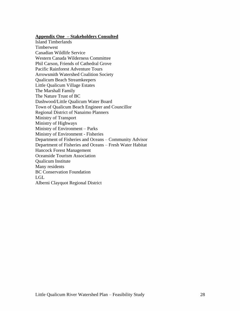
Little Qualicum River Watershed Plan – Feasibility Study 28
Appendix One – Stakeholders Consulted
Island Timberlands
Timberwest
Canadian Wildlife Service
Western Canada Wilderness Committee
Phil Carson, Friends of Cathedral Grove
Pacific Rainforest Adventure Tours
Arrowsmith Watershed Coalition Society
Qualicum Beach Streamkeepers
Little Qualicum Village Estates
The Marshall Family
The Nature Trust of BC
Dashwood/Little Qualicum Water Board
Town of Qualicum Beach Engineer and Councillor
Regional District of Nanaimo Planners
Ministry of Transport
Ministry of Highways
Ministry of Environment – Parks
Ministry of Environment - Fisheries
Department of Fisheries and Oceans – Community Advisor
Department of Fisheries and Oceans – Fresh Water Habitat
Hancock Forest Management
Oceanside Tourism Association
Qualicum Institute
Many residents
BC Conservation Foundation
LGL
Alberni Clayquot Regional District
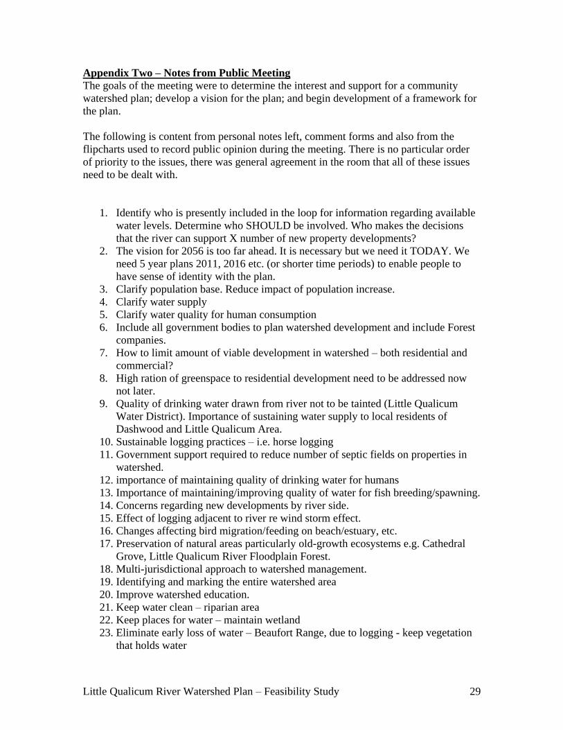
Little Qualicum River Watershed Plan – Feasibility Study 29
Appendix Two – Notes from Public Meeting
The goals of the meeting were to determine the interest and support for a community
watershed plan; develop a vision for the plan; and begin development of a framework for
the plan.
The following is content from personal notes left, comment forms and also from the
flipcharts used to record public opinion during the meeting. There is no particular order
of priority to the issues, there was general agreement in the room that all of these issues
need to be dealt with.
1. Identify who is presently included in the loop for information regarding available
water levels. Determine who SHOULD be involved. Who makes the decisions
that the river can support X number of new property developments?
2. The vision for 2056 is too far ahead. It is necessary but we need it TODAY. We
need 5 year plans 2011, 2016 etc. (or shorter time periods) to enable people to
have sense of identity with the plan.
3. Clarify population base. Reduce impact of population increase.
4. Clarify water supply
5. Clarify water quality for human consumption
6. Include all government bodies to plan watershed development and include Forest
companies.
7. How to limit amount of viable development in watershed – both residential and
commercial?
8. High ration of greenspace to residential development need to be addressed now
not later.
9. Quality of drinking water drawn from river not to be tainted (Little Qualicum
Water District). Importance of sustaining water supply to local residents of
Dashwood and Little Qualicum Area.
10. Sustainable logging practices – i.e. horse logging
11. Government support required to reduce number of septic fields on properties in
watershed.
12. importance of maintaining quality of drinking water for humans
13. Importance of maintaining/improving quality of water for fish breeding/spawning.
14. Concerns regarding new developments by river side.
15. Effect of logging adjacent to river re wind storm effect.
16. Changes affecting bird migration/feeding on beach/estuary, etc.
17. Preservation of natural areas particularly old-growth ecosystems e.g. Cathedral
Grove, Little Qualicum River Floodplain Forest.
18. Multi-jurisdictional approach to watershed management.
19. Identifying and marking the entire watershed area
20. Improve watershed education.
21. Keep water clean – riparian area
22. Keep places for water – maintain wetland
23. Eliminate early loss of water – Beaufort Range, due to logging - keep vegetation
that holds water

Little Qualicum River Watershed Plan – Feasibility Study 30
24. Keep swales and avoid rapid runoff
25. Consider two sources of water potable use and grey use
26. Avoid development close to water (as water comes up and estuaries move back,
or others any shore line)
27. Policies to deal with land loss due to rising ocean levels.
28. Types of water loss – evaporation and tree cover
29. Short term thinking concerns (not addressing rising waters)
30. Going back to olden days of cisterns not just convenience
31. Strict use of pesticides (water quality)
32. People breaking rules – Policies needed
33. Rules of respect – you are a stakeholder
34. Web of life - all connected – cooperation watershed to watershed
35. Beaufort Range = heavy logging as logging goes higher and sun’s radiation into
open areas = faster melt.
36. Cedar = may be gone in 60 years = higher evaporation
37. Collection areas – swales, wetlands, estuaries, anywhere we can collect this is
important
38. Riparian areas need to treat water
39. Use of grey water = double system; cistern off roof for some household uses –
let’s see more of this.
40. public education – need interconnection between watersheds
41. Rules of Respect – increase understanding, education
42. Need more government involvement
43. Need system for septic tank inspection, standards
44. Sewage disposal with increasing population = new technology needed?
45. Address Population Increase
46. Public education is very important – get message out to wider group
47. Identify who lives in a watershed and let them know.
48. Drinking Water
49. Educate Now – everybody above HWY – Cameron Lake, Englishman River. and
to hump to Port Alberni
50. People outside this watershed impacting this watershed – need education too.
51. Most watershed = privately owned = issue to get all landowners to buy-in
52. Trees as mineral rights – they are a resource. Get government to agree.
53. Policy changes in government to make it easier for landowners to protect land
(e.g. covenants)
54. Save the fish – please.
55. Communications loops re development approvals and water allocations.

Little Qualicum River Watershed Plan – Feasibility Study 31
Appendix Three – Media Clippings