lewisham character study | final report | september … a passage for viking raids and eventual...
TRANSCRIPT

Lew
isha
m C
hara
cter
Stu
dy |
Fin
al R
epor
t |
Sep
tem
ber
2010
26URBAN GRO
Lew
isha
m C
hara
cter
Stu
dy |
Fin
al R
epor
t |
Sep
tem
ber
2010
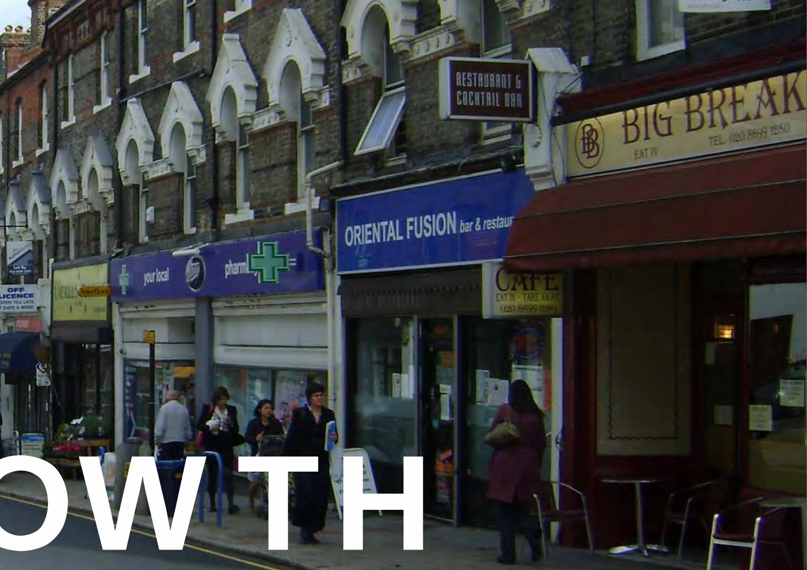
27OWTH

Lew
isha
m C
hara
cter
Stu
dy |
Fin
al R
epor
t |
Sep
tem
ber
2010
28
THE SHAPING OF A LONDON BOROUGH
Introduction
Lewisham’s history is inseparable from that of the wider metropolis. This part of the report records the most signifi cant periods of urbanisation in the Borough’s past and shows how it was shaped by the outward growth of London, stimulated by improved transport by rail and road. The profound effects of the blitz in the Second World War, followed by postwar reconstruction and the longterm decline of the industry and manufacturing in the Borough are also highlighted.
The modern borough of Lewisham was formed at the time of Greater London government reorganisation in 1965 and was an amalgamation of two earlier bodies, the Metropolitan Boroughs of Deptford and Lewisham, each of which had been formed in 1900. These in turn were created from the medieval parishes, including those of St Mary Lewisham, St Margaret Lee and St Paul Deptford.
Lewisham, like London as a whole, grew dramatically between 1800 and 1940 but the origins of human settlement in the area can be traced back much further. The Thames was a great thoroughfare for Romans and Anglo-Saxon trade, enabling the transport of materials and provisions to sustain the growing town. In the eighth and ninth centuries the river was also a passage for Viking raids and eventual settlement. Across land, ancient routes such as the old Kent highway from London Bridge to Canterbury and Dover (the Roman Watling Street) crossed the London basin.
The Domesday book of 1086 records eleven mills along the Ravensbourne river, the small tributary that runs the length of the Borough
and joins the Thames at Deptford Creek. There is is likely to have been some associated settlement. Little evidence of such activity survives today, but it is known that Blackheath’s raised position was prized for its strategic signifi cance in defending London, with long views across the Thames towards the Tower and the City itself.
Early growth
By the middle ages London, with its satellite at Southwark across the sole bridge, was unrivalled as an economic and social powerhouse. However, its physical reach was largely confi ned to the city walls. Like other outlying districts the Lewisham area was mainly farmland, well drained and fertile both arable and pasture, supporting small hamlets and farmsteads such as Lee (Belmont Hill and Lee Green) and Catford. Unlike nearby Greenwich, Lewisham did not have any longstanding royal patronage and until London’s growth accelerated in the 17th century most of the area was of little consequence to the city. Later as London grew, its outlying areas including Lewisham were used for market gardens and dairying, providing fresh produce for the population, and accommodating industry on the river banks.
The exception to this rural scene was the fi shing village of Deptford, where the width and depth of the tidal Thames made it suitable for shipbuilding, which royal associations from from the time of Henry Vlll. By the 18th century the area was established as the Royal Navy Victualling Yards, supporting the naval and munitions operations further downstream at Greenwich and Woolwich. The Yards reached
Olaudah Equiano - anti-slavery campaigner and author, arrrived on slave ship at Deptford in 1762
Ignatius Sancho - author, born on a slave ship and arrived in Blackheath in 1731
Images courtesy of Lewisham Local History and Archives Centre
their heyday by the early 1800s, providing ships and supplies for the Napoleonic wars. The dockyards declined after the defeat of Napeolon in 1815 and the Yards fi nally closed in 1869.
Deptford also was the last stopping place before London for coaches on the Dover Road. Late 17th century cottages at Tanners Hill are amongst the earliest houses in south London Two parishes of St Nicholas and St Paul, the latter fl ourishing after the riverside area fi lled up. Residential survivors from this period include the early 18th century terrace in Albury Street, Deptford and mansions at Blackheath.
In the 16th and 17th century, Deptford became an important dock for the world-wide slave trade. The Primrose ship was built in Deptford in 1551, and sailed from Deptford in 1562 on what was to become the fi rst ‘triangle’ slave trade voyage.

Lew
isha
m C
hara
cter
Stu
dy |
Fin
al R
epor
t |
Sep
tem
ber
2010
29
URBAN GROWTH
1800
1810
1820
1830
1840
1850
1860
1870
1890
1880
1900
1910
1920
1930
1940
1950
1960
1970
1980
1990
2000
2010
1790
Gre
enw
ich
and
Woo
lwic
h do
ckya
rds
prod
ucin
g sh
ips
and
supp
lies
Gre
enw
ich
and
Woo
lwic
h D
ocky
ards
clo
seREGENCY EARLY-MID VICTORIAN LATE VICTORIAN EDWARDIAN INTER-WAR POST-WAR LATE TWENTIETH CENTURY MODERN
WO
RLD
WA
R O
NE
WO
RLD
WA
R T
WO
GEORGIAN
Encl
osur
e A
ct a
llow
s de
velo
men
t of
com
mon
land
Cro
ydon
Can
al o
pene
d
Lond
on B
ridg
e to
Gre
enw
ich
rail
line
open
s as
Lo
ndon
’s fi r
st r
ailw
ay li
ne
Cry
stal
Pal
ace
dism
antle
d an
d m
oved
to
Upp
er
Nor
woo
dM
id K
ent
Rai
lway
ope
ns s
ervi
ng L
ewis
ham
and
C
atfo
rd
Lond
on B
ridg
e to
Gre
enw
ich
rail
line
open
s as
Lo
ndon
’s fi r
st r
ailw
ay li
ne
Tram
s se
rvin
g Le
wis
ham
and
Dep
tford
ele
ctri
fi ed
Belli
ngha
m E
stat
e co
mpl
eted
Dow
nham
Est
ate
com
plet
ed
Lam
mas
Gre
en c
ompl
eted
Pepy
s Es
tate
com
plet
ed

Lew
isha
m C
hara
cter
Stu
dy |
Fin
al R
epor
t |
Sep
tem
ber
2010
30
GEORGIAN AND REGENCY (1700 -1840)
As London grew, so those who could afford to moved out of the centre to escape the capital’s cramped and often dark and insanitary streets. This was continuing a trend begun in the 16th century or earlier, when merchants and the wealthier artisans migrated to country areas like Hackney, Richmond and Chelsea. South London’s suburbs came later, but Crooms Hill in Greenwich, Sydenham and Blackheath were some of the areas that provided grand houses for the gentry, including Dartmouth Hill and, on the border with Greenwich, the work of Michael Searles like the Paragon and the Circus, providing suburban retreats for the well-to-do.
The Enclosure Act of 1810 allowed development of common land and was accompanied by improvements in communications which allowed speculative buildling to take off. Foremost amongst these were Deptford New Town (1805-1840) and Lee New Town, with formal terraces of houses laid out on a uniform grid.
Forest Hill had its origins in this period. Its name was the invention of its fi rst developer, who built some fi fteen large houses on high ground on the edge of Sydenham Common.
The Croydon Canal opened in 1809 and ran from west Croydon to the Grand Surrey Canal near New Cross, passing through Forest Hill and Sydenham. It did not attract enough business to sustain it as a commercial proposition and by the 1840s it had been converted into a railway line.

Lew
isha
m C
hara
cter
Stu
dy |
Fin
al R
epor
t |
Sep
tem
ber
2010
31
Historical development c.1830(Plan by Urban Practitioners 2010)
Reproduced from the Ordnance Survey digital maps with the permission of the Controller of Her Majesty’s Stationary Offi ce © Crown Copyright. License No. LA LA075221. Published 2010.
The plan from around 1830 shows the extent of urban settlement in Lewisham. The historic centres of Deptford and Lewisham were established by this stage, with strong links to shipping and trade from the docks along the River Thames.

Lew
isha
m C
hara
cter
Stu
dy |
Fin
al R
epor
t |
Sep
tem
ber
2010
32
EARLY VICTORIAN (1840-1870)
Railway development took off early in Lewisham, with London’s fi rst railway line (and one of the fi rst in the country) opening between London Bridge and Greenwich in 1838. This had been presaged by an omnibus service ten years earlier, but trains greatly increased the capacity and speed of such facilities. Subsequent railway mania in the 1840s and 1950s saw fi erce competition from rival enterprises and many speculative ventures, not all of which succeeded.
The associated development not only provided homes for some of London’s fi rst commuters, but also to house workers in the industries spilling out of the capital such as Hatcham Iron Works at Pomeroy Street in New Cross, where London’s most important early locomotive works operated from the 1840s to the 1860s.
At the south of the Borough, Sydenham became fashionable after 1854, when the Crystal Palace was dismantled from its original location in Hyde Park where it had been the centrepiece of the Greet Exhibition. In its permanent home at Upper Norwood the enlarged and extended building became a major attraction with its own railway station. The houses that were built to the north in Sydenham were substantial villas, many of them owned by people associated with the products shown in the exhibition. Surviving properties include those on Sydenham Hill and Eliot Bank.
More villas and large terraces were built shortly afterwards at Brockley.
The railway network allowed the cheap transport of building materials and the introduction of mass-produced components. Slate from north Wales became the ubiquitous roofi ng material – lightweight, durable and

Lew
isha
m C
hara
cter
Stu
dy |
Fin
al R
epor
t |
Sep
tem
ber
2010
33
Historical development c.1880(Plan by Urban Practitioners 2010)
inexpensive, it replaced the clay tiles that had once been prevalent across Kent and the South east of England. Yellow-grey bricks – London stocks – were the most familiar material, although stucco render was still favoured for many developments, including Italianate villas off Lee High Road and in parts of Blackheath. Stylistic variations were however widespread and included examples of the English Picturesque and Gothic Revival as well as classical motifs. Builders’ pattern books gave stylistic and decorative information as well as practical directions
In 1857 the Mid Kent Railway opened, serving Lewisham and Catford. A lattice of railway lines spread across the area, refl ecting the terrain but also the commercial competitiveness of rival railway companies. The railway lines, together with the small rivers of the Ravensbourne and Quaggy, have continued to shape the form and character of the area today.
The adjacent plan illustrates the extent to which early settlements grew during the early Victorian era. The plan shows development up to 1880 and highlights the growth of Blackheath, Forest Hill and Sydenham during this period.
Reproduced from the Ordnance Survey digital maps with the permission of the Controller of Her Majesty’s Stationary Offi ce © Crown Copyright. License No. LA LA075221. Published 2010.

Lew
isha
m C
hara
cter
Stu
dy |
Fin
al R
epor
t |
Sep
tem
ber
2010
34
LATE VICTORIAN (1870-1900)
By the 1870s Lewisham and Deptford were growing apace, with extensive developments at New Cross (Hatcham and Telegraph Hill, both laid out on grids with the latter grouped around a park) as well as fi lling parcels of land at Brockley, Lee and St John’s.
From 1870 there were regular tram services connecting the south London suburbs with the City and the west end. These were horsedrawn at fi rst. Linear shopping centres at New Cross, Forest Hill and Lewisham were quickly developed. There were also places of recreation including the Hippodrome at Lewisham. Schools and hospitals, railway stations, pubs and hotels provided the social and functional facilities for the new communities.
Vicars Hill at Ladywell (1880s) and Jew’s Walk in Sydenham are notable examples from the period. This was a time of eclectic styles and considerable variety – larger houses often grand, re-introduction of red brick and architectural embellishments, sometimes exaggerated with turrets, bay windows and other lively motifs. At the same time there was housing for London’s burgeoning working class population as well as artisans and clerks commuting into the city and the west end.
In 1896 land at North Park Farm was bought up by Archibald Cameron Corbett who bought 278 acres and began building houses at Catford and Hither Green.
Often the houses were smaller than those built a few years earlier, providing houses for clerks and artisans; places like Catford well served by trams and had its own railway station serving the west end.

Lew
isha
m C
hara
cter
Stu
dy |
Fin
al R
epor
t |
Sep
tem
ber
2010
35
Historical development c.1890(Plan by Urban Practitioners 2010)
Reproduced from the Ordnance Survey digital maps with the permission of the Controller of Her Majesty’s Stationary Offi ce © Crown Copyright. License No. LA LA075221. Published 2010.
The plan from around 1890 captures the mid point of late Victorian growth in the borough. Signifi cant late Victorian growth around Lewisham is evident, as is the extension of Sydenham and Forest Hill neighbourhoods.

Lew
isha
m C
hara
cter
Stu
dy |
Fin
al R
epor
t |
Sep
tem
ber
2010
36
EDWARDIAN (1900 – 1914)
The trams serving the Lewisham and Deptford areas were electrifi ed by 1904, which with the trains continued to provide cheap and ready public transport into central London as well as Woolwich, Bromley and other destinations.
Edwardian houses in the Borough are immensely varied with numerous stylistic infl uences: Dutch renaissance, Queen Anne revival and Arts and Crafts, often with an eclectic mix of motifs. As a general rule, houses of this period are richly modelled in three dimensions, with irregular projections, bays, turrets and gables that lend a lively character to the street scene. In town centres and on main roads the corner buildings such as pubs, hotels or banks are often given particular architectural fl ourishes, with entrances on the corner. The Edwardian period is also crucial in the way that it sets the tone for much of the following development. Areas of planned street network, either on a regular or fl exible grid, were built out by a many different developers. Sometimes this was in planned groups or relatively large areas, but more typically houses have a strongly individual feel, which refl ects a fragmented pattern of development. This approach to development perpetuated past the First World War and there is a clear continuity between the Edwardian and inter-war periods.
A wide range of building materials are found – plaster, timber, lead, copper, red and yellow brick and pebbledash. Roofs are often clay tile, although in many instances they have since been replaced by machine-made ‘Rosemary’ type red tiles.
The most notable example of the period is probably the development at Sydenham Thorpe off Sydenham Lane – substantial red brick houses laid out on a grid of orderly terraces.

Lew
isha
m C
hara
cter
Stu
dy |
Fin
al R
epor
t |
Sep
tem
ber
2010
37
Historical development c.1920(Plan by Urban Practitioners 2010)
Reproduced from the Ordnance Survey digital maps with the permission of the Controller of Her Majesty’s Stationary Offi ce © Crown Copyright. License No. LA LA075221. Published 2010.
The plan from around 1920 particularly illustrates the scale of development east of Catford over the latter part of the Victorian era and the Edwardian period.

Lew
isha
m C
hara
cter
Stu
dy |
Fin
al R
epor
t |
Sep
tem
ber
2010
38
INTER-WAR (1919 -1939)
The housing shortage after the First World War prompted the building of working class housing on an unprecedented scale, both by Lewisham Council and by the London County Council, drawing on subsidies from central government and working to national standards of density and room sizes. This was later overtaken by growth in private housing
The Bellingham estate took its name from the farm on which it stood and was developed by the London County Council, partly in response to the housing shortage after the First World War. 2,700 cottage-inspired houses were laid out on a formal plan radiating from a hexagonal green with a strong garden suburb infl uence. The area was completed by 1923 and has a very green and spacious quality.
The Downham estate, also by the LCC followed in 1924-38, with some 7,000 houses laid out along sinuous roads extending into borough of Bromley. Together the two estates formed one of the largest Council estates in the country, although they were relatively poorly served by public transport, with no access to the London Underground or good proximity to surface rail.
The Grove Park estate was built by Lewisham Council 1926-29, coinciding with the electrifi cation of the railways.
Building materials at this time were diverse, including metal which was used for Crittall windows, slender sections boosted by timber shortages after the First World War. Concrete also begins to be introduced widely at this time, especially for factories and commercial buildings, and incorporating techniques of Europe and North America. Modernist philosophies as espoused by Le Corbusier and the Bauhaus are evident in some areas,
contrasting wth the Garden City model with its more rural character. Planning for the private car and certainly road traffi c is becoming signifi cant at this time.

Lew
isha
m C
hara
cter
Stu
dy |
Fin
al R
epor
t |
Sep
tem
ber
2010
39
Historical development c.1940(Plan by Urban Practitioners 2010)
Reproduced from the Ordnance Survey digital maps with the permission of the Controller of Her Majesty’s Stationary Offi ce © Crown Copyright. License No. LA LA075221. Published 2010.
The plan from around 1940 highlights the extensive suburban growth in the south of the borough between the World Wars.

Lew
isha
m C
hara
cter
Stu
dy |
Fin
al R
epor
t |
Sep
tem
ber
2010
40
POSTWAR (1945 -1960)
The borough was heavily bombed in the Second World War, especially around the docks and former naval yards on the Thames, but also Lewisham town centre.
Lewisham’s fi rst tower blocks and slabs date from this period. The Passfi elds estate at, Daneswood Avenue off Bromley Road, Catford is a notable work by the modernist architects Maxwell Fry and Jane Drew; the homes were built in 1949-50 on a site that had been acquired and cleared by the Council before the war.
Lammas Green (1955-57) is a distinctive development on the south side of Sydenham Hill designed for the City of London Corporation by Donald McMoran – terraces around a village green. Including houses and fl ats. The development represented a conscious return to the Kentish vernacular with colourwashed walls, pantile roofs and stout brick chimneys – out of step perhaps with the prevailing trends in architecture, but with an enduring and distinctive quality.
The images shown here illustrate a selection of typical examples of post-war development across the borough.

Lew
isha
m C
hara
cter
Stu
dy |
Fin
al R
epor
t |
Sep
tem
ber
2010
41
Historical development c.2010(Plan by Urban Practitioners 2010)(blue lines to be added)
Reproduced from the Ordnance Survey digital maps with the permission of the Controller of Her Majesty’s Stationary Offi ce © Crown Copyright. License No. LA LA075221. Published 2010.
The plan showing the extent of present day growth indicates that relatively little new land and neighbourhood extensions have been developed since the war. The areas outlined in blue also identifi ed those areas of land which have been redeveloped in the post-war period, refl ecting a loss of historic fabric and in some cases a loss of historic street patterns as well.

Lew
isha
m C
hara
cter
Stu
dy |
Fin
al R
epor
t |
Sep
tem
ber
2010
42
1960S AND AFTER
The latter part of the Twentieth Century has seen a continued desire to experiment with new architectural and urban forms. A period of experimentation took place with system-built tower blocks, using pre-fabricated concrete components in the modern international style taking their place alongside lower-rise developments and conventional developments. Amongst the more daring projects was the Pepys Estate at Deptford, built by the LCC 1963-66 on former Royal Navy Victualling Yard. Long blocks linked by high level walkways were a feature of the scheme.
By contrast, and partly as a reaction to the social and physical failings of some of the system-built estates, the Borough is home to Walter’s Way – self-build housing by pioneering Swiss-born architect Walter Segal. The houses are of lightweight timber framed construction, using simple, repeatable elements.
Latter development has included blocks of fl ats in Lewisham and Brockley Park housing by the Borough Architect in the 1970s. Most recently, housing associations have been to the fore, often with refurbishment or conversion projects as well as new build, some of it imaginatively planned and executed and often ingeniously inserted amongst older housing.
Most recently, there has been a gradual return to more conventional street-based schemes, mixing fl ats and housing to accommodate a raised population.
The images shown here illustrate a selection of typical examples of 1960s and more recent development across the borough.

Lew
isha
m C
hara
cter
Stu
dy |
Fin
al R
epor
t |
Sep
tem
ber
2010
43