landscape design in the clear zone: the effect of ... · rosenblatt naderi - 1 - landscape design...
TRANSCRIPT

Rosenblatt Naderi - 1 -
Landscape Design in the Clear Zone: The Effect of Landscape Variables on Pedestrian Health and Driver Safety Jody Rosenblatt Naderi, M.L.A. Assistant Professor, Department of Landscape Architecture and Urban Planning, College of Architecture, Texas A&M University 3135 TAMU College Station, Texas 77843-3135 Phone (979) 845-0133 Fax (979) 862-1759 [email protected] Submission Date: August 1, 2002 Word Count: 7488 Research Team and Advisors: Memory Grober, candidate, Master’s of Landscape Architecture; Geni Bahar, P.Eng., VP ItransConsulting, Canada; Dr. Harlow Landphair, Program Manager, Texas Transportation Institute; Dr. Ron Hughes, Highway Safety Research Center, University of North Carolina; Rabbi Sam Karff, U.T. School of Public Health, Houston; Dr. Michael Manser, Texas Transportation Institute; Dr. Vic Sierpina, Director Family Practice Unit, University of Texas Medical Branch; Dr. Byoung-suk Kweon, Texas A&M University Physiology Laboratory; Dr. Chris Ellis, Texas A&M University; Dr. Kay Sandor, Associate Professor, School of Nursing, University of Texas Medical Branch Galveston; Rui Zhang, candidate, Master’s of Landscape Architecture; and Barani Raman, candidate, Master’s of Computer Science.
Rosenblatt Naderi - 2 -
ABSTRACT
This study presents the relationship between landscape and landscape variables on safety and pedestrian activity. Sites selected for this study will be those adjacent to or within the areas often referred to as “clear zone” of the transportation corridor. Previous research in the impact of environmental mitigation on driver safety will be summarized to identify the landscape variables that appear to have a safety effect in the clear zone. Current research in the identification of variables that encourage walking is presented. Preliminary results from comparing these initial pilot studies indicate that typical landscape treatment in the clear zone appears to solicit positive behaviour response from both pedestrians and drivers in health and safety outcomes respectively. The emerging hypothesis that landscape design in the clear zone may have a positive affect on encouraging pedestrian activity with associated health benefits while improving transportation safety in the corridor. These studies were conducted in Canada and the United States. Funding for the pedestrian health and safety research portion of this study is provided in part by the Southwest University Transportation Center through Texas Transportation Institute, Texas A&M University.

Rosenblatt Naderi - 3 -
INTRODUCTION
While the transportation industry reconsiders its standards and design guidelines for greening the streets to respond to context sensitive design, the Center for Disease Control and the Surgeon General’s office are taking a close look at identifying variables which favor pedestrian and bicycle (active living) use over the automobile (passive living) for purposes of improving national health and reducing obesity and related medical care costs (1,). The growing interest in sustainable soft surface boulevard treatment and green infrastructure within transportation corridors is finding its newest proponents in the health field. This paper presents the results of research partnerships between landscape architects, safety engineers, planners and health industry researchers seeking to identify environmental variables that have a positive correlation with driver safety and encourage pedestrian activity.
The hypothesis of the first pilot study is that certain types of landscape variables introduced in mid-block clear zones in transportation corridors may provide a positive correlate with reductions in accident frequency and severity (3). In the second pilot study, we hypothesized that these same landscape treatments, by virtue of being aesthetically pleasing and safe, will concurrently affect an increase in pedestrian activity (4,5,6,7,8). Methodology and findings in the effect of greening on driver safety will be presented to establish the design treatments used in typical environmental mitigation plans associated with corridor landscaping projects. We will then present preliminary findings regarding the identification of landscape variables which have an affect on pedestrian response to the quality of walking environments. Again, methodology will be presented from an ongoing pedestrian health and safety study, which focuses on the impact of environmental variables that are preferred by people walking. The underlying assumption which supports the comparison of the data at this early stage in the investigation is that the presence of environmental features of various types in the clear zone identified by subjects as part of a “good” place for walking are the same features that were installed in the landscaping of the road corridors that resulted in reduced accident frequency and severity.
This work is the result of the collaborative efforts from practitioners, researchers and
students from various institutions across the southern United States and Canada. This paper presents transdisciplinary research on the potential role of the landscape architecture of the roadside as a pedestrian health and traffic safety strategy.
The purpose of this research paper is to present a holistic look at the effect of landscape architectural design variables on both driver safety and pedestrian activity. While these issues may seem disparate and broad at first glance, it is the area along the roadside, oftenwithin the clear zone dimensions of standard transportation policy, where both landscape enhancements and pedestrians are seeking accommodation. Clear zone dimensions are recommended in the 1988 Roadside Design Guide published by AASHTO. The clear zone is defined as an area continuously adjacent to the paved edge of the road, maintained clear of obstacles. Obstacles include bereak in slope, signs, guardrails, lamp posts, trees, planters, shrubs, architectural features, walls, etc. The width of the clear zone between the edge of the driving lane and the permissible obstacle is related to the design speed of the road, the design ADT for the road and the slope of the adjoining verge. It is not calculated based on contextual design considerations such as pedestrian activity or community adjacencies.

Rosenblatt Naderi - 4 -
As the demand for evidence-based manageable context sensitive design increases, it is important for researchers to understand the inter-relationship of a sustainable green streets program on safety and pedestrian access. Consideration of this inter-relationship is presented in this paper to contribute to integrated health and safety based standards related to landscape architecture in the road allowance.
The paper is organized as follows: 1) Study I: Environmental Variables and Safety Correlation
a) Methodology b) Findings
2) Study II: Environmental Variables and Pedestrian Correlation a) Methodology b) Findings
3) Conclusions

Rosenblatt Naderi - 5 -
1. STUDY I: ENVIRONMENTAL VARIABLES AND SAFETY CORRELATION
In this section we will present a pilot study that was developed by Bahar and Rosenblatt (3) to review and assess the impact of environmental variables on driver safety. We will present the findings from these case studies as they relate to the identification and cost of implementing environmental design treatments and landscape variables that appear to be impacting driver safety.
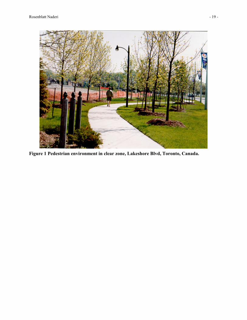
Traditionally, the concept that landscape features would be introduced into the clear zone is discouraged in transportation policy (9). Communities across the United States however put tremendous pressure on the transportation industry to provide landscape and trees within the clear zone as part of their community economic development, neighbourhood beautification or traffic calming endeavours (Figure 1). This has resulted in a serious conflict that has become part of a national research strategy and the focus of much research (10,11,12). At the same time, the Context Sensitive Design movement is beginning to provide the engineering community with skills and new standards and policies related to incorporating community preferences and needs into traditional transportation projects. Still, managing and maintaining clear zones have serious liability issues attached and many states have developed intricate policies to address the need on a broad basis (13,14,15). As a performance indicator, safety may be considered to be a major factor in contributing to a feeling of community well being. It is also well documented in safety research and community planning that a sense of safety is a significant contributor to active living. Because of the correlations between trees, environmental aesthetics, and walking, it has become important to understand the nature of the safety effect of landscaping within the right-of-way clear zone. The methodology presented below is one way to determine what kind of landscape treatment is beginning to show promise as a safety measure and how to ascertain the magnitude of the effect. 1A. Methodology The impact of implementing green streets infrastructure improvements on five arterial roads in Toronto between 1992 and 1995 indicate a possible correlation between greening and reduction in mid-block accident frequency and severity. The methodology used to investigate this relationship was conducted by a landscape architect and traffic safety engineer team. The thrust of the case study review was to conduct an analysis of pre and post construction accident statistics on five arterial corridors that had been subjected to landscape aesthetic improvements. The review and assessment also included an evaluation of the cost-benefit of the landscape improvements in terms of savings in reduced accident costs. Briefly, five sites were selected which had various environmental and aesthetic improvements installed in response to context sensitive design issues.

Rosenblatt Naderi - 6 -
Corridor Length
(km) R.O.W. width (metre)
# lanes (bw)
Sidewalk/centralmedian
Average weekday traffic volume (v/day)
Steeles Ave. 1.38 45 3+3 Yes/Yes 43,000 Markham Rd. 2.14 36+ 3+3 Yes/Yes 36,000 Ellesmere Rd. 0.83 42 2+2 Yes/Yes 30,000 Overlea Blvd. 1.80 33.6 2+2 Yes/Yes 24,000 Yonge Street 0.40 36 3+3 Yes/Yes 55.000 Table 1. Toronto case study sites for evaluation of landscape in clear zone on traffic accidents. All of the road segments make up a part of the arterial road system and are all classified as major arterials in the Metro Toronto region. Adjacent landuse includes high rise commercial and mixed use development, apartment towers, civic centers, university campuses, low rise institutional, green space and shopping malls. All roads carried mass transit as well as private vehicles. The posted speed on the road segments ranges between 50 and 70 kilometres per hour . The roads are either divided with an existing raised median or had a raised median added as part of the improvements. In all cases, green landscape elements increase on the center median as well as along the edge of the curb lane. Pedestrian facilities were either widened or buffered with landscape material. Sidewalks are present on all segments. Safety performance at these sites was not a criterion in the site selection for the landscape improvements. These case studies were selected because landscape improvements were implemented and funded as part of transportation agency’s response to community concerns attached to major road reconstruction and community development projects. Environmental variables, which increased at the back of curb and within the central median areas intensified the overall presence of landscape features in these edge areas. These included:
• Raised Concrete Planters • Shrubs • Decorative coloured paving stones, median and boulevard • Decorative lights • Decorative Noise Barriers • Flowers • Sculpture • Entry markers and bollards • Grass • Wildflowers • Trees

Rosenblatt Naderi - 7 -
We examined the accident frequency and severity before-and-after construction for each road segment. We took the total incidences of fatalities, injuries and property damage attached to all accidents for a period of three years prior to construction and three years after construction (simple comparison). The data was reviewed separating the mid-block information from the intersections. We concentrated on mid-block results because of the possibility that the accidents at the intersections may have been results of cross street behaviour and we did not have the resources to devote to differentiate the results. The ambient accident frequency and severity for the region was increasing at 12% annually during the study period. 1B. Findings The findings from this pilot study indicated that a positive correlation exists between the landscape improvements to the roadside and a reduction in mid-block accidents. While nearly all of the tree planting and landscape improvements occurred within the clear zone, mid-block accidents decreased from between 5% to 20% . This raises many questions regarding the clear zone policy that was theoretically based on increasing safety factors in the arterial road allowance. Certainly, off-road accident incidents with objects in the clear zone are a major concern. The data generated from the study of these case studies indicates that there may be a positive effect of having a well-defined edge which may result in overall decrease of off-road collisions with obstacles. A major impetus warranting further research related to clear zone conflicts stems from the desire of communities to have trees and landscaping of their pedestrian realm. By comparing the cost of these landscape elements (context sensitive design landscape features) with the savings realized in reduced accident costs, and using a “willingness to pay” formula from the Ministry of Transportation, we concluded that, for these case studies, a savings of over $1,000,000 in Canadian dollars (CAD$) was accrued within three years after the decision to pay $2,500,000 on landscape construction. There is a financial implication between the shared budgets of the safety and health industries: greening the streets may provide the basis for a cost-effective health and safety transportation policy overall. If savings from reductions in accidents are at the apparent level of significance indicated by the results of this preliminary investigation, investment in landscape is realized in calculable increased safety within reasonable budget and political cycles. This may indicate that some of the landscaping treatments used for environmental mitigation can function as a cost-effective safety measure. After the initial investment is returned, the profits year after year accrue as the accident reduction benefits continue to occur. This finding indicates a certain level of importance needs to be ascribed to developing capitalization and life-cycle management strategies for road side landscaping at a level commensurate with the management of other aspects of the transportation corridor. The question in this paper now turns to the issues related to whether the same environmental variables are determined to have similar affect on improving and encouraging pedestrian activity.
2. STUDY II: ENVIRONMENTAL VARIABLES AND PEDESTRIAN CORRELATIONS
This section presents a methodology that we have developed to assess the impact of environmental variables on encouraging pedestrian activity. Our research in this area is on-going. We readily acknowledge that an expanded data base is necessary to support any definitive
Rosenblatt Naderi - 8 -
conclusions regarding the impact of environmental variables on walking behavior. Our intention here is to determine whether the landscape improvements associated with traditional road side environmental mitigation or context sensitive design issues are potentially increasing pedestrian activity. We are also trying to identify which of the variables are more strongly associated with the decision to walk for various purposes. In the following section we will present the methodology and preliminary findings from the research to date in the context of the health industry’s interest in the issue of physical activity, walking and public health.
At the community level, researchers in public health and planning fields have been investigating whether different types of urban morphologies are having an impact on decisions related to walking or car use (16,17,18, 4,5,6,7,8). For many years, medical researchers are defining the positive benefits of physical activity on long-term quality of health (19,20). In addition, their research is indicating that the majority of adults are not engaging in physical activity. This is perceived as a health crisis and is promoting a high level of research interest at the National Institute of Health and Center for Disease Control among others, to determine what would stimulate more physical activity (1).
At the site level, specific variables related to level of service for design of pedestrian facilities has emerged out of many years of transportation research (21, 22, 23, 24, 25, 26, 27, 28). In addition, variables which were related to pedestrian activity and preferences for certain types of walking environments has been reviewed by mathematicians, urban designers and transportation researchers (29, 30, 31, 32, 33, 34). This work combined with the research coming from the medical field is yielding a body of information suggesting physical characteristics of the environment that might encourage walking, particularly walking along the streets.. We realize that the results of health and safety research attached to greening initiatives might warrant review of policy and guideline changes to landscaping in the transportation corridor’s clear zone. In this regard, it is criticalto make the link between evidence-based environmental variables at the site scale that encourage walking and the at least neutral or positive affect on traffic safety.. Of the various environments available for walking that are easily accessible, the street appears to be the preferred location. So it is the walking environment within transportation corridors that may hold the key to tremendous improvements in public health. 2A. Methodology This case study review acknowledges that pedestrian and environmental design interventions differ depending on the nature of the reason for the walk. The five sites selected include both on-road and off-road paths with an intention of assuring that the widest possible range of walking environments were included in the pilot study. The assumption is that certain site-specific variables in the environment will encourage certain types of walking behaviours. The question was one of what the effect of landscape edge treatments was on pedestrian preferences. Therefore, the initial pilot study d first questioned the motivation for the walk and then the reaction to various attributes of the environment. Three types of walking behaviours were identified: those walking for commuting purposes, those walking for health (curative and preventive) and those walking for spiritual or relaxation purposes (35). The case study methodology facilitates identification of the variables that would
Rosenblatt Naderi - 9 -
support active living, encouraging walking for pedestrian mobility as well as for health If a pedestrian identified a walk as a “good walk”, the attributes of a good walk might be consistent across a number of samples. In this pilot study we utilized attributes from literature review, previous on-site pedestrian surveys, current standards considered to be significant in the transportation and health community research. Given our position that people will respond to the environment differently depending on their purpose for walking, we considered whether the reaction to the variables could be grouped according to purpose for walking..
Starting with the environmental variables that were consistent with typical aesthetic improvement to roads, an expanded list of environmental attributes was developed as the basis for the field survey of the case study sites. Based on existing research related to the identification of environmental variables that affect decision to walk and our professional experience, field research was conducted using a pilot questionnaire. Subjects were asked to respond to the questionnaire while in the walking environment. Videos of the same environments were shown to the same subjects off-site in a laboratory setting and the same questionnaire was administered. This step in the methodology suggested further refinement, with inclusion and exclusion of variables that were identified as having an affect on pedestrian preferences.
A second questionnaire was presented asking subjects to identify the difference between the walking environments depicted in the video with the experience of the same walking environment in the field. Certain variables were identified as critical to the experience of “good” walks where subjects were walking for health or spiritual renewal. In this way, certain environmental variables, such as smell or level of maintenance, were identified as variables that were affecting some pedestrians and possibly a significant determinant in the attractiveness of a particular walk. In other words, due to their absence being noted as a negative factor in the video representation, we determined that the factor should be included as a variable in the on-site questionaire. Thesse preliminary studies helped to further develop the variable list and to refine the survey tool and was presented in part at TRB 2001 (36).
A pedestriansurvey was conducted with the revised list of variables.. 60 responses have been tabulated at this time. The locations are depicted in Figures 1 – Figures 5. . Health walkers and people walking for spiritual renewal were of particular interest to this research team, so the interviewers concentrated on reaching that group. The respondents were approached in the field during their walk and asked to volunteer to participate in the survey. The survey was then administered either in the field or was taken home by the subject to be mailed in later. The focus of the respondent was assessing whether a particular variable as experienced on site was having a positive or negative influence on their perception of the quality of the walking environment (Table 2). They also indicated an overall rating of the walking environment as “good” or “bad”.
Two of these walking environments were completely within arterial or collector road rights-of-way (Rio Grande, St. Andrews). Four of the environments adjoined or shared the rights-of-ways within the clear zone (Tanglewood, Brothers Pond, Labyrinth, Horticulture Garden) and two of the facilities functioned as pedestrian-only zones with limited service vehicle access only (West Campus, Northgate). In all cases, the eight sites above had the following common characteristics:
1. All were accommodating walking environments within or adjacent to the street 2. All were being used by people walking for curative or preventive health care
purposes

Rosenblatt Naderi - 10 -
3. All included landscape elements typical to the palette of traditional transportation landscapes used in context sensitive design
4. All sites were within the same bio-climatic region of South Texas
2B. Findings Preliminary review of the data, which will be statistically analyzed in the fall of 2002, indicates respondents own positive and negative attributes of the walking environments they were questioned about. In addition they were asked to rank or rate attributes which were defined in the survey. In this way we are able to ascertain which variables and combination of variables are specifically significant to encouraging people to choose to walk in those environments. Pedestrian learner expert software has been developed by Raman as an integral part of the research project and is pending an expanded database with additional negative target sites to complete the analysis of the variables.
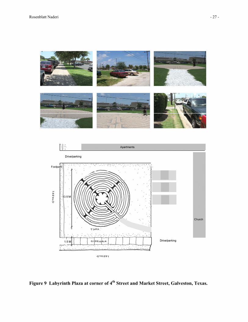
There have been some interesting patterns emerging. For instance, regarding distance of the facility from traffic noise, several respondents rated the walking site at the labyrinth in Galveston as “quiet” while others ranked the site as having loud mixed traffic sounds. The site is on an ambulance route to the nearby University of Texas Medical campus and is adjacent to a bus stop and traffic light.
Rosenblatt Naderi - 11 -
Other positive attributes identified by respondents on the labyrinth site include:
1. availability, proximity (llll) 2. tranquility, quiet (ll) 3. greenery (lll) 4. well maintained 5. outside space without rules 6. safe 7. good surface area, easy to walk on surface, liked surface (llll) 8. colourful pavers 9. grass (ll) 10. context around walking area has a nice feel 11. strong and interesting social theme
Negative attributes identified by respondents on the labyrinth site include:
1. too close to street (lll) 2. lack of seating 3. traffic noise (ll) 4. not enough landscaping, greenery (lll) 5. too narrow 6. bad colour 7. needs water 8. food smell from nearby was annoying (ll) 9. too congested
If more than one respondent stated the same attribute, an additional (l) is indicated. When
adding up simply the number of occurrences, it is clear that greenery/grass/landscape appears to be a fairly significant or noticed attribute when walking for spiritual renewal or stress relief. Personal interviews of pedestrians became the best way to solicit responses. To date, 44 surveys have been completed for the sites.
Questions on the survey include identifying both the most positive and most negative attributes of the site from the respondents point of view. Respondents were also asked to indicate whether the site was a good walking environment or a bad walking environment. An additional forty questions asked respondents to rate specific environmental attributes, such as:
• traffic impact (none, too much traffic, too close to traffic, too close to traffic sound) • quantity of trees along the walk (too many, not enough, adequate, none) • entry markers (too big, adequate, too small, none) • resiliency of path surface (too hard, just right, too flexible) • safety while crossing street (yes, no, not applicable)
3. CONCLUSION
Policymakers, planners, and designers in transportation and landscape architecture are exploring a variety of innovative solutions to traffic safety and various types of pedestrian
Rosenblatt Naderi - 12 -
mobility (Figure 10). Evidence based policies and guidelines will require rigorous research into design variables that are difficult to quantify. Through several iterations of attributes and defining variables at the site-specific scale, we now have a document that includes all the variables brought to our attention through our research, field interviews and lab work. Some of these variables may ultimately turn out to be insignificant; we hope to make that determination in the next phase of the work.
Preliminary data review of this small survey and case study samples in both studies presented above indicate issues related to noise, greenery and overall aesthetic of various roadside walking environments appear to be having an affect on both driver safety and pedestrian level of activity and warrant further study with a larger data base. We anticipate that standard landscape elements used in green infrastructure will consistently appear to have a positive impact at both the larger community scale as well as at the smaller site scale. At the moment there is not a significant enough data base in the on-going research and the resulting preliminary studies to draw definitive conclusions regarding site specific environmental design variables. Further research, with simulation and expert learners both, are being pursued by various members of the research team at this time.
The issues related to transdisciplinary research between landscape architects, transportation engineers and health practitioners hinges on developing a common language between the researchers. Developing methodology that is acceptable to all parties so that the data is relevant is an important part of ongoing dialogue, one which the Robert Wood Johnson Foundation and the ALPES program is pursuing. Landscape design guidelines and policy at both the site and community scales appear to contain variables which affect both pedestrian health and mobility as well as driver safety. Our growing body of knowledge regarding the commonality of environmental variables increases the need for landscape architects in the transportation field to collaborate with health and safety professionals in the development of evidence based landscape design solutions for neighborhood planning and roadside design. We would like to be sensitive to the impact of landscape on both paradigms as we rethink and reshape our policy and guidelines for retrofitting today’s urban street settings into healthy communities.
Rosenblatt Naderi - 13 -
REFERENCES 1. Williamson, D. F. The Prevention of Obesity. New England Journal of Medicine, Vol. 341, No. 15, Oct. 7, 1999, pp. 1140-1141 2. Satcher, D. The Virtual Office of the Surgeon General: Surgeon General Launches Effort to Develop Action Plan to Combat Overwight, Obesity. Accessed December 19, 2001. http://www.surgeongeneral.gov/todo/pressreleases/obesitypressrelease.htm. 3. Rosenblatt, J. and Bahar, G. An Integrated Approach to Environmental Impact Mitigation and Safety Mangement: Case Studies in the Municipality of Metropolitan Toronto. In Session: Roads/Transportation and the Environment, XIIIth World Meeting of the International Road Federation Toronto, Ontario, Canada, 1998. 4. Sallis, J.F., A. Bauman, and M. Pratt. Environmental and Policy Interventions to Promote Physical Activity. American Journal of Preventive Medicine, Vol. 15, No. 4, 1998, pp.379-397. 5. Ball, K., A.Bauman, E. Leslie, and N. Owen. Perceived Environmental Aesthetics and Convenience and Company are Associated with Walking for Exercise Among Australian adults. Preventative Medicine, Vol. 33, 2001, pp.434-440. 6. Giles-Corti, B., and R. J. Donovan. The Relative Influence of Individual, Social, and Physical Environment Determinants of Physical Activity. Social Science and Medicine, Vol. 54, 2002, pp. 1793-1812 7. Handy, S., M. Boarnet, R. Ewing, and R. Killingsworth., How the Built Environment Affects Physical Activity: Views from Urban Planning. American Journal of Preventative Medicine, Vol. 23 (2S), 2002, pp.64-73. 8. Pikora, T., B. Giles-Corti, et al. Developing a Framework for Assessment of the Environmental Determinants of Walking and Cycling. Social Science & Medicine, Uncorrected Proof, Article in Press, July 31, 2002. 9. Roadside Design Guide. Task Force for Roadside Safety of the Standing Committee on Highways Subcommittee on Design, American Association of State Highway and Transportation Officials, Washington, D.C. 1996. 10. Implementation of the AASHTO Strategic Highway Plan, "Initial Draft of a Compendium of Strategies. Project 17-18(3) National Cooperative Highway Research Program (NCHRP), 2000 11. Zeigler, A.J. Risk of Vehicle-Tree Accidents and Management of Roadside Trees. Transportation Research Record No. 1127, 1987, pp37-43. 12. Zeigler, A.J. Guide to Management of Roadside Trees. FHWA, U.S. Department of Transportation, 1986.

Rosenblatt Naderi - 14 -
13. Vegetation Control for Safety: A Guide for Street and Highway Maintenance Personnel. Publication No. FHWA-RD-90-003. FHWA, U.S. Department of Transportation. 14. Hunter, W., F. Council, and A. Dutt Project Selection for Roadside Hazards Elimination. University of North Carolina Highway Safety Research Center, Chapel Hill, North Carolina, 1977. 15. Turner, D.S., J. Walters, J. Hutt, and J.Patrick. Survey of State Utility Manual Clear Zone Provisions. In Transportation Research Record 1233, TRB, National Research Council, Washington, D.C., 1989, pp. 164-177 16. Cervero, R. and C. Radisch. Travel Choices in Pedestrian Versus Automobile Oriented Neighborhoods. Transport Policy, Vol. 3, No. 3, 1996, pp.127-141 17. Southworth, M. Walkable Suburbs? Journal of the American Planning Association, Vol. 63, No. 1, 1997, pp. 28-44 18. Peponis, J., C. Ross, and M. Rashid. The Structure of Urban Space, Movement and Co-presence: The Case of Atlanta, Geoforum, Vol. 28, No. 3-4, 1997, pp. 341-358. 19. A Little Walking Goes a Long Way. Harvard Heart Letter, Vol. 10, Issue 4, Dec. 1999, p. 1-4. 20. Exercise: A Good Health Prescription. Harvard Women’s Health Watch, Vol. 8, Issue 11, July 2001, pp. 6-11 21. Khisty, C.J. Evaluation of Pedestrian Facilities: Beyond the Level-of-Service Concept. In Transportation Research Record 1438, TRB, National Research Council, Washington, D.C., 1994, pp. 45-50. 22. Mori, M., and H. Tsukaguchi. A New Method for Evaluation of Level of Service in Pedestrian Facilities. Transportation Research A, Vol. 21, No. 3, 1987, pp. 223-234. 23. Sarkar, S. Determination of Service Levels for Pedestrians, with European Examples. In Transportation Research Record 1405, TRB, National Research Council, Washington, D.C., 1993, pp. 35-42. 24. Landis, B.W., V. R. Vattikuti, R.M. Ottenberg, D.S. McLeod, M. Guttenplan. Modeling the Roadside Walking Environment: A Pedestrian Level of Service. TRB Paper No. 01-0511, TRB, National Research Council, Washington, D.C., 2001. 25. Seneviratne, P.N., and J.F. Morrall. Level of Service on Pedestrian Faciliities, Transportation Quarterly, Vol.39. No. 1, 1985, pp. 109-123 26. Fruin, J.J. Pedestrian Planning and Design. Metropolitan Association of Urban Designers and Environmental Planners, Inc., 1971.
Rosenblatt Naderi - 15 -
27. Fruin, J.J. Designing for Pedestrians: A Level-of-Service Concept. HRB, Vol.308, 1971 pp. 1-15. 28. Dixon, L.B. Bicycle and Pedestrian Level-of-Service Performance Measures and Standards for Congestion Management Systems. In Transportation Research Record 1538, TRB, National Research Council, Washington, D.C., 1996, pp. 1-9. 29. Helbing, D., P. Molnar, I. Farkas, and K. Bolay. Self Organizing Pedestrian Movement. Environment and Planning B: Planning and Design, Vol. 28, 2001, pp361 – 383. 30. Isaacs, R. The Urban Picturesque: An Aesthetic Experience of Urban Pedestrian Places. Journal of Urban Design, Vol. 5, No. 2, 2000, pp. 145-181 31. Appleyard, D. Motion, Sequence and the City, in Kepes, G. (ed), The Nature and Art of Motion. George Braziller, Inc., New York, 1965. 32. Bishop, I., J. Wherrett, and D. Miller. Assessment of Path Choices on a Country Walk Using a Virtual Environment. Landscape and Urban Planning, Vol. 52, No.4, 2001, pp.225-237. 33. Jacobs, A.Great Streets. MIT Press, 1993. 34. Kaplan, R., S. Kaplan, and R. Ryan, With People in Mind, Island Press, Washington, D.C., 1998. 35. Naderi, J. R. and B. Raman. Design Considerations in Simulating Pedestrian Environments. TRB Conference, 2002.

Rosenblatt Naderi - 16 -
LIST OF TABLES Table 1 Sites Selected by Respondents as Walking Environments
Rosenblatt Naderi - 17 -
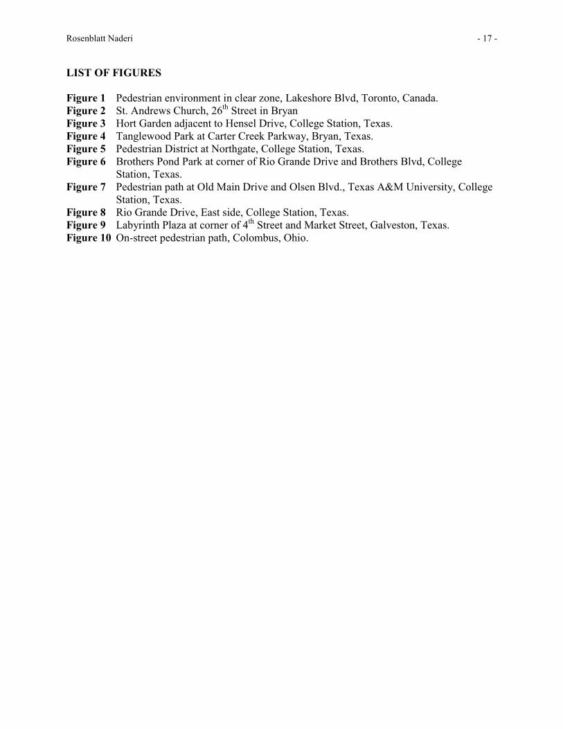
LIST OF FIGURES Figure 1 Pedestrian environment in clear zone, Lakeshore Blvd, Toronto, Canada. Figure 2 St. Andrews Church, 26th Street in Bryan Figure 3 Hort Garden adjacent to Hensel Drive, College Station, Texas. Figure 4 Tanglewood Park at Carter Creek Parkway, Bryan, Texas. Figure 5 Pedestrian District at Northgate, College Station, Texas. Figure 6 Brothers Pond Park at corner of Rio Grande Drive and Brothers Blvd, College
Station, Texas. Figure 7 Pedestrian path at Old Main Drive and Olsen Blvd., Texas A&M University, College
Station, Texas. Figure 8 Rio Grande Drive, East side, College Station, Texas. Figure 9 Labyrinth Plaza at corner of 4th Street and Market Street, Galveston, Texas. Figure 10 On-street pedestrian path, Colombus, Ohio.

Rosenblatt Naderi - 18 -
Table 1 Sites Selected by Respondents as Walking Environments
SITE LOCATION WALKING ENVIRONMENT; LEVEL OF LANDSCAPE IN CLEAR ZONE
St. Andrews Church, 26th Street, Bryan, Texas
Sidewalk in historic small town CBD along 2-lane local with curb parking both sides, urban cross section; nearly all of the walking environment was within the clear zone; utility poles and overhead wires, fire hydrants, decorative concrete, some sod and trees, decorative lighting and steps
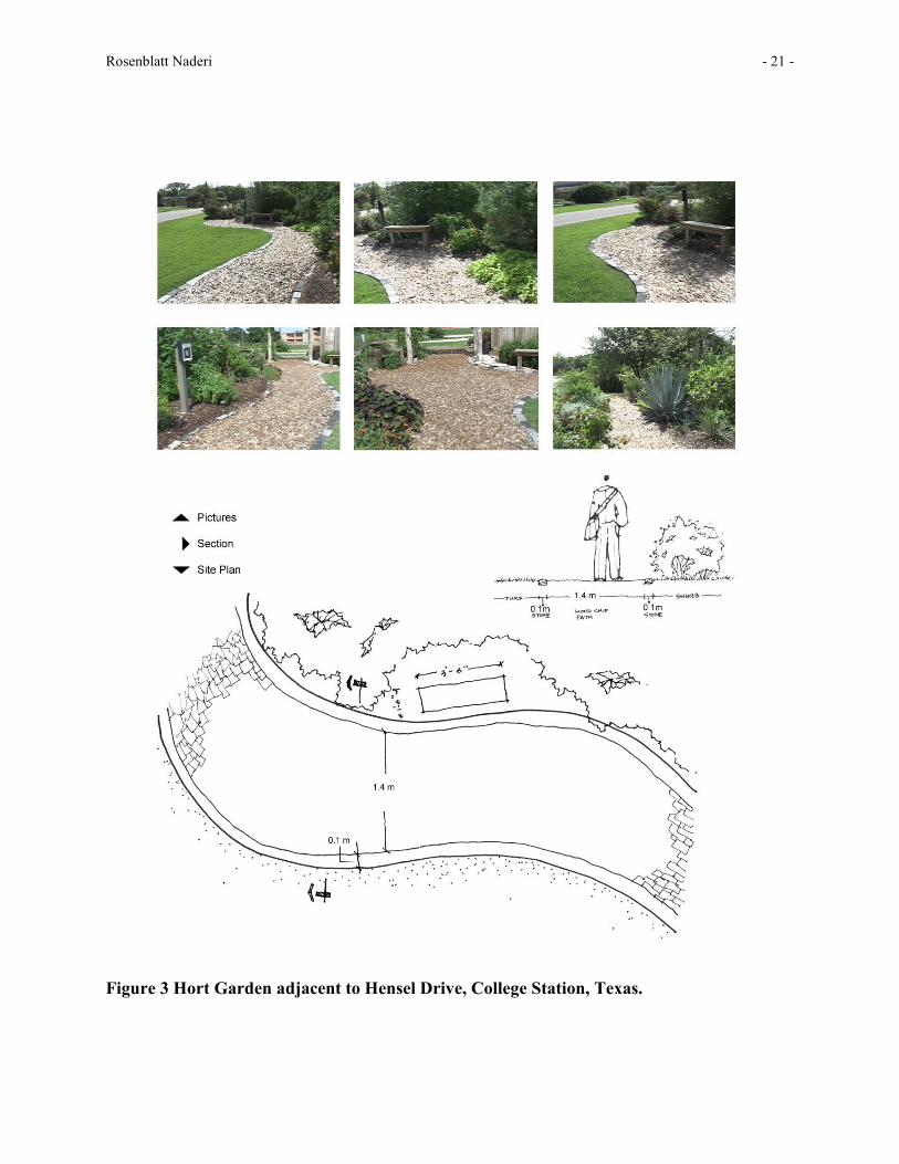
Hort Garden adjacent to Hensel Drive, College Station, Texas
Within 20 meters of and adjacent to 2-lane collector road with minimum land use development, heavily landscaped along edge and within clear zone; granular path, trees, shrubs wildflowers, benches, winding path, berms
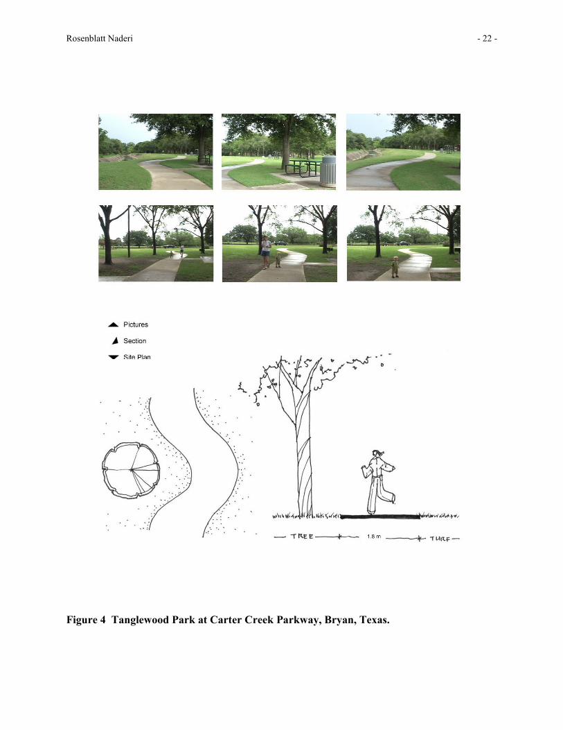
Tanglewood Park at Carter Creek Parkway, Bryan, Texas
Walking circuit facility shared within the clear zone of the adjoining right-of-way; 2-lane local road, urban section; concrete walking path on south side of park along road, mostly treed; formal sidewalk is included in circuit; lots of sodded areas
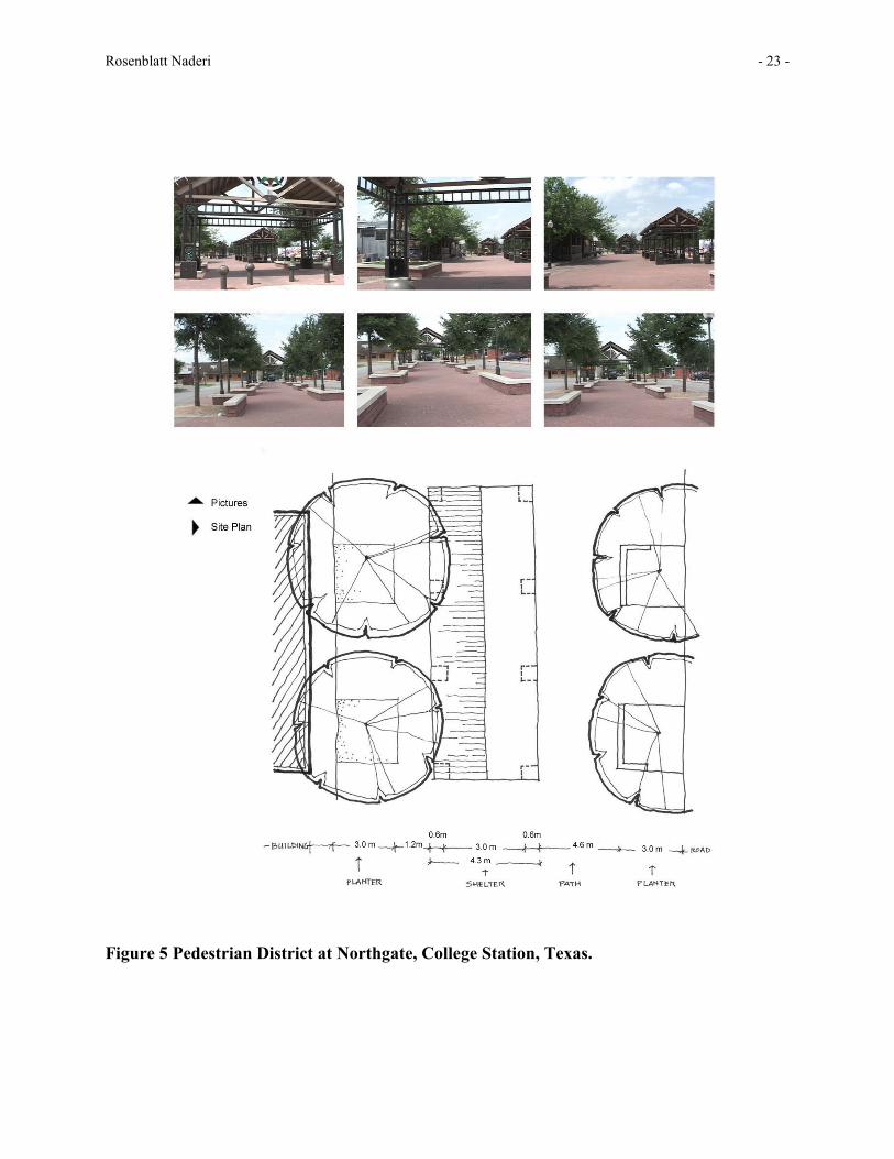
Pedestrian District at Northgate, College Station, Texas.
Urban Plaza accessible from parking lots off local road network; overhead gateways, bollards, decorative concrete, flowers, decorative lighting; no clear zone areas
Brothers Pond Park at corner of Rio Grande Drive and Brothers Blvd, College Station, Texas
Formal fitness track within community park abutting, 4-lanecollector and 2-lane local road on two sides, some wooded areas, some open on track
Pedestrian path at Old Main Drive and Olsen Blvd., Texas A&M University, College Station, Texas
Pedestrian only commuter link , leading to and from campus roadway; formalized tree planting with planters, lots of hard surface; no clear zone issues except at entrance area
Rio Grande Drive, East side, College Station, Texas.
Standard sidewalk along 4-lane arterial, urban cross section, oversized lanes, open drainage ditch between sidewalk and walled high-end residential property, shrubs, groundcovers,
Labyrinth Plaza at corner of 4th Street and Market Street, Galveston, Texas
At corner of local bus routes with Day care/community center and multi-familiy housing on two sides, parking adjacent to site; sod, decorative concrete, few trees, signage, sculptural art surface, standard city sidewalk on Market Street, dirt trail/no sidewalk along 4th Street
Rosenblatt Naderi - 19 -
Figure 1 Pedestrian environment in clear zone, Lakeshore Blvd, Toronto, Canada.

Rosenblatt Naderi - 20 -
Figure 2 St. Andrews Church, 26th Street in Bryan.
Rosenblatt Naderi - 21 -
Figure 3 Hort Garden adjacent to Hensel Drive, College Station, Texas.
Rosenblatt Naderi - 22 -
Figure 4 Tanglewood Park at Carter Creek Parkway, Bryan, Texas.
Rosenblatt Naderi - 23 -
Figure 5 Pedestrian District at Northgate, College Station, Texas.
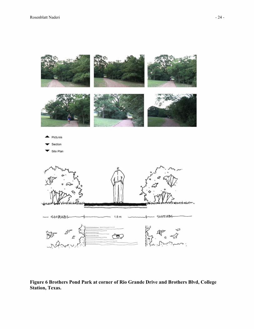
Rosenblatt Naderi - 24 -
Figure 6 Brothers Pond Park at corner of Rio Grande Drive and Brothers Blvd, College Station, Texas.
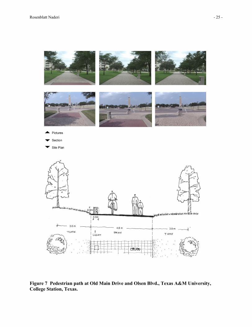
Rosenblatt Naderi - 25 -
Figure 7 Pedestrian path at Old Main Drive and Olsen Blvd., Texas A&M University, College Station, Texas.
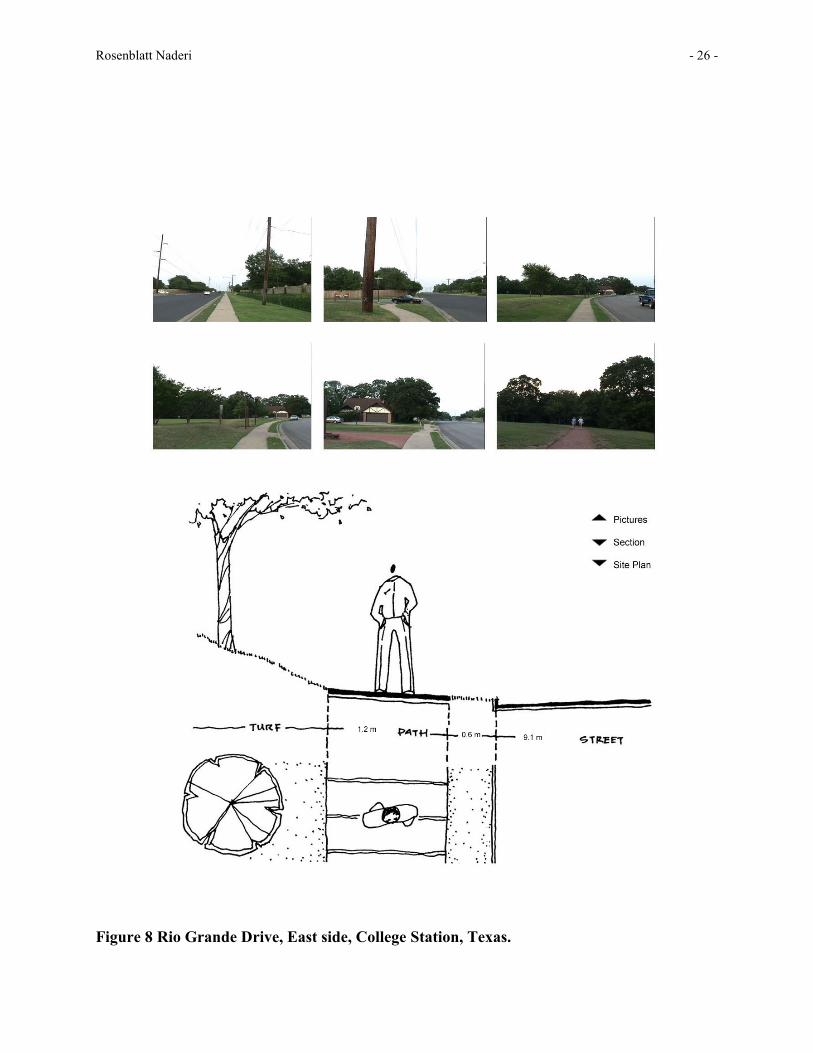
Rosenblatt Naderi - 26 -
Figure 8 Rio Grande Drive, East side, College Station, Texas.
Rosenblatt Naderi - 27 -
Figure 9 Labyrinth Plaza at corner of 4th Street and Market Street, Galveston, Texas.

Rosenblatt Naderi - 28 -
Figure 10 On-street pedestrian path, Colombus, Ohio.