landform-vegetation relationships in the northern
TRANSCRIPT
k AD-AL02 896 ARMY ENGINEER TOPOGRAPHIC LABS FORT BELVOIR VA F/B 8/6I LANDFORM-VEGETATION RELATIONSHIPS IN THE NORTHERN CHIHUAHUAN DE--ETC(U)
I MAR 81 M B SATTERWHITE, J EHLEN
U N C L SFI E D E T L -R 0 2 0N L
* EEEEEEEEE
SECURITY CLASSIFICATION OF THIS PAGE ,When Date Entered)
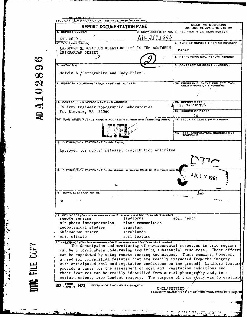
REPORT DOCUMENTATION PAGE READ INJSTRUCTIONSBEFORE COMPLETING FORM
I. REPORT NUMBER 2. GOVT ACCESSION NO. 3. RECIPIENT'S CATALOG NUMBER
ETL R020 COPETN SORC-T1TtL (and Subtitle) S. TYPE OF REPORT & PERIOD COVERED
LANDFORM-YUGETATION RELATIONSHIPS IN THE NORTHERN PaperCHIHUAHUAN DESERT S. PERFORMING ORG. REPORT NUMBER
7. AUTHOR(a) 8. CONTRACT OR GRANT NUMBER(s)
Melvin B./Satterwhite aod Judy Ehien
9. PERFORMING ORGANIZATION NAME AND ADDRESS 10. PROGRAM ELEMENT, PROJECT. TASK
AREA &WORK UNIT NUMBERS
0
It. CONTROLLING OFFICE NAME AND ADDRESS 12. REPORT DATE
US Army Engineer Topographic Laboratories i. 29 Marcr 981
Ft. Blevoir, VA 22060 13. NUMBEROF PAGES
2614. MONITORING AGENCY NAME & AODRESS(II different from Controlling Office) 15. SECURITY CLASS. (of thia report)
* .IS&. OECL ASSI FICATION/ DOWNGRADINGW ~SCHEDULE
16. DISTRIBUTION STATEMENT (of this Report)
Approved for public release; distribution unlimited
17. DISTRIBUTION STATEMENT (of the abstract entered in Block 20, It different from Ri~rt) A,8, AUQ 1 7 1981t
IS. SUPPLEMENTARY NOTES 'lli
19. KEY WORDS (Continue on reverse aide if necessary and Identify by block number)remote sensing landforms soil depthair photo interpretation plant communities
f. geobotanical studies grasslandChihuahuan Desert shrublandsarid climate soil texture
20N. kL ACT (Cbrzth ae ,,yeroe si it If wevr ad Ideottlfy by block number)
can The description and monitoring of environmental resources in arid regionscan be a formidabele undertaking requiring substantial resources. These efforti
1 can be expedited by using remote sensing techniques. There remains, however,a need for correlating features that are readily extracted fro the imagery
LLJ with anticipated soil and vegetation conditions on the ground Landform featur(.provide a basis for the assessment of soil and vegetation co ditions and
these fr-atures can be readily identified from aerial photogr hy and, to a
certain extent, from Landsat imagery. The purpose of this s udy was to evaluati
D O ... 147n EDITION OF I NOV 6S IS OBSOLETESECUNCLASSIFIED TSECURITY CLASSIFICATION OF THIS PAGE (When Data Ent*rl
A ... 1
07 FTHIS PAGE(lWha Data Entered)
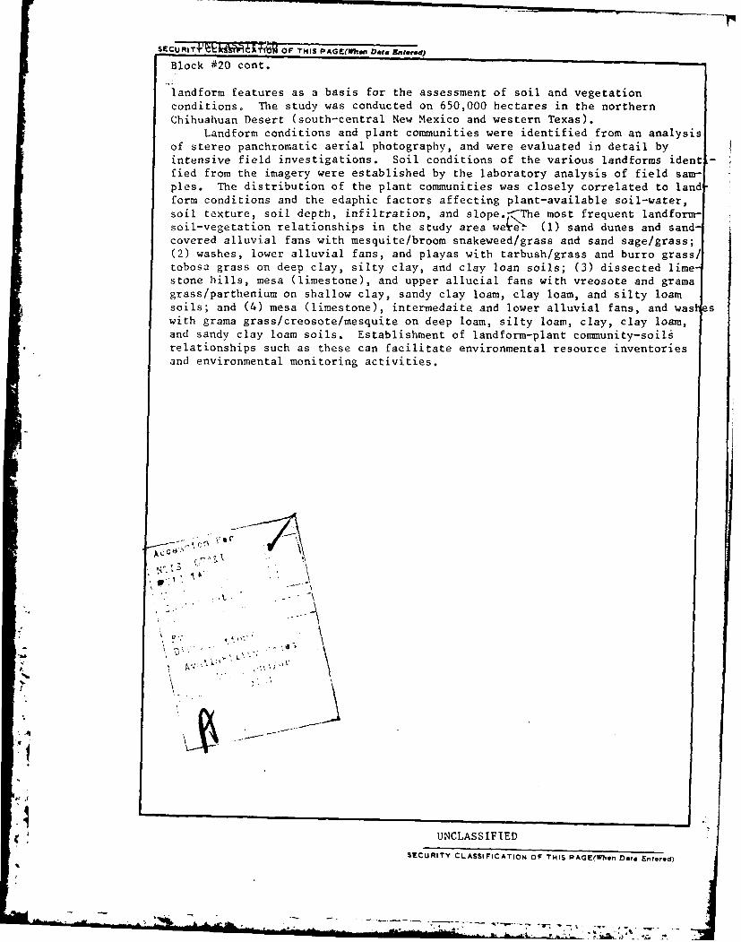
Block 020 cont.
landform features as a basis for the assessment of soil and vegetationconditions. The study was conducted on 650,000 hectares in the northernChihuahuan Desert (south-central New Mexico and western Texas).
Landform conditions and plant communities were identified from an analysisof stereo panchromatic aerial photography, and were evaluated in detail byintensive field investigations. Soil conditions of the various landforms identfied from the imagery were established by the laboratory analysis of field sam-ples. The distribution of the plant communities was closely correlated to land
form conditions and the edaphic factors affecting plant-available soil-water,soil texture, soil depth, infiltration, and slope.f-The most frequent landform-soil-vegetation relationships in the study area we4e! (1) sand dunes and sand-covered alluvial fans with mesquite/broom snakeweed/grass and sand sage/grass;(2) washes, lower alluvial fans, and playas with tarbush/grass and burro grass!tobosa grass on deep clay, silty clay, and clay loan soils; (3) dissected lime-stone hills, mesa (limestone), and upper allucial fans with vreosote and gramagrass/parthenium on shallow clay, sandy clay loam, clay loam, and silty loamsoils; and (4) mesa (limestone), intermedaite and lower alluvial fans, and washswith grama grass/creosote/mesquite on deep loam, silty loam, clay, clay loam,and sandy clay loam soils. Establishment of landform-plant community-soilsrelationships such as these can facilitate environmental resource inventoriesand environmental monitoring activities.
-- 4 ' 1
A -
UNCLASSIFTED
SECURITY CLASSIFICATION OF THIS PAGE(WPBn Daa Entered)
... . l i i l~ |+i++ + I i+ l'i k- i :I +i + .. . .+- r +:. r-->, + . .

LANDFORM-VEGETATION RELATIONSHIPSIN THE NORTHERN CHIHUAHUAN DESERT
Melvin B. Satterwhite and Judy EhlenCenter for Remote Sensing, Research InstituteU. S. Army Engineer Topographic Laboratories
Fort Belvoir, Virginia 22060
March 1981
ABSTRACT
The description and monitoring of environmental resources in arid regionscan be a formidable undertaking requiring substantial resources. These effortscan be expedited by using remote sensing techniques. There remains, however,a need for correlating features that are readily extracted from the imagerywith anticipated soil and vegetation conditions on the ground. Landform fea-tures provide a basis for the assessment of soil and vegetation conditions andthese features can be readily identified from aerial photography and, to acertain extent, from Landsat imagery. The purpose of this study was to eval-uate landform features as a basis for the assessment of soil and vegetationconditions. The study was conducted on 650,000 hectares in the northernChihuahuan Desert (south-central New Mexico and western Texas).
Landform conditions and plant communities were identified from an analysisof stereo panchromatic aerial photography, and were evaluated in detail byintensive field investigations. Soil conditions of the various landforms identi-fied from the imagery were established by the laboratory analysis of field sam-ples. The distribution of the plant communities was closely correlated to land-form conditions and the edaphic factors affecting plant-available soil water;soil texture, soil depth, infiltration, and slope. The most frequenX landform-soil-vegetation relationships in the study area were: (1) sand dunes and sand-covered alluvial fans with mesquite/broom snakeweed/grass and sand sage/grass;(2) washes, lower alluvial fans, and playas with tarbush/grass and burro grass/tobosa grass on deep clay, silty clay, and clay loam soils; (3) dissected lime-stone hills, mesa (limestone), and upper alluvial fans with creosote and gramagrass/parthenium on shallow clay, sandy clay loam, clay loam, and silty loamsoils; and (4) mesa (limestone), intermediate and lower alluvial fans, and washeswith grama grass/creosote/mesquite on deep loam, silty-loam, clay, clay loam,and sandy clay loam soils. Establishment of landform-plant community-soilsrelationships such as these can facilitate environmental resource inventories andenvironmental monitoring activities.
-4
81 8 14 094
- a~t.71 -

INTRODUCTION
Relationships between vegetation, soils, and landforms can be readilydetermined by using stereoscopic aerial photography and air photo inter-pretation techniques augmented by minimum field efforts. Although land-forms can be readily characterized on most photography, and general soilconditions can be identified by phcographic interpretation or by associationwith specific landforms, plant sr-cies often cannot be directly identifiedon aerial photography. Inferential determinations of plant communities,however, can be made on the basis of photo tone and photo texture dif-ferences. In arid lands where vegetation is closely adjusted to variousedaphic conditions (soil texture, soil depth, soil water, salinity, andgroundwater), the photo tone/photo texture relationship, used in conjunctionwith landform data, can facilitate predictions of plant community conditions.
The purpose of this study was to identify and describe the relationshipsbetween vegetation, landform, and soil conditions using manual photo analysisand interpretation techniques together with phytosociological techniques andto determine the extent to which one or more of these three factors can beused as an indicator of the other factors.
This study was conducted in south-central New Mexico and western Texaswhere the vegetation is largely dominated by shrub species (figure 1). Theseshrublands are thought to be disclimax communities that developed from thetrue climax desert grassland communities in response to man-induced chan'gesin environmental conditions. The shrub and grass species, now adjusted tothe new environmental conditions, from identifiable plant communities.
New MEXCID
MX O' Figure 1: Location of the Study Area
STUDY AI
FT GLOSS NEW
-- MEXC - - - -CIHMUANIJ4A
2

PROCEDURES
The aerial photography used was panchromatic 22.9-x 22.9-cm (9-x 9-in.)1:50,000 scale stereo aerial photography laid as three 102-x 152-cm uncon-trolled photomosaics. Landform units were identified and described from thethree-dimensional characteristics of shape, relief, slope, arrangement, andorientation; the drainage characteristics of pattern, density (spacing ofdrainageways), gulley cross sections, gulley gradient (uniformity and steep-ness), and degree of incision; and the bedrock characteristics of rock layer-ing, dip, type, and structure. Four major landform categories (mountains!hills, alluvial fans, basin areas, and washes) were divided into 14 landformunits. The percentage of the study area occupied by each landform unit wasdetermined using a grid sampling technique. Soil samples were collected atselected sites and were analyzed in the laboratory for textural and moistureconditions.
Plant communities were identified from phytosociological data collectedat 298 sites. These were representative of the plant community and associatedconditions found in the land cover mapping units. Species composition, speciespercent ground cover, and ancilliary data representative of the plant communitywere collected using a 20-x 20-m quadrant. Perennial grass species and woodyplants provided the basis for the plant community descriptions because of theirconstant presence and reoccurring nature.
The tabular comparison method was used to cluster the phytosociologicaldata and to assist in the identification of plant communities (Mueller-Domboisand Ellenberg, 19714; Kuchler, 1967). The phytosociological data were partiallyanalyzed using the automated clustering technique developed by Lieth and Moore (1971).
Three major land use categories (grassland, shrubland, and forestland) and22 land cover mapping units were identified from the phytosociological data.For each species, the ground cover class, absolute frequency, relative fre-quency, and an important coefficient [(cover x frequency)/21, were determined.The procedures followed for characterizing each community and for assigningbotanical names to the plant communities are discussed in Satterwhite and Ehlen(1980). Coefficients of similarity were calculated between all the plant commu-nities.
Probable plant communities were mapped on the aerial photography by eval-uating the photo tone and photo texture differences and plant physiognomic char-acteristics. Relationships between the plant communities and the photo mapping(land cover) units were identified by evaluating these same characteristics at
0each sample site and from numerous random observations made en route betweensample sites. Consequently, an association can be made between the plant commu-nities described from the phytosociological data and the photo patterns mapped fromthe aerial photography.
The relationships between the plant communities and specific landform unitswere determined by using The data collected in the field together with data collec-ted by simultaneous sampling of the landform and land cover maps. Data from themaps were collected at 6,033 sample points using the grid point sampling techniques.The frequency of each relationship was calculated as a percentage of the total sam-ple.
3
473

RESULTS
Landform and land cover units were mapped on three photo mosaics; forconvenience, only one photo mosaic is presented here. All three photo mosa-ics and their accompanying landform and land cover maps are reported else-where (Satterwhite and Ehlen, 1980). Geographic names are shown on figure 2.
Landforms
The relative percentages of the major landforms and their subunits with-in the study area are shown in Table I. Figure 3 illustrates the spatialdistribution of the landform subunits on one of the photo mosaics.
Table I: Landform Units and Their Percentages of the Study Area
Major Map Percentage ofLandform Unit Symbol Landform the Study Area
Mountains/hills Al Mesa 15.8A2 Highly dissected hills 16.1A3 Rugged, sharp-crested mountains 2.3
Alluvial Fans B1 Primary, high elevation fans 10.8B2 Secondary, high elevation fans 1.2B3 Mottled, intermediate elevation fans 6.8B4 Dark-toned, lowest elevation fans 3.6B5 Fans covered with aeolian sand 3.5B6 High elevation, anomolous fans 0.7
Basin Areas Cl Light-toned, speckled sand dunes 30.2C2 Dark-toned, rough-textured sand dunes 2.6C3 Low, smooth areas 2.SC4 Small, dark-toned depressions 1.5
Washes D --- 2.0
Total: 99.6
4
nih6

INI
Figue 2 Georapic amesin he SudyAre
4F
let-
* ~*--~-~-*--.A ~
Figure ~ ~ ~ ~ ~ ~ ~ : 2:GorahcNae n h tuyAe

* -c i
Figure 3, Landformf Map of
the study Area. \a~ L 4 ~ ,
Scale 1:270,000.
6' -4r
JAI !:N~-
4r4
4 ~;4
15 ..
k 16;!k
I . * * * I r e
Ad/mwax
*1 4~6
qd-e m

The mountains/hills landform comprises 34 percent of the study area and wasidentified by its three-dimensional shape in the stereo images. These areasare the highest and most rugged parts of the study area. Drainage patterns aredendritic and a high degree of structural control is often exhibited locally.The drainageways are usually incised, and density is generally high. Threesubunits were identified in this landform category: (i) large, flat-toppedmesas (Al) that are composed of gently dipping limestone with minor sandstoneand shale; (2) large, highly dissected rock masses (A2), primarily interbeddedlimestones or limestones and shales, along with many relatively small, isolatedrock bodies (inselbergs); and (3) large areas of rugged, sharp-crested mountains(A3) composed of coarse-grained, intrusive, igneous rocks, which also includesome inselbergs.
The alluvial fans comprise 27 percent of the study area. They were iden-tified by their distinctive fan shape, distributary drainage pattern, moderateslope (1 to 5 percent), and topographic position between the mountains and hillsand the low, flat basin areas. Relief and drainage characteristics on the allu-vial fans very with topographic position and the degree of fan development.Fans occur as individuals and as broad aprons (bajadas). The alluvial fans wereseparated into six discrete subunits.
Flat, with little relief, and occupying the lowest elevations, the basin
areas comprise 37 percent of the study area and are the largest landform units.Coppice sand dunes are common in this landform. Few drainageways can be seen,although some channel-like depressions were identified on the air photos. Thegentle regional slope of the basin areas is to the north in the Tularosa Basin,and to the south in the Hueco Bolson (figure 2). The boundary between thesebasins is difficult to identify on the air photos. The basin areas were dividedinto four discrete units.
The washes (the major stream channels upstream from where the drainage pat-tern becomes distributary or where the major channels enter the lowest alluvialfans) comprise 2 percent of the study area. Washes include the immediate over-flow areas associated with the channels. Distinct, steep-sided channels wereoccasionally noted on the alluvial fans. Most of the drainageways in these areas,however, lacked distinct channels and were identified by tonal pattern. Thispattern consists of very dark and very light tones caused by the contrast between
dense vegetative cover and bare soil. Washes in the mountains/hills landform have
either U-shaped or V-shaped cross sections, whereas in the alluvial fan complex,
the cross sections are box-shaped.
Soils
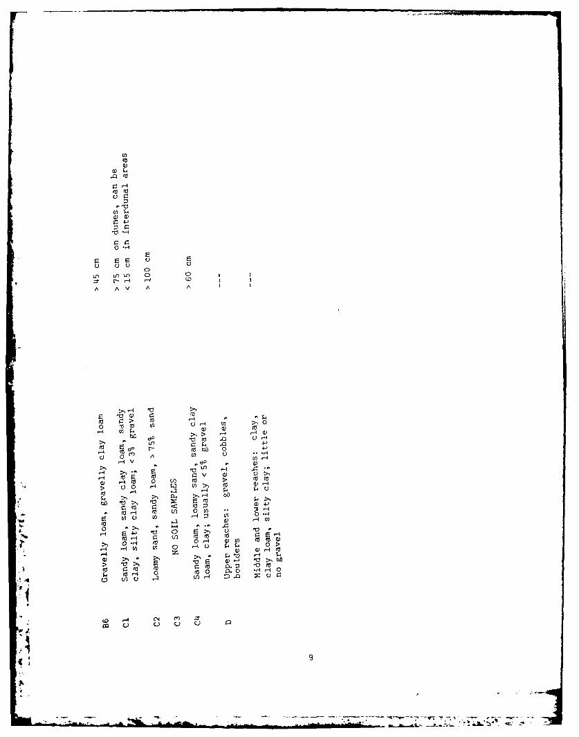
Soil texture and soil depth data, summarized in Table II, were collected in
3 the field for most of the landform subunits. The soil conditions form four groupsdefined by textural and depth differences: (1) sand, loamy sand, and sandy loamsoils more than 30 cm deep; (2) clay, clay loam, loam, gravelly loam, and grav-
elly clay loam soils less than 15 cm deep; (3) clay loam, clay, sandy clay, andsandy clay loam soil 15- to 30- cm deep; and (4) clay loam, silty clay loam,clay, and sandy clay soils more than 30 cm deep. Group 1 was associated with the
.7
I
/ a , ,° N, -:7

a). E0 0 '0 4 C')00) F=CI
0 4J' 4j 0 ~C,-1 ) Q) 4-' CL 10En C 0
r- 0 04. Ca) 00 Ci) 0 a) >1
'H4-~ 4-1 4-' A 0QE 0:I E
Ef) a) 0 IQ ) LI) LO)5L ) a) 0)
o 0L) 0 04-' 00H 94-' 0 U) E 4-'mo 4-'1 0 0O) 0)
1-4 E C rI 0a) - 0 0 4- 1H 0 I 4-'A V U- U nC) OCl I
0-. 0 ) - Q L) 1 I 0r 01 C) +- Q)E 4-'
0- -4 0 --1 ') I (v I0 cl0Lo -4 w/ m L 0 -4 U') LC) l)0C)4J0 0
-4 Lf) Z)C, v V D4-J V 14 'H4 A C'). -H C) C')
0C')
x*
CC)
-. 4 C1 'H 4 > i C. ---- a) - - a -
0' F= a) F- 'H) 4-00C r-4 C-. al H~C Va\. -A40
L" Ll)
E E 0) 00 >,~ 0 0)u rHCL M- LI) L)4- r- *r-4C bf > --
C-.-4 r- (\. 0 0 ) 1O >))r0 'C) -I>
U-, V0) E 1 4L 0 0)>9, 0 100 > )'H-- i CO >1-. F **V) 4-J1- I F H r- L) C) c
W r- m 1 uC a,) -4) a)L C: ru Am n 4 - EH. IH Q)> >) -4 -0) 0 >,0 'H>
01 -'- 0(0 -,ILn > (0 (0> )H >1' r-F= C
X).- 1 4 m 1 0 m - 4- (0 z )11) 1> 'Crj.j )I a)+-o C4 * 0M >o _q
*H,-4M V r-4>-U) 10 'H 0) > 0(0()>.1 l) CIC m-' U l 0) (1 'H 'CO E' -410 to 4V) W ) 1
0'
4I QH)f > CL) 0 ra r/)., E
0) 0 ft ) >1 C H m 0 4 0)0 mA a)U r4 (0'H (N (1) .*4- > N C C/l >-4 V) L OCO - 0-
O VI m I>, .0 '4- 0)z 0 r-i 4 V) / W >,' L4-) EH CI) 90CL 0- It E(vC E00 4J . 0M. Q). 00) mH 51 10 (0 p 4-' 0)
., _ 1 0) )10 a) wOC 0wH-L) 0 Q)
-4 CO0'C tL)C 'Ha C wH C 'H CM mH>> m rL-q m(0 C.(dm ( ' H0 14r-r -1 a)f p0H - I).0) - (0) *H 'HL)' S4 0 b O C)
H U' -4 .- 1 r 0'HxoU) I ->4 I O. 0 > H 'H' U bD' U'H c
4 '4 0N C') 'H N C') In
CO c M c
..a ok
Cl2
a)0
0 00j 0 -4 E
14 CI. 4 (1 Q
d" Oo
'a
0 r-rt Wa 0 4 0
1-4 v 0 (0bO
>1 0i At 0 1.
cc~ 0 (n 0)> a
~ 40 0o a)) -> 00 4W~ ~
(a >-4
m ( 5 d) 4-3
*a 0 W0 C) 'A
*1b W VL) ,- ~ U) 0 -4
00 0 >, 0
0 0.-1 (V 0 -4 a) U) 10m0)-4 'r~ ) 0 -40 P 0 >
En~:r (n 0 ( U D Q) -~~~ p 0 0 . .r-40
(0 0~
C) ) )
basin area landforms; group 2, with the uppermost alluvial fan unit andthe moutains/hills units; group 3, with the lower and sand-covered allu-vial fans and the washes; and group 4, with the mesa and the upper andsand-covered alluvial fan units.
Plant Communities
The spatial distribution of the land cover units on one photo mosa-ic is shown in figure 4. The statistics describing the areal extent ofeach of the 22 land cover units are presented in Table III.
Grasslands and grass-shrublands occupy 37 percent of the study area,are widely distributed, and occur on most landform units. Five discretegrassland communities were identified: (1) Bouteloua eriopoda - Boutelouacurtipendula, (2) Bouteloua curtipendula - Bouteloua uniflora, (3)Scleropogonbrevifolius - Hilaria mutica, (4) Sporobolus cryptandrus - Sporobolusflexuosus, and (5) Sporobolus giganteus. These communities were mapped asundifferentiated grassland (10) because of their small size and the dif-ficulty in differentiating them at the 1:50,000 photographic scale. Theshrub species, Acacia constricta, Artemisia filifolia, Flourensia cernua,Larrea tridentata, Parthenium incanum, or Proso is glandulosa, can occuras scattered individuals with 1 to 5 percent cover in the grassland areas.
Shrublands, the major physiognomic group, occupy 5F percent of thestudy area. The major shrub species are Acacia constricta, Artemisiafilifolia, Flourensia cernua, L. tridentata, Parthenium incanum, and Prosopis
glandulosa. Less frequent shrub species, Chilopsis chiliensis, Falliquaparadoxa, and Thelesperma longipes can form dense stands along some drain-ageways. These species were rarely observed in the upland areas. Thegrasses commonly forming the understory in these shrub communities are B.eriopoda, B. gracilis, H. mutica, Muhlenbergia spp., Sclerj-.ogon brev-ifolius, or Sporobolus flexuosus.
The distribution of forestlands is very limited. For all practicalpurposes, the forested areas of any size (more than 5 hectares) are in theSacramento and Organ Mountains in the northeastern and northwestern partsof the study area (figure 2). The major tree species, Juniperus monosperma,Pinus edulis, and Quercus undulata are limited to these areas and toisolated draws along the utero Mesa escarpment. The associated shrub speciesi the forestlands are Agave sp., Cercoparpus montanus, Chrysothamnus sp.,Nolina sp., and Xanthocephalum Sarothrae. Acacia sp., Celtis sp., Populussp., Prosopis glandulosa, Tamarix ramosissima, and Ulmus sp. are associatedwith some cattle watering tanks (ponds). Prosovis glandulosa occurs as asmall tree in these areas, but its normal stature is a short- to medium-sized shrub. Chilopsis chiliensis occasionally occurs as dense stands oftall shrubs and small trees in major drainageways.
Ir
10
*w* ' ~ - 3 -

IN-
Figure 4: Land Cover Map ofthe Study Area.scale 1:270,000.
wo.4
4,. -
p. V5, 9qtA
I7

Table III: Land Cover Mapping Units and Their Percentages of the Study Area
Physiognomic Group Percent PercentGroup of Area Land Cover Unit of Area
Grassland 37.4 Grassland (10) 21.1Grass - Larrea tridentata (11) 0.7Grass - Flourensia cernua - Larrea 1.3
tridentata (12)Grass - Acacia constricta (13) '0.1Grass - Artemisia filifolia (14) 0.7Grass - Prosopis glandulosa (15) 2.2Grass - Parthenium incanum (16) 11.3
Shrubland 58.2Larrea tridentata (20) 9.6Larrea tridentata - Grass (21) 4.6Larrea tridentata - Parthenium incanum 0.6
- Grass (22)Larrea tridentata - Prosopis glandulosa 4.1- Xanthocephalum Sarothrae (23)
Larrea tridentata - Flourensia cernua 2.4- Grass (25)
Acacia constricta - Grass (30) 1.2Acacia constricta - Larrea tridentata 0.8
- Grass (31)
Flourensia cernua - Grass (40) '0.1Flourensia cernua - Larrea tridentata 2.2
- Grass (41)Prosopis glandulosa - Xanthocephalum 27.5Sarothrae - Atriplex canescens -Grass (50)
Prosopis glandulosa - Larrea tridentata 0.9(51)
Prosopis glandulosa - Artemisia fili- 0.7folia (52)
Artemisia filifolia - Grass (60) 2.8Artemdsia filifolia - Prosopis glan- 0.7
dulosa (61)
Forestland 2.2Juniperus monosperma - Quercus 2.2
undulata (70)
Other 2.3"4
Total 100.1 100.1
I
Landform/Soils/Plant Community Relationships
The relationships between landform and land cover show that landformcan be used as an indicator of both vegetation and soil conditions. Datadescribing the associations between the plant communities and landform u-nits are summarized in Table IV. The value given at the intersection ofa row and a column is the percentage of the study area occupied by a partic-ular landform/plant community association. The Chi square test (95 percentlevel of confidence) confirmed what the frequency table shows: there is arelation between the plant communities and landform units. Figure 5 il-lustrates the association of the major and minor plant communities with alandform unit.
Mountains/Hills Plant Communities. The plant communities associatedwith the mesa landform are primarily grassland communities (10A and lOB);the Bouteloua eripoda - Bouteloua curtipendula grassland (10A) is themost common. Soils are silty clay loam, loam, and gravelly clay loam intexture and are generally more than 30 cm deep. In some swales, the soildepth is 60 cm or more to a petrocalcic horizon or bedrock. The mesasoils in some areas, however, are less than 15 cm to bedrock or a petro-calcic horizon and contain substantial amounts of gravel.
The plant community most commonly associated with the highly dissectedhills is the Grass - Parthenium incanum community (16), which occurs pri-marily on this lanform unit. Grassland communities are limited, withBouteloua curtipendula - Bouteloua uniflora (10B) the most common. Grass-Acacia constricta (13), Acacia constricta - Grass (30), and Acacia constricta-Larrea tridentata - Grass (31) communities occur alm-st exclusively onthis landform unit. The Juniperus monosperma -Quercus undulata community (70)occurs on this landform unit along the southern flanks of the SacramentoMountains. Soils are shallow (less than 15 cm) and their textures are clayand clay loam. Grass species in the Acacia constricta communities are H.mutica and Scleropogon brevifolius, which occur on clay soils 15- to 30- cmdeep.
Bouteloua curtipendula - Bouteloua uniflora (lOB) and Juniperus mono-sperma - Quercus undulata (70) communities are commonly found on the rugged,sharp-crested mountains. The latter community occurs in the Organ Mountains.Larrea tridentata - Parthenium incanum - Grass (22) is a minor associatedcommunity. Soils are shallow (less than 15 cm), and their textures are grav-elly loam and sandy.
Alluvial Fan Plant Communities. Larrea tridentata is either the dominantor the major associate species in plant communities on the alluvial fans. Themajor plant communities on the upper alluvial fans (BI and B2) are Larreatridentata (20) and Larrea tridentata - Grass (21). Soils on these fans areless than 15 cm to bedrock or a petrocalcic horizon. Soil textures are clay,clay loam, and loam. Some soils contain substantial amounts of gravel.
13

,0_- 0 0*-*0 0-:00 0 0,0 04 0 00 0
0 000 0000 0 00 0 0
A
i~~c -- - o- 0 0000-0 0 0 O -%
6 6Joo 6 6 66 6 6 6 6o6C 66 6 U
A. . 86 c if
66 6i 66 o o 6 LL. Q
6o 06 o6~ o o
'C .o. .
: ~ ~ r~ 0 u r' 0 ~~oo ~ ooo ~ ooo14

1- 4-' 1
ro IV0 0
4-)~ -4 4-'
0~ 24'a5 0Vf
.~-H N -4
H
E 0 0
0 C
00 r- 0
0-14-0
:1 9.4 '0.
~0 00
24-4 r-0 -0r(E
04 4J 4 0 C.)
LU lie r c;. 0 rMUJ N4-M
-.d c c
N o-
0 4 ) 0
o~~~~~~2 --. N'-F-~~. .z * E 2 co4- 4- 0X
N'-~C CO0~0
-H E- C) 0
E- 4-)V
N ) 4 , 41
4- *4- H
0 N ) 4O.) -4
S 7,E 4J ) V
40 N C0 0 4-J C:I~ 00
m0 (0d=Q (0 0, 0N r--.2
9 Z ,-: N. V4J Q)Wt~ t/ b-bO U (
0- 4) 4) 0
*H V V %.
Aoanoi %O+ oena) OZO
v.47

The major plant communities on the mid-elevation alluvial fans (B3) areLarrea tridentata (20) and Larrea tridentata - Prosopis glandulosa - Grass (23).The lower alluvial fans are dominated by Flourensia cernua - Larrea tridentata- Grass (41), Larrea tridentata - Flourensia cernua - Grass (25), Grass - Flour-ensia cernua - Larrea tridentata (12) and Scleropogon brevifolius - Hilaria mu-tica (1C) in addition to the two L. tridentata communities, 20 and 21. TheFlourensia cernua - Grass community (40) is found only on the lowest alluvialfan unit. This community covers large areas of these fans but its frequency islow in regard to the total study area. The grass species commonly found onthese landforms are H. mutica, M. Porteri, or Scleropogon brevifolius. Soiltextures are clay loam, silty clay loam, clay, and sandy clay; soil depth ismore than 30 cm.
The major plant communities found on the sand-covered alluvial fans (B5)are the Larrea tridentata - Prosopis glandulosa - Xanthocephalum Sarothrae (23)and the Prosopis glandulosa - Larrea tridentata (51) communities. The presenceof Prosopis glandulosa-dominated communities indicates a change in soil condi-tions compared to the other alluvial fans. Where substantial amounts of sandoccur, the L. tridentata shrubs, and other shrubs incapable of tolerating par-tial or complete burial, are eliminated and P. glandulosa is becoming estab-lished. P. glandulosa is capable of adventitious root growth and rapid estab-lishment on active fan areas. The Larrea tridentata - Prosopis glandulosa -
Xanthocephalum Sarothrae community (23) occupies sites where aeolian depositionis active, i.e., between the upper alluvial fan communities dominated by L.tridentata (20 and 21) and the P. glandulosa communities (50) of the basin areas.Soil textures on the B5 landforms are sandy clay loam and loamy sand and soildepths are 30- to 45- cm or more.
The alluvial fans on the Otero Mesa (B6) are vegetated almost exclusivelywith Bouteloua spp. grassland communities, particularly Bouteloua eriopoda-Bouteloua curtipendula (10A). Two isolated areas of ArTemisia filifolia - Grasscommunity (60) were found. Soil textures are gravelly loam and gravelly clayand soil depth is more than 45 cm.
Basin Area Plant Communities. The most prevalent plant community on thelight-toned, speckled sand dunes is the Prosopis glandulosa - XanthocephalumSarothrae - Atriplex canescens - Grass community (50). Other communitiesdominated by Prosopis glandulosa, Artemisia filifolia or the Sporobolus spp.grasses, Grass - Prosopis glandulosa (15), Grass - Artemisia filifolia (14),Prosopis glandulosa - Artemisia filifolia (52), and Artemisia filifolia -Prosopis glandulosa (61), occur on limited areas. Soils in these dune areasare sandy loams, loamy sands and sands. Soil depth is normally more than 2 m on thedunes, but is less than 30 cm in the interdunal areas.
The major plant community associated with the large, dark-toned sand dunes(C2) is the Artemisia filifolia - Grass community (60). Minor plant communitiesare the Sporobolus cryptandrus - Sporobolus flexuosus grassland (10D), Grass -Prosopis glandulosa (15), and Prosopis glandulosa - Xanthocephalum Sarothrae -Atriplex canescens - Grass (50). The sand and loamy sand soils in these areasare more than 2 m deep.
II" .. ", , .. . .
The plant communities in the low, smooth areas (C3) are mostly Sporoboluscryptandrus - Sporobolus flexuosus grassland (1OD) and the Artemisia filifolia- Grass shrubland (60). Sporobolus cryptandrus and S. flexuosus are the domi-nant grass species in both communities. Soils are similar in texture to thosein the Cl and C2 landforms, but are 1.0 meter or more in depth.
The major plant community in the small depressions (C4) is Larrea triden-tata - Flourensia cernua - Grass (25). The minor communities associated withthis landform are the Sporobolus cryptandrus - Sporobolus flexuosus grassland(10D) and the Artemisia filifolia - Grass community (60). In the almost circu-lar depressions, or playas, the grass communities are dominated by Scleropogonbrevifolius and H. mutica. The soils in the depressions contain more siltand clay than the other basin area soils and are more than 1.0 meter in depth.
Wash Plant Communities. Along the major drainageways, several plant commu-nities were encountered which had common species, but which differed in dominantspecies. The major plant community is the Scleropogon brevifolius - Hilariamutica grassland (1OD). The Sporobolus giganteus community (10E) is also pres-ent on small areas of the upper reaches. Minor plant communities are Grass -Flourensia cernua - Larrea tridentata (12), Flourensia cernua - Larrea tridentata-Grass (41), and Larrea tridentata (20). Soils are more than 30 cm deep and areclay loam, silty clay loam, clay, and sandy clay in texture.
DISCUSSION
Five major plant communities that covered 94 percent of the study area wereassociated with specific landform-soil c6nditions that in turn accounted for 80percent of the landform areas: (1) mesa with the grassland community Boutelouaeriopoda - Bouteloua curtipendula on clay loam, clay, and sandy clay soils morethan 30 cm deep; (2) the interbedded limestone and shale member of the highlydissected hills landform with the Bouteloua curtipendula - Parthenium incanumcommunity on loamy and silty loam soils less than 15 cm deep; (3) the upper andintermediate alluvial fans with the Larrea tridentata and the Larrea tridentata-Grass communities on sandy clay loam and clay loam soils more than 15 cm deep;(4) the light-toned, speckled sand dunes (coppice dunes) with the Prosopis gland-ulosa - Xanthocephalum Sarothrae - Atriplex canescens - Grass community on loamysand, sandy loam and sandy clay soils more than 30 cm deep; and (5) the dark-toned, rough-textured sand dunes with the Artemisia filifolia - Sporobolus spP.community on sandy, sandy loam, and loamy sand soils more than 65 cm deep.
The field and laboratory data show that soil depth and soil textural condi-tions vary with landform; each of the twenty-two plant communities is associatedmore frequently with one particular landform unit. The variation in these edaphicfactors determines the moisture retention characteristics of a soil (Satterwhite,1979) and the potential soil-water-holding capacity is the factor controllingplant community distribution. These relationships permit landforms to be used asan indicators of plant communities and soil conditions.
Species growing on the different soils throughout the study area tend toreflect these edaphic differences. For example, the drought-tolerant speciesoccur on the more xeric sites where soils are shallow and coarse textured. Acaciaconstricta, Fouquieria splendens, Opuntia spp., and Nolina sp. are routinely
17
k14%"~.~-

found on the dissected, interbedded limstones where soils are very shallowor non-existent. The amount of plant-available water held in these soilsis very small.
Other species exhibit similar edaphic relationships. L. tridentata,Parthenium incanum, Viguieria stenoloba, B. curtipendula, M. arenacea andSporobolus Wrightii are found on the dissected limestone hills and the upperalluvial fans where soil depth is 3- to 30-cm and soil textures are gravellyclay loam and gravelly loam. These soils are capable of holding substantialplant-available water; once the soil water is depleted, they can remaindroughty throughout the summer and fall growing season. Only the surfacedecimeter(s) may be wetted by the high-intensity, short-duration summerrains. The steep slopes of these landforms, combined with slow infiltrationand percolation rates, prevent recharge of the soil-water reservoir duringthis period. Less intense precipitation events recharge surface and sub-surface soil horizons during the late fall and winter months.
Even though the relationships between plant communities and edaphicconditions on the lower alluvial fans and washes are similar, the specieson these landforms can be less drought tolerant. The soils in these areasoften receive surface runoff from the upper slopes. The shrubs Atriplexcanescens, Flourensia cernua, Prosopis glandulosa, Rhus aromatica, andR. mycrophylla and the grasses H. mutica, M. Porteri, Scleropogon brevifol-ius, and Panicum obtuscum are most common.
For example, Prosopis glandulosa encroaches along the thread of smalldrainageways on the mid-elevation alluvial fans on the eastern slopes of theFranklin Mountains. L. tridentata, the dominant species on these alluvial fans,occurs at slightly higher elevations (less than 0.3 m) on the coarse-textured,shallow soils that form the interfluvs. These occurrences of the two specieson dissimilar microhabitats on the same landform illustrate their relativedrought tolerances and water requirements.
Prosopis glandulosa and L. tridentata also occur in limited areas of thecoppice dune region (Cl). P. glandulosa occupies the dunes where soil depth canbe 2 m or more, and L. tridentata occurs as a rare-to-infrequent species in thedunal areas where soil depth to the petrocalcic horizon is generally less than0.5 m. These two species occupy basin sites comparable to those on the mid-elevation alluvial fans. L. tridentata occupies the shallow, droughty soils andP. glandulosa occupies soils of greater depth and a potentially greater soil-water reservoir.
CONCLUSIONS
3 Aerial photography and conventional air photo interpretation techniques canprovide a successful way to obtain information about soils, landform, and vege-tation. These relationships can permit the most easily determined factor onaerial photography, soils, landforms, or vegetation, to be used as an indicatorof the other two factors. Because landforms are directly observable on stereoaerial photography, they can be used more easily than either vegetation or soilconditions as an indicator.
18

Extrapolating these relationships to other areas is a matter for continuedinvestigation. Observations made adjacent to the study area show these rela-tionships are applicable to those areas where the same species occur. Problemscan arise when extrapolating to other regions, however, because species eco-typical differentiation can change tolerance limits, and hence, landform andsoil relationships, even when comparable landform units and soil conditions areencountered.
REFERENCES CITED
Kuchler, A. W., 1967, Vegetation Mapping: New York, Ronald Press Co., 472 p.
Lieth, H., and G. W. Moore, 1971, Computerized Clustering of Species in Phyto-sociological Tables and Its Utilization for Field Work. IN Patil, G. P.,E. C. Pielou, and W. E. Waters (eds), Spatial Patterns and Statistical Dis-tributions: The Pennsylvania State University Press, University Park,Pennsylvania, p. 403-422.
Mueller-Dombois, D. and H. Ellenberg, 1974, Aims and Methods of VegetationEcology: New York, John Wiley and Sons, Inc., 547 p.
Satterwhite, Melvin B., 1979, Evaluating Soil Moisture and Textural Relation-ships Using Regression Analysis: U.S. Army Engineer Topographic Laboratories,Ft. Belvoir, Virginia, ETL-0226, 31 p.
Satterwhite, Melvin B., and Judy Ehlen, 1980, Photo Analysis of the Relation-ships Between Vegetation and Terrain Features in South-central New Mexicoand Western Texas: U.S. Army Engineer Topographic Laboratories, Ft. Belvoir,Virginia, ETL-0245, 228 p.
19