item 4 report - 14/00627/out - land north of london road
TRANSCRIPT

DEVELOPMENT COMMITTEE – 29 January 2015 Item 4
4.1
14/00627/OUT
OUTLINE PLANNING APPLICATION (WITH ALL MATTERS RESERVED APART FROM ACCESS) FOR THE ERECTION OF RESIDENTIAL DEVELOPMENT WITH ASSOCIATED OPEN SPACE, LANDSCAPING, PARKING, SERVICING, UTILITIES, FOOTPATH AND CYCLE LINKS, DRAINAGE AND INFRASTRUCTURE WORKS AND PRIMARY SCHOOL. PROVISION OF NON-RESIDENTIAL FLOOR SPACE TO PART OF SITE, USES INCLUDING ANY OF THE FOLLOWING: USE CLASS A1 (RETAIL), A3 (FOOD AND DRINK), A4 (DRINKING ESTABLISHMENTS), C2 (RESIDENTIAL INSTITUTIONS), D1A (HEALTH OR MEDICAL CENTRE) OR D1B (CRÈCHE, DAY NURSERY OR DAY CENTRE).
LAND NORTH OF LONDON ROAD AND SOUTH OF RAWRETH LANE AND WEST OF RAWRETH INDUSTRIAL ESTATE, RAWRETH LANE, RAYLEIGH.
APPLICANT: COUNTRYSIDE PROPERTIES (UK) LTD.
ZONING: SER1/METROPOLITAN GREEN BELT
PARISH: RAWRETH
WARD: DOWNHALL AND RAWRETH
1 PLANNING APPLICATION DETAILS
1.1 This application is an outline application with all matters reserved apart from access to the site off Rawreth Lane, London Road and Rawreth Lane Industrial Estate. Appearance, landscaping, layout and scale would all therefore be matters reserved for consideration in a Reserved Matters application, which would follow if outline permission were granted.
1.2 The key matters for determination at the outline stage are therefore the acceptability of the principle of residential development of the site, the quantum of residential development proposed, the principle of other proposed land uses including potential for uses falling within Use Classes A1, A3, A4, C2, D1a and/or D1b, the proposed primary school location, the proposed

DEVELOPMENT COMMITTEE – 29 January 2015 Item 4
4.2
access arrangements and other planning considerations including issues such as flood risk, drainage and ecology.
1.3 The key plan for determination at this outline stage is the Parameters Plan, which shows the areas of the site intended for residential and other uses, including areas that would form open space. If approved, this plan would form the basis for the working up of a detailed site layout at the Reserved Matters stage.
1.4 The application was accompanied by an Environmental Statement.
2 THE SITE
2.1 The application site is shown edged red on the submitted location plan and is an irregularly shaped area of some 46 hectares extending from Rawreth Lane to the north to London Road to the south. The site is located to the western edge of Rayleigh and abuts existing residential and industrial development to the eastern boundary. To the south, west and north, the site largely borders open agricultural land featuring sporadic development.
2.2 The site is currently arable farmland save for a small parcel to the north-eastern corner (0.4ha) which is separated by the road serving the nearby industrial estate; this small parcel is vacant and overgrown containing a number of trees and hedges to the boundaries. A public right of way runs alongside the eastern boundary of the parcel of land in the north-east corner of the site. The wider site is crossed by two rows of electricity pylons orientated north-south towards the western boundary and a water course traverses the site from east to west. The topography of the site varies from its highest point at some 26 metres Above Ordnance Datum (AOD) in the north-east corner to the lowest point at some 11 metres AOD towards the southern boundary.
2.3 A weather-boarded barn, which is part of a cluster of farm buildings including the farmhouse at Rawreth Hall, is a Grade II Listed Building and is located some 150 metres to the north-west of the site. The farmhouse is included on the Council’s Local List.
2.4 Following the adoption of the Allocations Plan in February 2014 the application site (save for the part due west of the easternmost overhead electricity pylon line) is allocated for residential development as part of a wider site and subject to Policy SER1. The strip of land included in the application site, which lies west of the easternmost electricity pylon, remains designated as Metropolitan Green Belt (some 9.8ha).
2.5 The whole of the SER1 site allocation is identified to provide up to 550 dwellings with associated open space. The site forms a large proportion of the SER1 allocation. Although no specific number of dwellings has been proposed in the proposal description the supporting documentation identifies
DEVELOPMENT COMMITTEE – 29 January 2015 Item 4
4.3
that a quantum of 500 dwellings is expected to be provided on the application site.
2.6 An illustrative masterplan showing all of the land within the SER1 allocation has been submitted with the application to indicate how the proposed development would relate to the parcels of land which would remain to be developed.
2.7 The submitted Parameters Plan identifies areas of the application site for each proposed use, including:-
o residential development (15.11ha)
o primary school (1.12ha)
o health provision (0.15ha)
o non-residential use (0.38ha)
o outdoor sports facilities (1.61ha)
o open space (22.38ha)
o public amenity space (0.62ha), local green space (0.15ha) and allotments (0.3ha).
3 PLANNING HISTORY
3.1 There is no planning history relating to the application site.
4 CONSULTATIONS AND REPRESENTATIONS
4.1 Rawreth Parish Council
o The Council still has very grave concerns about the effect that developing the land will have on an area that already suffers from flooding. Whilst Council notes that balancing ponds, basins and swales have been accounted for, the Parish of Rawreth is very unique in that it suffers from fluvial, tidal and surface water flooding and the Council does not feel that adequate notice has been taken of these factors and the correct information gathered and analysed. The Parish has suffered from the “one in a hundred years” event three times within eighteen months, however the advice given to the developer from the Environment Agency asks them to work on the one in a hundred years scenario only; this is proven to be ineffective, vast areas of the Parish are cut off for days when these events happen, properties flood, roads are impassable and lives are devastated through loss and fear of it happening again.

DEVELOPMENT COMMITTEE – 29 January 2015 Item 4
4.4
o The Council would like to re-emphasise that the Rawreth Brook is influenced by tidal flow and this is a major contributory factor to flooding in the Parish.
o The Council would also like to re-emphasise that in addition to water from the immediate area draining into Rawreth Brook, water from Bowers Gifford also drains into it via the Benfleet Brook, a very significant factor that has been overlooked.
o The Council is concerned that all the technical work is being done upstream of the site, but none is planned for downstream, Council believes this is because it is assumed there is no adverse effect downstream, which is totally unacceptable and incorrect.
o The Council also considers that the roads and infrastructure in the Rawreth area are completely inadequate to accommodate this proposed development as they are already full to capacity. The A127, A1245, A129 London Road, Rawreth Lane and Watery Lane just cannot take any more traffic and the proposed development will increase traffic to a completely unsustainable level. On numerous occasions this year and last year incidents within and on the outskirts of the Parish have brought traffic to a standstill for hours along London Road, Rawreth Lane, Watery Lane/Beeches Road and the Hullbridge Road. It took some residents 1 ¼ hours to proceed along Rawreth Lane and into Hullbridge – a distance of 1 ½ miles. We strongly recommend that an independent Traffic Survey and assessment should be done before any approval of this scheme. Without a long term solution to existing transport needs then this and any new developments are unsustainable.
o Council considers access to the site to be inadequate too; the access point is to and from Rawreth Lane, a road already over congested. Failure to improve the infrastructure at the access point and on surrounding roads will only add to the problems already experienced, the overall traffic flow to and from the development means congested roads will not improve and existing residents will only be inconvenienced more, which Council doesn’t consider acceptable. It is assumed by Countryside that most traffic will exit via London Road and that is where they will spend money to “improve” traffic flow; there will be very little improvement to Rawreth Lane, or the Rawreth Lane Hullbridge Road junction. There appears to be too much reliance on the Hullbridge development financing any improvement on Rawreth Lane.
o Below is a copy of a traffic survey undertaken by Rawreth Parish Council in 2010; this survey is woefully out of date as traffic has increased since it was taken, but it still gives an idea of the traffic volumes that use Rawreth Lane and Beeches Road on a daily basis.
o Rawreth Parish Council - Traffic Survey 25th March 2010.

DEVELOPMENT COMMITTEE – 29 January 2015 Item 4
4.5
Location Beeches Road, held between the hours of 7am and 7pm.
WESTBOUND EASTBOUND
7-9 AM 732 333
9-11 AM 250 322
11-12 PM 130 147
12- 1 PM 131 140
1-2 PM 128 150
2-3 PM 118 195
3-4 PM 120 247
4-5 PM 131 384
5-6 PM 171 595
6-7 PM 111 335
2022 2848
o The odd statistic from the figures show eastbound traffic is running at about 220 vehicles per hour whilst westbound is averaging at only about 170 vehicles per hour. This may be because the congestion on Rawreth Lane encourages more cars going east.
o There were considerable numbers of overweight vehicles, of mainly large transit type with double wheels or long wheel base.
o Rawreth Parish Council - Traffic Survey 25 March 2010.
o Location Rawreth Lane, Recreation car park, held between the hours of 7am and 7pm.
Easterly Westerly
7 - 8am - 460 7 - 8 am - 800
8 - 9 - 565 8 - 9 - 910
9 - 10 - 515 9 - 10 - 605
10 - 11 - 457 10 - 11 - 496
11 - 12 - 518 11 - 12 - 520

DEVELOPMENT COMMITTEE – 29 January 2015 Item 4
4.6
12 - 1 - 460 12 - 1 - 515
1 - 2 - 550 1 - 2 - 495
2 - 3 - 607 2 - 3 - 526
3-4 - 740 3 - 4 - 555
4- 5 - 821 4 - 5 - 594
5 - 6 - 801 5 - 6 - 665
6 - 7pm - 685 6 - 7pm - 536
Total 7179 7217
o Council also considers the provision for a primary school to be unnecessary given that the Parish School of St Nicholas could easily be extended to accommodate any future need. Council feels that the space allocated for a school would be better utilised as a doctors’ surgery as the existing surgeries in the area will not cope with a development of this size.
o The Council is extremely concerned that inadequate risk assessments and calculations have been undertaken with regard to flooding, and the effect of flooding on the Parish and surrounding area that, together with the lack of assessment with regard to increased traffic movement and flow, leaves the Council in no doubt that there will be an extreme lack of infrastructure to support this development.
4.2 Rayleigh Town Council
o After discussions Cllr E Dray proposed and Cllr J Burton seconded that the Town Council objects to this application. All Members agreed.
o Based on the information provided to this Planning Committee the Town Council objects to this outline application due to over-development of the site and inadequate road access. Improvements should be made before construction takes place to the junctions of Hambro Hill, Rawreth Lane and Hullbridge Road and London Road and Downhall Road. The Town Council recommends that a traffic management survey is carried out between Essex County Council Highways and Rochford District Council to include the suggested bus route and the implementation of mini roundabouts at junctions.
4.3 Mark Francois MP
o As the local Member of Parliament I formally lodge my objection. In the interests of transparency I also declare an interest as a local resident living in the Rawreth Lane area.

DEVELOPMENT COMMITTEE – 29 January 2015 Item 4
4.7
o I believe the developers have not assured adequate infrastructure provision, particularly with regard to highways and flooding and drainage issues.
o Rawreth Lane can become an extremely busy road during peak periods, when it is not unknown for traffic to stretch virtually with Hullbridge Road and Hambro Hill (eastern end). This problem is particularly exacerbated by the mini roundabout at the latter junction, which can be approached from three directions and at which right of way is not always obvious, particularly for drivers who are unfamiliar with the local area.
o In practical terms, this means that navigating the mini roundabout usually takes longer than for similar junctions, as drivers often effectively seek eye contact with others arriving at the junction around the same time, in order to try and ‘decide’ who is next to cross. Further house building at the proposed site would only exacerbate this problem by adding pressure on this already very busy junction.
o If there is to be further major house building along Rawreth Lane then this junction must be markedly improved, ideally by being completely re-designed as a larger, more traditional roundabout, in order to allow traffic to flow more freely and ease congestion. It would be important to make sure that this work is undertaken so that the junction can be improved before any new houses are constructed, in either Rayleigh or Hullbridge (where further house building is also proposed and the traffic from which will also be likely to use this junction, particularly at peak times).
o Traffic which crosses this junction and continues down towards Rayleigh Station or Sweyne Park School would normally turn right again down Downhall Road in order to proceed. This bottom end of Downhall Road is a junction with London Road, which might also need to be widened if the junction has to take additional traffic from new properties in Hullbridge and Rayleigh. Moreover, the proposed development is also likely to lead to more traffic directly along London Road itself as it feeds in towards Rayleigh town centre.
o The developer proposes a number of mitigation measures, including attempting to promote sustainable transport via a bus, cycling etc. While these might mitigate car use slightly on one level, the reality is that many of these properties will have 2 or 3 vehicles based there and this is bound to increase pressure on the local road network. The applicant has stated that a range of mitigation measures have been proposed, but the developer has failed to provide further details and no binding guarantees regarding how works will be financed. Given this lack of communication by the developer I do not believe this application should be approved.
o Much of South East Essex suffered flash flooding on Saturday 24 August 2013. Rainfall was exceptionally heavy and unfortunately a number of my constituents were flooded as a result. In addition, Rayleigh also suffered

DEVELOPMENT COMMITTEE – 29 January 2015 Item 4
4.8
further very heavy rainfall in July 2014. Understandably, there is therefore considerable local concern over the effects of potential new building on local drainage systems.
o Much of the land in West Rayleigh was originally farmland and many of the fields only benefitted from agricultural drainage ditches, which were not designed to cope with the kind of ‘run-off’ generated by modern housing developments and indeed the ASDA supermarket and associated large car park, which now front onto Rawreth Lane. At the time of the ASDA development several years ago I raised concerns about the ability of the local drainage system to cope with the additional run-off it would create.
o Both in August of last year and in July 2014 some properties along Rawreth Lane were unfortunately flooded, so there is already an issue regarding the ability of the local drainage system to cope with periods of very heavy rainfall. While the developer’s proposal includes measures to attenuate the effect of heavy rainfall on the development itself, it is short on detail on further measures to alleviate the cumulative effect on drainage and sewerage in the Rawreth Lane/London Road area. Similarly, no binding financial commitment has been offered in this regard either.
o I believe that before the development goes ahead further work may be required on the local infrastructure in this regard (for instance, the drainage ditch which runs along the southern side of Rawreth Lane) to ensure that the additional run-off of rainwater from the development can be successfully accommodated.
o Considerable thought must be given to providing sufficient additional school places for extra children who would live in the proposed new development at primary and secondary level. Financial contributions should be sought. In fairness, the developer does acknowledge these issues in their proposals although again no specific contribution has been identified.
o Some years ago, as the local MP I was involved in working with what was then the local Primary Care Trust (PCT) to achieve a significant expansion of the Audley Mills Surgery in the centre of Rayleigh. Nevertheless, a number of GP surgeries in the constituency, including Rayleigh itself, remain under pressure and it will be important to make sure that any developer makes an appropriate contribution to expanding, if necessary, the number of GP places available to local residents. The new Castle Point and Rochford Clinical Commissioning Group (CCG) and NHS England should be consulted.
o The developer’s proposal also mentions pressure on dental places in Rayleigh and again, a suitable contribution would need to be made to help expand provision in the area.
DEVELOPMENT COMMITTEE – 29 January 2015 Item 4
4.9
4.4 Highways (ECC)
o Mayer Brown was appointed to carry out a transport assessment on behalf of Countryside Properties UK and following a scoping meeting with ECC it was agreed for robustness to test the total allocation of SER1 plus 10% (605 units). In addition a spreadsheet model was provided to develop trip assignment and understand the cumulative impact of the development. This document was independently checked by ECC. The model focused on the strategic network in the vicinity of the site, including the A129 London Road, Rawreth Lane and the A1245 Chelmsford Road. The analysis concluded that the junction operations would meet the tests set out in NPPF. The means of access to the development shall be from priority junctions with ghost right turn lanes. These access arrangements have been assessed and prove to accommodate the proposed level of right turn movements without impeding the flow of vehicles on both London Road and Rawreth Lane.
o It was agreed with the developer to identify a series of measures that could also alleviate congestion and queuing along the London Road corridor. Following further assessment including camera monitoring a package of measures were developed:-
- Introducing a two lane merge for traffic exiting the Chelmsford Road roundabout to London Road eastbound
- Amending the signalised junction at Victoria Avenue/London Road
- Introducing ghost right hand turn lanes for eastbound traffic on London Road
- Signalising the Down Hall Road/London Road junction
- Introducing box junction road markings at the London Hill/Station Hill priority junction
o It was subsequently agreed with the developer and to meet the test of reasonableness and being justified and relevant, a selection of the improvement measures would be undertaken at their expense and secured through the section 278 process. This forms part of a wider strategy of the Highway Authority that would enable any outstanding improvements to be funded and provided by alternative means, including any further development identified in the SER1 area or London Road Corridor.
o For Rawreth Lane, whilst the detailed analysis of the Rawreth Lane/Hullbridge Road junction has shown that the SER1 proposals make a limited impact in terms of existing queuing, it was agreed with the developer to make a proportional contribution towards the implementation of ECC developed proposals to mitigate the operation at this junction. This

DEVELOPMENT COMMITTEE – 29 January 2015 Item 4
4.10
would form part of a funding package that would be supplemented from alternative sources, most notably funding secured from other development areas in the Rayleigh/Hullbridge area.
o In order to reduce the number of trips made by car from the development and in line with Sustainable Transport policy an extension to an existing bus service from Rayleigh railway station to the development has been agreed and secured for 5 years offering a 30 minute frequency at peak times and 1 hourly at weekend. This service will be supported by the provision of 12 month season tickets for bus travel to all eligible occupiers of the development. In addition the site will be supported by a travel plan and ‘Smarter Choices Campaign’.
o From a highway and transportation perspective the impact of the proposal is acceptable to the Highway Authority, subject to the following mitigation and conditions:-
o All housing developments in Essex, which would result in the creation of a new street (more than five dwelling units communally served by a single all-purpose access) will be subject to The Advance Payments Code, Highways Act, 1980. The developer will be served with an appropriate Notice within 6 weeks of building regulations approval being granted and prior to the commencement of any development must provide guaranteed deposits which will ensure that the new street is constructed in accordance with acceptable specification sufficient to ensure future maintenance as a public highway.
1. Prior to commencement of the development, the priority junction with ghost right turn lane Rawreth Lane shall be provided with a clear to ground visibility splay with dimensions of 4.5 metres by 180 metres to the east and west, as measured from and along the nearside edge of the carriageway. Such vehicular visibility splays shall be provided before the road junction is first used by vehicular traffic and retained free of any obstruction at all times. As shown in principle on Mayer Brown drawing No. CP.Rayleigh-junction 2.1.
2. Prior to occupation of the 150 dwelling or 5 years from the commencement of development, the priority junction with ghost right turn lane on London Road shall be provided with a clear to ground visibility splay with dimensions of 4.5 metres by 120 metres to the east and west, as measured from and along the nearside edge of the carriageway. Such vehicular visibility splays shall be provided before the road junction is first used by vehicular traffic and retained free of any obstruction at all times. As shown in principle on Mayer Brown drawing No. CP.Rayleigh-junction 2.1. The link road through the development shall be a minimum of 6.75m wide with associated footway/cycleway provision.
DEVELOPMENT COMMITTEE – 29 January 2015 Item 4
4.11
3. Prior to commencement of the development, the areas within the curtilage of the site for the purpose of loading/unloading/reception and storage of building materials and manoeuvring of all vehicles, including construction traffic, shall be provided clear of the highway.
The gradient of any proposed vehicular access/garage drive/hard standing shall be not steeper than 4% (1in 25) for the first 6 metres from the highway boundary and not steeper than 8% (1in 12.5) thereafter.
4. There shall be no discharge of surface water onto the Highway.
5. No development shall take place, including any ground works or demolition, until a Construction Method Statement has been submitted to, and approved in writing by, the Local Planning Authority. The approved Statement shall be adhered to throughout the construction period. The Statement shall provide for:-
the parking of vehicles of site operatives and visitors
loading and unloading of plant and materials
storage of plant and materials used in constructing the development
wheel and underbody washing facilities
6. The any new boundary planting shall be planted a minimum of 1 metre back from the highway boundary and any visibility splay.
7. Prior to occupation of the proposed residential development, the developer shall provide and implement a residential Travel Plan including payment of a £3000 Travel Plan monitoring fee to ECC. The plan is to be monitored annually, with all measures reviewed to ensure targets are met. The developer shall be responsible for the provision and implementation of a Residential Travel Information Pack for every household for sustainable transport, to include season tickets for bus travel approved by Essex County Council.
8. Prior to the occupation of the 150 dwellings a bus service linking the development with Rayleigh Railway Station along link road shall be provided to ensure the sustainability of the development. The service will operate between 0700 and 2100 hours Monday to Friday with a minimum frequency of every 30 minutes and hourly on a Saturday and Sunday between 0900 and 1800 hours for a period of 5 years.
9. Prior to first occupation, highway works along the London Road corridor have been provided entirely at the developer’s expense. This includes the:-

DEVELOPMENT COMMITTEE – 29 January 2015 Item 4
4.12
a. Signalising and associated works of Down Hall Road/London Road junction,
b. Improved road markings and associated works at the London Hill/ Station Hill priority junction,
c. Signal upgrade at Victoria Avenue/London Road junction to include, but not limited to, the provision of MOVA, associated enabling works and signal head upgrade.
d. Improvement of the existing public footpath number 23 up to its boundary with the St Nicholas Primary School and the creation of a new extension to this existing footpath into the site.
10. Prior to 50th occupation, a contribution of £250,000 (two hundred and fifty thousand pounds) to be provided entirely at the developer’s expense for highway infrastructure improvement at the Rawreth Lane/Hullbridge Road/Hambro Hill junction.
The requirements above should be imposed by way of negative planning condition or planning obligation as appropriate.
Prior to any works taking place in the public highway the developer shall enter into the appropriate legal agreement with the Highway Authority under the Highways Act 1980 to regulate the construction of the highway works.
Prior to occupation, the development shall be served by a system of operational street lighting, which shall thereafter be maintained in good repair.
In all cases where spoil is unavoidably brought out onto the highway, the applicant/developer must be reminded of their responsibility to promptly remove such spoil at their own expense and to the satisfaction of the Highway Authority.
Further Consultation
In relation to conditions 1 and 9 ECC has confirmed they accept these as prior to 50th occupation.
4.5 Highways Agency – No objection.
4.6 Minerals and Waste Planning Authority
o The application 14/00627/OUT does not lie within a Minerals Safeguarding or Minerals Consultation Area, as defined in the Essex Minerals Local Plan 2014 and therefore the MPA has no comments to make.
4.7 Engineering (RDC)
o Public foul sewer passes through the site east to west.

DEVELOPMENT COMMITTEE – 29 January 2015 Item 4
4.13
o Classified main river ditch through the site east to west and two existing ponds on the site, together with possible feeder ditches.
4.8 Environment Agency
o No objection, provided the flood risk conditions below are appended to any planning permission granted.
o The site falls partially within Flood Zone 1, 2 and 3a, and exceeds a hectare in area. Flood Zone 2 is classed as medium probability risk land having between a 1 in 100 and 1 in 1,000 annual probability of sea flooding. Flood zone 3a is classed as high probability risk land assessed as having a 1 in 100 year or greater annual probability of flooding. This is defined in Table 1: Flood Zones of the Planning Practice Guidance. The proposed development consists of residential units, non-residential floor space, a school, and a health centre.
o The (FRA) by URS, referenced 47065807, Rev. 6, and dated September 2014, states that the land within Flood Zone 2 and 3 will be set aside for public open space and all residential development will be located entirely within Flood Zone 1. However, it should be noted that the access road and bridge will be within Flood Zone 2, although levels will be set above the 1 in 100 year event inclusive of climate change. The proposed scale of development within Flood Zone 1 may present risk of flooding on-site and/or off-site if surface water run-off is not effectively managed. Therefore an FRA has been submitted in support of this application, as required by the National Planning Policy Framework (NPPF). The Floods and Water Management Act 2010 and NPPF require developers to include sustainable drainage (SuDS), where practicable, in new developments.
o Whilst not all SuDS options will be appropriate for all development sites, a sustainable drainage approach should be possible on almost every development site. Surface water arising from a developed site should, as far as is practicable, be managed in a sustainable manner to mimic the surface water flows arising from the site prior to the proposed development in accordance with the Planning Practice Guidance, Flood Risk and Coastal Change.
o Having reviewed the FRA submitted we are satisfied that it provides sufficient detail to fully assess the flood risks arising from the proposed development. The proposed development will only meet the NPPF policy to not increase flood risk elsewhere if the following planning conditions are included. We also provide advice for further consideration in Technical Appendix 1 to this letter, which will help inform your decision on whether the development can be made sustainable.

DEVELOPMENT COMMITTEE – 29 January 2015 Item 4
4.14
Condition
Development shall not begin until a surface water drainage scheme for the site, based on sustainable drainage principles and an assessment of the hydrological and hydrogeological context of the development, has been submitted to and approved in writing by the Local Planning aAthority. The scheme shall be implemented before the development is completed in accordance with the approved details. The scheme shall:-
o Provide calculations to demonstrate that the proposed surface water management scheme has been adequately sized to accommodate the critical duration 1 in 100 year rainfall event including allowances for climate change without causing nuisance or damage. The management strategy should consider both storage and conveyance of surface water.
o Provide plans and drawings showing the locations and dimensions of all aspects of the proposed surface water management scheme. The submitted plans should demonstrate that the proposed drainage layout will perform as intended based on the topography of the site and the location of the proposed surface water management features. In addition, full design details, including cross sections of any proposed infiltration or attenuation features will be required.
o Provide sufficient information to demonstrate that people and property will be kept safe from flooding, with consideration given to overland flow routing where required.
o Fully investigate the feasibility of infiltration SuDS as a preference and provide evidence to establish if the principles of any infiltration based surface water drainage strategy are achievable on site, based on the ground conditions, such as infiltration or soakaway tests which adhere to BRE365 guidance.
o Incorporate the SUDS “Management Train” and ensure all features are designed in accordance with CIRIA (C697) The SUDS Manual so ecological, water quality and aesthetic benefits can be achieved in addition to the flood risk management benefits. In addition, the maintenance requirements for the SUDS element of the proposed surface water drainage system should be formulated as per the recommendations within the CIRIA SUDS Manual (C697).
o Ensure that any surface water discharged to the receiving ditch or main river, Rawreth Brook, shall be no greater than existing green field runoff rates for a range of equivalent return period events up to and including the 1 in 30 year rainfall event over the lifetime of the development.
o Fully investigate the impacts of tide locking on the site and model a surcharge outfall scenario.

DEVELOPMENT COMMITTEE – 29 January 2015 Item 4
4.15
o Provide attenuation storage that will cater for the 1 in 100 year critical storm plus allowance for climate change based on a six hour duration event.
o Provide calculations of the piped network performance in the 1 in 30 year or 1 in 100 year rainfall events, including climate change.
o Include permeable paving in the drainage system where infiltration allows. Modelling should be provided to demonstrate its functionality in the 1 in 100 year event inclusive of climate change.
o Provide details of the future adoption and maintenance of the proposed surface water scheme for the lifetime of the proposed development. The Local Planning Authority should be satisfied that arrangements are in place for the long term maintenance and management of the surface water management scheme.
o Confirm that the receiving water course (Rawreth Brook) is in a condition to accept and pass on the flows from the discharge proposed.
Reason: To prevent flooding by ensuring the satisfactory storage and disposal of surface water from the site for the lifetime of the development.
Condition
The development permitted by this planning permission shall be carried out in accordance with the approved Flood Risk Assessment (FRA) undertaken by URS, referenced 47065807, Rev. 6, and dated September 2014, and the following mitigation measures detailed within the FRA:-
o Finished ground floor levels of any development within a flood zone should be set no lower than 13.11 metres above Ordnance Datum (AOD); 300mm above the 1 in 100 year event inclusive of climate change.
o Confirmation of the opening up of any culverts across. The impact this will have must be fully investigated and modelled.
o A scheme for compensatory flood storage should be provided where appropriate to the final layout of the development and its access road.
o The scheme and mitigation measures shall be fully implemented prior to completion of development and subsequently maintained, in accordance with the timing/phasing arrangements embodied within the scheme or within any other period as may subsequently be agreed, in writing, by the Local Planning Authority.
Reason: To reduce the risk of flooding to the proposed development and future occupants. To reduce the risk of flooding from blockages to the existing culvert and/or their removal. To prevent flooding elsewhere by ensuring that compensatory storage of flood water is provided.

DEVELOPMENT COMMITTEE – 29 January 2015 Item 4
4.16
Flood Defence Consent
o Under the terms of the Water Resources Act 1991, and the Land Drainage and Sea Defence Byelaws for Anglian Region, our prior written consent is required for any proposed works or structures, in, under, over or within 9 metres of the top of the bank of Rawreth Brook, designated a ‘main river’. The flood defence consent will control works in, over, under or adjacent to main rivers (including any culverting). Your consent application must demonstrate that:-
o There is no increase in flood risk either upstream or downstream.
o Access to the main river network and sea/tidal defences for maintenance and improvement is not prejudiced.
o Works are carried out in such a way as to avoid unnecessary environmental damage.
o Mitigation is likely to be required to control off site flood risk. We will not be able to issue our consent until this has been demonstrated.
Foul Water Disposal
o Anglian Water Services should be consulted regarding the available capacity in the foul water infrastructure. If there is not sufficient capacity in the infrastructure then we must be consulted again with alternative methods of disposal.
Sustainability
o Climate change is one of the biggest threats to the economy, environment and society. New development should therefore be designed with a view to improving resilience and adapting to the effects of climate change, particularly with regard to already stretched environmental resources and infrastructure such as water supply and treatment, water quality and waste disposal facilities. We also need to limit the contribution of new development to climate change and minimise the consumption of natural resources.
o Opportunities should therefore be taken in the planning system, no matter the scale of the development, to contribute to tackling these problems. In particular we recommend the following issues are considered at the determination stage and incorporated into suitable planning conditions:-
o Overall sustainability: a pre-assessment under the appropriate Code/BREEAM standard should be submitted with the application. We recommend that design Stage and Post-Construction certificates (issued by the Building Research Establishment or equivalent authorising body) are sought through planning conditions.
DEVELOPMENT COMMITTEE – 29 January 2015 Item 4
4.17
o Resource efficiency: a reduction in the use of resources (including water, energy, waste and materials) should be encouraged to a level which is sustainable in the long term. As well as helping the environment, Defra has advised that making simple changes resulting in the more efficient use of resources could save UK businesses around £23bn per year.
o Net gains for nature: opportunities should be taken to ensure the development is conserving and enhancing habitats to improve the biodiversity value of the immediate and surrounding area.
o Sustainable energy use: the development should be designed to minimise energy demand and have decentralised and renewable energy technologies (as appropriate) incorporated, while ensuring that adverse impacts are satisfactorily addressed.
o These measures are in line with the objectives of the NPPF as set out in paragraphs 7 and 93-108. Reference should also be made to the Climate Change section of the draft National Planning Practice Guidance, in particular: “Why is it important for planning to consider climate change?” and “Where can I find out more about climate change mitigation and adaptation?” http://planningguidance.planningportal.gov.uk/blog/guidance/
o Additional guidance on considering climate change for this proposal is provided in an appendix at the end of this letter.
Technical Appendix 1 – Flood Risk Surface Water Drainage Scheme
o Section 5.3.4 of the FRA states that the scheme will be developed to accommodate surface water runoff for all rainfall events up to and including the 1 in 100 year design storm inclusive of climate change. The scheme proposes to drain surface water generated by the site via a surface water outfall to Rawreth Brook. Table 5-1 of the FRA outlines the estimated green field run off rate for various events. It is important to note that these figures will be refined at the detailed design stage. In order to achieve the green field run off rate, it will be necessary to attenuate surface water on site and restrict the discharge rate to Rawreth Brook. The outline drainage design drawing, referenced 47065807-DS-02, Rev P4, dated 25 February 2014, details the location of the discharge point. In this drawing, it can be seen that attenuation will be provided by two attenuation basins to the west of the site. A number of swales are also proposed to drain the road. In Appendix E, the FRA has provided some quick storage estimates using the WinDES Micro Drainage software.
Tide Locking
o We are aware that tide locking is known to occur downstream of the site at Church Road, Rawreth. A pre-application meeting was held on 8 September 2014, where this was highlighted as an issue and the FRA was amended accordingly. In Section 4.2.3. Section 5.3.9 of the FRA highlights
DEVELOPMENT COMMITTEE – 29 January 2015 Item 4
4.18
the importance of assessing the impact of tide locking upon surface water drainage, on site attenuation and off site. It is possible that the discharge from the site could be restricted by high water levels in the river. Additional capacity will therefore be required to attenuate surface water until water levels in the channel reduce and allow discharge from the site. It is essential that this is investigated fully to establish the risk posed on and off site. In order to mitigate this risk it was agreed in the meeting that it may be possible to discharge any surface water at the 1 in 30 year storm rate. This would be betterment upon the existing arrangement and allow for the impact of tide locking ensuring that flood risk is not increased elsewhere and on site.
Sustainable Drainage
o Section 5.3.12 of the FRA states that infiltration SuDS are not suitable at this site, therefore surface water can be discharged to the nearest water course. Further consideration should be given to infiltration prior to discharge to water course. The development of this site should look to incorporate and give priority to sustainable drainage systems (SuDS) to manage surface water in accordance with paragraph 103 of the National Planning Policy Framework (NPPF) and the Planning Practice Guidance, Flood Risk and Coastal Change, Reference ID: 7-051-20140306. ‘Sustainable drainage systems are designed to control surface water runoff close to where it falls and mimic natural drainage as closely as possible. Sustainable drainage systems also provide opportunities (in line with other policies in the National Planning Policy Framework) to reduce the causes and impacts of flooding.’
o Soakage/infiltration testing should be completed across the site to establish where SuDS may be incorporated into the scheme. Section 5.3.16 of the FRA suggests the use of permeable paving on roads and parking spaces. Further information should be submitted to illustrate how this will be incorporated into the drainage system, where infiltration allows. Modelling should be provided to demonstrate its functionality in the 1 in 100 year event inclusive of climate change. Road and bridge design.
o Section 4.3.10 outlines the proposed access to the site. The access road will pass through the site and across Rawreth Brook. The access route connects to existing roads to the north and south of the site ensuring there is safe access and egress should Rawreth Brook flood. The road and bridge crossing will be located within Flood Zone 2. The road will also be set 300mm above the 1 in 100 year design event inclusive of climate change.
Compensatory Storage
o Section 5.2 identifies that some of the development will displace flood plain volume. It is therefore suggested that compensatory storage is provided on a level for level volume for volume basis. Section 5.2.4 states

DEVELOPMENT COMMITTEE – 29 January 2015 Item 4
4.19
that the construction of the bridge and access road within the flood zones will need to be compensated for should land raising be required. Further information should be submitted to clarify exactly how this will be achieved.
Culvert Removal
o Section 2.1.6 identifies that a section of Rawreth Brook, 60m to the west of the site, is culverted as part of a crossing between fields. The FRA suggests that there is an opportunity to de-culvert the water course and undertake river restoration work and increase flood storage capacity. In principle, this is acceptable and will provide betterment. However, the impact this removal could have upon the hydrology of the water course is unknown. Potentially the culvert at this location could act as a buffer, holding back water and slowing its progress downstream towards Church Street. Removal of the culverts could speed up the flow of the water course. The impact of the removal of the culvert should be investigated further to ensure flood risk is not increased on and off site.
New Modelling
o Rawreth Brook is currently being re-modelled. The modelled flood level information and flood map provided by the Environment Agency is derived from data from 2007. The update may alter the outlines of the flood zones and the modelled flood levels. This data will provided a more accurate picture of the flood risk at this location. It was understood from the pre-application meeting that this modelling will be considered when confirming the detailed design of the site.
Technical Appendix 2 – Sustainability
o We suggest the following points are addressed by the applicant to limit the development’s impact on the environment and ensure it is resilient to future climate change.
Water Efficiency
o Over the next 20 years demand for water is set to increase substantially yet there is likely to be less water available due to a drier climate and tighter controls on abstraction. To address this new development should be designed to be as water efficient as possible. This will not only reduce water consumption but also reduce energy bills as approximately 24% of domestic energy consumption in the UK goes to heating water (DTI 2002).
o Simple solutions such as dual-flush toilets, water-saving taps and showers, water butts and appliances with the highest water efficiency rating should all be included in the development. The use of grey water recycling and rainwater harvesting will achieve a higher efficiency for the development and should be installed wherever possible.

DEVELOPMENT COMMITTEE – 29 January 2015 Item 4
4.20
o The payback following investment in water saving devices is often higher in commercial units than residential due to the higher frequency of use. Simple measures such as urinal controls or waterless urinals, efficient flush toilets and automatic or sensor taps are therefore very effective. Likewise investment in water recycling schemes is also more viable in business settings. Further advice is available on our website at:http://www.environment-agency.gov.uk/business/topics/water/32070.aspx
o We also recommend that developers consider using equipment on the Water Technology List, a directory of products which have met an approved water efficiency eligibility criteria. Businesses which invest in these products may also be eligible for tax savings through Enhanced Capital Allowance (ECA).
o Any submitted scheme should include detailed information (capacities, consumption rates, etc) on proposed water saving measures. Where rainwater recycling or grey water recycling is proposed, this should be indicated on site plans.
Waste and Resource Management
o The applicant is strongly advised to prepare a site waste strategy which takes account of the requirements of the Waste Framework Directive 2008/98/EC transposed into UK law as the Waste (England and Wales) Regulations 2011. Compliance with Article 4, the Waste Hierarchy, is a legal obligation. Any site waste strategy should include aspirations for zero waste to landfill, the need for waste prevention, and recycling targets. The strategy should show that all possible measures will be taken to reduce construction and demolition waste produced during the course of the construction, and how this will be achieved, such as preventing the over-ordering of materials, reducing damage to materials before use by careful handling and segregating waste on site into separate skips. The strategy should be made available to all staff and contractors so they are aware of what is required.
o Waste should be designed out during the property design phase to ensure that during the construction and during demolition at the end of life, minimal volumes of waste result. The developer should consider how they will incorporate recycled/recovered materials into the building programme, including the use of secondary and recycled aggregates, and re-use of any on-site demolition waste.
Net Gains for Nature
o Landscaping proposals should demonstrate that thought has been given to maximising potential ecological enhancement. Paragraph 9 of the NPPF sets out that planning should seek positive improvements and includes an aim to move from a net loss of biodiversity to achieving net gains for

DEVELOPMENT COMMITTEE – 29 January 2015 Item 4
4.21
nature in line with the Natural Environment White Paper (2011). In determining planning applications Local Authorities are asked to conserve and enhance biodiversity and encourage opportunities to incorporate biodiversity in and around developments (para.118). This presents an opportunity to provide multi-functional benefits - providing open space for residents/workers, sustainable transport links, wildlife/ecological value, climate change resilience, improved water quality and flood risk management.
o Green Infrastructure, defined as a network of new and existing multi-functional green space and features, such as ecological corridors or other appropriate planting, should therefore be considered as part of the development. Such measures can provide the range of benefits outlined above, including for example providing shade to the built environment to reduce overheating, and intercepting rainfall and reducing flood risk. But there is evidence that the inclusion of such features can also provide further economic benefits, such as encouraging inward investment, increasing property values and increasing visitor spending in an area.
o Incorporating green and/or brown roofs and walls can be a particularly effective measure. They provide valuable urban habitats, increased energy efficiency of buildings and attenuation of rain water.
4.9 Urban Design (ECC)
o The main link road and access into the site has, in most parts, been suitably considered. The route of the link road would benefit from a slight realignment around the area labelled 21 on the illustrative master plan. The reason for this being that the location of the existing pylon is directly in the sight line of both directions of traffic flow, creating a very poor vista stop and entrance into the site.
o The access and movement plan indicates the key footpath and cycle routes throughout the site area only and does not demonstrate how these connect through to the wider area, off site. These need to be plotted on plan to demonstrate how the strategic connections have been considered.
o In some instances the permeability of pedestrian and cycle routes between the development parcels could be improved or extended to provide leisure routes that avoid the main spine road.
o The rationale behind locating the ‘non-residential’ uses onto the isolated parcel of land at the north-eastern edge is not clear. These uses (as yet to be identified) may be better located/integrated around the higher density blocks, adjacent to the school and healthcare facility. Depending on the uses, being centrally located provides a greater opportunity to encourage walking and cycling.

DEVELOPMENT COMMITTEE – 29 January 2015 Item 4
4.22
o The location of the school is suitable to serve the new development and surrounding community.
o Existing development along the frontage of Rawreth Lane follows a traditional linear pattern with buildings parallel to the road frontage; the new development should reflect this characteristic through the form of development along the boundary. The Rawreth Lane frontage is an important gateway into the site and this will require a considered approach to landscaping, built form and green infrastructure.
o Footpaths, cycleways and amenity areas will need to be overlooked and this should be considered as each parcel of development is designed in greater detail.
o The design and access statement includes an analysis of the existing materials and development form related to the context of the surrounding area, including Rochford and Rayleigh. I would expect to see these development/design principles borne out in the detailed masterplan layout. There needs to be a clear synergy between the design and access statement analysis and the indicative/illustrative masterplan; that said, the latest indicative masterplan appears to have a large proportion of detached units. The enclosure of space/streets will need to be carefully considered to avoid unsatisfactory suburbia. The balance between the number and location of detached dwellings and continued frontage is a key factor in achieving a townscape which addresses Essex Design Guide principles.
o I would recommend that detailed layout plans for each different parcel/or phases of development to be prepared and agreed with the LPA before reserved matters applications. This would be a condition on the outline.
o A lot more information and analysis needs to be provided regarding the landscape visual impacts of the development, including:-
mapping the important views into the site
mapping the important views throughout/out of the site
mitigation measures to address any negative effects the development has on the countryside
specifying the boundary and edge treatments
o Landscape frame work for development should be informed by this analysis and should include sections showing the topography and relationship between buildings and spaces.
o Given the high risk for areas of the site to flood, I would recommend a considered and integrated approach to planning for SuDS systems. The

DEVELOPMENT COMMITTEE – 29 January 2015 Item 4
4.23
attenuation basins provide opportunities to create wildlife areas as well as an engineered SuDS function, but there is a greater opportunity to integrate SuDS further throughout the site. The Flood Risk Assessment concludes that the site is at a high risk of flooding from surface water sources; paragraph 5.3.15 of the Flood Risk Assessment begins to suggest options to help mitigate this risk.
o I would recommend Essex County Council’s SuDS Design and Adoption Guide as a starting point to consider designing SuDS systems into the masterplan from an early stage.
4.10 Education Provision (ECC)
o I have received details of the above outline planning application for a residential development of up to 500 new homes and 5050 square metres of non-residential floor space. The residential element of a development of this size is estimated to generate the need for up to 45 early years and childcare (EY&C), 150 primary school and 100 secondary school places. The non-residential element of the development would generate the need for additional EY&C places, the number of which would be dependent on the number of employees (0.04 EY&C places per employee.
o With regard to EY&C provision, I am informed by ECC’s EY&C Sufficiency and Sustainability Team that there is 1 pre-school and 1 day nursery within walking distance to the proposed development. The latest information and data indicates that both are at full capacity. It is therefore clear that there will not be sufficient pre-school provision to meet the needs of the proposed development. In order to facilitate the EY&C expansion required in the area, land and finance will be required for a new provision.
o The School Pupil Place Planning Team is currently monitoring primary pupil numbers in the Rayleigh area. In September 2014 an additional Reception class was required at Glebe Primary School and following movement into the area over the summer holiday period, and the early part of the school year 2014-15, several other year groups now have little surplus places. Further, the non-denominational primary schools within reasonable walking distance of the development have a capacity of 1,715 places and are forecast to have a deficit of 2 places by the school year 2018-19. It is therefore clear that the additional places will be required within the Rayleigh area with a development of this size. The scope to expand existing primary schools in the vicinity of this development is limited and subsequently land for a primary school site is required to ensure that there would be sufficient school places to meet demand within the Rayleigh area in the future, particularly in view of the Rawreth industrial estate also being allocated in the Local Development Framework Allocations for future residential development.
o At secondary level the proposed development is located within the priority admissions area for the Sweyne Park School. This school has a capacity

DEVELOPMENT COMMITTEE – 29 January 2015 Item 4
4.24
of 1,240 places. The school is forecast to have a deficit of 9 places by the school year 2018-19. The Fitzwimarc School is also forecast to have a deficit of 22 places by 2018-19. A contribution will therefore be required in accordance with the formula set out in ECC’s Developers’ Guide to Infrastructure Contributions (2010).
o ECC has undertaken a Land Compliance Study exercise to investigate the suitability of the land that the applicant has indicated for education use as part of their application. The study has concluded that, with some modifications to the indicative plans provided, the site can be rendered suitable. A number of works will, however, need to be completed (to ECC’s specification and satisfaction) by the owners at their expense to bring the site into line with the criteria set out in ECC’s Education Contributions Supplement (published July 2010).
o A number of obligations will need to be included in the section 106 agreement with regard to the education site, which will have to be agreed with ECC.
o The actual establishment of any new school is subject to the outcome of statutory consultation. The section 106 agreement should thereby grant ECC an option to take transfer of the land, at nominal cost (usually £1). The option period should open on the occupation of 50 homes on the development and close ten years thereafter or, if later, on completion of the development.
o In addition to land, developer contributions to design and build the new primary school and EY&C facilities are required. The level of contribution should be based on the cost of a notional 210 place primary school with 56 place EY&C provision costing circa £4.6m. Since the maximum number of pupils forecast from 500 homes is lower than these indicative capacities a pro rata contribution should be paid by the developer. The appropriate pupil product formulae are set out in ECC’s Developers’ Guide to Infrastructure Contributions (2010). The estimated total education contribution, based on 500 qualifying houses with two or more bedrooms and the employment land uses outlined in the application would amount to just over £5.1m (index linked from April 2014 using the PUBSEC index).
o I have one further developer contribution request to draw to your attention, from ECC’s Youth Service. Rayleigh has limited social opportunities for older children and two pieces of infrastructure are suggested to serve this development. Firstly, a ‘youth shelter’ should be provided in a location in the public eye, but away from conflicting/noise sensitive occupants. Secondly, skate board facilities would be a welcome amenity for children that have outgrown traditional play area facilities.
o Given that a complex legal agreement will be required, involving several obligations in relation to the land to be transferred, ECC expects to be fully involved in the negotiation of its terms and will provide a template

DEVELOPMENT COMMITTEE – 29 January 2015 Item 4
4.25
agreement to speed up the process. Precise triggers can be discussed to ensure development viability is not called in to question but, in the absence of a guarantor/bond, pro rata contributions should be made prior to the dwellings to which amounts pertain being occupied.
4.11 Essex Bridleways Association (Summarised Response)
o We are very disappointed to note that the application does not make any provision whatsoever for equestrian access within the development.
o It is evident that there are proposals for some green links through the site, but the proposed pathways seem to be purely footpaths with a provision for some cycleways. The developer has gone through an extensive public consultation process and received a significant number of responses regarding equestrian access, yet the developer has chosen to completely ignore the equestrian sector. One must ask what relevance the public consultation must have on this development if a significant number of responses from one particular user group are not taken into account. Furthermore, within Rochford District Council’s Local Development Framework Allocations Document this development has been allocated within policy SER1. Point 3.38 of this policy states that links and enhancements for walking and cycling and the bridleway network should be developed.
o We consider that the proposed development does not accord with this policy and request that the developer is required by planning condition to provide bridleway access within the development.
o For example, a north-south bridleway route from London Road to Rawreth Lane along the proposed parkland area, perhaps incorporating part of the existing farm track, would be a welcome addition to the development, at minimal cost to the developer. This would enable a link to be created between London Road and the bridleway network on the opposite side of Rawreth Lane. We also request that equestrian access is made possible from this proposed bridleway in an easterly direction through the development to enable horse riders to access the bridleway around Sweyne Park.
o There is also no reason why several of the other footways could not be upgraded to bridleways after all; bridleways are legal multi-user tracks; they can be used by all vulnerable users, including walkers, cyclists and wheelchair/mobility scooter users as well as equestrians. It should be remembered that riding is an immensely popular pastime, especially with women and children, and has a great impact on fitness and a healthy lifestyle for these groups, who are frequently targeted in schemes to increase their participation in sport. The main deterrent to the uptake of riding is the danger on the roads for horse riders; there are over 3000 road accidents involving horse riders per annum in this country and it is vitally

DEVELOPMENT COMMITTEE – 29 January 2015 Item 4
4.26
important to the equestrian sector that safe access is built into all new developments.
4.12 Essex and Suffolk Water
o We would advise you that our existing apparatus do not appear to be affected by the proposed development.
o We have no objection to the development, subject to compliance with our requirements. Should consent be given to this development the condition that new water mains are laid in the highway on the site, and a new water connection is made onto our Company network for each new dwelling / commercial unit / non-domestic unit for revenue purposes should be included.
o There is a possibility that the company will need to reinforce our existing network to enable the proposed development on the whole of the site to be supplied with water. The cost of these works will be recovered from the client.
4.13 Environmental Protection Unit (RDC)
o The Head of Environmental Services reports that if Members are minded to approve the application, the following conditions should be attached to any consent granted:
o No adverse comments to this section except to note that the BS4142 assessment of noise from RIE appears to overlook the +5dB correction expected for character of noise(s).
o The reserved matters application will have to consider and provide commentary on all mitigation matters raised, in particular: premises layout and orientation; glazing specifications; acoustic bund/structure; and detailed proposals for non-residential elements of the development.
o The report fails to comment on the impacts the development scenarios will have at the junction of Rawreth Lane and Hullbridge Road, where the traffic assessment indicates that there will be additional queuing of vehicles. The report refers to the Council's 2013 Progress Report, not the 2014 version. The applicant is advised that there is an ongoing process to declare an Air Quality Management Area in Rayleigh town centre.
o The reserved matters application will have to provide further detail about the air quality impacts in and around the proposed AQMA and the Rawreth Lane/Hullbridge Road junction. Hambro Parade junction.
o Additional comments; Due to the applicant’s contribution to the junction improvement, I am happy to leave the air quality issue as it is. Forthcoming Rayleigh AQMA – I request that the applicant provides an

DEVELOPMENT COMMITTEE – 29 January 2015 Item 4
4.27
updated AQ assessment with the Reserved Matters application which quantifies the effect of the development upon the AQMA.
o Suggested condition - By way of future-proofing properties, this is an ideal development to require all dwellings to have an electric (car) charging point in each garage. Whilst I appreciate that there is no specific policy to require this, it is a low-cost measure for developers.
o The report's conclusions are accepted as to the nature of the soil on the site.
o The provision of compliance certificates for any material brought onto site should be made to the Local Planning Officer prior to material being used on site.
o Any previously contaminated or asbestos containing material discovered should be notified to the Local Planning Officer immediately. A remediation scheme should be drawn up to address the contamination discovered.
4.14 Highways Agency
o The Highways Agency does not wish to raise an objection against the application and therefore has no comment to make.
4.15 Health and Safety Executive
o This application does not fall within the Consultation Distance Zones of either a Major Hazard Site or Major Accident Hazard Pipeline.
o The Health and Safety Executive (HSE) is a statutory consultee for certain developments within the consultation distance of Major Hazard Sites and Major Accident Hazard Pipelines.
o When potential development sites are identified, if any of them lie within the Consultation Distances for either a Major Hazard Site or Major Accident Hazard Pipeline, Croydon Council can use PADHI+, HSEs on-line decision support software tool, to see how HSE would advise on any proposed development.
o Therefore HSE has no comment to make on this application.
4.16 Sustainable Urban Drainage (ECC)
o Until we become the SuDS Approval Body (SAB), expected to be in 2015, we are providing informal comments on SuDS schemes on sites over 1ha, which are given without prejudice to any future application under the Flood and Water Management Act. The Environment Agency remains the statutory consultee on surface water.
DEVELOPMENT COMMITTEE – 29 January 2015 Item 4
4.28
o We would ideally look for SuDS to comply with: the CIRIA SuDS Manual
(C697), Defra’s draft SuDS National Standards and Essex County Councils (ECCs) emerging Sustainable Drainage Design and Adoption Guide to keep open the possibility of Essex County Council as the future SAB being able to adopt them. This will, however, be subject to any future Voluntary Adoption Policy developed and full and clear evidence that SuDS meet the relevant criteria would be expected to be provided.
o Having reviewed the flood risk assessment, our comments on the surface water drainage strategy are as follows:-
o A plan showing the geology of the site should be provided, to support the statements that infiltration will not be possible. Ideally infiltration tests should also be carried out which may be done at the detailed stage.
o Some of the flows from the southern extent of Roc2 along Rawreth Lane may also impact the site - these should be mentioned here because whilst the predominant flow path is to the north, surface water flooding to the highway and potentially properties is known to occur in this location.
o The ECC SuDS Design and Adoption Guide seeks a reduction during the 1 in 100 year event to the 1 in 1 year greenfield rate if possible. If evidence can be provided that this is not feasible we would then seek a reduction to the extend considered feasible. This will not become formal policy until ECC becomes the SAB.
o The allowable run off rate should not include the 30% allowance for climate change as the idea is to mitigate against the effect of this i.e. by limiting to just the 1 in 100 year event. Otherwise run off is being allowed at the future rate i.e. higher than occurs at present, which could potentially cause a surface water flood risk. This would then increase the storage requirements as the storage must be designed to deal with the volumes generated during a 1 in 100 plus 30% CC event. Furthermore, a conservative approach could be taken whereby, as mentioned above, runoff rates are limited to the 1 in 1 year rate to calculate the maximum possible storage requirement to see if this can feasibly be provided on the site.
o The NPPF technical guidance contains the recommended precautionary sensitivity range for climate change of 30% for this type of development, but the NPPF does not specify that run off should be allowed at the 1 in 100 year rate and this would be at odds with EA and ECC policy, the former of which requires run off to be restricted to equivalent rates for the 1 in 1 and 1 in 100 year events, and the latter which requires run off for up to a 1 in 100 year event to be restricted to the 1 in 1 year rate.

DEVELOPMENT COMMITTEE – 29 January 2015 Item 4
4.29
o Appendix C - In order to show that the surface water drainage strategy is deliverable, the applicant should demonstrate that the required space can be set aside for the required storage identified in the FRA. The width of the swale indicated on the 'main road typical cross section' on the constraints plan of 2m would only provide 0.3 cubic metres of storage per metre length if recommended side slopes of 1 in 3 are used. Typical widths are in the region of 4-5m to ensure sufficient storage of road drainage is provided. This can be developed further at the detailed stage but we wanted to flag this up now as it may impact on available space.
o Whilst we have no further comments to make at this stage, attached is a standing advice note explaining the implications of Schedule 3 of the Flood and Water Management Act. We look forward to being consulted at subsequent planning stages.
Second Consultation Response
o Whilst we have no further comments to make, we would support the recommended policy in the Environment Agency response dated 3 November 2014.
4.17 NHS
o The proposal comprises a residential development of no less than 550 dwellings, which is likely to have an impact on the NHS funding programme for the delivery of primary health care provision within this area and specifically within the health catchment of the development. NHS England would therefore expect these impacts to be fully assessed and mitigated by way of a developer contribution secured through a Section 106 planning obligation.
o The planning application does not include a Health Care Impact Assessment (HIA) of the proposed development; however reference to the provision of a health care facility is noted and is in line with discussion held between NHS England and the developer prior to the submission of this application.
o NHS England has recently carried out a review of GP services to identify capacity issues throughout Essex. This development is likely to have an impact on the services of 2 GP practices within the Rayleigh locality.
o These GP practices do not have capacity for the additional growth that would arise as a result of this development. Therefore a new facility within the area is an option that NHS England wishes to consider in partnership with the existing GP practices within the vicinity of this development and in accordance with the Essex Area Team Prioritisation and Approval process.

DEVELOPMENT COMMITTEE – 29 January 2015 Item 4
4.30
o Further information would be required by NHS England in order that a decision can be made in relation to the sustainability of this proposal on health care grounds, these include but are not limited to:-
a. The terms under which the building will be constructed and made available for use.
b. Accessibility
c. Willingness of the existing GP practice/s within the vicinity of the development to relocate to the new facility.
d. Cost.
e. NHS England Business Case Approval.
o As per the S106 Heads of Terms included within the developer’s submission; should it not be possible to reach an agreement on the provision of a viable new health care facility within this development, then a developer contribution towards capital funding to increase capacity within the GP Catchment Area would be required.
o In line with the Government’s presumption for the planning system to deliver sustainable development set out in the National Planning Policy Framework (NPPF), the provision of a health care facility or a financial contribution is sought. It is a requirement of NHS England that, subject to agreement on the type of mitigation required, the delivery of infrastructure or payment of developer contributions would be provided before the development is first occupied.
o If a developer contribution is the means of mitigation, a financial contribution of £181,040 is sought.
o NHS England is satisfied that the basis and value of the developer contribution sought is consistent with the presumption in favour of sustainable development set out in the NPPF.
o Assuming the above is considered in conjunction with the current application process, NHS England would not wish to raise an objection to the proposed development. Otherwise the Local Planning Authority may wish to review the development’s sustainability if such impacts are not satisfactorily mitigated.
o The terms set out above are those that NHS England deems appropriate having regard to the formulated needs arising from the development. However, if the developer wishes to negotiate an alternative position NHS England would welcome ongoing dialogue that closely correlates with the need established.

DEVELOPMENT COMMITTEE – 29 January 2015 Item 4
4.31
Further Consultation Response
o Agreed that the financial contribution should be £164,581.82 rather than £181,040 as the former figure relates to 500 dwellings (as envisaged) as opposed to the latter figure, which was calculated on 550 dwellings.
NHS England has confirmed they are satisfied with the option for delivery of a primary care service on site or for the financial contribution to be paid, as set out in the heads of terms at the end of this report.
4.18 Ecology (RDC)
o The application is accompanied by an Environment Statement document that appears to adequately assess the impacts associated with the application, and is based on an appropriate level of ecological survey. Subject to the information to be provided at the detailed planning stage, there appear to be no ecological reasons to object to this application.
o The following measures of mitigation or enhancement are specified within the Environment Statement and are particularly welcomed:
o Section 5.1 states that low levels of lighting and habitat creation will be undertaken to mitigate and enhance potential habitat for bats;
o Section 5.2 states mitigation and creation of suitable terrestrial habitat for great created newts will be created; this should be contiguous with existing suitable habitat;
o Section 5.3 states that there will be enhancement of local hedgerows by active management, with scrub/mosaic created where appropriate, bird boxes will be incorporated into housing designs.
o Section 5.4 states that mitigation of water vole habitat will consist of a 5 metre buffer strip along the length of the ‘western ditch’.
o Section 5.5 describes enhancement measures for hedgerows.
o Section 5.6 describes a general principle of biodiversity enhancement through native species mix and for meadows and scrub and erection of bat boxes.
o If outline planning consent is granted, details of all of these measures and their implementation should be provided within the reserved matters application. The site management plan should be agreed by Rochford District Council. Provision should be made for the management plan to be followed “in perpetuity” to ensure a lasting benefit.
o Enhancement measures for bats should be incorporated within the architect’s drawings for new buildings and it is suggested that specialised

DEVELOPMENT COMMITTEE – 29 January 2015 Item 4
4.32
boxes for swifts and other birds also be incorporated within these drawings, in addition to those to be put up in new and existing planting.
4.19 Anglian Water
o There are assets owned by Anglian Water or those subject to an adoption agreement within or close to the development boundary that may affect the layout of the site. Anglian Water would ask that the following text be included within your Notice should permission be granted. “Anglian Water has assets close to or crossing this site or there are assets subject to an adoption agreement. Therefore the site layout should take this into account and accommodate those assets within either prospectively adoptable highways or public open space. If this is not practicable then the sewers will need to be diverted at the developer’s cost under Section 185 of the Water Industry Act 1991, or, in the case of apparatus under an adoption agreement, liaise with the owners of the apparatus. It should be noted that the diversion works should normally be completed before development can commence.”
o The foul drainage from this development is in the catchment of Rayleigh-West Water Recycling Centre that at present has available capacity for these flows.
o The sewerage system at present has available capacity for these flows. If the developer wishes to connect to our sewerage network they should serve notice under Section 106 of the Water Industry Act 1991. We will then advise them of the most suitable point of connection.
4.20 Archaeology (ECC)
o Previous archaeological investigations have been carried out on this site, consisting of geophysical survey, followed by targeted evaluation trenches of identified anomalies. A potential Romano-British farmstead has been identified in the southern part of the site. The Environmental Assessment document supplied with the application indicates that the applicant has identified that an archaeological mitigation strategy needs to be carried out in respect of this potential farmstead. There is still the potential for other related archaeological features to survive in areas not so far covered by detailed geophysical survey or trial trenching.
o The following recommendations are in line with the National Planning Policy Framework.
o RECOMMENDATION: A Programme of Trial Trenching followed by Open Area Excavation
1. No development or preliminary ground works can commence until a programme of archaeological trial trenching has been secured and undertaken in accordance with a written scheme of investigation which

DEVELOPMENT COMMITTEE – 29 January 2015 Item 4
4.33
has been submitted by the applicant, and approved by the Planning Authority. A mitigation strategy detailing the excavation/preservation strategy shall be submitted to the Local Planning Authority following the completion of this work and prior to any reserved matter applications.
2. No development or preliminary ground works can commence on those areas containing archaeological deposits until the satisfactory completion of field work, as detailed in the mitigation strategy, and which has been signed off by the Local Planning Authority through its historic environment advisors.
3. The applicant will submit to the Local Planning Authority a post-excavation assessment (to be submitted within six months of the completion of field work, unless otherwise agreed in advance with the Planning Authority). This will result in the completion of post-excavation analysis, preparation of a full site archive and report ready for deposition at the local museum, and submission of a publication report.
Further Recommendations
o A recognised professional team of archaeologists should undertake the archaeological work. The District Council should inform the applicant of the archaeological recommendation and its financial implications. An archaeological brief can be produced from this office detailing the requirements of the work.
Further Consultation Response Received
o As Countryside has already undertaken a second phase of targeted trial trenching evaluation, as well as limited open area excavation within that phase the first element of the phased condition recommended to Rochford District Council will be confirmed as undertaken.
4.21 Arboriculture (RDC)
o It appears that tree preservation orders 01/82, 20/95, 26/09 are either off the site or are to be incorporated in the green space design. The remaining trees that are not subject of TPO but included within the arboricultural constraints and impact assessment, are to be incorporated into the green space design also. I therefore have no objection to the outline proposal.
o Further detail will be required as part of the full application with regard to trees.
o I would recommend the following by way of condition.
DEVELOPMENT COMMITTEE – 29 January 2015 Item 4
4.34
o No (works or) development shall take place until a scheme for the protection of trees to be retained has been submitted to and approved in writing by the Planning Authority. The scheme shall include
a. A plan that shows the position, crown spread and root protection area in accordance with paragraph 5.2.2 of BS5837 of every retained tree on site and on neighbouring or nearby ground to the site in relation to the approved plans and particulars. The positions of all trees to be removed shall be indicated on the plan.
b. Details of each retained tree in a separate schedule in accordance with paragraph 4.2.6 of BS5837.
c. A schedule of tree works for all the retained trees specifying pruning and other remedial or preventative work. All tree works shall be carried out in accordance with BS3998, 1989, 'Recommendations for Tree Work'.
d. Details and positions of the Ground Protection Zones in accordance with section 9.3 of BS5837.
e. Details and positions of Tree Protection Barriers identified separately where required for different phases of construction work (e.g. demolition, construction, hard landscaping) in accordance with section 9.2 of BS5837. The Tree Protection Barriers shall be erected prior to each construction phase commencing and remain in place, and undamaged for the duration of that phase. No works shall take place on the next phase until the Tree Protection Barriers are repositioned for that phase.
f. Details and positions of the Construction Exclusion Zones in accordance with section 9 of BS5837.
g. Details and positions of the underground service runs in accordance with section 1 1.7 of BS5837.
h. Details of any changes in levels or the position of any proposed excavations within 5 metres of the Root Protection Area of any retained tree, including those on neighbouring or nearby ground in accordance with paragraph. 5.2.2 of BS5837.
i. Details of any special engineering required to accommodate the protection of retained trees (e.g. in connection with foundations, bridging, water features, surfacing) in accordance with section 10 of BS5837.
j. Details of the working methods to be employed with the demolition of buildings, structures and surfacing within or adjacent to the root protection areas of retained trees.
DEVELOPMENT COMMITTEE – 29 January 2015 Item 4
4.35
k. Details of the working methods to be employed for the installation of drives and paths within the RPAs of retained trees in accordance with the principles of "No-Dig" construction. Details of the working methods to be employed for the access and use of heavy, large, difficult to manoeuvre plant (including cranes and their loads, dredging machinery, concrete pumps, piling rigs, etc.) on site.
l. Details of the working methods to be employed for site logistics and storage, including an allowance for slopes, water courses and enclosures, with particular regard to ground compaction and phytotoxicity
m. Details of the method to be employed for the stationing, use and removal of site cabins within any root protection areas in accordance with paragraph 9.2.3 of BS5837.
n. Details of tree protection measures for the hard landscaping phase in accordance with sections 13 and 14 of BS5837.
o. The timing of the various phases of the works or development in the context of the tree protection measures.
Reason: To ensure that retained trees are protected from damage in the interests of visual amenity and to comply with policies
4.22 Strategic Housing (RDC) o The affordable dwellings should be tenure blind and integrate well into the
layout of the scheme. The provision of 35% affordable housing would meet a substantial part of the affordable housing need in the District.
o We would ideally aim for 80% of the affordable homes to be rented (i.e. social rent and/or affordable rent) and 20% intermediate housing (e.g. shared ownership).
o Based on a proposal for 500 homes, 175 (35%) should be affordable. Our review of housing needs in Rayleigh/Rawreth identifies the following need for affordable housing:-
o Social/Affordable rented homes (140 units):
o 1-bed – 55% (77 units), 2-bed – 40% (56 units), 3-bed – 4% (6 units), 4-bed – 1% (1 unit)
o Intermediate homes (35 units):
o 1-bed – 31% (11 units), 2-bed – 32% (11 units), 3-bed – 34% (12 units), 4-bed – 3% (1 unit)

DEVELOPMENT COMMITTEE – 29 January 2015 Item 4
4.36
o We would recommend a further review of property types prior to commencement on site if permission is approved, as the above figures can change significantly over time. Any affordable housing provision should be included in a S106 agreement (which should include delivery triggers, nomination rights and other relevant matters). The Nomination Agreement should ideally be prepared at the application stage in conjunction with the developer’s preferred RP (Housing Association). The agreement should stipulate that the Council receives 100% of all initial nominations and at least 75% of nominations thereafter.
4.23 Natural England (Summarised)
o Natural England does not object to the proposed development.
o Based on the information provided, it is not likely to have significant effects on the Crouch and Roach Estuaries Site of Special Scientific Interest (SSSI), Special Protection Area (SPA), and Ramsar (internationally important wetland) site.
o In considering the European site interest, Natural England advises that you, as a competent authority under the provisions of the Habitats Regulations, should have regard for any potential impacts that a plan or project may have. The Conservation objectives for each European site explain how the site should be restored and/or maintained and may be helpful in assessing what, if any, potential impacts a plan or project may have.
o The consultation documents provided by your authority do not include information to demonstrate that the requirements of Regulations 61 and 62 of the Habitats Regulations have been considered by your authority, i.e. the consultation does not include a Habitats Regulations Assessment.
o In advising your authority on the requirements relating to Habitats Regulations Assessment (HRA), and to assist you in screening for the likelihood of significant effects, based on the information provided, Natural England offers the following advice:-
the proposal is not necessary for the management of the European site;
the proposal is unlikely to have a significant effect on any European site, and can therefore be screened out from any requirement for further assessment.
o When recording your HRA we recommend you refer to the following information to justify your Council’s conclusions regarding the likelihood of significant effects:-

DEVELOPMENT COMMITTEE – 29 January 2015 Item 4
4.37
The proposal site lies 2.2km to the south of the Crouch and Roach Estuaries SPA. Based on the rationale presented in the Environmental Statement (9.36-9.38, 9.95-9.99) and the assured provision of the significant quantum of green space (22.38ha being 48% of the red line site), it can be reasonably concluded that additional recreational pressures attributable to the proposed development are unlikely to have a significant effect. Furthermore, as part of the HRA assessment of the Rochford District Council Core Strategy, planning policies CLT5, 7 and 9 are designed to provide new open space and alternative recreational opportunities as mitigation for recreational pressure.
o This application is in close proximity to the Crouch and Roach Estuaries Site of Special Scientific Interest (SSSI), Thundersley Great Common SSSI and Hockley Woods SSSI. Natural England is satisfied that the proposed development being carried out in strict accordance with the details of the application, as submitted, will not damage or destroy the interest features for which these sites have been notified. We therefore advise your authority that these SSSIs do not represent a constraint in determining this application.
o We would expect the Local Planning Authority (LPA) to assess and consider the other possible impacts resulting from this proposal on the following when determining this application:-
local sites (biodiversity and geodiversity)
local landscape character
local or national biodiversity priority habitats and species.
o Natural England does not hold locally specific information relating to the above. These remain material considerations in the determination of this planning application and we recommend that you seek further information from the appropriate bodies (which may include the local records centre, your local wildlife trust, local geo conservation group or other recording society and a local landscape characterisation document) in order to ensure the LPA has sufficient information to fully understand the impact of the proposal before it determines the application. A more comprehensive list of local groups can be found at Wildlife and Countryside link.
o Protected Species - We have not assessed this application and associated documents for impacts on protected species. Natural England has published Standing Advice on protected species. You should apply our Standing Advice to this application as it is a material consideration in the determination of applications in the same way as any individual response received from Natural England following consultation.
o Biodiversity enhancements - This application provides opportunities to incorporate features into the design that are beneficial to wildlife, such as
DEVELOPMENT COMMITTEE – 29 January 2015 Item 4
4.38
the incorporation of roosting opportunities for bats or the installation of bird nest boxes (such measures are recognised and promoted in the Environmental Statement). The authority should consider securing measures to enhance the biodiversity of the site from the applicant, if it is minded to grant permission for this application. This is in accordance with Paragraph 118 of the NPPF.
4.24 Essex Police
o Essex Police does not object to this application in relation to the new build (traffic issues are dealt with by our traffic department). I would, however, raise the point of safety and security as addressed within the Design and Access Statement (DAS). Essex Police would seek a condition that Secured By Design (SBD) certification is required on all new build housing, commercial, health and education.
o The DAS addresses and mentions the Safer Places document and Secured by Design so to this end I would not expect any objection from the applicant in achieving these standards within the development.
o SBD achieves what the local authority requires, low carbon emissions; crime has a carbon foot print.
o Sustainable Developments - high crime levels and a development cannot be truly sustainable.
o Section 17 of the Crime and Disorder Act places a condition on Local Authorities to consider crime and anti-social behaviour when carrying out any of their functions.
o Essex Police Architectural Liaison officers will work with the developer to assist them in achieving certification.
4.25 Sport England (Summary of Response)
o An objection is made to the quantity and layout of the outdoor sports provision facility proposed, together with the lack of detail about how issues such as site management, ancillary facilities, access and maintenance will be considered.
o Objection is also made to the lack of proposals for indoor sports provision.
4.26 Rayleigh Sports and Social Club (RTSSC) (Lease Holder of RDC Asset)
o This response relates to the provision of sports pitches shown as part of the residential development in Countryside Properties (UK) Ltd’s planning application, and constitutes an objection on the basis that the provision of pitches outlined in the application is inadequate, and greater provision should be made as an extension of the current RTSSC site.

DEVELOPMENT COMMITTEE – 29 January 2015 Item 4
4.39
o The club has been consulted by Sport England in relation to the provision of sports pitches as part of this residential development because RTSSC is the main supplier of organised sports facilities in the area and represents most of the clubs that use those facilities. The following sports clubs constitute sections within RTSSC, which is also a social club for local residents with a total membership of over 600 people:-
o Rayleigh Town Football Club, which has two teams that play in the prestigious Essex Olympian League that requires a ground to be up to a certain standard with regard to changing and spectator facilities.
o Wheatleys Football Club which has one team in the Southend Sunday League and two teams that play on Sundays in the Southend Borough Combination Veterans League.
o Rayleigh Boys Football Club, which is the largest junior club in the south of England with 22 junior teams, including two girls teams and also under 16, 18 and 21 teams. The club has 4 mini soccer pitches on the RTSSC site used by a dozen teams aged 8 and under.
o Weir Sports Football Club which has one team that plays on Saturdays in the Southend Borough Combination Football League.
o Rayleigh Fairview Cricket Club which has three teams that play on Saturdays in the Mid Essex Cricket League and a 4th team that plays occasional Saturday friendly matches. The club also has a team that plays fixtures on a Sunday. It also has a thriving junior section thanks to the coaching it does in the local schools. It has teams in the South East Essex Junior League in the Under 11, 13 and 15 age groups.
o RTSSC shares Sport England’s view that the provision of 1.61 hectares of land as two mini soccer pitches would not meet additional local demand for pitches for organised sport arising from the population growth brought about by the 772 houses that are planned to be built north of London Road and on Rawreth Industrial Estate.
o The land allocated for sports pitches is shown in Countryside Properties masterplan as adjacent to the north of the current RTSSC site, but it is not connected to the site. The club assumes that the intention is that it will be open to public access as there has been no discussion with the club about the 1.61 hectares of playing pitch provision.
o The Playing Pitch Strategy Consultation in January 2012 concluded that there was need for extra cricket pitches in Rayleigh. At the moment there is only one cricket pitch on the RTSSC site, which means that Rayleigh Fairview Cricket Club has to hire a pitch outside of the Rochford District to accommodate its 3rd team league fixtures and 4th team friendlies. The fact that there is only one pitch prevents the club from expanding the number of junior teams it puts out as it would be too costly to hire an

DEVELOPMENT COMMITTEE – 29 January 2015 Item 4
4.40
additional ground for fixtures in the junior age groups. The additional membership of the club that will emanate from the new housing will mean that the club will be able to increase its 4th team fixtures and put out additional junior teams and another Sunday team to give people the opportunity to play organised cricket. Consequently RTSSC shares Sport England’s view that an additional cricket pitch should be provided at the north end of the RTSSC site in and around the area currently allocated to the mini soccer pitches in Countryside’s masterplan.
o The Playing Pitch Strategy suggested additional mini soccer pitches, but this is now out of date in relation to local requirements as Rayleigh Boys Football Club has recently introduced teams at older age groups that require full size soccer pitches. Like the cricket club they have to hire some of their pitches outside of Rayleigh to meet the pitch requirements for these teams. As young footballers develop they need senior teams to play for when they pass the mini soccer stage and an additional pitch adjacent to the current RTSSC site would, in the view of Rayleigh Boys Football Club, be ideal for meeting the additional demand in their club for senior pitches.
o Rayleigh Town Football Club is also looking to utilise the additional demand for soccer facilities by the creation of Saturday teams for Under 21s and veterans. It is likely that a number of players could come from the new housing development which is what happened when Little Wheatleys estate was built over 30 years ago. Weir Sports Football Club has also expressed an interest in forming another team to meet the increased demand for football teams.
o RTSSC therefore shares Sport England’s view that a full size soccer pitch should be provided on the outfield of the additional cricket pitch as an extension of the club’s facilities. The pitches would need to be provided on a fit for use basis as the club could not afford to develop these pitches. It is hoped that the developer and the Council would accept Sport England’s proposal that the pitches be prepared and designed on the basis of an agronomist report and the guidance in Sport England’s paper Natural Turf for Sport so that the pitches are of the good standard required for teams that play organised sport at a high level.
o RTSSC would also want the Council to arrange for the developer to provide appropriate ancillary facilities to enable RTSSC to meet increased usage of its site. This would involve extending the car park and providing enlarged dressing room facilities: for example, the current cricket pavilion houses only two changing rooms whereas the size of the pavilion would need to be increased to meet the extra changing requirements for four teams. Similar increase in dressing room facilities would be needed for football. Additional football and cricket practice facilities would also be needed and it is hoped that the developer or Council would allocate funds to improve the club house as its current exterior is in need of renovation.
DEVELOPMENT COMMITTEE – 29 January 2015 Item 4
4.41
o As suggested by Sport England, RTSSC would be willing to meet with the developer and Council to discuss the nature and dimensions of new enlarged and enhanced facilities, and supports Sport England’s proposal that the precise details of the additional facilities should be included in a S106 statement as part of the approval of the planning application. RTSSC believes that providing facilities for local people on the RTSSC site, rather than causing them to obtain sports pitches away from their home area, would facilitate greater community cohesion which is one of the aims set out in the Sustainable Strategy proposals at pages 11 and 12 of the Rochford Local Development Framework Core Strategy document. If the Council proceeds with the provision of the sports pitches on a stand alone basis in accordance with Countryside’s current masterplan the club would not be able to allow access to this area through its site as this would not be reconcilable with RTSSC’s status as a private members club and would raise security issues.
o If its site was extended, RTSSC would wish for a new lease to be granted with a longer tenure than the present one in order to facilitate applications for grants to maintain and improve its site. As the club entirely maintains the site at its own expense and therefore saves the Council considerable costs, it is hoped that there would be no increase in the rent on a new lease.
4.27 Neighbours
o 659 letters of objection received in addition to a representation received from a local GP surgery (at end of section).
o Summary of the comments received:-
NOTE: A few comments have been received, which accept that additional development in Rayleigh needs to take place and that the number of new homes is necessary but these still raise other concerns.
Over-Development/Location
o Rayleigh is a beautiful town that is being destroyed with green spaces all but disappearing. Essex is taking far more than our fair share of development.
o Surely there is enough space in the district to build a new town and leave Rayleigh alone.
Loss of Open Spaces
o There should be an acknowledgement that the entire section between London Road and Rawreth Lane out to the Chelmsford Road will be developed in the next 50 years and that the Council is actually planning for this with the infrastructure requirements associated with this, additional

DEVELOPMENT COMMITTEE – 29 January 2015 Item 4
4.42
roads, schooling, shopping, and social areas. Putting this together would seal the future of Rayleigh and people would understand better.
o There are far better sites for this development further north of the A1245 that should be explored.
o The guidelines say that building on Green Belt should only be in exceptional circumstances and there are not any. We need quality not quantity.
o Given that Eric Pickles has said that there is no requirement for housing quotast, his development is not wanted by most Rayleigh and Hullbridge residents. This is without doubt over-development of Rayleigh.
o Other sites on the boundary and within the area of Rayleigh as a whole are available that would serve better for additional housing, and would distribute the impact of providing this number of new homes across the larger area of Rayleigh. Several sites were identified and "considered" during the process of developing Rochford’s Core Strategy (now adopted) but were discounted.
o A series of smaller developments around the area would have a much smaller impact on resources, traffic and flooding. I do not feel that this has been properly investigated; instead the easy option has been taken.
o The Council should consider the windfall site that has become available ‘Bullwood Hall Prison’ and could be utilised to supply housing instead of Green Belt land.
o This whole piece of land is important to be kept as farm land for this reason alone. Brownfield should be developed over Green Belt.
o Are these homes necessary and why?
o Not enough trees have been planted in the area and building on Green Belt land is disgraceful.
o Having heard recently that Government officials are saying Councils do not have to build on Ggreen Belt, why are you?
o The outline plan by Countryside Homes follows the usual pattern of developers seeking to put too much into too little space. The environmental impact is significant and the replacement a poor quality alternative to the existing habitat and wildlife.
o A more equitable distribution of new housing across the neighbouring towns would allow for different access routes and place less strain on this key road into Rayleigh and the surrounding towns.

DEVELOPMENT COMMITTEE – 29 January 2015 Item 4
4.43
o The entire development and all its supporting features/requirements (including balancing ponds) should be contained within SER1. If it doesn't all fit within SER1, then reduce the scale of the development so it does.
o The green buffer extending to the west of the pylons on the north eastern boundary of the site is unnecessary, outside the scope/perimeter of SER1 and is further erosion/loss of agricultural farmland. The loss of this existing agricultural land to create new parkland (to allegedly (ensure a stronger Green Belt boundary) as was claimed in the Allocations Submissions Document) is unnecessary. It is blatantly expanding the development site beyond its SER1 boundary (as is clear from both page 5 of the Design and Access Statement 08/2014 and also page 2 of SER1 Illustrative Master Plan 09/2014) without good reason, justification or surely allowed given the agreed SER1 area.
o I would like the strategic planting to be on the east side of the pylons and object to it being on the West side of the pylons.
o There is constant pressure to build on land around Rayleigh when there are other sites that would be more suitable within Rochford area such as Cherry Orchard Way with its much better infrastructure and this would not take away more of the Green Belt.
Infrastructure
o There has been a complete failure to adequately assess traffic flow and transport needs.
o Impact on policing – budgets are being cut – how will the service cope with more members of the public to deal with?
o That people of Rayleigh have difficulty in parking now, goodness knows what the future would bring should this planning application go through.
o Concern that there has been no firm agreement on a new school when existing schools are already over populated.
o The Asda isn’t big enough to cope.
o The Outline Planning Permission concept of approving the principle of large scale development alone (without any commitment to supporting infrastructure upgrades) is in itself a flawed approach. This application makes no firm commitment in respect of the impact on local roads/schools/transport or the support services (doctors-dentists-social care, etc.)
o Insufficient provision of day care and schools in the area. This development will only exacerbate the problem.

DEVELOPMENT COMMITTEE – 29 January 2015 Item 4
4.44
o Should another school not be built, an improved walking link connecting new houses with St Nicholas Primary would not be practical, as it is near capacity anyway and future expansion would not only take away learning/play space, but would only provide minimal extra class space.
o No account of increased pressure on struggling NHS Hospital services of Southend and Basildon, with the potential of an extra 2,000 people trying to cram into an already over-populated area or the effect upon Essex Ambulance Service.
o We have few public facilities for our children than other areas; we don’t even have a swimming pool in Rayleigh and the leisure centre is not nearly big enough, more facilities are needed for our children to play safely, and with more children coming with more housing this will only get worse.
o Concern over secondary places being provided.
o The proposed school would be on the area most likely to flood and should not be accepted in its present proposed position also because it would be opposite a huge warehouse that has constant traffic movements associated with it, including heavy trade vehicles. Noise, pollution and road danger for future pupils.
o Whilst there is provision of land for health care, we need confirmation of a primary care centre to service Rayleigh residents, the existing facilities will not support the increase in population - with 500 houses that effectively means another 1500 people in need of health care provision.
o The provision of land for education and health care is meaningless unless the facilities and services are guaranteed to be provided at the beginning of the project, not during or at some stage after the fact.
o Children from the development need play areas, teenage facilities, education and welfare care. These are the very services that are apparently already stretched to breaking point.
o There is a one form entry primary school in the immediate area at Priory Chase. St Nicholas Church of England school was built in such a way as to be extended when needed. It was also built with a school hall large enough to accommodate over 200 pupils. The school roll at the moment is approximately 125 pupils. With all this in mind a new school is not needed at all.
o No provision for youth; no meeting place/youth club etc, in the plans. Some youths can cause a nuisance when they have nothing to do.
o Suggested area for school too close to industrial estate/Makro; noisy for lessons, especially compulsory outside learning and raised dust/pollution

DEVELOPMENT COMMITTEE – 29 January 2015 Item 4
4.45
levels from lorries and metal waste centre, close to many pylons in exposed area.
o Core Strategy stated low birth rate when calculating secondary school place needs. Sweyne Park now has a 6th form and less capacity for additional children. Parents fear children will have to attend The Deans School or that Hullbridge children lose catchment status for Sweyne Park School to accommodate this new development.
o Recent widespread flooding locally in Rayleigh proves conclusively that inadequate planning is being undertaken before projects to ensure that all infrastructures are fully capable of carrying the extra load.
o Some extra housing within the area would be beneficial, however the proposed numbers being imposed will create gridlock within the area which will not only be unbearable for all of us living here, but will create a backlash for local industry when deliveries will be stranded in traffic jams. Industry will be discouraged from operating within the area, with the possibility of creating more unemployment.
House Types
o Rochford District will have one of the highest proportions of elderly residents in the country in 10 years time. This development would not address their housing need as no bungalows are proposed.
o I oppose the proposed housing being allowed to be 3 storeys high when the neighbouring properties are generally only 2 storeys high.
Residential Amenity
o This development will be blighted by the pollution from Rawreth Lane Industrial Estate.
o Concerned by the possibility of a public house close to the houses in Laburnum Way.
o Of all the open space that has been allocated to this site, I am angry that as a resident backing directly onto the patch of land in the north east corner set aside for non residential use we have been given absolutely no consideration at all as to what may be placed here.
o Concern that the proposed non residential use in the northeast corner will dramatically affect the quality of life and devalue properties backing on. A pub/restaurant will create noise, smell, rubbish and light pollution issues and encourage anti-social behaviour, especially at night.
o Why is another pub/restaurant being considered? Rayleigh has more than its fair share and within the area surrounding the site, there are already 3

DEVELOPMENT COMMITTEE – 29 January 2015 Item 4
4.46
well established pubs/restaurants to choose from; we feel considering another is unnecessary.
o Retail units would again cause offence with noise, deliveries, rubbish and light pollution issues. Any of these options should surely be placed away from existing dwellings.
o Development in the north-east corner could be up to 3 storeys high, so would be taller than our property, impact greatly on our privacy, would be an eyesore from our windows and potentially able to overlook us, which in turn would further devalue our property.
o The trees that separate us and the land would be nowhere near high enough to block any buildings of one storey or more. In the Supporting Documents, Laburnum is also at Medium Risk for pollution dust and fumes emanating from the site, so this will further impact on our health should this particular area be developed - we are less than the 100 metres.
o Extremely concerned about the disruption to us during the years it will take to build the houses. Is the Council going to compensate the immediate neighbours who will suffer from constant noise and dirt from the site, not to mention lorries and trucks over a prolonged period.
o I am also unhappy about the area described as ‘Non-Residential Use’. I am extremely worried that we will see a repeat of the disastrous Tesco Express in London Road which was very badly planned and causes complete havoc to its neighbouring properties.
o Noise from proposed school unwelcomed. Due to be situated right next door.
o Noise from construction.
o Putting in eating places and drinking places will encourage gangs to hang around and cause disturbance.
Transport/Highways
o Trains into London are already at breaking point; it is now common for people to stand on the train all the way to Liverpool Street. How on earth will they cope with potentially another 500+ people wanting to travel to work?
o Rayleigh has an old road layout and reached maximum capacity already.
o The purpose of a TA is to assess the likely impact of a development proposal. There are many aspects of this TA, however, which give the impression that this TA has been written with the intention of proving that the development will be acceptable. There are many reasons within it which lead to this conclusion but the most obvious is the choice of the area to

DEVELOPMENT COMMITTEE – 29 January 2015 Item 4
4.47
study which, to any local resident, is clearly inadequate. Why on earth the study area should stop just short of the High Street just looks like a deliberate choice in order to avoid a known and complicated problem. Similarly, Hambro Hill with its junctions at Down Hall Road and Hockley Road has also been avoided. The use of AADT flow data is not the accepted method for reliably examining traffic flow related to proposed developments. It is a cheap alternative to carrying out full traffic counts and it is not suited to this purpose. It is not acceptable and one can’t help but be suspicious as to why it has not been done properly. Traffic assessments should have been based on surveys and modelling of junctions, etc. should have been validated with surveys thereby giving the greatest possible confidence in the various modelling scenarios. The video surveys conducted are little more than useless on their own. All local residents and Councillors know where the problems lie and if the TA does not reflect this, then confidence is lost. It is not sufficient to analyse the a.m. and p.m. peak traffic flow. Saturday peak flows should also have been included.
o There is no way traffic will be able to right turn in or out of the estate without causing chaos. If this development does have to go ahead, surely an access road direct from the Carpenters Arms roundabout would make more sense.
o The development has shown no viable traffic plan and I believe that a solution isn't possible and that the quality of life impact on the wider community will be vast.
o This will add to the traffic congestion already in Rayleigh. As it is traffic at Crown Hill, Websters Way is frequently congested.
o It is already dangerous for my children to walk to school along London Road/near garage as no crossing/lollipop lady near Great Wheatley Chase, along this path is also very narrow and dangerous to walk as there are no barriers; this problem will only become of greater need unless this is rectified.
o This development will make existing traffic congestion on London Road and Rawreth Lane much worse.
o There has been no recent assessment of impact on traffic on local roads. Traffic Assessments are out of date and inadequate. The figures within the application are disputed. A full independent traffic assessment, to be undertaken over an extended period, must be commissioned to ascertain the full impact this development will have when combined with the other proposed developments within the immediate area. Watery Lane is a minor route which is regularly closed due to flooding, leading to an increased volume of traffic using Rawreth Lane for access to the east.
o Ghost islands have been muted as being the answer to ease congestion but regrettably the congestion issue stems from overpopulation and a
DEVELOPMENT COMMITTEE – 29 January 2015 Item 4
4.48
'funnel' effect of traffic that descends from major routes (A127/A130) upon this area for access to and through the local area for neighbouring towns such as Hullbridge, Hockley, and even beyond.
o I know very few people who only run one car per family. With an extra 500 houses, that is a potential 1,000 cars on roads that struggle to cope already -and as with all new developments, roads will be littered with cars which can't be fitted (or be bothered to be parked onto) the driveways. The introduction of a year’s free bus travel (which just loops the estate) is laughable. To assume people will take a bus, to get to the main road, to wait for another bus (one an hour on Rawreth Lane), to get to the station - travel locally or beyond, doesn't sound practical.
o The solutions put forward in the Supporting Documents to alleviate traffic problems are not sufficient. Widening the road at the junction of Hambro shops will not get rid of the problem, but will simply eat into more land, destroying what little space we have left. It states that it would put in signals at the junction of Down Hall Road and London Road. I do not see how queuing at a junction with traffic lights is going to help. The amount of traffic using the road at present will only be exacerbated, especially at peak times, leading to further queues. To implement signals, box junctions, two lane merges and ghost junctions to cope with extra traffic the development will produce, will just not work and leave Rayleigh gridlocked and an unpleasant place to move around. All this is being considered when traffic is running. If there is just one accident on any of these roads, the resulting traffic is horrendous, adding unacceptable amounts of time onto journeys and increasing pollution levels.
o Road safety – the proposed ghost junctions will result in compromising road safety as cars will have to cross the road which is 40mph to turn right. Rayleigh Lawn Tennis Club was refused permission in 2004 on the same stretch of road due to perceived dangerous traffic considerations; this was when vehicle movements were less.
o Concern about the level of safety to both traffic users and pedestrians along London Road. This road is already difficult to enter/exit due to the amount of traffic along it at peak times and the path is very narrow in places.
o The application fails to recognise how difficult it is to turn right out of Laburnum Way and into Rawreth Lane. Strangely enough, this is easier when the traffic is queuing and the on-coming traffic is moving slowly enough to let you through. But when the traffic is free flowing, it becomes difficult to find a safe gap on both sides of the road. This could easily be resolved by providing a safe place to wait when half way across until a gap appears on the other side.
o The movement of traffic to the east and south in particular is restricted by an old road design and the restrictions from two railway bridges. Countryside has undertaken traffic surveys for this and the Hullbridge

DEVELOPMENT COMMITTEE – 29 January 2015 Item 4
4.49
proposal combined, however they need to expand the area of influence of these developments. We must have surveys that include Crown Hill and London Hill, as well as Watery Lane and Lower Road. Without these surveys the application is flawed, and they need to be simultaneous with surveys along the London Road and Rawreth Lane over a 10 day period, to fully understand the cumulative effect across the area.
o The number of junctions along the London Road between Victoria Avenue and Little Wheatleys, particularly to the east/north side is unsustainable and will lead to accidents.
o There doesn’t seem to be an interim traffic management plan for the considerable construction traffic this development (and Hullbridge) will generate so until that is included the application should be declined.
o The pollution from all these stationary cars means that the walking option is not a good idea on health grounds either.
o There should also be widening and straightening of Watery Lane/Beeches Road to provide a reliable, fast alternative to Rawreth Lane.
o The road design of the new proposed development shows a ghost junction to exit the estate onto already busy stretches of road. Why no roundabout or lights? It is an accident spot just waiting to happen. The through road will be used as a 'rat run' with drivers trying to avoid the A130.
o St Nicholas primary doesn't have parking facilities; increased school traffic in Rawreth Lane from new estate.
o London commuters park and ride from Shotgate to Little Wheatleys estate for free parking and use No. 25 bus. New rat run and bus route on development will encourage further out of area commuter park and ride as Rayleigh station is full. For all of these reasons I object.
o Footpaths too narrow for double pushchairs and children walking along London Road to access Sweyne Park School. Busy road. Need a safer walk to town.
o Concern that only 2 traffic counts were done on existing roads and these done just prior to commencement of school holidays, giving biased information. If a traffic count was done now the figures would be twice as much.
o Separate mini village without cycle path links to former E-on site and Boston Avenue to integrate new/existing communities.
DEVELOPMENT COMMITTEE – 29 January 2015 Item 4
4.50
Other Matters
o Recycling plant needs to be moved away from Castle Road before any further houses are built. It is already too small and in the wrong location which congests the entire area at weekends.
o What employment opportunities will exist for new occupants? Would we find ourselves indirectly having to support people who can’t find work in the area?
o There is no longer any mention of provision for travellers - has this been dropped?
o The actual sale of the land will always be open to conjecture given the fact that part of the site is owned by the family of a local Councillor.
o I am advised that this land was not included in the Core Strategy so I am struggling with the legal and moral justification for utilising this area.
o The most efficient stock should be built as possible, such as Passivhaus.
o With such expansion it will feel like less of a community.
o We live within 200 yards of the local sewerage treatment centre, so obviously all the additional sewage created by this massive new estate will be channelled via our existing system. Since August 2013, our back garden has been flooded with sewage four times, which has spilled out of the manhole outside our kitchen window. The sheer volume of rainwater crosses over into the sewerage system and the pressure of water forces the manhole open. It is totally disgusting - raw sewage flooding onto our vegetable patch, lawn (where our grandchildren play) and flower beds. The Anglian Water Authority has looked at the pipe work with cameras and has said 'all is as is should be' so it is obvious that the current system was not designed to cope with any more capacity.
Consultation
o Omission of reference to the matter of the proposed travellers site within the newsletter.
o There has been a complete lack of engagement and consultation with the people of Rayleigh on the extension of the Green Belt development in this area.
Affordable Housing
o The plan includes a large amount of affordable housing on the new development but rather than being occupied by young people already living in Rayleigh I suspect it will only add to the local population as it attracts the

DEVELOPMENT COMMITTEE – 29 January 2015 Item 4
4.51
over spill from London as has been the case in many other areas in Essex. How do you intend to stop this?
o The idea is that 35% of the housing will be "affordable" - who dictates what is "affordable"? 1st time buyers have little or no hope of raising the deposit, let alone a mortgage.
o Affordable homes are too far from affordable amenities and access to shops/after school clubs without transport. Low financial means. Bus pass only for one year.
Flood Risk
o The proposed plan is to use a SUDs system in the new development but this particular method of drainage has already been shown to be inadequate by the recent partial flooding of the newly built Kinglsey Grange site off London Road, which uses the same system.
o The land in the north east corner (non residential use) is quite boggy and waterlogged on many occasions. Where will the water go if premises are built here? It cannot disperse onto the fields, as they won’t be there any more, which means it will run into housing areas or back up to our property.
o It has been well documented how once in a lifetime flooding affected homes across Rayleigh at least twice last year. The entrance to Laburnum was knee deep in water after such incidents and houses fronting Laburnum had a job protecting their homes from damage.
o This had been caused by overflow from the estate at Priory Chase. The ditches are rarely dry and often after even a short rain spell reach peak levels. Where would excess water flow to? The surface water balancing ponds on the new estate would soon overflow or back up onto the site itself, or further up -onto Laburnum. Even more likely when considering that properties built here will have minimal sized gardens to soak up excess surface water.
o The brook at the front of Laburnum Way constantly floods and I know many residents close to the proposed site who have had their houses ruined by excess surface water. I have seen the proposal for a SUDs system but how can you be 100 percent sure that this will work?
o A full unfettered risk assessment must be undertaken by the Environment Agency before any planning approval is granted. A Flood Forum under the direction of the Environment Agency is currently collating evidence so as to form a considered judgment on water management in the immediate area. It would be sensible to await their report before proceeding.
o Much of the development industry data being used to assess the Green Field run off flood risk in this area is based on flood studies report 1975.
DEVELOPMENT COMMITTEE – 29 January 2015 Item 4
4.52
o The methodology using WinDes microdrainage software has some under estimates as to the level of SUDs required in comparison to the HR Wallingford method of calculation. The result is a considerable difference in water retention requirement against that suggested by the developer. I would further request that a further study is undertaken using Mid Essex SFRA 208 report by Scott Wilson. This recommends that the Level 1 and Level 2 reports are used to assess flood risk in the light of ongoing climate change.
o Question the confidence in a SUDs system, given the development in Etheldore Avenue where the drainage system installed continues to cause considerable problems after some 12 years. This ongoing problem includes annual flooding of surface water, the failure of a pumping station that has led to leaching of sewage into local gardens and until recently a poorly maintained balancing pond that was full of debris. It is suggested that the maintaining of this system is now contracted by the developer to a company in Kent and that despite suggestions as to the contrary Anglian Water will still not agree to adopt the whole system as they claim it does not meet their specifications. The utmost care must be taken before agreeing any similar system. ECC does not advocate SUDs underground due to maintenance issues yet this is what is suggested here. None of the data has been independently verified and has caveats in.
o It is imperative that any attenuation ponds are sufficient in capacity to contain larger than expected surface water volumes.
o The flood risk report fails to recognise that the limited capacity of the ditch running across Laburnum Way is further restricted by its lack of maintenance. The ditch is currently heavily silted up, and although I understand an independent company has been paid to maintain the ditch, nobody appears to be holding them accountable to make sure the flow assumptions made in the planning application for the Asda site, with associated housing, can actually be achieved. So unless mitigation is improved and the modelling assumptions reflect current conditions (with the appropriate powers in place to ensure these are maintained), I object to this planning application on the basis that it will increase the surface water flooding risks already visible in the Rawreth Lane/Laburnum Way area.
o The recently developed E-on site (Kinsley Estate) has already been subject to flooding and these houses aren't even 12 months old.
o The sewage system for this whole area of Rayleigh can no longer cope and the last 12 months has clearly proved this.
o It needs to be clear who will be responsible for maintaining drainage.

DEVELOPMENT COMMITTEE – 29 January 2015 Item 4
4.53
Green Belt
o The increase of the site into the adjacent Green Belt. The site includes a considerable extension to the SER1 site agreed in the Core Strategy, being some 15 per cent greater in dimension than the original agreed. A Government Inspector suggested this extension to provide for roads and engineering works to avoid accessing the site via Rayleigh Town Sport and Social Club following his inquiry of 10 September 2013. Nevertheless, despite Members of RDC agreeing to this in the Modification put forward by the Inspector there has been no consultation or agreement with the residents of the District of Rochford as required by the NPPF and the Localism Act 2011 and under the European Directive re Strategic Environmental Assessment.
o The extension is not simply a suggested green buffer; a large area outside the original Core Strategy agreed site is to be used for the construction of engineered attenuation ponds designed to try to prevent flooding due to the development proposed. These will further diminish the area’s Green Belt status; they will require regular maintenance attended by commercial vehicles. The requirement of water management should be contained within the original SER1 site, as approved. The Green Belt will be further reduced by the application with a request to build slip roads within the Green Belt boundary onto the 2 roads that straddle this site, Rawreth Lane and London Road. This will result in further agricultural farmland being lost contrary to policies designed to protect food production.
o Soon we will be completely joined to Wickford, Hullbridge and Eastwood with no intervening Green Belt land.
Density
o The density of building planned is greater than Core Strategy approval. The application is for some 500 dwellings and the site SER1 was agreed to accommodate a total of 550 dwellings. Only two thirds of the originally identified SER1 site is proposed in this application, resulting in a substantial increase in agreed density of dwellings. The other parts of SER1 remain endorsed for development unless RDC formally removes these land masses from the allocation.
Air Pollution
o The assessments submitted in relation to air pollution, dust and dirt are questionable. The Environmental Assessment regarding air pollution is questioned as an air monitoring unit was removed from the industrial site just prior to the report commissioned in preparation of this application. It is therefore evident that the data used is that pertaining to other monitoring equipment not in the immediate area. There are two schools, a third proposed and other sensitive developments around the Rawreth Industrial

DEVELOPMENT COMMITTEE – 29 January 2015 Item 4
4.54
Estate and the proposed development will introduce even more sensitive development surrounding this ‘Bad Neighbour’.
o This proposed development would be adjacent to the Rawreth Lane Industrial Estate, which has previously been defined as an AQMA (Air Quality Monitoring Area) due to the high levels of environmental pollution it generates. The relocation of the Industrial Estate which was included as part of the Council's Development Framework should take place before the Council considers housing developments such as this in the area.
Wildlife/Character
o No mention in the submitted report of sparrow hawks, nor stoats/weasels which are in the area. We have also had bats at dusk and squirrels, not to mention many species of bird; all of these utilise shrubbery behind our property (land in north eastern corner. Other creatures include field mice, various insects, dragonflies, bees and butterflies. Although these are not endangered as such, they are still visitors and will therefore have their feeding/breeding grounds destroyed by this development, a further indication that leaving as much green space as possible is key in continuing to provide adequate sustainability for these creatures.
o Any new open space created between new housing will take years to re-establish a diversity of wildlife such as this, if at all. As it is already a wildlife haven, would it not be prudent to leave this small patch of land as it is, and place any required units further along the road nearer the Makro site, where there would be more room, be away from existing dwellings and be more accessible for traffic - having the benefit of the large parking spaces already available at the Makro site?
o Impact on and loss of the rich wildlife of this area.
o Disruption of the views of the wonderful fields.
o Harm to the character of this part of Rayleigh. The well known open field vista is a well known land mark and change to this will harm and destroy the character of this area for all time. This is not acceptable to change the character of this area as this housing can be made available in other parts of Rochford District Council that do not currently have this land character to destroy.
o Farm land is a valuable source of habitat for small animals found on this land.
o Will change a market town into a sprawling urban development.
o Green Belt land is important to our community; we are proud of how our town looks and the fields are an important part of that look.

DEVELOPMENT COMMITTEE – 29 January 2015 Item 4
4.55
o The flats built near Asda is an eye sore and these will be no different.
Open Spaces
o Although open spaces are shown to be provided there is concern that there may be pressure to develop these in the future.
Representation from Local GP Surgery ‘William Harvey Surgery’
o As a business providing health care services we have no objection to the housing proposed. However, we have no intention of moving our practice to the proposed health care centre outlined. There are currently two existing GP surgeries serving the population of west Rayleigh; our practice has been serving the community since the 1940's and recently undergone extensive updating and modernisation to ensure it is fit for purpose.
o The proposed 500 dwellings housing approximately 1400 residents can be easily absorbed into the two existing surgeries, which are well equipped and able to accommodate them and will increase GP and nursing appointments should there be a need.
o The residents who would move into the new dwellings are likely to be younger and mobile and able to travel to the existing practices; it would not be proper or reasonable for the existing practices to close and relocate, thus expecting our long standing patient population to travel to a new centre if it were built.
o We would welcome and support a purpose built leisure/sports facility to be used by all of the community to improve the health of those using the facility.
5 MATERIAL PLANNING CONSIDERATIONS
Principle of Residential Development
5.1 The proposal for residential development has to be assessed against relevant planning policy and with regard to any other material planning considerations. In determining this application regard must be had to section 38(6) of the Planning and Compulsory Purchase Act 2004, which requires proposals to be determined in accordance with the development plan unless material considerations indicate otherwise.
5.2 The adopted Development Plan is the Rochford District Core Strategy adopted December 2011, the Allocations Plan adopted February 2014 and the Development Management Plan adopted December 2014.
5.3 The Allocations Plan was formally adopted following confirmation from the Planning Inspector conducting the examination that the Plan was sound and legally compliant. The Allocations Plan allocates specific sites and sets out detailed policies for a range of uses, including residential, employment,

DEVELOPMENT COMMITTEE – 29 January 2015 Item 4
4.56
education and open spaces, and has been prepared in accordance with the general locations and policies set out in the adopted Rochford Core Strategy to accommodate the current housing and other development needs in the District.
5.4 A legal challenge to the adoption of the Allocations Plan was made to the High Court on 4 April 2014 under Section 113 of the Planning and Compulsory Purchase Act 2004 on grounds that the document was not within the appropriate powers and/or a procedural requirement had not been complied with. Several hearing sessions took place and the claim was dismissed by the High Court in a decision issued in December 2014. The Allocations Plan therefore proceeds as adopted.
5.5 The application site is within the general location of ‘North of London Road’, Rayleigh’ referred to in Policy H2 of the Core Strategy as one of the general locations in the District where land would be released from the Green Belt to meet a rolling up-to-date five year supply of deliverable sites for residential development up to 2021. This general location was identified in Policy H2 to accommodate 550 dwellings between 2015 and 2021. The Allocations Plan which has subsequently been adopted identified a specific site within this general location known as SER1.
5.6 Save for a strip towards the western boundary, the application site falls within the SER1 allocation. Policy SER1 sets out the policy requirements of development within this allocation which is expected to accommodate 550 dwellings, consistent with Policy H2 of the Core Strategy.
5.7 Following the adoption of the Allocations Plan the land designated as SER1 is no longer subject to the former Green Belt designation. The principle of the proposed residential development is therefore accepted, in accordance with Policy SER1.
5.8 Whilst a number of objections have been received from members of the public which argue that this site is not the most suitable for residential development it is considered that objection could not reasonably be made to the principle of residential development of this site, particularly given the policy support for the site which has emerged as one of the preferred sites to contribute to the district’s identified housing supply following public consultation and rigorous scrutiny by an Inspector at the Examination In Public.
Quantum of Residential Development
5.9 Whilst the proposal description does not specify a number of dwellings to be provided, the Design and Access Statement states that up to 500 would be envisaged. The Parameters Plan identifies the areas of the site where residential development would take place. Twelve areas of varying size are identified in total amounting to a total area of land of some 15.11ha. This total area of land would be sufficient to accommodate some 500 dwellings including capacity to accommodate all the necessary detailed layout

DEVELOPMENT COMMITTEE – 29 January 2015 Item 4
4.57
requirements such as parking bays to the preferred bay size and minimum garden areas.
5.10 As the application site does not include all of the land within the SER1 allocation there is potential for other planning applications to come forward on the remaining parts of the allocation, which have the potential to result in proposals which would cumulatively result in more than the 550 dwellings on the allocated land as a whole. Any subsequent applications would have to be determined at a future date on planning merit. Policy SER1 does, however, allow for a degree of flexibility in the quantum of dwellings the allocated site could accommodate providing that the need for any additional dwellings to maintain a five-year land supply can be demonstrated and any additional dwellings be shown to compensate for a shortfall of dwellings predicted to be delivered within the location identified in the adopted Core Strategy.
5.11 The current proposal for some 500 dwellings on the application site would accord with Policy SER1 and the total area of land shown designated for residential development on the Parameters Plan could accommodate the proposed quantum whilst meeting necessary detailed layout requirements. The proposed quantum of development, namely some 500 dwellings, could not therefore reasonably be resisted on the basis of future applications on other parts of the allocation, which might propose numbers over 550.
Infrastructure Provision
5.12 Policy H2 and Policy SER1 prescribe the infrastructure requirements, which must be delivered in order to ensure that the new residential development is comprehensively planned; these are as follows:-
New primary school
Local highway capacity and infrastructure improvements;
Public transport infrastructure improvements and service enhancements, including a link between Rawreth Lane and London Road;
Link and enhancements to local pedestrian/cycling and bridleway network;
Link to green grid greenway no.13;
Public park land to provide a buffer between the built environment and the A1245;
Youth and community facilities;
Play space; and
Sustainable drainage system.

DEVELOPMENT COMMITTEE – 29 January 2015 Item 4
4.58
5.13 The proposal would deliver all of the identified infrastructure improvements, as discussed in detail under the sections below, save for a link to green grid greenway no. 13. Essex County Council, as lead on the green grid strategy which seeks to connect new communities with existing neighbourhoods, has been contacted in an effort to understand progress on the development of the green grid greenways and in particular No. 13 but no response has been forthcoming. In the absence of this, the network of footpaths and cycle paths that would be created around the site is considered sufficient in terms of linking the new community to the existing and no further provisions are sought in respect of the green grid greenway.
Principle of Proposed Non-Residential Development
5.14 Non-residential development is proposed in the form of land for health care provision, land for a school and land for non residential use for the purposes of either: Use Class A1 (retail), A3 (food and drink), A4 (drinking establishments), C2 (residential institutions), D1A (health or medical centre) or D1B (crèche, day nursery or day centre).
Land for a Primary School
5.15 1.1ha of the site has been identified in the Parameters Plan for provision of a primary school in accordance with the requirement for this in Policy SER1. The land for the school is sited towards the eastern boundary in the northern part of the site. This part of the site is at the lowest risk of flooding (flood zone 1) and is a relatively flat part of the site. Essex County Council (ECC) accepts the proposed position of the school site following the completion of a land compliance study subject to certain works being undertaken to prepare the land in advance of transfer to the County Council.
5.16 ECC has confirmed that the proposed development would generate a need for additional early years and childcare, primary and secondary school places having considered the proposal, looking at existing capacity and forecasts.
5.17 The County Council seeks the option of having the land to provide a new primary school at the site transferred to them (if this option is eventually formally favoured over expansion of existing provision) and a pro rata financial contribution towards primary, early years and childcare and a financial contribution to secondary provision.
5.18 These requirements are consistent with Policies CLT2 and CLT3 of the Core Strategy as well as SER1 of the Allocations Plan, which seek to ensure that impacts on access to education arising from development are properly mitigated. The applicant has agreed to the above heads of terms with details to be finalised in the s106 legal agreement.

DEVELOPMENT COMMITTEE – 29 January 2015 Item 4
4.59
Land for Health Care Provision
5.19 The applicant has identified an area of the site for health care provision which is located in the north eastern part of the site and extends to an area of 0.19 hectares.
5.20 NHS England has been consulted on the proposal and has identified the need for a financial contribution of £164, 581.82 (calculated by NHS England’s standard formula based on 500 dwellings) to mitigate the impact that the proposed development would have on primary health care services having regard to the capacity of existing GP practices in the vicinity of the site.
5.21 NHS England has explained that funding would not allow the NHS to develop a new primary care facility on the site at present. However, NHS England is satisfied with the applicant’s proposal to market the land for 2 years and would not then require the financial contribution providing a health care facility, incorporating primary health care provision open to the general public, was built as this would then satisfactorily mitigate the impact on existing primary care services that the development would have.
5.22 The identified financial contribution would have to be paid (for use in capital projects to enable NHS England to upgrade or expand existing primary care facilities in the vicinity of the site) if no new facility were developed on the site within a certain timeframe or if a new facility were not to incorporate an element of primary health care provision open to the general public.
5.23 Subject to the above S106 requirements the proposed development would not result in increased pressure on existing primary health care facilities as satisfactory mitigation would be secured.
5.24 As noted above, there remains a possibility that the land set aside for health care provision could be developed for health care purposes which would not be required to mitigate the impact that the proposed development would have on primary health care services (in this case the financial contribution would be paid). Whilst there is no requirement in Policy SER1 or any other local planning policy requirement for land for health care purposes to be provided at the site, the provision of a more general or private health care facility at the site would sit comfortably alongside the proposed residential development having the possibility to serve day-to-day needs of at least some of the residents of the site. Incorporating the potential for a health care use at the site would add to the mix of residential and other land uses proposed, something identified as preferable in national planning policy. No objection is raised in relation to the proposal to include the land set aside for health care use including the possibility of a more general health care use not just limited to primary health care use open to the general public.

DEVELOPMENT COMMITTEE – 29 January 2015 Item 4
4.60
Land for Non-Residential Use in the North-East Corner
5.25 Any of the following uses are proposed in the far north east corner of the site including: Use Class A1 (retail), A3 (food and drink), A4 (drinking establishments), C2 (residential institutions), D1A (health or medical centre) or D1B (crèche, day nursery or day centre).
5.26 The principle of small-scale A1 retail units within the SER1 designation has already been accepted as identified in Policy SER1. Some of the proposed uses have the potential to serve day-to-day needs of residents at the site and in the wider vicinity. The other proposed uses would provide facilities within walking distance of a significant number of residential properties and help to create a mixed, sustainable development which national planning policy more widely seeks to create.
5.27 Concern has, however, been raised in a number of the neighbour representations received regarding the proposed non residential uses and impact on residential amenity, particularly with regard to the proposal for A4 drinking establishments.
5.28 Some five residential properties on Laburnum Way have a boundary close to the eastern boundary of the parcel of land in the north eastern corner of the site where non residential uses are proposed. The residential boundaries are, however, separated from the application site boundary here by a planted strip containing a number of trees and a public right of way footpath.
5.29 D1A, D1B or C2 uses are unlikely to create a level of noise and disturbance which would be unreasonably harmful to residential amenity such as to warrant such uses unacceptable in this location, in principle.
5.30 A3 and A4 uses may give rise to increased potential for noise and disturbance as patrons leave which might be expected later into the evening than would be the case with the other proposed uses.
5.31 All of the proposed uses would introduce a need for access for vehicles and car parking provision at the site and would introduce traffic movements closer to the western boundaries of the closer residential properties and the associated noise than currently exist. Detailed layout of any specific proposal would, however, be considered at the Reserved Matters stage where additional landscaping and or fencing could be required to mitigate the impact on adjoining residents. Given this and the context of the site on a relatively busy road, the increased noise and disturbance from vehicles accessing any new facility on this parcel of land would not be objectionable such as to resist any of the proposed uses.
5.32 In order to encourage the integration of the parcel of land proposed for non residential use (north east corner) and the wider site a footpath and footway should be provided to a suitable pedestrian crossing across the industrial

DEVELOPMENT COMMITTEE – 29 January 2015 Item 4
4.61
estate road. The provision of a footpath and footway would be something for consideration in the Reserved Matters application which would consider layout for that phase directly opposite the north eastern corner. A planning condition is recommended to ensure the provision of a suitable crossing.
5.33 Each of the proposed uses would have different requirements in terms of layout and parking. These, together with detailed matters of design and access, would be matters for determination at a later Reserved Matters application stage.
5.34 There is a policy requirement for all non residential buildings to meet the BREAAM very good rating and a planning condition is recommended to require any non residential buildings at the site to meet this standard.
Small-Scale Retail (A1)
5.35 Policy SER1 identifies that the provision of small scale retail (A1) units in the form of neighbourhood shops should be explored and if considered to be viable should be well designed and integrated into the development of the site. The provision of neighbourhood shops would complement the residential development of the site; however, this is not identified as a specific requirement of the site under Policy SER1 and therefore has to be viewed as desirable rather than essential.
5.36 The proposal includes A1 retail as a possibility and therefore recognises that this use may be viable at the site. The proposed A1 retail does not specifically refer to ‘small scale’, neighbourhood shops as indicated in Policy SER1 , however as this is a desirable rather than essential element of Policy SER1, this could not be insisted upon. The land set aside for possible A1 retail is not centrally positioned within the development site but in the far north east corner. This position does however take into account the constraints of this corner of the site which is separated from the main site by the road serving the industrial estate. It should be noted that this part of the site immediately borders existing residential development and as such would be considered better integrated taking account of proposed and existing residential development. Given this and that the possibility of A1 retail is desirable rather than essential the degree of integration into the proposed development site is considered acceptable. There would not be grounds to insist on a more centrally positioned site for the possible A1 retail.
Density
5.37 The developable area of the site for residential use would be an area of some 15.11ha. It is necessary to consider whether this area could reasonably accommodate the 500 dwellings proposed at an appropriate density, in a way that would achieve the high standard of design and layout required of new residential developments in order to create a high quality place to live.

DEVELOPMENT COMMITTEE – 29 January 2015 Item 4
4.62
5.38 Residential development must make efficient use of the site, in a manner that is compatible with the use, intensity, scale and character of the surrounding area, including potential impact on areas of nature conservation importance, and the size of the site. The Allocations Plan goes on to state that the SER1 site is capable of providing a density of 30 dwellings per hectare.
5.39 500 dwellings on a site of 15.11ha would result in an average density of 33 dwellings per hectare (dph), which would exceed the policy minimum and is considered to be acceptable given the context of the site and the policy considerations.
5.40 By way of comparison in the locality, the average density for the area immediately to the east of the site around Laburnum Way is some 45 dph.
5.41 The submitted density plan shows proposed variation in density across the site with three density bands proposed; the highest band at 34-38 dph, the mid-band at 29-34 dph and the lowest band at 25-29 dph. It would not be imperative that the detailed plans worked up at the Reserved Matters stage adhered rigidly to these density bands, however some variation in density across the wider site would be needed to ensure that in design terms the whole site did not appear homogenous and this would be secured by the suggested planning condition relating to density. Variation of other factors such as architectural detailing, house type, external facing materials and layout will also add to the creation of place and provide opportunity for variation across the site.
5.42 It is concluded that a residentially developable area of 15.11ha could accommodate 500 dwellings at an appropriate density and that a detailed overall design and layout could be worked up which would achieve the necessary high standard of design and layout including the required sizes for amenity spaces and parking standards.
Design
5.43 Policy CP1 requires new housing developments to achieve high quality design and layout. Good design is that which contributes positively to making places better for people and takes the opportunities available for improving the character and quality of an area and the way it functions. Places exhibiting good design should be visually attractive, safe, accessible, functional, inclusive, and have their own identity and maintain and improve local character. They should also be well integrated with neighbouring buildings and the local area more generally in terms of scale, density, layout and access and relate well to the surroundings.
5.44 At this outline stage the applicant is required to demonstrate how the proposal would integrate with the surrounding context. The applicant has considered this in the submitted Design and Access Statement.

DEVELOPMENT COMMITTEE – 29 January 2015 Item 4
4.63
5.45 As this is an outline application, detailed design and layout is not a matter for consideration at this stage. The submitted parameters plan does, however, show how the proposed residentially developable areas would fit with the proposed areas of open space.
5.46 Essex County Council Urban Design Team has provided comments on the outline proposal and in respect of access these comments are generally supportive. The suggestion that in some instances the permeability of pedestrian and cycle routes between the development parcels could be improved or extended to provide leisure routes that avoid the main spine road can be developed at the Reserved Matters stage.
5.47 It was also noted that the rationale behind locating the ‘non residential’ uses onto the isolated parcel of land at the north eastern edge was not clear with the suggestion that these uses (as yet to be identified) may be better located/integrated around the higher density blocks, adjacent to the school and health care facility as depending on the uses, being centrally located provides a greater opportunity to encourage walking and cycling. Officers also acknowledged the rather isolated position of the proposed non residential use but considered this acceptable given the site constraints and proximity to other surrounding residential development, which in this context makes the location less isolated.
5.48 In terms of frontages the urban design advice received noted that the existing development along the frontage of Rawreth Lane follows a traditional linear pattern with buildings parallel to the road frontage and suggested that the new development should reflect this characteristic through the form of development along the boundary. The Rawreth Lane frontage was acknowledged in the urban design advice as being an important gateway into the site and that this area would require a considered approach to landscaping, built form and green infrastructure. These are all matters that can be addressed in detail at the Reserved Matters stage.
5.49 That footpaths, cycleways and amenity areas will need to be overlooked to ensure the safety of users and that this should be considered as each parcel of development is designed in greater detail was also highlighted and this is again something that would be considered in detail at the Reserved Matters stage.
5.50 The urban design advice also highlighted that the enclosure of space/streets will need to be carefully considered to avoid unsatisfactory suburbia with the balance between the number and location of detached dwellings and continued frontage, a key factor in achieving a townscape which addresses Essex Design Guide principles. This is something that would again be considered in detail at the Reserved Matters stage.
5.51 Comments in relation to the need for more information relating to the strategic landscape and views have been discussed with the applicant and more detail relating to this would be provided at the Reserved Matters stage.

DEVELOPMENT COMMITTEE – 29 January 2015 Item 4
4.64
5.52 Any Reserved Matters application would be subject to its own consultation and allow for the acceptability of the proposed detailed design, layout and appearance to be interrogated further and for relevant policy relating to details matters of design to be taken into consideration.
Scale
5.53 Scale is a matter reserved for consideration in a reserved matters application that would follow if outline consent were approved, however, the applicant has provided scale parameters.
5.54 The proposed dwellings would be up to 3 storeys with the upper height parameter for 3 storey buildings indicatively proposed at 12.5 metres and for 2.5 storeys at 11 metres. The acceptability of exact height and massing of buildings would be considered in more detail as part of Reserved Matters applications.
Affordable Housing
5.55 The proposal would comply with Policy H4 of the Core Strategy, providing 35 per cent affordable housing in each phase (Reserved Matters application). This requirement would form part of the S106 legal agreement, which would also include clauses to require appropriate delivery triggers, nomination rights, the affordable dwellings to be tenure blind, reasonably located and to a 80 per cent (affordable rent) /20 per cent (intermediate) split in accordance with the requirements of the Council’s Strategic Housing Departments requirements.
Dwelling Types
5.56 Policy H5 of the Core Strategy requires that new housing developments contain a mix of dwelling types to ensure that they cater for and help create mixed communities. As the application is in outline, the precise mix of dwelling types is not yet known and is a matter that would be considered at the Reserved Matters stage; however, the applicant has confirmed their commitment to providing a mix of dwelling types.
New Dwellings: Sustainability
5.57 The Sustainability Statement submitted with the application highlights the changes to standards relating to building sustainability which the Government proposes to make following the Housing Standards Review conducted in 2013. The recommendations of this review are a material consideration to this application and are discussed below in relation to specific themes of sustainability and the relevant local planning policy. New Dwellings – Minimum Space Standards
5.58 Policy DM4 requires minimum habitable space standards to be met for all new dwellings. The Government has, however, proposed a national space

DEVELOPMENT COMMITTEE – 29 January 2015 Item 4
4.65
standard as part of the Housing Standards Review (2013) which differs from the standard that Policy DM4 seeks to achieve in several respects. The two standards are calculated slightly differently with the national standard proposed to be calculated on Gross Internal Area including voids, stairs and all rooms whereas the local policy standard incorporates only certain ‘habitable rooms’. The national space standard is also proposed to work to a minimum property space standard and also minimum space standards for particular rooms.
5.59 In some cases the proposed national space standard would be less generous than the local policy requirement. Government advice is, however, clear that, once in force, Local Authorities will not be allowed to require a more generous space standard that the national space standard. The Government also proposes that the national space standard when in force could only be required where a specific local planning policy identifies the need for it.
5.60 Government advice is also, however, clear that once the national space standard is adopted, until existing local planning policies are formally reviewed, existing policies relating to space standards should be interpreted by reference to the national space standard.
5.61 A planning condition is therefore recommended which would require all new homes to demonstrate compliance with the space standard in Policy DM4 until such a time as the national space standard is formally adopted after which time all new dwellings would have to achieve the national space standard as a minimum (unless it is demonstrated that this would not be viable). This approach is consistent with current Government advice in the Housing Standards Technical Consultation September 2014 (DCLG).
Lifetime Homes/Wheelchair Adaptable Properties
5.62 Policy H6 of the Core Strategy requires all new dwellings to meet the Lifetime Homes Standard which seeks to ensure that homes can be easily adapted to meet the changing needs of homeowners throughout their lifetimes. This policy also requires at least 3 per cent of new dwellings to be built to full wheelchair accessibility standards.
5.63 Changes proposed to the Building Regulations, also as part of the Housing Standards Review (2013) mentioned above, propose to enable local authorities to require wheelchair accessible dwellings where this requirement is identified as necessary and set out in a specific local planning policy. Once the proposed wheelchair access changes to the Building Regulations are in force, where a plan has not been formally reviewed, existing policies relating to access should be interpreted by reference to the nearest equivalent optional requirement.
5.64 A planning condition is therefore recommended which would require at least 3 per cent of new dwellings to be built to wheelchair accessibility standards as required by Policy H6 until such a time as the proposed access changes to

DEVELOPMENT COMMITTEE – 29 January 2015 Item 4
4.66
the Building Regulations come into force after which time at least 3 per cent of new dwellings must be built to meet the proposed Building Regulations Category 3b.
5.65 Local Authorities will not be able to require that new houses meet other building standards such as Lifetime Homes, once changes to the Building Regulations are in force. Having regard to this, a condition requiring that the development meet the Lifetime Homes Standard (other than in respect of wheelchair accessibility as detailed above) and Code for Sustainable Homes Standard Level 4 (save for in respect of water and energy efficiency as detailed below) is not recommended.
Water and Energy Efficiency
5.66 Policy ENV9 requires that Code for Sustainable Homes (CfSH) Level 4 be achieved for all new dwellings from 2013. The Government has, however, proposed the winding down of the CfSH, again as a result of the Government’s Housing Standards Review, although provision to ensure measures to achieve minimum water efficiency levels of new dwellings is proposed to be retained, to be incorporated as a new optional requirement in the Building Regulations. This requirement will be available to local authorities where there is a local planning policy which demonstrates a clear local need and would have to be sought as a planning condition.
5.67 The proposed optional requirement is to ensure that new dwellings are designed so that their estimated average water consumption would be no more than 110 litres per person per day which is equivalent to Code Level 3. Given this, a planning condition is recommended which would require all new dwellings to achieve Code Level 4 as a minimum until such a time as the proposed changes to the Building Regulations relating to water efficiency are in force after which all new dwellings must achieve water efficiency equivalent to the proposed optional Building Regulations standard as a minimum. Once the changes are in force all new dwellings that are subsequently built would still need to comply with the optional relevant Building Regulations requirement.
5.68 Government advice is also that Local Planning Authorities can continue to be able to apply policies requiring development to comply with energy efficiency standards that exceed the energy efficiency requirements of the current Building Regulations until the proposed zero carbon homes policy has been put in place which is anticipated to be towards the end of 2016 and equivalent to Code Level 4. Policy ENV9 currently requires all new dwellings to meet Code Level 4 as a minimum, including in relation to energy efficiency. A planning condition to require this is therefore recommended, consistent with Government advice.
Renewable or Low Carbon Energy

DEVELOPMENT COMMITTEE – 29 January 2015 Item 4
4.67
5.69 Policy ENV8 requires developments of 5 or more dwellings to secure at least 10 per cent of their energy from decentralised and renewable or low carbon sources unless this is not feasible or viable.
5.70 The applicant has identified Solar Photovoltaic (PV) or Solar Thermal Hot Water Systems as the most suitable renewable energy technologies for the proposed development and a planning condition is recommended to require compliance with the above policy unless it is demonstrated that this would not be viable or unless provision of such would be at the expense of provision of a higher specification energy efficient building fabric (to meet code level 4 with regard to energy efficiency) in which case a report demonstrating the case shall be submitted to and agreed in writing by the Local Planning Authority.
Open Space/Landscaping
5.71 There is a specific requirement that the Policy SER1 site delivers a minimum of 4 hectares of natural/semi-natural green space and this policy acknowledges that the majority of this would be provided on the site within the area at risk of flooding. The Parameter Plan shows that an area of natural/semi-natural green space in excess of some 11 hectares, well in excess of 4 hectares, would be provided. A large portion of this would be provided in the area around the Rawreth Brook, which would link to ribbons of the open space, which would extend along the western, northern and eastern boundaries.
5.72 Six local green spaces are also proposed within the residentially developable areas, the location of which will be finalised at the Reserved Matters stage. Soft landscaping would also be incorporated into the detailed layout of each residentially developable area. Overall, the outline Parameters Plan shows potential for the amenity green space and for appropriate landscaping to be well integrated into the site.
5.73 At this outline application stage, precise details of the proposed strategic and localised landscaping have not been provided but would be worked up and submitted for consideration at the Reserved Matters stage. A planning condition is also recommended which will ensure delivery of the open space in accordance with an agreed timetable as the residential development progresses. The S106 legal agreement will contain provision to ensure that the open spaces throughout the site are properly maintained.
5.74 In addition Policy SER1 contains a requirement for the provision of an area of public park land to the west of the site to provide a buffer between the built environment and the A1245. Policy SER1 specifies that the public parkland to the western boundary should be provided in the Green Belt, which it would be. The park land to the western boundary would equate to some 8.9 hectares in the Green Belt. National planning policy also identifies that parkland would not be an inappropriate use of Green Belt land as it would maintain openness and support the aims of the Green Belt.

DEVELOPMENT COMMITTEE – 29 January 2015 Item 4
4.68
Play Space 5.75 Policy SER1 contains a requirement that a minimum area of 0.07 hectares for
play space be provided. An area of 0.07 hectares is proposed within the amenity green space which would be located centrally within the northern portion of the site with the precise location of the play space within this area to be finalised at the Reserved Matters stage. Policy SER1 does require that play spaces be appropriately distributed across the site to enable the local community to access them easily. It is therefore recommended that a planning condition be imposed to require a total minimum of 0.07 hectares for play space and in addition to the play space to be provided in the amenity green space as proposed; a further play space is provided at the site in a location to be agreed.
Ecology – Protected Sites and Species
5.76 Policy DM27 requires consideration of the impact of development on the natural landscape including protected habitat and species. National planning policy also requires the planning system to contribute to and enhance the natural environment by minimising impacts on biodiversity, providing net gains in biodiversity where possible.
5.77 Local Authorities are required under the Conservation (Natural Habitats) Regulations (1994) to carry out an ‘appropriate assessment’ in respect of any plan or project which would not be directly connected to the management of the site for nature conservation and would either alone or in combination with other plans or projects be likely to have a significant effect on a European Site of conservation importance. The purpose of an ‘appropriate assessment’ is to assess the implications of a proposal in respect of the site’s conservation objectives.
5.78 Natural England has, however, confirmed that in their view, the proposed development would not be likely to have significant adverse effect on the designated sites in proximity to the application site, stating that: the proposal site lies 2.2km to the south of the Crouch and Roach Estuaries SPA. Based on the rationale presented in the Environmental Statement (9.36-9.38, 9.95-9.99) and the assured provision of the significant quantum of green space (22.38ha being 48% of the red line site), it can be reasonably concluded that additional recreational pressures attributable to the proposed development are unlikely to have a significant effect. Consequently it is not necessary for an ‘appropriate assessment’ for the purposes of the Habitat Regulations to be carried out.
5.79 Based on the information provided, Natural England advises that the proposed development is not likely to have significant effects on the Crouch and Roach Estuaries Site of Special Scientific Interest (SSSI), Special Protection Area (SPA), and Ramsar (internationally important wetland) site which are nearby.
DEVELOPMENT COMMITTEE – 29 January 2015 Item 4
4.69
5.80 The site is an area of arable farmland on which there are a number of ponds, ditches, hedgerows and trees and in addition there is a brook that bisects the site. Part of the eastern boundary is also immediately adjacent to an area of woodland. The site therefore offers the potential for habitat that supports protected species.
5.81 The submitted ecological report includes results of a walk-over site survey for protected species and a series of surveys for bats and great crested newts.
Bats
5.82 One of the trees within the site boundary was considered to have medium potential to support roosting bats. This tree is positioned mid-way along and close to the western boundary of the site. This tree is indicated to remain sited in the area of the site to provide public open green space along the western boundary. Evidence of bats using the site for foraging and commuting was also recorded. The report recommends that all tree and shrub planting at the site should comprise native species of UK origin including Field Maple, Dogwood, Hazel, Goat Willow and Elder and should provide substantial hedgerow corridors providing links across the site. In addition, any grassland should be created through the use of grassland seed mixes in the interests of preservation and enhancement of habitat for foraging bats. The recommended soft landscaping condition incorporates these requirements and subject to this it is considered that in respect of bats the proposed development would comply with local and national policy which seeks to conserve and enhance biodiversity and would not likely result in harm to this protected species. The report recommends the provision of bat boxes as a measure of ecological enhancement and this has been incorporated into the landscaping condition.
Great Crested Newts
5.83 Targeted presence/absence surveys of ponds in and near to the site were undertaken. The results found two ponds outside the site boundary but close to it, one near to Rawreth Hall and one at the nearby sports club, support great crested newt populations. As newts can travel up to 500m from a pond to forage, the site could support great crested newts and a mitigation scheme is required to ensure that great crested newts are not harmed during construction. A planning condition to require this is recommended.
Badgers
5.84 No badger activity was recorded on site although a badger sett was identified in the woodland east of the eastern boundary of the site. The parameters plan shows that a strip of open green space would be provided within the site immediately adjacent to that area of adjoining woodland where the badger sett is located. The developable area of the site closest to the badger sett on adjoining land would be some 15 metres away. No mitigation is deemed necessary in respect of badgers.
DEVELOPMENT COMMITTEE – 29 January 2015 Item 4
4.70
Birds
5.85 Thirteen species of bird were confirmed as breeding in the survey work undertaken at the site and in the wider survey area, 2 of which include skylark and house sparrow which are listed as UK BAP species. The report advises that if existing hedgerows and scattered trees are to be kept no further mitigation would be required. However, a small section of existing hedgerow and some trees are to be removed to facilitate the proposed development. A condition is therefore recommended to require all felling and removal of hedgerows to be undertaken outside of the bird nesting season. The report recommends the provision of bird boxes as a measure of ecological enhancement and this has been incorporated into the landscaping condition.
Habitat
5.86 The report identifies the importance of the hedgerow to the eastern boundary as a Biodiversity Action Plan hedgerow and advises it remains. The majority of this hedgerow would remain and indeed some is located outside the site boundary. A small section would be removed although it is considered that this would be adequately compensated for in the wider soft landscaping of the site.
Water Vole
5.87 The activity of water vole was recorded in a ditch to the west of the site. This area of ditch would not be affected by the proposed development and the water course within the site which may support water voles would remain. No mitigation is therefore required in respect of this species.
5.88 The site has ecological value, however several planning conditions are recommended to require mitigation and measures to avoid harm to ensure that the proposed development would not impact adversely on protected species or habitat of ecological value. This approach is consistent with both national and local planning policy which advises that planning permission should only be refused if significant harm resulting from development cannot be avoided, adequately mitigated or as a last resort compensated for. Several ecological enhancements would also be sought.
5.89 The applicant has been approached to provide a financial contribution towards a biodiversity offsetting scheme which seeks to mitigate impacts from loss of agricultural land and its biodiversity potential by providing alternative habitat in projects which could be outside the District. The developer has considered this suggestion but has not committed to participation in this scheme.
Trees
5.90 Policy DM25 requires that development seeks to conserve and enhance existing trees and woodlands and Policy DM26 seeks to protect existing

DEVELOPMENT COMMITTEE – 29 January 2015 Item 4
4.71
hedgerows of importance. An arboriculture implications assessment has been submitted with the application, which identifies existing trees and hedgerows on and close to the site and discusses the implications of the proposed development on these.
5.91 A linear hedgerow/woodland area borders a significant part of the site’s eastern boundary alongside the boundary with the industrial estate, residential properties on Grosvenor Road and wraps around the boundary with the sports ground. The woodland area is subject to a Tree Preservation Order. Open space is proposed adjacent to this linear hedgerow/woodland such that the proposed development would not adversely impact on the longevity of the hedgerow or individual trees within it save for a small section of hedgerow which would be adjacent to a section of the proposed link road in relation to which it is proposed that a small section of the existing hedgerow is removed.
5.92 A line of trees and fragmented hedgerow, which includes a number of hedgerow trees, runs along sections of the Rawreth Brook which bisects the site east-west. The tree constraints plan indicates that a small number of existing trees would be removed to facilitate the proposed development, namely the link road section which would bridge over the brook.
5.93 The third fragmented linear hedgerow feature including hawthorn, blackthorn and crab apple runs along the site’s northern boundary and features four individual trees. Two of these trees are Oaks which the Tree Constraints Plan indicates can remain with crown lifting works to 4m to enable sufficient visibility splay for the proposed access to the site off Rawreth Lane. The other two trees are an Ash and a Field Maple which are of low quality and would be required to be removed to facilitate provision of the proposed access.
5.94 Within the site there are three isolated individual trees and a small cluster of trees and a single tree on the southern boundary. The three individual trees within the site are Oaks, all of which can remain without the proposed development adversely affecting the Root Protection Areas and therefore having any harmful impact on the longevity of these trees. The small cluster of trees is around a small pond and of low quality. These would need to be removed to facilitate the provision of the attenuation basin. The single tree on the southern boundary is a field maple of poor quality identified as obstructing the footpath and also therefore proposed for removal.
5.95 The north eastern corner of the site indicated for non residential use contains a mix of Blackthorn, Hawthorn and Bramble with Field Maple and Oak and including a single Apple tree. The report indicates that the trees in this area would be felled to facilitate the proposed development. Given the small size of existing specimens it is considered that a new planting scheme could be developed for this area at Reserved Matters stage which could satisfactorily compensate for the trees lost.
5.96 The report identifies the dense linear hedgerow some 3 metres wide which runs adjacent to the eastern boundary of the north eastern corner of the site
DEVELOPMENT COMMITTEE – 29 January 2015 Item 4
4.72
which includes four good quality Oak trees. The importance of this hedgerow as a screen between the site and the existing residential properties to the east is acknowledged. The north eastern corner could be developed without adverse impact on the linear hedgerow and trees within it which lie outside the application site with ground works in the vicinity of the trees and hedgerow controlled by planning condition.
5.97 The Council’s Arboricultural Officer considered the submitted tree survey and report and raises no objection subject to conditions. In the context of the wider site in which a significant amount of new open space including additional tree planting is proposed, the proposed removal of hedgerow/trees as described above is not objectionable and would accord with Policy DM25 subject to planning conditions which are recommended to require a detailed Arboricultural Method Statement and Tree Protection Plan for each phase and to require details of the proposed tree/hedgerow planting in the open spaces throughout each phase.
Archaeology
5.98 This application is accompanied by an archaeological assessment of the site undertaken by Wessex Archaeology Ltd, the scope of which was agreed with ECC Historic Environment. The assessment includes the results of a desk-based evaluation of the archaeological record and historic landscape in the vicinity of the site, the results of field-walking, geophysical survey and trial trenching of areas of the site. On site surveys were carried out in 2012 and 2013.
5.99 Field walking results revealed a fairly low density spread of material across the site and included ceramic roof tiles and shards of pottery, mainly of medieval and post-medieval date.
5.100 Geophysical survey was carried out over 4 areas of the site (Areas A and B in the northern part of the site, Area C in the central area of the site and Area D in the SE part of the site). Anomalies were found which were suggestive of possible archaeological interest, the most significant of these were clustered in an area in the SE part of the site where a complex of ditches which appeared to possess internal features was found, indicative of a settlement site.
5.101 Area D in the SE part of the site was then subject to a scheme of trial trenching with 15 trenches excavated in and around this area. Archaeological features were found in 14 of the 15 trenches including a number of enclosures and several deep occupation layers where iron tools, coins and pottery were found. This SE area of the site was as a result of the finds identified as an area of intensive domestic occupation activity on an enclosed farmstead ranging in date from the 1st Century AD to the 4th Century AD. Further mitigation was recommended by the consultants who carried out the field work in the area of this likely farmstead involving a discrete area of excavation to

DEVELOPMENT COMMITTEE – 29 January 2015 Item 4
4.73
ensure the preservation of the archaeological remains by record in advance of the development.
5.102 Trial trenching has also taken place across the wider site with a total of 23 other trenches investigated in September 2013. Archaeological features were identified in 6 of the 23 indicative of settlement activity being undertaken in pockets during the late Iron age Romano-British period. No further intrusive site investigation was recommended in the wider site by the team that undertook this further work.
5.103 Essex County Council Historic Environment team has been consulted on the proposed development and recommends mitigation which can be controlled by planning condition. It is therefore recommended that a number of planning conditions be imposed on the grant of any outline consent as detailed at the end of the report. This approach to mitigating the impact of the proposed development on the archaeological heritage asset at the site is consistent with the asset’s significance and both national and local planning policy.
Historic Buildings
5.104 A weather boarded barn which is part of a cluster of farm buildings at Rawreth Hall to the west of the site is a Grade II Listed Building. The farm house is also included on the Local List. The proposed development would be of sufficient distance from this heritage asset such that it would not result in harm to the setting.
Contamination
5.105 A report examining contamination risk at the site based on consideration of desk top data and the results of intrusive site investigations accompanies the application. This report assesses the overall risk of contamination affecting the site as being low. The Council’s Environmental Health Department is satisfied with the investigations carried out and conclusions of the report and raises no objection, subject to several planning conditions which it is recommended are imposed. One to require remediation in the event that any contaminated material or asbestos is discovered during ground works and one to require compliance certificates are provided for any material to be brought to the site for use as subsoil, topsoil or backfill.
5.106 Policy ENV11 advises that the presence of contaminated land is not in itself a reason to resist development but requires that sites are subject to thorough investigation and that necessary remediation is carried out. Subject to the recommended conditions, the proposal would comply with this policy.
Noise
5.107 National planning practice guidance requires that noise needs to be considered when new development would be sensitive to the prevailing acoustic environment or when new developments may create additional noise.

DEVELOPMENT COMMITTEE – 29 January 2015 Item 4
4.74
This relates to requirements in the NPPF which require that planning decisions should aim to avoid noise from giving rise to significant adverse impacts on health and quality of life as a result of new development and mitigate impacts including through the use of conditions.
5.108 A noise impact assessment which includes the results of noise monitoring undertaken at points around the site to assess baseline noise from traffic and the nearby industrial estate accompanies the application.
5.109 A specific noise survey was undertaken to assess noise arising from the industrial estate the results of which found that the noise emanating from this source would not be significant above the monitored background noise level and would be within an acceptable level. However, the Council’s Environmental Protection Department noticed that with the need to adjust the results to take account of the type of noise generated from the industrial estate, the noise increase would be significant at around 10 decibels such as to likely result in noise complaint. The Council’s Environmental Protection Department recommend a planning condition to require the submission of an updated noise report which acknowledges this likely noise impact and identifies appropriate mitigation by way of acoustic bund/barrier, glazing specifications and consideration of minimising noise impact through layout and orientation. Subject to this and another condition to require a noise impact assessment in relation to any plant and equipment relating to non-residential use at the site, the noise that future residents of the proposed development would be subject to would be acceptable.
5.110 The report concludes that the change in noise arising from the development which would mainly be through increased vehicle movements associated with the residential development would have no perceivable effect on nearby sensitive receptors, i.e., nearby residential properties. The Council’s Environmental Protection Team is satisfied that the proposed development would not generate noise of an unacceptable level.
5.111 The submitted noise assessment acknowledges that the proposed development has the potential for noise impacts from construction vehicles and plant during the construction phase although states that a site specific Construction Environmental Management Plan will be implemented to minimise impacts. With this proposed mitigation in place, noise from the construction phase would be low magnitude and temporary.
Air Quality
5.112 Policy ENV5 states that new residential development will be restricted in Air Quality Management Area (AQMA), however this site does not fall within an AQMA and the proposed residential development of the site is therefore acceptable in this regard. This policy also requires that proposed development will be required to include measures to ensure that it does not have an adverse impact on air quality. The proposed development would not be in close enough proximity to the only identified AQMA in the district, in Rayleigh

DEVELOPMENT COMMITTEE – 29 January 2015 Item 4
4.75
High Street, such as to warrant the requirement of any mitigation in relation to this. Proposed highway improvements that would be required in relation to the proposed development along London Road and the financial contribution to a new roundabout at Rawreth Lane/Hambro Hill are intended to reduce queuing and improve the operation of the highway network to the benefit of air quality. The proposed development would comply with Policy ENV5.
Highways/Access to the Site
5.113 The applicant has submitted a Transport Assessment in which the impacts on the local highway network from the proposed development have been assessed. The Transport Assessment has also assessed the likely impact on the highway network that would arise as a result of cumulative impacts from the proposed development, together with the remainder of residential development allowed for in the SER1 allocation and other anticipated large scale development in the locality, namely the proposed residential development in Hullbridge and the residential redevelopment of Rawreth Industrial Estate.
5.114 The methodology used involved establishing likely vehicle movements to and from the site using trip rates agreed for residential developments with Essex County Council. To assess a worst case scenario on the local highway network the morning and early evening peak vehicle movement times were considered, namely 8-9am and 5-6pm. The likely distribution of vehicle movements on the local highway network was then established based on journey type (work, school, leisure, shopping and other) using distribution survey data from the Department for Transport and analysis of the location of these journey destinations in proximity to the site.
5.115 The resulting increase in vehicle movements arising from the proposed development on 4 existing junctions were then considered in terms of the impact of the increase on the capacity of the junctions compared to the existing situation. The junctions assessed were:-
Chelmsford Road/London Road
Rawreth Lane/Industrial Estate Access
Hullbridge Road/ Rawreth Lane
Chelmsford Road / Rawreth Lane
5.116 Model results show that the Chelmsford Road/London Road roundabout junction would operate below capacity in all tests (i.e. as a result of likely vehicle movements arising from the proposed development, together with all associated cumulative development), in the AM peak period and that the proposed development would have a negligible impact at this time. Results also show that this junction is reaching capacity and would slightly exceed capacity in the PM peak period with the likely vehicle movements arising from

DEVELOPMENT COMMITTEE – 29 January 2015 Item 4
4.76
the proposed development. The primary cause of queuing observed in the PM peak period is as a result of eastbound traffic on the London Road. The applicant has undertaken a specific analysis of London Road which identifies that the cause of queuing originates from the London Hill/Station Road junction and is exacerbated by the Downhall Road/London Road junction which operates above capacity and by vehicles attempting to turn right at several points along London Road and holding up traffic behind. The applicant has identified several mitigation measures which could be implemented to the London Road corridor that could alleviate congestion and queuing. Of these, ECC has identified those mitigation measures that would be required of the developer which would meet the test of reasonableness and be justified and relevant in relation to the proposed development, namely:-
o Signalising and associated works of Down Hall Road/London Road Junction,
o Improved road markings and associated works at the London Hill/Station Hill priority junction,
o Signal upgrade at Victoria Avenue/London Road junction to include but not limited to the provision of a Microprocessor Optimised Vehicle Actuation (MOVA) (a proactive self-optimising control system for Traffic Signals), associated enabling works and signal head upgrade.
5.117 These improvement measures would be undertaken at the developer’s expense. It is recommended that a planning condition be imposed to require these works to be complete prior to the 50th occupation at the site. These measures would form part of a wider strategy of the Highway Authority that would enable any outstanding improvements to be funded and provided by alternative means, including any further development identified in the SER1 area or London Road corridor.
5.118 Model results show that the Rawreth Lane/Industrial Estate Access would continue to operate below capacity as a result of the proposed development and in the cumulative development scenario and consequently no mitigation is proposed here.
5.119 The Transport Assessment identifies that model results show that the impact on the Rawreth Lane/Hambro Hill roundabout as a result of the proposed development would be minimal. This junction would, however, show a worsening in operation as a result of the cumulative assessment with the Hullbridge development. The report acknowledges that ECC is developing both interim improvements and a scheme involving the creation of a larger roundabout at this junction and that this scheme would look to make a proportional contribution towards implementation of these improvements subject to overall S106 contributions. ECC Highways Authority has identified that a financial contribution of £250,000 would be required as a proportionate contribution to the new roundabout to be developed at this junction. This would form a requirement in the S106 legal agreement.

DEVELOPMENT COMMITTEE – 29 January 2015 Item 4
4.77
5.120 Model results show that the Chelmsford Road/Rawreth Lane junction would operate below capacity in both peak periods. However, on-site observations indicate queuing on Rawreth Lane can lead to delays in traffic seeking to turn right. EEC does not require any mitigation to this junction as enforcement signals are already in place.
5.121 The applicant has also indicated a number of proposals to encourage trips to and from the site by means other than the private car, namely:-
Provision of an extended bus service to and from the site to ensure provision of a bus service linking the development with Rayleigh railway station along the link road with the service to operate between 0700 and 2100 hours Monday to Friday with a minimum frequency of every 30 minutes and hourly on a Saturday and Sunday between 0900 and 1800 hours for a period of 5 years.
Provision of 12 month season tickets for bus travel to all eligible occupiers of the development (maximum of 2 per property).
Provision and implementation of a residential Travel Plan in the interests of ensuring that the proposed development seeks to encourage use of sustainable transport means.
Provision and implementation of a Residential Travel Information Pack for every household for sustainable transport.
It is recommended that these requirements be incorporated into the S106 legal agreement/conditions as set out in the draft Heads of Terms/conditions below. The development would then meet the requirement of Policy SER1 in terms of public transport infrastructure improvements and service enhancements.
5.122 ECC Highways Authority has also identified that improvements should be made to a section of the existing public footpath number 23 up to its boundary with the St Nicholas Primary School. This footpath runs from the Rawreth Lane Industrial Estate road along the northern boundary of the industrial estate to Stirling Close going on to link to the footpath network in Sweyne Park and would likely be used by future occupants of the site to access on foot facilities to the east of the site, including Sweyne Park and the leisure centre. A condition is recommended to require details of specific works to be agreed and completed by the developer prior to the 50th occupation. This complies with the requirement of Policy SER1 that the development provide enhancements to the local pedestrian network.
5.123 Policy SER1 also requires that the development of this allocated site provide link and enhancements to the cycle and bridleway network. A planning condition is recommended which would require the provision of a cycle/bridleway network in the open space at the site.

DEVELOPMENT COMMITTEE – 29 January 2015 Item 4
4.78
5.124 The Council’s adopted Parking Standards also require that properties be provided with secure cycle storage provision and sufficient on-site parking and that visitor parking also be provided across the site. There would be sufficient space to accommodate cycle and vehicle parking in accordance with the adopted standards in the proposed residentially allocated area of the site. Given this, the detail of where these spaces would be provided in the layout would be a matter that would be considered at the Reserved Matters application stage.
Site Accesses
5.125 Two priority junctions with ghost right-hand turn lanes are proposed into the site, one onto Rawreth Lane and one onto London Road. The London Road junction includes a filter road to left turn into the site. ECC has considered the details of these proposed junctions and is satisfied that they would accommodate the proposed level of right turn movements without impeding the flow of vehicles on both London Road and Rawreth Lane. ECC recommends that conditions be imposed to require these junctions be provided in accordance with the submitted details and with sufficient visibility splays with the Rawreth Lane junction to be provided prior to the 50th occupation and the London Road junction provided prior to the 150th occupation, the latter of which would correspond with the time frame for delivery of the link road through the site and provision of the required bus service. Planning conditions are recommended to this effect.
5.126 Policy SER1 identified that a secondary non strategic vehicular access could be explored from the site to London Road to serve a southern portion of the site. A planning condition is recommended to allow potential for a secondary access to be incorporated into the detailed layout of the southern portion of the site to enable access via third party land to London Road in the event that adjoining third party land were also developed as part of the remainder of the SER1 allocation.
5.127 It is not considered necessary to impose the condition suggested by ECC that would require the link road through the development to be a minimum of 6.75m wide with associated footway/cycleway provision, as the detailed plan of that part of the link road access to be considered at this outline stage already demonstrates that the road would meet this required width. The remainder of the link road would be dealt with under a Reserved Matters application at which stage the width of this remaining section would be for consideration.
5.128 ECC has also recommended the imposition of several additional planning conditions which deal with matters of:-
o Areas within the site for purposes of loading/unloading/reception and storage of building materials and manoeuvring of all vehicles;

DEVELOPMENT COMMITTEE – 29 January 2015 Item 4
4.79
o The gradient of any proposed vehicular access/garage drive/hard standing shall be not steeper than 4% (1in 25) for the first 6 metres from the highway boundary and not steeper than 8% (1in 12.5) thereafter;
o Ensuring that there would be no discharge of surface water onto the highway;
o A Construction Method Statement to include details of the parking of vehicles of site operatives and visitors, loading and unloading of plant and materials, storage of plant and materials used in constructing the development and wheel and underbody washing facilities and;
o new boundary planting which shall be planted a minimum of 1 metre back from the highway boundary and any visibility splay.
With some amendments, several planning conditions are recommended which address these matters where reasonably required.
Public Right of Way
5.129 A public right of way footpath runs alongside the western boundary of the north easternmost corner of the site. This could remain unaffected by the proposed non residential development in this part of the site. Detailed plans submitted at the Reserved Matters stage would consider the relationship of the development here to this right of way.
Flood Risk
5.130 The site is divided by the Rawreth Brook which is a tributary of the River Crouch and flows from south of Grosvenor Road (SE of the site) in a north westerly direction. In addition there are several land drainage ditches within the site that flow to the Rawreth Brook.
5.131 The general slope of the site is downwards to the west and there is also a slope downwards from the north and south towards the centre of the site. The lowest point on the site is towards the west along the Rawreth Brook channel.
5.132 The bedrock geology is predominantly the London Clay Formation which is a combination of clay, silt and sand.
5.133 Section 10 of the NPPF contains national planning policy relating to flood risk. A site specific Flood Risk Assessment (FRA) is required for a site of this size to demonstrate that the proposed development is appropriate and would remain safe throughout its lifetime and ensure that the development would not increase flood risk to surrounding land. A site specific FRA has been submitted and assesses the risk of all forms of flooding (tidal, fluvial, ground water, surface water, sewer and flooding from artificial sources, namely ponds) to and from the proposed development.

DEVELOPMENT COMMITTEE – 29 January 2015 Item 4
4.80
Each of these possible flood risks is considered below. Fluvial Flood Risk to the Development
5.134 Fluvial flooding results from large rainfall events when the carrying capacity of water courses is exceeded. The main source of fluvial flood risk to the site is from the Rawreth Brook.
5.135 The site lies predominantly within Flood Zone 1 which is at lowest risk of flooding with parts of the site falling within Flood Zones 2 and 3 which are at greater risk.
5.136 The residential and other (health care/school, etc.) development would be constructed entirely within those parts of the site which lie within Flood Zone 1 and consequently there would be a low flood risk to the built development. The NPPF identifies that such development, which would be classified as more vulnerable, would be appropriate in Flood Zone 1.
5.137 Open green spaces would be provided within parts of the site at greater flood risk (Flood Zones 2 and 3) and this too would be acceptable given that these are classified as water compatible uses appropriate in areas of greater flood risk.
5.138 The proposed main access road would pass through the site in a roughly north-south direction and would cross the Rawreth Brook. The design of the road would, however, be such that it would be at a level above the modelled flood level of the Rawreth Brook which is 12.81 metres above Ordnance Datum (AOD) for the 1 in 100 year plus climate change event; the road would be at a level of 13.12m AOD to the north and 13.13m AOD to the south.
5.139 Fluvial flooding for the Rawreth Brook was modelled in 2007 within the South Essex Flood Risk Study and comparison of the modelled levels with the topographic survey of the site confirms that there is potential for the flood waters to overtop the banks of the Rawreth Brook. The FRA advises that the finished floor levels of the development should take account of the modelled flood levels of the Rawreth Brook and be raised 300mm above the 1 in 100 year plus climate change flood level.
Surface Water Flood Risk to the Development
5.140 Surface water flood risk results from rainfall that has failed to penetrate the ground. The risk from surface water flooding has the potential to be increased in clayey soils and with steep topography. The South Essex Surface Water Management Plan (SWMP) has undertaken strategic scale surface water modelling and shows that for a 1 in 100 year storm the site would be subject to some surface water flooding. Although the site is not in a Critical Drainage Area (CDA) part of the urban area to the east of the site is in a CDA. The FRA advises that the surface water flow paths tend towards the channel of the Rawreth Brook which then flows into the site. There is therefore potential for

DEVELOPMENT COMMITTEE – 29 January 2015 Item 4
4.81
surface water to run towards the site from adjacent land as well as surface water generated across the site. In order to mitigate the risk of surface water flooding to the site, the site layout should be considered so that surface water would follow flow paths and pond away from buildings.
5.141 The FRA acknowledges that the Environment Agency’s preference is for surface water to be managed in above ground sustainable urban drainage systems such as swales, ponds and wetlands. A planning condition is recommended to require the development of a sustainable urban drainage system (SuDS) to serve the site.
Other Flood Risk to the Development
5.142 The FRA concludes that there would be a low risk of flooding to the development from tidal sources (the site is too distant to be affected from modelled tidal flood extent of the River Crouch), sewer, ground water (should ground water discharge it would be within the channel of Rawreth Brook) and artificial sources (if the water level in the three ponds on site were exceeded the water would flow to the channel of the Rawreth Brook) and that no mitigation would therefore be required in respect of these sources.
5.143 The FRA states that Rayleigh West Sewerage Treatment works has capacity to treat the foul flows from the site.
Impact of the Development on Flood Risk to Surrounding Land
5.144 The FRA advises that should development be undertaken within areas of the site in Flood Zones 2 and 3, compensatory storage would be required to ensure that there would be no detrimental impact on flood plain storage. The masterplan identifies that the access road would pass through Flood Zone 2 and consequently compensatory storage should be provided. The bridge should also be designed to guard against impediment of flows along the Rawreth Brook. A planning condition is recommended to address these requirements.
5.145 The proposed development would result in impermeable surfacing which may promote rapid runoff to surface water sewers or water courses rather than allowing percolation into the ground. The minimum requirement of the NPPF is that the proposal demonstrates that there would be no increase in surface water run off compared to the existing situation and surface water run off would therefore need to be restricted to the green field run off rate. A planning condition is recommended to require this be achieved.
5.146 The proposed development would not increase the risk of flooding to surrounding land from tidal, sewer, ground water or artificial sources.
5.147 The FRA concludes that with appropriately designed and managed surface water management measures (providing sufficient attenuation and storage) and appropriate bridge construction and compensatory storage, it is

DEVELOPMENT COMMITTEE – 29 January 2015 Item 4
4.82
considered that the risk of flooding from the development to the surrounding areas is considered to be low. Nevertheless, the applicant has recognised the importance of ensuring the development does not increase the risk of flooding downstream in Rawreth and that being the case has agreed for a contribution of up to £200,000 being made available for flood alleviation works in Rawreth Parish, subject to a suitable scheme being agreed; this contribution is set out in the Heads of Terms of the S106 legal agreement towards the end of this report.
5.148 It is important that a maintenance program is developed and adopted for the sustainable urban drainage network across the site to avoid residual risk of surface water flooding to the site and downstream areas if the surface water drainage network is not maintained properly; this will be secured through the S106 legal agreement.
Conclusion
5.149 In principle the proposed residential (and other) development would be contained within those parts of the site at the lowest risk of flooding, Flood Zone 1. This would satisfy the sequential approach to flood risk and comply with national planning policy within the NPPF. The proposal would also satisfy relevant local planning policy relating to flood risks and sustainable drainage systems.
5.150 Whilst there is a higher risk of flooding from surface water and a high to low risk of flooding to parts of the site from fluvial sources, mitigation can be provided which would appropriately reduce the risk. This mitigation would involve provision of adequate surface water attenuation, careful design of the proposed bridge over the access road across the Rawreth Brook and construction of finished floor levels 300mm above the 1 in 100 year plus climate change flood level (using modelled flood levels for the Rawreth Brook).
5.151 Subject to the provision of appropriately designed and managed surface water management measures (including provision of sufficient attenuation and storage) and bridge construction, the development would not increase flood risk to surrounding areas. Surface water runoff from the site would also need to be restricted to green field run off rates requiring significant on site attenuation.
Residential Amenity
5.152 At the outline stage a detailed site layout is not for determination so specific relationships between existing buildings and proposed dwellings cannot yet be considered in detail; this would be a matter for consideration in the later Reserved Matters application.
5.153 However, the Parameters Plan shows areas of the site proposed for residential development and other uses. In respect of the proposed residential
DEVELOPMENT COMMITTEE – 29 January 2015 Item 4
4.83
development, this would all be sufficient distance from existing residential properties so as not to likely give rise to concerns relating to unreasonable impact on residential amenity.
Outdoor and Indoor Sports Provision
5.154 The NPPF at Section 73 acknowledges that opportunities for sport can make an important contribution to health and wellbeing of communities and identifies that planning policies should be based on robust and up-to-date assessments of the needs for sports facilities.
Outdoor Sports Provision
5.155 The proposal includes provision of some 1.61 hectares of the site which would provide land which could accommodate two mini football pitches (under 10’s) or junior pitches (under 14’s or under 12’s). The area of the site set aside for this use is shown on the Parameters Plan alongside part of the southern boundary, immediately north of the adjoining sports ground. The area is irregularly shaped but incorporates a rectangular portion which measures some 171m by 62m which could accommodate the above-mentioned sports pitches.
5.156 The proposed provision reflects the need identified in the Playing Pitch Strategy (2012) which assessed existing provision and need across the district and identified Rayleigh as having a need for junior and mini football pitches as well as a need for cricket pitches; there was an identified surplus of adult football pitches in Rayleigh at this time.
5.157 Whilst Sport England has objected on the grounds that sufficient outdoor sports provision has not been identified at the application site, officers consider that the land proposed which could provide mini or junior football pitches would be proportionate to the development proposed.
5.158 Neither Policy SER1 nor any other Local Planning Policy requires any other more onerous outdoor sports facility requirement of this site. Policy SER1 was adopted post publication of the NPPF and is therefore compliant with national planning policy including section 73 relating to the need for policy to be based on up-to-date assessment of need relating to sports facilities.
5.159 A requirement that the identified sports provision land be offered for transfer to the Council to an agreed specification (mini or junior pitches as required by the Council) with a commuted sum for maintenance for a period of time will be incorporated into the S106 legal agreement. In the event that the Council declines the offer, the land would have to be provided as additional open green space as an informal kick-about area and would be incorporated into the maintenance scheme for the open green space.

DEVELOPMENT COMMITTEE – 29 January 2015 Item 4
4.84
5.160 The legal agreement would also include a requirement that a footpath link is provided between the proposed new pitches and the sports ground to the south in the event that the land is to be transferred to the Council.
5.161 No financial contribution towards improvement of existing facilities serving the sports ground to the south of the site is proposed. The provision of the additional sports pitches as proposed is considered proportionate to the proposed development and there is not considered to be policy grounds to require any financial contribution towards the upgrade of existing facilities.
Indoor Sports Provision
5.162 There is not considered to be any planning policy justification to require any specific indoor sports provision from the developer or to seek a financial contribution towards off site provision as suggested by Sport England in its objection.
Youth Facilities
5.163 Policy SER1 requires the provision of youth facilities and requires that the type of youth facilities to be provided be determined in consultation with young people. The applicant has committed to undertaking a consultation exercise with young people to accord with a strategy which will have been previously submitted to and agreed with the Local Planning Authority. Following the submission of the results of the consultation exercise to the LPA the applicant will then be required to submit details of the proposed youth facilities specification for the Council to agree subject to a costs cap of £140,000 (inclusive of maintenance). The agreed youth facilities will then have to be provided at the site in accordance with the agreed specification and to a timeframe to be agreed in the final S106 legal agreement.
5.164 The youth facilities, once provided on site, would be initially maintained for a 12 month period by the owner of the site. Following this ongoing maintenance would be undertaken by a management company appointed to maintain the facility on behalf of the owner or by a management company following transfer of the facility to the management company. The S106 will also contain provision for the youth facilities to be offered for transfer to the Council with a commuted sum for maintenance for a period.
5.165 The provision of a youth facility at the site following a consultation exercise with young people and the ongoing maintenance of this would be secured by provision in the S106 legal agreement in accordance with the policy requirement for this.
Allotments
5.166 An area of the site towards the eastern boundary has been identified to provide allotments in line with the recommendation in Policy SER1. A requirement that this land be offered for transfer to Rawreth Parish Council

DEVELOPMENT COMMITTEE – 29 January 2015 Item 4
4.85
with a commuted sum for laying out will form a clause in the S106 legal agreement. It would then be for Rawreth Parish Council to consider whether it wished to have the land transferred to the Council for use as allotments. In the event that Rawreth Parish declined the land transfer the land would revert to public open green space and be maintained as such.
6 CONCLUSION
6.1 In determining this application regard must be had to section 38(6) of the Planning and Compulsory Purchase Act 2004, which requires that proposals be determined in accordance with the development plan unless material considerations indicate otherwise.
6.2 The application site is designated land within Policy SER1 where the principle of the proposed residential development is accepted. It is considered that the proposed development would meet the necessary infrastructure requirements associated with this policy designation and would, subject to condition and a Legal Agreement, adequately mitigate impacts associated with the development including those related to the highway network and flood risk.
6.3 Subject to the recommended conditions and Legal Agreement, the proposal is policy compliant with respect to relevant Core Strategy and other planning policies and there are no other material planning reasons to refuse consent.
6.4 Members will note at Condition 2 below that it is recommended that outline planning consent be granted with an extended time frame for implementation, allowing 5 years for the submission of all Reserved Matters applications, this is considered reasonable given the scale of development proposed.
7 RECOMMENDATION
7.1 It is proposed that the Committee RESOLVES That the application be APPROVED, subject to the completion of a LEGAL AGREEMENT under Section 106 of the Act for the heads of terms set out below and subject to the heads of CONDITIONS as set out below, subject to any reasonable changes the Head of Planning and Transportation shall deem fit:-
1) The option of transfer of the education land at the site to Essex County Council (ECC) and a pro rata financial contribution towards provision of a new primary school with early years and childcare provision on-site or a proportionate financial contribution towards expansion of existing primary, early years and childcare provision. A financial contribution towards secondary provision. A total estimated education contribution of approximately £5.1 million.
DEVELOPMENT COMMITTEE – 29 January 2015 Item 4
4.86
2) Prior to 50th occupation, a contribution of £250,000 (Two hundred and fifty thousand pounds) for highway infrastructure improvement at the Rawreth Lane/Hullbridge Road/Hambro Hill junction.
3) Payment of a £3000 Travel Plan Monitoring fee to ECC relating to the residential Travel Plan.
4) Provision and implementation of a Residential Travel Information Pack for every household.
5) Provision of an extended bus service linking the development with Rayleigh railway station.
6) Bus service along the link road with the service to operate between 0700 and 2100 Monday to Friday with a minimum frequency of every 30 minutes and hourly on a Saturday and Sunday between 0900 and 1800 for a period of 5 years. Fallback requirement for financial contribution to ECC in the event that reasonable endeavours cannot secure provision of the service for use in the provision of a bus service.
7) Provision of 12 month season tickets for bus travel to all eligible occupiers of the development (maximum of 2 per household).
8) A minimum of 35 per cent affordable housing shall be provided in each phase (Reserved Matters application site area) to a mix of 80 per cent affordable rent and 20 per cent intermediate housing subject to delivery triggers, appropriate location of units within the site, appropriate dwelling type/size, nomination rights and other relevant matters.
9) Youth facilities provision (subject to costs cap of £140,000) and financial contribution for maintenance to be offered for transfer to RDC. In the event that RDC declines the transfer, facilities to be maintained in perpetuity by a management company.
10) Land for provision of sports pitches to be offered for transfer to RDC (if to be transferred to RDC, to be laid out by the developer to Sport England standards to a specification to be agreed by the LPA, including any necessary fencing/planting and provision of a footpath link from the new pitches to Rayleigh Sports and Social Club). In the event RDC does not accept the transfer – a requirement to lay the land out for informal recreation and be incorporated into the open space maintenance scheme.
11) Allotment land to be offered for transfer (with the necessary infrastructure for a water supply to the boundary, fencing around the boundaries and vehicular access to the boundary which shall provide a route to connect to the adopted highway) to Rawreth Parish Council with a commuted sum for laying out. In the event that Rawreth Parish Council declines the land transfer the land would revert to public open

DEVELOPMENT COMMITTEE – 29 January 2015 Item 4
4.87
green space and be incorporated into the open space maintenance scheme.
12) Monies of £200,000 set aside for contribution towards any flood mitigation scheme associated with flood alleviation of the Rawreth Brook in the Parish of Rawreth to be paid to RDC in the event that a scheme is finalised and approved/agreed by the EA. Monies to be made available as follows; 50 per cent prior to 10th occupation and 50 per cent prior to the 150th occupation unless a scheme is agreed for implementation earlier in which case the monies can be called on at an earlier time.
13) Provision of a Sustainable Urban Drainage system in accordance with details agreed by the relevant planning condition. Maintenance of the system by a management company, statutory water undertaker or the County Council (should the County Council become an approved body) in perpetuity to be undertaken in accordance with a maintenance schedule to be submitted and agreed by the Local Planning Authority.
14) Marketing of health care site for provision of health care services for a period of 2 years following commencement of development at the site. Payment of a financial contribution of £164,581.82) for capital projects associated with delivery of primary health care services in the vicinity of the site in the event that the health care land at the site is not developed to provide a facility which incorporates primary publically available GP services within 4 years following commencement of development at the site.
15) A site of 0.38ha to the north east corner to be marketed for various non residential uses such as for retail, crèche/nursery, health purposes, for a period of 2 years from occupation of the first dwelling at the site. Further applications/approvals would be required for any such uses.
16) Provision of public open green space in accordance with the requirements of the relevant planning conditions and maintenance of these areas and any play equipment within these areas by a management company.
CONDITIONS
1. No development shall commence within any phase (Reserved Matters application site area) until plans and particulars showing precise details of the layout, scale, design and external appearance, access (save for access points to the site as shown on the approved Parameters Plan) and landscaping of the site, (herein after called the "Reserved Matters"), within the phase have been submitted to and approved in writing by the Local Planning Authority. All development at the site shall be carried out in accordance with the Reserved Matters details approved.

DEVELOPMENT COMMITTEE – 29 January 2015 Item 4
4.88
2. In the case of the Reserved Matters, application for the first residential reserved matters application for approval shall be made no later than the expiration of two years beginning with the date of this permission. Application for the approval of the remaining "Reserved Matters" referred to in Condition 1 above shall be made to the Local Planning Authority before the expiration of five years from the date of this planning permission. The development to which this permission relates must be begun not later than the expiration of two years from the final approval of the Reserved Matters or, in the case of approval on different dates, the final approval of the last such matter to be approved.
3. The development to which this permission relates shall be commenced not later than the expiration of two years from the approval of the first reserved matter and the remainder of the development shall be begun not later than:-
(i) the expiration of five years from the date of the grant of Outline Planning permission, or
(ii) within two years of the approval of the reserved matters for the phase or, in the case of approval on different dates, the final approval of the last reserved matters to be approved.
4. The development hereby approved shall be constructed in strict accordance with the approved plans; Red Line Plan (Reference 180605_URB_PP_RL_001), Land use and landscape plan (Reference 180605_URB_PP_LUB_011 Nov 2014), Access and Movement Plan - Indicative Only (Reference 180605_URB_PP_AMP_006 Nov 2014), Proposed Link Road General Arrangement Plan (Reference 47065807-DES-01 Rev P5), Building Heights Plan - Indicative Only (Reference 180605_URB_PP_BH_007 Aug 2014), Density Plan (Reference 180605_URB_PP_DP_008 Aug 2014), London Road Access (Reference MBSK140801B), Rawreth Lane Access (Reference MBSK140801A) and Rawreth Lane Industrial Estate Road Access (Reference MBSK140801C).
5. The residentially developable areas, as shown on the approved Parameters Plan, shall accommodate no more than 500 dwellings in total.
6. No development or preliminary ground works of any kind shall commence in ‘Area D’ as outlined and labelled on figure 6.7 of the Environmental Statement and figure 16 in the accompanying appendix C5, until a mitigation strategy detailing the excavation and preservation strategy that shall be undertaken has been submitted to and approved in writing by the Local Planning Authority.
The works, as outlined in the mitigation strategy, as approved, must be completed prior to the commencement of any ground works, or development which may have been approved via any reserved matters applications, that would directly affect Area D.
DEVELOPMENT COMMITTEE – 29 January 2015 Item 4
4.89
Prior to commencement of any development or preliminary ground works in ‘Area D’, written confirmation that the archaeological field work has been completed in accordance with the approved mitigation strategy shall need to be issued by Essex County Council’s Archaeological Officer and such confirmation be submitted to and agreed in writing by the Local Planning Authority.
7. Within 6 months of the completion of the field work agreed in the mitigation strategy, a post-excavation assessment to include completed post-excavation analysis, a full site archive and report ready for deposition at the local museum and a publication report shall be submitted to and agreed in writing by the Local Planning Authority.
8. Prior to the 50th occupation at the site, the following highway works along the London Road Corridor shall have been completed entirely at the developer’s expense:-
a. Signalising and associated works of Down Hall Road/London Road Junction,
b. Improved road markings and associated works at the London Hill/Station Hill priority junction,
c. Signal upgrade at Victoria Avenue/London junction to include but not limited to the provision of MOVA, associated enabling works and signal head upgrade.
9. Prior to the 50th occupation details shall be submitted to and agreed in writing by the Local Planning Authority for improvement of the existing public footpath number 23 up to its boundary with the St Nicholas Primary School. Once agreed, the works shall be completed, as agreed and prior to first occupation.
10. Prior to the first occupation at the site, the priority junction with ghost right turn lane on Rawreth Lane shall be provided with a clear to ground visibility splay with dimensions of 4.5 metres by 180 metres to the east and west, as measured from and along the nearside edge of the carriageway. Such vehicular visibility splays shall be provided before the road junction is first used by vehicular traffic and retained free of any obstruction at all times. As shown in principle on Mayer Brown drawing No. CP.Rayleigh-junction 2.1.
11. Prior to occupation of the 150th dwelling at the site or 5 years from the commencement of development, the priority junction with ghost right turn lane on London Road shall be provided with a clear to ground visibility splay with dimensions of 4.5 metres by 120 metres to the east and west, as measured from and along the nearside edge of the carriageway. Such vehicular visibility splays shall be provided before the road junction is first used by vehicular traffic and retained free of any obstruction at all times. As shown in principle on Mayer Brown drawing No. CP.Rayleigh-junction 2.1. The link road through

DEVELOPMENT COMMITTEE – 29 January 2015 Item 4
4.90
the development shall be a minimum of 6.75m wide with associated footway/cycleway provision.
12. The gradient of any proposed vehicular access/garage drive/hard standing shall be not steeper than 4% (1in 25) for the first 6 metres from the highway boundary and not steeper than 8% (1in 12.5) thereafter.
13. Details showing the means to prevent the discharge of surface water from the development onto the highway within each phase shall be submitted to and approved in writing by the Local Planning Authority. The approved scheme shall be carried out prior to the highway to which the works relate being operational and shall be retained at all times.
14. Prior to the first occupation at the site, a residential Travel Plan shall be submitted to and approved in writing by the Local Planning Authority to include details of how the plan would be monitored annually, with all measures reviewed to ensure targets are met. The Travel Plan shall be provided and implemented in accordance with the details agreed.
15. Prior to commencement of development (including any ground works) in each phase (Reserved Matters site) a Construction Method Statement shall be submitted to and approved in writing by the Local Planning Authority. This shall include details of:-
• the parking and manoeuvring of all vehicles of site operatives and visitors, including construction traffic;
• areas within the site to be used for the purposes of loading/ unloading/reception and storage of building and other materials;
• storage of plant and materials used in constructing the development; and
• wheel and underbody washing facilities.
Once agreed, the development within the phase to which the Construction Method Statement (Statement) relates shall commence and be carried out in accordance with the measures as agreed in the relevant Statement.
16. Prior to commencement of development of any non residential buildings at the site, details shall be submitted and agreed in writing with the Local Planning Authority to demonstrate that the buildings would meet the BREAAM very good rating unless it can be demonstrated that this is not viable or practical (in which case details of viability/practicality shall be submitted to and agreed in writing with the Local Planning Authority). Once agreed, the buildings shall be built in accordance with the agreed details to achieve the BREAAM very good rating and details submitted in writing to the Council to demonstrate that this rating has been achieved within 3 months of completion.
DEVELOPMENT COMMITTEE – 29 January 2015 Item 4
4.91
17. Prior to the importation of any material brought onto the site for use as subsoil, topsoil or backfill, a compliance certificate for that material proposed to be imported to the site shall be submitted to and agreed in writing by the Local Planning Authority. Material for use as subsoil, topsoil or backfill as agreed (and no other) may then be brought to the site.
18. In the event that contaminated material or asbestos is found at any time when carrying out the approved development that was not previously identified it must be reported in writing immediately to the Local Planning Authority. An investigation and risk assessment must be undertaken in accordance with the following requirements and a report submitted to and approved in writing by the Local Planning Authority to include:-
(i) a survey of the extent, scale and nature of contamination
(ii) an assessment of the potential risks to:
• human health,
• property (existing or proposed) including buildings, crops, livestock, pets, woodland and service lines and pipes,
• adjoining land,
• groundwaters and surface waters,
• ecological systems,
• archeological sites and ancient monuments;
(iii) an appraisal of remedial options, and proposal of the preferred option(s).
This must be conducted in accordance with DEFRA and the Environment Agency’s ‘Model Procedures for the Management of Land Contamination, CLR 11’ and the Essex Contaminated Land Consortium’s ‘Land Affected by Contamination: Technical Guidance for Applicants and Developers’.
Where remediation is necessary a detailed remediation scheme to bring the site to a condition suitable for the intended use by removing unacceptable risks to human health, buildings and other property and the natural and historical environment must be submitted to and approved in writing by the Local Planning Authority. The scheme must include all works to be undertaken, proposed remediation objectives and remediation criteria, timetable of works and site management procedures. The scheme must ensure that the site will not qualify as contaminated land under Part 2A of the Environmental Protection Act 1990 in relation to the intended use of the land after remediation.
The Local Planning Authority must be given two weeks written notification of commencement of the remediation scheme works and must complete the

DEVELOPMENT COMMITTEE – 29 January 2015 Item 4
4.92
remediation works in accordance with the scheme approved. Following completion of measures identified in the approved remediation scheme a verification report that demonstrates the effectiveness of the remediation carried out must be submitted to the Local Planning Authority and approved in writing by the Local Planning Authority.
Prior to occupation of any property hereby permitted the developer shall submit to the Local Planning Authority a signed certificate to confirm that the remediation works have been completed in accordance with the documents and plans detailed in the approved remediation scheme.
19. Prior to the occupation of the first dwelling within any phase (reserved matters application area) an updated BS4142 assessment of noise which acknowledges the required +5dB correction expected for character of noise(s) associated with the industrial estate and details mitigation in terms of:-
• Layout and orientation of buildings
• Glazing specifications
• Acoustic bund/structure
shall be submitted to and approved in writing by the Local Planning Authority for that phase. The mitigation measures as agreed shall be completed prior to the first occupation within the phase to which they relate.
20. Prior to the installation of any plant and equipment relating to any non residential use at the site, a BS4142 assessment of noise for the proposed plant and equipment shall be submitted to and agreed in writing by the Local Planning Authority including details of any mitigation. Any mitigation agreed shall be completed prior to the operational use of the plant and equipment and retained in perpetuity.
21. Prior to the provision of strategic open space (natural/semi natural green space and amenity green space as identified on the approved Parameters Plan) or localised open space and landscaping within the developable areas including in the local greens, details of the proposed hard and soft landscaping shall be submitted to and approved in writing by the Local Planning Authority. The scheme shall include (where applicable) details and plans (at an appropriate scale) of:-
Schedule of species, size, density and spacing of all trees, shrubs and hedgerows to be planted to include native species of UK origin, including Field Maple, Dogwood, Hawthorn, Spindle, Crab Apple, Blackthorn, Hazel, Goat Willow and Elder;
Substantial hedgerow corridors providing links across the site;
Grassland areas and the use of grassland seed mixes in these;

DEVELOPMENT COMMITTEE – 29 January 2015 Item 4
4.93
A full plan (to scale) that clearly shows the locations of new trees to be planted including planting method statement and after care plan;
Existing trees to be retained;
Provision of bird and bat boxes;
Areas to be grass seeded or turfed, including cultivation and other operations associated with plant and grass establishment;
A long term maintenance schedule and specifications including timetable for monitoring and maintenance;
Location and material details of paved or otherwise hard surfaced areas/paths within the public open space;
Long term design objectives in respect of the public open space area;
Existing and finished levels shown as contours with cross sections as required;
Location of lighting including details of lighting to be installed which shall be low pressure sodium lighting at levels kept as low as possible (between 1 and 3 lux where possible), directed to where it is needed, away from hedgerows with lighting columns kept as short as possible (ideally 3 metres or less).
Means of enclosure and other boundary treatment including materials to be used and location of these shown on a plan;
Minor artefacts and structures (e.g. benches, bins, signs etc.);
Surfacing to provide cycling, walking and bridleway routes.
The soft landscaping agreed within the residentially developable areas shall be planted/provided in its entirety during the first planting season (October to March inclusive) following commencement of the development within the phase (Reserved Matters application site area) to which the landscaping relates or in any other such phased arrangement as may be agreed in writing by the Local Planning Authority. Any tree, shrub or hedge plant (including replacement plants) removed, uprooted, destroyed, or be caused to die, or become seriously damaged or defective, within five years of planting, shall be replaced by the developer(s) or their successors in title, with species of the same type, size and in the same location as those removed, in the first available planting season following removal. The hard landscaping within the residentially developable areas as agreed shall be completed in accordance with a phased arrangement to be submitted and agreed in writing by the Local Planning Authority or prior to final occupation within the phase, whichever is earlier and retained in the approved form.

DEVELOPMENT COMMITTEE – 29 January 2015 Item 4
4.94
22. Prior to commencement of development within each phase (Reserved Matters application) a scheme for the protection of trees/hedgerows to be retained within or immediately adjacent to the site associated with that phase shall be submitted to and approved in writing by the Local Planning Authority. The scheme shall include:-
a. A plan that shows the accurate position, crown spread and root protection area in accordance with paragraph 5.2.2 of BS5837 of every retained tree on the site and on neighbouring or nearby ground to the site. The accurate positions of all trees to be removed shall also be indicated on the plan.
b. Details of each retained tree in a separate schedule in accordance with paragraph 4.2.6 of BS5837.
c. A schedule of tree works for all the retained trees specifying pruning and other remedial or preventative work. All tree works shall be carried out in accordance with BS3998, 1989, 'Recommendations for Tree Work'.
d. Details and positions of the Ground Protection Zones in accordance with section 9.3 of BS5837.
e. Details and positions of Tree Protection Barriers.
f. Details and positions of the Construction Exclusion Zones in accordance with section 9 of BS5837.
g. Details and positions of the underground service runs in accordance with section 1 1.7 of BS5837.
h. Details of any changes in levels or the position of any proposed excavations within 5 metres of the Root Protection Area of any retained tree, including those on neighbouring or nearby ground in accordance with paragraph. 5.2.2 of BS5837.
i. Details of any special engineering required to accommodate the protection of retained trees (e.g. in connection with foundations, bridging, water features, surfacing) in accordance with section 10 of BS5837.
j. Details of the working methods to be employed for the installation of drives and paths within the RPAs of retained trees in accordance with the principles of "No-Dig" construction. Details of the working methods to be employed for the access and use of heavy, large, difficult to manoeuvre plant (including cranes and their loads, dredging machinery, concrete pumps, piling rigs, etc.) on site.
k. Details of the working methods to be employed for site logistics and storage, including an allowance for slopes, water courses and enclosures, with particular regard to ground compaction and phytotoxicity.

DEVELOPMENT COMMITTEE – 29 January 2015 Item 4
4.95
l. Details of the method to be employed for the stationing, use and removal of site cabins within any root protection areas in accordance with paragraph 9.2.3 of BS5837.
m. Details of tree protection measures for the hard landscaping phase in accordance with sections 13 and 14 of BS5837.
n. The timing of the various phases of the works or development in the context of the tree protection measures.
Development shall proceed in accordance with the approved tree protection scheme with the agreed Tree Protection Barriers erected prior to commencement of development within the phase to which they relate and will remain in place, and undamaged for the duration of construction within that phase.
23. Prior to commencement of development (including any ground works) in each phase, an EPS (European Protected Species) mitigation strategy will be prepared, in consultation with the Local Planning Authority and Natural England, for the protection of great crested newts during construction. The approved scheme will be submitted to the LPA prior to the commencement of development and shall be implemented in accordance with the terms of the EPS licence, unless variations are approved.
24. Existing hedgerows and trees indicated to remain on Drawing Number 3878-D-1 submitted as part of the Arboriculture Report shall remain and not be felled or removed. Those sections of existing hedgerow and trees indicated to be felled/removed on this same plan shall only be felled/removed/managed outside of the bird nesting season (March to August inclusive) unless otherwise agreed in writing with the Local Planning Authority in which case details justifying works outside these times shall be submitted to and approved in writing by the Local Planning Authority.
25. Density shall accord with the approved Density Plan reference 180605_URB_PP_DP_008 Date Issued Aug 2014 unless variation of this is proposed in relation to any phase, in which case details shall be submitted to and approved in writing by the Local Planning Authority and these shall still demonstrate variation in density across the site.
26. All dwellings shall meet, as a minimum, the space standard as set out in Policy DM4 until such a time as a national space standard is formally adopted after which time all new dwellings shall meet, as a minimum, the national space standard as set out in the Annex to the Housing Standards Review Technical Consultation September 2014 (DCLG) or as amended when formally adopted. The relevant minimum requirements applicable at the date Reserved Matters applications are submitted shall be applied unless it is demonstrated that this would not be viable or deliverable in which case a report demonstrating the viability and/or deliverability case shall be submitted to and agreed in writing by the Local Planning Authority. Prior to or concurrent

DEVELOPMENT COMMITTEE – 29 January 2015 Item 4
4.96
with each Reserved Matters application, details of compliance with the applicable standard for all dwellings within that area to which the Reserved Matters application relates, shall be submitted to and approved in writing by the Local Planning Authority. Dwellings shall be constructed to the agreed details.
27. At least 3 per cent of new dwellings within each phase (Reserved Matters application area) shall be built to wheelchair accessibility standards as required by Policy H6 until such as time as the proposed access changes to the Approved Document M on access to and use of buildings volume 1 dwellings standards forming part of the Building Regulations come into force after which time at least 3 per cent of new dwellings within each phase (Reserved Matters application area) must be built to meet the optional standard M 4(3) set out in Approved Document M Building Regulations Category 3b (as consulted on by national Government in the Housing Standards Review Technical Consultation Approved Document M dated September 2014 (DCLG) or as amended when formally adopted). Prior to or concurrent with each Reserved Matters application, details of compliance with the above requirement for the area to which the Reserved Matters application relates, shall be submitted to and approved in writing by the Local Planning Authority.
28. All new dwellings shall achieve Code for Sustainable Homes Code Level 4 as a minimum in respect of water efficiency until such a time as Approved Document G on water efficient standards forming part of the Building Regulations (as consulted on by national Government in autumn 2014 or any subsequent further amendment or variation to the autumn 2014 consultation draft technical standard) comes into force after which all new dwellings shall achieve water efficiency equivalent to the proposed optional standard set out in the Approved Document G Building Regulation Building Regulations standard as a minimum, i.e., that new dwellings are designed so that their estimated average water consumption would be no more than 110 litres per person per day. Concurrent with each Reserved Matters application, details of compliance with the above requirement for all dwellings within the area to which the Reserved Matters application relates shall be submitted to and approved in writing by the Local Planning Authority. Dwellings shall be constructed to the agreed details.
29. All new dwellings shall achieve Code for Sustainable Homes Code Level 4 as a minimum in respect of energy efficiency. Prior to or concurrent with each Reserved Matters application, details of compliance with the above requirement for all dwellings within the area to which the Reserved Matters application relates, shall be submitted to and approved in writing by the Local Planning Authority. Dwellings shall be constructed to the agreed details.
30. Prior to the occupation of any dwelling within each phase (Reserved Matters application site) details shall be submitted to and approved in writing by the Local Planning Authority to demonstrate how at least 10 per cent of the

DEVELOPMENT COMMITTEE – 29 January 2015 Item 4
4.97
energy from the development within the phase would be provided from a decentralised and renewable or low carbon sources unless this is not feasible or viable or unless provision of such would be at the expense of provision of a higher specification energy efficient building fabric (in relation to condition 29 above) in which case a report demonstrating the case and the amount (decentralised/low carbon/renewable energy) that would be provided shall be submitted to and agreed in writing by the Local Planning Authority. The measures, as agreed, shall be implemented prior to the occupation of the dwellings to which the measures relate.
31. A minimum area of 0.07 hectares for play space shall be provided at the site. In addition to the play space to be provided within the amenity green space, as identified on the approved Land Use Plan, (which for the avoidance of doubt may be of a size less than 0.07 ha, notwithstanding the area shown on the Parameters Plan providing that a total area for play of 0.07 ha is provided across the site as a whole) at least one further play space within the site shall be provided. Precise details of the two proposed play spaces, including the precise location and equipment proposed, shall be submitted to and agreed in writing by the Local Planning Authority prior to provision on site. At least one of the two play spaces shall be provided as a local equipped area for play (LEAP) on an area of 0.04 ha. The equipped play spaces, as agreed, shall be provided prior to 50 per cent occupation of the dwellings within the phase (Reserved Matters application site area) of which they are a part.
32. The natural/semi natural green space/amenity green space (save for the allotments and sports pitches), as shown on the approved Parameters Plan, shall be provided in accordance with the hard and soft landscaping scheme that shall have previously been submitted to and approved in writing by the Local Planning Authority (in respect of condition No. 20) with all of the planting and other landscaping works within each Strategic Landscape Phase completed prior to the occupation of 50 per cent of the dwellings within the applicable residential phase, as identified on the Landscape Phasing Plan (Reference 180605_PP_LAPHA_004 Jan2015) or any variation of this phasing plan as might subsequently be agreed by the Local Planning Authority.
33. Details of a pedestrian crossing across the industrial estate road shall be submitted to and approved in writing by the Local Planning Authority. The crossing shall be linked to a suitable footpath/footway within the adjoining residentially developable area. The crossing shall be provided in accordance with the agreed details prior to the 50th occupation at the site.
34. Prior to the commencement of development within each phase (equating to a Reserved Matters application site area) a surface water drainage scheme for the phase, based on sustainable drainage principles and an assessment of the hydrological and hydrogeological context of the development, shall be submitted to and approved in writing by the Local Planning Authority. The scheme as agreed shall be implemented concurrently with the development

DEVELOPMENT COMMITTEE – 29 January 2015 Item 4
4.98
within the phase to which it relates to ensure that each property is served by a properly functioning surface water drainage system prior to occupation and that the scheme is completed in its entirety prior to the occupation of the last dwelling within the phase to which the scheme relates. The scheme shall:-
Provide calculations to demonstrate that the proposed surface water management scheme has been adequately sized to accommodate the critical duration 1 in 100 year rainfall event, including allowances for climate change without causing nuisance or damage. The management strategy should consider both storage and conveyance of surface water.
Provide plans and drawings showing the locations and dimensions of all aspects of the proposed surface water management scheme. The submitted plans should demonstrate that the proposed drainage layout will perform as intended based on the topography of the site and the location of the proposed surface water management features. In addition, full design details, including cross sections of any proposed infiltration or attenuation features, will be required.
Provide sufficient information to demonstrate that people and property will be kept safe from flooding, with consideration given to overland flow routing where required.
Fully investigate the feasibility of infiltration SuDS as a preference and provide evidence to establish if the principles of any infiltration based surface water drainage strategy are achievable on site, based on the ground conditions, such as infiltration or soakaway tests which adhere to BRE365 guidance.
Incorporate the SUDS “Management Train” and ensure all features are designed in accordance with CIRIA (C697) The SUDS Manual so ecological, water quality and aesthetic benefits can be achieved in addition to the flood risk management benefits. In addition, the maintenance requirements for the SUDS element of the proposed surface water drainage system should be formulated as per the recommendations within the CIRIA SUDS Manual (C697).
Ensure that any surface water discharged to the receiving ditch or main river, Rawreth Brook, shall be no greater than existing green field run off rates for a range of equivalent return period events up to and including the 1 in 30 year rainfall event over the lifetime of the development.
Fully investigate the impacts of tide locking on the site and model a surcharge outfall scenario.
Provide attenuation storage that will cater for the 1 in 100 year critical storm plus allowance for climate change based on a six hour duration event.

DEVELOPMENT COMMITTEE – 29 January 2015 Item 4
4.99
Provide calculations of the piped network performance in the 1 in 30 year or 1 in 100 year rainfall events, including climate change.
Include permeable paving in the drainage system where infiltration allows. Modelling should be provided to demonstrate its functionality in the 1 in 100 year event inclusive of climate change.
Provide details of the future adoption and maintenance of the proposed surface water scheme for the lifetime of the proposed development. The Local Planning Authority should be satisfied that arrangements are in place for the long term maintenance and management of the surface water management scheme.
Confirm that the receiving water course (Rawreth Brook) is in a condition to accept and pass on the flows from the discharge proposed.
Confirmation of the opening up of any culverts and submission of an assessment demonstrating that the impact this will have has been fully investigated and modelled.
35. Finished ground floor levels of all dwellings and other non residential buildings at the site shall be set no lower than 13.11 metres above Ordnance Datum (AOD); 300mm above the 1 in 100 year event inclusive of climate change. Prior to commencement of development associated directly with the construction of dwellings within any phase, details including plans shall be submitted to demonstrate how compliance will be achieved with the above requirement. Prior to the occupation of each dwelling evidence shall be submitted to and agreed in writing by the Local Planning Authority to demonstrate that compliance has been achieved with this requirement.
36. Prior to the installation of any boundary treatment around the Allotment Land details shall be submitted to and agreed in writing by the Local Planning Authority. The approved boundary treatment (fencing/hedging) shall be installed in accordance with the approved scheme, (and in accordance with a programme for delivery previously approved by the LPA) and retained in the approved form.
37. Prior to the commencement of development hereby approved, a phasing plan covering the entire site shall be submitted to and approved in writing by the Local Planning Authority. Thereafter each Reserved Matters application shall refer to a phase, phases, or part thereof identified in the phasing plan.
38. The carriageways and footways shall be constructed up to and including base course surfacing to ensure that each dwelling prior to occupation has a properly consolidated and surfaced carriageway and footway, between the dwelling and the existing highway. Until final surfacing is completed, the footway base course shall be provided in a manner to avoid any up stands to gullies, covers, kerbs or other such obstructions within or bordering the footway. The carriageways, footways and footpaths in front of each dwelling

DEVELOPMENT COMMITTEE – 29 January 2015 Item 4
4.100
shall be completed with final surfacing within twelve months (or three months in the case of a shared surface road or a mews) from the occupation of such dwelling.
39. Potential for a secondary vehicular access which would link (via third party land) to London Road shall be incorporated into the detailed layout of the residential area immediately adjacent and north and east of the Outdoor Sports Facilities land as identified on the approved Parameters Plan.
Shaun Scrutton
Head of Planning and Transportation
Relevant Development Plan Policies and Proposals
Policies RTC3, RTC2, ED1, T8, T7,T6, T5, T3, T2, T1, CLT10, CLT8, CLT7, CLT6, CLT5, CLT4, CLT3, CLT2, CLT1, ENV11, ENV10, ENV9, ENV8, ENV5, ENV4, ENV3, ENV1, GB1, CP1, H6, H5, H4, H2 and H1 of the Rochford District Core Strategy 2011. National Planning Policy Framework (NPPF) Parking Standards Design And Good Practice Supplementary Planning Document (Adopted December 2010). Policies DM1, DM2, DM4, DM5, DM16, DM25, DM26, DM27, DM28, DM29, DM30 and DM31 of the Development Management Document (Adopted December 2014).
Allocations Plan (2014) Policy SER1.
For further information please contact Katie Rodgers on:-
Phone: 01702 318094 Email: [email protected]
If you would like this report in large print, Braille or another language please contact 01702 318111.
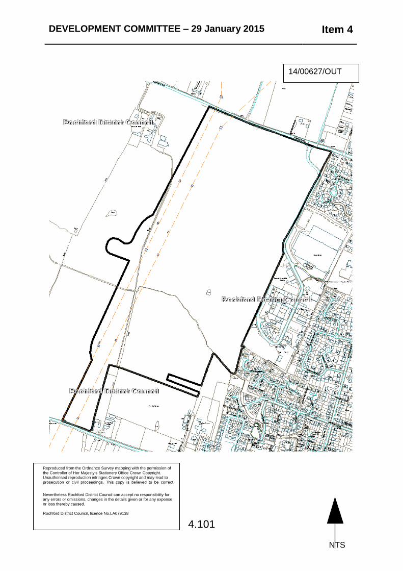
DEVELOPMENT COMMITTEE – 29 January 2015 Item 4
4.101
Reproduced from the Ordnance Survey mapping with the permission of the Controller of Her Majesty's Stationery Office Crown Copyright. Unauthorised reproduction infringes Crown copyright and may lead to prosecution or civil proceedings. This copy is believed to be correct.
N Nevertheless Rochford District Council can accept no responsibility for any errors or omissions, changes in the details given or for any expense or loss thereby caused. Rochford District Council, licence No.LA079138
14/00627/OUT
NTS
RRRoooccchhhfffooorrrddd DDDiiissstttrrriiicccttt CCCooouuunnnccciii lll
RRRoooccchhhfffooorrrddd DDDiiissstttrrriiicccttt CCCooouuunnnccciii lll
RRRoooccchhhfffooorrrddd DDDiiissstttrrriiicccttt CCCooouuunnnccciii lll