issn 1943-6548 base line - ala.org · latest developments in the rda cataloguing standard,...
TRANSCRIPT

base line 39 (3): 1
ISSN 1943-6548
base line3 From the Chair5 On the Cataloging/Cataloguing Front9 MAGIRT 2018 ALA Annual Conference Schedule10 MAGIRT 2018 ALA Annual Tour and Awards Dinner13 ALA Connect14 National Geospatial Advisory Committee (NGAC)16 MAGIRT Election Results18 New Maps and Cartographic Materials22 Great Moments in Map Librarianship
a newsletter of theMap and Geospatial Information Round Table
TABLE OF CONTENTS
http://www.ala.org/magirt/
Volume 39, Number 3June 2018
http://www.ala.org/rt/magirt/© American Library Association 2018
312.944.6780
Published by the Map and Geospatial Information Round Table
base line is an official publication of the American Library Association’s Map and Geospatial Information Round Table (MAGIRT). The purpose of base line is to provide current information on cartographic materials, other publications of interest to map and geography librarians, meetings, related governmental activities, and map librarianship. It is a medium of communication for members of MAGIRT and information of interest is welcome. The opinions expressed by contributors are their own and do not necessarily represent those of the American Library Association and MAGIRT. Contributions should be sent to the appropriate editor listed below.Editor: John A. OlsonGovernment and Geo-Information LibrarianSyracuse UniversityTel: 315-443-4818 E-mail: [email protected] Manager: Mike SmithSubject Specialist for Maps, California Gov Info, GIS Coordinator, UCSDTel: 858/534-1248 E-mail: [email protected] Editor: Tammy T. WongCartographic Materials CatalogerGeography and Map Division, Library of CongressTel: 202/707-6735 E-mail: [email protected] Mapping Editor: Carol McAuliffeMap LibrarianMap & Imagery Library, University of FloridaTel: 352/273-2828 E-mail: [email protected] Maps and Books Editor: David J. BertucaMap Librarian, Science & Engineering Information CenterUniversity at BuffaloTel: 716/645-1332 E-mail: [email protected] and Marketing Committee Chairperson:Andrew BattistaLibrarian for Geospatial Information SystemsNew York UniversityTel: 212/992-7312 E-mail: ab6137@nyu@edu
Advertising Rates: For one issue: full page $100; half page $50; quarter page $25. Opposite “Great Moments in Map Librarianship”: full page $150; half page $80; quarter page $40.
Send graphics as an: .AI, .PDF, .JPG, or .GIF file and 300 dpi or better. Send text documents in: Times New Roman 12 point. Send files as an email attachment to the editor. Submissions may be edited and re-formatted to the extent necessary to fit the size and space allotted for each issue. Final full-page size is 8 x 10 inches. Advertisers will be invoiced. Please make payments to the MAGIRT Treasurer, payable in U.S. dollars to ALA-MAGIRT.
base line is published electronically six times a year: in February, April, June, August, October, and December. All older issues of base line are now freely available on the MAGIRT website.
Members of MAGIRT can access base line as a benefit of their membership.
American Library Association personal and institutional mem-bers may choose MAGIRT membership for $20.00 (personal) or $60.00 (institutional) by so advising the American Library Association, 50 W. Huron St., Chicago, IL 60611.
MAGIRT OFFICERS:Chairperson:Leslie WagnerMetadata ArchivistUniv of Texas-ArlingtonTel: 817/272-6209 E-mail: [email protected]
Vice-Chairperson (Chair-Elect):Tammy T. WongCartographic Materials CatalogerGeography and Map Division, Library of CongressTel: 202/707-6735 E-mail: [email protected]
Secretary:Catherine HodgeMonograph & Cartographic Resources Cataloging LibrarianThe University of IowaTel: 319/335-6295 E-mail: [email protected]
Treasurer:Maggie M. Long Special Collections Cataloger Wesleyan UniversityTel: E-mail: [email protected]
Assistant Treasurer:Bruce GodfreyGIS LibrarianUniveristy of IdahoE-mail: [email protected]
Past Chairperson:Louise M. RatliffSocal Sciences and Map Catalog LibrarianUCLAPhone: 310/206-5853 E-mail: [email protected]

From The ChairLeslie Wagner
University of Texas - Arlington
We need ALL committee and officer’s reports in advance of ALA Annual in order to free up our business meeting for new business and discussion. I would hope to have these reports by June 14 so that they can be posted to our website and provided to executive board members in advance of the conference.
We need liaisons. We need new chairs for some of our committees and coordinators for our discussion and interest groups. Don’t be bashful. MAGIRT needs each and every one of our members to take an active part in MAGIRT’s future, and the future starts NOW. And if you don’t feel ready to serve as a committee chair or a group coordinator, I highly encourage your participation as a member of an interest or discussion group or as a committee member.
While at ALA Annual in New Orleans, I plan to attend RTCA and all scheduled MAGIRT meetings. And for our business meeting, we plan to spend much of our time in discussion of potential projects and programs for 2018-2019. I am so excited about our coming year!
Please feel free to contact me with questions or to state your interest in serving in any capacity: [email protected] .
I’m looking forward to seeing many of you in New Orleans. L’aissez les bon temps rouler!

base line 39 (3): 4

base line 39 (3): 5
On The Cataloging/Cataloguing FrontTammy Wong
Library of Congress
Upcoming RDA events and announcements
RDA Day in the UK
Registration is open for RDA Day, September 7, 2018, the final day of the Cataloguing & Indexing Group Conference 2018 at the John McIntyre Conference Centre in Edinburgh, Scotland. The theme of the conference is Metadata: Create, Share and Enrich, and RDA Day is the third and final day of the conference. For more details and to register, visit the conference website.
Diversity of Data: RDA in the international context
This one-day conference will be held on August 23, 2018 at the National Library of Malaysia, Kuala Lumpur and is organized by the RDA Board.
The Conference will benefit both RDA users and non-users. It will cover the latest developments in the RDA cataloguing standard, providing a forum for discussion, learning and sharing. There will be a focus on the potential of RDA for libraries in non-English speaking countries and information about the latest developments in the RDA standard and the Toolkit.
There will be sessions on the international uptake and implementation of RDA, with speakers from around the world highlighting different implementation experiences. Experts will give an in-depth demonstration of the new RDA Toolkit and explore RDA in a multilingual world where cataloguing traditions and practices may vary from country to country. There will be presentations on features that support translations, RDA’s ability to accommodate local practices in a global context and its potential for use in a linked data environment.
The program will feature speakers from around the world with the opportunity to meet and network with experienced RDA implementers.
There is no fee to attend the event, but advance registration is required.
Changes to 3R Rollout and Schedule
The initial release of the redesigned RDA Toolkit remains June 13, 2018. Because of the complexity of changes to both the content and structure of the RDA standard, however, expectations for that initial release and the subsequent

base line 39 (3): 6
revision timetable have changed. The June 13th release will be a beta version of the new site in English only. It will include the following:
• An initial implementation of LRM• Reorganized RDA instructions• Redesigned Personal and Institutional Profile capabilities• Search and navigation functions• Cross-Reference and Cross-Reference Preview functions• Ready Reference feature for each RDA element• Introduction of responsive design and greatly improved accessibility to the
overall site
RDA in MARC 21 meeting
An open discussion of the impact on the MARC 21 encoding standard by changes to RDA is being planned for the ALA Annual meeting in New Orleans. The discussion will take place on Monday, June 25, 2018 from 8:30 – 11:30 a.m. in the Hilton New Orleans Riverside, Churchill C room.
RDA Preconference at ALA Annual 2018: A Practical Introduction to the New RDA Toolkit (Sold Out Ticketed Event)
The RDA Toolkit Redesign Update and Preview preconference will take place on Friday, June 22, 2018 from 8:30 a.m. – 4:00 p.m. in the Morial Convention Center Room 356. The preconference is subtitled “A Practical Introduction to the New RDA Toolkit.”
There will be RDA experts presenting on topics such as the restructure and redesign of the RDA Toolkit, as well as discussions on new approaches to key cataloguing issues. This is a good opportunity to hear about the latest developments and test out the new RDA Toolkit with experts.
A beta version of the new Toolkit for community feedback will be publicly released on June 13.
RSC Governance and Meeting
The RDA Steering Committee (RSC) has moved forward in its implementation of the governance model announced by the RDA Board in 2015.
Upcoming Events
The following events are associated with RDA governance and development. Some events or sections with an event are open to participants and observers; please check the event links for further information, registration, etc.

base line 39 (3): 7
• August 13, 2018: RDA event sponsored by the Australian Committee on Cataloguing in Canberra
• August 16, 2018: Cataloguer’s Day, organized by CatSIG in Wellington, New Zealand
• September 7, 2018: RDA Day in the UK, in association with the Cataloguing and Indexing Group’s biennial conference
• October 22, 2018: RDA outreach event, Montreal• October 23 – 25, 2018: RDA Steering Committee meeting at
McGill University, Montreal
RSC meeting in 2018: Looking for a host institution
The RDA Steering Committee (RSC) welcomes invitations from institutions that may be interested in hosting its next in-person meeting. The RSC pro-poses to meet for 3 – 4 days during the period of October 15 – November 2, 2018. The RSC comprises 13 people, but part of the RSC meeting will likely be open to observers; this provides interested parties the opportunity to see how RDA is built and how international consensus is reached. One of the days could be an outreach or training event for the local or regional commu-nity.
Appointments to the RDA Steering Committee
The RDA Steering Committee is pleased to announce two new appointments.
• Kathy Glennan is the new Chair-Elect.• Ebe Kartus is the new Wider Community Engagement Officer.
Both Kathy and Ebe are current members of the RSC, as representatives of the American Library Association (ALA) and the Australian Committee on Cataloguing (ACOC) respectively. Each brings a wealth of expertise in the current strategy and development of RDA to their new roles.

base line 39 (3): 8
ONLINE GUIDE TO U.S. MAP COLLECTIONS
TAKE THE SURVEY TO GET ON THE MAP
TELL US ABOUT YOUR MAP COLLECTION
After producing three editions in paper, MAGIRT is taking the Guide to U.S. Map Resources online! In order to create the Online Guide, MAGIRT has created a survey to gather information about map collections in libraries and other institutions. MAGIRT needs YOUR help to create the new Online Guide - take the survey and tell us about your map collection!
To add information about your library’s map collection to the Online Guide to U.S. Map Collections, please visit:
tinyurl.com/magirtsurvey
Help MAGIRT create the NEW Online Guide to U.S. Map Collections!

base line 39 (3): 9
Friday, June 22
10:30 AM-12:00 PM Round Table Coordinating Assembly[Any available MAGIRT officers should attend this]
HIL Chart A
3:45 PM Tour Old U.S. Mint
6:00 PM - 8:00 PM Dinner Court of the Two Sisters
Saturday, June 23
8:30 AM-10:00 AM Understanding and Using Spatial Humanities: Digital Mapping at the Forefront of Scholarly Research
MCC Rm 281-282
10:30 AM-11:30 AM MAGIRT All Committees meeting MCC Rm 203
1:00 PM-2:00 PM ALA Membership Committee Meeting [A member of the Membership & Marketing Committee should attend this.]
MCC Rm 228
2:30 PM-3:30 PM MAGIRT Geo Tech Committee and GIS Discussion Group Meetig
MCC Rm 337
4:00 PM-5:30 PM MAGIRT Map and Geospatial Collection Management Discussion Group meeting
MCC Rm 204
Sunday, June 24
8:30 AM-10:00 AM MAGIRT Cataloging & Classification Committee and Cataloging Cartographic Resources Interest Group Meeting
MCC Rm 203
1:00 PM-2:00 PM ALA Planning & Budget Assembly [One of our treasurers should attend this.]
MCC Rm 205
1:00 PM-3:30 PM MAGIRT Executive Board Meeting MCC Rm 220
MAGIRT ALA Annual Conference Schedule New Orleans 2018
base line 39 (3): 10
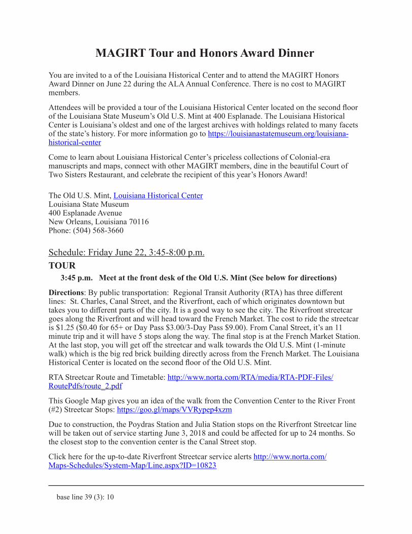
MAGIRT Tour and Honors Award Dinner
You are invited to a of the Louisiana Historical Center and to attend the MAGIRT Honors Award Dinner on June 22 during the ALA Annual Conference. There is no cost to MAGIRT members.
Attendees will be provided a tour of the Louisiana Historical Center located on the second floor of the Louisiana State Museum’s Old U.S. Mint at 400 Esplanade. The Louisiana Historical Center is Louisiana’s oldest and one of the largest archives with holdings related to many facets of the state’s history. For more information go to https://louisianastatemuseum.org/louisiana-historical-center
Come to learn about Louisiana Historical Center’s priceless collections of Colonial-era manuscripts and maps, connect with other MAGIRT members, dine in the beautiful Court of Two Sisters Restaurant, and celebrate the recipient of this year’s Honors Award!
The Old U.S. Mint, Louisiana Historical CenterLouisiana State Museum400 Esplanade AvenueNew Orleans, Louisiana 70116Phone: (504) 568-3660
Schedule: Friday June 22, 3:45-8:00 p.m.TOUR
3:45 p.m. Meet at the front desk of the Old U.S. Mint (See below for directions)
Directions: By public transportation: Regional Transit Authority (RTA) has three different lines: St. Charles, Canal Street, and the Riverfront, each of which originates downtown but takes you to different parts of the city. It is a good way to see the city. The Riverfront streetcar goes along the Riverfront and will head toward the French Market. The cost to ride the streetcar is $1.25 ($0.40 for 65+ or Day Pass $3.00/3-Day Pass $9.00). From Canal Street, it’s an 11 minute trip and it will have 5 stops along the way. The final stop is at the French Market Station. At the last stop, you will get off the streetcar and walk towards the Old U.S. Mint (1-minute walk) which is the big red brick building directly across from the French Market. The Louisiana Historical Center is located on the second floor of the Old U.S. Mint.
RTA Streetcar Route and Timetable: http://www.norta.com/RTA/media/RTA-PDF-Files/RoutePdfs/route_2.pdf
This Google Map gives you an idea of the walk from the Convention Center to the River Front (#2) Streetcar Stops: https://goo.gl/maps/VVRypep4xzm
Due to construction, the Poydras Station and Julia Station stops on the Riverfront Streetcar line will be taken out of service starting June 3, 2018 and could be affected for up to 24 months. So the closest stop to the convention center is the Canal Street stop.
Click here for the up-to-date Riverfront Streetcar service alerts http://www.norta.com/Maps-Schedules/System-Map/Line.aspx?ID=10823

base line 39 (3): 11
DINNER6:00 p.m. – 8 p.m. Court of Two Sisters.
The Court of Two Sisters Restaurant 613 Royal StreetNew Orleans, Louisiana 70130Phone: (504) 522-7261
Table D’Hote Dinner (Set Menu)
SALADE – COURT OF TWO SISTERS DINNER SALADHeart of Romaine, tasso, red onion, grape tomatoes, Creole French dressing.
ENTREE – CHICKEN OSCARGrilled airline breast of chicken, new potato mash, steamed asparagus, jumbo lump crabmeat,tasso hollandaise.
CORN FRIED LOUISIANA CATFISHServed with Creole mustard nappa slaw, jumbo lump crabmeat, and cayenne tartar sauce.
CHAR-BROILED TENDERLOIN OF BEEFThe whole tenderloin is lightly charred and cooked to perfection and sliced. Served with marchand de vin sauce and accompanied with new potato mash and haricots verts.
VEGETARIAN LASAGNA Zucchini, Eggplant, and Squash, Creole Tomato Sauce, Parmesan and Fontina Cheeses.
DESSERT – CHOCOLATE MOUSSE
From the U.S. Mint, we could either walk to the restaurant or take Riverfront Street car, which picks up right outside the U.S. Mint and goes Southward, get off at Toulouse Station (4-minute ride, 3 stops, run every 15 mins, $1.25/$0.40 for 65+ or Day Pass $3.00/3-Day Pass $9.00).
This Google Map gives you an idea of the walk/Streetcar ride from the U.S. Mint to the Restau-rant: https://goo.gl/maps/K5sERnSgDDN2
Please contact Tammy Wong [email protected] with your plans to attend the tour and/or the dinner on or before June 8. If you plan to attend the dinner, please reply with a choice of entrée or any dietary restrictions. Feel free to call/text with any last-minute questions at 240-418-0689.
Please join us for the tour and an evening of celebration!
Tammy WongMAGIRT Vice ChairSenior Cataloging Specialist Geography and Map DivisionLibrary of Congress (202) 707-6735

base line 39 (3): 12
ALCTS-CaMMS/MAGIRT Cartographic Resources Cataloging Interest Group
This is a meeting announcement for the ALA Annual Conference in New Orleans:
Date: Sunday, June 24, 2018
Time: 8:30-10:00 AM
Location: Morial Convention Center, Rm 203
The Cartographic Resources Cataloging Interest Group meeting is an open discussion session for addressing topics of interest to the cartographic and geospatial resources cataloging community. This is a great forum for posing questions to and exchanging ideas with members of the cartographic resources cataloging community.
Note that our meeting will be held jointly with the meeting of the MAGIRT Cataloging & Classification Committee.
A reminder message will be sent prior to the meeting with further details on the planned discussion topics.
All are welcome to attend. If you are unable to attend the discussion session, feel free to forward your discussion topics. Notes from the session will be posted to various resources including the MAGIRT email list soon after the conference, as well as printed in the next issue of our newsletter, base line.
We look forward to your attendance and the opportunity to share comments, concerns, and resources at the meeting in New Orleans!
Please send suggestions for discussion topics to [email protected].
Tim Kiser
Coordinator, Cartographic Resources Cataloging Interest Group

base line 39 (3): 13
As you know, ALA has completely revised its platform for ALA Connect. I suspect that most of you rarely use it, but it now has many new capabilities and it is very important for you to become familiar with it, at least in a very basic way, so that you can be active MAGIRT participants.
The URL is: https://connect.ala.org
Here is the FAQ page: https://connect.ala.org/faq
How To page: http://www.ala.org/support/alaconnect/howto
To view and manage your own information, you will need to login as you always do, using your ALA registration login ID and password.
Here is an ALA Support web page for ALA Connect “participants,” which is most of us:
http://www.ala.org/support/shib_login/?q=alaconnect/howto/admintraining/parts
The first link on this page is to an introductory video, which I suggest is “required viewing” for all MAGIRT members.
https://screencast-o-matic.com/u/esk9/participants
It is only 13 ½ minutes long, so please view it all the way to the end so you will have some idea of what the platform contains and how to access it. I encourage everyone to view his or her pro-file and update it so that MAGIRT can contact you with information about important discussions and events.
This is really not painful!
CAVEAT: In learning how to search on ALA Connect I have ONE LARGE WORD of ADVICE. When you do a search or browse some search results, you will want to click on a link to view the content. ALWAYS select “Open Link in New Tab,” otherwise it will open the content in the same window. Do not use the browser’s “back” button because it takes you back to the search page and you have to START ALL OVER AGAIN.
Louise Ratliff
MAGIRT Past ChairSocial Sciences and Map Catalog Librarian UCLA Library Cataloging & Metadata Center
ALA Connect

base line 39 (3): 14
National Geospatial Advisory Group holds first meeting of 2018
The National Geospatial Advisory Committee (NGAC) held their spring meeting April 3-4, 2018 at the Department of the Interior, Washington, DC. The NGAC is a Federal Advisory Committee (FACA) to the Federal Geographic Data Committee (FGDC). The role of the NGAC is to provide advice and recommendations related to the national geospatial program and the development of the National Spatial Data Infrastructure. Full minutes of the meeting, PowerPoints, and lightning talks are available on the NGAC website.
Tim Petty, Assistant Secretary for Water and Science, kicked off the meeting with a leadership discussion. Dr. Petty was involved in the founding of the NGAC and so it was with delight that the group welcomed him in his new role as the Assistant Secretary. He noted that “good data leads to good government” and asked that the NGAC think about how the Federal government could do a better job in this task. The group carried out a wide-ranging discussion about broader access to data through improved data dissemination, the importance of the NAIP program, and potential partnerships between different levels of government.
Keith Masback, Vice-Chair of the NGAC, moderated a panel discussion amongst members of the FGDC Executive Committee. Members of the panel included Carolyn Austin-Diggs from the General Services Administration (GSA), Diedre Bishop from the Census Bureau, Tony LaVoi from the National Oceanic and Atmospheric Administration (NOAA), Steve Lewis from the Department of Transportation (DOT), Mike Donnelly from the Department of Homeland Security (DHS), and Ivan DeLoatch from the FGDC. The group commented on the newly released President’s Management Agenda, which noted the importance of the accessibility and usability of data. The Agenda specifically called out the excellent work of the FGDC’s successful implementation of the portfolio management process for Federal geospatial data assets and investments. Both Mr. Lewis and Ms. Bishop voiced their support for the continued development of the National Address Database (NAD) and noted that it has been a struggle to secure funding to move the program forward.
Ivan DeLoatch updated the committee on the Geospatial Platform noting that the FGDC is now in the process of planning for the next generation GeoPlatform. They have been conducting workshops to assess the current state and value of the Platform and ascertain what its future capabilities should be. The discussion that followed focused on how the GeoPlatform could be more useful to non-Federal organizations and how to deal with increasing dynamic data sources. The FGDC will hold webinars to demonstrate the capabilities of the GeoPlatform and capture feedback from the NGAC members. He also briefed the group on the NSDI Strategic Plan, the COGO Report card due out this summer, and the GeoPathways Initiative.
The four subcommittees gave reports as to their current progress on their goals.
• The Landsat Advisory Group released two papers, which were adopted by the NGAC. The first is entitled, “Recommendations for possible future U.S. global land data collection missions beyond Landsat 9.” This paper reviewed the capabilities of current commercial remote sensing industry satellites including the smallsat and cubesat

base line 39 (3): 15
technologies, the technical feasibility and application value of enhanced collection capabilities while still maintaining continuing with the historic Landsat output, and the opportunities for private-public partnerships. The second paper is entitled, “The feasibility and utility of implementing temporal data cubes to support projection or ‘forecast’ models and land change trends.” This was written in response to a request from the U.S. Geological Survey to study the feasibility and utility of implementing temporal data cubes to support projection or ‘forecast’ models of land change trends. The group will now turn its attention to the third directive addressing possible fee recovery options for Landsat data. A final report is expected to be released in the fall.
• The Data as a Service Committee is developing a paper, including use cases, describing current and future needs for data as services. A draft version of the paper is expected to be presented at the June meeting.
• The Infrastructure Committee is developing a set of brief use cases demonstrating the uses of geospatial technology to support infrastructure initiatives. Final versions of the use cases will be presented at the June meeting. The sub-committee is developing an infographic and a white paper demonstrating the uses of geospatial technology to support infrastructure initiatives.
• The Cultural and Historical Resources Subcommittee is preparing to conduct a number of interviews that will inform a report making recommendations on policies and procedures to protect geospatial data assets that have cultural and historical significance. The goal is to produce a final report in the fall.
Sarah Battersby hosted a panel of experts to explore data as a service approaches, issues, concerns, and directions in the public and private sectors in providing access and delivery to geospatial data. Members of the panel included Tony Frazier of Radiant Solutions, Tony LaVoi from NOAA, Kevin Murphy from NASA, and Chris Tucker from Yale House Ventures. A number of themes emerged from the discussion. The group focused on the idea of authoritative data and what this actually means in a world where there are so many different data creation entities from satellites to crowd-sourced information. Next data as a service presupposes data exists, but how willing are users to pay for the data creation? What are the business models underpinning this assumption? The group discussed issues around the provenance and quality of crowd-sourced data. Finally, they talked about how the government procurement process is slow creating bottlenecks and difficulties in accessing data.
Throughout the meeting the NGAC voiced its support for the National Address Database and approved the following resolution:
“The National Geospatial Advisory Committee (NGAC) is encouraged by the progress the Federal Geographic Data Committee (FGDC) community is making in developing the National Address Database (NAD). The NGAC commends the U.S. Census Bureau and the U.S. Department of Transportation for their leadership of this important initiative. The NGAC has expressed its support for the development of the NAD for many years, through an initial paper, “The need for a National Address Database” (2012), through a previous NGAC resolution (2013), and through development of a set of use cases (2014). The NGAC believes that the NAD

base line 39 (3): 16
is consistent with the Data, Accountability, and Transparency component of the President’s Management Agenda; that it reflects a productive partnership of Tribal, Federal, State, and local governments; and that it will be a model use of the FGDC’s Geospatial Platform. The NGAC strongly encourages FGDC agencies to devote appropriate support and resources to create a National Address Database program that will ensure the long-term institutionalization of the NAD as a National Geospatial Data Asset.”
The next NGAC meeting will be held June 26-27, 2018 at the U.S. Department of the Interior in Washington, DC.
Thanks to John Mahoney for his help with the information contained in this report.
Posted April 27, 2018 in the Stanford Libraries Blog by Julie Sweetkind-SingerAssistant Director of Geospatial and Cartographic ServicesHead of the Branner Earth Sciences Library & Map Collections
(reprinted by permission of the author)
MAGIRT Election Results
I am pleased to announce the results of the election for 2018/19 MAGIRT officers. First, please welcome our new Vice-Chair/Chair-Elect, Iris Taylor. Iris is Senior Cataloging Specialist at the Geography and Map Division of the Library of Congress. She has been active in MAGIRT by chairing the Cataloging Cartographic Resources Interest Group and the Cataloging and Classification Committee, taking on an increasing level of responsibility in the organization. Next, welcome back to Secretary Cathy Hodge, from the University of Iowa. Cathy stepped up to volunteer for a second term, and we welcome her expertise, her excellent minute-taking, and her continuing commitment to keeping us organized and looking ahead.
Finally, welcome to Marguerite Ragnow from the University of Minnesota who was elected Assistant Treasurer. In 2016 when I was planning the program for ALA Annual 2017, Marguerite stepped in to help plan the content, and she contributed great ideas and organizational tips. Welcome, Marguerite, to the MAGIRT Executive Board!
Congratulations Iris, Cathy and Marguerite!
Louise Ratliff
MAGIRT Past ChairSocial Sciences and Map Catalog Librarian UCLA Library Cataloging & Metadata Center

base line 39 (3): 17
• Receive 10% off the 2017 dataset
• Receive 20% off the 2017 dataset if placed as a standing order
* Delivery of LandScan Global 2017 is expected early September 2018
NEW EDITION AVAILABLE SOON
OFFER EXPIRES AUGUST 31, 2018
NOT ALL POPULATION DATA IS CREATED EQUAL...
WITH LANDSCAN IT IS.
Uncommon Information Extraordinary Places
LANDSCAN GLOBAL THE WORLD’S FINEST POPULATION DISTRIBUTION DATA
FTP/DVD for Archive
WMS/WCS for GIS Users
WebApp for Everyone
LandScan Global is the most accurate and reliable global population database.
Produced annually by the U.S. Government, every square kilometer of landmass is covered.
Now more accessible than ever:
(952) 252-1205 | GEOSPATIAL.COM/LEARN/LANDSCAN | [email protected]
• Disaster Response
• Global Comparative Analysis
• Population Trends
• Market Research
• Risk Analysis
• Telecom Network Planning
• Emergency Management
• Sustainability Planning
• Assessing Human Impact
• Infrastructure Improvements
• Disease Modeling
• Academic Research
POPULATION DATA FOR ANY APPLICATION

base line 39 (3): 18
New Maps and Cartographic MaterialsDavid Bertuca
University of Buffalo
“A number of astronauts, and then all of us who saw the photography from space, marveled at how much the Florida peninsula, meandering Mississippi, the islands of Britain, and the boot of Italy resembled the maps everyone had grown up with. We had taken it for granted that maps were faithful reflections of reality; but we were somehow amazed when reality turned out to be true to the maps.”— John Noble Wilford, The Mapmakers.
Summer is coming and it is beautiful outside. Time to go use some maps that you’ve been storing away for a trip or just to look at and to dream about travel. This issue, I am reviewing all new books (or the newest edition). These are very nice works on some unique topics that have broad appeal. All are worthy of your review.
Atlases and BooksIonesco, Dina, François Gemenne, and Daria Mokhnacheva. The Atlas of Environmental Migration. London: Routledge, 2017 (ISBN: 9781138022058). 152 p.: color illustrations, color maps.
We have had many books on the migration of birds, animals, and even plants, in annual or climatological periods, but human migration books have mostly been to show emigration patterns through history.
This book covers the concept of people migrating because of environmental change, such as from climate, geophysical disasters, and other events. The authors state that the Atlas is, “…the first illustrated publication mapping environmental migration, clarifying terminology and concepts, drawing a typology of migration related to environment and climate change…”
The book provides case studies and a scientific framework for the study of the human effect of environmental change from all factors. It discusses both the causes and the effects of these events and the impact on government and society.
The Atlas covers all forms of environmental changes, including fires, floods, geophysical and man-made disasters, and potential threats from global climate change, among others. Examples are provided for various events along with visuals that help to describe the text.
The book is saturated with many color maps that are good visualizations on their own. The sections follow an organized progression from historic and current migrations, to factors that cause migrations, and the challenges that migrations of populations bring about. The final

base line 39 (3): 19
section describes government responses to population migrations and how the future might be handled.
The book has a glossary, bibliography and resource guide, and cited notes. A list of experts consulted in the compilation of this atlas is also included.
The Atlas of Environmental Migration is designed for professional research use, though college students will find it helpful in understanding the causes and effects of human migration from environmental events. Adult learners can also gain insight into this topic as well.
The maps are clear and offer direct visualizations of the topics covered. The work will appeal to planners, government population agencies, and scientists in a number of fields, especially environmentalism. This is definitely an excellent resource to acquire for a collection.
Hayes, Derek. Historical Atlas of Early Railways. Madeira Park, BC: Douglas and McIntyre, 2017 (ISBN: 9781771621755). 320 pages: illustrations (chiefly color), maps (chiefly color).
Early railroads had an immediate impact on various aspects of life. Economy, travel, invention, and imagination were affected by the steam locomotive’s development.
This atlas describes the early railway systems in the world, the first trains, and the changes that occurred when steam engines entered the transportation infrastructure.
“A ‘railway’ is commonly defined as a prepared track that guides vehicles running on it so that they cannot leave the track.”—p. 12. The author states that the earliest “tracks” were ruts in roadways caused by heavy traffic of carts and wagons. He points out that the first artificially created ruts for guiding wheeled vehicles were made as early as 2200 B.C.E.
The history continues into wooden railways, where the tracks were wood lengths and wooden wheels straddled the primitive roadway. The real history covers the advent of steam locomotive transit and describes the early nineteenth century development.
The rest of the book provides histories of a number of early railway companies in Great
Britain and the United States, and also many other countries, with contemporary and modern maps, photographs and paintings, and descriptive text on each. Photographs of historic equipment and facilities embellish the work throughout.
The history of railroad networks across countries demonstrates how these systems grew across the land and how they affected commerce and travel. In addition, subways and unique early railroad designs are discussed.

base line 39 (3): 20
The maps and illustrations alone will please railroad enthusisasts. This atlas is a gem for researchers in transportation history, planning, and other fields. Historians will enjoy the work, as will anyone from young adult through adult learner.
Given the extent to which railroads have changed the modern world, this book will be an asset to any map collection, or to any history collection.
Magocsi, Paul R., and Byron Moldofsky. Carpathian Rus’: A Historical Atlas. Toronto: Univer-sity of Toronto Press, 2017 (ISBN: 9780772751157). vi, 80 pages: color maps.
“This is the first historical atlas ever published in any language about the territory of Carpathian Rus’ and its main population, Carpatho-Rusyns. Carpathian Rus’ is a historic region of Europe on territory that straddles the present-day boundaries of Poland, Slovakia, Ukraine, and Romania. The atlas consists of 34 full-color maps, each with a brief explanatory text on a facing page. Consequently, the atlas also serves as a brief historical introduction to Carpathian Rus’ and Carpatho-Rusyns.”--Publisher.
The Carpathian region of Europe covers many modern countries and is the main settled area of the Carptho-Rusyn people. This region comprises rugged mountainous lands and has a
rich history of culture and mystique.
This atlas provides a glimpse into the region and its people from the fifth century to the present. The maps and text are presented in chronological progression with introductory chapters giving general history and distributions of the people.
In addition, the histories of the surrounding areas is provided for context and to show the interactions of groups outside of the Carpathian Rus’.
Each chapter describes the history surrounding a map. The maps are clear and the use of color makes it easy to understand the theme. It is possible to follow the changes in Europe and in the local population throughout the various developments over time.
This book will be of interest to historians, ethnic studies research, European studies, and to other uses. It would be useful to high school through adult learner. Genealogists may also find it helpful to use in locating settlements and regions.
This atlas will be a good addition to most collections.

base line 39 (3): 21
Burns, Loree Griffin. Life on Surtsey: Iceland’s Upstart Island (Scientists in the Field). Bos-ton: Houghton Mifflin Harcourt, 2017 (ISBN: 9780544687233). 73 pages: illustrations (chiefly color), color map.
On November 14, 1963, a new island was born off the coast of Iceland. Surtsey (Surtr’s Island), broke through the surface of the ocean and continued until June 1967. As a kid, I found this to be an amazing event; new land in a world that had been mapped and examined, where there was nothing else to discover.
It is 58 years later; the island is still here, but on the clock. It is expected to erode below sea level in another hundred years (though scientists believe that remnants of Surtsey may be around for many centuries). But while it is here, the tiny island is a science lab for a number of disciplines.
This half-square mile volcanic rock is now home to various forms of life. Birds, insects, and simple plants. Seals and other marine life also nests and rests on Surtsey. Researchers are careful not to leave anything there that will introduce non-natural flora or fauna.
This book is written for young scientists (grades 4-6), but it provides a good illustrated history of Surtsey from its birth through to its future. The color pictures and text that provide a narrative of the island through its life cycle. The story is partly told from the perspective of Erling Ólafsson, who became fascinated with Surtsey as a young boy after seeing the volcanic plume of ash in the sky from his home on Iceland.
Ólafsson began formally studying the island and the progression of life on it not long after. The history of his studies on the island are documented here. This includes colorful descriptions of the various forms of life, with additional discussions on each lifeform (e.g., the life cycle of a Cochylis dubitana Moth).
The text is easy to read for both juvenile reader and adult. Included are glossaries, reading lists, film suggestions, and web resources. There is a brief text on understanding Icelandic names for those interested in learning how to pronounce the various words in the book.
This is a short book with interest for young adult, that would also be interesting to adults for casual reading. It provides enough for learning in the sciences and is a stepping stone to more detailed studies. The book is part of a series that can inspire young people to learning about science.
ConclusionHope you can enjoy your summer and be able to use your maps and atlases. Summer goes quickly but by August, I will have finished reading the rest of the new map related books and items to describe them to you. Maybe I will get out and see some cartographic features myself! DJB
base line 39 (3): 22
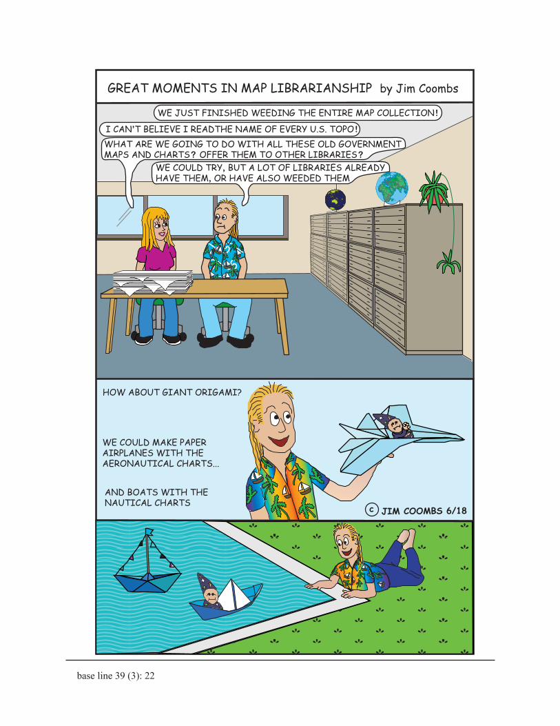
HOW ABOUT GIANT ORIGAMI?
WE COULD MAKE PAPER AIRPLANES WITH THE AERONAUTICAL CHARTS...
GREAT MOMENTS IN MAP LIBRARIANSHIP by Jim Coombs
AND BOATS WITH THE NAUTICAL CHARTS
c JIM COOMBS 6/18
I CAN’T BELIEVE I READTHE NAME OF EVERY U.S. TOPO !
WE JUST FINISHED WEEDING THE ENTIRE MAP COLLECTION !
WE COULD TRY, BUT A LOT OF LIBRARIES ALREADY HAVE THEM, OR HAVE ALSO WEEDED THEM
WHAT ARE WE GOING TO DO WITH ALL THESE OLD GOVERNMENT MAPS AND CHARTS? OFFER THEM TO OTHER LIBRARIES?