intelligent mobility - amazon simple storage service · a petri-net modelling appraoch to railway...
TRANSCRIPT

© Copyright IMPETUS June 2016. All rights reserved. REF: 060616-V3.1
CONTACT US
IMPETUSInnovate Research Technology Centre (Room B03)University ParkNottingham NG7 2RD
Telephone: +44 (0)115 748 6068
Email: [email protected]
www.nottingham.ac.uk/impetus
INTELLIGENT MOBILITYTHE OPTIMISED MOVEMENT OF GOODS AND PEOPLE
@IMPETUS_UK
©SHUTTERSTOCK

About IMPETUS 4
PROSPECT – proactive safety for pedestrians and cyclists 6
Estimating subsidence risk across an entire rail network from space 7
Telematics based predictive maintenance system for commercial vehicles 8
The effect of urban infrastructure on wireless network performance 10
Dynamic Modelling of Demand (D-MoD) 11
Limits of the predictability of human travel 12
Mapping obscuration of GNSS in urban landscapes (MOGUL) 13
PASSME (Personalised Airport Sytems for Seamless Mobility and Experience) 14
A Petri-Net modelling appraoch to railway bridge asset management 16
Variation of pollutant concentrations with road infrastructure interventions 17
Estimating public transport topology from existing supply data 18
Twitter and Passenger Disruption (TaPD) 19
Real time structural health monitoring 20
How the extremes of wireless network size affect data delivery 22
A Hansel and Gretel approach to cooperative vehicle positioning 23
Community and drone mapping in Tanzania 24
TFL buses as sentinels 25
The Smart Campus project 26
Satellite monitoring of ground motion at airports in green sites 27
Transforming transport planning operations at 3T Logistics 28
Contact 31
Contents
3IMPETUS THE OPTIMISED MOVEMENT OF GOODS & PEOPLE2
“Encompassing everything from autonomous vehicles to seamless journey systems and multi-modal modelling software, Intelligent Mobility uses emerging technologies to enable the smarter, greener and more efficient movement of people and goods around the world”
Transport Systems Catapult

Professor Sarah SharplesAssociate Pro-Vice-Chancellor for Research & Knowledge Exchange, Professor of Human Factors, Faculty of Engineering,The University of Nottingham
About IMPETUS
Dr Paul ZanelliChief Technical OfficerTransport Systems Catapult
An innovative partnership
The IMPETUS partnership brings together The University of Nottingham (UoN) and the University of Leicester (UoL) with the Transport Systems Catapult, in order to deliver world-class research into Intelligent Mobility. Examples of this work can be found in this document in a selection of case studies, each demonstrating how work is taking place directly with research funders, transport providers and technology developers to influence the transport technologies and travel behaviours of the future.
The work of IMPETUS spans three themes:
JOURNEY EXPERIENCE
INTELLIGENT INFRASTRUCTURE
FUTURE TRANSPORT SYSTEMS
Journey Experience considers how people choose and plan their journeys, and their priorities in making decisions about transport mode and timings. Work in this area ranges from the use of customer data, including social media, to predict and plan for traveller behaviour, to the design of interfaces in future automated vehicles.
Intelligent Infrastructure describes how sensor technologies and data analytic techniques can be used to monitor the state of our transport system – from bridges to wireless network performance, moving us towards an integrated data approach, which will enable us to have a real time and proactive view of multimodal transport systems.
Future Transport Systems examines everything from drones, to the way that people move around and behave on our university campuses, helping us to understand how we can deploy advanced transportation technologies effectively and harness the data that is produced to support future smart cities.
Intelligent Mobility is not only key to enabling individuals to travel effectively, it considers how goods and infrastructure systems should be designed both now and in the future to positively impact on our economy. By working with industry and policy makers, in partnership with the Transport Systems Catapult, we aim to be at the forefront of designing future transport technologies and informing the ways they are designed and deployed.
Integral to the mission of the Catapult network, as set out in Hauser’s 2010 report, is the relationship between UK Catapult Centres and academic research institutions.
Intelligent Mobility (IM) harnesses new and emerging technologies to achieve integrated, efficient and sustainable transport systems. Transport Systems Catapult (TSC) believes that the UK will capture a share of the global IM market through cutting-edge research and the ability to transform ideas into high-value products and services.
The University Partner Programme (UPP) was set up in 2014 as a three-year project to kick start our academic engagement activities with thirteen universities. Our ultimate aim was to increase the likelihood of new ideas and innovations from academia reaching the market as finished products and services. This will maximise the economic impact of research currently being undertaken in the UK. We do this by running various studentships, placements, workshops, conferences, sandpits and submit joint proposals with the universities.
IMPETUS emerged as a consequential partnership between the Universities of Nottingham and Leicester, with whom TSC has collaborated with to deliver many of the aforementioned activities. This partnership has enabled world-leading researchers to utilise TSC’s expertise and industry connections to support research and pave potential routes to commercialisation.
The following case studies demonstrate the benefits of academic-industry collaborations.
4 5IMPETUS THE OPTIMISED MOVEMENT OF GOODS & PEOPLE

PROJECT DESCRIPTION
Although most UK coal mines have been closed for decades, the underground voids and structures that were left behind can still result in serious subsidence incidents that extend over very large areas. This project identifies subsidence risk and therefore enables rail asset managers to more precisely focus maintenance resources on those parts of the network that need it.
The system combines satellite Earth observation measurements with a novel data processing technique developed by the Nottingham Geospatial Institute, providing a low-cost solution to hazard assessment across the whole rail infrastructure network. The solution is designed to exploit the new European Sentinel-1 satellite, which will support radar interferometric measurements of ground motion on a weekly basis across the whole of Europe.
OUTCOME AND IMPACT
A demonstration over a section of the proposed High Speed Two (HS2) route in the East Midlands showed that there was some significant differential motion that may affect safety along the track.
Project contactsProfessor Stuart Marsh – Professor of Geospatial Engineering, Faculty of Engineering,The University of [email protected]
Dr Andy Sowter – Assistant Professor, UoN
FacilitiesThe Punnet software, developed by The University of Nottingham, which extracts ground motion over both rural and urban land cover from stacks of satellite radar observations over extended time periods.
CollaboratorsBritish Geological Survey, Network Rail, Strukton.
Estimating subsidence risk across an entire rail network from space
PROJECT DESCRIPTION
PROSPECT is a European funded project which aims to provide a better understanding of accidents related to vulnerable road users such as pedestrians and cyclists.
The programme aims to develop, demonstrate and test innovative, safety systems for vehicles for protecting road users. The project will develop next generation collision avoidance systems which automatically brake/steer based on predictive algorithms concerning the potential path of road users.
The University of Nottingham’s role is to lead on “Accident Analysis and User Needs” and to conduct research into accidents involving vulnerable road users.
In addition, the team will investigate how a human-machine interface should be designed to facilitate trust and acceptance for automation technology within a vehicle.
OUTCOME AND IMPACT
It is hoped that collision avoidance systems developed by PROSPECT will significantly reduce the number of deaths for pedestrians and cyclists across the EU and worldwide.
In 2010, more than one quarter of the world’s road traffic deaths were suffered by pedestrians (22%) and cyclists (5%), according to the World Health Organisation (WHO).
This means that approximately 335,000 non-motorised vulnerable road users die annually worldwide; furthermore, according to WHO (2004), there are at least 20 times as many non-fatal injuries in road traffic accidents as fatalities.
Project contactsDr Gary Burnett – Associate Professor Human Factors Research Group, Faculty of Engineering, The University of Nottingham [email protected]
Dr Catherine Harvey – Research Fellow, UoNDr David Large – Research Fellow, UoN
FacilitiesA variety of ‘state of the art’ Human Factors Simulators (medium to high fidelity), tailor-made to investigate human-machine interface (HMI) design/evaluation issues – including driving simulators and bicycle simulators.
CollaboratorsIDIADA (ES), TNO (NL), Audi (DE), Volvo (SE), BMW (DE), Daimler (DE), Toyota (BE), VTI (SE), Budapest Uni (HU), IFSTTAR (FR), Chalmers Uni (SE), Continental (DE), Bosch (DE), Uni Amsterdam (NL).
PROSPECT – proactive safety for pedestrians and cyclists
JOU
RNEY
EX
PERI
ENC
E |
INTE
LLIG
ENT
INFR
AST
RUC
TURE
| F
UTU
RE T
RAN
SPO
RT S
YSTE
MS
JOU
RNEY
EX
PERI
ENC
E |
INTE
LLIG
ENT
INFR
AST
RUC
TURE
| F
UTU
RE T
RAN
SPO
RT S
YSTE
MS
Rates of ground motion have been detected that could exceed the tolerances specified for high-speed rail infrastructure.
6 7IMPETUS THE OPTIMISED MOVEMENT OF GOODS & PEOPLE
Severe damage (compression) and buckling of a rail track caused by fault re-activation.
CAPABILITIES
• Earth observation• Detecting and monitoring ground deformation relevant to infrastructure projects
CAPABILITIES
• Human factors• Human-machine interface• Autonomous vehicles
Human factors driving simulators
Map of deformation (above) and HS2 track profiles (left) of a section of track in the East Midlands detected using ENVISAT data. The grid boxes are 5km x 5km in extent.
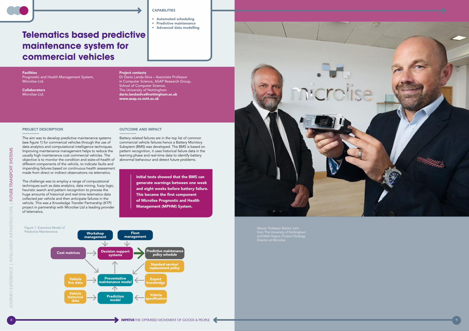
Above: Professor Robert John from The University of Nottingham and Matt Hague, Product Strategy Director at Microlise.
Initial tests showed that the BMS can generate warnings between one week and eight weeks before battery failure. This became the first component of Microlise Prognostic and Health Management (MPHM) System.
Project contactsDr Dario Landa-Silva – Associate Professor in Computer Science, ASAP Research Group, School of Computer Science,The University of [email protected] www.asap.cs.nott.ac.uk
FacilitiesPrognostic and Health Management System, Microlise Ltd.
CollaboratorsMicrolise Ltd.
PROJECT DESCRIPTION
The aim was to develop predictive maintenance systems (see figure 1) for commercial vehicles through the use of data analytics and computational intelligence techniques.Improving maintenance management helps to reduce the usually high maintenance cost commercial vehicles. The objective is to monitor the condition and state-of-health of different components of the vehicle, to indicate faults and impending failures based on continuous health assessment made from direct or indirect observations via telematics.
The challenge was to employ a range of computational techniques such as data analytics, data mining, fuzzy logic, heuristic search and pattern recognition to process the huge amounts of historical and real-time telematics data collected per vehicle and then anticipate failures in the vehicle. This was a Knowledge Transfer Partnership (KTP) project in partnership with Microlise Ltd a leading provider of telematics.
OUTCOME AND IMPACT
Battery related failures are in the top list of common commercial vehicle failures hence a Battery Monitory Subsytem (BMS) was developed. The BMS is based on pattern recognition, it uses historical failure data in the learning phase and real-time data to identify battery abnormal behaviour and detect future problems.
Telematics based predictive maintenance system for commercial vehicles
JOU
RNEY
EX
PERI
ENC
E |
INTE
LLIG
ENT
INFR
AST
RUC
TURE
| F
UTU
RE T
RAN
SPO
RT S
YSTE
MS
8 9IMPETUS THE OPTIMISED MOVEMENT OF GOODS & PEOPLE
Figure 1: Extensive Model of Predictive Maintenance.
CAPABILITIES
• Automated scheduling• Predictive maintenance • Advanced data modelling

PROJECT DESCRIPTION
Rail industry stakeholders have a need to predict the demands on the operational staff regulating traffic. This means understanding both how operational conditions now might influence demand, and also the effect of future technology change such as European Train Control System (ETC) and Traffic Management. To achieve this, Hitachi Information Control System Europe - HICSE have partnered with the Centre for Rail Human Factors at The University of Nottingham.
Together, the D-MOD project is using HICSE’s simulation platform to deliver quantitative estimates of traffic demand based on dynamic traffic patterns. This will allow rail stakeholders to deliver demand estimates in a more cost effective manner, and with greater sensitive and flexibility than has previously been possible.
D-MOD is part of a KTP programme (Knowledge Transfer Partnership) funded by Innovate UK and EPSRC, to reinforce the links between academic research and industry.
OUTCOME AND IMPACT
D-MOD has resulted in the development of a working demand estimation tool, which is based on the industry standard ODEC (Operational Demand Evaluation Checklist).
In addition, an advanced estimation tool reflecting signalling automation and traffic management HMI (Human Machine Interface) is due for delivery later this year.
New models of demand quantification for signalling and other similar tasks, such as Air Traffic Control, are also being developed.
JOU
RNEY
EX
PERI
ENC
E |
INTE
LLIG
ENT
INFR
AST
RUC
TURE
| F
UTU
RE T
RAN
SPO
RT S
YSTE
MS
Project contactsLise Delamare – KTP Associate, Faculty of Engineering, The University of Nottingham / HICSE, Bradford-on-Avon [email protected] Dr David Golightly – Senior Research Fellow, UoN
FacilitiesRail signalling simulators.
CollaboratorsHitachi Information Control System Europe.
Dynamic Modelling of Demand (D-MOD)
JOU
RNEY
EX
PERI
ENC
E |
INTE
LLIG
ENT
INFR
AST
RUC
TURE
| F
UTU
RE T
RAN
SPO
RT S
YSTE
MS
PROJECT DESCRIPTION
The propagation environment can have a substantial effect on the performance of wireless network systems. For example, the range over which a device can operate is much less in built-up areas than it is in open terrain.
This project measured and simulated the effect of the radio propagation on network performance for a number of road configurations ranging from built-up (i.e. with buildings either side) to more open areas (i.e. with buildings only one side).
OUTCOME AND IMPACT
The urban radio propagation environment is complex, but it is important to be able to properly assess the effect on radio systems in order to predict the impact on their operation.
The study found that network performance decreases with distance from an intersection.
When the device is more than about 40 metres from the junction, the performance is very poor. This limits the range over which two vehicles can communicate with each other and may reduce the effectiveness of safety critical systems.
Project contactsDr Alan Stocker – Senior Lecturer, Department of Engineering, University of Leicester [email protected]
Dr David Siddle – Lecturer, UoLProfessor Mike Warrington, UoLJerome Clayton – PhD student, UoLTim Edwards, HORIBA MIRA
FacilitiesSimulation (including high-performance computing) and measurement capabilities (for example, 40 wireless network nodes and a high quality signal strength and Doppler measuring system).
CollaboratorsHORIBA, MIRA.
The effect of urban infrastructure on wireless network performance
10 11IMPETUS THE OPTIMISED MOVEMENT OF GOODS & PEOPLE
CAPABILITIES
• Human factors• Distributed systems• Advanced transport data modelling• Autonomy
CAPABILITIES
• Radio propagation simulation and measurement • Measurement of network performance
Above: Measured packet delivery ratio (PDR) in an 802.11p system either side of a T-junction.
Right: Simulated signal strength of a 802.11p transmitter located near a T-junction.
Workstation and assessor desk
Simulated signalling workstation

OUTCOME AND IMPACT
In addition to the algorithm described, the techniques developed form an integral part of projects going forward, notably i-MOTORS, which has received £1.7m funding from Innovate Uk (£450k for University of Nottingham Geospatial Institute and Human Factors Research Group) and RHINOS (£250k for NGI).
The experience gained and the connections made with the Transport Systems Catapult (TSC), are central to developing further projects in intelligent mobility at the NGI.
PROJECT DESCRIPTION
Within urban areas the poor performance of global navigation satellite system (GNSS) has a deleterious effect in the accuracy and solution availability for positioning and navigation. This at a time when the European Union is advocating the development of advanced intelligent transportation systems (ITS), that in part rely on GNSS to direct vehicles, reduce congestion and prioritise the movement of emergency vehicles and public transport.
MOGUL has developed a novel low-cost algorithm for deriving obscuration maps that predict loss of GNSS signal in urban canyons. The algorithm has been tested using real world data and the Nottingham Geospatial Institute’s (NGI) GNSS simulator.
JOU
RNEY
EX
PERI
ENC
E |
INTE
LLIG
ENT
INFR
AST
RUC
TURE
| F
UTU
RE T
RAN
SPO
RT S
YSTE
MS
FacilitiesTransport Systems Catapult, Nottingham City Council.
CollaboratorsNottingham Geospatial Institute Spirent GNSS simulator, mobile laboratory fitted with low cost to survey grade positioning sensors, roof top test track for GNSS testing and simulation.
Project contactsDr Simon Roberts – Research Fellow,Nottingham Geospatial Institute,Faculty of Engineering, The University of [email protected]
Mapping Obscuration of GNSS in Urban Landscapes (MOGUL)
PROJECT DESCRIPTION
It has recently been claimed that human travel is theoretically ‘highly predictable’ with an upper bound of 93% predictability being shown. If true, this has huge import to transport services, in everything from destination prediction to congestion forecasting. Such upper bounds provide the theoretical limits to modelling human movement, that we simply cannot push past. Such information is not only theoretically valuable, but provides constraints for designers of location based services to work in, whether through ubiquitous advertising, navigation services or intelligent agents. This value is only useful, however, if the upper bound is tight, i.e. it is close to the true limit of movement predictability.
This project has shown that regularity in human movement was significantly over-estimated – by integrating topological constraints it has been able to show that human travel patterns are much less predictable than first thought.
OUTCOME AND IMPACT
The project reconsidered the mathematical derivation of the upper bound to human movement predictability. By considering real-world topological constraints, an approach to computing a tighter upper bound was developed. The results showed that the upper bound is actually between 11-24% less than previously claimed.
This is particularly evident at fine-grained spatial and temporal quantization, where a significant number of practical applications lie.
This work raises serious questions about the use of location information alone for predicting travel behaviour, indicating that we must integrate further contextual variables if we are to meet the promise of pervasive computing and location based applications.
Project contactsDr James Goulding – Data Science Research Fellow, Horizon Digital Economy Research,The University of [email protected]
Dr Gavin Smith – Geospatial Research Fellow, UoN
FacilitiesHigh Performance Computing Cluster.
CollaboratorsMillicom, World Bank.
JOU
RNEY
EX
PERI
ENC
E |
INTE
LLIG
ENT
INFR
AST
RUC
TURE
| F
UTU
RE T
RAN
SPO
RT S
YSTE
MS
Limits of the predictability of human travel
12 13IMPETUS THE OPTIMISED MOVEMENT OF GOODS & PEOPLE
CAPABILITIES
• Urban modelling• GNSS obscuration mapping • Geographical information systems • Inertial navigation sensor integration
CAPABILITIES
• Prediction of mobility patterns • Urban development • OD matrix development
360 Panorama transformed into mask of GNSS obscuration
ISTO
CK ©
VIS
ION4
RY-L
4NGU
4GE

OUTCOME AND IMPACT
PASSME’s outcomes and impact include:
• reducing door-to-door airport travel time for passengers in Europe by 60 minutes
• improving luggage handling processes
• forecasting passengers’ flow and reducing queues
• providing passengers with real-time personalised information via a personalised device and smartphone application
• reducing stress levels while at airport and enhancing overall passengers’ travel experience while at airports
• improving airports’ and aircraft interiors to enhance passengers’ experience.
Project contactsDr Genovefa Kefalidou – Principal Human Factors Research Fellow, Faculty of Engineering,The University of [email protected] Sarah Sharples – Associate Pro-Vice-Chancellor for Research & Knowledge Exchange – UoNDr Neil De Joux – Research Fellow, UoNDr Mirabelle D’Cruz – Director of European Research (HFRG), UoN
FacilitiesUsability and Ergonomics Laboratory at The University of Nottingham.
CollaboratorsThe Netherlands Aerospace Centre NLR , Amsterdam Airport Schiphol, Hamburg Airport, the German Aerospace Centre DLR, the Technical University of Hamburg, the Institute of Communication and Computer Systems, Almadesign and Carr Communications.
JOU
RNEY
EX
PERI
ENC
E |
INTE
LLIG
ENT
INFR
AST
RUC
TURE
| F
UTU
RE T
RAN
SPO
RT S
YSTE
MS
PASSME – Personalised Airport Systems for Seamless Mobility and Experience
PROJECT DESCRIPTION
PASSME researchers will investigate critical bottle necks in the airport experience, including luggage, security, boarding, overall passenger flow and passengers’ mobility including for those with reduced mobility. Through this research, PASSME aims to make the airport experience less stressful and more enjoyable for the entire aviation community, from airports and airlines to passengers and baggage handlers.
The project’s twelve partners will combine their expertise to address this aviation challenge together.
Funded by the EU’s Horizon 2020 programme, PASSME brings together leaders in the fields of aviation, transport, academia, design, technology and communications.
14 15IMPETUS THE OPTIMISED MOVEMENT OF GOODS & PEOPLE
CAPABILITIES
• Human factors • Passenger experience• Personal (psychological) data• Human computer interaction• Data security• Multi-sensor integration• Optimisation and decision-making
ISTO
CK ©
enc
rier
ISTO
CK ©
AM
R Im
age

PROJECT DESCRIPTION
The influence of mobility upon pollution, or vice versa, is an area of research that can inform the local authorities and decision makers. The involvement of different methodologies for the study of complex datasets including in-situ monitoring, which have many influencing variables, is key to understanding the anthropogenic impact of air pollution levels in urban areas.
A study was undertaken in North West Leicestershire, where a policy scheme for the improvement of traffic flow distribution and air quality, led by Leicester City Council and Leicestershire County Council, was implemented.
The geospatial distribution of works undertaken created a challenge to assess the impact of traffic improvements and required a suitable set of monitoring equipment, which needed to be installed on the road infrastructure, avoiding disturbances and providing reproducible results.
OUTCOME AND IMPACT
Air quality data acquired from this study is overlaid on Geographic Information Systems to relate sources of emissions and areas with high levels of pollution. The project has mainly focused on nitrogen dioxide concentration as the level of air quality, assuming road transport is the main source. Using open source approaches has proved useful in understanding the data over long periods of measurements within particular areas of research.
Concentrations of NO2 average in days (Openair).
Small sensors are installed throughout the urban network where road interventions are undertaken to improve traffic flow.
JOU
RNEY
EX
PERI
ENC
E |
INTE
LLIG
ENT
INFR
AST
RUC
TURE
| F
UTU
RE T
RAN
SPO
RT S
YSTE
MS
Project contactsDr Teresa Raventos – Air Quality Specialist, School of Chemistry,University of Leicester [email protected]
Professor Paul Monks – Professor in Atmospheric Chemistry, UoLDr Zoe Fleming – NCAS researcher, UoL
FacilitiesLeicestershire City County traffic SCOOT (Split Cycle Offset Optimisation Technique) and counters, analysis facilities servers, cloud and model data.
CollaboratorsLeicestershire County Council, Leicester City Council, Environmental Instruments Ltd and Transport Systems Catapult.
Variation of pollutant concentrations with road infrastructure interventions
Project contactsPanayioti Yianni – PhD student, Faculty of Engineering, The University of [email protected]
Dr Luis Neves – Assistant Professor, UoNDr Dovile Rama – Research Fellow, UoNProfessor John Andrews – Professor of Infrastructure Asset Management, UoN
CollaboratorsNetwork Rail.
A Petri-Net modelling approach to railway bridge asset management
JOU
RNEY
EX
PERI
ENC
E |
INTE
LLIG
ENT
INFR
AST
RUC
TURE
| F
UTU
RE T
RAN
SPO
RT S
YSTE
MS
PROJECT DESCRIPTION
The UK railway infrastructure is integral to economic output and growth. Managing such an extensive network however, poses many issues. The topic of this work is railway structures, in particular railway bridges. Management of such a vast portfolio of structures can be difficult.
Each bridge will have different construction materials and methods as well as different operational circumstances and maintenance regimes. A comprehensive model has been created using a state of the art modelling approach.
This model incorporates the complex behavioural processes of deterioration, inspection and maintenance.
The model can be simulated to provide railway bridge managers with predictions of condition, overall cost and maintenance actions required over the next 100 years.
OUTCOME AND IMPACT
Understanding the behavioural nature of assets is very important. A study was undertaken into the environmental factors that affect bridge deterioration, including the bridge type and configuration, the line speed on which the bridge resides and the proximity to the coast were investigated.
This is a breakthrough in bridge asset management. When the results were presented to the collaborating organisation, they were quickly adopted into their in-house modelling method. They are already being used to make the organisations predictions more accurate.
16 17IMPETUS THE OPTIMISED MOVEMENT OF GOODS & PEOPLE
CAPABILITIES
• Advanced data modelling• Open source data sensors• Geographic information system (GIS)• Air pollution
CAPABILITIES
• Infrastructure asset management• Advanced data analysis• Modelling and simulation

PROJECT DESCRIPTION
Twitter and Passenger Disruption (TaPD) is feasibility project to model how Twitter is used by passengers and transport operators during rail disruption. The aim is to inform cross-industry strategy and processes for passenger information during disruption events. The project will also deliver an understanding of future research and technology requirements for transport disruption management where social media plays a role.
TaPD combines qualitative interviews of those who operate rail Twitter accounts, with analyses of Twitter traffic between train operating companies and passengers resulting from disruption.
OUTCOME AND IMPACT
The project has resulted in engagement with key partners including ATOC as project sponsors, Network Rail and train operating companies.
Models of the Twitter strategy for rail operators have been developed and compared to support consistency across train operating companies.
As a result of the project, good practice has been identified and recommendations for Twitter strategies for future cross train operating companies have been developed which will be included in the next iteration of Passenger Information During Disruption (PIDD).
The project has also contributed to the Sentiment Mapping Project which the Transport Systems Catapult and Department for Transport have been undertaking.
JOU
RNEY
EX
PERI
ENC
E |
INTE
LLIG
ENT
INFR
AST
RUC
TURE
| F
UTU
RE T
RAN
SPO
RT S
YSTE
MS
JOU
RNEY
EX
PERI
ENC
E |
INTE
LLIG
ENT
INFR
AST
RUC
TURE
| F
UTU
RE T
RAN
SPO
RT S
YSTE
MS
Project contactsDr David Golightly – Senior Research Fellow,Faculty of Engineering,The University of [email protected]
FacilitiesAccess to a range of University research facilities.
CollaboratorsTransport Systems Catapult, Association of Train Operating Companies, Network Rail and train operating companies.
Twitter and Passenger Disruption (TaPD)
PROJECT DESCRIPTION
The General Transit Feed Specification (GTFS) has become a standard in recent years for describing public transport for cities and regions. However, data in this format has not been exploited to the fullest extent for transport intelligence such as understanding how the components of a network relate to each other, and to the underlying road network.
This project aims to extract a topology (a model of the relationships) for transport routes and stops, using well-known geographic information approaches based upon map matching. The model captures the relationship between each section of a transport route and the local road network, which in this case is drawn from OpenStreetMap.
Through a Knowledge Transfer Partnership, Integrated Transport Planning Ltd and The University of Nottingham are developing this solution to maximise the value of already-collected transport supply data for international transport agency clients.
OUTCOME AND IMPACT
Preliminary testing has been successful and has proven the ability to extract a high-fidelity transport model from the existing GTFS data. The map-matching algorithm used achieves a high level of accuracy with respect to the true behaviour of the transport network, and can be corrected by a knowledgeable user in an online interface. In-house testing on live modelling projects commenced in February 2016.
Project contactsDr Mark Dimond – KTP Research Associate,Integrated Transport Planning Ltd, and The University of Nottingham [email protected]
FacilitiesAccess to Integrated Transport Planning’s internal General Transit Feed Specification data assets and project teams.
CollaboratorsDr Rob Houghton – The University of NottinghamProfessor Sarah Sharples – The University of Nottingham
Estimating public transport topology from existing supply data
Mapping background © Stamen Design and OpenStreetMap contributors.
18 19IMPETUS THE OPTIMISED MOVEMENT OF GOODS & PEOPLE
CAPABILITIES
• Social media• Disruption management• Personal data
CAPABILITIES
• Advanced transport data modelling
ISTO
CK ©
Sol
Stoc
k

JOU
RNEY
EX
PERI
ENC
E |
INTE
LLIG
ENT
INFR
AST
RUC
TURE
| F
UTU
RE T
RAN
SPO
RT S
YSTE
MS
PROJECT DESCRIPTION
GeoSHM (GNSS and Earth observation for Structural Health Monitoring) is a Structural Health Monitoring (SHM) system that integrates GNSS and Earth Observation technologies to offer an integrated solution for the maintenance of different types of asset.
GeoSHM system integrates GNSS and Earth observation technologies to provide users with real-time measurements of their assets during normal and abnormal loading conditions. It also provides a complete picture of the structure in its changing landscape, identifying threats caused by environmental conditions, land motion, engineering works, landslip, mining and industrial activity.
OUTCOME AND IMPACT
In December 2015, cracks appeared in one of the tower girders of the Forth Road Bridge. One lane was closed to perform maintenance works, subjecting the bridge to abnormal loading. At the same time, the same area was experiencing extreme weather conditions with wind up to 80MpH.
The GeoSHM project has a dedicated monitoring server, based at Nottingham Geospatial Institute, which was used to view the behaviour of the Forth Road Bridge in real time.
Based on these observations, it was possible to advise AMEY (the company that maintains the bridge), that the combination of abnormal loading and adverse weather required the closure of the bridge in order to ensure passenger safety.
Project contactsDr Xiaolin Meng – Associate Professor,Director of the Sino-UK Geospatial Engineering Centre, Faculty of Engineering,The University of Nottingham [email protected]
FacilitiesGNSS signal simulator at the Nottingham Geospatial Institute, latest location sensors, an Earth observation software platform and a Probe Van for integrated sensor systems and field tests.
CollaboratorsUbiPOS UK Ltd., AMEY, China Railway,Leica Geosystems, GVL, AECOM, ARUP andTransport Scotland.
Real time structural health monitoring
20 21IMPETUS THE OPTIMISED MOVEMENT OF GOODS & PEOPLE
CAPABILITIES
• Earth observation• GNSS• Infrastructure asset management• Structural health monitoring• Vibration characteristics and spectral analysis
ISTO
CK ©
Geo
rge
Cler
k
ISTO
CK ©
Em
pato
ISTO
CK ©
Blac
kJac
k3D

PROJECT DESCRIPTION
An important aspect of Intelligent Transportation Systems and self-driving cars is the use of sensors to allow vehicles to follow a safe and legal route of travel. One approach to this issue is the use of cooperative vehicle communications allowing data from one vehicle to be passed to another to provide more accurate and real-time vehicle position information.
The Nottingham Geospatial Institute (NGI) has developed a system based on this approach using carrier-phase GNSS (such as GPS) technology and allowing for corrections to Real Time Kinematic positioning.
This is combined with a Hansel & Gretel marker approach of dropping ‘bread crumbs’ along the route – a trail of packets of information that can be used by other nearby vehicles for a short period.
The system was tested by the use of NGI’s own instrumented test vehicle and a second vehicle on a roof-based test track which effectively provided a truthing system to test the concept.
OUTCOME AND IMPACT
The tests clearly outlined the potential benefit of vehicle to vehicle communication to improve positioning accuracy based on the use of one vehicle’s knowledge of absolute position to assist a second vehicle using established GNSS techniques. The system was shown to provide a potential positioning accuracy of 20 -30 centimetres, with a message latency of less than 30 seconds.
JOU
RNEY
EX
PERI
ENC
E |
INTE
LLIG
ENT
INFR
AST
RUC
TURE
| F
UTU
RE T
RAN
SPO
RT S
YSTE
MS
Project contactsProfessor Terry Moore – Director of the Nottingham Geospatial Institute, Faculty of Engineering, The University of [email protected]
Dr Xiaolin Meng – Associate Professor, UoNTrevor Wright – NGI Business Innovation Manager, UoN
FacilitiesFully instrumented test vehicle and rail/locomotive test train track. Both facilities have on-board ground-truth systems.
CollaboratorsMIRA, Leica Geosystems.
A Hansel and Gretel approach to cooperative vehicle positioning
JOU
RNEY
EX
PERI
ENC
E |
INTE
LLIG
ENT
INFR
AST
RUC
TURE
| F
UTU
RE T
RAN
SPO
RT S
YSTE
MS
PROJECT DESCRIPTION
The study found that the number of nodes in a network can have a significant impact on the performance of that network. This project has been examining the extremes of network size, i.e. for ‘dense’ networks when the number of nodes in a geographical region is high and ‘sparse’ networks in areas lacking conventional infrastructure (for example, mobile telephone), when the number of nodes is sufficiently small that they will often not be able contact each other.
Changes to the routing in these networks may be able to reduce the impact of the network size on performance.
OUTCOME AND IMPACT
Congestion in wireless networks can be a serious problem as the number of users in a geographical area increases. For safety critical systems (for example, collaborative driving), packet loss will present serious problems. This project has indicated that it is possible to optimise routing protocols to reduce the packet loss.
Project contactsDr Alan Stocker – Senior Lecturer, Department of Engineering, University of Leicester [email protected]
Dr David Siddle – Lecturer, UoLProfessor Mike Warrington, UoL
FacilitiesSimulation (including high-performance computing) and measurement capabilities, including a network with up to 40 nodes.
CollaboratorsApproaches from potential collaborators are welcomed.
How the extremes of wireless network size affect data delivery
The simulated packet delivery ratio (PDR) for a wi-fi ad-hoc in a geographical area 3x2 km as a function of the number of nodes with two propogation modesl, two ray ground, (TRG) and ITU-R. P.1411
The PDR and delivery time for a ZigBee ‘epidemic’ (or ‘gossip’) network in a 200x200 km region.
22 23IMPETUS THE OPTIMISED MOVEMENT OF GOODS & PEOPLE
CAPABILITIES
• Positioning and navigation technologies• GNSS• High-precision, high integrity positioning• Cooperative positioning• Autonomous vehicles
CAPABILITIES
• Wireless network performance simulation and measurement
ISTO
CK ©
phiv
e201
5

OUTCOME AND IMPACT
GPS bus data and other road data was collected for the Wembley area, for the week before and during the FA Cup football final. The feasibility study enabled an assessment to be made about the amount of work required in building a predictive analysis platform using the GPS bus data and other data sources.
The project showed that the traffic pattern had numerous drivers, some which were clearly evident and others that were difficult to isolate. It also identified the issue of data quality, as significant effort was spent in data cleaning prior to any data analysis and visualisation. The project introduced a new approach to the Transport For London team, for analysing the GPS bus data.
PROJECT DESCRIPTION
London is a busy and active metropolis with a complex transport network. The aim of the project was to assess whether GPS data from the 8,500+ London buses could be used to derive insights from the bus movement characteristics, with respect to the driving and influencing forces in the city and how they might impact on traffic congestion, people movements and resource deployment.
Data from other sources was collected and correlated. This included information on sporting events, road closures or roadworks and other activities.
Pattern analysis of this nature, drawing on other available data feeds, is widely expected to inform predictive analyses and autonomous system controls that will underpin intelligent mobility.
FacilitiesThe Nottingham Geospatial Institute (NGI) has a roof based dynamic test platform, Spirent GSS8000 multi-GNSS simulator and other facilities.
CollaboratorsTransport Systems Catapult and Transport for London.
Project contactsDr Oluropo Ogundipe – Research Fellow, Faculty of Engineering, The University of [email protected]
TFL buses as sentinels
JOU
RNEY
EX
PERI
ENC
E |
INTE
LLIG
ENT
INFR
AST
RUC
TURE
| F
UTU
RE T
RAN
SPO
RT S
YSTE
MS
JOU
RNEY
EX
PERI
ENC
E |
INTE
LLIG
ENT
INFR
AST
RUC
TURE
| F
UTU
RE T
RAN
SPO
RT S
YSTE
MS
PROJECT DESCRIPTION
Even basic maps are scarce in many developing nations. Unmanned aerial vehicles or drones are emerging as a tool for rapid remote imaging in a much more cost efficient manner than using satellite imagery.
In pioneering the use of drones in emerging nations, such as Tanzania, the EPSRC Neo-demographics project at The University of Nottingham is supporting the World Bank in order to fly and analyse the results of drone flights over Dar es Salaam.
The team is investigating how the resulting imagery can be used to derive data on infrastructure, such as roads and buildings, mapping Dar es Salaam (Africa’s fastest growing city), in ways that have not been done before.
OUTCOME AND IMPACT
Open, aerial imagery coverage has now been produced as part of this project for over 1.5 million residents of Dar es Salaam, data that has not existed previously. This can be used to investigate and overlay data on transport, epidemiology and natural hazards, such as flooding. This has been instrumental in cross-supporting Department for International Development (DFID) research investigating behaviour during flood events. The use of drones has also kicked started discussion within Tanzania on policy development on how to fully exploit drone technology for social good.
Project contactsDr James Goulding – Data Science Research Fellow, Horizon Digital Economy Research, The University of Nottingham [email protected]
Dr Mark Iliffe – Business School Research Fellow, UoN
Community and drone mapping in Tanzania
FacilitiesAccess to a range of University research facilities.
CollaboratorsWorld Bank, Tanzanian commission for science and technology (COSTECH), IBM Research Kenya.
24 25IMPETUS THE OPTIMISED MOVEMENT OF GOODS & PEOPLE
CAPABILITIES
• GNSS data analysis• Algorithm development• Data integration and visualisation• GIS (Geographical information systems)
CAPABILITIES
• Unmanned aerial vehicles (UAVs) • Urban modelling• Demographic prediction

PROJECT DESCRIPTION
When planning the construction of a vital piece of infrastructure, such as an airport, it is important to identify, and mitigate against, hazards due to land subsidence. In rural areas, subsidence is difficult, time-consuming and costly to detect when using ground-based measurements and space-based alternatives.
The NGI (Nottingham Geospatial Institute) have developed a satellite data processing solution that can comprehensively describe land motion, particularly over rural and vegetated terrain, something that is difficult for more conventional approaches.
The solution has been demonstrated using radar data from the new European Sentinel-1 satellite over Mexico City, where previously unseen patterns of land deformation have been revealed over this primarily rural new airport site.
OUTCOME AND IMPACT
The demonstration showed that significant land motion was detected over the complete city, including the mainly rural airport site where other methods have failed to make any measurements at all.
Extent and magnitude agree with observations over the city area, geotechnical models and groundwater data.
JOU
RNEY
EX
PERI
ENC
E |
INTE
LLIG
ENT
INFR
AST
RUC
TURE
| F
UTU
RE T
RAN
SPO
RT S
YSTE
MS
Project contactsProfessor Stuart Marsh – Professor of Geospatial Engineering, Faculty of Engineering, The University of Nottingham [email protected]
Dr Andy Sowter – Assistant Professor, UoN
FacilitiesThe Punnet software, developed by The University of Nottingham, extracts ground motion over both rural and urban land cover from stacks of satellite radar observations over extended time periods.
CollaboratorsArup Group Limited.
Satellite monitoring of ground motion at airports in green sites
JOU
RNEY
EX
PERI
ENC
E |
INTE
LLIG
ENT
INFR
AST
RUC
TURE
| F
UTU
RE T
RAN
SPO
RT S
YSTE
MS
PROJECT DESCRIPTION
The aim of The University of Nottingham’s Smart Campus project is to develop a campus that is an efficient, safe, sustainable, responsive and enjoyable place to study, work and live, underpinned and enhanced by digital / internet based technologies.
This will be achieved by using the campus as a ‘vehicle’ through which to research, develop and evaluate user behaviours (staff, students and visitors) and trial emerging Smart Campus concepts and demonstrators, primarily within the area of intra /inter campus mobility. In addition, by being embedded within an existing city, multi-site and encircling a major hospital, the campus also serves as an ideal test-bed for related Smart City initiatives, which can be evidenced in a meaningful yet more manageable way.
OUTCOME AND IMPACT
The reality of developing a Smart Campus is highly complex and challenging, involving a wide range of stakeholders, with a diversity of motivations and goals. For this reason, and as indicated above, the project will initially focus on understanding campus/user mobility patterns, by analysing positional (mobile phone) data in conjunction with evidence gathered through focus groups, interviews and diary logs. For example, inter-campus bus usage will be examined, as the basis for more efficient, cost effective, demand-led provision.
This understanding in turn will help to shape future information, timetabling and service provision, whilst also enhancing the overall user experience.
Project contacts Dr Nancy Hughes – Research Fellow, Human Factors Research Group, Faculty of EngineeringThe University of Nottingham [email protected]
Professor Sarah Sharples – Associate Pro-Vice-Chancellor for Research & Knowledge Exchange, UoNAndy Nolan – Director of Sustainability, UoNEmma Kemp – Senior Environmental Officer, UoN
FacilitiesHydrogen refuelling facilities; fleet of Electric Vehicles with GPS; free intercampus bus service with on-board Eduroam (i.e. providing greater intelligence on mobility patterns); bike hire and car share schemes; 7 Creative Energy Homes; renewable energy infrastructure; extensive building management system.
CollaboratorsNottingham City Council, Transport Systems Catapult, Satellite Systems Catapult.
The Smart Campus project
26 27IMPETUS THE OPTIMISED MOVEMENT OF GOODS & PEOPLE
CAPABILITIES
• Earth observation• Detection and monitoring of ground deformation relevant to large infrastructure projects
CAPABILITIES
• Location-based technologies • Traveller behaviour/mode shift• Mobility as a service• Personal data

JOU
RNEY
EX
PERI
ENC
E |
INTE
LLIG
ENT
INFR
AST
RUC
TURE
| F
UTU
RE T
RAN
SPO
RT S
YSTE
MS
Facilities3T SOLO System, 3T Group.
Collaborators3T Logistics Ltd.
Project contactsDr Dario Landa-SilvaASAP Research GroupSchool of Computer ScienceThe University of [email protected] www.cs.nott.ac.uk/~jds
PROJECT DESCRIPTION
The aim was to develop an optimisation engine software component to automate the generation of transportation plans for heavy goods vehicles (HGVs), through the use of optimisation and computational intelligence techniques.
The objective is to produce efficient transportation plans with details of vehicle loading, vehicle routing, pickup and delivery times, etc. for the transportation of goods between different locations in dynamic transport logistic operations.
The challenge was to develop optimisation models and employ computational intelligent search to automatically generate high-quality transportation plans suitable to be implemented in practice. The developed optimiser incorporated clustering algorithms and tailored heuristic search routines. This was a Knowledge Transfer Partnership (KTP) project in collaboration with 3T, a provider of transport management services.
OUTCOME AND IMPACT
The optimisation engine developed was deployed as the Optimizer module into 3T’s SOLO, a world-class class transport management system (http://web.3t-europe.com/solo/), which helped to transform the core business of the company, replacing a mostly manual transport planning process with an automated system that utilises state-of-the-art computer algorithms for planning shipment delivery operations. Several research outcomes were incorporated into the optimiser including:
• multi-objective optimisation to tackle cost reduction, vehicle utilisation increase, and satisfaction of delivery time windows
• heuristic search transitions between feasibility and infeasibility
• specialised heuristic search operators for the efficient generation and improvement of vehicle loads
• self-adaptive feedback heuristic search for reacting to the quality of solutions and adapt the computation time accordingly.
See published related article: http://www.cs.nott.ac.uk/~pszjds/research/files/dls_mic2011.pdf
Transforming transport planning operations at 3T Logistics
28 29IMPETUS THE OPTIMISED MOVEMENT OF GOODS & PEOPLE
CAPABILITIES
• Operations and logistics • Algorithm development • Advanced data modelling
ISTO
CK ©
Bet
_Noi
re
ISTO
CK ©
pum
papi
ctur
es

For more information about IMPETUS, contact:
[email protected]+44 (0)115 951 4196
+44 (0)115 748 6068
30 31IMPETUS THE OPTIMISED MOVEMENT OF GOODS & PEOPLE
www.nottingham.ac.uk/impetus