hurricanes …no two are the same… bill read director national hurricane center
TRANSCRIPT

Hurricanes…no two are the same…
Bill ReadDirector
National Hurricane Center


Category 1
Within 75 miles

Category 2
Within 75 miles

Category 3
Within 75 miles

Category 4
Within 75 miles

Remember the Gulf Developers
• 1932 – TS 180 miles south of GLS – Cat 4 at landfall less than 36h
• 1943 , Alicia – both formed south of NOLA landfall less than 72h
• Audrey June 1957 – Cat 4 less then 72h after forming
• Anita (5), Celia (4), Camille (5) and Opal (4) all less then 96h

Category 2 MOM Galveston Basin
Mostly barrier island and inland marsh inundation
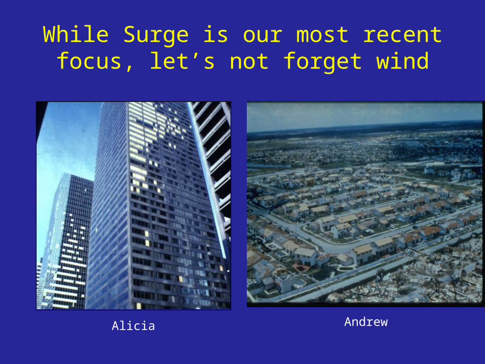
While Surge is our most recent focus, let’s not forget wind
Alicia Andrew

Potential wind threat from a Cat 4 at landfall
>125 mph
110 – 125 mph
90 – 110 mph
75-90 mph55-75 mph

Wind impacts
Rita forecast 150 mph 1 min average winds at landfall.
Gusts range 130-150 mph (1.5 x sustained)

Peak measured Gusts in Ike

The nightmare urban flood
Houston - June 8-9, 2001 Onset during
Friday evening About 2,000,000
folks experienced 10-15” rainfall in 6-12 hours
About 100,000 cars, 50,000 homes flooded
Loss of life (21) miraculously low considering scale of flooding

FRESHWATER 59%
WIND 12%SURF 11%
OFFSHORE 11%
TORNADO 4%OTHER 2%
SURGE 1%
1970-99 U.S. TROPICAL CYCLONE DEATHS
(Pre Katrina)
Over 800 of the 1000 deaths in 2008 were due to rainwater flooding


Reason for large increase


What’s the real hazard?
• We insist on living near the coast• Building codes less than even modest
hurricane winds (consider: Ike top 3 loss list)• Land use tied to the 100 year event - Flood
Insurance not “required” if outside 100 year.• People begin to forget within 5 years (IEM risk
management)

Thanks
…and each one has a unique history