huon aquaculture company trumpeter eis storm …dpipwe.tas.gov.au/documents/appendix h- initial...
TRANSCRIPT

Huon Aquaculture Company Trumpeter EIS Storm Bay MFDP
Appendix H Initial Environmental Assessment of the proposed Amendment (Oct/Nov
2016)
Reports provided by Aquaculture, Management & Development P/L and CSIRO

Oceans and Atmosphere Flagship
GEOPHYSICAL SURVEY & MAPPING (GSM)
Shallow Survey Facility
Trumpeter Lease (East of Yellow Bluff) Extension
Survey Huon Aquaculture
IMAS Vessel - RV Southern Cross
Sc2016_v01 – November 2016
sc2016_v01 GSM Report_rev2.docx
- 2 -
Contents
Executive Summary .................................................................................................................... 3
Itinerary ...................................................................................................................................... 4
Operational Narrative ................................................................................................................ 4
Data Acquisition, Processing & Interpretation .......................................................................... 4
Calibration ........................................................................................................................................... 4
Acquisition .......................................................................................................................................... 4
Tidal Reduction ................................................................................................................................... 4
Processing ........................................................................................................................................... 5
Sound Velocity Correction .................................................................................................................. 6
Product Creation ................................................................................................................................. 6
Interpretation ..................................................................................................................................... 6
Project Coordinate Information ............................................................................................... 12
Horizontal Datum .............................................................................................................................. 12
Datum Shifts ...................................................................................................................................... 12
Vertical Datum .................................................................................................................................. 12
Equipment Listing and Personnel ............................................................................................ 12
Positioning Systems .......................................................................................................................... 12
Heading Systems ............................................................................................................................... 12
Motion Reference Unit ..................................................................................................................... 12
Multibeam Echosounder ................................................................................................................... 12
Processing Software .......................................................................................................................... 12
Personnel .......................................................................................................................................... 12

sc2016_v01 GSM Report_rev2.docx
- 3 -
Executive Summary A bathymetric survey of a proposed extension to the Trumpeter lease on the eastern side of North
Bruny Island was conducted from the IMAS vessel RV Southern Cross on the 7th November 2016. The
proposed extension covered an area of 6.85 km² (685 ha), with depths ranging from 23.79m to
36.04m (Mean Sea Level). Seafloor characterisation was computed from Angle vs Range Analysis
(ARA) algorithms, and the seafloor characterisation within the proposed extension to the lease was
found to be mainly sand of various compositions, combined with silt. Localised depressions such as
those identified during the initial survey of the Trumpeter lease were identified on the Eastern
boundary of the site.
Data acquired from the RV Southern Surveyor and held in the data repository was used to fill in the
internal rectangular area.
Bathymetric and backscatter maps were updated with new lease boundary May 2017. Additional
information was added to Backscatter & Seafloor characterisation section.
Fig 1 – Location of Trumpeter Lease (existing survey data in internal polygon)

sc2016_v01 GSM Report_rev2.docx
- 4 -
Itinerary RV Southern Cross was mobilised on the 31st Oct and 1st Nov while at the Prince of Wales Marina in
Hobart. A technical problem was identified on the 2nd Nov and once rectified the vessel completed
the workscope on the 7th Nov. Demobilisation occurred on the 7th and 8th Nov.
Operational Narrative The vessel sailed for the survey site from Prince of Wales Bay in Hobart at 0630 on the 7th
November. An initial calibration and test of the system was carried out under the Tasman Bridge and
the system confirmed operational. The vessel then continued transit towards Trumpeter Bay arriving
at 0936 when a further calibration was undertaken. The vessel commenced surveying the Trumpeter
site at 1026 and this was completed at 1455. The vessel then commenced transit back to Hobart
arriving back at Prince of Wales Bay at 1630.
Data Acquisition, Processing & Interpretation
Calibration
Patch test calibrations of the EM2040c dual head system were conducted at a location to the east of
the Trumpeter site on the 7th Nov. Calibration lines were run to resolve for Roll, Pitch and Heading
error. The following values were determined and entered into the Caris processing software during
post-processing.
Transducer 1 (Port) Transducer 2 (Stbd)
Roll +0.12° Roll -0.03°
Pitch +0.18° Pitch +0.26°
Heading -4.27° Heading -4.30°
Table 1 – EM2040c calibration values
Acquisition
The EM2040c (dual head) system was deployed on a Universal Sonar Mount on the port side of the
vessel. The system was deployed with the vessel stationary near the survey area. The vessel then
commenced running survey lines at a speed of approximately 6 knots. Data was acquired in both a
North-South direction and East-West across the survey area. The EM2040c system was set to acquire
data at a frequency of 300KHz, with the pulse width set to ‘Automatic mode’. Filters and gain
settings were set at the Kongsberg recommended default settings.
Sound velocity profiles were conducted before acquisition started, a check profile was obtained half
way through the survey with another obtained before the vessel departed site.
All sound velocity corrections were applied in real time within the acquisition software.
The soundings were motion corrected in real time within the acquisition software.
Acquisition was undertaken by Stuart Edwards.
Tidal Reduction
Tidal reduction of acquired soundings was completed using DGNSS tides computed from ellipsoidal
height information obtained from the Cnav 3050 receiver installed onboard RV Southern Cross.

sc2016_v01 GSM Report_rev2.docx
- 5 -
The DGNSS receiver raw data was logged during the survey and then post-processed using C-Tides
offline software provided by C&C technologies. Vertical offsets to both the DGNSS antenna and the
waterline from the central reference point (CRP) of the vessel were measured and entered into the
software.
The data was processed with C-Tides to provide height information above the mean sea surface
(MSS). The Global Mean Sea Surface (MSS) model has been developed at the National Space
Institute and the University of Denmark and the MSS model provides the displacement of the sea
surface relative to a mathematical model of the earth and it closely follows the geoid. Trials have
shown a good correlation to Mean Sea Level (MSL) in Australia.
The Australian Height Datum (AHD) is the adjustment of 32 tide gauges around the coast of Australia
to MSL. Therefore zero AHD can be considered approximately equal to MSL.
To reduce soundings to Chart Datum (CD) to comply with depths shown on Australian Hydrographic
charts for the Storm Bay area, all soundings should have 0.9m subtracted (shoaler).
The DGNSS processed tide along with the predicted tide for the Port of Hobart can be found within
the Caris Tide folder.
Processing
Processing of the multibeam data was undertaken in Caris HIPS/SIPS v9.1.2 and Fledermaus FMGT. A
summary of the processing steps undertaken is summarised below:
Export & Conversion
Raw data has been exported from the Kongsberg SIS software in the .all format. The raw data
contains data packets from the following sensors:
Position: Kongsberg Seapath 320+ (Cnav 3050 RTCM Corrections) Heading: Kongsberg Seapath 320+ Motion: Kongsberg MRU5+ Depth: Kongsberg EM2040c MBES
Caris Vessel File
The caris vessel file contains all the information about sensor locations and uncertainties in the
vessel reference frame. Most of this information is not required due to the application of
corrections in real time during acquisition; as such the values are zero. There are some populated
values that require explanation:
Patch test values have been entered as the values in the acquisition software were left at zero
Swath Processing
Swath bathymetry profiles were examined within Caris HIPS to remove erroneous beams/profiles. A
summary of the processing steps undertaken is given below.
Manual swath editing to review the quality of the bathymetric data and remove outliers closer to the seabed.
Application of tides
Generation and review of the mean depth surfaces followed by subset editing.
Generation of final gridded surfaces for ASCII XYZ data export and GeoTIFF creation. All processing of data was carried out by Stuart Edwards

sc2016_v01 GSM Report_rev2.docx
- 6 -
Sound Velocity Correction Sound velocity profiles were acquired at regular intervals throughout the project using a Valeport
Monitor SVP instrument. In addition a Valeport MiniSVS sensor was placed at the MBES transducer.
Raw data was extracted from the instrument and processed using the SIS SVP manager to extend the
profile as required by SIS and saved in the .asvp format. A list of SV dips undertaken can be found in
appendix D
Product Creation
The processed bathymetry was used to create some standard products. This included:
Bathymetry and Backscatter Geotiffs
Bathymetry and Backscatter xyz’s
GSF’s for all lines within the sampling area The backscatter products had to be created within Fledermaus Geocoder Toolbox due to problems with Caris.
Interpretation
Bathymetric
The final Trumpeter survey area bathymetric soundings and contours are presented below. The
vertical reference datum for bathymetry acquired during this survey is Mean Sea Level (MSL). To
reduce to Chart Datum (approximately the level of Lowest Astronomical Tide LAT) 0.9m should be
subtracted (shoaler).
The water depths within the survey area range from 23.79 meters MSL in the northern part of the
site to 36.04 meters MSL in the southern.
A localised depression is evident near the eastern boundary of the site. This depression (channel)
has an average depth 1m lower than the surrounding seabed.
Backscatter and Seafloor Characterisation
A backscatter mosaic at 0.5m resolution was constructed within the Fledermaus Geocoder Toolbox
(FMGT). FMGT allows the visualisation and analysis of multibeam backscatter data and allows the
processing of the sonar files into mosaics. FMGT processing was largely automated in this case
however the steps the software took to construct the mosaic are outlined below:
1. Adjust and extract the backscatter data and perform radiometric corrections based on sonar
type and bottom topography.
2. Filtering, angle varying gain (AVG) adjustments, and anti-aliasing of the backscatter data.
3. Creation of the mosaic at resolution pre-computed by FMGT.
Angle vs Range Analysis (ARA) was conducted to provide seafloor characterisation of the survey
area. ARA is a method of seafloor characterisation which compares the actual backscatter response
to expected acoustic response curves for a wide range of seafloor types, based within the Jackson
mathematical model. It should be noted that this is a remote technique of seafloor characterisation,
however there appears to be strong correlation between the results obtained here and the samples
obtained during the initial Trumpter survey in 2014. The results of the ARA characterisation is shown
in table 2.
Seafloor characterisation is completed by analysis of the acoustic backscatter, which is the returning
sound pulse from the echosounder after being reflected back from the seafloor. Acoustic

sc2016_v01 GSM Report_rev2.docx
- 7 -
backscatter varies with intensity, soft sediments absorb more of this acoustic energy and less energy
is ‘backscattered’, while hard sediments the opposite is true. The sediment map is coloured by
intensity values measured in decibels, with areas of high intensity (stronger returns, i.e harder
sediment) shown as darker areas, while areas coloured lighter(such as the crescent areas shown in
the map) are likely to be areas of softer sediment such as sand or silt.
Data Infill
The internal rectangular area did not have multibeam data acquired during this survey. Upon
completion it became evident that this area was of importance, therefore as an interim measure
data held in the repository in Hobart from previous voyages was integrated with this dataset to form
a complete dataset covering the Trumpeter site.
Multiple transit lines from RV Southern Surveyor were integrated into the existing Trumpeter
dataset. Examination of this data showed excellent correlation with the data acquired during the
Trumpeter survey. The Multibeam Echosounder (MBES) operated onboard RV Southern Surveyor
was a deepwater system and operated at a frequency of 30KHz (the EM2040c operates at 300KHz)
this meant the bathymetric was nosier in shallow water and to achieve a coherent dataset the
bathymetric resolution of the surface was increased to 10m. A gap in the bathymetric data of
approx. 170m was left towards the eastern side of the site.
Early in 2017 RV Investigator transited through this area and filled the majority of this gap with data
from her EM710 high resolution MBES. The data was combined with the other systems to provide
almost complete coverage of the Trumpeter site. A small gap in the data remains in the middle of
the site, however this gap is approx. only 30m at its widest and no significant bathymetric features
are expected in this area.
Backscatter was extracted from these in-fill lines and used to make a combination mosaic. Again this
data integrated and correlated very well with the existing Trumpeter data. The intensity values in
the mosaic have been normalised but the striping evident is due to difference in frequency between
the MBES systems. ARA was performed on 3 additional points within the infill area and the results
are presented below. There was high correlation in the type of sediment it predicted and the types
from the existing survey.

sc2016_v01 GSM Report_rev2.docx
- 8 -
Fig 2 – Trumpeter Bathymetry (Combined)

sc2016_v01 GSM Report_rev2.docx
- 9 -
Fig 3 – Trumpeter Backscatter Mosaic & Seafloor Characterisation

sc2016_v01 GSM Report_rev2.docx
- 10 -
533570mE, 5226694mN
Medium Sand
534165mE, 5227449mN
Medium Sand/Silt
534570mE, 5227658mN
Fine Sand/Silt
535132mE, 5226940mN
Medium Sand/Silt
535705mE, 5226339mN
Fine Sand/Silt
536280mE, 5225696mN
Fine/Medium Sand

sc2016_v01 GSM Report_rev2.docx
- 11 -
535857mE, 5224622mN
Medium Sand
534623mE, 5224014mN
Medium Sand
534349mE, 5225338mN
Medium Sand
534172mE, 5227030mN EM300 data
Silt
534515mE, 5227156mN EM300 data
Silt/Sand
535615mE, 5225273mN EM300 data
Sand
Table 2 – ARA Seafloor Characterisation

sc2016_v01 GSM Report_rev2.docx
- 12 -
Project Coordinate Information
Horizontal Datum
Parameters ITRF2008 (GRS80)
Semi Major Axis 6 378 137.000
Semi-minor Axis 6 356 752.314
Eccentricity Squared 0.006 694 380
Inverse Flattening (1/f) 298.25722210
Datum Shifts
No datum shifts were applied.
Vertical Datum
Heights were reduced to Australian Height Datum (Mean Sea Level) using AUSGEOID09.
Equipment Listing and Personnel
Positioning Systems
CNav 3050 DGNSS receiver
Kongsberg Seapath 320+
Heading Systems
Kongsberg Seapath 320+
Motion Reference Unit
MRU 5+
Multibeam Echosounder
Kongsberg EM2040C
Processing Software
Caris HIPS and SIPS
Fledermaus Geocoder Toolbox
C-Tides Offline
Personnel
David Faloon (IMAS)
Stuart Edwards (CSIRO)

An Initial Environmental Assessment of a proposed amendment to the marine farming zone
at Storm Bay off Trumpeter Bay
Surface sediment characteristics and biota by ROV and Grab samples and Gazameda Gunnii
survey
FINAL REPORT (VERSION 1) October 2016
Report to
HUON AQUACULTURE COMPANY P/L
BY
AQUACULTURE, MANAGEMENT & DEVELOPMENT PTY LTD
New Trumpeter Environmental Assessment Report October 2016
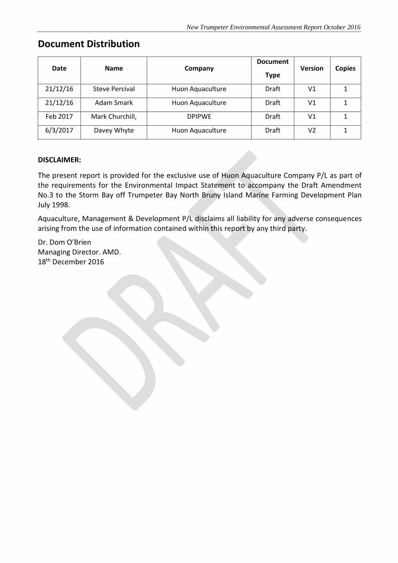
Document Distribution
Date Name Company Document
Type Version Copies
21/12/16 Steve Percival Huon Aquaculture Draft V1 1
21/12/16 Adam Smark Huon Aquaculture Draft V1 1
Feb 2017 Mark Churchill, DPIPWE Draft V1 1
6/3/2017 Davey Whyte Huon Aquaculture Draft V2 1
DISCLAIMER:
The present report is provided for the exclusive use of Huon Aquaculture Company P/L as part of the requirements for the Environmental Impact Statement to accompany the Draft Amendment No.3 to the Storm Bay off Trumpeter Bay North Bruny Island Marine Farming Development Plan July 1998.
Aquaculture, Management & Development P/L disclaims all liability for any adverse consequences arising from the use of information contained within this report by any third party.
Dr. Dom O’Brien Managing Director. AMD. 18th December 2016

New Trumpeter Environmental Assessment Report October 2016
Contents
1 Summary ................................................................................................................................. 5
2 Operational Summary ............................................................................................................. 6
3 Location and Survey Maps ....................................................................................................... 7
4 Underwater Video Survey........................................................................................................ 8
5 Sediment Characterisation .................................................................................................... 16
6 Gazameda Gunnii Survey ....................................................................................................... 21
List of Figures Figure 1 Location and Survey Maps – New Trumpeter Zone area .......................................................................................... 7 Figure 2 Screenshots of ROV footage from sites R1 R3 R4 R21 R25.......................................................................................15 Figure 3 Examples of shells observed at indicated sites, top – site 22 Maoricolpus roseus specimens, middle and
bottom – site 19 Austrodrillia beraudiana specimens. ................................................................................................21
List of Tables Table 1 ROV List of spot dives undertaken ..............................................................................................................................10 Table 2 ROV descriptions for the 25 video dives undertaken within the proposed marine farming zone North East of
Trumpeter Bay. ................................................................................................................................................................11 Table 3 Description and photographs of the Van Veen grab samples. ..................................................................................17

New Trumpeter Environmental Assessment Report October 2016
5
1 Summary
The nature of the seafloor described by ROV and sediment grab samples and Gazameda Gunnii survey components of an initial environmental assessment of a proposed new marine farming zone north of Trumpeter Bay on the western side of Storm Bay, was conducted in October 2016. The bathymetry and habitat mapping (by sonar) component of the EIS survey are presented in a separate report provided by CSIRO.
The survey area covered 7.98 km2 (798 ha) and was located approximately 1.5 to 4kms from the North Bruny Island shoreline. The proposed lease within the survey area covered 2km2 (200 ha), and was located approximately 2 to 3kms from the shore. From the ROV survey the great majority of sites shared the common features of fine to medium grained rippled sands, with varying amounts of shells and shell grit or gravel. Shells and shell grit appeared more prevalent towards the northern and more shallow end of the survey area and were especially prevalent at sites R1 & R8. The fauna was depauperate consisting generally of ascidians and Screw shells (found at most sites), and Japanese seastars, Hermit crabs and Ribbon worms (at a few sites only). However, there appeared to be numerous Anthozoa (suspected Edwardsiidae) at most sites. There was also the occasional Flounder, Flathead and Stingaree. Two introduced species were identified from the survey footage, the Japanese seastar (A. amurensis) and the Screw shell (M. roseus). Drift algae was present at all sites. The results for the sediment grab samples mirror the film footage in that all sites were composed of fine to medium rippled sands, yellow-brown in colour. Again, the two exceptions were sites 1 and 8 where larger shell debris dominated the samples. Dark grey/black silt was also present beneath the surface at several sites across the survey area. Larger infauna found in multiple grab samples across the survey area included, heart urchins, Screw shells, bivalves and gastropods, with the occasional hermit crab. The fine to medium grained sands dominating the whole survey area are broadly indicative of a sedimentary environment with moderate agitation of seabed sediments. These patterns are considered typical of sediments in exposed locations. The overall similarity in particle size distribution between sites implies similar depositional environments. No live or “old shell” Gazameda gunnii specimens were detected in any grab samples from the 25 sites included in that part of the survey.

New Trumpeter Environmental Assessment Report October 2016
6
2 Operational Summary Contractor: AQUACULTURE, MANAGEMENT & DEVELOPMENT PTY LTD (AMD) ACN 079 618 385
Phone 0421 331797 e-mail: dompobrien@ gmail.com Client: Huon Aquaculture Company P/L (Huon)
188 Collins St., Hobart 7000 T: 03 62958111 Liaison: Steve Percival/Adam Smark
Field work: Huon Aquaculture Company P/L (Huon) Huon Personnel: Adam Smark, Bill Joyes, Mick Gardam Laboratory Analysis: Gazamada Gunnii identification, Dr Dom O’Brien , AMD. Reporting: Initial ROV and sediments reporting provided by Adam Smark (Huon). The rest of the reporting and analysis was provided by AMD. AMD Personnel: Dom O’Brien - Reporting, review of ROV and analysis of G.gunnii and
other faunal samples. Methodology: The benthic habitat survey of the proposed marine farming zone North East of Trumpeter Bay was conducted on the 3rd of October (Figure 1). All surveys were done from the MFV Morticia.
Filming for this assessment (spot dives) was carried out using a VideoRay Remotely Operated Inspection System using a colour video camera with 180 degrees of tilt range, high resolution and 0.004 lux of sensitivity, accompanied by two optimised LED arrays (3,600 lumens) adjustable lights. Attached to the ROV was a GoPro Hero 4+ mounted on the dorsal surface of the ROV tilted to capture footage of the benthic surface. The ROV was driven 25 to 50 cm above the seafloor for two minutes at 25 sample sites in order to classify and verify habitat and collect more detailed information on habitat characteristics. (Figure 1). The positions of all spot dives, sediment sample sites and G. gunnii survey sites were located and stamped with date, time, depth and positional information by Differential GPS using a Getac mobile GIS unit with attached Novatel Smart Antenna DGPS. The video was analysed for flora and fauna abundance, and physical sediment structure and habitat assessed for patchiness (Table 2). Sediment and G. gunnii samples were collected using a Van Veen sediment sample grab at the same 25 sample sites used in the ROV survey (Figure 1) and 5 additional sites in the vicinity of the prospective lease area (#26-30). These samples were used for assessing physical characteristic, colour and texture as well as odour. Biota collected from the sediment grab were also identified where relevant.

New Trumpeter Environmental Assessment Report October 2016
7
3 Location and Survey Maps
Figure 1 Location and Survey Map – New Trumpeter Zone survey area.
Key to map: 1-25 - Sediment sample sites and ROV spot dives 26-30 - Sediment sample sites only Red dashed outline - Broad survey area Black rectangle – Proposed lease boundary. For sample site coordinates please refer to Table 1.

New Trumpeter Environmental Assessment Report October 2016
8
4 Underwater Video Survey Observations from filming The appearance of the seabed in the vicinity of the 25 sites covering the was recorded by filming spot dives of the sea floor using a VideoRay Remote Observation Vehicle (ROV). Survey sites were located at positions as illustrated in Figure 1 and listed in Table 1. Descriptions of video footage are summarised for each site in

New Trumpeter Environmental Assessment Report October 2016
9
Table 2. Digital recording of all control, compliance and internal lease dive sites for the MARL has been forwarded to the Marine Farming Branch, DPIPWE, and screenshots of some of the sites are provided in

New Trumpeter Environmental Assessment Report October 2016
10
Figure 2. Table 1 ROV List of spot dives undertaken

New Trumpeter Environmental Assessment Report October 2016
11
Table 2 ROV descriptions for the 25 video dives undertaken within the proposed marine farming zone North East of Trumpeter Bay.
Site Easting Northing Description
R1 533826 5226955 Mixed Sand/shell ridges/ripples with gravel/large shell debris between ridges. Many turritellids (Maoricolpus sp.) , abandonded shells & shell
debris observed. Hermit crabs, one flathead (Platycephalus sp.) , one stingaree (Urolophus sp.). Drift algae and some small reds attached to
shells.
R2 534167 5227545 Rippled sand with shell grit/debris. Bioturbation. Six Ascidians (Sycozoa sp. ). Many suspected Edwardsiidae Anthozoa. Hermit crab and few
turritellids (Maoricolpus sp.). Drift algae.
R3 534587 5227626 Ridges of course sand with shell grit/debris. Bioturbation. Five ascidians (Sycozoa sp.) and few turritellids (Maoricolpus sp.) . Many suspected
Edwardsiidae Anthozoa. Drift algae.
R4 533780 5226399 Rippled sand with some fine gravel & shell grit/debris. Bioturbation. Many suspected Edwardsiidae Anthozoa. Two seastars (Asterias amurensis) , three ribbon worms and few turritellids (Maoricolpus sp.) . Drift algae.
R5 534239 5227227 Rippled sand with shell grit/debris. Bioturbation. Two ascidians (Sycozoa sp. ). Many suspected Edwardsiidae Anthozoa. Drift algae.
R6 534303 5226354 Rippled sand with shell grit/debris. Bioturbation. Two seastar (Asterias amurensis) , one ascidian (Sycozoa sp.) and few turritellids (Maoricolpus sp.) . Many suspected Edwardsiidae Anthozoa. Drift algae.
R7 534691 5226749 Rippled sand with shell grit/debris. Bioturbation. Many suspected Edwardsiidae Anthozoa. Five ascidians (Sycozoa sp.) and a few turritellids
(Maoricolpus sp.) . Drift algae.
R8 535062 5227142 Ridges of gravel with shell debris between ridges. Abandonded shells & shell debris. Many turritellids (Maoricolpus sp.), Hermit crabs and one
ascidians (Sycozoa sp.) . A few suspected Edwardsiidae Anthozoa. Drift algae and some small reds attached to shells.
R9 534056 5225721 Rippled sand with shell grit/debris. Bioturbation. Two seastars (Asterias amurensis ). Many suspected Edwardsiidae Anthozoa. Drift algae.
R10 534440 5225462 Rippled sand with shell grit/debris. Bioturbation. Two seastars (Asterias amurensis ), four ascidians (Sycozoa sp .), one hermit crab and one
ribbon worm. Many suspected Edwardsiidae Anthozoa. Drift algae.
R11 534838 5225849 Rippled sand with a lot of shell grit/debris. Bioturbation. Twenty one ascidians (Sycozoa sp.) and a few turritellids (Maoricolpus sp.) . A few
suspected Edwardsiidae Anthozoa.Drift algae.
R12 535191 5226164 Rippled sand with shell grit/debris. Bioturbation. Three ascidians (Sycozoa sp. ). Many suspected Edwardsiidae Anthozoa. Drift algae.
R13 535518 5226558 Rippled sand with shell grit/debris. Bioturbation. Five ascidians (Sycozoa sp.) , one hermit crab, few turritellids (Maoricolpus sp.) and sea urchin
test. Many suspected Edwardsiidae Anthozoa. Drift algae.
R14 534482 5224732 Rippled sand with shell grit/debris. Bioturbation. One ascidian (Sycozoa sp. ). A few suspected Edwardsiidae Anthozoa.Drift algae.
R15 534900 5224884 Rippled sand with shell grit/debris. A few suspected Edwardsiidae Anthozoa. Bioturbation and drift algae.
R16 535273 5225349 Rippled sand with shell grit/debris. Bioturbation. One seastar (Asterias amurensis ), three ascidians (Sycozoa sp .) and one ribbon worm. A few
suspected Edwardsiidae Anthozoa. Drift algae.
R17 535612 5225632 Rippled sand with shell grit/debris. Bioturbation. Three ascidians (Sycozoa sp. ). Many suspected Edwardsiidae Anthozoa. Drift algae.
R18 536043 5226012 Rippled sand with shell grit/debris. Bioturbation. Four ascidians (Sycozoa sp.) , one ribbon worm and few turritellids (Maoricolpus sp.) . Many
suspected Edwardsiidae Anthozoa. Drift algae.
R19** 534651 5224258 Rippled sand with shell grit/debris. Bioturbation. Two ascidians (Sycozoa sp.) , a few turritellids (Maoricolpus sp.) and one ribbon worm. A few
suspected Edwardsiidae Anthozoa. Drift algae.
R20 534808 5223840 Rippled sand with shell grit/debris. Bioturbation. Two ribbon worms, few turritellids (Maoricolpus sp.) and one flounder (Rhombosolea tapirina) .
Many suspected Edwardsiidae Anthozoa. Drift algae.
R21 535352 5224445 Rippled sand with shell grit/debris. Bioturbation. Many suspected Edwardsiidae Anthozoa. Two ribbon worms. Drift algae.
R22 535746 5224816 Rippled sand with shell grit/debris. Bioturbation. Seven ascidians (Sycozoa sp .) and one ribbon worm. Many suspected Edwardsiidae
Anthozoa. Drift algae.
R23 536158 5225097 Rippled sand with shell grit/debris. Bioturbation. One seastar (Asterias amurensis) , one ascidian (Sycozoa sp.) , one hermit crab, a few
turritellids (Maoricolpus sp.) and four ribbon worms. Many suspected Edwardsiidae Anthozoa. Drift algae.
R24 536485 5225491 Rippled sand with shell grit/debris. Bioturbation. A few turritellids (Maoricolpus sp.) . Many suspected Edwardsiidae Anthozoa. Drift algae.
R25 536513 5225826 Rippled sand with shell grit/debris. Bioturbation. A few turritellids (Maoricolpus sp.) . Many suspected Edwardsiidae Anthozoa. Drift algae.
R SPM 11183 524748 5242505
* The time on the ROV video overlay had not been adjusted for daylight savings. Please add 1 hour for correct time
** The GoPro footage for R19 is incomplete. Please use ROV footage for complete footage

New Trumpeter Environmental Assessment Report October 2016
12
Interpretation – general comments on spot dive locations

New Trumpeter Environmental Assessment Report October 2016
13
Table 2 provides a list of seabed sediment characteristics and fauna observations from the 25 ROV spot dives undertaken. The great majority of sites shared the common features of fine to medium rippled sands (

New Trumpeter Environmental Assessment Report October 2016
14
Figure 2, R2-R7 and R9, R10 and R12-R25), with varying degrees of shells and shell grit or gravel. Larger shells and shell fragments were abundant at sites R1, R8 and R11. The fauna appeared to be depauperate consisting generally of Sycozoan ascidians and Maoricolpus Screw shells (found at most sites), and Japanese seastars, Hermit crabs and Ribbon worms (at a few sites only). However, there appeared to be numerous Anthozoa (suspected Edwardsiidae) at most sites (an example of these shown at site R25 in Figure 2). These appeared to be fewer in number at those sites with many larger shells. There was also the occasional Flounder, Flathead and Stingaree. Drift algae was present at all sites with some attached reds also found on the shell fragments at sites R1, R8 and R11. Two introduced species were identified from the survey footage, the Japanese seastar Asterias amurensis and the Screw shell Maoricolpus roseus.

New Trumpeter Environmental Assessment Report October 2016
15
Figure 2 Screenshots of ROV footage from sites R1 R3 R4 R21 R25
Key: Top left - R1 close up (<20cm distance) of accumulated shell debris between sand ridges Top right - R1 view of accumulated shells in the ripples from 0.5-1m distance 2nd row left - R1 view of accumulated shells at a distance of 30-40cm 2nd row right - R4, finer shell grit 3rd row left - R3, ripples and fine to medium sands 3rd row right - R21, ripples and fine to medium sands Bottom row left - R25, ripples and fine to medium sands Bottom row right - R25, suspected Edwardsiidae anemones
New Trumpeter Environmental Assessment Report October 2016
16
5 Sediment Characterisation Descriptions of the sediments and photographs of the sediment samples taken by Van Veen grab are provided in Table 3 below. The results for the sediment grab samples mirror the film footage in that all sites were composed of fine to medium rippled sands, yellow-brown in colour. Two notable exceptions were sites 1 and 8 where larger shell debris dominated the samples. Dark grey/black silt was also present beneath the surface at several sites across the survey area. There was no odour detected in any of the samples. The fine to medium grained sands dominating the whole survey area are broadly indicative of a sedimentary environment with moderate agitation of seabed sediments and associated low abundance of fine silt and clay fractions. These patterns are considered typical of sediments in deep (i.e. >20 m) and exposed locations. The overall similarity in particle size distribution between sites implies similar depositional environments. Larger infauna found in multiple samples across the survey area included, heart urchins (Echinocardium cordatum), Screw shells (M. roseus), bivalves (Placamen placidium) and gastropods (Australlodrillia beraudiana).

New Trumpeter Environmental Assessment Report October 2016
17
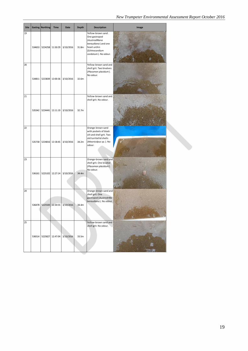
Table 3 Description and photographs of the Van Veen grab samples.
Site Easting Northing Time Date Depth Description Image
1
533826 5226958 8:12:37 3/10/2016 26.3m
Shell grit with brown and orange gravel/sand. Live turritellids (Maoricolpus sp. ) and hermit crab (suspected Pagurid). No odour.
2
534167 5227553 8:38:42 3/10/2016 26.4m
Yellow-brown sand with shell grit. One turritellid (Maoricolpus sp .) and two bivalves (Placamen placidum ). No odour
3
534577 5227618 8:54:49 3/10/2016 26.7m
Yellow-brown sand with shell grit. One abandoned turritellid (Maoricolpus sp.). One heart urchin (Echinocardium cordatum ) and hermit crab (suspected Pagurid). No odour
4
533777 5226398 9:16:46 3/10/2016 26.2m
Yellow-brown sand with shell grit. No odour.
5
534238 5227230 9:36:02 3/10/2016 27.1m
Yellow-brown sand with pockets of black silt and shell grit. One old turritellid shell (Maoricolpus sp. ) and two bivalves (Placamen placidum ). No odour.
6
534301 5226354 9:46:56 3/10/2016 28.4m
Yellow-brown sand with shell grit. Three bivalves (Placamen placidum). No odour.
7
534688 5226746 9:54:43 3/10/2016 28.9m
Yellow-brown sand with shell grit. Three old turritellid shells (Maoricolpus sp. ), one bivalve (Placamen placidum ) and one gastropod (Austrodrillia beraudiana ). No odour.
8
535062 5227139 10:05:01 3/10/2016 29.2m
Shell grit with yellow and brown gravel. Live turritellids (Maoricolpus sp ). No odour.
9
534055 5225724 10:24:26 3/10/2016 28.0m
Yellow-brown sand with pockets of black silt and shell grit. Two bivalves (Placamen placidum ) and one heart urchin (Echinocardium cordatum ). No odour.

New Trumpeter Environmental Assessment Report October 2016
18
Site Easting Northing Time Date Depth Description Image
10
534429 5225473 10:33:41 3/10/2016 29.8m
Yellow-brown sand with pockets of black silt. No odour.
11
534830 5225847 10:40:34 3/10/2016 31.0m
Yellow-brown sand with shell grit. One old polychaete tube. No odour.
12
535188 5226163 10:49:30 3/10/2016 30.5m
Yellow-brown gravel/sand with pockets of black silt and shell grit. One bivalve (Placamen placidum ) and one heart urchin (Echinocardium cordatum ). No odour.
13
535530 5226562 10:57:13 3/10/2016 30.8m
Yellow-brown sand and shell grit. Three bivalves (Placamen placidum ) and one heart urchin (Echinocardium cordatum ). No odour.
14
534476 5224720 11:06:15 3/10/2016 30.7m
Orange-brown sand and shell grit. One bivalve (Placamen placidum ) and one heart urchin (Echinocardium cordatum ). No odour.
15
534903 5224882 11:14:44 3/10/2016 32.2m
Yellow-brown sand. No odour.
16
535272 5225354 11:21:35 3/10/2016 32.3m
Yellow-brown sand and shell grit. One bivalve (Placamen placidum ). No odour.
17
535616 5225627 11:31:27 3/10/2016 32.6m
Yellow-brown sand with pockets of black silt and shell grit. One old turritellid shell (Maoricolpus sp. ) and two bivalves (Placamen placidum ). No odour.
18
536041 5226009 11:40:08 3/10/2016 32.7m
Yellow-brown sand and shell grit. Three bivalves (Placamen placidum ) and one heart urchin (Echinocardium cordatum ). No odour.
New Trumpeter Environmental Assessment Report October 2016
19
Site Easting Northing Time Date Depth Description Image
19
534653 5224258 11:50:29 3/10/2016 31.8m
Yellow-brown sand . One gastropod (Austrodilliana beraudiana ) and one heart urchin (Echinocardium cordatum ). No odour.
20
534811 5223839 12:00:36 3/10/2016 32.6m
Yellow-brown sand and shell grit. Two bivalves (Placamen placidum ). No odour.
21
535342 5224441 12:11:19 3/10/2016 32.7m
Yellow-brown sand and shell grit. No odour.
22
535758 5224816 12:18:45 3/10/2016 34.2m
Orange-brown sand with pockets of black silt and shell grit. Two old turritellid shells (Maoricolpus sp. ). No odour.
23
536161 5225102 12:27:14 3/10/2016 34.4m
Orange-brown sand and shell grit. One bivalve (Placamen placidum ). No odour.
24
536478 5225500 12:34:55 3/10/2016 34.4m
Orange-brown sand and shell grit. One gastropod (Austrodrillia beraudiana ). No odour.
25
536514 5225827 12:47:04 3/10/2016 33.5m
Yellow-brown sand and shell grit. No odour.

New Trumpeter Environmental Assessment Report October 2016
20
Site Easting Northing Time Date Depth Description Image
26
534125 5226696 3:13:33 3/10/2016 27.3m
Yellow-brown sand with shell grit/debris. One abandoned turritellid (Maoricolpus sp. ). No odour.
27
534697 5226200 3:27:11 3/10/2016 29.5m
Yellow-brown sand with shell grit/debris. Two bivalves (Placamen placidum ). No odour.
28
535607 5226042 3:33:34 3/10/2016 31.6m
Yellow-brown sand with shell grit/debris. No odour.
29
536097 5225602 3:59:19 3/10/2016 33.5m
Yellow-brown sand with shell grit/debris. No odour.
30
535646 5225150 4:07:56 3/10/2016 33.3m
Yellow-brown sand with shell grit/debris. One heart urchin (Echinocardium cordatum ). No odour.

New Trumpeter Environmental Assessment Report October 2016
21
6 Gazameda Gunnii Survey
No live or “old shell” Gazameda gunnii specimens were detected in any grab samples from the 25 sites included in the survey. Turritellids were common but consisted entirely of Maoricolpus roseus as live and dead specimens (shells). There were also a few Turritellid-like molluscs such as Austrodrillia beraudiana collected in a few of the grabs (e.g site 19).
Figure 3 Examples of shells observed at indicated sites, top – site 22 Maoricolpus roseus specimens, middle and bottom – site 19 Austrodrillia beraudiana specimens.