historical maps of europe - jewish genealogical society of ... · pdf file caution: website...
TRANSCRIPT
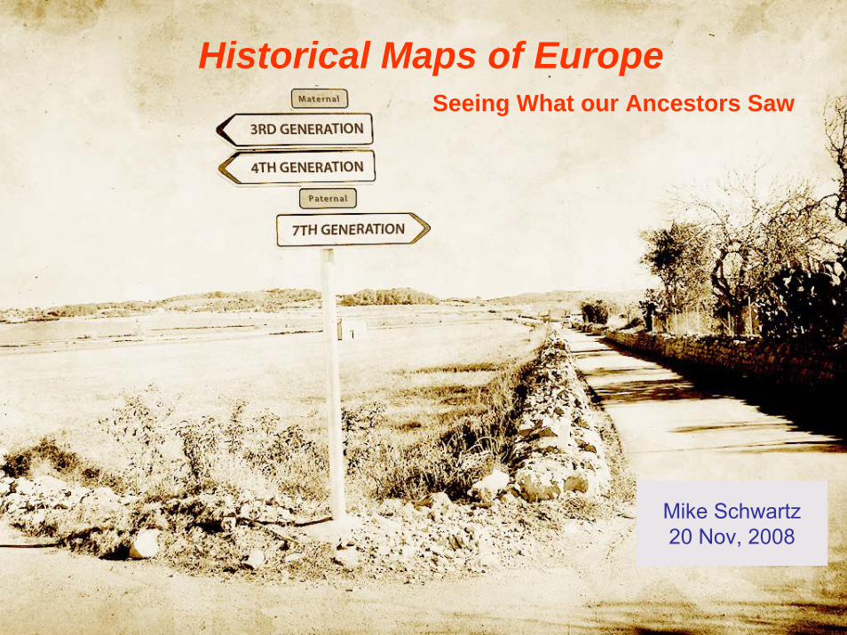
Mike Schwartz20 Nov, 2008
Historical Maps of EuropeSeeing What our Ancestors Saw
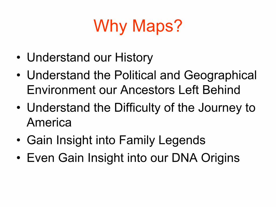
Why Maps?
• Understand our History• Understand the Political and Geographical
Environment our Ancestors Left Behind• Understand the Difficulty of the Journey to
America• Gain Insight into Family Legends• Even Gain Insight into our DNA Origins

If we REALLY want to trace our ancestors.......... 50,000 years ago
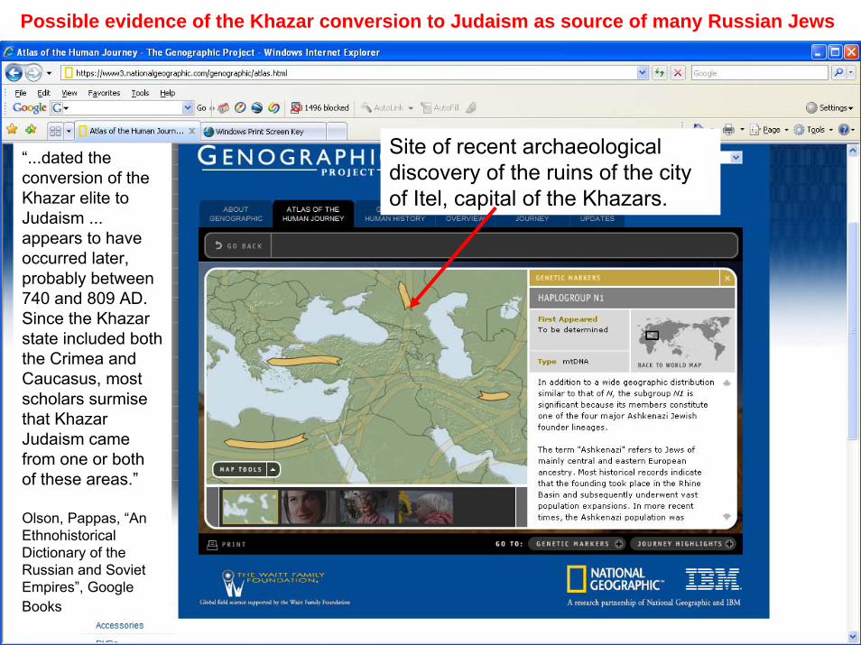
Site of recent archaeological discovery of the ruins of the city of Itel, capital of the Khazars.
Possible evidence of the Khazar conversion to Judaism as source of many Russian Jews
“...dated the conversion of the Khazar elite to Judaism ... appears to have occurred later, probably between 740 and 809 AD. Since the Khazar state included both the Crimea and Caucasus, most scholars surmise that Khazar Judaism came from one or both of these areas.”
Olson, Pappas, “An Ethnohistorical Dictionary of the Russian and Soviet Empires”, Google Books
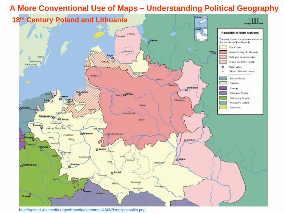
http://upload.wikimedia.org/wikipedia/commons/4/43/Rzeczpospolita.png
18th Century Poland and LithuaniaA More Conventional Use of Maps – Understanding Political Geography
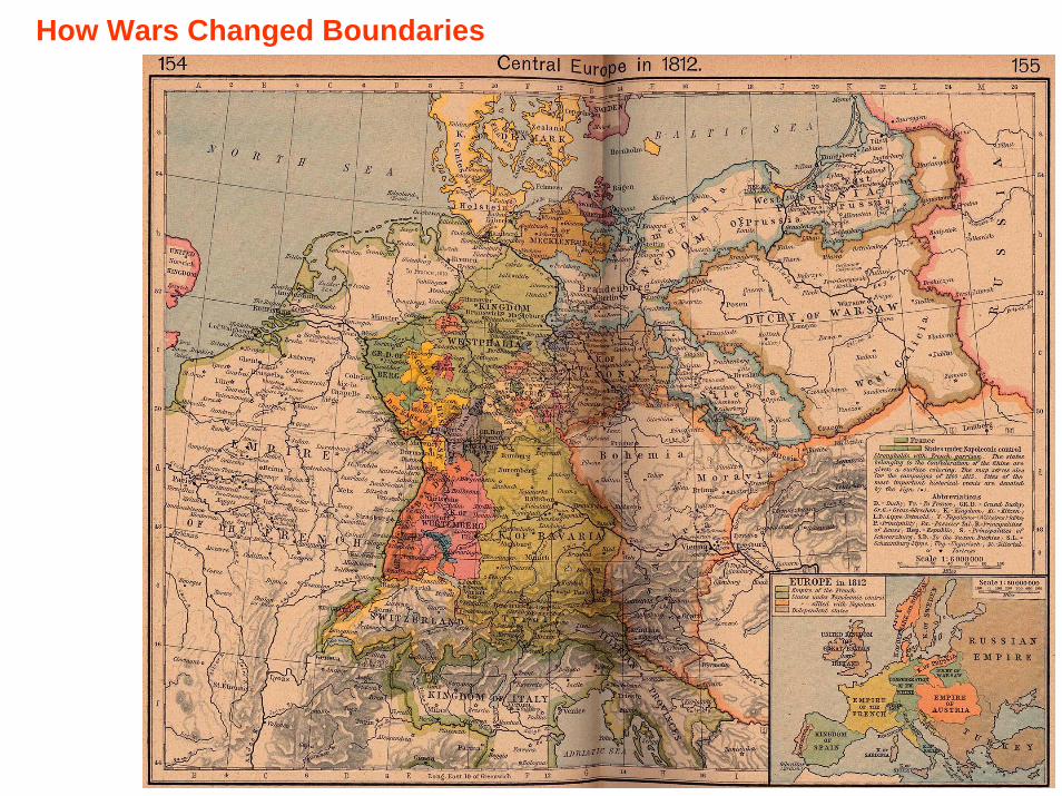
How Wars Changed Boundaries
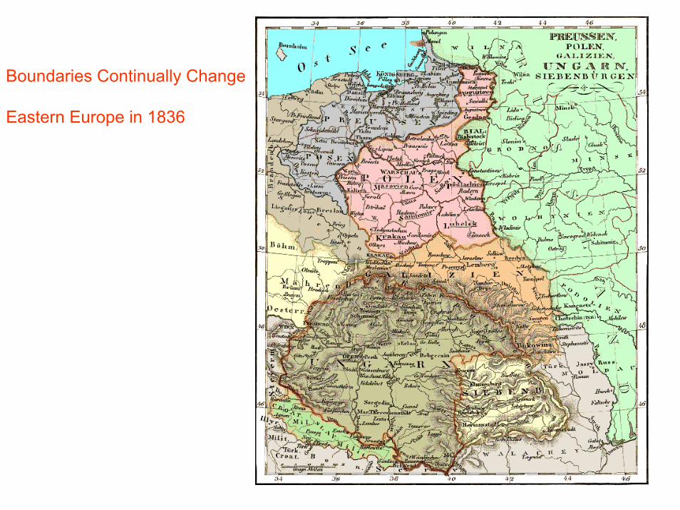
Boundaries Continually Change
Eastern Europe in 1836
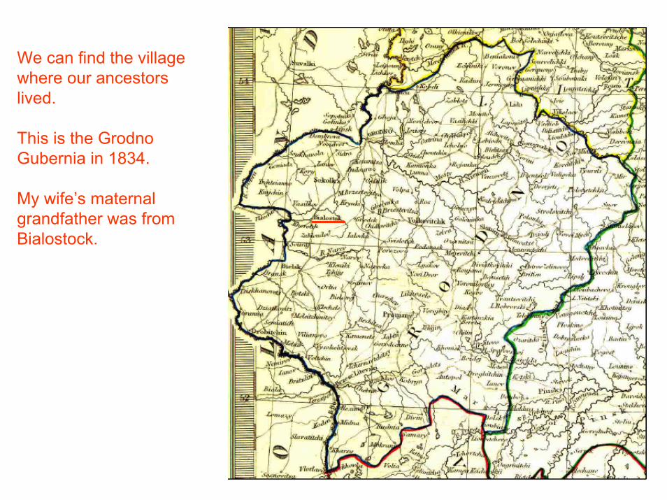
We can find the village where our ancestors lived.
This is the Grodno Gubernia in 1834.
My wife’s maternal grandfather was from Bialostock.

Some Maps are Just Pretty to Look AtGalicia (Austria-Hungary) in 1882
My paternal Grandfather’s Birth Place
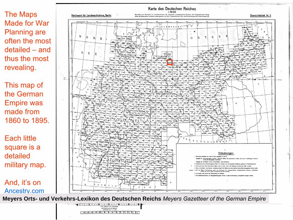
The Maps Made for War Planning are often the most detailed – and thus the most revealing.
This map of the German Empire was made from 1860 to 1895.
Each little square is a detailed military map.
And, it’s onAncestry.com
Meyers Orts- und Verkehrs-Lexikon des Deutschen Reichs Meyers Gazetteer of the German Empire
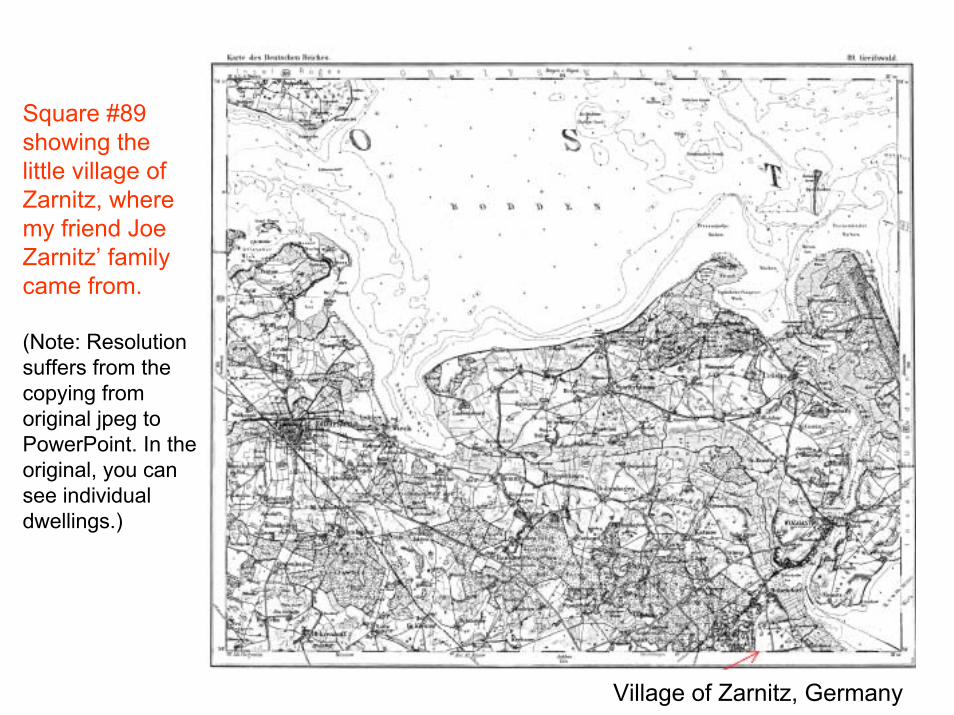
Village of Zarnitz, Germany
Square #89 showing the little village of Zarnitz, where my friend Joe Zarnitz’ family came from.
(Note: Resolution suffers from the copying from original jpeg to PowerPoint. In the original, you can see individual dwellings.)
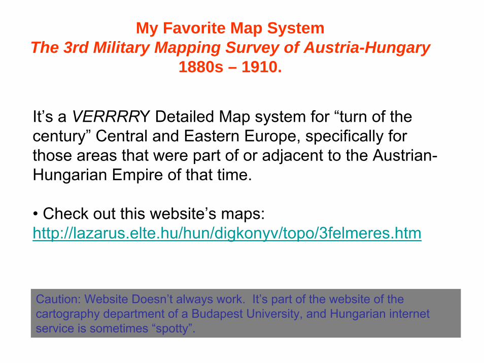
It’s a VERRRRY Detailed Map system for “turn of the century” Central and Eastern Europe, specifically for those areas that were part of or adjacent to the Austrian-Hungarian Empire of that time.
• Check out this website’s maps:http://lazarus.elte.hu/hun/digkonyv/topo/3felmeres.htm
Caution: Website Doesn’t always work. It’s part of the website of the cartography department of a Budapest University, and Hungarian internet service is sometimes “spotty”.
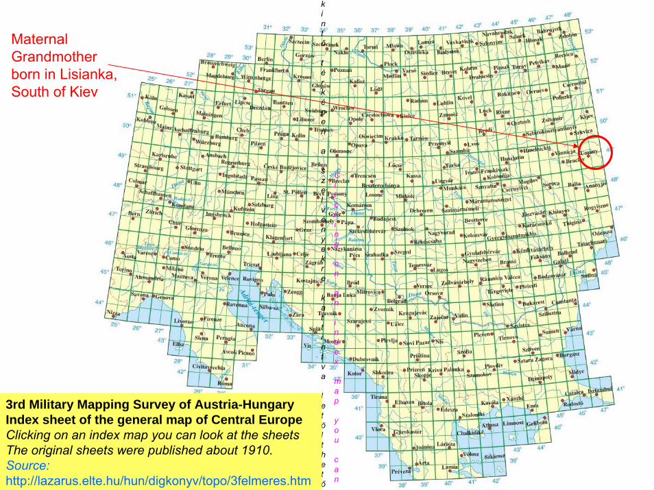
My Favorite Map SystemThe 3rd Military Mapping Survey of Austria-Hungary
1880s – 1910.

kintő
térképen
a
szelvényekre
kattintva
letölthetők
Clicking
on
an
index
map
you
can
3rd Military Mapping Survey of Austria-HungaryIndex sheet of the general map of Central Europe Clicking on an index map you can look at the sheetsThe original sheets were published about 1910.Source:http://lazarus.elte.hu/hun/digkonyv/topo/3felmeres.htm
Germany
ItalyHungary
Ukraine

UhnowLisianka
Krasnopol
Niemerow
Mike Schwartz’s Family Ancestors Migrated to America Between 1886 and 1927
New York

Schmul Malogolowke(Sam Malow)
Arr NY 15 Dec 1904With $112
Benjamin Malagalow(Ben Mallow)
Arr NY 16 Apr 1907With $400
?Mot Malagalowsky
(Max Mollow)Arr. NY 12 Nov 1907
With $700
Dweire Korotinsky Malagalowsky(Dora Mollow)
Arr. NY 12 Nov 1907
Abram Malagalowsky(Abe Mollow)
Arr NY 12 Nov 1907
Feige Malagalowsky(Frances Mollow Zeresky)
Arr NY 12 Nov 1907
(“Nana”)
Family Legend:(Maternal Grandmother)
• Nana Was From Kiev• Nana’s Family was Wealthy in Russia• Nana’s Father was an Inn Keeper
Discovered Facts: • Family was from Lisianka in Kiev Gubernia• Family DID have $Money$ when they immigrated
Source: Various Ship Manifests
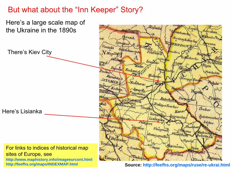
Here’s a large scale map of the Ukraine in the 1890s
There’s Kiev City
Here’s Lisianka
But what about the “Inn Keeper” Story?
For links to indices of historical map sites of Europe, seehttp://www.maphistory.info/imageeurcont.htmlhttp://feefhs.org/maps/INDEXMAP.html Source: http://feefhs.org/maps/ruse/re-ukrai.html
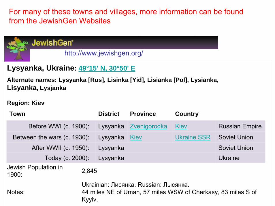
Lysyanka, Ukraine: 49°15' N, 30°50' EAlternate names: Lysyanka [Rus], Lisinka [Yid], Lisianka [Pol], Lysianka, Lisyanka, Lysjanka
Region: Kiev
Jewish Population in 1900: 2,845
Notes:Ukrainian: Лисянка. Russian: Лысянка. 44 miles NE of Uman, 57 miles WSW of Cherkasy, 83 miles S of Kyyiv.
Town District Province Country
Before WWI (c. 1900): Lysyanka Zvenigorodka Kiev Russian Empire
Between the wars (c. 1930): Lysyanka Kiev Ukraine SSR Soviet Union
After WWII (c. 1950): Lysyanka Soviet UnionToday (c. 2000): Lysyanka Ukraine
For many of these towns and villages, more information can be found from the JewishGen Websites
http://www.jewishgen.org/
kintő
térképen
a
szelvényekre
kattintva
letölthetők
Clicking
on
an
index
map
you
can
3rd Military Mapping Survey of Austria-HungaryIndex sheet of the general map of Central Europe Clicking on an index map you can look at the sheetsThe original sheets were published about 1910.Source:http://lazarus.elte.hu/hun/digkonyv/topo/3felmeres.htm
Maternal Grandmother born in Lisianka, South of Kiev
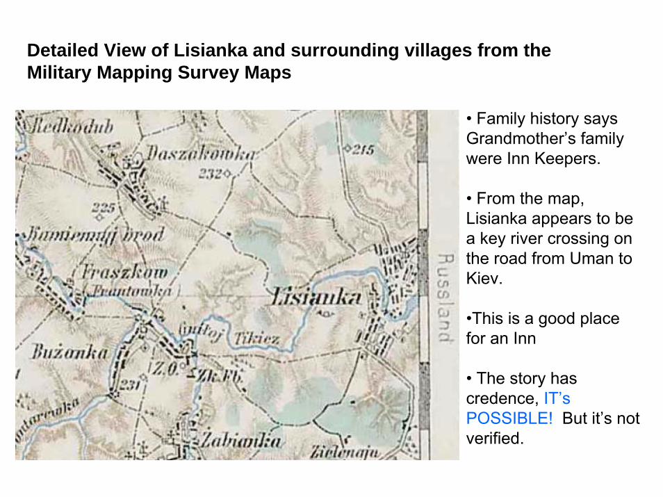
Detailed View of Lisianka and surrounding villages from the Military Mapping Survey Maps
• Family history says Grandmother’s family were Inn Keepers.
• From the map, Lisianka appears to be a key river crossing on the road from Uman to Kiev.
•This is a good place for an Inn
• The story has credence, IT’sPOSSIBLE! But it’s not verified.

Images of early maps on the web12a. Continental Europe(excluding British Isles)
•Europe. 'Antique Maps Gallery' (seven 19th-century, enlargeable, high res. maps of Germany,Greece, Italy and Turkey - Christos Nüssli) {February, 2003}
•Europe. 'Carte Générale des Postes de l'Europe' (enlargeable, high res. images of John Rocque'swall map of the roads of Europe (Sayer, 1781) - Christos Nüssli) {February, 2003}
•Europe. 'Cartographies' (a small selection of large 18th & 19th century maps of the countries ofEurope and the Mediterranean; you can bring up pre-selected sections at fairly high res. - euratlas){April, 2006}
•Europe. 'Facsimile Maps from the Mercator Atlas of Europe' (scroll down to a list of the low res.maps - Walking Tree Press, 1998)
•Europe. 'Garnisonkarte von Mitteleuropa' (high res. image of the 1897 map) {July, 2005}
•Europe. H.C. BERANN (bibliography, with sample illustrations, of the entire oeuvre of 566‘panorama’ maps (mostly of Austria, Italy and Switzerland) by Heinrich Caesar Berann [1915-99] -Matthias Troyer) {September, 2004}
•Europe. ‘Historical- Geographical Encyclopedia of the World (1880-1898): Historical Maps’ (asingle alphabetical index leads to high res. images of late 19th century maps of countries (47) andcities (88) [mostly European] - Hanno Kolbe, Hic Leones) {February, 2005}
http://www.maphistory.info/imageeurcont.html