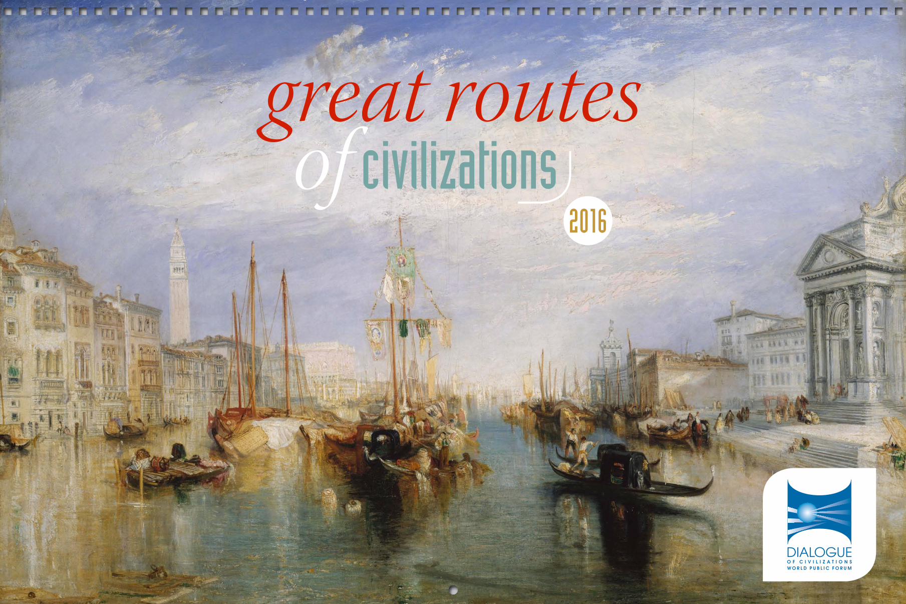
great routs of civilizations, calendar 2016
TRANSCRIPT
great routesof civilizations
2016
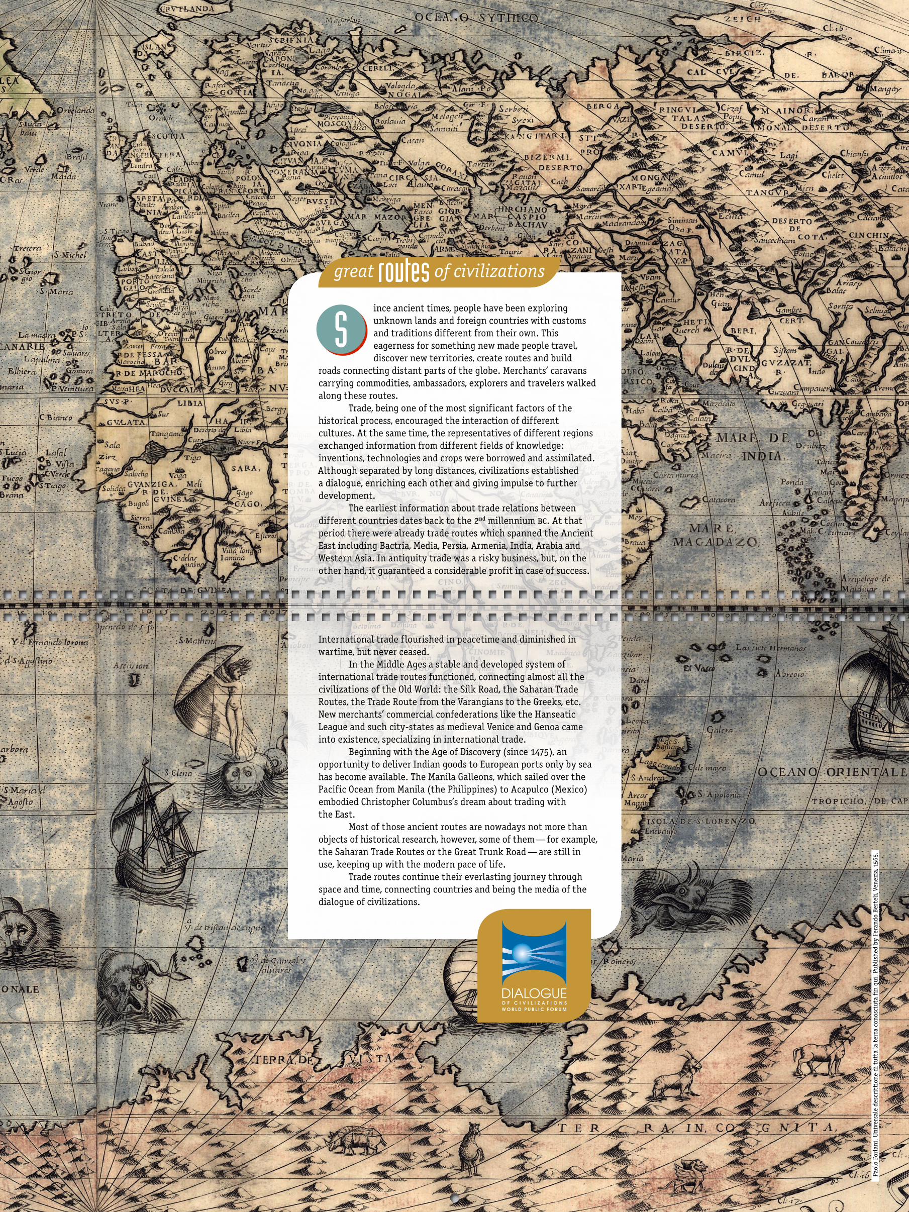
ince ancient times, people have been exploring unknown lands and foreign countries with customs and traditions different from their own. This eagerness for something new made people travel, discover new territories, create routes and build
roads connecting distant parts of the globe. Merchants’ caravans carrying commodities, ambassadors, explorers and travelers walked along these routes.
Trade, being one of the most significant factors of the historical process, encouraged the interaction of different cultures. At the same time, the representatives of different regions exchanged information from different fields of knowledge: inventions, technologies and crops were borrowed and assimilated. Although separated by long distances, civilizations established a dialogue, enriching each other and giving impulse to further development.
The earliest information about trade relations between different countries dates back to the 2nd millennium bc. At that period there were already trade routes which spanned the Ancient East including Bactria, Media, Persia, Armenia, India, Arabia and Western Asia. In antiquity trade was a risky business, but, on the other hand, it guaranteed a considerable profit in case of success.
International trade flourished in peacetime and diminished in wartime, but never ceased.
In the Middle Ages a stable and developed system of international trade routes functioned, connecting almost all the civilizations of the Old World: the Silk Road, the Saharan Trade Routes, the Trade Route from the Varangians to the Greeks, etc. New merchants’ commercial confederations like the Hanseatic League and such city-states as medieval Venice and Genoa came into existence, specializing in international trade.
Beginning with the Age of Discovery (since 1475), an opportunity to deliver Indian goods to European ports only by sea has become available. The Manila Galleons, which sailed over the Pacific Ocean from Manila (the Philippines) to Acapulco (Mexico) embodied Christopher Columbus’s dream about trading with the East.
Most of those ancient routes are nowadays not more than objects of historical research, however, some of them — for example, the Saharan Trade Routes or the Great Trunk Road — are still in use, keeping up with the modern pace of life.
Trade routes continue their everlasting journey through space and time, connecting countries and being the media of the dialogue of civilizations.
S
great of civilizationsroutes
Pao
lo F
orla
ni. U
nive
rsal
e de
scri
ttio
ne d
i tut
ta la
ter
ra c
onos
ciut
a fi
n qu
i. P
ublis
hed
by F
eran
do B
erte
li, V
enez
ia, 1
565.

2016
his trade route, which connected Scandinavia, Kievan Rus, and the Byzantine Empire, allowed traders from both Kievan Rus and Byzantine to establish prosperous, direct trade amongst each other. The route was
in the form of a long-distance waterway, which traveled through the Baltic Sea as well as several rivers flowing into it, and rivers of the Dnieper river system with portages located on the drainage divides.
Although first mentioned in the Primary Chronicle, this route’s impact was reported much earlier — in the early 9th century, when the Byzantines noticed some newcomers in their regions, these being Varangians. Today, the word “Varangians” means “Vikings,” however, for the Byzantines, this was a term used to describe all Scandinavians, including several tribes living on the territory of modern-day Russia.
The Trade Route from the Varangians to the Greeks was used primarily to transport various merchandise. Wine and spices, jewelry and glass, expensive fabrics, icons and books would be brought up from the Byzantine Empire. Kiev would trade in silver coins, bread, and handmade goods, among others. Spinning wheels came from Volyn, handicrafts and weaponry — from Scandinavia. Northern Rus, in turn, offered fur, timber, wax and honey, while the Baltic tribes would trade mostly in amber.
Routes that were more advantageous were opened with the Crusades in the second half of the 11th century. By that time, Rus had already strengthened its commercial ties with Western Europe, causing the Route from the Varangians to the Greeks to gradually lose its significance.
T
great of civilizationsroutes
Mon Tue Wed Thu Fri Sat Sun
1 2 3 4 5 6 7 8 9 10 11 12 13 14 15 16 17 18 19 20 21 22 23 24 25 26 27 28 29 30 31
Mon Tue Wed Thu Fri Sat Sun
1 2 3 4 5 6 7 8 9 10 11 12 13 14 15 16 17 18 19 20 21 22 23 24 25 26 27 28 29 30 31
januaryjanuaryNikolai Rerikh. Overseas guests. 1901
the trade route from the varangians to the greeks

great of civilizationsroutes
2016
he Amber Road is an ancient trade route, which was used to transfer amber from coastal areas of the North and Baltic Seas to the Mediterranean Sea. Amber trade had defined prehistoric trade routes between
Northern and Southern Europe. This significant raw material, termed “the gold of the north,” was transported from the North and Baltic Sea coasts to Italy, Greece, the Black Sea, Syria and Egypt by way of the Vistula and Dnieper rivers for thousands of years, beginning in the 16th century bc.
Large amber beads were found in the breast ornament of the Egyptian pharaoh Tutankhamen (ca. 1333–1324 bc), and it is known that amber was sent as an offering to the temple of Apollo at Delphi from the North Sea. From the Black Sea, trade continued to Asia along another ancient trade route called the Silk Road.
Kaup and Truso, two Old Prussian towns on the Baltic, served as the starting points of the route to the south. Traders traveled south to Carnantum, the Roman Legionary camp in the Alps, and from there, after about 2000 kilometers of paths and unpaved trails leading south from the Baltic Sea, the Amber Road joined the large network of Roman roads which connected all parts of the Empire.
The Via Gemina was the last section of the road, which connected Emona and Aquileia: the Roman capital of the Venetians and the most important Adriatic port of the Roman Empire. Segments of the Roman Amber road can be found today in the Austrian province of Burgenland, as well as in Hungary and Slovenia — and, of course, in Aquileia (Italy).
T
Mon Tue Wed Thu Fri Sat Sun
1 2 3 4 5 6 7 8 9 10 11 12 13 14 15 16 17 18 19 20 21 22 23 24 25 26 27 28 29
Mon Tue Wed Thu Fri Sat Sun
1 2 3 4 5 6 7 8 9 10 11 12 13 14 15 16 17 18 19 20 21 22 23 24 25 26 27 28 29
februaryfebruaryIvan Shishkin. After the tempest. Meri-Khovi. 1891
the amber road

the silk road
2016
great of civilizationsroutes
n ancient network of trade routes was vital for cultural interactions through various regions of the Asian continent. This was the purpose served by the Silk Road, or the Silk Route, which connected the West and
the East and enabled merchants, soldiers, pilgrims, monks, urban dwellers and nomads to travel from China and India to the Mediterranean Sea.
The Silk Road is over 6437 kilometers in length, and derives its name from the historic trade of Chinese silk, which began to be carried out on this road during the Han dynasty (206 bc — 220 ad). Around 114 bc, the Han dynasty expanded the Central Asian segments of the trade routes with the aid of the missions and expeditions of Zhang Qian, a Chinese imperial envoy. Taking great interest in the safe transportation of their trade products, the Chinese extended the Great Wall of China in order to ensure the protection of the trade route.
Trade along the Silk Road opened long-distance political and economic relations between the civilizations of China, Persia, the Indian subcontinent, Europe, the Horn of Africa and Arabia, and was generally an important factor in their development. Silk was definitely the major trade item from China; however, many other goods were traded along the route. In fact, the Silk Road served as a means of cultural interaction among civilizations — with people, religions, syncretic philosophies and technologies travelling along its network.
The United Nations World Tourism Organization, since 1993, has been working towards fostering peace and understanding through the development of sustainable international tourism along the Silk Route.
A
Mon Tue Wed Thu Fri Sat Sun
1 2 3 4 5 6 7 8 9 10 11 12 13 14 15 16 17 18 19 20 21 22 23 24 25 26 27 28 29 30 31
Mon Tue Wed Thu Fri Sat Sun
1 2 3 4 5 6 7 8 9 10 11 12 13 14 15 16 17 18 19 20 21 22 23 24 25 26 27 28 29 30 31
marchmarchNikolai Rusakov. Caravans are walking. 1920s

great of civilizationsroutes
2016
he Radhanites were medieval Jewish merchants who played a major role in trade between the Christian and Islamic worlds in the early Middle Ages (ca. 500–1000). Their trade network was quite vast, covering much
of North Africa, the Middle East, Central Asia, Europe, and parts of India and China — including many already established trade routes from the Roman Empire, which continued to function at this time largely through their efforts.
Throughout the Early Middle Ages, it was common practice in the Islamic countries of the Middle East and North Africa and the Christian kingdoms of Europe to forbid one another’s merchants from entering their ports. Corsairs from both sides raided the shipping of their enemy, and the Radhanites acted as neutral intermediaries to aid both sides in open communication and trade between the territories of the old Roman Empire and the Far East. There were four main trade routes utilized by the Radhanites — all beginning in the Rhone Valley in southern France and stretching all the way to the east coast of China. The Radhanites mainly transported commodities which combined small bulk and high demand, including perfumes, jewelry, spices and silk.
When the Tang Dynasty of China fell in 908, and the Khazar Khaganate was destructed some sixty years later (ca. 968–969 ad), the lands of Inner Eurasia, the Caucasus and China were left in widespread chaos. This caused trade routes to become unsafe and unstable, a situation which was intensified by Turkish invasions of the Middle East and Persia. The Silk Road collapsed for centuries, and the Radhanites, in turn, largely disappeared by the beginning of the 11th century.
T
Mon Tue Wed Thu Fri Sat Sun
1 2 3 4 5 6 7 8 9 10 11 12 13 14 15 16 17 18 19 20 21 22 23 24 25 26 27 28 29 30
Mon Tue Wed Thu Fri Sat Sun
1 2 3 4 5 6 7 8 9 10 11 12 13 14 15 16 17 18 19 20 21 22 23 24 25 26 27 28 29 30
aprilapril
the trade routes of the radhanites
Claude Joseph Vernet. Morning view of the inner port of Marseille and the Pavilion of the Horloge du Parc. 1754
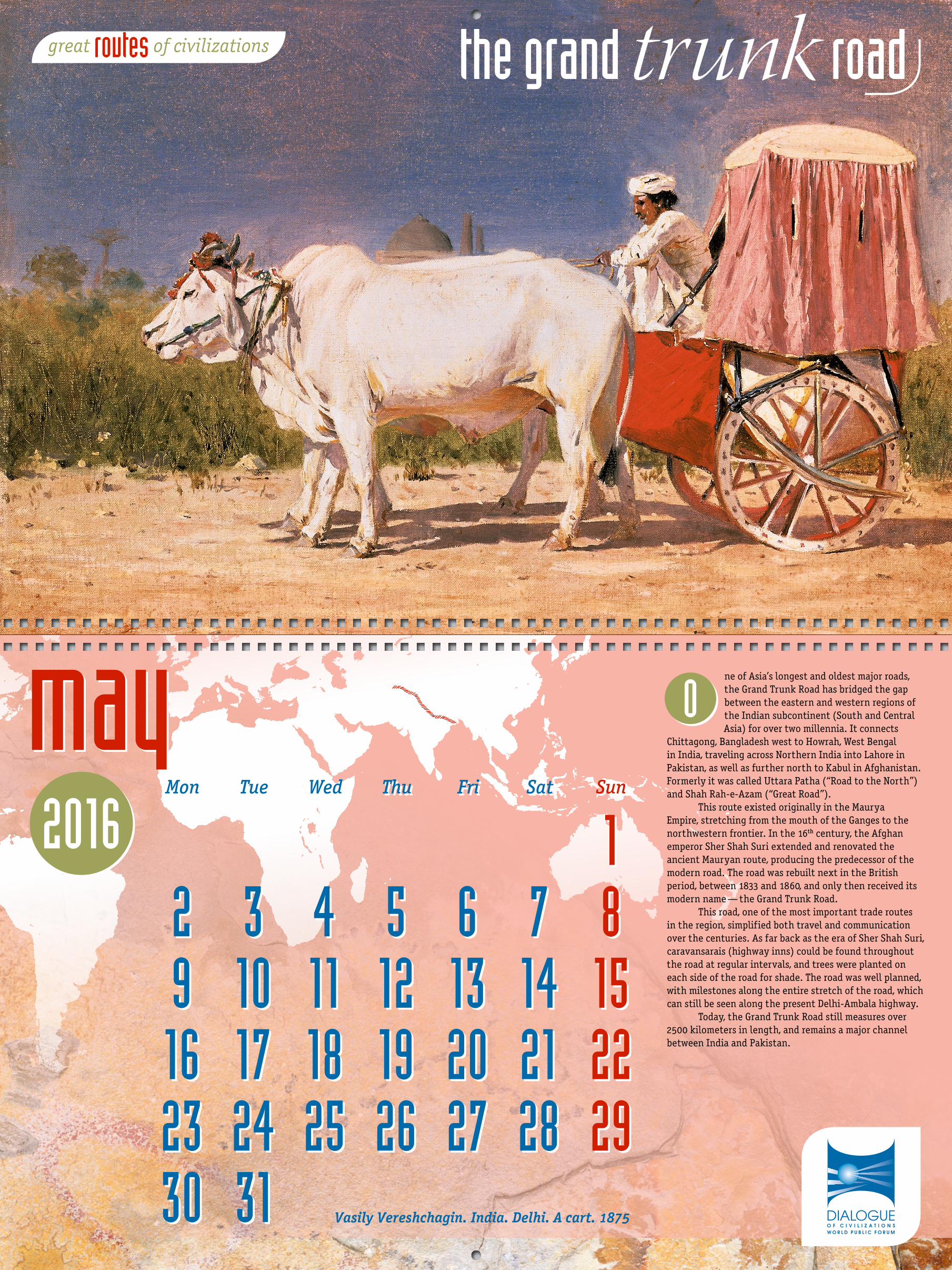
ne of Asia’s longest and oldest major roads, the Grand Trunk Road has bridged the gap between the eastern and western regions of the Indian subcontinent (South and Central Asia) for over two millennia. It connects
Chittagong, Bangladesh west to Howrah, West Bengal in India, traveling across Northern India into Lahore in Pakistan, as well as further north to Kabul in Afghanistan. Formerly it was called Uttara Patha (“Road to the North”) and Shah Rah-e-Azam (“Great Road”).
This route existed originally in the Maurya Empire, stretching from the mouth of the Ganges to the northwestern frontier. In the 16th century, the Afghan emperor Sher Shah Suri extended and renovated the ancient Mauryan route, producing the predecessor of the modern road. The road was rebuilt next in the British period, between 1833 and 1860, and only then received its modern name — the Grand Trunk Road.
This road, one of the most important trade routes in the region, simplified both travel and communication over the centuries. As far back as the era of Sher Shah Suri, caravansarais (highway inns) could be found throughout the road at regular intervals, and trees were planted on each side of the road for shade. The road was well planned, with milestones along the entire stretch of the road, which can still be seen along the present Delhi-Ambala highway.
Today, the Grand Trunk Road still measures over 2500 kilometers in length, and remains a major channel between India and Pakistan.
O
great of civilizationsroutes
2016 Mon Tue Wed Thu Fri Sat Sun
1 2 3 4 5 6 7 8 9 10 11 12 13 14 15 16 17 18 19 20 21 22 23 24 25 26 27 28 29 30 31
Mon Tue Wed Thu Fri Sat Sun
1 2 3 4 5 6 7 8 9 10 11 12 13 14 15 16 17 18 19 20 21 22 23 24 25 26 27 28 29 30 31
maymay
Vasily Vereshchagin. India. Delhi. A cart. 1875
the grand trunk road
2016
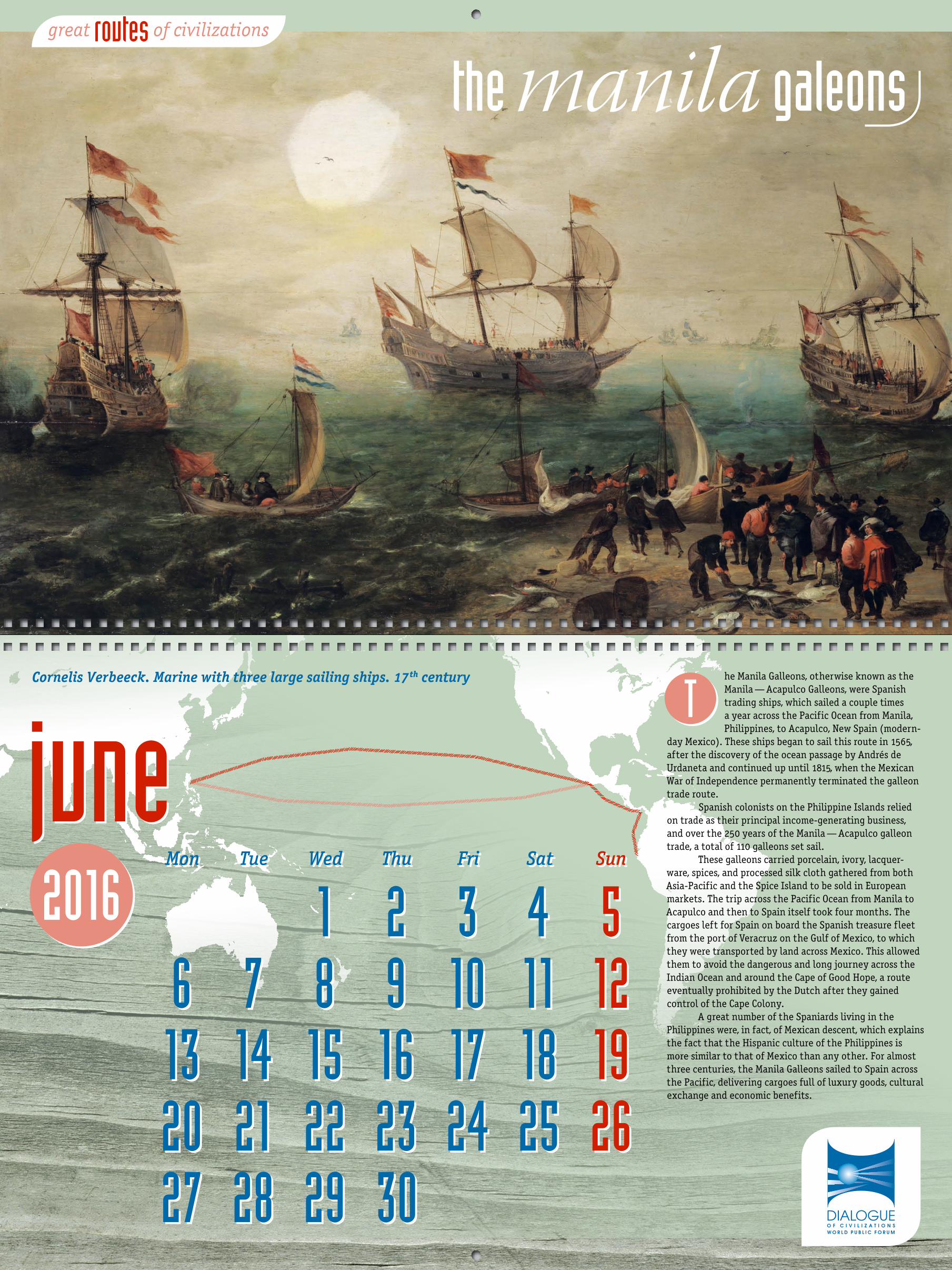
he Manila Galleons, otherwise known as the Manila — Acapulco Galleons, were Spanish trading ships, which sailed a couple times a year across the Pacific Ocean from Manila, Philippines, to Acapulco, New Spain (modern-
day Mexico). These ships began to sail this route in 1565, after the discovery of the ocean passage by Andres de Urdaneta and continued up until 1815, when the Mexican War of Independence permanently terminated the galleon trade route.
Spanish colonists on the Philippine Islands relied on trade as their principal income-generating business, and over the 250 years of the Manila — Acapulco galleon trade, a total of 110 galleons set sail.
These galleons carried porcelain, ivory, lacquer-ware, spices, and processed silk cloth gathered from both Asia-Pacific and the Spice Island to be sold in European markets. The trip across the Pacific Ocean from Manila to Acapulco and then to Spain itself took four months. The cargoes left for Spain on board the Spanish treasure fleet from the port of Veracruz on the Gulf of Mexico, to which they were transported by land across Mexico. This allowed them to avoid the dangerous and long journey across the Indian Ocean and around the Cape of Good Hope, a route eventually prohibited by the Dutch after they gained control of the Cape Colony.
A great number of the Spaniards living in the Philippines were, in fact, of Mexican descent, which explains the fact that the Hispanic culture of the Philippines is more similar to that of Mexico than any other. For almost three centuries, the Manila Galleons sailed to Spain across the Pacific, delivering cargoes full of luxury goods, cultural exchange and economic benefits.
T
great of civilizationsroutes
Mon Tue Wed Thu Fri Sat Sun
1 2 3 4 5 6 7 8 9 10 11 12 13 14 15 16 17 18 19 20 21 22 23 24 25 26 27 28 29 30
Mon Tue Wed Thu Fri Sat Sun
1 2 3 4 5 6 7 8 9 10 11 12 13 14 15 16 17 18 19 20 21 22 23 24 25 26 27 28 29 30
junejuneCornelis Verbeeck. Marine with three large sailing ships. 17th century
the manila galeons
2016
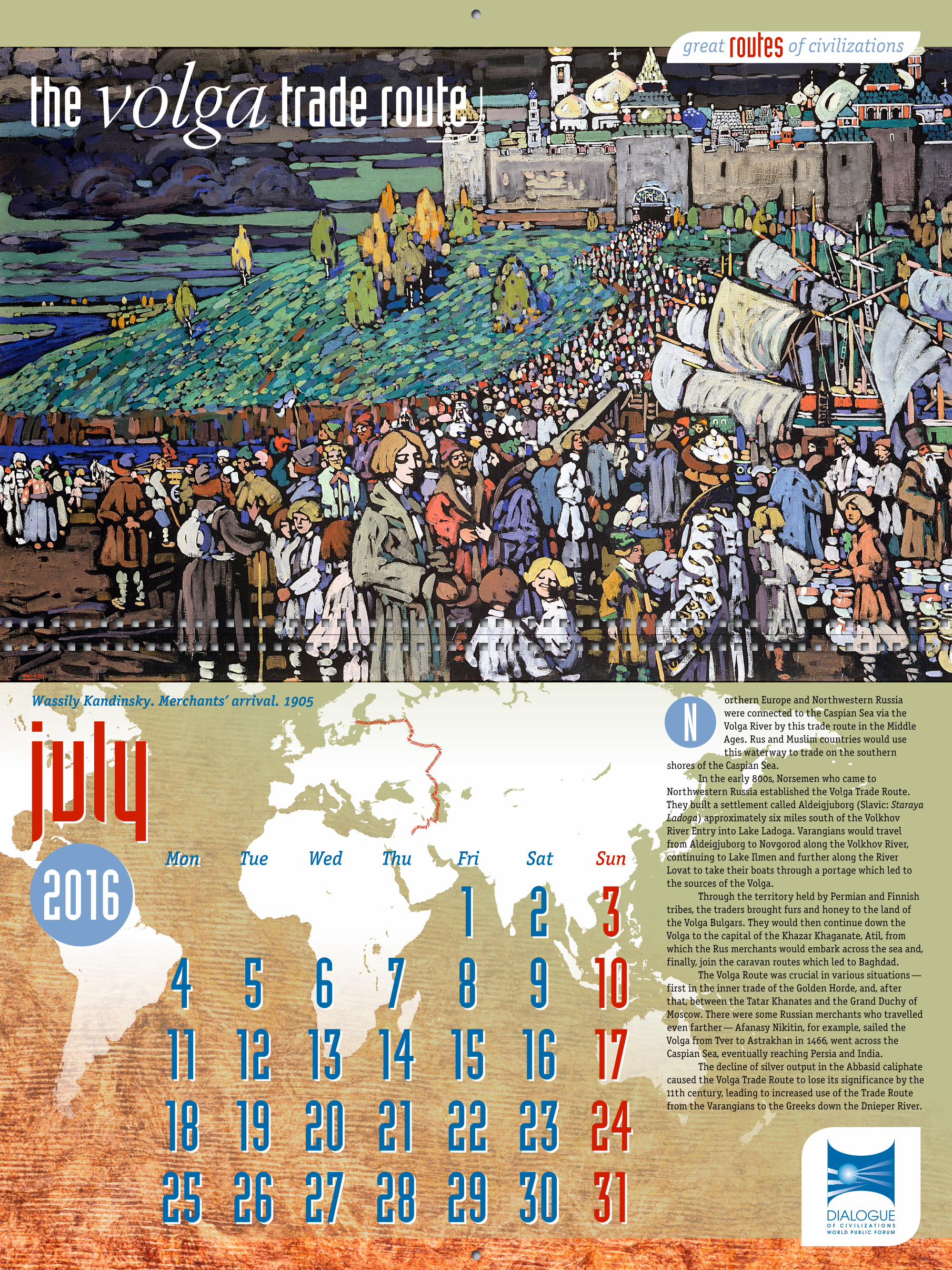
orthern Europe and Northwestern Russia were connected to the Caspian Sea via the Volga River by this trade route in the Middle Ages. Rus and Muslim countries would use this waterway to trade on the southern
shores of the Caspian Sea.In the early 800s, Norsemen who came to
Northwestern Russia established the Volga Trade Route. They built a settlement called Aldeigjuborg (Slavic: Staraya Ladoga) approximately six miles south of the Volkhov River Entry into Lake Ladoga. Varangians would travel from Aldeigjuborg to Novgorod along the Volkhov River, continuing to Lake Ilmen and further along the River Lovat to take their boats through a portage which led to the sources of the Volga.
Through the territory held by Permian and Finnish tribes, the traders brought furs and honey to the land of the Volga Bulgars. They would then continue down the Volga to the capital of the Khazar Khaganate, Atil, from which the Rus merchants would embark across the sea and, finally, join the caravan routes which led to Baghdad.
The Volga Route was crucial in various situations — first in the inner trade of the Golden Horde, and, after that, between the Tatar Khanates and the Grand Duchy of Moscow. There were some Russian merchants who travelled even farther — Afanasy Nikitin, for example, sailed the Volga from Tver to Astrakhan in 1466, went across the Caspian Sea, eventually reaching Persia and India.
The decline of silver output in the Abbasid caliphate caused the Volga Trade Route to lose its significance by the 11th century, leading to increased use of the Trade Route from the Varangians to the Greeks down the Dnieper River.
N
great of civilizationsroutes
Mon Tue Wed Thu Fri Sat Sun
1 2 3 4 5 6 7 8 9 10 11 12 13 14 15 16 17 18 19 20 21 22 23 24 25 26 27 28 29 30 31
Mon Tue Wed Thu Fri Sat Sun
1 2 3 4 5 6 7 8 9 10 11 12 13 14 15 16 17 18 19 20 21 22 23 24 25 26 27 28 29 30 31
julyjulyWassily Kandinsky. Merchants’ arrival. 1905
the volga trade route
augustaugust2016
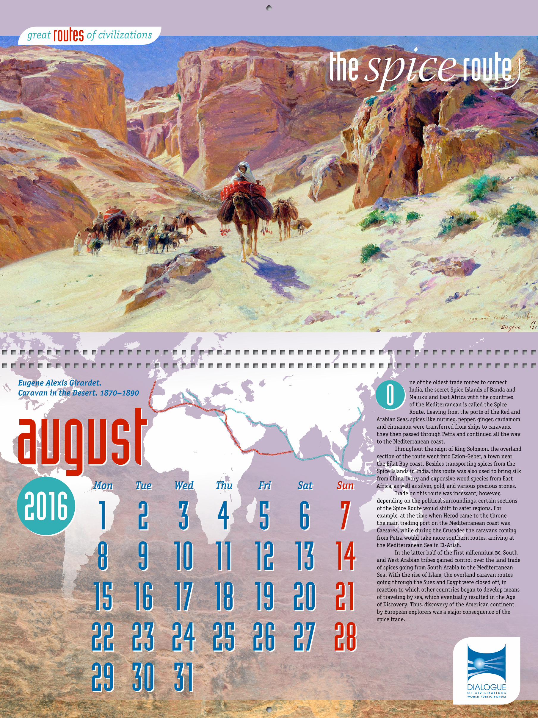
ne of the oldest trade routes to connect India, the secret Spice Islands of Banda and Maluku and East Africa with the countries of the Mediterranean is called the Spice Route. Leaving from the ports of the Red and
Arabian Seas, spices like nutmeg, pepper, ginger, cardamom and cinnamon were transferred from ships to caravans, they then passed through Petra and continued all the way to the Mediterranean coast.
Throughout the reign of King Solomon, the overland section of the route went into Ezion-Geber, a town near the Eilat Bay coast. Besides transporting spices from the Spice Islands in India, this route was also used to bring silk from China, ivory and expensive wood species from East Africa, as well as silver, gold, and various precious stones.
Trade on this route was incessant, however, depending on the political surroundings, certain sections of the Spice Route would shift to safer regions. For example, at the time when Herod came to the throne, the main trading port on the Mediterranean coast was Caesarea, while during the Crusades the caravans coming from Petra would take more southern routes, arriving at the Mediterranean Sea in El-Arish.
In the latter half of the first millennium bc, South and West Arabian tribes gained control over the land trade of spices going from South Arabia to the Mediterranean Sea. With the rise of Islam, the overland caravan routes going through the Suez and Egypt were closed off, in reaction to which other countries began to develop means of traveling by sea, which eventually resulted in the Age of Discovery. Thus, discovery of the American continent by European explorers was a major consequence of the spice trade.
O
great of civilizationsroutes
Mon Tue Wed Thu Fri Sat Sun
1 2 3 4 5 6 7 8 9 10 11 12 13 14 15 16 17 18 19 20 21 22 23 24 25 26 27 28 29 30 31
Mon Tue Wed Thu Fri Sat Sun
1 2 3 4 5 6 7 8 9 10 11 12 13 14 15 16 17 18 19 20 21 22 23 24 25 26 27 28 29 30 31
the spice route
Eugene Alexis Girardet. Caravan in the Desert. 1870–1890
2016
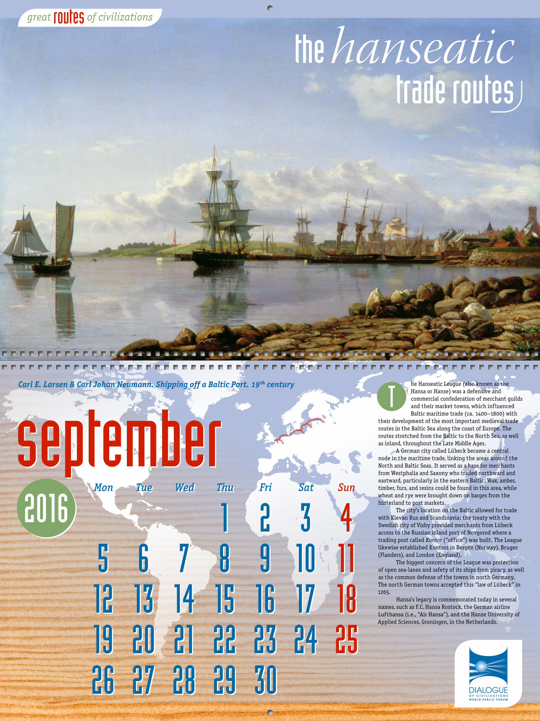
he Hanseatic League (also known as the Hansa or Hanse) was a defensive and commercial confederation of merchant guilds and their market towns, which influenced Baltic maritime trade (ca. 1400–1800) with
their development of the most important medieval trade routes in the Baltic Sea along the coast of Europe. The routes stretched from the Baltic to the North Sea, as well as inland, throughout the Late Middle Ages.
A German city called Lubeck became a central node in the maritime trade, linking the areas around the North and Baltic Seas. It served as a base for merchants from Westphalia and Saxony who traded northward and eastward, particularly in the eastern Baltic. Wax, amber, timber, furs, and resins could be found in this area, while wheat and rye were brought down on barges from the hinterland to port markets.
The city’s location on the Baltic allowed for trade with Kievan Rus and Scandinavia; the treaty with the Swedish city of Visby provided merchants from Lubeck access to the Russian inland port of Novgorod where a trading post called Kontor (“office”) was built. The League likewise established Kontors in Bergen (Norway), Bruges (Flanders), and London (England).
The biggest concern of the League was protection of open sea-lanes and safety of its ships from piracy, as well as the common defense of the towns in north Germany. The north German towns accepted this “law of Lubeck” in 1265.
Hansa’s legacy is commemorated today in several names, such as F.C. Hansa Rostock, the German airline Lufthansa (i.e., “Air Hansa”), and the Hanze University of Applied Sciences, Groningen, in the Netherlands.
T
great of civilizationsroutes
Mon Tue Wed Thu Fri Sat Sun
1 2 3 4 5 6 7 8 9 10 11 12 13 14 15 16 17 18 19 20 21 22 23 24 25 26 27 28 29 30
Mon Tue Wed Thu Fri Sat Sun
1 2 3 4 5 6 7 8 9 10 11 12 13 14 15 16 17 18 19 20 21 22 23 24 25 26 27 28 29 30
septemberseptemberCarl E. Larsen & Carl Johan Neumann. Shipping off a Baltic Port. 19th century
the hanseatic trade routes

xtending from the Sub-Saharan West African kingdoms across the Sahara desert into Europe, the Saharan Routes provided a connection between African empires such as Songhay, Ghana and Mali and the European
world. Two main roads crossed the desert from the south to the north. Pictures of ancient carts were discovered along these roads, leading scientists to believe that these trade routes had been used in antiquity. The North and the South (Carthage and Ancient Rome) traded carbuncles and ivory, with the tribes of garamantes, who lived on the territory in between, acting as intermediaries.
Though existing since prehistoric times, the trade industry of this area was at its prime between the 8th and late 16th century. This was the period in which the two mane routes developed — the first running from modern day Morocco to the Niger Bend across the western desert, and the second connecting the Lake Chad area with modern Tunisia.
Caravans of camels were the main source of transportation of goods, the main goods being gold and salt, with the average size of the caravan being 1000 camels. However, some caravans could be made up of as many as 12 000 camels. Berbers who knew the desert and could guarantee a safe journey from their fellow desert nomads were paid very well to guide the caravans. The trip across the Sahara and back took approximately 18 months in the peacetime.
Members of the Tuareg use the traditional caravan routes to this day, traveling 2400 kilometers across the Sahara for six months every year to trade in salt coming from the middle of the desert to communities located on its outskirts.
E
great of civilizationsroutes
2016 Mon Tue Wed Thu Fri Sat Sun
1 2 3 4 5 6 7 8 9 10 11 12 13 14 15 16 17 18 19 20 21 22 23 24 25 26 27 28 29 30 31
Mon Tue Wed Thu Fri Sat Sun
1 2 3 4 5 6 7 8 9 10 11 12 13 14 15 16 17 18 19 20 21 22 23 24 25 26 27 28 29 30 31
octoberoctober
the saharan trade routes
Martiros Saryan. The fellah village. 1911
2016
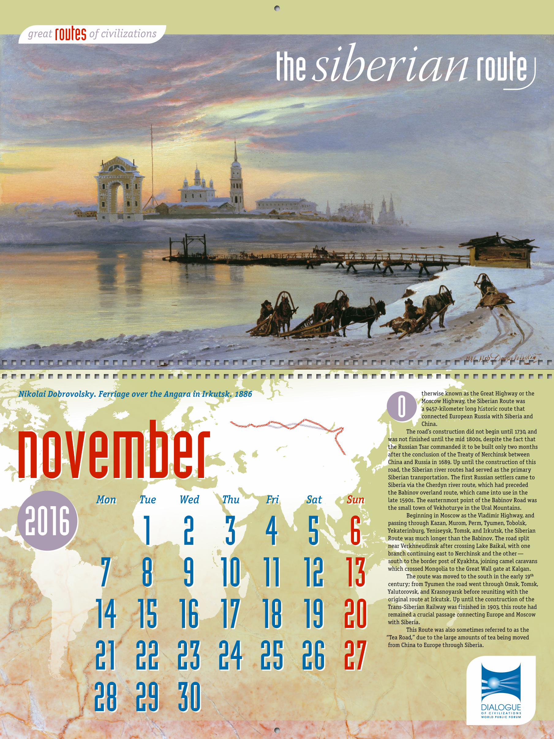
therwise known as the Great Highway or the Moscow Highway, the Siberian Route was a 9457-kilometer long historic route that connected European Russia with Siberia and China.
The road’s construction did not begin until 1730, and was not finished until the mid 1800s, despite the fact that the Russian Tsar commanded it to be built only two months after the conclusion of the Treaty of Nerchinsk between China and Russia in 1689. Up until the construction of this road, the Siberian river routes had served as the primary Siberian transportation. The first Russian settlers came to Siberia via the Cherdyn river route, which had preceded the Babinov overland route, which came into use in the late 1590s. The easternmost point of the Babinov Road was the small town of Vekhoturye in the Ural Mountains.
Beginning in Moscow as the Vladimir Highway, and passing through Kazan, Murom, Perm, Tyumen, Tobolsk, Yekaterinburg, Yeniseysk, Tomsk, and Irkutsk, the Siberian Route was much longer than the Babinov. The road split near Verkhneudinsk after crossing Lake Baikal, with one branch continuing east to Nerchinsk and the other — south to the border post of Kyakhta, joining camel caravans which crossed Mongolia to the Great Wall gate at Kalgan.
The route was moved to the south in the early 19th century; from Tyumen the road went through Omsk, Tomsk, Yalutorovsk, and Krasnoyarsk before reuniting with the original route at Irkutsk. Up until the construction of the Trans-Siberian Railway was finished in 1903, this route had remained a crucial passage connecting Europe and Moscow with Siberia.
This Route was also sometimes referred to as the “Tea Road,” due to the large amounts of tea being moved from China to Europe through Siberia.
O
Mon Tue Wed Thu Fri Sat Sun
1 2 3 4 5 6 7 8 9 10 11 12 13 14 15 16 17 18 19 20 21 22 23 24 25 26 27 28 29 30
Mon Tue Wed Thu Fri Sat Sun
1 2 3 4 5 6 7 8 9 10 11 12 13 14 15 16 17 18 19 20 21 22 23 24 25 26 27 28 29 30
novembernovember
great of civilizationsroutes
Nikolai Dobrovolsky. Ferriage over the Angara in Irkutsk. 1886
the siberian route
2016
great of civilizationsroutes
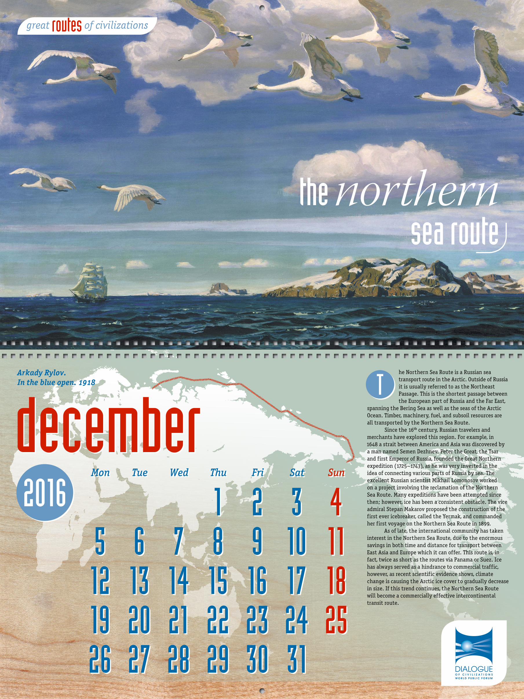
he Northern Sea Route is a Russian sea transport route in the Arctic. Outside of Russia it is usually referred to as the Northeast Passage. This is the shortest passage between the European part of Russia and the Far East,
spanning the Bering Sea as well as the seas of the Arctic Ocean. Timber, machinery, fuel, and subsoil resources are all transported by the Northern Sea Route.
Since the 16th century, Russian travelers and merchants have explored this region. For example, in 1648 a strait between America and Asia was discovered by a man named Semen Dezhnev. Peter the Great, the Tsar and first Emperor of Russia, founded the Great Northern expedition (1725–1743), as he was very invested in the idea of connecting various parts of Russia by sea. The excellent Russian scientist Mikhail Lomonosov worked on a project involving the reclamation of the Northern Sea Route. Many expeditions have been attempted since then; however, ice has been a consistent obstacle. The vice admiral Stepan Makarov proposed the construction of the first ever icebreaker, called the Yermak, and commanded her first voyage on the Northern Sea Route in 1899.
As of late, the international community has taken interest in the Northern Sea Route, due to the enormous savings in both time and distance for transport between East Asia and Europe which it can offer. This route is, in fact, twice as short as the routes via Panama or Suez. Ice has always served as a hindrance to commercial traffic, however, as recent scientific evidence shows, climate change is causing the Arctic ice cover to gradually decrease in size. If this trend continues, the Northern Sea Route will become a commercially effective intercontinental transit route.
T
Mon Tue Wed Thu Fri Sat Sun
1 2 3 4 5 6 7 8 9 10 11 12 13 14 15 16 17 18 19 20 21 22 23 24 25 26 27 28 29 30 31
Mon Tue Wed Thu Fri Sat Sun
1 2 3 4 5 6 7 8 9 10 11 12 13 14 15 16 17 18 19 20 21 22 23 24 25 26 27 28 29 30 31
decemberdecemberArkady Rylov. In the blue open. 1918
the northern sea route

Studio “4+4” Ltd. Tel.: +7 495 229-14-43
e-mail: [email protected]
Conception: Dmitry AblinEditing: Elena Borisova
Text: Ekaterina ParfenovaDesign: Vladimir Vinogradov
© World Public Forum “Dialogue of Civilizations”, 2015 www.wpfdc.org
Cover image: Joseph Mallord William Turner. Venice, from the Porch of Madonna della Salute. Ca. 1835
Images credits: Eugene Alexis Girardet. Caravan in the Desert. 1870–1890 — The Fine Art Society, London / Bridgeman Images / fotodom.ru
Claude Joseph Vernet. Morning view of the inner port of Marseille and the Pavilion of the Horloge du Parc. 1754 — Musee de la Marine, Paris, France / Bridgeman Images / fotodom.ruCarl E. Larsen & Carl Johan Neumann. Shipping off a Baltic Port. 19th century — Bourne Gallery, Reigate, Surrey / Bridgeman Images / fotodom.ru
Wassily Kandinsky. Merchants’ arrival. 1905 — Private Collection / Bridgeman Images / fotodom.ru
great of civilizationsroutescalendar 2016