gis value in local government - files.nc.gov
TRANSCRIPT
Value of GIS in Local Government
Presented to the North Carolina Geographic Information Coordinating Council (GICC)
February 11, 2015
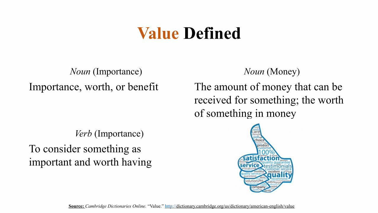
Value Defined
Noun (Importance)
Importance, worth, or benefit
Noun (Money)
The amount of money that can be received for something; the worth of something in money
Verb (Importance)
To consider something as important and worth having
Source: Cambridge Dictionaries Online. “Value.” http://dictionary.cambridge.org/us/dictionary/american-english/value

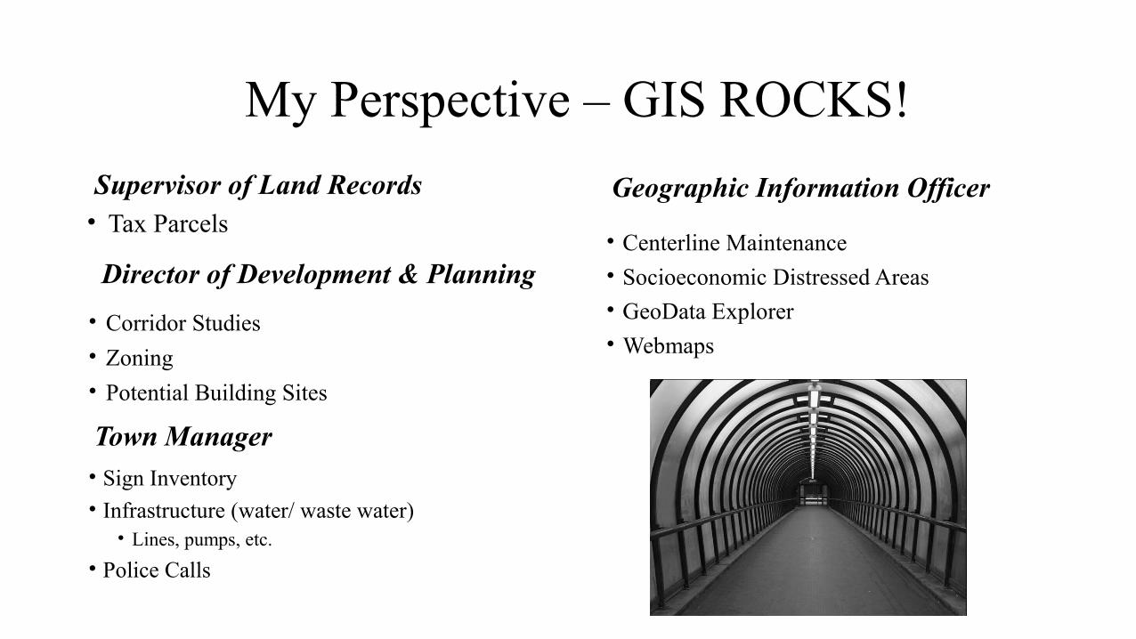
My Perspective – GIS ROCKS!
Supervisor of Land Records• Tax Parcels
Town Manager• Sign Inventory
• Infrastructure (water/ waste water)• Lines, pumps, etc.
• Police Calls
Director of Development & Planning
• Corridor Studies
• Zoning
• Potential Building Sites
Geographic Information Officer
• Centerline Maintenance
• Socioeconomic Distressed Areas
• GeoData Explorer
• Webmaps
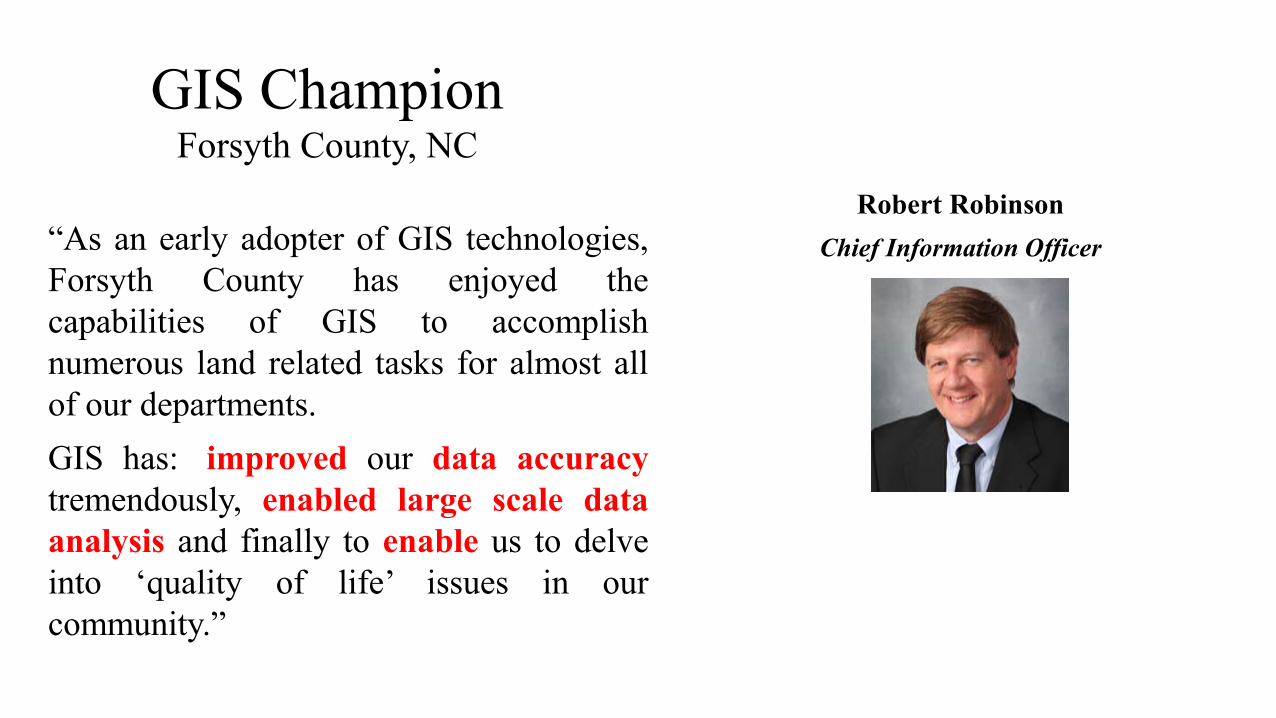
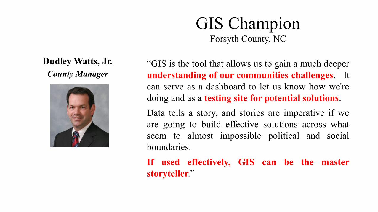
GIS ChampionForsyth County, NC
Robert Robinson
Chief Information Officer“As an early adopter of GIS technologies, Forsyth County has enjoyed the capabilities of GIS to accomplish numerous land related tasks for almost all of our departments.
GIS has: improved our data accuracy tremendously, enabled large scale data analysis and finally to enable us to delve into ‘quality of life’ issues in our community.”
Forsyth County Sheriff’s Office
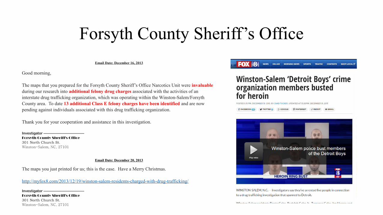
Email Date: December 16, 2013
Good morning, The maps that you prepared for the Forsyth County Sheriff’s Office Narcotics Unit were invaluable during our research into additional felony drug charges associated with the activities of an interstate drug trafficking organization, which was operating within the Winston-Salem/Forsyth County area. To date 13 additional Class E felony charges have been identified and are now pending against individuals associated with this drug trafficking organization. Thank you for your cooperation and assistance in this investigation. Investigator ----------------------------------Forsyth County Sheriff's Office301 North Church St.Winston-Salem, NC, 27101
Email Date: December 20, 2013
The maps you just printed for us; this is the case. Have a Merry Christmas. http://myfox8.com/2013/12/19/winston-salem-residents-charged-with-drug-trafficking/ Investigator ----------------------------------Forsyth County Sheriff's Office301 North Church St.Winston-Salem, NC, 27101
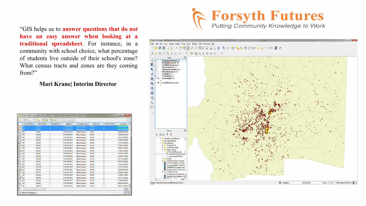
“GIS helps us to answer questions that do not have an easy answer when looking at a traditional spreadsheet. For instance, in a community with school choice, what percentage of students live outside of their school's zone? What census tracts and zones are they coming from?”
Mari Krane| Interim Director
Forsyth County Budget & Management Office
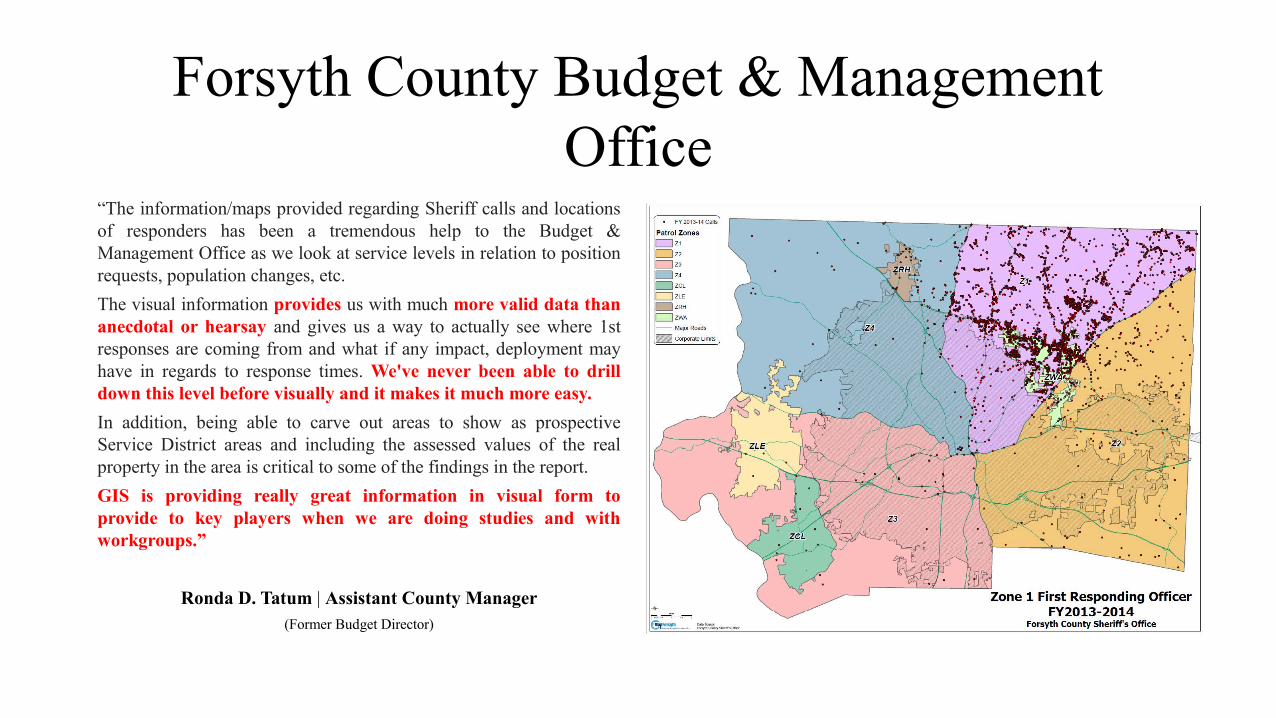
“The information/maps provided regarding Sheriff calls and locations of responders has been a tremendous help to the Budget & Management Office as we look at service levels in relation to position requests, population changes, etc.
The visual information provides us with much more valid data than anecdotal or hearsay and gives us a way to actually see where 1st responses are coming from and what if any impact, deployment may have in regards to response times. We've never been able to drill down this level before visually and it makes it much more easy.
In addition, being able to carve out areas to show as prospective Service District areas and including the assessed values of the real property in the area is critical to some of the findings in the report.
GIS is providing really great information in visual form to provide to key players when we are doing studies and with workgroups.”
Ronda D. Tatum | Assistant County Manager(Former Budget Director)
Forsyth County Fire
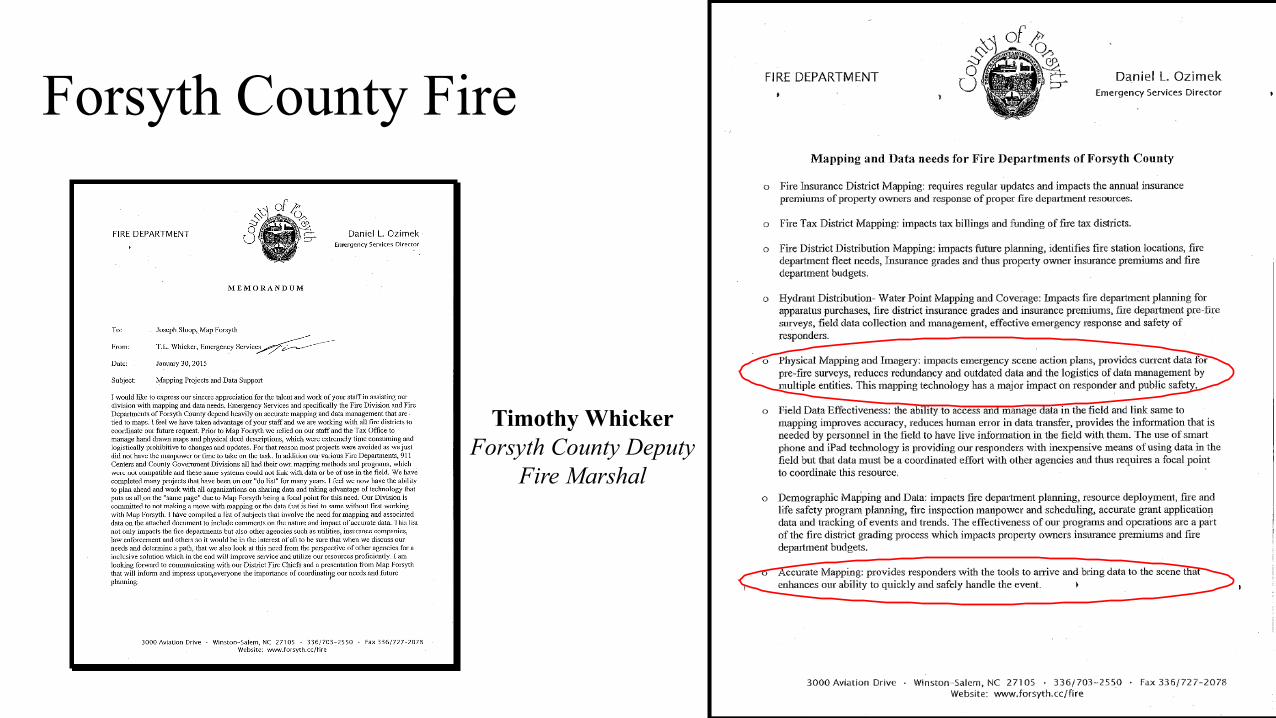
Timothy WhickerForsyth County Deputy
Fire Marshal
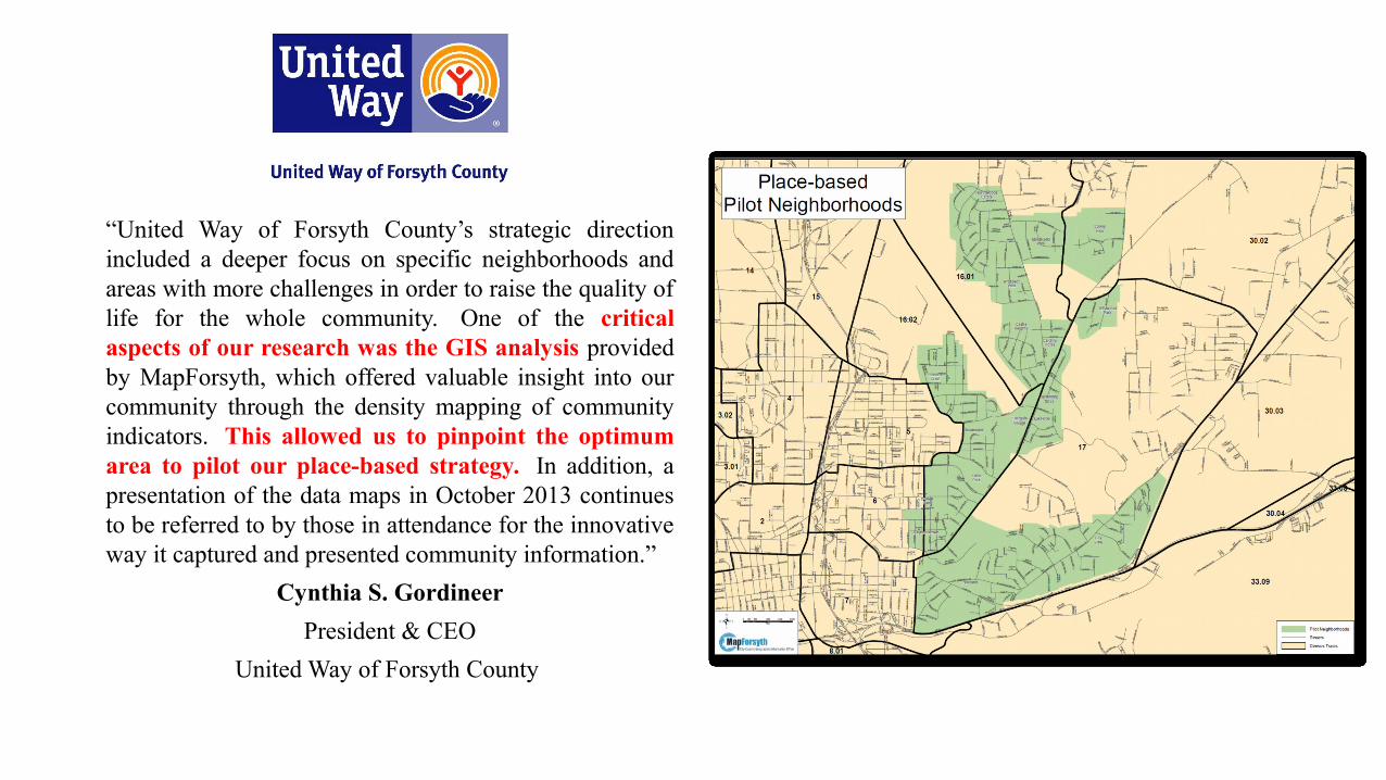
“United Way of Forsyth County’s strategic direction included a deeper focus on specific neighborhoods and areas with more challenges in order to raise the quality of life for the whole community. One of the critical aspects of our research was the GIS analysis provided by MapForsyth, which offered valuable insight into our community through the density mapping of community indicators. This allowed us to pinpoint the optimum area to pilot our place-based strategy. In addition, a presentation of the data maps in October 2013 continues to be referred to by those in attendance for the innovative way it captured and presented community information.”
Cynthia S. Gordineer
President & CEO
United Way of Forsyth County
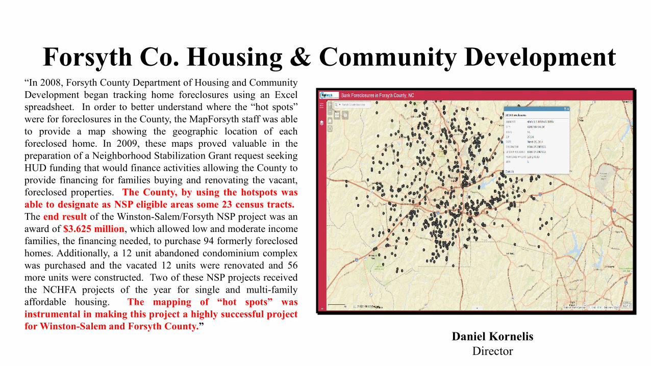
Forsyth Co. Housing & Community Development“In 2008, Forsyth County Department of Housing and Community Development began tracking home foreclosures using an Excel spreadsheet. In order to better understand where the “hot spots” were for foreclosures in the County, the MapForsyth staff was able to provide a map showing the geographic location of each foreclosed home. In 2009, these maps proved valuable in the preparation of a Neighborhood Stabilization Grant request seeking HUD funding that would finance activities allowing the County to provide financing for families buying and renovating the vacant, foreclosed properties. The County, by using the hotspots was able to designate as NSP eligible areas some 23 census tracts. The end result of the Winston-Salem/Forsyth NSP project was an award of $3.625 million, which allowed low and moderate income families, the financing needed, to purchase 94 formerly foreclosed homes. Additionally, a 12 unit abandoned condominium complex was purchased and the vacated 12 units were renovated and 56 more units were constructed. Two of these NSP projects received the NCHFA projects of the year for single and multi-family affordable housing. The mapping of “hot spots” was instrumental in making this project a highly successful project for Winston-Salem and Forsyth County.”
Daniel KornelisDirector
Housing Authority of Winston-Salem (HAWS)
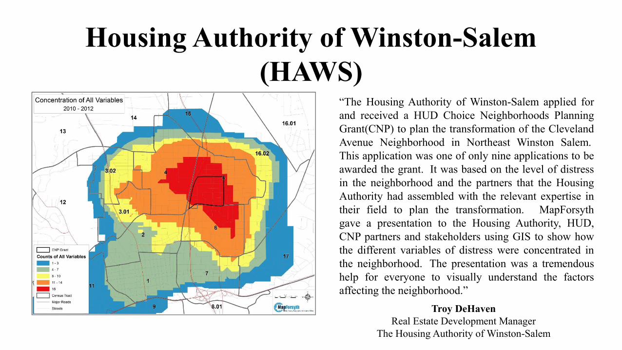
“The Housing Authority of Winston-Salem applied for and received a HUD Choice Neighborhoods Planning Grant(CNP) to plan the transformation of the Cleveland Avenue Neighborhood in Northeast Winston Salem. This application was one of only nine applications to be awarded the grant. It was based on the level of distress in the neighborhood and the partners that the Housing Authority had assembled with the relevant expertise in their field to plan the transformation. MapForsyth gave a presentation to the Housing Authority, HUD, CNP partners and stakeholders using GIS to show how the different variables of distress were concentrated in the neighborhood. The presentation was a tremendous help for everyone to visually understand the factors affecting the neighborhood.”
Troy DeHavenReal Estate Development Manager
The Housing Authority of Winston-Salem
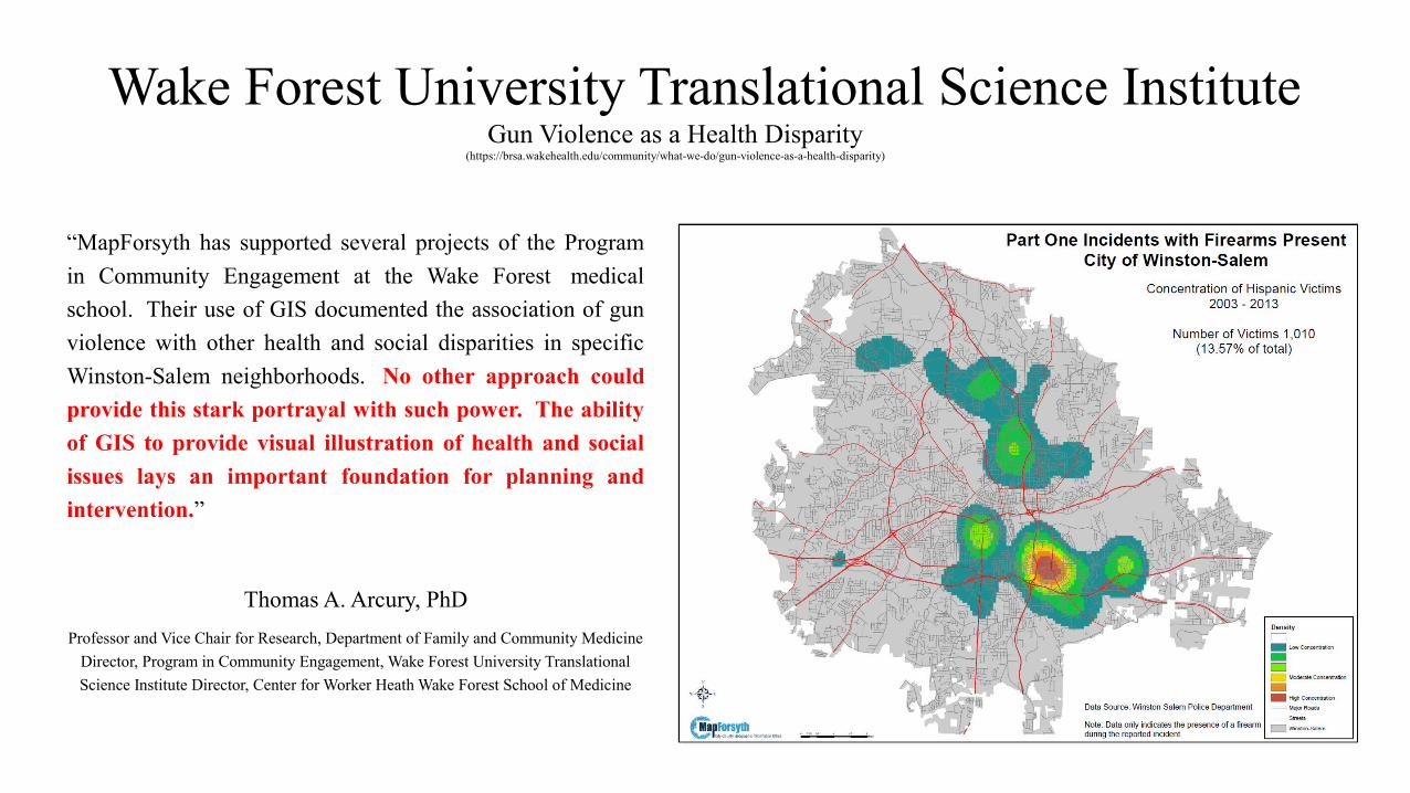
Wake Forest University Translational Science Institute
“MapForsyth has supported several projects of the Program
in Community Engagement at the Wake Forest medical
school. Their use of GIS documented the association of gun
violence with other health and social disparities in specific
Winston-Salem neighborhoods. No other approach could
provide this stark portrayal with such power. The ability
of GIS to provide visual illustration of health and social
issues lays an important foundation for planning and
intervention.”
Thomas A. Arcury, PhD
Professor and Vice Chair for Research, Department of Family and Community Medicine
Director, Program in Community Engagement, Wake Forest University Translational
Science Institute Director, Center for Worker Heath Wake Forest School of Medicine
Gun Violence as a Health Disparity(https://brsa.wakehealth.edu/community/what-we-do/gun-violence-as-a-health-disparity)
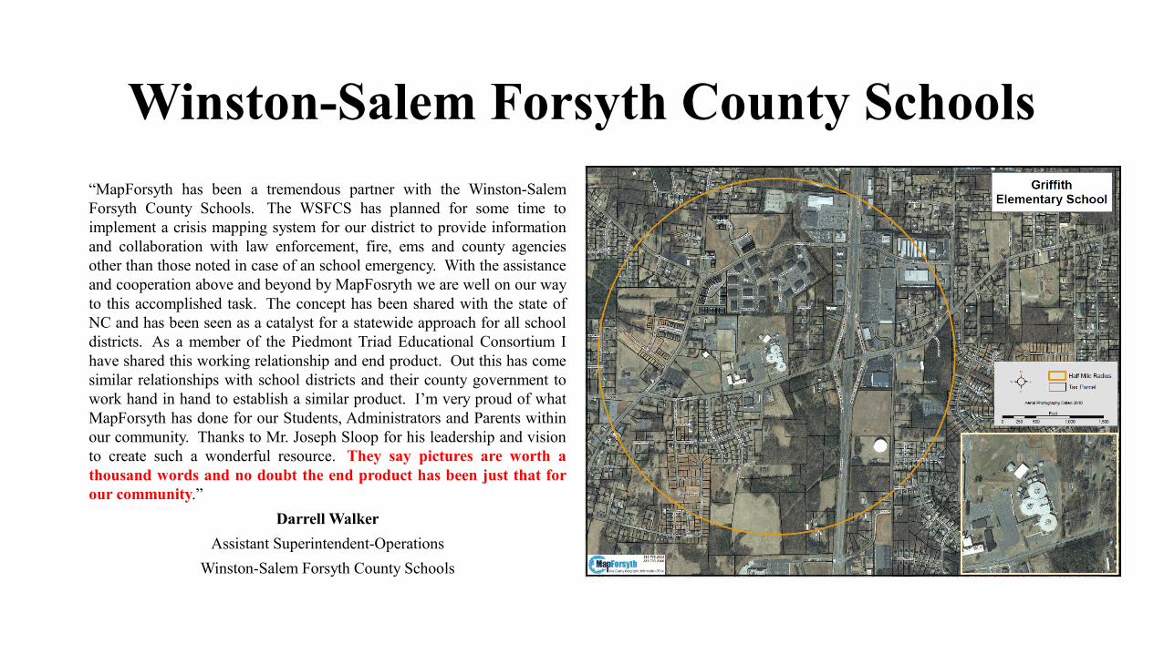
Winston-Salem Forsyth County Schools
“MapForsyth has been a tremendous partner with the Winston-Salem Forsyth County Schools. The WSFCS has planned for some time to implement a crisis mapping system for our district to provide information and collaboration with law enforcement, fire, ems and county agencies other than those noted in case of an school emergency. With the assistance and cooperation above and beyond by MapFosryth we are well on our way to this accomplished task. The concept has been shared with the state of NC and has been seen as a catalyst for a statewide approach for all school districts. As a member of the Piedmont Triad Educational Consortium I have shared this working relationship and end product. Out this has come similar relationships with school districts and their county government to work hand in hand to establish a similar product. I’m very proud of what MapForsyth has done for our Students, Administrators and Parents within our community. Thanks to Mr. Joseph Sloop for his leadership and vision to create such a wonderful resource. They say pictures are worth a thousand words and no doubt the end product has been just that for our community.”
Darrell Walker
Assistant Superintendent-Operations
Winston-Salem Forsyth County Schools
GIS ChampionForsyth County, NC
“GIS is the tool that allows us to gain a much deeper understanding of our communities challenges. It can serve as a dashboard to let us know how we're doing and as a testing site for potential solutions.
Data tells a story, and stories are imperative if we are going to build effective solutions across what seem to almost impossible political and social boundaries.
If used effectively, GIS can be the master storyteller.”
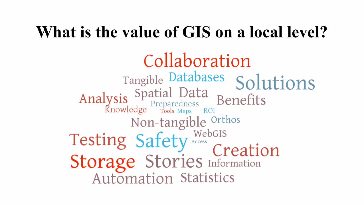
What is the value of GIS on a local level?
Thank You
Please visit us at www.mapforsyth.org
Follow us on Twitter: @MapForsyth
Joseph Sloop, CGCIO, GISP
Geographic Information [email protected]
Jason Clodfelter, CMS, GISP
Anthony ‘Skip’ Daniels, MCP, MCSE, CCNA
Dave Toren
GIS Programmer
336-703-2329