gi2015 programme+proceedings
TRANSCRIPT

GI2015 – GI/GIS/GDI – Forum
Open GeoData Management in Europe of Regions 15. Grenzüberschreitendes Sächsisches GIS – Forum – 15. September 2015 in Dresden
CoO / GI2015-Workshop on OGD Management for Agriculture & Forestry in Europe of Regions
NNR-Special-Edition-2015 PROCEEDINGS – “GI2015-X-border-GI/GIS/GDI-FORUM” – DRESDEN ISSN 1801-6480
1
GGII22001155 (( 1155.. SSääcchhssiisscchheess GGII//GGIISS//GGDDII –– FFOORRUUMM ))
CLUB OF OSSIACH & GI2015 WORKSHOPS
PROGRAMME & PROCEEDINGS
EUROPEAN BORDER REGIONS - MAP © COURTESY BY AEBR, 2011 ( Compiled 2007 at IfL )
15. SEPTEMBER 2015
DRESDEN
GI2015 © IGN e.V.

GI2015 – GI/GIS/GDI – Forum
Open GeoData Management in Europe of Regions 15. Grenzüberschreitendes Sächsisches GIS – Forum – 15. September 2015 in Dresden
CoO / GI2015-Workshop on OGD Management for Agriculture & Forestry in Europe of Regions
NNR-Special-Edition-2015 PROCEEDINGS – “GI2015-X-border-GI/GIS/GDI-FORUM” – DRESDEN ISSN 1801-6480
2
SUSTAINABILITY OF INTER-REGIONAL COLLABORATION EU Support Programme for “Inter-Regional and Cross-border Collaboration” – Free State of Saxony
GI2015 – INTERREGIONAL SCIENTIFIC PROGRAMME – COMMITTEE
SCIENTIFIC PROGRAMME MEMBERS: Chairs: Doz. Dr. F. HOFFMANN (IGN/DE), Dr. K. CHARVAT (CCSS/CZ) & Dir.W.MAYER (PROGIS/AT) Members: Prof. BEHR (HFT/DE), Dr. FURDIK (STUBA/SK), Dr. K. JANECKA (WBU/CZ) ORG-COM-Members: Dr. G. HOFFMANN (IGN), Prof. S. KLOSS (IGN), Dr. K.-D. MICHAEL (IGN).
ORGANIZER’S INFORMATION & INTERNET REFERENCE URL’S
GI2015-Contact-Address [ [email protected] | [email protected] ]
IGN-Dresden [ http://GDI-SN.blogspot.com ]
CCSS-Praha [ http://www.CCSS.cz ]
PROGIS-Villach [ http://www.PROGIS.com ]
SOCIAL NETWORKS [ INSPIRE-FORUM ] + [ FACEBOOK ] + [ LINKEDIN ] + [ TWITTER ]
IMPRESSUM:
Herausgegeben von / Published by
( Founding Members of IGN e.V. )
Doz. Dr. Frank HOFFMANN, CSc IGN – Vorstandsvorsitzender, Dresden INNOVATION. Grenzüberschreitendes Netzwerk e.V.
Dr. Karel CHARVAT, EU-Project-Manager CoO Vice President; Past President of CCSS, Praha (CZ) CCSS (Czech Center for Science and Society e.V.)
Dipl.Ing. Walter H. MAYER, CEO Geschäftsführer / Director of PROGIS GmbH, Villach (AT) PROGIS GmbH
INNOVATION. Grenzüberschreitendes Netzwerk
( Gemeinnütziger e.V. / Non-profit Organization ) c/o IGN-Vorstand, Martin-Andersen-Nexö-Str. 4 D – 01217 DRESDEN / Saxony / Germany
EMAIL: [ [email protected] | [email protected] ]
SKYPE: [ fh_ign ]
INTERNET: [ http://www.IGN-SN.de ]
WEBLOG: [ http://GDI-SN.blogspot.com ]
TEL/FAX: [ +49-351-403.2729 # FAX: +49-351-401.4260 ]
Copyright © 2015 by CCSS-Praha & IGN-Dresden & PROGIS-Villach – All rights reserved.

GI2015 – GI/GIS/GDI – Forum
Open GeoData Management in Europe of Regions 15. Grenzüberschreitendes Sächsisches GIS – Forum – 15. September 2015 in Dresden
CoO / GI2015-Workshop on OGD Management for Agriculture & Forestry in Europe of Regions
NNR-Special-Edition-2015 PROCEEDINGS – “GI2015-X-border-GI/GIS/GDI-FORUM” – DRESDEN ISSN 1801-6480
3
ISAF / Club of Ossiach & GI2015 Workshops @ 15.09.2015 ZINT – BUILDING – AGRI CAMPUS OF TUD – BERGSTRAßE 120 / *ENTRY KOHLENSTRAßE* !
FINAL PROGRAMME
GI2015
5
CoO
10 09:00 – 09:30
Welcome & Introduction by Frank HOFFMANN (IGN-Vorstand)
The Target of the Club of Ossiach (CoO) Overview of the Networking Event & Workshops / Development perspectives
Ajit MARU, Senior Officer, Global Forum on Agricultural Research
(GFAR c/o FAO-RD) / Chair of CoO
09:30 – 10:00
13
ICT for a sustainable agriculture & forestry – Public support needs/SensorNet
Karel CHARVAT, CEO WirelessInfo / Vice-Chair of CoO
10:00 – 10:30
20
ICT for a sustainable agriculture and forestry – Status and missing
Walter H. MAYER, CEO PROGIS / Treasurer of CoO
10:30 – 11:00 Coffee Break
GI2015
11:00 – 11:30
21 11:30 – 12:00
25
12:00 – 12:30
29
Workshop - Keynotes
Jakub KARAS (UPVISION): THE POSSIBILITY OF USING UAS IN THE
ENVIROMENT
Lenka HLADIKOVA (CENIA): COPERNICUS PROGRAMME AND
SENTINEL DATA FOR AGRICULTURE AND FORESTRY
Stefaan DeMEY & Grazia FIORE (EURISY): THE ADDED VALUE OF
COPERNICUS AND GALILEO FOR GEO-INFORMATION AND LBS AT
THE SERVICE OF AGRICULTURE & FORESTRY IN THE REGIONS
12:30 – 13:30
Lunch Break
CoO 13:30 – 13:45
Workshops – Introduction by Ajit Maru (GFAR c/o FAO-RD),
Chair of CoO
13:45 – 14:30
14:30 – 15:15
Workshop 1: Enabling Innovation for Informing Farmers
Workshop 1 continuing
15:15 – 15:30 Coffee Break
15:30 – 16:15
16:15 – 17:00
Workshop 2: ICT supporting Innovative Advisory Services
Workshop 2 continuing
17:00 – 17:15
17:15 – 17:45
17:45 – 18:00
Workshop 1 Summary Report
Workshop 2 Summary Report
CoO Networking & GI2015 - Conclusion of Day 2
"Get together"
19:00 – 23:00
Social "Get together"
Evening at BOWLING-Arena, Südhöhe/Bergstraße
GI2015 – GI/GIS/GDI – Forum
Open GeoData Management in Europe of Regions 15. Grenzüberschreitendes Sächsisches GIS – Forum – 15. September 2015 in Dresden
CoO / GI2015-Workshop on OGD Management for Agriculture & Forestry in Europe of Regions
NNR-Special-Edition-2015 PROCEEDINGS – “GI2015-X-border-GI/GIS/GDI-FORUM” – DRESDEN ISSN 1801-6480
4
COO&GI2015 – ANMELDUNG # REGISTRATION
TEILNEHMER / Participant ( )* STUDENT/ Aspirant ( )* RENTNER/ Pensioner ( )*
Teilnahme / Participation @ Social Event "Get together" ( )* ?
NAME, Vorname (Titel / Degree)*
ORGANISATION (Abteilung / Department)*
KONTAKT ADRESSE (Straße / PLZ / Ort / Street / ZIP / City)*
KONTAKT PHONE* / Mobile
KONTAKT EMAIL* / SKYPE
*) Pflichtangaben / Mandatory info
GI2015 & CoO Registration Deadline for Participants due latest at: 3311..0088..22001155 !
Registration by Email: [ GI2015 @ IGN-SN.de ] or Registration by FAX: ++4499 335511 440011 44226600
GI2015 is supported by EU Framework Program of Inter-regional Collaboration, therefore, Participation is FREE OF CHARGE ( ! ) but, a
small FEE for not supported CATERING & SOCIAL “GET TOGETHER” SERVICES will be charged for Participants (25 €) and Students (10 €) at CoO / GI2015 Registration Desk upon arrival at 15. September !
Datum / Date : / / 2015 Unterschrift / Signatur :
BEMERKUNGEN / Comments by IGN :
GI2015 – GI/GIS/GDI – Forum
Open GeoData Management in Europe of Regions 15. Grenzüberschreitendes Sächsisches GIS – Forum – 15. September 2015 in Dresden
CoO / GI2015-Workshop on OGD Management for Agriculture & Forestry in Europe of Regions
NNR-Special-Edition-2015 PROCEEDINGS – “GI2015-X-border-GI/GIS/GDI-FORUM” – DRESDEN ISSN 1801-6480
5
GI2015 – 15. Sächsisches GI/GIS/GDI – Forum
GI2015 – WELCOME & INTRODUCTION
GI2015 – MOTIVE & CONCEPT
– INTRODUCTION TO OPEN DATA MANAGEMENT IN EUROPE OF REGIONS –
Doz. Dr. Frank HOFFMANN, CSc – Vorstandsvorsitzender IGN e.V. Academician of International Eurasian Academy of Sciences (IEAS)
ABSTRACT <> SUMMARY
The European Commission has positioned itself as an innovative player in the field of multi-purpose use of OPEN GEO DATA (OGD) and PUBLIC SECTOR INFORMATION (PSI). The goal is to develop an open, dynamic Media industry that refine public data into valuable information and knowledge not only for ICT Experts, Public Administrators and Decision Makers, but also allowing transparency and participation for User Communities and Citizens.
With EU DIRECTIVES PSI (2003/98/EC / updated 2013/XX/EC), INSPIRE (2007/02/EC) legal requirements were provided enabling new developments and opportunities for funding of projects beyond 2014 – 2020 in EUROPE OF REGIONS. The European Commission presented in 2011 the „Strategy of Open Data in Europe“ to push the growth of EU economy to nearly 40 Billions Euro/year. However, there is a need for more & better knowledge about new EU policies and strategies like "DIGITAL EUROPE & HORIZON 2020". Therefore, these awareness needs require more and comprehensive information and knowledge, as well as creative, innovative actions for continuing education and training:
[ http://europa.eu/rapid/pressReleasesAction.do?reference=IP/11/1524&format=HTML&aged=0&language=EN&guiLanguage=en ]
The Use of ICT's in agriculture, forestry & regional development to improve productivity (inclusive sustainability) has evidently and substantially lagged than it other spheres of economy and everyday life. The Development of ICT's in agriculture & forestry is at the moment largely for use in very large farms in economically developed countries though they would benefit equally if not more in small farms which are resource poor in developing countries. ICT's for SMART/Precision agriculture are not scale neutral for all farming. Developed and developing countries need to innovate, adapt and adopt ICT's to improve productivity of their small farmers but they do not have the capacities to do so. Neither is there investment to research and develop appropriate ICT's for small farmers.
The UN-FAO Webinar: [ https://www.asist.org/Webinars/2015-09-09-Webinar-DCMI-99bnG.pdf ]
The institutions that are needing to support the use of ICT's in agriculture, for example, for more open access to data and information, are still not developed. FOODIE – Farm Oriented Open Data in Europe from the 7th Framework Program of the European Union with the target to get better access to data might be one step ahead:
to get better access to open data but also as data alone is not all,
to get better integration into stakeholder´s cooperation and
to support public AND private interests
GI2015 – GI/GIS/GDI – Forum
Open GeoData Management in Europe of Regions 15. Grenzüberschreitendes Sächsisches GIS – Forum – 15. September 2015 in Dresden
CoO / GI2015-Workshop on OGD Management for Agriculture & Forestry in Europe of Regions
NNR-Special-Edition-2015 PROCEEDINGS – “GI2015-X-border-GI/GIS/GDI-FORUM” – DRESDEN ISSN 1801-6480
6
We know very little of how actors, especially farmers, and stakeholders like consumers are being inclusively engaged to bring about effective management and use of ICT's in Agriculture & Forestry.
Therefore, sustainable decision making requires greater Awareness of intellectual property rights (IPR) and Knowledge exchange on copyrights, open data licensing rules and creative commons bylaws for economic, ecological & social applications for agriculture & forestry in Europe of Regions.
Finally, there is still yet a need for comprehensive information, communication, education and training actions, particularly at local, regional, cross-border and inter-regional levels.
The Saxon State Minister of Environment, Agriculture and Forestry speaking at 2nd December 2014 in the Workshop »Innovationen für die Landwirtschaft« on presenting innovation ideas for the branches of Agriculture and Forestry decleared:
„Solcher Wissenstransfer ist enorm wichtig... „Allerdings ist es wie so oft: wenn es an Kontakten zwischen den Akteuren fehlt, dann kommen sinnvolle Neuerungen nur schwer zur Anwendung“. Dabei hat Sachsen beste Voraussetzungen für Innovationen. Die sächsische Agrarstruktur ist so vielfältig wie in kaum einem anderen Bundesland, daher ist auch das Potential für Innovationen in der Landtechnik in Sachsen enorm...
Source: Medienservice Sachsen - SMUL, 2.12.2014 [ http://www.medienservice.sachsen.de/ ]. See also: "Club of Ossiach - Vision & Mission": [ http://www.clubofossiach.com/coo/visionandmission.html ]
The European Commission approved at 16th December 2014 the Working Programme 2015 as well other Supporting programmes for rural areas, among them the Federal Framework Programmes of Germany and other Programmes for States of Saxony and Saxony-Anhalt.
The Rural development is the "second pillar" of the EU's agricultural policy. For Germany are available a total of 9.45 billion euros by 2020 including EU funds, which are supplemented with national funds from Germany which have to be managed in the provinces:
[ http://ec.europa.eu/deutschland/press/pr_releases/12962_de.htm ]
The GI2015 Forum should promote sustainable, cross-border and inter-regional exchange of experience in cooperation with the international "Club of Ossiach" (CoO).
SUSTAINABILITY & INTEROPERABILITY OF AGRICULTURAL & FORESTRY DATA POLICY
OPEN GEODATA MANAGEMENT IN EUROPE OF REGIONS
Therefore, the Focus of the common CoO & GI2015 - Workshops content is intenting on inter-regional exchange of experience and information for integration and management of Open Geo DATA mainly at local, regional and cross-border levels.
However, the most problematic field is the CROSS-BORDER ADAPTATION and SEMANTIC
INTEROPERABILITY AND SUSTAINABILITY of OPEN DATA, SERVICES AND APPLICATIONS for effective governance, transparency and participation to create OPEN APPS for
Agriculture, Forestry, Infrastructure and Environment !
Proposals for presentation (title+abstract, max. 250-300 words in German or English or Russian) had to be submitted by 15.07.2015 to allow composing of the final draft of programme framework, while extented Summary texts were due until 31.08.2015 using the DOC templates (available for downloading) from Weblog at [ http://GDI-SN.blogspot.com ] website !
GI2015 – GI/GIS/GDI – Forum
Open GeoData Management in Europe of Regions 15. Grenzüberschreitendes Sächsisches GIS – Forum – 15. September 2015 in Dresden
CoO / GI2015-Workshop on OGD Management for Agriculture & Forestry in Europe of Regions
NNR-Special-Edition-2015 PROCEEDINGS – “GI2015-X-border-GI/GIS/GDI-FORUM” – DRESDEN ISSN 1801-6480
7
OPEN CALL for PRESENTATIONS - Subsequently, following cross-border workshop topics were planned (as usually, in German, English or Russian):
GI2015 – Call For Presentations – Proposed for Workshop TOPICS
UAV Technologies and Open Data for Precision Farming & Precision Forestry issues
COPERNICUS Program and SENTINEL Technologies for Agriculture and Forestry
INNOVATION and Technology transfer for International cross-border cooperation
MAPPING Technologies for Land use, Land cover and Rural Development
OPEN GEODATA Management for Environmental and Emergency
GI2015 – Workshop SCHEDULES
31.05.2015: Publication of Open Call for Presentations
15.07.2015: Schedule for Proposals of Presentation Abstracts [ [email protected] ]
31.07.2015: Abstract Confirmation and Draft of GI2015 Workshop Programm
31.08.2015: Registration Schedule for Workshop Participants [ [email protected] ]
01.09.2015: Author's Delivery of Summary DOC's and Presentation PPT‘s [ [email protected] ]
14.09.2015: IGN's Invitation for Keynote speakers & VIP’s (by Invitation only)
15.09.2015 GI2015 Workshop Forum (“Konrad-Zuse"-Haus and/or TU Dresden)
GI2015 – Contacts & Logistics
GI2015 Contact [ [email protected] | [email protected] | [email protected] ]
GI2015 is supported by EU Inter-regional Cooperation Programme and, therefore,
GI2015 Participation is FFRREEEE OOFF CCHHAARRGGEE ( ! )
Participants and target groups: Developers, Providers, Integrators and Users of Agricultural & Forestry Sector Information and Open GeoData, GeoService and GeoApplications for integrated Environmental Portals used in local / regional Governments, Administrations, Enterprises and for private Applications & Business (Enviro protection, agriculture, forestry, management, etc.).
FFuurrtthheerr llooggiissttiiccss iinnffoorrmmaattiioonn uuppddaatteess && pprroocceeeeddiinnggss ttoo bbee ppuubblliisshheedd ffiinnaallllyy aatt IIGGNN''ss WWeebblloogg !!
[[ hhttttpp::////GGDDII--SSNN..bbllooggssppoott..ccoomm ]]

GI2015 – GI/GIS/GDI – Forum
Open GeoData Management in Europe of Regions 15. Grenzüberschreitendes Sächsisches GIS – Forum – 15. September 2015 in Dresden
CoO / GI2015-Workshop on OGD Management for Agriculture & Forestry in Europe of Regions
NNR-Special-Edition-2015 PROCEEDINGS – “GI2015-X-border-GI/GIS/GDI-FORUM” – DRESDEN ISSN 1801-6480
8
ABOUT THE X-BORDER IGN FOUNDERS – IGN (DE) & CCSS (CZ)
IGN e.V. – INNOVATION.Grenzüberschreitendes Netzwerk ( X-border Network ) – is a non-profit Association ( NGO / gemeinnütziger Verein ) for Education, Development and Knowledge Transfer – founded in 2002 as “GDI-Sachsen” (i.G.) – the final outcome of the “OpenGIS Strategy Seminar” series in GI2000 & GI2002 at “Bildungswerk Ost-West” (BOW), but later on was re-founded as the follow-up “IGN” e.V. at September 2nd, 2003, by Czechia and Saxonia experts of Cartomatics, Cyberlaw, Cybernetics, Geomatics, Economics, Pedagogics, Regional Development and Spatial Sciences.
Its main goals: supporting GEO – ENVIRO – SPATIO – oriented Awareness, Business and Openness in Training, Education and Research on GeoINSPIRE’d Interoperability, Sustainability, and Usability of spatial Data, Services and Applications for X-border-Infrastructures of Spatial Information in EUROPE of REGIONS.
IIGGNN hhaass bbeeeenn rreeggiisstteerreedd bbyy DDrreessddeenn CCiittyy CCoouurrtt ooffffiicciiaallllyy aass aa NNoonn--pprrooffiitt AAssssoocciiaattiioonn,, OOccttoobbeerr 1166tthh
,, 22000033
[[ hhttttpp::////wwwwww..IIGGNN--SSNN..ddee//RReeggiissttrraattiioonn..ppddff ]] –– [[ MMaaiillttoo::VVoorrssttaanndd@@IIGGNN--SSNN..ddee ]] [[ CCooppyyrriigghhtt ©© 22000033--22001155 bbyy IIGGNN ee..VV..,, DDrreessddeenn –– AAllll rriigghhttss rreesseerrvveedd.. ]]
IGN’s „GEOSPATIAL SAXONY“ WEBLOG STATISTICS AS PER 31. AUGUST 2015
Google Statistics updated 31. August 2015 @ 10:45 GMT
Pageviews today = 195, last month = 2.906 and Totalviews since 2003 = 122.950
The CCSS – Czech Center for Science and Society – is an Association of high tech SMEs, the public administration and research organizations. It is an independent, non-profit and non-governmental organisation. It is a type of virtual centre of excellence with the focus on the implementation of new communication and navigation technologies which have potential for sustainable development. The CCSS co-operates with a wide range of institutions and individuals, home and foreign ones. It is focused on research & development activities in the field of international research projects and utilization of modern technologies. CCSS supports co-operation networks of the small and medium business within the framework of regional economies and helds intensive contacts, particularly in Europe, Asia, Africa and South America. The CCSS is focused on transfer, analyses and development of the most advanced GI & ICT technologies which are contributing to the growth of productivity not only in industrial enterprises but in the branch of small and medium business as well. CCSS is active in the agriculture, industry, trade and services, predominantly in agricultural regions. The priority of activities of CCSS is Environment protection and Crisis management. In this field CCSS is active in European FP7 research and “best practice” excellence & social networks.
[[ CCooppyyrriigghhtt ©© 22000033--22001144 bbyy CCCCSSSS,, PPrraahhaa –– AAllll rriigghhttss rreesseerrvveedd.. ]]
Access Statistics for IGN’s Weblog URL [ http://GDI-SN.blogspot.com ]
GI2015 – GI/GIS/GDI – Forum
Open GeoData Management in Europe of Regions 15. Grenzüberschreitendes Sächsisches GIS – Forum – 15. September 2015 in Dresden
CoO / GI2015-Workshop on OGD Management for Agriculture & Forestry in Europe of Regions
NNR-Special-Edition-2015 PROCEEDINGS – “GI2015-X-border-GI/GIS/GDI-FORUM” – DRESDEN ISSN 1801-6480
9
GGII22001155 (( 1155.. SSääcchhssiisscchheess GGII//GGIISS//GGDDII –– FFOORRUUMM ))
PPRROOCCEEEEDDIINNGGSS CLUB OF OSSIACH & GI2015 WORKSHOPS
Abstracts & Summaries & Workshops
DRESDEN 15. September 2015
Edited by IGN e.V.
Doz. Dr. Frank HOFFMANN, CSc – IGN Dipl.Ing. Walter H. MAYER - PROGIS (Villach)
Dr. Karel CHARVAT – CCSS (Praha)
Dr. Klaus-Dieter MICHAEL – VSBI
Dr. Gudrun HOFFMANN – IGN
Prof. Dr. Siegmar KLOSS – IGN
IIMMPPRRIIMMAATTUURR TTOO PPRRIINNTT
1144.. SSeepptteemmbbeerr 22001155
Copyright © 2015 by CCSS-Praha & IGN-Dresden & PROGIS-Villach – All rights reserved.
GI2015 – GI/GIS/GDI – Forum
Open GeoData Management in Europe of Regions 15. Grenzüberschreitendes Sächsisches GIS – Forum – 15. September 2015 in Dresden
CoO / GI2015-Workshop on OGD Management for Agriculture & Forestry in Europe of Regions
NNR-Special-Edition-2015 PROCEEDINGS – “GI2015-X-border-GI/GIS/GDI-FORUM” – DRESDEN ISSN 1801-6480
10
OVERVIEW OF THE CLUB OF OSSIACH
NETWORKING EVENT & WORKSHOPS INTRODUCTION
Ajit MARU Global Forum on Agricultural Research (GFAR / FAO-RD)
ABSTRACT
Keywords: Agriculture, Agrifuture, Brain storming, Club of Ossiach (CoO), Environment,
Farming, Food, Forestry, ICT, Networking, Protection, Safety, Services
Content:
Agriculture and forestry are vital economic sectors producing food, feed, energy and provid environmental services through managing soil, water, air and biodiversity holistically. They also contribute to manage and reduce risks from natural disasters, provide the social infrastructure to maintain cultural heritage and are part of a complex agro-food/wood chain with many stakeholders that also need support by ICT.
Vision (Objectives and goals): The CoO will develop into an internationally accepted think-tank on issues related to ICT use in agricultural development globally. Through its members, it will support effective use of ICTs, better knowledge management for sustainability in farming and in the protection of environment.
Mission: (How to meet aims, objectives and goals): The CoO will regularly discuss collectively through Agrifuture Days, seminars etc. and collaboratively act on influencing to use ICT to improve productivity, profitability, contribution to food and nutritional security and safety globally along with the protection of the environment.
Author Ajit MARU
Global Forum on Agricultural Research - Senior Officer - FAO/RD - Roma
Chair of Club of Ossiach (CoO)
References [ http://www.egfar.org/contacts/maru-ajit ]
[ http://www.ClubOfOssiach.org ]
Contact E-mail: [email protected]
GI2015 – GI/GIS/GDI – Forum
Open GeoData Management in Europe of Regions 15. Grenzüberschreitendes Sächsisches GIS – Forum – 15. September 2015 in Dresden
CoO / GI2015-Workshop on OGD Management for Agriculture & Forestry in Europe of Regions
NNR-Special-Edition-2015 PROCEEDINGS – “GI2015-X-border-GI/GIS/GDI-FORUM” – DRESDEN ISSN 1801-6480
11
A FRAMEWORK FOR DATA AND INFORMATION SHARING
FOR AGRICULTURAL RESEARCH FOR DEVELOPMENT:
A PERSPECTIVE FOR ITS DEVELOPMENT
Ajit MARU
Global Forum on Agricultural Research Secretariat (GFAR - Rome)
In developing a framework for data and information sharing for agricultural research for
development (ARD), the first question we need to ask is to why we need a framework, and prior to it,
why do we need to share data and information for agricultural research for development?
The answer lies in the fact that current and emerging challenges in agricultural development are global in
their scope. Every community and country needs increased agricultural productivity from their farms, and
just returns for their farmers and producers. They need to reduce hunger and malnutrition, alleviate
extreme poverty and use natural resources such as land and water and energy more efficiently and
sustainably. Climate change affects their agriculture now and will affect more in the future and they need
to adapt their agriculture rapidly to it as also contribute, as responsible world citizens, to mitigating and
reducing climate change and its effects.
Desertification, trans-boundary diseases, loss of agrobiodiversity and equitable participating in global
agricultural markets are also universal problems. And all need research and innovation to be solved.
Data and information sharing for agricultural research for development enable, among many benefits:
New information and knowledge to be generated
Localize globally available information and knowledge and enable it to be used more effectively
Increase efficiency and effectiveness of research and its outputs and innovation in time, cost,
quality and human effort
Reduce reinvention and repetition of research efforts
Allow greater inclusiveness and participation in research and innovation
Bring cross-disciplinary and specialized skills to agricultural research
Reduce “market failure” or inability to use research outputs effectively and/or efficiently
Create new research directions and avenues
Bring greater equity in using agricultural knowledge across and among communities
The second question that needs to be asked is what do we do to improve data and information
sharing in ARD?
The answer, in part, lies in the potential of new information and communications technologies (ICTs).
These ICTs have enabled new avenues to generating, processing, sharing and exchanging data and
information. The processing power of computing devices has increased dramatically, doubling almost
every two years while their size and energy consumption has reduced enabling more mobile use.
Similarly, connectivity of these devices has increased not only in speed but in spread and is becoming
ubiquitous facilitating further mobility in the use of these devices even in remote, rural areas. “Cloud”
computing is enabling huge amounts of data to be stored, accessed and used remotely. “Crowd”
computing enables communities to collectively generate, process and use information, many a times
through mobile devices, to solve a community’s problems.
The Web 2.0 technologies allow an interactive web and in the near future a “semantic” web, which
provides information as a human mind understands “information” and further down in the near future, a
“symbiotic” web, where the web symbiotically or through mutual benefits provides information to all who
are dependent on it rather than only to those who can afford it.
GI2015 – GI/GIS/GDI – Forum
Open GeoData Management in Europe of Regions 15. Grenzüberschreitendes Sächsisches GIS – Forum – 15. September 2015 in Dresden
CoO / GI2015-Workshop on OGD Management for Agriculture & Forestry in Europe of Regions
NNR-Special-Edition-2015 PROCEEDINGS – “GI2015-X-border-GI/GIS/GDI-FORUM” – DRESDEN ISSN 1801-6480
12
To move faster in harnessing the potential of new ICTs in ARD, and it is important here, that information
(and knowledge) is available and accessible to those who are dependent on it and that they can use
information effectively, we need to start looking at the information related to agriculture available in the
public domain and making it more accessible.
And why the focus on the public domain?
Because, a majority of information generators, assemblers, amalgamators and disseminators of
agricultural information for development are from the public sector and funded through public funds.
They are obliged to put their information in the public domain transparently. To make the information
more easily accessible as also interoperatable so as to make its effective use in different situations
possible and easier, we need to work at the level of information objects or data. And, therefore, we need
to create open data repositories and couple them to concepts of “linked open data” or data objects that can
be hyperlinked across common attributes.
Of course, to develop these data repositories that can be located and used globally we will need standards,
norms and regulations to govern effective, efficient, transparent and equitable flows and uses. We will
need standard descriptors, mutually agreed taxonomies and vocabularies based on common ontologies to
describe and organize the storage and access to the data. To reduce costs and time in assembling data to
meet the information needs for meeting the most critical challenges to agricultural development, we may
need to define Core Data Sets that Institutions and National Systems of agricultural research and
Innovation universally may contribute and work in the spirit of global shared responsibility, collaboration
and partnership. And for this we will need policies and strategies at Institute, Organization and Country
level.
We will need governance structures, legislation and International treaties to share data and information
openly as also protect interests of all parties in information management and use. We may need to create
Trust organizations that will manage the data and metadata that is shared openly at national and global
levels. We will need to look at investments, financial and in human skills that will be needed to manage
the entire information infrastructure in global ARD. And, of course, for all these ideas to take off, we will
need advocacy and promotion and new capacities to advocate and manage open data repositories
sustainably and all the issues related to them.
The third question that we should ask is, how do we do all that is needed to be done for data and
information sharing for ARD?
In my opinion, we need to start, through inclusive dialogue, by creating a framework for data and
information sharing for ARD for all involved to follow and contribute to systematically. A lot is already
being done and we need not all do the same individually and independently. We simply do not have the
resources for it. For example, the concept of open repositories is now well developed and there is constant
development of the concept of “linked open data” with basic standards such as XML, RSS, RDF etc
already in place.
The taxonomies and vocabularies, such as AGROVOC, are being rapidly evolving. We need to look at
Core Data Sets though some such as for weather and climate, plant germplasm and spatial data already
exist and some for example in agronomy are in the making.
The issue is who defines them?
We need to look at Trust Organizations. The CIARD.RING led by GFAR is one of them. We need to
look at implications of open data access in ARD at organizational and national levels and this can be done
through GFAR and FAO.
We need to advocate for increased investment in information infrastructure in global ARD. And much
more already done, being done and need to be done can be mapped once we have a framework.
SOURCE:
http://www.fao.org/docs/eims/upload/295233/4709_A_Framework_for_Data_and_Information_sharing_for_ARD_Ajit_Maru.pdf

GI2015 – GI/GIS/GDI – Forum
Open GeoData Management in Europe of Regions 15. Grenzüberschreitendes Sächsisches GIS – Forum – 15. September 2015 in Dresden
CoO / GI2015-Workshop on OGD Management for Agriculture & Forestry in Europe of Regions
NNR-Special-Edition-2015 PROCEEDINGS – “GI2015-X-border-GI/GIS/GDI-FORUM” – DRESDEN ISSN 1801-6480
13
ICT FOR A SUSTAINABLE AGRICULTURE & FORESTRY PUBLIC SUPPORT NEEDS
THE CLUB OF OSSIACH RECOMMENDATIONS ABOUT
ICT FOR FAMILY FARMING
ABSTRACT
Karel CHARVAT Club of Ossiach / Vice-Chair of CoO
Keywords: ICT for Agriculture, Small farms, Club of Ossiach
Content:
The Club of Ossiach is a voluntary group of agriculturists, agribusiness managers,
agriculture and forestry technologists, environmentalists and agricultural ICT specialists from
around the world to collectively discuss and collaboratively act on influencing the use of
information and communications technologies (ICTs) to improve agricultural productivity,
profitability and contribution to food and nutritional security and safety globally.
For ICTs to improve agricultural productivity, profitability and contribution to food and
nutritional security and safety globally there will be a need for collaboration between the public,
private and community sectors. The public sector provides the policies, Institutions and supports
basic research, the private sector brings entrepreneurial skills and provides services and together
with the community sector brings innovation that needs to be shared rapidly for development and
progress.
Author
Dr. Karel Charvat (CEO of WirelessInfo / CZ)
Reference
http://www.wirelessinfo.cz
Contact
Karel Charvat, Cholinská 1048/19, 784 01 Litovel, Czech Republic
Mobile: +420-605033596
EMail: [ mailto:[email protected]:[email protected] ]

GI2015 – GI/GIS/GDI – Forum
Open GeoData Management in Europe of Regions 15. Grenzüberschreitendes Sächsisches GIS – Forum – 15. September 2015 in Dresden
CoO / GI2015-Workshop on OGD Management for Agriculture & Forestry in Europe of Regions
NNR-Special-Edition-2015 PROCEEDINGS – “GI2015-X-border-GI/GIS/GDI-FORUM” – DRESDEN ISSN 1801-6480
14
SUMMARY
The "Club of Ossiach" offers a platform for interaction and dialogue for representatives of
all the 3 sectors, public, private and community which includes the cooperatives and producer
organizations to improve agricultural productivity, profitability, sustainability and contribution to
food and nutritional security and safety globally with the respect of environment protection.
Members of Club of Ossiach considered the topic through expression of their research findings
and collecting, experiences, opinions and knowledge on trends and disruptions influencing:
Family farming in different parts of the world which in general reflected trends globally
Development of information and communications technologies, especially those
influencing agriculture
Family farming in the future that can be improved by the developments in information
and communications technologies
From this, they considered issues that are and would emerge for policy, Institutions,
organizations, use of technology, in particular Information and Communications Technologies
(ICTs), and the participation by agricultural and related communities in improving family
farming.
An important question is whether ICTs can contribute to reducing marginalization of family
farming and abandonment of rural areas by these farmers. Participants pointed out that these
farmers also play a vital role in preserving cultural heritage and ecosystems that enhance the
quality of life of urban areas, a role that is not yet fully recognized by society and such
marginalization and abandonment of family farming could have disastrous consequences for the
society. Then, how can ICTs improve family farming in all these dimensions?
The trends in ICT were identified as:
• Exponential increase in computing power, memory, storage, capability (Moore’s Law)
with lowering of costs
• Near-ubiquity of mobile computing
• Spread of broadband connectivity
• More big/open/real-time data
• More Cloud for data and apps
• Content Co-Generation
• Predictive Analytics and decision support systems
• Semantic Web
• Wearable Computers
• Internet of Things
• Telematics, Geographic information Systems with location services and more precise,
real time earth observations
• Use of field sensors/embedded computing
• More and new social media
• More crowd-sourcing models
• 3D printing
• Visualization
• Automation, Linked Tools and Processes, Robotics
• Drones
• More smart phones and tablets

GI2015 – GI/GIS/GDI – Forum
Open GeoData Management in Europe of Regions 15. Grenzüberschreitendes Sächsisches GIS – Forum – 15. September 2015 in Dresden
CoO / GI2015-Workshop on OGD Management for Agriculture & Forestry in Europe of Regions
NNR-Special-Edition-2015 PROCEEDINGS – “GI2015-X-border-GI/GIS/GDI-FORUM” – DRESDEN ISSN 1801-6480
15
The ICTs that are currently impacting agriculture are:
• Automation, Robotics, Autonomous, Linked Tools, Equipment and Process Monitoring,
• Wearable Computing
• Controller Area Networking/Sensor Networks/Grid Computing
• Big data at different scales from field, farm to global
• Farm Management Information System
• Global Positioning System – Multi satellite
• Drones and Low cost Satellites/Micro satellites
• More precise geo-spatial data and 3D maps with elevation information
• Humidity, Ambient Environment and Soil Nutrient sensors
• Photometry
• Visualization and Integrated Display
• Social Media, MOOCs, Online Learning
• Rural access to online financial services
• Traceability systems using low cost RFIDs, NFC and other new technologies
• Telematics
• Variable rate Irrigation/Fertigation and prescriptive planting
• Weed, Biodiversity and Pest Management through Integrated systems
The participants drew attention to the current centrality the Smartphone with mobile connectivity
and access to cloud based data and applications are bringing to new and innovative knowledge
based services to rural communities.
The uses of these ICTs individually and with other ICTs in systems are resulting in complex
applications to improve productivity, resource use, reduce time and drudgery such as for farm
management, forecasting, marketing, logistics and quality assurance. ICTs are increasingly
improving access to information, knowledge, skills and technology for farmers and their
communities, improving farm productivity and ability to participate in markets and in
contributing to increased sustainability and resilience of farming systems while transforming
them to meet new challenges.
Participants drew attention that there were trends not only in digital ICTs but in all ICTs such as
print media and in learning. There were trends such as in the democratization of science and
education that enabled increasing flow of new information and learning to family farmers. This
could be harnessed and lead to an exponential increase in innovation and capacity to adopt and
adapt new ideas, skills and technologies to improve family farming.
The possible disruption to the trends in farming and use of ICTs include:
• Health scares (food, environment)
• Trade disruptions and exclusions (Non-tariff, tariff, political, market failures)
• Political upheavals
• Information conflicts
• Other Resource conflicts (water, land)
• Developments in other technologies such as Nanotechnologies, Materials, Biotechnology,
Space Technology
• Emergence of alternative socio-economic values to short-term profit and productivity
• Counter Movements such as for privacy and against intellectual property rights
GI2015 – GI/GIS/GDI – Forum
Open GeoData Management in Europe of Regions 15. Grenzüberschreitendes Sächsisches GIS – Forum – 15. September 2015 in Dresden
CoO / GI2015-Workshop on OGD Management for Agriculture & Forestry in Europe of Regions
NNR-Special-Edition-2015 PROCEEDINGS – “GI2015-X-border-GI/GIS/GDI-FORUM” – DRESDEN ISSN 1801-6480
16
Needs of Family Farmers for improving their Farming Systems through ICTs .There are various
trends (and possible disruptions) in family farming and ICTs, their possible scenarios and the key
driving forces, equitable participation in fair and just markets and the need for learning to learn
and effectively use knowledge, skills and technology for continuously adapting and improving
family farming to emerging challenges concluded that family farmers for improving their
farming systems through ICTs needed:
• Policies promoting and enabling aggregation of family farmers and farming systems such
as through cooperatives, producer organizations, farmer organizations etc. ICTs can
contribute to “virtual” aggregation of farms, synchronization of farm inputs, processes,
outputs and logistics to participate in markets.
• New Forms of advisory and support systems for knowledge, skills and technology
• Trust Centers with Data and Information Agreements, Treaties with regulatory and
enforcement mechanisms to share data at various levels and among multiple categories of
users from plot, farm, farming system, region, national to global agricultural and related
systems.
• New business-models that integrate governments, farmers and banks, insurance,
market intermediaries, cooperatives etc. for participation in markets
• Inclusive Governance of flow of data, information, knowledge, skills and technology
• Inclusive development of standards
• Open Technologies – Open data, information, knowledge, learning
• Increased democratization of science, learning and support to exponential innovation
• Lower cost of Hardware, infrastructure and connectivity
There are several dimensions in fulfilling these needs such as for investment through public,
private, crowd and community, infrastructure such as for data, applications, analytics, hardware,
software and connectivity, content, integration of data, information, information systems and
applications and governance.
To contribute to improving smallholder family farming, ICTs should make agriculture more
knowledge driven and:
1. Enable family farmers to participate equitably and as entrepreneurs in markets that are
just and fair
2. Reduce transaction costs, wastage, improve quality, save time and decrease drudgery
3. Enable and involve small and medium entrepreneurs to provide knowledge based services
for these farmers
4. Enable gender and youth to access and share information and participate and engage
effectively in all aspects of decision making in their farming and related livelihoods
5. Enable and support small holder farmers to aggregate into cooperatives, producer
companies and organizations with similar functions
6. Support these farmers to continuously innovate their farming and participate in research
7. Help formulate policies, change Institutions, their structures and work processes
GI2015 – GI/GIS/GDI – Forum
Open GeoData Management in Europe of Regions 15. Grenzüberschreitendes Sächsisches GIS – Forum – 15. September 2015 in Dresden
CoO / GI2015-Workshop on OGD Management for Agriculture & Forestry in Europe of Regions
NNR-Special-Edition-2015 PROCEEDINGS – “GI2015-X-border-GI/GIS/GDI-FORUM” – DRESDEN ISSN 1801-6480
17
OPEN SENSOR NET
Karel CHARVAT Wirelessinfo
ABSTRACT
Keywords:
BigData, European projects, multi-disciplinary, OpenData, OpenSensorNet, Sensor Network,
precision agriculture, value adding chain
Content:
Agriculture requires the collection, storage, sharing and analysis of large quantities of
spatially referenced data. For this data to be effectively used, it must be transferred between
different hardware, software and organisations.
These data flows currently present a hurdle to uptake of precision agriculture as the
multitude of data models, formats, interfaces and reference systems in use result in
incompatibilities. Management of huge amounts of data is a challenge.
Sensors in the fields, buildings, vehicles or satellites provide data on high time-frequency
and fast accumulation of data. Without smart sensors and better developed data management
(including data quality algorithms) the amount of data grows overwhelming and remains unused.
OpenSensorNetwork is common initiative started by more European projects like
SDIApps, FOODIE, FATIMA, and also supported by other activities national or Future Internet
(ImatoP, SmartHoney).
The aim of Open Sensors Network is to create an environment where different groups of
volunteers (for example farmers) will be able to integrate low cost sensors (meteorological,
quality of air, etc) into local and regional web sensor networks.
Author Karel Charvat
WirelessInfo
Reference
[ http://http://www.wirelessinfo.cz ]
Contact Cholinská 1048/19, 784 01 Litovel, Czech Republic
EMail: [ charvat (at) wirelessinfo.cz ]
GI2015 – GI/GIS/GDI – Forum
Open GeoData Management in Europe of Regions 15. Grenzüberschreitendes Sächsisches GIS – Forum – 15. September 2015 in Dresden
CoO / GI2015-Workshop on OGD Management for Agriculture & Forestry in Europe of Regions
NNR-Special-Edition-2015 PROCEEDINGS – “GI2015-X-border-GI/GIS/GDI-FORUM” – DRESDEN ISSN 1801-6480
18
SUMMARY
Introduction
Agriculture requires the collection, storage, sharing and analysis of large quantities of spatially
referenced data. For this data to be effectively used, it must be transferred between different
hardware, software and organisations. These data flows currently present a hurdle to uptake of
precision agriculture as the multitude of data models, formats, interfaces and reference systems
in use result in incompatibilities. Management of huge amounts of data is a challenge.
Sensors in the fields, buildings, vehicles or satellites provide data on high time-frequency and
fast accumulation of data. Without smart sensors and better developed data management
(including data quality algorithms) the amount of data grows overwhelming and remains unused.
Spatial data quality is considered to consist of several aspects, which may be categorised as data
completeness (amount of missing features), Data Precision (positional accuracy or degree of
details), Data accuracy (attribute accuracy) and Data Consistency (absence of conflicts of spatial
elements). Agricultural data often also has a temporal dimension, thus called spatiotemporal
data, consistency in time is also considered.
Spatio-temporal data is increasingly collected by remote or in-situ sensors rather than by field
campaigns. The wireless communications have several benefits, but also pose challenges to the
data exchange reliability and power supply. Sensor calibration and deployment as well as
maintenance of sensors need resources and technical skills and increase the costs of data
acquisition). Both increasing the amount of data and awareness of data quality issues highlight
importance that metadata are attached to sensor data.
Objectives
The OpenSensorNetwork is new initiative currently supported by more projects like SDI4Apps,
FOODIE, and FATIMA. The aim of the OpenSensorsNetwork pilot is to create an environment
where different groups of volunteers (farmers) will be able to integrate low cost sensors
(meteorological, quality of air, etc.) into local and regional web sensor networks. The pilot
application will integrate meteorological data and in-situ meteorological sensing networks based
on small stations collecting agro-meteorological data to support the crop production systems.
The OpenSensorNetwork defines a framework for taking advantage of intelligent sensor webs
based on the converging technologies of standard meteorological sensors, micro sensors,
computers, and wireless telecommunications with data management and analysis in support of
agriculture production activities, such as the chemical protection, grape and wine production,
fruit protection and production.
The knowledge gained from integrated sensors sensing has the potential to empower managers
and decision makers to act on crop and fruit production. The importance of meteorology
advisory and measures in agriculture has been increasing during the last decades due to the
emerging need to access appropriate information as a consequence of the rapid changes on
weather conditions. Although the quality of weather forecasting has improved constantly and
agriculture is benefiting from this achieved capability, in many European regions, the currently
available meteorological data are not sufficient for crop production, as much additional local
scale data is needed to be integrated into the specific agro-meteorological models and to take the
correct decision in any farm management system.

GI2015 – GI/GIS/GDI – Forum
Open GeoData Management in Europe of Regions 15. Grenzüberschreitendes Sächsisches GIS – Forum – 15. September 2015 in Dresden
CoO / GI2015-Workshop on OGD Management for Agriculture & Forestry in Europe of Regions
NNR-Special-Edition-2015 PROCEEDINGS – “GI2015-X-border-GI/GIS/GDI-FORUM” – DRESDEN ISSN 1801-6480
19
To meet the farmers’ ambitions, especially in the areas where the land parcels are relatively
small and involving the growth of “expensive” cultivars (fruits), there is a need of establishing
networks of local sensors and meteorological stations. The ongoing significant advancements in
sensor technologies and in-situ sensing are expected to support also the development of more
systematic capabilities for assimilating all sorts of in-situ measurements in agro-meteorological
models, at relevant scales, to generate immediately (in real time) useful information for farmer’s
decision making. The data will also be available for the public sector. It will help not only the
farmers, but also protection services. Large monitoring networks will be built using
neogeography and VGI principles for sensors.
Tasks
The OpenSensorNet scenario will collect and monitor data from in-field sensors coming from
diferent owners and providers. The basic approach will be for web services to send various
sensors’ proprietary protocols to a common database that is accessible with open protocols. The
Scenario will be then extended to use the Future Internet tools to process/aggregate the data
directly from the sensors "on the fly" in real-time.
In all cases the end users will be able to monitor the ongoing situation using their PCs, tablets or
Smartphones.
There will be next steps supported by system:
Registration of sensors URI (every single sensor or WSN has to be registered) in
catalogue describing sensors, measurement parameters, time period, uri and protocol for
accessing data Discovery sensors in geographical context, time period and also in
parameters for measurement
Accessing data from different sensor through one interoperable protocol
This will be supported by set of pilot applications mainly based on FOODIE data models
and utilisation of Future Internet tools (IoT discovery). There will be used experience and
results from other projects.

GI2015 – GI/GIS/GDI – Forum
Open GeoData Management in Europe of Regions 15. Grenzüberschreitendes Sächsisches GIS – Forum – 15. September 2015 in Dresden
CoO / GI2015-Workshop on OGD Management for Agriculture & Forestry in Europe of Regions
NNR-Special-Edition-2015 PROCEEDINGS – “GI2015-X-border-GI/GIS/GDI-FORUM” – DRESDEN ISSN 1801-6480
20
ICT FOR A SUSTAINABLE AGRICULTURE AND FORESTRY
STATUS AND MISSING
Walter H. MAYER CEO PROGIS / Treasurer of CoO
ABSTRACT
Keywords: Advisory services, integral solutions, location based services, environmental
services, ICT, location based circular flow management, stakeholder cooperation
Content: During the last decade, ICT solutions for the use within agriculture and forestry increased
worldwide, day by day new technologies show up like ICT, mobile solutions, precision farming,
drones, GIS, maps, ….. etc.
What is missing in many cases is the integration of (1) the different technologies and (2)
the existing know how of practice and sciences and (3) the better integration of scientific
findings as well as (4) education, training and capacity building for (5) private and/or public
advisory services, well educated, practical oriented and able to use these new technologies.(6) A
better stakeholder cooperation is a must too.
Further we know that farmers, small and big ones are part of environmental caretaking
and management of natural risks. In many cases managing their areas, they can influence them in
a positive or negative manner and also if we have in many countries private ownership we have a
social responsibility that has to be defined better. IT will help to plan, measure and control these
activities and compensate achievements above standard measures.
We also need with the help of new technologies better information regards location based
circular flow management – nature is based on it and we have step by step to understand these
methods better – that e.g. gives me detailed data about the soil and humus, about feed and it
chemical contents as well as detailed information about manure, chemical contents, pH etc.; only
detailed information about these linked elements – feed, manure, soil – will give us with the help
of IT all this information to optimize sustainable economic and ecologic targets.
Author Dipl.Ing. Walter H. MAYER
CEO PROGIS, Treasurer CoO
References [ http://www.ClubOfOssiach.org | http://www.PROGIS.com/ ]
Contact Dipl.Ing. Walter H. MAYER, Postgasse 6, A-9500 Villach/Austria
E-mail: [ mailto:[email protected] ], Skype: [ walter.h.mayer ]
Tel: +43/4242/26332

GI2015 – GI/GIS/GDI – Forum
Open GeoData Management in Europe of Regions 15. Grenzüberschreitendes Sächsisches GIS – Forum – 15. September 2015 in Dresden
CoO / GI2015-Workshop on OGD Management for Agriculture & Forestry in Europe of Regions
NNR-Special-Edition-2015 PROCEEDINGS – “GI2015-X-border-GI/GIS/GDI-FORUM” – DRESDEN ISSN 1801-6480
21
THE POSSIBILITY OF USING UAS IN THE
ENVIROMENT
Jakub KARAS UPVISION
ABSTRACT
Keywords: UAS, RPAS, unmanned aerial vehicles, GIS, Remote sensing, orthophotomaps,
digital surface model, aerial mapping and monitoring
Content:
Recently in mapping and remote sensing eclipsed classical spatial data collection methods
(geodesy and photogrammetry), a new technology – UAS (unmanned aerial systems).
The difference is in itself better and more quickly accessibility the UAS into the air and more
flexible and cheaper scheduling aerial mapping or monitoring, due to single transportation up to
the observed position.
It is therefore possible to use them by sudden natural events immediately after their formation
and possibly mapped in detailed high resolution, which was not possible until today.
Presentation will show what are the possibilities of this technology and using UAVs for the
environment.
Author
Jakub KARAS
UPVISION
References
[ http://www.upvision.cz ]
Contact Jakub KARAS, Klikatá 18, Praha 5 – 158 00, Czech Republic
Mobile: +420 601 373 937
Email: [ jakub.karas (at) upvision.cz]

GI2015 – GI/GIS/GDI – Forum
Open GeoData Management in Europe of Regions 15. Grenzüberschreitendes Sächsisches GIS – Forum – 15. September 2015 in Dresden
CoO / GI2015-Workshop on OGD Management for Agriculture & Forestry in Europe of Regions
NNR-Special-Edition-2015 PROCEEDINGS – “GI2015-X-border-GI/GIS/GDI-FORUM” – DRESDEN ISSN 1801-6480
22
SUMMARY
[ http://www.UPVISION.cz ]
Unmanned aerial systems bring new opportunities how quickly and in detail, and actually
perform aerial mapping and monitoring.
Their main advantage is the flexibility of use, cost of services and much better availability than
the use of conventional manned systems (planes, helicopters).
Due to their size it can be anywhere transport by cars and mapping performed directly at the
particular location.
Simultaneously, in a more detailed view, given that the flying is at lower altitudes with
conventional cameras, it is possible create for smaller localities current orthophoto in image
resolution even below 1 cm / pixel!, which has not yet been possible otherwise.
Likewise, it can create a lot of other outputs on the principles of photogrammetry - digital
surface models, 3D models, volume calculations, mapping in other spectral - thermal imaging
mapping, multispectral mapping, LiDAR etc.
The use of UAV's is therefore highly suitable for agricultural use and nature protection, where a
lot of these outputs applied very well and they are needed most recent remote sensing data as
possible for the lowest price.
Among the major projects where the UAV's can take advantage is precision agriculture, where it
is possible for individual agricultural areas to create NDVI orthomosaics from them, to create
application maps for smart fertilizing by agricultural machines, depending on the structure of the
soil.
Figure1: NIR orthomosaic
Furthermore, it can very well use these funds for mapping the extent of the current crisis and
prevent into the future damage to the soil - floods, erosion, landslides, calamities – windbreaks in
forestry, bark beetle in forests etc.
Likewise for identification of drainage systems in soil under certain climatic conditions.

GI2015 – GI/GIS/GDI – Forum
Open GeoData Management in Europe of Regions 15. Grenzüberschreitendes Sächsisches GIS – Forum – 15. September 2015 in Dresden
CoO / GI2015-Workshop on OGD Management for Agriculture & Forestry in Europe of Regions
NNR-Special-Edition-2015 PROCEEDINGS – “GI2015-X-border-GI/GIS/GDI-FORUM” – DRESDEN ISSN 1801-6480
23
Figure 2: Identification drainage systems by UAV
With using special sensors can be identify animals before intensive harvesting of agricultural
land with heavy machinery and prevent the death of animals or mapping the exact extent of
damage to farmland wild pigs for the eventual recovery of damages farmers.
Figure 3: Thermal identification animals in agricultural lands by UAV
GI2015 – GI/GIS/GDI – Forum
Open GeoData Management in Europe of Regions 15. Grenzüberschreitendes Sächsisches GIS – Forum – 15. September 2015 in Dresden
CoO / GI2015-Workshop on OGD Management for Agriculture & Forestry in Europe of Regions
NNR-Special-Edition-2015 PROCEEDINGS – “GI2015-X-border-GI/GIS/GDI-FORUM” – DRESDEN ISSN 1801-6480
24
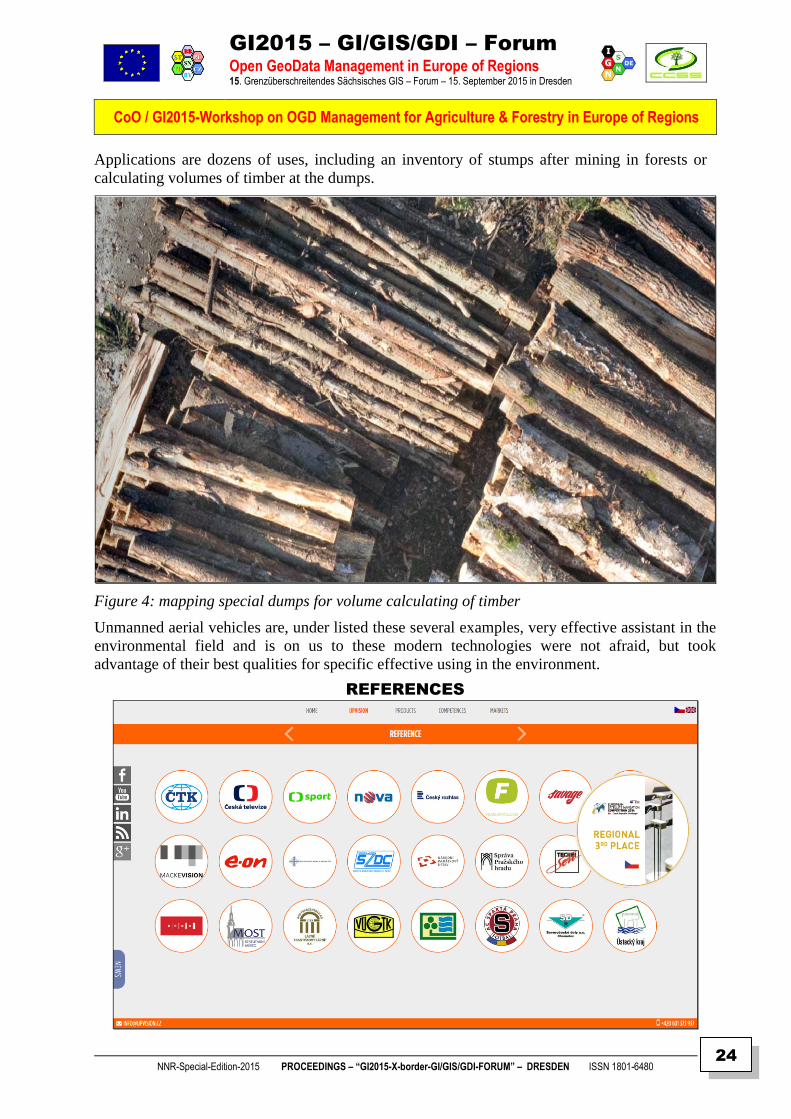
Applications are dozens of uses, including an inventory of stumps after mining in forests or
calculating volumes of timber at the dumps.
Figure 4: mapping special dumps for volume calculating of timber
Unmanned aerial vehicles are, under listed these several examples, very effective assistant in the
environmental field and is on us to these modern technologies were not afraid, but took
advantage of their best qualities for specific effective using in the environment.
REFERENCES

GI2015 – GI/GIS/GDI – Forum
Open GeoData Management in Europe of Regions 15. Grenzüberschreitendes Sächsisches GIS – Forum – 15. September 2015 in Dresden
CoO / GI2015-Workshop on OGD Management for Agriculture & Forestry in Europe of Regions
NNR-Special-Edition-2015 PROCEEDINGS – “GI2015-X-border-GI/GIS/GDI-FORUM” – DRESDEN ISSN 1801-6480
25
COPERNICUS PROGRAMME AND SENTINEL DATA
FOR AGRICULTURE AND FORESTRY
Lenka Hladíková CENIA, Czech Environmental Information Agency, Praha
ABSTRACT
Keywords: Copernicus, Sentinel satellites, remote sensing, services
Content: Copernicus (previously known as GMES) is the most important EU programme for monitoring of
environment and security from satellite data. It comprises from three main components – space
component (Sentinel satellites constructed dedicatedly for the programme and third party missions), in-
situ component (data from sensors on ground, sea etc.) and services (built upon the two previous
components in six thematic domains). The programme itself is coordinated by the European Commission
in close cooperation with European Space Agency and other entities for each component or service.
Agriculture and forestry are two important areas, which should highly benefit from satellite images –
meant in the way that information needed for these areas can be obtained in a more effective and
timesaving way for larger areas than in case of using only ground data collection.
Satellite images used to be rather expensive to obtain since the Landsat data were made accessible for
free. However, if we need images with different parameters, the best open and free sources are data from
the Copernicus Sentinel satellites. There are currently 6 satellites planned to be launched within the
Copernicus programme, each providing unique set of optical or radar images of different spatial and
spectral resolution. Each Sentinel will have two identical satellites (A and B units), ensuring very good
time resolution needed in the field of agriculture. The most important parameter of these data is the
sustainability, enabling regular monitoring of agriculture areas. In line with the open and free data policy
of the Copernicus programme, all data from Sentinel satellites will be provided free for all categories of
users. This principle results in cheaper applications created upon the satellite data and hopefully also in
their wider use among different areas.
Some products of the Copernicus services are directly determined for support of EU agricultural politics
mostly on the European and global level. However many other downstream services, build for the specific
user needs on national level, can be created upon the Sentinel data.
Author
Lenka HLADÍKOVÁ
References [http://www.copernicus.gov.cz/en]
[http://www.copernicus.eu]
[http://www.konference-copernicus.cz/en]
Contact Lenka HLADÍKOVÁ
CENIA, Czech Environmental Information Agency
Vršovická 1442/65, Praha 10, 100 10
mobile: +420 731 190 711
e-mail: [email protected]

GI2015 – GI/GIS/GDI – Forum
Open GeoData Management in Europe of Regions 15. Grenzüberschreitendes Sächsisches GIS – Forum – 15. September 2015 in Dresden
CoO / GI2015-Workshop on OGD Management for Agriculture & Forestry in Europe of Regions
NNR-Special-Edition-2015 PROCEEDINGS – “GI2015-X-border-GI/GIS/GDI-FORUM” – DRESDEN ISSN 1801-6480
26
SUMMARY
Introduction
Agriculture and forestry represent areas with high potential for utilization of remote sensing technologies.
With growing availability of satellite images, the remote sensing technologies are used more often than in
the past and especially in these fields they can bring significant savings. The Sentinel satellites, developed
in the frame of the European Copernicus programme, are in line with the programme policy provided for
free. In response to this fact, also services built upon these data can be substantially cheaper. This paper
summarizes the main advantages of utilization of remote sensing in the field of agriculture and forestry,
with special focus on the data and services from the Copernicus programme.
The Copernicus programme – an overview
Copernicus, the EU Earth Observation and Monitoring programme, provides timely and reliable
information to support decision making mainly in the field of environment and security. These
information – services – are delivered in six thematic domains: Land monitoring, Emergency
Management, Atmosphere, Marine, Security and Climate Change. The services are built upon satellite
images, delivered from the Sentinel satellites, which are constructed dedicatedly for the programme, and
other satellites, so-called third party missions. Images are complemented by the ground measurements
from the Copernicus in-situ component, which is also an important part of the programme.
Agriculture and forestry from satellite images
Agriculture and forestry can highly benefit from the remote sensing images and techniques. In the field of
agriculture, we are able to monitor some parameters important to farmers: crop identification and status,
soil moisture, health status or delineation of the field boundaries. In the case of forest monitoring, we can
similarly obtain information on forest types and structure, grow, damage after windstorm or forest fire,
identification of clear-cuts (Figure 1) or illegal logging. Therefore we can get information on large areas
in short time, on regular basis and in some cases also map phenomenon not visible to human eyes. In
conclusion, these information can help farmers to model crop prediction, use less fertilizers and maximize
the crop yields, resulting in the cost reduction and more environment-friendly farming.
Figure 1: Clear-cuts detection from the Landsat image, Source: Forest Management Institute, Czech Republic
GI2015 – GI/GIS/GDI – Forum
Open GeoData Management in Europe of Regions 15. Grenzüberschreitendes Sächsisches GIS – Forum – 15. September 2015 in Dresden
CoO / GI2015-Workshop on OGD Management for Agriculture & Forestry in Europe of Regions
NNR-Special-Edition-2015 PROCEEDINGS – “GI2015-X-border-GI/GIS/GDI-FORUM” – DRESDEN ISSN 1801-6480
27
Remote sensing is an important tool for the so-called precision farming. Precision farming is a modern
approach of farming in a cost-effective and more environment friendly way. Information from the satellite
images, in combination with the global positioning system (GPS) allow to adapt some of the farming
operations to local conditions.
In general, there are two main groups of users, who may benefit from satellite data in this field.
Information on the local level, i.e. from satellites with high resolution or aerial images, better serves for
farmers themselves. On the other hand, data of regional or global scale bring information needed for
governments to control allocation of subsidies or support shaping of national and European agricultural
policies, or for national landscape protection agencies mapping the grassland or forest management.
Parameters of the satellite images required for agricultural applications vary according to the purpose –
for some activities images with very high resolution (meters) are crucial, on the other hand for the crop
yield estimation the medium spatial resolution together with the frequent revisit time are needed. Long-
term data series also allow for analysis of changes and trends in the health of the forests. In some cases,
the satellite images can reduce or replace large-scale field surveys.
Copernicus for agriculture and forestry
And what can the Copernicus programme bring to these issues? Firstly, it offers satellite data of various
parameters (radar or optical images, different spectral and spatial resolution), which will scan the Earth
with a frequent revisit time. There are already 5 Sentinel missions (see Table 1), each of them having 2
identical units (A and B, later C and D) to provide optimal spatial and temporal resolution of the images.
One of the main benefits of the Sentinel satellites is the sustainability due to the identical units, enabling
creation of longer time-series of the monitored parameter. To this time, first two satellites are in orbit,
already delivering the images. In some cases, data from Sentinel satellites can replace currently used
aerial images with very high spatial resolution, but acquired only once in several years and having
significantly lower spectral resolution.
Table 1: Main characteristics of the Sentinel satellites
Sentinel 1 Sentinel 2 Sentinel 3 Sentinel 4 Sentinel 5
characteristics radar mission
multispectral
high resolution
mission
4 sensors
(multispectral,
radar,
microwave) of
medium
resolution
multispectral
geostationary
mission for
atmosphere
monitoring
multispectral
polar orbit
mission for
atmosphere
monitoring
spatial
resolution 5 – 40 m 10, 20, 60 m 300 – 500 m 8 km 5 – 15 km
temporal*
resolution 6 days 5 days 27 days 60 min 29 days
launch date
(A/B unit)
April 2014 June 2015 November 2015 2018 2019
February 2016 March 2016 February 2017 2018 2027
* for 2-satellite constellation, source: https://sentinel.esa.int
On regional and global scale, also some of the Copernicus services can be useful – particularly the Land
Monitoring Service: Corine Land Cover database about land cover and its changes since 1990, High
Resolution Layers with forest types or tree cover density or near-real time biophysical variables such as
leaf area index (Figure 2), energy budget, water cycle etc., provided on regular basis.

GI2015 – GI/GIS/GDI – Forum
Open GeoData Management in Europe of Regions 15. Grenzüberschreitendes Sächsisches GIS – Forum – 15. September 2015 in Dresden
CoO / GI2015-Workshop on OGD Management for Agriculture & Forestry in Europe of Regions
NNR-Special-Edition-2015 PROCEEDINGS – “GI2015-X-border-GI/GIS/GDI-FORUM” – DRESDEN ISSN 1801-6480
28
Figure 2: Leaf Area Index (LAI) derived from the satellite image (red – lowest LAI, blue – highest LAI). Source:
AQUAPATH-SOIL project.
To conclude, the Copernicus programme with its data and services has a great potential in the agriculture
domain; hopefully the number of its utilization in this field will grow steadily with more Copernicus
satellites and services becoming operational.
References:
Copernicus briefs – ESA:
http://www.copernicus.eu/sites/default/files/documents/Copernicus_Briefs/Copernicus_Brief_Issue35_Ag
ricultureMonitoring_Sep2013.pdf
http://www.copernicus.eu/sites/default/files/documents/Copernicus_Briefs/Copernicus_Brief_Issue14_Fo
restDamage_Sep2013.pdf
http://lms.seos-project.eu/learning_modules/agriculture
http://www.gisat.cz/content/cz/aplikace/zemedelstvi

GI2015 – GI/GIS/GDI – Forum
Open GeoData Management in Europe of Regions 15. Grenzüberschreitendes Sächsisches GIS – Forum – 15. September 2015 in Dresden
CoO / GI2015-Workshop on OGD Management for Agriculture & Forestry in Europe of Regions
NNR-Special-Edition-2015 PROCEEDINGS – “GI2015-X-border-GI/GIS/GDI-FORUM” – DRESDEN ISSN 1801-6480
29
THE ADDED VALUE OF COPERNICUS AND GALILEO
FOR GEO-INFORMATION AND LBS AT THE SERVICE
OF AGRICULTURE & FORESTRY IN THE REGIONS
Stefaan DE MEY & Grazia FIORE EURISY / Paris, France
ABSTRACT
Keywords: Copernicus, Galileo, EGNOS, GNSS, free open data, value adding chain, multi-disciplinary
Content:
European space flagship programmes. Europe invests in satellite infrastructure through two
major programmes, Galileo and Copernicus. The resulting applications are expected to bring growth,
jobs, and better quality of life for Europe's citizens. Galileo, Europe' own state-of-the-art Global
Navigation Satellite System (GNSS), provides accurate and guaranteed positioning for all types of
civilian applications. Copernicus, Europe's own Earth Observation system, provides free, full and open
access to a wealth of important environmental data from a variety of different sources, including satellite
imagery.
A global view for local actions: from open and free data to info that has a price. The use of
satellite-derived information is not any longer the privilege of global/national authorities. With more
sources of data, including from satellites, being more accessible to more people than ever before, the
understanding of places, spaces, and spatial phenomena is potentially better than ever. But making sense
of all this data is proportionally more complex for those whose job is not to analyse data, but to simply
make sense of a situation, sometimes in real time. More than ever, to become useful, data needs to be
turned into info. This requires a multidisciplinary approach involving the entire adding-value chain and
embracing a variety of applications such as Satnav-assisted farm management technologies, geographical
information systems, internet and IT technologies, space and terrestrial imaging and sensor technologies,
and expert knowledge on crop growth processes. This does not come for free.
How to get the information to the local users? Today, many initiatives to create (open) data
sharing platforms exist. New tools should rely on what is already there as much as possible and preferably
integrate in already existing platforms that are effectively and operationally used by public and private
entities. Those who work on such solutions not only have a role to play as facilitators of technology
transfer, but also as stakeholders’ brokers and federators.
Authors Grazia Fiore,
EURISY - Research and project coordinator
Stefaan De Mey EURISY - Secretary General
References [ http://www.eurisy.org ]
Contact Grazia Fiore, 94bis avenue de Suffren, 75015 Paris, France
EMail: [ Grazia.Fiore (at) eurisy.org ]

GI2015 – GI/GIS/GDI – Forum
Open GeoData Management in Europe of Regions 15. Grenzüberschreitendes Sächsisches GIS – Forum – 15. September 2015 in Dresden
CoO / GI2015-Workshop on OGD Management for Agriculture & Forestry in Europe of Regions
NNR-Special-Edition-2015 PROCEEDINGS – “GI2015-X-border-GI/GIS/GDI-FORUM” – DRESDEN ISSN 1801-6480
30
SUMMARY
Satellite applications are already changing our economies and societies
More than a thousand active satellites - both government and private - are currently out of space. These
devices are providing us with data and signals which have become essential to ensure transport,
communication and global monitoring of environmental phenomena on Earth. Weather forecast is today
largely based on satellite data. Satellites are used to create digital maps showing soil composition and crop
health. They determine the rate of water evaporation in irrigated crops, allowing farmers to optimise the use
of time, water, nitrates and human resources. Earth observation is also used to measure carbon storage in
forests, to monitor the vegetation cover, and even to spot illegal forest cuts. Satellite navigation is employed
in large farms and forests to guide trucks through the fields, while satellite communication delivers reliable
broadband services to ensure communication and to manage water reservoirs, pumps and other equipments
in remote locations.
Galileo and Copernicus
Acknowledging the potential of satellite-based services to create jobs, foster economic development and
support a sustainable management of the environment and of natural and anthropogenic disasters, the
European Union has being investing large resources in the implementation of its own satellite systems. The
EU allocated around EUR 6.3 billion to Galileo, the European satellite navigation programme, and EUR 4.3
billion to the European Earth observation system GMES-Copernicus for the period 2014-2020. Moreover,
the European Space Agency alone is investing EUR 309.2 million, i.e. 7% of its budget for 2015 to
telecommunications and integrated applications, supporting the development of market-oriented space
services. Also the Horizon 2020 EU Research and Innovation programme dedicates EUR 1.73 billion to
space research and development.
Eurisy: working to prepare the European society to make the most of satellite applications by
showcasing examples of what is already available and operationally used
These investments aim at supporting the operational use of satellite-based data and signals to meet current
and future policy and societal needs. During the last 25 years, Eurisy, an association of over 30 governmental
space agencies and offices, has been working to prepare public and private users to fully grasp the potential
benefits of satellite-based applications. The association has been doing this by raising awareness on available
services based on satellites which can support the work of public and private managers in sectors ranging
from transport to environmental protection, tourism, agriculture, forestry, and water management, to quote
only a few of the fields in which satellite applications find a use. Eurisy does not merely communicate on
services which are available on the market, but invites private companies and public authorities (such as
ministries and city and regional administrations) to speak about their operational use of satellite technologies
in front of their peers. They explain what their initial needs were, how they got to use a satellite-based
service, which difficulties they encountered and how they solved them, how much it cost to adopt and use
these services and how they could be improved.
How can satellites help improving farming and forestry?
Agriculture has been one of the first sectors in which satellite-based data and signals have been consistently
showing their benefits. Weather data largely come from satellites, while “precision farming” has become
today one of the main themes among farmers and agriculture decision-makers.
Indeed, satellites improve the quality and quantity of the information available on water reserves, soil, crops,
weather and infrastructure, allowing public and private stakeholders to match water availability to water
demand, to precisely assess irrigation needs, to map and monitor cultivated fields and to advice farmers on
where and how to distribute water and fertilisers.
Geospatial technology, such as satellite imagery and GIS are also widely used by government and private
organisations to better manage forests.
GI2015 – GI/GIS/GDI – Forum
Open GeoData Management in Europe of Regions 15. Grenzüberschreitendes Sächsisches GIS – Forum – 15. September 2015 in Dresden
CoO / GI2015-Workshop on OGD Management for Agriculture & Forestry in Europe of Regions
NNR-Special-Edition-2015 PROCEEDINGS – “GI2015-X-border-GI/GIS/GDI-FORUM” – DRESDEN ISSN 1801-6480
31
Indeed, satellite images provide information on land cover, species, habitats, soil conditions, land uses, and
forest productivity, among others, which are essential to both protect and exploit forests. Satellite imagery
and GIS data proved to be effective tools to quantify deforestation and to monitor our forests. Moreover,
satellite imagery, navigation and communication consistently support fire and emergency personnel in case
of natural or anthropogenic disasters, when timely and accurate data are essential. In the event of a disaster,
like a fire, satellite imagery also helps forest managers to design and monitor restoration measures.
Examples of use of satellite applications to improve agriculture and forestry
Satellite imagery and navigation are more and more integrated into GIS which allow farmers to better
manage their crops. In the region of La Mancha Oriental, in Spain, the Central Irrigation Board (JCRMO),
the Júcar River Basin Authority, the regional Government and the University of Castilla La Mancha agreed
to use information derived from satellite imagery to map the spatial distribution of land covers and build a
Geographic Information System. Since 2010, the JCRMO has been using time series of satellite images (12-
14 images per year) provided by the EU GMES-funded project SIRIUS (http://sirius-gmes.es/), to map and
estimate irrigation water needs of cultivated plots according to precipitations, atmospheric demand and
irrigation methods. Satellite information is used to assign water abstraction rights to farmers, according to
crops and field’s extension, and to monitor the enforcement of the Exploitation Plan of the Aquifer.
Enforcement of the AEP is in fact essential to ensure sustainability. Moreover, a web-GIS provides farmers
with routine reports on irrigation needs. Thanks to these results, historical water rights were assigned on 95%
of the territory, discouraging new non-authorised cultivations and allowing a recovery of groundwater levels
in the last three humid years. The classification process to identify irrigated areas based on satellite imagery
has been recognised as evidence by the Spanish Supreme Court in 2012.
Combined with in situ observations, satellite imagery also permits to acquire data on evapotranspiration and
soil moisture, which is useful to provide farmers with timely advice on the irrigation needs of each cultivated
parcel. The use case of the Campania Region, in Italy, shows that this information can be sent directly to
the mobile phones of the farmers subscribed to this free service. Indeed, through “IrriSat”
(www.consulenzairrigua.it), the Agriculture Department of the Campania Region provides customised
irrigation information, based on high spatial resolution satellite data (10-20 m), on the actual irrigation needs
of each plot managed by the farmers. This information, delivered every 7-10 days, indicates to farmers how
much irrigation water to use, without compromising yield. In addition, farmers get a map of the development
of the crop, indicating non-uniform growth due to irregularities in agronomic inputs (not only water, but also
fertilisers) and soil heterogeneity. The service is available to farmers and other water managers at all levels,
who can subscribe for free, and receive the information through text messages, MMS or on the web. In
addition to providing the service, the Agriculture Department accompanies the programme with particular
communication efforts to get an ever bigger number of farmers to subscribe, including through TV ad
campaigns.
In the case of the Directorate for Territories of the Deux-Sèvres County, in France, satellite imagery is
combined with in-situ measurements to reduce the amount of fertilisers spread over cultivated fields. The
Directorate started using satellite-derived maps to detect whether parcels are covered with catch crops, in
cooperation with the Earth Observation and Geoinformation for Land and Environment laboratory (TETIS)
of the National Research Institute of Science and Technology for Environment and Agriculture (IRSTEA),
and GEOSUD (GeoInformation for Sustainable Development, http://geosud.teledetection.fr/) – a French
database of satellite data, free for public authorities. These data enable to better spot the areas with no cover
and to prioritise site inspections. Thanks to satellite information, the Directorate is able, for the first time in
France, to build priority maps focusing on areas most affected by nitrates pollution risk, thus optimising field
inspections and saving time.
Satellite navigation also represents a precious tool to accurately map thermal field measurements made in
situ or through airplanes or airborne platforms, a method successfully implemented in Israel by the Volcani
Centre, and it can even be employed to automatically guide irrigation machinery.
GI2015 – GI/GIS/GDI – Forum
Open GeoData Management in Europe of Regions 15. Grenzüberschreitendes Sächsisches GIS – Forum – 15. September 2015 in Dresden
CoO / GI2015-Workshop on OGD Management for Agriculture & Forestry in Europe of Regions
NNR-Special-Edition-2015 PROCEEDINGS – “GI2015-X-border-GI/GIS/GDI-FORUM” – DRESDEN ISSN 1801-6480
32
An innovative example of a use of satellite applications for fire detection and response is the FireHub service
(http://195.251.203.94/seviri/), developed by the National Observatory of Athens (NOA) within the
BEYOND initiative, aiming at building a centre of excellence for Earth observation-based monitoring of
natural disasters in South-Eastern Europe. FireHub is a fire early-warning service which relies on
meteorological information, Earth observation data and other geospatial information.
The General Directorate for the Development and Protection of Forests and Rural Environment of the
Greek Ministry of Environment, Energy and Climate Change uses this service to monitor fire extent in real
time (fire monitoring data are produced every five minutes) and to forecast the smoke dispersion 15 minutes
ahead. Through a dedicated web-GIS application, the service also provides information on fires that occurred
in Greece during the last 30 years and generates burnt scar maps during and after wildfires. Moreover,
FireHub maps burnt areas for damage and deforestation assessment. The maps are used by the DG to
implement relief activities, to estimate carbon balance, monitor fire and soil erosion risk, and to plan urban
developments.
The basic FireHub, free of charge, is particularly useful in case of fires originating outside Greek borders.
Recently, a fire that started in Albania close to the Greek border was not officially notified to Greek
authorities. The accident was instead detected via FireHub, allowing the Fire Brigades to intervene even
before the fire entered the Greek territory. The DG is currently working with the FireHub team to enhance
the service, to hasten the damage assessment process and to identify reforestation areas within two months
after the end of the fire season, in line with Greek legislation.
These examples highlight the current and potential contributions of satellite applications to better manage
agriculture and forestry. Moreover, they illustrate how satellite-based services can support public managers
to comply with national and European policies and legislation, such as the Common Agricultural Policy
(CAP), the Water Framework Directive, the Nitrates Directive and the Soil Thematic Strategy, among others.
Which data are currently available? (Copernicus and Galileo)
The first pillar of Europe's navigation programme, the European Geostationary Navigation Overlay Service
(EGNOS), enhancing GPS signals, is operational since 2009. It sharpens the accuracy of GPS signals across
Europe to make it usable for e.g. goods tracking and precision farming.
Europe is currently deploying the Galileo satellite navigation system. In 2012 Galileo had four operational
satellites in orbit for the in-orbit validation, providing already early services with reduced performance from
mid 2014. Full operational capability with about 30 satellites in orbit is expected by 2019/2020.
The Copernicus services are also progressively reaching their operational phase. The Land Monitoring
Services (http://land.copernicus.eu/), operational since 2012, provide geographical information on land cover
and on variables related, for instance, to the vegetation state or the water cycle. They support applications in
a variety of domains, such as spatial planning, forest management, water management, agriculture and food
security, etc.
The Copernicus services represent a unique opportunity to develop more accurate and reliable applications
for agriculture and forestry. A closer cooperation between data providers, machine makers and farmers is
necessary to integrate all these technologies into easy-to-use tools for farmers. This process of mutual
collaboration will be a step of outmost importance to prepare both users and service providers to make the
most of the information provided by EGNOS, Galileo and Copernicus once these programmes will have
reached their full operational stage.
GI2015 – GI/GIS/GDI – Forum
Open GeoData Management in Europe of Regions 15. Grenzüberschreitendes Sächsisches GIS – Forum – 15. September 2015 in Dresden
CoO / GI2015-Workshop on OGD Management for Agriculture & Forestry in Europe of Regions
NNR-Special-Edition-2015 PROCEEDINGS – “GI2015-X-border-GI/GIS/GDI-FORUM” – DRESDEN ISSN 1801-6480
33
References: Copernicus (2015), Copernicus website, Products and Services. Consulted in August 2015 at:
www.copernicus.eu/main/services
Eurisy (2011), Eurisy website, Good Practices, Campania: Encouraging the sustainable use of irrigation
water in the region. Consulted in August 2015 at: www.eurisy.org/good-practice-campania-encouraging-the-
sustainable-use-of-irrigation-water-in-the-region_85
Eurisy (2013), Conclusions and recommendations of the conference “Satellite applications for multi-level
irrigation management: Capitalising on experience to drive regional innovation”, 31 October 2013, Badajoz,
Spain.
Eurisy (2013), Satellites Going Local: Water edition. Consulted in August 2015 at:
http://www.eurisy.org/data_files/publications-documents/4/publications_document-4.pdf?t=1391443756
Eurisy (2015), Eurisy website, Good Practices, The Greek Ministry of Environment uses real-time satellite
data to detect fires. Consulted in August 2015 at: www.eurisy.org/good-practice-the-greek-ministry-of-
environment-uses-real-time-satellite-data-to-detect-fires_158
Eurisy (2015), Eurisy website, On Satellite Applications. Consulted in August 2015 at: www.eurisy.org/on-
satellite-applications.php
Eurisy (2015), Operational uses of satellite-based applications in the public sector: a case study review,
Paris, France, 2015. ISBN 978-2-9551847-0-7.
Eurisy (2015), Summary and Conclusions of the workshop “Precision Agriculture: the added-value of
geoinformation and LBS, Vienna, Austria, 21 April 2015. Consulted in August 2015 at:
www.eurisy.org/event-precision-agriculture-the-added-value-of-geoinformation-and-lbs_32/summary-and-
conclusions
European Space Agency (2013), Copernicus Brief, Issue 2, Preserving Forests Cutting Carbon, September
2013. Consulted in August 2015 at:
www.copernicus.eu/sites/default/files/documents/Copernicus_Briefs/Copernicus_Brief_Issue2_Carbon_Sep
2013.pdf
European Space Agency (2013), Copernicus Brief, Issue 35, Food Watch From Space: How satellites
support agriculture, September 2013. Consulted in August 2015 at:
www.copernicus.eu/sites/default/files/documents/Copernicus_Briefs/Copernicus_Brief_Issue35_Agriculture
Monitoring_Sep2013.pdf
European Space Agency (2014), European Space Agency website, Our Activities, Navigation, Galileo and
EGNOS. Consulted in August 2015 at: www.esa.int/Our_Activities/Navigation/Galileo_and_EGNOS
European Space Agency (2015), European Space Agency website, ESA budget by domain for 2015.
Consulted in August 2015 at: http://www.esa.int/For_Media/Highlights/ESA_budget_2015
OECD (2014), The Space Economy at a Glance 2014, OECD Publishing.
Satellite Applications Catapult Ltd (2014), Satellites for everyone, The big picture, Consulted in August
2015 at: www.spaceforsmartergovernment.uk/workspace/assets/files/satellites-for-everyone-s4e-br-
5404e13017bd5.pdf
Satellite Imaging Corporation (2001-2015), Satellite Imaging Corporation website, Applications, Natural
resources, Forestry. Consulted in August 2015 at: http://www.satimagingcorp.com/applications/natural-
resources/forestry
Multimedia Presentation Online: https://prezi.com/ytb6-4lnn2l2/the-added-value-of-geoinformation-and-lbs-for-agriculture-and-
forestry/?utm_campaign=share&utm_medium=copy

GI2015 – GI/GIS/GDI – Forum
Open GeoData Management in Europe of Regions 15. Grenzüberschreitendes Sächsisches GIS – Forum – 15. September 2015 in Dresden
CoO / GI2015-Workshop on OGD Management for Agriculture & Forestry in Europe of Regions
NNR-Special-Edition-2015 PROCEEDINGS – “GI2015-X-border-GI/GIS/GDI-FORUM” – DRESDEN ISSN 1801-6480
34
GGII22001155 (( 1155.. SSääcchhssiisscchheess GGII//GGIISS//GGDDII –– FFOORRUUMM ))
CClluubb ooff OOssssiiaacchh NETWORKING WORKSHOPS
DRESDEN 15. September 2015
Edited by CCSS-Praha & IGN-Dresden & PROGIS-Villach Doz. Dr. Frank HOFFMANN, CSc – IGN
Dipl.Ing. Walter H. MAYER - PROGIS (Villach) Dr. Karel CHARVAT – CCSS (Praha)
IMPRIMATUR TO PRINT
14. September 2015
Copyright © 2015 by CCSS-Praha & IGN-Dresden & PROGIS-Villach – All rights reserved.
GI2015 – GI/GIS/GDI – Forum
Open GeoData Management in Europe of Regions 15. Grenzüberschreitendes Sächsisches GIS – Forum – 15. September 2015 in Dresden
CoO / GI2015-Workshop on OGD Management for Agriculture & Forestry in Europe of Regions
NNR-Special-Edition-2015 PROCEEDINGS – “GI2015-X-border-GI/GIS/GDI-FORUM” – DRESDEN ISSN 1801-6480
35
THE CLUB OF OSSIACH
THE BRIDGE FOR ICT IN AGRICULTURE & FORESTRY
BETWEEN DEVELOPED AND DEVELOPING COUNTRIES
WALTER H. MAYER & KAREL CHARVAT
PROGIS, VILLACH (AT) & CCSS, PRAHA (CZ)
ABSTRACT
The “Club of Ossiach”, a group of agriculturists, agribusiness managers, agriculture
technologists and agricultural ICT specialists from around the world, met at Ossiach between 17-
19 June 2013 at the “AgriFuture Days” Conference. They reviewed current trends and possible
discontinuities resulting from political, social, environmental and technological changes,
potentially impacting on the future of agriculture, farming, rural viability, food and nutrition
worldwide.
This Presentation describes:
The Recognition of the “OISSACH” Club
The Focus on ICT and Keypoints of its Adoption in Agriculture
The Technologies recognized by the “OISSACH” Club
The Priorities of ICT Adoption for Future Agriculture Communities
The Business Model
The Charter Members
Authors
Ajit MARU Chair of the Club of Ossiach (CoO)
Dipl.-Ing. Walter H. MAYER CEO of ROGIS GmbH, Villach (AT)
Dr. Karel CHARVAT EU Project Manager of HSRS, Benesov (CZ)
Contact Club of Ossiach”, Postgasse 6,
A-9500 Villach
Email [ [email protected] | [email protected] ]

GI2015 – GI/GIS/GDI – Forum
Open GeoData Management in Europe of Regions 15. Grenzüberschreitendes Sächsisches GIS – Forum – 15. September 2015 in Dresden
CoO / GI2015-Workshop on OGD Management for Agriculture & Forestry in Europe of Regions
NNR-Special-Edition-2015 PROCEEDINGS – “GI2015-X-border-GI/GIS/GDI-FORUM” – DRESDEN ISSN 1801-6480
36
SUMMARY
THE OSSIACH – DECLARATION ON THE UPTAKE OF ICT FOR AGRICULTURE, FORESTRY, RURAL VIABILITY AND
ENVIRONMENTAL MANAGEMENT
Dipl.Ing. Walter H. MAYER
CEO of PROGIS GmbH, Italienerstr. 3, A-9500 VILLACH
The “Club of Ossiach”, a group of agriculturists, agribusiness managers, agriculture technologists and
agricultural ICT specialists from around the world, met at Ossiach between 17-19 June 2013 at the
“AgriFuture Days” Conference. They reviewed current trends and possible discontinuities resulting from
political, social, environmental and technological changes, potentially impacting on the future of
agriculture, farming, rural viability, food and nutrition worldwide.
1. The Club of Ossiach recognized that:
Almost a third of the world’s population is vulnerable to poverty and malnutrition, respectively is
marginal in its current food and nutritional security, has concerns of its food safety and reliability of
its supply.
The resource poor small holder farmers of the world are the poorest and the bottom of the heap of the
hungry.
The world today faces severe environmental changes and damages. In addition it cannot continue to
exploit natural resources in the current unsustainable manner.
Information and Communication Technologies (ICTs), nanotechnology, biotechnology, materials
and space technology among many other technological innovations, individually and jointly, are
essentially unsynchronized. This negatively influences human progress and development including
agriculture, food security and rural viability. We have to create a bio-based economy (accepting the
sustainability rules of nature) transforming industry, business and services.
The potential to feed the world, to use natural resources and safeguard the environment depends on
judicious change and use of technology.
However, the poorest of the world not only suffer the most but may miss from benefitting from this
economic and technological transformation.
2. The Club of Ossiach focus on ICTs identified the following key points in adoption of ICT in
agriculture
• Agricultural contribution to rural communities is not limited to agrotechnology and production
efficiencies. To a large extent it is the result of ICT innovations and their implementation.
• ICT adoption for agriculture impacts on rural community sustainability and an unlimited variety of
roducts, economic benefits, technical improvements and social enhancement. ICT will be most
effective as an incentive and agent of change when used at points of stakeholder cooperation.
Stakeholders can be expected to be a major motivating factor for adopting ICT supported agricultural
production and rural sustainability.
• Stakeholders participation in ICT development and implementation of innovative initiatives must
include farmers, extension, scientists, agricultural and social services, students, rural residents and
sector supporting entities. This “Bottom-Up” inclusion complements the now conventional “Top-
Down” model.

GI2015 – GI/GIS/GDI – Forum
Open GeoData Management in Europe of Regions 15. Grenzüberschreitendes Sächsisches GIS – Forum – 15. September 2015 in Dresden
CoO / GI2015-Workshop on OGD Management for Agriculture & Forestry in Europe of Regions
NNR-Special-Edition-2015 PROCEEDINGS – “GI2015-X-border-GI/GIS/GDI-FORUM” – DRESDEN ISSN 1801-6480
37
3. The Club of Ossiach, recognized that these technologies:
Create promising choices including the change of the nature of information. This will make it easier
to distribute, share and utilize data, information and knowledge.
Contribute to implementation of opportunities, addressing discontinuities and new options;
Are most effectual as a means of change when effectively integrated at the points of collaboration
between the various stakeholders. They enhance development by introducing new elements of
flexibility in production, development of innovations and facilitating their implementation.
Dictate caution and care in access and use of ICT supported knowledge especially during
introductory stages. The knowledge must be focused on people, sustainability, equity, welfare and
“happiness”. “Sustainability” in this context must be understood as furthering economical
development, lifelong learning, social justice and environmental integrity.
ICT produces ruptures through creative technological breakthroughs: from “constructive destruction
to destructive construction”. It enables the transformation of concurrent practices driven by tradition,
ulterior external interests and obsolete technologies. ICT can support individuals in motivating,
integrating and sustaining change in communities. With this understanding ICT will contribute to
create choices and processes of change especially through partnerships and co-leadership.
The Club of Ossiach recognized further that by creative cooperation sustainable and responsible
agriculture can be attained. This will demonstrate the feasibility of future evolution of Earth’s
ecosystems. They will enhance health and well-being globally inaddition to attaining more effective
distribution of the food produced and minimizing food waste.
The Club of Ossiach considered it as a responsibility to pursue technological change within
agriculture.
4. Recommended/expected ICT Adoption priorities and their potential benefits for
future agricultural communities:
• Innovation adoption
• Know-how transfer
• Technology integration
• New business models
• Stimulating innovations – technical, environmental, social and more.....
• Cooperation at the various production and social levels
• Universal benefit for all chain members
• Support a “European Innovation Partnership (EIP): Agricultural Productivity and
• Sustainability” initiative.
The Club of Ossiach will meet regularly, to jointly consider the future of agriculture, farming, food and
nutrition and rural viability. The meetings will include documenting the process, its progress and regular
publication of its findings.
5. A possible business-model
A new business model for a country-wide Agro-ICT-adoption was introduced and reviewed at the
conference. The model was titled an “Agro-ICT-Infrastructure concept”. It is designed to be initiated by
the government or a public-private consortium within a country. It will collate and integrate basic data
like ortho-images, agro-meteorological data and ICT-technologies accessible to the country’s agro-
community. This community will include farmers, smallholders, their suppliers, customers, advisors,
supporting science, education bodies and other public authorities. They all represent the food-, feed-,
biomass- or log-production chain and are linked together with applications supporting their information
needs.

GI2015 – GI/GIS/GDI – Forum
Open GeoData Management in Europe of Regions 15. Grenzüberschreitendes Sächsisches GIS – Forum – 15. September 2015 in Dresden
CoO / GI2015-Workshop on OGD Management for Agriculture & Forestry in Europe of Regions
NNR-Special-Edition-2015 PROCEEDINGS – “GI2015-X-border-GI/GIS/GDI-FORUM” – DRESDEN ISSN 1801-6480
38
The Club of Ossiach - Charter Members
Robin Bourgeois Senior Foresight and Development Policies Expert, Secretariat
of the Global Forum on Agricultural Research (GFAR c/o FAO- #RD),Italy;
Ajit Maru Senior Officer, Secretariat of the Global Forum on Agricultural
Research (GFAR c/o FAO) Italy,
Karel Charvat, Project Manager of Help Service Remote Sensing s.r.o.,
WirelessInfo Czech Centre for Science and Society, Czech Republic and CEO
of Baltic Open Solution Centre Latvia and former EFITA president;
Ehud Gelb Samuel Neaman Institute for National Policy Research,Hebrew
University, Center for Agricultural Economic Research, Israel;
Dieter Ott, Bundesverband der Deutschen Maschinenringe (BMR), Germany;
Markus F. Hofreither, University of Natural Resources and Life Sciences,
Institute for Sustainable Economic Development, Austria;
Kyandoghere Kyamakya,Smart System Technologies-Transportation Informatics,
Alpen Adria University, Austria;
Alphons Claessens, NIT Holding – Limited, Netherland;
Alfred Pitterle, University of Natural Resources and Life Sciences Institute of
Silviculture and CEO of ForCert GmbH, Vienna, Austria;
Walter Mayer, Chief Executive Officer, PROGIS Software GmbH, Villach, Austria
For more information and comments please contact
“Club of Ossiach”, Postgasse 6, A-9500 Villach

GI2015 – GI/GIS/GDI – Forum
Open GeoData Management in Europe of Regions 15. Grenzüberschreitendes Sächsisches GIS – Forum – 15. September 2015 in Dresden
CoO / GI2015-Workshop on OGD Management for Agriculture & Forestry in Europe of Regions
NNR-Special-Edition-2015 PROCEEDINGS – “GI2015-X-border-GI/GIS/GDI-FORUM” – DRESDEN ISSN 1801-6480
39
CoO & GFAR Workshops in DRESDEN on ICTs for
Sustainable Agriculture and Forestry
Walter MAYER
ProGIS Software GmbH
Introduction The use of ICTs in agriculture to improve productivity (with sustainability) has evidently lagged
substantially than it other spheres of economy and everyday life. The development of ICTs in agriculture
are at the moment largely for use in very large farms in economically developed countries though they
would benefit equally if not more in small farms which are resource poor in developing countries. ICTs
for SMART/Precision agriculture are not scale neutral for all farming.
They face problems in:
• Availability and Accessibility
• Affordability and Applicability
• Relevance and Usefulness
• Timeliness and Trustworthiness
• Appropriation by Individual and/or Communities
• Making Effective Use of Information
Developed and developing countries need to innovate, adapt and adopt ICTs to improve productivity of
their small farmers but do not have the capacities to do so. Neither is there investment to research and
develop appropriate ICTs for small farmers.
The institutions that are needed to support the use of ICTs in agriculture, for example, for more open
access to data and information, are still not developed. FOODIE – Farm Oriented Open Data in Europe
from the 7th Framework Program of the European Union with the target to get better access to data might
be one step ahead:
to get better access to open data but also as data alone is not all,
to get better integration into stakeholder´s cooperation and
to support public AND private interests
We know very little of how actors, especially farmers, and stakeholders like consumers are being
inclusively engaged to bring about effective management and use of ICTs in agriculture.
Club of Ossiach, NGO, located at: Postgasse No 6, 9500 Villach, AUSTRIA
Tel. +43 (0) 4242-26332, Fax +43-(0)4242-263327, email: [email protected],
Internet:http://www.clubofossiach.com
Registered at 9500 Villach, Austria
GI2015 – GI/GIS/GDI – Forum
Open GeoData Management in Europe of Regions 15. Grenzüberschreitendes Sächsisches GIS – Forum – 15. September 2015 in Dresden
CoO / GI2015-Workshop on OGD Management for Agriculture & Forestry in Europe of Regions
NNR-Special-Edition-2015 PROCEEDINGS – “GI2015-X-border-GI/GIS/GDI-FORUM” – DRESDEN ISSN 1801-6480
40
The Workshop Process In this Workshop, through two stages, we are trying to answer two sets of questions around:
(1) HOW CAN WE IMPROVE THE USE OF ICTS TO START CONTRIBUTING TODAY AND IN NEAR
FUTURE (5-10 YEARS) TO IMPROVE PRODUCTIVITY OF FARMS IN A SUSTAINABLE WAY?
What are the current technology drivers in using ICTs for sustainable agriculture?
Examples of technology drivers:
1. Ubiquitous availability of cellular connectivity
2. Reduced cost of cell phones, sensors, connectivity
What are the current technology barriers in using ICTs for sustainable agriculture?
Examples of technology barriers:
1. Rural coverage of connectivity patchy
2. Standardized, interoperable, applicable content not available
What are the current business and market drivers in using ICTs for sustainable agriculture?
Examples of business and market drivers:
1. Consumer demand for agricultural commodities to be sustainably developed
2. Need to improve efficiency and wastage for competing in markets
What are the current business and market barriers in using ICTs for sustainable agriculture?
Examples of business and market barriers:
1. Little evidence yet of profitable return on investment for use of ICTs in agriculture
2. Lack of Institutional support such as in copyright/intellectual property rights
How can we create opportunities now to effectively use these drivers and overcome barriers to
improve use of ICTs to improve productivity of farms in a sustainable way?
Examples of creation of opportunities:
1. Legislation and executive action for opening data and information from public sector organizations
2. Public sector investment in rural telecommunication and physical infrastructure
(2) HOW DO WE PREPARE TODAY SO THAT AFTER 10 YEARS FROM NOW WE CAN USE ICT's
MORE EFFECTIVELY, WHERE IT IS NEEDED MOST, FOR SMALLHOLDER FARMING?
What will be the future Technology Drivers in using ICTs for sustainable agriculture?
What will be the future Technology Barriers in using ICTs for sustainable agriculture?
What will be the future business and market drivers in using ICTs for sustainable agriculture?
What will be the future business and market barriers in using ICTs for sustainable agriculture?
How can we now create opportunities so that we can effectively use these drivers and overcome
barriers to improve use of ICTs 10 years from now to improve productivity of farms in a
sustainable way?
Club of Ossiach, NGO, located at: Postgasse No 6, 9500 Villach, AUSTRIA
Tel. +43 (0) 4242-26332, Fax +43-(0)4242-263327, email: [email protected],
Internet:http://www.clubofossiach.com
Registered at 9500 Villach, Austria
GI2015 – GI/GIS/GDI – Forum
Open GeoData Management in Europe of Regions 15. Grenzüberschreitendes Sächsisches GIS – Forum – 15. September 2015 in Dresden
CoO / GI2015-Workshop on OGD Management for Agriculture & Forestry in Europe of Regions
NNR-Special-Edition-2015 PROCEEDINGS – “GI2015-X-border-GI/GIS/GDI-FORUM” – DRESDEN ISSN 1801-6480
41
Workshop 1: ENABLING INNOVATIONS FOR INFORMING FARMERS The participants will be divided into groups (or subgroups) if needed.
1st Session:
A. Sub-Groups on Current Technology, Business and Market Drivers and Barriers
Discussants
Provide through discussion in each group, a prioritized list of 3 current drivers and
barriers in using ICTs for sustainable agriculture each for:
1. Technology
2. Business and Markets
B. Sub-Groups on Future Technology, Business and Market Drivers and Barriers
Discussants
Provide in each sub-group, a prioritized list of 3 possible future drivers and barriers in
using ICTs for sustainable agriculture each for:
1. Technology
2. Business and Markets
C. Both Groups: Presentation of each sub-group lists of drivers and barriers
2nd Session:
A. Sub-Groups on Current Technology, Business and Market Drivers and Barriers
Discussants
List 3 suggestions each for how we can create opportunities now to (1) Effectively use
these drivers and (2) overcome barriers to improve use of ICTs to improve productivity
of farms in a sustainable way?
B. Sub-Groups on Future Technology, Business and Market Drivers and Barriers
Discussants
List 3 suggestions for how can we now create opportunities now so that we can (1)
effectively use these drivers and (2) overcome barriers to improve use of ICTs 10 years
from now to improve productivity of farms in a sustainable way?
C. Both Group Plenary: Presentation of sub-group lists opportunities
Club of Ossiach, NGO, located at: Postgasse No 6, 9500 Villach, AUSTRIA
Tel. +43 (0) 4242-26332, Fax +43-(0)4242-263327, email: [email protected],
Internet:http://www.clubofossiach.com
Registered at 9500 Villach, Austria
GI2015 – GI/GIS/GDI – Forum
Open GeoData Management in Europe of Regions 15. Grenzüberschreitendes Sächsisches GIS – Forum – 15. September 2015 in Dresden
CoO / GI2015-Workshop on OGD Management for Agriculture & Forestry in Europe of Regions
NNR-Special-Edition-2015 PROCEEDINGS – “GI2015-X-border-GI/GIS/GDI-FORUM” – DRESDEN ISSN 1801-6480
42
CoO / GFIA: DRESDEN - Workshop 1 on ICTs for Sustainable
Agriculture - ANSWERS
Workshop 1: ENABLING INNOVATIONS - INFORMING FARMERS
Group: Current Issues / Future Issues
Sub-Group:________________________________________________
Facilitateur: Ajit Maru / Walter H. Mayer
Chair:______________________________________
Rapporteur: ___________________________________
List of Drivers:
1.
2.
3.
Notes:
List of Barriers:
1.
2.
3.
Notes:
List of Opportunities:
1.
2.
3.
Notes:
Club of Ossiach, NGO, located at: Postgasse No 6, 9500 Villach, AUSTRIA
Tel. +43 (0) 4242-26332, Fax +43-(0)4242-263327, email: [email protected],
Internet:http://www.clubofossiach.com
Registered at 9500 Villach, Austria
GI2015 – GI/GIS/GDI – Forum
Open GeoData Management in Europe of Regions 15. Grenzüberschreitendes Sächsisches GIS – Forum – 15. September 2015 in Dresden
CoO / GI2015-Workshop on OGD Management for Agriculture & Forestry in Europe of Regions
NNR-Special-Edition-2015 PROCEEDINGS – “GI2015-X-border-GI/GIS/GDI-FORUM” – DRESDEN ISSN 1801-6480
43
Workshop 2: ADVISORY SERVICES The participants will be divided into groups (subgroups) if needed.
1st Session:
A. Sub-Groups on Current Technology, Business and Market Drivers and Barriers
Discussants
Provide through discussion in each sub-group, a prioritized list of 3 current drivers and
barriers in using ICTs for Advisory Services each for:
1. Technology
2. Business and Markets
B. Sub-Groups on Future Technology, Business and Market Drivers and Barriers
Discussants
Provide in each sub-group, a prioritized list of 3 possible future drivers and barriers in
using ICTs for Advisory Services each for:
1. Technology
2. Business and Markets
C. Both Groups Plenary: Presentation of each sub-groups lists of drivers and barriers
2st Session:
A. Sub-Groups on Current Technology, Business and Market Drivers and Barriers
Discussants
List 3 suggestions each for how we can create opportunities now to 1. Effectively use
these drivers and 2. Overcome barriers to improve use of ICTs to improve Advisory
Services?
B. Sub-Groups on Future Technology, Business and Market Drivers and Barriers
Discussants
List 3 suggestions for how can we now create opportunities now so that we can 1.
Effectively use these drivers and 2. Overcome barriers to use of ICTs 10 years from
now to improve Advisory Services?
C. Both Group Plenary: Presentation of each sub-groups lists of drivers and barriers
Club of Ossiach, NGO, located at: Postgasse No 6, 9500 Villach, AUSTRIA
Tel. +43 (0) 4242-26332, Fax +43-(0)4242-263327, email: [email protected],
Internet:http://www.clubofossiach.com
Registered at 9500 Villach, Austria

GI2015 – GI/GIS/GDI – Forum
Open GeoData Management in Europe of Regions 15. Grenzüberschreitendes Sächsisches GIS – Forum – 15. September 2015 in Dresden
CoO / GI2015-Workshop on OGD Management for Agriculture & Forestry in Europe of Regions
NNR-Special-Edition-2015 PROCEEDINGS – “GI2015-X-border-GI/GIS/GDI-FORUM” – DRESDEN ISSN 1801-6480
44
CoO / GFAR: DRESDEN - Workshop 2 on ICTs for
Sustainable Agriculture - ANSWERS
Workshop 2 on: ADVISORY SERVICES
Group: Current Issues / Future Issues
Sub-group:_________________________________________________
Facilitateur: Ajit Maru / Walter H. Mayer
Chair:______________________________________
Rapporteur: ___________________________________
List of Drivers:
1.
2.
3.
Notes:
List of Barriers:
1.
2.
3.
Notes:
List of Opportunities:
1.
2.
3.
Notes:
Club of Ossiach, NGO, located at: Postgasse No 6, 9500 Villach, AUSTRIA
Tel. +43 (0) 4242-26332, Fax +43-(0)4242-263327, email: [email protected],
Internet:http://www.clubofossiach.com
Registered at 9500 Villach, Austria
GI2015 – GI/GIS/GDI – Forum
Open GeoData Management in Europe of Regions 15. Grenzüberschreitendes Sächsisches GIS – Forum – 15. September 2015 in Dresden
CoO / GI2015-Workshop on OGD Management for Agriculture & Forestry in Europe of Regions
NNR-Special-Edition-2015 PROCEEDINGS – “GI2015-X-border-GI/GIS/GDI-FORUM” – DRESDEN ISSN 1801-6480
45
GGII22001155 (( 1155.. SSääcchhssiisscchheess GGII//GGIISS//GGDDII –– FFOORRUUMM ))
PRESS INFORMATION
&
WEB NEWS LINKS
DRESDEN 15. September 2015
Edited by IGN Doz. Dr. Frank HOFFMANN, CSc
IIMMPPRRIIMMAATTUURR TTOO PPRRIINNTT
1144.. SSeepptteemmbbeerr 22001155
Copyright © 2015 by CCSS-Praha & IGN-Dresden & PROGIS-Villach – All rights reserved.
GI2015 – GI/GIS/GDI – Forum
Open GeoData Management in Europe of Regions 15. Grenzüberschreitendes Sächsisches GIS – Forum – 15. September 2015 in Dresden
CoO / GI2015-Workshop on OGD Management for Agriculture & Forestry in Europe of Regions
NNR-Special-Edition-2015 PROCEEDINGS – “GI2015-X-border-GI/GIS/GDI-FORUM” – DRESDEN ISSN 1801-6480
46
WEB INFORMATION
Open Data Strategie for Saxony
Die Verpflichtung zur maschinenlesbaren Bereitstellung und der Veröffentlichung von Metadaten gilt
unter drei Bedingungen:
1. Die Daten müssen in öffentlich zugänglichen Netzen verfügbar sein.
2. Die Daten müssen nach dem 1. September 2014 für die Öffentlichkeit bereitgestellt worden sein
oder in der Verwaltung bereits veröffentlichungsfähig in maschinenlesbarer Form vorliegen.
3. Für die Daten ist ein Nutzungsinteresse zu erwarten.
Zur Umsetzung der sich aus § 8 SächsEGovG ergebenden Pflichten wird vorgeschlagen, wie folgt
vorzugehen.
Inventarisierung von Daten
Es wird jeder Behörde empfohlen, zunächst ein Inventar anzulegen und die folgenden Prüfschritte
durchzuführen:
1. Welche Daten werden bereits in den von der Behörde verantworteten Online-Angeboten
bereitgestellt?
Für ein systematisches Vorgehen ist es sinnvoll, ein Inventar der entsprechenden Daten
anzulegen, das die Bezeichnung der Daten und die URL enthält. Die folgenden Prüfschritte sind
für jeden gefundenen Datensatz durchzuführen, die entsprechenden Prüfergebnisse können im
Inventar festgehalten werden.
2. Liegen die Daten bereits maschinenlesbar vor? Liegen die Daten der Verwaltung bereits maschinenlesbar vor (dies ist dann der Fall, wenn die
Verwaltung des Freistaates Sachsen oder durch diese Beauftragte, die Daten selbst durch
Software automatisiert auslesen und verarbeiten können), so ist zu prüfen, ob sie auch über
öffentliche Netze für die Nutzung Dritter zur Verfügung gestellt werden, in Zukunft auch im Netz
maschinenlesbar angeboten und nach Möglichkeit mit Metadaten zu versehen sind. Da die
Maschinenlesbarkeit bereits vorliegt und damit der weitere Aufwand für die Bereitstellung zu
vernachlässigen ist, sind keine besonderen Ansprüche an das erwartbare Nutzungsinteresse zu
stellen; ein solches wird regelmäßig vorliegen.
Liegen die Daten noch nicht maschinenlesbar vor und wurden in anderer Form bereits vor dem 1.
September 2014 öffentlich bereitgestellt, so entstehen keine Verpflichtungen.
3. Wird für Daten, die noch nicht maschinenlesbar vorliegen und die nach dem 1. September
2014 (erstmals oder verändert) ins Netz gestellt werden, ein Nutzungsinteresse erwartet? Werden noch nicht maschinenlesbar vorliegende Daten öffentlich nach dem 1. September 2014
bereitgestellt, so müssen diese nur dann (auch) in maschinenlesbarer Form verfügbar gemacht
werden, wenn ein Nutzungsinteresse zu erwarten ist.
Ein Nutzungsinteresse liegt nach § 8 SächsEGovG insbesondere vor, wenn jemand
die Daten nicht nur gebrauchen will, um eine öffentliche Aufgabe zu erfüllen oder
sich die Daten nicht intellektuell lediglich aneignet, um das dadurch erlangte Wissen zu
verwerten, sondern mehr damit vorhat (Weiterverwendung).
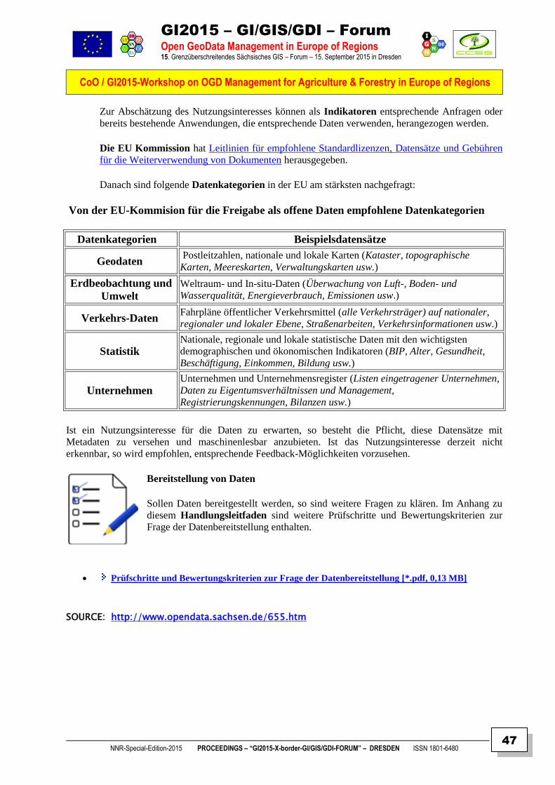
GI2015 – GI/GIS/GDI – Forum
Open GeoData Management in Europe of Regions 15. Grenzüberschreitendes Sächsisches GIS – Forum – 15. September 2015 in Dresden
CoO / GI2015-Workshop on OGD Management for Agriculture & Forestry in Europe of Regions
NNR-Special-Edition-2015 PROCEEDINGS – “GI2015-X-border-GI/GIS/GDI-FORUM” – DRESDEN ISSN 1801-6480
47
Zur Abschätzung des Nutzungsinteresses können als Indikatoren entsprechende Anfragen oder
bereits bestehende Anwendungen, die entsprechende Daten verwenden, herangezogen werden.
Die EU Kommission hat Leitlinien für empfohlene Standardlizenzen, Datensätze und Gebühren
für die Weiterverwendung von Dokumenten herausgegeben.
Danach sind folgende Datenkategorien in der EU am stärksten nachgefragt:
Von der EU-Kommision für die Freigabe als offene Daten empfohlene Datenkategorien
Datenkategorien Beispielsdatensätze
Geodaten Postleitzahlen, nationale und lokale Karten (Kataster, topographische
Karten, Meereskarten, Verwaltungskarten usw.)
Erdbeobachtung und
Umwelt
Weltraum- und In-situ-Daten (Überwachung von Luft-, Boden- und
Wasserqualität, Energieverbrauch, Emissionen usw.)
Verkehrs-Daten Fahrpläne öffentlicher Verkehrsmittel (alle Verkehrsträger) auf nationaler,
regionaler und lokaler Ebene, Straßenarbeiten, Verkehrsinformationen usw.)
Statistik Nationale, regionale und lokale statistische Daten mit den wichtigsten
demographischen und ökonomischen Indikatoren (BIP, Alter, Gesundheit,
Beschäftigung, Einkommen, Bildung usw.)
Unternehmen Unternehmen und Unternehmensregister (Listen eingetragener Unternehmen,
Daten zu Eigentumsverhältnissen und Management,
Registrierungskennungen, Bilanzen usw.)
Ist ein Nutzungsinteresse für die Daten zu erwarten, so besteht die Pflicht, diese Datensätze mit
Metadaten zu versehen und maschinenlesbar anzubieten. Ist das Nutzungsinteresse derzeit nicht
erkennbar, so wird empfohlen, entsprechende Feedback-Möglichkeiten vorzusehen.
Bereitstellung von Daten
Sollen Daten bereitgestellt werden, so sind weitere Fragen zu klären. Im Anhang zu
diesem Handlungsleitfaden sind weitere Prüfschritte und Bewertungskriterien zur
Frage der Datenbereitstellung enthalten.
Prüfschritte und Bewertungskriterien zur Frage der Datenbereitstellung [*.pdf, 0,13 MB]
SOURCE: http://www.opendata.sachsen.de/655.htm
GI2015 – GI/GIS/GDI – Forum
Open GeoData Management in Europe of Regions 15. Grenzüberschreitendes Sächsisches GIS – Forum – 15. September 2015 in Dresden
CoO / GI2015-Workshop on OGD Management for Agriculture & Forestry in Europe of Regions
NNR-Special-Edition-2015 PROCEEDINGS – “GI2015-X-border-GI/GIS/GDI-FORUM” – DRESDEN ISSN 1801-6480
48
WEB INFORMATION
Open Data Support
Open Data Support wird von der Europäischen Kommission finanziert, gemäß SMART 2012/0107 ‘Lot 2:
Provision of services for the Publication, Access and Reuse of Open Public Data across the European Union, through existing open data portals’
(Vertrag No. 30-CE-0530965/00-17)
(© Europäische Kommission)
Die Abteilung Kommunikationsnetze, Inhalte und Technologien der Europäischen Kommission unterstützt mit dem Projekt »Open Data Support« die Verbreitung von offenen Verwaltungsdaten über Open Data Portale. Öffentlich Stellen, die Daten bereitstellen wollen, finden hier Hilfe. Neben Beratung und eigenen Dienstleistungen beim Publizieren von Metadaten ist ein Schwerpunkt des Projekts die Qualifikation der Bereitsteller in den Verwaltungseinrichtungen.
Hier finden Sie Schulungsunterlagen, die Sie dank offener Lizenzen auch weiterverwenden können.
Open Data Support: Wie können wir Ihnen helfen (17 Abb.)
1.1 Die 'PSI' Richtlinie und offene Regierungsdaten (46 Abb.)
1.2 Einführung in Linked Data (50 Abb.)
1.3 Einführung in RDF & SPARQL (43 Abb.)
1.4 Einführung in das Metadata Management (42 Abb.)
1.5 Förderung der Wiederverwendung von offenen Regierungsdaten durch die Open Data Interoperability Platform (ODIP) (52 Abb.)
2.1 Der Lebenszyklus von Linked Offenen Regierungsdaten (61 Abb.)
2.2 Einführung in offene Daten Qualität (37 Abb.)
2.3 Das Entwerfen und die Verwaltung von persistenten URIs (30 Abb.)
2.4 Das Entwerfen und die Entwicklung von Vokabularen in RDF (30 Abb.)
2.5 Lizenzen für Daten und Metadaten (46 Abb.)
Zielgruppen der Module (Tabelle)
SOURCES:
https://joinup.ec.europa.eu/node/103388
http://www.opendata.sachsen.de/open_data_support.html
http://de.slideshare.net/OpenDataSupport/ods-service-description

GI2015 – GI/GIS/GDI – Forum
Open GeoData Management in Europe of Regions 15. Grenzüberschreitendes Sächsisches GIS – Forum – 15. September 2015 in Dresden
CoO / GI2015-Workshop on OGD Management for Agriculture & Forestry in Europe of Regions
NNR-Special-Edition-2015 PROCEEDINGS – “GI2015-X-border-GI/GIS/GDI-FORUM” – DRESDEN ISSN 1801-6480
49
USDA HACKATHON INFORMATION
Using Open Data in Creative Ways to Solve Problems
Want to make better use of forest, park and trail datasets? Try a hackathon. A hackathon is an event in which computer programmers and others involved in software development and hardware development, including graphic designers, interface designers and project managers, collaborate intensively on software projects. Hackathons typically last between a day and a week. Some hackathons are intended simply for educational or social purposes, although in many cases the goal is to create usable software. This popular forum for collaborative innovation has become an important method for developing modern solutions for government interactions. This particular hackathon occurred on April 11-12 in Washington, D.C., and involved the USDA and the Department of Interior (DOI) for the myAmerica Developers Summit. The summit is an initiative supporting the National Travel and Tourism Strategy by improving access to information about federal lands and waters so it’s easier for people to discover and experience America’s natural and national treasures.
The objective of the myAmerica Developer Summit is to develop technological products, services and other resources that promote and protect America’s public lands and waters. myAmerica reached out to federal agencies, private industry, academics, entrepreneurs, and others to develop trip-planning tools, enhance current online resources and cultivate methods for sharing data more easily; all in the name of improving access to America’s federal lands. The Tourism Policy Council working group sponsored myAmerica and continues to support and help drive this effort.
This event brought together approximately 100 technologists, developers, outdoor enthusiasts, government, academia and industry to build products that enhance our appreciation, utilization and protection of our federal lands and waters. Hosting this hackathon is part of USDA and DOI’s commitment to providing open data and collaboration with the digital entrepreneurs of today. This was a tremendous opportunity to expand the availability of open data and to demonstrate our willingness to work with private industry to innovate.
This data has been available to the public for over a decade, and now it is easier to access using publicly available data and Application Programming Interfaces, known as APIs. APIs are how modern Internet software and apps talk to each other. Offering an API also aligns with the Executive Order to make government data open and machine readable, as well as the U.S. Digital Services Playbook.
Over the course of the weekend, government and others collaborated and found and demonstrated 11 innovative solutions using open data that will help make public lands more accessible for people to enjoy. USDA looks forward to participating in more hackathons and would encourage sending in your suggestions on the types of data (i.e. food safety, food nutrition, local impacts of USDA grants, etc.) you feel would be beneficial to the American public. Please contact us at [email protected].
Related Posts
It’s County Fair Time at the USDA Farmers Market at Night
USDA Participated in a “First of Its Kind” Camp for DC-Area Teens Focused Specifically on Open Data and Agriculture
Tackling Rural Child Poverty In Southwest Georgia
Tags: #OpenData, API, Data, Department of Interior, hackathon, Joyce Hunter, ModernUSDA, Open Data, Washington DC
SOURCE:
Posted © by Joyce Hunter, Acting CIO, Deputy CIO for Policy and Planning, on May 28, 2015 at 3:00 PM
GI2015 – GI/GIS/GDI – Forum
Open GeoData Management in Europe of Regions 15. Grenzüberschreitendes Sächsisches GIS – Forum – 15. September 2015 in Dresden
CoO / GI2015-Workshop on OGD Management for Agriculture & Forestry in Europe of Regions
NNR-Special-Edition-2015 PROCEEDINGS – “GI2015-X-border-GI/GIS/GDI-FORUM” – DRESDEN ISSN 1801-6480
50
WEB INFORMATION
Internet of Farm Things
Companies are competing to turn data into advice on how to farm better, and attracting investments from the likes of Google Ventures and Monsanto.
(c) by Nanette Byrnes on May 21, 2015
Keith Larrabee’s farm sits on 4,000 acres of California’s Sacramento Valley, between a coastal range of mountains to the west and the tall Sierra Nevadas to the east. It’s an area that traditionally gets much more rain than most of the drought-stricken state. Even so, Larrabee is always worried about the cost and availability of water for his orchards of walnuts and pecans and his 3,000 acres of rice.
Two years ago he began inserting probes five feet deep into the soil of his nut orchards to measure the water concentration foot by foot.
When Larrabee began using such sensors, he had to walk into the fields to read each one individually—a process so laborious that he sometimes did it just once a week. But now, every 15 minutes, readings from the 25 sensors are fed into a network of solar-powered information-gathering stations scattered through the orchard. One of the stations transmits that information to a main database via cell signal. Larrabee uses his smartphone or tablet to log on to see that data, which is available almost instantaneously. Using a software platform called PTC ThingWorx, he sees two color-coded gauges for each sensor—blue means too much water in a given location, red not enough. Combined with data from weather stations around the property, the information helps Larrabee decide when to irrigate, where to do so, and how much water to use, either to maximize growth or to avoid frost. “Everything we do, every time I turn a pump on, everything costs money,” he says. “If I can manage my irrigation to exactly what I need, I’m not running the risk of overdoing it. I’m managing the health of the orchard better. I would equate that to a longer life of that orchard, to better crops, better-quality products.”
Also: more revenue and more profit.
On Tuesday, Farmers Business Network, a San Francisco company that sells advice to farmers based on data from the farm and public information like weather patterns, became the latest startup in this field to draw notice when it closed a round of venture capital funding that included Google Ventures, but the trend has been building for several years. Companies like Monsanto, tractor maker Deere, and technology giants IBM and Intel are among those already competing with a growing gang of Silicon Valley startups, all hoping for a proliferation of Keith Larrabees: farmers who will see data as an integral part of farming, as important as a reliable tractor or good seed.
A survey conducted last year by the American Farm Bureau Federation, a farm trade association, found that 39 percent of respondents in major corn- and wheat-growing states were using sensor-driven technologies on their farms. “Farming is moving from being an act of intuitive decision making to an act of analytical decision making,” says David Friedberg, CEO of Climate Corporation, a data modeling firm that Monsanto bought for $930 million in 2013.
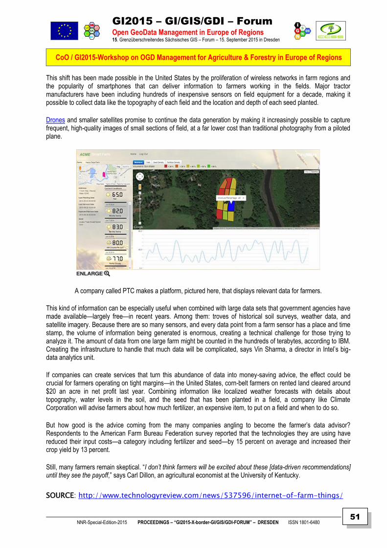
GI2015 – GI/GIS/GDI – Forum
Open GeoData Management in Europe of Regions 15. Grenzüberschreitendes Sächsisches GIS – Forum – 15. September 2015 in Dresden
CoO / GI2015-Workshop on OGD Management for Agriculture & Forestry in Europe of Regions
NNR-Special-Edition-2015 PROCEEDINGS – “GI2015-X-border-GI/GIS/GDI-FORUM” – DRESDEN ISSN 1801-6480
51
This shift has been made possible in the United States by the proliferation of wireless networks in farm regions and the popularity of smartphones that can deliver information to farmers working in the fields. Major tractor manufacturers have been including hundreds of inexpensive sensors on field equipment for a decade, making it possible to collect data like the topography of each field and the location and depth of each seed planted.
Drones and smaller satellites promise to continue the data generation by making it increasingly possible to capture frequent, high-quality images of small sections of field, at a far lower cost than traditional photography from a piloted plane.
A company called PTC makes a platform, pictured here, that displays relevant data for farmers.
This kind of information can be especially useful when combined with large data sets that government agencies have made available—largely free—in recent years. Among them: troves of historical soil surveys, weather data, and satellite imagery. Because there are so many sensors, and every data point from a farm sensor has a place and time stamp, the volume of information being generated is enormous, creating a technical challenge for those trying to analyze it. The amount of data from one large farm might be counted in the hundreds of terabytes, according to IBM. Creating the infrastructure to handle that much data will be complicated, says Vin Sharma, a director in Intel’s big-data analytics unit.
If companies can create services that turn this abundance of data into money-saving advice, the effect could be crucial for farmers operating on tight margins—in the United States, corn-belt farmers on rented land cleared around $20 an acre in net profit last year. Combining information like localized weather forecasts with details about topography, water levels in the soil, and the seed that has been planted in a field, a company like Climate Corporation will advise farmers about how much fertilizer, an expensive item, to put on a field and when to do so.
But how good is the advice coming from the many companies angling to become the farmer’s data advisor? Respondents to the American Farm Bureau Federation survey reported that the technologies they are using have reduced their input costs—a category including fertilizer and seed—by 15 percent on average and increased their crop yield by 13 percent.
Still, many farmers remain skeptical. “I don’t think farmers will be excited about these [data-driven recommendations] until they see the payoff,” says Carl Dillon, an agricultural economist at the University of Kentucky.
SOURCE: http://www.technologyreview.com/news/537596/internet-of-farm-things/
GI2015 – GI/GIS/GDI – Forum
Open GeoData Management in Europe of Regions 15. Grenzüberschreitendes Sächsisches GIS – Forum – 15. September 2015 in Dresden
CoO / GI2015-Workshop on OGD Management for Agriculture & Forestry in Europe of Regions
NNR-Special-Edition-2015 PROCEEDINGS – “GI2015-X-border-GI/GIS/GDI-FORUM” – DRESDEN ISSN 1801-6480
52
PRESS INFORMATION
Sustainable technologies and cooperation in food and agriculture
Milan - 26.08.2015 - Sustainable technologies and cooperation in food and agriculture
On the occasion of Expo Milan 2015 and the European Year for Development, the Directorate
General for Development Cooperation of the Ministry of Foreign Affairs and International
Cooperation, in partnership with the National Council of Research (CNR), the Agricultural
Research Centre (CREA) and UNIDO Italy organizes an event which aims to:
present methods,
technological tools and
programmes
adopted in development cooperation projects that can be extended to and at least partially
reproduced in other countries and different economic and social contexts;
reach stakeholders keen to support, finance and participate directly in existing projects or
interested in contributing to the development of new ideas and programmes;
allow interested parties to examine cutting-edge technologies and systems for the
transformation and sale of food products and technologies employed to set up monitoring,
planning and simulation systems.
In the final session of the event UNIDO will present an award to the winners of a call for
proposals launched by the organization for innovative projects in the area of technology, food
transformation and energy production applied to agriculture.
SOURCE:
http://www.cooperazioneallosviluppo.esteri.it/pdgcs/index.php?option=com_content&view=ar
ticle&id=12485:26-08-2015-sustainable-technologies-and-cooperation-in-food-and-
agriculture&catid=118:eventi-en&Itemid=914
GI2015 – GI/GIS/GDI – Forum
Open GeoData Management in Europe of Regions 15. Grenzüberschreitendes Sächsisches GIS – Forum – 15. September 2015 in Dresden
CoO / GI2015-Workshop on OGD Management for Agriculture & Forestry in Europe of Regions
NNR-Special-Edition-2015 PROCEEDINGS – “GI2015-X-border-GI/GIS/GDI-FORUM” – DRESDEN ISSN 1801-6480
53
INSPIRE INFORMATION REQUEST
How innovative is your organisation with data?
Michael Lutz
EC - JRC - ISPRA 31 August at 17:01
Questionnaire on the
European Data-Driven Economy
Following the Commission Communication COM2014(442) 'Towards a thriving data-driven
economy', the Commission launched in January 2015 a targeted stakeholder.
The European Commission (DG CONNECT) is gathering facts and views on the role and
impacts of data-driven innovation in several economic sectors, including the geospatial, earth
observation and environmental sector. This consultation will contribute to the definition of future
initiatives for the data-driven economy.
The questionnaire aims at understanding the use of (big) data analytics in decision-making,
business processes and emerging business models, and at gathering insights on the characteristics
of a functioning data ecosystem in your specific domain and identify existing or potential
barriers to the development of data-driven industrial sectors in Europe.
This exercise has two main objectives:
1. to understand the use of (big) data analytics in decision-making, business processes and
emerging business models, and
2. to gather insights on the characteristics of a functioning data ecosystem in your specific
domain and identify existing or potential barriers to the development of data-driven industrial
sectors in Europe.
The questionnaire takes about twenty minutes to complete. The outcome will contribute to the
definition of future initiatives for the data-driven economy. In case your organisation wishes to
submit please send it to [email protected] before 15 September 2015.
Find more information here: http://inspire.ec.europa.eu/index.cfm/newsid/11887
data-driven_economy_questionnaire.doc
Participation in the questionnaire is anonymous by default. Responses will be analysed so that no individual
person or organisation can be identified.
Optionally, in case you accept to be identified and contacted by European Commission staff for further details on
the answers provided in the current questionnaire, please share your contact details with us in the space dedicated
for this purpose at the end of the questionnaire.
GI2015 – GI/GIS/GDI – Forum
Open GeoData Management in Europe of Regions 15. Grenzüberschreitendes Sächsisches GIS – Forum – 15. September 2015 in Dresden
CoO / GI2015-Workshop on OGD Management for Agriculture & Forestry in Europe of Regions
NNR-Special-Edition-2015 PROCEEDINGS – “GI2015-X-border-GI/GIS/GDI-FORUM” – DRESDEN ISSN 1801-6480
54
WEB INFORMATION
Herzlich Willkommen auf der Homepage der Forstwissenschaftlichen Tagung
Save the Date - Call for Sessions
Bitte notieren Sie sich in Ihrem Kalender: die Forstwissenschaftliche Tagung 2016 findet vom
26. bis 29. September 2016 in Freiburg im Breisgau statt.
Wir laden Sie zur wichtigsten deutschsprachigen forstwissenschaftlichen Konferenz in den
Schwarzwald ein und freuen uns schon jetzt sehr auf lebhaften Austausch und Diskussionen
innerhalb und zwischen Wissenschaft und Praxis. Die Schwerpunktthemen der Tagung
umfassen:
die Auswirkungen des Klimawandels auf den Wald sowie
die Anpassungsstrategien der Forstwirtschaft an den Klimawandel,
Biodiversität und Naturschutz,
die Intensität der Waldnutzung,
die Rolle der Bioökonomie für die Waldwirtschaft, und
Evidenzbasierte Forstwirtschaft – die Objektivierung des Systemverständnisses
Zu diesen Themenfeldern und auch zu anderen, zusätzlichen Themen können Sie bis zum 15.
Juli 2015 spezifische Sessions vorschlagen. Sessions können sowohl von Einzelpersonen, von
Sektionen des Deutschen Verbands Forstlicher Forschungsanstalten, sowie von Arbeitsgruppen
und Institutionen empfohlen werden. Eine Session umfasst i. d. R. 5 Beiträge (jeweils 15 min.
Vortrag + 5 min. Diskussion). Bei Bedarf können auch Doppelsessions mit max. 10 Beiträgen
eingerichtet werden.
Ihre Vorschläge für Themen und ModeratorInnen von Sessions senden Sie bitte an die folgende
Email-Adresse: [email protected]
Nach Auswahl der Sessions und Erstellung eines Programms mit Sessions durch das
Wissenschaftliche Komitee erfolgt im Herbst 2015 ein weiterer Aufruf zur Anmeldung von
Konferenzbeiträgen in Form von Vorträgen und Postern. Eine festliche Abendveranstaltung zur
Verleihung des Deutschen Forstwissenschaftspreises sowie ein vielfältiges Exkursionsangebot
runden die Tagung ab. Weitere Informationen zur Forstwissenschaftlichen Tagung 2016 werden
in Kürze auf dieser Internetseite bereitgestellt.
Jürgen Bauhus (im Namen des Wissenschaftlichen Komitees und Organisationsteams)
SOURCE:
http://www.fowita.de/index.php?id=6
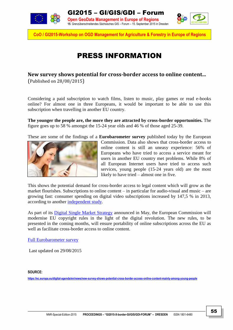
GI2015 – GI/GIS/GDI – Forum
Open GeoData Management in Europe of Regions 15. Grenzüberschreitendes Sächsisches GIS – Forum – 15. September 2015 in Dresden
CoO / GI2015-Workshop on OGD Management for Agriculture & Forestry in Europe of Regions
NNR-Special-Edition-2015 PROCEEDINGS – “GI2015-X-border-GI/GIS/GDI-FORUM” – DRESDEN ISSN 1801-6480
55
PRESS INFORMATION
New survey shows potential for cross-border access to online content... (Published on 28/08/2015)
Considering a paid subscription to watch films, listen to music, play games or read e-books
online? For almost one in three Europeans, it would be important to be able to use this
subscription when travelling in another EU country.
The younger the people are, the more they are attracted by cross-border opportunities. The
figure goes up to 58 % amongst the 15-24 year olds and 46 % of those aged 25-39.
These are some of the findings of a Eurobarometer survey published today by the European
Commission. Data also shows that cross-border access to
online content is still an uneasy experience: 56% of
Europeans who have tried to access a service meant for
users in another EU country met problems. While 8% of
all European Internet users have tried to access such
services, young people (15-24 years old) are the most
likely to have tried – almost one in five.
This shows the potential demand for cross-border access to legal content which will grow as the
market flourishes. Subscriptions to online content – in particular for audio-visual and music – are
growing fast: consumer spending on digital video subscriptions increased by 147,5 % in 2013,
according to another independent study.
As part of its Digital Single Market Strategy announced in May, the European Commission will
modernise EU copyright rules in the light of the digital revolution. The new rules, to be
presented in the coming months, will ensure portability of online subscriptions across the EU as
well as facilitate cross-border access to online content.
Full Eurobarometer survey
Last updated on 29/08/2015
SOURCE:
https://ec.europa.eu/digital-agenda/en/news/new-survey-shows-potential-cross-border-access-online-content-mainly-among-young-people

GI2015 – GI/GIS/GDI – Forum
Open GeoData Management in Europe of Regions 15. Grenzüberschreitendes Sächsisches GIS – Forum – 15. September 2015 in Dresden
CoO / GI2015-Workshop on OGD Management for Agriculture & Forestry in Europe of Regions
NNR-Special-Edition-2015 PROCEEDINGS – “GI2015-X-border-GI/GIS/GDI-FORUM” – DRESDEN ISSN 1801-6480
56
PRESS INFORMATION
Sehr geehrte Mitglieder und Freunde der AGEG,
wir freuen uns, Ihnen mitteilen zu können, dass die diesjährige AGEG Jahreskonferenz Arbeitsgemeinschaft Europäischer Grenzregionen am 13. November 2015 im Gebäude des AdR in Brüssel stattfindet. Das Hauptthema der Konferenz lautet: „Die Zukunft der grenzübergreifenden Zusammenarbeit in Europa". Dieses Thema wird allgemein beleuchtet, nicht nur im Hinblick auf EU Programme. Diese Konferenz wird durchgeführt in Zusammenarbeit mit der Europäischen Kommission, DG Regional and Urban Policy, dem Ausschuss der Regionen und dem Kongress der Gemeinden und Regionen des Europarates. Im Namen aller Konferenzpartner bitten wir Sie, den Termin bereits in Ihren Kalendern zu notieren! Ein erster Programmentwurf sowie eine kurze Erläuterung zum Konferenzthema finden Sie beigefügt. Sie erhalten bald die offizielle Einladung sowie praktische Hinweise zu Reise/Unterkunft sowie Anmeldung. Weitere Sprachversionen des Programms sowie Updates werden demnächst auf www.aebr.eu abrufbar sein. Darüber hinaus möchten wir bereits jetzt mitteilen, dass am 12. November 2015 ein AdR/AGEG Seminar zum Thema EVTZ stattfindet. Wir bitten Sie herzlich, auch diesen Termin bereits jetzt zu notieren. Weitere Informationen folgen in Kürze. Mit freundlichen Grüßen Martín Guillermo Ramírez Generalsekretär Association of European Border Regions (AEBR) Arbeitsgemeinschaft Europäischer Grenzregionen (AGEG) e.V. Association des régions frontalières européennes (ARFE) Asociación de Regiones Fronterizas Europeas (ARFE) Enscheder Str. 362, D-48599 Gronau Tel.: +49 (0) 2562 - 702 20 Fax: +49 (0) 2562 - 702 59 E-Mail: [email protected] www.aebr.eu FOLLOW US ON TWITTER: https://twitter.com/SocialnetAEBR / https://twitter.com/ageg_socialnet Secretary General: Martín Guillermo Ramírez Registry no. 5420, Local Court of Coesfeld/Germany
GI2015 – GI/GIS/GDI – Forum
Open GeoData Management in Europe of Regions 15. Grenzüberschreitendes Sächsisches GIS – Forum – 15. September 2015 in Dresden
CoO / GI2015-Workshop on OGD Management for Agriculture & Forestry in Europe of Regions
NNR-Special-Edition-2015 PROCEEDINGS – “GI2015-X-border-GI/GIS/GDI-FORUM” – DRESDEN ISSN 1801-6480
57
WEBLINK SOURCES
Web Links on OpenData:
Agriculture - Data.gov
Aktionsplan - OpenData.pdf
Amazon plant Drohnen-Autobahnen am Himmel - PC-WELT
AT Video „Was ist Open Data?” | data.gv.at
Big Earth Data - Die digitalisierte Erde - TV-Programm - Berliner-Zeitung
BMI - Nachrichten -Open Data weiter gestärkt
BOSC | F6S
Code for Germany
Code for Dresden
Center for Open Data Enterprise
Communication on Open Data
Creative Commons License
D21 #ODAP15
D21 Auftakt Live-Mitschrift
D21 Open-Data-Aktionsplan: Auftaktworkshop im BMI mit über 60 Teilnehmern | Initiative D21
DANUBE - Open (Geo) Data Hackathon & Developer's Workshop
Das paneuropäische Open-Data-Portal entsteht in Berlin - 39 Länder – ein Portal
Data.gov
Defra to release open satellite imagery that could transform food and farming | European Public Sector Information Platform
Der G7 Gipfel und Open Government Data: Deutschland bremst die G8 Open Data Charta aus > Open Knowledge Foundation Deutschland
Die Politik setzt auf Open Data als Treibstoff für die digitale Wirtschaft
Digital Agenda for Europe - European Commission
Digital Principles
Digitale Verwaltung 2020 und Open-Data-Aktionsplan beschlossen
GI2015 – GI/GIS/GDI – Forum
Open GeoData Management in Europe of Regions 15. Grenzüberschreitendes Sächsisches GIS – Forum – 15. September 2015 in Dresden
CoO / GI2015-Workshop on OGD Management for Agriculture & Forestry in Europe of Regions
NNR-Special-Edition-2015 PROCEEDINGS – “GI2015-X-border-GI/GIS/GDI-FORUM” – DRESDEN ISSN 1801-6480
58
Digitale-Agenda | Aktuelles | Online-Ideensammlung zum Open-Data-Aktionsplan
Einzelne Leuchttürme im Dunkeln
Environment Secretary speech on the future of food and farming
EU OpenData - Welcome | European Union Open Data Portal
Executive Order -- Making Open and Machine Readable the New Default for Government Information | whitehouse.gov
Food Access Research Atlas - Data.gov
Food Access Research Atlas - Interactive map - Data.gov
Food technology for all | MIT Technology Review | Technology Is Reshaping the Food Chain
Foodie - Farm-Oriented Open Data In Europe
Forum - eGovernment-Computing.de Informationsportal für eGovernment und Verwaltungsmodernisierung in Deutschland -eGOV-SN
G8 communiqué and documents
G8 communiqué and documents - GOV.UK
G8 Open Data Charter and Technical Annex
G8 Summit: G8 leaders' remarks - News stories - GOV.UK
Geoportal.de - Geodaten aus Deutschland - Aktuelles - Veranstaltungshinweis: Bundesministerium des Innern und Initiative D21 laden zur Thematischen Workshopreihe des Partizipationsprozesses im Rahmen des Open-Data-Aktionsplans ein
Gesetz über die Weiterverwendung von Informationen öffentlicher Stellen (IWG): Eine weitere vertane Chance > Open Knowledge Foundation Deutschland
Gesetzentwurf - BMWi
govdata (@govdata_de) | Twitter
government2020 — Verwaltungsmodernisierung zum Mitreden!
Gruppen - OffeneDaten.de
GSA/data.gov · GitHub
Hack a City Porto | European Public Sector Information Platform
Hackathon - Wikipedia, the free encyclopedia
Ideensammlung der Open Data Community HmbTG / HmbTG
ifib: Institut für Informationsmanagement Bremen GmbH - Über uns / Team
Impressum > Open Knowledge Foundation Deutschland
INSPIRE - Short video
Interessante Daten - Google Sheets
IT-Planungsrat Zu groß für die Badewanne

GI2015 – GI/GIS/GDI – Forum
Open GeoData Management in Europe of Regions 15. Grenzüberschreitendes Sächsisches GIS – Forum – 15. September 2015 in Dresden
CoO / GI2015-Workshop on OGD Management for Agriculture & Forestry in Europe of Regions
NNR-Special-Edition-2015 PROCEEDINGS – “GI2015-X-border-GI/GIS/GDI-FORUM” – DRESDEN ISSN 1801-6480
59
GOVDATA - Jens Klessmann FOKUS
Kabinett beschließt Gesetzentwurf - move moderne ...
Licence interoperability report by LAPSI 2.0
LinDA Project
Map - Center for Open Data Enterprise
Ministerien gefährden mit Gebührenzwang Informationsfreiheit (500 Euro für PDFs) > Open Knowledge Foundation Deutschland
Mitschrift ODAP Auftakt Workshop | okfnpad
NASA's SMAP releases first calibrated data
Nationaler G8/G7 Open Data Charter Aktionsplan veröffentlicht - not your GovData
OffenesDresden.de
OK Lab Dresden (Dresden) - Meetup
Open Data - Open Data Support
Open Data - Sachsen - Neufassung IWG
Open Data Aktionsplan_ - Google Search
Open Data als Treibstoff für die digitale Wirtschaft - BMWi ...
Open Data Charter
Open Data Dresden (@OpenDataDresden) | Twitter
Open Data Enterprise | Blog
Open Data Hackathon | ISAF 2014
Open Data Hackathon | ISAF 2015
Open Data Ideensammlung - Transparenzportal Hamburg
Open Data Impact Map BETA The Open Data Impact Map is searchable, centralized database of open data use cases from around the world. Explore the beta version of the map and stay tuned for our full launch in 2016. EXPLORE THE MAP ›
Open Data MAP Monitor - Offene Daten im öffentlichen Sektor
Open Data Portale
Open Data Sachsen - OpenData Saxony
Open Data Sachsen (@OpenDataSachsen) | Twitter
Open Data und das Transparenzgesetz OpenData und Transparenzgesetz, wie geht das zusammen?
Open Geo-Data Usability Workshop Notes | LinkedIn
Open GOV Data Sachsen - OpenData
Open Government Licence v3.0
GI2015 – GI/GIS/GDI – Forum
Open GeoData Management in Europe of Regions 15. Grenzüberschreitendes Sächsisches GIS – Forum – 15. September 2015 in Dresden
CoO / GI2015-Workshop on OGD Management for Agriculture & Forestry in Europe of Regions
NNR-Special-Edition-2015 PROCEEDINGS – “GI2015-X-border-GI/GIS/GDI-FORUM” – DRESDEN ISSN 1801-6480
60
Open-Data-Aktionsplan: Auftaktworkshop im BMI mit über 60 Teilnehmern | Initiative D21
OpenData - Digital Agenda for Europe - European Commission (2)
OpenGOV - Principles.jpg (1024 × 724 Pixel)
OpenGovData
Plädoyer für einen nachhaltigen Umgang mit Open Data und GovData
Prague gears up for its biggest ever Open Data hackathon
Project Open Data - Project Open Data
PSI Digital Agenda for Europe - European Commission (2)
PSI revision of the Directive
SDI4Apps Code Camp Tackles the Technical Challenges of the Cloud Environment for Geographic Information | SDI4APPS
Sentinel-2 on eoPortal
Stadtmodell Dresden - Datensätze - OffeneDaten.de
Stillstand bei Open Data (Charta) verhindern: Welche Daten braucht das Land? | netzpolitik.org
Stillstand bei Open Data (Charta) verhindern: Welche Daten braucht das Land? | netzpolitik.org
The Open Data Handbook
Transparenzgesetz Hamburg
U.S. Open Data Action Plan, released by the White House on May 9, 2014, - Google Search
UA+US AgriMinister
UAVs USED IN MAPPING TRANSPORTATION CORRIDORS
UK Defra Secretary of State: Vision for open data, food and farming - YouTube
UK Environment Secretary unveils vision for open data to transform food and farming - News stories - GOV.UK
UK ePSI Defra to release open satellite imagery that could transform food and farming | European Public Sector Information Platform
US Center for Open Data Enterprise
US Convene - Center for Open Data Enterprise
US Map - Center for Open Data Enterprise
us_national_action_plan_6p.pdf
us_open_data_action_plan.pdf
USDA ERS - Go to the Atlas
Vergabeverfahren für die Ideenplattform zu Open Data Aktionsplan
Verwaltung innovativ - Aktionsplan Open Data

GI2015 – GI/GIS/GDI – Forum
Open GeoData Management in Europe of Regions 15. Grenzüberschreitendes Sächsisches GIS – Forum – 15. September 2015 in Dresden
CoO / GI2015-Workshop on OGD Management for Agriculture & Forestry in Europe of Regions
NNR-Special-Edition-2015 PROCEEDINGS – “GI2015-X-border-GI/GIS/GDI-FORUM” – DRESDEN ISSN 1801-6480
61
Verzögerung beim Aktionsplan zur Umsetzung der G8-Open-Data-Charta - Neues | GovData
Was bedeutet Open Data und was sind "Offene Daten"? Wofür werden offene Daten verwendet?
Was kostet Open Data die Verwaltung? Eine Betrachtung am Beispiel von Geodaten
Workshops | Open Data Aktionsplan
WZB Big Data Blog - Site Access Restricted
Zu groß für die Badewanne
Геоинформационный портал ГИС-Ассоциации - ВМ: открылась фабрика дронов
Web Links on Agriculture, Forestry & Development
Africa: Land and Seed Laws Under Attack, Battle for Control of Land, Water, Seeds, Minerals, Forests, Oil | Global Research
AGRA2015 – Zahlen und Fakten -
Agrarmeteorologisches Messnetz Sachsen - Wetterdaten - sachsen.de - Landesamt für Umwelt, Landwirtschaft und Geologie - Wetterdaten
AGRIREVIEW - Technologies
AGRODAILY - Agriculture without Agronomist
AGRODAILY - Precision Farming
AGROPRAK
Aktuelle Meldungen Sachsenforst
An incredible image shows how powerful countries are buying up much of the world’s land - The Washington Post
CENIA
Copernicus in Deutschland | Nationale Fachkoordinatoren für Copernicus
Copernicus on eoPortal
Das Thüringer Forstprogramm 2030 [Download,*.pdf, 1,65 MB]
DE - Nationaler Aktionsplan der Bundesregierung zur Umsetzung der Open - Data - Charta der G8
Der Sächsische Waldbesitzerverband e.V.
Die Waldstrategie 2020 der Bundesregierung [Download,*.pdf, 0,68 MB]
Digital Agenda for Europe - European Commission
Ecosystem Services – Concept, Methods and Case Studies
EIP-Agri - Themen - Deutsche Vernetzungsstelle
EIP-AGRI Formular Projektskizze
EIP-AGRI Überblick
eoPortal - Earth Observation Directory & News
GI2015 – GI/GIS/GDI – Forum
Open GeoData Management in Europe of Regions 15. Grenzüberschreitendes Sächsisches GIS – Forum – 15. September 2015 in Dresden
CoO / GI2015-Workshop on OGD Management for Agriculture & Forestry in Europe of Regions
NNR-Special-Edition-2015 PROCEEDINGS – “GI2015-X-border-GI/GIS/GDI-FORUM” – DRESDEN ISSN 1801-6480
62
EU Förderprogramme in den Bereichen Umwelt, Landwirtschaft, Ländlicher Raum und Forst
EU-Agrarpolitik | Germanwatch e.V.
EURISY - Events
EURISY - Satellite applications
EURISY - Pool of 150 operational User ecperiences
EURISY - The added value of Geoinformation and LBS for Agriculture & Forestry
European Year for Development
Fachschule für Landwirtschaft Großenhain
Fachschulverzeichnis - Fortbildung - Bildungsserver Agrar
FAO-EU Partnership: EU projects
Förder- und Fachbildungszentrum Nossen, Sitz Döbeln mit Fachschule für Landwirtschaft
Forstbericht (2008-2012) der Sächsischen Staatsregierung
Forstpolitisches Forum 8:
Forstpolitisches Forum 9: Waldstrategie 2050 des Freistaates Sachsen – Eckpfeiler für die Nachhaltigkeit in der multifunktionalen Forstwirtschaft
Forstpolitisches Forum 10: Sächsischer Branchentag – Forst Holz Papier
ICT-AGRI | ICT-AGRI Meta Knowledge Base
IHK-Bildungszentrum Dresden gGmbH: Sachkundenachweiskarte im Pflanzenschutz und Fortbildungen (Übersicht)
Informations- und Servicestelle Plauen mit Fachschule für Landwirtschaft
Integratives Umweltmanagement: Systemorientierte Zusammenhänge zwischen ... - Google Books
Internationales Jahr der familienbetriebenen Landwirtschaft 2014 - Deutsche Gesellschaft für die Vereinten Nationen e.V.
Investing in agriculture: Barbarians at the farm gate | The Economist
ISAF2014
ISAF2014 - 18th International Conference on Information Systems for Agriculture and Forestry (ISAF 2014) | ICT-AGRI Meta Knowledge Base
ISAF2014 Hackathon WiKi | SDI4APPS
Landesamt für Umwelt, Landwirtschaft und Geologie - IHK - Infostelle Bildung
Landwirtschaft Sachsen EIP-AGRI Nachlese zur Ideenwerkstatt
Landwirtschaft Sachsen Informationen zu den Arbeitskreisen
Landwirtschaft Sachsen Regionales Agrar- und Wirtschaftlichkeits-InformationsSystem (RAWIS)
Landwirtschaft Sachsen Vorträge der Veranstaltung
LEADER 2014-2020
Monsanto - Mächtige Lobby - Wirtschaft - Süddeutsche.de
GI2015 – GI/GIS/GDI – Forum
Open GeoData Management in Europe of Regions 15. Grenzüberschreitendes Sächsisches GIS – Forum – 15. September 2015 in Dresden
CoO / GI2015-Workshop on OGD Management for Agriculture & Forestry in Europe of Regions
NNR-Special-Edition-2015 PROCEEDINGS – “GI2015-X-border-GI/GIS/GDI-FORUM” – DRESDEN ISSN 1801-6480
63
Monsanto Schottland will Anbau von GMO-Saatgut verbieten | RT Deutsch
Monsanto verdoppelt mit Daten-Überwachung die Getreide-Ernte | Nachrichten – DEUTSCHE WIRTSCHAFTS NACHRICHTEN
Partner - Umwelt und Landwirtschaft, Naturschutz und Umwelt des Freistaates Thüringen, Umwelt Sachsen-Anhalt, Bauernverband, Bauernzeitung
POMODORE@ - Intelligent Management for high quality of tomato production
RAWIS - Regionale Rauminformation Landwirtschaft - Überblick
ReKIS - Regionales Klimainformationssystem
Richtlinie »Agrarumwelt- und Klimamaßnahmen (AUK/2015)«
Richtlinie »Agrarumweltmaßnahmen und Waldmehrung« (RL AuW/2007, Teil A) - Abfinanzierung
Sächsischer Agrarbericht 2014
Search OpenData | Digital Agenda for Europe | European Commission
Sentinel-1 on eoPortal
Silicon Valley Takes a Trip to the Farm Belt | MIT Technology Review
SMUL LfUG Publikationen, Daten und Fakten
SMUL Publikationen
SMUL Sachsen : E-Learning Gartenbau
SMUL SBS PDF Organigramm des Staatsbetriebes Sachsenforst - Organigramm_SBS.pdf
SMUL_LfUG Sächsisches Landesamt für Umwelt, Landwirtschaft und Geologie
SMUL_SBS Staatsbetrieb Sachsenforst
SN_LEADER Startseminar_02-07-2008 - SN_Startseminar_02-07-2008.pdf
Standortbedingungen Landwirtschaft Sachsen Fachkulissen und Standortinformationen
Sustainable technologies and cooperation in food and agriculture
UN_FAO Webinar - Implementing Linked Data in Low Resource Conditions
USDA Blog » HACKATHON - Using Open Data in Creative Ways to Solve Problems
Wald, Forstwirtschaft, Jagd in Sachsen
Wälder & Abholzung - Deutsche Gesellschaft für die Vereinten Nationen e.V.
Waldstrategie 2050 für den Freistaat Sachsen
Waldverjüngung durch Holzernte
Waldzustandsbericht 2012
Waldzustandsbericht 2013
Waldzustandsbericht 2014
WWFoodWeb - 104pp_PDF
WWFoodWeb - International Innovation - Issue 182 digital edition
GI2015 – GI/GIS/GDI – Forum
Open GeoData Management in Europe of Regions 15. Grenzüberschreitendes Sächsisches GIS – Forum – 15. September 2015 in Dresden
CoO / GI2015-Workshop on OGD Management for Agriculture & Forestry in Europe of Regions
NNR-Special-Edition-2015 PROCEEDINGS – “GI2015-X-border-GI/GIS/GDI-FORUM” – DRESDEN ISSN 1801-6480
64
TABLE OF CONTENTS <> INHALTSVERZEICHNIS
GI2015 – PROGRAMME & PROCEEDINGS & WEB NEWS Seite / Page*)
GI2015 – Impressum 2
GI2015 – Final Programme / 15. September 2015 3
GI2015 – Registration Form 4
GI2015 – Welcome Address & Introduction by IGN e.V. 5
GI2015 – About Cross-border Organizers (IGN, CCSS & PROGIS) 8
GI2015 – PROCEEDINGS of Keynotes, Abstracts & Summaries 9
CoO – WORKSHOPS on ICT for Agriculture & Forestry 34
GI2015 – Press Information & WEB News 45
GI2015 – TABLE OF CONTENTS <> Inhaltsverzeichnis 64
**)) TThhee eexxtteennddeedd PPRROOCCEEEEDDIINNGGSS ooff AAbbssttrraacctt,, SSuummmmaarriieess,, PPoosstteerrss aanndd rreellaatteedd PPrreessss && WWeebb NNeewwss bbeeiinngg ppuubblliisshheedd iinn ddiiggiittaall FFoorrmmaatt oonnllyy !!
TThhee CCooOO // GGII22001155 OOrrggaanniizzeerrss –– IIGGNN (( DDrreessddeenn )) && CCCCSSSS (( PPrraahhaa )) && PPRROOGGIISS ((VViillllaacchh)) –– aarree
aacckknnoowwlleeddggiinngg......
the Support by EU Programme in Saxony for “Inter-regional Collaboration” (2014-2017)
the TU Dresden / AST (AgriSystemTechnique) for technical support
the Authors of CENIA, EURISY, UPVISON contributing keynote presentations
the Organizations of CCSS & PROGIS providing workshop presentations
the DR. SCHILLER & PARTNER GmbH (Dresden) & the BOWLING ARENA SERVICE GmbH (Dresden)
......ttoo mmaakkee tthhee GGII22001155 –– IInntteerrrreeggiioonnaall GGII // GGIISS // GGDDII –– FFoorruumm aa SSuucccceessss !!