geologic history - pbworkschaceporter.pbworks.com/w/file/fetch/86348752/unit 1.pdf · wegner’s...
TRANSCRIPT

GEOLOGIC HISTORY Chapter 9

GEOLOGY & THE EARTH’S PHYSICAL STRUCTURE
• Geology is the study of the physical structure and substance of the earth.
• The earth’s physical features have been created by many geological events: – Plate tectonics, earthquakes, volcanoes, folding and
faulting have all shaped the earth over the past 4.6 billion years, and continue to change the earth’s surface today.
– Other forces, like ice (glaciers), wind and running water have also influenced the physical appearance of the planet.

GEOLOGICAL ERAS • Geologists and geographers have created a timeline to
help record major physical changes on earth. • The timeline is divided into eras, and each era describes
how the earth’s surface was modified. • There are 4 major geological eras: 1. Precambrian (4.6 billion – 570 million) 2. Paleozoic (570 million – 245 million) 3. Mesozoic (245 million – 66 million) 4. Cenozoic (66 million – present) • How can you remember the order of the 4 eras?
– ACRONYM!!!!!!!!! – Example: Precious Parents Make Cookies

Assignment • Instructions:
– Time line Assignment: • Use chart 9-6 on page 86 to create a timeline of the Earth’s 4
eras and the major geological and biological events which occurred in each era.
– Use a blank white piece of paper – Divide your page into 4 equal sections – Draw a horizontal line through the center of the page
• On the top half draw and label major biological events • On the bottom half draw and label major geological events
– Use diagrams/pictures/symbol.
DUE TOMORROW!!!

Assignment (text questions)
• PART 1 questions #1-3 • Text 82-92

Continental Drift Plate Tectonics
Folding, Faulting & Erosion
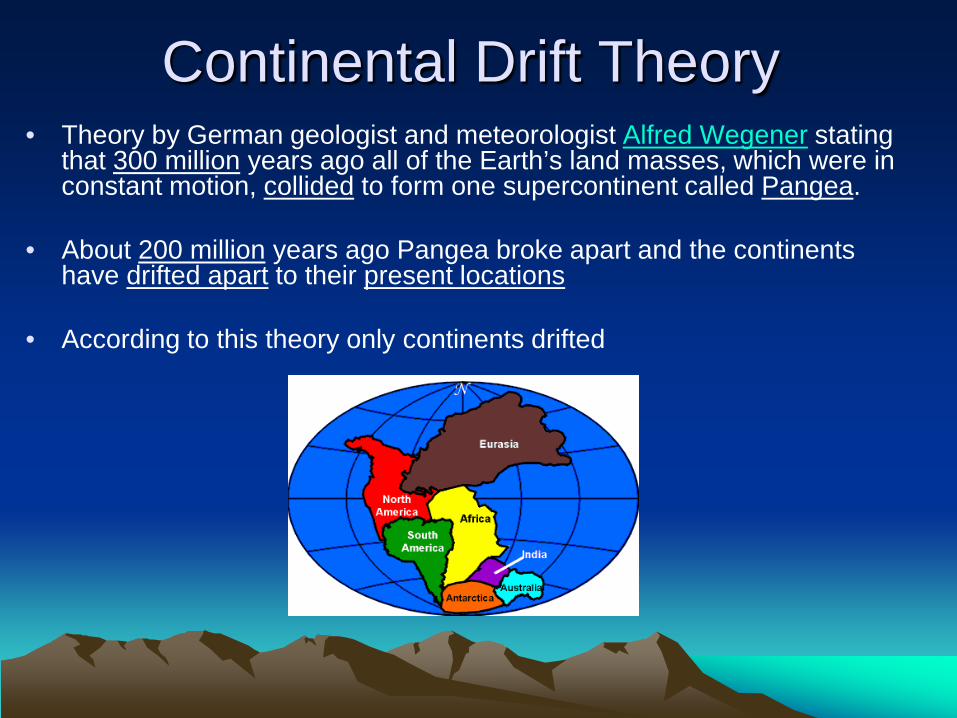
Continental Drift Theory • Theory by German geologist and meteorologist Alfred Wegener stating
that 300 million years ago all of the Earth’s land masses, which were in constant motion, collided to form one supercontinent called Pangea.
• About 200 million years ago Pangea broke apart and the continents have drifted apart to their present locations
• According to this theory only continents drifted
Wegner’s Proof of Continental Drift: 1. Jigsaw pattern between the shape of some continents
• Example: South America and Africa
2. Fossils of the same plants and animals found on different continents
• Example: South America and Africa
3. Structurally similar mountains on both sides of the Atlantic Ocean • Appalachians in NA are similar to the mountains in the northern British
Isles and Europe
4. Ice caps once covered southern Africa, India, Australia and South America so these continents were obviously located closer to the South Pole.
Most scientists disagreed with Wegner because he could not explain what mechanism was powerful enough to move huge continents

Plate Tectonics Theory • In the 1960’s technology existed to further develop
Wegner’s theory into the new theory of plate tectonics.
• The theory states that the Earth’s outer shell consists of plates that move causing earthquakes, volcanoes, mountains and the formation of new crust.

What causes the plate to move? Convection cells are caused by uneven temperature inside the Earth. They are the driving force that cause plates to move and shift.

Plate Movement
Folding – bend rock layers
Faulting – crack the Earth’s crust
As plates move away from each other and toward each other the Earth’s crust will…

Two Types of Plates
OCEANIC PLATES • Underneath oceans • About 4-7 miles thick • Thin, but dense
CONTINENTAL PLATES • Underneath continents • About 20 miles thick • Buoyant
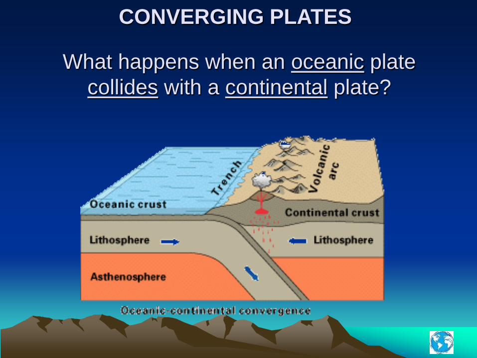
What happens when an oceanic plate collides with a continental plate?
CONVERGING PLATES

What happens when an oceanic plate collides with an oceanic plate?
CONVERGING PLATES

What happens when a continental plate collides with a continental plate?
CONVERGING PLATES
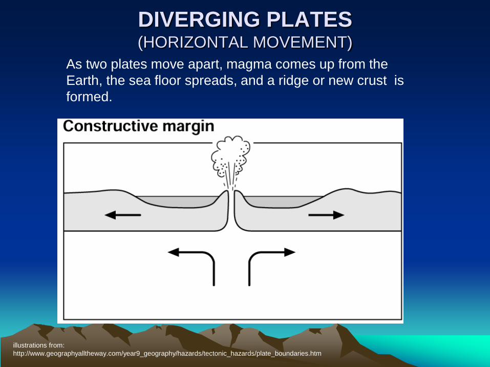
DIVERGING PLATES (HORIZONTAL MOVEMENT)
illustrations from: http://www.geographyalltheway.com/year9_geography/hazards/tectonic_hazards/plate_boundaries.htm
As two plates move apart, magma comes up from the Earth, the sea floor spreads, and a ridge or new crust is formed.

TRANSFORMING PLATES (LATERAL MOVEMENT)
illustrations from: http://www.geographyalltheway.com/year9_geography/hazards/tectonic_hazards/plate_boundaries.htm
All crust movement can cause earthquakes

CONVERGING PLATES (HORIZONTAL MOVEMENT)
illustrations from: http://www.geographyalltheway.com/year9_geography/hazards/tectonic_hazards/plate_boundaries.htm
As two plates collide, one plate descends under the other plate, creating volcanoes.
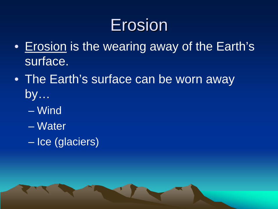
Erosion • Erosion is the wearing away of the Earth’s
surface. • The Earth’s surface can be worn away
by… – Wind – Water – Ice (glaciers)

Continental Drift & Plate Tectonics • These two theories relate to the physical layout of the
earth by creating mountains, volcanoes, trenches, and causing earthquakes.
• Movement of the Earth’s crust has shaped Canada in many ways. Folding, faulting and erosion have formed… – Mountain chains in the east coast (Appalachians) – Mountain chains in the west coast (The Rockies) – Mountain Chains in the north (Innuitian Mtns) – The Canadian Shield (glaciers eroded the Appalachians) – Fossil fuels (oil, gas and coal) – Lakes, rivers, hills and plains (formed by glaciers)
Assignment • All of Part 2

Correct Part 2

Forces of Nature
Video Worksheet
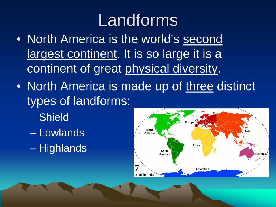
Landforms • North America is the world’s second
largest continent. It is so large it is a continent of great physical diversity.
• North America is made up of three distinct types of landforms: – Shield – Lowlands – Highlands

What is the Canadian Shield • The Canadian Shield is a large area of
Precambrian rock that forms the core of Canada • The largest landform region in Canada • Consists mainly of igneous and metamorphic
rock and some sedimentary rock.

What force contributed to the formation of the Canadian Shield?
• folding, faulting, and erosion – The features of the Shield are largely a result of the
conflict between mountain building forces (folding and faulting) and forces of erosion.
• Volcanoes, folding and faulting build up the landscape • Wind, rain, running water, glaciers, temperature changes and
chemical reactions erode the landscape
– Areas of the Shield developed and disappeared many times

Why is the Canadian Shield a significant landform in North America?
• Mining companies are attracted to this area because of the presence of metallic minerals (Sudbury, Ontario – large deposits of nickel and copper) – this creates jobs and minerals are used to manufacture products
people use everyday all over the world
• The tourist industry is very important to the southern parts of the Canadian Shield because of all the lakes, rivers and forests.
• Plentiful water makes the Shield an excellent source of water generated energy.
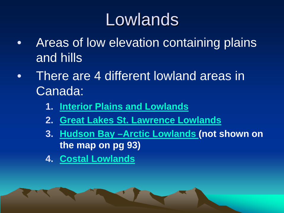
Lowlands • Areas of low elevation containing plains
and hills • There are 4 different lowland areas in
Canada: 1. Interior Plains and Lowlands 2. Great Lakes St. Lawrence Lowlands 3. Hudson Bay –Arctic Lowlands (not shown on
the map on pg 93) 4. Costal Lowlands

Interior Plains and Lowlands • Consists mainly of
sedimentary rock – Part of the sedimentary rock
consists of coral reefs that formed when the plains were covered with shallow seas during the Paleozoic era.
• Today they contain oil and gas (Alberta and Saskatchewan)
– Mineral deposits (potash and coal) were left in the dried out sea beds from the Mesozoic era (Saskatchewan)

Interior Plains and Lowlands • Were once covered by glaciers • The glaciers melted leaving
behind large lakes • Later, the land rose (rebound
affect) causing most of the water to drain into the ocean – Small portions of the ancient lakes
exist today: • Lake Winnipeg, Lake Manitoba,
Lake Winnipegosis, and Cedar Lake
• Soil that developed is deep and fertile – suitable for agriculture

Great Lakes St. Lawrence Lowlands • Consists mainly of sedimentary rock • Excellent soils and warm climates – suitable for
agriculture • The Great lakes are located in basins that were gouged
out by glaciers • St. Lawrence Lowlands is a rift valley formed from
faulting
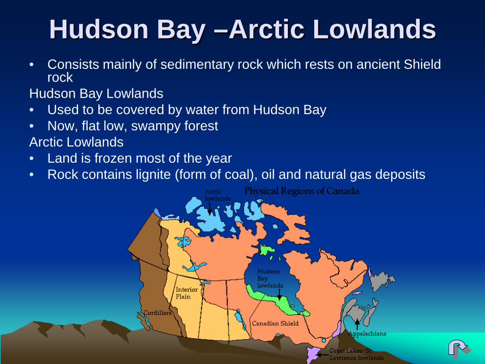
Hudson Bay –Arctic Lowlands • Consists mainly of sedimentary rock which rests on ancient Shield
rock Hudson Bay Lowlands • Used to be covered by water from Hudson Bay • Now, flat low, swampy forest Arctic Lowlands • Land is frozen most of the year • Rock contains lignite (form of coal), oil and natural gas deposits
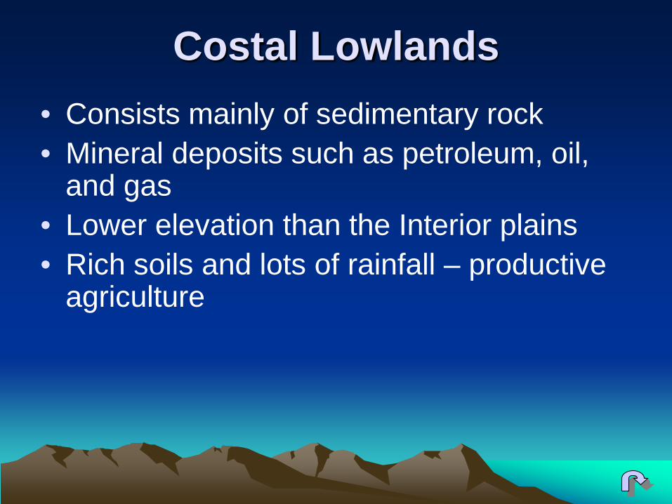
Costal Lowlands • Consists mainly of sedimentary rock • Mineral deposits such as petroleum, oil,
and gas • Lower elevation than the Interior plains • Rich soils and lots of rainfall – productive
agriculture

Differential Erosion • Occurs when soft sedimentary rock erodes
more quickly and easily than hard sedimentary rock
• Created escarpments – In the Interior Plains the land slopes from
west to east – The Niagara Escarpment in the Great Lakes
St. Lawrence Lowlands

Highlands • Areas of high elevation containing mountains
and plateaus • There are 3 different highland areas in
Canada: 1. The Appalachians
– sedimentary rock was uplifted and folded at the end of the Paleozoic era when North America collided with Europe and northern Africa.
2. The Innuitians – formed in the middle of the Mesozoic era – the North
American plate moved northward 3. The Western Cordillera
– The heavier Pacific plate forced under the lighter North American plate causing folding, faulting and volcanic activity

Assignment All of Part 3

Glaciation in Canada • A glacier is a slow moving sheet of ice which grows or
melts over time. • Glaciers covered Canada as recently as 6000 years ago
and have greatly shaped Canada’s landscape. • Rivers and lakes were created when glaciers melted. • Large rocks sand and gravel were moved and deposited
by the ice. • Small areas of glaciers can still be found. (Columbia ice
fields) & in the Arctic and Antarctic • During the last ice age (100000-6000 years ago) 2
different types of glaciers affected Canada’s landforms.

Glaciation in Canada
Alpine Glaciers: • Helped erode mountains and created large
valleys below Continental Glaciers: • Covered the interior parts of Canada. • Flattened the land and deposited rich
material that became fertile prairie soil.

1. Define the following terms: a) Till: eroded material deposited directly by ice of
a glacier; usually a mixture of materials of all sizes

b) striation: a groove often gouged out in the bedrock under the ice sheet by rocks frozen in the ice.
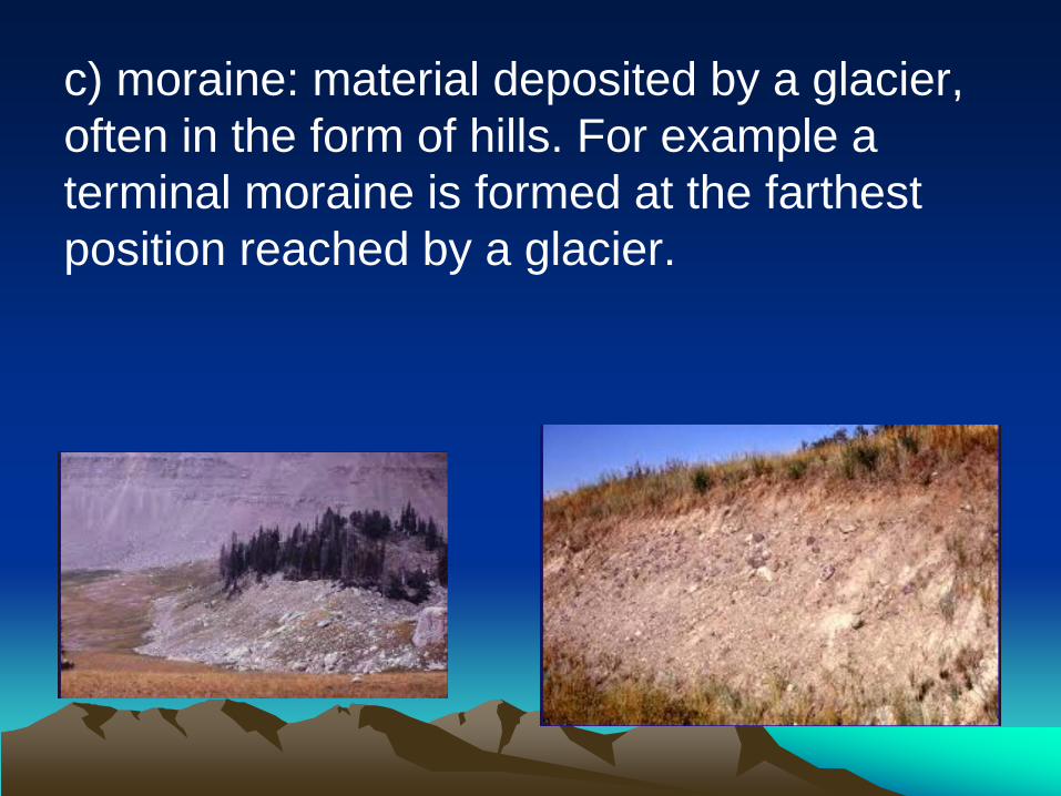
c) moraine: material deposited by a glacier, often in the form of hills. For example a terminal moraine is formed at the farthest position reached by a glacier.

d) drumlin: an egg-shaped hill with a steep side at the wide end and a gentle slope at the other formed by ice sheets.

e) lake plain: fertile bottom of an ancient glacial lake that is used for agriculture.

Eskers: a long, winding ridge of stratified sand and gravel.

2. a) How does a period of glacial activity begin?
• It begins when the earth’s climate cools • The snow that falls in the winter does not
completely melt in the summer • Snow gets deeper and becomes hundreds or
thousands of meters thick
b) What causes snow to turn to glacial ice? • The weight of the snow becomes tremendous and
the bottom layers turn to ice

2. c) What causes alpine and continental glaciers to flow (how does each type of glacier move)
Alpine glaciers – leave the mountain ranges and spill down valleys – Compressed ice becomes so heavy that it begins to change
shape and move. • The pressure, combined with gravity, causes the glacier to flow
downhill very slowly - creeping along and bending like an ice river. – They move down valleys from high elevations to low elevations
due to gravity. Continental glaciers – Move under their own weight
• The enormous weight of snow and ice causes the ice to spread outward from the center or the zone of accumulation
Movement underneath a glacier is slower than movement
at the top due to the friction form the ground's surface.

3. Explain how and why materials like rocks and sand are deposited by the movement of glaciers.
As the ice sheets moved they eroded huge amounts of soil, sand, gravel and rock. Deposited directly by the ice sheet. Rivers flowing within or under melting ice carried sand and gravel along with them and laid it down in river beds.

4. State two impacts glaciation had on the Canadian Shield
• Glaciers rounded the Appalachian Mountains • Large amounts of clay, silt, sand and gravel
were dumped on the lowlands surrounding the Shield, result in fertile farmland
• Many of Canada’s lakes and rivers were formed by glaciers scrapping and gouging out the land (example, Lake Agassiz)
• Striation, valleys, drumlins, moraines, eskers, lake plains, bare rocks and bent trees.

Bill Nye- Climate
Part 4

The Difference between Weather & Climate
• Weather – The day-to-day expressions of the
atmospheric conditions such as temperature, precipitation, humidity, wind, cloud cover and air pressure.
• Climate – The long-term pattern of the atmospheric
conditions such as temperature, precipitation, humidity, wind, cloud cover and air pressure.

How Weather & Climate Affect our Lives
• Weather – Wind
• sailing • parasailing • sky diving
– Temperature • clothing • sun block • determine daily activities • Travel
– Precipitation • clothing • determine daily activities • travel
• Climate – Cost of goods
• In cold climate regions it costs more for fruits and vegetables because they are imported
– Infrastructure – Transportation – Influence where you live
and vacation

Canada’s Climate
Varies Greatly from coast to coast for the following reasons: 1. Canada extends a great distance north to south. 2. Different elevations produce different climate conditions 3. Coastal and inland regions have different climates. 4. Wind and pressure systems move weather conditions
from one part of the country to another.

There are 6 factors that affect climate. They are: • Latitude • Ocean Currents • Winds and Air masses • Elevation • Relief • Near to Water A useful acronym to help remember these factors is : LOWER Near Water

Climate “Continental Climate” • develops away from the
influence of the ocean
• large annual temperature range
• low annual precipitation
• example – Winnipeg, Regina, Edmonton
“Maritime Climate” • strongly influenced by the
closeness of an ocean or other large bodies of water
• small annual temperature range
• high annual precipitation
• example – Vancouver, St. Johns, Halifax

Air Mass • Large parcels of air which move and create weather
conditions • Air masses originating over the water usually hold lots of
moisture and produce precipitation • coastal locations tend to receive more precipitation
• Air masses originating over land are usually dry • continental locations receive less precipitation
• Types of Air Masses (Fig. 7-11 pg 125): • mP = maritime polar • mT = maritime tropical • cP = continental polar • cT = continental tropical • cA = continental arctic

Front
– The leading edge of a cold air mass is called a cold front
• cold fronts occur when heavy cold air pushes lighter warm air upwards
• temperatures drop and rain, snow, sleet, and hail can occur
• clouds form and usually grow into thunderstorms
– The leading edge of a warm air mass is called a warm front
• warm air rises up and over the cold air • some of the warm air mixes with the cold air and
condenses to form clouds • can rain or drizzle for many hours
• Leading edge of an air mass where warm and cold air masses meet
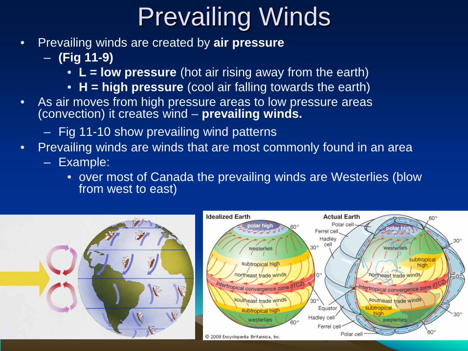
Prevailing Winds • Prevailing winds are created by air pressure
– (Fig 11-9) • L = low pressure (hot air rising away from the earth) • H = high pressure (cool air falling towards the earth)
• As air moves from high pressure areas to low pressure areas (convection) it creates wind – prevailing winds. – Fig 11-10 show prevailing wind patterns
• Prevailing winds are winds that are most commonly found in an area – Example:
• over most of Canada the prevailing winds are Westerlies (blow from west to east)

Jet Stream • A current of fast-moving air that is located high in the
atmosphere above the boundary between cold, dry polar air and warm, moist tropical air
• It moves from west to east all the way around the earth • It changes speed and position with the seasons
– moves south in the winter bringing cold arctic air south – moves north in the summer bringing warm southern air to the
north.

How Does Latitude Affect Climate? • Temperatures are warmer at the equator
– The equator receives the more sunlight than anywhere else on Earth because the equator is closer to the sun (sphere shaped Earth)
– Sun’s rays are more concentrated at the equator
• Temperatures decrease as you get further from the equator and closer to the poles
– It is cooler toward the poles because the suns rays are spread over a wider area and the poles are further away from the sun (sphere shaped Earth)
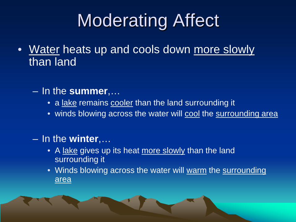
Moderating Affect • Water heats up and cools down more slowly
than land – In the summer,…
• a lake remains cooler than the land surrounding it • winds blowing across the water will cool the surrounding area
– In the winter,…
• A lake gives up its heat more slowly than the land surrounding it
• Winds blowing across the water will warm the surrounding area

How Do Ocean Currents Affect Climate?
• The temperature of an ocean current affects the temperature of the air that passes over it – Cold currents – cool the air of coastal region
– Warm currents – heats the air of the coastal region

• How do prevailing winds affect the movement of air masses? – Prevailing winds move air masses in the direction
they blow • Example:
– Prevailing westerlies move air mases from the west to the east
• How does the polar jet stream influence the
movement of air masses? – influences movement of air masses:
• In winter – the jet stream moves south allowing arctic air to settle over Canada and move into the United States
• In summer – the jet stream moves north allowing warm air from the Gulf of Mexico to travel further into Canada

3 Conditions That Cause Air to Rise 1. Cross and area of high elevation – Orographic (relief) precipitation
– results when warm moist air from the ocean is forced to rise by large mountains
– as air rises it cools, moisture in the air condenses and clouds and precipitation result on the windward side of the mountain
– the leeward side receives very little precipitation – this is common in British Columbia
2. After absorbing heat from the earth’s surface – convectional precipitation
– results from the heating of the earth's surface that causes air to rise rapidly
– as the air rises, it cools and moisture condenses into clouds and precipitation result
– this type of precipitation is common in the prairie provinces
3. A cooler denser air mass below forces air up – Frontal (cyclonic) precipitation
– results when a warm front meets a cold front – the warmer air mass is forced up over the cool air – as it rises the warm air cools, moisture in the air
condenses, clouds and precipitation result – this precipitation is common in Atlantic Canada

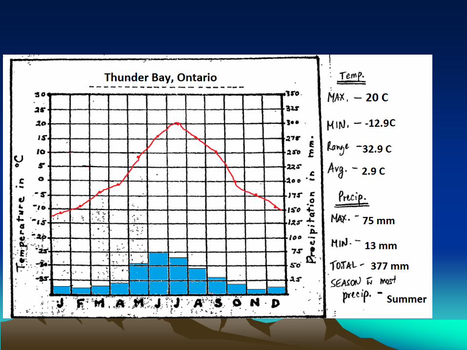
Climate Graphs

CLIMOGRAPHS MONTH J F M A M J J A S O N D
Temperature (C) -12.9 -7.6 -3.1 -1 8 16.3 20 16.2 11.9 -0.7 -4.2 -7.8
Precipitation (mm) 15 13 17 20 51 75 59 43 33 22 13 16
1. Label the graph with the name for the community 2. Plot the precipitation (on the right) - draw a line across the column at the appropriate point - shade below each line to create a bar graph - always label in blue 3. Plot the temperature (on the left). - draw a point in the middle of the appropriate square - connect each of the points to create a line graph - always label in red
Part 5 Homework Check Rocks and Soil Bill Nye
Climate graphs late (hand in!!!!)

Correct Part 5

Basic Facts About Soil
Geographers define soil as “the surface layer of earth” Although soils differ greatly from region to region, all soils are composed of 4 parts: 1. Minerals 2. Air 3. Organic material (decaying plants and animals) 4. Water
• Soil is created when rocks (know as Parent Material) are broken down (weathered) into small particles and mixed with other materials.
• Different types of weathered rocks produce different kinds of soil.
• Some of the most fertile soils in Canada are found on the prairies and in the river valleys (ex: Okanagan Valley, BC).
• The least developed soils are found in the mountains, Canada's arctic and Canadian shield. These soils are too thin to support diverse natural vegetation or agriculture.

1. Define the following soil-related terms: a) parent material: rock from which soil is derived b) topsoil: surface layer of soil c) soil profile: different horizons (layers) in the soil
and the rock layer (bedrock) below the soil. Each horizon has different physical, biological and chemical characteristics.
d) humus: dark upper layer of soil made up of
partially decayed plant material e) loam: rich, fertile soil in which decaying and
decayed plant matter is mixed with clay silt and sand.
2. What are the four basic components that soil is made of?
• Minerals – Come from rock – Become part of the soil when the rock is broken down into
smaller particles called sand, silt, or clay. – Provide nutrients to plants
• Organic materials (plants and animals) – Die and decompose (bacteria breaks it down) in the soil to form
humus • Air
– Loose decaying materials create many air pockets – Insects, worms and small animals that tunnel through the soil
also create air spaces • Moisture (water)
– Dissolves nutrients in the soil – Plant roots absorb the moisture (necessary for survival)
3. a) How is topsoil formed? – Bacteria decompose dead plants, leaves and animals which dark
top layer of soil – Very slow process
b) Why are there different types of topsoil in different
parts of Canada? – The type of topsoil is related to the influence of climate, which
affects the amount of vegetation in an area • In cold climates there is little vegetation, therefore humus does not
build up and topsoil is thin and lacking nutrients • In warm climates there is more vegetation, therefore the humus
builds up and topsoil is thick and rich in nutrients – Canada is a large country with many different climate regions
which is why there are different types of topsoil

Leaching • Occurs in areas of high
precipitation
• Downward movement of water through soil
• Water dissolves minerals and nutrients
• Excessive leaching results in poor, thin topsoil
• Diagram page141
Calcification • Occurs in areas of low
precipitation
• Upward movement of water through soil
• Water evaporates and leaves behind minerals
• Excessive calcification results in mineral deposits that are poisonous to plants
• Diagram page141

Natural Vegetation • Plants that would grow in an area in the
absence of human influence • Canada’s natural vegetation regions:
– Tundra – West coast forest – Cordilleran vegetation – Boreal and Taiga forest – Grassland – Mixed forest – Deciduous forest
• Transition Zone: – An area where the characteristics of one region gradually
change into those of another

Assignment • Canada’s Natural Vegetation Regions
– Use a blank white piece of paper – Divide your paper into 8 sections (only need 7) – For each section you need:
• Title • Minimum of 4 characteristics (point form) • Picture (keep it simple)

TEST REVIEW