flood study cape may county, nj - rampp - risk … · 2011-07-19 · 10 meeting objectives engage...
TRANSCRIPT
FLOOD STUDYCape May County, NJFEMA REGION IIJuly 12, 201110:00

2
Agenda
IntroductionsFEMA Strategic Plan & Risk Mapping, Assessment, and Planning (Risk MAP) GoalsRisk MAP Program OverviewMeeting ObjectivesCurrent Status of Cape May County Flood StudyRisk AssessmentCommunity EngagementQuestions

3
IntroductionsLocal – Cape May County (Host) & CommunitiesState – New Jersey Department of Environmental Protection (NJDEP)Supervising Engineer: Joseph Ruggeri, PE, CFMSupervising Engineer: John ScordatoProgram Development Specialist: Jim WattSenior Engineer: Kunal Patal
FEMA Region IIMitigation Division Director: Timothy P. CrowleyCommunications / Outreach Lead: William McDonnell Study Project Manager: Paul K. Weberg, PE Floodplain Management and Insurance Lead: Pat GriggsRegional Program Management Lead: Bo Juza, CFM Regional Support Center Coordinator: Andrew Martin, CFMRegional Support Center Outreach Lead: Crystal Smith, CFM

4
FEMA Strategic Plan & Risk MAP GoalsFEMA Strategic Plan Goals 2008-2013
o Lead an integrated approach that strengthens the Nation’s ability to address disasters, emergencies, and terrorist events
o Deliver easily accessible and coordinated assistance for all programso Provide reliable information at the right time for all userso FEMA invests in people and people invest in FEMA to ensure mission
successo Build public trust and confidence through performance and stewardship
FEMA Risk MAP GoalsCollaboration with Federal, State and local stakeholders to achieve goals under Risk MAP:
o Address gaps in flood hazard datao Public Awareness/Outreacho Hazard Mitigation Planningo Enhanced Digital Platformo Alignment and Synergies
5
Guiding PrinciplesEngage communities early and oftenAgree upon and document project outcomes and responsibilitiesCoordinate with other programs operating within the same communityLeverage associations to provide a third-party perspectiveUse local media and language that people understand
6
Risk MAP Program Overview

7
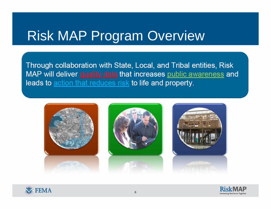
Risk MAP VisionThrough collaboration with State, Tribal, and local entities, Risk MAP will deliver quality data that increases public awareness and leads to action that reduces risk to life and property. Risk MAP will focus on products and services beyond the traditional Flood Insurance Rate Map (FIRM). FEMA will work with officials to help use flood risk data and tools to effectively communicate risk to citizens and enable communities to enhance their corresponding mitigation plans.

8
FEMA’s FY10 Flood Mapping Progress Report and Production Plan
With FY 2009 and FY2010 Congressional appropriations for Flood Hazard Mapping, FEMA is conducting flood map update projects:• Address gaps in required engineering and mapping for
high flood risk areas affected by coastal flooding, levees, and other riverine flood hazards
• Leverage established Cooperating Technical Partner (CTP) relationships
To learn more, see the FEMA’s FY10 Flood Mapping Progress Report and Production Plan on www.fema.gov
9
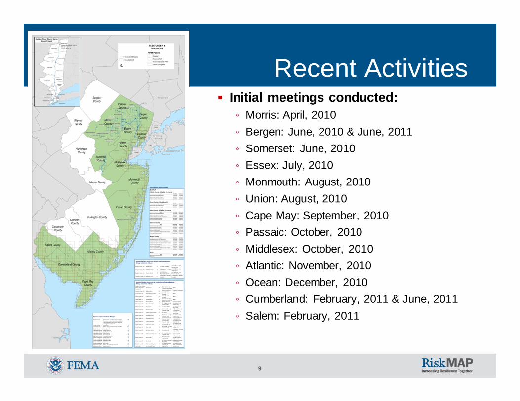
Recent ActivitiesInitial meetings conducted: ◦ Morris: April, 2010◦ Bergen: June, 2010 & June, 2011◦ Somerset: June, 2010◦ Essex: July, 2010◦ Monmouth: August, 2010◦ Union: August, 2010◦ Cape May: September, 2010◦ Passaic: October, 2010◦ Middlesex: October, 2010◦ Atlantic: November, 2010◦ Ocean: December, 2010◦ Cumberland: February, 2011 & June, 2011◦ Salem: February, 2011

10
Meeting ObjectivesEngage Cape May County communities and promote local ownership to reduce their vulnerability to risk
Provide risk awareness information to local officials to effectively manage and communicate flood risk for residents and businesses
Provide an update on the current status of Cape May County’s Flood Study
Encourage partnerships and collaborations to leverage and advance risk management and mitigation measures

11
Coastal and riverine analysis to be completed by June 2012
Project Team• Local Officials• New Jersey Department of Environmental Protection
(Cooperating Technical Partner)• FEMA
Risk Assessment, Mapping, and Planning Partners (RAMPP), a joint venture of Dewberry, URS, and ESPRegional Program Management LeadRegional Support Center
Cape May County Flood Study -Overview
12
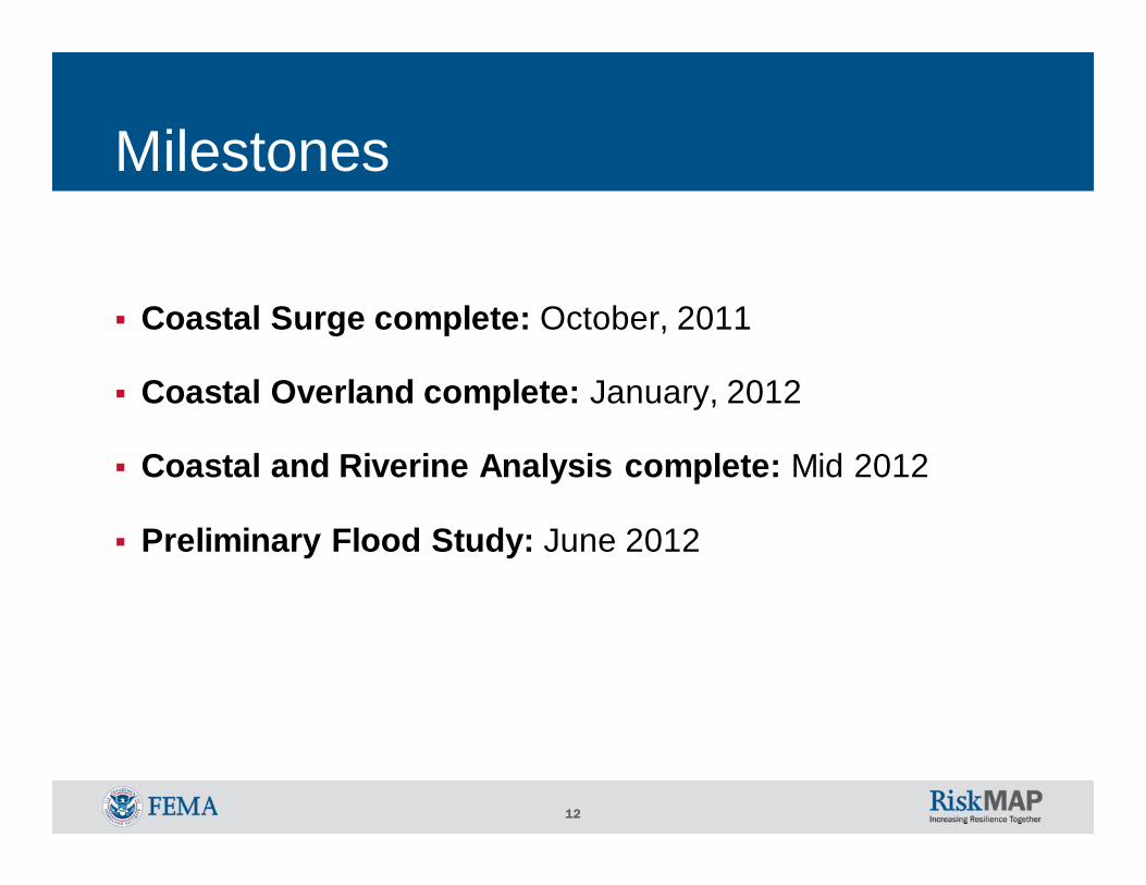
Milestones
Coastal Surge complete: October, 2011
Coastal Overland complete: January, 2012
Coastal and Riverine Analysis complete: Mid 2012
Preliminary Flood Study: June 2012

13
Cape May County Flood Study –Scope
Incorporation of approximately 10 miles of detailed riverine redelineation, 31 miles of approximate riverine redelineation, and 72 miles of detailed coastal analysis
Incorporation of NJFHA boundary to the Flood Insurance Study Report (FIS) profiles and Flood Insurance Rate Maps (FIRM)
The DFIRM and FIS report will be produced in the FEMA Countywide format in the North American Vertical Datum of 1988 (NAVD88)
• NAVD 88 = NGVD 29 – 1.275894’
NAVD 88895.275’NGVD 29
Elevation in NGVD 29
Elevation in NAVD 88
896’NAVD 88
897.275’NGVD 29
Datum Conversion of Cape May County

14
Coastal analyses are currently ongoing. Transect (Coastal Cross Sections) layouts have been defined. Obstructions have been modeled. Field reconnaissance has been completed. Surge is in progressApproximate riverine study Hydrology and Hydraulics are in advanced stages.Redelineation of riverine miles is in advanced stages. Mapping will be finalized when all other analyses are complete
Cape May County Flood Study -Update On the Current Status

15
Cape May County Flood Study –Paneling Scheme
• One Countywide FIS Report• Some of the communities may be covered with more than one FIRM panel• Paneling scheme createdfrom 1:24,000 USGS quads
16
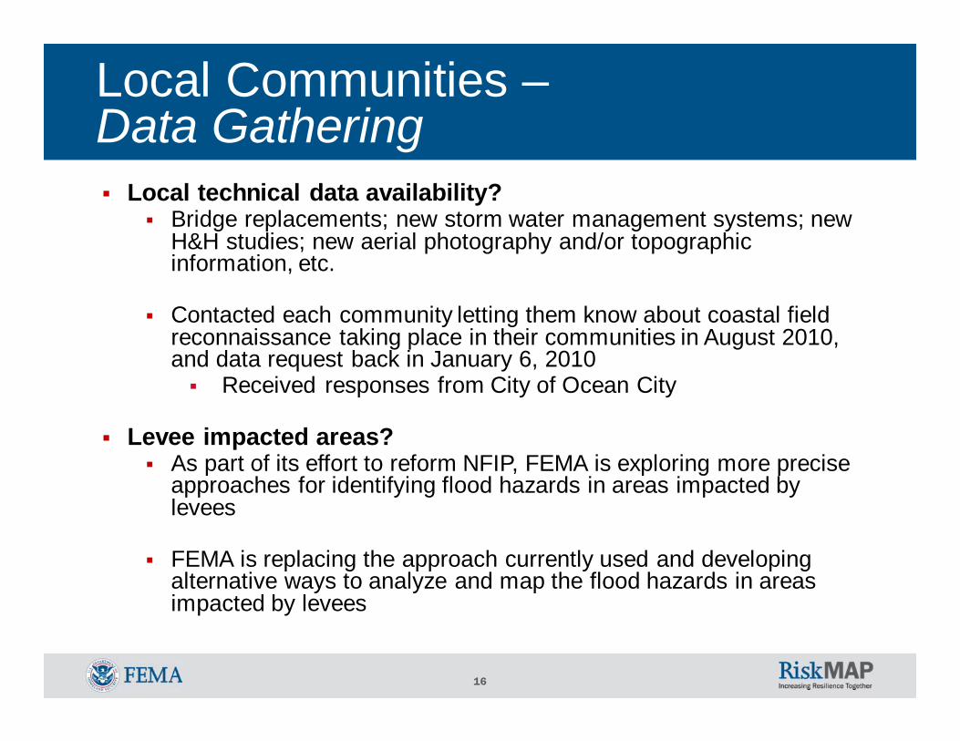
Local technical data availability?Bridge replacements; new storm water management systems; new H&H studies; new aerial photography and/or topographic information, etc.
Contacted each community letting them know about coastal field reconnaissance taking place in their communities in August 2010, and data request back in January 6, 2010
Received responses from City of Ocean City
Levee impacted areas?As part of its effort to reform NFIP, FEMA is exploring more precise approaches for identifying flood hazards in areas impacted by levees
FEMA is replacing the approach currently used and developing alternative ways to analyze and map the flood hazards in areas impacted by levees
Local Communities –Data Gathering
17
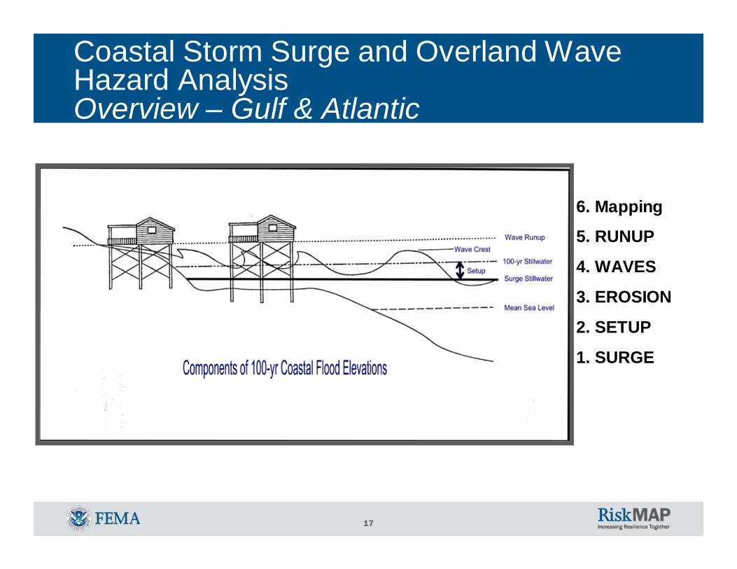
Coastal Storm Surge and Overland Wave Hazard Analysis Overview – Gulf & Atlantic
6. Mapping
5. RUNUP
4. WAVES
3. EROSION
2. SETUP
1. SURGE
18
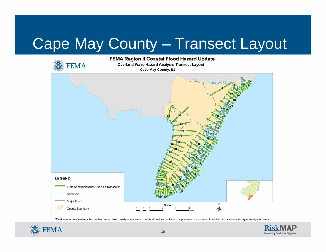
Cape May County – Transect Layout
19
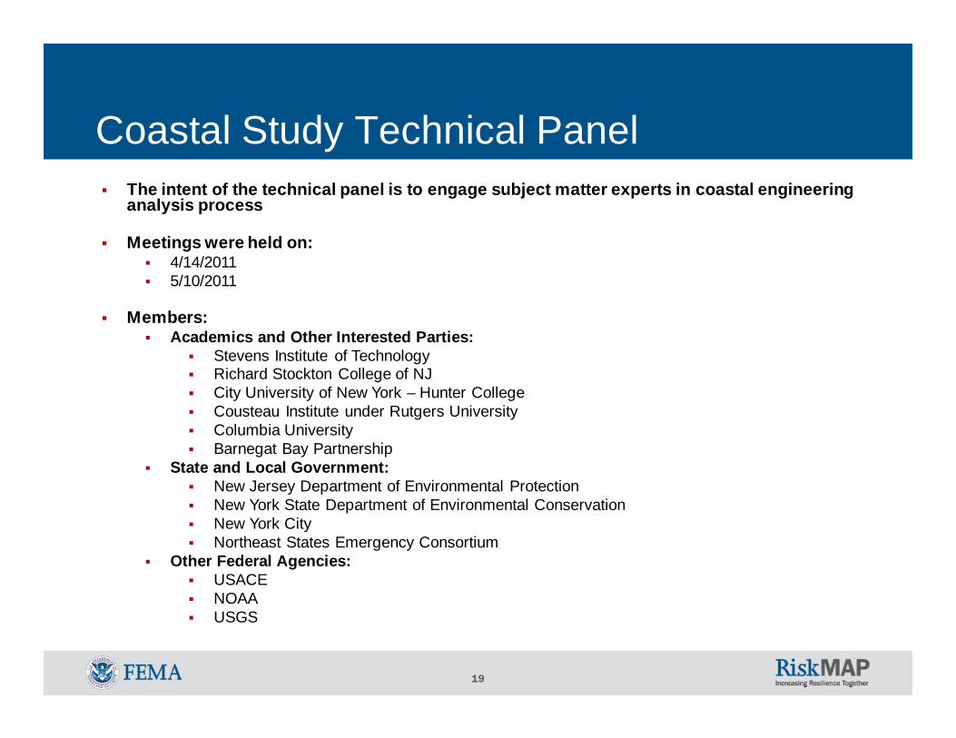
The intent of the technical panel is to engage subject matter experts in coastal engineering analysis process
Meetings were held on:4/14/20115/10/2011
Members:Academics and Other Interested Parties:
Stevens Institute of TechnologyRichard Stockton College of NJCity University of New York – Hunter CollegeCousteau Institute under Rutgers UniversityColumbia UniversityBarnegat Bay Partnership
State and Local Government:New Jersey Department of Environmental ProtectionNew York State Department of Environmental ConservationNew York CityNortheast States Emergency Consortium
Other Federal Agencies:USACENOAAUSGS
Coastal Study Technical Panel
20
Risk MAPRisk Assessment Tools & Resources
HAZUS-MH: Estimating potential losses from earthquakes, floods, and hurricanes
New Version 2.0 includes coastal storm surge modelingFor more information and to download the HAZUS-MH software: http://www.fema.gov/plan/prevent/hazus/index.shtm
National Tool: Evaluate appropriate long-term mitigation measures
For more information and to download the National Tool software: http://www.fema.gov/plan/prevent/floodplain/data_tool.shtm

21
Cape May County – NFIP Policies, Claims, Repetitive Losses, CRS, CAC & CAV
COMMUNITY
Number of
Policies Total Coverage Total
Premium
Total Claims Since 1978
Total Paid Since 1978
Number of Repetitive Losses CRS
Community Assistance Contact (CAC)
Community Assistance
Visit (CAV)
AVALON, BOROUGH OF 5268 1,351,279,700$ 3,167,003$ 1,315 8,235,547$ 243 YES 2009 1993CAPE MAY CITY, CITY OF 2691 624,233,700$ 2,127,094$ 1,233 7,973,316$ 371 YES 2003 1995CAPE MAY POINT, BOROUGH OF 445 115,195,900$ 358,531$ 116 651,206$ 24 YES 2006 1995DENNIS, TOWNSHIP OF 78 18,485,600$ 69,963$ 3 5,267$ 0 ‐ 1995LOWER, TOWNSHIP OF 2563 599,787,200$ 1,304,439$ 177 1,383,182$ 68 2007 1995MIDDLE, TOWNSHIP OF 1174 256,972,100$ 822,520$ 647 3,843,414$ 221 2006 2002NORTH WILDWOOD, CITY OF 6294 1,033,016,100$ 3,412,533$ 2,622 17,398,976$ 1,220 YES 2007 1995OCEAN CITY, CITY OF 17091 3,715,574,900$ 10,240,888$ 3,852 21,658,559$ 1,139 YES 2009 2007SEA ISLE CITY, CITY OF 6369 1,341,306,400$ 3,869,836$ 1,529 9,108,739$ 646 YES 2010 2010STONE HARBOR, BOROUGH OF 2685 672,775,000$ 2,086,708$ 925 7,372,024$ 359 YES 2010 2009UPPER, TOWNSHIP OF 621 160,137,800$ 661,365$ 224 2,076,645$ 71 3/2010 3/2010WEST CAPE MAY, BOROUGH OF 337 84,393,600$ 288,038$ 109 362,670$ 27 2002 1995WEST WILDWOOD, BOROUGH OF 567 104,597,700$ 482,716$ 1,862 15,959,756$ 1,173 YES 2008 1995WILDWOOD CREST, BOROUGH OF 4360 833,038,000$ 2,267,200$ 248 1,261,536$ 40 YES 2008 1995WILDWOOD, CITY OF 3831 674,934,800$ 2,746,713$ 1,662 15,395,004$ 771 2010 1995WOODBINE, BOROUGH OF 5 847,000$ 2,241$ 0 0 0 ‐ 1995
County Total 54,379 11,586,575,500$ 33,907,788$ 16,524 112,685,841$ 6,373
22
Broome County, NY - Early Demonstration ProjectDepth Grid and HAZUS-MH Development / Area of Mitigation Interest
FEMA Region II developed potential demonstration projects to field test proposed Risk MAP productsWhy in Broome?
o New Hydrology indicated an upward trend in flood discharge
o Increased flow created potential issues due to levee de-accreditation
23
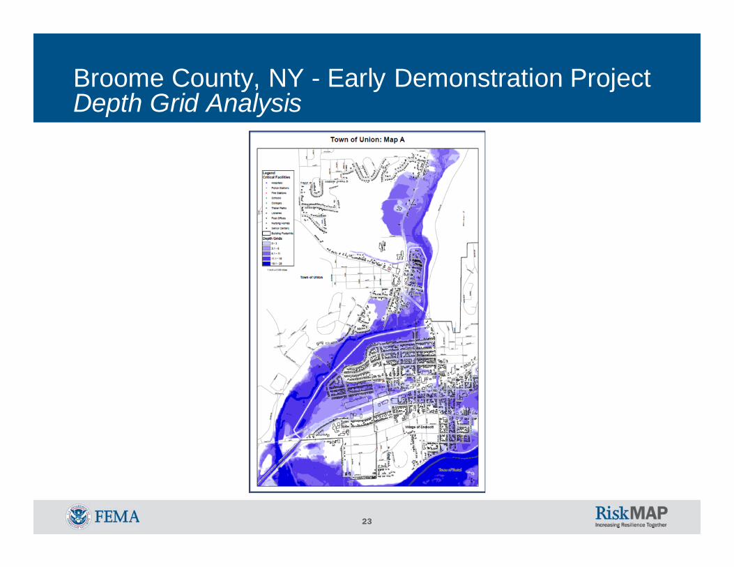
Broome County, NY - Early Demonstration ProjectDepth Grid Analysis

24
Broome County, NY - Early Demonstration Project Example Area of Mitigation Interest
Robinson St. was initially identified as the sole source for flooding of a large area
The area was of interest to the City of Binghamton as a potential economic development site
25
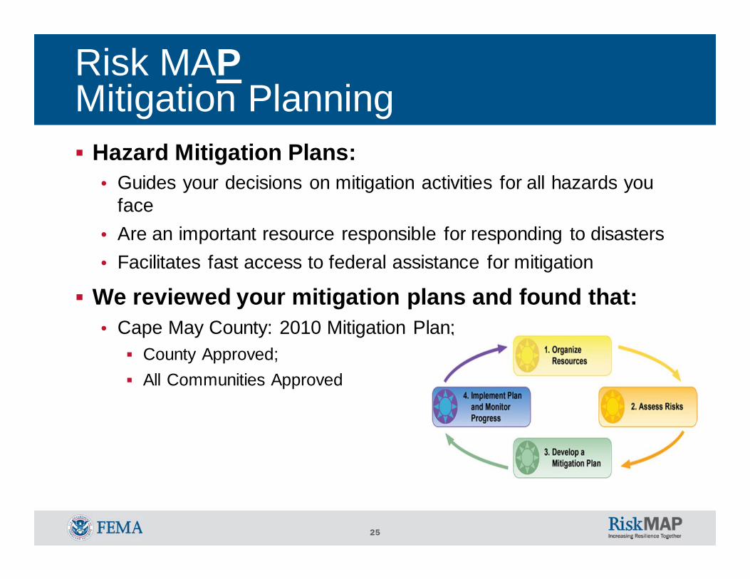
Risk MAPMitigation Planning
Hazard Mitigation Plans:• Guides your decisions on mitigation activities for all hazards you
face• Are an important resource responsible for responding to disasters• Facilitates fast access to federal assistance for mitigation
We reviewed your mitigation plans and found that:• Cape May County: 2010 Mitigation Plan;
County Approved; All Communities Approved
26
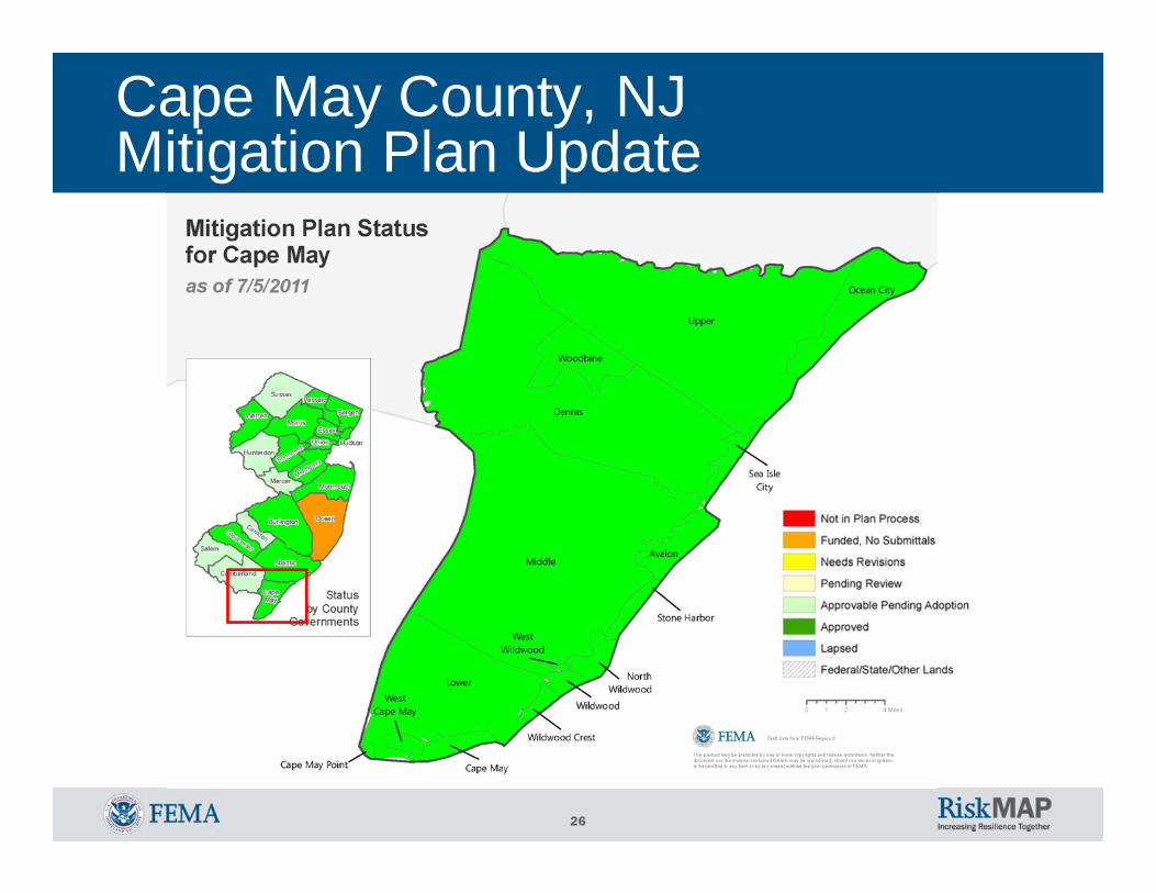
Cape May County, NJ Mitigation Plan Update
27
Hazard Mitigation Assistance (HMA)
HMA grant programs provide funding for eligible mitigation activities that reduce disaster losses and protect life and property from future disaster damages
Communities with approved hazard mitigation plans can apply for Federal Assistance on declared/non-declared disasters
Federal Assistance applications through New Jersey OEM (Bob Little)

28
Community Rating System (CRS)The National Flood Insurance Program's (NFIP) Community Rating System (CRS) is a voluntary incentive program that recognizes and encourages community floodplain management activities that exceed the minimum NFIP requirements
As a result, flood insurance premium rates are discounted to reflect the reduced flood risk resulting from the community actions meeting the three goals of the CRS:• Reduce flood losses;• Facilitate accurate insurance rating; and• Promote the awareness of flood insurance
• Borough of Avalon is CRS level 6

29
Risk CommunicationsFederal/State/Local goals:• To aid in safer communities and reduce risk to life and
property• To effectively communicate risk and increase public
awareness, leading citizens to make informed decisions regarding their risk
Key factors contributing to successful achievement of these goals are: • Community engagement and exchange of flood risk
information• Effective collaboration through partnerships• Strategic communications plan development

30
Risk CommunicationsAcknowledgement of the challenges in complex, multi-disciplinary, multi-dimensional, and evolving processes of risk communications• Conflicting priorities and messages• Difficulty in translating scientific information• Disagreements on what is risk
FEMA created a list of supporting, customizable tools and templates and is currently developing those materials in order of need as identified by FEMA Regions• Region II is waiting on FEMA HQ’s development and
outcomes• Region II is initiating it’s own risk communications strategy

31

32
The overarching goal of New Jersey Coastal Outreach Strategy is to increase congressional, state, county, community and public awareness of and engagement in the remapping of New Jersey coastal counties. Key themes:
• Flood risks have changed in many coastal communities since the date on their effective FIRM panels
• When completed, the storm surge study will be of sound technology and contain valid results
• Mitigation Planning involves learning about the hazards that can affect a community, setting clear goals to reduce a community’s vulnerability to the identified hazards, and putting into practice long-term hazard mitigation strategies
• Coordinated, sustained mitigation activities are the best way to ensure your community will be physically, socially, and economically resilient to future natural hazard impacts
Risk CommunicationsNJ Coastal Outreach Strategy
33
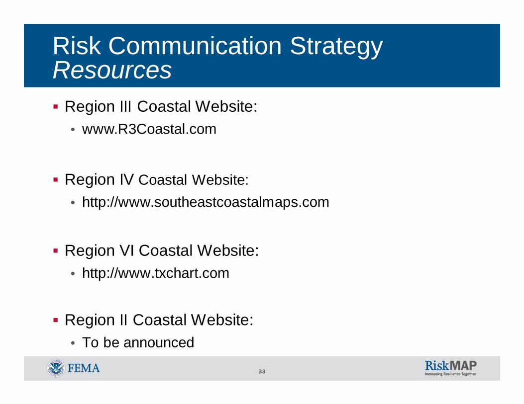
Risk Communication StrategyResources
Region III Coastal Website:• www.R3Coastal.com
Region IV Coastal Website:• http://www.southeastcoastalmaps.com
Region VI Coastal Website:• http://www.txchart.com
Region II Coastal Website:• To be announced

34
Example FEMA Region IIRisk MAP Activities Schedule
Current: July, 2011• Risk MAP overview and introduction
September, 2011• Risk communications strategy update
November, 2011• Risk assessment training
January, 2012• Mitigation planning training
March, 2012• Risk communications review and support
May, 2012• Risk assessment review and support
July, 2012• Mitigation planning review and support

35
Resources
FEMA: www.fema.govFloodsmart, the official site of the National Flood Insurance Program (NFIP): www.floodsmart.govRisk Assessment, Mapping and Planning Partners: www.RAMPP-team.comNFIP Reform: www.fema.gov/business/nfip/nfip_reform.shtm HAZUS-MH software: http://www.fema.gov/plan/prevent/hazus/index.shtmNational Tool software: http://www.fema.gov/plan/prevent/floodplain/data_tool.shtmHazus User Groups: http://www.fema.gov/plan/prevent/hazus/hz_users.shtm#4
New Jersey Department of Environmental Protection - NFIP CoordinatorNew Jersey State Office of Emergency Management
36
Questions & FeedbackPlease complete your survey. Your feedback is very important to us.This presentation & hand-outs will be posted at: www.RAMPP-TEAM.com
Contact InformationNJDEPJoseph Ruggeri / John Scordato / Chris Gould NJDEP, Bureau of Dam Safety & Flood ControlPhone: 609-292-2296NJDEP website: www.nj.gov/dep/floodcontrol
FEMAMitigation Division Director: Timothy P. Crowley / 212-680-3627/ [email protected] Analysis Branch Chief: Scott Duell / 212-680-3630 / [email protected] and Outreach: William McDonnell / 212-680-3636 / [email protected] Project Manager: Paul Weberg / 212-680-3638 / [email protected] Insurance & Management: Pat Griggs / 212-680-8523 / [email protected] Planning: Cathleen Carlisle / 212-680-8529 / [email protected] & GIS: Brian Shumon / 212-680-3631 / [email protected] Support Center Coordinator: Andrew Martin / 646-216-3677 / [email protected] Project Management Lead: Bo Juza / 646-801-6460 / [email protected]