flight planning tool - department of energy planning tool_0.pdf · background radiological...
TRANSCRIPT

Presented by: Dave IsimingerSite GIS & Environmental Systems
Geospatial Technology Summit
Flight Planning Tool
Powered by:
Environmental Data Portal

Background
Radiological Assistance Program (RAP)
The Flight Planning Tool (FPT)
1
2
3
AGENDA
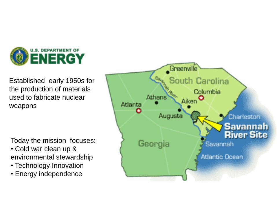
Established early 1950s for
the production of materials
used to fabricate nuclear
weapons
Today the mission focuses:
• Cold war clean up &
environmental stewardship
• Technology Innovation
• Energy independence

Background
Radiological Assistance Program (RAP)
The Flight Planning Tool (FPT)
1
2
3
AGENDA

• DOE/NNSA Radiological
First Responders
• Deployable within 2 hours.
• Regionally located to
provide a timely response
capability and foster
relationships with other
emergency response
elements

8
7
58
7
4
2
16
2
3
0
DOE Regional Map and Coordinating Offices

Aerial Measuring System (AMS)
detects, measures and tracks
radioactive material at an
emergency to determine
contamination levels
Regional AMS


Basic Map &Navigation Coordinates

Background
Radiological Assistance Program (RAP)
The Flight Planning Tool (FPT)
1
2
3
AGENDA

Automate flight plan packages1
2
3
Decrease creation time
Minimize human error
potential
OBJECTIVES


Lost Source
Scenarios

Scenarios
Road & Stream

National Atmospheric Release Advisory Center
Scenarios
NARAC Deposition

Benefits:•Preflight briefings have been reduced from 1.5 hours to 15 min.
•Clear communications. Coordinates & headings for the aircraft computer.
•Prevents weather aborted flights by combining flight plan with weather data.
•A second location ( backup plan) can already be selected for monitoring.
•Optimizes and minimizes travel paths.
•Better planning. Better utilization of pilot and aircraft.
•Eliminated training. Tool is intuitively obvious to use.
Summary:
Powered by:
The RAP Flight Planning Tool is used by DOE RAP Region 3 to
respond to emergency radiological situations. The tool automates the
flight planning package process while decreasing Aerial Measuring
System response times and decreases the potential for human error.
Presented by: Dave IsimingerSite GIS & Environmental Systems