fhwa resources for pedestrian and bicycle professionals
TRANSCRIPT

FHWA Resources for Pedestrian
and Bicycle Professionals
Charlie Zegeer, UNC Highway Safety Research Center/PBIC
Libby Thomas, UNC Highway Safety Research Center
Dan Nabors, Vanasse Hangen Brustlin (VHB)

Presentation Overview
• How to Develop a Pedestrian Safety Action Plan
• Pedestrian Safety Guide & Countermeasure Selection System (PEDSAFE)
• Bicycle Safety Countermeasure Selection System (BIKESAFE)
• Pedestrian and Bicycle Crash Analysis Tool (PBCAT)
• Pedestrian Road Safety Audit Guidelines and Prompt Lists
• Pedestrian Safety Guide for Transit Agencies
• A Resident’s Guide for Creating Safe and Walkable Communities

How to Develop a Pedestrian Safety Action Plan
Purpose Presents an overview and framework for state and local agencies to develop and implement a PSAP
Audience Planners, Engineers, Law Enforcement, Educators, Health Professionals and Decision Makers
Link www.walkinginfo.org/howtoguide

PSAP Guide Overview
• Planning and Designing for Pedestrians
• Involving Stakeholders
• Data Collection and Problem Identification
• Analysis and Prioritization
• Selecting Safety Solutions
• Providing Funding
• Resources
www.walkinginfo.org/howtoguide

Planning and Designing for Pedestrians
Presents background knowledge of policy, planning, and design elements that impact pedestrian safety, including:
– Street design
– Connectivity
– Site Design
– Land Use
– Access Management
www.walkinginfo.org/howtoguide

Stakeholder Involvement Provides guidance reaching out to key stakeholder groups, such as:
– Engineers and planners
– Educators and police
– Public health officials
– Individual citizens and organizations
– Public employees, officials, and agencies
– Business owners
– Media
www.walkinginfo.org/howtoguide

Data Collection & Problem Identification
Explains how to collect crash, count, survey, facility inventory, and other types of data for identifying problem areas for pedestrians
www.walkinginfo.org/howtoguide

Analyzing & Prioritizing Concerns
Introduces a process for:
– Categorizing problems
– Identifying spots, corridors, or jurisdiction-wide concerns
– Analyzing locations using audits or tools like PBCAT
– Prioritizing problems and solutions
www.walkinginfo.org/howtoguide

Selecting Safety Solutions
Presents detailed information about different types of countermeasures:
Engineering Education Enforcement
Also includes information on partnerships, policy considerations, and program/treatment evaluation.
www.walkinginfo.org/howtoguide
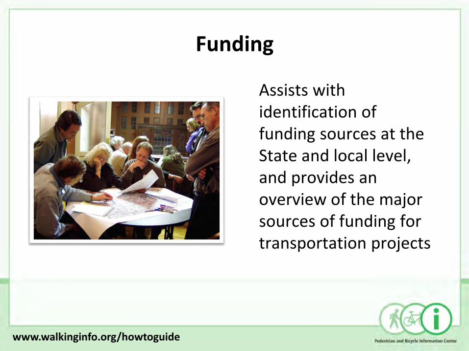
Funding
Assists with identification of funding sources at the State and local level, and provides an overview of the major sources of funding for transportation projects
www.walkinginfo.org/howtoguide

Resources
Includes a number of additional resources, including:
– Guidance for conducting pedestrian counts/surveys
– A comprehensive list of funding sources
– Tips for evaluating a pedestrian safety plan
– Checklist for engineering and planning solutions
– How to create an effective pedestrian advisory board
www.walkinginfo.org/howtoguide
For information about training opportunities based on the PSAP guide, visit www.walkinginfo.org/training

Pedestrian Safety Guide & Countermeasure Selection System (PEDSAFE)
Purpose Provides information for identifying safety/mobility needs and improving conditions for pedestrians
Audience Planners, Engineers, Safety Professionals, and Decision Makers
Link www.walkinginfo.org/pedsafe

PEDSAFE Resources
• Provides the user with a knowledge base for addressing pedestrian safety and mobility
• Presents an analysis of pedestrian crash statistics and trends
• Explains key concepts used in the application of the PEDSAFE tools
www.walkinginfo.org/pedsafe

PEDSAFE Tools
Interactive tools provide the user with a list of possible engineering treatments to improve pedestrian safety and/or mobility based on user input about a specific location.
www.walkinginfo.org/pedsafe
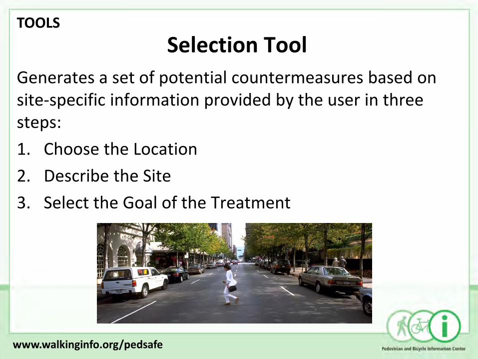
Selection Tool
Generates a set of potential countermeasures based on site-specific information provided by the user in three steps:
1. Choose the Location
2. Describe the Site
3. Select the Goal of the Treatment
www.walkinginfo.org/pedsafe
TOOLS

Selection Tool
Choose the Location – the user provides the name and a brief description of the roadway or intersection to be addressed.
www.walkinginfo.org/pedsafe
TOOLS

Selection Tool
Describe the Site – the user provides responses to a set of questions related to the roadway characteristics, such as ADT, speed, and number of lanes, in order to determine the pedestrian safety problem
www.walkinginfo.org/pedsafe
TOOLS

Selection Tool
Select Treatment Goal – the user selects a performance objective for the treatment, or a particular crash type to target
www.walkinginfo.org/pedsafe
TOOLS

Selection Tool
Once all information has been provided, the tool automatically selects a number of potential countermeasures to address the problem, and provides links to more information about the design specifications, applicability, and cost of each treatment.
www.walkinginfo.org/pedsafe
TOOLS

Countermeasures
• PEDSAFE provides details for 49 countermeasures, including a brief description, cost, purpose, considerations, and a link to relevant case studies.
• Countermeasure categories include the following:
www.walkinginfo.org/pedsafe
TOOLS

Interactive Matrices
The interactive matrices allow a user to select countermeasures based on the relationships between countermeasure group and:
• Performance Objectives, or
• Crash Types
The output provides a selection of specific countermeasures that address a particular objective or crash type within a certain category
www.walkinginfo.org/pedsafe
TOOLS

Case Studies
To provide real world examples, PEDSAFE includes 70 case studies that highlight the application of various countermeasures, including a description of the specific safety issue, a discussion of the solution, and a presentation of the implementation results.
www.walkinginfo.org/pedsafe
TOOLS

Bicycle Countermeasure Selection System (BIKESAFE)
Purpose Provides problem identification and treatment selection guidance for improving bicyclist safety
Audience Planners, Engineers, Safety Professionals, and Decision Makers
Link www.bicyclinginfo.org/bikesafe

Why Use BIKESAFE
Mostly about treating existing roadways:
• Understand and address specific crash problems
• Address broader performance objectives to create safer, more accessible roadways
• Benefit from others’ implementation experiences
• Learn about uses, estimated costs, considerations for countermeasures
• Tool to use as part of overall and comprehensive approach to providing safe and accessible streets
www.bicyclinginfo.org/bikesafe


Crash Types Descriptions RESOURCES
www.bicyclinginfo.org/bikesafe

Crash Matrix TOOLS
www.bicyclinginfo.org/bikesafe

Objectives Matrix TOOLS
www.bicyclinginfo.org/bikesafe

TOOLS
www.bicyclinginfo.org/bikesafe

TOOLS
www.bicyclinginfo.org/bikesafe

Select either a performance objective or a crash type
www.bicyclinginfo.org/bikesafe

Select location characteristics.
If any unknown, countermeasures will not be excluded

www.bicyclinginfo.org/bikesafe

TOOLS


Each study includes: • Background • Countermeasures • Evaluation and Results • Recommendations • Costs and Funding Info. • Contact Info.
Case Studies TOOLS
www.bicyclinginfo.org/bikesafe

Case Studies TOOLS
www.bicyclinginfo.org/bikesafe

How to know what crash types are a problem in your community?
How to determine performance priorities?
Other tools:
– How to Develop a Pedestrian Safety Action Plan
– Ped and Bike Intersection Safety Indices
– Pedestrian Road Safety Audit Guide and Prompt Lists
– PBCAT – type pedestrian and bicycle crashes
www.bicyclinginfo.org/bikesafe

Pedestrian & Bicycle Crash Analysis Tool (PBCAT)
Purpose Assists with development and analysis of detailed pedestrian and bicycle crash databases
Audience Engineers, Planners, and State/Local Coordinators
Link www.walkinginfo.org/facts/pbcat

Why Crash Typing?
Traditional Electronic Crash Data
When (date, time of day, day of week)
Where (city, street, roadway class, intersection)
Who (age, gender, severity)
? What happened leading up to the crash
Crash Typing
– Answers “what happened”
– Details on location
www.walkinginfo.org/facts/pbcat

Crash Typing History
NHTSA- Crash Typologies – 1970s – led to improved countermeasures
Pedestrian and Pedestrian Crash Types of the early 1990s
PBCAT Version 1.0 –1999
PBCAT v. 2 released 2006
Over 1200 downloads of v. 2
www.walkinginfo.org/facts/pbcat

http://www.bicyclinginfo.org/facts/pbcat/download.cfm
PBCAT v. 2

PBCAT Version 2.0
Greatly enhanced features including: • Navigation in familiar (Windows like) user interface
• More user options and greater customization
• Countermeasure information – links directly to PEDSAFE/BIKESAFE
• Better reporting capabilities & outputs
• Options for ‘group’ crash typing
• Option for location/scenario detail - ped intersection crashes
• Easy export functions for merging/using data in other formats – Excel, SAS, etc.
www.walkinginfo.org/facts/pbcat

Scroll-over each choice and text describes in detail

Detailed Pedestrian Intersection collision scenarios


General location type + Bicyclist Position, and Direction of Travel captured
www.walkinginfo.org/facts/pbcat

Crash Types or Groups - Reports

www.walkinginfo.org/facts/pbcat

Application example – Chapel Hill, NC
• Used PBCAT, state Crash files, and GIS tools to identify high-crash locations, crash types and other crash factors
• 13% involved motorists turning left in front of on-coming (with traffic) bicyclists
• 11% motorist drive out at sign-control
• 10% motorist drive out at midblock locations • [top three crash types]
www.walkinginfo.org/facts/pbcat
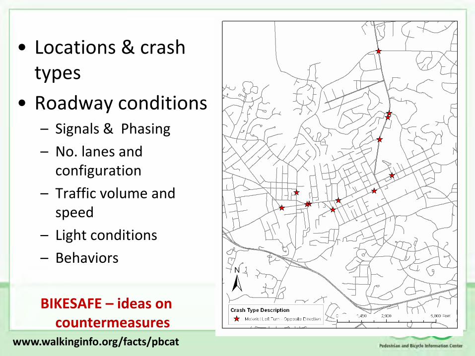
• Locations & crash types
• Roadway conditions – Signals & Phasing
– No. lanes and configuration
– Traffic volume and speed
– Light conditions
– Behaviors
BIKESAFE – ideas on countermeasures
www.walkinginfo.org/facts/pbcat

(RSAs) Audits of Conditions – to narrow optimal countermeasures:
– Numerous driveways and side streets with sight distance issues, wide turn radii
– High volume, 5-lane corridor with wide outside shared lanes, bus and truck traffic
Behaviors:
– > 40 mph speeds, wrong-way cycling on sidewalk
www.walkinginfo.org/facts/pbcat

Pedestrian Road Safety Audit Guidelines and Prompt Lists
Purpose To provide a better understanding of the needs of pedestrians in the transportation system when conducting an RSA
Audience State and Local Transportation Agencies
Link www.walkinginfo.org/pedrsa

What is a Road Safety Audit (RSA)?
A formal safety performance evaluation of an existing or future road or intersection by an independent,
multidisciplinary team.
www.walkinginfo.org/pedrsa

An RSA is a tool that: • Considers all road users • Considers all environmental conditions
What is an RSA?
www.walkinginfo.org/pedrsa

An RSA is a tool that: • Considers all road users • Considers all environmental conditions
What is an RSA?
www.walkinginfo.org/pedrsa

Why are Road Safety Audits Needed?
• Roadway designs need to anticipate and accommodate common errors.
• Not all road-related safety issues are identified in collision reports.
• Ensure all modes are considered.
www.walkinginfo.org/pedrsa

How have our roadways been built? Pedestrian Issues Exist in Varying Degrees
www.walkinginfo.org/pedrsa

How have our roadways been built? Pedestrian Issues Exist in Varying Degrees
www.walkinginfo.org/pedrsa

Pedestrian facilities may not consider desire lines.
How have our roadways been built?
www.walkinginfo.org/pedrsa

Pedestrian facilities may not consider desire lines.
How have our roadways been built?
www.walkinginfo.org/pedrsa

• Resources
• Pedestrian
Characteristics
• Analyzing Pedestrian
Crash Factors
PART 1: KNOWLEDGE BASE
www.walkinginfo.org/pedrsa

PART 2: FIELD MANUAL
STREETS
CROSSINGS TRANSIT
PARKING AREAS / ADJACENT DEVELOPMENTS
www.walkinginfo.org/pedrsa

How are RSAs conducted?
www.walkinginfo.org/pedrsa

Ped RSA Guidelines & Prompt Lists Example of master prompt list for RSA Teams
Zones: A. Streets B. Street Crossings C. Parking Areas / Adjacent
Developments D. Transit Areas
Subtopics: 1. Presence, Design and
Placement 2. Quality, Condition, and
Obstructions 3. Continuity and
Connectivity 4. Lighting 5. Visibility 6. Access Management 7. Traffic Characteristics 8. Signs and Pavement
Markings 9. Signals
www.walkinginfo.org/pedrsa

Ped RSA Guidelines & Prompt Lists Example of detailed prompt lists for RSA Teams
www.walkinginfo.org/pedrsa
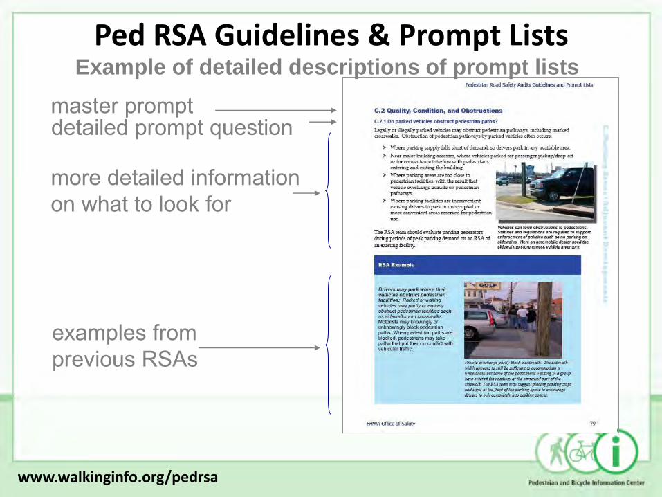
Ped RSA Guidelines & Prompt Lists
more detailed information on what to look for
examples from previous RSAs
detailed prompt question master prompt
Example of detailed descriptions of prompt lists
www.walkinginfo.org/pedrsa
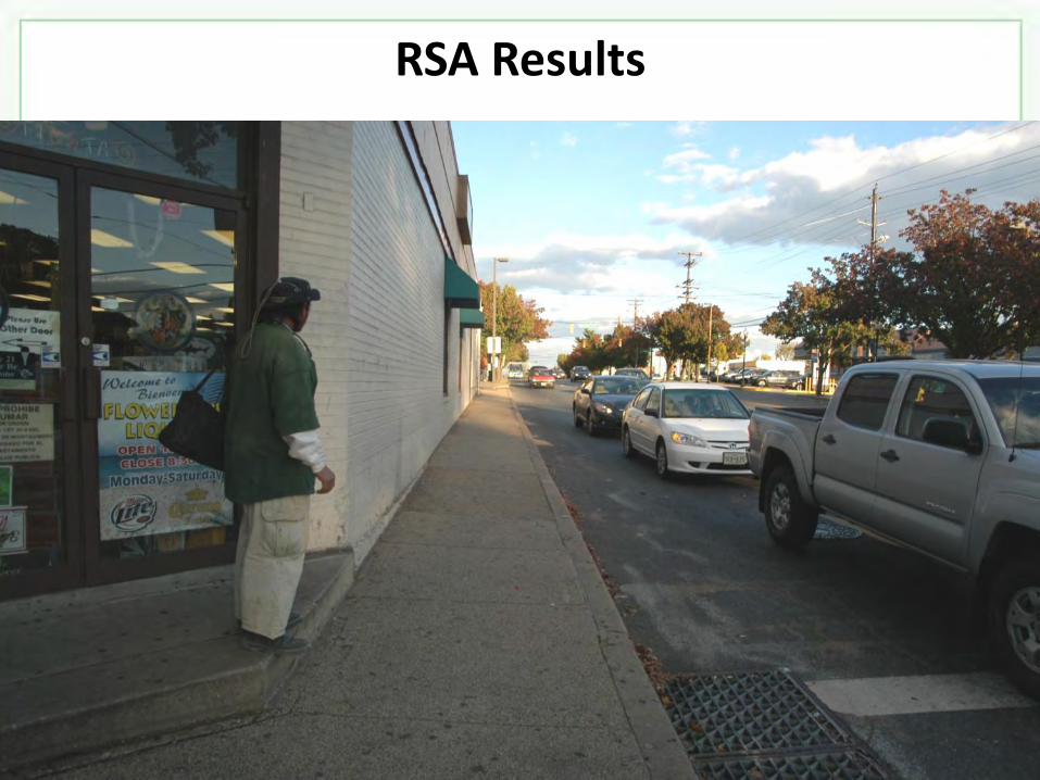
RSA Results

RSA Results

Pedestrian Safety Guide for Transit Agencies
Purpose Provides transit agencies with an easy-to-use resource for improving pedestrian safety
Audience Transit Agencies and their Partners
Link www.walkinginfo.org/transitguide

Transit Guidebook: Overview
The guide emphasizes the importance of solving pedestrian safety issues through partnerships between transit agencies and state and local transportation agencies, municipalities, and consumer interest all of whom can affect roadways and the pedestrian infrastructure.
www.walkinginfo.org/transitguide
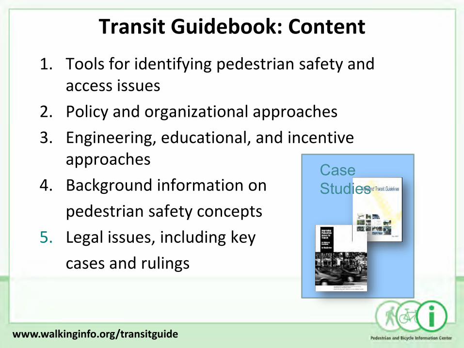
Transit Guidebook: Content
1. Tools for identifying pedestrian safety and access issues
2. Policy and organizational approaches
3. Engineering, educational, and incentive approaches
4. Background information on
pedestrian safety concepts
5. Legal issues, including key
cases and rulings
Case Studies
www.walkinginfo.org/transitguide

Transit Guidebook 1. Tools for identifying pedestrian safety and
access issues: • Bus Stop Assessments
• Pedestrian Observation and Questionnaires
• Pedestrian Crash Data Analysis
Case Studies
www.walkinginfo.org/transitguide

Before and After Reverse Bulb-out
www.walkinginfo.org/transitguide

Before and After Reverse Bulb-out
www.walkinginfo.org/transitguide

Transit Guidebook
2. Policy and organizational approaches:
• Take Internal Action –Organizational improvements
–Update policies, etc.
• Develop Partnerships –Local, Regional, & State Agencies
–Residents and Community Groups
–Development Community
www.walkinginfo.org/transitguide
Transit Guidebook
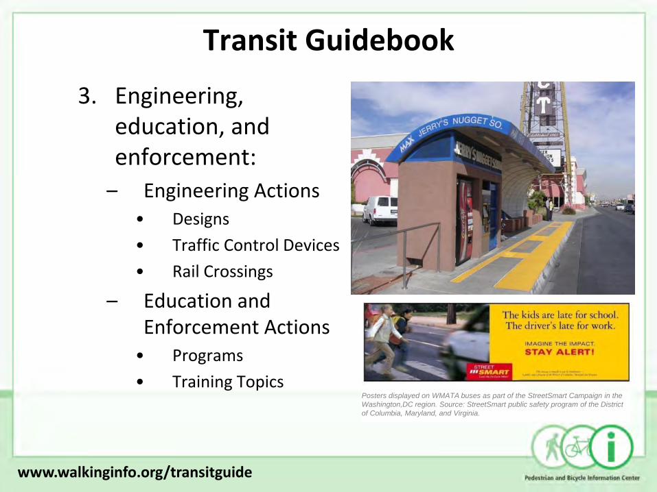
3. Engineering, education, and enforcement:
– Engineering Actions • Designs
• Traffic Control Devices
• Rail Crossings
– Education and Enforcement Actions
• Programs
• Training Topics
Posters displayed on WMATA buses as part of the StreetSmart Campaign in the
Washington,DC region. Source: StreetSmart public safety program of the District
of Columbia, Maryland, and Virginia.
www.walkinginfo.org/transitguide

Transit Guidebook
4. Background information on pedestrian safety concepts:
•Walking distances to transit
•Vehicle Speed vs. Safety
•Pedestrian Characteristics and Behavior
5. Legal issues, including key cases and rulings:
•Example Laws and Standards
•Example Legal Cases
www.walkinginfo.org/transitguide

A Resident’s Guide for Creating Safe and Walkable Communities
Purpose Assist residents, parents, community association members, and others in getting involved in making communities safer for pedestrians.
Audience Persons participating at the community-level.
Link www.walkinginfo.org/residentsguide

Community Guidebook: Overview
• Includes materials to help residents learn about traffic issues that affect pedestrians and find ways to help address these issues and promote pedestrian safety.
www.walkinginfo.org/residentsguide

Community Guidebook: Content Key topics to improve pedestrian safety:
1. How can I identify problems with walking conditions in my neighborhood?
2. Who can help me make my neighborhood a safer place to walk?
3. How can the walkability of my neighborhood be improved?
4. I need more information!
5. Resource Materials
www.walkinginfo.org/residentsguide

Community Guidebook
1. How can I identify problems with walking conditions in my neighborhood?
Information on types of pedestrian issues:
•Poor accommodations
•Unsafe behaviors
Ways to assess those problems:
•Checklists
•Talk with other community members
•Find out what is being done
www.walkinginfo.org/residentsguide
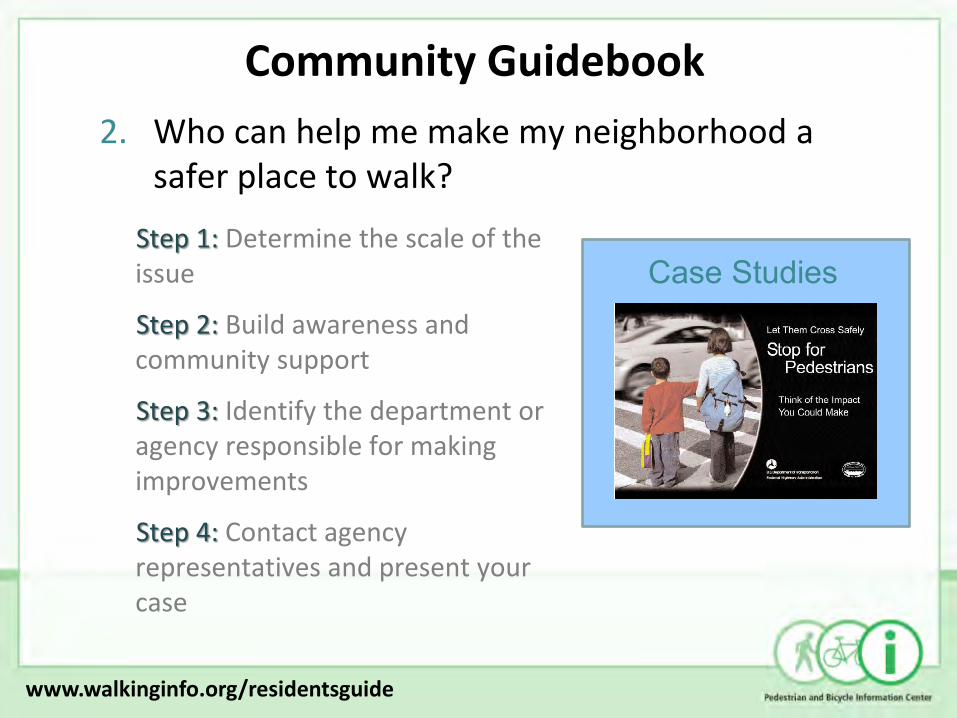
2. Who can help me make my neighborhood a safer place to walk?
Community Guidebook
Step 1: Determine the scale of the issue
Step 2: Build awareness and community support
Step 3: Identify the department or agency responsible for making improvements
Step 4: Contact agency representatives and present your case
Case Studies
www.walkinginfo.org/residentsguide

Community Guidebook
3. How can the walkability of my neighborhood be improved?
– Engineering improvements
– Education
– Enforcement
– Encourage more walking
www.walkinginfo.org/residentsguide
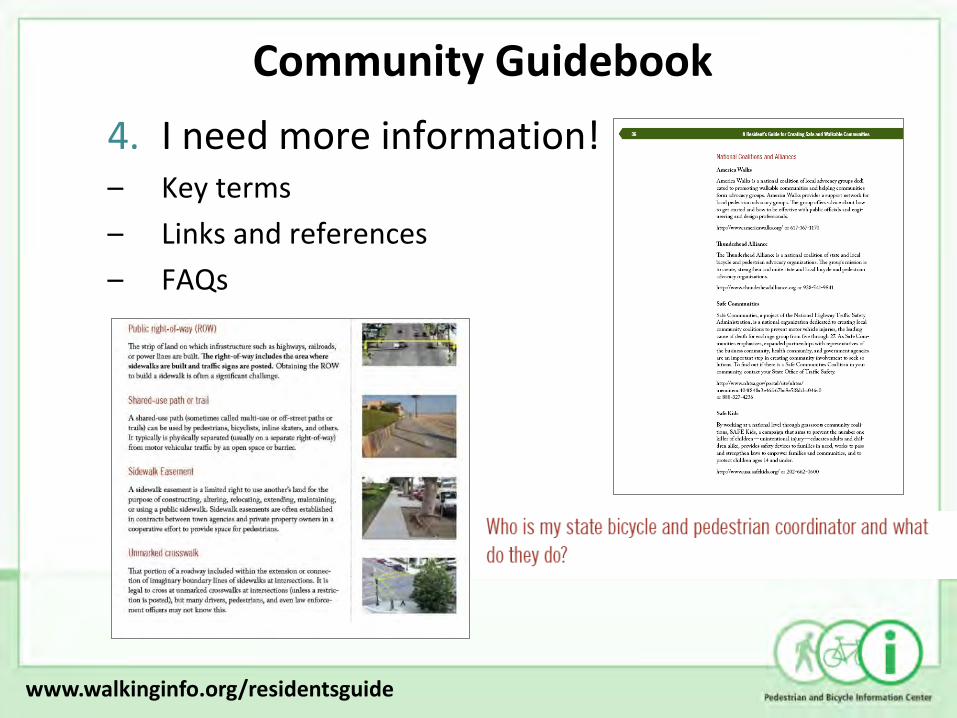
4. I need more information! – Key terms
– Links and references
– FAQs
Community Guidebook
www.walkinginfo.org/residentsguide

Resource Materials
• One to two-pages
• Range of topics
• Referenced
• Processes for improving pedestrian safety
• References
• Forms for organizing information
• Engineering measures
• Education tools
• Public awareness

Resident’s Guide Demo Project
• Over a dozen communities
• Provided grant to use and evaluate materials contained in the guide
www.walkinginfo.org/residentsguide

More Information Pedestrian and Bicycle Safety (FHWA Office of Safety) http://safety.fhwa.dot.gov/ped_bike/ Bicycle and Pedestrian Program (FHWA Office of Human and Natural Environment) http://www.fhwa.dot.gov/environment/bikeped/ Pedestrian and Bicycle Information Center (PBIC) http://www.walkinginfo.org http://www.bicyclinginfo.org

Questions?