expressway route options confirmed - nz transport … · expressway route options confirmed ... sh1...
TRANSCRIPT
PROJECT UPDATE October 2017
Expressway route options confirmedA short-list of options have been drawn up for the SH1 Cambridge to Piarere project. The options for a four-lane expressway are contained in a broad corridor identified mid-year and known as E2. These options are now out for public consultation/ feedback and further investigation by the NZ Transport Agency team.
The Project Team has been busy since our last Project Update in June 2017, when we announced E2 as the favoured corridor for further investigation. Initially, we met with potentially affected landowners within corridor E2 to talk with them about the project and the next steps. These meetings provided the Project Team with information to help highlight any issues we need to consider before we start developing route options.
From the information gathered via landowner meetings, stakeholder engagement and technical constraints mapping, we were able to develop a series of route options (the long-list of options) within E2. Those options were then evaluated by our team of specialists (against risk, complexity, and potential environmental effects) to filter the long-list down to a set of short-list route options. The short-list route options and the process taken to arrive at that short-list was then presented to key stakeholders during a workshop on 15 September 2017. The key stakeholders were satisfied that the process provided a reasonable short-list and this gave the Project Team good confidence to proceed with further investigation of the short-lost route options.
On pages 2 and 3 of this Project Update is a plan depicting the indicative short-list route options. You will note that the options do not include any interchanges, road junctions or local side roads. The location for such features (to be provided in the vicinity of Hydro/Karapiro roads and at the SH1/SH29 intersection) can only be developed while undertaking a more refined investigation of the short-listed route options.
Public Information Day
Come and talk to us about the short-list of route options and interchange treatments being considered for SH1
from the southern end of the Waikato Expressway to Piarere.
Thursday 26 October 2017Karapiro Taotaoroa Settlers Hall
Karapiro Rd (behind the Mobil Service Station)
2pm-7pm
26October2017
We want your feedback We are keen to gather your feedback. Tell us what you think at the Public Information Day on 26 October 2017.
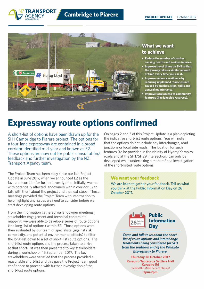
What we want to achieve• Reduce the number of crashes
causing deaths and serious injuries.• Improve travel times on SH1 so that
the journey takes a similar amount of time every time you use it.
• Improve network resilience by reducing unplanned road closures caused by crashes, slips, spills and general maintenance.
• Improve local access to community features (like lakeside reserves).

2 | Cambridge to Piarere Project update | October 2017 Cambridge to Piarere | 3Project update | October 2017
Short-list of expressway route options and indicative interchange areas
To help you understand the short-list expressway routes and interchange areas we have split the project into three sections (A, B and C) with the key points for each section outlined below.
LEGENDEXISTING STATE HIGHWAYLOCAL ROADE2 CORRIDORINDICATIVE SHORT-LIST ROUTE OPTIONINDICATIVE INTERCHANGE AREA
KARAPIRO RD
Piarere
KarapiroHYDRO RD
The plan below is illustrative only, and is not to be considered as definitive in terms of land requirements
Section A
Section B Section C
TO TAURANGA
TO TIRAU
TO HAMILTON
TO CAMBRIDGE
A1, A2, A3, A4
B1 C1
C2B2
B3B4
N
Section B Section CThere are four possible expressway route options within Section A. These options include: A1: Expressway built to the north of the existing SH1, with a local access road built to the north of the new expressway to serve properties. Existing SH1 becomes a local road on south side of expressway.A2: Expressway built to the south of the existing SH1, with a local access road built to the south of the new expressway to serve properties. Existing SH1 becomes a local road on north side of expressway.A3: Expressway built over the existing SH1 with local roads to the south and north to serve properties.A4: Variation of option A1, which provides an alternative alignment at eastern end of the straight.
Section ATwo expressway route options are available west of Karapiro Road (B1 and B4). These are heavily restricted by the Karapiro Gully to the north and the arm of Lake Karapiro (situated to the east of Karapiro Village) and both options avoid Karapiro School.East of Karapiro Road there are a total of four route options (B1, B2, B3 and B4). Each of the options through this section encounter similar topographical constraints, though the southern most option (B4) is initially close to the route of the existing State Highway.Within Section B there is a requirement to provide access from Karapiro Village and Karapiro Road to the expressway. Full access will be provided from these roads onto and off the expressway from both directions at this location. The precise location and form of the interchange to provide this is currently being considered by the project team.
Section C has two route options to choose from (C1 and C2). The northern most option (C1) connects to SH29 in the vicinity of Piarere Hall with option C2 to the south of this.Within Section C there is a requirement to provide access from SH29 and SH1 to the expressway. Full access will be provided from these roads onto and off of the expressway from both directions. The precise location and form of the interchange to provide this is currently being considered by the project team. We are considering a range of options from a large roundabout to an interchange that allows traffic to flow freely onto and off the expressway.

4 | Cambridge to Piarere Project update | October 2017
Works to make the existing SH1 route safer in the short-term will get underway soon. In December 2017 we will trim some vegetation along the route and move some fences near the Fergusson Gully Road intersection, making it easier for motorists to see. Work will then stop for the Christmas/New Year holiday period to avoid disruption to traffic.Early in 2018, the more extensive safety improvements will get underway. We will widen the road shoulder in various locations to provide space for drivers to recover if they lose control of their vehicle, or wait safely before turning into driveways. This will also allow for the installation of roadside safety barriers where required to reduce the risk of drivers hitting trees, or running off steep drop-offs if they leave the road. The centreline will also be widened to help
Short-term safety improvements due to start before Christmas
Project ManagerAdrian Khan
07 958 7262, 021 306 876 [email protected]
LONG-TERM IMPROVEMENTS
WHO DO I CONTACT FOR FURTHER INFORMATION?
This document is printed on environmentally-responsible paper manufactured using FSC-certified, mixed-source pulp harvested from sustainable well-managed forests and bleached using an elemental chlorine-free process.
Senior Communications AdvisorSimon Brandon
07 958 7888, 021 615 461 [email protected]
SHORT-TERM IMPROVEMENTSProject Manager Safe RoadsJeremy Froger
07 838 5744, 021 955 720 [email protected]
Find out more about the long-term improvements and subscribe to updates at: www.nzta.govt.nz/c2p For general enquiries email: [email protected]
reduce the risk for head-on collisions. Through engagement to date, a number of people have raised concerns about their ability to safely access Keeley Reserve so we’ll also create a new right-turning bay where motorists can safely wait for breaks in the traffic before turning into the reserve. We are also continuing to look at options for relocating bus stops near the Karapiro Road intersection. Once the expressway is built, the current SH1 will revert to a local road, so we are working with Waipa District Council to ensure the safety improvements will be appropriate for the road in the future. Subject to favourable weather conditions, these safety improvements should be completed by the end of 2018.
2020
(Pro
ject
co
nstr
uctio
n st
art)
2019
(Pro
ject
ed
gran
ting
of c
onse
nts)
DEC
201
7(P
refe
rred
alig
nmen
t de
term
ined
)
we
are
here
SEPT
201
7
APR
IL 2
018
JUN
E 20
18(C
onse
nts
lodg
ed)
Determine options short-list and then
preferred alignment
Finalise preferred alignment and prepare
consent documentation
Consenting / Initial-Design
Final Design & Construction
2024
(Pro
ject
ro
ad o
peni
ng)
Ongoing community and stakeholder engagement
Review process
Timeline for what’s ahead