educator guide - scitech: science exhibitions, workshops
TRANSCRIPT

Educator Guide

ContentsIntroduction to the Exhibition 2
Evacuation Plan! 5
Master Gamer 6
Location via Triangulation 8
Mapping the Ocean Floor 10
Topopotato 11
Magnetic Sea Floor 13
Treasure Hunt! 14
Tectonic Earthquakes 15
Map Distortion 16
Earth Mural: Piecing it Together 17
Warming = Cooling? 18
Speed of Sounds 20

32
Undertake a quest across land, sea, and space to explore the role of mapping and navigation in everyday life. Mapping and navigation has been at the heart of the human experience since the dawn of our species, underpinning advancements in science, technology, engineering, arts, and mathematics (STEAM) over millennia.
At Map it! students have the chance to explore the intricate global ocean currents using real-world scientific modelling by tracking the movement of debris from a spilled cargo container full of rubber ducks. Using the oldest navigational techniques known to humankind students will learn to use the stars to find their way across both land and ocean, just as our ancestors did tens of thousands of years ago. Throughout Map It! students will be captivated and surprised in the quest to explore cities, oceans and the night sky, and in developing their own mapping skills as they complete the quest map and uncover hidden layers of information.
The guide is composed of twelve activities including two design challenges that embody the ideals of STEAM and are aligned with the Next Generation Science Standards. These lessons and activities bridge the learning from the exhibition to the classroom.
Seven of the activities cover a variety of 3rd – 5th grade performance expectations and five of the activities cover a variety of 6th – 8th grade performance expectations, so teachers can choose which activities are best aligned with their curriculum and which best fit their students’ needs and interests.
There is a 3rd – 5th grade and a 6th – 8th grade activity that corresponds to each of the main exhibits in the Exhibition. Some of the activities should be done at the Exhibition but most are either an introductory or follow-up activity designed to enhance and expand students’ experience with the Map It! Exhibition.
Introduction to the Exhibition
About This Guide
Activities
54
Activities
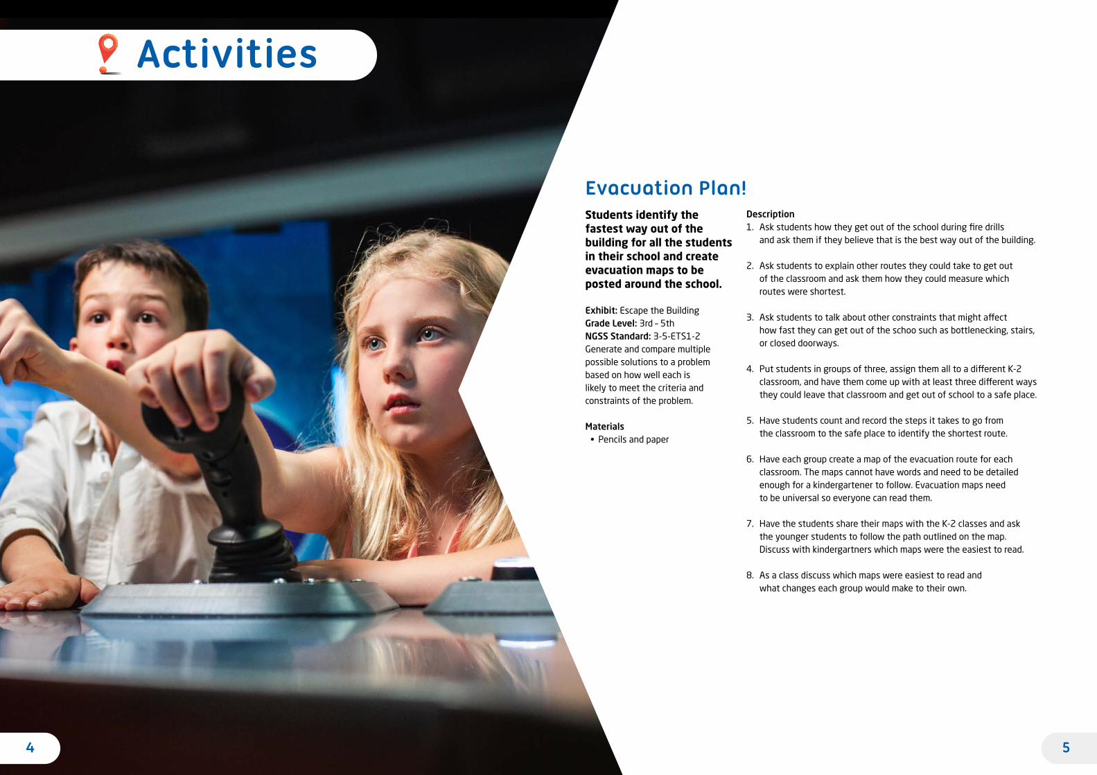
Students identify the fastest way out of the building for all the students in their school and create evacuation maps to be posted around the school.
Exhibit: Escape the BuildingGrade Level: 3rd – 5th NGSS Standard: 3-5-ETS1-2 Generate and compare multiple possible solutions to a problem based on how well each is likely to meet the criteria and constraints of the problem.
Materials• Pencils and paper
Description1. Ask students how they get out of the school during fire drills
and ask them if they believe that is the best way out of the building.
2. Ask students to explain other routes they could take to get out of the classroom and ask them how they could measure which routes were shortest.
3. Ask students to talk about other constraints that might affect how fast they can get out of the schoo such as bottlenecking, stairs, or closed doorways.
4. Put students in groups of three, assign them all to a different K-2 classroom, and have them come up with at least three different ways they could leave that classroom and get out of school to a safe place.
5. Have students count and record the steps it takes to go from the classroom to the safe place to identify the shortest route.
6. Have each group create a map of the evacuation route for each classroom. The maps cannot have words and need to be detailed enough for a kindergartener to follow. Evacuation maps need to be universal so everyone can read them.
7. Have the students share their maps with the K-2 classes and ask the younger students to follow the path outlined on the map. Discuss with kindergartners which maps were the easiest to read.
8. As a class discuss which maps were easiest to read and what changes each group would make to their own.
Evacuation Plan!

76
Students develop and test various methodologies to find the best approach to win at Battleships. Students determine what methodologies are most successful.
Exhibit: BattleshipGrade Level: 6th – 8thNGSS Standard: MS-ETS1-2 Evaluate competing design solutions using a systematic process to determine how well they meet the criteria and constraints of the problem.
Materials• Graph paper • Scissors • Cardboard• Paper hole punch outs
(red and black)
Description1. After visiting the Map It! Exhibition have students reflect on the Battleship
exhibit. Ask them what strategies they used to try to win the game. Ask students what they would do after they got a hit. For example, would they then continue to fire in that area or move to a new area?
2. Tell students that today they are going to make their own version of Battleships and develop a set of instructions for how to most often win the game. Once they make their instructions they will test their instructions with the instructions designed by others in the class.
3. Have each student make two Battleship boards using the graph paper. On the top row, they should list numbers 1 through 10 and, on the left column, they should list letters A through J.
4. Have students cut out strips of cardboard that are the width of one cell of a graph paper and the width of five, four, three and two cells. These are the students’ ships. If time allows let students decorate their ships.
5. Have the students play a round of the game in pairs. To set up the game, have students face each other and put a book upright between them so they can’t see each other’s graphs. Students place their ships on one of their pieces of graph paper and use the other piece of graph paper to record where they attempted to sink their opponent’s ships. Each round students take turns calling out coordinates such as A3 and then the other students declare if they have a ship on that space. If a student hits a ship the student should place a red hole on the graph paper on A3, and the other student should place a red hole on the ship on A3. If there is no hit both students should place a black hole on A3. Students take turns calling out coordinates. The winner of the pair is the first student to sink all the other student’s ships.
6. After students have played a round ask the winners to share what strategies they used when choosing which coordinates to use. For example, did they start in the center of the graph or on the edges? Did they aim a lot in one area or did they spread their guesses all over the place?
7. Tell students that they are now going to come up with a set of directions for what they think is the best strategy to win the game. Ask students if they have ever heard of if/then statements and discuss what they are as a class. Tell students that they must now write directions on how to win at the game by creating a set of instructions using if/then statements. Tell students that they will give these directions to another student to follow, so they need to be clear and complete. An example of a set of directions is listed below:
Call out E5. a. If this hits a ship, on the next round, call the coordinate to the left of the hit. If this hits a ship then repeat Step A. If it does not hit then move to Step B. b. If this does not hit, on the next round, call out the coordinate one space above. If this hits then go onto Step A. If it does not hit repeat Step B. 8. Have students give their directions to another student, and have students
play the game again by strictly following the other students’ directions. After this round of playing have all the students who won play against each other and, after that round, the winners play again until there is one last winner. Have the author of the directions that won read the directions to the class and lead a discussion about why those directions won. Discuss if this one round of testing was definitive in finding the best solution. Ask students to discuss all the variables and how they would improve upon their directions.
9. If time allows let students create a new set of directions and repeat Step 8.
Master Gamer

98
In this lesson, students learn how to use coordinates and to triangulate to identify the epicenter of an earthquake.
Exhibit: Bearings and GPS. Grade Level: 4th NGSS Standard: 4-ESS2-2 Analyze and interpret data from maps to describe patterns of Earth’s features.
Materials• Compasses (for drawing)• World Map handouts• Rulers
Description1. After visiting the GPS and Bearings exhibits ask students what
they learned about coordinates and how GPS works. Tell students coordinates are used to locate places on a map then demonstrate how to use coordinates.
2. Pass out the World Map handout to each student, and ask them to point to the following cities: San Francisco, CA; Mumbai, India; and Sydney, Australia. Read out the coordinates of the cities, and show students how to find the city locations on a map. Have students mark each city location with a star and label each city on their maps.
a. San Francisco: 37.7° N, 122.4° W b. Mumbai: 19.0° N, 72.8° E c. Sydney: 33.8° S, 151.2° E
3. Ask students what happens during an earthquake. Does it feel different if you are near the epicenter of the earthquake rather than farther away? Ask students to brainstorm how scientists are able to figure out where the epicenter of an earthquake is.
4. Tell students that when an earthquake occurs it sends out two waves that travel at different speeds and, by measuring the time between when those waves reach a location, scientists can calculate how far away the epicenter is. However, they don’t know from which direction it came.
5. Pass out the compasses to students. Tell them to pretend they are living in Sydney and an earthquake is about to occur! Say to students that when you yell out EARTHQUAKE, they should shake for a second and then count how many seconds until you yell EARTHQUAKE again. Yell EARTHQUAKE. Wait five seconds and shout EARTHQUAKE again. Ask students how long it was between earthquakes, and tell them that each second between shakes corresponds to a distance of 1,500 km from the epicenter. For example, if there were shakes that were three seconds apart, then the earthquake would be (3 x 1,500 km) 4,500 km away. Please note, this is not real time it would take between the waves hitting an area, but it is an accurate representation of how to find the epicenter of an earthquake.
6. Ask students to calculate the distance the epicenter was from Sydney (5 sec x 1,500 km = 7,500 km). Tell students that on their map 1 cm = 1,666 km, and ask students to calculate the number of centimeters on the map that equals 7,500 km (7,500 km/1,666 cm = 4.5 cm).
7. Have students measure out 4.5 cm on their compasses and draw a circle with Sydney as the center. Tell students that now we know that the epicenter occurred somewhere along the edge of that circle.
8. Tell students that they are now going to pretend to be in San Francisco and measure the time between when the waves of the same earthquake hit. Shout EARTHQUAKE, have the students shake, then shout EARTHQUAKE again 12 seconds later. Have students go through the same calculations as in Step 6 and draw a circle from San Francisco.
9. The circles should intersect in two places. Tell students that we now know the earthquake occurred in one of these two locations, but we need a third set of data to find its exact location.
10. Tell students that they are now going to pretend they are in Mumbai. Simulate another earthquake where the waves hit three seconds apart. Have the students do their calculations and draw a circle from Mumbai. Where the three circles intersect is the epicenter of the earthquake.
11. Have students share their results and discuss how this is an example of triangulation. Talk to students about how this is a great example of how gathering more data leads to more precision.
12. Ask students how coordinates helped them find things on maps, and ask why they needed the data from multiple cities to find the epicenter. Talk briefly about how this is also how GPS works from a series of satellites collecting data on your location. The GPS devices compile all that data to calculate where you are and to help determine the best route for you to get where you’re going.
Location via Triangulation

1110
In this activity, students are challenged with designing and testing a methodology to determine the types and locations of objects submerged in opaque water.
Exhibit: Ocean ExplorerGrade Level: 6th – 8th gradeNGSS Standard: MS-ETS1-3 Analyze data from tests to determine similarities and differences among several design solutions to identify the best characteristics of each that can be combined into a new solution to better meet the criteria for success.
Materials• Plastic containers
(at least the size of a shoebox ) • Miscellaneous objects that sink
such as rocks, screws, shells, blocks, etc.
• Washers• Food dye• String• Rulers • Paper
Description1. Before class begins, create an “ocean” for each group by putting a few
of the miscellaneous items into each food container and covering them with water. Add in a drops of the food dye until you can no longer see the submerged objects.
2. During class ask students what they learned about the ocean floor in the Ocean Explorer exhibit. Is the seafloor flat or mountainous? Does it have trenches and, most importantly, how do we know? Ask how we know what’s on the seafloor since we can’t see it or travel to it.
3. Put students in groups and tell them they are going to have to figure out a way to determine what is on the bottom of the “ocean” and make a map of it.
4. Pass out the bins, string, washers, and rulers to each group. Have them measure the length and width of the bin and to draw, to scale, a bird’s eye representation of the bin on their paper.
5. Tell students that with the materials they have, or with other materials in the classroom, they need to figure out a way to determine what is under the water and how to represent that on a map. This map should show the location and shape of the objects but not their height.
6. After completing the bird’s eye map have students create a side-view map that shows the objects’ heights.
7. Have students share their maps and explain their methodology.
8. Funnel out the water in each bin without disturbing the submerged objects. The easiest way to do this is to siphon the water.
9. Have students compare their maps with what is actually in the bins. As a group discuss which methodologies were most successful and what changes would they make if they were to do this lab again. If time allows do this activity again, allowing students to develop new techniques.
Mapping the Ocean Floor Students make a landscape using slices of potatoes and then create a topographic map of their landscape. Students then use the maps try to recreate the landscape.
Exhibit: Stackable Contours Grade Level: 3rd – 5thNGSS Standard: 3-5-ETS1-2 Generate and compare multiple possible solutions to a problem based on how well each is likely to meet the criteria and constraints of the problem.
Materials• Potatoes cut into
1cm-thick slices• Paper • Scissors
Description1. Ask students to reflect on the Stackable Contours exhibit. Ask them
to describe what a topographic map is. Discuss with students that a topographic map is a map that shows changes in elevation.
2. Ask students to discuss when a topographic map might be useful, and ask students how they think these maps are made.
3. Tell students that today they are going to make landscapes out of slices of potatoes and then will make topographic maps of these landscapes.
4. Put students into pairs and pass each pair a dozen potato slices. Have each pair arrange their potato slices on a piece of paper. The slices can be spread out across the paper and can be stacked on top of each other but can’t be leaning on each other or be placed off the paper.
5. Once all the potatoes have been arranged have students trace the outline of all the slices that are on the paper (the slices at the bottom). Have students label this line: 1 cm.
6. Have students carefully remove all the wedges that are touching the paper. If those potatoes are on the bottom of a stack of slices carefully remove the bottom slice, and replace the other slices back on the paper. Have students trace the outlines of the potatoes that are now touching the paper. Have students label this line: 2cm.
7. Repeat Step 6, increasing the height of each labeled line by one cm, until all the slices have been traced. Be sure students label the lines properly.
8. Have each pair shuffle around their slices and give their map and slices to another group. Each pair now must figure out how to stack and arrange the potato slices to match what is drawn on the map. Have groups share their potato landscapes and see how close they got to the original.
9. Come back together as a class and discuss the process. What features of the maps were easiest to read and which were more challenging? What would you do differently if you were to make a topographical map again?
Topopotato

1312
Students create a model to show how changes in the earth’s magnetic field help demonstrate seafloor spreading at the Mid-Atlantic Ridge.
Exhibit: CompassGrade Level: 6th – 8th NGSS Standard: MS-ESS2-3 Analyze and interpret data on the distribution of fossils and rocks, continental shapes, and seafloor structures to provide evidence of the past plate motions.
Materials• Rulers• 24-inch strips of paper
for each pair of students• Circular magnets for each group• Colored pencils • String
Description1. Ask students to discuss what a compass is, how it works, and what
functions it serves. Discuss with students how compasses are often used to help us find direction but also helped to prove that the seafloor is spreading in the Atlantic Ocean.
2. Put students in pairs and have them put their desks together so they are facing each other. Pass out the string, colored pencils, magnets, and strips of paper to each pair of students. Have students fold the paper in half so there are two twelve-inch sections.
3. Tell students to tie the string onto the magnet and have them hold the string up and wait for the magnet to stop spinning. Once the magnet is still have each pair of students spread their arms out straight in the direction that the magnet is facing. Tell them one arm is pointed north and the other is pointed south. This is how a compass works! The tricky part about it is that occasionally the earth’s magnetic field flips, so what is magnetic north today may not have been magnetic north 50 million years ago. However, geologists are able to use the flipping of Earth’s magnetic field to learn more about how Earth developed.
4. Have each group put their paper between their desks so that the folded edge is hanging down and the two open ends are just poking out of the desks. Tell students that they’re going to go back in time to 200 million years ago to observe how the Atlantic seafloor spread.
5. Tell students that the paper represents the molten basalt that comes out of the Mid-Atlantic Ridge. Basalt is full of iron and, since iron is magnetic, as the molten basalt cools to form rock the iron in the basalt aligns itself to the magnetic poles.
Magnetic Seafloor
6. Have each student pull out one inch of the paper so that one inch of the paper goes one direction and one inch goes another. Tell students this represents the flow of basalt from 200 million years ago (mya) to 175 mya. Have them write those dates on both sides of the paper and tell them that, during that time period, magnetic North was in the same place that it is now (positive), so they should color this part of the paper red.
7. Have students pull out two inches of the paper and tell them that this represents the seafloor from 175 mya to 125 mya and, during that time, the magnetic field flipped (negative). Students should write the dates on the paper and color it green.
8. Have students pull out the paper for the other times listed below and label and color accordingly.
a. 125 mya – 75 mya: two inches, positive, red. b. 75 mya – 50 mya: one inch, negative, green. c. 50 mya – present: 2 inches, positive, red.
9. Have students pull out the remaining paper and lay it all out on their desks. Ask them what they notice and what it tells them.
10. Discuss with students how the discovery that the rocks on both sides of the Atlantic ridges mirrored each other’s polarity and age as you moved away from the Mid-Atlantic Ridge was one of the most influential pieces of evidence that demonstrates the Theory of Plate Tectonics.

1514
Students are challenged with making a map that other students use to find treasures hidden around the school yard.
Exhibit: Town MapGrade Level: 3rd – 5th NGSS Standard: 3-5-ETS1-2 Generate and compare multiple possible solutions to a problem based on how well each is likely to meet the criteria and constraints of the problem.
Materials• Paper• Colored pencils • Miscellaneous objects to hide
(such as books, stuffed animals, coffee mugs, etc. anything that is not so small that it is hard to see)
Description1. Ask students to reflect on the Town Map exhibit. Ask them to think
about all the maps they’ve used before and to describe what was similar and different about them. Discuss the purposes of maps. Talk to students about the various symbols that are used on maps and ask how they help the reader better understand the map.
2. Put students into groups and tell them that today they are going to make a map that is also a treasure hunt! The trick to this map that you cannot use any words only symbols.
3. Pass out three objects to each group and go outside. Tell each group that they need to place their three items randomly around the schoolyard and record what their items are and where they placed them.
4. Have each group discuss and develop a map that gives directions on how to go from one object to another only using drawings and symbols. You might want to have the students create a map of the schoolyard first and then add in arrows or other symbols that will give directions to where the items are and in what order the group should find them.
5. Have groups exchange maps and tell them that each group now needs to go out and try to collect all three items in the order that is described on the map. The first team to come back with all three items is the winner!
6. After all the groups have returned make sure the groups collected the correct items and collected them in the correct order. Discuss with the class what features and symbols on the maps were most helpful and which were least helpful. You could award a prize to the team that made the winning map and to the team that was able to use it.
Treasure Hunt! Using the coordinates of recent earthquakes, students try to identify the location of the Earth’s tectonic plates.
Exhibit: Navigation Hazards and Layers of DataGrade Level: 4th NGSS Standard: 4-ESS2-2 Analyze and interpret data from maps to describe patterns of Earth’s features.
Materials• World Map handouts printed
on transparency paper for each group
• Dry erase markers• Computers with an internet
connection
Description1. Ask students to reflect on how data was used in the Layers of Data
and the Navigation Hazards exhibits. Discuss how data is used to help understand weather and traffic patterns and how data is used to help locate hazards.
2. Ask students to share what they know about earthquakes. Where, and why, do they occur? Even if students don’t know much about earthquakes, that’s ok! Tell them that today they are going to use data to learn a little about where and why earthquakes occur.
3. Pass out the World Map transparencies to pairs of students and have each group go to United States Geological Survey (USGS) Webpage. https://earthquake.usgs.gov/earthquakes/map/
4. Assign each group a different seven-day period from that webpage and have them look up all the 2.5+ earthquakes that occurred during that time period. Show students how to plot the coordinates for each earthquake on their transparencies. Students should plot earthquakes using their dry erase markers.
5. After students have plotted all their earthquakes discuss what tectonic plates are, that earthquakes normally occur at plate boundaries, and that the Earth is made up of seven major plates.
6. Have groups discuss where they think the plate boundaries are located based on where their earthquakes occurred. Then have each group stack their transparencies on top of each other so they can see the earthquakes all the groups have plotted.
7. Project an image of where the actual plate boundaries are and have students compare where the earthquakes are to where the tectonic plates are.
8. Discuss plate tectonics with students and how earthquakes are generally caused by the pulling apart, colliding, or grinding of tectonic plates. Discuss how the data from the USGS helped demonstrate this phenomenon and how even more data would help lead to even better data.
Tectonic Earthquakes

1716
Students formulate ways to measure the relative area of the continents on a map and compare that area to data on the actual area of the continents.
Exhibit: Real Size and Map ProjectionsGrade Level: 6th – 8th NGSS Standard: MS-ETS1-3 Analyze data from tests to determine similarities and differences among several design solutions to identify the best characteristics of each that can be combined into a new solution to better meet the criteria for success.
Materials• World Map handouts printed on
graph paper for each student• Blank graph paper• String• Globe
Description1. Discuss with students what they discovered about maps in the Real Size
and Map Projections exhibits. Ask them to explain why maps are distorted and what are some strategies that cartographers use to reduce this distortion.
2. Pass out the World Map handout and ask students to rank the continents in order from largest to smallest. Write responses on the board.
3. Pass out the string and have each student calculate the relative area (how big they are compared to each other) of each continent on the handout. The easiest way to do this is to color in all the cells of the graph paper that are in a continent and count them, but allow students to develop their own methods.
4. Have all students list the percent of total landmass that each continent contains as in, of all the land on Earth, what percent of it is on each continent. Have students share their results, and write them on the board. Ask students if their results differed from how they ranked them and why.
5. Share the following list of the actual areas of each continent and have students calculate the percent of the total for each. The actual percentages are in parentheses, but students should calculate these themselves, using the following formula: area of continent/total land area on Earth * 100 = % of Earth’s land area.
a. North America = 24,709,000 km2 (16.3%) b. South America = 17,840,000 km2 (12.0%) c. Africa = 30,221,532 km2 (20.3%) d. Asia = 44,579,000 km2 (30.0%) e. Oceana = 8,525, 989 km 2 (5.2%) f. Antarctica = 14,000,000 km2 (8.9%) g. Europe = 10,180,000 km2 (6.7%)
6. Ask students to discuss why the percentages of area on the maps are so different than the actual area of the continents. Pass around the globe, and have students compare the size of the continents on the globe to the size on the map. Discuss with the class why it is impossible to turn a three-dimensional object like the Earth into a two-dimensional object like a map.
7. Pass out the graph paper and have students try to create a more accurate map of the world. Have them make the continents their relative sizes and share their images. Have students discuss the pros and cons to the maps they made to the map on the handout.
Map Distortion Students make a giant mural of the Earth by piecing together multiple smaller images to simulate how satellites compile images to create a complete picture of the Earth.
Exhibit: Satellite Stitching Grade Level: 5th NGSS Standard: 5-PS1-1 Develop a model to describe that matter is made of particles too small to be seen.
Materials• World Map handouts printed
on blank graph paper • Square sheets of paper• Coloring materials
Description1. While in the Satellite Stitching exhibit ask students to focus on how
satellites use multiple images to create one complete and cohesive of Earth.
2. When you return to class, tell students that you want to create a beautiful and gigantic mural of the Earth.
3. Pass out a World Map handout to each student.
4. Have students label the rows alphabetically and the columns numerically. Tell students that they are each going to be responsible for drawing a square group of cells on the map and that they will put the cells all together as a class to make the mural of the Earth.
5. Assign a square group of cells to each student and have students draw what is in that group of cells on a large square piece of paper. Students draw where the countries boundaries are to enhance precision.
6. Have students research the country or countries that are within their group of cells to learn a little about its climate and culture. Have students color in their papers by adding in images that represent the countries they are drawing.
7. Tape the students’ drawings together in the arrangement on the wall, and ask for reactions. What do they notice? What do they wonder? Is this a good method for making an accurate map, or is it art? What’s the difference? Ask them how they could improve on this process. Discuss how all things are made up of individual parts that work together to make something else.
Earth Mural: Piecing it together

1918
Students observe what happens when freshwater and saltwater interact to determine how that interaction helps to drive ocean circulation and influence global climates.
Exhibit: Track the DucksGrade Level: 6th – 8th NGSS Standard: MS-ESS2-6 Develop and use a model to describe how unequal heating and rotation of the Earth cause patterns of atmospheric and oceanic circulation that determine regional climate.
Materials• One clear food storage container
(about the size of a shoebox) per group
• World Map handouts• Tape• Aluminum foil• Blue and red food coloring• Salt• Pepper• Pencils
Description1. Ask students to reflect on the Track the Ducks exhibit and ask them
what caused the ducks to float to the various places around the world. Ask students to brainstorm and share their ideas on what causes ocean currents.
2. Show students an image of the ocean conveyor belt and ask them to make observations on what they see.
3. Pass out the World Map handout and ask students what they know about the temperatures in Western Europe and on the East Coast of the United States. Have students notice how much farther north Western Europe is than the East Coast of the United States.
4. Have students draw a line of latitude from some of the major cities of Europe and note how, even though cities like Paris and London are farther north than Montreal and Calgary, the European cities have much warmer climates. This is due in part to the great ocean conveyor belt. Warm waters move north from the equator to Europe. These warm currents bring warm weather with them.
5. Tell students that they are going to model the mechanism that drives the ocean conveyor belt. Put students in groups and pass out the materials. Have students tape the aluminum foil in the middle of the food container dividing it into two equal parts. The aluminum should be taped in well enough to not let water pass through it.
6. Fill each side of the container with water. Fill one side with warm water and one side with cold water. Fill both sides at the same time so the aluminum “wall” doesn’t break.
7. Tell the students to add red food coloring to the warm side and blue food coloring to the cold side, then add three tablespoons of salt to the cold side and stir.
8. Tell students that they are going to carefully poke a hole in the top and bottom of the aluminum wall but, before they do, ask students to predict what will happen.
9. Poke a hole with a pencil in the top and bottom of the aluminum foil and have students observe what happens. Sprinkle some pepper on the surface to help students be better able to see what’s happening. Continue to observe until there is no more movement in the water. The container should have a layer of red water on top of a layer of blue water.
Warming = Cooling?
10. Ask students to describe what they saw and to brainstorm explanations of how and why this happened. Tell students that this movement is caused by the difference in the density of the warm fresh water and the cold saltwater.
11. Show students an image of the great ocean conveyor belt again and ask students to describe how the model they made represents what is happening in the North Atlantic. Explain to students that as water moves north up the Atlantic Ocean water evaporates, causing the salinity of the water to increase. This same water gets much colder as it gets near Greenland. Since the water has become both cold, and very salty, it becomes denser and sinks. This sinking is once of mechanisms that drives ocean circulation.
12. Ask students what impact global warming will have on the circulation of water in the Atlantic. Discuss with students how increasing global temperatures will weaken the conveyor belt, primarily by causing the land-bound glaciers of the North Atlantic to melt, which will add tons of freshwater to the surface of the ocean. This makes the water less saline, so the change in density will be less severe and the water will not sink at the same rate.
13. Ask students how global warming could cause it to get colder in Western Europe? Discuss with students that the weakening of the conveyor belt will slow flow of warm water which brings the warm air and weather to Western Europe. This is how a warming of the Earth can cause some places to get colder.

2120
A student bangs on a gong as students walk progressively farther and farther away. As the students get farther away, they notice the delay between when they see the gong hit and when they hear the sound of the gong. This demonstrates the difference in the speed of light and sound.
Exhibit: Sonar Scan Grade Level: 4th NGSS Standard: 4-PS3-2 Make observations to provide evidence that energy can be transferred from place to place by sound, light, heat, and electric currents.
Materials• Hammer or mallet• Gong, large drum, or piece of metal
that will make a very loud sound when struck
• Meter sticks • Stopwatches• Brightly colored bandana• Earplugs • Long, uninterrupted straightaway
(at least 350 meters)
Description1. After visiting the Sonar Scan exhibit ask students to discuss what
sonar is. Discuss how sonar uses sound waves to help determine how far away things are. Ask students how we know sound is a wave? Ask students what they think the speed of sound is, and ask them if it’s greater than or smaller than the speed of light.
2. Go outside to a long field and ask for a volunteer to bang the gong. Give the volunteer the gong and hammer. Have them put in earplugs and wrap the bandana around the hand they will use to bang the gong.
3. Have the students stand 10 yards away from the gong and have the person banging the gong hit it consistently every second. Have students make observations. Ask them if they can tell a difference between when they see the gong being hit and when they hear the sound.
4. The volunteer should continue to bang the gong every second as the rest of the class walks away. Every 50 meters the students should stop and observe the gong and see if they notice a difference between when they see the gong hit and when they hear the gong.
5. Continue Step 4 until to the students reach the end of the field, and have students make a final observation about the difference between when they see the gong hit and when they hear the sound.
6. In the classroom discuss the observations. Since light travels so fast, 670,616,629 mph, we see the gong being hit instantaneously. However, since the speed of sound is only about 767 mph, the farther we get from the gong, the longer it takes for the sound to reach us and thus we can observe a difference between when we see and hear the gong.
Speed of Sound

scitech.org.au/exhibition-rental