eastern washington version - access washington home · pdf fileabcs ... eastern washington...
TRANSCRIPT

Wetland Guidance for CAO Updates
Eastern Washington Version
June 2016 Publication No. 16-06-002

Publication and Contact Information This report is available on the Department of Ecology’s website at https://fortress.wa.gov/ecy/publications/summarypages/1606002.html For more information contact: Shorelands and Environmental Assistance Program P.O. Box 47600 Olympia, WA 98504-7600 Phone: 360-407-6600 Washington State Department of Ecology - www.ecy.wa.gov ○ Headquarters, Olympia 360-407-6000 ○ Northwest Regional Office, Bellevue 425-649-7000 ○ Southwest Regional Office, Olympia 360-407-6300 ○ Central Regional Office, Yakima 509-575-2490 ○ Eastern Regional Office, Spokane 509-329-3400 To ask about the availability of this document in a format for the visually impaired, call the Shorelands and Environmental Assistance Program at 360-407-6600. Persons with hearing loss can call 711 for Washington Relay Service. Persons with a speech disability can call 877-833-6341.

Wetland Guidance for CAO Updates
Eastern Washington Version
By
Donna Bunten, Rick Mraz, Lauren Driscoll and Amy Yahnke
Shorelands and Environmental Assistance Program Washington State Department of Ecology
Olympia, Washington
June 2016 Publication No. 16-06-002

This page is purposely left blank

Table of Contents Summary .......................................................................................... 1
Introduction ...................................................................................... 2
Guidance on the Science of Wetland Protection ............................. 3
Relationship of GMA and SMA ...................................................... 4
Policy Discussion for Your Wetlands Chapter ................................ 4
PURPOSE .......................................................................................................................... 4
DEFINITIONS .................................................................................................................... 4
IDENTIFYING, DESIGNATING, AND RATING WETLANDS ................................................... 5
REGULATED USES AND ACTIVITIES ................................................................................. 7
EXEMPTIONS ................................................................................................................... 7
FOREST PRACTICES ......................................................................................................... 9
AGRICULTURAL ACTIVITIES ............................................................................................ 9
Strategies for Protecting Wetlands from Impacts .......................... 10
WETLANDS INVENTORY ................................................................................................ 10
ABCS ............................................................................................................................ 10
BUFFERS ........................................................................................................................ 11
BUFFER AVERAGING ..................................................................................................... 13
MITIGATION .................................................................................................................. 13
MITIGATION ALTERNATIVES ......................................................................................... 15
MITIGATION BANKING .................................................................................................. 15
IN-LIEU FEE (ILF) ...................................................................................................... 15
OFF-SITE MITIGATION ................................................................................................. 16
ADVANCE MITIGATION ................................................................................................. 16
Conclusion ..................................................................................... 16
Appendix A - Sample Wetlands Chapter ...................................... 19
Appendix B - Wetland Definitions ................................................ 51

This page is purposely left blank

Wetland Guidance for CAO Updates Eastern Washington Version
Page 1
Summary This publication replaces Wetlands & CAO Updates: Guidance for Small Cities (Eastern Washington Version), Publication No. 10-06-001, January 2010. It also replaces the 1st revision dated July 2011 and the 2nd revision dated October 2012. This new publication, for the most part, contains the same guidance as the “small cities guidance” referenced above. Over the last few years, it became obvious that the information in that document could apply to all cities and counties, not just small cities. However, the wetland buffer table may be too restrictive for county use, because it assumes that adjacent land use intensity is high. Counties and larger cities generally have more staff and resources that allow more sophisticated approaches to assigning wetland buffers. In addition, these jurisdictions may be able to provide additional protection for habitat function by requiring protected wildlife corridors between the wetland and other priority habitats in exchange for buffer reduction—something that is often impossible in small, urban jurisdictions. Check with Ecology wetland staff for more information about using this guidance in your particular jurisdiction http://www.ecy.wa.gov/programs/sea/wetlands/contacts.htm. Specific changes to this new publication include:
• Reference to the updated 2014 wetland rating system • Updated definitions based on the updated 2014 wetland rating system • Buffer tables that include habitat scores from the updated 2014 wetland rating
system • Addition of buffer table (Table XX.3) to be used if minimizing measures are not
used • Emphasis on the requirement to provide wildlife corridors where possible in
exchange for buffer reduction • Guidance on using wetlands for stormwater management facilities • Removal of exemptions for small wetlands • Recommended language addressing agricultural activities in non-VSP
jurisdictions • Addition of recent mitigation documents and guidance • Corrected links to resource documents and web pages

Wetland Guidance for CAO Updates Eastern Washington Version
Page 2
Introduction This document is intended to provide guidance and tools useful in developing a wetland protection program for jurisdictions that are in the process of updating their critical areas ordinances (CAOs) to meet the Growth Management Act (GMA) requirements. Wetlands are one of the five types of critical areas identified in the GMA. We recognize that many local governments lack the planning staff and resources necessary to develop and implement wetland standards that are both locally appropriate and based on best available science (BAS). Nonetheless, they must comply with the GMA requirement to designate and protect wetlands. The first part of this document describes the important topics that should be addressed in the wetlands section of your CAO. It includes recommendations for wetland protection based on BAS. Appendix A is a sample CAO chapter for wetlands that incorporates these recommendations into a format similar to that found in many local CAOs. (Please note that the sample CAO will need to be tailored to your jurisdiction’s naming and numbering system. There are several generic “XX” references throughout the text.) Appendix B contains definitions that are commonly used in wetlands regulations. This document does not include the more general provisions typically found in regulations related to all critical areas. These can be found in Appendix A of the Critical Areas Assistance Handbook published by the Washington State Department of Commerce (formerly the Department of Community, Trade, and Economic Development) in November 2003 http://www.commerce.wa.gov/Documents/GMS-Critical-Areas-Appendix-A-Sample-Code-Provisions.pdf. This document revises the wetland-specific provisions in the Critical Areas Assistance Handbook. The recommendations in this document and the sample ordinance may not be appropriate for use by rural county governments. Factors to consider are the county’s rate of growth, the nature and intensity of land uses in the county, the wetland resources at risk, and the ability of the county to implement its CAO. We suggest that you contact us to determine whether this guidance is applicable to your county. Please use the following link to find Ecology’s wetland specialist for your area: http://www.ecy.wa.gov/programs/sea/wetlands/contacts.htm.

Wetland Guidance for CAO Updates Eastern Washington Version
Page 3
Guidance on the Science of Wetland Protection Ecology has produced several different tools that can help local governments develop a comprehensive wetlands protection program for their jurisdictions. The Washington Departments of Ecology (Ecology) and Fish and Wildlife (WDFW) have published a two-volume guidance document to help local governments protect and manage wetlands:
● Wetlands in Washington State, Volume 1: A Synthesis of the Science (Washington State Department of Ecology Publication #05-06-006, Olympia, WA, March 2005). This volume is the result of an extensive search of over 17,000 scientific articles and synthesizes over 1,000 peer-reviewed works relevant to the management of Washington’s wetlands.
● Wetlands in Washington State, Volume 2: Managing and Protecting Wetlands
(Washington State Department of Ecology Publication # 05-06-008, Olympia, WA, April 2005). This volume was developed with the assistance of local government planners and wetland consultants. It can be used to craft regulatory language that is based on BAS. We recommend that you review Chapter 8 and its appendices as you begin to work on updating your existing regulations. (Please note: Appendix 8-D was revised in October 2014.)
In October 2013, Ecology released an update of the science pertaining to wetland buffers. The new information on buffers provides a refinement of our knowledge and revisits the conclusions and key points in the 2005 synthesis.
• Update on Wetland Buffers: The State of the Science (Washington State Department of Ecology Publication #13-06-011, Olympia, WA, October 2013.
Ecology, in coordination with the U.S. Army Corps of Engineers (Corps) and the U.S. Environmental Protection Agency (EPA), has also developed a two-part guidance document aimed at improving the quality and effectiveness of compensatory mitigation in Washington State:
● Wetland Mitigation in Washington State – Part 1: Agency Policies and Guidance (Version 1). (Washington State Department of Ecology Publication #06-06-011a, Olympia, WA, March 2006). Part 1 provides a brief background on wetlands, an overview of the factors that go into the agencies’ permitting decisions, and detailed guidance on the agencies’ policies of wetland mitigation, particularly compensatory mitigation. It outlines the information the agencies use to determine whether specific mitigation plans are appropriate and adequate.
● Wetland Mitigation in Washington State – Part 2: Developing Mitigation Plans
(Version 1). (Washington State Department of Ecology Publication #06-06-011b, Olympia, WA, March 2006). Part 2 provides technical information on preparing plans for compensatory mitigation.

Wetland Guidance for CAO Updates Eastern Washington Version
Page 4
Ecology has also developed a wetland ratings system for eastern Washington. The rating system is a useful tool for dividing wetlands into groups that have similar needs for protection.
● Washington State Wetland Rating System for Eastern Washington: 2014
Update (Washington State Department of Ecology Publication #14-06-030, Olympia, WA, October 2014)
Links to all of these documents can be found at: http://www.ecy.wa.gov/programs/sea/wetlands/gma/index.html. Relationship of GMA and SMA You may be planning to adopt a Shoreline Master Program (SMP) that will rely on the CAO for protection of wetlands and other critical areas in shoreline jurisdiction. Ecology does not have an approval role in the CAO adoption process; our role is advisory. The SMP, however, is a joint document of Ecology and the local government requiring Ecology approval. Before the SMP can be approved by Ecology, the CAO must meet the “no net loss of ecological functions” requirement (WAC 173-26-186(8)(b)(i)). You should be aware that the Shoreline Management Act (SMA) may preclude or alter the administration of your CAO. For example, certain activities exempted under the CAO will not qualify for exemption under the SMP. In addition, activities allowed under the CAO may require permits under the SMP. For assistance with CAO/SMP integration, please use the following link to find the shoreline planner for your area: http://www.ecy.wa.gov/programs/sea/sma/contacts/index.html. Policy Discussion for Your Wetlands Chapter Your wetlands chapter will exist as one of several in your critical areas ordinance. Below we describe some of the important subsections in the wetlands chapter and include our recommendations for protecting wetlands based on the best available science. Purpose The chapter typically begins with a purpose statement, followed by designation criteria, which include a definition of wetlands and the methods by which they are identified and rated and other details listed below. The purpose statement may also state that this chapter is intended to be consistent with the requirements of 36.70A RCW and to implement the goals and policies of your Comprehensive Plan for protecting wetlands. Definitions Your wetlands chapter may include a separate list of definitions, or the definitions may be included in the general definitions section of the CAO. Appendix B is a list of

Wetland Guidance for CAO Updates Eastern Washington Version
Page 5
definitions relevant to your wetlands chapter. This list includes terms identified in state law and agency guidance documents. Clarity and consistency in the use of these terms will make ordinance implementation easier.
Identifying, Designating, and Rating Wetlands The first steps in regulating wetlands are to define what is being regulated and specify how these areas will be identified. The GMA requires the use of the following definition of wetlands and specifies how to identify and delineate them. In designating wetlands for regulatory purposes, counties and cities are required to use the definition of wetlands in RCW 36.70A.030 (21):
“Wetland” or “wetlands” means areas that are inundated or saturated by surface water or ground water at a frequency and duration sufficient to support, and that under normal circumstances do support, a prevalence of vegetation typically adapted for life in saturated soil conditions. Wetlands generally include swamps, marshes, bogs, and similar areas. Wetlands do not include those artificial wetlands intentionally created from non-wetland sites, including, but not limited to, irrigation and drainage ditches, grass-lined swales, canals, detention facilities, wastewater treatment facilities, farm ponds, and landscape amenities, or those wetlands created after July 1, 1990, that were unintentionally created as a result of the construction of a road, street, or highway. Wetlands may include those artificial wetlands intentionally created from non-wetland areas created to mitigate conversion of wetlands.
Wetlands are subject to a local government’s regulatory authority if they meet the criteria in this definition. This includes Prior Converted Croplands (PCCs) and isolated wetlands. These wetlands provide critical functions and habitat and should be regulated. The GMA does not allow flexibility in adopting a modified definition of wetlands. Irrigation practices, such as the Columbia Basin Project, can result in human-created, artificial wetlands. More frequently, however, irrigation practices may augment natural sources of water to a wetland. Wetlands that form along irrigation ditches that were intentionally created in uplands may be exempted from regulation. However, if a wetland is the unintentional by-product of irrigation activities, the wetland should be regulated. If a wetland disappears as the result of a change in irrigation practice, it will not be regulated in the future. However, most wetlands will not disappear completely as a result of local changes in irrigation practices because of natural sources of water or regional irrigation influences. Please see http://www.ecy.wa.gov/programs/sea/wetlands/irrigation.html for more information on how Ecology regulates irrigation-influenced wetlands. Ecology is most concerned about those changes in land use that would eliminate wetlands as the result of fill or grading, such as a conversion to commercial or residential use. These activities should be regulated by the CAO, and appropriate protection standards

Wetland Guidance for CAO Updates Eastern Washington Version
Page 6
(such as buffers and mitigation) should be required in order to prevent the loss of wetland area and function. Many jurisdictions use the National Wetland Inventory (NWI) to determine whether wetlands exist within their boundaries. Since the NWI is based on photographs that are over 30 years old and provides only a general approximation of wetland location, it cannot be used alone to designate wetlands. Wetlands are those areas that meet the above definition of “wetland.” Wetlands are also dynamic systems that change over time. It is important to adopt the GMA definition and to have regulations in place to protect wetland functions and values, should wetlands that do not currently appear on the NWI or other maps be identified in the future. State laws require that wetlands protected under the GMA and the SMA be delineated using a manual that is developed by Ecology and adopted into rules (RCW 36.70A.175; RCW 90.58.380). The Department of Ecology adopted a wetland delineation manual in 1997 (WAC 173-22-080) that was based on the original 1987 Corps of Engineers manual and subsequent Regulatory Guidance Letters. During the last few years the Army Corps of Engineers has updated and expanded their delineation manual with regional supplements. To maintain consistency between the state and federal delineations of wetlands, Ecology has repealed WAC 173-22-080 (the state delineation manual) and replaced it with a revision of WAC 173-22-035 that states delineations should be done according to the currently approved federal manual and supplements. The changes became effective March 14, 2011. The GMA states that “wetlands regulated under development regulations adopted pursuant to this chapter shall be delineated in accordance with the manual adopted by the department pursuant to RCW 90.58.380.” RCW 90.58.380 allows the Department of Ecology to adopt rules that incorporate changes to the manual. Therefore, the currently approved federal manual and supplements should be used for delineating wetlands in GMA jurisdiction. See: http://www.ecy.wa.gov/programs/sea/wetlands/delineation.html. Local governments are not required to rate or classify wetlands when regulating them. However, methods that classify, categorize, or rate wetlands help target the appropriate level of protection for particular types of wetlands and avoid the “one-size-fits-all” approach. If a local government uses a wetland rating system, it must consider the criteria described in WAC 365-190-090(3) The Washington State Wetland Rating System for Eastern Washington: 2014 Update (Effective January 2015), (Ecology Publication #14-06-030, October 2014) is a useful tool for dividing wetlands into groups that have similar needs for protection. The revised rating system represents the best available science, as it is based on a better understanding of wetland functions, ways to evaluate them, and what is needed to protect them. It provides a quick “snapshot” characterization of a particular wetland. In many cases, it will provide enough information about existing wetland functions to allow
Wetland Guidance for CAO Updates Eastern Washington Version
Page 7
adequate plan review and land use decisions to be made without the additional expense of a separate wetland functional assessment. While local governments are not required to use Ecology’s revised rating system, we strongly encourage you to adopt wetland regulations that require its use. Most qualified wetland specialists are using the revised rating system. In cases where state and federal permits are required, the use of this rating system would benefit applicants by eliminating the need to rate wetlands according to a different local standard. If you choose not to use the state’s wetland rating system, you must provide a rationale for this decision according to WAC 365-190-090(3). We recommend that you include language that describes the four categories of wetlands. This text is different for eastern and western Washington jurisdictions. Please refer to Appendix A, Section XX.020.B.1-4 for the specific category descriptions.
Regulated Uses and Activities Your wetland section should list those uses and activities that are regulated under the critical areas ordinance. Some of these items include: removal, excavation, grading, or dredging of material of any kind; draining, flooding, or disturbing of the wetland, water level or water table; the construction, reconstruction, demolition, or expansion of any structure; etc. More extensive examples are provided in the sample ordinance. Wetlands are often impacted by unauthorized clearing and grading that takes place before application for development permits. You should make sure your CAO adequately regulates clearing and grading. If it doesn’t, you should adopt a separate clearing and grading ordinance. The Department of Commerce (formerly Community, Trade and Economic Development) recently published technical guidance on developing a clearing and grading ordinance: http://www.commerce.wa.gov/Documents/GMS-Clearing-and-Grading-Technical-Guidance-Final-2005.pdf. Most forest practices (as defined in RCW 76.09) are exempted from the provisions of a wetlands chapter in the CAO. However, those forest practices that are Class IV general should be regulated. These activities constitute a conversion from forestry to some other use. As such, buffers and wetland protections are appropriate.
Exemptions Your wetlands section should identify those activities in or near wetlands that are regulated and those that are exempt from regulation. Exemptions include activities that will have little or no environmental effect or are an emergency that threatens public health or safety. In the case of emergency response activities that affect wetlands and buffers, the responsible party should be required to obtain after-the-fact permits, and to rectify impacts. Some jurisdictions place the exemptions or exceptions in a general exemptions section near the front of the CAO. However, some exemptions or exceptions may apply only to wetlands, so it may be more practical to have these specific exemptions in the wetlands section.
Wetland Guidance for CAO Updates Eastern Washington Version
Page 8
Exempt activities should be limited to those that will not have a significant impact on a wetland’s structure and function (including its water, soil, or vegetation) and those which are expected to be very short term. Local governments should, however, also consider the cumulative impacts from exempted activities. They can result in a loss of wetland acreage and function that are not replaced through compensatory mitigation. The scope, coverage, and applicability of a critical areas ordinance should capture the full range of activities that are detrimental to wetland functions. Therefore, exemptions should be supported by the scientific literature and be carefully crafted to minimize the potential for adverse impacts. However, a local government should not assume that an exemption is appropriate in the absence of science to refute the exemption. The language should clearly state whether a given exemption is from applicable standards in the code or whether it is exempt from needing a permit but still must comply with the code. Exemptions should be limited and construed narrowly. For more information on this topic please refer to Chapter 8 of Wetlands in Washington State, Volume 2: Managing and Protecting Wetlands (Ecology Publication # 05-06-008, Olympia, WA, April 2005: https://fortress.wa.gov/ecy/publications/summarypages/0506008.html). The GMA, in RCW 36.70a.030(21), requires local governments to regulate wetlands that meet the GMA-required definition of “wetland” (see the definition of “wetland” in the previous section). This includes Prior Converted Croplands (PCCs) and hydrologically isolated wetlands, two types of wetlands that have been exempt from federal regulation at times. PCCs are wetlands that have been ditched and drained for active agricultural use before December 23, 1985. Isolated wetlands are those wetlands that have no surface hydrologic connection to waters of the United States. These wetlands must be regulated by your CAO. Please see http://www.ecy.wa.gov/programs/sea/wetlands/isolated.html for more information on how the state of Washington currently regulates isolated wetlands. The scientific literature does not support exempting wetlands that are below a certain size. While we recognize an administrative desire to place size thresholds on wetlands that are to be regulated, you need to be aware that it is not possible to conclude from size alone what functions a particular wetland may be providing. Because of the important wildlife functions provided by small wetlands in Eastern Washington, Ecology does not recommend exempting small wetlands from regulation.
If your jurisdiction wants to exempt small wetlands, contact Ecology for guidance on criteria that should be considered. In certain circumstances, applying the buffers in Table XX.1 may result in buffer areas greater than that of the wetland being protected. In these instances, you may want to contact Ecology to determine whether exemptions from mitigation sequencing and/or reduced buffers are warranted. Impacts to small wetlands are NOT exempt from the requirement to provide compensatory mitigation for those impacts. If an in-lieu fee (ILF) program or a mitigation bank is available in your area (see page 15Error! Bookmark not defined.), these mitigation alternatives can help

Wetland Guidance for CAO Updates Eastern Washington Version
Page 9
prevent a net loss of wetland function from impacts to small wetlands in your jurisdiction. Exceptions are typically addressed in a CAO in the context of reasonable use of property. For more information about this regulatory tool, see Section VII of the Critical Areas Assistance Handbook published by the Washington State Department of Commerce: http://www.commerce.wa.gov/Documents/GMS-Critical-Areas-Assist-Handbook.pdf. You should keep in mind that the Shoreline Management Act does not allow reasonable use exceptions, providing instead a variance pathway to afford regulatory relief. If you decide to incorporate your CAO into your SMP when the latter document is updated, you will need to address this potential inconsistency.
Forest Practices Class I, II, and III forest practices should be exempted from the wetlands section of your CAO. These activities are regulated through RCW 76.09, the Forest Practices Act. Agricultural Activities In 2011 the Washington Legislature created the Voluntary Stewardship Program (VSP) as an alternative for meeting GMA requirements related to protecting critical areas and agricultural lands. In 2015 the state provided funding for participating counties to begin the VSP planning process. For more information on this program, see http://www.scc.wa.gov/voluntary-stewardship/. For the GMA update cycle beginning 2015, some counties will begin addressing critical area issues related to agriculture through a VSP work plan. If your jurisdiction is not in a participating county or not in a participating watershed, then you must review and revise your development regulations for protecting wetlands as they apply to agricultural activities (see RCW 36.70A.710). If your jurisdiction is in a VSP watershed designated by a participating county, your GMA responsibilities to protect critical areas from agricultural activities in or near wetlands will be achieved through the VSP work plan. However, it is important to keep in mind that federal and state regulations, such as the Clean Water Act and the State Water Pollution Control Act are still applicable in all jurisdictions regardless of participation or non-participation in the VSP. The VSP does not alter the responsibility of property owners to meet water quality standards, protect wetlands, and comply with state and federal environmental regulations. Ecology recommends the following approach for non-VSP jurisdictions: “Existing and ongoing agricultural activities” are often exempted from the provisions of a CAO. These activities should be clearly defined and should not include removing trees, diverting or impounding water, excavation, ditching, draining, culverting, filling, grading, or similar activities that introduce new adverse impacts to wetlands or other aquatic

Wetland Guidance for CAO Updates Eastern Washington Version
Page 10
resources. Maintenance of agricultural ditches should be limited to removing sediment in existing ditches to a specified depth at date of last maintenance. Conversion of wetlands that are not currently in agricultural use to a new agricultural use should be subject to the same regulations that govern new development. Ecology encourages the use of Best Management Practices (BMPs), farm conservation plans, and incentive-based programs to improve agricultural practices in and near wetlands. The goal of the BMPs should be to ensure that ongoing agricultural activities minimize their effects on water quality, riparian ecology, salmonid populations, and wildlife habitat.
Strategies for Protecting Wetlands from Impacts
Wetlands Inventory You may wish to pursue accurate identification and rating of all wetlands in your planning area based on the Washington State Wetland Rating System for Eastern Washington: 2014 Update (Washington State Department of Ecology Publication #14-06-030, Olympia, WA, October 2014) and the approved federal wetland delineation manual and applicable regional supplements. These documents can be downloaded at:
• http://www.ecy.wa.gov/programs/sea/wetlands/ratingsystems/index.html (rating
systems) • http://www.ecy.wa.gov/programs/sea/wetlands/delineation.html (delineation
manual and supplements)
While this approach may initially be more labor intensive and expensive, such information will allow rapid review of development proposals and can help your jurisdiction prioritize areas for preservation or acquisition.
This approach is consistent with BAS. It can help with the development of a landscape-analysis approach to protecting wetlands in your jurisdiction. Landscape analysis for critical areas facilitates and informs long-range planning. The City of Aberdeen used this approach in their CAO update. (See Section XX.050.B in the sample ordinance.)
ABCs The most basic approach to protecting wetland functions and values can be summarized as the A-B-C Approach, or; Avoid, Buffer, Compensate. This means that a CAO should contain language to ensure that:
1. Wetlands impacts are avoided to the extent practicable.
2. Wetlands are buffered to protect them from adjacent land- use impacts.
3. Unavoidable impacts are compensated, or replaced.
Wetland Guidance for CAO Updates Eastern Washington Version
Page 11
Your CAO should provide requirements on how to reduce the severity of impacts to wetlands. When an alteration to a wetland is proposed, impacts should be avoided, minimized, or compensated for in the following sequential order of preference:
1. Avoiding the impact altogether by not taking a certain action or parts of an action;
2. Minimizing impacts by limiting the degree or magnitude of the action and its implementation, by using appropriate technology, or by taking affirmative steps to avoid or reduce impacts;
3. Rectifying the impact by repairing, rehabilitating, or restoring the affected environment;
4. Reducing or eliminating the impact over time by preservation and maintenance operations during the life of the action;
5. Compensating for the impact by replacing, enhancing, or providing substitute resources or environments; and/or
6. Monitoring the impact and taking appropriate corrective measures.
Buffers Establishing standards for wetland buffers is usually the most challenging part of developing a CAO. However, developing a predictable, reasonable approach for establishing buffers that includes the best available science is not as difficult as it may seem. The scientific literature is unequivocal that buffers are necessary to protect wetland functions and values. The literature consistently reports that the primary factors to evaluate in determining appropriate buffer widths are:
1. The wetland type and functions needing protection (buffers filter sediment, nutrients, or toxics; screen noise and light; provide forage, nesting, or resting habitat for wetland-dependent species; etc.).
2. The types of adjacent land use and their expected impacts.
3. The characteristics of the buffer area (slope, soils, vegetation). The widths of buffers needed vary widely, depending on these three factors. For example, providing filtration of coarse sediment from residential development next to a low-quality wetland would require only a relatively flat buffer of dense grasses or forest/shrub vegetation in the range of 20 to 30 feet. However, providing forage and nesting habitat for common wetland-dependent species such as waterfowl, herons, or amphibians in a high-quality wetland adjacent to residential development would require a

Wetland Guidance for CAO Updates Eastern Washington Version
Page 12
buffer vegetated with trees and shrubs in the range of 200 to 300 feet. This illustrates the necessity of using an approach to buffers that incorporates wetland type and functions (based on an appropriate rating system), types of land use, and the environmental characteristics of the existing buffer. Your CAO should require buffers for activities that will impact wetland functions. Ecology’s complete buffer recommendations are presented in Appendix 8-D of Wetlands in Washington State, Volume 2 (revised October 2014). We recommend using the tables shown in the sample ordinance. Tables XX.1 and XX.3 are derived from the more-detailed tables in Volume 2. They are easy to use and are based on BAS. This approach provides the important balance of predictability and flexibility. Determination of buffer size is simply a matter of applying the results of the wetland rating system score to the buffer matrix, based on the wetland category and wildlife habitat score. It generally requires smaller buffers for those wetlands that do not have much wildlife use. Table XX.1 requires the use of the minimizing measures in Table XX.2. These measures are intended to reduce the impacts of the adjacent land use on the wetland. If impacts are reduced, the size of the buffer required to protect the wetland’s functions can be reduced. The buffer widths in Table XX.1 represent a 25% reduction in our recommended buffers in Volume 2. Table XX.1 also requires the protection of a wildlife corridor between wetlands that score 5 or more habitat points and any other Priority Habitat. This requirement is particularly applicable in large or rural jurisdictions where species need to have access to other habitats to meet their life needs. A buffer is the usual means of providing this necessary habitat. However, if buffer reduction is allowed, we cannot ensure that these species will have adequate access to habitat without providing a connective corridor. In urban areas, the best solution is a landscape-based approach that takes into account actual species use and spatial arrangement and connectivity of habitats. Without such an approach, jurisdictions should use the guidance provided in the sample wetland chapter. If your jurisdiction is small and urban, providing a wildlife corridor may not be an option. You should consult with Ecology wetland staff to determine whether using Tables XX.1 and XX.2 alone will provide adequate protection for your wetland functions. Table XX.3 shows the buffer widths required if the minimizing measures in Table XX.2 are not implemented and if a wildlife corridor is not protected. These buffers are wider than those in Table XX.1, because the impacts to the wetland functions are potentially greater. The buffer tables XX.1 and XX.3 do not consider land-use intensity in the buffer calculation, since it is presumed that most urban land uses will be high or moderate intensity. However, if your jurisdiction has an activity that can be considered low intensity, such as a passive recreation area or nature park with undeveloped trails, you

Wetland Guidance for CAO Updates Eastern Washington Version
Page 13
may wish to prescribe a smaller buffer for that area only. The buffer for an area should be no less than 75% of the otherwise required buffer. Such a “low-intensity” buffer is not appropriate for residential, commercial, or industrial uses. Of course, if your jurisdiction includes rural land uses, you should consider using the buffer tables in Appendix 8-D of Wetlands in Washington State, Volume 2 (revised October 2014). Some wetland types listed in the buffer tables may not be present in your jurisdiction (e.g., bogs, vernal pools, etc.). If you are certain that these wetlands do not occur within your jurisdiction and would not be introduced by future annexations, you may remove those wetland types from the buffer tables. You may wish to adopt an even simpler approach to wetland buffers, one based only on wetland category. In this case, buffers must be large enough to protect the most-sensitive wetlands from the most-damaging land use impacts. Please refer to Table 8D-1 of Appendix 8-D of Wetlands in Washington State, Volume 2 (revised October 2014) for this example Ecology’s buffer recommendations are based on a moderate-risk approach to protecting wetland functions. This means that there is a moderate risk that wetland functions will be impacted. Adopting smaller buffers represents a high-risk approach, and you need to be prepared to justify why such an approach is necessary and to offer alternative means of protecting wetland functions that help reduce the risk. Ecology’s buffer recommendations are also based on the assumption that the buffer is well vegetated with native species appropriate to the ecoregion. If the buffer does not consist of vegetation adequate to provide the necessary protection, then either the buffer area should be planted or the buffer width should be increased.
Buffer Averaging Local governments often wish to allow buffer widths to be varied in certain circumstances. This may be reasonable if your standard buffers are adequate. The width of buffers may be averaged if this will improve the protection of wetland functions, or if it is the only way to allow for reasonable use of a parcel. We recommend that a request for buffer averaging include a wetland report. The report should be prepared by a qualified professional describing the current functions of the wetland and its buffer and the measures that will be taken to ensure that there is no loss of wetland function due to the buffer averaging. The width of the buffer at any given point after averaging should be no smaller than 75% of the standard buffer. If you choose to adopt small standard buffer widths, then further reductions to the buffer width should not be allowed under any circumstances.
Mitigation Applicants are required by state and federal permitting agencies to show that they have followed mitigation sequencing and have first avoided and minimized impacts to

Wetland Guidance for CAO Updates Eastern Washington Version
Page 14
wetlands wherever practicable. Your CAO should include the definition of mitigation sequencing and require applicants to demonstrate that they have applied avoidance and minimization. For more information and sample checklists, see http://www.ecy.wa.gov/programs/sea/wetlands/avoidance.html. Unavoidable impacts to wetlands should be offset by compensatory mitigation. Your CAO should include standards for the type, location, amount, and timing of the mitigation. It should also include clear guidance on the design considerations and reporting requirements for mitigation plans. Ecology’s recommendations for the amount of mitigation (ratios) are based on wetland category, function, and special characteristics. Requiring a greater area for mitigation than the wetland area that will be impacted helps offset both the risk that compensatory mitigation will fail and the temporal loss of functions that may occur. We recommend using the ratio table shown in the sample ordinance. It is derived from the more detailed tables in Part 1 of the joint agency guidance on mitigation: Wetland Mitigation in Washington State, Parts 1 and 2, Ecology Publications #06-06-011a & b, March 2006). As an alternative to the mitigation ratios found in the joint guidance, Ecology has developed a credit-debit tool for calculating when a proposed wetland mitigation project adequately replaces the functions and values lost when wetlands are impacted. The tool is designed to provide guidance for both regulators and applicants during two stages of the mitigation process:
1. Estimating the functions and values lost when a wetland is altered (debits), and
2. Estimating the gain in functions and values that result from the mitigation (credits).
The Department of Ecology, however, does not require the use of this credit-debit method. It provides one method for determining the adequacy of compensatory wetland mitigation. It does not set any new regulatory requirements. The document and worksheets can be downloaded at: http://www.ecy.wa.gov/programs/sea/wetlands/mitigation/creditdebit/index.html. In 2008 the Corps and the EPA issued a rule governing compensatory mitigation. The rule establishes performance standards and criteria to improve the quality and success of compensatory mitigation, mitigation banks, and in-lieu fee programs. For more information on the federal rule, see: http://water.epa.gov/lawsregs/guidance/wetlands/wetlandsmitigation_index.cfm. By adopting mitigation standards based on the state and federal guidance and rules, you will be providing consistency for applicants who must also apply for state and federal permits.
Wetland Guidance for CAO Updates Eastern Washington Version
Page 15
Mitigation Alternatives Various options are available for mitigation, in addition to the traditional on-site concurrent option. These options include placing the mitigation away from the project site (off-site mitigation), building mitigation in advance of project impacts, and using third-party mitigation providers such as wetland banks and in-lieu-fee programs. Deciding which option should be used depends on what works best for the applicant and for the environment. Some of these options may not be available in your area at this time. However, we recommend that your CAO allow these options. They can be effective and valuable tools in preventing a net loss of wetland functions. Some project applicants may propose mitigation that is consistent with sound ecological principles but is located outside of your jurisdiction. You may wish to include language in your CAO that enables your government to allow such out-of-jurisdiction mitigation opportunities. In addition to the following options, you might want to consider allowing transfer of development rights (TDR) as a tool for protecting wetlands. The Department of Commerce is working with four Puget Sound counties in a pilot TDR program. For more information, contact the Commerce planner for your jurisdiction or see: Commerce Regional Assistance Teams.
Mitigation Banking A mitigation bank is a site where wetlands, streams, or other aquatic resource area have been restored, established, enhanced, or (in certain circumstances) preserved for the purpose of providing compensation for unavoidable impacts to aquatic resources. A mitigation bank may be created by a government agency, corporation, nonprofit organization, or other entity. The bank sells its credits to permittees who are required to compensate for wetland impacts. Mitigation banks allow a permittee to simply write a check for their mitigation obligation. It is the bank owner who is responsible for the mitigation success. Mitigation banks require a formal agreement with the Corps, Ecology, and the local jurisdiction to be used for federal or state permits. Ecology adopted the final Wetland Mitigation Banks Rule (WAC 173-700) in 2009. The purpose of the rule is to provide a framework for the certification, operation and monitoring of wetland mitigation banks. To learn more about wetland banking and the rule, see Ecology’s website at http://www.ecy.wa.gov/programs/sea/wetlands/mitigation/banking/index.html.
In-Lieu Fee (ILF) In this approach to mitigation, a permittee pays a fee to a third party in lieu of conducting project-specific mitigation or buying credits from a mitigation bank. ILF mitigation is used mainly to compensate for impacts to wetlands when better approaches to compensation are not available or practicable, or when the use of an ILF is in the best interest of the environment.

Wetland Guidance for CAO Updates Eastern Washington Version
Page 16
An ILF represents the expected costs to a third party of replacing the wetland functions lost or degraded as a result of the permittee’s project. Fees are typically held in trust until sufficient funds have been collected to finance a mitigation project. Only a nonprofit organization such as a local land trust, private conservation group, or government agency with demonstrated competence in natural resource management may operate an ILF program. All ILF programs must be approved by the Corps to be used for Section 404 permits. To learn more about ILF programs, see Ecology’s website at http://www.ecy.wa.gov/mitigation/ilf.html.
Off-Site Mitigation This refers to compensatory mitigation that is not located at or near the project that generates impacts to wetlands. Off-site mitigation is generally allowed when on-site mitigation is not practicable or environmentally preferable. The 2008 federal rule on compensatory mitigation requires that some type of watershed approach be used in siting mitigation. Ecology, the Corps of Engineers, and EPA have developed guidance to help applicants select potential off-site mitigation sites. To download a copy of Selecting Wetland Mitigation Sites Using a Watershed Approach (Eastern Washington), (Ecology Publication #10-06-007, November 2010), please see https://fortress.wa.gov/ecy/publications/publications/1006007.pdf.
Advance Mitigation When compensatory mitigation is implemented before, and in anticipation of, future known impacts to wetlands, it is referred to as “advance mitigation.” Advance mitigation has been used mostly for large mitigation projects that are constructed in distinct phases where the unavoidable impacts to wetlands are known. Advance mitigation lets an applicant provide all of the compensation needed for the entire project affecting wetlands at one time, which may result in more favorable mitigation ratios. Although similar to mitigation banking, advance mitigation is different in several ways. Most importantly, advance mitigation is used only to compensate for the permittee’s specific project (or projects) with pre-identified impacts to wetlands. Wetland banks provide mitigation for unknown future impacts within a specific “service” area. The advance mitigation can be used only by the permittee. Advance mitigation may not be sold unless it is changed to a wetland bank. Ecology, WDFW, and the Corps have developed guidance to help applicants develop advance mitigation proposals. To download a copy of this guidance, Interagency Regulatory Guide: Advance Permittee-Responsible Mitigation (Ecology Publication #12-06-015, December 2012), please see https://fortress.wa.gov/ecy/publications/SummaryPages/1206015.html Conclusion We hope you find this information helpful. If you have questions about this document or need additional assistance with the wetlands section of your critical areas ordinance update, please call Donna Bunten at (360) 407-7172 or email [email protected].

Wetland Guidance for CAO Updates Eastern Washington Version
Page 17
You may also contact one of Ecology’s regional wetland specialists. They are available to work with you during your update process. For example, they can offer presentations to elected officials and planning commissions. They can also provide technical assistance including help with wetland delineation, wetland rating, ordinary high water mark determination, and project review. Please use the following link to find the wetland specialist for your area: http://www.ecy.wa.gov/programs/sea/wetlands/contacts.htm. For assistance with other aspects of your critical areas ordinance update, please contact the Department of Commerce at (360) 725-3000.

Wetland Guidance for CAO Updates Eastern Washington Version
Page 18
This page is purposely left blank

Wetland Guidance for CAO Updates Eastern Washington Version
Page 19
Appendix A - Sample Wetlands Chapter
(Eastern Washington)

Wetland Guidance for CAO Updates Eastern Washington Version
Page 20
This page is purposely left blank
Wetland Guidance for CAO Updates Eastern Washington Version
Page 21
Subchapter XX.XX Wetlands
Sections: XX.010 Purpose XX.020 Identification and Rating XX.030 Regulated Activities XX.040 Exemptions and Allowed Uses in Wetlands XX.050 Wetland Buffers XX.060 Critical Area Reports XX.070 Compensatory Mitigation XX.080 Unauthorized Alterations and Enforcement XX.010 Purpose The purposes of this Chapter are to:
A. Recognize and protect the beneficial functions performed by many wetlands, which include, but are not limited to, providing food, breeding, nesting and/or rearing habitat for fish and wildlife; recharging and discharging ground water; contributing to stream flow during low flow periods; stabilizing stream banks and shorelines; storing storm and flood waters to reduce flooding and erosion; and improving water quality through biofiltration, adsorption, and retention and transformation of sediments, nutrients, and toxicants.
B. Regulate land use to avoid adverse effects on wetlands and maintain the
functions and values of wetlands throughout (name of jurisdiction). C. Establish review procedures for development proposals in and adjacent to
wetlands.
1. Compliance with the provisions of the Chapter does not constitute compliance with other federal, state, and local regulations and permit requirements that may be required (for example, Shoreline Substantial Development Permits, HPA permits, Army Corps of Engineers Section 404 permits, NPDES permits). The applicant is responsible for complying with these requirements, apart from the process established in this Chapter.
XX.020 Identification and Rating
A. Identification and Delineation. Identification of wetlands and delineation of their boundaries pursuant to this Chapter shall be done in accordance with the approved federal wetland delineation manual and applicable regional supplements. All areas within the City meeting the wetland designation criteria in that procedure are hereby designated critical areas and are subject to the provisions of this Chapter. Wetland delineations are

Wetland Guidance for CAO Updates Eastern Washington Version
Page 22
valid for five years; after such date the City shall determine whether a revision or additional assessment is necessary.
B. Rating. Wetlands shall be rated according to the Washington Department of Ecology wetland rating system, as set forth in the Washington State Wetland Rating System for Eastern Washington: 2014 Update (Ecology Publication #14-06-030, or as revised and approved by Ecology), which contains the definitions and methods for determining whether the criteria below are met.
1. Category I wetlands are: 1) alkali wetlands; 2) wetlands of high conservation value that are identified by scientists of the Washington Natural Heritage Program/DNR; 3) bogs and calcareous fens; 4) mature and old-growth forested wetlands over ¼ acre with slow-growing trees; 5) forests with stands of aspen; and 6) wetlands that perform many functions very well (scores between 22-27). These wetlands are those that 1) represent a unique or rare wetland type; or 2) are more sensitive to disturbance than most wetlands; or 3) are relatively undisturbed and contain ecological attributes that are impossible to replace within a human lifetime; or 4) provide a high level of function.
2. Category II wetlands are: 1) forested wetlands in the floodplains of rivers;
2) mature and old-growth forested wetlands over ¼ acre with fast-growing trees; 3) vernal pools; and 4) wetlands that perform functions well (scores between 19-21 points). These wetlands are difficult, though not impossible, to replace and provide high levels of some functions. These wetlands occur more commonly than Category I wetlands but still need a relatively high level of protection.
3. Category III wetlands have a moderate level of functions (scores between
16-18 points). These wetlands can be often adequately replaced with a well-planned mitigation project. Wetlands scoring between 16-18 points generally have been disturbed in some ways and are often less diverse or more isolated from other natural resources in the landscape than Category II wetlands.
4. Category IV wetlands have the lowest level of functions (scores fewer
than 16 points) and are often heavily disturbed. These are wetlands that we should be able to replace, and in some cases be able to improve. However, experience has shown that replacement cannot be guaranteed in any specific case. These wetlands may provide some important functions and also need to be protected.
C. Illegal modifications. Wetland rating categories shall not change due to illegal
modifications made by the applicant or with the applicant’s knowledge.

Wetland Guidance for CAO Updates Eastern Washington Version
Page 23
XX.030 Regulated Activities
A. For any regulated activity, a critical areas report (see Section XX.060 of this Chapter) may be required to support the requested activity.
B. The following activities are regulated if they occur in a regulated wetland or
its buffer: 1. The removal, excavation, grading, or dredging of soil, sand, gravel,
minerals, organic matter, or material of any kind.
2. The dumping of, discharging of, or filling with any material.
3. The draining, flooding, or disturbing the water level or water table.
4. Pile driving.
5. The placing of obstructions.
6. The construction, reconstruction, demolition, or expansion of any structure.
7. The destruction or alteration of wetland vegetation through clearing,
harvesting, shading, intentional burning, or planting of vegetation that would alter the character of a regulated wetland.
8. "Class IV - General Forest Practices" under the authority of the "1992
Washington State Forest Practices Act Rules and Regulations", WAC 222-12-030, or as thereafter amended.
9. Activities that result in:
a. A significant change of water temperature.
b. A significant change of physical or chemical characteristics of the sources of water to the wetland
c. A significant change in the quantity, timing or duration of the water
entering the wetland.
d. The introduction of pollutants.
C. Subdivisions. The subdivision and/or short subdivision of land in wetlands and associated buffers are subject to the following:

Wetland Guidance for CAO Updates Eastern Washington Version
Page 24
1. Land that is located wholly within a wetland or its buffer may not be subdivided.
2. Land that is located partially within a wetland or its buffer may be subdivided provided that an accessible and contiguous portion of each new lot is: a. Located outside of the wetland and its buffer; and b. Meets the minimum lot size requirements of Chapter XX.XX.
XX.040 Exemptions and Allowed Uses in Wetlands
A. Small isolated wetlands in arid landscapes often have a higher value and perform greater functions than in other settings. However, in certain circumstances, applying the buffers in Table XX.1 may result in buffer areas greater than that of the wetland being protected. In these instances, the City may consult with the Department of Ecology to determine whether exemptions from mitigation sequencing and/or reduced buffers are warranted.
B. Activities Allowed in Wetlands. The activities listed below are allowed in wetlands. These activities do not require submission of a critical area report, except where such activities result in a loss of the functions and values of a wetland or wetland buffer. These activities include:
1. Existing and ongoing agricultural activities, provided that they implement
applicable Best Management Practices (BMPs) contained in the latest editions of the USDA Natural Resources Conservation Service (NRCS) Field Office Technical Guide (FOTG); or develop a farm conservation plan in coordination with the local conservation district. BMPs and/or farm plans should address potential impacts to wetlands from livestock, nutrient and farm chemicals, soil erosion and sediment control and agricultural drainage infrastructure. BMPs and/or farm plans should ensure that ongoing agricultural activities minimize their effects on water quality, riparian ecology, salmonid populations, and wildlife habitat.
2. Those activities and uses conducted pursuant to the Washington State Forest Practices Act and its rules and regulations, WAC 222-12-030, where state law specifically exempts local authority, except those developments requiring local approval for Class 4 – General Forest Practice Permits (conversions) as defined in RCW 76.09 and WAC 222-12.
3. Conservation or preservation of soil, water, vegetation, fish, shellfish,
and/or other wildlife that does not entail changing the structure or functions of the existing wetland.

Wetland Guidance for CAO Updates Eastern Washington Version
Page 25
4. The harvesting of wild crops in a manner that is not injurious to natural
reproduction of such crops and provided the harvesting does not require tilling of soil, planting of crops, chemical applications, or alteration of the wetland by changing existing topography, water conditions, or water sources.
5. Drilling for utilities/utility corridors under a wetland, with entrance/exit
portals located completely outside of the wetland buffer, provided that the drilling does not interrupt the ground water connection to the wetland or percolation of surface water down through the soil column. Specific studies by a hydrologist are necessary to determine whether the ground water connection to the wetland or percolation of surface water down through the soil column will be disturbed.
6. Enhancement of a wetland through the removal of non-native invasive
plant species. Removal of invasive plant species shall be restricted to hand removal unless permits from the appropriate regulatory agencies have been obtained for approved biological or chemical treatments. All removed plant material shall be taken away from the site and appropriately disposed of. Plants that appear on the Washington State Noxious Weed Control Board list of noxious weeds must be handled and disposed of according to a noxious weed control plan appropriate to that species. Re-vegetation with appropriate native species at natural densities is allowed in conjunction with removal of invasive plant species.
7. Educational and scientific research activities
8. Normal and routine maintenance and repair of any existing public or
private facilities within an existing right-of-way, provided that the maintenance or repair does not expand the footprint of the facility or right-of-way.
9. Stormwater management facilities. A wetland or its buffer can be
physically or hydrologically altered to meet the requirements of an LID, Runoff Treatment or Flow Control BMP if ALL of the following criteria are met:
a. The wetland is classified as a Category IV or a Category III
wetland with a habitat score of 3-4 points, and
b. There will be “no net loss” of functions and values of the wetland, and
c. The wetland does not contain a breeding population of any native amphibian species, and

Wetland Guidance for CAO Updates Eastern Washington Version
Page 26
d. The hydrologic functions of the wetland can be improved as
outlined in questions 3, 4, 5 of Chart 4 and questions 2, 3, 4 of Chart 5 in the “Guide for Selecting Mitigation Sites Using a Watershed Approach,” (available here: http://www.ecy.wa.gov/biblio/0906032.html); or the wetland is part of a priority restoration plan that achieves restoration goals identified in a Shoreline Master Program or other local or regional watershed plan, and
e. The wetland lies in the natural routing of the runoff, and the discharge follows the natural routing, and
f. All regulations regarding stormwater and wetland management are followed, including but not limited to local and state wetland and stormwater codes, manuals, and permits, and
g. Modifications that alter the structure of a wetland or its soils will require permits. Existing functions and values that are lost would have to be compensated/replaced.
Stormwater LID BMPs required as part of New and Redevelopment projects can be considered within wetlands and their buffers. However, these areas may contain features that render LID BMPs infeasible. A site-specific characterization is required to determine if an LID BMP is feasible at the project site.
XX.050 Wetland Buffers
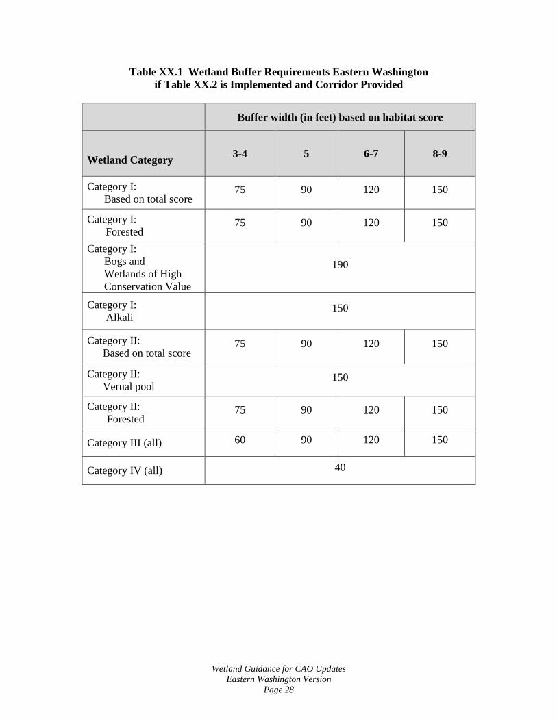
A. Buffer Requirements. The following buffer widths have been established in accordance with the best available science. They are based on the category of wetland and the habitat score as determined by a qualified wetland professional using the Washington State Wetland Rating System for Eastern Washington: 2014 Update (Ecology Publication #14-06-030, or as revised and approved by Ecology). The adjacent land use intensity is assumed to be high.
1. For wetlands that score 5 points or more for habitat function, the buffers in
Table XX.1 can be used if both of the following criteria are met:
• A relatively undisturbed, vegetated corridor at least 100 feet wide is protected between the wetland and any other Priority Habitats as defined by the Washington State Department of Fish and Wildlife. The latest definitions of priority habitats and their locations are available on the WDFW web site at: http://wdfw.wa.gov/hab/phshabs.htm )

Wetland Guidance for CAO Updates Eastern Washington Version
Page 27
The corridor must be protected for the entire distance between the wetland and the Priority Habitat by some type of legal protection such as a conservation easement.
Presence or absence of a nearby habitat must be confirmed by a
qualified biologist. If no option for providing a corridor is available, Table XX.1 may be used with the required measures in Table XX.2 alone.1
• The measures in Table XX.2 are implemented, where applicable,
to minimize the impacts of the adjacent land uses.
2. For wetlands that score 3-4 habitat points, only the measures in Table XX.2 are required for the use of Table XX.1 3. If an applicant chooses not to apply the mitigation measures in Table XX.2, or is unable to provide a protected corridor where available, then Table XX.3 must be used. 4. The buffer widths in Table XX.1 and XX.3 assume that the buffer is vegetated with a native plant community appropriate for the ecoregion. If the existing buffer is unvegetated, sparsely vegetated, or vegetated with invasive species that do not perform needed functions, the buffer should either be planted to create the appropriate plant community or the buffer should be widened to ensure that adequate functions of the buffer are provided.
1 See discussion in the Introduction, page 12, as to whether this applies in small urban jurisdictions.
Wetland Guidance for CAO Updates Eastern Washington Version
Page 28
Table XX.1 Wetland Buffer Requirements Eastern Washington if Table XX.2 is Implemented and Corridor Provided
Buffer width (in feet) based on habitat score
Wetland Category 3-4 5 6-7 8-9
Category I: Based on total score
75 90 120 150
Category I: Forested
75 90 120 150
Category I: Bogs and Wetlands of High Conservation Value
190
Category I: Alkali
150
Category II: Based on total score
75 90 120 150
Category II: Vernal pool
150
Category II: Forested
75 90 120 150
Category III (all) 60 90 120 150
Category IV (all) 40

Wetland Guidance for CAO Updates Eastern Washington Version
Page 29
Table XX.2 Required measures to minimize impacts to wetlands (Measures are required, where applicable to a specific proposal)
Disturbance Required Measures to Minimize Impacts Lights • Direct lights away from wetland Noise • Locate activity that generates noise away from
wetland • If warranted, enhance existing buffer with native
vegetation plantings adjacent to noise source • For activities that generate relatively continuous,
potentially disruptive noise, such as certain heavy industry or mining, establish an additional 10’ heavily vegetated buffer strip immediately adjacent to the outer wetland buffer
Toxic runoff • Route all new, untreated runoff away from wetland while ensuring wetland is not dewatered
• Establish covenants limiting use of pesticides within 150 ft of wetland
• Apply integrated pest management Stormwater runoff • Retrofit stormwater detention and treatment for roads
and existing adjacent development • Prevent channelized flow from lawns that directly
enters the buffer • Use Low Intensity Development techniques (for more
information refer to the drainage ordinance and manual)
Change in water regime • Infiltrate or treat, detain, and disperse into buffer new runoff from impervious surfaces and new lawns
Pets and human disturbance • Use privacy fencing OR plant dense vegetation to delineate buffer edge and to discourage disturbance using vegetation appropriate for the ecoregion;
• Place wetland and its buffer in a separate tract or protect with a conservation easement
Dust • Use best management practices to control dust

Wetland Guidance for CAO Updates Eastern Washington Version
Page 30
Table XX.3 Wetland Buffer Requirements for Eastern Washington if Table XX.2 is NOT Implemented or Corridor NOT provided
Buffer width (in feet) based on habitat score
Wetland Category 3-4 5 6-7 8-9
Category I: Based on total score
100 130 180 200
Category I: Forested
100 130 180 200
Category I: Bogs and Wetlands of High Conservation Value
250
Category I: Alkali
200
Category II: Based on total score
100 130 180 200
Category II: Vernal pool
200
Category II: Forested
100 130 180 200
Category III (all) 80 130 180 200
Category IV (all) 50

Wetland Guidance for CAO Updates Eastern Washington Version
Page 31
5. Increased Wetland Buffer Area Width. Buffer widths shall be increased
on a case-by-case basis as determined by the Administrator when a larger buffer is necessary to protect wetland functions and values. This determination shall be supported by appropriate documentation showing that it is reasonably related to protection of the functions and values of the wetland. The documentation must include but not be limited to the following criteria:
a. The wetland is used by a state or federally listed plant or animal
species or has essential or outstanding habitat for those species, or has unusual nesting or resting sites such as heron rookeries or raptor nesting trees; or
b. The adjacent land is susceptible to severe erosion, and erosion-control
measures will not effectively prevent adverse wetland impacts; or
c. The adjacent land has minimal vegetative cover or slopes greater than 30 percent.
6. Buffer averaging to improve wetland protection may be permitted when
all of the following conditions are met:
a. The wetland has significant differences in characteristics that affect its habitat functions, such as a wetland with a forested component adjacent to a degraded emergent component or a “dual-rated” wetland with a Category I area adjacent to a lower-rated area.
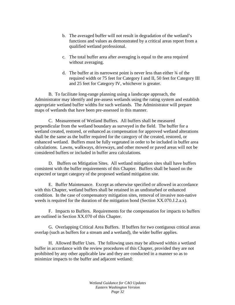
b. The buffer is increased adjacent to the higher-functioning area of
habitat or more-sensitive portion of the wetland and decreased adjacent to the lower-functioning or less-sensitive portion as demonstrated by a critical areas report from a qualified wetland professional.
c. The total area of the buffer after averaging is equal to the area required
without averaging. d. The buffer at its narrowest point is never less than either ¾ of the
required width or 75 feet for Category I and II, 50 feet for Category III and 25 feet for Category IV, whichever is greater.
7. Averaging to allow reasonable use of a parcel may be permitted when all
of the following are met:
a. There are no feasible alternatives to the site design that could be accomplished without buffer averaging.
Wetland Guidance for CAO Updates Eastern Washington Version
Page 32
b. The averaged buffer will not result in degradation of the wetland’s
functions and values as demonstrated by a critical areas report from a qualified wetland professional.
c. The total buffer area after averaging is equal to the area required without averaging.
d. The buffer at its narrowest point is never less than either ¾ of the
required width or 75 feet for Category I and II, 50 feet for Category III and 25 feet for Category IV, whichever is greater.
B. To facilitate long-range planning using a landscape approach, the
Administrator may identify and pre-assess wetlands using the rating system and establish appropriate wetland buffer widths for such wetlands. The Administrator will prepare maps of wetlands that have been pre-assessed in this manner.
C. Measurement of Wetland Buffers. All buffers shall be measured
perpendicular from the wetland boundary as surveyed in the field. The buffer for a wetland created, restored, or enhanced as compensation for approved wetland alterations shall be the same as the buffer required for the category of the created, restored, or enhanced wetland. Buffers must be fully vegetated in order to be included in buffer area calculations. Lawns, walkways, driveways, and other mowed or paved areas will not be considered buffers or included in buffer area calculations.
D. Buffers on Mitigation Sites. All wetland mitigation sites shall have buffers
consistent with the buffer requirements of this Chapter. Buffers shall be based on the expected or target category of the proposed wetland mitigation site.
E. Buffer Maintenance. Except as otherwise specified or allowed in accordance
with this Chapter, wetland buffers shall be retained in an undisturbed or enhanced condition. In the case of compensatory mitigation sites, removal of invasive non-native weeds is required for the duration of the mitigation bond (Section XX.070.J.2.a.x).
F. Impacts to Buffers. Requirements for the compensation for impacts to buffers are outlined in Section XX.070 of this Chapter.
G. Overlapping Critical Area Buffers. If buffers for two contiguous critical areas overlap (such as buffers for a stream and a wetland), the wider buffer applies.
H. Allowed Buffer Uses. The following uses may be allowed within a wetland buffer in accordance with the review procedures of this Chapter, provided they are not prohibited by any other applicable law and they are conducted in a manner so as to minimize impacts to the buffer and adjacent wetland:
Wetland Guidance for CAO Updates Eastern Washington Version
Page 33
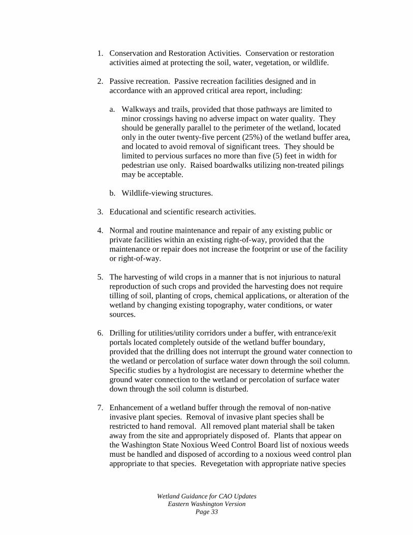
1. Conservation and Restoration Activities. Conservation or restoration activities aimed at protecting the soil, water, vegetation, or wildlife.
2. Passive recreation. Passive recreation facilities designed and in accordance with an approved critical area report, including:
a. Walkways and trails, provided that those pathways are limited to
minor crossings having no adverse impact on water quality. They should be generally parallel to the perimeter of the wetland, located only in the outer twenty-five percent (25%) of the wetland buffer area, and located to avoid removal of significant trees. They should be limited to pervious surfaces no more than five (5) feet in width for pedestrian use only. Raised boardwalks utilizing non-treated pilings may be acceptable.
b. Wildlife-viewing structures.
3. Educational and scientific research activities.
4. Normal and routine maintenance and repair of any existing public or private facilities within an existing right-of-way, provided that the maintenance or repair does not increase the footprint or use of the facility or right-of-way.
5. The harvesting of wild crops in a manner that is not injurious to natural
reproduction of such crops and provided the harvesting does not require tilling of soil, planting of crops, chemical applications, or alteration of the wetland by changing existing topography, water conditions, or water sources.
6. Drilling for utilities/utility corridors under a buffer, with entrance/exit
portals located completely outside of the wetland buffer boundary, provided that the drilling does not interrupt the ground water connection to the wetland or percolation of surface water down through the soil column. Specific studies by a hydrologist are necessary to determine whether the ground water connection to the wetland or percolation of surface water down through the soil column is disturbed.
7. Enhancement of a wetland buffer through the removal of non-native
invasive plant species. Removal of invasive plant species shall be restricted to hand removal. All removed plant material shall be taken away from the site and appropriately disposed of. Plants that appear on the Washington State Noxious Weed Control Board list of noxious weeds must be handled and disposed of according to a noxious weed control plan appropriate to that species. Revegetation with appropriate native species

Wetland Guidance for CAO Updates Eastern Washington Version
Page 34
at natural densities is allowed in conjunction with removal of invasive plant species.
8. Repair and maintenance of non-conforming uses or structures, where
legally established within the buffer, provided they do not increase the degree of nonconformity.
I. Signs and Fencing of Wetlands and Buffers. 1. Temporary markers. The outer perimeter of the wetland buffer and the
clearing limits identified by an approved permit or authorization shall be marked in the field with temporary “clearing limits” fencing in such a way as to ensure that no unauthorized intrusion will occur. The marking is subject to inspection by the Administrator prior to the commencement of permitted activities. This temporary marking shall be maintained throughout construction and shall not be removed until permanent signs, if required, are in place.
2. Permanent signs. As a condition of any permit or authorization issued
pursuant to this Chapter, the Administrator may require the applicant to install permanent signs along the boundary of a wetland or buffer.
a. Permanent signs shall be made of an enamel-coated metal face and
attached to a metal post or another non-treated material of equal durability. Signs must be posted at an interval of one (1) every fifty (50) feet, or one (1) per lot if the lot is less than fifty (50) feet wide, and must be maintained by the property owner in perpetuity. The signs shall be worded as follows or with alternative language approved by the Administrator:
Protected Wetland Area
Do Not Disturb Contact [Local Jurisdiction]
Regarding Uses, Restrictions, and Opportunities for Stewardship
b. The provisions of Subsection (a) may be modified as necessary to assure protection of sensitive features or wildlife.
3. Fencing
a. The applicant shall be required to install a permanent fence around the wetland or buffer when domestic grazing animals are present or may be introduced on site.
b. Fencing installed as part of a proposed activity or as required in this
Subsection shall be designed so as to not interfere with species

Wetland Guidance for CAO Updates Eastern Washington Version
Page 35
migration, including fish runs, and shall be constructed in a manner that minimizes impacts to the wetland and associated habitat.
XX.060 Critical Area Report for Wetlands
A. If the Administrator determines that the site of a proposed development includes, is likely to include, or is adjacent to a wetland, a wetland report, prepared by a qualified professional, shall be required. The expense of preparing the wetland report shall be borne by the applicant.
B. Minimum Standards for Wetland Reports. The written report and the
accompanying plan sheets shall contain the following information, at a minimum:
1. The written report shall include at a minimum:
a. The name and contact information of the applicant; the name, qualifications, and contact information for the primary author(s) of the wetland critical area report; a description of the proposal; identification of all the local, state, and/or federal wetland-related permit(s) required for the project; and a vicinity map for the project.
b. A statement specifying the accuracy of the report and all assumptions
made and relied upon.
c. Documentation of any fieldwork performed on the site, including field data sheets for delineations, rating system forms, baseline hydrologic data, etc.
d. A description of the methodologies used to conduct the wetland delineations, wetland ratings, or impact analyses including references.
e. Identification and characterization of all critical areas, wetlands, water
bodies, shorelines, floodplains, and buffers on or adjacent to the proposed project area. For areas off site of the project site, estimate conditions within 250 feet of the project boundaries using the best available information.
f. For each wetland identified on-site and within 250 feet of the project
boundary, provide: the wetland rating, including a description of and score for each function, per Wetland Ratings (Section XX.020.B of this Chapter); required buffers; hydrogeomorphic classification; wetland acreage based on a professional survey from the field delineation (acreages for on-site portion and entire wetland area including off-site portions); Cowardin classification of vegetation communities; habitat elements; soil conditions based on site assessment and/or soil survey information; and to the extent possible,

Wetland Guidance for CAO Updates Eastern Washington Version
Page 36
hydrologic information such as location and condition of inlet/outlets (if they can be legally accessed), estimated water depths within the wetland, and estimated hydroperiod patterns based on visual cues (e.g., algal mats, drift lines, flood debris, etc.). Provide acreage estimates, classifications, and ratings based on entire wetland complexes, not only the portion present on the proposed project site.
g. A description of the proposed actions including an estimation of
acreages of impacts to wetlands and buffers based on the field delineation and survey and an analysis of site development alternatives including a no-development alternative.
h. An assessment of the probable cumulative impacts to the wetlands and
buffers resulting from the proposed development.
i. A description of reasonable efforts made to apply mitigation sequencing pursuant to Mitigation Sequencing (Chapter XX.070.A) to avoid, minimize, and mitigate impacts to critical areas.
j. A discussion of measures, including avoidance, minimization, and compensation, proposed to preserve existing wetlands and restore any wetlands that were degraded prior to the current proposed land-use activity.
k. A conservation strategy for habitat and native vegetation that addresses methods to protect and enhance on-site habitat and wetland functions.
l. An evaluation of the functions of the wetland and adjacent buffer. Include reference for the method used and data sheets.
2. A copy of the site plan sheet(s) for the project must be included with the
written report and must include, at a minimum:
a. Maps (to scale) depicting delineated and surveyed wetland and required buffers on-site, including buffers for off-site critical areas that extend onto the project site; the development proposal; other critical areas; grading and clearing limits; areas of proposed impacts to wetlands and/or buffers (include square footage estimates);.
b. A depiction of the proposed stormwater management facilities and
outlets (to scale) for the development, including estimated areas of intrusion into the buffers of any critical areas. The written report shall contain a discussion of the potential impacts to the wetland(s) associated with anticipated hydroperiod alterations from the project.
XX.070 Compensatory Mitigation.

Wetland Guidance for CAO Updates Eastern Washington Version
Page 37
A. Mitigation Sequencing. Before impacting any wetland or its buffer, an
applicant shall demonstrate that the following actions have been taken. Actions are listed in the order of preference:
1. Avoid the impact altogether by not taking a certain action or parts of an action.
2. Minimize impacts by limiting the degree or magnitude of the action and its implementation, by using appropriate technology, or by taking affirmative steps to avoid or reduce impacts.
3. Rectify the impact by repairing, rehabilitating, or restoring the affected
environment.
4. Reduce or eliminate the impact over time by preservation and maintenance operations.
5. Compensate for the impact by replacing, enhancing, or providing
substitute resources or environments. 6. Monitor the required compensation and take remedial or corrective
measures when necessary.
B. Requirements for Compensatory Mitigation:
1. Compensatory mitigation for alterations to wetlands shall be used only for impacts that cannot be avoided or minimized and shall achieve equivalent or greater biologic functions. Compensatory mitigation plans shall be consistent with Wetland Mitigation in Washington State – Part 2: Developing Mitigation Plans--Version 1, (Ecology Publication #06-06-011b, Olympia, WA, March 2006 or as revised), and Selecting Wetland Mitigation Sites Using a Watershed Approach (Eastern Washington) (Publication #10-06-07, November 2010).
2. Mitigation ratios shall be consistent with Subsection H of this Chapter. 3. Mitigation requirements may also be determined using the credit/debit tool
described in “Calculating Credits and Debits for Compensatory Mitigation in Wetlands of Eastern Washington: Final Report (Ecology Publication #11-06-015, August 2012), consistent with subsection H of this Chapter.
C. Compensating for Lost or Affected Functions. Compensatory mitigation shall address the functions affected by the proposed project, with an intention to achieve functional equivalency or improvement of functions. The goal shall be for the

Wetland Guidance for CAO Updates Eastern Washington Version
Page 38
compensatory mitigation to provide similar wetland functions as those lost, except when either:
1. The lost wetland provides minimal functions, and the proposed compensatory mitigation action(s) will provide equal or greater functions or will provide functions shown to be limiting within a watershed through a formal Washington state watershed assessment plan or protocol; or
2. Out-of-kind replacement of wetland type or functions will best meet watershed goals formally identified by the City, such as replacement of historically diminished wetland types.
D. Approaches to Compensatory Mitigation. Mitigation for lost or diminished wetland and buffer functions shall rely on the approaches listed below.
1. Wetland mitigation banks. Credits from a certified wetland mitigation bank may be used to compensate for impacts located within the service area specified in the mitigation bank instrument. Use of credits from a wetland mitigation bank certified under Chapter 173-700 WAC is allowed if:
a. The approval authority determines that it would provide appropriate
compensation for the proposed impacts; and b. The impact site is located in the service area of the bank. c. The proposed use of credits is consistent with the terms and conditions
of the certified mitigation bank instrument.
d. Replacement ratios for projects using bank credits is consistent with replacement ratios specified in the certified mitigation bank instrument.
2. In-Lieu Fee Mitigation: Credits from an approved in-lieu-fee program
may be used when all of the following apply:
a. The approval authority determines that it would provide environmentally appropriate compensation for the proposed impacts.
b. The proposed use of credits is consistent with the terms and conditions of the approved in-lieu-fee program instrument.
c. Projects using in-lieu-fee credits shall have debits associated with the proposed impacts calculated by the applicant’s qualified wetland professional using the credit assessment method specified in the approved instrument for the in-lieu-fee program.

Wetland Guidance for CAO Updates Eastern Washington Version
Page 39
d. The impacts are located within the service area specified in the approved in-lieu-fee instrument.
3. Permittee-responsible mitigation. In this situation, the permittee performs
the mitigation after the permit is issued and is ultimately responsible for implementation and success of the mitigation. Permittee-responsible mitigation may occur at the site of the permitted impacts or at an off-site location within the same watershed. Permittee-responsible mitigation shall be used only if the applicant’s qualified wetland professional demonstrates to the approval authority’s satisfaction that the proposed approach is ecologically preferable to use of a bank or ILF program, consistent with the criteria in this section.
E. Types of Compensatory Mitigation. Mitigation for lost or diminished wetland and buffer functions shall rely on a type listed below in order of preference. A lower-preference form of mitigation shall be used only if the applicant’s qualified wetland professional demonstrates to the approval authority’s satisfaction that all higher-ranked types of mitigation are not viable, consistent with the criteria in this section
1. Restoration: The manipulation of the physical, chemical, or biological characteristics of a site with the goal of returning natural or historic functions to a former or degraded wetland. For the purpose of tracking net gains in wetland acres, restoration is divided into:
a. Re-establishment: The manipulation of the physical, chemical, or
biological characteristics of a site with the goal of returning natural or historic functions to a former wetland. Re-establishment results in a gain in wetland acres (and functions). Activities could include removing fill material, plugging ditches, or breaking drain tiles.
b. Rehabilitation: The manipulation of the physical, chemical, or
biological characteristics of a site with the goal of repairing natural or historic functions of a degraded wetland. Rehabilitation results in a gain in wetland function but does not result in a gain in wetland acres. Activities could involve breaching a dike to reconnect wetlands to a floodplain or return tidal influence to a wetland.
2. Establishment (Creation): The manipulation of the physical, chemical, or
biological characteristics of a site to develop a wetland on an upland or deepwater site where a wetland did not previously exist. Establishment results in a gain in wetland acres. Activities typically involve excavation of upland soils to elevations that will produce a wetland hydroperiod, create hydric soils, and support the growth of hydrophytic plant species.
a. If a site is not available for wetland restoration to compensate for
expected wetland and/or buffer impacts, the approval authority may

Wetland Guidance for CAO Updates Eastern Washington Version
Page 40
authorize creation of a wetland and buffer upon demonstration by the applicant’s qualified wetland professional that:
i. The hydrology and soil conditions at the proposed mitigation site
are conducive for sustaining the proposed wetland and that creation of a wetland at the site will not likely cause hydrologic problems elsewhere;
ii. Adjacent land uses and site conditions do not jeopardize the
viability of the proposed wetland and buffer (e.g., due to the presence of invasive plants or noxious weeds, stormwater runoff, noise, light, or other impacts); and
iii. The proposed wetland and buffer will eventually be self-
sustaining with little or no long-term maintenance.
3. Enhancement. The manipulation of the physical, chemical, or biological characteristics of a wetland site to heighten, intensify, or improve specific function(s) or to change the growth stage or composition of the vegetation present. Enhancement is undertaken for specified purposes such as water quality improvement, flood water retention, or wildlife habitat. Enhancement results in a change in some wetland functions and can lead to a decline in other wetland functions, but does not result in a gain in wetland acres. Activities typically consist of planting vegetation, controlling non-native or invasive species, modifying site elevations or the proportion of open water to influence hydroperiods, or some combination of these activities. Applicants proposing to enhance wetlands or associated buffers shall demonstrate how the proposed enhancement will increase the wetland’s/buffer’s functions, how this increase in function will adequately compensate for the impacts, and how existing wetland functions at the mitigation site will be protected.
4. Protection/Maintenance (Preservation). Removing a threat to, or
preventing the decline of, wetland conditions by an action in or near a wetland. This includes the purchase of land or easements, or repairing water control structures or fences. This term also includes activities commonly associated with the term preservation. Preservation does not result in a gain of wetland acres. Permanent protection of a Category I or II wetland and associated buffer at risk of degradation can be used only if:
a. The approval authority determines that the proposed preservation is the
best mitigation option;
b. The proposed preservation site is under threat of undesirable ecological change due to permitted, planned, or likely actions that will not be adequately mitigated under existing regulations;

Wetland Guidance for CAO Updates Eastern Washington Version
Page 41
c. The area proposed for preservation is of high quality or critical for the
health of the watershed or basin due to its location. Some of the following features may be indicative of high-quality sites:
i. Category I or II wetland rating (using the wetland rating system for
western Washington) ii. Rare or irreplaceable wetland type (for example, bogs, mature
forested wetlands, estuarine wetlands) or aquatic habitat that is rare or a limited resource in the area;
iii. The presence of habitat for priority or locally important wildlife
species; or also list has provides biological and/or hydrological connectivity;
iv. Provides biololgical and/or hydrological connectivity; v. Priority sites in an adopted watershed plan.
d. Permanent preservation of the wetland and buffer will be provided
through a conservation easement or tract held by an appropriate natural land resource manager, such as a land trust.
e. The approval authority may approve other legal and administrative
mechanisms in lieu of a conservation easement if it determines they are adequate to protect the site.
f. Ratios for preservation in combination with other forms of mitigation
generally range from 10:1 to 20:1, as determined on a case-by-case basis, depending on the quality of the wetlands being impacted and the quality of the wetlands being preserved. Ratios for preservation as the sole means of mitigation generally start at 20:1.
F. Location of Compensatory Mitigation. Compensatory mitigation actions shall
generally be conducted within the same sub-drainage basin and on the site of the alteration except when the applicant can demonstrate that off-site mitigation is ecologically preferable. The following criteria will be evaluated when determining whether the proposal is ecologically preferable. When considering off-site mitigation, preference should be given to using alternative mitigation, such as a mitigation bank, an in-lieu-fee program, or advance mitigation.
1. There are no reasonable opportunities on site or within the sub-drainage
basin (e.g., on-site options would require elimination of high-functioning upland habitat), or opportunities on site or within the sub-drainage basin do not have a high likelihood of success based on a determination of the

Wetland Guidance for CAO Updates Eastern Washington Version
Page 42
capacity of the site to compensate for the impacts. Considerations should include: anticipated replacement ratios for wetland mitigation, buffer conditions and proposed widths, available water to maintain anticipated hydrogeomorphic classes of wetlands when restored, proposed flood storage capacity, and potential to mitigate riparian fish and wildlife impacts (such as connectivity);
2. On-site mitigation would require elimination of high-quality upland habitat.
3. Off-site mitigation has a greater likelihood of providing equal or improved wetland functions than the altered wetland.
4. Off-site locations shall be in the same sub-drainage basin unless:
a. Established watershed goals for water quality, flood storage or
conveyance, habitat, or other wetland functions have been established by the City and strongly justify location of mitigation at another site; or
b. Credits from a state-certified wetland mitigation bank are used as compensation, and the use of credits is consistent with the terms of the certified bank instrument;
c. Fees are paid to an approved in-lieu fee program to compensate for the
impacts.
5. The design for the compensatory mitigation project needs to be appropriate for its location (i.e., position in the landscape). Therefore, compensatory mitigation should not result in the creation, restoration, or enhancement of an atypical wetland.
G. Timing of Compensatory Mitigation. It is preferred that compensatory mitigation projects be completed prior to activities that will disturb wetlands. At the least, compensatory mitigation shall be completed immediately following disturbance and prior to use or occupancy of the action or development. Construction of mitigation projects shall be timed to reduce impacts to existing fisheries, wildlife, and flora.
1. The Administrator may authorize a one-time temporary delay in
completing construction or installation of the compensatory mitigation when the applicant provides a written explanation from a qualified wetland professional as to the rationale for the delay. An appropriate rationale would include identification of the environmental conditions that could produce a high probability of failure or significant construction difficulties (e.g., project delay lapses past a fisheries window, or installing plants should be delayed until the dormant season to ensure greater survival of installed materials). The delay shall not create or perpetuate

Wetland Guidance for CAO Updates Eastern Washington Version
Page 43
hazardous conditions or environmental damage or degradation, and the delay shall not be injurious to the health, safety, or general welfare of the public. The request for the temporary delay must include a written justification that documents the environmental constraints that preclude implementation of the compensatory mitigation plan. The justification must be verified and approved by the City.
H. Wetland Mitigation Ratios2:
Category and
Type of Wetland Creation or
Re-establishment Rehabilitation Enhancement
Category I: Bog, Natural Heritage site
Not considered possible Case by case Case by case
Category I: Mature Forested
6:1 12:1 24:1
Category I: Based on functions
4:1 8:1 16:1
Category II 3:1 6:1 12:1
Category III 2:1 4:1 8:1
Category IV 1.5:1 3:1 6:1 I. Credit/Debit Method. To more fully protect functions and values, and as an
alternative to the mitigation ratios found in the joint guidance “Wetland Mitigation in Washington State Parts I and II” (Ecology Publication #06-06-011a-b, Olympia, WA, March, 2006), the administrator may allow mitigation based on the “credit/debit” method developed by the Department of Ecology in “Calculating Credits and Debits for Compensatory Mitigation in Wetlands of Eastern Washington: Final Report” (Ecology Publication #11-06-015, August 2012, or as revised).
2 Ratios for rehabilitation and enhancement may be reduced when combined with 1:1 replacement through creation or re-establishment. See Table 1b, Wetland Mitigation in Washington State – Part 1: Agency Policies and Guidance--Version 1, (Ecology Publication #06-06-011a, Olympia, WA, March 2006 or as revised). See also Paragraph D.4 for more information on using preservation as compensation.

Wetland Guidance for CAO Updates Eastern Washington Version
Page 44
J. Compensatory Mitigation Plan. When a project involves wetland and/or buffer impacts, a compensatory mitigation plan prepared by a qualified professional shall be required, meeting the following minimum standards:
1. Wetland Critical Area Report. A critical area report for wetlands must
accompany or be included in the compensatory mitigation plan and include the minimum parameters described in Minimum Standards for Wetland Reports (Section XX.060.B) of this Chapter.
2. Compensatory Mitigation Report. The report must include a written report
and plan sheets that must contain, at a minimum, the following elements. Full guidance can be found in Wetland Mitigation in Washington State– Part 2: Developing Mitigation Plans (Version 1) (Ecology Publication #06-06-011b, Olympia, WA, March 2006 or as revised).
a. The written report must contain, at a minimum:
i. The name and contact information of the applicant; the name, qualifications, and contact information for the primary author(s) of the compensatory mitigation report; a description of the proposal; a summary of the impacts and proposed compensation concept; identification of all the local, state, and/or federal wetland-related permit(s) required for the project; and a vicinity map for the project.
ii. Description of how the project design has been modified to avoid, minimize, or reduce adverse impacts to wetlands.
iii. Description of the existing wetland and buffer areas proposed to be impacted. Include acreage (or square footage), water regime, vegetation, soils, landscape position, surrounding lands uses, and functions. Also describe impacts in terms of acreage by Cowardin classification, hydrogeomorphic classification, and wetland rating, based on Wetland Ratings (Section XX.XX) of this Chapter.
iv. Description of the compensatory mitigation site, including location and rationale for selection. Include an assessment of existing conditions: acreage (or square footage) of wetlands and uplands, water regime, sources of water, vegetation, soils, landscape position, surrounding land uses, and functions. . Estimate future conditions in this location if the compensation actions are NOT undertaken (i.e., how would this site progress through natural succession?).
v. Surface and subsurface hydrologic conditions, including an analysis of existing and proposed hydrologic regimes for enhanced, created, or restored compensatory mitigation areas.

Wetland Guidance for CAO Updates Eastern Washington Version
Page 45
Include illustrations of how data for existing hydrologic conditions were used to determine the estimates of future hydrologic conditions
vi. A description of the proposed actions for compensation of wetland and upland areas affected by the project. Include overall goals of the proposed mitigation, including a description of the targeted functions, hydrogeomorphic classification, and categories of wetlands.
vii. A description of the proposed mitigation construction activities and timing of activities.
viii. Performance standards (measurable standards for years post-installation) for upland and wetland communities, a monitoring schedule, and a maintenance schedule and actions proposed by year.
ix. A discussion of ongoing management practices that will protect wetlands after the development project has been implemented, including proposed monitoring and maintenance programs (for remaining wetlands and compensatory mitigation wetlands).
x. A bond estimate for the entire compensatory mitigation project, including the following elements: site preparation, plant materials, construction materials, installation oversight, maintenance twice per year for up to five (5) years, annual monitoring field work and reporting, and contingency actions for a maximum of the total required number of years for monitoring.
ix. Proof of establishment of Notice on Title for the wetlands and buffers on the project site, including the compensatory mitigation areas.
b. The scaled plan sheets for the compensatory mitigation must contain, at a minimum:
i. Surveyed edges of the existing wetland and buffers, proposed areas of wetland and/or buffer impacts, location of proposed wetland and/or buffer compensation actions.
ii. Existing topography, ground-proofed, at two-foot contour intervals in the zone of the proposed compensation actions if any grading activity is proposed to create the compensation area(s). Also existing cross-sections of on-site wetland areas that are proposed to be impacted, and cross-section(s) (estimated one-foot intervals) for the proposed areas of wetland or buffer compensation.
Wetland Guidance for CAO Updates Eastern Washington Version
Page 46
iii. Conditions expected from the proposed actions on site, including future hydrogeomorphic types, vegetation community types by dominant species (wetland and upland), and future water regimes.
iv. Required wetland buffers for existing wetlands and proposed compensation areas. Also, identify any zones where buffers are proposed to be reduced or enlarged outside of the standards identified in this Chapter.
v. A planting plan for the compensation area, including all species by proposed community type and water regime, size and type of plant material to be installed, spacing of plants, typical clustering patterns, total number of each species by community type, and timing of installation.
K. Buffer Mitigation Ratios. Impacts to buffers shall be mitigated at a minimum 1:1 ratio. Compensatory buffer mitigation shall replace those buffer functions lost from development.
L. Protection of the Mitigation Site. The area where the mitigation occurred and any associated buffer shall be located in a critical area tract or a conservation easement consistent with Chapter XX.XX.
M. Monitoring. Mitigation monitoring shall be required for a period necessary to establish that performance standards have been met, but not for a period less than five years. If a scrub-shrub or forested vegetation community is proposed, monitoring may be required for ten years or more. The project mitigation plan shall include monitoring elements that ensure certainty of success for the project’s natural resource values and functions. If the mitigation goals are not obtained within the initial five-year period, the applicant remains responsible for restoration of the natural resource values and functions until the mitigation goals agreed to in the mitigation plan are achieved.
N. Advance Mitigation. Mitigation for projects with pre-identified impacts to
wetlands may be constructed in advance of the impacts if the mitigation is implemented according to federal rules, state policy on advance mitigation, and state water quality regulations consistent with Interagency Regulatory Guide: Advance Permittee-Responsible Mitigation (Ecology Publication #12-06-015, Olympia, WA, December 2012).
O. Alternative Mitigation Plans. The Administrator may approve alternative wetland mitigation plans that are based on best available science, such as priority restoration plans that achieve restoration goals identified in the SMP. Alternative mitigation proposals must provide an equivalent or better level of protection of wetland functions and values than would be provided by the strict application of this chapter.
The Administrator shall consider the following for approval of an alternative
mitigation proposal:

Wetland Guidance for CAO Updates Eastern Washington Version
Page 47
1. The proposal uses a watershed approach consistent with Selecting Wetland
Mitigation Sites Using a Watershed Approach (Eastern Washington) (Ecology Publication #10-06-07, November 2010).
2. Creation or enhancement of a larger system of natural areas and open space is preferable to the preservation of many individual habitat areas.
3. Mitigation according to Section E is not feasible due to site constraints such as parcel size, stream type, wetland category, or geologic hazards.
4. There is clear potential for success of the proposed mitigation at the proposed mitigation site.
5. The plan shall contain clear and measurable standards for achieving compliance with the specific provisions of the plan. A monitoring plan shall, at a minimum, meet the provisions in Section J.
6. The plan shall be reviewed and approved as part of overall approval of the proposed use.
7. A wetland of a different type may be justified based on regional needs or functions and values; the replacement ratios may not be reduced or eliminated unless the reduction results in a preferred environmental alternative.
8. Mitigation guarantees shall meet the minimum requirements as outlined in Section J.2.a.viii.
9. Qualified professionals in each of the critical areas addressed shall prepare the plan.
10. The City may consult with agencies with expertise and jurisdiction over the critical areas during the review to assist with analysis and identification of appropriate performance measures that adequately safeguard critical areas.
XX.080 Unauthorized Alterations and Enforcement
A. When a wetland or its buffer has been altered in violation of this Chapter, all
ongoing development work shall stop and the critical area shall be restored. The City shall have the authority to issue a “stop-work” order to cease all ongoing development work and order restoration, rehabilitation, or replacement measures at the owner’s or other responsible party’s expense to compensate for violation of provisions of this Chapter.

Wetland Guidance for CAO Updates Eastern Washington Version
Page 48
B. Requirement for Restoration Plan. All development work shall remain stopped until a restoration plan is prepared and approved by City. Such a plan shall be prepared by a qualified professional using the currently accepted scientific principles and shall describe how the actions proposed meet the minimum requirements described in Subsection C. The Administrator shall, at the applicant or other responsible party’s expense, seek expert advice in determining the adequacy of the plan. Inadequate plans shall be returned to the applicant or violator for revision and resubmittal.
C. Minimum Performance Standards for Restoration. The following minimum
performance standards shall be met for the restoration of a wetland, provided that if the applicant or other responsible party can demonstrate that greater functions and habitat values can be obtained, these standards may be modified:
1. The historic structure, functions, and values of the affected wetland shall
be restored, including water quality and habitat functions. 2. The historic soil types and configuration shall be restored to the extent
practicable.
3. The wetland and buffers shall be replanted with native vegetation that replicates the vegetation historically found on the site in species types, sizes, and densities. The historic functions and values should be replicated at the location of the alteration.
4. Information demonstrating compliance with other applicable provisions of
this Chapter shall be submitted to the Administrator. D. Site Investigations. The Administrator is authorized to make site inspections
and take such actions as are necessary to enforce this Chapter. The Administrator shall present proper credentials and make a reasonable effort to contact any property owner before entering onto private property.
E. Penalties. Any person, party, firm, corporation, or other legal entity convicted
of violating any of the provisions of this Chapter shall be guilty of a misdemeanor.
1. Each day or portion of a day during which a violation of this Chapter is committed or continued shall constitute a separate offense. Any development carried out contrary to the provisions of this Chapter shall constitute a public nuisance and may be enjoined as provided by the statutes of the state of Washington. The [city/town] may levy civil penalties against any person, party, firm, corporation, or other legal entity for violation of any of the provisions of this Chapter. The civil penalty shall be assessed at a maximum rate of $XX per day per violation.
2. If the wetland affected cannot be restored, monies collected as penalties
shall be deposited in a dedicated account for the preservation or

Wetland Guidance for CAO Updates Eastern Washington Version
Page 49
restoration of landscape processes and functions in the watershed in which the affected wetland is located. The City may coordinate its preservation or restoration activities with other cities in the watershed to optimize the effectiveness of the restoration action.

Wetland Guidance for CAO Updates Eastern Washington Version
Page 50
This page is purposely left blank

Wetland Guidance for CAO Updates Eastern Washington Version
Page 51
Appendix B - Wetland Definitions
(Eastern Washington)

Wetland Guidance for CAO Updates Eastern Washington Version
Page 52
This page is purposely left blank

Wetland Guidance for CAO Updates Eastern Washington Version
Page 53
Appendix B – Wetland Definitions Agricultural Activities, Existing and Ongoing – Those activities conducted on lands defined in RCW 84.34.020(2), and those activities involved in the production of crops and livestock, including but not limited to operation, maintenance and conservation measures of farm and stock ponds or drainage ditches, irrigation systems, changes between agricultural activities, and normal operation, maintenance or repair of existing serviceable structures, facilities or improved areas. Activities which bring an area into agricultural use are not part of an ongoing activity. An operation ceases to be ongoing when the area in which it was conducted is proposed for conversion to a nonagricultural use or has lain idle for a period of longer than five years, unless the idle land is registered in a federal or state soils conversation program. Alkali Wetland – A wetland characterized by the presence of shallow saline water with a high pH, as described in Washington State Wetland Rating System for Eastern Washington: 2014 Update (Washington State Department of Ecology Publication #14-06-30, Olympia, WA, October 2014). Alteration – Any human-induced change in an existing condition of a critical area or its buffer. Alterations include, but are not limited to, grading, filling, channelizing, dredging, clearing of vegetation, construction, compaction, excavation, or any other activity that changes the character of the critical area. Best Available Science – Current scientific information used in the process to designate, protect, or restore critical areas that is derived from a valid scientific process as defined by WAC 365-195-900 through 925. Best Management Practices (BMPs) – Conservation practices or systems of practices and management measures that:
(a) Control soil loss and reduce water quality degradation caused by high concentrations of nutrients, animal waste, toxics, or sediment;
(b) Minimize adverse impacts to surface water and ground water flow and circulation patterns and to the chemical, physical, and biological characteristics of wetlands;
(c) Protect trees, vegetation and soils designated to be retained during and
following site construction and use native plant species appropriate to the site for re-vegetation of disturbed areas; and
(d) Provide standards for proper use of chemical herbicides within critical areas.
Bog – A low-nutrient, acidic wetland with organic soils and characteristic bog plants, as described in Washington State Wetland Rating System for Eastern Washington: 2014

Wetland Guidance for CAO Updates Eastern Washington Version
Page 54
Update (Washington State Department of Ecology Publication #14-06-30, Olympia, WA, October 2014). Buffer or Buffer Zone – The area contiguous with a critical area that maintains the functions and/or structural stability of the critical area. Calcareous Fen – An alkaline peat wetland in which the groundwater is typically rich in calcium and magnesium bicarbonates and sometimes calcium and magnesium sulfates, as described in Washington State Wetland Rating System for Eastern Washington: 2014 Update (Washington State Department of Ecology Publication #14-06-30, Olympia, WA, October 2014). Critical Areas – Critical areas include any of the following areas or ecosystems: critical aquifer recharge areas, fish and wildlife habitat conservation areas, geologically hazardous areas, frequently flooded areas, and wetlands, as defined in RCW 36.70A and this Chapter. Creation – The manipulation of the physical, chemical, or biological characteristics to develop a wetland on an upland or deepwater site, where a wetland did not previously exist. Creation results in a gain in wetland acreage and function. A typical action is the excavation of upland soils to elevations that will produce a wetland hydroperiod and hydric soils, and support the growth of hydrophytic plant species. Cumulative Impacts or Effects – The combined, incremental effects of human activity on ecological or critical area functions and values. Cumulative impacts result when the effects of an action are added to or interact with the effects of other actions in a particular place and within a particular time. It is the combination of these effects, and any resulting environmental degradation, that should be the focus of cumulative impact analysis and changes to policies and permitting decisions. Development – A land use consisting of the construction or exterior alteration of structures; grading, dredging, drilling, or dumping; filling; removal of sand, gravel, or minerals; bulk heading; driving of pilings; or any project of a temporary or permanent nature which modifies structures, land, or shorelines and which does not fall within the allowable exemptions contained in the City Code. Enhancement – The manipulation of the physical, chemical, or biological characteristics of a wetland to heighten, intensify or improve specific function(s) or to change the growth stage or composition of the vegetation present. Enhancement is undertaken for specified purposes such as water quality improvement, flood water retention, or wildlife habitat. Enhancement results in a change in wetland function(s) and can lead to a decline in other wetland functions, but does not result in a gain in wetland acres. Examples are planting vegetation, controlling non-native or invasive species, and modifying site elevations to alter hydroperiods.

Wetland Guidance for CAO Updates Eastern Washington Version
Page 55
Functions and Values – The services provided by critical areas to society, including, but not limited to, improving and maintaining water quality, providing fish and wildlife habitat, supporting terrestrial and aquatic food chains reducing flooding and erosive flows, wave attenuation, historical or archaeological importance, educational opportunities, and recreation. Growth Management Act – RCW 36.70A and 36.70B, as amended. Hazardous Substances – Any liquid, solid, gas, or sludge, including any material, substance, product, commodity, or waste, regardless of quantity, that exhibits any of the physical, chemical, or biological properties described in WAC 173-303-090 or 173-303-100. Impervious Surface – A surface area which either prevents or retards the entry of water into the soil mantle as under natural conditions prior to development. A non-vegetated surface area which causes water to run off the surface in greater quantities or at an increased rate of flow from the flow present under pre-development or pre-developed conditions. Common impervious surfaces include, but are not limited to, roof tops, walkways, patios, driveways, parking lots or storage areas, concrete or asphalt paving, gravel roads, packed earthen materials, and oiled, macadam or other surfaces which similarly impede the natural infiltration of stormwater.
In-Kind Compensation – To replace critical areas with substitute areas whose characteristics and functions closely approximate those destroyed or degraded by a regulated activity. In-Lieu-Fee Program – An agreement between a regulatory agency (state, federal, or local) and a single sponsor, generally a public natural resource agency or non-profit organization. Under an in-lieu-fee agreement, the mitigation sponsor collects funds from an individual or a number of individuals who are required to conduct compensatory mitigation required under a wetland regulatory program. The sponsor may use the funds pooled from multiple permittees to create one or a number of sites under the authority of the agreement to satisfy the permittees’ required mitigation. Infiltration – The downward entry of water into the immediate surface of soil. Isolated Wetland – A wetland that is hydrologically isolated from other aquatic resources, as determined by the United States Army Corps of Engineers (USACE). Isolated wetlands may perform important functions and are protected by state law (RCW 90.48) whether or not they are protected by federal law.
Mature and Old-Growth Forested Wetland with Slow-Growing Trees – A wetland over ¼ acre in size dominated by slow-growing native trees, as described in Washington State Wetland Rating System for Eastern Washington: 2014 Update (Washington State Department of Ecology Publication #14-06-30, Olympia, WA, October 2014).

Wetland Guidance for CAO Updates Eastern Washington Version
Page 56
Mature and Old-Growth Forested Wetland with Fast-Growing Trees – A wetland over ¼ acre in size dominated by fast-growing native trees, as described in Washington State Wetland Rating System for Eastern Washington: 2014 Update (Washington State Department of Ecology Publication #14-06-30, Olympia, WA, October 2014). Mitigation – Avoiding, minimizing, or compensating for adverse critical areas impacts. Mitigation, in the following sequential order of preference, is:
(a) Avoiding the impact altogether by not taking a certain action or parts of an action;
(b) Minimizing impacts by limiting the degree or magnitude of the action and its implementation, by using appropriate technology, or by taking affirmative steps to avoid or reduce impacts;
(c) Rectifying the impact to wetlands, critical aquifer recharge areas, and habitat
conservation areas by repairing, rehabilitating, or restoring the affected environment to the conditions existing at the time of the initiation of the project;
(d) Reducing or eliminating the impact or hazard over time by preservation and
maintenance operations during the life of the action;
(e) Compensating for the impact to wetlands, critical aquifer recharge areas, and habitat conservation areas by replacing, enhancing, or providing substitute resources or environments; and
(f) Monitoring the hazard or other required mitigation and taking remedial action
when necessary.
Mitigation for individual actions may include a combination of the above measures. Monitoring – Evaluating the impacts of development proposals on the biological, hydrological, and geological elements of such systems, and assessing the performance of required mitigation measures through the collection and analysis of data by various methods for the purpose of understanding and documenting changes in natural ecosystems and features. Monitoring includes gathering baseline data. Native Vegetation – Plant species that occur naturally in a particular region or environment and were present before European colonization.
Off-Site Compensation – To replace critical areas away from the site on which a critical area has been impacted. On-Site Compensation – To replace critical areas at or adjacent to the site on which a critical areas has been impacted.

Wetland Guidance for CAO Updates Eastern Washington Version
Page 57
Ordinary High Water Mark – That mark which is found by examining the bed and banks of water bodies and ascertaining where the presence and action of waters are so common and usual, and so long continued in all ordinary years, that the soil has a character distinct from that of the abutting upland in respect to vegetation. Preservation – The removal of a threat to, or preventing the decline of, wetland conditions by an action in or near a wetland. This term includes the purchase of land or easements, repairing water control structures or fences, or structural protection. Preservation does not result in a gain of wetland acres but may result in a gain in functions over the long term. Project Area – All areas, including those within fifty (50) feet of the area, proposed to be disturbed, altered, or used by the proposed activity or the construction of any proposed structures. When the action binds the land, such as a subdivision, short subdivision, binding site plan, planned unit development, or rezone, the project area shall include the entire parcel, at a minimum. Prior Converted Croplands – Prior converted croplands (PCCs) are defined in federal law as wetlands that were drained, dredged, filled, leveled or otherwise manipulated, including the removal of woody vegetation, before December 23, 1985, to enable production of an agricultural commodity, and that: 1) have had an agricultural commodity planted or produced at least once prior to December 23, 1985; 2) do not have standing water for more than 14 consecutive days during the growing season, and 3) have not since been abandoned. Qualified Professional – A qualified professional for wetlands must be a professional wetland scientist with at least two years of full-time work experience as a wetlands professional, including delineating wetlands using the federal manual and supplements, preparing wetlands reports, conducting function assessments, and developing and implementing mitigation plans.
Re-establishment – The manipulation of the physical, chemical, or biological characteristics of a site with the goal of returning natural or historic functions to a former wetland. Re-establishment results in rebuilding a former wetland and results in a gain in wetland acres and functions. Activities could include removing fill, plugging ditches, or breaking drain tiles. Rehabilitation – The manipulation of the physical, chemical, or biological characteristics of a site with the goal of repairing natural or historic functions and processes of a degraded wetland. Rehabilitation results in a gain in wetland function but does not result in a gain in wetland acres. Activities could involve breaching a dike to reconnect wetlands to a floodplain or returning tidal influence to a wetland. Repair or Maintenance – An activity that restores the character, scope, size, and design of a serviceable area, structure, or land use to its previously authorized and undamaged condition. Activities that change the character, size, or scope of a project beyond the

Wetland Guidance for CAO Updates Eastern Washington Version
Page 58
original design and drain, dredge, fill, flood, or otherwise alter critical areas are not included in this definition. Restoration – Measures taken to restore an altered or damaged natural feature, including:
(a) Active steps taken to restore damaged wetlands, streams, protected habitat, or their buffers to the functioning condition that existed prior to an unauthorized alteration; and
(b) Actions performed to re-establish structural and functional characteristics of the critical area that have been lost by alteration, past management activities, or catastrophic events.
SEPA – Washington State Environmental Policy Act, 43.21C RCW. Service Area – The geographic area within which impacts can be mitigated at a specific mitigation bank or an in-lieu-fee program, as designated in its instrument.
Soil Survey – The most recent soil survey for the local area or county by the National Resources Conservation Service, U.S. Department of Agriculture. Species – Any group of animals or plants classified as a species or subspecies as commonly accepted by the scientific community. Species of Local Importance – Those species of local concern designated by the City in Chapter XX.XX due to their population status or their sensitivity to habitat manipulation. Species, Listed -- Any species listed under the federal Endangered Species Act or state endangered, threatened, and sensitive, or priority lists (see WAC 232-12-297 or page 6 of “Priority Habitat and Species List,” Washington Department of Fish and Wildlife, 2008, Olympia, Washington. 177 pp.) Stream – An area where open surface water produces a defined channel or bed, not including irrigation ditches, canals, storm or surface water runoff devices, or other entirely artificial watercourses, unless they are used by salmonids or are used to convey a watercourse naturally occurring prior to construction. A channel or bed need not contain water year-round, provided there is evidence of at least intermittent flow during years of normal rainfall. Unavoidable Impacts – Adverse impacts that remain after all appropriate and practicable avoidance and minimization has been achieved. Vernal Pool – Small depressions in scabrock or in shallow soils that fill with snowmelt or spring rains, as described in Washington State Wetland Rating System for Eastern Washington: 2014 Update (Washington State Department of Ecology Publication #14-06-30, Olympia, WA, October 2014).

Wetland Guidance for CAO Updates Eastern Washington Version
Page 59
Washington Administration Code (WAC) – Administrative guidelines implementing state laws. Wetlands – Those areas that are inundated or saturated by surface or ground water at a frequency and duration sufficient to support, and that under normal circumstances do support, a prevalence of vegetation adapted for life in saturated soil conditions. Wetlands generally include swamps, marshes, bogs, and similar areas. Wetlands do not include those artificial wetlands intentionally created from non-wetland sites, including, but not limited to, irrigation and drainage ditches, grass-lined swales, canals, detention facilities, wastewater treatment facilities, farm ponds, and landscape amenities, or those wetlands created after July 1, 1990, that were unintentionally created as a result of the construction of a road, street, or highway. Wetlands may include those artificial wetlands intentionally created from non-wetland areas to mitigate the conversion of wetlands. Wetland of High Conservation Value – A wetland that has been identified by scientists from the Washington Natural Heritage Program (WHNHP) as an important ecosystem for maintaining plant diversity in Washington State. See http://www.dnr.wa.gov/data-information-natural-heritage-features . Wetland Mitigation Bank – A site where wetlands are restored, created, enhanced, or in exceptional circumstances, preserved expressly for the purpose of providing advance mitigation in advance of unavoidable impacts to wetlands or other aquatic resources that typically are unknown at the time of certification to compensate for future, permitted impacts to similar resources. Wetland Mosaic – An area with a concentration of multiple small wetlands, in which each patch of wetland is less than one acre; on average, patches are less than 100 feet from each other; and areas delineated as vegetated wetland are more than 50% of the total area of the entire mosaic, including uplands and open water.