downshill excavation report (2007)
TRANSCRIPT

Preliminary report on excavations at Downshill, County Wicklow
Licence Number 07E596
Dr. John Ó Néill
UCD School of Archaeology
31st October 2007
This project was supported by
funding from Royal Irish Academy and Department of
the Environment, Heritage and Local Government.

1
Contents:
Page
List of Figures 2 List of Plates 2 1. Summary 3 2. Introduction 4 2.1 General 4 2.2 Background 4
2.3 Reason for Excavation and Research Objectives 5 2.4 Archiving 6 2.5 Credits and Acknowledgements 7
3. Excavation 11 3.1 Methodology 11 3.2 Account of the excavations: Trench 1 11
3.3 Account of the excavations: Trench 2 19 3.4 Phasing of the stratigraphic sequences 24 3.5 Artefactural dating 25
4. Results and Discussion 26 4.1 Results 26 4.2 Discussion: Downshill as a hillfort 27
4.3 A note on the cordite blanks 30 5. References 31 Appendix One: Context List 32 Appendix Two: Harris Matrix 33 Appendix Three: Photographic Record 35 Appendix Four: Field Drawing Register 37 Appendix Five: Small Finds Register 38 Appendix Six: Samples Register 39

2
List of Figures: Figure Page Figure 1. Location map, showing Downshill (circled). 8 Figure 2. Site as shown on the 1909-1910 edition of the Ordnance
Survey. Location of proposed excavation shown. 9 Figure 3. Plan showing surviving earthworks on Downshill. 10 Figure 4. Plan showing Trench 1 after excavation with bank deposits in
situ (shown as 1008) and the excavated fosse (shown as 1002). 13 Figure 5. Plan showing the two early 20th century pits in Trench 1 (1012
and 1014), relative to the position of the fosse and bank (see figure 4). 14
Figure 6. South-facing section of Trench 1, with context numbers indicating layers as described in the text. 15
Figure 7. Plan showing Trench 2 after excavation with bank deposits in situ (shown as 2005) and the excavated fosse (shown as 2006). 22
Figure 8. West-facing section of Trench 2, with context numbers indicating layers as described in the text. 23
Figure 9. Harris Matrix for Trench 1. 33 Figure 10. Harris Matrix for Trench 2. 34 List of Plates: Plate Page Plate 1. Downshill, subsequent to removal of forestry (from Google Earth). 5 Plate 2. Typical view of the earthwork on Downshill (visible as the raised
bank planted with trees in the centre of the image, with the traces of a fosse to the left). 12
Plate 3. Trench 1 with excavated fosse in centre of image. 16 Plate 4. View across fosse and bank during excavation. 18 Plate 5. Trench 1, Pit 1014. 19 Plate 6. Trench 2, viewed from the north across the fosse and bank, the
area to the right of the upright ranging rod was largely disturbed by tree roots. 25
Plate 7. View of a portion of the earthwork (barely visible up the centre of the image), indicating density of tree planting on the site. 26
Plate 8. Typical view from Trench 2 on Downshill (looking towards, left to right, the Little Sugar Loaf, Bray Head and Kindlestown Hill). 29

Preliminary report on excavations at Downshill, County Wicklow 07E596
3
1. Summary
1.1 The archaeological investigations on Downshill in 2007 focused on the bank and
fosse of the hillfort. The archaeological structure is recorded in the RMP for
Wicklow as 13:001 and is located at National Grid Co-ordinates 325290, 210120.
1.2 Downshill had been converted to forestry in the late 1950s prior to a detailed
surveyed of the site. Investigation of the hilltop identified an earthwork in the
location indicated on the 2nd OS maps, partially destroyed by the construction of
earlier field walls and planting of trees. Two trenches were opened to try and
identify the morphology of the bank and fosse and recover dating samples.
1.3 The excavation was directed by Dr. John Ó Néill of UCD School of Archaeology,
and was carried out under licence number 07E596. This programme of work was
supported by funding from the Royal Irish Academy and Department of the
Environment, Heritage and Local Government.
1.4 The earthwork was shown to be a 2-3 m wide bank, with an external fosse which
was up to 2 m wide and 1 m deep. No datable artefactual material was recovered
from the bank or fosse and samples were retained for analysis and, potentially,
radiocarbon dating. Some early twentieth century cartridges were recovered from
pits dug into the line of the fosse in one of the trenches.
1.5 Due to the intensity of the impact of forestry on Downshill, there is no
recommendation being made for further fieldwork. Post-excavation on the
radiocarbon samples is being undertaken in order to complete the excavation and
bring the project to completion and publication.

Preliminary report on excavations at Downshill, County Wicklow 07E596
4
2. Introduction
2.1 General
2.1.1 The following report details the preliminary results of the archaeological excavation
at Downshill, undertaken by Dr. John Ó Néill of the School of Archaeology at
University College Dublin in 2007. This programme of work was supported by
funding from the Royal Irish Academy and Department of the Environment,
Heritage and Local Government.
2.2 Background
2.2.1 Downshill, lies 1.5 km to the south-west of the Glen of the Downs and some 6 km
from the coast (figure 1). Heavily planted with forestry in the twentieth century, it
was clear-felled over the last three years and the summit of the hill has now been
free of trees since 2004. Although it is not named on the 1909-1910 edition of the
Ordnance Survey maps, an oval field boundary on the map corresponds with the
circuit of an earthwork which encloses the summit of the hill (see figures 2 and 3
and Plate 1). This was subsequently identified as a hillfort and is recorded as such
in the Archaeological Inventory of County Wicklow (Grogan and Kilfeather 1997,
42) and was subsequently listed in the Sites and Monuments Record for County
Wicklow as SMR No:13:1.
2.2.2 The Archaeological Inventory of County Wicklow provides the following description
of the site: ‘Subcircular univallate hillfort. The dimensions are c. 360 m from East to
West, and c. 220 m from North to South. Part of the site is depicted on the
Ordnance Survey 6-inch map as a field boundary. The site encloses the summit of
Downshill with steep slopes to the North, East and South and gentler slopes to the
West and has a commanding position on the Western edge of the Glen of the
Downs. The summit is now covered in forestry and the only accessible surviving
part of the rampart is along the south-west side where it forms part of a field
boundary which skirts the plantation. The earth and stone bank (Width 4 m, Height
1.60 m) has near vertical drystone facing (probably not original). The external
fosse (Width 4 m) was also identified to the south-east in the next field in 1989

Preliminary report on excavations at Downshill, County Wicklow 07E596
5
during ploughing. The south-east perimeter had apparently not survived’ (Grogan
and Kilfeather 1997, 42).
2.2.3 Previous investigation of Downshill has been confined to monitoring of tree-felling
on the hilltop by Claire Cotter in 2003 (Cotter 2003). Nothing of archaeological
significance was noted in the course of the tree-felling, other than the existence of
a possible mound to the north-west, outside the bank.
Plate 1. Downshill, subsequent to removal of forestry (from Google Earth)
2.3 Reason for Excavation and Research Objectives
2.3.1 The site at Downshill was marked as a univallate hillfort of Raftery’s Class I on
maps in Pagan Celtic Ireland (Raftery 1994), although it was not recognised at the
time of the publication of his initial work on the subject (Raftery 1972). There have
Preliminary report on excavations at Downshill, County Wicklow 07E596
6
been detailed investigations of a number of the multivallate hillforts (i.e. Raftery’s
Class II), such as Rathgall, Co. Wicklow (Raftery 1994), Haughey’s Fort, Co.
Armagh (Mallory 1995), Mooghaun, Co. Clare (Grogan 2005), Dún Aonghusa, Inis
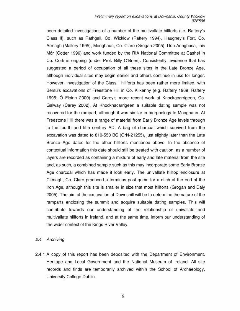
Mór (Cotter 1996) and work funded by the RIA National Committee at Cashel in
Co. Cork is ongoing (under Prof. Billy O’Brien). Consistently, evidence that has
suggested a period of occupation of all these sites in the Late Bronze Age,
although individual sites may begin earlier and others continue in use for longer.
However, investigation of the Class I hillforts has been rather more limited, with
Bersu’s excavations of Freestone Hill in Co. Kilkenny (e.g. Raftery 1969; Raftery
1995; Ó Floinn 2000) and Carey’s more recent work at Knockacarrigeen, Co.
Galway (Carey 2002). At Knocknacarrigeen a suitable dating sample was not
recovered for the rampart, although it was similar in morphology to Mooghaun. At
Freestone Hill there was a range of material from Early Bronze Age levels through
to the fourth and fifth century AD. A bag of charcoal which survived from the
excavation was dated to 810-550 BC (GrN-21255), just slightly later than the Late
Bronze Age dates for the other hillforts mentioned above. In the absence of
contextual information this date should still be treated with caution, as a number of
layers are recorded as containing a mixture of early and late material from the site
and, as such, a combined sample such as this may incorporate some Early Bronze
Age charcoal which has made it look early. The univallate hilltop enclosure at
Clenagh, Co. Clare produced a terminus post quem for a ditch at the end of the
Iron Age, although this site is smaller in size that most hillforts (Grogan and Daly
2005). The aim of the excavation at Downshill will be to determine the nature of the
ramparts enclosing the summit and acquire suitable dating samples. This will
contribute towards our understanding of the relationship of univallate and
multivallate hillforts in Ireland, and at the same time, inform our understanding of
the wider context of the Kings River Valley.
2.4 Archiving
2.4.1 A copy of this report has been deposited with the Department of Environment,
Heritage and Local Government and the National Museum of Ireland. All site
records and finds are temporarily archived within the School of Archaeology,
University College Dublin.

Preliminary report on excavations at Downshill, County Wicklow 07E596
7
2.5 Credits and Acknowledgements
2.5.1 The excavations were directed by Dr. John Ó Néill of the UCD School of
Archaeology with assistance from Dr Steve Mandal, Bairbre Mullee, Mark Kelly,
Liam Chambers (all CRDS Ltd), Dr. Phil Macdonald (QUB) and students from
various universities. Access to the site was facilitated by Tim O’Regan of Coillte,
the owners of the site, and Emmet Byrnes of the Department of Agriculture. The
work was supported by funding from the Royal Irish Academy and Department of
the Environment, Heritage and Local Government.

Preliminary report on excavations at Downshill, County Wicklow 07E596
8
Fig
ure
1. L
ocat
ion
map
, sho
win
g D
owns
hill
(circ
led)
.

Pre
limin
ary
rep
ort o
n e
xcavatio
ns a
t Dow
nsh
ill, Coun
ty W
icklo
w
07E
596
9
Trench 1
Trench 2
Figure 2. Site as shown on the 1909-1910 edition of the Ordnance Survey. Location of excavation trenches shown.

Preliminary report on excavations at Downshill, County Wicklow 07E596
10
Fig
ure
3.
Pla
n sh
owin
g su
rviv
ing
eart
hwor
ks o
n D
owns
hill.

Preliminary report on excavations at Downshill, County Wicklow 07E596
11
3. Excavation
3.1 Methodology
3.1.1 The initial focus of the 2007 investigations was to produce a post-felling survey of
the hilltop to identify the earthwork identified as a hillfort in the Archaeological
Inventory of County Wicklow and then to open two trenches to try and recover
information as to the morphology of the earthwork and recover potential dating
samples.
3.1.2 The excavations were undertaken by hand and the context record for the site was
created using the standard context recording method. Individual features were
photographed both prior to, and following, excavation and included in a series of
overall plans (Scales 1:10 and 1:20 for modern deposits) of the trench which were
prepared throughout the course of the excavation. Section drawings (Scale 1:20)
were undertaken of the exposed archaeological deposits visible in the baulk (for
details of site photography see Appendix Three and for field illustrations see
Appendix Four). In addition to the photography and illustration, the principal site
records consisted of context sheets augmented by separate registers of small finds
(Appendix Five) and samples (Appendix Six). Following the completion of the site
recording, the excavation trenches were backfilled and re-sodded.
3.1.3 It is intended that the Harris Matrix for the site (see Appendix Two) are referred to
whilst reading the account of the stratigraphic sequence of Trenches One and
Two.
3.2 Account of the excavations: Trench One.
3.2.3 A trench measuring a maximum of 4 m in width and 8 metres in length was opened
on the western side of the earthwork, in an area where the earthwork itself was
clearly visible and the density of tree planting was below the average for the hilltop
(see Plates 2 or 7 for a typical view). The trench extended from the exterior of the
hillfort across the shallow traces of the fosse and over the top of the bank into the

Preliminary report on excavations at Downshill, County Wicklow 07E596
12
interior at the eastern end of the trench with two small extensions to the east and
south as shown in figure 4. This account should be read in conjunction with figures
4, 5 and 6, as well as the matrix in figure 9.
Plate 2. Typical view of the earthwork on Downshill (visible as the raised bank planted with trees in the centre of the image, with the traces of a fosse to the left).

Preliminary report on excavations at Downshill, County Wicklow 07E596
13
Figure 4. Plan showing Trench 1 after excavation with bank deposits in situ (shown as
1008) and the excavated fosse (shown as 1002).
Limits of bank prior to excavation
Limits of fosse prior to excavation
Limits of 1016 1002
Bank deposits 1008
0 1 m 3 4 N

Preliminary report on excavations at Downshill, County Wicklow 07E596
14
Figure 5. Plan showing the two early 20th century pits in Trench 1 (1012 and 1014), relative to the position of the fosse and bank (see figure 4).

Pre
limin
ary
rep
ort o
n e
xcavatio
ns a
t Dow
nsh
ill, Coun
ty W
icklo
w
07E
596
15
Figure 6. South-facing section of Trench 1, with context numbers indicating layers as described in the text.

Preliminary report on excavations at Downshill, County Wicklow 07E596
16
3.2.4 The removal of the sod (1007) exposed the upper portion of the bank (1009),
buried peat (1006) which was subsequently discovered to be the upper fill of the
fosse and glacial till (1000). The sod and active soils (1007) were present to a
depth of 0.15 m and were present across the whole trench, once removed, a layer
of peaty soil (1006) was exposed that extended from the outer face of the bank
down into the fosse on the exterior. This deposit was present to a depth of 0.10 m,
burying the surviving upper surface of the bank and backfilling the fosse. The
removal of this deposit (1006), exposed the surviving bank and the cut for the
fosse and these are discussed separately below.
Plate 3. Trench 1 with excavated fosse in centre of image, showing both the shallower cut (1016) and the deeper, central cut (1002).

Preliminary report on excavations at Downshill, County Wicklow 07E596
17
3.2.5 At this location, the bank, as it survived prior to excavation, was 2 m wide, with the
top of the bank standing some 1.30 m above the visible portion of the fosse. The
removal of the sod 1007 and the deposit 1006 exposed a dump of gritty orange
clay (1009), 1.80 m wide and up to 0.50 m deep, which contained some weathered
shale slabs, up to 0.25 m in length. This clay layer (1009) partly covered a layer of
peaty clay which was recorded as 1008. This layer (1008), was not always present
beneath 1009 and was up to 0.50 m wide and 0.20 m deep and contained shale
slabs up to 0.20 m in length. The peaty clay (1008) and, where that layer was not
present, the orange clay layer (1009), overlay a buried peaty soil horizon, recorded
as 1001, which was up to 0.15 m deep. The external (i.e. western) face of the bank
deposits followed the profile of the original ground surface and there was no
evidence of an original facing to the bank. The interior face of the bank appears to
have been truncated during forestry works. None of the deposits described here
produced any artefactual material and screening of the soils failed to produce
charred plant material.
3.2.6 The cut for the fosse was also exposed on removal of deposit 1006. The surface of
the glacial till, 1000, was exposed on the exterior, i.e. western, side of the bank (as
described above) from where it sloped gently towards the west, dropping some 1
m in height over a distance of 10 m. The fosse was also cut through an earlier soil
horizon on the exterior of the earthwork, recorded as 1017. Directly beyond the
western limits of the bank deposits (i.e. 1008 and 1009), a portion of the glacial till
had been removed in a 2.50 m wide cut, 1016, parallel to the external face of the
bank, up to 0.40 m deep and with a V-shaped profile and concave base. The base
of this feature had been deepened along the 4 m from the northern baulk to give a
funnel-shaped profile. The remaining portion of 1016 extended parallel to the bank
but without the added deeper section This latter feature was recorded separately,
as 1002, as it was distinct from 1016 and was not continuously present within 1016
(see Plate 3). This part of the fosse was up 0.70 m wide and 0.50 m deep, with
steep sides and a fairly flat base.
3.2.7 The excavation of Trench 1 indicated that the bank had been constructed by
depositing 1009 and 1008 onto the old ground surface (1001), to an overall

Preliminary report on excavations at Downshill, County Wicklow 07E596
18
surviving height of 0.90 m and measuring 1.80 m in width. The external fosse was
identified as two distinct ‘cuts’, 1002 and 1016, both apparently executed as part
of the same phase of construction. This provided a fosse that was up to 0.90 m in
depth and up to 2.50 m in width. Taken together, the bank and fosse provided an
obstacle measuring some 4.40 m in width (see Plate 5), with a difference in height
of almost 2 m between the base of the fosse and the surviving top of the bank.
3.2.8 The base of the fosse (1002) contained a 0.10 m deep deposit of silty clay (1003)
with few identifiable organic inclusions. This was overlain by a 0.40 m deep deposit
of silty clay (1004), with a high proportion of pieces of angular and subangular
shale and granite, up to 0.25 m in length. There were no finds from either of these
deposits. The fill of the top of 1012 and 1016 was a fine peaty clay (1005), up to
0.25 m deep, which was overlain by layers 1006 and 1007 which are described in
section 3.2.5 above.
Plate 4. View across fosse and bank during excavation.

Preliminary report on excavations at Downshill, County Wicklow 07E596
19
3.2.9 Two pits, 1012 and 1014, had been cut through 1007, into the line of the fosse,
and backfilled with a mixed deposit, apparently derived from 1004, 1005 and 1006.
The upper fill of both pits was a yellow-orange silty, sandy clay, 1010 which was
spread across an area measuring 2.30 m by 0.80 m and up to 0.25 m deep. This
deposit (1010) was exposed directly beneath the sod layer (1007) and overlay the
soil layer 1006 which were present across the whole trench. The pit 1012 was fully
contained within the trench and measured 1.30 m (north-south) by 0.60 m and was
0.50 m deep. It had been cut though 1006 and backfilled with a mixed deposit of
peat, clay and stones which was recorded as 1013 and the upper fill contained
1010. The only finds from this pit were 14 star-crimped brass cartridges, some of
which had the head stamp ‘K C VI’ and may have been originally wrapped in
cardboard or paper. The pit 1014 extended beyond the southern limits of the
trench (see Plate 5). The excavated portion measured 0.50 m (north-south) by
0.80 m and was 0.50 m deep. It had been cut though 1006 and, similar to 1012,
backfilled with a mixed deposit of peat, clay and stones which was recorded as
1015, while the upper fill consisted of 1010. The only finds from this pit were 11
cartridges, some of which have the visible head stamp ‘R /|\ L C VI’.
Plate 5. Trench 1, Pit 1014.

Preliminary report on excavations at Downshill, County Wicklow 07E596
20
3.3 Account of the excavations: Trench Two
3.3.1 A second trench measuring a maximum of 4 m in width and 10 metres in length
was opened on the northern side of the earthwork, in an area where the earthwork
itself was fairly well defined and the density of tree planting was below the average
for the hilltop. The trench extended from the exterior of the hillfort (to the north)
across the shallow traces of the fosse and over the top of the bank into the interior
at the southern end of the trench. There was one large root system present in the
trench across a portion of the bank and one close to the eastern side of the trench.
This account should be read in conjunction with figures 7 and 8 and Plate 6 and
figure 10.
3.3.2 The removal of the sod (2001) and peaty soils (2004) exposed the upper portion of
the bank (2005). The sod and active soils (2001 and 2004) were present to a depth
of 0.40 m and were present across the whole trench. In the areas around the root
systems on the bank (recorded as 2003) and the eastern end of the trench
(recorded as 2002), the root systems had caused considerable disturbance which
extended from the sod and upper surface of 2004 down through any earlier
deposits. The layer of peaty soil (2004) was present to a depth of 0.25 m, burying
the surviving upper surface of the bank and backfilling the fosse. The removal of
this deposit (2004), exposed the surviving bank and the cut for the fosse and these
are discussed separately below.
3.3.3 At this location, the bank, as it survived prior to excavation, was 3 m wide, with the
top of the bank standing some 1.20 m above the visible portion of the fosse. The
removal of the sod 2001 and the deposit 2004 exposed a dump of peaty orange
clay (2005), 2.10 m wide and up to 0.30 m deep, which contained some weathered
shale slabs, up to 0.15 m in length. This layer (2005) tapered out to the interior of
the site (i.e. to the south) and to the exterior (i.e. to the north) where the ground
sloped down to the north. This layer (2005), overlay a buried peaty soil horizon,
recorded as 2009, which was up to 0.15 m deep. There was no evidence of an
original facing to the bank. None of the deposits described here produced any

Preliminary report on excavations at Downshill, County Wicklow 07E596
21
artefactual material and screening of the soils failed to produce charred plant
material.
3.3.4 The cut for the fosse was also exposed on removal of deposit 2004. The surface of
the glacial till, 2000, was exposed on the exterior, i.e. northern, side of the bank
(as described above) from where it sloped gently towards the north, dropping
some 1.50 m in height over a distance of 10 m. Directly beyond the northern limits
of the bank deposit (i.e. 2005), a portion of the glacial till had been removed in a
2.20 m wide cut, 2006, parallel to the external face of the bank, up to 1.00 m deep
and with a rough V-shaped profile with a smoothed concave base. The base of this
feature may have been deepened give a funnel-shaped profile but the extent of the
root disturbance (2003) in this area close to the western limits of the trench
precluded identifying this cut clearly during the excavation.
3.3.5 The excavation of Trench 2 indicated that the bank had been constructed by
depositing 2005 and onto the old ground surface (2009), to an overall surviving
height of 0.40 m and measuring 2.10 m in width. The external fosse was identified
as one distinct ‘cut’, 2006 similar to 1016 in Trench 1. The possibility that another
discontinuous section, similar to 1002, was present could not be ruled out as the
root disturbance 2003 obscured this area of the trench. As present during the
excavation, 2006 provided a fosse that was up to 0.70 m in depth and up to 1.80 m
in width. Taken together, the bank and fosse provided an obstacle measuring
some 4.00 m in width, with a difference in height of almost 1.50 m between the
base of the fosse and the surviving top of the bank.
3.3.6 The base of the fosse (2006) contained a 0.10 m deep deposit of silty clay (2008)
with few identifiable organic inclusions. This was overlain by a 0.40 m deep deposit
of silty clay (2007), which contained some pieces of angular and subangular shale
and granite, up to 0.15 m in length. There were no finds from either of these
deposits. The upper portion of 2006 was the peaty clay (2004), up to 0.20 m deep,
which overlay an older soil horizon (2010) on the northern (exterior) side of the
fosse, beyond the edge of 2006.

Preliminary report on excavations at Downshill, County Wicklow 07E596
22
Figure 7. Plan showing Trench 2 after excavation with bank deposits in situ (shown as 2005) and the excavated fosse (shown as 2006).

Pre
limin
ary
rep
ort o
n e
xcavatio
ns a
t Dow
nsh
ill, Coun
ty W
icklo
w
07E
596
23
Figure 8. West-facing section of Trench 2, with context numbers indicating layers as described in the text.

Preliminary report on excavations at Downshill, County Wicklow 07E596
24
3.4 Phasing of the stratigraphic sequences
3.4.1 A number of statements can be made about the stratigraphic relationships, as
recorded during excavation (see Appendix 2 for Harris Matrices). The earliest soils
identified in Trenches 1 and 2 were old soil horizons stratified below the bank
deposits in Trench 1 (i.e. 1001 beneath 1008 and 1009, and 1017 beneath 1006)
and Trench 2 (i.e. 2009 beneath 2005 and 2004, and, 2010 beneath 2004).
3.4.2 In both trenches, there was no clear stratigraphic relationship between the bank
and fosse to suggest the sequence of construction. The cuts for the fosse,
1002/1016 and 2006, both accentuated the profile of the slope at that particular
location and removed the earlier soil layers. The bank deposits (1008/1009 in
Trench 1 and 2005 in Trench 2) were placed just beyond the highest point at which
the fosse was cut, confirming their relationship and suggesting the were conceived
as a single entity, and constructed as such.
3.4.3 Following the initial construction, the fosse acquired a deposit of silty clay soil in it’s
base in both trenches, followed by a mixed deposit of stone, clay and peat. This
was then followed by a protracted episode where, the fosse having become
backfilled, natural soil formation processes sealed the fosse and bank beneath an
active soil layer and sod.
3.4.4 Early twentieth century activity led to the opening and backfilling of two pits (1012
and 1014) in Trench 1. This was followed by disturance associated with the
conversion of the site to a forestry plantation in the late 1950s.
3.5 Artefactual Dating
3.5.1 The only artefactual material recovered during the excavation were the cartridge
cases recovered from the fills of 1012 and 1014.
3.5.2 Some cartridge cases were recovered from these two features. These include 10
expended and 15 unfired .303 star-crimped rounds with the headstamps ‘K C VI’

Preliminary report on excavations at Downshill, County Wicklow 07E596
25
and ‘R /|\ L C VI’, indicating Kynochs/Cordite/Mark VI and Royal Laboratory,
Woolwich Arsenal/Cordite/Mark VI (Tebbutt 2005; additional information from the
International Ammunition Association). As date stamping of cartridge cases was
introducted in 1908, both appear to have been manufactured prior to this date. The
Kynoch blanks were manufactured in the Kynochs factory in Birmingham in either
1907 or 1908, as 1907 saw the discontinutation of brass mock bullets on blanks
due to accidental deaths. The Royal Laboratory Arsenal blanks must have been
manufactured at around the same time. As these blanks could be viable for up to
30 years or more, there is no clear evidence to suggest the context in which they
were fired. Some of the unexpended Kynoch cartridges were found lying side-by-
side with what appeared to be traces of a wrapping.
Plate 6. Trench 2, viewed from the north across the fosse and bank, the area to the right of the upright ranging rod was largely disturbed by tree roots.
Preliminary report on excavations at Downshill, County Wicklow 07E596
26
4. Results and Discussion
4.1 Results
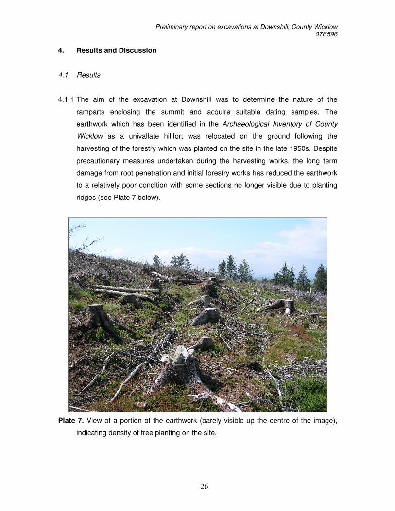
4.1.1 The aim of the excavation at Downshill was to determine the nature of the
ramparts enclosing the summit and acquire suitable dating samples. The
earthwork which has been identified in the Archaeological Inventory of County
Wicklow as a univallate hillfort was relocated on the ground following the
harvesting of the forestry which was planted on the site in the late 1950s. Despite
precautionary measures undertaken during the harvesting works, the long term
damage from root penetration and initial forestry works has reduced the earthwork
to a relatively poor condition with some sections no longer visible due to planting
ridges (see Plate 7 below).
Plate 7. View of a portion of the earthwork (barely visible up the centre of the image),
indicating density of tree planting on the site.
Preliminary report on excavations at Downshill, County Wicklow 07E596
27
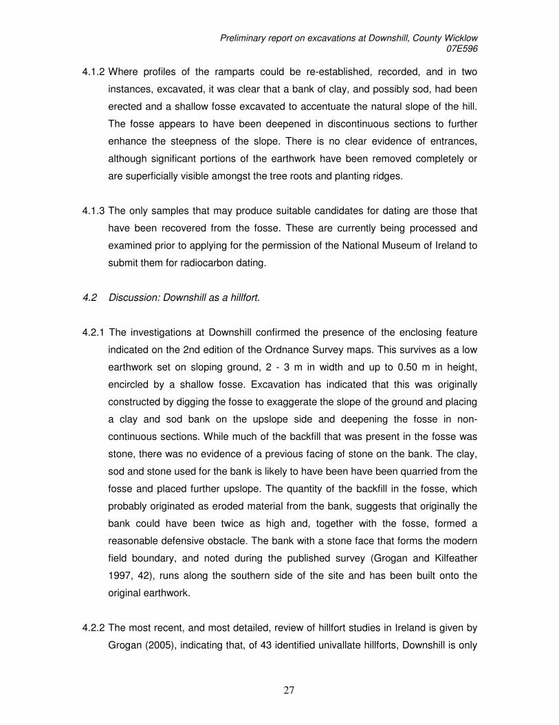
4.1.2 Where profiles of the ramparts could be re-established, recorded, and in two
instances, excavated, it was clear that a bank of clay, and possibly sod, had been
erected and a shallow fosse excavated to accentuate the natural slope of the hill.
The fosse appears to have been deepened in discontinuous sections to further
enhance the steepness of the slope. There is no clear evidence of entrances,
although significant portions of the earthwork have been removed completely or
are superficially visible amongst the tree roots and planting ridges.
4.1.3 The only samples that may produce suitable candidates for dating are those that
have been recovered from the fosse. These are currently being processed and
examined prior to applying for the permission of the National Museum of Ireland to
submit them for radiocarbon dating.
4.2 Discussion: Downshill as a hillfort.
4.2.1 The investigations at Downshill confirmed the presence of the enclosing feature
indicated on the 2nd edition of the Ordnance Survey maps. This survives as a low
earthwork set on sloping ground, 2 - 3 m in width and up to 0.50 m in height,
encircled by a shallow fosse. Excavation has indicated that this was originally
constructed by digging the fosse to exaggerate the slope of the ground and placing
a clay and sod bank on the upslope side and deepening the fosse in non-
continuous sections. While much of the backfill that was present in the fosse was
stone, there was no evidence of a previous facing of stone on the bank. The clay,
sod and stone used for the bank is likely to have been have been quarried from the
fosse and placed further upslope. The quantity of the backfill in the fosse, which
probably originated as eroded material from the bank, suggests that originally the
bank could have been twice as high and, together with the fosse, formed a
reasonable defensive obstacle. The bank with a stone face that forms the modern
field boundary, and noted during the published survey (Grogan and Kilfeather
1997, 42), runs along the southern side of the site and has been built onto the
original earthwork.
4.2.2 The most recent, and most detailed, review of hillfort studies in Ireland is given by
Grogan (2005), indicating that, of 43 identified univallate hillforts, Downshill is only

Preliminary report on excavations at Downshill, County Wicklow 07E596
28
surpassed in size by Lyles Hill in Antrim, and, Caherdrinny and Claraghatlea South
in Cork, and, Laghtea in Tipperary (Grogan 2005, Tables 7.1 and 7.2). Current
dating evidence now seems to suggest two distinct episodes of hillfort construction
with some built around the 12th century BC, such as Rathgall, Co. Wicklow (Raftery
1994) and Haughey’s Fort, Co. Armagh (Mallory 1995; possibly continuing to the
9th century BC – see Grogan 2005, 129). A similar date has been suggested by
recent work, funded by the RIA National Committee, at Cashel in Co. Cork under
Prof. Billy O’Brien. Others appear to have been constructed some time in the 9th
century BC, such as: Mooghaun, Co. Clare which has been dated to 895-842 BC
(Grogan 2005, 129); Dún Aonghusa on Inis Mór which has been dated to before
950-540 BC (Cotter 1996); a date of 810-550 BC (GrN-21255) was returned from
some charcoal that survived from the excavation at the univallate hillfort on
Freestone Hill in Co. Kilkenny (e.g. Raftery 1969; Raftery 1995; Ó Floinn 2000);
and, most recently, a date of 994-827 BC was returned for a sample from the inner
ditch of a multivallate hillfort at Rahally in County Galway (O’Sullivan 2007, 89). It
is hoped that material recovered from the samples at Downshill can be
successfully dated to suggest whether it fits in with one of these episodes. It is
hoped that this will shed some light on the dating of univallate hillforts as the only
current example is Freestone Hill, which may be unreliable (see.2.3.1 above).
4.2.3 The location of Downshill, at an elevation of 339 m OD, provides a significant
panoramic vista encompassing much of the Wicklow coast, Dublin bay and
northwards along the coast with both the Mourne Mountains and Wales visible on
a clear day (see Plate 8 below). The hilltop defences, in their surviving form, do not
appear to represent an insurmountable obstacle to a determined attacker,
although, as discussed above, the original height of the bank and the fosse may
have further accentuated the slope of the ground. The discontinuous nature of the
deeper base of the fosse does not particularly strengthen an argument as to the
tactical defence of the site. However, given that Downshill is only one of a number
of hills in the area which may suitably accommodate a hillfort, the reason for its
selection may be more closely related to the panoramic view from the top and its
strategic qualities. The construction of some 925 m of rampart on Downshill,
totalling some 2,000 m³, or 3,000 tons of earth, suggesting a project involving
significant numbers of people. While it could be argued that tactical defences

Preliminary report on excavations at Downshill, County Wicklow 07E596
29
would be erected that might be capable of withstanding an assault in the
contemporary mode of warfare (and so, by extension, it should allow us to assess
what that mode might be), it is equally possible, that the vision behind this project
was strategic rather than tactical. In this case, the society responsible for the
project may have been concerned with providing a highly visible (and so,
reassuring) hilltop redoubt that might act as an early warning system for mobile
incursions from outside the area.
Plate 8. Typical view from Trench 2 on Downshill (looking towards, left to right, the Little Sugar Loaf, Bray Head and Kindlestown Hill).
4.2.4 While Downshill itself is located beyond the reaches of the Kings River Valley
which has been the focus of a number of research projects by the UCD School of
Archaeology, it may have be a significant strategic focus for the coastal plain to the
east of the Kings River Valley in the Late Bronze Age.

Preliminary report on excavations at Downshill, County Wicklow 07E596
30
4.3 A note on the Cordite blanks.
4.2.1 The blank cartridges recovered from the two pits in Trench 1 may relate to an
unrecorded episode of activity on the hilltop in the early 20th century. The field
boundary to the south-east of the site is flanked by a series of irregularities which
may pre-date the planting of forestry on the site. These continue up the slope of
the hill where they have damaged a portion of the earthwork (to the immediate
north of Trench 1). Investigation of eroding deposits in the area to the north of
Trench 1 showed that this area of disturbance was dug to a depth of around 1 m
and seem to represent a phase of dugout construction relating to military activity
on the hill. While this was not the focus of the 2007 investigations, the date of the
cartridges does not preclude the possibility that this relates to the period of the War
of Independence or Civil War which may be of interest by the time of the
centenaries of these events from 2016 onwards. Further research may identify
records of this activity and clarify this matter.

Preliminary report on excavations at Downshill, County Wicklow 07E596
31
5. References
Carey, A. 2002. Excavations at Knockcarrigeen Hill, Tuam, Co. Galway, JGAHS 54, 55-
71. Cotter, C. 1996 Dùn Aonghusa, Kilmurvey, Inis Mòr, Cliff Fort, in I. Bennett (ed)
Excavations 1995, 36-37. Cotter, C. 2003 Monitoring of Tree-felling at Downshill. Unpublished report. Grogan, E. 2005 The North Munster Project. Dublin. Grogan, E. and Daly, A. 1997.Excavations at Clenagh, Co. Clare, in E.Grogan The North
Munster Project, 247-255. Dublin. Grogan, E. and Kilfeather, A. 1997. Archaeological Inventory of County Wicklow. Dublin. Mallory, J. 1995 Haughey’s Fort and the Navan Complex in the Late Bronze Age, in J.
Waddell and E.S.Twohig (eds) Ireland in the Bronze Age, 73-86. Dublin. Ó Floinn, R. 2000. Freestone Hill, Co. Kilkenny: a reassessment, in A. Smyth (ed)
Seanchas: Studies in Early and medieval Irish archaeology, history and literature in honour of Francis J. Byrne. Dublin.
O’Sullivan, J. 2007 The quiet landscape: archaeological discoveries on a road scheme in
east Galway. In J. O’Sullivan and M. Stanley (eds) New routes to the past, 81-100. Archaeology and the National Roads Authority Monograph Series, No. 4.
Raftery, B. 1969. Freestone Hill, Co. Kilkenny: an Iron Age hillfort and Bronze Age cairn,
PRIA 68C, 1-108. Raftery, B. 1972. Irish Hill-forts, in C. Thomas (ed) The Iron Age in the Irish Sea
Province, 37-58. London. Raftery, B. 1994. Pagan Celtic Ireland. London. Tebbutt, R 2005 .303 British Service Cartridge. The Drop Zone, Vol. 3:1.

Preliminary report on excavations at Downshill, County Wicklow 07E596
32
Appendix One: Context List
Context No.
Trench No.
Description
1000 1 Glacial Till
1001 1 Compact peaty soil beneath bank
1002 1 Steep sided cut in base of 1016
1003 1 Silty clay in base of 1002
1004 1 Silty clay layer, high proportion of stone, overlies 1003
1005 1 Fine peaty clay overlying 1004
1006 1 Silty peaty soil
1007 1 Active soil layer and sod
1008 1 Deposit of peaty clay in bank (possibly sods)
1009 1 Gritty orange clay deposit (part of bank)
1010 1 Deposit of sandy clay soil – fills top of 1012 and 1014
1011 1 Peaty soil – same as 1007 (number not used in text)
1012 1 Pit dating 20th century
1013 1 Fill of 1012
1014 1 Pit dating 20th century
1015 1 Fill of 1014
1016 1 Shallow, round-bottomed cut for fosse
1017 1 Compact peaty soil outside fosse, similar to 1001
2000 2 Glacial till
2001 2 Active soil layer and sod
2002 2 Tree root system and associated disturbance
2003 2 Tree root system and associated disturbance
2004 2 Silty peaty soil
2005 2 Peaty orange clay (bank)
2006 2 Cut for fosse
2007 2 Fine peaty clay overlying 2008 in 2006
2008 2 Silty clay in base of 2006
2009 2 Compact peaty soil (buried soil below bank)
2010 2 Compact peaty soil (buried soil outside fosse)

Preliminary report on excavations at Downshill, County Wicklow 07E596
33
Appendix Two: Harris Matrix
Figure 9. Harris Matrix for Trench 1

Preliminary report on excavations at Downshill, County Wicklow 07E596
34
Figure 10. Harris Matrix for Trench 2.

Preliminary report on excavations at Downshill, County Wicklow 07E596
35
Appendix Three: Photographic Record Film One: Nikon Coolpix (archived as jpeg images at UCD School of Archaeology) Frame Description (file caption):
1. Disturbed area north of Trench 1 2. Earthworks 1 3. Earthworks 2 4. Earthworks 3 5. Earthworks and tree line 6. Earthworks showing tree stumps 7. Field boundary 8. Northwest corner of earthwork 9. Record shot 10. Record shot 11. Record shot 12. Record shot 13. Trench 1 Bank 14. Trench 1 Bank from North 15. Trench 1 during recording 16. Trench 1 from disturbed area 17. View from Trench 1 to the Sugarloaf 18. View of Trench 1 from north 19. Well preserved earthwork on north side 20. Pit 1014 21. Pit 1014 and cut 1016 22. Close up of 1014 23. Contexts 1002 and 1016 24. Contexts 1002 1016 1014 25. Fosse post ex shot 26. Fosse post ex shot 27. Trench 1 post ex 28. Fosse and bank 29. Trench 1 from South 30. Bank in section in Trench 1 31. 1002 and 1016 in section 32. Possible ‘dugout’ to north of Trench 1 33. Disturbed area (20th century disturbance) 34. Disturbance along field boundary 35. Disturbance along field boundary 36. Disturbance along field boundary 37. Disturbance along field boundary 38. View from interior to east beyond Trench 1 39. View of Trench 1 from West 40. View of Trench 1 41. Working Shot

Preliminary report on excavations at Downshill, County Wicklow 07E596
36
42. Trench being recorded 43. View to north from Trench 2 44. Record shot Trench 2 45. Trench 2 tree root disturbance 46. Record shot of root disturbance 47. Record shot of root disturbance 48. Record shot of root disturbance 49. Record shot of root disturbance 50. 2000 beneath bank in Trench 2 51. Trench 2, C2006 52. Trench 2, C2006 53. Trench 2, C2006 with root systems 54. Close up of 2007 and 2008 55. Disturbance by roots of 2001 and 2004, Tr 2 56. View from outside fosse in Tr 2 57. Tr 2 fosse and bank 58. Tr 2 record shot post ex 59. 2006 with root disturbance 60. View to east from Tr 2 61. Tr 2 view – record shot 62. Backfilling shot 63. Backfilling shot 64. Backfilling shot

Preliminary report on excavations at Downshill, County Wicklow 07E596
37
Appendix Four: Field Drawing Register
Drawing Description Type Scale
Earthwork Profile 1 Profile 1:10
Earthwork Profile 2 Profile 1:10
Earthwork Profile 3 Profile 1:10
Earthwork Profile 4 Profile 1:10
Earthwork Profile 5 Profile 1:10
Earthwork Profile 6 Profile 1:10
Earthwork Profile 7 Profile 1:10
Earthwork Profile 8 Profile 1:10
Earthwork Profile 9 Profile 1:10
Earthwork Profile 10 Profile 1:10
Earthwork Profile 11 Profile 1:10
Earthwork Profile 12 Profile 1:10
Earthwork Profile 13 Profile 1:10
Earthwork Profile 14 Profile 1:10
Earthwork Profile 15 Profile 1:10
Earthwork Profile 16 Profile 1:10
Earthwork Profile 17 Profile 1:10
Earthwork Profile 18 Profile 1:10
Earthwork Profile 19 Profile 1:10
Earthwork Profile 20 Profile 1:10
Earthwork Profile 21 Profile 1:10
Earthwork Profile 22 Profile 1:10
Earthwork Profile 23 Profile 1:10
Earthwork Profile 24 Profile 1:10
Trench 1 features Plan 1:20
Trench 1 (south-facing) Section 1:10
Trench 1 (north-facing) Section 1:10
Trench 2 features Plan 1:20
Trench 2 (east-facing) Section 1:10
Trench 2 (west-facing) Section 1:10

Preliminary report on excavations at Downshill, County Wicklow 07E596
38
Appendix Five: Small Finds Register
Find no. Material Object Trench Context
1 copper alloy cartridge case 1 1013
2 copper alloy cartridge case 1 1013
3 copper alloy cartridge case 1 1013
4 copper alloy cartridge case 1 1013
5 copper alloy cartridge case 1 1013
6 copper alloy cartridge case 1 1013
7 copper alloy cartridge case 1 1013
8 copper alloy cartridge case 1 1013
9 copper alloy cartridge case 1 1013
10 copper alloy cartridge case 1 1013
11 copper alloy cartridge case 1 1013
12 copper alloy cartridge case 1 1013
13 copper alloy cartridge case 1 1013
14 copper alloy cartridge case 1 1013
15 copper alloy cartridge case 1 1015
16 copper alloy cartridge case 1 1015
17 copper alloy cartridge case 1 1015
18 copper alloy cartridge case 1 1015
19 copper alloy cartridge case 1 1015
20 copper alloy cartridge case 1 1015
21 copper alloy cartridge case 1 1015
22 copper alloy cartridge case 1 1015
23 copper alloy cartridge case 1 1015
24 copper alloy cartridge case 1 1015
25 copper alloy cartridge case 1 1015

Preliminary report on excavations at Downshill, County Wicklow 07E596
39
Appendix Six: Samples Register
The following samples were retained for analysis for plant macro, charcoal and
other significant materials:
Sample No Trench Context
Sample 1 Trench 1 C1005
Sample 2 Trench 1 C1004
Sample 3 Trench 1 C1003
Sample 4 Trench 1 C1005
Sample 5 Trench 2 C2007
Sample 3 Trench 2 C2008