Fundamental Station Wettzell- geodetic observatory -
Wolfgang SchlüterBundesamt für Kartographie und Geodäsie, Fundamental Station Wettzell
Germany
Radiometer Workshop, Wettzell, 10.10.06
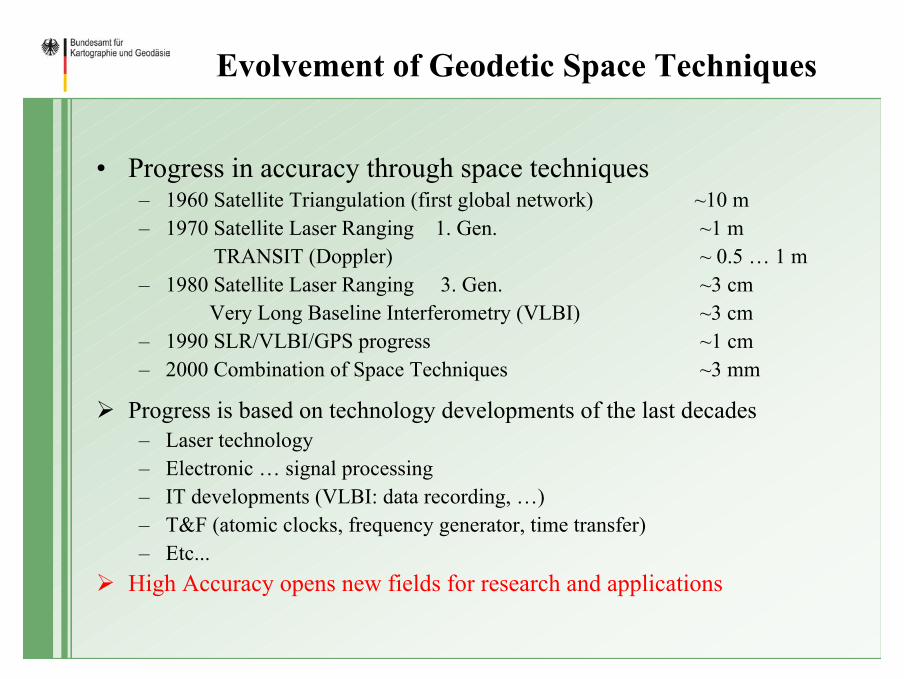
Evolvement of Geodetic Space Techniques
• Progress in accuracy through space techniques– 1960 Satellite Triangulation (first global network) ~10 m– 1970 Satellite Laser Ranging 1. Gen. ~1 m
TRANSIT (Doppler) ~ 0.5 … 1 m– 1980 Satellite Laser Ranging 3. Gen. ~3 cm
Very Long Baseline Interferometry (VLBI) ~3 cm– 1990 SLR/VLBI/GPS progress ~1 cm– 2000 Combination of Space Techniques ~3 mm
Progress is based on technology developments of the last decades– Laser technology– Electronic … signal processing – IT developments (VLBI: data recording, …)– T&F (atomic clocks, frequency generator, time transfer)– Etc...
High Accuracy opens new fields for research and applications
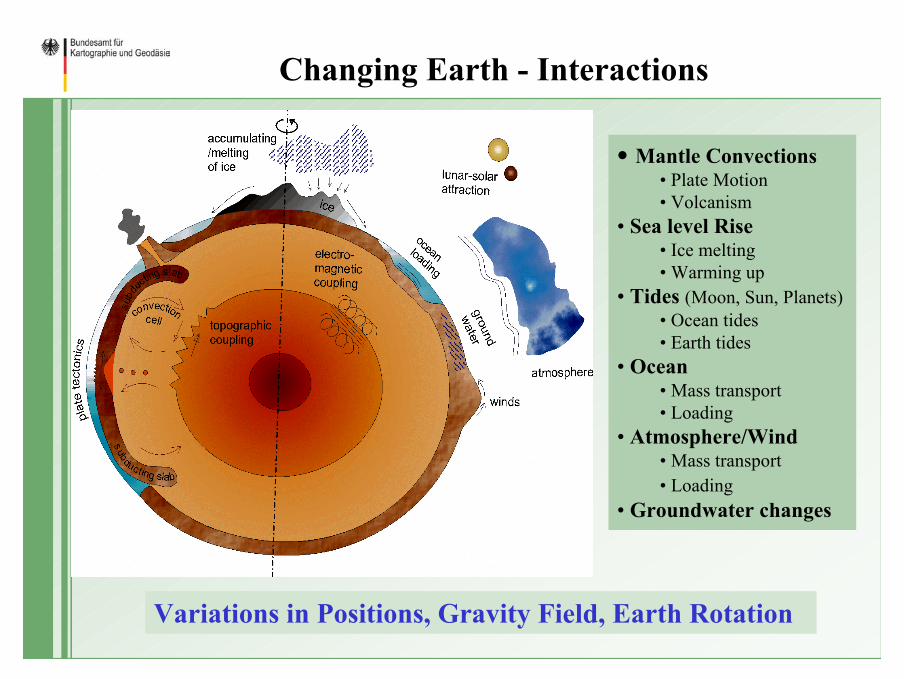
Changing Earth - Interactions
• Mantle Convections• Plate Motion • Volcanism
• Sea level Rise • Ice melting• Warming up
• Tides (Moon, Sun, Planets)• Ocean tides• Earth tides
• Ocean• Mass transport• Loading
• Atmosphere/Wind• Mass transport• Loading
• Groundwater changes
Variations in Positions, Gravity Field, Earth Rotation
• Monitoring the variations • Improve the models (predictions)• Understanding of geophysical phenomena• Maintenance of global reference frames for positioning in Space and
on Earth• Quasar, Stars, Planets, Moon ...)• Space Crafts, Satellites,... )• Geodesy• Geo-Information• Navigation• …..
• Fundamental for Research in all Geosciences and related disciplines
IAG-PP: GGOS (Global Geodetic Observing System) – global reference frame, 10-9 precise– consistent in geometrical and physical parameters!– consistent for decades!
Continuous observations required
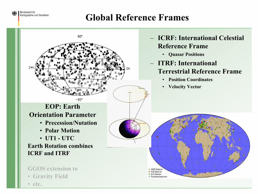
Global Reference Frames
– ICRF: International Celestial Reference Frame
• Quasar Positions
– ITRF: International Terrestrial Reference Frame
• Position Coordinates• Velocity Vector
EOP: Earth Orientation Parameter
• Precession/Nutation• Polar Motion• UT1 - UTC
Earth Rotation combines ICRF and ITRF
GGOS extension to• Gravity Field• etc.
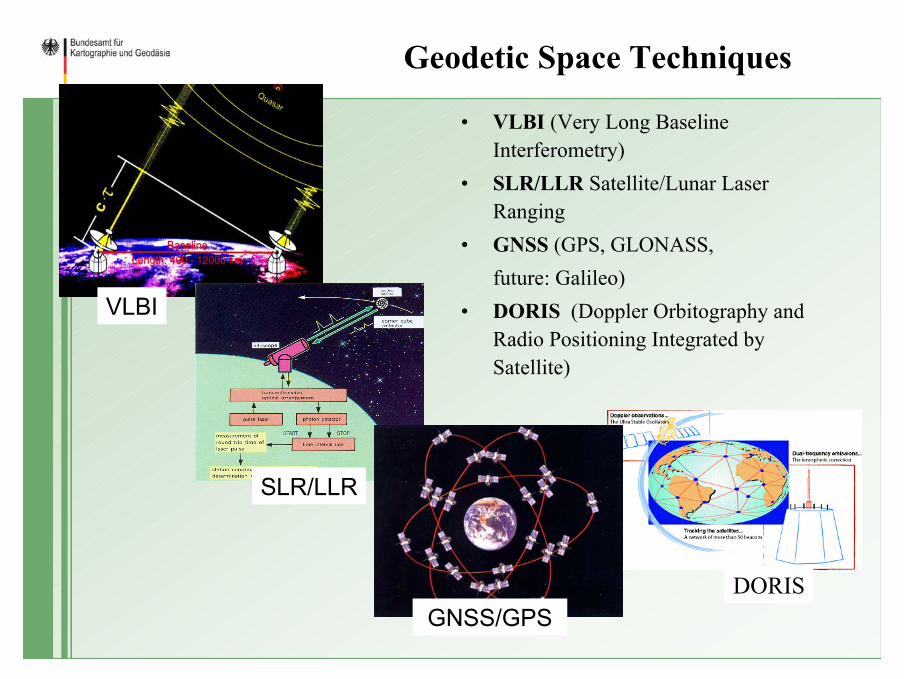
Geodetic Space Techniques
• VLBI (Very Long Baseline Interferometry)
• SLR/LLR Satellite/Lunar Laser Ranging
• GNSS (GPS, GLONASS, future: Galileo)
• DORIS (Doppler Orbitography and Radio Positioning Integrated by Satellite)
VLBI
SLR/LLR
GNSS/GPSDORIS
International Cooperation: IAG-, IAU- ServicesThe maintenance of global reference frames is a very complex and a global task, which can only be solved on the international level. In the last years, international services were established by the individual techniques, in the frame of the International Association of Geodesy (IAG) or International Astronomical Union (IAU), in order to coordinate the observations, the data flow, the analysis and the development of technology. The services are the“Geometric Services“
– International GNSS Service (IGS), – International Laser Ranging Service (ILRS),– International VLBI Service for Geodesy and Astrometry (IVS) – International DORIS Service (IDS) and theCombination of the products by – International Earth Rotation and Reference Frame Service (IERS).
IAG-PP: GGOS (Global Geodetic Observing System) needs also“Gravimetric Services“
– International Gravimetric Bureau (BGI)– International Center for Earth Tides (ICET)– Permanent Service for Mean Sea Level (PSMSL)– International Gravity Field Service (IGFS)
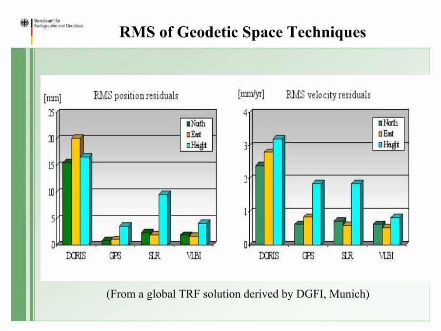
RMS of Geodetic Space Techniques
(From a global TRF solution derived by DGFI, Munich)
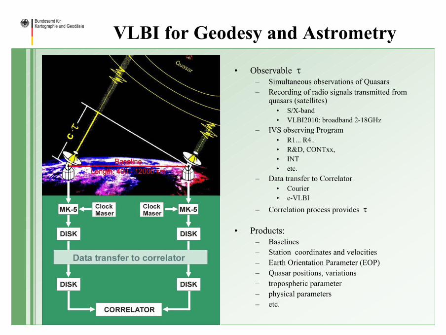
VLBI for Geodesy and Astrometry
• Observable τ– Simultaneous observations of Quasars– Recording of radio signals transmitted from
quasars (satellites)• S/X-band • VLBI2010: broadband 2-18GHz
– IVS observing Program • R1... R4.. • R&D, CONTxx, • INT • etc.
– Data transfer to Correlator • Courier• e-VLBI
– Correlation process provides τ
• Products:– Baselines– Station coordinates and velocities– Earth Orientation Parameter (EOP)– Quasar positions, variations– tropospheric parameter– physical parameters– etc.
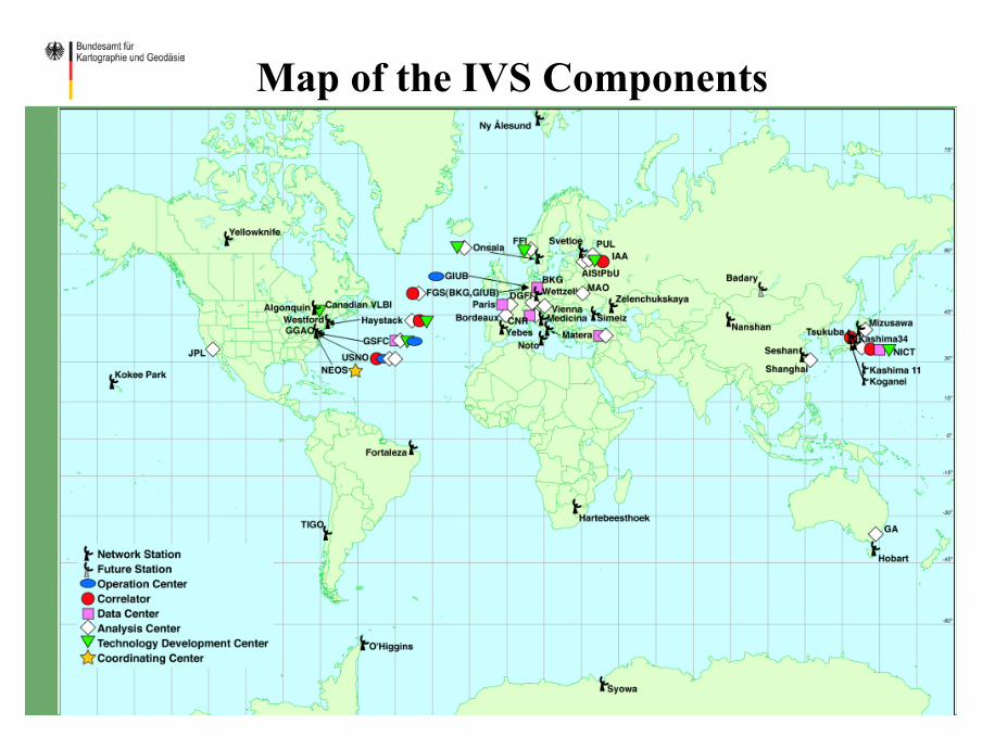
Map of the IVS Components
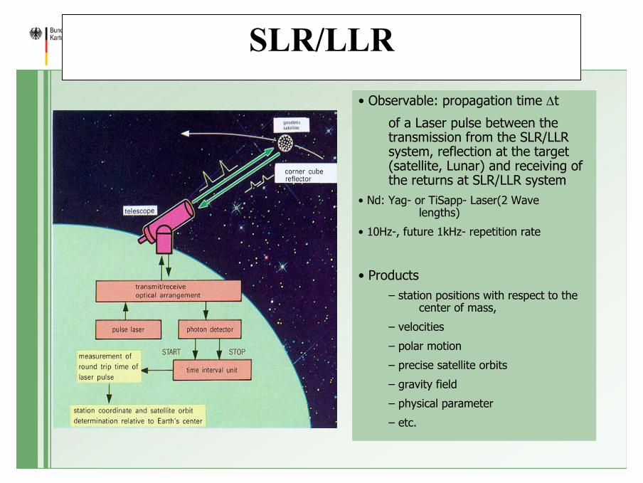
SLR/LLR• Observable: propagation time ∆t
of a Laser pulse between the transmission from the SLR/LLR system, reflection at the target (satellite, Lunar) and receiving of the returns at SLR/LLR system
• Nd: Yag- or TiSapp- Laser(2 Wave lengths)
• 10Hz-, future 1kHz- repetition rate
• Products– station positions with respect to the
center of mass,
– velocities
– polar motion
– precise satellite orbits
– gravity field
– physical parameter
– etc.
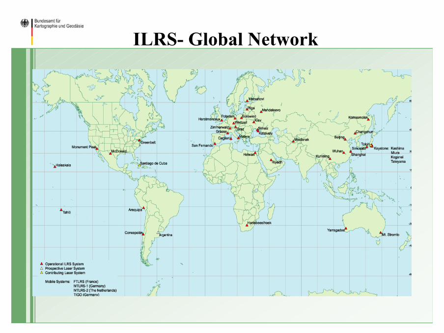
ILRS- Global Network
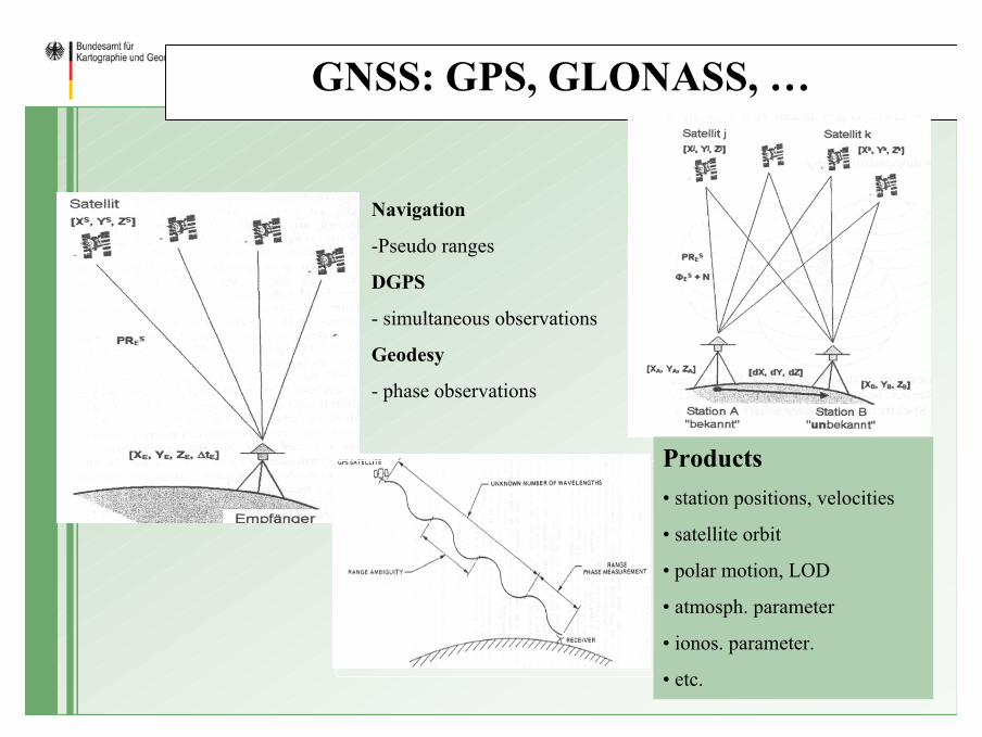
GNSS: GPS, GLONASS, …
Navigation
-Pseudo ranges
DGPS
- simultaneous observations
Geodesy
- phase observations
Products• station positions, velocities
• satellite orbit
• polar motion, LOD
• atmosph. parameter
• ionos. parameter.
• etc.
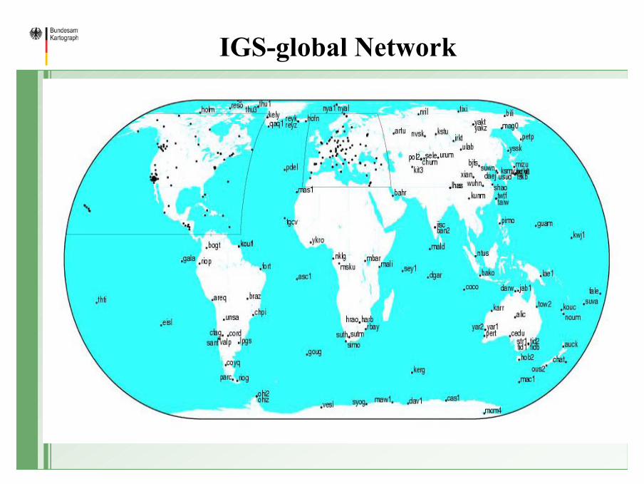
IGS-global Network
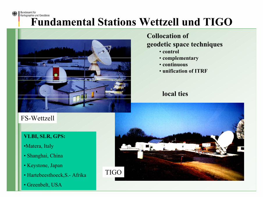
Fundamental Stations Wettzell und TIGOCollocation of geodetic space techniques
• control• complementary• continuous• unification of ITRF
FS-Wettzell
TIGO
VLBI, SLR, GPS:
•Matera, Italy
• Shanghai, China
• Keystone, Japan
• Hartebeesthoeck,S.- Afrika
• Greenbelt, USA
local ties
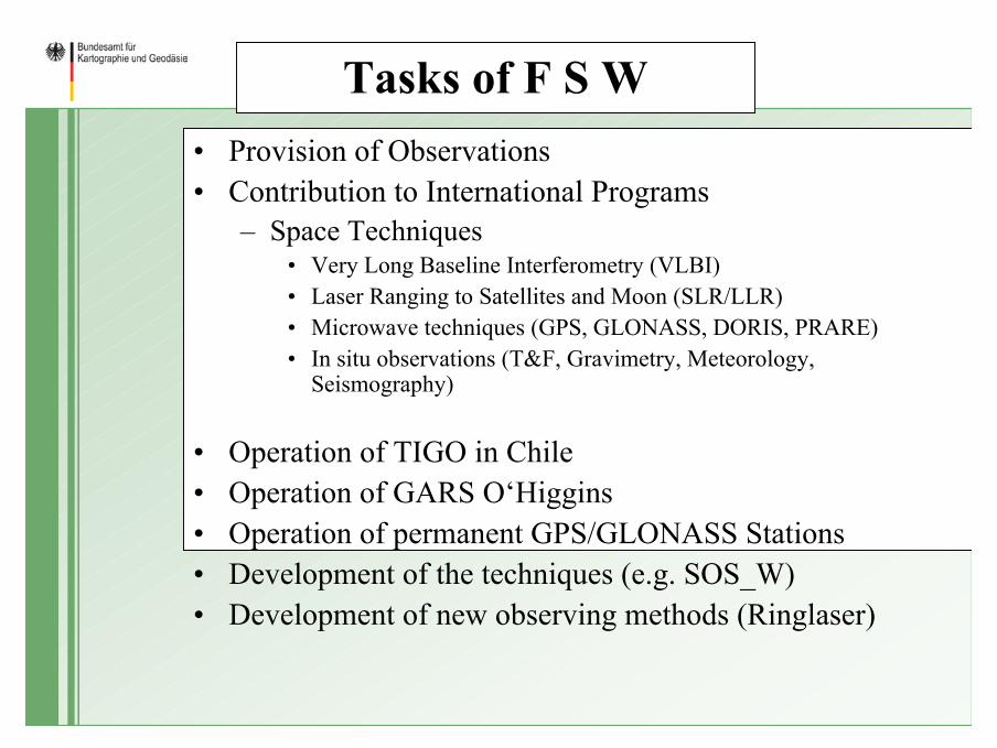
Tasks of F S W• Provision of Observations • Contribution to International Programs
– Space Techniques• Very Long Baseline Interferometry (VLBI)• Laser Ranging to Satellites and Moon (SLR/LLR)• Microwave techniques (GPS, GLONASS, DORIS, PRARE)• In situ observations (T&F, Gravimetry, Meteorology,
Seismography)
• Operation of TIGO in Chile• Operation of GARS O‘Higgins• Operation of permanent GPS/GLONASS Stations• Development of the techniques (e.g. SOS_W)• Development of new observing methods (Ringlaser)
Research Group Satellite Geodesy (FGS)
• Agreement on Cooperation– Bundesamt für Kartographie und Geodäsie (BKG)– Deutsches Geodätisches Forschungsinstitut (DGFI)– Technische Universität München (TUM)
• Institut für Astronomische und Physikalische Geodäsie (IAPG)• Forschungseinrichtung Satellitengeodäsie (FESG)
– Geodätisches Institut der Universität Bonn (GIUB)
• Operation of Fundamentalstation Wettzell by– Bundesamt für Kartographie und Geodäsie (BKG)– Forschungseinrichtung Satellitengeodäsie (FESG)
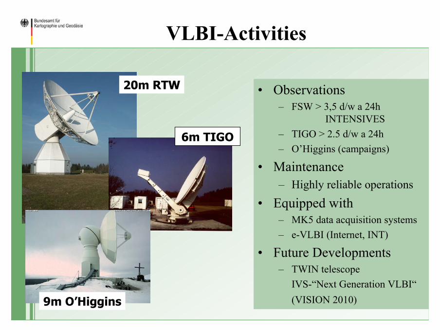
VLBI-Activities
• Observations– FSW > 3,5 d/w a 24h
INTENSIVES – TIGO > 2.5 d/w a 24h– O’Higgins (campaigns)
• Maintenance– Highly reliable operations
• Equipped with– MK5 data acquisition systems– e-VLBI (Internet, INT)
• Future Developments– TWIN telescope
IVS-“Next Generation VLBI“(VISION 2010)
20m RTW
6m TIGO
9m O’Higgins
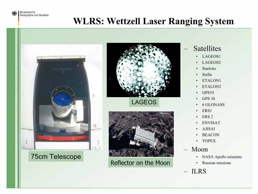
WLRS: Wettzell Laser Ranging System
– Satellites• LAGEOS1 • LAGEOS2 • Starlette • Stella• ETALON1• ETALON2 • GPS35 • GPS 36 • 6 GLONASS• ERS1 • ERS 2• ENVISAT• AJISAI • BEACON• TOPEX
– Moon• NASA Apollo missions• Russian missions
– ILRS
75cm Telescope
LAGEOS
Reflector on the Moon
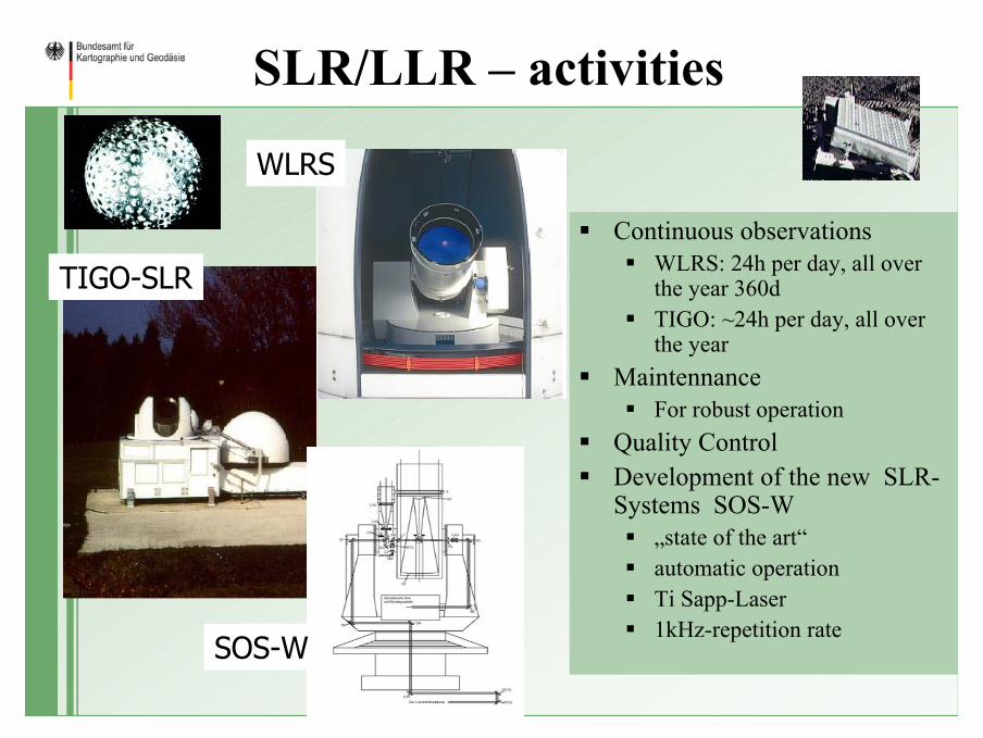
SLR/LLR – activities
Continuous observationsWLRS: 24h per day, all over the year 360dTIGO: ~24h per day, all over the year
Maintennance For robust operation
Quality ControlDevelopment of the new SLR-Systems SOS-W
„state of the art“automatic operationTi Sapp-Laser1kHz-repetition rate
WLRS
TIGO-SLR
SOS-W
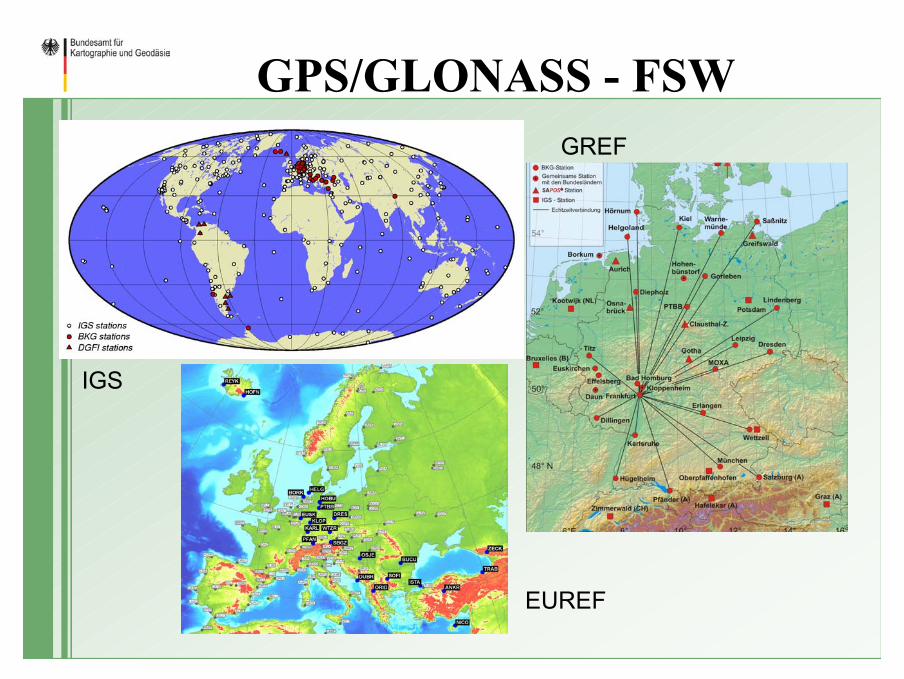
GPS/GLONASS - FSW
IGS
GREF
EUREF
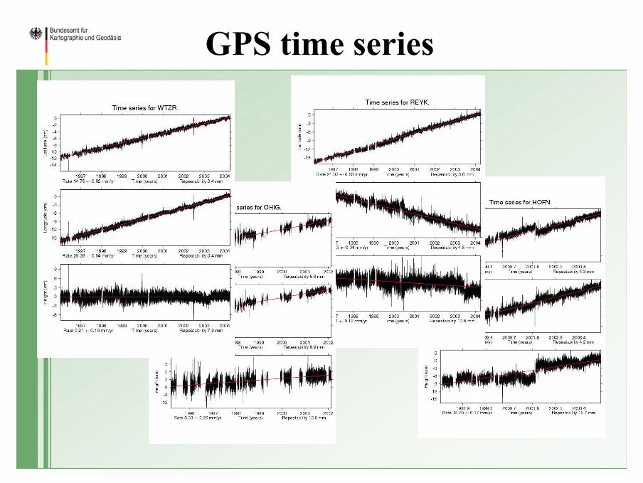
GPS time series
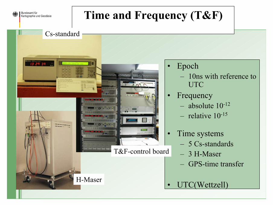
Time and Frequency (T&F)
• Epoch– 10ns with reference to
UTC• Frequency
– absolute 10-12
– relative 10-15
• Time systems– 5 Cs-standards– 3 H-Maser– GPS-time transfer
• UTC(Wettzell)
Cs-standard
H-Maser
T&F-control board
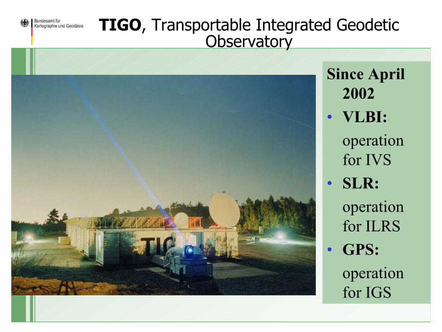
TIGO, Transportable Integrated Geodetic Observatory
Since April 2002
• VLBI: operation for IVS
• SLR: operation for ILRS
• GPS: operation for IGS
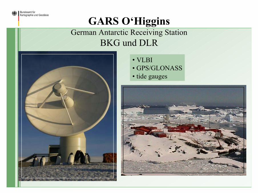
GARS O‘HigginsGerman Antarctic Receiving Station
BKG und DLR
• VLBI• GPS/GLONASS• tide gauges
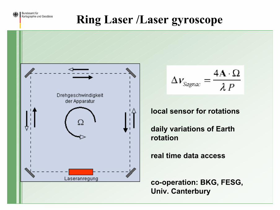
Ring Laser /Laser gyroscope
local sensor for rotations
daily variations of Earth rotation
real time data access
co-operation: BKG, FESG, Univ. Canterbury
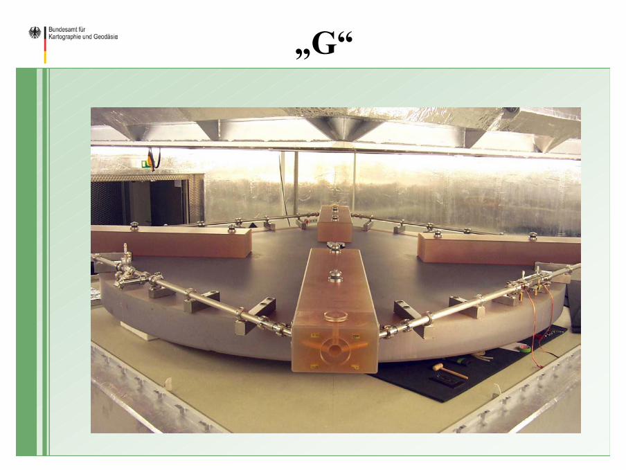
„G“
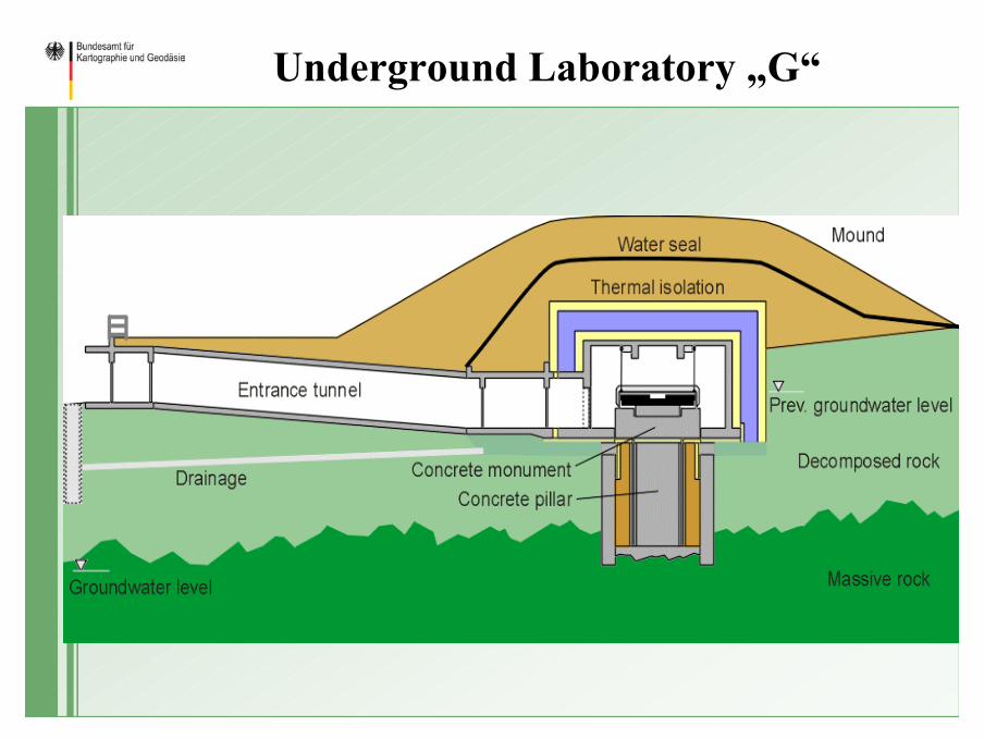
Underground Laboratory „G“
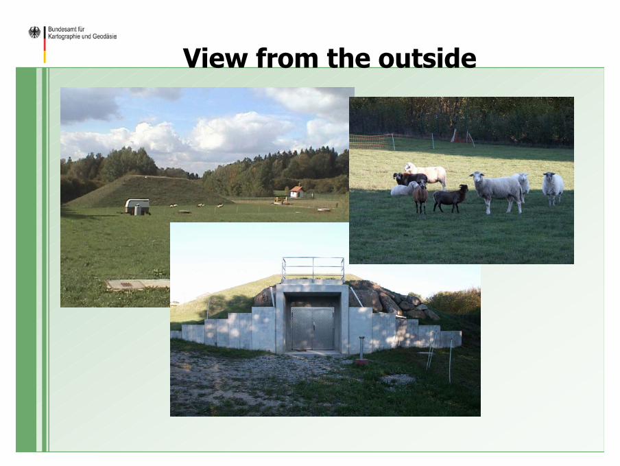
View from the outside
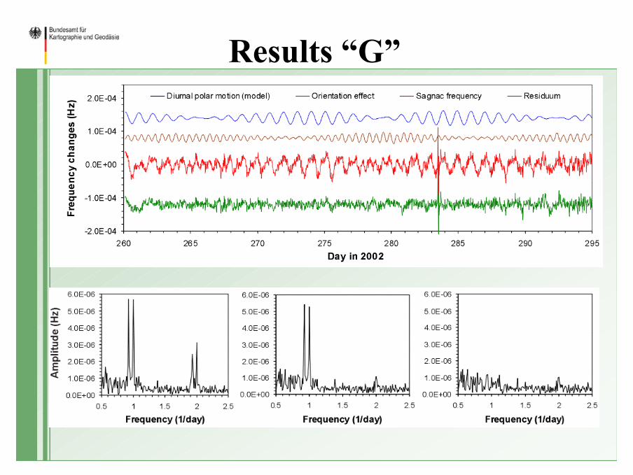
Results “G”
Thank you


