
A Remote Snow/Water Equivalent Monitoring SystemChristian Skalka (UVM)
Joint work with Jeff Frolik, Beverly Wemple, Tom Neumann (UVM)

How Much Snow is Out There? Snow/Water Equivalent (SWE):
measurement of water content in snowpack Not the same as snow height.

How Much Snow is Out There? Real world measurement is complicated
Terrain irregularities Precipitation irregularities Wind, forest canopies, elevation Snow itself!

The Importance of SWE
Regional snowpack profiles are critically important: Natural resource planning
Areas such as CA rely on snowmelt for water supply Flood predictions Avalanche forecasting
Accurate SWE monitoring system is a “holy grail” of remote monitoring Snow is dynamic, strange characteristics that make
SWE measurement difficult

NOAA National SWE Estimate

SWE Measurement Techniques Considerable research has yielded a variety
of measurement technologies LIDAR, ground penetrating radar
Air based, ground based Significant cost, low measurement frequencies Air based techniques complicated by forest canopies
Augmented by national network of static ground-based sensors

SNOTEL Sites
Multiple SNOTEL sites form a national network of ground-based SWE datapoints
SNOTEL sites comprise: Snow pillows for SWE measurement Other weather sensing devices On-site datalogging Satellite uplink for remote data acquisition
(usually)

SNOTEL Sites

SNOTEL Sites: Drawbacks
SNOTEL sites are based on old technology that has significant drawbacks: High Cost (~$15,000/site) Expensive, “dumb” data acquisition technology Environmentally hazardous, unreliable SWE
sensing technology Severe deployment difficulties: mass,
construction, not adaptable to terrain

SNOTEL Sites: Data Acquisition SNOTEL sites use traditional dataloggers
(e.g. CR1000) ~$1500 per unit Standalone Heavy Not programmable Power hungry No intelligent processing of data
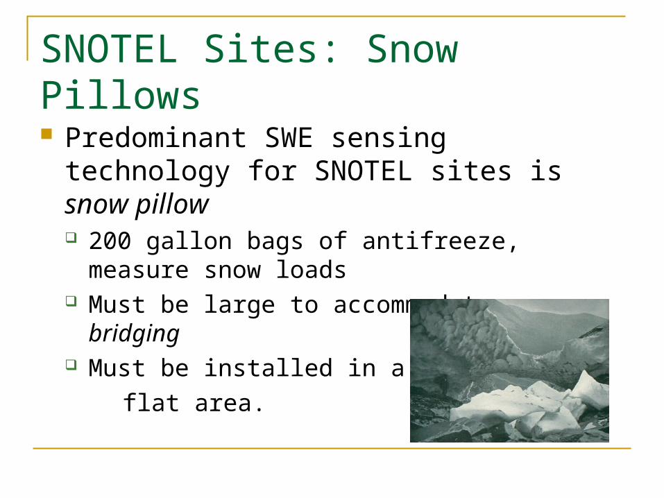
SNOTEL Sites: Snow Pillows
Predominant SWE sensing technology for SNOTEL sites is snow pillow 200 gallon bags of antifreeze, measure snow
loads Must be large to accommodate snow bridging Must be installed in a large,
flat area.

SNOTEL Sites: Snow Pillows

A New Approach
We advocate a new approach to static ground-based SWE monitoring Fundamental idea: use modern technology for
data acquisition and retrieval Fundamental idea: measure SWE via attenuation
of electromagnetic radiation, not load sensing Lightweight, low cost, robust, adaptable Improved spatial resolution

Attenuation of Electromagnetic Radiation Basic idea:
Electromagnetic waves of certain types are attenuated by snow/ice/water
Attenuation is measurable Amount of attenuating medium can be
extrapolated from attenuation factor Note well: this approach is robust to terrain
and snow bridging effects

Attenuation of Electromagnetic RadiationCandidate waveforms: Gamma radiation
Free source (the Universe) Previous work (UC Berkeley) illustrates
effectiveness Microwave radiation
Cheap off-the-shelf sources and detectors

Attenuation of Electromagnetic Radiation
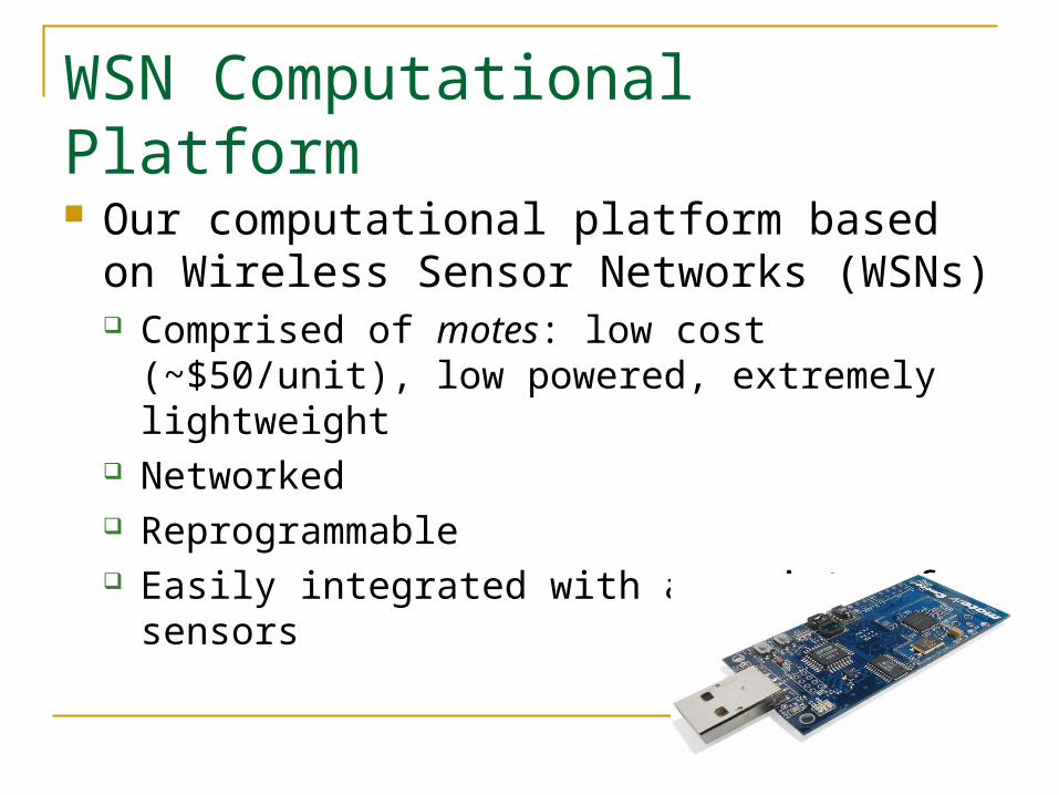
WSN Computational Platform Our computational platform based on
Wireless Sensor Networks (WSNs) Comprised of motes: low cost (~$50/unit), low
powered, extremely lightweight Networked Reprogrammable Easily integrated with a variety of sensors
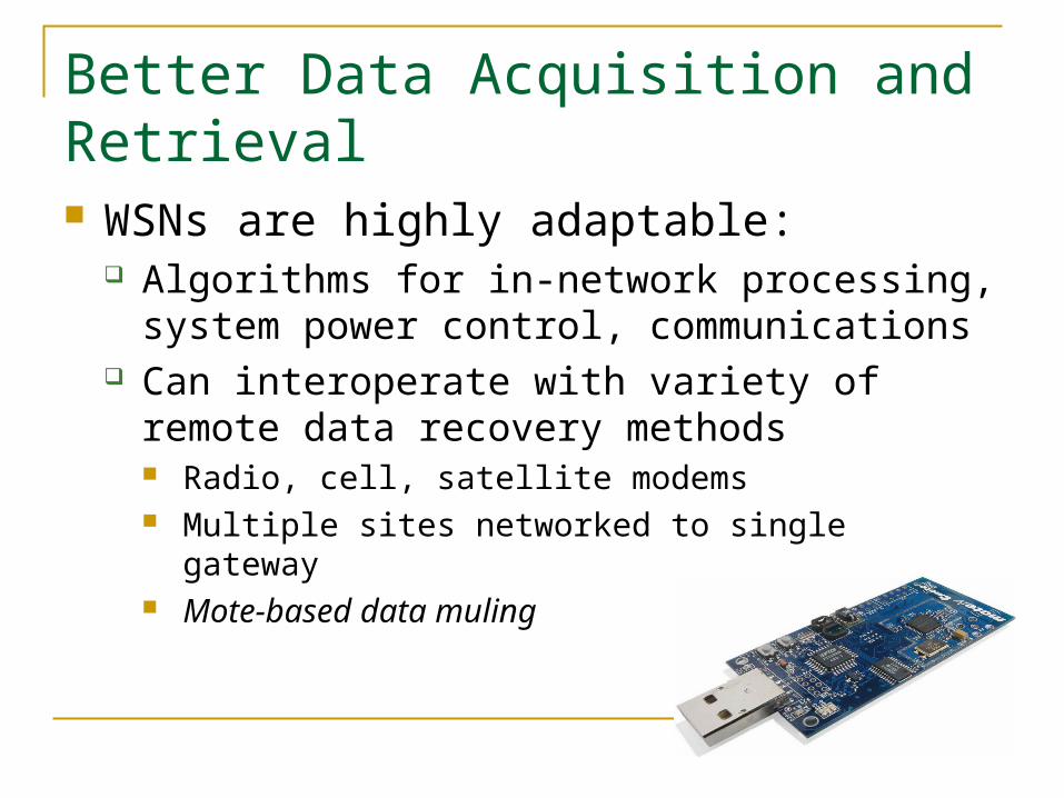
Better Data Acquisition and Retrieval WSNs are highly adaptable:
Algorithms for in-network processing, system power control, communications
Can interoperate with variety of remote data recovery methods Radio, cell, satellite modems Multiple sites networked to single gateway Mote-based data muling

Data Muling Demo

Prototype Deployment on Mt. Mansfield An experimental network was deployed on
Mt. Mansfield in Winter 2007-2008. Test software, system robustness, power
requirements Sensing accuracy not a priority
Project developed with the help of UVM undergraduates Charley Robinson (CS), Matt Casari (EE),
Christopher Henwood (EE)

Site Layout
USGS stream gage site (Ranch Camp)
Three site network Two in clearing One in the forest
Air temperature (x3) Snow height (x3) Snow weight (rudimentary
load sensors)

Ranch Camp Prototype Deployment

Ranch Camp Prototype Deployment

Deployment Effort
The measurement system is transportable by backpack 3 backpacks for 3 sites
When the system was installed at the Ranch Camp Site the packs were carried in for a ½ hour hike
Pack Requirements: (2) External Frame Backpacks (1) Standard Large Camping Style Pack

Frame
2-5’ lengths of ¾” metal tube
Threaded ends Allows many configurations
with simple adapter changes
Wires are ran through the pipe for protection
Design allows ease of installation and modification

Power System
12V 12Ah Battery Powers snow weight sensors
4xAA Battery -> Upgraded to D cell Powers mote & height sensor
Predicted life of 150 days Prototype experimentation illustrated that this is a
significant overestimate due to cold weather

Site Costs
Initial Proposal:Cost of all Sites: $3678
Cost for entire project (four sites): $4000

Future Work
Develop sensor technologies Currently in initial phases of testing microwave
and gamma ray attenuation Hardware and software issues
Develop communication technologies Time synchronization for networked sites Remote data retrieval (cell modem interface)

Future Work
“Ruggedize” system hardware Current work by Jeff Frolik and Matt Seekins
Solve power supply issues Move to wet-cell batteries exclusively
Future deployments and testing Mt. Mansfield, Central Sierra Snow Laboratory
Readily available ground truthing

Conclusion
SWE data is critically important to society Static ground-based measurement essential
to large-scale SWE estimates Our proposed technology significantly
advances state-of-the-art Low cost, easily deployed, better spatial resolution Highly adaptable, many applications Key ideas: WSN computational infrastructure, new
robust sensing technology

Conclusion
For more info go to:
http://www.cems.uvm.edu/research/cems/snow/swe.php


