understanding neo-assyrian settlement patterns from spatial entropy modelling
TRANSCRIPT
Understanding Neo-Assyrian Settlement Patterns from Spatial Entropy Modelling
Mark AltaweelAlessio Palmisano
University College LondonInstitute of Archaeology
Department of Ancient HistoryCASA (Centre of Advanced Spatial Analysis)
Neue Untersuchungen zur Archäologie und Geschichte eines WeltreichsMunchen, 11 - 12 January 2013
Outline
•Introduction
•Methodology
•Case studies
•Conclusion and future direction
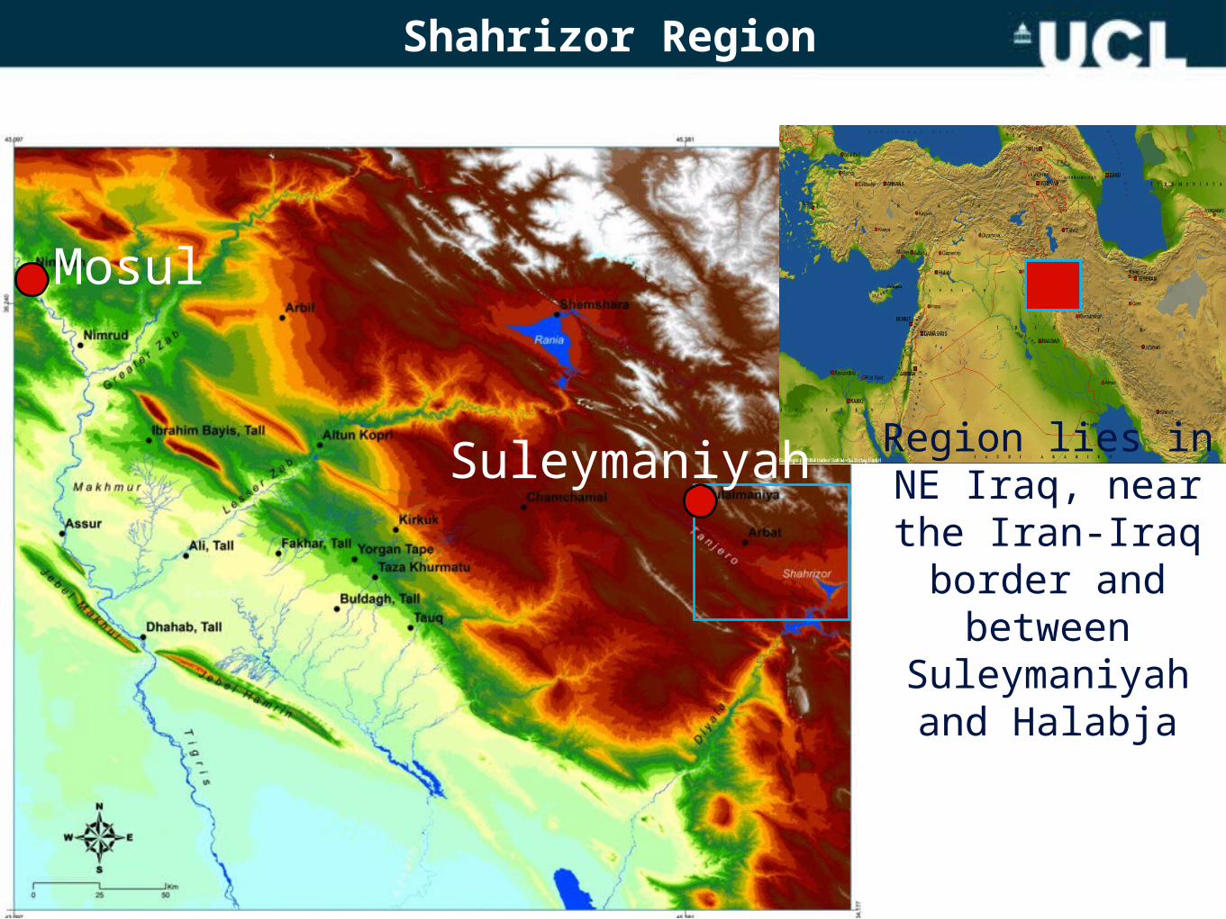
Shahrizor Region
Mosul
Region lies in NE Iraq, near the Iran-Iraq border and between
Suleymaniyah and Halabja
Suleymaniyah
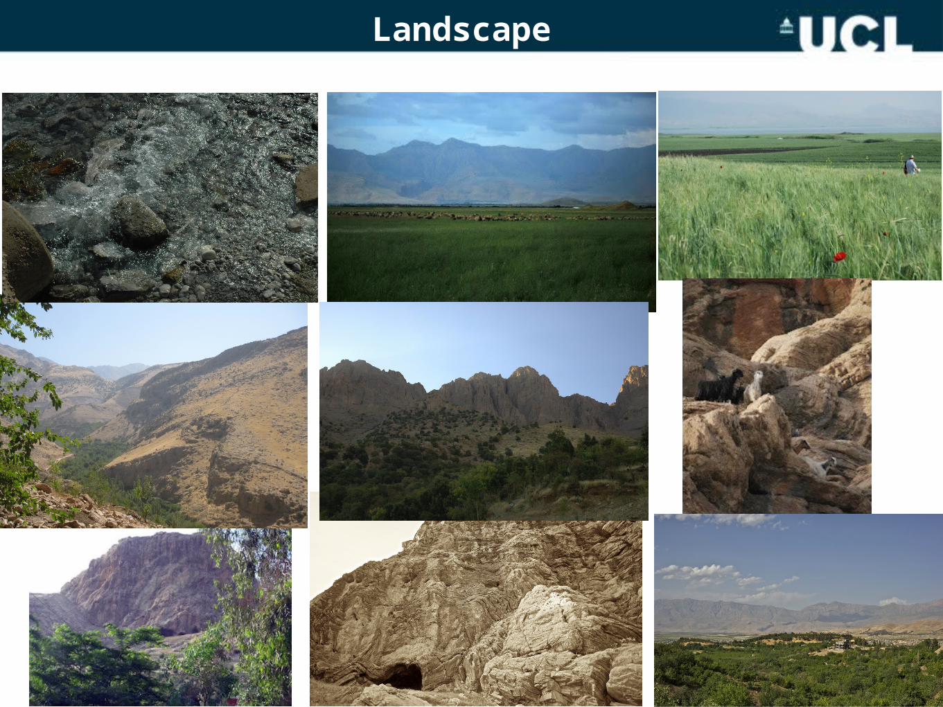
Landscape
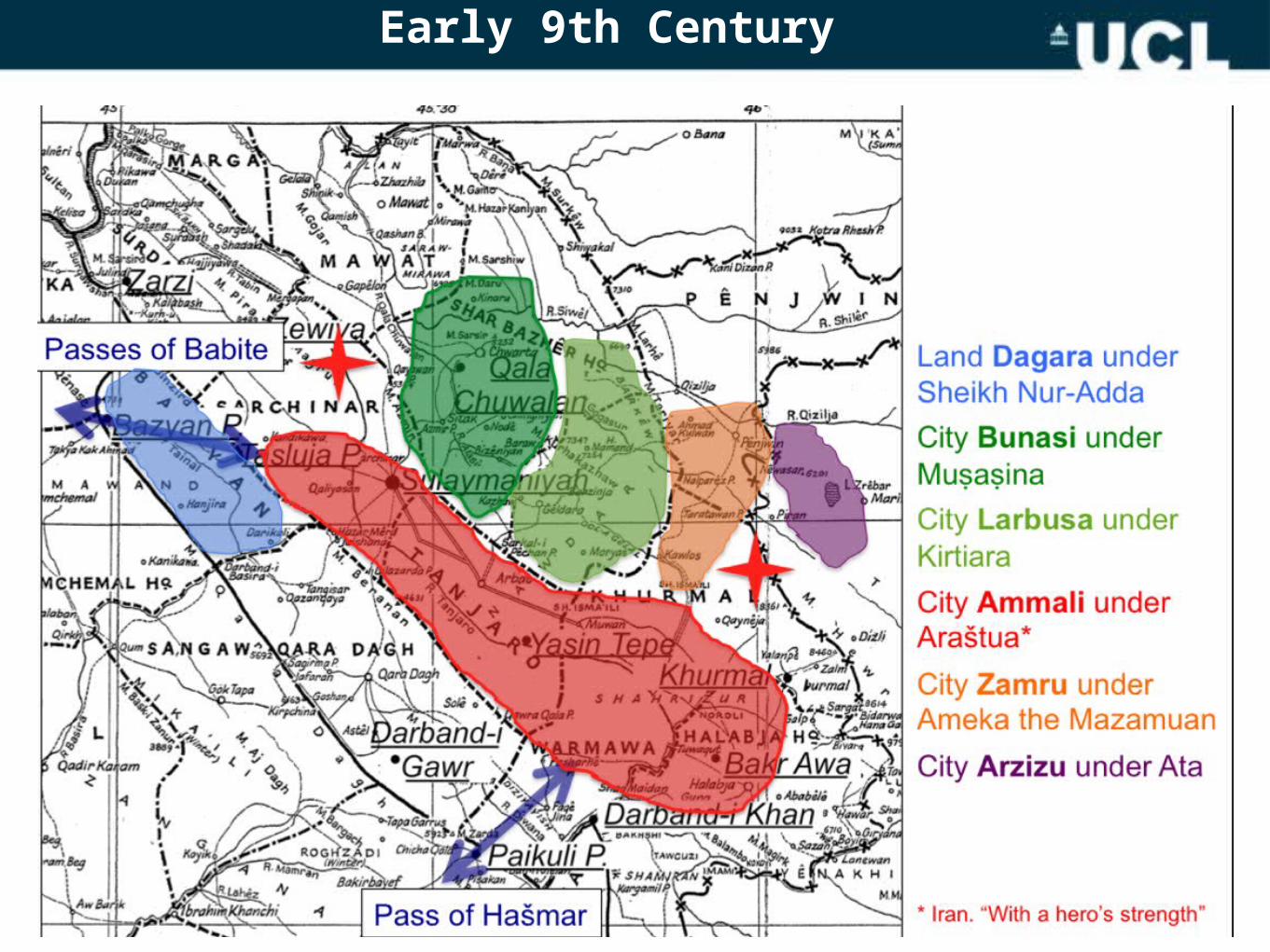
Early 9th Century
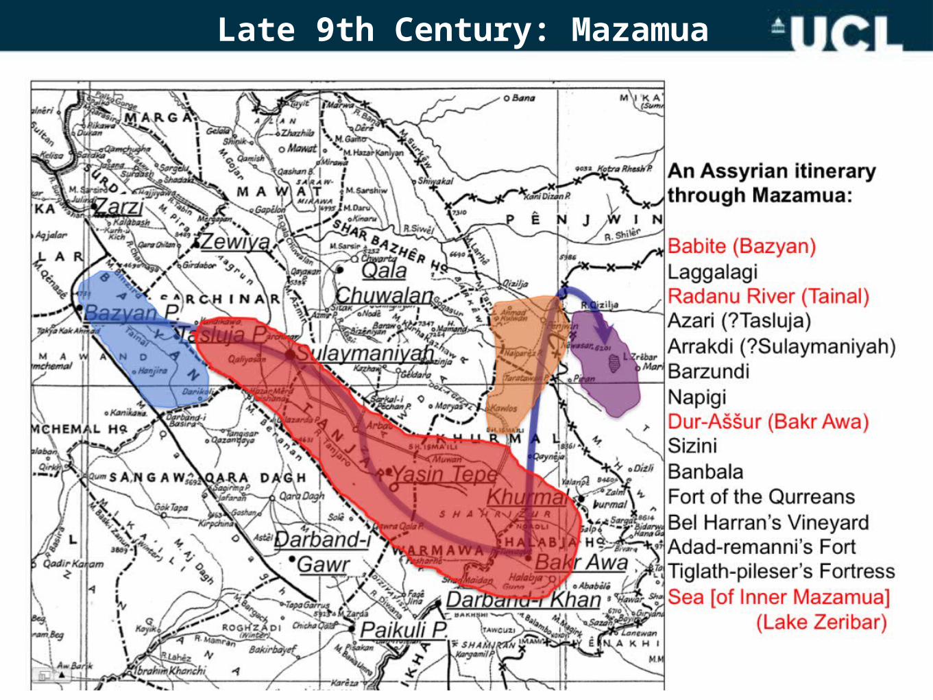
Late 9th Century: Mazamua
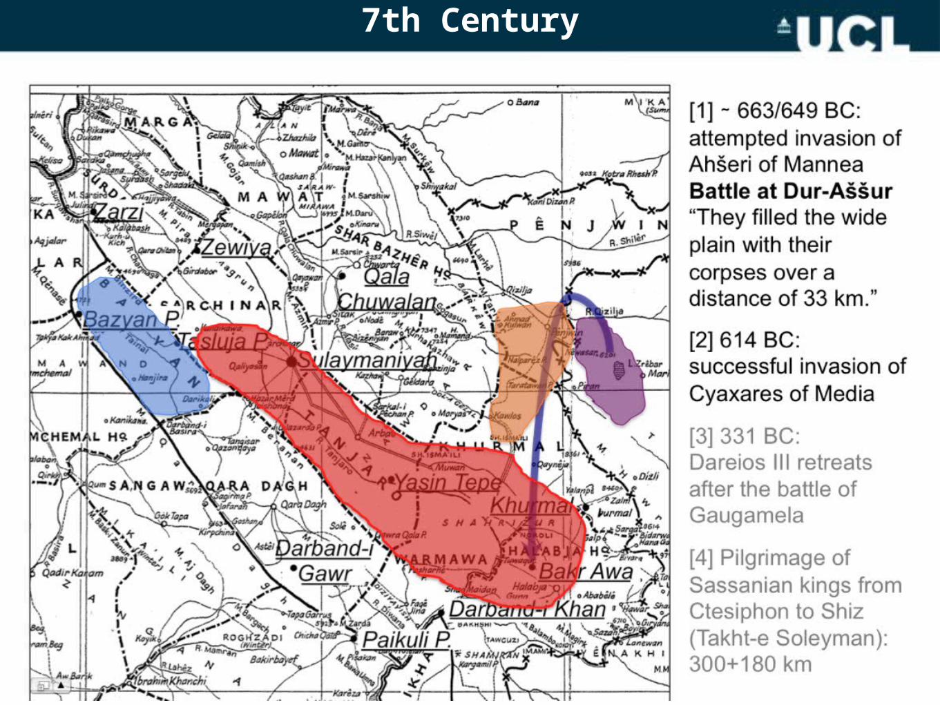
7th Century
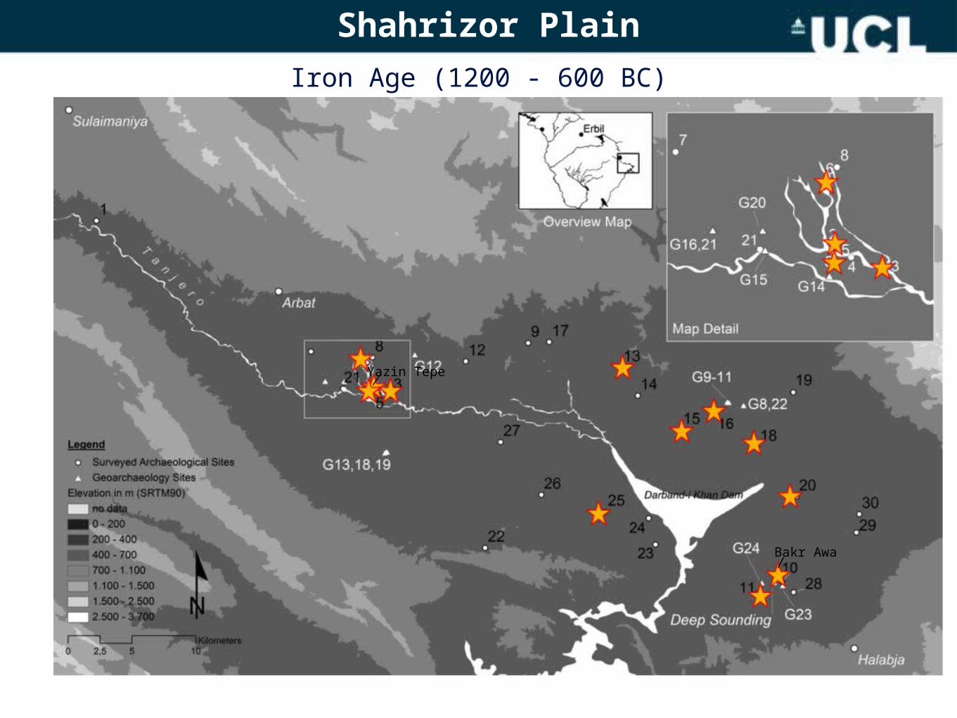
Shahrizor Plain Iron Age (1200 - 600 BC)
Yazin Tepe
Bakr Awa
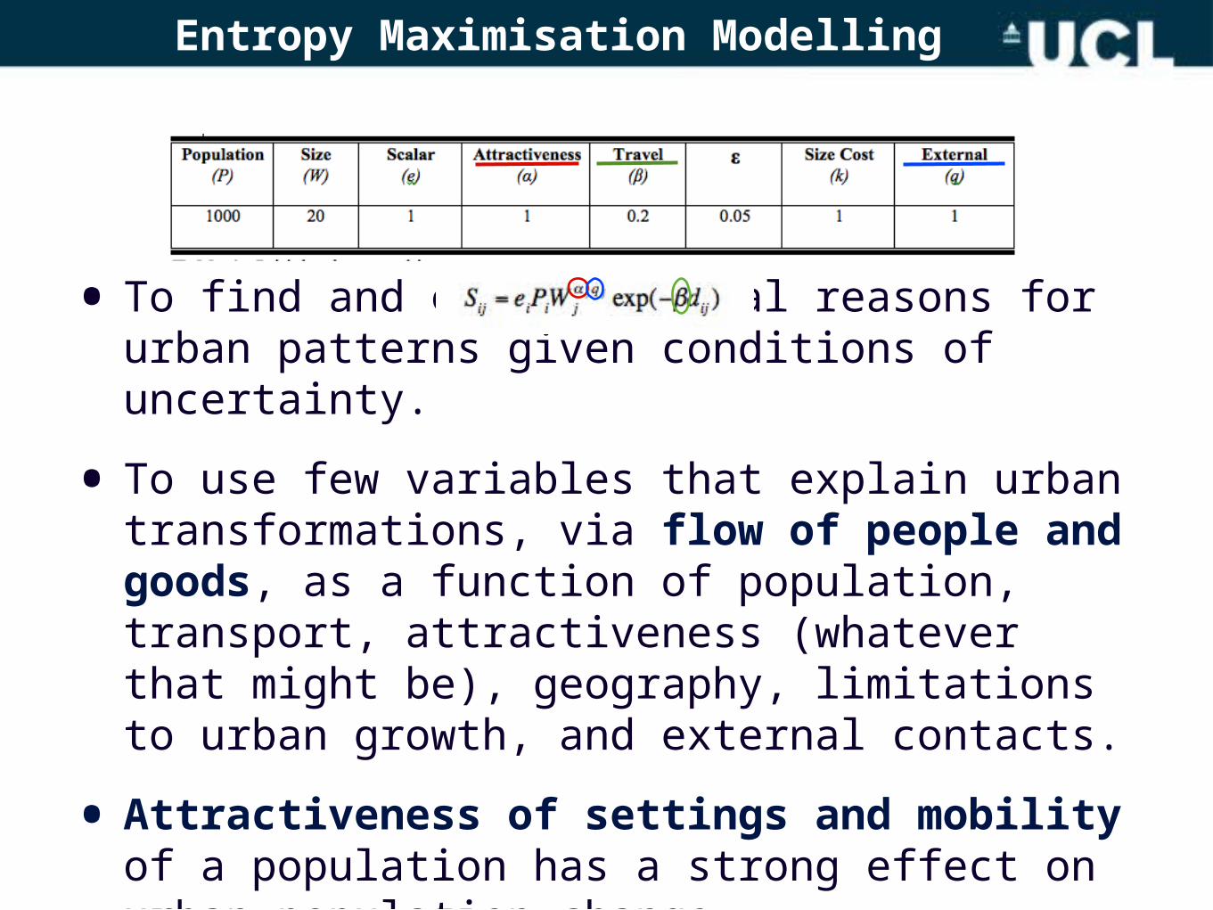
Entropy Maximisation Modelling
• To find and explore causal reasons for urban patterns given conditions of uncertainty.
• To use few variables that explain urban transformations, via flow of people and goods, as a function of population, transport, attractiveness (whatever that might be), geography, limitations to urban growth, and external contacts.
• Attractiveness of settings and mobility of a population has a strong effect on urban population change.
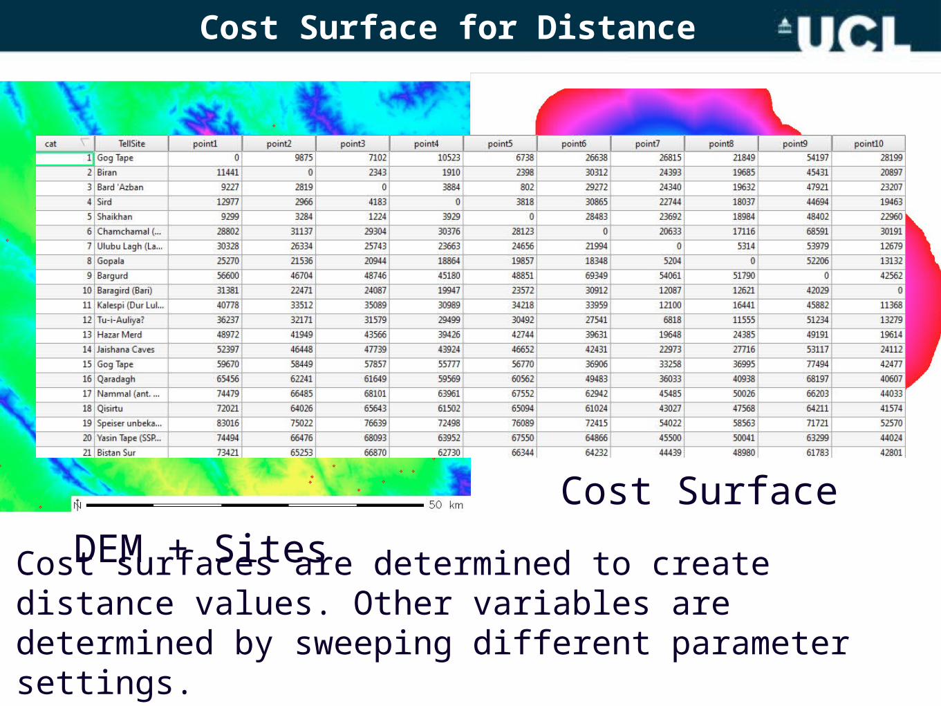
Cost Surface for Distance
DEM + SitesCost Surface
Cost surfaces are determined to create distance values. Other variables are determined by sweeping different parameter settings.
sites
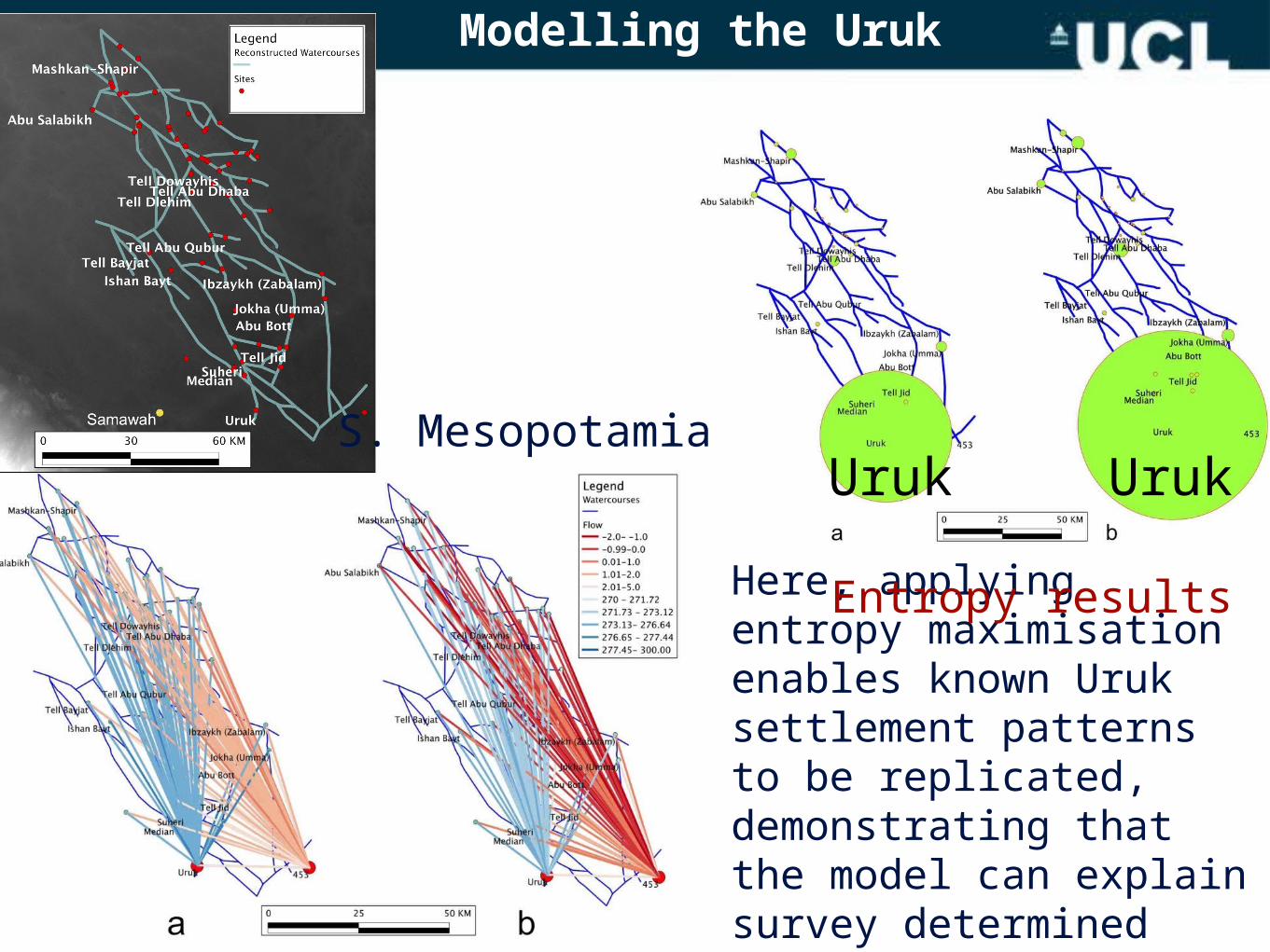
Modelling the Uruk
Here, applying entropy maximisation enables known Uruk settlement patterns to be replicated, demonstrating that the model can explain survey determined patterns.
S. Mesopotamia
Entropy results
Uruk Uruk
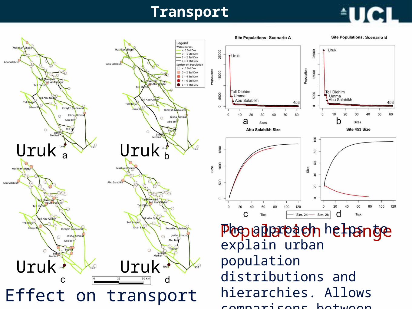
Transport
Population change
Effect on transport
The approach helps to explain urban population distributions and hierarchies. Allows comparisons between regions.
UrukUruk
Uruk Uruk

Modelling the upper Khabur valley
Using regions such as the Khabur, one can calibrate to which values of alpha and beta one can replicate known settlement patterns.
Natural LogSize to Rank distributions
Overall West East
Tell Halaf
Tell Beydar
Tell Hamidiya
Tell Barri
Tell al’Id
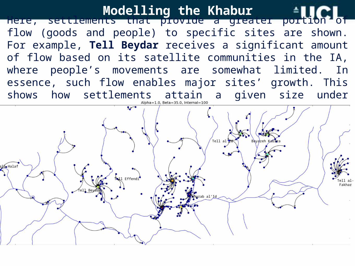
Modelling the KhaburHere, settlements that provide a greater portion of flow (goods and people) to specific sites are shown. For example, Tell Beydar receives a significant amount of flow based on its satellite communities in the IA, where people’s movements are somewhat limited. In essence, such flow enables major sites’ growth. This shows how settlements attain a given size under transport and attractiveness rates.
Tell Halaf
Tell BeydarKharab al’Id
Tell al’Id Bayazeh Kabira
Tell al-Fakhar
Tell Effendi
Modelling the Shahrizor Plain
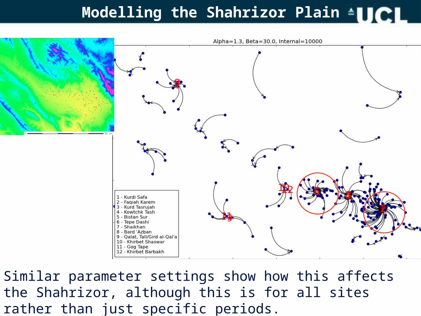
Similar parameter settings show how this affects the Shahrizor, although this is for all sites rather than just specific periods.
Modelling the Shahrizor Plain
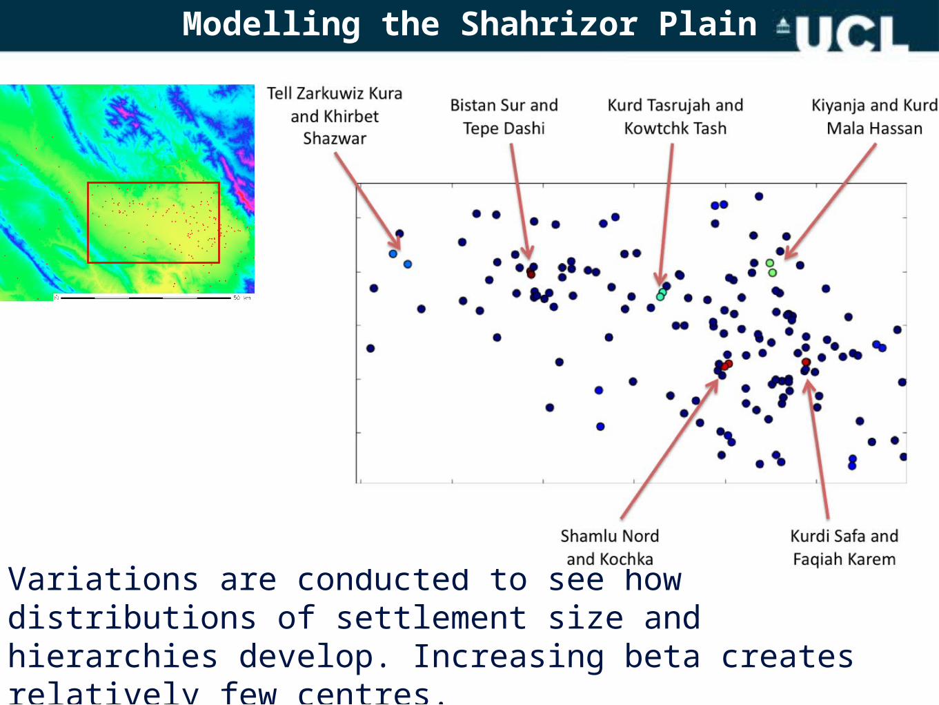
Variations are conducted to see how distributions of settlement size and hierarchies develop. Increasing beta creates relatively few centres.
Modelling the Shahrizor Plain
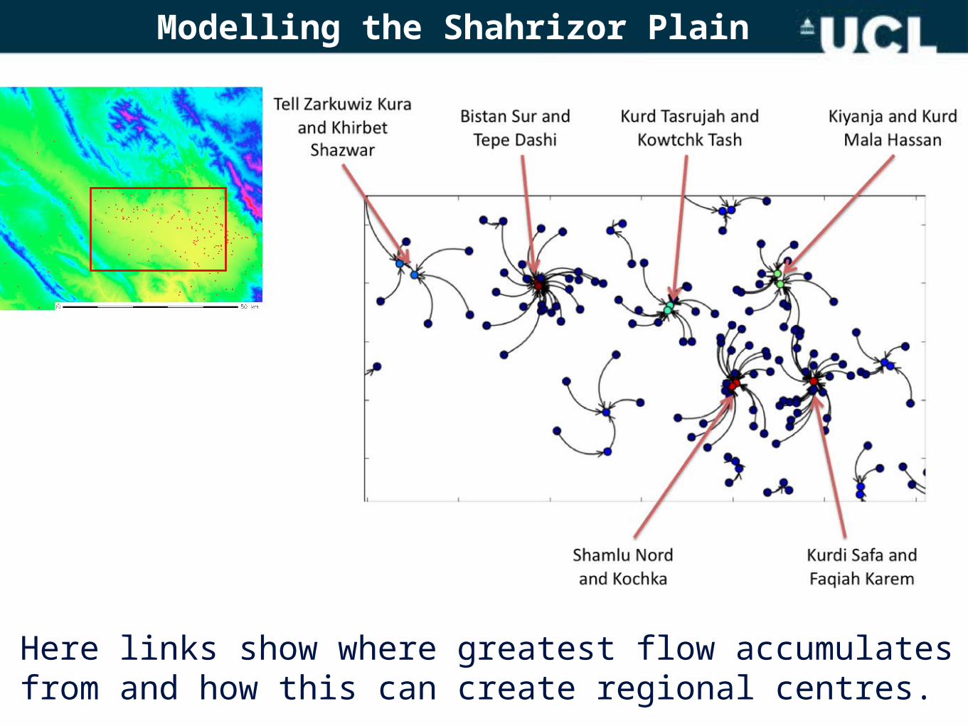
Here links show where greatest flow accumulates from and how this can create regional centres.
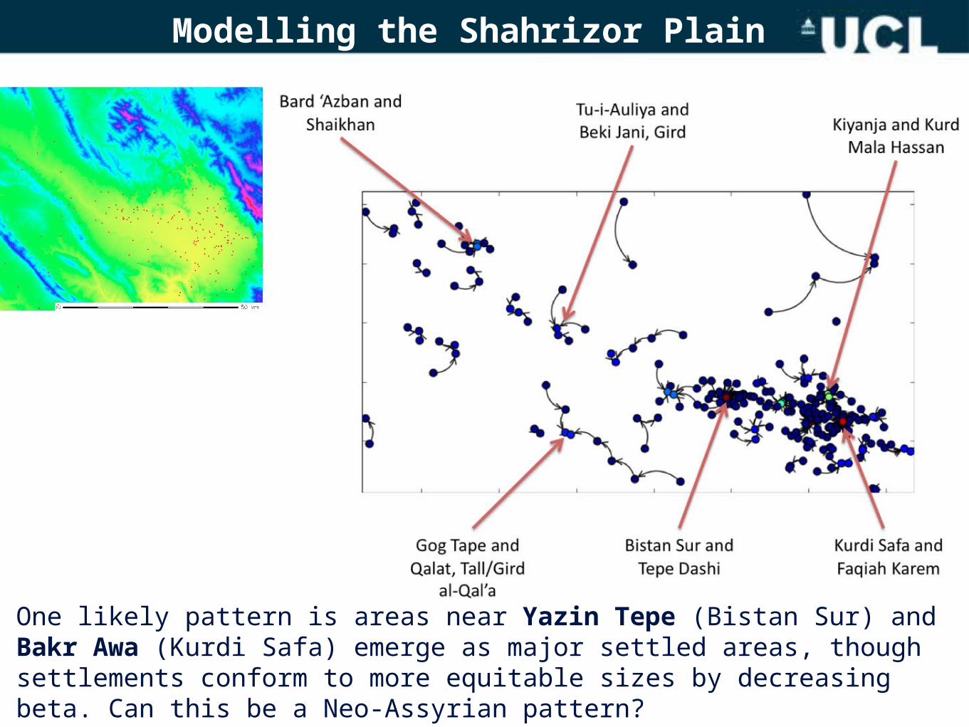
Modelling the Shahrizor Plain
One likely pattern is areas near Yazin Tepe (Bistan Sur) and Bakr Awa (Kurdi Safa) emerge as major settled areas, though settlements conform to more equitable sizes by decreasing beta. Can this be a Neo-Assyrian pattern?
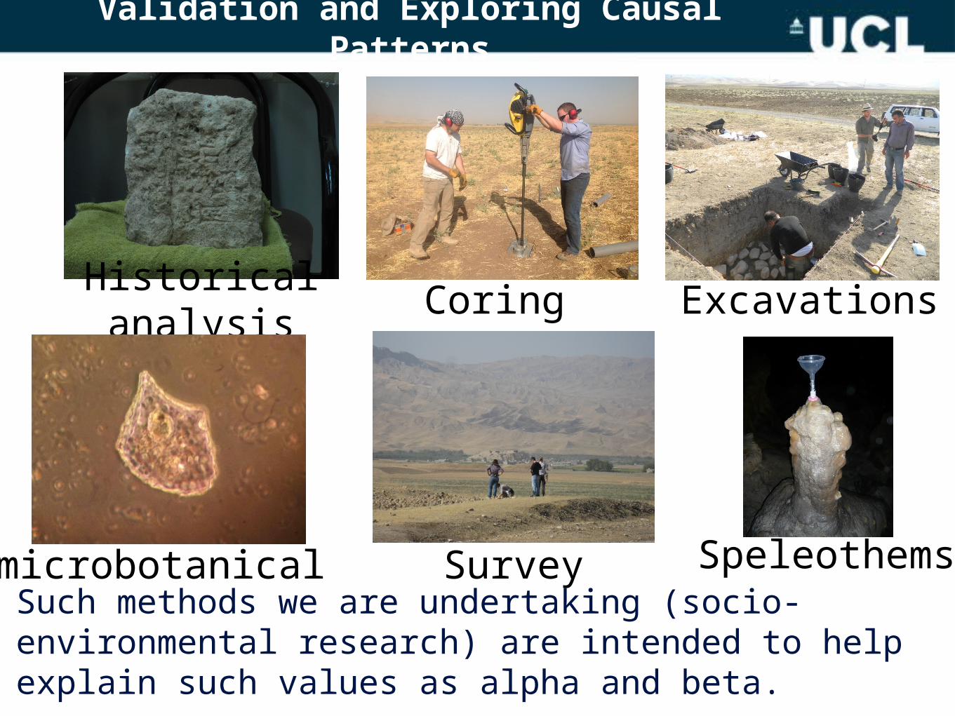
Validation and Exploring Causal Patterns
Excavations
Speleothemsmicrobotanical Survey
CoringHistorical analysis
Such methods we are undertaking (socio-environmental research) are intended to help explain such values as alpha and beta.
Conclusion and Future Direction
• Entropy maximisation enables one to identify what factors (e.g., transport and attractiveness) may affect settlement change and growth.
• In areas of uncertainty (poor survey data), entropy maximisation can provide an idea of settlement distribution and also estimates where areas could be settled.
• For the Shahrizor, proposed sites of Yazin Tepe and Bakr Awa as major regional centres seems reasonable, with other areas emerging as relatively significant.
• Once variables such as alpha (attractiveness) and beta (transport ability) help demonstrate given settlement patterns, and their variation from different periods, then questions for the Neo-Assyrian period (e.g., to what extent do large-scale empires have significant political effects on regional settlement?) can be better addressed.

This research was funded by the strategic development fund
from University College London
Thank You!
Thanks also goes to our colleagues Karen Radner, Alan Wilson, Toby Davies, and Hannah
Fry for their efforts in this project.