terrain discontinuity effects in the regional flow of a complex karstified aquifer
TRANSCRIPT

Terrain Discontinuity Effects in the Regional Flowof a Complex Karstified Aquifer
Maria P. Papadopoulou & Emmanouil A. Varouchakis &
George P. Karatzas
Received: 9 April 2008 /Accepted: 22 September 2009 /Published online: 27 October 2009# Springer Science + Business Media B.V. 2009
Abstract Karst aquifers are characterized by spatial hetero-geneity due to the presence of highly permeable channelsand conduits in low-permeable fractured rocks (matrixblock). Recent studies have reported a close relationshipbetween surface and subsurface water in karstic regions dueto the water flow through a complicated network of pathsformed by fracture intersections. Subsurface flow in karsti-fied aquifers ranges between conduit flow, in large passageswith relatively high flow velocities, and diffuse flow, in thematrix block where Darcy’s law is still valid. In this paper, wepresent the simulation of a complex karstified aquifer systemin Crete, Greece, where the presence of main faults drasticallyaffects the regional flow. A discrete fracture approach inconjunction with an equivalent porous medium approach wasadopted to simulate the mixed flow in the area of interest. Thesimulation results have shown that the length and theorientation of the dominant faults, primarily during the rainyseason, affect the flow field.
Keywords Karstification . Faults . Subsurface flowsimulation . Fractured medium . Coastal aquifer
1 Introduction
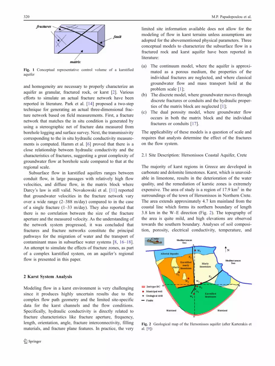
In karst terrains, it is common for an artesian inflow of surfaceand subsurface water to be channeled through a complexnetwork of paths formed by fracture intersections. In manycases, this flow penetrates hundreds of meters into thebedrock (Fig. 1). Fracture is a general term for any breakor discontinuity in a rock caused by mechanical failureresulting from stress, regardless of whether the displacementis visible to the unaided eye or not. It may be a joint, fault,or fissure caused by a geological or mechanical process andcan range from microscopic to macro- and megascopicscales (US DOE [19]). Fracture network connectivity, flowand transport phenomena in fractures, density effects,dissolution, and precipitation play a key role in the analysisof heat and mass transfer in the subsurface processes,especially in cases involving high health risk such as nuclearwaste repositories. An accurate prediction of the flowpathways as well as of the leakage rates of the contaminantmass from waste facilities is one of the most important tasksin order to protect the environment.
The inherent complexity of fractured formations, bothstructural and hydraulic, severely limits the type and qualityof the data that can be obtained from field measurements andthe level of certainty in model prediction [3]. The generationof an actual fracture network is essential for the accurateprediction of the flow pathways and of the travel time ofthe subsurface water in systems with anisotropic hydraulicconductivity. A careful study and analysis of aquiferproperties such as the effective porosity, storage, naturalrecharge, infiltration, temporal water chemistry, isotropy,
M. P. Papadopoulou (*)School of Rural and Surveying Engineering,National Technical University of Athens,9 Iroon Polytechneiou,Polytechnioupolis Zografou,15780 Athens, Greecee-mail: [email protected]
E. A. Varouchakis :G. P. KaratzasDepartment of Environmental Engineering,Technical University of Crete,Polytechnioupolis,73100 Chania, Greece
E. A. Varouchakise-mail: [email protected]
G. P. Karatzase-mail: [email protected]
Environ Model Assess (2010) 15:319–328DOI 10.1007/s10666-009-9207-5
and homogeneity are necessary to properly characterize anaquifer as granular, fractured rock, or karst [2]. Variousefforts to simulate an actual fracture network have beenreported in literature. Park et al. [14] proposed a two-steptechnique for generating an actual three-dimensional frac-ture network based on field measurements. First, a fracturenetwork that matches the in situ condition is generated byusing a stereographic net of fracture data measured fromborehole logging and surface survey. Next, the transmissivitycorresponding to the in situ hydraulic conductivity measure-ments is computed. Hamm et al. [6] proved that there is aclose relationship between hydraulic conductivity and thecharacteristics of fractures, suggesting a great complexity ofgroundwater flow at borehole scale compared to that at theregional scale.
Subsurface flow in karstified aquifers ranges betweenconduit flow, in large passages with relatively high flowvelocities, and diffuse flow, in the matrix block whereDarcy’s law is still valid. Novakowski et al. [11] reportedthat groundwater velocities in the fracture network varyover a wide range (2–388 m/day) compared to in the caseof a single fracture (1–33 m/day). They also reported thatthere is no correlation between the size of the fractureaperture and the measured velocity. As the understanding ofthe network system progressed, it was concluded thatfractures and fracture networks constitute the principalpathways for the migration of water and the transport ofcontaminant mass in subsurface water systems [8, 16–18].An attempt to simulate the effects of fracture zones, as partof a complex karstified system, on an aquifer’s regionalflow is presented in this paper.
2 Karst System Analysis
Modeling flow in a karst environment is very challengingsince it produces highly uncertain results due to thecomplex flow path geometry and the limited site-specificdata for the karst channels and the flow conditions.Specifically, hydraulic conductivity is directly related tofracture characteristics like fracture aperture, frequency,length, orientation, angle, fracture interconnectivity, fillingmaterials, and fracture plane features. In practice, the very
limited site information available does not allow for themodeling of flow in karst terrains unless assumptions areadopted for the abovementioned physical parameters. Threeconceptual models to characterize the subsurface flow in afractured rock and karst aquifer have been reported inliterature:
(a) The continuum model, where the aquifer is approxi-mated as a porous medium, the properties of theindividual fractures are neglected, and where classicalgroundwater flow and mass transport hold at theproblem scale [1];
(b) The discrete model, where groundwater moves throughdiscrete fractures or conduits and the hydraulic proper-ties of the matrix block are neglected [1];
(c) The dual porosity model, where groundwater flowoccurs in both the matrix block and the individualfractures or conduits [17].
The applicability of these models is a question of scale andrequires that analysts determine the effect of the fractureson the flow system.
2.1 Site Description: Hersonissos Coastal Aquifer, Crete
The majority of karst regions in Greece are developed incarbonate and dolomite limestones. Karst, which is unavoid-able in limestone, results in the deterioration of the waterquality, and the remediation of karstic zones is extremelyexpensive. The area of study is a region of 17.9 km2 in thesurroundings of the town of Hersonissos in Northern Crete.The area extends approximately 4.7 km mainland from thecoastal line which forms its northern boundary of length3.8 km in the W–E direction (Fig. 2). The topography ofthe area is quite mild, and high elevations are observedtowards the southern boundary. Analyses of soil composi-tion, porosity, electrical conductivity, temperature, and
Fig. 2 Geological map of the Hersonissos aquifer (after Karterakis etal. [9])
Fig. 1 Conceptual representative control volume of a karstifiedaquifer
320 M.P. Papadopoulou et al.

density measurements were used to determine representa-tive values for the hydraulic conductivity and the porositywhich are necessary for the development of a reliablephysical model for the Hersonissos coastal aquifer.
The boundary conditions and the hydrological parame-ters values necessary for the calibration of the numericalmodel were obtained from previous works [9, 12]. Due tothe limited availability of hydraulic conductivity (K) andstorativity (S) data, a sensitivity analysis was conducted toestimate the flow field behavior. Model runs wereperformed (a) for various hydraulic conductivity (K) values(±10%) for the different geological formations and (b) forstorativity values in the range of 10−5 to 10−1 showing nosignificant differences among the scenarios assessed. Arepresentative sensitivity analysis run for the differenthydraulic conductivity scenarios is presented in Fig. 3.Based on the results, considerable variations in thehydraulic head field appear only locally in areas wheredifferent geological formations coexist.
For the modeling process, geological formations (matrices)with similar hydraulic properties were considered equivalentto porous media. Although the fracture network in theHersonissos aquifer is quite dense, the short length, thearbitrary orientation of the fractures, and the extremely lowconnectivity between them result in an equivalent porousmedium with porosity higher than that of the correspondingnon-karstified porous medium. Therefore, the fracture net-work was assumed to have similar characteristics in thedifferent geological formations over the entire domain ofinterest interacting with the porous medium. One uniquecharacteristic of the Hersonissos aquifer is the presence of twomain faults, F1 and F2 (Fig. 2), that dominate the regional
subsurface flow. These faults play a significant role in thestudy of the regional flow due to their considerable length,orientation (perpendicular to the shoreline), depth, and directconnection to the sea.
A representative site characterization was developedbased on the analysis of data obtained from the GreekInstitute of Geology and Mineral Exploration and the twoboring logs installed at two locations in the area of interest,G1 and G2 (Fig. 2). A representative geological stratifica-tion of the Hersonissos aquifer is impressed in the twoboring logs showing a tendency for karst zones (fracturedrock and voids) to develop not within strata, but at thecontacts between them. As shown in Fig. 4, in small depths,the dominant geological strata is a marl-limestone forma-tion where water can be preserved. Underneath theseformations, a karstified limestone formation extends up to200 m in depth.
3 The Modeling Approach
The fundamental problems that modelers face when tryingto simulate a karstified physical system are the system’shydraulic characteristics (extreme values of aquifer hydrau-lic conductivity and porosity) and its distribution (networkof permeable channels and conduits embedded in lowpermeability fractured rocks). The geometry of this networkmay affect the hydraulic behavior and the contaminantmass transport making this region particularly vulnerable topollution. Park and Zhan [15], in their analysis ofgroundwater hydraulic head in the vicinity of a horizontalwell in fractured and porous aquifers, showed that the waterflow from the matrix to a fracture cannot be ignored even ifthe hydraulic conductivity of the matrix is small comparedto that of the fracture. They also showed that the solution tothe hydraulic head equation is more sensitive to the specificstorage ratio in the case of a confined fractured aquifercompared to an unconfined fractured aquifer. Since thegeometry of the highly permeable drainage network affectsthe hydraulic behavior, Κoukadaki et al. [10] proposed anovel approach that borrows methods commonly used inenvironmental geophysics to obtain the estimates of theaquifer parameters. Specifically, the estimates of hydraulicconductivity were obtained from field measurements of theelectrical resistivity while accounting for the karsticity ofthe geological formations in the area of study. Based on thegeological studies performed in the area of interest, adiscrete fracture approach in conjunction with an equivalentporous medium approach was adopted for the developmentof a numerical simulation model for the area. In thisapproach, the karstic characteristics of each geologicalformation present in the aquifer were simulated as anequivalent porous medium with hydrogeological parame-Fig. 3 Hydraulic conductivity sensitivity analysis results
Effects in the regional flow of complex karstified aquifer 321

ters that accurately simulate the behavior and the responseof the karstic aquifer. The two main geological discon-tinuities (faults F1 and F2) present in the Hersonissosaquifer were simulated as physical conduits with a certainaperture that allow the unrestrained rapid movement ofsubsurface water.
3.1 The Numerical Simulator
The analysis of the regional flow field in the domain ofinterest was based on data obtained from literature and fieldmeasurements. The three-dimensional flow simulatorVisual-MODFLOW [20] was used for the development ofthe three-dimensional numerical model for the coastalaquifer. The governing equation for the subsurface regional
flow was solved over the entire domain using a finitedifference approximation:
@
@ xKXX
@ h
@ x
� �þ @
@ yKyy
@ h
@ y
� �þ @
@ zKzz
@h
@ z
� �þW ¼ Ss
@ h
@ t
ð1Þ
where Kxx, Kyy, and Kzz are the values of the hydraulicconductivity along the x, y, and z coordinate axes, h is thepotentiometric head, W is a volumetric flux per unit volumerepresenting sources and/or sinks of water, SS is the specificstorage of the porous material, and t is time [7].
The domain of interest is subdivided into cells, madefrom a grid of mutually perpendicular lines that may bevariably spaced in which the properties of the medium are
Fig. 4 Boring logs at locationsG1 and G2
322 M.P. Papadopoulou et al.

assumed to be uniform (Fig. 5). A finite differenceapproximation for the flow equation is written horizontallyfor each cell. In a similar way, a finite difference approxima-tion is written vertically, connecting the different modellayers. The thickness of each layer could vary depending onthe geological stratification. Papadopoulou et al. [13]presented a detailed analysis of the benefits of usingnumerical methodologies for the representation of complexphysical systems.
The effects of the two main faults on the regional flow ofthe complex aquifer system are studied in this work. Bothfaults are directly connected to the sea. They extend indifferent directions, F1 in the N–S direction and F2 in theE–W direction, and they intersect a few kilometers inlandfrom the shore. For the purposes of this study, the drainfeature of Visual-MODFLOW [20] was used to approxi-mate the hydraulic behavior of the two faults. A leakagecondition was assigned along the inland boundary tointroduce the flow in the faults (from or towards the sea).A conductance coefficient was used to describe the headloss between the drain (fault) and the porous mediumaccording to the following equation [4, 7]:
C ¼ R� K ð2Þwhere C is the conductance, R is the reach length of thedrain in each grid cell, and K is the hydraulic conductivityin each grid cell.
4 Results and Discussion
The regional flow and the hydraulic continuity in coastalaquifers can be easily disturbed by physical causes such asgeological discontinuities (faults) and by anthropogenicactivities such as the unrestrained pumping activity thatcauses water table depletion. Besides the effect on waterquality due to the disturbance of the fragile dynamicbalance between fresh and saline water (seawater intrusion
Fig. 5 Numerical model mesh
Fig. 6 Conceptual cross-sections A–A′ and B–B′
Effects in the regional flow of complex karstified aquifer 323

phenomenon), the abrupt decrease of the water table, andthe reduction of the subsurface fresh water flow, it may alsoaffect the hydraulic connection between the surface andsubsurface water systems. A rough estimation of theseawater intrusion front can be obtained from the Ghyben–Herzberg relationship [5]. A recent study of the Hersonissos
coastal aquifer by Papadopoulou et al. [12] showed thesignificant effects of discrete faults on the hydrauliccharacteristics and the behavior of the physical system.The study considered two different hydrogeological set-tings, one with a single fault extending a few kilometersinland from the shoreline and one without any fault. The
Fig. 8 Flow field with the presence of both faultsFig. 7 Flow field without the presence of faults
Stress periods Pumping activity (m3/day) Natural inflow (%)
October–December 3,793 (50%) 130
January–March 2,275 (30%) 150
April–June 6,068 (80%) 120
July–September 7,586 (100%) 100
Table 1 Varying flowcharacteristics
324 M.P. Papadopoulou et al.

coastal aquifer was simulated as one-layer aquifer with theassumption that the discrete fracture is fully penetratingthe entire aquifer.
In the present study, a three-dimensional representationof the physical system is developed to reduce the numericalerror in the solution of the flow equation. A more repre-sentative vertical discretization with three stratificationlayers is used to accurately represent the hydraulic processesthat take place between the porous medium and the twomain faults and the varying with depth hydrogeologicalbehavior. As shown in the two conceptual cross-sections of
Fig. 6, the discrete faults are assumed to be active fromelevation 0 m mean sea level (MSL) to 100 m below MSL(stratification layers 2 and 3). Assuming that the pumpingactivity occurs only at layer 3 and controlled over thedomain of interest, steady-state conditions can be obtainedover a 1-year simulation period, concluding that anydisturbance in the regional flow is due to the presence ofthe discrete faults.
Based on field measurements which have shown that thewater table elevation is approximately at the MSL, theeffects of the two main faults on the hydraulic behavior of
Fig. 9 Flow field simulation for a hydrological year (a) without faults, (b) with vertical fault F1 only, (c) with horizontal fault F2 only, and (d)with both faults F1 and F2
Effects in the regional flow of complex karstified aquifer 325

the aquifer appear to be significant in stratification layers 2and 3. Therefore, it can be considered that the regional flowis affected only at saturated depths and that the penetrationdepths of the two main faults extend in stratification layers2 and 3 (Fig. 6). For the purposes of this analysis, fourindependent numerical models were developed for thecoastal aquifer of interest: (a) without faults, (b) withvertical fault F1 only, (c) with horizontal fault F2 only, and(d) with both faults F1 and F2. The same set of data andmodel assumptions were considered in all four simulationmodels. The simulation time of one hydrological year wasdivided into four 3-month periods starting from October:
October–December, January–March, April–June, and July–September. In each time period, anthropogenic and physicalparameters associated with pumping activity, natural re-charge, and infiltration were varied depending on waterdemand and on the natural inflow from the mainland asshown in Table 1. For calibration purposes, the naturalinflow from the mainland varied over the hydrological yeartaking the lowest value in the July–September period whenintense pumping activity occurs. During the October–December, January–March, and April–June periods, thenatural inflow from the mainland was 30%, 50%, and 20%higher than in the July–September period, respectively.
Fig. 10 Flow head field for theJanuary–March period forvarious fault penetration depths
326 M.P. Papadopoulou et al.

4.1 Effect of Fault Orientation
As expected, the hydraulic field in each quarter is quitesimilar in layers 2 and 3 since free surface water table con-ditions are assumed during the modeling process (Fig. 7).
The hydraulic response of the physical system is alteredwhen geological discontinuities are present (Fig. 8). Thesimulation results showed that during the first model period(October–December), the presence of horizontal fault F2dominates the natural flow in layer 2 along the fault (redcircle mark in Fig. 8). Although the inland flow isincreasing during the same period, the front movementtowards the sea is decelerating. In the areas where the faultsare not present, the response of the hydraulic head field isas expected based on the natural inflow and the pumpingactivity for each period (contour lines 7.5 and 10 m).
Significant depletion of the water table is observed alongthe two main faults, F1 and F2, during the fall (October–December) and winter (January–March) periods when thewater table elevations in the neighboring porous mediumlocations are high due to the natural inflow from themainland, the high infiltration rates, and the reducedpumping activity. Significant differences in the hydraulichead response are also observed between the four differentmodels, especially during the fall and the winter periodswhen the fresh water front is considerably shifted towardsthe shoreline due to the natural inflow from the mainland.During the fall period, the hydraulic head value between theno-fault model and the two-fault model is estimated to beover 2.5 m at locations within the proximity of fault F2.During the winter term, a substantial change in the aquiferregional flow is observed along fault F1, but the impact ofthe F2 fault orientation is more drastic due to the directconnection to the sea. During the spring (April–June) andsummer (July–September) periods, the response of theregional flow field due to the presence of fault F1 is limitedsince the extremely high pumping activity has not retainedthe necessary hydraulic connection between F1 and thesubsurface water resources within the porous medium. Theanalysis has also shown that the East–west orientation offault F2 and the immediate access to the sea play a key rolein the lowering of the water table (Fig. 9).
4.2 Effect of Fault Penetration Depth
A sensitivity analysis was also performed to evaluate theeffect of the faults’ penetration depth on the aquifer flowfield. As shown in Fig. 10, depending on the penetrationdepth, the hydraulic head field is quite sensitive in areasnear the fault (marked with the red circle). As thepenetration depth increases, the geological discontinuities(faults) cross both layer 2 and 3, and the fresh water frontdraws back towards the mainland.
5 Conclusions
Karst aquifers are generally characterized as dynamic physicalsystems that must be carefully analyzed due their rapidlychanging behavior. Modeling regional flow in karst environ-ments is very challenging since it produces highly uncertainresults due to the complicated flow path network formed byfracture intersections. The geometry of the highly permeabledrainage network, the karst channels, and the predominantflow conditions affect the hydraulic response of a sensitivephysical system such as the Hersonissos coastal aquifer. In thepresent study, four alternative numerical models, with one(vertical and horizontal), two, and zero faults, were developedto simulate the regional flow in the Hersonissos aquifer. Theresults have shown that geological discontinuities (faults)affect significantly the hydraulic characteristics and thebehavior of the aquifer’s physical system. The water tabledepletion is remarkably high at observation locations within aclose proximity of the two faults. The depletion along fault F2implies the significant withdrawal of the water table and theconsequent quality degradation of the subsurface waterresources due to the fresh water front draw back towardsthe mainland. The two faults, F1 and F2, operate as openconduits where seawater can freely move backwards andforwards depending on the extent of the mixing zonebetween fresh and saline water.
References
1. Anderson, M. P., & Woessner, W. W. (1992). Applied Ground-water Modeling Simulation of Flow and Advective Transport. SanDiego: Academic Press.
2. ASTM. (1995). Standard guide for design of groundwater moni-toring systems in karst and fractured-rock aquifers, D 5717–95.West Conshohocken: American Society for Testing and Materials.
3. Berkowitz, B. (2002). Characterizing flow and transport infractured geological media: A review. Advances in WaterResources, 25, 861–884.
4. Charbeneau, R. J. (2000). Groundwater Hydraulics and PollutantTransport. Upper Saddle River, NJ: Prentice Hall.
5. Freeze, R. A., & Cherry, J. A. (1979). Groundwater. EnglewoodCliffs, NJ: Prentice Hall.
6. Hamm, S.-Y., Kim, Moon Su, Cheong, J.-Y., Kim, J.-Y., Son, M.,& Kim, T.-W. (2007). Relationship between hydraulic conductivityand fracture properties estimated from packer tests and borehole datain a fractured granite. Engineering Geology, 92, 73–87.
7. Harbaugh, A. W., Banta, E. R., Hill, M. C., & McDonald, M. G.(2000). User guide to modularization concepts and the Ground-Water Flow Process, MODFLOW-2000 the US Geological Surveymodular ground-water model, US Geological Survey Open-FileReport 00-92, pp. 121.
8. Jaquet, O., Siegel, P., Klubertanz, G., & Benabderrhamane, H.(2004). Stochastic discrete model of karstic networks. Advances inWater Resources, 27, 751–760.
9. Karterakis, S. M., Karatzas, G. P., Nikolos, I. K., & Papadopoulou,M. P. (2007). Application of linear programming and differentialevolutionary optimization methodologies for the solution of coastal
Effects in the regional flow of complex karstified aquifer 327

subsurface water management problems subject to environmentalcriteria. Journal of Hydrology, 342, 270–282.
10. Κoukadaki, M. A., Karatzas, G. P., Papadopoulou, M. P., &Vafidis, A. (2007). Identification of the saline zone in a coastalaquifer using electrical tomography data and simulation. WaterResources Management, 21, 1881–1898.
11. Novakowski, K., Bickerton, G., Lapcevic, P., Voralek, J., & Ross,N. (2006). Measurements of groundwater velocity in discrete rockfractures. Journal of Contaminant Hydrology, 82, 44–60.
12. Papadopoulou M. P., Varouchakis, E. A., and Karatzas, G. P. (2007).A Study of the Complex Karstification Phenomenon in Nature: AnAnalysis of the Flow in a Fractured Medium in Crete. Proceedings ofthe 10th International Conference on Environmental Science andTechnology, Vol. A, pp. 1109–1116, Kos Island, Greece.
13. Papadopoulou, M. P., Varouchakis, E. A., & Karatzas, G. P.(2009). Simulation of complex aquifer behavior using numericaland geostatistical methodologies. Desalination, 237, 42–53.
14. Park, B. Y., Kim, K. S., Kwon, S., Kim, C., Bae, D. S., Hartley,L. J., et al. (2002). Determination of the hydraulic conductivitycomponents using a three-dimensional fracture network model involcanic rock. Engineering Geology, 66, 127–141.
15. Park, E., & Zhan, H. (2003). Hydraulics of horizontal wells infractured shallow aquifer systems. Journal of Hydrology, 281,147–158.
16. Quinn, J. J., Tomasko, D., & Kuiper, J. A. (2006). Modelingcomplex flow in a karst aquifer. Sedimetary Geology, 184, 343–351.
17. Samardzioska, T., & Popov, V. (2005). Numerical comparison ofthe equivalent continuum, non-homogeneous and dual porositymodels for flow and transport in fractured porous media.Advances in Water Resources, 28, 235–255.
18. Scanlon, B. R., Mace, R. E., Barrett, M. E., & Smith, B. (2003).Can we simulate regional groundwater flow in a karst systemusing equivalent porous media models? Case Study, BartonSprings Edwards aquifer USA. Journal of Hydrology, 276, 137–158.
19. US DOE. (1982). Site characterization report for the Basalt WasteIsolation Project, DOE/RL 82-3. Prepared by Rockwell HanfordOperations, November.
20. Visual MODFLOW (1995–2006). Modular three-dimensionalfinite-difference ground-water FLOW model, Version 4.2, Water-loo Hydrogeologic, Inc.
328 M.P. Papadopoulou et al.