qara chay basin prehistoric project (qbpp)
TRANSCRIPT
Qara Chay Basin Prehistoric Project (QBPP)
Ghafoor Kaka and Gholam Shirzadeh
The Eastern edge of the Central Zagros has unique and geographical characteristics.
This geographic zone includes high mountains, several valleys and numerous water
resources; thus, it has been chosen for habitation by societies since very old times.
Shazand, Khondab and Komijan Towns are located in the eastern edge of Central Zagros
and a part of west and south-west Markazi Province. We have started archaeological
activities in the province since 2005 until now. Location of these regions which are
between the Central Zagros and Central Iranian Plateau causes us to notice the quality
and quantity of regional and intra-regional interactions over different periods because
it has been one of the routes entering Central Iranian Plateau especially over prehistoric
era. Therefore, first, a field survey was done over Shazand region to achieve necessary
information about the location of Neolithic and Chalcolithic occupations. Then, Tepe
Ghale Sarsakhti was selected for doing archaeological stratigraphy as one the most
significant known sites due to its suitable geographical environment as well as
abundant surface finds that were related to the different prehistoric periods under
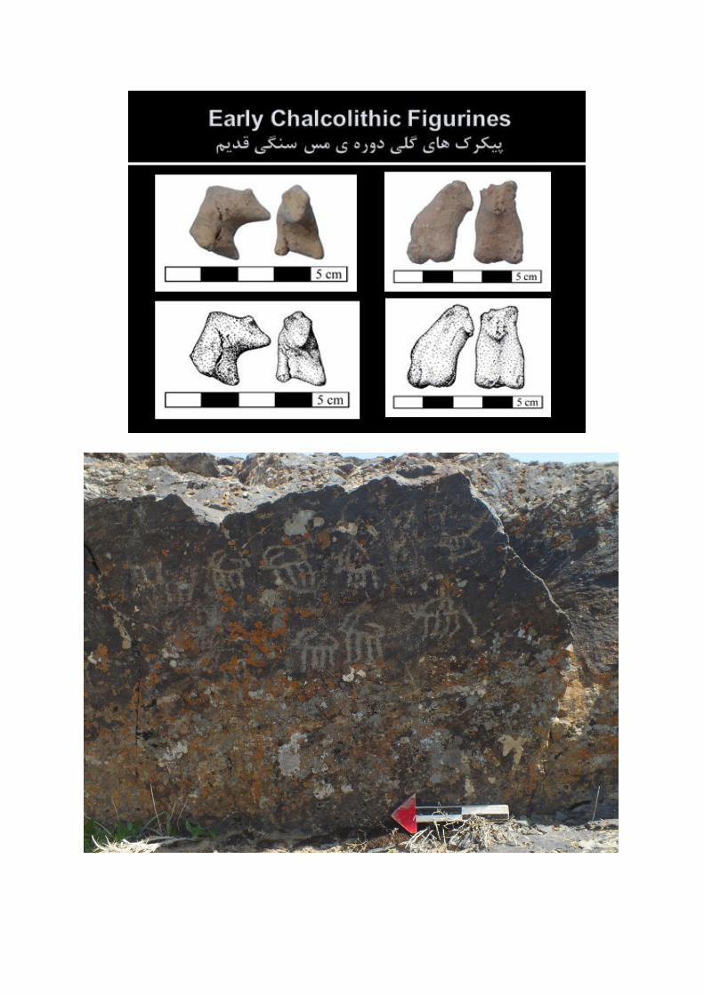
supervision of Gholam Shirzadeh and Ghafoor Kaka. With regards to Neolithic period
finds reconnaissance at the lowest layers of Sarsakhti was decided to survey the region
(Shazand, Khondab and Komijan Towns) under Ghafoor Kaka. These towns are located
in beside Qara Chay River. The river is the most important resource of water preparing
for native population. This river has 540 kilometers long and 18000 watershed and is
started from Shazand Town and passed Khondab, Komijan Towns in Markazi province,
Famenin Town in Hamedan Province and Saveh Town in Markazi again and then ended
to Masileh seasonal river in Qom Province.
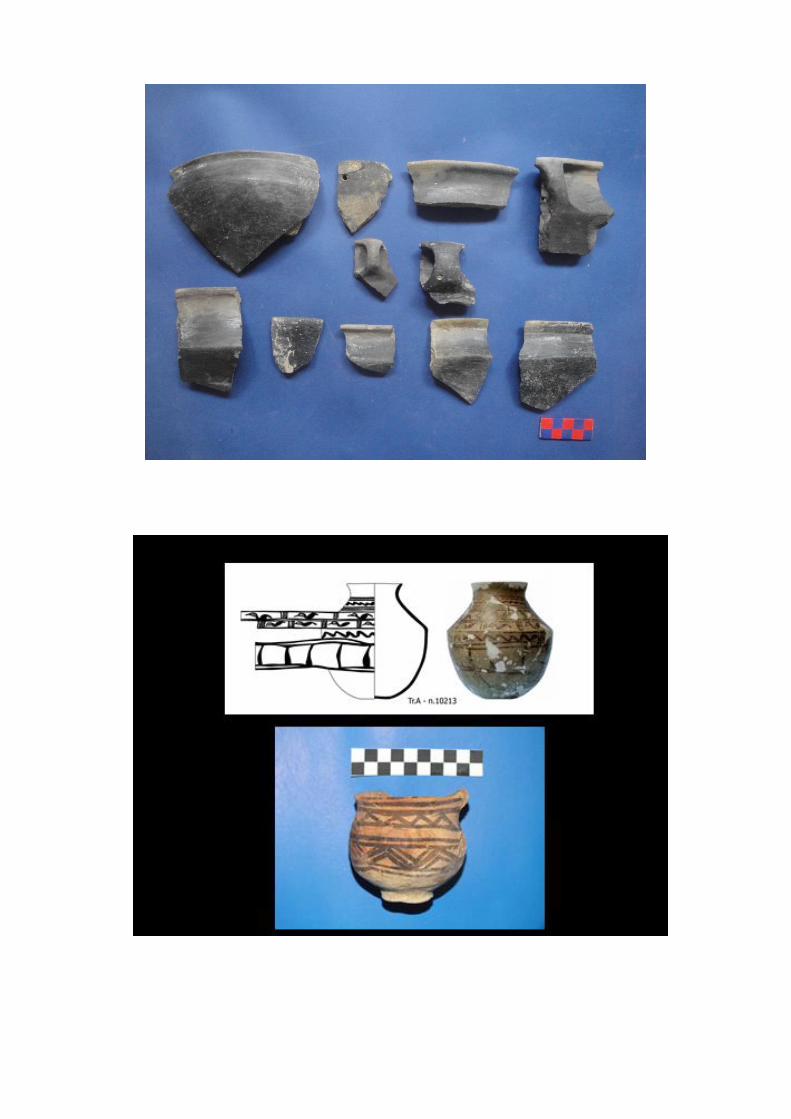
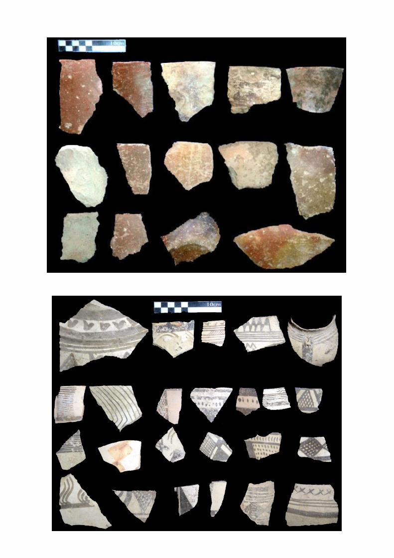
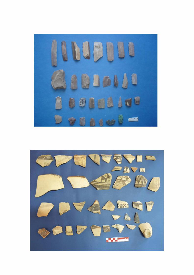
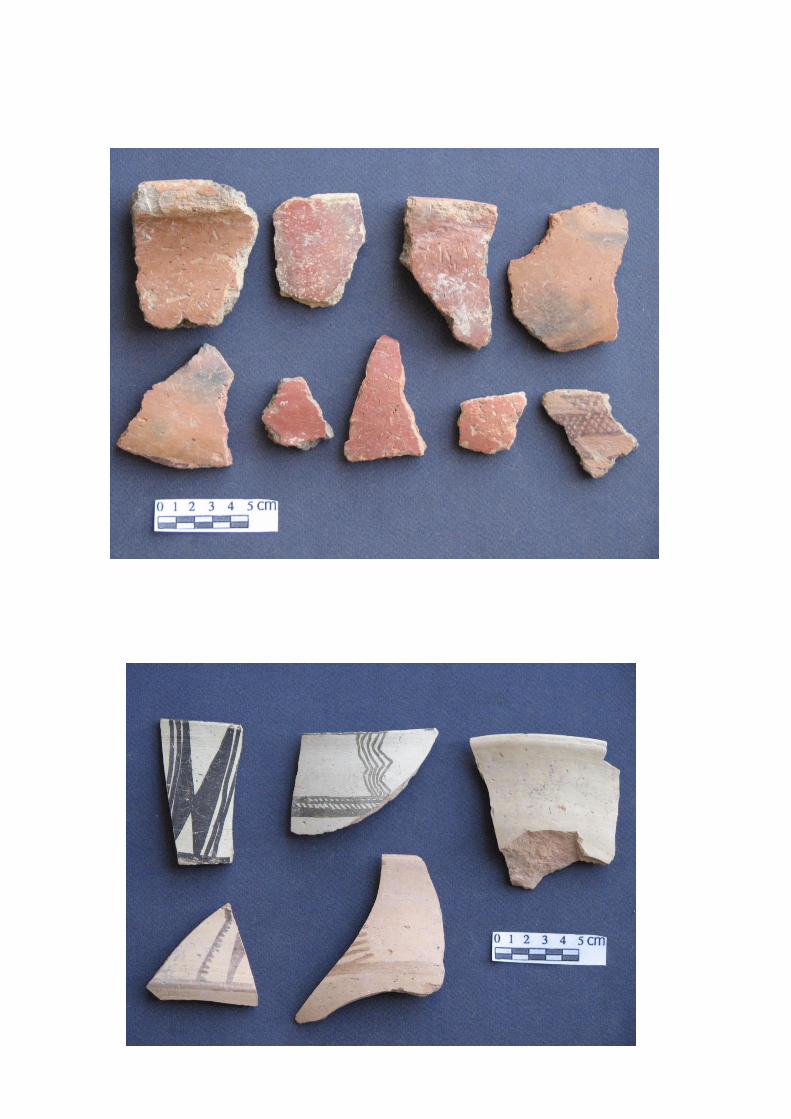
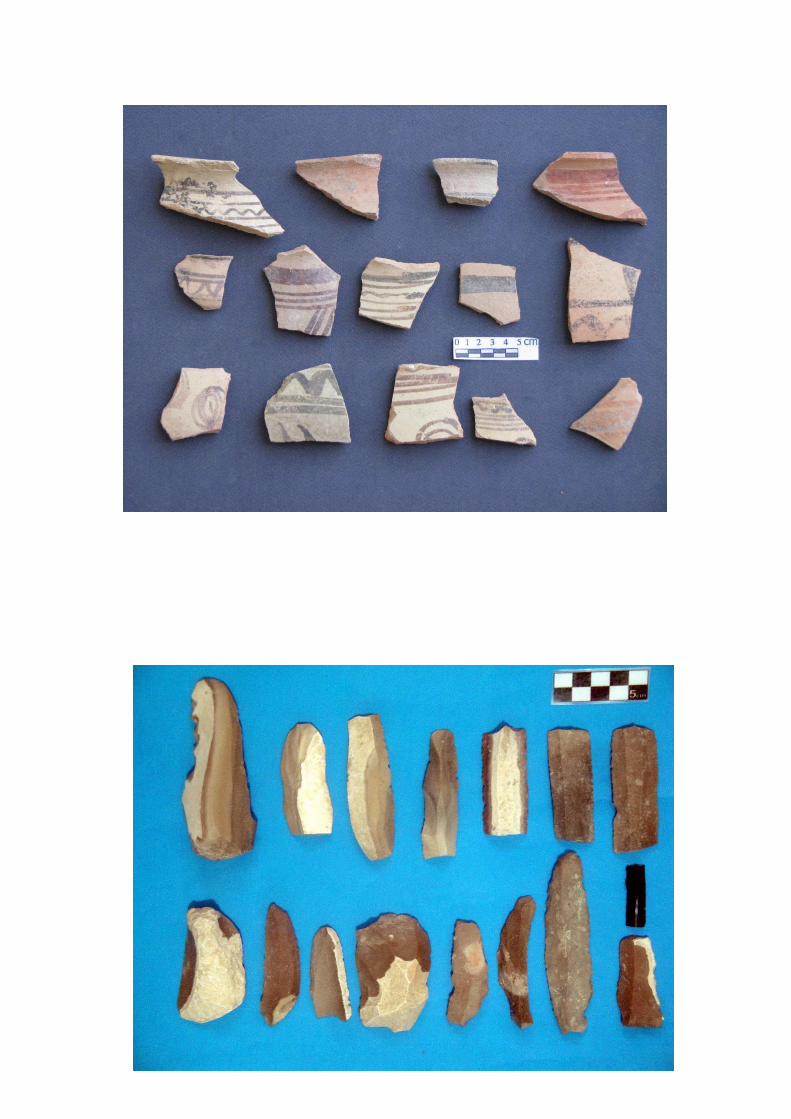
We have collection of data belonging to Neolithic, Chalcolithic, Bronze and Iron periods
which comparison with the Central Zagros, Central Iranian Plateau. Because of the
province is wilderness, there are many questions that is a real challenge for Iranian
archaeology. We are going to study data which have obtained with the helping of
prehistorians and inter-disciplinary sciences in Qara Chay Basin Prehistoric Project. We
will hope to answer to many questions about the archaeology of this region of Iran. One
of the special purposes of the team is excavation in Kholouzin Site that has great data
related to the prehistory of the Central Zagros and Central Iranian Plateau.
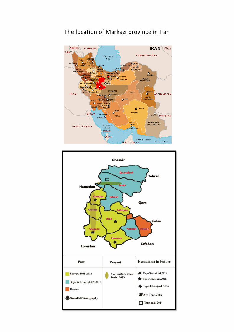
The location of Markazi province in Iran