oyo state pocket factfinder - wordpress.com
TRANSCRIPT
HISTORICAL BACKGROUND
Oyo State, popularly referred to as the “Pace Setter” is
one of the 36 States of the Federal Republic of Nigeria.
It came into existence with the break up of the old
Western State of Nigeria during the state creation
exercise in 1976 and it originally included Ọsun State,
which was split off in 1991. Ibadan had been the centre
of administration of the old Western Region, Nigeria
since the days of the British colonial rule.
Ibadan, surrounded by seven hills, is the second largest
city in Nigeria. It came into existence when bands of
Yoruba renegades following the collapse of the Yoruba
Oyo Empire, began settling in the area towards the end
of the 18th century; attracted by its strategic location
between the forests and the plains. Its pre-colonial
history centered on militarism, imperialism and violence.
The military sanctuary expanded even further when
refugees began arriving in large numbers from northern
Oyo following raids by Fulani warriors. Ibadan grew
into an impressive and sprawling urban center so much
that by the end of 1829, Ibadan dominated the Yoruba
region militarily, politically and economically.
The area became a British Protectorate in 1893. By then
the population had swelled to 120,000. The British
developed their new colony to facilitate their commercial
activities in the area, and Ibadan shortly grew into the
major trading center that it is today. The colonizers also
developed the academic infrastructure of the city. The
first university to be set up in Nigeria was the University
of Ibadan (established as a college of the University of
London when it was founded in 1948, and later
converted into an autonomous university in 1962). It has
the distinction of being one of the premier educational
institutions in West Africa, and there is a museum in the
building of its Institute of African Studies, which
exhibits several remarkable pre-historic bronze carvings
and statues. Other noteworthy institutions in the city
include the University College Hospital, the first
teaching hospital in Nigeria and the internationally
acclaimed International Institute of Tropical Agriculture
(lTTA).
The city has several well stocked libraries, a zoological
garden and several botanical gardens. Nestled inside
(IITA) is the best golf course in Nigeria, and the grounds
of the Ibadan Polo Club is not too far away. Ibadan is
home to the first television station in Africa. There are a
few hotels with hotspot (wifi) access, a few decent
restaurants and a couple of radio stations. Ibadan and its
environs before the disolution of the Western Region
was the home of the the most sophisticated and liberal
scientific and cultural community on the continent of
Africa; as personified by the immortalized Ibadan
School
The most probable date of the founding of Ibadan is
1829, when the abandone settlement of Ibadan was
reoccupied by the allied forces of Ijebu, Ife and Oyo;
hence, it came to be regarded as „a war encampment‟ of
the town of warriors.
From the onward, Ibadan grew I unimportance and has
served as the administrative centre for the whole of
Southern Nigeria (1946 – 1951). And as the capital of
the Western Region (1951 – 1967). After this period, the
city‟s region started to shrink, to cover just the Western
Region (1963 – 1967); Western State and old Oyo State
(1976 – 1991), before the creation of Osun State, (1976 –
1991). It has been the capital of present Oyo State since
1991.
The Political status of the city has influenced other
aspect of its development. One of which is the
reminiscence of colonial administration. The
Government Secretariat at Agodi and the Government
Reservation Areas (GRAs)A at Agodi, Jericho and
Onikere are relice of that era. The grid pattern of the
residential layout of Oke – Bola and Oke – Ado is also
associated with its activities.
ECONOMY
With its strategic location on the railway line connecting
Lagos to Kano, the city is a major center for trade in
cassava, cocoa, cotton, timber, rubber, and palm oil. The
main industries in the area are tire rethreading, cigarettes
manufacturing and the processing of agricultural
products; including flour-milling, leather-working and
furniture-making. The largest companies with major
infrastructure based in Ibadan are Kakanfo Inn , Coca-
Cola , Nigerian Breweries , Galaxy Television,
Globacom , NTA Ibadan , and Zartech Limited. There is
abundance of clay, kaolin and aquamarine in its
environs, and there are several cattle ranches, a dairy
farm as well as a commercial abattoir in Ibadan.
Dugbe Market is the nerve center of Ibadan's transport
and trading network. The haphazard layout of the city's
roads and streets contribute largely to the disorderly
traffic and make it very difficult to locate and reach
destinations. The best method to move about the city is
to use reference points and notable landmarks. The
Bower Memorial Tower to the east on Oke-Aare (Hill)
can be seen from practically any point in the city. It also
provides an excellent view of the whole city from the
top. Another prominent landmark is Cocoa House, the
first skyscraper in Nigeria. It is one of the few
skyscrapers in the city and is at the hub of Ibadan's
commercial center. Other attractions include Mapo Hall,
the colonial style city hall perched on top a hill, the
Trans-Wonderland amusement park, the cultural centre
Mokola and Liberty Stadium, Ibadan--with a seating
capacity of 35,000--is the first stadium built in West
Africa. Ibadan is also home to the fabled Shooting Stars
FC; a professional Football Club.
Ibadan has a few other important industries
establishment like the confectionaries, oil processing
plants, soft drinks, bottling and food factories, feed mills,
tobacco factory and flour mills. Other are sawmills,
paper mills, foam products, concrete poles and block
making, chemicals, paints and petroleum oil deport. The
government tries to promote industrial establishment by
creating industrial estates, with a basic infrastructure ,
such as Owode Olubadan, Oluyole and Lagelu Industrial
Estates.
Its, however, upon the commercial sector that the city‟s
development mainly depends. As of 1991, close to 50%
of its economically active population were commercial
workers Oja‟ba, Ayeye and Oranyan are the Traditional
markets. While Gbagi, Agbeni, Bodija, Alesinloye,
Agbeni and gate are modern ones. They trade foodstuff,
textile goods, locally woven strips of cloth or „aso oke‟,
household utensils, electronics and pharmaceuticals.
One should also note that involvement of many
Nigerian business in the trading of motor parts and both
local and foreign building materials.
The production and related workers are next in
importance, with 265 of the working population. They
are followed by professional/technical and related
workers (10.9%). Other occupations the people are
engaged in are as administrative and (4.5%) and clerical
and related workers (2.6%). The agriculture and related
workers features last, with 1.9%.
IBADAN NATIVES
Ibadan natives of note include Augustus Akinloye, a
prominent politician, Theophilus Adeleke Akinyele a
civil servant, Bobby Ologun, a K-1 fighter who is very
popular in Japan, and Sade Adu, frontwoman and lead
vocalist of the popular English group Sade.

TOURISM
Ibadan also has many recreational and tourist centres of
attraction: Liberty Stadium and Lekan Salami stadium,
the PoloClub, the botanical Garden, the Zoo and the
Transwonderland Amusement Park. The cultural Centre,
Mapo Hall, Ido, Centaph and the Bowers Tower are
other tourist centres of historical culture value.
Premier Hotel Ibadan
TRANSPORTATION
Ibadan has an airport and is served by the Ibadan
Railway Station on the main railway line from Lagos to
Kano. The bad economic situation in the country has
adversely affected the quality of public transportation. It
is therefore advisable to arrange transportation before
traveling to Ibadan.
the city is respectively well linked by road, rail and air
both domestic and internationally. The intra city road
network provide the major links with its different parts.
Recently, the Ibadan – Lagos Express way the Ring road
network were built to ease traffic congestion in the city.
URBANIZATION
Ibadan presents fascinating landscape of tradition and
modern features Prominent in its old, indigenous core
area are the I b a‟s marked (Oja‟ba) and the king‟s
place. Force Mopo Hill, one can easily see the sea of
rusted brown roofs and buildings in places like Agugu,
Ayeye, Idi Arere, Odinjo, Gege and Foko, to mention
but a few.
These are interspersed by neighborhoods, of new and
modern buildings, which are linked and crisscrossed by
winding roads. Other places are at the periphery of the
core centre. The include Odo Ona, Apata Ganga and
Owode Estate, to the west, to the south are Challenge,
Molate and Felele areas. Those to the north are
Oorogun, Ojoo, Sasa etc, while to the north – east are
Bodija, Akobo, Monatan and Isebo.
The outward of the city is in all direction of the seven
main riges that dominate the city of Landform. The
sprawl has also been in the of the railway that runs in a
southwest-northwest direction of the cit of the road
networks, which link the city with almost all the cardinal
points of the country. Some of the contributive factors
to its spread are:the Ibadab – Lagos and the Ring Road –
Adeoye Express ways, the establishment of institutional
area housing and industrial estates. Example of the last
three named factors are the University of Ibadan,
Polytechnic, Bodija Odogbo Army Barracksm Jericho,
Owode and Felele Housing Estates, NNPC Oil Storage
Deport, Apata and Oluyole and Lagelu Housing and
Industrial Estate. Other newly developing area of the
city include Eleyele, Challenge, Gbanda, Ikolaba,
Akobo, Monatan, Adegbayi, Olodo and Olomi.
EDUCATION
Ibadan is an exception educational centre. It has
numerous primary and post primary institutions, such as
the University of Ibadan, the first University in the
country, and world renowned. There are also The
Polytechnic and several research institutes, such as the
Nigeria Horticulture Research (NISER) and the Institute
of Agriclture, Research Training (IAR & T). Also, there
is a private University, the City University of Ibadan,
and a host of private secondary institutions.
HEALTH.
The city also enjoys modern health facilities. All the
three tiers of heath facilities are well represented in the
city, with the University College Hospital (UCH), Ring
Road and Yemetu State Hospitals and myriad of clinics,
dispensaries maternal and child health centres.
PROSPECTS.
The large market size which the city‟s population size
connotes, is one major prospect of it vability. In
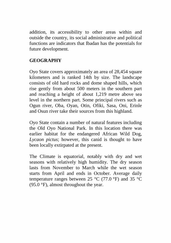
addition, its accessibility to other areas within and
outside the country, its social administrative and political
functions are indicators that Ibadan has the potentials for
future development.
GEOGRAPHY
Oyo State covers approximately an area of 28,454 square
kilometers and is ranked 14th by size. The landscape
consists of old hard rocks and dome shaped hills, which
rise gently from about 500 meters in the southern part
and reaching a height of about 1,219 metre above sea
level in the northern part. Some principal rivers such as
Ogun river, Oba, Oyan, Otin, Ofiki, Sasa, Oni, Erinle
and Osun river take their sources from this highland.
Oyo State contain a number of natural features including
the Old Oyo National Park. In this location there was
earlier habitat for the endangered African Wild Dog,
Lycaon pictus; however, this canid is thought to have
been locally extirpated at the present.
The Climate is equatorial, notably with dry and wet
seasons with relatively high humidity. The dry season
lasts from November to March while the wet season
starts from April and ends in October. Average daily
temperature ranges between 25 °C (77.0 °F) and 35 °C
(95.0 °F), almost throughout the year.
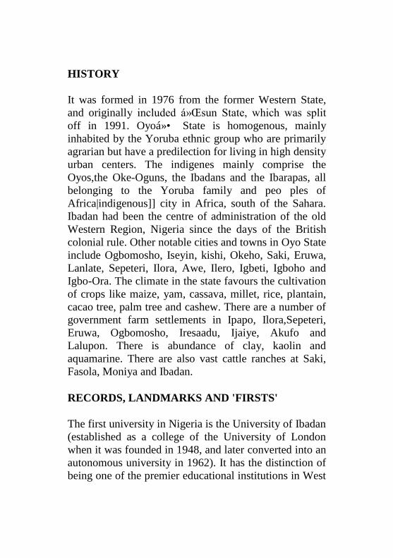
HISTORY
It was formed in 1976 from the former Western State,
and originally included Ọsun State, which was split
off in 1991. Oyoổ State is homogenous, mainly
inhabited by the Yoruba ethnic group who are primarily
agrarian but have a predilection for living in high density
urban centers. The indigenes mainly comprise the
Oyos,the Oke-Oguns, the Ibadans and the Ibarapas, all
belonging to the Yoruba family and peo ples of
Africa|indigenous]] city in Africa, south of the Sahara.
Ibadan had been the centre of administration of the old
Western Region, Nigeria since the days of the British
colonial rule. Other notable cities and towns in Oyo State
include Ogbomosho, Iseyin, kishi, Okeho, Saki, Eruwa,
Lanlate, Sepeteri, Ilora, Awe, Ilero, Igbeti, Igboho and
Igbo-Ora. The climate in the state favours the cultivation
of crops like maize, yam, cassava, millet, rice, plantain,
cacao tree, palm tree and cashew. There are a number of
government farm settlements in Ipapo, Ilora,Sepeteri,
Eruwa, Ogbomosho, Iresaadu, Ijaiye, Akufo and
Lalupon. There is abundance of clay, kaolin and
aquamarine. There are also vast cattle ranches at Saki,
Fasola, Moniya and Ibadan.
RECORDS, LANDMARKS AND 'FIRSTS'
The first university in Nigeria is the University of Ibadan
(established as a college of the University of London
when it was founded in 1948, and later converted into an
autonomous university in 1962). It has the distinction of
being one of the premier educational institutions in West
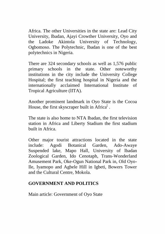
Africa. The other Universities in the state are: Lead City
University, Ibadan, Ajayi Crowther University, Oyo and
the Ladoke Akintola University of Technology,
Ogbomoso. The Polytechnic, Ibadan is one of the best
polytechnics in Nigeria.
There are 324 secondary schools as well as 1,576 public
primary schools in the state. Other noteworthy
institutions in the city include the University College
Hospital; the first teaching hospital in Nigeria and the
internationally acclaimed International Institute of
Tropical Agriculture (lITA).
Another prominent landmark in Oyo State is the Cocoa
House, the first skyscraper built in Africa[ .
The state is also home to NTA Ibadan, the first television
station in Africa and Liberty Stadium the first stadium
built in Africa.
Other major tourist attractions located in the state
include: Agodi Botanical Garden, Ado-Awaye
Suspended lake, Mapo Hall, University of lbadan
Zoological Garden, Ido Cenotaph, Trans-Wonderland
Amusement Park, Oke-Ogun National Park in, Old Oyo-
Ile, Iyamopo and Agbele Hill in Igbeti, Bowers Tower
and the Cultural Centre, Mokola.
GOVERNMENT AND POLITICS
Main article: Government of Oyo State

Under the Nigerian 1999 constitution the government of
Oyo State, and those of the other 35 Nigerian States, is
divided into three branches to be in line with the
government of the Federal Republic of Nigeria which is
also three tier: the executive branch, the legislative
branch and the judiciary. The executive branch of Oyo
State government is headed by an elected executive
governor who presides over the State Executive Council
made up of appointed cabinet members. The present
governor of Oyo State is Senator Abiola Ajimobi with
Chief Moses Alake Adeyemo as deputy governor. The
legislative branch is headed by an elected Speaker of the
House of Assembly. The current Speaker is Monsurat
Sunmonu. And lastly, the judiciary is headed by the
Chief Judge of Oyo State High Court. The present and
acting Chief Judge of the state is Badejoko Olateju
Adeniji who replaced Olagoke Ige.
EDUCATION
Presently the State has 1,703 public schools, 971 private
nursery/primary schools, 335 public secondary schools
including 7 schools of Science and 57 private secondary
schools. Also in the State, there are five government
technical colleges at Oyo, Ogbomoso, Ibadan, Saki and
Igbo-Ora with enrolment of 2,829 students in the
2000/2001 academic session.
Historically prominent secondary schools include Loyola
College Ibadan, Government College Ibadan, St Patricks
Grammar School Ibadan, St Thersa's College Ibadan and
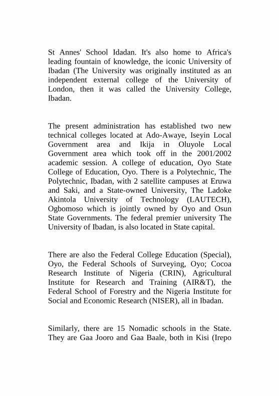
St Annes' School Idadan. It's also home to Africa's
leading fountain of knowledge, the iconic University of
Ibadan (The University was originally instituted as an
independent external college of the University of
London, then it was called the University College,
Ibadan.
The present administration has established two new
technical colleges located at Ado-Awaye, Iseyin Local
Government area and Ikija in Oluyole Local
Government area which took off in the 2001/2002
academic session. A college of education, Oyo State
College of Education, Oyo. There is a Polytechnic, The
Polytechnic, Ibadan, with 2 satellite campuses at Eruwa
and Saki, and a State-owned University, The Ladoke
Akintola University of Technology (LAUTECH),
Ogbomoso which is jointly owned by Oyo and Osun
State Governments. The federal premier university The
University of Ibadan, is also located in State capital.
There are also the Federal College Education (Special),
Oyo, the Federal Schools of Surveying, Oyo; Cocoa
Research Institute of Nigeria (CRIN), Agricultural
Institute for Research and Training (AIR&T), the
Federal School of Forestry and the Nigeria Institute for
Social and Economic Research (NISER), all in Ibadan.
Similarly, there are 15 Nomadic schools in the State.
They are Gaa Jooro and Gaa Baale, both in Kisi (Irepo
Local Government); Baochilu Government; Arin-Oye,
Abiogun, Okaka and Baba-Ode (Itesiwaju Local
Government); Iganna (Iwajowa Local Government);
Igangan and Ayete (Ibarapa North Local Government
Gaa Kondo and Igbo-Ora, Ibarapa Central Local
Government) and Sepeteri (Saki East Local
Government). There are 213 continuing education
centres spread all over the State.
Also, there are 15 special primary schools and 8 special
units in secondary schools catering for handicapped
children. There are 11,732 teaching staff in the state
public secondary schools and 2,789 non-teaching staff.
There are also the Agency for Adult and Non-formal
Education (AANFE) which caters for illiterate adults
who had no opportunity of formal education. The
Agency has 455 classes in existence in the 33 Local
Government areas of the State, while 200,000 illiterate
adults and over 80,000 post-illiterate adults have been
trained recently.
LIST OF UNIVERSITIES IN OYO STATE
Ladoke Akintola University of Technology,
Ogbomoso
University of Ibadan, Ibadan
Lead City University, Ibadan
Ajayi Crowther University, Oyo
LOCAL GOVERNMENT AREAS
The state consists of thirty three Local Government
Areas:
Akinyele
Afijio
Egbeda
Ibadan North
Ibadan North-East
Ibadan North-West
Ibadan South-West
Ibadan South-East
Ibarapa Central
Ibarapa East
Ido
Irepo
Iseyin
Kajola
Lagelu
Ogbomosho North
Ogbomosho South
Oyo West
Atiba
Atisbo
Saki West
Saki East
Itesiwaju
Iwajowa
Ibarapa North
Olorunsogo
Oluyole
Ogo Oluwa
Surulere
Orelope
Ori Ire
Oyo East
Ona Ara
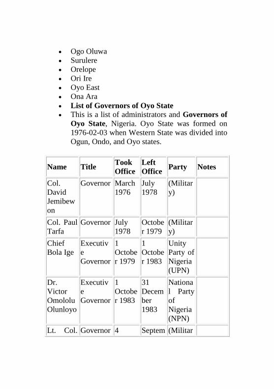
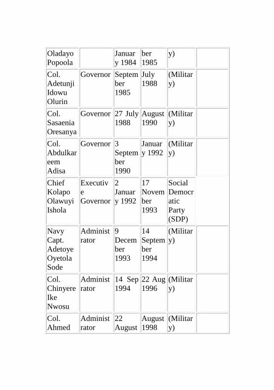
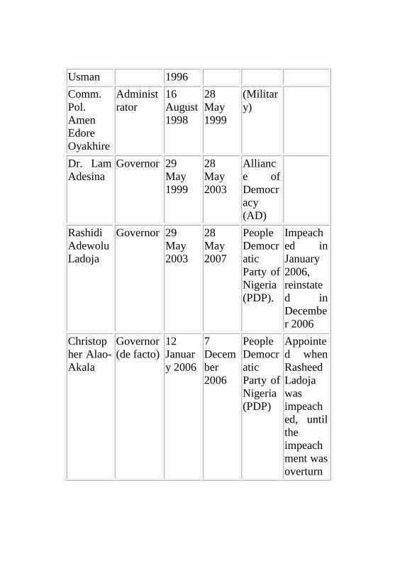
List of Governors of Oyo State
This is a list of administrators and Governors of
Oyo State, Nigeria. Oyo State was formed on
1976-02-03 when Western State was divided into
Ogun, Ondo, and Oyo states.
Name Title Took
Office
Left
Office Party Notes
Col.
David
Jemibew
on
Governor March
1976
July
1978
(Militar
y)
Col. Paul
Tarfa
Governor July
1978
Octobe
r 1979
(Militar
y)
Chief
Bola Ige
Executiv
e
Governor
1
Octobe
r 1979
1
Octobe
r 1983
Unity
Party of
Nigeria
(UPN)
Dr.
Victor
Omololu
Olunloyo
Executiv
e
Governor
1
Octobe
r 1983
31
Decem
ber
1983
Nationa
l Party
of
Nigeria
(NPN)
Lt. Col. Governor 4 Septem (Militar
Oladayo
Popoola
Januar
y 1984
ber
1985
y)
Col.
Adetunji
Idowu
Olurin
Governor Septem
ber
1985
July
1988
(Militar
y)
Col.
Sasaenia
Oresanya
Governor 27 July
1988
August
1990
(Militar
y)
Col.
Abdulkar
eem
Adisa
Governor 3
Septem
ber
1990
Januar
y 1992
(Militar
y)
Chief
Kolapo
Olawuyi
Ishola
Executiv
e
Governor
2
Januar
y 1992
17
Novem
ber
1993
Social
Democr
atic
Party
(SDP)
Navy
Capt.
Adetoye
Oyetola
Sode
Administ
rator
9
Decem
ber
1993
14
Septem
ber
1994
(Militar
y)
Col.
Chinyere
Ike
Nwosu
Administ
rator
14 Sep
1994
22 Aug
1996
(Militar
y)
Col.
Ahmed
Administ
rator
22
August
August
1998
(Militar
y)
Usman 1996
Comm.
Pol.
Amen
Edore
Oyakhire
Administ
rator
16
August
1998
28
May
1999
(Militar
y)
Dr. Lam
Adesina
Governor 29
May
1999
28
May
2003
Allianc
e of
Democr
acy
(AD)
Rashidi
Adewolu
Ladoja
Governor 29
May
2003
28
May
2007
People
Democr
atic
Party of
Nigeria
(PDP).
Impeach
ed in
January
2006,
reinstate
d in
Decembe
r 2006
Christop
her Alao-
Akala
Governor
(de facto)
12
Januar
y 2006
7
Decem
ber
2006
People
Democr
atic
Party of
Nigeria
(PDP)
Appointe
d when
Rasheed
Ladoja
was
impeach
ed, until
the
impeach
ment was
overturn
ed.
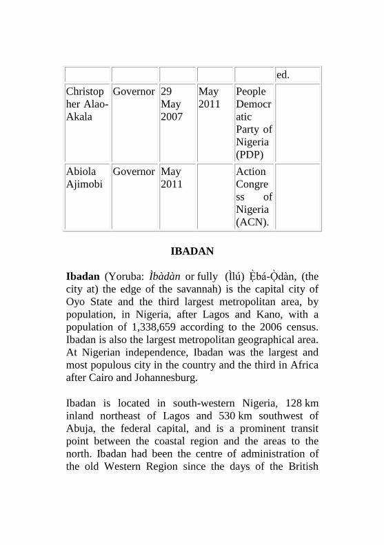
Christop
her Alao-
Akala
Governor 29
May
2007
May
2011
People
Democr
atic
Party of
Nigeria
(PDP)
Abiola
Ajimobi
Governor May
2011
Action
Congre
ss of
Nigeria
(ACN).
IBADAN
Ibadan (Yoruba: Ìbàdàn or fully (Ìlú) Ẹ̀bá-Ọ̀dàn, (the
city at) the edge of the savannah) is the capital city of
Oyo State and the third largest metropolitan area, by
population, in Nigeria, after Lagos and Kano, with a
population of 1,338,659 according to the 2006 census.
Ibadan is also the largest metropolitan geographical area.
At Nigerian independence, Ibadan was the largest and
most populous city in the country and the third in Africa
after Cairo and Johannesburg.
Ibadan is located in south-western Nigeria, 128 km
inland northeast of Lagos and 530 km southwest of
Abuja, the federal capital, and is a prominent transit
point between the coastal region and the areas to the
north. Ibadan had been the centre of administration of
the old Western Region since the days of the British
colonial rule, and parts of the city's ancient protective
walls still stand to this day. The principal inhabitants of
the city are the Yorubas.
HISTORY
Ibadan came into existence in 1829. According to local
historians, Lagelu, the Jagun (commander-in-chief) of
Ife and Yoruba's generalissimo, left Ile Ife with a handful
of people from Ife, Oyo and Ijebu to found a new city,
Eba Odan, which literally means 'between the forest and
plains.' According to HRH Sir Isaac Babalola Akinyele,
the late Olubadan (king) of Ibadan (Olu Ibadan means
Lord of Ibadan), in his authoritative book on the history
of Ibadan, Iwe Itan Ibadan, printed in 1911, the first city
was destroyed due to an incident at an Egungun
(masquerade) festival when an Egungun was
accidentally disrobed and derisively mocked by women
and children in an open marketplace full of people. In
Yorubaland, it was an abomination for women to look an
Egungun in the eye because the Egunguns were
considered to be the dead forefathers who returned to the
earth each year to bless their progeny. When the news
reached Sango, the then Alaafin of Oyo, he commanded
that Eba Odan be destroyed for committing such
abominable act.
Lagelu was by now an old, frail man; he could not stop
the destruction of his city, but he and some of his people
survived the attack and fled to a nearby hill for
sanctuary. On the hill they survived by eating oro fruit
and snails; later, they cultivated the land and made corn
and millets into pap meals known as oori or eko, which
they ate with roasted snails. They improvised a bit by
using the snail shells to drink the liquefied eko.
Ultimately, Lagelu and his people came down from the
hill and founded another city called Eba'dan.
The new city instantly grew prosperous and became a
commercial nerve centre. Shortly afterwards, Lagelu
died, leaving behind a politically savvy people and a
very stable community. The newly enthroned Olubadan
made a friendly gesture to the Olowu of Owu by
allowing Olowu to marry his only daughter, Nkan.
Coming from a war campaign one day, the raging Odo
Oba (River Oba) would not allow Olowu and his army to
cross until a human sacrifice was performed to appease
the angry river. The chosen sacrifice was Nkan. The
Olubadan was infuriated at hearing of Nkan's death; he
sent an emissary to inform the Alafin of Oyo. Yoruba
kings and rulers such as Alake of Egba, Agura of
Gbagura, Ooni of Ife, Awujale of Ijebu. Then the
Olubadan sent his army to attack the powerful Olowu of
Owu and defeated him. The Olowu committed suicide to
escape being captured by the Ibadan army. The battle
shattered the great Owu kingdom into pieces till today.
Some of it remains in the mother town which is the
present Orile-Owu in Osun State, while others are in
Ogun State, known as Owu Abeokuta and etc.
A part of Ibadan was historically an Egba town. The
Egba occupants were forced to leave the town and
moved to present-day Abeokuta under the leadership of
Sodeke as result of their disloyalty. Ibadan grew into an
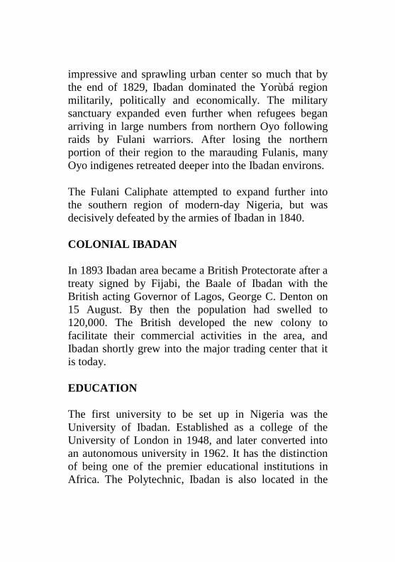
impressive and sprawling urban center so much that by
the end of 1829, Ibadan dominated the Yorùbá region
militarily, politically and economically. The military
sanctuary expanded even further when refugees began
arriving in large numbers from northern Oyo following
raids by Fulani warriors. After losing the northern
portion of their region to the marauding Fulanis, many
Oyo indigenes retreated deeper into the Ibadan environs.
The Fulani Caliphate attempted to expand further into
the southern region of modern-day Nigeria, but was
decisively defeated by the armies of Ibadan in 1840.
COLONIAL IBADAN
In 1893 Ibadan area became a British Protectorate after a
treaty signed by Fijabi, the Baale of Ibadan with the
British acting Governor of Lagos, George C. Denton on
15 August. By then the population had swelled to
120,000. The British developed the new colony to
facilitate their commercial activities in the area, and
Ibadan shortly grew into the major trading center that it
is today.
EDUCATION
The first university to be set up in Nigeria was the
University of Ibadan. Established as a college of the
University of London in 1948, and later converted into
an autonomous university in 1962. It has the distinction
of being one of the premier educational institutions in
Africa. The Polytechnic, Ibadan is also located in the
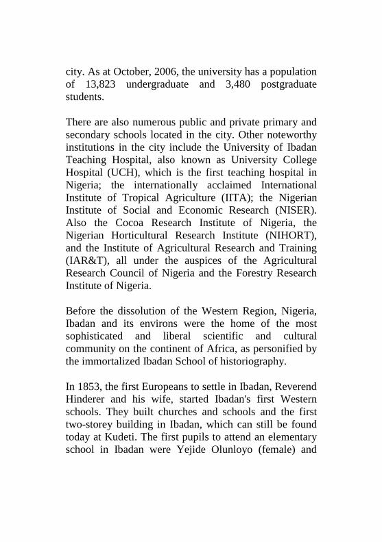
city. As at October, 2006, the university has a population
of 13,823 undergraduate and 3,480 postgraduate
students.
There are also numerous public and private primary and
secondary schools located in the city. Other noteworthy
institutions in the city include the University of Ibadan
Teaching Hospital, also known as University College
Hospital (UCH), which is the first teaching hospital in
Nigeria; the internationally acclaimed International
Institute of Tropical Agriculture (IITA); the Nigerian
Institute of Social and Economic Research (NISER).
Also the Cocoa Research Institute of Nigeria, the
Nigerian Horticultural Research Institute (NIHORT),
and the Institute of Agricultural Research and Training
(IAR&T), all under the auspices of the Agricultural
Research Council of Nigeria and the Forestry Research
Institute of Nigeria.
Before the dissolution of the Western Region, Nigeria,
Ibadan and its environs were the home of the most
sophisticated and liberal scientific and cultural
community on the continent of Africa, as personified by
the immortalized Ibadan School of historiography.
In 1853, the first Europeans to settle in Ibadan, Reverend
Hinderer and his wife, started Ibadan's first Western
schools. They built churches and schools and the first
two-storey building in Ibadan, which can still be found
today at Kudeti. The first pupils to attend an elementary
school in Ibadan were Yejide Olunloyo (female) and
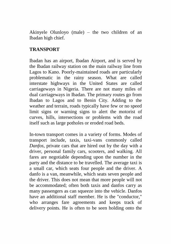
Akinyele Olunloyo (male) – the two children of an
Ibadan high chief.
TRANSPORT
Ibadan has an airport, Ibadan Airport, and is served by
the Ibadan railway station on the main railway line from
Lagos to Kano. Poorly-maintained roads are particularly
problematic in the rainy season. What are called
interstate highways in the United States are called
carriageways in Nigeria. There are not many miles of
dual carriageways in Ibadan. The primary routes go from
Ibadan to Lagos and to Benin City. Adding to the
weather and terrain, roads typically have few or no speed
limit signs or warning signs to alert the motorist of
curves, hills, intersections or problems with the road
itself such as large potholes or eroded road beds.
In-town transport comes in a variety of forms. Modes of
transport include, taxis, taxi-vans commonly called
Danfos, private cars that are hired out by the day with a
driver, personal family cars, scooters, and walking. All
fares are negotiable depending upon the number in the
party and the distance to be travelled. The average taxi is
a small car, which seats four people and the driver. A
danfo is a van, meanwhile, which seats seven people and
the driver. This does not mean that more people will not
be accommodated; often both taxis and danfos carry as
many passengers as can squeeze into the vehicle. Danfos
have an additional staff member. He is the "conductor,"
who arranges fare agreements and keeps track of
delivery points. He is often to be seen holding onto the
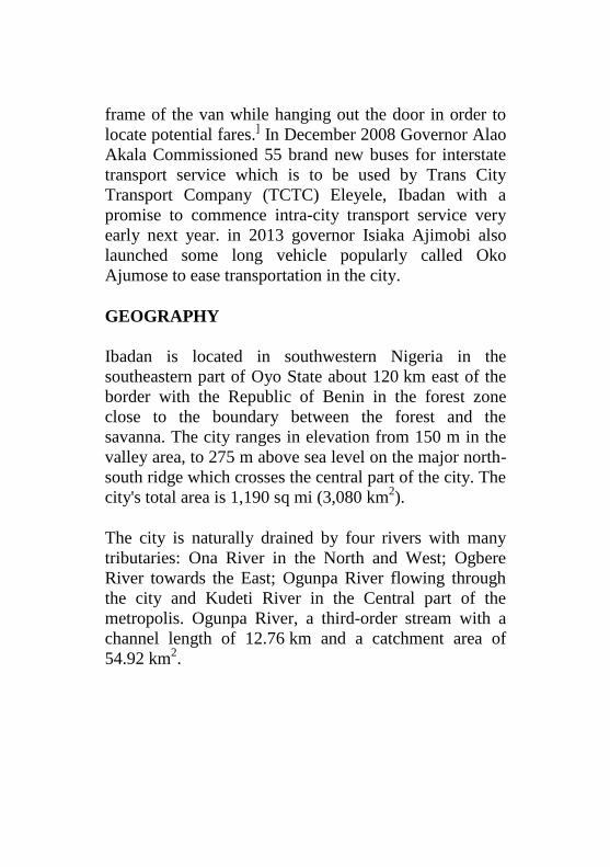
frame of the van while hanging out the door in order to
locate potential fares.] In December 2008 Governor Alao
Akala Commissioned 55 brand new buses for interstate
transport service which is to be used by Trans City
Transport Company (TCTC) Eleyele, Ibadan with a
promise to commence intra-city transport service very
early next year. in 2013 governor Isiaka Ajimobi also
launched some long vehicle popularly called Oko
Ajumose to ease transportation in the city.
GEOGRAPHY
Ibadan is located in southwestern Nigeria in the
southeastern part of Oyo State about 120 km east of the
border with the Republic of Benin in the forest zone
close to the boundary between the forest and the
savanna. The city ranges in elevation from 150 m in the
valley area, to 275 m above sea level on the major north-
south ridge which crosses the central part of the city. The
city's total area is 1,190 sq mi (3,080 km2).
The city is naturally drained by four rivers with many
tributaries: Ona River in the North and West; Ogbere
River towards the East; Ogunpa River flowing through
the city and Kudeti River in the Central part of the
metropolis. Ogunpa River, a third-order stream with a
channel length of 12.76 km and a catchment area of
54.92 km2.
CLIMATE
Ibadan has a tropical wet and dry climate (Köppen
climate classification Aw), with a lengthy wet season and
relatively constant temperatures throughout the course of
the year. Ibadan‟s wet season runs from March through
October, though August sees somewhat of a lull in
precipitation. This lull nearly divides the wet season into
two different wet seasons. November to February forms
the city‟s dry season, during which Ibadan experiences
the typical West African harmattan. The mean total
rainfall for Ibadan is 1420.06 mm, falling in
approximately 109 days. There are two peaks for
rainfall, June and September. The mean maximum
temperature is 26.46 C, minimum 21.42 C and the
relative humidity is 74.55%.
ADMINISTRATION
There are eleven (11) Local Governments in Ibadan
Metropolitan area consisting of five urban local
governments in the city and six semi-urban local
governments in the less city. Local governments at
present are institutions created by the military
governments but recognised by the 1999 constitution and
they are the third tiers of government in Nigeria. Local
governments Councils consist of the Executive Arm
made up of the Executive Chairman, the vice chairman,
the secretary and the supervisory councilors.

LOCAL GOVERNMENT AREAS
Ibadan Urban
1. Ibadan North
2. Ibadan North-East
3. Ibadan North-West
4. Ibadan South-East
5. Ibadan South-West
Ibadan Semi-Urban
6. Akinyele
7. Egbeda
8. Ido
9. Lagelu
10. Ona Ara
11. Oluyole
DEMOGRAPHY
POPULATION
Until 1970, Ibadan was the largest city in sub-Saharan
Africa. In 1952, it was estimated that the total area of the
city was approximately 103.8 km2.
However, only
36.2 km2 was built up. This meant that the remaining
67 km2 were devoted to non-urban uses, such as
farmlands, river floodplains, forest reserves and water
bodies. These “non-urban land uses” disappeared in the
1960s: an aerial photograph in 1973 revealed that the
urban land-scape had completely spread over about
100 km2. The land area increased from 136 km
2 in 1981
to 210–240 km2 in 1988-89 (Areola, 1994: 101). By the
year 2000, it is estimated that Ibadan covered 400 km2.
The growth of the built-up area during the second half of
the 20th century (from 40 km2 in the 1950s to 250 km
2 in
the 1990s) shows clearly that there has been an
underestimate of the total growth of the city. In the
1980s, the Ibadan-Lagos expressway generated the
greatest urban sprawl (east and north of the city),
followed by the Eleiyele expressway (west of the city).
Since then, Ibadan city has spread further into the
neighbouring local government areas of Akinyele and
Egbeda in particular.
MONUMENTS, LANDMARKS AND OTHER
LOCATIONS
There is a museum in the building of the Institute of
African Studies, which exhibits several remarkable pre-
historic bronze carvings and statues. The city has several
well stocked libraries, and is home to the first television
station in Africa. Dugbe Market is the nerve centre of
Ibadan's transport and trading network. The best method
to move about the city is to use reference points and
notable landmarks. The city also has a zoo located inside
the University of Ibadan, and a botanical garden located
at Agodi.
The Bower Memorial Tower to the east on Oke Aàre
(Aare's Hill) ("Aare" in Yoruba means commander-in-
chief or generalissimo), which can be seen from
practically any point in the city; it also provides an
excellent view of the whole city from the top. Another
prominent landmark, Cocoa House, was the first
skyscraper in Africa. It is one of the few skyscrapers in
the city and is at the hub of Ibadan's commercial centre.
Other attractions include Mapo Hall[11]
– the colonial
style city hall – perched on top of a hill, "Oke Mapo,"
Mapo Hill ("oke" is hill in Yoruba), the Trans-
Wonderland amusement park, the cultural centre Mokola
and the Obafemi Awolowo Stadium, a major stadium.
The first citadel of higher learning, University of Ibadan
(formerly the University College of Ibadan), the
Obafemi Awolowo Hall in the university of Ibadan is
said to be the tallest and largest hostel in west Africa.
The first teaching hospital in Nigeria, University College
Hospital, UCH, were both built in this ancient but,
highly important city. Ibadan is also home to the
legendary Shooting Stars FC – a professional Football
Club. There are some good golf courses: the Ibadan Golf
Club is a large 18-hole challenge and the Barracks
course has just been extended to 18 holes. The most
challenging and exclusive is the IITA Golf Club based
on the 1,000 hectare premises of IITA.
ECONOMY
With its strategic location on the non-operational railway
line connecting Lagos to Kano, the city is a major center
for trade in cassava, cocoa, cotton, timber, rubber, and
palm oil.
The main industries in the area include the processing of
agricultural products; Tobacco processing and Cigarette
(Manufacture); flour-milling, leather-working and
furniture-making.
There is abundance of clay, kaolin and aquamarine in its
environs, and there are several cattle ranches, a dairy
farm as well as a commercial abattoir in Ibadan.
The headquarters of the International Institute of
Tropical Agriculture (IITA) have extensive grounds for
crop and agricultural research into key tropical crops
such as bananas, plantains, maize, cassava, soybean,
cowpea and yam.
OLUBADAN
The Olubadan (Olubadan means Lord of Ibadan) is the
royal title of the king of Ibadan land in Nigeria, now a
largely symbolic role. Ibadan was founded in the 16th
century, but the present Yoruba people only took control
around 1820. By 1850 they had established their unusual
succession principle, which is quite different compared
with other traditional Yoruba rulers in that it alternates
between two lines. It usually takes decades to groom an
Olubadan for the stool through stages of chieftaincy
promotion, thus meaning that just about any male born
title-holder of the metropolitan center is a potential king.
HISTORY
According to the outline history of Ibadan by Oba Isaac
Akinyele, Ibadan was founded in the 16th century.
Around 1820, an army of Egba, Ijebu, Ife and Oyo
people won the town during their wars with the Fulanis.
After a struggle between the victors, the Oyo gained
control in 1829. A system where the Baale line (civic)
and Balogun Isoriki line (military) shared power was
established by 1851, subject to a traditional council
representing both lines.
In 1885 C.E. the Royal Niger Company became effective
rulers of the area, signing treaties with local powers such
as the Olubadan, and in 1900 the British government
formally assumed authority over Nigeria as a
"Protectorate". The British created the Ibadan Town
Council in 1897, using the traditionally powerful local
chiefs to administer their town. In 1901 the Governor Sir
William MacGregor introduced an ordinance whereby
the Baale became the president of the Council while the
Resident was only to advise when necessary (Rulers of
Ibadan were generally referred to as Baale until 1936,
when the title of Olubadan was resuscitated).
On October 1, 1960, Nigeria gained its independence
from the United Kingdom. Various juntas then ruled for
almost forty years. In 1999, a democratically elected
government came into power.
RULING LINES
There are two ruling lines to the throne of Olubadan,
Egbe Agba (civil) and Balogun (military), from where
Olubadans are appointed on rotational basis to occupy
the stool on the death of a monarch. The next to
Olubadan and most senior on both lines are the Otun
Olubadan and Balogun, who under the Western Nigeria
Law are recognised as second class traditional rulers and
who are included on the Nigerian equivalent of a civil
list as a result. Others are the Osi Olubadan, Asipa
Olubadan, Ekerin and Ekarun, as well as Otun Balogun,
Osi Balogun, Asipa Balogun, Ekerin and Ekarun
Balogun, while the Seriki and Iyalode, ("mother of the
town", female chief) are also members of the Olubadan's
privy council.
The 11 high chiefs that formed the Olubadan-in-council,
apart from the Seriki and Iyalode, are recognised as the
traditional head of each of the 11 LGs in Ibadanland. It
was learnt that the progenitors of Ibadan frowned on the
involvement of the senior chiefs in partisan politics
because of the salient neutral roles they were expected to
play in their domains. For instance, they are appointed as
presidents of customary courts, who are expected to
adjudicate on matrimonial, land, boundary and other
communal disputes.
ACCESSION PROCESS
The Olubadan has the sweeping powers to depose or peg
a chief, irrespective of the person's position on the
chieftaincy line. By implication, high chiefs on the lower
cadre could be promoted above a high chief whose
position was pegged. Even when forgiven, in the event
that he was penitent, the promotion would not be
reversed while the offending high chief served his
punishment. For instance, during the reign of Oba Fijabi
II, between 1948 and 1952, a wealthy Balogun, who was
next to Olubadan, was said to have had his chieftaincy
pegged. About the same time, a holder of the title of Osi-
Olubadan was also hammered for acts of disloyalty to
the cause of Ibadanland, an offence regarded as
treasonable felony. Spirited efforts made by a former
Minister in the old Western Region to seek redress from
the government and the courts when his chieftaincy title
was also pegged, was reported to have failed. Although
he was said to have been forgiven after seeking help
outside the courts, his juniors who had been promoted
above him were said to have remained his seniors
thereafter.
In 1983, the late Olubadan, Oba Yesufu Asanike,
withdrew the honorary title of Are Alasa from the then
Governor of the old Oyo State, the late Chief Bola Ige,
for an act considered as being disrespectful to
Ibadanland.
TODAY
Oba Ogundipe, the 39th Olubadan, ascended the throne
on 7 May 1999 and died in 2007 at the age of 87. He was
succeeded by Oba Samuel Odulana, 93, Odugade 1.
Although the role is now largely symbolic, the Olubadan
is still an influential figure and is not hesitant to attack
local political leaders on issues such as violence,
corruption and lack of true democracy in the region.
List of Olubadan
Ba‟ale Maye Okunade (1820-1830)
Ba‟ale Oluyedun
Ba‟ale Lakanle
Bashorun Oluyole 1850
Ba‟ale Oderinlo 1850
Ba‟ale Oyeshile Olugbode 1851-1864
Ba‟ale Ibikunle 1864
Bashorun Ogunmola 1865-1867
Ba‟ale Akere I 1867-1870
Ba‟ale Orowusi 1870-1871
Are Ona Kakanfo Obadoke Latosa 1871-1885
Ba‟ale Ajayi Osungbekun 1885-1893
Ba‟ale Fijabi I 1893-1895
Ba‟ale Oshuntoki 1895-1897
Ba‟ale Fajinmi 1897-1902
Ba‟ale Mosaderin 1902-1904
Ba‟ale Dada Opadare 1904-1907
Ba‟ale Sunmonu Apampa 1907-1910
Ba‟ale Akintayo Awanibaku Elenpe 1910-1912
Ba‟ale Irefin 1912-1914
Ba‟ale Shittu Latosa (son of Are Latosa) 1914-
1925
Ba‟ale Oyewole Foko 1925-1929
Olubadan Okunola Abass 1930-1946
Olubadan Akere I 1946
Olubadan Oyetunde I 1946
Olubadan Akintunde Bioku 1947-1948
Olubadan Fijabi II 1948-1952
Olubadan Alli Iwo 1952
Olubadan Apete 1952-1955
Oba Isaac Babalola Akinyele 1955-1964
Oba Yesufu Kobiowu July 1964 - December
1964
Oba Salawu Akanni Aminu 1965-1971
Oba Shittu Akintola Oyetunde II 1971-1976
Oba Gbadamosi Akanbi Adebimpe 1976-1977
Oba Daniel „Tayo Akinbiyi 1977-1982
Oba Yesufu Oloyede Asanike I 1982-1994
Oba Emmanuel Adegboyega Operinde I (1994-
1999)
Oba Yunusa Ogundipe Arapasowu I (1999-2007)
Oba Samuel Odulana Odugade I (2007–present)
ISEYIN
Iseyin, the Home of "Aso Oke", is a city located in Oyo
State, South West Nigeria ,Africa. It is approximately
100 kilometers north of Ibadan. Iseyin is bounded by
Latitude 7º57‟N & 8º17‟N with longitude 2º45‟E &
3º37‟E, and shares boundaries with Ojogbodu (Oyo
West), Kajola, Ifedapo and Ibarapa Local Government
Areas of Oyo State. The recent National head count put
the city at a population of 256,926. The primary industry
of our area is cotton-based textiles.
Agriculture is our secondary occupation and some of the
food crops cultivated include; maize, okro, yam, cassava
and various leaf vegetables. Tobacco is grown in large
quantity and it is as a result of this that one of the biggest
tobacco companies owned by British and American cited
its Leaf Office in Iseyin.
We are well known for trading, craftworks, soap making,
gaari and oil palm processing. Iseyin has been the
headquarters of Oke-Ogun area, which comprises of
Iseyin, Okeho, Iganna, Saki, kisi, Ipapo, Tede, Ado-
Awaye etc. Oke Ogun people are identified with
language or dialet known as 'Onko' solicited. His Royal
Majesty, Oba (Dr.) Abdu-Ganiyu Oloogunebi-Ajinese I,
is the incumbent Aseyin of Iseyin, the paramount ruler of
Iseyinland.
In 1914, Sir Lugard amalgamated southern and northern
protectorate, Iseyin became a District Council. However
with local Government Reform of 1976, the District
council became Iseyin local Government Area in Oyo
state. And of the 33LGA”S in Oyo state, Iseyin Local
Government Area is the second largest.