mill house hbr , tutbury mill, rocester
TRANSCRIPT
Mill House, Tutbury Mill, Rocester.
Birmingham Archaeology i
.
Project No. 1558
February 2007
Mill House, Tutbury Mill, Rocester
Historic Building Recording
By
Shane Kelleher
For
The Development Planning Partnership
For further information please contact: Alex Jones (Director)
Birmingham Archaeology The University of Birmingham
Edgbaston Birmingham B15 2TT Tel: 0121 414 5513 Fax: 0121 414 5516
E-Mail: [email protected] Web Address: http://www.arch-ant.bham.ac.uk/bufau/
Mill House, Tutbury Mill, Rocester.
Birmingham Archaeology ii
Mill House, Tutbury Mill, Rocester.
CONTENTS
1 INTRODUCTION................................................................................................... 1
2 LOCATION AND GEOLOGY.................................................................................... 1
3 OBJECTIVES......................................................................................................... 2
4 METHODS ............................................................................................................ 2 4.1 MEASURED SURVEY............................................................................................. 2 4.2 PHOTOGRAPHIC SURVEY ....................................................................................... 2 4.3 WRITTEN RECORD .............................................................................................. 2 4.4 HISTORICAL RESEARCH ........................................................................................ 2
5 ANALYTICAL BUILDING DESCRIPTION ................................................................ 2 5.1 EXTERIOR ........................................................................................................ 2 5.2 INTERIOR ........................................................................................................ 4
6 STRUCTURAL PHASING........................................................................................ 7 6.1 PHASE 1: LATE 18TH/ EARLY 19TH- CENTURY................................................................ 7 6.2 PHASE 2: MID TO LATE 19TH-CENTURY....................................................................... 7 6.3 PHASE 3: EARLY 20TH-CENTURY .............................................................................. 8 6.4 PHASE 4: MID TO LATE 20TH-CENTURY....................................................................... 8
7 CONCLUSIONS AND RECOMMENDATIONS............................................................ 8
8 ACKNOWLEDGEMENTS......................................................................................... 9
9 SOURCES ............................................................................................................. 9 9.1 PRIMARY SOURCES ............................................................................................. 9 9.2 SECONDARY SOURCES.......................................................................................... 9 9.3 CARTOGRAPHIC SOURCES...................................................................................... 9
Figures and Plates
Mill House, Tutbury Mill, Rocester.
Birmingham Archaeology iii
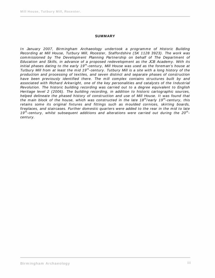
SUMMARY In January 2007, Birmingham Archaeology undertook a programme of Historic Building Recording at Mill House, Tutbury Mill, Rocester, Staffordshire (SK 1128 3923). The work was commissioned by The Development Planning Partnership on behalf of The Department of Education and Skills, in advance of a proposed redevelopment as the JCB Academy. With its initial phases dating to the early 19th-century, Mill House was used as the foreman’s house at Tutbury Mill from at least the mid 19th-century. Tutbury Mill is a site with a long history of the production and processing of textiles, and seven distinct and separate phases of construction have been previously identified there. The mill complex contains structures built by and associated with Richard Arkwright, one of the key personalities and catalysts of the Industrial Revolution. The historic building recording was carried out to a degree equivalent to English Heritage level 2 (2006). The building recording, in addition to historic cartographic sources, helped delineate the phased history of construction and use of Mill House. It was found that the main block of the house, which was constructed in the late 18th/early 19th-century, this retains some its original fixtures and fittings such as moulded cornices, skirting boards, fireplaces, and staircases. Further domestic quarters were added to the rear in the mid to late 19th-century, whilst subsequent additions and alterations were carried out during the 20th-century.
Mill House, Tutbury Mill, Rocester.
Birmingham Archaeology iv
Figures 1. Location Map. 2. The study area. 3. Map regression plan. 4. Ground-floor phased plan. 5. First-floor phased plan. 6. Second-floor phased plan. 7. 18th-century Plan of Rocester Mills. 8. 1850 Plan of the Parish of Rocester in the County of Stafford. 9. 1876 Extract From Plan On Conveyance of Rocester Mills. 10. 1881, 1901, 1927 1:2500 Ordnance Survey Maps. 11. Extract from 1922 Ordnance Survey Map. Plates 1. Southwest elevation. 2. Blocked doorway southwest elevation. 3. Southeast elevation. 4. Northeast elevation. 5. Northwest elevation. 6. G1 from north. 7. G3 from east. 8. Stairs G3 from southwest. 9. G5 from northwest. 10. G5 fireplace from east. 11. G6 from east. 12. G7 from north. 13. G8 from west. 14. G9 from northeast. 15. G9 from south. 16. G10 from east. 17. F1 from east. 18. F2 from east. 19. Fireplace F2 from southeast. 20. Beam F3 from east. 21. Fireplace F5 from southwest. 22. S1 from northeast. 23. Early 20th-century photograph.
Mill House, Tutbury Mill, Rocester.
Birmingham Archaeology 1
MILL HOUSE, TUTBURY MILL, MILL STREET, ROCESTER. HISTORIC BUILDING RECORDING, 2007.
1 INTRODUCTION In January 2007 Birmingham Archaeology carried out a programme of Historic Building Recording at Mill House, Tutbury Mill, Rocester, Staffordshire (SMR 02251-MST2241). The work was commissioned by The Development Planning Partnership on behalf of The Department of Education and Skills in advance of a proposed redevelopment of the Tutbury Mill site as the JCB Academy. This report outlines the results of the Historic Building Recording, which was carried out on the 29th and 30th of January 2007, and which was prepared in accordance with the Institute of Field Archaeologist’s Standard and Guidance for the Archaeological Investigation and Recording of Standing Buildings or Structures (IFA 2001). The historic building recording was carried out to level 2 standard as defined by English Heritage (2006). Birmingham Archaeology previously carried out an Archaeological Desk-Based and Historic Building Assessment at Tutbury Mill (Kelleher 2006). This assessment revealed a site with a long history of the production and processing of textiles, and identified seven distinct and separate phases of construction. The mill complex contains structures built by and associated with Richard Arkwright, one of the key personalities and catalysts of the Industrial Revolution. Kelleher (2006, 10) notes that Mill House is possibly of a late 18th-century date, and postulates that it may have been used as the mill manager’s house prior to the construction of Millholme c. 1831. What is certain is that it was utilised as the mill foreman’s house from at least the mid 19th-century. The building now stands idle.
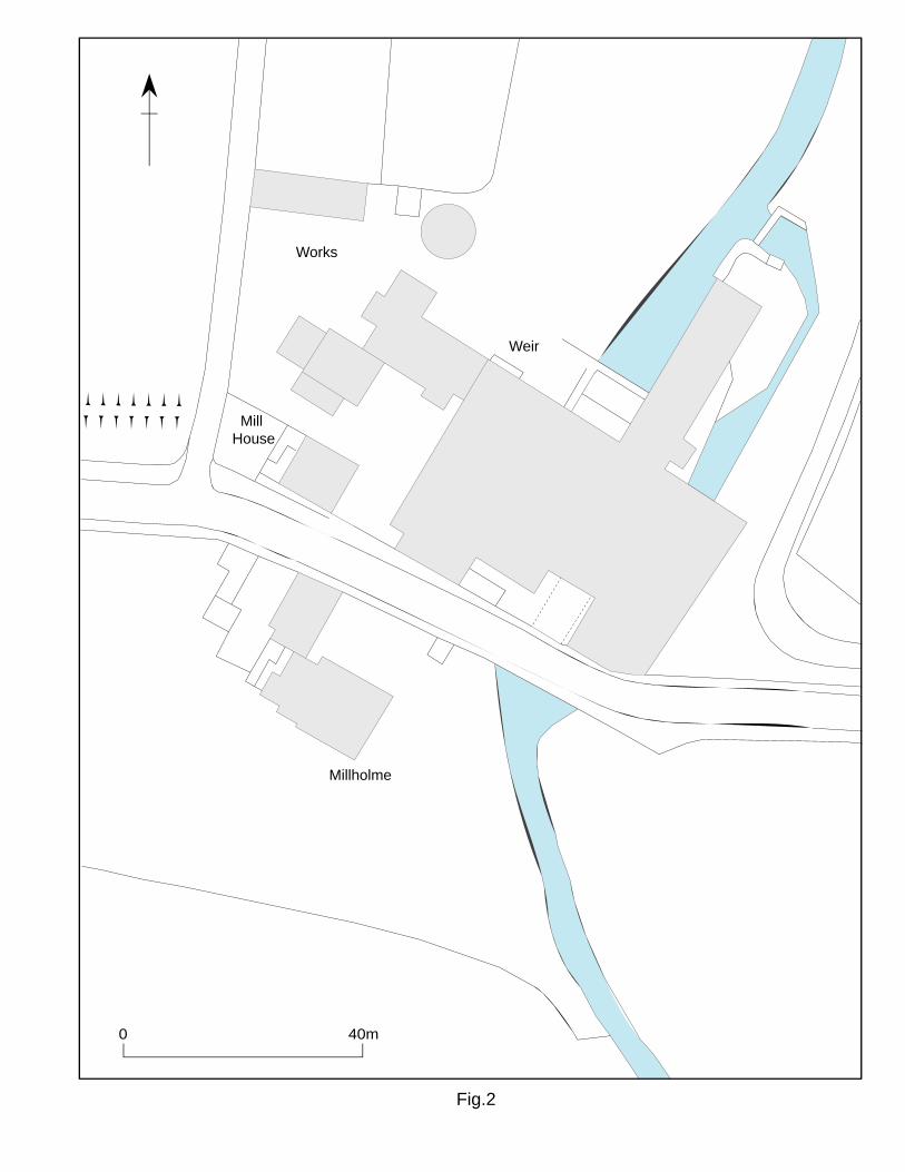
2 LOCATION AND GEOLOGY The site is located on the north side of Mill Street, on the eastern edge of Rocester, Staffordshire. It is approximately 4 ½ miles northeast of Uttoxeter, and is centred on NGR SK 1128 3923 (Fig. 1) (Plate 1). Mill House overlooks Mill Road to the southwest, it is abutted by an electrical substation to the southeast, and there is a large yard to the rear opening onto some of the historic mill buildings (Fig. 2).
The underlying geology consists of alluvial fan and deposits of a higher river terrace (Geological Survey 1983, Ashbourne Sheet 124). Rocester’s soil has been described historically as loam with subsoil gravel (Kelly’s Directory 1896, 292).
The present character of the Tutbury Mill complex is undisturbed grassland with areas of hardstanding surrounding the historic mill buildings and Mill House itself. Mill Street runs adjacent to Mill House to the south. To the north of the site are the remains of the former millpond, and West View, a late 19th-century terraced development associated with the mill. To the west are the remains of a Roman fort, within which are the below-ground remains of a 12th-century Augustinian Abbey. To the east, on the east bank of the river Dove is the home ground of Rocester FC. To the south, across Mill Street, is Millholme, the former mill manager’s house, which was constructed by 1831.
Mill House, Tutbury Mill, Rocester.
Birmingham Archaeology 2
3 OBJECTIVES The principal objective of the project was to record the building ahead of proposed development. This took the form of a level 2 record of the structure, as defined by English Heritage (2006). Further aims were to gain an understanding of the historic structural phasing of the building. 4 METHODS The historic building recording corresponded to the Royal Commission on the Historical Monuments of England’s Level 2 (RCHME 1996) (English Heritage 2006), and comprised the following elements: -
4.1 Measured Survey
A measured survey, which comprised of the preparation of floor plans, was carried out using hand measurement and a laser distance meter. Drawings were compiled using AutoCAD and are produced at 1:50 scale.
4.2 Photographic Survey
A photographic survey was carried out with a 35mm camera using black and white film and a photographic scale, and supplemented by colour digital coverage. The survey included both external and internal general and more detailed photographs including fixtures and fittings. These photographs were recorded on pro forma register sheets indicating location, scales used, orientation, photographer and date.
4.3 Written Record
An analytical description was compiled on pro forma building and room record sheets, involving a systematic elevation-by-elevation, and room-by-room, treatment. These field notes were used as a basis for the definitive account.
4.4 Historical Research
Kelleher (2006) was consulted in order to provide some historical context and to assist in the interpretation of the building. 5 ANALYTICAL BUILDING DESCRIPTION
5.1 Exterior
The main range is aligned northwest-southeast facing southwest, with similarly orientated extensions to the rear. The exterior is almost invariably of painted red brickwork. It is likely
Mill House, Tutbury Mill, Rocester.
Birmingham Archaeology 3
however due to the quality of facing brick used that this brick was originally intended to be exposed (Fig. 3). Elevation 1 (Southwest) Mill House is bounded off from the road by a low brick and stone wall with wrought iron railings (Plate 1). The main block of this elevation has three bays, and two storeys with attic. It is of painted red brick measuring 8 ⅝ ins x 2 ⅜ ins x 4 ¼ ins, which is laid in what appears to be Flemish bond, but which is obscured by a thick coating of whitewash. What is particularly noticeable with this elevation is the slight asymmetry of the fenestration pattern, there does not appear to be any discernable reason for this, and none of the windows in question appear to be inserted, nor is there evidence of any blocked windows. At ground floor level two wooden two-pane sash windows with stops flank a flat arched doorway with a timber lintel and a six-panelled door. This doorway is aesthetically augmented with an ornamental wooden porch with decorative bargeboard and spirelet finial; the returns of this porch are trellised. The windows have plain painted concrete/stone sills. The most easterly window has an inserted timber lintel, whilst the other has a concrete lintel. Directly to the west of this western window is a blocked segmental arch doorway (Plate 2). To the west of the main block is a round arched doorway, which forms part of a one-storey structure, which abuts the main facade; this is largely obstructed by dense vegetation. Abutting this main block to the east is a one-storey red brick 20th-century electrical substation. The projecting brick pillar at the junction of this substation and Mill House appears to be the last remaining vestige of the former gateway to Tutbury Mill. Much of the western side of the upper storeys is obscured by vegetation. There are two timber two-pane sash windows with stops at first floor-level. These have painted concrete/stone sills, and concrete heads, the western one is directly above the ground-floor window, whilst the other is to the west of the eastern ground floor one. To the east of this is a cruciform-shaped wall tie. Second-floor/attic-level has two metal-framed bipartite mullioned casement windows. These windows, which are shorter than those on the lower floors, have concrete sills, and heads that form part of the eaves. The fenestration layout and positioning follows that of the first floor. The eaves consist of one course of dentilated brick under two courses of oversailing brick. The low-pitched roof is covered in modern roof tiles. There is a central north/south brick chimney. Elevation 2 (Southeast a) This elevation is largely obscured by an electrical substation (Plate 3). It is of painted red brick, which is laid in what appears to be English garden wall bond. There is no visible fenestration scheme on this elevation. The southern roofline of this elevation consists of a shouldered gable, which is coped with stone or concrete. This appears to be abutted to the north by a steeply pitched roof. Elevation 3 (Northeast) This is a composite elevation, with three distinct sections (Plate 4). The eastern side of ground floor level is of painted red brick measuring 9 ins x 2 ¾ ins and laid in stretcher bond. This wall supports a lean-to corrugated asbestos roof, and is possibly the remnant of a boundary wall. The chamfered corner for the doorway is an addition/alteration. A straight joint is possibly discernible at the junction of this portion of the elevation and the western portion. This section of the elevation has two storeys and has no apparent fenestration scheme. It is of painted red brick measuring 9 ¼ ins x 2 ⅞ ins x 4 ⅞ ins and laid in stretcher bond. The eaves consist of
Mill House, Tutbury Mill, Rocester.
Birmingham Archaeology 4
two courses of oversailing brick and central corbelling, from which a north-south red brick chimney rises. Above and behind the one storey lean-to structure to the east is the first floor of the main block. This is of painted red brick laid in what appears to be Flemish bond. This has a west of centre four-pane casement window. The eaves are of one course of dogtooth brick above one course of oversailing brick. Elevation 4 (Northwest) This is also a composite elevation, with four distinct sections (Plate 5). The most northerly section is a two storey, one bay elevation in painted red brick measuring 9 ¼ x 3 ⅝ x 4 ½ and is laid in Stretcher bond. This has a large ground floor window (now obscured with plywood), which has a lead lined lintel. This section has a central window (now obscured with plywood) at first floor level with a gabled roof with oversail brick eaves, which rise on oversail brick kneelers. The junction between this section and the main block of the house/southern section is demarcated by cast iron rainwater goods and down pipes. There also appears to be a straight joint where these sections meet. This section of the main block is obscured at ground level by later additions and in the upper storeys by dense vegetation. This is of painted red brick laid in what appears to be English Garden Wall bond. The only visible window is at the northern side of first floor level (now obscured with plywood). The most northerly addition is a wooden planked gable ended structure with tiled roof; all windows and doors are obscured with plywood. The addition to the south of this was largely inaccessible from the exterior. Its west wall would appear to be the remains of a stone coped painted red brick wall measuring 9 ¼ x 2 ⅞ x 4 ⅝ laid in what appears to be Stretcher bond boundary/garden wall. A square headed window has been inserted to provide light. The remainder is of red brick with a corrugated steel pitched roof.
Elevation 5 (Southeast b) This two-storey gable end is obstructed at ground-floor level by the lean-to structure to the southeast (Plate 4). It is of painted brick laid in an indiscernible brick bond. There doesn’t appear to be any fenestration scheme. The gable has oversailing brick eaves, which rise on oversailing brick kneelers.
5.2 Interior
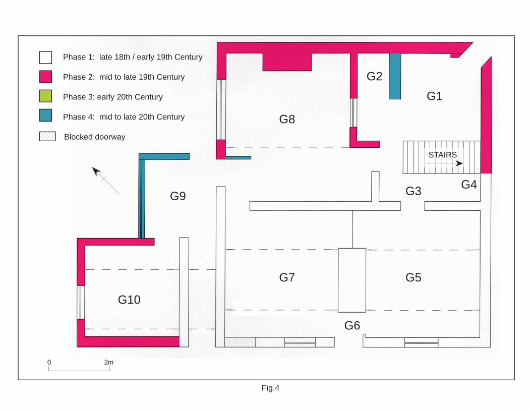
The original interior plan adheres to a baffle/lobby entry type plan with a central chimneystack, and two main ground-floor rooms, with the stairs at the rear. Later additions give the plan a square-shaped arrangement with western offshoots. Unless specified, interior rooms have carpet covered timber floorboards, invariably have plaster covered brick walls, and lath and plaster ceilings, and. In places the plaster has been stripped from the internal load-bearing walls revealing red brickwork. Ground Floor (Fig. 4) G1 This room is entered through a chamfered doorway in the east corner (Plate 6). It appears to be a courtyard, which was later covered with a mid to late 20th-century corrugated asbestos roof with skylight. All of the walls are of painted red brick, whilst the floor is of blue brick paviours, which were possibly an original feature. Access to G3 is through a doorway on the southwest wall. This doorway has a half french door and a plain wooden architrave and hood.
Mill House, Tutbury Mill, Rocester.
Birmingham Archaeology 5
The courtyard is overlooked by a multipane awning window in the northwest wall. G2 is located in the north corner. G2 is a mid to late 20th-century WC entered through an overlighted door in its southwest wall. Its southeast wall is a stud partition. G3 (Plates 7 and 8) is a hallway/lobby providing access to G1, G5, G8, and the first floor via a staircase. This room has a lino covered quarry tile floor. All walls have a high moulded skirting which is likely to be of a late 18th/ early 19th-century date, whilst the northwest and southwest walls have plain dados and picture rails which were used for hanging coats. The doorway to G1 has a lightly moulded architrave, whilst the doorways to G5 and G8 have heavily carved architraves with panelled doors. The ⅛ turn staircase in the east corner has turned balusters and newel post. This appears to be of a late 18th/ early 19th-century date and style. This has moulded timber steps, which are now partially covered with carpet. G4 is an under stairs cupboard with a timber plank door with cast iron handle to G3. G5 (Plates 9 and 10) This living room has high moulded skirting board and ornate moulded cornicing (apart from the southeast wall). Stylistically these appear consistent with a late 18th/ early 19th-century date. The doorframes to G3 and G6 have heavily moulded architraves. These have six-panelled doors. There is an early 19th-century moulded timber neoclassical style mantelpiece with brick fireplace with a cast iron ornamental surround with vitruvian scroll-like pattern. Scarring in the alcove to the northeast of this suggests the recent removal of a cupboard. The window on the southwest wall is a vertical tripartite sash window with moulded architrave and shelf sill. There are two southeast-northwest running beams covered with ornate cornicing. G6 The lobby/ baffle entrance has a quarry tile floor (Plate 11). Each wall has high splayed skirting boards. The door to the exterior on the southwest wall is panelled. There is a later wooden partition with doorway between this lobby and G7. G7 This living room (Plate 12) has a high moulded skirting board as in G5. Each wall has a high moulded picture rail. The southwest window is a replica of that in G5. The fireplace on the northwest wall is a mid/late 20th-century insert. There is a wooden cupboard in the alcove to the northeast. Two southeast-northwest running beams are boxed in with plywood. G8 has the appearance of another living room (Plate 13), it is ‘L’ shaped in plan, and has what stylistically appears to be mid to late 19th-century moulded skirting boards and picture rails. The floor is of chequerboard quarry tiles, which are now covered with carpet. The doorframes to G3 and G9 have lightly moulded architraves. The door to G9 is a batten door, which would suggest that it is an exterior door. The window overlooking G1 to the southeast has a moulded architrave frame with shelf sill as those in G5 and G7. The window itself is a bipartite awning casement, again of a mid to late 19th-century date. The window on the northwest wall is a tripartite window with mullions and transoms. The chimneybreast on the northeast wall has mid/late 20th-century fireplace with cast iron and glass hearth. There is a single northwest-southeast beam, which is now supported with scaffolding.
Mill House, Tutbury Mill, Rocester.
Birmingham Archaeology 6
G9 (Plate 14 and 15) is a covered courtyard and alleyway and has a blue brick paviour floor. The covered alleyway has an original round arched doorway to the southwest. A battened door has been inserted and the arch infilled. Two beams run above the alleyway to support the roof of G10. The covered courtyard section is a mid to late 19th-century wooden and brick gabled structure with skylight. This has an external doorway in the northeast wall, and a long, thin window with six sections. G10 This kitchen (Plate 16) has red and blue brick paviours as flooring. The fixtures and fittings attest to a mid/late 20th-century refit, however a Belfast sink suggests an earlier date for a kitchen function. There is a casement awning window in the northwest wall, whilst the two beams mentioned in G9 are also present here. First Floor (Fig. 5) F1 This is the landing/upper hallway (Plate 17). Each wall has a high moulded late 18th/ early 19th-century skirting board. All doorways have lightly moulded architraves and have panelled doors. The door to F4 has a metal ventilation grille built onto the doorframe. The ⅛ turn turned balustraded stairs to ground-floor level are situated in the east corner. The landing/upper hallway is lit by a window in the northeast wall. This has rounded jambs and has a mid to late 19th-century metal bipartite casement style window with mullions and transoms. Situated between the doors to F2 and F3 is a late 18th/ early 19th-century stairwell to the second floor. This half turn stairs is identical in decoration as the other staircase. F2 is a bedroom and is entered up a step from F1 (Plates 18 and 19). Each wall has late 18th/ early 19th-century moulded skirting boards and moulded picture rails. The early 19th-century ornate cast iron fireplace on the northwest wall has a wooden neoclassical style mantelpiece. There is a wooden cupboard in the alcove to the southwest of this. There is an understairs cupboard in the west corner. The window on the southwest wall is a tripartite sash window with moulded architrave. There are two splayed and chamfered beams with stops running northwest to southeast. F3 This bedroom has moulded skirting boards as in F2 (Plate 20). It has a window similar to that in F2 in the southwest wall. There is an inserted 20th-century red brick fireplace on the southeast wall. A cupboard has been recently removed from the west corner, whilst there is a wooden cupboard in the west corner. There are two splayed and chamfered beams with stops running northwest to southeast. F4 is a bathroom and has mid/late 20th-century fixtures and fittings. This room has a moulded skirting board along the southwest and southeast walls. The other walls have timber panelling. It has a four-pane sash window with architrave on the southwest wall. F5 The walls of this bedroom have high moulded skirting boards. The northeast wall has a mid to late 19th-century ornate cast iron fireplace with wooden mantelpiece (Plate 21). The ceiling is slightly coved to the northeast. The northwest window is a tripartite sash with architrave. Second Floor (Fig. 6) S1 (Plate 22) The doorways to this attic room have been inserted. There is an early 20th-century bipartite timber casement window in the southwest wall. The sill is positioned at floor level. The ceiling is coved at the southwest and northeast sides. There are two undressed beams running northwest to southeast, these are supported on brick corbels.
Mill House, Tutbury Mill, Rocester.
Birmingham Archaeology 7
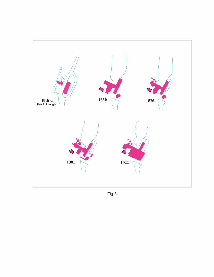
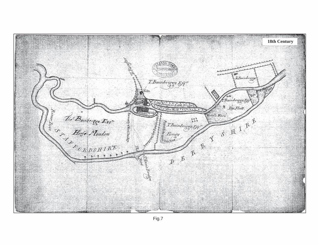
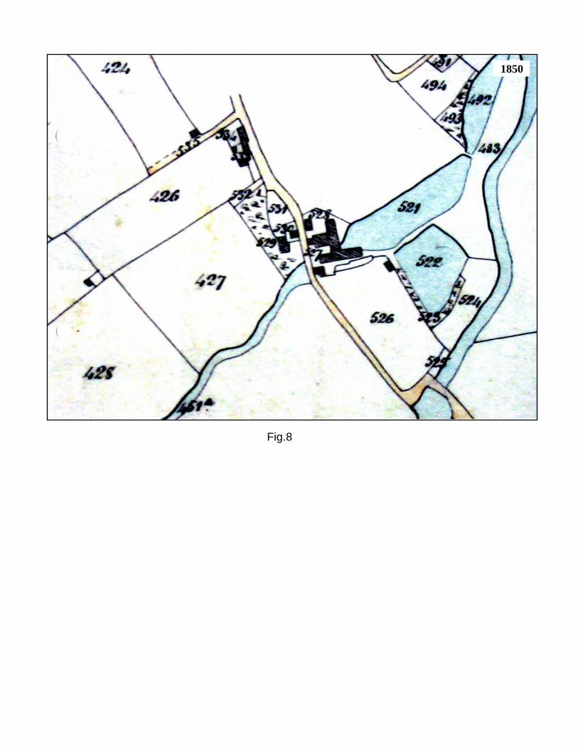
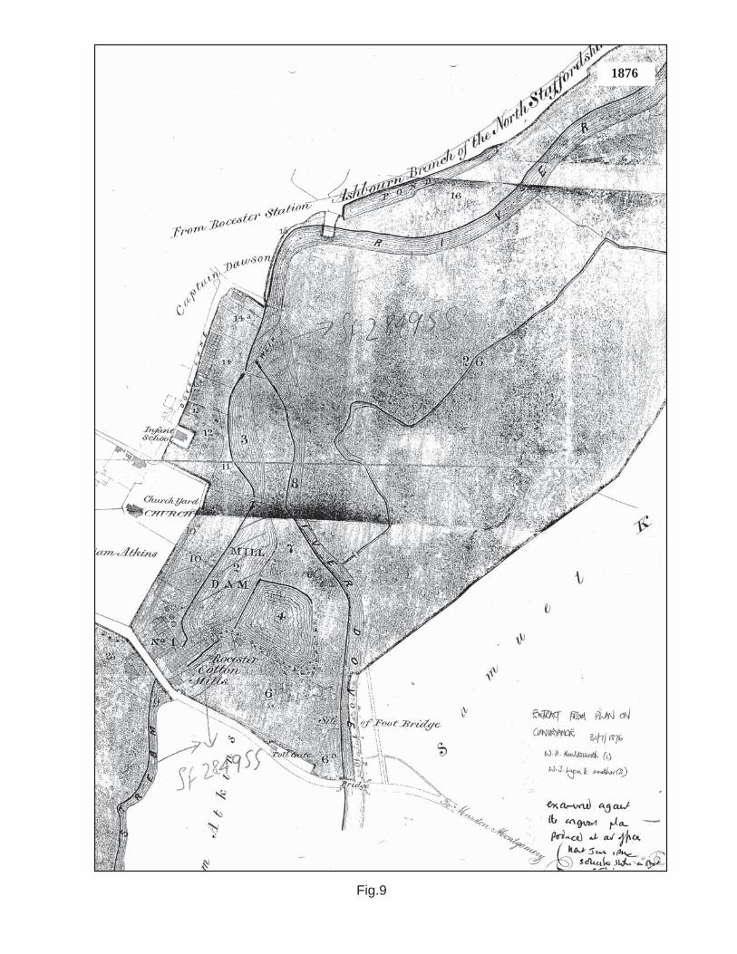
S2 This is the lobby space between S1 and S3. It has a chamfered beam above running from northwest to southeast. S3 This is essentially a mirror image of S1, however the door positioning is slightly different. 6 STRUCTURAL PHASING There were four distinct phases of construction, additions, and alterations at Mill House (Figs. 4 to 6). These phases have been identified through a combination of on-site visual analysis, architectural history, and historic cartographic sources (Figs 7 to 11).
6.1 Phase 1: Late 18th/ Early 19th- century
The main block of Mill House, i.e. G3, G4, G5, G6, G7, and part of G8, and above, would appear to have been constructed during this period. Kelleher (2006) suggests that this may be of a late 18th-century date, however on closer inspection it may be that a very early 19th-century date may be more plausible. The overall appearance, fixtures and fittings such as fireplaces, staircases, skirting boards, and moulded cornices, and cartographic evidence all contribute to this conclusion. The baffle/lobby entrance plan form is an interesting survival; this is an appealing throwback to a vernacular style of construction, which had all but died out in Staffordshire by the 18th-century. An example of a structure with a similar plan-form nearby can be seen at the Grade II listed Brook Farmhouse at Lower Leigh which dates from 1694 (DOE 1985, 63). It is also likely that the alleyway section of G9 was also in existence at this time. What is less clear is the function and date of the now blocked segmental arch doorway to the east of this. It is possible that this may have had functional connotations. This would have provided access to G7, and may have been an alternative doorway to this room, which may have had some administrational function for the mill. Historic photographs show that this had been blocked by the early 20th-century (Plate 23). The chamfered and stopped beams in G5 and G7 are much earlier in appearance, and are more akin to a 16th or 17th-century building, however, it is likely that these have been removed from an earlier building. There is no likelihood that Mill house contains remnants of an earlier structure, as there is no evidence of one on the 18th-century map. Cartographic evidence suggests that there was no development on the site of Mill House in the mid to late 18th-century.
6.2 Phase 2: Mid to late 19th-century
Rooms G8 and F8 would appear to have been added later than the main block above. Architectural and cartographic evidence suggest that this was added in the mid to late 19th-century. The 1881 OS map is the first source to show this extension along with the addition of the kitchen G10. It is likely that the trellised porch was added in the late 19th-century as part of a late Victorian trend for adding these features for climbing plants. This is shown on an early 20th-century historic photograph (Plate 23).

Mill House, Tutbury Mill, Rocester.
Birmingham Archaeology 8
6.3 Phase 3: Early 20th-century
The type of window frame employed in the attic rooms S1 and S3 suggests that these were inserted in the early 20th-century, when it can be assumed the attic was converted for use as living quarters. Historic photographs suggest that the pillar projecting from the southwest elevation formed part of a gateway to the mill complex (Plate). This would appear stylistically similar to the additions and alterations exacted by the Tutbury Mill Company between 1881 and 1901 (Kelleher 2006).
6.4 Phase 4: Mid to late 20th-century
A number of alterations and additions were carried out during this phase. The electrical substation to the east of the main block was constructed during this period. It would also appear that G1 was roofed over at this time, and G2 subsequently constructed. Room G9 was also added, and the alleyway to the southwest of this roofed over. The fireplace in G8, and the kitchen and bathroom fittings in G10 and F3 were also added during this phase. The roof was also stripped and replaced at this time.
7 CONCLUSIONS AND RECOMMENDATIONS
The programme of historic building recording at Mill House revealed a late 18th/early 19th-century house constructed for use of the mill manager or foreman, this was surrounded with paved yards and had an external alleyway to the west. These yards were later filled in or covered over. It is likely that this initial phase of construction was undertaken by the Bridden family following their acquisition of the mill in 1806 (Kelleher 2006, 10). However, stylistically it is quite possible that it was constructed before this, and may have been constructed by Richard Arkwright following his acquisition of the mill in 1781, or by his son Richard Jr in the subsequent years. The next phase of construction saw the addition of further two-storey living quarters to the rear in the mid to late 19th-century. Further alterations and additions in the 20th-century have resulted in its current architectural footprint and form. It is recommended that efforts should be made to retain Mill House. With its farmhouse/vernacular appearance it is aesthetically pleasing, it contributes greatly to the street scene, and retains much of its original plan-form, fixtures and fittings, and setting. Its associations with, and proximity to Tutbury Mill and Millholme ensure that it contributes to the group value of the overall site, and assists in our understanding of the Tutbury Mill complex, which itself is of national significance, being a grade II listed building within a Conservation Area. In addition, it may be associated with Richard Arkwright one of the great innovators of the industrial age. The baffle/lobby entrance plan is also a rather late example of a type of plan which once proliferated the countryside. Subject to an engineering/condition assessment this plan form and the size of the rooms would lend themselves to some modern usage such as office/administration or domestic function. If it is deemed necessary and planning permission is granted to demolish Mill House, it must be highly recommended that a programme of supplementary historic building recording be carried out prior to any works. This should include a full metric survey including the production of scaled elevations and sections, and should also include a more specific desk-based assessment. It may also prove beneficial to attach a provision for a watching brief to be carried out during demolition works.
Mill House, Tutbury Mill, Rocester.
Birmingham Archaeology 9
8 ACKNOWLEDGEMENTS
The project was commissioned by The Development Planning Partnership, on behalf of The Department of Education and Skills. Thanks are due to Katy Lightbody of The Development Planning Partnership and to Nick Hague of Burofour for their co-operation and assistance throughout the project. Thanks are also due to Roger Austin, caretaker, Rocester Mill. The historic building recording was undertaken by Shane Kelleher. Shane Kelleher produced the written report, which was illustrated by Nigel Dodds, and edited by Malcolm Hislop who also monitored the project for Birmingham Archaeology. 9 SOURCES
9.1 Primary Sources
1896 Kelly’s Directory of Staffordshire.
9.2 Secondary Sources
DOE 1985 List of Buildings of Special Architectural or Historical Interest, District of East Staffordshire. Department of Environment. English Heritage 2006 Understanding Historic Buildings: A Guide to Good Recording Practice. Greenslade, M.W. and Jenkins, J.G. 1967 The Victoria History of the County of Stafford Vol 2, London, Oxford University Press for the Institute of Historical Research. Institute of Field Archaeologists (IFA) 2001 Standard and Guidance for the Archaeological Investigation and Recording of Standing Buildings or Structures rev. edn. Kelleher, S. 2006 Tutbury Mill Rocester, Archaeological Desk-Based and Historic Buildings Assessment Birmingham Archaeology Reports no. 1520. RCHME 1996, Recording Historic Buildings: A Descriptive Specification, 3rd edn.
9.3 Cartographic Sources
18th-century Plan of Rocester Mills, William Salt Library M900. 1850 Plan of the Parish of Rocester in the County of Stafford. 1876 Extract From Plan On Conveyance of Rocester Mills. 1881 Ordnance Survey Map 1:2500 Staffordshire Sheet XXVI.3. 1901 Ordnance Survey Map 1:2500 Staffordshire Sheet XXVI.3. 1922 From Ordnance Survey Map 1:2500 Staffordshire Sheet XXVI.3.
Mill House, Tutbury Mill, Rocester.
Birmingham Archaeology 10
1927 Ordnance Survey Map 1:2500 Staffordshire Sheet XXVI.3.
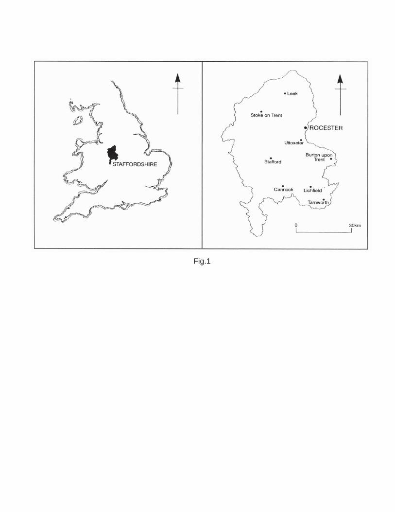
Fig.1
0 40m
Mill House
Works
Weir
Millholme
Fig.2
18th C Pre Arkwright
1850 1876
1922 1881
Fig.3
0 2m
Phase 1: late 18th / early 19th Century
Phase 2: mid to late 19th Century
Phase 3: early 20th Century
Phase 4: mid to late 20th Century
Blocked doorway
STAIRS
G8
G1G2
G6
G9
G10
G3
G5G7
G4
Fig.4

0 2mPhase 1: late 18th / early 19th Century
Phase 2: mid to late 19th Century
Phase 3: early 20th Century
Phase 4: mid to late 20th Century
Fig.5
STAIRS
STAIRSF1F4
F5
F3 F2

STAIRS
0 2m
Phase 1: late 18th / early 19th Century
Phase 2: mid to late 19th Century
Phase 3: early 20th Century
Phase 4: mid to late 20th Century
S1S3
S2
Fig.6
18th Century
Fig.7
1850
Fig.8
1876
Fig.9

1881
1901
1927
Fig.10

1922
Fig.11
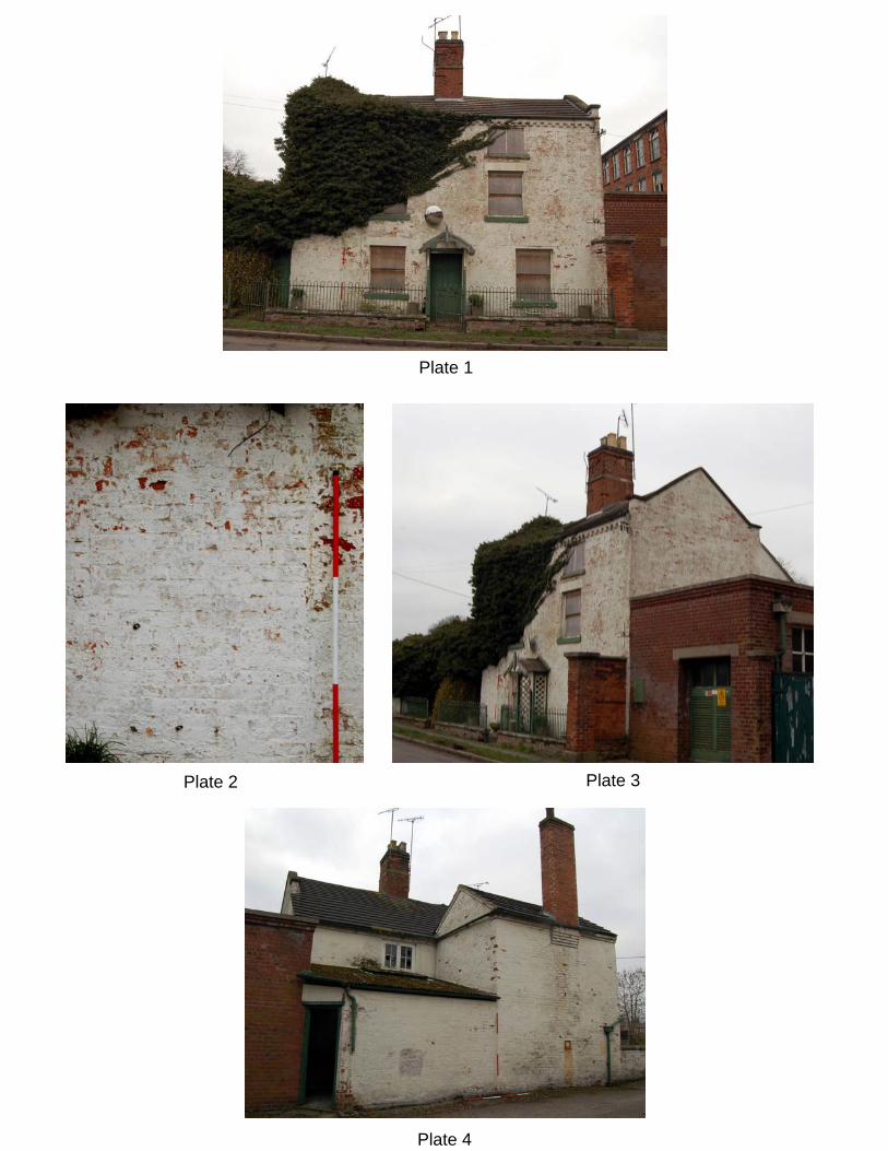
Plate 1
Plate 2 Plate 3
Plate 4
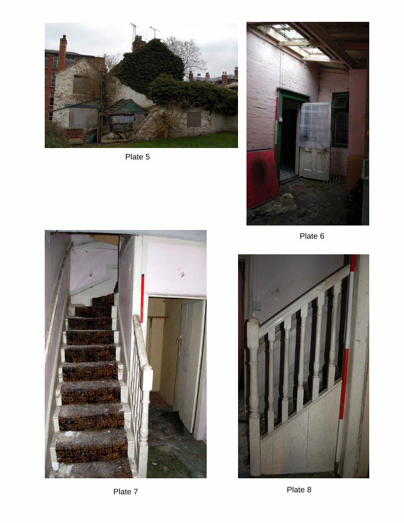
Plate 5
Plate 6
Plate 7 Plate 8

Plate 9 Plate 10
Plate 11
Plate 12
Plate 13 Plate 14

Plate 15 Plate 16
Plate 17 Plate 18
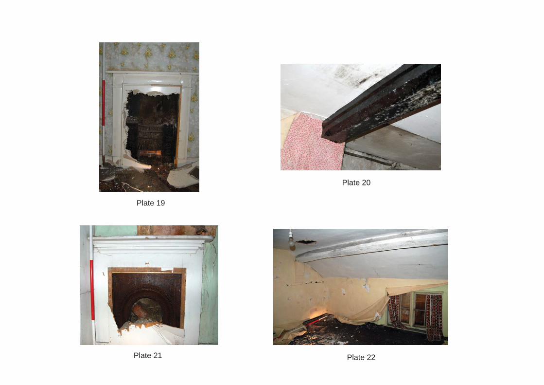
Plate 19
Plate 20
Plate 21 Plate 22
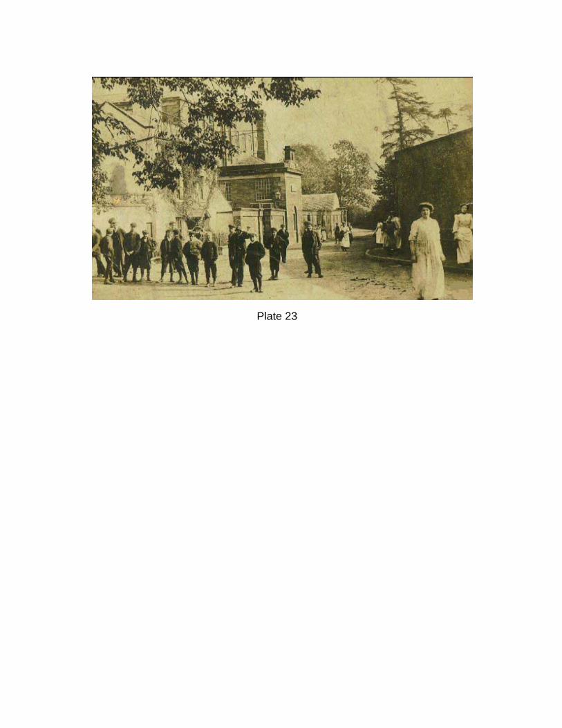
Plate 23