geogra,phy of israel
TRANSCRIPT
Geogra,phyof Israel
Efraim Orni and Elisha Efrat
Third Revised Edition
1>: ISRAEL UNIVERSITIES PRESS •~ Jerusalem, 1973
IUP cat. no. 2652
vii
xi
315355380
106123
135164
193227257286308348
359388
v
Introduction
Part IV The Administered AreasThe Sinai PeninsulaThe Gaza Strip
Part II Climate, Vegetation and WildlifeThe ClimateFlora and Fauna
Part III Human Geography of the CountryThe Archeological and Historical BackgroundZionist Settlement and the State of IsraelDemography ' ..,Rural SettlementUrban SettlementThe Road System
Part I The Country and Its RegionsThe Country, Its Structure and Geological HistoryThe NegevThe Coastal PlainThe Hill RegionsThe Jordan Rift and Its BranchesTransjordanThe Sinai Peninsula
Contents
Foreword
Os/I () t:j. LI
· 0 ?1)A 9tt/!
Copyright © Israel Program for Scientific Translations Ltd., Jerusalem, 1971
This book has been composed, printed and bound by Keter Press,Jerusalem, Israel, 1973.
Printed in Israel
.. 11t111.,.'· rH. ' .....
iI"E)Di3
Rewritten by Efraim Orni from the Hebrew Edition, Achiasaf Publishing House Ltd., Jerusalem,1963
All rights reserved
ISRAEl: UNIVERSITIES PRESSis a publishing division ofKETER PUBLISHING HOUSE LTD.a wholly owned subsidiary of
ISRAEL PROGRAM FOR SCIENTIFIC TRANSLATIONS LTD., Jerusalem
First Edition 1964
. Second (Revised) Edition 1966
Third (Revised) Edition 1971
CONTENTS
Judea and SamariaThe Golan
Part V The Economy and Its FoundationsSoil and WaterAgricultureMining, Industry, Services, Foreign Trade
Bibliography
List ofAbbreviations
Index
398420
433459473
505
522
523
Foreword
Over the centuries, the geography of the Holy Land has been the most amplydocumented in the world. Travelers and pilgrims-pagan, Christian, Jewish andMoslem-have reported their impressions for over two thousand years, some withpainstaking exactitude, others with an imagination fired by religious enthusiasm.In the Middle Ages, Palestine was the principal subject of map-makers. Thedevelopment of the scientific approach to Bible research has, since the end of the18th century, brought to the country theologians, historians and archeologists,geographers and naturalists, many of whom published t~eir findings. With theZionist Movement's unique work of construction, and the founding of the Stateof Israel, literature on the country gained further scope, and included politics,sociology, economics, etc.
The very wealth of the material available may, in part, explain the limitednumber of modern, comprehensive and yet concise geographies on the Land ofIsrael, particularly in languages other than Hebrew. This book, first publishedin Hebrew in 1960, is an attempt to present the geology, morphology, climate,population, history, and economy of the country and its regions, with specialemphasis on the interrelationships between these fields.
In preparing the English, German and French versions, the authors have aimedto adapt the book to the background and needs of the non-Israeli reader. Therapid developments occurring in all spheres of life in the country necessitate a complete rewriting of considerable parts of the book in preparing each new edition.Not only are there constant changes in the country's political and economicsituation, demographic structure, etc., but also novel approaches to planningevolve and even new ideas on the scientific interpretation of its natural phenomenaare developed.
The present, third English edition called for even more fundamental revisionthan its predecessors, as the Six Day War of 1967 caused the former, provisionalarmistice lines to disappear, made new regions accessible to the Israeli, and created
vii
viii FOREWORD
novel economic and cultural opportunities not only for the State, but also for thepopulation which came under Israel's administration. A need was thus felt to addto those parts of the book dealing with physical geography a detailed descriptionof the Sinai Peninsula, and also to include chapters covering the human geographyof Sinai and the Gaza Strip, Judea-Samaria and the Golan. All these tasks werefacilitated by the fact that one of the authors himself not only carried out thefirst English translation but also wrote the additional English material subsequently required. In the present volume, great care has also been taken to enrichthe cartographic and illustrational material.
The correct transliteration of Hebrew and Arabic place names and geographicalterms had to be determined. This book generally keeps to the rules laid down forthe Israel Place Names Committee by the Hebrew Language Academy, and to therules for transliterating Arabic names adopted by modern maps; in the case offamous Biblical or otherwise well-known names, the customary English spellinghas been used (e.g. Beersheba, Eilat, Hebron, Nazareth, Tiberias, Safed, etc.).It should be kept in mind that 'a' is pronounced as in 'but' or 'far,' 'e' as in 'pen'or 'ale,' 'i' .as in 'inn' or 'eat,' '0' as in 'hot' or 'role,' and 'u' as in 'butcher' or'root'; 'y' is always a consonant; 'h' is always clearly audible; '1)' and 'kh' aregutturals, the former pronounced somewhat softer, the latter somewhat sharperthan in the Scottish 'loch' (this differentiation is clear in Arabic, less so inHebrew); 'g' is always as in 'goal,' 'k' and 'q' are in Hebrew both identical with t~e
English 'k' (the Arabic 'q' is more guttural); 's' is sharp as in 'sing'; 'z' is soft as In
'zeal,' while the Hebrew ',?-' is pronounced like 'z' in German (orits'): 'sh' does notdiffer from the English (like 'share'); 'j,' existing in Arabic only, is identical withthe English letter (like 'joy'). The majority of Hebrew words are accented on thelast syllable; as there is no such rule in Arabic, the accented syllable in Arabicwords is indicated by the sign (a) (which does not necessarily indicate a longvowel). An apostrophe signifies that the slight clicking sound, heard when anEnglish word begins with a vowel (as in 'at'), should be pronounced in the middleof a Hebrew or Arabic word (e.g. 'biq'at'), The same transliteration also appliesto titles of Hebrew books in the bibliography.
The number of Hebrew terms in the book has been kept to a minimum.'Nahal' (abbreviated: N.) means a small stream, similar to the Arabic 'wadi'which in general is a dry watercourse carrying only occasional floods. 'Har'is mountain, 'giv'a'-hill, 'Emeq' and 'Biq'a'-valley, 'Yam'-sea or lake;'Kefar' means a village, 'Kibbutz' is a collective settlement, 'Moshav' a cooperativesmallholders' village, and 'Moshav shittufi'-a settlement form intermediatebetween the former two.
The authors wish to express their thanks to the geologists Mr. Ya'akov Nir, forhis comments on geological problems, and Dr. Uri Wuerzburger and Mr. Michael
FOREWORD ix
Beith, for data on Sinai geology and minerals; to Mr. Yoav Zur of the TahalCompany for his advice on matters relating to water and water planning; to Mrs.Ruth Wolff and Mr. David Catarivas of the Israel Ministry for Foreign Affairsfor their advice on various problems relating to the country's recent history andpolitics; to Dr. Shaul Colbi and Dr. Yona Malachi of the Israel Ministry ofReligious Affairs for details on minority communities, their rights and institutiorrs: to the Achiasaf Publishing House Ltd. for making available graphicmaterial from the book's Hebrew edition; to the Jewish National Fund HeadOffice and the Government Press Office for the numerous photographs fromtheir archives; to Mrs. Rita Orni for her extensive aid in preparing the Englishedition; to Messrs. Sh. Barlev, B. Shelkovitz and D. Oren for their work on mapsand graphics; to Mr. R. Amoils for editorial assistance; and to the staff of KeterPublishing House for their kind and efficient cooperation.
Introduction
This book seeks to draw a comprehensive picture of the Land of Israel-itslandscape and geological past, its climate, its population and history, its economic resources, and the great development projects being carried out today.Such a wide scope makes it necessary to determine the country's area and todefine its borders.
The term 'border' is one of the fundamental concepts of geography. A distinction is drawn between physical borders, based on topography, or on factorssuch as climate, vegetation, etc., and historical and political borders. Amongthe former there is, in effect, only one boundary which is sharp and indisputable-the shorelines separating land and sea. Between hills and plains, valleys andplateaus, there are generally only gradual transitions and no definite frontiers.The borders of climatic and vegetation regions are even less clearly defined.Moreover, all these limits are liable to change over short or long periods.
This is even more marked in the case of historical and political frontiers;whole geographical-political units may cease to exist and be supplanted byothers. Only rarely will a political border coincide with a physical one; in fact,political changes may, to a degree, even entail transformations of the landscape.
The terms 'State of Israel,' 'Land of Israel,' 'Palestine,' etc., all roughly referring to the same area, furnish a striking example of this phenomenon. Theevents of June 1967 illustrate how a new situation necessitates a rethinking ofaccepted notions. The Six Day War brought the Sinai Peninsula, the GazaStrip, Judea-Samaria (known as the 'West Bank' under the former Jordanianregime) and the Golan Heights under Israel administration-an area morethan three times as large as that of the State of Israel prior to 5 June, 1967.According to both geographical and historical criteria, however, these regionsform part of the Land of Israel in its natural boundaries.
At the time these lines go to print, no decision has yet been reached concerning Israel's definitive peacetime frontiers, as this depends on various factors,
xi
INTRODUCTION
primarily on the acceptance, by Israel's Arab neighbors, of her existence andtheir preparedness for normal, friendly and stable relations with her. Howeverthis problem may finally be solved, it may be expected that the future frontierswill coincide with the country's physical features to a larger degree than didthe purely accidental demarcation lines of the 1949 armistice agreements.
The State of Israel's pre-1967 borders were the outcome of an intricate historical development. Taking into consideration events of the present centuryonly, the following details should be mentioned: the frontier between Israeland the Sinai Peninsula, which was held by the Egyptians, originated in anagreement, arrived at by Turkey and Great Britain after protracted bickering;it demarcated the area under the jurisdiction of the British Governor of Egyptwho, formally at least, was but a subordinate of the Turkish Sultan. The northern frontiers, between Israel and Syria and between Israel and Lebanon, werethe outcome of a prolonged silent struggle between Britain and France duringand after World War lover the delimitation of their respective mandated areas.The borders along the Jordan River and the Arava Valley stemmed from theBritish Government's decision, in 1922-23, to separate Transjordan from Western Palestine and remove it from the area validated by the Balfour Declarationfor the establishment of a Jewish National Home. They hoped by this step to'conciliate the Arab nationalists and make amends to the Hashemite family, oneof whose members they named 'Emir' of Transjordan. The other frontiers, separating Israel from the Jordanian Kingdom and the Gaza Strip, mostly reflectedthe position of the front lines in the 1948 War of Independence on the dates ofthe cease-fire orders.
These accidental frontiers had roots neither in physical geography nor in theexisting realities of demography, economy, etc. It is true that developments onboth sides of those borders gave them a tangible content when new, sharplycontrasting political, economic, cultural and demographic units came into being.During the three and a half years since the Six Day War, these differences havealready become blurred, with the multiplication of various economic and humancontacts between the inhabitants on both sides of the former demarcation.
'Erez Israel' (Land of Israel), also the 'Holy Land,' Biblical and traditionalterms, came into use after the Children of Israel had entered the 'Land ofCanaan'; these names have been preserved not only by the Jewish people, butby all those who cherish the Bible as the 'Book of Books.' Additional names,however, have been introduced, including 'Palestine.' The area referred to bythe term 'Erez Israel' has undergone radical changes with time, in accordancewith changing realities, needs and concepts. The greatest area was that of the
INTRODUCTION xiii
Land promised to Abraham (Genesis XV, 18 - 21) and of the kingdom ruled byDavid and Solomon, extending 'from the great river, the Euphrates, unto theRiver of Egypt.' The smallest area was that delimited by the Jewish sages underRoman and Byzantine rule, who attempted, by defining its borders as narrowlyas possible, to free many of the poor, persecuted Jewish communities from the'precepts which are dependent on the land.'*
Faced with so many contradictions, this book has to adapt each of its chapters to the subject matter dealt with therein. The parts devoted to physicalgeography are therefore based on the country's physical features, describingorganic units within their natural borders.
With the inclusion of descriptions of the Sinai Peninsula, the physical regioncovered by the present edition is bounded in the west by the MediterraneanSea, the Suez Canal and the Suez Gulf, in the east by the Great Syrian Desertand the Eilat Gulf, in the south by the Red Sea, and in the north by the lowersection of the Litani River (between its sharp bend and its mouth), the north~
eastern slopes of Mt. Hermon and the hill chains separating the Basan fromthe Damascus Depression.
The historical chapters, on the other hand, must clearly deal with the areawhich, at one time or another, was populated by the Jewish people or by theother groups predominant in the country at the time. In the chapters dealingwith the State of Israel, its projects, economy and population, the 1949 frontiers and Jerusalem's municipal boundary (the latter redefined in 1967) in general constitute the framework, while new chapters have been added in this editiondescribing the population, economics, major centers, etc., of Sinai, the GazaStrip, Judea-Samaria and the Golan.
Three geographical factors determine the character of this country: its positionwithin the Mediterranean zone, on the crossroads of three continents and twooceans, and on the boundary of the desert and the sown.
In common with other Mediterranean lands, this country hasa predominantlyhilly topography, rock foundations in which limestones and chalks prevail, asunny climate characterized by a sharp season~l division between a rainy winterand a totally dry summer, and the resultant soil and vegetation types.
In this context the history and mode of life of man can be understood. Manappeared in this country very early; indeed, his traces here are among the earliest found anywhere. At first he was a gleaner and hunter living in the' open;
* The scriptures made the performance of particular precepts conditional on entering Palestine,for example Leviticus XIX, 23; Exodus, XIII.
INTRODUCTION
subsequently, when ,the climate became more inclement, he took refuge in cavesand subterranean shelters. He began to domesticate animals, became a herdsman and, finally, a tiller of the soil. Later he learned to build houses, tow~s,and fortifications of the stones excellently suited for these purposes, whichabound in the country.
The farming that developed under Mediterranean conditions united thethree fundamental branches of grain cultivation, fruit orchards, and cattle.The hill regions may have seen the invention of the art of terracing, aided asit was by the natural structure of the steplike slopes. The hilly topography ofthe country' and the profound differences in landscape, often over very shortdistances, explain the tendency to tribal separation and isolation into small unitssuch as the Biblical city and its 'daughter towns,' which were ruled either by a localking or by an aristocratic or democratic 'council of elders.' These political forms
.contrast sharply with those of the great river valleys in Mesopotamia and Egyptwhere mighty empires and autocratic regimes rose, based on feudal land holdings, slavery, and oppression of the inhabitants.
The country's position at the crossroads between Asia, Africa and Europe,and between the Mediterranean Sea (communication with the Atlantic) aridthe Red Sea, a part of the Indian Ocean, led to wide cultural and trading contacts. It made easier both the absorption of foreign influences and the spreadingof cultural and spiritual values which had developed in the country, in somecases over an area much larger than its own. The same position, however, drewthe country into the whirlpool of armed clashes between great powers. Campaigns of foreign armies competing for control over this invaluable strategi~ areawrought havoc and utter destruction. Palestine thus passed from one empire toanother, to Egypt, the Mesopotamian empires of Babylonia and Assyria, Persia,Greece, Rome, Byzantium, the great Moslem caliphates, the Ottoman-Turkand the British empires.
It would be a mistake, however, to assume that the lines of communication inthis country have always been particularly easy. Travel in the hills of both Cisjordan and Transjordan is difficult. The Coastal Plain with its dunes and, untilthe recent past, swamps and brush presented in most periods an obstacle tocontacts between the coast and the inland region, or between neighboringcountries. In addition, the unbroken Palestinian shoreline was unsuitable forboth shipping and fishing. Only people possessing great technical talent were ableto overcome all these difficulties. Under the rule of overseas people who camefrom the west, the political center of the country usually moved to the CoastalPlain and returned inland after they had left.
In most of the border regions of Palestine, there are abrupt transitions fromareas of permanent settlement to empty desert. The Judean Desert, for example,
INTRODUCTION XV
reaches the very gates of Jerusalem, and in Transjordan and the Northern. Negevwell-cultivated fields border on arid spaces which, at best, serve as grazinggrounds for the nomads' flocks. Although this border is always sharply delineated,it is mobile, moving one way or another. In rainy years the border farmers maycultivate land which normally belongs to the desert and, in drought periods,abandon fields regarded as lying well within the settled area. In addition to theseshort-term alterations, there are also more profound changes over broader zonesand more extended periods. Such phenomena led scholars to assume that as lateas in the historic past Palestine's climate underwent considerable changes whichcaused the cultivated land to retreat and the desert to invade large portions of thecountry. These hypotheses, however, have proved erroneous. Today, scholarsbelieve that the shifting of the border line is due exclusively to man's behavior,a reflection of the eternal conflict between the herdsman and the peasant. Theformer needs a zone of comparatively great rainfall to graze his sheep andcamels in summer when all the desert plants wither. Naturally, he tries to widenthe marginal zone by molesting the peasants settled there, by destroying theirproperty and by felling all fruit and forest trees he finds. An industrious andintelligent farmer, on the other hand, learns to extend his cultivation to marginal
. lands by using crop rotation and correct agrotechnical methods. The desert,therefore, retreats when an energetic regime in the cultivated land can restrainthe unruly nomads, but makes new inroads as soon as that regime shows signsof weakness and decline.
The preceding paragraphs indicate that the Land of Israel cannot be includedamong the countries most favored by nature for human settlement. This isparticularly significant in the modern world, when resources of minerals, fueland water determine the density and wealth of a country's population even morethan do its climate and soils.
The State of Israel was created in this country, which less than two generationsago was counted among the poorest and most backward in the world. It cameinto existence out of a historical necessity, born from the Jewish people's distressand from their ever-present attachment to this land. As a result of this necessity,the builders of the Jewish community and the State were spurred to full utilizationof the country's sparse resources to ensure decent conditions for the life of a large,well-established population.
Today, Israel endeavors to broaden its agricultural basis by land reclamationand soil amelioration, terracing and drainage, and introduces scientific methodsto aid intensive cropping and to obtain record harvests. Water resources, bothsurface and underground, are utilized here more fully than anywhere else in theworld; Israeli scientists. were among the first in the world to experiment in the desalination of sea water and in the production of artificial rain. All potential mineral
.. INTRODUCTION
.. resources are being investigated intensively; the recent development of thechemical industry, which relies largely on nonmetallic minerals such as potash andphosphates, found here in substantial quantities, has aided Israel somewhat in thisrespect. Finally, initiati~e and technological knowledge help to create many newbranches in agriculture, industry, communications, and commerce, and to developproductive services such as tourism and recreation.
Along with the strengthening of the State's economic foundations its culturaland spiritual life intensifies and broadens. This culture, shaped by the landscapeand nature of the country, is now flourishing thanks to the renewed contactwith the ancient soil of the Land of Israel.
Part I
The Country and Its Regions
,
I1
(
I!I~I
The Country, Its Structureand Geological History
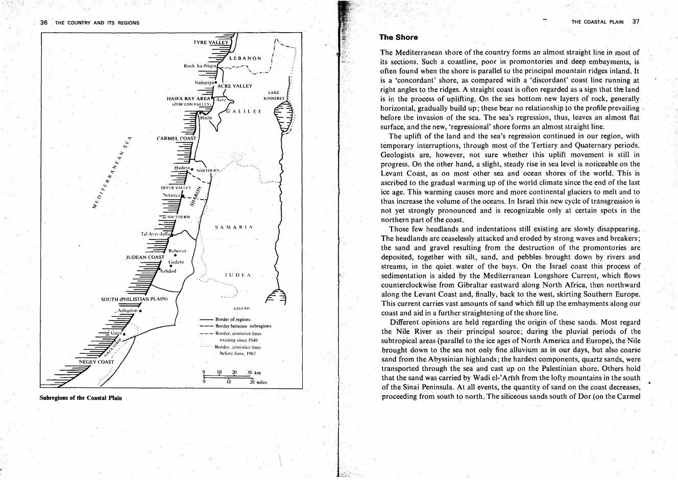
Regions*
Although small in area, the Land of Israel contains a large number of regions andsubregions. These differ from one another so sharply that there is no real need todiscuss their identification and delineation. The Biblical definitions are still validtoday, and the old terms and names can be used unchanged in moderngeographical analysis.
The deep rift of the Jordan Valley, the Dead Sea, and the Arava Valley dividesthe country into western and eastern parts, Oisjordan and Transjordan. In mostcases the regions of Transjordan have much in common with their westerncounterparts. In Cisjordan the climate and its results-landscape features, .vegetation, and settling conditions-clearly differentiate. the south, the aridNegev, from the central and northern sections which are typically Mediterraneanin character.
The map clearly shows a subdivision of Cisjordan into three lengthwise stripsrunning south (or southwest) to north: the Coastal Plain, the Hill Regions, andthe Rift.
The Coastal Plain is divided into southern, central and northern sections. Only itssouthwest tip belongs to the Negev; beginning at Gaza, where it is broadest, thePlain gradually narrows through 'the South' (the Philistian and Judean Plain) tothe Sharon. The very narrow Carmel Coast strip is a separate region. In the-norththe Coastal Plain is interrupted twice by hills jutting into the sea-the CarmelCape and the Cape of Rosh ha-Niqra. The Haifa Bay, interrupting an otherwisealmost unbroken shoreline, and the adjoining Zebulon Valley differ from the restofthe Coastal Plain in possessing features of a subsiding graben.
* The Sinai Peninsula, forming a large geographic unit on its own, is not included in this chapter;it is treated separately on pp. 123-132.
3
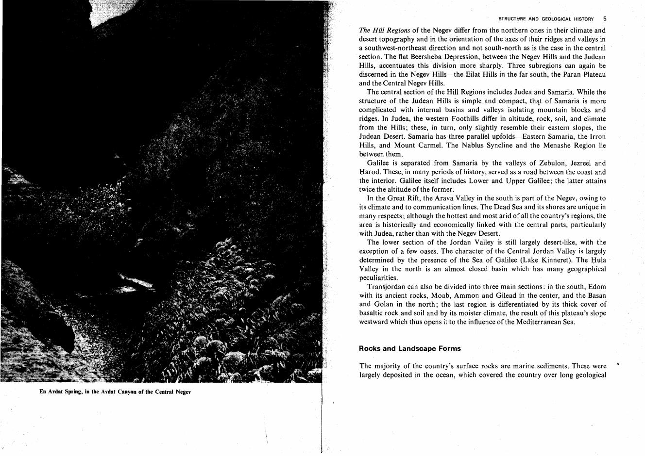
En Avdat Spring, in the Avdat Canyon of the Central Negev
STRUCTtfRE AND GEOLOGICAL HISTORY 5
The Hill Regions of the Negev differ from the northern ones in their climate anddesert topography and in the orientation of the axes of their ridges and valleys ina southwest-northeast direction and not south-north as is the case in the centralsection. The flat Beersheba Depression, between the Negev Hills and the JudeanHills, accentuates this division more sharply. Three subregions can again bediscerned in the Negev Hills-the Eilat Hills in the far south, the Paran Plateauand the Central Negev Hills.
The central section of the Hill Regions includes Judea and Samaria. While thestructure of the Judean Hills is simple and compact, that of Samaria is morecomplicated with internal basins and valleys isolating mountain blocks andridges. In Judea, the western Foothills differ in altitude, rock, soil, and climatefrom the Hills; these, in turn, only slightly resemble their eastern slopes, theJudean Desert. Samaria has three parallel upfolds-Eastern Samaria, the IrronHills, and Mount Carmel. The Nablus Syncline and the Menashe Region liebetween them.
Galilee is separated from Samaria by the valleys of Zebulon, Jezreel andHarod. These, in many periods of history, served as a road between the coast andthe interior. Galilee itself includes Lower and Upper Galilee; the latter attainstwice the altitude of the former.
In the Great Rift, the Arava Valley in the south is part of the Negev, owing toits climate and to communication lines. The Dead Sea and its shores are unique inmany respects; although the hottest and most arid of all the country's regions, thearea is historically and economically linked with the central parts, particularlywith Judea, rather than with the Negev Desert.
The lower section of the Jordan Valley is still largely desert-like, with theexception of a few oases. The character of the Central Jordan Valley is largelydetermined by the presence of the Sea of Galilee (Lake Kinneret). The Hula .Valley in the north is an almost closed basin which has many geographicalpeculiarities.
Transjordan can also be divided into three main sections: in the south, Edomwith its ancient rocks, Moab, Ammon and Gilead in the center, and the Basanand Golan in the north; the last region is differentiated by its thick cover ofbasaltic rock and soil and by its moister climate, the result of this plateau's slopewestward which thus opens it to the influence of the Mediterranean Sea.
Rocks and Landscape Forms
The majority of the country's surface rocks are marine sediments. These werelargely deposited in the ocean, which covered the country over long geological

j
/
o 10
............. Fault line
oI
Beersheba mt'
"<''l.l _--="'-=<
"<''l.l
<"<'~
~
'l.lt-;
......Q
'l.l -~ ~
Main fault lines in the country
6 THE COUNTRY AND ITS REGIONS
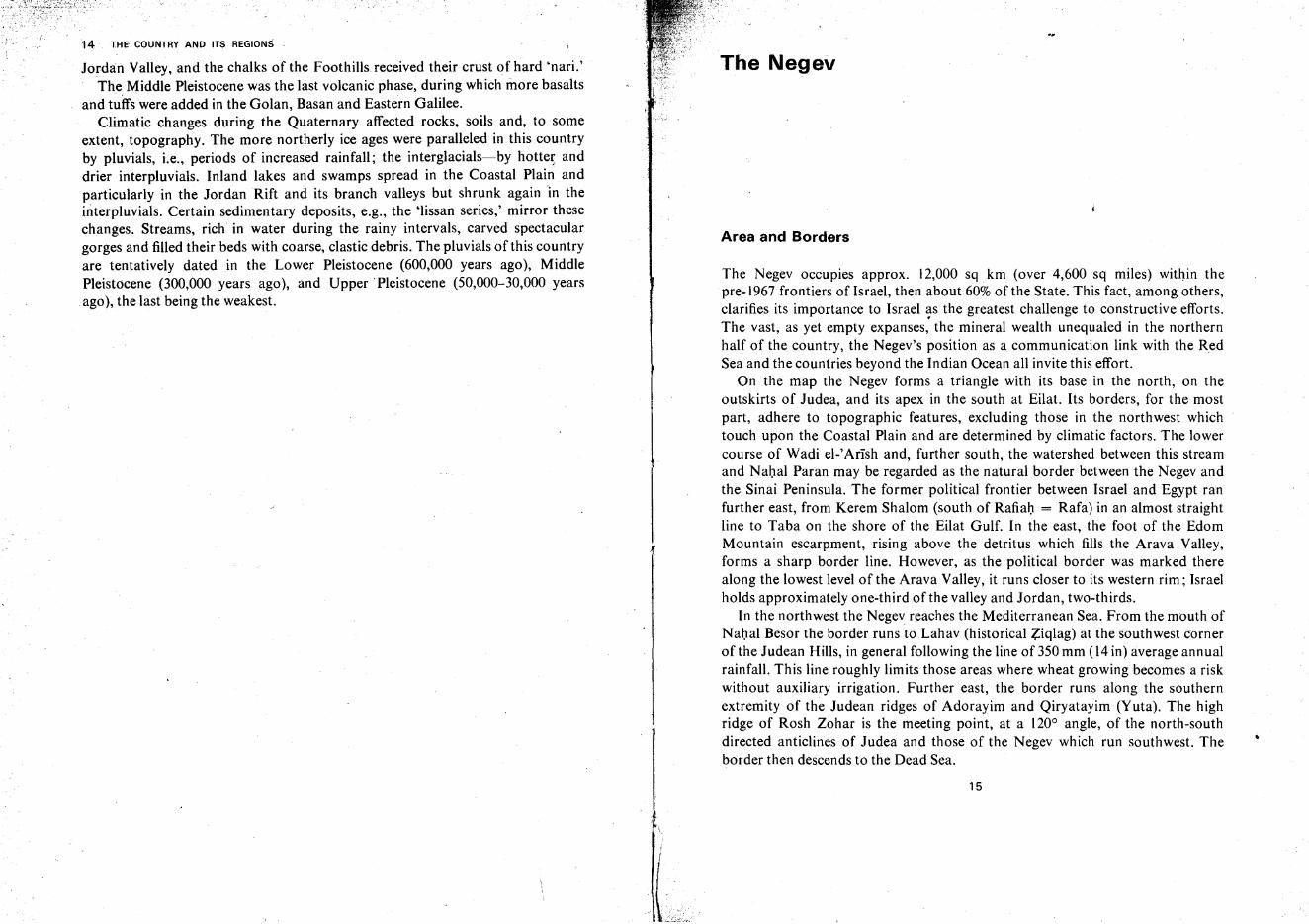
.. periods, as well as in lagoons; to these have to be added lacustrine sedimentswhich have their origin in fresh or brackish lakes. Most of the Central NegevHills and the Judean Hills, large portions of Samaria, the core of the GalileanHills, and the higher reaches of the Gilead Plateau have hard limestone anddolomite. Softer rocks, particularly chalk, prevail on the outskirts and in thelower parts of the hills, e.g., on the Paran Plateau of the Southern Negev, in theNortheastern Negev, in the Judean Foothills and Desert, in the Nablus Synclineand Menashe Region of Samaria, in the perimeter of the Galilean Hills and onlarge portions of the Transjordan Plateau. Lacustrine sediments, chiefly 'lissanmarl,' and also gypsum and rock salt, characterize sections of the Rift Valley.:
Nubian sandstone, mostly of terrestrial origin, is exposed in the SouthernNegev and Edom; it is outstanding in its vivid colors and curious landscapeforms. The 'kurkar' sandstone of the Coastal Plain also belongs to this group; itcontains sand thrown up by the sea, but has been consolidated in general on theland. Finally, the rock meal and soils in all parts of the country must bementioned here.
Volcanic rocks, particularly basalts, cover most of the Golan and Basan andsmaller portions of Eastern Lower and Upper Galilee and patches appear inMoab and Edom. Small patches of older volcanic rocks, also basalt and tuffs, arefound on the three anticlines of Samaria and in the Ramon Cirque of the Negev.
Plutonic and metamorphic rocks are relatively rare in this country. InCisjordan, they form a small area in the Eilat Hills at the southern tip of Israel,and are more prominent along the edge of the Edom Plateau, east of the RiftValley. On both sides of the valley they are remnants of the northern outskirts ofthe ancient continent which comprised large parts of Southern Egypt, the Sudan,and the Arabian Peninsula.
With the exception of the extreme south, the forming of the country's presentlandscape features began at the end of the Mesozoic with a gradual uplift fromthe sea accompanied by folding movements which are better traced west of theRift. In the north and center, the fold axes are generally north-south; ·in theNegev they turn southwest, and, near the Sinai border, west. ln Judea, Samariaand Galilee one to three folds are discernible; in the Negev there are five.
Uplift and folding movements intensified the strain of the rock crust, whichultimately led to faulting. The faults separated blocks, some of which subsided asrifts or grabens, while others were tilted, or uplifted as horsts. One of the largestfissures on the earth's crust, the Syrian-East African Rift, runs the entire length ofthe country. The Dead Sea is the lowest continental section of this rift, as well asthe lowest spot of any continent. Branch valleys of the Rift exist on both its sides.There are also, particularly in Samaria and Galilee, a number of graben valleyswhich are not directly connected with the Rift. Mount Hermon is by far the
8 THE COUNTRY AND ITS REGIONS
highest and most spectacular of the blocks; Mount Carmel is marked by its steepslope and proximity to the sea. Other blocks, shoved sideward, formed two tiltedblock series in Western and Eastern Galilee. Faulting features become moreprominent from south to north, until they constitute the dominant landscapeelement in Galilee.
Exogenic forces have imposed the definite morphological features on thesetectonic foundations. In this respect the north and south differ sharply as theclimate of the south is in the present-if not in the geologic past-pronouncedlyarid. The Negev, therefore, displays typical desert features (e.g., canyons, tablemounts, desert pavement or 'hammada', talus mounds, etc.), while the morphology of Galilee is that of a semihumid region. These differences are furtheremphasized by the vegetation which, in parts of the Galilean Hills, forms a densebrush while large areas in the Negev remain bare.
Erosion and degradation gradually transform the landscape relief created bytectonic forces, causing it to 'mature' and, later, to 'grow old.' In this respect,most of our landscapes can be classed as 'young.' The anticlines of the Negev stillappear as ridges; the synclines as valleys. The Negev 'craters' or 'cirques' are thevery beginning of relief inversion. Further along in this process, although farfrom completion, is Samaria, where parts of the Nablus Sycline are higher todaythan adjacent anticlines. However, even in Galilee with its comparatively wetclimate, the present morphology recalls the original tilted blocks, valleys, gorges,etc., created by folding, uplift, fracture and subsidence. .
One of the reasons for the straightness of the country's shoreline may be itsnature as an emergent shore. The continental shelf of the Mediterranean shore is
.not particularly broad; from a width of 25 km (15 miles) or more opposite Rafa(Rafiah) in the south it narrows to an average of 6-10 km (4-6 miles) in thecentral and northern sections of the coast. The Eilat Gulf, which subsided as partof the great Rift and was flooded by the sea, has a very narrow shelf.
Geological History
Precambrian. Our knowledge of the geological events in the region during thisearliest and most extended age of the earth's crust is limited. The rock of thePrecambrian apparently underwent intensive, and perhaps repeated, foldingprocesses which erected ~ery high mountains in the southern part of the countryas well as in the southern Sinai Peninsula, Arabia, Egypt, and the Sudan. Thiswas the 'Arab-Nubian Massif,' later a part of the ancient Gondwana Continent.Crystalline rocks were uplifted, kneaded by folding, hardened, and split byfaulting. Fissures and veins were filled intrusively with newer rock, and volcanic
STRUCTlJI'IE AND GEOLOGICAL HISTORY 9
eruptions added extrusive rock types. The straining and the pressure, the heatgenerated at depth or by the contact of the lava or magma with solid rock, andgases emanating from intrusions and extrusions transformed some of the existingstone into metamorphic rock.
Over millions of years, toward the end of the Precambrian, the mountains wereground down by erosion and almost flattened out. Much of the detritus seems tohave been carried off into an ancient ocean in the north, approximately in thedirection of the present Mediterranean. In some periods this ocean may haveinvaded and flooded parts of the Arab-Nubian Massif.
Paleozoic and Mesozoic. The ocean which geologists call 'Tethys' and whichalmost circled the earth in these latitudes, spread to the north and west ofPalestine, at least since the early Paleozoic. The Arab-Nubian continental masslay to the south and east. This continent alternately rose and subsided overhundreds of millions of years; in each case this caused a regression ortransgression of the sea. This explains the marine Paleozoic strata appearingbetween terrestrial rocks; the marine strata are comparatively thin as they probablyunderwent erosion in the subsequent regressional and continental stage.
It may be assumed that the climate in our region during most of the geologicpast was a desert or near-desert one. This is indicated 'by the colored Nubiansandstone, created from the detritus of the crystalline rocks in its vicinity. On thebottom of the Tethys Sea limestone, chalk, marl and, less frequently, dolomiteand flint, were deposited. Many of the limestones can be termed as organogenicas they are composed mainly of mollusk shells, corals, and other sea fossils. Incontrast to these limestones, dolomite is poor in fossil traces .
In every transgressional stage the northern and western parts of the countrywere the first to be inundated and the last to be vacated by the sea, while in thesouth and east the sea lingered for comparatively shorter periods. Hence, marinestrata thicken as we proceed north and west while in the south and east terrestrialrocks or shore deposits (marl, etc.) predominate. It is also assumed that ageosyncline of the Tethys, where deposition of marine strata was most intensive,lay toward the northwest.
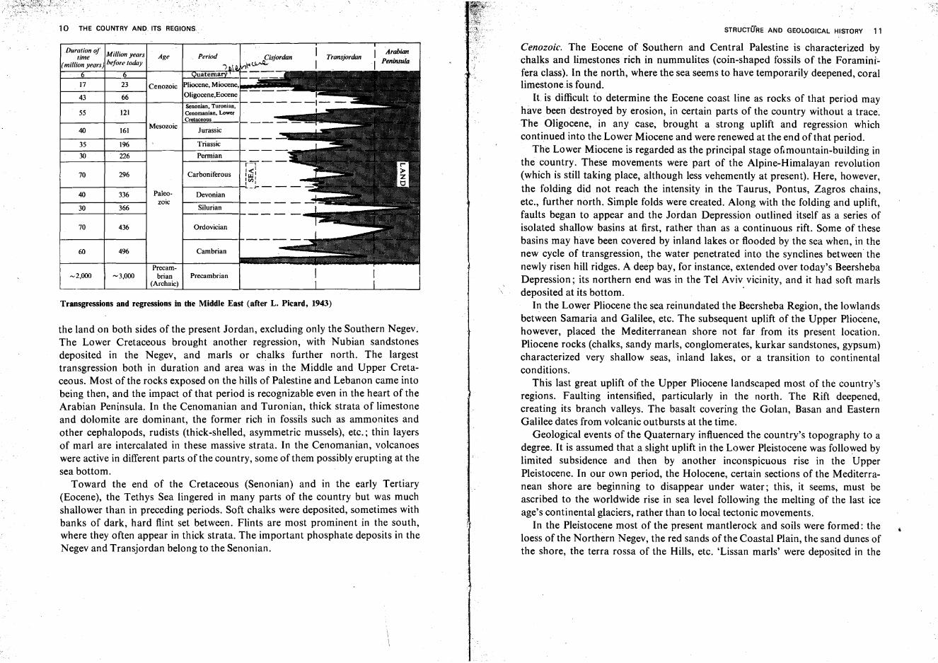
A diagram prepared by L. Picard traces the assumed vacillations of the coastline between the Tethys Sea and the Arab-Nubian land mass. It depicts five majorPaleozoic transgressions. The Permian at the end of that era brought a sustainedregression with desert conditions on the continent. Three Mesozoic transgressions can be noted, each successive one penetrating deeper into the massif: in theMiddle Triassic the sea covered most of Cisjordan and parts of Transjordan; inthe Upper Triassic and Lower Jurassic, Nubian sandstones point to a terrestrialregime; in the Middle and Upper Jurassic the sea returned and flooded most of
10 THE COUNTRY AND. ITS REGIONS
Duration ofMillion years I Arabian
time Age Period Cisjordan Transjordan(million years) before today ~~ I Peninsula
")
6 6 uatema
17 23 Cenozoic Pliocene, Miocene,
43 66 Oligocene,Eocene
Senonian, Turonian.55 121 Cenomanian, Lower
Cretaceous
40 161Mesozoic
Jurassic---
35 196 Triassic
30 226 Permianr=t--
Carboniferous1<'
70 296 I~I1<1:>11 1_J-----
40 336 Paleo- Devonianzoic
30 366 Silurian
70 436 Ordovician
60 496 Cambrian
Precam-~2,OOO ~3,OOO brian Precambrian
(Archaic)
Transgressions and regressions in tire Middle East (after L. Picard, 1943)
the land on both sides of the present Jordan, excluding only the Southern Negev.The Lower Cretaceous brought another regression, with Nubian sandstonesdeposited in the Negev, and marls or chalks further north. The largesttransgression both in duration and area was in the Middle and Upper Cretaceous. Most of the rocks exposed on the hills of Palestine and Lebanon came intobeing then, and the impact of that period is recognizable even in the heart of theArabian Peninsula. In the Cenomanian and Turonian, thick strata of limestoneand dolomite are dominant, the former rich in fossils such as ammonites andother cephalopods, rudists (thick-shelled, asymmetric mussels), etc.; thin layersof marl are intercalated in these massive strata. In the Cenomanian, volcanoeswere active in different parts of the country, some of them possibly erupting at thesea bottom.
Toward the end of the Cretaceous (Senonian) and in the early Tertiary(Eocene), the Tethys Sea lingered in many parts of the country but was muchshallower than in preceding periods. Soft chalks were deposited, sometimes withbanks of dark, hard flint set between. Flints are most prominent in the south,where they often appear in thick strata. The important phosphate deposits in theNegev and Transjordan belong to the Senonian.
STRUCTURE AND GEOLOGICAL HISTORY 11
Cenozoic. The Eocene of Southern and Central Palestine is characterized bychalks and limestones rich in nummulites (coin-shaped fossils of the Foraminifera class). In the north, where the sea seems to have temporarily deepened, corallimestone is found.
It is difficult to determine the Eocene coast line as rocks of that period mayhave been destroyed by erosion, in certain parts of the country without a trace.The Oligocene, in any case, brought a strong uplift and regression whichcontinued into the Lower Miocene and were renewed at the end of that period.
The Lower Miocene is regarded as the principal stage ofcmountain-bulldlng inthe country. These movements were part of the Alpine-Himalayan revolution(which is still taking place, although less vehemently at present). Here, however,the folding did not reach the intensity in the Taurus, Pontus, Zagros chains,etc., further north. Simple folds were created. Along with the folding and uplift,faults began to appear and the Jordan Depression outlined itself as a series ofisolated shallow basins at first, rather than as a continuous rift. Some of thesebasins may have been covered by inland lakes or flooded by the sea when, in thenew cycle of transgression, the water penetrated into the synclines between thenewly risen hill ridges. A deep bay, for instance, extended over today's BeershebaDepression; its northern end was in the Tel Aviv vicinity, and it had soft marlsdeposited at its bottom. .
In the Lower Pliocene the sea reinundated the Beersheba Region, the lowlandsbetween Samaria and Galilee, etc. The subsequent uplift of the Upper Pliocene,however, placed the Mediterranean shore not far from its present location.Pliocene rocks (chalks, sandy marls, conglomerates, kurkar sandstones, gypsum)characterized very shallow seas, inland lakes, or a transition to continentalconditions.
This last great uplift of the Upper Pliocene landscaped most of the country'sregions. Faulting intensified, particularly in the north. The Rift deepened,creating its branch valleys. The basalt covering the Golan, Basan and EasternGalilee dates from volcanic outbursts at the time.
Geological events of the Quaternary influenced the country's topography to adegree. It is assumed that a slight uplift in the Lower Pleistocene was followed bylimited subsidence and then by another inconspicuous rise in the UpperPleistocene. In our own period, the Holocene, certain sections of the Mediterranean shore are beginning to disappear under water; this, it seems, must beascribed to the worldwide rise in sea level following the melting of the last iceage's continental glaciers, rather than to local tectonic movements.
In the Pleistocene most of the present mantlerock and soils were formed: theloess of the Northern Negev, the redsands of the Coastal Plain, the sand dunes ofthe shore, the terra rossa of the Hills, etc. 'Lissan marls' were deposited in the
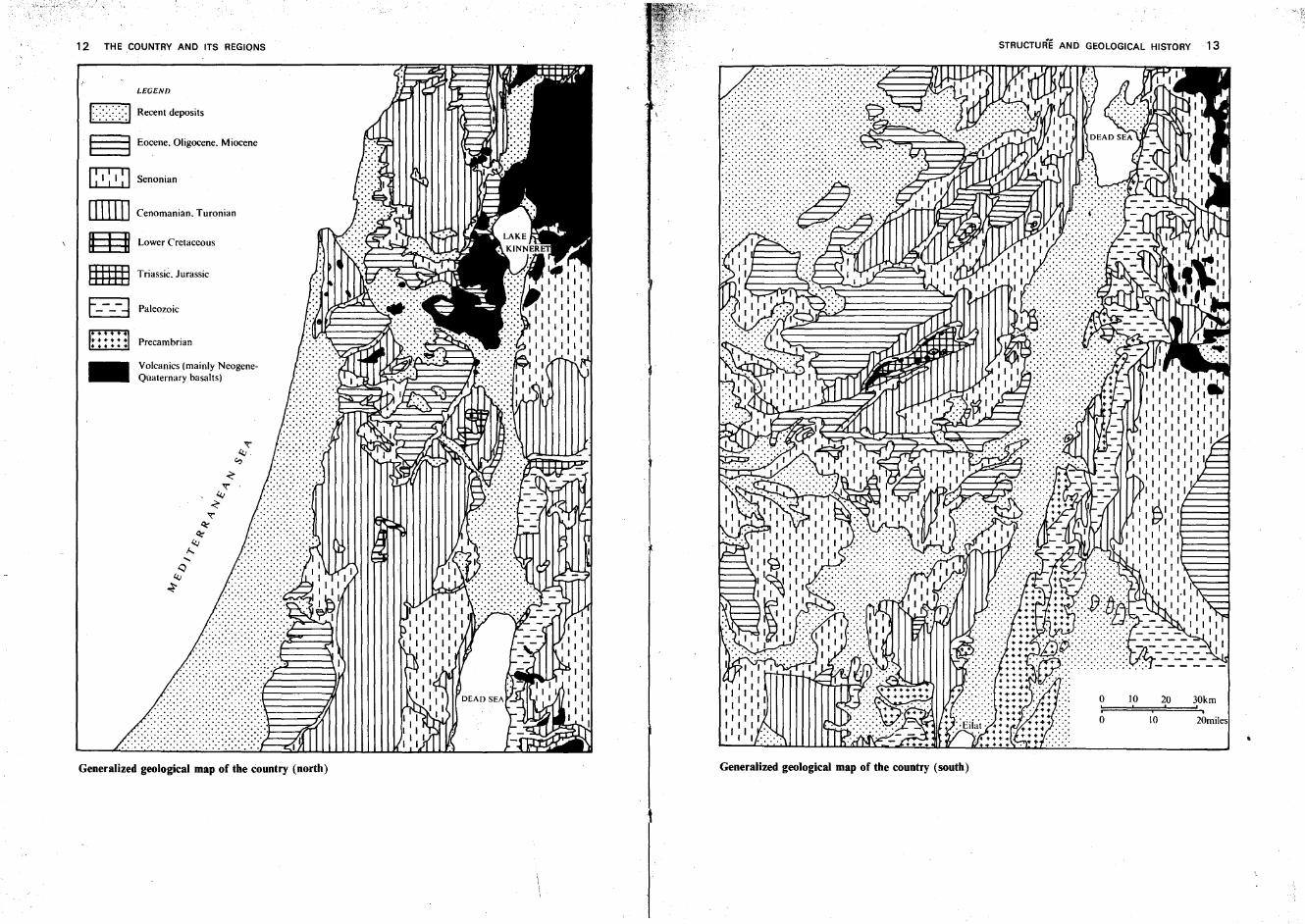
12 THE COUNTRY AND ITS REGIONS
20miles
20,
10
10o
o
STRUCTURE AND GEOLOGICAL HISTORY 13
.......... ' .......... ..... '" .
Generalized geological map of the country (south)
"<"4.;
e.,
-<-"<"
4.;
-<"<"~
~4.;
f........
Q4.;
~
Precambrian
Volcanics (mainly NeogeneQuaternary basalts)
~ Senonian
LEGEND
Ed Recent deposits
§ Eocene. Oligocene. Miocene
[illill Cenomanian. Turonian
m Lower Cretaceous
g Triassic. Jurassic
E----d Paleozoic
-
Generalized geological map of the country (north)
14 THE COUNTRY AND ITS REGIONS
Jordan Valley, and the chalks of the Foothills received their crust of hard 'nari.'The Middle Pleistocene was the last volcanic phase, during which more basalts
and tuffs were added in the Golan, Basan and Eastern Galilee.Climatic changes during the Quaternary affected rocks, soils and, to some
extent, topography. The more northerly ice ages were paralleled in this countryby pluvials, i.e., periods of increased rainfall; the interglacials-by hotter anddrier interpluvials. Inland lakes and swamps spread in the Coastal Plain andparticularly in the Jordan Rift and its branch valleys but shrunk again 'in theinterpluvials, Certain sedimentary deposits, e.g., the 'Iissan series,' mirror thesechanges. Streams, rich in water during the rainy intervals, carved spectaculargorges and filled their beds with coarse, clastic debris. The pluvials of this countryare tentatively dated in the Lower Pleistocene (600,000 years ago), MiddlePleistocene (300,000 years ago), and Upper 'Pleistocene (50,000-30,000 yearsago), the last being the weakest.
I
L~
The Negev
Area and Borders
The Negev occupies approx. 12,000 sq km (over 4,600 sq miles) within thepre-1967 frontiers of Israel, then about 60% of the State. This fact, among others,clarifies its importance to Israel ~s the greatest challenge to constructive efforts.The vast, as yet empty expanses, the mineral wealth unequaled in the northernhalf of the country, the Negev's position as a communication link with the RedSea and the countries beyond the Indian Ocean all invite this effort.
On the map the Negev forms a triangle with its base in the north, on theoutskirts of Judea, and its apex in the south at Eilat. Its borders, for the mostpart, adhere to topographic features, excluding those in the northwest whichtouch upon the Coastal Plain and are determined by climatic factors. The lowercourse of Wadi el-'Arlsh and, further south, the watershed between this streamand Nahal Paran may be regarded as the natural border between the Negev andthe Sinai Peninsula. The former political frontier between Israel and Egypt ranfurther east, from Kerem Shalom (south of Rafiah = Rafa) in an almost straightline to Taba on the shore of the Eilat Gulf. In the east, the foot of the EdomMountain escarpment, rising above the detritus which fills the Arava Valley,forms a sharp border line. However, as the political border was marked therealong the lowest level of the Arava Valley, it runs closer to its western rim; Israelholds approximately one-third of the valley and Jordan, two-thirds.
In the northwest the Negev reaches the Mediterranean Sea. From the mouth ofNahal Besor the border runs to Lahav (historical Ziqlag) at the southwest cornerof the Judean Hills, in general following the line of 350 mm (14 in) average annualrainfall. This line roughly limits those areas where wheat growing becomes a riskwithout auxiliary irrigation. Further east, the border runs along the southernextremity of the Judean ridges of Adorayim and Qiryatayim (Yuta). The highridge of Rosh Zohar is the meeting point, at a 1200 angle, of the north-southdirected anticlines of Judea and those of the Negev which run southwest. Theborder then descends to the Dead Sea.
15
16 THE COUNTRY AND ITS REGIONS THE NEGEV 17
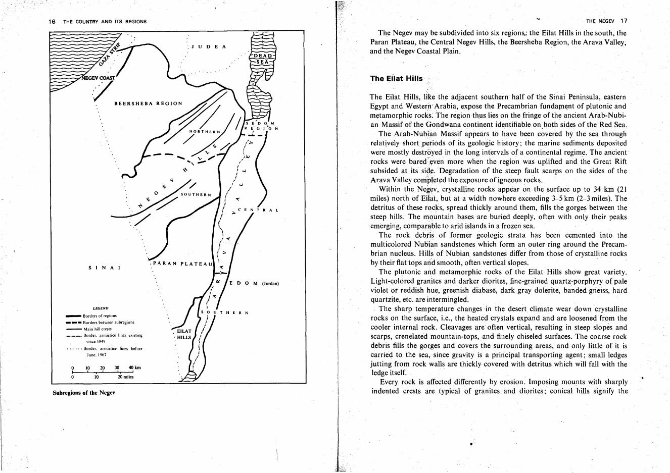
The Negev may be subdivided into six regions; the Eilat Hills in the south, theParan Plateau, the Central Negev Hills, the Beersheba Region, the Arava Valley,and the Negev Coastal Plain.
The Eilat Hills
The Eilat Hills, liRe the adjacent southern half of the Sinai Peninsula, easternEgypt and Western-Arabia, expose the Precambrian fundament of plutonic andmetamorphic rocks. The region thus lies on the fringe of the ancient Arab-Nubian Massif of the Gondwana continent identifiable on both sides of the Red Sea.
The Arab-Nubian Massif appears to have been covered by the sea throughrelatively shortperiods of its geologic history; the marine sediments depositedwere mostly destroyed in the long intervals of a continental regime. The ancientrocks were bared\wen more when the region was uplifted a~d the Great Riftsubsided at its side. Degradation of the steep fault scarps on the sides of theArava Valley completed the exposure of igneous rocks.
Within the Negev, crystalline rocks appear on the surface up to 34 km (21miles) north of Eilat; but at a width nowhere exceeding 3-5 km (2-3 miles). The.detritus of these rocks, spread thickly around them, fills the gorges between thesteep hills. The mountain bases are buried deeply, often with only their peaksemerging, comparable to arid islands in a frozen sea.
The rock debris of former geologic strata has been cemented into themulticolored Nubian sandstones which form an outer ring around the Precambrian nucleus. Hilts of Nubian sandstones differ from those of crystalline rocksby their flattops arid smooth, often vertical slopes .
The plutonic and metamorphic rocks of the Eilat Hills show great variety.Light-colored granites and darker diorites, fine-grained quartz-porphyry of paleviolet or reddish hue, greenish diabase, dark gray dolerite, banded gneiss, hardquartzite, etc. are intermingled. .
The sharp temperature changes in the desert climate wear down crystallinerocks on the surface, i.e., the heated crystals expand and are loosened from thecooler internal rock. Cleavages are often vertical, resulting in steep slopes andscarps, crenelated mountain-tops, and finely chiseled surfaces. The coarse rockdebris fills the gorges and covers the surrounding areas, and only little of it iscarried to the sea, since gravity is a principal transporting agent; small ledgesjutting from rock walls are thickly covered with detritus which will fall with theledge itself.
Every rock is affected differently by erosion. Imposing mounts with sharplyindented crests are typical of granites and diorites; conical hills signify the
ERN
E D 0 M (Jordan)
/;../i
./)"J
!'..;J
!/
"i ..;J
//i <l:;I ;..CENTRALi,.
(,"~
1; <l:
-{i
i ;..\\
J U D E A
. PARAN PLATEAU
~7BEERSHEBA
LEGEND
SIN A I
o 10 20 30 40kmI 'i' "o 10 20 miles
_ Borders of regions
___ Borders between subregions
- Main hill crests_._.._ .. Border. armistice lines existing
since 1949
•••••• Border. armistice lines before
June. 1967
Subregions of the Negev
•
18 THE' COUNTRY AND ITS REGIONS
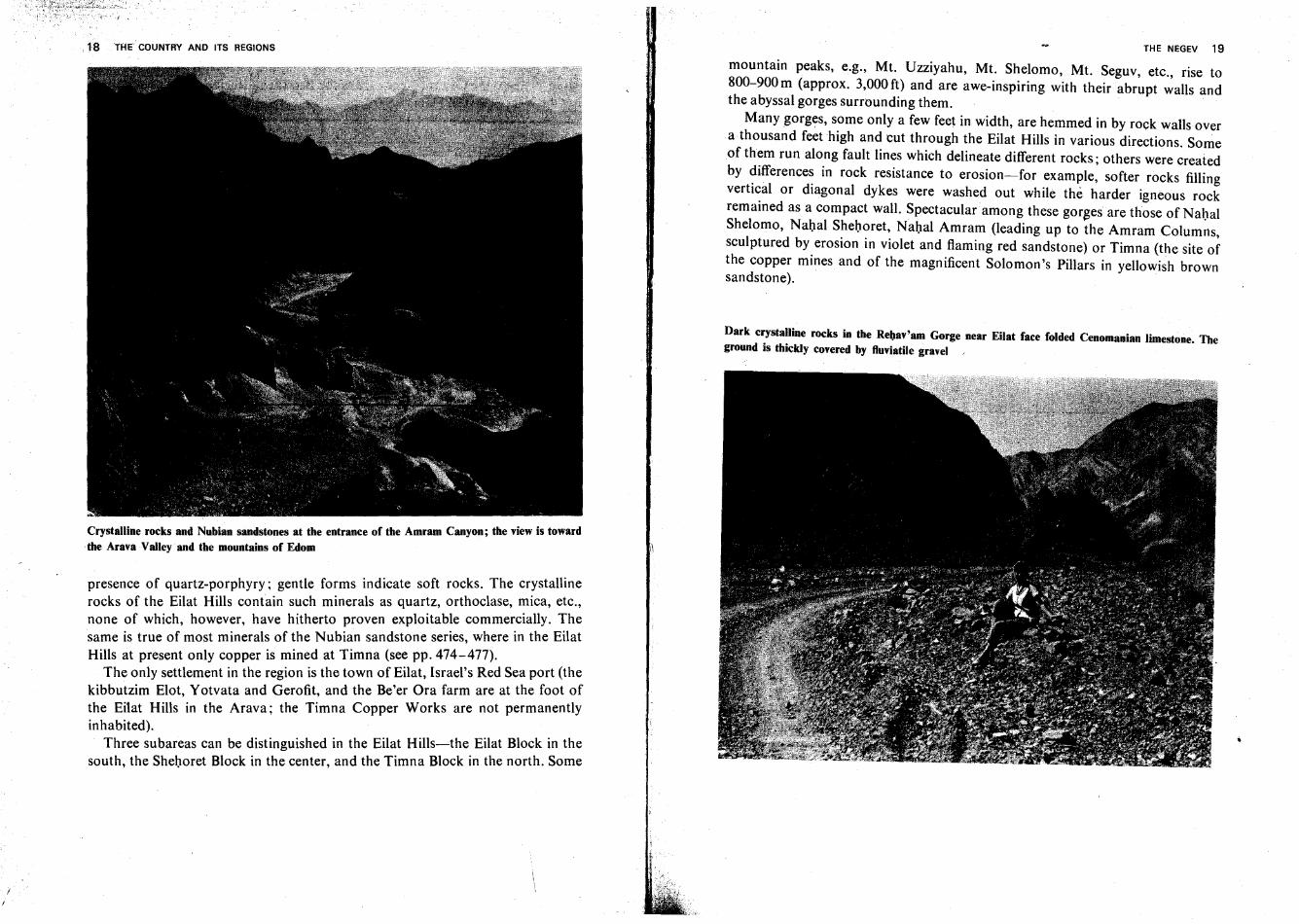
Crystalline rocks and Nubian sandstones at the entrance of the Amram Canyon; the viewis toward.the AravaValley·and the mountains of Edom
presence of quartz-porphyry; gentle forms indicate soft rocks. The cr~stalline
rocks of the Eilat Hills contain such minerals as quartz, orthoclase, mica, etc.,none of which, however, have hitherto proven exploitable commercially. Thesame is true of most minerals of the Nubian sandstone series, where in the EilatHills at present only copper is mined at Timna (see pp. 474-477).
The only settlement in the region is the town of Eilat, Israel's Red Sea port (thekibbutzim Elot, Yotvata and Gerofit, and the Be'er Ora farm are at the foot ofthe Eilat Hills in the Arava; the Timna Copper Works are not permanentlyinhabited).
Three subareas can be distinguished in the Eilat Hills-the Eilat Block in thesouth, the Shehoret Block in the center, and the Timna Block in the north. Some
:1
THE NEGEV 19
mountain peaks, e.g., Mt, Uzziyahu, Mt. Shelomo, Mt. Seguv, etc., rise to800-900 m (approx. 3,000 ft) and are awe-inspiring with their abrupt walls andthe abyssal gorges surrounding them.
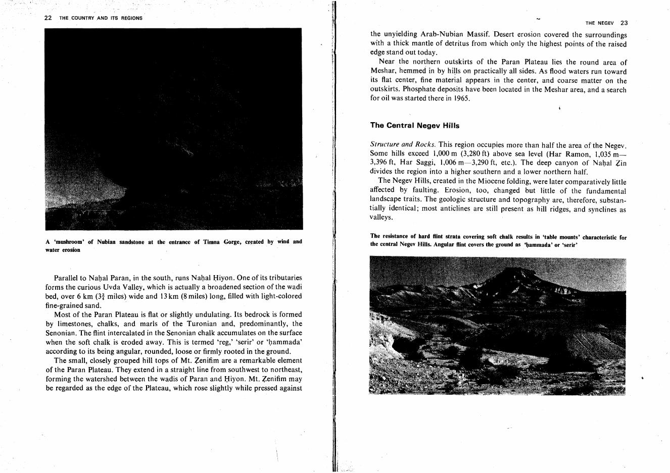
Many gorges, some only a few feet in width, are hemmed in by rock walls overa thousand feet high and cut through the Eilat Hills in various directions. Someof them run along fault lines which delineate different rocks; others were createdby differences in rock resistance to erosion-for example, softer rocks fillingvertical or diagonal dykes were washed out while the harder igneous rockremained as a compact wall. Spectacular among these gorges are those of NahalShelomo, Nahal Shehoret, Nahal Amram (leading up to the Amram Columns,sculptured by erosion in violet and flaming red sandstone) or Timna (the site ofthe copper mines and of the magnificent Solomon's Pillars in yellowish brownsandstone). .
Dark crystalline rocks in the Rebav'am Gorge near Eilat face folded Cenomanian limestone. Theground is thickly covered by fluviatile gravel ,
20 THE COUNTRY AND ITS REGIONS
The Amram Columns near Eilat
THE NEGEV 21
Solomon's Pillars in the Timna Gorge
The Paran Plateau
This fairly large region is named for the stream (wadi) which runs through itlengthwise from southwest to northeast. The Plateau, inclined in the samedirection, descends from 600 m (almost 2,000 ft) above sea level at the Sinaiborder to only 100m (330 ft) where Nahal Paran enters the Arava Valley.
Nahal Paran originates in Sinai territory, southwest of Eilat. Its lower section,called Nahal ha-Arava, reaches the Sedom salt swamps south of the Dead Sea. Ithas a large drainage basin with numerous tributaries from the south, west, andnorth. The Paran is the largest stream in the country, surpassing the Jordan in thelength of its course (240 km-140 miles) and in the width of its bed (up to 3 km),although it is dry most of the year. An occasional rainstorm may flood its bedpartly, or, on rare occasions, entirely. As it thunders through the bed its carries agreat load of silt, cobbles and even large boulders. In some sections of its middlecourse, Nahal Paran has carved its bed far below the level of the Plateau, andbold scarps and rock pillars tower on both sides.
22 THE COUNTRY AND ITS REGIONS
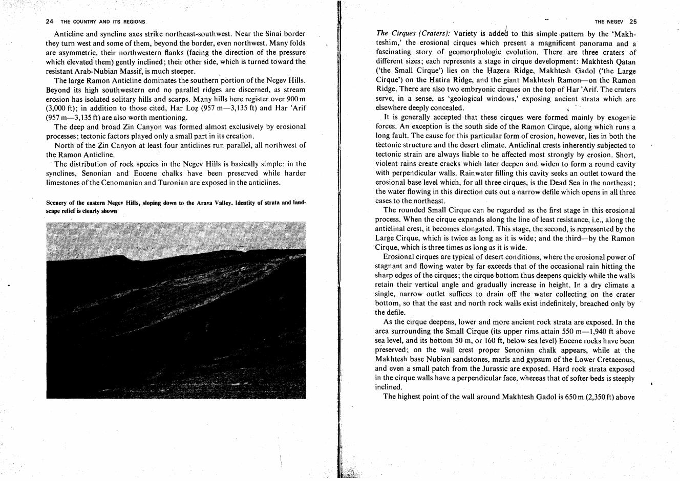
A 'mushroom' of Nubian sandstone at the entrance of TimnaGorge,created by wind andwater erosion
Parallel to Nahal Paran, in the south, runs Nahal Hiyon. One of its tributariesforms the curious Uvda Valley, which is actually a broadened section of the wadibed, over 6 km (31 miles) wide and 13km (8 miles) long, filled with light-coloredfine-grained sand.
Most of the Paran Plateau is flat or slightly undulating. Its bedrock is formedby limestones, chalks, and marls of the Turonian and, predominantly, theSenonian. The flint intercalated in the Senonian chalk accumulates on the surfacewhen the soft chalk is eroded away. This is termed 'reg,' 'serir' or 'hammada'according to its being angular, rounded" loose or firmly rooted in the ground.
The small, closely grouped hill tops of Mt. Zenifim are a remarkable elementof the Paran Plateau. They extend in a straight line from southwest to northeast,forming the watershed between the wadis of Paran and Hiyon. Mt. Zenifim maybe regarded as the edge of the Plateau, which rose slightly while pressed against
THE NEGEV 23
the unyielding Arab-Nubian Massif. Desert erosion covered the surroundingswith a thick mantle of detritus from which only the highest points of the raisededge stand out today.
Near the northern outskirts of the Paran Plateau lies the round area ofMeshar, hemmed in by hills on practically all sides. As flood waters run towardits flat center, fine material appears in the center, and coarse matter on theoutskirts. Phosphate deposits have been located in the Meshar area, and a searchfor oil was started there in 1965.
The Central Negev Hills
Structure and Rocks. This region occupies more than half the area of the Negev.Some hills exceed 1,000 m (3,280 ft) above sea level (Har Ramon, 1,035 m3,396 ft, Har Saggi, 1,006 m-3,290 ft, etc.). The deep canyon of Nahal Zindivides the region into a higher southern and a lower northern half.
The Negev Hills, created in the Miocene folding, were later comparatively littleaffected by faulting. Erosion, too, changed but little of the fundamentallandscape traits. The geologic structure and topography are, therefore, substantially identical; most anticlines are still present as hill ridges, and synclines asvalleys.
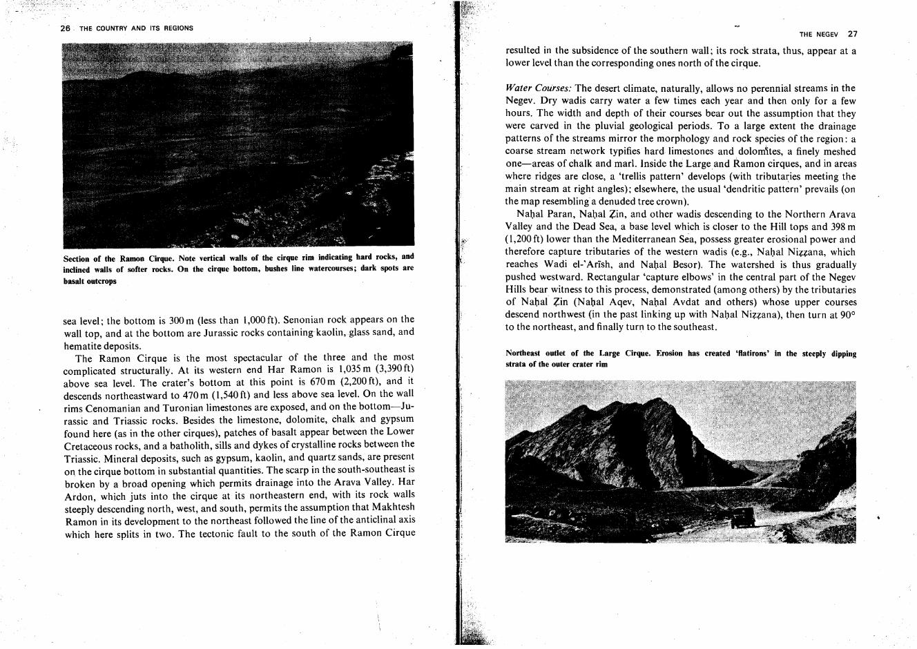
The resistance of hard flint strata covering soft chalk results in 'table mounts' characteristic forthe central Negev Hills. Angular flint covers the ground as '''ammada' or 'serir'
24 THE COUNTRY ANO ITS REGIONS.
Anticline and syncline axes strike northeast-southwest. Near the Sinai borderthey turn west and some of them, beyond the border, even northwest. Many foldsare asymmetric, their northwestern flanks (facing the direction of the pressurewhich elevated-them) gently inclined; their other side, which is turned toward theresistant Arab-Nubian Massif, is much steeper. .
The large Ramon Anticline dominates the southern portion of the Negev Hills.Beyond its high southwestern end no parallel ridges are discerned, as streamerosion has isolated solitary hills and scarps. Many hills here register over 900 m(3,000 ft); in addition to those cited, Har Loz (957 m-3, 135 ft) and Har 'Arif(957 m-3, 135ft) are also worth mentioning.
The deep and broad Zin Canyon was formed almost exclusively by erosionalprocesses; tectonic factors played only a small part in its creation.
North of the Zin Canyon at least four anticlines run parallel, all northwest ofthe Ramon Anticline.
. The distribution of rock species in the Negev Hills is basically simple: in thesynclines, Senonian and Eocene chalks have been preserved while harderlimestones of the Cenomanian and Turonian are exposed in the anticlines.
Scenery of the eastern Negev Hills, sloping down to the Arava Valley. Identity of strata and landscape relief is clearly shown
THE NEGEV 25
The Cirques (Craters): Variety is adde~ to this simple -pattern by the 'Makhteshim,' the erosional cirques which present a magnificent panorama and afascinating story of geomorphologic evolution. There are three craters ofdifferent sizes; each represents a stage in cirque development: Makhtesh Qatan('the Small Cirque') lies on the Hazera Ridge, Makhtesh Gadol ('the LargeCirque') on the Hatira Ridge, and the giant Makhtesh Ramon-on the RamonRidge. There are also two embryonic cirques on the top of Har 'Arif. The cratersserve, in a sense, as 'geological windows,' exposing ancient strata which areelsewhere deeply concealed. j
. It is generally accepted that these cirques were formed mainly by exogenicforces. An exception is the south side of the Ramon Cirque, along which runs along fault. The cause for this particular form of erosion, however, lies in both thetectonic structure and the desert climate. Anticlinal crests inherently subjected totectonic strain are always liable to be affected most strongly by erosion. Short,violent rains create cracks which later deepen and widen to form a round cavitywith perpendicular walls. Rainwater filling this cavity seeks an outlet toward theerosional base level which, for all three cirques, is the Dead Sea in the northeast;the water flowing in this direction cuts out a narrow defile which opens in all threecases to the northeast.
The rounded Small Cirque can be regarded as the first stage in this erosionalprocess. When the cirque expands along the line of least resistance, i.e., along theanticlinal crest, it becomes elongated. This stage, the second, is represented by theLarge Cirque, which is twice as long as it is wide; and the third-by the RamonCirque, which is three times as long as it is wide.
Erosional cirques are typical of desert conditions, where the erosional power ofstagnant and flowing water by far exceeds that of the occasional rain hitting thesharp edges of the cirques; the cirque bottom thus deepens quickly while the wallsretain their vertical angle and gradually increase in height. In a dry climate asingle, narrow outlet suffices to drain off the water collecting on the craterbottom, so thatthe east and north rock walls exist indefinitely, breached only bythe defile.
As the cirque deepens, lower and more ancient rock strata are exposed. In thearea surrounding the Small Cirque (its upper rims attain 550 m-l,940 ft abovesea level, and its bottom 50 m, or 160 ft, below sea level) Eocene rocks have beenpreserved; on the wall crest proper Senonian chalk appears, while at theMakhtesh base Nubian sandstones, marls and gypsum of the LowerCretaceous,and even a small patch from the Jurassic are exposed. Hard rock strata exposedin the cirque walls have a perpendicular face, whereas that of softer beds is steeplyinclined.
The highest point of the wall around Makhtesh Gadol is 650 m (2,350 ft) above
26 THE COUNTRY AND ITS REGIONS
Section of the Ramon Cirque. Note vertical walls of the cirque rim indicating hard rocks, andinclined walls of softer rocks. On the cirque bottom, bushes line watercourses; dark spots are
basalt outcrops
sea level; the bottom is 300m (less than 1,000ft). Senonian rock appears on thewall top, and at the bottom are Jurassic rocks containing kaolin, glass sand, andhematite deposits.
The Ramon Cirque is the most spectacular of the three and the mostcomplicated structurally. At its western end Har Ramon is 1,035 m (3,390ft)above sea level. The crater's bottom at this point is 670 m (2,200 ft), and itdescends northeastward to 470m (1,540ft) and less above sea level. On the wallrims Cenomanian and Turonian limestones are exposed, and on the bottom-Jurassic and Triassic rocks. Besides the limestone, dolomite, chalk and gypsumfound here (as in the other cirques), patches of basalt appear between the LowerCretaceous rocks, and a batholith, sills and dykes of crystalline rocks between theTriassic. Mineral deposits, such as gypsum, kaolin, and quartz sands, are presenton, the cirque bottom in substantial quantities. The scarp in the south-southeast isbroken by a broad opening which permits drainage into the Arava Valley. HarArdon, which juts into the cirque at its northeastern end, with its rock wallssteeply descending north, west, and south, permits the assumption that MakhteshRamon in its development to the northeast followed the line of the anticlinal axiswhich here splits in two. The tectonic fault to the south of the Ramon Cirque
THE NEGEV 27
resulted in the subsidence of the southern wall; its rock strata, thus, appear at alower level than the corresponding ones north of the cirque.
Water Courses: The desert climate, naturally, allows no perennial streams in theNegev. Dry wadis carry water a few times each year and then only for a fewhours. The width and depth of their courses bear out the assumption that theywere carved in the pluvial geological periods. To a large extent the drainagepatterns of the streams mirror the morphology and rock species of the region: acoarse stream network typifies hard limestones and dolomites, a finely meshedone-areas of chalk and marl. Inside the Largeand Ramon cirques, and in areaswhere ridges are close, a 'trellis pattern' develops (with tributaries meeting themain stream at right angles); elsewhere, the usual 'dendritic pattern' prevails (onthe map resem bling a den uded tree crown).
Nahal Paran, Nahal Zin, and other wadis descending to the Northern AravaValley and the Dead Sea, a base level which is closer to the Hill tops and 398 m(1,200 ft) lower than the Mediterranean Sea, possess greater erosional power andtherefore capture tributaries of the western wadis (e.g., Nahal Nizzana, whichreaches Wadi el-IArish, and Nahal Besor). The watershed is thus graduallypushed westward. Rectangular 'capture elbows' in the central part of the NegevHills bear witness to this process, demonstrated (among others) by the tributariesof Nahal Zin (Nahal Aqev, Nahal Avdat and others) whose upper coursesdescend northwest (in the past linking up with Nahal Nizzana), then turn at 90°to the northeast, and finally turn to the southeast.
Northeast outlet of the Large Cirque. Erosion has created 'flatirons' in the steeply dippingstrata of the outer crater rim
28 THE COUNTRY AND ITS REGIOIIIS
Settlement: The Central Negev Hills, where, until a few years ago, only bedouinroamed, are today the object of a great development effort. Foremost among thenew centers is the town of Dimona, with approximately 20,000 inhabitants whoare employed in the Dead Sea Works and in theOron and Zefa' phosphate mines,as well as inthe textile industry and other branches. Mizpe Ramon andYerohamare nuclei of towns to be based on mining and industry. The kibbutz Sede Boqeris a solitary desert outpost experimenting in a number of farm branches.
The Beersheba Region
The Beersheba Region is a depression forming a triangle on the map, its baseparalleling the Mediterranean shore in the west and its apex in the east wedged inbetween the Negev Hills and the Hills of Judea. It rises nearly imperceptibly from50-100 m (150-350 ft) above sea level in the west to approx. 250 m (800 ft) aroundBeersheba and attains 500 m (1,650 ft) at its eastern extremity.
The Beersheba Region subsided with the opening of the Jordan and Dead SeaRift, which began in the Miocene and continued, at an accelerated rate, in thePliocene. In the latter period the sea penetrated the region deeply and depositedchalk in many of its parts.
Since the sea's final recession toward the end of the Pliocene, the regionbecame thickly covered with loess soil which, in many parts of the world, ischaracteristic of the fringes of large deserts. This soil is mainly of eolian origin,Le., it was transported by the winds. The streams descending from the NegevHills are also considered by scholars to have participated in carrying the loess tothe Beersheba Region.
The yellowish brown loess is fine-grained; only thus can it be lifted andtransported by winds over large distances from the desert to less arid regionswhere it adheres to the ground. Loess soil, potentially fertile, contains manysubstances necessary to plant life, e.g., silica, calcium, alumina, iron, etc. In theBeersheba Region it is frequently 30 m (100 ft) thick or more. Some mechanicalproperties of this soil, however, contribute to sheet erosion and badlandformation and pose serious problems to the farmer. In the first winter rain thesurface grains swell and coalesce into a hard crust which is impenetrable toseepage of additional rainwater into the subsoil. Rainwater then collects on thesurface, and wild flash floods tear open deep, zigzagging gullies. The soilcrumbling into the bed in summer from the vertical gully banks obstructs thefloodwaters in the winter. This causes them to break out of the wadi bed and toopen additional gullies. Near the course of Nahal Besor, in the vicinity of Be'erinear the Gaza Strip border, in the area of Dorot and Ruhama further north and
THE NEGEV 29
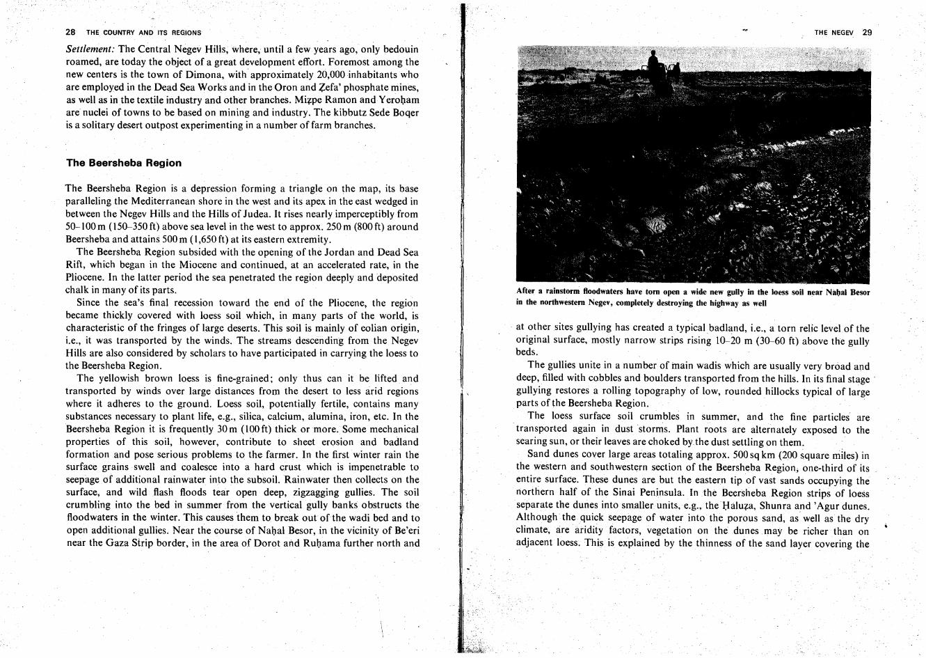
After a rainstorm floodwaters have torn open a wide new gully in the loess soil near Nabal Besorin the northwestern Negev, completely destroying the highway as well
. at other sites gullying has created a typical badland, i.e., a torn relic level of theoriginal surface, mostly narrow strips rising 10-20 m (30-60 ft) above the gullybeds.
The gullies unite in a number of main wadis which are usually very broad anddeep, filled with cobbles and boulders transported from the hills. In its final stage :gullying restores a rolling topography of low, rounded hillocks typical of largeparts of the Beersheba Region.
The loess surface soil crumbles in summer, and the fine particles aretransported again in dust storms. Plant roots are alternately exposed to thesearing sun, or their leaves are choked by the dust settling on them.
Sand dunes cover large areas totalingapprox. 500 sq km (200 square miles) inthe western and southwestern section of the Beersheba Region; one-third of itsentire surface. These dunes are but the eastern tip of vast sands occupying thenorthern half of the Sinai Peninsula. In the Beersheba Region strips of loessseparate the dunes into smaller units,e.g., the I:lalu?:a, Shunra and'Agur dunes.Although the quick seepage of water into the porous sand, as well as the dryclimate.rare aridity factors, vegetation on the dunes may be richer than onadjacent loess. This is explained by the thinness of the sand layer covering the
w30 THE COUNTRY AND ITS REGIONS
loess soil beneath; rainwater filters swiftly through the sand and reaches the loess,where it is blocked, protected from evaporation, yet available to most plant roots.The irregular distribution of sand and loess areas in the Beersheba Region is hardto explain; the sand is not found much nearer to the hills where seemingly bothsand and loess originate, as should be the case since sand is heavier.
Almost the entire Beersheba Region is in the drainage basin of a single stream,NahalBesot, which runs down from Har Haluqim inthe Negev Hills. This waditakes up important tributaries-s-Nahal Beersheba which runs due west fromRosh Zohar and unites in the Beersheba precincts with Nahal Hevron (the latterdrains the southern part of the Hebron Hills), and Nahal Gerar, running from thesouthwestern flank of the Judean Hills (the Adorayim Ridge).
Settlement: Since 1943, intensive settling has been under way in the BeershebaRegion. Beersheba itself, evacuated by its Arab inhabitants in the 1948 war,numbers 75,000 inhabitants and is a first-rate industrial center, as well as thehome of important institutions of science and culture (notably, the NegevResearch Institute). In addition to about 60 farming villages there are twosemiurban centers, Ofaqim and Netivot. In 1963, construction of the town ofArad, which is based on a large chemical and petrochemical complex, was begunat the region's eastern extremity. Another project is that of dense settlement ofthe Eshkol Region, in the west. *
The Arava Valley
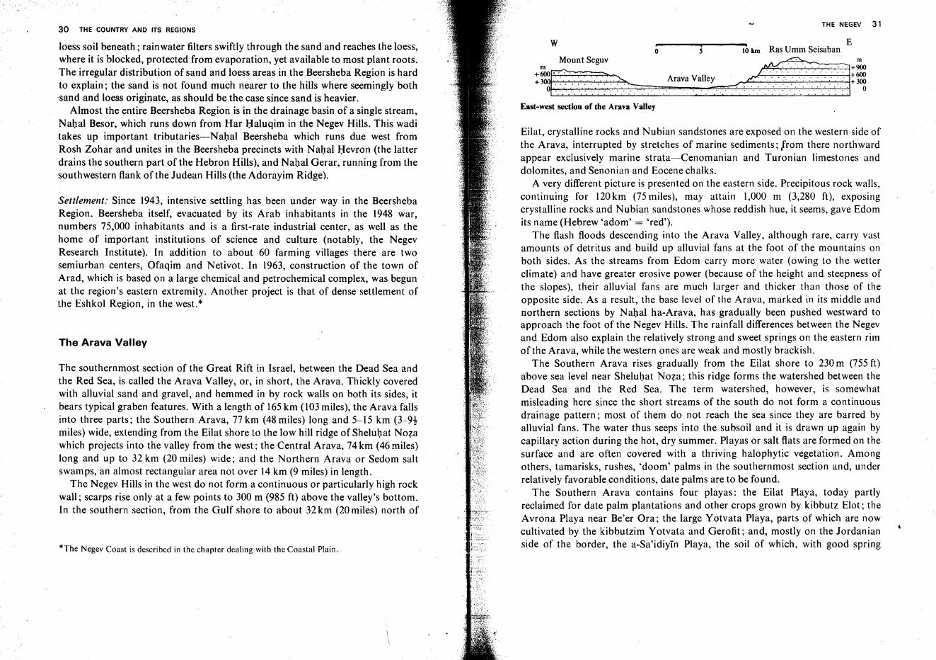
The southernmost section of the Great Rift in Israel, between the Dead Sea andthe Red Sea, is called the Arava Valley, or, in short, the Arava. Thickly coveredwith alluvial sand and gravel, and hemmed in by rock walls on both its sides, itbears typical graben features. With a length of 165km (l03 miles), the Arava fallsinto three parts; the Southern Arava, 77 km (48 miles) long and 5-15 km (3-9!miles) wide, extending from the Eilat shore to the low hill ridge of Sheluhat Nozawhich projects into the valley from the west; the Central Arava, 74km (46 miles)long and up to 32 km (20 miles) wide; and the Northern Arava or Sedom saltswamps, an almost rectangular area not over 14 km (9 miles) in length.
The Negev Hills in the west do not form a continuous or particularly high rockwall; scarps rise only at a few points to 300 m (985 ft) above the valley's bottom.In the southern section, from the Gulf shore to about 32 km (20 miles) north of
*The Negev Coast is described in the chapter dealing with the Coastal Plain.
THE NEGEV 31
Eo 5 10 krn Ras Umm Seisaban
~~"."tS'gu;~> An.. Voll'Y --<.d~2TI1~East-west section of the Arava Valley
Eilat, crystalline rocks and Nubian sandstones are exposed on the western side ofthe Arava, interrupted by stretches of marine sediments; trom there northwardappear exclusively marine strata-Cenomanian and Turonian limestones anddolomites, and Senonian and Eocene chalks.
A very different picture is presented on the eastern side. Precipitous rock walls,continuing for 120km (75 miles), may attain 1,000 m (3,280 ft), exposingcrystalline rocks and Nubian sandstones whose reddish hue, it seems, gave Edomits name (Hebrew 'adorn' = 'red').
The flash floods descending into the Arava Valley, although rare, carry vastamounts of detritus and build up alluvial fans at the foot of the mountains onboth sides. As the streams from Edom carry more water (owing to the wetterclimate) and have greater erosive power (because of the height and steepness ofthe slopes), their alluvial fans are much larger and thicker than those of theopposite side. As a result, the base level of the Arava, marked in its middle andnorthern sections by Nahal ha-Arava, has gradually been pushed westward toapproach the foot of the Negev Hills. The rainfall differences between the Negevand Edom also explain the relatively strong and sweet springs on the eastern rimof the Arava, while the western ones are weak and mostly brackish.
The Southern Arava rises gradually from the Eilat shore to 230 m (755 ft)above sea level near Sheluhat Noza ; this ridge forms the watershed between theDead Sea and the Red Sea. The term watershed, however, is somewhatmisleading here since the short streams of the south do not form a continuousdrainage pattern; most of them do not reach the sea since they are barred byalluvial fans. The water thus seeps into the subsoil and it is drawn up again bycapillary action during the hot, dry summer. Playas or salt flats are formed on thesurface and are often covered with a thriving halophytic vegetation. Amongothers, tamarisks, rushes, 'doom' palms in the southernmost section and, underrelatively favorable conditions, date palms are to be found.
The Southern Arava contains four playas: the Eilat Playa, today partlyreclaimed for date palm plantations and other crops grown by kibbutz Elot ; theAvrona Playa near Be'er Ora; the large Yotvata Playa, parts of which are nowcultivated by the kibbutzim Yotvata and Gerofit ; and, mostly on the Jordanianside of the border, the a-Sa'idiyin Playa, the soil of which, with good spring
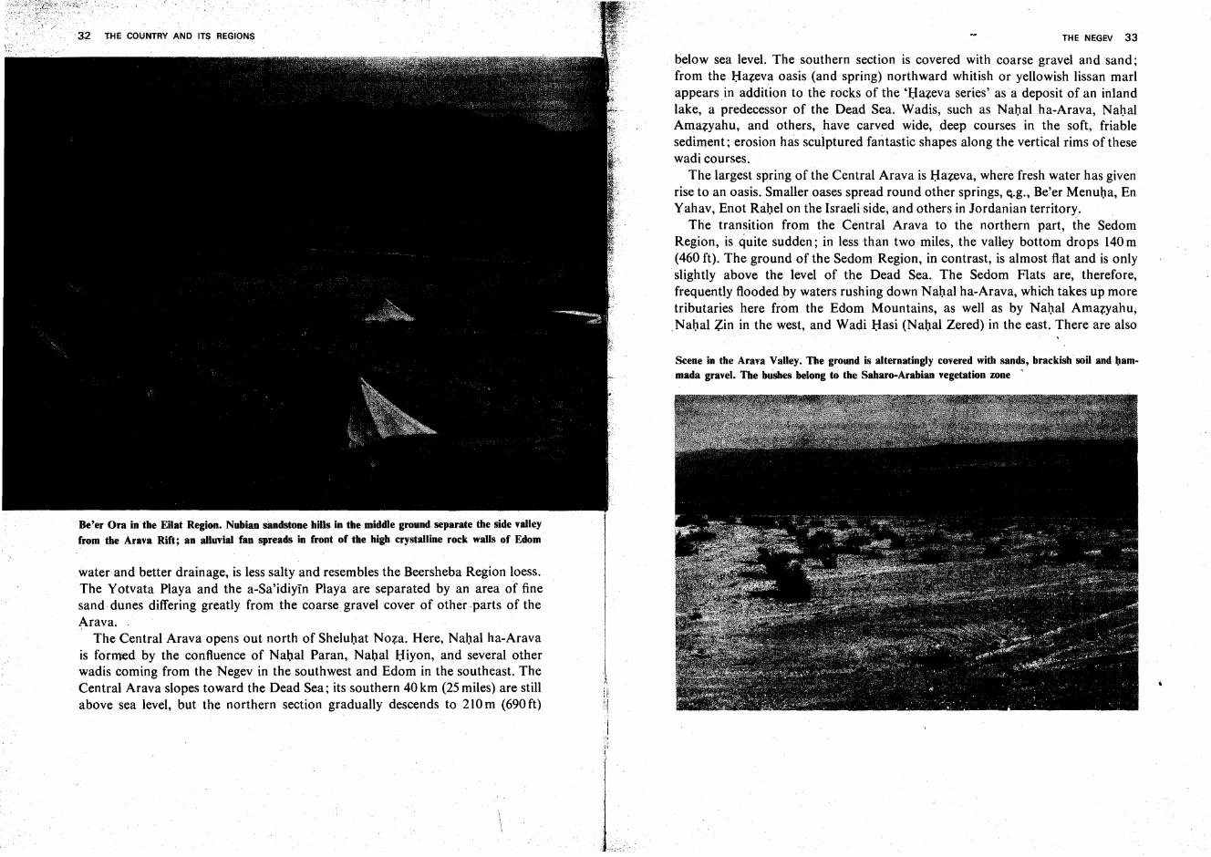
Be'er Ora in the Eilat Region. Nubian sandstone hills in the middle ground separate the side valleyfrom· the Arava Rift; an alluvial fan spreads in front of the high crystalline rock walls of Edom
water and better drainage, is less salty and resembles the Beersheba Region loess.The Yotvata Playa and the a-Sa'idiyin Playa are separated by an area of finesand dunes differing greatly from the coarse gravel cover of other parts of theArava.
The Central Arava opens out north of Sheluhat Noza. Here, Nahal ha-Aravais formed by the confluence of Nahal Paran, Nahal Hiyon, and several otherwadis coming from the Negev in the southwest and Edom in the southeast. TheCentral Arava slopes toward the Dead Sea; its southern 40 km(25 miles) are stillabove sea level, but the northern section gradually descends to 210m (690 ft)
iI
l'r1.
THE NEGEV 33
below sea level. The southern section is covered with coarse gravel and sand ;from the Hazeva oasis (and spring) northward whitish or yellowish lissan marlappears in addition to the rocks of the 'Hazeva series' as a deposit of an inlandlake, a predecessor of the Dead Sea. Wadis, such as Nahal ha-Arava, NahalAmazyahu, and others, have carved wide, deep courses in the soft, friablesediment; erosion has sculptured fantastic shapes along the vertical rims of thesewadi courses.
The largest spring of the Central Arava is Hazeva, where fresh water has givenrise to an oasis. Smalleroases spread round other springs, e.g., Be'er Menuha, EnYahav, Enot Rabel on the Israeli side, and others in Jordanian territory.
The transition from the Central Arava to the northern part, the SedornRegion, is quite sudden; in less than two miles, the valley bottom drops 140m(460 ft). The ground of the Sedom Region, in contrast, is almost flat and is onlyslightly above the level of the Dead Sea. The Sedom Flats are, therefore,frequently flooded by waters rushing down Nahal ha-Arava, which takes up moretributaries here from the Edom Mountains, as well as by Nahal Amazyahu,Nabal Zin in the west, and Wadi HasifNahal Zered) in the east. There are also
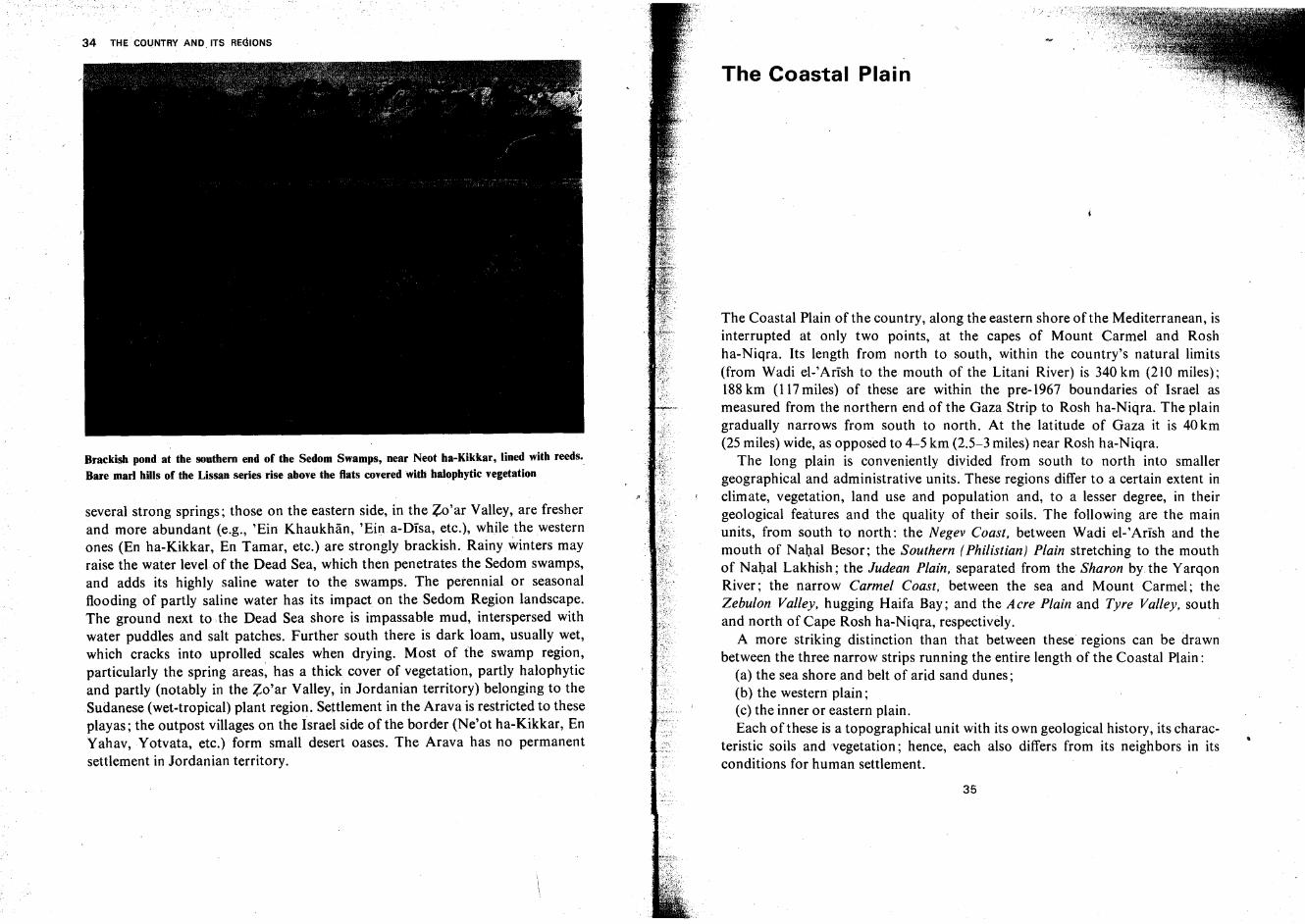
Scene in the Arava Valley. The ground is a1ternatingly covered with sands, brackish soil and lJammada gravel. The bushes belong to the Saharo-Arabian vegetation zone "
34 THE COUNTRY AND. ITS REGIONS
Brackish pond at the southern end of the Sedom Swamps, near Neot ha-Kikkar, lined with reeds,.Bare marl hills of the Lissan series rise above the flats covered with halophytic vegetation
several strong springs; those on the eastern side, in the Zo'ar Valley, are fresherand more abundant (e.g., 'Ein Khaukhan, 'Ein a-Disa, etc.), while the westernones (En ha-Kikkar, En Tamar, etc.) are strongly brackish. Rainy winters mayraise the water level of the Dead Sea, which then penetrates the Sedom swamps,and adds its highly saline water to the swamps. The perennial or seasonalflooding of partly saline water has its impact on the Sedom Region landscape.The ground next to the Dead Sea shore is impassable mud, interspersed withwater puddles and salt patches. Further south there is dark loam, usually wet,which cracks into up rolled scales when drying. Most of the swamp region,particularly the spring areas: has a thick cover of vegetation, partly halophyticand partly (notably in the Zo'ar Valley, in Jordanian territory) belonging to theSudanese (wet-tropical) plant region. Settlement in the Arava is restricted to theseplayas; the outpost villages on the Israel side of the border (Ne'ot ha-Kikkar, EnYahav, Yotvata, etc.) form small desert oases. The Arava has no permanentsettlement in Jordanian territory.
The Coastal Plain
The Coastal Plain of the country, along the eastern shore of the Mediterranean, isinterrupted at only two points, at the capes of Mount Carmel and Roshha-Niqra. Its length from north to south, within the country's natural limits(from Wadi el-Arish to the mouth of the Litani River) is 340 km (210 miles);188km (117 miles) of these are within the pre-1967 boundaries of Israel asmeasured from the northern end of the Gaza Strip to Rosh ha-Niqra. The plaingradually narrows from south to north. At the latitude of Gaza it is 40 km(25 miles) wide, as opposed to 4-5 km (2.5-3 miles) near Rosh ha-Niqra.
The long plain is conveniently divided from south to north into smallergeographical and administrative units. These regions differ to a certain extent inclimate, vegetation, land use and population and, to a lesser degree, in theirgeological features and the quality of their soils. The following are the mainunits, from south to north: the Negev Coast, between Wadi el-'Arish and themouth of Nahal Besor; the Southern (Philistian) Plain stretching to the mouthof Nahal Lakhish; the Judean Plain, separated from the Sharon by.the YarqonRiver; the narrow Carmel Coast, between the sea and Mount Carmel; theZebulon Valley, hugging Haifa Bay; and the Aere Plain and Tyre Valley, southand north of Cape Rosh ha-Niqra, respectively.
A more striking distinction than that between these regions can be drawnbetween the three narrow strips running the entire length of the Coastal Plain:
(a) the sea shore and belt of arid sand dunes;(b) the western plain;(c) the inner or eastern plain.Each of these is a topographical unit with its own geological history, its charac
teristic soils and vegetation; hence, each also differs from its neighbors in itsconditions for human settlement.
35
THE COASTAL PLAIN 37
The Mediterranean shore of the country forms an almost straight line in most ofits sections. Such a coastline, poor in promontories and' deep embayments, isoften found when the shore is parallel to the principal mountain ridges inland. Itis a 'concordant' shore, as compared with a 'discordant' coast line running atright angles to the ridges. A straight coast is often regarded as a sign that the landis in the process of uplifting. On the sea bottom new layers of rock, generallyhorizontal, gradually build up; these bear no relationship to the profile prevailing \before the invasion of the sea. The sea's regression, thus, leaves an almost flatsurface, and the new, 'regressional' shore forms an almost straight line.
The uplift of the land and the sea's regression continued in our region, withtemporary interruptions, through most of the Tertiary and Quaternary periods.Geologists are, however, not sure whether this uplift movement is still inprogress. On the other hand, a slight, steady rise in sea level is noticeable on theLevant Coast, as on most other sea and ocean shores of the world. This isascribed to the gradual warming up of the world climate since the end of the lastice age. This warming causes more and more continental glaciers to melt and tothus increase the volume of the oceans. In Israel this new cycle of transgression isnot yet strongly pronounced and is recognizable only at certain spots in thenorthern part of the coast.
Those few headlands and indentations still existing are slowly disappearing.The headlands are ceaselessly attacked and eroded by strong waves and breakers;the sand and gravel resulting from the destruction of the promontories aredeposited, together with silt, sand, and pebbles brought down by rivers andstreams, in the quiet water of the bays. On the Israel coast this process ofsedimentation is aided by the Mediterranean Longshore Current, which flowscounterclockwise from Gibraltar eastward along North Africa, then northwardalong the Levant Coast and.finally, back to the west, skirting Southern Europe.This current carries vast amounts of sand which fill up theembayments along ourcoast and aid in a further straightening of the shore line.
Different opinions are held regarding the origin of these sands. Most regardthe Nile River as their principal source; during the pluvial periods of thesubtropical areas (parallel to the ice ages of North America and Europe), the Nilebrought down to the sea not only fine alluvium as in our days, but also coarsesand from the Abyssinian highlands; the hardest components, quartz sands, weretransported through the sea and cast up on the Palestinian shore. Others hold'that the sand was carried by Wadi el-'Artsh from the lofty mountains in the southof the Sinai Peninsula. Atall events, the quantity of sand on the coast decreases,proceeding from south to north.The siliceous sands south of Dor (onthe Carmel
The Shore
J U DE A
f\ .j ~'-"':
I ' :, .I '
.~.~.~._.,..... i" ''-'-'-
1'0 20 miles
10 20 30 kmI ,
SAMARIA
ooI
-- Border of regions
--- Border between subregions
_._.- Border. armistice-lines
existing since 1949
..... Border. urmist ice lines
before June, 1%7
.
Etadera. NORTIIL~~,'"... "
"'....I.lHTR VALl.!'''?: .
NC.'I.an;.t ~ .. -"<"-'. ~'.
'" ...-:: SOL 'TlILRN '
JUbEAN COAST
<""....
<-""'l;'
'l;'
.:..:.'s;.....
Q.;.;,..
~
#0.~.
_Gaw •.. '
..,~-::. .:
~~\""\~~.: , .
NEGEV COAST--"~,,
36 . THE COUNTRY AND ITS REGIONS
Subregions of the Coastal Plain
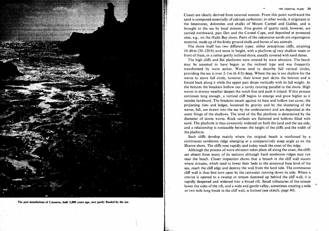
The port installations of Caesarea, built 2,000 years ago, now partly flooded by the sea
THE COASTAL PLAIN 39
Coast) are clearly derived from external sources. From this point northward thesand is composed essentially of calcium carbonate; in other words, it originates inthe limestones, dolomites and chalks of Mount Carmel and Galilee, and isbrought to the sea by local streams. Fine grains of quartz sand, however, arecarried northward, past Dor and the Carmel Cape; and deposited at protectedsites, e.g., on the Haifa Bay shore. Parts of the calcareous sands are organogenicmaterial, made up of the finely ground shells and bones of sea animals.
The shore itself has two different types: either precipitous cliffs, attaining1O-40m (30-120ft) and more in height, with a platform of very shallow water infront of them, or a rather gently inclined shore, usually covered with sand dunes.
The high cliffs and flat platforms were created by wave abrasion. The beachmay be assumed to have begun as the inclined type and was frequentlytransformed by wave action. Waves tend to describe full vertical circles,providing the sea is over 2-3 m (6-8 ft) deep. Where the sea is too shallow for thewaves to move full circle, however, their lower part skirts the bottom and isforced back along it while the upper part drops vertically with its full weight. Atthe bottom the breakers hollow out a cavity running parallel to the shore. Highwaves in stormy weather deepen the notch line and push it inland. If this processcontinues long enough, a vertical cliff begins to emerge and grow higher as itrecedes landward. The breakers smash against its base and hollow out caves; theprojecting rims and ledges, loosened by gravity and by the shattering of thewaves, fall, are drawn into the sea by the undercurrent and are deposited at theouter fringe of the shallows. The level of the flat platform is determined by thediameter of storm waves. Rock surfaces are flattened and hollows filled withsand. The platform is thus constantly widened on both the land and the sea side,and a relationship is noticeable between the height of the cliffs and the width ofthe platform.
Such cliffs develop mainly where the original beach is reinforced by acontinuous sandstone ridge emerging at a comparatively steep angle as on theSharon shore. The cliffs rose rapidly and today reach the crest of the ridge.
Although the process of wave abrasion takes place all along the coast, the cliffsare absent from many of its sections although hard sandstone ridges may runnear the beach. Closer inspection shows that a breach in the cliff wall occurswhere streams, which tend to lower their beds to the erosional base level of thesea, reach the cliff edge and destroy the wall from the land side. The continuouscliff wall is thus first torn open by the rainwater running down its side. Where acrevice is opened to a swamp or stream dammed up behind the cliff wall, it israpidly deepened and widened into a broad rift. Small tributaries of the streamlower the sides of the rift, and a wide and gentle valley, sometimes creating a mileor two mile long break in the cliff wall, is formed (see sketch, page 40).
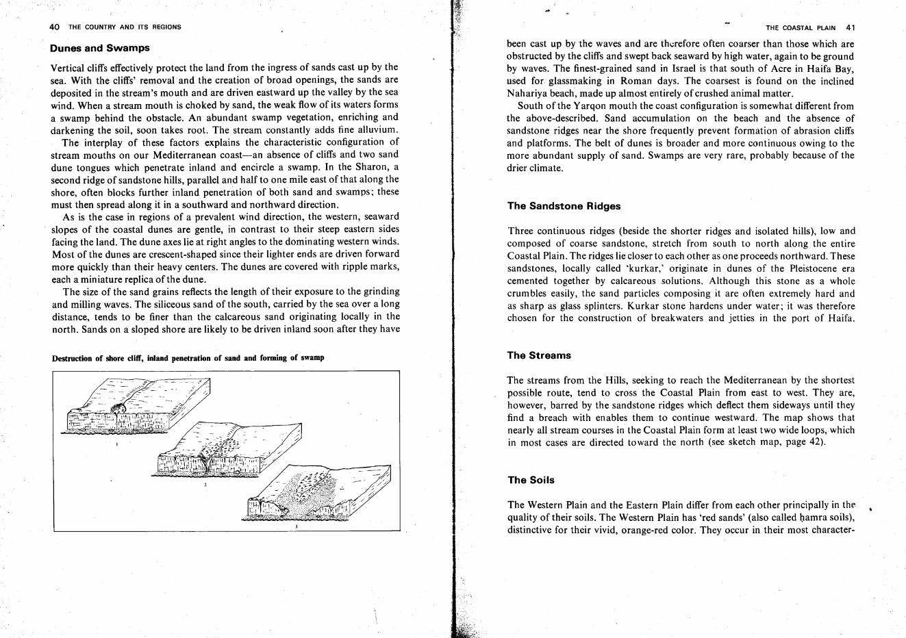
40 THE COUNTRY AND ITS REGIONS
Dunes and Swamps
Vertical cliffs effectively protect the land from the ingress of sands cast up by thesea. With the cliffs' removal and the creation of broad openings, the sands aredeposited in the stream's mouth and are driven eastward up the valley by the seawind. When a stream mouth is choked by sand, the weak flow of its waters formsa swamp behind the obstacle. An abundant swamp vegetation, enriching anddarkening the soil, soon takes root. The stream constantly adds fine alluvium.
The interplay of these factors explains the characteristic configuration ofstream mouths on our Mediterranean coast-an absence of cliffs and two sanddune tongues which penetrate inland and encircle a swamp. In the Sharon, asecond ridge of sandstone hills, parallel and half to one mile east of that along theshore, often blocks further inland penetration of both sand and swamps; thesemust then spread along it in a southward and northward direction.
As is the case in regions of a prevalent wind direction, the western, seawardslopes of the coastal dunes are gentle, in contrast to their steep eastern sidesfacing the land. The dune axes lie at right angles to the dominating western winds.Most of the dunes are crescent-shaped since their lighter ends are driven forwardmore quickly than their heavy centers. The dunes are covered with ripple marks,each a miniature replica of the dune.
The size of the sand grains reflects the length of their exposure to the grindingand milling waves. The siliceous sand of the south, carried by the sea over a longdistance, tends to be finer than the calcareous sand originating locally in thenorth. Sands on a sloped shore are likely to be driven inland soon after they have
Destruction of shore cliff, inland penetration of sand and forming of swamp
...THE COASTAL PLAIN 41
been cast up by the waves and are therefore often coarser than those which areobstructed by the cliffs and swept back seaward by high water, again to be groundby waves. The finest-grained sand in Israel is that south of Acre in Haifa Bay,used for glassmaking in Roman days. The coarsest is found on the inclinedNahariya beach, made up almost entirely of crushed animal matter.
South of the Yarqon mouth the coast configuration is somewhat different fromthe above-described. Sand accumulation on the beach and the absence ofsandstone ridges near the shore frequently prevent formation of abrasion cliffsand platforms. The belt of dunes is broader and more continuous owing to themore abundant supply of sand. Swamps are very rare, probably because of thedrier climate.
The Sandstone Ridges
Three continuous ridges (beside the shorter ridges and isolated hills), low andcomposed of coarse sandstone, stretch from south to north along the entireCoastal Plain. The ridges lie closer to each other as one proceeds northward. Thesesandstones, locally called 'kurkar,' originate in dunes of the Pleistocene eracemented together by calcareous solutions. Although this stone as a wholecrum bles easily, the sand particles composing it are often extremely hard andas sharp as glass splinters. Kurkar stone hardens under water; it was thereforechosen for the construction of breakwaters and jetties in the port of Haifa.
The Streams
The streams from the Hills, seeking to reach the Mediterranean by the shortestpossible route, tend to cross the Coastal Plain from east to west. They are,however, barred by the sandstone ridges which deflect them sideways until theyfind a breach with enables them to continue westward. The map shows thatnearly all stream courses in the Coastal Plain form at least two wide loops, whichin most cases are directed toward the north (see sketch map, page 42).
The Soils
The Western Plain and the Eastern Plain differ from each other principally in thequality of their soils. The Western Plain has 'red sands' (also called hamra soils),distinctive for their vivid, orange-red color. They occur in their most character-
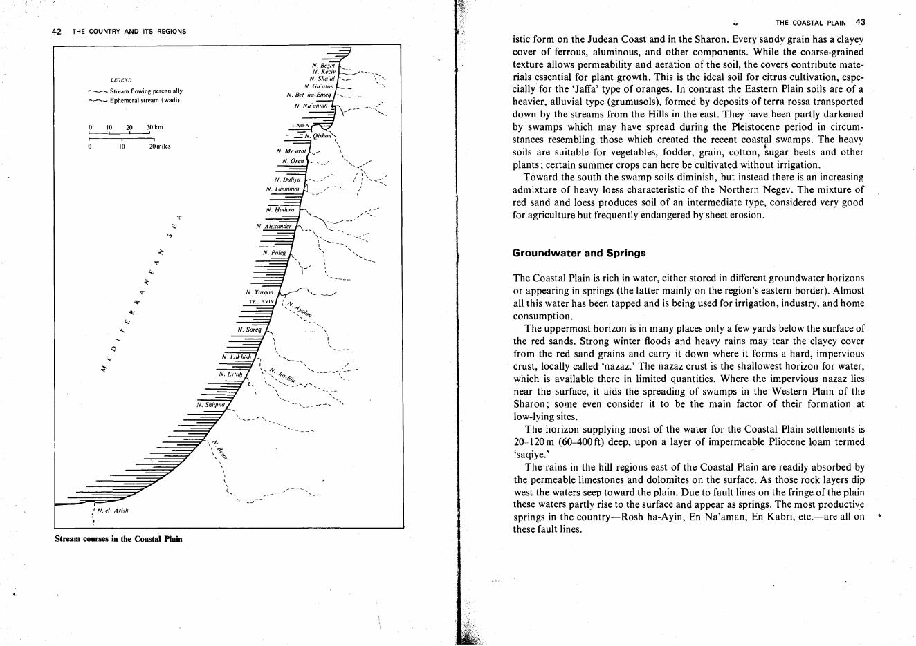
THE COASTAL PLAIN 43
The Coastal Plain is rich in water, either stored in different groundwater horizonsor appearing in springs (the latter mainly on the region's eastern border). Almostall this water has been tapped and is being used for irrigation, industry, and homeconsumption.
The uppermost horizon is in many places only a few yards below the surface ofthe red sands. Strong winter floods and heavy rains may tear the clayey coverfrom the red sand grains and carry it down where it forms a hard, imperviouscrust, locally called 'nazaz.' The nazaz crust is the shallowest horizon for water,which is available there in limited quantities. Where the impervious nazaz liesnear the surface, it aids the spreading of swamps in the Western Plain of theSharon; some even consider it to be the main factor of their formation atlow-lying sites.
The horizon supplying most of the water for the Coastal Plain settlements is20-120m (60-400ft) deep, upon a layer of impermeable Pliocene loam termed'saqiye.'
The rains in the hill regions east of the Coastal Plain are readily absorbed bythe permeable limestones and dolomites on the surface. As those rock layers dipwest the waters seep toward the plain. Due to fault lines on the fringe of the plainthese waters partly rise to the surface and appear as springs. The most productivesprings in the country-Rosh ha-Ayin, En Na'aman, En Kabri, etc.-are all onthese fault lines.
Groundwater and Springs
istic form on the Judean Coast and in the Sharon. Every sandy grain has a clayeycover of ferrous, aluminous, and other components. While the coarse-grainedtexture allows permeability and aeration of the soil, the covers contribute materials essential for plant growth. This is the ideal soil for citrus cultivation, especially for the 'Jaffa' type of oranges. In contrast the Eastern Plain soils are of aheavier, alluvial type (grumusols), formed by deposits of terra rossa transporteddown by the streams from the Hills in the east. They have been partly darkenedby swamps which may have spread during the Pleistocene period in circumstances resembling those which created the recent coastal swamps. The heavy
j
soils are suitable for vegetables, fodder, grain, cotton, sugar beets and otherplants; certain summer crops can here be cultivated without irrigation.
Toward the south the swamp soils diminish, but instead there is an increasingadmixture of heavy loess characteristic of the Northern Negev. The mixture ofred sand and loess produces soil of an intermediate type, considered very goodfor agriculture but frequently endangered by sheet erosion.
-.. -::.....
---
,\\
" .........-"'"I'
" 1\I " '--::.:",,,
,,I,,
'--
\\\\
"""
N. Sor~q
-, ,.... _--- ..........
N. Shiqmu
----,I v rz".~\ '7}., g..,,
\I
\,(
I
" N. <,1- /I rish,J,
o 10 20 30kmL--' ! I
o 10 20miles
l,EGENI>
--- Stream flowing perennially
---- Ephemeral stream (wadi)
Stream courses in the Coastal Plain
42 THE COUNTRY AND ITS REGIONS
44 THE COUNTRY AND ITS REGIONS
General Cross Section of the Coastal Plain
The following generalized west-east cross section may serve as a summation ofthe Coastal Plain: The seashore lies in the west, including an intermittent belt ofmoving sand dunes. These are broad in the south, narrow in the center, andnonexistent in the north. The westernmost kurkar ridges are either concealed bythe sands, emerge ashigh cliffs or, further north, appear as small headlands, reefsor islets. Beyond these is the central sandstone chain, also lower in the south thanin the Sharon, but in general definitely limiting the eastward spread of sanddunes. Further inland the Western Plain is covered mostly by red sands. Theeastern kurkar ridges separate it from the Eastern Plain, which stretches up to thehill slopes and which, mainly in the Sharon and the Zebulon Valley, has dark,heavy and fertile soils.
The Negev Coast
The greater part of this region remained, until 1967, outside the borders of Israel,being included in the Sinai Peninsula and GazaStrip.*
A wide belt of loose sands is found along the shore; it also covers most of thekurkar ridges on its eastern limits. In sections of the Negev Coastal Plain twoparallel chains of low sandstone hills are recognizable, with a fertile area up totwo miles wide in between. Some of the ridge crests served as ancient city sites,while others still retain their strategic importance. Loess soil.frequently coveredwith a thin layer of sand, is found in the inner part of the region. Thisconfiguration is conducive to agriculture: the upper sand facilitates readyabsorption of the rainwater and minimum loss through evaporation, and theimpermeable loess below enables most plant roots to reach the water.
Due to this absorbent sand cover, thesubsoil is often richer in water thanmight be expected from the annual precipitation averages. Wells become morefrequent near the shore, appearing at shallower depths with less saline water.These waters irrigate orange groves, fruit orchards, and vegetable gardens in theGaza area as well as extensive date palm plantations at Deir al-Balah (the Arabicname means 'Date Palm Convent').
The region also has a heavy dewfall, an additional blessing to agriculture.Experts ascribe to the dew the outstanding success of watermelons, obtaineddespite the low rainfall (150-350 mm-6-14 in-per annum).
* The Sinai Coast is described in detail on pp. 131-132. Population and settlements of the GazaStrip are dealt with on pp. 388-397.
THE COASTAL PLAIN 45
There is only one stream in the entire region, Nahal Besor, flowing down fromthe Negev Hills and sometimes carrying strong, dangerous floods; The sandspread over the region apparently causes the rainwater to seep into the groundquickly, and thus obviates the need for an extensive network of surface runoff..
Nahal Besor, with its wide catchment area and devastating winter floods, hascreated a very large bed 100-150 meters wide, not only in the Beersheba Region(see pp. 28-29), but also in the region of the Negev Coast. In the streambed gullying has created a spectacular 'badland' topography; parts of the bed have beenproclaimed a nature reserve. In the lower section of Nahal, Besor, near the GazaStrip border, construction of a large reservoir is planned to cover an area ofabout 4,000 acres. It is hoped that a considerable part of the floodwater(estimated at 20-30 million m' annuallyjwill thus become available for farming.
Outside the Gaza Strip which in the Six Day War came under Israeladministration, exist the development town Netivot and over 20 kibbutzim andsmallholders' villages; the population is expected to increase further with theprogress of the Eshkol region al settlement project. .
The Philistian Plain
In several respects the Philistian Plain presents a transition zone. The slopedbeach found on the Negev shore continues while the first cliffs begin to appear.The soil changes gradually from loess sands or sandy loess to the terra rossa andred sands of the Center and the North. The dune belt, although still broad andalmost continuous, is no longer the dominant feature of the landscape.
The streams crossing the region carry water only after strong winter rains.Nahal Shiqma, which runs through broad dunes, has been chosen for animportant pilot project: the floodwaters are directed to the sand flats to seepunderground quickly. Protected from evaporation losses, they are stored andmay be pumped for irrigation in summer. Nahal Lakhishis the largest stream andwith its tributary, Nahal ha-Ela, is among the most important in the -entireCoastal Plain. At the mouth of Nahal Lakhish the port of Ash dod has been built.
Good farmland, suitable in the western part for citrus (groves have quicklyexpanded here in recent years) and in the eastern part for field and garden crops,and a mild climate with annual precipitation averaging 350-500 mm (14-20 in)make the South one of the most important economic regions of Israel, with arapidly increasing population. In addition, it is rich in groundwater. The porousCenomanian rock layers, fed by the rain falling in the Hebron Hills, form a widesubterranean anticline in this region which can be tapped with relative ease in theGevar'am-Nir Am wells. Lower strata of this anticlinorium (of the Lower
46 THE COUNTRY AND ITS REGIONS
Cretaceous) hold the oil of the Helez, Beror and Kokhav fields. At presentadditional water is brought to the South from the Rosh ha-Ayin springs by thenational irrigation network, and more has become available with the completionofthe National Water Carrier.
The region forms a network of rural and urban agglomerations. The West hasthe coastal cities of Ashqelon and Ashdod as well as semiurban centers-Sederot(on the Negev border) and Qiryat Mal'akhi-and many villages. The easternpart, the Lakhish Region, is the first in the country to have been settled in theframework of comprehensive regional planning (see p. 305); Qiryat Gat serves asits urban center.
The Judean Coast
In this region three bands of soil are clearly distinguishable: drifting dunes in thewest, red sand in the center, and heavier terra rossa in the east and northeast withsmall stretches of dark swamp soil near the banks of Nahal Ayalon.
South and north of Nahal Soreq's mouth the dunes widen to nearly five miles.As late as 2,000 years ago the dunes covered a smaller area; while excavatingfoundations for new buildings in the town of Holen, vestiges of Romanstructures standing on fertile soil overlain with arid sand over 3-5 ft thick, werediscovered. The moving dunes endanger the fields and gardens at their edge. AtRishon le-Zion they are checked by high eucalyptus and sycamore trees whosetrunks are almost buried in the sand.
Citrus groves cover a large part of the region's middle section. These orchards,mainly on the red sands of the area, can be irrigated with groundwater. Theabundant Rosh ha-Ayin springs at the northeastern margin of the region yieldup to 14,000m 3 per hour. A subterranean fault running diagonally through theregion in the southeast-northwest direction is assumed to have created the hill ofJaffa; slightly jutting into the sea, the hill constitutes the only break in anotherwise entirely straight coast. The fault also apparently adds to the groundwater reserves ofthe area.
The streams crossing the region are Nahal Soreq and Nahal Ayalon, the lattera tributary of the Yarqon. Both display the two wide northward bendscharacteristic of most streams in the Coastal Plain. Nahal Soreq becomes astream only in the last few miles of its course; the same is true, to a certain extent,of Nahal Ayalon, where at least isolated puddles of water remain in the drysummer. In contrast to these, the Yarqon, reaching the sea in the northern part ofthe Tel Aviv municipal area, is fed by the Rosh ha-Ayin springs; it had a strongand constant perennial flow until most of the spring water was diverted
THE COASTAL PLAIN 47
southward as part of the national water planning program. The lower section ofits bed has been mostly filled since then with sea water or with sewage from theadjacent industrial and residential areas. The absence of wide bends in its coursemay be ascribed to the powerful flow which overcame rather than avoided theobstacles rising in the river's course. The Yarqon, until very recently, seasonallyflooded areas on both banks, thus creating the Petah Tiqwa swamps; these havenow been entirely drained by Jewish settlers.
Occupied in its central and northern part by the Tel Aviv-Jaffa 'conurbation'(see p. 336ff.), the Judean Coast is today, with approx. I million inhabitants, themost densely populated region in Israel.
The Sharon
The Sharon measures 54 km (34 miles) from south to north and is about 16km(10 miles) wide from west to east. A number of phenomena mark the transitionfrom the Judean Plain to the Sharon. The cliff wall on the shore grows higher andbecomes nearly continuous while the dune belt narrows and is interrupted overlong stretches.. The sandstone ridges become prominent features and form cleardivides between the three lengthwise strips of the region. A narrow dune zone liesbetween the shore and the central ridge. The next ridge defines the western limitof the red sands while the easternmost kurkar chain, although concealed by red
. sands, separates these from the darker, heavier soils of the east.The Sharon streams have a perennial water flow in their lowermost parts; until
drained by settlers during the last sixty years, swamps existed in their neighborhood.
The streams of the Sharon, from south to north, are: Poleg, Alexander,Hadera, Ada and Tanninim. The smallest of them, Nahal Poleg, follows analmost straight course and is assumed to be a drainage channel dug by theRomans rather than a genuine stream. A breach hewn in the kurkar ridge nearthe former swamps has, however, been identified as the moat of an Iron Agefortress. Nahal Alexander flows in the Eastern Sharon, crosses its center (theHefer Valley) and reaches the sea accompanied by a band of dunes, mainly on itsnorthern side. The wide lowest part of its course contains salt water which seepsin from the sea. Nahal Hadera, receiving many tributaries from the SamarianHills, flows northwest to the town of Hadera, then turns west to the sea. NahalAda leaves the Menashe Plateau to unite with Nahal Tanninim (meaning'Crocodile stream'-these animals were reportedly there in the recent past); itcircles the southern 'nose' of Mount Carmel, then divides and reaches the sea intwo arms which are three miles apart.
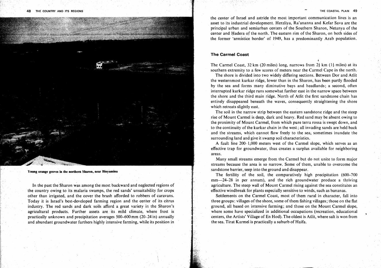
48 THE COUNTRY AND ITS REGIONS
Young orange groves in the northern Sharon, near Binyamina
In the past the Sharon was among the most backward and neglected regions ofthe country owing to its malaria swamps, the red sands' unsuitability for cropsother than irrigated, and the cover the brush afforded to robbers of caravans.Today it is Israel's best-developed farming region and the center of its citrusindustry. The red sands and dark soils afford a great variety in the Sharon'sagricultural products. Further assets are ... its mild climate, where frost ispractically unknown and precipitation averages 500-600 mm (20-24 in) annuallyand abundant groundwater furthers highly intensive farming, while its position in
THE COASTAL PLAIN 49
the center of Israel and astride the most important communication lines is anasset to its industrial development. Herzliya, Ra'ananna and Kefar Sava are theprincipal urban and semiurban centers of the Southern Sharon, Netanya of thecenter and Hadera of the north. The eastern rim of the Sharon, on both sides ofthe former <armistice border' of 1949, has a predominantly Arab population.
The Carmel Coast
The Carmel Coast, 32 km (20 miles) long, narrows from 2! km (a miles) at itssouthern extremity to a few scores of meters near the Carmel Cape in the north;
The shore is divided into two widely differing sections. Between Dor and Atlitthe westernmost kurkar ridge, lower than in the Sharon, has been partly floodedby the sea and forms many diminutive bays and headlands; a second, ofteninterrupted kurkar ridge runs somewhat further east in the narrow space betweenthe shore and the third main ridge. North of Atlit the first sandstone chain hasentirely disappeared beneath the waves, consequently straightening the shorewhich retreats slightly east.
The soil in the narrow strip between the eastern sandstone ridge and the steeprise of Mount Carmel is deep, dark and heavy. Red sand may be absent owing tothe proximity of Mount Carmel, from which pure terra rossa is swept down, andto the continuity of the kurkar chain in the west; all invading sands are held backand the streams, which cannot flow freely to the sea; sometimes inundate thesurrounding land and-give it swamp soil characteristics.
A fault line 200-1,000 meters west of the Carmel slope, which serves as aneffective trap for groundwater, thus creates a surplus available for neighboringareas.
Many small streams emerge from the Carmel but do not unite to form majorstreams because the area is so narrow. Some of them, unable to overcome thesandstone barrier, seep into the ground and disappear.
The fertility of the soil, the comparatively high precipitation (600-700mm-24-28 in per annum), and the rich groundwater produce a thrivingagriculture. The steep wall of Mount Carmel rising against the sea constitutes aneffective windbreak for plants especially sensitive to winds, such as bananas.
Settlements on the Carmel Coast, most of them rural in character, fall intothree groups: villages of the shore, some of them fishing villages; those on the flatground, all based on intensive farming; and those on the Mount Carmel slope,where some have specialized in additional occupations (recreation, educationalcenters, the Artists' Village of En Hod). The oldest is Atlit, where salt is won fromthe sea. Tirat Karmel is practically a suburb of Haifa.
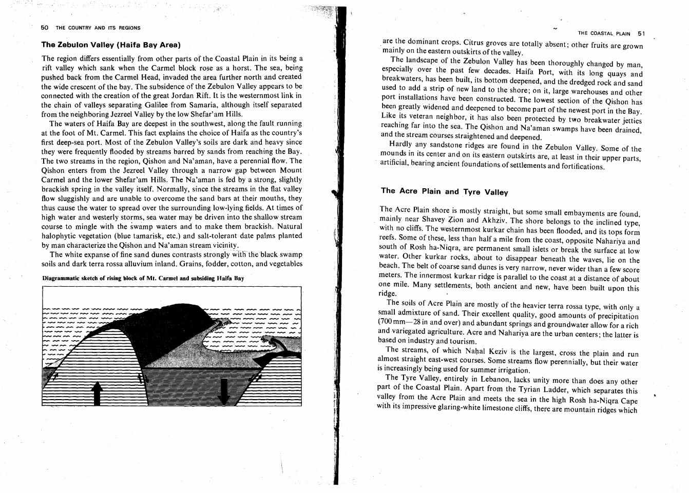
50 THE COUNTRY AND ITS REGIONS
The Zebulon Valley (Haifa Bay Area)
The region differs essentially from other parts of the Coastal Plain in its bein~ arift valley which sank when the Carmel block rose as a horst. The sea, beingpushed back from the Carmel Head, invaded the area further north and createdthe wide crescent of the bay. The subsidence of the Zebulon Valley appears to beconnected with the creation of the great Jordan Rift. It is the westernmost link inthe chain of valleys separating Galilee from Samaria, although itself separatedfrom the neighboring Jezreel Valley by the low Shefar'am Hills.
The waters of Haifa Bay are deepest in the southwest, along the fault runningat the foot of Mt. Carmel. This fact explains the choice of Haifa as the country'sfirst deep-sea port. Most of the Zebulon Valley's soils are dark and heavy sincethey were frequently flooded by streams barred by sands from reaching the Bay.The two streams in the region, Qishon and Na'aman, have a perennial flow. TheQishon enters from the Jezreel Valley through a narrow gap between MountCarmel and the lower Shefar'am Hills. The Na'aman is fed by a strong, slightlybrackish spring in the valley itself. Normally, since the streams in the flat valleyflow sluggishly and are unable to overcome the sand bars at their mouths, theythus cause the water to spread over the surrounding low-lying fields. At times ofhigh water and westerly storms, sea water may be driven into the shallow streamcourse to mingle with the swamp waters and to make them brackish. Naturalhalophytic vegetation (blue tamarisk, etc.) and salt-tolerant date palms plantedby man characterize the Qishon and Na'aman stream vicinity-"_
The white expanse of fine sand dunes contrasts strongly with-the black swampsoils and dark terra rossa alluvium inland. Grains, fodder, cotton, and vegetables
Qiagrammatic sketch of rising block of Mt. Carmel and subsiding Haifa Bay
THE COASTAL. PLAIN 51
.are the dominant crops. Citrus groves are totally absent; other fruits are grownmainly on the eastern outskirts ofthe valley.
The landscape of the Zebulon Valley has been thoroughly changed by man,especially over the past few decades. Haifa Port, with its long quays andbreakwaters, has been built, its bottom deepened, and the dredged rock and sandused to add a strip of new land to the shore; on it, large warehouses and otherport installations have been constructed. The lowest section of the Qishon hasbeen greatly widened and deepened to become part of the newest port in the Bay.Like its veteran neighbor, it has also been protected by two breakwater jettiesreaching far into the sea. The Qishon and Na'aman swamps have been drained,and the stream courses straightened and deepened.
Hardly any sandstone ridges are found in the Zebulon Valley. Some of themounds in its center and on its eastern outskirts are, at least in their upper parts,
. artificial, bearing ancient foundations of settlements and fortifications.
The Acre Plain and Tyre Valley
The Acre Plain shore is mostly straight, but some small embayments are found,mainly near Shavey Zion and Akhziv. The shore belongs to the inclined type,with no cliffs. The westernmost kurkar chain has been flooded, and its tops formreefs. Some of these, less than half a mile from the coast, opposite Nahariya andsouth of Rosh ha-Niqra, are permanent small islets or break the surface at lowwater. Other kurkar rocks, about to disappear beneath the waves, lie on thebeach. The belt of coarse sand dunes is very narrow, never wider than a few scoremeters. The innermost kurkar ridge is parallel to the coast .at a distance of aboutone mile. Many settlements, both ancient and new, have been built upon thisridge.
The soils of Acre Plain are mostly of the heavier terra rossa type, with only asmall admixture of sand. Their excellent quality, good amounts of precipitation(700mm-28 in and over) and abundant springs and groundwater allow for a richand variegated agriculture. Acre and Nahariya are the urban centers; the latter isbased on industry and tourism.
The streams, of which Nahal Keziv is the largest, cross the plain and runalmost straight east-west courses. Some streams flow perennially, but their wateris increasingly being used for summer irrigation.
The Tyre Valley, entirely in Lebanon, lacks unity more than does any otherpart of the Coastal Plain. Apart from the Tyrian Ladder, which separates thisvalley from the Acre Plain and meets the sea in the high Rosh ha-Niqra Capewith its impressive glaring-white limestone cliffs, there are mountain ridges which
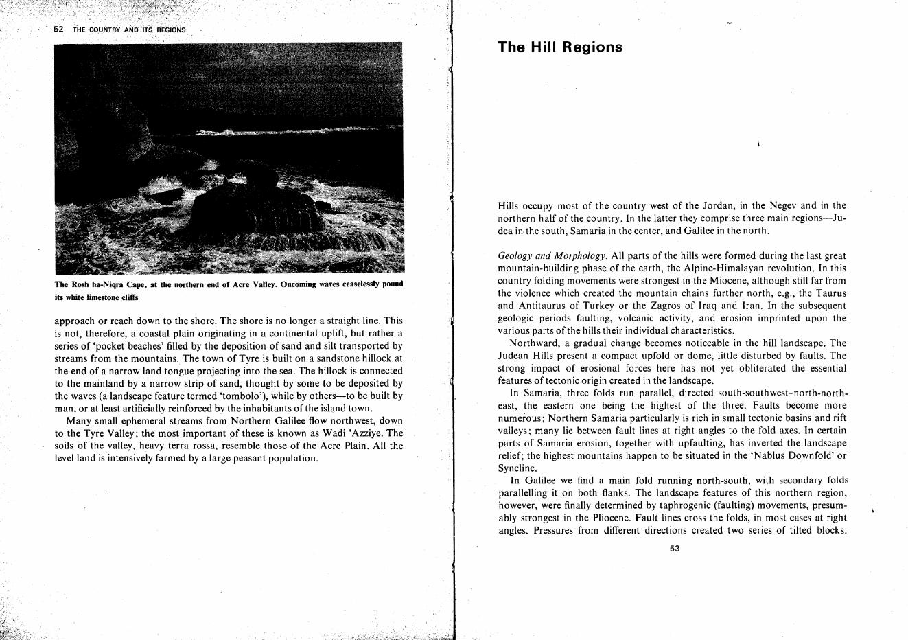
The Rosh ha-Niqra Cape, at the northern end of Acre Valley. Oncoming waves ceaselessly pound
its white limestone cliffs
approach or reach down to the shore. The shore is no longer a straight line. Thisis not, therefore, a coastal plain originating in a continental uplift, but rather aseries of 'pocket beaches' filled by the deposition of sand and silt transported bystreams from the mountains. The town of Tyre is built on a sandstone hillock atthe end of a narrow land tongue projecting into the sea. The hillock is connectedto the mainland by a narrow strip of sand, thought by some to be deposited bythe waves (a landscape feature termed 'tombolo'), while by others-to be built byman, or at least artificially reinforced by the inhabitants of the island town.
Many small ephemeral streams from Northern Galilee flow northwest, downto the Tyre Valley; the most important of these is known as Wadi 'Azziye. Thesoils of the valley, heavy terra rossa, resemble those of the Acre Plain. All thelevelland is intensively farmed by a large peasant population.
,]
The Hill Regions
Hills occupy most of the country west of the Jordan, in the Negev and in thenorthern half of the country. In the latter they comprise three main regions-Judea in the south, Samaria in the center, and Galilee in the north.
Geology and Morphology. All parts of the hills were formed during the last greatmountain-building phase of the earth, the Alpine-Himalayan revolution. In thiscountry folding movements were strongest in the Miocene, although still far fromthe violence which created the mountain chains further north, e.g., the Taurusand Antitaurus of Turkey or the Zagros of Iraq and Iran. In the subsequentgeologic periods faulting, volcanic activity, and erosion imprinted upon thevarious parts of the hills their individual characteristics.
Northward, a gradual change becomes noticeable in the hill landscape. TheJudean Hills present a compact upfold or dome, little disturbed by faults. Thestrong impact of erosional forces here has not yet obliterated the essentialfeatures of tecton ic origin created in the landscape.
In Samaria, three folds run parallel, directed south-southwest-north-northeast, the eastern one being the highest of the three. Faults become morenumerous; Northern Samaria particularly is rich in small tectonic basins and riftvalleys; many lie between fault lines at right angles to the fold axes. In certainparts of Samaria erosion, together with upfaulting, has inverted the landscaperelief; the highest mountains happen to be situated in the 'Nablus Downfold' orSyncline.
In Galilee we find a main fold running north-south, with secondary foldsparallelling it on both flanks. The landscape features of this northern region,however, were finally determined by taphrogenic (faulting) movements, presumably strongest in the Pliocene. Fault lines cross the folds, in most cases at rightangles. Pressures from different directions created two series of tilted blocks.
53
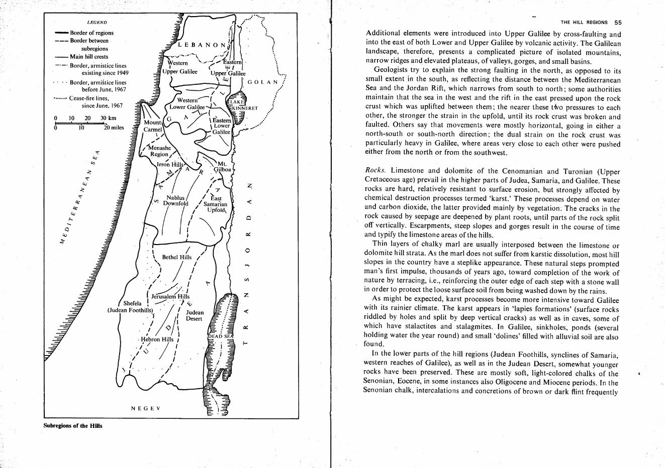
THE HILL REGIONS 55
Additional elements were introduced into Upper Galilee by cross-faulting andinto the east of both Lower and Upper Galilee by volcanic activity. The Galileanlandscape, therefore, presents a complicated picture of isolated mountains,narrow ridges and elevated plateaus, of valleys, gorges, and small basins,
Geologists try to explain the strong faulting in the north, as opposed to itssmall extent in the south, as reflecting the distance between the MediterraneanSea and the Jordan Rift, which narrows from south to north; some authoritiesmaintain that the sea in the west and the rift in the east pressed upon the rockcrust which was uplifted between them; the nearer these two pressures to eachother, the stronger the strain in the upfold, until its rock crust was broken andfaulted. Others say that movements were mostly horizontal, going in either anorth-south or south-north direction; the dual strain on the rock crust wasparticularly heavy in Galilee, where areas very close to each other were pushedeither from the north or from the southwest.
Rocks. Limestone and dolomite of the Cenomanian and Turonian (UpperCretaceous age) prevail in the higher parts of Judea, Samaria, and Galilee. Theserocks are hard, relatively resistant to surface erosion, but strongly affected bychemical destruction processes termed 'karst.' These processes depend on waterand carbon dioxide, the latter provided mainly by vegetation: The cracks in therock caused by seepage are deepened by plant roots, until parts of the rock splitoff vertically. Escarpments, steep slopes and gorges result in the course of timeand typify the limestone areas of the hills.
Thin layers of chalky marl are usually interposed between the limestone ordolomite hill strata. As the marl does not suffer from karstic dissolution, most hillslopes in the country have a steplike appearance. These natural steps promptedman's first impulse, thousands of years ago, toward completion of the work ofnature by terracing, i.e., reinforcing the outer edge of each step with a stone wallin order to protect the loose surface soil from being washed down by the rains,
As might be expected, karst processes become more intensive toward Galileewith its rainier climate. The karst appears in 'lapies formations' (surface rocksriddled by holes and split by deep vertical cracks) as well as in caves, some ofwhich have stalactites and stalagmites. In Galilee, sinkholes, ponds (severalholding water the year round) and small 'dolines' filled with alluvial soil are alsofound.
In the lower parts of the hill regions (Judean Foothills, synclines of Samaria,western reaches of Galilee), as well as in the Judean Desert, somewhat youngerrocks have been preserved. These are mostly soft, light-colored chalks of theSenonian, Eocene, in some instances also Oligocene and Miocene periods. In theSenonian chalk, intercalations and concretions of brown or dark flint frequently
z,
o
....
z
J, ,/\ Bethel HIlls I
) / /',,/' '/ I
---: //, Jf Jerusalem'Hills
Shefela ! ..--:' . ') ~(Judean Foothills)'A I Judean
,) /' Desert, / II ,,\
I ,
, Hebron Hills I1/ / I, I\:).
, I II I
~ I. , . ' 'IfI'
10 201'0 '
NEGEV
LEGEND
- Border of regions--- Border between
subregions-- Main hill crests
-._. Border, armistice linesexisting since 1949
. ' . , Border, armistice linesbefore June, 1967
••••••.• Cease-fire lines,since June, 1967
Subregions of the Hills
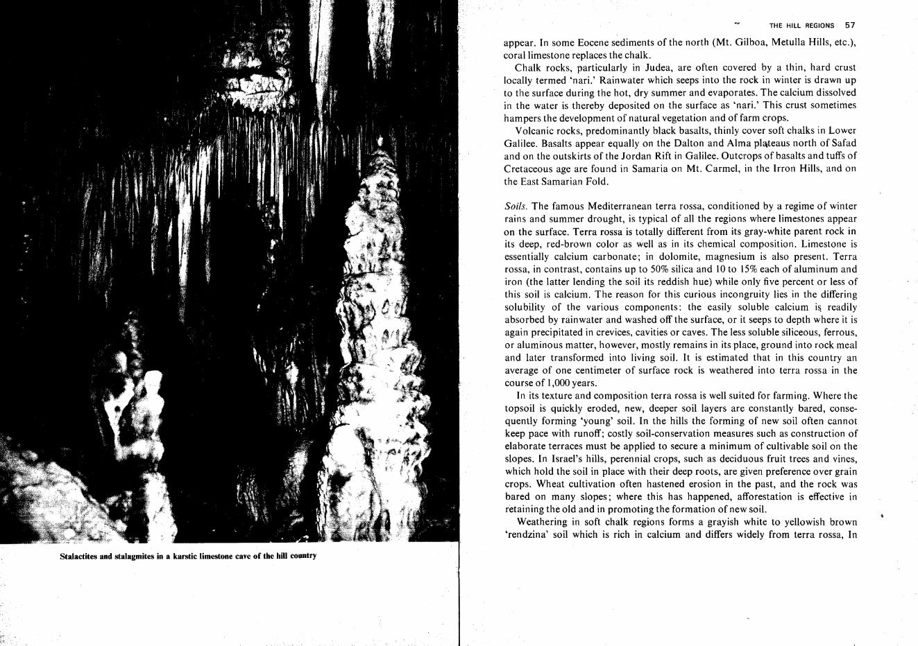
Stalactites and stalagmites in a karstic limestone cave of the hill country
THE HILL REGIONS 57
appear. In some Eocene sediments of the north (Mt. Gilboa, Metulla Hills, etc.),coral limestone replaces the chalk.
Chalk rocks, particularly in Judea, are often covered by a thin, hard crustlocally termed 'nari.' Rainwater which seeps into the rock in winter is drawn upto the surface during the hot, dry summer and evaporates. The calcium dissolvedin the water is thereby deposited on the surface as 'nari.' This crust sometimeshampers the development of natural vegetation and of farm crops.
Volcanic rocks, predominantly black basalts, thinly cover soft chalks in LowerGalilee. Basalts appear equally on the Dalton and Alma plateaus north of Safadand on the outskirts of the Jordan Rift in Galilee. Outcrops of basalts and tuffs ofCretaceous age are found in Samaria on Mt. Carmel, in the Irron Hills, and onthe East Samarian Fold.
Soils. The famous Mediterranean terra rossa, conditioned by a regime of winterrains and summer drought, is typical of all the regions where limestones appearon the surface. Terra rossa is totally different from its gray-white parent rock inits deep, red-brown color as well as in its chemical composition. Limestone isessentially calcium carbonate; in dolomite, magnesium is also present. Terrarossa, in contrast, contains up to 50% silica and 10 to 15% each of aluminum andiron (the latter lending the soil its reddish hue) while only five percent or less ofthis soil is calcium. The reason for this curious incongruity lies in the differingsolubility of the various components: the easily soluble calcium is readilyabsorbed by rainwater and washed off the surface, or it seeps to depth where it isagain precipitated in crevices, cavities or caves. The less soluble siliceous, ferrous,or aluminous matter, however, mostly remains in its place, ground into rock mealand later transformed into living soil. It is estimated that in this country anaverage of one centimeter of surface rock is weathered into terra rossa in thecourse of 1,000 years.
In its texture and composition terra rossa is well suited for farming. Where thetopsoil is quickly eroded, new, deeper soil layers are constantly bared, consequently forming 'young' soil. In the hills the forming of new soil often cannotkeep pace with runoff; costly soil-conservation measures such as construction ofelaborate terraces must be applied to secure a minimum of cultivable soil on theslopes. In Israel's hills, perennial crops, such as deciduous fruit trees and vines,which hold the soil in place with their deep roots, are given preference over graincrops. Wheat cultivation often hastened erosion in the past, and the rock wasbared on many slopes; where this has happened, afforestation is effective inretaining the old and in promoting the formation of new soil.
Weathering in soft chalk regions forms a grayish white to yellowish brown'rendzina' soil which is rich in calcium and differs widely from terra rossa, In
· 58 THE COlJNrl~Y
intermontane valley 'grol.1nds it is frequently enriched with organic matter andthus turned into dark,fertile 'grumusols.' Rendzina, though poorer than terrarossa, is friable and easy to fill. It forms no hard crust in summer nor does itbecome viscous mud under the winter rains. On the gentle Foothills slopes it isless affected by runoff and is thus usually deeper than hill soil. Therefore, farmersgenerally prefer it to terra rossa. Rendzina soils support a wide range of crops,e.g., fruit trees, vines, grains, cotton, tobacco, etc.
Basalt soils, prevalent in Eastern Lower Galilee, resemble terra rossa in color(although some shades darker) as well as in texture and chemical composition.This is surprising, as the parent rocks are totally different. While the terra rossa'scomposition is far removed from that of limestone, basalt soil is quite similar tothe basalt rocks of Lower Galilee which contain about 45% silica and only 0.2%calcium. Basalt soil on mountain slopes is no less endangered by erosion than isterra rossa and therefore requires stringent conservation methods. The almostlevel basalt plateaus of Lower Galilee, however, have deep soil and thus caneasily support grain and other field crops.
The Judean Hills
The Judean Hills are divided into three subregions, distinct from each other inmorphology, rocks, soils, and climate: in the west, the Foothills, in the center, theHills, and in the east, the Judean Desert. The pre-1967 frontiers gave Israelalmost all of the Foothills, the 'Jerusalem Corridor' in the Hills leading to thecapital, and the southern section of the Judean Desert; the greatest part of theHills and two thirds of the Desert were left in Jordan. After the Six Day War,these lines still have administrative and demographic significance.
The limits of the three subregions are most sharply marked by rockdifferences: chalks characterize the Foothills and the Desert, limestones anddolomites-the Hills.
Variety in rainfall, too, is extreme; the Foothills average 400-500 mm(16-22 in) annually, while precipitation on the Hills attains a maximum of800mm (32in); the Judean Desert, however, receives only 300mm (12in)annually 6 miles east of the hill tops, and a mere 50-100 mm (2 to 4 in) of rain aremeasured near the Dead Sea shore escarpment.
Rainfall distribution and rock properties determine the natural drainagesystem of Judea. Streams have gouged narrow, winding gorges deep into the hardrock on the western slopes of the Hills. The streams generally flow due westtoward the sea; only a few of them, like Nahal En Kerem or Nahal Adullam, flowin a different direction. The drainage network is rather 'coarse,' with a relatively
THE HILL REGIONS 59
small number of streams in relation to area. On the map the streams with theirsmall tributaries form an outbranching tree crown ('dendritic system'). In theFoothills these streams unite and flow in a few wider, alluvium-filled valleys. Ofnote are Nahal Shiqma which drains the western slopes of the Adorayim Ridge;Nahal Lakhish and its tributary, Nahal ha-Ela, which emerge from the AdullamRegion; Nahal Soreq which has cut a spectacular gorge southwest of Jerusalemwhere the railway runs between the capital and the Coastal Plain; Nahal Ayalonwhich joins the Yarqon River inside the municipal boundary of Tel Aviv; andNahal Shilloh, the upper section of the Yarqon. Only ione stream, NahalHevron, drains the Hills toward the southwest, from Hebron to Beersheba, whereit enters N ahal Beersheba. All these streams carry water only intermittently, inthe winter. The abundance of coarse gravel and stones in all stream courses pointsto pluvial periods in the recent geological past when their flow was perennial,much more powerful, and their erosional force much greater than at present.
The drainage system on the eastern flank of the Hills, i.e., in the Judean Desert,is finer than in the west and typical of the prevalent chalk rock. On their relativelyshort way from the watershed to the Dead Sea the streams do not unite intomajor courses. In their middle and lower sections, where they cross the high faultescarpments with their limestone outcrops, deep canyons with perpendicular rockwalls at some places rising to 200 m (600 ft) or more are cut. Nahal Qidron, whichoriginates near the Old City of Jerusalem, is the best known of the easternstreams. N ahal Hever, Nahal Arugot and others have recently received publicitythanks to the archeological discoveries in the caves high on the canyon sides.
The Hills of Judea (in the narrow sense): The Judean upfold exceeds 1,000m(3,200 ft) above sea level. The axis of the dome is directed south-southwestnorth-northeast. The watershed is much closer to the Jordan River and the DeadSea than to the Coastal Plain and the Mediterranean Sea: from Tell 'Asur (Mt.Baal Hazer) in the north, 1,016 m (3,333 ft) high, the distance is only 15 km(9 miles) to the Jordan Valley cross-country, but 37 km (23 miles) to the CoastalPlain (near Lod Airport) and 57 km (33 miles) to the coast itself. Mt. Halhul nearHebron in the south is 25 km (1St miles) away from the Dead Sea, and over 60km (39 miles) from the Mediterranean Sea. The eastern flanks of the upfold areconsequently much shorter and steeper than those of the west.
The crest of the upfold is compact and broad. It is somewhat higher in thesouth ('Hebron Hills') and in the north ('Bethel Hills') than in the center.('Jerusalem Hills'). The narrow Hebron Dome slopes steeply both west and east.South of Hebron, Nahal Hevron runs along the upfold crest through a broadvalley which separates the Adorayim Ridge in the west from the higher Yuta(Yatta), or Qiryatayim, Ridge in the east.
60 THE COUNTRY AND ITS REGIONS THE HILL REGIONS 61
~
.=<J....~
.lICrIJ
.~....CCeeCC..~CC
~.!l:E=CC~~:I...,~
.=....
.5~~
ii..~....CC~
~<J
~11...e'5e~<JCC
!~.. ~CC~"tilCC~
'"f-oou,
~
"c-,~
~
~-es ""~ 2 ""
~2
c -gf- ~ -c
'" :;: "R 2w UJ UJ~
2 ~w
l )a 63
s ~ z-cE w
:;: a ~
:;)
~- -cu
<3;"!:ivE
li! ' E ~0;;:; ::s
~~~~~ ,
"'-" 0 >- u~ >-..J ~o.
!MI/-\O.f,)m. lI., ~ [E]Il"'_f').'r!
li! c
~~<>
~ :J-'"
c~
~ ~"2
I"}~:~;::; ... z e~
"2 "20
w 0~ e
a ~ l- V:;)- II rnIDlll
Scene of the Judean Hills southwest of Jerusalem. Interchange of hard and soft rock strata createsstep-like slopes. Some alluvial soil is retained on the gorge bottom. Afforestation has been begunon the higher reaches of the hills
The central section of the Jerusalem Hills, which is 100-200 m (300-700 ft)lower than the southern and northern extremities, forms a saddle between them.It broadens to the east, and even more so to the west. This fact explains thedevelopment of important towns (Gibeon, and later Jerusalem) in this section inantiquity; the north-south highway (the 'Hill Road' of the Bible), which used theflat upfold crest, at this point crossed the vital west-east road which took the leastdifficult path, i.e., the one where the hills are less steep, and the Dead Sea does notbar the way to Transjordan (as it does further south). Another relatively easyentry to the heart of the Judean Hills is through Nahal Eta Valley; at its upperend lies Bethlehem.
In the Bethel Hills of the north, the upfold again narrows and grows higher. Itattains its maximum elevation in Mt. Baal Hazer on the Samarian border. Thearea between al-Jib (Gibeon) and Mukhmas (Mikhmash) is rather flat andlittle-eroded, and has therefore been used for farming and settlement sinceancient times. The town of Ramallah takes, in our days, the place of ancientBethel whose site lies further to the northeast.
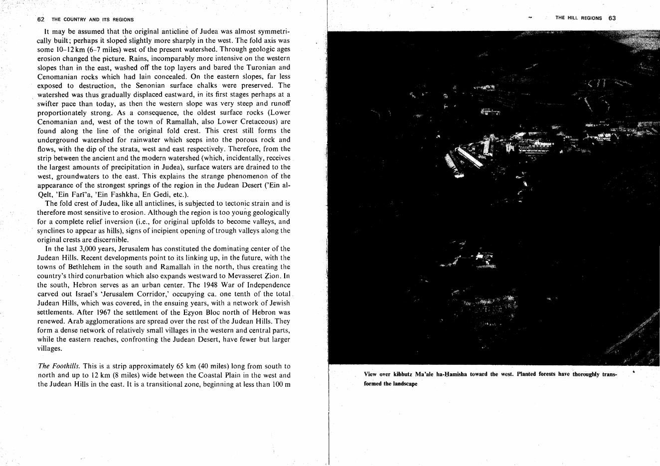
62 THE COUNTRY AND ITS REGIONS
It may be assumed that the original anticline of Judea was almost symmetrically built; perhaps it sloped slightly more sharply in the west. The fold axis wassome IO~12 km (6-7 miles) west of the present watershed. Through geologic ageserosion changed the picture. Rains, incomparably more intensive on the westernslopes than in the east, washed off the top layers and bared the Turonian andCenomanian rocks which had lain concealed. On the eastern slopes, far lessexposed to destruction, the Senonian surface chalks were preserved. Thewatershed was thus gradually displaced eastward, in its first stages perhaps at aswifter pace than today, as then the western slope was very steep and runoffproportionately strong. As a consequence, the oldest surface rocks (LowerCenomanian and, west of the town of Ramallah, also Lower Cretaceous) arefound along the line of the original fold crest. This crest still forms theunderground watershed for rainwater which seeps into the porous rock andflows, with the dip of the strata, west and east respectively. Therefore, from thestrip between the ancient and the modern watershed (which, incidentally, receivesthe largest amounts of precipitation in Judea), surface waters are drained to thewest, groundwaters to the east. This explains the strange phenomenon of theappearance of the strongest springs of the region in the Judean Desert ('Ein alQelt, 'Ein Farra, 'Ein Fashkha, En Gedi, etc.).
The fold crest of Judea, like all anticlines, is subjected to tectonic strain and istherefore most sensitive to erosion. Although the region is too young geologicallyfor a complete relief inversion (i.e., for original upfolds to become valleys, andsynclines to appear as hills), signs of incipient opening of trough valleys along theoriginal crests are discernible.
In the last 3,000 years, Jerusalem has constituted the dominating center of theJudean Hills. Recent developments point to its linking up, in the future, with thetowns of Bethlehem in the south and Ramallah in the north, thus creating thecountry's third conurbation which also expands westward to Mevasseret Zion. Inthe south, Hebron serves as an urban center. The 1948 War of Independencecarved out Israel's 'Jerusalem Corridor,' occupying ca. one tenth of the total.Judean Hills, which was covered, in the ensuing years, with a network of Jewishsettlements. After 1967 the settlement of the Ezyon Bloc north of Hebron wasrenewed. Arab agglomerations are spread over the rest of the Judean Hills. Theyform a dense network of relatively small villages in the western and central parts,while the eastern reaches, confronting the Judean Desert, have fewer but largervillages.
The Foothills. This is a strip approximately 65 km (40 miles) long from south tonorth and up to 12 km (8 miles) wide between the Coastal Plain in the west andthe Judean Hills in the east. It is a transitional zone, beginning at less than 100 m
THE HILL REGIONS 63
View over kibbutz Ma'ale ha-Hamisha toward the west. Planted forests have thoroughly trans
formed the landscape
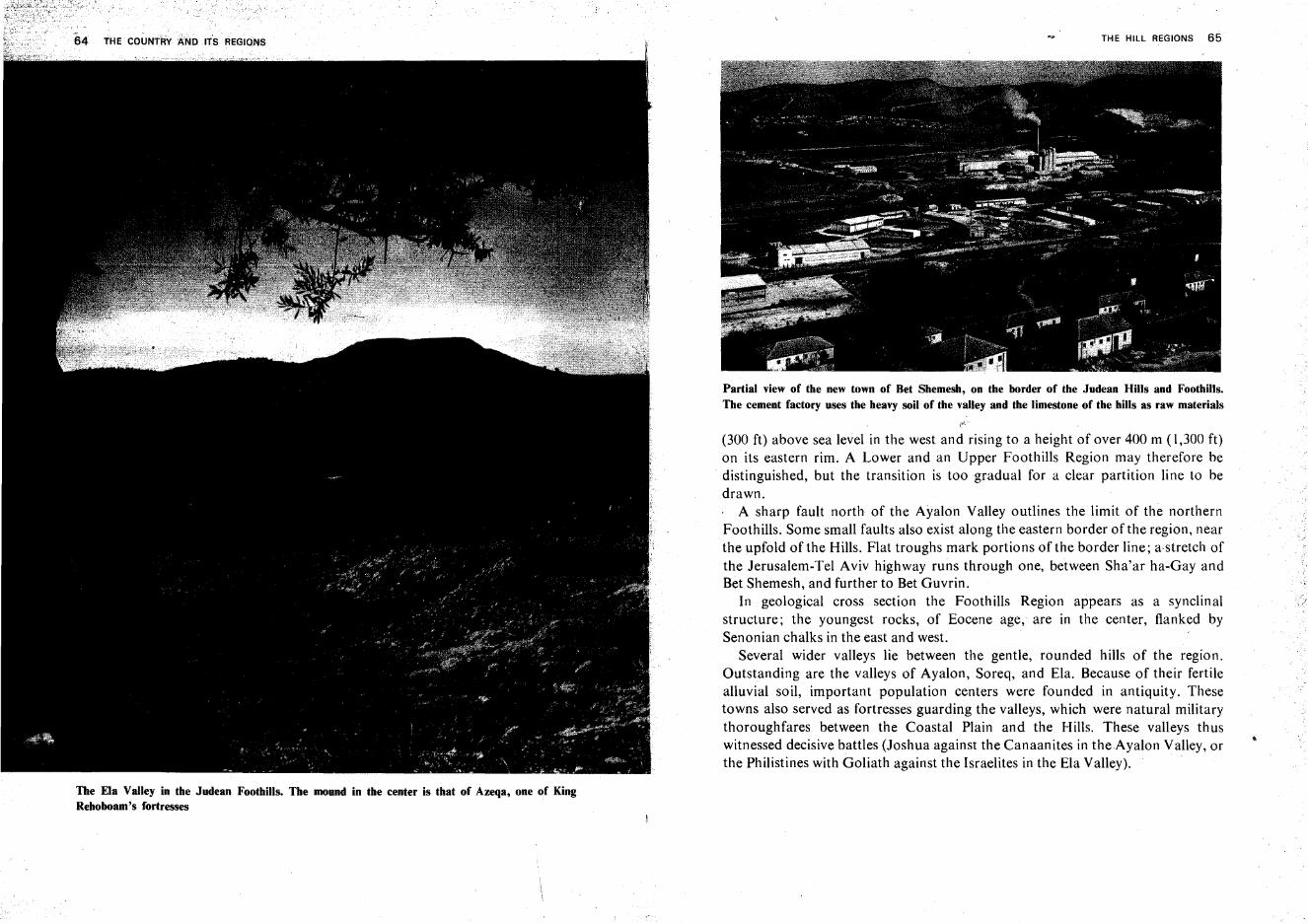
The Ela Valley in the Judean Foothills. The mound in the center is that of Azeqa, one of KingRehoboam's fortresses
THE HILL REGIONS 65
Partial view of the new town of Bet Shemesh, on the border of the Judean Hills and Foothills.The cement factory uses the heavy soil of the valley and the limestone of the hills as raw materials
(300 ft) above sea level in the west and rising to a height of over 400 m (1,300 ft)on its eastern rim. A Lower and an Upper Foothills Region may therefore bedistinguished, but the transition is too gradual for a clear partition line to bedrawn., A sharp fault north of the Ayalon Valley outlines the limit of the northernFoothills. Some small faults also exist along the eastern border of the region, nearthe upfold of the Hills. Flat troughs mark portions of the border line; a-stretch ofthe Jerusalem-Tel Aviv highway runs through one, between Sha'ar ha-Gay andBet Shemesh, and further to Bet Guvrin.
In geological cross section the Foothills Region appears as a synclinalstructure; the youngest rocks, of Eocene age, are in the center, flanked bySenonian chalks in the east and west.
Several wider valleys lie between the gentle, rounded hills of the region.Outstanding are the valleys of Ayalon, Soreq, and Ela. Because of their fertilealluvial soil, important population centers were founded in antiquity. Thesetowns also served as fortresses guarding the valleys, which were natural militarythoroughfares between the Coastal Plain and the Hills. These valleys thuswitnessed decisive battles (Joshua against the Canaanites in theAyalon Valley, orthe Philistines with Goliath against the Israelites in the Ela Valley).
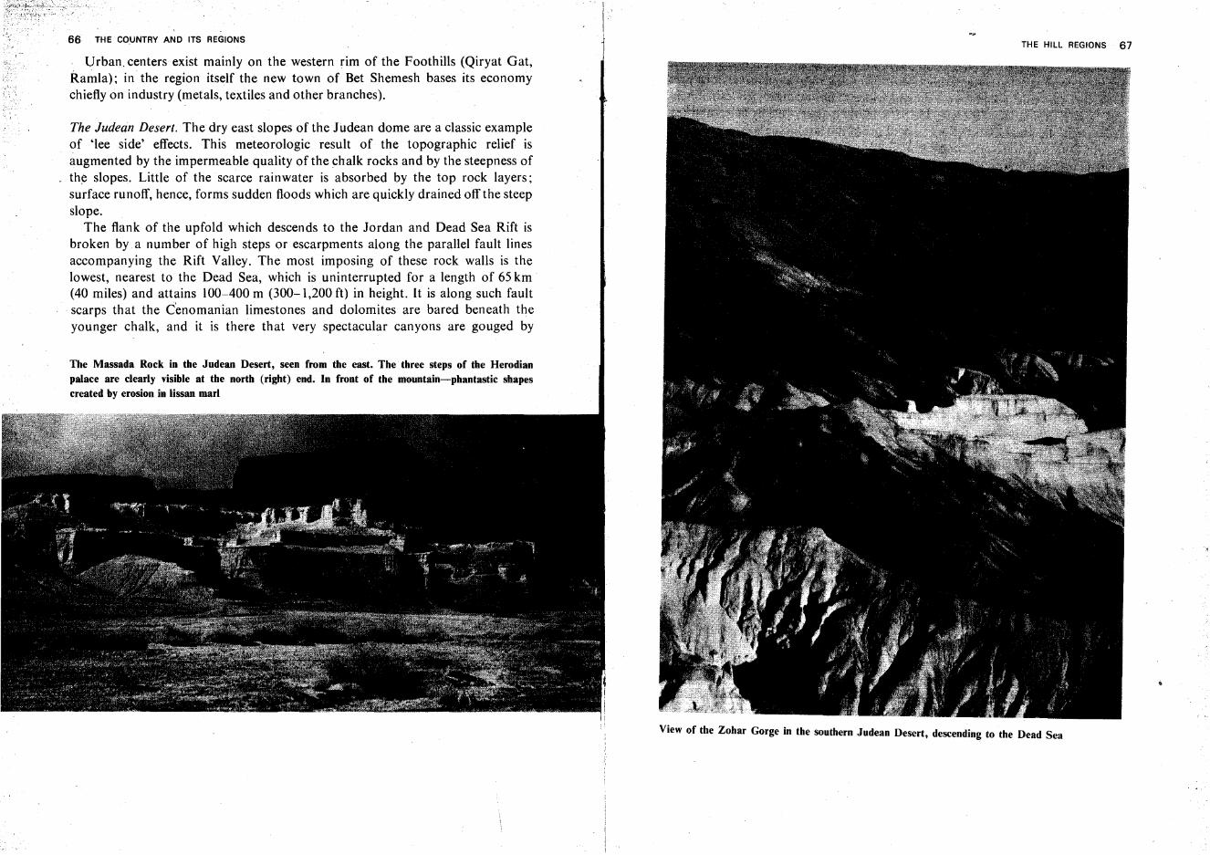
66 l"HE COUNTRY AND ITS REGIONS
Urban. centers exist mainly on the western rim of the Foothills (Qiryat Gat,Ramla): in the region itself the new town of Bet Shemesh bases its economychiefly on industry (metals, textiles and other branches).
The Judean Desert. The dry east slopes of the Judean dome are a classic exampleof 'lee side' effects. This meteorologic result of the topographic relief isaugmented by the impermeable quality of the chalk rocks and by the steepness ofthe slopes. Little of the scarce rainwater is absorbed by the top rock layers;surface runoff, hence, forms sudden floods which are quickly drained off the steepslope.
The flank of the upfold which descends to the Jordan and Dead Sea Rift isbroken by a number of high steps or escarpments along the parallel fault linesaccompanying the Rift Valley. The most imposing of these rock walls is thelowest, nearest to the Dead Sea, which is uninterrupted for a length of 65 km(40 miles) and attains 100-400 m (300-1,200 ft) in height. It is along such faultscarps that the Cenomanian limestones and dolomites are bared beneath theyounger chalk, and it is there that very spectacular canyons are gouged by
The Massada Rock in the Judean Desert, seen from the east. The three steps of the Herodianpalace are clearly visible at the north (right) end. In front of the mountain-phantastic shapescreated by erosion in lissan marl
THE HILL REGIONS 67
View of the Zohar Gorge in the southern Judean Desert, descending to the Dead Sea
-'!
68 THE COUNTRY AND ITS REGIONS
floodwaters rushing toward the Dead Sea. Two canyons at a small distance fromeach other with a tributary entering one of them at a right angle isolate one partof the high step as a 'relic mountain,' which slopes down almost vertically on allsides. The most famous of these, made particularly impregnable by being upliftedasa horst, is the Massada Rock fortress, scene of the last, desperate resistance ofJewish freedom fighters against the Roman legions in 73 C.E.; it is only 49 m (150ft) above the Mediterranean sea level but rises over 300 m (1,000 ft) above its
immediate surroundings.
The Samarian Hills
The hills of Samaria are morphologically variegated. Three parallel folds formthe skeleton of their structure-Mount Carmel in the northwest, the Irron Hillsin the center, and the East Samarian Fold (Tevez Hills) in the southeast, with twosynclinal areas in between, the Menashe and Nablus regions.
The small intermontane rift valleys, often bordering on uplifted blocks orhorsts, lend a pronouncedly mountainous character to many parts of Samaria,although the elevations do not equal those of Judea. A comparatively dense ruralpopulation lives on the hills around the valley grounds because of the goodfarming conditions provided by the more ample rains and fertile alluvial soil.Valleys opening west, north and south give easy access to the center of Samaria;perhaps this explains why Samaria was, historically, more receptive to foreigninfluence in politics, culture and religion than was the 'closed'hill region of
Judea.
The East Samarian Fold. The highest of the three folds of Samaria touches Mt.Baal Hazor in the southwest on the Judean border, and in the northeast, the BetShe'a~ Valley. As a result of the fold's strong elevation at the beginning of theerosional cycle, the particularly active erosion has bared ancient strata: not onlyCenomanian limestone but also Lower Cretaceous sediments in the center (RasJedira = Mt. Tevez, 712 m [2,279 ft] above sea level), as well as basalt and tuffpatches, which signify volcanic activity d~ring that age.
The proximity of the Rift influences the morphology of the eastern upfold; theeastern slopes follow fault lines and drop abruptly. From the Rift, northwest-directed branch valleys penetrate the fold and divide its northern part into separatesections. Most typical of these are the broad and rather shallow Wadi Buqei'a,and Wadi Farra; the latter is narrow and very deep, its bottom largely below sealevel. At its side Jebel Kabir (792 m-2,598 ft) rises in the south, and JebelTammun (647 m-2, 123ft) in the north. The difference in level therefore exceeds
I
j'
,.'
THE HILL REGIONS 69
800 m (2,600 ft) over a distance of only 2 km. The immense, bare slopes on bothsides of the valley, contrasting with the strip of green orchards and vegetablegardens of the valley bottom, create an atmosphere of grandeur.
At the southeastern end of Jebel Kabir rises Mt. Sartaba, 377 m (1,237 ft)above sea level, which juts into the Jordan Valley and dominates large stretchesof it in the north, east and south. The strategic importance of this spot wasrecognized by the Hasmonean kings of antiquity, who erected the fortress ofAlexandrion; the sages of the Mishna chose the mountain as a beacon station,one of a chain which signaled the sighting of the new mdon in Jerusalem to theMesopotamian diaspora, to indicate the beginning of a new month in the Jewishcalendar.
Since the valleys of Samaria opening out to the west allow the moisture-bearing sea winds to reach even the eastern folds, the 'rain shadow' area is at most10 km (6 miles) wide. Even there, with an annual rainfall exceeding 250 mm(10 in), it is not pronouncedly arid.
The Nablus Syncline. The topography of this fairly large region has becomevaried, owing to both tectonic movements and erosional activity. The southernextremity of the syncline touches the southern Sharon Plain and the Bethel Hillsof Judea; its northern end is formed by Mt. Gilboa, which drops abruptly to theHarod Valley.*
In the central parts of the Nablus Syncline, Eocene chalk is the top layer; theflanks show older, Senonian strata. The highest elevations of Samaria, Mt. Ebal940 m (3,084 ft) above sea level and Mt. Gerizim 881 m (2,890 ft), lie precisely inthe center of the syncline. Erosion has certainly contributed to this 'inversion ofrelief' by attacking the strata of the anticlines more strongly than the downfold,which has better resistance; it must be assumed, however, that the decisiveprocesses for the present topography were the simultaneous tectonic uplift of twomountain blocks, separated by the narrow Nablus Valley opening out in the eastto the larger Sokher Valley.
The larger tectonic valleys of Samaria lie in the northern part of this downfold.Of note among them are the Sahl Arraba (Dotan Vale, mentioned in the Bible asthe site where Joseph was sold by his brothers to the Midianites) and Marj Sanur.A small valley, very deep and steep-sided, is that of Marj Lubban (Levona) nearthe southern border of Samaria. The only interior rift valley paralleling the foldaxis is that of Sahl Miikhna (Mikhmetat), where the highway from Ramallah toNablus runs.
* Mt. Gilboa belongs, structurally, to the tilted blocks of Galilee; it is therefore described in connection with these on p. 75.
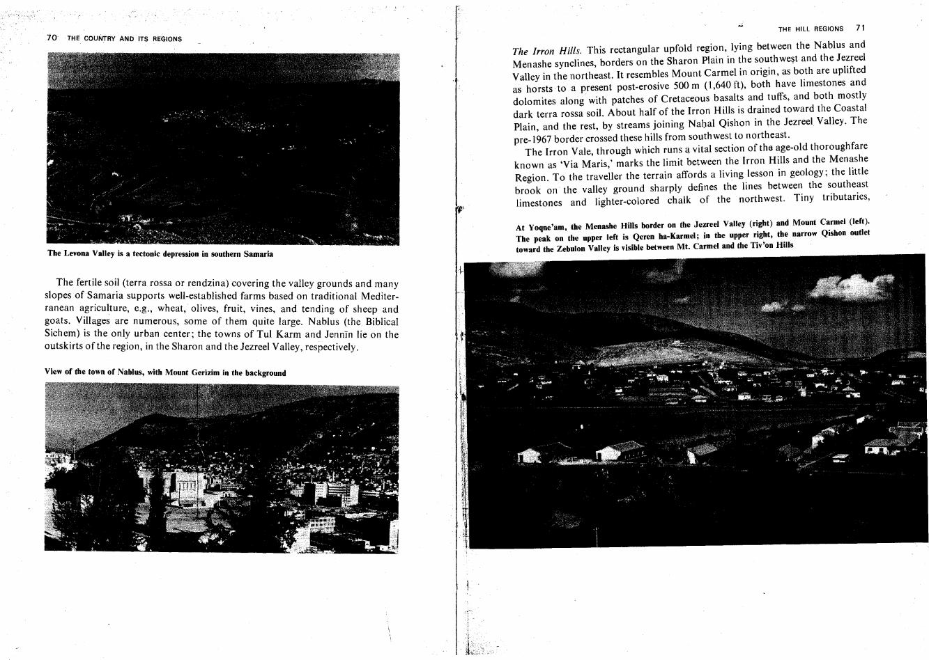
70 THE COUNTRY AND ITS REGIONS
The Levona Valley is a tectonic depression in southern Samaria
The fertile sOi.1 (terra rossa or rendzina) covering the valley grounds and manyslopes of S~mana supports well-established farms based on traditional Mediterranean a.gnculture, e.g., wheat, olives, fruit, vines, and tending of sheep andg?ats. V~llages are numerous, some of them quite large. Nablus (the BiblicalSlche~) IS the only urban center; the towns of Tul Karm and Jermin lie on theoutskirts of the region, in the Sharon and the Jezreel Valley, respectively.
View of the town of Nablus, with Mount Gerizim in the background
THE HILL REGIONS 71
The Irron Hills. This rectangular upfold region, lying between the Nablus andMenashe synclines, borders on the Sharon Plain in the southwest and the JezreelValley in the northeast. It resembles Mount Carmel in origin, as both are upliftedas horsts to a present post-erosive 500 m (1,640 ft), both have limestones anddolomites along with patches of Cretaceous basalts and tuffs, and both mostlydark terra rossa soil. About half of the Irron Hills is drained toward the CoastalPlain, and the rest, by streams joining Nahal Qishon in the Jezreel Valley. The
pre-1967 border crossed these hills from southwest to northeast.The Irron Vale, through which runs a vital section of the age-old thoroughfare
known as 'Via Maris,' marks the limit between the Irron Hills and the MenasheRegion. To the traveller the terrain affords a living lesson in geology; the littlebrook on the valley ground sharply defines the lines between the southeastlimestones and lighter-colored chalk of the northwest. Tiny tributaries,
At ¥oqne'am, the Menashe Hills border on the Jezreel Valley (right) and Mount Carmel (left).The peak on the upper left is Qeren ha-Karmel; in the upper right, the narrow Qishon outlettoward the Zebulon Valley is visible between Mt, Carmel and the Tiv'on Hills
THE COUNTRY ANO ITS REGIONS
descending from both sides, have built small alluvial fans around which NahalIrron curves; these are composed of terra rossa on one bank, and of light grayrendzina on the other.
The Menashe Region. This area extends from the Irron Vale in the southeast tothe Nahal Yoqne'am Valley in the northwest, where, bordering on MountCarmel, it forms, like the Irron Hills, a quadrangle on the map. Lower than theneighboring upfolds, with an average altitude of 200 m (650 ft), and only a fewpoints 300 m (1,000 ft) high, it presents an elevated plateau between the CoastalPlain and the Jezreel Valley. Most of it is nearly flat, except its eastern corner,which· passes into rolling hills. The distribution of rock strata on the surfaceconfirms the synclinal structure of the region: most of them are Eocene, withSenonian on the outskirts and a small patch of younger Oligocene in the center.Rendzina soil, blackened by organic matter in low-lying parts, covers most of theplateau.
The 'corridor' of the Menashe Region, between Mount Carmel and the Irron .Hills, is open to the sea winds and produces a draft effect. Precipitation thereforeattains higher values (600-700 mm, or 24-28 in) than might be expected of its lowaltitude.
Mount Carmel. This is an uplifted block forming a triangle whose base line, 32 km(20 miles) long, borders on the Carmel Coast in the west; its apex, Qerenha-Karmel, protrudes into the Jezreel Valley in the southeast; its greate.st widthamounts to 14km (9 miles). The southern 'nose' of the Carmel is wedged inbetween the Carmel Coast and the northeastern corner of the Sharon Plain; on itis the large village and summer resort of Zikhron Ya'aqov. The highestelevations of Mount Carmel are those nearest to the fault escarpment whichdominates the Jezreel and Zebulon valleys; these are Rom ha-Karmel, 546 m(1,792 ft) above sea level, Har Allon, 515m (I,690ft), and Qeren ha-Karrnel, 482m (1,581 ft), traditionally held to be the site of the Prophet Elijah's contest withthe priests of Baal.
Mount Carmel, originally a simple upfold, rose later as a horst between faultlines. The northeastern fault escarpment is the most spectacular; the western oneis now covered by the alluvium of the Carmel Coast. The rock wall on this sidehas receded a few hundred yards by degradation, yet maintains its near-verticalslope. Least visible is the southeastern fault which runs along the NahalYoqne'amValley and the rim of the Menashe Plateau.
It is not known whether Mount Carmel was covered by younger strata at anytime in the geologic past. All present surface rocks are Cenomanian, most ofthem limestones and dolomites strongly affected by karst weathering, with a few
THE HILL REGIONS 73
patches of basalts and tuffs which some geologists believe erupted fromsubmarine volcanoes.
Two shallow depressions on the hill crest, both running obverse to the fold axisand parallel to the northeastern fault, are filled with terra rossa and are the mainfarming area of the two Druze villages 'lsfiya and Daliyat al-Karmil.- Water courses have created picturesque narrow gorges on Mount Carmel. Thelongest wadis run from the edge of the northeast escarpment to the west, e.g.,Nahal Daliya, Nahal Me'arot, Nahal Oren, etc. Nahal Gibborim, its bedovershadowed by precipitous rock walls, is the only stream to run from thehilltop directly into Haifa Bay. This canyonlike gorge, like others cut into thenortheast escarpment by tributaries of Nahal Qishon, is filled with boulderswhich have been carried down by floods with devastating force and deposited atthe foot of the mountain in the Zebulon Valley.
The numerous karstic caves of Mount Carmel have repeatedly played animportant role in human prehistory and history. Some of them (in the Me'arotand Oren gorges) sheltered man in the Paleolithic and Neolithic eras; others, likethe Prophet Elijah's Cave near Haifa, have become part of Jewish, Christian andArab folklore.
Since ancient times, ·Mount Carmel has also been famous for its verdant plantcover; the fairly abundant precipitation aids the preservation of the naturalMediterranean hill-type vegetation, which is better developed here than in mostother parts of the country. Large parts of wood-covered Mount Carmel havebeen declared a nature reserve.
Besides the city of Haifa in the northwestern corner of Mount Carmel, thereare two large villages inhabited by members of the Druze community and severalJewish settlements.
Galilee
All borders of the hill regions of Galilee are clearly outlined. In the west, Galileemeets the northern portion of the Coastal Plain (Zebulon, Acre, Tyre valleys);the large outbranching of the Rift (Harod, Jezreel valleys) marks the southernborder of Galilee; in the north it is delimited by the gorge of the Litani River; andin the east, by the Rift.
There is a traditional distinction between Lower and Upper Galilee. Differences of altitude, climate and vegetation justify this division. No height in LowerGalilee exceeds 600 m (2,000 ft)-greatest elevations are Mount Kamon, 598 m(I,962ft); Mount Bazan, 584m (I,916ft); Mt. Tabor, 588m (I,929ft); Mt.Azmon, 548 m (1,798 ft); and Giv'at ha-More, 515 m (1,690 ft)-while in Upper
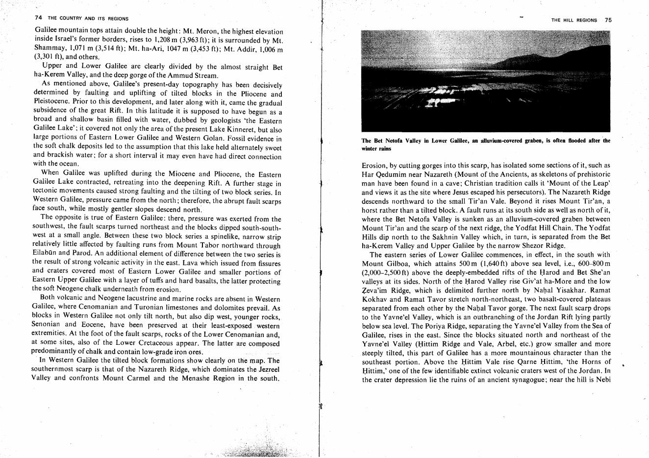
74 THE COUNTRY AND ITS REGIONS
Galilee mountain tops attain double the height: Mt. Meron, the highest elevationinside Israel's former borders, rises to 1,208 m (3,963 ft); it is surrounded by Mt.Shammay, 1,071 m (3,514 ft); Mt. ha-Ari, 1047 m (3,453 ft): Mt. Addir, 1,006 m(3,301 ft), and others.
Upper and Lower Galilee are clearly divided by the almost straight Betha-Kerem Valley, and the deep gorge of the Ammud Stream.
. As mentioned above, Galilee's present-day topography has been decisivelydetermined by faulting and uplifting of tilted blocks in the Pliocene andPleistocene. Prior to this development, and later along with it, came the gradualsubsidence of the great Rift. In this latitude it is supposed to have begun as abroad and shallow basin filled with water, dubbed by geologists 'the EasternGalilee Lake'; it covered not only the area of the present Lake Kinneret, but alsolarge portions of Eastern Lower Galilee and Western Golan. Fossil evidence inthe soft chalk deposits led to the assumption that this lake held alternately sweetand brackish water; for a short interval it may even have had direct connectionwith the ocean.
When Galilee was uplifted during the Miocene and Pliocene, the EasternGalilee Lake contracted, retreating into the deepening Rift. A further stage intectonic movements caused strong faulting and the tilting of two block series. InWestern Galilee, pressure came from the north; therefore, the abrupt fault scarpsface south, while mostly gentler slopes descend north.
The opposite is true of Eastern Galilee: there, pressure was exerted from thesouthwest, the fault scarps turned northeast and the blocks dipped south-southwest at a small angle. Between these two block series a spinelike, narrow striprelatively little affected by faulting runs from Mount Tabor northward throughEilabun and Parod. An additional element of difference between the two series isthe result of strong volcanic activity in the east. Lava which issued from fissuresand craters covered most of Eastern Lower Galilee and smaller portions ofEastern Upper Galilee with a layer of tuffs and hard basalts, the latter protectingthe soft Neogene chalk underneath from erosion.
Both volcanic and Neogene lacustrine and marine rocks are absent in WesternGalilee, where Cenomanian and Turonian limestones and dolomites prevail. Asblocks in Western Galilee not only tilt north, but also dip west, younger rocks,Senonian and Eocene, have been preserved at their least-exposed westernextremities. At the foot of the fault scarps, rocks of the Lower Cenomanian and,at some sites, also of the Lower Cretaceous appear. The latter are composedpredominantly of chalk and contain low-grade iron ores.
. In Western Galilee the tilted block formations show clearly on the map. Thesouthernmost scarp is that of the Nazareth Ridge, which dominates the JezreelValley and confronts Mount Carmel and the Menashe Region in the south.
THE HILL REGIONS 75
The Bet Netofa Valley in Lower GalUee, an a1luvium-covered graben, is often flooded after thewinter rains
Erosion, by cutting gorges into this scarp, has isolated some sections of it.such asHar Qedumim near Nazareth (Mount of the Ancients, as skeletons of prehistoricman have been found in a cave; Christian tradition calls it 'Mount of the Leap'and views it as the site where Jesus escaped his persecutors). The Nazareth Ridgedescends northward to the small Tir'an Vale. Beyond it rises Mount Tir'an, ahorst rather than a tilted block. A fault runs at its south side as well as north of it, .where the Bet Netofa Valley is sunken as an alluvium-covered graben betweenMount Tir'an and the scarp of the next ridge, the Yodfat Hill Chain. The YodfatHills dip north to the Sakhnin Valley which, in turn, is separated from the Betha-Kerem Valley and Upper Galilee by the narrow Shezor Ridge.
The eastern series of Lower Galilee commences, in effect, in the south withMount Gilboa, which attains 500 m (1,640 ft) above sea level, i.e., 600-800 m(2,000-2,500 ft) above the deeply-embedded rifts of the Harod and Bet She'anvalleys at its sides. North of the Harod Valley rise Giv'at ha-More and the lowZeva'im Ridge, which is delimited further north by Nahal Yisakhar. RamatKokhav and Ramat Tavor stretch north-northeast, two basalt-covered plateausseparated from each other by the Nahal Tavor gorge. The next fault scarp dropsto the Yavne'el Valley, which is an outbranching of the Jordan Rift lying partlybelow sea level. The Poriya Ridge, separating the Yavne'el Valley from the Sea ofGalilee, rises in the east. Since the blocks situated north and northeast of theYavne'el Valley (Hittim Ridge and Vale, Arbel, etc.) grow smaller and moresteeply tilted, this part of Galilee has a more mountainous character than thesoutheast portion. Above the Hittim Vale rise Qarne Hittim, 'the Horns ofHittim,' one of the few identifiable extinct volcanic craters west of the Jordan. Inthe crater depression lie the ruins of an ancient synagogue; near the hill is Nebi
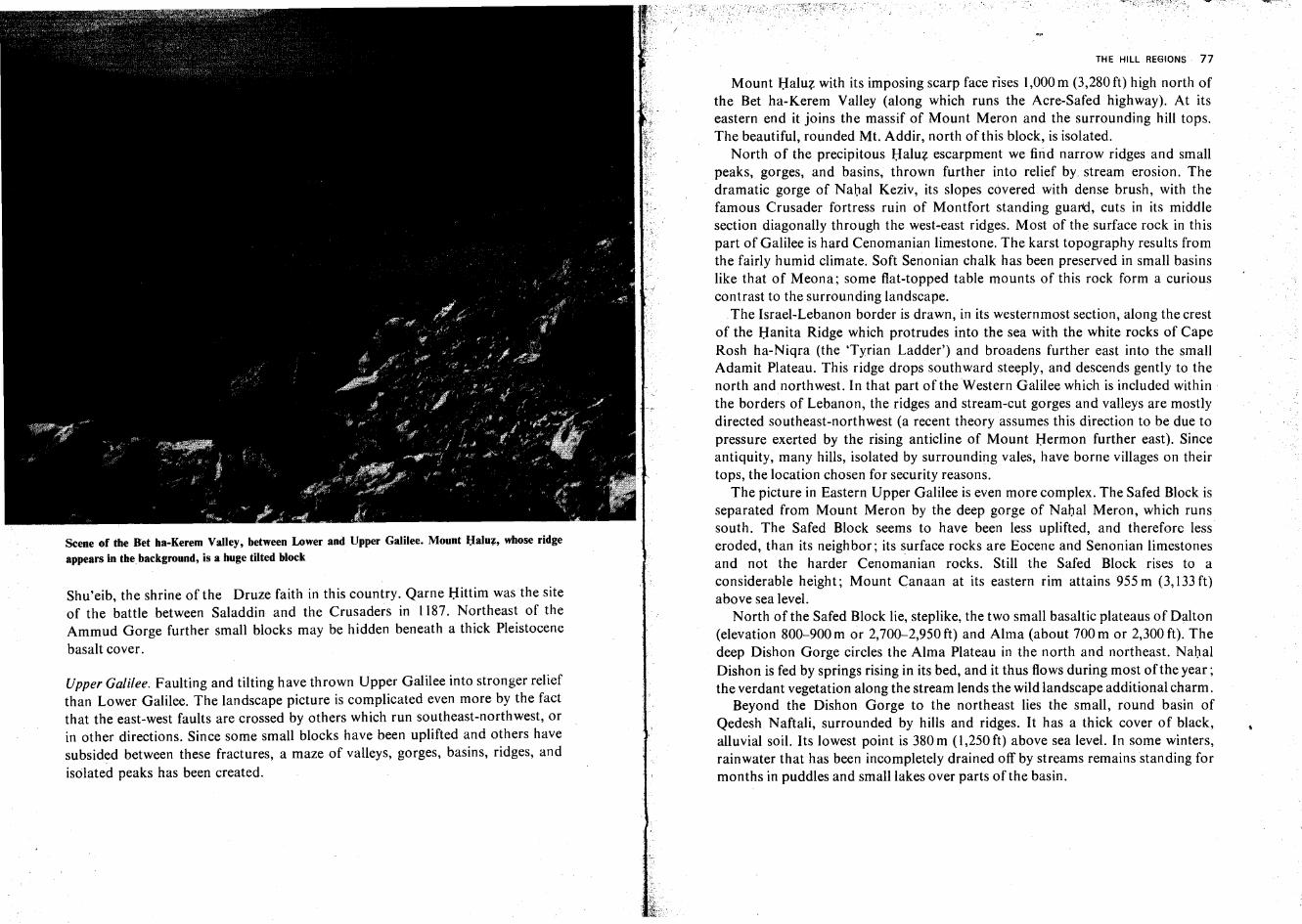
Scene of the Bet ha-Kerem Valley, between Lower and Upper Galilee. Mount Haluz, whose ridgeappears in the background, is a huge tilted block
Shu'eib, the shrine of the Druze faith in this country. Qarne Hittim was the siteof the battle between Saladdin and the Crusaders in 1187. Northeast of theAmmud Gorge further small blocks may be hidden beneath a thick Pleistocene
basalt cover.
Upper Galilee. Faulting and tilting have thrown Upper Galilee into stronger reliefthan Lower Galilee. The landscape picture is complicated even more by the factthat the east-west faults are crossed by others which run southeast-northwest, orin other directions. Since some small blocks have been uplifted and others havesubsided between these fractures, a maze of valleys, gorges, basins, ridges, and
isolated peaks has been created.
THE HILL REGIONS 77
Mount Haluz with its imposing scarp face rises 1,000 m (3,280 ft) high north ofthe Bet ha-Kerern Valley (along which runs the Acre-Safed highway). At itseastern end it joins the massif of Mount Meron and the surrounding hill tops.The beautiful, rounded Mt. Addir, north of this block, is isolated.
North of the precipitous Haluz escarpment we find narrow ridges and smallpeaks, gorges, and basins, thrown further into relief by stream erosion. Thedramatic gorge of Nahal Keziv, its slopes covered with dense brush, with thefamous Crusader fortress ruin of Montfort standing guard, cuts in its middlesection diagonally through the west-east ridges. Most of the surface rock in thispart of Galilee is hard Cenomanian limestone. The karst topography results fromthe fairly humid climate. Soft Senonian chalk has been preserved in small basinslike that of Meona; some flat-topped table mounts of this rock form a curiouscontrast to the surrounding landscape.
The Israel-Lebanon border is drawn, in its westernmost section, along the crestof the Hanita Ridge which protrudes into the sea with the white rocks of CapeRosh ha-Niqra (the 'Tyrian Ladder') and broadens further east into the smallAdamit Plateau. This ridge drops southward steeply, and descends gently to thenorth and northwest. In that part of the Western Galilee which is included withinthe borders of Lebanon, the ridges and stream-cut gorges and valleys are mostlydirected southeast-northwest (a recent theory assumes this direction to be due topressure exerted by the rising anticline of Mount Hermon further east). Sinceantiquity, many hills, isolated by surrounding vales, have borne villages on theirtops, the location chosen for security reasons.
The picture in Eastern Upper Galilee is even more complex. The Safed Block isseparated from Mount Meron by the deep gorge of Nahal Meron, which runssouth. The Safed Block seems to have been less uplifted, and therefore lesseroded, than its neighbor; its surface rocks are Eocene and Senonian limestonesand not the harder Cenomanian rocks. Still the Safed Block rises to aconsiderable height; Mount Canaan at its eastern rim attains 955 m (3,133 ft)above sea level.
North of the Safed Block lie, steplike, the two small basaltic plateaus of Dalton(elevation 800-900 m or 2,700-2,950 ft) and Alma (about 700 m or 2,300 ft). Thedeep Dishon Gorge circles the Alma Plateau in the north and northeast. NahalDishon is fed by springs rising in its bed, and it thus flows during most of the year;the verdant vegetation along the stream lends the wild landscape additional charm.
Beyond the Dishon Gorge to the northeast lies the small, round basin ofQedesh Naftali, surrounded by hills and ridges. It has a thick cover of black,alluvial soil. Its lowest point is 380 m (1,250 ft) above sea level. In some winters,rainwater that has been incompletely drained off by streams remains standing formonths in puddles and small lakes over parts of the basin.
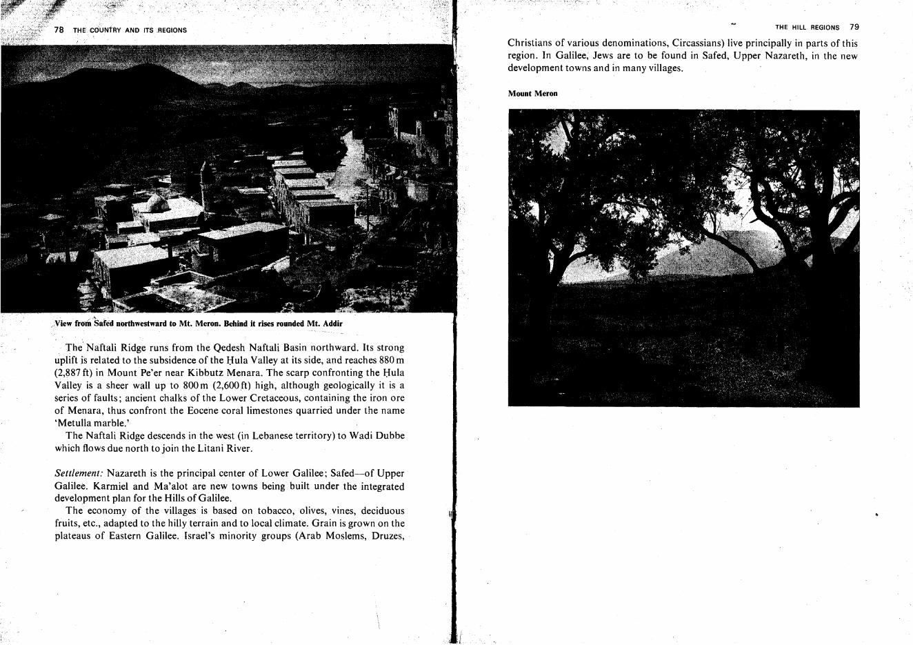
~ . ~",~
,,view ftom Safed northwestward to Mt, Meron. Behind it rises rounded Mt, Addir
The' Naftali Ridge runs from the Qedesh NaftaliBasin northward. Its stronguplift is related to the subsidence of the Hula Valley at its side, and reaches 880 m(2,887 ft) in Mount Pe'er near Kibbutz Menara. The scarp confronting the HulaValley is a sheer wall up to 800m (2,600ft) high, although geologically it is aseries of faults; ancient chalks of the Lower Cretaceous, containing the iron oreof Menara, thus confront the Eocene coral limestones quarried under the name'Metulla marble.'
The Naftali Ridge descends in the west (in Lebanese territory) to Wadi Dubbewhich flows due north to join the Litani River.
Settlement: Nazareth is the principal center of Lower Galilee; Safed-of UpperGalilee. Karmiel and Ma'alot are new towns being built under the integrateddevelopment plan for the Hills of Galilee.
The economy of the villages is based on tobacco, olives,vines, deciduousfruits, etc., adapted to the hilly terrain and to local climate. Grain is grown on theplateaus of Eastern Galilee. Israel's minority groups (Arab Moslems, Druzes,
:(
THE HILL REGIONS 79
Christians of various denominations, Circassians) live principally in parts of thisregion. In Galilee; Jews are to be found in Safed, Upper Nazareth, in the newdevelopment towns and in many villages.
Mount Meron
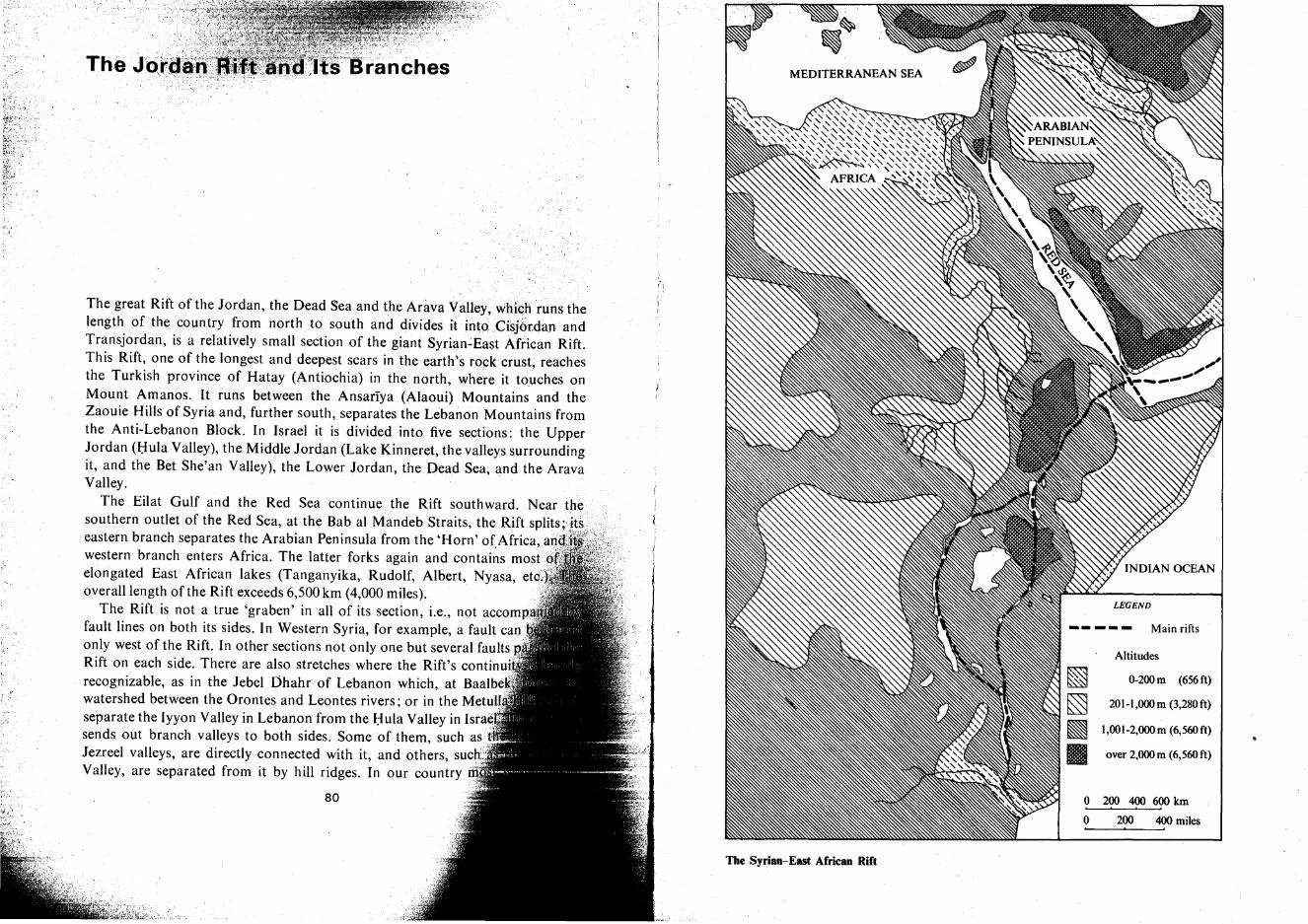
Main rifts
Altitudes
0-200m (656ft)
201-1,OOOm (3,280ft)
1,OOl-2,OOOm (6,560ft)
over 2,OOOm (6,560ft)
o 200 400 600 Ian
o 200 400 miles
The Syrian-East African Rift
The great Rift of the Jordan, the Dead Sea and the Arava ValleY,whi<;h runs thelength of the country from north to south and divides it int<:iCisj6tdanandTransjordan, is a relatively small section of the giant Syrian-East African Rift.This Rift, one of the longest and deepest scars in the earth's rockcrust, reachesthe Turkish province of Hatay (Antiochia) in the north, where it touches onMount Amanos. It runs between the Ansariya (Alaoui) Mountains and theZaouie Hills of Syria and, further south, separates the Lebanon Mountains fromthe Anti-Lebanon Block. In Israel it is divided into five sections: the UpperJordan (Hula Valley), the Middle Jordan (Lake Kinneret, the valleys surroundingit, and the Bet She'an Valley), the LowerJordan, the Dead Sea, and the AravaValley.
The Eilat Gulf and the Red Sea continue the Rift southward. Nearsouthern outlet of the Red Sea, at the Bab al Mandeb Straits, the Rift SnIITS"HS
eastern branch separates the Arabian Peninsula from the 'Horn' ofAfrica,western branch enters Africa. The latter forks again and contains mostelongated East African lakes (Tanganyika, Rudolf, Albert, Nyasa, etc'.overall length of the Rift exceeds 6,500 km (4,000 miles).
The Rift is not a true 'graben' in all of its section, i.e., not accompfault lines on both its sides. In Western Syria, for example, a fault canonly west of the Rift. In other sections not only one but several faults ,.,Rift on each side. There are also stretches where the Rift's continuirecognizable, as in the Jebel Dhahr of Lebanon which, at Baalbe]watershed between the Orontes and Leontes rivers; or in the Metulseparate the Iyyon Valley in Lebanon from the Hula Valley in Israsends out branch valleys to both sides. Some of them, such asJezreel valleys, are directly connected with it, and others, sueValley, are separated from it by hill ridges. In our country
80
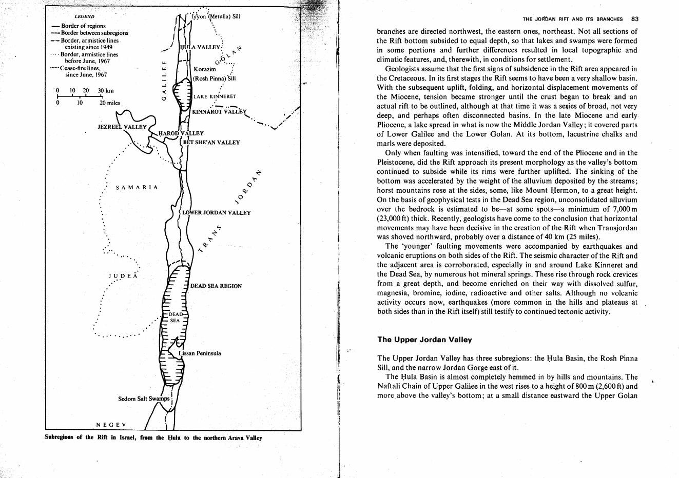
THE JOFfOAN RIFT AND ITS BRANCHES 83
branches are directed northwest, the eastern ones, northeast. Not all sections ofthe Rift bottom subsided to equal depth, so that lakes and swamps were formedin some portions and further differences resulted in local topographic andclimatic features, and, therewith, in conditions for settlement.
Geologists assume that the first signs of subsidence in the Rift area appeared inthe Cretaceous. In its first stages the Rift seems to have been a very shallow basin.With the subsequent uplift, folding, and horizontal displacement movements ofthe Miocene, tension became stronger until the crust began to break and anactual rift to be outlined, although at that time it was a series of broad, not verydeep, and perhaps often disconnected basins. In the late Miocene and earlyPliocene, a lake spread in what is now the Middle Jordan Valley; it covered partsof Lower Galilee and the Lower Golan. At its bottom, lacustrine chalks andmarls were deposited.
Only when faulting was intensified, toward the end of the Pliocene and in thePleistocene, did the Rift approach its present morphology as the valley's bottomcontinued to subside while its rims were further uplifted. The sinking of thebottom was accelerated by the weight of the alluvium deposited by the streams;horst mountains rose at the sides, some, like Mount Hermon, to a great height.On the basis of geophysical tests in the Dead Sea region, unconsolidated alluviumover the bedrock is estimated to be-at some spots-a minimum of 7,000m(23,000 ft) thick. Recently, geologists have come to the conclusion that horizontalmovements may have been decisive in the creation of the Rift when Transjordanwas shoved northward, probably over a distance of 40 km (25 miles).
The 'younger' faulting movements were accompanied by earthquakes andvolcanic eruptions on both sides of the Rift. The seismic character of the Rift andthe adjacent area is corroborated, especially in and around Lake Kinneret andthe Dead Sea, by numerous hot mineral springs. These rise through rock crevicesfrom a great depth, and become enriched on their way with dissolved sulfur,magnesia, bromine, iodine, radioactive and other salts. Although no volcanicactivity occurs now, earthquakes (more common in the hills and plateaus atboth sides than in the Rift itself) still testify to continued tectonic activity.
I •,/-" /.,"'.
LAKE KINNERET
..- ..-....
DEAD SEA REGION
wW
...J
...J
<C<.:1
.'.. .(.~.r: tulia) Sill
i "J .....I I .".
..••/ I;IULA VALLEY! ~. . t-
:0vo .....Korazim J(Rosh Pinna) 'SiII
NEGEV
J U D EA..
SAMARIA
...
.. .. . ..
o 10 20 30 kmI i I '.
o 10 20 miles
LEGEND
- Border of regions_..:-Border between subregions_.- Border, armistice lines.
existing since 1949.... Border, armistice lines
before June, 1967•••.•• Cease-fire lines,
since June, 1967
Subregions of the Rift in Israel, from the l;Iula to the northern Arava Valley
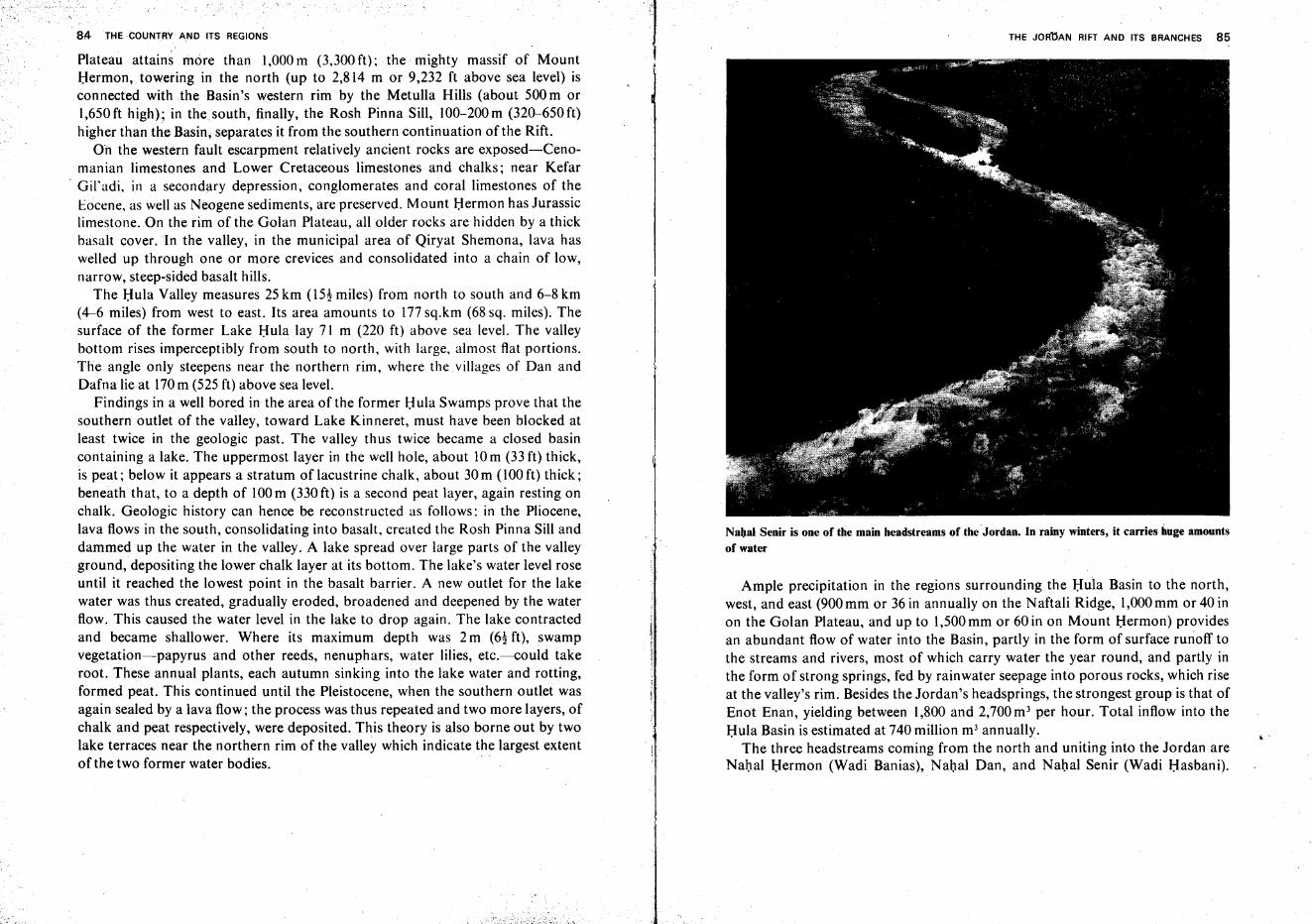
84 THE COUNTRY ANDIT$ REGIONS
Plateau attains more than 1,000 m (3,300 ft): the mighty massif of MountHermon, towering in the north (up to 2,814 m or 9,232 ft above sea level) isconnected with the Basin's western rim by the Metulla Hills (about 500 m or1,650ft high); in thesouth, finally, the Rosh Pinna Sill, 100-200m (320-650ft)higher than the Basin; separates it from the southern continuation of the Rift.
On the western fault escarpment relatively ancient rocks are exposed-Cenoman ian limestones and Lower Cretaceous limestones and chalks; near Kefar
. Gil'adi, in a secondary depression, conglomerates and coral limestones of theeocene, as well as Neogene sediments, are preserved. Mount Hermon has Jurassiclimestone. On the rim of the Golan Plateau, all older rocks are hidden by a thickbasalt cover. In the valley, in the municipal area of Qiryat Shemona, lava haswelled up through one or more crevices and consolidated into a chain of low,narrow, steep-sided basalt hills.
The Hula Valley measures 25 km (l5! miles) from north to south and 6-8 km(4-6 miles) from west to east. Its area amounts to 177sq.km (68 sq. miles). Thesurface of the former Lake Hula lay 71 m (220 ft) above sea level. The valleybottom rises imperceptibly from south to north, with large, almost flat portions.The angle only steepens near the northern rim, where the villages of Dan andDafna lie at 170m (525 ft) above sea level.
Findings in a well bored in the area of the former Hula Swamps prove that thesouthern outlet of the valley, toward Lake Kinneret, must have been blocked atleast twice in the geologic past. The valley thus twice became a closed basincontaining a lake. The uppermost layer in the well hole, about 10m (33 ft) thick,is peat; below it appears a stratum of lacustrine chalk, about 30 m (100 ft) thick;beneath that, to a depth of 100m (330ft) is a second peat layer, again resting onchalk. Geologic history can hence be reconstructed as follows: in the Pliocene,lava flows in the south, consolidating into basalt, created the Rosh Pinna Sill anddammed up the water in the valley. A lake spread over large parts of the valleyground, depositing the lower chalk layer at its bottom. The lake's water level roseuntil it reached the lowest point in the basalt barrier. A new outlet for the lakewater was thus created, gradually eroded, broadened and deepened by the waterflow. This caused the water level in the lake to drop again. The lake contractedand became shallower. Where its maximum depth was 2 m (6! ft), swampvegetation-papyrus and other reeds, nenuphars, water lilies, etc.-could takeroot. These annual plants, each autumn sinking into the lake water and rotting,formed peat. This continued until the Pleistocene, when the southern outlet wasagain sealed by a lava flow; the process was thus repeated and two more layers, ofchalk and peat respectively, were deposited. This theory is also borne out by twolake terraces near the northern rim of the valley which indicate the largest extentof the two former water bodies.
THE JORnAN RIFT AND ITS BRANCHES 85
Nabal Senir is one of the main headstreams of the Jordan. In rainy winters, it carries huge amountsof water
Ample precipitation in the regions surrounding the Hula Basin to the north,west, and east (900 mm or 36 in annually on the Naftali Ridge, 1,000mm or 40 inon the Golan Plateau, and up to 1,500mm or 60 in on Mount Hermon) providesan abundant flow of water into the Basin, partly in the form of surface runoff tothe streams and rivers, most of which carry water the year round, and partly inthe form of strong springs, fed by rainwater seepage into porous rocks, which riseat the valley's rim. Besides the Jordan's headsprings, the strongest group is that ofEnot Enan, yielding between 1,800 and 2,700 m' per hour. Total inflow into theHula Basin is estimated at 740 million m' annually.
The three headstreams coming from the north and uniting into the Jordan areNahal Hermon (Wadi Banias), Nahal Dan, and Nahal Senir (Wadi Hasbani),
.-
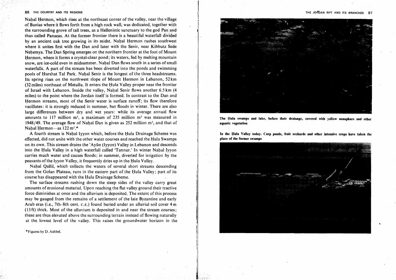
86 THE COUNTRY AND ITS REGIONS
NahalHermon.which rises at the northeast corner of the valley, near the villageof Banias where it flows forth from a high rock wall, was dedicated, together withthe surrounding grove oftall trees, as a Hellenistic sanctuary to the godPana,ndthus called Panaeas. At the former frontier there is a beautiful waterfall dividedby an ancient oak tree growing in its midst. Nahal Hermon rushes southwestwhere it unites first with the Dan and later with the Senir, near Kibbutz SedeNehemya. The Dan Spring emerges on the northern frontier at the foot of MountHermon, where it forms a crystal-dear pond; its waters, fed by melting mountainsnow, are ice-cold even in midsummer. Nahal Dan flows south in a series of smallwaterfalls. A part of the stream has been diverted into the ponds and swimmingpools of Hurshat Tal Park. Nahal Senir is the longest of the three headstreams.Its spring rises OT! the northwest slope of Mount Hermon in Lebanon, 52 km(32 miles) northeast of Metulla. It enters the Hula Valley proper near the frontierofIsrael with Lebanon. Inside the valley, Nahal Senir flows another 6.5 km (4miles) to the point where the Jordan itself is formed. In contrast to the Dan andHermon streams, most of the Senir water is surface runoff; its flow thereforevacillates: it is strongly reduced in summer, but floods in winter. There are alsolarge differences between dry and wet years: while its average annual flowamounts to 117 million m', a maximum of 235 million m' was measured in1948/4.9. The average flow of Nahal Dan is given as 252 million m', and that ofNahal Hermon-s-as 122m3.*
A fourth stream is Nahal Iyyon which, before the Hula Drainage Scheme waseffected, did not unite with the other water courses and reached the Hula Swampson its own. This stream drains the 'Ayiin (lyyon) Valley in Lebanon and descendsinto the Hula Valley in a high waterfall called 'Tannur.' In winter Nahal Iyyoncarries much water and causes floods; in summer, diverted for irrigation by thepeasants of the Iyyon Valley, it frequently dries up in the Hula Valley.
Nahal Qallil, which collects the waters of several short streams descendingfrom the Golan Plateau, runs in the eastern part of the Hula Valley; part of itscourse has disappeared with the Hula Drainage Scheme.
The surface streams rushing down the steep sides of the valley carry greatamounts of erosional material. Upon reaching the flat valley ground their tractiveforce diminishes at once and the alluvium is deposited. The extent of this processmay be gauged from the remains of a settlement of the late Byzantine and earlyArab eras (i.e., 7th-8th cent. C.E.) found buried under an alluvial soil cover 4 m(13 ft) thick. Most of the alluvium is deposited in and near the stream courses;these are thus elevated above the surrounding terrain instead of flowing naturallyat the lowest level of the valley. This raises the groundwater horizon in the
*Figures by D. Ashbel.
THE JoFl'bAN RIFT AND ITS BRANCHES 87
The Hula swamps and lake, before their drainage, covered with yellow nenuphars and otheraquatic vegetation
In the Hula Valley today. Carp ponds, fruit orchards and other intensive crops have taken theplace of the former swamps
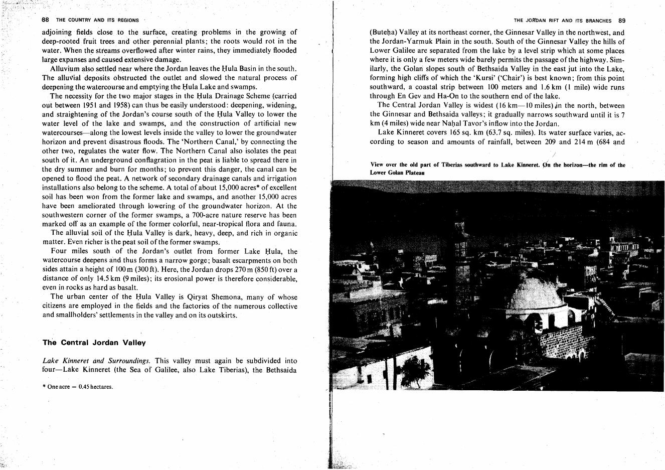
88 THE COUNTRY AND ITS REGIONS
adjoining fields close .to the surface,creating problems in the growing ofdeep-rooted fruit trees and other perennial plants; the roots would rot in thewater. When the streams overflowed after winter rains, they immediately floodedlarge expanses and caused extensive damage.
Alluvium also settled near where the Jordan leaves the Hula Basin in the south.The alluvialdeposits obstructed the outlet and slowed the natural process ofdeepening the watercourse and emptying the Hula Lake and swamps.
The necessity for the two major stages in the Hula Drainage Scheme (carriedout between 1951 and 1958) can thus be easily understood: deepening, widening,and straightening of the Jordan's course south of the Hula Valley to lower thewater level of the lake and swamps, and the construction of artificial newwatercourses-along the lowest levels inside the valley to lower the groundwaterhorizon and prevent disastrous floods. The 'Northern Canal,' by connecting theother two, regulates the water flow. The Northern Canal also isolates the peatsouth of it. An underground conflagration in the peat is liable to spread there inthe dry summer and burn for months; to prevent this danger, the canal can beopened to flood the peat. A network of secondary drainage canals and irrigationinstallations also belong to the scheme. A total of about 15,000 acres* of excellentsoil has been won from the former lake and swamps, and another 15,000 acreshave been ameliorated through lowering of the groundwater horizon. At thesouthwestern corner of the former swamps, a 700-acre nature reserve has beenmarked off as an example of the former colorful, near-tropical flora and fauna.
The alluvial soil of the Hula Valley is dark, heavy, deep, and rich in organicmatter. Even richer is the peat soil ofthe former swamps.
Four miles south of the Jordan's outlet from former Lake Hula, thewatercourse deepens and thus forms a narrow gorge; basalt escarpments on bothsides attain a height of 100m (300 ft). Here, the Jordan drops 270 m (850 ft) over adistance of only 14.5km (9 miles); its erosional power is therefore considerable,even in rocks as hard as basalt.
The urban center of the Hula Valley is Qiryat Shemona, many of whosecitizens are employed in the fields and the factories of the numerous collectiveand smallholders' settlements in the valley and on its outskirts.
The Central Jordan Valley
Lake Kinneret and Surroundings. This valley must again be subdivided intofour-Lake Kinneret (the Sea of Galilee, also Like Tiberias), the Bethsaida
* One acre = 0.45 hectares.
THE JOR'DAN RIFT AND ITS BRANCHES 89
(Buteha) Valley at its northeast corner, the Ginnesar Valley in the northwest, andthe Jordan-Yarmuk Plain in the south. South of the Ginnesar Valley the hills ofLower Galilee are separated from the lake by a level strip which at some placeswhere it is only a few meters wide barely permits the passage of the highway. Similarly, the Golan slopes south of Bethsaida Valley in the east jut into the Lake,forming high cliffs of which the 'Kursi' ('Chair') is best known; from this pointsouthward, a coastal strip between 100 meters and 1.6 km (I mile) wide runsthrough En Gev and Ha-On to the southern end of the lake.
The Central Jordan Valley is widest (16 km-lO milesj.Jn the north, betweenthe Ginnesar and Bethsaida valleys; it gradually narrows southward until it is 7km (4 miles) wide near Nahal Tavor's inflow into the Jordan.
Lake Kinneret covers 165 sq. km (63.7 sq. miles). Its water surface varies, according to season and amounts of rainfall, between 209 and 214 m (684 and
/View over the old part of Tiberias southward to Lake Kinneret. (in the horizon-the rim of theLower Golan Plateau
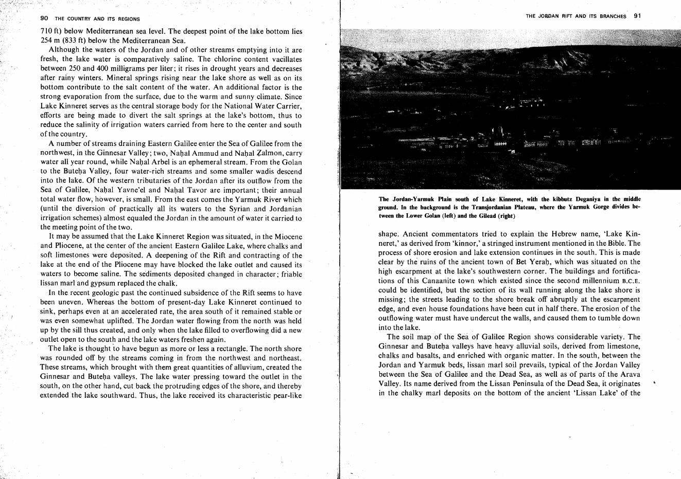
90 THE COUNTRY ANo ITS REGIONS
710 ft) below Mediterranean sea level. The deepest point of the lake bottom lies254 m (833 ft) below the Mediterranean Sea.
Although the waters of the Jordan and of other streams emptying into it .arefresh, the lake water is comparatively saline. The chlorine content vacillatesbetween 250 and 400 milligrams per liter; it rises in drought years and decreasesafter rainy winters. Mineral springs rising near the lake shore as well as on itsbottom contribute to the salt content of the water. An additional factor is thestrong evaporation from the surface, due to the warm and sunny climate. SinceLake Kinneret serves as the central storage body for the National Water Carrier,efforts are being made to divert the salt springs at the lake's bottom, thus toreduce the salinity of irrigation waters carried from here to the center and southof the country.
A number of streams draining Eastern Galilee enter the Sea of Galilee from thenorthwest, in the Ginnesar Valley; two, Nahal Ammud and Nahal Zalmon, carrywater all year round, while Nahal Arbel is an ephemeral stream. From the Golanto the Buteha Valley, four water-rich streams and some smaller wadis descendinto the lake. Of the western tributaries of the Jordan after its outflow from theSea of Galilee, Nahal Yavne'el and Nahal Tavor are important; their annualtotal water flow, however, is small. From the east comes the Yarmuk River which(until the diversion of practically all its waters to the Syrian and Jordanianirrigation schemes) almost equaled the Jordan in the amount of water it carried tothe meeting point of the two.
It may be assumed that the Lake Kinneret Region was situated, in the Mioceneand Pliocene, at the center of the ancient Eastern Galilee Lake, where chalks andsoft limestones were deposited. A deepening of the Rift and contracting of thelake at the end of the Pliocene may have blocked the lake outlet and caused itswaters to become saline. The sediments deposited changed in character; friablelissan marl and gypsum replaced the chalk.
In the recent geologic past the continued subsidence of the Rift seems to havebeen uneven. Whereas the bottom of present-day Lake Kinneret continued tosink, perhaps even at an accelerated rate, the area south of it remained stable orwas even somewhat uplifted. The Jordan water flowing from the north was heldup by the sill thus created, and only when the lake filled to overflowing did a newoutlet open to the south and the lake waters freshen again.
The lake is thought "to have begun as more or less a rectangle. The north shorewas rounded off by the streams coming in from the northwest and northeast.These streams, which brought with them great quantities of alluvium, created theGinnesar and Buteha valleys. The lake water pressing toward the outlet in thesouth, on the other hand, cut back the protruding edges of the shore, and therebyextended the lake southward. Thus, the lake received its characteristic pear-like
THE JORDAN RIFT AND ITS BRANCHES 91
The Jordan-Yarmuk Plain south of Lake Kinneret, with the kibbutz Deganiya in the middleground. In the background is the Transjordanian Plateau, where the Yarmuk Gorge divides be
tween the Lower Golan (left) and the Gilead (right)
shape. Ancient commentators tried to explain the Hebrew name, 'Lake Kinneret,' as derived from 'kinnor,' a stringed instrument mentioned in the Bible. Theprocess of shore erosion and lake extension continues in the south. This is madeclear by the ruins of the ancient town of Bet Yerah, which was situated on thehigh escarpment at the lake's southwestern corner. The buildings and fortifications of this Canaanite town which existed since the second millennium B.C.E.
could be identified, but the section of its wall running along the lake shore ismissing; the streets leading to the shore break off abruptly at the escarpmentedge, and even house foundations have been cut in half there. The erosion of theoutflowing water must have undercut the walls, and caused them to tumble downinto the lake.
The soil map of the Sea of Galilee Region shows considerable variety. TheGinnesar and Buteha valleys have heavy alluvial soils, derived from limestone,chalks and basalts, and enriched with organic matter. In the south, between theJordan and Yarmuk beds, lissan marl soil prevails, typical of the Jordan Valleybetween the Sea of Galilee and the Dead Sea, as well as of parts of the AravaValley. Its name derived from the Lissan Peninsula of the Dead Sea, it originatesin the chalky marl deposits on the bottom of the ancient 'Lissan Lake' of the
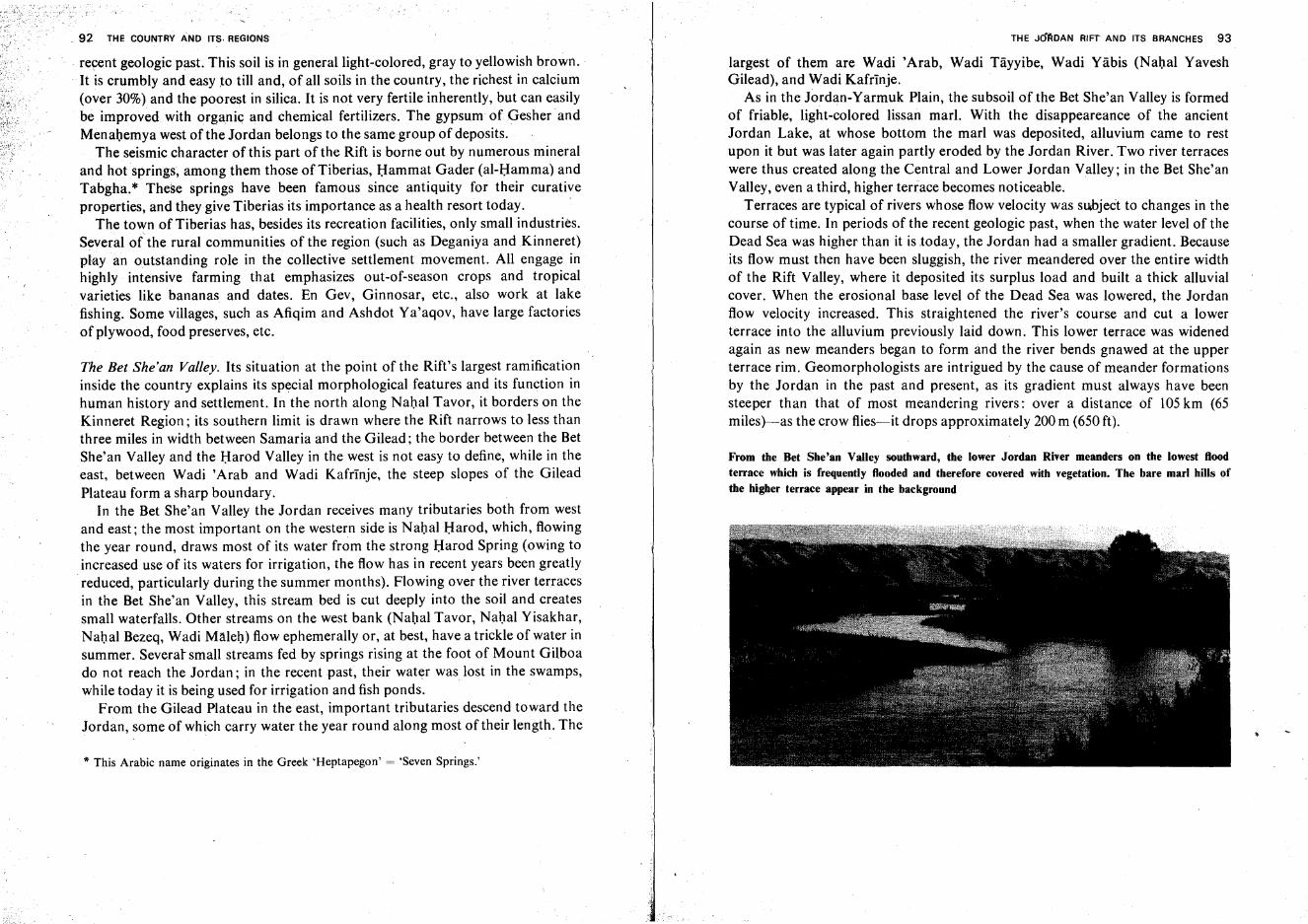
92 THE COUNTRY AND ITS. REGIONS
. recent geologic past. This soil is in general light-colored, gray to yellowish brown.
. It is crumbly and easy to till and, of all soils in the country, the richest in calcium(over 30%) and the poorest in silica. It is not very fertile inherently, but can easilybe improved with organic and chemical fertilizers. The gypsum of Gesher andMenahemya west of the Jordan belongs to the same group of deposits.
The seismic character of this part of the Rift is borne out by numerous mineraland hot springs, among them those of Tiberias, Hammat Gader (al-Harnma) andTabgha.* These springs have been famous since antiquity for their curativeproperties, and they give Tiberias its importance as a health resort today.
The town of Tiberias has, besides its recreation facilities, only small industries.Several of the rural communities of the region (such as Deganiya and Kinneret)play an outstanding role in the collective settlement movement. All engage inhighly intensive farming that emphasizes out-of-season crops and tropicalvarieties like bananas and dates. En Gev, Ginnosar, etc., also work at lakefishing. Some villages, such as Afiqim and Ashdot Ya'aqov, have large factoriesof plywood, food preserves, etc.
The Bet She'an Valley. Its situation at the point of the Rift's largest ramificationinside the country explains its special morphological features and its function inhuman history and settlement. In the north along Nahal Tavor, it borders on theKinneret Region; its southern limit is drawn where the Rift narrows to less thanthree miles in width between Samaria and the Gilead; the border between the BetShe'an Valley and the Harod Valley in the west is not easy to define, while in theeast, between Wadi 'Arab and Wadi Kafrinje, the steep slopes of the GileadPlateau form a sharp boundary.
In the Bet She'an Valley the Jordan receives many tributaries both from westand east; the most important on the western side is Nahal Harod, which, flowingthe year round, draws most of its water from the strong Harod Spring (owing toincreased use of its waters for irrigation, the flow has in recent years been greatlyreduced, particularly during the summer months). Flowing over the river terracesin the Bet She'an Valley, this stream bed is cut deeply into the soil and createssmall waterfalls. Other streams on the west bank (Nahal Tavor, Nahal Yisakhar,Nahal Bezeq, Wadi Maleh) flow ephemerally or, at best, have a trickle of water insummer. Several small streams fed by springs rising at the foot of Mount Gilboado not reach the Jordan; in the recent past, their water was lost in the swamps,while today it is being used for irrigation and fish ponds.
From the Gilead Plateau in the east, important tributaries descend toward theJordan, some of which carry water the year round along most of their length. The
if This Arabic name originates in the Greek 'Heptapegon' = 'Seven Springs.'
.1 THE J6flDAN RIFT AND ITS BRANCHES 93
largest of them are Wadi 'Arab, Wadi Tayyibe, Wadi Yabis (Nahal YaveshGilead), and Wadi Kafrinje.
As in the Jordan-Yarmuk Plain, the subsoil of the Bet She'an Valley is formedof friable, light-colored lissan marl. With the disappeareance of the ancientJordan Lake, at whose bottom the marl was deposited, alluvium came to restupon it but was later again partly eroded by the Jordan River. Two river terraceswere thus created along the Central and Lower Jordan Valley; in the Bet She'anValley, even a third, higher terrace becomes noticeable.
Terraces are typical of rivers whose flow velocity was subject to changes in thecourse of time. In periods of the recent geologic past, when the water level of theDead Sea was higher than it is today, the Jordan had a smaller gradient. Becauseits flow must then have been sluggish, the river meandered over the entire widthof the Rift Valley, where it deposited its surplus load and built a thick alluvialcover. When the erosional base level of the Dead Sea was lowered, the Jordanflow velocity increased. This straightened the river's course and cut a lowerterrace into the alluvium previously laid down. This lower terrace was widenedagain as new meanders began to form and the river bends gnawed at the upperterrace rim. Geomorphologists are intrigued by the cause of meander formationsby the Jordan in the past and present, as its gradient must always have beensteeper than that of most meandering rivers: over a distance of 105km (65miles)-as the crow flies-it drops approximately 200 m (650 ft).
From the Bet She'an Valley southward, the lower Jordan River meanders on the lowest floodterrace which is frequently flooded and therefore covered with vegetation. The bare marl hills ofthe higher terrace appear in the background
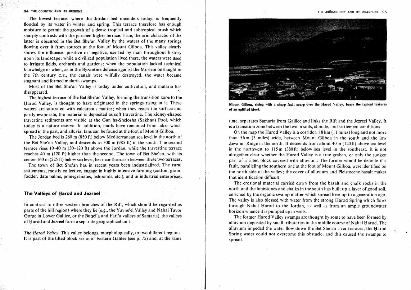
,94 THE CQUNTRYAND ITSRE~IONS
The lowest terrace, where the Jordan "bed meanders today, is frequentlyflooded by its water in winter and spring. This terrace therefore has enoughmoisture to permit the growth of a dense tropical and subtropical brush whichsharply contrasts with the parched higher terrace. True, the arid character of thelatter is obscured in the Bet She'an Valley by the waters of the many springsflowing over it from sources at the foot of Mount Gilboa. This valley clearlyshows the influence, positive or negative, exerted by man throughout historyupon its landscape; while a civilized population lived there, the waters were usedto irrigate fields, orchards and gardens; when the population lacked technicalknowledge or when, as in the Byzantine defense against the Moslem onslaught inthe 7th century C.E., the canals were wilfully .destroyed, the water becamestagnant and formed malaria swamps.
Most of the Bet She'an Valley is today under cultivation, and malaria hasdisappeared.
The highest terrace of the Bet She'an Valley, forming the transition zone to theHarod Valley, is thought to have originated in the springs rising in it. Thesewaters are saturated with calcareous matter; when they reach the surface andpartly evaporate, the material is deposited as soft travertine. The kidney-shapedtravertine sediments are visible at the Gan ha-Shelosha (Sakhna) Pool, whichtoday is a nature reserve. In addition, marls have remained from lakes whichspread in the past, and alluvial fans can be found at the foot of Mount Gilboa.
The Jordan bed is 260 m (850 ft) below Mediterranean sea level in the north ofthe Bet She'an Valley, and descends to 300 m (985 ft) in the south. The secondterrace rises 10-40 m (30-120 ft) above the Jordan, while the travertine terracereaches 40 m (120 ft) higher than the second. The town of Bet She'an, with itscenter 160 m (525 ft) below sea level, lies near the scarp between these two terraces.
The town of Bet She'an has in recent years been industrialized. The ruralsettlements, mostly collective, engage in highly intensive farming (cotton, grain,fodder, date palms, pomegranates, fishponds, etc.), and in industrial enterprises.
The Valleys ofJ:larodand Jezreel
In contrast to other western branches of the Rift, which should be regarded asparts of the hill regions where they lie (e.g., the Yavne'el Valley and Nahal.TavorGorge in Lower Galilee, or the Buqei'a and Fari'a valleys of Samaria), the valleysof Harod and Jezreel form a separate geographical unit.
The Harod Valley. This valley belongs, morphologically, to two different regions.It is part of the tilted block series of Eastern Galilee (see p. 75) and, at the same
I,1I
THE JO'RDAN RIFT AND ITS BRANCHES 95
Mount Gilboa, rising with a sharp fault scarp over the Harod Valley, bears the typical featuresof an uplifted block
time, separates Samaria from Galilee and links the Rift and the Jezreel Valley. Itis a transition zone between the two in soils, climate, and settlement conditions.
On the map the Harod Valley is a corridor, 18km (11 miles) long and not morethan 5 km (3 miles) wide, between Mount Gilboa in the south and the lowZeva'im Ridge in the north. It descends from about 40m (120ft) above sea levelin the northwest to 115m (380 ft) below sea level in the southeast. It is notaltogether clear whether the Harod Valley is a true graben, or only the sunkenpart of a tilted block covered with alluvium. The former would be definite if afault, paralleling the southern one at the foot of Mount Gilboa, were identified onthe north side of the valley; the cover of alluvium and Pleistocene basalt makesthat identification difficult.
The erosional material carried down from the basalt and chalk rocks in thenorth and the limestones and chalks in the south has built up a layer of good soil,enriched by the organic swamp matter which spread here up to a generation ago.The valley is also blessed with water from the strong Harod Spring which flowsthrough Nahal Harod to the Jordan, as well as from an ample groundwaterhorizon whence it is pumped up in wells.
The former Harod Valley swamps are thought by some to have been formed byalluvium deposited by small tributaries in the middle course of Nahal Harod. Thealluvium impeded the water flow down the Bet She' an river terraces; the HarodSpring water could not overcome this obstacle, and this caused the swamps tospread.
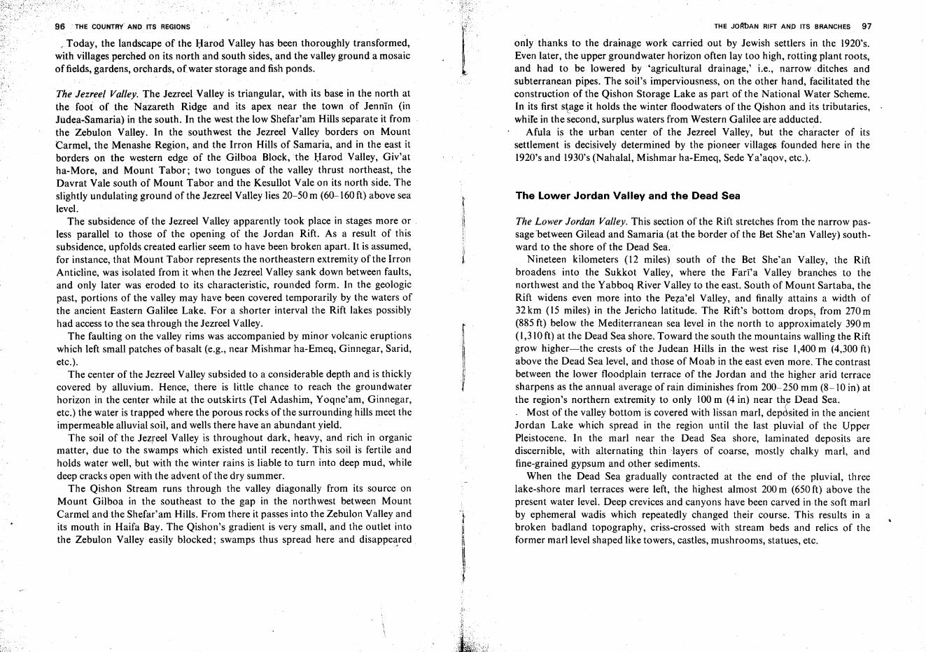
96 THE COUNTRY AND ITS REGIONS
The lower Jordan Valley and the Dead Sea
The Lower Jordan Valley. This section of the Rift stretches from the narrow passagebetween Gilead and Samaria (at the border of the Bet She'an Valley) southward to the shore of the Dead Sea.
Nineteen kilometers (12 miles) south of the Bet She'an Valley, the Riftbroadens into the Sukkot Valley, where the Farl'a Valley branches to thenorthwest and the Yabboq River Valley to the east. South of Mount Sartaba, theRift widens even more into the Peza'el Valley, and finally attains a width of32 km (15 miles) in the Jericho latitude. The Rift's bottom drops! from 270 m(885 ft) below the Mediterranean sea level in the north to approximately 390 m(1,310 ft) at the Dead Sea shore. Toward the south the mountains walling the Riftgrow higher-the crests of the Judean Hills in the west rise 1,400 m (4,300 ft)above the Dead Sea level, and those of Moab in the east even more. The contrastbetween the lower floodplain terrace of the Jordan and the higher arid terracesharpens as the annual average of rain diminishes from 200-250 mm (8-10 in) atthe region's northern extremity to only 100 m (4 in) near the Dead Sea.. Most of the valley bottom is covered with lissan marl, dep6sited in the ancientJordan Lake which spread in the region until the last pluvial of the UpperPleistocene. In the marl near the Dead Sea shore, laminated deposits arediscernible, with alternating thin layers of coarse, mostly chalky marl, andfine-grained gypsum and other sediments.
When the Dead Sea gradually contracted at the end of the pluvial, threelake-shore marl terraces were left, the highest almost 200 m (650 ft) above thepresent water level. Deep crevices and canyons have been carved in the soft marlby ephemeral wadis which repeatedly changed their course. This results in abroken badland topography, criss-crossed with stream beds and relics of theformer marl level shaped like towers, castles, mushrooms, statues, etc.
THE JOM>AN RIFT AND ITS BRANCHES 97
only thanks to the drainage work carried out by Jewish settlers in the 1920's.Even later, the upper groundwater horizon often lay too high, rotting plant roots,and had to be lowered by 'agricultural drainage,' i.e., narrow ditches andsubterranean pipes. The soil's imperviousness, on the other hand, facilitated theconstruction of the Qishon Storage Lake as part of the National Water Scheme.In its first stage it holds the winter floodwaters of the Qishon and its tributaries,while in the second, surplus waters from Western Galilee are adducted.
Afula is the urban center of the Jezreel Valley, but the character of itssettlement is decisively determined by the pioneer villages founded here in the1920's and 1930's (Nahalal, Mishmar ha-Emeq, Sede Ya'aqov, etc.).
rIIIi!it
f
The Jezreel Valley.The Jezreel Valley is triangular, with its base in the north atthe foot of the Nazareth Ridge and its apex near the town of Jennin (inJUdea-Samaria) in the south. In the west the low Shefar'am Hills separate it fromthe Zebulon Valley. In the southwest the Jezreel Valley borders on MountCarmel, the Menashe Region, and the Irron Hills of Samaria, and in the east itborders on the western edge of the Gilboa Block, the Harod Valley, Giv'atha-More, and Mount Tabor; two tongues of the valley thrust northeast, theDavrat Vale south of Mount Tabor and the Kesullot Vale on its north side. Theslightly undulating ground of the Jezreel Valley lies 20-50 m (60-160 ft) above sealevel.
The subsidence of the Jezreel Valley apparently took place in stages more or .less parallel to those of the opening of the Jordan Rift. As a result of thissubsidence, upfolds created earlier seem to have been broken apart. It is assumed,for instance, that Mount Tabor represents the northeastern extremity of the IrronAnticline, was isolated from it when the Jezreel Valley sank down between faults,and only later was eroded to its characteristic, rounded form. In the geologicpast, portions of the valley may have been covered temporarily by the waters ofthe ancient Eastern Galilee Lake. For a shorter interval the Rift lakes possiblyhad access to the sea through the Jezreel Valley.
The faulting on the valley rims was accompanied by minor volcanic eruptionswhich left small patches of basalt (e.g., near Mishmar ha-Emeq, Ginnegar, Sarid,etc.).
The center of the Jezreel Valley subsided to a considerable depth and is thicklycovered by alluvium. Hence, there is little chance to reach the groundwaterhorizon in the center while at the outskirts (Tel Adashim, Yoqne'am, Ginnegar,etc.) the water is trapped where the porous rocks of the surrounding hills meet theimpermeable alluvial soil, and wells there have an abundant yield.
The soil of the Jezreel Valley is throughout dark, heavy, and rich in organicmatter, due to the swamps which existed until recently. This soil is fertile andholds water well, but with the winter rains is liable to turn into deep mud, whiledeep cracks open with the advent of the dry summer.
The Qishon Stream runs through the valley diagonally from its source onMount Gilboa in the southeast to the gap in the northwest between MountCarmel and the Shefar'am Hills. From there it passes into the Zebulon Valley andits mouth in Haifa Bay. The Qishon's gradient is very small, and the outlet intothe Zebulon Valley easily blocked; swamps thus spread here and disappeared
/ Today, the landscape of the Harod Valley has been thoroughly transformed,with villages perched on its north and south sides, and the valley ground a mosaicof fields, gardens, orchards, ofwater storage and fish ponds.
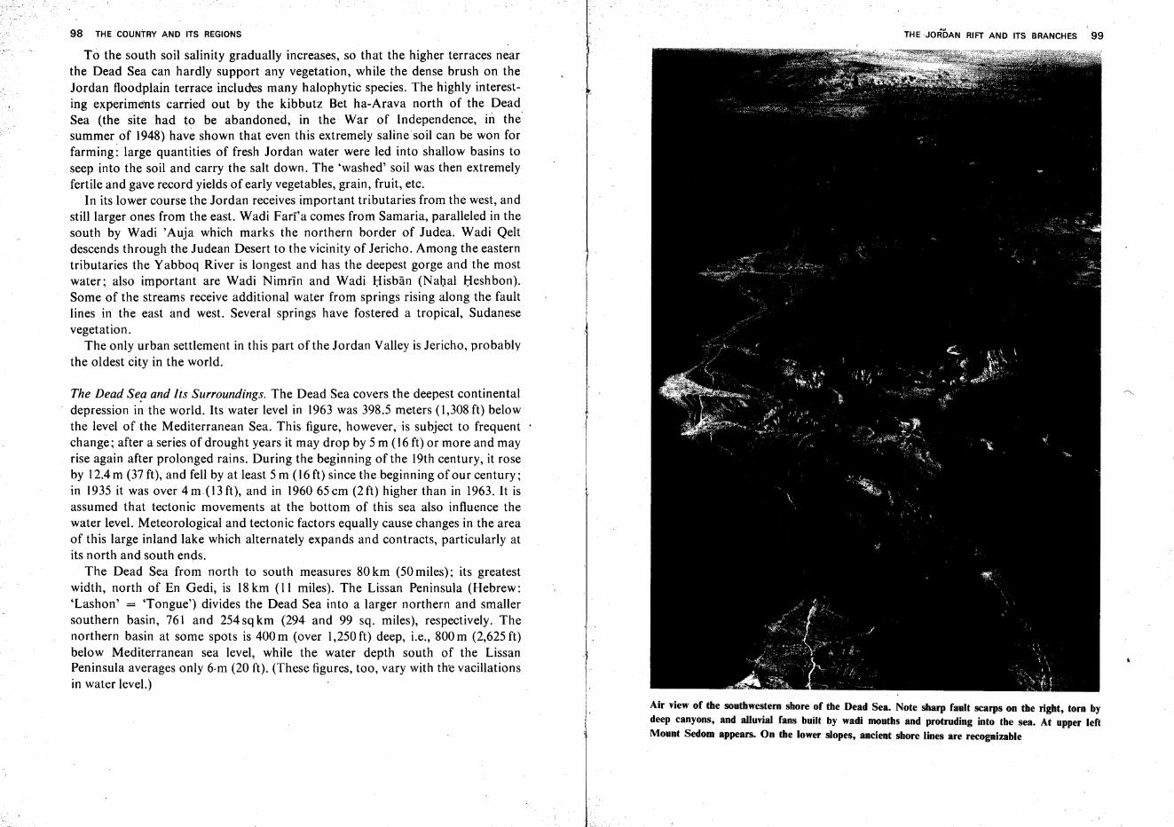
98 THE COUNTRY AND ITS REGIONS
To the south soil salinity gradually increases, so that the higher terraces nearthe Dead Sea can hardly support any vegetation, while the dense brush on theJordan floodplain terrace includes many halophytic species. The highly interesting experiments carried out by the kibbutz Bet ha-Arava north of the DeadSea (the site had to be abandoned, in the War of Independence, in thesummer of 1948) have shown that even this extremely saline soil can be won forfarming: large quantities of fresh Jordan water were led into shallow basins toseep into the soil and carry the salt down. The 'washed' soil was then extremelyfertile and gave record yields of early vegetables, grain, fruit, etc.
In its lower course the Jordan receives important tributaries from the west, andstill larger ones from the east. Wadi Farra comes from Samaria, paralleled in thesouth by Wadi 'Auja which marks the northern border of Judea. Wadi Qeltdescends through the Judean Desert to the vicinity of Jericho. Among the easterntributaries the Yabboq River is longest and has the deepest gorge and the mostwater; also important are Wadi Nimrin and Wadi Hisban (Nahal Heshbon).Some of the streams receive additional water from springs rising along the faultlines in the east and west. Several springs have fostered a tropical, Sudanesevegetation.
The only urban settlement in this part ofthe Jordan Valley is Jericho, probablythe oldest city in the world.
The Dead Sea and Its Surroundings. The Dead Sea covers the deepest continentaldepression in the world. Its water level in 1963 was 398.5 meters (1,308 ft) belowthe level of the Mediterranean Sea. This figure, however,is subject to frequentchange; after a series of drought years it may drop by 5 m (16 ft) or more and mayrise again after prolonged rains. During the beginning of the 19th century, it roseby 12.4 m (37 ft), and fell by at least 5 m (16 ft) since the beginning of our century;in 1935 it was over4 m.(13 ft), and in 196065 em (2 ft) higher than in 1963. It isassumed that tectonic movements at the bottom of this sea also influence thewater level. Meteorological and tectonic factors equally cause changes in the areaof this large inland lake which alternately expands and contracts, particularly atits north and south ends.
The Dead Sea from north to south measures 80 km (50 miles); its greatestwidth, north of En Gedi, is 18km (11 miles). The Lissan Peninsula (Hebrew:'Lashon' = 'Tongue') divides the Dead Sea into a larger northern and smallersouthern basin, 761 and 254 sq km (294 and 99 sq. miles), respectively. Thenorthern basin at some spots is 400 m (over 1,250 ft) deep, i.e., 800 m (2,625 ft)below Mediterranean sea level, while the water depth south of the LissanPeninsula averages only 6·m (20 ft). (These figures, too, vary with the vacillationsin water level.)
j1
THE ·JoRDAN RIFT AND ITS BRANCHES 99
Air view of the southwestern shore of the Dead Sea. Note sharp fault scarps on the right, torn bydeep canyons, and alluvial fans built by wadi mouths and protruding into the sea. At upper leftMount Sedom appears. On the lower slopes, ancient shore lines are recognizable
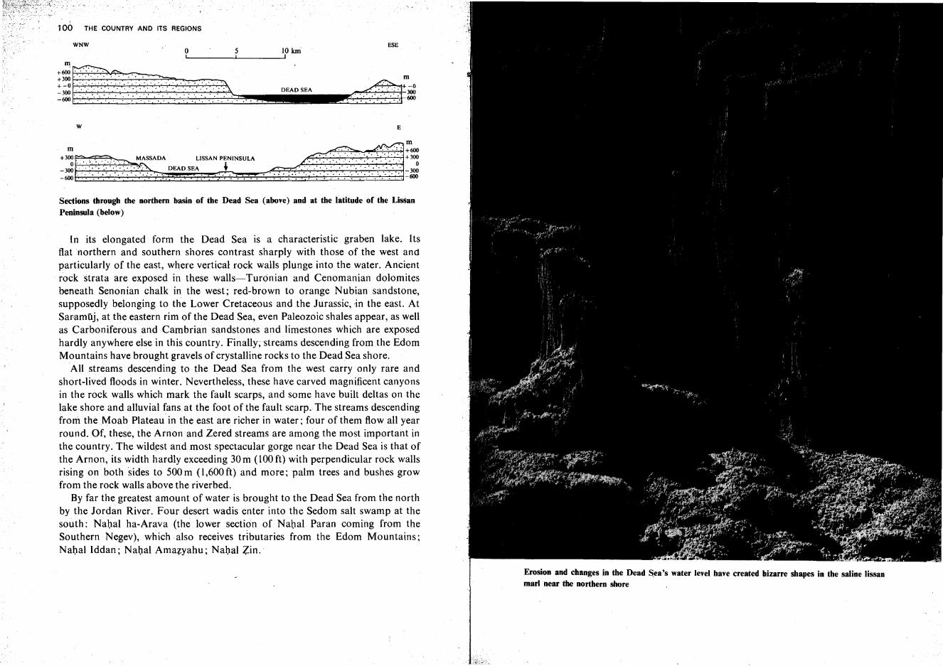
E
ESE
---- -DEAD SEA
W
WNW5I
m
+3~rr8EjD:rASSADA LISSAN PENINSULA-300.·.·.·:.:·.·:· ...~ DEAD SEA ~-600:.. ·....•...... "=7':"",:,, .. : TO ':'0 T, •••• '.1.
Sections through the northern basin of the Dead Sea (above) and at the latitude of the LisSanPeninsula (below)
In its elongated form the Dead Sea is a characteristic graben lake. Itsflat northern and southern shores contrast sharply with those of the west andparticularly of the east, where vertical rock walls plunge into the water. Ancientrock strata are exposed in these walls-Turonian and Cenomanian dolomitesbeneath Senonian chalk in the west; red-brown to orange Nubian sandstone,supposedly belonging to the Lower Cretaceous and the Jurassic, 'in the east. AtSaramuj, at the eastern rim of the Dead Sea, even Paleozoic shales appear, as wellas Carboniferous and Cambrian sandstones and limestones which are exposedhardly anywhere else in this country. Finally; streams descending from the EdomMountains have brought gravels of crystalline rocks to the Dead Sea shore.
All streams descending to the Dead Sea from the west carry only rare andshort-lived floods in winter. Nevertheless, these have carved magnificent canyonsin the rock walls which mark the fault scarps, and some have built deltas on thelake shore and alluvial fans at the foot of the fault scarp. The streams descendingfrom the Moab Plateau in the east are richer in water; four of them flow all yearround. Of, these, the Arnon and Zered streams are among the most important inthe country.The wildest and.most spectacular gorge near the Dead Sea is that ofthe Arnon, its width hardly exceeding 30 m (100 ft) with perpendicular rock wallsrising on both sides to 500m (I,600ft) and more; palm trees and bushes growfrom the rock walls above the riverbed.
By far the greatest amount of water is brought to the Dead Sea from the northby the Jordan River. Four desert wadis enter into the Sedom salt swamp at thesouth: Nahal ha-Arava (the lower section of Nahal Paran coming from theSouthern Negev), which also receives tributaries from the Edom Mountains;Nabal Iddan ; Nabal Amazyahu: Nabal Zin.
100 THE COUNTRY AND ITS REGIONS
Erosion and changes in the Dead Sea's water level have created bizarre shapes in the saline Iissanmarl near the northern shore
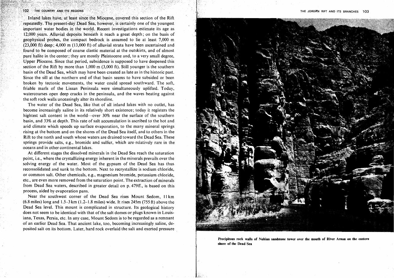
:J'."""'I.,. r<lllip"h'!iv';;./'~If'npgj;,t,"'·h",..·t']hl'fMjI6c,erH~,>c:Q"~re:d this section of the RiftMpr'ese:n~·'<i1ayJ..1eia<i1S.ell;lh6;we;ver, i",,,prf<>lnlv one of the youngest
."'"''',"lIll investigations estimate its age asit reach a great depth; on the basis of
bedrock is assumed to lie at least 7,000 mm (13,000 ft) of alluvial strata have been ascertained and
composed of coarse clastic material at the outskirts, and of almostin the center; they are mostly Pleistocene and, to a very small degree,
Pliocene. Since that period, subsidence is supposed to have deepened thissection of the Rift by more than 1,000 m (3,000 ft). Still younger is the southernbasin of the Dead Sea, which may have been created as late as in the historic past.Since the sill at the northern end of that basin seems to have subsided or beenbroken by tectonic movements, the water could spread southward. The soft,friable marls of the Lissan Peninsula were simultaneously uplifted. Today,watercourses open deep cracks in the peninsula, and the waves beating againstthe soft rock walls unceasingly alter its shoreline,
The water of the Dead Sea, like that of all inland lakes with no outlet, hasbecome increasingly saline in its relatively short existence; today it registers thehightest salt content in the world-over 30% near the surface of the southernbasin, and 33% at depth. This rate of salt accumulation is ascribed to the hot andarid climate which speeds up surface evaporation, to the many mineral springsrising at the bottom and on the shores of the Dead Sea itself, and to others in theRift to the north and south whose waters are drained toward the Dead Sea. Thesesprings provide salts, e.g., bromide and sulfur, which are relatively rare in theoceans and in other continental lakes.
At different stages the dissolved minerals in the Dead Sea reach the saturationpoint, i.e., where the crystallizing energy inherent in the minerals prevails over thesolving energy of the water. Most of the gypsum of the Dead Sea has thusreconsolidated and sunk to the bottom. Next to recrystallize is sodium chloride,or common salt. Other chemicals, e.g., magnesium bromide, potassium chloride,etc., are even more removed from the saturation point. The extraction of mineralsfrom Dead Sea waters, described in greater detail on p. 479ff., is based on thisprocess, aided by evaporation pans.
Near the southwest corner of the Dead Sea rises Mount Sedom, 11 km(6.8 miles) long and 1.5-3 km (1.2-1.8 miles) wide. It rises 245m (755 ft) above theDead Sea level. This mount is complicated in structure. Its geological historydoes not seem to be identical with that of the salt domes or plugs known in Louisiana, Texas, Persia, etc. In any case, Mount Sedom is to be regardedas a remnantof an earlier Dead Sea. That ancient lake, too, becoming increasingly saline, deposited salt on its bottom. Later, hard rock overlaid the salt and exerted pressure
THE JORD~N RIFT AND ITS BRANCHES 103
Precipitous rock walls of Nubian sandstone tower over the mouth of River Arnon on the easternshore of the Dead Sea
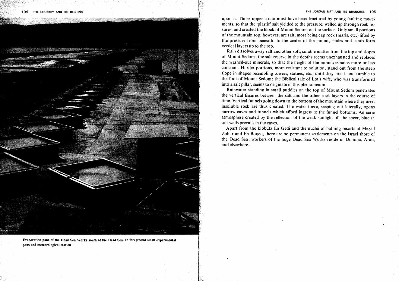
THE COUNTRY AND ITS REGIONS
Evaporation pans of the Dead Sea Works south of the Dead Sea. In foreground small experimentalpans and meteorological station
THE JORDAN RIFT AND ITS BRANCHES 105
upon it. Those upper strata must have been fractured by young faulting movements, so that the 'plastic' salt yielded to the pressure, welled up through rook fissures, and created the block of Mount Sedom on the surface. Only small portionsof the mountain top, however, are salt, most being cap rock (marls, etc.) lifted bythe pressure from beneath. In the center of the mount, shales and sands formvertical layers up to the top.
Rain dissolves away salt and other soft, soluble matter from the top and slopesof Mount Sedom; the salt reserve in the depths seems unexhausted and replacesthe washed-out minerals, so that the height of the mount, remains more or lessconstant. Harder portions, more resistant to solution, stand out from the steepslope in shapes resembling towers, statues, etc., until they break and tumble tothe foot of Mount Sedom; the Biblical tale of Lot's wife, who was transformedinto a salt pillar, seems to originate in this phenomenon.
Rainwater standing in small puddles on the top of Mount Sedom penetratesthe vertical fissures between the salt and the other rock layers in the course oftime. Vertical funnels going down to the bottom of the mountain where they meetinsoluble rock are thus created. The water there, seeping out laterally, opensnarrow caves and tunnels which afford ingress to the funnel bottoms. An eerieatmosphere created by the reflection of the weak sunlight off the sheer, blueishsalt walls prevails in the caves.
Apart from the kibbutz En Gedi and the nuclei of bathing resorts at MezadZohar and En Boqeq, there are no permanent settlements on the Israel shore ofthe Dead Sea; workers of the huge Dead Sea Works reside in Dimona, Arad,and elsewhere.
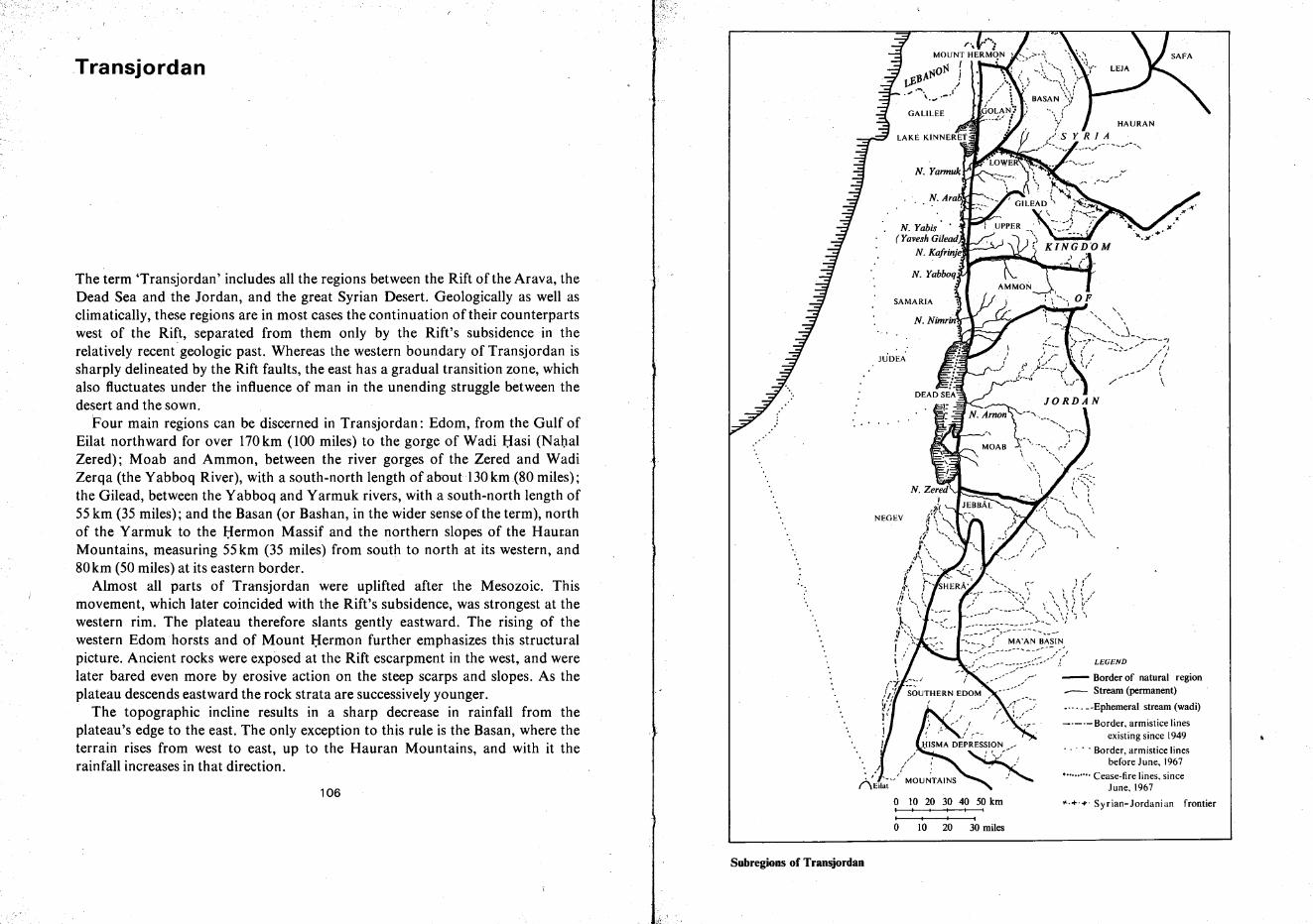
-'-'- Border, armistice linesexisting since 1949
..... Border, armistice linesbefore June, 1967
•••....••. Cease-fire lines, sinceJune, 1967
.... + ..... Syrian-Jordanian frontier
/C'" : (
\ l ( ~ ,/~ \ \ ( ~..
~ ..... \ I ... ...
\ \ \1 I 1____ ->- ....... I
o 10 20 30 40 50 kmI' I I I
I I I I
o 10 20 30 miles
~~~~-;2~~~~;~~~,~~~~~-,i .' r- _:.-: -- _~:;::o:-::.,J'- LEGEND
(-J: :::-/ i ,- - Border of natural region/.// SOUTHERN EDOM -- Stream (permanent):!,' _.-. _.-Ephemeral stream (wadi))'
NEGEV
106
The term 'Transjordan' includes all the regions between the Rift of the Arava, theDead Sea and the Jordan, and the great Syrian Desert. Geologically as well asclimatically, these regions are in most cases the continuation of their counterpartswest of the Rift, separated from them only by the Rift's subsidence in therelatively recent geologic past. Whereas the western boundary of Transjordan issharply delineated by the Rift faults, the east has a gradual transition zone, whichalso fluctuates under the influence of man in the unending struggle between thedesert and the sown.
Four main regions can be discerned in Transjordan: Edom, from the Gulf ofEilat northward for over 170km (100 miles) to the gorge of Wadi Basi (NahalZered); Moab and Ammon, between the river gorges of the Zered and WadiZerqa (the Yabboq River), with a south-north length ofaboutl30km(80 miles);the Gilead, between the Yabboq and Yarmuk rivers, with a south-north length of55 km (35 miles); and the Basan (or Bashan, in the wider sense ofthe term), northof the Yarmuk to the Hermon Massif and the northern slopes of the HauranMountains, measuring 55km (35 miles) from south to north at its western, and80km (50 miles) at its eastern border.
Almost all parts of Transjordan were uplifted after the Mesozoic. Thismovement, which later coincided with the Rift's subsidence, was strongest at thewestern rim. The plateau therefore slants gently eastward. The rising of thewestern Edomhorsts and of Mount Hermon further emphasizes this structuralpicture. Ancient rocks were exposed at the Rift escarpment in the west, and werelater bared even more by erosive action on the steep scarps and slopes. As theplateau descends eastward the rock strata are successively younger.
The topographic incline results in a sharp decrease in rainfall from theplateau's edge to the east. The only exception to this rule is the Basan, where theterrain rises from west to east, up to the Hauran Mountains, and with it therainfall increases in that direction.
Transjordan
Subregions of Transjordan
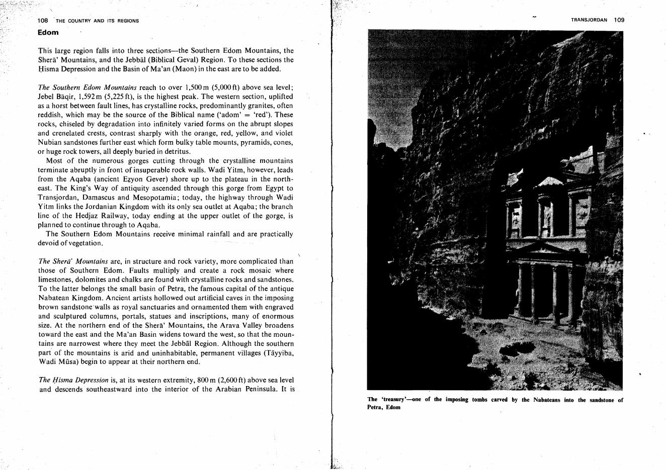
108 'THE COUNTRY AND ITS REGIONS
Edom
This large region falls into three sections-the Southern Edom Mountains, theShera' Mountains, and the Jebbal (Biblical Geval) Region. To these sections theHisma Depression and the Basin of Ma'an (Maon) in the east are to be added.
The Southern Edom Mountains reach to over 1,500m (5,000ft) above sea level;Jebel Baqir, 1,592m (5,225 ft), is the highest peak. The western section, upliftedas a horst between fault lines, has crystalline rocks, predominantly granites, oftenreddish, which may be the source of the Biblical name ('adorn' = 'red'). Theserocks, chiseled by degradation into infinitely varied forms on the abrupt slopesand crenelated crests, contrast sharply with the orange, red, yellow, and violetNubian sandstones further east which form bulky table mounts, pyramids, cones,or huge rock towers, all deeply buried in detritus.
Most of the numerous gorges cutting through the crystalline mountainsterminate abruptly in front of insuperable rock walls. Wadi Yitm, however, leadsfrom the Aqaba (ancient Ezyon Gever) shore up to the plateau in the northeast. The King's Way of antiquity ascended through this gorge from Egypt toTransjordan, Damascus and Mesopotamia; today, the highway through WadiYitm links the Jordanian Kingdom with its only sea outlet at Aqaba; the branchline of the Hedjaz Railway, today ending at the upper outlet of the gorge, isplanned to continue through to Aqaba.
The Southern Edom Mountains receive minimal rainfall and are practicallydevoid of vegetation.
The Sherii' Mountains are, in structure and rock variety, more complicated thanthose of Southern Edom. Faults multiply and create a rock mosaic wherelimestones, dolomites and chalks are found with crystalline rocks and sandstones.To the latter belongs the small basin of Petra, the famous capital of the antiqueNabatean Kingdom. Ancient artists hollowed out artificial caves in the imposingbrown sandstonewalls as royal sanctuaries and ornamented them with engravedand sculptured columns, portals, statues and inscriptions, many of enormoussize. At the northern end of the Shera' Mountains, the Arava Valley broadenstoward the east and the Ma'an Basin widens toward the west, so that the mountains are narrowest where they meet the Jebbal Region. Although the southernpart of the mountains is arid and uninhabitable, permanent villages (Tayyiba,Wadi Mfisa) begin to appear at their northern end.
The Hisma Depression is, at its western extremity, 800 m (2,600 ft) above sea leveland descends southeastward into the interior of the Arabian Peninsula. It is
TRANSJORDAN 109
The 'treasury'-one of the imposing tombs carved by the Nabateans into the sandstone ofPetra, Edom
..
llQ THE'COUlIITRY,AND ITS REGIONS_
hemme(;iiitrby the~h~~g,ti~~~s()f:!heSouthern Edom Mountains and the Sher~i'
rvt0ll-ntaius \\Ihichtdwe~~~Q;5~09fil (2,20(h2,600 ft) above the valley bottom. Thef~lltas~i9 roek~o\Vers,i_~ol:U~~~;rt~edlesa?dcastles of multicolored sandstonecr~~tealan9,scape,of~ut>Hl1le.magnifi,cencewhichhas always deeply impressedn~rfiad;sand ~,Ugdm.s using ,this gateway to Arabia.
;', ",- -..-- ..,',', - ... ,~.,- .. ... ....... .. .. L' "-' ......;.' - " .. -- ,;;, ;' .... '. .. ...-;_, ...
1Xb¢ Jel',MI',-,-k!ountains are even 'more varied thanthose of Southern Edom. Faults'",/!""';,'\",
seP!l,f~t~_tltC?~l't;gionfromthe deeply embedded Northern.Arava and cut through itill-~rr~?t'tiire~tions" isolating rather flat areas, each one with a large village(Sh~~p~~,,;ph,_ana, T~fila). Crystalline rocks and Nubian sandstones occupy partsof;\\',est~r;rI.f~bQ_al;furthereast appear first limestones and dolomites, then chalks.Large!p~!9I1esofvolcanic rocks (basalts) are found; at the sides of the DhanaGorge~::Paleozoicsedimentsare exposed. The highest of the Jebbal blocks is thatof Dhana village,where one peak attains 1,600m (5,181 ft).
Conditions are more favorable for human settlement and farming in the JebbalRegion than elsewhere in .Edom. Annual precipitation averages 400-500 rnm(16-20 in), .and relatively frequent snowfall upon the hill crests benefits the waterbalance of the region. These conditions promoted the growth of natural forestand brush which Provided the wood for-the antique copper smelters of Punnon,Timna, and E?:yql'IGever.The vegetation was, however, finally destroyed inWorld War I when the Turks used woodinstead of coal forthe engines oftheHedjaz Railway. The Biblical name 'HarSe'ir,'used for Edom, may derive fromthe forest which gave a hairy aspect to the skyline of these mountains whenviewed from the west (Hebrew'sa'ir'-'hairy'); the Biblical legend of theE~omi~es'ancestor Esau, whose body was covered with a thick pelt of hair, mayhave originated here.
Moab and Ammon
The Moab Plateau is east-of the DeadSeaand the Lower Jordan.Fromth~neadSea to about 30-40 km (20-30miles) to the.east, it descends gently toasha,llowdepression, along which stream courses run northor south.Theridge'b~yondjsonly slightly elevated above the plateau and forms the watershedb~HveentheDead Sea and the streams directed. into Arabia. The MoaQflateallisJtighestatits southwest corner, above the Zered Gorge,where]ebelcKhiI1zIraisl,234m(4,056ft) above sea level, or 1,626m (5,340ft) abQY(: th~peadS~a,QI1ly8Km(5 miles) away.
The bedrock of most of the Moab Plateau isSenonian chalk and flint; in thesouth, patches of basalt, the extinguished crater of JebelSheihan.vand warm
I" ~ ,,";,:,' '-
'"- -:
'. ;:'"
'1,
TRANSJORDAN 111
springs bear witness to volcanic activity. Ancient rocks, particularly sandstones,are exposed on the western escarpments and on the sides of the deep gorges, whilecrystalline rocks and Paleozoic sediments appear at Saramuj near the Dead Sea.
Streams thrusting through the high western edge of the plateau carve abysmalcanyons, the wildest of which are those of Wadi Miijib (Nahal Arnon), WadiHeidan which, cutting diagonally through central Moab, joins the Arnon near itsmouth, Wadi Kerak in the south, and Wadi Zerqa Ma'in in the north. The gorgescarps are often impassable.
The Moab Plateau, higher than the Judean Hills in the west, receives a more orless reliable winter rainfall which makes grain farming possible. The Book ofRuth relates the migration of Bethlehemites to Moab, which had not sufferedfrom the drought as much as Judea.
The canyons cut Southern Moab into easily defensible blocks which served asimportant links in the Roman 'limes arabicus' as well as in the Transjordanianchain of Crusader fortresses; notable among the latter is Crac du Desert (Kerak),whose ruins are impressive to this day.
The mountainous topography of southwestern Moab grows flatter north ofWadi Zerqa Ma'In, from which roads radiate in all directions. Medba is famousfor the mosaic floor found in the ruins of its Byzantine church. The mosaiccontains the oldest original map known, a pictorial map of the Holy Land andthe surrounding countries. Measuring 20 m X 8 m (65t X 26t ft), it is anamazingly exact and impressive rendering of landscape features (hills, rocks,watercourses, flora, fauna, etc.) and of villages, towns, and cities. Based on the'Onomastikon'- the list of place-names compiled earlier by Eusebius- it is aninvaluable treasure for the geographic and historical research of the country.Large parts of the mosaic, unfortunately, were destroyed at the end of the lastcentury, when the construction of a church was begun on the site with theimmense value of the mosaic unrecognized. With its renewed growth in ourcentury, Medba has replaced Hisban (Biblical Heshbon), which remained a smallvillage.
Northwest of Medba, Mount Nebo, 795 m (2,631 ft) above sea level, juttingwestward from the Moab Plateau, commands a wide view of the Lower JordanValley, the Dead Sea, and the Judean Hills; this site, with the nearby spring calledin Arabic 'Ein Miisa ('Moses' Spring') forms a most credible background to theBiblical tale of Moses, to whom God showed the Promised Land from MountNebo and did not allow entry (Deuteronomy, XXXIV, I).
Wadi Hisban and other streams of Northern Moab do not form canyons. Theplateau, almost flat, gradually rises to the north and attains altitudes of890-1,070 m (2,900-3,300 ft).No clear boundary is perceptible between Moaband Ammon; the two regions should be regarded as one geograph ic unit;
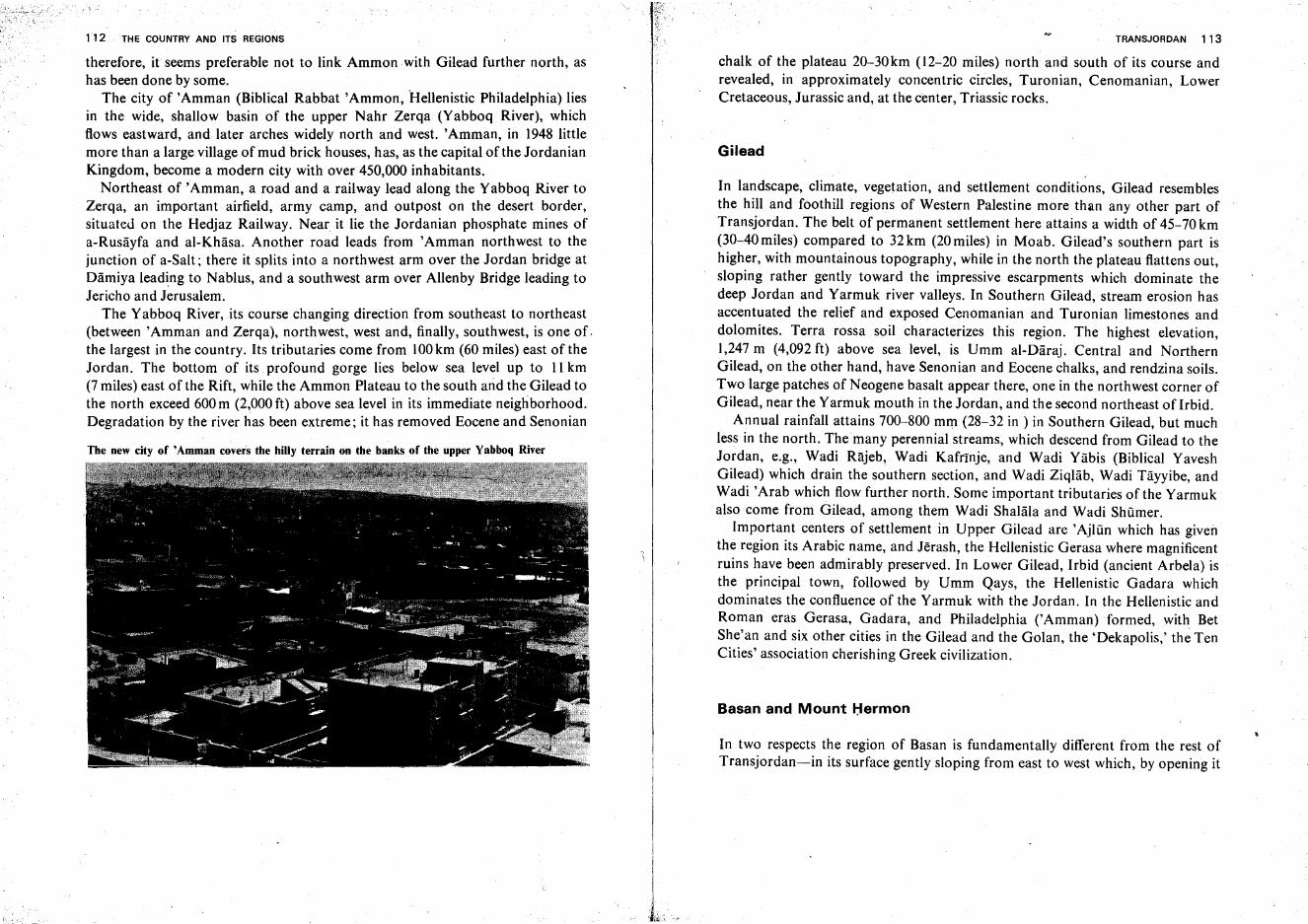
112 THE COUNTRY AND ITS REGIONS
therefore, it seems preferable not to link Ammon with Gilead further north, ashas been done by some.
The city of 'Amman (Biblical Rabbat 'Ammon, "Hellenistic Philadelphia) liesin the wide, shallow basin of the upper Nahr Zerqa (Yabboq River), whichflows eastward, and later arches widely north and west. 'Amman, in 1948 littlemore than a large village of mud brick houses, has, as the capital of the JordanianKingdom, become a modern city with over 450,000 inhabitants.
Northeast of 'Amman, a road and a railway lead along the Yabboq River toZerqa, an important airfield, army camp, and outpost on the desert border,situated on the Hedjaz Railway. Near it lie the Jordanian phosphate mines ofa-Rusayfa and al-Khasa. Another road leads from 'Amman northwest to thejunction of a-Salt; there it splits into a northwest arm over the Jordan bridge atDamiya leading to Nablus, and a southwest arm over Allenby Bridge leading toJericho and Jerusalem.
The Yabboq River, its course changing direction from southeast to northeast(between 'Amman and Zerqa), northwest, west and, finally, southwest, is one of.the largest in the country. Its tributaries come from 100km (60 miles) east of theJordan. The bottom of its profound gorge lies below sea level up to II km(7 miles) east of the Rift, while the Ammon Plateau to the south and the Gilead tothe north exceed 600 m (2,000 ft) above sea level in its immediate neighborhood.Degradation by the river has been extreme; it has removed Eocene and Senonian
The new city of 'Amman covers the hilly terrain on the banks of the upper Yabboq River
TRANSJORDAN 113
chalk of the plateau 20-30km (12-20 miles) north and south of its course andrevealed, in approximately concentric circles, Turonian, Cenomanian, LowerCretaceous, Jurassic and, at the center, Triassic rocks.
Gilead
In landscape, climate, vegetation, and settlement conditions, Gilead resemblesthe hill and foothill regions of Western Palestine more than any other part ofTransjordan. The belt of permanent settlement here attains a width of 45-70 km(30-40 miles) compared to 32 km (20 miles) in Moab. Gilead's southern part ishigher, with mountainous topography, while in the north the plateau flattens out,sloping rather gently toward the impressive escarpments which dominate thedeep Jordan and Yarmuk river valleys. In Southern Gilead, stream erosion hasaccentuated the relief and exposed Cenomanian and Turonian limestones anddolomites. Terra rossa soil characterizes this region. The highest elevation,1,247 m (4,092 ft) above sea level, is Umm al-Daraj, Central and NorthernGilead, on the other hand, have Senonian and Eocene chalks, and rendzina soils.Two large patches of Neogene basalt appear there, one in the northwest corner ofGilead, near the Yarmuk mouth in the Jordan, and the second northeast of Irbid.
Annual rainfall attains 700-800 mm (28-32 in ) in Southern Gilead, but muchless in the north. Themany perennial streams, which descend from Gilead to theJordan, e.g., Wadi Rajeb, Wadi Kafrtnje, and Wadi Yabis (Biblical YaveshGilead) which drain the southern section, and Wadi Ziqlab, Wadi Tayyibe, andWadi 'Arab which flow further north. Some important tributaries of the Yarmukalso come from Gilead, among them Wadi Shalala and Wadi Shiimer.
Important centers of settlement in Upper Gilead are'Ajliin which has giventhe region its Arabic name, and Jerash, the Hellenistic Gerasa where magnificentruins have been admirably preserved. In Lower Gilead, Irbid (ancient Arbela) isthe principal town, followed by Umm Qays, the Hellenistic Gadara whichdominates the confluence of the Yarmuk with the Jordan. In the Hellenistic andRoman eras Gerasa, Gadara, and Philadelphia ('Amman) formed, with BetShe'an and six other cities in the Gilead and the Golan, the 'Dekapolis,' the TenCities' association cherishing Greek civilization.
Basan and Mount Hermon
In two respects the region of Basan is fundamentally different from the rest ofTransjordan-in its surface gently sloping from east to west which, by opening it
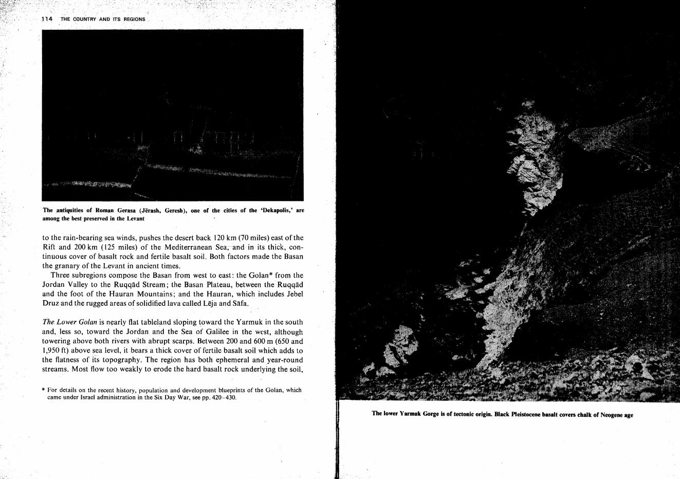
* For details on the recent history, population and development blueprints of the Golan, whichcame under Israel administration in the Six Day War, see pp. 420-430.
The antiquities of Roman Gerasa (Jerash, Geresh), one of the cities of the 'Dekapolis,' areamong the best preserved in the Levant
to the rain-bearing sea winds, pushes the desert back 120 km (70 miles) east of theRift and 200 km (125 miles) of the Mediterranean Sea, and in its thick, continuous cover of basalt rock and fertile basalt soil. Both factors made the Basanthe granary of the Levant in ancient times.
Three subregions compose the Basan from west to east: the Golan* from theJordan Valley to the Ruqqad Stream; the Basan Plateau, between the Ruqqadand the foot of the Hauran Mountains; and the Hauran, which includes JebelDruzand the rugged areas of solidified lava called Leja and SMa.
The Lower Golan is nearly flat tableland sloping toward the Yarmuk in the southand, less so, toward the Jordan and the Sea of Galilee in the west, althoughtowering above both rivers with abrupt scarps. Between 200 and 600 m (650 and1,950ft) above sea level, it bears a thick cover of fertile basalt soil which adds tothe flatness of its topography. The region has both ephemeral and year-roundstreams. Most flow too weakly to erode the hard basalt rock underlying the soil,
, - <
114 THE COUNTRY AND ITS REGIONS.
The lower Yarmuk Gorge is of tectonic origin. Black Pleistocene basalt covers chalk of Neogene age
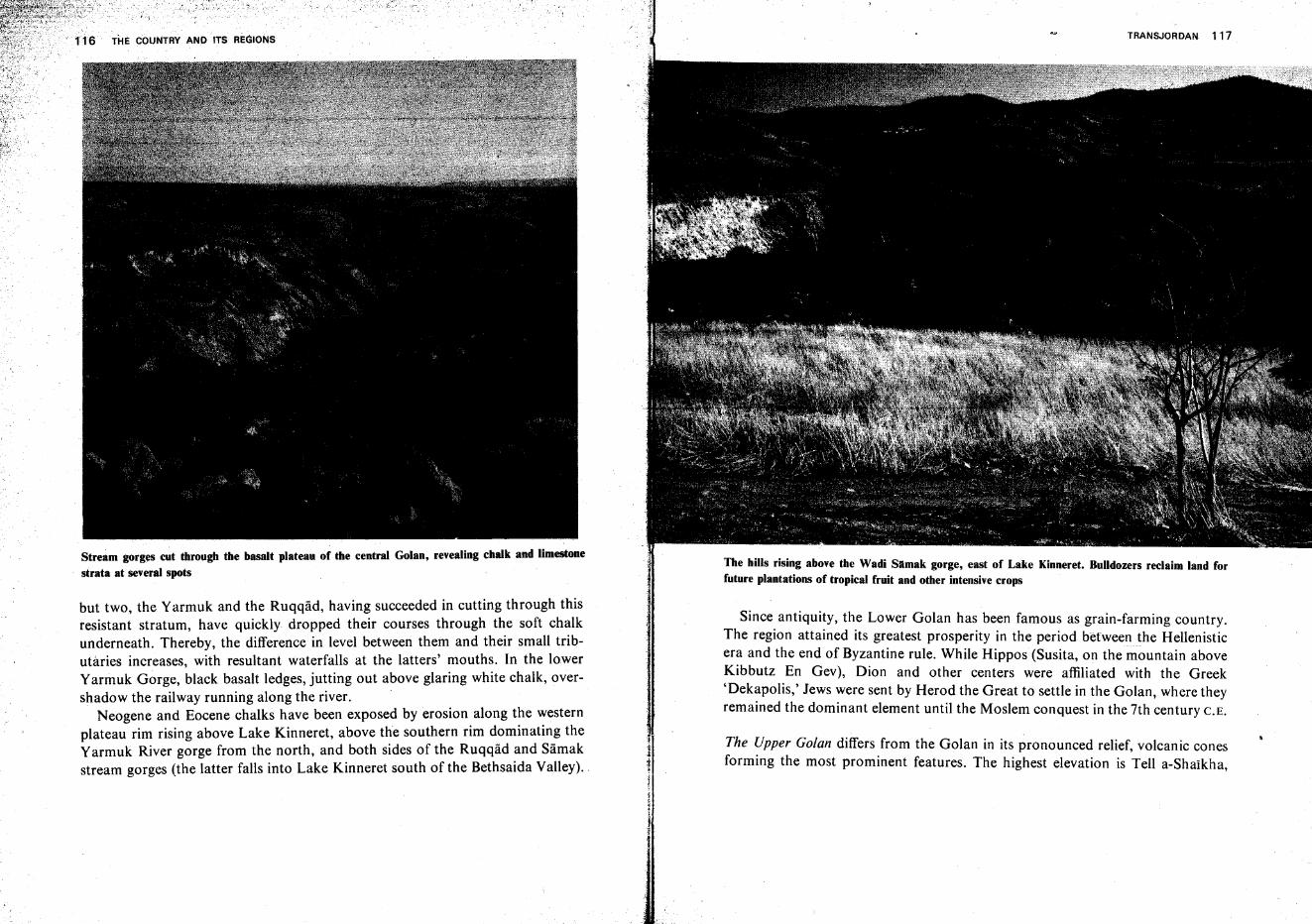
Stream gorg~ cut through the basalt plateau of the central Golan, revealing chalk and limestone
strata at several spots
but two, the Yarmuk and the Ruqqad, having succeeded in cutting through thisresistant stratum, have quickly dropped their courses through the soft chalkunderneath. Thereby, the difference in level between them and their small tributaries increases, with resultant waterfalls at the latters' mouths. In the lowerYarmuk Gorge, black basalt ledges, jutting out above glaring white chalk, overshadow the railway running along the river.
Neogene and Eocene chalks have been exposed by erosion along the westernplateau rim rising above Lake Kinneret, above the southern rim dominating theYarmuk River gorge from the north, and both sides of the Ruqqad and Samakstream gorges (the latter falls into Lake Kinneret south of the Bethsaida Valley)..
TRANSJORDAN 117
The hills rising above the Wadi Slimak gorge, east of Lake Kinneret. Bulldozers reclaim land forfuture plantations of tropical fruit and other intensive crops
Since. antiqui~y, th.e Lower Golan has been famous as grain-farming country.The region attamed Its greatest prosperity in the period between the Hellenisticera and the end of Byzantine rule. While Hippos (Susita, on the mountain aboveKibbutz En Gev), Dion and other centers were affiliated with the Greek'Dek~polis,'Jews were sent by Herod the Great to settle in the Golan, where theyremamed the dominant element until the Moslem conquest in the 7th century C.E.
The '!pper Golan differs from the Golan in its pronounced relief, volcanic conesformmg the most prominent features. The highest elevation is Tell a-Shaikha,
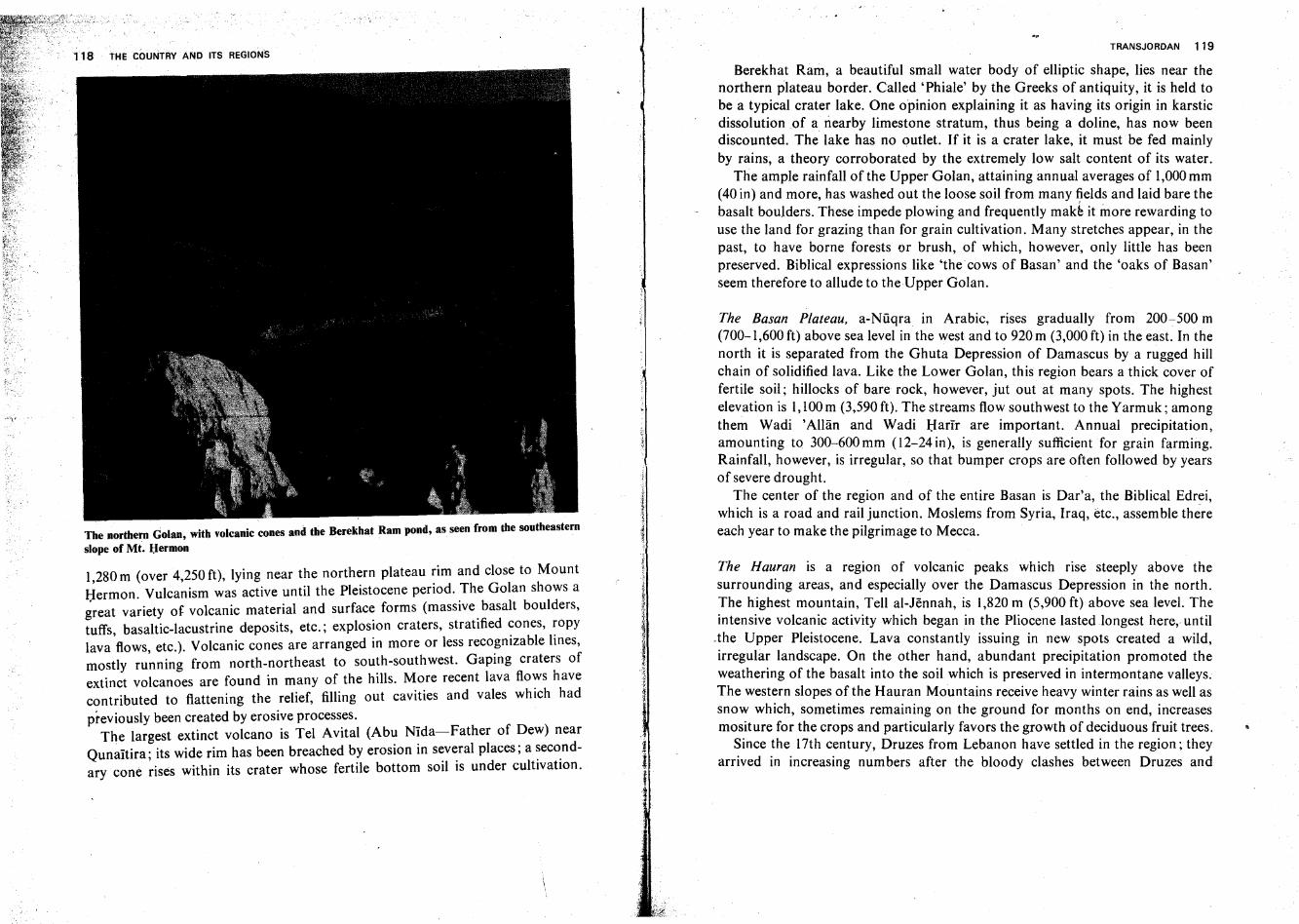
The northern Golan, with volcanic cones and the Berekhat Ram pond, as seen from the southeastern
slope of Mt. l;Iermon
1,280m (over 4,250ft), lying near the northern plateau rim and close to MountHermon Vulcanism was active until the Pleistocene period. The Golan shows agreat variety of volcanic material and surface forms (massive basalt boulders,tuffs, basaltic-lacustrine deposits, etc.; explosion craters, stratified cones, ropylava flows, etc.). Volcanic cones are arranged in more or less recognizable lines,mostly running from north-northeast to south-southwest. Gaping craters ofextinct volcanoes are found in many of the hills. More recent lava flows havecontributed to flattening the relief, filling out cavities and vales which had
previously been created by erosive processes.The largest extinct volcano is Tel Avital (Abu Nida-Father of Dew) near
Qunaitira ; its wide rim has been breached by erosion in several places; a secondary cone rises within its crater whose fertile bottom soil is under cultivation.
TRANSJORDAN 119
Berekhat Ram, a beautiful small water body of elliptic shape, lies near thenorthern plateau border. Called 'Phiale' by the Greeks of antiquity, it is held tobe a typical crater lake. One opinion explaining it as having its origin in karsticdissolution .of a nearby limestone stratum, thus being a doline, has now beendiscounted. The lake has no outlet. If it is a crater lake, it must be fed mainlyby rains, a theory corroborated by the extremely low salt content of its water.
The ample rainfall of the Upper Golan, attaining annual averages of 1,000 mm(40 in) and more, has washed out the loose soil from many fields and laid bare thebasalt boulders. These impede plowing and frequently make it more rewarding touse the land for grazing than for grain cultivation. Many stretches appear, in thepast, to have borne forests or brush, of which, however, only little has beenpreserved. Biblical expressions like 'the cows of Basan' and the 'oaks of Basan'seem therefore to allude to the-Upper Golan.
The Basan Plateau, a-Nuqra in Arabic, rises gradually from 200-500 m(700-1,600 ft) above sea level in the west and to 920 m (3,000 ft) in the east. In thenorth it is separated from the Ghuta Depression of Damascus by a rugged hillchain of solidified lava. Like the Lower Golan, this region bears a thick cover offertile soil; hillocks of bare rock, however, jut out at many spots. The highestelevation is I, 100m (3,590 ft). The streams flow southwest to the Yarmuk; amongthem Wadi 'Alliin and Wadi Harir are important. Annual precipitation,amounting to 300-600 mm (12-24 in), is generally sufficient for grain farming.Rainfall, however, is irregular, so that bumper crops are often followed by yearsof severe drought.
The center of the region and of the entire Basan is Dar'a, the Biblical Edrei,which is a road and rail junction. Moslems from Syria, Iraq, etc., assemble thereeach year to make the pilgrimage to Mecca.
The Hauran is a region of volcanic peaks which rise steeply above thesurrounding areas, and especially over the Damascus Depression in the north.The highest mountain, Tell al-Jennah, is 1,820 m (5,900 ft) above sea level. Theintensive volcanic activity which began in the Pliocene lasted longest here, until
.the Upper Pleistocene. Lava constantly issuing in new spots created a wild,irregular landscape. On the other hand, abundant precipitation promoted theweathering of the basalt into the soil which is preserved in intermontane valleys.The western slopes of the Hauran Mountains receive heavy winter rains as well assnow which, sometimes remaining on the ground for months on end, increasesmositure for the crops and particularly favors the growth of deciduous fruit trees.
Since the 17th century, Druzes from Lebanon have settled in the region; theyarrived in increasing numbers after the bloody clashes between Druzes and
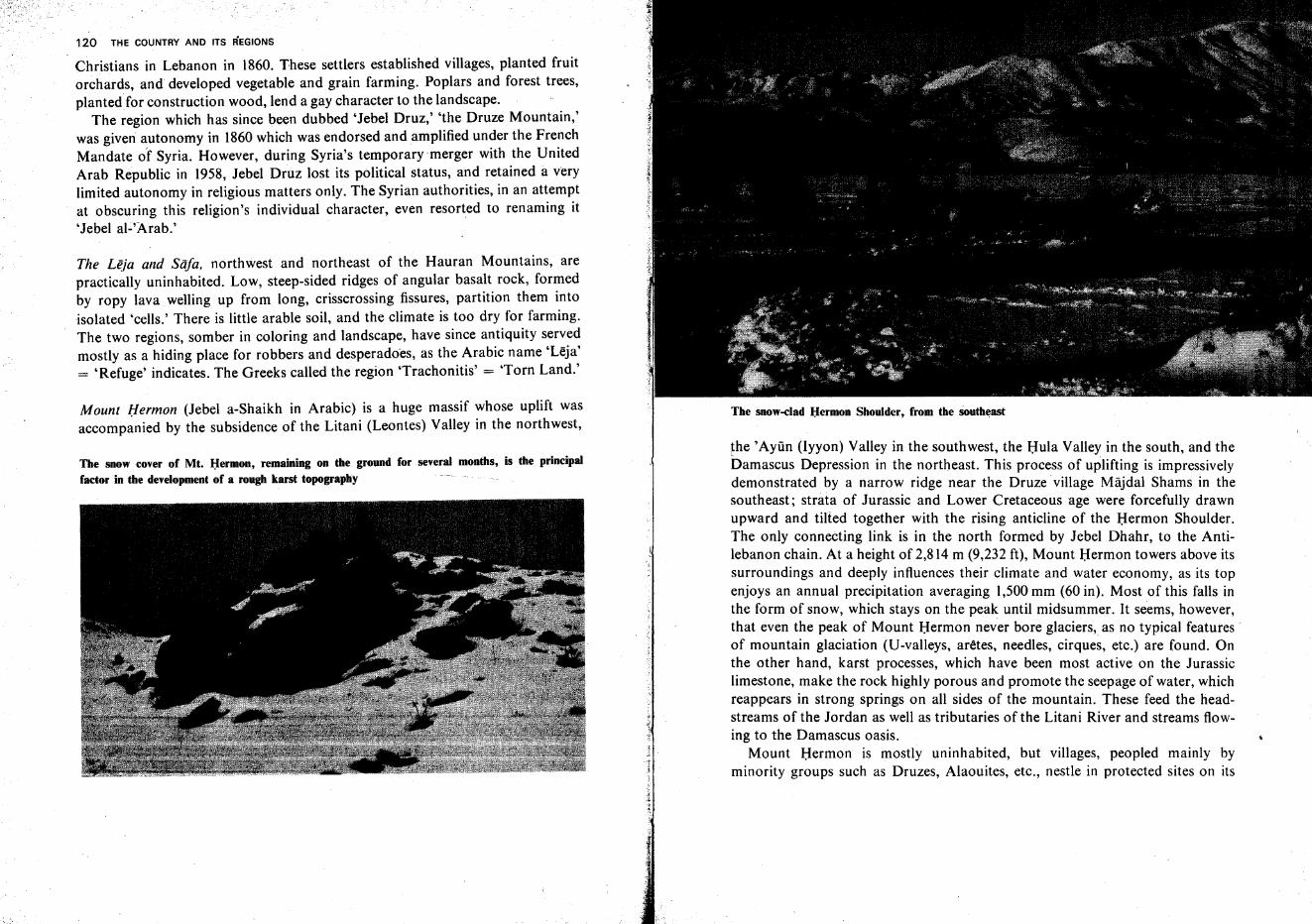
120 THE COUNTRY AND ITS REGIONS
. Christians in Lebanon in 1860. These settlers established villages, planted fruitorchards, and developed vegetable and grain farming. Poplars and forest trees,plantedfor construction wood, lend a gay character to the landscape.
The region which has since been dubbed 'Jebel Druz,' 'the Druze Mountain,'was given autonomy in 1860 which was endorsed and amplified under the FrenchMandate of Syria. However, during Syria's temporary merger with the UnitedArab Republic in 1958, Jebel Druz lost its political status, and retained a verylimited autonomy in religious matters only. The Syrian authorities, in an attemptat obscuring this religion's individual character, even resorted to renaming it'Jebel al-'Arab.'
The Leja and Sa/a, northwest and northeast of the Hauran Mountains, arepractically uninhabited. Low, steep-sided ridges of angular basalt rock, formedby ropy lava welling up from long, crisscrossing fissures, partition them intoisolated 'cells.' There is little arable soil, and the climate is too dry for farming.The two regions, somber in coloring and landscape, have since antiquity servedmostly as a hiding place for robbers and desperadoes, as the Arabic name 'Leja'= 'Refuge' indicates. The Greeks called the region "Trachonitis' = 'Torn Land.'
Mount Hermon (Jebel a-Shaikh in Arabic) is a huge massif whose uplift wasaccompanied by the subsidence of the Litani (Leontes) Valley in the northwest,
The snow cover of Mt. l:Iermon, remaining on the ground for several months, is the principalfactor in the development of a rough karst topography
the 'Ayiin (Iyyon) Valley in the southwest, the Hula Valley in the south, and theDamascus Depression in the northeast. This process of uplifting is impressivelydemonstrated by a narrow ridge near the Druze village Majdal Shams in thesoutheast; strata of Jurassic and Lower Cretaceous age were forcefully drawnupward and tilted together with the rising anticline of the Hermon Shoulder.The only connecting link is in the north formed by Jebel Dhahr, to the Antilebanon chain. At a height of 2,814 m (9,232 ft), Mount Hermon towers above itssurroundings and deeply influences their climate and water economy, as its topenjoys an annual precipitation averaging 1,500 mm (60 in). Most of this falls inthe form of snow, which stays on the peak until midsummer. It seems, however,that even the peak of Mount Hermon never bore glaciers, as no typical features·of mountain glaciation (Uvvalleys, aretes, needles, cirques, etc.) are found. Onthe other hand, karst processes, which have been most active on the Jurassiclimestone, make the rock highly porous and promote the seepage of water, whichreappears in strong springs on all sides of the mountain. These feed the headstreams of the Jordan as well as tributaries of the Litani River and streams flowing to the Damascus oasis.
Mount Hermon is mostly uninhabited, but villages, peopled mainly byminority groups such as Druzes, Alaouites, etc., nestle in protected sites on its
THE COUNTRY AND ITS REGIONS
lower slopes. Since June 1967, the southeast ridge of the mountain massif (Ketef. ha-Hermon-i-'The Hermon Shoulder'), whose highest point lies 2,200 m(7,220 £1) above sea level, is under Israeladministration.
Mount l:Iermon seen from the south. A fault running through the massif separat~s the huge anticlineof the 'l:Iermon Shoulder' from the western and northwestern parts
The Sinai Peninsula
The Sinai Peninsula stands out from the other regions of the Levant by virtue ofits size, being three times that of the State of Israel prior to the Six Day War.However, it constitutes a well-defined geographical unit and contains readilyidentifiable topographic regions, these features being the outcome of its geological history. Meteorological data, too, are easy to trace, as all of Sinai falls withinthe subtropical desert zone. The lack of water is the reason for the sparsevegetation cover and the strict limitations of farming, and these, in turn, explainthe-extremely low population density of this vast area at all times. The lines ofcommunication crossing the peninsula have always been of prime importance, intimes of peace, and even more so, of war. As far as is known, Sinai contains anumber of valuable minerals deposits, only a part of which has been exploited upto the present.
Extent, Structure, Geological History and Landscape Forms
Area and Distances. The Sinai Peninsula covers ca. 60,000 square kilometers.Triangular in shape, it is wedged between the continents of Asia and Africa,forming the transition between the two, although most geographers include it inthe former. The Mediterranean coast in the north constitutes the base line of thetriangle, while its apex points to the Red Sea in the south. On the side facingsouthwest and west, the peninsula borders on the Suez Gulf and Suez Canal,andon the southeast and east side-on the Eilat Gulf and the Negev.
Distances (all indicated here as the crow flies) are considerable. Sinai measures400 km from Rafiah on the Mediterranean coast to the cape Ras Muhammad inthe south. West-east distances are 190km between Rafiah and both al-Qantaraand Port Sa'Id, 200 km between Nizzana and Isma'iliya, 210 km between
123
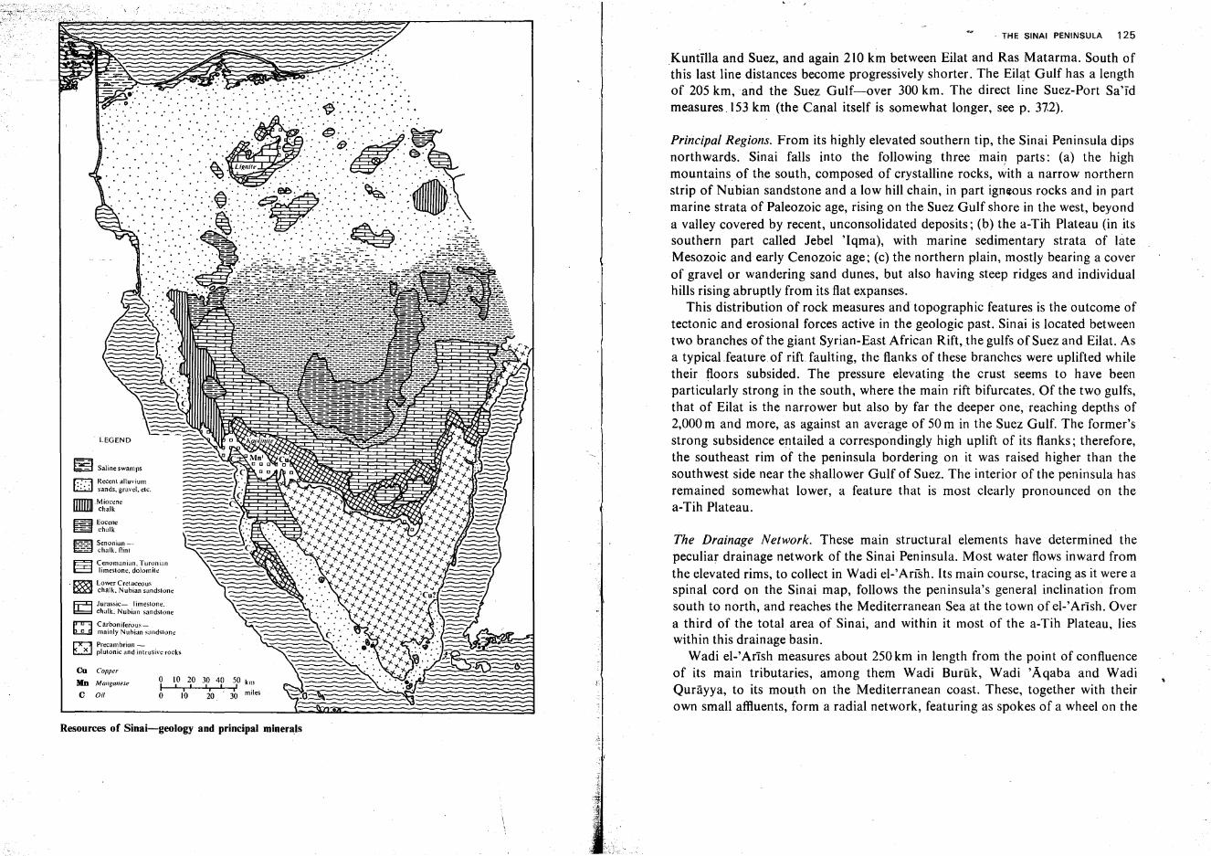
- LEGEND
The Drainage Network. These main structural elements have determined thepeculiar drainage network of the Sinai Peninsula. Most water flows inward fromthe elevated rims, to collect in Wadi el-'Arlsh. Its main course, tracing as it were aspinal cord on the Sinai map, follows the peninsula's general inclination fromsouth to north, and reaches the Mediterranean Sea at the town of el-' Arish. Overa third of the total area of Sinai, and within it most of the a-Tih Plateau, lieswithin this drainage basin.
Wadi el-'Arlsh measures about 250km in length from the point of confluenceof its main tributaries, among them Wadi Buruk , Wadi 'Aqaba and WadiQurayya, to its mouth on the Mediterranean coast. These, together with theirown small affiuents, form a radial network, featuring as spokes of a wheel on the
, THE SINAI PENINSULA 125
Principal Regions. From its highly elevated southern tip, the Sinai Peninsula dipsnorthwards. Sinai falls into the following three main parts: (a) the highmountains of the south, composed of crystalline rocks, with a narrow northernstrip of Nubian sandstone and a low hill chain, in part igneous rocks and in partmarine strata of Paleozoic age, rising on the Suez Gulf shore in the west, beyonda valley covered by recent, unconsolidated deposits; (b) the a-Tih Plateau (in itssouthern part called Jebel 'Iqma), with marine sedimentary strata of biteMesozoic and early Cenozoic age; (c) the northern plain, mostly bearing a coverof gravel or wandering sand dunes, but also having steep ridges and individualhills rising abruptly from its flat expanses.
This distribution of rock measures and topographic features is the outcome oftectonic and erosional forces active in the geologic past. Sinai is located betweentwo branches of the giant Syrian-East African Rift, the gulfs of Suez and Eilat. Asa typical.feature of rift faulting, the flanks of these branches were uplifted whiletheir floors subsided. The pressure elevating the crust seems to have beenparticularly strong in the south, where the main rift bifurcates. Of the two gulfs,that of Eilat is the narrower but also by far the deeper one, reaching depths of2,000 m and more, as against an average of 50 m in the Suez Gulf. The former'sstrong subsidence entailed a correspondingly high uplift of its flanks; therefore,the southeast rim of the peninsula bordering on it was raised higher than thesouthwest side near the shallower Gulf of Suez. The interior of the peninsula hasremained somewhat lower, a feature that is most clearly pronounced on thea-Tih Plateau.
Kuntilla and Suez, and again 210 km between Eilat and Ras Matarma. South ofthis last line distances become progressively shorter. The Eilat Gulf has a lengthof 205 km,and the Suez Gulf-over 300 km. The direct line Suez-Port Sa'Idmeasures _153 km (the Canal itself is somewhat longer, see p. 372).
.' .'.' .....
o
chalk
en Copper
Mn Manganese 0 10 20 30 40 5,0 killI I I , I
I i i milesC Oil 0 10 20 30
~ Eocene
~ Cenomanian. Turonianl:::::::I limestone. dolomite
t:=;1 Senonian ..--- chalk. nint
~ Jurassic- limestone.~ chalk. Nubian sandstone
p-rr-::J Carboniferous c;
b.....!!..sI mainly Nubian sandstone
~ Precambrian-~ plutonic and intrusive rocks
SJ Saline swamps
r:-::;I Recent alluvium~ sands. gravel. etc,
m-Miocenechalk
. [X'5(ii Lower Cretaceous~ chalk. Nubian sandstone
Resources of Sinai-geology and principal minerals
-..'_ .. - ."-"'."--'
;' .....'..-;'-·,>.~I
;'7~.\<:~~:f:;:'·~-'-~-' ;.
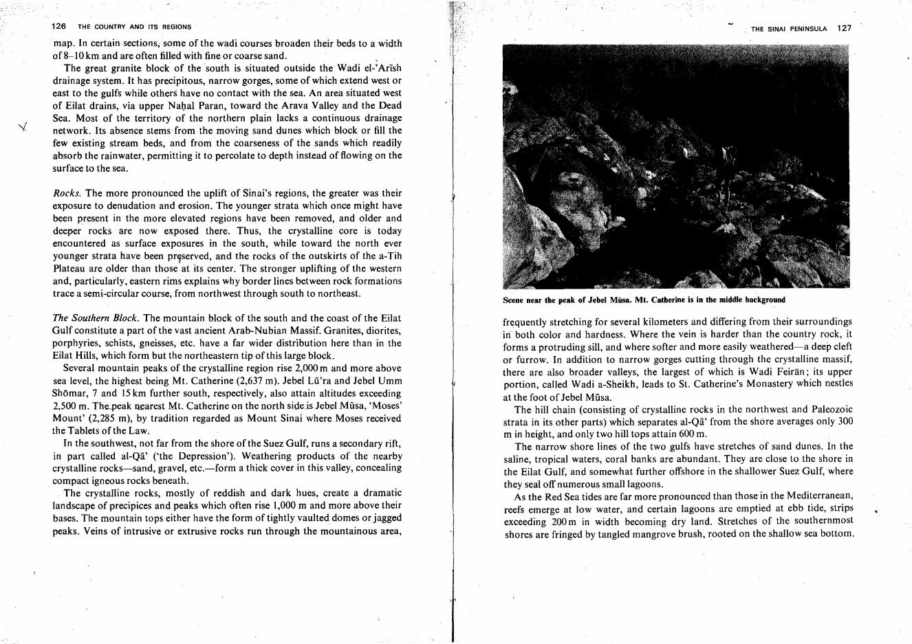
126 THE COUNTRY AND ITS REGIONS
map. In certain sections; some of the wadi courses broaden their beds to a widthof 8-10 km and are often filled with fine or coarse sand. ,
The great granite block of the south is situated outside the Wadi el-'Arlshdrainage system. It has precipitous, narrow gorges, some of which extend west oreast to the gulfs while others have no contact with the sea. An area situated westof Eilat drains, via upper Nahal Paran, toward the Arava Valley and the DeadSea. Most of the territory of the northern plain lacks a continuous drainagenetwork. Its absence stems from the moving sand dunes which block or fill thefew existing stream beds, and from the coarseness of the sands which readilyabsorb the rainwater, permitting it to percolate to depth instead of flowing on thesurface to the sea.
Rocks. The more pronounced the uplift of Sinai's regions, the greater was theirexposure to denudation and erosion. The younger strata which once might havebeen present in the more elevated regions have been removed, and older anddeeper rocks are now exposed there. Thus, the crystalline core is todayencountered as surface exposures in the south, while toward the north everyounger strata have been pr9served, and the rocks of the outskirts of the a-TihPlateau are older than those at its center. The stronger uplifting of the westernand, particularly, eastern rims explains why border lines between rock formationstrace a semi-circular course, from northwest through south to northeast.
The Southern Block. The mountain block of the south and the coast of the EilatGulf constitute a part of the vast ancient Arab-Nubian Massif. Granites, diorites,porphyries, schists, gneisses, etc. have a far wider distribution here than in theEilat Hills, which form but the northeastern tip of this large block.
Several mountain peaks of the crystalline region rise 2,000 m and more abovesea level, the highest being Mt. Catherine (2,637 m). Jebel Lii'ra and Jebel UmmShornar, 7 and 15km further south, respectively, also attain altitudes exceeding2,500 m. The.peak nearest Mt. Catherine on the north side.is Jebel Miisa, 'Moses'Mount' (2,285 m), by tradition regarded as Mount Sinai where Moses receivedthe Tablets ofthe Law.
In the southwest, not far from the shore of the Suez Gulf, runs a secondary rift,in part called al-Qa' ('the Depression').. Weathering products of the nearbycrystalline rocks-sand, gravel, etc.-form a thick cover in this valley, concealingcompact igneous rocks beneath.
. The crystalline rocks, mostly of reddish and dark hues, create a dramaticlandscape of precipices and peaks which often rise 1,000 m and more above theirbases. The mountain tops either have the form of tightly vaulted domes or jaggedpeaks. Veins of intrusive or extrusive rocks run through the mountainous area,
, '
THE SINAI PENINSULA 127
Scene near the peak of Jebel Miisa. Mt, Catherine is in the middle background
frequently stretching for several kilometers and differing from their surroundingsirf both color and hardness. Where the vein is harder than the country rock, itforms a protruding sill, and where softer and more easily weathered-a deep cleftor furrow. In addition to narrow gorges cutting through the crystalline massif,there are also broader valleys, the largest of which is Wadi Feiran ; its upperportion, called Wadi a-Sheikh, leads to St. Catherine's Monastery which nestlesat the foot of Jebel Miisa.
The hill chain (consisting of crystalline rocks in the northwest and Paleozoicstrata in its other parts) which separates al-Qa' from the shore averages only 300m in height, and only two hill tops attain 600 m.
The narrow shore lines of the two gulfs have stretches of sand dunes. In thesaline, tropical waters, coral banks are abundant. They are close to the shore inthe Eilat Gulf, and somewhat further offshore in the shallower Suez Gulf, wherethey seal off numerous small lagoons.
As the Red Sea tides are far more pronounced than those in the Mediterranean,reefs emerge at low water, and certain lagoons are emptied at ebb tide, stripsexceeding 200 m in width becoming dry land. Stretches of the southernmostshores are fringed by tangled mangrove brush, rooted on the shallow sea bottom.
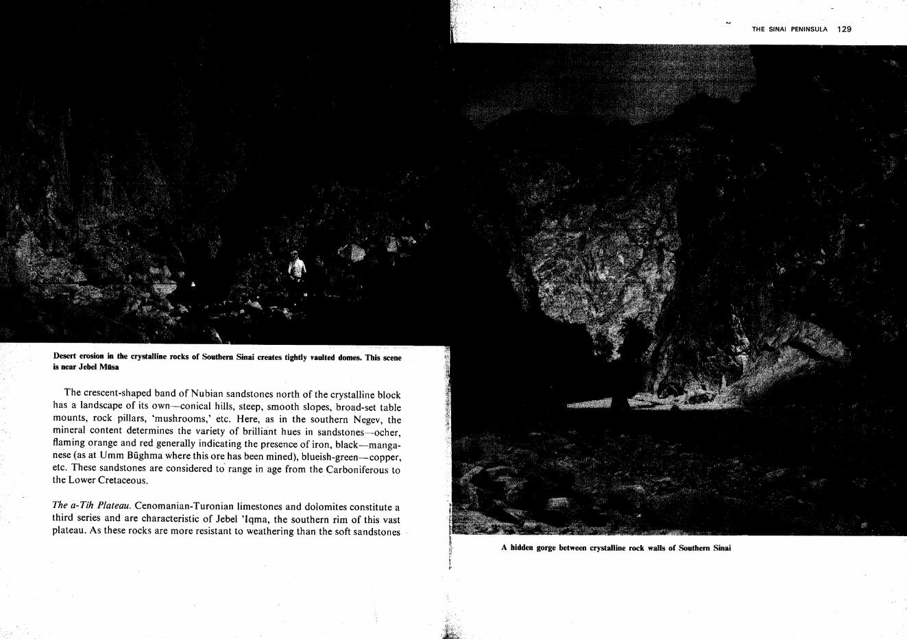
Desert erosion in the crystalline rocks of Southern Sinai creates tightly vaulted domes. This sceneis near Jebel Miisa
The crescent-shaped band of Nubian sandstones north of the crystalline blockhas a landscape of its own-conical hills, steep, smooth slopes, broad-set tablemounts, rock pillars, 'mushrooms,' etc. Here, as in the southern Negev, themineral content determines the variety of brilliant hues in sandstones-i-ocher,flaming orange and red generally indicating the presence of iron, black-manganese (as at Umm Biighma where this ore has been mined), blueish-green-copper,etc. These sandstones are considered to' range in age from theCarboniferous tothe Lower Cretaceous.
The a-Tih Plateau. Cenomanian-Turonian limestones and dolomites constitute athird series and are characteristic of Jebel 'Iqma, the southern rim of this vastplateau. As these rocks are more resistant to weathering than the soft sandstones
A hidden gorge between crystalline rock walls of Southern Sinai
THE SINAI PENINSULA 129
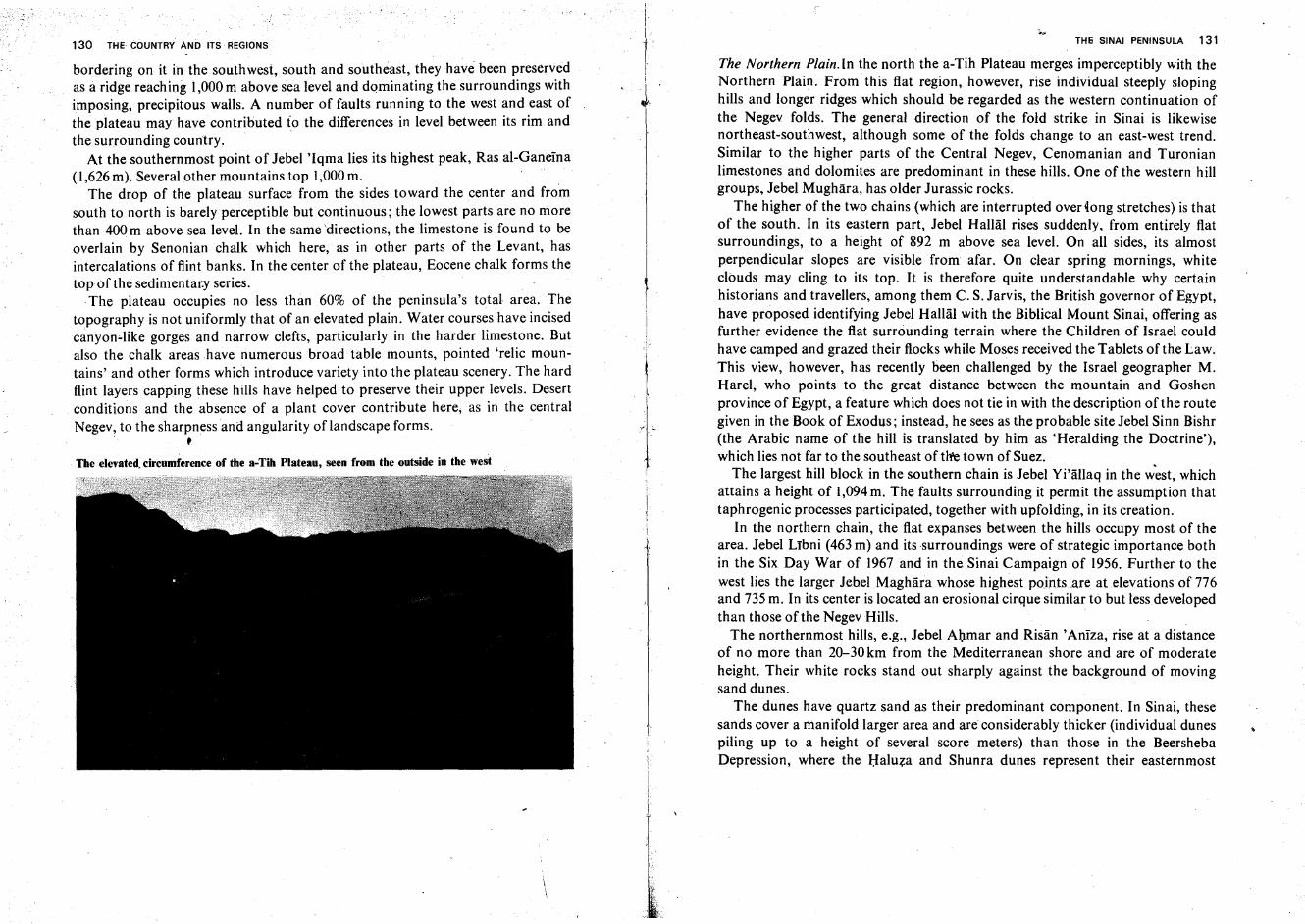
130 THE COUNTRY AND ITS REGIONS
bordering on it in the southwest, south and southeast, they have been preservedas a ridge reaching 1,000 m above sea level and dominating the surroundings withimposing, precipitous walls. A number of faults running to the west and east ofthe plateau may have contributed to the differences in level between its rim andthe surrounding country.
At the southernmost point of Jebel 'Iqma lies its highest peak, Ras al-Ganeina(1,626 m). Several other mountains top 1,000 m.
The drop of the plateau surface from the sides toward the center and fromsouth to north is barely perceptible but continuous; the lowest parts are no morethan 400 m above sea level. In the samedirections, the limestone is found to beoverlain by Senonian chalk which here, as in other parts of the Levant, hasintercalations of flint banks. In the center of the plateau, Eocene chalk forms thetop of the sedimentar.y series.
.The plateau occupies no less than 60% of the peninsula's total area. Thetopography is not uniformly that ofan elevated plain. Water courses have incisedcanyon-like gorges and narrow clefts, particularly in the harder limestone. Butalso the chalk areas have numerous broad table mounts, pointed 'relic mountains' and other forms which introduce variety into the plateau scenery. The hardflint layers capping these hills have helped to preserve their upper levels. Desertconditions and the absence of a plant cover contribute here, as in the centralNegev, to the sharpness and angularity oflandscape forms.
, .The elevated.circumference of the a-Tih Plateau, seen from the outside in the west
iI
IrIi
J
TH6 SINAI PENINSULA 131
The Northern Plain.In the north the a-Tih Plateau merges imperceptibly with theNorthern Plain. From this flat region, however, rise individual steeply slopinghills and longer ridges which should be regarded as the western continuation ofthe Negev folds. The general direction of the fold strike in Sinai is likewisenortheast-southwest, although some of the folds change to an east-west trend.Similar to the higher parts of the Central Negev, Cenomanian and Turonianlimestones and dolomites are predominant in these hills. One of the western hillgroups, Jebel Mughara, has older Jurassic rocks.
The higher of the two chains (which are interrupted over tong stretches) is thatof the south. In its eastern part, Jebel Hallal rises suddenly, from entirely flatsurroundings, to a height of 892 m above sea level. On all sides, its almostperpendicular slopes are visible from afar. On clear spring mornings, whiteclouds may cling to its top. It is therefore quite understandable why certainhistorians and travellers, among them C. S. Jarvis, the British governor of Egypt,have proposed identifying Jebel Hallal with the Biblical Mount Sinai, offering asfurther evidence the flat surrounding terrain where the Children of Israel couldhave camped and grazed their flocks while Moses received the Tablets of the Law.This view, however, has recently been challenged by the Israel geographer M.Harel, who points to the great distance between the mountain and Goshenprovince of Egypt, a feature which does not tie in with the description ofthe routegiven in the Book of Exodus; instead, he sees as the probable site Jebel Sinn Bishr(the Arabic name of the hill is translated by him as 'Heralding the Doctrine'),which lies not far to the southeast of tire town of Suez.
The largest hill block in the southern chain is Jebel Yi'allaq in the west, whichattains a height of 1,094 m. The faults surrounding it permit the assumption thattaphrogenic processes participated, together with upfolding, in its creation.
In the northern chain, the flat expanses between the hills occupy most of thearea. Jebel Lrbni (463 m) and its surroundings were of strategic importance bothin the Six Day War of 1967 and in the Sinai Campaign of 1956. Further to thewest lies the larger Jebel Maghara whose highest points are at elevations of 776and 735 m. In its center is located an erosional cirque similar to but less developedthan those ofthe Negev Hills. .
The northernmost hills, e.g., Jebel Ahmar and Risan 'Aniza, rise at a distanceof no more than 20-30 km from the Mediterranean shore and are of moderateheight. Their white rocks stand out sharply against the background of movingsand dunes.
The dunes have quartz sand as their predominant component. In Sinai, thesesands cover a manifold larger area and are considerably thicker (individual dunespiling up to a height of several score meters) than those in the BeershebaDepression, where the Haluza and Shunra dunes represent their easternmost
THE COUNTRY AND ITS REGIONS
extremity. Many dunes are crescent-shaped and bear ripple marks on theirsurface. Over large areas; the dunes stretch in parallel chains. There are, however,also localities where the arrangement of the dunes is less uniform, apparently asthe outcome of lesser regularity in wind directions and velocities. Towards thesouth, gravel flats frequently take the place of dunes. At certain sites, especially inthe vicinity of the lower course of Wadi el-'Arish, loess, and loess-sand soils areto be found, but their impact upon the scenery is slight.
The Mediterranean Shore. The Mediterranean shore line of the Sinai Peninsulameasures 230km. In general, the beach has a gentle slope and the coast line isstraight or slightly curved. The entire western section of the shore, however, is buta narrow sand spit closing off the large shallow lagoon Sabkhat el-Bardawil (itsname recalls the Crusader King Baldwin I who won a victory here over theSaracens in 1118 but soon after died nearby of an illness). The inner, southernbank of the lagoon is rich in bays and headlands, with diminutive islets orsubmerged sand reefs offshore. A narrow inlet in the northeast connects thelagoon with the sea; sand blocks this opening from time to time, and the localfishermen clear it anew to provide passage for fish from the open sea. In 1955, theEgyptian Government undertook the broadening of this inlet and of a second onefurther to the southeast. The width was increased to 7-8 m and the banks werereinforced with concrete. Because of inadequate maintenance, this inlet was soonobstructed again. It is possible that in the historic past the main inlet lay furtherto the west.
The shore of the Nile delta has four more lagoons-Mariut, Idku, Burullusand Manzala. Their formation is attributed to the Mediterranean coastal currentwhich sweeps the river-borne alluvium in an easterly direction and deposits it onits landward side, thus building up the spits sealing off the lagoons. Some holdthat even in the recent past another arm of the Nile was in existence ('the PelusianArm'), reaching the sea on the Sinai coast and giving birth to the Bardawillagoon.Its existence is difficult to ascertain, although Wadi Thumeilat is considered bysome scholars to show traces of such a Nile branch. The western part of the spitand the continuation of the coast swinging to the north form a rounded bav. 'thePelusian Bight' (at present called a-Tina Bay). The northwestern corner of theSinai Peninsula forms a totally impassable salt swamp which is a refuge to aunique flora, and a rich fauna of fish and water fowl.
IlI
't Part II
Climate, Vegetation and Wildlife
The Climate
Climatically, almost all regions of the Land of Israel form a part of theMediterranean Zone, with the outstanding characteristics of winter rains andsummer drought. The. Mediterranean climate is typical of countries on or nearthe west coasts of continents and approximately between the latitudes 25° and35° in the northern and southern hemispheres; among these are Israel, mostcountries adjoining the Mediterranean Sea, part of California in North Americaand of Central Chile in South America, and small areas on the southern andsouthwestern coasts of South Africa and of Australia.
Israel belongs to the countries near the equatorward border of the Mediterranean Zone. Its conditions can therefore be described as 'extreme Mediterranean,'with a comparatively short rainy season and 3-4 completely rainless summermonths.
Length of Days, Insolation and Temperature
Israel's position on the earth grid, between 29° 30' and 33° 15' northern latitude,*results in moderate seasonal variations in length of day and night, and in highvalues of insolation, or sunlight intensity. While on the equator day and night theyear round are exactly 12 hours long, and the poles have only one day and onenight per year, each 6 months long, in this country the longest day, June 21, issunlit for 14 hours, and the shortest, December 22, for 10 hours (as comparedwith 18and 6 hours, respectively, in London).
The angle formed between the sun's rays and the ground decides the amount ofinsolation, i.e., sunlight and warmth received on the surface and near it. On the
if Referring to the pre-1967 borders. Details of the climate of Sinai are given onpp. 160-163.
135
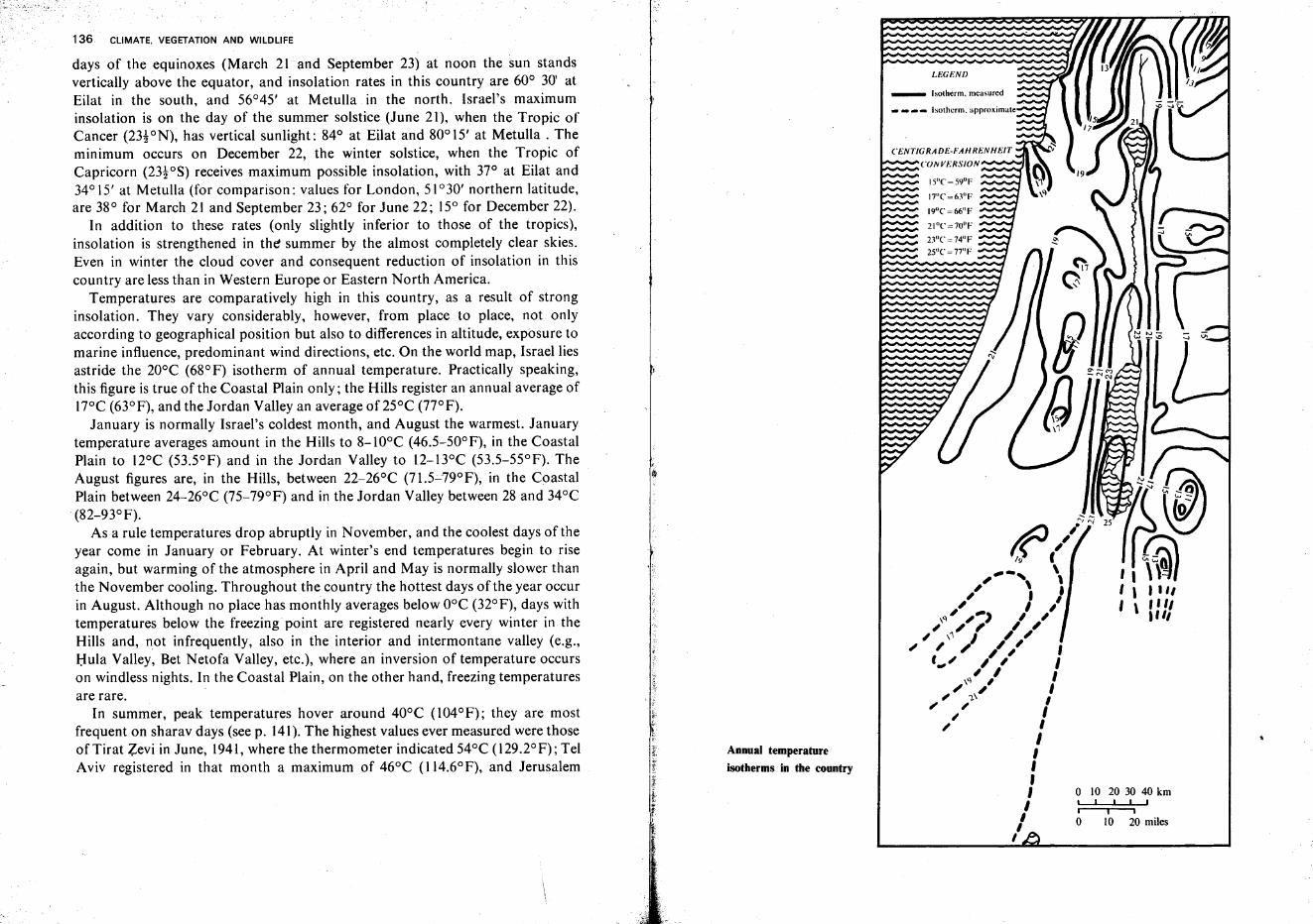
136 CLIMATE. VEGETATION AND WILDLIFE
days of the equinoxes (March 21 and September 23) at noon the sun standsvertically above the equator, and insolation rates in this country are 60° 30' atEilat in the south, and 56°45' at Metulla in the north. Israel's maximuminsolation is on the day of the summer solstice (June 21), when the Tropic ofCancer (23!ON), has vertical sunlight: 84° at Eilat and 80° 15' at Metulla . Theminimum occurs on December 22, the winter solstice, when the Tropic ofCapricorn (23toS) receives maximum possible insolation, with 37° at Eilat and34° 15' at Metulla (for comparison: values for London, 51 °30' northern latitude,are 38° for March 21 and September 23; 62° for June 22; 15° for December 22).
In addition to these rates (only slightly inferior to those of the tropics),insolation is strengthened in the summer by the almost completely clear skies.Even in winter the cloud cover and consequent reduction of insolation in thiscountry are less than in Western Europe or Eastern North America.
Temperatures are comparatively high in this country, as a result of stronginsolation. They vary considerably, however, from place to place, not onlyaccording to geographical position but also to differences in altitude, exposure tomarine influence, predominant wind directions, etc. On the world map, Israel liesastride the 20°C (68°F) isotherm of annual temperature. Practically speaking,this figure is true of the Coastal Plain only; the Hills register an annual average ofl7°C (63°F), and the Jordan Valley an average of 25°C (77°F).
January is normally Israel's coldest month, and August the warmest. Januarytemperature averages amount in the Hills to 8-100C (46.5-50°F), in the CoastalPlain to l2°C (53.5°F) and in the Jordan Valley to l2-13°C (53.5-55°F).TheAugust figures are, in the Hills, between 22-26°C (71.5-79°F), in the CoastalPlain between 24-26°C (75-79°F) and in the Jordan Valley between 28 and 34°C(82-93°F).
As a rule temperatures drop abruptly in November, and the coolest days of theyear come in January or February. At winter's end temperatures begin to riseagain, but warming of the atmosphere in April and May is normally slower thanthe November cooling. Throughout the country the hottest days of the year occurin August. Although no place has monthly averages below O°C (32°F), days withtemperatures below the freezing point are registered nearly every winter in theHills and, not infrequently, also in the interior and intermontane valley (e.g.,Hula Valley, Bet Netofa Valley, etc.), where an inversion of temperature occurson windless nights. In the Coastal Plain, on the other hand, freezing temperaturesare rare.
In summer, peak temperatures hover around 40°C (104°F); they are mostfrequent on sharav days (see p. 141).The highest values ever measured were thoseofTirat Zevi in June, 1941, where the thermometer indicated 54°C (l29.2°F); TelAviv registered in that month a maximum of 46°C (l14.6°F), and Jerusalem
if
Annual temperature
isotherms in the country
LEGEND
_ Isotherm. measured
_ _ _ _ Isotherm. approximate
,III
IIIII,,,
III,
,,~@II@I , "", \ '''1
I'"
o 10 20 30 40 kmI I ,
i Io 10 20 miles
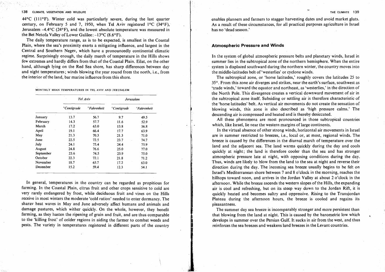
138 CLIMATE. VEGETATION AND WILDLIFE
44°C (IllOF). Winter cold was particularly severe, during the last quartercentury, on February 5 and 7, 1950, when Tel Aviv registered 1°C (34°F),Jerusalem -4.4°C (24°F), and the lowest absolute temperature was measured inthe Bet Netofa Valley of Lower Galilee: -BoC (8.6°F).
The daily temperature range, as is to be expected, is smallest in the CoastalPlain, where the sea's proximity exerts a mitigating influence, and largest in theCentral and Southern Negev, which have a pronouncedly continental climaticregime. Surprisingly enough, the daily march of temperature in the Hills showsfew extremes and hardly differs from that of the Coastal Plain. Eilat, on the otherhand, although lying on the Red Sea shore, has sharp differences between dayand night temperatures; winds blowing the year round from the north, i.e., fromthe interior of the land, bar marine influence from this shore.
MONTHLY MEAN TEMPERATURES IN TEL AVIV AND JERUSALEM
Tel Aviv Jerusalem
°Centigrade °Fahrenheit °Centigrade °Fahrenheit
January 13.7 56.7 9.7 49.5February 14.3 57.7 11.6 52.9March 17.2 63.0 13.8 56.8April 19.1 66.4 17.7 63.9May 21.3 70.3 21.3 71.0June 22.5 n.5 23.7 74.7July 24.1 75.4 24.4 75.9 IAugust 24.8 76.6 25.0 77.0 ?f
September 23.6 74.5 23.9 75.0 ~
October 22.3 n.1 21.8 71.2November 18.7 65.7 17.2 63.0December 15.2 59.4 12.3 54.1
In general, temperatures in the country can be regarded as propitious forfarming. In the Coastal Plain, citrus fruit and other crops sensitive to cold arevery rarely endangered by frost, while deciduous fruit and vines on the Hillsreceive in most winters the moderate 'cold ration' needed to enter dormancy. Thesharav heat waves in May and June adversely affect humans and animals anddamage pastures, which wither quickly. On the whole, however, they benefitfarming, as they hasten the ripening of grain and fruit, and are thus comparableto the 'killing frost' of colder regions in aiding the farmer to combat weeds andpests. The variety in temperatures registered in different parts of the country
THE CLIMATE 139
enables planners and farmers to stagger harvesting dates and avoid market gluts.As a result of these circumstances, for all practical purposes agriculture in Israelhas no 'dead season.'
Atmospheric Pressure and Winds
In the system of global atmospheric pressure belts and planetary winds, Israel insummer lies in the subtropical zone of the northern hemisphere. When the entiresystem is displaced southward during the northern winter, the country moves intothe middle-latitudes belt of 'westerlies' or cyclone winds.
The subtropical zone, or 'horse latitudes,' roughly covers the latitudes 25 to35°. From this zone air diverges and strikes, near the earth's surface, southwest as'trade winds,' toward the equator and northeast, as 'westerlies,' in the direction ofthe North Pole. This divergence creates a vertical downward movement of air inthe subtropical zone itself. Subsiding or settling air is therefore characteristic ofthe 'horse latitudes' belt. As vertical air movements do not create the sensation ofblowing winds, this zone is also described as 'high pressure calms.' Thedescending air is compressed and heated and is thereby desiccated.
All these phenomena are most pronounced in those subtropical countrieswhich, like Israel, lie near the western margins of large continents.
In the virtual absence of other strong winds, horizontal air movements in Israelare in summer restricted to breezes, i.e., local or, at most, regional winds. Thebreeze is caused by the differences in the diurnal march of temperature over theland and the adjacent sea. The land warms quickly during the day and coolsquickly at night; the land is therefore cooler than the. sea and has strongeratmospheric pressure late at night, with opposing conditions during the day.Thus, winds are likely to blow from the land to the sea at night and reverse theirdirection during the day. The incoming sea breeze usually begins to be felt onIsrael's Mediterranean shore between 7 and 8 o'clock in the morning, reaches thehilltops toward noon, and arrives in the Jordan Valley at about 2 o'clock in theafternoon. While the breeze ascends the western slopes of the Hills, the expandingair is cool and refreshing, but on its steep way down to the Jordan Rift, it isquickly heated and becomes sultry and oppressive. Rising to the TransjordanPlateau during the afternoon hours, the breeze is cooled and regains itspleasantness.
The summer day sea breeze is incomparably stronger and more persistent thanthat blowing from the land at night. This is caused by the barometric low whichdevelops in summer over the Persian Gulf. It sucks in air from the west, and thusreinforces the sea breezes and weakens land breezes in the Levant countries.
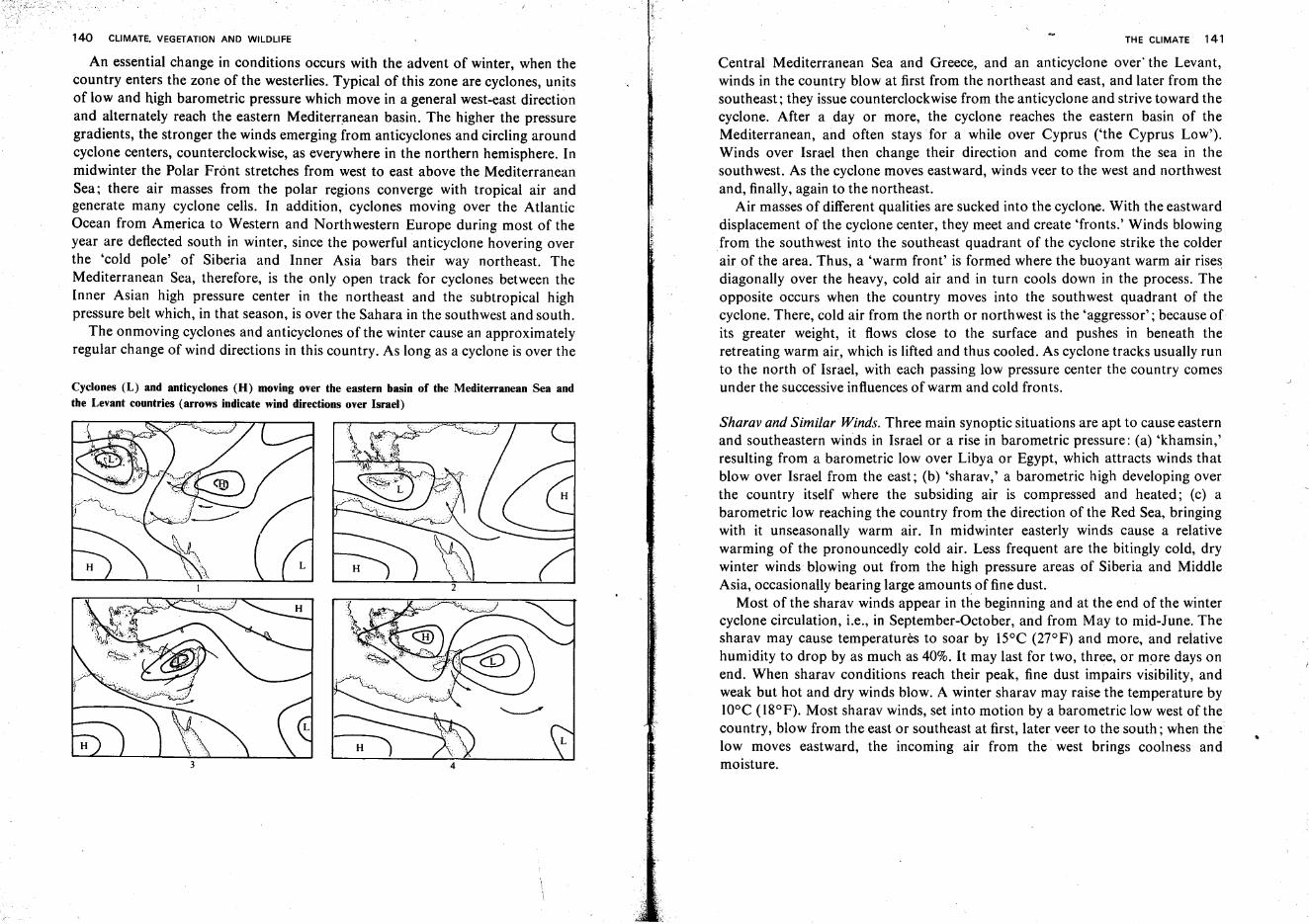
140 CLIMATE. VEGETATION AND WILDLIFE
An essential change in conditions occurs with the advent of winter, when thecountry enters the zone of the westerlies. Typical of this zone are cyclones, unitsof low and high barometric pressure which move in a general west-east directionand alternately reach the eastern Mediterranean basin. The higher the pressuregradients, the stronger the winds emerging from anticyclones and circling aroundcyclone centers, counterclockwise, as everywhere in the northern hemisphere. Inmidwinter the Polar Front stretches from west to east above the MediterraneanSea; there air masses from the polar regions converge with tropical air andgenerate many cyclone cells. In addition, cyclones moving over the AtlanticOcean from America to Western and Northwestern Europe during most of theyear are deflected south in winter, since the powerful anticyclone hovering overthe 'cold pole' of Siberia and Inner Asia bars their way northeast. TheMediterranean Sea, therefore, is the only open track for cyclones between theInner Asian high pressure center in the northeast and the subtropical highpressure belt which, in that season, is over the Sahara in the southwest and south.
The onmoving cyclones and anticyclones of the winter cause an approximatelyregular change of wind directions in this country. As long as a cyclone is over the
Cyclones (L) and anticyclones (H) moving over the eastern basin of the Mediterranean Sea andthe Levant countries (arrows indicate wind directions over Israel)
THE CLIMATE 141
Central Mediterranean Sea and Greece, and an anticyclone overthe Levant,winds in the country blow at first from the northeast and east, and later from thesoutheast; they issue counterclockwise from the anticyclone and strive toward thecyclone. After a day or more, the cyclone reaches the eastern basin of theMediterranean, and often stays for a while over Cyprus ('the Cyprus Low').Winds over Israel then change their direction and come from the sea in thesouthwest. As the cyclone moves eastward, winds veer to the west and northwestand, finally, again to the northeast.
Air masses of different qualities are sucked into the cyclone. With the eastwarddisplacement of the cyclone center, they meet and create 'fronts.' Winds blowingfrom the southwest into the southeast quadrant of the cyclone strike the colderair of the area. Thus, a 'warm front' is formed where the buoyant warm air risesdiagonally over the heavy, cold air and in turn cools down in the process. Theopposite occurs when the country moves into the southwest quadrant of thecyclone. There, cold air from the north or northwest is the 'aggressor'; because ofits greater weight, it flows close to the surface and pushes in beneath theretreating warm air, which is lifted and thus cooled. As cyclone tracks usually runto the north of Israel, with each passing low pressure center the country comesunder the successive influences of warm and cold fronts.
Sharav and Similar Winds. Three main synoptic situations are apt to cause easternand southeastern winds in Israel or a rise in barometric pressure: (a) 'khamsin,'resulting from a barometric low over Libya or Egypt, which attracts winds thatblow over Israel from the east; (b) 'sharav,' a barometric high developing overthe country itself where the subsiding air is compressed and heated; (c) abarometric low reaching the country from the direction of the Red Sea, bringingwith it unseasonally warm air. In midwinter easterly winds cause a relativewarming of the pronouncedly cold air. Less frequent are the bitingly cold, drywinter winds blowing out from the high pressure areas of Siberia and MiddleAsia, occasionally bearing large amounts offine dust.
Most of the sharav winds appear in the beginning and at the end of the wintercyclone circulation, i.e., in September-October, and from May to mid-June. Thesharav may cause temperatures to soar by 15°C (27°F) and more, and relativehumidity to drop by as much as 40%. It may last for two, three, or more days onend. When sharav conditions reach their peak, fine dust impairs visibility, andweak but hot and dry winds blow. A winter sharav may raise the temperature byWOC (l8°F). Most sharav winds, set into motion by a barometric low west of thecountry, blow from the east or southeast at first, later veer to the south; when thelow moves eastward, the incoming air from the west brings coolness andmoisture.
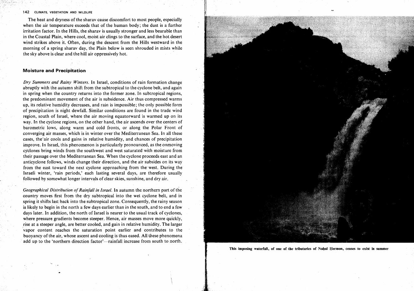
142 CLIMATE. VEGETATION AND WILDLIFE
The heat and dryness of the sharav cause discomfort to most people, especiallywhen the air temperature exceeds that of the human body; the dust is a furtherirritation factor. In the Hills, the sharav is usually stronger and less bearable thanin the Coastal Plain, where cool, moist air clings to the surface, and the hot desertwind strikes above it. Often, during the descent from the Hills westward in themorning of a spring sharav day, the Plain below is seen shrouded in mists whilethe sky above is clear and the hill air oppressively hot.
Moisture and Precipitation
Dry Summers and Rainy Winters. In Israel, conditions of rain formation changeabruptly with the autumn shift from the subtropical to the cyclone belt, and againin spring when the country returns into the former zone. In subtropical regions,the predominant movement of the air is subsidence. Air thus compressed warmsup, its relative humidity decreases, and rain is impossible; the only possible formof precipitation is night dewfall. Similar conditions are found in the trade windregion, south of Israel, where the air moving equatorward is warmed up on itsway. In the cyclone regions, on the other hand, the air ascends over the centers ofbarometric lows, along warm and cold fronts, or along the Polar Front of.converging air masses, which is in winter overthe Mediterranean Sea. In all thesecases, theair cools and gains in relative humidity, and chances of precipitationimprove.. In Israel, this phenomenon is particularly pronounced, as the onmovingcyclones bring winds from the southwest and west saturated with moisture fromtheir passage over the Mediterranean Sea. When the cyclone proceeds east and ananticyclone follows, winds change their direction, and the air subsides on its wayfrom the east toward the next cyclone approaching from the west. During theIsraeli winter, 'rain periods,' each lasting several days, are therefore usuallyfollowed by somewhat longer intervals of clear skies, sunshine, and dry air.
Geographical Distribution ofRainfall in Israel. In autumn the northern part of thecountry moves first from the dry subtropical into the wet cyclone belt, and inspring it shifts last back into the subtropical zone. Consequently, the rainy seasonis likely to begin in the north a few days earlier than in the south, and to end a fewdays later. In addition, the north of Israel is nearer to the usual track of cyclones,where pressure gradients become steeper. Hence, air masses move more quickly,,rise at a steeper angle, are better cooled, and gain in relative humidity. The largervapor content reaches the saturation point earlier and contributes to thebuoyancy of the air, whose ascent and cooling is thus eased. All these phenomenaadd up to the 'northern direction factor'-rainfall increase from south to north.
This imposing waterfall, of one of the tributaries of Nahal Hermon, ceases to exist in summer
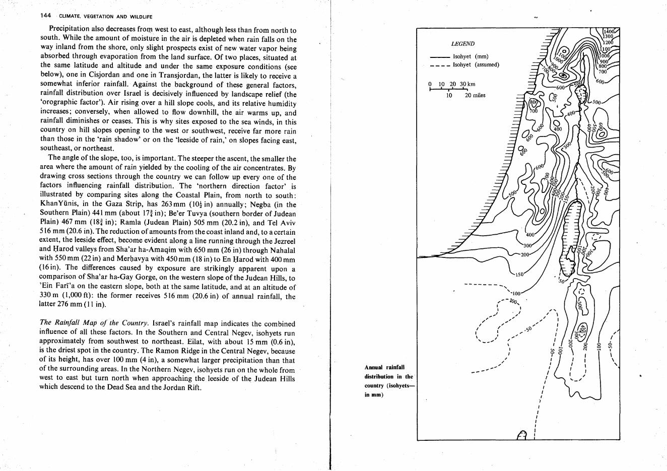
144 CLIMATE. VEGETATION AND WILDLIFE
LEGEND
10 20 miles
o 10 20 30kmI 'i' "
'"Io .6o on.... ,
\\ ,
, ...I \
" I..... ,.<;,f.) ,
-: ,I'" I\ ,I ~ :;I 'i' 0
I I,,/ ,
,'" I
---' II
II
I,.,,,II,II
--------,'-100
,'-loa,~ II . I
... ", "" "'" ...I ,I /
I I\ ', I-_ ....
--- Isohyet (mm)_ _ _ _ Isohyet (assumed)
Annual rainfall
distribution in the
country (isohyets
in mm)
The Rainfall Map of the Country. Israel's rainfall map indicates the combinedinfluence of all these factors. In the Southern and Central Negev, isohyets runapproximately from southwest to northeast. Eilat, with about 15 mm (0.6 in),is the driest spot in the country. The Ramon Ridge in the Central Negev, becauseof its height, has over 100mm (4 in), a somewhat larger precipitation than thatof the surrounding areas. In the Northern Negev, isohyets run on the whole fromwest to east but turn north when approaching the leeside of the Judean Hillswhich descend to the Dead Sea and the Jordan Rift.
Precipitation also decreases from west to east, although less than from north tosouth. While the amount of moisture in the air is depleted when rain falls on theway inland from the shore, only slight prospects exist of new water vapor beingabsorbed through evaporation from the land surface. Of two places, situated atthe same latitude and altitude and under the same exposure conditions (seebelow), one in Cisjordan and one in Transjordan, the latter is likely to receive asomewhat inferior rainfall. Against the background of these general factors,rainfall distribution over Israel is decisively influenced by landscape relief (the'orographic factor'). Air rising over a hill slope cools, and its relative humidityincreases; conversely, when allowed to flow downhill, the air warms up, andrainfall diminishes or ceases. This is why sites exposed to the sea winds, in thiscountry on hill slopes opening to the west or southwest, receive far more rainthan those in the 'rain shadow' or on the 'leeside of rain,' on slopes facing east,southeast, or northeast.
The angle of the slope, too, is important. The steeper the ascent, the smaller thearea where the amount of rain yielded by the cooling of the air concentrates. Bydrawing cross sections through the country we can follow up everyone of thefactors influencing rainfall distribution. The 'northern direction factor' isillustrated by comparing sites along the Coastal Plain, from north to south:KhanYiinis, in the Gaza Strip, has 263 mm (1O! in) annually; Negba (in theSouthern Plain) 441 mm (about In in); Be'er Tuvya (southern border of JudeanPlain) 467 mm (l8! in); Ramla (Judean Plain) 505 mm (20.2 in), and Tel Aviv516 mm (20.6 in). The reduction of amounts from the coast inland and, to a certainextent, the leeside effect, become evident along a line running through the Jezreeland Harod valleys from Sha'ar ha-Amaqim with 650 mm (26 in) through Nahalalwith 550 mm (22 in) and Merhavya with 450 mm (18 in) to En Harod with 400 mm(16 in). The differences caused by exposure are strikingly apparent upon acomparison of Sha'ar ha-Gay Gorge, on the western slope of the Judean Hills, to'Ein Fari''a on the eastern slope, both at the same latitude, and at an altitude of330m (l,000 ft): the former receives 516 mm (20.6 in) of annual rainfall, thelatter 276 mm (11 in).
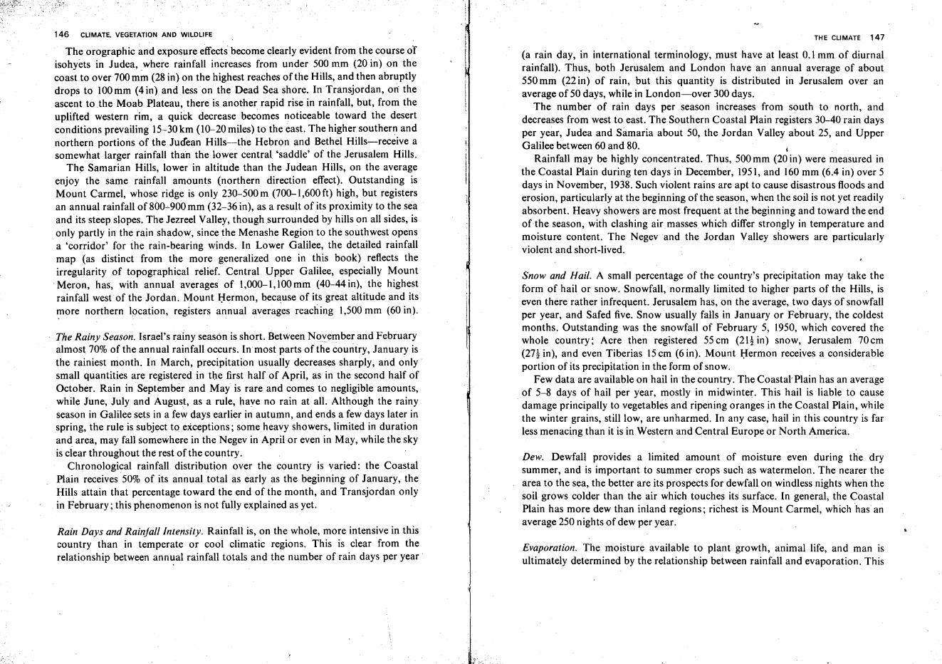
146 CLIMATE. VEGETATION AND WILDLIFE
The orographic and exposure effects become clearly evident from the course ofisohyets in Judea, where rainfall increases from under 500 mm (20 in) on thecoast to over 700 mm (28 in) on the highest reaches ofthe Hills, and then abruptlydrops to 100 mm (4 in) and less on the Dead Sea shore. In Transjordan, on theascent to .the Moab Plateau, there is another rapid rise in rainfall, but, from theuplifted western rim, a quick decrease becomes noticeable toward the desertconditions prevailing 15-30km (10-20 miles) to the east. The higher southern andnorthern portions of the Judean Hills-the Hebron and Bethel Hills-receive asomewhat larger rainfall than the lower central 'saddle' of the Jerusalem Hills.
The Samarian Hills, lower in altitude than the Judean Hills, on the averageenjoy the same rainfall amounts (northern direction effect). Outstanding isMount Carmel, whose ridge is only 230-500 m (700-1,600 ft) high, but registersan annual rainfall of 800~900mm (32-36 in), as a result of its proximity to the seaandits steep slopes. The Jezreel Valley, thoughsurrounded by hills on all sides, isonly partly in the rain shadow, since the Menashe Region to the southwest opensa 'corridor' for the rain-bearing winds. In Lower Galilee, the detailed rainfallmap (as distinct from the more generalized one in this book) reflects theirregularity of topographical relief. Central Upper Galilee, especially Mount
'Meron, has, with annual averages of 1,000-1,100mm (40-44 in), the highestrainfall west of the Jordan. Mount Hermon, because of its great altitude and itsmore northern location, registers annual averages reaching 1,500 mm (60 in).
, .
The Rainy Season. Israel's rainy season is short. Between November and Februaryalmost 70% of the annual rainfall occurs. Inmost parts of the country, January isthe rainiest month. In March, precipitation usually decreases sharply, and only'small quantities are registered in the first half of April, as in the second half ofOctober. Rain in September and May is rare and comes to negligible amounts,while June, July and August, as a rule, have no rain at all. Although the rainyseason in Galilee sets in a few days earlier in autumn, and ends a few days later inspring, the rule is subject to exceptions; some heavy showers, limited in durationand area, may fall somewhere in the Negev in April or even in May, while the skyis ciear throughout the rest of the country.
Chronological rainfall distribution over the country is varied: the CoastalPlain receives 50% of its annual total as early as the beginning of January, theHills attain that percentage toward the end of the month, and Transjordan onlyin February; this phenomenon is not fully explained as yet.
Rain Days and Rainfall Intensity. Rainfall is, on the whole, more intensive in thiscountry than in temperate or cool climatic regions. This is clear from therelationship between ann~al rainfall totals and the number of rain days per year
THE CLIMATE 147
(a rain day, in international terminology, must have at least O.lmm of diurnalrainfall). Thus, both Jerusalem and London have an annual average of about550 mm (22 in) of rain, but this quantity is distributed in Jerusalem over anaverage of 50 days, while in London-over 300 days.
The number of rain days per season increases from south to north, anddecreases from west to east. The Southern Coastal Plain registers 30-40 rain daysper year, Judea and Samaria about 50, the Jordan Valley about 25, and UpperGalilee between 60 and 80. I
Rainfall may be highly concentrated. Thus, 500 mm (20 in) were measured inthe Coastal Plain during ten days in December, 1951, and 160 mm (6.4 in) over 5days in November, 1938. Such violent rains are apt to cause disastrous floods anderosion, particularly at the beginning of the season, when the soil is not yet readilyabsorbent. Heavy showers are most frequent at the beginning and toward the endof the season, with clashing air masses which differ strongly in temperature andmoisture content. The Negev and the Jordan Valley showers are particularlyviolent and short-lived.
Snow and Hail. A small percentage of the country's precipitation may take theform of hail or snow. Snowfall, normally limited to higher parts of the Hills, iseven there rather infrequent. Jerusalem has, on the average, two days of snowfallper year, and Safed five. Snow usually falls in January or February, the coldestmonths. Outstanding was the snowfall of February 5, 1950, which covered thewhole country: Acre then registered 55cm (21! in) snow, Jerusalem 70cm(27! in), and even Tiberias 15em (6 in). Mount Hermon receives a considerableportion of its precipitation in the form of snow.
Few data are available on hail in the country. The Coastal-Plain has an averageof 5-8 days of hail per year, mostly in midwinter. This hail is liable to cause
. damage principally to vegetables and ripening oranges in the Coastal Plain, whilethe winter grains, still low, are unharmed. In any case, hail in this country is farless menacing than it is in Western and Central Europe or North America.
Dew. Dewfall provides a limited amount of moisture even during the drysummer, and is important to summer crops such as watermelon. The nearer thearea to the sea, the better are its prospects for dewfall on windless nights when thesoil grows colder than the air which touches its surface. In general, the CoastalPlain has more dew than inland regions; richest is Mount Carmel, which has anaverage 250 nights of dew per year.
Evaporation. The moisture available to plant growth, animal life, and man isultimately determined by the relationship between rainfall and evaporation. This
148 CLIMATE. VEGETATION AND WILDLIFE
can be expressed by the 'rain factor,' i.e., annual precipitation (in mm) of a place,divided by its mean annual temperature (in centigrade). In the more humidregions of the country, the rain factor attains 50, while over large expanses itsinks below 15, the borderline for absolute desert conditions.
There are, however, several other facts which influence the evaporation rate.Naturally, evaporation is particularly strong in summer, owing to the hightemperatures, to intensive insolation under a cloudless sky, and to the low airhumidity on sharav days. The Coastal Plain has, because of its year-round highair humidity, a comparatively low evaporation rate (3-4.5 mm = 0.12-0.18 in perday); in the Hills, this rises to 4.5-7 mm (0.18-0.28 in), and during the summer inthe Dead Sea Region to a maximum of 13 mm (0.51 in). It must be remembered,however, that only water surfaces, which are in full contact with the air, are fullyaffected by evaporation, while water that has seeped into the ground is, for themost part, protected. Fortunately for Israel, its rainfall is concentrated in the coolseason, so that there is less evaporation upon reaching the ground than would bethe case with summer rains. The 'rain factor' can therefore be taken only withreservation as a criterion of the climatic character of regions in this country. It isestimated that in Israel 50-60% of rainwater evaporates immediately (forcomparison: countries with tropical summer. rains register up to 95% evaporation). Another 10% or more is lost later, and between 5 and 15% returns to the seain surface runoff. Only 10-25% of the precipitation, therefore, remains for theneeds of the country and its inhabitants.
Drought and the Aridity Border. Drought, in Israel, means either a period without precipitation during the rainy season, or an entire rainy season with precipitation markedly below average. Lack of rain, as well as unseasonal heat and theresulting high evaporation rates, are factors of drought conditions. In the north,drought is a comparatively small menace, as a drop of 100mm (4 in) or morefrom the annual average cannot seriously affect the water balance of the region.In the Northern Negev, on the other hand, 100mm (4 in) less ofrain is, in effect, athird, or even a half, less than the annual total. Not only are the regions of the'aridity border' most sensitive to vacillations in rainfall, but precipitation there ismost unpredictable. While in Western Europe deviations of more than 10% fromthe annual mean are exceptional, the Northern Negev or the Bet She'an Valleymay receive only one third of their average annual rainfall and,in other years,twice the normal amount. Even if the annual total attains the average, a regionmay suffer from 'agricultural drought,' when the rains begin too late, areinterrupted for several weeks in midwinter, or cease too early in spring, so thatthe growth of crops is impeded, and they wither before bearing fruit.
Drought years in Israel are frequent, and often affect the entire country. In
.j
I
THE CLIMATE 149
1950-51, for example, only 35%of the annual average fell on the northwest shoreof the Sea of Galilee, 43% in Jerusalem, 53% in Haifa, and 65% in Tel Aviv. Oftenthere are series of drought years, as in the five winters between autumn 1958 andspring 1963. There is, however, no recognizable regularity in the incidence ofample rainfall periods and of drought years. In Jerusalem, where rainfall has beenmeasured continuously since 1846, the periods 1854-1859, 1880-1898, 19171922, 1936-1939 and 1941-1945 had above-average rainfall, while between 1869and 1873, or between 1924 and 1936, most years were those of drought. Adrought in a certain year does not necessarily affect all parts of the country to thesame degree; the Negev or the Judean Hills may be severely hit by drought whilerainfall in the north is normal, or vice versa.
The lower the annual total of precipitation, the larger the likely deviationsfrom the average, and the greater the danger to crops. An annual rainfall of250mm (lOin) suffices, on the heavy loess soil of the Negev, for the success of thewinter wheat crop. The 'aridity border,' however, must be drawn further north,along the 350 mm (14 in) isohyet, for beyond it the precipitation for too manyyears has been considerably below that average and not even attained thenecessary minimum of 250 mm (10 in). The 350 mm (14 in) isohyet runs along thenorthern margin of the Negev, separates the Judean Hills from the JudeanDesert, and cuts through the Bet She'an Valley.
Climatic Regions of Israel
The division of Cisjordan into four main geographical regions-the Negev, theCoastal Plain, the Hills, and the Jordan and Dead Sea Rift-is also valid forclimatic conditions.*
The Climate of the Negev
The Negev differs vastly in climate from the country's center and north. Twoclimatic subregions can be discerned-the Northern Negev, which includes onlyabout half of the Beersheba Region and can be described, at best, as semiarid,and all other parts of the Negev which are desert proper. Although the climaticconditions of the Negev are better known today than they were prior to 1948,
'" Transjordan south of the Yarmuk River is not included due to lack of data and to the fact thatits climate is irrelevant to the economy of the State of Israel.
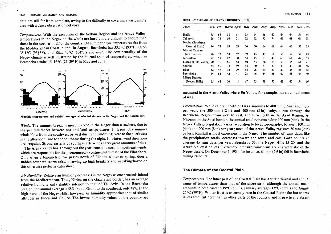
The Climate of the Coastal Plain
measured in the Arava Valley where En Yahav, for example, has an annual meanof40%.
Precipitation. While rainfall north of Gaza amounts to 400 mm (16 in) and moreper year, the 300 mm (12 in) and 200 mm (8 in) isohyets run through theBeersheba Region from west to east, and turn north in the Arad Region. AtNizzana on the Sinai border, the annual total remains below 100mm (4in). In theNegev Hills precipitation varies, according to local topography, between 100mm(4 in) and 200 mm (8 in) per year; most of the Arava Valley registers 50 mm (2 in)or less. Rainfall is most capricious in the Negev. The number of rainy days, likethe precipitation totals, decreases toward the south and east. Gaza counts anaverage 45 rain days per year, Beersheba 33, the Negev Hills 15-20, and theArava Valley 8 or less. Extremely intensive rainstorms are characteristic of theNegev desert. On December 5, 1934, for instance, 64 mm (2.6 in) fell in Beershebaduring 24 hours.
I II III IV V VIVUVIIIIX X XI XII111 III IV V VI VII VIII IX X XI XIII II III IV V VI VII VIII IX X XI XII
TIBERIAS BEERSHEBA EILAT
Monthly temperatures and rainfall averages at selected stations in the Negev and the Jordan Rift
Winds. The summer breeze is more marked in the Negev than elsewhere, due tosharper differences between sea and land temperatures. In Beersheba summerwinds blow from the southwest or west during the morning, veer to the northwestin the afternoon, and to the southeast during the night. In winter, wind directionsare irregular. Strong easterly or southeasterly winds carry great amounts of dust.
The Arava Valley has, throughout the year, constant north or northeast winds,which are responsible for the pronouncedly continental climate of the Eilat shore.Only when a barometric low passes north of Eilat in winter or spring, does asudden southern storm arise, throwing up high breakers and wreaking havoc onthis otherwise perfectly calm shore.
150 CLIMATE. VEG.ETATION AND WILDLIFE THE CLIMATE 151
data are still far from complete, owing to the difficulty in covering a vast, empty MONTHLY AVERAGE OF RELATIVE HUMIDITY (IN %)
area with a dense observation network. Place Jan. Feb. March April May June July Aug. Sept. Oct. Nov. Dec.
Temperatures. With the exception of the Sedom Region and the Arava Valley, Haifa 75 65 58 61 53 64 66 67 64 64 54 64temperatures in the Negev on the whole are hardly more difficult to endure than Tel Aviv 66 78 66 71 52 72 72 74 69 68 64 78
those in the northern half of the country. On summer days temperatures rise from Negba (Southern
the Mediterranean Coast inland. In August, Beersheba has 33.7°C (93°P), Oron Coastal Plain) 74 74 69 59 56 60 64 68 64 62 57 65
35.1oC (95!OP), and Eilat 40°C (l04°P) and over. The continentality of theMount Canaan
(near Safed) 76 73 58 57 39 45 47 51 ' 57 52 57 73Negev climate is well illustrated by the diurnal span of temperatures, which in Jerusalem 72 58 47 38 54 45 53 49 60 61 42 63Beersheba attains 15-16°C (27-29°P) in May and June. Dafna (l;Iula Valley) 70 70 66 64 40 53 56 59 57 55 61 71
Sedom 54 50 38 49 44 30 33 33 39 43 41 56
c. c. mm c. Eilat 52 47 32 29 64 26 29 33 37 38 44 4540· 200 40. 200 Beersheba 64 64 42 41 73 46 54 58 60 58 44 60
Mizpe Ramon(Negev Hills) 65 62 50 48 67 53 59 50 63 60 54 66
Air Humidity. Relative air humidity decreases in the Negev as one proceeds inlandfrom the Mediterranean. Thus, Nirim, on the Gaza Strip border, has an averagerelative humidity only slightly inferior to that of Tel Aviv. In the BeershebaRegion, the annual average is 58%, but at Oron, to the southeast, only 48%. In thehigh parts of the Negev Hills, however, air humidity approaches that of similaraltitudes in Judea and Galilee. The lowest humidity values of the country are
Temperatures. The inner part of the Coastal Plain has a wider diurnal and annualrange of temperatures than that of the shore strip, although the annual meanamounts in both cases to 19°C (66°P). January averages BOC (55°P) and August26°C (79°P). Winter frost is extremely rare in the Coastal Plain; the hot sharavis less frequent here than .in other parts of the country, and is practically absent
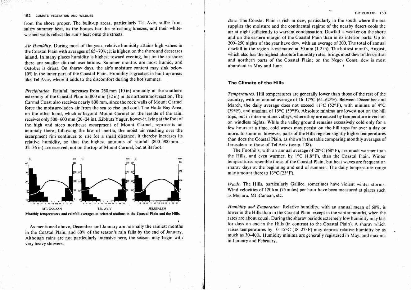
152 CLIMATE. VEGETATION AND WILDLIFE
from the shore proper. The built-up areas, particularly Tel Aviv, suffer fromsultry summer heat, as the houses bar the refreshing breezes, and their whitewashed walls reflect the sun's heat onto the streets.
Air Humidity. During most of the year, relative humidity attains high values inthe Coastal Plain with averages of 65-70%; it is highest on the shore and decreasesinland. In many places humidity is highest toward evening, but on the seashorethere are smaller diurnal oscillations. Summer months are most humid, andOctober is driest. On sharav days, the air's moisture content may sink below10% in the inner part of the Coastal Plain. Humidity is greatest in built-up areaslike Tel Aviv, where it adds to the discomfort during the hot summer.
THE CLIMATE, 153
Dew. The Coastal Plain is rich in dew, particularly in the south where the seasupplies the moisture and the continental regime of the nearby desert cools theair at night sufficiently to warrant condensation. Dewfall is weaker on the shoreand on the eastern margin of the Coastal Plain than in its interior parts. Up to200-250 nights of the year have dew, with an average of 200. The total of annualdewfall in the region is estimated at 30 mm (1.2 in). The hottest month, August,which also has the highest absolute humidity rates, brings most dew to the centraland northern parts of the Coastal Plain; on the Negev Coast, dew is mostabundant in May and June.
The Climate of the Hills
MT. CANAAN TEL AVIV JERUSALEM
Monthly temperatures and rainfall averages at selected stations in the Coastal Plain and the Hills
\
As mentioned above, December and January are normally the rainiest monthsin the Coastal Plain, and 60% of the season's rain falls by the end of January.Although rains are not particularly intensive here, the season may begin withvery heavy showers.
Precipitation. Rainfall increases from 250 mm (10 in) annually at the southernextremity of the Coastal Plain to 800 mm (32 in) in its northernmost section. TheCarmel Coast also receives nearly 800 mm, since the rock walls of Mount Carmelforce the moisture-laden air from the sea to rise and cool. The Haifa Bay Area,on the other hand, which is beyond Mount Carrilel on the leeside of the rain. ,receives only 500-600 mm (20-24 in). Kibbutz Yagur, however, lying at the foot ofthe high and steep northeast escarpment of Mount Carmel, represents ananomaly there; following the law of inertia, the moist air reaching over theescarpment rim continues to rise for a small distance; it thereby increases itsrelative humidity, so that the highest amounts of rainfall (800-900 mm32-36 in) are received, not on the top of Mount Carmel, but.at its foot.
Humidity and Evaporation. Relative humidity, with an annual mean of 60%, islower in the Hills than in the Coastal Plain, except in the winter months, when therates are about equal. During the sharav periods extremely low humidity may lastfor days on end in the Hills (in contrast to the Coastal Plain). A sharav whichraises temperatures by 1O-15°C (l8-27°F) may depress relative humidity by as~uch as 30-40%. Humidity minima are generally registered in May, and maximaIII January and February.
Temperatures. Hill temperatures are generally lower than those of the rest of thecountry, with an annual average of 16-17°C (61-62°F). Between December andMarch, the daily average does not exceed 11°C (52°F), with minima of 4°C(39°F), and maxima of 15°C (59°F). Absolute minima are lowest not on the hilltops, but in intermontane valleys, where they are caused by temperature inversionon windless nights. While the valley ground remains excessively cold only for afew hours at a time, cold waves may persist on the hill tops for over a day ormore. In summer, however, parts of the Hills register slightly higher temperaturesthan does the Coastal Plain, as shown in the table comparing monthly averages ofJerusalem to those of Tel Aviv (see p. 138).
The Foothills, with an annual average of 20°C (68°F), are much warmer thanthe Hills, and even warmer, by lOC (l.8°F), than the Coastal Plain. Wintertemperatures resemble those of the Coastal Plain, but heat waves are frequent onsharav days at the beginning and end of summer. The daily temperature rangemay amount there to 13°C (23°F).
Winds. The Hills, particularly Galilee, sometimes have violent winter storms.Wind velocities of 120km (75 miles) per hour have been measured at places suchas Menara, Mt. Canaan, etc.
mm200
ISO
I II III IV V VI VII VIII IX X XI XII
c.
I II III IV V VI VII VIII IX X XI XII
mm C.
I II III IV V VI VIIVIHIX X XI XII
c.
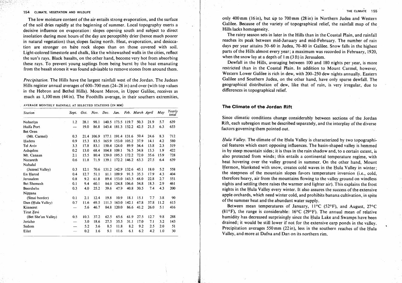
154 CLIMATE. VEGETATION AND WILDLIFE
The low moisture content of the air entails strong evaporation, and the surfaceof the soil dries rapidly at the beginning of summer. Local topography exerts adecisive influence on evaporation: slopes opening south and subject to directinsolation during most hours of the day are perceptibly drier (hence much poorerin natural vegetation) thanslopes facing north. Heat; evaporation, and desiccation are stronger on bare rock slopes than on those covered with soil.Light-colored limestone and chalk, like the whitewashed walls in the cities, reflectthe sun's rays. Black basalts, on the other hand, become very hot from absorbingthese rays. To prevent young saplings from being burnt by the heat emanatingfrom the basalt stones it was found advisable to remove stones from around them.
Precipitation. The Hills have the largest rainfall west of the Jordan. The JudeanHills register annual averages of 600-700 mm (24-28 in) and over (with top valuesin the Hebron and Bethel Hills). Mount Meron, in Upper Galilee, receives asmuch as 1,100mm (44 in). The Foothills average, in their southern extremities,
THE CLIMATE 155
only 400 mm (16 in), but up to 700 mm (28 in) in Northern Judea and WesternGalilee. Because of the variety of topographical relief, the rainfall map of the
. Hills lacks homogeneity. .The rainy season sets in later in the Hills than in the Coastal Plain, and rainfall
reaches its peak between mid-January and mid-February. The number of raindays per year attains 50-60 in Judea, 70-80 in Galilee. Snow falls in the highestparts of the Hills almost every year; a maximum was recorded in February, 1920,when the snow lay at a depth of 1m (3 ft) in Jerusalem.
Dewfall in the Hills, averaging between 100 and 180 nights per year, is morerestricted than in the Coastal Plain. In addition to Mount Carmel, however,Western Lower Galilee is rich in dew, with 200-250 dew nights annually. EasternGalilee and Southern Judea, on the other hand, have only sparse dewfall. Thegeographical distribution of dew, like that of rain, is very irregular, due todifferences in topographical relief.
AVERAGE MONTHLY RAINFALL AT SELECTED STATIONS (IN MM) The Climate of the Jordan Rift
28.1 98.1 140.5 173.5 II9.7 50.3 21.9 5.719.0 86.8 143.4 181.3 132.2 42.5 21.5 6.3
2.1 12.4 19.8 10.9 18.1 15.1 7.7 3.811.6 69.5 II I.3 163.0 142.1 67.8 37.8 11.25.6 46.7 84.8 120.0 86.6 41.2 26.0 5.1
Nov. Dec. Jan. Feb. March AprilSept. Oct.
Hula Valley. The climate of the Hula Valley is characterized by two topographical features which exert opposing influences. The basin-shaped valley is hemmedin by steep mountain sides; it is thus in the rain shadow and, to a certain extent, isalso protected from winds; this entails a continental temperature regime, withheat hovering over the valley ground in summer. On the other hand, MountHermon, blanketed with snow, creates cold waves in the Hula Valley in winter;the steepness of the mountain slopes favors temperature inversion (i.e., cold,therefore heavy, air from the mountains flowing to the valley ground on windlessnights and settling there raises the warmer and lighter air). This explains the frostnights in the Hula Valley every winter. It also assures the success of the extensiveapple orchards, which need winter cold, and prohibits banana cultivation, in spiteof the summer heat and the abundant water supply.
Between mean temperatures of January, 11°C (52°F), and August, 27°C(81°F), the range is considerable: 16°C (29°F). The annual mean of relativehumidity has decreased surprisingly since the Hula Lake and Swamps have beendrained; it would be still lower if not for the extensive carp ponds in the valley.Precipitation averages 550 mm (22 in), less in the southern reaches of the HulaValley, and more at Dafna and Dan on its northern rim. .
Since climatic conditions change considerably between sections of the JordanRift, each subregion must be described separately, and the interplay of the diversefactors governing them pointed out.
558404551461200
90615416
2881435130
639633
712580519422728639
9.83.22.01.0
5.24.32.72.94.3
8.34.22.31.9
15.96.4
May Yearlytotal
18.017.922.818.37.4
24.614.113.813.335.627.5
132.6 45.191.3 35.3
143.3 68.0106.6 54.840.8 30.5
131.6 50.4105.2 37.989.9 34.476.5 .34.8
172.2 72.0146.2 63.3
62.5 65.6 61.9 27.5 12.727.5 35.5 31.1 17.0 7.1
8.5 11.8 8.2 9.2 2.59.1 11.6 6.1 6.2 4.2
131.2 142.981.1 109.989.4 153.084.0 124.839.6 47.9
177.1 191.4165.9 153.0150.4 124.0104.8 109.1139.0 195.3139.1 172.2
70.651.161.860.125.2
106.983.583.168.480.471.9
10.3 37.23.0 18.65.2 3.60.2 1.6
12.112.79.29.44.0
21.415.317.813.015.5II.8
0.5
0.10.7
1.2
0.30.40.80.10.3
0.30.93.30.22.10.6
Station
NahariyaHaifa PortBet Oren
(Mt. Carmel)HaderaTel AvivAshqelonMt. CanaanNazarethNahalal
(Jezreel Valley)En HarodJerusalemBet ShemeshBeershebaNizzana
(Sinai border)Dan (J::Iula Valley)KinneretTirat Zevi
(Bet She' an Valley)JerichoSedomEilat
· 156 CLIMATE. VEGETATION AND WILDLIFE
Kinnarot Valley. This region's climate is also controlled by two topographicalfactors opposed in their effect, although quite different from those of the HulaValley. The valley ground, 200m (650ft) and more below sea level, therefore hasa high barometric pressure. Temperatures are high during most of the year,because of the steep descent into the valley, where the air is compressed andwarmed by friction. Winter temperatures are also mitigated by the water bodyof Lake Kinneret, which fills a large portion of this section in the Rift. TheAugust mean reads 31°C (88°F), and the January mean does not sink below 14°C(57°F). Thus, bananas, date palms, and other crops sensitive to cold succeed, asdo out-of-season vegetables and fruit in the region. The valley, although onthe leeside of rain, is open to westerly winds. Lake Kinneret creates a breezecirculation of its own; during the late hours of the night, especially in summer,weak winds blow from the shores of the lake toward its center. In the morning thedirection is reversed and the surrounding areas receive a light wind from the lake.In the early afternoon, however, the stronger breeze from the Mediterraneanshore overrides this local regime; compressed in its descent into the low-lyingvalley, it adds to the oppressive heat and dryness. Since it hits the eastern rimmore sharply than the western shore of Lake Kinneret, summer afternoons atEn Gev are usually hotter than those at Tiberias.
In winter violent winds sometimes enter the narrow valley; unable to continueout through the east side, they whirl over Lake Kinneret, raise high waves in it,and sometimes create thunderstorms accompanied by torrential rain. Averaging350~500mm (14-20 in), annual precipitation is not great, but usually comes downin short, concentrated showers. The number of rain days never exceeds 50 peryear. The presence of the lake raises relative humidity to an annual mean of 65%.
Bet She'an Valley. The Bet She'an Valley lies even deeper below sea level thandoes Lake Kinneret and its surroundings. With the absence of a mitigatingwater body, it has a pronouncedly continental temperature regime. Although thehighest temperature ever recorded in the country was measured at Tirat Zevi inthe Bet She'anValley, January, averaging l3°C (55°F), is quite cool. Winter coldexcludes bananas from this valley,although it permits the cultivation of datepalms. Relative humidity is low, and dewfall sparse, but both have recentlyincreased somewhat as a result of the installation of carp ponds. Rainfall does notexceed 350 mm (14 in) annually, and even that amount is extremely capricious, sothat the valley is frequently hit by drought.
Harod Valley. This valley forms the transition between the Bet She'an and Jezreelvalleys in climate, as in topography. Toward the west temperatures fall andprecipitation increases. Summer breezes rapidly warm up when passing through
THE CLIMATE 157
this narrow corridor. The wall-like escarpment of Mount Gilboa bars windscoming from the southwest. Characteristic of the Harod Valley are climaticdifferences in accordance with altitude and exposure between sites only a fewscore yards from each other.
Jezreel Valley. This region is under a stronger maritime influence than are theother interior valleys, yet its climate differs greatly from that of the Coastal Plain.The annual temperature mean increases from 18°C (64°F) in its northwest part to21°C (70°F) in its southeast corner. Although winter frost is less frequent herethan in the Bet She'an Valley, the region is not entirely free of it. Because of thesteep Nazareth Chain rising beyond it, the northern part of the Jezreel Valley hasa comparatively ample rainfall: 600 mm (24 in) and more, while the south lies,toa certain extent, on the leeside of rain.
Lower Jordan Valley. Meteorological reports of this section of the Rift are lessdetailed than those of other sections; its description must therefore be moregeneralized. This region can be regarded as the transition zone between thedry-steppe climate of the Bet She'an Valley and the extreme desert conditions ofthe Dead Sea. From north to south, barometric pressure, temperatures andevaporation become higher, and rainfall and dew lower. The lowermost floodterrace of the Jordan certainly differs from the higher steps of the valley; indouble or triple seclusion from the west, its microclimate, owing to the water ofthe Jordan and its annual winter inundations, has peak temperatures and asomewhat higher humidity rate than the rest of the region. The eastern bank ofthe Jordan is more exposed than the western to the hot, dry summer breeze; thebroad section where the Yabboq joins the Jordan (Sukkot Valley) has strongerwestern winds than the narrower passages ofthe Rift.
Dead Sea Region. The Dead Sea and its surroundings, at the lowest spot on earthand enclosed in high mountain walls to the west and east, is unique in its climaticconditions. The annual mean temperature is highest at the southern end of theDead Sea: 25.7°C (78°F). In January, a mean of 16.9°C (62.5°F) is registered onthe southern, and 14.3°C (57.7°F) on the northern shore, compared to 34.3°C(93.7°F) and 31.9°C (89.4°F) respectively, in August. The highest temperatureever recorded in the region reached 51°C (124°F). The considerable differencesbetween the northern and southern part of the region stem from the structure ofthe Dead Sea; the wide, deep northern basin functions similarly to the open sea:it sets into motion breezes which mitigate the midday heat, while the shallowsouthern basin acts thus only to a limited degree. Moreover, the cooling breezeduring the hot hours of the day cannot blow over the huge evaporation pans of
158 CLIMATE. VEGETATION AND WILDLIFE
the Dead Sea Works in the south; being water bodies themselves, they resemblethe sea surface in their diurnal pressure regime.
Relative humidity near the Dead Sea, averaging 57%, is among the lowest inthe country; the minimum, 45%, is registered for May, and the maximum, 62%,for October. Sharav days, however, are not as dry here as in t~e Judean Hills.Between 10 and 15sharav days are counted per year.
The extremely high evaporation rate is used to extract minerals from the DeadSea waters. High temperatures and strong winds contribute to the evaporation,which would be higher still, if not for the salinity of the Dead Sea waters, the highbarometric pressure, and the light mists hovering over the sea on most days.Evaporation is stronger from the northern than from the southern basin and, inthe area of the pans, stronger than on the sea shore. It has been calculated that3.5 m (almost 12 ft) of water would evaporate annually from the surface of thenorthern basin of the Dead Sea if the water were fresh.
The strong barometric pressure (an average of800 mm or 32 in) enriches the airabove the Dead Sea by 6-8% of oxygen over that above the Mediterranean Sea, afact which aids fuel combustion in the machines of the Dead Sea Works.
Winds in the Dead Sea Region are remarkably constant. The southern shorehas northern winds blowing from the Dead Sea in the morning, and southernwinds at night. On the northern shore, wind directions are opposite. As the Rift .resembles a narrow corridor in this section, open at its ends but almosthermetically closed on the sides, wind directions other than north and south arerare.
Precipitation amounts in the region are very low. The northern shore of theDead Sea has an annual mean of 86.3 mm (about 3i in), but this figure is subjectto extreme vacillations. In 1944/45, for instance, 258 mm (lOt in) were recorded,but only 23.2 mm (less than I in) in 1946/47. The southern shore, with an annualaverage of 54.7 mm (2.2 in), receives less rain than the northern.
The Climate of the Golan and the Hermon Shoulder
Detailed observations of the climate in these regions have become feasible onlysince the Six Day War, although some long-term data are available for twostations, Fiq in the Lower and Qunaitira in the Upper Golan.
As may be expected, sharp contrasts exist between the Lower Golan, wherealtitudes barely exceed 300 m, and the Upper Golan which not only rises to 1,000 mand more above sea level, but also comes under the climatic influence of thenearby Hermon Shoulder. The latter has near-Alpine conditions and constitutesa climatic region unlike any other in the country.
THE CLIMATE 159
Temperatures. Temperatures of the Golan are generally lower than those ofLower and Upper Galilee, the corresponding regions west of the Jordan, and theannual temperature curve shows sharper differences. As in the rest of the country,January is the coldest, and August the warmest month. While Fiq registers anaverage minimum of 6.8°C (44.3°F) in January and an average maximum of33°C (9 1.4°F) in August, the Qunaltira January minimum attains 3.1°C (37.6°F)and the August maximum only 29.5°C (85.I OF). In the Upper Golan, wintertemperatures frequently drop below freezing point, sometimes preserving thesnow cover on the ground for weeks on end. On the higher reaches of Mt.Hermon, diurnal averages in January and February are mostly below zero.
Humidity and Evaporation. Humidity rates on the Golan Plateau are throughouthigher than those of Galilee. While Qunaitira (approximately equaling Mt.Canaan of Upper Galilee in height and latitude) registers a January average of83%, as against 76% on Mt. Canaan, even Fiq has a January average of70%. Juneis the driest month at both stations, with averages at Fiq ranging from 58% at8.00 hrs, through 32% at 14.00 hrs, to 51% at 20.00 hrs; the corresponding valuesat Qunattira read 40.34 and 57%.
Relatively low temperatures and high air humidity cause, particularly in theUpper Golan, low evaporation rates, enabling summer crops to thrive with littleor no irrigation, and pastures to provide grazing throughout most or all of thesummer.
Precipitation. The annual rainfall at Fiq (455 mm, 18.2 in) is considerably lowerthan the Nazareth average (639 mm, 25i in) and only slightly exceeds that ofKinneret (416 mm, 16i in) which is situated within the Jordan Rift Valley.Qunaitira, on the other hand, receives an annual total of 822 mm (33 in),considerably more than Mt. Canaan (728 mm, 29 in). No exact data are yetavailable for the Hermon Shoulder; precipitation is presumably much higherthan at Qunattira, although not attaining the amounts on the mountain peak andthe western slopes of the Hermon Massif (in Lebanese territory) which, accordingto estimates, approach 1,500 mm (60 in) per year.
As elsewhere in the country, January is the rainiest month (219 mm, 8t in, atQunaitira, 110 mm, 4i in, at Fiq), followed, at Qunattira, by February andDecember (157 and 152 mm, 6i and 6 in, respectively), while at Fiq the Decemberaverage (91 mm, 3.6 in) slightly exceeds that of February (88 mrn, 3.5 in). Largemonthly differences between regions east and west of the Jordan are noticeable inMarch, when Qunaitira registers precipitation exceeding 134 mm (5.4 in) and Mt.Canaan a mere 72 mm (2.9 in)-a clear indication that late rains increase inimportance as one proceeds eastward.
160 CLIMATE. VEGETATION AND WILDLIFE
Mt. Hermon receives most ofits precipitation in the form of snow. Even in theUpper Golan, snowfall is by no means infrequent, a fact which seems to favor theregion's water economy and to offer good prospects for certain crops requiringwinter cold, e.g., walnut and true pistachio which are being contemplated for thenew Upper Golan settlements.
The Climate of Sinai
Our summary of climatic conditions of the Sinai Peninsula is, in most respects,confined to general remarks, as observations have been made at few localities, andonly exceptionally were they continued over long periods. Some additional buthaphazard information exists for certain other sites, but no data whatsoever areavailable for the greater part of the peninsula.
The Sinai Peninsula lies between the northern latitudes of 27°30' and 31°30'N.Accordingly, during the summer, its northern part finds itself in the subtropicalhigh pressure belt, and the south-s-in the trade winds zone, both markedly aridregions. In winter, Sinai approaches the wet cyclones belt but does not actuallyenter it, so that chances of rainfall remain slim even in the north of the peninsula.
Local variations from these uniform desert conditions are to be ascribed to theconsiderable differences in altitude and to the degree of exposure to marineinfluence. Concerning the latter, however, it must be emphasized that only theMediterranean Sea has a noticeable effect, whereas the climatic impact of theGulf of Suez is fairly insignificant, and that of the Gulfof Eilat is practicallynon-existent.
Temperatures. According to measurements taken in the town of el-'Ansh in theyears 1936-1956, August is the warmest month of the year, with an averagetemperature of 26.4° C (79.5°F), and January the coolest, with 13.7°C (56.7°F).Although this seasonal span exceeds that of points further north along the Levantcoast, it is smaller than that of inland sites and, in fact, of all other parts of theSinai Peninsula. The daily march of temperature, too, does not show extremes atel-Arish, the diurnal span amounting to 10° C (18° F) in summer, and to somewhat lower values in winter.
Of particular interest is the fact that the el-'Artsh coast has perceptibly coolersummers than either Tel Aviv, Haifa or Beirut. The curve of monthly averagetemperatures does not show surprising features, mounting relatively rapidlybetween April and May (from 18.4 to 21.6°C-65 to 71°F), and descending at aslightly steeper rate between November and December (from 19.7 to 15.4°C67.5 to 59.7°F).
r
}
i
THE CLIMATE 161
At even small distances from the Mediterranean shore, diurnal and seasonaltemperature curves sharpen considerably, to attain an average August high of28°C (82.5°F) and a January low of 8°C (46.5°F) at a-Nakhl on the a-TihPlateau, 150km south of el-Arish. Here the summer day temperatures oftenreach 35° C (95° F), but summer nights cool down to 15° C (59° F), this diurnalspan of 20° C (36°F) being characteristic of desert conditions.
The high mountains of the south again present a different picture. Averages forthe warmest month do not rise above 24°C (75° F), while monthly wintertemperatures fall to 8°C (46.4°F). Mountain tops show considerably lowervalues. American meteorologists who carried out observations on the top ofMt. Catherine during the nineteen-thirties, repeatedly recorded winter minima of-15 and even -20° C (5° and _4° F). The diurnal temperature range, too, is largeand, as far as can be ascertained, exceeds that of the a-Tih Plateau.
Along the low, narrow coast of the Suez Gulf and, more so, along the Gulf ofEilat, temperatures are high throughout the year, with August averages of28-32°C (82-89°F). Three factors combine there to produce this phenomenon:greater proximity to the equator; high mountain walls enclosing the gulfs andpreventing inflow of cooling winds; and compression and heating of air massesgliding from the mountain tops toward the shores in calm weather. Suez (PortTauftq), which lies landlocked at the innermost point of the western gulf,experiences somewhat larger diurnal and seasonal temperature ranges than thoseat a-Tur situated 220 km further south. Also winter minima are lower at a-Turthan at Suez. Similarly, Sharm a-Sheikh, situated near the southern tip of thepeninsula, at the opening of the Eilat Gulf into the Red Sea, registers summertemperatures which are about 2°C (3.6°F) lower than those at Eilat, which lies150km further north but is surrounded by mountains.
Winds. Very scanty information is available in this field. Observations made inthe north, center ~nd southwest of the peninsula in 1910, and published byJ. P. Range in 1924, show that in all three regions the prevailing winds have awestern component (64% of all winds of that year at el-'Ansh on the Mediterranean shore, 79.6% at a-Nakhl on the a-Tih Plateau, and 68.3% at a-Tur on theSuez Gulf coast). Calms were rare everywhere. As one proceeds southward, theimportance of northern winds appears to increase. While at el-Arlsh 26.3% of thewinds appears to come from the southwest, and only 6.1% from the north, a-Turreceived only 1.4%from the southwest, but 41%from the northwest and 22.4%fromthe north. The wind regime throughout Sinai seems to be rather uniform.
Precipitation. It is fairly safe to assume that at least 80% of the Sinai Peninsulareceives less than 100mm of rain per year, and that over more than half of its area
162 CLIMATE, VEGETATION AND WILDLIFE
precipitation does not even attain 50 mm. In addition to the figures of the Israelclimatologist D. Ashbel cited below, measurements taken at the beginning of thepresent century indicate a 35-year average of 83 mm for Port Sa'rd, a ten-yearaverage of 102 mm for el-'Arish and a mere 25 mm for a-Nakhl.
The very uneven distribution of rainfall over the winter months as well as overprolonged periods is again characteristic of the desert. Entire years pass without adrop of rain, but sudden downpours of a few hours duration may bring quantitieswhich greatly surpass the local annual average. Thamed on the a-Tih Plateau, for
. example, received 164mm of rain on November 18, 1925, while the annualaverage recorded there during the 22-year period 1921-1944 amounted to39.2 mm only. Of these 22 years, 2 were completely rainless, 5 saw less than10 mm, 4 between 10 and 20 mm, 8 between 20 and 50 mm, one 150 mm and
. another 3.13 mm. The November average for a-Tur over the period 1914-1943 isa mere 2.5 mrn, but in one of these years 40 mm fell in a single day of this month.
The principal reason for the overall scarcity of precipitation is to be found inthe fact that the peninsula is too far removed from the usual path of winterlycyclones wandering over the eastern Mediterranean Basin. Several points on theMediterranean shore still approach the annual average of 100mm, but towardthe interior rainfall decreases rapidly. In the southwest, along the coastal strip ofthe Suez Gulf, rainfall amounts to less than 20 mm per annum, and on the EilatGulf shore it does not even attain 10mm. The tops of the high southernmountains, on the other hand, may be assumed to receive an annual precipitation,exceeding 150 or even 200 mm. Only a few trial observations have been madethere, and it was difficult to make measurements, as most of the precipitation ofthe region is in the form of snow. The further southward one proceeds in the SinaiPeninsula, the more difficult it becomes to single out typical rain months. Heavydownpours may occur in April or October, while December and January arecompletely dry. It appears that the sudden rainstorms of the south are caused bylocal low pressure cells existing for a few hours only, rather than by extensivecyclones wandering over sizeable portions of the earth.
Cloudiness, Relative Humidity and Evaporation. The extremely sparse cloud coverduring all seasons and in all parts of the Sinai Peninsula is a further indicator ofdesert conditions. Even the Mediterranean coast has no month of the year withmore than 2/ 10of the sky covered by clouds.
The only available data on relative air humidities are those from el-'Arish.During the period 1936-1956, an annual averageof 72% relative humidity wasrecorded, a rather high value, with only small monthly deviations, the lowestaverage reading being 61% for May, and the highest-74% for December. Dailyevaporation at el-' Arrsh averaged 4 mm. It is, however, beyond doubt that the
THE CLIMATE 163
above-described conditions at el-' Arish differ sharply from those of the rest of thepeninsula, and that everywhere else values of cloud cover and air humidity arelower, and of evaporation higher, than onthe Mediterranean shore. The highestmountain reaches of the south possibly constitute the sole exception.
The Climate of the Past. The well-developed drainage system of the a-Tih Plateauand of the mountains of the south, the depth to which watercourses have incisedtheir beds, their width, the enormous amounts of coarse debris which weretransported by them over large distances and in the process were often roundedto pebbles-v-all these permit the assumption that the climate of the SinaiPeninsula must have been considerably wetter in the recent geologic past, duringthe pluvial periods of the Pleistocene, than it is in our own time.
This theory is reinforced by the evidence of vegetation: at a few particularlyfavorable spots on the peninsula, one encounters relict plant types whichnormally require much more humidity than is available to them at present.Botanists believe that many species are able to adapt themselves to worseningconditions; such plants would, however, not have taken root at these spots hadthe latter then been as "dryas they are today. In addition, such flora could nothave found their way to their presently totally isolated stations, had they notencountered greater humidity in the intermediate space, permitting them to form'bridges' from their regions of origin.
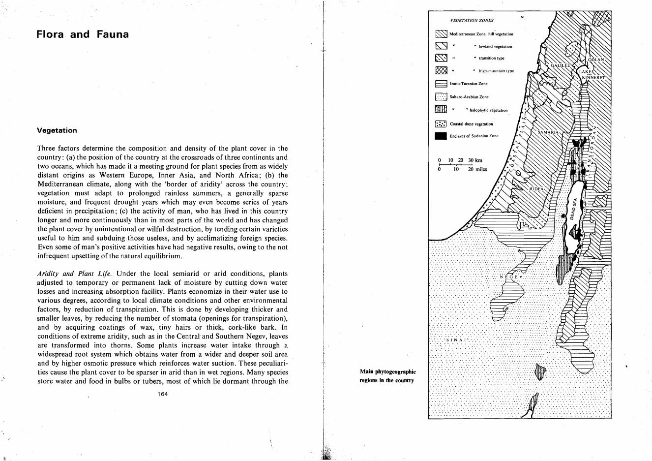
~ " high-mountain type
. ..... ' - "'"
...........::.. ;..:.......
" halophytic vegetationrnrn·-~. ".' .
. . ..' . . . . . . . . .. . ' .
• Enclaves of Sudanian Zone
~ Irano-Turanian Zone
....... " ,. ..: :.: :.:.:.:.: :.': :-:-:-:-:.:-:: NE o' E'y:·:· .. :.:-:.:-:-:-:-:-:.: .' '.':'
VEGETATION ZONES
o 10 20 30kmI I,'o 10 20 miles
~. Mediterranean Zone, hill ¥vegetation
o "lowland vegetation
1>:-:->:1 Saharo-Arabian Zone
I~:::J Coastal dune vegetation
~ U transition type
..................~....':::::::::::: ... ,
. . . . . . . . . ..... - .. .
.... ' " , .: : : : : : .',: .: : ::::::: ....... . .. . . . . . . . . .. .. ' .
•.•1i-" N'.;·/ii/·.i.i••·<••••••••••·i.···.€·:~....~.S~~.. .. ..., :::::::.': : .
'" ••••••••••• " • 4.
···········>······························{t>···· ...........•.•..•. :.:-:~ :.. ~ ::.. .: .: .. ~: :' :.~ :':-.':.:: <.-:<::~: ..:-.> :.::. ~ :::.',.:.<: ..: < :.::: .... ~ : ... .. .. .. .. .. '" .. '" .
Main phytogeographic
regions in the country
Aridity and Plant Life. Under the local semiarid or arid conditions, plantsadjusted to temporary or permanent lack of moisture by cutting down waterlosses and increasing absorption facility. Plants economize in their water use tovarious degrees, according to local climate conditions and other environmentalfactors, by reduction of transpiration. This is done by developing .thicker andsmaller leaves, by reducing the number of stomata (openings for transpiration),and by acquiring coatings of wax, tiny hairs or thick, cork-like bark. Inconditions of extreme aridity, such as in the Central' and Southern Negev, leavesare transformed into thorns. Some plants increase water intake through awidespread root system which obtains water from a wider and deeper soil areaand by higher osmotic pressure which reinforces water suction. These peculiarities cause the plant cover to be sparser in arid than in wet regions. Many speciesstore water and food in bulbs or tubers, most of which lie dormant through the
164
Vegetation
Three factors determine the composition and density of the plant cover in thecountry: (a) the position of the country at the crossroads of three continents andtwo oceans, which has made it a meeting ground for plant species from as widelydistant origins as Western Europe, Inner Asia, and North Africa; (b) theMediterranean climate, along with the 'border of aridity' across the country;vegetation must adapt to prolonged rainless summers, a generally sparsemoisture, and frequent drought years which may even become series of yearsdeficient in precipitation; (c) the activity of man, who has lived in this countrylonger and more continuously than in most parts of the world and has changedthe plant cover by unintentional or wilful destruction, by tending certain varietiesuseful to him and subduing those useless, and by acclimatizing foreign species.Even some of man's positive activities have had negative results, owing to the notinfrequent upsetting of the natural equilibrium.
Flora and Fauna
166 CLIMATE. VEGETATION AND WILDLIFE
dry summer and burst into flower in the rainy season (e.g., Cyclamen persicum,Anemone coronaria, etc.): several, however, bring forth broad leaves in spring butdelay flowering until the end of summer (e.g., the squill-Urginea maritima).
Most of the annual plants adapt their life cycle to the rainy season, whenprotection against water losses becomes less vital. The drier the climate, theshorter the life cycle of such plants becomes. In the Negev or the Judean Desert,seeds of annual species may lie years in the soil waiting for a rainy winter, thenawake, sprout, grow, flower, and produce new seeds in the course of a few weeksbefore the moisture vanishes. Thorny weeds often exist until midsummer, whilethe delicate, broad-leaved annuals normally disappear in April.
A special group are the halophytes (salt lovers), which are prominent in theplayas of the Arava Valley, in the Dead Sea area, and the Lower Jordan Region.Some of these, such as the tamarisk, can eliminate surplus salt dissolved in dropsof water they secrete.
Influence of Man. Man's influence upon the plant cover and its composition hasbeen particularly strong in the Middle East, which, during most of the last fivethousand years, has been relatively. densely populated. The structure of thecountry and the nature of its soils and climate increase the danger of erosion,once man's activity has contributed to this process. In the dry summer, fires spreadeasily and destroy large expanses of woodland. The first step toward introducingagriculture, thousands of years ago, necessitated clearing the natural forest. Thisis excellently described in the Bible; Joshua advised the tribes of Ephraim andManasseh, who complained about the lack of arable land in their territories: 'Butthe mountain shall be thine; for it is a wood, and thou shalt cut it down; and theoutgoings of it shall be thine .. .' (Joshua xvii, 18). Upon the disappearance of the
.forest, conditions in the hills quickly deteriorated without the trees to protect thesoil by reducing the onslaught of hard rains, by grasping the soil with their roots,and by adding organic matter. Naked rock was bared on the hill slopes, andbadland topography developed on many lowland sites. Even worse was theinfluence of the herdsman and his flocks. The local black goat, nibbling at youngshoots and tree bark, hastened their degeneration into low shrub. The shepherdalso fells and burns trees systematically to enlarge pasture areas. A third cause offorest destruction was the many wars fought in the country and the deliberateburning of large expanses to rob the enemy of natural cover.
The natural forests degenerated steadily under the impact of all these factors.Three stages are marked in this process: (a) high maquis (in Hebrew-c-'horesh'),where the largest trees still attain 3-5.m (10-16 ft), but most are lower;(b) 'garrigue,' or low maquis, with the original species still present but turned intobushes of 1-2 m (3-7 ft) height, which, developing sideways rather than upwards,
FLORA AND FAUNA 167
often form an almost impenetrable thicket; (c) dwarf brush (in Hebrew'batta'), not over 30-60 em (1-2 ft) high, with many thorny species, the mostprominent of which is thorny burnet (Poterium spinosum}.
Vegetation Zones in the Country
Owing to its geographical position, Israel is the meeting ground for plants ofdifferent origin and also constitutes the extreme point of geographical.distribution of many species. This explains the large number of plant species represented:up to 2,250, compared to 1,700 in England, 1,500 in Egypt,or 1,300 inNorway-all of these states being much larger in area than this country.
The plants of Israel belong to at least four large phytogeographic regions;(I) the Mediterranean Zone, which comprises most countries bordering on theMediterranean Sea, as well as a strip of territory along the southern border ofTurkey; (2) the Irano-Turanian Zone, dry steppe or desert steppe which stretchesfrom its southwest tip in Israel through Iran, Turkestan and Inner Asia to theGobi Desert in China; (3) the Saharo-Arabian Zone, pure desert which coversmost of the Sahara in Africa, the Arabian Peninsula, and parts of southern Iran;(4) the Sudanese Zone of tropical vegetation which, as its name indicates, isprincipally represented in central and southern Sudan, and in Israel forms onlysmall enclaves. There are also a few species to be found, mainly in Upper Galileeand the Upper Golan, which are related to the Euro-Siberian Zone.
The Mediterranean Flora. The Mediterranean Zone of vegetation roughly covers,in this country, those areas which receive an annual average precipitation of 350mm (14 in) or more. It runs from the vicinity of Gaza to the southwest corner ofthe Judean Hills, turns north in the Arad Region, thence runs 8-12 miles west ofthe Dead Sea, where it separates the Judean Desert from the Judean Hills proper,continues along the eastern rim of the Hills of Samaria, descends to the HarodValley near Bet Alfa, traces its border with Bet She'an Valley, and reaches LakeKinneret near the village of Kinneret. In Transjordan, the Mediterranean Zoneincludes all the Golan and the Bashan, most of Gilead, the western half ofAmmon and Moab, and the northwestern part of Edom.
The Mediterranean vegetation in this country falls into two very differenttypes: that of the Hills and that of the Coastal Plain and interior valleys. Theclimax vegetation of the Hills, i.e., forest or high maquis, has almost disappearedexcept on very ~mall areas, e.g., 01} Mount Meron, in the Nahal Karkara Gorgeof Western Upper Galilee, on several spots on Mount Carmel, etc. In the climaxvegetation, different plant associations can be discerned in accordance with local
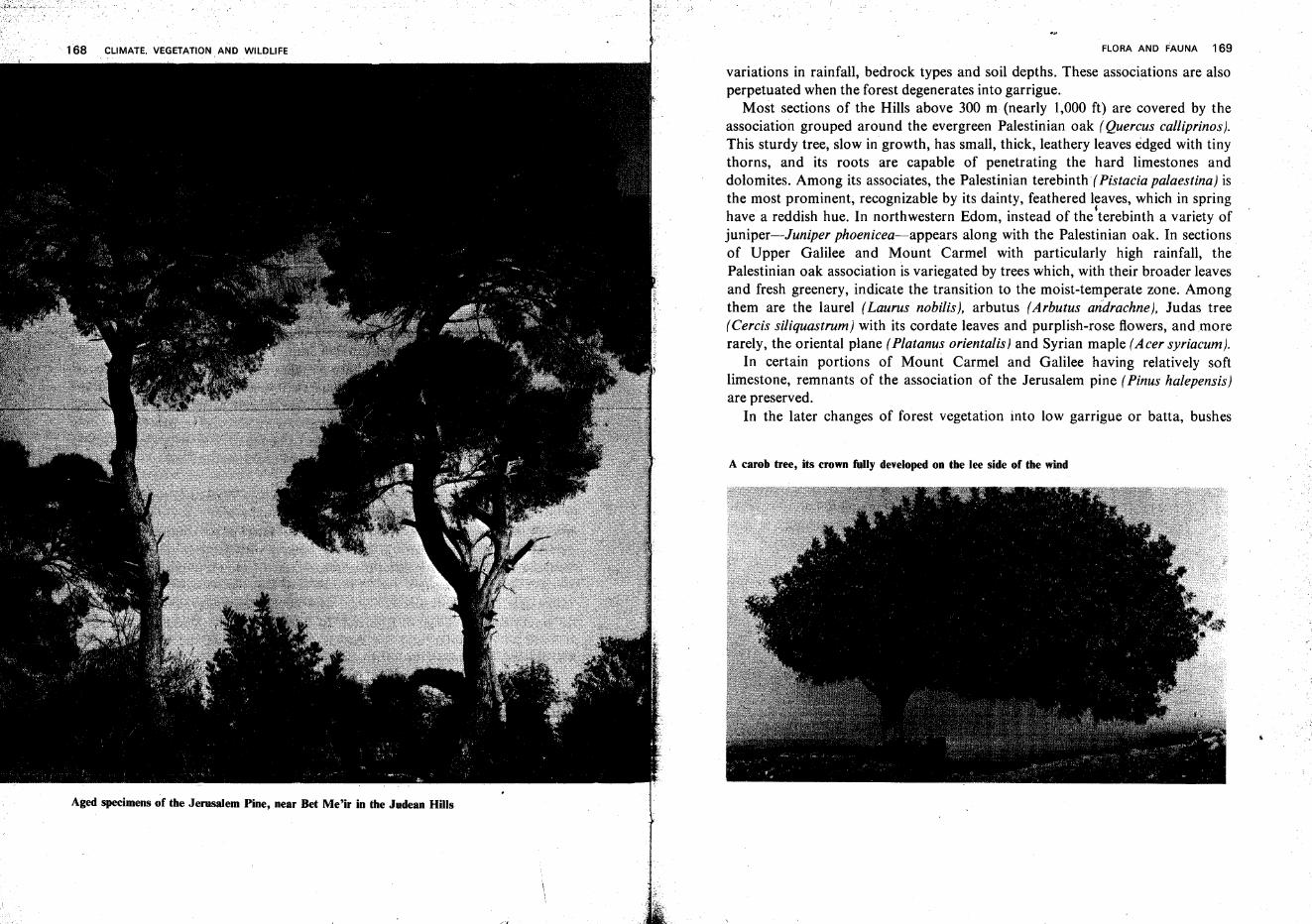
Aged specimens of the Jerusalem Pine, near Bet Me'ir in the Judean Hills
FLORA AND FAUNA 169
variations in rainfall, bedrock types and soil depths. These associations are alsoperpetuated when the forest degenerates into garrigue.
Most sections of the Hills above 300 m (nearly 1,000 ft) are covered by theassociation grouped around the evergreen Palestinian oak (Quercus calliprinos].This sturdy tree, slow in growth, has small, thick, leathery leaves edged with tinythorns, and its roots are capable of penetrating the hard limestones anddolomites. Among its associates, the Palestinian terebinth( Pistacia palaestina] isthe most prominent, recognizable by its dainty, feathered leaves, which in springhave a reddish hue. In northwestern Edom, instead of the'terebinth a variety ofjuniper-Juniper phoenicea-appears along with the Palestinian oak. In sectionsof Upper Galilee and Mount Carmel with particularly high rainfall, thePalestinian oak association is variegated by trees which, with their broader leavesand fresh greenery, indicate the transition to the moist-temperate zone. Amongthem are the laurel (Laurus nobilis}, arbutus (Arbutus andrachne], Judas tree(Cercis siliquastrum] with its cordate leaves and purplish-rose flowers, and morerarely, the oriental plane (Platanus orientalist and Syrian maple (A cer syriacum}.
In certain portions of Mount Carmel and Galilee having relatively softlimestone, remnants of the association of the Jerusalem pine (Pinus halepensis]are preserved.
In the later changes of forest vegetation into low garrigue or batta, bushes
A carob tree, its crown fully developed on the lee side of the wind
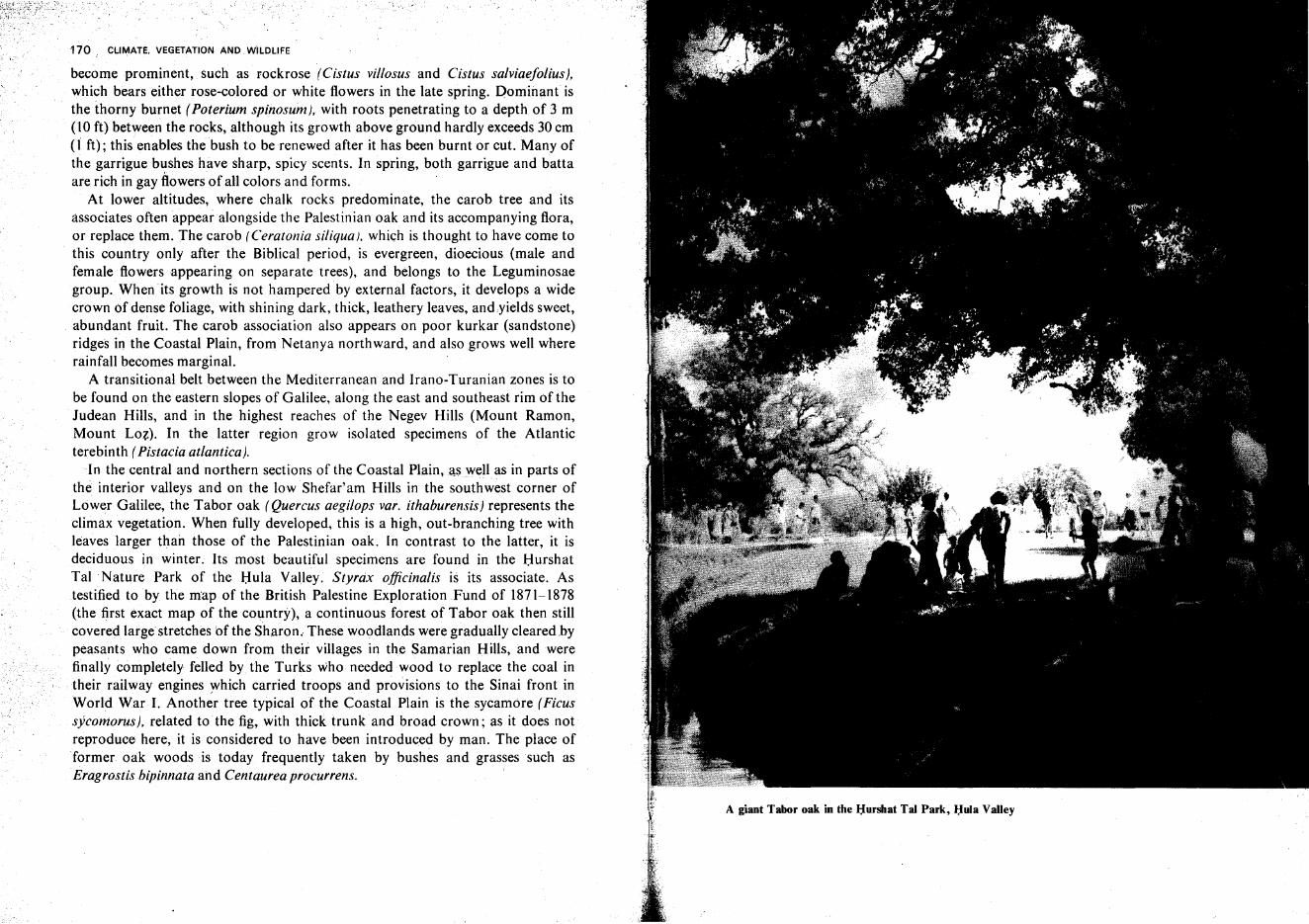
170 CLIMATE. VEGETATION AND WiLDLIFE
become prominent, such as rockrose (Cistus villosus and Cistus salviaefolius},which bears either rose-colored or white flowers in the late spring. Dominant isthe thorny burnet (Poterium spinosum). with roots penetrating to a depth of 3 m(10 ft) between the rocks, although its growth above ground hardly exceeds 30 em(1 ft); this enables the bush to be renewed after it has been burnt or cut. Many ofthe garrigue bushes have sharp, spicy scents. In spring, both garrigue and battaare rich in gay flowers of all colors and forms.
At lower altitudes, where chalk rocks predominate, the carob tree and itsassociates often appear alongside the Palestinian oak and its accompanying flora,or replace them. The carob (Ceratonia siliquat. which is thought to have come tothis country only after the Biblical period, is evergreen, dioecious (male andfemale flowers appearing on separate trees), and belongs to the Leguminosaegroup. When its growth is not hampered by external factors, it develops a widecrown of dense foliage, with shining dark, thick, leathery leaves, and.yields sweet,abundant fruit. The carob association also appears on poor kurkar (sandstone)ridges in the Coastal Plain, fromNetanya northward, and also grows well whererainfall becomes marginal.
A transitional belt between the Mediterranean and Irano-Turanian zones is tobe found on the eastern slopes of Galilee, along the east and southeast rim of theJudean Hills, and in the highest reaches of the Negev Hills (Mount Ramon,Mount LoZ). In the latter region grow isolated specimens of the Atlanticterebinth (Pistaciaatlantica).
In the central and northern sections of the Coastal Plaineaswell as in parts ofthe interior valleys and on the low Shefar'am Hills in the southwest corner ofLower Galilee, the Tabor oak (Quercus aegilops var. ithaburensis) represents theclimax vegetation. When fully developed, this is a high, out-branching tree withleaves larger than those of the Palestinian oak. In contrast to the latter, it isdeciduous in winter. Its most beautiful specimens are found in the HurshatTal Nature Park of the Hula Valley. Styrax officinalis is its associate. Astestified to by the map of the British Palestine Exploration Fund of 1871-1878(the first exact map of the country), a continuous forest of Tabor oak then stillcovered large stretches bf the Sharon. These woodlands were gradually cleared.bypeasants who came down from their villages in the Samarian Hills, and werefinally completely felled by the Turks who needed wood to replace the coal intheir railway engines which carried troops and provisions to the Sinai front inWorld War I. Another tree typical of the Coastal Plain is the sycamore (Ficussycomorus], related to the fig, with thick trunk and broad crown; as it does notreproduce here, it is considered to have been introduced by man. The place offormer oak woods is today frequently taken by bushes and grasses such asEragrostis bipinnata and Centaurea procurrens.
A giant Tabor oak in the l:Iursltat Tal Park, Hula Valley
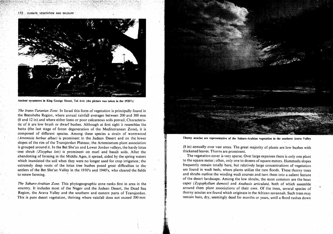
Ancient sycamores in King George Street, Tel Aviv (the picture was taken in the 1920's)
The Irano-Turanian Zone. In Israel this form of vegetation is principally found inthe Beersheba Region, where annual rainfall averages between 200 and 300 mm(8 and 12 in) and where either loess or poor calcareous soilsprevaiLCharacteristic of it are low brush or dwarf bushes. Although at first sight it resembles thebatta (the last stage of forest degeneration of the Mediterranean Zone), it iscomposed of different species. Among these species a strain of wormwood(Artemisia herbae albae) is prominent in the Judean Desert and on the lowerslopes of the rim of the Transjordan Plateau; the Artemisetum plant associationis grouped around it. In the Bet She'an and Lower Jordan valleys, the hardy lotus
. tree shrub (Zizyphus loti) is prominent on marl and basalt soils. After theabandoning of farming in the Middle Ages, it spread, aided by the spring waterswhich inundated the soil when they were no longer used for crop irrigation; theextremely deep roots of the lotus tree bushes posed great difficulties to thesettlers of the Bet She'an Valley in the 1930's and 1940's, who cleared the fieldsto renew farming.
The Saharo-Arabian Zone. This phytogeographic zone ranks first in area in thecountry. It includes most of the Negev and the Judean Desert, the Dead SeaRegion, the Arava Valley and the southern and eastern parts of Transjordan.This is pure desert vegetation, thriving where rainfall does not exceed 200 mm
Thorny acacias are representative of the Saharo-Arabian vegetation in the southern Arava Valley
(8 in) annually over vast areas. The great majority of plants are low bushes withthickened leaves. Thorns are prominent.
The vegetation cover is very sparse. Over large expanses there is only one plantto the square meter; often, only one to dozens of square meters. Hammada slopesfrequently remain totally bare, but relatively large concentrations of vegetationare found in wadi beds, where plants utilize the rare floods. These thorny treesand shrubs outline the winding wadi courses and turn them into a salient featureof the desert landscape. Among the low shrubs, the most common are the beancaper (Zygophyllum dumosi) and Anabasis articulata, both of which assemblearound them plant associations of their own. Of the trees, several species ofthorny acacias are found which originate in the African savannah. Such trees mayremain bare, dry, seemingly dead for months or years, until a flood rushes down
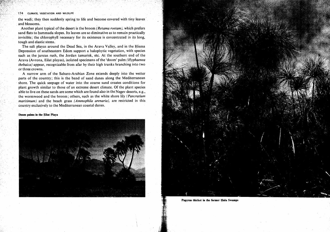
CLIMATE. VEGETATION AND WILD~IFE
the wadi; they then suddenly spring to life and become covered with tiny leaves'. and blossoms.
Another plant typical of the desert is the broom (Retama roetam}, which preferssand flats to hammada slopes. Its leaves are so diminutive as to remain practicallyinvisible; the chlorophyll 'necessary for its existence is concentrated in its long,tough and elastic stems.
The salt playas around the Dead Sea, in the Arava Valley, and in the HismaDepression of southeastern Edom support a halophytic vegetation, with speciessuch as the juncus rush, the Jordan tamarisk, etc. At the southern end of theArava (Avrona, Eilatplayas), isolated specimens of the 'doom' palm (Hyphaeneathebaica} appear, recognizable from afar by their high trunks branching into twoor three crowns.
A narrow arm of the Saharo-Arabian Zone extends deeply into the wetterparts of the country; this is the band of sand dunes along the Mediterraneanshore. The quick seepage of water into the coarse sand creates conditions forplant growth similar to those ofan extreme desert climate. Of the plant speciesable to live on these sandsare some which are found also in the Negev deserts; e.g.,the wormwood and the broom; others, such as the white shore lily (Pancratiummaritimum) and the beach grass (Ammophila arenaria), are restricted in thiscountryexclusively to the Mediterranean coastal dunes.
Doom palms in the :EUat Playa
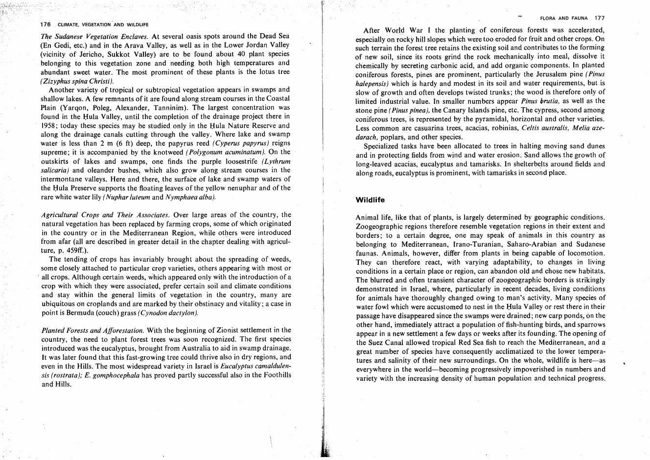
176 CLIMATE. VEGETATION AND WILDLIFE
the Sudanese Vegetation Enclaves. At several oasis spots around the Dead Sea(En Gedi, etc.) and in the Arava Valley, as well as in the Lower Jordan Valley(vicinity of Jericho, Sukkot Valley) are to be found about 40 plant speciesbelonging to this vegetation zone and needing both high temperatures andabundant sweet water. The most prominent of these plants is the lotus tree(Zizyphus spina Christi).
Another variety of tropical or subtropical vegetation appears in swamps andshallow lakes. A few remnants of it are found along stream courses in the CoastalPlain (Yarqon, Poleg, Alexander, Tanninim). The largest concentration wasfound in the Hula Valley, until the completion of the drainage project there in1958; today these species may be studied only in the Hula Nature Reserve andalong the drainage canals cutting through the valley. Where lake and swampwater is less than 2 in (6 ft) deep, the papyrus reed (Cyperus papyrus) reignssupreme; it is accompanied by the knotweed (Polygonum acuminatum}. On theoutskirts of lakes and swamps, one finds the purple loosestrife (Lythrumsalicaria) and oleander bushes, which also grow along stream courses in theintermontane valleys. Here and there, the surface of lake and swamp waters ofthe Hula Preserve supports the floating leaves of the yellow nenuphar and of therare white water lily (Nuphar luteum and Nymphaea alba).
Agricultural Crops and Their Associates. Over large areas of the country, thenatural vegetation has been replaced by farming crops, some of which originatedin the country or in the Mediterranean Region, while otherswere introducedfrom afar (all are described in greater detail in the chapter dealing with agriculture, p. 459ff.).
The tending of crops has invariably brought about the spreading of weeds,some closely attached to particular crop varieties, others appearing with most or
.. all crops. Although certain weeds, which appeared only with the introduction of acrop with which they were associated, prefer certain soil and climate conditionsand stay within the general limits of vegetation in the country, many areubiquitous on croplands and are marked by their obstinacy and vitality; a case inpoint is Bermuda (couch) grass (Cynodon dactylon).
Planted Forests and Afforestation. With the beginning of Zionist settlement in thecountry, the need to plant forest trees was soon recognized. The first speciesintroduced was the eucalyptus, brought from Australia to aid in swamp drainage.It was later found that this fast-growing tree could thrive also in dry regions, andeven in the Hills. The most widespread variety in Israel is Eucalyptus camaldulensis (rostrata); E. gomphocephala has proved partly successful also in the Foothillsand Hills.
FLORA AND FAUNA 177
After World War I the planting of coniferous forests was accelerated,especially on rocky-hill slopes which were too eroded for frui~ and other crops. ~nsuch terrain the forest tree retains the existing soil and contributes to the formingof new soil, since its roots grind the rock mechanically into meal, dissolve itchemically by secreting carbonic acid, and add organic components. In plantedconiferous forests, pines are prominent, particularly the Jerusalem pine (Pinushalepensis] which is hardy and modest in its soil and water requirements, but isslow of growth and often develops twisted trunks; the wood is therefore only oflimited industrial value. In smaller numbers appear Pinus brutia, as well as thestone pine (Pinus pineal, the Canary Islands pine, etc. The cypress, second amongconiferous trees, is represented by the pyramidal, horizontal and other varieties.Less common are casuarina trees, acacias, robinias, Celtis australis, Melia azedarach, poplars, and other species.. Specialized tasks have been allocated to trees in halting moving sand dunesand in protecting fields from wind and water erosion. Sand allows the growth oflong-leaved acacias, eucalyptus and tamarisks. In shelterbelts around fields andalong roads, eucalyptus is prominent, with tamarisks in second place.
Wildlife
Animal life, like that of plants, is largely determined by geographic conditions.Zoogeographic regions therefore resemble vegetation regions in their extent andborders; to a certain degree, one may speak of animals in this country asbelonging to Mediterranean, Irano-Turanian, Saharo-Arabian and Sudanesefaunas. Animals,however, differ from plants in being capable of locomotion.They can therefore react, with varying adaptability, to changes in livingconditions in a certain place or region, can abandon old and chose new habitats.The blurred and often transient character of zoogeographic borders is strikinglydemonstrated in Israel, where, particularly in recent decades, living conditionsfor animals have thoroughly changed owing to man's activity. Many species ofwater fowl which were accustomed to nest in the Hula Valley or rest there in theirpassage have disappeared since the swamps were drained ; new carp ponds.on theother hand, immediately attract a population of fish-hunting birds, and sparrowsappear in a new settlement a few days or weeks after its founding. The opening ofthe Suez Canal allowed tropical Red Sea fish to reach the Mediterranean, and agreat number of species have consequently acclimatized to the lower temperatures and salinity of their new surroundings. On the whole, wildlife is here-aseverywhere in the world-becoming progressively impoverished in numbers andvariety with the increasing density of human population and technical progress.
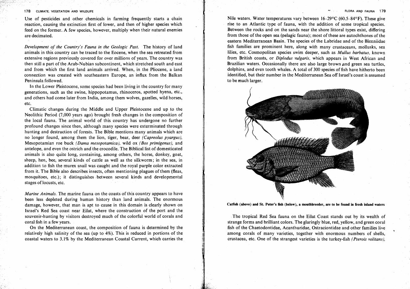
178 CLIMATE. VEGETATION AND WILDLIFE
Use of pesticides and other chemicals in farming frequently starts a chainreaction, causing the extinction first of lower, and then of higher species whichfeed on the former; A few species, however, multiply when their natural enemiesare decimated.
Development of the Country's Fauna in the Geologic Past. The history of landanimals in this country can be traced to the Eocene, when the sea retreated fromextensive regions previously covered for over millions of years. The country wasthen still a part of the Arab-Nubian subcontinent, which stretched south and eastand from which the first land animals arrived. When, in the Pliocene, a landconnection was created with southeastern Europe, an influx from the BalkanPeninsula followed.
In the Lower Pleistocene, some species had been living in the country for manygenerations, such as the swine, hippopotamus, rhinoceros, spotted hyena, etc.,and others had come later from India, among them wolves, gazelles, wild horses,etc.
Climatic changes during the Middle and Upper Pleistocene and up to theNeolithic Period (7,000 years ago) brought fresh changes in the composition ofthe local fauna. The animal world of this country has undergone no furtherprofound changes since then, although many species were exterminated throughhunting and destruction of forests. The Bible mentions many animals which areno longer found, among them the lion, tiger, bear, deer (Capreolus pyargus),Mesopotamian roe buck (Dama mesopotamica], wild ox (Bos primigenus], andantelope, and even the ostrich arid the crocodile. The Biblicallistof domesticatedanimals is also quite long, containing, among others, the horse, donkey, goat,sheep, hen, bee, several kinds of cattle as well as the silkworm; in the sea, inaddition to fish the murex snail was caught and the royal purple color extractedfrom it. The Bible also describes insects, often mentioning plagues of them (fleas,mosquitoes, etc.); it distinguishes between several kinds and developmentalstages of locusts, etc.
Marine Animals. The marine fauna on the coasts of this country appears to havebeen less depleted during human history than land animals. The enormousdamage, however, that man is apt to cause in this domain is clearly shown onIsrael's Red Sea coast near Eilat, where the construction of the port and thesouvenir-hunting by visitors destroyed much of the colorful world of corals andcoral fish in a few years.
On the Mediterranean coast, the composition of fauna is determined by therelatively high salinity ofthe sea (up to 4%). This is reduced in portions of thecoastal waters to 3.1% by the Mediterranean Coastal Current, which carries the
FLORA AND FAUNA 179
Nile waters. Water temperatures vary between 16-29°C (60.5-84°F). These giverise to an Atlantic type of fauna, with the addition of some tropical species.Between the rocks and on the sands near the shore littoral types exist, differingfrom those of the open sea (pelagic fauna); most of these are autochthones of theeastern Mediterranean Basin. The species of the Labridae and of the Blenniidaefish families are prominent here, along with many crustaceans, mollusks, sealilies, etc. Cosmopolitan species swim deeper, such as Mullus barbatus, knownfrom British coasts, or Diplodus vulgaris, which appears in West African andBrazilian waters. Occasionally there are also large brown and green sea turtles,dolphins, and even tooth whales. A total of 300 species of fish have hitherto beenidentified, but their number in the Mediterranean Sea off Israel's coast is assumedto be much larger.
Catfish (above) and St. Peter's fish (below), a mouthbreeder, are to be found in fresh inland waters
The tropical Red Sea fauna on the Eilat Coast stands out by its wealth ofstrange forms and brilliant colors. The glaringly blue, red, yellow, and green coralfish of the Chaetodontidae, Acanthuridae, Ostraciontidae and other families liveamong corals of many varieties, together with enormous numbers of shells,crustacea, etc. One of the strangest varieties is the turkey-fish (Pterois volitans),
180 CLIMATE. VEGETATION MID WILDLIFE
which floats with slow movements of nearly transparent fins, and is protected bylong backspikes containing poison. Large sharks, hammerfish, sawfish, etc. infestthe deeper parts of these waters. Different is the freshwater fauna, todayrepresented mainly in Lake Kinneret. It includes several kinds of carp, sixvarieties. of mouthbreeders of the Cichlidae family, among them St. Peter's fish(Tilapia galilaea), further catfish [Clarias lazera), and others.
Invertebrate Land Animals. Because invertebrates were less decimated by humanactivity than were the higher classes, they are the best example of the country'sposition as a meeting ground for creatures of extremely divergent geographicorigin. The number of insects, spiders, crustaceans, etc. reaches tens of thousands, and there is an incredible variety of forms and colors. In addition tocountrywide species, many are restricted to limited areas. Richest in invertebratefauna are regions which abound in warmth, water and vegetation, such as theHula Valley, the valleys around Lake Kinneret, and some of the northern parts ofthe Coastal Plain. The use of insecticides and biological warfare against croppests or plagues succeeds in reducing the attacked species greatly, but only rarelymakes it disappear. The introduction of new farming crops also leads to theappearance of new pests, previously unknown; cotton growing, since thebeginning of the 'fifties, caused the spreading of the bollworm (Earias insulana].The introduction of groundnuts brought other species; citrus growers must wageconstant war against the Mediterranean fruit fly, etc. Of creatures harmful toman, best known are scorpions, among them the common black and the moredangerous yellow variety (Nebo hierochunticus and Buthusquinquestriatus]. Thebite of a large spider, the black widow (Latrodectus tredecimiguttatus], may causeconsiderable distress.
Amphibia and Reptiles. The amphibia, whose existence depends on the presenceof permanent water bodies, naturally decline in number from the coast inlandand from north to south with the increasing aridity in these two directions.They are, however, numerous along the course of the Jordan and those of itstributaries which carry water the year round. Swamp drainage in Israel in recentdecades has greatly reduced the number of local amphibia. Most common amongthem are the triton (Triton vittatus], the fire salamander (Salamandra maculosa),the green toad, and different kinds of frogs.
Reptiles, belonging to the three orders of tortoises, lizards and snakes, arerepresented by about 80 species. This relatively large number should be ascribedto the generally warm climate and to the long hours of strong, direct insolationover most of the year. The local species include several which are almost extinctin other parts of the world. During hot and wet periods of the Middle Tertiary,
-~
FLORA AND FAUNA 181
many tropical reptiles are assumed to have penetrated into the country. Most ofthem disappeared when the climate again became drier and cooler, but some wereable to adapt themselves to the new conditions. This explains the presence ofsome reptiles normally found in the jungles of tropical India.
At the beginning of the 20th century, a few specimens of Nile crocodiles wereseen in Nahal Tanninim ('the Crocodile Stream') of the Coastal Plain but havesince disappeared entirely. Of the seven local tortoise species, four live in the seaand three on the land.
Of lizards and related species, geckoes are widespread and most spectacular,often penetrating into human dwellings. Interesting, too, is the chameleon, ableto change its color according to its surroundings, slow in movement and quick tocatch flies by the sudden ejection of its long tongue.
Among the most common nonpoisonous snakes is the sand boa (Eryx).Another is the black snake [Coluberjugularis], up to 2 m (7 ft) long, and a third(Malpolon), somewhat shorter, which is sometimes found even in the built-uparea of Tel Aviv. Of the venomous species, one cobra and two kinds of vipers aredangerous, most notably so Vipera palaestinae.
Birds. There are about 350 species of birds in the country. About 100of them areperennial, 50 only summer here, 100 winter, 100 are birds of passage whichremain for a few days or weeks, and 50 are but occasional visitors. Thedistribution of birds has, during recent decades, undergone decisive changes;some species, like the hawk, the vulture (Gyps fulvus], or the eagle owl have beenfrightened off by man and retreated to lonely gorges hardly touched bycivilization, while others, well known from other parts of the world, have beenattracted by the newly planted forests and gardens, e.g., the blackbird (Turdusmerula), by sown fields (field swallow, crested lark) or by human habitations(Spanish sparrow, house swallow).
The Mediterranean shore harbors gulls and other water birds, but the coast ispoor in nesting species. The desert regions, too, have but a sparse population ofbirds; in the Saharo-Arabian region, the most prominent are the short-tailedraven (Corvus rhipidurus], Rhodopechys gitaginea, which prefers an environmentof bare rocks, and the courser [Cursorius cursor) which is to be found on sandflats. Interesting local varieties are the Dead Sea sparrow (Passer moabiticus), theJudean Desert rockbird (Oeanthe lugens), etc.
Bird passage through the country runs, in spring and before the breedingseason, in general from south to north, and in autumn in the opposite direction.Most of the larger birds fly during the daytime, and the smaller ones at night.
There are birds which nest in the country and leave for winter, and others,which nest in Europe, come here to spend the winter, and leave again in April. Of
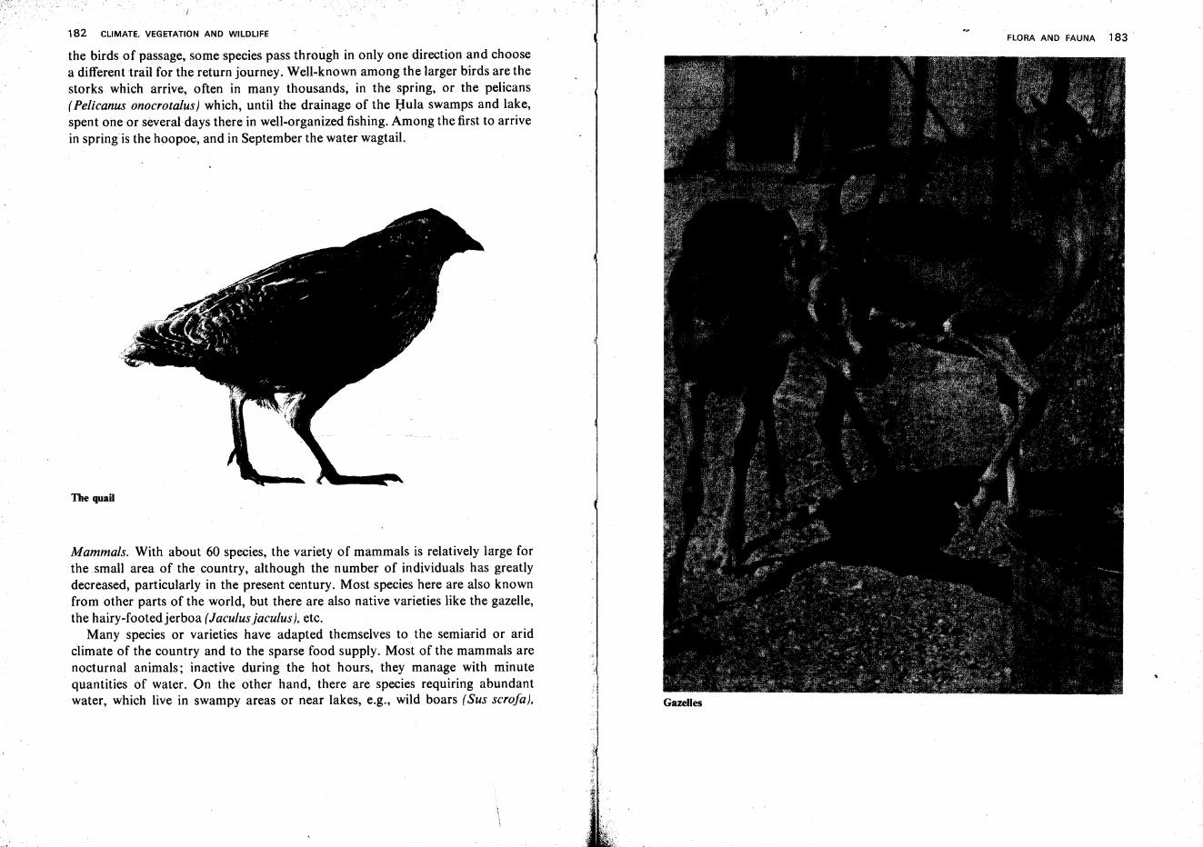
182 CLIMATE. VEGETATION AND WILDLIFE
1 '
FLORA AND FAUNA 183
the birds of passage, some species pass through in only one direction and choosea different trail for the return journey. Well-known among the larger birds are thestorks which arrive, often in many thousands, in the spring, or the pelicans(Pelicanus onocrotalus) which, until the drainage of the Hula swamps and lake,spent one or several days there in well-organized fishing. Among the first to arrivein springis the hoopoe, and in September the water wagtail.
The quail
Mammals. With about 60 species, the variety of mammals is relatively large forthe small area of the country, although the number of individuals has greatlydecreased, particularly in the present century. Most species here are also knownfrom other parts of the world, but there are also native varieties like the gazelle,the hairy-footedjerboa (Jaculusjaculus], etc.
Many species or varieties have adapted themselves to the semiarid or aridclimate of the country and to the sparse food supply. Most of the mammals arenocturnal animals; inactive during the hot hours, they manage with minutequantities of water. On the other hand, there are species requiring abundantwater, which live in swampy areas or near lakes, e.g., wild boars (Sus scrofa), Gazelles
184 CLIMATE. VEGETATION AND WILDLIFE
Foxes in captivity
which often cause considerable damage to fruit orchards, fields and vegetablegardens in -the Hula Valley and around Lake Kinneret. Withhuman settlementbecoming. ever denser over most of the country, the mammals are first todisappear. Thus the howling of jackals, heard at night in most rural areas, diesdown around the sprawling cities.
Vegetation and Wildlife of Sinai
Conditions of vegetation and wildlife in Sinai resemble, to an extent, those ofthe Negev. The very vastness of the peninsula, however, as well as a number oftopographical, climatic and historical features demand that its flora and fauna bedescribed separately from those of the rest of the country.
Aridity as a Determining Factor of Vegetation. As the entire area of the SinaiPeninsula falls within the zone of desert climate, its vegetation cover isaccordingly sparse throughout. Moreover, Sinai does not show sharp climaticchanges over short distances, a feature so characteristic of the rest of the country.
FLORA AND FAUNA 185
This explains why by far the greater part of the peninsula belongs to a singlevegetation region, namely the Saharo-Arabian Zone of hot and extremely aridconditions. The Irano-Turanian dry-steppe zone forms two enclaves in this wideexpanse-the higher reaches of the southern mountains, including also Jebel'Iqma and the southern outskirts of the a-Tih Plateau, and the vicinity of Rafiahwhere annual precipitation approaches 150mm.
Plant Life ofNorthern Sinai. Near Rafiah, rainfall suffices to sustain a semi-desertflora whose outstanding representative is a strain of ~ormwood (A rtemisiamonosperma). However, even under these relatively favorable conditions, largeexpanses are completely devoid of vegetation owing to the presence of movingsands.
To the south and west ofthis narrow strip, the wormwood is replaced by plantsadapted to still more arid conditions, among them Panicum turgidum andHalocnemum strobi/aceum. From the course of Wadi el-'Artsh westward to thestrip running parallel to the Suez Canal, the thick cover of moving sand dunes isan additional factor limiting plant growth. Often, only a few plants are to befound per square kilometer, many of them being species of Aristida and ofbindweed (Convolvulus).
B~sh~s~auSellloving sands in Western Sinai to pile up in mounds" 't;;- . ", ..-,. ~,_ ..-,.- - - - .
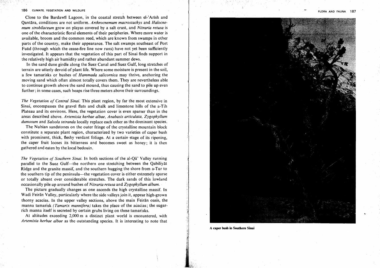
186 CLIMATE. VEGETATION AND WILDLIFE
Close to the Bardawil Lagoon, .in the coastal stretch between el-' Arlsh andQantara, conditions are not uniform. Arthrocnemum macrostachys and Halocnemum strobilaceum grow on playas covered by a salt crust, and Nitraria retusa isone of the characteristic floral elements of their peripheries. Where more water. isavailable; broom and the common reed, which are known from swamps in otherparts of the country, make their appearance. The salt swamps southeast of PortFuad (through which the cease-fire line now runs) have not yet been sufficientlyinvestigated. It appears that the vegetation of this part of Sinai finds support inthe relatively high air humidity and rather abundant summer dews.
In the sand dune girdle along the Suez Canal and Suez Gulf, long stretches ofterrain are utterly devoid of plant life. Where some moisture is present in the soil,a few tamarisks or bushes of Hammada salicornica may thrive, anchoring themoving sand which often almost totally covers them. They are nevertheless ableto continue growth above the sand mound, thus causing the sand to pile up evenfurther; in some cases, such heaps rise three meters above their surroundings.
The Vegetation of Central Sinai. This plant region, by far the most extensive inSinai, encompasses the gravel flats and chalk and limestone hills of the a-TihPlateau and its environs. Here, the vegetation cover is even sparser than in theareas described above. Artemisia. herbae albae, Anabasis articulata, Zygophyllumdumosum and Salsola tetranda locally replace each other as the dominant species .
. The Nubian sandstones on the outer fringe of the crystalline mountain blockconstitute a separate plant region, characterized by two varieties of caper bushwith prominent, thick, fleshy verdant foliage. At a certain stage of its ripening,the caper fruit looses its bitterness and becomes sweet as honey; it is thengathered and eaten by the local bedouin.
The Vegetation of Southern Sinai. In both sections of the al-Qa' Valley runningparallel to the Suez Gulf-s-the northern one stretching between the QabiliyatRidge and the granite massif, and the southern hugging the shore from a-Tur tothe southern. tip of the peninsula-s-the vegetation cover is either extremely sparseor totally absent over. considerable stretches. The dark sands of this lowlandoccasionally pileup around bushes of Nitraria retusa and Zygophyllum album;
The picture gradually changes as one ascends the high crystalline. massif. InWadi Feiran Valley, particularly where the side valleys join it, appear high-grownthorny acacias. In the upper valley sections, above the main Feiran oasis, themanna tamarisk (Tamarix mannifera) takes the place of the acacias; the sugarrich manna itself is secreted by certain grubs living on these tamarisks.
At altitudes exceeding 2,000 m a distinct plant world is encountered, withArtemisia herbae albae as the outstanding species. It is interesting to note that
FLORA AND FAUNA 187
A caper bush in Southern Sinai
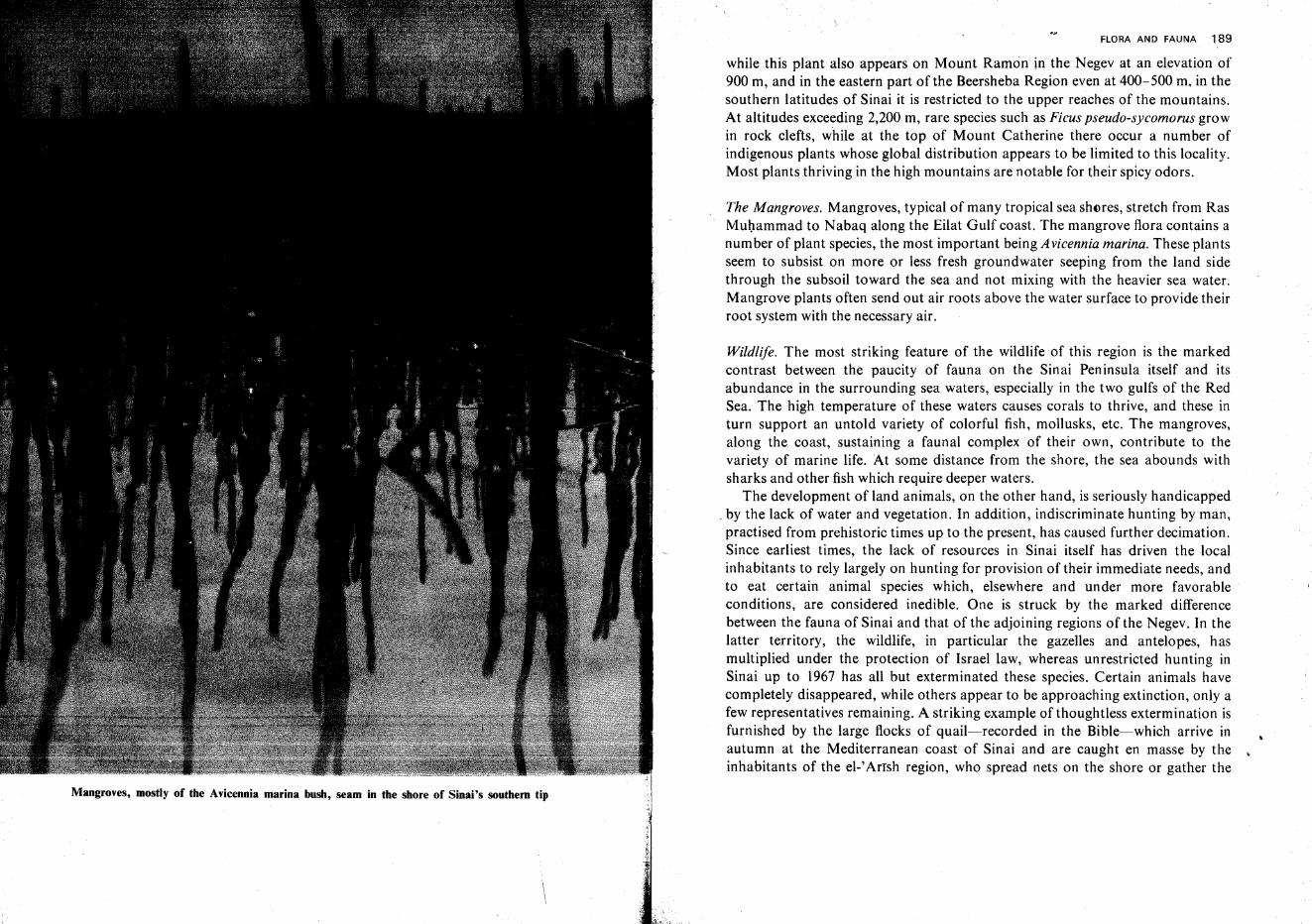
Mangroves, mostly of the Avicennia marina bush, seam in the shore of Sinai's southern tip
FLORA AND FAUNA 189
while this plant also appears on Mount Ramon in the Negev at an elevation of900 m, and in the eastern part of the Beersheba Region even at 400-500 m, in thesouthern latitudes of Sinai it is restricted to the upper reaches of the mountains.At altitudes exceeding 2,200 m, rare species such as Ficus pseudo-sycomorus growin rock clefts, while at the top of Mount Catherine there occur a number ofindigenous plants whose global distribution appears to be limited to this locality.Most plants thriving in the high mountains are notable for their spicy odors.
The Mangroves. Mangroves, typical of many tropical sea shores, stretch from RasMuhammad to Nabaq along the Eilat Gulf coast. The mangrove flora contains anumber of plant species, the most important being Avicennia marina. These plantsseem to subsist on more or less fresh groundwater seeping from the land sidethrough the subsoil toward the sea and not mixing with the heavier sea water.Mangrove plants often send out air roots above the water surface to provide theirroot system with the necessary air.
Wildlife. The most striking feature of the wildlife of this region is the markedcontrast between the paucity of fauna on the Sinai Peninsula itself and itsabundance in the surrounding sea waters, especially in the two gulfs of the RedSea. The high temperature of these waters causes corals to thrive, and these inturn support an untold variety of colorful fish, mollusks, etc. The mangroves,along the coast, sustaining a faunal complex of their own, contribute to thevariety of marine life. At some distance from the shore, the sea abounds withsharks and other fish which require deeper waters.
The development of land animals, on the other hand, is seriously handicapped. by the lack of water and vegetation. In addition, indiscriminate hunting by man,practised from prehistoric times up to the present, has caused further decimation.Since earliest times, the lack of resources in Sinai itself has driven the localinhabitants to rely largely on hunting for provision of their immediate needs, andto eat certain animal species which, elsewhere and under more favorable.:conditions, are considered inedible. One is struck by the marked differencebetween the fauna of Sinai and that of the adjoining regions of the Negev. In thelatter territory, the wildlife, in particular the gazelles and antelopes, hasmultiplied under the protection of Israel law, whereas unrestricted hunting inSinai up to 1967 has all but exterminated these species. Certain animals havecompletely disappeared, while others appear to be approaching extinction, only afew representatives remaining. A striking example of thoughtless extermination isfurnished by the large flocks of quail-recorded in the Bible-which arrive inautumn at the Mediterranean coast of Sinai and are caught en masse by theinhabitants of the el-'Arrsh region, who spread nets on the shore or gather the
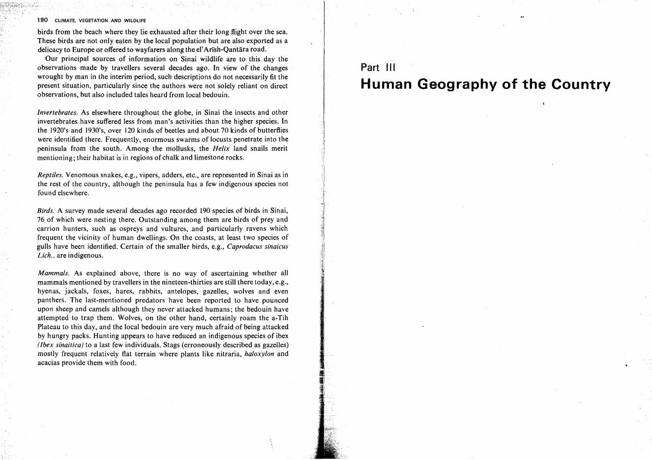
190 CLIMATE. VEGETATION AND WILDLIFE
birds from the beach where they lie exhausted after their long flight over the sea.These birds are not only eaten by the local population but are also exported as adelicacy to Europe or offered to wayfarers along the el'Arish-Qantara road.
Our principal sources of information on Sinai wildlife are to this day theobservations made by travellers several decades ago. In view of the changeswrought by man in the interim period, such descriptions do not necessarily fit thepresent situation, particularly since the authors were not solely reliant on directobservations, but also included tales heard from local bedouin.
Invertebrates. As elsewhere throughout the globe, in Sinai the insects and otherinvertebrates have suffered less from man's activities than the higher species. Inthe 1920's and 1930's, over 120 kinds of beetles and about 70 kinds of butterflieswere identified there. Frequently, enormous swarms of locusts penetrate into thepeninsula from the south. Among the mollusks, the Helix land snails meritmentioning; their habitat is in regions of chalk and limestone rocks.
Reptiles. Venomous snakes, e.g., vipers, adders, etc., are represented in Sinai as inthe rest of the country, although the peninsula has a few indigenous species notfound elsewhere.
Birds. A survey made several decades ago recorded 190 species of birds in Sinai,76 of which were nesting there. Outstanding among them are birds of prey andcarrion hunters, such as ospreys and vultures, and particularly ravens whichfrequent the vicinity of human dwellings. On the coasts, at .least two species ofgulls have been identified. Certain of the smaller birds, e.g., Caprodacus sinaicusLich., are indigenous.
Mammals. As explained above, there is no way of ascertaining whether allmammals mentioned by travellers in the nineteen-thirties are still there today, e.g.,hyenas, jackals, foxes, hares, rabbits, antelopes, gazelles, wolves and evenpanthers. The last-mentioned predators have been reported to have pouncedupon sheep and camels although they never attacked humans; the bedouin haveattempted to trap them. Wolves, on the other hand, certainly roam the a-TihPlateau to this day, and the local bedouin are very much afraid of being attackedby hungry packs. Hunting appears to have reduced an indigenous species of ibex(Ibex sinaitica} to a last few individuals. Stags (erroneously described as gazelles)mostly frequent relatively flat terrain where plants like nitraria, haloxylon andacacias provide them with food.
Part III
Human Geography of the Country
The Archeological and Historical Background
The Land of Israel, sacred to three world faiths, is therefore an intimately knowncountry and one whose prehistory and history have been thoroughly explored.Often scholars doing research into this country's past did not limit themselves tothe particular historical problems of their interest. Their curiosity was aroused,for example, by accidentally coming across human bones and prehistoric artifactsduring their work here.and they thus became absorbed in a new study. Thej;J:).llntty.was Sound to ·Pt.tsenta£ontinuous documentation of nearly allprElJis!9fic p~rjQds~JIQm t~r,emQte..'stbeginnings.upto thepr-e.sent day, although
... - ..
,an~ientJ:)l.lildingsandworksofart.havegenerally.been preserved less perfectlyhere than in other areas ofthe Mediterranean and Middle East.
Our knowledge of this part of the world is greatly enlarged by two additionalfactors: the Bible, possibly the most comprehensive and reliable document ofantiquity, and the art of writing, first invented in this part of the world; inscribedsherds, papyrus scrolls, etc., have thus been found in this country as well as inEgypt, Mesopotamia and other regions, which refer to Palestine itself, to itstowns and inhabitants, or to other countries but permit analogies with culturaland political developments in the Land of Israel.
Palestine in Prehistory
The prehistoric periods of the Near and the Middle East should be datedsomewhat differently from those relating to Western Europe or America, sincehere most new cultural developments began earlier than those further north andwest. Man is assumed to, have first appeared in this country at least half a millionyears ago, when the Old Stone Age (Paleolithic) began. It ended in our regionbetween 12,000 and 10,000 B.C.E. The Middle Stone Age (Mesolithic) lasted until
193

1~4 HUMAN GEOGRAPHY OF THE COUNTRY
about 8,000 B.C.E., and the New Stone Age (Neolithic) until about 4,500 B.C.E.; itwas followed, in the fourth millennium B.C.E., by the Chalcolithic ('Copper andStone') Age, which was the transition between prehistory and history.
Paleolithic Period. There are signs that man's habitation in this region has beenmore continuous than in Europe. This stems from the absence of glacial periods,which, further north, cut him off from nearly all sources of subsistence. Theclimate of the country, however, has not remained unchanged since the beginningof human population. Fossil plants and animals are evidence that pluvials, i.e.,wet periods, paralleled the Ice Ages of Europe in our latitudes. In the Lower andMiddle Paleozoic, the climate appears to have been warmer and moister than thatof today. Tropical plants and animals abounded, among the latter hugeelephants, rhinoceri, hippopotami, etc. Man, living by gathering and hunting,fought these giants for his very life, and depended on them for food and clothing.
At the beginning of the Upper Paleolithic, the climate became more arid; afterseveral more humid intervals, some warmer and some cooler than today, a drierphase followed. The climate has been more or less stable since the end of thePaleolithic.
Many tribes left this country due to the worsening conditions of the climate;those who remained were spurred to greater efforts in improving their tools andin developing new sources oflivelihood.
. The earliest human traces were discovered in 1962 at a site called 'Ubeydiya,near kibbutz Afiqim in the Jordan Valley. The few human bones found there wereidentified as belonging to Australopithecus, the first erect tool-maker, whopreceded even the famous 'Java Man' and 'Peking Man' and was previouslyknown only in South Africa. Tools such as hand axes, ·ball-like stones and otherimplements were found, along with bones of giraffes, elephants, zebras, etc.
In the Early Paleolithic the hand axe served as a simple all-purpose tool; thegrasping end was rounded, and the other, which struck the worked material,sharpened. At first, stones of all kinds were made into hand axes; later hard flints,'shelled' painstakingly from the surrounding soft chalk, were preferred. Gradually the art of sharpening edges was perfected, and the flakes splintered off in theprocess were used as scrapers, arrowheads, etc.
Fire seems to have been taken into man's service at a very early stage; at nightfire afforded warmth and security from ferocious animals. The first nuclei ofsociety-the family, the clan, the tribe-were formed around the open fire andthe hearth. As the climate became more severe, man was driven from the openfield, his exclusive dwelling-place, to seek shelter in the karstic caves of the Hillregions, e.g., in the Nahal Ammud gorge in Eastern Lower Galilee, Har Qedumimnear Nazareth, Mount Carmel, etc. Cults, such as those of the dead and of the
IIiI
.~
ARCHEOLOGICAL AND HISTORICAL BACKGROUND 195
hunt, and their resulting crude artistic creations, mark the development ofspiritual activity in the Early Paleolithic.
Migrations followed climatic oscillations. Alongside Palaeoanthropus palaestinensis, who was related to Neanderthal man, appeared tribes belonging to Homosapiens. The Carmel Caves, with remains of humans of mixed parentage, affordproof that both races belonged to the same human species and were thus able toprocreate freely. The Carmel caves reflect progress in the variegation of tools andin their shapes and uses; the dead were buried, and cults became more elaborate.People adorned themselves with shell and stone necklaces, etc., and attempted tosculpture images.
Mesolithic Period. The finds in Wadi Natuf, 10km (6 miles) east of Ben Shemenin Northern Judea, typify man's achievements in the Mesolithic. The 'NatufianCulture' included fishing hooks, pointed stone arrowheads, sickles of crescentshaped bones reinforced with toothedged flakes. Wild-wheat grains were gathered and ground in stone mortars, but no agricultural work was done yet.
Flint axe of the Neolithic Period
0 1 2 3 4 em, , ! ! I, I0 2 in
Neolithic Period. The excavations made in kibbutz Sha'ar ha-Golan near theYarmuk River in the Kinnarot Valley ('Yarmukian Culture') reflect a step abovethe Mesolithic Culture. This stage marks the beginnings of farming; the soil wasdug with primitive hoes or forks, grain was ground in stone mills, and fish caughtin nets. The first animals, such as sheep, were domesticated. People settled downand lived in huts. Fertility and ancestor cults ruled spiritual life; this isdemonstrated by the 'Venus of Sha'ar ha-Golan,' the shape of a naked womanengraved on a pebble.
196 HUMAN GEOGRAPHY OF THE COUNTRY
The transition from nomadism to a sedentary way of life is most clearlyrevealed by the excavations at Jericho which may be assumed to be the world'soldest city, dating back to ca. 8000 B.C.E. Its houses were built of brick, androofed over with clay arches. A thick stone wall, four meters high, surroundedtheagglomeration. At the wall's inner margin stands a huge, round stone tower, eventoday attaining a height of ten meters. Many finds at this level of the Jericho digpoint to the beginnings of agriculture. The abundant spring of En Elisha' CEines-Sultan), rising at the foot of the Jericho mound, was used in those early timesfor irrigation. The most interesting objects discovered at Jericho are nine humanskulls, with marly clay replacing flesh and shells representing eyes, which appearto have been devotional objects.
Chalcolithic Period. In this transitional period between prehistory and history,man's progress was accelerated. Farming became the almost exclusive source of
The excavations on the Jericho mound have revealed the remains of what is assumed to be theearth's oldest urban settlement
• .q
ARCHEOLOGICAL AND HISTORICAL BACKGROUND 197
food. Finds near Hadera, in the Northern Sharon, allow the assumption thatvegetables 'were sometimes grown with irrigation. Grain was stored in stonekettles or subterranean storage bins. Artisans specialized, and social andvocational differentiations became pronounced. Permanent settlements werefounded in most parts of the country. Objects were dedicated to the fertilitygoddess (which later, in the language of the Canaanites, assumed the names of'Ashera' or 'Ashtoret' (= Astarte). Trade developed between distant towns andeven between different countries. To commemorate the dead, huge dolmens wereerected, or remains were buried in sarcophagi. At Tuleylat-el-Ghassul, no-rtheastof the Dead Sea, wall pictures with beautiful geometric patterns in three colorshave been discovered. ('the Ghassulian Culture'). Near Beersheba a largeChalcolithic settlement was found with artisan shops which produced articles ofbasalt stone and copper-both raw materials which were transported from Edomor Moab over at least 160-210 km (100-130 miles). Other Chalcolithic settlements which had attained a high level of civilization have been found near theEnot Enan Springs in the Hula Valley, and elsewhere in the country. Thediscovery of beautifully finished copper vessels in a cliff cave of the JudeanDesert canyons near En Gedi caused a sensation among archeologists in 1962.
Essential Factors in the Country's History
The geographical position and economic assets of the country create severalfactors which have fundamentally influenced historical developments during thefirst 3,000 years (i.e., between 3,000 B.C.E. and the Roman period) and, partly, tothis day. These factors can be summed up as follows:
(a) The country is situated midway between the two large river valleys of Egyptand Mesopotamia, which at a very early period became centers of overpoweringpolitical might and influential civilizations. These powers met on the soil ofthis country, mostly in strife, but in some instances they achieved a certaindegree of mutual integration. The highways crossing the country, connectingthose two centers, assumed great political importance. The desire of both powersto control these roads engendered frequent armed expeditions into this countrywith the aim of imposing political rule. Palestine therefore passed repeatedlyfrom one empire to its adversary. Political units within the country could befully independent only when both powers were simultaneously weakened andthus unable to intervene in local government.
(b) Lying on the border between the desert and the sown, the country waswitness to the unending struggle between the two. As soon as the control ofmighty rulers weakened and the local settlers appeared negligent or helpless, the
198 HUMAN GEOGRAPHY OF THE· COUNTRY
desert tribes ventured into the cultivated land to plunder it. Eventually, thenomad invaders became farmers in the border region, assimilated and wereintegrated in the local population. It was then their turn to repel fresh invasions.
(C)According to the geographical origin and character of the changingpopulation and its rulers, the centers of settlement and administration alternatedbetween the Hill regions and the Coastal Plain and interior valleys, and back tothe Hills. Peoples coming from the eastern interior, where material civilizationwas at a relatively ·low level, preferred the Hills (among these were the ancientIsraelites, the Arabs and the Turks); those who came over the western sea,possessing a high degree of technical skill and showing talent and inclination forinternational trade, moved the center toward the Coastal Plain (Phoenicians,Philistines, Greeks, Romans, Crusaders, Jews of the present time.)
The Bronze Age
Early Bronze Period. The Bronze Age, which lasted about 1,800 years (3100-1200B.C.E.) in the Middle East, is divided into the Early, Middle and Late Bronzeperiods; the Early Bronze lasted until 2100 B.C.E.
This first historic period of the country was characterized by attempts to forma more comprehensive social organization and forceful political regime. In thetowns public buildings, much larger than the living quarters of the ordinarycitizen, were erected. Their construction required a combined effort of allinhabitants. Towns were fortified with strong walls. Ash strata in the ruins ofmany towns testify to their repeated conquest and sacking by enemies.
In the middle of the third millennium B.C.E., the mighty Accadian empire wasfounded in Mesopotamia and soon spread its rule over the 'Land of Amurru,'i.e., over the entire region between the Euphrates and the shores of theMediterranean Sea. The inhabitants of Palestine and Syria then spoke west-Semitic dialects. The Accadian rule introduced cuneiform script everywhere andadapted it to local languages. On the other hand, the Egyptians developed theirtrade with the cities on the Lebanese coast and tried to secure commandingpositions in Palestine. In those centuries the international overland trade usedmostly the 'King's Way' in Transjordan, which passed flourishing settlements.Toward the end of this period, the Egyptian grip weakened, and the Palestinianseven exerted pressure on the frontiers of Egypt proper. The towns ofTransjordanwere razed by nomads, and the King's Way had to be abandoned temporarily.
Middle Bronze. At the beginning of the Middle Bronze Period, the MiddleKingdom of Egypt attained new splendor and renewed its rule over Palestine,
ARCHEOLOGICAL AN~D HISTORICAL BACKGROUND 199
which was called 'Rthenu.' From then on, the principal thoroughfare betweenEgypt and Mesopotamia became the Via Maris or 'Sea Road,' which ran in thiscountry along the Coastal Plain, through the Irron Vale, the Jezreel, Bet She'anand Kinnarot valleys, and over the Golan Plateau toward Damascus. Theinhabitants of Palestine were then cultivators of grain and fruit and herders ofsheep and cattle. An interesting testimony of life and political events in Palestineappears in the so-called 'execration texts,' small clay tablets bearing the names oftowns and their rulers who were enemies of Egypt; the smashing of the tabletswas to symbolize the downfall ofthe foe. Jerusalem, Ascalon, Aphek, Sichem andHazer are among the Palestinian towns mentioned.
In the eighteenth century B.C.E., a huge wave of migrations swept over AsiaMinor and the Middle East; it engulfed Palestine from the north and broughtforeign rule to Egypt. The conquerors, in Egypt called 'Hyksos,' i.e., 'foreignrulers,' and who included Semite and Indo-Aryan peoples, overpowered allopponents. Two innovations which they introduced in warfare aided themhorses and chariots. The Hyksos built their capital at Tanis (Zo'an) in the east ofthe Nile Delta and also ruled over Palestine and Syria. The town of Sharuhen inthe Northwestern Negev was their center in this country. Even when they weredriven out of Egypt by a powerful local dynasty two hundred years later, theirrule over Palestine was maintained for a while. With their final retreat, theMiddle Bronze Period cameto its end.
The Patriarchs. The advent of the Patriarchs of Israel dates back to the latter partof the Hyksos Period. The description in the Book of Genesis of events and waysof life in this country has been borne out fully by historical and archeologicalresearch. Of special interest is the campaign of four Mesopotamian kings, headedby Kedarlaomer of Elam, which is described in Genesis XIV. The expeditiontook the renewed King's Way in Transjordan, from Damascus through theGilead to the Land of Moab; the invaders descended to the Dead Sea Region, butdid not continue southward to Edom where the highway splits (one branch led toEilat, and the other descended to Punnon in the Arava Valley, crossed the Negevand reached Egypt through Qadesh Barne'a and the northern Sinai Peninsula).
These events and others also set numerous local and west-Semitic tribes on themove, some of which reached Palestine and Egypt. These tribes were called incontemporary documents 'Hapiru' or 'Habiru,' and many scholars identify themwith the Hebrews. 'Abram the Hebrew' and his household were such semi-nomads. Abraham, feeling like a newcomer, wished to acquire the rights of aresident; and therefore paid a large sum for a family tomb site at Hebron; his sonIsaac became a wealthy landowner in the Negev where he sowed the fields,intermittently at least; the third generation, Jacob and his sons, regarded
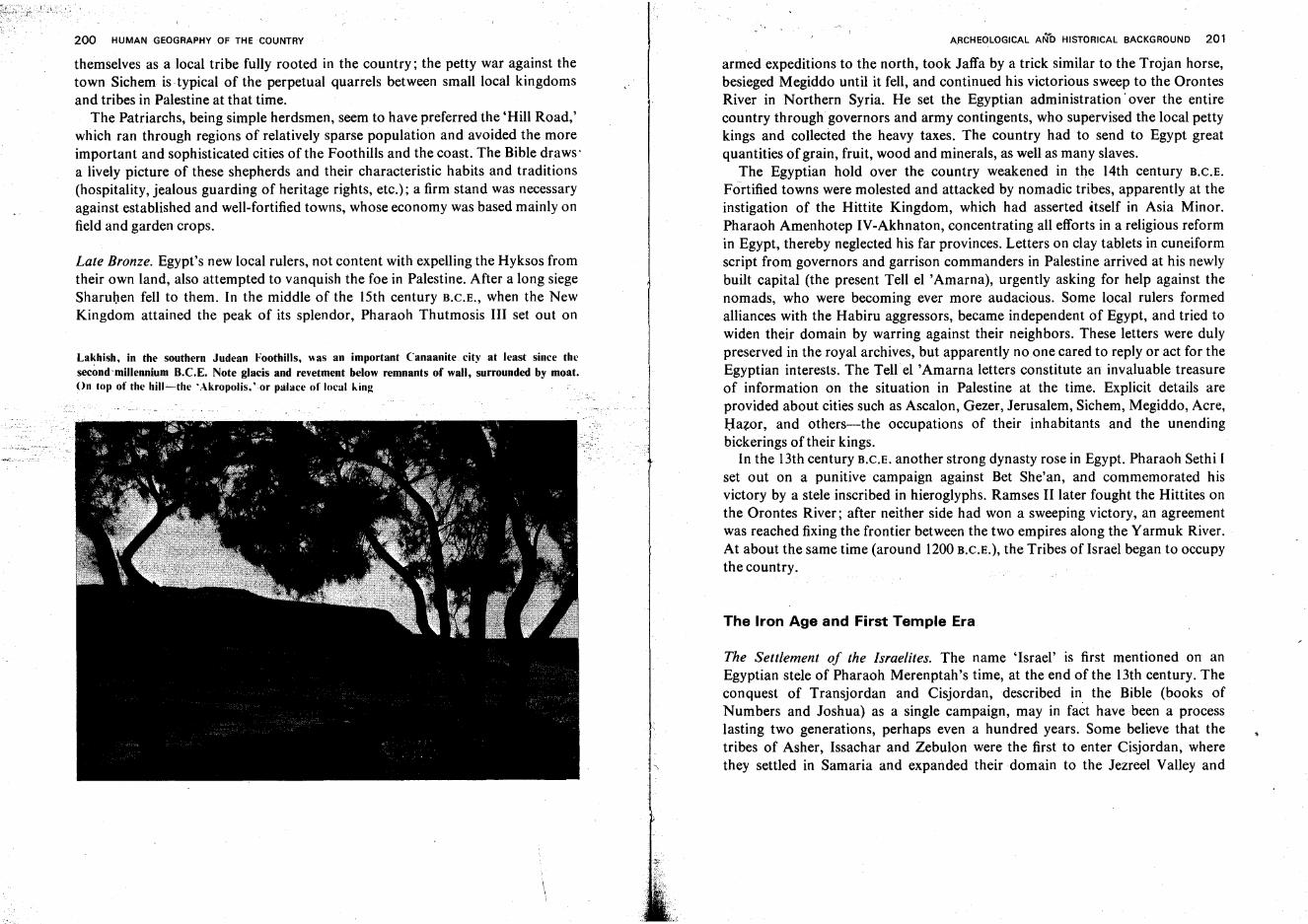
200 HUMAN GEOGRAPHY OF THE COUNTRY
themselves as a local tribe fully rooted in the country; the petty war against thetown Sichem is typical of the perpetual quarrels between small local kingdomsand tribes in Palestine at that time.
The Patriarchs, being simple herdsmen, seem to have preferred the 'Hill Road,'which ran through regions of relatively sparse population and avoided the moreimportant and sophisticated cities of the Foothills and the coast. The Bible draws'a lively picture of these shepherds and their characteristic habits and traditions(hospitality, jealous guarding of heritage rights, etc.): a firm stand was necessaryagainst established and well-fortified towns, whose economy was based mainly onfield and garden crops.
Late Bronze. Egypt's new local rulers, not content with expelling the Hyksos fromtheir own land, also attempted to vanquish the foe in Palestine. After a long siegeSharuhen fell to them. In the middle of the lSth century B.C.E., when the NewKingdom attained the peak of its splendor, Pharaoh Thutmosis III set out on
Lakhish, in the southern Judean Foothills, was an important Canaanite. city at least since thesecondmllleanium R.C.E. Note glacis and revetment below remnants of wall, surrounded by moat.On top of the hill-s-the 'Akropolis, 'or palace of local king
A.RCHEOLOGICAL AN~D HISTORICAL BACKGROUND 201
armed expeditions to the north, took Jaffa by a trick similar to the Trojan horse,besieged Megiddo until it fell, and continued his victorious sweep to the OrontesRiver in Northern Syria. He set the Egyptian administration' over the entirecountry throughgovernors and army contingents, who supervised the local pettykings and collected the heavy taxes. The country had to send to Egypt greatquantities of grain, fruit, wood and minerals, as well as many slaves.
The Egyptian hold over the country weakened in the 14th century B.C.E.
Fortified towns were molested and attacked by nomadic tribes, apparently at theinstigation of the Hittite Kingdom, which had asserted itself in Asia Minor.Pharaoh Amenhotep IV-Akhnaton, concentrating all efforts in a religious reformin Egypt, thereby neglected his far provinces. Letters on clay tablets in cuneiformscript from governors and garrison commanders in Palestine arrived at his newlybuilt capital (the present Tell el 'Amarna), urgently asking for help against thenomads, who were becoming ever more audacious. Some local rulers formedalliances with the Habiru aggressors, became independent of Egypt, and tried towiden their domain by warring against their neighbors. These letters were dulypreserved in the royal archives, but apparently no one cared to reply or act for theEgyptian interests. The Tell el 'Amarna letters constitute an invaluable treasureof information on the situation in Palestine at the time. Explicit details areprovided about cities such as Ascalon, Gezer, Jerusalem, Sichem, Megiddo, Acre,Hazer, and others-the occupations of their inhabitants and the unendingbickerings of their kings.
In the 13th century B.C.E. another strong dynasty rose in Egypt. Pharaoh Sethi Iset out on a punitive campaign against Bet She'an, and commemorated hisvictory by a stele inscribed in hieroglyphs. Ramses II later fought the Hittites onthe Orontes River; after neither side had won a sweeping victory, an agreementwas reached fixing the frontier between the two empires along the Yarmuk River.At about the same time (around 1200B.C.E.), the Tribes of Israel began to occupythe country.
The Iron Age and First Temple Era
The Settlement of the Israelites. The name 'Israel' is first mentioned on anEgyptian stele of Pharaoh Merenptah's time, at the end of the lJth century. Theconquest of Transjordan and Cisjordan, described in the Bible (books ofNumbers and Joshua) as a single campaign, may in fact have been a processlasting two generations, perhaps even a hundred years. Some believe that thetribes of Asher, Issachar and Zebulon were the first to enter Cisjordan, wherethey settled in Samaria and expanded their domain to the Jezreel Valley and
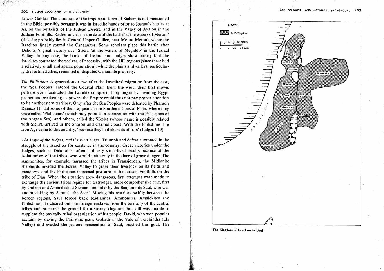
202 HUMAN GEOGRAPHY OF THE COUNTRY
Lower Galilee. The conquest of the important town of Sichem is not mentionedin the Bible, possibly because it was in Israelite hands prior to Joshua's battles atAi, on the outskirts of the Judean Desert, and in the Valley of Ayalon in theJudean Foothills. Rather unclear is the date ofthe battle 'at the waters of Merom'(this site probably lies in Central Upper Galilee, near Mount Meron), where theIsraelites finally routed the Canaanites. Some scholars place this battle afterDeborah's great victory over Sisera 'at the waters of Megiddo' in the JezreelValley. In any case, the books of Joshua and Judges show clearly that theIsraelites contented themselves, of necessity, with the Hill regions (since these hada relatively small and sparse population), while the plains and valleys, particularly the fortified cities, remained undisputed Canaanite property.
The Philistines. A generation or two after the Israelites' migration from the east,the 'Sea Peoples' entered the Coastal Plain from the west; their first movesperhaps even facilitated the Israelite conquest. They began by invading Egyptproper and weakening its power; the Empire could thus not pay proper attentionto its northeastern territory. Only after the Sea Peoples were defeated by PharaohRamses III did some of them appear in the Southern Coastal Plain, where theywere called 'Philistines' (which may point to a connection with the Pelasgians ofthe Aegean Sea), and others, called the Sikeles (whose name is possibly relatedwith Sicily), arrived in the Sharon and Carmel Coast. With the Philistines, theIron Age came to this country, 'because they had chariots of iron' (Judges 1,19).
The Days of the Judges, and the First Kings. Triumph and defeat alternated in thestruggle of the Israelites for existence in the country. Great victories under theJudges, such as Deborah's, often had very short-lived results because of theisolationism of the tribes, who would unite only in the face of grave dangervTheAmmonites, for example, harassed the tribes in Transjordan, the Midianiteshepherds invaded the Jezreel Valley to graze their livestock on its fields andmeadows, and the Philistines increased pressure in the Judean Foothills on thetribe of Dan. When the situation grew dangerous, first attempts were made toexchange the ancient tribal regime for a stronger, more comprehensive rule, firstby Gideon and Abimelech at Sichem, and later by the Benjaminite Saul, who wasanointed king by Samuel 'the Seer.' Moving his warriors swiftly between theborder regions, Saul forced back Midianites, Ammonites, Amalekites andPhilistines. He cleared out the foreign enclaves from the territory of the centraltribes and prepared the ground for a strong kingdom, but still was unable tosupplant the basically tribal organization of his people. David, who won popularacclaim by slaying the Philistine giant Goliath in the Vale of Terebinths (ElaValley) and evaded the jealous persecution of Saul, reached this goal. The I
j
LEGEND
o 10 20 30 40 50 kmI ", ','.o 10 20 30 miles
The Kingdom of Israel under Saul
ARCHEOLOGICAL AN'D HISTORICAL BACKGROUND 203
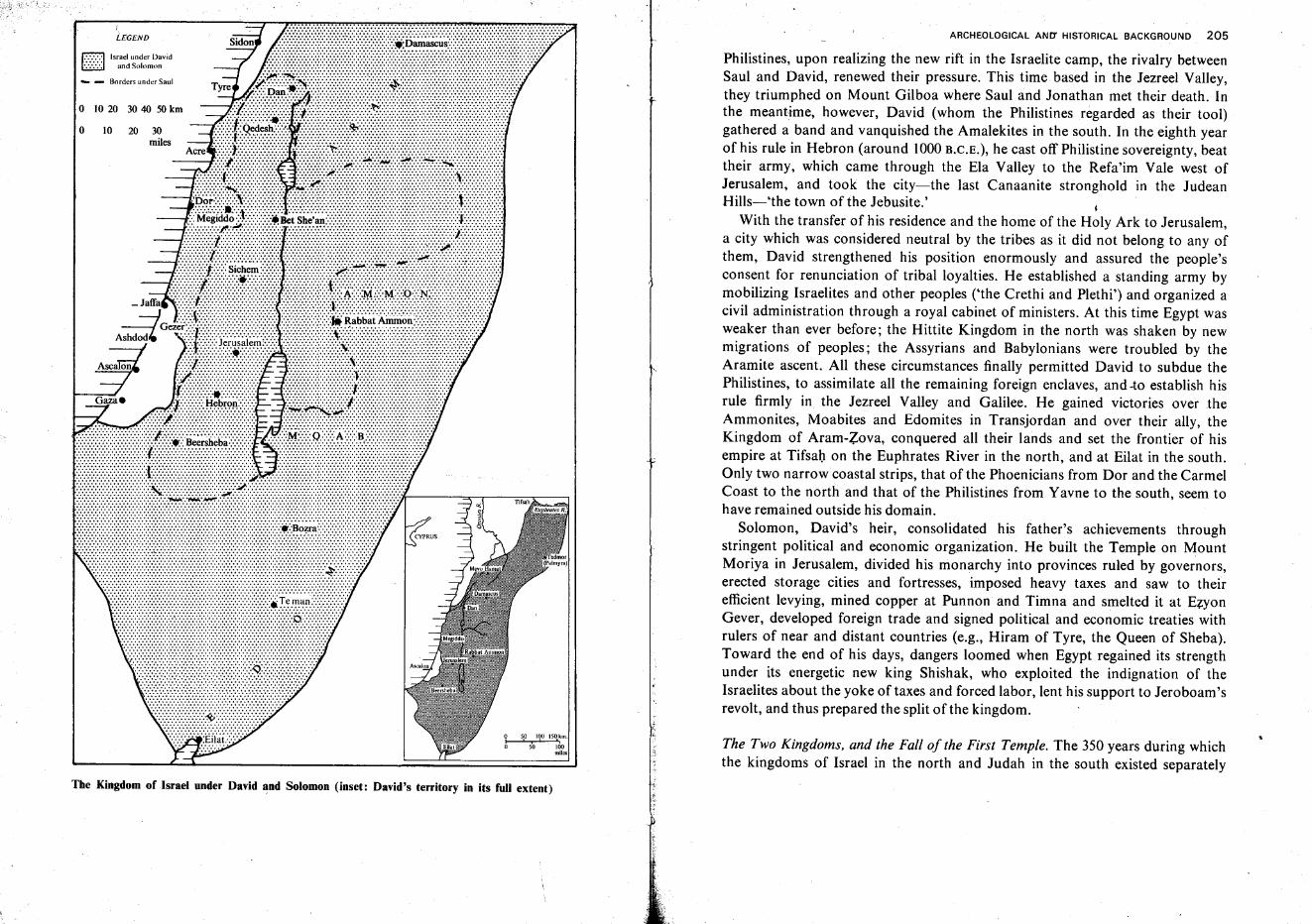
ARCHEOLOGICAL AND' HISTORICAL BACKGROUND 205
The Two Kingdoms, and the Fall of the First Temple. The 350 years during whichthe kingdoms of Israel in the north and Judah in the south existed separately
Philistines, upon realizing the new rift in the Israelite camp, the rivalry betweenSaul and David, renewed their pressure. This time based in the Jezreel Valley,they triumphed on Mount Gilboa where Saul and Jonathan met their death. Inthe meantime, however, David (whom the Philistines regarded as their tool)gathered a band and vanquished the Amalekites in the south. In the eighth yearof his rule in Hebron (around 1000 R.C.E.), he cast off Philistine sovereignty, beattheir army, which came through the Ela Valley to the Refa'im Vale west ofJerusalem, and took the city-the last Canaanite stronghold in the JudeanHills-'the town of the Jebusite.' I
With the transfer of his residence and the home of the Holy Ark to Jerusalem,a city which was considered neutral by the tribes as it did not belong to any ofthem, David strengthened his position enormously and assured the people'sconsent for renunciation of tribal loyalties. He established a standing army bymobilizing Israelites and other peoples ('the Crethi and Plethi') and organized acivil administration through a royal cabinet of ministers. At this time Egypt wasweaker than ever before; the Hittite Kingdom in the north was shaken by newmigrations of peoples; the Assyrians and Babylonians were troubled by theAramite ascent. All these circumstances finally permitted David to subdue thePhilistines, to assimilate all the remaining foreign enclaves, and -to establish hisrule firmly in the Jezreel Valley and Galilee. He gained victories over theAmmonites, Moabites and Edomites in Transjordan and over their ally, theKingdom of Aram-Zova, conquered all their lands and set the frontier of hisempire at Tifsah on the Euphrates River in the north, and at Eilat in the south.Only two narrow coastal strips, that of the Phoenicians from Dor and the CarmelCoast to the north and that of the Philistines from Yavne to the south, seem tohave remained outside his domain.
Solomon, David's heir, consolidated his father's achievements throughstringent political and economic organization. He built the Temple on MountMoriya in Jerusalem, divided his monarchy into provinces ruled by governors,erected storage cities and fortresses, imposed heavy taxes and saw to theirefficient levying, mined copper at Punnon and Timna and smelted it at EzyonGever, developed foreign trade and signed political and economic treaties withrulers of near and distant countries (e.g., Hiram of Tyre, the Queen of Sheba).Toward the end of his days, dangers loomed when Egypt regained its strengthunder its energetic new king Shishak, who exploited the indignation of theIsraelites about the yoke of taxes and forced labor, lent his support to Jeroboam'srevolt, and thus prepared the split of the kingdom.
5,0 190 ISq,km.
sb 160miles
20 30miles
10
LEGEND
r.=:=:::::l Israel under David~ and Solomon
... - Borders under Saul
o
o 10 20 3040 50km
The Kingdom of Israel under David ~nd Solomon (inset: David's territory in its full extent)

ARCHEOLOGICAL AI'J'O HISTORICAL BACKGROUND 207
emphasize the extent to which this country's fate depends on the interplay offorces between world powers. Pharaoh Shishak's campaign weakened mainly theKingdom of Israel, which lost territory in the north and east. The kings ofJudah-Rehoboam and Abijam-tried to counteract the growing dangers bybuilding strong defense positions south and west of the Judean Hills-an outerring of fortresses from Zif (Siph) in the south of the Judean Desert throughAdorayim, Lakhish, Azeqa and Zor'a to Ayalon, and an inner ring fromBethlehem over Etam, Teqo'a, Bet Zur, and Adullam to Sokho. These kings,however, did not reinforce their northern border with the Kingdom of Israel,hoping, perhaps, that the split would be only temporary and that their rule overthe whole country would be restored to the limits of Solomon's empire.
In the middle of the 9th century B.C.E., since Egypt was again declining, thetwo kingdoms, under Jehoshaphath of Judah and Omri of Israel, who had madean alliance, were able to regain some of their former might. This new phase,however, did not last long. Mesha, King of Moab, revolted against Judah andcommemorated his success in the 'Mesha stele,' written in ancient Hebrewcharacters and one of the most important archeological documents of the time.Judah was in dire straits under Jehoshaphath's son Joram, while Israel wasshaken by internal unrest culminating in Jehu's uprising against the House ofOmri. The northern Aramite Kingdom of Damascus gained strength, repelled theAssyrians, and captured from King Joahaz all of Israel's territory except thecapital, Shomron, and its nearest surroundings. An Assyrian return to powergave Israel, under King Joash, and Judah, under Amaziah, another lease on lifeand a chance to restore their positions. A new peak of political and economicpower was reached under Jeroboam II of Israel and Uziah of Judah in the middleofthe 8th century B.C.E. The former extended his rule over the Basan, conquered,Damascus and again fixed the frontier along the Euphrates River, while the latterassured his mastery of the Negev as well as of Southern Transjordan and Eilat.Uziah aided the development of agriculture and tried to renew copper mining andoverseas trade through the Red Sea.
The upsurge of Assyria, however, which had initially aided Israel and Judah byweakening their Aramite enemy led, in 722 H.C.E., only 30 years after the death ofJeroboam II, to the liquidation of the northern Kingdom of IsraeL The area ofJudah was also reduced. The Assyrians conquered Shomron, led its notables intocaptivity, captured the fortresses in the Judean Foothills (e.g., Azeqa, Lakhish),and besieged Jerusalem. At that time King Hezekiah enabled his capital towithstand the siege by building the famous tunnel and leading water from theGihon Spring to the Shiloah Pool inside the walls of Jerusalem.
The siege was lifted when the Assyrian army was suddenly compelled to returnhome. But the might of Assyria, which had overcome Egypt, weighed heavily on
Damascus.
Ternan
Ei a
~
\\\'\
\ .... IIIII1I~.·.;·; I
"
o 10 20 30 kmI ',' ..o 10 2Q miles
- _Borders under Solomon
LfGEND
r771 Kingd.om ofIsraelILL! under Jeroboam
1TTT111 Kingdom of JudahUlllJI under Rehoboam
The divided kingdoms of Israel and Judah after Solomon's death
208 HUMAN GEOGRAPHY OF THE COUNTRY
Judah during the long rule of King Manasse (699-644 B.C.E.). A last spell ofprosperity carne under King Josiah, when Babylon replaced Assyria in theMesopotamian Basin. A spiritual and religious renaissance fired the people ofJudah when a volume of the Pentateuch was discovered in the Temple Area andBiblical law was fixed as the fundamental codex of the State. Josiah was even ableto extend his borders, briefly, over parts of the former Kingdom of Israel inSamaria and Galilee. Egypt experienced a brief revival as well, and PharaohNecho organized a campaign against Babylonia. Josiah, who supported theBabylonians, fell in battle against Necho near Megiddo (609 B.C.E.). Josiah's heirsalternated between Egypt and Babylonia until King Nebuchadnezzar finallyresolved to end Judah's existence, destroyed Jerusalem and the Temple, and ledthe inhabitants into captivity (586 B.C.E.).
The age of the two kingdoms was also that of the great prophets. It began withElijah and Elisha in the 9th century B.C.E., attained a peak in Isaiah, who wasboth a preacher and a great statesman, and ended with Jeremiah, who witnessedthe destruction of the Temple, and Ezekiel in the Babylonian exile. In theirforthright call to the people and the leaders for social justice and against heathenpractices, their stern warnings to the kings and the rich in days of apparentwell-being, and their compassionate consolation of the people when the darkprophecies had come true, they attained perhaps the greatest heights of thehuman spirit.
The Second Temple Era
The Persian Period. Babylon's heyday did not last for long. In 539 B.C.E. Cyrus ofPersia occupied its territory and a year later issued a decree permitting the exiledJews to return to their country. Initially, the number of returnees was small,about 40,000 souls. The area of Judea itself had shrunk. The Edomites, drivenfrom their original home by the Nabateans, had settled in the Hebron Hills andthe Judean Foothills; the Samaritans or 'Cuthians'-a new people formed by thelast inhabitants of the northern Kingdom of Israel and the splinters of other
.peoples who had been settled there after the Assyrian conquest-s-occupied partsof Northern Judea, and the Philistines and Phoenicians had grown stronger in thewest. The land was desolate, and the local inhabitants scorned the returning Jews.Jerusalem apparently did not become a city again until the time of Darius I in themiddle of the fifth century B.C.E., when a second returning group, led by Ezra andNehemiah, arrived in the country. With Nehemiah's initiative, the Temple andthe walls of Jerusalem were reconstructed 'everyone with one of his handswrought in the work, and with the other hand held a weapon' (Nehemiah IV, 17),
ARCHEOLOGICAL AND~ HISTORICAL BACKGRO~ND 209
Our knowledge of the Persian Period is meager, particularly of the period,following the termination of the Books of Ezra and Nehemiah. Archeologicalevidence in the country testifies to a decrease in population and a material andcultural decline. Toward the end of that period, however, the situation improved.The population grew; farming, handicrafts and trade developed, especially in thecoast cities which came under Hellenistic influence, and in the Negev settled bythe Nabateans. This people showed great ingenuity in city planning and building,in storing and utilizing their scanty water reserves, and in using the opportunitiesto trade their farming produce at high prices to the caravans traveling the Negevhighways (see below, pp.218f., 443-444). The Jewish community, whichgradually increased in numbers and prosperity, found new ways of nationalorganization with the creation of the Greet Assembly, 'Knesseth ha-Gedola,'which was headed by the High Priest or one of the Scribes.
Hellenistic Period and Hasmonean Kingdom. The swift conquest of the entireMiddle East by Alexander the Great (332 B.C.E.)-who was welcomed by thecountry's Jewish community toward which he showed goodwill-entailedan immediate political change in the country and greatly strengthened theimpact of Greek civilization. After his death, however, the political situationreverted to that of the period of the First Temple: the country's fate hinged on thestruggle between outside powers. After the division of Alexander's giant empireamong the Diadochs, the country alternated between the rule of Egypt'sPtolemies and the .Seleucids of Syria and Mesopotamia. In the year 200 B.C.E.Palestine was captured from the Ptolemies by the Seleucid King Antiochus theGreat. Both empires were weakened by incessant wars and by internal friction. Inthe long run, both were overshadowed by Rome, the growing world power in thewest. Using this interval between the decadence of the Hellenistic kingdoms andRome's final triumph in the east, the Jews were able-for a century at least-toregain independence.
Under Ptolemean rule, economic conditions in the country improved. Wheatrenowned for its good quality, wine, and olive oil were exported. Sea commercedeveloped, and with it the increasingly numerous Hellenistic harbor cities. TheNabateans in the Negev thrived on the transit trade of spices and other luxuriesbetween Southern Arabia and the Mediterranean Basin.
The economic prosperity created a new rich class in Judea. The deepeningsocial contrasts soon took on political and cultural aspects. The rich tended toassimilate Hellenism, while the poor remained faithful to their national andreligious heritage. When the financial resources of the Seleucid kings wereexhausted by the wars, rich Judean families tried to gain political influence byproffering financial aid and were not shy to use community monies for this
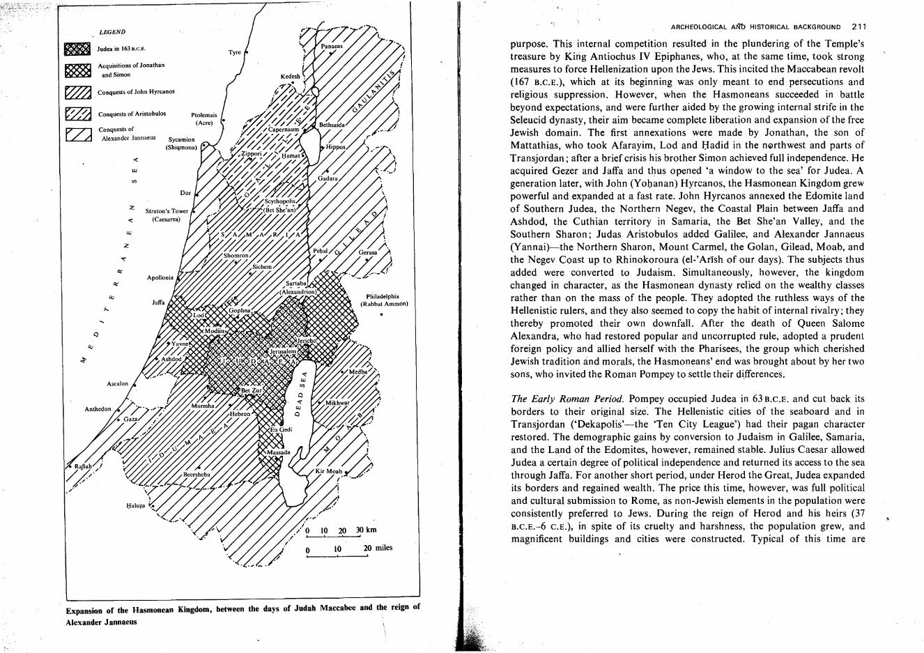
Expansion of the Hasmonean Kingdom, between the days of Judah Maccabee and the reign of
Alexander J annaeus
ARCHEOLOGICAL A~ HISTORICAL BACKGROUND 211
The Early Roman Period. Pompey occupied Judea in 63 B.C.E. and cut back itsborders to their original size. The Hellenistic cities of the seaboard and inTransjordan ('Dekapolis'-the 'Ten City League') had their pagan characterrestored. The demographic gains by conversion to Judaism in Galilee, Samaria,and the Land of the Edomites, however, remained stable. Julius Caesar allowedJudea a certain degree of political independence and returned its access to the seathrough Jaffa. For another short period, under Herod the Great, Judea expandedits borders and regained wealth. The price this time, however, was full politicaland cultural submission to Rome, as non-Jewish elements in the population wereconsistently preferred to Jews. During the reign of Herod and his heirs (37B.C.E.-6 C.E.), in spite of its cruelty and harshness, the population grew, andmagnificent buildings and cities were constructed. Typical of this time are
purpose. This internal competition resulted in the plundering of the Temple'streasure by Kirig Antiochus IV Epiphanes, who, at the same time, took strongmeasures to force Hellenization upon the Jews. This incited the Maccabean revolt(167 B.C.E.), which at its beginning was only meant to end persecutions andreligious suppression. However, when the Hasmoneans succeeded in battlebeyond expectations, and were further aided by the growing internal strife in theSeleucid dynasty, their aim became complete liberation and expansion of the freeJewish domain. The first annexations were made by Jonathan, the son ofMattathias, who took Afarayim, Lod and Hadid in the northwest and parts ofTransjordan; after a brief crisis his brother Simon achieved full independence. Heacquired Gezer and Jaffa and thus opened 'a window to the sea' for Judea. Ageneration later, with John (Yohanan) Hyrcanos, the Hasmonean Kingdom grewpowerful and expanded at a fast rate. John Hyrcanos annexed the Edomite landof Southern Judea, the Northern Negev, the Coastal Plain between Jaffa andAshdod, the Cuthian territory in Samaria, the Bet She'an Valley, and theSouthern Sharon; Judas Aristobulosadded Galilee, and Alexander Jannaeus(Yannai)-the Northern Sharon, Mount Carmel, the Golan, Gilead, Moab, andthe Negev Coast up to Rhinokoroura (el-Artsh of our days). The subjects thusadded were converted to Judaism. Simultaneously, however, the kingdomchanged in character, as the Hasmonean dynasty relied on the wealthy classesrather than on the mass of the people. They adopted the ruthless ways of theHellenistic rulers, and they also seemed to copy the habit of internal rivalry; theythereby promoted their own downfall. After the death of Queen SalomeAlexandra, who had restored popular and uncorrupted rule, adopted a prudentforeign policy and allied herself with the Pharisees, the group which cherishedJewish tradition and morals, the Hasmoneans' end was brought about by her twosons, who invited the Roman Pompey to settle their differences.
(Rabbat Ammon)
20 30 km, ,
10 20 miles
10!
oI
Ptolemais(Acre)
z
....
z
UJ
UJ
LEGEND
Conquests ofAlexander Jannaeus
Acquisitions of Jonathan
and Simon
Conquests of Aristobulos
Conquests of John Hyrcanos
Judea in 163D.C.E.
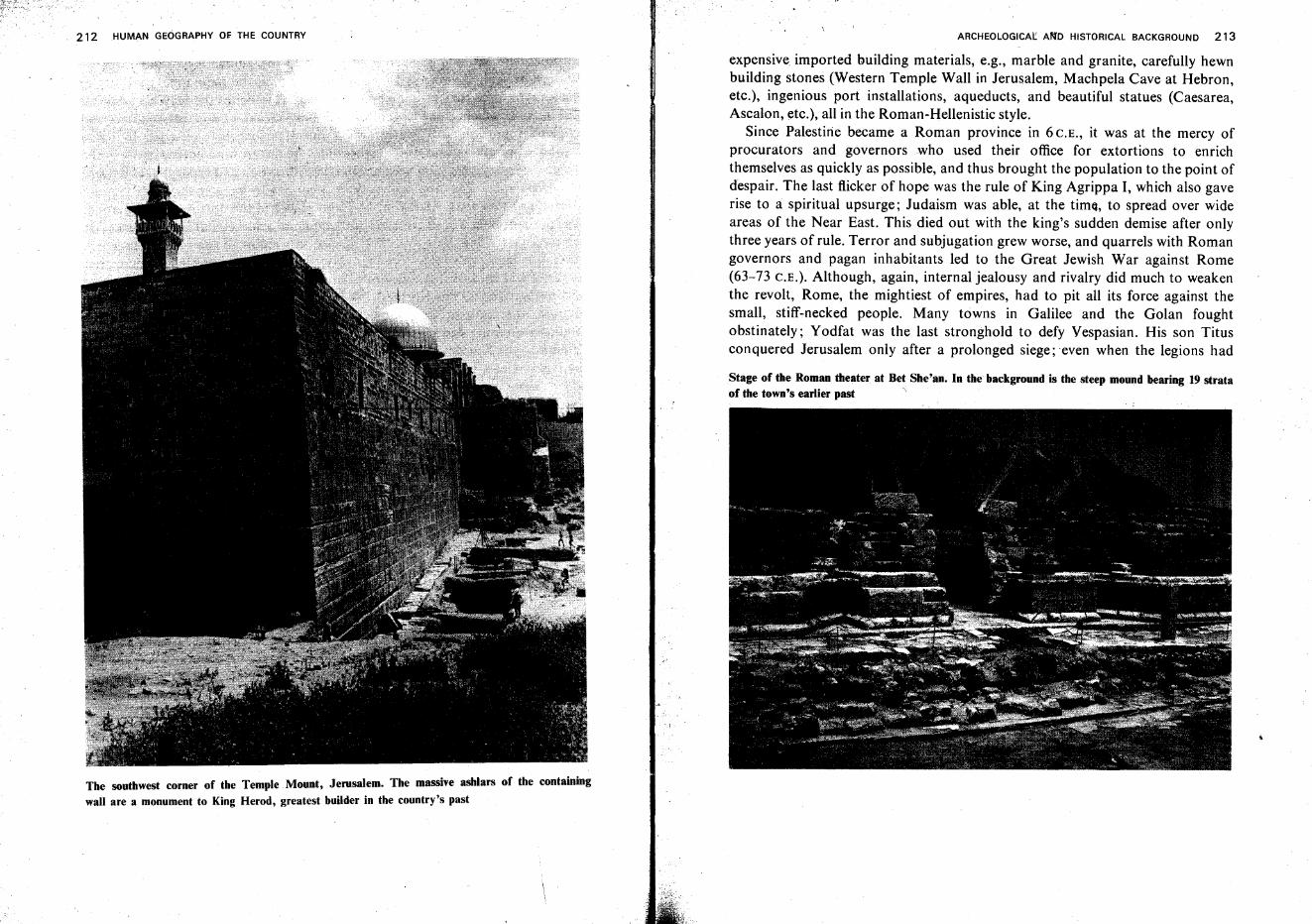
212 HUMAN GEOGRAPHY OF THE COUNTRY
The southwest corner of the Temple Mount, Jerusalem. The massive ashlars of the containing
wall are a monument to King Herod, greatest builder in the country's past
ARCHEOLOGICAl: AIlfD HISTORICAL BACKGROUND 213
expensive imported building materials, e.g., marble and granite, carefully hewnbuilding stones (Western Temple Wall in Jerusalem, Machpela Cave at Hebron,etc.), ingenious port installations, aqueducts, and beautiful statues (Caesarea,Ascalon, etc.), all in the Roman-Hellenistic style.
Since Palestine became a Roman province in 6 C.E., it was at the mercy ofprocurators and governors who used their office for extortions to enrichthemselves as quickly as possible, and thus brought the population to the point ofdespair. The last flicker of hope was the rule of King Agrippa I, which also gaverise to a spiritual upsurge; Judaism was able, at the time, to spread over wideareas of the Near East. This died out with the king's sudden demise after onlythree years of rule. Terror and subjugation grew worse, and quarrels with Romangovernors and pagan inhabitants led to the Great Jewish War against Rome(63-73 C.E.). Although, again, internal jealousy and rivalry did much to weakenthe revolt, Rome, the mightiest of empires, had to pit all its force against thesmall, stiff-necked people. Many towns in Galilee and the Golan foughtobstinately; Y odfat was the last stronghold to defy Vespasian. His son Titusconquered Jerusalem only after a prolonged siege; even when the legions had
Stage of the Roman theater at Bet She'an. In the background is the steep mound bearing 19 strataof the town's earlier past ';
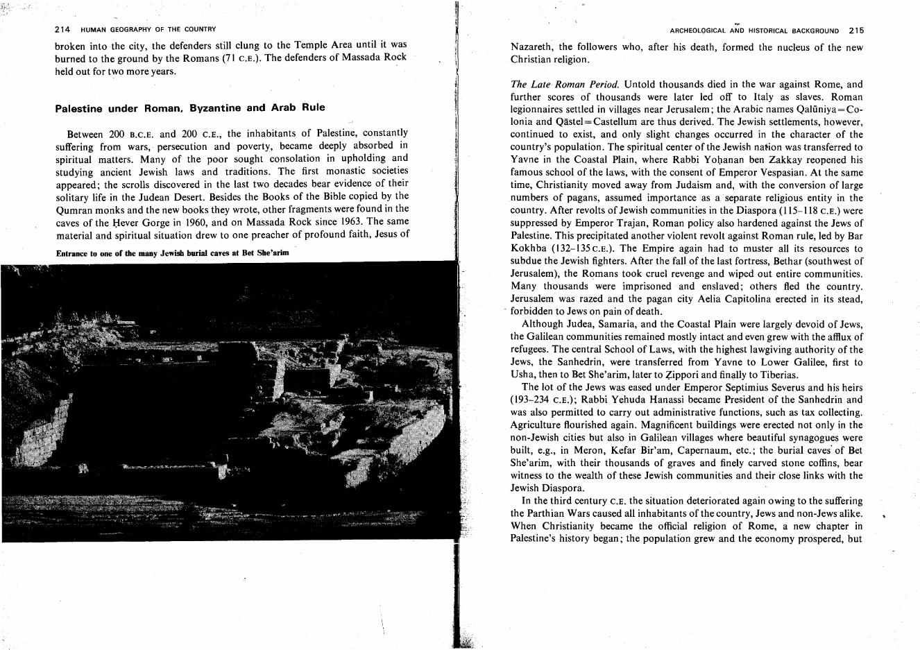
214 HUMAN GEOGRAPHY OF THE COUNTRY
broken into the city, the defenders still clung to the Temple Area until it wasburned to the ground by the Romans (71 C.E.). The defenders of Massada Rockheld out for two more years.
ARCHEOLQGICAL AND HISTORICAL BACKGROUND 215
Nazareth, the followers who, after his death, formed the nucleus of the newChristian religion.
Palestine under Roman, Byzantine and Arab Rule
Between 200 R.C.E. and 200 C.E., the inhabitants of Palestine, constantlysuffering from wars,· persecution and poverty, became deeply absorbed inspiritual matters. Many of the poor sought consolation in upholding andstudying ancient Jewish laws and traditions. The first monastic societiesappeared; the scrolls discovered in the last two decades bear evidence of theirsolitary life in the Judean Desert. Besides the Books of the Bible copied by theQumran monks and the new books they wrote, other fragments were found in thecaves of the Bever Gorge in 1960, and on Massada Rock since 1963. The samematerial and spiritual situation drew to one preacher of profound faith, Jesus of
Entrance to one of the many Jewish burial caves at Bet She'arim
The Late Roman Period. Untold thousands died in the war against Rome, andfurther scores of thousands were later led off to Italy as slaves. Romanlegionnaires settled in villages near Jerusalem; the Arabic names Qalilniya= Colonia and Qastel-e Castellum are thus derived. The Jewish settlements, however,continued to exist, and only slight changes occurred in the character of thecountry's population. The spiritual center of the Jewish nation was transferred toYavne in the Coastal Plain, where Rabbi Yohanan ben Zakkay reopened hisfamous school of the laws, with the consent of Emperor Vespasian. At the sametime, Christianity moved away from Judaism and, with the conversion of largenumbers of pagans, assumed importance as a separate religious entity in thecountry. After revolts of Jewish communities in the Diaspora (115-118 C.E.) weresuppressed by Emperor Trajan, Roman policy also hardened against the Jews ofPalestine. This precipitated another violent revolt against Roman rule, led by BarKokhba (132-135c.E.). The Empire again had to muster all its resources tosubdue the Jewish fighters. After the fall of the last fortress, Bethar (southwest ofJerusalem), the Romans took cruel revenge and wiped out entire communities.Many thousands were imprisoned and enslaved; others fled the country.Jerusalem was razed and the pagan City Aelia Capitolina erected in its stead,
- forbidden to Jews on pain of death.Although Judea, Samaria, and the Coastal Plain were largely devoid of Jews,
the Galilean communities remained mostly intact and even grew with the afflux ofrefugees. The central School of Laws, with the highest lawgiving authority of theJews, the Sanhedrin, were transferred from Yavne to Lower Galilee, first toUsha, then to Bet She'arim, later to Zippori and finally to Tiberias.
The lot of the Jews was eased under Emperor Septimius Severus and his heirs(193-234 C.E.); Rabbi Yehuda Hanassi became President of the Sanhedrin andwas also permitted to carry out administrative functions, such as tax collecting.Agriculture flourished again. Magnificent buildings were erected not only in thenon-Jewish cities but also in Galilean villages where beautiful synagogues werebuilt, e.g., in Meron, Kefar Bir'am, Capernaum, etc.: the burial caves' of BetShe'arim, with their thousands of graves and finely carved stone coffins, bearwitness to the wealth of these Jewish communities and their close links with theJewish Diaspora.
In the third century C.E. the situation deteriorated again owing to the sufferingthe Parthian Wars caused all inhabitants of the country, Jews and non-Jews alike.When Christianity became the official religion of Rome, a new chapter inPalestine's history began; the population grew and the economy prospered, but
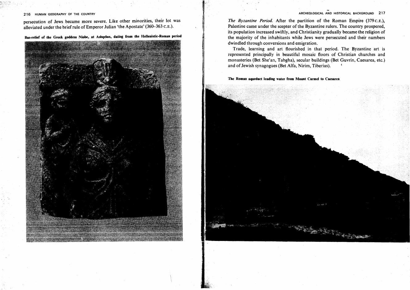
216 HUMAN GEOGRAPHY OF THE COUNTRY
persecution of Jews became more severe. Like other minorities, their lot wasalleviated under the brief rule of Emperor Julian 'the Apostate' (360-363 C.E.).
Bas-relief of the Greek goddess Niobe, at Ashqelon, dating from the Hellenistic-Roman period
ARCHEQLOGICAL AND HISTORICAL BACKGROUND 217
The Byzantine Period. After the partition of the Roman Empire (379c.E.),Palestine came under the scepter of the Byzantine rulers. The country prospered,its population increased swiftly, and Christianity gradually became the religion ofthe majority of the inhabitants while Jews were persecuted and their numbersdwindled through conversions and emigration.
Trade, learning and art flourished in that period. The Byzantine art isrepresented principally in beautiful mosaic floors of Christian churches andmonasteries (Bet She'an, Tabgha), secular buildings (Bet Guvrin, Caesarea, etc.)and of Jewish synagogues (Bet Alfa, Nirim, Tiberias). i
The Roman aqueduct leading water from Mount Carmel to Caesarea
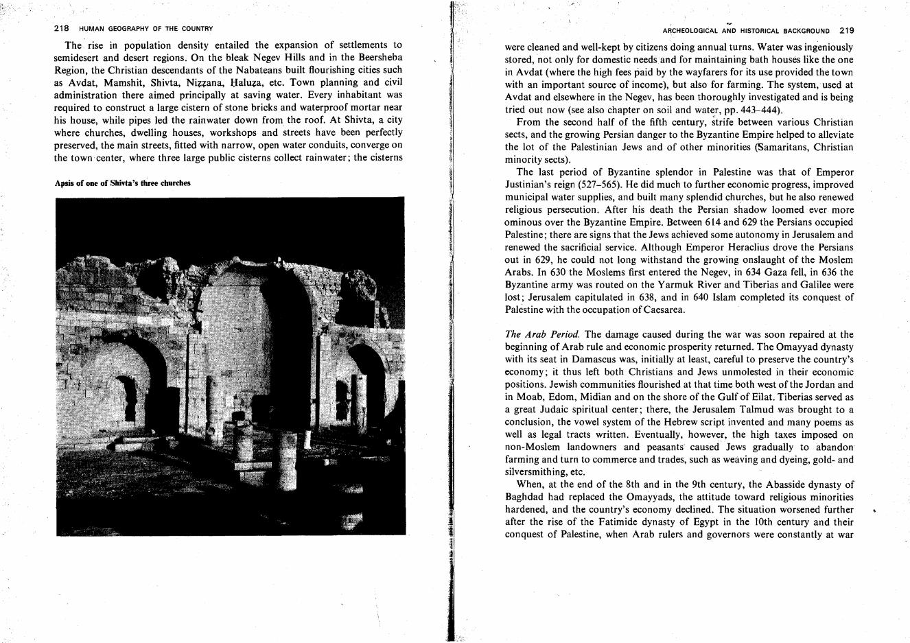
218 HUMAN GEOGRAPHY OF THE COUNTRY
The.· rise in population density entailed the expansion of settlements tosemidesert and desert regions. On the bleak Negev Hills and in the BeershebaRegion, the Christian descendants of the Nabateans built flourishing cities suchas Avdat, Mamshit, Shivta, Nizzana, Haluza, etc. Town planning and civiladministration there aimed principally at saving water..Every inhabitant wasrequired to construct a large cistern of stone bricks and waterproof mortar nearhis house, while pipes led the rainwater down from the roof. At Shivta, a citywhere churches, dwelling houses, workshops and streets have been perfectlypreserved, the main streets, fitted with narrow, open water conduits, converge onthe town center, where three large public cisterns collect rainwater; the cisterns
Apsis of one of Shivta's three churches
~
J
II;;
ARCHEOLOGICAL AND HISTORICAL BACKGROUND 219
were cleaned and well-kept by citizens doing annual turns. Water was ingeniouslystored, not only for domestic needs and for maintaining bath houses like the onein Avdat (where the high fees paid by the wayfarers for its use provided the townwith an important source of income), but also for farming. The system, used atAvdat and elsewhere in the Negev, has been thoroughly investigated and is beingtried out now (see also chapter on soil and water, pp. 443-444).
From the second half of the fifth century, ~trife between various Christiansects, and the growing Persian danger to the Byzantine Empire helped to alleviatethe lot of the Palestinian Jews and of other minorities (Samaritans, Christianminority sects).
The last period of Byzantine splendor in Palestine was that of EmperorJustinian's reign (527-565). He did much to further economic progress, improvedmunicipal water supplies, and built many splendid churches, but he also renewedreligious persecution. After his death the Persian shadow loomed ever moreominous over the Byzantine Empire. Between 614 and 629 the Persians occupiedPalestine; there are signs that the Jews achieved some autonomy in Jerusalem andrenewed the sacrificial service. Although Emperor Heraclius drove the Persiansout in 629, he could not long withstand the growing onslaught of the MoslemArabs. In 630 the Moslems first entered the Negev, in 634 Gaza fell, in 636 theByzantine army was routed on the Yarmuk River and Tiberias and Galilee werelost; Jerusalem capitulated in 638, and in 640 Islam completed its conquest ofPalestine with the occupation of Caesarea.
The Arab Period. The damage caused during the war was soon repaired at thebeginning of Arab rule and economic prosperity returned. The Omayyad dynastywith its seat in Damascus was, initially at least, careful to preserve the country'seconomy; it thus left both Christians and Jews unmolested in their economicpositions. Jewish communities flourished at that time both west of the Jordan andin Moab, Edom, Midian and on the shore of the Gulf of Eilat. Tiberias served asa great Judaic spiritual center; there, the Jerusalem Talmud was brought to aconclusion, the vowel system of the Hebrew script invented and many poems aswell as legal tracts written. Eventually, however, the high taxes imposed onnon-Moslem landowners and peasants' caused Jews gradually to abandonfarming and turn to commerce and trades, such as weaving and dyeing, gold- andsilversmithing, etc.
When, at the end of the 8th and in the 9th century, the Abasside dynasty ofBaghdad had replaced the Omayyads, the attitude toward religious minoritieshardened, and the country's economy declined. The situation worsened furtherafter the rise of the Fatimide dynasty of Egypt in the IOth century and theirconquest of Palestine, when Arab rulers and governors were constantly at war
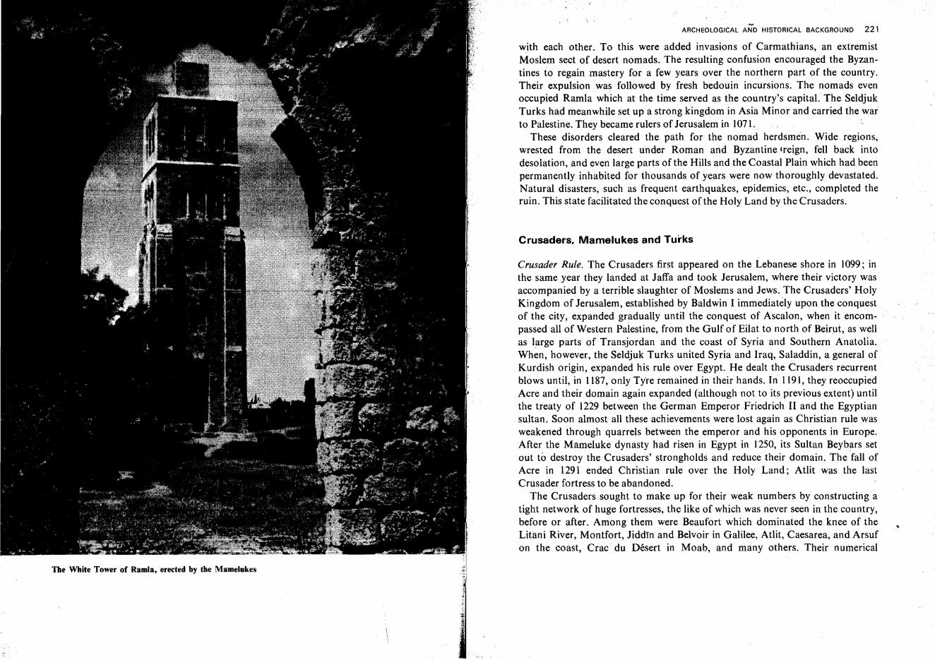
The White Tower of Ramla, erected by the Mamelukes
.~
ARCHEOLOGICAL AND HISTORICAL BACKGROUND 221
with each other. To this were added invasions of Carmathians, an extremistMoslem sect of desert nomads. The resulting confusion encouraged the Byzantines to regain mastery for a few years over the northern part of the country.Their expulsion was followed by fresh bedouin incursions. The nomads evenoccupied Ramla which at the time served as the country's capitaL The SeldjukTurks had meanwhile set up a strong kingdom in Asia Minor and carried the warto Palestine. They became rulers of Jerusalem in 1071.
These disorders cleared the path for the nomad herdsmen. Wide regions,wrested from the desert under Roman and Byzantine -reign, fell back intodesolation, and even large parts of the Hills and the Coastal Plain which had beenpermanently inhabited for thousands of years were now thoroughly devastated.Natural disasters, such as frequent earthquakes, epidemics, etc., completed theruin. This state facilitated the conquest of the Holy Land by the Crusaders.
Crusaders. Mamelukes and Turks
Crusader Rule. The Crusaders first appeared on the Lebanese shore in 1099; inthe same year they landed at Jaffa and took Jerusalem, where their victory wasaccompanied by a terrible slaughter of Moslems and Jews. The Crusaders' HolyKingdom of Jerusalem, established by Baldwin I immediately upon the conquestof the city, expanded gradually until the conquest of Ascalon, when it encompassed all of Western Palestine, from the Gulf of Eilat to north of Beirut, as wellas large parts of Transjordan and the coast of Syria and Southern Anatolia.When, however, the Seldjuk Turks united Syria and Iraq, Saladdin, a general ofKurdish origin, expanded his rule over Egypt. He dealt the Crusaders recurrentblows until, in 1187, only Tyre remained in their hands. In 1191, they reoccupiedAcre and their domain again expanded (although not to its previous extent) untilthe treaty of 1229 between the German Emperor Friedrich II and the Egyptiansultan. Soon almost all these achievements were lost again as Christian rule wasweakened through quarrels between the emperor and his opponents in Europe.After the Mameluke dynasty had risen in Egypt in 1250, its Sultan Beybars setout to destroy the Crusaders' strongholds and reduce their domain. The fall ofAcre in 1291 ended Christian rule over the Holy Land; Atlit was the lastCrusader fortress to be abandoned.
The Crusaders sought to make up for their weak numbers by constructingatight network of huge fortresses, the like of which was never seen in the country,before or after. Among them were Beaufort which dominated the knee of theLitani River, Montfort, Jiddtn and Belvoir in Galilee, Atlit, Caesarea, and Arsufon the coast, Crac du Desert in Moab, and many others. Their numerical
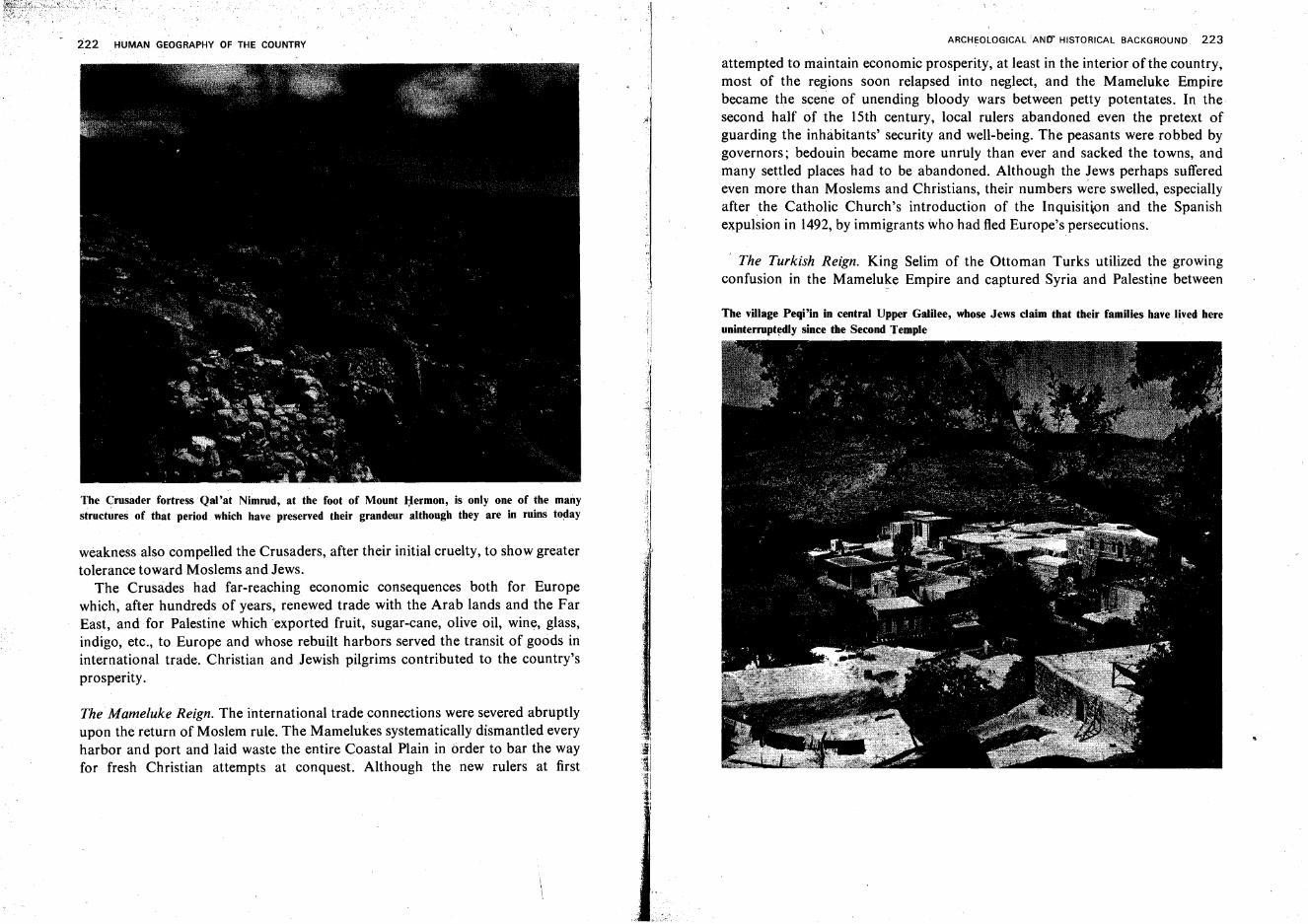
222 HUMAN GEOGRAPHY OF THE COUNTRY
The Crusader fortress Qal'at Nimrud, at the foot of Mount Hermon, is only one of the manystructures of that period which have preserved their grandeur although they are in ruins to~ay
weakness also compelled the Crusaders, after their initial cruelty, to show greatertolerance toward Moslems and Jews.
The Crusades had far-reaching economic consequences both for Europewhich, after hundreds of years, renewed trade with the Arab lands and the FarEast, and for Palestine which exported fruit, sugar-cane, olive oil, wine, glass,indigo, etc., to Europe and whose rebuilt harbors served the transit of goods ininternational trade. Christian and Jewish pilgrims contributed to the country'sprosperity.
The Mameluke Reign. The international trade connections were severed abruptlyupon the return of Moslem rule. The Mamelukes systematically dismantled everyharbor and port and laid waste the entire Coastal Plain in order to bar the wayfor fresh Christian attempts at conquest. Although the new rulers at first
I
:II'IJ''''·.·.··1i
II
ARCHEOLOGICAL 'AND' HISTORICAL BACKGROUND 223
attempted to maintain economic prosperity, at least in the interior of the country,most of the regions soon relapsed into neglect, and the Mameluke Empirebecame the scene of unending bloody wars between petty potentates. In thesecond half of the 15th century, local rulers abandoned even the pretext ofguarding the inhabitants' security and well-being. The peasants were robbed bygovernors; bedouin became more unruly than ever and sacked the towns, andmany settled places had to be abandoned. Although the Jews perhaps sufferedeven more than Moslems and Christians, their numbers were swelled, especiallyafter the Catholic Church's introduction of the Inquisition and the Spanishexpulsion in 1492,by immigrants who had fled Europe's persecutions.
The Turkish Reign. King Selim of the Ottoman Turks utilized the growingconfusion in the Mameluke Empire and captured Syria and Palestine between
The village Peqi'in in central Upper Galilee, whose Jews claim that their families have lived hereuninterrupt~dly since the Second Temple

The el-Jazzar Mosque in Acre, overlooking Haifa Bay
224 . HUMAN GEOGRAPHY OF THE COUNTRY
1512 and 1516. His son, Suleyman the Magnificent, restored order in the country,encouraged trade, rebuilt and fortified villages and towns and, in particular,
. reconstructed the walls of Jerusalem. Up to the end of the 16th century, theJewish community progressed, with Safed as its center. The town attracted agreat many famous sages; .Jewish mysticism developed, and great works ofreligious literature were written. Jews were active in trades, such as cotton andsilk spinning, weaving and dyeing, soap making, etc.
From the end of the 16th century, revolts of the Janissary soldiery shook theTurkish Empire. Greedy local governors often acted, for all practical purposes,independently of Constantinople. In the 17th century, the enlightened Druzegovernor of Galilee, Fakhr a-Din, attained an important position and, byestablishing relations with European powers, tried to shake off Turkish rulealtogether and conquer Egypt. He sought to encourage agriculture and trade, andcheck the bedouin robbers. He was finally defeated by the Turks and beheaded inConstantinople. In the 18th century, the bedouin sheikh Zaher el 'Amr obtainedfrom the Turks 'leasehold rights' over Galilee and, by annexing other regions,ruled over almost the entire country. He was a tyrant who grew rich as a result ofbartering the booty of bedouin robbers for that of Christian sea Ipirates. Heorganized expeditions against Egypt, entangled himself in war with the Turks,and was finally murdered. After him, Ahmed el Jazzar ('the Butcher,' thus calledbecause of his cruelty) became governor of the province of Sidon, and transferredhis seat to Acre. The city was so built up and efficiently fortified that, with the aidof the British fleet from the sea, it could withstand Napoleon's siege in 1799. Thisforced him to abandon the campaign which was aimed at occupying Constantinople, cutting off India and, in effect, defeating Britain. The population of thecountry had by then become abjectly poor and reached its lowest number, notover 250,000-300,000 souls.
Napoleon's campaign, however, renewed the interest of the European powersin the Middle East in general and in Palestine in particular. This was expressed inthe aid which the French extended, in the 1820's and 1830's, to the Egyptian rulerMehemet Ali, who meant to conquer all of the Turkish Empire. His stepson,Ibrahim Pasha, representing him as Governor of Palestine, was a severe masterbut did introduce some order. Considerable numbers of Egyptian fellahinapparently immigrated to Palestine, where they founded new villages, mainly inthe Southern Coastal Plain and in the Hula Valley. The Turks finally regainedSyria and Palestine, and even a nominal sovereignty over Egypt, with the aid ofthe British and the Russians, who preferred 'the sick man on the Bosphorus' tothe energetic and ambitious Mehemet Ali. Turkey's allies, however, asked fortheir reward in the form of 'capitulation rights' including jurisdiction over theirrespective subjects living in Turkey, maintenance of postal agencies in Turkish
provinces of the Middle East, special rights in Turkish ports, etc. On the whole,these arrangements contributed to the country's progress since city childrenattended European schools and villagers received instruction from monasteries intheir vicinity. Jews concentrated mainly in the four 'sacred' cities, Jerusalem,Safed, Hebron, and Tiberias and, in smaller numbers, in Gaza, Acre, Haifa,Shefar'am, and Peqi'in. They, too, benefited from the European interest in thecountry. Wishing to increase its influence, each European power appointed itselfguardiari of at least one religious minority living within Turkey's border, e.g., theRussians of the Greek-Orthodox, the French of the Catholics, the British andGermans of the Protestants, and the British also of the Druzes and Jews.
In the second half of the 19th century, security conditions gradually improved,nomads were restrained, the hill villagers began to plow fields in the interiorvalleys and in the Coastal Plain and founded 'dependencies' there which, in thecourse of time, became villages in their own right. In the cities, Christian pilgrims
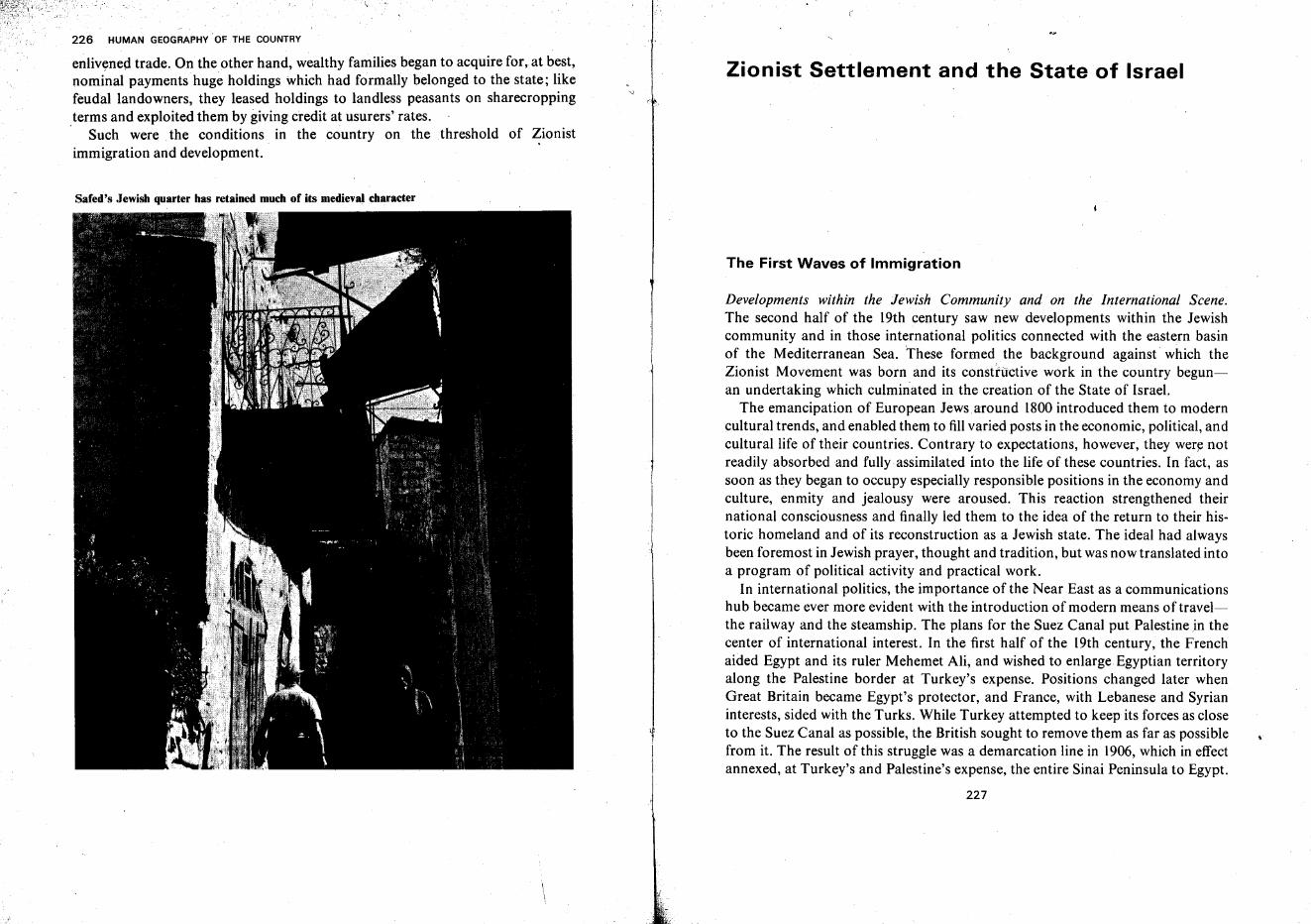
226 HUMAN GEOGRAPHY· OF THE COUNTRY
enlivened trade. On the other hand, wealthy families began to acquire for, at best,nominal payments huge holdings which had formally belonged to the state; likefeudal landowners, they leased holdings to landless peasants on sharecroppingterms and exploited them by giving credit at usurers' rates.. Such were the conditions in the country on the threshold of Zionistimmigration and development.
Safed's Jewish quarter has retained much of its medieval character
\\
Zionist Settlement and the State of Israel
The First Waves of Immigration
Developments within the Jewish Community and on the International Scene.The second half of the 19th century saw new developments within the Jewishcommunity and in those international politics connected with the eastern basinof the Mediterranean Sea. These formed the background against which theZionist Movement was born and its constructive work in the country begunan undertaking which culminated in the creation of the State of Israel.
The emancipation of European Jews around 1800introduced them to moderncultural trends, and enabled them to fillvaried posts in the economic, political, andcultural life of their countries. Contrary to expectations, however, they were notreadily absorbed and fully assimilated into the life of these countries. In fact, assoon as they began to occupy especially responsible positions in the economy andculture, enmity and jealousy were aroused. This reaction strengthened theirnational consciousness and finally led them to the idea of the return to their historic homeland and of its reconstruction as a Jewish state. The ideal had alwaysbeen foremost in Jewish prayer, thought and tradition, but was now translated intoa program of political activity and practical work.
In international politics, the importance of the Near East as a communicationshub became ever more evident with the introduction of modern means oftravelthe railway and the steamship. The plans for the Suez Canal put Palestine in thecenter of international interest. In the first half of the 19th century, the Frenchaided Egypt and its ruler Mehemet Ali, and wished to enlarge Egyptian territoryalong the Palestine border at Turkey's expense. Positions changed later whenGreat Britain became Egypt's protector, and France, with Lebanese and Syrianinterests, sided with the Turks. While Turkey attempted to keep its forces as closeto the Suez Canal as possible, the British sought to remove them as far as possiblefrom it. The result of this struggle was a demarcation line in 1906, which in effectannexed, at Turkey's and Palestine's expense, the entire Sinai Peninsula to Egypt.
227
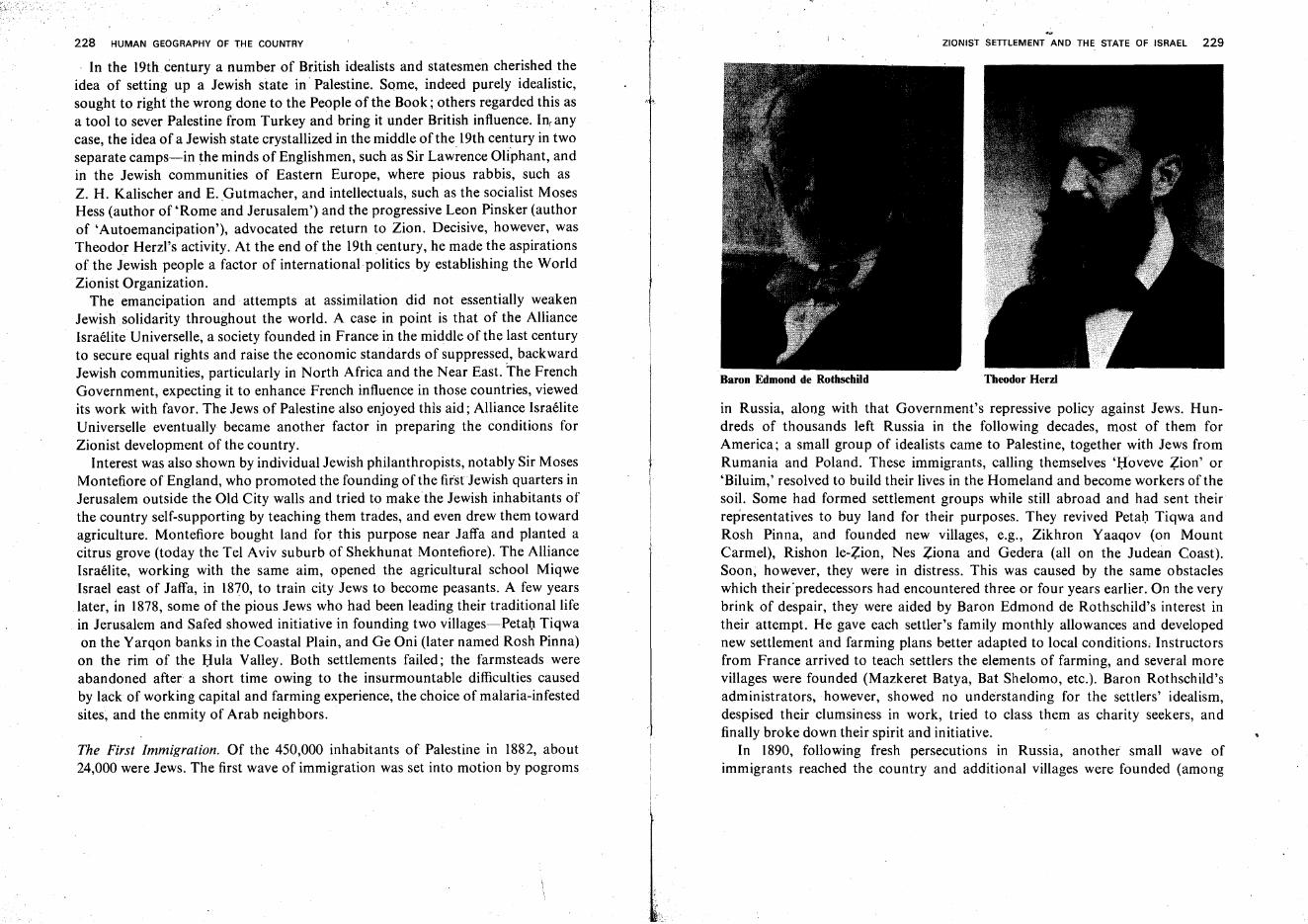
in Russia, along with that Government's repressive policy against Jews. Hundreds of thousands left Russia in the following decades, most of them forAmerica; a small group of idealists came to Palestine, together with Jews fromRumania and Poland. These immigrants, calling themselves 'Hoveve Zion' or'Biluim,' resolved to build their lives in the Homeland and become workers of thesoil. Some had formed settlement groups while still abroad and had sent theirrepresentatives to buy land for their purposes. They revived Petal) Tiqwa andRosh Pinna, and founded new villages, e.g., Zikhron Yaaqov (on MountCarmel), Rishon le-Zion, Nes Ziona and Gedera (all on the Judean Coast).Soon, however, they were in distress. This was caused by the same obstacleswhich their 'predecessors had encountered three or four years earlier. On the verybrink of despair, they were aided by Baron Edmond de Rothschild's interest intheir attempt. He gave each settler's family monthly allowances and developednew settlement and farming plans better adapted to local conditions; Instructorsfrom France arrived to teach settlers the elements of farming, and several morevillages were founded (Mazkeret Batya, Bat Shelomo, etc.). Baron Rothschild'sadministrators, however, showed no understanding for the settlers' idealism,despised their clumsiness in work, tried to class them as charity seekers, andfinally broke down their spirit and initiative.
In 1890, following fresh persecutions in Russia, another small wave ofimmigrants reached the country and additional villages were founded (among
228 HUMAN GEOGRAPHY OF THE COUNTRY
In the 19th century a number of British idealists and statesmen cherished theidea of setting up a Jewish state in Palestine. Some, indeed purely idealistic,sought to right the wrong done to the People of the Book; others regarded this asa tool to sever Palestine from Turkey and bring it under British influence. In,anycase, the idea of a Jewish state crystallized in the middle of the 19th century in twoseparate camps-in the minds of Englishmen, such as Sir Law~ence Oliphant, andin the Jewish communities of Eastern Europe, where pious rabbis, such asZ. H. Kalischer and E. ,Gutmacher, and intellectuals, such as the socialist MosesHess (author of 'Rome and Jerusalem') and the progressive Leon Pinsker (authorof 'Autoemancipation'), advocated the return to Zion. Decisive, however, wasTheodor Herzl's activity. At the end of the 19th century, he made the aspirationsof the Jewish people a factor of international politics by establishing the WorldZionist Organization.
The emancipation and attempts at assimilation did not essentially weakenJewish solidarity throughout the world. A case in point is that of the AllianceIsraelite Universelle, a society founded in France in the middle of the last centuryto secure equal rights and raise the economic standards of suppressed, backwardJewish communities, particularly in North Africa and the Near East. The FrenchGovernment, expecting it to enhance French influence in those countries, viewedits work with favor. The Jews of Palestine also enjoyed this aid; Alliance IsraeliteUniverselle eventually became another factor in preparing the conditions forZionist development of the country.
Interest was also shown by individual Jewish philanthropists, notably Sir MosesMontefiore of England, who promoted the founding of the firstJewish quarters inJerusalem outside the Old City walls and tried to make the Jewish inhabitants ofthe country self-supporting by teaching them trades, and even drew them towardagriculture. Montefiore bought land for this purpose near Jaffa and planted acitrus grove (today the Tel Aviv suburb of Shekhunat Montefiore). The AllianceIsraelite, working with the same aim, opened the agricultural school MiqweIsrael east of Jaffa, in 1870, to train city Jews to become peasants. A few yearslater, in 1878, some of the pious Jews who had been leading their traditional lifein Jerusalem and Safed showed initiative in founding two villages-Petal) Tiqwaon the Yarqon banks in the Coastal Plain, and Ge Oni (later named Rosh Pinna)on the rim of the Hula Valley. Both settlements failed; the farmsteads wereabandoned after a short time owing to the insurmountable difficulties causedby lack of working capital and farming experience, the choice of malaria-infestedsites, and the enmity of Arab neighbors.
The First Immigration. Of the 450,000 inhabitants of Palestine in 1882, about24,000 were Jews. The first wave of immigration was set into motion by pogroms
'-
Baron Edmond de Rothschild
ZIONIST SETTLEMENT AND THE STATE OF ISRAEL 229
Theodor Herzl
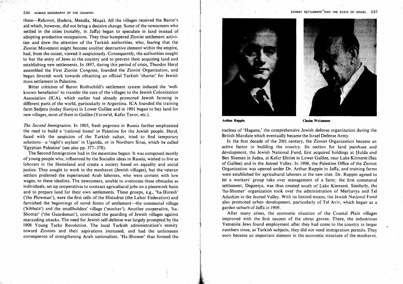
230 HUMAN GEOGRAPHY OF THE COUNTRY ZIONIST SI;TTLEMENT'~AND THE STATE OF ISRAEL 231
nucleus of 'Hagana,' the comprehensive Jewish defense organization during theBritish Mandate which eventually became the Israel Defense Army.
In the first decade of the 20th century, the Zionist Organization became anactive factor in building the country. Its section for land purchase anddevelopment, the Jewish National Fund, first acquired holdings at Hulda andBen Shemen in Judea, at Kefar Hittim in Lower Galilee, near Lake Kinneret (Seaof Galilee) and in the Jezreel Valley. In 1908, the Palestine Office of the ZionistOrganization was opened under Dr. Arthur Ruppin in Jaffa, and training farmswere established for agricultural laborers at the new sites. Dr. Ruppin agreed tolet a workers' group take over management of a farm; the first communalsettlement, Deganiya, Was thus created south of Lake Kinneret. Similarly, the'ha-Shomer' organization took over the administration of Merhavya and TelAdashim in the Jezreel Valley. With its limited means, the Jewish National Fundalso promoted urban development, particularly of Tel Aviv, which began as agarden suburb of Jaffa in 1909.
After many crises, the economic situation of the Coastal Plain villagesimproved with the first success of the citrus groves. There, the industriousYemenite Jews found employment after they had come to the country in largernumbers since, as Turkish subjects, they did not need immigration permits. Theysoon became an important element in the economic structure of the moshavot.
these-i-Rehovot, Hadera, Metulla, Moza). All the villages received the Baron'said which, however, did not bring a decisive change. Some of the newcomers whosettled in the cities (notably, in Jaffa) began to speculate in land instead ofadopting productive occupations. They thus hampered Zionist settlement activities and drew the attention of the Turkish authorities, who, fearing that theZionist Movement might become another destructive element within the empire,had, from the outset, viewed it suspiciously. Consequently, the authorities soughtto bar the entry of Jews to the country and to prevent their acquiring land andestablishing new settlements. In 1897, during this period of crisis, Theodor Herzlassembled the First Zionist Congress, founded the Zionist Organization, andbegan feverish work towards obtaining an official Turkish 'charter' for Jewishmass settlement in Palestine.
Bitter criticism of Baron Rothschild's settlement system induced the 'wellknown benefactor' to transfer the care of the villages to the Jewish ColonizationAssociation (lCA), which earlier had already promoted Jewish farming in,different parts of the world, particularly in Argentina. ICA founded the trainingfarm Sedjera (today Ilaniya) in Lower Galilee and in 1901 began to buy land fornew villages, most of them in Galilee (Yavne'el, Kefar Tavor, etc.).
The Second Immigration. In 1903, fresh pogroms in Russia further emphasizedthe need to build a 'national home' in Palestine for the Jewish people. Herzl,faced with the suspicion of the Turkish sultan, tried to find temporarysolutions-a 'night's asylum' in Uganda, or in Northern Sinai, which he called'Egyptian Palestine' (see also pp. 377-378).
The Second Immigration had in the meantime begun. It was composed mostlyof young people who, influenced by the Socialist ideas in Russia, wished to live aslaborers in the Homeland and create a society based on equality and socialjustice. They sought to work in the moshavot (Jewish villages), but the veteransettlers preferred the experienced Arab laborers, who were content with lowwages, to these idealists. The newcomers, unable to overcome these obstacles asindividuals, set up cooperatives to contract agricultural jobs on a piecework basisand to prepare land for their own settlements. These groups, e.g., 'ha-Horesh'('the Plowman'), were the first cells of the Histadrut (the Labor Federation) andfurnished the beginnings of novel forms of settlement-the communal village('kibbutz') and the smallholders' village ('moshav'). Another cooperative, 'haShomer' ('the Guardsman'), contracted the guarding of Jewish villages againstmarauding attacks. The need for Jewish self-defense was largely prompted by the1908 Young Turks Revolution. The local Turkish administration's enmitytoward Zionists and their aspirations increased, and had the unforeseenconsequence of strengthening Arab nationalism. 'Ha-Shorner' thus formed the
Arthur Ruppin Chaim Weizmann
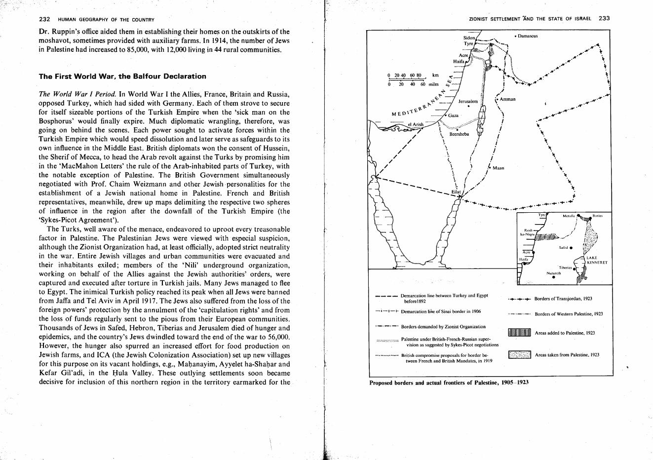
232 HUMAN GEOGRAPHY OF THE COUNTRY ZIONIST SETTLEMENT AND THE STATE OF IS~AEl 233
Proposed borders and actual frontiers of Palestine, 1905-1923
Dr. Ruppin's office aided them in establishing their homes on the outskirts of themoshavot, sometimes provided with auxiliary farms. In 1914, the number of Jewsin Palestine had increased to 85,000, with 12,000 living in 44 rural communities.
The First World War, the Balfour Declaration
The World War I Period. In World War I the Allies, France, Britain and Russia,opposed Turkey, which had sided with Germany. Each of them strove to securefor itself sizeable portions of the Turkish Empire when the 'sick man on theBosphorus' would finally expire. Much diplomatic wrangling, therefore, wasgoing on behind the scenes. Each power sought to activate forces within theTurkish Empire which would speed dissolution and later serve as safeguards to itsown influence in the Middle East. British diplomats won the consent of Hussein,the Sherif of Mecca, to head the Arab revolt against the Turks by promising himin the 'MacMahon Letters' the rule of the Arab-inhabited parts of Turkey, withthe notable exception of Palestine. The British Government simultaneouslynegotiated with Prof. Chaim Weizmann and other Jewish personalities for theestablishment of a Jewish national home in Palestine. French and Britishrepresentatives, meanwhile, drew up maps delimiting the respective two spheresof influence in the region after the downfall of the Turkish Empire (the'Sykes-Picot Agreement').
The Turks, well aware of the menace, endeavored to uproot every treasonablefactor in Palestine. The Palestinian Jews were viewed with especial suspicion,although the Zionist Organization had, at least officially, adopted strict neutralityin the war. Entire Jewish villages and urban communities were evacuated andtheir inhabitants exiled; members of the 'Nili' underground organization,working on behalf of the Allies against the Jewish authorities' orders, werecaptured and executed after torture in Turkish jails. Many Jews managed to fleeto Egypt. The inimical Turkish policy reached its peak when all Jews were bannedfrom Jaffa and Tel Aviv in April 1917. The Jews also suffered from the loss of theforeign powers' protection by the annulment of the 'capitulation rights' and fromthe loss of funds regularly sent to the pious from their European communities.Thousands of Jews in Safed, Hebron, Tiberias and Jerusalem died of hunger andepidemics, and the country's Jews dwindled toward the end of the war to 56,000.However, the hunger also spurred an increased effort for food production onJewish farms, and ICA (the Jewish Colonization Association) set up new villagesfor this purpose on its vacant holdings, e.g., Mahanayim, Ayyelet ha-Shahar andKefar Gil'adi, in the Hula Valley. These outlying settlements soon becamedecisive for inclusion of this northern region in the territory earmarked for the
Ir
I
__ - - Demarcation line between Turkey and Egyptbefore 1892
-'-1-'- Demarcation line of Sinai border in 1906
._. _. -' Borders demanded by Zionist Organization
""..".:.:::::::." Palestine under British-French-Russian supervision as suggested by Sykes-Picot negotiations
'" British compromise proposals for border be-tween French and British Mandates, in 1919
.•.•••• Borders of Transjordan, 1923
.._ .._ .._ .. Borders of Western Palestine, N23
.. Areas added to Palestine, 1923
t<{?;/':)I Areas taken from Palestine, 1923
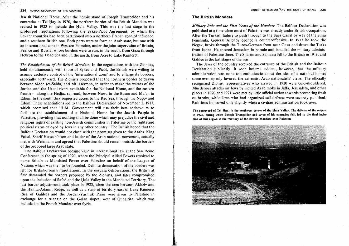
234 HUMAN GEOGRAPHY OF THE COUNTRY
Jewish National Home. After the heroic stand of Joseph Trumpeldor and hiscomrades at Tel Hay in 1920, the northern border of the British Mandate wasrevised in 1923 to include the Hula Valley. This was the last stage in theprolonged negotiations following the Sykes-Picot Agreement, by which theLevant countries had been partitioned into a northern French zone of influence,and a southern British one. Both parts were to form an Arab state, but one withan international zone in Western Palestine, under the joint supervision of Britain,France and Russia, whose borders were to run, in the south, from Gaza throughHebron to the Dead Sea and, in the north, from Acre to Lake Kinneret.
The Establishment of the British Mandate. In the negotiations with the Zionists,held simultaneously with those of Sykes and Picot, the British were willing toassume exclusive control of the 'international zone' and to enlarge its borders,especially northward. The Zionists proposed that the northern border be drawnbetween Sidon (es-Saida) and Mt. Hermon, in order to make the waters of theJordan and the Litani rivers available for the National Home, and the easternfrontier-along the Hedjaz railroad, between Nawa in the Basan and Ma'an inEdom. In the south they requested access to the Red Sea, through the Negev andEdom. These negotiations led to the Balfour Declaration of November 2, 1917,which promised that 'H.M. Government will use their best endeavours tofacilitate the establishment of a National Home for the Jewish People inPalestine, providing that nothing shall be done which may prejudice the civil andreligious rights of existing non-Jewish communities in Palestine or the rights andpolitical status enjoyed by Jews in any other country.' The British hoped that theBalfour Declaration would not clash with the promises given to the Arabs. KingFeisal, Sherif Hussein's son and leader of the Arab national movement, actuallymet with Weizmann and agreed that Palestine should remain outside the bordersof the proposed large Arab state.
The Balfour Declaration became valid in international law at the San RemoConference in the spring of 1920, where the Principal Allied Powers resolved toname Britain as Mandated Power over Palestine on behalf of the League ofNations which was then to be founded. Definite demarcation of the borders wasleft for British-French negotiations. In the ensuing deliberations, the British atfirst demanded the borders proposed by the Zionists, and later compromisedupon the inclusion of Safed and the Hula Valley in the Mandated Territory. Thelast border adjustments took place in 1923, when the area between Akhziv andthe Hanita-Adamit Ridge, as well as a strip of territory east of Lake Kinneret(Sea of Galilee) and the Jordan-Yarmuk Plain were given to Palestine inexchange for a triangle on the Golan slopes, west of Qunaitira, which wasincluded in the French Mandate over Syria.
ZIONIST SETILEMENT 'AND THE STATE OF ISRAEL 235
The British Mandate
Military Rule and the First Years of the Mandate. The Balfour Declaration waspublished at a time when most of Palestine was already under British occupation.After the Turkish failure to push through to the Suez Canal by way of the SinaiPeninsula, General Allenby opened a counteroffensive. In 1917 he took theNegev, broke through the Turco-German front near Gaza and drove the Turksfrom Judea. He entered Jerusalem in parade and installed the military administration of Palestine there. The Sharon and Samaria fell to the British in 1918, andGalilee in the last stages of the war.
The Jews of the country received the entrance of the British and the BalfourDeclaration jubilantly. It soon became evident, however, that the militaryadministration was none too enthusiastic about the idea of a national home;some even openly favored the extremist Arab nationalists' views. The officiallyrecognized Zionist representatives who arrived in 1920 were cold-shouldered.Murderous attacks on Jews by incited Arab mobs in Jaffa, Jerusalem, and otherplaces in 1920 and 1921 were' met by little official action towards preventing freshoutbreaks, while Jews who had organized self-defense were severely punished.Relations improved only slightly when a civilian administration took over.
The courtyard of Tel Hay, in the northwest corner of the Hula Valley. The defense of the outpostin 1920, during which Joseph Trumpeldor and seven of his comrades fell, led to the final inclusion of this region in the territory of the British Mandate over Palestine
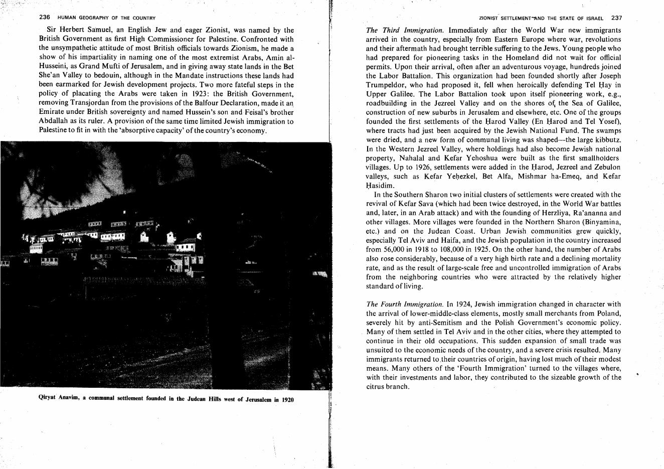
236 HUMAN GEOGRAPHY OF THE COUNTRY-
ZIONIST SETILEMENT"AND THE STATE OF ISRAEL 237
Sir Herbert Samuel, an English Jew and eager Zionist, was named by theBritish Government as first High Commissioner for Palestine. Confronted withthe unsympathetic attitude of most British officials towards Zionism, he made ashow of his impartiality in naming one of the most extremist Arabs, Amin alHusseini, as Grand Mufti of Jerusalem, and in giving away state lands in the BetShe'an Valley to bedouin, although in the Mandate instructions these lands hadbeen earmarked for Jewish development projects. Two more fateful steps in thepolicy of placating the Arabs were taken in 1923: the British Government,removing Transjordan from the provisions of the Balfour Declaration, made it anEmirate under British sovereignty and named Hussein's son and Feisal's brotherAbdallah as its ruler. A provision of the same time limited Jewish immigration toPalestine to fit in with the 'absorptive capacity' of the country's economy.
The Third Immigration. Immediately after the World War new immigrantsarrived in the country, especially from Eastern Europe where war, revolutionsand their aftermath had brought terrible suffering to the Jews. Young people whohad prepared for pioneering tasks in the Homeland did not wait for officialpermits. Upon their arrival, often after an adventurous voyage, hundreds joinedthe Labor Battalion. This organization had been founded shortly after JosephTrumpeldor, who had proposed it, fell when heroically defending Tel Bay inUpper Galilee. The Labor Battalion took upon itself pioneering work, e.g.,roadbuilding in the Jezreel Valley and on the shores o~ the Sea of Galilee,construction of new suburbs in Jerusalem and elsewhere, etc. One of the groupsfounded the first settlements of the Harod Valley (En Harod and Tel Yosef),where tracts had just been acquired by the Jewish National Fund. The swampswere dried, and a new form of communal living was shaped-the large kibbutz.In the Western Jezreel Valley, where holdings had also become Jewish nationalproperty, Nahalal and Kefar Yehoshua were built as the first smallholdersvillages. Up to 1926, settlements were added in the Harod, Jezreel and Zebulonvalleys, such as Kefar Yehezkel, Bet Alfa, Mishmar ha-Emeq, and KefarHasidim,
In the Southern Sharon two initial clusters of settlements were created with therevival of Kefar Sava (which had been twice destroyed, in the World War battlesand, later, in an Arab attack) and with the founding of Herzliya, Ra'ananna andother villages. More villages were founded in the Northern Sharon (Binyamin a,etc.) and on the Judean Coast. Urban Jewish communities grew quickly,especially Tel Aviv and Haifa, and the Jewish population in the country increasedfrom 56,000 in 1918 to 108,000 in 1925. On the other hand, the number of Arabsalso rose considerably, because of a very high birth rate and a declining mortalityrate, and as the result of large-scale free and uncontrolled immigration of Arabsfrom the neighboring countries who were attracted by the relatively higherstandard ofliving.
The Fourth Immigration. In 1924, Jewish immigration changed in character withthe arrival of lower-middle-class elements, mostly small merchants from Poland,severely hit by anti-Semitism and the Polish Government's economic policy.Many of them settled in Tel Aviv and in the other cities, where they attempted tocontinue in their old occupations. This sudden expansion of small trade wasunsuited to the economic needs of the country, and a severe crisis resulted. Manyimmigrants returned to.their countries of origin, having lost much oftheir modestmeans. Many others of the 'Fourth Immigration' turned to the villages where,with their investments and labor, they contributed to the sizeable growth of thecitrus branch.
Qiryat Anavim, a communal settlement founded in the Judean Hills west of Jerusalem in 1920
l.~t ..
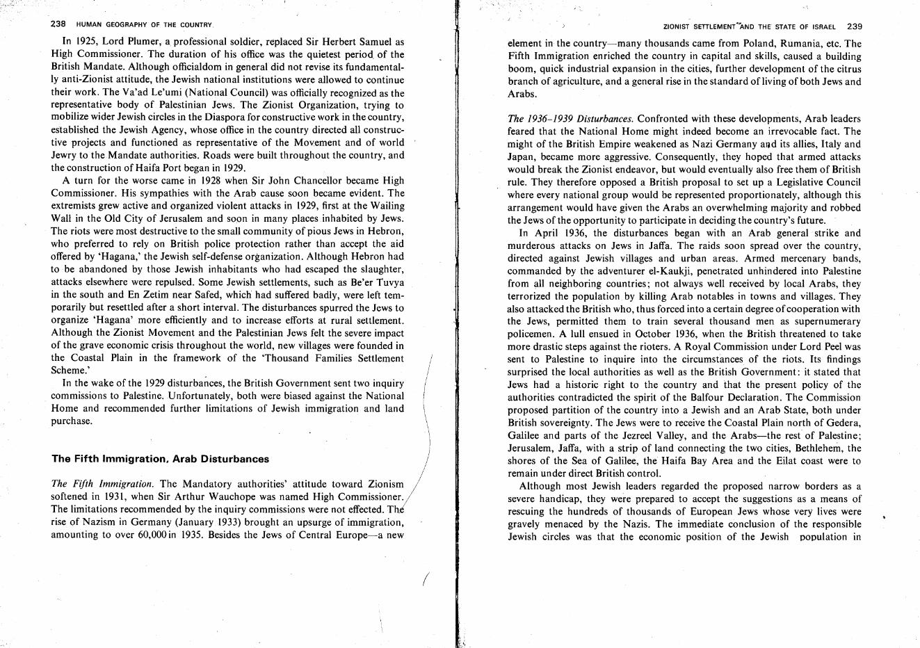
438 HUMAN GEOGRAPHY OF THE COUNTRY
In 1925, Lord Plumer, a.professional soldier, replaced Sir Herbert Samuel asHigh Commissioner. The duration of his office was the quietest period. of theBritish Mandate. Although officialdom in general did not revise its fundamentally anti-Zionist attitude, the Jewish national institutions were allowed to continuetheir work. The Va'ad Le'umi (National Council) was officially recognized as therepresentative body of Palestinian Jews. The Zionist Organization, trying tomobilize wider Jewish circles in the Diaspora for constructive work in the country,established the Jewish Agency, whose office in the country directed all constructive projects and functioned as representative of the Movement and of worldJewry to the Mandate authorities. Roads were built throughout the country, andthe construction of Haifa Port began in 1929.
A turn for the worse came in 1928 when Sir John Chancellor became HighCommissioner. His sympathies with the Arab cause soon became evident. Theextremists grew active and organized violent attacks in 1929, first at the WailingWall in the Old City of Jerusalem and soon in many places inhabited by Jews.The riots were most destructive to the small community of pious Jews in Hebron,who preferred to rely on British police protection rather than accept the aidoffered by 'Hagana,' the Jewish self-defense organization. Although Hebron hadto be abandoned by those Jewish inhabitants who had escaped the slaughter,attacks elsewhere were repulsed. Some Jewish settlements, such as Be'er Tuvyain the south and En Zetim near Safed, which had suffered badly, were left temporarily but resettled after a short interval. The disturbances spurred the Jews toorganize 'Hagana' more efficiently and to increase efforts at rural settlement.Although the Zionist Movement and the Palestinian Jews felt the severe impactof the grave economic crisis throughout the world, new villages were founded inthe Coastal Plain in the framework of the 'Thousand Families SettlementScheme.'
In the wake of the 1929 disturbances, the British Government sent two inquiry. commissions to Palestine. Unfortunately, both were biased against the National
Home and recommended further limitations of Jewish immigration and landpurchase.
The Fifth Immigration, Arab Disturbances
The Fifth Immigration. The Mandatory authorities' attitude toward Zionismsoftened in 1931, when Sir Arthur Wauchope was named High Commissioner.The limitations recommended by the inquiry commissions were not effected. Thrise of Nazism in Germany (January 1933) brought an upsurge of immigration,amounting to over 60,000 in 1935. Besides the Jews of Central Europe-a new
(
.ZIONIST SETTLEMENT"AND THE STATE OF ISRAEL 239
element in the country-many thousands came from Poland, Rumania, etc. TheFifth Immigration enriched the country in capital and skills, caused a buildingboom, quick industrial expansion in the cities, further development of the citrusbranch of agriculture, and a general rise in the standard of living of both Jews andArabs.
The 1936-1939 Disturbances. Confronted with these developments, Arab leadersfeared that the National Home might indeed become an irrevocable fact. Themight of the British Empire weakened as Nazi Germany and its allies, Italy andJapan, became more aggressive. Consequently, they hoped that armed attackswould break the Zionist endeavor, but would eventually also free them of Britishrule. They therefore opposed a British proposal to set up a Legislative Councilwhere every national group would be represented proportionately, although thisarrangement would have given the Arabs an overwhelming majority and robbedthe Jews of the opportunity to participate in deciding the country's future.
In April 1936, the disturbances began with an Arab general strike andmurderous attacks on Jews in Jaffa. The raids soon spread over the country,directed against Jewish villages and urban areas. Armed mercenary bands,commanded by the adventurer el-Kaukji, penetrated unhindered into Palestinefrom all neighboring countries; not always well received by local Arabs, theyterrorized the population by killing Arab notables in towns and villages. Theyalso attacked the British who, thus forced into a certain degree ofcooperation withthe Jews, permitted them to train several thousand men as supernumerarypolicemen. A lull ensued in October 1936, when the British threatened to takemore drastic steps against the rioters. A Royal Commission under Lord Peel wassent to Palestine to inquire into the circumstances of the riots. Its findingssurprised the local authorities as well as the British Government: it stated thatJews had a historic right to the country and that the present policy of theauthorities contradicted the spirit of the Balfour Declaration. The Commissionproposed partition of the country into a Jewish and an Arab State, both underBritish sovereignty. The Jews were to receive the Coastal Plain north of Gedera,Galilee and parts of the Jezreel Valley, and the Arabs-the rest of Palestine;Jerusalem, Jaffa, with a strip of land connecting the two cities, Bethlehem, theshores of the Sea of Galilee, the Haifa Bay Area and the Eilat coast were toremain under direct British controL
Although most Jewish leaders regarded the proposed narrow borders as asevere handicap, they were prepared to accept the suggestions as a means ofrescuing the hundreds of thousands of European Jews whose very lives weregravely menaced by the Nazis. The immediate conclusion of the responsibleJewish circles was that the economic position of the Jewish population in
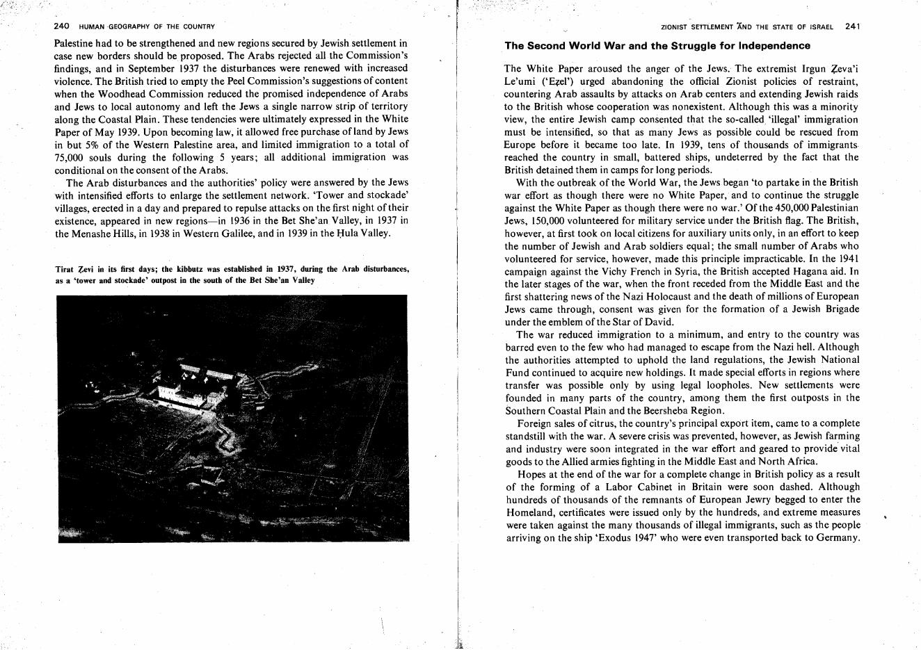
240 HUMAN -GEOGRAPHY OF THE COUNTRY
Palestine had to be strengthened and new regions secured by Jewish settlement incase new borders should be proposed. The Arabs rejected all the Commission'sfindings, and in September 1937 the disturbances were renewed with increasedviolence. The British tried to empty the Peel Commission's suggestions of contentwhen the Woodhead Commission reduced the promised independence of Arabsand Jews to local autonomy and left the Jews a single narrow strip of territoryalong the Coastal Plain. These tendencies were ultimately expressed in the WhitePaper of May 1939. Upon becoming law, it allowed free purchase of land by Jewsin but 5% of the Western Palestine area, and limited immigration to a total of75,000 souls during the following 5 years; all additional immigration wasconditional on the consent of the Arabs.
The Arab disturbances and the authorities' policy were answered by the Jewswith intensified efforts to enlarge the settlement network. 'Tower and stockade'villages, erected in a day and prepared to repulse attacks on the first night of theirexistence, appeared in new regions-in 1936 in the Bet She'anValley, in 1937 inthe Menashe Hills, in 1938 in Western Galilee, and in 1939in the Hula Valley.
Tirat ~evi in its first days; the kibbutz was established in 1937, during the Arab disturbances,as a 'tower and stockade' outpost in the south of the Bet She 'an Valley
ZIONIST SETIL.EMENT AND THE STATE OF ISRAEL 241
The Second World War and the Struggle for Independence
The White Paper aroused the anger of the Jews. The extremist Irgun Zeva'iLe'umi ('E?:el') urged abandoning the official Zionist policies of restraint,countering Arab assaults by attacks on Arab centers and extending Jewish raidsto the British whose cooperation was nonexistent. Although this was a minorityview, the entire Jewish camp consented that the so-called. 'illegal' immigrationmust be intensified, so that as many Jews as possible could be rescued fromEurope before it became too late. In 1939, tens of thousands of immigrantsreached the country in small, battered ships, undeterred by the fact that theBritish detained them in camps for long periods.
With the outbreak of the World War, the Jews began 'to partake in the Britishwar effort as though there were no White Paper, and to continue the struggleagainst the White Paper as though there were no war.' Of the 450,000 PalestinianJews, 150,000 volunteered for military service under the British flag. The British,however, at first took on local citizens for auxiliary units only, in an effort to keepthe number of Jewish and Arab soldiers equal; the small number of Arabs whovolunteered for service, however, made this principle impracticable. In the 1941campaign against the Vichy French in Syria, the British accepted Hagana aid. Inthe later stages of the war, when the front receded from the Middle East and thefirst shattering news of the Nazi Holocaust and the death of millions of EuropeanJews came through, consent was given for the formation of a Jewish Brigadeunder the emblem of the Star of David.
The war reduced immigration to a minimum, and entry to the country wasbarred even to the few who had managed to escape from the Nazi hell. Althoughthe authorities attempted to uphold the land regulations, the Jewish NationalFund continued to acquire new holdings. It made special efforts in regions wheretransfer was possible only by using legal loopholes. New settlements werefounded in many parts of the country, among them the first outposts in theSouthern Coastal Plain and the Beersheba Region.
Foreign sales of citrus, the country's principal export item, came to a completestandstill with the war. A severe crisis was prevented, however,as Jewish farmingand industry were soon integrated in the war effort and geared to provide vitalgoods to the Allied armies fighting in the Middle East and North Africa.
Hopes at the end of the war for a complete change in British policy as a resultof the forming of a Labor Cabinet in Britain were soon dashed. Althoughhundreds of thousands of the remnants of European Jewry begged to enter theHomeland, certificates were issued only by the hundreds, and extreme measureswere taken against the many thousands of illegal immigrants, such as the peoplearriving on the ship 'Exodus 1947' who were even transported back to Germany.
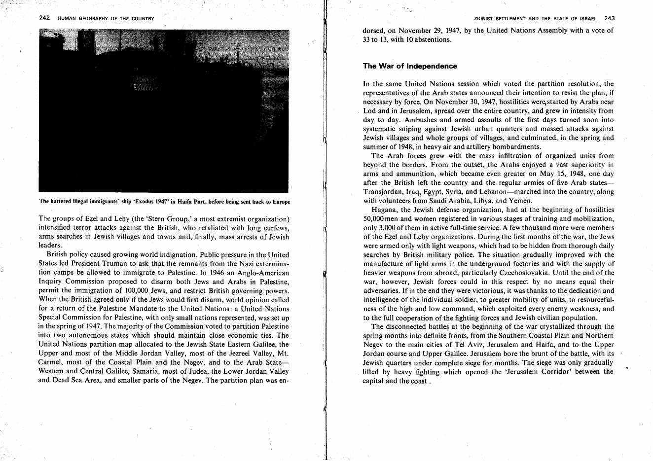
242 HUMAN GEOGRAPHY OF THE COUNTRY
The battered illegal immigrants' ship 'Exodus 1947' in Haifa Port, before being sent back to Europe
The groups of Ezel and Lehy (the 'Stern Group,' a most extremist organization)intensified terror attacks against the British, who retaliated with long curfews,arms searches in Jewish villages and towns and, finally, mass arrests of Jewishleaders.
British policy caused growing world indignation. Public pressure in the UnitedStates led President Truman to ask that the remnants from the Nazi extermination camps be allowed to immigrate to Palestine. In 1946 an Anglo-AmericanInquiry Commission proposed to disarm both Jews and Arabs in Palestine,permit the immigration of 100,000 Jews, and restrict British governing powers.When the British agreed only if the Jews would first disarm, world opinion calledfor a return of the Palestine Mandate to the United Nations : a United NationsSpecial Commission for Palestine, with only small nations represented, was set upin the spring of 1947.The majority of the Commission voted to partition Palestineinto two autonomous states which should maintain close economic ties. TheUnited Nations partition map allocated to the Jewish State Eastern Galilee, theUpper and most of the Middle Jordan Valley, most of the Jezreel Valley, Mt.Carmel, most of the Coastal Plain and the Negev, and to the Arab StateWestern and Central Galilee, Samaria, most of Judea, the Lower Jordan Valleyand Dead Sea Area, and smaller parts of the Negev. The partition plan was en-
, ,
,
ZIONIST SETILEMENT' AND THE STATE OF ISRAEL 243
dorsed, on November 29, 1947, by the United Nations Assembly with a vote of33 to 13, with 10 abstentions.
The War of Independence
In the same United Nations session which voted the partition resolution, -therepresentatives of the Arab states announced their intention to resist the plan, ifnecessary by force. On November 30, 1947, hostilities were.started by Arabs nearLod and in Jerusalem, spread over the entire country, and grew in intensity fromday to day. Ambushes and armed assaults of the first days turned soon intosystematic sniping against Jewish urban quarters and massed attacks againstJewish villages and whole groups of villages, and culminated, in the spring andsummer of 1948, in heavy air and artillery bombardments.
The Arab forces grew with the mass infiltration of organized units frombeyond the borders. From the outset, the Arabs enjoyed a vast superiority inarms and ammunition, which became even greater on May 15, 1948, one dayafter the British left the country and the regular armies of five Arab statesTransjordan, Iraq, Egypt, Syria, and 'Lebanon-marched into the country, alongwith volunteers from Saudi Arabia, Libya, and Yemen.
Hagana, the Jewish defense organization, had at the beginning of hostilities50,000 men and women registered in various stages of training and mobilization,only 3,000 of them in active full-time service. A few thousand more were membersof the Ezel and Lehy organizations. During the first months of the war, the Jewswere armed only with light weapons, which had to be hidden from thorough dailysearches by British military police. The situation gradually improved with themanufacture of light arms in the underground factories and with the supply ofheavier weapons from abroad, particularly Czechoslovakia. Until the end of thewar, however, Jewish forces could in this respect by no means equal theiradversaries. If in the end they were victorious, it was thanks to.the dedication andintelligence of the individual soldier, to greater mobility of units, to resourcefulness of the high and low command, which exploited every enemy weakness, andto the full cooperation of the fighting forces and Jewish civilian population.
The disconnected battles at the beginning of the war crystallized through thespring months into definite fronts, from the Southern Coastal Plain and NorthernNegev to the main cities of Tel Aviv, Jerusalem and Haifa, and to the UpperJordan course and Upper Galilee. Jerusalem bore the brunt of the battle, with itsJewish quarters under complete siege for months. The siege was only graduallylifted by heavy fighting which opened the 'Jerusalem Corridor' between thecapital and the coast.
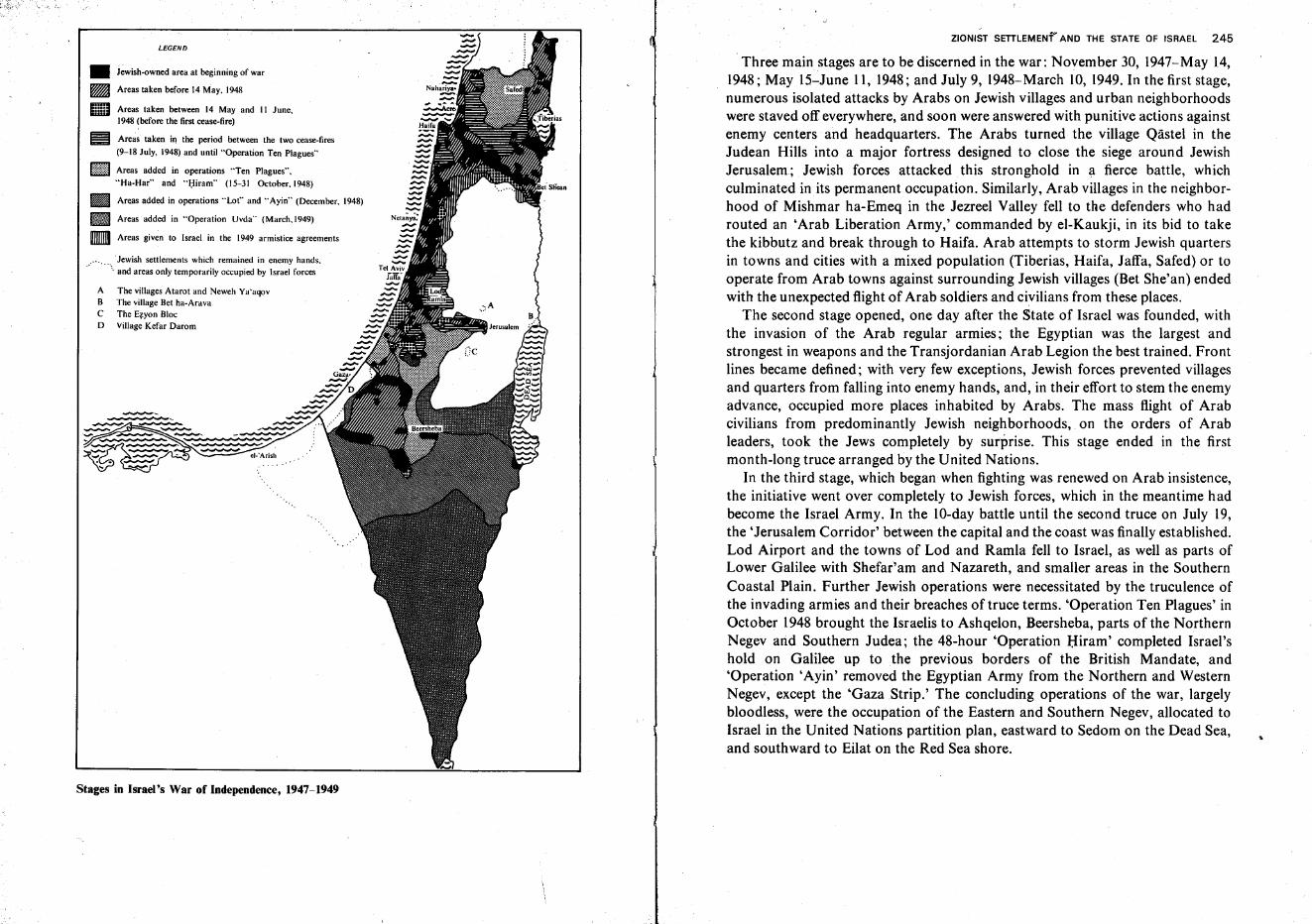
.Jewish settlements which remained in enemy hands.and areas only temporarily occupied by Israel forces
ZIONIST SETTLEMENf~ AND THE STATE OF ISRAEL 245
.Three main stages are to be discerned in the war: November 30, 1947-May 14,1948; May 15-June 11, 1948; and July 9, 1948-March 10, 1949. In the first stage,numerous isolated attacks by Arabs on Jewish villages and urban neighborhoodswere staved off everywhere, and soon were answered with punitive actions againstenemy centers and headquarters. The Arabs turned the village Qastel in theJudean Hills into a major fortress designed to close the siege around JewishJerusalem; Jewish forces attacked this stronghold in a fierce battle, whichculminated in its permanent occupation. Similarly, Arab villages in the neighborhood of Mishmar ha-Emeq in the Jezreel Valley fell to the defenders who hadrouted an 'Arab Liberation Army,' commanded by el-Kaukji, in its bid to takethe kibbutz and break through to Haifa. Arab attempts to storm Jewish quartersin towns and cities with a mixed population (Tiberias, Haifa, Jaffa, Safed) or tooperate from Arab towns against surrounding Jewish villages (Bet She'an) endedwith the unexpected flight of Arab soldiers and civilians from these places.
The second stage opened, one day after the State of Israel was founded, withthe invasion of the Arab regular armies; the Egyptian was the largest andstrongest in weapons and the Transjordanian Arab Legion the best trained. Frontlines became defined; with very few exceptions, Jewish forces prevented villagesand quarters from falling into enemy hands, and, in their effort to stem the enemyadvance, occupied more places inhabited by Arabs. The mass flight of Arabcivilians from predominantly Jewish neighborhoods, on the orders of Arableaders, took the Jews completely by surprise. This stage ended in the firstmonth-long truce arranged by the United Nations.
In the third stage, which began when fighting was renewed on Arab insistence,the initiative went over completely to Jewish forces, which in the meantime hadbecome the Israel Army. In the 1O-day battle until the second truce on July 19,the 'Jerusalem Corridor' between the capital and the coast was finally established.Lod Airport and the towns ofLod and Ramla fell to Israel, as well as parts ofLower Galilee with Shefar'am and Nazareth, and smaller areas in the SouthernCoastal Plain. Further Jewish operations were necessitated by the truculence ofthe invading armies and their breaches of truce terms. 'Operation Ten Plagues' inOctober 1948 brought the Israelis to Ashqelon, Beersheba, parts of the NorthernNegev and Southern Judea; the 48-hour 'Operation Hiram' completed Israel'shold on Galilee up to the previous borders of the British Mandate, and'Operation 'Ayin' removed the Egyptian Army from the Northern and WesternNegev, except the 'GazaStrip.' The concluding operations of the war, largelybloodless, were the occupation of the Eastern and Southern Negev, allocated toIsrael in the United Nations partition plan, eastward to Sedom on the Dead Sea,and southward to Eilat on the Red Sea shore.
-----.........--------...-.-Nah~.-
,..,.----...--..--,..,.-------Neta~~:-----,..,..--.......Tel Aviv.i:iffil~------......-.--......-.--::::::- .,:::
."...,... .....,,::;::' .::.-..
Gaza---.;
~D-------~ .....,
el·'Arish. '
LEGEND
A The villages Atarot and Neweh YaaqovB The village Bet ha-AravaC The Ezyon BlocD VillageKefar Darom
• Jewish-owned area at beginning of war
~ Areas taken before 14 May. 1948
I!iliI Areas taken between 14 May and II June,1948(before the first cease-fire)
~ Areas taken in the period between the two cease-fires(9-18 July. 1948)and until "Operation Ten Plagues"
mEl Areas added in operations "Ten Plagues"."Ha-Har" and "Hiram" (15-31 October. 1948)
• Areas added in operations "LoC and "Ayin" (December. 1948)
• Areas added in "Operation Uvda' (March.1949)
IIIIIIII Areas given to Israel in the 1949 armistice agreements
Stages in Israel's War of Independence, 1947-1949
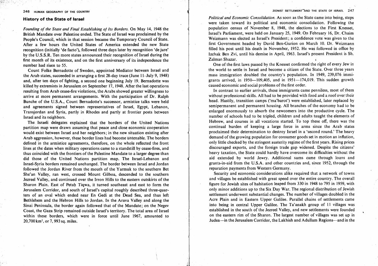
246 HUMAN GEOGRAPHY OF THE COUNTRY
History of the. State of Israel
Founding of the State and Final Establishing oj Its Borders. On May 14, 1948 theBritish Mandate over Palestine ended. The State of Israel was proclaimed by thePeople's Council, which in that session became the Temporary Council of State.After a few hours the United States of America extended the new Staterecognition (initially 'de facto'), followed three days later by recognition 'de jure'by the U.S.S.R. Ten more states announced their recognition of Israel during thefirst month of its existence, and on the first anniversary of its independence thenumber had risen to 55.
Count Folke Bernadotte of Sweden, appointed Mediator between Israel andthe Arab states, succeeded in arranging a first 28-day truce (June l l-July 9, 1948)and, after ten days of fighting, a second one beginning July 19. Bernadotte waskilled by extremists in Jerusalem on September 17, 1948.After the last operationsresulting from Arab cease-fire violations, the Arabs showed greater willingness toarrive at more permanent arrangements. With the participation of Dr. RalphBunche of the U.S.A., Count Bernadotte's successor, armistice talks were heldand agreements signed between representatives of Israel, Egypt, Lebanon,Transjordan and Syria, partly in Rhodes and partly at frontier posts betweenIsrael and its neighbors.
The. Israeli delegates explained that the borders of the United Nationspartition map were drawn assuming that peace and close economic cooperationwould exist between Israel and her neighbors; in the new situation existing afterArab aggression, however, these border lines had become untenable. The bordersdefined in the armistice agreements, therefore, on the whole reflected the frontlines at the dates when military operations came to a standstill by cease-fires, andthus coincided with the frontiers of the Palestine Mandate to a larger degree thandid those of the United Nations partition map. The Israel-Lebanon andIsrael-Syria borders remained unchanged. The border between Israel and Jordanfollowed the Jordan River from the mouth of the Yarmuk to the southern BetShe'an Valley, ran west, crossed Mount Gilboa, descended to the southernJezreel Valley, and continued over the Irron Hills to the eastern outskirts of theSharon Plain. East of Petal) Tiqwa, it turned southeast and east to form theJerusalem Corridor, and south of Israel's capital roughly described three-quarters of an oval which ended near En Gedi at the Dead Sea, and thus leftBethlehem and the Hebron Hills to Jordan. In the Arava Valley and along theSinai Peninsula, the border again followed that of the Mandate; on the NegevCoast, the Gaza Strip remained outside Israel's territory. The total area of Israelwithin these borders, which were in force until June 1967, amounted to20,700km-, or 7,993 sq. miles.
ZIONIST SETTLEMENT"AND THE STATE OF ISRAEL 247
Political and Economic Consolidation. As soon as the State came into being, stepswere taken toward its political and economic consolidation. Following thepopulation census of November 8, 1948, the elections to the First Knesset,Israel's Parliament, were held on January 25, 1949. On February 16, Dr. ChaimWeizmann was elected as Israel's President; a confidence vote was given to thefirst Government headed by David Ben-Gurion on March 10. Dr. Weizmannfilled his post until his death in November, 1952. He was followed in office byIzchak Ben Zvi, until his demise in April, 1963. Israel's present President is Sh.Zalman Shazar.
One of the first laws passed by the Knesset confirmed the right of every Jew inthe world to settle in Israel and become a citizen of the State. Over three yearsmass immigration doubled the country's population. In 1949, 239,076 immigrants arrived, in 1950-109,405, and in 1951-174,019. This sudden growthcaused economic and social problems of the first order.
In contrast to earlier arrivals, these immigrants came penniless, most of themwithout professional skills. All had to be provided with food and a roof over theirhead. Hastily, transition camps ('ma'barot') were established, later replaced bysemipermanent and permanent housing. All branches of the economy had to beenlarged enormously to absorb the newcomers into the productive cycle. Thenumber of schools had to be tripled, children and adults taught the elements ofHebrew, and courses in all vocations started. To top these off, there was thecontinual burden of keeping a large force in arms since the Arab statesproclaimed their determination to destroy Israel in a 'second round.' The heavydemand of the growing population for consumer goods set in motion an inflation,only little checked by the stringent austerity regime of the first years. Rising pricesdiscouraged exports, and the foreign trade gap widened. Despite the citizens'heavy taxation, the State could hardly have overcome its difficulties without theaid extended by world Jewry. Additional sums came through loans andgrants-in-aid from the U.S.A. and other countries and, since 1952, through thereparation payments from Western Germany.
Security and economic considerations alike required that a network of townsand villages be established with great speed over the entire country. The overallfigure for Jewish sites of habitation leaped from 330 in 1948 to 795 in 1959, withonly minor additions up to the Six Day War. The regional distribution of Jewishsettlement underwent substantial changes. The number of villages doubled in theAcre Plain and in Eastern Upper Galilee. Parallel chains of settlements cameinto being in central Upper Galilee. The Ta'anakh group of 11 villages wasestablished in the south of the Jezreel Valley, and new settlements were foundedon the eastern rim of the Sharon. The largest number of villages was set up inJudea-in the Jerusalem Corridor, the Lakhish and Adullam Regions-and in the
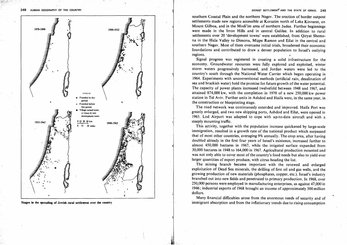
248 HUMAN GEOGRAPHY OF THE COUNTRY ZIONIST SETILEMENf' AND THE STATE OF ISRAEL 249
southern Coastal Plain and the northern Negev. The erection of border outpostsettlements made new regions accessible at Korazim north of Lake Kinneret, onMount Gilboa, and in the Modi'im area of northern Judea. Further beginningswere made in the Irron Hills and in central Galilee. In addition to ruralsettlements over20 'development towns' were established, from Qiryat Shemona in the Hula Valley to Dimona, Mizpe Ramon and Eilat in the central andsouthern Negev. Most of them overcame initial trials, broadened their economicfoundations and contributed to draw a denser population to Israel's outlyingregions.
Signal progress was registered in creating a solid infrastructure for theeconomy. Groundwater resources were fully explored and exploited, winterstorm waters progressively harnessed, and Jordan waters were led to thecountry's south through the National Water Carrier which began operating in1964. Experiments with unconventional methods (artificial rain, desalination ofsea and brackish water) hold the promise for future growth of the water potential.The capacity of power plants increased twelvefold between 1948 and 1967, andattained 874,000 kw, with the completion in 1970 of a new 250,000 kw powerstation in Tel Aviv. Further units in Ashdod and Haifa were, in the same year, inthe construction or blueprinting stage.
The road network was continuously extended and improved. Haifa Port wasgreatly enlarged, and two new shipping ports, Ashdod and Eilat, were opened in1965. Lod Airport was adapted to cope with up-to-date aircraft and with asteeply mounting traffic.
This activity, together with the population increase quickened by large-scaleimmigration, resulted in a growth rate of the national product which surpassedthat of most other countries, averaging 9% annually. The crop area, after havingdoubled already in the first four years of Israel's existence, increased further toalmost 450,000 hectares in 1967, while the irrigated surface expanded from30,000 hectares in 1948 to 164,000 in 1967. Agricultural production mounted andwas not only able to cover most of the country's food needs but also to yield everlarger quantities of export produce, with citrus heading the list.
The mining branch became important with the renewed and enlargedexploitation of Dead Sea minerals, the drilling of first oil and gas wells, and thegrowing production of new materials (phosphates, copper, etc.). Israel's industrybranched out into new fields and.penetrated to primary production. In 1968,over250,000 persons were employed in manufacturing enterprises, as against 47,000 in1946; industrial exports of 1968 brought an income of approximately 500 milliondollars.
Many financial difficulties arose from the enormous needs of security and ofimmigrant absorption and from the inflationary trends due to rising consumption
b
\\
I.Hi!:..".\"D
0102030km...............o 10 20 miles
• Founded in thisperiod
• Founded beforethis period
• Village turned town.or (map d) newdevelopment town
a
..
....
1870-1899
\ . . ..\ .. .\
\c d
'\
\
\
Stages in the spreading of Jewish rural settlement over the country
HISTORICAL PERIODS AND EVENTS IN THE LAND OF ISRAEL
*Described in detail in the chapters dealing with the Administered Areas, pp. 359-431.
ZIONIsT SETTLEMENr AND THE STA~E OF ISRAEL 251
signed an agreement on full military cooperation with Egypt. Israel's annihilationwas openly proclaimed as the policy ofthe Arab nations. These developments triggered off the Six Day War (June 5-10, 1967)* which ended in Israel's completevictory and with cease-fire lines fixed along the Suez Canal, the Jordan River andthe eastern rim of the Golan Plateau.
Israel's hope for peace was soon dashed and its offer of direct open talksrejected when the Arab summit conference at Khartoum decided on 'no peace, nonegotiations and no recognition of Israel.' This stand stymied the moves madewithin and without the UN framework to promote Middle East peace. Theterrorist groups, actively backed by the Arab states, failed in arousing thepopulation of the administered regions to revolt, and their numerous intrusionsinto Israel, as well as the frequent artillery attacks of Arab regular armies alongthe cease-fire lines, had much graver consequences for themselves than for Israel.
Israel, on the other hand, entered a new phase of accelerated economic andsocial progress, with production, exports, tourism, etc., greatly expanding,demand for labor taking the place of unemployment, immigration picking up,and research and cultural activities being intensified. All these contributed toreinforce the country's political and military resilience.
250 HUMAN GEOGRAPHY OF THE COUNTRY
and an imbalance between imports and exports. In spite of all these, Israelmanaged toarrive, in the mid-'sixties, at relative monetary stability. After adevaluation in 1962, and a smaller one following on that of Sterling in 1967,Israel's currency has gained a sound international standing.
Israel was compelled to be constantly on its guard in its relations with the Arabcountries of the region. With the murder of King Abdallah in Jordan (1951) andthe seizure of power in Egypt by Gamal Abdul Nasser, hopes for a gradualnormalization dwindled. The abundant supply of arms by Eastern Bloc countriesencouraged Egypt and other Arab states to start a campaign of sabotage againstIsrael with army-trained infiltrator gangs. As Syria, Jordan and Egypt organizeda unified command for their armies and worked out the details of a concertedattack on Israel, the imminent danger was averted by the Sinai Campaign(October 29-November 3, 1956). Israel seized the entire Sinai Peninsula and theGaza Strip, dismantled all offensive enemy installations and put the Egyptianarmy out of action. Acceding to a United Nations request, Israel evacuated theterritory, completing the withdrawal from the Gaza Strip on March 8, 1957.
The principal achievements of the campaign were almost a decade of relativequiet on the borders and the opening of the vital shipping lane from Eilat to Asiaand Africa, when United Nations guards were posted near the Tiran Straits. Thisled to the laying of the first oil pipeline between Eilat and Haifa and thedevelopment of new Negev centers. Trade contacts were established with manynew countries in Asia and Africa which, to an increasing degree, enjoyed Israel'stechnical aid. Foreign investments were attracted by Israel enterprises. Thequickened pace of economic progress also brought a new surge in immigrationwhich lasted until the early. 1960's. In 1965, however, the slackening ofpopulation growth necessitated measures to restrain the inflationary economyand contain the increase in consumption.
The Arabs, fully backed by Soviet policy, stepped up aggression anew, firstcondemning Israel's peaceful project for the country-wide Water Carrier,although Israel was careful not to infringe on the rights of the two other riverinestates, Syria and Jordan, to the Jordan and Yarmuk waters. Their constantthreats and preparations for diverting the Jordan headwaters from Israel werefollowed by ever more frequent terrorist incursions into Israel territory. In May,1967, Nasser demanded the withdrawal of the United Nations' troops from theTiran Straits, a request immediately complied with by the evacuation of all UNpersonnel from the entire Sinai Peninsula and the Gaza Strip. Simultaneously, anEgyptian force of 100,000 was posted in Sinai in proximity to the Israel border,and Nasser declared the Tiran Straits closed to Israel shipping, boasting therebyto having thus reduced Israel to its pre-1956 position and promising to restore thepre-1948 situation, i.e., cessation of Israel's very existence. The Jordanian King
Period
PREHISTORYPALEOLITHIC
Lower
Middle
Upper
MESOLITHIC
Years(duration)
B.C.E.
c.500,000100,000
c. 100,00025,000
c.25,00012,500
c. 12,5008500
Conditions, cultures and events in the country
Climate warmer and moister than at present. Primitiveman living in the open. Hunting and gathering thesources of livelihood. Rough hand axes and adzes.Fire in man's service.
Climate moister than at present. Man living in caves.Gathering, hunting, Variegation of stone tools, Slingstones.
Climate drier. Man living in caves. Stone arrowheads,flaked tools, scrapers. Net fishing. Cult of hunting.
Climate resembling the present. Man living in caves.Gathering, improved hunting techniques. Bow andarrow. Stone saws, sickles. First domestication ofanimals. First steps in artistic creation.
252 HUMAN GE0GRAPHY OF THE COUNTRY
HISTORICAL PERIODS AND EVENTS IN THE LAND OF ISRAEL
ZIONIST SETTLEMENT' AND THE STATE OF ISRAEL 253
HISTORICAL PERIODS AND EVENTS IN THE LAND OF ISRAEL
Period
NEOLITHIC
CHALCOLITHIC
HISTORYBRONZE
Early
Middle
Late
IRON
Early
Years(duration)
c. 85004500
c.45003100
3100-12003100-2100
2100-1546
1546-1200
1200-5861200-930
Conditions, cultures and events in the country
Field crops and gardening. Herding sheep. Grindingstones, digging sticks. First clay tools. Huts, partlysubterranean. Fertility cult. Jericho first town.
Agriculture. Grain storage in bins and subterraneancavities. Round or quadrangular brick houses. Potterydeveloped. First use of copper tools. Trade develops.Arts of drawing, painting, sculpturing. Burying of deadin dolmens and sarcophagi.
Use of bronze, copper. Fortification of towns. Beginningof writing. Social organization, and developing politicalregimes. The country called 'Amurru' by the AccadianEmpire. West-Semitic seafarers' cities on the coast. TheKing's Road in Transjordan.
The Middle Kingdom of Egypt rules Over Palestine('Rthenu'), 2000-1780. Its cities mentioned in theEgyptian 'execration tablets.' Invasions of the Hyksosand their rule over Egypt (1780-1546). The Habiru makeinroads into the country. The Hebrew Patriarchs.
The New Kingdom in Egypt, the Hittite Empire in AsiaMinor. The el 'Amarna Letters (1387-1366). ContinuedHabiru invasions of the country. Rule of PharaohSethi I (1318-1299), who campaigns in Palestine andtakes Bet She'an. Pharaoh Ramses II (1299-1232) warsin Palestine and Syria, reaches Orontes River.
The tribes of Israel enter the country (1200). Shortlyafterward, Philistines and the 'Peoples of the Sea' arrivein the Coastal Plain. Period of the Judges (until 1020).Saul throws off the Philistine yoke, becomes king (10201000). Simultaneous decline of the empires of Egypt,Assyria and the Hittites. Reign of David (1000-960).Jerusalem becomes capital of Kingdom of Israel. Reignof Solomon (960-930). Kingdom of Israel at peak of itsflower, politically and economically. Toward end ofSolomon's reign renewed ascent of Egypt.
Period
Middle and Late
PERSIAN
HELLENISTIC
Years(duration)
930-586
586-332
332-63
Conditions, cultures and events in the country
Partition into Kingdoms of Israel and Judah. The kingsJeroboam ofI.srael and Rehoboam of Judah (930-881).Dynasty of Omri in Israel. King Ahab (873-853). TheProphet Elijah. Dynasty of Jehu in Israel. Joash King ofJudah (836-797). Prosperity ef Israel under Jeroboam II(793-752) and of Judah under Uziyah. The ProphetAmos. Toward end of epoch Assyria, strengthenedanew, vanquishes the Aramites, takes Galilee fromIsrael. Fall of Shomron and end of Northern Kingdom(722). The Prophet Isaiah.Last period of flower in Judah under King Josiah. ThePentateuch becomes foundation of the Kingdom'slegislature. Fall of Assyria, ascent of Babylon. IncreasingBabylonian pressure on Judah. Destruction of FirstTemple and Babylonian captivity (586).
Prophet Ezekiel in Babylon. Persian conquest. KingCyrus' decree and beginning of First Return and construction of Second Temple (538). Second wave ofimmigrants from Babylonia (457-420). The Scribes, Ezra andNehemiah. Construction of walls of Jerusalem.
Conquest of Palestine by Alexander the Great (332).Partition of his empire by the Diadoches (323). Palestineunder the Ptolemies (301-200). Frequent wars betweenPtolemies and Seleucids. Antiochus the Great conquersPalestine for the Seleucids (200). Oppression of the Jewsand their religion under Antiochus Epiphanes. TheMaccabean revolt (167). Judah the Maccabee falls inthe battle of El'asa (161). Jonathan (161-142) achievesindependence for Jewish State. Simon (142-135) takesJaffa and 'opens a window to the sea.'The Hasmonean Kingdom. John Hyrcanus (135-104)occupies the Edomite lands of Southern Judea, andSamaria. Judah Aristobulos (104-103) completes theconquest of Galilee. Alexander Jannaeus (102-79) addsmost of the Coastal Plain and Transjordan, bringskingdom to its peak.Queen Salome Alexandra (Shelomzion, 79-69) makespeace with the Pharisees. Quarrels between her sons
254 HUMAN GEOGRAPHY OF THE COUNTCY
HISTORICAL PERIODS AND EVENTS IN THE LAND OF ISRAEL
ZIONIST SEnLEME~l AND THE STATE OF ISRAEL 255
HISTORICAL PERIODS AND EVENTS IN THE LAND OF ISRAEL
Period Years(duration)
Conditions, cultures and events in the country
Hyrcanus and Aristobulos engender the campaign ofPompey and the end of the Kingdom (63).
PeriodYears
(duration)Conditions, cultures and events in the country
Mamelukes under Beybars reduce Crusader strongholds. The fall of Acre seals the Crusader epoch.
ROMAN
BYZANTINE
ARAB
CRUSADER
63-4 B.C.E. Pompey takes most of Judea's conquests. Hyrcanusbecomes 'President of the People,' while Antipater as'tutor' holds real power. Julius Caesar returns Jaffa toJudea (47). Kingdom of Herod the Great (47-4).
6-379 C.E. The Roman Protectorate (6-41). Life of Jesus. KingAgrippa I (41-44). The Great Revolt against Rome(63-73). Surrender of Yodefat (67). Destruction ofJerusalem and Second Temple (71). Fall of MassadaFortress (73).The Law School and the Sanhedrin opened by YohananBen-Zakkay in Yavneh. The Bar Kokhba revolt (133135) ends with the fall of Bethar. Spread of Christianity.Persecutions by Emperor Hadrian. Jerusalem becomesAelia Capitolina. The Sanhedrin transferred to Galilee(140 to Usha and Bet She'arim, 165 to Zippori, 230-429in Tiberias). Respite for Jews under Emperor SeptimiusSeverus (193-235). The Mishna concluded. Renewedreprisals against Jews after Christianity has becomestate religion in Rome. Short respite under EmperorJulian (360-363).
379-640 Prosperity in the country, but Jews persecuted. Persianinvasion (614-629) ended by victory of Emperor Heraclius. Moslem conquest of the country (629-640).
640-1099 The Omayyad Dynasty (661-807) shows, in the beginning, tolerance toward Christians and Jews and seeksto maintain prosperity, but later oppresses minoritiesand neglects the country. Under the Abasside Dynasty(807-969) gradual worsening of the situation. Under theFatimides (969-1091) internal wars, invasions of Mongols, Carmathians. Earthquakes and epidemics.
1099-1291 Conquest of Jerusalem under King Baldwin I. Crusaderrule gathers strength and expands until 1153, but laterdeclines. After Saladdin's victory near the Horns ofHittin (1187), only Tyre remains in Crusader hands.From 1192, renewed expansion of Crusader rule overmost parts of the country, but from 1244 onward, the
MAMELUKE
TURKISH
BRITISH MANDATE
1291-1517
1517-1918
1918-1948
Impoverishment of local population, worsening securitysituation. Growing immigration of Jews, particularlyafter expulsion from Spai~ in 1492.
Selim I (1512-1520) conquers Jerusalem, Suleyman theMagnificent (1520-1566) builds its walls. The JewishZhahr el 'Amr fights the Turks (1740). Governor Ahmedcommunity of Safed attains peak of prosperity. In early17th century security conditions worsen. The Druzeruler Fakhr e-Din (1650). The Bedouin Governoral-Jazzar (1775-1804) rules most of the country, buildsAcre. Napoleon's Near East campaign fails against wallsof Acre (1799). Population depleted and impoverished.Mehemet Ali, ruler of Egypt (1831-1840), makes himself master of Palestine; his governor, Ibrahim Pasha,aids the country's progress, settles Egyptian peasants.'Capitulation rights' of European powers in the country.Founding of Miqwe Israel agricultural school in 1870.Beginning of Zionist development in 1882. Arrival of'Bilu' immigrants in the country. Aid of Baron E. deRothschild. After temporary slackening, immigrationrenewed in 1890. The First Zionist Congress (1897).1899-1914, the Second Immigration. ICA (Jewish Colonization Association) sets up more villages. The Palestine Office of the Zionist Organization opened in Jaffa(1908). Defence organization 'Hashomer' formed.Yemenite immigration. Tel Aviv (1909) and Deganiya(1910) founded. In 1914, 85,000 Jews in the country,but their number declines to 56,000 in 1918. BalfourDeclaration (2 November 1917).Occupation of south and Jerusalem in 1917, center andnorth in 1918 by British army under Gen. Allenby.
1918-1920 military rule of the British. Sir HerbertSamuel first High Commissioner (1920-1925). TheThird Immigration. Defense of Tel Hay and death ofJoseph Trumpeldor (1920). The British Mandate, confirmed by League of Nations (1923).The Fourth Immigration (1924-1926). Lord PlumerHigh Commissioner (1925-1928). Economic crisis
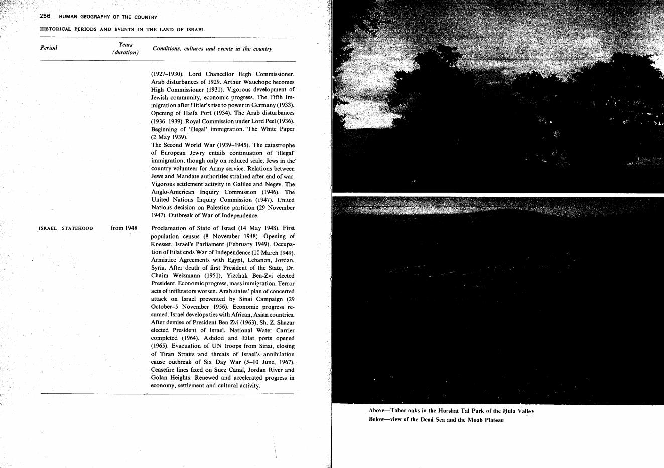
HISTORICAL ~ERIODS AND EVENTS IN THE LAND OF ISRAEL
HUMAN GEOGRAPHY OF THE COUNTRY
Conditions, cultures and events in the country
(1927-1930). Lord Chancellor High Commissioner.Arab disturbances of 1929. Arthur Wauchope becomesHigh Commissioner (1931). Vigorous development ofJewish community, economic progress. The Fifth Immigration after Hitler's rise to power in Germany (1933).Opening of Haifa Port (1934). The Arab disturbances(1936-1939). Royal Commission under Lord Peel (1936).Beginning of 'illegal' immigration.' The White Paper(2 May 1939).The Second World War (1939-1945). The catastropheof European Jewry entails continuation of 'illegal'immigration, though only on reduced scale. Jews in thecountry volunteer for Army service. Relations betweenJews and Mandate authorities strained after end of war.Vigorous settlement activity in Galilee and Negev. TheAnglo-American Inquiry Commission (1946). TheUnited Nations Inquiry Commission (1947). UnitedNations decision on Palestine partition (29 November1947). Outbreak of War ofIndependence.
Proclamation of State of Israel (14 May 1948). Firstpopulation census (8 November 1948). Opening ofKnesset, Israel's Parliament (February 1949). Occupation of Eilat ends War oflndependence (10 March 1949).Armistice Agreements with Egypt, Lebanon, Jordan,Syria. After death of first President of the State, Dr.Chaim Weizmann (1951), Yizchak Ben-Zvi electedPresident. Economic progress, mass immigration. Terroracts of infiltrators worsen. Arab states' plan of concertedattack on Israel prevented by Sinai Campaign (29October-5 November 1956). Economic progress resumed. Israel develops ties with African, Asian countries.After demise of President Ben Zvi (1963), Sh. Z. Shazarelected President of Israel. National Water Carriercompleted (1964). Ashdod and Eilat ports opened(1965). Evacuation of UN troops from Sinai, closingof Tiran Straits and threats of Israel's annihilationcause outbreak of Six Day War (5-10 June, 1967).Ceasefire lines fixed on Suez Canal, Jordan River andGolan Heights. Renewed and accelerated progress ineconomy, settlement and cultural activity.
Years(duration)
from 1948
Period
ISRAEL STATEHOOD
Above-Tabor oaks in the Hurshat Tal Park of the Hula Valley
Below-view of the Dead Sea and the Moab Plateau
Coral fauna in the Eilat Gulf waters Installations of the Timna Copper Works
Modern tourist hotel in Tiberias Ruins of the Crusader fortress Montfort, in the Keziv Gorge of Upper Galilee
Damascus Gate and Christian Quarter of Jerusalem's Old City Intensive farming of export crops in the Arava Valley
Above-Galilean landscape
Below-view from Rabbi Me'ir Ba'al ha-Nes sanctuary across Lake Kinneret
Demography*
The Population, from Ancient Times to the 19th Century. The Bible tells ofrepeated attempts to count the population, whether for allocating land to thetribes, taxation, or levying an army. The figures given in the Bible are, however,.rough estimates. Scholars try to deduce from such a passage (2 Samuel, XXIV)that the inhabitants of King David's realm toward the end of his reign numberedapproximately 5 million, in an area including, besides almost all of Palestine andTransjordan, parts of Syria and the Sinai Peninsula.
The great Jewish historian of antiquity, Josephus Flavius, sets the number ofthe country's inhabitants at the beginning of the Second Temple period atapproximately 3 million.
Between the destruction of the Second Temple and the 19th century, evenestimates are unavailable. It may be safely assumed, however, that underByzantine rule, i.e., between the 4th and 6th century C.E., population densityreached the maximum, then decreased gradually until the 17th and 18th century.
A turning point was reached in the early 19th 'century when, under the shortreign of Mehemet Ali's governor, Ibrahim Pasha (1832-1840), the countryabsorbed many Moslem immigrants from Egypt. However, information aboutpopulation movement in this country is extremely meager until the very end ofTurkish rule.
Population Censuses. The first census ever undertaken, even though on a verylimited scale, was that carried out during World War I by the Palestine Office ofthe Zionist Organization. Relating to the Jewish community only, it aimedprincipally at following the social and vocational changes since the first Zionistimmigration in 1882.
*" All tables and most data in this chapter aretaken from Statistical Abstract of Israel, No. 21,1970, published by the Central Bureau of Statistics.
257
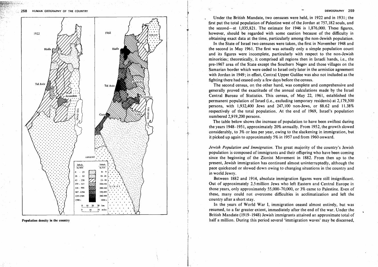
HUMAN GEOGRAPHY OF THE COUNTRY
Jewish Population and Immigration. The great majority of the country's Jewishpopulation is composed of immigrants and their offspring who have been comingsince the beginning of the Zionist Movement in 1882. From then up to thepresent, Jewish immigration has continued almost uninterruptedly, although thepace quickened or slowed down owing to changing situations in the country andin world Jewry.
Between 1882 and 1914, absolute immigration figures were still insignificant.Out of approximately 2.5 million Jews who left Eastern and Central Europe inthose years, only approximately 55,000-70,000, or 3% came to Palestine. Even ofthese, many could not overcome difficulties in acclimatization and left thecountry after a short stay.
In the years of World War I, immigration ceased almost entirely, but wasresumed, to a far greater extent, immediately after the end of the war. Under theBritish Mandate (1919-1948) Jewish immigrants attained an approximate total ofhalf a million. During this period several 'immigration waves' may be discerned,
DEMOGRAPHY 259
Under the British Mandate, two censuses were held, in 1922 and in 1931; thefirst put the total population of Palestine west of the Jordan at 757,182 souls, andthe second-at 1,035,821. The estimate for 1946 is 1,876,000. These figures,however ,should be regarded with some caution because of the difficulty inobtaining exact data at the time, particularly among the non-Jewish population.
In the State of Israel two censuses were taken, the first in November 1948 andthe second in May 1961. The first was actually only a simple population countand its figures were incomplete, particularly with respect to the non-Jewishminorities; theoretically, it comprised all regions then in Israeli hands, i.e., thepre-1967 area of the State except the Southern Negev and those villages on theSamarian border which were ceded to Israel only later in the armistice agreementwith Jordan in 1949; in effect, Central Upper Galilee was also not included as thefighting there had ceased only a few days before the census.
The second census, 0'1 the other hand, was complete and comprehensive andgenerally proved the exactitude of the annual calculations made by the IsraelCentral Bureau of Statistics. This census, of May 22, 1961, established thepermanent population of Israel (i.e., excluding temporary residents) at 2,179,500persons, with 1,932,400 Jews and 247,100 non-Jews, or 88.62 and 11.38%respectively of the total population. At the end of 1969, Israel's populationnumbered 2,919,200 persons.
The table below shows the increase of population to have been swiftest duringthe years 1948-1951, approximately 20% annually. From 1952, the growth slowedconsiderably, to 3% or less per year, owing to the slackening in immigration, butit picked up again to approximately 5% in 1957and from 1960onward.
1968
2590+
907 -1294
63 - 258
259 - 517
518 - 906
1295-2589
.. "..
~~ 'WON:··:S\:.;::\;j:~~;:;.1~~:1: ':': '.: ... <.:..:.:>..• ::~ ..
SINAI . '" ..200-349 • '. ' •••• : .:.....: -: :.-.::
350.-499 • • • • • ':::: :: ..... -.
500-999
1000+ • • • • • • ':'-:':'.':';.............. " ..o 10 20 30 km •••••• ::.:.:
10 20 miles I· .. .. .. .. • .. :i.<::... , .. .. .. .. .'.. .. .. .. .. .. ..
1922
Population density in the country
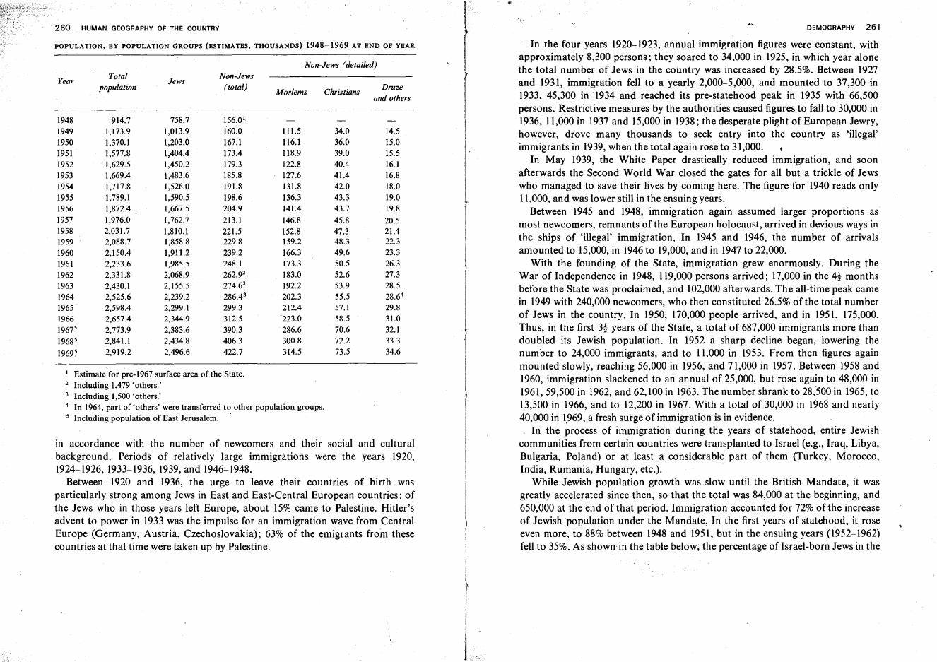
260 . HUMAN GEOGRAPHY OF THE COUNTRY
POPULATION, BY POPULATION GROUPS (ESTIMATES, THOUSANDS) 1948-1969 AT END OF YEAR
Non-Jews (detailed)Total Non-Jews
fYear
populationJews
(total)Moslems Christians
Druzeand others
1948 914.7 758.7 156.01
1949 1,173.9 1,013.9 i60.0 111.5 34.0 14.5 I1950 1,370.1 1,203.0 167.1 116.1 36.0 15.01951 1,577.8 1,404.4 173.4 118.9 39.0 15.51952 1,629.5 1,450.2 179.3 122.8 40.4 16.11953 1,669.4 1,483.6 185.8 127.6 41.4 16.81954 1,717.8 1,526.0 191.8 131.8 42.0 18.01955 1,789.1 1,590.5 198.6 136.3 43.3 19.01956 1,872.4 1,667.5 204.9 141.4 43.7 19.81957 1,976.0 1,762.7 213.1 146.8 45.8 20.51958 2,031.7 1,810.1 221.5 152.8 47.3 21.41959 2,088.7 1,858.8 229.8 159.2 4lU 22.3
1960 2,150.4 1,911.2 239.2 166.3 49.6 23.31961 2,233.6 1,985.5 248.1 173.3 50.5 26.31962 2,331.8 2,068.9 262.92 183.0 52.6 27.31963 2,430.1 2,155.5 274.63 192.2 53.9 28.51964 2,525.6 2,239.2 286.43 202.3 55.5 28.64
1965 2,598.4 2,299.1 299.3 212.4 57.1 29.81966 2,657.4 2,344.9 312:5 "223.0 58.5 31.019675 2,773.9 2,383.6 390.3 286.6 70.6 32.1
19685 2,841.1 2,434.8 406.3 300.8 72.2 33.3
19695 2,919.2 2,496.6 422.7 314.5 73.5 34.6
1 Estimate for pre-1967 surface area of the State.2 Including 1,479 'others.'3 Including 1,500 'others.'4 In 1964, part of 'others' were transferred to other population groups.5 Including population of East Jerusalem. .
in accordance with the number of newcomers and their social and culturalbackground. Periods of relatively large immigrations were the years 1920,1924-1926, 1933-1936, 1939, and 1946-1948.
Between 1920 and 1936, the urge to leave their countries of birth wasparticularly strong among Jews in East and East-Central European countries; ofthe Jews who in those years left Europe, about 15% came to Palestine. Hitler'sadvent to power in 1933 was the impulse for an immigration wave from CentralEurope (Germany, Austria, Czechoslovakia); 63% of the emigrants from thesecountries at that time were taken up by Palestine.
DEMOGRAPHY 261
In the four years 1920-1923, annual immigration figures were constant, withapproximately 8,300 persons; they soared to 34,000 in 1925, in which year alonethe total number of Jews in the country was increased by 28.5%. Between 1927and 1931, immigration fell to a yearly 2,000-5,000, and mounted to 37,300 in1933, 45,300 in 1934 and reached its pre-statehood peak in 1935 with 66,500persons. Restrictive measures by the authorities caused figures to fall to 30,000 in1936, 11,000 in 1937 and 15,000 in 1938; the desperate plight of European Jewry,however, drove many thousands to seek entry into the country as 'illegal'immigrants in 1939, when the total again rose to 31,000.
In May 1939, the White Paper drastically reduced immigration, and soonafterwards the Second World War closed the gates for all but a trickle of Jewswho managed to save their lives by coming here. The figure for 1940 reads only11,000, and was lower still in the ensuing years.
Between 1945 and 1948, immigration again assumed larger proportions asmost newcomers, remnants of the European holocaust, arrived in devious ways inthe ships of 'illegal' immigration, In 1945 and 1946, the number of arrivalsamounted to 15,000, in 1946 to 19,000, and in 1947 to 22,000.
With the founding of the State, immigration grew enormously. During theWar of Independence in 1948, 119,000 persons arrived; 17,000 in the 4! monthsbefore the State was proclaimed, and lO2,000 afterwards. The all-time peak camein 1949 with 240,000 newcomers, who then constituted 26.5% of the total numberof Jews in the country. In 1950, 170,000 people arrived, and in 1951, 175,000.Thus, in the first 3! years of the State, a total of 687,000 immigrants more thandoubled its Jewish population. In 1952 a sharp decline began, lowering thenumber to 24,000 immigrants, and to 11,000 in 1953. From then figures againmounted slowly, reaching 56,000 in 1956, and 71,000 in 1957. Between 1958 and1960, immigration slackened to an annual of 25,000, but rose again to 48,000 in1961, 59,500 in 1962, and 62, lOO in 1963. The number shrank to 28,500 in 1965, to13,500 in 1966, and to 12,200 in 1967. With a total of 30,000 in 1968 and nearly40,000 in 1.969, a fresh surge of immigration is in evidence.
In the process of immigration during the years of statehood, entire Jewishcommunities from certain countries were transplanted to Israel (e.g., Iraq, Libya,Bulgaria, Poland) or at least a considerable part of them (Turkey, Morocco,India, Rumania, Hungary, etc.).
While Jewish population growth was slow until the British Mandate, it wasgreatly accelerated since then, so that the total was 84,000 at the beginning, and650,000 at the end of that period. Immigration accounted for 72% of the increaseof Jewish population under the Mandate, In the first years of statehood, it roseeven more, to 88% between 1948 and 1951, but in the ensuing years (l952~1962)
fell to 35%. As shown in the table below; the percentage of Israel-born Jews in the
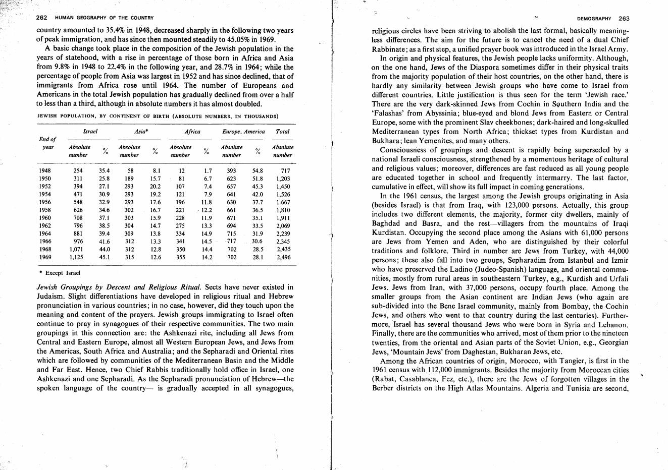
262 HUMAN GEOGRAPHY OF THE COUNTRY?
DEMOGRAPHY 263
JEWISH POPULATION, BY CONTINENT OF BIRTH (ABSOLUTE NUMBERS, IN THOUSANDS)
country amounted to 35.4% iri 1948,decreased sharply in the following two yearsof peak immigration, and has since then mounted steadily to 45.05%in 1969.
A basic change took place in the composition of the Jewish population in theyears of statehood, with a rise in percentage of those born in Africa and Asiafrom 9.8% in 1948 to 22.4% in the following year, and 28.7% in 1964; while thepercentage of people from Asia was largest in 1952and has since declined, that ofimmigrants from Africa rose until 1964. The number of Europeans andAmericans in the total Jewish population has gradually declined from over a halfto less than a third, although in absolute numbers it has almost doubled.
Jewish Groupings by Descent and Religious Ritual. Sects have never existed inJudaism. Slight differentiations have developed in religious ritual and Hebrewpronunciation in various countries; in no case, however, did they touch uponthemeaning and content of the prayers. Jewish groups immigrating to Israel oftencontinue to pray in synagogues of their respective communities. The two maingroupings in this connection are: the Ashkenazi rite, including all Jews fromCentral and Eastern Europe, almost all Western European Jews, and Jews fromthe Americas, South Africa and Australia; and the Sepharadi and Oriental riteswhich are followed by communities of the Mediterranean Basin and the Middleand Far East. Hence, two Chief Rabbis traditionally hold office in Israel, oneAshkenazi and one Sepharadi. As the Sepharadi pronunciation of Hebrew-thespoken language of the country- is gradually accepted in all synagogues,
* Except Israel
religious circles have been striving to abolish the last formal, basically meaningless differences. The aim for the future is to cancel the need of a dual ChiefRabbinate ;as a first step, a unified prayer book was introduced in the Israel Army.
In origin and physical features, the Jewish people lacks uniformity. Although,on the one hand, Jews of the Diaspora sometimes differ in their physical traitsfrom the majority population of their host countries, on the other hand, there ishardly any similarity between Jewish groups who have come to Israel fromdifferent countries. Little justification is thus seen for the term 'Jewish race.'There are the very dark-skinned Jews from Cochin in Southern India and the'Falashas' from Abyssinia; blue-eyed and blond Jews from Eastern or CentralEurope, some with the prominent Slav cheekbones; dark-haired and long-skulledMediterranean types from North Africa; thickset types from Kurdistan andBukhara; lean Yemenites, and many others.
Consciousness of groupings and descent is rapidly being superseded by anational Israeli consciousness, strengthened by a momentous heritage of culturaland religious values; moreover, differences are fast reduced as all young peopleare educated together in school and frequently intermarry. The last factor,cumulative in effect, will show its full impact in coming generations.
In the 1961 census, the largest among the Jewish groups originating in Asia(besides Israel) is that from Iraq, with 123,000 persons. Actually, this groupincludes two different elements, the majority, former city dwellers, mainly ofBaghdad and Basra, and the rest-villagers from the mountains of IraqiKurdistan. Occupying the second place among the Asians with 61,000 personsare Jews from Yemen and Aden, who are distinguished by their colorfultraditions and folklore. Third in number are Jews from Turkey, with 44,000persons; these also fall into two groups, Sepharadim from Istanbul and Izmirwho have preserved the Ladino (Judeo-Spanish) language, and oriental communities, mostly from rural areas in southeastern Turkey, e.g., Kurdish and UrfaliJews. Jews from Iran, with 37,000 persons, occupy fourth place. Among thesmaller groups from the Asian continent are Indian Jews (who again aresub-divided into the Bene Israel community, mainly from Bombay, theCochinJews, and others who went to that country during the last centuries). Furthermore, Israel has several thousand Jews who were born in Syria and Lebanon.Finally, there are the communities who arrived, most of them prior to the nineteentwenties, from the oriental and Asian parts of the Soviet Union, e.g., GeorgianJews, 'Mountain Jews' from Daghestan, Bukharan Jews, etc.
Among the African countries of origin, Morocco, with Tangier, is first in the1961 census with 112,000 immigrants. Besides the majority from Moroccan cities(Rabat, Casablanca, Fez, etc.), there are the Jews of forgotten villages in theBerber districts on the High Atlas Mountains. Algeria and Tunisia are second,I
l
7171,2031,4501,5261.6671,8101,9112,0692,2392,3452,435
2,496
Absolutenumber%
54.851.845.342.037.736.535.133.531.930.6
28.528.1
393623657641630661671694715717
702702
Europe. America Total
Absolutenumber%
1.76.77.47.9
11.812.211.913.314.914.5
14.414.2
1281
107121196221228275334341
350355
Africa
Absolutenumber
8.115.720.219.217.616.715.914.7
13.813.312.812.6
%
58189293293293302303304
309312
312315
Asia*
Absolutenumber
35.425.827.130.932.934.637.138.539.441.644.045.1
%
Israel
254311394471548626708796881976
1,0711,125
Absolutenumber
End ofyear
1948195019521954195619581960196219641966
19681969
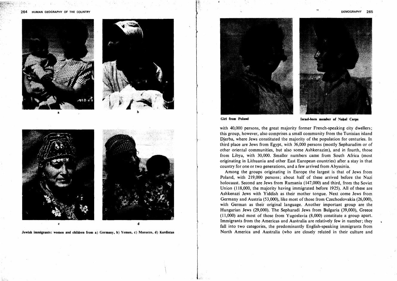
264 liUMAN GEOGRAPHY OF THE COUNTRY
a b
Girl from Poland
DEMOGRAPHY 265
Israel-born member of Nabal Corps
Jewish immigrants: women and children from a) Germany, b) Yemen, c) Morocco, d) Kurdistan
c d
1
I
with 40,000 persons, the great majority former French-speaking city dwellers;this group, however, also comprises a small community from the Tunisian islandDjerba, where Jews constituted the majority of the population for centuries. Inthird place are Jews from Egypt, with 36,000 persons (mostly Sepharadim or ofother oriental communities, but also some Ashkenazim), and in fourth, thosefrom Libya, with 30,000. Smaller numbers came from South Africa (mostoriginating in Lithuania and other East European countries) after a stay in thatcountry for one or two generations, and a few arrived from Abyssinia.
Among the groups originating in Europe the largest is that of Jews fromPoland, with 219,000 persons; about half of these arrived before the Naziholocaust. Second are Jews from Rumania (147,000) andthird, from the SovietUnion (118,000, the majority having immigrated before 1925). All of these areAshkenazi Jews with Yiddish as their mother tongue. Next come Jews fromGermany and Austria (53,000), like most of those from Czechoslovakia (26,000),with German as their original language. Another important group are theHungarian Jews (29,000). The Sepharadi Jews from Bulgaria (39,000), Greece(11,000) and most of those from Yugoslavia (8,000) constitute a group apart.Immigrants from the Americas and Australia are relatively few in number; theyfall into two categories, the predominantly English-speaking immigrants fromNorth America and Australia (who are closely related in their culture and
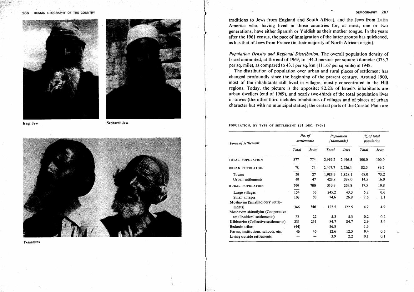
266 HUMAN GEOGRAPHY OF THE COUNTRY DEMOGRAPHY 267
traditions to Jews from England and South Africa), and the Jews from LatinAmerica who, having lived in those countries for, at most, one or twogenerations, have either Spanish or Yiddish as their mother tongue. In the yearsafter the 1961 census, the pace of immigration of the latter groups has quickened,as has that of Jews from France (in their majority of North African origin).
Population Density and Regional Distribution. The overall population density ofIsrael amounted, at the end of 1969, to 144.3 persons per square kilometer (373.7per sq. mile), as compared to 43.1 per sq. km (l11.67 per sq. mile) in 1948.
The distribution of population over urban and rural places of settlement haschanged profoundly since the beginning of the present century. Around 1900,most of the inhabitants still lived in villages, mostly concentrated in the Hillregions. Today, the picture is the opposite: 82.2% of Israel's inhabitants areurban dwellers (end of 1969), and nearly two-thirds of the total population livesin towns (the other third includes inhabitants of villages and of places of urbancharacter but with no municipal status); the central parts ofthe Coastal Plain are
Iraqi Jew Sephardi JewPOPULATION, BY TYPE OF SETTLEMENT (31 DEC. 1969)
No. of Population %of total
Form ofsettlementsettlements ( thousands) population
Total Jews Total Jews Total Jews
TOTAL PO PULATION 877 774 2,919.2 2,496.5 100.0 100.0
URBAN POPULATION 78 74 2,407.7 2,226.1 82.5 89.2
Towns 29 27 1,983.9 1,828.1 68.0 73.2Urban settlements 49 47 423.8 398.0 14.5 16.0
RURAL POPULATION 799 700 510.9 269.8 17.5 10.8- -
Large villages 154 56 245.2 43.3 5.8 0.6Small villages 108 50 74.6 26.9 2.6 1.1
Moshavim (Smallholders' settle-ments) 346 346 122.5 122.5 4.2 4.9
Moshavim shittufiyim (Cooperativesmallholders' settlements) 22 22 5.3 5.3 0.2 0.2
Kibbutzim (Collective settlements) 231 231 84.7 84.7 2.9 3.4Bedouin tribes (44) 36.8 1.3
IFarms, institutions, schools, etc. 46 45 12.6 12.5 0.4 0.5Living outside settlements 3.9 2.2 0.1 0.1
Yemenites
l
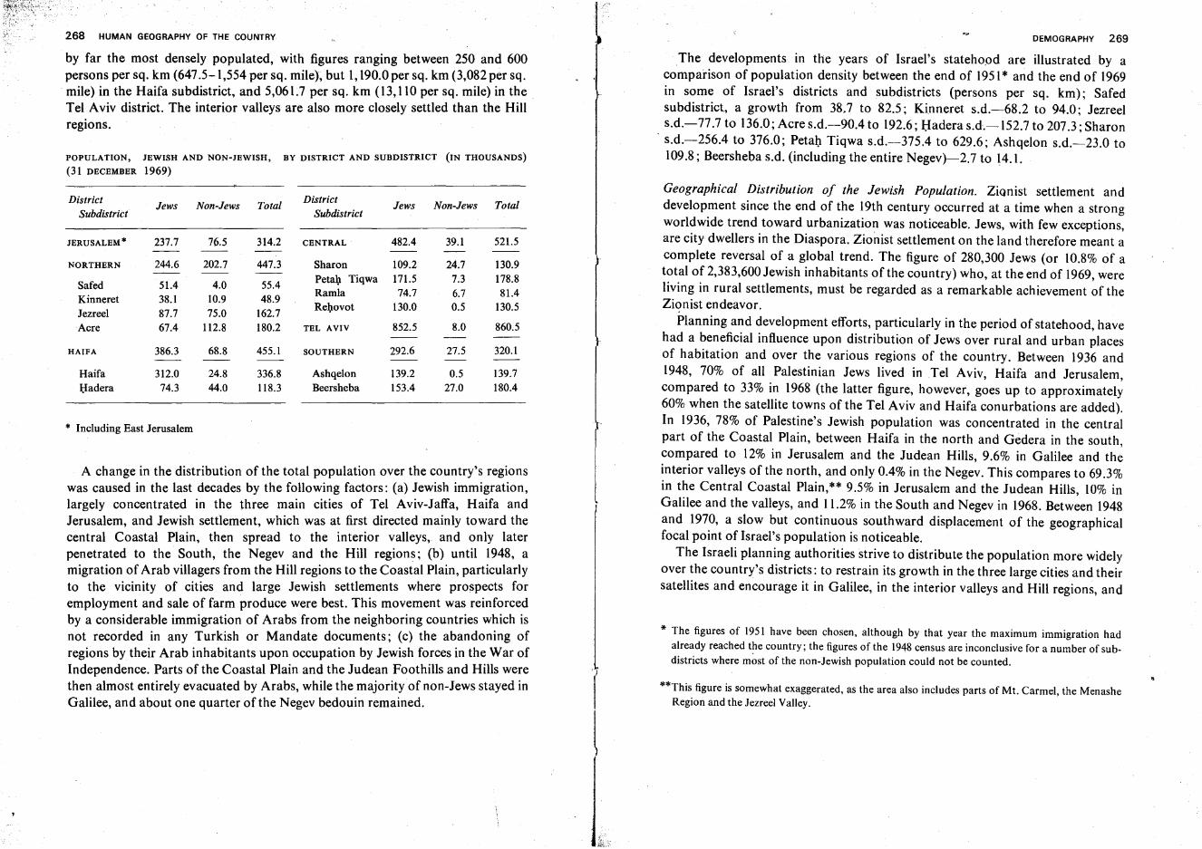
268 HUMAN GEOGRAPHY OF THE COUNTRY
by far the most densely populated, with figures ranging between 250 and 600persons per sq. km (647.5-1,554 per sq. mile), but 1,190.0 per sq. km (3,082 per sq.mile) in the Haifa subdistrict, and 5,061.7 per sq. km (13,110 per sq. mile) in theTel Aviv district. The interior valleys are also more closely settled than the Hillregions.
POPULATION, JEWISH AND NON-JEWISH, BY DISTRICT AND SUBDISTRICT (IN THOUSANDS)
(31 DECEMBER 1969)
DistrictJews Non-Jews Total
DistrictJews Non-Jews Total
Subdistrict Subdistrict
JERUSALEM * 237.7 76.5 314.2 CENTRAL 482.4 39.1 521.5
NORTHERN 244.6 202.7 447.3 Sharon 109.2 24.7 130.9
Safed 51.4 4.0 55.4Petah Tiqwa 171.5 7.3 178.8
Kinneret 38.1 10.9 48.9Ramla 74.7 6.7 81.4
Jezreel 87.7 75.0 162.7Rehovot 130.0 0.5 130.5
Acre 67.4 112.8 180.2 TEL AVIV 852.5 8.0 860.5
HAIFA 386.3 68.8 455.1 SOUTHERN 292.6 27.5 320.1
Haifa 312.0 24.8 336.8 Ashqelon 139.2 0.5 139.7Hadera 74.3 44.0 118.3 Beersheba 153.4 27.0 180.4
* Including East Jerusalem
A change in the distribution of the total population over the country's regionswas caused in the last decades by the following factors: (a) Jewish immigration,largely concentrated in the three main cities of Tel Aviv-Jaffa, Haifa andJerusalem, and Jewish settlement, which was at first directed mainly toward thecentral Coastal Plain, then spread to the interior valleys, and only laterpenetrated to the South, the Negev and the Hill regions; (b) until 1948, amigration of Arab villagers from the Hill regions to the Coastal Plain, particularlyto the vicinity of cities and large Jewish settlements where prospects foremployment and sale of farm produce were best. This movement was reinforcedby a considerable immigration of Arabs from the neighboring countries which isnot recorded in any Turkish or Mandate documents; (c) the abandoning ofregions by their Arab inhabitants upon occupation by Jewish forces in the War ofIndependence. Parts of the Coastal Plain and the Judean Foothills and Hills werethen almost entirely evacuated by Arabs, while the majority of non-Jews stayed inGalilee, and about one quarter ofthe Negev bedouin remained.
DEMOGRAPHY 269
The developments in the years of Israel's statehood are illustrated by acomparison of population density between the end of 1951* and the end of 1969in some of Israel's districts and subdistricts (persons per sq. km): Safedsubdistrict, a growth from 38.7 to 82.5; Kinneret s.d.-68.2 to 94.0; Jezreels.d.-77.7 to 136.0; Acre s.d.-90A to 192.6; Hadera s.d.-152.7 to 207.3; Sharon
. s.d.-256A to 376.0; Petal) Tiqwa s.d.-375A to 629.6; Ashqelon s.d.-23.0 to109.8; Beersheba s.d, (including the entire Negev)-2.7 to 14.1.
Geographical Distribution of the Jewish Population. Zionist settlement anddevelopment since the end of the 19th century occurred at a time when a strongworldwide trend toward urbanization was noticeable. Jews, with few exceptions,are city dwellers in the Diaspora. Zionist settlement on the land therefore meant acomplete reversal of a global trend. The figure of 280,300 Jews (or 10.8% of atotal of 2,383,600 Jewish inhabitants of the country) who, at the end of 1969, wereliving in rural settlements, must be regarded as a remarkable achievement of theZionist endeavor.
Planning and development efforts, particularly in the period of statehood, havehad a beneficial influence upon distribution of Jews over rural and urban placesof habitation and over the various regions of the country. Between 1936 and1948, 70% of all Palestinian Jews lived in Tel Aviv, Haifa and Jerusalem,compared to 33% in 1968 (the latter figure, however, goes up to approximately60% when the satellite towns of the Tel Aviv and Haifa conurbations are added).In 1936, 78% of Palestine's Jewish population was concentrated in the centralpart of the Coastal Plain, between Haifa in the north and Gedera in the south,compared to 12% in Jerusalem and the Judean Hills, 9.6% in Galilee and theinterior valleys of the north, and only 0.4% in the Negev. This compares to 69.3%in the Central Coastal Plain,** 9.5% in Jerusalem and the Judean Hills, 10% inGalilee and the valleys, and 11.2% in the South and Negev in 1968. Between 1948and 1970, a slow but continuous southward displacement of the geographicalfocal point of Israel's population is noticeable.
The Israeli planning authorities strive to distribute the population more widelyover the country's districts: to restrain its growth in the three large cities and theirsatellites and encourage it in Galilee, in the interior valleys and Hill regions, and
* The figures of 1951 have been chosen, although by that year the maximum immigration hadalready reached the country; the figures of the 1948 census are inconclusive for a number of subdistricts where most of the non-Jewish population could not be counted.
**This figure is somewhat exaggerated, as the area also includes parts of Mt. Carmel, the MenasheRegion and the Jezreel Valley.
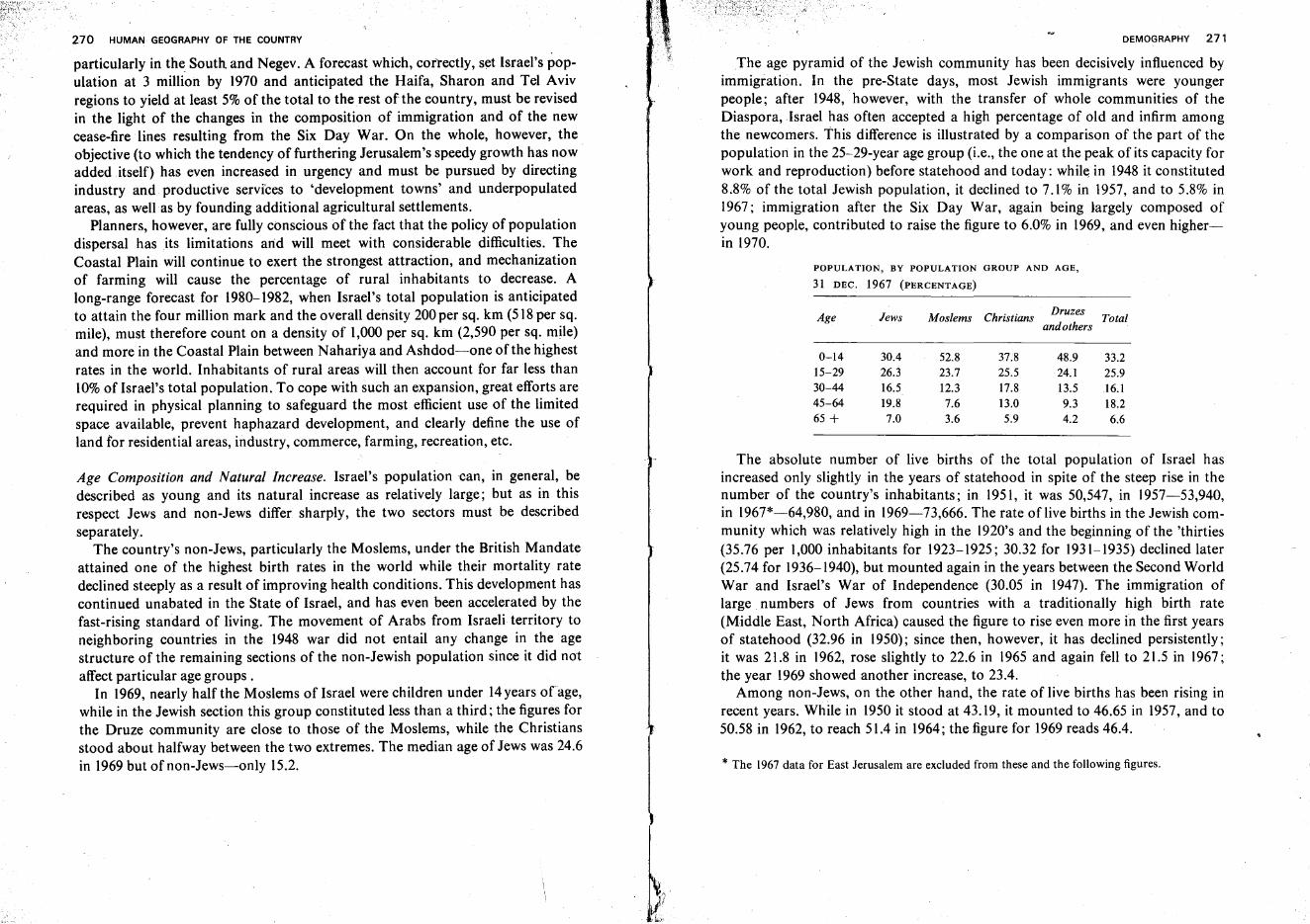
270 HUMAN GEOGRAPHY OF THE COUNTRY
particularly in the South. and Negev. A forecast which, correctly, set Israel's population at 3 million by 1970 and anticipated the Haifa, Sharon and Tel Avivregions to yield at least 5% of the total to the rest of the country, must be revisedin the light of the changes in the composition of immigration and of the newcease-fire lines resulting from the Six Day War. On the whole, however, theobjective (to which the tendency of furthering Jerusalem's speedy growth has nowadded itself) has even increased in urgency and must be pursued by directingindustry and productive services to 'development towns' and underpopulatedareas, as well as by founding additional agricultural settlements.
Planners, however, are fully conscious of the fact that the policy of populationdispersal has its limitations and will meet with considerable difficulties. TheCoastal Plain will continue to exert the strongest attraction, and mechanizationof farming will cause the percentage of rural inhabitants to decrease. Along-range forecast for 1980-1982, when Israel's total population is anticipatedto attain the four million mark and the overall density 200per sq. km (518 per sq.mile), must therefore count on a density of 1,000 per sq. km (2,590 per sq. mile)and more in the Coastal Plain between Nahariya and Ashdod-one of the highestrates in the world. Inhabitants of rural areas will then account for far less than10% of Israel's total population. To cope with such an expansion, great efforts arerequired in physical planning to safeguard the most efficient use of the limitedspace available, prevent haphazard development, and clearly define the use ofland for residential areas, industry, commerce, farming, recreation, etc.
Age Composition and Natural Increase. Israel's population can, in general, bedescribed as young and its natural increase as relatively large; but as in thisrespect Jews and non-Jews differ sharply, the two sectors must be describedseparately.
The country's non-Jews, particularly the Moslems, under the British Mandateattained one of the highest birth rates in the world while their mortality ratedeclined steeply as a result of improving health conditions. This development hascontinued unabated in the State of Israel, and has even been accelerated by thefast-rising standard of living. The movement of Arabs from Israeli territory toneighboring countries in the 1948 war did not entail any change in the agestructure of the remaining sections of the non-Jewish population since it did notaffect particular age groups.
In 1969, nearly half the Moslems of Israel were children under 14years ofage,while in the Jewish section this group constituted less than a third; the figures forthe Druze community are close to those of the Moslems, while the Christiansstood about halfway between the two extremes. The median age of Jews was 24.6in 1969 but of non-Jews-only 15.2.
DEMOGRAPHY 271
The age pyramid of the Jewish community has been decisively influenced byimmigration. In the pre-State days, most Jewish immigrants were youngerpeople; after 1948, however, with the transfer of whole communities of theDiaspora, Israel has often accepted a high percentage of old and infirm amongthe newcomers. This difference is illustrated by a comparison of the part of thepopulation in the 25-29-year age group (i.e., the one at the peak of its capacity forwork and reproduction) before statehood and today: while in 1948 it constituted8.8% of the total Jewish population, it declined to 7.1% in 1957, and to 5.8% in1967; immigration after the Six Day War, again being largely composed ofyoung people, contributed to raise the figure to 6.0% in 1969, and even higherin 1970.
POPULATION, BY POPULATION GROUP AND AGE,
31 DEC. 1967 (PERCENTAGE)
Age Jews Moslems ChristiansDruzes
Totalandothers
0-14 30.4 52.8 37.8 48.9 33.215-29 26.3 23.7 25.5 24.1 25.930-44 16.5 12.3 17.8 13.5 16.145-64 19.8 7.6 13.0 9.3 18.265 + 7.0 3.6 5.9 4.2 6.6
The absolute number of live births of the total population of Israel hasincreased only slightly in the years of statehood in spite of the steep rise in thenumber of the country's inhabitants; in 1951, it was 50,547, in 1957-53,940,in 1967*-64,980, and in 1969-73,666. The rate of live births in the Jewish community which was relatively high in the 1920's and the beginning of the 'thirties(35.76 per 1,000 inhabitants for 1923-1925; 30.32 for 1931-1935) declined later(25.74 for 1936-1940), but mounted again in the years between the Second WorldWar and Israel's War of Independence (30.05 in 1947). The immigration oflarge numbers of Jews from countries with a traditionally high birth rate(Middle East, North Africa) caused the figure to rise even more in the first yearsof statehood (32.96 in 1950); since then, however, it has declined persistently;it was 21.8 in 1962, rose slightly to 22.6 in 1965 and again fell to 21.5 in 1967;the year 1969 showed another increase, to 23.4.
Among non-Jews, on the other hand, the rate of live births has been rising inrecent years. While in 1950 it stood at 43.19, it mounted to 46.65 in 1957, and to50.58 in 1962, to reach 51.4 in 1964; the figure for 1969 reads 46.4.
* The 1967data for East Jerusalem are excluded from these and the following figures.
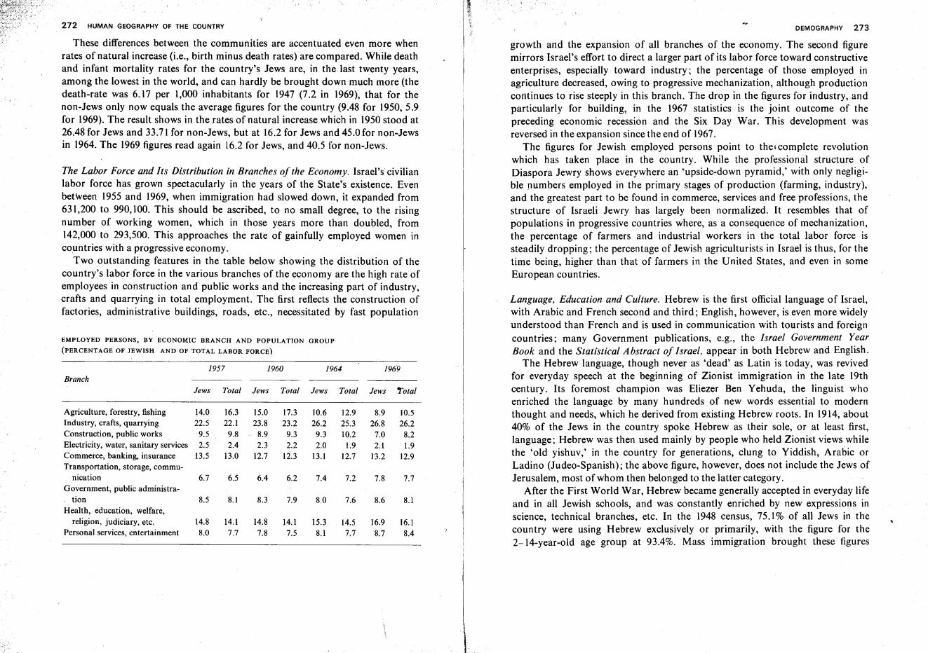
272 HUMAN GEOGRAPHY OF THE COUNTRY
These differences between the communities are accentuated even more whenrates of natural increase (i.e., birth minus death rates) are compared. While deathand infant mortality rates for the country's Jews are, in the last twenty years,among the lowest in the world, and can hardly be brought down much more (thedeath-rate was 6.17 per 1,000 inhabitants for 1947 (7.2 in 1969), that for thenon-Jews only now equals the average figures for the country (9.48 for 1950, 5.9for 1969). The result shows in the rates of natural increase which in 1950 stood at26.48 for Jews and 33.71 for non-Jews, but at 16.2 for Jews and 45.0 for non-Jewsin 1964. The 1969 figures read again 16.2 for Jews, and 40.5 for non-Jews.
The Labor Force and Its Distribution in Branches of the Economy. Israel's civilianlabor force has grown spectacularly in the years of the State's existence. Evenbetween 1955 and 1969, when immigration had slowed down, it expanded from631,200 to 990,100. This should be ascribed, to no small degree, to the risingnumber of working women, which in those years more than doubled, from142,000 to 293,500. This approaches the rate of gainfully employed women incountries with a progressive economy.
Two outstanding features in the table below showing the distribution of thecountry's labor force in the various branches of the economy are the high rate ofemployees in construction and public works and the increasing part of industry,crafts and quarrying in total employment. The first reflects the construction offactories, administrative buildings, roads, etc., necessitated by fast population
EMPLOYED PERSONS, BY ECONOMIC BRANCH AND POPULATION GROUP
(PERCENTAGE OF JEWISH AND OF TOTAL LABOR FORCE)
DEMOGRAPHY 273
growth and the expansion of all branches of the economy. The second figuremirrors Israel's effort to direct a larger part of its labor force toward constructiveenterprises, especially toward industry; the percentage of those employed inagriculture decreased, owing to progressive mechanization, although productioncontinues to rise steeply in this branch. The drop in the figures for industry, andparticularly for building, in the 1967 statistics is the joint outcome of thepreceding economic recession and the Six Day War. This development wasreversed in the expansion since the end of 1967.
The figures for Jewish employed persons point to the- complete revolutionwhich has taken place in the country. While the professional structure ofDiaspora Jewry shows everywhere an 'upside-down pyramid,' with only negligible numbers employed in the primary stages of production (farming, industry),and the greatest part to be found in commerce, services and free professions, thestructure of Israeli Jewry has largely been normalized. It resembles that ofpopulations in progressive countries where, as a consequence of mechanization,the percentage of farmers and industrial workers in the total labor force issteadily dropping; the percentage of Jewish agriculturists in Israel is thus, for thetime being, higher than that of farmers in the United States, and even in someEuropean countries.
Language, Education and Culture. Hebrew is the first official language of Israel,with Arabic and French second and third; English, however, is even more widelyunderstood than French and is used in communication with tourists and foreigncountries; many Government publications, e.g., the Israel Government YearBook and the Statistical Abstract of Israel, appear in both Hebrew and English.
The Hebrew language, though never as 'dead' as Latin is today, was revivedfor everyday speech at the beginning of Zionist immigration in the late 19thcentury. Its foremost champion was Eliezer Ben Yehuda, the linguist whoenriched the language by many hundreds of new words essential to modernthought and needs, which he derived from existing Hebrew roots. In 1914, about40% of the Jews in the country spoke Hebrew as their sole, or at least first,language; Hebrew was then used mainly by people who held Zionist viewswhilethe 'old yishuv,' in the country for generations, clung to Yiddish, Arabic orLadino (Judeo-Spanish); the above figure, however, does not include the Jews ofJerusalem, most of whom then belonged to the latter category.
After the First World War, Hebrew became generally accepted in everyday lifeand in all Jewish schools, and was constantly enriched by new expressions inscience, technical branches, etc. In the 1948 census, 75.1% of all Jews in thecountry were using Hebrew exclusively or primarily, with the figure for the2-14-year-old age group at 93.4%. Mass immigration brought these figures
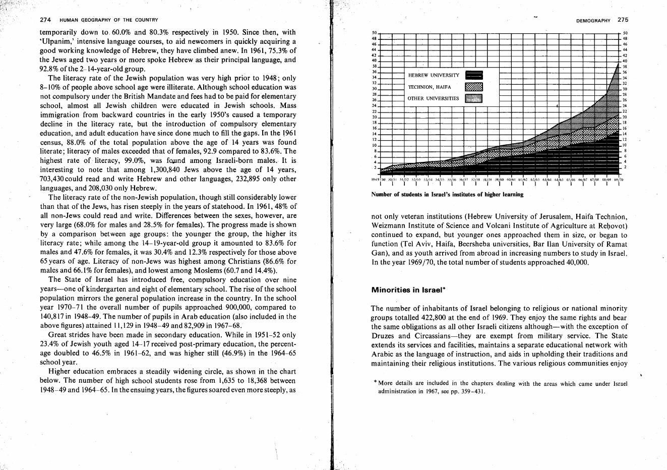
DEMOGRAPHY 275
Minorities in Israel*
* More details are included in the chapters dealing with the areas which came under Israeladministration in 1967, see pp. 359-431.
Number of students in Israel's institutes of higher learning
1949/50 5U/SI 51/52 5'2/53 53/5-1. 5..Jj55 55/56 56/57 57/5M SM/59 59/60 60/61 61/62 61/63 63/64 04/65 65/66 6b/67 67/6'{, 6H/61J 69/70I I I I I I I I I I I I I I I I I I I I I
+--+----4 HEBREW UNIVERSITY ..
-+---+-~ TECHNION, HAIFA f::::E:~~:;:;ft
+--+----4 OTHER UNIVERSITIES ••
not only veteran institutions (Hebrew University of Jerusalem, Haifa Technion,Weizmann Institute of Science and Volcani Institute of Agriculture at Rehovot)continued to expand, but younger ones approached them in size, or began tofunction (Tel Aviv, Haifa, Beersheba universities, Bar Han University of RamatGan), and as youth arrived from abroad in increasing numbers to study in Israel.In the year 1969/70, the total number of students approached 40,000.
The number of inhabitants of Israel belonging to religious or national minoritygroups totalled 422,800 at the end of 1969. They enjoy the same rights and bearthe same obligations as all other Israeli citizens although-with the exception ofDruzes and Circassians-they are exempt from military service. The Stateextends its services and facilities, maintains a separate educational network withArabic as the language of instruction, and aids in upholding their traditions andmaintaining their religious institutions. The various religious communities enjoy
274 HUMAN ~EOGRAPHY OF THE COUNTRY
temporarily down to 60.0% and 80.3% respectively in 1950. Since then, with'Ulpanim,' intensive language courses, to aid newcomers in quickly acquiring agood working knowledge of Hebrew, they have climbed anew. In 1961,75.3% ofthe Jews aged two years or more spoke Hebrew as their principal language, and92.8% of the 2-14-year-old group.
The literacy rate of the Jewish population was very high prior to 1948; only8-10% of people above school age were illiterate. Although school education wasnot compulsory under the British Mandate and fees had to be paid for elementaryschool, almost all Jewish children were educated in Jewish schools. Massimmigration from backward countries in the early 1950's caused a temporarydecline in the literacy rate, but the introduction of compulsory elementaryeducation, and adult education have since done much to fill the gaps. In the \961census, 88.0% of the total population above the age of 14 years was foundliterate; literacy of males exceeded that of females, 92.9 compared to 83.6%. Thehighest rate of literacy, 99.0%, was found among Israeli-born males.: It isinteresting to note that among 1,300,840 Jews above the age of 14 years,703,430 could read and write Hebrew and other languages, 232,895 only otherlanguages, and 208,030 only Hebrew.
The literacy rate of the non-Jewish population, though still considerably lowerthan that of the Jews, has risen steeply in the years of statehood. In 1961, 48% ofall non-Jews could read and write. Differences between the sexes, however, arevery large (68.0% for males and 28.5% for females). The progress made is shownby a comparison between age groups: the younger the group, the higher itsliteracy rate; while among the 14-19-year-old group it amounted to 83.6% formales and 47.6% for females, it was 30.4% and 12.3% respectively for those above65 years of age. Literacy of non-Jews was highest among Christians (86.6% formales and 66.1% for females), and lowest among Moslems (60.7 and 14.4%).
The State of Israel has introduced free, compulsory education over nineyears-one of kindergarten and eight of elementary school. The rise of the schoolpopulation mirrors the general population increase in the country. In the schoolyear 1970-71 the overall number of pupils approached 900,000, compared to140,817in 1948-49. The number of pupils in Arab education (also included in theabove figures) attained 11,129in 1948-49 and 82,909 in 1967-68.
Great strides have been made in secondary education. While in 1951-52 only23.4% of Jewish youth aged 14-17 received post-primary education, the percentage doubled to 46.5% in 1961-62, and was higher still (46.9%) in the 1964-65school year.
Higher education embraces a steadily widening circle, as shown in the chartbelow. The number of high school students rose from 1,635 to 18,368 between1948-49 and 1964-65. In the ensuing years, the figures soared even more steeply, as
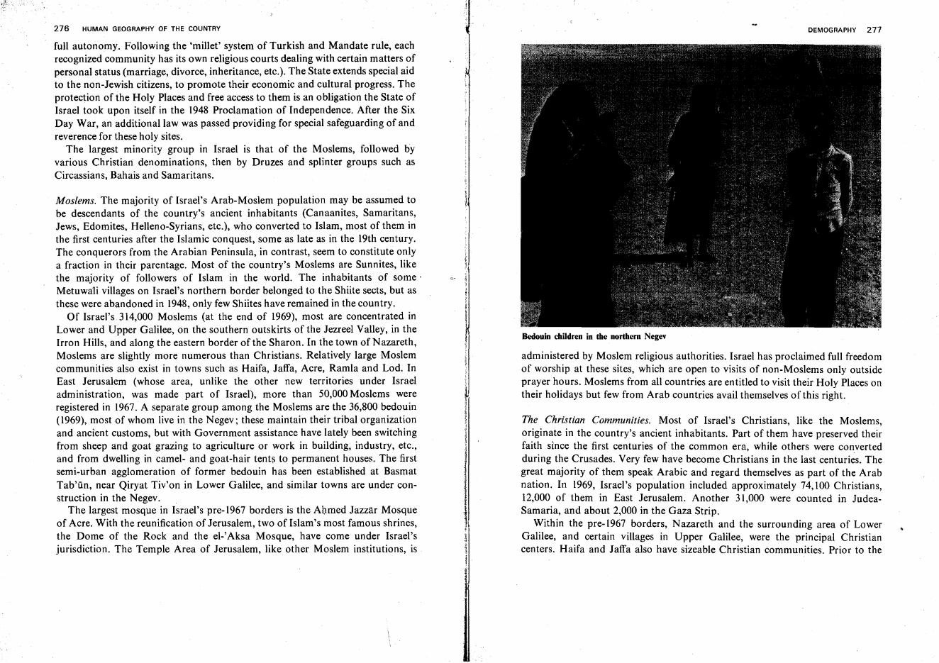
276 HUMAN GEOGRAPHY OF THE COUNTRY
full autonomy. Following the 'millet' system of Turkish and Mandate rule, eachrecognized community has its own religious courts dealing with certain matters ofpersonal status (marriage, divorce, inheritance, etc.). The State extends special aidto the non-Jewish citizens, to promote their economic and cultural progress. Theprotection of the Holy Places and free access to them is an 0 bligation the State ofIsrael took upon itself in the 1948 Proclamation of Independence. After the SixDay War, an additional law was passed providing for special safeguarding of andreverence for these holy sites.
The largest minority group in Israel is that of the Moslems, followed byvarious Christian: denominations, then by Druzes and splinter groups such asCircassians, Bahais and Samaritans.
Moslems. The majority of Israel's Arab-Moslem population may be assumed tobe descendants of the country's ancient inhabitants (Canaanites, Samaritans,Jews, Edomites, Helleno-Syrians, etc.), who converted to Islam, most of them inthe first centuries after the Islamic conquest, some as late as in the 19th century.The conquerors from the Arabian Peninsula, in contrast, seem to constitute onlya fraction in their parentage. Most of the country's Moslems are Sunnites, likethe majority of followers of Islam in the world. The inhabitants of some'Metuwali villages on Israel's northern border belonged to the Shiite sects, but asthese were abandoned in 1948,only few Shiites have remained in the country.
Of Israel's 314,000 Moslems (at the end of 1969), most are concentrated inLower and Upper Galilee, on the southern outskirts of the Jezreel Valley, in theIrron Hills, and along the eastern border of the Sharon. In the town of Nazareth,Moslems are slightly more numerous than Christians. Relatively large Moslemcommunities also exist in towns such as Haifa, Jaffa, Acre, Ramla and Lod. InEast Jerusalem (whose area, unlike the other new territories under Israeladministration, was made part of Israel), more than 50,000 Moslems wereregistered in 1967. A separate group among the Moslems are the 36,800 bedouin(1969), most of whom live in the Negev; these maintain their tribal organizationand ancient customs, but with Government assistance have lately been switchingfrom sheep and goat grazing to agriculture or work in building, industry, etc.,and from dwelling in camel- and goat-hair tents to permanent houses. The firstsemi-urban agglomeration of former bedouin has been established at BasmatTab'un, near Qiryat Tiv'on in Lower Galilee, and similar towns are under construction in the Negev.
The largest mosque in Israel's pre-I967 borders is the Ahmed Jazzar Mosqueof Acre. With the reunification of Jerusalem, two of Islam's most famous shrines,the Dome of the Rock and the el-'Aksa Mosque, have come under Israel'sjurisdiction. The Temple Area of Jerusalem, like other Moslem institutions, is
IIis,
I
DEMOGRAPHY 277
Bedouin children in the northern Negev
administered by Moslem religious authorities. Israel has proclaimed full freedomof worship at these sites, which are open to visits of non-Moslems only outsideprayer hours. Moslems from all countries are entitled to visit their Holy Places ontheir holidays but few from Arab countries avail themselves of this right.
The Christian Communities. Most of Israel's Christians, like the Moslems,originate in the country's ancient inhabitants. Part of them have preserved theirfaith since the first centuries of the common era, while others were convertedduring the Crusades. Very few have become Christians in the last centuries. Thegreat majority of them speak Arabic and regard themselves as part of the Arabnation. In 1969, Israel's population included approximately 74,100 Christians,12,000 of them in East Jerusalem. Another 31,000 were counted in JudeaSamaria, and about 2,000 in the Gaza Strip.
Within the pre-1967 borders, Nazareth and the surrounding area of LowerGalilee, and certain villages in Upper Galilee, were the principal Christiancenters. Haifa and Jaffa also have sizeable Christian communities. Prior to the
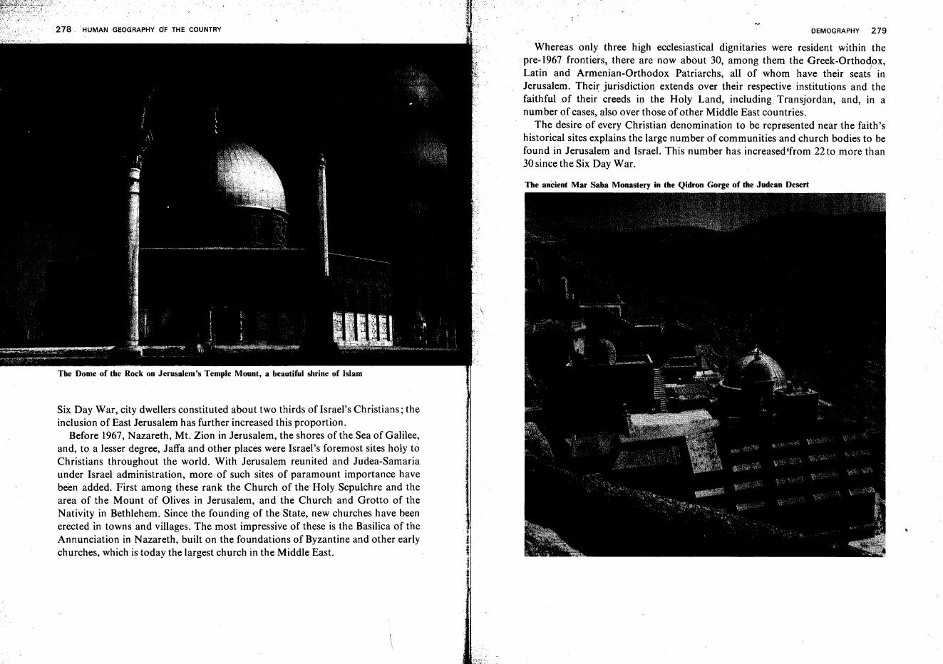
. HUMAN GEOGRAPHY OF THE COUNTRY
The Dome of the Rock on Jerusalem's Temple Mount, a beautiful shrine of Islam
Six Day War, city dwellers constituted about two thirdsofIsrael's Christians; theinclusion of East Jerusalem has further increased this proportion.
Before 1967, Nazareth, Mt. Zion in Jerusalem, the shores ofthe Sea of Galilee,and, to a lesser degree, Jaffa and other places were Israel's foremost sites holy toChristians throughout the world. With Jerusalem reunited and Judea-Samariaunder Israel administration, more of such sites of paramount importance havebeen added. First among these rank the Church of the Holy Sepulchre and thearea of the Mount of Olives in Jerusalem, and the Church and Grotto of theNativity in Bethlehem. Since the founding of the State, new churches have beenerected in towns and villages. The most impressive of these is the Basilica of theAnnunciation in Nazareth, built on the foundations of Byzantine and other earlychurches, which is today the largest church in the Middle East.
DEMOGRAPHY 279
Whereas only three high ecclesiastical dignitaries were resident within the. pre-1967 frontiers, there are now about 30, among them the Greek-Orthodox,
ILatin and Armenian-Orthodox Patriarchs, all of whom have their seats inJerusalem. Their jurisdiction extends over their respective institutions and thefaithful of their creeds in the Holy Land, including Transjordan, and, in anumber of cases, also over those of other Middle East countries.
The desire of every Christian denomination to be represented near the faith'shistorical sites explains the large number of communities and church bodies to befound in Jerusalem and Israel. This number has increased from 22 to more than30since the Six Day War.
The anCient Mar Saba Monastery in the Qidron Gorge of the Judean Desert
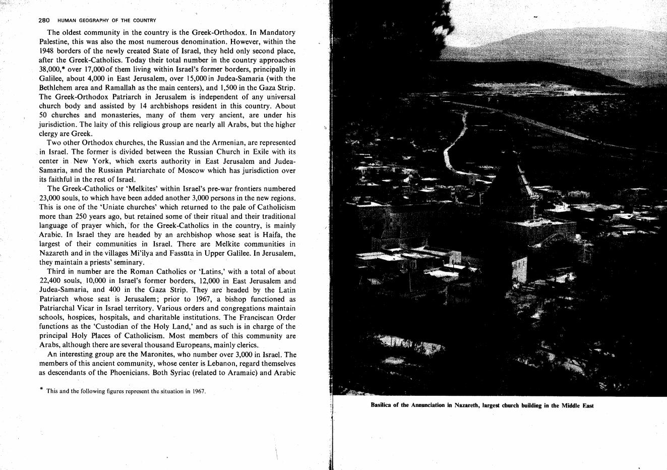
280 HUMAN GEOGRAPHY OF THE COUNTRY
The oldest community in the country is the Greek-Orthodox. In MandatoryPalestine, this was also the most numerous denomination. However, within the1948 borders of the newly created State of Israel, they held only second place,after the Greek-Catholics. Today their total number in the country approaches38,000,* over 17,000of them living within Israel's former. borders, principally inGalilee, about 4,000 in East Jerusalem, over 15,000in Judea-Samaria (with theBethlehem area and Ramallah as the main centers), and 1,500 in the Gaza Strip.The Greek-Orthodox Patriarch in Jerusalem is independent of any universalchurch body and assisted by 14 archbishops resident in this country. About50 churches and monasteries, many of them very ancient, are under hisjurisdiction. The laity of this religious group are nearly all Arabs, but the higherclergy are Greek.
Two other Orthodox churches, the Russian and the Armenian, are representedin Israel. The former is divided between the Russian Church in Exile with itscenter in New York, which exerts authority in East Jerusalem and JudeaSamaria, and the Russian Patriarchate of Moscow which has jurisdiction overits faithful in therest of Israel.
The Greek-Catholics or 'Melkites' within Israel's pre-war frontiers numbered23,000 souls, to which have been added another 3,000 persons in the new regions.This is one of the 'Uniate churches' which returned to the pale of Catholicismmore than 250 years ago, but retained some of their ritual and their traditionallanguage of prayer which, for the Greek-Catholics in the country, is mainlyArabic. In Israel they are headed by an archbishop whose seat is Haifa, thelargest of their communities in Israel. There are Melkite communities inNazareth and in the villages Mi'ilya and Fassuta in Upper Galilee. In Jerusalem,they maintain a priests' seminary.
Third in number are the Roman Catholics or 'Latins,' with a total of about22,400 souls, 10,000 in Israel's former borders, 12,000 in East Jerusalem andJudea-Samaria, and 400 in the Gaza Strip. They are headed by the LatinPatriarch whose seat is Jerusalem; prior to 1967, a bishop functioned asPatriarchal Vicar in Israel territory. Various orders and congregations maintainschools, hospices, hospitals, and charitable institutions. The Franciscan Orderfunctions as the 'Custodian of the Holy Land,' and as such is in charge of theprincipal Holy Places of Catholicism. Most members of this community areArabs, although there are several thousand Europeans, mainly clerics..
An interesting group are the Maronites, who number over 3,000 in Israel. Themembers of this ancient community, whose center is. Lebanon, regard themselvesas descendants of the Phoenicians. Both Syriac (related to Aramaic) and Arabic
* This and the following figures represent the situation in 1967.
BasHica of the Annunciation in Nazareth, largest church building in the Middle East
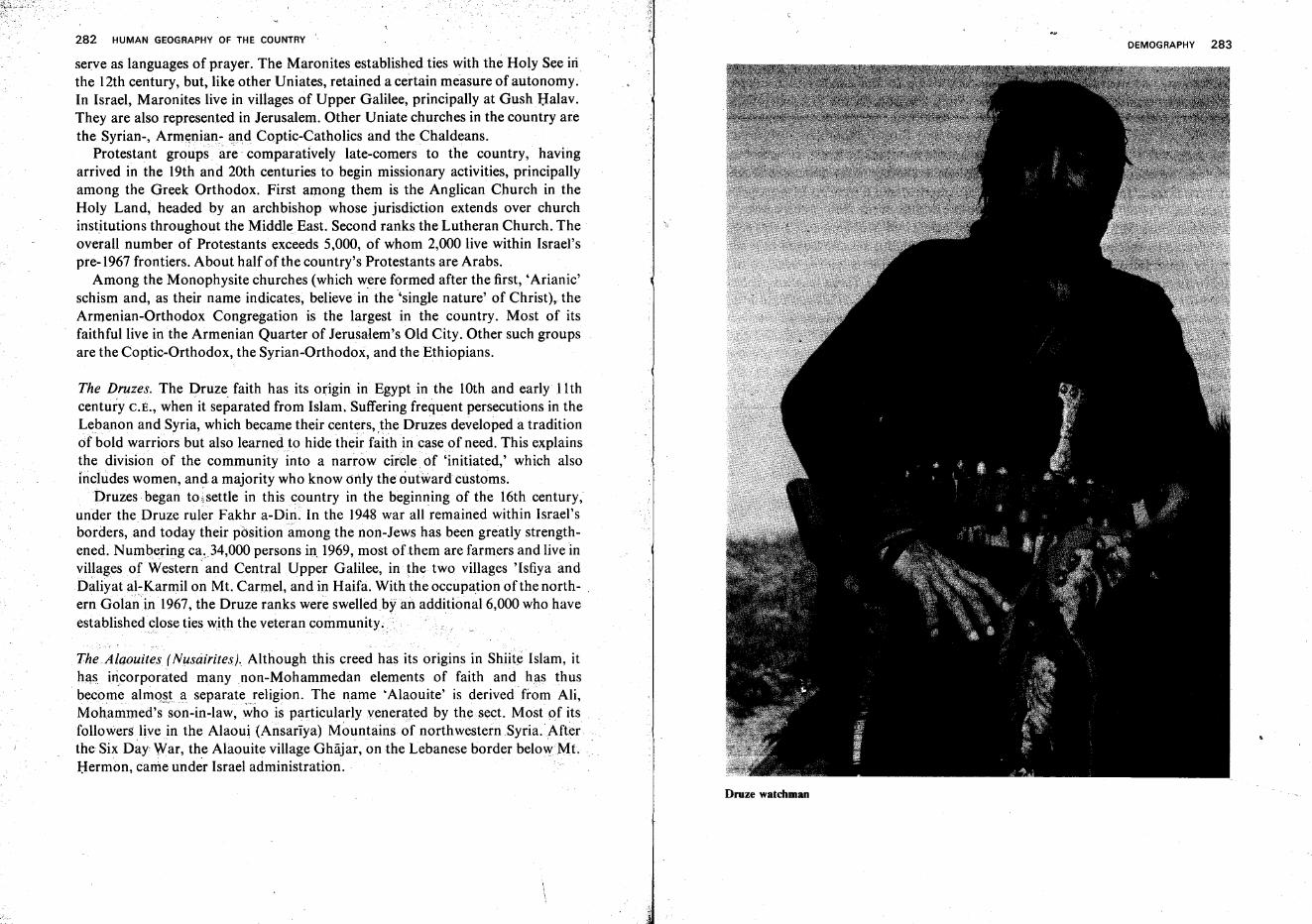
282 HUMAN GEOGRAPHY OF THE COUNTRY
serve as languages of prayer. The Maronites established ties with the Holy See inthe 12th century, but, like other Uniates, retained a certain measure of autonomy.In Israel, Maronites live in villages of Upper Galilee, principally at Gush Halav.They are also represented in Jerusalem. Other Uniate churches in the country arethe Syrian-, Armenian- and Coptic-Catholics and theChaldeans.
Protestant groups are comparatively late-comers to the country, havingarrived in the 19th and 20th centuries to begin missionary activities, principallyamong the Greek Orthodox. First among them is the Anglican Church in theHoly Land, headed by an archbishop whose jurisdiction extends over churchinstitutions throughout the MiddleEast. Second ranks the Lutheran Church. Theoverall number of Protestants exceeds 5,000, of whom 2,000 live within Israel'spre-1967 frontiers. About half of the country's Protestants are Arabs.
Among the Monophysite churches (which were formed after the first, 'Arianic'schism and, as their name indicates, believe in the 'single nature' of Christ), theArmenian-Orthodox Congregation is the largest in the country. Most of itsfaithful live in the Armenian Quarter of Jerusalem's Old City. Other such groupsare the Coptic-Orthodox, the Syrian-Orthodox, and the Ethiopians.
The Druzes. The Druze faith has its origin in Egypt in the 10th and early 11 thcentury C.E., when it separated from Islam. Suffering frequent persecutions in theLebanon and Syria, which became their centers, ,the Druzes developed a traditionof bold warriors but also learned to hide their faith in case of need. This explainsthe division of the community into a narrow circle. of 'initiated,' which alsoincludes women, and a majority who know only the outward customs.
Druzes began to-settle in this country in the beginning of the 16th century,under the Druze ruler Fakhr a-Din. In the 1948 war all remained within Israel'sborders,and today their position among the non-Jews has been greatly strengthened. Numbering ca~34,000 persons in. 1969, most of them are farmers and live invillages of Western' and Central Upper Galilee, in the two villages 'Isfiya andDaliyat al-Karmil on Mt. Carmel, and in Haifa. With the occupation ofthe north- .ern Golan in 1967, the Druze ranks were swelledby an additional 6,000 who haveestablished close ties with the veteran community.. .
The .Alaouites (Nusairites). Although this creed has its origins in Shiite Islam, ithAS incorporated many non-Mohammedan elements of faith and has thus
, become almo'§ta separatereligion, The name 'Alaouite' is derived from Ali,Mohammed's son-in-law, who is particularly venerajed by the sect. Most of itsfollowers live in the Alaoui (Ansariya) Mountains of northwestern Syria. Afterthe Six Day War, the Alaouite village Ghajar, on the Lebanese border belowMt.Hermon, came under Israel administration.
DEMOGRAPHY 283
Druze watchman
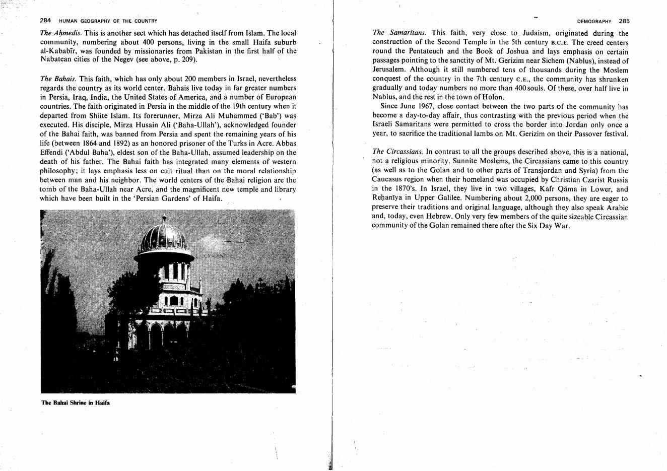
284 HUMAN GEOGRAPHY OF THE COUNTRY
The Ahmedis. This is another sect which has detached itself from Islam. The localcommunity, numbering about 400 persons, living in the small Haifa suburbal-Kababir, was founded by missionaries from Pakistan in the first half of theNabatean cities of the Negev (see above, p. 209).
The Bahais. This faith, which has only about 200 members in Israel, neverthelessregards the country as its world center. Bahais live today in far greater numbersin Persia, Iraq, India, the United States of America, and a number of Europeancountries. The faith originated in Persia in the middle of the 19th century when itdeparted from Shiite Islam. Its forerunner, Mirza Ali Muhammed ('Bab') wasexecuted. His disciple, Mirza Husain Ali ('Baha-Ullah'), acknowledged founderof the Bahai faith, was banned from Persia and spent the remaining years of hislife (between 1864 and 1892) as an honored prisoner of the Turks in Acre. AbbasEffendi ('Abdul Baha'), eldest son of the Baha-Ullah, assumed leadership on thedeath of his father. The Bahai faith has integrated many elements of westernphilosophy; it lays emphasis less on cult ritual than on the moral relationshipbetween man and his neighbor. The world centers of the Bahai religion are thetomb of the Baha-Ullah near Acre, and the magnificent new temple and librarywhich have been built in the 'Persian Gardens' of Haifa.
The Babai Shrine in Haifa
DEMOGRAPHY 285
The Samaritans. This faith, very close to Judaism, originated during theconstruction of the Second Temple in the 5th century H.C.E. The creed centersround the Pentateuch and the Book of Joshua and lays emphasis on certainpassages pointing to the sanctity of Mt. Gerizim near Sichem (NabIus), instead ofJerusalem. Although it still numbered tens of thousands during the Moslemconquest of the country in the 7th century C.E., the community has shrunkengradually and today numbers no more than 400 souls. Of these, over half live inNablus, and the rest in the town of Bolon.
Since June 1967, close contact between the two parts of the community hasbecome a day-to-day affair, thus contrasting with the previous period when theIsraeli Samaritans were permitted to cross the border into Jordan only once ayear, to sacrifice the traditional lambs on Mt. Gerizim on their Passover festival.
The Circassians. In contrast to all the groups described above, this is a national,not a religious minority. Sunnite Moslems, the Circassians came to this country(as well as to the Golan and to other parts of Transjordan and Syria) from theCaucasus region when their homeland was occupied by Christian Czarist Russiain the 1870's. In Israel, they live in two villages, Kafr Qama in Lower, andRehantya in Upper Galilee. Numbering about 2,000 persons, they are eager topreserve their traditions and original language, although they also speak Arabicand, today, even Hebrew. Only very few members of the quite sizeable Circassiancommunity of the Golan remained there after the Six Day War.
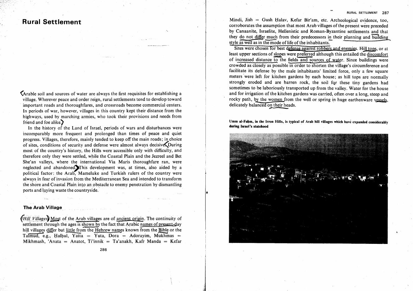
Rural Settlement
(Arable soil and sources of water are always the first requisites for establishing avillage. Wherever peace and order reign, rural settlements tend to develop towardimportant roads and thoroughfares, and crossroads become commercial centers.In periods of war, however, villages in this country kept their distance from thehighways, used by marching armies, who took their provisions and needs fromfriend and foe alike)
In the history of the Land of Israel, periods of wars and disturbances wereincomparably more frequent and prolonged than times of peace and quietprogress. Villages, therefore, mainly tended to keep off the main roads; in choiceof sites, conditions of security and defense were almost always decisive(Duringmost of the country's history, the Hills were accessible only with difficulty, andtherefore only they were settled, while the Coastal Plain and the Jezreel and BetShe'an valleys, where the international Via Maris thoroughfare ran, wereneglected and abandone~This development was, at times, also aided by apolitical factor: the Arab, Mameluke and Turkish rulers of the country werealways,in fear of invasion from the Mediterranean Sea and intended to transformthe shore and Coastal Plain into lin.obstacle to enemy penetration by dismantlingports and laying waste the countryside.
The Arab Village
(Hl1lfi(ll!gei» }'fost of the Arab. villages are of ancient origin. The continuity ofsettlement through the ages is shown by the fact,that Arabic!lames ofpresent-dayhill villages differ but little from the Hebrew names known from the Bible or the
..--~ . . ---riA '......-.. - - - _. - : >= ~
Talmud, e.g., Halhul, Yatta = Yuta, Dora = Adorayim, Mukhmas =Mikhrnash, 'Anata = Anatot, Ti'innik = Ta'anakh, Kafr Manda = Kefar
286
i
RURAL SETILEMENT 287
Mindi, Jish == Gush Halav, Kefar Bir'am, etc. Archeological evidence, too,corroborates the assumption that most Arab villages of the present were precededby Canaanite, Israelite, Hellenistic and Roman-Byzantine settlements and thatthey do not differ~ from their predecessors i.!!...their planning and "'biiilding,.style as well as in the mode of life of the inhabitants.
Sites were chosen for best defeg§e agamst robbers and enemies. Hill tops, or atleast upper sections of sloees were greferred although this entailed the discomfortof increased distance to the ~elds and s(imrces of water. Since buildings werecrowded as closely as possible in order to shorten the village's circumference andfacilitate its defense by the male inhabitants' limited force, only a few squaremeters were left for kitchen gardens by each house; as hill tops are normallystrongly eroded and are barren rock, the soil fqr these tiny gardens hadsometimes to be laboriously transported up from the valley. Water for the houseand for irrigation of the kitchen gardens was carried, often over a long, steep androcky path, ~ the women from the well or spring in huge earthenware v~,delicately balance3 on their heads. .
~
Umm al-Fabm, in the Irron Hills, is typical of Arab hill villages which have expanded considerablyduring Israel's statehood
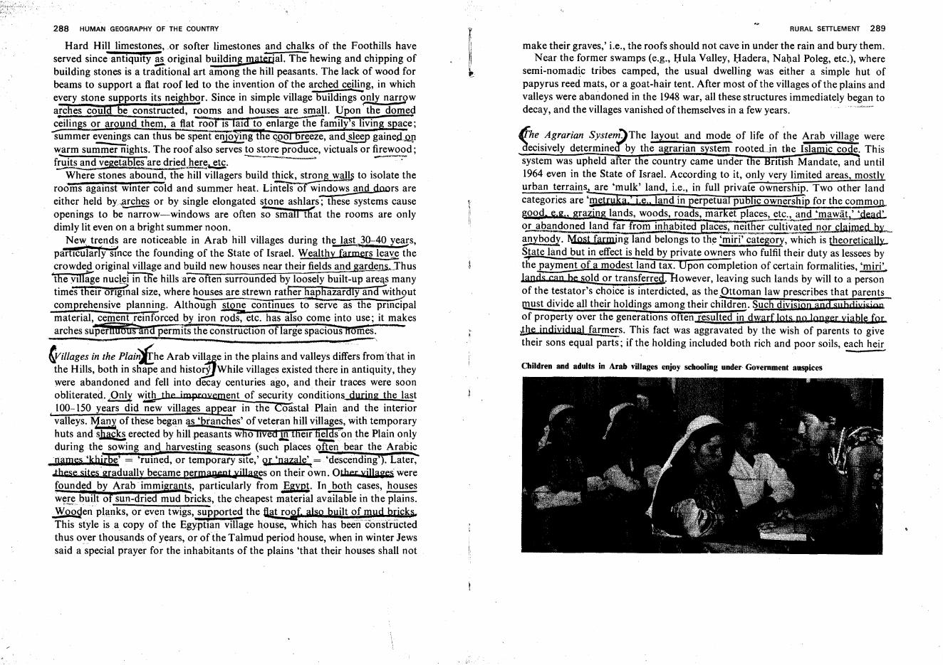
288 HUMAN GEOGRAPHY OF THE COUNTRY
Hard Hill limestones, or softer limestones and chalks of the Foothills haveserved since antiquity ~ original building material. The hewing and chipping ofbuilding stones is a traditional art among the hill peasants. The lack of wood forbeams to support a flat roof led to the invention of the a!:,hed c~~g, in whichevery stone supports its nei hbor. Since in simple village buildings o.!!Jy nan;$>warches cou be constructed, rooms and houses. are small. Upon' the domedc~ilin s or around them, a flat roof IS laId to' enlarge fieantiiy1s livin s ace;summer evenings can thus be spent enl0;ting t e cR,? .!]eze, and~sleep gaines:l.Q..{lwarm summer nights. The roof also serves to store produce, victuals or firewood;... . ~ ---f~a~d vegs.tables"'aredri~~..etc. .
Where stones abound, the hill villagers build thick, strong wa;lli to isolate theroo·ms against winter cold and summer heat. Li~ls of-;indo~s and doors areeither held by~~ches or by single elongated s.1Qne ashlars; these systems causeopenings to be narrow-windows are often so smalnErat the rooms are onlydimly lit even on a bright summer noon.
Newrbtr~n~~ are noticeable in Arab hill villages during the last}~40 ye::gs,parhcularly smce the founding of the State of Israel. Wealthy farmers lea';E thecrowd~original village and build new houses near their fields and gardeIlS...~Thus
"the Yillagenuc~ in the hills are often surrounded by loosely built-up are~ manytimes theIr ongmal size, where ~uses are strewn rather h~phazardlyand wit~ut
comprehensive planning. Although stone continues to serve as the pnncipalmaterial, cement reinforced by iron~etc. has also come into use; it makesarches su~rHuffiiiana ~ermIfs the constructIOn oflarge spacious Ifomes.
fFillages in the Plili;;j£he Arab vil~e in the plains and valleys differs from 'that inthe Hills, both in shape and histoEilWhile villages existed there in antiquity, theywere abandoned and fell into decay centuries ago, and their traces were soonobliterated. pnly with ent of security conditions during the last
I 100-150 ,years did new villages appear in the oastal Plain and the interiorvalleys.l\1an of these began s' ranches' of veteran hill villages, with temporaryhuts and shac,!2 erected by hill peasants w 0 IveJ!l. err ~_fonthe Plain onlyduring the sowing anp harvesting season~. (such places ften bear the Arabicnaw,~ 'kbjrhe'= 'ruined, or temporary SIte,' or 'pazale'= 'descending . Later,Jbese sitks 'gradually became permaQ,pt,.yjlJa-&E~on their ~wn. Other xiJl.a~es werefounded by Arabimmi8ran~, particularly from~. In both cases, ,housesw~re.,.built of sun-dried mud bricks, the cheapest material available in the plains.Woo,2en planks, or even twigs, supported thet4!t roof. also built of Illud ,bricks.This style is a copy of the Egy.ptian village house,':hich has been'c~onsfriictedthus over thousands of years, or ofthe Talmud period house, when in winter Jewssaid a special prayer for the inhabitants of the plains 'that their houses shall not
RURAL SETTLEMENT 289
make their graves,' i.e., the roofs should not cave in under the rain and bury them.Near the former swamps (e.g., 1:1ula V-alley, Hadera, Nahal Poleg, etc.), where
semi-nomadic tribes camped, the usual dwelling was either a simple hut ofpapyrus reed mats, or a goat-hair tent. After most of the villages of the plains andvalleys were abandoned in the 1948 war, all these structures immediately began todecay, and the villages vanished of themselves in a few years.
D-he Agrarian System')The layout and mode of life of the Arab village were)ecisively determinet"by the a rarian s stem rooted_jn the Isla ic code. Thissystem was upheld after the country came under t e rifish Mandate, and until1964 even in the State of Israel. According to it, only very limited areas, mostlyurban terrains,,! are 'mulk' land, Le., in full private o~nership. Two other landcategories are 'metruk ' 1 e. land in perpetual publIc ownersfiI for the commonood razin lands, woods, roads, mar et places, etc., and 'mawat}' 'dea~l'
~r .l':~~l)doned land far.' rom inhabited places, nett er culti~ted nor claiw~~~llYbod!£. Most farming land belongs to th~ '~iri'categ~ri,';hich i~ theoreticallySate hmd but in effect is held by private owners who fulfil their duty as lessees bythe payment of a modest land tax. pon completion of certain formalities, 'mid'.laud; can be sold or transferred.. However, leaving such lands by will to a personof the testator's choice is interdicted, as the gaoman law prescribes that parentsmust divide all their holdings among their children. Such divisjon iiiiiG"bdjyj;jguof property over the generations often resulted in dwarf lots no longer yjablUQt.~k iudjyjdual farmers. This fact was aggravated by the wish of parents to givetheir sons equal parts; if the holding included both rich and poor soils, each heir- ..
Children and adults in Arab villages enjoy schooling under' Government auspices
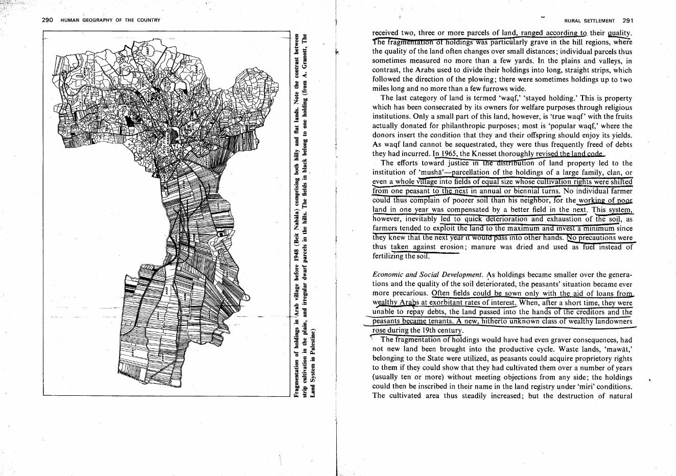
290 HUMAN GEOGRAPHY OF THE COUNTRY RURAL SETTLEMENT 291
received two, three or more parcels of land, ran ed accordin to their g,ua~.
he fragm IOn 0 0 mgs was particularly grave in the hill regions, wherethe quality of the land often changes over small distances; individual parcels thussometimes measured no more than a few yards. In the plains and valleys, incontrast, the Arabs used to divide their holdings into long, straight strips, whichfollowed the direction of the plowing; there were sometimes holdings up to twomiles long and no more than a few furrows wide.
The last category of land is termed 'waqf,' 'stayed holding.' This is propertywhich has been consecrated by its owners for welfare purposes through religiousinstitutions. Only a small part of this land, however, is 'true waqf' with the fruitsactually donated for philanthropic purposes; most is 'popular waqf,' where thedonors insert the condition that they and their offspring should enjoy its yields.As waqf land cannot be sequestrated, they were thus frequently freed of debtsthey had incurred. In 1965, the Knesset thoroughly revised t
The efforts toward justice 10 e n ution of land property led to theinstitution of 'musha'- arcellation of the holdings of a large family, clan, or~ven a whole VI age into fields of equa size whose cu Iva Ion ng ts were s I tedfrom one peasant to tfi·· next in annual or biennial turns. No individual farmercould t us complain of poorer SOl t an his neig or, or the working of pomland in one year was compensated by a better field in the next. ,\his system,however, inevitably led to quick detenoratlOn and exhaustion of the s<ill, asfarmers tended to exploit the land to the maximum and Invest a mInimum sincethey knew that the next year It would pass Into other liands. tio precautions werethus taken against erosion; manure was dried and used as fuel instead offertilizing the soil.
Economic and Social Development. As holdings became smaller over the generations and the quality of the soil deteriorated, the peasants' situation became evermore precarious. Often fields could be sown only with the aid of loans froIlL~ealth:t Ara~s at exorbitant rates of interesh When, after a short time, they wereunable to repay debts, the land pas.sed into the hands of the creditors and the
-peasants became tenants. A new, hitherto unknown class of wealthy landownersrose durin'g the 19th century.
"\" The fragmentation of holdings would have had even graver consequences, hadnot new land been brought into the productive cycle. Waste lands, 'rnawat,'belonging to the State were utilized, as peasants could acquire proprietory rightsto them if they could show that they had cultivated them over a number of years(usually ten or more) without meeting objections from any side; the holdingscould then be inscribed in their name in the land registry under 'miri' conditions.The cultivated area thus steadily increased; but the destruction of natural
292 HUMAN GEOGRAPHY OF THE COUNTRY
vegetation, the frequent plowing, and sowing of weak-rooted grains promotedsoil erosion since the peasants could not afford costly terracing and other soilconservation measures. Often the terrain was finally abandoned again afterseveral years of cultivation.
,Until the present century, the 1rab farm was, in general, self-sufficient, withgrain as lis mam crop-wheat and barley m winter, durra (primitive sorghum),sesame, and other species in summer. As grain growing was practiced not only inthe plains but also in the hills, it constituted another factor to hasten soil erosion.In both hills and plains grain was complemented by herds of goats and sheepwhich provided milk, meat, and wool. In the hills, olives were another importantbranch of farming. Vegetables were grown on a very limited scale near the homesto.nrovide fresh food for the family.
Changes began to be introduced, first under the influence of Christianmonastefils lying near Arab villages and, later, of Jewish settlement. MQn~,many of them experienced in the Mediterranean type of agriculture, furthered thecultivation o[)vine grW?es and other fruit and ~tructed the peasants i!1 mOE~
efficient farming methods. The first rapid growth of Jewish population and"-settlement provided gamful employment for Arab peasants and affordedthem a_. '" ~
more or less fixed source Of income. I'he peasants also learned ways of intensivefarming from their employers. They soon copied th'em on then own holdings~i,!1vested the mon~y thus ,l'Mned. 1he s£reading cities, with their Jewishpopulation, opened a steadily widening market for Ara151arm produce. Furthermore, the quest for rural and urban hoRlmgs by..!he lewIs" newcot':ters cause?land prices to soar, and many Arab peasants and large landowners grew rich byspeculahve lal'id sales:= This deveTopIIlelll tooK place mainly in)henelgFiborfioodof the ,Jewish cent~ in the Coastal Plai? which attrfiCteifthousands of Arabvillagers from the hills. ~ab villages of tne Coastal Plain grew rapidly; some ofthem attained a population of several thousands. They prospered, introducedirrigated crops and planted citrus groves on wide areas. In 1939, half of the 75,000acres of citrus plantations in tYe country were in Arab p~essio.n. ~
This economic progress was somewhat retarded by the 1936-39 disturbances,and late;'""by the ~cond~orld.War. The war of 1948~o~@ac~eregrouping of the Arab rural population; inside the State 0 sraef the Arabinhabitants remained ITl'1U~ v!llage§, W~;rof them Ln the Hill regio~s. The waraltered the composition of the non-Jewish population as the percentage. ofMoslems decreased and that 0f Christians and Druze rose. It also caused ap....ofound social readjustment. Both the classes of wealth~, often absent~landlords, and of poor, exploited tenant farmers dlsappeared':'Almos{ all Arabfarmers (ins1de the pre-1967 borders) work ~heir own land today;;nd discrepanciesfrt the size of holdings are greatly diminished...
RURAL SETTLEMENT 293
(The Arab Village in the State of Israd}The events of 1948 brought undoubtedsuffering not only to those who followed the call of the Arab leaders and becamerefugees but also, as in every war, to those who stayed in the villages. Since then,however, the non-Jewish rural population has made spectacular progress and theArab village; have reached a degree of prosperity pre~ously unknown. MarketTng conditions tor produce are better than ever before, and SCientIfic 'instructionand experimentation through Government institutions have brought l!,..steep risein efficiency and crop yiel<!s. Most of the Arab hill villages have olive groves andtobacco as their economic backbone and have also introduced intensive branchessuch is deciduous fruit orchards, vegetable plots, and milch cattle. Governmenta encies aid in reclaimin and terracing new land, and in replacing those holdingsost by the demarcation of Israel's borders or other causes. Especially importantare the economic, health and social services provided by the State (water and.electricity supply, buildin roads to the villages, clinics, schools, etc.). r;;.pduCe.TS'coo era Ives are nd there is a e mnm industrial undertakings,especially those linked to farm produce (fruit and vegetable preserves, to acco£~(;cessing, etc.). An increasing number of villagers go to the towns and cities toworkju,the-Siilding trade in industr s vices and most of their earnings arebrought back to their homes. Many oun vi a ers receive voca IOna or~cientific trainins, and the ~ences in the living~~andard and mode of lif!:,betwe nd Jewish villages steadily grow smaller.
Most of the larger Arab villages ave set up ocal coun ils and ar' ded inthe State budgets for d~lopmeni, education, an ot er services. The tendency is~organize the other Arab vj1Jages m the framework of resional'"\:ouncils alongwith Jewish settlements and to provide the saine services and facilities that areertended to their Jewish neighbors. Local councils of Arab Villages ate fully~sslsted1;;-iheir work by Governm_~1!t~~pertsj~ municipal matters.
(Rural housing scherriesnave been carried out in a number of Arab villages,and projects are under review for erecting villages or semiurban centers forbedouin.. w~o are becoming settled farmers or work permanently in otheroccupatIOns)
Jewish Rural Settlement
The development ofJewish agricultural~t, its special types andsocia!forms were determined by,geographical factors. (1.Qcal topography, c,t!mate, soils,
_water, etc.) ~l as by~he.origin of settlers, ~eir !d~~~, their own fi~an .{fIeaos and those atthe disposal 9( the s"ettlem~~t.mstItutlOns, an t e skills andprinciples ofplanners and settlers. .
. ~""""""--._.__-_.=_._~."..-*=--_.,.,.J
294 HUMAN GEOGRAPHY OF THE COUNTRY
Geographical Distribution of Jewish SettlemeU/..;.· In Jewish settlement, the firstnucleus-took form in the Coastal Plain; it was followed by penetrationinto the~ of the interi~ and7 only in th6 later stages, an expansion to parts (;7theHills and the Neaev. ~~ - .
After two attempts in 1878 ad :ttere;Iement started with the foundingof VI ag reglO s- os mna on the rim of the Hula Valley,Zikhron Ya~qov on .the southern spur of Mt. Carmel, Petah-Tiqwa near theYarqon course, and Rishon le-Zion in the Judean Coastal Plain. Soon, however,the vicinity of Jaffa, the port of en't-~y for all immigrants, became the princjpalcenter of Jewisfi'S'ettlemenf."By 1900, this group of villagesbad spread south toBe'er Tuvya; a first foothold was gained in the Northern Sharon (Hadera), andsome 'daughter settlements' were added to the veteran villages of ZikhronYa'aqov and Rosh Pinna.
Between J900 and 191~ the first Jewish villages appeared in Easteru~r
Galilee and in the Kipneret Valley, and more settlements were built in the centralpart of the Coastal Plain. Between 1920 'iiid 191.5, the Jezreel and l;Iarodv~swere the heart of ~~.wish pioneering; in the ~ar0.!1 a contmuous chain of villa,gescame into being, and the ground was prepared for the comprehensive develop.!pent of the Haifa Bay area. . . ) __...."""'t
Durmg the- 1936-39 disturbances, Jewish settlement spread to new regions.'Tower and Stockade' villages were erected in the Bet Sfie'an and l;Iula valleys, inthe Acre Plam, and 10 hilly Western Upper GalIlee. ·t'fre JeWIsh populationcenters of the Sharon and of the Jezreel vall,9' were link¢ by a 'settlementb'ndge' through the Menashe Region, and those of th'e Jareel and Kinneretv.~.neys·by another 'bndge' through Eastefn Lower Gahlee.
The mosUmporfanf achje"emcot of settlement policy between the outbreak ofthe Second World War and the founding of the State was penetration of theSouthern Coastal Plain and the Northern Nege\j. - . ..,
In the years of statehood, the number of Jewish farming vjJIages has t~dand today approach.es...800; they extend over practically all parts of the countrywithin the old borders of the State of Israel except the deserts of the Central andSouthern Negev. After the 1967 war, settlement activity has started in the Golanand elsewhere in thenew t;;Itories and has been stepped up in areas within thepre-June borders (e.g. Arava Valley, Eshkol Region, etc.).
rerystallizatio~ of Fcgm TveeV The places of origin of the first settlers andfounders of VIllages and their Ideas of farming explain their preference for plainsand valleys. Coming from Eastern and East Central Europe, which are mostly flat~s where!arming was then almost equated with grain cultivation.uhey triedto model their new farms in the same fashion. They found fitting soil,~outwardly
RURAL SETTLEMENT 295
resembling the chernozem of their countries of origin, in the swamp lands of theCoasi-aIPlain and of the interior valleys; these malaria-infested lands weredeserted and the pricesconseguently were not p~hjbftjye >
-- Baron Edmond de Rothschild took the existing villages under his protectionand founded new dries. two aecislve changes were made. Gram crops'werereplaced by plantahons of vines almonds etc., with the essentially soundassum itions of this countr ' resembled those ofSou ern France rather than those of Eastern Euro e. Because t ese ruit species
e er 1 SOlis, the re sands of the Coastal Plain entered the orbit of Jewishsettlement.
A third stage was reached when, in 1899, the ICA society assumed the care ofthese ~ls!n'illages. Aiming to create a class of real workers of the soHmst~ffie tal iii-aeti1hmstrat~r type which had developed in the plantation villages of theCoastal Plain, ICA saw the solution in farms based on field crops. For thispurpose they b~ht new land, heavy basalt soIls in Eastern Lower Gaiilee(Yavne'el, Kefar Tavor, etct--
Two types of farfl'Iilf'g;-which characrerize Jewish agriculturt( to'Ihisday.jnakform 'In the decade preceding the First World War: ~ citrusfar~ and mixedfirming bas~d on the dairy lieiO:-Q~'gfoWihg was o~amzed efficiently~based on scientific research, efforts in which Y. El'azari- ~lcani was prominent.The protagonist of mixed farming was A. Ruppin, who was then head of thePalestine Office of the Zionist Organization at Jaffa. gr. Ruppin insisted that.onl the mixed farm ensures a stable economy, where a gain made in one or moreuccessfii ranches cancover losses incurred simultaneously by~'nother branch.
Both the citrus farm and the mixed farm are--mrrstsliccessfUttff"plairis'ahdv!lle~s, wher~r is av7illable f~r irrigation. Fo~ citrus, the red sands oftlieCoastal Plain are best, while mixed farming can succeed on the intermediate soiltypes ofthe Coastal Plain as well as on the heavy soils of the interior valleys.
The outposts established jg newj'eglons during the 'decade before Israel'sstatehoOd-the Hills and.F'oothills, t~ Northern' Negcil~c.- 'necessitatedresearch and experImentation with additional types of farming to suit conditions10 these areas; mass settlement after 1948 increased the ur enc 0The requirements of expanding the natrona economy also- called for greatervariegation in farming produce. The achievements over the years of statehoodcan be summed up as follows: a manifold increase of production in almost allbranches sufficient tQ fill the food reqmrements of the population in all items with
'few exceptions ;Jarge-scale introduction of 'industrial crops' (sugar beet, cotton."groundnuts, etc.), partly for export; adaptation of farm t)'p~~ 19 QQPdjtjoos Of •
~ery geograph~:.al region) e.g., 'hill farms,' 'foothill farms,' 'plantation farms,'field crop farms,' 'grazing farms,' 'Arava Valley farms,' etc.; comprehensive
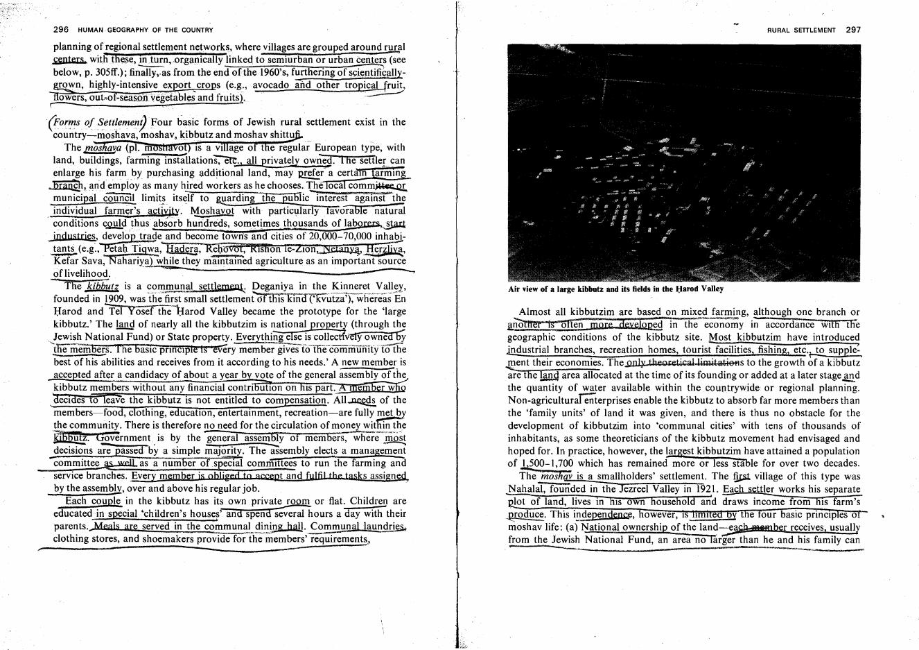
296 HUMAN GEOGRAPHY OF THE COUNTRY
planning of regional settlement networks, where villages are grouped around rural~nters, witii'the,se, in turn, .organically linked,to semiurban or urban centers (s~ebelow, p. 305ff.); fin~s from the end of the 1960's, furthering of scientifrcaUy~n, highlY4-intens~~e~~P?rt.crops (~.g,:, avocado· and other tropical Jruit,
owers,.oubof-seas.ouVegetables and fruits), ..~r . ,
(for':ls ofSettlemeny Four basic forms of Jewish rural settlement exist in thecountry-moshava, moshav" kibbutz and moshav shittu
The ffiOS alIa (pl. m 0 IS a VI age 0 t e regular European type, withland, buildings, farming insta'ilations:-a;, all privateb; owned. I fie settler.5anenlarge his farm ,by purchasing additional land, may urefer' a certam armm~landemploy as many hired workers as he chooses. lJ!: oca comm~municipal c~l limits itself to 1@arding the pu@ic interest agal'i'iS't'the
. individual farm~r's acti~itY. Moshavot with particularly favorable naturalconditions c.2!:!!.d thus absorb hundreds, sometimes thousands of laborers.,~ingJlstries, develop trade and become towns and cities of20,000,..-70,000 inhabi
.tants (e.g~,""Petal) Tigwa,"~, Reb'oyot, RlsHon re-ZlOn:::JSIetan~,1!e.r~liY;,Kefar Sava, "Nahariya) ~hile they IIla.intarned agriculture as an importantSouf(?eof livelihood. " -.,
- Tfie kibb~ti is a c0I"I}!!!.!illa! s~ttlemenl: Deganiya in the Kinneret Van.~y,founded in 1909, was the first small settlement"dtTIi1skind1'1(Vutza'j7'"wf}'er'eas En- ....Harod and Tel Yosef the Harod Valley became the prototype for the 'largekibbutz.' The land of nearly all the kibbutzim is national property (through the
.!ewis~ National Fund) or State property. Everyt~~iscoUect?v~owneabY~member-so I he baSIC prInCiple Is 'every member gives t<illie'"communifyi<5'thebestof his abilities and receives from it according to his needs.' A new memb~. isacce ted after a candidacy of about a year b vote of the general assembly of thekibbutz members without any financial contrI utlOn on IS part. em er w S)
deCides to leave the kibbutz is not entitled to compensation. All~ of themembers-food, clothing, educatIOn, entertainment, recreation-are fully ffi;e,W>ythe community. There is therefore no need for the circulation of money wit i~ the~. 'Q£.vernment is by the -general assembly of memberS:-~eiIio~decisions. are ..Eassed by a simple majority. Th;assemblyelects a management-committe~ well as a number of special committees to run the farming andservice branches. Every member is obliged to accept and fulfil the tasks assignedby the assembly, over and above his regular job.
Each couple in the kibbutz has its ownpriva~ or flat. Child~ areeducated in special 'children's housef and spend several hours a day with theirparents...Meals are served in the communal dining hall. Communal launqri~
clothing stores, and shoemakers prov'ide for~tlle'rri~mbe~"requirement~,
RURAL SEITLEMENT 297
Air view of a large kibbutz and its fields in the Harod Valley
Almost all kibbutzim are based on mixed farming, although one branch or!..@~r :w often ....more aev,rop~d in-'the'"'~co~;;;y in accordance Wlfli" tliegeographic conditions of the kibbutz site. Most kibbutzim have introducedindustrial branches, recreation homes, tourist facilities, fishing, etc.ri0 supple: ,.J.2ent their economies. The Only theo&.et.icllllimitatie+1s to the growth of a kibbutzare the land area allocated at the time of its founding or added at a later stage~.dthe quantity of water available within the countrywide or regional planning.-Non-agricultural enterprises enable the kibbutz to absorb far more members thanthe 'family units' of land it was given, and there is thus no obstacle for thedevelopment of kibbutzim into 'communal cities' with tens of thousands ofinhabitants, as some theoreticians of the kibbutz movement had envisaged andhoped for. In practice, however, the largest kibbutzim have attained a populationof ,1?00- 1,700 which has remained more or less stable for over two decades.
The '*moShav is a smallholders' settlement. The fil:s1 village of this type wasNahalal, founded in the Jezreel Valley in 1921. Each settler works his separate
lot of land, lives in filS own household an'd d;aws income from hiS farm'swoduct?. This independence, owever, IS I ley e our basic princiji es 0moshav life: (a) National ownership of the land-eae.h..mttmber receives, usuallyfrom the Jewish National Fund, an area no large;"'than he and his family can
. _ w &,",,- •. " -
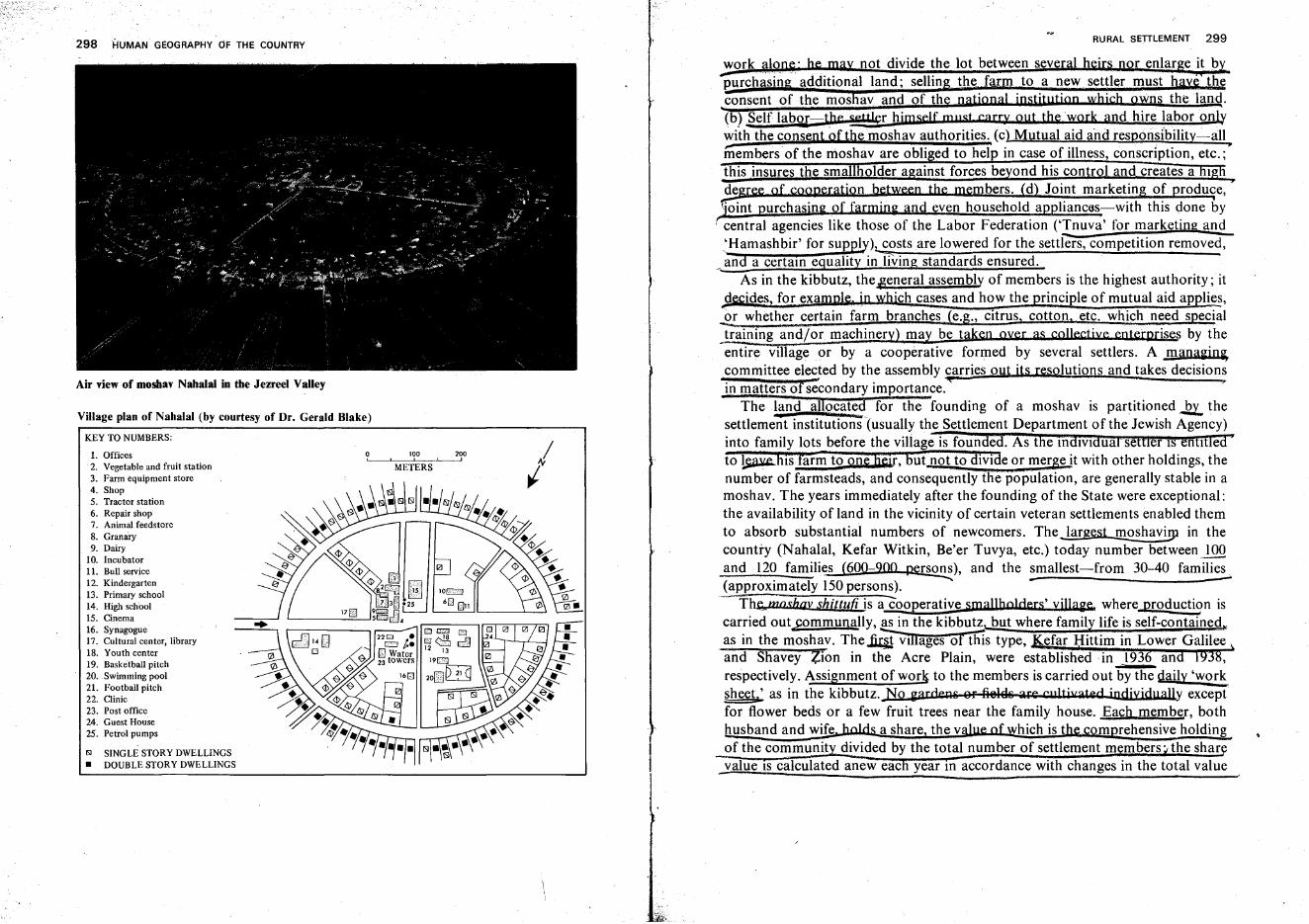
298 HUMAN GEOGRAPHY OF THE COUNTRY
Air view of moshav Nahalal in the Jezreel Valley
Village plan of Nahalal (by courtesy of Dr. Gerald Blake)
KEY TO NUMBERS:
1. Offices2. Vegetable and fruit station3. Farm equipment store4. Shop5. Tractor station6. Repair shop7. Animal feedstore8. Granary9. Dairy
10. Incubator11. Bull service12. Kindergarten13. Primary school14. High school15. Cinema16. Synagogue17. Cultural center, library18. Youth center19. Basketball pitch20. Swimming pool21. Football pitch22. Clinic23. Post office24. Guest House25. Petrol pumps
E>1 SINGLE STORY DWELLINGS• DOUBLE STORY DWELLINGS
100I
METERS
200I
RURAL SETTLEMENT 299
work alone' he may not divide the lot between several heir§ nor enlarge it bypurc asin 'additional land; sellin the farm to a new settler must h j i he..consent of the mos av and pf the national jnstitutjQD whjch owns the land.(b) Self labor the settkr himself mllst carry Qut the 'work and hire labor only
~ . .~.', - - ' - ','. - - - - -- - ----~
with the consent of the mQshav authorities. (c) Mutual aid and responsibility-alliiiembers' of the moshav are obli ed to help in case Qf illness, conscrIptiQn, etc.;'this insures the sma older against forces beyond his control and creates a 19degree Qf cooperatiQn between the members. (d) JQint marketing of produce, •%Ilt purchasing of farming and even hQusehold appliancas-with this done by
r central agencies like those of the Labor Federation ('Tnuva' for marketing and'Hamashbir' for suPe.!>')~osts are lowered for the setders, competition removed,
_~~d a certalO eguality inl'i\,ing standards ensured.As in the kibbutz, the~eneral assembly of members is the highest authority; it
jecides, for exampl". in which cases and how the principle of mutual aid applie~,
.2!. ~hether certain farm branches (e.g., citrus, cotton. etc. which need specialtraining and/or machinery) ma~ be taken oyer as coJlectjYe ent$<rpris«s by theentire' village or by a cooperative formed by several settlers. A managin~
committee elected by the assembly carries out it§ re§olutions and takes decisionsin matters of 8e'condary importance.~· •
The land allQfated for the founding of a moshav is partitioned...2t, thesettlemeii't institution'nusually the Settlement Department of the Jewish Agency)into family lots before the village is founded. As the In.d1V1dual settler is enutlea·to ~JHs rar~ to Qnwr, but not to divide or mergejt with other holdings, thenumber of farmsteads, and consequently the population, are generally stable in amoshav. The years immediately after the founding of the State were exceptional:the availability of land in the vicinity of certain veteran settlements enabled themto absorb substantial numbers of newcomers. The largest moshav!!p in thecountry (Nahalal, Kefar Witkin, Be'er Tuvya, etc.) today number between lQ.Qand 120 families (600~9QQ persons), and the smallest-from 30-40 families(approximately 150persons). -- - -
The..mO£hav shittufi. is aCooperative smaJlholders' yiJIage where production iscarried out.Fommunally,~n the kibbu~_but where family life is self-contained"as in the moshav. The~ v1IIages of this type, Kefar l:Iittim in Lower Galilee \and Shavey Zion in the Acre Plain, were established in 1936 and 1938,respectively. Assignment of work to the members is carried out by the daily 'worksheet~ as in the kibbutz. No gardeg~ Sf f.i818~ ;;u:e cultivated jndiyjdually excePi'for flower beds or a few fruit trees near the family house. Each member, bothhusband and wife, holds a share, the value of which is thl( cQmprehensive holdingof the communit divided by the total number of settlement members' the shar
_value IS calculated anew eac year 10 accordance with changes in the total value
300 HUMAN GEOGRAPHY OF THE COUNTRY
( of tbegettJement's holdings. By the assembly's resolutions, each family receives amQnthly hQusehQld bud~et adapted to the financial situation of the village:SpecIal arrangements..·are .made for the wQmen",j they work in the communalenterpris~s'3-4hoursdaily; the rest Qf their time, as wll~riday, isd::yoted tb
"1ne"hQmeand childrert. • - e ....
q 'As in the case of the kibbutz, there is no theoretical hindrance to the growth ofa moshav shittufi intQ a populous settlement; villages of this type, however, haveremained much smaller than the average kibbutz; none exceeds 400 inhabitants.. A ,~~~iety of the moshav was the gwshay gUm, ~the immigrant smallhQlders'
,,~JL!~e. Jff tb,c::)irst years Qf statebQQd, the vital needs of increasing agriculturalproduction and absorbing masses of unskilled newcomers in productive workwere met by seeking a joint solution tQ both prQblems in this forrn of settlement.Since there was no time for the immigraI1t§ to receive a thorough training beforehand, they had tQ be~iv~I!.,!!t~nt?.s:~~uid~",}Yrile they were fQunding t!J.l<ir<?wB farms. They often had to be taught the rudiments of farming as well aselementary rules of organization and social cooperation, even of hygiene, childcare, education, etc. A host of instructors were therefore mQbilized by Govern-ment and Labor Federation bodies, settlement associations, etc. '
Every immigrants' settlement was allocated an area sufficient for an auxiliaryfarm for each settler at the beginning, and a regular-sized farm when he hadgained adequate experience to handle it. In the initial stages most branches ofagriculture were worked cooperatively; the farms were later divided according tothe settlers' wishes. In many cases an intermediate system was devised whichcontributed to efficiency: large, continuous fields for specified cropste.g., cotton,sugar beet) were formed from the parcels belonging tQ different farmers.Mechanized work is carried out for all together, and hand work is dQne by eachfarmer. Water installations for irrigation, farm buildings, and equipment areprovided for in the budget allotted to each settlement.
Eventually, almost all moshvey olim have become self-reliant economically,adopted the basic principles of moshav life and joined the countrywide moshavmovements.
Subvarieties of the moshav olim, transitional in character and adapted to localor regional conditions, were the following: plantation villages, which revivedabandQned vineyards and groves of olives and other fruit and where settlersworked at first as hired laborers. The groves were later parcelled Qut and takenQver at the settlers' Qwn respQnsibility. AnQther type were grain villages, set upmainly in the SQuthern CQastal Plain where fields CQuid at first be cultivated Qnlyextensively; the settlers wQrked either as hired labQrers Qr cQQperated withveteran kibbutzim Qr mQshavim. When mQre water became available, they CQuidintrQduce intensive farming and their villages CQuid becQme regular mQshavim. A
RURAL SETILEMENT 301
third variety were the labor villages, founded mainly in Hill regions where notenough land was suitable for immediate farming, but could be made availablethrough reclamation. In these cases the settlers were employed by the JewishNational Fund in vast afforestation and reclamation programs and were given asmall plot of land to begin the rudiments of a farm. As more land was cleared andsuited for cultivation, the plots were gradually enlarged to become, finally,full-fledged farms. A last variety are outpost villages where settlement is the bestway to improve the security situation, but where farming can become profitableonly after years of thorough reclamation work. In many ef these cases, Nahal(Pioneer Settler Corps) units of the Israel Army build the villages; soldiersremain, in many instances, after demobilization as permanent settlers.
Blueprints for the Various Settlement Forms. The veteran moshavot were plannedupon the model of the usual village layout in Eastern or Western Europe.Dwellings were usually built along a broad, straight road, with the farmyard andstructures behind it. In accordance with the security situation, buildings were setclQse together and sometimes connected by an outer protective wall (e.g.,Metulla, north of the Hula Valley, Mizpa, Ilaniya in Lower Galilee, etc.). As themoshavot grew, particularly in the Coastal Plain, the original blueprint wasovershadowed by new planning, and any uniformity in the building styledisappeared. Local authorities dealt only with construction of thoroughfares,administrative buildings, and other public amenities. As moshavot turned intocities, town-planning schemes replaced village blueprints.
Kibbutzim have almost all been built Qn previously unoccupied sites. Thismade it possible to prepare blueprints along rational lines, without the impediment of existing structures. Plans for communal settlements were drawnprincipally by the architect Richard Kauffmann, whose numerous original ideashave since been adopted everywhere. Above all, his schemes considered thefunctional relationship of structures and groups of buildings, but also suited thebasic plan to local topography and to the social and economic conditions andspecial requirements of each village.
Kauffmann recommended a strict separation between the residential zone andthe farmyard. The western section of the area was usually set aside for livingquarters. Since in nearly every part of Israel westerly winds prevail, theinhabitants can thus enjoy the fresh sea breeze, while the farmyard smells areremoved from the residential ZQne. The separatiQn between the tWQ areas is oftenaccentuated by planting avenues Qftrees and lawns alQng the dividing line.
The CQmmunal dining hall with its kitchens is preferably in the center Qf theresidential ZQne tQ make it easily accessible tQ the entire pQpulatiQn. A gQQd roadshQuld lead tQ the kitchens tQ facilitate the apprQach Qf the trucks hauling
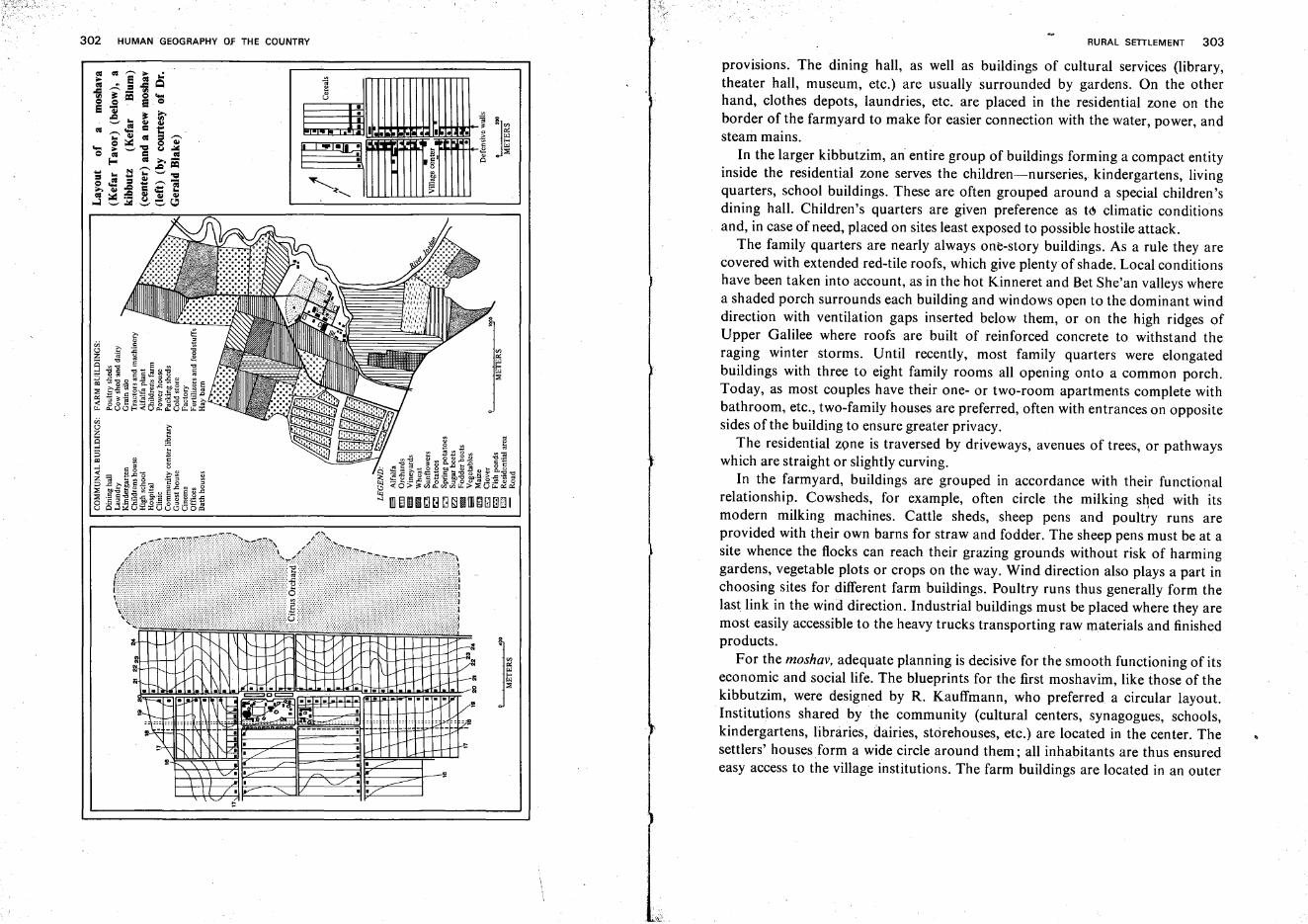
302 HUMAN GEOGRAPHY OF THE COUNTRY RURAL SETTLEMENT 303
provisions, The dining hall, as well as buildings of cultural services (library,theater hall, museum, etc.) are usually surrounded by gardens. On the otherhand, clothes depots, laundries, etc. are placed in the residential zone on theborder of the farmyard to make for easier connection with the water, power, andsteam mains.
In the larger kibbutzim, an entire group of buildings forming a compact entityinside the residential zone serves the children-nurseries, kindergartens, livingquarters, school buildings. These are often grouped around a special children'sdining hall. Children's quarters are given preference as to climatic conditionsand, in case of need, placed on sites least exposed to possible hostile attack.
The family quarters are nearly always one-story buildings. As a rule they arecovered with extended red-tile roofs, which give plenty of shade. Local conditionshave been taken into account, as in the hot Kinneret and Bet She'an valleys wherea shaded porch surrounds each building and windows open to the dominant winddirection with ventilation gaps inserted below them, or on the high ridges ofUpper Galilee where roofs are built of reinforced concrete to withstand theraging winter storms. Until recently, most family quarters were elongatedbuildings with three to eight family rooms all opening onto a common porch.Today, as most couples have their one- or two-room apartments complete withbathroom, etc., two-family houses are preferred, often with entrances on oppositesides of the building to ensure greater privacy.
The residential zone is traversed by driveways, avenues of trees, or pathwayswhich are straight or slightly curving.
In the farmyard, buildings are grouped in accordance with their functionalrelationship. Cowsheds, for example, often circle the milking shed with itsmodern milking machines. Cattle sheds, sheep pens and poultry runs areprovided with their own barns for straw and fodder. The sheep pens must be at asite whence the flocks can reach their grazing grounds without risk of harminggardens, vegetable plots or crops on the way. Wind direction also plays a part inchoosing sites for different farm buildings. Poultry runs thus generally form thelast link in the wind direction. Industrial buildings must be placed where they aremost easily accessible to the heavy trucks transporting raw materials and finishedproducts.
For the moshav, adequate planning is decisive for the smooth functioning of itseconomic and social life. The blueprints for the first moshavim, like those of thekibbutzim, were designed by R. Kauffmann, who preferred a circular layout.Institutions shared by the community (cultural centers, synagogues, schools,kindergartens, libraries, dairies, storehouses, etc.) are located in the center. Thesettlers' houses form a wide circle around them; all inhabitants are thus ensuredeasy access to the village institutions. The farm buildings are located in an outer
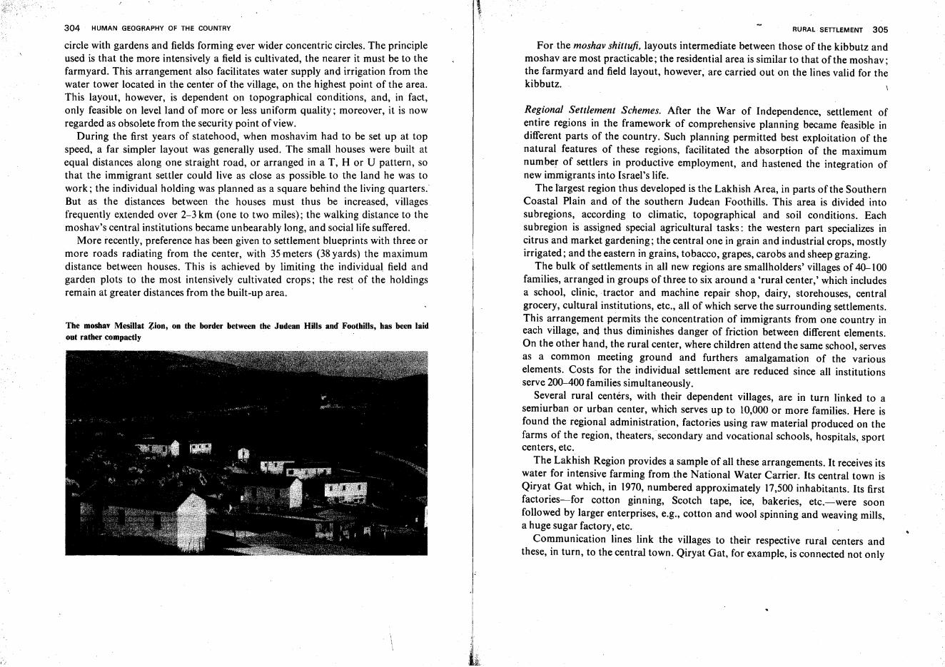
304 HUMAN GEOGRAPHY OF THE COUNTRY
circle with gardens and fields forming ever wider concentric circles. The principleused is that the more intensively a field is cultivated, the nearer it must be to thefarmyard. This arrangement also facilitates water supply and irrigation from thewater tower located in the center of the village, on the highest point of the area.This layout, however, is dependent on topographical conditions, and, in fact,only feasible on levelland of more or less uniform quality; moreover, it is nowregarded as obsolete from the security point of view.
During the first years of statehood, when moshavim had to be set up at topspeed, a far simpler layout was generally used. The small houses were built atequal distances along one straight road, or arranged in a T, H or U pattern, sothat the immigrant settler could live as close as possible. to the land he was towork; the individual holding was planned as a square behind the living quarters.'But as the distances between the houses must thus be increased, villagesfrequently extended over 2-3 km (one to two miles); the walking distance to themoshav's central institutions became unbearably long, and social life suffered.
More recently, preference has been given to settlement blueprints with three ormore roads radiating from the center, with 35meters (38 yards) the maximumdistance between houses. This is achieved by limiting the individual field andgarden plots to the most intensively cultivated crops; the rest of the holdingsremain at greater distances from the built-up area.
The moshav Mesillat ~ion, on the border between the Judean Hills and Foothills, has been laidout rather compactly
RURAL SETTLEMENT 305
For the moshav shittufi, layouts intermediate between those of the kibbutz andmoshav are most practicable; the residential area is similar to that of the moshav;the farmyard and field layout, however, are carried out on the lines valid for thekibbutz.
Regional Settlement Schemes. After the War of Independence, settlement ofentire regions in the framework of comprehensive planning became feasible indifferent parts of the country. Such planning permitted best exploitation of thenatural features of these regions, facilitated the absorption of the maximumnumber of settlers in productive employment, and hastened the integration ofnew immigrants into Israel's life.
The l'argest region thus developed is the Lakhish Area, in parts of the SouthernCoastal Plain and of the southern Judean Foothills. This area is divided intosubregions, according to climatic, topographical and soil conditions. Eachsubregion is assigned special agricultural tasks: the western part specializes incitrus and market gardening; the central one in grain and industrial crops, mostlyirrigated; and the eastern in grains, tobacco, grapes, carobs and sheep grazing.
The bulk of settlements in all new regions are smallholders' villages of 40-100families, arranged in groups of three to six around a 'rural center,' which includesa school, clinic,tractor and machine repair shop, dairy, storehouses, centralgrocery, cultural institutions, etc., all of which serve the surrounding settlements.This arrangement permits the concentration of immigrants from one country ineach village, and thus diminishes danger of friction between different elements.On the other hand, the rural center, where children attend the same school, servesas a common meeting ground and furthers amalgamation of the variouselements. Costs for the individual settlement are reduced since all institutionsserve 200-400 families simultaneously.
Several rural centers, with their dependent villages, are in turn linked to asemiurban or urban center, which serves up to 10,000 or more families. Here isfound the regional administration, factories using raw material produced on thefarms of the region, theaters, secondary and vocational schools, hospitals, sportcenters, etc.
The Lakhish Region provides a sample of all these arrangements. It receives itswater for intensive farming from the National Water Carrier. Its central town isQiryat Gat which, in 1970, numbered approximately 17,500 inhabitants. Its firstfactories-for cotton ginning, Scotch tape, ice, bakeries, etc.c--were soonfollowed by larger enterprises, e.g., cotton and wool spinning and weaving mills,a huge sugar factory, etc.
Communication lines link the villages to their respective rural centers andthese, in turn, to the central town. Qiryat Gat, for example, is connected not only
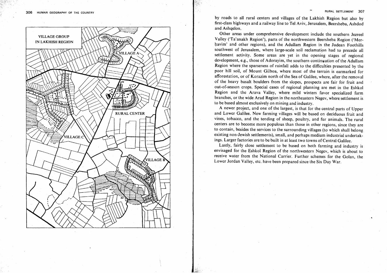
306 HUMAN GEOGRAPHY OF THE COUNTRY
VILLAGE GROUP
IN LAKHISH REGION
RURAL SETTLEMENT 307
by roads to all rural centers and villages of the Lakhish Region but also byfirst-class highways and a railway line to Tel Aviv, Jerusalem, Beersheba, Ashdodand Ashqelon.
Other areas under comprehensive development include the southern JezreelValley (Ta'anakh Region'), parts of the northwestern Beersheba Region ('Merbavim' and other regions), and the Adullam Region in the Judean Foothillssouthwest of Jerusalem, where large-scale soil reclamation had to precede allsettlement activity. Some areas are yet in the opening stages of regionaldevelopment, e.g., those of Adorayim, the southern continuation of the AdullamRegion where the sparseness of rainfall adds to the difficulties presented by thepoor hill soil, of Mount Gilboa, where most of the terrain is earmarked forafforestation, or of Korazim north of the Sea of Galilee, where, after the removalof the heavy basalt boulders from the slopes, prospects are fair for fruit andout-of-season crops. Special cases of regional planning are met in the EshkolRegion and the Arava Valley, where mild winters favor specialized farmbranches, or the wide Arad Region in the northeastern Negev, where settlement isto be based almost exclusively on mining and industry.
A newer project, and one of the largest, is that for the central parts of Upperand Lower Galilee. New farming villages will be based on deciduous fruit andvines, tobacco, and the tending of sheep, poultry, and fur animals. The ruralcenters are to become more populous than those in other regions, since they areto contain, besides the services to the surrounding villages (to which shall belongexisting non-Jewish settlements), small, and perhaps medium industrial undertakings. Larger factories are to be built in at least two towns of Central Galilee.
Lastly, fairly close settlement to be based on both farming and industry isenvisaged for the Eshkol Region of the northwestern Negev, which is about toreceive water from the National Carrier. Further schemes for the Golan, theLower Jordan Valley, etc. have been prepared since the Six Day War.
Urban Settlement
Towns and Cities in History
Antiquity of Towns in the Country. The history of most towns and urban centersgoes back long before the Arab conquest of the 7th century C.E.; many even datefrom the second or third millennium B.C.E. If a number of villages ('moshavot')turned towns, and satellite towns of the major cities are disregarded, as well assome of the newest centers founded in Israel after 1948, the only exception is thetown of Ramla, which was built in 717 C.E. by the Omayyads to replace nearbyLod as the Arab capital of the country. On the other hand, numerous ancienttowns ceased to exist after the Moslem occupation, and urban settlementcompletely disappeared from whole districts, whether through slow decline anddilapidation as in the Negev, or through deliberate and systematic destruction, asin the Coastal Plain. Even the towns of the hill regions were abandoned ordegraded to the rank of villages (e.g., Adorayim in Judea, Gophna and Shomronin Samaria, Zippori in Lower Galilee, etc.). Other centers, particularly thosesacred to Christianity, lay vacant and neglected through centuries, and revived inthe late 18th century after the Turks had conceded Europeans the right to settlethere and erect religious institutions (e.g., Nazareth, Bethlehem, Ramallah). Inthe history of towns, Safed and Tiberias have a special place: Safed was at best aninsignificant hamlet until the Crusaders fortified it as one of their strongholds inGalilee. It later flourished as a result of the large Jewish community whichconcentrated there from the 15th century. Tiberias was founded in Herod's timenear the Biblical site of Raqqat (Rakath) and named after the Emperor Tiberius.It served as a spiritual center of Judaism until the early Middle Ages. Later italmost disappeared, but it grew anew in the 16th century when a Jewishcommunity led by Don Joseph Nassi assembled there and briefly hoped toachieve some sort of independence.
Economic Foundations of Ancient Towns. In this part of the world, as everywhereelse, trade and commerce formed the principal economic basis for country towns
308
URBAN SETTLEMENT 309
in antiquity. Peasants of the surrounding villages brought their produce to townto barter it against wares of local tradesmen. It appears, however, that during allperiods of history farming also constituted an important occupation for citydwellers, whether as a principal or subsidiary source of income (the Bible tells, forinstance, of communal threshing floors in front of city gates). This fact wasundoubtedly the result of the precarious security situation through most periodsof history: many farmers preferred to live within fortified towns withoutforsaking their holdings, even if this meant dwelling at a considerable distancefrom their fields and gardens.
In towns near crossroads, trade was lively: local produce was exchanged forwares brought by the caravans, often from great distances, and traders arrivingfrom different directions exchanged goods at these meeting places. At certainspots near the 'border of the desert and the sown' (e.g., Hebron, Beersheba),hill-farming produce was traded for goods of the nomadic shepherds, andsometimes even for luxuries brought from Southern Arabia, East Africa, or Indiaalong the important highway linking Eilat to Gaza. Similarly, Bet She'an servedas a gateway to the Syrian Desert, to Damascus, and to Mesopotamia.
Services to caravans and travelers (water, food, and other provisions) oftenprovided an important sourCe of income for townspeople, particularly in theNabatean cities of the Negev (see above, p. 209).
Ora different character were the harbor towns of the Mediterranean and RedSea shores, where fishing, seafaring, and shipbuilding constituted additional linesof occupation. In some cities, such as Gaza, Ascalon or Eilat, merchants whotraveled along continental highways met traders who plied international searoutes, and these contacts livened commerce and formed the basis for specializedtrades. In many cases, the principal sea town developed inland, beyond thebarren sana dune belt and near the Via Maris (the ancient Sea Road), but itmaintained intimate links with the sea trade through 'daughter cities' lying on theshore itself. Distances between the former and the latter sometimes amounted to3-7 kilometers (2-4 miles). Thus two harbor towns, Maiumas and Anthedon,served ancient Gaza, Ashdod Yam ('Marine Ashdod') was the port for Ashdod,Yavne Yam-for Yavne, and Tyre-on-Sea, built out on its narrow land tongue,had a 'daughter-town,' 'Tyre-on-the-Land.'
Urban Centers Founded by Zionist Settlers. The urban centers founded by Zionistsettlers before Israel's statehood had at first been planned as villages butdeveloped into towns and cities because of particularly favorable conditions.Most of these lie in the central section of the Coastal Plain, e.g., Hadera,Netanya, Petah Tiqwa, Rishon le-Zion, Rehovot. Since all these 'rnoshavot' had,in their early days, fairly large areas of cultivable land sufficient for many
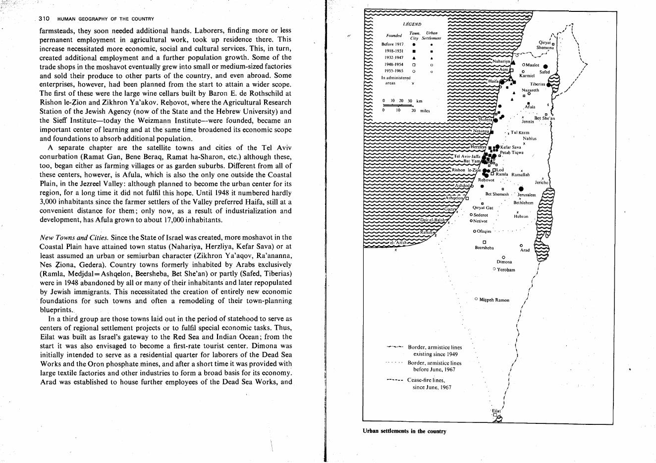
oArad
o Maalot •
o SafedKarmiel
xHebron
•Afula
'~7I I
~, \t\. I \
j ". \
Qiryat o \Shemona I
.. I
-cr·,,·.... ·,· .....,._._.~·; "\
',">I,,,
I,,./,
Tiberias
Nazareth6 00
6
•. aI' .' x Bet She'an
lennin .
oDimona
o Yerohami,
j,,-i
(i
Ij
I
./Ii
I
I
")Ii\
ii
./J
ii;
ii,-I
i. Eilat·0 .
D •Bet Shemesh .. J~rusalem
xBethlehem
•
CBeersheba
o Mi?peh Ramon
OOfaqim
DQiryat Gat
o Sederot
o Netivot
• x Tul Karm
: Nablus
Herzliya •••Kefar Sa va x••• Petah Tiqwa
Tel Aviv-Jaffa Mo. .Bat Ya ~o'
D D .
Rishon Ie-Zion .. CLod x,. C Ramla Rarnallah
Rehovot ..
•
~ .... .... ... ..... .... .-. ....;::;_~Haifa
o
o
••
Ashqelon C
Deir el-Balahx.
Gaza .. .
Ashdod
20 miles
Town. UrbonCity Settlement
• •
Border. armistice linesexisting since 1949
Border, armistice linesbefore June, 1967
Cease-fire lines,since June, 1967
10
el-'Arish
Founded
LEGEND
o
Before 1917
o 10 20 30 km
1918-1931 •
1932-.1947 •
1948-1954 0
1955-1965 0
In administeredareas )(
New Towns and Cities, Since the State of Israel was created,more moshavot in theCoastal Plain have attained town status (Nahariya, Herzliya, Kefar Sava) or atleast assumed an urban or semiurban character (Zikhron Ya'aqov, Ra'ananna,Nes Ziona, Gedera). Country towns formerly inhabited by Arabs exclusively(Ramla, Medjdal e Ashqelon, Beersheba, Bet She'an) or partly (Safed, Tiberias)were in 1948 abandoned by all or many of their inhabitants' and later repopulatedby Jewish immigrants. This necessitated the creation of entirely new economicfoundations for such towns and often a remodeling of their town-planningblueprints..
In a third group are those towns laid out in the period of statehood to serve ascenters of regional settlement projects or to fulfil special economic tasks. Thus,Eilat was built as Israel's gateway to the Red Sea and Indian Ocean; from thestart it was also envisaged to become a first-rate tourist center. Dimona wasinitially intended to serve as a residential quarter for laborersof the Dead SeaWorks and the Oron phosphate mines, and after a short time it was provided withlarge textile factories and other industries to form a broad basis for its economy.Arad was established to house further employees of the Dead Sea Works, and
farmsteads, they soon needed additional hands. Laborers, finding more or lesspermanent employment in agricultural work, took up residence there. Thisincrease necessitated more economic, social and cultural services. This, in turn,created additional employment and a further population growth. Some of thetrade shops in the moshavot eventually grew into small or medium-sized factoriesand sold their produce to other parts of the country, and even abroad. Someenterprises, however, had been planned from the start to attain a wider scope.The first of these were the large wine cellars built by Baron E. de Rothschild atRishon le-Zion and Zikhron Ya'akov. Rehovot, where the Agricultural ResearchStation. of the Jewish Agency (now of the State and the Hebrew University) andthe Sieff Institute-today the Weizmann Institute-were founded, became animportant center of learning and at the same time broadened its economic scopeand foundations to absorb additional population.
A separate chapter are the satellite towns and cities of the Tel Avivconurbation (Ramat Gan, Bene Beraq, Ramat ha-Sharon, etc.) although these,too, began either as farming villages or as garden suburbs. Different from all ofthese centers, however, is Afula, which is also the only one outside the CoastalPlain, in the Jezreel Valley: although planned to become the urban center for itsregion, for a long time it did not fulfil this hope. Until 1948 it numbered hardly3,000 inhabitants since the farmer settlers of the Valley preferred Haifa, still at aconvenient distance for them; only now, as a result of industrialization anddevelopment-has Afula grown to about 17,000inhabitants.
. 310 HUMAN GEOGRAPHY OF THE COUNTRY
Urban settlements in the country
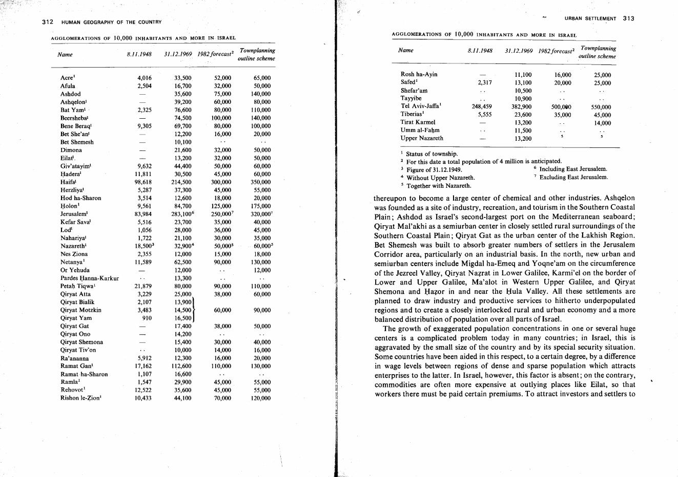
312 HUMAN GEOGRAPHY OF THE COUNTRY
AGGLOMERATIONS OF 10,000 INHABITANTS AND MORE IN~ ISRAEL
URBAN SETILEMENT 313
AGGLOMERATIONS OF 10,000 INHABITANTS AND MORE IN ISRAEL
Name 8.11.1948 31.12.1969 1982forecast2 Townplanningoutline scheme
Name 8.11.1948 31.12.1969 1982forecast2 Townplanningoutline scheme
I Status of township.2 For this date a total population of 4 million is anticipated.3 Figure of 31.12.l949. 6 Including East Jerusalem.4 Without Upper Nazareth. 7 Excluding East Jerusalem.5 Together with Nazareth.
thereupon to become a large center of chemical and other industries. Ashqelonwas founded as a site of industry, recreation, and tourism in the Southern CoastalPlain; Ashdod as Israel's second-largest port on the Mediterranean seaboard;Qiryat Mal'akhi as a semiurban center in closely settled rural surroundings of theSouthern Coastal Plain; Qiryat Gat as the urban center of the Lakhish Region.Bet Shemesh was built to absorb greater numbers of settlers in the JerusalemCorridor area, particularly on an industrial basis. In the north, new urban andsemiurban centers include Migdal ha-Emeq and Yoqne'am on the circumferenceof the Jezreel Valley, Qiryat Nazrat in Lower Galilee, Karmi'el on the border ofLower and Upper Galilee, Ma'alot in Western Upper Galilee, and QiryatShemona and Hazer in and near the Hula Valley. All these settlements areplanned to draw industry and productive services to hitherto underpopulatedregions and to create a closely interlocked rural and urban economy and a morebalanced distribution of population over all parts of Israel.
The growth of exaggerated population concentrations in one or several hugecenters is a complicated problem today in many countries; in Israel, this isaggravated by the small size of the country and by its special security situation.Some countries have been aided in this respect, to a certain degree, by a differencein wage levels between regions of dense and sparse population which attractsenterprises to the latter. In Israel, however, this factor is absent; on the contrary,commodities are often more expensive at outlying places like Eilat, so thatworkers there must be paid certain premiums. To attract investors and settlers to
Acre I
AfulaAshdodAshqelon'Bat Yam! .Beersheba'Bene Beraq!Bet She'anBet ShemeshDimonaEilatl ,
Giv'atayimHadera'HaifaJ.Herzliya'Hod ha-Sharonl:Iolon l
Jerusalem'Kefar Sava'Lod'NahariyaNazareth'Nes ZionaNetanya 'Or YehudaPardes Hanna-KarkurPetal).Tiqwa-Qiryat AttaQiryat BialikQiryat MotzkinQiryat YamQiryat GatQiryat OnoQiryat ShemonaQiryat Tiv'on
Ra'anannaRamat Gan!
Ramat ·ha-SharonRamla!Rehovot!Rishon le-Zion'
4,0162,504
2,325
9,305
9,6321l,81198,618
5,2873,5149,561
83,9845,5161,0561,722
18,5003
2,3551l,589
21,8793,2292,1073,483
910
5,91217,1621,1071,547
12,52210,433
33,50016,70035,60039,20076,60074,50069,70012,20010,10021,60013,20044,40030,500
214,50037,30012,60084,700
283,100 6
23,70028,00021,10032,9004
12,00062,50012,00013,30080,00025,000
13,900\14,50016,50017,40014,20015,40010,00012,300
112,60016,60029,90035,60044,100
52,00032,00075,00060,00080,000
100,00080,00016,000
32,00032,00050,00045,000
300,00045,00018,000
125,000250,0007
35,00036,00030,00050,0005
15,00090,000
90,00038,000
60,000
38,000
30,00014,00016,000
110,000
45,00045,00070,000
65,00050,000
140,00080,000
110,000140,000100,00020,000
50,00050,00060,00060,000
350,00055,00020,000
175,000320,000'40,00045,00035,00060,0005
18,000130,000
12,000
110,00060,000
90,000
50,000
40,00016,00020,000
130,000
55,00055,000
120,000
I~I
'Ii~
Rosh ha-AyinSafed l
Shefar'amTayyibeTel Aviv-Jaffa!Tiberias!Tirat KarmelUmm al-FahmUpper Nazareth
2,317
248,4595,555
1l,10013,10010,50010,900
382,90023,60013,20011,50013,200
16,00020,000
500,00035,000
25,00025,000
550,00045,00014,000
314 HUMAN GEOGRAPHY OF THE COUNTRY
new towns and cities, other means must be used, such as cheap building land andhousing, loans, subsidies and ,', tax exemptions. Such a policy is successful,particularly where enterprises also find geographical advantages such as marketsand raw materials close at hand to even out high transport costs and otheroverheads. 'This explains, in part, why larger enterprises often show greaterreadiness to go to 'development towns' than do small undertakings. Proximity ofraw materials, for instance, has been decisive in attracting to Beersheba industriesof ceramics, insecticides and other chemicals; to Qiryat Gat, Qiryat Shemona andBet She'an-cotton gins and spinning mills; to Afula and Qiryat Gat-sugarfactories, to Ramla and Bet Shemesh-cement plants, etc. The Sharon, the
, Southern Coastal Plain and the Jezreel, Kinneret and Hula valleys are seen as thenatural location of food-processing and preserve plants. Markets explain placingof garages and machine shops for farming equipment in centers of developingagricultural regions, e.g., Qiryat Gat, Beersheba, Qiryat Shemona, etc.
Industries which 'can be drawn with relative ease toward development regionsare those of comparatively low transport costs; a case in point are diamond-cuttingand polishing plants now found in many new towns, from Eilat in the south toQiryat Shemona in the north.
Tourism and recreation have greatly aided the progress ofveterantowns, andof villages which have become towns or cities during the period of statehood(Tiberias,Safed, Nahariya, Zikhron Yaaqov, Netanya, Herzliya) as well as ofnew centers, e.g., Eilat, Ashqelon, Caesarea. /
I,n the early years of statehood, housing was a decisive criterion in, settling newimmigrants in towns abandoned in the War of Independence as well as in newdevelopment centers, even if the immigrants could not be given immediateemployment. In the first stages of development, public works and investment(such as construction of houses and roads, land reclamation, etc.) provided thelivelihood for most of the newcomers. Incidentally, these activities in most casesconstitute the necessary groundwork for industrialization of a new center. Whenfactories are opened in development towns, a growing percentage of the locallabor force gains permanent employment in partly skilled or skilled work.
Planning and Building in Ancient Cities. Urban settlements existed in this countryat least since the Early Bronze Period (third millennium B.C;.E.) and perhaps sincethe preceding Chalcolithic Era.* The typical remnant of an ancient city here, as inmany parts of the Middle East, is, a flat-topped, very steep-sided and oftenrectangular hill or hillock,called 'tel' or 'tell' in both Hebrew and Arabic. What
* Jericho, assumed to be the world's oldest city, dates back to the Neolithic Era (see p. 196).
URBAN SETILEMENT 315
today most strikes the spectator is the extremely small area of towns built on suchmounds-several thousands lived crowded on 5 acres or less; the most importantand populouscities (Hazer, Jerusalem) covered barely more than 6-7 ha (I5-17acres). As in the case of ancient villages, this crowding stems from the need tobuild a strong wall and to defend it with the relatively small resources andmanpower of the city. To save space, lanes between rows of houses were just wideenough to permit the passage of a beast of burden, and often houses were builtagainst the city wall itself (see Joshua, II, 15: 'For her house was upon the townwall, and she dwelt upon the wall'). j
Usually, cities had only one gate, which was reinforced by all technical meansavailable. Open spaces on both sides of the gate served the public need asassembly square, market place, threshing floor, court of judgment, etc. In thosetimes of peril and frequent warfare, cities sought to perfect their fortificationtechniques; thus revetments, steep, slippery glacis and deep moats in front of citywalls came into use in the Hyksos epoch (1750-1550 B.C.E.). As seen in Lakhishand many other sites, the gate of the inner wall was frequently placed at somedistance from the outer one. The enemy, having forced the outer gate, had to passthrough the narrow corridor between the two walls still held by the defenders,who then rolled heavy rocks or poured boiling water or oil upon the invader. Thecasemate system divided the space between the two walls by partitions intochambers used for food and weapon storage; at Lakhish, an archive of inscribedsherds was discovered in a casemate chamber near the gate.
The palace of the local king or ruler was in the center of many Canaanite townsand at their highest point. Another wall often surrounded such an 'akropolis'which, with its structures and courtyards, sometimes occupied half or more of thecity area.
Upon enemy conquest, the town was first burned down and its buildings razed.A new town was later built on the rubble. The usual mound therefore containsstrata of different cities, sometimes ten, fifteen or (as at Hazer) even more thantwenty, each new one built upon the foundations of its predecessor. Thin layers ofashes mark the seams between the strata and testify to the destruction thatpreceded each new city. To stand firm, a new wall had to be set back from theouter rim of its predecessor, so that the city area shrank gradually with repeatedconquests and reconstructions, and the typical shape of the 'tel' resulted.
The influence of Hellenistic civilization and the improved security situationunder Roman rule brought about a decisive change in town planning. TheHellenistic cities on the Mediterranean seaboard as well as towns of the interior(Shomron, Zippori, etc.) and the cities of the Dekapolis in Transjordan had muchlarger areas than earlier urban agglomerations. The new cities boastedmagnificent edifices-pagan temples, theaters, hippodromes, palaces 'of gover-
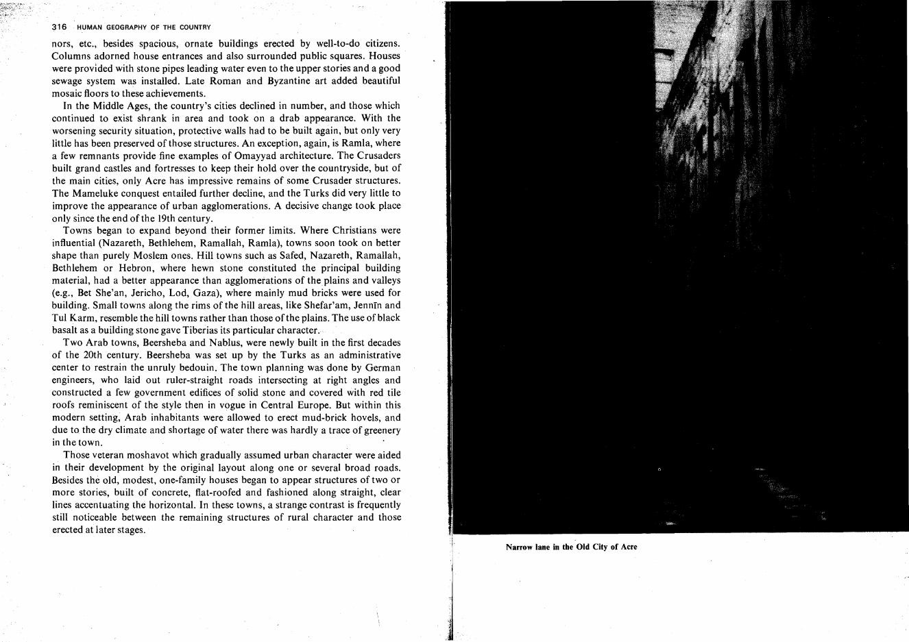
316 HUMAN GEOGRAPHY OF THE COUNTRY
nors, etc., besides spacious, ornate buildings erected by well-to-do citizens.Columns adorned house entrances and also surrounded public squares. Houseswere provided with stone pipes leading water even to the upper stories and a goodsewage system was installed. Late Roman and Byzantine art added beautifulmosaic floors to these achievements.
In the Middle Ages, the country's cities declined in number, and those whichcontinued to exist shrank in area and took on a drab appearance. With theworsening security situation, protective walls had to be built again, but only verylittle has been preserved of those structures. An exception, again, is Ramla, wherea few remnants provide fine examples of Omayyad architecture. The Crusadersbuilt grand castles and fortresses to keep their hold over the countryside, but ofthe main cities, only Acre has impressive remains of some Crusader structures.The Mameluke conquest entailed further decline, and the Turks did very little toimprove the appearance of urban agglomerations. A decisive change took placeonly since the end of the 19th century.
Towns began to expand beyond their former limits. Where Christians wereinfluential (Nazareth, Bethlehem, Ramallah, Ramla), towns soon took on bettershape than purely Moslem ones. Hill towns such as Safed, Nazareth, Ramallah,Bethlehem or Hebron, where hewn stone constituted the principal buildingmaterial, had a better appearance than agglomerations oftheplains and valleys(e.g., Bet She'an, Jericho, Lod, Gaza), where mainly mud bricks were used forbuilding. Small towns along the rims of the hill areas, like Shefar'am, Jennin andTul Karm, resemble the hill towns rather than those of the plains. The use of blackbasalt as a building stone gave Tiberias its particular character.
Two Arab towns, Beersheba and Nablus, were newly built in the first decadesof the 20th century. Beersheba was set up by the Turks as an administrativecenter to restrain the unruly bedouin. The town planning was done by Germanengineers, who laid out ruler-straight roads intersecting at right angles andconstructed a few government edifices of solid stone and covered with red tileroofs reminiscent of the style then in vogue in Central Europe. But within thismodern setting, Arab inhabitants were allowed to erect mud-brick hovels, anddue to the dry climate and shortage of water there was hardly a trace of greeneryin the town.
Those veteran moshavot which gradually assumed urban character were aidedin their development by the original layout along one or several broad roads.Besides the old, modest, one-family houses began to appear structures of two ormore stories, built of concrete, flat-roofed and fashioned along straight, clearlines accentuating the horizontal. In these towns, a strange contrast is frequentlystill noticeable between the remaining structures of rural character and thoseerected at later stages.
Narrow lane in the Old City of Acre
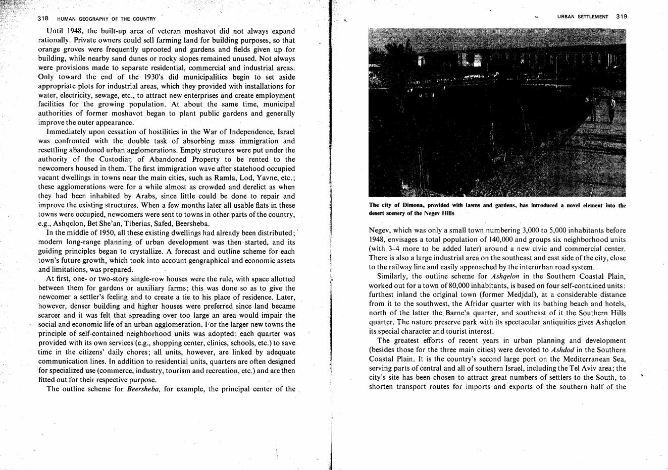
318 HUMAN GEOGRAPHY OF THE COUNTRY
Until 1948, the built-up area of veteran moshavot did not always expandrationally. Private owners could sell farming land for building purposes, so thatorange groves were frequently uprooted and gardens and fields given up forbuilding, while nearby sand dunes or rocky slopes remained unused. Not alwayswere provisions made to separate residential, commercial and industrial areas.Only toward the end of the 1930's did municipalities begin to set asideappropriate plots for industrial areas, which they provided with installations forwater, electricity, sewage, etc., to attract new enterprises and create employmentfacilities for the growing population. At about the same time, municipalauthorities of former moshavot began to plant public gardens and generallyimprove the outer appearance.
Immediately upon cessation of hostilities in the War of Independence, Israelwas confronted with the double task of absorbing mass immigration andresettling abandoned urban agglomerations. Empty structures were put under theauthority of the Custodian of Abandoned Property to be rented to thenewcomers housed in them. The first immigration wave after statehood occupiedvacant dwellings in towns near the main cities, such as Ramla, Lod, Yavne, etc.;these agglomerations were for a while almost as crowded and derelict as whenthey had been inhabited by Arabs, since little could be done to repair andimprove the existing structures. When a few months later all usable flats in thesetowns were occupied, newcomers were sent to towns in other parts of the country,e.g., Ashqelon, BetShe'an, Tiberias, Safed, Beersheba.
In the middle of 1950, all these existing dwellings had already been distributed; .modern long-range planning of urban development was then started, and itsguiding principles began to crystallize. A forecast and outline scheme for eachtown's future growth, which took into account geographical and economic assetsand limitations, was prepared.
At first, one- or two-story single-row houses were the rule, with space allottedbetween them for gardens or auxiliary farms; this was done so as to give thenewcomer a settler's feeling and to create a tie to his place of residence. Later,however, denser building and higher houses were preferred since land becamescarcer and it wasfelt that spreading over too large an area would impair thesocial and economic life of an urban agglomeration. For the larger newtowns theprinciple of self-contained neighborhood units was adopted: each quarter wasprovided with its own services (e.g., shopping center, clinics, schools, etc.) to savetime in the citizens' daily chores; all units, however, are linked by adequatecommunication lines. In addition to residential units, quarters are often designedfor specialized use (commerce, industry, tourism and recreation, etc.) and are thenfitted out for their respective purpose.
The outline scheme for Beersheba, for example, the principal center of the
URBAN SETILEMENT 319
The city of Dimona,provided with lawns and gardens, has introduced a novel element into thedesert scenery of the Negev Hills
Negev, which was only a small town numbering 3,000 to 5,000 inhabitants before1948, envisages a total population of 140,000 and groups six neighborhood units(with 3-4 more to be added later) around a new civic and commercial center.There is also a large industrialarea on the southeast and east side of the city, closeto the railway line and easily approached by the interurban road system.
Similarly, the outline scheme for Ashqelon in the Southern Coastal Plain,worked out for a town of 80,000 inhabitants, is based on four self-contained units:furthest inland the original town (former Medjdal), at a considerable distancefrom it to the southwest, the Afridar quarter with its bathing beach and hotels,north of the latter the. Barne'a quarter, and southeast of it the Southern Hillsquarter. The nature preserve park with its spectacular antiquities gives Ashqelon .its special character and tourist interest.
The greatest efforts of recent years in urban planning and development(besides those for the three main cities) were devoted to Ashdod in the SouthernCoastal Plain. It is the country's second large port on the Mediterranean Sea,serving parts of central and all of southern Israel, including the Tel Aviv area; thecity's site has been chosen to attract great numbers of settlers to the South toshorten transport routes for imports and exports of the southern half of 'the
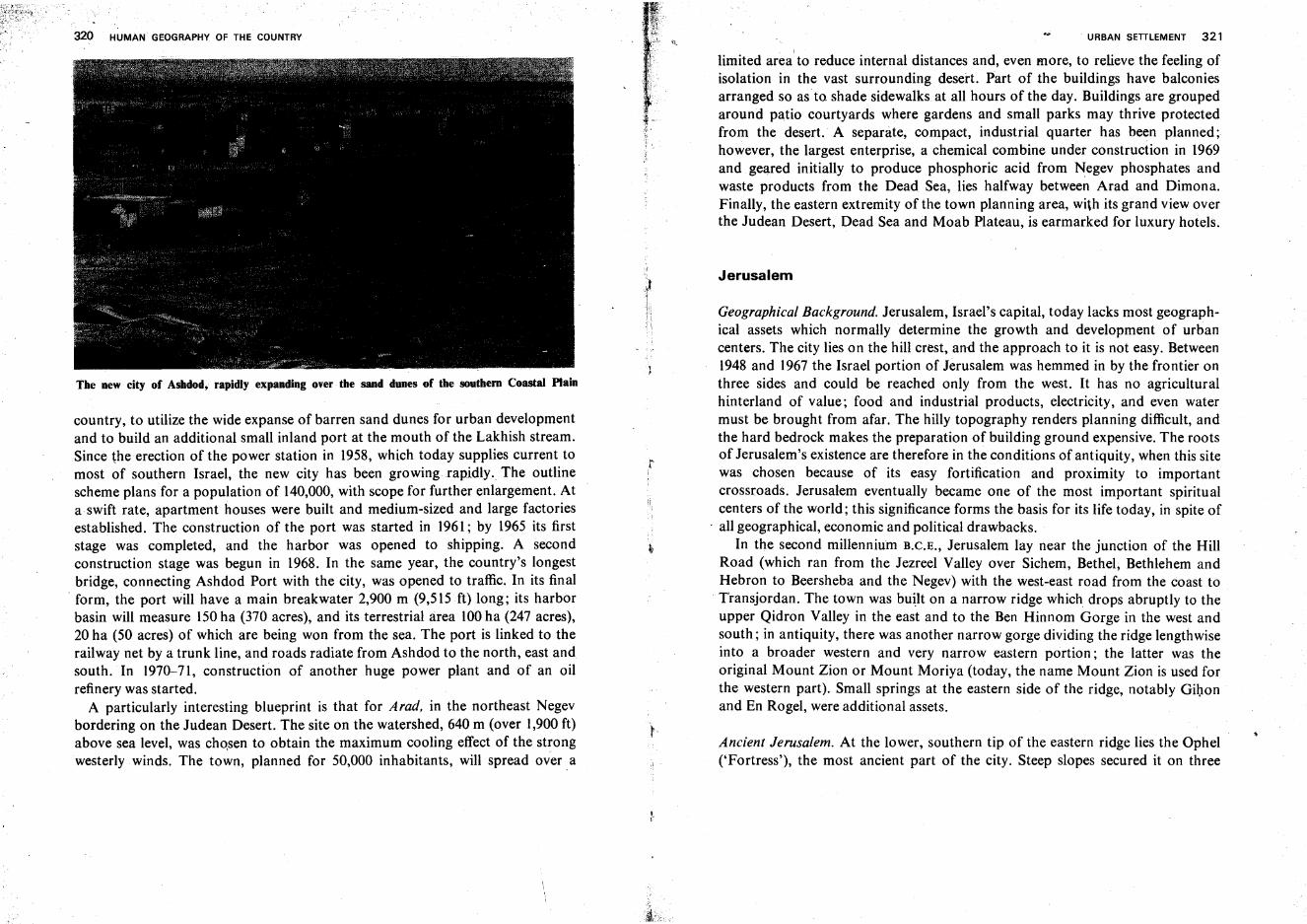
320 HUMAN GEOGRAPHY OF THE COUNTRY
The new city of Ashdod, rapidly expanding ever the sand dunes of the southern Coastal Plain
country, to utilize the wide expanse of barren sand dunes for urban developmentand to build an additional small inland port at the mouth of the Lakhish stream.Since theerection of the power station in 1958, which today supplies current tomost of southern Israel, the new city has been growing rapidly. The outlinescheme plans for a population of 140,000, with scope for further enlargement. Ata swift rate, apartment houses were built and medium-sized and large factoriesestablished. The construction of the port was started in 1961; by 1965 its firststage was completed, and the harbor was opened to shipping. A secondconstruction stage was begun in 1968. In the same year, the country's longestbridge, connecting Ashdod Port with the city, was opened to traffic. In its final
. form, the port will have a main breakwater 2,900 m (9,515 ft) long; its harborbasin will measure 150ha (370 acres), and its terrestrial area 100ha (247 acres),20 ha (50 acres) of which are being won from the sea. The port is linked to therailway net by a trunk line, and roads radiate from Ashdod to the north, east andsouth. In 1970-71, construction of another huge power plant and of an oilrefinery was started.
A particularly interesting blueprint is that for Arad, in the northeast Negevbordering on the Judean Desert. The site on the watershed, 640 m (over 1,900 ft)above sea level, was chosen to obtain the maximum cooling effect of the strongwesterly winds. The town, planned for 50,000 inhabitants, will spread over. a
r
. URBAN SEITLEMENT 321
limited area to reduce internal distances and, even more, to relieve the feeling ofisolation in the vast surrounding desert. Part of the buildings have balconiesarranged so as to shade sidewalks.at all hours of the day. Buildings are groupedaround patio courtyards where gardens and small parks may thrive protectedfrom the desert. A separate, compact, industrial quarter has been planned;however, the largest enterprise, a chemical combine under construction in 1969and geared initially to produce phosphoric acid from Negev phosphates andwaste products from the Dead Sea, lies halfway between Arad and Dimona.Finally, the eastern extremity of the town planning area, with its grand view overthe Judean Desert, Dead Sea and Moab Plateau, is earmarked for luxury hotels.
Jerusalem
Geographical Background. Jerusalem, Israel's capital, today lacks most geographical assets which normally determine the growth and development of urbancenters. The city lies on the hill crest, and the approach to it is not easy. Between1948 and 1967 the Israel portion of Jerusalem was hemmed in by the frontier onthree sides and could be reached only from the west. It has no agriculturalhinterland of value; food and industrial products, electricity, and even watermust be brought from afar. The hilly topography renders planning difficult, andthe hard bedrock makes the preparation of building ground expensive. The rootsof Jerusalem's existence are therefore in the conditions of antiquity, when this sitewas chosen because of its easy fortification and proximity to importantcrossroads. Jerusalem eventually became one of the most important spiritualcenters of the world; this significance forms the basis for its life today, in spite of
. all geographical, economic and political drawbacks.In the second millennium B.C.E., Jerusalem lay near the junction of the Hill
Road (which ran from the Jezreel Valley over Sichem, Bethel, Bethlehem andHebron to Beersheba and the Negev) with the west-east road from the coast toTransjordan. The town was built on a narrow ridge which drops abruptly to theupper Qidron Valley in the east and to the Ben Hinnom Gorge in the west andsouth; in antiquity, there was another narrow gorge dividing the ridge lengthwiseinto a broader western and very narrow eastern portion; the latter was theoriginal Mount Zion or Mount Moriya (today, the name Mount Zion is used forthe western part). Small springs at the eastern side of the ridge, notably Gihonand En Rogel, were additional assets.
Ancient Jerusalem. At the lower, southern tip of the eastern ridge lies the Ophel('Fortress'), the most ancient part of the city. Steep slopes secured it on three
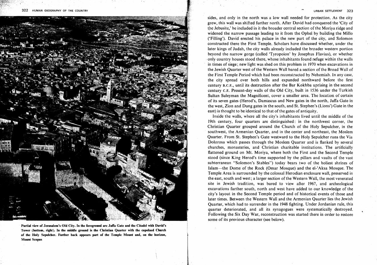
HUMAN GEOGRAPHY OF THE COUNTRY
Partial view of Jerusalem's Old City. In the foregroond are Jaffa Gate and the Citadel with David'sTower (bottom, right). In the middle ground is the Christian Quarter with the cupolaed Churchof the Holy Sepulcher. Further back appears part of the Temple Mount and, on the horizon,Mount Scopus
URBAN SETILEMENT 323
sides, and only in the north was a low wall needed for protection. As the citygrew, this wall was shifted further north. After David had conquered the 'City ofthe Jebusite,' he included in it the broader central section of the Moriya ridge andwidened the narrow passage leading to it from the Ophel by building the Millo('Filling'). David erected his palace in the new part of the city, and Solomonconstructed there the First Temple. Scholars have discussed whether, under thelater kings of Judah, the city walls already included the broader western portionbeyond the narrow gorge (called 'Tyropoion' by Josephus Flavius), or whether
c only country houses stood there, whose inhabitants found refuge within the wallsin times of siege; new light was shed on this problem in 1970 when excavations inthe Jewish Quarter west of the Western Wall bared a section of the Broad Wall ofthe First Temple Period which had been reconstructed by Nehemiah. In any case,the city spread over both hills and expanded northward before the firstcentury B.C.E., until its destruction after the Bar Kokhba uprising in the secondcentury C.E. Present-day walls of the Old City, built in 1536 under the TurkishSultan Suleyman the Magnificent, cover a smaller area. The location of certainof its seven gates (Herod's, Damascus and New gates in the north, Jaffa Gate inthe west, Zion and Dung gates in the south, and St. Stephen's (Lions') Gate in theeast) is thought to be identical to that of the gates of antiquity.
Inside the walls, where all the city's inhabitants lived until the middle of the19th century, four quarters are distinguished: in the northwest corner, theChristian Quarter grouped around the Church of the Holy Sepulcher, in thesouthwest, the Armenian Quarter, and in the center and northeast, the MoslemQuarter. From St. Stephen's Gate westward to the Holy Sepulcher runs the ViaDolorosa which passes through the Moslem Quarter and is flanked by severalchurches, monasteries, and Christian charitable institutions. The artificiallyflattened ground on Mt. Moriya, where both the First and the Second Templestood (since King Herod's time supported by the pillars and vaults of the vastsubterranean "Solomon's Stables") today bears two of the holiest shrines ofIslam-i-the Dome of the Rock (Omar Mosque) and the el-'Aksa Mosque. TheTemple Area is surrounded by the colossal Herodian enclosure wall, preserved inthe east, south and west; a larger section of the Western Wall, the most veneratedsite in Jewish tradition, was bared to view after 1967, and archeologicalexcavations further south, north and west have added to our knowledge of thecity's layout in the Second Temple period and of historical events of those andlater times. Between the Western Wall and the Armenian Quarter lies the JewishQuarter, which had to surrender in the 1948 fighting. Under Jordanian rule, thisquarter deteriorated, and all its synagogues were systematically destroyed.Following the Six Day War, reconstruction was started there in order to restoresome of its previous character (see below).
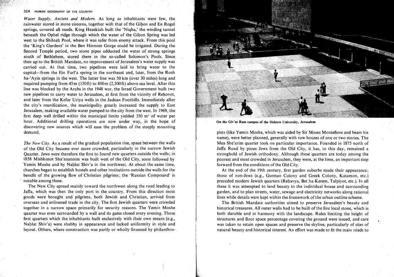
324 HUMAN GEOGRAPHY OF THE COUNTRY
Water Supply, Ancient and Modern. As long as inhabitants were few, therainwater stored in stone cisterns, together with that of the Gihon and En Rogelsprings, covered all needs. King Hezekiah built the 'Niqba,' the winding tunnelbeneath the Ophel ridge through which the water of the Gihon Spring was ledwest to the Shiloah Pool, where it was safer from enemy attack. From this poolthe 'King's Gardens' in the Ben Hinnom Gorge could be irrigated. During theSecond Temple period, two stone pipes adducted the water of strong springssouth of Bethlehem, stored there in the so-called Solomon's Pools. Sincethen up to the British Mandate, no improvement of Jerusalem's water supply wascarried out. At that time, two pipelines were laid to bring water to thecapital-from the Ein Farra spring in the northeast and, later, from the Roshha-'Ayin springs in the west. The latter line was 50 km (over 30 miles) long andrequired pumping from 45m (150ft) to 800m (2,500ft) above sea level. After thisline was blocked by the Arabs in the 1948 war, the Israel Government built twonew pipelines to carry water to Jerusalem, at first from the vicinity of Rehovot,and later from the Kefar Uriya wells in the Judean Foothills. Immediately afterthe city's reunification, the municipality greatly increased the supply to EastJerusalem, making available water pumped to the city from the west. In 1969, thefirst deep well drilled within the municipal limits yielded 350 m3 of water perhour. Additional drilling operations are now under way, in the hope ofdiscovering new sources which will ease the problem of the steeply mountingdemand.
The New City. As a result of the gradual population rise, space between the wallsof the Old City became ever more crowded, particularly in the narrow JewishQuarter. Jews were therefore the first to found new quarters outside the walls; in1858 Mishkenot Sha'anannim was built west of the Old City; soon followed byYemin Moshe and by Nahlat Shiv'a in the northwest. At about the same time,churches began to establish hostels and other institutions outside the walls for thebenefit of the growing flow of Christian pilgrims; the 'Russian Compound' isnotable among these.
The New City spread mainly toward the northwest along the road leading toJaffa, which was then the only port in the country. From this direction mostgoods were brought and pilgrims, both Jewish and Christian, arrived fromoverseas and enlivened trade in the city. The first Jewish quarters were crowdedtogether in a narrow space primarily for security reasons. The Yemin Moshequarter was even surrounded by a wall and its gates closed every evening. Thosefirst quarters which the inhabitants built exclusively with their own means (e.g.,Nahlat Shiv'a) were shabby in appearance and lacked uniformity in style andlayout. Others, where construction was partly or wholly financed by philanthro-
On the Giv'at Ram campus of the Hebrew University, Jerusalem
pists (like Yemin Moshe, which was aided by Sir Moses Montefiore and bears hisname), were better planned, generally with row houses of one or two stories. TheMea She'arim quarter took on particular importance. Founded in 1875 north ofJaffa Road by pious Jews from the Old City, it has, to this day, remained astronghold of Jewish orthodoxy. Although these quarters are today among thepoorest and most crowded in Jerusalem, they were, at the time, an important stepforward from the conditions of the Old City.
At the end of the 19th century, first garden suburbs made their appearance;those of non-Jews (e.g., German Colony and Greek Colony, Katamon, etc.)preceded modern Jewish quarters (Rehavya, Bet ha-Kerem, Talpiyot, etc.). In allthese it was attempted to lend beauty to the individual house and surroundinggarden, and to plan streets, water, sewage and electricity networks along rationallines while details were kept within the framework of the urban outline scheme.
The British Mandate authorities aimed to preserve Jerusalem's beauty andhistorical treasures. All outer walls had to be built of the fine local stone, which isboth durable and in harmony with the landscape. Rules limiting the height ofstructures and floor space percentage covering the ground were issued, and carewas taken to retain open spaces and preserve the skyline, particularly of sites ofnatural beauty and historical interest. An effort was made to fit the main roads to
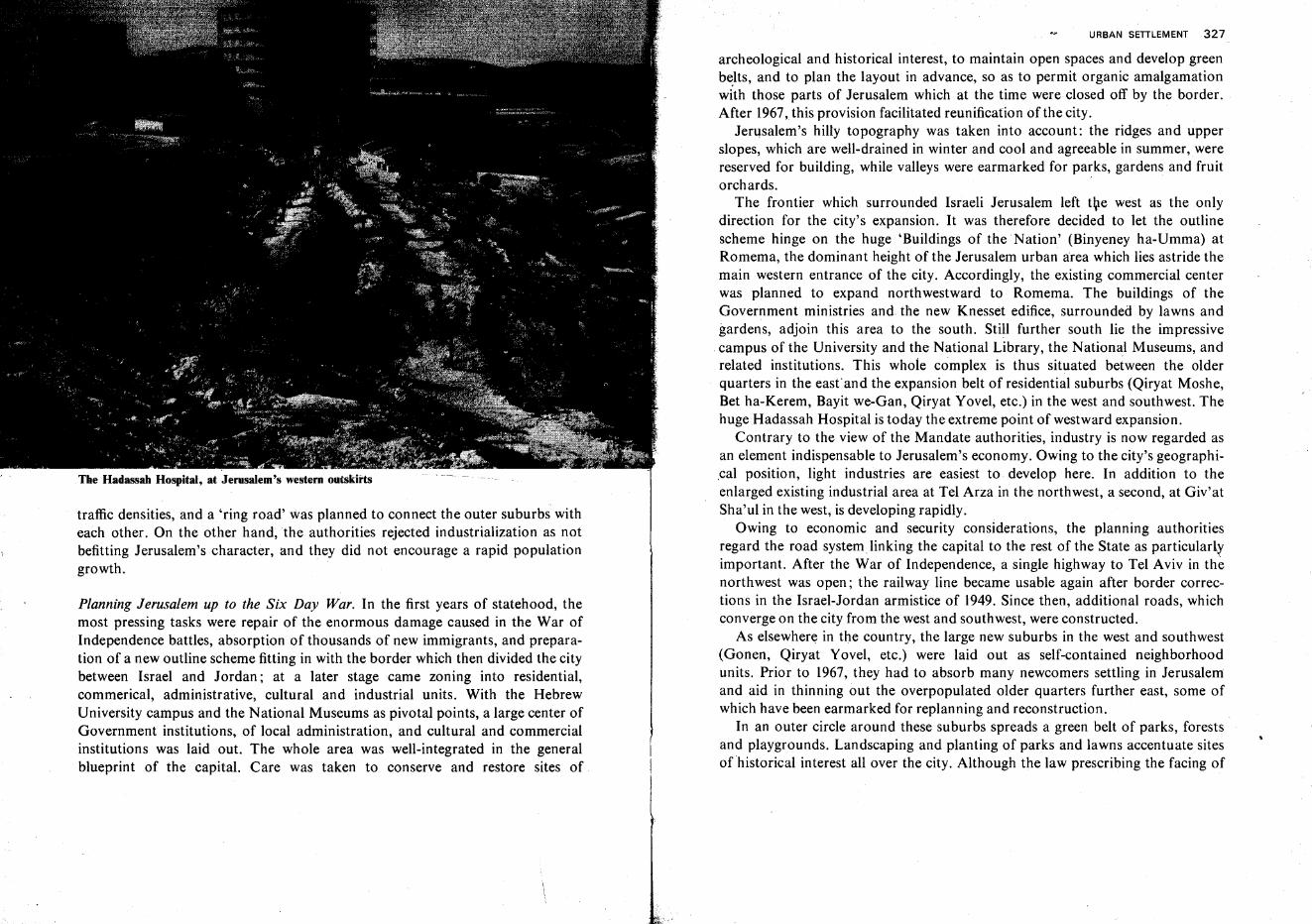
The Hadassah Hospital, at Jerusalem's western outskirts
traffic densities, and a 'ring road' was planned to connect the outer suburbs witheach other. On the other hand, the authorities rejected industrialization as notbefitting Jerusalem's character, and they did not encourage a rapid populationgrowth.
Planning Jerusalem up to the Six Day War. In the first years of statehood, themost pressing tasks were repair of the enormous damage caused in the War ofIndependence battles, absorption of thousands of new immigrants, and preparation of a new outline scheme fitting in with the border which then divided the citybetween Israel and Jordan; at a later stage came zoning into residential,commerical, administrative, cultural and industrial units. With the HebrewUniversity campus and the National Museums as pivotal points, a large center ofGovernment institutions, of local administration, and cultural and commercialinstitutions was laid out. The whole area was well-integrated in the generalblueprint of the capital. Care was taken to conserve and restore sites of
URBAN SETTLEMENT 327
archeological and historical interest, to maintain open spaces and develop greenbelts, and to plan the layout in advance, so as to permit organic amalgamationwith those parts of Jerusalem which at the time were closed off by the border.After 1967,this provision facilitated reunification of the city.
Jerusalem's hilly topography was taken into account: the ridges and upperslopes, which are well-drained in winter and cool and agreeable in summer, werereserved for building, while valleys were earmarked for parks, gardens and fruitorchards.
The frontier which surrounded Israeli Jerusalem left the west as the onlydirection for the city's expansion. It was therefore decided to let the outlinescheme hinge on the huge 'Buildings of the Nation' (Binyeney ha-Umma) atRomema, the dominant height of the Jerusalem urban area which lies astride themain western entrance of the city. Accordingly, the existing commercial centerwas planned to expand northwestward to Romema. The buildings of theGovernment ministries and the new Knesset edifice, surrounded by lawns andgardens, adjoin this area to the south. Still further south lie the impressive
.campus of the University and the National Library, the National Museums, andrelated institutions. This whole complex is thus situated between the olderquarters in the east' and the expansion belt of residential suburbs (Qiryat Moshe,Bet ha-Kerem, Bayit we-Gan, Qiryat Yovel, etc.) in the west and southwest. Thehuge Hadassah Hospital is today the extreme point of westward expansion.
Contrary to the view of the Mandate authorities, industry is now regarded asan element indispensable to Jerusalem's economy. Owing to the city's geographi,cal position, light industries are easiest to develop here. In addition to theenlarged existing industrial area at Tel Arza in the northwest, a second, at Giv'atSha'ul in the west, is developing rapidly.
Owing to economic and security considerations, the planning authoritiesregard the road system linking the capital to the rest of the State as particularlyimportant. After the War of Independence, a single highway to Tel Aviv in thenorthwest was open; the railway line became usable again after border corrections in the Israel-Jordan armistice of 1949. Since then, additional roads, whichconverge on the city from the west and southwest, were constructed.
As elsewhere in the country, the large new suburbs in the west and southwest(Gonen, Qiryat Yovel, etc.) were laid out as self-contained neighborhoodunits. Prior to 1967, they had to absorb many newcomers settling in Jerusalemand aid in thinning out the overpopulated older quarters further east, some ofwhich have been earmarked for replanning and reconstruction.
In an outer circle around these suburbs spreads a green belt of parks, forestsand playgrounds. Landscaping and planting of parks and lawns accentuate sitesofhistorical interest all over the city. Although the law prescribing the facing of
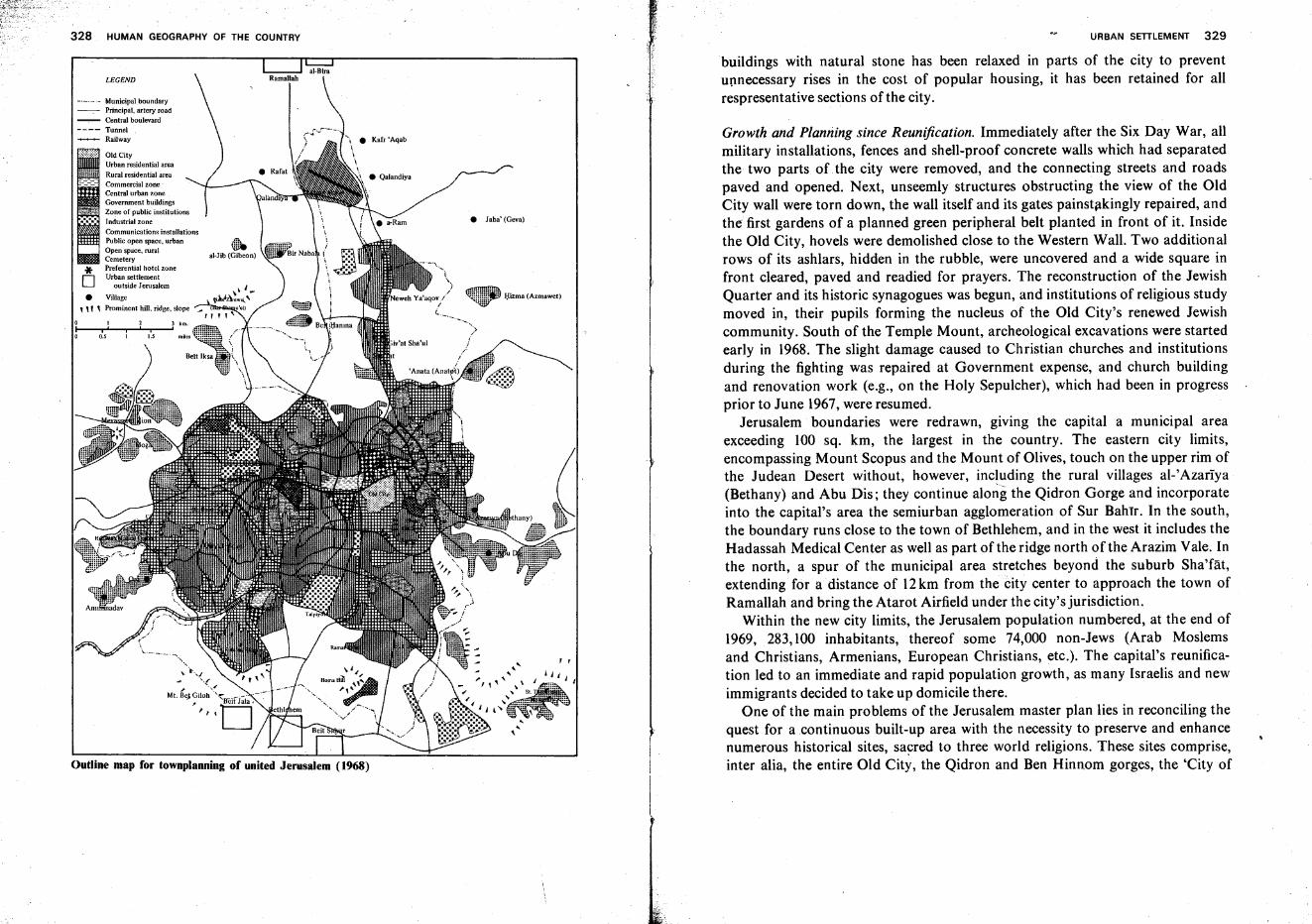
328 HUMAN GEOGRAPHY OF THE COUNTRY
Outline map for townplanning of united Jerusaiem (1968)
URBAN SETILEMENT 329
Growth and Planning since Reunification. Immediately after the Six Day War, allmilitary installations, fences and shell-proof concrete walls which had separatedthe two parts of the city were removed, and the connecting streets and roadspaved and opened. Next, unseemly structures obstructing the view of the OldCity wall were torn down, the wall itself and its gates painstakingly repaired, andthe first gardens of a planned green peripheral belt planted in front of it. Insidethe Old City, hovels were demolished close to the Western Wall. Two additionalrows of its ashlars, hidden in the rubble, were uncovered and a wide square infront cleared, paved and readied for prayers. The reconstruction of the JewishQuarter and its historic synagogues was begun, and institutions of religious studymoved in, their pupils forming the nucleus of the Old City's renewed Jewishcommunity. South of the Temple Mount, archeological excavations were startedearly in 1968. The slight damage caused to Christian churches and institutionsduring the fighting was repaired at Government expense, and church buildingand renovation work (e.g., on the Holy Sepulcher), which had been in progressprior to June 1967,were resumed.
Jerusalem boundaries were redrawn, giving the capital a municipal areaexceeding 100 sq. km, the largest in the country. The eastern city limits,encompassing Mount Scopus and the Mount of Olives, touch on the upper rim ofthe Judean Desert without, however, including the rural villages al-'Azariya(Bethany) and Abu Dis; they continue along the Qidron Gorge and incorporateinto the capital's area the semiurban agglomeration of Sur Bahrr. In the south,the boundary runs close to the town of Bethlehem, and in the west it includes theHadassah Medical Center as well as part of the ridge north of the Arazim Vale. Inthe north, a spur of the municipal area stretches beyond the suburb Sha'fat,extending for a distance of 12km from the city center to approach the town ofRamallah and bring the Atarot Airfield under the city's jurisdiction.
Within the new city limits, the Jerusalem population numbered, at the end of1969, 283,100 inhabitants, thereof some 74,000 non-Jews (Arab Moslemsand Christians, Armenians, European Christians, etc.). The capital's reunification led to an immediate and rapid population growth, as many Israelis and newimmigrants decided to take up domicile there.
One of the main problems of the Jerusalem master plan lies in reconciling thequest for a .continuous built-up area with the necessity to preserve and enhancenumerous historical sites, sacred to three world religions. These sites comprise,inter alia, the entire Old City, the Qidron and Ben Hinnom gorges, the 'City of
buildings with natural stone has been relaxed in parts of the city to preventupnecessary rises in the cost of popular housing, it has been retained for allrespresentative sections of the city.
, ,
I;lizma (Azmawet)
• Jaba' (Geva)
~al-Jjb (Gibeon)
0.5 l.S
I 2i' 'i
LEGEND
Old CityUrban residential areaRural residential areaCommercial zoneCentral urban zoneGovernment buildingsZone of public institutionsIndustrial zoneCommunications installationsPublic open space, urban
, Open space, ruralCemetery* Preferential hotel zone
D ur:~~s~~~t~ee:~;em• Village
1 " , Prominent hill. ridge, slope
-'-'-'- Municipal boundary-. Principal, artery road-.- Central boulevard
---- Tunnel .--+-+- Railway
330 HUMAN GEOGRAPHY OF THE COUNTRY
David' to the south, Mount Scopus arid the Mount of Olives, and many more.Both inside and outside the Old City walls, gardens have either been laid out orare blueprinted, while other areas to the east and south have been earmarked aspublic open spaces or sites for preservation and reconstruction. Overcrowding inthe Old City could possibly be remedied by resettling some of the inhabitantselsewhere in the city. However, the Old City is not to be viewed as a museumpiece, but should continue to serve as a residential and, to an extent, commercialarea, with the additional development of tourist facilities .. Another difficult task, which since June 1967 has assumed great urgency, lies in
securing efficient traffic arteries leading through and around Jerusalem. Theexistent main thoroughfares have become totally inadequate, particularly JaffaRoad which carries the bulk of both urban and interurban traffic. A network ofnew broad roads has been blueprinted' in order to provide alternative approachroutes from all directions, enabling vehicular traffic to cross the municipal area todestinations beyond it (e.g., from Bethlehem directly to Ramallah) withoutclogging Jerusalem's main arteries. Adequate parking facilities must also beprovided throughout the city. The numerous protected historical sites andedifices and, primarily, Jerusalem's hilly terrain, render this program highlyexpensive, as entire complexes of nonessential buildings will have to bedemolished. In addition, earth-moving work, on :a very large scale, must becarried out and long road tunnels will have to be excavated in the ridges.
In order to arrive at an acceptable joint solution to the traffic, social andeconomic problems, planners prefer not to concentrate industry, commerce,administration, tourism, etc., each in a separate area,butratherto distributethem evenly throughout the city, thus shortening the distances between residential quarters and sites of employment and more evenly spreading traffic flowduring rush hours. For example, a group of science-based industries to be locatedat Meqor Hayyim in the south is to be linked by a direct highway to the Giv'atRam university campus.
Jerusalem planners must take into account the prominence given by the eventsof 1967 to the four pillars of the city's economy-country-wide administration,institutes of higher education, tourism, and industry. As more and moreGovernment ministries and other central offices move to the capital, anincreasing need is felt to depart from the original plan of concentrating allGovernment buildings in the area of the Knesset, and to distribute them overother sectors, including East Jerusalem.
The Hebrew University has seen the return of its original campus atop MountScopus, where, beginning with the Harry S Truman Research Institute, an intensive restoration and building program was launched in 1968, comprising lecturehalls and dormitories for thousands of students. Other institutes of learning, e.g.,
URBAN SETILEMENT 331
yeshivot, Christian theological seminaries, etc., are in the construction orplanning stage in various parts of the city.
In view of the growing need for tourist accomodation and services inJerusalem, large sums of public and private capital are being invested in hotelbuilding, and suitable sites have been earmarked for these purposes throughoutthe city, with an area in the south, on a ridge northwest of former GovernmentHouse, planned as the principal hotel center.
The capital is attracting increasing numbers of industrial enterprises, particularly of the electronics and other science-intensive branches.ifor which new areashave been set aside in the south and northeast.
While the pre-1967 blueprint called for expansion of the commercial area onlywestward, under the new conditions the first logical step is seen as the linkingtogether of the two existing centers of West and East Jerusalem (Jaffa and BenYehuda Streets, and the area north of Damascus Gate, respectively). At a laterdate, secondary commercial centers will be developed in most suburbs.
New housing developments call for the largest share of both space andinvestments. While the southwest (Qiryat Yovel, etc.) continues to serve as thesector of intensive apartment building, and vacant lots elsewhere are increasinglybeing used for new constructions, a concentrated effort is now being directedtoward the favorable terrain in the northeast, beyond the former armistice line.New residential quarters, under construction since 1968, promise to provideaccomodation for tens of thousands of citizens, both Jews and non-Jews, and tolink western Jerusalem with Mount Scopus in the east and Sha'fat in the north.
The advisability of a large conurbation centered on Jerusalem is a debatablepoint. Most experts hold that such a development should not be encouraged, soas not to spoil the landscape on the approaches to the city, of singular beauty andgreat spiritual significance to mankind. In the long run, however, it may provedifficult to prevent an at least partial amalgamation of satellite towns likeBethlehem or Ramallah with the capital city on which their economy is largelydependent. The solution appears to lie in detailed planning and landscaping,protecting skylines and open spaces wherever necessary, locating new suburbswhere they least interfere with the scenic vistas, and reducing buildings to a heighttolerable from the esthetic point of view.
Tel Aviv-Jaffa
The Geographical Setting. There is archeological evidence of Jaffa's uninterruptedinhabitation at least since the Neolithic Period, i.e., for 7,000-10,000 years.Itseems that the geological setting made the site particularly suited for human
332 HUMAN GEOGRAPHY OF THE COUNTRY
settlement: an underground fault line is assumed to run from the shore to thesoutheast; its uplifted southern side created Jaffa Hill, which slightly juts into thesea. Settlers were attracted to this site with its sea breeze and easy defensibility. \.The hill forms two shallow bays, a larger one in the north anda smaller one in thesouth. Alternately protected from the waves with the changing wind direction,these served ancient seafarers as double anchorage. Together with the hill's uplift,kurkar reefs were also elevated from the. sea bottom (one, in Greek legend, therock to which Andromeda was tied and later freed by Perseus); normally, thesereefs served as breakwaters and only in heavy storms constituted a menace toshipping. The hill also checks the landward penetration of sand dunes;consequently, fertile soil lies east of it, while further south the sand-dune beltattains almost 8 km (5 miles) width. In the north, where a number of kurkarridges mostly covered by loose sand are close to each other, the dune belt is onlybetween 300-600 m (1,000-2,000 ft) wide. Small springs and wells at small depthmay also originate in the underground fault. Jaffa Hill, in any case, blocks thecourse of Nahal Ayalon to the sea and causes it today to turn sharply north andjoin the Yarqon stream near its mouth (in prehistoric times the former streamseems to have had its outlet south of the hill, but this was blocked by accumulatingsands thrown up by the sea); at the bend of Nahal Ayalon, spreading swamps
. used to bar access to Jaffa Hill; at certain times they may have been regarded asanother security asset.
The Yarqon's mouth served as a second anchorage for the flat-bottomed shipsof antiquity; this explains the existence of another fortress town there on TelQasila ; the stream bed secured this hillock from the south and seems to haverepeatedly constituted a border line between tribes or small kingdoms.
Jaffa's History. Prehistoric hunters and fishermen settled on Jaffa Hill and atother sites south of the Yarqon. In the Chalcolithic Period, farmers tilled thefertile soil at the hill's foot. During the Early Bronze, Phoenician seafarers notonly exploited the double anchorage as one of their stations along the Levantcoast but also seem to have fortified the hill against attacks from the land. Atleast since the beginning of the second millennium B.C.E., Jaffa was also animportant market place along the Via Maris (Sea Road).
Under King Solomon, the Bible reports, cedar wood for the construction ofthe Temple was brought to Jaffa by King Hiram of Tyre, and thence transportedto Jerusalem. The Tel Qasila excavations allow the assumption that the townthere was Israelite, while in Jaffa itself Phoenician and Philistine elements stillprevailed.
In spite of the frequent changes in Jaffa's fortunes, population and culture, itremained at all times the principal port in the country. Toward the end of the
URBAN SETTLEMENT 333
First Temple period, it was described as a 'Cuthian,' i.e., pagan, city; later, itaccepted Hellenistic civilization. Because of its proximity to and relative ease ofcommunication with Jerusalem, however, a strong Jewish community also foundits place in Jaffa, long before Simon the Hasmonean made the city 'the gateway tothe islands of the sea' (Maccabees I, 14, 5). The Hasmonean kings aided and
. developed Jaffa, but they systematically suppressed all other Hellenistic cities onthe seaboard. After Pompey's occupation in 63 B.C.E., Jaffa resumed· itsHellenistic character, but its economy underwent little change. The city continued to thrive also under Byzantine rule and under the early 1}rab caliphates. TheCrusaders used Jaffa as a port in their campaign to conquer Jerusalem. The citydeclined after the Crusades-under the Mamelukes and Turks-but renewed itsgrowth in the 18th century, when links between Palestine and Europe becamecloser and Christians were permitted to make pilgrimages to the Holy Land. Jaffabegan to spread to the low ground east of the hill. First orange groves wereplanted, and fruit gardening became one of the occupations of its citizens. Sincethe end of the 19th century, Zionist immigrants settled in Jaffa, at the side of the'old yishuv' of Jews, and soon Jaffa was regarded as the Zionist center of thecountry. In 1908, the Palestine Office of the Zionist Organization was opened inJaffa under Arthur Ruppin. In 1909, the progressive Jewish inhabitants providedthe initiative for founding a comfortable, modern garden suburb, which becameTel Aviv.
Tel Aviv's Geography. Only thirty years after its founding, Tel Aviv was thelargest city in the country, although modern conditions deprive it of most of theadvantages which had made Jaffa thrive in antiquity. Tel Aviv's phenomenalgrowth, like the continued importance of Jerusalem, is therefore explained byhistorical circumstances rather than by geographical assets. The straight, shallowshore of Tel Aviv does not favor construction of a modern port. The climate isless agreeable than that of most other places in the country since the kurkar hillsbar the cooling sea breeze, and high humidity makes summers sultry. Neithersand dunes nor kurkar are particularly suited as foundations for modernbuildings, and sections of the city are easily flooded by winter rains. On the otherhand, Tel Aviv's position in the central part of the Coastal Plain is today apositive factor; the highway issuing from here to Jerusalem also retains itsimportance.
The Beginnings of Tel Aviv. In 1909, two societies set up by Jaffa Jews, 'AhuzatBayit' and 'Nahlat Binyamin,' chose the barren sand dunes north of Jaffa for thesuburb they planned to build, simply because plots there were offered at a reasonable price. The founders, it appears, did not dream that their garden suburb
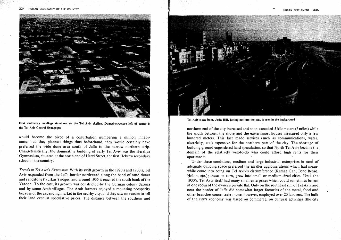
Tel' Aviv's sea front. Jaffa Hill, jutting out into the sea, is seen in the background
334 HUMAN GEOGRAPHY OF THE COUNTRY
First multistory buildings stand out on the Tel Aviv skyline. Domed structure left of center isthe Tel Aviv Central Synagogue
would become the pivot of a conurbation numbering a million inhabitants; had they planned things thus beforehand, they would certainly havepreferred the wide dune area south of Jaffa to the narrow northern strip.Characteristically, the dominating building of early Tel Aviv was the Herzliya
- Gymnasium, situated at the north end of Herzl Street, the first Hebrew secondaryschool in the country.
Trends in Tel Aviv's Expansion. With its swift growth in the 1920's and 1930's, TelAviv expanded from the Jaffa border northward along the band of sand dunesand sandstone ('kurkar') ridges, and around 1935 it reached the south bank of theYarqon. To the east, its growth was constricted by the German colony Saronaand by some Arab villages. The Arab farmers enjoyed a mounting prosperitybecause of the expanding market in the nearby city, and they saw no reason to selltheir land even at speculative prices. The distance between the southern and
URBAN SETTLEMENT 335
northern end of the city increased and soon exceeded 5 kilometers (3 miles) whilethe width between the shore and the easternmost houses measured only a fewhundred meters. This fact made services (such as communications, water,electricity, etc.) expensive for the northern part of the city; The shortage ofbuilding ground engendered land speculation, so that North Tel Aviv became thedomain of the relatively well-to-do who could afford high rents for theirapartments.
Under these conditions, medium and large industrial enterprises in need ofadequate building space preferred the smaller agglomerations which had meanwhile come into being on Tel Aviv's circumference (Ramat Gan, Bene Beraq,Holen, etc.); these, in turn, grew into small or medium-sized cities. Until the1930's, Tel Aviv itself had many small enterprises which could sometimes be runin one room of the owner's private flat. Only on the southeast rim of Tel Aviv andnear the border of Jaffa did somewhat larger factories of the metal, food andother branches concentrate; none, however, employed over 20 laborers. The bulkof the city's economy was based on commerce, on cultural activities (the city
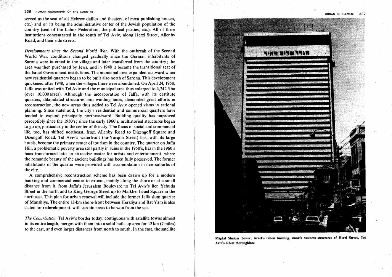
336 HUMAN GEOGRAPHY OF THE COUNTRY
served as the seat of all Hebrew dailies and theaters, of most publishing houses,etc.) and on its being the administrative center of the Jewish population of thecountry (seat of the Labor Federation, the political parties, etc.). All of theseinstitutions concentrated in the south of Tel Aviv, along Herzl Street, AllenbyRoad, and their side streets.
Developments since the Second World War. With the outbreak of the SecondWorld War, conditions changed gradually since the German inhabitants ofSarona were interned in the village and later transferred from the country; thearea was then purchased by Jews, and in 1948 it became the transitional seat ofthe Israel Government institutions. The municipal area expanded eastward whennew residential quarters began to be built also north of Sarona. This developmentquickened after 1948, when the villages there were abandoned. On April 24, 1950,Jaffa was united with Tel Aviv and the municipal area thus enlarged to 4,242.5 ha(over 10,000acres). Although the incorporation of Jaffa, with its destitutequarters, dilapidated structures and winding lanes, demanded great efforts inreconstruction, the new areas thus added to Tel Aviv opened vistas in rationalplanning. Since statehood, the city's residential and commercial quarters havetended to expand principally northeastward. Building quality has improvedperceptibly since the 1950's; since the early 1960's, multistoried structures beganto go up, particularly in the center of the city. The focus of social and commerciallife, too, has shifted northeast, from Allenby Road to Dizengoff Square andDizengoff Road. Tel Aviv's waterfront (ha-Yarqon Street) has, with its largehotels, become the primary center of tourism in the country; The quarter on JaffaHill, a problematic poverty area still partly in ruins in the 1950's, has in the 1960'sbeen transformed into an attractive center for artists and entertainment, wherethe romantic beauty of the ancient buildings has been fully preserved. The formerinhabitants of the quarter were provided with accomodation in new suburbs ofthe city.
A comprehensive reconstruction scheme has been drawn up for a modernbanking and commercial center to extend, mainly along the shore or at a smalldistance from it, from Jaffa's Jerusalem Boulevard to Tel Aviv's Ben YehudaStreet in the north and to King George Street up to Malkhei Israel Square in thenortheast. This plan for urban renewal will include the former Jaffa slum quarterof Manshiye. The entire 13-km shore-front between Herzliya and Bat Yam is alsoslated for redevelopment, with certain areas to be won from the sea.
The Conurbation. Tel Aviv's border today, contiguous with satellite towns almostin its entire length, merges with them into a solid built-up area for 12km (7miles)to the east, and even larger distances from north to south. In the east, the satellite
I
URBAN SETILEMENT 337
Migdal Shalom Tower, Israel's tallest building, dwarfs business structures of Herzl Street, TelAviv's oldest thoroughfare
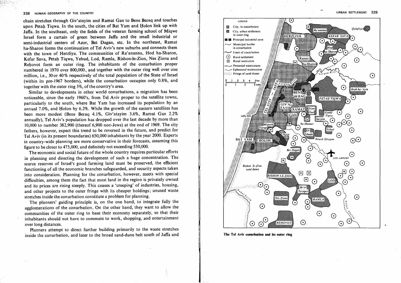
338 HUMAN GEOGRAPHY OF THE COUNTRY URBAN SETTLEMENT 339
LEGEND
The Tel Aviv conurbation and its outer ring
I!jj City, in conurbation
~ City, urban settlementin outer ring
1111l1li Principal industrial zone
--....; Municipal borderin conurbation
.-..- Limit of conurbation
o Rural settlemento Rural institution
_ Perennial watercourse
,-------
o
o
o
Qulqiliyue
oo: .~·l
.':',':1.:./.../
:-.:J~ 00:.:{ \V •':".\
ooI
chain stretches through Giv'atayim and Ramat Gan to Bene Beraq and touchesupon Petah Tiqwa. In the south, the cities of Bat Yam and Holen link up withJaffa. In the southeast, only the fields of the veteran farming school of MiqweIsrael form a curtain of green between Jaffa and the small industrial orsemi-industrial centers of Azor, Bet Dagan, etc. In the northeast, Ramatha-Sharon forms the continuation of Tel Aviv's new suburbs and connects themwith the town of Herzliya. The communities of Ra'ananna, Hod ha-Sharon,Kefar Sava, Petah Tiqwa, Yehud, Lod, Ramla, Rishon-le-Zion, Nes Ziona andRehovot form an outer ring. The inhabitants of the conurbation propernumbered in 1970 over 800,000, and together with the outer ring well over onemillion, i.e., 30or 40 % respectively of the total population of the State of Israel(within its pre-1967 borders), while the conurbation occupies only 0.8%, andtogether with the outer ring 3%, of the country's area.
Similar to developments in other world conurbations, a migration has beennoticeable, since the early 1960's, from Tel Aviv proper to the satellite towns,particularly to the south, where Bat Yam has increased its population by anannual 7.0%, and Holen by 6.2%. While the growth of the eastern satellites hasbeen more modest (Bene Beraq 4.1%, Giv'atayim 3.6%, Ramat Gan 2.2%annually), Tel Aviv's population has dropped over the last decade by more than10,000 to number 382,900 (thereof 6,900 non-Jews) at the end of 1969. The cityfathers, however, expect this trend to be reversed in the future, and predict forTel Aviv (in its present boundaries) 650,000 inhabitants by the year 2000. Expertsin country-wide planning are more conservative in their forecasts, assuming thisfigure to be closer to 475,000, and definitely not exceeding 550,000.
The economic and social future of the whole country requires particular effortsin planning and directing the development of such a huge concentration. Thescarce reserves of Israel's good farming land must be preserved, the efficientfunctioning ofall the economic branches safeguarded, and security aspects takeninto consideration. Planning for the conurbation, however, meets with specialdifficulties, among them the fact that most land in the region is privately ownedand its prices are rising steeply. This causes a 'creeping' of industries, housing,and other projects to, the outer fringe with its cheaper holdings; unused wastestretches inside the conurbation constitute a problem for planning.
The planners' guiding principle is, on the one hand, to integrate fully theagglomerations of the conurbation. On the other hand, they want to allow thecommunities of the outer ring to base their economy separately, so that theirinhabitants should not have to commute to work, shopping, and entertainmentover long distances.
Planners attempt to direct further building primarily to the waste stretchesinside the conurbation, and later to the broad sand-dune belt south of Jaffa and
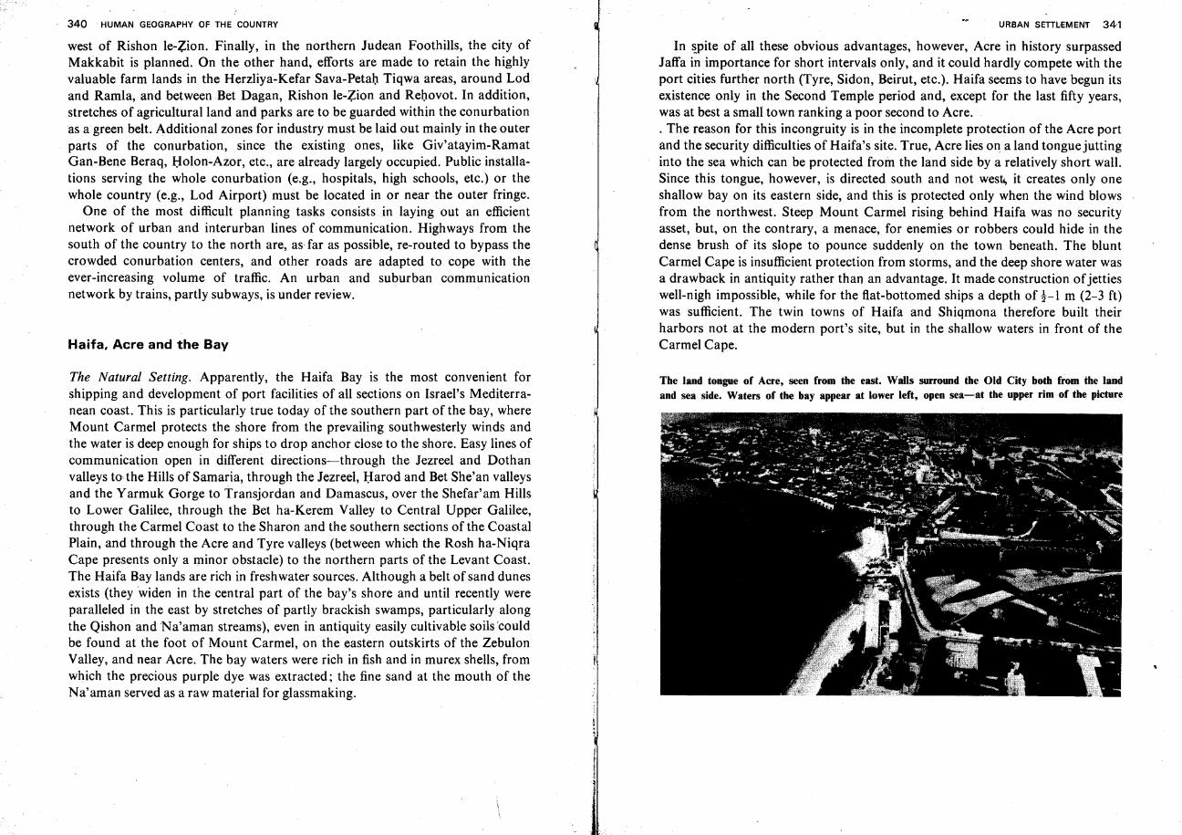
340 HUMAN GEOGRAPHY OF THE COUNTRY
west of Rishon le-Zion. Finally, in the northern Judean Foothills, the city ofMakkabit is planned. On the other hand, efforts are made to retain the highlyvaluable farm lands in the Herzliya-Kefar Sava-Petah Tiqwa areas, around Lodand Ramla, and between Bet Dagan, Rishon le-Zion and Rehovot. In addition,stretches of agricultural land and parks are to be guarded within the conurbationas a green belt. Additional zones for industry must be laid out mainly in the outerparts of the conurbation, since the existing ones, like Giv'atayim-RamatGan-Bene Beraq, Holon-Azor, etc., are already largely occupied. Public installations serving the whole conurbation (e.g., hospitals, high schools, etc.) or thewhole country (e.g., Lod Airport) must be located in or near the outer fringe.
One of the most difficult planning tasks consists in laying out an efficientnetwork of urban and interurban lines of communication. Highways from thesouth of the country to the north are, as far as possible, re-routed to bypass thecrowded conurbation centers, and other roads are adapted to cope with theever-increasing volume of traffic. An urban and suburban communicationnetwork by trains, partly subways, is under review.
Haifa, Acre and the Bay
The Natural Setting. Apparently, the Haifa Bay is the most convenient forshipping and development of port facilities of all sections on Israel's Mediterranean coast. This is particularly true today of the southern part of the bay, whereMount Carmel protects the shore from the prevailingsouthwesterly winds andthe water is deep enough for ships to drop anchor close to the shore. Easy lines ofcommunication open in different directions-through the Jezreel and Dothanvalleys to-the Hills of Samaria, through the Jezreel, Harod and Bet She'an valleysand the Yarmuk Gorge to Transjordan and Damascus, over the Shefar'am Hillsto Lower Galilee, through the Bet ha-Kerem Valley to Central Upper Galilee,through the Carmel Coast to the Sharon and the southern sections of the CoastalPlain, and through the Acre and Tyre valleys (between which the Rosh ha-NiqraCape presents only a minor obstacle) to the northern parts of the Levant Coast.The Haifa Bay lands are rich in freshwater sources. Although a belt of sand dunesexists (they widen in the central part of the bay's shore and until recently wereparalleled in the east by stretches of partly brackish swamps, particularly alongthe Qishon and Na'aman streams), even in antiquity easily cultivable soils 'couldbe found at the foot of Mount Carmel, on the eastern outskirts of the ZebulonValley, and near Acre. The bay waters were rich in fish and in murex shells, fromwhich the precious purple dye was extracted; the fine sand at the mouth of theNa'aman served as a raw material for glassmaking.
URBAN SETILEMENT 341
In spite of all these obvious advantages, however, Acre in history surpassedJaffa in importance for short intervals only, and it could hardly compete with theport cities further north (Tyre, Sidon, Beirut, etc.). Haifa seems to have begun itsexistence only in the Second Temple period and, except for the last fifty years,was at best a small town ranking a poor second to Acre.. The reason for this incongruity is in the incomplete protection of the Acre portand the security difficulties of Haifa's site. True, Acre lies on a land tongue juttinginto the sea which can be protected from the land side by a relatively short wall.Since this tongue, however, is directed south and not west, it creates only oneshallow bay on its eastern side, and this is protected only when the wind blowsfrom the northwest. Steep Mount Carmel rising behind Haifa was no securityasset, but, on the contrary, a menace, for enemies or robbers could hide in thedense brush of its slope to pounce suddenly on the town beneath. The bluntCarmel Cape is insufficient protection from storms, and the deep shore water wasa drawback in antiquity rather than an advantage. It made construction ofjettieswell-nigh impossible, while for the flat-bottomed ships a depth of !-l m (2-3 ft)was sufficient. The twin towns of Haifa and Shiqmona therefore built theirharbors not at the modern port's site, but in the shallow waters in front of theCarmel Cape.
The land tongue of Acre, seen from the east. Walls surround the Old City both from the landand sea side. Waters of the bay appear at lower left, open sea-at the upper rim of the picture
342 HUMAN GEOGRAPHY OF THE COUNTRY
Acre's History. Acre is first mentioned in the Egyptian 'execration texts' of the18th century H.C.E., but it may be assumed to have existed a long time before thatdate, perhaps even since prehistoric times. On the mound of ancient Acre, lyinginland at a distance of over one mile from the sea (Napoleon's Hill), potsherds ofthe Early Bronze Age have been found. In present-day Acre clear archeologicalevidence of an urban settlement exists only for the 4th century H.C.E. and later;continuous inhabitation since then, however, may have obliterated earlier traces.In the Hellenistic and Roman periods, the twin cities Acre-on-Sea and Acre-onLand existed side by side. Later, Acre-on-Sea grew in importance while the cityon the land dwindled into 'Acre Village' and then disappeared. AlexanderJannaeus, the greatest Hasmonean king, failed to conquer the city, which hadmeanwhile taken on the character of a Hellenistic 'polis' and changed its name toPtolemais, In the Great Jewish War, Vespasian used the city as a base for hisGalilean campaign. A large Jewish community is later reported, which buried itsdead outside the city limits. Prosperous Acre was conquered by the Crusaders in1104, made their principal port, and thoroughly fortified. The massive walls andpillars of an ancient crypt or refectorium, one of the earliest Gothic structuresexistent, bear witness to the city's importance. Acre remained the capital of theHoly Kingdom of Jerusalem even after Jerusalem itself was lost. Acre's fall in1291 marked the end of the Crusades.
Acre regained prominence in the late 17th and in the 18th centuries, especiallywhen it was the seat of the governors Zaher el'Amr and Ahmed el Jazzar whorebuilt and fortified it magnificently in medieval-oriental fashion with buildingmaterials plundered from ancient Caesarea-Roman marble,granite and porphyry columns, etc. Jazzar, striving to make the city a major trading center, constructed a number of 'khans' or caravan inns, rectangular courtyards with a cisternor well to water the camels, surrounded by two-story buildings with the upperstory borne on columns. The fortifications, two thick walls with a deep moat inbetween and provided with openings for cannon muzzles, surrounded Acre onland and sea and successfully withstood Napoleon's siege in 1799.
In the 19th century, Acre stagnated, and in the 20th century it even declinedwhile Haifa develope,d rapidly. Since the Turks lifted the prohibition on buildingbeyond the walls in the first decade of the present century, the 'New City' wascreated on the north side, and laid out with straight, and sometimes broad roads.Another new suburb has been developing since 1949 in the east, between thewalled city and Napoleon's Hill, while further south, nearer the shore, theindustrial area centering on Acre Steel City istaking shape.
Haifa's History. The oldest settlement identified within Haifa's present municipalboundary is near the southeast corner of the bay; pottery found there belongs to
URBAN SETILEMENT 343
the Late Bronze Period. In Roman times, a relay station called Calamon mayhave stood at the same site, but this was never a town and had no fortifications.
The name Haifa, together with the neighboring town ofShiqmona(Sycamion),is first mentioned under Roman rule. The Romans erected a fortress uphill,Castrum Samaritanorum, where they posted Samaritans (known for their enmitytoward Jews and therefore dependable in guarding them in the twin-cities below).In 1100, Venetian Crusaders took the town after an obstinate defense by itsMoslem and Jewish citizens. Haifa fell to Saladdin in 1187, returned briefly toCrusader rule under Louis IX of France between 1250 j and 1265, and wasdestroyed by the Mamelukes. A squalid fishing hamlet near the Carmel Cape inthe 18th century, it was razed by Governor Zaher el 'Amr. He immediatelyrebuilt it further east, but even then, however, he hardly improved its economicposition. Only in the middle of the 19th century did it begin to grow slowly,numbering 2,000 inhabitants in 1854, among them Jews, most of whomoriginated from Morocco. The founding of the German Templar colony on theMount Carmel slope in 1868 aided its development.
Since the beginning of the present century, the construction of railways(Haifa-Damascus in 1905, Haifa-Led-Egypt, completed in 1919) and of roadsmade Haifa an important traffic hub. The advantages of Haifa's deep-wateranchorage were recognized and led to the construction of the large,modern portcompleted in 1934. The Kirkuk-Haifa oil pipeline was laid and the Haifa OilRefineries were installed between 1936 and 1939.
Haifa's vast potentialities had been recognized by Theodor Herzl, who madethe town, still insignificant when he visited it in 1899, the focus of his visionarynovel 'Old-New Land.' Before World War I Jews began to acquire land on theCarmel slope, particularly on the broad level step 40-60m (l80-200ft) above thesea, where a site was prepared for the Technion (Israel Institute of Technology)and where in 1920 the modern Jewish quarter Hadar ha-Karmel was founded. In1925, the Technion opened its gates to students. The early 1930's saw the formingof the nuclei for the garden suburbs atop Mount Carmel-the French Carmel atits northwest extremity, the Central Carmel, and Ahuza further to the southeast.With the construction of the port and dredging of its bottom, a strip of land wasadded to downtown Haifa. Room was thus provided for the port installations aswell as the broad King's Way thoroughfare. The area became a center ofbanking, wholesale trade, and enterprises connected with the port's activities.
Greater Haifa Town Planning. The first step toward comprehensive townplanning for Haifa was taken in 1928. At that time the Jewish National Fund'sacquisition of the flat strip of land adjoining the bay shore almost up to Acre gavescope for allocating areas to different functional tasks. The southern section, near

HUMAN GEOGRAPHY OF THE COUNTRYURBAN SETILEMENT 345
1621~I Acre Old City
Outline map for townplanning of the Haifa-Acre area
milesI,3 km2,
o
oI
LEGEND
Planning boundary
Municipal boundary
RailwayTrunk roadRoadResidential zone
Industrial zone
Proposed industrial zone
Harbor authority reservation.
Civic center, public buildings
Antiquities
Agricultural area
Public open space
National park and nature reserve
Bathing beach
!mil~IT'T.7.I~
~[:;:::;:]IIIIDD):-:;:-:-:1"...,..,..,.I..:.-:.",,:J
View from Mount Carmel over Haifa's Hadar ha-Karmel quarter, the port and the bay
the mouth of the Qishon Stream, was earmarked for small, medium and largeindustry, as it is nearest to the city and to the port (which was then about to bebuilt) and could be most easily linked by branch lines to the railway. The oilharbor was built there in the years before the Second World War. Between 1952and 1956 the Qishon harbor was built to serve Israel's high-sea fishing fleet. Italso contains a. floating dock for ship repairs, and ship construction wharfs.Inside the industrial zone, most factories giving off obnoxious fumes (OilRefineries, Chemicals and Phosphates, Nesher Cement Works, etc.) were placedfurthest from the city to the east, where they were last in the chain of dominantwind direction.
North of the industrial zone and separated from it by an avenue of trees, the'Qerayot' (garden cities) were laid out, at first with small, one- or two-family
346 HUMAN GEOGRAPHY OF THE COUNTRY
homes, and later superseded (particularly in the last decade) by large apartmenthouses. The Qerayot (Qiryat Hayyim, Q. Motzkin, Q. Bialik, Q. Yam, etc.),originally meant to house workers of the industrial zone, soon took up otherstrata, among them many people employed in Haifa City or within the Qerayot.
The northern section was originally designated for farming, and between 1937and 1939 three kibbutz settlements were set up there. A fourth zone crystallizedaround the Ata textile works further east, near the foot of the Shefar'am Hills; itincludes industry, residential quarters (some of them with auxiliary farms), andfarming villages..
In the years of statehood, several changes have been introduced into this basicblueprint. Haifa and Acre are now conceived as the main supports of thecomprehensive regional scheme for urban development, and the opportunitiesprovided by the great variety in landscape forms are utilized. West of the formeragricultural zone and south of Acre, more and more industrial enterprises take upthe dune strip, while to the east, residential quarters are pushing north, leavingto farming only the heavy soils further inland. Simultaneously, growing partsof Mount Carmel are included in the town planning scheme. The residentialquarter of Hadar ha-Karmel climbs the slope and links up with the zone ofapartment houses, villas and hotels on the mountain crest. Sections of MountCarmel further east are included in Haifa with the spread of residential areas suchas Neve Sha'anan and Qiryat Remez and with the construction of the largecampus of the Technion ('the Technion City'). On the mountain top southeast ofAhuza, the Haifa University campus, designed by world-famous architect OscarNiemeyer, is taking shape. In the hilly parts of the city, the principles appliedresemble those of the Jerusalem blueprint: since the hill crest is cut by deepgorges into narrow spurs running west and east, the spine of Mount Carmel, thespurs, and part of the upper slopes are reserved for building while parks andorchards occupy the gorges. Sections of Mount Carmel, with their abundant andvariegated vegetation, have been set aside as nature preserves.
Downtown Haifa spreads west; modern residential quarters occupy the levelspace between the port area, the Carmel Cape, and the Carmel slope. The cityalso expands beyond the cape and spills over into the narrow Carmel Coast.Here, an arrangement resembling that of Haifa Bay becomes noticeable-amanufacturing zone occupies the low area west of the Haifa-Tel Aviv railwayand highway, and the houses climb the slope of Mount Carmel. About l! km(l mile) south of the Carmel Cape, a strip of farming land still remains, wedged inbetween the industrial and residential zones. Planners wish to restrain furtherexpansion in this direction.
An outer ring of satellites includes places of habitation of partly rural orsemirural character. Outstanding among them is Qiryat Tiv'on in the Tiv'on Hills
URBAN SETILEMENT 347
in the southeast, which also has recreation facilities. Tirat Karmel south of Haifa,in the Carmel Coast region, Nesher, Kibbutz Yagur, and Rekhasim in thesoutheast, and Qiryat Ata and its neighbors in the east also form part of the ring.
Haifa numbered, at the end of 1969, 214,500 inhabitants within its municipalboundaries, whilethe Haifa-Acre conurbation exceeded 300,000. The port, whosecapacity is steadily expanding, the docks and expanding shipbuilding trade,"andnotably heavy industry, for which Haifa is becoming the primary center of thecountry, together with the region's assets for tourism, which are not yet fullyexploited, warrant a further rapid population growth. Estimates of 500,000inhabitants in the region in the next decade therefore do not seem exaggerated.
The Road System
Roads in History. At a very early stage, a difference became apparent between theinternational highways and routes, and local communication lines. The latterserved for herdsmen to drive their flocks, or for lone tradesmen and peddlers totravel between inhabited places with their few wares or tools. The former borelarge, rich merchant caravans, their numerous carriers heavily laden, or armieswith their weapons, chariots and provisions. The wayfarers of the local roads,traveling on foot, did not require road paving and could overcome topographicaldifficulties such as steep, rocky slopes or deep, dry wadi beds. However, theyneeded wayside hostels for a safe night's rest and inhabited places with water andmarkets for food and other commodities. The travelers on the internationalhighways, on the other hand, who were provisioned with drinking water andfood, and often tents for the night's camp, were largely independent of the localpopulation, but their vehicles and animals needed a well-prepared roadway alongthe topographically easiest path.
It is often hard to decide whether an existing place of habitation attractedtravelers and caused the road to turn toward it, or whether an existing roadcontributed to the founding and growth of a town at its side.' In general, townsseem to have profited from local roads, while they feared the armies marching onthe international highways who took all they needed from the inhabitants,frequently by use of force. Distant rulers often used those towns which weresituated along the road as fortresses to secure the way for their expeditionaryarmies.
The country's topography, in general, does not favor traffic. The hill ridges,running mostly from north to south, bar the way inland from the coast, especiallyin Judea. For south-north travel, four lanes were then open: through the CoastalPlain, along the main hill crests, through the Jordan Rift, and over theTransjordan Plateau. The Coastal Plain and Transjordan Plateau thoroughfares,
348
THE ROAD SYSTEM 349
relatively the easiest, became two of the main highways of antiquity, the ViaMaris (Sea Road) and the King's Way.
The Via Maris was perhaps the most important highway of the ancient world.Coming from Egypt, it ran through Rhinokoroura (present-day el-'Arish), nearthe mouth of Wadi el-'Arfsh on the Sinai coast, and reached the sown land atRafiah. It thence ran north, along the inland rim of the barren sand-dune belt.After crossing the bed of Nahal Soreq, it forked out into an eastern branch,which reached the border of the Foothills at Lod, and a western branch, which,after touching on Jaffa, led eastward again along the, Yarqon stream; thebranches reunited at Aphek (Antipatris). The Via Maris, continuing north alongthe border between the Sharon Plain and the Samarian Hills, avoided the brushand swamps of the plain with its dangers of robbers and malaria. From thenortheastern corner of the Sharon, the highway crossed the Samarian Hillsthrough the Irron Valley, and reached the Jezreel Valley at Megiddo. Here it splitagain: its northern route ran over the plateaus of Eastern Lower Galilee to thenorthwest shore of the Sea of Galilee, and thence over the Rosh Pinna Sill to theBenot Ya'aqov Bridge on the Jordan south of the Hula Valley, and reachedDamascus through the Upper Golan; the southern route descended through theHarod Valley to Bet She'an, there turned north, passed the fortress town of BetYerah at the southern end of the Sea of Galilee and the town Aphek of the LowerGolan, and ascended through the Upper Golan to Nawa in the Bashan, and fromthere straight north, also to Damascus. The desert track between Damascus andMesopotamia constituted the continuation ofthe Via Maris.
The King's Way of Transjordan led from the Eilat shore through Edom, QirMoav (Kerak), Dibbon, Heshbon, Rabbat Ammon and Ashtarot to Damascus.In Edom, it had to traverse several profound canyons of the streams runningdown to the Arava Valley and cross the precipices in sharp turns instead ofmaking the wide circuit to the desert in the east; this track seems to have beenchosen to adhere to the water sources and the food supply of the sown land. Animportant side branch of the King's Way descended from Petra to the copper siteof Punnon in the Arava Valley, and crossed the Negev and the Sinai Peninsulainto Egypt.
Of the local thoroughfares, the longest was the Hill Road, which, after crossingthe Sinai Peninsula, entered the country at the Qadesh Barne'a oasis, ran throughBeersheba, climbed through the valley of Nahal Hevron to the comfortably flathill crest where it proceeded over Hebron, Bethlehem and Jerusalem to Bethel.The interior rift valleys of Samaria rendered its northern section more circuitous,as it had to descend steeply into the Levona Vale, pass through the Mikhmetatand Nablus (Sichem) vales, then wind its way near the town of Shomron andissue through the Dotan Vale into the Jezreel Valley. The tilted blocks of Galilee
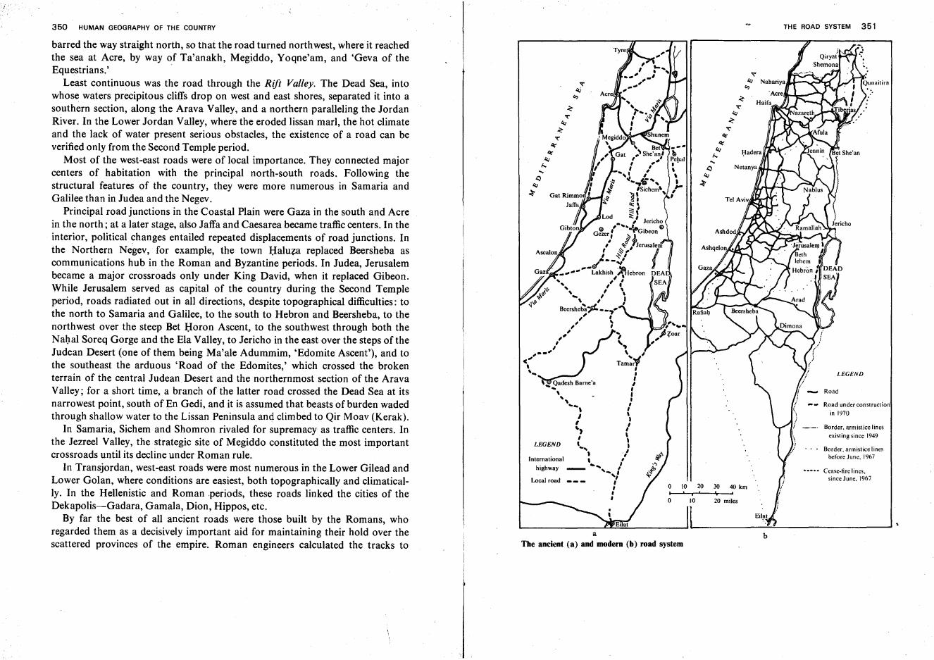
350 HUMAN GEOGRAPHY OF THE COUNTRY THE ROAD SYSTEM 351
aThe ancient (a) and modern (b) road system
LEGEND
Local road _
LEGEND
Road
Border. armistice linesexisting since 1949
Border. armistice linesbefore June. 1967
Road under constructionin 1970
...... Cease-fire lines,since June. 1967
b
~
't'4J~
't''l;'
'l;'4J
(i.,...J:) NetanyallfM.......~.....
4J~
o 10 20 30 40 kmI i f I
o 10 20 miles
;' ..
\ ,Tam~;f,,,
'~~adesh Barne'a "
\ I
" :" .., ,I ', }~, ,I ', '"... I, 1
International , #
highway _ ........ /...,,',,,,
barred the way straight north, so that the road turned northwest, where it reachedthe sea at Acre, by way of Ta'anakh, Megiddo, Yoqne'am, and 'Geva of theEquestrians.'
Least continuous was the road through the Rift Valley. The Dead Sea, intowhose waters precipitous cliffs drop on west and east shores, separated it into asouthern section, along the Arava Valley, and a northern paralleling the JordanRiver. In the Lower Jordan Valley, where the eroded lissan marl, the hot climateand the lack of water present serious obstacles, the existence of a road can beverified only from the Second Temple period.
Most of the west-east roads were of local importance. They connected majorcenters of habitation with the principal north-south roads. Following thestructural features of the country, they were more numerous in Samaria andGalilee than in Judea and the Negev.
Principal road junctions in the Coastal Plain were Gaza in the south and Acrein the north; at a later stage, also Jaffa and Caesarea became traffic centers. In theinterior, political changes entailed repeated displacements of road junctions. Inthe Northern Negev, for example, the town Haluza replaced Beersheba ascommunications hub in the Roman and Byzantine periods. In Judea, Jerusalembecame a major crossroads only under King David, when it replaced Gibeon.While Jerusalem served as capital of the country during the Second Templeperiod, roads radiated out in all directions, despite topographical difficulties: tothe north to Samaria and Galilee, to the south to Hebron and Beersheba, to thenorthwest over the steep Bet Horen Ascent, to the southwest through both theNahal Soreq Gorge and the Ela Valley, to Jericho in the east over the steps of theJudean Desert (one of them being Ma'ale Adummim, 'Edomite Ascent'), and tothe southeast the arduous 'Road of the Edomites,' which crossed the brokenterrain of the central Judean Desert and the northernmost section of the AravaValley; for a short time, a branch of the latter road crossed the Dead Sea at itsnarrowest point, south of En Gedi, and it is assumed that beasts of burden wadedthrough shallow water to the Lissan Peninsula and climbed to Qir Moav (Kerak).
In Samaria, Sichem and Shomron rivaled for supremacy as traffic centers. Inthe Jezreel Valley, the strategic site of Megiddo constituted the most importantcrossroads until its decline under Roman rule.
In Transjordan, west-east roads were most numerous in the Lower Gilead andLower Golan, where conditions are easiest, both topographically and climatically. In the Hellenistic and Roman .periods, these roads linked the cities of theDekapolis-Gadara, Gamala, Dion, Hippos, etc.
By far the best of all ancient roads were those built by the Romans, whoregarded them as a decisively important aid for maintaining their hold over thescattered provinces of the empire. Roman engineers calculated the tracks to
352 HUMAN GEOGRAPHY OF THE COUNTRY
choose; the roads were smoothly paved,· and bridged over the wadi courses.Among the outstanding Roman-built highways in the country are the routesCaesarea-Antipatris-Jerusalem, Gaza-Jerusalem, Jerusalem-Jericho-Philadelphia(Rabbat Ammon)-Gerasa, Jerusalem-Legio (Megiddo), and Acre-Tiberias.
With the end of Roman rule, roads fell into disrepair. The Crusaders tried toimprove some of the highways but never attained the standards of Roman times.Until the end of the 19th century, there were no paved roads, goods weretransported on camels or donkeys, and travel was either by foot or on horses andcamels. Although lines of communication followed the general tracks of Romanroads, they had degenerated into tortuous paths; care was taken only of crossingsover dry wadi beds and stream fords.
The enlivenment of seafaring in the Mediterranean Sea and the growing streamof pilgrims to the Holy Land at the end of the 19th century made a: thoroughimprovement of the road system inevitable. The existing tracks were partlyadapted to the passage of caravans and coaches ('diligences'). Prime attentionwas given to the roads leading to sacred sites, e.g., the links between Jaffa andJerusalem, Haifa and Nazareth, or the lengthwise route of Hebron-BethlehemJerusalem-Nablus-Nazareth. These tracks were paved and provided with bridgesand culverts, so that they became all-weather roads. Before the First World War,they totaled 450 km (280 miles) in length.
The first years of the British Mandate saw much repair, improvement,widening and asphalting of roads to fit them for motorized traffic. In 1932, theroad network reached a length of 950km (590miles). Until then, however, leastcare was taken of roads in the Coastal Plain, since the authorities did not wish tocreate a serious competition to the railway there.
The increase in immigration and citrus exports of the 1930's necessitated afurther expansion of the road network, and the mounting prosperity in thecountry provided the means to finance it. In 1936, the first highway running thewhole length of the Sharon was finally built between TelAviv and Haifa: a roadlink was also established between the port-city of Haifa and the flourishing farming region of the Jezreel Valley.
Efforts to complete the road system were redoubled during the Second WorldWar, when the country was the hinterland of the Allied front in the LibyanDesert and of the operation to free Syria and Lebanon from the Vichy French. Inthe south, and even more in the north, new roads were laid out. Among these wasthe Megiddo-Afula road in the Jezreel Valley, which created a direct link betweenthe Coastal Plain and the Sea of Galilee. The country's road system wasconnected with Transjordan and Syria to the east and north as well as with Egyptthrough the Sinai Peninsula. On the eve of Israel's statehood, Palestine had2,660km (l,650miles) of motor roads.
THE ROAD SYSTEM 353
From the late 19th century, several railway lines were installed to supplement. the road system. The first line, for the benefit of pilgrims, was built by a Frenchcompany between Jaffa and Jerusalem. Second came the line Rafiah-Gaza-LodTul Karm-Haifa: this was later, between the two world wars, linked to al-Qantarain Egypt and to Beirut in Lebanon. Two narrow-track lines were added: fromHaifa through Afula to Bet She'an and Zemah at the southern shore of the Sea ofGalilee where it linked up with the Hedjaz Railway through the Yarmuk Valley;and from Afula south to Nablus and then west to Tu! Karm. The War ofIndependence paralyzed all rail traffic, and later only the Jaffa (Tel Aviv)-Jerusalem line and that section of the coastal railway running from Ashqelon throughLod and Haifa to Nahariya were renewed.
The Present Road System. The road network still mirrors, to some extent, thecountry's morphological structure although today's technical means enablebuilders to overcome most topographical difficulties: some highways still followancient road tracks. The borders existent between Israel and her neighborsbetween 1949 and 1967 put many roads out of use completely or in part, lentincreased importance to other roads, and necessitated the construction of newhighways to replace those cut by the frontiers. The latter is illustrated, forexample, by that section of the Jerusalem-Tel Aviv highway built by Israelimmediately after the cessation of hostilities in 1948, between Sha'ar ha-Gay andRamla (the 'Road of Courage') to circumvent Latrun, then in Jordanianterritory, or the Jordanian route reconnecting the City of Jerusalem withBethlehem, which ran east of the Israel border. Furthermore, new economicrequirements, expansion of old and construction of new urban centers, as wellas regional settlement projects necessitate investment of large means and effortsin roadbuilding. To cope with the ever-increasing traffic, all major interurbanhighways continually have to be widened.
Israel's principal traffic arteries connect the three main cities of Tel Aviv,Jerusalem, and Haifa: lead from Tel.Aviv and Jerusalem south to the Negev andEilat ; and from Tel Aviv and Haifa north and east, to Galilee and to the Centraland Upper Jordan Valley. The Tel Aviv-Haifa highway bears by far the heaviesttraffic: constructed in the early 1950's, it runs along the shore from Tel Avivthrough Herzliya and Netanya up to Hadera, where it continues west of the former Hadera-Haifa road, since 1970 in its entire length a modern four-lane, andpartly six-lane highway. The older road, paralleling the new one in the eastbetween Petal) Tiqwa, Hadera and Atlit, today connects (together with theRamla-Lod-Petah Tiqwa highway) Jerusalem with Haifa.
Extremely important is the connection between Hadera in the Coastal Plainthrough the Irron Valley to Afula in the Jezreel Valley and thence to Tiberias:
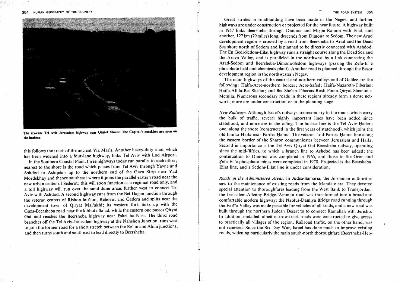
354 HUMAN GEOGRAPHY of THE COUNTRY
The six-lane Tel Aviv-Jerusalem highway near Qiistel Mount. The Capital's outskirts are seen on
theborizon
this follows the track of the ancient Via Maris. Another heavy-duty road, whichhas been widened into 11 four-lane highway, links Tel Aviv with Lod Airport.
In the Southern Coastal Plain, three highways today run parallel to each other;nearest to the shore is the road which passes from Tel Aviv through Yavne andAshdod to Ashqelon up to the northern end of the Gaza Strip near YadMordekhay and thence southeast where it joins the parallel eastern road near thenew urban center of Sederot; this will soon function as a regional road only, anda toll highway will run over the sand-dune areas further west to connect TelAviv with Ashdod. A second highway runs from the Bet Dagan junction throughthe veteran centers of Rishon Ie-Zion, Rehovot and Gedera and splits near thedevelopment town of Qiryat Mal'akhi; its western fork links up with theGaza-Beersheba road near the kibbutz Sa'ad, while the eastern one passes QiryatGat and reaches the Beersheba highway near Eshel ha-Nasi. The third roadbranches off the Tel Aviv-Jerusalem highway at the Nahshon Junction, runs westto join the former road for a short stretch between the Re'im and Ahim junctions,and then turns south and southeast to lead directly to Beersheba.
" THE ROAD SYSTEM 355
Great strides in roadbuilding have been made in the Negev, and furtherhighways are under construction or projected for the near future. A highway builtin 1957 links Beersheba through Dimona and Mizpe Ramon with Eilat, andanother, 127km (79 miles) long, descends from Dimona to Sedom. The new Araddevelopment region is crossed by a road from Beersheba to Arad and the DeadSea shore north of Sedom and is planned to be directly connected with Ashdod.The En Gedi-Sedom-Eilat highway runs a straight course along the Dead Sea andthe Arava Valley, and is paralleled in the northwest by a link connecting theArad-Sedom and Beersheba-Dimona-Sedom highways (passing the Zefa-Ef?ephosphate field and chemicals plant). Another road is planned through the Besordevelopment region in the northwestern Negev.
The main highways of the central and northern valleys and of Galilee are thefollowing: Haifa-Acre-northern border; Acre-Safed; Haifa-Nazareth-Tiberias;Haifa-Afula-Bet She'an; and Bet She'an-Tiberias-Rosh Pinna-Qiryat ShemonaMetulla. Numerous secondary roads in these regions already form a dense network; more are under construction or in the planning stage.
New Railways. Although Israel's railways are secondary to the roads, which carrythe bulk of traffic, several highly important lines have been added sincestatehood, and more are in the offing. The busiest line is the Tel Aviv-Haderaone, along the shore (constructed in the first years of statehood), which joins theold line to Haifa near Pardes Hanna. The veteran Lod-Pardes Hanna line alongthe eastern border of the Sharon communicates between Jerusalem and Haifa.Second in importance is the Tel Aviv-Qiryat Gat-Beersheba railway, operatingsince the mid-'fifties, to which a branch line to Ashdod has been added; thecontinuation to Dimona was completed in 1965, and those to the Oron andZefa-Ef'e phosphate mines were completed in 1970. Projected is the BeershebaEilat line, and a Sedom-Eilat line is under consideration.
Roads in the Administered Areas. In Judea-Samaria, the Jordanian authoritiessaw to the maintenance of existing roads from the Mandate era. They devotedspecial attention to thoroughfares leading from the West Bank to Transjordan:the Jerusalem-Allenby Bridge-' Amman road was transformed into a broad andcomfortable modern highway; the Nablus-Damiya Bridge road running throughthe Fari 'a Valley was made passable for vehicles of all kinds, and a new road wasbuilt through the northern Judean Desert to to connect Ramallah with Jericho.In addition, metalled, albeit narrow-track roads were constructed to give accessto practically all villages of the region. Railroad traffic, on the other hand, wasnot renewed. Since the Six Day War, Israel has done much to improve existingroads, widening particularly the main south-north thoroughfare (Beersheba-Heb-
·356 HUMAN GEOGRAPHY OF THE COUNTRY
ron-Bethlehem-Jerusalem-Ramallah-Nablus-Jennin). Immediately after the war,the Ayalon Valley (Latrun) road was repaired and re-opened to vehicles notexceeding 4 tons, thus shortening by 9 km the journey between Jerusalem and TelAviv. A particularly important new road, built in extremely different terrain, isthe En Gedi-Ein Feshkha link which connects Eilat and Sedom with Jerusalem,Bet She'an and Eastern Galilee.
In the Golan, Syrian-built roads principally served military requirements.These have now undergone thorough repair, and in addition to the three existinglinks with veteran Israel territory (the Banias-Mas'ada, Gesher Benot Ya'aqovQunaitira and Hammat Gader-Fiq roads), a fourth highway is under construction. A venture of special interest are new roads blazed to a 2,200 m-high peak ofMount Hermon and on the mountain's western slopes.
In Sinai; roads existing before 1967 have been repaired, and new connectinglinks have been added.* Israel is constructing a new broad highway from Eilatsouth to Mifraz Shelomo (Sharm a-Sheikh).
*" For further details on Sinai roads, see pp. 367-371.
Part IV
The Administered Areas
The Sinai Peninsula
Soil, Water and Farming
Natural conditions for farming are extremely difficult in Sinai. Only a fewthousand hectares ar<:: at present under cultivation there, less than one tenth ofone percent of the total surface. It is difficult to envisage that this area could havebeen much larger in the historic past. In general, farming is limited to a few oases,and even there the fields are tilled only intermittently and haphazardly. Grazinggrounds are also sparse. Thorough planning may make possible a certainexpansion of the area under cultivation even if no water is brought to Sinai fromthe outside in large quantities. However, should novel methods make wateravailable in adequate amounts and at a reasonable price, a revolutionary changemay be brought about, both in agriculture and in settlement conditions.
Soil and Water. The largest concentration of land suitable for cultivation,principally loess and loess-sand soils, is to be found along the lower course ofWadi el-'Arish, south of the town of same name. Smaller parcels of similar soilsare located near the Negev border in the east, between 'Azmon (el-Quzetma) andKuntilla. In the Pelusian Plain south of the Bardawil Lagoon, between el-'Arishand Rumani, date palms cover stretches of land between the sea shore and thesalt playas, wherever only a thin cover of moving dunes hides the underlyingmore fertile soil. In the eastern section of the coastal region, between el-'Arishand Rafiah, conditions are more problematic, as the dune cover is thicker there.
Relatively ample reserves of groundwater exist in the northwestern part of thecoastal region, but even here the water is decidedly brackish, and a chloridecontent of700-1,000 milligrams per liter is regarded as still acceptable (in mostparts of Israel, 350mg/Iiter is considered as the upper limit for irrigation). Thehigh salt content is explained by the fact that the groundwater migrates overconsiderable distances before arriving at the wells or small springs, dissolving enroute salts from the rocks or sands through which it seeps. Moreover, a large
359
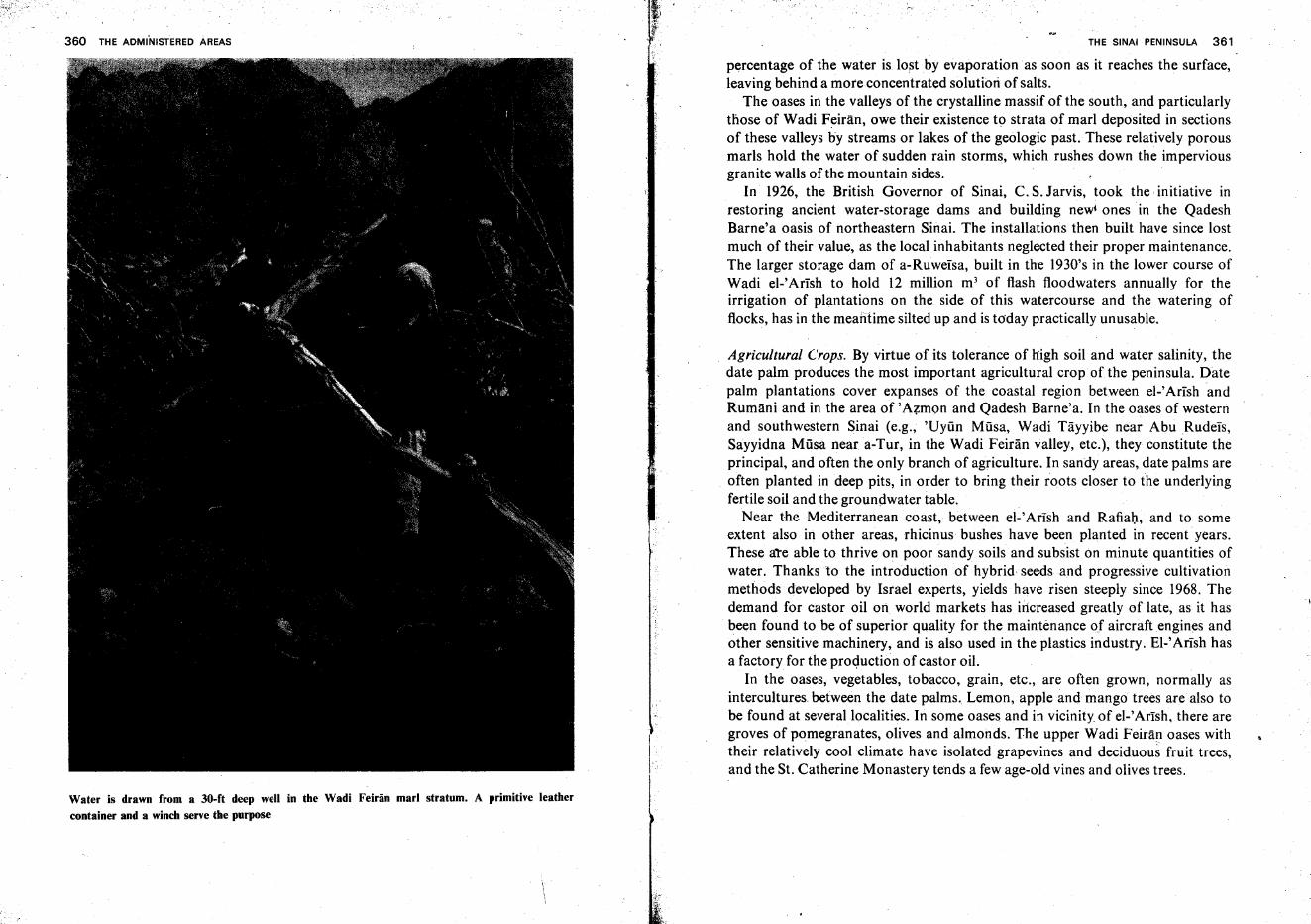
360 THE ADMI'NISTERED AREAS
Water is drawn from a 30-ft deep well in the Wadi Feiran marl stratum. A primitive leathercontainer and a winch serve the purpose
I·
THE SINAI PENINSULA 361
percentage of the water is lost by evaporation as soon as it reaches the surface,leaving behind a more concentrated solutiori of salts.
The oases in the valleys of the crystalline massif of the south, and particularlythose of Wadi Feiran, owe their existence to strata of marl deposited in sectionsof these valleys by streams or lakes of the geologic past. These relatively porousmarls hold the water of sudden rain storms, which rushes down the imperviousgranite walls of the mountain sides.
In 1926, the British Governor of Sinai, C. S. Jarvis, took the initiative inrestoring ancient water-storage dams and building new' ones in the QadeshBarne'a oasis of northeastern Sinai. The installations then built have since lostmuch of their value, as the local inhabitants neglected their proper maintenance.The larger storage dam of a-Ruweisa, built in the 1930's in the lower course ofWadi el-'Arish to hold 12 million m3 of flash floodwaters annually for theirrigation of plantations on the side of this watercourse and the watering offlocks, has in the meantime silted up and is today practically unusable.
Agricultural Crops. By virtue of its tolerance of high soil and water salinity, thedate palm produces the most important agricultural crop of the peninsula. Datepalm plantations cover expanses of the coastal region between el-'Arish andRumani and in the area of 'Azmon and Qadesh Barne'a. In the oases of westernand southwestern Sinai (e.g., 'Uyiin Miisa, Wadi Tayyibe near Abu Rudeis,Sayyidna Miisa near a-Tur, in the Wadi Feiran valley, etc.), they constitute theprincipal, and often the only branch of agriculture. In sandy areas, date palms are
. often planted in deep pits, in order to bring their roots closer to the underlyingfertile soil and the groundwater table.
Near the Mediterranean coast, between el-'Arish and Rafiah, and to someextent also in other areas, rhicinus bushes have been planted in recent' years.These are able to thrive on poor sandy soils and subsist on minute quantities ofwater. Thanks to the introduction of hybrid seeds and progressive cultivationmethods developed by Israel experts, yields have risen steeply since 1968. Thedemand for castor oil on world markets has increased greatly oflate, as it hasbeen found to be of superior quality for the maintenance of aircraft engines andother sensitive machinery, and is also used in the plastics industry. El-' Arish hasa factory for the production of castor oil.
In the oases, vegetables, tobacco, grain, etc., are often grown, normally asintercultures between the date palms. Lemon, apple and mango trees are also tobe found at several.localities. In some oases and in vicinity. of el-Artsh, there aregroves of pomegranates, olives and almonds. The upper Wadi Feiran oases withtheir relatively cool climate have isolated grapevines and deciduous fruit trees,and the St. Catherine Monastery tends a few age-old vines and olives trees.
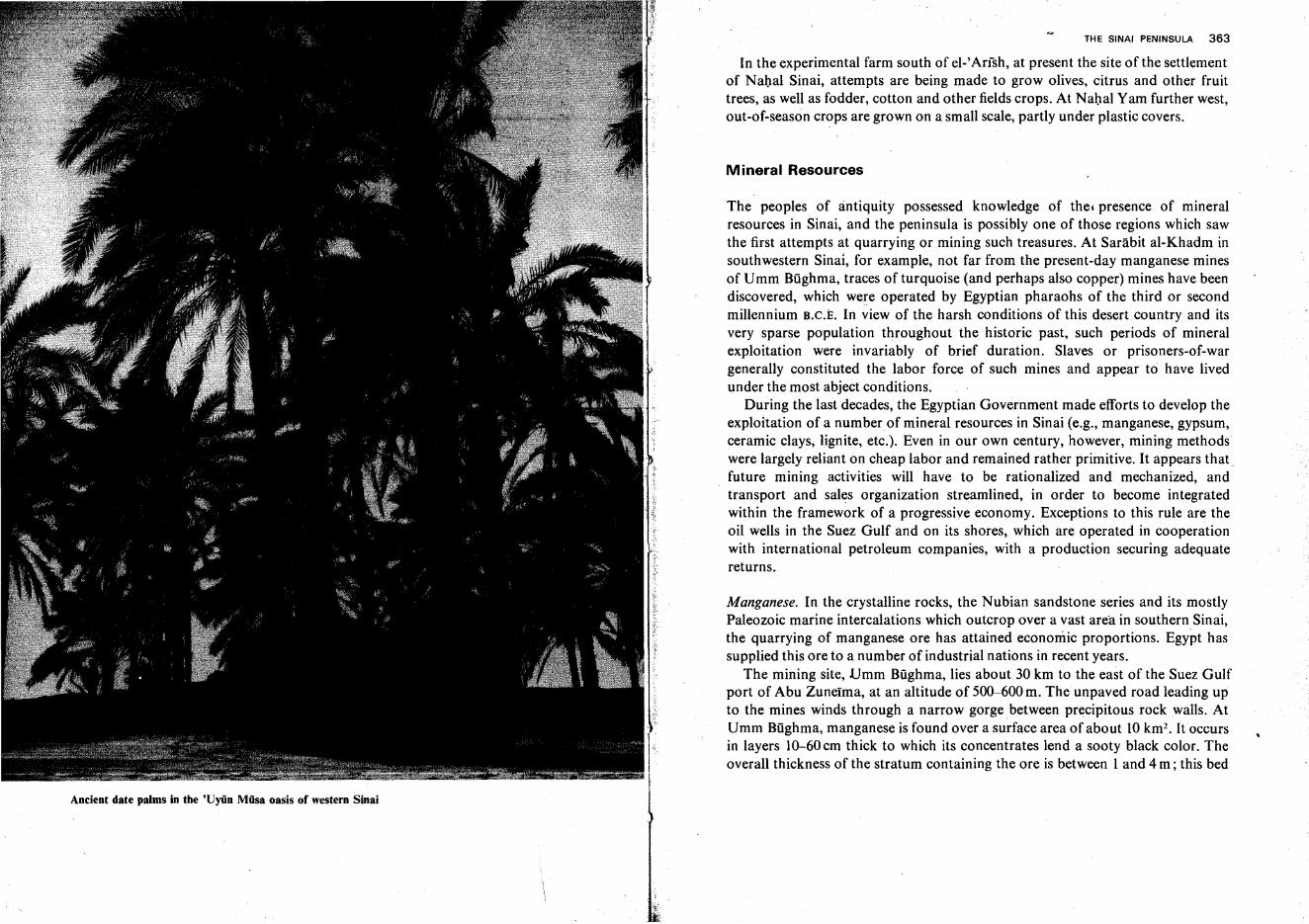
Ancient date palms in the 'Uyiin Miisa oasis of western Sinai
THE SINAI PENINSULA 363
In the experimental farm south of el-' Arish, at present the site of the settlementof Nahal Sinai, attempts are being made to grow olives, citrus and other fruittrees, as well as fodder, cotton and other fields crops. At Nahal Yam further west,out-of-season crops are grown on a small scale, partly under plastic covers.
Mineral Resources
The peoples of antiquity possessed knowledge of the, presence of mineralresources in Sinai, and the peninsula is possibly one of those regions which sawthe first attempts at quarrying or mining such treasures. At Sarabit al-Khadm insouthwestern Sinai, for example, not far from the present-day manganese minesof Umm Bughma, traces of turquoise (and perhaps also copper) mines have beendiscovered, which were operated by Egyptian pharaohs of the third or secondmillennium B.C.E. In view of the harsh conditions of this desert country and itsvery sparse population throughout the historic past, such periods of mineralexploitation were invariably of brief duration. Slaves or prisoners-of-wargenerally constituted the labor force of such mines and appear to have livedunder the most abject conditions.
During the last decades, the Egyptian Government made efforts to develop theexploitation of a number of mineral resources in Sinai (e.g., manganese, gypsum,ceramic clays, lignite, etc.). Even in our own century, however, mining methodswere largely reliant on cheap labor and remained rather primitive. It appears that ~
future mining activities will have to be rationalized and mechanized, andtransport and sales organization streamlined, in order to become integratedwithin the framework of a progressive economy. Exceptions to this rule are theoil wells in the Suez Gulf and on its shores, which are operated in cooperationwith international petroleum companies, with a production securing adequatereturns.
Manganese. In the crystalline rocks, the Nubian sandstone series and its mostlyPaleozoic marine intercalations which outcrop over a vast are-a in southern Sinai,the quarrying of manganese ore has attained economic proportions. Egypt hassupplied this ore to a number of industrial nations in recent years.
The mining site, Umm Biighma, lies about 30 km to the east of the Suez Gulfport of Abu Zunetma, at an altitude of 500-600 m. Theunpaved road leading upto the mines winds through a narrow gorge between precipitous rock walls. AtUmm Bughma, manganese is found over a surface area of about 10 krn-. It occursin layers 10-60 em thick to which its concentrates lend a sooty black color. Theoverall thickness of the stratum containing the ore is between I and 4 m ; this bed
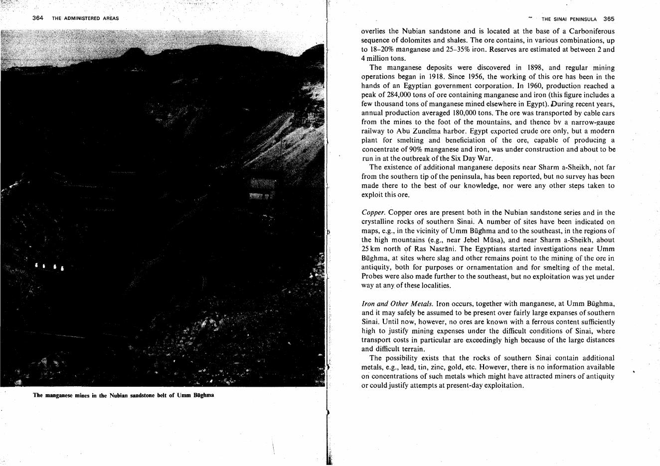
364 THE ADMINISTERED AREAS THE SINAI PENINSULA 365
The manganese mines in the Nubian sandstone belt of Umm Biighma
overlies the Nubian sandstone and is located at the base of a Carboniferoussequence of dolomites and shales. The ore contains, in various combinations, upto 18-20% manganese and 25-35% iron. Reserves are estimated at between 2 and4 million tons.
The manganese deposits were discovered in 1898, and regular miningoperations began in 1918. Since 1956, the working of this ore has been in thehands of an Egyptian government corporation. In 1960, production reached apeak of 284,000 tons of ore containing manganese and iron (this figure includes afew thousand tons of manganese mined elsewhere in Egypt). During recent years,annual production averaged 180,000 tons. The ore was transported by cable carsfrom the mines to the foot of the mountains, and thence bv a narrow-gaugerailway to Abu Zuneirna harbor. Egypt exported crude ore only, but a modernplant for smelting and beneficiation of the ore, capable of producing aconcentrate of 90% manganese and iron, was under construction and about to berun in at the outbreak of the Six Day War.
The existence of additional manganese deposits near Sharm a-Sheikh, not farfrom the southern tip of the peninsula, has been reported, but no survey has beenmade there to the best of our knowledge, nor were any other steps taken toexploit this ore.
Copper. Copper ores are present both in the Nubian sandstone series and in thecrystalline rocks of southern Sinai. A number of sites have been indicated onmaps, e.g., in the vicinity of Umm Bughrna and to the southeast, in the regions ofthe high mountains (e.g., near Jebel Musa), and near Sharm a-Sheikh, about25 km north of Ras Nasrani, The Egyptians started investigations near UmmBilghrna, at sites where slag and other remains point to the mining of the ore inantiquity, both for purposes or ornamentation and for smelting of the metal.Probes were also made further to the southeast, but no exploitation was yet underway at any of these localities.
Iron and Other Metals. Iron occurs, together with manganese, at Umm Bughma,and it may safely be assumed to be present over fairly large expanses of southernSinai. Until now, however, no ores are known with a ferrous content sufficientlyhigh to justify mining expenses under the difficult conditions of Sinai, wheretransport costs in particular are exceedingly high because of the large distancesand difficult terrain.
The possibility exists that the rocks of southern Sinai contain additionalmetals, e.g., lead, tin, zinc, gold, etc. However, there is no information availableon concentrations of such metals which might have attracted miners of antiquityor could justify attempts at present-day exploitation.
366 THE ADMINISTERED AREAS
Clays, Glass Sands. From Umm Biighma northward, in the direction of Jebela-Tih, deposits of high-quality kaolinite clays have been discovered in a stratumoverlying the manganiferous rock. Parts of these deposits were quarriedintensively by the Egyptians during recent years. At Abu Zuneima, heaps ofmined kaolinite were found, ready for shipping overseas. Deposits of bentonitealso appear to have been worked, this clay mineral being used for drilling mud inthe oil fields along the Suez Gulf shores. Additional clay deposits are thought toexist elsewhere in southern Sinai. Glass sands, virtually free of iron impurities,occur quite extensively in the Nubian sandstones series of southern Sinai.However, it is not known whether the Egyptians had quarried this material orwere considering such operations prior to June 1967.
Gypsum. An extensive area of gypsum deposits has been located on the lowground near the Suez Gulf shore, stretching from Ras Matarrna in the north toAbu Zuneima in the south. Certain quantities were quarried in the last years.
Coal. Considerable deposits of lignite were discovered in MiddleJurassic rocks ofJebel Maghara in northwestern Sinai during the last decade. Commercial reservesare estimated at 35 million tons. Mines were opened in two measures, one 135emthick, and the other 70cm. Annual production of 150,000 tons of lignite wasplanned for the first stage, to be stepped up to 300,000 tons around 1970. Here,too, mining operations were based on cheap labor, as approximately 1,000 menappear to have been engaged in working underground galleries prior to the SixDay War. Various European countries provided knowhow and machinery. Mostof the lignite was destined for the Egyptian iron smelters at Heluan, where it wasto be used together with imported high-grade coal in the ratio of 3 : 1.
Oil. There is no doubt that the oil buried in the rocks of the Sinai Peninsula andin the shallow parts of the shelf off the coast is far more valuable than all othermineral deposits taken together. Oil was first discovered in 1946 on the Suez Gulfshore. Since then it has been ascertained that the entire Suez Gulf, together withthe adjoining coastal belts, constitutes a fairly important oil province. Productionmounted from year to year. The first wells were sunk on land near the northernend of the gulf (Ras Siidar, Asal, Abu Rudeis, etc.), Although the reserves inthese early wells are now dwindling, the southward extension of these oil fieldshas been established. On the Sinai side of the gulf they stretch at least as far asRas Garra which is no more than 60 km from the southern tip of the peninsula.
The marine rock strata which contain the oil belong mostly to the Pliocene.Wells drilled in the sea bottom are usually found to be more productive thanthose on the land. Thus, on the western side of the gulf (which remained in.
THE SINAI PENINSULA 367
Egyptian hands after the Six Day War), the marine fields 'al-Morgan' and '23. July' are the most productive. On the Sinai side, the two Belelm fields are the
richest. 'Terrestrial Beletm' had, at the beginning of 1967,71 productive wells,and 'Marine Belelm'-16; the marine field,however, equaled the yield of theterrestrial one, and was superior to the latter in that in all of its wells the oilreached the well mouth under free flow, whileon the land pumping was necessaryin 41 wells.
In 1966, Egypt obtained 6.5 million tons of oil from its own sources, out of 7million tons required by its economy. Of this quantity, 4.5 million tons camefrom the wells on the Sinai shore which are at present in Israel's hands. It isestimated that the production of the existing Sinai oil fields can be increased,without great difficulty, to 10 million tons per annum. In addition, there are goodprospects of finding oil also in northern Sinai, along the Mediterranean coast ofthe peninsula.
Roads
By virtue of its geographic position, the Sinai Peninsula constitutes a land bridgebetween Africa and Asia on the one hand, and between the Mediterranean andthe Red Sea on the other. This explains the prime importance of roads traversingthe peninsula, particularly those running in a west-east direction. Among thelatter, we find three ancient international arteries: the Sea Road or Via Maris,connecting the Nile Valley with Mesopotamia, whose westernmost sectionfollows the Mediterranean coast of Sinai; the Way of Shur, crossing Sinaibetween lsma'iliya and Nizzana and continuing westward to the central NileDelta and eastward to Beersheba, where it links up with the Hill Road ascendingto Hebron, Bethlehem, Jerusalem, Ramallah and Nablus; the Pilgrims' Roadwhich, coming from Cairo and running across Sinai, connects Suez with Eilat,and then continues along the west coast of the Arabian Peninsula to the Islamiccenters of Mecca and Medina. Control of these roads was the sole motivation ofthe various powers who sought possession of the Sinai Peninsula, and thus therole of Sinai in world history and politics has been determined almost exclusivelyby these traffic arteries.
The Sea Road. The path traced by the Via Maris, which does not seem to havechanged much from antiquity to the present day, was largely dictated bytopography. Today, a railroad parallels the highway. The Sea Road follows,wherever possible, the narrow strip of ground between the salt swamps to thenorth and the moving sand dunes to the south, affording easy passage. In many
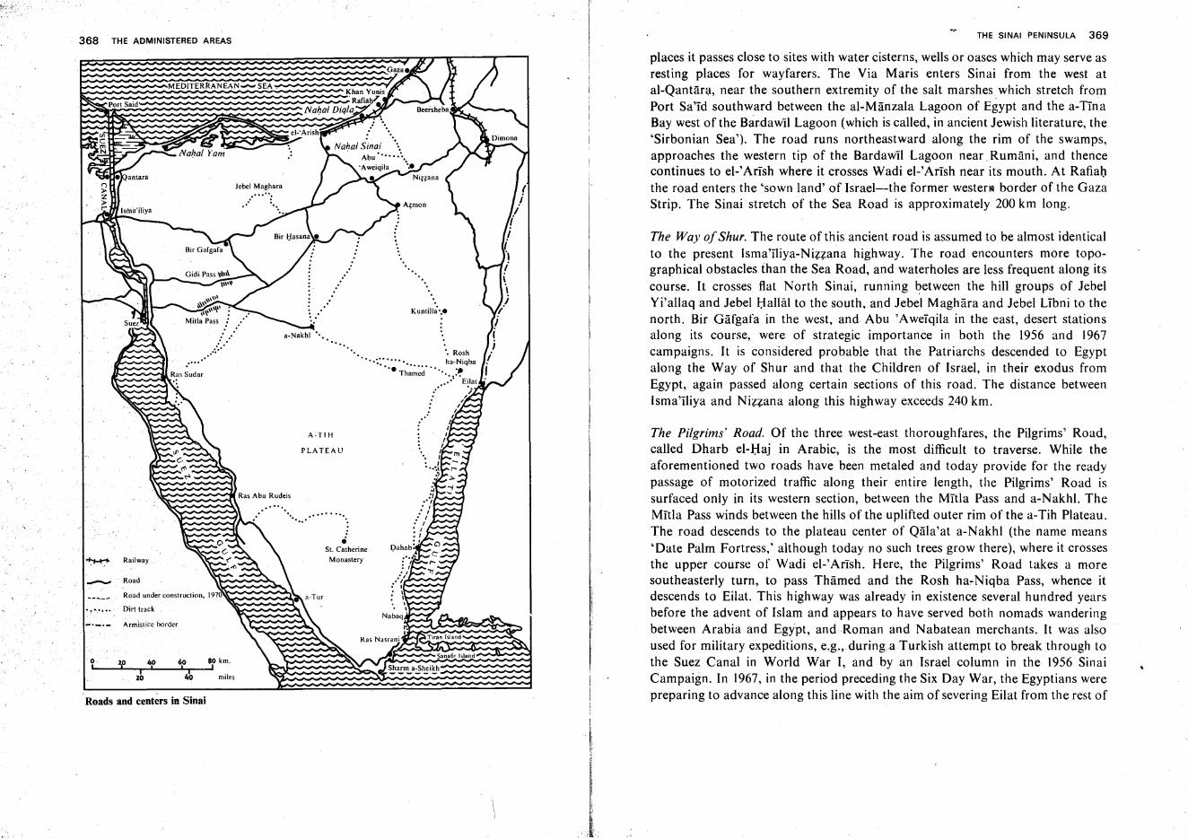
368 THE ADMINISTERED AREASTHE SINAI PENINSULA 369
places it passes close to sites with water cisterns, wells or oases which may serve asresting places for wayfarers. The Via Maris enters Sinai from the west atal-Qantara, near the southern extremity of the salt marshes which stretch fromPort Sa'Id southward between the al-Manzala Lagoon of Egypt and the a-TInaBay west of the Bardawil Lagoon (which is called, in ancient Jewish literature, the'Sirbonian Sea'). The road runs northeastward along the rim of the swamps,approaches the western tip of the Bardawil Lagoon near Rumani, and thencecontinues to el-Arish where it crosses Wadi el-Arish near its mouth. At Rafiahthe road enters the 'sown land' of Israel-the former wester III border of the GazaStrip. The Sinai stretch of the Sea Road is approximately 200 km long.
The Pilgrims' Road. Of the three west-east thoroughfares, the Pilgrims' Road,called Dharb el-Haj in Arabic, is the most difficult to traverse. While theaforementioned two roads have been metaled and today provide for the readypassage of motorized traffic along their entire length, the Pilgrims' Road issurfaced only in its western section, between the Mitla Pass and a-Nakhl. TheMitla Pass winds between the hills of the uplifted outer rim of the a-Tih Plateau.The road descends to the plateau center of Qala'at a-Nakhl (the name means'Date Palm Fortress,' although today no such trees grow there), where it crossesthe upper course of Wadi el-IArlsh. Here, the Pilgrims' Road takes a moresoutheasterly turn, to pass Thamed and the Rosh ha-Niqba Pass, whence itdescends to Eilat. This highway was already in existence several hundred yearsbefore the advent of Islam and appears to have served both nomads wanderingbetween Arabia and Egypt, and Roman and Nabatean merchants. It was alsoused for military expeditions, e.g., during a Turkish attempt to break through tothe Suez Canal in World War I, and by an Israel column in the 1956 SinaiCampaign. In 1967, in the period preceding the Six Day War, the Egyptians werepreparing to advance along this line with the aim of severing Eilat from the rest of
The Way ofShur. The route of this ancient road is assumed to be almost identicalto the present Isma'Iliya-Nizzana highway. The road encounters more topographical obstacles than the Sea Road, andwaterholes are less frequent along itscourse. It crosses flat North Sinai, running between the hill groups of JebelYi'allaq and Jebel Hallal to the south, and Jebel Maghara and Jebel Libni to thenorth. Bir Gafgafa in the west, and Abu'Aweiqila in the east, desert stationsalong its course, were of strategic importance in both the 1956 and 1967campaigns. It is considered probable that the Patriarchs descended to Egyptalong the Way of Shur and that the Children of Israel, in their exodus fromEgypt, again passed along certain sections of this road. The distance betweenIsma'Iliya and Nizzana along this highway exceeds 240 km.
Sanafir Island
Sharm a-Sheikh
Jebel Maghara
miles
MEDITERRANEAN ........ SEA
40I '
20
PortSaid~ ~~
o,
....-..- Road
~ Railway
Roads and centers in Sinai
Road under construction, 197
• ! .,... •• Dirt track
_._._ Armistice border
370 THE ADMINISTERED AREAS
Israel. The length of the. Pilgrims' Road in Sinai, like that of the Way of Shur, isabout 240 km.
North-South Roads. Two major north-south roads cross Sinai, the eastern onepassing dose to the Negev border, and the western route running along the SuezCanal and the Suez Gulf shore. While the eastern thoroughfare was important inantiquity, the western road rose to prominence only during the last decades.Forming the eastern highway, two roads meet at the 'Azmon (al-Quzeirna)junction: one comes from Rafiah via Nizzana, and the other from el-'Arishthrough Bir Lahfan and Abu'Aweiqila. From'Azrnon onward the road follows asouth-southeasterly course, paralleling the former Israel-Sinai border. Its principal stations are Kuntilla and Rosh ha-Niqba. The terrain crossed by this track,though by no means easy, is nevertheless far smoother than that along theBeersheba-Mizpe Ramon-Eilat highway because, in contrast to the latter, theformer circumvents the Negev Highlands block in the west instead of ascending itand crossing its ravines and craters. Traffic along the road was brisk in the days ofthe Nabateans, who carried goods to and from the Mediterranean ports andcontinued their way from Eilat to their capital Petra in the mountain region ofEdom.
The western highway is paralleled by a railroad between Port Fu'ad (oppositePort Sa'Id) and Port Taufiq (opposite Suez). Being suitable for vehicular trafficover most of its length, it provides an access to Sinai's most important miningsites (oil wells, manganese mines, gypsum and kaolin quarries). The roadapproaches the southern end of the peninsula and then turns to the northeast,terminating at Ras Nasrani near the Titan Straits.
Connecting Roads. Road sections connecting the main highways have beendeveloped chiefly in north Sinai, where the Egyptians made efforts to build andmaintain them, principally for military purposes. In central and southern Sinai,by way of contrast, only few such roads are to be found.
An important thoroughfare issues from el-'Arish to the south. From BirLahfan it takes a turn to the southwest, to meet the Way of Shur west of JebelLibni, and then continues southward to Bir al-Hasana where it again follows asouthwesterly course, finally joining the Pilgrims' Road at a site called Sidral-Heitan in front of the Mitla Pass. More desert tracks issue from the Biral-Hasana crossroads, one running south to a-Nakhl, and another northeast tothe vicinity of 'Azrnon. The a-Nakhl junction, too, is linked with'Azmon by adirt track. The newly metaled roads include the thoroughfare connecting the twoformer military camps, Bir a-Thamade on the Pilgrims' Road and Bir Gafgafa onthe Way of Shur, and the road leading from Bir a-Thamade, over the Gidi Pass
THE SINAI PENINSULA 371
(north of the Mitla Pass), to the Small Bitter Lake. A side road branching off theWay of Shur climbs Jebel Maghara and provides access to its lignite mines.
In the. west and southwest, several short roads have been built, leading fromthe main highway to the oil fields near the coast. Also of importance are severalsecond-class roads, one of which leads to the Umm Biighma manganese mines,while another, apparently very old, reaches the St.Catherine monastery via theFeiran oasis.
The Suez Canal
The Suez Canal undoubtedly represents one of the most profound man-madechanges on the physical map of the globe. The Canal connects the Mediterraneanwith the Red Sea, and through them-.:..-the Atlantic with the Indian Ocean. Thewaterway has not only shortened lines of maritime communications and greatlyinfluenced world commerce, but has also had a certain impact on naturalconditions, enabling, for instance, marine fauna to pass from the Red Sea to theMediterranean, where it acclimatizes to its new surroundings.
History of the Canal. The idea of linking the Mediterranean with the Red Sea wasconceived long before our times. Ancient authors such as Aristotle and thegeographer Strabo report that a canal was dug between an eastern arm of the NileDelta (no longer in existence) and the Suez Gulf. Herodotus tells of PharaohNecho's attempt to excavate a canal which, according to the historian, took tollof the lives of 120,000 workers. A stone tablet found at Isma'iliya bears aninscription relating the conquest of Egypt by the Persian King Cyrus and of thedigging of a canal at his behest. Under the Roman Emperor Trajan, a similarcanal was in use and remained so until the first period of Islamic occupation inthe 8th century. In the lSth and 16th centuries, Venetian merchants thought ofreviving Mediterranean commerce, which had suffered since the discovery of asea route to India via the Cape of Good Hope, by opening anew the sea lane tothe Red Sea. Napoleon, during his Middle Eastern campaign of 1798-99,.considered a similar enterprise, but his engineers hesitated as they erroneouslyassumed the Red Sea level.to be 10m higher than that of the Mediterranean.
In the middle of the nineteenth century, Ferdinand de Lesseps, a retiredFrench diplomat living in Egypt, won for this project the support of the KhediveIsmail, then ruler over Egypt on behalf of the Turkish Empire, and alsosucceeded in mobilizing capital in France for the construction of the Canal. Workbegan in 1859, first carried out by 20,000 Egyptian forced laborers who were laterreplaced by 4,000 workers brought over from Europe. The capital investment
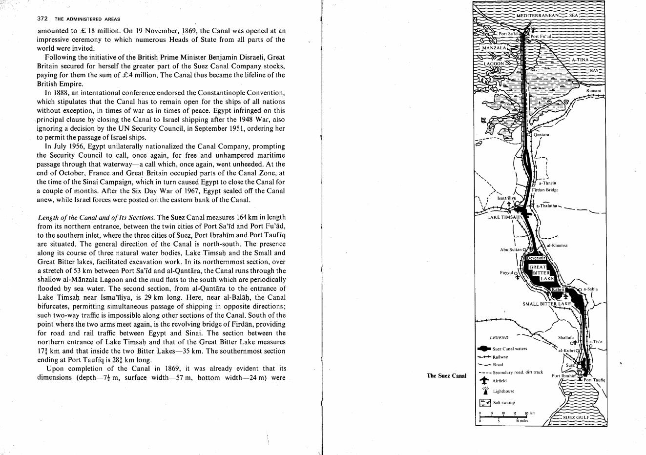
372 THE ADMINISTERED AREASMEDITERRANEAN::::: SEA
lhmiles
10 lS 20 km! , ,
a-Thalatha ....
--'--
LEGEND
[iiL:;::J~ Salt swamp
... Suez Canal waters
-Railway
-...- Road
.... _-_ Secondary road. dirt track
't'" Airfield
....'1',.j Lighthouse
The Suez Canal
Length of the Canal and ofIts Sections. The Suez Canal measures 164km in lengthfrom its northern entrance, between the twin cities of Port Sa'id and Port Fu'ad,to the southern inlet, where the three cities of Suez, Port Ibrahim and Port Taufiqare situated. The general direction of the Canal is north-south. The presencealong its course of three natural water bodies, Lake Timsah and the Small andGreat Bitter lakes, facilitated excavation work. In its northernmost section, overa stretch of 53 km between Port Sa'Id and al-Qantara, the Canal runs through theshallow al-Manzala Lagoon and the mud flats to the south which are periodicallyflooded by sea water. The second section, from al-Qantara to the entrance ofLake Timsah near Isma'iliya, is 29 km long. Here, near al-Balah, the Canalbifurcates, permitting simultaneous passage of shipping in opposite directions;such two-way traffic is impossible along other sections of the Canal. South of thepoint where the two arms meet again, is the revolving bridge of Firdan, providingfor road and rail traffic between Egypt and Sinai. The section between thenorthern entrance of Lake Timsah and that of the Great Bitter Lake measuresIn km and that inside the two Bitter Lakes-35 km. The southernmost sectionending at Port Taufiq is 28t km long.
Upon completion of the Canal in 1869, it was already evident that itsdimensions (depth-7t m, surface width-57 m, bottom width-24 m) were
amounted to £ 18 million. On 19 November, '869, the Canal was opened at animpressive ceremony to which numerous Heads of State from all parts of theworld were invited.
Following the initiative of the British Prime Minister Benjamin Disraeli, GreatBritain secured for herself the g-reater part of the Suez Canal Company stocks,paying for them the sum of £4 million. The Canal thus became the lifeline of theBritish Empire.
In 1888, an international conference endorsed the Constantinople Convention,which stipulates that the Canal has to remain open for the ships of all nationswithout exception, in times of war as in times of peace. Egypt infringed on this
.principal clause by closing the Canal to Israel shipping after the 1948 War, alsoignoring a decision by the UN Security Council, in September 1951, ordering herto permit the passage of Israel ships.
In July 1956, Egypt unilaterally nationalized the Canal Company, promptingthe Security Council to call, once again, for free and unhampered maritimepassage through that waterway-a call which, once again, went unheeded. At theend of October, France and Great Britain occupied parts of the Canal Zone, atthe time of the Sinai Campaign, which in turn caused Egypt to close the Canal fora couple of months. After the Six Day War of 1967, Egypt sealed off the Canalanew, while Israel forces were posted on the eastern bank ofthe Canal.
374 TI-\E ADMINISTERED AREAS
inadequate to permit passage of the larger motor vessels then in use. It wastherefore enlarged immediately, this stage of the work reaching completion in1875. Subsequently, the Canal has undergone several widenings and deepenings.Its present minimum surface width is 100m, increasing to 164m along certainsections, and the bottom width is 65 m. Ships of a maximum draft of II! m canpass through the Canal.
Maintenance and Navigation Problems. The huge quantities of sand incessantlyintroduced by the frequent desert dust storms on both sides of the Canal causelarge-scale silting of this waterway. Continuous dredging is therefore imperativeto prevent blockage of the Canal within a brief span of time. In the ninety-yearinterval between the Canal's completion and its closure in 1967, the quantity ofearth dredged from it was six times greater than that excavated during its actualconstruction. In 1957, when Egypt resolved to re-open the Canal after the SinaiCampaign, several months of intensive dredging work were necessary beforeships could pass through. In view of the fact that all work on the Canal has beensuspended for a considerably longer period after the Six Day War, experts doubtwhether the huge expenditure involved in clearing this waterway would bewarranted, even should a political settlement make provision for its re-opening.
To these difficulties of maintenance must be added the damage constantlycaused to the Canal bottom and walls by ships passing through, and by wavesand currents they set in motion. Ships' keels throw waves obliquely toward theCanal sides from where they are forcefully turned back to swirl in a strong vortexin the ships' wake. This not only causes extensive erosion damage to the Canalitself but also makes navigation extremely hazardous. The captains of all shipsseeking passage are therefore required to enlist the services of a pilot of the CanalCompany who is intimately acquainted with local conditions.
Past Use and Profitability Prospects. Sea lanes were decisively shortened by theSuez Canal. The distance between Marseilles and Bombay, for example,measures only 9,000 km via the Canal, as compared to 19,000 km along the Caperoute. Since the Second World War, traffic through the Suez Canal has increasedby leaps and bounds. While in 1946 the total tonnage passing through amountedto 21 million, it attained 107million in 1955, and close to 250 million in 1966. Itshould be noted that the proportion of crude oil transported through the Canalhas increased steadily, amounting to 75% of the total tonnage in recent years.This explains the great disparity in loads traveling in different directions, withabout 80% of the total tonnage moving from south to north. The number ofpassengers passing through the Canal reached 500,000 in peak years, but hasdecreased rapidly over the last decades, with air travel replacing passenger ships.
'(
THE SINAI PENINSULA 375
Even should the Canal be opened anew in the future, its prospects do not seemas promising as might be inferred from the figures cited above. The reason for thislies in the increasing use of supertankers of 100,000 tons and more load capacity :passage in the Canal is restricted to ships of 45,000-65,000 tons. The routedistance becomes a less important factor in transport costs as the load of theindividual ship increases. A preferable solution to the oil transportation problemis seen by many in the plan to lay pipelines between two ports open to giantships,e.g., the 42-inch line operating since 1969 between Eilat and Ashqelon, or the oneplanned to link Suez with Alexandria. Such pipelines may, i41 the IOl1g run, totallysupplant the Suez Canal.
Sinai in Modern History
The Problem of Political Borders. Only toward the end of the nineteenth centurywas serious consideration given to the drawing of exactly defined politicalborders for Sinai. The peninsula had never constituted an independent politicalunit. Whoever controlled the highways crossing Sinai was inherently held to be itsruler. In most periods of the historic past, both Sinai and Palestine came underthe same power, e.g., the Persian Empire, the realm of Alexander the Great.itheRoman and Byzantine empires, the early' Arab caliphates, the rule of theMamelukes and Turks. All these felt little need to give formal expression to theirownership of Sinai, and were, in general, content with safeguarding forthemselves the peninsula's vital thoroughfares, occasionally also attemptingexploitation of some of its mineral wealth.
The situation began to change gradually after Napoleon's campaign to Egyptand Palestine (1797-1799) brought the eastern Mediterranean basin into the orbitof European power politics. This development was accelerated when the idea ofbuilding the Suez Canal was mooted.
Since the sixteenth century,Palestine and Egypt were included within theborders of the Ottoman Empire. Turkish rule was interrupted for but a brieften-year spell between 1831 and 1840, when the Egyptian Governor Mehemet Alirevolted against the Sultan and extended his rule over Palestine, appointingIbrahim Pasha as his governor in the latter province. By the treaty of 1841Palestine was returned to direct Turkish rule; Egypt retained certain autonomybut the Sultan became the Egyptian Khedive's suzerain. Even at that juncture noneed was yet felt for a clear delimitation of the frontiers between Turkey andEgypt. In 1882, however, the British occupied Egypt and in fact took over itsadministration. The Khedive was permitted to remain in his post and his formalallegiance to the Turkish throne was not questioned. As master of the Suez
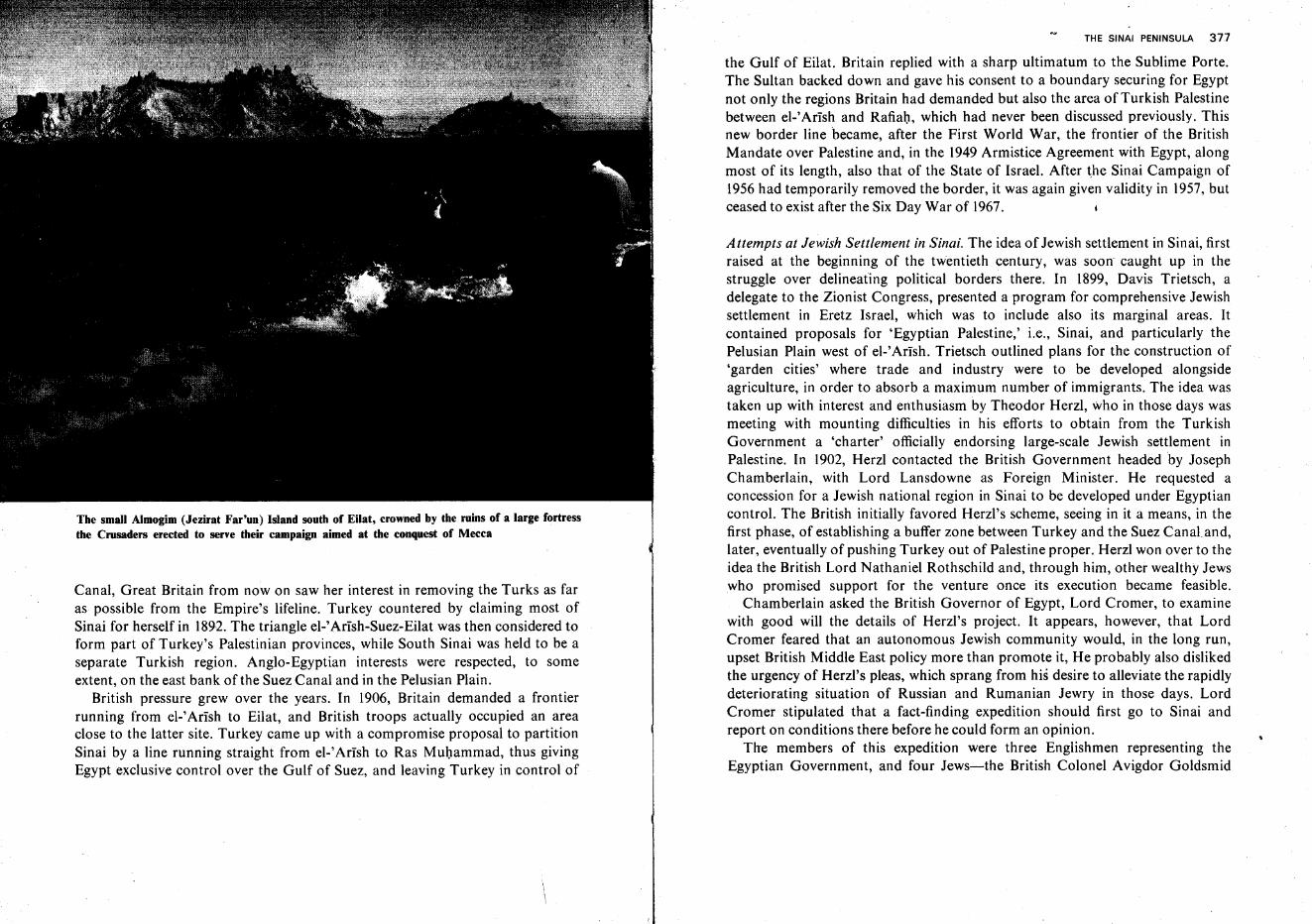
The small Almogim (Jezirat Far'un) Island south of Eilat, crowned by the ruins of a large fortressthe Crusaders erected to serve their campaign aimed at the conquest of Mecca
Canal, Great Britain from now on saw her interest in removing the Turks as faras possible from the Empire's lifeline. Turkey countered by claiming most ofSinai for herself in 1892. The triangle el-fArish-Suez-Eilat was then considered toform part of Turkey's Palestinian provinces, while South Sinai was held to be aseparate Turkish region. Anglo-Egyptian interests were respected, to someextent, on the east bank of the Suez Canal and in the Pelusian Plain.
British pressure grew over the years. In 1906, Britain demanded a frontierrunning from el-' Arish to Eilat, and British troops actually occupied an areaclose to the latter site. Turkey came up with a compromise proposal to partitionSinai by a line running straight from el-'Arlsh to Ras Muhammad, thus givingEgypt exclusive control over the Gulf of Suez, and leaving Turkey in control of
THE SINAI PENINSULA 377
the Gulf of Eilat. Britain replied with a sharp ultimatum to the Sublime Porte.The Sultan backed down and gave his consent to a boundary securing for Egyptnot only the regions Britain had demanded but also the area of Turkish Palestinebetween el-' Arish and Rafiah, which had never been discussed previously. Thisnew border line became, after the First World War, the frontier of the BritishMandate over Palestine and, in the 1949 Armistice Agreement with Egypt, alongmost of its length, also that of the State of Israel. After the Sinai Campaign of1956 had temporarily removed the border, it was again given validity in 1957, butceased to exist after the Six Day War of 1967.
Attempts at Jewish Settlement in Sinai. The idea of Jewish settlement in Sinai, firstraised at the beginning of the twentieth century, was soon caught up in thestruggle over delineating political borders there. In 1899, Davis Trietsch, adelegate to the Zionist Congress, presented a program for comprehensive Jewishsettlement in Eretz Israel, which was to include also its marginal areas. Itcontained proposals for 'Egyptian Palestine,' i.e., Sinai, and particularly thePelusian Plain west of el-' Arish. Trietsch outlined plans for the construction of'garden cities' where trade and industry were to be developed alongsideagriculture, in order to absorb a maximum number of immigrants. The idea wastaken up with interest and enthusiasm by Theodor Herzl, who in those days wasmeeting with mounting difficulties in his efforts to obtain from the TurkishGovernment a 'charter' officially endorsing large-scale Jewish settlement inPalestine. In 1902, Herzl contacted the British Government headed by JosephChamberlain, with Lord Lansdowne as Foreign Minister. He requested aconcession for a Jewish national region in Sinai to be developed under Egyptiancontrol. The British initially favored Herzl's scheme, seeing in it a means, in thefirst phase, of establishing a buffer zone between Turkey and the Suez Canal.and,later, eventually of pushing Turkey out of Palestine proper. Herzl won over to theidea the British Lord Nathaniel Rothschild and, through him, other wealthy Jewswho promised support for the venture once its execution became feasible.
Chamberlain asked the British Governor of Egypt, Lord Cromer, to examinewith good will the details of Herzl's project. It appears, however, that LordCromer feared that an autonomous Jewish community would, in the long run,upset British Middle East policy more than promote it, He probably also dislikedthe urgency of Herzl's pleas, which sprang from his desire to alleviate the rapidlydeteriorating situation of Russian and Rumanian Jewry in those days. LordCromer stipulated that a fact-finding expedition should first go to Sinai andreport on conditions there before he could form an opinion.
The members of this expedition were three Englishmen representing theEgyptian Government, and four Jews-the British Colonel Avigdor Goldsmid
378 THE ADMINISTEijED AREAS
who was well acquainted with the relevant problems, having directed BaronHirsch's Jewish settlement enterprise in Argentina; the Viennese architect O.Marmorek, one of Herzl's close associates in the Zionist Movement; twoPalestinians, the doctor Hillel Jaffe, and the agronomist Dr. Zelig Soskin. Theexpedition toured Sinai, principally its northern parts, in the months of Februaryand March, 1903. In its report it did not in any way question the feasibility of theproject, but discussed practical steps to be taken for its execution. Among itssuggestions were the construction of dams to retain flash floods coming downthrough Wadi el-'Arlsh and its tributaries, the development of the Pelusian Plainwith the aid of Nile water which was to be led to Sinai instead of flowing unusedinto the sea, rinsing of salts from the soil with sweet water prior to its intensivecultivation, construction of a port at or near el-'Arish, founding of factories,exploiting fishing grounds in the Bardawll Lagoon and in the Mediterranean Sea,etc. The expedition also recommended the setting up and running of experimentalfarms for a certain period before the launching of large-scale settlement in Sinai.This last proposal embittered Herzl who awaited the expedition's return in Cairo,as he saw in this a delay endangering the speedy rescue of East European Jewry.The entire project, however, met with the resolute opposition of Lord Cromer,based on the contention that no surplus Nile waters were available for Sinai. Inreaching his decision he was possibly influenced by the wish to retain such watersfor irrigation in the Sudan, a country in whose development British policy wasinterested at the time. Herzl tried to save at least part of the scheme byabandoning the claim to Nile waters and restricting his request to the el-'Arisharea. However, even these concessions failed to gain him the British Governor'sconsent.
The failure of Herzl's plan did not yet spell the end of Zionist attempts atsettlement in Sinai. Between the years 1905 and 1913, efforts were repeatedlymade to acquire land holdings between Rafiah and el-'Arlsh, an area lying closeto Turkish Palestine yet outside Turkish jurisdiction. Such projects were initiatedboth by Palestinian Jews, by Zionist groups of Eastern Europe and by a societyset up for this purpose by Zionists in Germany. Several missions set out for Gaza,Rafiah and Cairo, to survey land plots, collect data on ownership of the tracts inquestion, on legal conditions, etc. The principal difficulty arose from the fact thatmost of the bedouin offering land for sale could not verify their ownership, as theholdings were not entered in the land registry. Efforts in this direction ceased withthe outbreak of the First World War and the drawing of the British Mandateborders.
Sinai Battles in Israel's War ofIndependence. Toward the end of 1948, the militaryinitiative was gradually gained by the Israel Army. In 'Operation Horev' (also
THE SINAI PENINSULA 379
called 'Operation Ayin'), Israel soldiers crossed the Sinai frontier at Nizzana,advanced along the 'Way of Shur' to the Abu 'Aweiqila fortifications, and thenceturned northwestward to take up positions at the southern entrances of el-'Arish,Near Rafiah , they also reached the Sea Road leading to el-Ansh, andapproached the town of Gaza. The operation came to a halt when Britain warnedthat her troops stationed near the Suez Canal might intervene on behalf of Egypt.In the ensuing Armistice Agreement with Egypt, the former Sinai frontier wasreestablished and the Gaza Strip was placed temporarily under Egyptianadministration.
The Sinai Campaign. In 1956, the ever-increasing infiltration of terror gangs sentfrom Egypt to carry out murder missions against Israel's civilian population, andthe concerted plan of Arab states to wage a war of extinction against Israel in thespring of the following year, made the Sinai Campaign inevitable. On October 29,the Israel Army launched a three-pronged attack; from Nizzana toward'Azmonand Abu'Aweiqila ; from the Paran Plateau toward Kuntilla ; and from Eilatover the Rosh ha-Niqba Pass toward Thamed. On the first day of fighting, paratroopers were dropped over the Mitla Pass where they dug in while fighting afierce battle.
On the following day, Israel forces gained control over the road between Roshha-Niqba and Mitla Pass, together with the strongholds of Thamed anda-Nakhl. Other units took up positions round Abu 'Aweiqila. On October 31,this fortress fell, as did the strategic crossroads west of Jebel Libni.Simultaneously, forces advanced along the Raflab -el-'Arish axis. Most phases ofthe operation were concluded on November 2, when Israel colums, complyingwith the demand of the British and French, halted their advance at a distance of10 miles from the Suez Canal, after another column had reached Ras Nasrani andthe Tiran Straits over hazardous routes from Rosh ha-Niqba, along or near theEilat Gulf coast. By November 3, Israel forces had occupied the entire peninsula,and all Egyptian resistance had ceased.
Complying with UN demands and relying on promises that its shipping rightswould henceforth be safeguarded and the peace on the Egyptian border be keptby a UN force, Israel carried out, between January and March 1957, its gradualwithdrawal from Sinai and the Gaza Strip, at the same time reserving the right torenewed action should Egypt again try to interfere with shipping in the TiranStraits.
The Six Day War. Egypt did not adhere to the understanding reached in theUnited Nations, and the Suez Canal remained closed to Israel vessels. The Arabsnever ceased to proclaim their intention of wiping Israel off the map. In the spring
380 THE ADMINISTERED AREAS
of 1967, Egypt took the initiative in challenging Israel, after the Soviet Union haddeliberately supplied her with false information on alleged Israel troop concentrations along the Syrian border. Beginning from May IS, Egypt assembled anaggressive force in Sinai near the Israel border, comprising at least 100,000soldiers and 900-1,000 tanks. Requesting and obtaining the immediate evacuation of the UN Emergency Force, Egypt sent troops to take up positions at RasNasrani. The Egyptian President declared the Tiran Straits closed to Israelshipping, adding that should Israel interpret this as an act of war, such adevelopment would be welcomed by Egypt. Nasser gave further emphasis tothese threats by declaring his full support for the al-Fatah terror organization andstepping up the shelling of Israel border villages.
Moved by the need to secure her very existence, Israel responded on themorning of June 5, 1967, opening with an air strike against enemy airforce basesthat destroyed on the ground most of the military aircraft of Egypt and the otherbelligerent Arab countries. Four Egyptian airfields in Sinai wereamong those putout of action. On the same day, three Israel columns swept into Sinai Thenorthernmost column forced its way through enemy formations between KhanYunis and Rafiah in the Gaza Strip and advanced, after hard-won battles, alongthe Sea Road toward el-'Arish, at whose outskirts it arrived in the evening;another force had pushed forward and reached the approaches of the airfieldsouth of the town. The central column grouped itself around Abu 'Aweiqila andblocked theel-'Arish-Abu 'Aweiqila road near Bir Lahfan.
On the morning of June 6, Abu 'Aweiqila fell and the occupation of el-'Arishwas completed. At noon, Israeli troops entered Gaza. That evening, the northernforces stood at Rumani northeast of al-Qantara, In the center, the crossroadswest of Jebel Ltbni fell into Israel hands, while the southern force reached thePilgrims' Road at Thamed. On June 7, the northern arm posted itself along theCanal bank at al-Qantara and occupied the vast camp of Bir Gafgafa, while thecentral force advanced rapidly over Bir Hasana and Bir a-Thamade to the MitlaPass, thereby cutting off the enemy's main line of retreat. When, on the same day,Israel forces borne by ship and helicopter arrived at Ras Nasrani near the TiranStraits, they found it deserted. On June 8, all seven Egyptian divisions wereutterly routed, and disorganized enemy troops attempted to reach the Canal andswim across. On June 9, Israel completed the occupation of the peninsula; in theevening Egypt accepted a cease-fire. Since that date, Sinai has been under Israeladministration. The menace to Israel by an Egyptian military build-up has beenremoved by at least 250 kilometers. A final decision on Sinai's future must beincluded in a formal and binding peace treaty to be concluded between Israeland Egypt.
THE SINAI PENINSULA 381
Population and Settlements
Throughout its history, Sinai has been a very thinly populated region. Duringmost periods, the majority of its inhabitants were nomads or semi-nomads whoderived their modest livelihood from local sources-the poor pasture lands and afew oases where date palms, and occasionally certain other crops, can be grown.In addition, there were semi-nomads living from fishing, principally in theBardawil Lagoon, and to a smaller extent, from shell fishing and pearl diving onthe Suez and Eilat Gulf coasts. The minority were people settled in Sinai byoutside factors in order to fulfil two main tasks-to secure and maintain theimportant highways which cross the peninsula, and to exploit mineral resources.Whereas most of the nomads can trace the continued presence of their tribes inSinai through many generations, the above-mentioned minority group is characterized by mobility and a lack of roots in the region. A third population unit, setapart from the others, is constituted by Greek-Orthodox monks, mainly at the St.Catherine Monastery, and by the Jabaliya tribe supplying services to thismonastery.
Population Figures. Numerically, Sinai's population appears to have undergonefrequent and extreme fluctuations. This is illustrated by data of the last fiftyyears: an estimate in 1917-which may be incomplete-gave a total of 5,430persons for the entire peninsula. Shortly before the Six Day War of 1967, theEgyptian authorities put the figure of Sinai's population at approximately130,000: 100,000 in the north of the peninsula, and the rest spread throughout itsother parts. In the census carried out by Israel in the fall of 1967, 33,441 personswere counted in northern Sinai, the estimate for the other regions not exceeding afew additional thousands. This indicates that the Egyptian figures of early }967had been obviously exaggerated-even allowing for the demographic dislocationcaused by the war. Up to the summer of 1968, former inhabitants of Sinai werepermitted to return in exchange for repatriation of Egyptian citizens, but thesemovements do not seem to have substantially influenced the population total.Certain changes may occur in the future, following, for example, the opportunitygiven to inhabitants of the Gaza Strip to move to other regions under Israel'sadministration, or the establishment of Nahal (Pioneer Settler Corps) villages inSinai.
The Nomads. Ancient inhabitants of Sinai, presumably nomad hunters, lefttestimony of their presence in the form of rock paintings and, later, in the secondmillennium B.C.E., also of inscriptions (the 'proto-Sinaitic' signs constituting theoldest alphabetic script hitherto known). Such graffiti are most frequently
382 THE ADMiNISTERED AREAS
Nomads with their camels resting in a rock gorge of southern Sinai
encountered in the south, e.g., in Wadi Mukattab ('Inscription Valley') northwestof the St. Catherine Monastery.*
Two main groups are usually distinguished among the present-day bedouininhabitants: those of the a-Tih Plateau and northern Sinai. Among the latter aremembers of three large tribes known also in the Negev before 1948: the Tiyaha(whose name, 'Wanderers,' is identical with that of the a-Tih Plateau); theTrabtn of northwestern Sinai (their name, derived from the Arabic 'trab' = 'soil,'points to their semi-nomadic existence, as they have apparently always sownfields in addition to herding flocks); and the Ahyawat of eastern Sinai borderingon Eilat.
* A far larger number of inscriptions there, mostly in Greek, dates from Nabatean times (firstcentury C.E.).
THE SINAI PENINSULA ,383
The St. Catherine Monastery is laid out as a rectangular fortress. At the side of the magnificentchurch of Byzantine age, a mosque was built so as to discourage Moslem attacks
THE SINAI PENINSULA 385
The anchorage of a-Tur, the pilgrims' town of southwestern Sinai
present site of el-'Arish. As this name means 'Hut' in Arabic, some scholarspropose identifying this locality with the exodus camp of Sukkoth (the Hebrewword for 'huts'). The Greeks called the town 'Rhinokoroura' which may betranslated as 'City of Cut Noses' and alludes to the tale that here an Egyptianruler kept prisoners maimed in this cruel way. Alexander Jannaeus, theHasmonean king, conquered Rhinokoroura, presumably intending to seal themarine trade outlet of his Nabatean enemies. Even in later centuries, el-'Arishmaintained its importance, and Napoleon, on his Palestinian campaign (1799),was surprised to encounter a strong fortress here, the resistance of which caused afatal delay in his march to the north.
Qala'at a-Nakhl, situated at a crossroad in the interior, rose to significancewith the increase of Moslem pilgrimage to Mecca via the Dharb al-Haj, Itsimportance waned, however, when Egyptian pilgrims began, in the last century,to show preference for the sea voyage to Jedda. This development gaveprominence to a-Tur and its anchorage; more than 30,000 pilgrims were kept
The Non-Nomads. The vast majority of the St. Catherine monks have invariablybeen of Greek origin, the Greek-Orthodox authorities selecting candidates. In thepast, as many as 300 are reported to have dwelt there at one time. Their numberdropped to about thirty in the last century, and at present there are only ninemonks resident at the monastery.
The earliest of the fortresses guarding roads in Sinai are thought to be thosebuilt along the Via Maris. One of the oldest ofthese appears to have stood at the
Many, of the Sinai bedouin have adopted a more or less sedentary life in ornear oases, particularly in northwestern Sinai between el-' Arish and al-Qantara,They have, however, retained their tribal organization and bedouin lore andcustoms. The largest of the oases is al-Quzetma (presumably Biblical 'Azmon),about 20 km south of Nizzana in eastern Sinai, near the Biblical site and springsof QadeshBarne'a. An archeological survey made there after the 1956 Sinai Warrevealed remnants of the Late Bronze and Iron ages (the latter corresponding tothe period of the Judges and the Kings), as well as of Roman, Nabatean andByzantine occupation. Other oases are to be found in southwestern Sinai, e.g.,'Uyiin Miisa southeast of Suez, Wadi Tayyibe near Abu Zuneirna, and SayyidnaMusa near a-Tur.
The bedouin of southern Sinai are known under the collective name ofTawarat, which is supposedly connected with the town of a-Tur, for a number ofcenturies the only permanently inhabited site in this part of the peninsula. Theirprincipal tribe is the Sawalha, most members of which live in the coastal stripnear the Suez Gulf.
A group apart from the rest of the Sinai inhabitants are the Jabaliya('Mountain People'). These were originally Christians whom Emperor Justiniansent to Sinai from Egypt and Dacia (present-day Rumania) to attend as layservants the monks of the St. Catherine Monastery that was founded, at hisbehest, circa 550 C.E. In the course oftime, the Jabaliya appear to have absorbedother elements, among them perhaps also Negro slaves. Most of the Jabaliyawere converted to Islam as early as the first centuries after the Mohammedanconquest (640 C.E.); the last Christian among them, an old woman,is reported tohave died around 1750. In spite of their common faith, the other Sinai inhabitantsrefrain from contacts with the Jabaliya and regard them as inferior. Followingancient custom, the monastery rewards the bedouin for their services withmonthly flour rations and other naturalia. After June, 1967, the Israel Government has undertaken provision of the monastery with flour for this purpose.Most of the )abaliya live at the large Feiran oasis (which tradition tends toidentify with Biblical Rephidim), while a smaller number dwell in the immediatevicinity of the monastery.
384 THE ADMINISTERED AREAS
386 THE ADMINISTERED AREAS
Scene from the outpost settlement Nal;Jal Yam, established in 1967, whose principal occupationis fishing in the Bardawil Lagoon
THE SINAI PENINSULA 387
. there annually in quarantine on their return voyage from Arabia. Thus, a staff ofTurkish (and later, Egyptian) and foreign doctors, medical orderlies, customsofficers, etc., was added to the local population of fishermen and pearl divers.
The Sinai mining sites have undergone rapid development during the last twodecades. First in importance were the oil fields along the Suez Gulf shore (RasSudar, Abu Rudeis, Beleim, Abu Durba, Ras Garra), the manganese mine site ofUmm Biighma and the manganese harbor at Abu Zuneima. A laborers' campwas under construction in 1967 near the lignite mines on Jebel Maghara. None ofthese localities was inhabited by a truly permanent popularion of any size, andthey were characterized by the sharp contrast between the adequate housingprovided for experts and the miserable hovels serving native and Egyptianworkers.
Since the construction of the Suez Canal, a few settlements developed also onits eastern bank, although these were, as a rule, no more than suburbs of farlarger centers on the western side. The latter receive fresh water from the Nile andhence enjoy green fields and gardens, while on the Sinai side but little was done toalleviate the starkness of the desert. Opposite Port Sa'id, at the northern entranceof the Canal, stands Port Fu'ad (outside the area under Israel control); oppositeal-Qantara lies Eastern Qantara ; Isma'iliya has a small suburb on the east bank.The small station of a-Shatt confronts the triple city of Suez-Port Ibrahim-PortTaufiq near the southern outlet of the Suez Canal.
In the Six Day War, all mining sites were abandoned, but the populationremained in el-'Arish where approximately 30,000 inhabitants were registered inthe census of August, 1967. Over 1,000 residents stayed in Eastern Qantara (untilcontinuous Egyptian shelling necessitated evacuating them, for their own safety,to el-'Arish), and smaller numbers at other places along the Canal and at a-Tur.
A new chapter in populating Sinai was opened in 1968 with the establishmentof the first three outpost settlements, Nahal Yam whose principal occupation isfishing in the Bardawil Lagoon, Nahal Sinai which is developing a large farmsouth of el-'Arish, and Nahal Diqla on the Mediterranean shore further east.
The Gaza Strip.
'The Gaza Strip'-A Political Entity
The term 'Gaza Strip' dates from the last stages of Israel's War of Independence;it received political validity in the 1949 Armistice Agreement between Israel andEgypt, when it was recognized as a separate entity, albeit temporarily underEgyptian supervision. This discrete political existence of the Strip was terminatedby the Six Day War, which brought it under Israel military administration; thefinal decision about its future awaits the signing of peace treaties between Israeland its neighbors.
The Gaza Strip, although constituting a demographic entity sharply differingfrom the bordering regions, possesses no distinct geographical characteristics. Itbelongs to Israel's Coastal Plain: the area to the southwest of Nahal Besor formsa part of the Negev Coast, while north of this watercourse stretches the PhilistianPlain. Climatically, the Gaza Strip comes under the moderating influence of theMediterranean Sea. Although its area is small, rainfall is unevenly distributed;while the annual average remains below 150mm at Rafiah, at the southwesternextremity of the Strip, the area lying north of the city of Gaza receivesapproximately 400 mm per year.
The Gaza Strip came into being when the invading Egyptian Army chose, inMay 1948, to advance northward along the coastal road, through a region settledalmost exclusively by Arabs. At that stage, the Egyptians occupied a far largerarea, but in the ensuing operations 'Ten Plagues' and 'Ayin,' the region undertheir control was whittled down to a narrow strip between Rafiah and Gaza.According to the Armistice Agreement, the Strip remained outside Israel; twosmall stretches of land already occupied by Israel forces-the surroundings of thevillage Beit Hanun (northeast of Gaza), and the area of 'Abasan east ofRafiah-i-were added to it. The length of the Gaza Strip, from Rafiah to BeitHannn, thus measures 45 km, and its width 5-7 km in the northern section,attaining a maximum of 12km at the southern end. The area of the Gaza Striptotals 362 km-.
388
Ir~i-It,
t
1THE GAZA STRIP 389
The Population of the Gaza Strip. With the emergence of the Gaza Strip as apolitical entity, its population .underwent profound changes. To the existing50,000-60,000 inhabitants (end of 1947) were added large numbers of Arabs whohad, as a result of the war, abandoned their villages, towns and bedouinencampments in the SouthernCoastal Plain and the Negev. The refugees swelledthe population figure to an estimated 180,000-200,000, practically all of themArabs and, in their overwhelming majority, of the Moslem faith. The only Jewishvillage in the Strip, the small kibbutz of Kefar Darom, after having displayed
. obstinate resistance for over a month against the overwhelming odds of theEgyptian Army, left its site at the order ofthe Israel Command in June, 1948.
A population census was held by the Israel authorities in the Gaza Stripbetween the 10th and 14th September, 1967. The figures obtained in this censuscan be regarded as reliable, in contrast to those of the Mandatory authorities whoaccepted the information given by heads of families, although it must have beenclear that these were inclined to gross exaggeration, be it to boast of the numberof their offspring or to obtain advantages in rations, social aid, tax relief, etc.When the Gaza Strip came under Egyptian administration, the authoritiesthemselves became the principal factor in deliberately inflating census figures,particularly those of refugees whom they regarded as an important weapon intheir anti-Israel propaganda campaign. Food rations were distributed byUNWRA to refugee families in accordance with the number of their members. Inorder to obtain more rations, non-existent persons were added to the lists and thedeaths of family members were never reported. This explains the discrepancy of22% between the Egyptian 1966 estimate of 454,960 inhabitants for the GazaStrip, and the 354,000 souls actually registered by the Israel census. Together withnorthern Sinai, the figure attained 390,000. Between the Six Day War and thedate of the census there was no emigration worth. speaking of which couldaccount for this huge difference. By the end of 1968, the population of the GazaStrip and northern Sinai had decreased to 356,000, the cause for this developmentbeing seen in emigration, principally to Jordan.
Even after the true figures have been established, however, the fact remainsthat the Gaza Strip is one of the most densely populated areas of the world,averaging 973.2 inhabitants per km 2 in the 1967census.
Population Groups. The Gaza Strip population differs from that of any otherworld region in that refugees make up an absolute majority there. The 1967census revealed that families whose heads were born in areas held by Israel since1949 numbered 207,250 souls, i.e., 58.9% of the total population. Of these,however, only 149,396 lived in refugee camps, while the rest had established theirhollies in villages and towns. On the other hand, there were about 23,000
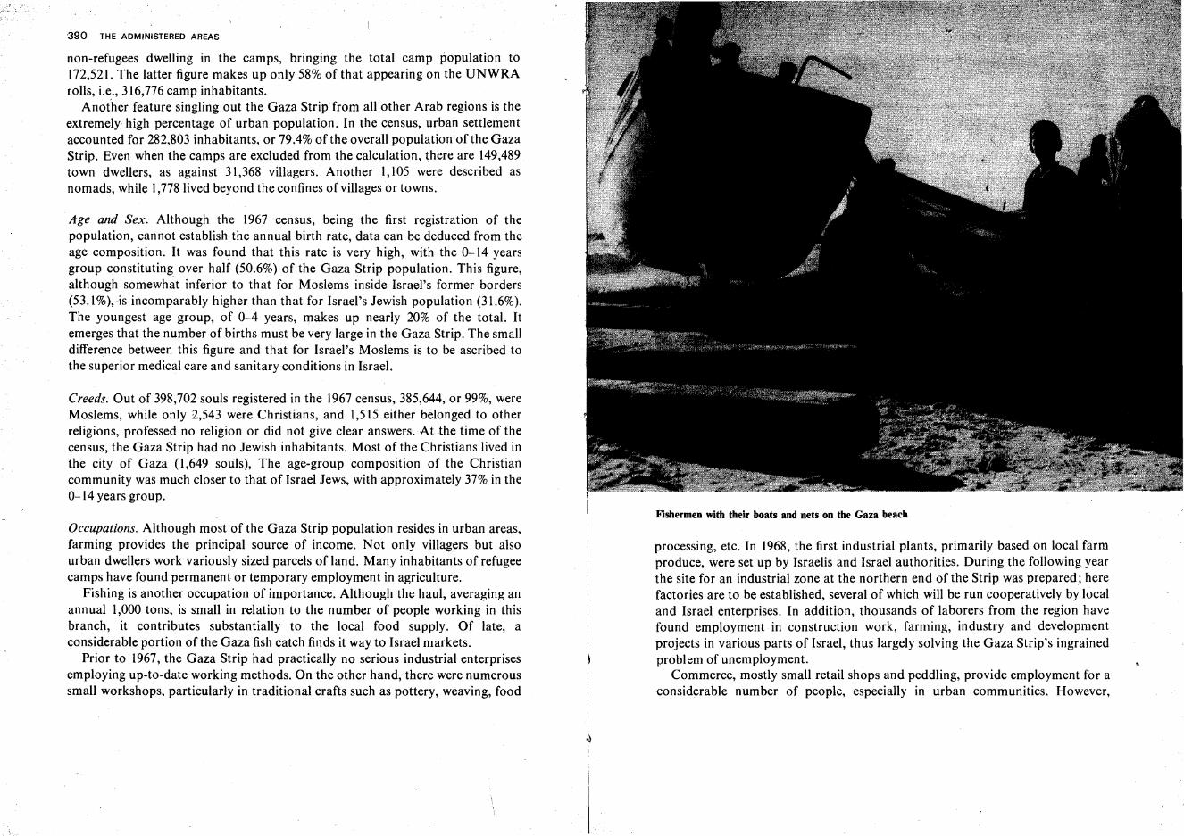
'390 THE ADMINISTERED AREAS
non-refugees dwelling in the camps, bringing the total camp population to172,521. The latter figure makes up only 58% of that appearing on the UNWRArolls, i.e., 316,776 camp inhabitants.
Another feature singling out the Gaza Strip from all other Arab regions is theextremely high percentage of urban population. In the census, urban settlementaccounted for 282,803 inhabitants, or 79.4% of the overall populationof the GazaStrip. Even when the camps are excluded from the calculation, there are 149,489town dwellers, as against 31,368 villagers. Another 1,105 were described asnomads, while 1,778lived beyond the confines of villages or towns.
Age and Sex. Although the 1967 census, being the first registration of thepopulation, cannot establish the annual birth rate, data can be deduced from theage composition. It was found that this rate is very high, with the 0-14 yearsgroup constituting over half (50.6%) of the Gaza Strip population. This figure,although somewhat inferior to that for Moslems inside Israel's former borders(53.1%),is incomparably higher than that for Israel's Jewish population (31.6%).The youngest age group, of 0-4 years, makes up nearly 20% of the total. Itemerges that the number of births must be very large in the Gaza Strip. The smalldifference between this figure and that for Israel's Moslems is to be ascribed tothe superior medical care and sanitary conditions in Israel.
Creeds. Out of 398,702 souls registered in the 1967 census, 385,644, or 99%, wereMoslems, while only 1,543 were Christians, and 1,515 either belonged to otherreligions, professed no religion or did not give clear answers. Atthe time of thecensus, the Gaza Strip had no Jewish inhabitants. Most of the Christians lived inthe city of Gaza (l,649 souls), The age-group composition of the Christiancommunity was much closer to that of Israel Jews, with approximately 37% in the0-14 years group.
Occupations. Although most of the Gaza Strip population resides in urban areas,farming provides the principal source of income. Not only villagers but alsourban dwellers work variously sized parcels of land. Many inhabitants of refugeecamps have found permanent or temporary employment in agriculture.
Fishing is another occupation of importance. Although the haul, averaging anannual 1,000 tons, is small in relation to the number of people working in thisbranch, it contributes substantially to the local food supply. Of late, aconsiderable portion of the Gaza fish catch finds it way to Israel markets.
Prior to 1967, the Gaza Strip had practically no serious industrial enterprisesemploying up-to-date working methods. On the other hand, there were numeroussmall workshops, particularly in traditional crafts such as pottery, weaving, food
I
Fishermen with their boats and nets on the Gaza beach
processing, etc. In 1968, the first industrial plants, primarily based on local farmproduce, were set up by Israelis and Israel authorities. During the following yearthe site for an industrial zone at the northern end of the Strip was prepared; herefactories are to be established, several of which will be run cooperatively by localand Israel enterprises. In addition, thousands of laborers from the region havefound employment in construction work, farming, industry and developmentprojects in various parts of Israel, thus largely solving the Gaza Strip's ingrainedproblem of unemployment.
Commerce, mostly small retail shops and peddling, provide employment for aconsiderable number of people, especially in urban communities. However,
392 THE ADMINISTl:RED AREAS
Gaza potters find, since 1967, an improved market for their painted ware
occupational groups are not clearly delimited, because farmers and tradesmenfrequently sell their own produce or that of their neighbors on the markets, andshopowners and peddlers occasionally hire themselves out for work of all kindsor keep small auxiliary farms near their homes.
Agricultural Branches. As a result of the great population density, the strain onexisting soil and water resources is enormous. Every stretch of land fit forcultivation is exploited. This is true even of dunes, wherever more fertile soil ishidden at small depth beneath the sand. Out of the 362 km 2 of the Gaza Strip, 267were under cultivation in 1967.
Although the groundwater reserves are large in relation to the amounts oflocalrainfall, overpumping constitutes a serious hazard, and most wells are "in acute
THE GAZA STRIP 393
danger of becoming saline if exploitation at the present rate is continued for a fewmore years. The area has 1,200 wells, yielding 65 million cubic meters of waterannually. Experts advise reducing pumping to half this volume, with particularattention to be paid to the southern half of the Strip where the danger ofsalination is most imminent and where the irrigated area may have to be reduced.
In 1967, irrigated crops covered 13,700 hectares, citrus groves heading the listwith 9,200 ha. This branch of agriculture, which expanded in the Gaza Stripmainly during the last two decades, produces the principal export item of thearea, amounting to 2-4 million standard cases of fruit annually. Until recently,East European countries were the main customers for Gaza citrus fruit. UnderIsrael administration, government institutions and citrus growers' associationsextend all possible aid to Gaza citrus farmers, improving cultivation and pestcontrol methods, marketing and export organization, etc.
Of the remaining area under irrigation, ca. 1,000 ha are planted with olives,vines and deciduous fruit, while 3,500 ha produce vegetables and field crops.Often, two to three different crops are raised simultaneously on the same plots,with rows of vines planted between date palms and narrow vegetable bedsoccupying the remaining space. Among the important annual species are melonsand watermelons, which thrive un watered or require auxiliary irrigation only.
The most important unirrigated plantations are those of date palms, centeringon the town of Deir ial-Balah, while rhici.nus bushes are prominent in thesouthernmost part of the Gaza Strip. Wheat is the principal field crop.
The City of Gaza. From the very earliest times Gaza has constituted one of theprincipal centers in the south of the country. Situated on.the Via Maris, it served,in the second millennium B.C.E., as an administrative city, the residence of theEgyptian governor of the Land of Canaan. In the 13th century B.C.E., thePhilistines (or Caphtorites= Cretans) annihilated the Avite inhabitants of Gazaand made the city the southernmost, and probably the largest, of their fivecenters. The Bible reports that Gaza was taken by the tribe of Judah, but alsoincludes the city among those places lying 'in the remaining country,' i.e., notoccupied by the Israelites. In the 8th century B.C.E., the Assyrians captured Gaza,and in the 7th, Pharaoh Necho conquered the city while on his campaign againstthe Babylonians. Later, however, it again came under Babylonian rule, to beoccupied, in the 6th century, by the Persian king Cambyses. In the 5th centuryGaza fell to Alexander the Great, after whose death it repeatedly changed handsbetween the Ptolemaic and Seleucid kingdoms. In the 2nd century, Simon theMaccabee took the town and settled Jews in it. After the Hasmoneans lost ittemporarily, Alexander Jannaeus reconquered it. In the lst century B.C.E.,
Pompey made Gaza a free 'polis' and restored its Hellenistic character. In their
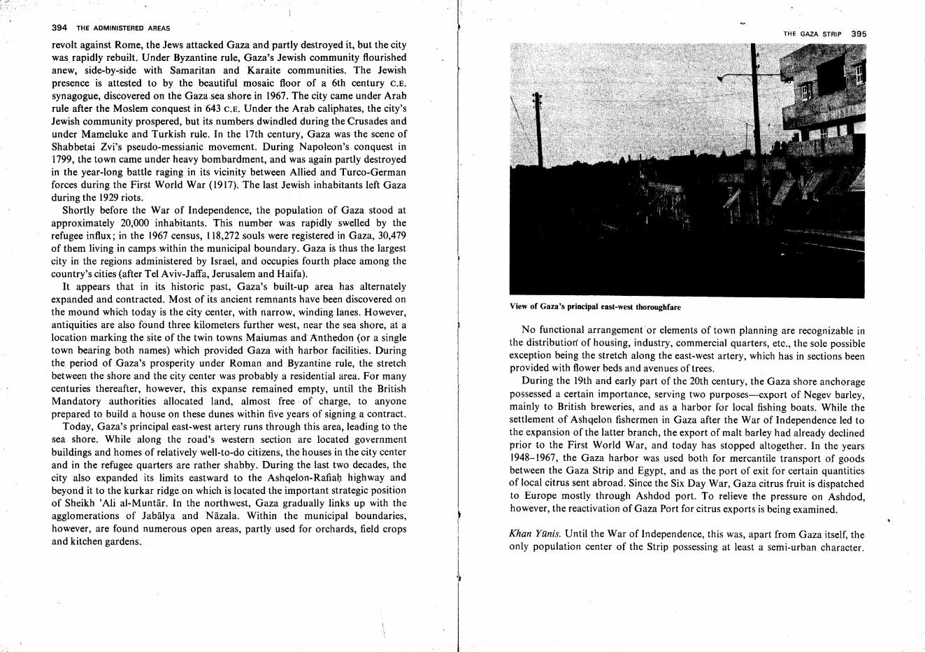
394 THE ADMINISTERED AREAS
revolt against Rome, the Jews attacked Gaza and partly destroyed it, but the citywas, rapidly rebuilt. Under Byzantine rule, Gaza's Jewish community flourishedanew, side-by-side with Samaritan and Karaite communities. The Jewishpresence is attested to by the beautiful mosaic floor of a 6th century C.E.
synagogue, discovered on the Gazasea shore in 1967.The city came under Arabrule after the Moslem conquest in 643 C.E. Under the Arab caliphates, the city'sJewish community prospered, but its numbers dwindled during the Crusades andunder Mameluke and Turkish rule. In the 17th century, Gaza was the scene ofShabbetai Zvi's pseudo-messianic movement. During Napoleon's conquest in1799, the town came under heavy bombardment, and was again partly destroyedin the year-long battle raging in its vicinity between Allied and Turco-Germanforces during the First World War (1917). The last Jewish inhabitants left Gazaduring the 1929 riots.
Shortly before the War of Independence, the population of Gaza stood atapproximately 20,000 inhabitants. This number was rapidly swelled by therefugee influx; in the 1967 census, 118,272 souls were registered in Gaza, 30,479of them living in camps within the municipal boundary. Gaza is thus the largestcity in the regions administered by Israel, and occupies fourth place among thecountry's cities (after Tel Aviv-Jaffa, Jerusalem and Haifa).
It appears that in its historic past, Gaza's built-up area has alternatelyexpanded and contracted. Most of its ancient remnants have been discovered onthe mound which today is the city center, with narrow, winding lanes. However,antiquities are also found three kilometers further west, near the sea shore, at alocation marking the site of the twin towns Maiumas and Anthedon (or a singletown bearing both names) which provided Gaza with harbor facilities. Duringthe period of Gaza's prosperity under Roman and Byzantine rule, the stretchbetween the shore and the city center was probably a residential area. For manycenturies thereafter, however, this expanse remained empty, until the BritishMandatory authorities allocated land, almost free· of charge, to anyoneprepared to build a house on these dunes within five years of signing a contract.
Today, Gaza's principal east-west artery runs through this area, leading to thesea shore. While along the road's western section are located governmentbuildings and homes of relatively well-to-do citizens, the houses in the city centerand in the refugee quarters are rather shabby. During the last two decades, thecity also expanded its limits eastward to the Ashqelon-Rafiah highway andbeyond it to the kurkar ridge on which is located the important strategic positionof Sheikh 'Ali al-Muntar. In the northwest, Gaza gradually links up with theagglomerations of Jabalya and Nazala. Within the municipal boundaries,however, are found numerous open areas, partly used for orchards, field cropsand kitchen gardens.
I1
I
,~
THE GAZA STRIP 395
View of Gaza's principal east-west thoroughfare
No functional arrangement or elements of town planning are recognizable inthe distribution' of housing, industry, commercial quarters, etc., the sole possibleexception being the stretch along the east-west artery, which has in sections beenprovided with flower beds and avenues of trees.
During the 19th and early part of the 20th century, the Gaza shore anchoragepossessed a certain importance, serving two purposes-export of Negev barley,mainly to British breweries, and as a harbor for local fishing boats. While thesettlement of Ashqelon fishermen in Gaza after the War of Independence led tothe expansion of the latter branch, the export of malt barley had already declinedprior to the First World War, and today has stopped altogether. In the years1948-1967, the Gaza harbor was used both for mercantile transport of goodsbetween the Gaza Strip and Egypt, and as the port of exit for certain quantitiesof local citrus sent abroad. Since the Six Day War, Gaza citrus fruit is dispatchedto Europe mostly through Ashdod port. To relieve the pressure on Ashdod,however, the reactivation of Gaza Port for citrus exports is being examined.
Khan Yunis. Until the War of Independence, this was, apart from Gaza itself, theonly population center of the Strip possessing at least a semi-urban character.
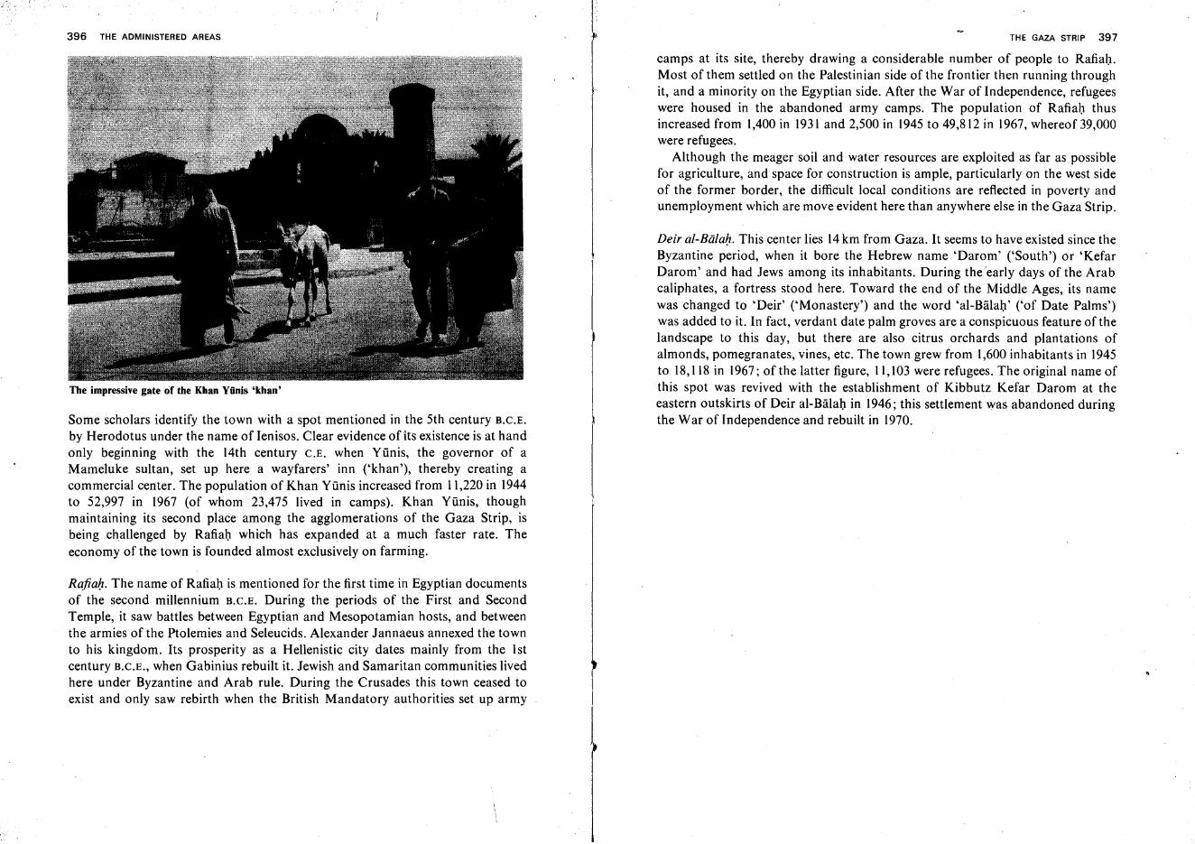
396 THE ADMINISTERED AREAS
The impressive gate of the Khan Yiinis 'khan'
Some scholars identify the town with a spot mentioned in the 5th century B.C.E.
by Herodotus under the name of Ienisos. Clear evidence of its existence is at handonly beginning with the 14th century C.E. when Yiinis, the governor of aMameluke sultan, set up here a wayfarers' inn ('khan'), thereby creating acommercial center. The population of Khan Yiinis increased from 11,220 in 1944to 52,997 in 1967 (of whom 23,475 lived in camps). Khan Yunis, thoughmaintaining its second place among the agglomerations of the Gaza Strip, isbeing challenged by Rafiah which has expanded at a much faster rate. Theeconomy of the town is founded almost exclusively on farming.
Rafiah. The name of Rafiah is mentioned for the first time in Egyptian documentsof the second millennium B.C.E. During the periods of the First and SecondTemple, it saw battles between Egyptian and Mesopotamian hosts, and betweenthe armies of the Ptolemies and Seleucids. Alexander Jannaeus annexed the townto his kingdom. Its prosperity as a Hellenistic city dates mainly from the 1stcentury B.C.E., when Gabinius rebuilt it. Jewish and Samaritan communities livedhere under Byzantine and Arab rule. During the Crusades this town ceased toexist and only saw rebirth when the British Mandatory authorities set up army
THE GAZA STRIP 397
camps at its site, thereby drawing a considerable number of people to Rafiah.Most of them settled on the Palestinian side of the frontier then running throughit, and a minority on the Egyptian side. After the War of Independence, refugeeswere housed in the abandoned army camps. The population of Rafiah thusincreased from 1,400 in 1931 and 2,500 in 1945 to 49,812 in 1967, whereof 39,000were refugees.
Although the meager soil and water resources are exploited as far as possiblefor agriculture, and space for construction is ample, particularly on the west sideof the former border, the difficult local conditions are reflected in poverty andunemployment which are move evident here than anywhere else in the Gaza Strip.
Deir al-Biilah. This center lies 14km from Gaza. It seems to have existed since theByzantine period, when it bore the Hebrew name 'Darom' ('South') or 'KefarDarom' and had Jews among its inhabitants. During the early days of the Arabcaliphates, a fortress stood here. Toward the end of the Middle Ages, its namewas changed to 'Deir' ('Monastery') and the word 'al-Balah' ('of Date Palms')was added to it. In fact, verdant date palm groves are a conspicuous feature of thelandscape to this day, but there are also citrus orchards and plantations ofalmonds, pomegranates, vines, etc. The town grew from 1,600 inhabitants in 1945to 18,118 in 1967; of the latter figure, 11,103 were refugees. The original name ofthis spot was revived with the establishment of Kibbutz Kefar Darom at theeastern outskirts of Deir al-Balah in 1946; this settlement was abandoned duringthe War of Independence and rebuilt in 1970.
Judea and Samaria
'Judea-Samaria' as a Political and Administrative Unit
The term 'Judea-Samaria' was chosen in the fall of 1967 to describe a politicaland administrative unit composed of those regions of Western Palestine whichhad been invaded by Transjordan in 1948 and had thus come under Jordanianrule between the Armistice Agreement of 1949 and the Six Day War, and whichsince 1967 have been under Israel military government. This term supplants thename 'West Bank,' used by the Jordanians up to 1967 to designate those parts oftheir kingdom west of the Jordan River. Actually, the area includes not only thelarger part of the two geographical provinces of Judea and Samaria, but also thewestern halfofthe Lower Jordan Valley.
The course of the River Jordan and the Dead Sea coast clearly delimit theeastern border of Judea-Samaria. The old armistice line tracing the boundaries inthe north, west and south reflects, along most of its length, the deployment offorces when the battles of the War ofIndependence were brought to a sudden haltby the 1948 cease-fire arrangements. Only minor adjustments were later made tothis line, as an outcome of the armistice negotiations, and by subsequentagreements within the framework of the Mixed Armistice Commission, e.g.,areas ceded to Israel in the Irron Vale and Irron Hills, on the eastern fringe of theSharon and on the northwestern margin of the Judean Hills; areas ceded toJordan northeast of Kibbutz Lahav and near the villages Wadi Fukln and BeitIksa in Judea; a strip of land giving Israel control of the Tel Aviv-Jerusalemrailway line along its entire length; and stretches of 'no-man's land' -and'demilitarized zones' in Judea, along the Budrus-Modi'im-Beit Tul border sectionand within the municipal limits of Jerusalem.
In the fall of 1967, after all of Western Palestine had come under Israel'scontrol, the municipal boundary of reunited Jerusalem was redrawn, and its areawas finally incorporated into Israel and separated from Judea-Samaria whichremained under military government. After this border correction, the area ofJudea-Samaria totals 5,505 km-.
398
JUDEA AND SAMARIA 399
Jewish Villages in Judea-Samaria Abandoned in 1948. Until the year 1948, sevenJewish villages existed in the area of Judea-Samaria but had to be abandoned inthe Independence War. Four of them (Kefar Ezyon, Massu'ot Yizhaq, EnZurirn, Revadim) constituted the Ezyon Bloc in the Hebron Hills, which fell in abitter battle on the eve of the founding of the State of Israel (12-13 May, 1948).Two villages north of Jerusalem, Neweh Ya'aqov and'Atarot, were evacuated onthe order of the Israel military command on May 17, 194~. A similar fate befellthe kibbutz Bet ha-'Arava, the Rabbat Ashlag potash works and the Kallia Hotelat the north end of the Dead Sea, whose inhabitants and defenders reached Sedomin the south by boat, on May 19, 1948. There were also other tracts ofland underJewish ownership, both of the Jewish National Fund and private individuals,particularly north of Jerusalem; these had not yet been brought under cultivationat the time and were taken over by Arab neighbors or the Jordanian authorities.
The Population
Development of the Population. According to the census carried Qut by the Israelauthorities in the fall of 1967, the number of inhabitants of Judea-Samariatotaled 598,637. The Jordanian Government had made two population counts onthe West Bank, the first in 1952, arriving at the figure of 667,000 inhabitants, andthe second in 1961, indicating a total of 730,000 souls. Comparing these twofigures on the assumption that they are more or less correct and do not containdeliberate exaggerations, it emerges that the population of Judea-Samaria grew inthe course of a decade by 63,000 persons only, i.e., at an annual rate of 0.9%, asagainst a natural increase of 4.5% per year for Israeli Arabs during the sameperiod. The reason for these differences lies in emigration, which was particularlyhigh during the years 1948-1952 but continued until the Six Day War. In the 1967census, about one third of the families in Judea-Samaria stated that they hadrelatives abroad, 90% ofthem in Arab countries.
Geographical Distribution. The overall population density in 1967 amounted to109 inhabitants per km-. The population distribution over Judea-Samaria is,however, extremely uneven, as the area comprises two totally different regionsthe fields and orchard lands of the Hills and the intermontane valleys, and theempty waste area, comprising the Lower Jordan Valley, the eastern slopes ofSamaria and the Judean Desert,
Judea-Samaria contained, in 1967, eight administrative districts. In 1968, theirnumber was reduced to seven and their borders were redrawn by the Israeladministration, enlarging the Tul Karm and Jenntn districts at the expense of that
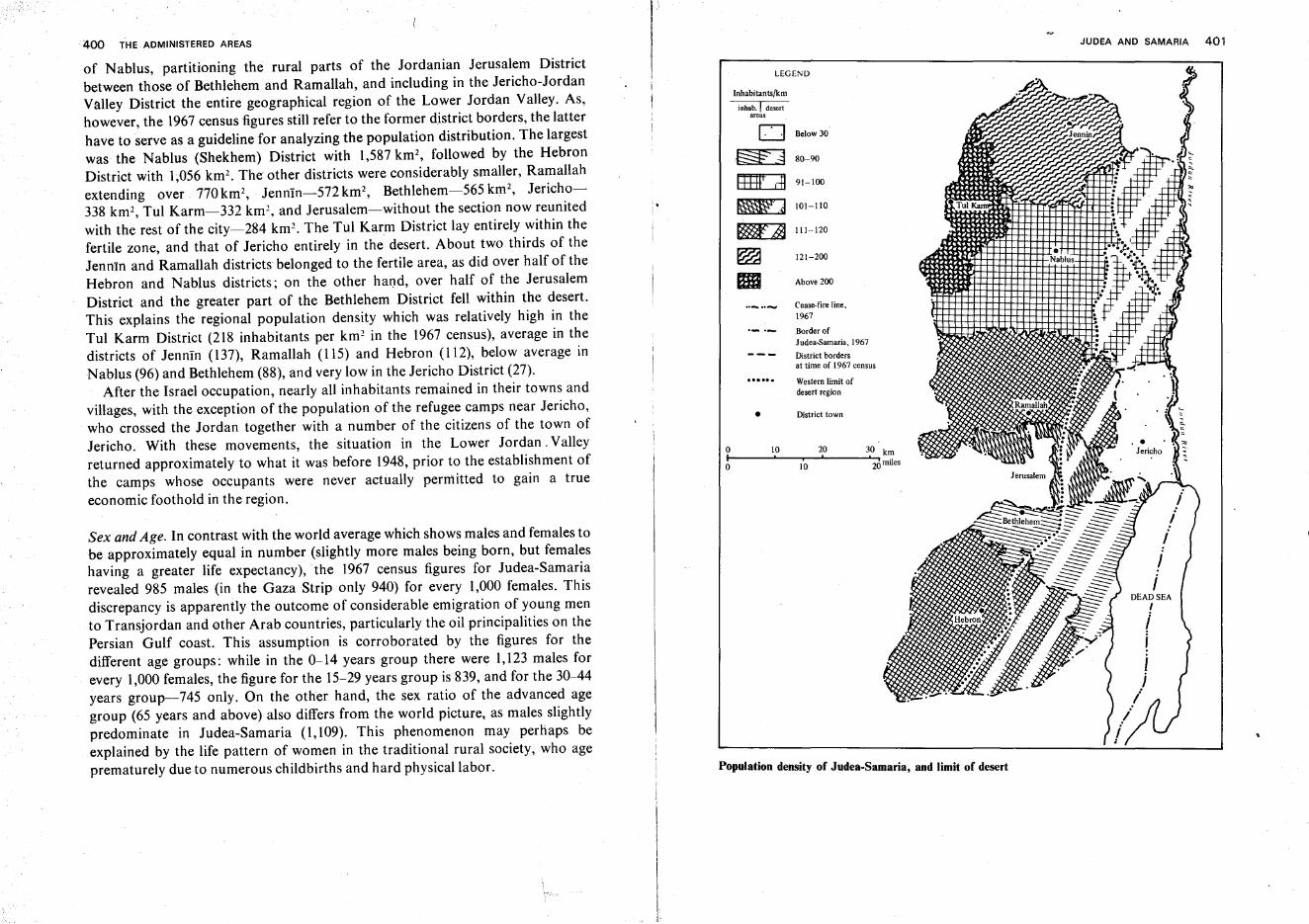
400 THE ADMINISTERED AREAS JUDEA AND SAMARIA 401
Population density of Judea-Samaria, and limit of desert
30 km
'20 milesi
lO
LEGEND
10 20
Inhabitants/km
inhab.1 desertareas
0 Below 30
.~ 80-90
~ 91-100
~ lOl-IIO
~ 111-·l20
~ 121-200 •Nablus
EI Above 200
Cease-fire line,1967
Border of
Judea-Samaria,1967
District bordersat time of 1967 census
Western limit ofdesert region
• District town
ooI
Sex and Age. In contrast with the world average which shows males and females tobe approximately equal in number (slightly more males being born, but femaleshaving a greater life expectancy), the 1967 census figures for Judea-Samariarevealed 985 males (in the GazaStrip only 940) for every 1,000 females. Thisdiscrepancy is apparently the outcome of considerable emigration of young mento Transjordan and other Arab countries, particularly the oil principalities on thePersian Gulf coast. This assumption is corroborated by the figures for thedifferent age groups: while in the 0-14 years group there were 1,123 males forevery 1,000 females, the figure for the 15-29 years group is 839, and for the 30-44years group-745 only. On the other hand, the sex ratio of the advanced agegroup (65 years and above) also differs from the world picture, as males slightlypredominate in Judea-Samaria (1,109). This phenomenon may perhaps beexplained by the life pattern of women in the traditional rural society, who ageprematurely due to numerous childbirths and hard physical labor.
of Nablus, partitioning the rural parts of the Jordanian Jerusalem Districtbetween those of Bethlehem and Ramallah, and including in the Jericho-JordanValley District the entire geographical region of the Lower Jordan Valley. As,however, the 1967 census figures still refer to the former district borders, the latterhave to serve as a guideline for analyzing the population distribution. The largestwas the Nablus (Shekhem) District with 1,587 krn-, followed by the HebronDistrict with 1,056 km-. The other districts were considerably smaller, Ramallahextending over 770km2, Jennln-572km2
, Bethlehem-565 km", Jericho338 krn-, Tul Karm-332 krn-, and Jerusalem-without the section now reunitedwith the rest of the city~284 km '. The Tul Karm District lay entirely within thefertile zone, and that of Jericho entirely in the desert. About two thirds of theJenntn and Ramallah districts belonged to the fertile area, as did over half of theHebron and Nablus districts; on the other hand, over half of the JerusalemDistrict and the greater part of the Bethlehem District fell within the desert.This explains the regional population density which was relatively high in theTul Karm District (218 inhabitants per km 2 in the 1967 census), average in thedistricts of Jennin (137), Ramallah (115) and Hebron (112), below average inNablus (96) and Bethlehem (88), and very low in the Jericho District (27).
After the Israel occupation, nearly all inhabitants remained in their towns andvillages, with the exception of the population of the refugee camps near Jericho,who crossed the Jordan together with a number of the citizens of the town ofJericho. With these movements, the situation in the Lower Jordan. Valleyreturned approximately to what it was before 1948, prior to the establishment ofthe camps whose occupants were never actually permitted to gain a trueeconomic foothold in the region.
402 THE ADMINISTERED AREAS
The population distribution over the various age groups testifies to a steepnatural increase, although this is still somewhat inferior to that of Israel'snon-Jews. Of the entire population, 48.4% belonged to the 0-14 years age group,as against 53.1% of Israel Moslems, but only 31.6 of Israel Jews. For the Christiancommunity of Judea-Samaria, children up to 14 years constitute 38% of the total.
Religious Communities. About 94.5%of the population of Judea-Samaria are ofthe Mohammedan faith, the rest being mostly Christian. The districts of Hebron,Nablus, Tul Karm and Jerusalem are almost exclusively Moslem. Also in theJenntn District, the number of Christians is negligible, with the exception of asingle village, Zababida, which has a Christian majority. In the RamallahDistrict, Christians are more prominent, not only in Ramallah town where theyconstitute a little over half of the population, but also in the villages of Jifna, BirZeit and Tayyiba where they are in the majority, and in 'Abiid where theyapproach 50%. While only few Christians live in the villages of the BethlehemDistrict, they constitute about two thirds of the residents of the towns of Beit Jalaand Beit Sahur, and nearly halfthe population of Bethlehem proper.
As in the rest of the country, the overwhelming majority of the Moslems inJudea-Samaria are Sunnites. Although the holiest Islamic shrines of the country-the Dome of the Rock and the 'Aksa Mosque-are in Jerusalem, Judea-Samaria has a number of important sites of worship, the Double Mosque over theMakhpela Cave in Hebron (Masjid el-Khalil) heading the list. Many beautifulmosques, both old and modern, are to be found in Nablus and the other urbancommunities and also in most villages. Religious bodies such as the 'Waqf"maintain schools, hospitals and other social and religious institutions. These, andlikewise the religious Moslem Shart'a courts, continue to function withoutinterference under Israel administration.
Of the 29,644 Christians counted in the 1967 census, approximately half belongto the Greek-Orthodox Church, and about a quarter to the Catholic (locallycalled 'Latin') Church, while 10% are followers of the Greek-Catholic UniateChurch, and the rest members of other denominations and sects. The Church ofthe Nativity in Bethlehem and the Church of the Holy Sepulcher in Jerusalemrank among Christendom's most holy places. There are other Christian sacredsites in Judea-Samaria, among them the place of Jesus' baptism by John on theJordan near Jericho. Villages having a sizeable Christian population can easily berecognized by the prominent church buildings. Although East Jerusalem itselfhas been administratively separated from Judea-Samaria, the Christian communities of the region continue to be under the control of their central institutions inthe capital and to maintain with them close organizational and personal ties,as in the past.
JUDEA AND SAMARIA 403
Over half of the adherents to the Samaritan faith in the world, about 250persons, live in Nablus. Since the Six Day War, contacts between the Samaritansof Nablus and their brethren living in Holen, near Tel Aviv, have become muchcloser.
Labor Force and Occupations. The labor force in Judea-Samaria was, underJordanian rule, particularly small in relation to the total population, amountingto only 22%. This can be partly explained by the exceptionally high percentage ofthe 0-14 years age group, and by the large number of people who over the yearsfound employment abroad. The actual percent of gainfully employed people,however, was somewhat higher, because women working on their husbands'farms were not includedin the statistics.
Unemployment, high under Jordanian rule and in the first months of Israeladministration, has been on the decline since the beginning of 1968·· andpractically disappeared in 1970, thanks to development projects undertaken in~udea~S~maria (road-building, etc.), to employment of laborers from the regionIn building, farm work, etc. in veteran parts of Israel and to intensification offarming and industrialization in the region proper. Simultaneously, a sizeableincrease in wages has caused a rapid improvement in the living standards of theworking class and augurs well for the narrowing of social differences inJudea-Samaria.
According to a Jordanian census of 1961, 37.1% of employed males worked inagricu.lture, 11.6% in industry, crafts, mining and quarrying, 10.4% in building,8.2% In commerce, 2.9% in electricity, water and transport services, 14.6% inother services, and 15.2% were described as 'unspecified.' As these statisticsinclude East Jerusalem, it must be assumed that in the regions today comprisingJudea-Samaria, the services and commerce sections are less strongly representedthan in the figures cited above.
In general, a picture of an underdeveloped economy emerges from these facts.Industry was only in its infancy. Before 1967, 14,000 persons were reported to beemployed in industry, but there were only two enterprises in Judea-Samariaemploying over 100 workers, while the average for the great majority of plants~as 3-4 ~o.rkers only. M~st enterprises were small, labor-intensive workshops,singly or JOintly owned, with branches like garment making, shoe manufacture,carpentry, small handicrafts and arts preponderant. Working methods weregenerally primitive and quality of products was often low. Under Israeladmin.istration, the local manufacturers began to adopt a new approach. Existingfacto~Ies have, between 1967 and 1970, enlarged their premises, acquired newmachinery, and doubled or tripled their production as well as the number of theiremployees. New enterprises were opened in the textiles, plastics, food products
404 THE ADMINISTERED AREAS
and other branches. This entailed an increase in the number of industrial laborersfrom 1,500 in 1967 to 7,000 at the beginning of 1970. Factories started to take oncontract jobs from Israel enterprises or export products over the Jordan bridges
to Arab countries.Tourism was on the rise in Jordan during the 1960's. In 1966,616,832 visitors
were counted, as against 162,058 in 1961. Of these, the great majority came to theWest Bank, particularly to Jerusalem. The increase is impressive, even whenpersons coming from European and American countries alone are taken intoaccount: 75,568 persons in 1961, and 175,024 in 1966. The first months after theSix Day War understandably saw a slump in foreign tourism which, however,was more than compensated for by the vast numbers of Israeli sightseers visitingJudea-Samaria. Larger numbers of foreigners toured the areas in 1968-1970, asJudea-Samaria partook in the great rise of Israel tourism. It must be emphasized,however, that at present, as in the past, Jerusalem and Bethlehem are the mainbeneficiaries of overseas tourism.
Rural Settlement and Agriculture
Number of Villages and Their Inhabitants. The inhabitants of villages constitute71% of the overall population of Judea-Samaria. The rural component has alwaysbeen preponderant in the area's social and economic fabric. It has now increasedstill further owing to the separation of East Jerusalem from the region. The abovefigure does not, however, provide a full reflection of the region's rural character,as numerous inhabitants of the refugee camps, even of those situated within theboundaries of urban communities, work in agriculture, mainly as hired laborers,and many of the townspeople themselves practice farming, either as a principal or
auxiliary occupation.There are 380 villages in Judea-Samaria, 45 of them with populations
exceeding 2,000. The average village is, therefore, larger than most Jewish ruralsettlements, but somewhat smaller than Arab villages inside Israel's 1949 borders,the latter having grown during the twenty years of statehood at the unusual rateof 5% annually. Most villages in Judea-Samaria have absorbed refugees from theareas which became part of Israel, but only in rare cases does their number exceed20%ofthe local population. Generally speaking, the villages ofNablus District havea smaller refugee population than those of the rest of Judea-Samaria, and refugeesare more strongly represented in villages near the former border than in the
interior.Most of these villages have been in existence for hundreds and even thousands
of years. A number of them have preserved both their site and their original name
JUDEA AND SAMARIA 405
since the time of the First or Second Temple. In the Hills of Samaria, eightrefugee camps have been added to the existing villages during the last twodecades, three of them in or around Nablus, one near Jennin, another near TulKarm, but only three in a truly rural setting, one of them being no longeroccupied. Of the nine camps in the Judean Hills, five are located in the rural area.
In the Hills of Samaria and in Northern Judea, only few new villages havemade their appearance in the last twenty years. Most of these were former'akhrab,' i.e., daughter settlements of larger villages, which have now becomeindependent rural communities. A number ofsmall villages were established inthe Fari'a Valley, where the irrigated farming area has greatly increased. Themost striking change has occurred in Southern Judea-east and south ofBethlehem and west, south and east of Hebron-where nomads, peasants fromother villages or refugees have been settled. This has brought about a further shiftof the 'border between desert and the sown,' the oscillations of which have, forthousands of years, invariably been dictated by political, economic or demographic circumstances.
The Village Layout. In contrast with the Arab villages included in Israel since 1949,those which came under Jordanian rule have extended but little beyond theirnarrow, congested confines of antiquity. Some hill villages are perched on hilltops(e.g. Halhul near Hebron, Jib = Gibeon in the Jerus~lem Hills, Silwad in thesouthern part of the Samarian Hills, etc.), but .nost are located on the upperreaches of the slopes.
Economic Foundations. In almost all villages of Judea-Samaria, farming providesthe sole source of livelihood, and hardly any manufacturing or service brancheshave developed there. The transition from subsistence farming to the raising ofcommercial crops, slow in the preceding period, has been greatly accelerated underIsrael administration.
Water and Irrigation. Water consumption in Judea-Samaria averaged, until 1967,over 80 million cubic meters annually, whereof approximately 75 million m' wereused for agriculture, and the rest for domestic and municipalconsumption. Theirrigated area attained 7,000 ha, much thereof, however, only receiving auxiliarywatering. Since 1968, new wells have been sunk, mainly in Samaria, with the aidof Israel geologists and engineers, and irrigation is expanding.
The water potential of Judea-Samaria is estimated at close to 400 million m',whereof 160 million may be derived from groundwater sources (of these about 50million brackish water), 40 million from surface runoff, and 190 million fromrivers, mainly the Jordan and its tributaries.
406 THE ADMINISTERED AREAS
Farming Methods. But few innovations in farming methods were introduced in therecent past. To the present day, the sickle often serves for reaping grain. Use ofchemical fertilizers is still infrequent, and tractors and mechanized farmingequipment are seldom encountered. Few efforts have been made to improve seedvarieties and introduce new crops. All this results in low yields. The grape andolive harvests of the local farmers amount to half the Israel average for thesecrops, while the local wheat yields were only a quarter or less of those obtained
on established Israeli farms.Since the setting up of Israel administration, however, a thoroughgoing change
has become noticeable. Field days are arranged for local farmers, with practicaldemonstrations of agricultural equipment and new methods, selected seeds areprovided on easy terms, and peasants from Judea-Samaria are given theopportunity to visit Israel farms and acquire knowledge of modern systems ofwork and organization. The plan is to centralize professional guidance in anautonomous local institution, and agronomists, graduates of Arab universities,receive in Israel supplementary training so as to direct later farm developmentprograms on their own. The Ministry of Agriculture budgets ever larger sums forall these purposes (IL 2 million in 1967/68, IL 10 million in 1969/70, and IL 17
million in 1970/71).There appear to be fair chances for progress, as the peasants are assiduous and
eager to learn. Many villages, particularly in the Hebron Hills, have during thelast decades extended their cultivated lands by building new terraces and otherreclamation measures. A considerable part of the acreage thus won has beenplanted with vines. The area under cultivation has expanded since the beginningof the 'fifties, and is now approaching the limit of the cultivable acreage,estimated at less than one third of the overall area, i.e., 180,000 out of 560,000hectares. Over half of this land is under plantations, which in most cases are notirrigated. The figures for 1967 are as follows: olive groves, 60,000 ha; vineyards,about 17,000 ha; other fruit trees (mainly figs and almonds), 17,000 ha.
Irrigated farming is, on the whole, restricted to the Wadi Farra and Sukkotvalleys, and to the Jericho oasis. Less than 15,000 ha were under regular irrigation
in 1967.In the Hebron Hills, viticulture is prominent, producing sweet, late-ripening
grapes. Olives, almonds, and, on a modest scale, other deciduous fruit ar~ als?grown. Wheat is sown even on narrow hill terraces. Sheep and goat herding IS
important, particularly in villages near the desert border.In the Jerusalem Hills, no particular branch has prominence. A development
characteristic of the last few years is the inclusion in the agricultural cycle ofmarginal lands on the desert border, especially east of Bethlehem, despite thescant rainfall and its extreme seasonal variations which often lead to crop failure,
1i
I!
j!
j
JUDEA AND SAMARIA 407
In the Bethel and southern Samaria Hills, olives cover wide areas on the slopesand constitute the principal farming branch. In the central and northern SamariaHills with their broader valleys (Levona, Mikhmetat, Sokher, Sannr, Dotan,etc.), field crops are important. Not only winter grain and legumes are sown therewithout irrigation (wheat, barley, lentils, peas, etc.), but also certain summercrops, e.g., maize, durra, sesame, etc. In northern Samaria, tobacco of satisfactory quality is grown.· While in Judea vegetables are in general restricted to smallkitchen gardens, this branch is fairly well developed in North Samaria.Vegetables, un watered or only under auxiliary irrigation, are sold in largequantities to Transjordan. About 20% of the truck farm output was made up in1967 and 1968 of tomatoes, and another 20% of watermelons. In the valleys of thenorth, particularly the Dotan Valley, small citrus groves have lately been planted.Citrus plantations are important on the Sharon border, around Qalqtliya and TulKarm. New crops promising a more secure income, like cotton, are beingintroduced, to replace perishable produce which encounters marketing difficulties.
It is in the Jericho oasis and the Fart'a and Sukkot valleys that farming takes ona unique character. In the Fart'a Valley appear, side by side with grain crops,vegetables, grapes and deciduous fruit, and also citrus and banana plantations. Inthe environs of Jericho, one encounters, in addition to the above-enumeratedcrops, also date palm and pomegranate groves and plantations of tropical fruit,e.g., mango, guava, etc.
A few experimental farms have contributed to the progress of agriculture inJudea-Samaria. Those meriting mention are 'Ein 'Arrub south of Kefar Ezyon inthe Hebron Hills, formerly under the supervision of the Jordanian Ministry ofAgriculture, and the private farm of the former politician Musa el-' Alami nearJericho, where methods of rinsing the soil of salt with fresh water, developed bythe kibbutz Bet ha-Arava which had existed nearby up to 1948, were employed.
Of the gainfully employed in Judea-Samaria, 37.1% worked in agriculture in1961.* In actual fact, the percentage was far higher, as women and childrenengaged in seasonal work in the fields are not accounted for in the labor forcefigures. Prior to the Six Day War, approximately half of Jordan's agriculturalproduce came from the West Bank. A considerable part of the yields was soldeast of the Jordan River, whence vegetables and fruit were also exported to SaudiArabia, Kuwait and other Arab countries. In 1966, the total value of the WestBank's farm produce reached ca. 4 million dinars (equaling 35 million IL). These
* This figure includes East Jerusalem which today is separated from Judea-Samaria. In the HebronDistrict, the percentage amounted to 44.0, and in the Nablus District-to 46.4.
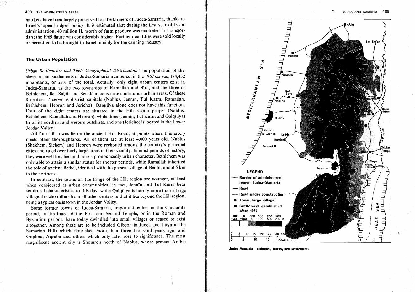
LEGEND
.-.- Border of administeredregion Judea-Samaria
-Road
--- Road under construction
• Town, large village
• Settlement establishedafter 1967
-300 0 300 600 900 1200-.400 -300 0 300 600 900 M
~
Re~ovol.
The Urban Population
Urban Settlements and Their Geographical Distribution. The population of theeleven urban settlements of Judea-Samaria numbered, in the 1967census, 174,452inhabitants, or 29% of the total. Actually, only eight urban centers exist inJudea-Samaria, as the two townships of Ramallah and Bira, and the three ofBethlehem, Beit Sahur and Beit Jala, constitute continuous urban areas. Of these8 centers, 7 serve as district capitals (Nablus, Jennin, Tul Karm, Ramallah,Bethlehem, Hebron and Jericho); QalqIliya alone does not have this function.Four of the eight centers are situated in the Hill region proper (Nablus,Bethlehem, Ramallah and Hebron), while three (Jennin, Tul Karm and Qalqiliya)lie on its northern and western outskirts, and one (Jericho) is located in the LowerJordan Valley.
All four hill towns lie on the ancient Hill Road, at points where this arterymeets other thoroughfares. All of them are at least 4,000 years old. Nablus(Shekhem, Sichem) and Hebron were reckoned among the country's principalcities and ruled over fairly large areas in their vicinity. In most periods of history,they were well fortified and bore a pronouncedly urban character. Bethlehem wasonly able to attain a similar status for shorter periods, while Ramallah inheritedthe role of ancient Bethel, identical with the present village of Beitin, about 5 kmto the northeast.
In contrast, the towns on the fringe of the Hill region are younger, at leastwhen considered as urban communities; in fact, Jennin and Tul Karm bearsemirural characteristics to this day, while Qalqiliya is hardly more than a largevillage. Jericho differs from all other centers in that it lies beyond the Hill region,being a typical oasis town in the Jordan Valley.
Some former towns of Judea-Samaria, important either in the Canaaniteperiod, in the times of the First and Second Temple, or in the Roman andByzantine periods, have today dwindled into small villages or ceased to existaltogether. Among these are to be included Gibeon in Judea and Tirza in theSamarian Hills which flourished more than three thousand years ago, andGophna, Aqraba and others which only later rose to significance. The mostmagnificent ancient city is Shornron north of Nablus, whose present Arabic
oIo
5 10 15, i' 'i
5 10
20 25. , i
JUDEA AND SAMARIA 409
«wCIJ
o«wo
/f
Judea-Samaria-altitudes, towns, new settlements
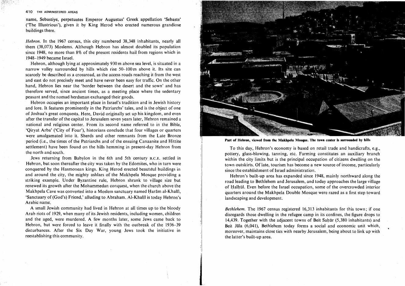
410 THE ADMINISTERED AREAS
name, Sebastiye, perpetuates Emperor Augustus' Greek appellation 'Sebaste'('The Illustrious'), given it by King Herod who erected numerous grandiosebuildings there.
Hebron. In the 1967 census, this city numbered 38,348 inhabitants, nearly allthem (38,073) Moslems. Although Hebron has almost doubled its populationsince 1948, no more than 8% of the present residents hail from regions which in1948-1949 became Israel.
Hebron, although lying at approximately 930 m above sea level, is situated in anarrow valley surrounded by hills which rise 50-100 m above it. Its site canscarcely be described as a crossroad, as the access roads reaching it from the westand east do not precisely meet and have never been easy for traffic. On the otherhand, Hebron lies near the 'border between the desert and the sown' and hastherefore served, since ancient times, as a meeting place where the sedentarypeasant and the nomad herdsman exchanged their goods.
Hebron occupies an important place in Israel's tradition and in Jewish historyand lore. It features prominently in the Patriarchs' tales, and is the object of oneof Joshua's great conquests. Here, David originally set up his kingdom, and evenafter the transfer of the capital to Jerusalem seven years later, Hebron remained anational and religious center. From its second name referred to in the Bible,'Qiryat Arba' ('City of Four'), historians conclude that four villages or quarterswere amalgamated into it. Sherds and other remnants from the Late Bronzeperiod (i.e., the times of the Patriarchs and of the ensuing Canaanite and Hittitesettlement) have been found on the hills hemming in present-day Hebron fromthe north and south.
Jews returning from Babylon in the 6th and 5th century B.C.E. settled inHebron, but soon thereafter the city was taken by the Edomites, who in turn wereconquered by the Hasmonean kings. King Herod erected beautitul buildings inand around the city, the mighty ashlars of the Makhpela Mosque providing astriking example. Under Byzantine rule, Hebron shrank to village size butrenewed its growth after the Mohammedan conquest, when the church above theMakhpela Cave was converted into a Moslem sanctuary named Haram al-Khalil,'Sanctuary of (God's) Friend,' alluding to Abraham. Al-Khalil is today Hebron'sArabic name.
A small Jewish community had lived in Hebron at all times up to the bloodyArab riots of 1929, when many of its Jewish residents, including women, childrenand the aged, were murdered. A few months later, some Jews came back toHebron, but were forced to leave it finally with the outbreak of the 1936-39disturbances. After the Six Day War, young Jews took the initiative inreestablishing this community.
Part of Hebron, viewed from the Makhpela Mosque. The town center is surrounded by hills
To this day, Hebron's economy is based on retail trade and handicrafts, e.g.,pottery, glass-blowing, tanning, etc. Farming constitutes an auxiliary branchwithin the city limits but is the principal occupation of citizens dwelling on thetown outskirts. Of late, tourism has become a new source of income, particularlysince the establishment of Israel administration.
Hebron's built-up area has expanded since 1948, mainly northward along theroad leading to Bethlehem and Jerusalem, and today approaches the large villageof Halhul. Even before the Israel occupation, some of the overcrowded interiorquarters around the Makhpela Double Mosque were razed as a first step towardlandscaping and development.
Bethlehem. The 1967 census registered 16,313 inhabitants for this town; if onedisregards those dwelling in the refugee camp in its confines, the figure drops to14,439. Together with the adjacent towns of Beit Sahur (5,380 inhabitants) andBeit Jala (6,041), Bethlehem today forms a social and economic unit which,moreover, maintains close ties with nearby Jerusalem, being about to link up withthe latter's built-up area.
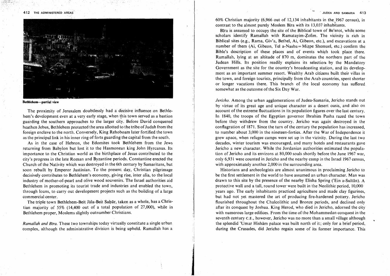
412 THE ADMINISTEREDAAEAS
Bethlehem-partial view
The proximity of Jerusalem doubtlessly had a decisive influence on Bethlehem's development even at a very early stage, when this town served as a bastionguarding the southern approaches to the larger city. Before David conqueredheathen Jebus, Bethlehem protected the area allotted to the tribe of Judah from theforeign enclave to the north. Conversely, King Rehoboam later fortified the townas the principal link in his inner ring of forts guarding the capital from the south.
As in the case of Hebron, the Edomites took Bethlehem from the Jewsreturning from Babylon but lost it to the Hasmonean king John Hyrcanus. Itsimportance to the Christian world as the birthplace of Jesus contributed to thecity's progress in the late Roman and Byzantine periods. Constantine erected theChurch of the Nativity which was destroyed in the 6th century by Samaritans, butsoon rebuilt by Emperor Justinian. To the present day, Christian pilgrimagedecisively contributes to Bethlehem's economy, giving rise, inter alia, to the localindustry of mother-of-pearl and olive wood souvenirs. The Israel authorities aidBethlehem in promoting its tourist trade and industries and enabled the town,through loans, to carry out development projects such as the building of a largecommercial center.
The triple town Bethlehem-Beit Jala-Beit Sahur, taken as a whole, has a Christian majority of 55% (14,400 out of a total population of 27,000), while inBethlehem proper, Moslems slightly outnumber Christians.
Ramaflah and Btra. These two townships today virtually constitute a single urbancomplex, although the administrative division is being upheld. Ramallah has a
r JUDEA AND SAMARIA 413
60% Christian majority (6,966 out of 12,134 inhabitants in the 1967 census), in. "
contrast to thealmost purely Moslem Bira with its 13,037 inhabitants.Blra is assumed to occupy the site of the Biblical town of Be'erot, while some
scholars identify Ramallah with Ramatayirn-Zofim. The vicinity is rich inBiblical sites (e.g., Rama, Giv'a, Bethel, Ai, Gibeon, etc.), and excavations at anumber of them (Ai, Gibeon, Tel a-Nasba= Mizpe Shemuel, etc.) confirm theBible's description of these places and of events which took place there.Ramallah, lying at an altitude of 870 m, dominates the northern part of theJudean Hills. Its position readily explains its selection by the MandatoryGovernment as the site for the country's broadcasting station, and its development as an important summer resort. Wealthy Arab citizens built their villas inthe town, and foreign tourists, principally from the Arab countries, spent shorteror longer vacations there. This branch of the local economy has sufferedsomewhat as the outcome of the Six Day War.
Jericho. Among the urban agglomerations of Judea-Samaria, Jericho stands outby virtue of its great age and unique character as a desert oasis, and also onaccount of the extreme fluctuations in its population figures over the last century.In 1840, the troops of the Egyptian governor Ibrahim Pasha razed the townbefore they withdrew from the country. Jericho was again destroyed in theconflagration of 1871. Since the turn of the century the population has increased,to number about 3,000 in the nineteen-forties. After the War of Independence itgrew apace, when refugee camps were set up in the vicinity. During the last twodecades, winter tourism was encouraged, and many hotels and restaurants gaveJericho a new character. While the Jordanian authorities estimated the population of Jericho and its environs at 80,000 souls shortly before the June 1967 war,only 6,931 were counted in Jericho and the nearby camp in the Israel 1967census,with approximately another 2,000 in the surrounding area.
Historians and archeologists are almost unanimous in proclaiming Jericho tobe the first settlement in the world to have assumed an urban character. Man wasdrawn to this site by the presence of the nearby Elisha Spring ('Ein a-Sultan). Aprotective wall and a tall, round tower were built in the Neolithic period, 10,000years ago. The early inhabitants practiced agriculture and made clay figurines,but had not yet mastered the art of producing fire-hardened pottery. Jerichoflourished throughout the Cha1colithic and Bronze periods, and declined onlyafter its conquest by Joshua. King Herod, who died in Jericho, adorned the citywith numerous large edifices. From the time of the Mohammedan conquest in theseventh century C.E., however, Jericho was no more than a small village althoughthe splendid 'Umar Hisham palace was built north of it; only for a brief period,during the Crusades, did Jericho regain some of its former importance. This
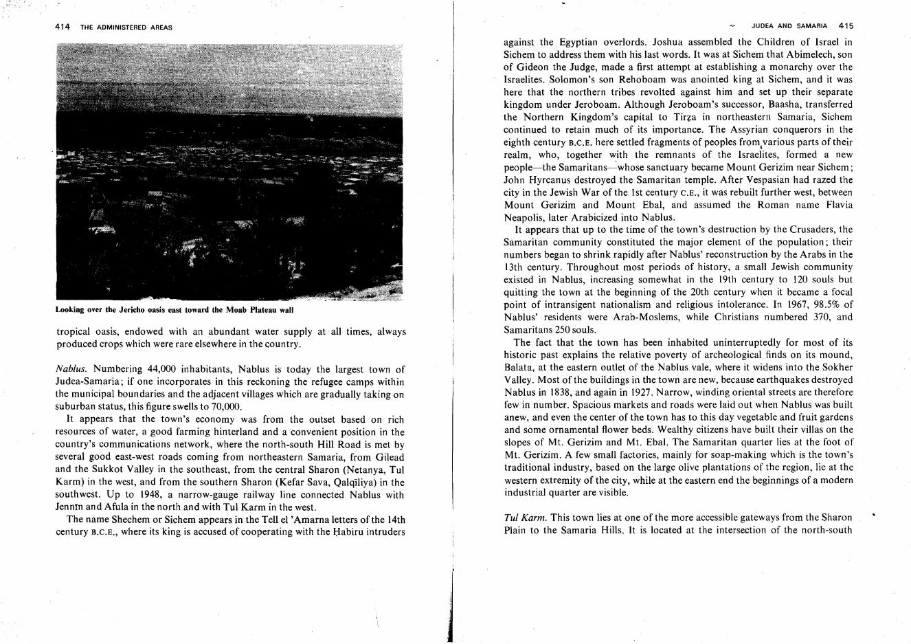
414 THE ADMINISTERED AREAS
Looking over the Jericho oasis east toward the Moab Plateau wall
tropical oasis, endowed with an abundant water supply at all times, alwaysproduced crops which were rare elsewhere in the country.
Nablus. Numbering 44,000 inhabitants, Nablus is today the largest town ofJudea-Samaria; if one incorporates in this reckoning the refugee camps withinthe municipal boundaries and the adjacent villages which are gradually taking onsuburban status, this figure swells to 70,000.
It appears that the town's economy was from the outset based on richresources of water, a good farming hinterland and a convenient position in thecountry's communications network, where the north-south Hill Road is met byseveral good east-west roads coming from northeastern Samaria, from Gileadand the Sukkot Valley in the southeast, from the central Sharon (Netanya, TulKarm) in the west, and from the southern Sharon (Kefar Sava, Qalqiliya) in thesouthwest. Up to 1948, a narrow-gauge railway line connected Nablus withJenntn and Afula in the north and with Tul Karm in the west.
The name Shechem or Sichem appears in the Tell el 'Amarna letters of the 14thcentury B.C.E., where its king is accused of cooperating with the Habiru intruders
JUDEA AND SAMARIA 415
against the Egyptian overlords. Joshua assembled the Children of Israel inSichem to address them with his last words. It was at Sichem that Abimelech, sonof Gideon the Judge, made a first attempt at establishing a monarchy over theIsraelites. Solomon's son Rehoboam was anointed king at Sichem, and it washere that the northern tribes revolted against him and set up their separatekingdom under Jeroboam. Although Jeroboam's successor, Baasha, transferredthe Northern Kingdom's capital to Tirza in northeastern Samaria, Sichemcontinued to retain much of its importance. The Assyrian conquerors in theeighth century B.C.E. here settled fragments of peoples from,various parts of theirrealm, who, together with the remnants of the Israelites, formed a newpeople-the Samaritans----':'whose sanctuary became Mount Gerizim near Sichem;John Hyrcanus destroyed the Samaritan temple. After Vespasian had razed thecity in the Jewish War of the lst century C.E., it was rebuilt further west, betweenMount Gerizim and Mount Ebal, and assumed the Roman name FlaviaNeapolis, later Arabicized into Nablus.
It appears that up to the time of the town's destruction by the Crusaders, theSamaritan community constituted the major element of the population; theirnumbers began to shrink rapidly after Nablus' reconstruction by the Arabs in thel Jth century. Throughout most periods of history, a small Jewish communityexisted in Nablus, increasing somewhat in the 19th century to 120 souls butquitting the town at the beginning of the 20th century when it became a focalpoint of intransigent nationalism and religious intolerance. In 1967, 98.5% ofNablus' residents were Arab-Moslems, while Christians numbered 370, andSamaritans 250 souls.
The fact that the town has been inhabited uninterruptedly for most of itshistoric past explains the relative poverty of archeological finds. on its mound,Balata, at the eastern outlet of the Nablus vale, where it widens into the SokherValley. Most of the buildings in the town are new, because earthquakes destroyedNablus in 1838, and again in 1927. Narrow, winding oriental streets are thereforefew in number. Spacious markets and roads were laid out when Nablus was builtanew, and even the center of the town has to this day vegetable and fruit gardensand some ornamental flower beds. Wealthy citizens have built their villas on theslopes of Mt. Gerizim and Mt. Ebal. The Samaritan quarter lies at the foot ofMt. Gerizim. A few small factories, mainly for soap-making which is the town'straditional industry, based on the large olive plantations of the region, lie at thewestern extremity of the city, while at the eastern end the beginnings of a modernindustrial quarter are visible.
Tul Karm. This town lies at one of the more accessible gateways from the SharonPlain to the Samaria Hills. It is located at the intersection of the north-south
416 THE ADMINISTERED AREAS
arteries of the Haifa-Lod railroad and motor road, both running along thewestern edge of the Hills (a section of the ancient Via Maris), with the west-easthighway leading from the coast to Nablus. The rich farmlands of the surroundingarea have contributed toward its development.
Archeological finds reveal that an agglomeration has existed here at least sincethe Roman period. Tul Karm's name has its roots in the Aramaic 'Tur Karma'('Vineyard Hill'), which was used by the Samaritan inhabitants of the MiddleAges and by the Crusaders. In the past few hundred years, Tul Karm assumed theform of a small village, but expanded anew as from the beginning of the 20thcentury with increase in traffic passing through. This development came to a haltin the nineteen-thirties, with the construction of the Petal) Tiqwa-Haderahighway which bypasses the town in the west. Despite the fact that theIsrael-Jordan armistice border of 1949 encircled Tul Karm on the southwest, westand northwest, the town increased its population considerably, becoming anadministrative center while farming in its surroundings was intensified. The townhas an agricultural school established by the Mandatory Government with amonetary contribution by the Jewish philanthropist J. S. Kadoorie. In the 1967census, Tul Karm numbered 15,275 inhabitants, nearly all of them Moslems, onethird living in a refugee camp.
Jennin. In 1967, this town had 13,365 inhabitants, the vast majority beingMoslems. Jenntn is usually identified with the Biblical En Gannim. In historicaldocuments, it is named 'Kan' by the ancient Egyptians, 'Ginat,' 'Ginai,' etc.,during later periods, and 'Ie Grand Guerin' by the Crusaders. During the SecondTemple period it was populated by Samaritans.
Jenntn lies at the south corner of the Jezreel Valley, where roads radiatenorthwestwards to Haifa, northwards to Afula and Nazareth, and southwardsthrough the Dotan Valley to Nablus. Thus its situation, together with theabundant water supply and fertile soil in the vicinity, provides this town with aneconomic basis. During the last decades, Jennln lay at the apex of the aggressive'Arab triangle' of Samaria, which explains why battles were fought around it inthe 1936-1939 disturbances, in the Independence War and in the Six Day War.
East Jerusalem and Judea-Samaria in the Six Day War
5 June 1967. When war broke out on the morning of this day on the Sinai front, itwas still assumed that the Jordanians would refrain from attacking Israel or, atmost, content themselves with a few token salvoes. The Israel Army, therefore,prepared to reply to localized Jordanian fire. As from the late morning hours,
JUDEA AND SAMARIA 417
however.. the Jordanians set up a barrage of shells along the entire length of theborder with Israel, particularly concentrating on West Jerusalem, on the KefarSava vicinity and even the Tel Aviv area. At 13.00 hrs, Arab Legion troops forcedtheir way into Government House (which served as the headquarters on the UNTruce Supervision Organization) in Jerusalem, seizing it from the UN personnelstationed there, and immediately prepared for further advance into Israelterritory. This compelled the Israel Army to re-define its strategic objectives,albeit still on a limited scale, including occupation of the ridge dominating fromthe north the Qastel-Jerusalem section of the main highway leading to thecapital; liquidation of enemy positions around Qalqiliya from which the Tel Avivarea had been hit; and dislodging of the Jordanians from the Irron Hills, withinshelling range of the Ramat David airfield in the Jezreel Valley. However, whenthe Jordanian Army, in the course of the day and the ensuing night, brought up itsarmor to forward positions in Judea and Samaria, with an Iraqi division followingin the rear, it became evident that there was no alternative to extending the sphereof Israel's military involvement to the entire area west of the Jordan. Throughoutthe war, Jerusalem constituted the focus of fighting.
A Jerusalem brigade cleared the enemy from Government House two hoursafter the latter had entered it, and thence advanced eastwards, taking Sur Bahirand thereby severing the Jerusalem-Bethlehem road. An armored unit arriving inthe Jerusalem Corridor from the Coastal Plain began at midnight to pierce enemydefences opposite Ma'ale ha-Harnisha and Oastel, took the villages of Biddu andNabi Samwil, and thrust forward to appear on the next morning at theJerusalem-Ramallah road in front of Tell al-Ful, the site of the Biblical Giv'atSha'ul. The Latrun enclave was taken on the first evening, and from there acolumn advanced toward Ramallah over the Bet Heron ascent.
6 June. In the north, forces crossed the border in the noon hours of June 6. Onecolumn advanced from the southern Jezreel Valley in the direction of the KafrDan and Yamun villages, while a second, setting off from the Irron Hills,marched against the village of Ya'bed. That night saw the fall of the villageBirqtn, on the outskirts of the Dotan Valley, and on the next morning the forcewas posted at the road connecting Jennin with central Samaria, there to turnnortheastwards against Jennin itself.
On the Jerusalem front, a paratrooper unit entered the battle at 02.00 hrs. andattacked the heavily fortified Police School and Ammunition Hill. In a cruelencounter, this force also broke through the Nahlat Shim'on quarter to SheikhJarrah, attaining its objectives around 10.00 hrs. The paratroopers then battledtheir way through the American Colony quarter southeastwards to the Rockefeller Museum, where they confronted the Old City wall opposite Herod's Gate, and
418 THE ;ADMINISTERED AREAS
reestablished the link with the isolated Israel position on Mount Scopus. Furthernorth, the strongly fortified Giv'at ha-Mivtar and French Hill were taken by thearmored brigade, whereupon the large suburb Sha'fat fell. In the evening hours,Israel forces entered the town of Ramallah. That afternoon the JerusalemBrigade had taken the Abu Tor quarter in hand-to-hand .combat. During theevening, the paratroopers began their ascent of Mount Scopus and the Mount ofOlives.
Meanwhile, an infantry column had marched against the town of Qalqiliya inthe Sharon, occupied it, and advanced eastwards to the village of'Azzun,
On the Jennin front, Israel forces threw back a counterattack of Jordaniantanks and took the town of Jennin, overcoming massive opposition whichcentered mainly on the huge police fortress at the town's western entrance. In themorning, the village Ya'bed southwest of Jennin was taken. From this point, t~eIsrael column reached the highway leading to Nablus and advanced along It,breaking through a formidable road block of Jordanian tanks. An armoredbrigade joined the battle, crossing the border on Mount Gilboa and advancingthrough the villages of Deir Abu Dha'Tf, Jalqamus and TilfIt, to reach the roadleading to Tubbas and proceed in that direction.
7 June. On this day, Jerusalem was re-united with the conquest of the Old City byIsrael forces. In the morning hours, the Augusta Victoria building, the Jordanians' last stronghold on Mount Scopus, came under intensive fire from the groundand air and was then assaulted and taken from the side of the Hebrew Universitycompound in the northwest. Immediately, the Israel forces turned west todescend into the Qidron Valley opposite St. Stephen's Gate, where they joinedother forces which had advanced from the Rockefeller Museum, circling thenortheast corner of the Old City wall. After the gate itself had been burst open bya tank shell, the Old City was entered by three units who mopped up the lastpockets of resistance, ascended the Temple Mount and reached the Western Wallat 10.00 hrs.
While the paratroopers fought inside the Old City, the Jerusalem Brigadeadvanced along its southern wall. In the afternoon, enemy resistance on thestrongly fortified hill near Mar Elias monastery was broken, and therewith theway was opened for the conquest of Bethlehem and Hebron. After the latter townhad fallen, the Israeli advance split into two columns, one heading towardsDhahariya on the road leading to Beersheba, and the other taking the pa~allel
road in the east to Samu'a (Eshtemo'a). On that day, an armored bngadeadvanced northward from Ramallah in the direction of Nablus, where it joinedother Israel forces who where approaching the city from the northeast afterhaving overcome, during the night, the resistance of strong Jordanian armored
'j
JUDEA AND SAMARIA 419
units in the Kufeir-Aqaba area and then taking Tubbas without encounteringfurther opposition. An Israel tank column which entered Nablus was at firstgiven a friendly reception by the local inhabitants who mistook it for Iraqireinforcements, and was thus able to gain control of the city with relative ease.Two other columns pressed forward at the same time toward Nablus, one from,Azzun in the west, and another from the Jenntn area in the north, after havingwiped out at dawn a Jordanian force of 25 tanks at the Qabatiya road fork, in thesouth of the Dotan Valley.
Other Israel columns moved eastwards through the Judean Desert to Jericho,reached the Jordan River and its mouth in the Dead Sea, and blew up the bridgesthere. After the fall of Nablus, a force descended through the Farl'a Valley to theDarntya Bridge. The occupation of the entire West Bank was thus completed inthe course of three days.
The Golan
The Golan as a New Administrative Unit
The Golan, westernmost of the three parts of the Bashan, stretches from theUpper Jordan Rift and Lake Kinneret eastward to the course of Nahal Ruqqad.Practically all of its territory was occupied by the Israel Army in the last two daysof the June 1967 War.jas were also certain areas belonging to other geographicalunits-the 'Hermon Shoulder' in the southeast corner of this mountain massif;the Nukhetla area which constitutes the northern end of the Hula Valley,stretching from Dan and Dafna northward to the Lebanese frontier; and theBethsaida (Buteiha) Valley which forms part of the Kinneret depression. TheGolan as an administrative unit under Israel government comprises 1,250km-.The district borders on Lebanon over a length of 20 km, on Syria-80 km, and onJordan-20 km. The cease-fire line in existence since the June 1967 battles beginsat the Lebanese border 5 km north of'Majdal Shams, whence it runs east-southeast, with an indentation tothe southwest, passing about 4 km east of the BerekhatRam lake and 3 km east of Qunattira. From there it continues southward at adistance of a few kilometers east of the Qunattira-Butmtya road; the latter site isthe easternmost point under Israel's control, and there the line turns southwest,touching the bank of Nahal Ruqqad and following it to the mouth of this streamin the Yarmuk River, where it joins the Jordanian border. A strip of no-man'sland, ranging from a few hundred meters to 2.5 km in width, parallels thecease-fire line in the east.
Population of the Golan. In contrast to the other regions which came underIsrael's control as a result of the Six Day War, the Golan was almost totallyabandoned by its inhabitants. It appears that a large number of the formerresidents, whose livelihood stemmed from services extended to the Syrian Army,took flight together with the soldiers. Thus, nearly all Moslem-Sunnite Arabs left,as did most of the Moslem Circassians. Even among the Christians-whose
420
THE GOLAN 421
numbers had been very small prior to the war-only few remained, making up nomore than 1% of the total population registered in the Golan in the census ofautumn, 1967. The Druzes were the only community to stay in their five villages(Majdal Shams, Mas'ada, Baq'ata, 'Ein Quniya, Sihita), and they thus came toconstitute over 90% of the population of the region, about 5,800 souls out of thetotal of 6,400.
An exception to the above general picture is encountered in the village Ghajarat the Lebanese border, on the east bank of Nahal Senir; its inhabitants, whobelong to the Nusairi (Alaouite) faith, did not leave their homes. Two othervillages of the same community, al-Fit and Za'iira, lying southeast of Banias,were abandoned during the fighting.
Only the six villages mentioned above remained inhabited, while all otherswere found deserted when Israel troops entered them. In the district capital,Qunaitira, 206 persons were counted in the census, mostly Circassians; however,a considerable number of them left at a later date. At present, nearly half the totalGolan population lives at the village Majdal Shams which, in the 1967 census,had 2,929 inhabitants.
Druzes and Alaouites. Immediately after the Israel occupation, the Golan Druzesexpressed their wish to become citizens of Israel and established close ties withthe members of their faith living in Galilee and on Mount Carmel. Theireconomy was in no way impaired by the war and its consequences, and firmeconomic links have already been forged between their villages and Israelenterprises, both for the marketing of their farming produce and for providingthem with employment in Israel development projects and factories. TheGovernment extends to them aid in setting up public institutions, e.g., schools andclinics, improving education facilities, etc. In the summer of 1968, local autonomywas accorded to the Golan Druzes and village councils were set up in theirlocalities. The sole Nusairi village, Ghajar, northwest of Dan, has a domed prayerhall resembling a mosque.
Sex and Age. In analyzing these statistical data, it is advisable to overlook thoseminority groups which are today represented in the Golan by but a fewindividuals and whose composition is in consequence purely accidental; only theDruze community is therefore treated here. As in the case of other minoritygroups in Israel and in the rest of the new regions, this population is young andhas a very low median age, the 0-14 years group making up 46.5% of all GolanDruzes. Although somewhat lower than the average for Israel Arabs, th is figurepermits the conclusion that the birth rate is equally high. The average householdin the Druze village in 1967 numbered 5.5 persons.
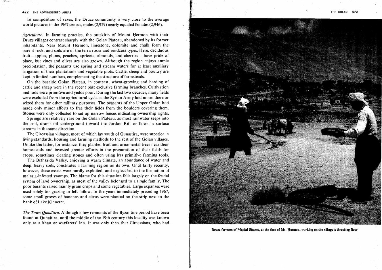
422 THE ADMINISTERED AREAS
In composition of sexes, the Druze community is very close to the averageworld picture; in the 1967census, males (2,929) nearly equaled females (2,946).
Agriculture. In farming practice, the outskirts of Mount Hermon with theirDruze villages contrast sharply with the Golan Plateau, abandoned by its formerinhabitants. Near Mount Hermon, limestone, dolomite and chalk form theparent rock, and soils are of the terra rossa and rendzina types. Here, deciduousfruit-apples, plums, peaches, apricots, almonds, and cherries- have pride ofplace, but vines and olives are also grown. Although the region enjoys ampleprecipitation, the peasants use spring and stream waters for at least auxiliaryirrigation of their plantations and vegetable plots. Cattle, sheep and poultry arekept in limited numbers, complementing the structure offarmsteads.
On the basaltic Golan Plateau, in contrast, wheat-growing and herding ofcattle and sheep were in the recent past exclusive farming branches. Cultivationmethods were primitive and yields poor. During the last two decades, many fieldswere excluded from the agricultural cycle as the Syrian Army laid mines there orseized them for other military purposes. The peasants of the Upper Golan hadmade only minor efforts to free their fields from the boulders covering them.Stones were only collected to set up narrow fences indicating ownership rights.
Springs are relatively rare on the Golan Plateau, as most rainwater seeps intothe soil, drains off underground toward the Jordan Rift or flows in surfacestreams in the same direction.
The Circassian villages, most of which lay south of QunaItira, were superior inliving standards, housing and farming methods to the rest of the Golan villages.Unlike the latter, for instance, they planted fruit and ornamental trees near theirhomesteads and invested greater efforts in the preparation of their fields forcrops, sometimes clearing stones and often using less primitive farming tools.
The Bethsaida Valley, enjoying a warm climate, an abundance of water anddeep, heavy soils, constitutes a farming region on its own. Until fairly recently,however, these assets were hardly exploited, and neglect led to the formation ofmalaria-infested swamps. The blame for this situation falls largely on the feudalsystem of land ownership, as most of the valley belonged to a single family. Thepoor tenants raised mainly grain crops and some vegetables. Large expanses wereused solely for grazing or left fallow. In the years immediately preceding 1967,some small groves of bananas and citrus were planted on the strip next to thebank of Lake Kinneret.
The Town Qunaitira. Although a few remnants of the Byzantine period have beenfound at Qunaitira, until the middle of the 19th century this locality was knownonly as a khan or wayfarers' inn. It was only then that Circassians, who had
Druze farmers of Miijdal Shams, at the foot of Mt, Hermon, working on the village's threshing floor
424 THE ADMINISTERED AREAS
found refuge in several provinces of the Turkish Empire, were settled here by theTurkish Government. Broad roads were laid out in the town, and brick or basaltstone houses were built. The population increased gradually, from 1,500 at theturn of the century to 15,000 shortly before the Six Day War. Its economy wasbasd on trade, small workshops and farming, as well as on administration, asQunaItira served as a district center. During the 1960's, when most Syrian unitswere concentrated in this region next to the Israel frontier, the services extendedto the army gained in importance. On the other hand, the town lacked industry ofany kind.
Attempts at Jewish Settlement in the Golan
In the early phases of Zionist settlement, the Golan was the object of specialinterest, both on account of the low land prices prevailing there and because of itssoil and climate conditions which gave promise for the development of farmingsimilar to that in eastern Europe, the region of origin of most of the settlercandidates.
Rumthaniya. The first attempt was made by Jews of the 'old yishuv' of Safed.Fifty-two families founded a society named 'Bene Yehuda' which negotiated forthe acquisition of a large tract of 15,000 dunams at Rumthaniya, in the UpperGolan, about 15km south of Qunaitira. Some of its numbers went there in 1887and sowed winter grain. With the advent of the following sumrrrer.fhey preparedto build houses, terrace fields and carry out other development programs, butwere compelled to leave when the Turkish governor of Damascus refused toappend his signatureto the transfer of the land to Jewish ownership.
Bene Yehuda. Approximately 20 member families of the 'Bene Yehuda' Societydid not despair of settling in the Golan even after the attempt at Rumthanrya hadfailed. They sent an emissary to Europe and America. who succeeded in raisingsome funds for the purchase of a part of the lands of Bir Sheqnm village, 5 kmnortheast of the present-day kibbutz En Gev. In 1898, 10 families arrived at thesite which, in honor of the society, they named 'Bene Yehuda.' They met withuntold difficulties, e.g., the lack of even the most basic necessities, the Turkishauthorities' prohibition on construction of houses, crop failures, etc. Despitetheir preparedness for a most frugal life, most of them were not able to hold outfor long. Nevertheless, six families struggled on until 1912, but by the followingyear only one remained, which abandoned the site in 1920, when one of its sonswas killed by Arabs while working his lands.
1THE GOLAN 425
Bethsaida Valley. In 1904, a group of Jews who had been peasants in their nativeCrimea accepted the proposal of the Kurdish-Moslem proprietor of lands in theBethsaida Valley to settle there, initially as his tenants, with the prospects ofpurchasing the holdings for themselves at a later stage. A number of them tookup this offer, and yields of the first season were promising. However, the housingprovided was primitive and they suffered severely from malaria, as they hadchosen to settle within the swamp area. In the hour oftheir distress, local quarrelsbroke out as a further disrupting force, and the last of this group left the valley inthe following summer.
Baron Rothschild's Lands in the Bashan. The boldest attempt at settlement everundertaken in the region was that in the Bashan east of Nahal Ruqqad, on bothbanks of the'Allan stream, i.e., beyond the limits of the area which came underIsrael control in 1967. Zion ist associations of Russia and Rumania took theinitiative in acquiring land there. Baron Edmond de Rothschild consented toparticipate in the venture and contributed a substantial sum of money. Between1894 and 1896, the purchase was finalized, notwithstanding the numerousobstacles the Turkish-Syrian administration placed in the way of registering theland in the name of the company Baron Rothschild had founded for this purpose.Theoretically, an area measuring between 100,000 and 120,000 dunams had beenbought, but a survey showed that in actual fact it amounted to no more than75,000 dunams. A farm was set up at Jilin, as well as a colony which was namedTif'eret Binyamin, and two additional settlement points. The number of familiesliving there amounted to 16 or 17. The authorities, however, claimed that thesepeople had no right settling there as they were not Turkish citizens, and at the endof 1897 sent soldiers to expel them. A second attempt, this time to bring inSyrian-Jewish settlers, similarly met with failure. Baron Rothschild transferredthe lands to the ICA Society which maintained its administration under a Jewishdirector who resided first at Jilin and later at Sakhm al-Jolan, His duties were tokeep watch over the property and raise the leasehold fees from the Arab lessees.After the First World War, a Jewish administrator returned there on behalf ofPICA (which had taken over ICA holdings in Palestine). This official was afarmer from Kefar Tavor who up to 1940 spent several months each year in theGolan. In that year the rule over Syria passed into the hands of the Vichy-Frenchallies of the Nazis.
Throughout the days of the Second and Third Aliya, attempts at renewingJewish settlement in the Bashan never ceased. Expeditions to the area wereorganized by the Labor Battalion and by the Ha-Po'el ha-Za'ir Movement.Leaders of the Jewish community in the country and the Zionist Movementenergetically supported the idea. However, the hope that the French Mandate
426 THE ADMINISTERED AREAS
authorities would adopt a more favorable attitude toward Jewish settlementplans than their Turkish predecessors faded in the 1930's.
Conquest of the Golan in the Six Day War
Since the establishment of the State of Israel, the Syrians surpassed her otherneighbors in aggressiveness. In the 1960's Syria became the principal base ofArab terrorist gangs seeking to infiltrate into Israel, and it was the steadilyheightening tension along the 77 km stretch of the Syrian armistice lines whichultimately led to the Six Day War. The Syrians invested enormous efforts inbuilding military installations along this border, fully exploiting the topographical features which were all in their favor: the slopes of Mount Hermon dominatethe Hula Valley from the north, while east of this valley the Golan Plateau rises asan abrupt wall, which is particularly steep south of Kefar Szold. High and almostvertical escarpments fringe the east shore of Lake Kinneret. From the upper rimof these escarpments the terrain rises further but more gently toward the east.This not only made access from the Israel side extremely difficult, but alsoenabled the Syrians to develop a highly efficient system of fortifications,simultaneously defensive and offensive. On the escarpment rims, they postedartillery and tanks which could readily strike at any object in the Israel villagesdown in the valley. Behind these were located several strings of fortifications anddugouts, with artillery emplacements, able to fire at targets in Israel territory overthe heads of their own forward positions. All trenches and dugouts were so wellprotected by reinforced concrete and earth roofs that they were practicallyinvulnerable to shelling and aerial bombardment.
5-8 June. Documents found in military camps in the Golan show that the Syrianswere preparing to penetrate into Israel at two points-opposite Ayyelet ha-Shabar and near Lake Kinneret-and to reach the line Gush Halav-Safed in UpperGalilee in the course of one day, with the final aim of taking all of northern Israel,including Haifa. June 5, 1967, was set as D-Day for their attack. However, whenfighting broke out on the morning of the same day on the Sinai front, the Syrianswere content with heavy, continuous shelling of Jewish settlements along theentire length of the border. On 6 June they attempted to invade Israel at Tel Dan,Ashmura and She'ar Yashuv, but were soon driven back. The shelling caused veryheavy damage, but the Israel artillery retaliated with increasing strength.
9 June. On that day, Israel columns moved against the Golan in the hours beforenoon, when the battles on the other fronts had been won and the air force was
f THE GOLAN 427
free to concentrate its full efforts here. At 11.30 hrs., units crossed the bordernorth of Kefar Szold where the ascent is somewhat less steep than in the othersections. With heavy artillery support, the column advanced and took the Syrianposition of Na'amush. At that point it split up into two parts, one headingsoutheast to reach Qala'a, while the other moved northeastward to Za'iira, takingthe positions above that village in a fierce battle at 16.30 hrs. Simultaneously,other columns advanced further north and south. In gruelling fighting, theposition of Tel al-Fakhr was taken, whereupon the strongest of the Syrianforward fortifications, Tel 'Aziziyat, could be attacked from the rear. The
j
southern column captured the village of Rawiya situated above Kibbutz Gonen.All other Syrian strongpoints along the border north of the Benot Ya'aqovBridge also came under attack, thus bringing about the foundering of the entireSyrian defense system by that evening.
10 June. On this second and last day of fighting on the Syrian front, Israel forcesadvanced with great speed. In the north, they closed in on Banias and took thevillage, and then turned westward to occupy the Nukheila pocket between theIsrael and Lebanon borders. After doubling back eastward, they ascended overZa'ura to Mas'ada, where the Syrians fled, leaving behind them large quantitiesof equipment without even attempting to destroy them. Further south, thecolumn which had entered Qala'a proceeded over Mansura to Qunaitira. Thetown was reached at 14.00 hrs, and was entered almost without resistance. Otherunits arrived at QunaItira from the south. After having overcome the' lastdesperate Syrian resistance at Rawiya, they had first advanced southward toKafr Naffakh and then continued along the main road leading from the BenotYa'aqov Bridge to Damascus. The last enemy positions down at the bridge werealso cleared.
At the same time, an attack was launched on the Lower Golan from the south,the main effort being directed against the Tawafiq-Kafr Harib ridge above thekibbutzim of Tel Qazir and Ha-On. At 15.30 hrs, Tawafiq was stormed byparatroopers. After this battle, the advancing columns encountered only limitedresistance. They reached el-' AI, which had already been taken by an airborneunit, and then the Butmiya road fork, where they met other columns which hadcome from QunaItira in the north and from Darbashtya in the west. Finally, ahelicopter-borne unit occupied positions on the Hermon Shoulder. Therewith, aneasily defensible line, running along the highest points of the Upper Golan in thenorth, and along the Ruqqad course in the south, was established when thecease-fire came into force in the evening.
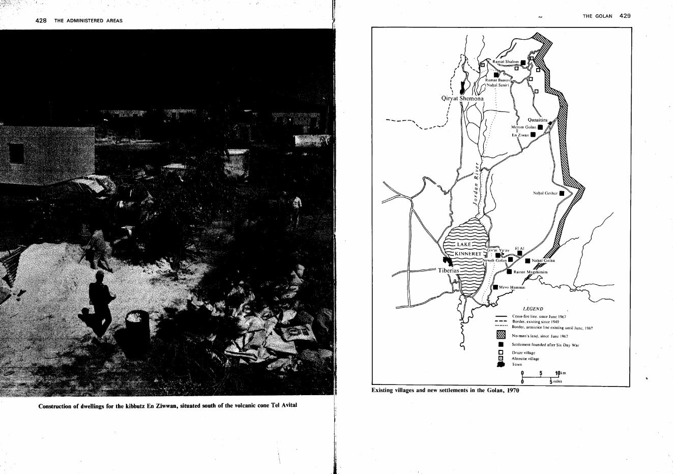
Existing villages and new settlements in the Golan, 1970
THE GOLAN 429
LEGEND
Cease-fire line. since June 1967Border. existing since 1949
Border. armistice line existing until June. 1967
No-man-s land. since June 1967
Settlement founded after Six Day War
Druze village
Alaouite village
Town
~
•oB•
-----,
428 THE ADMINISTERED AREAS
Construction of dwellings for the kibbutz En Ziwwan, situated south of the volcanic cone Tel Avital
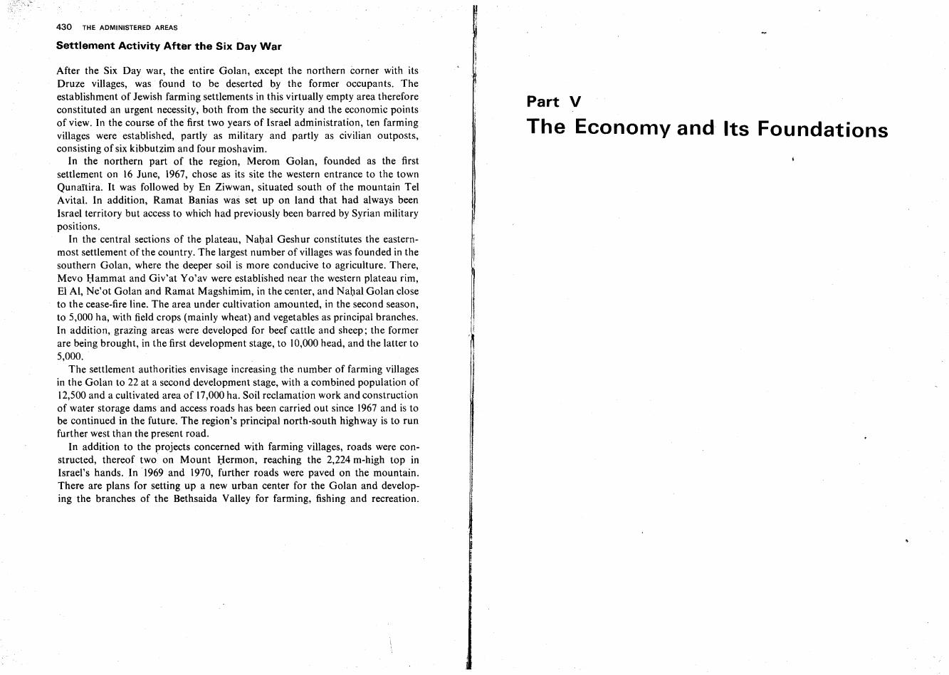
430 THE ADMINISTERED AREAS
Settlement Activity After the Six Day War
After the Six Day war, the entire Golan, except the northern corner with itsDruze villages, was found to be deserted by the former occupants. Theestablishment of Jewish farming settlements in this virtually empty area thereforeconstituted an urgent necessity, both from the security and the economic pointsof view. In the course of the first two years of Israel administration, ten farmingvillages were established, partly as military and partly as civilian outposts,consisting of six kibbutzim and four moshavim.
In the northern part of the region, Merom Golan, founded as the firstsettlement on 16 June, 1967, chose as its site the western entrance to the townQunartira. It was followed by En Ziwwan, situated south of the mountain TelAvital. In addition, Ramat Banias was set up on land that had always beenIsrael territory but access to which had previously been barred by Syrian militarypositions.
In the central sections of the plateau, Nahal Geshur constitutes the easternmost settlement of the country. The largest number of villages was founded in thesouthern Golan, where the deeper soil is more conducive to agriculture. There,Mevo Hamrnat and Giv'at Yo'av were established near the western plateau rim,El AI, Ne'ot Golan and Ramat Magshimim, in the center, and Nahal Golan closeto the cease-fire line. The area under cultivation amounted, in the second season,to 5,000 ha, with field crops (mainly wheat) and vegetables as principal branches.In addition, grazing areas were developed for beef cattle and sheep; the formerare being brought, in the first development stage, to 10,000 head, and the latter to5,000.
The settlement authorities envisage increasing the number of farming villagesin the Golan to 22 at a second development stage, with a combined population of12,500 and a cultivated area of 17,000 ha. Soil reclamation work and constructionof water storage dams and access roads has been carried out since 1967 and is tobe continued in the future. The region's principal north-south highway is to runfurther west than the present road.
In addition to the projects concerned with farming villages, roads were constructed, thereof two on Mount Hermon, reaching the 2,224 m-high top inIsrael's hands. In 1969 and 1970, further roads were paved on the mountain.There are plans for setting up a new urban center for the Golan and developing the branches of the Bethsaida Valley for farming, fishing and recreation.
Part V
The Economy and Its Foundations
Soil and Water
Soils, Conservation and Reclamation
Soil Types in Israel. Two factors, the parent rock and the climate, determine soilphysiognomy. Even Israel's pre-1967 borders, including a great variety of bothrocks and climatic conditions, consequently displayed a wide range of soil types.Most similar to the parent rock in composition is young soil; in mature or oldsoils, climatic and other environmental factors are decisive while the origin of therock meal is hardly identifiable. Soils mature most rapidly in a tropical-humidclimate. Israel's central and northern parts, with relatively high temperatures andonly winter rains, are intermediate in this respect and engender special Mediterranean soil types; in the Negev, desert soils prevail.
Highly important for farming is the ratio between the formation of new soiland its disappearance by erosion. Particularly in the hill regions, the topsoil iswashed off faster than new soil can form from the bedrock beneath. The youngsoil usually has no chance to mature and grow old; therefore, most soils in thecountry are classed as young.
As Israel's soil types have been described in greater detail in the chapters of thebook dealing with the geology and morphology of the country's regions, a briefrecounting of their geographical distribution and properties will suffice here.
In the Negev, besides the dead rock meal, the reg and hammada types of the desert proper, the fine-grained, semiheavy, yellowish brown loess of the BeershebaRegion is found. Loess, potentially fertile because of its inclusion of mineralsneeded by plants, is, however, liable to crumble into dust when dry, and it is thentransported by winds over small or large distances. Under the winter rains,conversely, it forms a hard, impenetrable crust. This causes surface waters tocollect in flash floods, which, in turn, create a badland topography. In thesouthwestern part of the Beersheba Region, shifting sand dunes are prominent,often underlain by loess. In the Arava Valley, a number of oases and brackishplayas are found where soils are heavy and mostly saline.
433
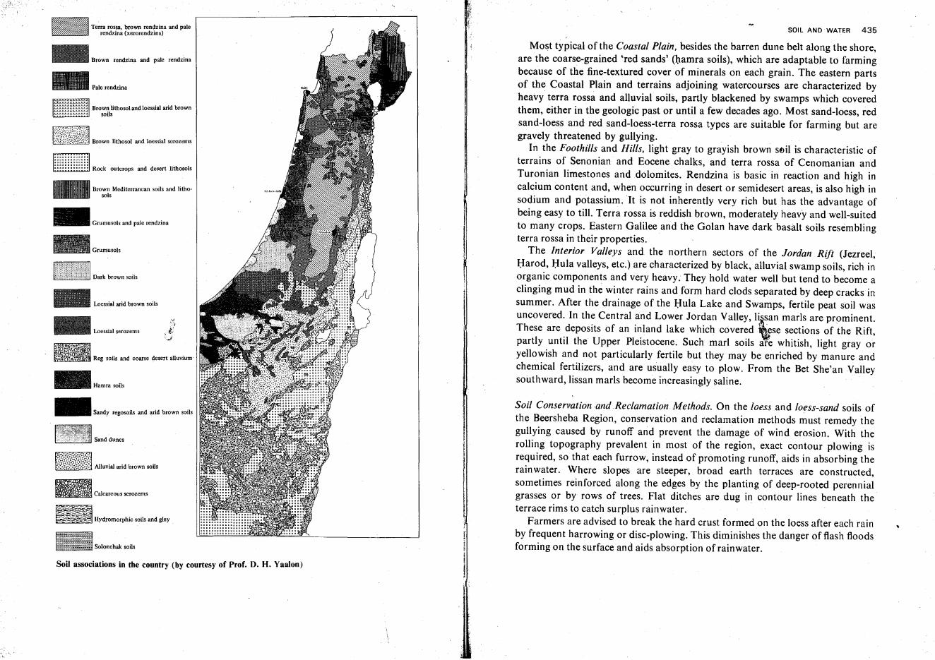
SOIL AND WATER 435
Soil Conservation and Reclamation. Methods. On the loess and loess-sand soils ofthe Beersheba Region, conservation and reclamation methods must remedy thegullying caused by runoff and prevent the damage of wind erosion. With therolling topography prevalent in most of the region, exact contour plowing isrequired, so that each furrow, instead of promoting runoff, aids in absorbing therain water. Where slopes are steeper, broad earth terraces are constructed,sometimes reinforced along the edges by the planting of deep-rooted perennialgrasses or by rows of trees. Flat ditches are dug in contour lines beneath theterrace rims to catch surplus rainwater.
Farmers are advised to break the hard crust formed on the loess after each rainby frequen t harrowing or disc-plowing. This diminishes the danger of flash floodsforming on the surface and aids absorption ofrainwater.
Most typical of the Coastal Plain, besides the barren dune belt along the shore,are the coarse-grained 'red sands' (hamra soils), which are adaptable to farmingbecause of the fine-textured cover of minerals on each grain. The eastern partsof the Coastal Plain and terrains adjoining watercourses are characterized byheavy terra rossa and alluvial soils, partly blackened by swamps which coveredthem, either in the geologic past or until a few decades ago. Most sand-loess, redsand-loess and red sand-loess-terra rossa types are suitab.le for farming but aregravely threatened by gullying.
In the Foothills and Hills, light gray to grayish brown soil is characteristic ofterrains of Senonian and Eocene chalks, and terra rossa of Cenomanian andTuronian limestones and dolomites. Rendzina is basic in reaction and high incalcium content and, when occurring in desert or semidesert areas, is also high insodium and potassium. It is not inherently very rich but has the advantage ofbeing easy to till. Terra rossa is reddish brown, moderately heavy and well-suitedto many crops. Eastern Galilee and the Golan have dark basalt soils resemblingterra rossa in their properties.
The Interior Valleys and the northern sectors of the Jordan Rift (Jezreel,Harod, Hula valleys, etc.) are characterized by black, alluvial swamp soils, rich inorganic components and very heavy. They hold water well but tend to become aclinging mud in the winter rains and form hard clods separated by deep cracks insummer. After the drainage of the Hula Lake and Swamps, fertile peat soil wasuncovered. In th.e Central and Lower Jordan Valley, l~~san marls are prominent.These are deposits of an inland lake which covered wse sections of the Rift,partly until the Upper Pleistocene. Such marl soils are whitish, light gray oryellowish and not particularly fertile but they may be enriched by manure andchemical fertilizers, and are usually easy to plow. From the Bet She'an Valleysouthward, lissan marls become increasingly saline.
ISolonchak soils
Hydromorphic soils and gley
Sand dunes
Calcareous scrozems
Reg soils and coarse desert alluvium·
Loessial arid brown soils
Hamra soils
-,1
,-?
Loessial serozems t:..i
Dark brown soils
Brown Mediterranean soils and lithosols
Brown rendzina and pale rendzina
f~}'{~{~;1~~7.~ Alluvial arid brown soils
_ Sandy regosoils and arid brown soils
_ Grumusols and pale rendzina
~ Terra rossa, brown rendzina and pale~ rendzina (xerorendzina)
EillIill············ooooOOOOOOODD
::::::::::::: Rock outcrops and desert lithosols
Soil associations in the country (by courtesy of Prof. D. H. Yaalon)
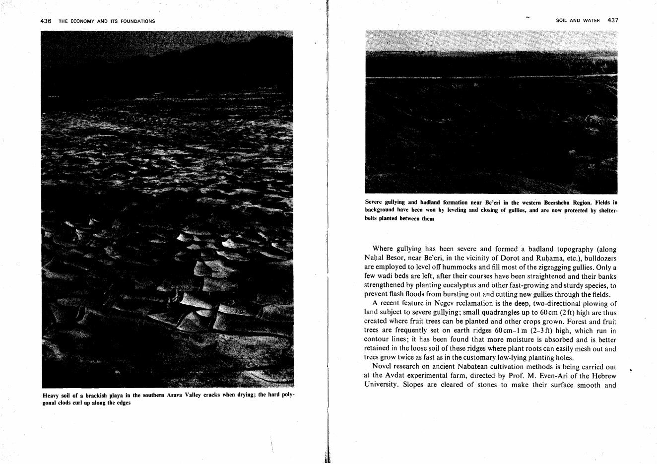
436 THE ECONOMY AND ITS FOUNDATIONS
Heavy soil of a brackish playa in the southern Arava Valley cracks when drying; the hard polygonal clods curl up along the edges
SOIL AND WATER 437
Severe gullying and badland formation near Be'eri in the western Beersheba Region. Fields inbackground have been won by leveling and closing of gullies, and are now protected by shelterbelts planted between them
Where gullying has been severe and forrned a badland topography (alongNahal Besor, near Be'eri, in the vicinity of Dorot and Ruhama, etc.), bulldozersare employed to level off hummocks and fill most of the zigzagging gullies. Only afew wadi beds are left, after their courses have been straightened and their banksstrengthened by planting eucalyptus and other fast-growing and sturdy species, toprevent flash floods from bursting out and cutting new gullies through the fields.
A recent feature in Negev reclamation is the deep, two-directional plowing ofland subject to severe gullying; small quadrangles up to 60 em (2 ft) high are th uscreated where fruit trees can be planted and other crops grown. Forest and fruittrees are frequently set on earth ridges 60cm-l In (2-3 ft) high, which run incontour lines; it has been found that more moisture is absorbed and is betterretained in the loose soil of these ridges where plant roots can easily mesh out andtrees grow twice as fast as in the customary low-lying planting holes.
Novel research on ancient Nabatean cultivation methods is being carried outat the Avdat experimental farm, directed by Prof. M. Even-Ari of the HebrewUniversity. Slopes are cleared of stones to make their surface smooth and
438 THE ECONOMY AND ITS FOUNDATIONS
promote runoff toward low-lying wadis. Cleared stones are sometimes piled up ingeometrically arranged heaps to direct the water to canals which lead it to thefields laid out inside the neatly leveled and terraced wadi courses. The crops thenreceive the rainwater falling on a manifold larger surface. Similarly, orchards areplanted experimentally in wadi beds near Be'erotayim on the Sinai border andirrigated almost exclusively by infrequent and short-lived flash floods, whose flowis regulated by protective dikes.
Negev dust storms are countered by planting shelterbelts around crop fields.These consist of 2-4 parallel rows of trees which decelerate the wind force,restrain wind erosion, and cut down the evaporation of water from the upper soilstratum caused by hot summer gusts striking over the surface. Measurementsshow that the wind slackens to 60% of its original speed to windward of theshelterbelts and to 50% on their lee side. The area protected by the trees exceedstheir own height by far, tenfold on the windward, thirtyfold on the lee side.
In the loess area of the SOuth, tamarisks are planted on earth ridges to serve as shelterbelts
SOIL AND WATER 439
Shelterbelts, mainly of eucalyptus and tamarisk, are placed at intervals of350-750 m (1,200-2,500 ft). Here, too, trees are set on earth ridges which enablethem to subsist on an annual rainfall of 200 mm (8 in) and less, without anyirrigation even in their first year of life.
Drifting sand dunes which threaten neighboring fields, roads or installations,can best be checked by tree planting. Tamarisk, eucalyptus and long-leavedacacia have been found capable of rooting themselves in' barren sand. Plantingalong the fringe of dune areas is often sufficient to protect neighboring cropfields; planting the entire surface with trees harnesses the 'dunes and, byaddingorganic material, may slowly transform them into tillable soil.
Novel use has been made of sandy tracts, particularly along the Mediterraneancoast, for growing certain species of fodder grasses. Another experiment, hithertoconducted on a very limited scale by the late Dr. H. Boyko, consists in growingcrops on coarse sand and irrigating them with large amounts of salt water; mostof the water immediately percolates to a great depth and returns to the sea. Asmall part ofit, however, evaporates, IS recondensed on the sand grains as freshwater, and is retained there colloidally for absorption by plants.
In the Hills and Foothills, the age-old art of terracing is paramount in theconservation of terra rossa and rendzina soils. Its two main stages-clearing ofrocks which hinder the plow, and construction of terrace walls-are interdependent, since the stones cleared are used for building the walls along the terraceedges. The alternating layers of hard limestone or dolomite and of soft marl in theCenomanian and Turonian formations, which give slopes a steplike appearance,are conducive to this method and explain why this country was among the first topractice terracing.
In recent years, several phases of hill reclamation have been mechanized.Terraces are laid out to be as broad as possible (depending on the slope angle).The first phase, generally, is the examination of the terrain to show whether thedepth of the soil warrants the investment. This is normally done by a rooterdrawing a furrow at the depth of about 60 em (2 ft). A novel method ofgeophysical subsoil photography is now being tested which, it is hoped, will beless expensive and reveal the subsoil structure in greater depth. The second step isdeep plowing by bulldozers, which uproot boulders and shove many of them tothe terrace edge. Where compact bedrock outcrops, dynamiting is sometimesnecessary. The remaining surface stones are piled and carried on tractor-drawnsledges to the terrace edge, where the dry stone walls are built by hand. Today,two low parallel walls are preferred; the surplus rocks and stones fill the spacein-between. All terraces are set out in exact contour lines, sinuous on the hillslopes, which are repeated by the rows of vines or fruit trees planted there. InGalilee, particularly, the garrigue or maquis brush must also be rooted out when
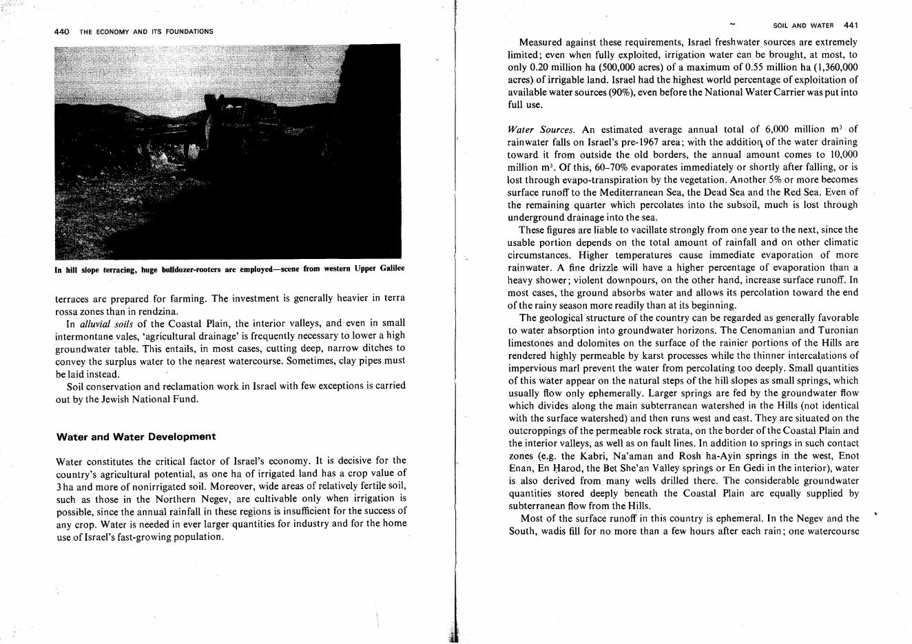
440 THE ECONOMY AND ITS FOUNDATIONS
In hill slope terracing, huge bulldozer-rooters are employed-scene from western Upper Galilee
terraces are prepared for farming. The investment is generally heavier in terrarossa zones than in rendzina.
In alluvial soils of the Coastal Plain, the interior valleys, and even in smallintermontane vales, 'agricultural drainage' is frequently necessary to lower a highgroundwater table. This entails, in most cases, cutting deep, narrow ditches toconvey the surplus water to the nearest watercourse. Sometimes, clay pipes mustbe laid instead.
Soil conservation and reclamation work in Israel with few exceptions is carriedout by the Jewish National Fund.
Water and Water Development
Water constitutes the critical factor of Israel's economy. It is decisive for thecountry's agricultural potential, as one ha of irrigated land has a crop value of3 ha and more of nonirrigated soil. Moreover, wide areas of relatively fertile soil,such as those in the Northern Negev, are cultivable only when irrigation ispossible, since the annual rainfall in these regions is insufficient for the success ofany crop. Water is needed in ever larger quantities for industry and for the homeuse of Israel's fast-growing population.
SOIL AND WATER 441
Measured against these requirements, Israel freshwater sources are extremelylimited; even when fully exploited, irrigation water can be brought, at most, toonly 0.20 million ha (500,000 acres) of a maximum of 0.55 million ha (1,360,000acres) of irrigable land. Israel had the highest world percentage of exploitation ofavailable water sources (90%), even before the National Water Carrier was put intofull use.
Water Sources. An estimated average annual total of 6,000 million m3. of
rainwater falls on Israel's pre-1967 area; with the addition of the water drainingtoward it from outside the old borders, the annual amount comes to 10,000million m". Of this, 60-70% evaporates immediately or shortly after falling, or islost through evapo-transpiration by the vegetation. Another 5% or more becomessurface runoff to the Mediterranean Sea, the Dead Sea and the Red Sea. Even ofthe remaining quarter which percolates into the subsoil, much is lost throughunderground drainage into the sea.
These figures are liable to vacillate strongly from one year to the next, since theusable portion depends on the total amount of rainfall and on other climaticcircumstances. Higher temperatures cause immediate evaporation of morerainwater. A fine drizzle will have a higher percentage of evaporation than aheavy shower; violent downpours, on the other hand, increase surface runoff. Inmost cases, the ground absorbs water and allows its percolation toward the endof the rainy season more readily than at its beginning.
The geological structure of the country can be regarded as generally favorableto water absorption into groundwater horizons. The Cenomanian and Turonianlimestones and dolomites on the surface of the rainier portions of the Hills arerendered highly permeable by karst processes while the thinner intercalations ofimpervious marl prevent the water from percolating too deeply. Small quantitiesof this water appear on the natural steps of the hill slopes as small springs, whichusually flow only ephemerally. Larger springs are fed by the groundwater flowwhich divides along the main subterranean watershed in the Hills (not identicalwith the surface watershed) and then runs west and east. They are situated on theoutcroppings of the permeable rock strata, on the border of the Coastal Plain andthe interior valleys, as well as on fault lines. In addition to springs in such contactzones (e.g. the Kabri, Na'aman and Rosh ha-Ayin springs in the west, EnotEnan, En Harod, the Bet She'an Valley springs or En Gedi in the interior), wateris also derived from. many wells drilled there. The considerable groundwaterquantities stored deeply beneath the Coastal Plain are equally supplied bysubterranean flow from the Hills.
Most of the surface runoff in this country is ephemeral. In the Negev and theSouth, wadis fill for no more than a few hours after each rain; one watercourse
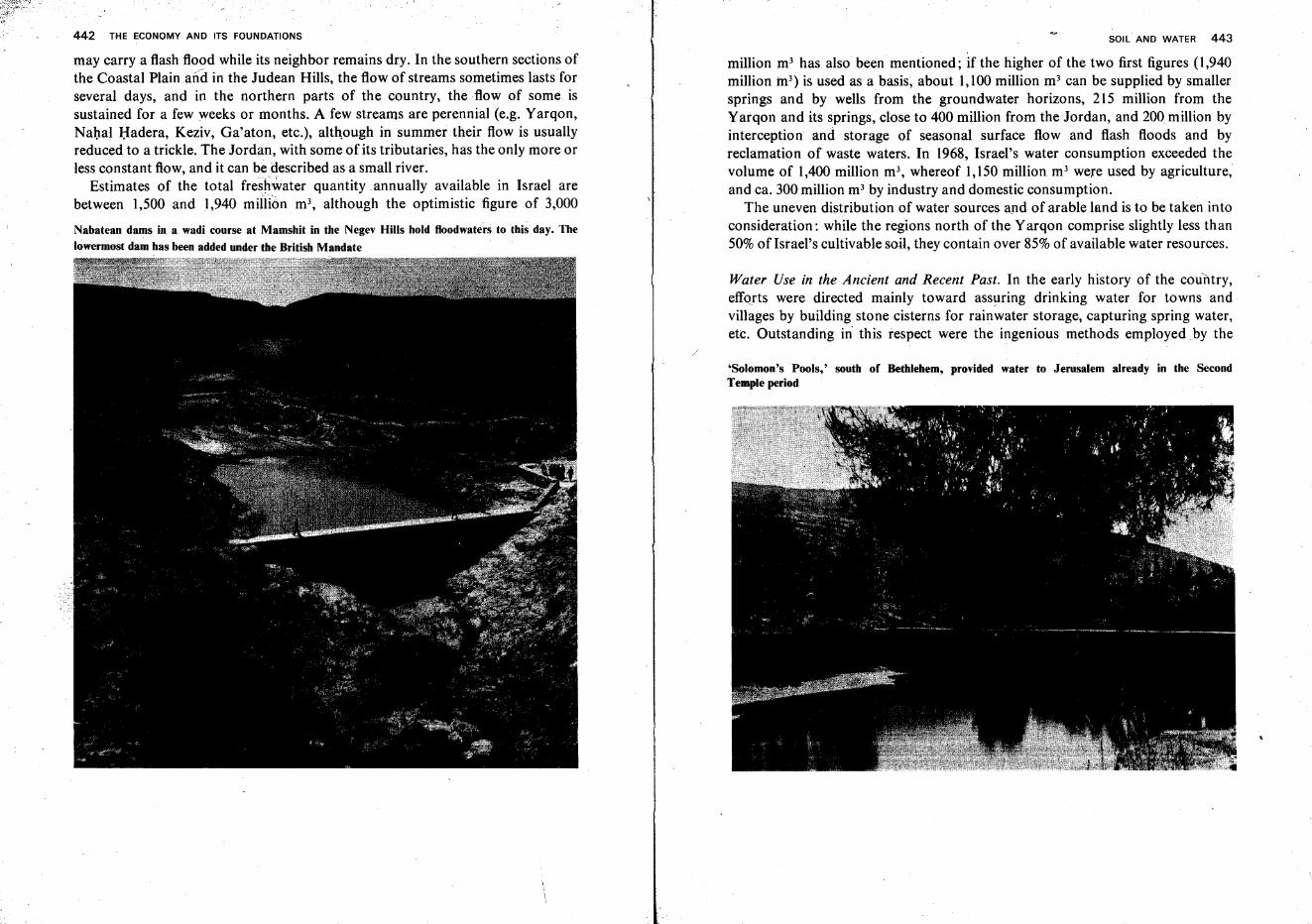
442 THE ECONOMY AND ITS FOUNDATIONS
may carry a flash flood while.its neighbor remains dry. In the southern sections ofthe Coastal Plain and in the Judean Hills, the flow of streams sometimes lasts forseveral days, and in the northern parts of the country, the flow of some issustained for a few weeks or months. A few streams are perennial (e.g. Yarqon,Nahal Hadera, Keziv, Ga'aton, etc.), although in summer their flow is usuallyreduced to a trickle. The Jordan, with some of its tributaries, has the only more orless constant flow, and it can be described asa small river.
Estimates of the total freshwater quantity annually available in Israel arebetween 1,500 and 1,940 million m", although the optimistic figure of 3,000
Nabatean dams ina wadi course at Mamshit in the Negev Hills hold floodwaters to this day. The
lowermost dam has been added under the British Mandate
SOIL AND WATER 443
million m' has also been mentioned; if the higher of the two first figures (l,940million m") is used as a basis, about 1,100 million m3 can be supplied by smallersprings and by wells from the groundwater horizons, 215 million from theYarqon and its springs, close to 400 million from the Jordan, and 200 million byinterception and storage of seasonal surface flow and flash floods and byreclamation of waste waters. In 1968, Israel's water consumption exceeded thevolume of 1,400 million m3, whereof 1,150 million m3 were used by agriculture,and ca. 300 million m! by industry and domestic consumption.
The uneven distribution of water sources and of arable land is to be taken intoconsideration: while the regions north of the Yarqon comprise slightly less than50% of Israel's cultivable soil, they contain over 85%of available water resources.
Water Use in the Ancient and Recent Past. In the early history of the country,efforts were directed mainly toward assuring drinking water for towns and
~ ~
villages by building stone cisterns for rainwater storage, capturing spring water,etc. Outstanding in this respect were the ingenious methods employed. by the
'Solomon's Pools,' south of Bethlehem, provided water to Jerusalem already in the SecondTemple period
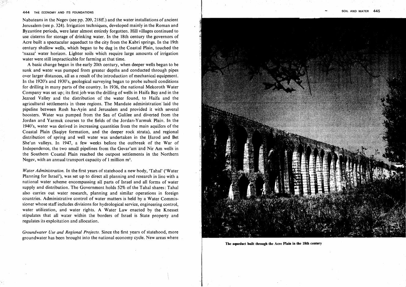
444 THE ECONOMY AND ITS FOUNDATIONS
Nabateans in the Negev (see pp. 209, 218ff.) and the water installations of ancientJerusalem (see p. 324). Irrigation techniques, developed mainly in the Roman andByzantine periods, were later almost entirely forgotten. Hill villages continued touse cisterns for storage of drinking water. In the 18th century the governors ofAcre built a spectacular aqueduct to the city from the Kabri springs. In the 19thcentury shallow wells, which began to be dug in the Coastal Plain, touched the'nazaz' water horizon. Lighter soils which require large amounts of irrigationwater were still impracticable for farming at that time.
A basic change began in the early 20th century, when deeper wells began to besunk and water was pumped from greater depths and conducted through pipesover larger distances, all as a result of the introduction of mechanical equipment.In the 1920's and 1930's, geological surveying began to probe subsoil conditionsfor drilling in many parts of the country. In 1936, the national Mekoroth WaterCompany was set up; its first job was the drilling of wells in Haifa Bay and in theJezreel Valley and the distribution of the water found, to Haifa and theagricultural settlements in these regions. The Mandate administration' laid thepipeline between Rosh ha-Ayin and Jerusalem and provided it with severalboosters. Water was pumped from the Sea of Galilee and diverted from theJordan and Yarmuk courses to the fields of the Jordan-Yarmuk Plain. In the1940's, water was derived in increasing quantities from the main aquifers of theCoastal Plain (Saqiye formation, and the deeper rock strata), and regionaldistribution of spring and well water was undertaken in the Harod and BetShe'an valleys. In 1947, a few weeks before the outbreak of the War ofIndependence, the two small pipelines from the Gevar'amandNir Am wells inthe Southern Coastal Plain reached the outpost settlements in the NorthernNegev, with an annual transport capacity of 1 million m",
Water Administration. In the first years of statehood a new body, 'Tahal' ('WaterPlanning for Israel'), was set up to direct all planning and research in line with anational water scheme encompassing all parts of Israel and all forms of watersupply and distribution. The Government holds 52% of the Tahal shares: Tahalalso carries out water research, planning and similar operations in foreigncountries. Administrative control of water matters is held by a Water Commissioner whose staff includes divisions for hydrological service, engineering control,water utilization, and water rights. A Water Law enacted by the Knessetstipulates that all water within the borders of Israel is State property andregulates its exploitation and allocation.
Groundwater Use and Regional Projects. Since the first years of statehood, moregroundwater has been brought into the national economy cycle. New areas where
SOIL AND WATER 445
The aqueduct built through the Acre Plain in the 18th century
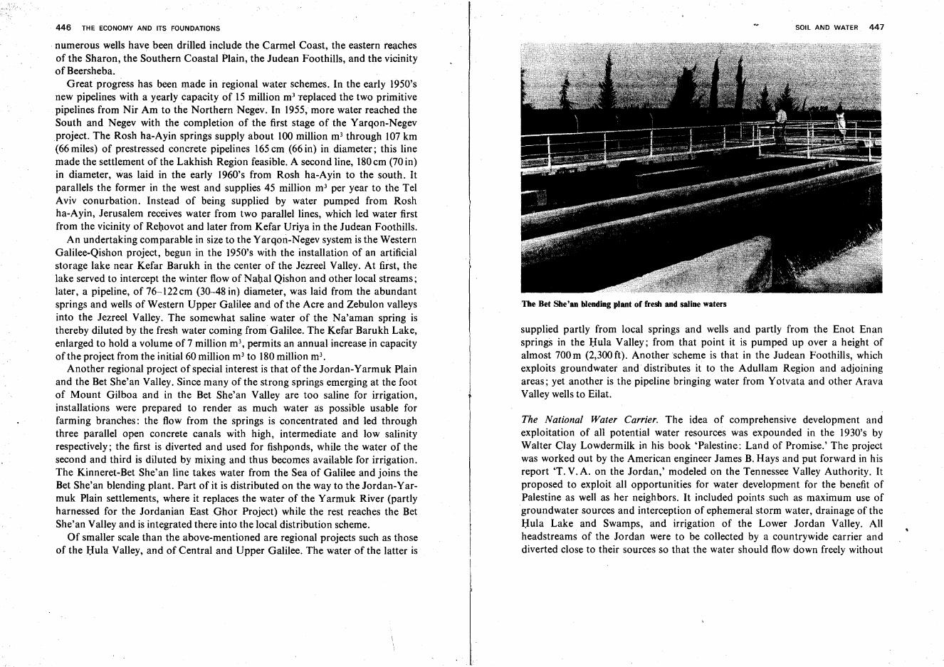
446 THE ECONOMY AND ITS FOUNDATIONS
. numerous wells have been drilled include the Carmel Coast, the eastern reachesof the Sharon, the Southern Coastal Plain, the Judean Foothills, and the vicinityof Beersheba.
Great progress has been made in regional water schemes. In the early 1950'snew pipelines with a yearly capacity of 15 million m" replaced the two primitivepipelines from Nir Am to the Northern Negev. In 1955, more water reached theSouth and Negev with the completion of the first stage of the Yarqon-Negevproject. The Rosh ha-Ayin springs supply about 100 million m! through 107 km(66 miles) of prestressed concrete pipelines 165em (66 in) in diameter; this linemade the settlement of the Lakhish Region feasible. A second line, 180em (70 in)in diameter, was laid in the early 1960's from Rosh ha-Ayin to the south. Itparallels the former in the west and supplies 45 million m- per year to the TelAviv conurbation. Instead of being supplied by water pumped from Roshha-Ayin, Jerusalem receives water from two parallel lines, which led water firstfrom the vicinity of Rehovot and later from Kefar Uriya in the Judean Foothills.
An undertaking comparable in size to the Yarqon-Negev system is the WesternGalilee-Qishon project, begun in the 1950's with the installation of an artificialstorage lake near. Kefar Barukh in the center of the Jezreel Valley. At first, thelake served to intercept the winter flow of Nahal Qishon and other local streams;later, a pipeline, of 76-122 em (30-48 in) diameter, was laid from the abundantsprings and wells of Western Upper Galilee and of the Acre and Zebulon valleysinto the Jezreel Valley. The somewhat saline water of the Na'aman spring isthereby diluted by the fresh water coming from Galilee. The Kefar Barukh Lake,enlarged to hold a volume of 7 million m', permits an annual increase in capacityof the project from the initial 60 million m3 to 180million m",
Another regional project of special interest is that of the Jordan-Yarmuk Plainand the Bet She'an Valley. Since many of the strong springs emerging at the footof Mount Gilboa and in the Bet She'an Valley are too saline for irrigation,installations were prepared to render as much water as possible usable forfarming branches: the flow from the springs is concentrated and led throughthree parallel open concrete canals with high, intermediate and low salinityrespectively; the first is diverted and used for fishponds, while the water of thesecond and third is diluted by mixing and thus becomes available for irrigation.The Kinneret-Bet She'an line takes water from the Sea of Galilee and joins theBet She'an blending plant. Part of it is distributed on the way to the Jordan-Yarmuk Plain settlements, where it replaces the water of the Yarmuk River (partlyharnessed for the Jordanian East Ghor Project) while the rest reaches the BetShe'an Valley and is integrated there into the local distribution scheme.
Of smaller scale than the above-mentioned are regional projects such as thoseof the Hula Valley, and of Central and Upper Galilee. The water of the latter is
SOIL AND WATER 447
Tbe Bet Sbe'an blending plant of fresh and saline waters
supplied partly from local springs and wells and partly from the Enot Enansprings in the Hula Valley; from that point it is pumped up over a height ofalmost 700 m (2,300 ft). Another scheme is that in the Judean Foothills, whichexploits groundwater and distributes it to the Adullam Region and adjoiningareas; yet another is the pipeline bringing water from Yotvata and other AravaValley wells to Eilat.
The National Water Carrier. The idea of comprehensive development andexploitation of all potential water resources was expounded in the 1930's byWalter Clay Lowdermilk in his book 'Palestine: Land of Promise.' The projectwas worked out by the American engineer James B.Hays and put forward in hisreport 'T. V. A. on the Jordan,' modeled on the Tennessee Valley Authority. Itproposed to exploit all opportunities for water development for the benefit ofPalestine as well as her neighbors. It included points such as maximum use ofgroundwater sources and interception of ephemeral storm water, drainage of theHula Lake and Swamps, and irrigation of the Lower Jordan Valley. Allheadstreams of the Jordan were to be collected by a countrywide carrier anddiverted close to their sources so that the water should flow down freely without
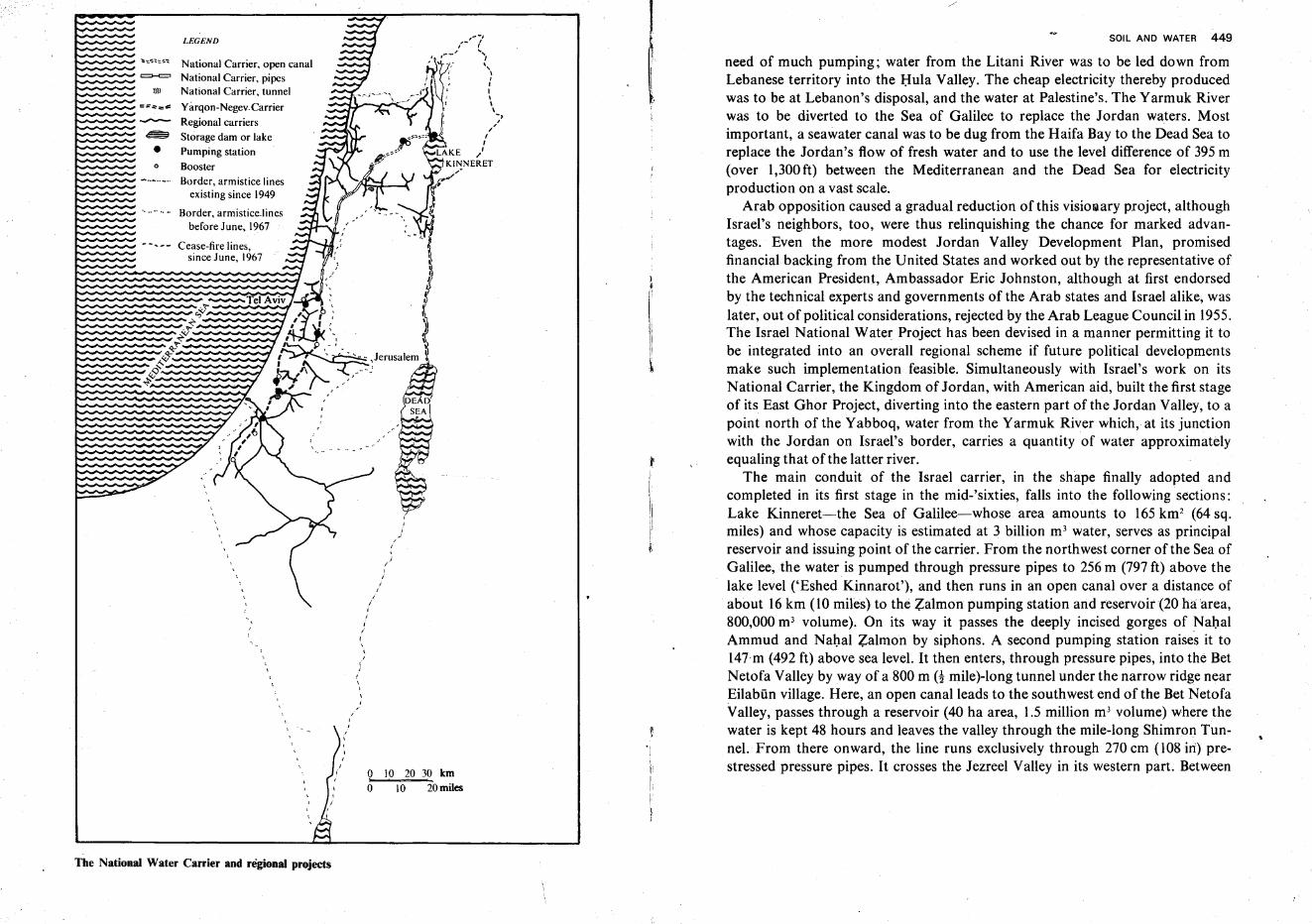
~ - - ~ - Cease-fire lines,
=--=»l)
~
•o
LEGEND
National Carrier, open canalNational Carrier, pipesNational Carrier, tunnel
Yarqon-Negev. Carrier
Regional carriers
Storage dam or lake
Pumping station
Booster
Border, armistice linesexisting since 1949
Border, armistice.linesbefore June, 1967
since June, 1967
,-'
/,
o 10 20 30 km
o 10 20 miles
SOIL AND WATER 449
need of much pumping; water from the Litani River was to be led down fromLebanese territory into the Hula Valley. The cheap electricity thereby producedwas to be at Lebanon's disposal, and the water at Palestine's. The Yarmuk Riverwas to be diverted to the Sea of Galilee to replace the Jordan waters. Mostimportant, a seawater canal was to be dug from the Haifa Bay to the Dead Sea toreplace the Jordan's flow of fresh water and to use the level difference of 395m(over 1,300ft) between the Mediterranean and the Dead Sea for electricityproduction on a vast scale.
Arab opposition caused a gradual reduction of this visionary project, althoughIsrael's neighbors, too, were thus relinquishing the chance for marked advantages. Even the more modest Jordan Valley Development Plan, promisedfinancial backing from the United States and worked out by the representative ofthe American President, Ambassador Eric Johnston, although at first endorsedby the technical experts and governments of the Arab states and Israel alike, waslater, out of political considerations, rejected by the Arab League Council in 1955.The Israel National Water Project has been devised in a manner permitting it tobe integrated into an overall regional scheme if future political developmentsmake such implementation feasible. Simultaneously with Israel's work on itsNational Carrier, the Kingdom of Jordan, with American aid, built the first stageof its East Ghor Project, diverting into the eastern part of the Jordan Valley, to apoint north of the Yabboq, water from the Yarmuk River which, at its junctionwith the Jordan on Israel's border, carries a quantity of water approximatelyequaling that ofthe latter river.
The main conduit of the Israel carrier, in the shape finally adopted andcompleted in its first stage in the mid-'sixties, falls into the following sections:Lake Kinneret-the Sea of Galilee-whose area amounts to 165km2 (64 sq.miles) and whose capacity is estimated at 3 billion m' water, serves as principalreservoir and issuing point of the carrier. From the northwest corner ofthe Sea ofGalilee, the water is pumped through pressure pipes to 256m (797 ft) above thelake level ('Eshed Kinnarot'), and then runs in an open canal over a distance ofabout 16 km (10 miles) to the Zalmon pumping station and reservoir (20 haarea,800,000 m- volume). On its way it passes the deeply incised gorges of NahalAmmud and Nahal Zalmon by siphons. A second pumping station raises it to147'm (492 ft) above sea level. It then enters, through pressure pipes, into the BetNetofa Valley by way of a 800 m H mile)-long tunnel under the narrow ridge nearEilabiin village. Here, an open canal leads to the southwest end of the Bet NetofaValley, passes through a reservoir (40 ha area, 1.5 million m3 volume) where thewater is kept 48 hours and leaves the valley through the mile-long Shimron Tunnel. From there onward, the line runs exclusively through 270 em (108 in) prestressed pressure pipes. It crosses the Jezreel Valley in its western part. Between
The National Water Carrier and regional projects
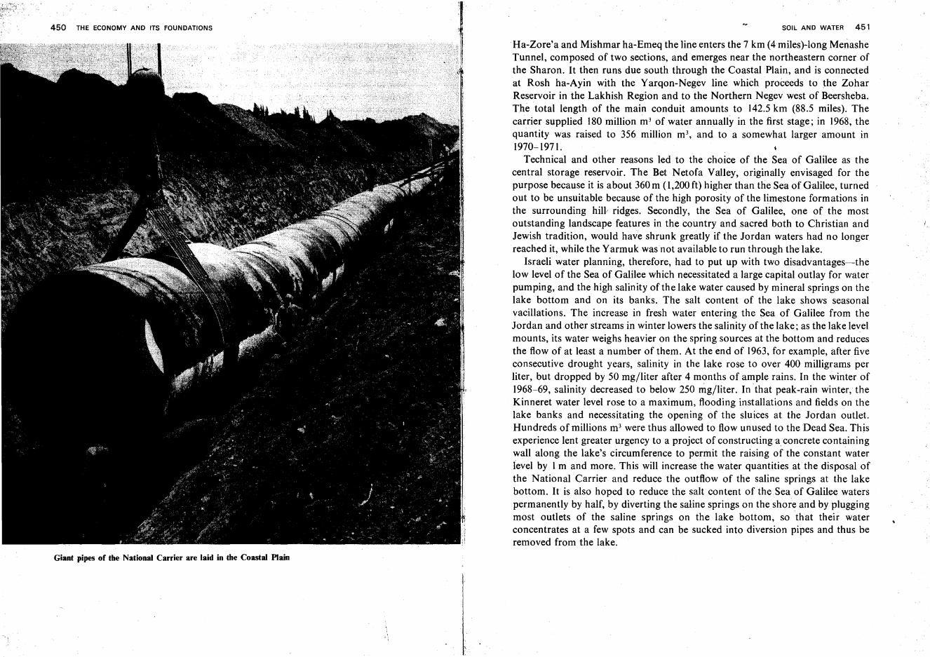
450 THE ECONOMY AND ITS FOUNDATIONS
Giant pipes of the National Carrier are laid in the Coastal Plain
SOIL AND WATER 451
Ha-Zore'a and Mishmar ha-Emeq the line enters the 7 km (4miles)-long MellasheTunnel, composed of two sections, and emerges near the northeastern corner ofthe Sharon. It then runs due south through the Coastal Plain, and is connectedat Rosh ha-Ayin with the Yarqon-Negev line which proceeds to the ZoharReservoir in the Lakhish Region and to the Northern Negev west of Beersheba.The total length of the main conduit amounts to 142.5 km (88.5 miles). Thecarrier supplied 180 million m- of water annually in the first stage; in 1968, thequantity was raised to 356 million m', and to a somewhat larger amount in1970-1971.
Technical and other reasons led to the choice of the Sea of Galilee as thecentral storage reservoir. The Bet Netofa Valley, originally envisaged for thepurpose because it is about 360 m (1,200 ft) higher than the Sea of Galilee, turnedout to be unsuitable because of the high porosity ofthe limestone formations inthe surrounding hill/ ridges. Secondly, the Sea of Galilee, one of the mostoutstanding landscape features in the country and sacred both to Christian andJewish tradition, would have shrunk greatly if the Jordan waters had no longerreached it, while the Yarmuk was not available to run through the lake.
Israeli water planning, therefore, had to put up with two disadvantages-thelow level of the Sea of Galilee which necessitated a large capital outlay for waterpumping, and the high salinity of the lake water caused by mineral springs on thelake bottom and on its banks. The salt content of the lake shows seasonalvacillations. The increase in fresh water entering the Sea of Galilee from theJordan and other streams in winter lowers the salinity of the lake; as the lake levelmounts, its water weighs heavier on the spring sources at the bottom and reducesthe flow of at least a number of them. At the end of 1963, for example, after fiveconsecutive drought years, salinity in the lake rose to over 400 milligrams perliter, but dropped by 50 mg/liter after 4 months of ample rains. In the winter of1968-69, salinity decreased to below 250 mg/Iiter. In that peak-rain winter, theKinneret water level rose to a maximum, flooding installations and fields on thelake banks and necessitating the opening of the sluices at the Jordan outlet.Hundreds of millions m' were thus allowed to flow unused to the Dead Sea. Thisexperience lent greater urgency to a project of constructing a concrete containingwall along the lake's circumference to permit the raising of the constant waterlevel by 1m and more. This will increase the water quantities at the disposal ofthe National Carrier and reduce the outflow of the saline springs at the lakebottom. It is also hoped to reduce the salt content of the Sea of Galilee waterspermanently by half, by diverting the saline springs on the shore and by pluggingmost outlets of the saline springs on the lake bottom, so that their waterconcentrates at a few spots and can be sucked into diversion pipes and thus beremoved from the lake.
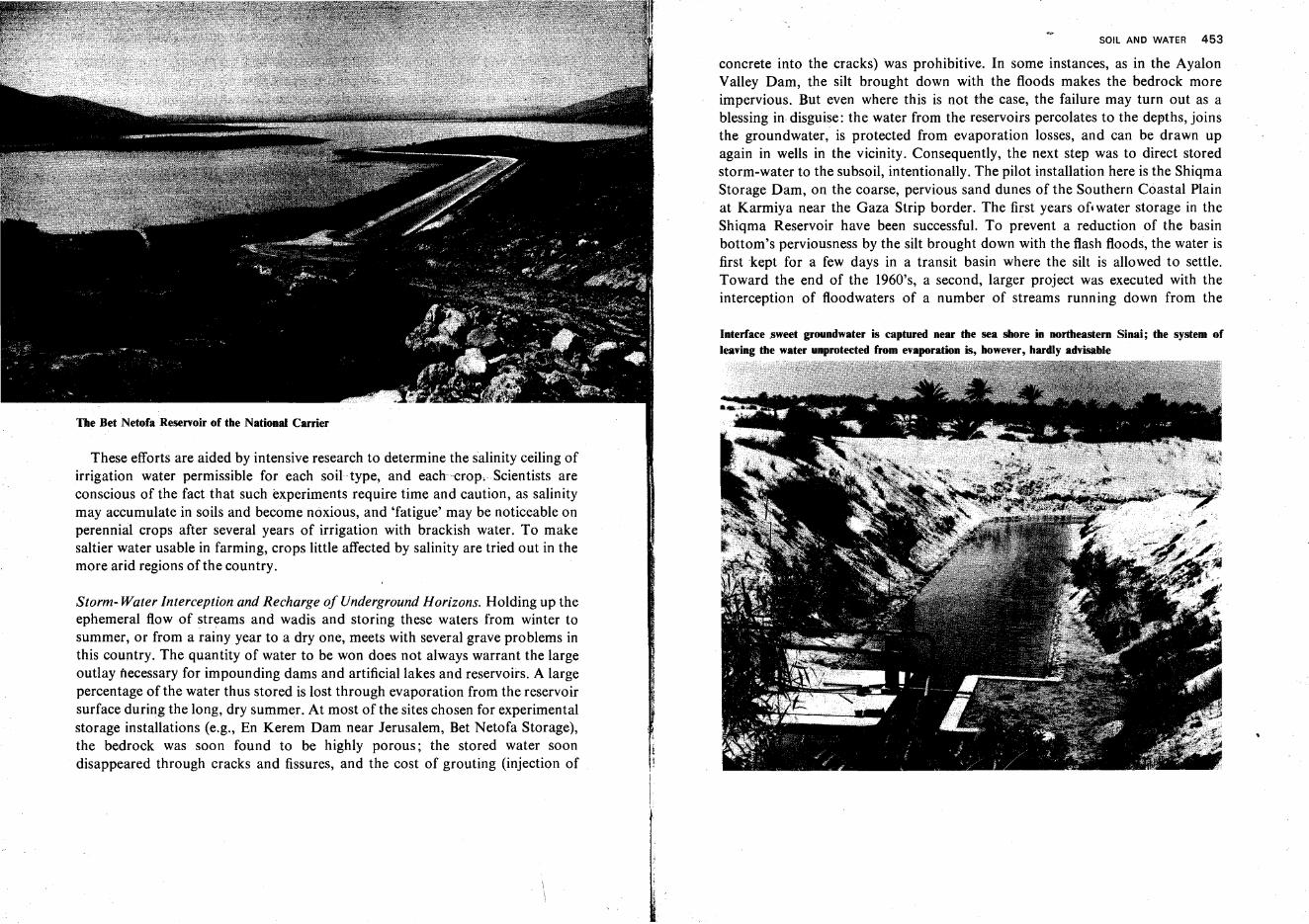
The Bet Netofa Reservoir of the National Carrier
These efforts are aided by intensive research to determine the salinity ceiling ofirrigation water permissible for each soil type, and each-crop. Scientists areconscious of the fact that such experiments require time and caution, as salinitymay accumulate in soils and become noxious, and 'fatigue' may be noticeable onperennial crops after several years of irrigation with brackish water. To makesaltier water usable in farming, crops little affected by salinity are tried out in themore arid regions of the country.
Storm- Water Interception and Recharge of Underground Horizons. Holding up theephemeral flow of streams and wadis and storing these waters from winter tosummer, or from a rainy year to a dry one, meets with several grave problems inthis country. The quantity of water to be won does not always warrant the largeoutlay necessary for impounding dams and artificial lakes and reservoirs. A largepercentage of the water thus stored is lost through evaporation from the reservoirsurface during the long, dry summer. At most of the sites chosen for experimentalstorage installations (e.g., En Kerem Dam near Jerusalem, Bet Netofa Storage),the bedrock was soon found to be highly porous; the stored water soondisappeared through cracks and fissures, and the cost of grouting (injection of
SOIL AND WATER 453
concrete into the cracks) was prohibitive. In some instances, as in the AyalonValley Dam, the silt brought down with the floods makes the bedrock moreimpervious. But even where this is not the case, the failure may turn out as ablessing in disguise: the water from the reservoirs percolates to the depths, joinsthe groundwater, is protected from evaporation losses, and can be drawn upagain in wells in the vicinity. Consequently, the next step was to direct storedstorm-water to the subsoil, intentionally. The pilot installation here is the ShiqmaStorage Dam, on the coarse, pervious sand dunes of the Southern Coastal Plainat Karmiya near the Gaza Strip border. The first years of. water storage in theShiqma Reservoir have been successful. To prevent a reduction of the basinbottom's perviousness by the silt brought down with the flash floods, the water isfirst kept for a few days in a transit basin where the silt is allowed to settle.Toward the end of the 1960's, a second, larger project was executed with theinterception of floodwaters of a number of streams running down from the
Interface .sweet groundwater is captured near the sea shore in northeastern Sinai; the system ofleaving the water unprotected from evaporation is, however, hardly advisable
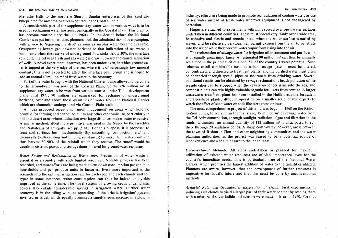
454 THE ECONOMY AND ITS FOUNDATIONS
Menashe Hills to the northern Sharon. Similar enterprises of this kind areblueprinted for most major stream courses in the Coastal Plain.
A considerable part of the supplementary water won in various ways is to beused for recharging water horizons, principally in the Coastal Plain. This practicehas become routine since the late 1960's. In the decade before the NationalCarrier was put into operation, planners took the calculated risk of overpumping,with a view to 'repaying the debt' as soon as surplus water became available.Overpumping lowers groundwater horizons so that infiltration of sea water isimminent; when the reserve of underground flow sinks below 30%, the interface(dividing line between fresh and sea water) is drawn upward and causes salinationof wells. A novel experiment, however, has been undertaken,in which groundwater is tapped at the very edge of the sea, where it is of surprisingly low mineralcontent; this is not expected to affect the interface equilibrium and is hoped toadd an annual 40 million m! of fresh water to the economy.
Part of the water brought with the National Carrier is also allowed to percolateto the groundwater horizons of the Coastal Plain. Of the 276 million m3 ofsupplementary water to be won from various sources under Tahal developmentplans until 1971, 70 million are earmarked for recharge of undergroundhorizons, over and above those quantities of water from the National Carrierwhich are channeled underground via Coastal Plain wells.
An idea proposed recently is 'runoff inducement' on areas which hold nopromise for farming and cannot be put to any other economic use, particularly inhill and desert areas where adduction over large distances makes water expensive.A similar method, albeit more primitive, was used in the Negev by the Israelitesand Nabateans of antiquity (see pp. 218f.). For this purpose, it is proposed totreat soil surfaces both mechanically (by smoothing, compaction, etc.) andchemically (with crusting and binding substances) to make them waterproof andthus harvest 80-90% of the rainfall which they receive. The runoff would becaught in cisterns, ponds and storage dams, or used for groundwater recharge.
Water Saving and Reclamation of Wastewater. Prevention of water waste isessential in a country with such limited resources. Notable progress has beenrecorded, and more efforts are being made to cut down consumption per capita inhouseholds and per produce units in factories. Even more important is theresearch into the optimal irrigation rate for each crop and each climate and soiltype; in some instances, water consumption can thus be halved and yieldsimproved at the same time. The novel system of growing crops under plasticcovers also entails considerable savings in irrigation water. Further watereconomy is in the offing with the spreading of the 'trickle irrigation'system,invented in Israel, which equally promises a simultaneous increase in yields. In
I1~
Ii
SOIL AND WATER 455
industry, efforts are being made to promote recirculation of cooling water, or useof sea water instead of fresh water wherever equipment is not endangered bycorrosion.
Hopes are attached to experiments with films spread over open water surfacesundertaken in different countries. These must spread very thinly over a wide area,be cohesive and elastic and remain intact when the water surface is curled bywaves, and be selectively pervious, i.e., permit oxygen from the air to penetrateinto the water while they prevent water vapor from rising into the air.
The reclamation of sewage water for irrigation after treatment and purificationis of equally great importance. An estimated 90 million m3 can thus be annuallyreclaimed in the principal cities alone, 5% of the country's water potential. Suchschemes entail considerable cost, as urban sewage systems must be altered,concentrated, and directed to treatment plants, and the purified water must oftenbe channeled through special pipes to separate it from drinking water. Severaladditional results can be obtained by sewage reclamation: beach pollution of theseaside cities can be stopped when the sewers no longer issue into the sea, andcompost plants can win highly valuable organic fertilizers from sewage. A largerwastewater treatment plant has been installed in the Haifa area; the Jerusalemand Beersheba plants, although operating on a smaller scale, enable experts towatch the effect of such water on soils like terra rossa or loess.
The most comprehensive project of this kind was begun in 1968 on the Rishonle-Zion dunes, to reclaim, in the first stage, 15 million m' of sewage water fromthe Tel Aviv conurbation, through sunlight radiation, algae and filtration in thesands. Ultimately, an annual quantity of 112 million m' is anticipated to runthere through 20 oxidation ponds. A sharp controversy, however, arose betweenthe town of Rishon le-Zion and other neighboring communities and the waterplanning authorities, as the project was feared to be a potential source ofinconvenience and a health hazard to the inhabitants.
Unconventional Methods. All steps undertaken or planned for maximumutilization of existent water resources are of vital importance, even for thecountry's immediate needs. This is particularly true of the National WaterCarrier, which promises the largest addition of water to the quantities utilized.Planners are aware, however, that the development of further resources isimperative for Israel's future and that this must be done by unconventionalmethods.
Artificial Rain, and Groundwater Exploration at Depth. First experiments ininducing rain clouds to yield a larger part of their water content by seeding themwith a mixture of silver iodide and acetone were made in Israel in 1960. For that
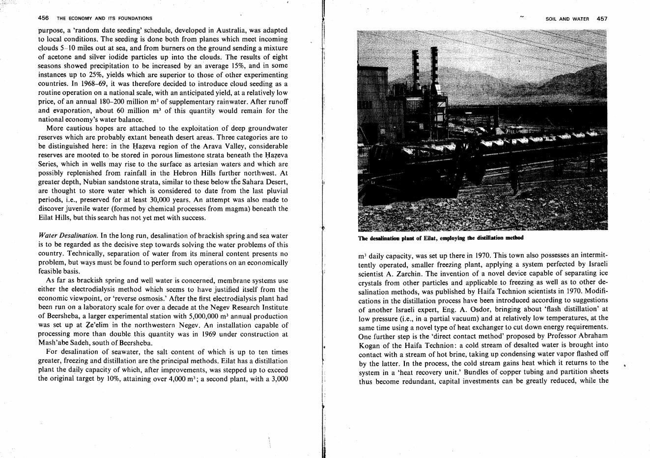
456 THE ECONOMY AND ITS FOUNDATIONS
purpose, a 'random date seeding' schedule, developed in Australia, was adaptedto local conditions. The seeding is done both from planes which meet incomingclouds 5-10 miles out at sea, and from burners on the ground sending a mixtureof acetone and silver iodide particles up into the clouds. The results of eightseasons showed precipitation to be increased by an average 15%, and in someinstances up to 25%, yields which are superior to those of other experimentingcountries. In 1968-69, it was therefore decided to introduce cloud seeding as aroutine operation on a national scale, with an anticipated yield, at a relatively lowprice, of an annual 180-200 million m3 of supplementary rainwater. After runoffand evaporation, about 60 million m- of this quantity would remain for thenational economy's water balance.
More cautious hopes are attached to the exploitation of deep groundwaterreserves which are probably extant beneath desert areas. Three categories are tobe distinguished here: in the Hazeva region of the Arava Valley, considerablereserves are mooted to be stored in porous limestone strata beneath the HazevaSeries, which in wells may rise to the surface as artesian waters and which arepossibly replenished from rainfall in the Hebron Hills further northwest. Atgreater depth, Nubian sandstone strata, similar to these below the Sahara Desert,are thought to store water which is considered to date from the last pluvialperiods, i.e., preserved for at least 30,000 years. An attempt was also made todiscover juvenile water (formed by chemical processes from magma) beneath theEilat Hills, but this search has not yet met with success.
Water Desalination. In the long run, desalination of brackish spring and sea wateris to be regarded as the decisive step towards solving the water problems of thiscountry. Technically, separation of water from its mineral content presents noproblem, but ways must be found to perform such operations 0.0 an economicallyfeasible basis.
As far as brackish spring and well water is concerned, membrane systems useeither the electrodialysis method which seems to have justified itself from theeconomic viewpoint, or 'reverse osmosis.' After the first electrodialysis plant hadbeen run on a laboratory scale for over a decade at the Negev Research Instituteof Beersheba, a larger experimental station with 5,000,000 m' annual productionwas set up at Ze'elim in the northwestern Negev. An installation capable ofprocessing more than double this quantity was in 1969 under construction atMash'abe Sadeh, south of Beersheba.
For desalination of seawater, the salt content of which is up to ten timesgreater, freezing and distillation are the principal methods. Eilat has a distillationplant the daily capacity of which, after improvements, was stepped up to exceedthe original target by 10%, attaining over 4,000 m"; a second plant, with a 3,000
SOIL AND WATER 457
The desalination plant of Eilat, employing the distillation method
m- daily capacity, was set up there in 1970. This town also possesses an intermittently operated, smaller freezing plant, applying a system perfected by Israeliscientist A. Zarchin. The invention of a novel device capable of separating icecrystals from other particles and applicable to freezing as well as to other desalination methods, was published by Haifa Technion scientists in 1970. Modifications in the distillation process have been introduced according to suggestionsof another Israeli expert, Eng. A. Osdor, bringing about 'flash distillation' atlow pressure (i.e., ina partial vacuum) and at relatively low temperatures, at thesame time using a novel type of heat exchanger to cut down energy requirements.One further step is the 'direct contact method' proposed by Professor AbrahamKogan of the Haifa Technion: a cold stream of desalted water is brought intocontact with a stream of hot brine, taking up condensing water vapor flashed offby the latter. In the process, the cold stream gains heat which it returns to thesystem in a 'heat recovery unit.' Bundles of copper tubing and partition sheetsthus become redundant, capital investments can be greatly reduced, while the
458 THE ECONOMY AND ITS FOUNDATIONS
heat transfer becomes much more efficient and the need for an outside supply ofenergy is reduced. As the water won in all these forms is virtually salt-free, itcan dilute more brackish water and thus further increase usable quantities.
In 1964, the United States of America agreed in principle to cooperate withIsrael in this field, and make this country a pilot plant for the solution of thisproblem of world-wide importance. President Johnson, as one of his last acts inoffice, presented to Congress a bill for a grant-in-aid to Israel amounting to 40million dollars, and a further loan of 18 million for this purpose. Israel is todecide whether to operate the installation with conventional fuel or with atomicpower. In all events, the proposed plant is to be a double- or triple-purposeinstallation, combining the production of electric power with desalination and,eventually as a by-product, also winning chemicals from the seawater. Althoughthe original blueprint of the plant capable of producing 100million m3 of desaltedwater was, for technical reasons, reduced to a capacity of 50 million, it willcertainly be, for some time to come, the largest installation of its kind, andprovide experts from all interested nations with the opportunity to investigatethis sphere.
i,
!I
I,
\
I
Agriculture
General Conditions
Among the factors determining the character of farming in Israel are the dearthof principal resources-soil and water-and the great variety in climatic andother conditions. The latter are conducive to a wide range of branches,cultivation systems and crops, all in an extremely limited area. About 4,500 km 2
(1,112,000 acres) of the pre-1967 surface of Israel are estimated as capable ofyielding crops without irrigation, with another 1,000-1,500km2 (247,000-371,000acres) capable only when water is brought from afar. An additional 2,000-3,000km2 (494,000-741,000 acres) are, to some extent, usable for pasture or afforestation.*
It is therefore clear that Israel's agriculture must strive for maximumintensivity and efficiency. As labor for Israel farming is neither cheap norabundant, mechanization is stressed. This tendency often leads to problems, inview of the small size of most farming units. The collective or cooperative form offarming, however, aids full utilization of heavy equipment, as one set can serve avillage or even a group of villages. Each of the 'rural centers,' established in theframework of regional planning, is provided with large tractor garages and repairshops. Local industry, especially factories located in kibbutzim, have broughtonto the market smaller types of agricultural machinery or tools specificallyadapted to local conditions, such as mountain plows, small tractors, etc.Increasing mechanization reduces the amount of labor in relation to yield.Another trend is towards farm specialization in one or a few particular branches,most of them capital- and labor-intensive and export-oriented. Countrywide andregional planning and allocation of production quotes for each crop have largely
* The agriculture of the areas under Israel's administration since 1967 and its branches are described in the relevant chapters, i.e., Sinai, pp. 359-363; Gaza Strip, pp. 392-393; Judea
Samaria, pp. 404-408; Golan, p. 422.
459
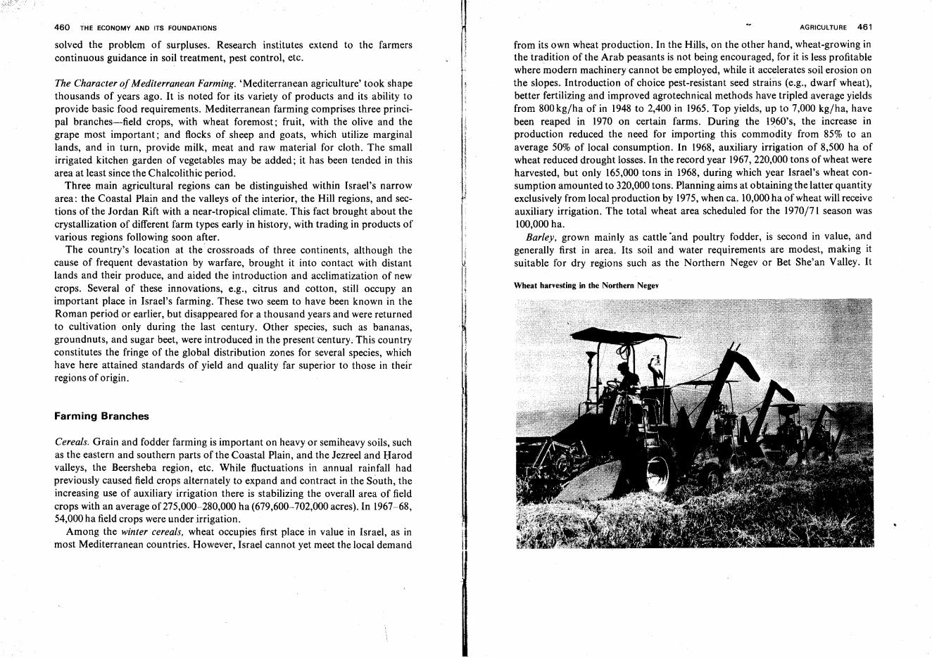
460 THE ECONOMY AND ITS FOUNDATIONS
solved the problem of surpluses. Research institutes extend to the farmerscontinuous guidance in soil treatment, pest control, etc.
The Character ofMediterranean Farming. 'Mediterranean agriculture' took shapethousands of years ago. It is noted for its variety of products and its ability toprovide basic food requirements. Mediterranean farming comprises three principal branches-field crops, with wheat foremost; fruit, with the olive and thegrape most important; and flocks of sheep and goats, which utilize marginallands, and in turn, provide milk, meat and raw material for cloth. The smallirrigated kitchen garden of vegetables may be added; it has been tended in thisarea at least since the Chalcolithic period.
Three main agricultural regions can be distinguished within Israel's narrowarea: the Coastal Plain and the valleys of the interior, the Hill regions, and sections of the Jordan Rift with a near-tropical climate. This fact brought about thecrystallization of different farm types early in history, with trading in products ofvarious regions following soon after.
The country's location at the crossroads of three continents, although thecause of frequent devastation by warfare, brought it into contact with distantlands and their produce, and aided the introduction and acclimatization of newcrops. Several of these innovations, e.g., citrus and cotton, still occupy animportant place in Israel's farming. These two seem to have been known in theRoman period or earlier, but disappeared for a thousand years and were returnedto cultivation only during the last century. Other species, such as bananas,groundnuts, and sugar beet, were introduced in the presentcentury; This countryconstitutes the fringe of the global distribution zones for several species, whichhave here attained standards of yield and quality far superior to those in theirregions of origin.
Farming Branches
Cereals. Grain and fodder farming is important on heavy or semiheavy soils, suchas the eastern and southern parts of the Coastal Plain, and the Jezreel and Harodvalleys, the Beersheba region, etc. While fluctuations in annual rainfall hadpreviously caused field crops alternately to expand and contract in the South, theincreasing use of auxiliary irrigation there is stabilizing the overall area offieldcrops with an average of 275,000-280,000 ha (679,600-702,000 acres). In 1967-68,54,000ha field crops were under irrigation.
Among the winter cereals, wheat occupies first place in value in Israel, as inmost Mediterranean countries. However, Israel cannot yet meet the local demand
AGRICULTURE 461
from its own wheat production. In the Hills, on the other hand, wheat-growing inthe tradition of the Arab peasants is not being encouraged, for it is less profitablewhere modern machinery cannot be employed, while it accelerates soil erosion onthe slopes. Introduction of choice pest-resistant seed strains (e.g., dwarf wheat),better fertilizing and improved agrotechnical methods have tripled average yieldsfrom 800kg/ha of in 1948 to 2,400 in 1965. Top yields, up to 7,000 kg/ha, havebeen reaped in 1970 on certain farms. During the 1960's, the increase inproduction reduced the need for importing this commodity from 85% to anaverage 50% of local consumption. In 1968, auxiliary irrigation of 8,500 ha ofwheat reduced drought losses. In the record year 1967,220,000 tons of wheat wereharvested, but only 165,000 tons in 1968, during which year Israel's wheat consumption amounted to 320,000tons. Planning aims at obtaining the latter quantityexclusively from local production by 1975,when ca. 10,000ha of wheat will receiveauxiliary irrigation. The total wheat area scheduled for the 1970/71 season was100,000ha.
Barley, grown mainly as cattle 'and poultry fodder, is second in value, andgenerally first in area. Its soil and water requirements are modest, making itsuitable for dry regions such as the Northern Negev or Bet She'an Valley. It
Wheat harvesting in the Northern Negev
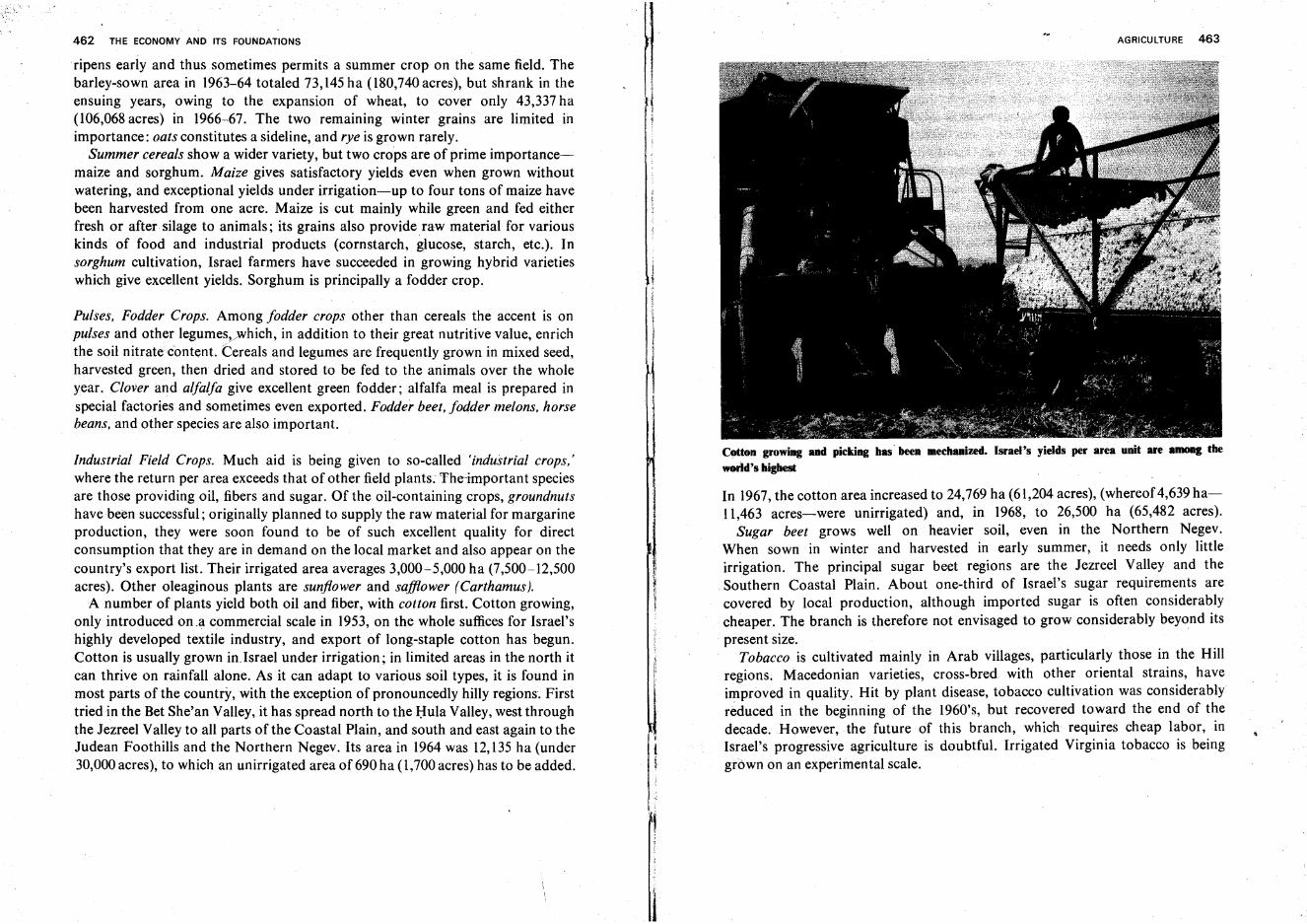
462 THE ECONOMY AND ITS FOUNDATIONS
ripens early and thus sometimes permits a summer crop on the same field. Thebarley-sown area in 1963-64 totaled 73,145ha(l80,740acres), but shrank in theensuing years, owing to the expansion of wheat, to cover only 43,337 ha(106,068acres) in 1966-67. The two remaining winter grains are limited inimportance: oats constitutes a sideline, and rye is grown rarely.
Summer cereals show a wider variety, but two crops are of prime importance-smaize and sorghum. Maize gives satisfactory yields even when grown withoutwatering, and exceptional yields under irrigation-up to four tons of maize havebeen harvested from one acre. Maize is cut mainly while green and fed eitherfresh or after silage to animals; its grains also provide raw material for variouskinds of food and industrial products (cornstarch, glucose, starch, etc.). Insorghum cultivation, Israel farmers have succeeded in growing hybrid varietieswhich give excellent yields. Sorghum is principally a fodder crop.
Pulses, Fodder Crops. Among fodder crops other than cereals the accent is onpulses and other legumes,...which, in addition to their great nutritive value, enrichthe soil nitrate content. Cereals and legumes are frequently grown in mixed seed,harvested green, then dried and stored to be fed to the animals over the wholeyear. Clover and alfalfa give excellent green fodder; alfalfa meal is prepared inspecial factories and sometimes even exported. Fodder beet, fodder melons, horsebeans, and other species are also important.
Industrial Field Crops. Much aid is being given to so-called 'industrial crops,'where the return per area exceeds that of other field plants. The-important speciesare those providing oil, fibers and sugar. Of the oil-containing crops, groundnutshave been successful; originally planned to supply the raw material for margarineproduction, they were soon found to be of such excellent quality for directconsumption that they are in demand on the local market and also appear on thecountry's export list. Their irrigated area averages 3,000-5,000 ha (7,500-12,500acres). Other oleaginous plants are sunflower and safflower (Carthamus).
A number of plants yield both oil and fiber, with cotton first. Cotton growing,only introduced on.a commercial scale in 1953, on the whole suffices for Israel'shighly developed textile industry, and export of long-staple cotton has begun.Cotton is usually grown in.Israel under irrigation; in limited areas in the north itcan thrive on rainfall alone. As it can adapt to various soil types, it is found inmost parts of the country, with the exception of pronouncedly hilly regions. Firsttried in the Bet She'an Valley, it has spread north to the Hula Valley, west throughthe Jezreel Valley to all parts of the Coastal Plain, and south and east again to theJudean Foothills and the Northern Negev. Its area in 1964 was 12,135 ha (under30,000acres), to which an unirrigated area of 690 ha (1,700 acres) has to be added.
1
AGRICULTURE 463
Cotton growing and picking has' been meehanized. Israel's yields per area unit are lUIIOIIg the
world's higtiest
In 1967,the cotton area increased to 24,769 ha (61,204 acres), (whereof4,639ha11,463 acres-were unirrigated) and, in 1968, to 26,500 ha (65,482 acres).
Sugar beet grows well on heavier soil, even in the Northern Negev.When sown in winter and harvested in early summer, it needs only littleirrigation. The principal sugar beet regions are the Jezreel Valley and theSouthern Coastal Plain. About one-third of Israel's sugar requirements arecovered by local production, although imported sugar is often considerablycheaper. The branch is therefore not envisaged to grow considerably beyond itspresent size.
Tobacco is cultivated mainly in Arab villages, particularly those in the Hillregions. Macedonian varieties, cross-bred with other oriental strains, haveimproved in quality. Hit by plant disease, tobacco cultivation was considerablyreduced in the beginning of the 1960's, but recovered toward the end of thedecade. However, the future of this branch, which requires cheap labor, inIsrael's progressive agriculture is doubtful. Irrigated Virginia tobacco is beinggrown on an experimental scale.
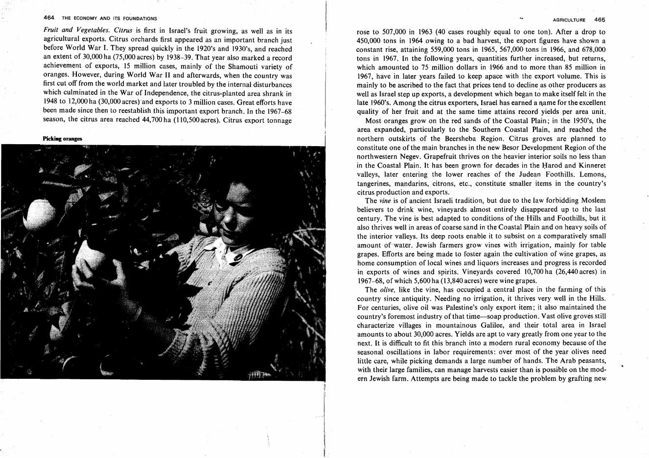
464 THE ECONOMY AND ITS FOUNDATIONS
Fruit and Vegetables. Citrus is first in Israel's fruit growing, as well as in itsagricultural exports. Citrus orchards first appeared as an important branch justbefore World War I. They spread quickly in the 1920's and 1930's, and reachedan extent of 30,000ha (75,000acres) by 1938-39. That year also marked a recordachievement of exports, 15 million cases, mainly of the Shamouti variety oforanges. However, during World War II and afterwards, when the country wasfirst cut off from the world market and later troubled by the internal disturbanceswhich culminated inthe War of Independence, the citrus-planted area shrank in1948 to 12,000ha (30,000acres) 'and exports to 3 million cases. Great efforts havebeen made since then to reestablish this important export branch. In the 1967-68season, the citrus area reached 44,700 ha (110,500acres). Citrus export tonnage
I
ft
AGRICULTURE 465
rose to 507,000 in 1963 (40 cases roughly equal to one ton). After a drop to450,000 tons in 1964 owing to a bad harvest, the export figures have shown aconstant rise, attaining 559,000 tons in 1965, 567,000 tons in 1966, and 678,000tons in 1967. In the following years, quantities further increased, but returns,which amounted to 75 million dollars in 1966 and to more than 85 million in1967, have in. later years failed to keep apace with the export volume. This ismainly to be ascribed to the fact that prices tend to decline as other producers aswell as Israel step up exports, a development which began to make itself felt in thelate 1960's. Among the citrus exporters, Israel has earned a name for the excellentquality of her fruit and at the same time attains record yields per area unit.
Most oranges grow on the red sands of the Coastal Plain; in the 1950's, thearea expanded, particular.ly to the Southern Coastal Plain, and reached thenorthern outskirts of the Beersheba Region. Citrus groves are planned toconstitute one of the main branches in the new Besor Development Region of thenorthwestern Negev. Grapefruit thrives on the heavier interior soils no less thanin the Coastal Plain. It has been grown for decades in the Harod and Kinneretvalleys, later entering the lower reaches of the Judean Foothills. Lemons,tangerines, mandarins, citrons, etc., constitute smaller items in the country'scitrus production and exports.
The vine is of ancient Israeli tradition, but due to the law forbidding Moslembelievers to drink wine, vineyards almost entirely disappeared up to the lastcentury. The vine is best adapted to conditions of the Hills and Foothills, but italso thrives well in areas of coarse sand in the Coastal Plain and on heavy soils ofthe interior valleys. Its deep roots enable it to subsist on a comparatively smallamount of-water. Jewish farmers grow vines with irrigation, mainly for tablegrapes. Efforts are being made to foster again the cultivation of wine grapes, ashome consumption of local wines and liquors increases and progress is recordedin exports of wines and spirits. Vineyards covered 10,700ha (26,440acres) in1967-68, of which 5,600 ha (13,840acres) were wine grapes.
The olive, like the vine, has occupied a central place in the farming of thiscountry since antiquity. Needing no irrigation, it thrives very well in the Hills.For centuries, olive oil was Palestine's only export item; it also maintained thecountry's foremost industry of that time-soap production. Vast olive groves stillcharacterize villages in mountainous Galilee, and their total area in Israelamounts to about 30,000 acres. Yields are apt to vary greatly from one year to thenext. It is difficult to fit this branch into a modern rural economy because of theseasonal oscillations in labor requirements: over most of the year olives needlittle care, while picking demands a large number of hands. The Arab peasants,with their large families, can manage harvests easier than is possible on the modern Jewish farm. Attempts are being made to tackle the problem by grafting new
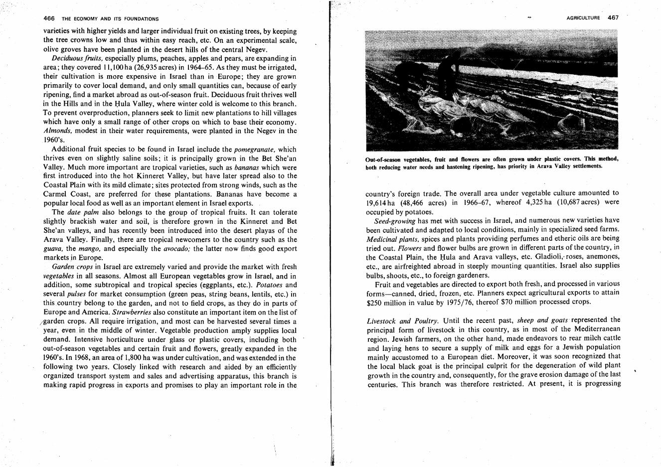
466 THE ECONOMY AND ITS FOUNDATIONS
varieties with higher yields and larger individual fruit on existing trees, by keepingthe tree crowns low and thus within easy reach, etc. On an experimental scale,olive groves have been planted in the desert hills of the central Negev,
Deciduous fruits, especially plums, peaches, apples and pears, are expanding inarea; they covered 11,100ha (26,935 acres) in 1964-65. As they must be irrigated,their cultivation is more expensive in Israel than in Europe; they are grownprimarily to cover local demand, and only small quantities can, because of earlyripening, find a market abroad as out-of-season fruit. Deciduous fruit thrives wellin the Hills and in the Hula Valley, where winter cold is welcome to this branch.To prevent overproduction, planners seek to limit new plantations to hill villageswhich have only a small range of other crops on which to base their economy.Almonds, modest in their water requirements, were planted in the Negev in the1960's.
Additional fruit species to be found in Israel include the pomegranate, whichthrives even on slightly saline soils; it is principally grown in the Bet She'anValley. Much more important are tropical varieties, such as bananas which werefirst introduced into the hot Kinneret Valley, but have later spread also to theCoastal Plain with its mild climate; sites protected from strong winds, such as theCarmel Coast, are preferred for these plantations. Bananas have become apopular local food as well as an important element in Israel exports.
The date palm also belongs to the group of tropical fruits. It can tolerateslightly brackish water and soil, is therefore grown in the Kinneret and BetShe'an valleys, and has recently been introduced into the desert playas of theArava Valley. Finally, there are tropical newcomers to the country such as theguava, the mango, and especially the avocado; the latter now finds good exportmarkets in Europe.
Garden crops in Israel are extremely varied and provide the market with freshvegetables in all seasons. Almost all European vegetables grow in Israel, and inaddition, some subtropical and tropical species (eggplants, etc.). Potatoes andseveral pulses for market consumption (green peas, string beans, lentils, etc.) inthis country belong to the garden, and not to field crops, as they do in parts ofEurope and America. Strawberries also constitute an important item on the list of
/garden crops. All require irrigation, and most can be harvested several times ayear, even in the middle of winter. Vegetable production amply supplies localdemand. Intensive horticulture under glass or plastic covers, including bothout-of-season vegetables and certain fruit and flowers, greatly expanded in the1960's. In 1968, an area of 1,800ha was under cultivation, and was extended in thefollowing two years. Closely linked with research and aided by an efficientlyorganized transport system and sales and advertising apparatus, this branch ismaking rapid progress in exports and promises to play an important role in the
AGRICULTURE 467
Out-of-season vegetables, fruit and flowers are often grown under plastic covers. This method,both reducing water needs and hastening ripening, has priority in Arava Valley settlements.
country's foreign trade. The overall area under vegetable culture amounted to19,614ha (48,466 acres) in 1966-67, whereof 4,325ha (1O,687acres) wereoccupied by potatoes.
Seed-growing has met with success in Israel, and numerous new varieties havebeen cultivated and adapted to local conditions, mainly in specialized seed farms.Medicinal plants, spices and plants providing perfumes and etheric oils are beingtried out. Flowers and flower bulbs are grown in different parts of the country, inthe Coastal Plain, the Hula and Arava valleys, etc. Gladioli, roses, anemones,etc., are airfreighted abroad in steeply mounting quantities. Israel also suppliesbulbs, shoots, etc., to foreign gardeners.
Fruit and vegetables are directed to export both fresh, and processed in variousforms-canned, dried, frozen; etc. Planners expect agricultural exports to attain$250 million in value by 1975/76, thereof $70 million processed crops.
Livestock and Poultry. Until the recent past, sheep and goats- represented theprincipal form of livestock in this country, as in most of the Mediterraneanregion. Jewish farmers, on the other hand, made endeavors to rear milch cattleand laying hens to secure a supply of milk and eggs for a Jewish populationmainly accustomed to a European diet. Moreover, it was soon recognized thatthe local black goat is the principal culprit for the degeneration of wild plantgrowth in the country and, consequently, for the grave erosion damage of the lastcenturies. This branch was therefore restricted. At present, it is progressing
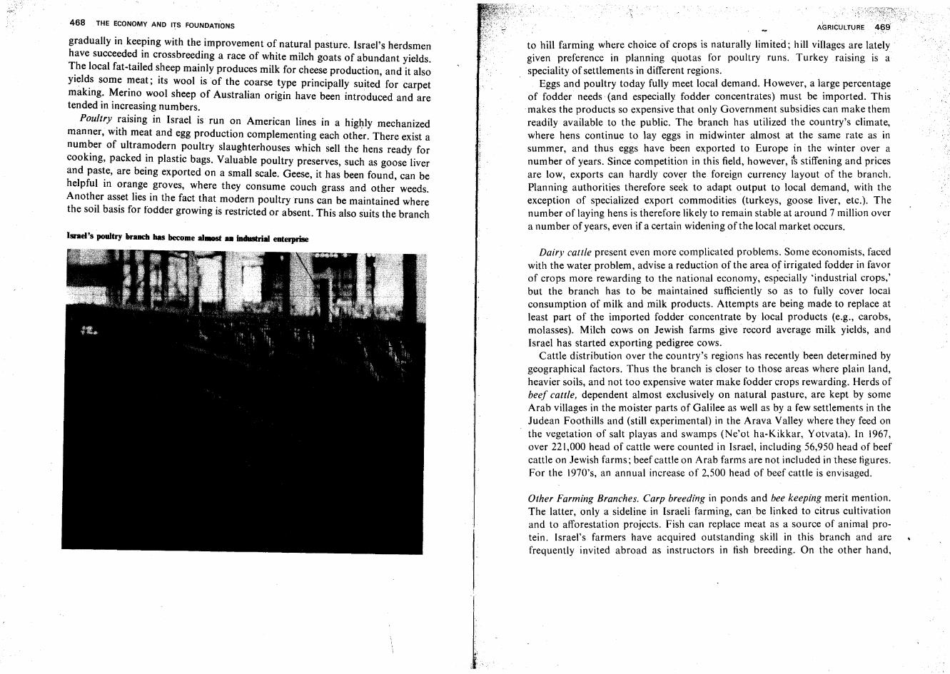
468 THE ECONOMY AND ITS FOUNDATIONS
gradually in keeping with the improvement of natural pasture. Israel's herdsmenhave succeeded in crossbreeding a race of white milch goats of abundant yields.~he local fat-tailed sheep mainly produces milk for cheese production, and it alsoYleld.s some ~eat; its wool is of the coarse type principally suited for carpetmaking. Menno wool sheep of Australian origin have been introduced and aretended in increasing numbers.
Poultry raising in Israel is run on American lines in a highly mechanizedmanner, with meat and egg production complementing each other. There exist anumber of ultramodern poultry slaughterhouses which sell the hens ready forcooking, packed in plastic bags. Valuable poultry preserves, such as goose liverand paste, are being exported on a small scale. Geese, it has been found, can behelpful in orange groves, where they consume couch grass and other weeds.Another asset lies in the fact that modern poultry runs can be maintained wherethe soil basis for fodder growing is restricted or absent. This also suits the branch
Israel's poultry brlUlCh has become aI.-st .. industrial enterprise
AGRICULTURE
to hill farming where choice of crops is naturally limited; hill villages are latelygiven preference in planning quotas for poultry runs. Turkey raising is aspeciality of settlements in different regions.
Eggs and poultry today fully meet local demand. However, a large percentageof fodder needs (and especially fodder concentrates) must be imported. Thismakes the products so expensive that only Government subsidies can make themreadily available to the public. The branch has utilized the country's climate,where hens continue to lay eggs in midwinter almost at the same rate as insummer, and thus eggs have been exported to Europe in the winter over anumber of years. Since competition in this field, however, i~ stiffening and pricesare low, exports can hardly cov~r the foreign currency layout of the branch.Planning authorities therefore seek to adapt output to local demand, with theexception of specialized export commodities (turkeys, goose liver, etc.). Thenumber of laying hens is therefore likely to remain stable at around 7 million overa number of years, even if a certain widening of the local market occurs.
Dairy cattle present even more complicated problems. Some economists, facedwith the water problem, advise a reduction of the area of irrigated fodder in favorof crops more rewarding to the national economy, especially 'industrial crops,'but the branch has to be maintained sufficiently so as to fully cover localconsumption of milk and milk products. Attempts are being made to replace atleast part of the imported fodder concentrate by local products (e.g., carobs,molasses). Milch cows on Jewish farms give record average milk yields, andIsrael has started exporting pedigree cows.
Cattle distribution over the country's regions has recently been determined bygeographical factors. Thus the branch is closer to those areas where plain land,heavier soils, and not too expensive water make fodder crops rewarding. Herds ofbeef cattle, dependent almost exclusively on natural pasture, are kept by someArab villages in the moister parts of Galilee as well as by a few settlements in theJudean Foothills and (still experimental) in the Arava Valley where they feed onthe vegetation of salt playas and swamps (Ne'ot ha-Kikkar, Yotvata). In 1967,over 221,000 head of cattle were counted in Israel, including 56,950 head of beefcattle on Jewish farms; beef cattle on Arab farms are not included in these figures.For the 1970's, an annual increase of 2,500 head of beef cattle is envisaged.
Other Farming Branches. Carp breeding in ponds and bee keeping merit mention.The latter, only a sideline in Israeli farming, can be linked to citrus cultivationand to afforestation projects. Fish can replace meat as a source of animal protein. Israel's farmers have acquired outstanding skill in this branch and arefrequently invited abroad as instructors in fish breeding. On the other hand,
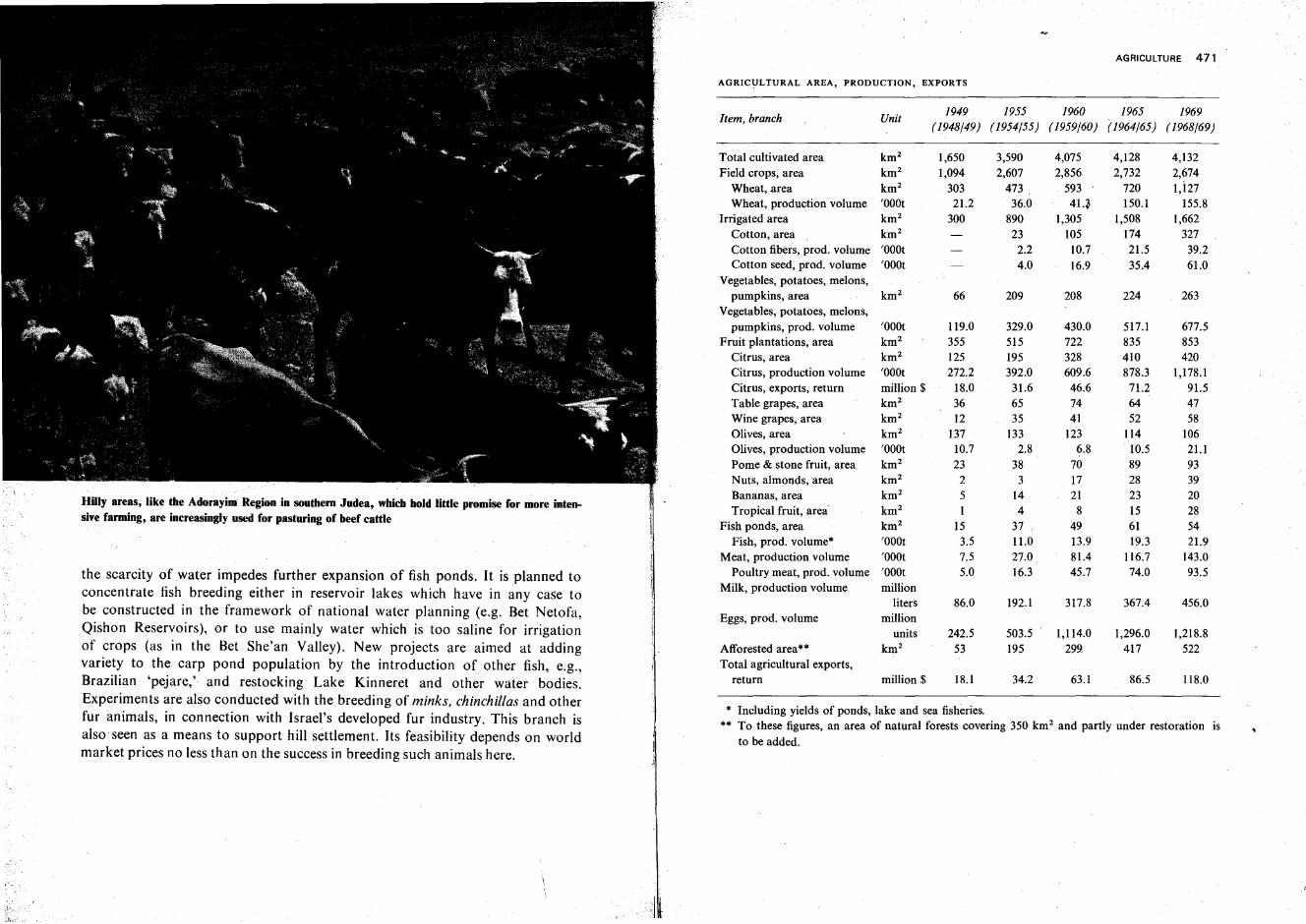
Hilly areas, like the Adorayim Region insouthem Judea, which hold little promise for more intensive farming, are increasingly used for pasturing of beef cattle
the scarcity of water impedes further expansion of fish ponds. It is planned toconcentrate fish breeding either in reservoir lakes which have in any case tobe constructed in the framework of national water planning (e.g. Bet Netofa,Qishon Reservoirs), or to use mainly water which is too saline for irrigationof crops (as in the Bet She'an Valley). New projects are aimed at addingvariety to the carp pond population by the introduction of other fish, e.g.,Brazilian 'pejare,' and restocking Lake Kinneret and other water bodies.Experiments are also conducted with the breeding of minks, chinchillas and otherfur animals, in connection with Israel's developed fur industry. This branch isalso seen as a means to support hill settlement. Its feasibility depends on worldmarket prices no less than on the success in breeding such animals here.
AGRICULTURE 471
AGRICULTURAL AREA, PRODUCTION, EXPORTS
1949 1955 1960 1965 1969Item, branch Unit
(1948/49) (1954/55) (1959/60) (1964/65) (1968/69)
Total cultivated area km 2 1,650 3,590 4,075 4,128 4,132Field crops, area km 2 1,094 2,607 2,856 2,732 2,674
Wheat, area km 2 303 473 593 720 l,i27Wheat, production volume 'OOOt 21.2 36.0 4q 150.1 155.8
Irrigated area km 2 300 890 1,305 1,508 1,662Cotton, area km 2 23 105 174 327Cotton fibers, prod: volume 'OOOt 2.2 10.7 21.5 39.2Cotton seed, prod. volume 'OOOt 4.0 16.9 35.4 61.0
Vegetables, potatoes, melons,pumpkins, area km 2 66 209 208 224 263
Vegetables, potatoes, melons,pumpkins, prod. volume 'OOOt 119.0 329.0 430.0 517.1 677.5
Fruit plantations, area km 2 355 515 722 835 853Citrus, area km 2 125 195 328 410 420Citrus, production volume 'OOOt 272.2 392.0 609.6 878.3 1,178.1Citrus, exports, return million $ 18.0 31.6 46;6 71.2 91.5Table grapes, area km 2 36 65 74 64 47Wine grapes, area km 2 12 35 41 52 58Olives, area km 2 137 133 123 114 106Olives, production volume 'OOOt 10.7 2.8 6.8 10.5 21.1Pome & stone fruit, area km 2 23 38 70 89 93Nuts, almonds,area km 2 2 3 17 28 39Bananas, area km 2 5 14 21 23 20Tropical fruit, area km 2 I 4 8 15 28
Fish ponds, area km 2 15 37 49 61 54Fish, prod. volume* 'OOOt 3.5 11.0 13.9 19.3 21.9
Meat, production volume 'OOOt 7.5 27.0 81.4 116.7 143.0Poultry meat, prod. volume 'OOOt 5.0 16.3 45.7 74.0 93.5
Milk, production volume millionliters 86.0 192.1 317.8 367.4 456.0
Eggs, prod. volume millionunits 242.5 503.5 1,114.0 1,296.0 1,218.8
Afforested area** km 2 53 195 299 417 522Total agricultural exports,
return million $ 18.1 34.2 63.1 86.5 118.0
* Including yields of ponds, lake and sea fisheries.** To these figures, an area of natural forests covering 350 km 2 and partly under restoration is
to be added.
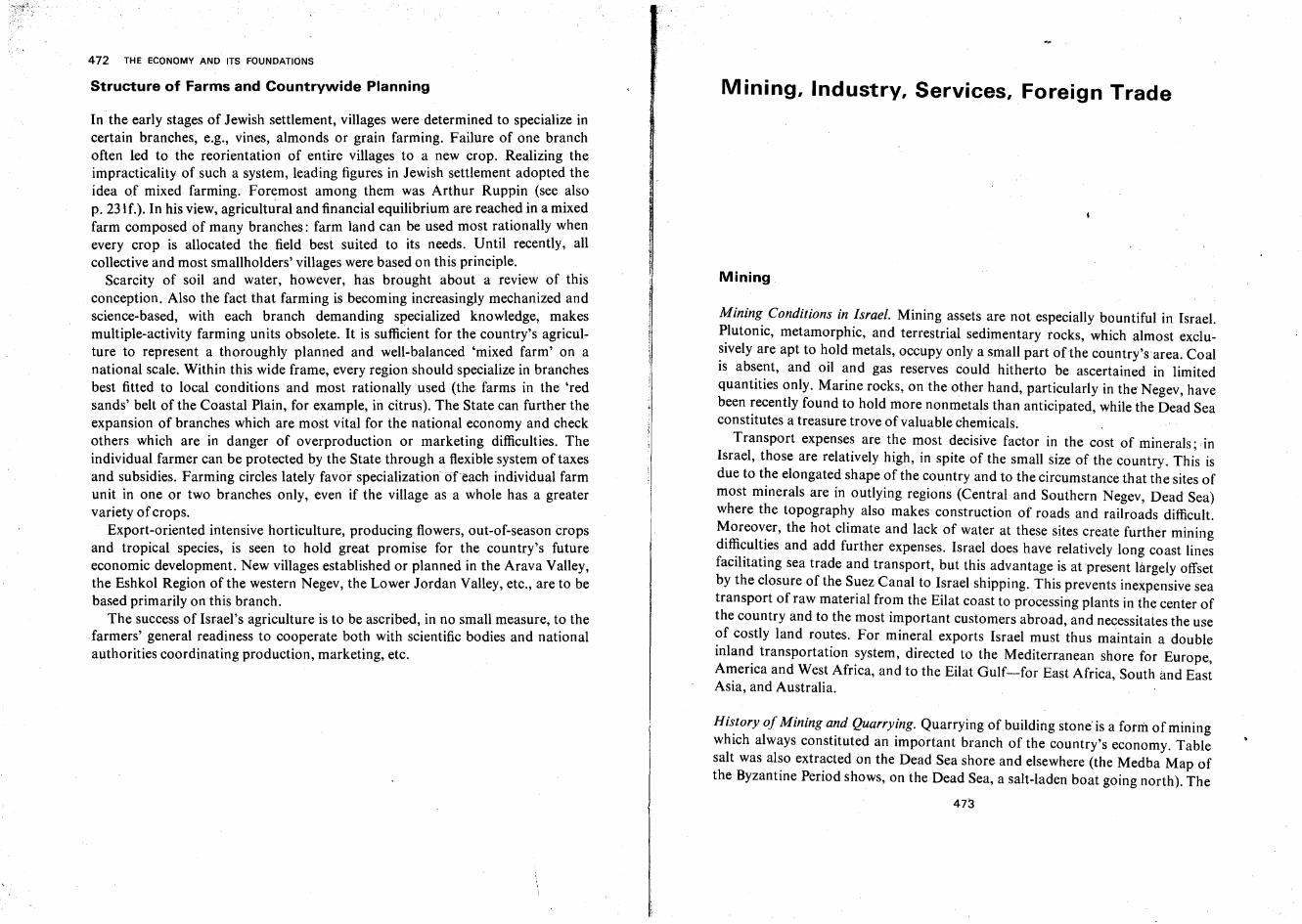
472 THE ECONOMY AND ITS FOUNDATIONS
Structure of Farms and Countrywide Planning
In the early stages of Jewish settlement, villages were determined to specialize incertain branches, e.g., vines, almonds or grain farming. Failure of one branchoften led to the reorientation of entire villages to a new crop. Realizing theimpracticality of such a system, leading figures in Jewish settlement adopted theidea of mixed farming. Foremost among them was Arthur Ruppin (see alsop. 231f.). In his view, agricultural and financial equilibrium are reached in a mixedfarm composed of many branches: farm land can be used most rationally whenevery crop is allocated the field best suited to its needs. Until recently, allcollective and most smallholders' villages were based on this principle.
Scarcity of soil and water, however, has brought about a review of thisconception. Also the fact that farming is becoming increasingly mechanized andscience-based, with each branch demanding specialized knowledge, makesmultiple-activity farming units obsolete. It is sufficient for the country's agriculture to represent a thoroughly planned and well-balanced 'mixed farm' on anational scale. Within this wide frame, every region should specialize in branchesbest fitted to local conditions and most rationally used (the farms in the 'redsands' belt of the Coastal Plain, for example, in citrus). The State can further theexpansion of branches which are most vital for the national economy and checkothers which are in danger of overproduction or marketing difficulties. Theindividual farmer can be protected by the State through a flexible system of taxesand subsidies. Farming circles lately favor specialization of each individual farmunit in one or two branches only, even if the village as a whole has a greatervariety of crops.
Export-oriented intensive horticulture, producing flowers, out-of-season cropsand tropical species, is seen to hold great promise for the country's futureeconomic development. New villages established or planned in the Arava Valley,the Eshkol Region of the western Negev, the Lower Jordan Valley, etc., are to bebased primarily on this branch.
The success of Israel's agriculture is to be ascribed, in no small measure, to thefarmers' general readiness to cooperate both with scientific bodies and nationalauthorities coordinating production, marketing, etc.
Mining, Industry, Services, Foreign Trade
Mining
Mining Conditions in Israel. Mining assets are not especially bountiful in Israel.Plutonic, metamorphic, and terrestrial sedimentary rocks, which almost exclusively are apt to hold metals, occupy only a small part of the country's area. Coalis absent, and oil and gas reserves could hitherto be ascertained in limitedquantities only. Marine rocks, on the other hand, particularly in the Negev, havebeen recently found to hold more nonmetals than anticipated, while the Dead Seaconstitutes a treasure trove of valuable chemicals. ,
Transport expenses are the most decisive factor in the cost of minerals . ,inIsrael, those are relatively high, in spite of the small size of the country. This isdue to the elongated shape of the country and to the circumstance that the sites ofmost minerals are in outlying regions (Central and Southern Negev, Dead Sea)where the topography also makes construction of roads and railroads difficult.~oreov.er, the hot climate and lack of water at these sites create further miningdlf~~ult~es and add further expenses. Israel does have relatively long coast linesfacilitating sea trade and transport, but this advantage is at present largely offsetby the closure of the Suez Canal to Israel shipping. This prevents inexpensive seatransport of raw material from the Eilat coast to processing plants in the center ofthe country and to the most important customers abroad, and necessitates the useof costly land routes. For mineral exports Israel must thus maintain a doubleinlan~ transportation ~ystem, directed to the Mediterranean shore for Europe,America and West Africa, and to the Eilat Gulf-for East Africa South and East. ,ASIa, and Australia.
Hi~tory of Mining and Quarrying. Quarrying of building stone is a form of miningwhich always constituted an important branch of the country's economy. Tablesalt was al~o extr~cted on the Dead Sea shore and elsewhere (the Medba Map ofthe Byzantine Period shows, on the Dead Sea, a salt-laden boat going north). The
473
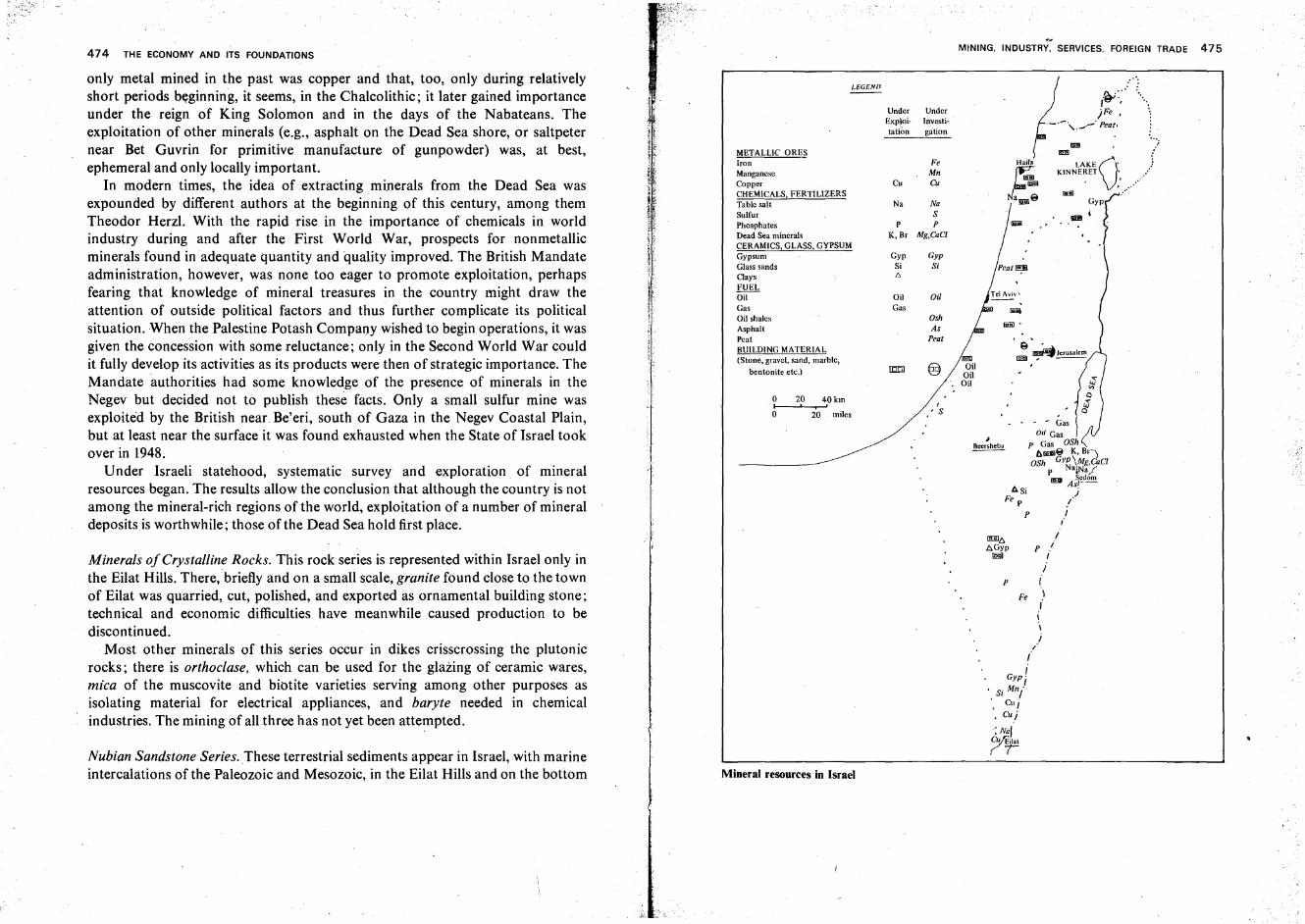
Gyp
oj
..[D •• ::
:,'tl"V,/fIiiJiI .....
"~:"_ )Fe ,
'-'. ',._.- Peat»
P
:0°:
- GasOil Gas
P Gas OSh~1SI8 K, Br)
OSh GYP\Mg.CaCIP NaiNa/__ Sedom~ As'--
6Si jFe P /
P J,.I
p ii
II
Fe \,.\\
J/,.
Gyp II
. Si Mni. Cu i'. Cui
:Nal7r
I!!!iIOil
OilOil
.~
MINING. INDUSTRY. SERVICES. FOREIGN TRADE 475
OshAs
Peat
Oil
, 'S
UnderInvestigation
Fe Haifa
Mn
~Cu Cu Iiiiil
Na NaNamll8
SP P
K, Br Mg.CaCI
Gyp GypSi st{';
LEGEND
METALLIC ORESIronManganeseCopperCHEMICALS, FERTILIZERSTable saltSulfurPhosphatesDead Sea mineralsCERAMICS, GLASS, GYPSUMGypsumGlass sandsClaysFUELOil OilGas GasOil shalesAsphaltPeatBUILDING MATERIAL(Stone, gravel, sand, marble,
bentonite etc.) 100
UnderExploitation
o 20 40kmI , 'o 20 miles
Mineral resources in Israel
474 THE ECONOMY AND ITS FOUNDATIONS
Minerals ofCrystalline Rocks. This rock series is represented within Israel only inthe Eilat Hills. There, briefly and on a small scale, granite found close to the townof Eilat was quarried, cut, polished, and exported as ornamental building stone;technical and economic difficulties have meanwhile caused production to bediscontinued.
Most other minerals of this series occur in dikes crisscrossing the plutonicrocks; there is orthoclase. which can be used for the glazing of ceramic wares,mica of the muscovite and biotite varieties serving among other purposes asisolating material for electrical appliances, and baryte needed in chemicalindustries. The mining of all three has not yet been attempted.
Nubian Sandstone Series. These terrestrial sediments appear in Israel, with marineintercalations of the Paleozoic and Mesozoic, in the Eilat Hills and on the bottom
only metal mined in the past was copper and that, too, only during relativelyshort periods beginning, it seems, in the Chalcolithic; it later gained importanceunder the reign of King Solomon and in the days of the Nabateans. Theexploitation of other minerals (e.g., asphalt on the Dead Sea shore, or saltpeternear Bet Guvrin for primitive manufacture of gunpowder) was, at best,ephemeral and only locally important.
In modern times, the idea of extracting minerals from the Dead Sea wasexpounded by different authors at the beginning of this century, among themTheodor Herzl. With the rapid rise in the importance of chemicals in worldindustry during and after the First World War, prospects for nonmetallicminerals found in adequate quantity and quality improved. The British Mandateadministration, however, was none too eager to promote exploitation, perhapsfearing that knowledge of mineral treasures in the country might draw theattention of outside political factors and thus further complicate its politicalsituation. When the Palestine Potash Company wished to begin operations, it wasgiven the concession with some reluctance; only in the Second World War couldit fully develop its activities as its products were then of strategic importance. TheMandate authorities had some knowledge of the presence of minerals in theNegev but decided not to publish these facts. Only a small sulfur mine wasexploited by the British near. Be'eri, south of Gaza in the Negev Coastal Plain,but at least near the surface it was found exhausted when the State of Israel tookover in 1948.
Under Israeli statehood, systematic survey and exploration of mineralresources began. The results allow the conclusion that although the country is notamong the mineral-rich regions of the world, exploitation of a number of mineraldeposits is worthwhile; those of the Dead Sea hold first place.
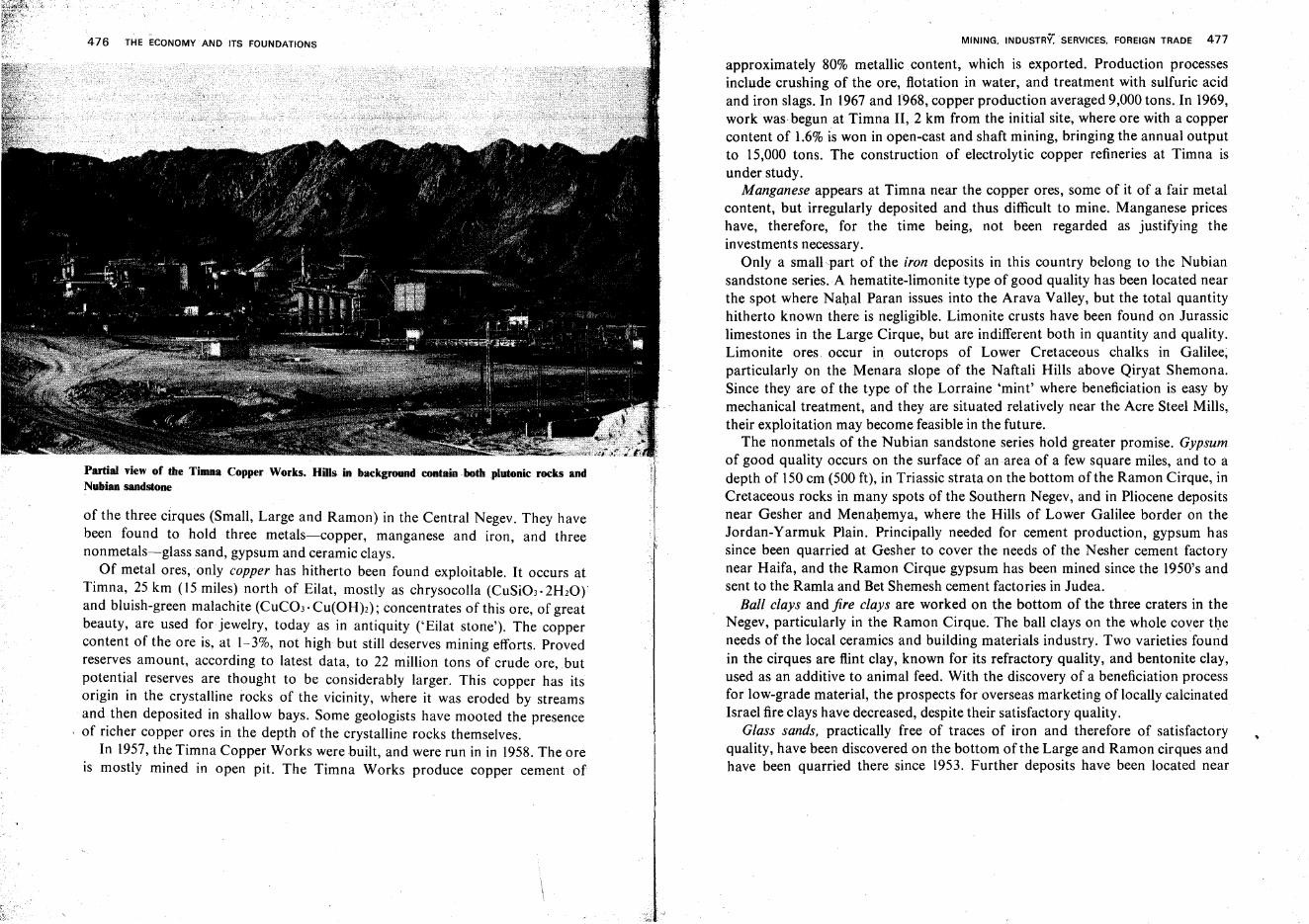
476 THE ECONOMY AND ITS FOUNDATIONS
Partial view of the Timna Copper Works. HiIlsin backgroond contain both plutonic rocks andNubian sandstone
of the three cirques (Small, Large and Ramon) in the Central Negev. They havebeen found to hold three metals-copper, manganese and iron, and threenonmetals-glass sand, gypsum and ceramic clays.
Of metal ores, only copper has hitherto been found exploitable. It occurs atTimna, 25 km (15 miles) north of Eilat, mostly as chrysocolla (CuSi03.2H20rand bluish-green malachite (CUC03' Cu(OH)2); concentrates of this ore, of greatbeauty, are used for jewelry, today as in antiquity ('Eilat stone'). The coppercontent of the ore is, at 1-3%, not high but still deserves mining efforts. Provedreserves amount, according to latest data, to 22 million tons of crude ore,butpotential reserves are thought to be considerably larger. This copper has itsorigin in the crystalline rocks of the vicinity, where it was eroded by streamsand then deposited in shallow bays. Some geologists have mooted the presenceof richer copper ores in the depth of the crystalline rocks themselves.
In 1957, the Timna Copper Works were built, and were run in in 1958. The oreis mostly mined in open pit. The Timna Works produce copper cement of
MINING. INDUSTRY. SERVICES. FOREIGN TRADE 477
approximately 80% metallic content, which is exported. Production processesinclude crushing of the ore, flotation in water, and treatment with sulfuric acidand iron slags. In 1967 and f968, copper production averaged 9,000 tons.Tn 1969,work was begun at Timna II, 2 km from the initial site, where ore with a coppercontent of 1.6% is won in open-cast and shaft mining, bringing the annual outputto 15,000 tons. The construction of electrolytic copper refineries at Timna isunder study.
Manganese appears at Timna near the copper ores, some of it of a fair metalcontent, but irregularly deposited and thus difficult to mine. Manganese priceshave, therefore, for the time being, not been regarded as justifying theinvestments necessary.
Only a small part of the iron deposits in this country belong to the Nubiansandstone series. A hematite-limonite type of good quality has been located nearthe spot where Nahal Paran issues into the Arava Valley, but the total quantityhitherto known there is negligible. Limonite crusts have been found on Jurassiclimestones in the Large Cirque, but are indifferent both in quantity and quality.Limonite ores occur in outcrops of Lower Cretaceous chalks in Galilee,particularly on the Menara slope of the Naftali Hills above Qiryat Shemona.Since they are of the type of the Lorraine 'mint' where beneficiation is easy bymechanical treatment, and they are situated relatively near the Acre Steel Mills,their exploitation may become feasible in the future.
The nonmetals of the Nubian sandstone series hold greater promise. Gypsumof good quality occurs on the surface of an area of a few square miles, and to adepth of 150 em (500 ft), in Triassic strata on the bottom ofthe Ramon Cirque, inCretaceous rocks in many spots of the Southern Negev, and in Pliocene depositsnear Gesher and Menahemya, where the Hills of Lower Galilee border on theJordan-Yarmuk Plain. Principally needed for cement production, gypsum hassince been quarried at Gesher to cover the needs of the Nesher cement factorynear Haifa, and the Ramon Cirque gypsum has been mined since the 1950's andsent to the Ramla and Bet Shemesh cement factories in Judea.
Ball clays and fire clays are worked on the bottom of the three craters in theNegev, particularly in the Ramon Cirque.The ball clays on the whole cover theneeds of the local ceramics and building materials industry. Two varieties foundin the cirques are flint clay, known for its refractory quality, and bentonite clay,used as an additive to animal feed. With the discovery of a beneficiation processfor low-grade material, the prospects for overseas marketing of locally calcinatedIsrael fire clays have decreased, despite their satisfactory quality.
Glass sands, practically free of traces of iron and therefore of satisfactoryquality, have been discovered on the bottom of the Large and Ramon cirques andhave been quarried there since 1953. Further deposits have been located near
478 THE ECONOMY AND ITS FOUNDATIONS
Eilat. Supplying the basic raw material for the developed local glass industry atHaifa and Yeroham, they aid to cut down imports of this commodity.
Minerals of Marine Rocks. Marine rocks, which cover most of Israel's surface,are relatively poor in minerals. Besides building stones and other buildingmaterials quarried all over the country, phosphates, oil and natural gas are ofimportance here.
Phosphates, of calcium phosphate and apatite types similar to those found inMorocco and other North African and Middle Eastern countries, have beenlocated in Senonian chalks in the Negev, notably at Oron, southeast of the LargeCirque, near the Zefa and Ef'e wadi courses in the Arad Region east of Dimona,southeast of the Small Cirque (Makhtesh Qatan) in the Meshar Basin in theCentral Negev Hills and near En Yahav in the Arava Valley. In addition,phosphates containing stronger-and perhaps exploitable-traces of uraniumthan those found at the other sites have been located in the Hatrurim Regionsoutheast of Arad.
Phosphate mining was begun in 1951 at Oron (the name of the site, meaning'light,' refers to the phosphorescence of the mineral). Production rose from17,000 tons in 1952 to 210,000 in 1959 and to 300,000 in 1963; of the latterquantity, 175,000 tons were exported. Although relatively poor with 23-27% ofactive phosphorus content, the ore is being upgraded mechanically by crushingand sieving to 29-30%. In 1963-64, a giant calcination kiln was set up at Oron,raising the phosphorous content to 33-35%. As mining was simultaneously begunon the Zefa-Ef''e field (with a content of 28-33% phosphoric oxide, one of theworld's richest phosphate deposits), output increased rapidly, totaling I milliontons in 1968 and expected to increase further to 1.5 million tons, boosted byproduction from the Makhtesh Qatan field since 1966. Phosphate sales wereIL 21 million in 1967, and IL 35 million in 1968. The Zefa-Ef'e ore is to serve thenearby phosphoric acid plant, to be run in in 1971, as a principal raw material.
Oil and Gas. Israel, with the other countries on the Levant coast and thoseportions of Egypt adjoining the Red Sea, is in an oil province separate from thatof the Persian Gulf countries. While the shores of the Suez Gulfhave shown themselves to be rich in petroleum (see p. 366f.), oil prospects in Israel proper seemto be more modest. Some exploratory drillings were started by the authorities inthe last years of the British Mandate and were renewed soon after the State ofIsrael came into being. In 1955, the. first oil in commercial quantity wasdiscovered at Helez in the Southern Coastal Plain, in a subsoil anticlinal structureof Lower Cretaceous rocks, most of them sandstones. Up to 1969, no reserves offluid oil could be located in other parts of the country, but the Helez field was
MINING. INDUSTRY. SERVICES. FOREIGN TRADE 479.
widened by oil finds in the field of Beror to the south, and of Kokhav to the. north. In 1968, Helez had 37 producing wells, and proven reserves were reported
as amounting to 2.75 million tons. Since 1964, annual production has remainedmore or less stationary, averaging 200-250 million liters.
Experts consider the oil-bearing structure of Helez to extend along most of theCoastal Plain, from Nahariya in the north to Haluza in the Western Negev.Beginnings have been made to search for oil in the marine shelf off Israel'sMediterranean shore where prospects are considered to be relatively favorable.The overall petroleum reserves in Israel's pre-1967 frontiers were estimated in1968 to be 300 million tons (natural gas included).
Drillings in the anticlinal structures of Rosh Zohar, Mt. Kiddod and Mt. Kanna'im in the Arad Region, where the main crest of the Judean Hills meetsthose of the Negev Hills, have since the mid-fifties yielded substantial quantitiesof methane gas. The gas is piped to the installations of the Dead Sea Works, to theOron calcination kiln and to the Zefa-Ef''e phosphoric acid plant. As the formertwo installations began to function in 1964, production of natural gas jumped inthat year to 29.5 million m", compared to 9.8 million in 1963. Proven gas reservesof Rosh Zohar were given in 1968 as the equivalent of 1.25 million tons of liquidoil. Bitumen and asphalt, pointing to an impregnation of chalks or limestoneswith oil, appear in the southern part of the Judean Desert and on the westernshore ofthe Dead Sea. They have not yet been exploited commercially.
Quarries for sand, lime, etc., as well as limestone and alluvial soil for cementproduction, exist in most parts of the country, and fully cover the needs. Goodlimestone resembling whitish or yellowish marble (although not true, i.e.,crystalline, marble) is quarried at sites like Segev in Lower Galilee, Hefzi-Bah onthe slope of Mt. Gilboa, etc. In the Arad Region, reddish and black marble-likelimestones have been found; the same region also has bentonite from which whitecement can be produced. The quarrying of coarse building sand (locally called'zifzif') on the sea shore was prohibited by law in 1964, as the depletion of sanddestroys the beaches and increases the erosive power of incoming waves.
Minerals of the Dead Sea. Of the minerals contained in the waters of the DeadSea, potash (potassium chloride) and bromides are being won in industrialprocesses, and table salt is produced as a sideline. In future, magnesium andcalcium chloride may be added to the list.
The licence for exploiting Dead Sea resources was obtained in 1929, andproduction was started in 1931 by the Palestine' Potash Company, founded byBritish and Jewish-Palestinian partners, which set up its factory at Kallia at thenorthern end of the Dead Sea. In 1937 the company added auxiliary installationsat Sedom at the southern end of the Dead Sea, where more space was available
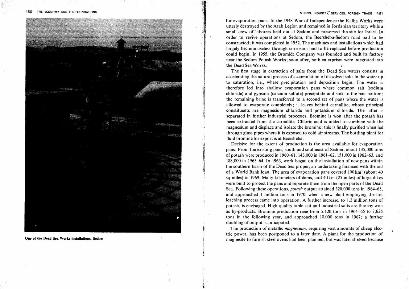
480 THE ECONOMY AND'ITS FOUNDATIONS
One of the Dead Sea Works installations, Sedom
MINING. INDUSTRY~ SERVICES. FOREIGN TRADE 481
for evaporation pans. In the 1948 War of Independence the Kallia Works wereutterly destroyed by the Arab Legion and remained in Jordanian territory while asmall crew of laborers held out at Sedom and preserved the site for Israel. Inorder to revive operations at Sedom, the Beersheba-Sedom road had to beconstructed; it was completed in 1952.The machines and installations which hadlargely become useless through corrosion had to be replaced before productioncould begin. In 1955, the Bromide Company was founded and built its factorynear the Sedom Potash Works; soon after, both enterprises were integrated intothe Dead Sea Works.
The first stage in extraction of salts from the Dead Sea waters consists inaccelerating the natural process of accumulation of dissolved salts in the water upto saturation, i.e., where precipitation and deposition begin. The water istherefore led into shallow evaporation pans where· common salt (sodiumchloride) and gypsum (calcium sulfate) precipitate and sink to the pan bottom;the remaining brine is transferred to a second set of pans where the water isallowed to evaporate completely; it leaves behind carnallite, whose principalconstituents are magnesium chloride and potassium chloride. The latter isseparated in further industrial processes. Bromine is won after the potash hasbeen extracted from the carnallite. Chloric acid is added to combine with themagnesium and displace and isolate the bromine; this is finally purified when ledthrough glass pipes where it is exposed to cold air streams. The bottling plant forfluid bromine for export is at Beersheba.
Decisive for the extent of production is the area available for evaporationpans. From the existing pans, south and southeast of Sedom, about 135,000tonsof potash were produced in 1960-61, 143,000in 1961-62, 151,000in 1962-63, and188,000 in 1963-64. In 1963, work began on the installation of new pans withinthe southern basin of the Dead Sea proper, an undertaking financed with the aidof a World Bank loan. The area of evaporation pans covered 100km2 (about 40sq miles) in 1969. Many kilometers of dams, and 40km (25 miles) of large dikeswere built to protect the pans and separate them from the open parts of the DeadSea. Following these operations, potash output attained 320,000 tons in 1964-65,and approached 1 million tons in 1970, when a new plant employing the hotleaching process came into operation. A further increase, to 1.2 million tons ofpotash, is envisaged. High quality table salt and industrial salts are thereby wonas by-products. Bromine production rose from 5,120 tons in 1964-65 to 7,626tons in the following year, and approached 10,000 tons in 1967; a furtherdoubling of output is anticipated.
The production of metallic magnesium, requiring vast amounts of cheap electric power, has been postponed to a later date. A plant for the production ofmagnesite to furnish steel ovens had been planned, but was later shelved because
482 THE ECONOMY AND ITS FOUNDATIONS
changes in the technology of steel production have reduced world demand forthis material; it is anticipated that novel uses for the Dead Sea magnesium will befound. Calcium chloride, which serves as a detergent in the chemical industry anda source of chloric acid, is put to use in the Arad phosphoric acid plant.
Additional table salt is won from the Mediterranean Sea in the evaporationpans at Atlit on the Carmel Coast, and is also quarried as rock salt from MountSedom.
Industry
Israel's industry and its growth are conditioned by three facts: relative poverty inraw materials; absence of historical continuity, of a gradual transition from localartisanship to large-scale" industrial activity; the particular skills of Jewishimmigrants, who had concentrated abroad on the finishing stages of manufactureor on" commerce, especially in the textile branch. Industry, therefore, had todevelop here from the final stages toward the basic ones. Before and shortly afterthe First World War, industrial activity began with repackaging and adaptationof imported goods' for local sale, soon took over "finishing, then secondaryprocesses, finally 'deepened' to reach primary production. Industry had also tobroaden its initial framework of small, often one-man workshops, to attain massproduction and proceed from manufacture for restricted local markets-oftenfollowing specifications of single customers-to cover the needs of an entirecountry and to divert an increasing portion of its produce to exports.
History of Industrial Development. Until the end of the 19th century, the onlybranches in this country which could, to any degree, be described as industrieswere soap production, practiced principally at Nablus and based on the olivecrop of the region, and printing, mainly in Hebrew characters. With thebeginning of Zionist settlement, Baron Edmond de Rothschild took the initiativein introducing reforms in farming and industrial development. He established thelarge Rishon Ie-Zion and Zikhron Ya'aqovwine cellars, aided in the founding offlour mills and attempted to establish additional industries, such as glassproduction at Dor (Tantura) on the Carmel Coast.
Among the early enterprises were the salt factory at Atlit and the Shemenfactory for soaps, edible oils, etc., in the Haifa Bay area. In the 1920's and early'thirties, immigrant craftsmen opened small enterprises in the cities, particularlyin Tel Aviv. More often than not these were small workshops based almostexclusively on the labor, initiative, management and skill of the proprietors.Some of these expanded gradually, took on more laborers, and introduced
I
MINING. INDUSTRY. SERVICES. FOREIGN TRADE 483
machinery. A new phase opened in 1934-35 with the arrival of immigrants fromCentral Europe who came with some capital and with experience in industrialmanagement. Some of the enterprises then founded ventured into secondaryproduction stages. Between the two world wars, individual Jewish investors fromthe country and from abroad took the initiative for, and participated in, theerection of novel industrial branches and enabled the founding of severalenterprises which became decisive for the country's economy (electricity, thePotash Company, etc.).
A propelling force for industrial development were workers' cooperatives, andespecially the Histadrut (Labor Federation), which was founded in 1920. Goingfar beyond the normal activity of labor organizations throughout the world, theHistadrut set up large enterprises under its own auspices, and particularlyendeavored to penetrate to basic production and 'conquer' heavy industry. Inaddition, communal settlements began, since the mid-'thirties, to add industrialbranches to their rural economies.
This development was not viewed very favorably by the Mandate authorities.Since industrialization constituted the most efficient means for a quick expansionof the absorptive capacity of the country's economy, they did little to encourageit, so as not to justify larger immigration quotas and upset what they consideredthe desirable demographic and political equilibrium in Palestine. Local production was thus not protected by tariffs; foreign goods were freely imported fromthe Commonwealth as well as from all other countries, without any stipulation ofreciprocal trade. When the Arabs here and abroad proclaimed in the mid-'thirtiesa boycott of Jewish industry in Palestine, imports from neighboring countrieswere even enlarged. The boycott, however, did not greatly affect the fledglingindustry, as its products were anyhow scarcely directed toward Arab markets.
Industrial expansion quickened in the Second World War when this countryserved as a hinterland for the Allied armies fighting in North Africa and theMediterranean basin and was required to supply vital strategic goods. Thisgrowth was due, however, to Jewish initiative only and was financed mainly bylocal capital. Incidentally, industrial products of Palestine then began to findoutlets in Middle East countries which, owing to war conditions, were no longerreached by supplies from Europe and America. The number of industrialundertakings grew from 1,550 in 1937 to 2,500 in 1946, and that of personsemployed in industry-from 21,000 to 47,000. The gross value of productionmounted from 8 to 44 million £ P, and electricity consumption by industryfrom 20.3 to 74.5 million kwhr.
In the first years of statehood, many new enterprises were opened byimmigrants, as well as by veterans who before had worked as foremen in existingfactories. The branches of metals, textiles and food made up the bulk of industrial
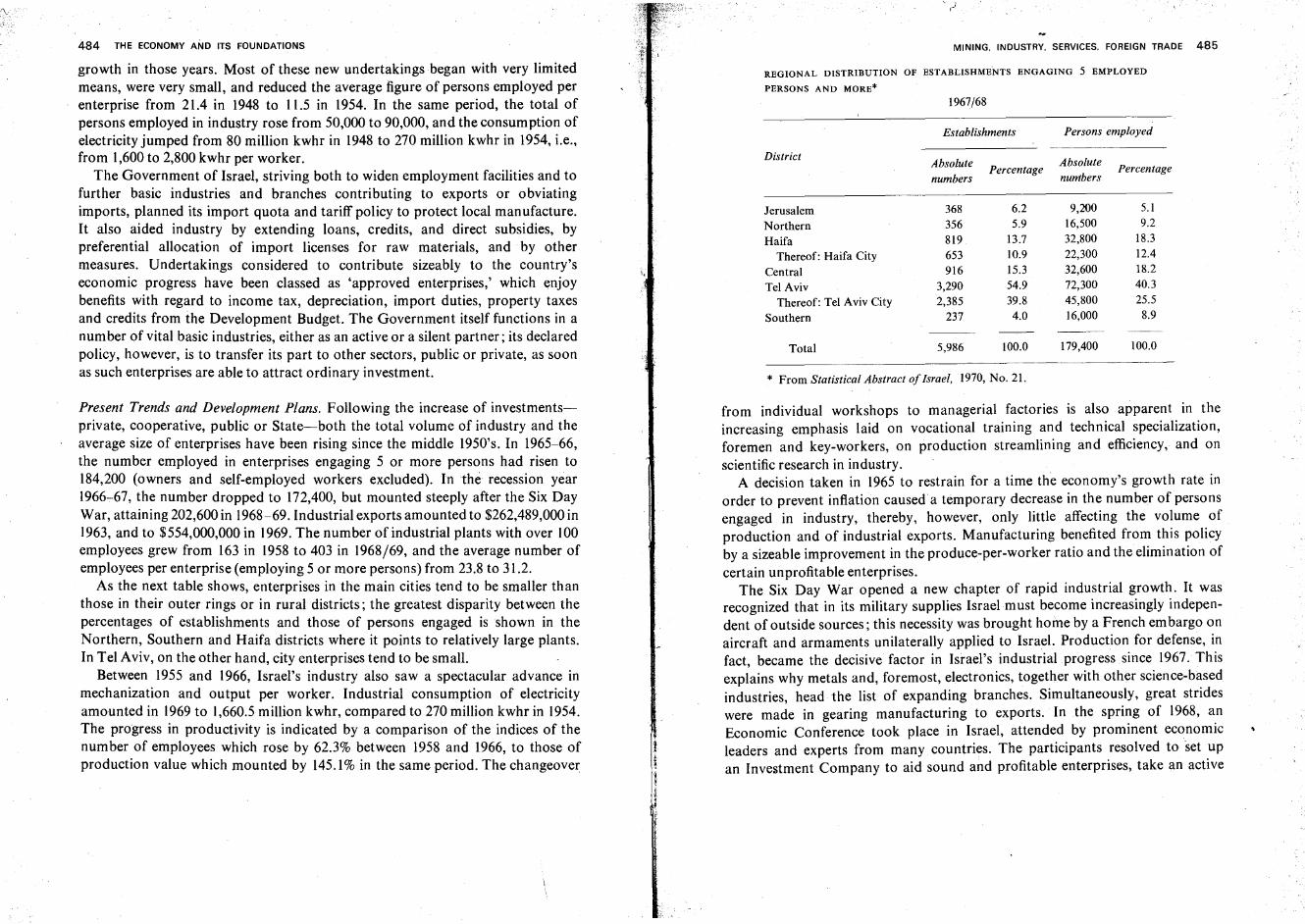
MINING. INDUSTRY. SERVICES. FOREIGN TRADE 485
REGIONAL DISTRIBUTION OF ESTABLISHMENTS ENGAGING 5 EMPLOYED
PERSONS AND MORE*
Establishments Persons employed
AbsolutePercentage
Absolute Percentagenumbers numbers
368 6.2 9,2Q0 5.1
356 5.9 16,500 9.2
819 13.7 32,800 18.3
653 10.9 22,300 12.4
916 15.3 32,600 18.2
3,290 54.9 72,300 40.3
2,385 39.8 45,800 25.5
237 4.0 16,000 8.9
5,986 100.0 179,400 100.0Total
* From Statistical Abstract of Israel, 1970, No. 21.
JerusalemNorthernHaifa
Thereof: Haifa CityCentralTel Aviv
Thereof: Tel Aviv CitySouthern
District
1967/68
'.
484 THE ECONOMY AND ITS FOUNDATIONS
growth in those years. Most of these new undertakings began with very limitedmeans, were very small, and reduced the average figure of persons employed perenterprise from 21.4 in 1948 to 11.5 in 1954. In the same period, the total ofpersons employed in industry rose from 50,000 to 90,000, and the consumption ofelectricity jumped from 80 million kwhr in 1948 to 270 million kwhr in 1954, i.e.,from 1,600 to 2,800 kwhr per worker.
The Government of Israel, striving both to widen employment facilities and tofurther basic industries and branches contributing to exports or obviatingimports, planned its import quota and tariff policy to protect local manufacture.It also aided industry by extending loans, credits, and direct subsidies, bypreferential allocation of import licenses for raw materials, and by othermeasures. Undertakings considered to contribute sizeably to the country'seconomic progress have been classed as 'approved enterprises,' which enjoybenefits with regard to income tax, depreciation, import duties, property taxesand credits from the Development Budget. The Government itself functions in anumber of vital basic industries, either as an active or a silent partner; its declaredpolicy, however, is to transfer its part to other sectors, public or private, as soonas such enterprises are able to attract ordinary investment.
Present Trends and Development Plans. Following the increase of investmentsprivate, cooperative, public or State-both the total volume of industry and theaverage size of enterprises have been rising since the middle 1950's. In 1965-66,the number employed in enterprises engaging 5 or more persons had risen to184,200 (owners and self-employed workers excluded). In the recession year1966-67, the number dropped to 172,400, but mounted steeply after the Six DayWar, attaining 202,600 in 1968-69. Industrial exports amounted to $262,489,000 in1963, and to $554,000,000 in 1969. The number of industrial plants with over 100employees grew from 163 in 1958 to 403 in 1968/69, and the average number ofemployees per enterprise (employing 5 or more persons) from 23.8 to 31.2.
As the next table shows, enterprises in the main cities tend to be smaller thanthose in their outer rings or in rural districts; the greatest disparity between thepercentages of establishments and those of persons engaged is shown in theNorthern, Southern and Haifa districts where it points to relatively large plants.In Tel Aviv, on the other hand, city enterprises tend to be small.
Between 1955 and 1966, Israel's industry also saw a spectacular advance inmechanization and output per worker. Industrial consumption of electricityamounted in 1969 to 1,660.5 million kwhr, compared to 270 million kwhr in 1954.The progress in productivity is indicated by a comparison of the indices of thenumber of employees which rose by 62.3% between 1958 and 1966, to those ofproduction value which mounted by 145.1 % in the same period. The changeover
from individual workshops to managerial factories is also apparent in theincreasing emphasis laid on vocational training and technical specialization,foremen and key-workers, on production streamlining and efficiency, and onscientific research in industry.
A decision taken in 1965 to restrain for a time the economy's growth rate inorder to prevent inflation caused a temporary decrease in the number of personsengaged in industry, thereby, however, only little affecting the volume ofproduction and of industrial exports. Manufacturing benefited from this policyby a sizeable improvement in the produce-per-worker ratio and the elimination ofcertain unprofitable enterprises.
The Six Day War opened a new chapter of rapid industrial growth. It wasrecognized that in its military supplies Israel must become increasingly independent of outside sources; this necessity was brought home by a French embargo onaircraft and armaments unilaterally applied to Israel. Production for defense, infact became the decisive factor in Israel's industrial progress since 1967. Thisexplains why metals and, foremost, electronics, together with other science-basedindustries, head the list of expanding branches. Simultaneously, great strideswere made in gearing manufacturing to exports. In the spring of 1968, anEconomic Conference took place in Israel, attended by prominent economicleaders and experts from many countries. The participants resolved to set upan Investment Company to aid sound and profitable enterprises, take an active
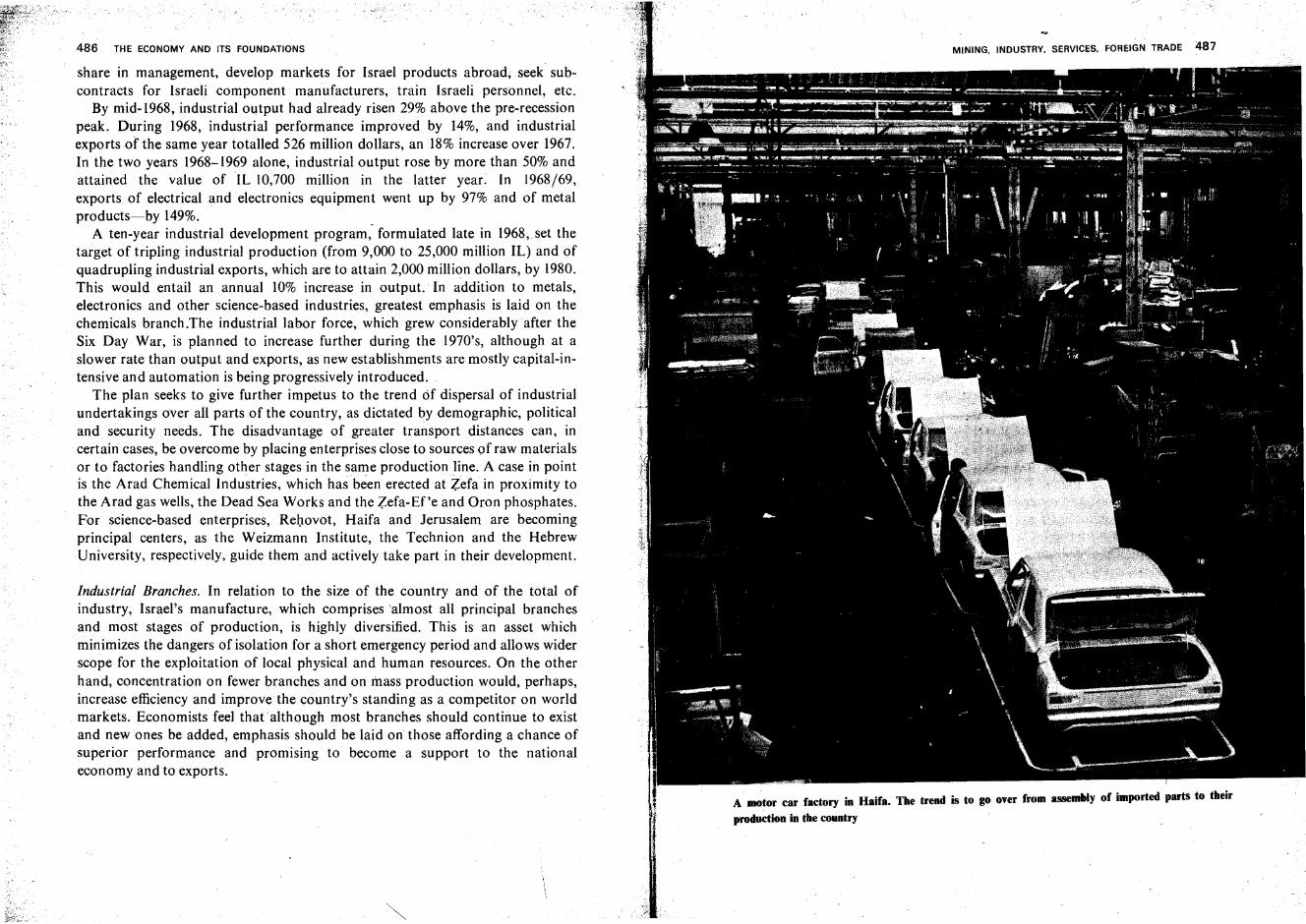
486 THE ECONOMY AND ITS FOUNDATIONS
share in management, develop markets for Israel products abroad, seek subcontracts for Israeli component manufacturers, train Israeli personnel, etc.
By mid-1968, industrial output had already risen 29% above the pre-recessionpeak. During 1968, industrial performance improved by 14%, and industrialexports of the same year totalled 526 million dollars, an 18% increase over 1967.In the two years 1968-1969 alone, industrial output rose by more than 50% andattained the value of IL 10,700 million in the latter year. In 1968/69,exports of electrical and electronics equipment went up by 97% and of metalproducts-by 149%. _
A ten-year industrial development program, formulated late in 1968, set thetarget of tripling industrial production (from 9,000 to 25,000 million IL) and ofquadrupling industrial exports, which are to attain 2,000 million dollars, by 1980.This would entail an annual 10% increase in output.: In addition to metals,electronics and other science-based industries, greatest emphasis is laid on thechemicals branch.The industrial labor force, which grew considerably after theSix Day War, is planned to increase further during the 1970's, although at aslower rate than output and exports, as new establishments are mostly capital-intensive and automation is being progressively introduced.
The plan seeks to give further impetus to the trend Of dispersal of industrialundertakings over all parts of the country, as dictated by demographic, politicaland security needs. The disadvantage of greater transport distances can, incertain cases, be overcome by placing enterprises close to sources of raw materialsor to factories handling other stages in the same production line. A case in pointis the Arad Chemical Industries, which has been erected at Zefa in proximity tothe Arad gas wells, the Dead Sea Works and the Zefa-Ef'e and Oron phosphates.For science-based enterprises, Rehovot, Haifa and Jerusalem are becomingprincipal centers, as the Weizmann Institute, the Technion and the HebrewUniversity, respectively, guide them and actively take part in their development.
Industrial Branches. In relation to the size of the country and of the total ofindustry, Israel's manufacture, which comprises 'almost all principal branchesand most stages of production, is highly diversified. This is an asset whichminimizes the dangers of isolation for a short emergency period and allows widerscope for the exploitation of local physical and human resources. On the otherhand, concentration on fewer branches and on mass production would, perhaps,increase efficiency and improve the country's standing as a competitor on worldmarkets. Economists feel that although most branches should continue to existand new ones be added, emphasis should be laid on those affording a chance ofsuperior performance and promising to become a support to the nationaleconomy and to exports.
MINING. INDUSTRY. SERVICES. FOREIGN TRADE 487
A· motor car factory in Haifa. The trend is to go over from assemhly of imported parts to their
production in the country
488 THE ECONOMY AND ITS FOUNDATIONS
In the geographical distribution of industrial branches, no clear tendencies arerecognizable in Israel. During the last decades, industry the world over hasemancipated itself to a mounting degree from dependence on local conditions
, (e.g., the textiles branch, earlier preferring sites with high air humidity,can now,as a result of air conditioning systems,' choose locations as it sees fit). Naturally,enterprises using bulky raw materials, or producing wares expensive to transport,seek, even more than others, proximity of ports and principal markets. For allbranches, the main cities are preferable because of easier availability of labor,machinery, spare parts, etc. The neighborhood of mining sites, or of farmproduce (e.g., cotton, sugar beet) carries decisive weight only in a few instances.No wonder, therefore, that in 1963-64 56.8% of all enterprises and 43.1 % of allpersons employed in industry were concentrated in Tel Aviv and its district.When Haifa, its district and the Central District are added, the figures mount to84.7% and 79.4%, respectively.
A comparison with 1967/68 data (which only relate to establishments employing 5 or more persons) reveals a certain success of the policy aiming at a bettergeographical distribution of industry, and, in its wake, of population. Tel AvivCity and District account for 54.9% of enterprises and for 40.3% of employees.Together with Haifa City and District and the Central District, the figures read83.9 and 76.8%, respectively.
The metal branch, employing the relatively largest number of workers, showsgreatest variety, both in the thousands of items produced, and in the size ofenterprises, from the largest factories in the, country to.xine-man workshops.Basic production stages are concentrated in the Haifa Bay area-the Acre SteelCity, large foundries, and other plants. Emphasis is laid on rolling and castingprocesses rather than on smelting.
All subdivisions of the metal branch are represented in the country, includingmachine building, toolmaking, production of household goods and buildingparts, electrical appliances, electronics, etc. Especially important are those goodswhich are to cover typical needs of Israel households (e.g., refrigerators) or oflocal farming (e.g., irrigation pipes and sprinklers); the latter category often isproduced in .kibbutz plants. Important are armament plants, which strive tosupply the bulk of Israel's security requirements and to recover-throughexports-at least part of the foreign exchange needed for arms acquisitionabroad. Progress is also being made in the local automobile industry, whichbegan with the assembly of imported parts but is gradually proceeding to theirproduction on its own. A similar basic trend is aimed at in the Israel AircraftIndustries near Lod Airport-with over 13,000 employees (in 1970) Israel'sbiggest single enterprise-as well as in the shipbuilding yards of Haifa Bay, in thenew Bet Shemesh Turbomeca turbine and jet engine plant, etc. t
MINING. INDUSTRY. SERVICES. FOREIGN TRADE 489
Building materials are a veteran branch of Israel's industry; among the fir~t
large plants opened in the country were a factory for silicate ?ricks near Tel AvIVand one for roof tiles at Moza near Jerusalem. The most Important plants atpresent are the three cement factories at ~esher in the Haifa Bay area, at Ramla,and at Bet Shemesh in the Judean Foothills; they cover the v~s~ needs oflocalconstruction and in certain years produce sizeable quantities for export.Specialized plants manufacture prefabricate~ buil.ding parts, asbestos plates, etc.
Ceramics and glass industries have also existed m Israel ~~r sever~l decades. Toa rising degree, they are based on locally mined raw materials.. ThIS .enables t~e
industry, to some extent, to follow the policy of geograph~cal ~Isp~rsal; Inaddition to the main center in Haifa Bay and plants manufacturing scientific glassinstruments which are linked to the Hebrew University in Jerusalem and to theWdzmann Institute at Rehovot, a large ceramics plant operates at Beersheba,and a glass factory at Yeroham in the Central Negev.
In diamond polishing, Israel is among the foremost world. pro~ucers. Theindustry is based exclusively on the superior skill of experts who immigrated fromBelgium and Holland shortly before and during World War. II. A~ all rawdiamonds are purchased abroad, the added value of the produce IS relatively low;Israel polishers are specialized in jewelry gems. Exports therefore depend,on themarkedly fluctuating foreign markets. All this does not detr~ct .fro~ the ,Importance of the branch which tops the list of Israel's exports, bringing In an Incomeof 215.9 million dollars in 1969. The first diamond polishing plants we~e openedat Netanya in the Sharon; today, the largest number is con~entrated m the TelAviv conurbation. The virtual absence of transport cost differences, howeve.r,facilitates the dispersal of the industry; it has now penetrated to some centers Inthe hill regions and is found in development towns throughout the co~nt.ry.
The chemical industry already plays a decisive role in Israel's economic life,and is expected to expand even more rapidly in the ?ear futur~. In. 1968.' stepswere undertaken to coordinate the work of the mam enterprises In this field(Dead Sea Works, Haifa Refineries, Chemicals and Phosphates, .Is~ael Petrochemicals, Haifa Chemicals, Arad Chemical Industries, etc.), aImI~g at theannual export total of 500 million dollars within ten years, as against $79..1million in 1969. Accenting heavy chemicals, Israel produces the three ?aSICfertilizers (nitrates, potash, phosphates). Israel has begun to manufac~ure ~Ighlyconcentrated combinations with minimum dead weight, such as potassium n~tra~e
and potassium metaphosphate, or specialties like di-calcium phosphate WhICh ISan important fodder additive; such new lines and many o.thers open excel~ent
export prospects. Preparations were made in 1969 for ~ettmg up. a magnesiumplant near the Arad Chemicals Factory. Strides are being made m the electrochemical and petrochemical branches, with production of such fundamental
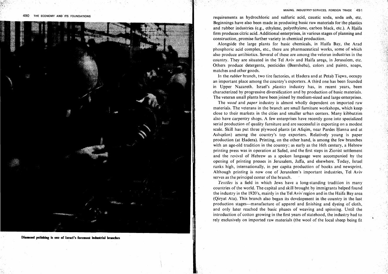
490 THE ECONOMY AND' ITS FOUNDATIONS
DiaBlOnd polishing is one of Israel's foremost industrial brlllldles
MINING. INDUSTRY~~SERVICES. FOREIGN TRADE 491
requirements as hydrochloric and sulfuric acid, caustic soda, soda ash, etc.Beginnings have also been made in producing basic raw materials for the plasticsand rubber industries (e.g., ethylene, polyethylene, carbon black, etc.). A Haifafirm produces citric acid. Additional enterprises, in various stages of planning andconstruction, promise further variety in chemical production. '
Alongside the large plants for basic chemicals, in Haifa Bay, the Aradphosphoric acid complex, etc., there are pharmaceutical works, some of whichalso produce antibiotics. Several of these are among theveteran industries in thecountry. They are situated in the Tel Aviv and Haifa areas, in Jerusalem, etc.Others produce detergents, pesticides (Beersheba), colors, and paints, soaps,matches and other goods.
In the rubber branch, two tire factories, at Hadera and at Petah Tiqwa, occupyan important place among the country's exporters. A third one has been foundedin Upper Nazareth. Israel's plastics industry has, in recent years, beencharacterized by progressive diversification and by production of basic materials.The veteran small plants have been joined by medium-sized and large enterprises.
The wood and paper industry is almost wholly dependent on imported rawmaterials. The veterans in the branch are small furniture workshops, which keepclose to their markets in the cities and smaller urban centers. Many kibbutzimalso have carpentry shops. A few enterprises have recently gone into specializedserial production of quality furniture and are successful in exporting on a modestscale. Skill has put three plywood plants (at Afiqim, near Pardes Hanna and atAshqelon) among the country's top exporters. Relatively young is paperproduction (at Hadera). Printing, on the other hand, is among the few brancheswith an age-old tradition in the country; as early as the 16th century, a Hebrewprinting press was in operation at Safed, and the first steps in Zionist settlementand the revival of Hebrew as a spoken language were accompanied by theopening of printing presses in Jerusalem, Jaffa, and elsewhere. Today, Israelranks high, internationally, in per capita production of books and newsprint.Although printing is now one of Jerusalem's important industries, Tel Avivserves asthe principal center of the branch.
Textiles is a field in which Jews have a long-standing tradition in manycountries of the world. The capital and skill brought by immigrants helped foundthe industry in the 1920's, mainly in the Tel Aviv' region and in the Haifa Bay area(Qiryat Ata). This branch also began its development in the country in the lastproduction stages-manufacture of apparel and finishing and dyeing of cloth,and only later reached the basic phases of weaving and spinning. Until theintroduction of cotton growing in the first years of statehood, the industry had torely exclusively on imported raw materials (the wool of the local sheep being fit
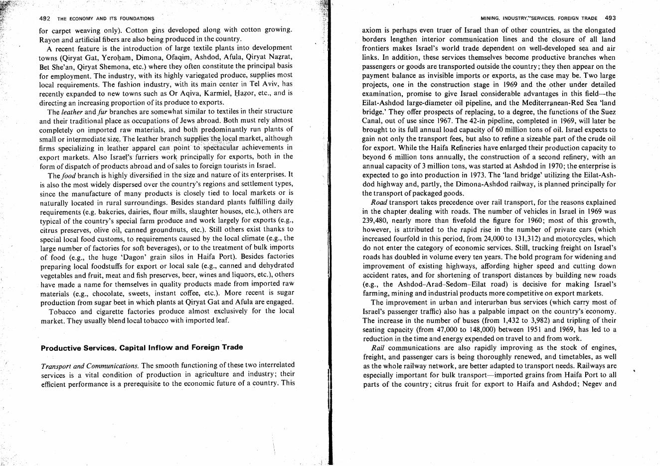
4~2 THE ECONOMY AND ITS FOUNDATIONS
for carpet weaving only). Cotton gins developed along with cotton growing.Rayon and artificial fibers are also being produced in the country.
A recent feature is the introduction of large textile plants into developmenttowns (Qiryat Gat, Yeroham, Dimona, Ofaqim, Ashdod, Afula, Qiryat Nazrat,Bet She'an, Qiryat Shemona, etc.) where they often constitute the principal basisfor employment. The industry, with its highly variegated produce, supplies mostlocal requirements. The fashion industry, with its main center in Tel Aviv, hasrecently expanded to new towns such as Or Aqiva, Karmiel, Hazer, etc., and isdirecting an increasing proportion of its produce to exports.
The leather andfur branches are somewhat similar to textiles in their structureand their traditional place as occupations of Jews abroad. Both must rely almostcompletely on imported raw materials, and both predominantly run plants ofsmall or intermediate.size, The leather branch .suppli~s'th~;l0f:almarket, althoughfirms specializing in.leather apparel can point' to' spect~ciilar achievements inexport markets. Also Israel's furriers work principally for exports, both in theform of dispatch of products abroad and of sales to foreign tourists in Israel.
The food branch is highly diversified in the size and nature of its enterprises. Itis also the most widely dispersed over the country's regions and settlement types,since the manufacture of many products is closely tied to local markets or isnaturally located in rural surroundings. Besides standard plants fulfilling dailyrequirements (e.g. bakeries, dairies, flour mills, slaughter houses, etc.), others aretypical of the country's special farm produce and work largely for exports (e.g.,citrus preserves, olive oil, canned groundnuts, etc.). Still others exist thanks tospecial local food customs, to requirements caused by the local climate (e.g., thelarge number of factories for soft beverages), or to the treatment of bulk importsof food (e.g., the huge 'Dagon' grain silos in Haifa Port). Besides factoriespreparing local foodstuffs for export or local sale (e.g., canned and dehydratedvegetables and fruit, meat and fish preserves, beer, wines and liquors, etc.), othershave made a name for themselves in quality products made from imported rawmaterials (e.g., chocolate, sweets, instant coffee, etc.). More recent is sugarproduction from sugar beet in which plants at Qiryat Gat and Afula are engaged.
Tobacco and cigarette factories produce almost exclusively for the localmarket. They usually blend local tobacco with imported leaf.
Productive Services, Capital Inflow and Foreign Trade
Transport and Communications. The smooth functioning of these two interrelatedservices is a vital condition of production in agriculture and industry; theirefficient performance is a prerequisite to the economic future of a country. This
MINING, INDUSTRY,·DSERVICES, FOREIGN TRADE 493
axiom is perhaps even truer of Israel than of other countries, as the elongatedborders lengthen interior communication lines and the closure of all landfrontiers makes Israel's world trade dependent on well-developed sea and airlinks. In addition, these services themselves become productive branches whenpassengers or goods are transported outside the country; they then appear on thepayment balance as invisible imports or exports, as the case may be. Two largeprojects, one in the construction stage in 1969 and the .other under detailedexamination, promise to give Israel considerable advantages in this' field-theEilat-Ashdod large-diameter oil pipeline, and the Mediterranean-Red Sea 'landbridge.' They offer prospects of replacing, to a degree, the functions of the SuezCanal, out of use since 1967. The 42-in pipeline, completed in 1969, will later bebrought to its full annual load capacity of 60 million tons of oil. Israel expects togain not only the transport fees, but also to refine a sizeable part of the crude oilfor export. While the Haifa Refineries have enlarged their production capacity tobeyond 6 million tons annually, the construction of a second refinery, with anannual capacity of 3 million tons, was started at Ashdod in 1970; the enterprise isexpected to go into production in 1973. The 'land bridge' utilizing the Eilat-Ashdod highway and, partly, the Dimona-Ashdod railway, is planned principally forthe transport of packaged goods.
Road transport takes precedence over rail transport, for the reasons explainedin the chapter dealing with roads. The number of vehicles in Israel in 1969 was239,480, nearly more than fivefold the figure for 1960; most of this growth,however, is attributed to the rapid rise in the number of private cars (whichincreased fourfold in this period, from 24,000 to 131,312)and motorcycles, whichdo not enter the category of economic services. Still, trucking freight on Israel'sroads has doubled in volume every ten years. The bold program for widening andimprovement of existing highways, affording higher speed and cutting downaccident rates, and for shortening of transport distances by building new roads(e.g., the Ashdod-Arad-Sedom-Eilat road) is decisive for making Israel'sfarming, mining and industrial products more competitive on export markets.
The improvement in urban and interurban bus services (which carry most ofIsrael's passenger traffic) also has a palpable impact on the country's 'economy.The increase in the number of buses (from 1,432 to 3,982) and tripling of theirseating capacity (from 47,000 to 148,000) between 1951 and 1969, has led to areduction in the time and energy expended on travel to and from work.
Rail communications are also rapidly improving as the stock of engines,freight, and passenger cars is being thoroughly renewed, and timetables, as wellas the whole railway network, are better adapted to transport needs. Railways areespecially important for bulk transport-imported grains from Haifa Port to allparts of the country; citrus fruit for export to Haifa and Ashdod; Negev and
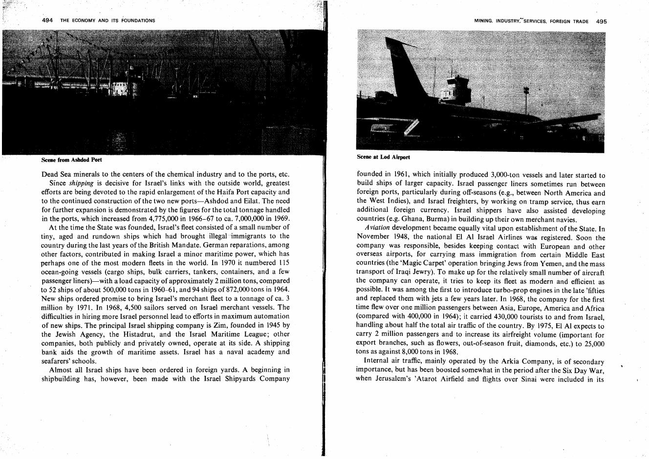
494 THE ECONOMY AND ITS FOUNDATIONS
Dead Sea minerals to the centers of the chemical industry and to the ports, etc.Since shipping is decisive for Israel's links with the outside world, greatest
efforts are being devoted to the rapid enlargement of the Haifa Port capacity andto the continued construction of the two new ports-Ashdod and Eilat. The needfor further expansion is demonstrated by the figures for the total tonnage handledin the ports, which increased from 4,775,000 in 1966-67 to ca. 7,000,000 in 1969.
At the time the State was founded, Israel's fleet consisted of a small number oftiny, aged and rundown ships which had brought illegal-immigrants to thecountry during the last years of the British Mandate. German reparations, amongother factors, contributed in making Israel a minor maritime power, which hasperhaps one of the most modern fleets in the world. In 1970 it numbered 115ocean-going vessels (cargo ships, bulk carriers, tankers, containers, and a fewpassenger liners)-with a load capacity of approximately 2 million tons, comparedto 52 ships of about 500,000 tons in 1960-61, and 94 ships of 872,000 tons in 1964.New ships ordered promise to bring Israel's merchant fleet to a tonnage of ca. 3million by 1971. In 1968, 4,500 sailors served on Israel merchant vessels. Thedifficulties in hiring more Israel personnel lead to efforts in maximum automationof new ships. The principal Israel shipping company is Zim, founded in 1945 bythe Jewish Agency, the Histadrut, and the Israel Maritime League; othercompanies, both publicly and privately owned, operate at its side. A shippingbank aids the growth of maritime assets. Israel has a naval academy andseafarers' schools.
Almost all Israel ships have been ordered in foreign yards. A beginning inshipbuilding has, however, been made with the Israel Shipyards Company
MINING. INDUSTRY:~SERVICES. FOREIGN TRADE 495
Scene at Lod Airport
founded in 1961, which initially produced 3,000-ton vessels and later started tobuild ships of larger capacity. Israel passenger liners sometimes run betweenforeign ports, particularly during off-seasons (e.g., between North America andthe West Indies), and Israel freighters, by working on tramp service, thus earnadditional foreign currency. Israel shippers have also assisted developingcountries (e.g. Ghana, Burma) in building up their own merchant navies.
Aviation development became equally vital upon establishment of the State. InNovember 1948, the national El Al Israel Airlines was registered. Soon thecompany was responsible, besides keeping contact with European and otheroverseas airports, for carrying mass immigration from certain Middle Eastcountries (the 'Magic Carpet' operation bringing Jews from Yemen, and the masstransport of Iraqi Jewry). To make up for the relatively small number of aircraftthe company can operate, it tries to keep its fleet as modern and efficient aspossible. It was among the first to introduce turbo-prop engines in the late 'fiftiesand replaced them with jets a few years later. In 1968, the company for the firsttime flew over one million passengers between Asia, Europe, America and Africa(compared with 400,000 in 1964); it carried 430,000 tourists to and from Israel,handling about half the total air traffic of the country. By 1975, El Al expects tocarry 2 million passengers and to increase its airfreight volume (important forexport branches, such as flowers, out-of-season fruit, diamonds, etc.) to 25,000tons as against 8,000 tons in 1968.
Internal air traffic, mainly operated by the Arkia Company, is of secondaryimportance, but has been boosted somewhat in the period after the Six Day War,when Jerusalem's 'Atarot Airfield and flights over Sinai were included in its
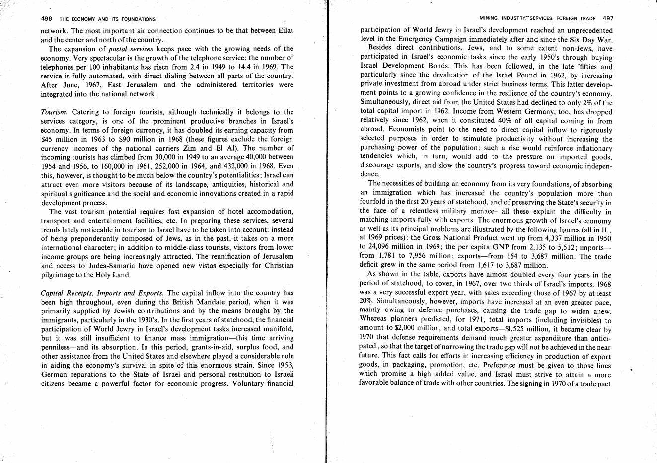
496 THl: ECONOMY AND ITS FOUNDATIONS
network. The most important air connection continues to be that between Eilatand the center and north of the country.
The expansion of postal services keeps pace with the growing needs of theeconomy. Very spectacular is the growth of the telephone service: the number oftelephones per 100 inhabitants has risen from 2.4 in 1949 to 14.4 in 1969. Theservice is fully automated, with direct dialing between all parts of the country.After June, 1967, East Jerusalem and the administered territories wereintegrated into the national network.
Tourism. Catering to foreign tourists, although technically it belongs to theservices category, is one of the prominent productive branches in Israel'seconomy. In terms of foreign currency, it has doubled its earning capacity from$45 million in 1963 to $90 million in 1968 (these figures exclude the foreigncurrency incomes of the national carriers Zim and El AI). The number ofincoming tourists has climbed from 30,000 in 1949 to an average 40,000 between1954 and 1956, to 160,000 in 1961, 252,000 in 1964, and 432,000 in 1968. Eventhis, however, is thought to be much below the country's potentialities; Israel canattract even more visitors because of its landscape, antiquities, historical andspiritual significance and the social and economic innovations created in a rapiddevelopment process.
The vast tourism potential requires fast expansion of hotel accomodation,transport and entertainment facilities, etc. In preparing these services, severaltrends lately noticeable in tourism to Israel have to be taken into account: insteadof being preponderantly composed of Jews, as in the past, it takes on a moreinternational character; in addition to middle-class tourists, visitors from lowerincome groups are being increasingly attracted. The reunification of Jerusalemand access to Judea-Samaria have opened new vistas especially for Christianpilgrimage to the Holy Land.
Capital Receipts, Imports and Exports. The capital inflow into the country hasbeen high throughout, even during the British Mandate period, when it wasprimarily supplied by Jewish contributions and by the means brought by theimmigrants, particularly in the 1930's. In the first years of statehood, the financialparticipation of World Jewry in Israel's development tasks increased manifold,but it was still insufficient to finance mass immigration-this time arrivingpenniless-and its absorption. In this period, grants-in-aid, surplus food, andother assistance from the United States and elsewhere played a considerable rolein aiding the economy's survival in spite of this enormous strain. Since 1953,German reparations to the State of Israel and personal restitution to Israelicitizens became a powerful factor for economic progress. Voluntary financial
MINING. INDUSTRY~~SERVICES. FOREIGN TRADE 497
participation of World Jewry in Israel's development reached an unprecedentedlevel in the Emergency Campaign immediately after and since the Six Day War.
Besides direct contributions, Jews, and to some extent non-Jews, haveparticipated in Israel's economic tasks since the early 1950's through buyingIsrael Development Bonds. This has been followed, in the late 'fifties andparticularly since the devaluation of the Israel Pound in 1962, by increasingprivate investment from abroad under strict business terms. This latter development points to a growing confidence in the resilience of the country's economy.Simultaneously, direct aid from the United States had declined to only 2% of thetotal capital import in 1962. Income from Western Germany, too, has droppedrelatively since 1962, when it constituted 40% of all capital coming in fromabroad. Economists point to the need to direct capital inflow to rigorouslyselected purposes in order to stimulate productivity without increasing thepurchasing power of the population; such a rise would reinforce inflationarytendencies which, in turn, would add to the pressure on imported goods,discourage exports, and slow the country's progress toward economic independence.
The necessities of building an economy from its very foundations, of absorbingan immigration which has increased the country's population more thanfourfold in the first 20 years of statehood, and of preserving the State's security inthe face of a relentless military menace-all these explain the difficulty inmatching imports fully with exports. The enormous growth of Israel's economyas well as its principal problems are illustrated by the following figures (all in Il.,at 1969 prices): the Gross National Product went up from 4,337 million in 1950to 24,096 million in 1969; the per capita GNP from 2,135 to 5,512; importsfrom 1,781 to 7,956 million; exports-from 164 to 3,687 million. The tradedeficit grew in the same period from 1,617 to 3,687 million.
As shown in the table, exports have almost doubled every four years in theperiod of statehood, to cover, in 1967, over two thirds of Israel's imports. 1968was a very successful export year, with sales exceeding those of 1967 by at least20%. Simultaneously, however, imports have increased at an even greater pace,mainly owing to defence purchases, causing the trade gap to widen anew.Whereas planners predicted, for 1971, total imports (including invisibles) toamount to $2,000 million, and total exports-$1,525 million, it became clear by1970 that defense requirements demand much greater expenditure than anticipated , so that the target of narrowing the trade gap will not be achieved in the nearfuture. This fact calls for efforts in increasing efficiency in production of exportgoods, in packaging, promotion, etc. Preference must be given to those lineswhich promise a high added value, and Israel must strive to attain a morefavorable balance of trade with other countries. The signing in 1970of a trade pact
,
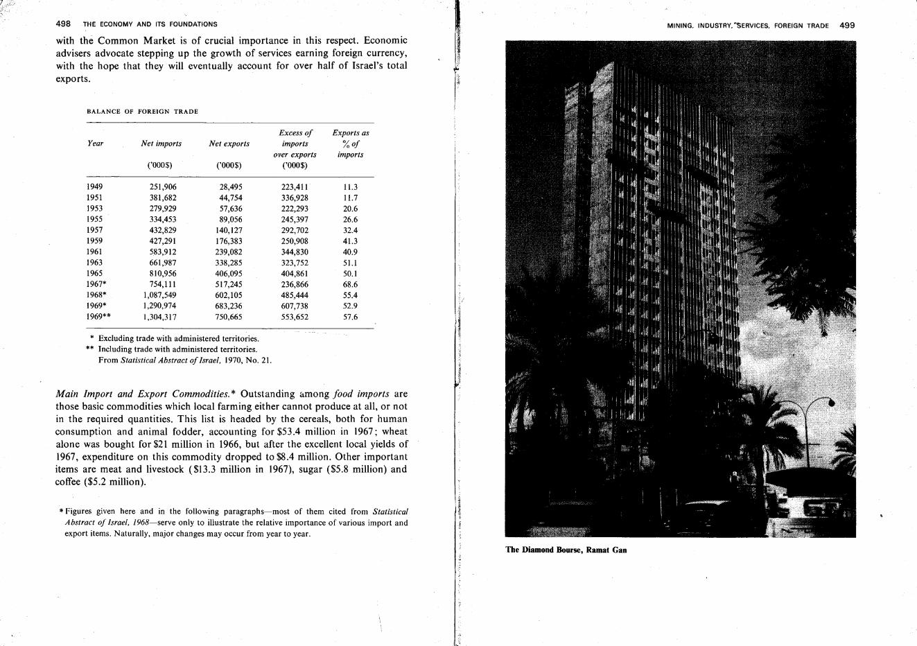
498 THE ECONOMY AND ITS FOUNDATIONS
with the Common Market is of crucial importance in this respect. Economicadvisers advocate stepping up the growth of services earning foreign currency,with the hope that they will eventually account for over half of Israel's totalexports.
BALANCE OF FOREIGN TRADE
Excess of Exports asYear Net imports Net exports imports %of
over exports imports('000$) ('000$) ('000$)
1949 251,906 28,495 223,411 11.31951 381,682 44,754 336,928 11.71953 279,929 57,636 222,293 20.61955 334,453 89,056 245,397 26.61957 432,829 140,127 292,702 32.41959 427,291 176,383 250,908 41.31961 583,912 239,082 344,830 40.91963 661,987 338,285 323,752 51.11965 810,956 406,095 404,861 50.11967* 754,1l1 517,245 236,866 68.61968* 1,087,549 602,105 485,444 55.41969* 1,290,974 683,236 607,738 52.91969** 1,304,317 750,665 553,652 57.6
* Excluding trade with administered territories.** Including trade with administered territories.
From Statistical Abstract of Israel, 1970, No. 21.
Main Import and Export Commodities. * Outstanding &mong food imports arethose basic commodities which local farming either cannot produce at all, or notin the required quantities. This list is headed by the cereals, both for humanconsumption and animal fodder, accounting for $53.4 million in 1967; wheatalone was bought for $21 million in 1966, but after the excellent local yields of1967, expenditure on this commodity dropped to $8.4 million. Other importantitems are meat and livestock ($13.3 million in 1967), sugar ($5.8 million) andcoffee ($5.2 million).
* Figures given here and in the following paragraphs-most of them cited from StatisticalAbstract of Israel, 1968-serve only to illustrate the relative importance of various import andexport items. Naturally, major changes may occur from year to year.
Ie~i-Ii
MINING. INDUSTRY. ·'SERVICES. FOREIGN TRADE 499
The Diamond Bourse, Ramat Gan
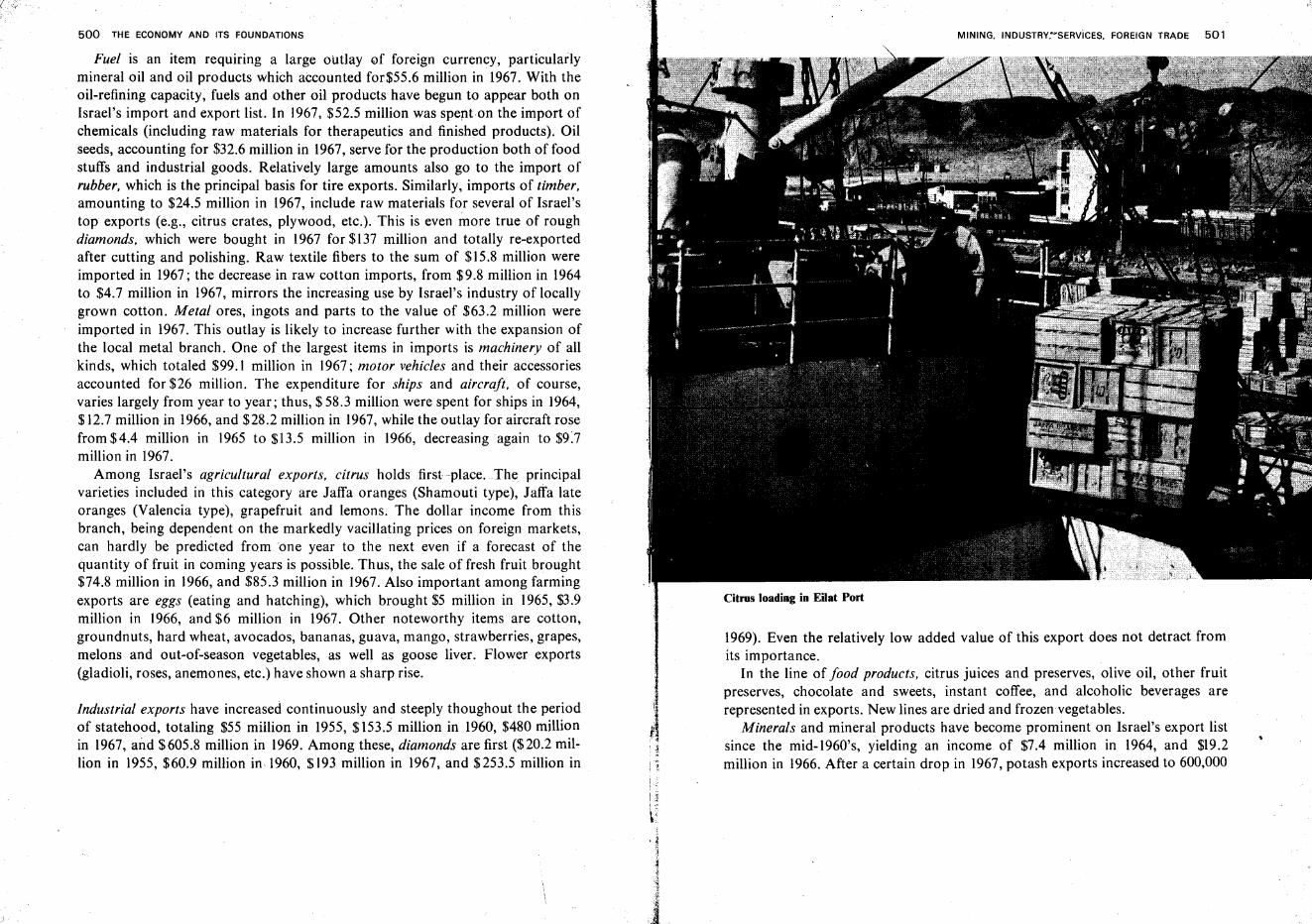
500 THE ECONOMY AND ITS FOUNDATIONS
Fuel is an item requiring a large outlay of foreign currency, particularlymineral oil and oil products which accounted for$55.6 million in 1967. With theoil-refining capacity, fuels and other oil products have begun to appear both onIsrael's import and export list. In 1967, $52.5 million was spenton the import ofchemicals (including raw materials for therapeutics and finished products). Oilseeds, accounting for $32.6 million in 1967, serve for the production both of foodstuffs and industrial goods. Relatively large amounts also go to the import ofrubber, which is the principal basis for tire exports. Similarly, imports of timber,amounting to $24.5 million in 1967, include raw materials for several of Israel'stop exports (e.g., citrus crates, plywood, etc.). This is even more true of roughdiamonds, which were bought in 1967 for $137 million and totally re-exportedafter cutting and polishing. Raw textile fibers to the sum of $15.8 million wereimported in 1967; the decrease in raw cotton imports, from $9.8 million in 1964to $4.7 million in 1967, mirrors the increasing use by Israel's industry of locallygrown cotton. Metal ores, ingots and parts to the value of $63.2 million wereimported in 1967. This outlay is likely to increase further with the expansion ofthe local metal branch. One of the largest items in imports is machinery of allkinds, which totaled $99.1 million in 1967; motor vehicles and their accessoriesaccounted for $26 million. The expenditure for ships and aircraft, of course,varies largely from year to year; thus, $ 58.3 million were spent for ships in 1964,$12.7 million in 1966, and $28.2 million in 1967, while the outlay for aircraft rosefrom $4.4 million in 1965 to $13.5 million in 1966, decreasing again to $9:7million in 1967.
Among Israel's agricultural exports, citrus holds first place. The principalvarieties included in this category are Jaffa oranges (Shamouti type), Jaffa lateoranges (Valencia type), grapefruit and lemons. The dollar income from thisbranch, being dependent on the markedly vacillating prices on foreign markets,can hardly be predicted from 'one year to the next even if a forecast of thequantity of fruit in coming years is possible. Thus, the sale of fresh fruit brought$74.8 million in 1966, and $85.3 million in 1967. Also important among farmingexports are eggs (eating and hatching), which brought $5 million in 1965, $3.9million in 1966, and $6 million in 1967. Other noteworthy items are cotton,groundnuts, hard wheat, avocados, bananas, guava, mango, strawberries, grapes,melons and out-of-season vegetables, as well as goose liver. Flower exports(gladioli, roses, anemones, etc.) have shown a sharp rise.
Industrial exports have increased continuously and steeply thoughout the periodof statehood, totaling $55 million in 1955, $153.5 million in 1960, $480 millionin 1967, and $605.8 million in 1969. Among these, diamonds are first ($20.2 million in 1955, $60.9 million in, 1960, $193 million in 1967, and $253.5 million in
f..l•
MINING. INDUSTRY;~SERVicES. FOREIGN TRADE 501
Citrus loading in Eilat Port
1969). Even the relatively low added value of this export does not detract fromits importance.
In the line of food products, citrus juices and preserves, olive oil, other fruitpreserves, chocolate and sweets, instant coffee, and alcoholic beverages arerepresented in exports. New lines are dried and frozen vegetables.
Minerals and mineral products have become prominent on Israel's export listsince the mid-1960's, yielding an income of $7.4 million in 1964, and $19.2million in 1966. After a certain drop in 1967, potash exports increased to 600,000
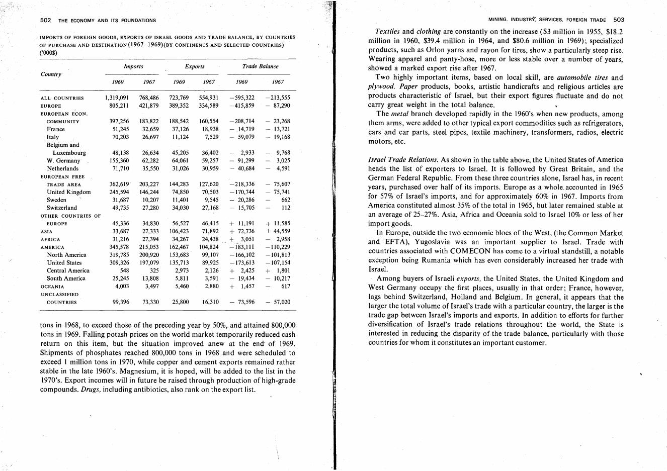
502 THE ECONOMY AND ITS FOUNDATIONS
IMPORTS OF FOREIGN GOODS, EXPORTS OF ISRAEL GOODS AND TRADE BALANCE, BY COUNTRIESOF PURCHASE AND DESTINATION (1967-1969)(BY CONTINENTS AND SELECTED COUNTRIES)
('000$)
tons in 1968, to exceed those of the preceding year by50%, and attained 800,000tons in 1969. Falling potash prices on the world market temporarily reduced cashreturn on this item, but the situation improved anew at the end of 1969.Shipments of phosphates reached 800,000 tons in 1968 and were scheduled toexceed 1 million tons in 1970, while copper and cement exports remained ratherstable in the late 1960's. Magnesium, it is hoped, will be added to the list in the1970's. Export incomes will in future be raised through production of high-gradecompounds. Drugs, including antibiotics, also rank on the export list.
Israel Trade Relations. As shown in the table above, the United States of Americaheads the list of exporters to Israel. It is followed by Great Britain, and theGerman Federal Republic. From these three countries alone, Israel has, in recentyears, purchased over half of its imports. Europe as a whole, accounted in 1965for 57% of Israel's imports, and for approximately 60% in 1967. Imports fromAmerica constituted almost 35% of the total in 1965, but later remained stable atan average of 25-27%. Asia, Africa and Oceania sold to Israel 10% or less of herimport goods.
In Europe, outside the two economic blocs of the West, (the Common Marketand EFTA), Yugoslavia was an important supplier to Israel. Trade withcountries associated with COMECON has come to a virtual standstill, a notableexception being Rumania which has even considerably increased her trade withIsrael.
Among buyers of Israeli exports, the United States, the United Kingdom andWest Germany occupy the first places, usually in that order; France, however,lags behind Switzerland, Holland and Belgium. In general, it appears that thelarger the total volume of Israel's trade with a particular country, the larger is thetrade gap between Israel's imports and exports. In addition to efforts for furtherdiversification of Israel's trade relations throughout the world, the State isinterested in reducing the disparity of the trade balance, particularly with thosecountries for whom it constitutes an important customer.
MINING. INDUSTRY': SERVICES. FOREIGN TRADE 503
Textiles and clothing are constantly on the increase ($3 million in 1955, $18.2million in 1960, $39.4 million in 1964, and $80.6 million in 1969); specializedproducts, such as Orlon yarns and rayon for tires, show a particularly steep rise.Wearing apparel and panty-hose, more or less stable over a number of years,showed a marked export rise after 1967.
Two highly important items, based on local skill, are automobile tires andplywood. Paper products, books, artistic handicrafts and religious articles areproducts characteristic of Israel, but their export figures fluctuate and do notcarry great weight in the total balance.
The metal branch developed rapidly in the 1960's when new products, amongthem arms, were added to other typical export commodities such as refrigerators,cars and car parts, steel pipes, textile machinery, transformers, radios, electricmotors, etc.
Trade Balance
1969 1967
-595,322 -213,555~415,859 - 87,290
-208,714 - 23,268
14,719 13,72159,079 19,168
2,933 9,768- 91,299 3,025- 40,684 4,591
-218,336 75,607-170,744 75,741 ,f
- 20,286 66215,705 112
36,40259,25730,959
1967
46,415 + 11,191 + 11,58571,892 + 72,736 + 44,55924,438 + 3,051 - 2,958
104,824 -183,111 -110,22999,107 -166,102 -101,81389,925 -173,613 -107,1542,126 + 2,425 + 1,8013,591 19,434 10,2172,880 + 1,457 617
16,310 73,596 57,020
127,62070,503
9,54527,168
554,931334,589
160,55418,9387,529
25,800
45,20564,06131,026
1969
56,527106,42334,267
162,467153,683135,713
2,9735,8115,460
144,28374,85011,40134,030
188,54237,12611,124
723,769389,352
Exports
· .
Bibliography
GENERAL
ABEL, F. M., Geographiede la Palestine, I-II, Paris, 1933-1938.Atlas Geografi-Histori shel Ere? Yisrael (Geographical-Historical Atlas of the Land of Israel),
edited by M. Avi-Yonah, Israel Army General Staff, Chief Education Officer. [Hebrew].Atlas Israel (Atlas of Israel). Cartography, Physical Geography, History, Demography, Econom
ics, Education, Dept. of Surveys, Ministry of Labor and Bialik Institute, 1956-1964.[Hebrew].
AVI-YONAH, M., The Madaba Mosaic Map, Jerusalem, 1954.AVI-YONAH, M., Map of Roman Palestine, 2nd ed., Oxford, 1940.BENTOR, Y. K. and VROMAN, A., 'A Structural Contour Map of Israel,' BReI, 4, pp. 125-135,
1954.BENTWICH, N., Palestine, London, 302 pp., 1934.BONNE, A., Palastina, Land und Wirtschaft, Berlin, 333 pp., 1935.
BRAWER, A. Y., Erez Yisrael (The Land of Israel), Bialik Institute-Dvir, 531 pp., 1954. [Hebrew].BRAWER, M. and KARMON, Y., Atlas ha-Mizrab ha-Tikhon (Atlas of the Middle East), Yavneh,
Tel Aviv, 1964. [Hebrew].BUCKINGHAM, I. S., Travels in Palestine, London, 1821.BURCKHARDT, J. L., Travels in Syria and the Holy Land, London, 1822.CONDER, C. R. and KITCHENER, H. H., Map of Western Palestine, in 26 sheets, London, 1880.CONDER, C. R. and KITCHENER, H. H., The Survey of Western Palestine, Memoirs of the Topog-
raphy, Orography, Hydrography and Archaeology, 3 vols., London, 1881-1883.CRESSEY, G. B., Asia's Lands and People, McGraw-Hill, New York, pp. 388-398, 1951.EFRAT, E. and MESSING, H., Millon le-Geografiya we-Lidi'at ha-Arez (Dictionary of General and
Israel Geography), 'Massada, Tel Aviv, 309 pp., 1960. [Hebrew].Enziqlopediya Ivrit (Hebrew Encyclopedia), Vol. VI:. Erez Yisrael (The Land of Israel), Massada,
Tel Aviv, 1,172 pp., 1957. [Hebrew].Enziqlopediya Miqra'it (Biblical Encyclopedia), 5 vols., Mosad Bialik, Jerusalem, 1955-1968.
[Hebrew].
Ere? Yisrael. Annual Volumes. Archeological, Historical and Geographical Studies, I-X, IsraelExploration Society ed., Jerusalem, 1951-1970. [Hebrew].
FISHER, W. 8., The Middle East, Methuen and Co. Ltd., London, 514 pp., 1950.GUERIN, N. V., Description de la Palestine, I-III, Paris, 1868-1880.GUTHE, H., Bibelatlas, 2nd ed., Leipzig, 1925.
505
506 BIBLIOGRAPHY
HAREL, M. and NIR, D., Geografiya Shel Erez Yisrael (Geography of the Land of Israel), AmOved, Tel Aviv, 1969. [Hebrew].
HUNTINGTON, E., Palestine and Its Transformation, London, 1911.Facts about Israel. Annual Volumes, Ministry for Foreign Affairs, 1950-1970.Lexikon Miqra'i (Biblical Lexicon) (eds. Soli'eli and M. Barkuz), 2 vols., Dvir, Tel Aviv, 1965.
[Hebrew].MARMARDJI, A. S., Textes geographiques arabes sur la Palestine, Paris, 1951.MUNK, S., Palestine, Description geographique, historique et archeologique, Firmin Didot
Freres, Paris, 704 pp. et env. 100 gravures, 1845.NEUBAUER, A., La Geographie du Talmud, Paris, 1868.ORNI, E., Moladtenu (Our Homeland), R. Mass, Jerusalem, 200 pp., 1957. [Hebrew].ORNI, E., This is Israel. A Guidebook, Achiasaf, Jerusalem, 336 pp., 1962.PALMER, P. and GUTHE, H., Die Mosaikkartevon Madeba, I, Leipzig, 1906.PAPORISH, Y., Yedi'at ha-Arez, Geografiya Fizit we-Yishuvit (Israel's Geography, Physical and
Human), Czaczyk, Tel Aviv, 1960. [Hebrew].PRESS, Y., Enziqlopediya shel Erez Yisrael (Encyclopaedia of Palestine), 4 vols., R. Mass, Jeru
salem, 1948-1955. [Hebrew].
REIFENBERG, A. A., The Struggle between the Desert and the Sown, Bialik Institute, Jerusalem,1950.
Research Council of Israel. Desert Research, Proceedings of International Symposium, Sponsoredby the Research Council and UNESCO, 643 pp., 1952.
RITTER, C., Die Erdkunde von Asien, Bd. 8, Abt. 2, Berlin, 1848~ 1854.RITTER, c., Vergleichende Erdkunde der Sinai-Halbinsel, Palastina und Syrien, Berlin, 1850.ROBINSON, E., Physical Geography of the Holy Land, London, 1865.SCHATTNER, I., Mapat Erez Yisrael we-Toldoteha (The Map of the Land of Israel and Its History),
Bialik Institute, Jerusalem, 204 pp., 1951. [Hebrew].Statistical Abstract of Israel, Israel Bureau of Statistics, No. 21, Jerusalem, 1970. [Hebrew and
English].
The Survey of Western Palestine, Vols. I-III, 1881-1889; The Survey of Eastern Palestine, Vols.I-II, Palestine Exploration Fund, London, 1889.
TAVENER, L. E., The Revival of Israel, Hodder and Stoughton, London, 128 pp., 1961.TRIETSCH, D., Paliistina-Handbuch, Berlin, 1912.VILNAI, Z., Israel Guide, Jerusalem, 1970.VILNAI, Z., Ha-Mapa ha-Ivrit shel Erez Yisrael (The Hebrew Map of Palestine), The Jewish Pales
tine Exploration Society, 1944. [Hebrew].VOLNEY, C. F., Voyage en Egypte et en Syrie, 1783-1785, Paris, 1825.
THE COUNTRY, ITS STRUCTURE AND GEOLOGICAL HISTORY
AMIRAN, D. H. K., 'Qawey Yesod be-Mivne ha-Arez mi-Zafon le-Viq'at Be'ersheva' (Fundamental Traits in the Structure of the Country North of the Beersheba Depression), ErezYisrael, Annual of the Israel Exploration Society, Vol. 4, pp. 9-23, 1956. [Hebrew].
AVNIMELECH, M., Zefunot Sal'ey Arzenu (The Secrets of Our Rocks). Sketches on Palestine'sGeology and Paleontology, Sifriat ha-Po'alim, 324 pp., 1948. [Hebrew].
BIBLIOGRAPHY 507
BLANCKENHORN, M., Syrien, Arabien und Mesopotamien. Handbuch fur regionale Geologie,
Bd. V, Heidelberg, 1914.LARTET, L., 'Essai sur la geologie de la Palestine,' Ann. Sci. Geol. I, I, Paris, 1869.PICARD, L., Structure and Evolution of Palestine. Geological Department, Hebrew University,
Jerusalem, 134pp., 1943.
THE NEGEV·
BENTOR, Y. and VROMAN, A., Ha-Mapa ha-Geologit shel ha-Negev (T~e Geological Map 01 theNegev), Israel Army ed., 1951. [Hebrew].
BITAN (Buttenwieser), A., Mehqar Topo-Aqlimi be-Hevel ha-Besor (To po-Climatic Survey of theBesor Region), Jewish Agency Settlement Dept., 315 pp., 1967. [Hebrew].
BRASLAVI (Braslavsky), Y., Hayada'ta et ha-Arez (Know Thy Country), Vol. II, Erez ha-Negev
(The Land of the Negev), 506 pp. 1947; Vol. IV, EI Elat we-el Yam Suf(Toward Eilat and TheRed Sea), 532 pp., Ha-Kibbutz ha-Me'uhad ed. [Hebrew].
DEBUCHY, V., Le Neguev, ou la conquete de l'impossible, Ecole Pratique des Hautes Etudes, Paris.364+33 pp., 1968.
EFRAT, E. and GABRIELI, E., Physical Master Plan of the Northern Negev, Ministry of the Interior,Planning Dept., 1967. [Hebrew and English].
GLUECK, N., Rivers in the Desert-the Exploration of the Negev, Weidenfeld and Nicolson,London, 302 pp., 1959.
KALLNER-AMIRAN, D. H., 'Georrnorphology of the Central Negev Highlands,' lEJ, I, pp. 107-120,1950/51.
LAWRENCE, T. E. and WOOLLEY, C. L., 'The Wilderness of Zion,' Palestine Exploration FundAnnual, III, London, 1914/15.
LOEHNBERG, E., Ha-Negev ha-Rahoq (The Far Negev), Am Oved, Tel Aviv, 192 pp., 1954.[Hebrew].
MESTRAS, J., 'Israel Contre Ie Desert: la mise en valeur du Neguev,' CO.M., 9"pp. 181-201, 1956.PICARD, L., 'Geomorphology ofIsrael,Part I: The Negev,' BRCl, I, 1-2, 1951.PICARD, L. and SOLMONICA, P., On the Geology of the Gaza-Beersheba District, Jerusalem,
1936.
THE COASTAL PLAIN
AVITZUR, SH., Nahal ha- Yarqon (The Yarqon River), Ha-Kibbutz ha-Mc'uhad ed., 231 pp., 1948.[Hebrew].
AVNIMELECH, M., 'The, Geological History of the Yarqon Valley and the Influence on AncientSettlements,' IEJ, I, pp. 77-83, 1950/51.
AVNIMELECH, M., 'Late Quaternary Sediments of the Coastal Plain of Israel,' BReI, 2, pp. 5i-57,
1952.BEN ARIEH, Y., NASHIV, Y. and REICHMAN, S., 'Hof ha-Karmel ha-Deromi-Seqira Geografit'
(The Southern Carmel Coast-a Geographical Survey), Yedi'ot ha-Hevra la-Haqirat ha
Are?, 26, pp. 3-14, 1962. [Hebrew].
508 BIBLIOGRAPHY
BEN ARIEH, Y., NASHIV, Y. and REICHMAN, S., 'Ha-Shimmush ha-Haqla'i be-Qarqa ha-Hof shelha-Karmel ha-Deromi' (Agricultural Use of the South Carmel Coast Lands), Yedi'ot, 26,pp.48-70, 1962. [Hebrew].
EFRAT, E. and GABRIEL!, E., Physical Master Plan of the Coastal Strip, Ministry of the Interior,Planning Dept., Jerusalem, 22 pp. and 17 maps, 1966. [English Abstract].
EFRAT, E., Physical Master Plan of the Jerusalem-Ashdod Region, Ministry of the Interior, Planning Dept., 1967. [English Abstract].
EMERY, K. O. and BENTOR, Y. K., The Continental Shelf of Israel,' Sea Fisheries Research StationBull. 28, Jerusalem, pp. 25-41', 1960.
GHALLAB, E.S., 'Constant and Variable Factors in the Interrelations between the Judean Plateauand the Maritime Plain of Palestine,' BRSGE, 24, pp. 201-225, 1951.
GRADER, P. Z. and REISS, Z., On the Lower Cretaceous of the Helez Area, Bull. 16, Geologic Survey of Israel, II pp., 1958.
LOEHNBERG, A. E., The Buried Structure of Rosh ha-Ayin in the Central Coastal Plain of Israel,'IEJ, II, pp. 145-152, 1952.
KARMON, Y., 'Geographical Aspects in the History of the Coastal Plain of Israel,' IEJ, VI, pp. 3350, 1956.
NIR, D., 'Artificial Outlets of the Mount Carmel Valleys through the Coastal "Kurkar" Ridge,'IEJ, IX, pp. 46-54, 1959.
NIR, D., 'Etude sur la morphologie littorale d'Israel,' AdG, 68, pp. 424-436, 1959.PICARD, L. and AVNIMELECH, M., On the Geology of the Central Coastal Plain, Jerusalem, 1937.RANGE, P., Die Kiistenebene Paldstinas, Berlin, 1922.RIM, M., 'Sand and Soil in the Coastal Plain of Israel,' IEJ, I, pp. 33-48, 1950/51.SHALEM, N., 'Considerazioni sull'origine delle sabbie Palestinense da Ras en-Nakura al confino
Egiziano,' Societe dei Naturalisti eMatematici di Modena, 6A, Vol. III, pp. 47-52, 1928.
THE HILL REGIONS
AMIRAN, D. H. K., NIR, D. and SCHICK, A. P., The "Lake" of Dalton: Agam Dalton,' IEJ, a,pp, 246-259, 1959.
AVNIMELECH, M., Etude geologiques dans la region de la Shephela en Palestine, Grenoble, 1936.BRASLAVI (Braslavsky), Y., Hayada'ta et ha-Arez (Know Thy Country), Vol. I., Ha-Ga/i/ we
Imqey ha-Zafon (Galilee and the Valleys of the North), 1956; Vol. V, Beyn Tavor we-Hermon(Between Tabor and Hermon), 1960. [Hebrew].
FLEXER, A., The Geology of Mount Gilboa,' BRCl, 7, lOG, pp. 64-67, 1961.
HAREL, M., 'Reduced Aridity in Eastern Lower Galilee,' IEJ, VII, pp. 256-262, 1957.NIR, D., 'Les marges meridionales du phenornene karstique en Israel,' Revue Geogr. Alpine, 52,
pp.533-541,1964.
OPPENHEIM, M., The Geology of the Southeastern Galilee Lava Fields,' BRCI, II G, pp. 58-84,1962.
PICARD, L., Geological Researches in the Judean Desert, Jerusalem, 1931.PRAUSNITZ, M. W., The First Agricultural Settlements in Galilee,' IEJ, IX, pp. 166-174, 1959.
SCHICK, A. P., Geomorfologiya shel Hevel Menashe (Geomorphology of the Menashe Region),Hebrew University, Jerusalem, 272 pp., 1963. [Hebrew].
. BIBLIOGRAPHY 509
SCHWOEBEL, V., 'Das westpalastinische Mittelland,' ZdPV, 53, 1930.SCHWOEBEL, V., 'Die Verkehrswege und Ansiedlungen Galilaas in ihrer Abhangigkeit von den
natiirlichen Bedingungen,' ZdPV, 27, pp. 1-151, 1904.SCHWOEBEL, V., 'Die geographischen Verhaltnisse des Menschen in der Wiiste Juda; Paliistina
jahrbuch des deutsch-evange/ischen Instituts, III, Jerusalem, 1907.SHIFTAN, Z. L., 'The Goo-Hydrology of the Safad Region,' BRCI, Vol. 1,4, 1952.YEDAYA, M. and GIL, E. (eds.), Ma'aravo shel ha-Ga/i/ (The West of Galilee), Sullam Zor-s-Ga'aton
Regional Study Circle for Knowledge of the Country, 292 pp., 1961. [Hebrew].Yehuda Wirushalayim (Judea and Jerusalem), Volume of the 12th Convention of the Israel Explora-
tion Society, 208 pp., 1957. [Hebrew]. j
Zefat we-ha-Ga/i/ (Safed and Galilee), Volume of the Israel Exploration Society, 1959. [Hebrew].
THE JORDAN RIFT AND ITS BRANCHES
ALMOG, Y. and ESHEL, B. Z., Ezor Yam ha-Melab (The Dead Sea Region), Am Oved, Tel Aviv.
583 pp., 1956. [Hebrew].AVNIMELECH, M., 'On the Geology and Morphology of the Megiddo Area,' JPOS, 19, pp. 18-37,
1939.BEN-ARIEH, Y., 'Some Remarks on the Last Stages of the Formation of Lake Tiberias,' Israel
Journal ofEarth Sciences, 13, 2, pp. 53-62, 1964.BEN-ARIEH, Y., Tentative Water Balance of the Lisan Lake,' Israel Journal of Earth Sciences,
13, I, pp. 42-47, 1964.BEN-ARIEH, Y., The Changing Landscape of the Central Jordan Valley, Magnes Press, Jerusalem,
131 pp. and maps, plates, 1968.BLANCKENHORN, M., Naturwissenschaft/iche Studien am Toten Meer und im Jordantale, Berlin,
1912.BRASLAVI (Braslavsky), Y., Hayada'ta et ha-Arez (Know Thy Country), Volume III: Yam ha
Metal: Saviv Saviv (The Dead Sea and Its Surroundings), Ha-Kibbutz ha-Me'uhad ed.,508 pp., 1956. [Hebrew].
DELEEUW, A., Some Information on Lake Tiberias, Israel Ministry of Agriculture, Water Dept.Report No. I, 1950.
GLUECK, N., The Jordan, Westminster Press, Philadelphia, 1946.IONIDEs, M. G., The Jordan Valley,' RCAJ, 38, pp. 217-225,1951.KARMON, Y., Emeq ha-Hula ha-Zefoni (The Northern Hula Valley), Hebrew University, Y. L.
Magnes ed., 108pp., 1956. [Hebrew].KARMON, Y., The Drainage of the Huleh Swamps,' G.R., 50, pp. 169-193, 1960.KARMON, Y., 'The Settlement of the Huleh Valley since 1838,' IEJ, 3, pp. 4-25, 1953.KLEIN, C., On the Fluctuations of the Level of the Dead Sea since the Beginning of the 19th
Century, Israel Ministry of Agriculture, Water Commission, Hydrological Service, Hydr.Paper No.7, Jerusalem, 1960.
LAMBERTY, M. A., 'Fluctuations in the Level of the Dead Sea,' G.R., 52, pp. 602-603,1962.LYNCH, W. F., Narrative of the United States Expedition to the River Jordan and the Dead Sea,
2nd ed., London, 1850.
510 BIBLIOGRAPHY
MOLYNEUX, A., 'Expedition to the Jordan and the Dead Sea,' Journ.Royal Geogr. Soc., 18,
pp. 104-130, 1848.NEUMANN, J., 'On the Water Balance of Lake Tiberias,' IEJ, 4, pp. 246-249, 1953.
NEUMANN, J., 'Energy and Evaporation from Sweet Water Lakes of the Jordan Rift,' BReI, 2,
pp.337-357,1953.NEUMANN, J., 'On the Water Balance of the Lake Huleh Swamps 1942/43-1946/47,' IEJ, 5,
pp.49-58, 1955.
NIR, D., Ezor Bet She'an (The Bet She'an Region), Ha-Kibbutz ha-Me'uhad ed., 200 pp., 1960.
[Hebrew].NIR, D., La Vallee de Beth Cheane-i-la mise en valeur d'une region a la lisiere du desert, A. Colin,
Paris, 182 pp., 1968.NOVOMEYSKY, M., The Dead Sea, Transactions of the Institute of Chemical Engineers, Vol. 14,
1936.OREN, O. H., 'Physical and Chemical Characteristic of Lake Tiberias,' BRCI, Ilg, pp. 1-33, 1962.
ORNI, E., Huleh, Background and Development, Jewish National Fund, Jerusalem, 54 pp., 1952.
PICARD, L., 'Zur Geologie der Besan-Ebene,' ZdPV, Bd. 52, 1929.
PICARD, L., Zur Geologie der Kischon-Ebene, Liepzig, 1928.PICARD, L., 'Zur Geologie des mittleren Jordantals,' ZdPV, Bd. 55, 1932.PICARD, L., The Pleistocene Peat of Lake Hula; BENTOR, Y., Air Photographs and Geological
Mapping in the Negev, Geological Institute, Jerusalem, 22 pp. and plates, 1952.
QUENNELL, A. M., The Structural and Geomorphic Evolution of the Dead Sea Rift,' QuarterlyJourn., Geol. Society of London, 114, pp. 1-24, 1958.
SCHATTNER, I., The Lower Jordan Valley-s-A Study of Fluviomorphology of an Arid Zone, Jeru-salem, 1961.
SCHULMANN, N., 'The Geology of the Central Jordan Valley,' BRCI, 8, pp. 2-3; 36-90, 1959.
SCHWOEBEL, V., DerJordangraben, Breslau, 1921.
SHALEM, N., The Valley of the Hule, Tel Aviv, 1937.
SHIFTAN, Z. L., 'An Artesian Aquifer of the Southern Dead Sea Basin,' BRCI, 76, pp. 27-52,
1958.
SHIFTAN, Z. L., 'New Data on the Artesian Aquifers of the Southern Dead Sea Basin and Their
Geological Evolution,' BRCI, 11,2, pp. 121-128, 1952.
The Huleh and the Upper Jordan Region, Volume ed. by Youth and Hechalutz Dept. of World
Zionist Organization and Jewish National Fund, Jerusalem, 253 pp., 1954.YARON, F., The Springs of Lake Kinneret and Their Relationship to the Dead Sea,' BRCI, 11, 2,
pp. 121-128, 1952.YARON, F. and HEITNER, M., 'The Chloride-Bromide Ratio of the Water Sources of the Eastern
Emek Yesreel and of the Beisan Valley,' BRCI, 11,2, pp. 121-128, 1952.
YEVIN, SH. and HIRSCHBERG, Z. (eds.), Ere; Kinarot (The Land of Kinarot), Sifriyat Kav le-Kav,
Tel Aviv, 166 pp. and plates, 1950. [Hebrew].
TRANSJORDAN
BRUENNOW, R. E. and DOMASZEWSKI, A., Die Provincia Arabia, 3 vols., Strassburg, 1904-1909.
CONDER, CR., The Survey of Eastern Palestine, I: The Adwan Country, London, 1889.
BIBLIOGRAPHY 511
Ha-Golan, Leqet Ma'amarim (The Golan, Collected Articles), Internal Publication of the Israel
Exploration Circles of the Kibbutz Movement, 382 pp., 1970. [Hebrew].
IONIDES, M. G. and BLAKE, G. S., Report on the Water Resources 01' Transjordan and Their
Developmenj, 1939.KONIKOFF, A., Transjordan, an Economic Survey, Economic Research Institute of the Jewish
Agency, 120 pp., 1946.MUSIL, A., Arabia Petraea. Vol. II: Edom, Wien, 1907-19mLNEISTATT, M., Ha-Golan (The Golan), Ma'arakhot (Israel Army), 213 pp., 1968. [Hebrew].
SCHUMACHER, G. and STEUERNAGEL, C, 'Der Adschlun,' ZdPV, Bd.47, 1924.
SCHUMACHER, G" 'Der Dscholan,' ZdPV. Bd. 9, 1886; 'Der Siidlich\: Basan,' ZdPV, Bd. 20,
1897.
THE CLIMATE
AMIRAN, D. H. K. and GILEAD, M., 'Early Excessive Rainfall and Soil Erosion,' IEJ, IV,
pp. 286-295, 1954.
ASHBEL, D., Bio-Climatic Atlas of Israel, Meteorology Dept. of the Hebrew University, Jerusalem, 151 pp., 1951. [Hebrew and English].
ASHBEL, D., Die Niederschlagsverhhltnisse im siidlichen Libanon, Palastina lind im niirdlichenSinai. Berlin, 1930,
ASHBEL, D., 'Frequency and Distribution of Dew in Palestine,' G.R., 39, pp. 291-297, 1949.
ASHBEL, D., Regional Climatology ofIsrael, ed. Meteorology Dept. of the Hebrew University,Jerusalem, 244 + 17 pp. [Hebrew and English].
BIEL, E. R., Climatology 01' the Mediterranean Area, Chicago, 1944.
BITAN-BuTTENWIESER, A" 'A Comparison of Sixty Years' Rainfall between Jerusalem and TelAviv,' IEJ, 13, pp. 242-246, 1963.
FEIGE, R. and ROSENAU, E., Rainfall Atlas of Palestine, Jerusalem, 1940.
FEIGE, R. and ROSENAU, E., Rainfall in Palestine and Transjordan. Appendix: Geology and
Water Resources of Palestine, by G.S, BLAKE and M. G. GOLDSCHMIDT, Jerusalem, 1947.GILEAD, M. and ROSENAN, N., Ten Years of Dew Observation in Israel,' IEJ, IV, pp. 120-123,
1954.
NEUMANN, J., 'Evaporation from the Red Sea,' IEJ, 11, pp. 153-162, 1952.
NEUMANN, J., 'On the Incidence of Dry and Wet Years,' IEJ, VI, pp. 58-63, 1956.
ROSENAN, N:, 'One Hundred Years of Rainfall in Jerusalem-s-A Homotopic Series ,of AnnualAmounts,' IEJ, V, pp. 137-153, 1955.
SHALEM, N " 'Stabilite du climat en Palestine,' Revue Biblique, 58, pp. 54-74, 1951.
fLORA AND FAUNA
BODENHEIMER, F. S., Animal Life in Palestine, Jerusalem, 1935.
BODENHEIMER, F. S., Prodromus Faunae Palaestinae, Cairo, 1937.
BODENHEIMER, SH., Ha-Hay be-Arzot ha-Miqra (Wildlife in Lands of the Bible), Bialik Institute,
Jerusalem, 350pp., 1950. [Hebrew].
512 BIBLIOGRAPHY
EIG, A., 'A Contribution to the Knowledge ofthe Flora in Palestine,' Inst. Agr. and Nat. Hist.,Agr. Exp. Sta. Bull., 4, pp. 1-72, 1926.
EIG, A., Les elements et les groupes phytogeographiques auxi/iaires dans la flore palestinienne, I,II, Beih. Rep. spec. nov. veg., 63,1931-1932.
EVENARI, M., 'Ecological Investigations in Palestine on the Vegetation of Kurkar Hills,' BRCI,I, 1-2, pp. 48-58, 1952.
FEINBRUN, N. and ZOHARY, M., 'A Geobotanical Survey of Transjordan,' Pal. Journ. Bot., 6,1955.
GINDEL, Y., Ha-Ya'ar we-ha-Ye'ur be-Yisrael (Forest and Afforestation in Israel), Forestry Research Laboratory, 344 pp., 1952. [Hebrew].
ORNI, E., Afforestation in Israel (2nd ed.), Jewish National Fund, Jerusalem, 78 pp., 1969.POST, G. E. and DINSMORE, J. E., Flora of Syria, Palestine and Sinai (2nd ed.), 2 vols., Amer.
Univ. Pub\. Fac. Arts and Sci. Ser., I, Beirut, pp. 1-639; 1-928, 1931-1932.ZOHARY, M., Mavo la-Geobotaniqa shel Ere? Yisra'el (Introduction to the Geobotany of the
Land of Israel), Hashomer Hatzair ed., 278 pp., maps, 1944. [Hebrew].ZOHARY, M., 'A Geobotanical Soil Map of Western Palestine,' Pal. Journ. Bot., 4, pp. 24-35,
1947.
ZOHARY, M. and FEINBRUN, N., 'Outline of Vegetation of the Northern Negev,' Pal. Journ. Bot.,5,pp.96-114,1951.
ZOHARY, M. and ORSHANSKY, G., The Vegetation of the Huleh Plain,' Pal. Journ. Bot., 4,pp. 90-105, 1947.
ZOHARY, M. and ORSHANSKY, G. 'Structure and Ecology of the Vegetation in the Dead Sea Regionof Palestine,' Pal. Joum. Bot., 4, pp. 178-206, ·1949.
THE ARCHEOLOGICAL AND HISTORICAL BACKGROUND
AHARONI, Y., The Negev of Judah,' IEJ, VIII, pp. 26-38, 1958.AHARONI, Y. and ROTENBERG, B., Be-Iqvot Melakhim u-Mordim be-Midbar Yehuda (Tracing
Kings and Rebels in the Judean Desert), Massadah, Tel Aviv, 162 pp., 1960. [Hebrew].ALBRIGHT, W. F., The Archaeology of Palestine, Penguin Books, 271 pp., 1949.ALT, A., Kleine Schriften zur Geschichte des Volkes Israel, 3 vols., Miinchen, 1953.ApPLEBAUM, SH., Archaeology in Israel, Israel Today Series, No. 10, Israel Digest, 32 pp., 1962.AVI-YoNAH, M., Bimey Roma u-Vizantion (In the Days of Rome and Byzantium), Bialik Insti-
tute, Jerusalem, 274 pp., 1962. [Hebrew].AVI-YONAH, M., Historiya Geografit shel Erez Yisra'el (Historical Geography of the Land of
Israel, from the End of the Babylonian Exile up to the Arab Conquest), Bialik Institute,Jerusalem, 231 pp., 1962. [Hebrew].
AVI-YONAH, M. and YEVIN, SH., Qadmoniyot Arzenu (The Antiquities of Israel), Ha-Kibbutz haMe'uhad ed., 344 pp., 1955. [Hebrew].
BEIN, A., The Return to the Soi/-a History of Jewish Settlement in Israel, Youth and HechalutzDept. of the Zionist Organization, 576 pp., 1952.
BEN ZVI, I., Ere? Yisra'el we-Yishuvah tahat ha-Shi/ton ha-Otomani (The Land of Israel underOttoman Rule: Four Centuries of History), Bialik Institute, Jerusalem, 478 pp., 1962.[Hebrew].
/
BIBLIOGRAPHY 513
BRASLAVI (Braslavsky), Y., Le-Heqer Arzenu (The Research of Our Country, The Past and ItsRemnants), Ha-Kibbutz ha-Me'uhad ed., 390 pp., 1954. [Hebrew].
CARMEL, M., Ma'arakhot Zafon (Battles of the North), Ha-Kibbutz ha-Me'uhad ed., 286 pp.,1949. [Hebrew].
CONDER, C. R., The Latin Kingdom ofJerusalem, London, 1897.DALMAN, G., Orte und Wege Jesu, 3 Aufl., Giitersloh, 1924.DOTHAN, T., Ha-Pelishtim we-Tarbutam he-Homrit (The Philistines and Their Material Culture),
Bialik Institute, Jerusalem, 1967. [Hebrew].DUBNOV, S., Weltgeschichte desjudischen Volkes, 10 Bde., Jiidischer Verlag, Berlin, 1924.GARROD, D. A. E. and BATE, D. M. A., The Stone Age of Mount Carmel, Excavations at the
Wadi el-Mughara, Vol. I, Oxford, 1937.GARSTANG, J., Joshua-Judges, London, 1931.GRAETZ, H., History of the Jews, 6 vols., the Jewish Publication Society of America, Phila-
delphia, 1945.GROUSSET, R., Histoire des croisades, 3 vols., Paris, 1935.HABAS, 8., Migdal we-Homa (Tower and Stockade), Labor Fed. ed., 202 pp., 1939. [Hebrew].KENYON, K. M., Archaeology in the Holy Land, 2nd ed., Methuen, London, 328 pp., 1965.KLEIN, SH., Ere? Yehuda (The Land of Judah), Dvir, Tel Aviv, 289 pp., 1939. [Hebrew].LAMB, Y., 'Crusader Lands Re-Visited,' NGM, 106, pp. 815-852, 1954.LESTRANGE, G., Palestine under the Moslems, London, 1890.NEUVILLE, R., Le paleolithique et mesolithique du desert de Judee, Archive de l'Institute de Pale
ontologie Humaine, Memoire 24, Paris, 1951.NOTH, M., Geschichte Israels, 3 Aufl., Gottingen, 1956. .PRAWER, J., Toldot Mamlekhet ha-Zalbanim be-Ere? Yisra'el (A History of the Latin Kingdom
of Jerusalem), 3 vols., 561,544 pp., separate index 105pp., 1962. [Hebrew].ROBINSON, E., Biblical Researches in Palestine, Mount Sinai and Arabia Petraea, 3 vols., London,
1841.
ROHRICHT, R., Geschichte des Konigreichs Jerusalem, Innsbruck, 1893.ROTH, c., Short History of the Jewish People, East and West Library.SCHORER, E., Geschichte desjiidischen Volkes im Zeitalter Jesu Christi, 4 Aufl., Leipzig, 1907.SHOR, F., 'Conquest of the Holy City,' NGM, 124, pp. 838-857, 1963.SHOR, F., 'Crusader Road to Jerusalem,' NGM, 124, pp. 797-837, 1963.SMITH, G. A., The Historical Geography of the Holy Land, Following the 25th ed., 1931, re
edited by Fontana Library, London, 512 pp., 1966.STEKELIS, M., Les monuments megalithiques de Palestine, Archives de l'Institut de Paleontologic
Humaine, Memoire 15, Paris, 1935.TADMOR, N. H. et aI., The Ancient Desert Agriculture of the Negev, 2 vols., Israel Ministry of
Agriculture, 1957-1958.WEITZ, Y., Hitnahalutenu bi-Tqufat ha-Sa'ar (Our Settlement in Stormy Times), Sifriyat ha
Po'alim, Tel Aviv, 202 pp., 1947. [Hebrew].YADlN, Y. (ed.), Megillat Beney Or bi-Vney Hoshekh (The Scroll of the War of the Sons of Light
against the Sons of Darkness), Bialik Institute, Jerusalem, 397+vi pp., 1955. [Hebrew andEnglish summary].
YADlN, Y., Ha-Mimza'im Mimey Bar-Kokhba bi-M'arot ha-Iggarot (Judean Desert StudiesThe Finds from the Bar-Kokhba Period in the 'Cave of Letters'), Israel Exploration Society
and Bialik Institute, Jerusalem, 292 pp. and 108 plates, 1963. [Hebrew].
514 BIBLIOGRAPHY
YADIN, Y.; Torat ha-Milhama be-Arzot ha-Miqra (The Art of War in the Lands of the Bible),International Publishing Co., Ramat Gan, 416 pp. and plates, 1963. [Hebrew].
YEVIN, SH., Milhemet Bar Kokhba (Bar Kokhba's War), Bialik Institute, Jerusalem, 264 pp.,1952. [Hebrew].
DEMOGRAPHY
AMIRAN, D. H. K. and BEN-ARIEH, Y., 'Sedentarization of Beduin in Israel,' IEJ, 13, 1963.AVIDOR, M., Education for a Growing Nation, Israel Today Series, No. I, Israel Digest, 24 pp.,
1961.
BEAUJEU-GARNIER, J., 'L'Immigration dans I'Etat d'Israel,' AdG, pp. 57-61, 1952.BEN ZVI, I., 'The Druze Community in Israel,' IEJ, IV, pp. 65-76, 1954.BIANDRINI, M., 'La distribuzione attuale della popolazione in Israele,' Bol. Soc. Geogr. Italiana,
7,pp.368-399,1954.
ELATH, E., 'Population Problems in Israel,' RCAJ, 60, pp. 47-56, 1952.GRUSHKA, T. (ed.), Health Services in Israel, 1948-1958, Ministry of Health, Jerusalem, 1959.GUREVITCH, D. and GERTZ, A., Statistical Handbook of Jewish Palestine, Jerusalem, 1947.MARK, E., The Bedouin of the Negev, Manchester University Press, 15 + 260 pp., 1968.MILLS, E., Census of Palestine, I-II, 1931, Alexandria, 1933.
MOHSAM, H. V., 'Enumerating the Beduins of Palestine,' Scripta Hierosolymitana, Vol. III,pp. 265-280, 1955.
RABIN, CH., The Revival of Hebrew, Israel Today Series, No. 18, Israel Digest, 20 pp., 1958.SHIMONI, Y., Arvey Ere? Yisra'el (The Arabs of Palestine), Am Oved, Tel Aviv, 476 pp., 1947.
[Hebrew].
SMITH, C. G., 'The Boundaries and Population Problems of Israel,' Geography, 37, pp. 152-165,1952.
SUPER, A., Absorption of Immigrants, Israel Today Series, No. 18, Israel Digest, 32 pp., 1961.TAMSMA, R., 'Changes in the Jewish Population Pattern of Israel, 1948-1957: Some Human-Geo
graphical Causes and Consequences,' TESG, pp. 170-182, 1959.VILNAY,Z., Mi'utimbe-Yisra'el, Reuben Mass, Jerusalem, 268pp. [Hebrew].
RURAL SETTLEMENT
Agricultural Settlement Dept., Jewish Agency (ed.), The Composite Rural Structure-a SettlementPattern in Israel, Jerusalem, 45 pp., 1960.
AMIRAN, D. H. K., 'The Pattern of Settlement in Palestine,' IEJ, 1II, pp. 65-78; 192-260, 1953.AMIRAN, D. H. K., 'Two Types of Border of Aridity in Palestine,' XVIIIe Congres International
de Geographie, Rio de Janeiro, pp. 461-465, 1956.AMIRAN, D .. H. K., The Expansion of Settled Land in Israel, Abstracts of Papers of the 18th
Geogr. Congress, Rio de Janeiro, 1956.ASSAF, A., Moshvey Ovdim be-Yisra'el (Moshav Ovdim in Israel), Ayanot, Tel Aviv, 304 pp.,
1954. [Hebrew].
BIBLIOGRAPHY 515
Atlas of Settlement in Israel, Population and Housing Census, 1961, Publication No. 14, Central
Bureau of Statistics, Jerusalem, 1963.BARATZ, J., A Village by the Jordan, Tel Aviv, 1960.BEN DAVID, J. (ed.), Agricultural Planning and Village Community in Israel, UNESCO, Paris,
159 pp., 1964.BlENHEIM, K. L., Physical Planning of Collective Settlement in Israel, FAO Congress, Israel, Tel
Aviv, 1956.BLAKE, G. H., 'The Origins and Evolution of Israel's Moshav,' Kulturgeografi Arhus, 109, 1969.COHEN, R., Yesodot ha-Mesheq ha-Qibbutzi (Foundations of the Kibbutz Economy), Ha-Kibbutz
ha-Me'uhad ed., 278 pp., 1956. [Hebrew].
DARIN-DRABKIN, H., Der Kibbutz, Stuttgart, 1964.DESROCHE, H., Au Pays du Kibboutz, Union des Coops. des Consommations, Bille.
ELAZARI-VOLCANI, I., The Fellah's Farm, Agr. Exp, Sta., Rehovot, 128 pp., 1930.ERES, A., 'Die landwirtschaftliche Planung in Israel,' Ztschr. f ausl. Landwirtschaft, 6. Jg.,
Frankfurt aiM., pp. 64-73, Marz 1967.GRANOTT, A., The Land System of Palestine: History and Structure, Eyre & Spottiswoode,
London, 359 pp., 1952.GRANOTT, A., Agrarian Reform and the Record of Israel, Eyre & Spottiswoode, London, 301 pp.,
1956.HARMAN, A., Agricultural Settlement, Israel Today Series, No.2, Israel Digest, 36 pp., 1969.Hebrew University (ed.), Le-Herkevo ha-Hevrati shel ha-Kefar ha-Ivri be-Ere? Yisra'el (The
Social Configuration of the Jewish Village in Palestine), Massada, Tel Aviv, 239 pp., 1945.[Hebrew].
ILLERIS, S., 'Recent Changes in the Settlement Geography of Israel,' Sartryk af Geografisk Tids
skrift, Kebenhavn, 63 Bd., pp. 43-63, 1964.Jewish Agency, Land Settlement Dept., and Israel Ministry of Housing: Rural Planning in Israel,
Tel Aviv, 1964; Land Settlement in Israel, Jerusalem, 51 pp., 1970.KADAR, G., The Moshav-the Economic Aspect, International Farmers' Convention 1959, 1960.KAPLAN, 8., The Lakhish Settlement Project, State of Israel Study Group on Problems of Indi
vidual and Group Settlement, Tel Aviv, 1956.KEREM, M., The Kibbutz, Israel Today Series, No. 27, Israel Digest, 36 pp., 1963.KORN, Y., Darkah shel Tenu'at ha-Moshavim, (The Path of the Moshav Movement), Labor Fed.
ed., 29 pp., 1958. [Hebrew].LADOR, Y., Hityashvutenu ba-Arez 1870-1954 (Our Settlement in the Country, 1870-1954), Ofek,
Tel Aviv, 300 pp., 1955. [Hebrew].MEISTER, A., Principes et Tendances de la Planification Rurale en Israel, Ed. de Minuit, Paris.MEYER, E., Der Moshav, List-Gesellschaft, Basel-Tiibingen, 123 pp., 1967.NAWRATZKI, C., Die judische Kolonisation Palastinas, Miinchen, 1914.ORNI, E., Fonrs of Settlement (5th ed.), Youth and Hechalutz Dept. of Zionist Organization and
Jewish National Fund, 178 pp., 1963. '.ORNI, E.; L'Agriculture en Israel, formes de la vie rurale, Centre israeli en de Documentation,
Paris, 30 pp., 1963.PARAN, U., 'Kibbutzim in Israel: Their Development and Distribution,' Jerusalem Studies in Geog
raphy, I, pp. 1-36, 1970.
516 BIBLIOGRAPHY
Publications on Problems of Regional Development: (I) Regional Cooperation in Israel, 148 pp.;(2) Survey of Regional Cooperation in Three Regions of Collective Settlement (Cohen, E.and Leshem, E.), 89 pp.; (3) Development Trends of Spatial Rural Cooperation in Israel(Weitz, R. and Prion, I.), 108 pp.; (4) Urban Zones of Influence in the Southern CoastalPlain of Israel (Cohen, Y.), 112 pp.; (5) Inhabited Rural Centers in Israel (Shapiro, 0.),161 pp., National and University Inst. of Agriculture, Rehovot, 1968-1969.
ROSENFELD, H., Social Changes in Arab Villages, Israel Ministry of Agriculture, 1963.RUPPIN, A., The Agricultural Colonization of the Zionist Organization in Palestine, M. Hopkin
son, London, 209 pp., 1926.
SAMUEL, E., Handbook of the Jewish Communal Villages in Palestine, Jerusalem, 1945.SHAMIR, Y., Ha-Ba'ya ha-Agrarit we-ha- Yishuv ha-Kibbutzi (The Agrarian Problem and Collec-
tive Settlement), Sifriyat ha-Po'alim, Tel Aviv, 301 pp., 1953. [Hebrew].SHARON, A., 'Collective Settlement in Israel,' Town Planning Review, 23, pp. 255-270, 1955.SHATlL, J., The Way of Life in a Collective Settlement, FAO Congress in Israel, Tel Aviv, 1956.SHATIL, J., L'Economie collective du Kibbouts israelien, Editions de Minuit.
TABENKIN, Y., Ha-Hevra ha-Qibbuzit (The Kibbutz Society), Ha-Kibbutz ha-Meuhad ed., 59 pp.,1954. [Hebrew].
URI, Y., Bintiv Moshav Ovdim (The Way of the Moshav Ovdim), Youth and Hechalutz Dept. ofZionist Organization, 84 pp., 1950. [Hebrew].
URBAN SETTLEMENT
ABBADY, I. (ed.), Jerusalem Economy, Collective Volume, Jerusalem Chamber of Commerce,1950.
AMIRAN, D. H. K. and SHAHAR, A., 'Estimates of the Urban Population of Palestine in the SecondHalfofthe Nineteenth Century,' IEJ, X, pp. 181-183, 1960.
AMIRAN, D. H. K. and SHAHAR, A., 'The Towns of Israel, Principles of Their Urban Geography,'G.R., 51, pp. 348-369,1961.
BENSHEMESH, SH., Seminar on the Supply and Allocation of Land for Housing and Related Purposes (Israel), Paris, 1965.
BEN SIRA, Y., BERLER, A., MERTENS, H. and TAMIR, J., Housing Policy in Regions of Rapid Population Growth in Israel, Israel Ministry of Housing, 43 pp., 1964.
BRUTZKUS, E., Physical Planning in Israel, Jerusalem, 85 pp., 1964.
BRUTZKUS, E., 'Tikhnun Kalkali u-Fizzur Ukhlusim' (Economic Planning and Population Dispersion), Economic Quarterly, VI, pp. 321-336, 1959. [Hebrew].
DALMAN, G. H., Jerusalem und sein Geliinde, Giitersloh, 1930.DAsH, J. and Efrat, E., The Israel Physical Master Plan, Israel Ministry of Interior, Planning
Dept., 91 pp. and 35 maps, 1964.
DAsH, J., DOUDAI, A., EFRAT, E., GLIKSON, A. and KAHANE, A., National Planning for the Redistribution of Population and the Establishment of New To~ns in Israel, Israel Ministry ofInterior, Planning Dept., 38 pp., 1964.
EFRAT, E., Aspeqtim Geografiyim ba-Tikhnun ha-Fizi shel Ezor Yerushalayim (GeographicalAspects in the Physical Planning of the Jerusalem Region [Abstract]), Israel Ministry ofInterior, Planning Dept., 20 pp., 1963. [Hebrew 189 pp. and English summary].
BIBLIOGRAPHY 517
EFRAT, E., 'The Hinterland of Jerusalem and Its Economic Significance,' E.G., Vol. 40, No.3,
pp. 254-260, 1964.ELIASH, Y., 'Temurot be-Ir Midbar' (Changes in a Desert Town), Ha-Mizrah ha-Tikhon, 8,
pp. 19-25, 1957. [Hebrew].HAEZRAHI, Y., Yerushalayim asher Baharti (The Jerusalem I Have Chosen), Carta, Jerusalem,
. 310 pp., 1970. [Hebrew].ISAAC, F., 'A Deteriorating Urban Core, Ideology and Economics in the Landscape of Tel Aviv,'
TESG, 54, 52 pp., 1961.KAHANE, A., 'Aufgaben und Einfluss der raumlichen Planung bei der wirtschaftlichen und sozialen
Entwicklung Israels,' Raumforschung und Raumordnung, 21. j Jg.KAPLAN, Y., Ha-Arkheologiya we-ha-Historiya shel Tel Aviv-Jafo (Archeology and History of
Tel Aviv-Jaffa), Massada, Tel Aviv, 107 pp., 1959. [Hebrew].KARMON, Y., 'Eilat-Israel's Red Sea Port,' TESG, 54, pp. 117-126, 1953.KENDALL, H., Jerusalem, the City Plan, 1918-1948, His Majesty's Stationery Office, London,
123 pp., maps, plates, 1948.MELlON, Z. (ed.), Towns and Villages in Israel, Union of Local Authorities in Israel, Tel Aviv,
384 pp., 1966.ORNI, E., 'Stadtische Siedlungen Israels,' Geographische Rundschau, 5/1970, pp. 165-174.REIFENBERG, A., 'Caesarea, a Study in the Decline of a Town,' lEJ, I, pp. 20-32, 1950/51.SCHATTNER, I., 'Haifa: a Study in the Relation of City and Coast,' IEJ, IV, pp. 26-46, 1954.SCOFIELD, J., 'Jerusalem, the Divided City,' NGM, 115, pp. 492-531, 1959.SHAHAR, A., Megamot Hitpathut be-Tel Aviv (Development Trends in Tel Aviv), Tel Aviv Muni
cipality, 36 pp., 1964. [Hebrew].SHAHAR, A., Urban Renewal-an Interdisciplinary Symposium, Inst. for Planning and Develop
ment, Tel Aviv, 259 pp., 1968.SHARON, A., Tikhnun Fisi be-Yisra'el (Physical Planning in Israel), Israel Government Printer,
80 pp., plates, maps, 1952. [Hebrew and English].SPIEGEL, A., New Towns in Israel, Urban Planning and Regional Development, List Gesellschaft
Publications, K. Kramer Verlag, Stuttgart, 192pp., plates, maps, 1966. [German and English].
THE ROAD SYSTEM
GOTTMANN, J., 'La route et I'eau en Asie sud-occidentale,' AdG, 47, pp. 575-601, 1938.HAREL, M., 'The Roman Road at Ma'aleh ha-Aqrabim (Scorpion's Ascent),' IEJ, IX, pp. 175-199,
1959.ORION, M., 'Eser Shenot Hitpathut ha-Tahbura' (Ten Years of Transportation Development),
Economic Quarterly, V, pp. 336-346, 1958. [Hebrew].
SOIL AND WATER
AVITZUR, SH., Le-Toldot Ni77Ul Koah ha-Mayim be-Ere? Yisra'el (The History of Exploitationof Water Power in the Land of Israel), Avshalom Institute for Homeland Studies, Tel Aviv,110 pp., 38 pp, plates, 1960. [Hebrew].
518 BIBL.IOGRAPHY
AVITZUR, SH., 'On the History of the Exploitation of Water in Erez Israel,' IEJ, 10, pp. 37-45,1960. Ba'yot ha-Mayim shel Yisra'el (Israel's Water Problems), Hebrew University, Geography Dept., Jerusalem, 97 pp., 1955. [Hebrew].
BLAKE, G. S. and GOLDSCHMIDT, M. J., Geology and Water Resources oj Palestine, Jerusalem,1947.
Chemical Analyses of Water from Rivers, Springs, Wadis, and Wells, Government of Palestine,Dept. of Land Settlement and Water Commissioner, Jerusalem, 1948.
DAN, J., KOYUMDJISKY, H. and YAALON, D. M., 'Principles of a Proposed Classification for theSoils of Israel,' International Soil Conference, New Zealand, 1962.
DE LEEUW, A., 'Decade of Water Development in Israel,' Technion Yearbook, New York, 1958.GIL, N. and ROSENSAFT, Z., Soils of Israel and Their Land Use Capabilities, Part I, Israel Ministry
for Foreign Affairs, 12 pp. and maps, 1962.GOLDSCHMIDT, M. J. and JACOBS, M., Precipitation over and Replenishment of the Yarqon and
the Nahal ha-Tanninim Catchments, Hydrological Service, Jerusalem, 1959.GOTTMANN, J., 'L'Irrigation en Palestine,' AdG, 44, pp. 143-161, 1935.Government Tourist Corporation, Ha-Mayim be-Yisra'el (Water in Israel), Jerusalem, 35 pp.,
illustr., 1965. [Hebrew].KARIV, Z., Water Development and Water Costs in Israel, Israel Nat. Comm. 'for the Inter
national Committee on Irrigation and Drainage, Tel Aviv, 1960.LOWDERMILK, W. c., 'An Inventory of the Land of Israel: Land Classification for Use with Soil
Conservation,' IEJ, III, pp. 162-177, 1953.Mekorot Water Co., Ha-Movil ha-Arzi (The National Carrier), Tel Aviv, 1965. [Hebrew].ORNI, E. and YAALON, D. M., Conservation and Reclamation of the Soil, Israel Today Series,
No. 26, Israel Digest, 46 pp., 1971.ORNI, E., 'Wassernutzung in Israel und ihre Probleme,' Geographische Zeitschrift, 57, Jg. 3,
pp. 198-204, 1969.PELED, A., 'Operation of the Freeze Desalination Plants,' 1st Internat. -Symposium on Water
Desalination, Vol. III, pp. 1-10, 1965.PRUSHANSKY, Y., Water Development, Israel Today Series, No. 11, Israel Digest, 32 pp., 1961.RAVIKOVITCH, S., Soils of Israel, Their Nature and Agricultural Value, Internat. Farmers' Con
vention 1959, Jerusalem, 1960.SHIFTAN, Z. L., 'The Application of Hydrology in the Development of Israel's Water Resources,'
Lecture before the 13th Meeting of the Executive Committee, Internat. Comm. on Irrigationand Drainage, Jerusalem; 14 pp., 1962.
SHMUELI, E., Irrigation and Irrigation Research in a Semi-Arid Country, The National and University Institute of Agriculture, Rehovot, 1964.
Water Measurements, Govt. of Palestine, Dept. of Land Settlement and Water Commissioner,Jerusalem, 1947.
WIENER, A., Israel's Water Development Policy: The Israel National Water Plan, Israel Ministryfor Foreign Affairs, 12 pp. and maps, 1962. \
YAALON, D. H., 'Classification and Nomenclature of Soils in Israel,' BR(s;I, 8, 2-3, pp. 91~ 117.YAALON, D. H., 'On the Origin and Accumulation of Salts in Groundwater and Soils of Israel,'
BRCI, llG, 3, pp. 105-131.YAALON, D. H., 'Saline Irrigation Water in Calcareous Soils,' BRCI, 5B, pp. 83-97, 1955.
BIBLIOGRAPHY 519
AGRICULTURE
BEN ARIEH, Y., 'A Comparison of Agricultural Land Use in a Semi-Arid Region: Ashqelon-BetGuvrin Area,' Jerusalem Studies in Geography, 1, pp. 107-128, 1970.
COHEN, S. B., 'Israel's Fishing Industry,' G.R., pp. 66-85, 1957.EL-ZUR, A., MAGNES, J. and SAMUELOFF, S., Les recherches sur les zones arides en Israel, Centre
Israelien de documentation sur les pays de langue francaise, Paris, 16pp., 1963.HALPERIN, H., Changing Patterns in Israel Agriculture, Routledge & Co., London, 290 pp.,
1960. ,
HALPERIN, H., Agrindus (Integration of Agriculture and Industries), London, 1963.HORIN, Y., Development of Agriculture in Israel, International Farmers' Convention, Jerusalem,
1959ed., 1960.
KEDAR, Y., 'Water and Soil from the Negev-Some Ancient Agricultural Achievements in theCentral Negev,' GJ., 123, pp. 179-187, 1957.
LEVIE, E. L., The Economics of Citrus Growing in Israel, Wageningen, 1962.LOWDERMILK, W. c., 'A New Agriculture in an Old Land,' The Atlantic Monthly, 1961.
Luz, K., Agriculture in Israel, Jerusalem, 1959.NUTTONSON, M. Y., 'Agroclimatology and Crop Ecologies in the United States,' G.R., 37,
pp. 136-456, 1947.OPHEN, J.D., The Citrus Industry in Israel,' MEA, 5, pp. 51-58, 1954.ROKACH, A., History of the Citrus Industry in Israel, International Farmers Convention, Jeru
salem 1959, 1960.WEITZ, R., Darkenu ba-Haqla'ut uwa-Hityashvut (Our Ways in Agriculture and Settlement), Am
Oved, Tel Aviv, 339 pp., 1959. [Hebrew].WEITZ, R. and ROKACH, A... Agriculture and Rural Development in Israel-Projection and Plan
ning, Division of Publications, Rehovot, and Settlement Dept. of Jewish Agency, 140+ XLpp., 1963.
ZELIGMAN, N., ROSENSAFT, Z., TADMOR, N., KATZNELSON, Y. and NAVEH, Z., Ha-Mir'e ha-Tiv'i
be-Yisra'el (Natural Pasture in Israel), Sifriyat ha-Po'alim, Tel Aviv, 379 pp., 1959. [Hebrew].ZOHARY, D., 'Notes on Ancient Agriculture in the Central Negev,' IEJ, IV, pp. 17-25, 1954.
MINING, INDUSTRY, SERVICES AND FOREIGN TRADE
AMIRAN, D. H. K. and KARMON, Y., The Expansion of the Dead Sea Works,' TESG, pp. 210-223,1964.
BALL, M. W. and BALL, D., 'Oil Prospects in Israel,' Bull. A mer. Assoc. Petrol. Geol., 37, 1953.BLAKE, G. S., The Mineral Resources of Palestine and Transjordan, Jerusalem, 1930.BLAKE, G. S., The Stratigraphy of Palestine and Its Building Stones, Jerusalem, 1936.FISCHLER, G., Energiewirtschaft in Israel, Veroffentlichg. d. List-Gesellschaft, Bd. 42, Basel!
Tiibingen, 1965.HOROWITZ, D., 'Fundamental Trends in Israel's Economy,' MEA, III, pp. 139-149, 1953.
HOVNE, A., The Economy of Israel, Israel Today Series, No. 23, Israel Digest, 36 pp., 1963.
520 BIBLIOGRAPHY
ISSAWY, CH. (ed.), The Economic History of the Middle East, 1800-1914,· University of ChicagoPress, 543 pp., 1966.
KARMON, Y., 'Zur Wirtschaftsgeographie Israels', Ztschr. f Wirtschaftsgeographie, Hagen, 1960.KRIVINE, D., Transport and Communications. Israel Today Series, No. 28, Israel Digest, 40 pp.,
1964.MARCUS, A., Mivne ha-Ta'asiya be-Yisra'el, (The Structure of Israel's Industry), Am Oved, Tel
Aviv, 136pp., 1954. [Hebrew].MARCUS, A., Industry in Israel. Israel Today Series, No.8, Israel Digest, 40 pp., 1959.MEIR, Z., The Labor Movement, Israel Today Series, No. 20, Israel Digest, 44 pp., 1961.NATHAN, R., GASS, O. and CREAMER, D., Palestine: Problem and Promise, Washington, 1946.PICARD, L., 'History of Mineral Research in Israel,' lsr. Econ. Forum, IX, No.3, 1947.
SINAI
ADAMS, W. H., Mount Sinai, Petra and the Desert, Nelson, Edinburgh, 1879.ALBRIGHT, W. F., 'Exploring in Sinai with the University of California African Expedition, 1948,'
BASOR, 109,pp. 5-20.AWAD, H., 'La Peninsule du Sinai, problemes morphologiques,' Bull. Ass. Geogr. Francais,
pp.42-47, 1941.AWAD, H' i 'Presentation d'une carte morphologique du Sinai,' Bull. Inst. Desert. Egypte, Vol. 2,
No.1, pp. 132-138, 1952.AWAD, H., La Montagne du Sinai' Central, etude morphologique, Le Caire, 1951.BALL, J., The Geography and Geology of the Southeastern Desert, Egypt. Survey Dept., Cairo,
1916.BAR DEROMA, H. Y., Ha-Negev (The Negev-mostlydevoted to Sinai), Jerusalem, 16+641 pp.,
1935. [Hebrew].BEADNELL, H. J. L., The Wilderness of Sinai, Arnold Co., London, 1927.BODEL, J., Sinai, "die Waste der Gesetzesbildung," als Beispiel fur allgemeine klimatische Wusten
morphologie.
DAVEY, J. c., 'Report on Southern Sinai,' Mining Magazine, Vol. 78, Nos. 1-4, pp. 9-20; 76-87;144-152;212-214,1948.
DEMANGEOT, J., 'Les Regions morphologiques de la presqu'ile sinaitique,' Rev. Geogr. Lyon. Vol.28, No.2, pp. 135-141, 1953.
EL GABALY, M. M., 'The Soil, Water Supply and Agriculture in Northeastern Sinai,' Bull. Inst.
Desert. Egypt., Vol. 4, No.1, pp. 125-153, 1954.EL SHAZLY, E. M., 'Classification of Egyptian Mineral Deposits,' Egypt. Journal of Geology, pp.
1-20, 1957.HAREL, M., Massa'ey Sinai (Sinai Journeys), Am Oved, Tel Aviv, 318 pp., 1968. [Hebrew].JARVIS, C. S., Yesterday and Today in Sinai, Blackwood & Sons, London, 280 pp., 1938.JARVIS, C. S., Three Deserts, London, 313 pp., 1936.KADDAH, M. T., Soil Survey of the Northwest Sinai Project, Inst. Desert. Egypt., Publ. No.6,
109 pp., 1956.KADER, A., Die Sinaiwiiste, Mitt. d. ThUr. Naturforsch.-Ges., 106 pp., 12 plates, maps, 1922.
BIBLIOGRAPHY 521
KLAER, W., Untersuchungen zur klimagenetischen Morphologie in den Hochgebirgen Vorderasiens, Keyser, Heidelberg-Miinchen, 1962.
MARTONNE, E., 'Une Reconnaissance geographique du Sinai,' Ann. Geogr., Paris, Vol. 28, No.2,pp. 135-141, 1953.
MOON, F. W. and SADEK, H., 'Topography and Geology of Northern Sinai,' Petrol ResearchBull., No. 10, Cairo, pp. 1-154.
SA'm, R., The Geology of Egypt, Elsevier, New York, 1962.
SCHAMP, H., 'Das Hochgebirge des siidlichen Sinai und die Frage seiner diluvialen Vereisung'Die Erde, Berlin, Jg., pp. 18-25, 1952. '
SCHICK, A. P., 'Tiran, the Straits, the Island and Its Terraces,' IEJ, VIII, pp. 120-130; 189-196,1958. j
SHAFEI, A., .'Historical Notes on the Pelusian Branch, the Red Sea Canal and the Route of theExodus,' Bull. Soc. Geogr. Egypt., Vol. 21, pp. 231-287.
SHATA, A., 'Oil Possibilities of Northern Sinai,' Bull. Inst. Desert. Egypt., Vol. 2, No.2, pp. 111116, 1952.
List of Abbreviations
AdG
Ann. Sci. Geol.
BASOR
BRCI
BSRGE
COM
E.G.
G.J.
G.R.
IEJ
JPOS
MEA
NGM
RCAJ
TESG
ZdPV
Annales de Geographic
Annales des Sciences Geologiques
Bulletin of the American School of Oriental Research
Bulletin of the Research Council of Israel
Bulletin de la Societe Royale de Geographic d'EgypteCahiers d'Outre-Mer
Economic Geography
Geographical Journal
Geographical Review
Israel Exploration Journal
Journal of the Paleontologic Oriental Society
Middle East Affairs
National Geographic Magazine
Royal Central Asian Journal
Tijdschrift voor Ekonomische en Sociale Geografie
Zeitschrift des Deutschen Palastina-Vereins
522
Index
,Abasan, village 388Abasside dynasty 219Abdallah, emir (later king) 236, 250Abijam, king of Judah 207Abimelech, judge 202,415Abraham, Patriarch 199,410Abu'Aweiqila, stronghold 369f., 379f.,Abiid, village 402Abu Dis, village 329Abu Diirba, oil field 387Abu Rudeis, oil field 361, 366, 387Abu Tor, Jerusalem quarter 418Abu Zuneima, Sinai harbor 363ff., 384, 387
. Acacia trees 177, 439Acanthuridae, fishes 179Acre
town 51, 202, 221, 224f., 276, 284, 317,341f., 350, 352, 355, 444
Plain 35, 51f., 247, 294, 445Steel City 342,477,488
Adamit Plateau 77Adders 190Aden, immigrants from 263Adorayim
Region 207, 286, 307f.Ridge 15, 30, 59village 470
Adullamancient town 207Region 247, 307, 447
Aelia Capitolina (Jerusalem) 215Afarayim, ancient town 211
Afforestation, forests 57, 60, 63, 166, 176£.,301
Afiqim, kibbutz 92Africa, immigrants from 262Afridar quarter, Ashqelon 319Afula, town 97,310,314, 352f., 355, 492Age composition, of population 270ff.Agrarian system 289ff.Agricultural Research Station 310Agriculture
area 249, 459, 471drainage 97, 440exports 467,471,500in administered areas 359-363, 392f., 404
408,422in Israel 459-472production 471
Agrippa I, king 213,Agur dunes 29Ahim Junction 354Ahmed el Jazzar, governor of Acre 224, 342Ahmedi community 284Ahuza, Haifa suburb 343Ahuzat Bayit, Tel Aviv 333Ai, ancient town 202, 413Ahyawat, beduin tribe 382Aircraft production, imports 488, 500Akhrab (see Khirbe)Akhziv, ancient town, seaside resort 51, 234Akropolis, of ancient mounds 315'Aksa Mosque, Jerusalem 402Alaoui (Ansariya) Mountains 80, 282
523
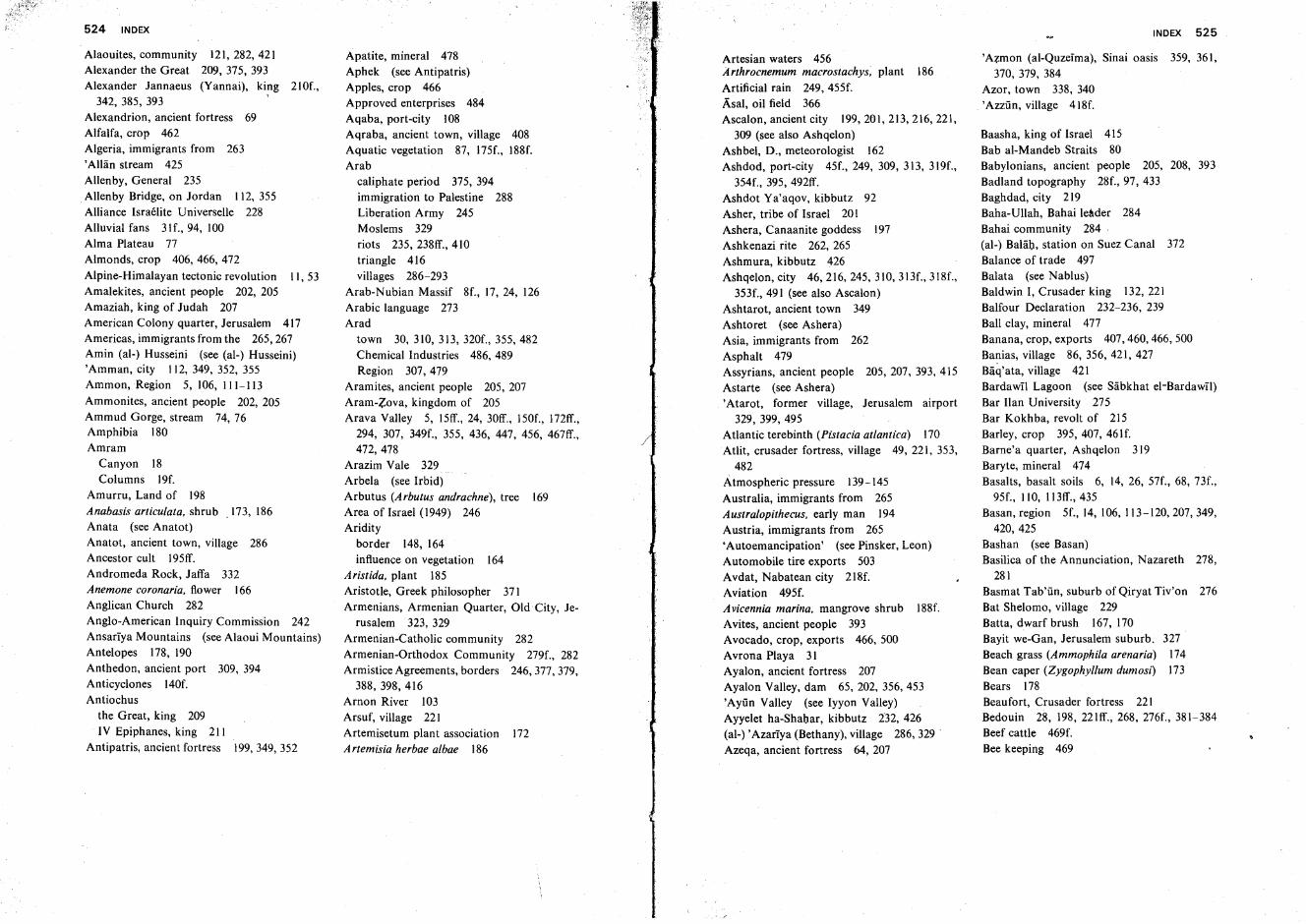
524 INDEX
Alaouites, community 121,282,421Alexander the Great 209, 375, 393Alexander Jannaeus (Yannai), king 21Of.,34~ 385, 393 •
Alexandrion, ancient fortress 69Alfalfa, crop 462Algeria, immigrants from 263,Allan stream 425Allenby, General 235Allenby Bridge, on Jordan 112, 355Alliance Israelite Universelle 228Alluvial fans 31f., 94, 100Alma Plateau 77Almonds, crop 406, 466, 472
Alpine-Himalayan tectonic revolution II, 53Amalekites, ancient people 202, 205Amaziah, king of Judah 207American Colony quarter, Jerusalem 417Americas, immigrants from the 265,267Amin (al-) Husseini (see (al-) Husseini)'Amman, city 112, 349, 352, 355Ammon,Region 5,106,111-113
Ammonites, ancient people 202, 205Ammud Gorge, stream 74, 76Amphibia 180Amram
Canyon 18Columns 19f.
Amurru, Land of 198Anabasis articulata, shrub .173, 186Anata (see Anatot)Anatot, ancient town, village 286Ancestor cult 195ff.Andromeda Rock, Jaffa 332Anemone coronaria, flower 166Anglican Church 282Anglo-American Inquiry Commission 242Ansariya Mountains (see Alaoui Mountains)Antelopes 178, 190Anthedon, ancient port 309, 394Anticyclones 140f.Antiochus
the Great, king 209IV Epiphanes, king 211
Antipatris, ancient fortress 199,349,352
Apatite, mineral 478Aphek (see Antipatris)Apples, crop 466Approved enterprises 484Aqaba, port-city 108Aqraba, ancient town, village 408Aquatic vegetation 87, 175f., 188f.Arab
caliphate period 375, 394immigration to Palestine 288Liberation Army 245Moslems 329riots 235, 238ff., 410triangle 416villages 286-293
Arab-Nubian Massif 8f., 17, 24, 126Arabic language 273Arad
town 30, 310, 313, 320f., 355, 482Chemical Industries 486, 489Region 307,479
Aramites, ancient people 205, 207Aram-Zova, kingdom of 205Arava Valley 5, 15ff., 24, 3Off. , 150f., I72ff.,
294, 307, 349f., 355, 436, 447, 456, 467ff.,472,478
Arazim Vale 329Arbela (see Irbid)Arbutus (Arbutus andrachne), tree 169Area of Israel (1949) 246Aridity
border 148, 164influence on vegetation 164
A ristida, plant 185Aristotle, Greek philosopher 371Armenians, Armenian Quarter, Old City, Je-
rusalem 323, 329Armenian-Catholic community 282Armenian-Orthodox Community 279f., 282Armistice Agreements, borders 246,377,379,
388, 398,416Arnon River 103Arsuf, village 221Artemisetum plant association 172Artemisia herbae albae 186
Artesian waters 456Arthrocnemum macrostachys, plant 186Artificial rain 249, 455f.Asal, oil field 366Ascalon, ancient city 199,201,213,216,221,
309 (see also Ashqelon)Ashbel, D., meteorologist 162Ashdod, port-city 45f., 249, 309, 313, 319f.,
354f., 395, 492ff.Ashdot Ya'aqov, kibbutz 92Asher, tribe of Israel 201Ashera, Canaanite goddess 197Ashkenazi rite 262, 265Ashmura, kibbutz 426Ashqelon, city 46, 216, 245, 310, 313f., 318f.,
353f., 491 (see also Ascalon)Ashtarot, ancient town 349Ashtoret (see Ashera)Asia, immigrants from 262Asphalt 479Assyrians, ancient people 205, 207, 393, 415Astarte (see Ashera)'Atarot, former village, Jerusalem airport
329, 399, 495Atlantic terebinth (Pistacia atlantica) 170Atlit, crusader fortress, village 49, 221, 353,
482Atmospheric pressure 139-145Australia, immigrants from 265Australopithecus, early man 194Austria, immigrants from 265'Autoemancipation' (see Pinsker, Leon)Automobile tire exports 503Avdat, Nabatean city 218f.Aviation 495f.Avicennia marina, mangrove shrub 188f.Avites, ancient people 393Avocado, crop, exports 466, 500Avrona Playa 31Ayalon, ancient fortress 207Ayalon Valley, dam 65, 202, 356,453'Ayiin Valley (see Iyyon Valley)Ayyelet ha-Shahar, kibbutz 232, 426(al-) ,Azariya (Bethany), village 286, 329 .Azeqa, ancient fortress 64, 207
INDEX 525
'Azmon (al-Quzeirna), Sinai oasis 359, 361,370, 379, 384
Azor, town 338, 340,Azziin, village 418f.
Baasha, king of Israel 415Bab al-Mandeb Straits 80Babylonians, ancient people 205, 208, 393Badland topography 28f., 97, 433Baghdad, city 219Baha-Ullah, Bahai leader 284Bahai community 284·(al-) Balah, station on Suez Canal 372Balance of trade 497Balata (see Nablus)Baldwin I, Crusader king 132, 221Balfour Declaration 232-236, 239Ball clay, mineral 477Banana, crop, exports 407, 460, 466, 500Banias, village 86, 356, 421, 427Baq'ata, village 421Bardawil Lagoon (see Sabkhat el-Bardaw1l)Bar Han University 275Bar Kokhba, revolt of 215Barley, crop 395,407, 461f.Barne'a quarter, Ashqelon 319Baryte, mineral 474Basalts, basalt soils 6, 14, 26, 57f., 68, 73f.,
95f., 110, 113ff., 435Basan, region 5f., 14, 106, 113-120,207,349,
420,425Bashan (see Basan)Basilica of the Annunciation, Nazareth 278,
281Basmat Tab'iin, suburb of Qiryat Tiv'on 276Bat Shelomo, village 229Batta, dwarf brush 167, 170Bayit we-Gan, Jerusalem suburb. 327Beach grass (Ammophila arenaria) 174Bean caper (Zygophyl/um dumosi) 173Bears 178Beaufort, Crusader fortress 221Bedouin 28, 198, 22Iff., 268, 276f., 381-384Beef cattle 469f.Bee keeping 469
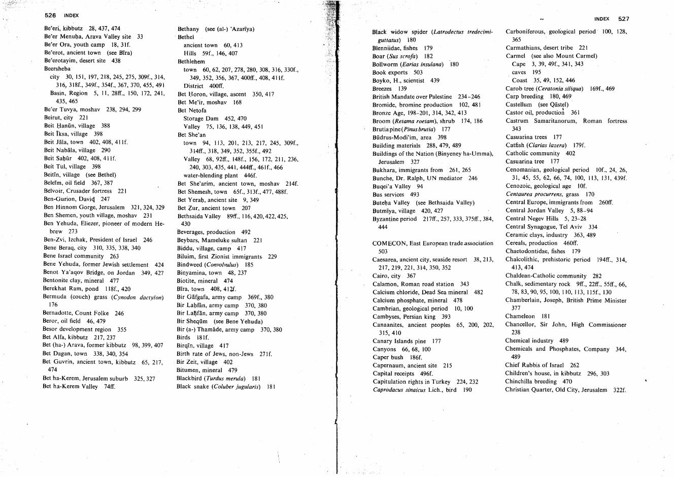
526 INDEX
Be'eri, kibbutz 28, 437, 474Be'er Menuha, Arava Valley site 33Be'er Ora, youth camp 18,31f.Be'erot, ancient town (see Bira)Be'erotayim, desert site 438Beersheba
city 30, 151, 197,218,245,275, 309f., 314,316, 318f., 349f., 354f., 367, 370, 455, 491
Basin, Region 5, II, 28ff., 150, 172, 241,435,465
Be'er Tuvya, moshav 238, 294, 299Beirut, city 221Beit l;Ianiin, village 388Beit Iksa, village 398Beit Jala, town 402, 408, 411f.Beit Nabala, village 290Beit Sahur 402, 408, 411f.Beit Tul, village 398Beitin, village (see Bethel)Beleim, oil field 367, 387Belvoir, Crusader fortress 221Ben-Gurion, David 247Ben Hinnom Gorge, Jerusalem 321, 324, 329Ben Shemen, youth village, moshav 231Ben Yehuda, Eliezer, pioneer of modern He-
brew 273Ben-Zvi, Izchak, President of Israel 246Bene Beraq, crty 310, 33~ 33~ 340Bene Israel community 263Bene Yehuda, former Jewish settlement 424Benot Ya'aqov Bridge, on Jordan 349, 427Bentonite clay, mineral 477Berekhat Ram, pond 118f., 420Bermuda (couch) grass (Cynodon dactylon)
176Bernadotte, Count Folke 246Beror, oil field 46, 479Besor development region 355Bet Alfa, kibbutz 217,237Bet (ha-) Arava, former kibbutz 98,399,407
Bet Dagan, town 338, 340, 354Bet Guvrin, ancient town, kibbutz 65, 217,
474
Bet ha-Kerem, Jerusalem suburb 325,327Bet ha-Kerem Valley 74ff.
Bethany (see (al-) 'Azariya). Bethel
ancient town 60, 413Hills 59f., 146, 407
Bethlehemtown 60, 62, 207, 278, 280, 308, 316, 330f.,
349,352,356,367, 400ff., 408, 411f.District 400ff.
Bet Horen, village, ascent 350, 417Bet Me'ir, moshav 168Bet Netofa
Storage Dam 452, 470Valley 75, 136, 138,449,451
Bet She'antown 94, 113, 201, 213, 217, 245, 309f.,
314ff., 318, 349, 352, 355f., 492Valley 68,92ff., 148f., 156, 172,211,236,
240,303,435,441, 444ff., 461f., 466water-blending plant 446f.
Bet She'arim, ancient town, moshav 214f.Bet Shemesh, town 65f., 313f., 477, 488f.Bet Yerah, ancient site 9, 349Bet Zur, ancient town 207Bethsaida Valley 89ff., 116,420,422,425,
430Beverages, production 492Beybars, Mamelukesultan 221Biddu, village, camp 417Biluim, first Zionist immigrants. 229Bindweed (Convolvulus) 185
Binyamina, town 48, 237Biotite, mineral 474Bira, town 408,412f.8ir Gafgafa, army camp 369f., 380Bir Lahfan, army camp 370, 380Bir Lalifan, army camp 370, 380Bir Sheqiim (see Bene Yehuda)Bir (a-) Thamade, army camp 370,380Birds 181f.Birqin, village 417Birth rate of Jews, non-Jews 271f.Bir Zeit, village 402Bitumen, mineral 479Blackbird (Turdus merula) 181Black snake (Coluber jugularis) 181
Black widow spider (Latrodectus tredecimi-
guttatus) 180
Blenniidae, fishes 179Boar (Sus scrofas 182Bollworm (Earias insulanai 180
Book exports 503Boyko, H., scientist 439Breezes 139British Mandate over Palestine 234-246Bromide, bromine production 102, 481Bronze Age, 198-201,314,342,413Broom (Retama roetam), shrub 174, 186Brutia pine (Pinus brutia) 177Biidrus-Modi'im, area 398Building materials 288, 479, 489Buildings of the Nation (Binyeney ha-Umma),
Jerusalem 327Bukhara, immigrants from 261, 265Bunche, Dr. Ralph, UN mediator 246Buqei'a Valley 94Bus services 493Buteha Valley (see Bethsaida Valley)Butmiya, village 420, 427Byzantine period 217ff., 257, 333, 375ff., 384,
444
COMECON, East European trade.association503
Caesarea, ancient city, seaside resort 38, 213,217,219,221,314,350,352
Cairo, city 367Calamon, Roman road station 343Calcium chloride, Dead Sea mineral 482Calcium phosphate, mineral 478Cambrian, geological period 10, 100Cambyses, Persian king 393Canaanites, ancient peoples 65, 200, 202,
315,410Canary Islands pine 177Canyons 66, 68, 100Caper bush 186f.Capernaum, ancient site 215Capital receipts 496f.Capitulation rights in Turkey 224, 232Caprodacus sinaicus Lich., bird 190
INDEX 527
Carboniferous, geological period' 100, 128,365
Carmathians, desert tribe 221Carmel (see also Mount Carmel)
Cape 3,39, 49f., 341, 343caves 195Coast 35, 49, 152, 446
Carob tree tCeratonia siliqua) 169f.,469Carp breeding 180, 469Castellum (see Qastel)Castor oil, production 361Castrum Samaritanorum, Roman fortress
343Casuarina trees 177Catfish (Clarias lazera) 179f.Catholic community 402Casuarina tree 177Cenomanian, geological period 1Of., 24, 26,
31, 45, 55, 62, 66, 74, 100, 113, 131, 439f.Cenozoic, geological age 10f.Centaurea procurrens, grass 170Central Europe, immigrants from 260ff.Central Jordan Valley 5,88-94Central Negev Hills 5, 23-28Central Synagogue, Tel Aviv 334Ceramic clays, industry 363, 489Cereals, production 460ff.Chaetodontidae, fishes 179Chalcolithic, prehistoric period 194ff., 314,
413,474Chaldean-Catholic community 282Chalk, sedimentary rock 9ff., 22ff., 55ff., 66,
78, 83, 90, 95, 100, 110, 113, 115f., 130Chamberlain, Joseph, British Prime Minister
377Chameleon 181Chancellor, Sir John, High Commissioner
238Chemical industry 489Chemicals and Phosphates, Company 344,
489Chief Rabbis of Israel 262Children's house, in kibbutz 296, 303Chinchilla breeding 470Christian Quarter, Old City, Jerusalem 322f.
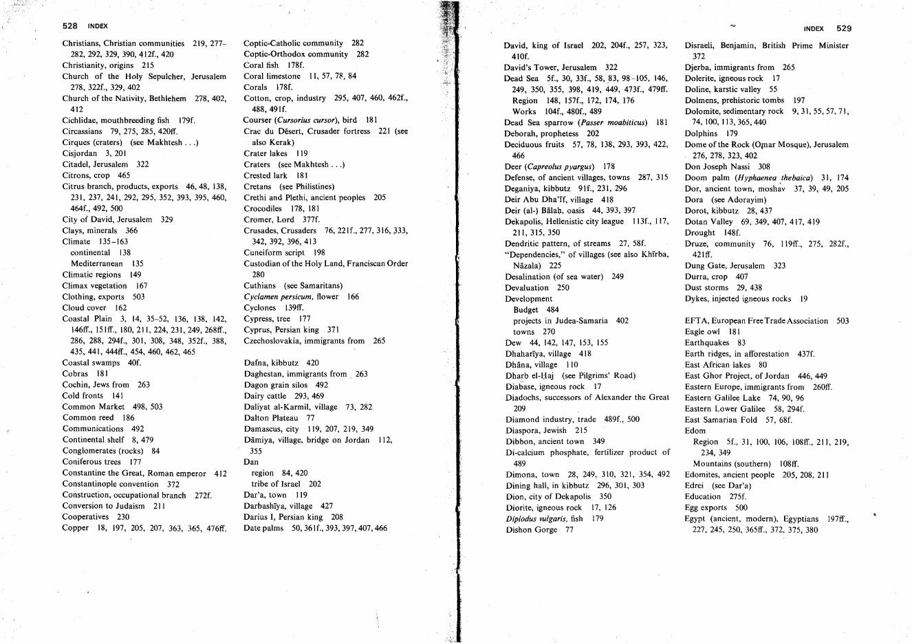
528 INDEX
Christians, Christian communities 219, 277282, 292, 329, 390, 412f., 420
Christianity, origins 215Church of the Holy Sepulcher, Jerusalem
278, 322f., 329, 402Church of the Nativity, Bethlehem 278,402,
412Cichlidae, mouthbreeding fish 179f.Circassians 79, 275, 285, 420ff.Cirques (craters) (see Makhtesh ...)Cisjordan 3, 20ICitadel, Jerusalem 322Citrons, crop 465Citrus branch, products, exports 46,48, 138,
231, 237, 241,292,295,352,393, 395,460,464f., 492, 500
City of David, Jerusalem 329Clays, minerals 366Climate 135-163
continental 138Mediterranean 135
Climatic regions 149Climax vegetation 167Clothing, exports 503Cloud cover 162Coastal Plain 3, 14, 35-52, 136, 138, 142,
146ff., 15Iff., 180,211,224,231,249, 268ff.,286, 288, 294f., 30I, 308, 348, 352f., 388,435, 441, 444ff., 454,460, 462, 465
Coastal swamps 40f.Cobras 181Cochin, Jews from 263Cold fronts 141Common Market 498, 503Common reed 186Communications 492Continental shelf 8, 479Conglomerates (rocks) 84Coniferous trees 177Constantine the Great, Roman emperor 412Constantinople convention 372Construction, occupational branch 272f.Conversion to Judaism 211Cooperatives 230Copper 18, 197, 205, 207, 363, 365, 476ff.
Coptic-Catholic community 282Coptic-Orthodox community 282Coral fish 178f.Coral limestone II, 57, 78, 84Corals 178f.Cotton, crop, industry 295, 407, 460, 462f.,
488, 491f.Courser (Cursorius cursor), bird 181Crac du Desert, Crusader fortress 221 (see
also Kerak)Crater lakes 119Craters (see Makhtesh ...)Crested lark 181Cretans (see Philistines)Crethi and Plethi, ancient peoples 205Crocodiles 178, 181Cromer, Lord 377f.Crusades, Crusaders 76, 221f., 277, 316, ~33,
342, 392, 396, 413Cuneiform script 198Custodian of the Holy Land, Franciscan Order
280Cuthians (see Samaritans)Cyclamen persicum, flower 166Cyclones I39ff.Cypress, tree 177Cyprus, Persian king 371Czechoslovakia, immigrants from 265
Dafna, kibbutz 420Daghestan, immigrants from , 263Dagon grain silos 492Dairy cattle 293, 469Daliyat al-Karmil, village 73, 282Dalton Plateau 77Damascus, city 119, 207, 219, 349Damiya, village, bridge on Jordan 112,
355Dan
region 84, 420tribe of Israel 202
Dar'a, town 119Darbashiya, village 427Darius I, Persian king 208Date palms 50, 361f., 393, 397, 407, 466
David, king of Israel 202, 204f., 257, 323,41Of.
David's Tower, Jerusalem 322Dead Sea 5f., 30, 33f., 58,_83,98-105, 146,
249, 350, 355, 398, 419, 449, 473f., 479ff.Region 148, 157f., 172, 174, 176Works 104f., 480f., 489
Dead Sea sparrow (Passer moabiticus) 181Deborah, prophetess 202Deciduous fruits 57, 78, 138, 293, 393, 422,
466Deer (Capreolus pyargus) 178Defense, of ancient villages, towns 287, 315Deganiya, kibbutz 91f., 231, 296Deir Abu Dha'If, village 418Deir (al-) Balah, oasis 44, 393, 397Dekapolis, Hellenistic city league 113f., 117,
211,315,350Dendritic pattern, of streams 27, 58f."Dependencies," of villages (see also Khirba,
Nazala) 225Desalination (of sea water) 249Devaluation 250Development
Budget 484projects in Judea-Samaria 402towns 270
Dew 44, 142, 147, 153, 155Dhahariya, village 418Dhana, village 110Dharb el-I;Iaj· (see Pilgrims' Road)Diabase, igneous rock 17Diadochs, successors of Alexander the Great
209Diamond industry, trade 489f., 500Diaspora, Jewish 215Dibbon, ancient town 349Di-calcium phosphate, fertilizer product of
489Dimona, town 28, 249, 310, 321, 354, 492Dining hall, in kibbutz 296, 301, 303Dion, city of Dekapolis 350Diorite, igneous rock 17, 126Diplodus vulgaris, fish 179Dishon Gorge 77
INDEX 529
Disraeli, Benjamin, British Prime Minister372
Djerba, immigrants from 265Dolerite, igneous rock 17Doline, karstic valley 55Dolmens, prehistoric tombs 197Dolomite, sedimentary rock 9,31,55,57,71,
74, 100, 113,365,440Dolphins 179Dome of the Rock (Ornar Mosque), Jerusalem
276, 278, 323, 402Don Joseph Nassi 308Doom palm (Hyphaenea .thebaica) 31, 174Dor, ancient town, moshav 37, 39, 49, 205Dora (see Adorayim)Dorot, kibbutz 28, 437Dotan Valley 69,349,407,417,419Drought 148f.Druze, community 76, 119ff., 275, 282f.,
421ff.Dung Gate, Jerusalem 323Durra, crop 407Dust storms 29, 438Dykes, injected igneous rocks 19
EFT A, European Free Trade Association 503Eagle owl 181Earthquakes 83Earth ridges, in afforestation 437f.East African lakes 80East Ghor Project, of Jordan 446, 449Eastern Europe, immigrants from 260ff.Eastern Galilee Lake 74, 90, 96Eastern Lower Galilee 58, 294f.East Samarian Fold 57, 68f.Edom
Region 5f., 31, 100, 106, 108ff., 211, 219,234, 349
Mountains (southern) 108ff.Edomites, ancient people 205,208, 211Edrei (see Dar'a)Education 275f.Egg exports 500Egypt (ancient, modern), Egyptians 197ff.,
227, 245, 250, 365ff., 372, 375, 380
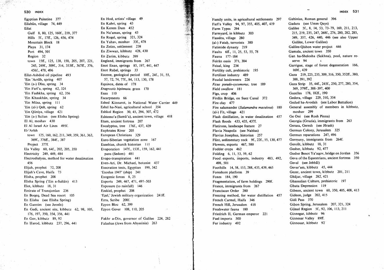
530 INDEX
Egyptian Palestine 377Eilabiin, village 74, 449Eilat
Gulf 8, 80, 125, 160f., 2J9,377Hills 5f., 17ff., 126, 456, 474Mountain Block 18Playa 31, 174Port 494, 501Region 32town 15ff., 125, 138, 150, 205, 207, 221,
245, 249f., 309f., 314, 353ff., 367ff., 376,456f., 478, 496
Eilat-Ashdod oil pipeline 493'Ein 'Arriib, spring 407'Ein (a-) Disa, spring 34'Ein Fari'a, spring 62, 324'Ein Fashkha, spring 62, 356'Ein Khaukhan, spring 34'Ein Miisa, spring III'Ein (al-) Qelt, spring 62'Ein Qiiniya, village 421'Ein (a-) Sultan (see Elisha Spring)EI AI, moshav 430EI Ai Israel Air Lines 495f.EI-'Arish
town 125,160,162,211,349,359,361,363,369f., 376ff., 384f., 387
Project 377f.Ela Valley 60, 64f., 202, 205, 350Electricity 249, 449, 484Electrodialysis, method for water desalination
456Elijah, prophet 72, 208Elijah's Cave, Haifa 73Elisha, prophet 208Elisha Spring ('Ein a-Sultan) 413Elot, kibbutz 18, 31Emirate of Transjordan 236En Boqeq, Dead Sea resort 105En Elisha (see Elisha Spring)En Gannim (see Jennin)En Gedi, ancient site, kibbutz 62, 98, 105,
176, 197, 350, 354, 356, 441En Gev, kibbutz 89,92En Harod, kibbutz 237, 296, 441
En Hod, artists' village 49En Kabri, spring 43En Kerem Dam 452En Na'aman, spring 43En Rogel, spring 321, 324En Yahav, moshav 33f.,478En Zetim, settlement 238En Ziwwan, kibbutz 428, 430
En Zurim, kibbutz 399England, immigrants from 267Enot Enan, springs 85, 197, 441, 447Enot Rabel, springs 33Eocene, geological period IOff., 24f., 31, 55,
57, 72, 74, 77f., 84, 113, 130, 178Equinox, dates of 178Eragrostis bipinnata, grass 170Esau 110Escarpments 66Eshed Kinnarot, in National Water Carrier 449Eshel ha-Nasi, agricultural school .354Eshkol Region 30, 45, 294, 307, 472Eshtemo'a (Samir'a), ancient town, village 418Etam, ancient fortress 207Eucalyptus, tree 176f., 437, 439Euphrates River 205European Christians 329Euro-Siberian vegetation zone 167Eusebius, church historian IIIEvaporation 147f., 153f., 159, 162,441
pans (Sedom) 481Evapo-transpiration 441Even-Ari, Dr. Michael, botanist 437Execration texts, Egyptian 199, 342'Exodus 1947' (ship) 241Exogenic forces 8, 25Exports 249,467,471,497-503Exposure (to rainfall) 146Ezekiel, prophet 208'E:lel,' Jewish military organization 24Iff.Ezra, Scribe 208f.Ezyon Bloc 62, 399Ezyon Gever 108, 110, 205
Fakhr a-Din, governor of Galilee 224, 282Falashas (Jews from Abyssinia) 263
'Family units, in agricultural settlements 297Fari'a Valley 94, 97, 355,405,407, 419Farm Types 294Farmyard, in kibbutz 303Fassilta, village 280(al-) Fatal), terrorists 380Fatimide dynasty 219Faults 6ff., II, 25, 53, 55, 78Fauna 177-184Feiran oasis 371, 384Feisal, king 234Fertility cult, prehistoric 195Fertilizer industry 489Feudal landowners 226Ficus pseudo-sycomorus, tree 189Field swallow 181Figs, crop 406Firdan Bridge, on Suez Canal 372Fire clay 477Fire salamander (Salamandra maculosa) 180(al-) Fit, village 421Flash distillation, in water desalination 457Flash floods 433, 435, 437f.Flatirons, landscape feature 27Flavia Neapolis (see Nablus)Flavius Josephus, historian 257Flint, sedimentary rock 9f., 22f., 55, 130,477Flowers, exports 467, 500Fodder crops 462Folding 6, II, 53, 59, 62Foodc-exports, imports, industry 483, 492,
498, 501Foothills 14,58, 153,288,435,439,465Foreshore platform 39Foxes 184, 190Fragmentation, of farm holdings 290f.France, immigrants from 267Franciscan Order 280Freezing method, for water distillation 457French Carmel, Haifa 346French Hill, Jerusalem 418Freshwater fauna 180Friedrich II, German emperor 221Fuel imports 500Fur industry 492
INDEX 531
Gabinius, Roman general 396Gadara (see Umm Qays)Galilee sr., 8, 14, 53, 73-79, 169, 211, 213,
215,219,235,247, 268f., 276, 280, 282, 285,349, 357, 426, 440, 446 (see also UpperGalilee, Lower Galilee)
Galilee-Qishon water project 446Gamala, ancient town 350Gan ha-Shelosha (Sakhna), pool, nature re
serve 94Garrigue, stage of forest degeneration 166,
169f.,439Gaza 219,225,235,309,316,350, 352ff., 380,
388,391,392Gaza Strip 35, 44f., 245f., 250, 277, 280, 354,
369, 379ff., 388-397,400Gazelles 178, 182f., 190Gedera, village 229, 310, 354Gedud ha-Avodah (see Labor Battalion)General assembly of members in kibbutz,
moshav 299Ge ani (see Rosh Pinna)Georgia (Gruzia), immigrants from 263Gerasa, Geresh (see Jerash)German Colony, Jerusalem 325German reparations 247,496Germany, immigrants from 264f.Gerofit, kibbutz 18, 31Gesher, kibbutz 92, 477Gesher Benot Ya'aqov, bridge on Jordan 356Geva of the Equestrians, ancient fortress 350Geval (see Jebbal)Gevar'am, kibbutz 45, 444Gezer, ancient town, kibbutz 201, 211Ghajar, village 282",421Ghassulian Culture, prehistoric 197Ghuta Depression 119'Gibeon, ancient town 60, 350,405,408,413Gideon, judge 202, 415Gidi Pass 370Gihon Spring, Jerusalem 207,321,324Gilead Region 5f., 92, 106, 113, 211Ginnegar, kibbutz 96Ginnesar Valley 89ff.Ginnosar, kibbutz 92'
532 INDEX
Giv'a, ancient town 413Giv'atayim,city 338, 340Giv'at ha-Mivtar, Jerusalem 418Giv'at ha-More, mountain 73, 75, 96Giv'at Ram campus of Hebrew University,
Jerusalem 325, 330Giv'at Sha'ul, Jerusalem suburb 327Giv'at Yo'av, moshav 430Glaciation 121Glass industry 478, 489Glass sand 26, 366, 477f.Gneiss, metamorphic rock 17, 126Goats, tending 292Golan, Region 5f., 14, 114-119, 158ff., 211,
213,234,251,282,285,294,307,349,420430 (see also Upper Golan, Lower Golan)
Goldsmid, Colonel Avigdor 377Goliath 65, 202Gonen, kibbutz 327, 427Gondwana, continent of geological past
8,17Gophna, ancient town (see Jifna)Goshen, province of Egypt 131Graben, geological rift 6, 30, 80Grain
farming 292, 472villages 300
Grand Guerin (see Jennin)Granites 17, 108, 126,474Granott, Dr. A., agrarian economist 290Grapefruit, crop 465Great Bitter Lake 372Great Britain 224, 227f., 232, 234, 375, 503Greece, immigrants from 265Greek-Catholic community 280, 402Greek Colony, Jerusalem suburb 325Greek-Orthodox community 279f., 384, 402Grotto of the Nativity, Bethlehem 278Groundnuts, crop 295, 460, 462Groundwater 43, 48f., 359ff., 392f., 405, 444-
472Grouting (cement injection into rocks) 452Grumusols, soil type 43, 50, 58, 96Guava crop, exports 466, 500Gullying 28f., 435, 437
Gush Halav, ancient town, village 282, 287,426
Gutmacher, E., Rabbi 228Gypsum, mining II, 25f., 90, 92, 97; 102,363,
366,477,481
Habiru (Hapiru), ancient people 199, 201,414
Hadar ha-Karmel, Haifa quarter 343f., 346Hadassah Medical Center, Jerusalem 326f.,
329Hadera, town 49, 197, 230, 294, 296, 309,
353, 355, 491Hadid, ancient town, moshav 211Hagana, Jewish defense organization 238,
241,243Haifa
Bay 3,35,39,41, 50f., 73, 340Bay Area 152,482,488city 50,73,225,237,245,249, 269f., 267f.,
280ff., 310, 340ff., 352f., 355, 444, 455,478, 486ff., 491
oil refineries 343, 489, 493Port 41, 51, 238, 249, 344, 347, 494University 275
Haifa Chemicals, company 489Hail 147Hairy-footed jerboa (Jaculus jaculus) 182l:Ialb.ul, village 286, 405, 410Halite, mineral 102Halocnemum strobilaceum, grass 185f.Halophytic vegetation 31,34,50,98,166,174
Haluzaancient town 218, 350dunes 29, 131
Hamashbir, Labor Federation cooperative299
(al-) Hamma (see Hammat Gader)Hammada, desert gravel 22f., 31, 33, 173,433Hammada salicornica, shrub 186Ham mat Gader, hot springs 92, 356Hammerfish 180Hamra soils (see Red sands)Hand axe, prehistoric artifact 194Hanita-Adamit Ridge 72, 234
Ha-On, kibbutz 89, 427Hapiru (see Habiru)Ha-Po'el ha-Za'ir Movement 425Haram al-Khalil (see Makhpela Mosque)Harbor towns, ancient 309Harel, Dr. M., geographer 131Harod
Spring 95Valley 80,92, 94ff., 156,237,294,296,349,
435, 444, 465Ha-Shomer, guardsmen's association 230f.Hasmoneans, kingdom of 21Of., 333, 393Hatira Ridge 25Hatrurim Region 478Hauran Region 106, 114, 119f.Hawk, bird 181Hays, James B., waterplanning engineer 447Hazera Ridge 25Hazeva
oasis, region 33, 456rock series 33, 456
Hazor.iancient, new town 129,201,313,315,492
Ha-Zore'a, kibbutz 449Hebrew language, culture 273f.Hebrew University, Jerusalem 275,418,486,
489Hebron
District 400, 402Hills 30, 59, 146, 208, 406f.town 59, 199,205,213,225,232,309,316,349ff., 355, 408ff.
Hedjaz Railway 108ff., 234Hefer Valley 47Hefzi-Bah, kibbutz 479Helez, moshav, oil field 46, 479Hellenism, Hellenistic period 209ff., 315Hematite, mineral 26, 477Helix, land snail 190Heptapegon (see Tabgha)Heraclius, Byzantine emperor 219Hermon (see Mount Hermon)Herod the Great, king 117,211,323,410,413Herodotus, historian 371, 396Herod's Gate, Jerusalem 417
INDEX 533
Herzl, Theodor 228ff., 343, 377f., 474Herzliya, city 49, 237, 296, 310, 314, 340, 353Herzliya Gymnasium, Tel Aviv 334Heshbon (see Hisban)Hess, Moses, writer 228Hever Gorge 214Hezekiah, king of Judah 207, 324High Commissioners of Palestine 236, 238Hill
Regions 5, 53-79, 136, 138, 142, 146, 148,I53ff., 435, 439, 460, 465
Road 60, 200, 321, 349,408,414villages 286ff.
Hill-type vegetation 167Hippopotamus 178, 194Hippos (see Susita)Hiram of Tyre, Phoenician king 205, 332Hirsch, Baron Maurice de 378Hisban, village III, 349Hisma Depression IOSf., 174Histadrut (Labor Federation) 230, 299f., 483,
494Hittim Ridge, Vale 75Hittite kingdom 20I, 205, 410Hod ha-Sharon, town 338Holocene, geological period 11I;lolon, city 46, 285, 335, 340, 402Holy Kingdom of Jerusalem, of Crusaders'
221Holy Places, protection of 276Horns of Hittim (see Qarne Hittim)Horse latitudes, climatic zone 139Horses, wild 178Horst, raised block of earth's crust 6, 50, 68,
72Hoveve Zion Movement 229I;lula
Drainage Scheme 86ff.Lake 84f., 87f., 435, 447Nature Reserve 88, 176Swamps 87, 175, 182,435Valley 5, 78, 80,83-88, 121, 136, 155, 177,
180, 224, 232, 234f., 240, 294, 420, 426,435, 446f., 462, 466f.
Hulda, kibbutz 231
534 INDEX
Hungary, immigrants from 261Hurshat Tal Park 86, 170f.Hussein, king of Jordan 250Hussein, Sherif of Mecca 232(al-) Husseini, Arnin, Grand Mufti of Jerusa
lem 236Hyksos, ancient people 199f., 315
ICA, Jewish Colonization Association 230,232, 295, 425
Ibex (Ibex sinaitica) 190
Ibrahim Pasha, Governor of Palestine 224,257,375,413
Ilaniya (Sedjera), moshava 230, 301'Illegal' immigration 241Immigrant
absorption 249smallholders' village (moshav olim) 300
ImmigrationArab 237, 268Jewish 259-262
First. 228-230Second 230-232Third 237Fourth 237Fifth 238f.mass (after 1948) 247
Imports 497ff.Indebtedness, of peasants 291India, immigrants from 261Industry
branches 249, 272f., 482-492exports 484, 486, 500f.farm crops 295in the Gaza Strip 391in Jerusalem 331in Judea-Samaria 403f.labor force 486output 486regional distribution of 484f., 488
Insolation 135f., 148Interface, in groundwater horizon 453f.Interpluvials 14Invertebrate land animals 180Inverted relief, of landscape 53
Investment companies 485Investments 250Irano-Turanian vegetation zone 167,172,185Iraq, immigrants from 261, 263, 266Irbid, town 113Irgun Zeva'i Le'umi (see 'Ezel')Iron Age 201-299Iron ores, industry 74, 78, 365, 477Irron
Hills 5, 57, 68, 7lf., 96, 276, 287, 398Vale 71r., 349, 353, 398
Isaac, Patriarch 199Isaiah, prophet 208'Isfiya, village 73, 282Islam (see Moslems)Islamic code 289Isma'i!iya, town 123, 367, 369, 37lf., 387Isohyets (see Rainfall distribution)Isotherms, annual I36f.Israel, Biblical kingdom of 205ff.Israel Aircraft Industries 488Israel-born Jews 261f., 265Israel Development Bonds 497Israel Shipyards Company 494Israel Petrochemicals 489Israel Shipyards Company 494Issachar, tribe of Israel 20IIyyon Valley 80, 86, 121
Jabaliya tribe 381f.Jabalya, Gaza suburb 394Jackals 184, 190Jacob, Patriarch 199Jaffa, city 46, 201, 211, 221, 228, 230ff., 235,
239, 245, 276ff., 332f., 350ff., 491 (see alsoTel Aviv-Jaffa)
Jaffa Gate, Jerusalem 322f.Jaffe, Dr. Hillel 378Jalqamiis, village 418Janissary soldiery 224Jarvis, C. S., Governor of Sinai 131, 361Jebbal Mountains 108, 110Jebel Ahmar 131Jebel (al-) 'Arab 120Jebel Baqir 108
Jebel Dhahr 80, 121Jebel Druz 114, 120Jebel I;Iallal 131, 369Jebel 'Iqma . 125, 128, 130, 185Jebel Kabir 68f.Jebel Khinzira 110Jebel Libni 131, 369f., 379f.Jebel Lii'ra 126Jebel Maghjira 131, 369, 371,387Jebel Miisa 126ff., 365Jebel (a-) Shaikh (see Mount Hermon)Jebel Shehan 110Jebel Sinn Bishr 131Jebel Tammiin 68Jebel (a-) Tih 366Jebel Umm Shomar 126Jebel Yi'allaq 131,369Jebus (see Jerusalem)Jehoshaphat, king of Judah 207Jehu, King of Israel 207Jennin
District 400town 70,96,316,356,399,405,408, 416ff.
Jerash (Gerasa) 113f., 352Jeremiah, prophet 208Jericho
oasis 406f.town, archeological site 97f., 176, 196,316,
350, 352, 355,408, 413f.Jericho-Jordan Valley District 400Jeroboam I, king of Israel 205Jeroboam II, king of Israel 207Jerusalem
city 60, 62, I36ff., 147, 149, 152, 199, 201,205, 207f., 211, 213, 215, 219, 221, 224f.,228, 232, 235, 243, 245, 269f., 276ff., 280,315,321-331, 349ff., 367, 398,404, 411f.,417, 444, 446, 455, 486, 491, 496
Corridor 58, 62, 243, 245, 247District 400, 402Hills 59f., 406townplanning 328
Jerusalem pine (Pinus halepensis) 168f., 177Jerusalem Talmud 219Jesus of Nazareth 214f.
INDEX 535
Jewish Agency 238Jewish Brigade 241Jewish National Fund 231, 237, 241, 296ff.,
301, 343, 440Jewish National Home 234Jewish Quarter, Old City, Jerusalem 323,329Jewish War against Rome 213Jezreel Valley 50, 80, 96f., 146, 157, 201f.,
237, 247, 276, 294, 297, 349, 352f., 435, 444,446, 449, 463
(al-) Jib (see Gibeon)Jiddin, Crusader fortress 221Jifna (Gophna), ancient town, village 308,
402, 408Jilin, Jewish settlement attempt 425Jish (see Gush Halav)Joahaz, king of Israel 207Joash, king of Israel 207John (Yohanan) Hyrcanos, Hasmonean king
211,412Johnson, Lyndon 8., President of U.S.A. 458Johnston, Eric, U.S. Ambassador 449Jonathan, son of King Saul 205Jonathan, the Maccabee 211Joram, king of Judah 207Jordan
Hashemite Kingdom of 250River 86, 90, 93f., 100,121,234,251,350,
398, 405, 419, 442ff.Rift Valley II, 14, 28, 97f., 80-105, 136,
147, 155ff., 460Valley Development Plan 449
Jordan tamarisk 174Jordan-Yarmuk Plain 89, 91, 93, 234, 444,
446Joshua, leader of Israelites after Moses 65,
166,202,410,413,415Josiah, king ofJudah 208Judah, kingdom of 205-208Judah the Maccabee 210Judas Aristobulos, Hasmonean king 211Judas tree (Cercis siliquastrum) 169Judea 57, I46f., 211, 277, 280, 405Judean Desert rockbird (Oeanthe lugens) 181Judean Desert Scrolls 214
536 INDEX
Judean physiographyCoast 3, 35, 46f., 237, 294Desert 55, 58f., 62, 66ff., 149, 172, 279,
399,419Foothills 5f., 55, 58f., 62-66, 268, 446Hills 5f., 58-68, 97, 146, 149,207,268
Judea-Samaria, administered area 355, 398-419,496
Judges, Biblical 202-205Julian 'the Apostate,' Roman emperor 216Julius Caesar 211Juncus rush 174Juniper (Juniper phoenicea), tree 169Jurassic, geological period 9ff., 25f., 84, 100,
113, 121, 131Justinian, Byzantine emperor 219, 384, 412Juvenile water reserves 456
(al-) Kababir, Haifa suburb 284Kabri springs 441,444Kadoorie Agricultural School 416Kafr Dan, village 417Kafr Manda, village (see Kefar Mindi)Kafr Naffakh, village site 427Kafr Qama, village 285Kalisher, Z. H., Rabbi 228Kallia, Dead Sea shore site 399, 479Kaolin, kaolinite, mineral 26, 366Karaites, Jewish religious group 394Karmiel, town 78, 313, 492Karst, landscape phenomena 55, 72f., 77,
l20f.,441Katamon, Jerusalem suburb 325Kauffmann, Richard, architect 301, 303(al-) Kaukji, commander of Arab irregulars in
1948 War 239, 245Kedarlaomer, Biblical king 199Kefar Blum, kibbutz 302Kefar Bir'am, ancient town 215, 287Kefar Darom, kibbutz 389, 397Kefar Ezyon, kibbutz 399Kefar Gil'adi, kibbutz 84, 232Kefar Hasidim, moshav 237Kefar Hittim, moshav shittufi 231, 299Kefar Mindi, ancient village 286f.
Kefar Nahum (see Capernaum)Kefar Sava, town 49,237,296,310,338,340Kefar Szold, kibbutz 426f.Kefar Tavor, moshava 230, 295, 302, 425Kefar Uriya, moshav 324, 446Kefar Witkin, moshav 299Kefar Yehezkel, moshav 237Kefar Yehoshua, moshav 237Kerak, town IIIKerem Shalom, kibbutz 15Kesullot Vale 96·Ketef ha-Hermon (see Hermon Shoulder)(al-) Khalil (see Hebron)Khamsin, dry heat wave 141Khan Yimis, town 380, 395f.Khartoum Conference 251(al-) Khasa, phosphate quarries 112Khedive Ismail, Egyptian ruler 371Khirbe, daughter settlement of Arab village
288Kibbutz, settlement form 230,237, 296f., 301,
488King's Way 108, 198f., 343, 349Kinneret, kibbutz 92Kinneret Valley 156, 294, 303, 465f.Kirkuk-Haifa oil pipeline 343Knesset, parliament building, Jerusalem 247,
327, 330Knesseth ha-Gedola (Great Assembly) 209Knotweed (Polygonum acuminatum) 176Kogan, Abraham, engineer 457Kokhav, oil field, moshav 46, 479Korazim Region 249, 307Kufeir-'Aqaba road 419Kuntilla, site in Sinai 125, 359,370,379Kurdistan, immigrants from 263, 264Kurkar sandstone 6, II, 41, 44, 47, 49, 51,
170Kursi, site on Lake Kinneret 89Kvutza (see Kibbutz)
Labor Battalion 237, 425Labor Federation (see Histadrut)Labor force 272f.
in Judea-Samaria 403
Labor villages 30ILabridae, fishes 179Lacustrine sediments 6, 83Ladino (Judeo-Spanish) language 263, 273Lagoons 127, 132Lahav, kibbutz 15, 398Lake Kinneret (Sea of Galilee) 5, 74, 88-92,
116, 156, 180, 278, 349, 352, 420, 422, 426,444, 449, 451
Lake Tiberias (see Lake Kinneret)Lake Timsab 372Lakhish
ancient town, moshav 200, 207, 315Region 46, 247, 303, 307, 313, 446, 451
Land bridge, between Eilat and Ashdod 493Landowners, Arab 291Land
reclamation 30Iregulations of British White Paper 241speculation 292
Lansdowne, Lord 377Lapies, karst formation 55 J
Large Cirque (see Makhtesh Gadol)Lashon (see Lissan Peninsula)Latins (see Roman-Catholic community)Latrun, monastery 353, 356, 417Laurel tree (Laurus nobilis) 169Lava flows 118ff.Law of Return, Israel 247League of Nations 234Leather industry 492Lebanon 51, 77, 449
immigrants from 263'Lee side,' climatic effect 66, 69, 144Legio (see Megiddo)Leguminosae plant family 170'Lehy' ('Stern Group'), military organization
242f.Leja Region 114, 120Lemons, crop 465Length of days 135Leontes River, Valley (see Litani River, Val
ley)Lesseps, Ferdinand de, Suez Canal engineer
371
INDEX 537
Levona Valley 70, 349, 407Libya, immigrants from 261Lignite, mineral 363, 366, 371Limestone, sedimentary rock 9, II, 22ff.,
55ff., 71, 74, 77,113,116,130,440Limestone caves 55ff., 73Limonite, mineral 477Lissan
Lake 91marl, sedimentary jI"ock 6, II, 33f., 66, 91,
97, 101, 350,435Peninsula 91, 98, 100, 102series, rock sequence 14, 34
Litani River, Valley 35,73,78,80, l20f., 221,234,449
Literacy rateof Jews 274of non-Jews 274
Lithuania, immigrants from 265Lizards 180Local councils, of villages 293Lod
Airport 245, 249, 340, 354, 488town 211, 243, 245, 276, 308, 316, 318,
338, 340, 349, 352, 355Loess soil 28-20, 32, 43ff., 359, 433, 435Lotus tree (Zizyphus spina Christi) 176Lotus tree shrub (Zizyphus loti) 172Louis IX, French king 343Lowdermilk, Walter Clay, engineer 447Lower Cretaceous, geological period 10, 12,
25f., 45, 62, 68, 74, 78, 84, 100, 113, 121, 128Lower Galilee 55, 73f., 78, 146,202,230, 307LowerGolan 114-117Lower Jordan Valley 97f., 157, 307, 398ff.,
447,472Lowland-type, Mediterranean vegetation 167Lutheran Church 282
Ma'ale Adummim, in Judean Desert 350Ma'ale ha-Hamisha, kibbutz 63, 417Ma'alot, town 78, 310Ma'an Basin 108Ma'barot, immigrant transition camps 247Maccabean revolt 211
538 IND.EX
Machinery imports 500MacMahon Letters 232Magic Carpet, immigration operation 495Magmatic (crystalline) rocks 31, 129Magnesium, Dead Sea product
bromide 102chloride 481
Mahanayim, kibbutz 232Maiumas 309, 394Maize, crop 407, 462Majdal Shams, village 121, 420ff.Makhpela Cave, Mosque, Hebron 213, 402,
41Of.Makhtesh Gadol 25,27,476f.
Makhtesh Qatan 25, 476ff.Makhtesh Ramon 6, 24ff., 476f.Malachite, mineral 476Malpolon, snake 181Mammals I82ff.Mameluke reign 220ff., 316, 333, 343, 375Mamshit, Nabatean site 218, 442Man, influence on vegetation 166Manasse, king of Judah 208Mandarins, crop 465
Manganese, mineral resource 128,363ff., 387,477
Mango, exports 500Mangrove brush 127, 188f.Manna 186Manshiye, Jaffa quarter 336(al-) Manzala Lagoon 369,372Ma'on (see Ma'an Basin)
Maquis, forest degeneration stage 166f., 439Mar Elias monastery, Jerusalem 418Marine animals 178ff.Marine rocks 5f.Marl, sedimentary rock 9ff., 22, 25, 55, 83,
90,93,97, 102, 105,361 (see also Lissan marl)Marmorek, 0., Zionist 378Maronites, community 280ff.Mar Saba monastery 279Mas'ada, village 356,421,427Massada Rock, fortress 66,68, 100,214Massu'ot Yizhak, kibbutz 399Ma 'fat, land classification 289, 291
Mazkeret Batya, moshava 229Me'arot Gorge 73Mea She'arim, Jerusalem quarter 325Medba
ancient site, town IIIMap 473
Medicinal plants, crop 467Mediterranean
agriculture 460aquatic fauna 178Longshore Current 37soil types 433vegetation zone 167-171
Medjdal (see Ashqelon)Megiddo, ancient fortress 201f., 349ff.Mehemet Ali, Egyptian ruler 224, 227, 375Mehola, kibbutz 409Mekoroth Water Company 444Melia azedarach, tree 177
Melkites (see Greek-Catholic community)Melons, crop, exports 393, 500Menahemya, moshava 92, 477Menara, kibbutz 78, 477Menashe
Region 5f., 47, 68, 71, 96, 146, 240, 294,454
Tunnel 451Meona, village, vale 77Meqor Hayyim, Jerusalem suburb 330Merhavim, settlement region 307Merhavya, kibbutz, moshav 231Meron
ancient site, moshav 215waters of (see Nahal Meron)
Merom Golan, kibbutz 430Mesha, king of Moab 207Mesha stele 207Meshar Basin 23, 478Mesillat Zion, moshav 304Mesolithic, prehistoric age 193, 195Mesopotamia 197f., 349Mesopotamian roe buck (Dama mesopota
mica) 178Mesozoic, geological age 6, 9f.Metal imports, industry 483, 488, 500, 503
Metamorphic rocks 6,9, 17,473Methane gas 249, 478f.Metruka, land classification 289
MetullaHills 57, 80, 84marble 78moshava 86, 136, 230, 301, 355
Metuwalis, Moslem sect 276Mevasseret Zion, urban settlement 62Mevo Hammat, kibbutz 430Mezad Zohar, Roman fortress 105Mica, mineral 18, 474Midianites, ancient people 202, 219Mifraz Shelomo (see Sharm a-Sheikh)Migdal ha-Emeq, town 313Migdal Shalom Tower, Tel Aviv 337Millo, Jerusalem 323Mi'ilya, village 280Mikhmash, ancient town, village 60, 286Mikhmetat Valley 69,407Military industry 485, 488Millet system, Ottoman 276Mineral resources, exports 249, 363-367,
381,473-482,501Mineral springs 102Mink breeding 470Minorities in Israel 275-285Miocene, geological period 1Of., 23, 28, 55,
74, 83, 90, 102Miqwe Israel, agricultural school 228, 338Miri, land classification 289, 291Mirza Ali Muhammed, forerunner of Bahai
faith -284Mishkenot Sha'anannim, Jerusalem quarter
324Mishmar ha-Emeq, kibbutz 96f., 237, 245,
449Mitla Pass, Sinai 369ff., 379f.Mixed farming 472Mizpa, moshava 30IMizpe Ramon, town 28, 249, 354, 370Mizpe Shemuel, Biblical site 413Moab, land of 5, 97, 100, 106, 11Of., 146,
205, 211,219Moisture, air 142-147
INDEX 539
Monastic societies 214Monophysitechurches 282Montefiore, Sir Moses 228, 325Montfort, Crusader fortress 77, 221(al-) Morgan, oil field 367Morocco, immigrants from 261, 263f.
Moses 126, 131Moshav, settlement form 230, 237, 296ff.,
303f.olim (immigrant smallholders' village) 300
Moshav shittufi, settlement form 299f., 305Moshava, settlement form 230f., 237, 30 I,
309f., 316, 318Moslem Quarter, Old City, Jerusalem 323Moslems 219ff., 276f., 292, 390, 402, 413,
415Mount. .. (see also Har ..., Jebel ..., Giv
'at ...)Addir 74,77f.Amanos 80Arbel 75Ardon 26(ha-) Ari 74'Arif 24f.Azmon 73Baal Hazer 59f., 68Canaan 77, 152Carmel 5,8,35,47, 49f., 57, 68, 7Iff., 96,
I46f., 152, 167ff., 194, 21I, 294, 340ff., 346Catherine I 26f., 161, 189,361,371, 38Iff.
Ebal 69,415Gerizim 69f., 285, 415Gilboa 57,69,75, 94ff., 205, 249, 307,418,
446, 479l;Ialbul 59Haluqim 30l;Ialuz 76f.Hazen 73Hermon 6ff., 77, 83ff., 120ff., I46f., 155,
158ff., 222, 356, 420ff.Kamon 73Kanna'im 479Kiddod 479of the Leap (see Mount Qedumim)
LoZ 24
540 INDEX
Meron 74ff., 167, 202Moriya 32Iff.Nebo IIIof Olives, Jerusalem 278, 329f., 418Pe'er 78Qedumim 75, 194Ramon 23,26Saggi 23
Sartaba 69, 97Scopus, Jerusalem 322, 329ff., 418Sedom 99, 102ff., 482Seguv 19Se'ir 110Shammay 74Shelomo ·19Sinai 126, 131Tabor 73f., 96Tevez 69Tir'an 75Uzziyahu 19Zenifim 22Zion, Jerusalem 321
Mountain Jews, from Caucasus 263Moza, moshava 230, 489Mukhmas (see Mikhmash)Mulk , land classification 289Mullus barbatus, fish 179Murex snail 178
Musa 'Alami, Palestinian Arab leader 407Muscovite, mineral 474
Musha', form of land tenure 291Mysticism, Jewish 224
Na'amush, site 427
Nabateans, ancient people 108f., 208f., 218f.,309, 369f., 382ff., 437, 442ff., 454, 474
Nabi Samwll, village 417Nablus
District 400ff.Syncline 5ff., 68ff.
town 70, 316, 349, 352, 356, 367, 402ff.,414f., 418f., 482 (see also Sichem)
Valley 69,415Naftali Ridge 78, 83, 85, 477
Nahal (Pioneer Settler Corps) 301,381Argaman (kibbutz) 409Diqla (settlement) 387Geshur (kibbutz) 430Gilgal (kibbutz) 409Golan (kibbutz) 430Kallia (kibbutz) 409Massu'a (kibbutz) 409Sinai (settlement) 363, 387Yam (settlement) 363, 386f.
Nahal (stream, watercourse, wadi)Ada 47Adullam 58Alexander 47Amazyahu 33, 100Ammud 90, 194,449Amram 19Aqev 27(ha-) Arava 21,3Iff.Arbel 90Arnon 100, IIIArugot 59Avdat 27Ayalon 46, 59, 332Beersheba 30, 59.Besor 15, 27ff., 35, 45, 437Bezeq 92Daliya 73Dan 86Dishon 77(ha-) Ela 45, 59f.En Kerem 58Ga'aton 442Gerar 30Gibborim 73Hadera 47, 442Harod 92, 95Hermon 86, 143Heshbon (see Wadi Hisban)Hever 59Hevron 30, 59Hiyon 22, 32Iddan 100lrron 72
Nahal (stream, watercourse, wadi)
Iyyon 86Karkara 167Keziv 51,77,442Lakhish 35, 45, 59Me'arot 73Meron 77, 202Na'aman 50f., 340, 446Nizzana 27Oren 73Par an 15, 21f., 27, 32, 100, 126,477Poleg 47Qallil 86Qidron 59Qishon 50f., 71, 73, 96, 344, 446Ruqqad 420, 425Senir 85f.Shehoret 19Shelomo 19Shilloh 59Shiqma 45, 59Soreq 46, 59, 349f.Tanninim 47, 181Tavor 75, 89ff.YaveshGilead (see Wadi Yabis)Yavne'el 90Yisakhar 75, 92Yoqne'am 72Zalmon 90, 449Zered 33, 100, 106Zin 23ff., 33, 100
Nahariyah 41,51,296,310,314Nahalal, moshav 97, 237, 297ff., 299Nahlat Binyamin, Tel Aviv quarter 333Nahlat Shiv'a, Jerusalem quarter 324Nahshon Junction 354(a-) Nakhl, desert station 369f., 379, 385Napoleon 224, 371, 375, 385, 394Napoleon's Hill, Acre 342Nari, rock crust 1.4, 57Nasser, Gamal Abdul, Egyptian President
250,380Nassi, Don Joseph 308National Library, Jerusalem 327National Museums, Jerusalem 326f.
INDEX 541
National Water Carrier 46, 90, 249f., 305,307,447-452
Natufian, prehistoric culture 195
Nawa, town 349Nazala, daughter settlement of Arab village
288,394Nazareth
Ridge 74,96town 78,245, 276ff., 281,308,316,352,355
Nazaz, subsoil horizon 43, 444Nazi Holocaust 238,241,261Nazrat II1it (see Upper Nazareth)
Nebi Shu'eib (see Qarnei Hittim)Nebuchadnezzar, king of Babylon 208Negev 5,8, 15-34, 138, 144ff., 172, 219,234,
245, 249, 269f., 294f., 308, 349, 353f., 433,437, 440ff., 461f., 473f.Coast 35, Mf., 211, 388Hills 6, 23-30, 218
Negev Research Institute, Beersheba 30Nehemiah, Scribe, Book of 208f., 323Nenuphars, water lilies 84 r
Neolithic, prehistoric age 194ff.,314, 331, 413Ne'ot Golan, kibbutz 430Ne'ot ha-Kikkar, moshav 34,469Nesher, urban settlement, cement works 344,
347,477,489Nes Ziona, moshava 229, 310, 338Netanya, city 49,296,309,314,353,489Netivot, town 30, 45New City, Jerusalem 324Neweh Ya'aqov, former settlement 399Niemeyer, Oscar, architect 346Nile River, delta 132,367,371,378'Nili,' Jewish underground organization 232Niqba Tunnel, Jerusalem 324Nir Am, kibbutz, wells 45, 444, 446Nirim, kibbutz 217Nitraria retusa, shrub 186Nizzana, ancient site, border station 123,218,
367, 370, 379North Africa, immigrants from 263North America, immigrants from 265Northern Canal (l;Iula Valley) 88Northern direction factor, climatic 142
542 INDex
Notch line, on shore 39
Nubian sandstone 6, 9f., 17f., 22, 2S, 3If.,100, 103, 108ff., 128, 186, 363ff., 456, 474ff.
Nukheila, Syrian military post 420, 427Nummulites, fossils II(a-) Niiqra (see Basan Plateau)Nusairites (see Alaouites)
Oasis farming 359Oats, crop 462Ofaqim, town 30, 492Oil, pipelines, refineries 46, 249f., 344, 363,
366f., 372, 375,478f.Old City, Jerusalem 324, 329, 417f.'Old-New Land,' novel by Th. Herzl 343Oleander bush 176Oligocene, geological period lOff., 55, 72Oliphant, Sir Lawrence 228Olives, olive oil 78, 292, 393, 406, 465f., 492Omayyad dynasty 219, 308, 316Omri, king of Israel 207Onomastikon, 6th century inventory of Holy
Land sites IIIOperations Ayin, Hiram, Horev, Ten Plagues,
in 1948 war 245, 378f., 388Ophel Ridge, Jerusalem 321, 324Oranges, crop, exports 43, 465Or Aqiva, town 492Oren Gorge 73Organogenic rocks 9Oriental community, immigrants of 265Oriental plane tree (Platanus orienta/is) 169
Oriental rites, in Judaism 262Orographic factor, in rainfall 144, 146Oron, phosphate deposit 28, 150, 310, 478f., 486
Orontes River 80, 201Orthoclase, mineral 18,474Osdor, A., engineer 457Osprey, bird 190Ostraciontidae, fishes 179Ostriches 178Ottoman Turks 223Out-of-season crops, vegetables 466,472,500Outpost villages 30IOx, wild (Bos primigenus) 178
PICA, Palestine Jewish Colonization Association 425
Palaeoanthropus palaestinensis, prehistoricman 195
Paleozoic, geological age 9ff., III, 194Paleolithic, prehistoric age I93ff.Palestine Office, of Zionist Organization 231,
257, 295, 233Palestine Potash Company 474, 479Palestinian oak (Quercus ca//iprinos) 169Palestinian terebinth (Pistaciapalaestina) 169
Panaeas (see Banias)Panicum turgidum, wild cereal 185Paper industry 491Papyrus reed (Cyperus papyrus) 84, 175f.Paran Plateau 5f., 21-23Pardes Hanna, moshava 355, 491Parod, kibbutz 74Partition Plan
of 1937 239of UN (1947) 242f.
Patriarchs 199f., 410Peaches, crop 466Peat 84,88Peel, Lord, Head of 1937 Royal Commission
239f.
Pelican (Pe/icanus onocrotalusi 182
Pelusian Arm (of Nile), Bight 132Pelusian Plain 359, 375ff.Pentateuch 208People's Council, before Israel statehood 246Peqi'in, village 223Permian, geological period 9f.Percolation, of water in soil 441Persian Gardens, Haifa 284
Persian Period, Persians 208f., 219Pesticides 491Petab Tiqwa, city 47, 228f., 294ff., 309, 338ff.,
491Petra, Nabatean rock city 108f., 349, 370Petrochemical industry 489Peza'el Valley 97Pharaohs of Egypt
Amenhotep IV-Akhnaton 201Merenptah 20I
Pharaohs of EgyptNecho 208,371, 393Ramses II 20 IRamses III 202Shishak 205, 207Sethi I 201Thutmosis 200
Pharisees, Jewish religious faction 211Pharmaceutic industry 491Phiale (see Berekhat Ram pond)Philadelphia (see 'Amman)
Philistian Plain 3, 35, 45f., 388Philistines, ancient people 65, 202ff., 332, 393Phoenicians, ancient people 205, 208, 332Phosphates, mineral 10, 23, 321, 478, 502Picard, Prof. J. L., geologist 9Pilgrimage to Holy Land 222, 225, 252, 496Pilgrims' Road 367, 369f., 385Pinsker, Leon, early Zionist 228Plantation villages 300Plastic covers, in agriculture 467Plastics industry 491Playas, salt flats 31, 34, 186, 433, 435Pleistocene, geological period II, 14,41, 74,
83, 97, 102, usPliocene, geological period 1Of., 28, 43, 53,
74, 80, 90, 102, 178, 366Plumer, Lord H. C. 0., High Commissioner
238Plums, crop 466Plutonic rocks 6, 17,473f.Pluvial periods 14, 27, 37, 59, 97, 163, 194Plywood exports 503Pocket beaches 52Poland, immigrants from 237,261,265Polar front, climatic 140Pomegranates, crop 407, 466Pompey, Roman general 211, 333, 393Population
censuses 257-259density 258, 267-269dispersion 313Gaza Strip 389Golan 420-423increase 249, 259-262
INDEX 543
PopulationJewish, geographical distribution 269f.Judea-Samaria 399-404natural increase 271f.regional distribution 267-269
Poriya Ridge 75Porphyry, igneous rock 126Port Fu'ad, town 370, 372, 387Port Ibrahim, town 372, 387Port Sa'Id, city 123, 125, 162, 369f., 372, 387
Port Taufiq, town 370, 372, 387Postal services 496Potash, mining, exports 481, 50IPotassium (mineral resource)
chloride 102, 481metaphosphate 489nitrate 489
Potatoes, crop 466Poultry, branch in agriculture 468ff.Precambrian, geological age 8ff., 17Precipitation, meteorological 142-147, 151-
162Prehistory 193-197Printing branch 491Proclamation of State of Israel 246Proto-Sinaitic script 381Ptolemaic kingdom 209, 393, 396Ptolernais (see Acre)Punnon, ancient copper mining site llO, 199,
205, 349Purple loosestrife (Lythrum salicaria) 176
(al-) Qa' Rift I26f., 186Qabatiya, village 419Qabiliyat Ridge 186Qadesh Barne'a, oasis in Sinai 199,349,361,
384Qal'at Nimrud, Crusader fortress 222Qalqiliya, town 407f.,417f.QaIiiniya (Colonia), former village 215(al-) Qantara, town 123, 353, 369, 372, 380,
384, 387Qarne Hittim, extinct volcano 75f.Qastel (Castellum), former village 215, 245,
354,417
544 INDEX
Qedesh Naftaliancient town 77Basin 78
Qerayot, Haifa Bay residential area 344, 346Qeren ha-Karmel, Mount 7If.Qidron Gorge 279,312,329,418Qir Moav (see Kerak)Qiryat Anavim, kibbutz 236Qiryat Arba (see Hebron)Qiryat Ata, town 347, 491Qiryat Bialik, town 346Qiryat Gat, town 46, 66, 305ff., 313f., 354f.,
492
Qiryat Hayyim, Haifa suburb 346Qiryat Mal'akhi, town 46, 313, 354Qiryat Moshe, Jerusalem quarter 327Qiryat Motzkin, town 346Qiryat Nazrat, town 313,492Qiryat Remez, Haifa suburb 346Qiryat Shemona, town 84; 88,249, 313f., 355,
492
Qiryat Tiv'on, town 346Qiryat Yam, town 346Qiryat Yovel, Jerusalem suburb 327, 331Qiryatayim Ridge 15, 59Qishon
Port, Haifa 344Storage Lake 97, 470
Quail, bird 182, 189·Quarrying 473, 479Quartz, quartz sand 18, 131Quartzite 17f.Quartz-porphyry 17Queen of Sheba 205Qumran scrolls 214Qunaitira, town 118, 420ff., 424, 430(al-) Quzeima (see 'Azmon)
Ra'ananna, town 49,237, 310, 338Rabbat 'Ammon (see 'Amman)Rabbat Ashlag Potash Works 399Rabbi Yehuda Hanassi 215Rabbi Yohanan ben Zakkay 215Rafiah, town 8, 15, 123, 185,349,352, 369f.,
377ff., 388,396
Railway lines, communications 353, 493f.Rain
factor 148shadow (see Lee side effect)
Rainfall, distribution, etc. 58, 142-147, 155,441
Rainwater, in the Golan 422Rama, village 413Ramallah
District 400town 60, 62, 280, 308, 329ff., 355f., 367,
400ff., 408, 412f., 417Ramatayim-Zofim, ancient site 413Ramat Banias, kibbutz 430Ramat David Airfield 417Ramat Gan, city 310,335,338,340,499Ramat Kokhav, plateau 75Ramat Magshimim, kibbutz 430Ramat (ha-) Sharon, town 310,338Ramat Tavor, plateau 75Ramla, town 66, 220f., 245, 276, 308, 310,
314ff., 338ff., 352,477,489Ramon Anticline, Cirque (see Makhtesh Ra-
mon)Random date seeding, of rain clouds 456Range, J. P., geographer 161Raqqat (Rakath), ancient town 308Ras (al-) Ganeina, mountain 130Ras Jedira (see Mount Tevez)Ras Garra, oil field 366, 387Ras Matarma, cape 125, 366Ras Muhammad, cape 123, 376Ras Nasrani, cape 365, 370, 379f.Ras Siidar, cape 366, 387Ravens 190Recharge, of groundwater horizons 452ff.Reclamation of wastewater 454Red sands, soil 4Iff., 295, 435Red Sea fauna 178f.Refa'im Vale, Jerusalem 205Reg, desert gravel 22Regional councils 293Regional settlement 296, 305ff.Regression, retreat of ancient seas 9f.Rehav'am Gorge 19
Rehavya, Jerusalem suburb 325Rehoboam, king of Judah 64, 207, 412, 415Rehovot, town 230, 296, 309f., 324, 338ff.,
354, 446, 486f.Re'im Junction 354Rekhasim, urban settlement 347Relative humidity 142ff., 159, 162Relic mountains 68Religious articles, export 503Rendzina, soil 57, 70ff., 113,422, 435, 439Rephidim, Biblical site 384Reptiles 180Residential zone, in kibbutz 303Revadim, kibbutz 399Reverse osmosis, in water desalination
456Rhicinus, bush 361, 393Rhinoceros 178, 194Rhinokoroura (see EI-'Arish)Rhodopechys gitaginea, bird 181Risan 'Aniza, hills 131Rishon Ie-Zion, town 46, 229, 294ff., 309f.,
338ff., 354, 455, 482River terraces 93, 97Road of Courage 353Road of the Edomites 350Roads, road network 197,209,249,348-356,
367-371Robinia, tree 177Rock
debris 17meal 57paintings 381weathering 57
Rockefeller Museum, Jerusalem 417f.Rockrose (Cistus salviaefolius vilosus) 170Roman Catholic community 280Roman period 209-218, 350ff., 369, 375, 384,
444Romema, Jerusalem suburb 327Rom ha-Karrnel, mount 72Rosh (ha-) Ayin, springs 43, 46, 324, 441,
444ff.,451Rosh (ha-) Niqba Pass 369f.,379Rosh (ha-) Niqra Cape 3, 35, 51f., 77
INDEX 545
Rosh Pinnamoshava 228f., 294,355Sill 84, 349
Rosh Zohar, mount 15, 30, 479Rosh Zurim, kibbutz 409Rothschild
Baron Edmond de 229ff., 295, 310, 425,482
Lord Nathaniel 377Royal Commission .(see Peel)Rthenu, Land of 199Rubber industry 49If.Ruhama, kibbutz 28, 437Rumani, site 359, 361, 369, 380Rumania, immigrants from 261Rumthaniya, settlement attempt in Golan
424Runoff inducement 454Ruppin, Dr. Arthur, sociologist 231f., 295,
333,472Rural center, in regional settlement 305Rural housing schemes 293Rural population 267ff.Rural settlement 286-307lao) Rusayfa, phosphate deposit 112Russian Compound, Jerusalem 324Russian-Orthodox community 280Ruth, Book of III(a-) Ruweisa, storage dam 361
Sa' ad, kibbutz 354Sabkhat el-Bardawil, lagoon 132, 186, 359,
369,378, 381, 386f.Safa, Region 114, 120Safed
Block 77town 78f., 147, 224ff., 232ff., 245, 308ff.,
416,491Safflower (Carthamus) 462Saharo-Arabian vegetation zone 33, 167,
172ff., 181, 185Sahl Arriiba (see Dotan Valley)Sahl Miikhna (see Mikhmetat Valley)(a-) Sa'idiyin Playa 31f.St. Catherine Monastery 127,361,371, 38Iff.
.546 INDEX
St. Jean d' Acre (see Acre)St. Stephen's (Lion's) Gate, Jerusalem 323,
418St. Peters fish (Tilapia galilaea) 179f.Sakhm al-Jolan, Jewish settlement attempt
425Sakhnin Valley 75Saladdin, sultan 76, 221Salination of water 452ff.Salome Alexandra, Hasmonean queen 211Salsola tetranda, shrub 186Salt, common (sodium chloride) 481f.Salt pillars 105Salt water irrigation 439f.Samaria, Samarian Hills 5ff., 53, 57, 68-73,
146f., 201, 235, 277, 280, 405ff.Samaritans (Cuthians) 208, 211, 219, 285,
333, 394, 403, 415f.Samu'a (see Eshtemo'a)Samuel, the Seer 102Samuel, Sir Herbert, High Commissioner
236,238Sand boa (Eryx) 181Sand dunes II, 29f., 37ff., 46f., 126, 131f.,
174, 177, 185f., 338,433,439 (see also Coastal sand dunes)
Sandstone ridges (see Kurkar)Sandstones 128Sandy loess 45Sanhedrin, ancient Jewish legislative council
215San Remo Conference 234Saniir Valley 69,407Saqiye, groundwater horizon 43, 444Sariibit al-Khadm, archeological site 363Saramiij, site IIISarid, kibbutz 96Sarona, Tel Aviv suburb 334, 336Saul, king of Israel 202f., 205Sawalha, bedouin tribe 384Siiyyidna Miisa, oasis 361, 384Schists, metamorphic rocks 126Scorpions 180Sea of Galilee (see Lake Kinneret)Sea Peoples 202
Sea Road (see Via Maris)Sea turtles 179Seawater distillation plant 456Sebastiye (see Shomron)Sede Boqer, kibbutz 28Sede Nehemya, kibbutz 86Sede Ya'aqov, moshav 97Sederot, town 46, 354Sedjera (see Ilaniya)Sedom
Dead Sea industrial site 245, 355f., 479ff.Region 33f., 150salt swamps 21, 30, 100
Seed-growing 467Segev, moshav, quarries 479Seldjuk Turks 221Seleucid kingdom 209, 211, 393ff.Self-contained neighborhood units 318Selim, Turkish sultan 223Semi-nomads 289, 381Senonian, geological period IOff., 22ff., 31,
55, 62, 69, 72f., 77, 100, 110, 113, 130, 478Sephardi rite, in Judaism 262ff.Sepharadim, immigration of 265f.Septimius Severus, Roman emperor 215Serir, desert gravel 22f.Services, in economy272f.Sesame, crop. 407Settlement Department of Jewish Agency 299Sha'ar (ha-) Gay, gorge 65, 353Sha'ar (ha-) Golan, kibbutz 195Shabbetai Zvi, false messiah 394Sha'f'at, Jerusalem suburb 329, 331, 418Shales, sedimentary rocks 105, 365Shamouti oranges 464, 500Sharav, desert wind 138, 141-143, 148Sharl'a, Moslem courts 402Sharks 180Sharm (a-) Sheikh, Straits 365Sharon, Region 35, 39ff, 170, 211, 235ff., 247,
270, 294, 349, 352, 451, 454Sharuhen, Hyksos center 199f.(a-) Shatt, station on Suez Canal 387Shaiibak, village 110Shavey Zion, moshav shittufi 51, 299
She'ar Yashuv, moshav 426Shazar, Z. Sh., Israel President 247Sheep, goats, tending of 292, 406, 467f.Sheet erosion 28Shefar'am
Hills 50, 96, 346town 245,316
Shehoret mountain block 18Sheikh Jarrah quarter, Jerusalem 417Shekhem (see Nablus, Sichem)Shekhunat Montefiore, Tel Aviv quarter 228Shelterbelts, of trees 437ff.Sheluhat Noza, ridge 30ff.Sherii' Mountains 108, 110Shezor Ridge 75Shiites, division of Islam 276, 282Shiqma Storage Dam 453Shiloah Pool, Jerusalem 207, 324Shimron Tunnel, of National Water Carrier
449Shipbuilding yards, Haifa Bay 488Ship imports 500Shipping 494f.Shiqmona (Sycamion), ancient site 343Shivta, Nabatean site 218f.Shomron, ancient town 207, 308, 315, 350,
408-410Shore, Mediterranean 8, 11, 37ff., 181Shore cliffs 39f., 44f., 47Short-tailed raven (Corvus rhipidurus) 181Shunra dunes 29, 131Sichem 199ff.,285, 350,408 (see also Nablus)Sieff Institute, Rehovot 310Sihita, village 421Sikeles, ancient people 202Simon the Maccabee 211Sinai Campaign (1956) 250, 369, 372, 377ff.Sinai
climate 160ff.fauna 189f.Peninsula 15, 24, 29, 123-132, 227, 230,
250, 349, 352, 359-387population, settlements 381- 387Plain, northern 125, 131f.vegetation 163, 184ff.
INDEX 547
Sinkholes, karst phenomenon 55Sirbonian Sea 369Sisera, Canaanite warrior 202Six Day War 251, 372, 377, 379ff., 388, 398,
416f., 426f., 485, 497Small Bitter Lake 371f.Small Cirque (see Makhtesh Qatan)Snakes 180f.Snowfall 147, 155, 160Soap production 4FSodium chloride 102Soil
associations 434conservation 57, 435erosion 292, 467reclamation 430, 435-440salinity 98, 435
Shokher Valley 69,407,415Sokho, ancient town 207Solomon, king of Israel 204ff., 323, 332, 474Solomon's Pillars 19, 21Solomon's Pools 443Solomon's Stables, Jerusalem 323Solstice 136Soreq Valley 65Sorghum, crop 462Soskin, Dr. Zelig, economist 378South Africa, immigrants from 265, 267South Sinai Mountains I25ff.Soviet Union, immigrants from 263Sparrows 181Spotted hyena 178Squill (Urginea maritima) 166Stalactites, stalagmites 55f.Step slopes, in hills 55, 60Stern Group (see 'Lehy')Stone pine (Pinus pinea) 177Storm-water interception 452Strabo, ancient geographer 371Strawberries, crop, exports 466, 500Stream
capture 27courses, in Coastal Plain 41f.mouths 39
Styrax officinalis, tree 170
548 INDEX
Subtropical high pressure zone 139Sudanese vegetation zone 34, 98, 167, 176Suez
city 125, 367, 370, 376Canal 177,227,235,251, 37Iff., 380, 387,
493Canal Company 372Gulf 125, 160f., 363
Sugar beet, crop 295, 460, 463, 488Sukkot Valley 97, 176, 406f.Sukkoth (see EI-'Arish)Sullam Zur (see Rosh ha-Niqra)Suleyman the Magnificent, Turkish sultan
224Sulfur, mineral 102, 474Sunflowers, crop 462Sunnites, division of Islam 276,402, 420Susita, ancient town 117, 350Swamp(s) 47f., 176, 295
soils 43vegetation 176
Sycamore (Ficus sycomorus) 46, 170, 172Sykes-Picot Agreement 232, 234Syria 250, 352, 426
immigrants from 263Syrian-Catholic community 282Syrian-East African Rift 6, 17, 30, 80f., 125Syrian-Orthodox community 282Syrian maple (Acer syriacum) 169
Ta'anakhancient town 350settlement region 347, 307
Taba, site 15Tabgha, ancient site 92, 217Table mounts 130Tabor oak (Quercus aegilops var. ithaburensis)
170f.Tiifila, village 110Tahal, Water Planning for Israel 444, 454Talpiyot, Jerusalem suburb 325Tamarisks 31,50, 166, 177, 186,438f.Tangier, immigrants from 263Tanis (Zo'an), Hyksos capital 199Tannur waterfall 86
Taphrogenic movements, in geological history'53
Tayyiba, village 108, 402Technion, Haifa 275, 343, 346, 486Tectonic basins 53Tel or tell, ancient mound 314Tel Adashim, moshav 96, 231Tell (el) 'Amarna letters 201Tel Arza, Jerusalem suburb 327Tel Avital, extinct volcano 118, 428Tel Aviv-Jaffa, city 136, 152, 172, 231f., 237,
269f., 310, 331-340, 352ff., 446, 482, 488ff.Tel Aviv conurbation 47,334,336-340Tel Aviv University 275Tel Dan, ancient mound 426Tel (al-) Fakhr 427Tel (a-) Nasba, ancient site 413Tel l;Iay, former kibbutz 234ff.Tel Qasila (Tel Aviv), ancient site 332Tel Qazir, kibbutz 427Tel Yosef, kibbutz 237, 296Tell Abu Nida (see Tel Avital)Tell'Astir (see Mount Baal Hazer)Tell (al-) Ful, ancient site 417Tell (al-) Jennah, mound 119Tell (a-) Shaikha, extinct volcano 117Temperature 135ff.,J50ff., 159f.
inversion of 136, 155Temple
First 205, 208Second 208-214Mount, Jerusalem 276, 278, 322, 329, 418
Teqo'a, ancient town, village 207Tennessee Valley Authority 447Tenants, of land holdings 291f.Terracing 55, 57, 293, 406, 435, 439f.Terra rossa soil 11,43, 45f., 57f., 70, 72, 113,
422, 435, 439Tertiary, geological period 10Tethys Sea, of geological past 9Tevez Hills 68Textile industry 483, 491Thamed, site in Sinai 369, 379f.Thorny burnet (Poterium spinosum) 167, 170Thousand Families Settlement Scheme 238
Tiberias, town 89, 92, 150, 215ff., 225, 232,245, 308ff., 314, 318, 352f., 355
Tif'eret Binyamin, Jewish settlement attemptin Basan 425
Tifsah, site on Euphrates River 205(a-) Tih Plateau 125f., 128ff., 131, 161, 185f.,
190, 369, 380Tilfit, village 418Tilted blocks 6ff., 53, 74Timna
copper mines 18f., 110, 205, 476Block 18Gorge 21f.
(a-) Tina Bay 132, 369Ti'innik (see Ta'anakh)Tiran Straits 250, 370, 379f.Tir'an Vale 75Tirat Karmel, town 49,.347Tirat Zevi, kibbutz 136, 240Tirza, ancient town 408Titus, Roman emperor 213Tiv'on Hills 71,346Tiyaha, bedouin tribe 382Tnuva, farm produce marketing cooperative
299Tobacco,crop 78,407,463,492Tombolo, landscape feature 52Tooth whales 179Tortoises 180f.Tourism 404, 412f., 496Tower and stockade villages 240, 294Trade relations 503Trade-winds 139Trajan, Roman emperor 215, 371Transgression, advance of ancient seas 9ff.,
37Transjordan 3, sr., 106-122, 146,236, 348f.,
352Arab Legion 245Plateau 348
Transport branch 473, 492-496Travertine, sedimentary rock, terrace 94Trellis pattern, of stream drainage 27Triassic, geological period 9ff., 26, 113Trickle irrigation 454
INDEX 549
Trietsch, David, Zionist 377Triton (Triton vittatus) 180Tropical fruit, crop 117Truce, the first, in 1948 war 245Truman, Harry S, President of U.S.A. 242Truman Research Institute, Jerusalem 330Trumpeldor, Joseph 234f., 237Tubbas, village 418f.Tuffs, rocks 57, 68, 73f.Tuleylat-el-Ghassirl, prehistoric site 197Tul Karm
District 400ff.town 70, 316, 352, 399, 405, 407f., 415f.
Tunisia, immigrants from 263(a-) Tur, town 384ff.Turkey, immigrants from 261,263Turkey fish (Pterois volitans) 179Turkeys, raising of 469Turkish reign 223ff., 227-233, 316, 333, 375Turonian, geological period 10, 12, 22ff., 31,
55,62,74, 100, 113, 131,439,441Turquoise, mineral 363Tyre
town 52,221,309Valley 35, 51f.
Tyrian Ladder (see Rosh ha-Niqra)Tyropoion Gorge, Jerusalem 323
UNWRA, United Nations Work and ReliefAgency 389f.
'Ubeydiya, prehistoric site 194Uganda Project 230'Umar Hisharn palace, Jericho 413Umm Biighma, manganese mine 128, 363ff.,
370,387Umm (al-) Daraj, mountain 113Umm (al-) Fahrn 287Umm Qays, town 113,350Uniate churches 280, 282United Nations Special Commission for Pales-
tine 242Upper Cretaceous, geological period 10, 55Upper Galilee 55, 73ff., 146f., 303Upper Golan 83f., 117f.Upper Jordan Valley 83-88
550. INDEX
Upper Nazareth 79Upper Paleolithic; prehistoric.period 194Urban center, in regional settlement 305Urban population 267ff.Urban settlement 308-347,408-416Urfal, immigrants from 263Usha, ancient town, kibbutz 215Uvda Valley 22'Uyiin Miisa, oasis 36If., 384Uziah, king of Judah 207
Va'ad Le'umi (National Council) 238Vegetables, crops, industry 293,393,407,466Vegetation 164-177
cover, degeneration of 166zones I65ff.
Vespasian, Roman emperor 213, 215, 342,415
Via Maris (Sea Road) 71, 199, 286, 309, 332,349, 354, 367ff., 380, 384, 393,416
Villages in the Plain 288f.Vines, crop 57, 78, 138, 292, 393, 465,472,
500Vipers 181, 190Vocational structure in Judea-Samaria 402Volcanic rocks 6, 12, 118Volcanoes 118
. Vultures 181, 190
Wadi (dry watercourse, see also Nahal)'Allan 119'Aqaba 125'Arab 92f., 113(el-) Arish 15,27,35, 125f., 132, 185,349,
361,369'Auja 98'Azziye 52Banias (see Nahal Hermon)Buqei'a 68Burfik 125Dubbe 78Farra 68f., 98, 406Feiriin, Vl:llley 127, 186, 360f.FukIn, village 398l;:IarIr 119
Wadi (dry watercourse, see also Nahal)
Hasbani (see Nahal Senir)l;:Iasi (see Nal.Ial Zered)Heidan 111l;:Iisbiin 98, IIIKafrinje 92f., 113Kerak IIIMaleh 92Miijib (see Nahal Arnon)Mukattab, gorge 382Miisa 108Natiif 195Nimrin 98Quelt 98Qurayya 125Rajeb 113Ruqqad 114ff.Samak 116f.Shalala 113(a-) Sheikh 127Shilmer 113Tiiyyibe 93, 119, 361, 384Thumeilat 132Yiibis 93, 113Yitm 108Zerqa (see Yabboq River)Zerqa Ma'In Ill ..Ziqliib 113
Wailing (Western) Wall, Jerusalem 238, 329,418Waqf, land classification 291, 402·War of Independenc~ 243ff.Warm front, meteorological 141Water
administration 444Commissioner 444consumption 443desalination 456ff.development 440-458legislation 444regional projects 444ff.saving 454storage dams 430, 442
Wat~rshed 62Wauchope, Sir Arthur, High Commissioner
238
';
Way of Shur 367ff., 379Weizmann, Chaim, President of Israel 231ff.,
247. Weizmann Institute, Rehovot 310, 486, 489Westerlies, winds 139Western Galilee 240Wheat, crop 57, 393, 406f., 422, 460White Paper, British (1939) 240f.,261White shore lily U:ancratium maritimum) 174White water lily (Nymphaea alba) 176Winds 139-142, 153, 161Wine and liquor industry 465, 482, 492Wolves 178, 190Wood industry, imports 491,500Wormwood (Artemisia herbae albae; mono-
sperma) 172, 185
Yabboq River 97f., 106, 112, 449Yii'bed, village 417f.Yad Mordekhay, kibbutz 354Yagur, kibbutz 347Yam Iin, village 417Yarmuk River, gorge 90f., 106, 113ff., 201,
219, 444ff., 449, 451Yarmukian prehistoric culture 195Yarqon-Negev water project 446,451Yarqon River 35, 46f., 59, 332, 349,
442f.Yatta (see Yuta)Yavne, town 205,215,309,318,354Yavne'el
moshava 230, 295Valley 75,94
Yavne Yam, ancient port 309Yehud, town 338Yellow nenuphar (Nuphar luteum), water lily
176Yemen, immigrants from 231,263ff:Yemin Moshe, Jerusalem quarter 324Yereham, town 28, 478, 489, 492Yiddish language 273Yodfat
Hills 75kibbutz 213
Yoqne'am, town, moshav 71,96,313,350
INDEX i55 1
Yotvatakibbutz 18, 31, 447Playa 3Iff.
Young Turks Revolution 230Yugoslavia, immigrants from 265Yuta
Ridge (see Qiryatayim Ridge)village 15, 286
Zababida, village 402Zaher el-'Amr, 17th century ruler 224, 342f.Zalmon, pumping station of National Water
Carrier 449Zaouie Hills, in Syria 80Zarchin, A., engineer 457Za'ilra, village 421, 427Zebulon, tribe of Israel 201Zebulon Valley 3, 35, 44, 50f., 71, 96Ze'elirn, kibbutz 456Zefa-Ef'e phosphate deposits 28, 355, 478ff.,. 486
Zemah, former village 253Zered Gorge 110Zerqa, town 112Zeva'im Ridge 75, 95Zif (Siph), ancient site 207Zifzif, building sand 479Zikhron Ya'aqov, moshava 72,229,294,310,
482Zim Navigation Lines 494,496Zion Gate, Jerusalem 323Zionist Congress, First 230Zionist Movement 227ff.Zionist Organization 231, 238Zippori, ancient town, moshav 215,308,315Ziqlag, ancient site 15Zo'an (see Tanis)Zo'ar Valley 34Zohar Gorge 67
Zohar Reservoir of National Water Carrier45-1
Zoning, urban 318Zoogeographic regions 177Zor'a, ancient town, kibbutz 207Zygophyllum album, dumosum, shrubs 186
~ 11'111" r:",.,...D"!:)cn
..