encapsulating the loci via hybrid modernity: the political
TRANSCRIPT
ENCAPSULATING THE LOCI VIA HYBRID MODERNITY: THE POLITICAL SYNTAX OF POST-COLONIAL CAPITALS, ISLAMABAD AND
CHANDIGARH
A THESIS SUBMITTED TO THE GRADUATE SCHOOL OF NATURAL AND APPLIED SCIENCES
OF MIDDLE EAST TECHNICAL UNIVERSITY
BY
MANSOOR AHMED
IN PARTIAL FULFILLMENT OF THE REQUIREMENTS FOR
THE DEGREE OF DOCTOR OF PHILOSOPHY IN
ARCHITECTURE
NOVEMBER 2018

Approval of the thesis:
ENCAPSULATING THE LOCI VIA HYBRID MODERNITY: THE
POLITICAL SYNTAX OF POST-COLONIAL CAPITALS, ISLAMABAD
AND CHANDIGARH
submitted by MANSOOR AHMED in partial fulfillment of the requirements for the degree of Doctor of Philosophy in Architecture Department, Middle East
Technical University by,
Prof. Dr. Halil Kalıpçılar Dean, Graduate School of Natural and Applied Sciences
Prof. Dr. Fatma Cânâ Bilsel Head of Department, Architecture
Prof. Dr. Güven Arif Sargın Supervisor, Architecture, METU
Assoc. Prof. Dr. Bülent Batuman Co-Supervisor, Urban Des. & Landscape Arch., Bilkent Uni.
Examining Committee Members:
Prof. Dr. Aydan Balamir Architecture Dept., METU
Prof. Dr. Güven Arif Sargın Architecture Dept., METU
Prof. Dr. Tomris Elvan Altan Architecture Dept., METU
Prof. Dr. Zeynep UludağArchitecture Dept., Gazi University
Assist. Prof. Dr. Bilge İmamoğlu Architecture Dept., TED University
Date: 30.11.2018

iv
I hereby declare that all information in this document has been obtained and
presented in accordance with academic rules and ethical conduct. I also declare
that, as required by these rules and conduct, I have fully cited and referenced all
material and results that are not original to this work.
Name, Surname:
Signature:
Mansoor Ahmed
ABSTRACT
ENCAPSULATING THE LOCI VIA HYBRID MODERNITY: THE
POLITICAL SYNTAX OF POST-COLONIAL CAPITALS, ISLAMABAD
AND CHANDIGARH
Ahmed , Mansoor Doctor of Philosophy, Architecture
Supervisor: Prof. Dr. Güven Arif Sargın Co-Supervisor: Assoc. Prof. Dr. Bülent Batuman
November 2018, 388 pages
The dissertation aims to comparatively analyses the architecture and urban
development of the planned modern capital cities in post-partitioned Indian
Subcontinent, through the concept of hybrid modernity. While emphasizing the hybrid
character of modernity, the dissertation maps the evolution of modernity in the Indian
Subcontinent, through analysing the planned modern capital cities, from early modern
period to the post-independence period, concerning the architecture and urban
development.
Right after partition, the governments of India and Pakistan developed the modern
capital cities, Chandigarh and Islamabad, from scratch. For architecture and urban
development of these modern capital cities, the new nation-states invited the well-
known international architects such as, Albert Mayer, Le Corbusier, Doxiadis, Louis
Kahn, Edward Durrell Stone and Arne Jacobson. The design ideas of these architects
had nurtured and evolved in a Eurocentric context and these ideas were later
contextualized, once they came in contestation with the Indian conditions, during the
development of modern capitals in the Indian Subcontinent, which in result paved
v
vi
the way for emergence of post-independence modernity. Through a
detailed spatial analysis, the dissertation reaffirms the fact that this “new”
modernity is a historical extension of prevailing hybrid modernity of the Indian
Subcontinent and should not be read only as an extension of Western modernity.
In the discussion of evolutionary modernity, the dissertation provides a
detailed analysis of how foreign ideas were imported, legitimized,
domesticated and hybridized in the local context, across historical timeline, to
develop the modern planned capitals in the Indian Subcontinent.
Keywords: Hybrid modernity, Nationalism, Planned Indian capitals, Comparative urbanism, Postcolonialism.
ÖZ
MELEZ MODERNITE VASITASIYLA YERI TARTIŞMAK: POST-
KOLONYAL BAŞKENTLERIN POLITIK SÖZDIZIMI, ISLAMABAD VE
CHANDIGARH
Ahmed , Mansoor Doktora, Mimarlık
Tez Danışmanı: Prof. Dr. Güven Arif Sargın Ortak Tez Danışmanı: Prof. Dr. Bülent Batuman
Kasım 2018, 388 sayfa
Bu tez, bölünme sonrası Britanya Hindistan’ındaki planlı başkentlerin mimarlığını ve
kentsel gelişimini karşılaştırmalı olarak analiz etmeyi amaçlamaktadır. Bölünmeden
hemen sonra, Hindistan ve Pakistan hükümetleri başkentleri olan İslamabad ve
Chandigarh’ı inşaa ettiler. Bu başkentler yalnızca geleneksel bilgelik ve Avrupa
hegemonyasi arasında bir çekişme sahası olarak rol almakla kalmadı, fakat aynı
zamanda savaş sonrası kentsel planlamanın iyi birer örneğine evrildiler. Bu
başkentleri ve mimarlıklarını geliştirmek üzere hükümetler Albert Mayer, Le
Corbusier, Doxiadis, Louis Kahn, Edward Durrell Stone ve Arne Jacobson gibi iyi
bilinen uluslararası mimarları davet etti. Ülke dışından mimarların davet edilmesi
yarımadada yetişmiş yerel mimar eksikliğini meşru hale getirdi. Davet edilen
mimarların Batı merkezli çevreden beslenmiş tasarım felsefeleri ve bunun Hint
yerelinde bağlamsallaştırılması bir bağımsızlık sonrası -post-bağımsızlık- üretimi
olarak sonuçlandı. Detaylı bir analiz sonucunda tez, bu yeni modernitenin batılı bir
modernite uzantısı olmaktan ziyade, bölgede hüküm süren melez modernitenin
tarihsel bir sürekliliği olarak imlenebileceği one surmektedir. Araştırma, yurtdışı
kaynaklı fikirlerin nasıl yerele aktarılmış olduğunun, meşru hale getirildiğinin ve
yerel
vii
viii
yerel bağlamda yorumlanarak ehlileştirildiğinin detaylı bir analizini sunmaktadır.
Kentleşme süreçlerini ve mimari üretimi teorileştirmek üzere tez, melez
modernitenin Hint yarımadasında evrilme süreçlerini planlı başkentlerin erken
dönemden bağımsızlık sonrası döneme kadarki mimarlık ve kentsel analiziyle
haritalamaktadır.
Anahtar Kelimeler: Hibrit modernite, Milliyetçilik, Planlı Hint Başkentleri, Karşılaştırmalı Şehircilik, Sömürgecılık sonrası.
ix
To my wife Wardah, and my sons Shayan and Erhan.
ACKNOWLEDGMENTS
The dissertation took its present shape under the tutelage of Prof. Dr. Guven Arif
Sargin, my Ph.D. supervisor. His valuable criticism and discussion on architecture
and city, had helped me in successfully completing this dissertation I would also like
to acknowledge his support in my personal and non-academic matters. Furthermore,
I am also thankful to my co-advisor Prof. Dr. Bulent Batuman. Throughout
this dissertation, he provided an in-depth criticism especially concerning Modernity,
Post-Colonial theory, and Political Islam. I also want to thank, Prof. Dr. Aydan
Balamir who kept on providing her insightful criticism throughout this Dissertation.
I am thankful to Bobby Singh, Prof. Dr. Kiran Joshi., Prof. Dr. Sangeeta Bagga,
Prof. Dr. Rohit Jigyasu and Mr. Ramana Johal who are associated with Chandigarh
for quite a long time. I am also thankful to Prof Dr. Vikramditya Parakash, Prof Dr.
Ravi Kalia for sparing time for discussions.
I want to extend my thanks to Arnaud Dercelles and Claudia Weigert at Fondation
Le-Corbusier, Giota Pavlidou at Konstantinos Apostolos Doxiadis Archives
in Athens, Isbell Schumacher Archivist at the University of Pennsylvania for
providing me the required information about Louis Kahn and Miss. Sarah
Green, who helped me in getting the documents from Edward Durrell Stone
Archives at the University of Arkansas, I am also thankful to Architect Hick
Stone, son of Edward Durrell Stone for providing an insight into the Stone’s
work. I want to extend my gratitude to Athanasios Hadjopoulos, (Project
Architect, Islamabad for Doxiadis Associates).
I also like to thanks Dr. Shama Anbrine and Adam Abdullah for carefully
proofreading the dissertation and providing their valuable insight. I also like to
thank my friend Taimur for assisting me with field work in Pakistan. I am greatfull
of Higher Education Commission (HEC) Pakistan for funding my Ph.D. Studies.
x
xi
TABLE OF CONTENTS
ABSTRACT ................................................................................................................. v
ÖZ ........................................................................................................................... vii
ACKNOWLEDGMENTS ........................................................................................... x
TABLE OF CONTENTS ........................................................................................... xi
LIST OF TABLES ..................................................................................................... xv
LIST OF FIGURES ................................................................................................. xvi
CHAPTERS
1. INTRODUCTION ................................................................................................ 1
1.1. Premises ............................................................................................................ 1
1.2. Aims and Objectives ..................................................................................... 10
1.3. Methodological Framework and Methodology ............................................ 12
1.4. Significance of Study .................................................................................. 22
1.5. Scope of Study ............................................................................................. 25
1.6. Literature Review ....................................................................................... 26
2. HYBRID MODERNITY & CAPITAL CITIES IN PRE COLONIAL AND
COLONIAL INDIAN SUBCONTINENT. ............................................................... 37
2.1. Introduction .................................................................................................... 37
2.2. Early Nodes of Modernity in India ................................................................ 50
2.3. From Modernity to Hybrid Modernity ......................................................... 57
2.4. Pre-Colonial Planned Capital Cities ............................................................. 61
2.4.1. Fatehpur Sikri: The First Modern Planned Capital in India .................... 63
2.4.2. Shahjahan Abad: The Sovereign Planned Capital .................................. 71
xii
2.5. Colonialism: The Emergence of the New Modernity ................................... 80
2.6. Raj and Urban Space .................................................................................... 82
2.6.1. Madras: A Case of Apartheid Urbanism ................................................ 84
2.6.2. Calcutta: From a Trading Post to Capital City ...................................... 88
2.6.3. New Delhi: The Dichotomy of East and West ..................................... 97
2.7. Conclusion ................................................................................................... 107
3. CONCEPTION OF PROMISED LAND ........................................................ 111
3.1. Introduction .................................................................................................. 111
3.2. Chandigarh: The Modern Experiment in India ........................................... 119
3.2.1. Deciphering Tradition (From Nehru to Le Corbusier) .......................... 120
3.2.2. The Planning Mantra ............................................................................. 127
3.2.3. The First Plan: An American Garden City in India ............................... 129
3.2.4. Novicki’s Plan ....................................................................................... 135
3.2.5. Corbusier’s Plan: Reinvented City ....................................................... 141
3.3. Islamabad: The Capital City between a Utopia and Mirage ........................ 172
3.3.1. Islamic City .......................................................................................... 173
3.3.2. Karachi - A Plan for The Democratic State .......................................... 181
3.3.3. Corbusier’s Sketch for National Capital ................................................ 187
3.3.4. Islamabad – The City for Future ........................................................... 189
3.4. Conclusion .................................................................................................... 216
4. ARCHITECTURAL DESIGN MANTRA ....................................................... 221
4.1. Introduction ................................................................................................... 221
4.2. The Capitol Complex: Chandigarh ............................................................... 227
4.2.1. Novicki/Mayer’s 1st Design: Cosmeticizing the Foreign ...................... 227
xiii
4.2.2. Novicki’s 2nd Proposal: Aesthetic and Consumerization. ...................... 233
4.2.3. The Capitol Complex: Le Corbusier ...................................................... 238
4.2.3.1. High Court ....................................................................................... 247
4.2.3.2. Secretariat Building ......................................................................... 252
4.2.3.3. Constitution Assembly ................................................................... 255
4.2.3.4. Governor’s Palace ......................................................................... 259
4.3. The Presidential Estate: Islamabad ................................................................ 273
4.3.1. Reductionism as an Ideology in Pakistani Islamic Architecture ........... 274
4.3.2. Doxiadis' First Proposal ........................................................................ 277
4.3.3. Doxiadis' Second Proposal ................................................................... 278
4.3.4. Arne Jacobsons’s Proposal .................................................................. 284
4.3.5. Louis Kahn’s Proposal ......................................................................... 287
4.3.6. Edward Durell Stone’s Proposal .......................................................... 293
4.3.7. Shah Faisal Mosque ............................................................................ 303
4.4. Conclusion .................................................................................................... 308
5. CONCLUSION ................................................................................................ 311
A. GLOSSARY ..................................................................................................... 361
B. LAND USE PLAN OF ISLAMABAD ........................................................... 367
C. MASTER PLAN OF ISLAMABAD ................................................................ 368
D. LAND USE PLAN OF CHANDIGARH ........................................................ 369
E. MASTER PLAN OF CHANDIGARH ............................................................. 370
F. DOCUMENTS AT FONDATION LE CORBUSIER, PARIS, FRANCE ...... 371
REFERENCES ...................................................................................................... 333
APPENDICES
xiv
H. DOCUMENTS AT CONSTANTINOS A. DOXIADIS ARCHIVES. ............ 377
I. CAPITAL DEVELOPMENT AUTHORITY. ISLAMABAD, ARCHIVES .. 379
J. EDWARD DURELL STONE PAPERS, UNIVERSITY OF ARKANSAS, U.S.A
SERIES 11. ARCHITECTURAL DRAWINGS ..................................................... 380
K. CANADIAN CENTER FOR ARCHITECTURE ........................................... 382
L. PRINCIPLES AND ELEMETNS OF EKISTICS .......................................... 383
M. EVOLUTION OF INDIAN NATIONALISM ............................................... 385
CURRICULUM VITAE .......................................................................................... 387
G. LIST OF DRAWINGS AT FONDATION LE CORBUSIER ........................ 376
xv
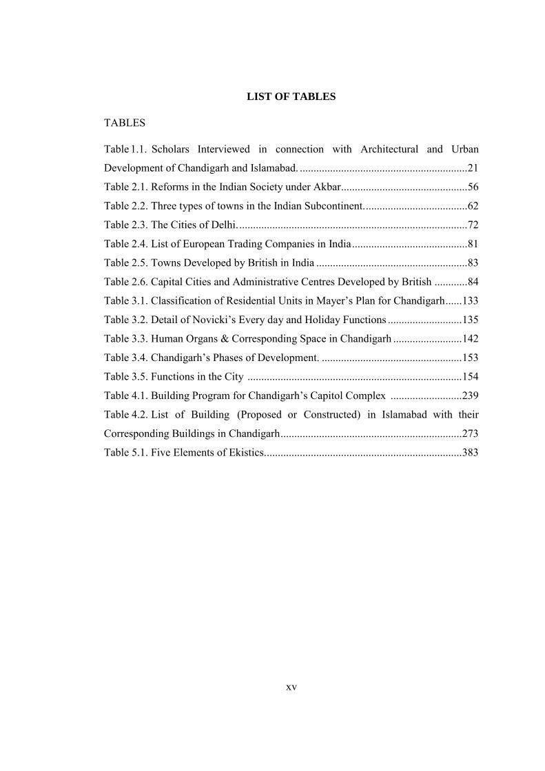
LIST OF TABLES
TABLES
Table 1.1. Scholars Interviewed in connection with Architectural and Urban
Development of Chandigarh and Islamabad. ............................................................. 21
Table 2.1. Reforms in the Indian Society under Akbar.............................................. 56
Table 2.2. Three types of towns in the Indian Subcontinent. ..................................... 62
Table 2.3. The Cities of Delhi. ................................................................................... 72
Table 2.4. List of European Trading Companies in India .......................................... 81
Table 2.5. Towns Developed by British in India ....................................................... 83
Table 2.6. Capital Cities and Administrative Centres Developed by British ............ 84
Table 3.1. Classification of Residential Units in Mayer’s Plan for Chandigarh ...... 133
Table 3.2. Detail of Novicki’s Every day and Holiday Functions ........................... 135
Table 3.3. Human Organs & Corresponding Space in Chandigarh ......................... 142
Table 3.4. Chandigarh’s Phases of Development. ................................................... 153
Table 3.5. Functions in the City .............................................................................. 154
Table 4.1. Building Program for Chandigarh’s Capitol Complex .......................... 239
Table 4.2. List of Building (Proposed or Constructed) in Islamabad with their
Corresponding Buildings in Chandigarh .................................................................. 273
Table 5.1. Five Elements of Ekistics. ....................................................................... 383
xvi
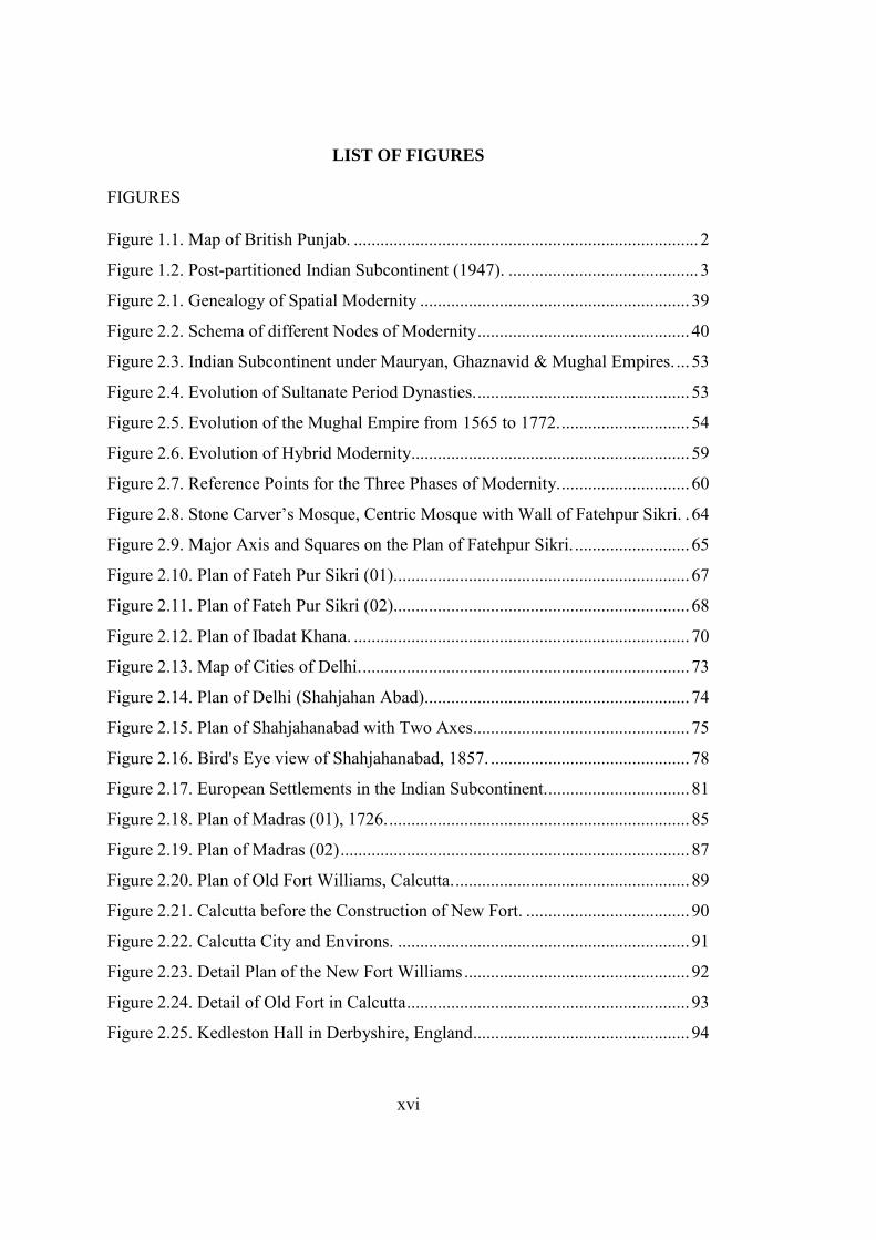
LIST OF FIGURES
FIGURES
Figure 1.1. Map of British Punjab. .............................................................................. 2
Figure 1.2. Post-partitioned Indian Subcontinent (1947). ........................................... 3
Figure 2.1. Genealogy of Spatial Modernity ............................................................. 39
Figure 2.2. Schema of different Nodes of Modernity ................................................ 40
Figure 2.3. Indian Subcontinent under Mauryan, Ghaznavid & Mughal Empires. ... 53
Figure 2.4. Evolution of Sultanate Period Dynasties. ................................................ 53
Figure 2.5. Evolution of the Mughal Empire from 1565 to 1772. ............................. 54
Figure 2.6. Evolution of Hybrid Modernity............................................................... 59
Figure 2.7. Reference Points for the Three Phases of Modernity. ............................. 60
Figure 2.8. Stone Carver’s Mosque, Centric Mosque with Wall of Fatehpur Sikri. . 64
Figure 2.9. Major Axis and Squares on the Plan of Fatehpur Sikri. .......................... 65
Figure 2.10. Plan of Fateh Pur Sikri (01). .................................................................. 67
Figure 2.11. Plan of Fateh Pur Sikri (02) ................................................................... 68
Figure 2.12. Plan of Ibadat Khana. ............................................................................ 70
Figure 2.13. Map of Cities of Delhi. .......................................................................... 73
Figure 2.14. Plan of Delhi (Shahjahan Abad)............................................................ 74
Figure 2.15. Plan of Shahjahanabad with Two Axes ................................................. 75
Figure 2.16. Bird's Eye view of Shahjahanabad, 1857. ............................................. 78
Figure 2.17. European Settlements in the Indian Subcontinent. ................................ 81
Figure 2.18. Plan of Madras (01), 1726. .................................................................... 85
Figure 2.19. Plan of Madras (02) ............................................................................... 87
Figure 2.20. Plan of Old Fort Williams, Calcutta. ..................................................... 89
Figure 2.21. Calcutta before the Construction of New Fort. ..................................... 90
Figure 2.22. Calcutta City and Environs. .................................................................. 91
Figure 2.23. Detail Plan of the New Fort Williams ................................................... 92
Figure 2.24. Detail of Old Fort in Calcutta ................................................................ 93
Figure 2.25. Kedleston Hall in Derbyshire, England ................................................. 94
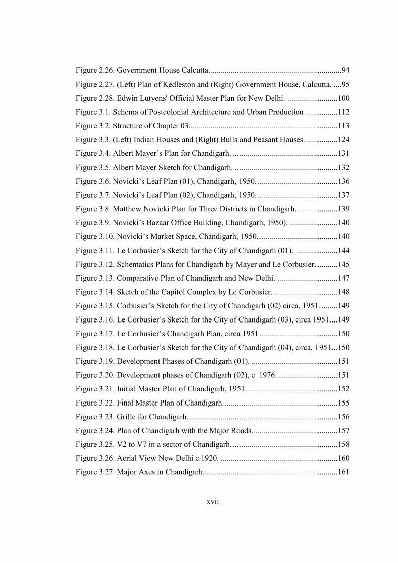
xvii
Figure 2.26. Government House Calcutta. ................................................................. 94
Figure 2.27. (Left) Plan of Kedleston and (Right) Government House, Calcutta. .... 95
Figure 2.28. Edwin Lutyens' Official Master Plan for New Delhi. ......................... 100
Figure 3.1. Schema of Postcolonial Architecture and Urban Production ................ 112
Figure 3.2. Structure of Chapter 03. ......................................................................... 113
Figure 3.3. (Left) Indian Houses and (Right) Bulls and Peasant Houses. ............... 124
Figure 3.4. Albert Mayer’s Plan for Chandigarh. .................................................... 131
Figure 3.5. Albert Mayer Sketch for Chandigarh. ................................................... 132
Figure 3.6. Novicki’s Leaf Plan (01), Chandigarh, 1950. ........................................ 136
Figure 3.7. Novicki’s Leaf Plan (02), Chandigarh, 1950. ........................................ 137
Figure 3.8. Matthew Novicki Plan for Three Districts in Chandigarh. .................... 139
Figure 3.9. Novicki’s Bazaar Office Building, Chandigarh, 1950). ........................ 140
Figure 3.10. Novicki’s Market Space, Chandigarh, 1950. ....................................... 140
Figure 3.11. Le Corbusier’s Sketch for the City of Chandigarh (01). .................... 144
Figure 3.12. Schematics Plans for Chandigarh by Mayer and Le Corbusier. .......... 145
Figure 3.13. Comparative Plan of Chandigarh and New Delhi. .............................. 147
Figure 3.14. Sketch of the Capitol Complex by Le Corbusier. ................................ 148
Figure 3.15. Corbusier’s Sketch for the City of Chandigarh (02) circa, 1951. ........ 149
Figure 3.16. Le Corbusier’s Sketch for the City of Chandigarh (03), circa 1951. ... 149
Figure 3.17. Le Corbusier’s Chandigarh Plan, circa 1951 ....................................... 150
Figure 3.18. Le Corbusier’s Sketch for the City of Chandigarh (04), circa, 1951. .. 150
Figure 3.19. Development Phases of Chandigarh (01). ........................................... 151
Figure 3.20. Development phases of Chandigarh (02), c. 1976. .............................. 151
Figure 3.21. Initial Master Plan of Chandigarh, 1951.............................................. 152
Figure 3.22. Final Master Plan of Chandigarh. ........................................................ 155
Figure 3.23. Grille for Chandigarh. .......................................................................... 156
Figure 3.24. Plan of Chandigarh with the Major Roads. ......................................... 157
Figure 3.25. V2 to V7 in a sector of Chandigarh. .................................................... 158
Figure 3.26. Aerial View New Delhi c.1920. .......................................................... 160
Figure 3.27. Major Axes in Chandigarh................................................................... 161
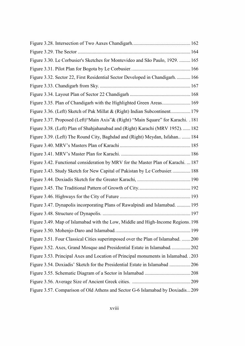
xviii
Figure 3.28. Intersection of Two Aaxes Chandigarh. .............................................. 162
Figure 3.29. The Sector ........................................................................................... 164
Figure 3.30. Le Corbusier's Sketches for Montevideo and São Paulo, 1929. ......... 165
Figure 3.31. Pilot Plan for Bogota by Le Corbusier. ............................................... 166
Figure 3.32. Sector 22, First Residential Sector Developed in Chandigarh. ........... 166
Figure 3.33. Chandigarh from Sky. ......................................................................... 167
Figure 3.34. Layout Plan of Sector 22 Chandigarh ................................................. 168
Figure 3.35. Plan of Chandigarh with the Highlighted Green Areas. ...................... 169
Figure 3.36. (Left) Sketch of Pak Millat & (Right) Indian Subcontinent.. .............. 179
Figure 3.37. Proposed (Left)“Main Axis”& (Right) “Main Square” for Karachi. . 181
Figure 3.38. (Left) Plan of Shahjahanabad and (Right) Karachi (MRV 1952). ...... 182
Figure 3.39. (Left) The Round City, Baghdad and (Right) Meydan, Isfahan.. ....... 184
Figure 3.40. MRV’s Masters Plan of Karachi ......................................................... 185
Figure 3.41. MRV’s Master Plan for Karachi. ........................................................ 186
Figure 3.42. Functional consideration by MRV for the Master Plan of Karachi. ... 187
Figure 3.43. Study Sketch for New Capital of Pakistan by Le Corbusier. .............. 188
Figure 3.44. Doxiadis Sketch for the Greater Karachi, ........................................... 190
Figure 3.45. The Traditional Pattern of Growth of City. ......................................... 192
Figure 3.46. Highways for the City of Future ......................................................... 193
Figure 3.47. Dynapolis incorporating Plans of Rawalpindi and Islamabad. ........... 195
Figure 3.48. Structure of Dynapolis. ....................................................................... 197
Figure 3.49. Map of Islamabad with the Low, Middle and High-Income Regions . 198
Figure 3.50. Mohenjo-Daro and Islamabad. ............................................................ 199
Figure 3.51. Four Classical Cities superimposed over the Plan of Islamabad. ....... 200
Figure 3.52. Axes, Grand Mosque and Presidential Estate in Islamabad. ............... 202
Figure 3.53. Principal Axes and Location of Principal monuments in Islamabad. . 203
Figure 3.54. Doxiadis’ Sketch for the Presidential Estate in Islamabad ................. 206
Figure 3.55. Schematic Diagram of a Sector in Islamabad ..................................... 208
Figure 3.56. Average Size of Ancient Greek cities. ............................................... 209
Figure 3.57. Comparison of Old Athens and Sector G-6 Islamabad by Doxiadis. .. 209
xix
Figure 3.58. Comparison Plan of Old Athens and Sector G-6 Islamabad. .............. 209
Figure 3.59. Community Class V, Sector G-6, Islamabad. ...................................... 210
Figure 3.60. (Left) Community Class IV and (Right) III, Sector G-6, Islamabad .. 210
Figure 3.61. Block of the Ancient City with Sector of Islamabad. .......................... 211
Figure 3.62. Metropolitan Area of Islamabad. ......................................................... 213
Figure 3.63. Seven Landscape Areas of Islamabad. ................................................ 214
Figure 3.64. Central Axis and Principal Administrative Buildings(Left) Chandigarh &
(Right) Islamabad. .................................................................................................... 219
Figure 4.1. Structure of Chapter 04 .......................................................................... 222
Figure 4.2. (Left) A Mohamedan Doorway, (Right) A Hindu Doorway. ................ 224
Figure 4.3. Novicki’s First Proposal for the Capital Complex in Chandigarh ......... 230
Figure 4.4. Novicki’s Sketch for the 1st proposal of Capitol Complex. ................. 232
Figure 4.5. Novicki’s Sketch for the 2nd proposal of Capitol Complex................. 234
Figure 4.6. Tracing Inspiration for Novicki’s 2nd Proposal / Assembly Building. . 236
Figure 4.7. Le Corbusier’s Sketch for the Capitol Complex, 1958.......................... 238
Figure 4.8. Le Corbusier’s Sketch for the Location of Capitol Complex, 1956 ...... 239
Figure 4.9. The First Sketch of the Capitol Complex Feb 26, 1952. ....................... 240
Figure 4.10. Letter Written by Le Corbusier to M. T. Harris. ................................ 241
Figure 4.11. Second Sketch for the Capitol Complex Chandigarh. Nov 28, 1952. . 242
Figure 4.12. Le Corbusier Sketch from the Pinjore Garden. ................................... 243
Figure 4.13. Le Corbusier’s Sketch for Courtyard Capitol Complex. ..................... 243
Figure 4.14. Preliminary Sketch for the Capitol Complex (01) ............................... 244
Figure 4.15. Preliminary Sketch for the Capitol Complex (02). .............................. 245
Figure 4.16. he First Draft of the Capitol Complex. ................................................ 245
Figure 4.17. Plan of Capitol Complex at Chandigarh by Le Corbusier. .................. 246
Figure 4.18. Skyline for Chandigarh’s Capitol Complex ........................................ 246
Figure 4.19. High Court Building, Chandigarh during Construction. ..................... 248
Figure 4.20. Le Corbusier at the Construction of the High Court Building............. 248
Figure 4.21. Colour Scheme of the Frontal Columns of High Court. ...................... 249
Figure 4.22. High Court Building (Chandigarh) with the Signature Colours. ......... 250
xx
Figure 4.23. Initial Sketch of the High Court Building at Chandigarh.................... 251
Figure 4.24. Diwan-e-Khas (House of Elites) in Red Fort, New Delhi. .................. 251
Figure 4.25. First (Left) and Final (Right) Schemes for the Secretariat Building. .. 252
Figure 4.26. Secretariat Complex, Chandigarh. ...................................................... 253
Figure 4.27. Secretariat Building, Chandigarh. ....................................................... 254
Figure 4.28. Assembly Building, Chandigarh ......................................................... 255
Figure 4.29. Assembly Building in Chandigarh during Construction (01). ............ 256
Figure 4.30. Assembly Building in Chandigarh during Construction (02). ............ 257
Figure 4.31. Interior and Roof View for Assembly Building in Chandigarh. ......... 258
Figure 4.32. Sketch (Left) & 3D visualization (Right) of the Governor’s Palace ... 260
Figure 4.33. Model of Governor’s Palace and Monument of Martyrs. ................... 261
Figure 4.34. Chandigarh’s Capitol Sketch & View of Viceroy’s Palace Delhi. ..... 263
Figure 4.35. (Left) Governor’s Palace Chandigarh & Diwan-e-Khas, Fatehpur Sikr,
(Right) High Court Building & Diwan-e-Aam. ....................................................... 264
Figure 4.36. Mughal Garden’s Morphological Analysis. ........................................ 266
Figure 4.37. . (Left) Mughal Garden on the Rear Side of Viceroy’s Palace in New
Delhi, Right) Gardens on the Rear Side of Governor’s House Chandigarh.. .......... 266
Figure 4.38. Le Corbusier’s Sketches of Indigenous Indian Houses. ...................... 268
Figure 4.39. (Left) Model of the Assembly Tower, Chandigarh, (Top Right) Solar
Clock at Jantar Mantar, Jaipur (Bottom Right) Jantar Mantar, New Delhi. ............ 270
Figure 4.40. Tower of Shadows, Chandigarh (01). ................................................. 271
Figure 4.41. (Left) Picture and (Right) Sketch of Tower of Shadows.. .................. 272
Figure 4.42. Elevation of the Presidential Estate Islamabad. .................................. 273
Figure 4.43. Jamia Masjid Shahjahan Abad, India .................................................. 275
Figure 4.44. Jaina Temple. ...................................................................................... 276
Figure 4.45. First proposal (Rear View) for the Presidential Estate (01). ............... 278
Figure 4.46. First Proposal (Top View) for the Presidential Estate (02). ................ 278
Figure 4.47. Proposed Boulevards in Islamabad. .................................................... 279
Figure 4.48. Perspective Drawings for the Presidential Estate, Islamabad. ............ 281
Figure 4.49. Skyline of the Proposed Presidential Estate by Doxiadis Associates. 281
xxi
Figure 4.50. Relationship Diagram of the Presidential Estate, Islamabad. .............. 282
Figure 4.51. Ancient City Squares with Chandigarh & Islamabad. ........................ 282
Figure 4.52. Second Proposal for the Presidential Estate. ....................................... 283
Figure 4.53. Mount at Mohanjo Daro. ..................................................................... 283
Figure 4.54. (Top Left) Model for the Assembly Building in Islamabad, (Bottom Left)
Elevation of the Assembly Building (Islamabad), (Right) Plan and Section of
Assembly Building (Islamabad) by Arne Jacobson. ................................................ 286
Figure 4.55. Presidential Estate (First Proposal) by Louis Kahn. ............................ 288
Figure 4.56. (Left) Presidential Estate (Islamabad) 2nd Proposal, version 01, (Right)
Presidential Estate (Islamabad) 2nd Proposal, version 02 by Louis Kahn. ............. 290
Figure 4.57. Model of Presidential Estate, Islamabad’s 1st Proposal by Stone ....... 294
Figure 4.58. . View of Shalimar Garden Lahore ...................................................... 295
Figure 4.59. Ground Floor of the Presidential Estate (01). ...................................... 296
Figure 4.60. Ground Floor of the Presidential Estate (02). ...................................... 297
Figure 4.61. Presidential Estate (Islamabad) by Stone ............................................ 298
Figure 4.62. Presidential Estate (Islamabad) Edward Durrell Stone. ...................... 299
Figure 4.63. The J. F. Kennedy Centre for the Performing Arts.............................. 302
Figure 4.64. Front View of Faisal Mosque. ............................................................. 304
Figure 4.65.(Left) Sketch & (Right) Model of (Unbuilt) Kocatepe Cami, Ankara. 305
Figure 4.66. Faisal Mosque & the Faisal Avenue. ................................................... 306
Figure 4.67. (Left) Faisal Mosque, (Right) Study sketch for Faisal Mosque ......... 308
Figure 5.1. Schematics Plans for Chandigarh by Mayer and Le Corbusier. ............ 315
Figure 5.2. CIAM’s Six Functions and Ekistics Framework. .................................. 317
Figure 5.3. (Left) Master Plan of Islamabad and (Right) Chandigarh ..................... 318
Figure 5.4. Static and Dynamic Plans of Islamabad and Chandigarh respectively. . 319
Figure 5.5. Commercial Centres in Islamabad (Left) and Chandigarh (Right). ...... 320
Figure 5.6. Location of Monuments in the Plan of Chandigarh and Islamabad. ..... 321
Figure 5.7. Multi-level Structures & Networks, Rio de Janeiro, Brazil (1965). ...... 322
Figure 5.8. Pyramidal Expansion of Networks (in Depth) and Shells (in Height). . 322
Figure 5.9. Schematic Blow up Highlighting V2 to V7 in a sector of Chandigarh. 323
xxii
Figure 5.10. Plan of Sector, G6 of Islamabad (Left) and Sector 22, Chandigarh .... 324
Figure 5.11. Capitol Complex, Chandigarh & Presidential Estate, Islamabad . ...... 325
Figure 5.12. Composition of Viceroy Palace, New Delhi (Left), Presidential Estate,
Islamabad (Centre), Capitol Complex Chandigarh (Right). .................................... 328
Figure 5.13. Typical Traffic Flow in Chandigarh (Top Right), Islamabad (Top Left),
New-Delhi (Bottom Right) and Karachi (Bottom Left) on Monday at 0900. ......... 330
1
CHAPTER 1
1. INTRODUCTION
1.1. Premises
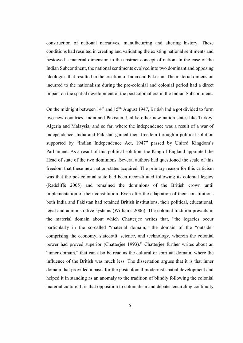
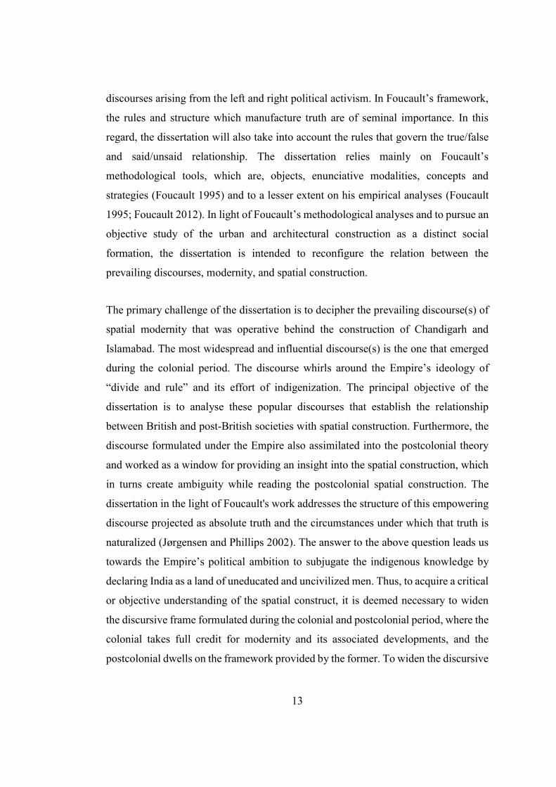
Right after the partition of British India in August 1947, two new nations India and
Pakistan came into being. These nations were created following the controversial
partition plan presented by Sir Radcliff. His demarcation plan and physical constraints
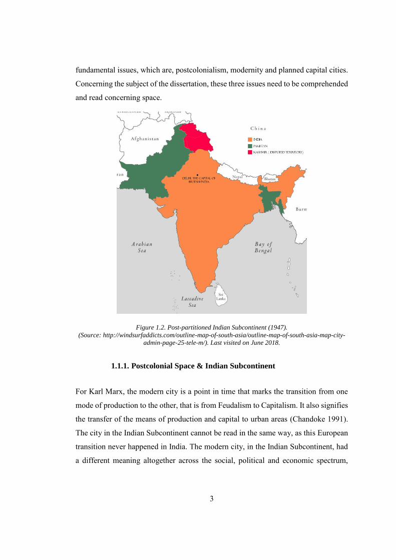
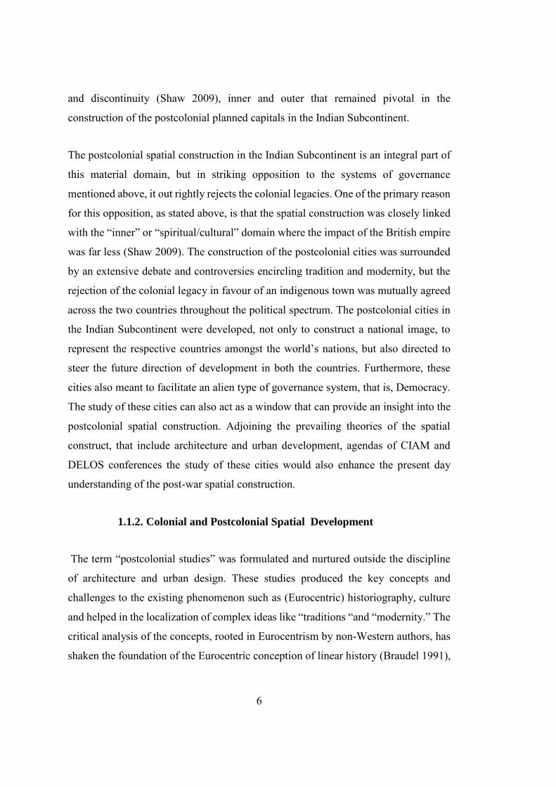
had left Pakistan without a capital city, as New Delhi, the capital of British Empire
ceded to India (Chester 2010)( See Figure 1.2). Similarly, Punjab: one of the two states
of British India that got divided between India and Pakistan also suffered the loss of
capital. The former capital of the state of Punjab, Lahore was ceded to the Pakistani
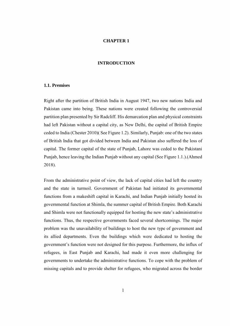
Punjab, hence leaving the Indian Punjab without any capital (See Figure 1.1.).(Ahmed
2018).
From the administrative point of view, the lack of capital cities had left the country
and the state in turmoil. Government of Pakistan had initiated its governmental
functions from a makeshift capital in Karachi, and Indian Punjab initially hosted its
governmental function at Shimla, the summer capital of British Empire. Both Karachi
and Shimla were not functionally equipped for hosting the new state’s administrative
functions. Thus, the respective governments faced several shortcomings. The major
problem was the unavailability of buildings to host the new type of government and
its allied departments. Even the buildings which were dedicated to hosting the
government’s function were not designed for this purpose. Furthermore, the influx of
refugees, in East Punjab and Karachi, had made it even more challenging for
governments to undertake the administrative functions. To cope with the problem of
missing capitals and to provide shelter for refugees, who migrated across the border
2
after the partition, both the respective governments of India and Pakistan had
prioritized the works for the development of the national and state capitals,
immediately after the independence (Evenson 1966; Nilsson 1973; Kalia 1987;
Prakash 2002; Mahsud 2008).
Figure 1.1. Map of British Punjab.
Muslims (Green) Non-Muslim (Pink) Majority Areas and Princely States (Yellow). The red line
depicts the international boundary line between India and Pakistan (Source: Punjab Digital Library).
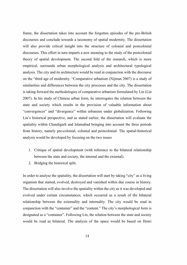
To pursue this task both the governments invited internationally acclaimed architects
to design the new capital cities. The first reason for asking these architects was the
lack of trained people, especially architects, in India and Pakistan. Secondly, both the
government wanted to align themselves with the progressive first world nations by
making these capitals as a symbol of progress for their countries. The development
process for these cities was not a straightforward as its foundation lies on the fractured
history, dichotomy of tradition and modernity, the escape from the colonial ethos,
burden of representation, people’s aspiration, state’s ambition, architect’s vision, and
the physical and technological constraints. It is evident from the above description and
title of this dissertation that discussion on the two cities whirls around three
3
fundamental issues, which are, postcolonialism, modernity and planned capital cities.
Concerning the subject of the dissertation, these three issues need to be comprehended
and read concerning space.
Figure 1.2. Post-partitioned Indian Subcontinent (1947). (Source: http://windsurfaddicts.com/outline-map-of-south-asia/outline-map-of-south-asia-map-city-
admin-page-25-tele-m/). Last visited on June 2018.
1.1.1. Postcolonial Space & Indian Subcontinent
For Karl Marx, the modern city is a point in time that marks the transition from one
mode of production to the other, that is from Feudalism to Capitalism. It also signifies
the transfer of the means of production and capital to urban areas (Chandoke 1991).
The city in the Indian Subcontinent cannot be read in the same way, as this European
transition never happened in India. The modern city, in the Indian Subcontinent, had
a different meaning altogether across the social, political and economic spectrum,
4
which is in contrast with the European cities. As Chandoke explains, “the city in the
European historical experience represents a break; a point of transition from one mode
of production to another. In the postcolonial world, the city is a historical subject
(Chandoke 1991).” Thus, in order to understand the modern Indian city, an excavation,
integration, and reconstitution of the history is required. The process of decolonization
started during the first quarter of the 19th century when several new nations came into
being. The creation of the new countries was the result of a complicated process that
includes the rise of the anti-colonial sentiments and formulation of the national
narratives. Although in the Indian Subcontinent the process of decolonization gained
its momentum in the middle of the 20th century, its roots can be traced back to a
century ago, to the failed war of independence in 1857.1 The loss in war against the
British, helped Indians in nurturing and reconstituting their nationalistic ideologies.
Furthermore, the Empire’s initiative, such as India’s participation in the great
exhibitions, historiography2, and Macaulay’s educational reforms3 and political
reforms4, also reinforced the Indian society towards reconstituting the national
sentiments. The rise of anti-colonial and national sentiments had affected almost every
aspect of life. The impact had extended to religious and educational spheres,
1 Indian war of Independence or India Mutiny was a battle fought between the British empire and local
Indian (including Hindu. Muslim and Sikhs) under the patronage of Bahadur Shah Zafer the last Mughal Emperor (Singh 2009; Fremont-Barnes 2014).
2 The Raj’s project of historiography was aligned with Empire’s policy of “divide and rule”, which in result fabricated the narrative that developed the gulf of difference between Hindus and Muslims, the two religious group which were living together in the Indian Subcontinent for more than 1000 years. The Empire’s ambitious project of historiography resulted in the production of few, controversial yet mostly referred texts on the Indian history which includes “History of Indian and
Eastern Architecture”, by Fergusson (Fergusson 1899) and “The Design and development of Indian
Architecture” by Batley (Batley 1934). 3 Macaulay’s education reforms were centred around the planned substitution of the alien culture of a
colonizing power via the education system. The term is derived from the name of British Lawyer and politician Thomas Babington Macaulay (1800-1859), an individual who was instrumental in the introduction of English as the medium of instruction for higher education in India and for encouraging the systematic wiping out of traditional and indigenous means of education and sciences (Macaulay 1835).
4 Hume, an Englishmen, formed the first political party, that was, the Indian National Congress (INC) in 1885 with a vision to include locals Indian into the political spectrum of British India. Hume assumed that this in result would facilitate the Empire in making India as its stronghold. However, a few decades after its formation INC became the major party fighting for the independence of India (Sharma and Sharma 2001).
5
construction of national narratives, manufacturing and altering history. These
conditions had resulted in creating and validating the existing national sentiments and
bestowed a material dimension to the abstract concept of nation. In the case of the
Indian Subcontinent, the national sentiments evolved into two dominant and opposing
ideologies that resulted in the creation of India and Pakistan. The material dimension
incurred to the nationalism during the pre-colonial and colonial period had a direct
impact on the spatial development of the postcolonial era in the Indian Subcontinent.
On the midnight between 14th and 15th, August 1947, British India got divided to form
two new countries, India and Pakistan. Unlike other new nation states like Turkey,
Algeria and Malaysia, and so far, where the independence was a result of a war of
independence, India and Pakistan gained their freedom through a political solution
supported by “Indian Independence Act, 1947” passed by United Kingdom’s
Parliament. As a result of this political solution, the King of England appointed the
Head of state of the two dominions. Several authors had questioned the scale of this
freedom that these new nation-states acquired. The primary reason for this criticism
was that the postcolonial state had been reconstituted following its colonial legacy
(Radcliffe 2005) and remained the dominions of the British crown until
implementation of their constitution. Even after the adaptation of their constitutions
both India and Pakistan had retained British institutions, their political, educational,
legal and administrative systems (Williams 2006). The colonial tradition prevails in
the material domain about which Chatterjee writes that, “the legacies occur
particularly in the so-called “material domain,” the domain of the “outside”
comprising the economy, statecraft, science, and technology, wherein the colonial
power had proved superior (Chatterjee 1993).” Chatterjee further writes about an
“inner domain,” that can also be read as the cultural or spiritual domain, where the
influence of the British was much less. The dissertation argues that it is that inner
domain that provided a basis for the postcolonial modernist spatial development and
helped it in standing as an anomaly to the tradition of blindly following the colonial
material culture. It is that opposition to colonialism and debates encircling continuity
6
and discontinuity (Shaw 2009), inner and outer that remained pivotal in the
construction of the postcolonial planned capitals in the Indian Subcontinent.
The postcolonial spatial construction in the Indian Subcontinent is an integral part of
this material domain, but in striking opposition to the systems of governance
mentioned above, it out rightly rejects the colonial legacies. One of the primary reason
for this opposition, as stated above, is that the spatial construction was closely linked
with the “inner” or “spiritual/cultural” domain where the impact of the British empire
was far less (Shaw 2009). The construction of the postcolonial cities was surrounded
by an extensive debate and controversies encircling tradition and modernity, but the
rejection of the colonial legacy in favour of an indigenous town was mutually agreed
across the two countries throughout the political spectrum. The postcolonial cities in
the Indian Subcontinent were developed, not only to construct a national image, to
represent the respective countries amongst the world’s nations, but also directed to
steer the future direction of development in both the countries. Furthermore, these
cities also meant to facilitate an alien type of governance system, that is, Democracy.
The study of these cities can also act as a window that can provide an insight into the
postcolonial spatial construction. Adjoining the prevailing theories of the spatial
construct, that include architecture and urban development, agendas of CIAM and
DELOS conferences the study of these cities would also enhance the present day
understanding of the post-war spatial construction.
1.1.2. Colonial and Postcolonial Spatial Development
The term “postcolonial studies” was formulated and nurtured outside the discipline
of architecture and urban design. These studies produced the key concepts and
challenges to the existing phenomenon such as (Eurocentric) historiography, culture
and helped in the localization of complex ideas like “traditions “and “modernity.” The
critical analysis of the concepts, rooted in Eurocentrism by non-Western authors, has
shaken the foundation of the Eurocentric conception of linear history (Braudel 1991),
7
and provided an inside view into the non-Western world, which initially was framed
and viewed through the lens of Eurocentric concepts (for example, modernization,
nation-statehood, development, and urbanization). The localization of these concepts
also helped in developing a national discourse and impacted the architecture and urban
construction in the postcolonial nations. The issues thus generated by social scientists
could not escape from the problematic of “space” in colonial and postcolonial
contexts. Though these new critiques have opened a vast horizon for discussions,
however, Chakrabarty believes that further improvement is still required. He points
out that, “the standpoint or focus from which these works are generated still tends to
be the European (Chakrabarty 1992).” Logically the spectrum of postcolonial studies
can only be broadened by the inclusion of ideas from the “Third World” which consist
of the narrative of suppressed, the subjects who resisted, fought and overthrew the
colonial powers. The non-European scholars have also insisted on the inclusion of the
non-Western knowledge into the cannon of historiography.
The conventional study of architecture and urban design designates the subjects as
independent fields of inquiry by positioning the architect as a master builder who
interprets space in terms of aesthetic and technological values, instead of the social
formation which it is made up of (Fletcher 1996). In sheer contrast, a number of other
studies with reference to the structure of spatial and architectural agendas, (Mitchell
1991; Thai 1997; Blunt and McEwan 2003; King 2007) have argued that architecture
and space are constructed over a distinct base, which is formed by different socio-
political forces, thus negating the sole role of Architect in these social formations.
These studies are pivotal in the sense that they not only open up a new horizon in
historiography, but also helps in reconfiguring the relationship between architecture
and space in a postcolonial context under the influence of socio-political and culture.
Brenda Yeoh’s (2003) study of urban transformation with reference to Singapore is a
critical example in terms of socio-political analysis from the other’s perspective.
Yeoh’s principle argument is that the morphological form of Singapore is a product
of British and Chinese history overlaid with the project of modernity. A parallel
8
thought was established by not negating the colonial past but emphasizing the later
processes. Nalbantoglu and Wong analyses the idea of “domination and resistance” in
the rapidly changing postcolonial world. They write that
… an intervention into that unified architectural discourse that developed
under the guise of global agendas and tends to exclude or repress spatial
construct of often disadvantaged ethnicities, and underdeveloped
communities or people (G. B. Nalbantoglu and Wong 1997).
The postcolonial theorist had focused on the examination of the discourses generated
by “others” (Said 2012; Spivak 1987; Bhabha 1994). However, the major problem
which was challenged by the non-Western authors can be well narrated in Scott’s
words as the “epistemic violence” of colonialism, and the ways in which colonial
power works, in the realm of the real as well as the representational, at some time to
exclude and at others to include the colonized (Scott 1995).
1.1.3. Modernist Spatial Development in India and Pakistan
The rise of Modern movement at the start of the 20th century had made it almost
impossible to comprehend modernity. The term “modern” becomes more complicated
when the problematic is contextualized in a non-European geography like India, as
majority of the literature written on the genealogy, evolution, and taxonomy of
modernity inclined towards Eurocentrism. Alternatively, it also suggests that the
modern development in the Indian Subcontinent is the translation and domestication
of Western modernization, but is this really the case?
The postcolonial modern city is a product of sovereign cultural domain within the
society that is affected by the legacy of the colonizers and the pre-colonial past. The
importance of its predecessor spatial construction under the British Empire cannot be
neglected; however, the way it is understood within the framework developed by
Eurocentric social theory suppresses this influence. Appadurai presented a more
9
balanced approach to the problem. He writes, “for the ex-colony decolonization is a
dialogue with the colonial past and not a simple dismantling of colonial habits and
mode of life (Appadurai 1996).” Chapter 2 of the dissertation will provide a detailed
study of how spatial modernity originated and evolved in the Indian Subcontinent
integrating the pre-colonial, colonial and postcolonial literature. The mentioned
studies have resulted in the formulation of a new discourse on modern architecture
and urban design by broadening of the existing point of view on European colonization
and post-imperialism. These studies also depict that architecture and space were being
used as tools to establish European supremacy over the rest of the world, especially at
the end of 19th and beginning of 20th century (Frampton 2007). The depth created in
the field due to more recent scholarly works has made it possible to analyse
architecture and urbanism in the indigenous socio-political context. Here architecture
and urban development in the so-called “third-world” countries can be seen as a
fragment of their respective “political strategies” and “historicity.”
In the cases of India and Pakistan, postcolonial states with a colonial and pre-colonial
spatial past had worked out towards the creation of a “new meaning” that can represent
the society. The society in a Leferbvian sense is not an individual object, and nor is
space a static object that is frozen within a point in time. Both space and society evolve
together by influencing each other over the course of time (Lefebvre 1992). The
postcolonial governments are equally authoritative as their colonial predecessors, and
want to establish their control over the society, using space, similar to the colonizers.
The critical point to note that in such (postcolonial) scenarios, urban design (and
spatial construct to be more specific) was only executed under a shallow agenda of
development, where it becomes an instrument of achieving political control over
subjects (Wright 1991; Al Sayyad 1992; Rabinow 1995; Home 2011). The dissertation
will argue that it is the authoritative stance that helped in reinforcing the colonial
legacies in the architectural and urban domains. This dissertation advocates the idea
of “Indian exceptionalism ” (Chatterjee 1993) and utilizes the endogenous notions
while comprehending the modern cities. In other words, the project of modernity in
10
Islamabad and Chandigarh can be read as the resultant of diverse and deeper
intellectual agendas of the political leaders rather than the mere implementation of
European Modernism. Thus, the dissertation claims that a distinction should be made
the universal Modernism and multiple modernities that flourish in different socio-
political contexts, especially in the case of Islamabad, Pakistan and Chandigarh, India
and consequently how these modernities formed a national image of the country using
architecture and urban constructs. The pivotal question the dissertation address is, how
this postcolonial phenomenon affects the urban and architecture spatial construct. It is
understood that in nations that came into being at the end of colonial era, modernity
is being used as a tool by architects. Thus, modernity reinforces the state’s ambitions
for the formation of a national image. In any such construction, architecture has always
been taken as its object rather than a subject. However, the framework for
understanding the spatial construction in Indo-Pakistan remained unattended. Some
fundamental question can be posed to formulate an in-depth study of spatial
construction for example, how spatial construction is being created? What are the
primary elements that formulate and maneuver spatial construction? Modernist spatial
construct (both architectural and urban) in postcolonial nations was a manifestation of
states’ agenda of acquiring control over space. However, over time, architecture and
urban space assimilated into nationhood and became an integral part of national
subjectivity. As Kusno narrates, “The making of postcolonial subjects, phrased as
hybrid contradictory and ambivalent, are all noticeable unmediated by the materials
properties of the space (Kusno 2000).” Thus, the dissertation will focus on
highlighting how spatial and political cultures are formed by the representation of
architectural culture and how a city is used for the production of these objects, instead
of just merely representing the identity of the new nation.
1.2. Aims and Objectives
The dissertation is an attempt to investigate the modernist spatial construction within
cities of “Islamabad” and “Chandigarh,” along with utopias, prevailing socio-political
11
condition, and the background forces that influenced their development. The
dissertation will provide an overview of how architectural and urban development was
initiated and evolved in these cities. Chandigarh and Islamabad are two critical
examples of the postcolonial and post-war planning. The cities were constructed on a
part of the earth that shares thousands of years of mutual history yet were segregated
by a political border. Moreover, they were designed under the same socio-political
condition and following similar design philosophies. In contradiction to the
similarities, the political differences that resulted in the creation of the two states, India
and Pakistan, created a gulf of differences between them. The dissertation is an effort
to bridge that gulf and develop a theory of the cities that not only mend the ruptured
past, but also facilitate future development in the Indian Subcontinent. In order to
provide a holistic understanding of the planned capital cities, the dissertation will posit
the three critical concepts, that are, Postcolonial Indian city, Genealogy of Indian
spatial modernity and Planned Capital cities in India. The dissertation will
contextualize the “hybrid5 modernity,” as it formulated and evolved in the postcolonial
capital cities, within the socio-historical paradigm, in the South Asian context. This
effort will carve new venues of understanding and brings depth to the existing
literature. The primary objectives of this research are to formulate knowledge, by
locating the “spatial development” in the core and disengaging it with the politics of
manufactured historical narratives and Empire’s social theory. As a conclusion, the
dissertation will produce spatial knowledge. It will also comprehend the conditions
that contributed towards the formation of the new cities and later on steered the
direction of urban morphological and architectural development of the principal
administrative centres, that is, Capitol Complex in Chandigarh and the Presidential
Estate in Islamabad. The dissertation will critically analyse the complex relationships
between religion and state, by deciphering the underlying processes that resulted in
5 Hybridity” is one of the key terms coined by Bhabha and used quite frequently in the postcolonial
literature. Hybridity commonly refers to the creation of new transcultural forms within the contact zone produced by colonization. As used in horticulture, the term refers to the cross-breeding of two species by grafting or cross-pollination to form a third, ‘hybrid’ species. Hybridization takes many forms: linguistic, cultural, political, racial, etc. (Bhabha 1994; Mambrol 2016).
12
the development of state apparatuses. In the result, the dissertation will advance
towards the formulation of the theory of “hybrid modernity” by comparing the cities
and their principal administrative centres, constructed on the opposite side of borders.
In short, the research aims for the dissertation would be
1. To locate the origin of the spatial (hybrid) modernity in the Indian
Subcontinent and classify spatial (hybrid) modernity.
2. To theorize the premises for the postcolonial spatial development which
include nationalistic ideologies, architect’s ambitions, regime’s intention and
people’s aspiration.
3. To evaluate the distinctive spatial characteristics of Islamabad and
Chandigarh, created as a “cities for the future” in the postcolonial, post-
Independence context.
4. To theorize the urban and architectural space that in necessity explores the
multiple modernities along various conflicting and contested lines of identity,
representation and consumption.
1.3. Methodological Framework and Methodology
The main frame of the dissertation is bifold. Firstly, it will theorize modernity in order
to impart a deeper understanding of the postcolonial planned capital cities. Secondly,
it includes urban analysis, and thirdly architectural analysis, of the principal
administrative centres. In order to obtain the desired objective, the methodological
framework constitutes two distinct yet interrelated methods, that are, Discourse
analysis and Comparative Method. Foucault’s discourse analysis emphasises the fact
that the “truth is a discursive construction.” In line with this, the dissertation will
critically analyse the structure of different regimes of knowledge: the most relevant
among them, in accordance with the subject of the dissertation, are pre-British,
colonial and postcolonial, although the dissertation also rejects the idea of a single
recurring discourse in a single time frame, and would try to incorporate several other
13
discourses arising from the left and right political activism. In Foucault’s framework,
the rules and structure which manufacture truth are of seminal importance. In this
regard, the dissertation will also take into account the rules that govern the true/false
and said/unsaid relationship. The dissertation relies mainly on Foucault’s
methodological tools, which are, objects, enunciative modalities, concepts and
strategies (Foucault 1995) and to a lesser extent on his empirical analyses (Foucault
1995; Foucault 2012). In light of Foucault’s methodological analyses and to pursue an
objective study of the urban and architectural construction as a distinct social
formation, the dissertation is intended to reconfigure the relation between the
prevailing discourses, modernity, and spatial construction.
The primary challenge of the dissertation is to decipher the prevailing discourse(s) of
spatial modernity that was operative behind the construction of Chandigarh and
Islamabad. The most widespread and influential discourse(s) is the one that emerged
during the colonial period. The discourse whirls around the Empire’s ideology of
“divide and rule” and its effort of indigenization. The principal objective of the
dissertation is to analyse these popular discourses that establish the relationship
between British and post-British societies with spatial construction. Furthermore, the
discourse formulated under the Empire also assimilated into the postcolonial theory
and worked as a window for providing an insight into the spatial construction, which
in turns create ambiguity while reading the postcolonial spatial construction. The
dissertation in the light of Foucault's work addresses the structure of this empowering
discourse projected as absolute truth and the circumstances under which that truth is
naturalized (Jørgensen and Phillips 2002). The answer to the above question leads us
towards the Empire’s political ambition to subjugate the indigenous knowledge by
declaring India as a land of uneducated and uncivilized men. Thus, to acquire a critical
or objective understanding of the spatial construct, it is deemed necessary to widen
the discursive frame formulated during the colonial and postcolonial period, where the
colonial takes full credit for modernity and its associated developments, and the
postcolonial dwells on the framework provided by the former. To widen the discursive
14
frame, the dissertation takes into account the forgotten episodes of the pre-British
discourses and conclude towards a taxonomy of spatial modernity. The dissertation
will also provide critical insight into the structure of colonial and postcolonial
discourses. This effort in turn imparts a new meaning to the study of the postcolonial
theory of spatial development. The second fold of the research, which is more
empirical, surrounds urban morphological analysis and architectural typological
analysis. The city and its architecture would be read in conjunction with the discourse
on the “third age of modernity. “Comparative urbanism (Nijman 2007) is a study of
similarities and differences between the city processes and the city. The dissertation
is taking forward the methodologies of comparative urbanism formulated by Lin (Lin
2007). In his study of Chinese urban form, he interrogates the relation between the
state and society which results in the provision of valuable information about
“convergences” and “divergence” within urbanism under globalization. Following
Lin’s historical perspective, and as stated earlier, the dissertation will evaluate the
spatiality within Chandigarh and Islamabad bringing into account the three periods
from history, namely pre-colonial, colonial and postcolonial. The spatial-historical
analysis would be developed by focusing on the two issues
1. Critique of spatial development (with reference to the bilateral relationship
between the state and society, the internal and the external).
2. Bridging the historical split.
In order to analyse the spatiality, the dissertation will start by taking “city” as a living
organism that started, evolved, destroyed and vanished within due course in history.
The dissertation will also involve the spatiality within the city as it was developed and
evolved under certain circumstances, which occurred as a result of the bilateral
relationship between the externality and internality. The city would be read in
conjunction with the “container” and the “content.” The city’s morphological form is
designated as a “container”. Following Lin, the relation between the state and society
would be read as bilateral. The analysis of the space would be based on Henri
15
Lefebvre’s conceptual triad of “spatial practices”, “the representations of space”
(planned or conceived space) and “spaces of representation,” that provides an
interesting framework for analysing not only society- state relationship, but also the
spatiality of urbanism (Lefebvre 1992; Lin 2007). In addition to space the cities of
“Chandigarh” and “Islamabad,” would be studied alongside the theoretical approaches
established by their respective architects “Le Corbusier” and “Doxiadis” within the
primary stream of the urban development concepts of the 20th century. Both cities
were constructed to fulfil the need of the “missing” capital, to be represented as a
symbol of progression and provide the habiting to the people.The postcolonial
theorists over-emphasized the “split,” initially formulated as a result of Eurocentric
philosophical dilemmas and attached a negative connotation on whatever comes from
the west. The dissertation would emphasize the fact the border between historical
times lines shall not be read as a blockade; instead, it is porous and provides an
opportunity for historical assimilation. The analysis will also omit the interval between
the late 18th century to the earlier 19th century, a period of chaos, civil war and anarchy
in India.
1.3.1. Framework for Comprehending the KEY Terms
The dissertation’s central theme is based on hybrid modernity, an idea that emerged
from the contesting discourses of modernity in Indian Subcontinent and had a
universal meaning. Thus, for deciphering the hybrid character of modernity, it is
important to present definitions of the key terms such as modernity, modernization
and alternate modernities.
1.3.1.1. Modernity
The term modern is used for quite a long time in Western literature. Its basic meaning
is the humans’ negotiation with the present (Berman 1983). Berman’s three phases of
modernity roughly starts from sixteenth century and ends at the age of globalization
16
that reached its advent in the twentieth century. Unfortunately, the idea was forcefully
engaged with newness, thus resulted in multifaceted interpretations (Calinescu 1993).
Modernity, in general, is perceived as a rupture, from the past. Several philosophers
had criticised this conception of modernity and labelled this rupture as falsely
fabricated, which theorizes present as a disconnected episode of the human evolution.
On contrary modernity can be conceptualized as the acquired ability of man that is
linked with its progress, which materializes once man gain “ rational control over his
physical and social environment (Tipps 1973). In order to chalk a holistic picture of
modernity, the dissertation advocates a second “model” from comprehending
modernity where it is conceived as “re-orientation” from the past rather than a rupture
(Fernée 2014). The dissertation thus tries to disengage the problem of modernity from
“newness6” and “formalism7”, and charts its holistic understanding, which leads
towards the development of the theory of hybrid modernity.
The dissertation’s main frame for the origin of modernity coincides with the
Jairazbhoy’s idea that present an absolute picture about the process of modernization.
The works by King, Bhabha, Chatterjee and Karim’s postcolonial ideas are
investigated to develop a political stance about modernity. The Western authors like
Berman, Marx, Giedion and Habermas are also studied to conceptualize modernity
and locate its counterpart in the Indian Subcontinent. The Eurocentric restrictions in
the text of the Western authors are carefully studied and funnelled through the writings
of postcolonial authors to yield an Indian perspective on hybrid modernity. In His
historical account of modernity, All that is Solid Melts into Air Berman described the
yesterday, today and tomorrow of modernity concerning Faust as, Dreamer,
Destructor, and Developer. The book also enhances the terms modernity and
6 In post-independence India modern or new is generally read as a synonym of being foreigner (Prakash
2002), which brings the local at a primitive position, when it is read in conjunction with the externality. The dissertation develops a theory which comprehend the fact that modernity belongs to the region where it evolved, following a symbiotic relationship with the indigenous trends.
7 Academic formality is another challenge that restricts or at times negates the “others” of modernity in the favor of imparting a European supremacy. The dissertation challenges the very notion of this fabricated idea and through an intensive study of spatial development.
17
modernism by releasing them from “historical conjunctures and elite cultural forms.”
Though the book is excellently compiled and brought all modernists, from Marx and
Nietzsche to Foucault into a single frame, the limits imposed by its westward
orientation limits its role in the dissertation. Habermas’s seminal essay, “Modernity:
an Unfinished Project” emphasizes reassessing the “modern” before jumping into the
realm of post-modernity. He believes in modernity and its surviving potential. On
defining the function of modernity, He writes, “Modernity revolts against the
normalizing function of tradition; modernity lives on the experience of rebelling
against all that is normative (Habermas and Ben-Habib 1981, 5).”
Although written with reference to Europe’s cultural and societal limits, the function
and definition formulated by Habermas (as mentioned above) are appropriated with
reference to the dissertation. Heynen (2000), who tries to connect cultural theories of
modernity and modern movement provides an excellent account and bridges
architecture, modernity and dwelling. The dissertation, however, will take a different
route especially when discussing the colonial modernity and will disengage the
colonial modernity from the British-centric cultural theories. David Harvey’s, Paris:
Capital of Modernity would further steer the direction of the dissertation. In continuity
with Marxist tradition and postcolonial authors, Harvey also doesn't agree with the
idea of modernity as a radical break from the past. However, the dissertation is
utilizing his main idea as a substantial justification for engaging modernity with the
pre-colonial discourse. Harvey writes
The alternative theory of modernization (rather than modernity), due
initially to Saint-Simon and very much taken to heart by Marx, is that no
social order can achieve changes that are not already latent within its
existing condition (Harvey 2003).
Rabinow’s, French Modern: Norms and Forms of the Social Environment is a study
of space and power which provides an insight into how modernity was reflected onto
18
the urban space in Paris by using different philosophical and cultural tools. This book
provides a mould for reading and deciphering the modernist city which is in line with
the main idea of this dissertation (Rabinow 1995). Vikramaditya Parkash also pens
down first-hand information as he inherited from his father Aditya Prakash, one of the
nine assistants of Indian origin designated to facilitate Le Corbusier and his team by
the Government of India.
1.3.1.2. Modernization
Modernization in the West is viewed as a product of industrialisation, which limits its
age to few hundred years, but is it really the case? According to Berman (1983), in the
last century “the social processes that bring this maelstrom into being, and keep it in
a state of perpetual becoming, have come to be called "modernization.” These social
processes had their Eurocentric origins, due to the strong affinity between
“Modernism” and industrialization in the West, which was later assimilated into the
postcolonial world. Berman, like the rest of Eurocentric authors, envisioned the
process of modernization that started in the West and enraptured the world. The
dissertation through a detailed historiographical analysis will excavate the similar
condition in the Indian Subcontinent, which supports the presence of existence of
modernity. The dissertation also negates a monolithic image of modernization in the
non-Western world and reinforces the fact that modernization should be read in a close
relationship with the social and political processes. For Example, in Brasilia, the plan
was sought to act as a mould for social change, which was not the case in the Indian
Subcontinent. Furthermore, the ambitious Stalinist projects (such as the White Sea
Canal – 1931-33) in Russia or Kemalist modernization in Turkey, where the states had
authoritative agendas for change, are drastically in contrast with postcolonial Indian
modern projects. With certain specificities, Berman (1983, 76) claims the the French
Revolution also popularized the idea of overnight revolutionary transformation in
which the modernization process acts as main agent, remained the core philosophy of
Stalinist and Kemalist regimes. After the partition of British India, like other countries
19
of Third World, the modernization process was triggered and affirmed by the
respective governments of India and Pakistan. Ayyub in Pakistan and Nehru in India
were the spearhead of these spatial experiments8. The major objective of the respective
governments was to put their countries on the track of economic growth. Through the
analysis of the spatial manifestation and urban construct the dissertation highlights the
differences between the intended and executed paradigms and present a schema for
post-partitioned Indian modernization.
1.3.1.3. Alternative Modernities in Indian Subcontinent
The rise of Modern movement, (which eventually turned into Modernism) in social
and cultural theories at the dawn of the twentieth century along with other “isms”,
reaffirmed the European control over modernity. Berman’s definition of Modernism
is useful, provided that it is understood beyond Europe, “Any attempt by modern men
and women to become subjects as well as objects of modernization, to get a grip on
the modern world and make themselves at home in it (Berman 1983, 5).” The
dissertation critically analyse that even the idea of superficially imposing these
concepts on a “Living” civilization (A valuable account about this notion can be found
in (Jairazbhoy 1963) is vague and ambiguous. Furthermore, several postcolonial
authors like Jairazbhoy (1963), Prakash (2002), King (2004) and Hosagrahar (2005)
had also provided a frame work that reaffirms that fact that the prevailing alternative
modernities in the Indian Subcontinent are the result of exogenous and endogenous
forces and should be read in the similar fashion. The dissertation rephrases the claim
8 Ayyub khan (a military dictator, who overthrew the elected government, in 1958, through a blood less coup d'état) in order to authenticate his rule used religion as a tool to gain the popularity amongst masses. Educated and trained under British, his liberal orientation was not hidden. Since Ayyub Khan was keen in acquiring the support of right-wing activist to upheld his regime, He passively tried to integrate liberal values, (for example, removal of the word “Islamic” from the name of country in the constitution and Romanizing the Urdu script following the Turkish experiment (Rizvi 2000, 129)) but he never tried, nor he was politically powerful to implement his liberal ideas. Nehru’s modernization had come head to head with the “rationalism” of his mentor Gandhi. Following his democratic ideas, he never tried to enforce his vision on masses and space. Thus, the modernity experiment in India under Nehru was a “compromised” solution developed through the amalgamation of “Sawaraj, tradition and modernity.”(Gandhi 1909; Kalia 1999).
20
about alternative modernities, supported by the writers like Harvey (2003), Latour
(2012) and Berman (1983)9 that challenges the monolithic authoritarian vision of
modernity, as compiled in the form of “Modern movement”.
1.3.1.4. Modernism
The Rise of Modern movement, (which eventually turned into Modernism) in social
and cultural theories at the dawn of twentieth century along with other “isms”,
reaffirmed the European control over modernity. A definition of Modernism as
provided by Berman if understood beyond the European sphere reinforces this idea.
Berman writes that
Any attempt by modern men and women to become subjects as well as
objects of modernization, to get a grip on the modern world and make
themselves at home in it.
The dissertation is an attempt to disengage the problem of Modernism from the
industrialization and capitalism and locate its contextual origin. It provides a critique
of how Modernism, an idea that was conceptualized in the west is not only
appropriated and contextualized in the post-colonial world, but it can be traced over
the historical timeline of Indian subcontinent. The dissertation from the very start
reinforce the point of view that the industrial and capital driven western Modernism
was alien to the Indian sub-continent. Although the industrial Modernism enforced
over India during the colonial rule but it was the framework that was imported and not
the content (Chatterjee 1993; Karim 2012). of the ideas, that nurtured in the cradle of
social theory.
9 Harvey in his seminal book, “ Paris: the Capital of Modernity” writes that “the conditions of modernity are latent within the society (Harvey 2003)”. In the similar fashion, Latour challenges the divide between the modern and pre-modern (Latour 2012) and Berman says that “once this developer has destroyed the pre-modern world, he has destroyed his whole reason for being in the world. (Berman 1983)” These arguments clearly provides a possibility of alternative modernities which also come into being as a challenge to the FORMAL vision of modernity.
21
1.3.2. Methodology
The dissertation dwells on an extensive archival survey conducted across four
countries in three continents. Both in India and Pakistan, the archival materials are not
maintained correctly, thus while surveying the archives in Pakistan and Chandigarh
several documents and links were found missing. In order to overcomes these
deficiencies, the archival survey is further extended, to acquire the firsthand
knowledge of design and development of postcolonial planned capital cities
Chandigarh, India and Islamabad, Pakistan, specifically focusing on Fondation Le
Corbusier, Paris, France, Constantinos A. Doxiadis Archives, Athens, Greece and
Edward Durrell Stone Paper, University of Arkansas, U.S.A. (For the detail about the
documents and drawings accessed in the above mentioned archives see Appendix F-
L). In order to understand and analyze the social, political, cultural and built traditions
of Chandigarh brief interviews are conducted with distinguished Authors, Professors,
Researchers, and people living and working primarily associated with Chandigarh.
These discussions helped me in acquiring first-hand information about the history,
social formation, material culture, design ideas and evolution of the Chandigarh, India.
Following is the list of notable individuals who were interviewed during the
development of this dissertation.
Table 1.1. Scholars Interviewed in connection with Architecture and Urban Development of
Chandigarh and Islamabad.
No. Name Significance
1 Athanasios Hadjopoulos (Architect & Town Planner)
Head of Islamabad office, Doxiadis Associates, Intern at the office of the Le Corbusier.
2 Prof. Dr. Vikramadatya Parakash
University of Washington Son of Mr. Aditya Prakash one of the Assistant Architect to Mr. Le Corbusier for Chandigarh project. Book: 1. Chandigarh’s Le Corbusier, the struggle
of Modernity in postcolonial India.
22
3 Prof Dr. Kiran Joshi Head – Chitkara Centre for Advanced Studies in Architecture, Chandigarh, India. Books: 1. Documenting Chandigarh: The Indian
Architecture of Pierre Jeanneret, Edwin
Maxwell Fry, and Jane Beverly Drew,
Vol. 1.
4 Prof. Dr. Ravi Kalia The City College of New York Books: 1. Chandigarh: In search of an Identity.
2. Bhubaneswar, From a Temple Town to a
Capital City.
3. Gandhinagar, building national identity in
postcolonial India. 5 Prof Dr. Rohit Jigyasu
President of ICOMOS, India and a resident of Chandigarh.
6 Prof. Dr. J. P. Singh President of ICOMOS, India and a resident of Chandigarh.
Hick Stone (Architect) Son of Edward Durrell Stone. Books: 1. Edward Durell Stone: A Son's Untold
Story of a Legendary Architect.
1.4. Significance of Study
The studies on the postcolonial urban development try to analyse the city with
reference to the Eurocentric models. This study will outright reject the claims that
spatial modernity is a product of the West. Instead, it will present the idea that hybrid
modernity originated in the early modern period, long before the arrival of the British.
In this regard, the dissertation will theorize the origin of modernity before British by
bringing into account the books written under the Empire and lesser known books
published before the British period. The study would provide an insight into the
relationship between modernity, Nationalism, and spatial urban construction and
architectural development of principal administrative buildings, as it appeared in the
construction of post-independence capitals, Islamabad and Chandigarh. The starting
point of the dissertation is to appropriate nationalism and modernity. The dissertation
23
will further proceed with analysing their reflections and implications on architectural
and urban development in both the cities. The study will provide a framework for
understanding the modernistic spatial development as an apex point of the hybrid
modern urban development that originated in Fatehpur Sikri. The recent years have
seen an immense academic interest concerning the cross roads of nationalism,
modernity and urban/architectural development. The dissertation will compare the city
of Islamabad to Chandigarh, and also highlight the fact that although these cities
evolved under starkly different political circumstances, yet the resultant urban
formation shares the same trajectory of evolution. The comparison will help in
providing a better comprehension of the hybrid modernity and its connection to the
history. The study will also conclude the operational role of hybrid modernity and how
it was contextualized and acclimatized to the local condition. Several studies10 by
authors across the globe to tackle the new nation-states and capital cities. The
modernity in this regard can be read as a bridge that can help in the collective reading
of the cities that were developed on the strikingly different discourse, to resolve the
urban and architectural problems of India and Pakistan. Another important aspect of
this dissertation is to comprehend the different issues about “representation,” “utopia”
and “dwelling” in the light of urban theory. Benedict Anderson in his seminal text
elaborates that new nation states came into existence following a schema of “imagined
communities”; these imagined communities require a space to prove their existence
(Anderson 1983). The dissertation thus briefly addresses that this “space” which was
constructed not only takes the burden of representation, nationalism, and so forth, but
also brings new nations into existence. The development of the new cities “from
scratch” can be seen in continuation to the overall process of the urbanization in the
10 These studies include Sibel Bozdogan, Esra Akcan and Kezer’s works with reference to Nation
building in Turkey (Bozdogan and Kasaba 1997; Bozdogan and Akcan 2012) & Zeynep Kezer’s (Kezer 2016); Abidin Kusno’s seminal work invetigating the relation between postcolonialism and spatial construction in indonesia (Kusno 2000); James Holston’s and Mehrten’s landmark books criticizing Brasilia, the new capital of Brasil (Holston 1989a; Peixoto-Mehrtens 2010); Anoma Pieris’ book encircling nationalism and space for Sri Lanka (Pieris 2012); Kishwer Rizvi’s envisioning text written for the Middle East (Isenstadt and Rizvi 2011); Duanfang Lo’s book for Chinese urban development and forms (Lu 2006); and Vikramaditya Prakash’s deciphering the complex relation between modernity and postcolonial India (Prakash 2002).
24
post-partition India. The urbanization also resulted in land speculation and converted
use-value of the land into exchange-value. This study can be seen as a tool for urban
analysis. It not only contributes in developing a holistic understanding of the
modernistic spatial development in the Indian Subcontinent, but also helps in
identifying and comprehending the ideologies and forces that are steering the
morphological and typological development. Reinforced by archival materials, this
study will also open up concealed issues like the relationship between national politics,
issues of representation and spatial development. The study will try to investigate the
relation between the base and superstructure bringing into the discussion the issue of
class formation and socio-political conditions and will try to understand the forces that
were generating, shaping up and giving form to these cities.
To conclude this, the dissertation firstly intends to contribute to the theories of urban
history in the South Asian context by discussing the relationship between politics and
spatial construction. Secondly, the dissertation aims to open a new horizon for
discussing planned cities in general and post-independence cities in particular by
bringing together two similar cities that are separated by political borders. The
dissertation aims to frame a new perspective on the 20th-century urbanism by
providing the comparative analysis of the two modern planned capital cities. Thirdly,
the dissertation will contribute to re-defining modernity, and will present a contextual
definition of hybrid modernity. The theory of hybrid modernity would help in
broadening of the existing understanding about architectural and urban development.
In doing so, the dissertation will analyse and reconfigure the relationship between the
religious ideologies, political ambitions and aspiration to create a new meaning of
modern city in the Indian Subcontinent. Fourthly, cities in the Subcontinent were
marginalized from the main course discussion on the architecture and urbanism of the
20th century (Taylor 1998). Although Chandigarh got extensive media coverage
during its early years, the main reason for the coverage was Corbusier and his love for
self-projection, and not the city as such. On the other hand, Doxiadis was not even
included in seminal texts like Tafuri’s, History of Architecture (Tafuri 1986). This
25
dissertation is intended to bring the historical development and evolution of these
cities into mainstream discourse. Furthermore, the development of this discourse will
help in widening the horizon for the discussion on spatial construction. Lastly, the
studies will contribute objectively towards the study of the historiography of the South
Asian cities and formulate knowledge that would be beyond the religious
subjectivities and nationalistic dilemma. Since the partition of India, religious
subjectivities were anchored in the pivotal position in the historiography, that resulted
in the construction of a fractured narrative11.
1.5. Scope of Study
The dissertation will reconfigure the modernistic spatial development by
contextualizing modernity. In order to achieve the desired objective, the dissertation
will start by substituting the word “modern” with “hybrid modern” in order to
disengage the problem of modernity from the Western/Eurocentrism theorization and
to open up a new horizon and opportunities to the discuss the modernity concerning
the Indian Subcontinent. Although Chatterjee had provided a detailed insight into
modernity (Chatterjee 1997), his discussion is limited to India, and does not address
Pakistan. The study of Islamabad and Chandigarh is an opportunity to segregate
modernity from Eurocentrism and define it in relation to an area that shares centuries
of history, transcending political borders. The dissertation will analyse the
architectural and urban spatial construction concerning modernist spatial development
in the postcolonial nations of India and Pakistan. The focus of the dissertation are the
metropolitan areas of the cities, as defined by the Capital Development Authority,
Islamabad, Pakistan, and Chandigarh Urban Development and Planning Authority,
11 Pakistan came into being following the two-nation theory, based on the fact that Muslims of the
Indian Subcontinent are a different nation than Hindus and thus require their separate homeland. Although India’s founding fathers Gandhi, Nehru and Abul Kalam Azad were all secular and believed in the secular state, however a faction of Indian society viewed the Indian Republic as an extension to Mahabharata, a term derived from Hindu religious scriptures that emphasize that India should not be divided, and partition of India was a sin that should be reverted back (Iqbal 1959; Bansal 2015).
26
Chandigarh, India. Reinforced by excessive archival materials, this study will bring
the evolution both in terms of plans and the city into the discussion. The discussion
will consider the significant historical and geographical development and would act
as a bridge to connect isolated patches of history, deconstruct manufactured narratives,
and engage contradictory geographies. However, this dissertation will specifically
focus on the three aspects of the development related to the cities
1. The historical and geographical relations between the early modern, colonial
modern and postcolonial space as it developed.
2. The politics of development of new cities, architects’ aspirations, the regime’s
intention and people’s dream.
3. The comparative study to analyse the social-spatial characteristics of space.
The dissertation will analyse the new planned cities, which were designed and
developed, in striking contrast with the earlier cities within the shared geography and
will discuss the resultant class antagonism developed in the city in relation with the
architecture of the major administrative complexes and vice versa. The study starts by
theorizing the capital cities in the Indian Subcontinent. In this regard, the dissertation
provides a brief overview of the capital cities developed in the Indian-Subcontinent.
Particular emphasis will be given to the capital cities where a considerable amount of
literature and archaeological evidence are present. These capital cities include
Fatehpur Sikri, (the first designed capital by Mughals) Shahjahan Abad, Madras (The
first imperial capital), Calcutta and New-Delhi (the last imperial capital).The study
will also take into consideration the urban design project by the British, including the
military cantonment, trade towns and capital city as stated underneath.
1.6. Literature Review
The early modern condition in Indian subcontinent, were theoretical camouflage by
misreading on India, thus in order to evaluate these conditions in India, Fernee’s and
27
Richard’s text provided a solid ground with complimentary help from Fergusson’s and
King’s writings, whose work also reinforce the presence of early nodes of Indian
modernity. The dissertation’s central framework is developed along Bhabha’s seminal
term “hybrid.”12 While describing the postcolonial modernity, the dissertation is
further reinforced by Homi Bhabha’s key concepts such as “ambivalence13 and”
beyond”14 and his conceptualization of the borders and the illusions of space, that
exists between private and public, past and present, and the psyche and society.
Fergusson’s controversial yet essential book provides the earliest traces of modernity
before the arrival of the British. The book is reinforced with hundreds of sketches of
the building and overview of Indo-Saracenic style (Fergusson 1899). To decipher the
colonial biases embedded by Fergusson in his book, the dissertation analyses it with
reference to the writings of Inigenous authors like Jairazbhoy’s, Foreign influences in
India (Jairazbhoy 1963) and Nath’s detailed description of the Mughal Architecture
(Nath 1982). The dissertation also takes into account Karim’s Ph.D. dissertation which
reiterates the fact that modernity (as a content) was imported during the British period
and later domesticated. Karim also provides insight into the colonial development in
India (Karim 2012). The dissertation’s central theme about modernity is greatly
influenced by Anthony King’s essay “Transnational Delhi Revisited: The spatial
Language of Three Modernities,” re-published in his book, Spaces of Global Cultures,
12 Recent years have seen a rise in the utility of the term “hybrid”, which is mainly used in postcolonial
discourse, gender studies etc. In terms of the spatial analysis Bhabha referred hybrid as “third space” – a space where a new position is upheld, that is not only the sum of two parts, but something more. For a detail discussion on this see “The Commitment to Theory” in (Bhabha 1994).
13 The simple presence of the colonized “Others” within the textual structure, is enough evidence of the ambivalence of the colonial text. An ambivalence that destabilizes its claim for absolute authority or unquestionable authenticity. Bhabha writes, “it is only by understanding the ambivalence and the antagonism of the desire of the Other that we can avoid the increasingly facile adoption of the notion of a homogenized other.” (Bhabha 1994).
14 Bhaba writes while describing beyond as “it is the trope of our times to location the question of culture in the realm of the beyond … prefix post: post-modernist, postcolonialism, post- feminism” and “Beyond signifies spatial distances, marks progress, promises the future, but our intimations of exceeding the barrier or boundary – the very act of going beyond -are unknowable, unpresentable, without a return to the ‘present’ which in the process of repetition, becomes disjunct and displaced”. Furthermore, he writes “it is in the sense that the boundary becomes the place from which something begins it presenting in a movement not dissimilar to the ambulant, ambivalent articulation of the beyond.” (Bhabha 1994).
28
Architecture Urbanism Identity. In this article King provides an excellent account of
three modernities in the Indian subcontinent, that are, indigenous, colonial and post-
colonial. The geographical constraint and the context of Delhi resulted in the
difference of almost seventy years between King’s description of the colonial and
post-colonial space.
1.6.1. Architecture and Urban Development
To acquire the desired objectives a comprehensive survey has been done on literature
produced by Soja, Harvey, and Lefebvre. Their analysis of the urban space provides a
framework within which this dissertation operates. In addition to the analysis of space
as an “objective” instrument, different layers of subjectivities are read in coordination
with the relevant literature produced, for example, postcolonial studies by King and
Bhaba are referred quite frequently. However, since the subject of the thesis is purely
space and architecture, the next generation of postcolonial authors, who grounded their
argument on architecture and spatial construct, is given great importance. In this
regard, books written by Sibel Bozdogan, Abidin Kusno, James Holston, and
Vikramaditya Prakash played a pivotal role towards the conceptualization of this
dissertation. Their works have provided a base to understand modernity concerning
the new nation-statehood. Written concerning the different geographical locations,
such as Turkey, Indonesia, Brazil and India, these works steer the direction of the
dissertation. Though the concentration of the study is the postcolonial literature,
however, authors from around the world are taken into consideration for this work.
Most prominent of them is Paul Rabinow (Rabinow 1995), Smith (Smith 1998) and
Tom Avermaete (Avermaete 2010). Rabinow studies the formation of the “modern”
social environment of France, through examination of the field in which power
operates, namely urban planning (Rabinow 1995).Also, Lawrence J Vale’s seminal
book (Vale 1992) criticizing the relation between politics and architecture/urban
design is taken into consideration for developing a thesis on comparison and
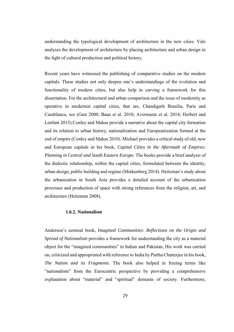
29
understanding the typological development of architecture in the new cities. Vale
analyses the development of architecture by placing architecture and urban design in
the light of cultural production and political history.
Recent years have witnessed the publishing of comparative studies on the modern
capitals. These studies not only deepen one’s understandings of the evolution and
functionality of modern cities, but also help in carving a framework for this
dissertation. For the architectural and urban comparison and the issue of modernity as
operative in modernist capital cities, that are, Chandigarh Brasilia, Paris and
Casablanca, see (Gast 2000; Baan et al. 2010; Avermaete et al. 2014; Herbert and
Lenfant 2015).Conley and Makas provide a narrative about the capital city formation
and its relation to urban history, nationalization and Europeanization formed at the
end of empire (Conley and Makas 2010). Michael provides a critical study of old, new
and European capitals in his book, Capital Cities in the Aftermath of Empires:
Planning in Central and South Eastern Europe. The books provide a brief analysis of
the dialectic relationship, within the capital cities, formulated between the identity,
urban design, public building and regime (Minkenberg 2014). Heitzman’s study about
the urbanization in South Asia provides a detailed account of the urbanization
processes and production of space with strong references from the religion, art, and
architecture (Heitzman 2008).
1.6.2. Nationalism
Anderson’s seminal book, Imagined Communities: Reflections on the Origin and
Spread of Nationalism provides a framework for understanding the city as a material
object for the “imagined communities” in Indian and Pakistan, His work was carried
on, criticized and appropriated with reference to India by Partha Chatterjee in his book,
The Nation and its Fragments. The book also helped in freeing terms like
“nationalism” from the Eurocentric perspective by providing a comprehensive
explanation about “material” and “spiritual” domains of society. Furthermore,
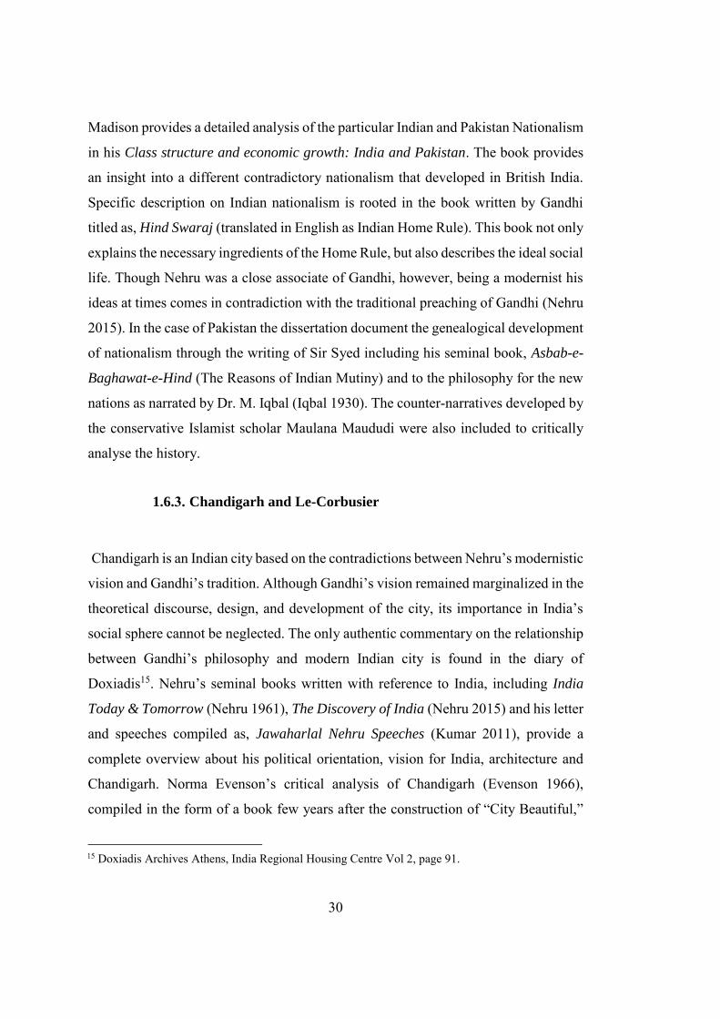
30
Madison provides a detailed analysis of the particular Indian and Pakistan Nationalism
in his Class structure and economic growth: India and Pakistan. The book provides
an insight into a different contradictory nationalism that developed in British India.
Specific description on Indian nationalism is rooted in the book written by Gandhi
titled as, Hind Swaraj (translated in English as Indian Home Rule). This book not only
explains the necessary ingredients of the Home Rule, but also describes the ideal social
life. Though Nehru was a close associate of Gandhi, however, being a modernist his
ideas at times comes in contradiction with the traditional preaching of Gandhi (Nehru
2015). In the case of Pakistan the dissertation document the genealogical development
of nationalism through the writing of Sir Syed including his seminal book, Asbab-e-
Baghawat-e-Hind (The Reasons of Indian Mutiny) and to the philosophy for the new
nations as narrated by Dr. M. Iqbal (Iqbal 1930). The counter-narratives developed by
the conservative Islamist scholar Maulana Maududi were also included to critically
analyse the history.
1.6.3. Chandigarh and Le-Corbusier
Chandigarh is an Indian city based on the contradictions between Nehru’s modernistic
vision and Gandhi’s tradition. Although Gandhi’s vision remained marginalized in the
theoretical discourse, design, and development of the city, its importance in India’s
social sphere cannot be neglected. The only authentic commentary on the relationship
between Gandhi’s philosophy and modern Indian city is found in the diary of
Doxiadis15. Nehru’s seminal books written with reference to India, including India
Today & Tomorrow (Nehru 1961), The Discovery of India (Nehru 2015) and his letter
and speeches compiled as, Jawaharlal Nehru Speeches (Kumar 2011), provide a
complete overview about his political orientation, vision for India, architecture and
Chandigarh. Norma Evenson’s critical analysis of Chandigarh (Evenson 1966),
compiled in the form of a book few years after the construction of “City Beautiful,”
15 Doxiadis Archives Athens, India Regional Housing Centre Vol 2, page 91.
31
not only provides a framework for tracing the origin of the city, but also brings
together first-hand information about the city. Evenson's study was considered a
ground-breaking effort for understanding. Chandigarh. In due course of history, much
has been written and published about Chandigarh. It was designated as the Mecca of
contemporary architecture and urbanism (Giedion 1956), acknowledged for its
struggle for Modernity (Prakash 2002), appreciated for its role in making Indian
Identity (Kalia 1987), its development as an Indian City (Kalia 1999), re-evaluated as
a modern city (Khan, Beinart, and Correa 2010), documented along with its built
elements (Joshi 1999). The above-mentioned references provide a holistic
understanding of the politics of development, power, and representation in
Chandigarh. Furthermore, several other books that provide an illustrated account of
the city by publishing the archival photographs of the “City Beautiful” are referred.
This list includes Ernst Scheidegger unpublished monographs about Chandigarh. Due
to the visa limitation, the author of the dissertation was not able to visit Chandigarh.
However, several monographs containing the old and new pictures of Chandigarh
published in recent years were studied. These volumes provide in-depth information
about the character of Chandigarh through several old and new photographs. These
volumes include Chandigarh 1956 (Scheidegger, Moos, and Casciato 2010),
Chandigarh Redux (Feiersinger and Feiersinger 2015) and Fynn’s excellent
publication with the current pictures of the Chandigarh (Fynn 2017). Anderson’s
Ph.D. dissertation titled Expressive Structure: The Life and Work of Matthew Novicki,
provides an in-depth analysis of the buildings designed by Matthew Novicki and
specifically his work in Chandigarh. The dissertation also helps in reading his plan for
Chandigarh concerning his earlier works.
Le Corbusier and Doxiadis had also written extensively on urban design and city
planning. Their books and articles are precious not only in understanding their vision
about the cities and post-independence spatial modernity, but also clears them from
undue criticism, posted on them for being the flag bearers of European thought and
culture. In this regard, Towards a New Architecture a book written by Le Corbusier,
32
focuses on redefining the relation, beyond being a mere stylistic expression, between
users and buildings, in the new industrial age (Corbusier 2014). Further to Corbusier’s
core philosophy his seminal projects include, Contemporary city of 3 million people
(The ideal city) /1922. Plan Voisin for Paris /1925 and The Radiant city (Villa
Radieuse) /1930. are reviewed.
These books provide a detailed account of Corbusian vision of the city and help in
developing a critical understanding that how physical constraints in India had
restricted and forced Corbusier to contextualize his ideas. Furthermore, the charters
developed by CIAM (Frampton and Mumford 2002) and during the Athens
conference (Corbusier 1973) are also studied. These chapters provide information
about the primary functions of the city design as defined by CIAM, which are
dwelling, work, recreation, transportation and civic space. After the CIAM meeting in
1943 monumentality was added as a necessary function. Although Corbusier’s work
drew a lot of attention and criticism, pertaining to the scope of the dissertation Curtis,
Jacobs, Colquhoun, Frampton and Mumford’s works are reviewed. Curtis criticized
Corbusier for using alien symbolism in India (Curtis 1994). Jacobs concluded her
criticism by coining the term “Radiant Garden City Beautiful” produced by the
amalgamation of Corbusier’s radiant city and American garden cities (Jacobs 1992).
Colquhoun’s commentary on Corbusier, which appeared in his essays, criticized
Corbusier's approach as a modernist and in lieu of prevailing architectural historicism
(Colquhoun 1989; Colquhoun and Frampton 1985). Mumford’s seminal essay which
was written with reference to the Unite d’Habitation, Marseilles, criticized
Corbusier’s work as less innovative as compared to his competitors (Mumford 1981).
Although Chandigarh was the most significant urban development project undertaken
by Le Corbusier, some of his key ideas remained unimplemented due to the economic,
social and political condition of post-independence India. However, those concepts
are seminal for theorizing the origin, development, and evolution of Chandigarh.
Further to the published text, several archives around the world are accessed to gain
first-hand knowledge. The most prominent among them are Doxiadis’ archives in
33
Athens and Fondation Le Corbusier in Paris. For a complete list of archives and
interview conducted see Appendices F-K.
1.6.4. On Islamabad and Doxiadis
The discussion on Islamabad will comprise of a critique of spatial modernity and
Islamic spatial ideology. For criticism about the spatial modernity, the dissertation
asserts the following books and articles. Sten Nilsson’s monograph written about the
new capital developed for Pakistan, India, and Bangladesh provide a detailed account
on Islamabad, in addition to Chandigarh and Dhaka (Nilsson 1973). Several books,
monographs, and Ph.D. theses were written across the globe, covering the spatial and
administrative aspect of Islamabad that includes Yakas’s personnel experiences as a
project architect of Islamabad describing the political conditions at the time when
Islamabad was at the design stage, containing clients brief and its regulatory function.
The book also contains first-hand information about his coordination with Doxiadis
(Yakas 2001). Zaheer ud Din Khwaja remained the chief architect of Islamabad had
penned downs his personal experiences with architects and planners who were
involved in the designing of Islamabad. The most prominent among them are
Doxiadis, Yakas, Edward Durrell Stone, Louis Kahn, and Ponti. He also criticized the
C.D.A. management’s obsession with the formal aspect of Islamic Architecture
(Khwaja 1998). Furthermore, Islamabad’s socio-political condition and vision for the
creation of new capital by then President Ayyub Khan (Khan 1967), the role of
bureaucracy, government, and documentation in shaping up the urban life as a parallel
instrument to modernity (Hull 2012), and the analysis of the design and development
of Islamabad with the political role of the international funding agencies (Daechsel
2015) are also studied.
A couple of Ph.D. dissertations that contain a comprehensive discussion on Islamabad
include Ahmed Khan’s dissertation that highlights the politics of place-making,
evolution and norms of the historiography of Islamabad (Mahsud 2008). Furthermore,
34
Moatasim’s dissertation on the architectural anomalies and non-conforming spaces
that evolved over the period of times within different sectors of Islamabad (Moatasim
2015) and the discussion on Islamabad concerning the modern architecture and its role
in the making of the third world are also reviewed. Kreutzman explains the limitation
imposed by the interest of different stakeholders and development of squatter
settlement within the limits of the planned city which in returns challenges not only
the power relation, but the plan as well (Kreutzmann 2013). Mahsud’s article
highlights the specificity of the architect’s intuition and landscape in “making of the
plan of Islamabad” (Mahsud 2005), the importance of plan as a reflection of Dynapolis
and “transformation of modernist ideas about the city “and framework that contains
the agenda of evolution (Mahsud 2010), a critique on the entangled agendas of states,
the axial plans and hidden symbolism within the plan (Mahsud 2013). A comparison
between the intended and actual city through analysing the city 33 years after its
construction (Botka 1995), a critique on the architecture of Doxiadis and associate
with reference to “regional symbolism, Islamic iconography and technological
Modernism” (Karim 2016).
Islamic architecture and urbanism is a multi-layered, complex phenomenon which is
difficult to comprehend. Nazer Al Sayyad’s article provides an excellent overview of
the city development in Muslim communities across different geographies (Al Sayyad
1996). Hillenbrand also provides an analysis of spatial construction and society
through a detailed description of public architecture (Hillenbrand 2004). Jairazbhoy
provides an outline of Islamic Architecture. According to him, Islamic spatial
development is a subject which can be best understood within a specific geography.
In this reference, Jairazbhoy provides a wonderful example of Islamic architecture
reinforced with drawings and clarification of conceptual terminologies (Jairazbhoy
2004). Furthermore, Batuman provides a detailed account of the interaction between
political Islam and urban environment by discussing and analysing buildings
constructed in central Asia and Turkey. This study provides a framework for analysing
the spatial construction of Islamabad (Batuman 2017).Doxiadis himself has written
35
extensively on the subject. Several research papers and books written by him
encompasses his general system of ideas and how these ideas should be implemented.
According to the scope of this dissertation the seven books, as recommended by
Doxiadis (Doxiadis 1968) were reviewed to grasp his philosophy and develop a spatial
analysis of Islamabad. According to Doxiadis these books, “Provide the reader with a
general system of ideas and examples of how these ideas can be implemented in
particular cases (Doxiadis 1968).”Reinforced by the statistical data the first book
provides detail information about Ekistics: The Science of Human Settlements. The
book is divided into four sections: subject, facts, theory and action. It provides in-
depth knowledge about fundamental terms like Ekistics, Dynapolis, Megapolis and
Ecumenopolis (Doxiadis 1968). Book two provides detailed information about
Ecumenopolis, the inevitable city of the future. It provides an account for the
Doxiadian city of future and comprehensive study of settlements of the past and
present (Doxiadis 1974). This book is relevant to the subject of the dissertation, as
Islamabad was also envisioned as the city of future. The third book is a report on the
urban renewal explicitly written for the American city. In line with Mumford’s ideas,
Doxiadis provides valuable information about the scale of the city and prefer to make
a “human city” instead of “dead city” (Doxiadis 1966). The fourth book defines some
key terms like “cosmos” and “the human scale,” which remained in the mainstream
discussion during the planning of Islamabad (Doxiadis 1965). Doxiadis is generally
known as an urban planner, and the majority of his literature is written with reference
to the urban planning and design. However, the fifth book titled “Architecture in
Transition” provide Doxiadis’ comprehensive views about architecture. The book
highlights the cause of the crisis in architecture and suggests new solutions for new
problems. The sixth book clarifies the terms like “human architecture” and “urban
architecture” (Doxiadis 1985). The last book brings “dystopia” and “utopia” into the
main discussion (Doxiadis 1966).Further to the interpretation of the cities, Doxiadis
himself has written thoroughly about the city and urban development. The approach
of Doxiadis was more pragmatic as compared to Le Corbusier’s Utopia. His
philosophy revolves around the human scale and its interaction with the built urban

36
spaces, which primarily consist of five levels: Anthropos, nature, society, shells, and
networks (Doxiadis 1968).These concepts are thoroughly discussed by Doxiadis and
documented in the form of several articles and books.
37
CHAPTER 2
2. HYBRID MODERNITY & CAPITAL CITIES IN PRE COLONIAL AND
COLONIAL INDIAN SUBCONTINENT
2.1. Introduction
This chapter provides the genealogy of hybrid modernity, and subsequently, works
towards drawing a definition of modernity. The resultant definition then acts as a
baseline for comprehending the planned capital cities in the Indian Subcontinent In
contrast to the popular adjectives like postcolonial and domesticated used for
modernity, the dissertation will appropriate the term “hybrid” for modernity.
Furthermore, by providing a brief discussion about modernity, its operational frame
work and indication of condition for early modernity in Indian-Subcontinent. An
extensive inquiry is lodged for the origin of spatial modernity and its dynamics
through the analysis of the planned capital cities, that were developed from scratch.
Modern planned capital cities at different nodes of modernity would be discussed.
After providing the premises for modernity a detailed analysis of Fatehpur Sikri and
Shahjahanabad the modern planned capital developed under Mughals, and Madras,
Calcutta and New-Delhi, the modern planned capital developed by the British are
thoroughly and critically analysed with reference to the architecture and urban
development. This discussion will also postulate a comprehensive study of the origins
of spatial modernity in the Indian Subcontinent. The study will shift the direction of
the discourse from the eurocentrism to Indian and Pakistani context, as deemed
necessary to evaluate the postcolonial planned cities critically, which in result will
help in developing a comprehensive debate about the postcolonial modern space as it
evolved in the Indian Subcontinent, negating the widespread belief that it was
imported during the British times. Several dates are quoted to depict the origin of
modernity in the west corresponding to significant events that had a substantial impact
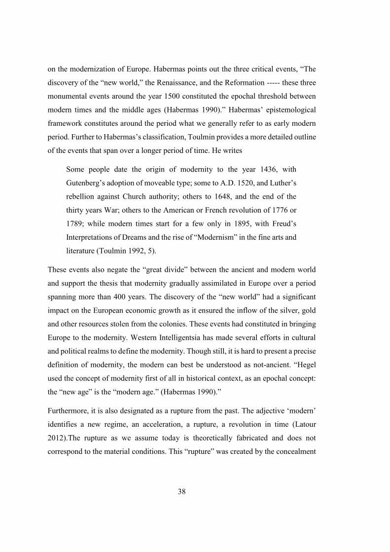
38
on the modernization of Europe. Habermas points out the three critical events, “The
discovery of the “new world,” the Renaissance, and the Reformation ----- these three
monumental events around the year 1500 constituted the epochal threshold between
modern times and the middle ages (Habermas 1990).” Habermas’ epistemological
framework constitutes around the period what we generally refer to as early modern
period. Further to Habermas’s classification, Toulmin provides a more detailed outline
of the events that span over a longer period of time. He writes
Some people date the origin of modernity to the year 1436, with
Gutenberg’s adoption of moveable type; some to A.D. 1520, and Luther’s
rebellion against Church authority; others to 1648, and the end of the
thirty years War; others to the American or French revolution of 1776 or
1789; while modern times start for a few only in 1895, with Freud’s
Interpretations of Dreams and the rise of “Modernism” in the fine arts and
literature (Toulmin 1992, 5).
These events also negate the “great divide” between the ancient and modern world
and support the thesis that modernity gradually assimilated in Europe over a period
spanning more than 400 years. The discovery of the “new world” had a significant
impact on the European economic growth as it ensured the inflow of the silver, gold
and other resources stolen from the colonies. These events had constituted in bringing
Europe to the modernity. Western Intelligentsia has made several efforts in cultural
and political realms to define the modernity. Though still, it is hard to present a precise
definition of modernity, the modern can best be understood as not-ancient. “Hegel
used the concept of modernity first of all in historical context, as an epochal concept:
the “new age” is the “modern age.” (Habermas 1990).”
Furthermore, it is also designated as a rupture from the past. The adjective ‘modern’
identifies a new regime, an acceleration, a rupture, a revolution in time (Latour
2012).The rupture as we assume today is theoretically fabricated and does not
correspond to the material conditions. This “rupture” was created by the concealment
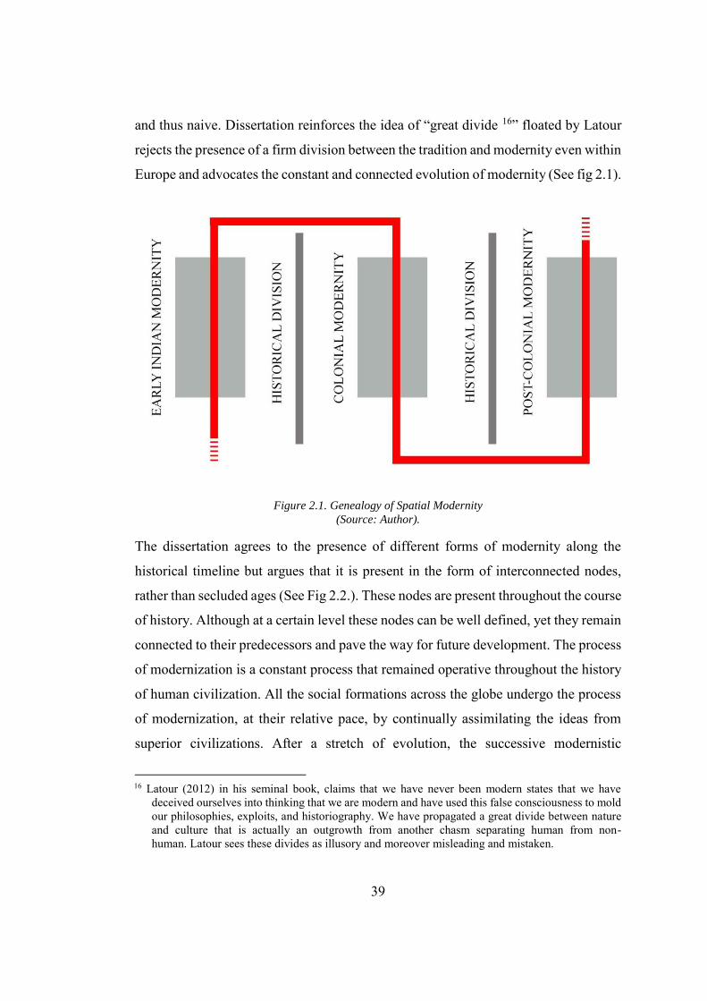
39
and thus naive. Dissertation reinforces the idea of “great divide 16” floated by Latour
rejects the presence of a firm division between the tradition and modernity even within
Europe and advocates the constant and connected evolution of modernity (See fig 2.1).
Figure 2.1. Genealogy of Spatial Modernity
(Source: Author).
The dissertation agrees to the presence of different forms of modernity along the
historical timeline but argues that it is present in the form of interconnected nodes,
rather than secluded ages (See Fig 2.2.). These nodes are present throughout the course
of history. Although at a certain level these nodes can be well defined, yet they remain
connected to their predecessors and pave the way for future development. The process
of modernization is a constant process that remained operative throughout the history
of human civilization. All the social formations across the globe undergo the process
of modernization, at their relative pace, by continually assimilating the ideas from
superior civilizations. After a stretch of evolution, the successive modernistic
16 Latour (2012) in his seminal book, claims that we have never been modern states that we have
deceived ourselves into thinking that we are modern and have used this false consciousness to mold our philosophies, exploits, and historiography. We have propagated a great divide between nature and culture that is actually an outgrowth from another chasm separating human from non-human. Latour sees these divides as illusory and moreover misleading and mistaken.
40
development can be distinctively identified. These distinctively identifiable points can
be referred as “nodes of modernity”. These nodes of modernity that appear after the
society attains a certain level of maturity, cannot be homogenously relatable to a single
source but can be linked by connecting different patches to different time periods and
geographical locations. However, this schema is not enough to understand how
modernity was operational, evolved and executed.
Figure 2.2. Schema of different Nodes of Modernity (Source: Author).
In the West, modernity is mostly understood with reference to the works of Karl Marx,
Max Weber, Emile Durkheim and George Simmel who had developed a detailed
study on the relation between modernity and rationality (Weber 1991; Lash and
Whimster 2008), differentiation (Durkheim and Halls 1997), economy (Simmel and
Frisby 1990) and spatial commodification respectively. Kant from the critical analysis
of the “reason” elaborated the fundamental of modernity. He explained two conditions
for apprehending the reasons namely “a priori” (independent of all experience) and
“posteriori” (gained from experience). However, in each of these condition the
knowledge produced is “fabricated” and not absolute (Kant 1999). Nietzsche and
several other post-structural critics had also challenged the “absoluteness” of
modernity and reinforced the fact that modernity is infected historical concealment
(Nietzsche 2003; Latour 2012). Jurgen Habermas, renowned social theorist, describes
“Project of Modernity” as a project which was fabricated by the Enlightenment
Philosophers. He has laid an extensive criticism on the incomplete project of
modernity and its “false program of the negation of culture.” He also criticized the
41
Marxist theorist for not addressing the pivotal questions while romanticizing the
agendas of social movements and “negating philosophy.” For Habermas, the
modernity which is based on reason and democracy is an unfinished project. The final
product of the modernity as narrated by him as, “A fully rational society is that in
which both system and life-world rationality were allowed to express themselves fully
without one destroying the other (Habermas 1997).”Walter Benjamin defines
modernity as “world dominated by its phantasmagorias.”17 Michel Foucault had
observed that a modern “society” in the strict sense must be seen as nothing more than
the effect of the technology in its widest arc, a rubric produced by biopolitical
constructs such the census, hygiene, security apparatuses and so on (Foucault et al.
2009). Harvey defines modernity as “creative destruction. Further to this definition,
Benjamin Schwartz, a historian who describes modernization by referring to Max
Weber as, “The ability of man to gain rational control over his physical and social
environment (Tipps 1973).” Paul Rabinow (Rabinow 1995), who remained the
mastermind behind theorizing the elusive relation between the modernity and spatial
development defines it by bringing the man to the centre of the definition which is
entirely in line with the philosophical ideas of Plato. He writes about man as, “the
measure of all things, of the existence of the things that are and the non-existence of
the things that are not (“Plato, Theaetetus, Section 152” n.d.).” Rabinow further
defines that as the central character of a man is to possess the capacity to invent,
interpret and implement. This definition does not present modernity as the internment
of opposition to the tradition but thrashes the authority of individual traditional
institutes like religion and other modes of production explicitly. According to Tipps,
Modernization, then, becomes a transition, or rather a series of transitions
from primitive, subsistence economies to technology-intensive,
17 “Phantasmagorias” as it is used and interpreted in literature is a complex and plural term and it is
difficult to reduce it to a singular concept. However, the term, originally derived from a show, popular in the nineteenth century that used optical illusion to produce shadows or “Fantomes”, was appropriated by Marx to designate the illusory, reified nature of personnel relationships under capitalism (Rigney and Fokkema 1993, 120).
42
industrialized economies; from subject to participant political cultures;
from closed, ascriptive status systems to open, achievement-oriented
systems; from extended to nuclear kinship units; from religious to secular
ideologies; and so on (Tipps 1973).
Thus conceived, modernization is not merely a process of change, but one, which can
be defined regarding with respect to the desired objectives. This criticism of Western
modernity, on the one hand, challenges its universal position and on the other, open
up the possibility to locate the substantial “truths” away from the Western
universalism. “Reason” not only plays a critical role in the fabrication of modernity,
but it can also act as a tool to view the possibility into the “other’s” modernity.
Logically speaking if the rational societies are regarded as modern in the west than the
Indian society under the reign of Akbar, the great Mughal emperor, where aql or
Reason supersedes to naql, or imitation, and utilized for creating a new world would
stand in par with the west. Interestingly both Akbar and European Modernity had its
origin in the Arabian Peninsula (Ali and Ali 1980). Western modernity was an
extension of reformation that transpired in Arabian Peninsula in tenth and eleventh
century, and the legacy of Mongols who contributed extensively towards the
formation of the new Western world. The modernistic notions borrowed from the
Arabs and Mongols had provided the basis for the early modern period in Europe. Al
Jabri on his account about the development of Arab modernity claims the credits and
highlights the contributions of Arabs for the early European modernity. He writes
When the philosophy of Ibn Rushd was transferred into it (Europe) and
created a revolutionary current of thought that turned the wheel of
evolution in a manner enabling science, afterward to play a historical role
in the modern European Renaissance (Al Jabri 2011, 428).
Unlike the European supremacist (especially the way they were operative in the Indian
Subcontinent), who concealed the non-Western elements from progress and labelling
it as a brainchild of the west, Al Jabri also acknowledges the Greek-Christian
43
traditions for the condition about the early European modernity by claiming that, “the
European Renaissance, which possesses two types of ‘heritage’: the Greek-Christian
heritage on the one hand, and the philosophical and scientific Arab heritage on the
other (Al Jabri 2011, 434).”This ideation, thus, brings the origin of Western European
modernity on crossroads where the Arab and European tradition and reinforcing
towards the upbringing of enlightenment. Weatherford provides a similar anecdote
where he pin-points the relationship between the Mongols and the early European
modernity by providing an interesting account of “three inventions”, as re-counted by
Francis Bacon, which were influential in forming the early European modernity. These
three inventions along with paper were introduced into Europe by the Mongols.
Weatherford writes that
As early as 1620, the English scientist Francis Bacon recognized the
impact that changing technology had produced in Europe. He designated
printing, gunpowder, and the compass as three technological innovation
on which the modern world was built…Under the widespread influences
from the paper and printing, gunpowder and firearms, and the spread of
navigational compass and other maritime equipment, Europeans
experienced a renaissance, literally a rebirth, but it was not the ancient
world of Greece and Rome being reborn: it was the Mongol Empire,
picked up, transferred, and adapted by the Europeans to their own need
and culture (Weatherford 2005).
The lack of the clarity whether printing was imported in Europe or originated in
Europe still prevails as neither Francis Bacon nor any other historian had provided any
authentic information about this issue, but the Paper, Gunpowder, and Compass were
authentic Mongol and Chinese exports. In addition to the tangible influences, the non-
tangible conditions produced by the transformation due to the global socio-political
changes. The key examples in this regard is the conquest of Constantinople (c.1453)
by Fatih Sultan Mehmet, which forced the Europeans to the find the new world as
their sole connection to India. When Columbus reached America in 1492, he was
44
intended on a mission to find a sea route to India; undoubtedly, he called the native
Americans as “red-Indians.” It is important to note that, in the early age of modernity,
these foreign influences were not imposed on the mainland Europe, but Europe learned
these trades to remain in par with the established powers of their times. Almost a
similar agenda was followed by the postcolonial rulers of India and Pakistan while
inviting the great architects of the west to design the capitals cities in their respective
countries. (Chapter three and four will further elaborate on this idea). The dissertation
also reinforces the argument that the modernity throughout history is formulated
through contextualization of foreign impressions using the local resources. In fact, the
“alien” influence spell a new soul into civilization and restrain it from becoming
stagnant. This argument is also reinforced by Indian Prime Minister Nehru and
Jairazbhoy. Nehru had stated that, “A society which ceases to change, ceases to go
ahead, necessarily becomes weak and it is an extraordinary thing how that weakness
comes out in all forms of creative activity (Prakash 2002a, 9)18.” Similarly,
Jairazbhoy also provides in detail the explanation regarding the importance of the
foreign influences as
Conservatism is a root characteristic of ancient cultures. Once the
techniques of civilization have been learned or fashioned for the first time,
once an idiom had been formed by the native craftsman from the limited
horizons within his purview, there follows a period of entrenchment and
assimilation. If after this there should be no further impetus from outside,
no further contact with a world of different values, then there is a process
of hardening in which innovation gives way to repetition and elaboration
is preferred to the invention (Jairazbhoy 1963).
The very reason for bringing the foreign influences that were seminal to the formation
of European modernity, into the discussion, is to comprehend the hybrid nature of
18 On another instance while addressing a gathering in Madras Mr. Nehru Said, “The moment you
individual or as a nation, think that you are doomed. You stop growing. That was what happened to India, China and the whole of Asia and we suffered from it (Nehru 1953).”
45
modernity. The plurality indebted within the structure of modernity provides a clear
direction that emphasizes the importance of foreign influences. The brief explanation
thus paved a path towards the objective discussion about modernity in the Indian
Subcontinent. As the importance of the amalgamation of exogenous and endogenous
forces was negated to establish the British supremacy, in the canonical texts written
on the “British Indian modernity” and was highly criticized and misread concerning
the “postcolonial Indian (India and Pakistani) modernity.” From the above discussion,
we can thus conclude that modernity, despite being a universal phenomenon weaved
through impressions borrowed from the different geographies, was aided through the
theoretical concealments and historical biases that acted as a catalyst for the
abandonment of the non-European traditions in Western modernity. A
2.1.1. Eurocentric Theoretical Camouflage and Misreading of India
Marx, like his teacher Hegel, is one of the prominent philosophers of Western
modernity. His historical perspective becomes vital in the course of this dissertation
as he was the first sociologist who had written about the destruction of traditional
societies that, in return, had provided a condition for the rise of modernity (Antonio
2003). This point of view is entirely in line with the Hegel’s earlier conception where
he narrated that certain social formations are binding, destroying and constructing the
society (Browning 2011). Marx from his study of historical materialism and
indigenous societies has indicated that the modernity is an outcome of the change of
mode of production particularly emphasizing the capitalist mode of productions.
Further to the critique of the mode of production he also emphasized the idea that the
modernity was growing out from historical development and class conflicts and
reflected itself on the horizon of the world. According to the study on the “Marx and
modernity” Feng and Xing narrated that, “the logic of capital, the historical viewpoint,
the theory of contradiction and a global perspective are fundamental in Marx's analysis
of the problems of modernity (Feng and Xing 2006).” Marx’s theory of modernity
remained pivotal in theorizing it in the west. Quite unlikely, when it comes to the
Indian Subcontinent, Marx also misread the Indian social conditions. He grounded his
46
analysis on the biasedly and miswritten information provided by the Hegel and other
Europeans. Following Hegel’s hateful comment that Africa has no history at all, Marx
floated the same idea about India. He had written that, “Indian society has no history
at all, at least no known history (Marx 1853).” Unlike Hegel, Marx displayed his
knowledge about the different religion and practices that helped in envisioning India,
however, he failed to recognize the early changes in Indian society. He referred to
History before the Britons as, “all the civil wars, invasions, revolutions, conquests,
famines, strangely complex, rapid, and destructive as the successive action in
Hindostan may appear, did not go deeper than its surface (Marx 1853).” For Marx, the
traditional Hindu culture remained the main force behind the social formation in India
as it was for the Britons.
England has broken down the entire framework of Indian society, without
any symptoms of reconstitution yet appearing. This loss of his old world,
with no gain of a new one, imparts a particular kind of melancholy to the
present misery of the Hindoo, and separates Hindostan, ruled by Britain,
from all its ancient traditions, and from the whole of its history (Marx
1853).
This viewpoint not only discards the early condition of modernity in India, but also
provides a foundation to the modern European discourse and canonical literature
which strengthen the fact, that how harsh it may be for the Indian, the modernity came
to India with the British. Quite surprisingly, a philosopher like Marx failed to
acknowledge the fruits of the encounter of Islam and Hinduism on the Indian land.
Similarly, he also failed to comprehend the transformation in the Indian society due
to an early Industrialization resulting in the formation of Industrial towns and urban
centres. These urban centres along with the Mansabdari system, the tax reforms, had
significantly affected the mythical self-sufficient Indian communes. In fact, Mughal
tax reforms were deteriorated by the British for their political gains when they started
giving ownership of the land which could be transferred through inheritance to their
local governors, unlike Mughals whose governors were only allowed to collect the
47
taxes from the assigned land with no ownership of the land. The economy was shifted
from the barter system to money due to the influx of gold bullions and silver from
Europe in exchange for spices and cotton. This inflow of the precious material was a
result that India, not so heavily mechanized, was labelled as an “industrial society,”
sharing 25 percent of the world’s Industrial production in 1750 A.D. (McClellan and
Dorn 2006). The abundance of gold is described by Marx as
Whose love of finery is so great that even the lowest class, those who go
about nearly naked, have commonly a pair of golden earrings and a gold
ornament of some kind hung round their necks. Rings on the fingers and
toes have also been common. Women, as well as children, frequently wore
massive bracelets and anklets of gold or silver, and statuettes of divinities
in gold and silver were met within the households (Marx 1853).
Marx made another generalization by bringing the deserts of Sahara, Arabia and
Africa in comparison to the fertile soil of India. He criticizes that due to lack of a
proper irrigation system before British, the land was turning into “barren and desert”
plains. Accordingly, he portrayed the reason for the desertification as the lack of an
artificial irrigation system due to the negligence of government, as he has written that
in India “civilization was too low and the territorial extent too vast (Marx 1853).”
Mughals were known to create the landmark Building include the Taj Mahal, Shalimar
Gardens and numerous tombs and tomb garden across India. These buildings were
constructed from the surplus they collected in the form of tax on agriculture. The
steady construction of these buildings depicts that there was a continuous production
of agriculture which, of course, was not possible without the artificial irrigation.
Secondly, the source of revenue for the Mughals was the export of cotton; an
agriculture yield. Thus Mughal governments from the very start provided extensive
funding for building the irrigation system (Schmidt 1995). The Mughal dynasty ruled
over India for almost 300 years among which the first 200 years have seen a
tremendous growth in the Empire which also indicates a stable economy mainly
comprising of agricultural incomes. Mughals had also developed the control over
48
artificial irrigation and integrated water supply in their garden and buildings. Their
water technology was more advanced as they developed planned canals and banked
the rivers as compared to the traditional Sultans of Bengal who were limited to making
water storage ponds (Kamal 2006). Several authors have provided extensive details
about the Mughal irrigation system as
Muslim rule brought improved irrigation and hydraulic technology to
North Indian agriculture, including the use of artificial lakes. The great
Moghul emperor Akbar (1556–1605) established a special government
canal department, and at the height of the Moghul empire, fully one-third
of the water used for irrigation flowed in manmade canals (McClellan and
Dorn 2006, 149).
Furthermore, a similar anecdote is provided by Kausar et. al. as, “Lahore once the
capital of Mughal Empires was known as the city of Garden and the famous terraced
Shalamar Garden developed on the flat land reflects the irrigation skill of the Mughal’s
Craftsman (Kausar, Brand, and Wescoat 1990).” The concealment of the early nodes
of Indian modernity get worsened with the time of the arrival of the British. The biases
and generalization by the British Historian had not only concealed the advancement
made by Mughal, but also tried to hold Europe for all the advancement. For example
in his seminal book Fergusson regards the architecture of Ghaznavid Period as a
“stepping stone” through which the architecture of the West was introduced into India
(Fergusson 1899, 491). Fergusson’s was not alone. In a letter, written to the Times
magazine, Baker claims that
The high domed portal arch, so prominent in Mughal architecture, had it
“prototype” in the Roman baths, while the “pride of Indian architecture,”
the dome, could be “traced through Constantinople and the Byzantine
Empire” and had, in any case, “its highest manifestation in St. Paul’s.” He
later speculated that even pierced-stone jaali screen might have been
derived from the chancel screen and pierced masonry window of Rome.
49
(Metcalf 2002).
The story was not limited to the basic elements of architecture; several absurd claims
are being made to glorify Italian architect Veroneo as the man who designed the Taj
Mahal (Carroll and Division 1973, 57). Modernity, as envisioned in the west, was not
only fabricated by the philosophers, but it was fabricated to establish the European
supremacy over the rest of the world. Continuing this tradition, the British
historiographers had later exploited the “stem power” to it fullest to establish the
supremacy of Raj in India. An overview of the discourse of modernity in Europe not
only makes one aware of the problematic in the discourse, but also makes it evident
that it was the values of “reason,”” truth” and “freedom” that was lying at the very
foundation of Western modernity. The rationalization following the celebration of
reason also provides us with a clue for excavating the Indian modernity before the
arrival of the British. To summarise the significant theoretical deficiencies in the
works of Hegel and Marx, the subsequent lines will provide in-depth information
about the early modern condition in the Indian Subcontinent. It was because of this
misinterpretation in the British historiography and the theoretical concealments that
even the common Indian in the postcolonial era tend to believe everything before the
British era was not modern. Prakash surfaces the antagonism between Indian and
modern prevails in India. Although his focus resides only in India, the same logic
implies for the entire Subcontinent. He writes
In postcolonial India, “Indian” and “modern” are considered to be
opposites and exclusive of each other... modernity is not, of course, the
exclusive preserve of the West, but it is a legacy of the colonial
distribution of the Western epistemic universe that only things that are
precolonial are considered “Indian.” This is not only forestalled India’s
autonomous advent into modernity, but also made anything that was
modern in India into something that was Western (Prakash 2002).
Further to the misinterpretation, concealment and the colonial biases, it was the
50
“commodification” of modernity under the capitalist mode of production that drew a
rigid identifiable line between modern and not modern. Humans were subjected under
a constant evolution from the very start, as King writes that “ no one living in stone
age ever thought he was living in the stone age”(King 2004, 65), it was the rise of
Western capitalism that marginalized India as an exotic place that was disconnected
from world history, which in result acted as a catalyst to establish the European
supremacy. India was also marginalized from some of the canonical text written on
the historical connection and early modern period (Subrahmanyam 1997). Later, the
modernization theory and Americanization of the urban space and architecture had
also reinforced the earlier ambiguities.
2.2. Early Nodes of Modernity in India
One major question that becomes the centre of argument in this case, is whether
modernity prevailed in India before the arrival of the British. In the light of the
discussion above, it can be concluded that the conceptualization of modernity varies
between the countries and geographies (for example, for some, it was the emergence
of Taimur in central Asia for others it was the discovery of sea routes) and a unified
image of modernity is non-comprehendible. Subrahmanyam also criticizes the
homogenous image of modernity and suggest a way forward to decipher the notion of
modernity. He writes
To delink the notion of 'modernity' from a particular European trajectory
(Greece, classical Rome, the Middle Ages, the Renaissance and thus
'modernity'...), and to argue that it represents a more-or-less global shift,
with many different sources and roots, and-inevitably-many different
forms and meanings depending on which society we look at from
(Subrahmanyam 1997).
We can search for the “early nodes of Indian modernity,” which can be used as a
critical tool owing to latest research in the academic circles (Chatterjee 1997; Richards
1997; Subrahmanyam 1997, 2001; Hosagrahar 2005; Fernée 2014; Ganeri 2014). In
51
this regard, Chatterjee’s narration is seminal, as he emphasizes on, “applying the
methods of reasons” to identify or invent the specific technologies of modernity that
are appropriated for our purposes that can lead towards “our modernity.” The “nodes”
of our modernity are the apex point of that particular modernity. This section will
analyse the period of the Mughal Emperor Akbar where a transition, towards the
supremacy of the reason, that provides the first visible clue for emergences of
recognizable nodes of modernity. The society under Akbar was shifting from the
traditional values towards rationality and socio-political reforms, that was also the
baseline attributes for the early European modernity. These early modern spatial
developments are crucially linked with the postcolonial modern capital cities as they
had, not only inspired Le Corbusier and Doxiadis (The designers of the postcolonial
capital cities of Chandigarh and Islamabad), but also provide the earliest traces of
spatial modernity in the Indian Subcontinent. Pertaining to the subject of the
dissertation two capital cities developed by Mughals namely, Shahjahanabad and
Fatehpur Sikri are analysed to highlight the salient modernistic feature. These cities
were built with the help of best possible technology, planning concepts “of their time”
and the best possible materials19. Further to this discussion, the following early
modern planned cities in the Indian Subcontinent helps in deciphering the social
formation by comprehending the complex relationship between the Indian society and
spatial construction. It will also bring the planning concepts into the discussion that
later influenced the planning and design of the postcolonial modern city planning. This
exercise will, in return, free the postcolonial modern capital cities from the harsh
criticism of being a sole product of West and acknowledges the fact that the foreign
influences are a mandatory condition for upbringing the modernity as it restricts the
civilization for becoming frozen in time. The contextualization of the borrowed
foreign impression in the presence of the local resources, result in upbringing
modernity. The first part of this chapter will provide an overview of the socio-political
conditions under which the early modern conditions were traced before the arrival of
19 Mughal have also utilized Lahore and Agra as their capital cities, but according to Vale’s definition they fall under the category of evolved capitals hence not discussed in detail.
52
colonizers in the Indian Subcontinent, as the origin of modernity. The first clue in this
regard was provided by the first Indian Prime Minister Nehru while speaking at the
seminar on architecture in 1957. He said
In fact, without being very accurate or precise, architecturally considered,
for the last few hundred years, India was static and the great buildings
which we admire really date back to a considerable time. Even before the
British came, we had become static. In fact, the British came because we
are static (Prakash 2002, 9).
Hence, why India became static is the seminal question. After the death of the
Aurangzeb Alamgir in 1707, India underwent a considerable period of turmoil which
includes the civil uprising by the local Ameers and foreign invasion by Portuguese,
French and the British. It was this period of unrest that stripped India of its glory and
acted as a catalyst to conceal the past. Later, the British historiography project in the
Indian Subcontinent, that focused on the glorification of the British and the rejection
on Indian tradition, acted as pivotal for the concealment.
2.2.1. Akbar’s Sulh-i-Kul and Modernity in Indian Subcontinent
India is a land of multiple religions and ethnicities. Three of the world’s largest
religions Hinduism, Buddhism and Sikhism were born and evolved from this land,
and the Indian Subcontinent (India, Pakistan and Bangladesh) hosts 30 percent of the
world Muslim population. The emergence of these new religious movements depicts
a constant dialogue within the society and its receptivity towards the new ideas.
Diversity is inherited in Indian-Subcontinent. It is a land comprising of multiple
religions ethnicities and languages20. For most of the period in the known history, this
land was divided among numerous small kingdoms and states that kept on fighting
with each other. In due course of time, several emperors tried to unite the Indian
20 Total languages spoken in Indian Subcontinent exceeds 550. Which include 448 languages spoked in
present day India (“India” 2018), and 74 languages spoken in Pakistan 74 (“Pakistan” 2018) and 42 languages spoken in Bangladesh (“Bangladesh” 2018).
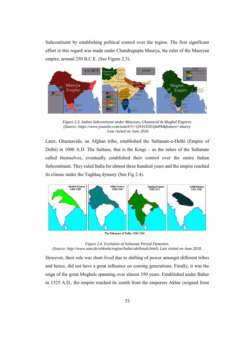
53
Subcontinent by establishing political control over the region. The first significant
effort in this regard was made under Chandragupta Maurya, the ruler of the Mauryan
empire, around 250 B.C.E. (See Figure 2.3).
Figure 2.3. Indian Subcontinent under Mauryan, Ghaznavid & Mughal Empires. (Source: https://www.youtube.com/watch?v=QN41DJLQmPk&feature=share).
. Last visited on June 2018.
Later, Ghaznavids, an Afghan tribe, established the Sultanate-e-Delhi (Empire of
Delhi) in 1000 A.D. The Sultans, that is the Kings – as the rulers of the Sultanate
called themselves, eventually established their control over the entire Indian
Subcontinent. They ruled India for almost three hundred years and the empire reached
its climax under the Tughlaq dynasty (See Fig 2.4).
Figure 2.4. Evolution of Sultanate Period Dynasties. (Source: http://www.zum.de/whkmla/region/India/xdelhisult.html). Last visited on June 2018.
However, their rule was short lived due to shifting of power amongst different tribes
and hence, did not have a great influence on coming generations. Finally, it was the
reign of the great Mughals spanning over almost 350 years. Established under Babur
in 1525 A.D., the empire reached its zenith from the emperors Akbar (reigned from
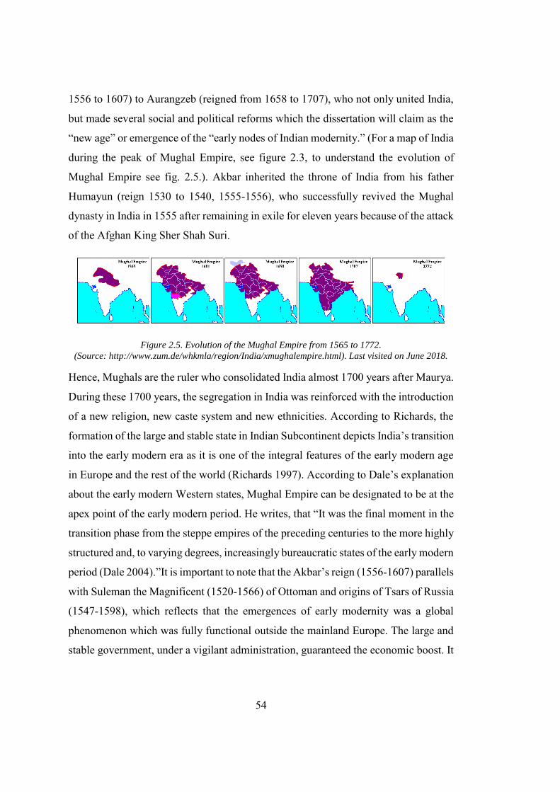
54
1556 to 1607) to Aurangzeb (reigned from 1658 to 1707), who not only united India,
but made several social and political reforms which the dissertation will claim as the
“new age” or emergence of the “early nodes of Indian modernity.” (For a map of India
during the peak of Mughal Empire, see figure 2.3, to understand the evolution of
Mughal Empire see fig. 2.5.). Akbar inherited the throne of India from his father
Humayun (reign 1530 to 1540, 1555-1556), who successfully revived the Mughal
dynasty in India in 1555 after remaining in exile for eleven years because of the attack
of the Afghan King Sher Shah Suri.
Figure 2.5. Evolution of the Mughal Empire from 1565 to 1772. (Source: http://www.zum.de/whkmla/region/India/xmughalempire.html). Last visited on June 2018.
Hence, Mughals are the ruler who consolidated India almost 1700 years after Maurya.
During these 1700 years, the segregation in India was reinforced with the introduction
of a new religion, new caste system and new ethnicities. According to Richards, the
formation of the large and stable state in Indian Subcontinent depicts India’s transition
into the early modern era as it is one of the integral features of the early modern age
in Europe and the rest of the world (Richards 1997). According to Dale’s explanation
about the early modern Western states, Mughal Empire can be designated to be at the
apex point of the early modern period. He writes, that “It was the final moment in the
transition phase from the steppe empires of the preceding centuries to the more highly
structured and, to varying degrees, increasingly bureaucratic states of the early modern
period (Dale 2004).”It is important to note that the Akbar’s reign (1556-1607) parallels
with Suleman the Magnificent (1520-1566) of Ottoman and origins of Tsars of Russia
(1547-1598), which reflects that the emergences of early modernity was a global
phenomenon which was fully functional outside the mainland Europe. The large and
stable government, under a vigilant administration, guaranteed the economic boost. It
55
was the blessing of this stable economy that India was a “major centre in the early
modern world economy” (Parthasarathi 2011). This was also the time in India when
the new administrative system Mansabdari had spearheaded the tradition Jajmani
system. In addition to the unification of India, Emperor Akbar also initiated the
implementation of his philosophy “Sulh-i-kul” (Literally mean peace for all) where he
preferred Aql (reason) over Naql (intimation). In his seminal book on the subject,
Fernee matches the Akbar’s reform to the European Enlightenment. He writes
In the 16th-century Mughal state under emperor Akbar (reigned 1556-
1605) — conterminous with Philip II’s (reigned (1556-1598) Inquisitional
campaign of catholic purification in Spain — we find a political
experiment defined by ideological percepts significantly comparable to
the spirit of later European Enlightenment yet it was derived from local
cultures resources in response to new global conditions of early
modernity… it also showed surprising intellectual innovations suggesting
the emergence of a secular rationalist worldview (Fernée 2014).
Comparing an indigenous Indian philosophy to the enlightenment seems like an
overstatement especially when the blockade created by the discourse of the colonizer
and children of enlightenment was fully operational. However, Fernee’s text examines
this embargo through a detailed analysis of the philosophy of Sulh-i Kul and its
implication on the Indian society, particularly in terms of social and religious reforms
that made Akbar a rebellion to the tradition.21
2.2.2. Emergence of Mercantile Capitalism and Flexible Industry
During the times of Akbar, India’s share of global manufacturing was estimated to be
around 25 percent. Goods manufactured in India were famous across the world and
hence they resulted in the flow of silver and gold bullion from around the globe into
21 This section is intended to provide an overview about the Akbar reformist period to Establish that it had all the ingredients of Early modernity as defined in Europe and elsewhere (Mubarak 1873; Chandra 1992; Fernée 2014; Lane-Poole 2018).
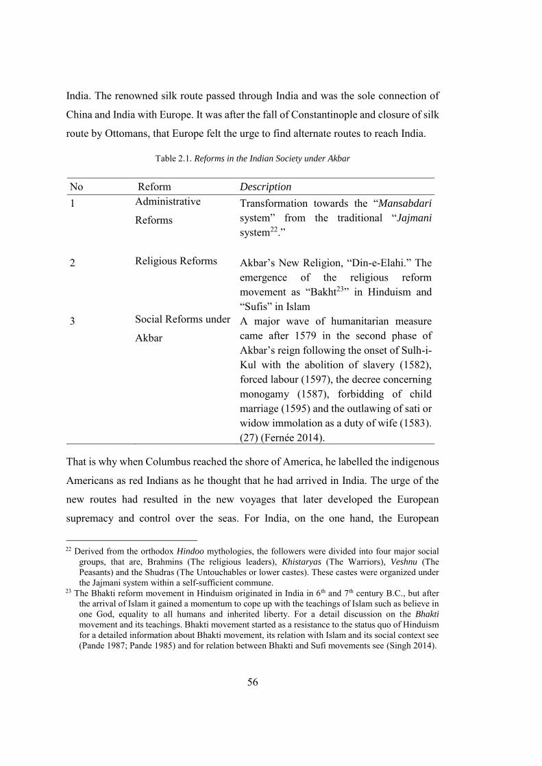
56
India. The renowned silk route passed through India and was the sole connection of
China and India with Europe. It was after the fall of Constantinople and closure of silk
route by Ottomans, that Europe felt the urge to find alternate routes to reach India.
Table 2.1. Reforms in the Indian Society under Akbar
No Reform Description
1 Administrative
Reforms Transformation towards the “Mansabdari system” from the traditional “Jajmani system22.”
2 Religious Reforms Akbar’s New Religion, “Din-e-Elahi.” The emergence of the religious reform movement as “Bakht23” in Hinduism and “Sufis” in Islam
3 Social Reforms under
Akbar A major wave of humanitarian measure came after 1579 in the second phase of Akbar’s reign following the onset of Sulh-i-Kul with the abolition of slavery (1582), forced labour (1597), the decree concerning monogamy (1587), forbidding of child marriage (1595) and the outlawing of sati or widow immolation as a duty of wife (1583). (27) (Fernée 2014).
That is why when Columbus reached the shore of America, he labelled the indigenous
Americans as red Indians as he thought that he had arrived in India. The urge of the
new routes had resulted in the new voyages that later developed the European
supremacy and control over the seas. For India, on the one hand, the European
22 Derived from the orthodox Hindoo mythologies, the followers were divided into four major social groups, that are, Brahmins (The religious leaders), Khistaryas (The Warriors), Veshnu (The Peasants) and the Shudras (The Untouchables or lower castes). These castes were organized under the Jajmani system within a self-sufficient commune.
23 The Bhakti reform movement in Hinduism originated in India in 6th and 7th century B.C., but after the arrival of Islam it gained a momentum to cope up with the teachings of Islam such as believe in one God, equality to all humans and inherited liberty. For a detail discussion on the Bhakti
movement and its teachings. Bhakti movement started as a resistance to the status quo of Hinduism for a detailed information about Bhakti movement, its relation with Islam and its social context see (Pande 1987; Pande 1985) and for relation between Bhakti and Sufi movements see (Singh 2014).
57
superiority had restricted the sea movement of Mughal ships, and on the other hand,
facilitated the transportation of the goods produced, by early manufacturing industry
in India, to the rest of the world. The early manufacturing could not be equated to
European Industrialization in the later modern stage, but it can be comprehended using
Seth’s following explanation, that is, “the root of the word manufacture is two Latin
words, manu and facers. Here ‘manu’ means hand and ‘facers’ means ‘to make.’ This
signifies that manufacturing in the earlier times was associated with the handicrafts
(Seth 2017).”In traditional Indian society, which is discussed at full length in the
following section, artisans and craftsmen did not choose the profession by choice,
however, it was a result of the rigid caste system that was an integral part of the
traditional agrarian economy. The social organization of the villages, under the
Jajmani system, did not allow the mediated market economy. Consequently, with the
emergence of the towns in India under the Mughals, considerable freedom was
imparted to the craftsmen. These people then settled in small towns thus providing a
basis for the emergence of mercantile capitalism in India. The major administrative,
religious and social reforms that transformed the Indian society from a traditional to
modern are summarized in the table 2.1.
2.3. From Modernity to Hybrid Modernity
From seventeenth century until the present times the term “modern” has provided a
framework to understand the “evolutionary present” in Indian Subcontinent (Hvattum
and Hermansen 2004). The contextual understanding of modernity can lead us towards
formulating a new paradigm of architectural and urban development in the modern
South Asian capitals. Partha Chatterjee provides an interesting anecdote about the
perception of “modern” and “new” in Bengal. He writes
The word adhunik, in the sense in which we now use it in Bengali to mean
‘modern,’ was not in use in the nineteenth century. The word then used
was nabya (new): the ‘new’ was that which was inextricably linked to
Western education and thought the other word that was much in use was
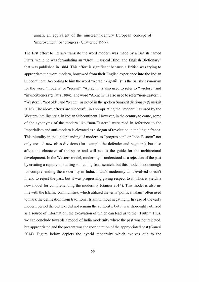
58
unnati, an equivalent of the nineteenth-century European concept of
‘improvement’ or ‘progress’(Chatterjee 1997).
The first effort to literary translate the word modern was made by a British named
Platts, while he was formulating an “Urdu, Classical Hindi and English Dictionary”
that was published in 1884. This effort is significant because a British was trying to
appropriate the word modern, borrowed from their English experience into the Indian
Subcontinent. According to him the word “Apracin (अूा चीन)” is the Sanskrit synonym
for the word “modern” or “recent”. “Apracin” is also used to refer to “ victory” and
“invincibleness”(Platts 1884). The word “Apracin” is also used to refer “non-Eastern”,
“Western”, “not old”, and “recent” as noted in the spoken Sanskrit dictionary (Sanskrit
2018). The above efforts are successful in appropriating the “modern “as used by the
Western intelligentsia, in Indian Subcontinent. However, in the century to come, some
of the synonyms of the modern like “non-Eastern” were read in reference to the
Imperialism and anti-modern is elevated as a slogan of revolution in the lingua franca.
This plurality in the understanding of modern as “progression” or “non-Eastern” not
only created new class divisions (for example the defender and negators), but also
affect the character of the space and will act as the guide for the architectural
development. In the Western model, modernity is understood as a rejection of the past
by creating a rupture or starting something from scratch, but this model is not enough
for comprehending the modernity in India. India’s modernity as it evolved doesn’t
intend to reject the past, but it was progressing giving respect to it. Thus it yields a
new model for comprehending the modernity (Ganeri 2014). This model is also in-
line with the Islamic communities, which utilized the term “political Islam” often used
to mark the delineation from traditional Islam without negating it. In case of the early
modern period the old text did not remain the authority, but it was thoroughly utilized
as a source of information, the excavation of which can lead us to the “Truth.” Thus,
we can conclude towards a model of India modernity where the past was not rejected,
but appropriated and the present was the reorientation of the appropriated past (Ganeri
2014). Figure below depicts the hybrid modernity which evolves due to the
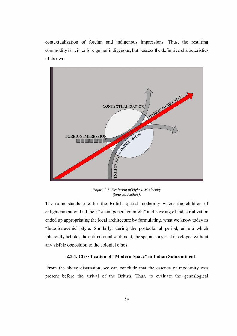
59
contextualization of foreign and indigenous impressions. Thus, the resulting
commodity is neither foreign nor indigenous, but possess the definitive characteristics
of its own.
Figure 2.6. Evolution of Hybrid Modernity (Source: Author).
The same stands true for the British spatial modernity where the children of
enlightenment will all their “steam generated might” and blessing of industrialization
ended up appropriating the local architecture by formulating, what we know today as
“Indo-Saracenic” style. Similarly, during the postcolonial period, an era which
inherently beholds the anti-colonial sentiment, the spatial construct developed without
any visible opposition to the colonial ethos.
2.3.1. Classification of “Modern Space” in Indian Subcontinent
From the above discussion, we can conclude that the essence of modernity was
present before the arrival of the British. Thus, to evaluate the genealogical
60
development of the modernistic urban space in Indian-Subcontinent, we can point
visible nodes of modernity across the historical timeline.
Figure 2.7. Reference Points for the Three Phases of Modernity. (Source: Author).
Certain nodes with close resemblance to each other can be grouped under a phase.
However, a distinctive start and end dates for each stage are almost impossible to mark
as they inseparably diffuse into each other, thus adding plurality to the material
conditions (See Fig 2.7.). In order to provide a holistic understanding of modern space,
a significant historical event can be marked as the reference point for each phase/node.
For example, 1556 marks the year when Emperor. Akbar came to power in India. The
year 1857 had witnessed the Indian war of Independence (often referred to as the
Indian Mutiny by the British scholars), the British victory in the war had made them
the sovereign power in the Indian Subcontinent. Similarly, 1947 was the year when
two new nations India and Pakistan came into being following the partition of British
India. Although these events had a significant impact on the social formation in the
61
Indian Subcontinent yet they don’t reinforce any abrupt change in material conditions
of the particular phase in the Indian Subcontinent, but rather signify the culmination
point of the process that originates long before these events and reached its climax
during this phase. These apex point of these formulation would, as already explained,
be referred as nodes of modernity (see Fig. 2.2). To impart clarity and retrieve these
terminologies from cultural romanticism a carefully sampled planned capital cities
would be analysed in connection with history, the socio-political condition of
production, urban morphology and spatial construct, relations of productions
emphasizing active and passive ties and their genealogical development, public and
private ownership and monumental qualities of cities, for example, scale, material and
design inspirations.
2.4. Pre-Colonial Planned Capital Cities
The early modern condition in the Indian Subcontinent was reflected in the material
domain after monumental buildings and cities were erected by consuming the surplus
accumulated from the agriculture and exports of agricultural goods. Harvey
emphasizes the importance of agricultural surplus which is “necessary for the
emergence of city forms”(Harvey 2009, 216). These buildings in the early modern
period reflect the Timurid / Persian influences, which was mixed with the local
vocabulary to produce the hybrids. A number of historical accounts provide an in-
depth analysis of this early modern urbanization in India (Spodek 1980; Sinopoli
1994; Hambly 2004; Misra 2013; Ray 2016). The early modern urbanization,
especially in the Mughal period, took its material form in the shape of small industrial
towns, administrative centres meant to host the local administration and military
cantonments. Eraly writes about the importance of these towns as, “the towns made
possible the manufacture of muskets and guns, providing the new military basis for
political and military domination over the countryside and the means to effective
revenue collection. (Eraly 2000).” Iftikhar provides a detailed account of these cities
and categorizes them into three main categories as shown below. Pertaining to the
subject of dissertation this section will analyse the spatial development in the planned
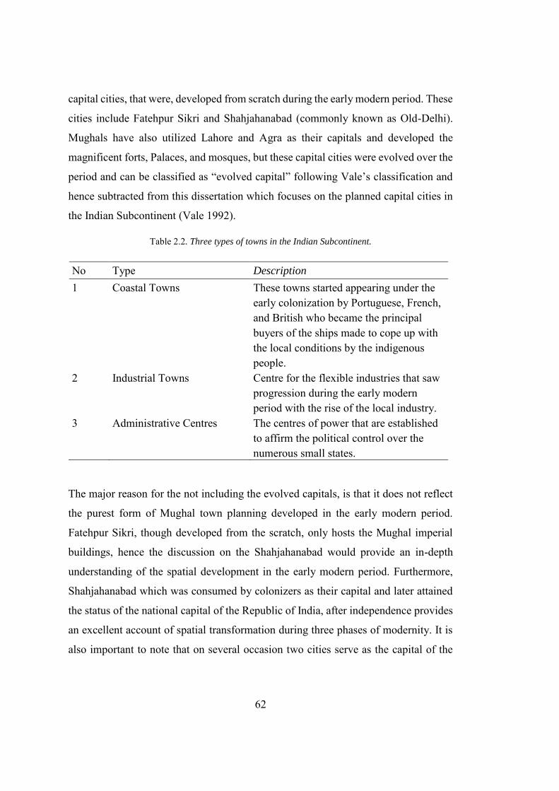
62
capital cities, that were, developed from scratch during the early modern period. These
cities include Fatehpur Sikri and Shahjahanabad (commonly known as Old-Delhi).
Mughals have also utilized Lahore and Agra as their capitals and developed the
magnificent forts, Palaces, and mosques, but these capital cities were evolved over the
period and can be classified as “evolved capital” following Vale’s classification and
hence subtracted from this dissertation which focuses on the planned capital cities in
the Indian Subcontinent (Vale 1992).
Table 2.2. Three types of towns in the Indian Subcontinent.
No Type Description
1 Coastal Towns These towns started appearing under the early colonization by Portuguese, French, and British who became the principal buyers of the ships made to cope up with the local conditions by the indigenous people.
2 Industrial Towns Centre for the flexible industries that saw progression during the early modern period with the rise of the local industry.
3 Administrative Centres The centres of power that are established to affirm the political control over the numerous small states.
The major reason for the not including the evolved capitals, is that it does not reflect
the purest form of Mughal town planning developed in the early modern period.
Fatehpur Sikri, though developed from the scratch, only hosts the Mughal imperial
buildings, hence the discussion on the Shahjahanabad would provide an in-depth
understanding of the spatial development in the early modern period. Furthermore,
Shahjahanabad which was consumed by colonizers as their capital and later attained
the status of the national capital of the Republic of India, after independence provides
an excellent account of spatial transformation during three phases of modernity. It is
also important to note that on several occasion two cities serve as the capital of the
63
Mughal Empire, like Delhi and Agra, and Agra and Fatehpur Sikri, and hence were
designed accordingly (Bernier 1916). A parallel can be drawn between the failed
experiment undertook by the Government of Pakistan, for hosting the national capital
of Pakistan in both Ayyub Nagar, Dhaka (designed by Louis Khan) and Islamabad
(designed by Doxiadis), in order to create the equilibrium of power between the East
and West Pakistan.
2.4.1. Fatehpur Sikri: The First Modern Planned Capital in India
Fatehpur Sikri which literally means “the city of victory” was constructed between
1571-1573 A.D., as the capital of Mughal Emperor Akbar the Great (Blake 2002). The
splendour of the city can be understood from the Englishman Ralph Fitch’s account,
who designates that Fatehpur was larger than London (Ryley and Fitch 1998). The
city was designed to reflect Akbar’s social ideology into architecture and urban space.
The city fulfils the Akbar’s agenda and had overtones of his political and social
ambitions. Akbar wanted to make his city the most beautiful on earth, for this reason,
the craftsmen was invited from across the country. Most of the craftsmen involved in
the city building were Hindu and specialized in the Hindu temple buildings (Srivastava
1964; Nath 1982). Thus, the indigenous tones to the imperial buildings was evident.
The Persian inspiration was evident in the design of the city, though one can also view
the presence of several motives that were indigenous to India. In general, the city was
planned according to the Indian principles24 while the buildings were extruded along
Indian and Persian principles25. Appreciated the rigor of the local craftsmen and the
attributes of the indigenous architecture, Hurlimann quotes Reuther as
How an Indian, following his own ideas, solved the problem of building
a Palace for a Moslem ruler’, and this is in such a comprehensive manner
24 For a detailed discussion on how the plan of the Fatehpur Sikri follows the 9 square rule, that it in
close association with the sacred mandala (Davar 1975). 25 These indigenous tones of the imperial building also generate a controversy that Fatehpur-Sikri firstly
established as a Hindu city that was later transformed by Akbar, into an imperial capital. This point of view mainly propagated by the Hansraj Bhatia of Institute of re-writing Indian history, still to the date was unable to present authentic proof to support his argument and hence subtracted from the main discussion (Bhatia 1969).
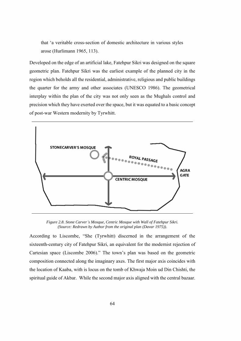
64
that ‘a veritable cross-section of domestic architecture in various styles
arose (Hurlimann 1965, 113).
Developed on the edge of an artificial lake, Fatehpur Sikri was designed on the square
geometric plan. Fatehpur Sikri was the earliest example of the planned city in the
region which beholds all the residential, administrative, religious and public buildings
the quarter for the army and other associates (UNESCO 1986). The geometrical
interplay within the plan of the city was not only seen as the Mughals control and
precision which they have exerted over the space, but it was equated to a basic concept
of post-war Western modernity by Tyrwhitt.
Figure 2.8. Stone Carver’s Mosque, Centric Mosque with Wall of Fatehpur Sikri. (Source: Redrawn by Author from the original plan (Davar 1975)).
According to Liscombe, “She (Tyrwhitt) discerned in the arrangement of the
sixteenth-century city of Fatehpur Sikri, an equivalent for the modernist rejection of
Cartesian space (Liscombe 2006).” The town’s plan was based on the geometric
composition connected along the imaginary axes. The first major axis coincides with
the location of Kaaba, with is locus on the tomb of Khwaja Moin ud Din Chishti, the
spiritual guide of Akbar. While the second major axis aligned with the central bazaar.
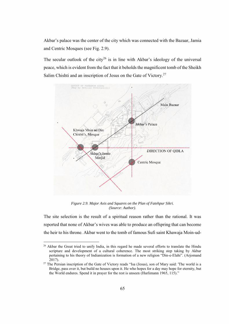
65
Akbar’s palace was the center of the city which was connected with the Bazaar, Jamia
and Centric Mosques (see Fig. 2.9).
The secular outlook of the city26 is in line with Akbar’s ideology of the universal
peace, which is evident from the fact that it beholds the magnificent tomb of the Sheikh
Salim Chishti and an inscription of Jesus on the Gate of Victory.27
Figure 2.9. Major Axis and Squares on the Plan of Fatehpur Sikri. (Source: Author).
The site selection is the result of a spiritual reason rather than the rational. It was
reported that none of Akbar’s wives was able to produce an offspring that can become
the heir to his throne. Akbar went to the tomb of famous Sufi saint Khawaja Moin-ud-
26 Akbar the Great tried to unify India, in this regard he made several efforts to translate the Hindu
scripture and development of a cultural coherence. The most striking step taking by Akbar pertaining to his theory of Indianization is formation of a new religion “Din-e-Elahi”. (Arjomand 2017).
27 The Persian inscription of the Gate of Victory reads “Isa (Jesus), son of Mary said: 'The world is a Bridge, pass over it, but build no houses upon it. He who hopes for a day may hope for eternity, but the World endures. Spend it in prayer for the rest is unseen (Hurlimann 1965, 115).”
66
Din Chishti28 and vowing that he will walk barefooted from “Agra to Ajmer if his
wish is fulfilled. In the upcoming year Akbar’s wife gets pregnant and she is sent to
Sikri, to seek the blessing from Khawaja Saleem Chishti who was the famous disciple
of the Khawaja Moin-ud-Din Chishti. Akbar’s son Jahangir was born in 1569, it was
the time when Akbar planned to move his capital from Agra to a remote site of Sikri.
he named his capital Fatehpur, the Town of Victory29(Brand and Lowry 1985).The
site of the capital was located on the hill approximately forty kilometres southwest of
the earlier capital Agra. Agra was the first capital, after the arrivals of Muslims. that
was not located on the grand trunk (G.T.) road that connects Afghanistan with Delhi.
The primary reason for the relocation of the capital was the utmost respect Akbar had
for Khwaja Moin-ud-din Chishti. However, Sinopoli provides a political account for
the transfer of Akbar’s new capital
The city has been viewed as a power run amok or "Akbar's whim" and,
more convincingly, as both a strategic fortress in which potentially
recalcitrant nobles could be isolated from the sources of wealth and power
in Agra and other economic centres of the empire (Sinopoli 1994).
According to Hurlimann, the central city was located on the quadrangular site made
from stone. The quadrangle was approximately fifteen hundred yards broad and three-
thousand-yards long. The town was fortified with an approximately ten-kilometre long
wall, encircling its three sides.
Due to the short life of the city, the boundary wall was never constructed completely
(Hurlimann 1965). The central citadel was in the highest part of the city having both
public and private buildings. It also contains a number of schools, caravanserai, public
baths and Havelis (Grand Houses) of the noble. The major buildings were strongly
28 Sufi saint Khawaja Moin-ud-Din Chishti used to pray in a cave near a small town of Sikri. The Stone
Carver’s working in the nearby quarry made a small mosque in honour of the Moin-ud- Din Chishti. Akbar used to visit this mosque following a path on which he erected Agra Gate. Akbar placed his grand mosque behind the Chishti’s Mosque (Davar 1975).
29 It is important to note and as discussed in earlier, the Sanskrit word for the modernity is “Apracin”, which also used as a synonym to Victory.”
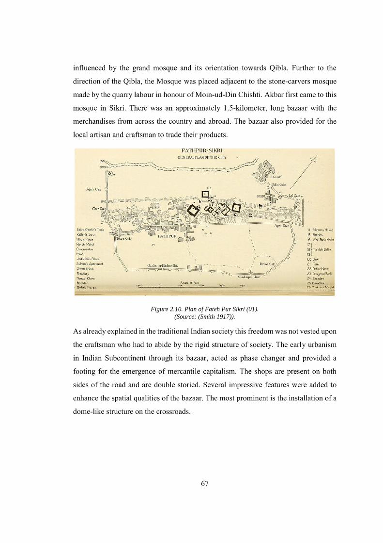
67
influenced by the grand mosque and its orientation towards Qibla. Further to the
direction of the Qibla, the Mosque was placed adjacent to the stone-carvers mosque
made by the quarry labour in honour of Moin-ud-Din Chishti. Akbar first came to this
mosque in Sikri. There was an approximately 1.5-kilometer, long bazaar with the
merchandises from across the country and abroad. The bazaar also provided for the
local artisan and craftsman to trade their products.
Figure 2.10. Plan of Fateh Pur Sikri (01). (Source: (Smith 1917)).
As already explained in the traditional Indian society this freedom was not vested upon
the craftsman who had to abide by the rigid structure of society. The early urbanism
in Indian Subcontinent through its bazaar, acted as phase changer and provided a
footing for the emergence of mercantile capitalism. The shops are present on both
sides of the road and are double storied. Several impressive features were added to
enhance the spatial qualities of the bazaar. The most prominent is the installation of a
dome-like structure on the crossroads.
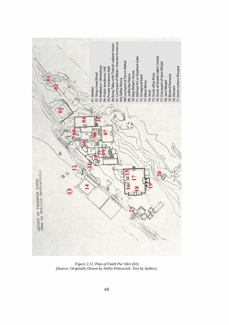
68
Figure 2.11. Plan of Fateh Pur Sikri (02) (Source: Originally Drawn by Attilio Pettrucioli. Text by Author).
69
Following a Persian tradition, a significant “Maydan30” ground was made in the
Fatehpur Sikri where the emperor uses to hold the polo matches, religious festivals,
public appearances and greet the ambassadors. There was not a natural source of water
nearby, so in order to cope with the problem of scarcity of water, the Emperor ordered
to build a 3km long dam. In 1585, due to the heavy monsoons, the artificial lake that
used to supply the water to the city broke away. As a result, the lower portion of the
city was flooded causing the damage to the properties and resulting in several
causalities. The major problem arising from the destruction of the Dam was that it
also cut down the water supply of the city thus leaving the inhabitants of the city with
the permanent problem of water shortage. As a consequence, Akbar left the city in
1585 (Bennison and Gascoigne 2007). The city mainly consists of the two parts; the
citadel and the town. The Citadel contains the Grand Mosque, King's Palaces,
administration buildings, the house of the queens, treasury mint and house of
commons. The town in this way developed in the early Mughal tradition where the
administration and royal function are separated from the public. The grand mosque is
the most spectacular and grand building of the city (see Fig. 2.11).
Keeping Akbar’s secular orientation in view, the only reason for building the great
mosque would be to commemorate the memory of Sheikh Moin-ud-Din Chishti, the
spiritual leader for Akbar, who was buried in the courtyard of the mosque. While
praising the stone buildings, Fergusson writes, “All the architecture, properly so
called, is in style invented, or at least introduced by the Pathans and brought to
perfection under Akbar (Fergusson 1899).”Another landmark building in Fatehpur
Sikri was the Ibadat Khana. Just like the “workers club”’; the particular expression of
Soviet’s new social function, developed by breaking the status quo of the elite
gathering places, with no precedent in the history; the “Ibadat Khana,” the religious
30 “Maydan” was designed to be utilized as a communal space in the tradition Muslim communities that
is used as a meeting point and hosting public events. In the modern history that “Maydan” is also used as a place for the resistance against the Government and acted as a focal point for the revolution, for example, “Maydan-e-Jaleh” in Tehran and “Maydan-e-Tehreer” in Cairo (Babaie and Grigor 2015).
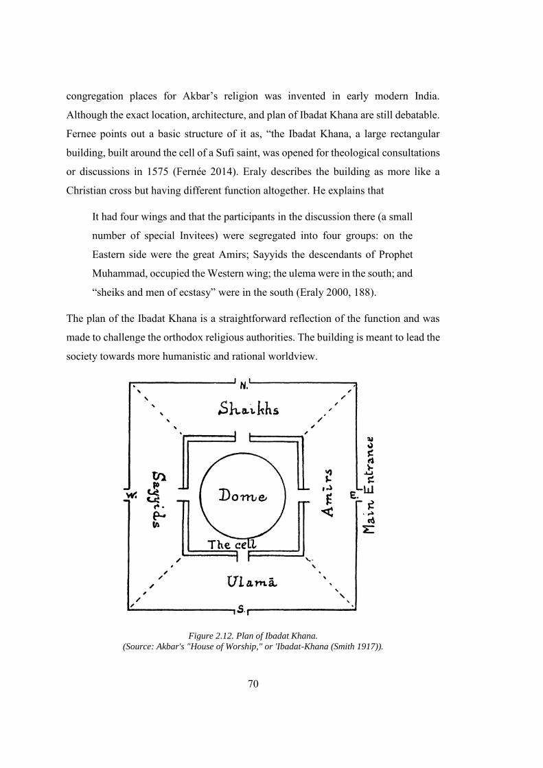
70
congregation places for Akbar’s religion was invented in early modern India.
Although the exact location, architecture, and plan of Ibadat Khana are still debatable.
Fernee points out a basic structure of it as, “the Ibadat Khana, a large rectangular
building, built around the cell of a Sufi saint, was opened for theological consultations
or discussions in 1575 (Fernée 2014). Eraly describes the building as more like a
Christian cross but having different function altogether. He explains that
It had four wings and that the participants in the discussion there (a small
number of special Invitees) were segregated into four groups: on the
Eastern side were the great Amirs; Sayyids the descendants of Prophet
Muhammad, occupied the Western wing; the ulema were in the south; and
“sheiks and men of ecstasy” were in the south (Eraly 2000, 188).
The plan of the Ibadat Khana is a straightforward reflection of the function and was
made to challenge the orthodox religious authorities. The building is meant to lead the
society towards more humanistic and rational worldview.
Figure 2.12. Plan of Ibadat Khana. (Source: Akbar's "House of Worship," or 'Ibadat-Khana (Smith 1917)).
71
Though Akbar wanted to hold the non-violent debates among the religions,
unfortunately, the vigorous debates between the religious scholars had led Akbar to
abandon the Ibadat Khana. From the limited data available about the Ibadat Khana
does not confirm its exact position in Fatehpur Sikri, but it is evident that there was
only one building of its kind. Smith writes that it was the building located in one of
the Gardens of the Palace (Smith 1917). The successors of Akbar did not show any
interest in the Akbar’s religion and the religious building. In the meanwhile, the Sufis
and Bakht, the softer interpretation of Islam and Hinduism respectively became more
popularized, thus leaving no space for the Akbar’s drastically different religion to
grow. The building is lost in time, but it truly reflects Akbar’s effort to rationalize the
religion. Though created as a symbolic capital with a powerful political expression by
Akbar while he was expanding the empire, Fatehpur Sikri was a short-lived capital.
The city was constructed with the red sandstone, and the buildings were erected and
decorated based on the Persian principles (Sinopoli 1994). Richards view the inclusion
of the Persian elements as Akbar’s effort to impress and impose the political control
over the courtiers, the majority of whom were native Hindustani (Indians) (Richards
1997).
2.4.2. Shahjahan Abad: The Sovereign Planned Capital
In one of the first account written about Shahjahan Abad, Hearn mentions the city of
Shahjahanabad as modern Delhi. Old Delhi remained the seat of political power for
almost 336 years before Shahjahan developed his “eighth paradise” on earth. The only
reason Shahjahan was able to develop this city lies in the socio-political condition of
India under the Mughal Empire. Mughal Emperors had brought the political stability
to the country that was once an arena of war between numerous small kingdoms. The
strong Mughal army also stopped the danger of any foreign invasion on the country.
Delhi, the city, remained the capital of the empires starting from the Sultans of Delhi
to Mughals and finally to the British (see Table 2.3.). The present-day Delhi
metropolitan contains several small towns that were once the seat of power of different
dynasties in due course of history. The first extensive account for Delhi was written
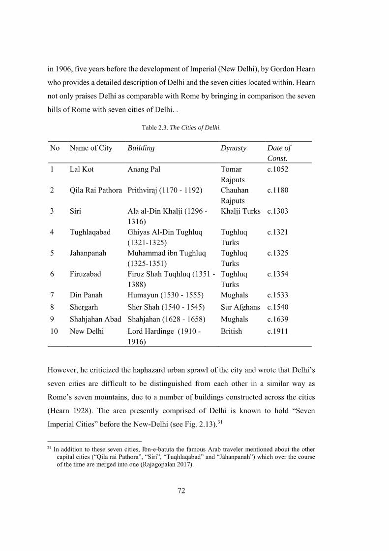
72
in 1906, five years before the development of Imperial (New Delhi), by Gordon Hearn
who provides a detailed description of Delhi and the seven cities located within. Hearn
not only praises Delhi as comparable with Rome by bringing in comparison the seven
hills of Rome with seven cities of Delhi. .
Table 2.3. The Cities of Delhi.
No Name of City Building Dynasty Date of
Const.
1 Lal Kot Anang Pal Tomar Rajputs
c.1052
2 Qila Rai Pathora Prithviraj (1170 - 1192) Chauhan Rajputs
c.1180
3 Siri Ala al-Din Khalji (1296 - 1316)
Khalji Turks c.1303
4 Tughlaqabad Ghiyas Al-Din Tughluq (1321-1325)
Tughluq Turks
c.1321
5 Jahanpanah Muhammad ibn Tughluq (1325-1351)
Tughluq Turks
c.1325
6 Firuzabad Firuz Shah Tuqhluq (1351 - 1388)
Tughluq Turks
c.1354
7 Din Panah Humayun (1530 - 1555) Mughals c.1533 8 Shergarh Sher Shah (1540 - 1545) Sur Afghans c.1540 9 Shahjahan Abad Shahjahan (1628 - 1658) Mughals c.1639 10 New Delhi Lord Hardinge (1910 -
1916) British c.1911
However, he criticized the haphazard urban sprawl of the city and wrote that Delhi’s
seven cities are difficult to be distinguished from each other in a similar way as
Rome’s seven mountains, due to a number of buildings constructed across the cities
(Hearn 1928). The area presently comprised of Delhi is known to hold “Seven
Imperial Cities” before the New-Delhi (see Fig. 2.13).31
31 In addition to these seven cities, Ibn-e-batuta the famous Arab traveler mentioned about the other
capital cities (“Qila rai Pathora”, “Siri”, “Tuqhlaqabad” and “Jahanpanah”) which over the course of the time are merged into one (Rajagopalan 2017).
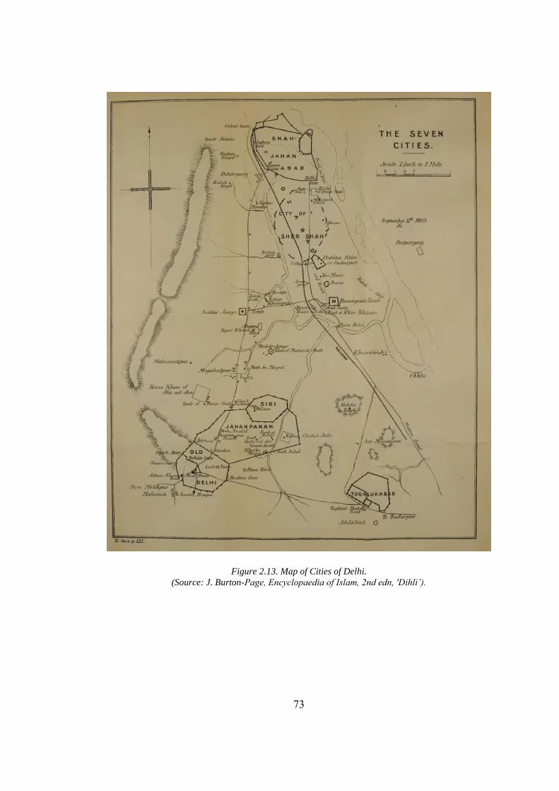
73
Figure 2.13. Map of Cities of Delhi. (Source: J. Burton-Page, Encyclopaedia of Islam, 2nd edn, 'Dihli’).
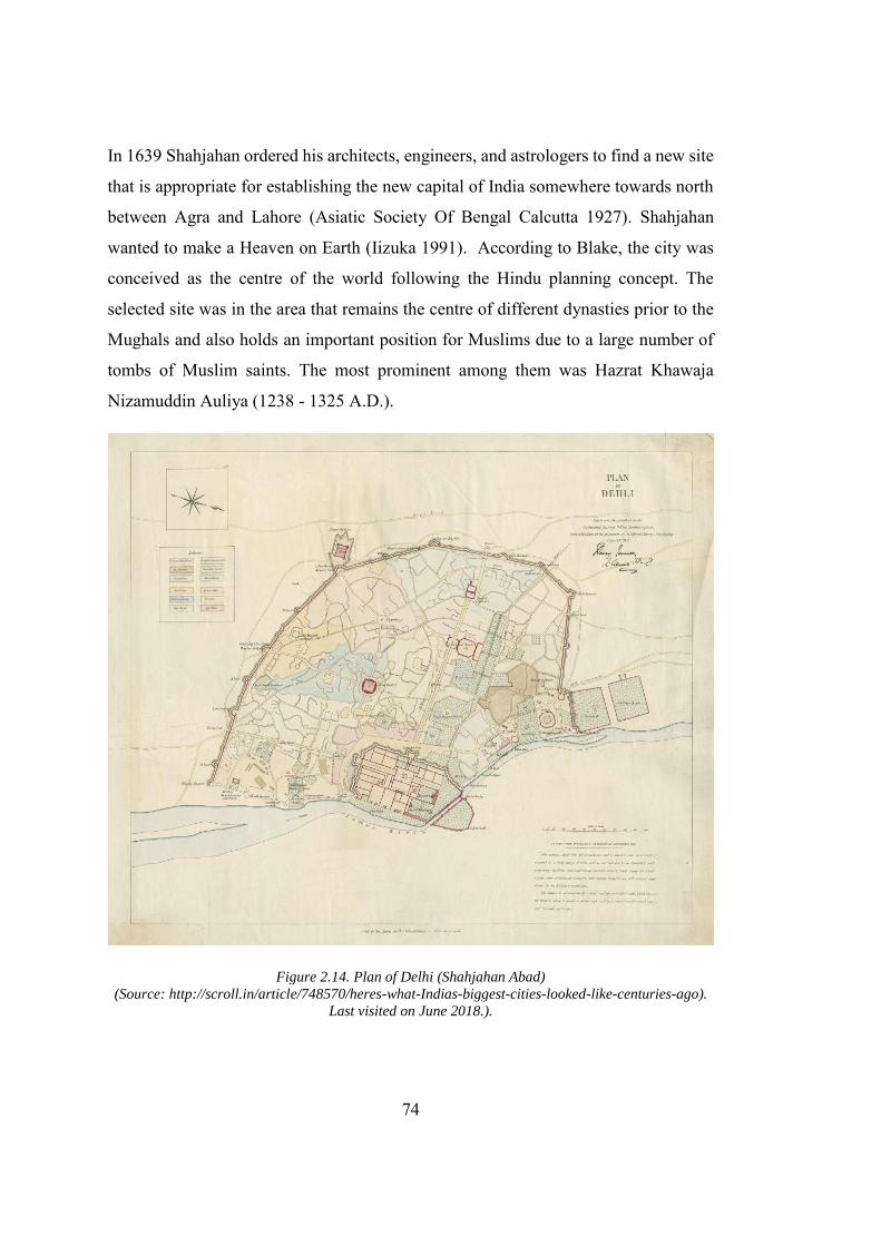
74
In 1639 Shahjahan ordered his architects, engineers, and astrologers to find a new site
that is appropriate for establishing the new capital of India somewhere towards north
between Agra and Lahore (Asiatic Society Of Bengal Calcutta 1927). Shahjahan
wanted to make a Heaven on Earth (Iizuka 1991). According to Blake, the city was
conceived as the centre of the world following the Hindu planning concept. The
selected site was in the area that remains the centre of different dynasties prior to the
Mughals and also holds an important position for Muslims due to a large number of
tombs of Muslim saints. The most prominent among them was Hazrat Khawaja
Nizamuddin Auliya (1238 - 1325 A.D.).
Figure 2.14. Plan of Delhi (Shahjahan Abad) (Source: http://scroll.in/article/748570/heres-what-Indias-biggest-cities-looked-like-centuries-ago).
Last visited on June 2018.).
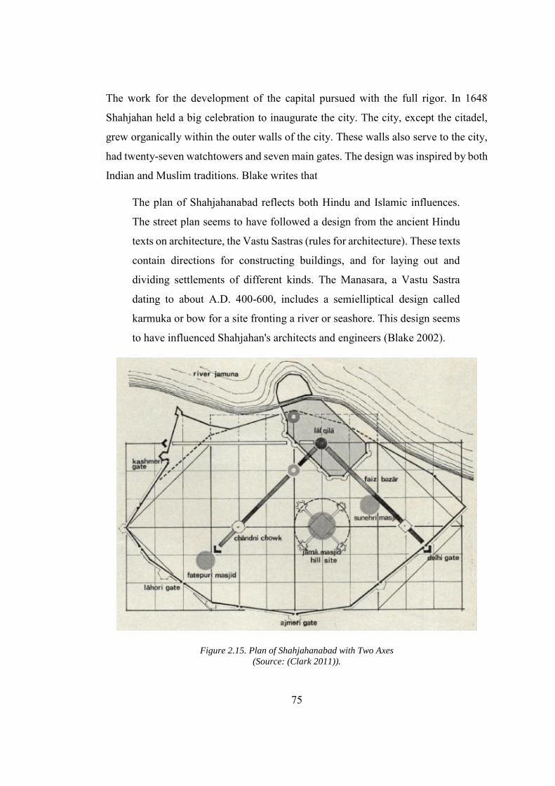
75
The work for the development of the capital pursued with the full rigor. In 1648
Shahjahan held a big celebration to inaugurate the city. The city, except the citadel,
grew organically within the outer walls of the city. These walls also serve to the city,
had twenty-seven watchtowers and seven main gates. The design was inspired by both
Indian and Muslim traditions. Blake writes that
The plan of Shahjahanabad reflects both Hindu and Islamic influences.
The street plan seems to have followed a design from the ancient Hindu
texts on architecture, the Vastu Sastras (rules for architecture). These texts
contain directions for constructing buildings, and for laying out and
dividing settlements of different kinds. The Manasara, a Vastu Sastra
dating to about A.D. 400-600, includes a semielliptical design called
karmuka or bow for a site fronting a river or seashore. This design seems
to have influenced Shahjahan's architects and engineers (Blake 2002).
Figure 2.15. Plan of Shahjahanabad with Two Axes (Source: (Clark 2011)).
76
The plan of the Delhi is organic, developed along a strong central axis known as
“Chandni Chowk.” This axis connects the citadel and Fathepuri mosque to the city.
The shops located on both sides of the axis and opened towards the central axis. A
second less obvious axis connects the citadel with the Delhi Gate. In addition to the
great mosque, located on the second axis some other mosques were constructed,
within the periphery of the town by the Emperor and his entourage (See Fig 2.1.5.).
The plan of the city is like the earlier Mughal capitals with the imperial residences and
important administrative building are separated from the main city and located inside
the main citadels. The citadels hold all the administrative building, for example,
offices and mansions including the Daulat Khana-e-Khas (Hall of the Important
people), Daulat Khana-e-Aam (Hall of ordinary citizens), Moti Masjid, Jehanara
Begum’s mansion, Imtiaz Mahal, Naqqar Khana (Hall of musicians), Hayat Baksh
(life-giving) Garden and Mehtab (Rose) Garden. The garden inside the citadel known
as “Charbagh” (literally means four gardens), is designed following the idea in the
Islamic tradition of the gardens of heaven. The concept was derived directly from
Quran and had its material precedence in “Charbagh” of Persia [for a comprehensive
discussion about the Islamic Garden traditions (Clark 2011).
While the city, in addition to the residential buildings, contained religious places
mosques, church and temple. The central mosque was dominant among all the
buildings in the city. Furthermore, the bazaar, customs house, the banking house,
magazine and storage house were accommodated in the city. Unlike the imperial
buildings which were designed following a rigid geometry, the city of the
Shahjahanabad lacked planning. The city grew organically after the local nawabs and
governors had started building their houses outside the citadel within the city walls.
The major buildings in the citadel were made from the white marble. The use of white
marble also marks a shift in the use of material, since the “red sandstone” was the
frequently used material in the earlier monumental buildings and capital built by
Mughals. The white marble was acquired from a quarry near Rajputana.
Shahjahanabad is also distinguished from the predecessor capital city as it was
77
completed under the reign of single monarch. Thus, all building are intimately
connected to each other regarding outlook (Iizuka 1991).The design of the buildings
follows a hybrid pattern with both local and foreign impression. In Shahjahan Abad,
the foreign influences stretched far beyond Persian and Afghanistan gaining the fruits
of the European classicism. Hurlimann connect the Mughal intricacies with the
Versailles and contribution of European classicism as
Mason worked on the marble slabs, carving delicate flower patterns in low
relief. Valuable stones of many colors were collected, to be painstakingly
worked into the surface of marble (pietra dura); especially rich decoration
of this kind was used for the imperial bath, which at the Moghul court
played a similar role to the bed of state in Versailles at the king’s levee…
the classicism beginning to arise in Europe also made its contribution to
the marble splendor of this highest achievement of oriental building craft,
which combines Persian and Indian elements into such an elegant simple
form (Hurlimann 1965, 42).
The old Delhi or Shahjahanabad was a perfect example of Mughal city with a
magnificent fort that is the most prominent building in the city. Other than fort, some
mosques helped in integrating the element of Islamic semiology into the city’s urban
fabric (see Fig. 2.16). King, in his essay on Delhi, interprets modernity concerning the
capital city of India and classify three stage of modernity. He writes in “Transnational
Delhi revisited: The Spatial Language of Three Modernities” that, “The three types of
modernity of my title, therefore, are indigenous Shahjahan Abad, colonial New Delhi,
and postcolonial DLF City.(King 2004, 142).” Lastly, it is the extensive planning and
monumental structures of the city that withstand the harshness of times and remained
usable till the last Mughal prince was sent to exile from his Palace in Shahjahan Abad.
Labelling “Shahjahan Abad” as a modern indigenous city contradicts his earlier claim
where he emphasized the “transnational” character of these cities.” I shall argue that
the most recent three have all been essentially ‘transnational’ settlements or, if not
exactly transnational, at least (King 2004).”
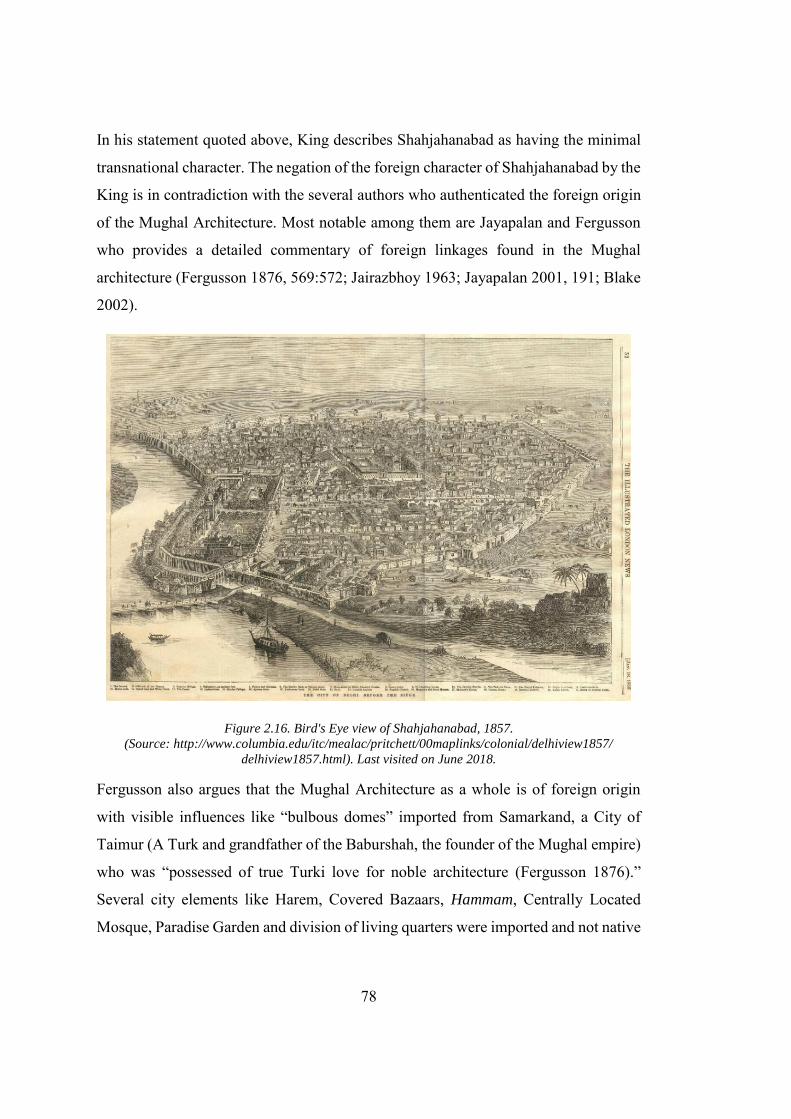
78
In his statement quoted above, King describes Shahjahanabad as having the minimal
transnational character. The negation of the foreign character of Shahjahanabad by the
King is in contradiction with the several authors who authenticated the foreign origin
of the Mughal Architecture. Most notable among them are Jayapalan and Fergusson
who provides a detailed commentary of foreign linkages found in the Mughal
architecture (Fergusson 1876, 569:572; Jairazbhoy 1963; Jayapalan 2001, 191; Blake
2002).
Figure 2.16. Bird's Eye view of Shahjahanabad, 1857. (Source: http://www.columbia.edu/itc/mealac/pritchett/00maplinks/colonial/delhiview1857/
delhiview1857.html). Last visited on June 2018.
Fergusson also argues that the Mughal Architecture as a whole is of foreign origin
with visible influences like “bulbous domes” imported from Samarkand, a City of
Taimur (A Turk and grandfather of the Baburshah, the founder of the Mughal empire)
who was “possessed of true Turki love for noble architecture (Fergusson 1876).”
Several city elements like Harem, Covered Bazaars, Hammam, Centrally Located
Mosque, Paradise Garden and division of living quarters were imported and not native
79
to India. While describing the covered Bazaar, Stephen Blake quotes Muhammad
Salih (The writer of Aml-e-Salih) as
The source for these ideas, as for most of the other arts of the Indo-Islamic
style, was Persia. In painting, poetry, music, and dance as well as in
architecture and city planning the Persian influences were predominant.
The Emperor Humayun, the father of Akbar, spent twelve years (1543-
55) in exile in Iran and was heavily exposed to Shi'ism and the Safavid
court (Blake 2002, 33).
Although roofed bazaars were usual in Iran and West Asia, they were rare
in India. A building like the covered bazaar, which the people of
Hindustan had never before seen, was a new idea produced by the ruler of
the seven lands with effortless attention and unique building talent (Blake
2002, 43).
At the same time, Shahjahan was also influenced by the native ideas and following
the indigenous traditions he invited the astrologers to the select the time for its
construction,
The plan of Shahjahanabad reflects both Hindu and Islamic influences.
The street plan seems to have followed a design from the ancient Hindu
texts on architecture, the Vastu Sastras (rules for architecture). These texts
contain directions for constructing buildings, and for laying out and
dividing settlements of different kinds. The Manasara, a vastu sastra
dating to about A.D. 400-600, contains a semi elliptical design called
karmuka or bow for a site fronting a river or seashore. This design seems
to have influenced Shahjahan's architects and engineers (Blake 2002, 32).
The above discussion reinforces the stance that the Shahjahanabad was not only a
modern city, but also a transnational hybrid in character. Shahjahan adhered to the
policy of Indianizing, propagated by his father Akbar, yet at the same time borrowing
influences from its surrounding, that is, as described by Jairazbhoy, is a symbol of a
80
progressive society. In short, we can say that the spatial development in the early
modern period comprises of monumental structures that fulfil the political agendas of
its builders. The city design was limited to the royal citadel and the imperial building.
The Citadel and the Main mosque remained the pivotal point of the city and can be
viewed from almost every corner of the city. In the case of Shahjahan Abad, a splendid
main boulevard drawn along the central axis of the city was meant to emphasize the
imperial movement within the city. Although the bazaar on both side of this axis also
served as the economic centre of the city, the city outside the citadel was not planned
and evolved following an organic pattern. In general, the buildings and city were
developed following the exogenous and endogenous inspiration, and the Mughal
emperors did not compromise on the grandeur of the new buildings. Further to the
natural inspiration that was coming from Persian and Samarkand the craftwork “Petra
dura” was also sought after from as far as Italy.
2.5. Colonialism: The Emergence of the New Modernity
Mughal and Europeans arrived in India at the same time. Babur Shah, the founder of
the Mughal Empire, had killed the emperor of India, Ibrahim Lodhi, in a decisive battle
of Panipat, approximately hundred kilometres north of Delhi in 1526. The battle had
opened the doors for Babur to establish his mighty empire in the Indian Subcontinent.
Approximately thirty years before this battle, Vasco Da Gama Portuguese Sailor
reached Calicut in India on 20 May 1498. He returned to India in 1502 with a fleet of
warships to take the revenge of Portuguese traders killed by local rulers. His last
voyage to India was in 1524, when he was sent as the viceroy of India, but fell ill
during the expedition and died in Cochin (History.com 2010). The arrival of Vasco
Da Gama had opened the Indian Subcontinent to the European trading companies. In
the upcoming century, after the death of Vasco Da Gama, six European nations had
opened their trading posts in Indian Subcontinent (See Table 3.4. & Fig 3.17) . The
most influential among them were the British and French. British, in addition to the
trading, tried to establish their own empire in the Indian subcontinent that is commonly
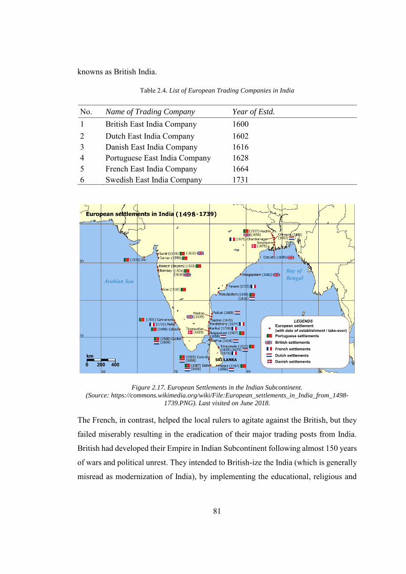
81
knowns as British India.
Table 2.4. List of European Trading Companies in India
No. Name of Trading Company Year of Estd.
1 British East India Company 1600 2 Dutch East India Company 1602 3 Danish East India Company 1616 4 Portuguese East India Company 1628 5 French East India Company 1664 6 Swedish East India Company 1731
Figure 2.17. European Settlements in the Indian Subcontinent. (Source: https://commons.wikimedia.org/wiki/File:European_settlements_in_India_from_1498-
1739.PNG). Last visited on June 2018.
The French, in contrast, helped the local rulers to agitate against the British, but they
failed miserably resulting in the eradication of their major trading posts from India.
British had developed their Empire in Indian Subcontinent following almost 150 years
of wars and political unrest. They intended to British-ize the India (which is generally
misread as modernization of India), by implementing the educational, religious and
82
political reforms. Envisioned by the Enlightenment and powered by the steam,
British’s agenda was to exploit Indian condition for their benefits. They transformed
the infrastructure in Indian Subcontinent by laying the railway tracks and building the
cities (Capital cities, port cities, trade towns and cantonment, etc.) at a scale which
India had never seen before. These projects brought an “urban revolution” in India
which resulted in the complete destruction of the traditional communities. Like
Mughals, British rule also influenced several reformist movements in India, most
notable among them were the education reforms and political reforms. The above-
mentioned reforms along with large-scale excavation projects and historiography of
India by British, also steered the advent and evolution of Indian national sentiments,
that resulted in the creation of Republic of India and Islamic Republic of Pakistan.
2.6. Raj and Urban Space
The British Raj had made a very less effort to improve the condition of the local
people, however, to strengthen their political control and meet their trade expectations
they developed new cities. These cities were the honest reflections of their socio-
political and economic intentions. Spodek found the port-cities32 in India developed
by colonizers, strikingly different from the ancient Hindu and Muslim cities in the
organization (Spodek 1980). In addition to the difference between the early colonial
settlement and the Indigenous cities, Desai highlights the emergences of the unique
urban forms as the civil lines (residing place for British Civilians), the cantonment
(British military settlements) and the hill station (the places developed to keep British
administration in cool place during harsh Indian summers) (Desai 1995). In general,
British had developed five major urban centres, which are listed below in Table 3.5.
32 The following lines would explain that how political ambition of Britishers had transformed the urban
pattern of the settlement developed by them, from the early port cities (developed by the east Indian company which was mainly a trading company) to New Delhi (developed under the patronage of Viceroy of British India). The Transformation had helped in developing a discourse that brought the New-Delhi, the last imperial city much closer to the indigenous settlements in India.
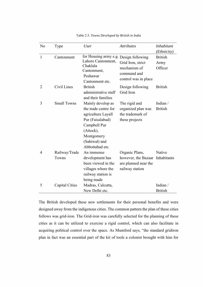
83
Table 2.5. Towns Developed by British in India
No Type User Attributes Inhabitant
(Ethnicity)
1 Cantonment for Housing army e.g. Lahore Cantonment, Chaklala Cantonment, Peshawar Cantonment etc.
Design following Grid Iron, strict mechanism of command and control was in place
British Army Officer
2 Civil Lines British administrative staff and their families
Design following Grid Iron
British
3 Small Towns Mainly develop as the trade centre for agriculture Layall Pur (Faisalabad) Campbell Pur (Attock), Montgomery (Sahiwal) and Abbottabad etc.
The rigid and organized plan was the trademark of these projects
Indian / British
4 Railway/Trade Towns
An immense development has been viewed in the villages where the railway station is being made
Organic Plans, however, the Bazaar are planned near the railway station
Native Inhabitants
5 Capital Cities Madras, Calcutta, New Delhi etc.
Indian / British
The British developed these new settlements for their personal benefits and were
designed away from the indigenous cities. The common pattern the plan of these cities
follows was grid-iron. The Grid-iron was carefully selected for the planning of these
cities as it can be utilized to exercise a rigid control, which can also facilitate in
acquiring political control over the space. As Mumford says, “the standard gridiron
plan in fact was an essential part of the kit of tools a colonist brought with him for
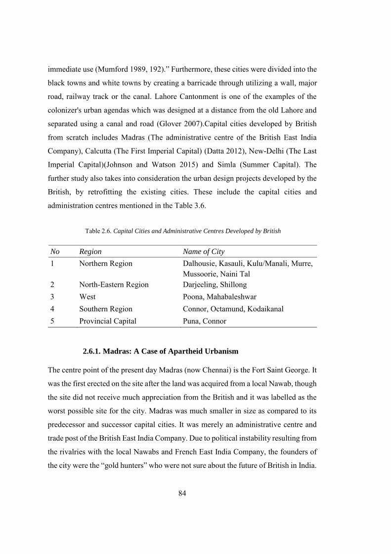
84
immediate use (Mumford 1989, 192).” Furthermore, these cities were divided into the
black towns and white towns by creating a barricade through utilizing a wall, major
road, railway track or the canal. Lahore Cantonment is one of the examples of the
colonizer's urban agendas which was designed at a distance from the old Lahore and
separated using a canal and road (Glover 2007).Capital cities developed by British
from scratch includes Madras (The administrative centre of the British East India
Company), Calcutta (The First Imperial Capital) (Datta 2012), New-Delhi (The Last
Imperial Capital)(Johnson and Watson 2015) and Simla (Summer Capital). The
further study also takes into consideration the urban design projects developed by the
British, by retrofitting the existing cities. These include the capital cities and
administration centres mentioned in the Table 3.6.
Table 2.6. Capital Cities and Administrative Centres Developed by British
No Region Name of City
1 Northern Region Dalhousie, Kasauli, Kulu/Manali, Murre, Mussoorie, Naini Tal
2 North-Eastern Region Darjeeling, Shillong 3 West Poona, Mahabaleshwar 4 Southern Region Connor, Octamund, Kodaikanal 5 Provincial Capital Puna, Connor
2.6.1. Madras: A Case of Apartheid Urbanism
The centre point of the present day Madras (now Chennai) is the Fort Saint George. It
was the first erected on the site after the land was acquired from a local Nawab, though
the site did not receive much appreciation from the British and it was labelled as the
worst possible site for the city. Madras was much smaller in size as compared to its
predecessor and successor capital cities. It was merely an administrative centre and
trade post of the British East India Company. Due to political instability resulting from
the rivalries with the local Nawabs and French East India Company, the founders of
the city were the “gold hunters” who were not sure about the future of British in India.
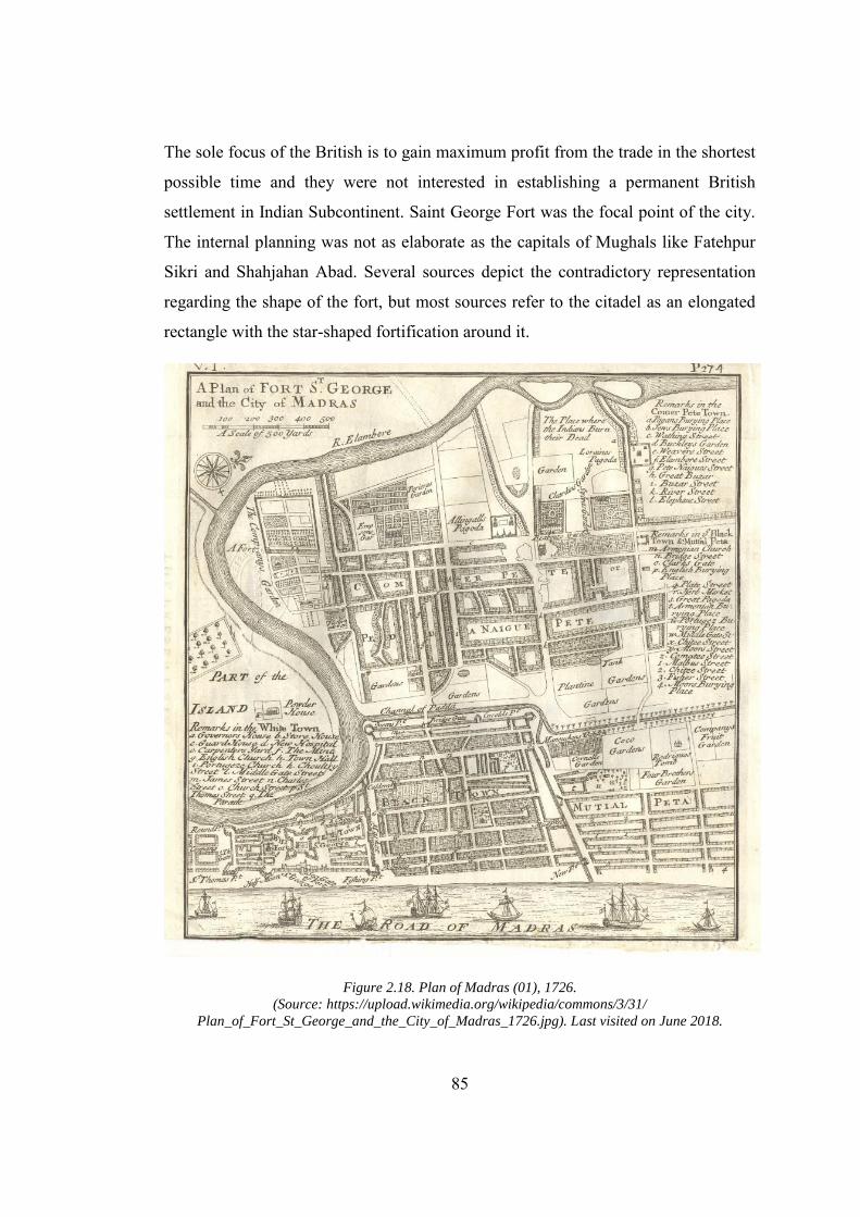
85
The sole focus of the British is to gain maximum profit from the trade in the shortest
possible time and they were not interested in establishing a permanent British
settlement in Indian Subcontinent. Saint George Fort was the focal point of the city.
The internal planning was not as elaborate as the capitals of Mughals like Fatehpur
Sikri and Shahjahan Abad. Several sources depict the contradictory representation
regarding the shape of the fort, but most sources refer to the citadel as an elongated
rectangle with the star-shaped fortification around it.
Figure 2.18. Plan of Madras (01), 1726. (Source: https://upload.wikimedia.org/wikipedia/commons/3/31/
Plan_of_Fort_St_George_and_the_City_of_Madras_1726.jpg). Last visited on June 2018.
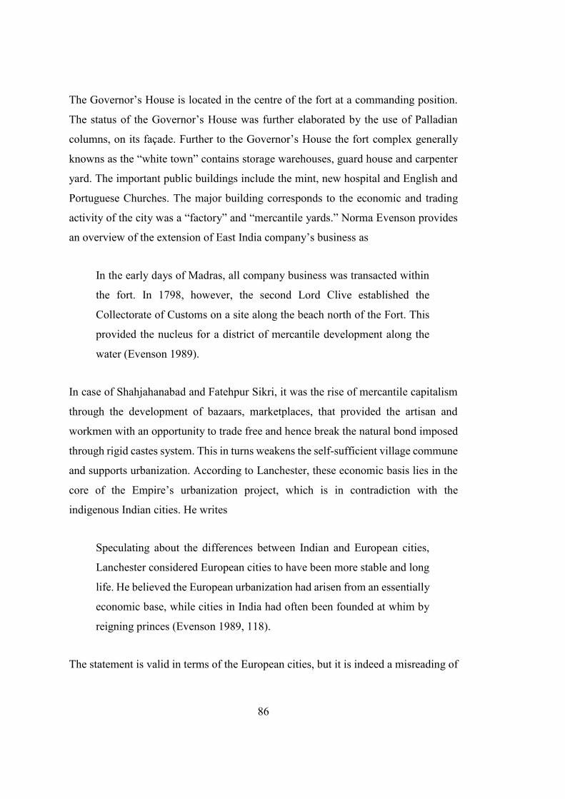
86
The Governor’s House is located in the centre of the fort at a commanding position.
The status of the Governor’s House was further elaborated by the use of Palladian
columns, on its façade. Further to the Governor’s House the fort complex generally
knowns as the “white town” contains storage warehouses, guard house and carpenter
yard. The important public buildings include the mint, new hospital and English and
Portuguese Churches. The major building corresponds to the economic and trading
activity of the city was a “factory” and “mercantile yards.” Norma Evenson provides
an overview of the extension of East India company’s business as
In the early days of Madras, all company business was transacted within
the fort. In 1798, however, the second Lord Clive established the
Collectorate of Customs on a site along the beach north of the Fort. This
provided the nucleus for a district of mercantile development along the
water (Evenson 1989).
In case of Shahjahanabad and Fatehpur Sikri, it was the rise of mercantile capitalism
through the development of bazaars, marketplaces, that provided the artisan and
workmen with an opportunity to trade free and hence break the natural bond imposed
through rigid castes system. This in turns weakens the self-sufficient village commune
and supports urbanization. According to Lanchester, these economic basis lies in the
core of the Empire’s urbanization project, which is in contradiction with the
indigenous Indian cities. He writes
Speculating about the differences between Indian and European cities,
Lanchester considered European cities to have been more stable and long
life. He believed the European urbanization had arisen from an essentially
economic base, while cities in India had often been founded at whim by
reigning princes (Evenson 1989, 118).
The statement is valid in terms of the European cities, but it is indeed a misreading of
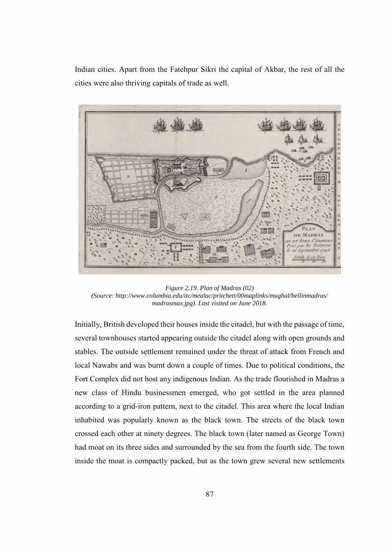
87
Indian cities. Apart from the Fatehpur Sikri the capital of Akbar, the rest of all the
cities were also thriving capitals of trade as well.
Figure 2.19. Plan of Madras (02)
(Source: http://www.columbia.edu/itc/mealac/pritchett/00maplinks/mughal/bellinmadras/
madrasmax.jpg). Last visited on June 2018.
Initially, British developed their houses inside the citadel, but with the passage of time,
several townhouses started appearing outside the citadel along with open grounds and
stables. The outside settlement remained under the threat of attack from French and
local Nawabs and was burnt down a couple of times. Due to political conditions, the
Fort Complex did not host any indigenous Indian. As the trade flourished in Madras a
new class of Hindu businessmen emerged, who got settled in the area planned
according to a grid-iron pattern, next to the citadel. This area where the local Indian
inhabited was popularly known as the black town. The streets of the black town
crossed each other at ninety degrees. The black town (later named as George Town)
had moat on its three sides and surrounded by the sea from the fourth side. The town
inside the moat is compactly packed, but as the town grew several new settlements
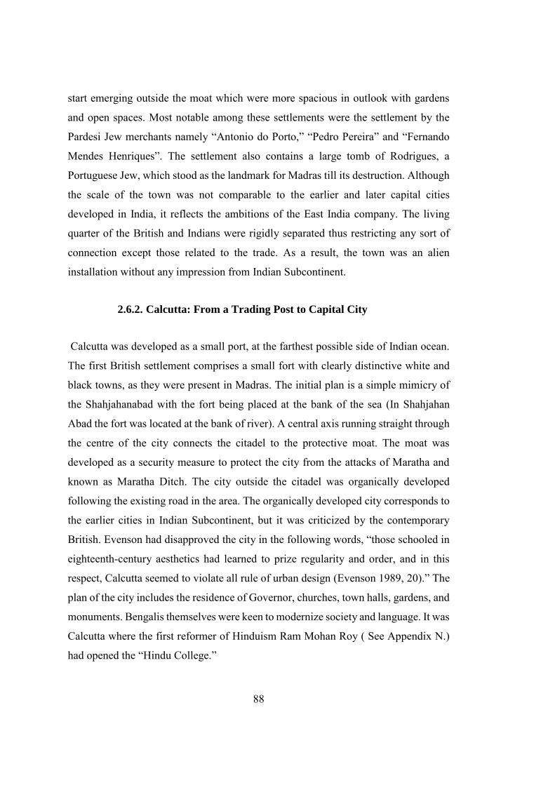
88
start emerging outside the moat which were more spacious in outlook with gardens
and open spaces. Most notable among these settlements were the settlement by the
Pardesi Jew merchants namely “Antonio do Porto,” “Pedro Pereira” and “Fernando
Mendes Henriques”. The settlement also contains a large tomb of Rodrigues, a
Portuguese Jew, which stood as the landmark for Madras till its destruction. Although
the scale of the town was not comparable to the earlier and later capital cities
developed in India, it reflects the ambitions of the East India company. The living
quarter of the British and Indians were rigidly separated thus restricting any sort of
connection except those related to the trade. As a result, the town was an alien
installation without any impression from Indian Subcontinent.
2.6.2. Calcutta: From a Trading Post to Capital City
Calcutta was developed as a small port, at the farthest possible side of Indian ocean.
The first British settlement comprises a small fort with clearly distinctive white and
black towns, as they were present in Madras. The initial plan is a simple mimicry of
the Shahjahanabad with the fort being placed at the bank of the sea (In Shahjahan
Abad the fort was located at the bank of river). A central axis running straight through
the centre of the city connects the citadel to the protective moat. The moat was
developed as a security measure to protect the city from the attacks of Maratha and
known as Maratha Ditch. The city outside the citadel was organically developed
following the existing road in the area. The organically developed city corresponds to
the earlier cities in Indian Subcontinent, but it was criticized by the contemporary
British. Evenson had disapproved the city in the following words, “those schooled in
eighteenth-century aesthetics had learned to prize regularity and order, and in this
respect, Calcutta seemed to violate all rule of urban design (Evenson 1989, 20).” The
plan of the city includes the residence of Governor, churches, town halls, gardens, and
monuments. Bengalis themselves were keen to modernize society and language. It was
Calcutta where the first reformer of Hinduism Ram Mohan Roy ( See Appendix N.)
had opened the “Hindu College.”
89
Figure 2.20. Plan of Old Fort Williams, Calcutta. (Source: http://www.columbia.edu/itc/mealac/pritchett/00maplinks/mughal/bellinmadras/
madrasmax.jpg). Last visited on June 2018.
From 1883-1890 a massive development has started in Calcutta which included
increasing the size of the port, laying the railway lines, construction of a big shed and
beginning of industrialization (Chattopadhyay 2005). Samite Gupta writes about the
evolution of the city as
Two distinct sectors of the economy emerged, as well as two distinct
physical forms. As headquarter of the great managing agencies, Calcutta’s
European sector developed a modern Institutional Economy and
International connections. Yet the networks of markets in the city
integrated it into the traditional bazaar economy of the surrounding
regions (Gupta 1993).
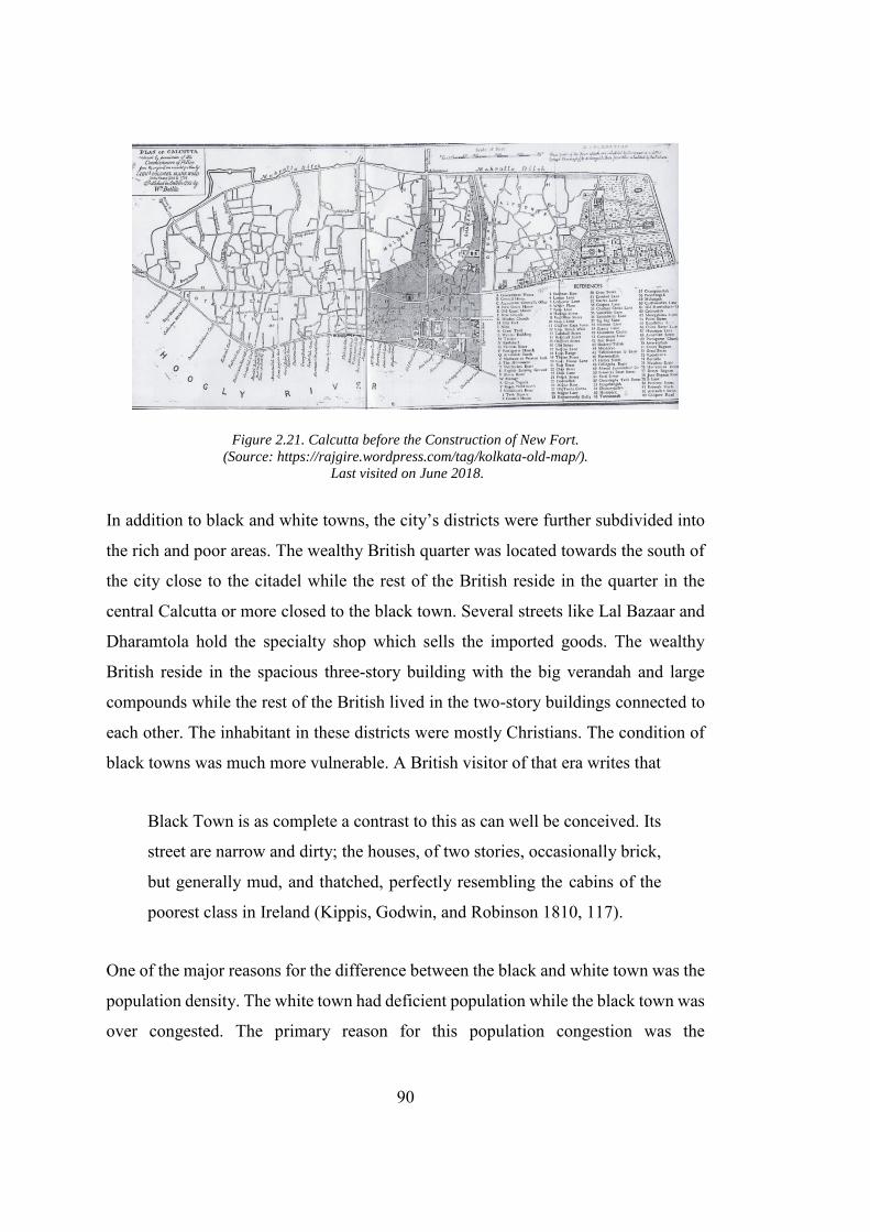
90
Figure 2.21. Calcutta before the Construction of New Fort. (Source: https://rajgire.wordpress.com/tag/kolkata-old-map/).
Last visited on June 2018.
In addition to black and white towns, the city’s districts were further subdivided into
the rich and poor areas. The wealthy British quarter was located towards the south of
the city close to the citadel while the rest of the British reside in the quarter in the
central Calcutta or more closed to the black town. Several streets like Lal Bazaar and
Dharamtola hold the specialty shop which sells the imported goods. The wealthy
British reside in the spacious three-story building with the big verandah and large
compounds while the rest of the British lived in the two-story buildings connected to
each other. The inhabitant in these districts were mostly Christians. The condition of
black towns was much more vulnerable. A British visitor of that era writes that
Black Town is as complete a contrast to this as can well be conceived. Its
street are narrow and dirty; the houses, of two stories, occasionally brick,
but generally mud, and thatched, perfectly resembling the cabins of the
poorest class in Ireland (Kippis, Godwin, and Robinson 1810, 117).
One of the major reasons for the difference between the black and white town was the
population density. The white town had deficient population while the black town was
over congested. The primary reason for this population congestion was the
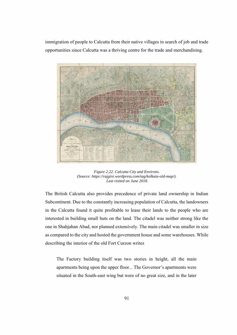
91
immigration of people to Calcutta from their native villages in search of job and trade
opportunities since Calcutta was a thriving centre for the trade and merchandising.
Figure 2.22. Calcutta City and Environs. (Source: https://rajgire.wordpress.com/tag/kolkata-old-map/).
Last visited on June 2018.
The British Calcutta also provides precedence of private land ownership in Indian
Subcontinent. Due to the constantly increasing population of Calcutta, the landowners
in the Calcutta found it quite profitable to lease their lands to the people who are
interested in building small huts on the land. The citadel was neither strong like the
one in Shahjahan Abad, nor planned extensively. The main citadel was smaller in size
as compared to the city and hosted the government house and some warehouses. While
describing the interior of the old Fort Curzon writes
The Factory building itself was two stories in height, all the main
apartments being upon the upper floor... The Governor’s apartments were
situated in the South-east wing but were of no great size, and in the later
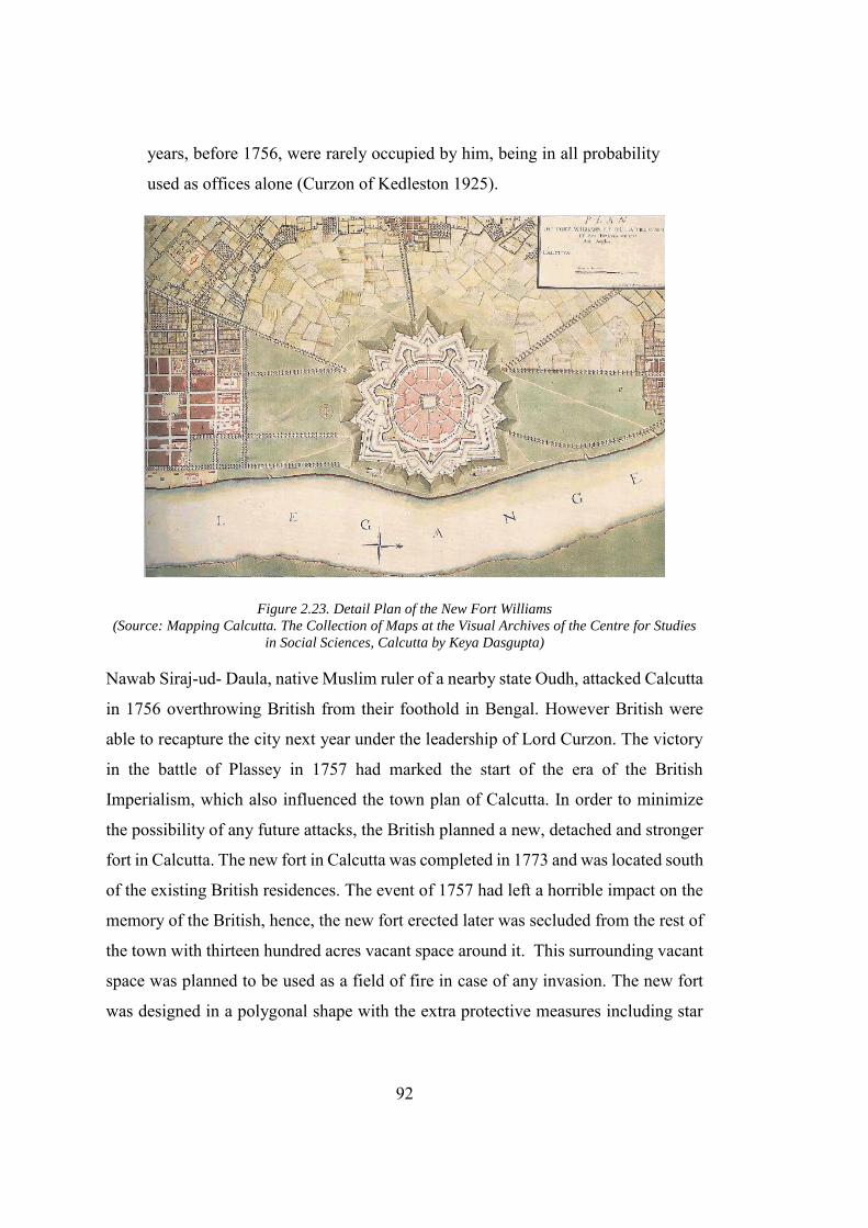
92
years, before 1756, were rarely occupied by him, being in all probability
used as offices alone (Curzon of Kedleston 1925).
Figure 2.23. Detail Plan of the New Fort Williams (Source: Mapping Calcutta. The Collection of Maps at the Visual Archives of the Centre for Studies
in Social Sciences, Calcutta by Keya Dasgupta)
Nawab Siraj-ud- Daula, native Muslim ruler of a nearby state Oudh, attacked Calcutta
in 1756 overthrowing British from their foothold in Bengal. However British were
able to recapture the city next year under the leadership of Lord Curzon. The victory
in the battle of Plassey in 1757 had marked the start of the era of the British
Imperialism, which also influenced the town plan of Calcutta. In order to minimize
the possibility of any future attacks, the British planned a new, detached and stronger
fort in Calcutta. The new fort in Calcutta was completed in 1773 and was located south
of the existing British residences. The event of 1757 had left a horrible impact on the
memory of the British, hence, the new fort erected later was secluded from the rest of
the town with thirteen hundred acres vacant space around it. This surrounding vacant
space was planned to be used as a field of fire in case of any invasion. The new fort
was designed in a polygonal shape with the extra protective measures including star
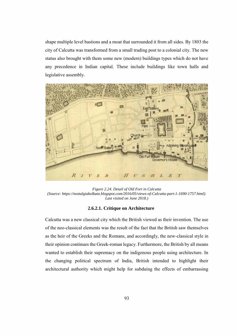
93
shape multiple level bastions and a moat that surrounded it from all sides. By 1803 the
city of Calcutta was transformed from a small trading post to a colonial city. The new
status also brought with them some new (modern) buildings types which do not have
any precedence in Indian capital. These include buildings like town halls and
legislative assembly.
Figure 2.24. Detail of Old Fort in Calcutta (Source: https://nostalgiakolkata.blogspot.com/2016/05/views-of-Calcutta-part-1-1690-1757.html).
Last visited on June 2018.)
2.6.2.1. Critique on Architecture
Calcutta was a new classical city which the British viewed as their invention. The use
of the neo-classical elements was the result of the fact that the British saw themselves
as the heir of the Greeks and the Romans, and accordingly, the new-classical style in
their opinion continues the Greek-roman legacy. Furthermore, the British by all means
wanted to establish their supremacy on the indigenous people using architecture. In
the changing political spectrum of India, British intended to highlight their
architectural authority which might help for subduing the effects of embarrassing
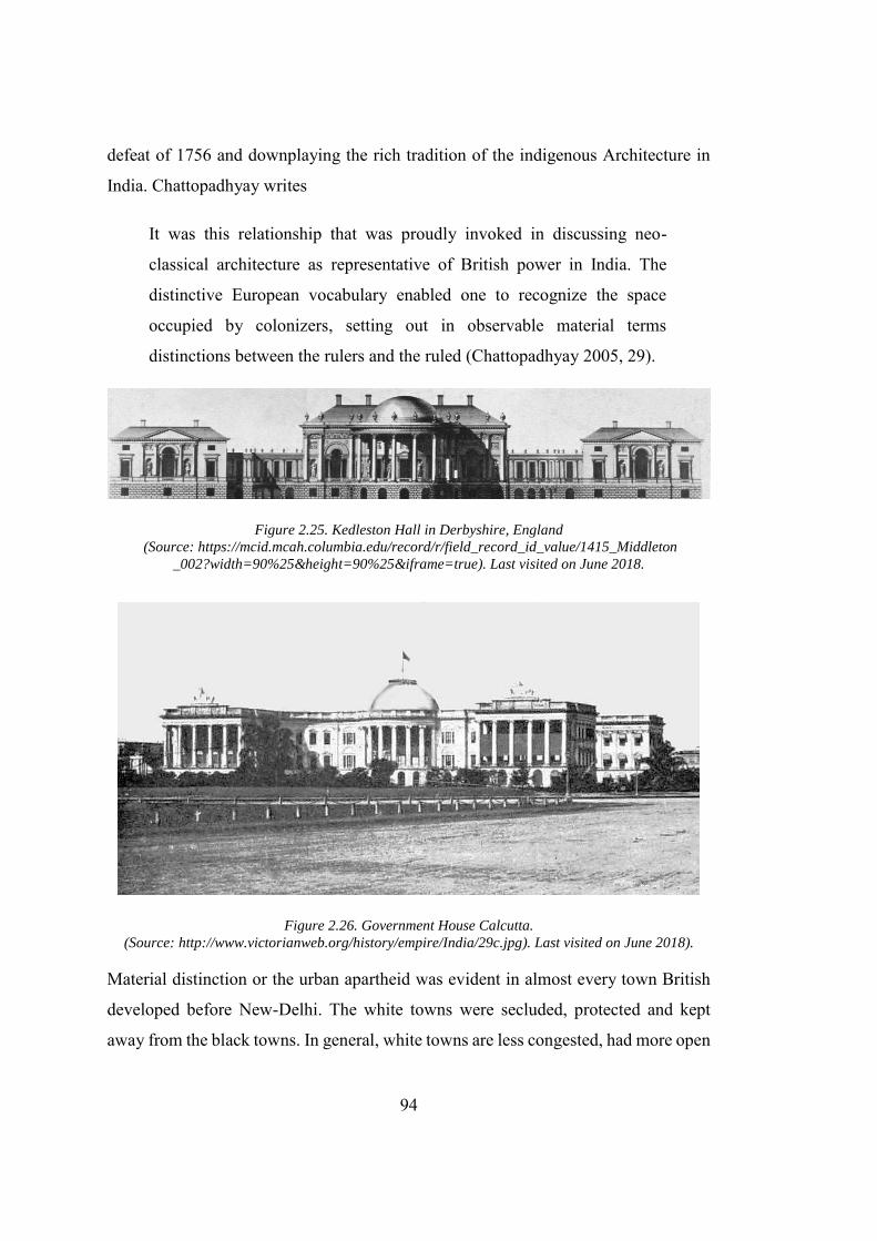
94
defeat of 1756 and downplaying the rich tradition of the indigenous Architecture in
India. Chattopadhyay writes
It was this relationship that was proudly invoked in discussing neo-
classical architecture as representative of British power in India. The
distinctive European vocabulary enabled one to recognize the space
occupied by colonizers, setting out in observable material terms
distinctions between the rulers and the ruled (Chattopadhyay 2005, 29).
Figure 2.25. Kedleston Hall in Derbyshire, England (Source: https://mcid.mcah.columbia.edu/record/r/field_record_id_value/1415_Middleton
_002?width=90%25&height=90%25&iframe=true). Last visited on June 2018.
Figure 2.26. Government House Calcutta. (Source: http://www.victorianweb.org/history/empire/India/29c.jpg). Last visited on June 2018).
Material distinction or the urban apartheid was evident in almost every town British
developed before New-Delhi. The white towns were secluded, protected and kept
away from the black towns. In general, white towns are less congested, had more open
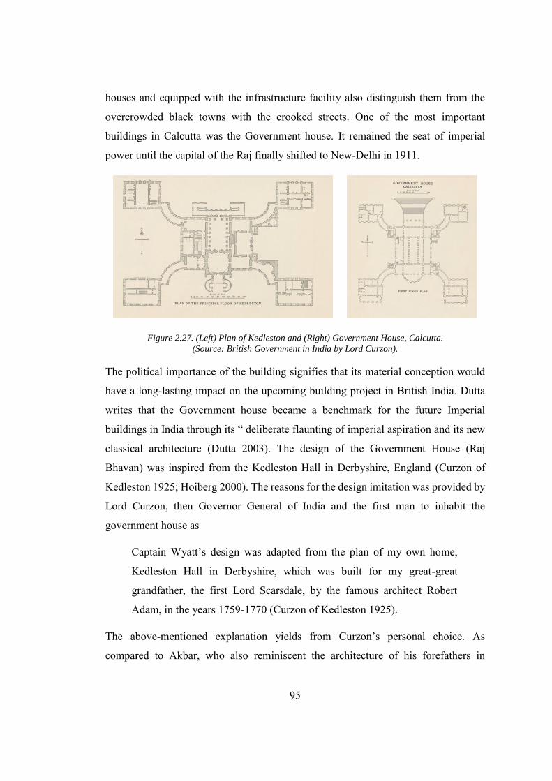
95
houses and equipped with the infrastructure facility also distinguish them from the
overcrowded black towns with the crooked streets. One of the most important
buildings in Calcutta was the Government house. It remained the seat of imperial
power until the capital of the Raj finally shifted to New-Delhi in 1911.
Figure 2.27. (Left) Plan of Kedleston and (Right) Government House, Calcutta. (Source: British Government in India by Lord Curzon).
The political importance of the building signifies that its material conception would
have a long-lasting impact on the upcoming building project in British India. Dutta
writes that the Government house became a benchmark for the future Imperial
buildings in India through its “ deliberate flaunting of imperial aspiration and its new
classical architecture (Dutta 2003). The design of the Government House (Raj
Bhavan) was inspired from the Kedleston Hall in Derbyshire, England (Curzon of
Kedleston 1925; Hoiberg 2000). The reasons for the design imitation was provided by
Lord Curzon, then Governor General of India and the first man to inhabit the
government house as
Captain Wyatt’s design was adapted from the plan of my own home,
Kedleston Hall in Derbyshire, which was built for my great-great
grandfather, the first Lord Scarsdale, by the famous architect Robert
Adam, in the years 1759-1770 (Curzon of Kedleston 1925).
The above-mentioned explanation yields from Curzon’s personal choice. As
compared to Akbar, who also reminiscent the architecture of his forefathers in
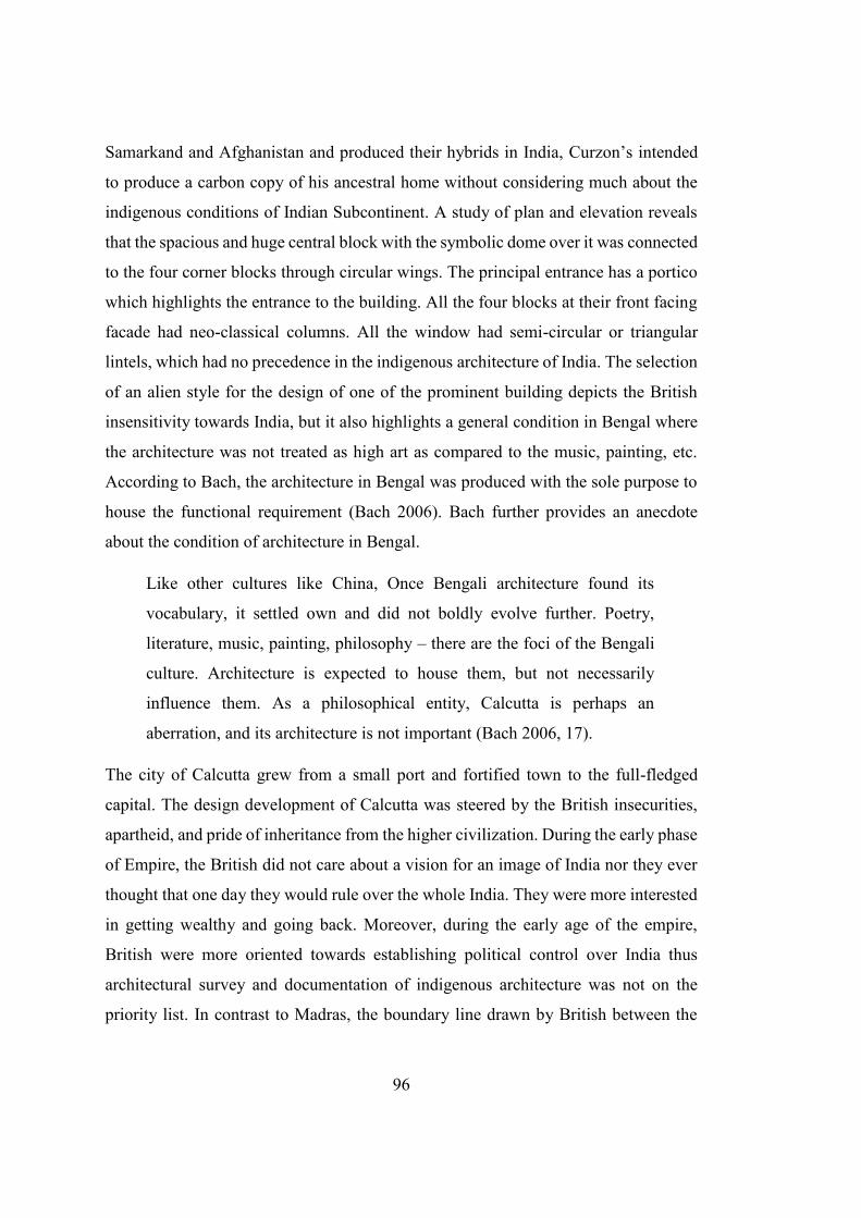
96
Samarkand and Afghanistan and produced their hybrids in India, Curzon’s intended
to produce a carbon copy of his ancestral home without considering much about the
indigenous conditions of Indian Subcontinent. A study of plan and elevation reveals
that the spacious and huge central block with the symbolic dome over it was connected
to the four corner blocks through circular wings. The principal entrance has a portico
which highlights the entrance to the building. All the four blocks at their front facing
facade had neo-classical columns. All the window had semi-circular or triangular
lintels, which had no precedence in the indigenous architecture of India. The selection
of an alien style for the design of one of the prominent building depicts the British
insensitivity towards India, but it also highlights a general condition in Bengal where
the architecture was not treated as high art as compared to the music, painting, etc.
According to Bach, the architecture in Bengal was produced with the sole purpose to
house the functional requirement (Bach 2006). Bach further provides an anecdote
about the condition of architecture in Bengal.
Like other cultures like China, Once Bengali architecture found its
vocabulary, it settled own and did not boldly evolve further. Poetry,
literature, music, painting, philosophy – there are the foci of the Bengali
culture. Architecture is expected to house them, but not necessarily
influence them. As a philosophical entity, Calcutta is perhaps an
aberration, and its architecture is not important (Bach 2006, 17).
The city of Calcutta grew from a small port and fortified town to the full-fledged
capital. The design development of Calcutta was steered by the British insecurities,
apartheid, and pride of inheritance from the higher civilization. During the early phase
of Empire, the British did not care about a vision for an image of India nor they ever
thought that one day they would rule over the whole India. They were more interested
in getting wealthy and going back. Moreover, during the early age of the empire,
British were more oriented towards establishing political control over India thus
architectural survey and documentation of indigenous architecture was not on the
priority list. In contrast to Madras, the boundary line drawn by British between the
97
white town and black town was diminished over the passage of time, that resulted in
integration of the European and Indian inhabitants within the city’s fabric. This,
consequently, created trouble for the British administration during the rise of Bengalis
nationalism (c. 1900 onwards) resulting in the partition of Bengal Province in 1905.
The political insecurity of British and unmanageable population33 acted as a catalyst
for the relocation of the capital from Calcutta to Delhi (Chattopadhyay 2005). In short,
the development of Calcutta was steered and affected by the two main factors, that
are, ephemeral development and rapid urbanization. The Indian administrator of the
British East Indian company 34 had no intention and vision to produce a permanent
British town on Indian soil. Secondly, the rapid growth of these port towns resulted in
need of mass housing, for which these cities were not designed. As a result, this caused
the unplanned and uncontrolled development of the city (Mitter 1986).
2.6.3. New Delhi: The Dichotomy of East and West
To cope with the political problems that arose from the partition of Bengal province
and post-1900 uprising of Indian nationalism, the British administration in India with
the consent from British Parliament decided to shift the capital from Calcutta to Delhi.
The decision was announced on December 12, 1911, at a Darbar (Imperial court)
organized to celebrate his coronation of the king of England. The shifting of the capital
of British India was motivated by both political and administrative ambitions. It was
the time when the British had also planned to exercise their influence on India’s past
and start posturing them as the indigenous rulers of India. Lord Harding’s statement
that he penned down in favour of Delhi depicts the legitimacy of the city, not only for
the Empire, but for Hindus and Muslim as well. He writes
Delhi is still a name to conjure with it is intimately associated in the minds
of the Hindus with sacred legends which go back even beyond the dawn
33 The population of combine Bengal was twice as much as the population of Punjab 34 It is also important to note the before establishing an Empire in the Indian Subcontinent the British
were working under the East Indian company, a trading organization who sole objective is to establish the factories in India and maximize the profit (Mitter 1986).
98
of history … To the Mohammedans, It would be a source of unbounded
gratification to see the ancient capital of the Moguls restored to its proud
position as the seat of the Empire (Metcalf 2002, 211).
A faction within the British Indian empire foresees New Delhi as a city that can help
in bridging the Empire’s relation with indigenous Indians. While the other factions
were debating on several contradictory models ranging from “legitimization of Indo-
Saracenic” to “the appropriation of European classicism.” Regarding the prevailing
debates about the design of the new city, the major challenge for the British
administration was the material conception of the city. The Shahjahanabad (regarded
as old-Delhi after the construction of British Delhi) once the magnificent city of the
great Mughal resides in the near vicinity of the site selected for the new city, but the
years of the destruction and wars had left it to ruins. Although the principal
monuments like the citadel and Jamia mosque still stand firm on the ground, they were
by no means, equipped to hold the imperial administration. The architecture and urban
development of the new city posed a challenge for the imperial administration. King
George V’s had admired the Mughal Shahjahanabad (old Delhi) and indicated his
desire to make the new city on par with it. He said at the Delhi Darbar that
It is my desire that the planning and designing of the public buildings to
be erected will be considered with the greatest deliberation and care, so
that the new creation may be in every way worthy of this ancient and
beautiful city (Metcalf 2002, 212).
The King George’s statement does not explicitly define the type or style of the
buildings to be constructed in the city and hence it remained debatable.
The rise of nationalistic movements that started in the Bengal, after Lord Curzon has
decided to divide it also forced British to relocate the capital from the Calcutta, which
was also the state capital of Bengal, to Delhi (Joardar 2006). This strategy was
reinforced with the fact that the British also want to utilize the shifting of capital as an
opportunity to strengthen their control over the central and northern India. British were
99
aware of the strategic importance of Delhi and already held royal Darbars (Court) here
in 1977 and 1911. As described earlier, the area around Delhi remained the capital of
different dynasties, since the start of the Sultanate period (1206). Shahjahanabad (old
Delhi) was the last capital of the Mughal Empire before British took over. The site
was selected very carefully, as the British wanted to make a city that overshadowed
the old historic centres of Delhi in grandeur and spatial arrangement thus establishing
the British supremacy over its predecessors. In addition to the fact that Delhi lies in
the heart of India, the site was selected because
Infrastructure such as Road and Railway lines made the proposed city
accessible almost from every major town of British India.
The Strong presence of British Military and Civil lines to cope with any
unwanted uprising or resistance from the indigenous people.
The site was located on terrain between a ridge and river thus providing an
excellent drainage system.
The site was located in Punjab hence the crops and agriculture were in
abundance.
Although for four months in summers Delhi’s weather becomes unbearable for
the British, they could run the state function from a hill station near Shimla.
For designing the city and its building, one of the top British Architects, Edwin Lutyen
was hired (Irving 1982). Lutyen along with Herbert Baker designed the master plan
and different buildings in the new imperial capital. King George V and Queen laid the
foundation of the new city in the temporary structure called as “Shahjahani Tomb,”
with an intention to justify British as the heir of the Mughals. The extensive planning
and development process of the capital took 20 years, and the new capital was
inaugurated in February 1931. The new capital was designed to make British the
permanent ruler of India, but due to the fluctuating political situation, between the two
great wars, British had to leave India 16 years after the completion of the capital city.
Hardinge had envisioned a link between the historic district of Shahjahanabad the new
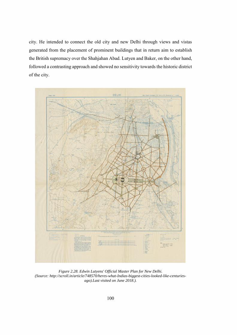
100
city. He intended to connect the old city and new Delhi through views and vistas
generated from the placement of prominent buildings that in return aim to establish
the British supremacy over the Shahjahan Abad. Lutyen and Baker, on the other hand,
followed a contrasting approach and showed no sensitivity towards the historic district
of the city.
Figure 2.28. Edwin Lutyens' Official Master Plan for New Delhi. (Source: http://scroll.in/article/748570/heres-what-Indias-biggest-cities-looked-like-centuries-
ago).Last visited on June 2018.).
101
In fact, they wanted to develop an imperial and European city following a baroque
scheme, which would follow the rigid geometrical planning with strong axes with the
tree-loaded boulevards. Hardinge’s ambitious conceptualization to connect the old and
new city was nullified, when Lutyen, owing to the price of land acquisition, had to
reorient the central axis away from the old city. The plan of the New-Delhi bears a
resemblance with the plan of Washington DC. It shares the same vocabulary like a
strong central axis, geometric plan, prominent boulevards and special emphasis was
laid on integrating the green areas. The symbolism is imparted in the city through the
strategically placed buildings and monuments. The Viceroy’s Palace that was inspired
from the Greek Acropolis was placed on the hilltop of “Raisina Hill.” This placement
also brought it in an elevated position with reference to Shahjahan’s mosque. The city
plan was developed as an effort to unify the diverse Indian Subcontinent through the
Britain materialistic supremacy (Irving 1981). The plan is divided into three main
zones, that are, administrative, residential and economic district. The administrative
sector is planned at the centre of the city. The central boulevard was named as King’s
way, with Viceroy’s Palace (now known as Rashtrapati Bhavan) is located at the one
end and Arch of Triumph is located on its other end. The government Secretariat
offices were designed to be placed on both sides of the King’s way. In the final plan,
the administrative zone contains the Viceroy’s House, two blocks of Secretariat
buildings, legislative Assembly Building, and record offices. The houses and
bungalows in residential areas of New Delhi were designed according to the status of
its inhabitants. In general, the bungalows were designed to have colonnades visible on
its façade, supported with large gardens. Connaught Palace, the city’s shopping mall,
is also placed strategically within the residential district. Lord Curzon, Viceroy of
India’s residence is almost equal in size as compared to the old residence in the
cantonment town (King 2012).In the sheer contrast to the Shahjahan Abad, the city is
well planned and organized into small manageable segments. The city is also loaded
with the vast green spaces lined with trees. The only legitimate effort to connect the
city with the indigenous Indian people is the “India Gate,” a triumph arch constructed
to the commemorate the Indian soldiers, who died in the world war one while fighting
102
on behalf of the British. The arch lies on the central axis of the city, opposite to the
Viceroy’s Palace. The New-Delhi was constructed almost at the same time when the
Canberra, the capital of colonial Australia, was under construction. Apart from the
empire’s fading political control in India and its proclaimed agenda to make a city that
would connect the indigenous Indians to British, the design of New Delhi was “forced
from above,” which was in stark contrast to Canberra. In New-Delhi, the Viceroy’s
House holds the commanding position on the central axis, within the heart of the city
on the Raisina Hill, while in Canberra the Parliament house occupies a nearly similar
position. This placement truly reflects the Empire’s different political decorum that it
wanted to maintain in both colonies. The presence of a broad central axis in New-
Delhi is harshly criticized by architects and urban designers. Blakes writes in this
regard that
Much scarier are certain single-use patterns that have literally demolished
the cities upon which they were imposed. One of the most interesting
examples of this abuse is New Delhi, whose incredible, bombastic central
avenue - the Raj Path - was designed by Sir Edwin Lutyens, the great
architect of the declining years of the British Empire (Blake 1977, 118).
In contrast to the King’s way, Blake praises the “Chandni Chowk,” the central axis of
Shahjahanabad and states that although no one designed it, it is chaotic and frenzied,
and nothing works here except “life.” (Blake 1977, 119). In India, after the 1919
reforms, Baker designed the Indian Parliament building and placed it within the
administrative sector, but, as can be seen clearly, it was an afterthought and was not
part of the original plan.
2.6.3.1. Architecture of New Delhi
The announcement to develop new Delhi had also resulted in the eruption of debates
about the formal orientation of the architecture of the new capital city. The participants
103
of these debates belong to all spheres of life. However, the main contributors were the
British Indian officers and British posted in India to perform various duties. In short,
these debates can be funneled down into three major categories namely, the Indo-
Saracenic style, the Indic style, and the Orientalization of European Classicism. For
most of the conceptual issues, there was a consensus among the exponents of the Indo-
Saracenic style and the Indic style. The advocates of Indo-Saracenic style believe in
acquiring the direct inspiration from the Mughal buildings. They see the creation of
the new capital at Delhi as an opportunity for the British to emulate their Mughal
successors. The group backing the Indo-Saracenic style saw the buildings of the new
capitals produced by the contribution of the local artisan and craftsman. While the
proponents of Indic style, were advocating the involvement of the Indian craftsmen,
under the supervision of the European architects. The focal point of the debate (Indo-
Saracenic style) was E. B. Havell who was the ex-principal of Calcutta college of Art.
He saw the construction of Delhi as an opportunity that could surpass the “shoddy
imitation” of Western architecture in Calcutta which included the “bastard Gothic”
and “emasculated Italian Renaissance.”(Metcalf 2002). He advised the government of
India to take the direct inspiration from the lost Mughal monuments that were located
nearby the proposed site. Favouring the Indic style of architecture, he, in spite of
opposition from Lord Curzon and Herbert Baker, suggested that retrofitting the
Palaces and buildings at Fatehpur Sikri and Agra, according to the British
administrative needs, would be much easier than the problem Greeks faced while
converting old Greek Palaces for the secular requirement of modern Europe. For
Havell, the incorporation of traditional Indian buildings would not only impart
legitimacy to the British empire in India, rather it would also help in its progress.
Metcalf re-quotes Havell as
A Delhi built by Indian craftsmen working under British supervision
“would prove that Indian and British imperial interests were not
antagonistic, but really and truly identical.” In this way, Britain would
“give India of her best” and at the same time “use both for her own and
104
India’s advancement, all the resources of Indian culture and practical
experience. “From such a “reconciliation between Eastern and Western
ideals.” could spring, indeed, not only a revitalized Raj, but “a greater
Renaissance that the world has ever known. A “message of hope for
India,” New Delhi would stand as a lasting challenge at once to the
“Europeanized” nationalism of India’s elites and the degradation” of
modern capitalism (Metcalf 2002, 214).
Just like Gandhi and Ruskin, Havell also advocated the preservation of the village
economy in India, but in striking contrast to Gandhi, he interpreted the concept of
preservation from a British centric perspective. Metcalf writes that Havell has,
“accepted the concept of “traditional” India, (which is) in need of British guidance,
that underlay the late Victorian view of empire (Metcalf 2002, 214).” The people who
were actively supporting Havell’s point of view include Sanderson (an officer in the
archaeological survey of India), John Begg (Consulting Architect for the government
of India) and F.O. Oretel (Superintendent Engineer of Allahabad municipality). For
them, Akbar’s Fatehpur Sikri and Agra were the key examples from where the Indian
administration could take inspiration to build New Delhi. Metcalf writes that Oertel
was inspired from the harmony that Akbar bought by uniting Hindu and Muslim
architecture to carve the purest form of “Indian architecture.” He quotes Oertels as
“Akbar had created,” Oertel said, expressing the longstanding British
view of that Emperor’s building, a “truly Indian style, bringing into happy
union both Hindu and Muhammad forms.” Now that we “are establishing
our capital at the seat of the old Moghal Empire,” urged Oertel, “: let us
endeavour to follow in the footsteps of Akbar.” (Metcalf 2002, 216).
In short, the advocates of the Indic style of architecture were inspired from the
changing philosophy of the later Victorian era where they wanted to build as the
indigenous rulers of India, rather than the foreign invaders who built Calcutta. They
105
wanted to objectively address the problem of the architecture of the new capital and
were in favour of adopting an architecture that suited India in general, rather than the
personal tastes of a group. They were determined to reconcile the “east” and “west”
through architecture and exhibit massive respect to India’s tradition, especially the
buildings developed by Akbar. In general, the Indian administrators could feel the
strong vibes, within the British Indian circles, to revive the traditional Indian
architecture. The reason for this inclination was that firstly, in contrast to the
administration at Calcutta, more Indians were part of administration while Delhi was
in the planning and development phase and secondly, the British Empire after 1900,
in the wake of rising nationalist movements, was losing its control over India. The
group reinforcing the idea that Empire’s authority should be established through
architecture also include Lord Hardinge. Being the Governor General of India, he was
the supreme authority in India. His intention for the new Delhi can be understood from
the following statement, that is, “building in the plains of Delhi a purely Western
Town …must be imbued with the spirit of the East such as will appeal to Orientals as
well as to Europeans.” (Metcalf 2002, 219).” He was in favour of developing a
Western town, but due to the political conditions he was forced to include the “spirit
of the East”, as British Empire was losing its grip on India. He wanted to impart to
indigenous Indian with a sense of pride by including the “Indian spirit” into the
building of the new capital. At the start, Hardinge had no idea how to Orientalize the
European buildings in India, especially when his dislike for the Moghul and Hindu
buildings was quite evident. He criticized the Mughal buildings for over decoration
and believed that these buildings were inspired from Hindu buildings. To Orientalize
the European buildings in India, he found inspiration in “Pathan style35” in contrast
to the other groups whose focus were the buildings developed by Mughals. In a
descriptive conceptualization of his ideas about Orientalizing the European
architecture, he writes about Pathan style as
35 Pathans originated from Afghanistan and were the rulers of India before the Mughals. Hardinge
believed the the Pathan style is “far purer” than Mughal style.
106
With it rectangular or hexagonal columns, its breadth of treatment with
big walls, buttresses, flat domes and few windows would lend itself to a
composition with Italian architecture and would inspire beauty, solidity,
and originality (Metcalf 2002, 220).
Hardinge’s search for the simple and aesthetically pleasing architecture had led him
to Mandu, which became the new imperial inspiration instead of Akbar’s Fatehpur
Sikri. Hardinge was cautious about the changing political times and didn’t want to
imitate the Western classicism as the British East India Company had previously did
in Calcutta. In fact, he wanted to produce a hybrid that was mutually acceptable to
both Indians and British. This ideology of amalgamation of east and west had forced
him to contact Herbert Baker, who had already worked on the composite building in
South Africa. Baker had never been to India before this assignment, however, his
scepticism about Indian architecture reflected from the following statement regarding
Indo-Saracenic style. “It does not have the constructive and geometrical qualities
necessary to embody the idea of law and order, and have been produced out of chaos
by the British administration (Metcalf 2002, 222).” Herbert Baker also wanted to
create a city that should have the stamp of “British sovereignty” and a city which
“must not be Indian. nor English, nor Roman, but it must be Imperial.” Baker like
most of the British historiographer was concerned with establishing the British
supremacy and was less aware of the history of India. The recipe that Baker proposed
to Lord Hardinge for creating the authentic Indian architecture consisted of three
primary ingredients, that were, Orientalized European classical architecture,
consideration for weather, and Indian material conditions. The Orientalization of the
classical architecture was done by incorporating the Chajja (Wide cantilevered shade),
Jali (stone screen), Chattri (literally means umbrella refer to the freestanding canopied
structure) into the European style architecture. Hardinge’s stress on the insertion of
the four centred pointed Mughal arch had resulted in the differences between
Baker/Lutyens and Hardinge. Baker and Lutyen want to integrate the circular arch
borrowed from the Western classical tradition and regarded Mughal arch as an
107
eccentric for the architecture of the new city. Baker wants to integrate only specific
features from Indian architecture that relates to the function of the buildings. He writes
that, “to weave into the fabric of the more elemental and universal forms of
architecture the thread of such Indian traditional shape and features as may be
compatible with the nature and use of the building (Baker 1926).”Hardinge, however,
rejected their stance and their persistence admiration of the “circular arch” finally let
them leave the project. The Baker’s philosophy as described by himself does not
correspond with the Hardinge’s intentions but reinforce the hybridity of modernity as
it prevails under colonizer.
2.7. Conclusion
The early phase of Indian modernity is marginalized from the canonical literature
written in the west, especially by the influential philosophers of modernity like Hegel
and Marx. It was the tradition of misrepresentation that was carried forward by the
colonizers and through their derogatory and biased texts, that had almost nullified the
possibility of the pre-colonial modernity. The analysis of Akbar’s reign and the
postcolonial criticism (especially that is posed by Richards, Fernee, Seth, Chatterjee,
and Appadurai) provides a solid footing for the theorization of early Indian spatial
modernity. Akbar’s intention of rationalizing the society, his socio-political reforms,
administration reforms brings the Indian in par with the European society. However,
it should not be gauged or evaluated based on the values established in the west.
The Indian modernity is best understood through “reorientation” rather than a
“rupture” from tradition. The “reorientation” towards the modern is driven by the
contextualization of both exogenous and endogenous forces. These forces resulted in
the production of hybrid models which can be related to the Indian Subcontinent. It is
important to note that the process of the “contextualization” is gradual and cannot be
read from building to building developed immediately after each other. Though, it
becomes distinguishable at a mature stage of evolution, which in the case of this
108
dissertation is Shahjahan Abad, the early modern capital and New-Delhi, the colonial
capital. In case of the Early modern period in India, the buildings were inspired from
the Samarkand built by Timur, the great-great grandfather of the Mughals and Isfahan
the capital of Shah Tahmasp, where Humayun, father of Akbar remained in exile for
ten years. These external influences which include the Chattris, onion-shaped domes,
pointed arches, geometrical plans, double story structures, along with a rich
indigenous tradition of construction, assimilated into the buildings through the local
craftsman, had defined what we can now term as early modern spatial development.
In addition to the Mughal affiliation with Samarkand and Isfahan, it was the similar
weather that had helped in the construction of almost similar buildings in India; a
quality which nullifies the claim of the Europeans that architecture in India belongs to
Europe. The Mughal capital cities, on the one hand, contain the well-planned
monumental building erected with geometric precision and on the other hand tells the
story of an organic city, outside the walls of the citadel. The early urbanization also
helped in the breaking the traditional self-sufficient commune and opens up the new
vistas for the artisan and craftsman for freely trading their manufactured goods.
The British colonial modernity can be gauged on the hybrid model. Loaded with the
spirit of enlightenment, steam power and Greek traditions British buildings were
hybridized by the elements borrowed from the Great Moghuls. One can visibly see the
transition in development from alien city (Madras and Calcutta) to a more Indianized
(New Delhi) one. Furthermore, the scale and impact of the British were much greater
than that of the Moghuls, which destroyed the traditional self-sufficient commune in
India. The destruction of commune owes to two factors, firstly the British agendas of
destroying the traditional economy by completely dilapidating the industry established
under the early modern period for their political gains. Secondly, the massive
industrialization, military campaigns, and infrastructure projects had opened new
trades and job for the local Indian, which lead them to settle in the urban areas rather
than a traditional commune. At the start, the British spatial modernity in the Madras
and Calcutta was reciprocated based on the Western ideals. The main reason was that
109
at the point of time the British trading company was more interested in earning profit
rather than developing the ideal cities. However, there is gradually shift in the British
discourse of city planning and architecture from the mere replication of the European
ideals to the production of Indianized buildings, summed up as Indo-Saracenic style.
The transition in the discourse was not limited to the New-Delhi, but it assimilated
within the material fabric of the towns including Calcutta and Madras that were made
in the British taste. For example, the Victoria memorial in Madras built in 1909
resembles the Buland Darwaza of Fatehpur Sikri (Fergusson 1899). The reasons for
this shift in the discourse was political as British were trying to legitimize themselves
as the indigenous owner and for them establishing a link with the Mughal serves as a
connection to India’s past (Metcalf 2002). British initially labelled Indians as
uneducated and uncivilized, but with the passage of time intellectuals within the
British circles had emphasized on incorporating the Indian elements and admired the
vision of Muslim kings especially Akbar which was reflected in the architecture of
Fatehpur Sikri. Apart from all the biases of Lord Curzon and his entourage, they were
not able to transcend Akbar’s vision of an Indian city while developing New-Delhi.
From the above analysis, one can conclude that during the early modern period in
India, planning was limited to the citadel and boundary wall and the city grows
following an organic part. While in the British modern period the planned grid
gradually emerged, which reached its culmination point in New-Delhi. The urban
critics generally praise the planned city over the organic city, due to obvious reasons,
but draw an un-natural comparison between the early modern India and later modern
England. The dissertation argues that this criticism is not fair as the planned
town started appearing in England during the late modern period.36 During early modern
36 The criticism was based on the fact that in Western theory there was a strong discourse of planned city. However, the British critics were unaware of the Indian tradition of Vastu Shastra and the remains of the first planned city found in Indus valley civilization.
110
England, town plan was based on the similar organic pattern as that of India37. For a
complete discussion on the subject, see (Pevsner 1972; Pevsner and Cherry 1973;
Sharpe 1997; Morris 2013). The fact, however, was that the Mughal cities were
developed over the passage of time, according to the growing needs of the new time.
Mughals never had the complete image of the whole city at the start. People either
walk or use horses for transportation within the Mughal cities, therefore organically
planned street doesn’t hinder their movement. The British era, however, has seen a
rise in the use of horse-driven carts and later motor vehicles which requires wider and
straight streets for mobility. Which is one of the main reasons for prioritizing more
rigidly geometric planning over organic planning, in addition to exercising the
political control over space.
37 It is important to note that for executing a planned city one requires political stability and a central
planning authority, which was not present in Early Modern Period (whether it is England or India) hence the town generally grow following an organic pattern (Sharpe 1997). In England and Wales first Statutory control of land use was made in 1909 (Megarry, 1962).
111
CHAPTER 3
3. CONCEPTION OF PROMISED LAND
3.1. Introduction
The chapter will address the production of hybrid modernity in the urban spatial
construct as it was articulated in the establishment and development of plans for the
postcolonial / post-independence capital cities, Chandigarh and Islamabad, in the
Indian Subcontinent. The “hybrid”, earlier discussed in chapter two, is an entity
produced as a result of amalgamation of exogenous and endogenous impressions
under the prevailing socio-political conditions and hence, it favours heterogeneity
over homogeneity and plurality over singularity. The endogenous impressions in the
case of Indian Subcontinent encompass both external and internal domains. The
external or material domain, in the case of the postcolonial spatial construct, includes
the hereditary material traditions that were once alien to this part of the world and
were appropriated during the early modern and British modern period. On the other
hand, the inner domain, which was seemingly less affected by the colonizers, includes
the social aspects like religion, culture and non-material conditions which added to
the plurality to the univocal Western modernity during the process of contextualization
(Chatterjee 1997). Hence, this chapter will seek to address in detail the role of “less
affected” internal or spiritual domain38 and the external or material domain39 in the
formation of the postcolonial capital cities (Chatterjee 1997). Material domain defined
38 Chatterjee shows how anti-colonialist nationalists produced their own domain of sovereignty within
colonial society well before beginning their political battle with the imperial power. Chatterjee names this domain as the inner or spiritual domain “bearing the essential marks of cultural identity.” This domain consists of spiritual sphere, represented by religion, caste, women and the family, and peasants (Chatterjee 1993).
39 Material domain defined by the Chatterjee is the external domain consist of science and technology, statecraft and economy where the British colonizer had a proven expertise and were superior to the Indians (Chatterjee 1993).
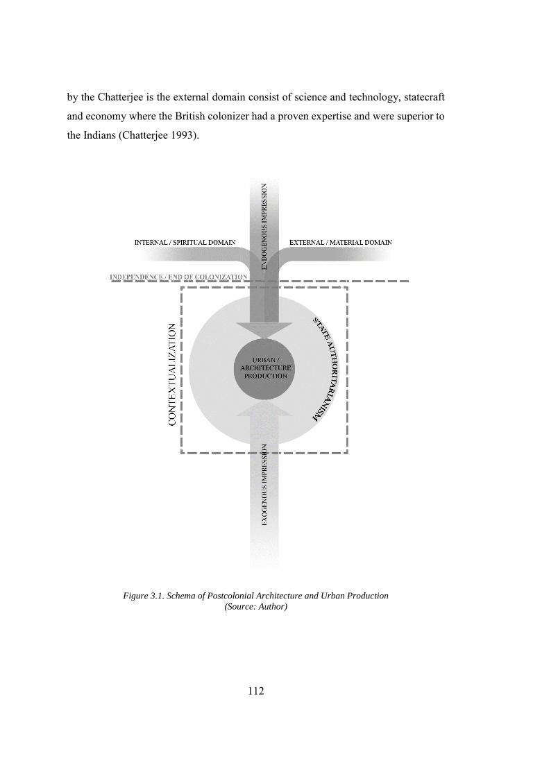
112
by the Chatterjee is the external domain consist of science and technology, statecraft
and economy where the British colonizer had a proven expertise and were superior to
the Indians (Chatterjee 1993).
Figure 3.1. Schema of Postcolonial Architecture and Urban Production (Source: Author)
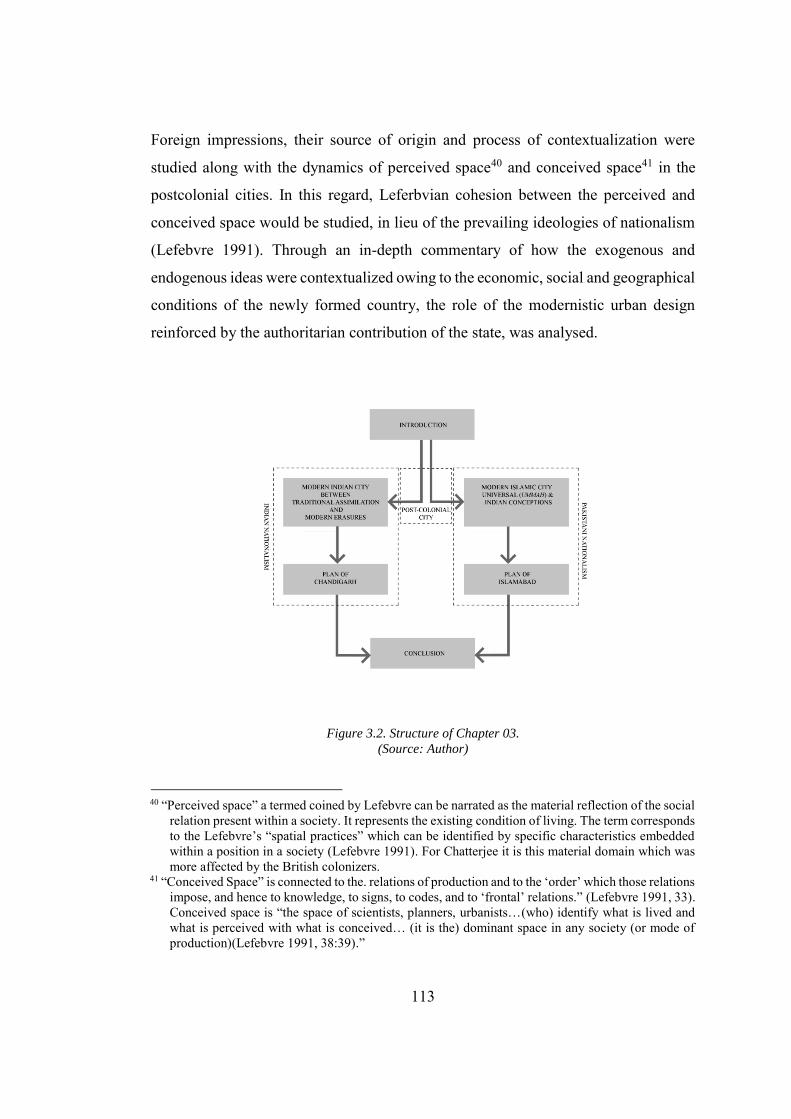
113
Foreign impressions, their source of origin and process of contextualization were
studied along with the dynamics of perceived space40 and conceived space41 in the
postcolonial cities. In this regard, Leferbvian cohesion between the perceived and
conceived space would be studied, in lieu of the prevailing ideologies of nationalism
(Lefebvre 1991). Through an in-depth commentary of how the exogenous and
endogenous ideas were contextualized owing to the economic, social and geographical
conditions of the newly formed country, the role of the modernistic urban design
reinforced by the authoritarian contribution of the state, was analysed.
Figure 3.2. Structure of Chapter 03. (Source: Author)
40 “Perceived space” a termed coined by Lefebvre can be narrated as the material reflection of the social
relation present within a society. It represents the existing condition of living. The term corresponds to the Lefebvre’s “spatial practices” which can be identified by specific characteristics embedded within a position in a society (Lefebvre 1991). For Chatterjee it is this material domain which was more affected by the British colonizers.
41 “Conceived Space” is connected to the. relations of production and to the ‘order’ which those relations impose, and hence to knowledge, to signs, to codes, and to ‘frontal’ relations.” (Lefebvre 1991, 33). Conceived space is “the space of scientists, planners, urbanists…(who) identify what is lived and what is perceived with what is conceived… (it is the) dominant space in any society (or mode of production)(Lefebvre 1991, 38:39).”
114
The exercise in result yields towards rewriting the urban history. Interestingly, both
the cities shared a common history, however, the nationalistic discourses that
overshadowed the objective history have resulted in embedment of paradoxes and
myths within the plan of these capital cities. Hence creation of the socio-political
condition which can be termed as the “aesthetic of erasure” whereby the modernist
development in Chandigarh and Islamabad served as an agency to re-appropriate the
past. Furthermore, through a comprehensive comparison of salient features, paradoxes
and hidden agendas concealed in the plan of Islamabad and Chandigarh, this study
seeks to interpret the reflection of these ideations on the production of spatial
configuration in the postcolonial Indian cities. The chapter concludes by discussing
that modern postcolonial capitals in the Indian Subcontinent, Islamabad and
Chandigarh, should not be regarded as mere replication of the modern Western cities.
These are complexly hybridized cities reinvented by the architects under the enforced
conditions and constraints posed by the indigenous conditions.
3.1.1. Nationalist Ethos, Contradictions and Postcolonial Space
On the midnight of 14th and 15th August 1947, British India was divided into two self-
governing dominions, India and Pakistan. This un-natural territorialisation of space
resulted in a vacuum owing to several political, social and economic problems, one of
the main reasons being the unequal distribution of the natural and material resources.
Furthermore, the new countries also suffered the loss of capital cities. To concentrate
power and cope with the administrative deficiency that resulted from the loss of the
capital cities, Lahore and New Delhi, both Indian and Pakistani governments
conceived the idea of development of new capital cities. Hence, Chandigarh (the
capital of Eastern Punjab in India) and Islamabad (the capital of Pakistan) came into
being. This historicism that lies at the core of the national movement of both the
countries was clearly reflected in the planning of these capital cities and nurtured them
as “hybrid modern” capitals. The hybridity resulted from the historical connectivity,
makes them different from the other planned capital cities of the twentieth century.
115
The percentage of historicity, agenda of the respective governments and political
ambitions bring both these capital in striking contrast to each other. These hybrid cities
also challenged the very notion of Marxian conception of the city whereby he
designates the city as a moment in the history that marks the transition from the
feudalism to the capitalist mode of production. Chandoke writes about the difference
between the European and postcolonial cities as
The city in the European historical experience represents a break; a point
of transition from one mode of production to another. In the postcolonial
world, the city is a historical subject because it is a manifestation of the
articulation; the symbiosis of the non-capitalist modes of production42
and the dominant capitalist mode (Chandoke 1991).
It is important to note that Marx presented his thesis concerning the early modern
conditions in Europe, while Indian Subcontinent never completely shifted from the
feudal economy to the capitalist mode of production, even today, both these go
together in hand with each other. Chandoke explained that this shift was not the
eradication of one mode of production for the survival of other, but it was the
consolidation of “non-capitalist mode of production” and “dominant capitalist mode”
(Chandoke 1991). This “shift from one mode [of production] to another must entail
the production of new space (Lefebvre 1991, 46).” Chandigarh was the brainchild of
modernist Nehru that he envisioned as “unfettered by the traditions of the past”43 44
while Islamabad, as the name clearly indicates, was developed as a city of Islam. Both
these cities, in general, are linked to the earliest echoes of nationalistic space, voiced
during the formative years of the Indian independence movement, the collective
42 Marx presented his idea of “Asiatic Mode of Production”, which is the most relevant non-capitalist
mode of productions with reference to the Indian Subcontinent. It is important to note that Marx never gave an elaborate view of the Asiatic mode of production. Another major problem about comprehending this point of views is “comments on the Asiatic mode are scattered throughout his writings” (Taylor 1979).
43 Fondation Le Corbusier, Document Number: P2-12-2-002, Subject: “Notes of Meeting between Le Corbusier and Nehru on Date June 26th, 1957, from Le Corbusier’s Diary.”
44 The possible confusion in the holistic understanding of tradition in India discussed later in detail in section 3.3.1.
116
memory of Indian renaissance in the early modern period’s spatial development, the
legacy of colonizers and foreign impressions were Indianized by Le Corbusier and
Doxiadis.45 This is unlike other postcolonial cities, e.g. Brasilia, where modernity,
“…proposes architecture and city planning as instruments of social change and
management (Holston 1989, 12).” Urban design of both cities reveals a strong
connection, not only with the early modern capital cities, but also with their immediate
predecessors, New Delhi; the last imperial capital of the British India. The reflection
of the colonial cities can be seen in the development of housing and residential areas
that were divided according to the pay-scale and grade of the government employees,
thus enhancing and formalizing the class antagonism through reflection on material
world yielding to spatial practices. Consequently, in the conception of the postcolonial
space in the Indian Subcontinent, the “Gandhi’s Sawaraj46” and the “Muslim
nationalism47” were schematically infused with the conception of space within India
and Pakistan. The conception of space as a tool for control has been argued by
45 Chatterjee argues that the middle-class elites had firstly “imagined the nation into being in this
spiritual dimension and then readied it for political contest, all the while "normalizing" the aspirations of the various marginal groups that typify the spiritual sphere.” Hence once the Pakistani and Indian nationalisms are formulated, thesis on the spatial reflection of nationalism was floated by Ch. Rehmat Ali (Ali 1933) and Gandhi respectively. The most important place was the mimicry of historicism in the conception of space where on one hand Ch Rahmat Ali connects the spatial demarcation with the roots of Islam and on the other hand Gandhi present his thesis on the traditional revivalism on Indian Subcontinent.
46 “Hind Sawaraj” or “Indian home Rule” was the title of the book written by Ramdas Mohan Chand Gandhi, founding Father of India. The book reflects his traditionalist ideologies and probable sketch of Indian society after independence. Although his thesis was based on the revival of the traditional Indian society, he acknowledges the English and want an “English rule without the Englishman” in post-independence India. He further explains this statement as “English Parliament be the Mother of Parliaments, I certainly think that we should copy the English people”, but to an extent where they cannot over rule the Indian traditions (Gandhi 1909).
47 Muslim Nationalistic ideologies gained its momentum following the two-nation theory with Muhammad Ali Jinnah’s (founding father of Pakistan) as its flag bearer. The two-nation theory was the soul of “Pakistan resolution” passed on the annual convention of All-India Muslim League on Mar 23, 1940. The Two Nation theory emphasizes on the fact that Muslims in the Indian Subcontinent are a distinct nation, whose way of life, social customs, philosophies and religious practices and not only different, but contradictory with the Hindus, thus they require a separate country to dwell, without getting in to a dispute with the majority Hindus (Khan 1985; Hoveyda 2010, 43:47). Within the popular streams of “ethnic” and “civic” nationalism, religious nationalism is a lesser known stream with Pakistan and Israel being only two countries created following this ideology. The theory was highly criticized specially after the separation of Muslim Majority Bangladesh (former East Pakistan) from West Pakistani.
117
Yiftachel, where he stresses planners to acknowledge that, the progressive potential
of planning is accompanied by a sinister side in which planning may function as a tool
of social control in the interests of power (Yiftachel 1998), consequently this idea is
quite contrary to the beliefs on the basis of which postcolonial independent states were
formed. For example, in the case of Chandigarh, there is a clear contradiction with
reference to Jawahar Lal Nehru’s urge for a “democratic” plan. Despite Corbusier’s
utmost plea, Nehru ordered the removal of the Governor’s Palace from the plan of
Chandigarh, owing to its “imitating imperial outlook” bestowed by its location on the
plan.48 However, in case of the residential area planning, he was “greatly interested in
the quarters being built for staff of all grades.”49 Subsequently, the class-based
residential quarters resulted in the social alienation and strongly reinforced the class
antagonism within the plan. The physical segregation of the rich and poor classes
reminds one of the black and white towns; a salient feature of the colonial capitals
(that are, Madras and Calcutta). It is also important to note that although contradictory
with the constitution of India, the class based system is well protected in Hinduism,
who adopted this system from the Aryans who conquered India and established there
empire in 1500 BCE. This ideology fundamentally contradicts the constitution of
India, which guarantees equal rights for the citizens, and the promises made by
Western modernity50, but align them with the cities of British colonizers. Le Corbusier
also unwinds the benefits of monetization through space planning in a meeting with
the high-level advisory committee of Chandigarh project. He states that “the good
48 In a Letter to Mr. Nehru, Le Corbusier writes that “India is greatly appreciated as since the highest
ages she has inspired architectural works and cultivated spiritual, intellectual and poetical values. Chandigarh excites everybody’s interest. It is your country which is “poor as Job” which has built Chandigarh. If you cut off the head of Chandigarh it shall be said:” The have not been able to carry out their enterprise. Fondation Le Corbusier, Document Number: P2-13-48-004, “Letter from Le Corbusier to Mr. Nehru (Page 02), Date June 26th, 1957.”
49 Fondation Le Corbusier, Document Number: P2-8-38-004, “Camp: “The Retreat”. Mashobra”. Main Title: Housing. Written by Jawahar Lal Nehru on Apr 04, 1952.
50 Since Renaissance treatises on the nature of architecture and the city and the Laws of the Indies of 1573 regulating the discovery and settlement of the New World, architecture and city planning have been prominent among those modern techniques of government that address what the order of society should be and how it should be maintained (Holston 1989).
118
urbanism makes money; the bad urbanism loses money!”51. This was not the first
times when Le Corbusier encouraged the Punjab Government’s official to utilize the
speculation. In the progress report for the Assembly Building he writes
Town hall should not be constructed on the privileged places, but
precisely at the heart of the city centre. It was a financial point of view to
give values to the depreciated land and in turn a super value to the land
along the avenues. That is making money. Now the authority (the board)
must reap the harvest, selling the plots at high prices. This is urbanism.
The Chandigarh boards is assured to create big money in this manner.52
This fact was also confirmed by Doxiadis who, during his visit to Chandigarh, has
written that the Government of India was selling the land to the buyers at 20,000-
50,000 Indian rupees per acre, which it bought for 1500 Indian rupees per acre.53In
case of Islamabad, the first Muslim planned city developed under a unified authority,
the material conception of the city is borrowed from the discourse developed by
colonizers rather than prevailing theory of Islamic architecture. The central idea is to
locate the origins for development within the motherland. The emphasis of British
Historian on the formal aspect of the architecture, inherited by the British trained
administration of Pakistan and it kept on haunting the foreign architects hired to
produced Islamic building in the Capital ( For a detailed discussion on the subject see
51 Fondation Le Corbusier, Document Number: P3-8-71-008, “Attached Document to the Letter to the
High-Level Advisory Committee of the Capital Project Control Board, Chandigarh from Mr. Le Corbusier” (Title: Statue of the Land, City of Chandigarh) (Page 06). This is not the first time Corbusier revealed the money-making potential of urbanism. In a swiss colony in Paris he told his closes friends, “To urbanize means to increase value…To urbanize is not to spend money, but to earn money, to make money.” This assertion thus revealed the original character of his Highrise fever, which was anything, but revolutionary. Thus idea city was in fact ideal city of capitalism (Moos 2009, 119).
52 Fondation Le Corbusier, Document Number: P2-8-104-001, “copy of notes given by Le Corbusier for consideration in the first meeting Chandigarh capital project control”. on Apr 04, 1952.
53 Doxiadis Archives, Athens. Document Number: DOX-PP (77-84) Pakistan Diaries and Reports, DOX-PP (77-84), Jan-Mar 1956 (Page 2).
119
section 4.2.).The British discourse on Indian architecture was politically motivated
that reduced the Islamic architecture to a mere formal statement. For a brief discussion
on the subject see section 3.2.1 & 3.2.2.
3.2. Chandigarh: The Modern Experiment in India
Mao’s Beijing or, in different circumstance,
Nehru’s Chandigarh owe their present spatial
form to a combination of both ‘external’ and
‘internal’ ideas as well as the everyday
activities of their inhabitants (King 2004).
The following section of the dissertation will critically analyse the design evolution
of Chandigarh, the planned capital city that was developed from scratch after the
independence of Indian. It also reinforces the argument that Chandigarh was modern
city re-invented on Indian soil, and owes its existence not only to Le Corbusier, but to
Nehru, Indian bureaucracy and politicians as well. This point of views the challenges
the tradition idea of architect as a “master build” bearing all the responsibility od
design development. This idea is also reinforced by Perera where he points out that,
“the majority of work approaches the city from a physical standpoint and the discourse
revolves around its designer, marginalizing its residents, political leaders and socio-
political and historical contexts (Perera 2004).” The plan of Chandigarh was based on
the contradictions that were embedded due to techno-economic reasons. These reasons
together with the physical constraints and Corbusier’s anomalous interest in the Indian
culture, led the stubborn architect 54 to produce a plan that also challenged his earlier
conceptions of the city. The city thus presents a case for hybrid modernity, by
54 Stubbornness of Le Corbusier is well known, and he was rigid not only about his ideas, but quite
often praise himself and his work. In a letter written to Nehru he writes that “I have created an important “Plan of the city” … “My Architecture has a universal value (and signification …I have transformed architecture all over the world”. Knowing this fact, it was not less than a miracle that he transformed his earlier ideas about the city planning but made a solution that match the Indian condition upon request of his client. Fondation Le Corbusier, Document Number: P2-13-95-004.
120
reminiscing about the local and foreign impression, instead of “bastard55” architectural
production. Furthermore, due to the geographical constraints and impacts the city
should not be viewed as an extension of the Corbusier’s previous work in Europe,56
but rather one should read it as an excellent example of Corbusian skilful
transformation of problematic to Indian condition57 with the help of his entourage.
3.2.1. Deciphering Tradition (From Nehru to Le Corbusier)
During his meeting with Nehru in June 1957, Le Corbusier re-quotes Nehru’s famous
statement and pens down his response as,” Chandigarh - a symbol of the Freedom of
India unfettered by the tradition of the past. Nehru is very solemn.58” Several Western
authors (Morris 1975) have frequently re-quoted this statement, however, the
dissertation will argue that they have misunderstood this statement, due to the lack of
knowledge regarding the political orientation of Nehru. “Nehru’s idea of modernity
was not the simple opposite of traditional, but was constructed within a continuity and
change of tradition (Perera 2004)”. Kalia also reinforces the fact that Nehru wanted to
build community life on a ‘higher’ scale without breaking the old foundations of India
(Kalia 1999). Chatterjee and Kenny also argues that, Nehru’s vision of ‘new’ India
presented the possibility of combining its spiritual heritage with the ‘scientific temper’
of the Western societies (Chatterjee and Kenny 1999). It is important to note that both
55 E. B. Havell who was the ex-principal of Calcutta college of Art. saw the construction of Delhi as an
opportunity that can surpass the “shoddy imitation” of Western architecture in Calcutta which includes “bastard Gothic” and “emasculated Italian Renaissance.” (Metcalf 2002).
56 Le Corbusier earlier work for the city planning in the Europe comprise of “Contemporary city of three million people 1922 (The Ideal City)”, “Plan Voisin for Paris 1925”, “The radiant city 1930 (Villa Radieuse)” (Corbusier 1987, 1933, 1971).
57 Fondation Le Corbusier, Document Number: P2-8-38-004 Attached notes to the letter written by P.S. Thapar letter to Mr. Le Corbusier. Dated Apr 05, 1952. These Notes were written by Nehru where he referring to Le Corbusier writes that “Mr. Corbusier told me an we should definitely investigate what changes we should make to make our buildings conform more to Indian conditions and at the same time have some artistic value. In the past we have paid little attention to architecture or to aesthetics in this respect. … nothing is more horrid than the type of Peons’ or Servants quarters which became the standard pattern in British.”
58 Fondation Le Corbusier, Document Number: P2-12-02-002, “Notes of Meeting between Le Corbusier and Nehru on Date June 26th, 1957, from Le Corbusier’s Diary.”
121
Le Corbusier and Nehru had a different perception for the tradition. Le Corbusier, one
of the founding father of the modern movement in architecture had a clear point of
view about rejecting the tradition that yields a rupture. He was the spearhead of the
Modern movement in architecture, the group of people who were translating the
rupture into the built environment leaving behind the tradition. Coming from a person
of the stature of Nehru, who was not only a disciple of Gandhi, but also a forerunner
for the independence of India, reading this statement in line with Corbusier is absurd.
Both Gandhi59 and Nehru shared a vision of India rooted in the past and inspired from
the present. Nehru fell more towards the present, while Gandhi was inclined towards
historicism, but not encaged in historical romanticism. He was also open to
incorporate the English customs for the progress. In his seminal book “Hind Swaraj”
Indian home rule) he writes, “If the English Parliament be the Mother of Parliaments,
I certainly think that we should copy the English people (Gandhi 1909, 25).”However,
his very limited openness towards the English institutions was not widespread and
often marginalized from the canonical literature. The acceptability towards inducing
the foreign influences for the National progress reinforces the baseline idea of
hybridity, discussed in this dissertation. It is due to the marginalization of Gandhi’s
acceptability of Western culture that Doxiadis, while visiting Chandigarh, felt that the
soul of Gandhi was missing from Chandigarh. In the following section with reference
to the plan of Chandigarh, the dissertation will explain the domain in which tradition
was revived within a modernist plan, reinforced by both Nehru and Le Corbusier.
Before pursuing this debate, it is vital to address the question posed in the above
statement, that whether Nehru wanted to create a historical rupture, by negating the
tradition in the European sense or the word “tradition” in the above statement does not
do justice with his ideology regarding unfettering. In his seminal book, “The Search
59 Gandhi was a strong advocate of the revival of Indian traditions especially the self-sufficient
commune, which in his opinion was destroyed by the British colonizer. He lived in the houses that reinforce his belief of traditional revivalism and reincarnation of the self-sufficient commune. In Sabarmati ashram, Gandhi’s house in Ahmedabad there was dedicated space for the living experiments e.g. farming, animal husbandry, cow breeding, Khadi and related constructive activities (National Gandhi Museum 2018).
122
of India,” written during his imprisonment days Nehru writes
To some extent, I came to her (India) via the West and looked at her as a
friendly Westerner might have done. I was eager and anxious to change her
outlook and appearance and give her the garb of modernity. And yet doubts
arose within me. Did I know India? (Nehru 1946, 50).
To answer this question, and in search of India, Nehru travelled across India from the
north Western provinces to the Eastern provinces through which he came across
people of different races and religions that helped him in discovering the “vitality” of
India. By ‘vitality’ he refers to the forces that have kept a country of different
ethnicities and religions together in the form of one country (Nehru 1946). He related
this vitality with that of China instead of the United States of America. He proclaimed
that future India (that is post-independence India) will be a product of not only of the
present, but a thousand years of history similar to that of China. He was not only
fascinated by the history of India, but under the tutelage of Gandhi reinforced the idea
of traditional realism. He also displayed his fear as, “I have often wondered that if our
race forgot, the Buddha …It would be uprooted and would lose the basic
characteristics which have clung to it and given it distinction throughout these long
ages. India would cease to be India.60” . He also advocated the idea that “The future
had to be built on the foundations laid in the past and the present. To deny the past and
break with it completely us to uproot ourselves and, sapless and dry up.61” Further to
the above statement Nehru has also written that, “traditions had to be accepted to a
large extent and adapted and transformed to meet new conditions and ways of thought,
and at the same time, new traditions have to be built up (Nehru 1946, 55).” Several
other statements and writing by Nehru reinforce the fact that he wanted to “adopt the
new and harmonize it with the old” (Nehru 1946, 54). Thus one can conclude that
60 Fondation Le Corbusier, Document Number: P2-13-86-006, “India Today and Tomorrow by
Jawaharlal Nehru” in Azad Memorial Lectures (1959), Page 02 & 03. 61 Fondation Le Corbusier, Document Number: P2-13-86-008, “India Today and Tomorrow by
Jawaharlal Nehru” in Azad Memorial Lectures (1959), Page 06 & 07.
123
Nehru was not in favour of scrapping the past, but wanted to release it from the dogmas
and ills attached to it. He tried to utilize the tradition for the progress in conjunction
with the foreign impressions (Nehru 1946). This amalgamation, as this dissertation
argues, was not a brainchild of Nehru or Gandhi only. Gandhi, being a traditionalist,
was unable to incorporate the system of the “higher civilization” within his ideology
of tradition. This was, however, the apex point of the practise initiated by Akbar and
carried forward by Ram Mohan Roy and Sir Syed Ahmed Khan for their religious
reform movements during the British Times. Le Corbusier, when landed in India, had
a vision of the city of skyscrapers which was truly represented in his earlier projects.
It was the lack of the socio-political conditions, technology and poor economy of India
that had led him to re-invent not only his city, but also transformed ideas about
tradition. In praise of Indian traditions, Le Corbusier writes that, “You have in your
traditions of life, fundamental functions – respect for nature, love of sky, stars, plants
and animals. This is a thing the west had completely lost.62” It was not the appreciation
alone, but Corbusier had tried to understand the Indian culture and civilization. His
interest is visible through the sketches preserved in his sketchbook titled, “Album
Simla, Punjab, India, Chandigarh Capitol Project” at Fondation Le Corbusier, Paris,
France. However, his detail studies also made him stand in a position where he could
highlight the problems in the vernacular architecture of India. Although he also shared
the same views as that of Nehru, Thapar, and Verma to incorporate the Indian
conditions in the housing, he wanted to re-appropriate them through the lens of
science. In a meeting with Planning Commission of the Capital City Project, he
deliberately suggested to
Bring a scientific spirit in them (while talking about housings) you make
fortresses which belong to the past. (while talking about cost reduction)
Walls are too thick. You like them because it gives coolness. You think
62 Fondation Le Corbusier, Document Number: P2-08-29-006 Minutes of the meeting of the planning
commission held on Apr. 17, 1952 at 9.30 a.m. in the committee room to meet M. Le Corbusier, (Page 06).
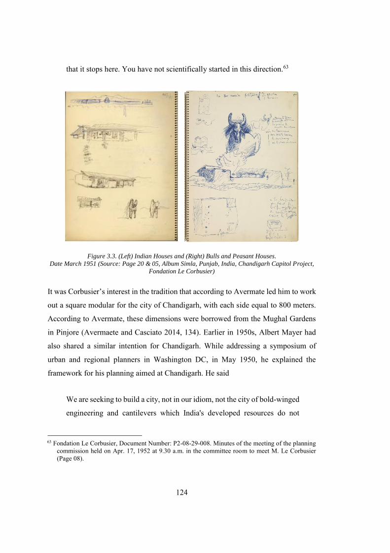
124
that it stops here. You have not scientifically started in this direction.63
Figure 3.3. (Left) Indian Houses and (Right) Bulls and Peasant Houses. Date March 1951 (Source: Page 20 & 05, Album Simla, Punjab, India, Chandigarh Capitol Project,
Fondation Le Corbusier)
It was Corbusier’s interest in the tradition that according to Avermate led him to work
out a square modular for the city of Chandigarh, with each side equal to 800 meters.
According to Avermate, these dimensions were borrowed from the Mughal Gardens
in Pinjore (Avermaete and Casciato 2014, 134). Earlier in 1950s, Albert Mayer had
also shared a similar intention for Chandigarh. While addressing a symposium of
urban and regional planners in Washington DC, in May 1950, he explained the
framework for his planning aimed at Chandigarh. He said
We are seeking to build a city, not in our idiom, not the city of bold-winged
engineering and cantilevers which India's developed resources do not
63 Fondation Le Corbusier, Document Number: P2-08-29-008. Minutes of the meeting of the planning
commission held on Apr. 17, 1952 at 9.30 a.m. in the committee room to meet M. Le Corbusier (Page 08).
125
justify, but a city in the Indian idiom, fused with our own simplicity and
functional honest (Morris 1975).
Blending a functional plan with the indigenous elements, as proposed by Mayer, was
less ambiguous and controversial in terms of retaining Indianness of the project
quintessentially required for the identity building of new nation, than scientizing the
local rudiments in Corbusian way. Corbusier's “worship of science and technology”,
had already provoked his critic Mumford who was quoted saying "from the time I read
the first edition of his Vers une architecture... I knew we were... predestined enemies"
(Fishman 1982, 258). It was not Mumford alone, Foucault (Foucault 1973) and Fabian
(Fabian and Bunzl 1983) also tried to address the problem related to scientizing, in
general. They argue in different ways, that the sciences of society use techniques of
seeing to control and distance their objects in the moment of appropriating them as
scientific-especially which is conceived as or made to become radically other, as the
mad or the primitive. After the loss of Lahore to west Punjab, east Punjab was left
with an only choice, that is, to administer the state from any of the existing cities
(Kudaisya and Yong 2004), but none of the existing towns, within East Punjab had
the capacity to host the administrative functions (Morris 1975). Among the existing
contenders for the capital cities64 “Simla,” the summer capital of the colonial Empire
was shortlisted. While it was more suitable than the rest, yet its small scale and remote
location was a significant hindrance in making it as fully functional capital for the
state. The few of the critical considerations that were kept in mind while selecting the
site of the new capital were
1. Appropriate space for hosting the state’s administration and refugees.
2. Future expansion and growth.
3. Distance from neighbouring Pakistan.
64 To begin with, the government of east Punjab started operating from different cities like Ambala,
Kalka, Dagshai, and Kasauli which of course created many problems for the people and the government itself. These problems had forced the government to most aggressively pursue the development of the new capital (Evenson 1966; Kalia 1999; Prakash 2002).
126
4. The city which can be comparable both at the national and international level
and can fill the gap produced by loss of Lahore that commercial and economic hub
of the state.
5. The Government of East Punjab also wanted to accommodate the businessmen
who migrated from West Pakistan (Kalia 1999).
It was unfortunate that no such consideration was kept beforehand to integrate the
economic planning, physical planning and develop a scheme for economic
development at the macro level. Following the widespread beliefs and existing
examples (that are, Brasilia and Ankara), that strengthen the fact that the capital city
should be located at the centre of gravity of the territory, the cities of Amritsar,
Jullundar, Ludhiana, and Ambala were initially shortlisted for the development of the
capital cities. Amritsar was subtracted from the list because it lies on the border next
to Pakistan, and similar security reasons had affected the selection of Jullundar as the
capital of Punjab. Ambala was not selected because of its poor infrastructure
(problems with sanitation and electrical facilities) and military character. Ludhiana's
adverse road connection with the rest of the state, its dominant Muslim population and
its industrial character had affected its selection. The poor sanitation and infrastructure
facilities and undue political pressure from the politicians had made the selection of
the site difficult (Sprague 2013). The politicians and the administrators ran into a
lengthy debate over the location of the capital. It was not decided until Prime Minister
Nehru intervened in the matter which expedited the work for the site selection of the
capital. In the start of 1948 three sites were shortlisted for the capital, that is, the
Chandigarh site, the Ambala site, and the Ludhiana site. After a rigorous analysis of
understanding the pros and cons, the Chandigarh site was shortlisted for the
development of the new capital for Punjab. The site was admired because of it low
possession cost, no dispute of land, accessibility from the rest of the state and its
central location. Nehru also praised the site and during his first visit set the direction
for the future development, “the site chosen is free from the existing encumbrances of
old towns and old traditions. Let it be the first large expression of our creative genius
127
flowering on our newly earned freedom (Kalia 1999, 12).”As reported by Kalia, the
Land surveyors Mr. B.R.C. Iyengor and M.R. Sahni also admired the site, owing to
the six reasons stated below
13. The ground stability of the selected site &The appropriate slope for the
groundwater drainage.
14. Potential of the Site for setting up the industry.
15. Abundant water supply from the near vicinity.
16. Presence Limestone (which can help in setting up a reasonable scale
cement factory) and building stones for construction (Kalia 1999).
The rejection of the sites with overriding (military and industrial) character, poor
infrastructure facilities (that are, sanitation, electricity and roads) and with hygiene
problems, depicts Nehru’s intention of moving forward from traditional ills of the old
towns. It also provides a clear direction of the Government of India for the
development of the new capital. The central government’s ambitious plan to make the
new city a symbol of its political expression, that can fill the gap created by the loss
of Lahore, and its intention to represent India at the international level through the
development of the new city, forced the progress of city without giving due
consideration to the economic development of the city. In the long run, the
development of the city that would be based on the industrial capital above the
agriculture land also created massive problems.
3.2.2. The Planning Mantra
Morris provides an interesting anecdote about the site selection of the Chandigarh as
compared to New-Delhi, “The one small difference seems to have been that this time
the site was chosen with the aid of an aeroplane instead of an elephant (Morris 1975).”
Probably it was the aeroplane that gives one freedom to select a site, which can be
praised in Nehru's words as “The site appeared to me as an ideal one from many points
128
of view.”65 The location of the Chandigarh site was in fact scenic, it was located in the
bottom of the Shivalik range of the Himalayas with two seasonal rivers “Sukhna Cho”
and “Patiala Rao” flowing east and west of the site. The site was primarily an
agricultural land with mango trees groves covering the area. The site also contains
seventeen existing villages. It was the nature of the land that resulted in the agitation
from agriculturist supported by the socialist and Akalis. Furthermore, the allocation of
the land by Sardar Jaswant Singh Uppal’s decision of allocating the plots to the
government officials and his friends completely ignoring the refugees who were in the
real need of these plots, was objected by Lala Jagat Narain, (the general secretary of
the provincial congress committee). Sikh leaders had also added to the controversy to
the selection of Chandigarh site. They wanted Amritsar or Jullundur, the majority Sikh
population cities, to be selected as the capital to elevate the role of the Sikhs in the
politics of Punjab. The Central Government which had experienced the 1947 partition
based on the religious ground was clearly against taking any such step that could lead
to a repetition of the history (Prakash 2002).The controversy and agitation at one point
reached such a climax that the Provincial Government requested the Central
Government to choose the Ambala site instead and was willing to provide its full
support for any such acquisition. Under such pressures, it was only the iron vision and
concrete support from Nehru that the “Chandigarh” site was chosen to construct the
new capital of Eastern Punjab. The earlier works for the development of the capital
territory were looked after by P. L. Varma chief engineer for the state of Punjab. He
was studying road construction in the U.S. when he was recalled and appointed as the
chief engineer of Punjab. During his stay in the U.S., he was consulting with American
town planners concerning the development of the new capital as directed by the
government of Punjab and P.N. Thapar who was a bureaucrat and was appointed as
the head of the capital city project in 1949 (Evenson 1966).
65 Fondation Le Corbusier, Document Number: P2-8-38-004
129
To design Chandigarh, Nehru wanted to negotiate with the planners who were
already working in India at that time before seeking to hire an architect planner from
abroad. This was intended to lower the consultancy fee, as well as help in
incorporating Nehruvian vision concerning the integration of social aspect and
maximum utilization of the local resources. Therefore, under the direction of
Nehru, the east Punjab government started negotiating with Albert Mayer66 and
Otto Konigsberger67 (Nehru 1961). Konigsberger was an employee of the
government of India and was working on the development of Faridabad. It was,
therefore, assumed that the Central Government could transfer his services to
the Provincial Government for the Chandigarh project thus saving the
consultancy fee.68 Mayer came to India during World War Two as an army
engineer for U.S. army after spending an extensive amount of time with the
housing organization and project in the U.S. (see footnote 74 & 75). He was also a
sound critic of both New Delhi and Washington D.C. On one hand, he wanted to
avoid “overscale sterility and stiltedness of New Delhi (McClarence 2017),”
and on the other, he blamed Washington D.C. for its monumentality (Kalia
2004, 126). He wanted to upgrade American planning concepts owing to the
problems that he witnessed in Foley Square (New York), Civic Centre (Chicago)
and in American city planning. In his seminal article titled as “Horse Sense
Planning”(1940), he pointed out 4 main reasons for the failure of an American city,
66 Mayer (1897-1981) was an American architect and town planner who was acquainted with the Indian conditions. He was involved in the up-gradation of a rural development project in united provinces of India and several post-independence town planning projects in India. His most prominent work in India was the initial studies for developing the master plan of the greater Bombay with the N. V. Modak.
67 Otto Koenigsberger (1909–99) was Educated in Germany during the Weimar Republic, but subjected to Nazi persecution, Koenigsberger migrated via Egypt to Bangalore and employed by the Tata Dynasty in 1939. In independent India, he was appointed to Director of Housing in charge of New Town Development across India, including the organization of the Chandigarh commissions (Liscombe 2006).
68 With many shortcomings concerning education and appropriate skills to undertake the project of this scale, Koenigsberger main problem was that he does not have a planning unit of his own. Therefore, while approached by Government to design Chandigarh he advised them to pursue with Mayer for the design of the new capital.
3.2.3. The First Plan: An American Garden City in India
130
1. He was very critical about the automobiles in the city and blame them as a
reason for widening the roads in the city centre and in result narrowing the
pedestrian pathways and hinder their circulation by generally “bumping into
them.”
2. He blamed the city planners for not developing and exploiting the potential of
outdoor space where “people meet and dine.”
3. Based on his studies of “Radburn69” and practical engagement with the
American green belt town70, he was a strong advocate of the neighbourhood
that is connected with the shopping, services and recreation activities. He also
proposed that living near the workplace would result in the economically and
socially stable neighbourhood.
4. He was also a strong proponent of providing the green belts and green areas in
the city, on the garden city pattern, which in his opinion limits the uncontrolled
growth of cities.
Mayer wanted to make an Indian city by fusing the functional and beautiful city
concept, but his in-depth analysis of the functional and beautiful city forced him to
reinvent these concepts to be utilized in India. Mayer summed up his philosophy for
Chandigarh as, “our basic purpose (in Chandigarh) is to create a sense of pride in the
citizen not only in this own city, but in India, its past and its potential imminent future
(Kalia 2004, 126).”
69 Clarence Stein grouped with few associates planned the first American garden city. Based on the Weleyn, second garden city he designed a small cul-de-sac community town for Radburn in New Jersey. Which is claimed to be first American Garden city (Morris 1975). It was the product of Regional planning association of America (R.P.A.A.) and was inspired from the garden city movement. It was “well designed and rationally organized (Birch 1980).
70 Henry Wright, (the co-designer of the “Radburn” with Stein, and one of his collaborators for his theoretical New York suburban “Garden City” project), was one of the co-planner of the Green Belt towns. Albert Mayer was a co-architect of one of the ill-fated Green belt towns at New Jersey. Although “Green belt, New Jersey” was abandoned. It provided Mayer with an opportunity to work with Wright and understand the planning rigor behind garden cities of America (Morris 1975).
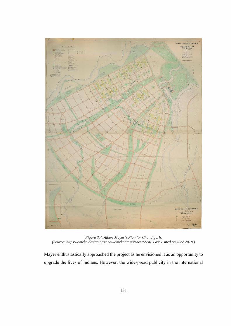
131
Figure 3.4. Albert Mayer’s Plan for Chandigarh. (Source: https://omeka.design.ncsu.edu/omeka/items/show/274). Last visited on June 2018.)
Mayer enthusiastically approached the project as he envisioned it as an opportunity to
upgrade the lives of Indians. However, the widespread publicity in the international
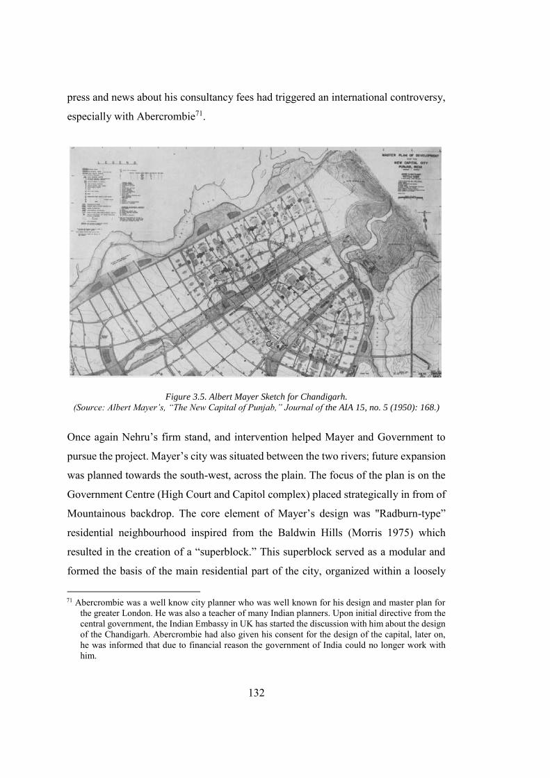
132
press and news about his consultancy fees had triggered an international controversy,
especially with Abercrombie71.
Figure 3.5. Albert Mayer Sketch for Chandigarh. (Source: Albert Mayer’s, “The New Capital of Punjab,” Journal of the AIA 15, no. 5 (1950): 168.)
Once again Nehru’s firm stand, and intervention helped Mayer and Government to
pursue the project. Mayer’s city was situated between the two rivers; future expansion
was planned towards the south-west, across the plain. The focus of the plan is on the
Government Centre (High Court and Capitol complex) placed strategically in from of
Mountainous backdrop. The core element of Mayer’s design was "Radburn-type”
residential neighbourhood inspired from the Baldwin Hills (Morris 1975) which
resulted in the creation of a “superblock.” This superblock served as a modular and
formed the basis of the main residential part of the city, organized within a loosely
71 Abercrombie was a well know city planner who was well known for his design and master plan for
the greater London. He was also a teacher of many Indian planners. Upon initial directive from the central government, the Indian Embassy in UK has started the discussion with him about the design of the Chandigarh. Abercrombie had also given his consent for the design of the capital, later on, he was informed that due to financial reason the government of India could no longer work with him.
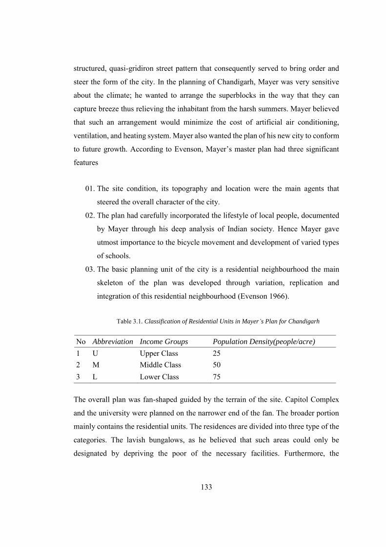
133
structured, quasi-gridiron street pattern that consequently served to bring order and
steer the form of the city. In the planning of Chandigarh, Mayer was very sensitive
about the climate; he wanted to arrange the superblocks in the way that they can
capture breeze thus relieving the inhabitant from the harsh summers. Mayer believed
that such an arrangement would minimize the cost of artificial air conditioning,
ventilation, and heating system. Mayer also wanted the plan of his new city to conform
to future growth. According to Evenson, Mayer’s master plan had three significant
features
01. The site condition, its topography and location were the main agents that
steered the overall character of the city.
02. The plan had carefully incorporated the lifestyle of local people, documented
by Mayer through his deep analysis of Indian society. Hence Mayer gave
utmost importance to the bicycle movement and development of varied types
of schools.
03. The basic planning unit of the city is a residential neighbourhood the main
skeleton of the plan was developed through variation, replication and
integration of this residential neighbourhood (Evenson 1966).
Table 3.1. Classification of Residential Units in Mayer’s Plan for Chandigarh
No Abbreviation Income Groups Population Density(people/acre)
1 U Upper Class 25 2 M Middle Class 50 3 L Lower Class 75
The overall plan was fan-shaped guided by the terrain of the site. Capitol Complex
and the university were planned on the narrower end of the fan. The broader portion
mainly contains the residential units. The residences are divided into three type of the
categories. The lavish bungalows, as he believed that such areas could only be
designated by depriving the poor of the necessary facilities. Furthermore, the
134
infrastructure, sanitation, and electrification of private residences required much more
money than creating a compact residence. However, On the outer edge of the city, a
small portion (almost one acre) is marked for the private residences. These residences
were designed as a single story with imparting freedom to the inhabitant who can
develop the first floor if required. The Mayer plan also thrashes an old colonial spatial
practice of providing. The central area of the neighbourhoods was set free to host parks
and other social functions. As a solution to the harsh environment of Chandigarh,
Mayer designed the streets which were narrow at the end and broader at the middle,
so they can facilitate the air circulation. The houses were located at the narrower end
and provided with a verandah/open space. The central open space was designed at a
relatively small scale so it will provide the inhabitants with an opportunity to come
together and interact with each other.(Pinto & Srivastava 2008). Traffic planning was
one of the most challenging tasks in case of the design for an Indian city. In the U.S.
generally, a single mode of transportation (that is, automobiles) exists, that runs at a
uniform speed however in India much variation exists in terms of mode of
transportation. From the bicycles to animal driven carts to motor vehicles all use the
same roads and their varying speed can create a disaster if not adequately planned.
Mayer provided a “threefold” solution for addressing this complex problem.
1. The plan provides separate access to each type of vehicles ranging from the
fast-moving automobiles to bicycles. This ensures the smooth traffic flow and
safety for each type of vehicles.
2. Secondly, the major roads were designed parallel and close to each other, so
they can share the peak hours load.
3. Self-sufficient districts and neighbourhoods were equipped with all the basic
facilities, which restricts the inhabitants to go to other places for their basic
needs, which in result minimizes traffic on the main roads.
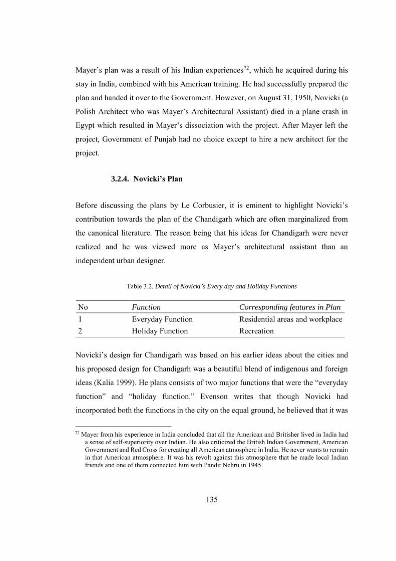
135
Mayer’s plan was a result of his Indian experiences72, which he acquired during his
stay in India, combined with his American training. He had successfully prepared the
plan and handed it over to the Government. However, on August 31, 1950, Novicki (a
Polish Architect who was Mayer’s Architectural Assistant) died in a plane crash in
Egypt which resulted in Mayer’s dissociation with the project. After Mayer left the
project, Government of Punjab had no choice except to hire a new architect for the
project.
3.2.4. Novicki’s Plan
Before discussing the plans by Le Corbusier, it is eminent to highlight Novicki’s
contribution towards the plan of the Chandigarh which are often marginalized from
the canonical literature. The reason being that his ideas for Chandigarh were never
realized and he was viewed more as Mayer’s architectural assistant than an
independent urban designer.
Table 3.2. Detail of Novicki’s Every day and Holiday Functions
No Function Corresponding features in Plan
1 Everyday Function Residential areas and workplace 2 Holiday Function Recreation
Novicki’s design for Chandigarh was based on his earlier ideas about the cities and
his proposed design for Chandigarh was a beautiful blend of indigenous and foreign
ideas (Kalia 1999). He plans consists of two major functions that were the “everyday
function” and “holiday function.” Evenson writes that though Novicki had
incorporated both the functions in the city on the equal ground, he believed that it was
72 Mayer from his experience in India concluded that all the American and Britisher lived in India had
a sense of self-superiority over Indian. He also criticized the British Indian Government, American Government and Red Cross for creating all American atmosphere in India. He never wants to remain in that American atmosphere. It was his revolt against this atmosphere that he made local Indian friends and one of them connected him with Pandit Nehru in 1945.
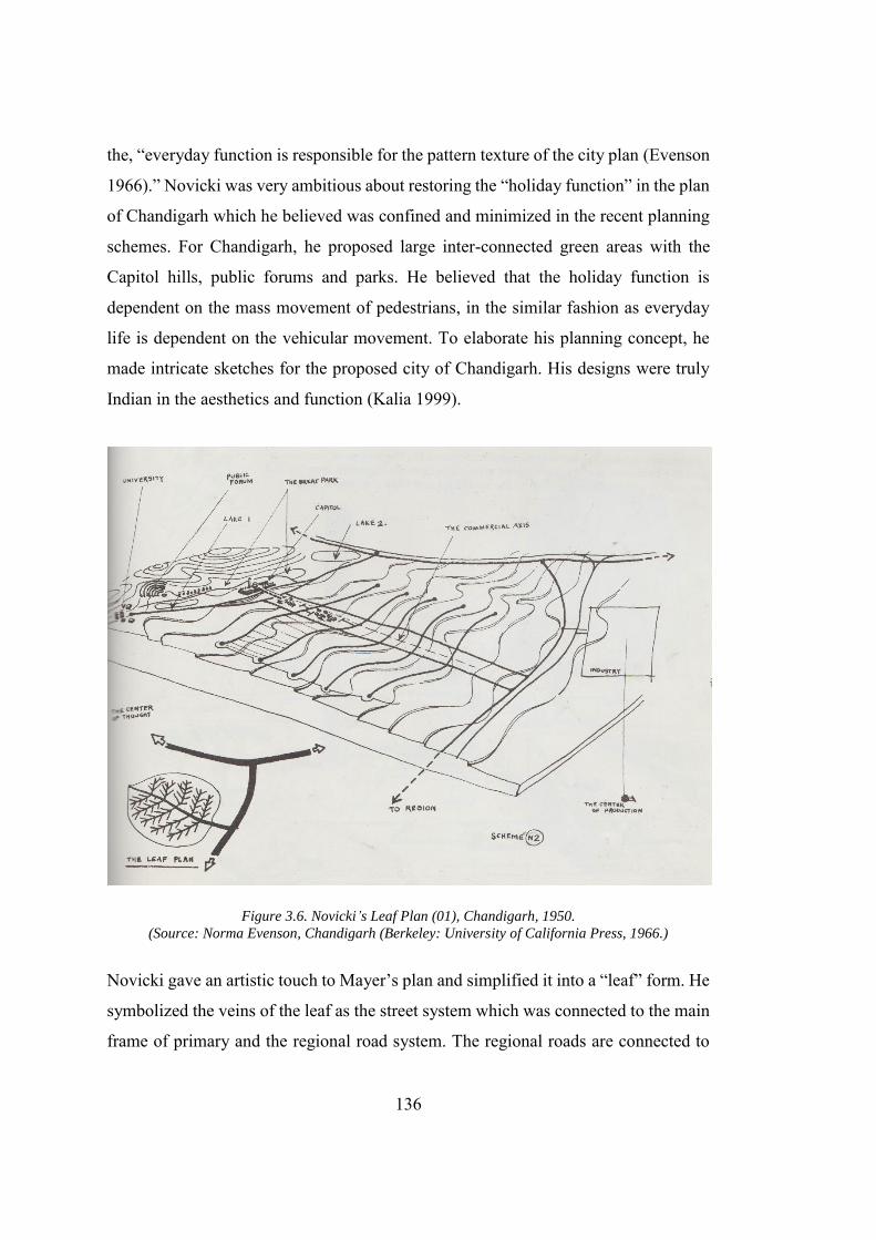
136
the, “everyday function is responsible for the pattern texture of the city plan (Evenson
1966).” Novicki was very ambitious about restoring the “holiday function” in the plan
of Chandigarh which he believed was confined and minimized in the recent planning
schemes. For Chandigarh, he proposed large inter-connected green areas with the
Capitol hills, public forums and parks. He believed that the holiday function is
dependent on the mass movement of pedestrians, in the similar fashion as everyday
life is dependent on the vehicular movement. To elaborate his planning concept, he
made intricate sketches for the proposed city of Chandigarh. His designs were truly
Indian in the aesthetics and function (Kalia 1999).
Figure 3.6. Novicki’s Leaf Plan (01), Chandigarh, 1950. (Source: Norma Evenson, Chandigarh (Berkeley: University of California Press, 1966.)
Novicki gave an artistic touch to Mayer’s plan and simplified it into a “leaf” form. He
symbolized the veins of the leaf as the street system which was connected to the main
frame of primary and the regional road system. The regional roads are connected to
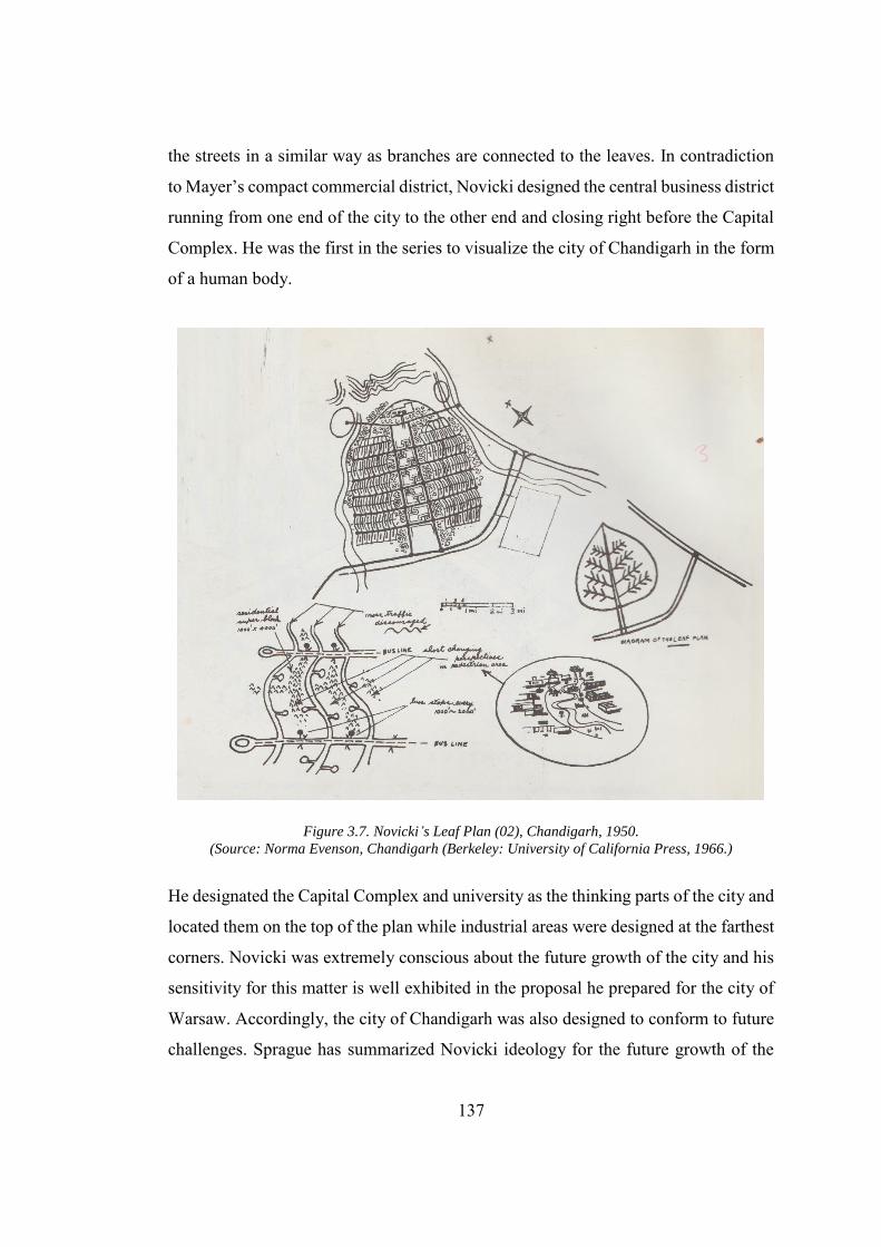
137
the streets in a similar way as branches are connected to the leaves. In contradiction
to Mayer’s compact commercial district, Novicki designed the central business district
running from one end of the city to the other end and closing right before the Capital
Complex. He was the first in the series to visualize the city of Chandigarh in the form
of a human body.
Figure 3.7. Novicki’s Leaf Plan (02), Chandigarh, 1950. (Source: Norma Evenson, Chandigarh (Berkeley: University of California Press, 1966.)
He designated the Capital Complex and university as the thinking parts of the city and
located them on the top of the plan while industrial areas were designed at the farthest
corners. Novicki was extremely conscious about the future growth of the city and his
sensitivity for this matter is well exhibited in the proposal he prepared for the city of
Warsaw. Accordingly, the city of Chandigarh was also designed to conform to future
challenges. Sprague has summarized Novicki ideology for the future growth of the
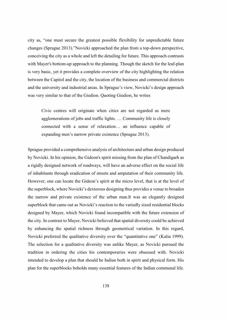
138
city as, “one must secure the greatest possible flexibility for unpredictable future
changes (Sprague 2013).”Novicki approached the plan from a top-down perspective,
conceiving the city as a whole and left the detailing for future. This approach contrasts
with Mayer's bottom-up approach to the planning. Though the sketch for the leaf-plan
is very basic, yet it provides a complete overview of the city highlighting the relation
between the Capitol and the city, the location of the business and commercial districts
and the university and industrial areas. In Sprague’s view, Novicki’s design approach
was very similar to that of the Giedion. Quoting Giedion, he writes
Civic centres will originate when cities are not regarded as mere
agglomerations of jobs and traffic lights. … Community life is closely
connected with a sense of relaxation… an influence capable of
expanding men’s narrow private existence (Sprague 2013).
Sprague provided a comprehensive analysis of architecture and urban design produced
by Novicki. In his opinion, the Gideon's spirit missing from the plan of Chandigarh as
a rigidly designed network of roadways, will have an adverse effect on the social life
of inhabitants through eradication of streets and amputation of their community life.
However, one can locate the Gideon’s spirit at the micro level, that is at the level of
the superblock, where Novicki’s dexterous designing thus provides a venue to broaden
the narrow and private existence of the urban man.It was an elegantly designed
superblock that came out as Novicki’s reaction to the variedly sized residential blocks
designed by Mayer, which Novicki found incompatible with the future extension of
the city. In contrast to Mayer, Novicki believed that spatial diversity could be achieved
by enhancing the spatial richness through geometrical variation. In this regard,
Novicki preferred the qualitative diversity over the “quantitative one” (Kalia 1999).
The selection for a qualitative diversity was unlike Mayer, as Novicki pursued the
tradition in ordering the cities his contemporaries were obsessed with. Novicki
intended to develop a plan that should be Indian both in spirit and physical form. His
plan for the superblocks beholds many essential features of the Indian communal life.
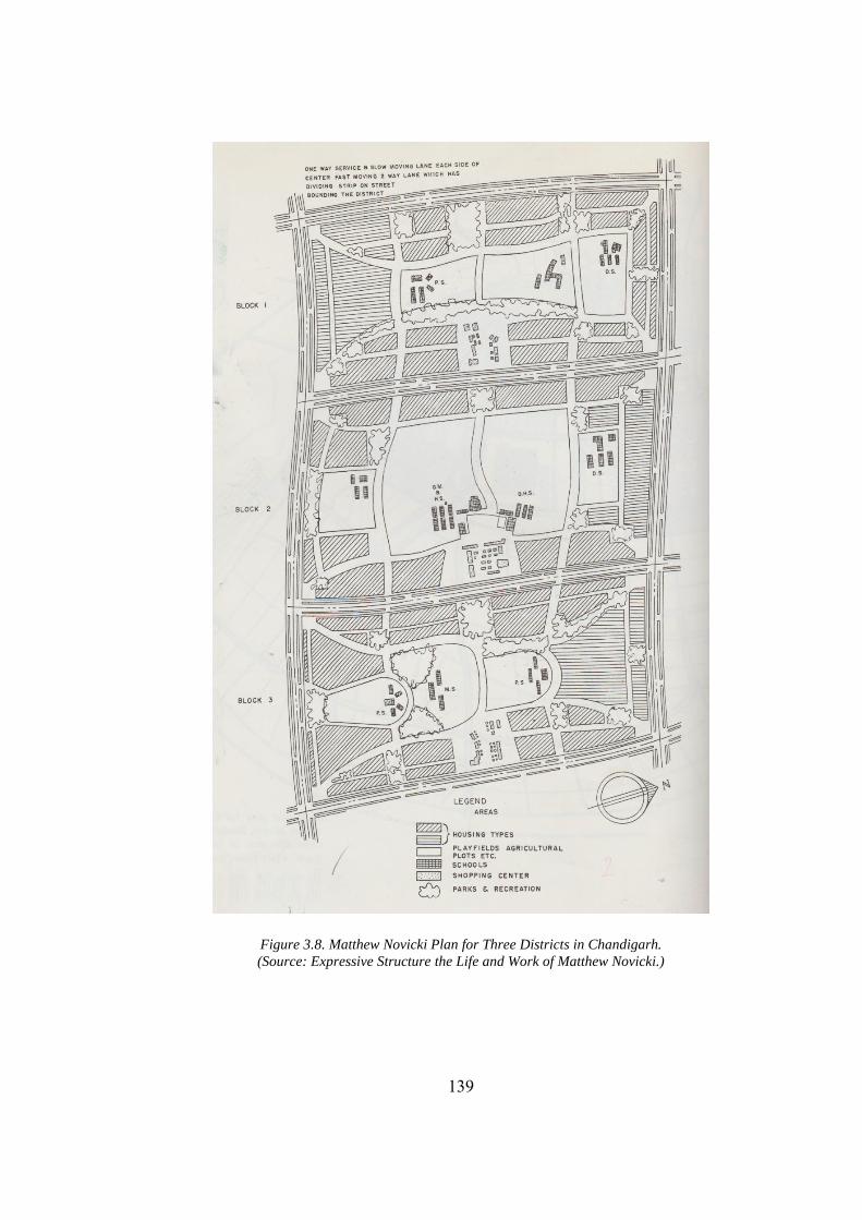
139
Figure 3.8. Matthew Novicki Plan for Three Districts in Chandigarh. (Source: Expressive Structure the Life and Work of Matthew Novicki.)
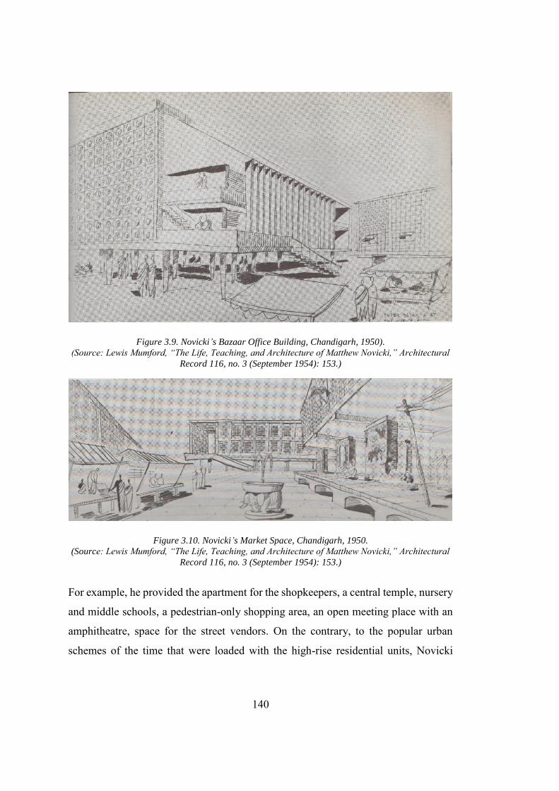
140
Figure 3.9. Novicki’s Bazaar Office Building, Chandigarh, 1950). (Source: Lewis Mumford, “The Life, Teaching, and Architecture of Matthew Novicki,” Architectural
Record 116, no. 3 (September 1954): 153.)
Figure 3.10. Novicki’s Market Space, Chandigarh, 1950. (Source: Lewis Mumford, “The Life, Teaching, and Architecture of Matthew Novicki,” Architectural
Record 116, no. 3 (September 1954): 153.)
For example, he provided the apartment for the shopkeepers, a central temple, nursery
and middle schools, a pedestrian-only shopping area, an open meeting place with an
amphitheatre, space for the street vendors. On the contrary, to the popular urban
schemes of the time that were loaded with the high-rise residential units, Novicki
141
proposes a three-story apartment. The buildings were designed to cater for the absence
of elevators and harsh weather in Chandigarh. The intention of producing a city
inspired by the indigenous traditions, Novicki has loaded his new bazaar to cater for
all types of business needs. Ample space is provided for the big businesses while the
shops for the small vendors have the place to sit on the floor and outside areas covered
by the canvass roof.
3.2.5. Corbusier’s Plan: Reinvented City
Chandigarh was often read as a plan produced exclusively by Corbusier (George 1997;
Sagar 1999; Perera 2004, 178) elevating him to the status of the master builder of
ancient times. Without negating or undermining the Corbusier’s role in the
Chandigarh, the following lines would take a contrary route and would bring into the
discussion the role of different agencies including British trained bureaucracy,
Nehru’s vision, and Corbusier’s assistant (who carried over the planning of residential
area once Corbusier had distanced himself from the planning of residential areas73).
The idea can be summarized in Morris’ words as “Le Corbusier deserves neither all
the praise nor all the opprobrium.”(Morris 1975).Corbusier, a staunch critique of the
Ebenezer Howard garden city movement, had accepted Mayer’s plan.74 For Nehru,
the Corbusian straightness of Mayer’s curve would not be able to make a major
difference in the conception of the city. Corbusier chose a “gridiron pattern” to form
the skeleton of the new city. The main feature of this plan was the incorporation of a
system for precise vehicular movement, known as 7 Vs. The strict emphasis on the
segregation and organization the vehicular movement was a result of the vehicular
congestion Le Corbusier experienced in European cities. Corbusier also integrated the
73 The idea was taken forward based on the Lynch’s statement that urban designers contribute to the
built environment through "policies, programs and guidelines rather than by blueprints that specify shape and location in detail (George 1997).” Thus, to strengthen the dissertation’s earlier claim that Chandigarh was a re-invented Le Corbusian city. A more holistic approach is thus required for analysis.
74 Fondation Le Corbusier, Document Number: P2-8-35-001.
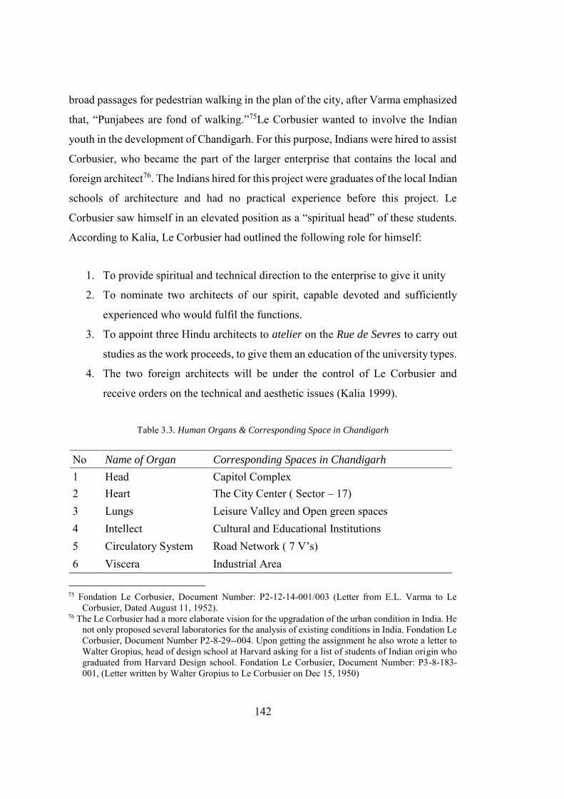
142
broad passages for pedestrian walking in the plan of the city, after Varma emphasized
that, “Punjabees are fond of walking.”75Le Corbusier wanted to involve the Indian
youth in the development of Chandigarh. For this purpose, Indians were hired to assist
Corbusier, who became the part of the larger enterprise that contains the local and
foreign architect76. The Indians hired for this project were graduates of the local Indian
schools of architecture and had no practical experience before this project. Le
Corbusier saw himself in an elevated position as a “spiritual head” of these students.
According to Kalia, Le Corbusier had outlined the following role for himself:
1. To provide spiritual and technical direction to the enterprise to give it unity
2. To nominate two architects of our spirit, capable devoted and sufficiently
experienced who would fulfil the functions.
3. To appoint three Hindu architects to atelier on the Rue de Sevres to carry out
studies as the work proceeds, to give them an education of the university types.
4. The two foreign architects will be under the control of Le Corbusier and
receive orders on the technical and aesthetic issues (Kalia 1999).
Table 3.3. Human Organs & Corresponding Space in Chandigarh
No Name of Organ Corresponding Spaces in Chandigarh
1 Head Capitol Complex 2 Heart The City Center ( Sector – 17) 3 Lungs Leisure Valley and Open green spaces 4 Intellect Cultural and Educational Institutions 5 Circulatory System Road Network ( 7 V’s) 6 Viscera Industrial Area
75 Fondation Le Corbusier, Document Number: P2-12-14-001/003 (Letter from E.L. Varma to Le
Corbusier, Dated August 11, 1952). 76 The Le Corbusier had a more elaborate vision for the upgradation of the urban condition in India. He
not only proposed several laboratories for the analysis of existing conditions in India. Fondation Le Corbusier, Document Number P2-8-29--004. Upon getting the assignment he also wrote a letter to Walter Gropius, head of design school at Harvard asking for a list of students of Indian origin who graduated from Harvard Design school. Fondation Le Corbusier, Document Number: P3-8-183-001, (Letter written by Walter Gropius to Le Corbusier on Dec 15, 1950)
143
Just like Mayer and Novicki, Le Corbusier also saw the city as a biological organism.
For him, the system of seven V’s performs the same function as the veins do in the
human body, that is, to keep it alive through transportation of blood. It was not only
the roads that were inspired from an element of the human body, in fact, he had
conceptualized the new city in the form of a human body, where all the functions of
the city correspond to the respective elements of the human body. A study of earlier
Corbusian projects reveals his ambitious planning ideas for vertical development in
the city. Over the period high-rise apartment blocks were marked as his trademark
feature and an integral part of the Corbusian metropolis. It is, however, the economic
and social conditions in India that restricted Le Corbusier in making the Highrise
building in Chandigarh.77 Like Novicki, he was also limited by the absence of an
elevator. Although Chandigarh Planning Commission partially agreed to the idea of
high-rise apartment with fewer amenities, thus, making them more economical to
build, Corbusier rejected the idea by saying that, “the cutting down of amenities like
staircases, baths, W.C.’s, etc to make apartment houses reasonably cheap for poor
class people render them dirty and uncomfortable.”78 Due to the economic conditions,
Corbusier’s team had to design the low-rise residential units for Chandigarh.
Interestingly, the resulting solution that consists of the low-rise residential unit was
more like the garden city, which was criticized by the Le Corbusier. In addition,
Corbusier was clearly annoyed after Chandigarh administration had stopped him for
incorporating high rise apartments in the city, the solution presented by his team,
resulted in distancing him from the design of the city and especially its residential
areas. This in turn divided the city of Chandigarh into two halves, that are, “Corbusian
Capitol complex” and “the residential area of the city.” (Shaw 2009). Corbusier tried
to segregate the Capitol Complex and the city firstly by proposing a moat, that was,
the “Boulevard of water” between them. Joshi writes about the role that the boulevard
of water had played in creating the difference between the two factions of the city as,
“the separate identity of each being reinforced by the ‘Boulevard of Waters’ (Uttar
77 Fondation Le Corbusier, Document Number: P2-8-29-003. 78 Fondation Le Corbusier, Document Number: P2-8-29-003.
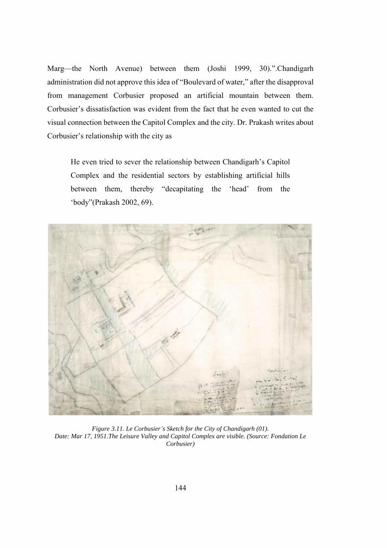
144
Marg—the North Avenue) between them (Joshi 1999, 30).”.Chandigarh
administration did not approve this idea of “Boulevard of water,” after the disapproval
from management Corbusier proposed an artificial mountain between them.
Corbusier’s dissatisfaction was evident from the fact that he even wanted to cut the
visual connection between the Capitol Complex and the city. Dr. Prakash writes about
Corbusier’s relationship with the city as
He even tried to sever the relationship between Chandigarh’s Capitol
Complex and the residential sectors by establishing artificial hills
between them, thereby “decapitating the ‘head’ from the
‘body”(Prakash 2002, 69).
Figure 3.11. Le Corbusier’s Sketch for the City of Chandigarh (01). Date: Mar 17, 1951.The Leisure Valley and Capitol Complex are visible. (Source: Fondation Le
Corbusier)
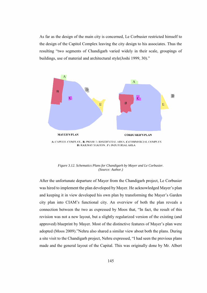
145
As far as the design of the main city is concerned, Le Corbusier restricted himself to
the design of the Capitol Complex leaving the city design to his associates. Thus the
resulting “two segments of Chandigarh varied widely in their scale, groupings of
buildings, use of material and architectural style(Joshi 1999, 30).”
Figure 3.12. Schematics Plans for Chandigarh by Mayer and Le Corbusier. (Source: Author.)
After the unfortunate departure of Mayer from the Chandigarh project, Le Corbusier
was hired to implement the plan developed by Mayer. He acknowledged Mayer’s plan
and keeping it in view developed his own plan by transforming the Mayer’s Garden
city plan into CIAM’s functional city. An overview of both the plan reveals a
connection between the two as expressed by Moos that, “In fact, the result of this
revision was not a new layout, but a slightly regularized version of the existing (and
approved) blueprint by Mayer. Most of the distinctive features of Mayer’s plan were
adopted (Moos 2009).”Nehru also shared a similar view about both the plans. During
a site visit to the Chandigarh project, Nehru expressed, “I had seen the previous plans
made and the general layout of the Capital. This was originally done by Mr. Albert
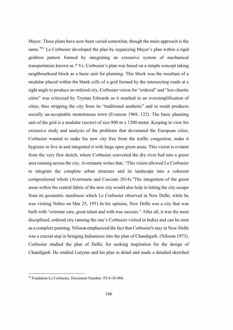
146
Mayer. These plans have now been varied somewhat, though the main approach is the
same.79” Le Corbusier developed the plan by organizing Mayer’s plan within a rigid
gridiron pattern formed by integrating an extensive system of mechanical
transportation known as 7 Vs. Corbusier’s plan was based on a simple concept taking
neighbourhood block as a basic unit for planning. This block was the resultant of a
modular placed within the blank cells of a grid formed by the intersecting roads at a
right angle to produce an ordered city. Corbusier vision for “ordered” and “less chaotic
cities” was criticized by Trystan Edwards as it resulted in an oversimplification of
cities, thus stripping the city from its “traditional aesthetic” and in result produces
socially un-acceptable monotonous town (Evenson 1969, 122). The basic planning
unit of the grid is a modular (sector) of size 800 m x 1200 meter. Keeping in view his
extensive study and analysis of the problems that devastated the European cities,
Corbusier wanted to make his new city free from the traffic congestion, make it
hygienic to live in and integrated it with large open green areas. This vision is evident
from the very first sketch, where Corbusier converted the dry river bed into a green
area running across the city. Avermaete writes that, “This vision allowed Le Corbusier
to integrate the complete urban structure and its landscape into a coherent
compositional whole (Avermaete and Casciato 2014).”The integration of the green
areas within the central fabric of the new city would also help in letting the city escape
from its geometric sturdiness which Le Corbusier observed in New Delhi, while he
was visiting Nehru on Mar 25, 1951.In his opinion, New Delhi was a city that was
built with “extreme care, great talent and with true success.” After all, it was the most
disciplined, ordered city (among the one’s Corbusier visited in India) and can be seen
as a complete painting. Nilsson emphasized the fact that Corbusier's stay in New-Delhi
was a crucial step in bringing Indianness into the plan of Chandigarh. (Nilsson 1973).
Corbusier studied the plan of Delhi, for seeking inspiration for the design of
Chandigarh. He studied Lutyens and his plan in detail and made a detailed sketched
79 Fondation Le Corbusier, Document Number: P2-8-38-004.
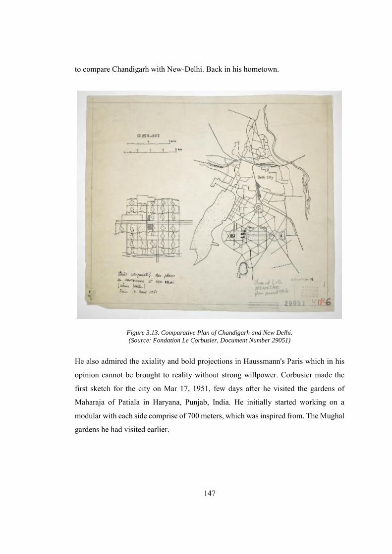
147
to compare Chandigarh with New-Delhi. Back in his hometown.
Figure 3.13. Comparative Plan of Chandigarh and New Delhi. (Source: Fondation Le Corbusier, Document Number 29051)
He also admired the axiality and bold projections in Haussmann's Paris which in his
opinion cannot be brought to reality without strong willpower. Corbusier made the
first sketch for the city on Mar 17, 1951, few days after he visited the gardens of
Maharaja of Patiala in Haryana, Punjab, India. He initially started working on a
modular with each side comprise of 700 meters, which was inspired from. The Mughal
gardens he had visited earlier.
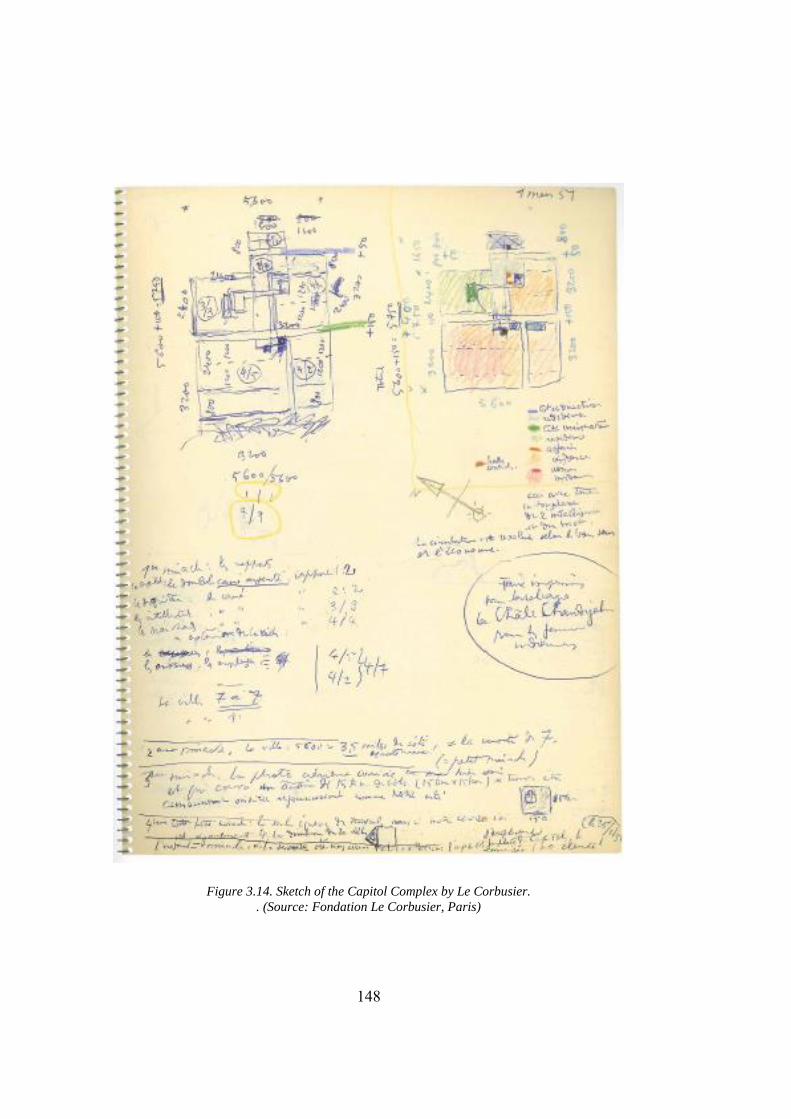
148
Figure 3.14. Sketch of the Capitol Complex by Le Corbusier. . (Source: Fondation Le Corbusier, Paris)
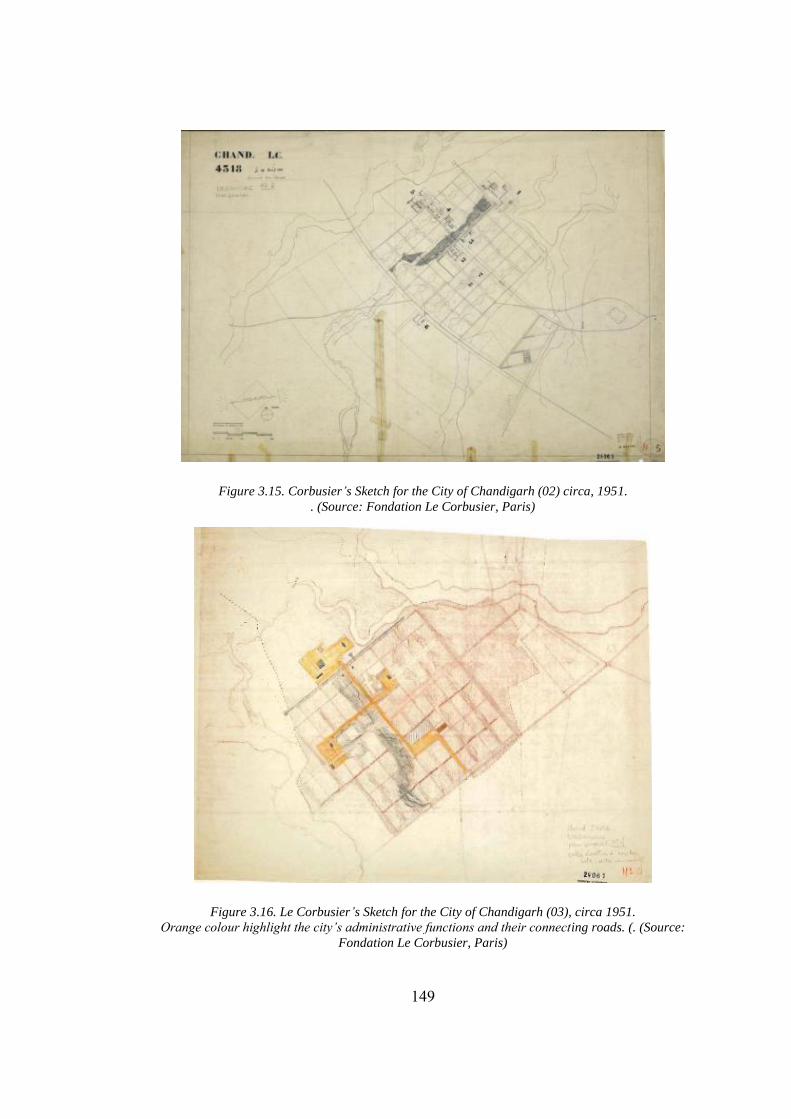
149
Figure 3.15. Corbusier’s Sketch for the City of Chandigarh (02) circa, 1951. . (Source: Fondation Le Corbusier, Paris)
Figure 3.16. Le Corbusier’s Sketch for the City of Chandigarh (03), circa 1951. Orange colour highlight the city’s administrative functions and their connecting roads. (. (Source:
Fondation Le Corbusier, Paris)
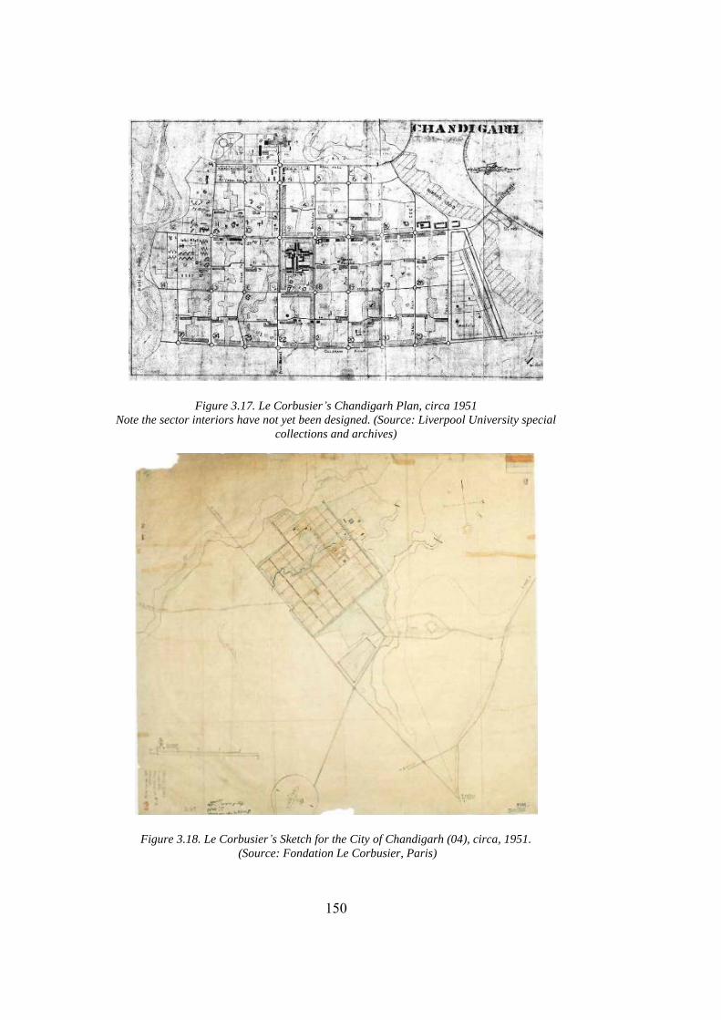
150
Figure 3.17. Le Corbusier’s Chandigarh Plan, circa 1951 Note the sector interiors have not yet been designed. (Source: Liverpool University special
collections and archives)
Figure 3.18. Le Corbusier’s Sketch for the City of Chandigarh (04), circa, 1951. (Source: Fondation Le Corbusier, Paris)
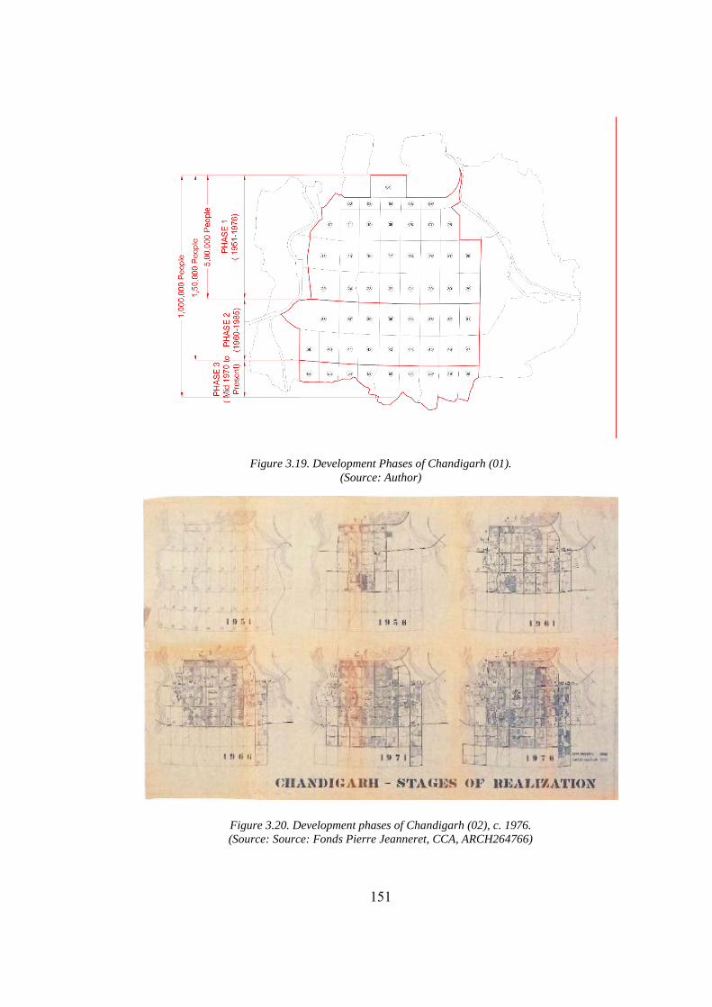
151
Figure 3.19. Development Phases of Chandigarh (01). (Source: Author)
Figure 3.20. Development phases of Chandigarh (02), c. 1976. (Source: Source: Fonds Pierre Jeanneret, CCA, ARCH264766)
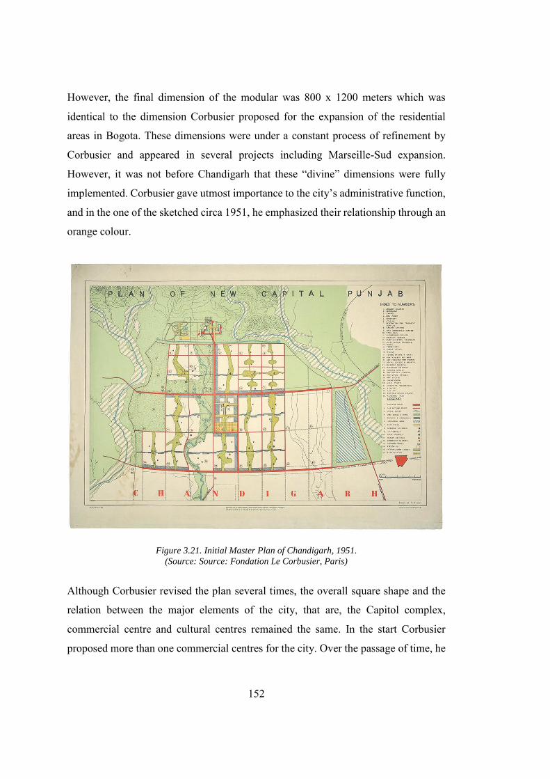
152
However, the final dimension of the modular was 800 x 1200 meters which was
identical to the dimension Corbusier proposed for the expansion of the residential
areas in Bogota. These dimensions were under a constant process of refinement by
Corbusier and appeared in several projects including Marseille-Sud expansion.
However, it was not before Chandigarh that these “divine” dimensions were fully
implemented. Corbusier gave utmost importance to the city’s administrative function,
and in the one of the sketched circa 1951, he emphasized their relationship through an
orange colour.
Figure 3.21. Initial Master Plan of Chandigarh, 1951. (Source: Source: Fondation Le Corbusier, Paris)
Although Corbusier revised the plan several times, the overall square shape and the
relation between the major elements of the city, that are, the Capitol complex,
commercial centre and cultural centres remained the same. In the start Corbusier
proposed more than one commercial centres for the city. Over the passage of time, he
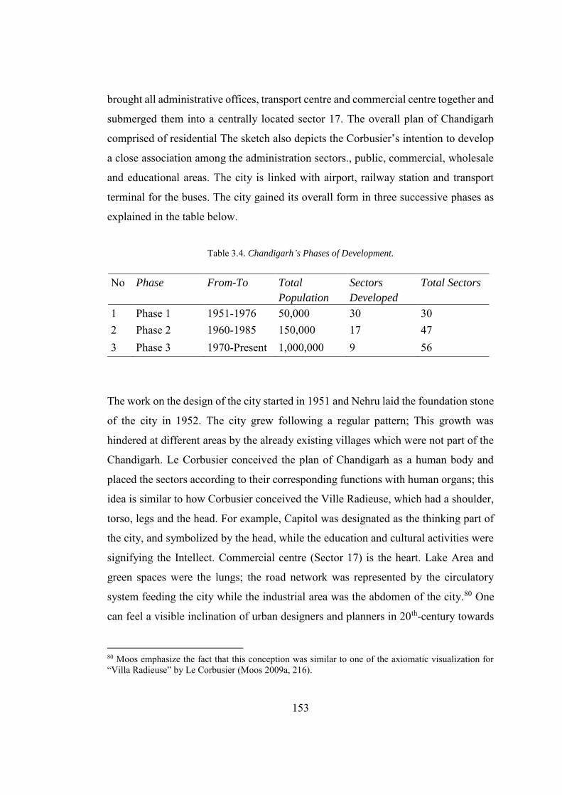
153
brought all administrative offices, transport centre and commercial centre together and
submerged them into a centrally located sector 17. The overall plan of Chandigarh
comprised of residential The sketch also depicts the Corbusier’s intention to develop
a close association among the administration sectors., public, commercial, wholesale
and educational areas. The city is linked with airport, railway station and transport
terminal for the buses. The city gained its overall form in three successive phases as
explained in the table below.
Table 3.4. Chandigarh’s Phases of Development.
No Phase From-To Total
Population
Sectors
Developed
Total Sectors
1 Phase 1 1951-1976 50,000 30 30 2 Phase 2 1960-1985 150,000 17 47 3 Phase 3 1970-Present 1,000,000 9 56
The work on the design of the city started in 1951 and Nehru laid the foundation stone
of the city in 1952. The city grew following a regular pattern; This growth was
hindered at different areas by the already existing villages which were not part of the
Chandigarh. Le Corbusier conceived the plan of Chandigarh as a human body and
placed the sectors according to their corresponding functions with human organs; this
idea is similar to how Corbusier conceived the Ville Radieuse, which had a shoulder,
torso, legs and the head. For example, Capitol was designated as the thinking part of
the city, and symbolized by the head, while the education and cultural activities were
signifying the Intellect. Commercial centre (Sector 17) is the heart. Lake Area and
green spaces were the lungs; the road network was represented by the circulatory
system feeding the city while the industrial area was the abdomen of the city.80 One
can feel a visible inclination of urban designers and planners in 20th-century towards
80 Moos emphasize the fact that this conception was similar to one of the axiomatic visualization for “Villa Radieuse” by Le Corbusier (Moos 2009a, 216).
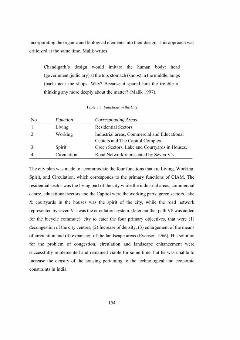
154
incorporating the organic and biological elements into their design. This approach was
criticized at the same time. Malik writes
Chandigarh’s design would imitate the human body: head
(government, judiciary) at the top, stomach (shops) in the middle, lungs
(park) near the shops. Why? Because it spared him the trouble of
thinking any more deeply about the matter? (Malik 1997).
Table 3.5. Functions in the City
No Function Corresponding Areas
1 Living Residential Sectors. 2 Working Industrial areas, Commercial and Educational
Centers and The Capitol Complex. 3 Spirit Green Sectors, Lake and Courtyards in Houses. 4 Circulation Road Network represented by Seven V’s.
The city plan was made to accommodate the four functions that are Living, Working,
Spirit, and Circulation, which corresponds to the primary functions of CIAM. The
residential sector was the living part of the city while the industrial areas, commercial
centre, educational sectors and the Capitol were the working parts, green sectors, lake
& courtyards in the houses was the spirit of the city, while the road network
represented by seven V’s was the circulation system, (later another path V8 was added
for the bicycle commute). city to cater the four primary objectives, that were (1)
decongestion of the city centres, (2) Increase of density, (3) enlargement of the means
of circulation and (4) expansion of the landscape areas (Evenson 1966). His solution
for the problem of congestion, circulation and landscape enhancement were
successfully implemented and remained viable for some time, but he was unable to
increase the density of the housing pertaining to the technological and economic
constraints in India.
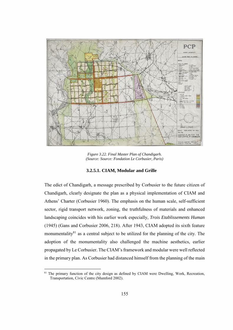
155
Figure 3.22. Final Master Plan of Chandigarh. (Source: Source: Fondation Le Corbusier, Paris)
3.2.5.1. CIAM, Modular and Grille
The edict of Chandigarh, a message prescribed by Corbusier to the future citizen of
Chandigarh, clearly designate the plan as a physical implementation of CIAM and
Athens’ Charter (Corbusier 1960). The emphasis on the human scale, self-sufficient
sector, rigid transport network, zoning, the truthfulness of materials and enhanced
landscaping coincides with his earlier work especially, Trois Etablissements Human
(1945) (Gans and Corbusier 2006, 218). After 1943, CIAM adopted its sixth feature
monumentality81 as a central subject to be utilized for the planning of the city. The
adoption of the monumentality also challenged the machine aesthetics, earlier
propagated by Le Corbusier. The CIAM’s framework and modular were well reflected
in the primary plan. As Corbusier had distanced himself from the planning of the main
81 The primary function of the city design as defined by CIAM were Dwelling, Work, Recreation, Transportation, Civic Centre (Mumford 2002).
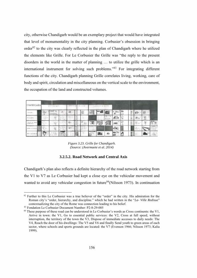
156
city, otherwise Chandigarh would be an exemplary project that would have integrated
that level of monumentality in the city planning. Corbusier’s obsession in bringing
order82 to the city was clearly reflected in the plan of Chandigarh where he utilized
the elements like Grille. For Le Corbusier the Grille was “the reply to the present
disorders in the world in the matter of planning … to utilize the grille which is an
international instrument for solving such problems.”83 For integrating different
functions of the city. Chandigarh planning Grille correlates living, working, care of
body and spirit, circulation and miscellaneous on the vertical scale to the environment,
the occupation of the land and constructed volumes.
Figure 3.23. Grille for Chandigarh. (Source: (Avermaete et al. 2014)
3.2.5.2. Road Network and Central Axis
Chandigarh’s plan also reflects a definite hierarchy of the road network starting from
the V1 to V7 as Le Corbusier had kept a close eye on the vehicular movement and
wanted to avoid any vehicular congestion in future84(Nilsson 1973). In continuation
82 Further to this Le Corbusier was a true believer of the “order” in the city. His admiration for the Roman city’s “order, hierarchy, and discipline.” which he had written in the “La- Ville Redisue” contextualizing the city of the Rome was connection leading to his belief.
83 Fondation Le Corbusier Document Number: P2-8-29-005 84 These purpose of these road can be understood in Le Corbusier’s words as Cross continents: the V1,
Arrive in town: the V1, Go to essential public services: the V2, Cross at full speed, without interruption, the territory of the town the V3, Dispose of immediate accesses to daily needs: The V4, Reach the door of his dwellings: The V5 and V6 and finally Send youth to green areas of each sector, where schools and sports grounds are located: the V7 (Evenson 1966; Nilsson 1973; Kalia 1999).
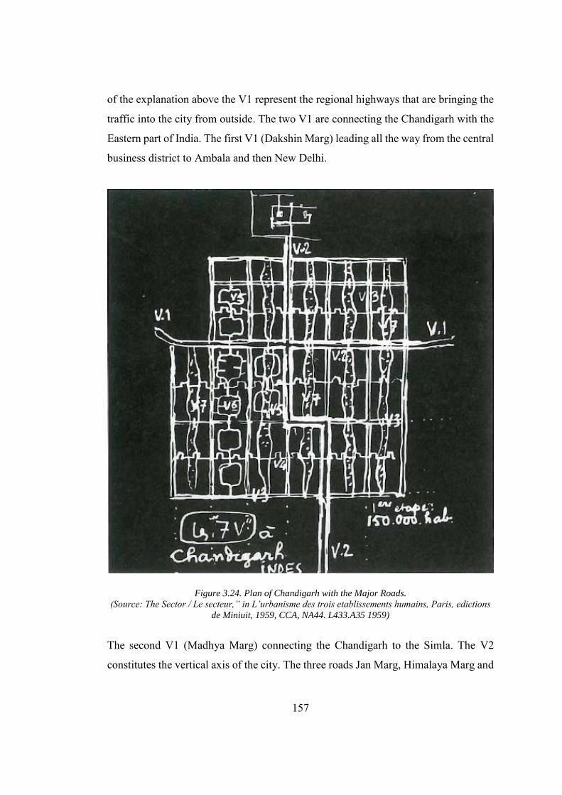
157
of the explanation above the V1 represent the regional highways that are bringing the
traffic into the city from outside. The two V1 are connecting the Chandigarh with the
Eastern part of India. The first V1 (Dakshin Marg) leading all the way from the central
business district to Ambala and then New Delhi.
Figure 3.24. Plan of Chandigarh with the Major Roads. (Source: The Sector / Le secteur,” in L’urbanisme des trois etablissements humains, Paris, edictions
de Miniuit, 1959, CCA, NA44. L433.A35 1959)
The second V1 (Madhya Marg) connecting the Chandigarh to the Simla. The V2
constitutes the vertical axis of the city. The three roads Jan Marg, Himalaya Marg and
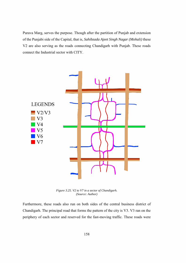
158
Purava Marg, serves the purpose. Though after the partition of Punjab and extension
of the Punjabi side of the Capital, that is, Sahibzada Ajeet Singh Nagar (Mohali) these
V2 are also serving as the roads connecting Chandigarh with Punjab. These roads
connect the Industrial sector with CITY.
Figure 3.25. V2 to V7 in a sector of Chandigarh. (Source: Author)
Furthermore, these roads also run on both sides of the central business district of
Chandigarh. The principal road that forms the pattern of the city is V3. V3 ran on the
periphery of each sector and reserved for the fast-moving traffic. These roads were
159
designed as the expressways with the limited access to the residential sectors. The
entrance to the residential sectors was further hindered by the tree lining and the walls
which prohibits the traffic flow, into the sectors, from the undesired point to make sure
that traffic on the main street flows smoothly. It is the result of this traffic management
that all the sectors are planned, looking inward. V4’s run through the sector, bisecting
it half way. As compared to the other roads the V4 were designed asymmetrical and
proposed to be run under the V3 to join the adjacent sectors (However this connection
through underpass was never realized). These roads are also planned as the shopping
street with the shopping areas only on the shaded side of the road to withstand the
weather condition.
Furthermore, this would also prohibit the pedestrian from unnecessarily crossing the
road. These roads were meant for the slow-moving traffic and access to V3 is limited
to 4 entrances. V5 are the roads intersecting the V4 at two points in the sector. This
was planned as a road for the distribution of slow-moving traffic. V6 are the roads that
are leading the traffic to the doorsteps. Thus, fast moving traffic is slowed down
through this network of the rods from V1 to V6. V7 are the roads for the bicycles and
pedestrians which runs all the way across the green areas and open spaces. In the initial
plans, all the V7 are planned to go underneath the major road thus one can experience
the city on foot. The system of 7 Vs was conceived by Le Corbusier keeping in mind
the condition of fast-moving traffic in Europe and America. However, the design was
a bit altered in India to accommodate a different kind of street traffic. The fast-moving
lanes were only meant for the motor vehicles and hence kept straight. However, the
V4 and V5 can also accommodate the slow traffic like bull karts. To ensure the
minimum speed on these roads, the architect had intentionally planned them irregular
to avoid even a chance for over speeding. Moos writes that “(these) avenues, however,
serve as a multifunctional public space, not solely traffic arteries (Moos 2009).” Le
Corbusier also wanted to make these roads identical by their names. He was unhappy
with how the administration of the city had named these roads, but the main reason
for his frustration was due to the fact that he did not understand the Hindi language.
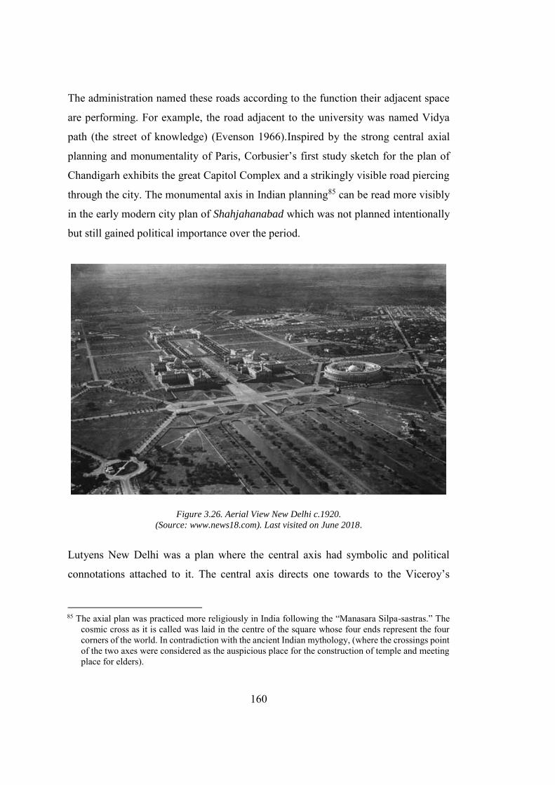
160
The administration named these roads according to the function their adjacent space
are performing. For example, the road adjacent to the university was named Vidya
path (the street of knowledge) (Evenson 1966).Inspired by the strong central axial
planning and monumentality of Paris, Corbusier’s first study sketch for the plan of
Chandigarh exhibits the great Capitol Complex and a strikingly visible road piercing
through the city. The monumental axis in Indian planning85 can be read more visibly
in the early modern city plan of Shahjahanabad which was not planned intentionally
but still gained political importance over the period.
Figure 3.26. Aerial View New Delhi c.1920. (Source: www.news18.com). Last visited on June 2018.
Lutyens New Delhi was a plan where the central axis had symbolic and political
connotations attached to it. The central axis directs one towards to the Viceroy’s
85 The axial plan was practiced more religiously in India following the “Manasara Silpa-sastras.” The
cosmic cross as it is called was laid in the centre of the square whose four ends represent the four corners of the world. In contradiction with the ancient Indian mythology, (where the crossings point of the two axes were considered as the auspicious place for the construction of temple and meeting place for elders).
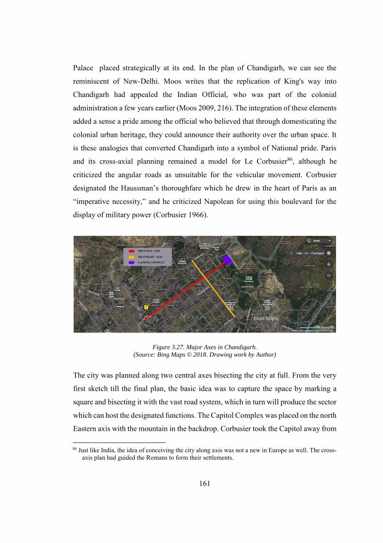
161
Palace placed strategically at its end. In the plan of Chandigarh, we can see the
reminiscent of New-Delhi. Moos writes that the replication of King's way into
Chandigarh had appealed the Indian Official, who was part of the colonial
administration a few years earlier (Moos 2009, 216). The integration of these elements
added a sense a pride among the official who believed that through domesticating the
colonial urban heritage, they could announce their authority over the urban space. It
is these analogies that converted Chandigarh into a symbol of National pride. Paris
and its cross-axial planning remained a model for Le Corbusier86, although he
criticized the angular roads as unsuitable for the vehicular movement. Corbusier
designated the Haussman’s thoroughfare which he drew in the heart of Paris as an
“imperative necessity,” and he criticized Napolean for using this boulevard for the
display of military power (Corbusier 1966).
Figure 3.27. Major Axes in Chandigarh. (Source: Bing Maps © 2018. Drawing work by Author)
The city was planned along two central axes bisecting the city at full. From the very
first sketch till the final plan, the basic idea was to capture the space by marking a
square and bisecting it with the vast road system, which in turn will produce the sector
which can host the designated functions. The Capitol Complex was placed on the north
Eastern axis with the mountain in the backdrop. Corbusier took the Capitol away from
86 Just like India, the idea of conceiving the city along axis was not a new in Europe as well. The cross-
axis plan had guided the Romans to form their settlements.
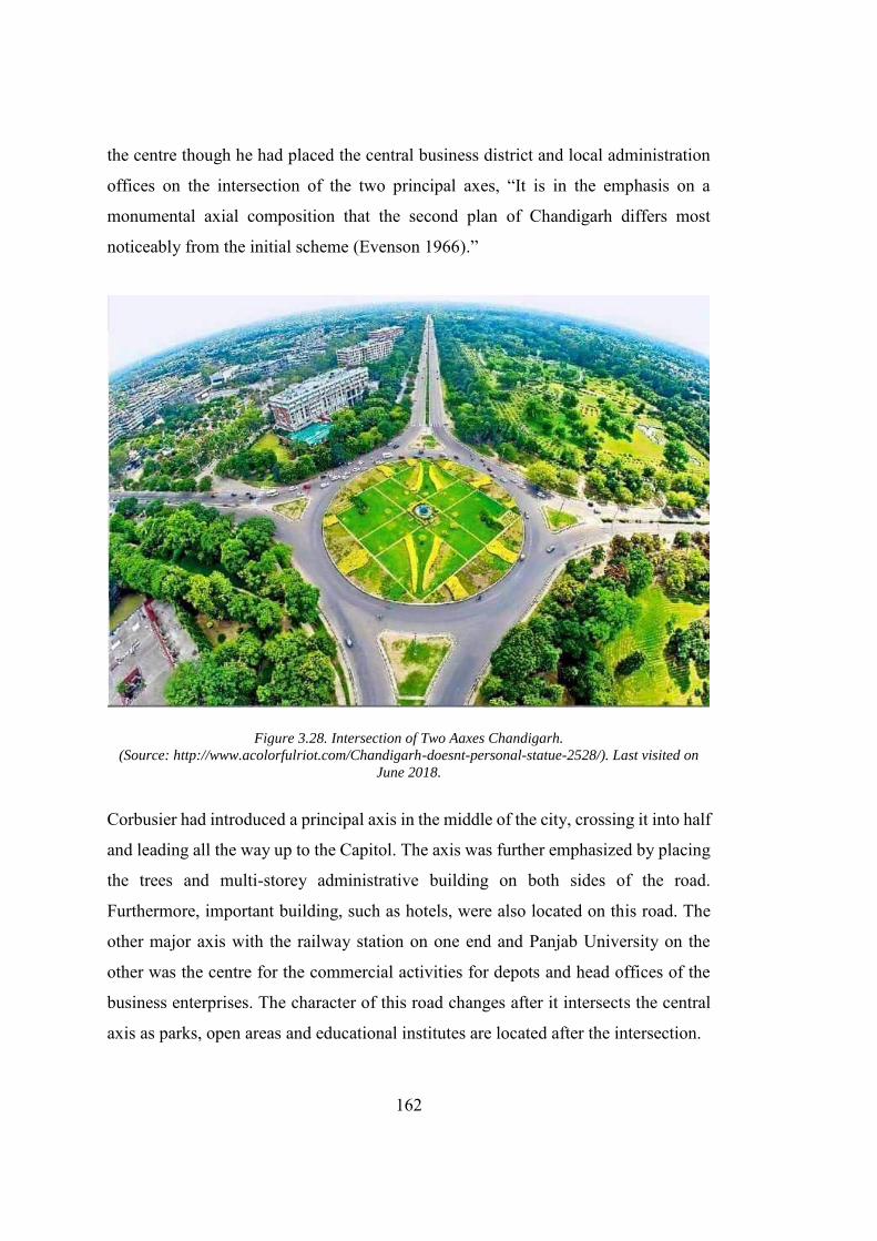
162
the centre though he had placed the central business district and local administration
offices on the intersection of the two principal axes, “It is in the emphasis on a
monumental axial composition that the second plan of Chandigarh differs most
noticeably from the initial scheme (Evenson 1966).”
Figure 3.28. Intersection of Two Aaxes Chandigarh. (Source: http://www.acolorfulriot.com/Chandigarh-doesnt-personal-statue-2528/). Last visited on
June 2018.
Corbusier had introduced a principal axis in the middle of the city, crossing it into half
and leading all the way up to the Capitol. The axis was further emphasized by placing
the trees and multi-storey administrative building on both sides of the road.
Furthermore, important building, such as hotels, were also located on this road. The
other major axis with the railway station on one end and Panjab University on the
other was the centre for the commercial activities for depots and head offices of the
business enterprises. The character of this road changes after it intersects the central
axis as parks, open areas and educational institutes are located after the intersection.
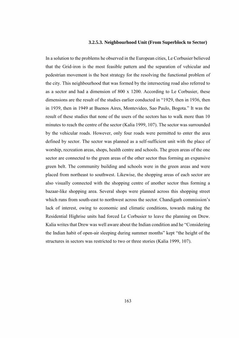
163
3.2.5.3. Neighbourhood Unit (From Superblock to Sector)
In a solution to the problems he observed in the European cities, Le Corbusier believed
that the Grid-iron is the most feasible pattern and the separation of vehicular and
pedestrian movement is the best strategy for the resolving the functional problem of
the city. This neighbourhood that was formed by the intersecting road also referred to
as a sector and had a dimension of 800 x 1200. According to Le Corbusier, these
dimensions are the result of the studies earlier conducted in “1929, then in 1936, then
in 1939, then in 1949 at Buenos Aires, Montevideo, Sao Paulo, Bogota.” It was the
result of these studies that none of the users of the sectors has to walk more than 10
minutes to reach the centre of the sector (Kalia 1999, 107). The sector was surrounded
by the vehicular roads. However, only four roads were permitted to enter the area
defined by sector. The sector was planned as a self-sufficient unit with the place of
worship, recreation areas, shops, health centre and schools. The green areas of the one
sector are connected to the green areas of the other sector thus forming an expansive
green belt. The community building and schools were in the green areas and were
placed from northeast to southwest. Likewise, the shopping areas of each sector are
also visually connected with the shopping centre of another sector thus forming a
bazaar-like shopping area. Several shops were planned across this shopping street
which runs from south-east to northwest across the sector. Chandigarh commission’s
lack of interest, owing to economic and climatic conditions, towards making the
Residential Highrise units had forced Le Corbusier to leave the planning on Drew.
Kalia writes that Drew was well aware about the Indian condition and he “Considering
the Indian habit of open-air sleeping during summer months” kept “the height of the
structures in sectors was restricted to two or three stories (Kalia 1999, 107).
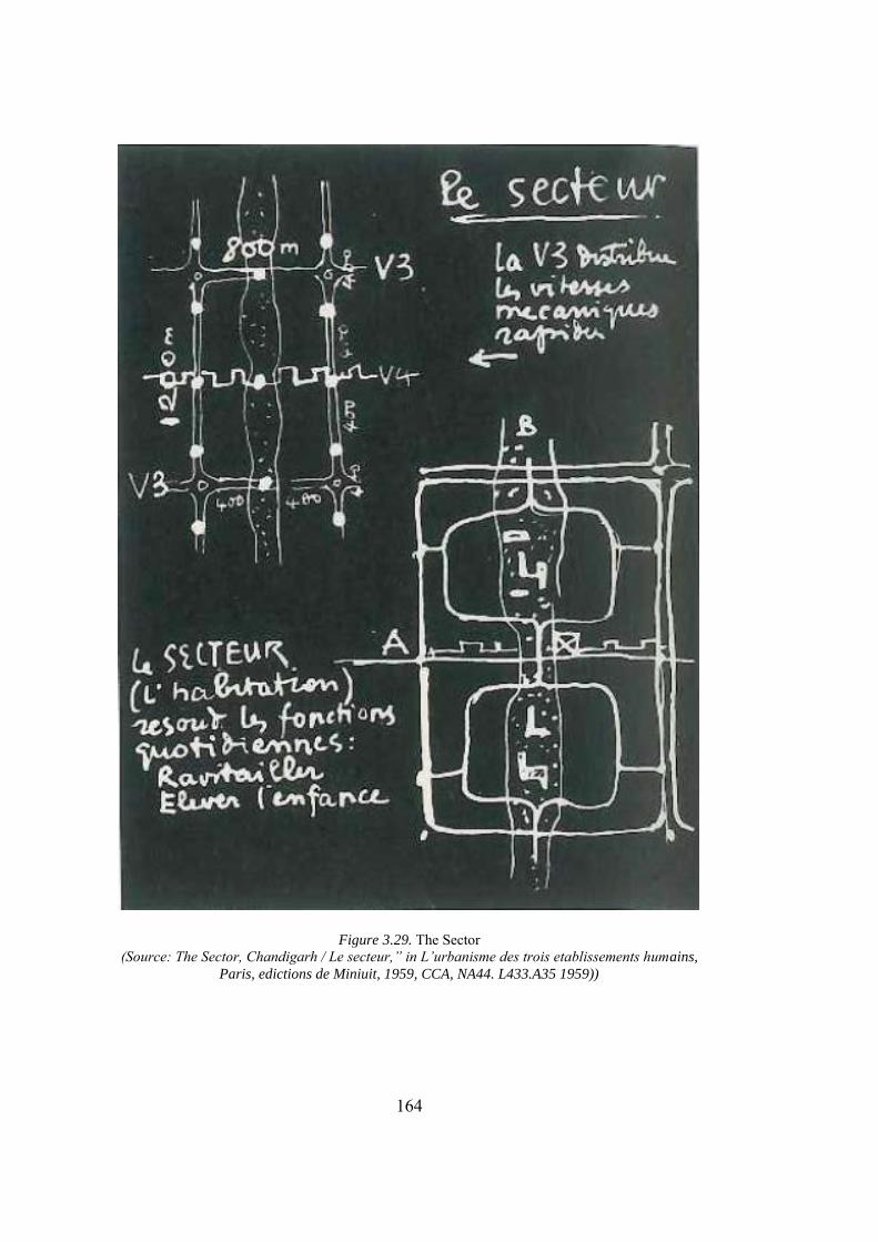
164
Figure 3.29. The Sector (Source: The Sector, Chandigarh / Le secteur,” in L’urbanisme des trois etablissements humains,
Paris, edictions de Miniuit, 1959, CCA, NA44. L433.A35 1959))
165
Figure 3.30. Le Corbusier's Sketches for Montevideo and São Paulo, 1929. (Source: Le Corbusier and São Paulo – 1929: Architecture and Landscape). Last visited on June
2018.
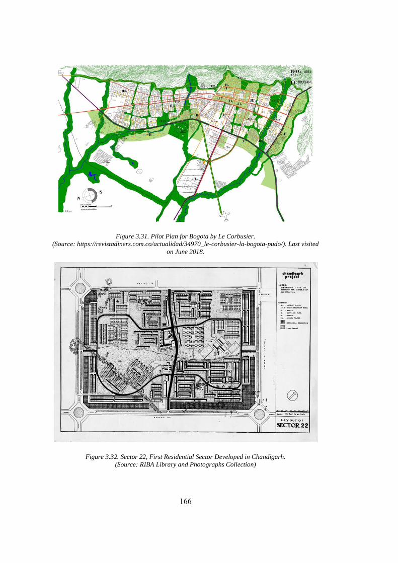
166
Figure 3.31. Pilot Plan for Bogota by Le Corbusier. (Source: https://revistadiners.com.co/actualidad/34970_le-corbusier-la-bogota-pudo/). Last visited
on June 2018.
Figure 3.32. Sector 22, First Residential Sector Developed in Chandigarh. (Source: RIBA Library and Photographs Collection)
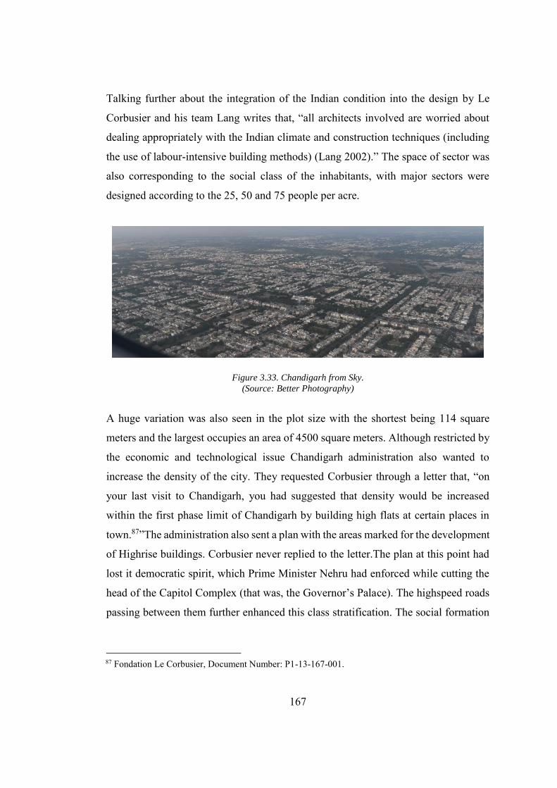
167
Talking further about the integration of the Indian condition into the design by Le
Corbusier and his team Lang writes that, “all architects involved are worried about
dealing appropriately with the Indian climate and construction techniques (including
the use of labour-intensive building methods) (Lang 2002).” The space of sector was
also corresponding to the social class of the inhabitants, with major sectors were
designed according to the 25, 50 and 75 people per acre.
Figure 3.33. Chandigarh from Sky. (Source: Better Photography)
A huge variation was also seen in the plot size with the shortest being 114 square
meters and the largest occupies an area of 4500 square meters. Although restricted by
the economic and technological issue Chandigarh administration also wanted to
increase the density of the city. They requested Corbusier through a letter that, “on
your last visit to Chandigarh, you had suggested that density would be increased
within the first phase limit of Chandigarh by building high flats at certain places in
town.87”The administration also sent a plan with the areas marked for the development
of Highrise buildings. Corbusier never replied to the letter.The plan at this point had
lost it democratic spirit, which Prime Minister Nehru had enforced while cutting the
head of the Capitol Complex (that was, the Governor’s Palace). The highspeed roads
passing between them further enhanced this class stratification. The social formation
87 Fondation Le Corbusier, Document Number: P1-13-167-001.
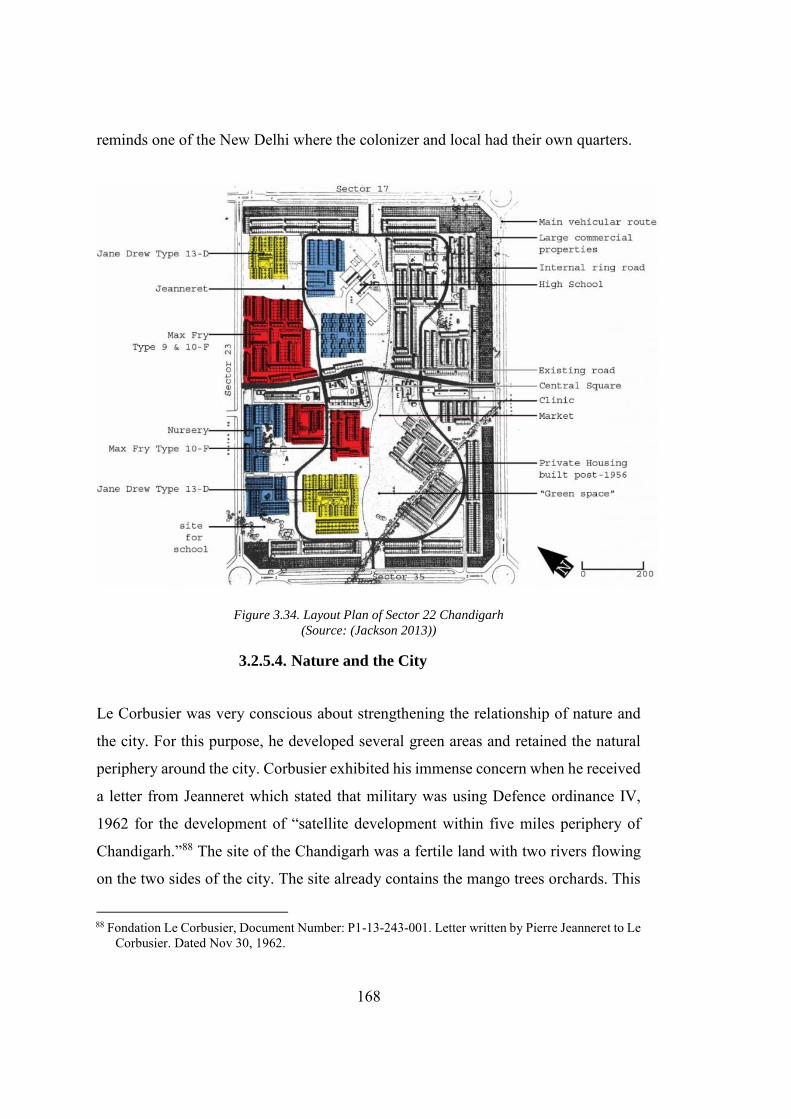
168
reminds one of the New Delhi where the colonizer and local had their own quarters.
Figure 3.34. Layout Plan of Sector 22 Chandigarh (Source: (Jackson 2013))
3.2.5.4. Nature and the City
Le Corbusier was very conscious about strengthening the relationship of nature and
the city. For this purpose, he developed several green areas and retained the natural
periphery around the city. Corbusier exhibited his immense concern when he received
a letter from Jeanneret which stated that military was using Defence ordinance IV,
1962 for the development of “satellite development within five miles periphery of
Chandigarh.”88 The site of the Chandigarh was a fertile land with two rivers flowing
on the two sides of the city. The site already contains the mango trees orchards. This
88 Fondation Le Corbusier, Document Number: P1-13-243-001. Letter written by Pierre Jeanneret to Le
Corbusier. Dated Nov 30, 1962.
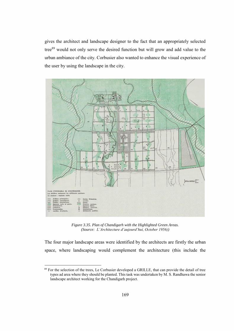
169
gives the architect and landscape designer to the fact that an appropriately selected
tree89 would not only serve the desired function but will grow and add value to the
urban ambiance of the city. Corbusier also wanted to enhance the visual experience of
the user by using the landscape in the city.
Figure 3.35. Plan of Chandigarh with the Highlighted Green Areas. (Source: L’Architecture d’aujourd’hui, October 1956))
The four major landscape areas were identified by the architects are firstly the urban
space, where landscaping would complement the architecture (this include the
89 For the selection of the trees, Le Corbusier developed a GRILLE, that can provide the detail of tree
types ad area where they should be planted. This task was undertaken by M. S. Randhawa the senior landscape architect working for the Chandigarh project.
170
commercial areas and the Capitol complex, the roads, the open green spaces and the
parks and Periphery). Secondly, the V2 leading to the Capitol Complex is surrounded
on both sides with the bicycle lanes, footpath and the parking spaces in front of the
commercial areas. To make it more panoramic and differentiating the main roads with
the side road, tall trees were proposed on both sides of the roads. Thirdly, V2 and V3,
in general, are meant to host the fast-moving traffic to support the adequate function
and prevent the roads from the sun rays, the thick foliage was proposed on both sides
of the road. Lastly, for the V4, residential areas and the proposed green areas adjacent
to it the flowering trees were proposed, but the final form of these areas was not
developed according to the plan. Kalia argues that these areas were not developed
owing to the arid environment (where special care is required for the upbringing the
trees) and presence of the animals (that had spoiled and ate the trees) (Kalia 1999).
Unfortunately, the green spaces, as conceived by Corbusier, were ruined due to poor
maintenance by the administration. Although Corbusier was a staunch critique of the
Garden city it reminiscent can be found within Chandigarh. Barnett writes that,
“Enough of the original garden city concept remains that a visitor to Chandigarh is
more conscious of the landscaping of the principal streets that of the generally
mediocre buildings (Barnett 2016).”
Furthermore, Corbusier also utilized the dried river bed which ran through the centre
of the city by converting it into the longitudinal green area labelled as leisure valley.
Manish Chalana argues that, “this network of green spaces in the urban core was meant
to function as the ‘‘lungs of the city’’ in accordance with the ‘‘care of body and spirit’’
principle of CIAM ideology (Chalana 2015).” In addition to the internal green spaces,
Le Corbusier and team marked an area extending five miles in all directions beyond
the edge of Chandigarh’s modernist urban core. This area, which they called the
‘‘Periphery’’, consisted agricultural landscapes of villages, forested areas, and some
farmlands. On recommendation of Corbusier, Punjab Government also passed a new
law, titled as Punjab New Capital (Periphery) Control Act in 1952, which ensures to
preserve this area. In 1962, most probably after Military tried to develop a satellite
171
town in the periphery area, the radius of the periphery of Chandigarh was increased to
10 miles from 5 miles.
3.2.5.5. Recreational and Industrial Areas
Le Corbusier also emphasized the importance of providing the recreation and green
space in the city. These areas are meant to provide the leisure and meeting point for
the people living in the city and were termed as the lungs of the city. The most
noticeable of these areas is an artificial lake and attached park formed at the Sukhna
Chao. Le Corbusier wanted this place to be quiet. To achieve this objective all the
kind of vehicular access is prohibited in the area. Furthermore, the area was also
intentionally kept quite dark with only a row of the lamps to lit up it at night. Corbusier
wanted to provide the people of the city with an opportunity to interact with the stars
in the sky and notice their reflection in the water. However, it is important to discuss
that though Corbusier wanted to revive the rural isolation by planning the Lake away
from the city without the vehicular access, it also deprived the people of the city of a
vital leisure point. The industrial area that symbolized the abdomen of the city was
placed in the lower corner of the city segregating it entirely from the residential areas.
The nearby railway station also allowed the industrial transportation to go with ease
without affecting the residential area or producing traffic congestion. The employees
working in the residential areas were living in the sector 28 and 29. A buffer area
between the industrial areas and the residential areas were reinforced with the
provision of fruit trees. These trees can also help some of the manufacturers who were
planning to develop their businesses in the industrial area (Kalia 1999).
The Corbusier plan was a formalization of Mayer’s plan in the shape of famous grid-
iron. Chandigarh was a Corbusian city re-invented according to the Indian conditions
in line with the garden city movement, that he had earlier rejected in Europe. In
comparison, Corbusier’s plan reinforces the class antagonism in contradiction with
Mayer’s plan. Mayer rejected the provision of lavish bungalows, that was once the
172
trademark of the colonizers, by providing a socially conscious housing in the similar
way as it was provided in Brasilia. Corbusier’s plan provided 56 type of housing thus
reinforcing the class antagonism, that was in contradiction with the national
aspirations of thousands of people. Nehru was, “Seemingly politically at odds with the
class stratification and paternalistic symbolism of Lutyens’s grandiose early 19th
century "White Raj" urban designing (Morris 1975).”Corbusier lost interest in the
design of the city, after his landmark high-rise residential apartment buildings were
rejected by the state’s government, which in result had left the work for the
development of the residential area on his team.
3.3. Islamabad: The Capital City between a Utopia and Mirage
From the very start of the project the architects and State shared the view that the new
city should imitate the tradition of Islamic cities90, but at the same time, it should have
its distinguishable individuality with reference to the other Islamic cities. The
Government of Pakistan (G.O.P.) also wanted to bring the country in line with the
international agenda of progress, using a capital building project. Moreover, State did
not want a replication of any international image rather they wanted architects to
produce a more eclectic city by the localization. Mahsud argues that the ruling regime
wanted to develop a city that would represent the national ideology and work as a
catalyst for progress in such a manner that the resulting city should be, “A bridge
between the local culture/traditions and the ‘imagined communities’(Mahsud
2013).”‘Imagined communities’ is a term coined by Anderson in his seminal book
with the same title. He argues that “imagined communities,” exists at an abstract level
which requires physical space to come into existence91. In Lefebvre’s words, one can
90 In the case of Islamabad, the State’s focus was the cities developed by the Great Mughals in India, as
they want to retain their individuality even among the Muslim nations of the world. The agenda for the connection was not clear though as a British educated bureaucracy and President Ayyub wants to attain the level of colonizers, due to which certain cross-arguments were made to pursue the traditions set by colonizer for city building projects.
91 In his critical analysis of the nationalism and nation hood Anderson describes the nation as an imagined community, socially constructed by a group of people. (Anderson 1983).
173
argue that the abstract communities are the product of a utopian ideology who are
striving to acquire the real space92. This utopia protrudes from socio-political
conditions, and strictly abides by ideology. It steers the people to strive for a real space,
where this ideology can be grounded. Together with the inherited ideas of “freedom,”
“justice” and “happiness” this ideology guarantees the up gradation of a community
and promises them a better opportunity of habiting93. This urge to acquire a mental
space for a community is being desired since the Plato’s Republic, or even before. It
is this urge that provoked the Government of Pakistan to develop a national space in
Pakistan, right after its independence in 1947. A space that can take the burden of
identity and representation as desired by people and rulers. In the case of Islamabad,
one case see that this utopia is often hijacked by the proponents of social and religious
ideologies, thus transforming the utopia into mirage by extracting the essence from it.
The flag bearers of these ideologies intend to gain the benefits for a small group
(generally the elite) of people, in the name of the majority
3.3.1. Islamic City
In a similar way as of Chandigarh, where the urban space had to bear the load of the
contradiction between Gandhi’s Tradition against Nehru’s modernization, Islamabad
had a similar challenge in a different vocabulary. The capital city of a modern Islamic
state94, which by definition had a conflict concealed within its conception, that is, the
paradox for consolidation of modernity and religion. In the prevailing antagonism, the
material conception of the capital city of the modern Islamic republic was problematic.
92 Lefebvre in social production of space, made a distinction between “mental space (the space of the
philosophers) and real space (the physical and social spheres in which we all live)” (Lefebvre 1992). 93 “Habiting” is a key term defined by Lefebvre which can be defined as place where one can “dwell
poetically (Lefebvre 2003). 94 The modern Islamic state refer to two conflicting ideas that are modernity and religion (which is
inheritably traditional and does not support any improvisation thus leaving behind people following the scriptures and practices revealed thousands of years ago. Certain religious reform movements were launched in almost every religion including Islam, Christianity, Judaism, Hinduism and Sikhism, but apart from an utmost effort none of them able to disconnect themselves with the roots and those who were somehow able to disengage themselves from the roots were marginalized and declared blasphemous.
174
In theory, the Islamic cities are referred to the traditional cities made by Muslims rules
for the Muslim communities which include cities like Fez, Isfahan, Damascus, etc95.
However, the dissertation will argue that this concept curtails a major generalization
and does not have universal meaning due to varying socio-historic conditions. The
biggest challenge for the architects working for G.O.P was that in case of established
Islamic cities, theory comes once the city was developed and inhabited. However, in
the case of the Federal capital of Pakistan, probably the first planned Muslim capital
city developed under a unified authority, the abstract concepts should be theorized
beforehand, that can lead to the development of a modern Islamic city. These ideas
should be rendered in lieu of the prevailing ideologies of nationalism and
representation in Pakistan. In the wake of growing interest in the Nationalism, both
Architecture and the state had to re-examine the Islamic city, to present, “operational
guidelines for building and planning practices (Al Sayyad 1996).”
The Federal capital of Pakistan thus faced a serious challenge owing to the diversity
embedded within the fabric of Islamic cities, from Isfahan to Fez and Jakarta to
Istanbul. The biggest reason for this diversity is that these cities were developed under
different climates, historical background, social conditions and developed by the
Kings who follows a different interpretation of Islam. Gurenbaum’s text had a visibly
subjective tone, he rightly points out that, “neither Mecca nor Baghdad could be
assigned the place of an archetype in a comparable sense …The Islamic town did not
represent a uniform type of civilized life as had the Greek or Roman town (Gruenbaum
1958).”The absence of the archetype also impact the characterization of an Islamic
city. Al Sayyad writes that by 1950, (almost the same time when the Government of
Pakistan had started the search for the new Capital), “Two different models of Muslim
95 Just like the debate of modernity in the first chapter, it is difficult t label any city as Islamic or non-
Islamic due to the historic origin of these settlements.
175
urbanism had emerged within Western scholarship.96 Both of these models were not
sufficed to assemble a single image for Islamic city to be utilized by G.O.P.
Furthermore, Rabbat also describes three models for Islamic cities namely Classical,
Oriental and Medieval Model (Rabbat 2010). All of these models reinforces the
importance of historical and political impression on the development of Islamic cities
Alsayyad writes that over the different range of time, urban elements like covered
Bazaar, ethnically segregated living, citadel, public baths and the centrally located
Friday Mosque became the general features of the Islamic cities (Al Sayyad 1996).
The literature on the Islamic city, however, failed to shed light on the material
conception of these urban elements, which not only stands in opposition to each other,
but can be connected with the non-Muslim civilization and architecture. In the above
discussion except for the mosque, all other elements were borrowed from the cities
developed by the historical communities. The absence of “purely Islamic elements97”
in the city also limit the process of characterization. Even, if one formulates a
comprehendible sketch of an Islamic city in the Middle East and Africa, it still
contradicts with the Muslim cities developed by Mughals in the Indian Subcontinent,
due to contestation on a different historical battlefield.
In case of Shahjahan Abad, as discussed in Chapter 02, a mature city developed by
Muslim rulers of India, the relation of the citadel of the city, reminds one of the cities
established by Arabs in Africa or by the colonizers in India. The city had the all the
elements mentioned above, which came to India through Isfahan, with a significant
difference that Grand Mosque’s placement is more symbolic rather than strategic.
96 In his seminal essay on the historiography of the Muslim urbanism. Alsayyad discuss two different
sphere of knowledge, operational for comprehending the Islamic city. First one was based on the analysis of cities developed in North Africa, while the second one whirls around Middle East and Central Asia. Alsayyad pointed out the ambiguity in the conception of Islamic city “Neither of these models, incorporated much about the characteristic institutional structure or social organization of Muslim society”(Al Sayyad 1996).
97 The dissertation had discussed in detailed in the Chapter 2 about the origin of modernity and how it should be seen as an extension of the progress of mankind in general rather than a single group (which in this case is European) takes all credit of it and use as a tool for establishing their supremacy. in the similar way. Al-Sayyed quotes Sauvaget as,“ Muslim cities evolved from pre-Islamic origins (Al Sayyad 1996)”
176
Placed at minor axes of the city the Mosque was built after the citadel and city were
made. In the case of Arab Islamic cities, the city grows with the Friday Mosque in its
core, and it is probably the most splendid building related to the other elements
developed in the city. In the case of Shahjahan Abad, the grand mosque was located
at a certain distance from Chandni chawk the central axis and is placed on the minor
axis. The city is centred around the bazaar owing to the emergence of mercantile
capitalism. Kennedy argues that the central location of Bazaar in the Islamic cities is
because of the prominence, Merchants hold within the social structure of the Islamic
communities. This is the one reason Bazaar remained the chief aspiration for the
Muslim geographers.
When Muslim geographers describe a city, they mention the mosque
and their extent, prosperity and the different sorts of goods for them it
is the commerce of the city rather than its monumental buildings which
are the chief source of interest.98
The quest for the national capital of Pakistan gained its momentum due to the
functional reasons, since none of the existing cities had the infrastructure available for
hosting the Capital’s administrative function. From the plan for the upgradation of
Karachi, (that is developed to reflect democratic values) to the Islamabad, the new
capital of Pakistan (developed to reflect an authoritarian rule) a persistent effort to
connect the city to the tradition of Islam was much evident. However, this was a
mammoth task. Batuman argues that the cities that were emerged in a global world,
under the umbrella of the postcolonialism had to deal with their “plural ethnicities,
modernities and Islams at the same time (Batuman 2017).” To cope with problem
98 The Muslim communities are rested on the idea of equality. This equality was established through
the Jurists (Qazi) who came from this merchant class, even Prophet Muhammad P.B.U.H and his close allies were all traders and merchants, instead of Military or Government administration. Kennedy writes that thus, “ It was natural then that the design of the city reflected the need of this class and that the Muslim city allowed the commercial consideration to outweigh the dictates of formal planning”(Kennedy 1985).
177
MRV in their plan for the master plan of Karachi tried to connect it with Isfahan while
Doxiadis associates tried to “Islamize the Grid.” Kalia also reinforce Doxiadian view
by arguing, while presenting the case of the Grid in connection to his description of
Chandigarh, that, “these ideas appear more suited to the Islamic notions, where
religion exhorts men to walk on a straight line with a purpose, rather than for Hindu
nation having a circular view of life, the concept of samsara (Kalia 1999).”Yakas, the
project architect for Islamabad appointed by the Doxiadis associates, explains that
how they have validated the functional grid plan. He writes whiles discussing reasons
for selecting the grid pattern as
Finally, for cultural reasons, Islamabad, a symbolic city of the Islamic
Republic of Pakistan, could not abstain from the rules of design and
synthesis, which are the main characteristics of Islamic culture. Every large
and important synthesis of Islamic culture is based on pure geometry. The
great mosques and large Palaces with their squares, Fatehpur Sikri and its
synthesis based on the vertical axis, Lahore Fort, all of them remind one
that Islamic culture has always used pure geometrical patterns in the design
of structural works. One may find that geometry sets the pattern even in
the smallest details of Islamic cultures (Yakas 2001, 67).
Yakas explanation reduces the concept of Islamic city to a more abstract and
manageable level. This abstraction not only helped in the conception of Islamabad,
but also binds the cities, discussed earlier in this section, together. This conception
also problematizes the Islamic city and adds further complication to the already
complex phenomenon. Furthermore, the grid was also viewed as an entity that
provides the uniform distribution of the space, which corresponds to the Islamic values
of “equality.” However, this intended equality was nullified after provision of class-
based housing accommodations and strict segregation of ruling elite from the public.
The dissertation argues that from naming the city to the development of “Islamic grid,”
the architects and state had tried to bind opposing ideologies within the proposed space
178
forcefully. Islamic city, if it exists, should concern more about social justice and other
fundamental values of Islam rather than negotiating with formal elements.
The Indian Subcontinent was the home of multiple cultural, ethnic and religious
groups. Islam was introduced into India initially through Arab traders and later on by
the Arab invasion of southern India. In the course of history, Muslim rulers had
established some of the great empires on the Indian soil, which include the “Delhi
sultanate” and “Moghuls.” However, these empires were more “political99” in nature
rather than religious one. The evolution of religion as a political entity has affected
the construction of urban space since then. Rulers of these empires were manoeuvring
the religion as a political entity rather than acclimatizing to the framework provided
by the religion.
The architecture produced by them, labelled as “Islamic100”, was against the
fundamental teaching of religion which emphasized on the simplicity. In contrast to
the lavish place making which includes marble pavilions and gardens, within the
collective memory of Muslims, the welfare state of Medina101 was still being
idealized.
Post-1900 have seen aggression in the politics of British India. The formation of “All
India Muslim League,” in 1906, provided a parallel point of view, which was in a
99 The term “political Islam” has been adopted by many scholars in order to identify this seemingly
unprecedented irruption of Islamic religion into the secular domain of politics and thus to distinguish these practices from the forms of personal piety, belief and ritual conventionally subsumed in Western scholarship under the unmarked category “Islam.” (“What Is Political Islam | Middle East Research and Information Project” n.d.)
100 Islamic architecture is a plural term generally refers to the Architecture produced in the Islamic societies. However, a universal consensus about the definition of this architecture is yet to be arrived. it came into the cannons of architectural discussion after 1980s specifically by initiative such as “Aga Khan award for Islamic architecture (Mumtaz 1989).
101 The state of Madinah was established by Prophet Muhammad (PBUH) after he emigrate from MECCA. It remained a subject of Inquiry among many well know Arab Historians like “Al Madinah
Al-Fadilah” by Farabi and, “Muqqademah” Ibne Khuldon. However, the modern-day scholar like Nazar Al Sayyad had criticized the concept by narrating that the benefits of small town or generic terms like Medina can be speculated (Al Sayyad 1998).
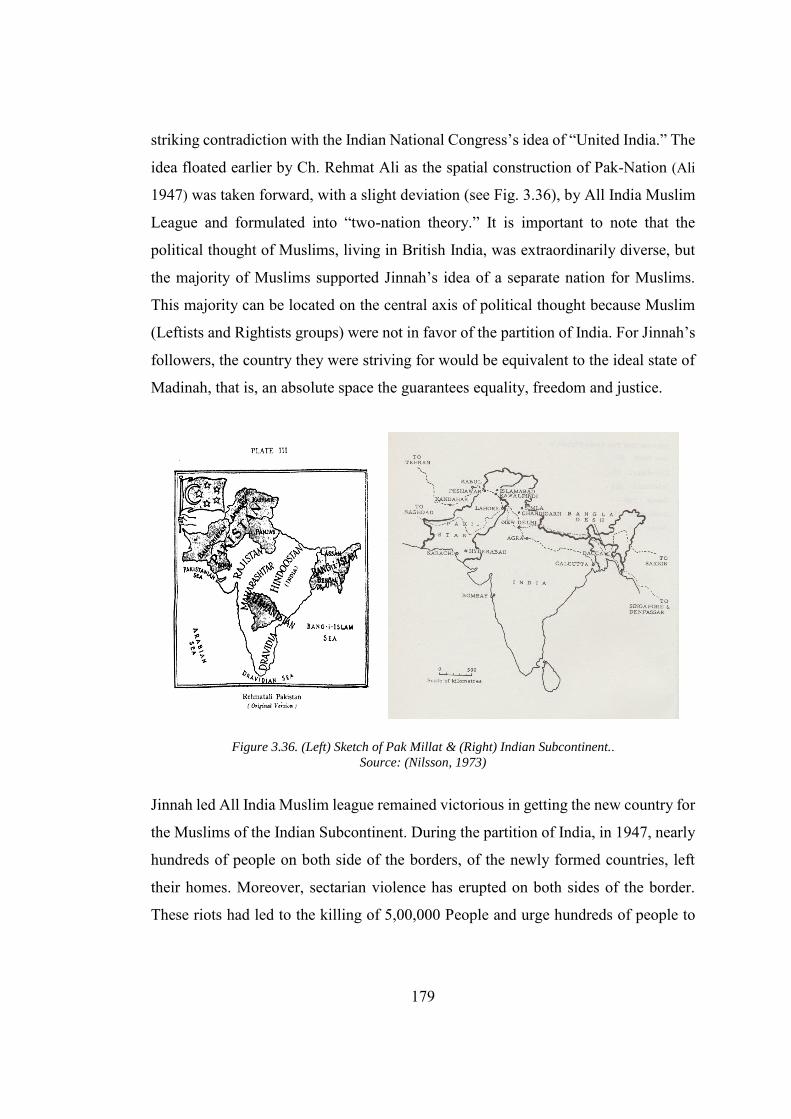
179
striking contradiction with the Indian National Congress’s idea of “United India.” The
idea floated earlier by Ch. Rehmat Ali as the spatial construction of Pak-Nation (Ali
1947) was taken forward, with a slight deviation (see Fig. 3.36), by All India Muslim
League and formulated into “two-nation theory.” It is important to note that the
political thought of Muslims, living in British India, was extraordinarily diverse, but
the majority of Muslims supported Jinnah’s idea of a separate nation for Muslims.
This majority can be located on the central axis of political thought because Muslim
(Leftists and Rightists groups) were not in favor of the partition of India. For Jinnah’s
followers, the country they were striving for would be equivalent to the ideal state of
Madinah, that is, an absolute space the guarantees equality, freedom and justice.
Figure 3.36. (Left) Sketch of Pak Millat & (Right) Indian Subcontinent.. Source: (Nilsson, 1973)
Jinnah led All India Muslim league remained victorious in getting the new country for
the Muslims of the Indian Subcontinent. During the partition of India, in 1947, nearly
hundreds of people on both side of the borders, of the newly formed countries, left
their homes. Moreover, sectarian violence has erupted on both sides of the border.
These riots had led to the killing of 5,00,000 People and urge hundreds of people to
180
migrate (Kalia 2011). In the background of this miserable condition, when refugees
were flocking on the streets of the capital city, the utmost need of a very “own”
national space was felt. However, in the presence of prevailing economic instability,
social aspirations, political inclinations and historical ties, the production of national
space was a mammoth task.
Pakistan started its nation-building with the help of foreign experts and funding
agencies (including Ford Foundation and the United States Technical Assistance and
Productivity Program (TAP)). Due to lack of the trained architects and architectural
practices in Pakistan, Government had relied heavily on the foreign architects for the
construction of the monumental project during the first phase of the post-independence
period102. Commenting on the architectural aspiration of the foreign architects
working in Pakistan, Karim states that, “spearheaded and aided by US universities,
architects and TAP, the group embarked on a grand project: forging a hybrid of post-
war reformation spirit, modernization theory and postcolonial Muslim nationalism
(Karim 2016).” In lieu of the prevailing challenges of the hybridization, the work had
started on the design of the national capital of Pakistan. Furthermore, the expected
design is supposed to cater the people’s aspirations and the states’ ambition. In
addition to the historical aspiration, the Government of Pakistan was keen to connect
itself with the other new nation-states of Islamic origin, most prominent among them
were Turkey103 and Indonesia104. Moreover, the experimentation done in the
Chandigarh105, India had developed a sense of competition in neighbouring Pakistan.
102 Pakistan’s post-independence history can be divided into two distinct phases. The first Phase starts
from 1947, when Pakistan came into being and continues till 1971 when following the bloody war Bangladesh (former east-Pakistan) got separated from the union of Pakistan. 1971 onwards can be referred as the second phase.
103Turkish modernization started with the advent of republican era and end of caliphate. Though the political scenario had changed all together at the end of caliphate, but In Pakistan the people’s sentiment for Turkey remained the same (Bozdogan and Kasaba 1997).
104 Indonesia is one of the largest Islamic countries, the process of modernization had started under the leadership of Sukarno, who like Ayyub Khan was a military dictator (Kusno 2000).
105 After partition Government of India has undertaken the development of capital cities for a number of states which include Gandhinagar, Bhubaneswar and Chandigarh (Kalia 1990).
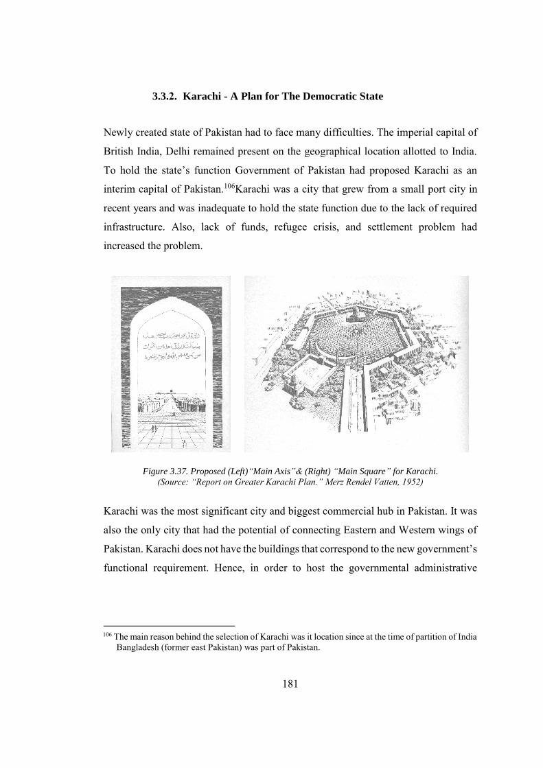
181
3.3.2. Karachi - A Plan for The Democratic State
Newly created state of Pakistan had to face many difficulties. The imperial capital of
British India, Delhi remained present on the geographical location allotted to India.
To hold the state’s function Government of Pakistan had proposed Karachi as an
interim capital of Pakistan.106Karachi was a city that grew from a small port city in
recent years and was inadequate to hold the state function due to the lack of required
infrastructure. Also, lack of funds, refugee crisis, and settlement problem had
increased the problem.
Figure 3.37. Proposed (Left)“Main Axis”& (Right) “Main Square” for Karachi.
(Source: “Report on Greater Karachi Plan.” Merz Rendel Vatten, 1952)
Karachi was the most significant city and biggest commercial hub in Pakistan. It was
also the only city that had the potential of connecting Eastern and Western wings of
Pakistan. Karachi does not have the buildings that correspond to the new government’s
functional requirement. Hence, in order to host the governmental administrative
106 The main reason behind the selection of Karachi was it location since at the time of partition of India Bangladesh (former east Pakistan) was part of Pakistan.
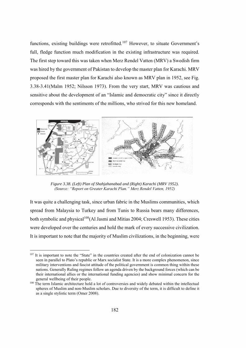
182
functions, existing buildings were retrofitted.107 However, to situate Government’s
full, fledge function much modification in the existing infrastructure was required.
The first step toward this was taken when Merz Rendel Vatten (MRV) a Swedish firm
was hired by the government of Pakistan to develop the master plan for Karachi. MRV
proposed the first master plan for Karachi also known as MRV plan in 1952, see Fig.
3.38-3.41(Malm 1952; Nilsson 1973). From the very start, MRV was cautious and
sensitive about the development of an “Islamic and democratic city” since it directly
corresponds with the sentiments of the millions, who strived for this new homeland.
Figure 3.38. (Left) Plan of Shahjahanabad and (Right) Karachi (MRV 1952). (Source: “Report on Greater Karachi Plan.” Merz Rendel Vatten, 1952)
It was quite a challenging task, since urban fabric in the Muslims communities, which
spread from Malaysia to Turkey and from Tunis to Russia bears many differences,
both symbolic and physical108(Al Jasmi and Mitias 2004; Creswell 1953). These cities
were developed over the centuries and hold the mark of every successive civilization.
It is important to note that the majority of Muslim civilizations, in the beginning, were
107 It is important to note the “State” in the countries created after the end of colonization cannot be
seen in parallel to Plato’s republic or Marx socialist State. It is a more complex phenomenon, since military interventions and fascist attitude of the political government is common thing within these nations. Generally Ruling regimes follow an agenda driven by the background forces (which can be their international allies or the international funding agencies) and show minimal concern for the general wellbeing of their people.
108 The term Islamic architecture hold a lot of controversies and widely debated within the intellectual spheres of Muslim and non-Muslim scholars. Due to diversity of the term, it is difficult to define it as a single stylistic term (Omer 2008).
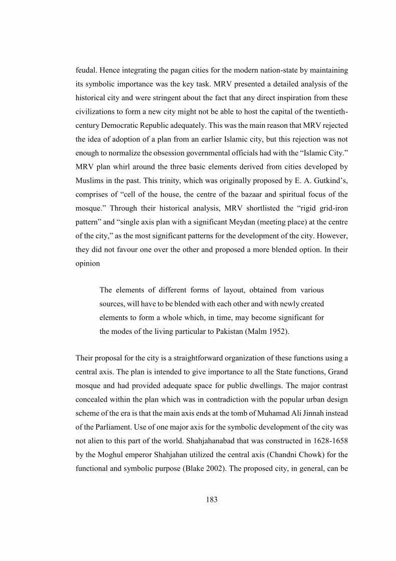
183
feudal. Hence integrating the pagan cities for the modern nation-state by maintaining
its symbolic importance was the key task. MRV presented a detailed analysis of the
historical city and were stringent about the fact that any direct inspiration from these
civilizations to form a new city might not be able to host the capital of the twentieth-
century Democratic Republic adequately. This was the main reason that MRV rejected
the idea of adoption of a plan from an earlier Islamic city, but this rejection was not
enough to normalize the obsession governmental officials had with the “Islamic City.”
MRV plan whirl around the three basic elements derived from cities developed by
Muslims in the past. This trinity, which was originally proposed by E. A. Gutkind’s,
comprises of “cell of the house, the centre of the bazaar and spiritual focus of the
mosque.” Through their historical analysis, MRV shortlisted the “rigid grid-iron
pattern” and “single axis plan with a significant Meydan (meeting place) at the centre
of the city,” as the most significant patterns for the development of the city. However,
they did not favour one over the other and proposed a more blended option. In their
opinion
The elements of different forms of layout, obtained from various
sources, will have to be blended with each other and with newly created
elements to form a whole which, in time, may become significant for
the modes of the living particular to Pakistan (Malm 1952).
Their proposal for the city is a straightforward organization of these functions using a
central axis. The plan is intended to give importance to all the State functions, Grand
mosque and had provided adequate space for public dwellings. The major contrast
concealed within the plan which was in contradiction with the popular urban design
scheme of the era is that the main axis ends at the tomb of Muhamad Ali Jinnah instead
of the Parliament. Use of one major axis for the symbolic development of the city was
not alien to this part of the world. Shahjahanabad that was constructed in 1628-1658
by the Moghul emperor Shahjahan utilized the central axis (Chandni Chowk) for the
functional and symbolic purpose (Blake 2002). The proposed city, in general, can be
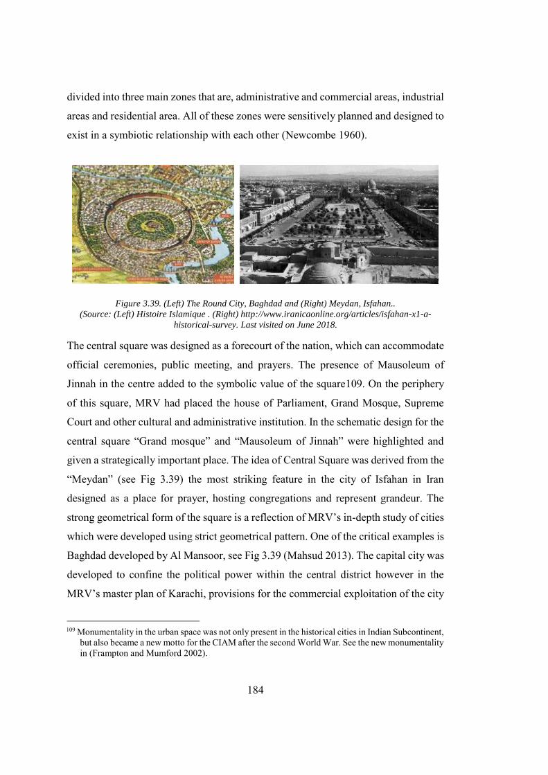
184
divided into three main zones that are, administrative and commercial areas, industrial
areas and residential area. All of these zones were sensitively planned and designed to
exist in a symbiotic relationship with each other (Newcombe 1960).
Figure 3.39. (Left) The Round City, Baghdad and (Right) Meydan, Isfahan.. (Source: (Left) Histoire Islamique . (Right) http://www.iranicaonline.org/articles/isfahan-x1-a-
historical-survey. Last visited on June 2018.
The central square was designed as a forecourt of the nation, which can accommodate
official ceremonies, public meeting, and prayers. The presence of Mausoleum of
Jinnah in the centre added to the symbolic value of the square109. On the periphery
of this square, MRV had placed the house of Parliament, Grand Mosque, Supreme
Court and other cultural and administrative institution. In the schematic design for the
central square “Grand mosque” and “Mausoleum of Jinnah” were highlighted and
given a strategically important place. The idea of Central Square was derived from the
“Meydan” (see Fig 3.39) the most striking feature in the city of Isfahan in Iran
designed as a place for prayer, hosting congregations and represent grandeur. The
strong geometrical form of the square is a reflection of MRV’s in-depth study of cities
which were developed using strict geometrical pattern. One of the critical examples is
Baghdad developed by Al Mansoor, see Fig 3.39 (Mahsud 2013). The capital city was
developed to confine the political power within the central district however in the
MRV’s master plan of Karachi, provisions for the commercial exploitation of the city
109 Monumentality in the urban space was not only present in the historical cities in Indian Subcontinent,
but also became a new motto for the CIAM after the second World War. See the new monumentality in (Frampton and Mumford 2002).
185
by providing adequate space for the industrial areas and increased capacity of seaport
were intelligently incorporated.
Figure 3.40. MRV’s Masters Plan of Karachi (Source: “Report on Greater Karachi Plan.” Merz Rendel Vatten, 1952)
An overview of the plan reveals that it was not only a reflection of the promised
democracy, but also accommodate the adequate residential and commercial activities.
The development of the central square, as the forecourt of the nations and its
availability for the people’s congregation and assembly, go in synchronization with
the promised vision of democracy and freedom110.
110 On March 1949, Pakistan constitution assembly had passed the objective resolution, which acted in
the place of constitution. Objective resolution clearly suggest that Pakistan would be an “Islamic” and “Democratic” country. For a detail discussion on the social and historical background of “objective resolution and its future consequences see (Anas Malik 2015).
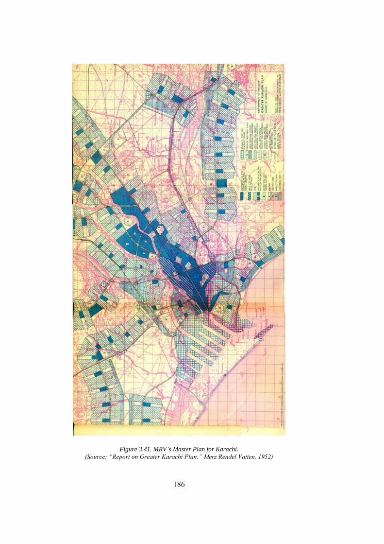
186
Figure 3.41. MRV’s Master Plan for Karachi. (Source: “Report on Greater Karachi Plan.” Merz Rendel Vatten, 1952)
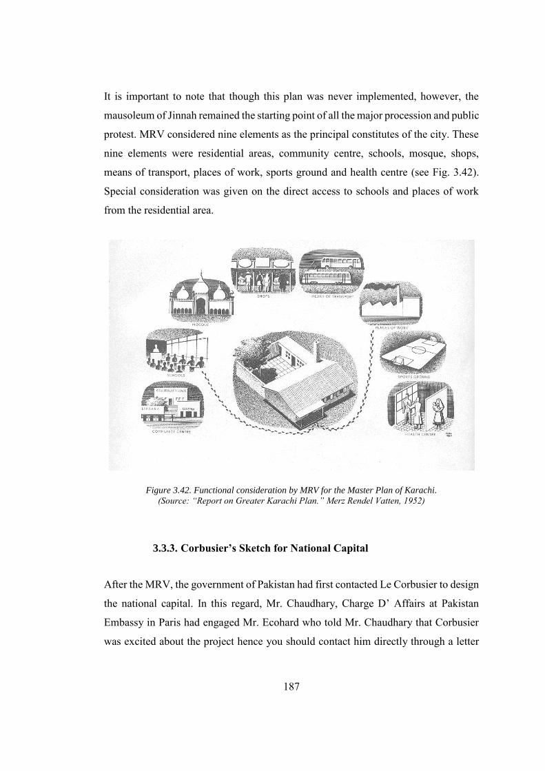
187
It is important to note that though this plan was never implemented, however, the
mausoleum of Jinnah remained the starting point of all the major procession and public
protest. MRV considered nine elements as the principal constitutes of the city. These
nine elements were residential areas, community centre, schools, mosque, shops,
means of transport, places of work, sports ground and health centre (see Fig. 3.42).
Special consideration was given on the direct access to schools and places of work
from the residential area.
Figure 3.42. Functional consideration by MRV for the Master Plan of Karachi. (Source: “Report on Greater Karachi Plan.” Merz Rendel Vatten, 1952)
3.3.3. Corbusier’s Sketch for National Capital
After the MRV, the government of Pakistan had first contacted Le Corbusier to design
the national capital. In this regard, Mr. Chaudhary, Charge D’ Affairs at Pakistan
Embassy in Paris had engaged Mr. Ecohard who told Mr. Chaudhary that Corbusier
was excited about the project hence you should contact him directly through a letter
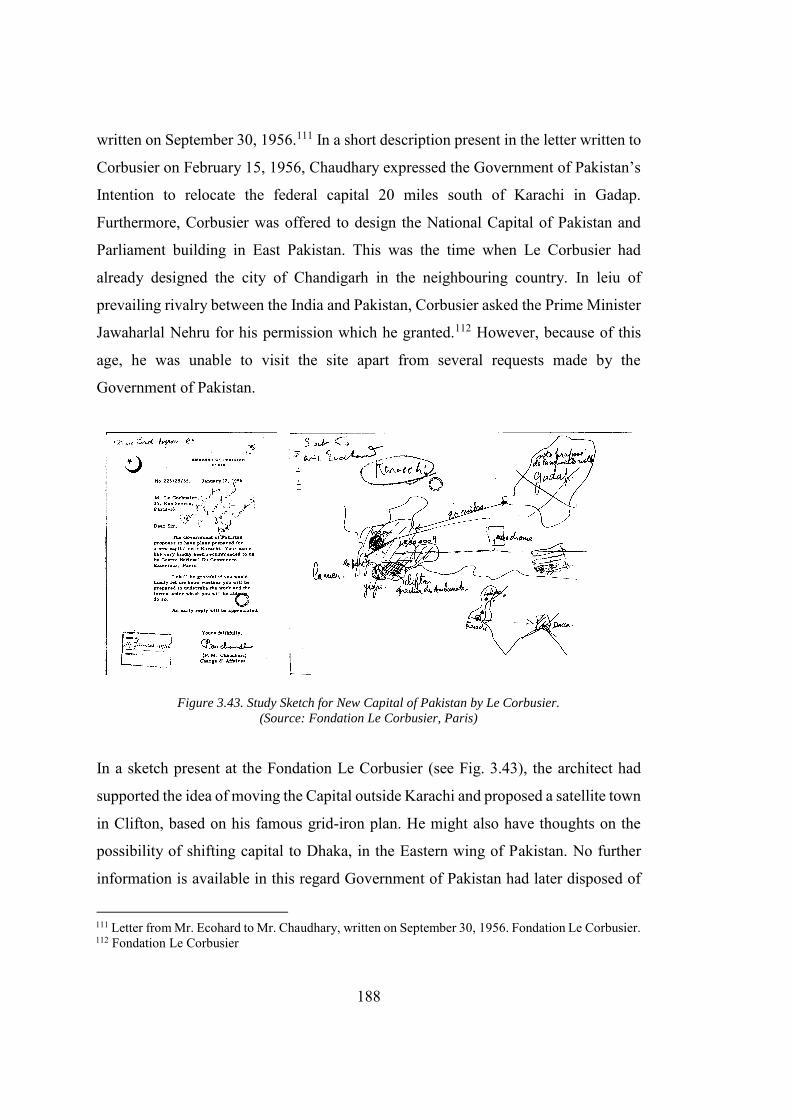
188
written on September 30, 1956.111 In a short description present in the letter written to
Corbusier on February 15, 1956, Chaudhary expressed the Government of Pakistan’s
Intention to relocate the federal capital 20 miles south of Karachi in Gadap.
Furthermore, Corbusier was offered to design the National Capital of Pakistan and
Parliament building in East Pakistan. This was the time when Le Corbusier had
already designed the city of Chandigarh in the neighbouring country. In leiu of
prevailing rivalry between the India and Pakistan, Corbusier asked the Prime Minister
Jawaharlal Nehru for his permission which he granted.112 However, because of this
age, he was unable to visit the site apart from several requests made by the
Government of Pakistan.
Figure 3.43. Study Sketch for New Capital of Pakistan by Le Corbusier.
(Source: Fondation Le Corbusier, Paris)
In a sketch present at the Fondation Le Corbusier (see Fig. 3.43), the architect had
supported the idea of moving the Capital outside Karachi and proposed a satellite town
in Clifton, based on his famous grid-iron plan. He might also have thoughts on the
possibility of shifting capital to Dhaka, in the Eastern wing of Pakistan. No further
information is available in this regard Government of Pakistan had later disposed of
111 Letter from Mr. Ecohard to Mr. Chaudhary, written on September 30, 1956. Fondation Le Corbusier. 112 Fondation Le Corbusier
189
the site of National Capital at Gadap. Le Corbusier also negates to the design of the
Parliament building in Dhaka, due to the health issues and old age. In his reply to a
Fax sent from Rawalpindi on September 03, 1962 Le Corbusier stated that he does not
have time for the immediate site visit and design of Parliament building.113 The
Parliament building was later designed by Louis Kahn which would be discussed in
Chapter 04, at full length.
3.3.4. Islamabad – The City for Future
In 1958 Military General Ayyub Khan (Khan 1967) overthrew the Government in
Pakistan and came to power through bloodless coup d’état. The change in the
Government not only affected the political condition of the country, but also posed the
question of the status of Karachi as a national capital. In less than three months of
gaining power General Ayyub Khan appointed General Yahya Khan as the head of a
commission for relocating the federal capital. The commission had declared Karachi
unsuitable as the capital of Pakistan and instead proposed a new site near Rawalpindi
in the province of Punjab. President Ayyub Khan announced the location of new
federal capital in October 1959. The change of location, however, left no impact on
the “Islamic” discourse for spatial development. The new city was named
“Islamabad”: the city of Islam. Due to the flourishing relationship between the
Government of Pakistan and United States funding agencies114, former world bank
advisor for the Middle East, Doxiadis was hired to design the new capital.
Doxiadis engagement with Pakistan was not a new one. He was already involved with
several town planning projects in Pakistan was an advisor to the world bank. He also
studied the earlier master plan developed by MRV for the Federal Capital in Karachi
and criticized its planning and growth pattern. Furthermore, he also provided his own
113 Fondation Le Corbusier 114 For a brief discussion about the role of the International funding agencies and Pakistan and United
States relationship see (Karim 2016).
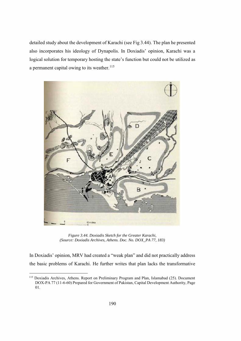
190
detailed study about the development of Karachi (see Fig 3.44). The plan he presented
also incorporates his ideology of Dynapolis. In Doxiadis’ opinion, Karachi was a
logical solution for temporary hosting the state’s function but could not be utilized as
a permanent capital owing to its weather.115
Figure 3.44. Doxiadis Sketch for the Greater Karachi,
(Source: Doxiadis Archives, Athens. Doc. No. DOX_PA 77, 183)
In Doxiadis’ opinion, MRV had created a “weak plan” and did not practically address
the basic problems of Karachi. He further writes that plan lacks the transformative
115 Doxiadis Archives, Athens. Report on Preliminary Program and Plan, Islamabad (25). Document
DOX-PA 77 (11-6-60) Prepared for Government of Pakistan, Capital Development Authority, Page 01.
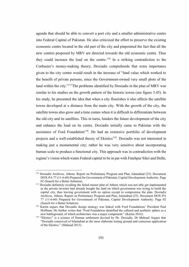
191
agenda that should be able to convert a port city and a smaller administrative centre
into Federal Capital of Pakistan. He also criticized the effort to preserve the existing
economic centre located in the old part of the city and pinpointed the fact that all the
new centres proposed by MRV are directed towards the old economic centre. Thus
they could increase the load on the centre.116 In a striking contradiction to the
Corbusier’s money-making theory, Doxiadis comprehends that extra importance
given to the city centre would result in the increase of “land value which worked to
the benefit of private persons, since the Government-owned very small plots of the
land within the city.”117The problems identified by Doxiadis in the plan of MRV was
similar to his studies on the growth pattern of the historic towns (see figure 3.45). In
his study, he presented the idea that when a city flourishes it also affects the satellite
towns developed at a distance from the main city. With the growth of the city, the
satellite towns also grow and a time comes when it is difficult to differentiate between
the old city and its satellites. This in turns, hinders the future development of the city
and enhance the load on its centre. Doxiadis initially came to Pakistan with the
assistance of Ford Foundation118. He had an extensive portfolio of development
projects and a well-established theory of Ekistics119. Doxiadis was not interested in
making just a monumental city; rather he was very sensitive about incorporating
human scale to produce a functional city. This approach was in contradiction with the
regime’s vision which wants Federal capital to be in par with Fatehpur Sikri and Delhi,
116 Doxiadis Archives, Athens. Report on Preliminary Program and Plan, Islamabad (25). Document
DOX-PA 77 (11-6-60) Prepared for Government of Pakistan, Capital Development Authority. Page 02 (Search for a Better Solution).
117 Doxiadis definitely recalling the failed master plan of Athens which was not able get implemented as the private investor had already bought the land on which government was trying to build the capital city, thus leaving government with no option except to compromise the plan. Doxiadis Archives, Athens. Report on Preliminary Program and Plan, Islamabad (25). Document DOX-PA 77 (11-6-60) Prepared for Government of Pakistan, Capital Development Authority. Page 02 (Search for a Better Solution).
118 Karim argues that Doxiadis design strategy was linked with Ford Foundations’ President Paul Hoffman. He further writes that “Ford Foundation identified the cultural and aesthetic sphere as a new battleground, of which architecture was a major component.” (Karim 2016).
119 “Ekistics” is a science of Human settlement devised by Dr. Doxiadis. Dr Mahsud Argues that “Doxiadis conceived of Islamabad as the most elaborate testing ground and conscious application of the Ekistics.” (Mahsud 2013).
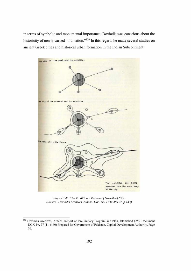
192
in terms of symbolic and monumental importance. Doxiadis was conscious about the
historicity of newly carved “old nation.”120 In this regard, he made several studies on
ancient Greek cities and historical urban formation in the Indian Subcontinent.
Figure 3.45. The Traditional Pattern of Growth of City.
(Source: Doxiadis Archives, Athens. Doc. No. DOX-PA 77, p.143)
120 Doxiadis Archives, Athens. Report on Preliminary Program and Plan, Islamabad (25). Document
DOX-PA 77 (11-6-60) Prepared for Government of Pakistan, Capital Development Authority, Page 01.
193
Karachi was known for its harsh climate, but the main reason for relocation of the
capital was the political ambitions of President Ayyub that finally resulted in the
transfer of the Federal Capital from Karachi to Islamabad. In continuation of the policy
of Britishers, Ayyub’s administration wants to keep the politician and the businessmen
at a distance121. All major businessmen were based in Karachi: the commercial hub of
Pakistan, thus in order to meet the above objective, a site at a fair distance from
Karachi was considered as feasible.
Figure 3.46. Highways for the City of Future
(Source: Source: DOX-PA 77, p. 141-153)
Among all three sites shortlisted for the federal capital Islamabad seems more
favourable for the military establishment as it also lies right next to the military’s
121 President Ayyub wants to secure his power at any cost and his fear was evident when he says
“politician found that they could collect mobs with the help of industrialists and businessmen and bring all kinds of pressure to bear on the government. A time came when one large public meeting attended by a riotous mob could determine the fate of the government (Kudaisya and Yong 2004).
194
general headquarter in Rawalpindi. Sir Morris James, the British High commissioner
in Pakistan, recalls,
He (Ayyub Khan) believed that Pakistan should be run from somewhere
else. Moreover, as a general who had made himself the president and who
depended for his continuance in office on the support of the Army, he had
the strongest of motives for keeping in close touch with his colleagues, the
other generals at Army Headquarters in Rawalpindi. What one army
commander and the chief had done some other very senior officer might
one day be tempted to try…To remove himself permanently to a city 900
miles away would be the height of imprudence (James 1993).
Separation between the politician and businessmen was not enough for regime. In
order to further enhance (or elaborate) their strength they advised the technical expert
to form a “super cantonment” (Tan and Kudaisya 2000). Several factions of the society
protested over the decision of relocation especially the politicians from East Pakistan
as this will terminate their direct connection with the capital. In order to calm the
Bengali Politicians, Ayyub’s Government proposed to host the Federal Capital for six
months in Islamabad and six months in Dhaka, East Pakistan122. The Politicians from
the East Pakistan never fully agreed on the recommendation of the Military
administration. For naming the city, Ayyub took the clutches of religion and called
the new city: Islamabad, the city of Islam. In continuation with the two-nation theory
that remained the force behind the Muslim nationalism in the Indian Subcontinent,
Ayyub also viewed religion as a powerful binding force, then physical infrastructure
and connectivity. In support of his vision he declared, “with the two provinces of
122 Ayyub Nagar (now Sher-e-Bangla Naga, literally means ‘The Land for the Lion of Bangladesh’)
was the capital district in the Dhaka, former East Pakistan designed by Louis Kahn to fulfil the purpose. The capital was completed after the Bangladesh gained its independence. Following the Bengali independence Ayyub Nagar was renamed to Sher-e-Bangla Nagar and it was designated as the National Capital of Bangladesh. Due to the reason it is excluded from the main discussion on the capital.
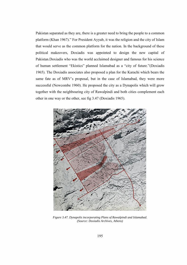
195
Pakistan separated as they are, there is a greater need to bring the people to a common
platform (Khan 1967).” For President Ayyub, it was the religion and the city of Islam
that would serve as the common platform for the nation. In the background of these
political makeovers, Doxiadis was appointed to design the new capital of
Pakistan.Doxiadis who was the world acclaimed designer and famous for his science
of human settlement “Ekistics” planned Islamabad as a “city of future.”(Doxiadis
1965). The Doxiadis associates also proposed a plan for the Karachi which bears the
same fate as of MRV’s proposal, but in the case of Islamabad, they were more
successful (Newcombe 1960). He proposed the city as a Dynapolis which will grow
together with the neighbouring city of Rawalpindi and both cities complement each
other in one way or the other, see fig 3.47 (Doxiadis 1965).
Figure 3.47. Dynapolis incorporating Plans of Rawalpindi and Islamabad.
(Source: Doxiadis Archives, Athens)
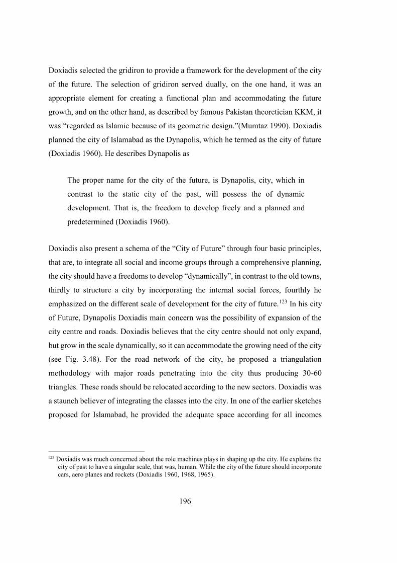
196
Doxiadis selected the gridiron to provide a framework for the development of the city
of the future. The selection of gridiron served dually, on the one hand, it was an
appropriate element for creating a functional plan and accommodating the future
growth, and on the other hand, as described by famous Pakistan theoretician KKM, it
was “regarded as Islamic because of its geometric design.”(Mumtaz 1990). Doxiadis
planned the city of Islamabad as the Dynapolis, which he termed as the city of future
(Doxiadis 1960). He describes Dynapolis as
The proper name for the city of the future, is Dynapolis, city, which in
contrast to the static city of the past, will possess the of dynamic
development. That is, the freedom to develop freely and a planned and
predetermined (Doxiadis 1960).
Doxiadis also present a schema of the “City of Future” through four basic principles,
that are, to integrate all social and income groups through a comprehensive planning,
the city should have a freedoms to develop “dynamically”, in contrast to the old towns,
thirdly to structure a city by incorporating the internal social forces, fourthly he
emphasized on the different scale of development for the city of future.123 In his city
of Future, Dynapolis Doxiadis main concern was the possibility of expansion of the
city centre and roads. Doxiadis believes that the city centre should not only expand,
but grow in the scale dynamically, so it can accommodate the growing need of the city
(see Fig. 3.48). For the road network of the city, he proposed a triangulation
methodology with major roads penetrating into the city thus producing 30-60
triangles. These roads should be relocated according to the new sectors. Doxiadis was
a staunch believer of integrating the classes into the city. In one of the earlier sketches
proposed for Islamabad, he provided the adequate space according for all incomes
123 Doxiadis was much concerned about the role machines plays in shaping up the city. He explains the
city of past to have a singular scale, that was, human. While the city of the future should incorporate cars, aero planes and rockets (Doxiadis 1960, 1968, 1965).
197
groups (see Fig. 3.49).
Figure 3.48. Structure of Dynapolis.
(Source: Doxiadis Archives, Athens, Doc. No. DOX PA 77, p 157)
However, it is important to note that such development provides the people from all
wages of life an opportunity to inhabit the city, it by no means count towards the social
integration. As already discussed, this class stratification, which was the major part of
the planning of New Delhi and Chandigarh thus results in the separation of classes
rather than combining them.
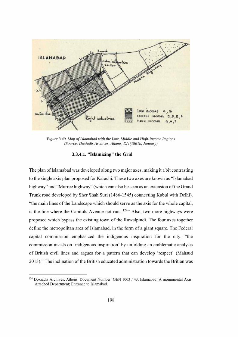
198
Figure 3.49. Map of Islamabad with the Low, Middle and High-Income Regions
(Source: Doxiadis Archives, Athens, DA (1961b, January)
3.3.4.1. “Islamizing” the Grid
The plan of Islamabad was developed along two major axes, making it a bit contrasting
to the single axis plan proposed for Karachi. These two axes are known as “Islamabad
highway” and “Murree highway” (which can also be seen as an extension of the Grand
Trunk road developed by Sher Shah Suri (1486-1545) connecting Kabul with Delhi).
“the main lines of the Landscape which should serve as the axis for the whole capital,
is the line where the Capitols Avenue not runs.124” Also, two more highways were
proposed which bypass the existing town of the Rawalpindi. The four axes together
define the metropolitan area of Islamabad, in the form of a giant square. The Federal
capital commission emphasized the indigenous inspiration for the city. “the
commission insists on ‘indigenous inspiration’ by unfolding an emblematic analysis
of British civil lines and argues for a pattern that can develop ‘respect’ (Mahsud
2013).” The inclination of the British educated administration towards the Britian was
124 Doxiadis Archives, Athens. Document Number: GEN 1003 / 43. Islamabad: A monumental Axis: Attached Department; Entrance to Islamabad.
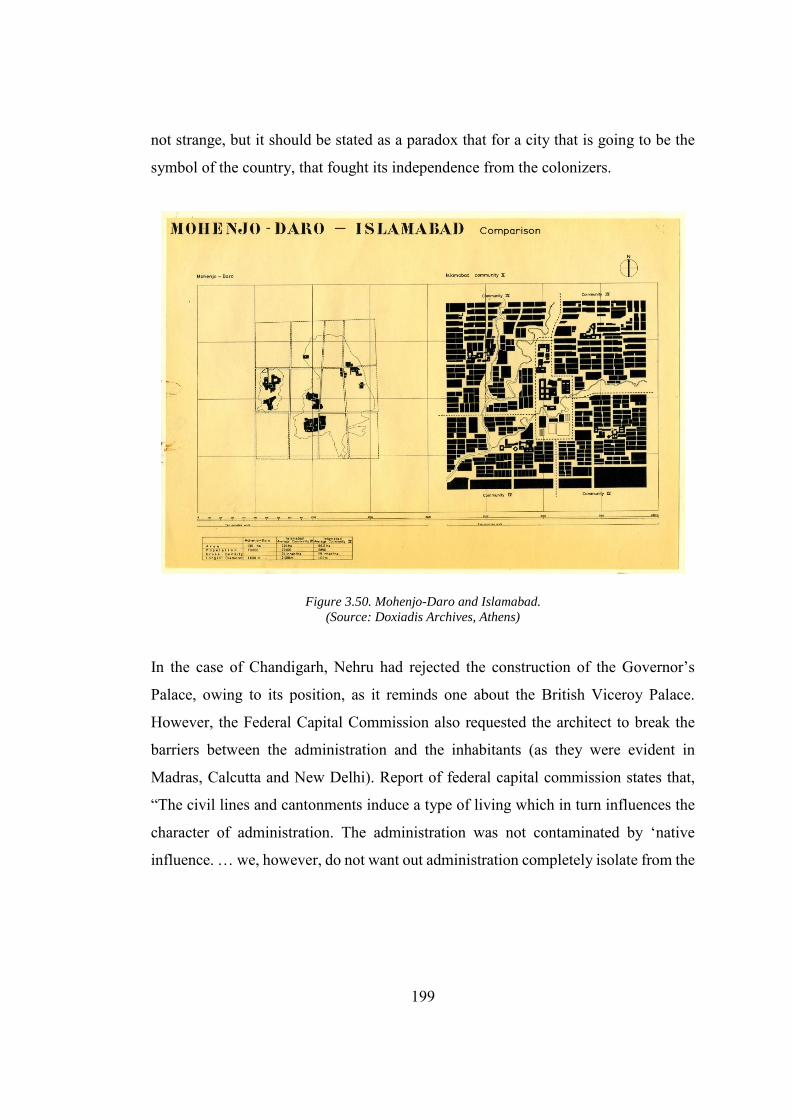
199
not strange, but it should be stated as a paradox that for a city that is going to be the
symbol of the country, that fought its independence from the colonizers.
Figure 3.50. Mohenjo-Daro and Islamabad.
(Source: Doxiadis Archives, Athens)
In the case of Chandigarh, Nehru had rejected the construction of the Governor’s
Palace, owing to its position, as it reminds one about the British Viceroy Palace.
However, the Federal Capital Commission also requested the architect to break the
barriers between the administration and the inhabitants (as they were evident in
Madras, Calcutta and New Delhi). Report of federal capital commission states that,
“The civil lines and cantonments induce a type of living which in turn influences the
character of administration. The administration was not contaminated by ‘native
influence. … we, however, do not want out administration completely isolate from the
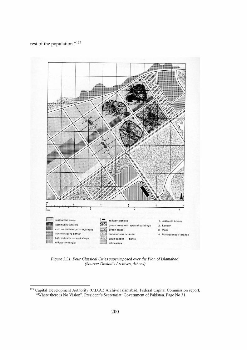
200
rest of the population.”125
Figure 3.51. Four Classical Cities superimposed over the Plan of Islamabad.
(Source: Doxiadis Archives, Athens)
125 Capital Development Authority (C.D.A.) Archive Islamabad. Federal Capital Commission report,
“Where there is No Vision”. President’s Secretariat: Government of Pakistan. Page No 31.
201
Doxiadis, however, was much fascinated by Ancient Greek Cities, and the Indus
valley civilization existed in the geographic region some 5000 years B.C. In a number
of drawing at the Doxiadis archives, he not only tried to analyse the Indus valley cities,
but also made the comparative studies with a sector of Islamabad (see Fig 3.50 &
3.51). Doxiadis critically evaluated the main features of the Indus valley cities. The
cities of the Indus valley civilization were developed on the grid plan following formal
segregation between public and private areas (Daechsel 2015). In a similar fashion to
the Indus valley and modern urban planning concepts, the plan follows a rigid
geometry, and segregate the governmental buildings from the residential areas. The
plan reflects not only the concern for the vehicular movement, but also depicts the
regime's intention to gain political control over the space. The social areas were
segregated entirely in the plans and can be cordoned off in the case of an emergency
situation (Kenoyer 1998). The size of the sector is carefully worked out by Doxiadis
through a comprehensive study of ancient and early modern cities in Europe and India
(see Fig. 3.50, 3.51, 3.57 &3.58). He carefully organized the function within each
sector of the city, which surpass the problems of disorder and congestion in the ancient
city. It was the result of his studies that one sector in Islamabad was larger than
classical Athens, London, Paris and Renaissance’s Florence.
3.3.4.2. Monumental Axes, States and Religion
The plan of Islamabad was based on two axes. The first axis is the one that runs from
northeast to the south-west of Islamabad which terminates at the Presidential Estate.
The axis was mainly designed for the motor vehicles however a part of it was reserved
for the low-speed vehicles integrated with the pathways to give it a monumental
appearance. The second axis was the natural expansion of historical grand trunk road
that runs all the way from Delhi to Kabul. The Main axis which terminates at the
president’s house is Islamabad truly reflects the intention of the ruling regime who
were looking for a Presidential system, instead of the prevailing Parliamentary
democratic system (see Fig. 3.52). About the central axis, Doxiadis writes that, “This
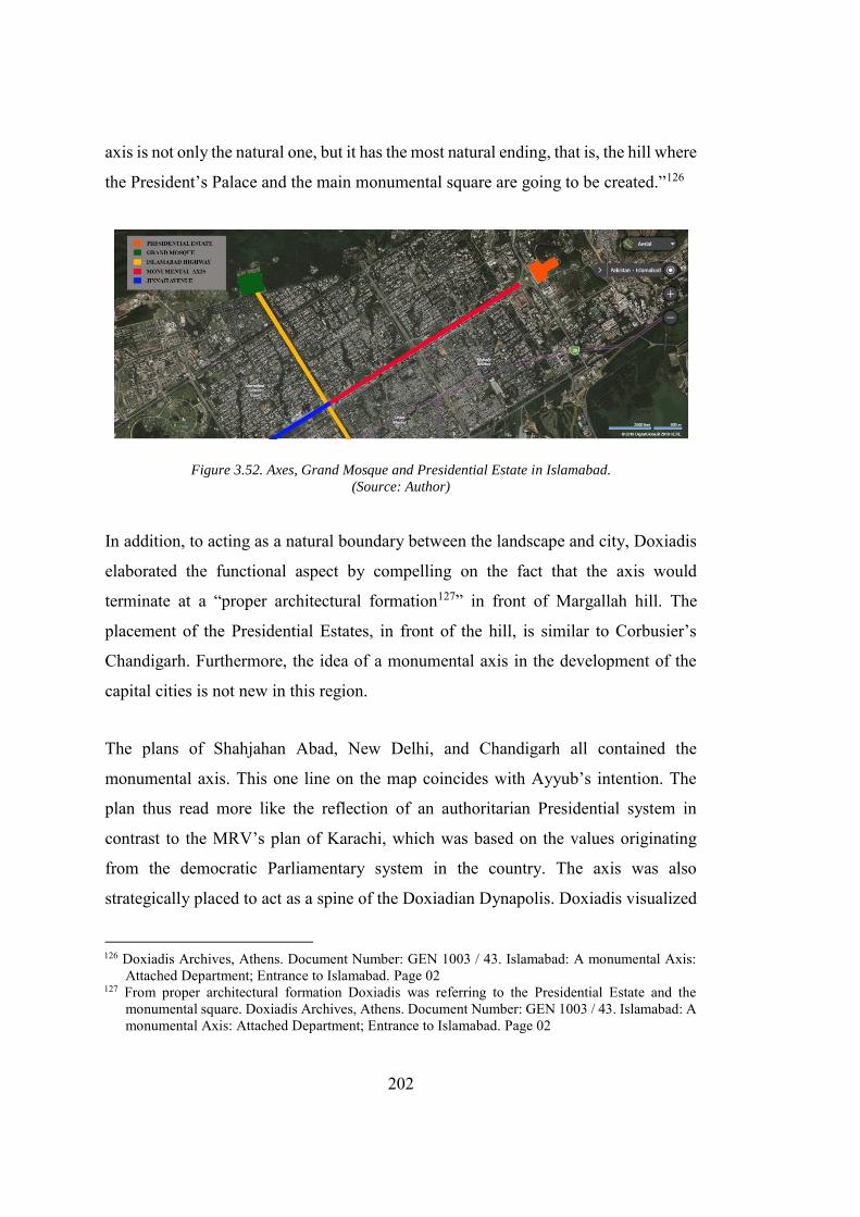
202
axis is not only the natural one, but it has the most natural ending, that is, the hill where
the President’s Palace and the main monumental square are going to be created.”126
Figure 3.52. Axes, Grand Mosque and Presidential Estate in Islamabad.
(Source: Author)
In addition, to acting as a natural boundary between the landscape and city, Doxiadis
elaborated the functional aspect by compelling on the fact that the axis would
terminate at a “proper architectural formation127” in front of Margallah hill. The
placement of the Presidential Estates, in front of the hill, is similar to Corbusier’s
Chandigarh. Furthermore, the idea of a monumental axis in the development of the
capital cities is not new in this region.
The plans of Shahjahan Abad, New Delhi, and Chandigarh all contained the
monumental axis. This one line on the map coincides with Ayyub’s intention. The
plan thus read more like the reflection of an authoritarian Presidential system in
contrast to the MRV’s plan of Karachi, which was based on the values originating
from the democratic Parliamentary system in the country. The axis was also
strategically placed to act as a spine of the Doxiadian Dynapolis. Doxiadis visualized
126 Doxiadis Archives, Athens. Document Number: GEN 1003 / 43. Islamabad: A monumental Axis:
Attached Department; Entrance to Islamabad. Page 02 127 From proper architectural formation Doxiadis was referring to the Presidential Estate and the
monumental square. Doxiadis Archives, Athens. Document Number: GEN 1003 / 43. Islamabad: A monumental Axis: Attached Department; Entrance to Islamabad. Page 02
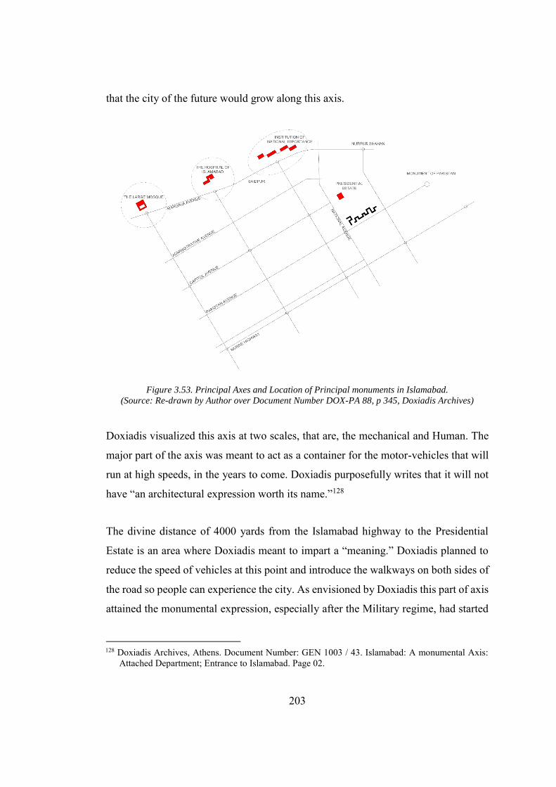
203
that the city of the future would grow along this axis.
Figure 3.53. Principal Axes and Location of Principal monuments in Islamabad.
(Source: Re-drawn by Author over Document Number DOX-PA 88, p 345, Doxiadis Archives)
Doxiadis visualized this axis at two scales, that are, the mechanical and Human. The
major part of the axis was meant to act as a container for the motor-vehicles that will
run at high speeds, in the years to come. Doxiadis purposefully writes that it will not
have “an architectural expression worth its name.”128
The divine distance of 4000 yards from the Islamabad highway to the Presidential
Estate is an area where Doxiadis meant to impart a “meaning.” Doxiadis planned to
reduce the speed of vehicles at this point and introduce the walkways on both sides of
the road so people can experience the city. As envisioned by Doxiadis this part of axis
attained the monumental expression, especially after the Military regime, had started
128 Doxiadis Archives, Athens. Document Number: GEN 1003 / 43. Islamabad: A monumental Axis:
Attached Department; Entrance to Islamabad. Page 02.
204
holding the annual Republic day military parades on this area. Seemingly, the idea for
holding the military parade at the monumental axis was inspired from the Red Square
in the Russia and Tiananmen Square in Beijing, China (Gordon 2006).129 The Military
show off, reinforce the power structure and strengthen the military regime’s intention
of reflecting the absolute authority, using the urban space, on its subject which can be
best understood in connection with Foucault’s mechanism of Power-
knowledge.130The second complementary axis for Islamabad is known as Islamabad
highways run from all the way from Grand trunk road to the Margallah hills and cut
the major axis into its “mechanical” and “monumental” halves. The grand National
Mosque which remained a focal point in the earlier Islamic cities does not lie in the
centre of the city. It was planned at the end of the second grand axis thus imparting a
symbolic value to the mosque. Doxiadis writes that
The reason why the main mosque of Islamabad had been proposed in the
extension of the Islamabad highway, as people’s attention has to be drawn
towards the hills up to the point at which they reach Capitol Avenue and
then, if they do not move towards the big symbols, the mosque, they turn
towards the other symbols, the focal point of the administration of the
country.131
Thus, the two major axis that forms the central spine of the city converges on the two
129 In a detailed explanation to human dimensions for the city Doxiadis writes that “it should be
mentioned that even the greatest axes created in cities like Paris and Washington have a length of approximately 2000 yards for the whole axis. this is the case with the Champs-Elysee’in Paris which has a length of about 2000 yards from the Arc de Triomphe to the Place de la Concorde and of a bit more than 3000 yards up to the Palais du Louvre. This is also the case for the great Mall in Washington where the distance between the Capitol and the Washington Monument is about 2000 yards and the distance up to the Lincoln Memorial no more that 4000 yards. Doxiadis Archives Document Number: GEN 1003 / 43. Islamabad: A monumental Axis: Attached Department; Entrance to Islamabad. Page 03.
130 The term ‘Power-Knowledge’ refers to the power structures established in society through the creation, maintenance and existence through established system of knowledge, culture and social norms (Seisun 2012).
131 Doxiadis Archives, Athens. Document Number: GEN 1003 / 43. Islamabad: A monumental Axis: Attached Department; Entrance to Islamabad, Page 07.
205
main symbolic building the Presidential Estate and the grand national mosque.
Mahsud argues that by these placements, Doxiadis tried to cope with the problem of
the “ideological dualities” of the state (Mahsud 2013). Further to the symbolic
importance, Doxiadis wanted people to have a focal point while they were entering
the Islamabad thus imparting a sense of orientation to them. Doxiadis had further
reinforced the monumentality and sense of direction by proposing a monumental arch
at the intersection of the two highways and the entrance gate on both the axes. Both
the gateways and monumental arches were never built thus leaving the plan
incomplete.
In Addition to the two major axes, Doxiadis utilized the other major boulevards to
signify the buildings of national importance and places them outside the planned grid.
The placement of monuments also reinforces Doxiadis’ vision of Islamabad as a
monument less city (see Fig. 3.53). Mahsud, through his analysis of urban form, also
concludes that the planned area of Islamabad did not have any place for the
monuments (Mahsud 2008).On assuming power, President Ayyub Khan through a
post-proclamation order removed the word “Islamic” from the name of Pakistan.132
He also suggested substituting a Roman script for Urdu, the national language of
Pakistan (Rizvi 2000, 130). These two efforts confirm the inclination of Sandhurst
educated Ayyub Khan towards more secular Pakistan (that remained the centre of
debate in the British educated ruling elite since the conception of Pakistan),133 against
the one who claims it to be a theocratic state. Ayyub Khan who came into power
following the coup d’état, never publicly expresses his secular vision as he wants to
curtail the religious factions of the society for his political support. The plan of
132 Government of Pakistan, President’s order (post-proclamation) no 1 of 1958, Laws (continuance in
force), Order, 1958 10th October 10 1958,Article 2(1) “Notwithstanding the abrogation of the Constitution of March 23, 1956, hereinafter referred to as the late Constitution, by the Proclamation and subject to any Order of the President or regulation made by the Chief Administrator of Martial Law the Republic, to be known henceforward as Pakistan, shall be governed as nearly as may be in accordance with the late Constitution”
133Although Pakistan was declared an “Islamic state” under the constitution of Pakistan implemented on Mar 23, 1956. It was Jinnah’s speech (Nelson 2012) that was used as a fundamental argument by minority secularists, in opposition to the religious masses.
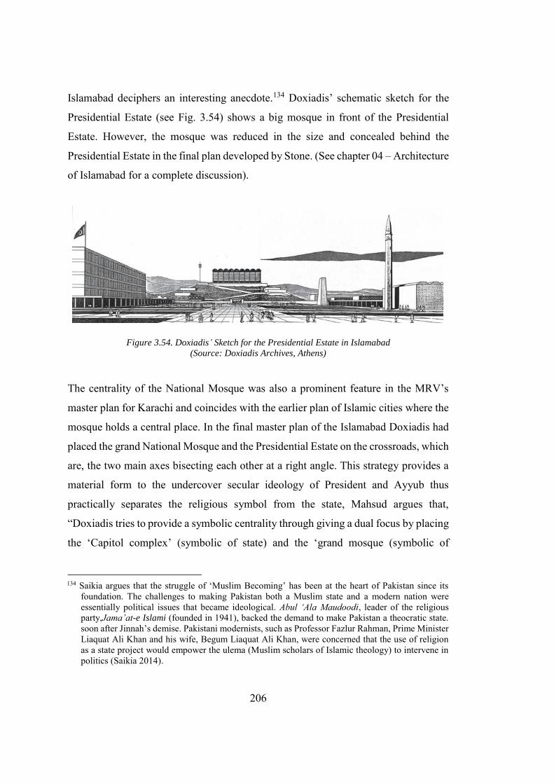
206
Islamabad deciphers an interesting anecdote.134 Doxiadis’ schematic sketch for the
Presidential Estate (see Fig. 3.54) shows a big mosque in front of the Presidential
Estate. However, the mosque was reduced in the size and concealed behind the
Presidential Estate in the final plan developed by Stone. (See chapter 04 – Architecture
of Islamabad for a complete discussion).
Figure 3.54. Doxiadis’ Sketch for the Presidential Estate in Islamabad
(Source: Doxiadis Archives, Athens)
The centrality of the National Mosque was also a prominent feature in the MRV’s
master plan for Karachi and coincides with the earlier plan of Islamic cities where the
mosque holds a central place. In the final master plan of the Islamabad Doxiadis had
placed the grand National Mosque and the Presidential Estate on the crossroads, which
are, the two main axes bisecting each other at a right angle. This strategy provides a
material form to the undercover secular ideology of President and Ayyub thus
practically separates the religious symbol from the state, Mahsud argues that,
“Doxiadis tries to provide a symbolic centrality through giving a dual focus by placing
the ‘Capitol complex’ (symbolic of state) and the ‘grand mosque (symbolic of
134 Saikia argues that the struggle of ‘Muslim Becoming’ has been at the heart of Pakistan since its
foundation. The challenges to making Pakistan both a Muslim state and a modern nation were essentially political issues that became ideological. Abul ‘Ala Maudoodi, leader of the religious party,Jama’at-e Islami (founded in 1941), backed the demand to make Pakistan a theocratic state. soon after Jinnah’s demise. Pakistani modernists, such as Professor Fazlur Rahman, Prime Minister Liaquat Ali Khan and his wife, Begum Liaquat Ali Khan, were concerned that the use of religion as a state project would empower the ulema (Muslim scholars of Islamic theology) to intervene in politics (Saikia 2014).
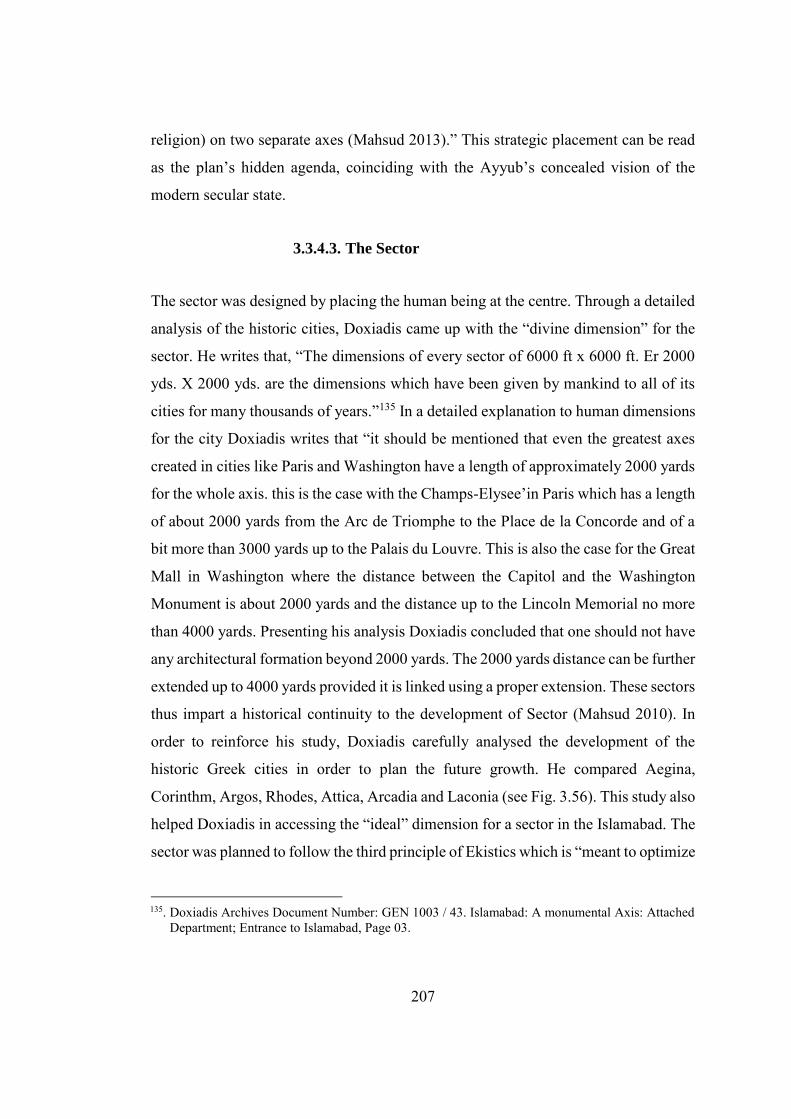
207
religion) on two separate axes (Mahsud 2013).” This strategic placement can be read
as the plan’s hidden agenda, coinciding with the Ayyub’s concealed vision of the
modern secular state.
3.3.4.3. The Sector
The sector was designed by placing the human being at the centre. Through a detailed
analysis of the historic cities, Doxiadis came up with the “divine dimension” for the
sector. He writes that, “The dimensions of every sector of 6000 ft x 6000 ft. Er 2000
yds. X 2000 yds. are the dimensions which have been given by mankind to all of its
cities for many thousands of years.”135 In a detailed explanation to human dimensions
for the city Doxiadis writes that “it should be mentioned that even the greatest axes
created in cities like Paris and Washington have a length of approximately 2000 yards
for the whole axis. this is the case with the Champs-Elysee’in Paris which has a length
of about 2000 yards from the Arc de Triomphe to the Place de la Concorde and of a
bit more than 3000 yards up to the Palais du Louvre. This is also the case for the Great
Mall in Washington where the distance between the Capitol and the Washington
Monument is about 2000 yards and the distance up to the Lincoln Memorial no more
than 4000 yards. Presenting his analysis Doxiadis concluded that one should not have
any architectural formation beyond 2000 yards. The 2000 yards distance can be further
extended up to 4000 yards provided it is linked using a proper extension. These sectors
thus impart a historical continuity to the development of Sector (Mahsud 2010). In
order to reinforce his study, Doxiadis carefully analysed the development of the
historic Greek cities in order to plan the future growth. He compared Aegina,
Corinthm, Argos, Rhodes, Attica, Arcadia and Laconia (see Fig. 3.56). This study also
helped Doxiadis in accessing the “ideal” dimension for a sector in the Islamabad. The
sector was planned to follow the third principle of Ekistics which is “meant to optimize
135. Doxiadis Archives Document Number: GEN 1003 / 43. Islamabad: A monumental Axis: AttachedDepartment; Entrance to Islamabad, Page 03.
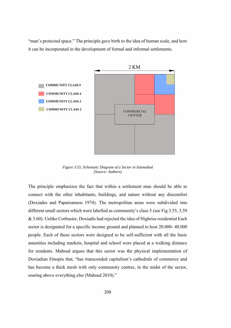
208
“man’s protected space.” The principle gave birth to the idea of human scale, and how
it can be incorporated in the development of formal and informal settlements.
Figure 3.55. Schematic Diagram of a Sector in Islamabad
(Source: Authors)
The principle emphasizes the fact that within a settlement man should be able to
connect with the other inhabitants, buildings, and nature without any discomfort
(Doxiades and Papaioannou 1974). The metropolitan areas were subdivided into
different small sectors which were labelled as community’s class 5 (see Fig 3.55, 3.59
& 3.60). Unlike Corbusier, Doxiadis had rejected the idea of Highrise residential Each
sector is designated for a specific income ground and planned to host 20.000- 40.000
people. Each of these sectors were designed to be self-sufficient with all the basic
amenities including markets, hospital and school were placed at a walking distance
for residents. Mahsud argues that this sector was the physical implementation of
Doxiadian Etnopia that, “has transcended capitalism’s cathedrals of commerce and
has become a thick mesh with only community centres, in the midst of the sector,
soaring above everything else (Mahsud 2010).”
209
Figure 3.56. Average Size of Ancient Greek cities.
(From Left to Right Aegina, Corinthm Argos, Rhodes, Average city-state, Attica, Arcadia, Laconia
(Source: Doxiadis Archives, Athens)
Figure 3.57. Comparison of Old Athens and Sector G-6 Islamabad by Doxiadis.
(Source: Doxiadis Archives, Athens)
Figure 3.58. Comparison Plan of Old Athens and Sector G-6 Islamabad.
(Source: Doxiadis Archives, Athens)
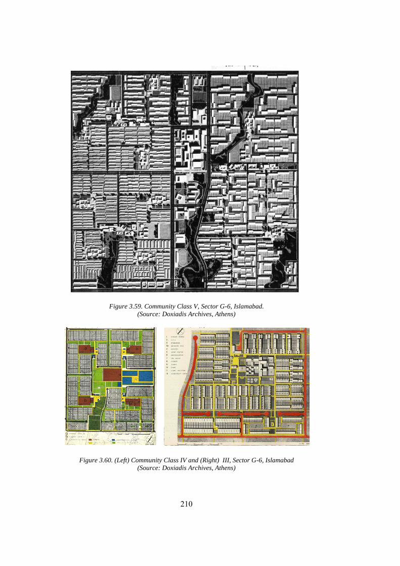
210
Figure 3.59. Community Class V, Sector G-6, Islamabad.
(Source: Doxiadis Archives, Athens)
Figure 3.60. (Left) Community Class IV and (Right) III, Sector G-6, Islamabad
(Source: Doxiadis Archives, Athens)
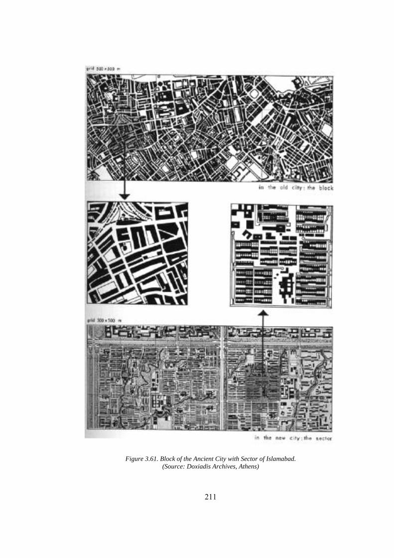
211
Figure 3.61. Block of the Ancient City with Sector of Islamabad.
(Source: Doxiadis Archives, Athens)
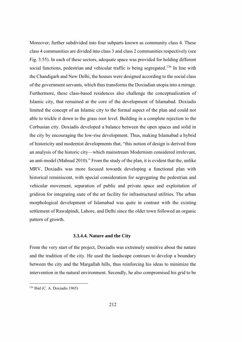
212
Moreover, further subdivided into four subparts known as community class 4. These
class 4 communities are divided into class 3 and class 2 communities respectively (see
Fig. 3.55). In each of these sectors, adequate space was provided for holding different
social functions, pedestrian and vehicular traffic is being segregated.136 In line with
the Chandigarh and New Delhi, the houses were designed according to the social class
of the government servants, which thus transforms the Doxiadian utopia into a mirage.
Furthermore, these class-based residences also challenge the conceptualization of
Islamic city, that remained at the core of the development of Islamabad. Doxiadis
limited the concept of an Islamic city to the formal aspect of the plan and could not
able to trickle it down to the grass root level. Building in a complete rejection to the
Corbusian city. Doxiadis developed a balance between the open spaces and solid in
the city by encouraging the low-rise development. Thus, making Islamabad a hybrid
of historicity and modernist developments that, “this notion of design is derived from
an analysis of the historic city—which mainstream Modernism considered irrelevant,
an anti-model (Mahsud 2010).” From the study of the plan, it is evident that the, unlike
MRV, Doxiadis was more focused towards developing a functional plan with
historical reminiscent, with special consideration for segregating the pedestrian and
vehicular movement, separation of public and private space and exploitation of
gridiron for integrating state of the art facility for infrastructural utilities. The urban
morphological development of Islamabad was quite in contrast with the existing
settlement of Rawalpindi, Lahore, and Delhi since the older town followed an organic
pattern of growth.
3.3.4.4. Nature and the City
From the very start of the project, Doxiadis was extremely sensitive about the nature
and the tradition of the city. He used the landscape contours to develop a boundary
between the city and the Margallah hills, thus reinforcing his ideas to minimize the
intervention in the natural environment. Secondly, he also compromised his grid to be
136 Ibid (C. A. Doxiadis 1965)
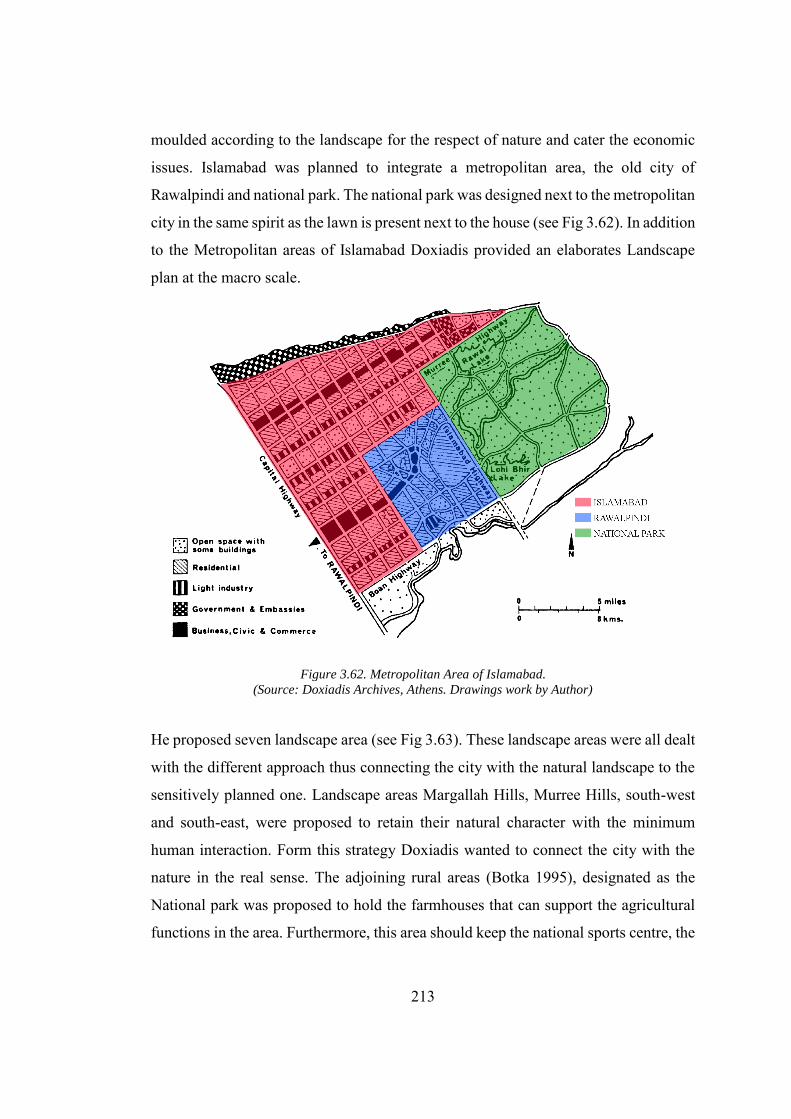
213
moulded according to the landscape for the respect of nature and cater the economic
issues. Islamabad was planned to integrate a metropolitan area, the old city of
Rawalpindi and national park. The national park was designed next to the metropolitan
city in the same spirit as the lawn is present next to the house (see Fig 3.62). In addition
to the Metropolitan areas of Islamabad Doxiadis provided an elaborates Landscape
plan at the macro scale.
Figure 3.62. Metropolitan Area of Islamabad.
(Source: Doxiadis Archives, Athens. Drawings work by Author)
He proposed seven landscape area (see Fig 3.63). These landscape areas were all dealt
with the different approach thus connecting the city with the natural landscape to the
sensitively planned one. Landscape areas Margallah Hills, Murree Hills, south-west
and south-east, were proposed to retain their natural character with the minimum
human interaction. Form this strategy Doxiadis wanted to connect the city with the
nature in the real sense. The adjoining rural areas (Botka 1995), designated as the
National park was proposed to hold the farmhouses that can support the agricultural
functions in the area. Furthermore, this area should keep the national sports centre, the
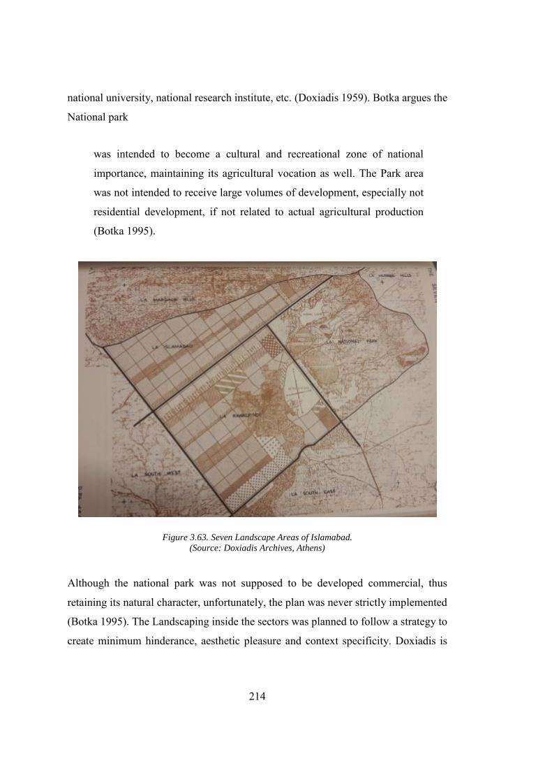
214
national university, national research institute, etc. (Doxiadis 1959). Botka argues the
National park
was intended to become a cultural and recreational zone of national
importance, maintaining its agricultural vocation as well. The Park area
was not intended to receive large volumes of development, especially not
residential development, if not related to actual agricultural production
(Botka 1995).
Figure 3.63. Seven Landscape Areas of Islamabad.
(Source: Doxiadis Archives, Athens)
Although the national park was not supposed to be developed commercial, thus
retaining its natural character, unfortunately, the plan was never strictly implemented
(Botka 1995). The Landscaping inside the sectors was planned to follow a strategy to
create minimum hinderance, aesthetic pleasure and context specificity. Doxiadis is
215
very sensitive about the scale of the landscaping, which in his opinion imparts the user
with an experience of the city. He suggested that all the landscaping whether in the
road, green spaces in the sector or the courtyard of the house should be such that it
should not hinder the passing of cars, pedestrian and should not restrict opening of
windows137. Thus, proposing a rational development of these landscape areas. He
writes that, “a rational plan certainly must provide a successful aesthetic, appearance,
it must satisfy the people who to make use of it. it must respect the civilization and
tradition of the country.”138 Doxiadis wanted to integrate the landscaping in the street
to enhance their character. Doxiadis, quite frequently, had highlighted the importance
of the traditional landscape of Islamabad and the region through his sketches and
writings. At one occasion Doxiadis writes that
The Mughal period is fill of magnificent examples of architecture
combined with landscaping…In Islamabad, we have to face a very old and
magnificent inheritance which cannot be ignored as it has now become
traditions. We do not, of course, say that tradition should be copied, this is
not our aim, but if we know the principles on which they developed we
shall be in position to better to face the case of Islamabad.139
However, the historicity of the region was absent from the landscape development of
Islamabad. In this lieu, Daechsel argues that it was the landscape of Athens that
remained in the mind of Doxiadis from the very first day (Daechsel 2015, 210).
137 Report on Landscape, Islamabad (76), Document DOX-PA (31.3.62), Prepared for Government of
Pakistan, Capital Development Authority, Page 76. 138 Doxiadis from the very first day was very sensitive about the tradition of the country. He wants to
give it respect, without copying it. In this regard he writes, “In Islamabad we have to face a very old and magnificent inheritance which cannot be ignore as it has now become traditions. We do not of course say that tradition should be copied, this is not our aim, but if we know the principles on which they developed we shall be in position to better to face the case of Islamabad.” Report on Landscape, Islamabad (76), Document DOX-PA (31.3.62), Prepared for Government of Pakistan, Capital Development Authority. page 79-80.
139 Report on Landscape, Islamabad (76), Document DOX-PA (31.3.62), Prepared for Government of Pakistan, Capital Development Authority.
216
Mahsud also argues that Doxiadis wanted to impart a character to Islamabad by fusing
“Greek Acropolis, medieval landscape and later renaissance palatial
formality”(Mahsud 2009).The plans for the Karachi and Islamabad are poles apart. As
former was intended to resolve the problems of the existing city, while later was
envisioned to develop a city from scratch. The significant difference between the plan
was that MRV’s plan for Karachi was planned to bring the symbolic and monumental
values to the core of city by through Jinnah’s tombs and Grand national mosque, while
Doxiadis had placed the symbolic elements Presidential Estate and grand National
Mosque on the periphery, outside the city. MRV plans also doesn’t show any intention
of bringing nature into the city in contradiction to the Doxiadis plan. The Plan of the
Karachi reflects the democratic values with the public gathering space inspired from
Meydan in Isfahan, in the heart of the city. Secondly, the centre point of the plan was
the tomb of Jinnah, and national symbols were carved in the forecourt thus reinforcing
the national sentiments of the nation.
3.4. Conclusion
The development of these new capital cities was not only meant to symbolize the
country, but they behold a greater political agenda, that is, to transform the society as
a whole. Although the radical ideas of clients and utopianism of architects were well
embedded within the plan, integration of certain social processes had devastated the
reformist agenda of plan. The selection of the abstract and universal design, the Grid-
iron, was an effort by the respective Governments to connect itself with the global
community and to impart identity to the newly born nations. It was established by the
idea that abstract aesthetic and functional forms had the potential to absorb the radical
socio‐political change, consequently resulting in overcoming the dynamics of pre‐
colonial and imperial settlements. Hence, this abstraction could be the new face, the
identity, of the respective countries exhibiting features derived from Indian
architectural tradition. Both Le Corbusier and Doxiadis had tried to justify the grid plan
with reference to India and Pakistan by connecting it with the Democracy and Religion.
217
Kalia argues that, “Some of these ideas appear more suited to the Islamic notions,
where religion exhorts men to walk on a straight line with a purpose, rather than for
Hindu nation having a circular view of life, the concept of samsara (Kalia 1990).”Both
of the cities were developed following an overwhelming expression of “human scale,”
“Machine” and Functionalism. All these aspects were integrated to form a city of the
future. However, in line with the Foucault’s emphasis on the outcomes of power
relation instead of only ideologies (Foucault 1980) can be applied to the spatial
construction. The cities that were meant to resolve the traffic problems are facing the
problems sixty years after their construction. Which reinforces the fact, that “machine
problems” in the city could not be resolved by making wider roads, rather its solution
lies in provision of an efficient mass transportation system.
3.4.1. Monumentality against City
The addition of the last function, that is, Monumentality in the CIAM agenda after
1945 had given a new soul to the post-war urban planning (Mumford 2002; Frampton
and Mumford 2002). Corbusier intended to develop a monumental city by integrating
the Highrise residential apartment at the core of the city and a symbolic Capitol
complex. The rejection of the Highrise residential apartments, owing to the Indian
condition, in Chandigarh had resulted in the fact that Corbusier had lost his interest in
the city design instead he restricted himself to the design of the Capitol Complex and
left the development of the city on this team. He was upset to the extent that he even
tried to the develop an artificial hill between his Capitol Complex and the city (Prakash
2002). Doxiadis’ city has no place for the monumentality (Mahsud 2013, 71). He
places the Presidential Estate and the grand National Mosque outside the city’s
planning grid and encourages and low height and increased density residential unit
that corresponds to the local climatic and historical conditions. Doxiadis’ focus on the
city designing and restriction to the monumentality was to the extent that he out-rightly
rejected the proposal to create the high rise apartment in the core of the city (Yakas
2001). Furthermore, due to Doxiadis’ lack of interest in making any monumental and
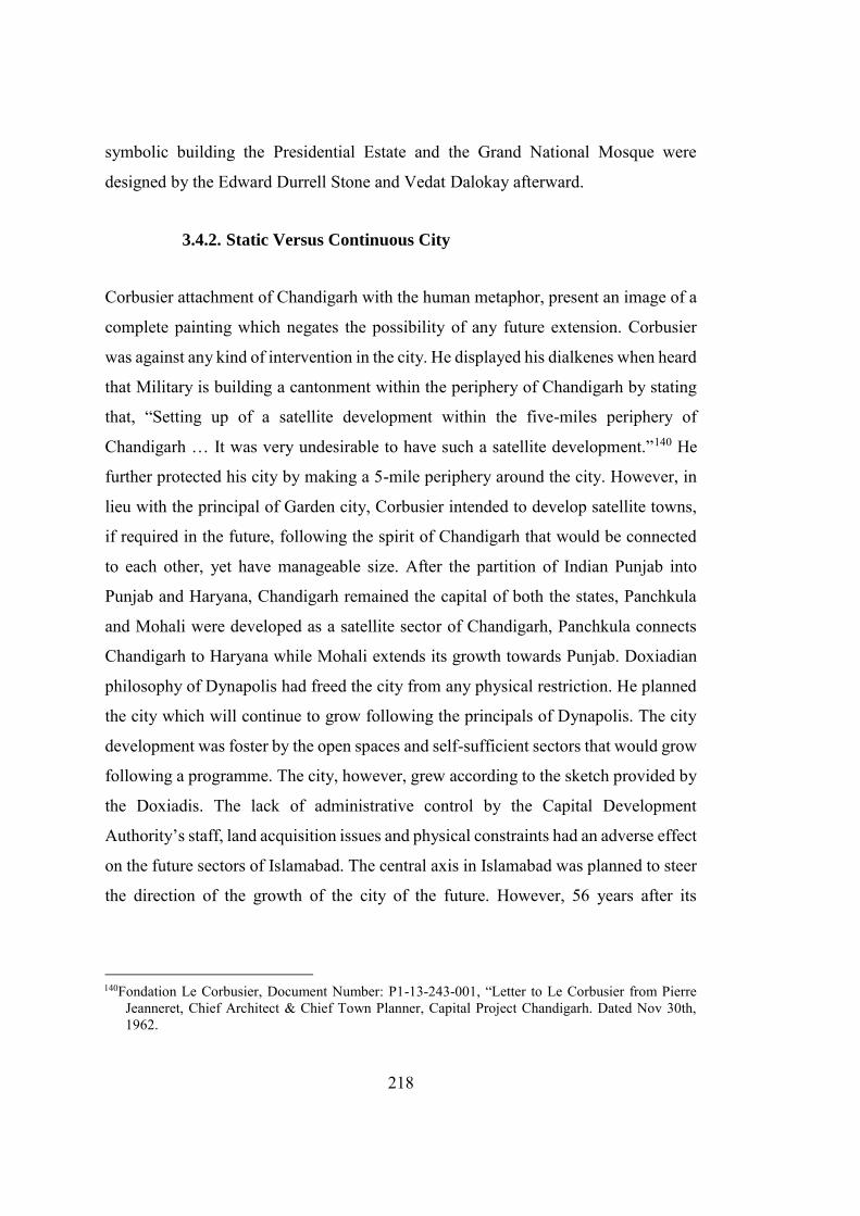
218
symbolic building the Presidential Estate and the Grand National Mosque were
designed by the Edward Durrell Stone and Vedat Dalokay afterward.
3.4.2. Static Versus Continuous City
Corbusier attachment of Chandigarh with the human metaphor, present an image of a
complete painting which negates the possibility of any future extension. Corbusier
was against any kind of intervention in the city. He displayed his dialkenes when heard
that Military is building a cantonment within the periphery of Chandigarh by stating
that, “Setting up of a satellite development within the five-miles periphery of
Chandigarh … It was very undesirable to have such a satellite development.”140 He
further protected his city by making a 5-mile periphery around the city. However, in
lieu with the principal of Garden city, Corbusier intended to develop satellite towns,
if required in the future, following the spirit of Chandigarh that would be connected
to each other, yet have manageable size. After the partition of Indian Punjab into
Punjab and Haryana, Chandigarh remained the capital of both the states, Panchkula
and Mohali were developed as a satellite sector of Chandigarh, Panchkula connects
Chandigarh to Haryana while Mohali extends its growth towards Punjab. Doxiadian
philosophy of Dynapolis had freed the city from any physical restriction. He planned
the city which will continue to grow following the principals of Dynapolis. The city
development was foster by the open spaces and self-sufficient sectors that would grow
following a programme. The city, however, grew according to the sketch provided by
the Doxiadis. The lack of administrative control by the Capital Development
Authority’s staff, land acquisition issues and physical constraints had an adverse effect
on the future sectors of Islamabad. The central axis in Islamabad was planned to steer
the direction of the growth of the city of the future. However, 56 years after its
140Fondation Le Corbusier, Document Number: P1-13-243-001, “Letter to Le Corbusier from Pierre
Jeanneret, Chief Architect & Chief Town Planner, Capital Project Chandigarh. Dated Nov 30th, 1962.
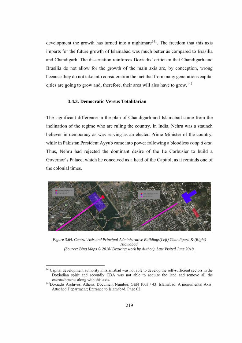
219
development the growth has turned into a nightmare141. The freedom that this axis
imparts for the future growth of Islamabad was much better as compared to Brasilia
and Chandigarh. The dissertation reinforces Doxiadis’ criticism that Chandigarh and
Brasilia do not allow for the growth of the main axis are, by conception, wrong
because they do not take into consideration the fact that from many generations capital
cities are going to grow and, therefore, their area will also have to grow.142
3.4.3. Democratic Versus Totalitarian
The significant difference in the plan of Chandigarh and Islamabad came from the
inclination of the regime who are ruling the country. In India, Nehru was a staunch
believer in democracy as was serving as an elected Prime Minister of the country,
while in Pakistan President Ayyub came into power following a bloodless coup d'etat.
Thus, Nehru had rejected the dominant desire of the Le Corbusier to build a
Governor’s Palace, which he conceived as a head of the Capitol, as it reminds one of
the colonial times.
Figure 3.64. Central Axis and Principal Administrative Buildings(Left) Chandigarh & (Right)
Islamabad.
(Source: Bing Maps © 2018/ Drawing work by Author). Last Visited June 2018.
141Capital development authority in Islamabad was not able to develop the self-sufficient sectors in the
Doxiadian spirit and secondly CDA was not able to acquire the land and remove all the encroachments along with this axis.
142Doxiadis Archives, Athens. Document Number: GEN 1003 / 43. Islamabad: A monumental Axis: Attached Department; Entrance to Islamabad, Page 02.
220
While, in case of the Islamabad, Presidential Estate was strategically placed at the
most critical location thus imparting a symbolic significance of it. At the same time,
the Prime Minister Secretariat, that was the constitutional head of the country, had no
place in the plan and later it was developed on a minor axis away from the Presidential
Estate. However, with their different approaches, both the cities reinforce the case for
the political reflection on the urban design. Both Le Corbusier and Doxiadis laid
emphasis on respecting the local history, indigenous practices and climate of the
region. However, apparatuses of the new kind of the government mechanism don’t
have any precedent in the past. Both Doxiadis and Le Corbusier had acknowledged
the strong axial plan of Shahjahanabad and New Delhi and mimic them in the
respective plans for Islamabad and Chandigarh. Nielsen argues that Doxiadis was
looking at the city in line with the Fatehpur Sikri and Shahjahanabad while the ruling
regime in Pakistan, was assuming the role of colonizer thus the cantonment and New-
Delhi was their first inspiration. Le Corbusier also showed an immense interest in the
history and culture of Punjab, as evident from a compilation of his sketches, which he
made during a different visit to India, at foundation Le Corbusier. His Capitol
Complex was seen in line with the Fatehpur Sikri and gardens of Patiala (to be
discussed later in the next chapter). In short, we can conclude that both Chandigarh
and Islamabad, developed in India and Pakistan respectively, behold both the
exogenous and endogenous impression, however, it could not be related to either of
them independently. They were the hybrid modern products which were re-invented
on the Indian soil. The Capital cities, in the wake of prevailing nationalistic ideologies,
were directed towards Utopia; A promised land, but since then following a mirage
where a rational plan can yield a city of people.
221
CHAPTER 4
4. ARCHITECTURAL DESIGN MANTRA
Modern architecture had always and inevitably
been considered a Western bequest because its
origin lies in Western History. Origins,
however, are not ends and therefore are not the
only ways of deriving identity and ownership
(Prakash 2002).
4.1. Introduction
A This chapter would inquire the making of monumental, Capitol Complex
(Chandigarh) and the Presidential Estate (Islamabad) in the prevailing ideologies of
nationalism and placemaking. These buildings not only reflect the new genre of
modernist architecture in the Indian Subcontinent, but also meant to act as a symbol
for the new nations. Furthermore, this chapter will discuss these building with
reference to the “theory of hybrid modernity,” and argues that impeachment of Indian
historicism and the search for rational ideals not only forced the architects to produce
a solution that is Indian in spirit, but also made Western modernity null and void. Both
the buildings were designed outside the main frame of the planned grid. The reason
for Chandigarh was that Le Corbusier wanted to disconnect the Capitol Complex from
the city after his proposed Highrise buildings were not seemed feasible to be erected
in the city. The city of Doxiadis had no place for monumentality, although Doxiadis
proposed a strong link between the city and the administration complex by providing
a vast square designed as a “forecourt of the nation.” Edward Durrell Stone’s
insensitive approach towards the design had disconnected the building from the city.
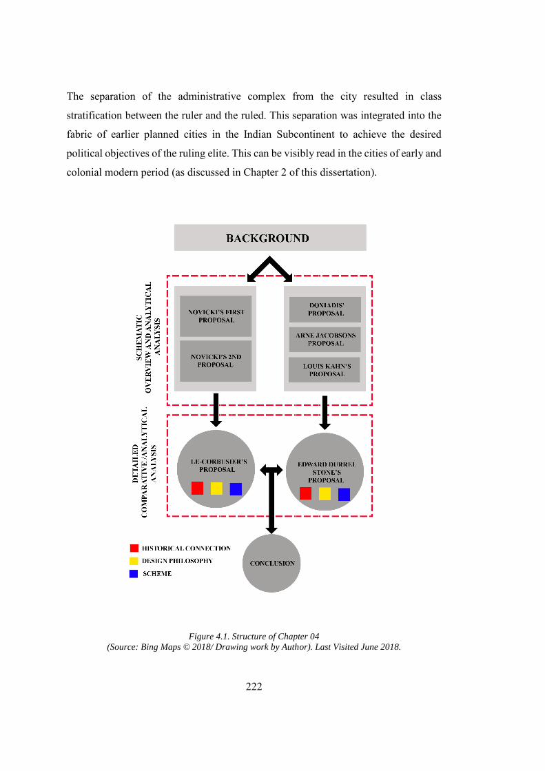
222
The separation of the administrative complex from the city resulted in class
stratification between the ruler and the ruled. This separation was integrated into the
fabric of earlier planned cities in the Indian Subcontinent to achieve the desired
political objectives of the ruling elite. This can be visibly read in the cities of early and
colonial modern period (as discussed in Chapter 2 of this dissertation).
Figure 4.1. Structure of Chapter 04
(Source: Bing Maps © 2018/ Drawing work by Author). Last Visited June 2018.
223
This stratification contradicts the democratic and nationalistic sentiments which lay
emphasis on removing the barrier between the ruler and the ruled and presents a
scheme of society as a singular entity. The structure of this chapter comprises of a
detailed analysis of the evolution of design for the Capitol Complex in Chandigarh
and the Presidential Estate in Islamabad by bringing into the discussion the design
aspiration, design inspiration and the respective background agendas. (see Fig. 4.1).
The final schemes for Capitol complex, Chandigarh and the Presidential Estate,
Islamabad are critically analysed and compared to highlights the distinctive features
and characteristics of buildings in both sites. The (new Indian) monumentality
remained the pivotal objective behind the design of the Presidential Estate in
Islamabad and Capitol Complex in Chandigarh. The Governments required the city
buildings to have symbolic functions embedded within them, which not only
represented their country internationally, but also helped in imparting national pride
in the citizens of the respective countries. The resultant monumentality is a product of
binary operation of exogenous and endogenous forces. Exogenous forces were
brought by the foreign architects, and endogenous forces originated from the pre-
independence nationalist movements, colonial discourse on architecture, material
culture and various other contextual issues. In this regard, an overview of the colonial
discourse and the relation between the (new) monumentality and Indian condition
would develop a solid footing for comprehending the architecture of the Capitol
Complex (Chandigarh) and the Presidential Estate (Islamabad).As already discussed
in chapter 3, during the relocation of the Empire’s capital from Calcutta to New Delhi
three parallel discourses on architecture emerged. The following lines would address
that colonizers had a different perception about the “Indian-ness,” and religious
architecture that assimilated into the post-independence material formation through
the British trained technocrats. This difference in understanding is exhibited through
different texts written to mould Indian history according to the political ambitions of
the colonizer.
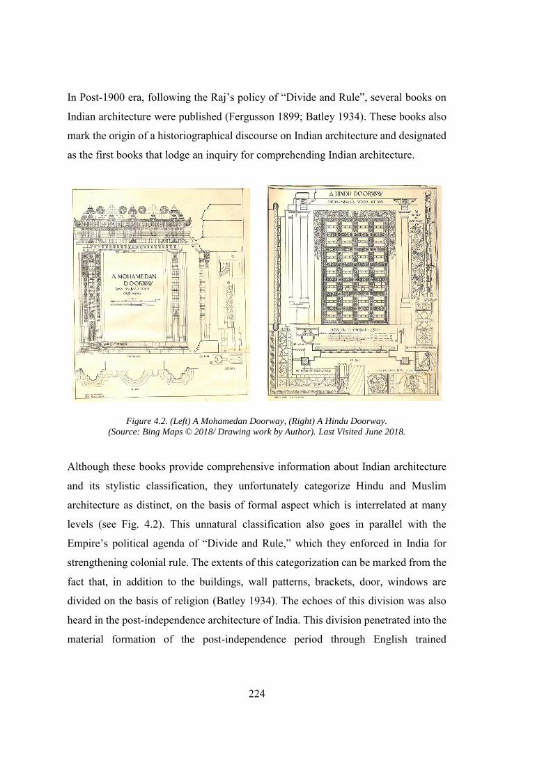
224
In Post-1900 era, following the Raj’s policy of “Divide and Rule”, several books on
Indian architecture were published (Fergusson 1899; Batley 1934). These books also
mark the origin of a historiographical discourse on Indian architecture and designated
as the first books that lodge an inquiry for comprehending Indian architecture.
Figure 4.2. (Left) A Mohamedan Doorway, (Right) A Hindu Doorway.
(Source: Bing Maps © 2018/ Drawing work by Author). Last Visited June 2018.
Although these books provide comprehensive information about Indian architecture
and its stylistic classification, they unfortunately categorize Hindu and Muslim
architecture as distinct, on the basis of formal aspect which is interrelated at many
levels (see Fig. 4.2). This unnatural classification also goes in parallel with the
Empire’s political agenda of “Divide and Rule,” which they enforced in India for
strengthening colonial rule. The extents of this categorization can be marked from the
fact that, in addition to the buildings, wall patterns, brackets, door, windows are
divided on the basis of religion (Batley 1934). The echoes of this division was also
heard in the post-independence architecture of India. This division penetrated into the
material formation of the post-independence period through English trained
225
bureaucracy and technocrats (who held the major administration posts after the
independence and played a pivotal rule during the development of Chandigarh and
Islamabad). In the prevailing ideologies of nationalism, the perceived space was
assumed following this divisions carved by British, rather than established norms of
Islamic or Hindu architecture. In the case of the Islamic Republic of Pakistan, the case
of material translation is rather straightforward. Muslim ruled India for 1000 of years
and created a number of monumental buildings. These building, especially the ones
by the Turkic rulers and dynasties, set the benchmark for the development. There were
two reasons for the adaptation of these buildings
1. With the relocation of Caliphate, there was a gradual shift in inclination of
Indian Muslim intelligentsia from the Arab Muslims to Turkic Muslims.
2. Pakistan shares a disputed border with Afghanistan; this is the one reason
architecture of Mughals, who eradicated the sultanate of Afghan Kings from
India, is preferred over the architecture of sultanates of Afghan origin
In short post-independence architecture in Islamabad was a result of formal
classification, based on the literature published by the colonizers. Both Mayer and Le
Corbusier and to some extent their counterpart in Islamabad Edward Durrell Stone
and Doxiadis tried to develop the Capitol Complex and the Presidential Estate as the
monumental buildings, with restricted access to the city. For Mayer and Le Corbusier,
the monumentality is like a fresh breeze passing through the simple and functional
agenda of CIAM, as, just a few years before the independence of India in 1947, CIAM
had included monumentality into their debates about modern architecture. The
inclusion of monumentality in CIAM’s manifestoes depicts a reorientation in the
CIAM’s ideology which came as a surprise since “the concept had always been linked
to the classical tradition that they rejected” (Mumford 2002,151). Giedion nourished
this idea of new monumentality. He utilized more historical detail to criticize the

226
“empty shell,” which in his opinion lacks the spirit of the time.143 Giedion also
attacked the pseudo monumentality which in his opinion
comes into being within the sphere of the Napoleonic society, imitating
the manner of a former ruling class … The recipe is always. The same:
take some curtains of the column. and put them in front of any building.
Whatever its purpose and to whatever consequences it may lead
(Zucker and Giedion 1944).
A similar anecdote to the pseudo-monumentality was also highlighted by the group of
architects who were supporting the Indo-Saracenic style before the development of
Imperial Delhi. The focal point of the debated was E. B. Havell who was the ex-
principal of Calcutta college of Art. He saw the construction of Delhi as an opportunity
that can surpass the “shoddy imitation” of Western architecture in Calcutta which
includes “bastard Gothic” and “emasculated Italian Renaissance (Metcalf 2002,
213).”Giedion believed that the focus of the new monumentality should be the,
“publicly financed community centre.” In a monograph he prepared with Sert
highlights the nine points of the new monumentality (Giedion and Sert 1943). He
cautions architects that architecture is now facing a transition from simpler/functional
problem to harder and more complex one. The complexity is inevitable that problem
is architecture is not limited to the production of a functional building alone, but there
is a need to develop a mutual relation between the city and architecture. He concludes
that, “The monument should constitute the most powerful accents in these vast
schemes (Giedion and Sert 1943).” Giedion did not shed any further light on the
relationship between the city and the monument, but Sert wrote a detailed article, “The
human scale in city planning.” carrying forward the ideas floated by the Le Corbusier
143“Spirit of time” or “zeitgeist” is a term that is closely linked with Hegel and his conception of
modernity. For Hegel the “spirit of the times” does not indicate a homogenous state of affairs in which everyone goes along with the same idea, but rather expresses the fact that in any given society, there is a certain “language”, culture or range of concepts in which every dispute, every contradiction must be fought out (Bernasconi 2002).
227
and Garden City movement. He designated the civic centre as the most important part
of the city. He also emphasized that the new monumentality should be constituted by
“areas especially planned for public gatherings, main monument constituting
landmarks in the region, a symbol of popular aspirations (Sert 1944).” These
guidelines were developed for the post-war communities in order to express man’s
“highest cultural needs” and utilized mainly for conceptualizing the civic centres in
the cities. This dissertation argues that it remained the major force behind Mayer,
Novicki and Le Corbusier’s144 proposals. Chandigarh and Islamabad also provided
vaster urban schemes for the developments. These “monuments” were rediscovered
by embedding the historicity and ideas of nationalism.
4.2. The Capitol Complex: Chandigarh
Mayer/Novicki and Le Corbusier, who prepared the proposal for the
city beautiful, had also designed the Capitol Complex in Chandigarh. Both the
proposals share a few similarities; however, the major difference between them is that
of inspiration. The Mayer/Novicki proposal was based on Novicki’s previous works
and coincides with international theories of architecture, while giving little
consideration to the Indian condition. Le Corbusier’s proposal had a dual reception:
on the one hand, he was criticized for replicating an alien form in Chandigarh, while
on the other hand several authors tried to interpret the degree of Indian-ness of his
Capitol Complex at Chandigarh.
4.2.1. Novicki/Mayer’s 1st Design: Cosmeticizing the Foreign
In the wake of prevailing ideologies of nationalism, Novicki placed his Capitol
Complex between the two rivers, in front of the Shivalik mountains that served as the
144Mumford writes the Le Corbusier had presented this new-monumentality in the French town of Saint
Die, but the material conception was different from how Sert and Wienar had conceptualized the motor city. Giedion acknowledged the project and labelled it as, “A long stride from the enclosed Renaissance plaza.”(Mumford 2002).
228
backdrop. The site of the Capitol Complex was elevated so it “would permit views of
it from the city from whatever perspective, and would associate it most closely with
the splendid backdrop of ridges (Evenson 1966, 16).”Novicki was a functionalist
under a strong influence of CIAM and Giedion (Sprague 2013). His first proposal for
the Capitol Complex was a straightforward integration of “function” and
“monumentality.” This proposal lacked the Indian character of the building and was
in contradiction with his other sketches for the city of Chandigarh. In these sketches,
an indigenous tone was quite evident, and he tried his best to translate his knowledge
of Indian culture into the design (see Chapter 3).
His first proposal for the Capitol Complex lacked the Indian spirit; it was rather a
reflection of his earlier works in Warsaw and a strong impression of his mentors such
as Le Corbusier and Niemeyer. His designed the Capitol Complex at a distance from
the city. A moat was developed segregating the city and the Capitol complex145.
Evenson argues that this “functional” isolation of the Capitol Complex and city had
its pedigree in Le Corbusier’s Villa Radieuse146. His steadfastness on completely
separating the city from the Capitol Complex is expressed by Vale as, “Mayer plan
underwent many transformations, but the position of the Capitol as its head remained
unchallenged. believing that the government functions should be spiritually detached
(Vale 1992).” Novicki’s segregation can be interpreted as a paradox which, on one
hand, rejects the hierarchy indebted within the traditional Indian towns (In the
traditional Indian towns, the administrative function lies in the core of the city), while
on the other, it can be well appropriated with the rigid class-based caste system: the
145Kalia argues that Mayer was quite rigid about developing Capital Complex in complete separation
from the city in this regard he rejected the Buckley’s idea of “moving Capitol Complex to the form the centre of gravity for employment”(Kalia 1999, 59).
146Evenson Argues that, “In each case, the area which performs the “thinking” function of the city is given placement analogous to that of the head in relation to the body (Evenson 1966, 16).”
229
dominant social ideology followed by the majority of Hindus in India147. The
dissertation, however, argues that this effort of segregating the Capitol from the city
does contradict with the basic idea for which the city was being built at the first
place148. Apart from all the criticism on Mayer’s plan, it provided a footprint for the
future development of the post-independence Indian capital cities later designed by Le
Corbusier and Doxiadis as Chandigarh and Islamabad respectively. These cities were
eventually developed as a capitals without “monuments.” The separation of Capitol
Complex from the city had added to the autonomy of the building complex which in
result overly enhanced its symbolic value. The creation of this new class of buildings
resulted in the social alienation of the buildings. Novicki had presented his first
proposal of the Capitol Complex with this leaf plan (see Fig. 4.3). The buildings in
this proposal were grouped in a single block with courtyards. Quite ironically,
Novicki’s symbolism could not be related to the democratic system of India; rather it
resembles more like a fort, administrative centre of an ancient theocratic state. The
Capitol Complex was rectangular with an approximate dimension of 100 feet by 400
feet. The height of the building was the result of technological constraints149 and
follows the state’s intention of making buildings economical for construction. To keep
the building’s construction economic Novicki limited the height of the block to three
stories, and proposed brick as the principal building material.
147It is important to note that Indian and Pakistani nationalism were based on contradiction. Religion
was the predominant force that shaped up Pakistani Nationalism. Indian nationalism in contradiction with Pakistan was based on promoting secular ideologies that lead to the declaration of India as a secular Estate. However, behind the scene Hinduism was the dominant religious force whose ideologies often surpassed that of secularism. Keeping this information in background one can trace the role of religion as a backdrop to architecture and urban production. For example Kalia argues that it was because of the strong impact of Hindu tradition that “Cambridge educated Nehru could not resist admitting that the creation of a city was a “godlike” act (Kalia 2006).
148 The post-independence capital city represents the dominance of people’s power. During the colonial period the citizens were marginalized from the city as well as their access to the public buildings was restricted, which coincides with the colonizers’ ambition to gain political control over the space. The postcolonial capital city, following the people’s aspirations, should be a tool to bridge the gap, instead of continuing the legacy of the colonizers.
149 The Major problem Novicki and Le Corbusier faced in the conception of the city was the lack of elevators. This constraint thrashed the Corbusian multi-storey city, resulting in Corbusian disassociation with the city plan.
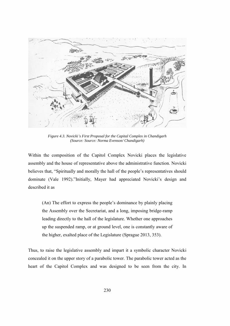
230
Figure 4.3. Novicki’s First Proposal for the Capital Complex in Chandigarh
(Source: Source: Norma Evenson/ Chandigarh)
Within the composition of the Capitol Complex Novicki places the legislative
assembly and the house of representative above the administrative function. Novicki
believes that, “Spiritually and morally the hall of the people’s representatives should
dominate (Vale 1992).”Initially, Mayer had appreciated Novicki’s design and
described it as
(An) The effort to express the people’s dominance by plainly placing
the Assembly over the Secretariat, and a long, imposing bridge-ramp
leading directly to the hall of the legislature. Whether one approaches
up the suspended ramp, or at ground level, one is constantly aware of
the higher, exalted place of the Legislature (Sprague 2013, 353).
Thus, to raise the legislative assembly and impart it a symbolic character Novicki
concealed it on the upper story of a parabolic tower. The parabolic tower acted as the
heart of the Capitol Complex and was designed to be seen from the city. In
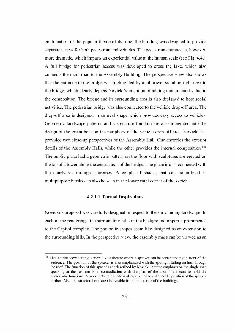
231
continuation of the popular theme of its time, the building was designed to provide
separate access for both pedestrian and vehicles. The pedestrian entrance is, however,
more dramatic, which imparts an experiential value at the human scale (see Fig. 4.4.).
A full bridge for pedestrian access was developed to cross the lake, which also
connects the main road to the Assembly Building. The perspective view also shows
that the entrance to the bridge was highlighted by a tall tower standing right next to
the bridge, which clearly depicts Novicki’s intention of adding monumental value to
the composition. The bridge and its surrounding area is also designed to host social
activities. The pedestrian bridge was also connected to the vehicle drop-off area. The
drop-off area is designed in an oval shape which provides easy access to vehicles.
Geometric landscape patterns and a signature fountain are also integrated into the
design of the green belt, on the periphery of the vehicle drop-off area. Novicki has
provided two close-up perspectives of the Assembly Hall. One encircles the exterior
details of the Assembly Halls, while the other provides the internal composition.150
The public plaza had a geometric pattern on the floor with sculptures are erected on
the top of a tower along the central axis of the bridge. The plaza is also connected with
the courtyards through staircases. A couple of shades that can be utilized as
multipurpose kiosks can also be seen in the lower right corner of the sketch.
4.2.1.1. Formal Inspirations
Novicki’s proposal was carefully designed in respect to the surrounding landscape. In
each of the renderings, the surrounding hills in the background impart a prominence
to the Capitol complex. The parabolic shapes seem like designed as an extension to
the surrounding hills. In the perspective view, the assembly mass can be viewed as an
150 The interior view setting is more like a theatre where a speaker can be seen standing in front of the
audience. The position of the speaker is also emphasized with the spotlight falling on him through the roof. The function of this space is nor described by Novicki, but the emphasis on the single man speaking at the rostrum is in contradiction with the plan of the assembly meant to hold the democratic functions. A more elaborate shade is also provided to enhance the position of the speaker further. Also, the structural ribs are also visible from the interior of the buildings.
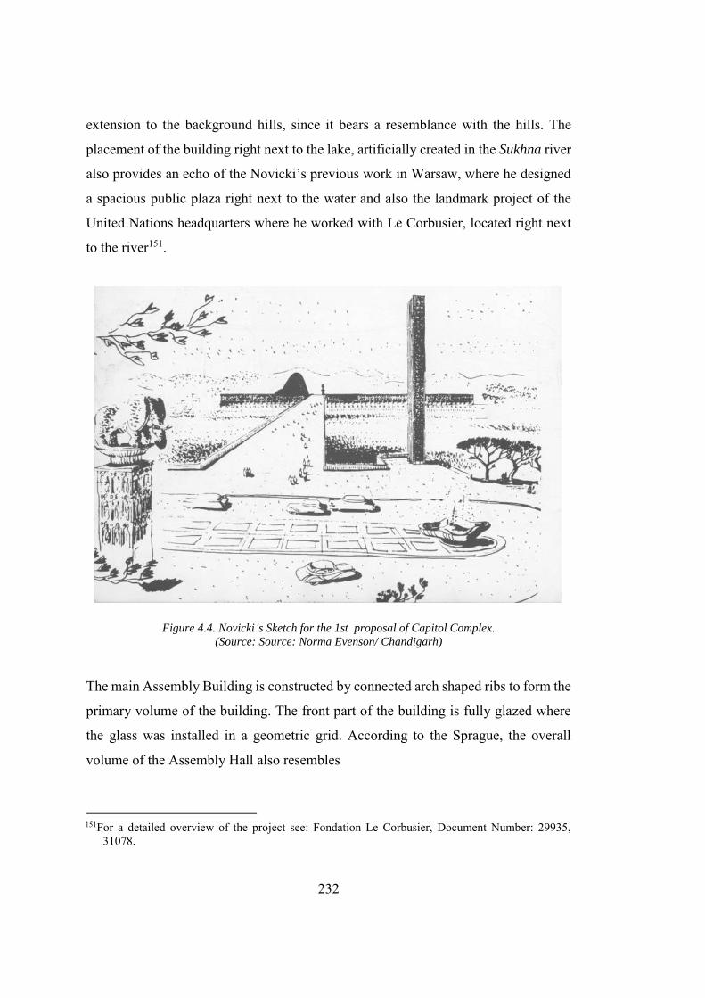
232
extension to the background hills, since it bears a resemblance with the hills. The
placement of the building right next to the lake, artificially created in the Sukhna river
also provides an echo of the Novicki’s previous work in Warsaw, where he designed
a spacious public plaza right next to the water and also the landmark project of the
United Nations headquarters where he worked with Le Corbusier, located right next
to the river151.
Figure 4.4. Novicki’s Sketch for the 1st proposal of Capitol Complex.
(Source: Source: Norma Evenson/ Chandigarh)
The main Assembly Building is constructed by connected arch shaped ribs to form the
primary volume of the building. The front part of the building is fully glazed where
the glass was installed in a geometric grid. According to the Sprague, the overall
volume of the Assembly Hall also resembles
151For a detailed overview of the project see: Fondation Le Corbusier, Document Number: 29935,
31078.
233
Oscar Niemeyer’s 1943 Church of St. Francis, in Pampulha, Brazil that
had been widely published. Novicki had worked closely with Niemeyer
on the United Nations project and had published a photo of this church
in his essay, “Composition in Modern Architecture” (1949), under the
subheading “ornament.”(Sprague 2013, 350)
The first proposal depicts Novicki’s intention of using the Capitol Complex site as an
arena for exhibiting the Western modernistic architecture. This, however, was quite in
contradiction with Novicki’s sketch for the city of Chandigarh where he carefully
designed and incorporated the traditional elements. Seemingly Novicki was
welcoming the new Western Monumentality on the Eastern ground, an approach
already criticized by Havell in Calcutta and labelled as Pseudo monumentality by
Giedion152. The proposal was rejected by Mayer and the officials at Chandigarh.
4.2.2. Novicki’s 2nd Proposal: Aesthetic and Consumerization.
The new proposal for the Capitol complex, in contradiction to the first one, is planned
by spreading the function over a large area of the land on the bank of the river Sukhna
Rao. The sketch made for the Capitol Complex is very basic, but defines the access
road and location of the buildings (Evenson 1966; Kalia 1999). The expansive look
reminds one of Fatehpur Sikri the first planned capital, but seemingly Novicki never
thought on these lines. The user enters the site from the side of the artificial lake by
crossing the river via a bridge and arrives at a plaza. On the right side of the plaza is
the Assembly Building, placed at the back of a U-shaped complex and connected with
a building mass of a considerable size that was supposedly meant to accommodate the
support functions and office area of the Assembly Building. The Governor’s Palace is
placed on the top right end side and connected with the Assembly Halls. Governor’s
152Giedion presented his thesis with reference to incorporating the historical elements, leaving aside the
spirit of time. Novicki’s approach is inappropriate as “time” just like modernity is a region-specific idea.
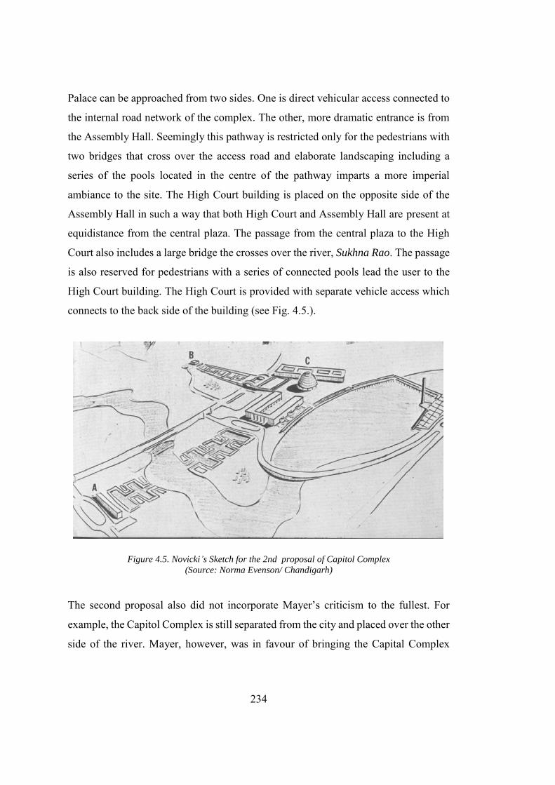
234
Palace can be approached from two sides. One is direct vehicular access connected to
the internal road network of the complex. The other, more dramatic entrance is from
the Assembly Hall. Seemingly this pathway is restricted only for the pedestrians with
two bridges that cross over the access road and elaborate landscaping including a
series of the pools located in the centre of the pathway imparts a more imperial
ambiance to the site. The High Court building is placed on the opposite side of the
Assembly Hall in such a way that both High Court and Assembly Hall are present at
equidistance from the central plaza. The passage from the central plaza to the High
Court also includes a large bridge the crosses over the river, Sukhna Rao. The passage
is also reserved for pedestrians with a series of connected pools lead the user to the
High Court building. The High Court is provided with separate vehicle access which
connects to the back side of the building (see Fig. 4.5.).
Figure 4.5. Novicki’s Sketch for the 2nd proposal of Capitol Complex
(Source: Norma Evenson/ Chandigarh)
The second proposal also did not incorporate Mayer’s criticism to the fullest. For
example, the Capitol Complex is still separated from the city and placed over the other
side of the river. Mayer, however, was in favour of bringing the Capital Complex
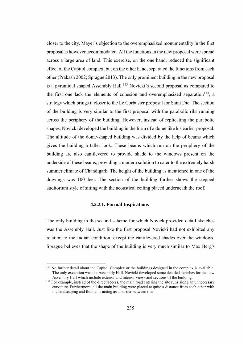
235
closer to the city. Mayer’s objection to the overemphasized monumentality in the first
proposal is however accommodated. All the functions in the new proposal were spread
across a large area of land. This exercise, on the one hand, reduced the significant
effect of the Capitol complex, but on the other hand, separated the functions from each
other (Prakash 2002; Sprague 2013). The only prominent building in the new proposal
is a pyramidal shaped Assembly Hall.153 Novicki’s second proposal as compared to
the first one lack the elements of cohesion and overemphasized separation154, a
strategy which brings it closer to the Le Corbusier proposal for Saint Die. The section
of the building is very similar to the first proposal with the parabolic ribs running
across the periphery of the building. However, instead of replicating the parabolic
shapes, Novicki developed the building in the form of a dome like his earlier proposal.
The altitude of the dome-shaped building was divided by the help of beams which
gives the building a taller look. These beams which run on the periphery of the
building are also cantilevered to provide shade to the windows present on the
underside of these beams, providing a modern solution to cater to the extremely harsh
summer climate of Chandigarh. The height of the building as mentioned in one of the
drawings was 100 feet. The section of the building further shows the stepped
auditorium style of sitting with the acoustical ceiling placed underneath the roof.
4.2.2.1. Formal Inspirations
The only building in the second scheme for which Novick provided detail sketches
was the Assembly Hall. Just like the first proposal Novicki had not exhibited any
relation to the Indian condition, except the cantilevered shades over the windows.
Sprague believes that the shape of the building is very much similar to Max Berg's
153 No further detail about the Capitol Complex or the buildings designed in the complex is available.
The only exception was the Assembly Hall. Novicki developed some detailed sketches for the new Assembly Hall which include exterior and interior views and sections of the building.
154 For example, instead of the direct access, the main road entering the site runs along an unnecessary curvature. Furthermore, all the main building were placed at quite a distance from each other with the landscaping and fountains acting as a barrier between them.
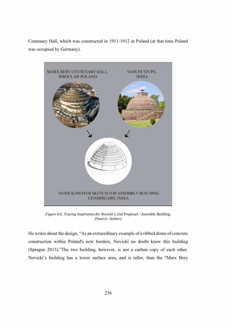
236
Centenary Hall, which was constructed in 1911-1912 in Poland (at that time Poland
was occupied by Germany).
Figure 4.6. Tracing Inspiration for Novicki’s 2nd Proposal / Assembly Building.
(Source: Author)
He writes about the design, “As an extraordinary example of a ribbed dome of concrete
construction within Poland's new borders, Novicki no doubt knew this building
(Sprague 2013).”The two building, however, is not a carbon copy of each other.
Novicki’s building has a lower surface area, and is taller, than the “Marx Bery
237
Centenary Hall.”155 Evenson and Kali argue that Mayer had a contrastingly different
understanding of the dome. According to Norma Evenson, Mayer had related this
design to the Indian condition and more specifically to the form of Stupa156. Mayer
said, “We felt this a happy solution in the Indian context, where it is, I believe, most
important for national pride and self-respect to tie in their past with the modern and
future (Evenson 1966).” (see Fig. 4.6.).
Kalia also writes that Mayer was happy about the similarity between the exterior form
of the Assembly Building and its resemblance to the Indian stupa at Sanchi (Kalia
1999). Designing a building in Sikh and Hindu majority state would have increased
the already present segregation157. This depicts Mayer’s limited understanding of the
Indian condition that resulted in the forceful marriage of the Buddhist Stupa with the
Novicki’s design. However, Mayer’s satisfaction with the design reflects his
deliberate intention to create a design that is indigenous to local conditions of India.
One of the major reasons for this was that the client required a solution that should be
Indian in spirit (Kalia 1999). Whatever Mayer felt about that design, Novicki never
got any inspiration from the stupas. Sprague criticized the second proposal for the
design as against the Novicki pre-established design philosophy. In contrast to the first
proposal, the second proposal seems unfinished. The absence of human activity and
landscape elements made it lifeless. The proposal also had the functional shortcomings
as Sprague explains as, “Nor did the proposal for the second Capitol Complex provide
the civic gathering place envisioned in Novicki’s letter, an essential element of his
“holiday function” of the city (Sprague 2013).” A clear difference can be seen between
155 It was not only the Centenary Hall, but this solution was also in line with his previous work in the
Warsaw and United Nations headquarters, on which he worked with Le Corbusier (Sprague 2013). 156 Stupa, Buddhist commemorative monument usually housing sacred relics associated with
the Buddha or other saintly persons. The hemispherical form of the stupa appears to have derived from pre-Buddhist burial mounds in India.
157 Kalia highly criticised Mayer’s approach about referring the design of the building to Buddhist stupa declaring the new design as a national pride as the state of Punjab was predominantly a Sikh one.
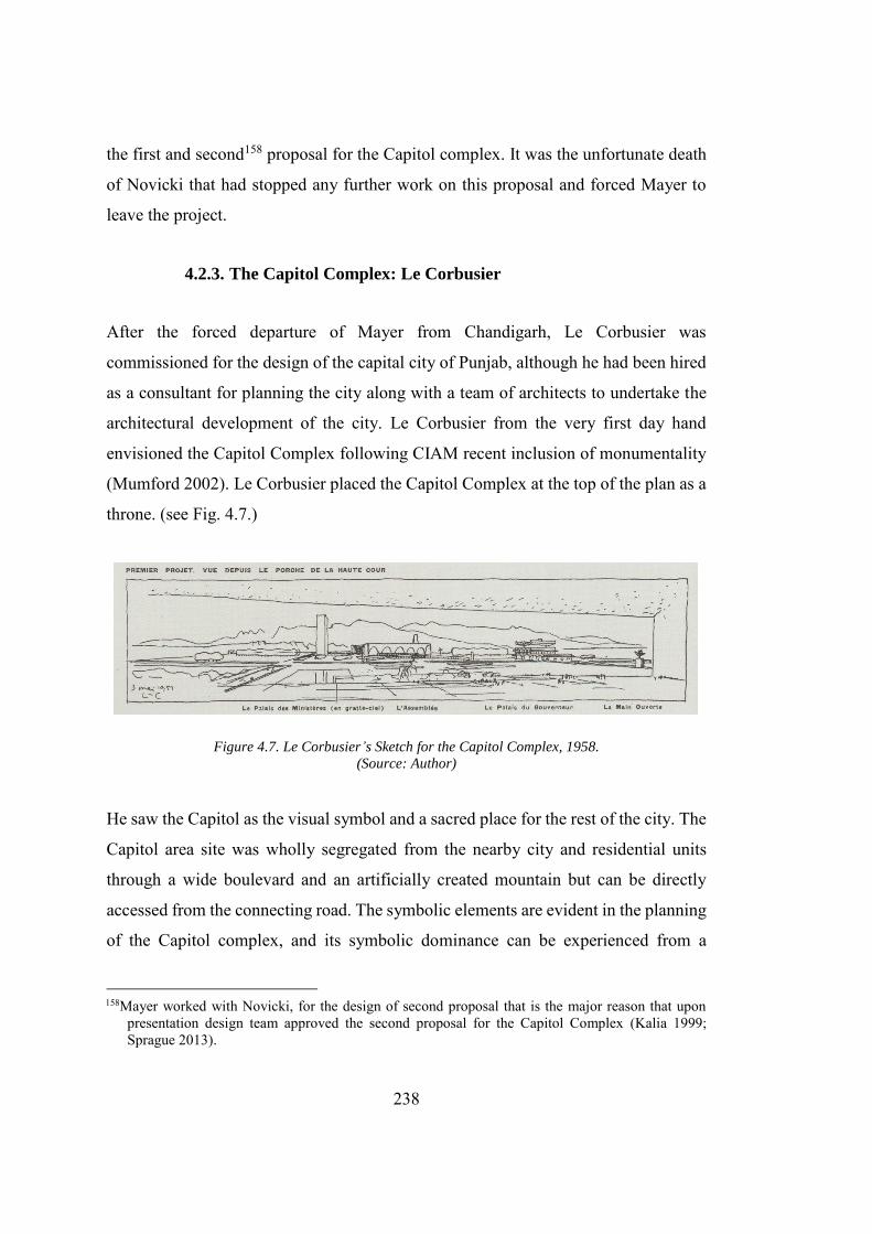
238
the first and second158 proposal for the Capitol complex. It was the unfortunate death
of Novicki that had stopped any further work on this proposal and forced Mayer to
leave the project.
4.2.3. The Capitol Complex: Le Corbusier
After the forced departure of Mayer from Chandigarh, Le Corbusier was
commissioned for the design of the capital city of Punjab, although he had been hired
as a consultant for planning the city along with a team of architects to undertake the
architectural development of the city. Le Corbusier from the very first day hand
envisioned the Capitol Complex following CIAM recent inclusion of monumentality
(Mumford 2002). Le Corbusier placed the Capitol Complex at the top of the plan as a
throne. (see Fig. 4.7.)
Figure 4.7. Le Corbusier’s Sketch for the Capitol Complex, 1958.
(Source: Author)
He saw the Capitol as the visual symbol and a sacred place for the rest of the city. The
Capitol area site was wholly segregated from the nearby city and residential units
through a wide boulevard and an artificially created mountain but can be directly
accessed from the connecting road. The symbolic elements are evident in the planning
of the Capitol complex, and its symbolic dominance can be experienced from a
158Mayer worked with Novicki, for the design of second proposal that is the major reason that upon
presentation design team approved the second proposal for the Capitol Complex (Kalia 1999; Sprague 2013).
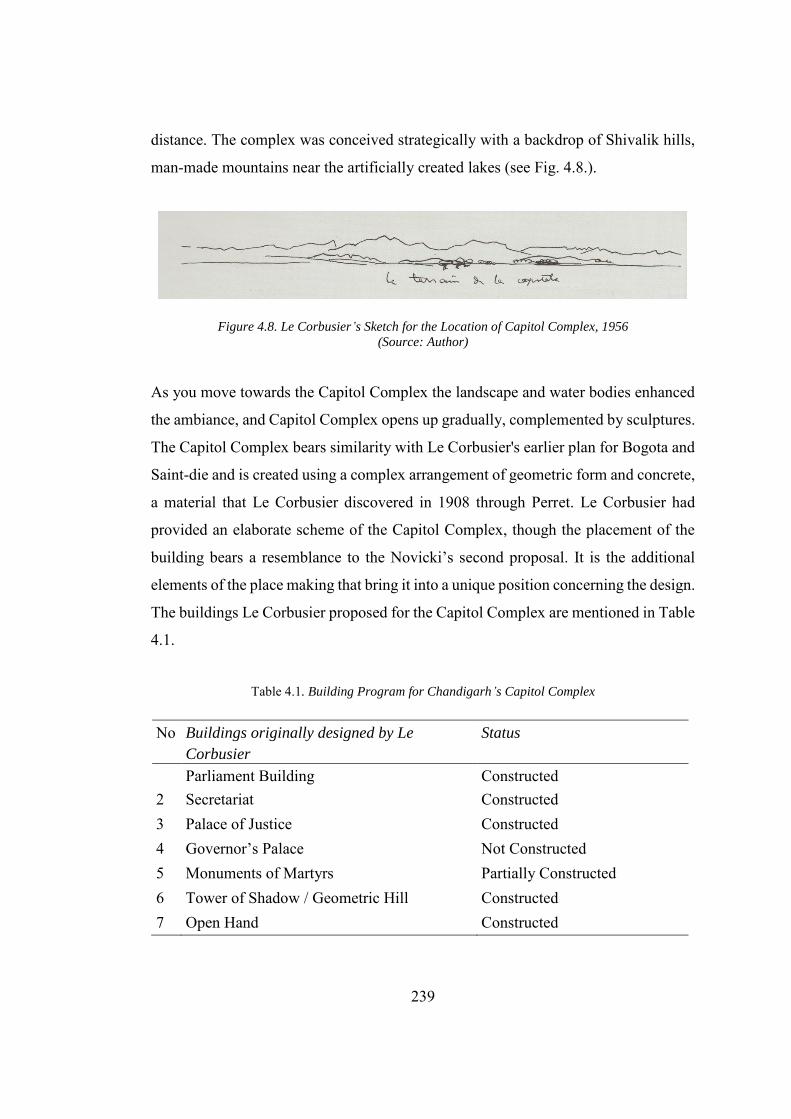
239
distance. The complex was conceived strategically with a backdrop of Shivalik hills,
man-made mountains near the artificially created lakes (see Fig. 4.8.).
Figure 4.8. Le Corbusier’s Sketch for the Location of Capitol Complex, 1956
(Source: Author)
As you move towards the Capitol Complex the landscape and water bodies enhanced
the ambiance, and Capitol Complex opens up gradually, complemented by sculptures.
The Capitol Complex bears similarity with Le Corbusier's earlier plan for Bogota and
Saint-die and is created using a complex arrangement of geometric form and concrete,
a material that Le Corbusier discovered in 1908 through Perret. Le Corbusier had
provided an elaborate scheme of the Capitol Complex, though the placement of the
building bears a resemblance to the Novicki’s second proposal. It is the additional
elements of the place making that bring it into a unique position concerning the design.
The buildings Le Corbusier proposed for the Capitol Complex are mentioned in Table
4.1.
Table 4.1. Building Program for Chandigarh’s Capitol Complex
No Buildings originally designed by Le
Corbusier
Status
Parliament Building Constructed 2 Secretariat Constructed 3 Palace of Justice Constructed 4 Governor’s Palace Not Constructed 5 Monuments of Martyrs Partially Constructed 6 Tower of Shadow / Geometric Hill Constructed 7 Open Hand Constructed
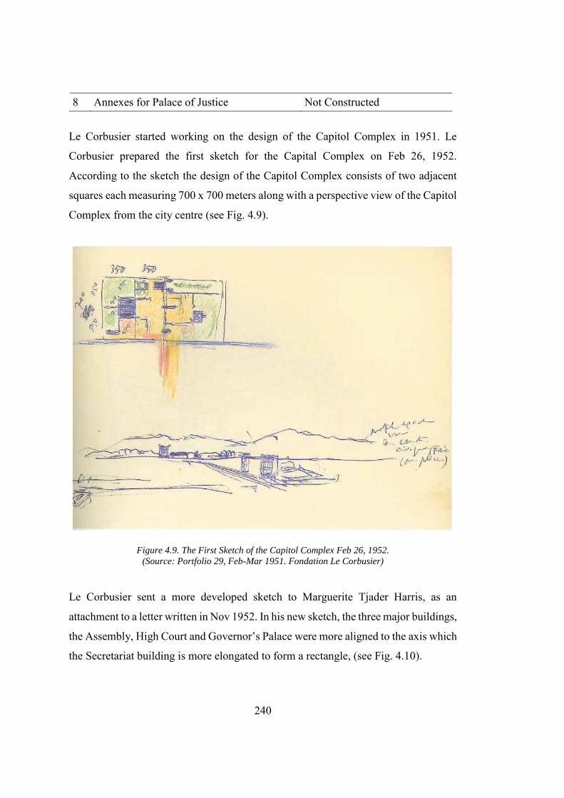
240
8 Annexes for Palace of Justice Not Constructed
Le Corbusier started working on the design of the Capitol Complex in 1951. Le
Corbusier prepared the first sketch for the Capital Complex on Feb 26, 1952.
According to the sketch the design of the Capitol Complex consists of two adjacent
squares each measuring 700 x 700 meters along with a perspective view of the Capitol
Complex from the city centre (see Fig. 4.9).
Figure 4.9. The First Sketch of the Capitol Complex Feb 26, 1952.
(Source: Portfolio 29, Feb-Mar 1951. Fondation Le Corbusier)
Le Corbusier sent a more developed sketch to Marguerite Tjader Harris, as an
attachment to a letter written in Nov 1952. In his new sketch, the three major buildings,
the Assembly, High Court and Governor’s Palace were more aligned to the axis which
the Secretariat building is more elongated to form a rectangle, (see Fig. 4.10).
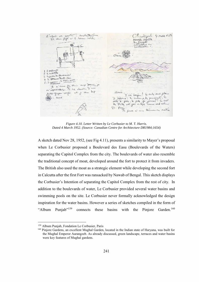
241
Figure 4.10. Letter Written by Le Corbusier to M. T. Harris.
Dated 4 March 1952. (Source: Canadian Centre for Architecture DR1984;1654)
A sketch dated Nov 28, 1952, (see Fig 4.11), presents a similarity to Mayer’s proposal
when Le Corbusier proposed a Boulevard des Easu (Boulevards of the Waters)
separating the Capitol Complex from the city. The boulevards of water also resemble
the traditional concept of moat, developed around the fort to protect it from invaders.
The British also used the moat as a strategic element while developing the second fort
in Calcutta after the first Fort was ransacked by Nawab of Bengal. This sketch displays
the Corbusier’s Intention of separating the Capitol Complex from the rest of city. In
addition to the boulevards of water, Le Corbusier provided several water basins and
swimming pools on the site. Le Corbusier never formally acknowledged the design
inspiration for the water basins. However a series of sketches compiled in the form of
“Album Punjab”159 connects these basins with the Pinjore Garden.160
159 Album Punjab, Fondation Le Corbusier, Paris 160 Pinjore Gardens, an excellent Mughal Garden, located in the Indian state of Haryana, was built for
the Mughal Emperor Aurangzeb. As already discussed, green landscape, terraces and water basins were key features of Mughal gardens.
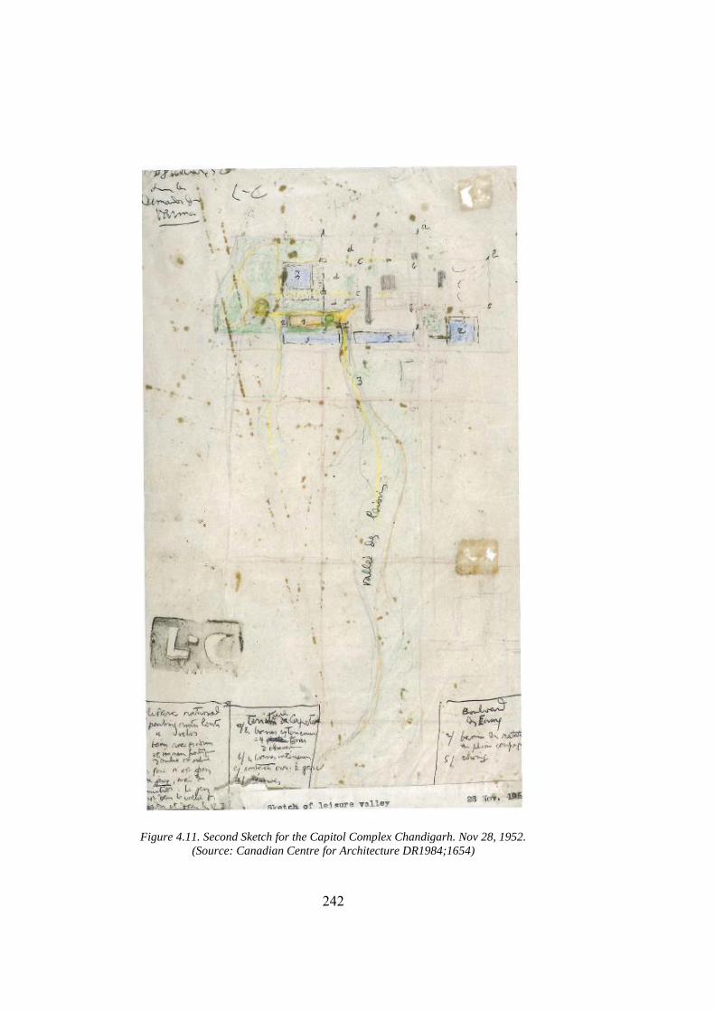
242
Figure 4.11. Second Sketch for the Capitol Complex Chandigarh. Nov 28, 1952.
(Source: Canadian Centre for Architecture DR1984;1654)
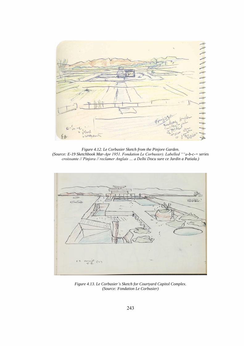
243
Figure 4.12. Le Corbusier Sketch from the Pinjore Garden.
(Source: E-19 Sketchbook Mar-Apr 1951. Fondation Le Corbusier). Labelled ““a-b-c-= series
croissante // Pinjora // reclamer Anglais … a Delhi Docu sure ce Jardin a Patiala.)
Figure 4.13. Le Corbusier’s Sketch for Courtyard Capitol Complex.
(Source: Fondation Le Corbusier)
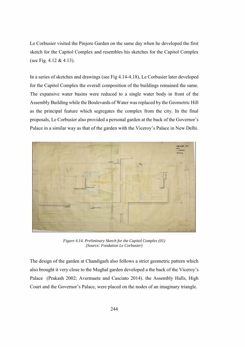
244
Le Corbusier visited the Pinjore Garden on the same day when he developed the first
sketch for the Capitol Complex and resembles his sketches for the Capitol Complex
(see Fig. 4.12 & 4.13).
In a series of sketches and drawings (see Fig 4.14-4.18), Le Corbusier later developed
for the Capitol Complex the overall composition of the buildings remained the same.
The expansive water basins were reduced to a single water body in front of the
Assembly Building while the Boulevards of Water was replaced by the Geometric Hill
as the principal feature which segregates the complex from the city. In the final
proposals, Le Corbusier also provided a personal garden at the back of the Governor’s
Palace in a similar way as that of the garden with the Viceroy’s Palace in New Delhi.
Figure 4.14. Preliminary Sketch for the Capitol Complex (01)
(Source: Fondation Le Corbusier)
The design of the garden at Chandigarh also follows a strict geometric pattern which
also brought it very close to the Mughal garden developed a the back of the Viceroy’s
Palace (Prakash 2002; Avermaete and Casciato 2014). the Assembly Halls, High
Court and the Governor’s Palace, were placed on the nodes of an imaginary triangle.
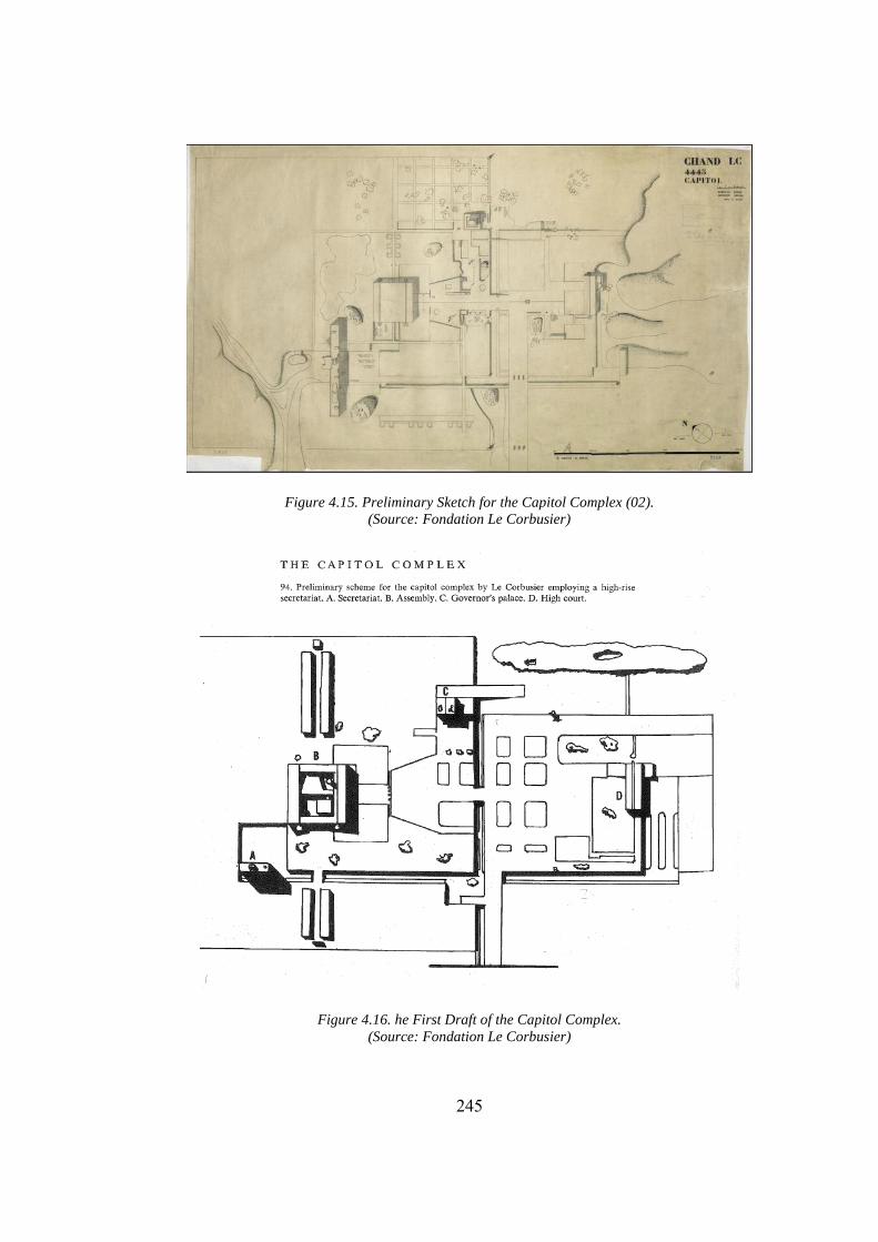
245
Figure 4.15. Preliminary Sketch for the Capitol Complex (02).
(Source: Fondation Le Corbusier)
Figure 4.16. he First Draft of the Capitol Complex.
(Source: Fondation Le Corbusier)
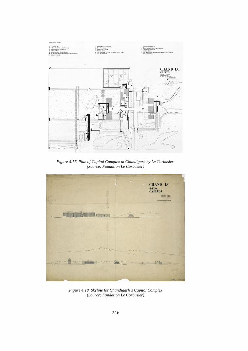
246
Figure 4.17. Plan of Capitol Complex at Chandigarh by Le Corbusier.
(Source: Fondation Le Corbusier)
Figure 4.18. Skyline for Chandigarh’s Capitol Complex
(Source: Fondation Le Corbusier)
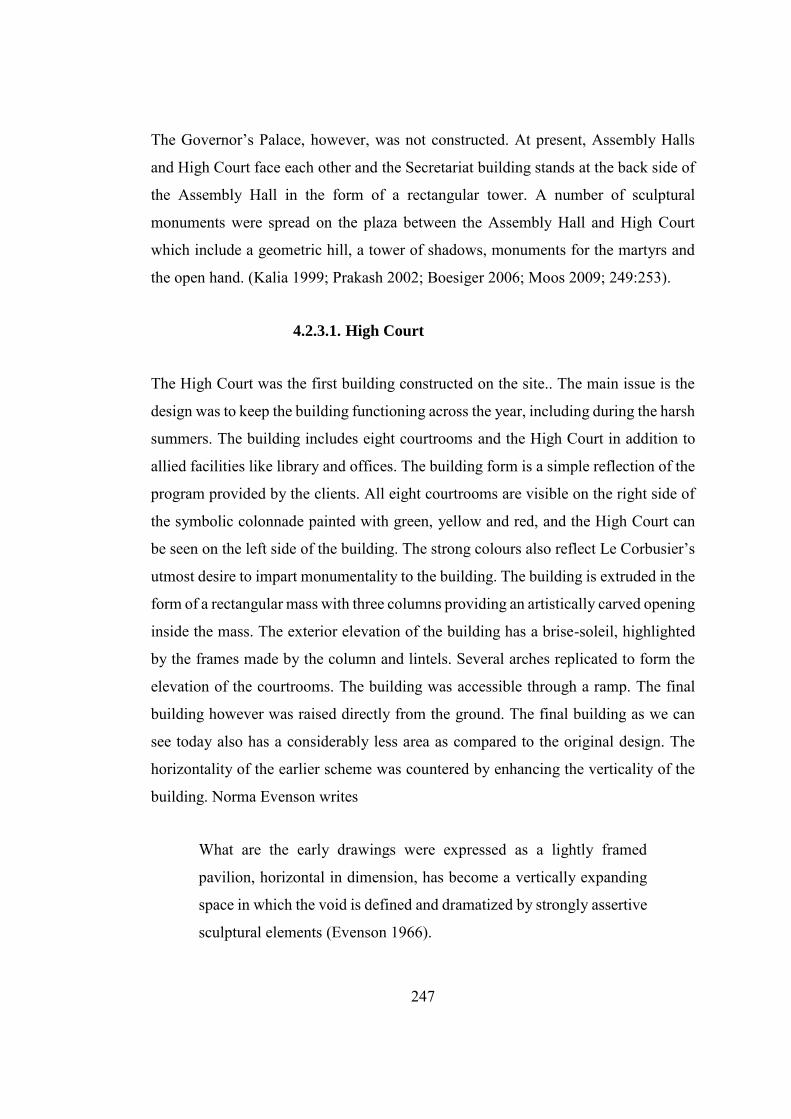
247
The Governor’s Palace, however, was not constructed. At present, Assembly Halls
and High Court face each other and the Secretariat building stands at the back side of
the Assembly Hall in the form of a rectangular tower. A number of sculptural
monuments were spread on the plaza between the Assembly Hall and High Court
which include a geometric hill, a tower of shadows, monuments for the martyrs and
the open hand. (Kalia 1999; Prakash 2002; Boesiger 2006; Moos 2009; 249:253).
4.2.3.1. High Court
The High Court was the first building constructed on the site.. The main issue is the
design was to keep the building functioning across the year, including during the harsh
summers. The building includes eight courtrooms and the High Court in addition to
allied facilities like library and offices. The building form is a simple reflection of the
program provided by the clients. All eight courtrooms are visible on the right side of
the symbolic colonnade painted with green, yellow and red, and the High Court can
be seen on the left side of the building. The strong colours also reflect Le Corbusier’s
utmost desire to impart monumentality to the building. The building is extruded in the
form of a rectangular mass with three columns providing an artistically carved opening
inside the mass. The exterior elevation of the building has a brise-soleil, highlighted
by the frames made by the column and lintels. Several arches replicated to form the
elevation of the courtrooms. The building was accessible through a ramp. The final
building however was raised directly from the ground. The final building as we can
see today also has a considerably less area as compared to the original design. The
horizontality of the earlier scheme was countered by enhancing the verticality of the
building. Norma Evenson writes
What are the early drawings were expressed as a lightly framed
pavilion, horizontal in dimension, has become a vertically expanding
space in which the void is defined and dramatized by strongly assertive
sculptural elements (Evenson 1966).
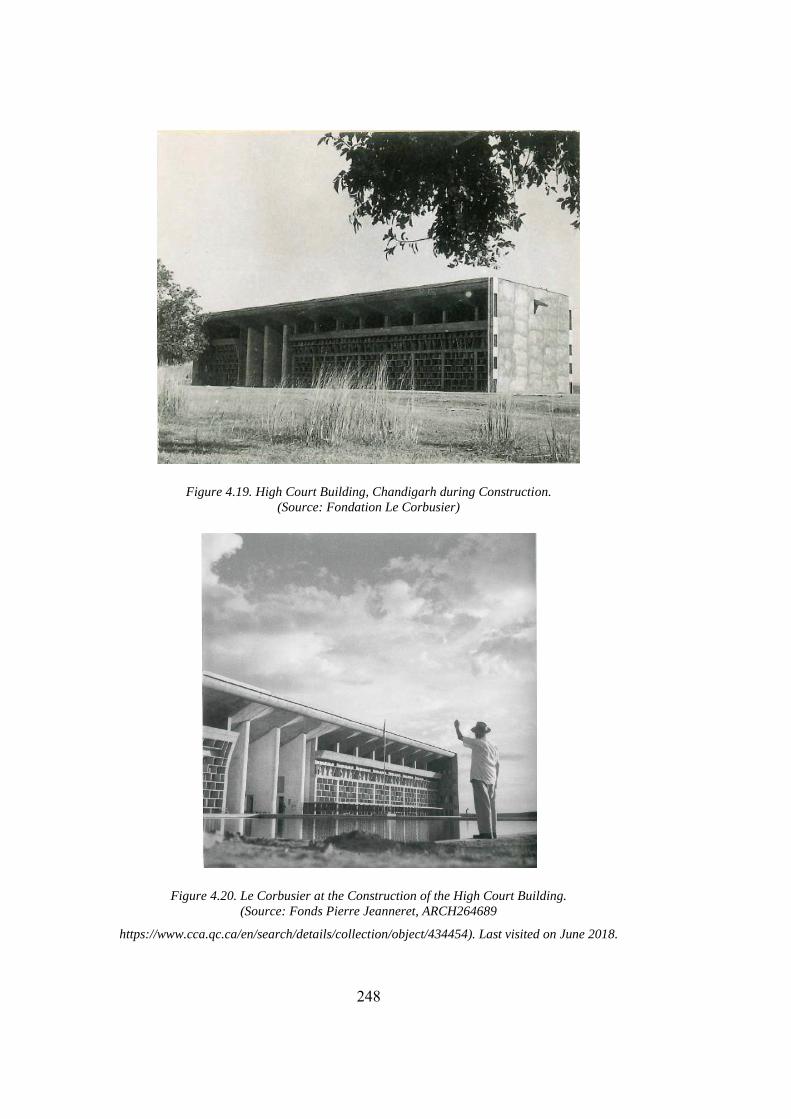
248
Figure 4.19. High Court Building, Chandigarh during Construction.
(Source: Fondation Le Corbusier)
Figure 4.20. Le Corbusier at the Construction of the High Court Building.
(Source: Fonds Pierre Jeanneret, ARCH264689
https://www.cca.qc.ca/en/search/details/collection/object/434454). Last visited on June 2018.
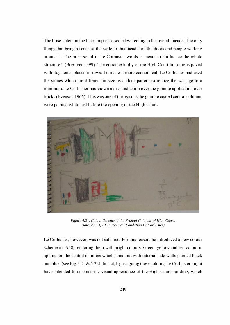
249
The brise-soleil on the faces imparts a scale less feeling to the overall façade. The only
things that bring a sense of the scale to this façade are the doors and people walking
around it. The brise-soleil in Le Corbusier words is meant to “influence the whole
structure.” (Boesiger 1999). The entrance lobby of the High Court building is paved
with flagstones placed in rows. To make it more economical, Le Corbusier had used
the stones which are different in size as a floor pattern to reduce the wastage to a
minimum. Le Corbusier has shown a dissatisfaction over the gunnite application over
bricks (Evenson 1966). This was one of the reasons the gunnite coated central columns
were painted white just before the opening of the High Court.
Figure 4.21. Colour Scheme of the Frontal Columns of High Court.
Date: Apr 3, 1958. (Source: Fondation Le Corbusier)
Le Corbusier, however, was not satisfied. For this reason, he introduced a new colour
scheme in 1958, rendering them with bright colours. Green, yellow and red colour is
applied on the central columns which stand out with internal side walls painted black
and blue. (see Fig 5.21 & 5.22). In fact, by assigning these colours, Le Corbusier might
have intended to enhance the visual appearance of the High Court building, which
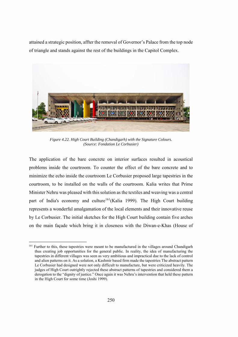
250
attained a strategic position, affter the removal of Governor’s Palace from the top node
of triangle and stands against the rest of the buildings in the Capitol Complex.
Figure 4.22. High Court Building (Chandigarh) with the Signature Colours.
(Source: Fondation Le Corbusier)
The application of the bare concrete on interior surfaces resulted in acoustical
problems inside the courtroom. To counter the effect of the bare concrete and to
minimize the echo inside the courtroom Le Corbusier proposed large tapestries in the
courtroom, to be installed on the walls of the courtroom. Kalia writes that Prime
Minister Nehru was pleased with this solution as the textiles and weaving was a central
part of India's economy and culture161(Kalia 1999). The High Court building
represents a wonderful amalgamation of the local elements and their innovative reuse
by Le Corbusier. The initial sketches for the High Court building contain five arches
on the main façade which bring it in closeness with the Diwan-e-Khas (House of
161 Further to this, these tapestries were meant to be manufactured in the villages around Chandigarh
thus creating job opportunities for the general public. In reality, the idea of manufacturing the tapestries in different villages was seen as very ambitious and impractical due to the lack of control and alien patterns on it. As a solution, a Kashmir based firm made the tapestries The abstract pattern Le Corbusier had designed were not only difficult to manufacture, but were criticized heavily. The judges of High Court outrightly rejected these abstract patterns of tapestries and considered them a derogation to the “dignity of justice.” Once again it was Nehru’s intervention that held these pattern in the High Court for some time (Joshi 1999).
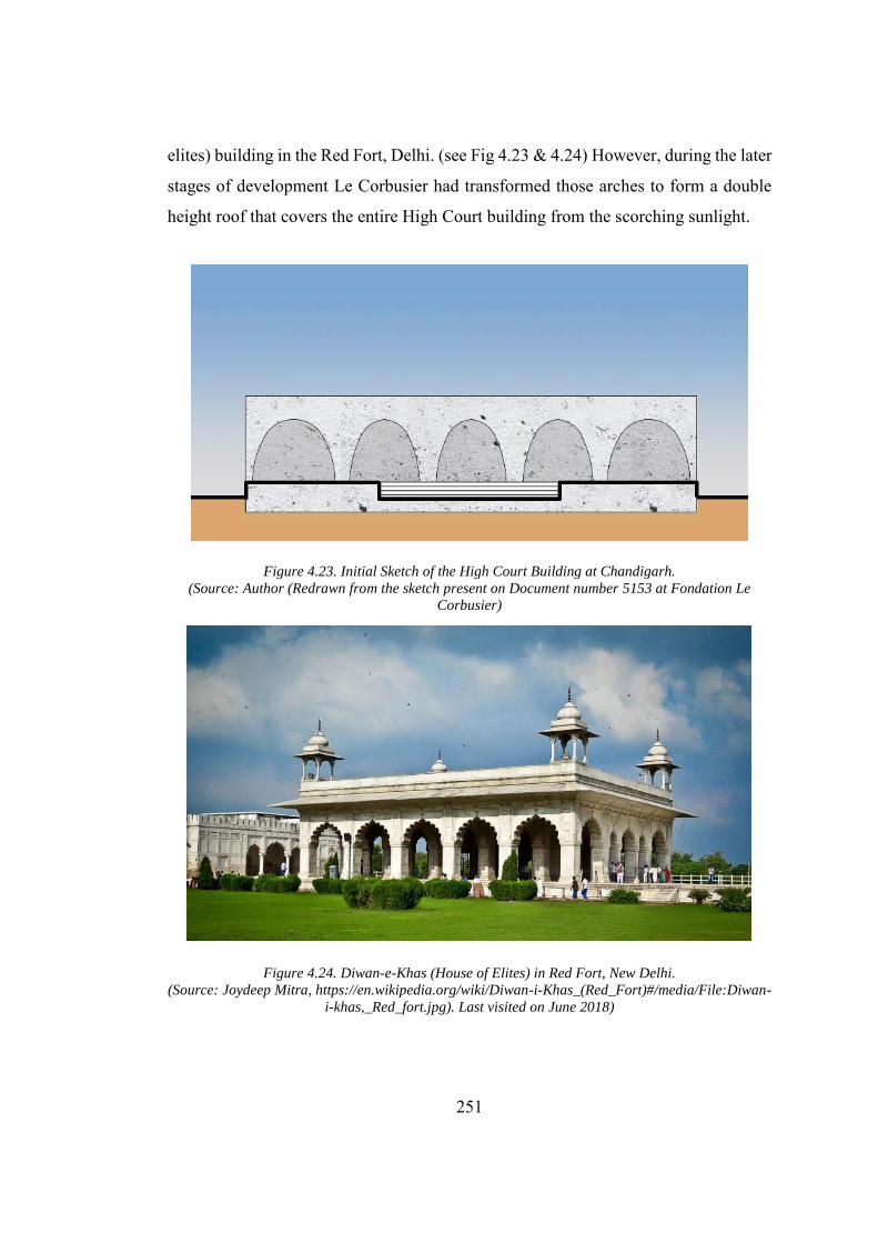
251
elites) building in the Red Fort, Delhi. (see Fig 4.23 & 4.24) However, during the later
stages of development Le Corbusier had transformed those arches to form a double
height roof that covers the entire High Court building from the scorching sunlight.
Figure 4.23. Initial Sketch of the High Court Building at Chandigarh.
(Source: Author (Redrawn from the sketch present on Document number 5153 at Fondation Le
Corbusier)
Figure 4.24. Diwan-e-Khas (House of Elites) in Red Fort, New Delhi.
(Source: Joydeep Mitra, https://en.wikipedia.org/wiki/Diwan-i-Khas_(Red_Fort)#/media/File:Diwan-
i-khas,_Red_fort.jpg). Last visited on June 2018)
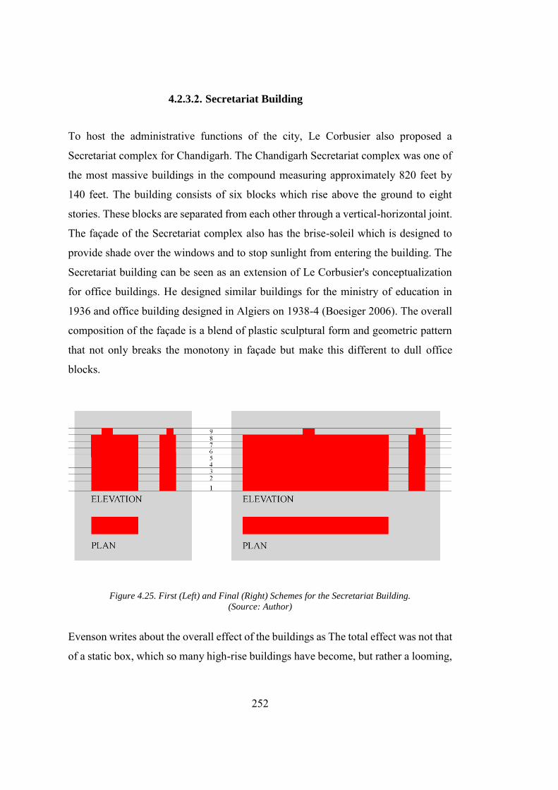
252
4.2.3.2. Secretariat Building
To host the administrative functions of the city, Le Corbusier also proposed a
Secretariat complex for Chandigarh. The Chandigarh Secretariat complex was one of
the most massive buildings in the compound measuring approximately 820 feet by
140 feet. The building consists of six blocks which rise above the ground to eight
stories. These blocks are separated from each other through a vertical-horizontal joint.
The façade of the Secretariat complex also has the brise-soleil which is designed to
provide shade over the windows and to stop sunlight from entering the building. The
Secretariat building can be seen as an extension of Le Corbusier's conceptualization
for office buildings. He designed similar buildings for the ministry of education in
1936 and office building designed in Algiers on 1938-4 (Boesiger 2006). The overall
composition of the façade is a blend of plastic sculptural form and geometric pattern
that not only breaks the monotony in façade but make this different to dull office
blocks.
Figure 4.25. First (Left) and Final (Right) Schemes for the Secretariat Building.
(Source: Author)
Evenson writes about the overall effect of the buildings as The total effect was not that
of a static box, which so many high-rise buildings have become, but rather a looming,
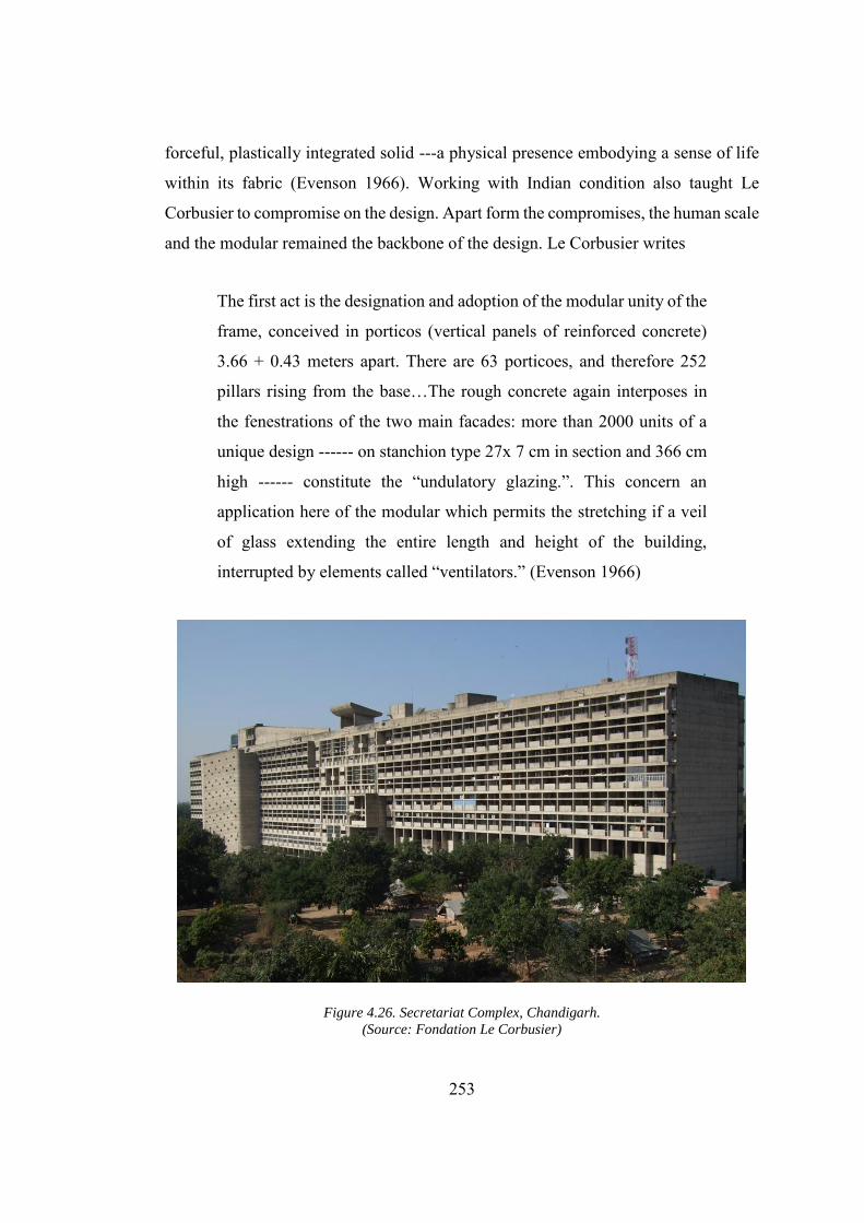
253
forceful, plastically integrated solid ---a physical presence embodying a sense of life
within its fabric (Evenson 1966). Working with Indian condition also taught Le
Corbusier to compromise on the design. Apart form the compromises, the human scale
and the modular remained the backbone of the design. Le Corbusier writes
The first act is the designation and adoption of the modular unity of the
frame, conceived in porticos (vertical panels of reinforced concrete)
3.66 + 0.43 meters apart. There are 63 porticoes, and therefore 252
pillars rising from the base…The rough concrete again interposes in
the fenestrations of the two main facades: more than 2000 units of a
unique design ------ on stanchion type 27x 7 cm in section and 366 cm
high ------ constitute the “undulatory glazing.”. This concern an
application here of the modular which permits the stretching if a veil
of glass extending the entire length and height of the building,
interrupted by elements called “ventilators.” (Evenson 1966)
Figure 4.26. Secretariat Complex, Chandigarh.
(Source: Fondation Le Corbusier)

254
Approach to the building is through the access road provided on the rear side of the
building. Due to a lack of automobiles the user is expected to come to this building
through bicycles, and thus a limited parking area is provided for automobiles. Unlike
the roof of the building which is flat the ground level had many variations. Block 1,
2, 5 and 6 starts from the ground level while block 3 and 4 are standing on the columns
over the excavated areas, thus forming pilotis. The top of the building is provided with
a cafeteria (Boesiger 2006).
Figure 4.27. Secretariat Building, Chandigarh.
(Source: Fondation Le Corbusier)
Although it was a well-integrated plan and Le Corbusier wants to place all the program
requirement in the single building because of its functional importance, the mass of
the building, however, was towering the site. In the absence of the Governor’s Palace
that was designed to be the focal point of the complex, Secretariat building pre-
dominate the site through its towering mass (Joshi 1999).
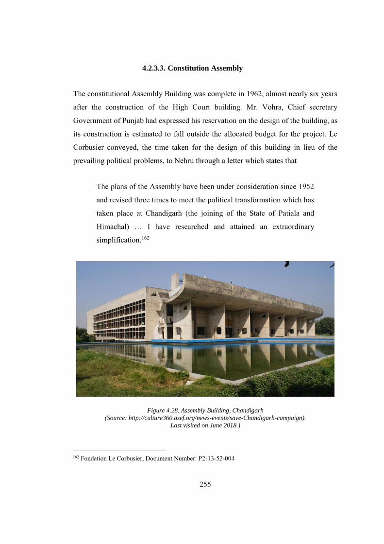
255
4.2.3.3. Constitution Assembly
The constitutional Assembly Building was complete in 1962, almost nearly six years
after the construction of the High Court building. Mr. Vohra, Chief secretary
Government of Punjab had expressed his reservation on the design of the building, as
its construction is estimated to fall outside the allocated budget for the project. Le
Corbusier conveyed, the time taken for the design of this building in lieu of the
prevailing political problems, to Nehru through a letter which states that
The plans of the Assembly have been under consideration since 1952
and revised three times to meet the political transformation which has
taken place at Chandigarh (the joining of the State of Patiala and
Himachal) … I have researched and attained an extraordinary
simplification.162
Figure 4.28. Assembly Building, Chandigarh
(Source: http://culture360.asef.org/news-events/save-Chandigarh-campaign).
Last visited on June 2018.)
162 Fondation Le Corbusier, Document Number: P2-13-52-004
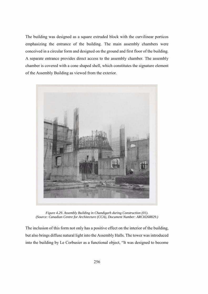
256
The building was designed as a square extruded block with the curvilinear porticos
emphasizing the entrance of the building. The main assembly chambers were
conceived in a circular form and designed on the ground and first floor of the building.
A separate entrance provides direct access to the assembly chamber. The assembly
chamber is covered with a cone shaped shell, which constitutes the signature element
of the Assembly Building as viewed from the exterior.
Figure 4.29. Assembly Building in Chandigarh during Construction (01).
(Source: Canadian Centre for Architecture (CCA), Document Number: ARCH268829.)
The inclusion of this form not only has a positive effect on the interior of the building,
but also brings diffuse natural light into the Assembly Halls. The tower was introduced
into the building by Le Corbusier as a functional object, “It was designed to become
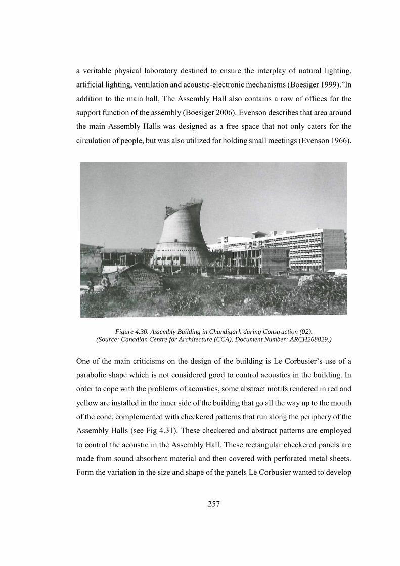
257
a veritable physical laboratory destined to ensure the interplay of natural lighting,
artificial lighting, ventilation and acoustic-electronic mechanisms (Boesiger 1999).”In
addition to the main hall, The Assembly Hall also contains a row of offices for the
support function of the assembly (Boesiger 2006). Evenson describes that area around
the main Assembly Halls was designed as a free space that not only caters for the
circulation of people, but was also utilized for holding small meetings (Evenson 1966).
Figure 4.30. Assembly Building in Chandigarh during Construction (02). (Source: Canadian Centre for Architecture (CCA), Document Number: ARCH268829.)
One of the main criticisms on the design of the building is Le Corbusier’s use of a
parabolic shape which is not considered good to control acoustics in the building. In
order to cope with the problems of acoustics, some abstract motifs rendered in red and
yellow are installed in the inner side of the building that go all the way up to the mouth
of the cone, complemented with checkered patterns that run along the periphery of the
Assembly Halls (see Fig 4.31). These checkered and abstract patterns are employed
to control the acoustic in the Assembly Hall. These rectangular checkered panels are
made from sound absorbent material and then covered with perforated metal sheets.
Form the variation in the size and shape of the panels Le Corbusier wanted to develop
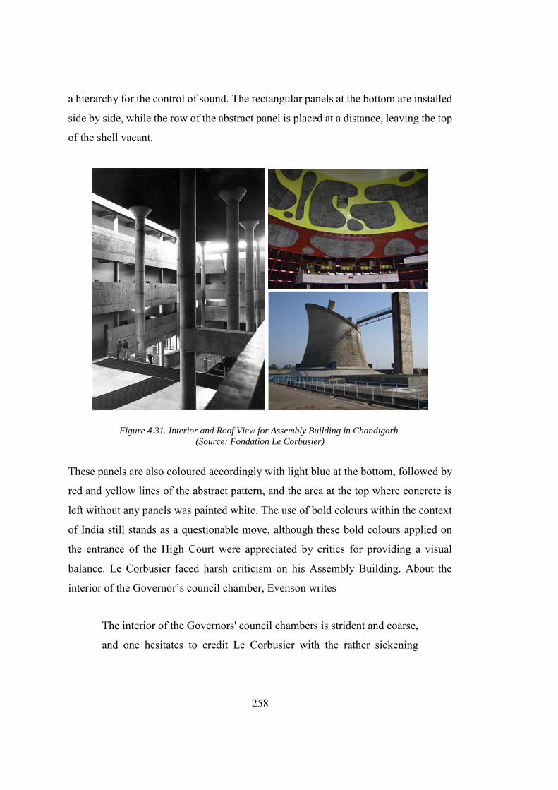
258
a hierarchy for the control of sound. The rectangular panels at the bottom are installed
side by side, while the row of the abstract panel is placed at a distance, leaving the top
of the shell vacant.
Figure 4.31. Interior and Roof View for Assembly Building in Chandigarh. (Source: Fondation Le Corbusier)
These panels are also coloured accordingly with light blue at the bottom, followed by
red and yellow lines of the abstract pattern, and the area at the top where concrete is
left without any panels was painted white. The use of bold colours within the context
of India still stands as a questionable move, although these bold colours applied on
the entrance of the High Court were appreciated by critics for providing a visual
balance. Le Corbusier faced harsh criticism on his Assembly Building. About the
interior of the Governor’s council chamber, Evenson writes
The interior of the Governors' council chambers is strident and coarse,
and one hesitates to credit Le Corbusier with the rather sickening
259
combination of magenta and tomato red which dominates the color
scheme (Evenson 1966).
The three exterior walls of the building are covered with the brise-soleil covering the
glass behind them except the south-east wall. The South Eastern wall is more
sculpturally created in the form of a portico. The freestanding roof is made from
concretes and is designed as a semi-circular tube placed on the top of 8 walls, inviting
the user inside the building. This wall faces the High Court building and can be
accessed through a ramp with pools on both sides. The overall landscape starting from
the tower of shadows diverge towards the Assembly Hall, orienting the user towards
the main building. Different figurative and nonfigurative low reliefs are one of the
most critical features that Le Corbusier made on the exterior wall.163 In addition to the
upper part of the Assembly Hall, the roof of the building contains a pyramid shaped
skylight that is used to light up the offices of the Governor’s representative. Moreover,
a cylindrical shaped volume is also present to cater to the servicing of the building.
The overall composition makes the building much more dramatic and employs the Le
Corbusier intention to highlight the building against the sky (June and 2011 n.d.). On
the contrary to the idea of the assembly, that is, to bring people together, Le Corbusier
provided segregated access and entrances to all the legislators, press, the general
public, and women, to control public movements. Several corridors, walking ramps,
and staircases were provided throughout the building to perform this function well.
4.2.3.4. Governor’s Palace
Le Corbusier designed the Governor’s Palace as the crown of the Capitol Complex
and located it along the significant axial road continuing across the city at the highest
163 It was noted that during the construction of the building the small boys who used to control donkeys while transporting building material to the site, used to draw small figurative drawings on the wet concrete. Le Corbusier, when he saw the drawings for the first time, got delighted. He copied them using the tracing paper and later modified and made them a permanent feature of the assembly walls (June and 2011 n.d.).
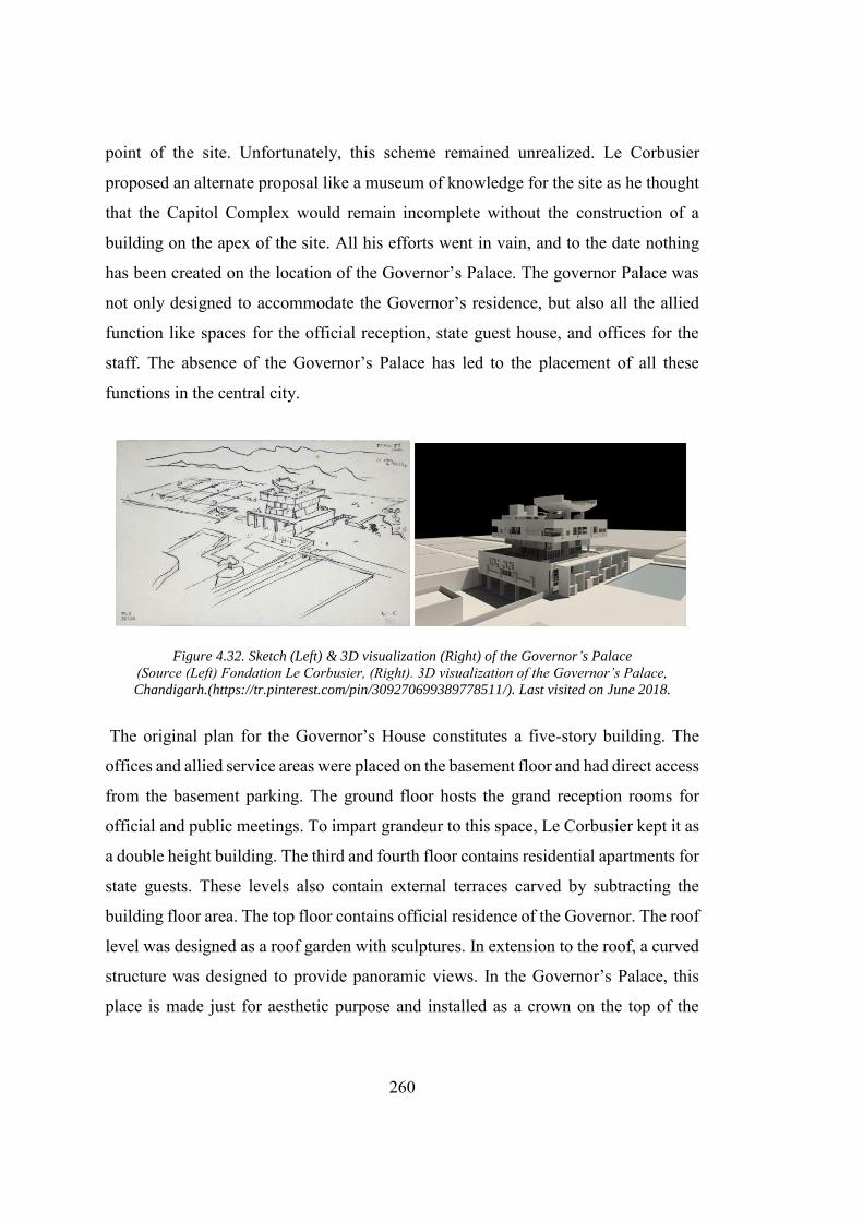
260
point of the site. Unfortunately, this scheme remained unrealized. Le Corbusier
proposed an alternate proposal like a museum of knowledge for the site as he thought
that the Capitol Complex would remain incomplete without the construction of a
building on the apex of the site. All his efforts went in vain, and to the date nothing
has been created on the location of the Governor’s Palace. The governor Palace was
not only designed to accommodate the Governor’s residence, but also all the allied
function like spaces for the official reception, state guest house, and offices for the
staff. The absence of the Governor’s Palace has led to the placement of all these
functions in the central city.
Figure 4.32. Sketch (Left) & 3D visualization (Right) of the Governor’s Palace (Source (Left) Fondation Le Corbusier, (Right). 3D visualization of the Governor’s Palace,
Chandigarh.(https://tr.pinterest.com/pin/309270699389778511/). Last visited on June 2018.
The original plan for the Governor’s House constitutes a five-story building. The
offices and allied service areas were placed on the basement floor and had direct access
from the basement parking. The ground floor hosts the grand reception rooms for
official and public meetings. To impart grandeur to this space, Le Corbusier kept it as
a double height building. The third and fourth floor contains residential apartments for
state guests. These levels also contain external terraces carved by subtracting the
building floor area. The top floor contains official residence of the Governor. The roof
level was designed as a roof garden with sculptures. In extension to the roof, a curved
structure was designed to provide panoramic views. In the Governor’s Palace, this
place is made just for aesthetic purpose and installed as a crown on the top of the
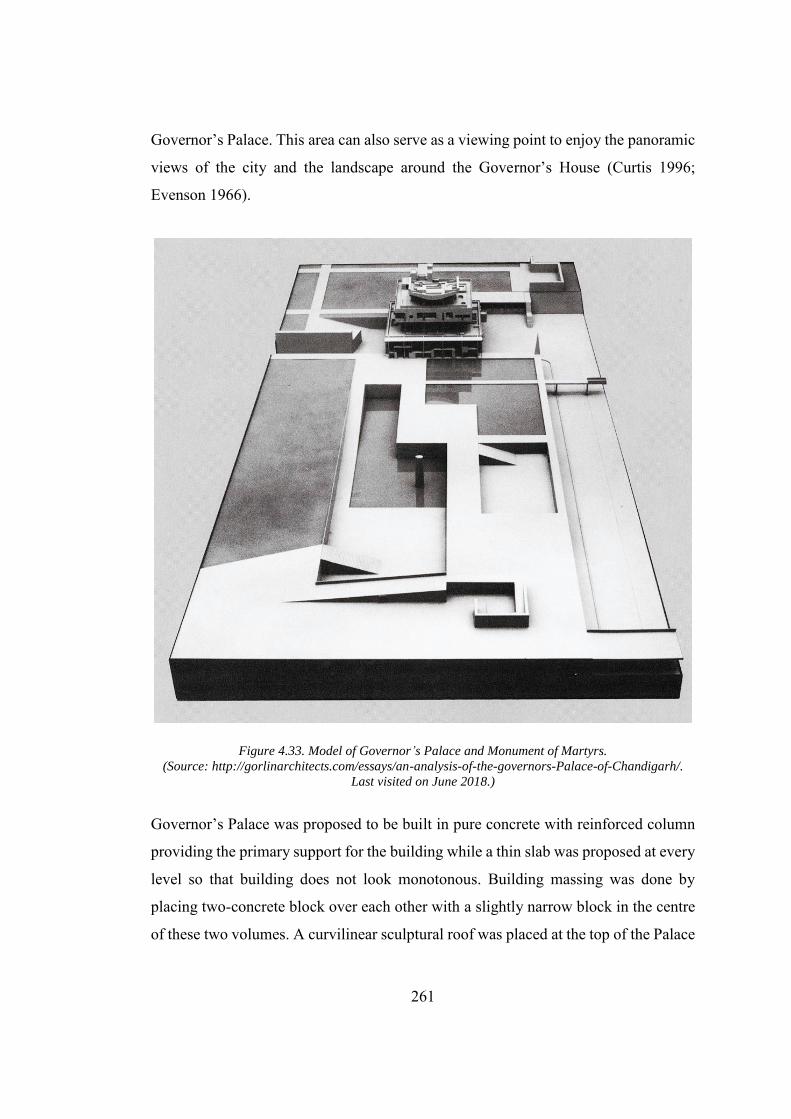
261
Governor’s Palace. This area can also serve as a viewing point to enjoy the panoramic
views of the city and the landscape around the Governor’s House (Curtis 1996;
Evenson 1966).
Figure 4.33. Model of Governor’s Palace and Monument of Martyrs. (Source: http://gorlinarchitects.com/essays/an-analysis-of-the-governors-Palace-of-Chandigarh/.
Last visited on June 2018.)
Governor’s Palace was proposed to be built in pure concrete with reinforced column
providing the primary support for the building while a thin slab was proposed at every
level so that building does not look monotonous. Building massing was done by
placing two-concrete block over each other with a slightly narrow block in the centre
of these two volumes. A curvilinear sculptural roof was placed at the top of the Palace
(Curtis 1996). Le Corbusier’s intention for placing the Governor’s Palace as the focal
point of the city was more pronounced in his proposal for Addis-a-Baba, Capital of
Ethiopia. This idea was also criticized in Ethiopia, as it brings the proposed city in
close association to the social formation of the colonizers. The plan was so ruthless
that if built it would have eradicated the material culture of the existing Addis-a-Baba
(Woudstra 2014), “The colony was a space without time, and therefore, without
history, and without any particular geographical meaning… the city is direct
dominion; the city becomes the city of government, in which the Palace of the
Governor must stand overall (Woudstra 2014).”Le Corbusier himself had praised the
design of the Governor’s Palace regarding it as a crown of the Capitol Complex. The
unique sculptural form of the Governor’s Palace would no doubt add to the beauty of
the Capitol Complex. Prime Minister Nehru, however, was not happy about the critical
position given to Governor’s Palace in the design.
4.2.3.5. Metaphorical Interpretation
The Capitol Complex is generally viewed as Le Corbusier’s effort to appropriate the
alien forms in Chandigarh. Moos argues that the Capitol Complex had its
morphological origins in Le Corbusier's early work. He further argues that, “from the
League of Nations to the Capitol of Chandigarh, the rejection of traditional form of
political representation in the building has been one of the key themes of Le
Corbusier’s institutional architecture (Moos 2009b, 353).”Moos, however, provides a
feeble historical link with the buildings of power and Le Corbusier’s machine. He
connects it as a top end of a tradition that had New-Delhi, the imperial capital city, at
its base. The city of New Delhi as described was the political reflection of the Empire’s
ideology into the built environment through expansive boulevards and monumental
squares (see Fig. 4.34). Curtis argues that, “Le Corbusier fully appreciated another
aspect of New Delhi, evident in the Viceroy’s House and other monumental buildings:
the way they fused the European and the Indian traditions in the iconography of state
magnificence (Curtis 1996).”
262
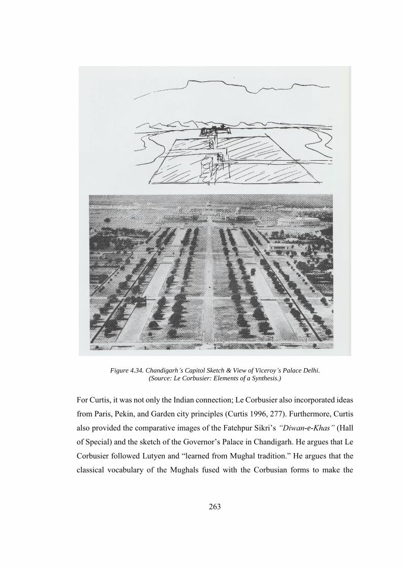
263
Figure 4.34. Chandigarh’s Capitol Sketch & View of Viceroy’s Palace Delhi. (Source: Le Corbusier: Elements of a Synthesis.)
For Curtis, it was not only the Indian connection; Le Corbusier also incorporated ideas
from Paris, Pekin, and Garden city principles (Curtis 1996, 277). Furthermore, Curtis
also provided the comparative images of the Fatehpur Sikri’s “Diwan-e-Khas” (Hall
of Special) and the sketch of the Governor’s Palace in Chandigarh. He argues that Le
Corbusier followed Lutyen and “learned from Mughal tradition.” He argues that the
classical vocabulary of the Mughals fused with the Corbusian forms to make the
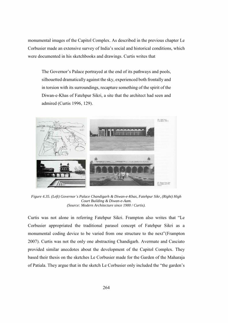
264
monumental images of the Capitol Complex. As described in the previous chapter Le
Corbusier made an extensive survey of India’s social and historical conditions, which
were documented in his sketchbooks and drawings. Curtis writes that
The Governor’s Palace portrayed at the end of its pathways and pools,
silhouetted dramatically against the sky, experienced both frontally and
in torsion with its surroundings, recapture something of the spirit of the
Diwan-e-Khas of Fatehpur Sikri, a site that the architect had seen and
admired (Curtis 1996, 129).
Figure 4.35. (Left) Governor’s Palace Chandigarh & Diwan-e-Khas, Fatehpur Sikr, (Right) High
Court Building & Diwan-e-Aam. (Source: Modern Architecture since 1900 / Curtis).
Curtis was not alone in referring Fatehpur Sikri. Frampton also writes that “Le
Corbusier appropriated the traditional parasol concept of Fatehpur Sikri as a
monumental coding device to be varied from one structure to the next”(Frampton
2007). Curtis was not the only one abstracting Chandigarh. Avermate and Casciato
provided similar anecdotes about the development of the Capitol Complex. They
based their thesis on the sketches Le Corbusier made for the Garden of the Maharaja
of Patiala. They argue that in the sketch Le Corbusier only included the “the garden’s
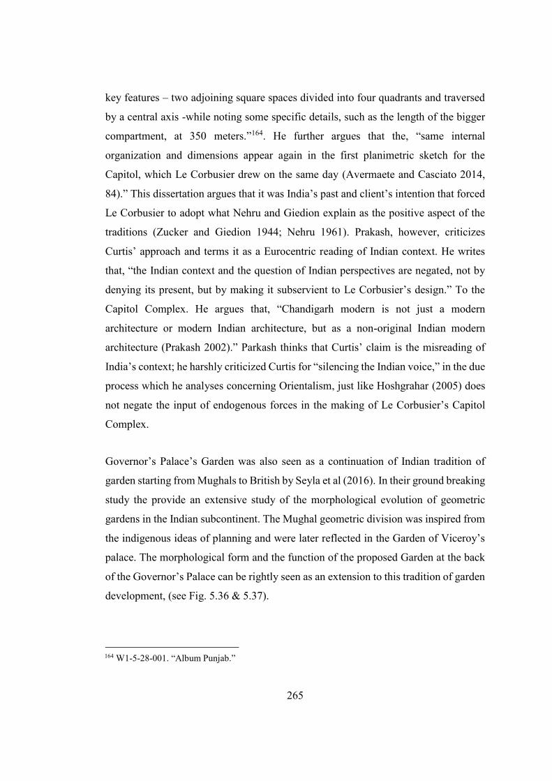
265
key features – two adjoining square spaces divided into four quadrants and traversed
by a central axis -while noting some specific details, such as the length of the bigger
compartment, at 350 meters.”164. He further argues that the, “same internal
organization and dimensions appear again in the first planimetric sketch for the
Capitol, which Le Corbusier drew on the same day (Avermaete and Casciato 2014,
84).” This dissertation argues that it was India’s past and client’s intention that forced
Le Corbusier to adopt what Nehru and Giedion explain as the positive aspect of the
traditions (Zucker and Giedion 1944; Nehru 1961). Prakash, however, criticizes
Curtis’ approach and terms it as a Eurocentric reading of Indian context. He writes
that, “the Indian context and the question of Indian perspectives are negated, not by
denying its present, but by making it subservient to Le Corbusier’s design.” To the
Capitol Complex. He argues that, “Chandigarh modern is not just a modern
architecture or modern Indian architecture, but as a non-original Indian modern
architecture (Prakash 2002).” Parkash thinks that Curtis’ claim is the misreading of
India’s context; he harshly criticized Curtis for “silencing the Indian voice,” in the due
process which he analyses concerning Orientalism, just like Hoshgrahar (2005) does
not negate the input of endogenous forces in the making of Le Corbusier’s Capitol
Complex.
Governor’s Palace’s Garden was also seen as a continuation of Indian tradition of
garden starting from Mughals to British by Seyla et al (2016). In their ground breaking
study the provide an extensive study of the morphological evolution of geometric
gardens in the Indian subcontinent. The Mughal geometric division was inspired from
the indigenous ideas of planning and were later reflected in the Garden of Viceroy’s
palace. The morphological form and the function of the proposed Garden at the back
of the Governor’s Palace can be rightly seen as an extension to this tradition of garden
development, (see Fig. 5.36 & 5.37).
164 W1-5-28-001. “Album Punjab.”
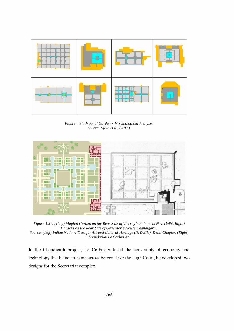
266
Figure 4.36. Mughal Garden’s Morphological Analysis. Source: Syala et al. (2016).
Figure 4.37. . (Left) Mughal Garden on the Rear Side of Viceroy’s Palace in New Delhi, Right)
Gardens on the Rear Side of Governor’s House Chandigarh.. Source: (Left) Indian Nations Trust for Art and Cultural Heritage (INTACH), Delhi Chapter, (Right)
Foundation Le Corbusier.
In the Chandigarh project, Le Corbusier faced the constraints of economy and
technology that he never came across before. Like the High Court, he developed two
designs for the Secretariat complex.
267
4.2.3.6. Acclimatizing to Indian Conditions
In addition to the historical and external influences, technology and economics are
two more factors that forced Le Corbusier to provide an Indian specific solution. The
lack of technology was discussed in Chapter 3 at full length: how absence of elevators
forced the designer to re-consider his high-rise city. Furthermore, it is due to economic
reasons that Le Corbusier had to remove his signature pilotis from the design
scheme.165 The major problems in Punjab was that it became extremely hot during the
summer and required extra protection from water during the monsoon rain seasons.
Le Corbusier made extensive research on the indigenous houses around Chandigarh
and highlighted the main features of the houses that they used to cope with the existing
weather conditions166, (see Fig. 4.38).
His co-architect had photographically documented all the details. The sketches made
by Le Corbusier covers not only the houses, but also depicts how the users interact
with it. Le Corbusier never got a chance to incorporate these details in the residential
area of the city, as he distanced himself from the design of the residences in the city
after his Highrise apartment was considered unbuildable due to high prices and lack
of elevators. The Capitol Complex was Le Corbusier’s chance to utilize his knowledge
of the climatic condition of Punjab. As a solution to the problem, he incorporates
“brise-soleil,” “Cantilevered shades over windows” and “Chatris” into the design of
buildings in the Capitol Complex. While incorporating these elements into the
building Le Corbusier made sure that they don't affect the outlook/overall composition
of the building. In High Court, he provided an extra double roof over the building
supported by concrete columns and extended it outside the building area. The roof acts
as an umbrella to save the building from the sunshade, a feature which resembles
“Chattri” and extensively used in Mughal and colonial architecture. Moreover,
165 The earlier sketches for the High Court shows an elevated High Court placed on the top of Le Corbusier's elevated pilotis.(“AD Classics: Palace of the Assembly / Le Corbusier” 2011)
166 For a detailed sketches and studies see the Album Punjab. Fondation Le Corbusier, Document Number: P2-12-14-001.
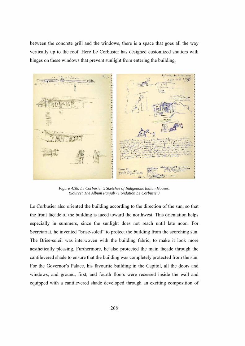
268
between the concrete grill and the windows, there is a space that goes all the way
vertically up to the roof. Here Le Corbusier has designed customized shutters with
hinges on these windows that prevent sunlight from entering the building.
Figure 4.38. Le Corbusier’s Sketches of Indigenous Indian Houses. (Source: The Album Punjab / Fondation Le Corbusier)
Le Corbusier also oriented the building according to the direction of the sun, so that
the front façade of the building is faced toward the northwest. This orientation helps
especially in summers, since the sunlight does not reach until late noon. For
Secretariat, he invented “brise-soleil” to protect the building from the scorching sun.
The Brise-soleil was interwoven with the building fabric, to make it look more
aesthetically pleasing. Furthermore, he also protected the main façade through the
cantilevered shade to ensure that the building was completely protected from the sun.
For the Governor’s Palace, his favourite building in the Capitol, all the doors and
windows, and ground, first, and fourth floors were recessed inside the wall and
equipped with a cantilevered shade developed through an exciting composition of
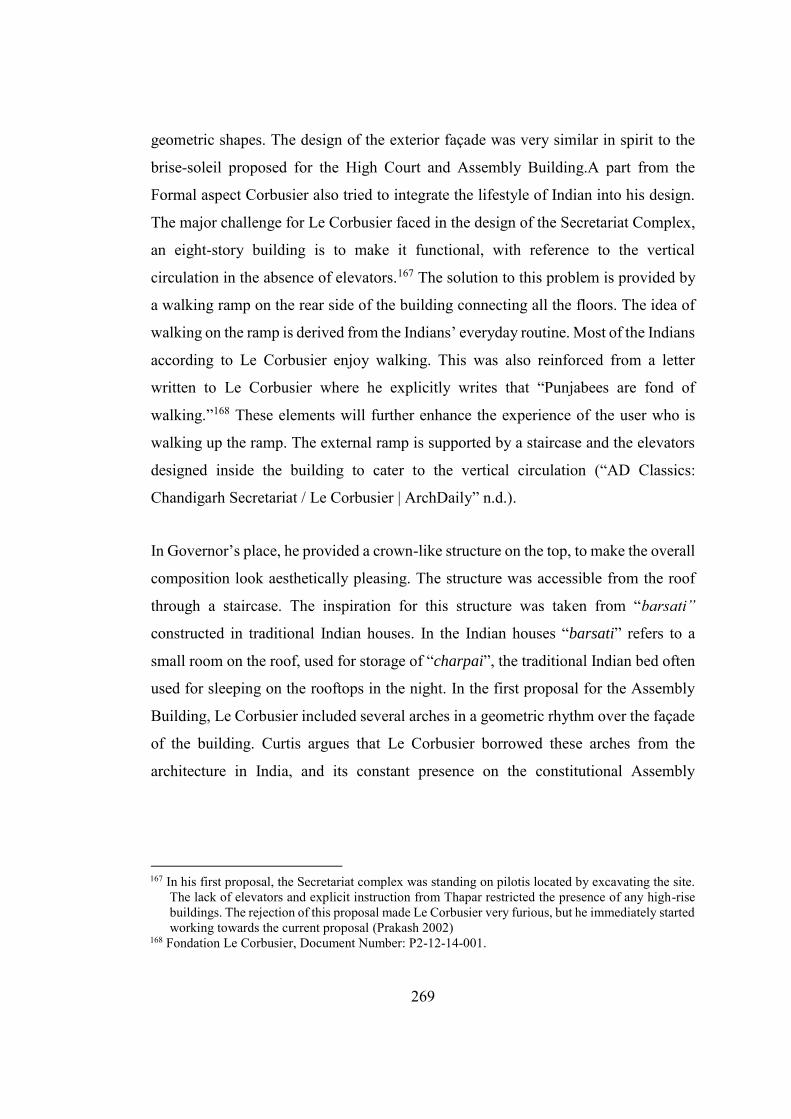
269
geometric shapes. The design of the exterior façade was very similar in spirit to the
brise-soleil proposed for the High Court and Assembly Building.A part from the
Formal aspect Corbusier also tried to integrate the lifestyle of Indian into his design.
The major challenge for Le Corbusier faced in the design of the Secretariat Complex,
an eight-story building is to make it functional, with reference to the vertical
circulation in the absence of elevators.167 The solution to this problem is provided by
a walking ramp on the rear side of the building connecting all the floors. The idea of
walking on the ramp is derived from the Indians’ everyday routine. Most of the Indians
according to Le Corbusier enjoy walking. This was also reinforced from a letter
written to Le Corbusier where he explicitly writes that “Punjabees are fond of
walking.”168 These elements will further enhance the experience of the user who is
walking up the ramp. The external ramp is supported by a staircase and the elevators
designed inside the building to cater to the vertical circulation (“AD Classics:
Chandigarh Secretariat / Le Corbusier | ArchDaily” n.d.).
In Governor’s place, he provided a crown-like structure on the top, to make the overall
composition look aesthetically pleasing. The structure was accessible from the roof
through a staircase. The inspiration for this structure was taken from “barsati”
constructed in traditional Indian houses. In the Indian houses “barsati” refers to a
small room on the roof, used for storage of “charpai”, the traditional Indian bed often
used for sleeping on the rooftops in the night. In the first proposal for the Assembly
Building, Le Corbusier included several arches in a geometric rhythm over the façade
of the building. Curtis argues that Le Corbusier borrowed these arches from the
architecture in India, and its constant presence on the constitutional Assembly
167 In his first proposal, the Secretariat complex was standing on pilotis located by excavating the site.
The lack of elevators and explicit instruction from Thapar restricted the presence of any high-rise buildings. The rejection of this proposal made Le Corbusier very furious, but he immediately started working towards the current proposal (Prakash 2002)
168 Fondation Le Corbusier, Document Number: P2-12-14-001.
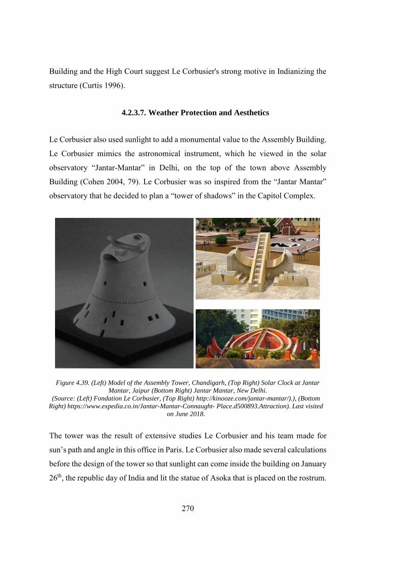
270
Building and the High Court suggest Le Corbusier's strong motive in Indianizing the
structure (Curtis 1996).
4.2.3.7. Weather Protection and Aesthetics
Le Corbusier also used sunlight to add a monumental value to the Assembly Building.
Le Corbusier mimics the astronomical instrument, which he viewed in the solar
observatory “Jantar-Mantar” in Delhi, on the top of the town above Assembly
Building (Cohen 2004, 79). Le Corbusier was so inspired from the “Jantar Mantar”
observatory that he decided to plan a “tower of shadows” in the Capitol Complex.
Figure 4.39. (Left) Model of the Assembly Tower, Chandigarh, (Top Right) Solar Clock at Jantar
Mantar, Jaipur (Bottom Right) Jantar Mantar, New Delhi.
(Source: (Left) Fondation Le Corbusier, (Top Right) http://kinooze.com/jantar-mantar/).), (Bottom
Right) https://www.expedia.co.in/Jantar-Mantar-Connaught- Place.d500893.Attraction). Last visited
on June 2018.
The tower was the result of extensive studies Le Corbusier and his team made for
sun’s path and angle in this office in Paris. Le Corbusier also made several calculations
before the design of the tower so that sunlight can come inside the building on January
26th, the republic day of India and lit the statue of Asoka that is placed on the rostrum.
271
However, finding it impossible to execute this plan, Le Corbusier abandoned this idea
(Curtis 1996). The tower is designed based on the extensive calculation undertaken by
Le Corbusier and his team in their Paris office regarding the movement of the sun over
the buildings of the Capitol Complex so that they can design a customized brise-soleil
for individual buildings. Just like the open hand, this monument is erected to serve a
more symbolic function in the Capitol Complex. Unlike the open hand monument, the
“tower of shadows” can be related to the “Jantar Mantar,” the royal observatories in
ancient India to study the sun. Le Corbusier label the monument as a place of
meditation, “a very open hall, very high and shadowy, its somber atmosphere intended
to invite meditation (Evenson 1966).”
Figure 4.40. Tower of Shadows, Chandigarh (01). (Source: The Album Punjab / Fondation Le Corbusier)
The structure of the tower of shadows does not resemble a tower because of its low
height. The structure is made from concrete in the form of an abstract cuboid which is
covered on three sides by vertical concrete louver type structures designed in a similar
fashion to braise - soleil. A relatively small cube is placed on the top of the tower of
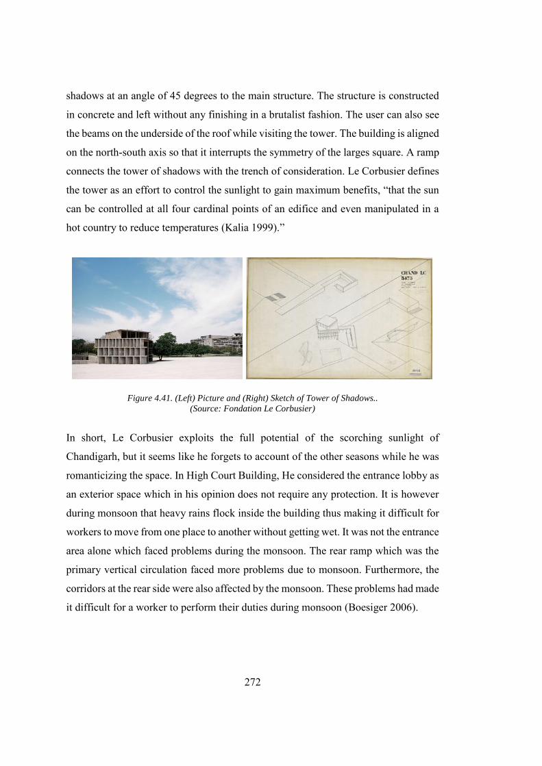
272
shadows at an angle of 45 degrees to the main structure. The structure is constructed
in concrete and left without any finishing in a brutalist fashion. The user can also see
the beams on the underside of the roof while visiting the tower. The building is aligned
on the north-south axis so that it interrupts the symmetry of the larges square. A ramp
connects the tower of shadows with the trench of consideration. Le Corbusier defines
the tower as an effort to control the sunlight to gain maximum benefits, “that the sun
can be controlled at all four cardinal points of an edifice and even manipulated in a
hot country to reduce temperatures (Kalia 1999).”
Figure 4.41. (Left) Picture and (Right) Sketch of Tower of Shadows.. (Source: Fondation Le Corbusier)
In short, Le Corbusier exploits the full potential of the scorching sunlight of
Chandigarh, but it seems like he forgets to account of the other seasons while he was
romanticizing the space. In High Court Building, He considered the entrance lobby as
an exterior space which in his opinion does not require any protection. It is however
during monsoon that heavy rains flock inside the building thus making it difficult for
workers to move from one place to another without getting wet. It was not the entrance
area alone which faced problems during the monsoon. The rear ramp which was the
primary vertical circulation faced more problems due to monsoon. Furthermore, the
corridors at the rear side were also affected by the monsoon. These problems had made
it difficult for a worker to perform their duties during monsoon (Boesiger 2006).
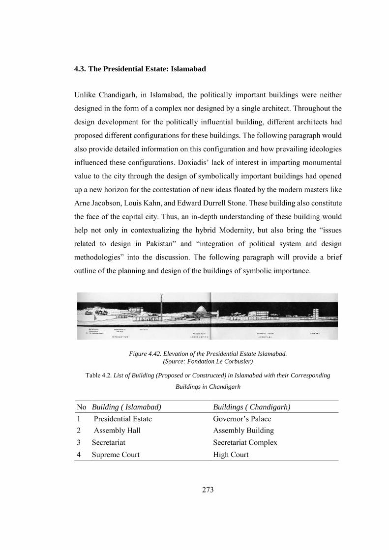
273
4.3. The Presidential Estate: Islamabad
Unlike Chandigarh, in Islamabad, the politically important buildings were neither
designed in the form of a complex nor designed by a single architect. Throughout the
design development for the politically influential building, different architects had
proposed different configurations for these buildings. The following paragraph would
also provide detailed information on this configuration and how prevailing ideologies
influenced these configurations. Doxiadis’ lack of interest in imparting monumental
value to the city through the design of symbolically important buildings had opened
up a new horizon for the contestation of new ideas floated by the modern masters like
Arne Jacobson, Louis Kahn, and Edward Durrell Stone. These building also constitute
the face of the capital city. Thus, an in-depth understanding of these building would
help not only in contextualizing the hybrid Modernity, but also bring the “issues
related to design in Pakistan” and “integration of political system and design
methodologies” into the discussion. The following paragraph will provide a brief
outline of the planning and design of the buildings of symbolic importance.
Figure 4.42. Elevation of the Presidential Estate Islamabad. (Source: Fondation Le Corbusier)
Table 4.2. List of Building (Proposed or Constructed) in Islamabad with their Corresponding
Buildings in Chandigarh
No Building ( Islamabad) Buildings ( Chandigarh)
1 Presidential Estate Governor’s Palace 2 Assembly Hall Assembly Building 3 Secretariat Secretariat Complex 4 Supreme Court High Court
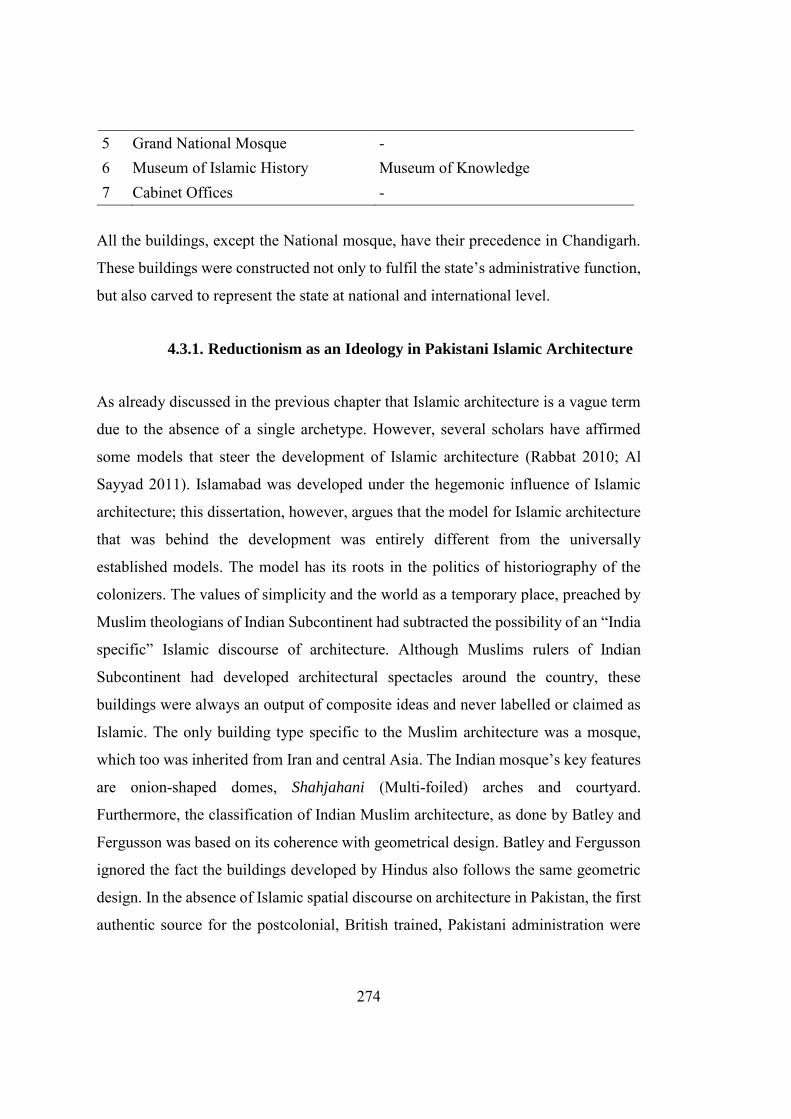
274
5 Grand National Mosque - 6 Museum of Islamic History Museum of Knowledge 7 Cabinet Offices -
All the buildings, except the National mosque, have their precedence in Chandigarh.
These buildings were constructed not only to fulfil the state’s administrative function,
but also carved to represent the state at national and international level.
4.3.1. Reductionism as an Ideology in Pakistani Islamic Architecture
As already discussed in the previous chapter that Islamic architecture is a vague term
due to the absence of a single archetype. However, several scholars have affirmed
some models that steer the development of Islamic architecture (Rabbat 2010; Al
Sayyad 2011). Islamabad was developed under the hegemonic influence of Islamic
architecture; this dissertation, however, argues that the model for Islamic architecture
that was behind the development was entirely different from the universally
established models. The model has its roots in the politics of historiography of the
colonizers. The values of simplicity and the world as a temporary place, preached by
Muslim theologians of Indian Subcontinent had subtracted the possibility of an “India
specific” Islamic discourse of architecture. Although Muslims rulers of Indian
Subcontinent had developed architectural spectacles around the country, these
buildings were always an output of composite ideas and never labelled or claimed as
Islamic. The only building type specific to the Muslim architecture was a mosque,
which too was inherited from Iran and central Asia. The Indian mosque’s key features
are onion-shaped domes, Shahjahani (Multi-foiled) arches and courtyard.
Furthermore, the classification of Indian Muslim architecture, as done by Batley and
Fergusson was based on its coherence with geometrical design. Batley and Fergusson
ignored the fact the buildings developed by Hindus also follows the same geometric
design. In the absence of Islamic spatial discourse on architecture in Pakistan, the first
authentic source for the postcolonial, British trained, Pakistani administration were
275
the books written by Fergusson and Batley.
Figure 4.43. Jamia Masjid Shahjahan Abad, India (Source: https://eatanddust.com/2012/10/28/eid-al-adha-prayers-at-old-delhis-jama-masjid/). Last
visited on June 2018.)
As discussed in section 4.1.2 of this chapter, during the rule of the British empire,
several books were written specifically on the history of architecture. Most prominent
among them are Fergusson’s “History of Indian and Eastern Architecture (1876)” and
Batley’s “The design and development of Indian architecture (1934)”. These books
provide a comprehensive account of architecture in the Indian Subcontinent. The
major problem is that these books were written in continuation with the empire’s
ideology of “Divide and Rule”169, hence not only triggered the differences between
Hindus and Muslims but masked the architecture accordingly. As described in Chapter
2, almost all the empires ruled by Muslim rulers on Indian Subcontinent were political
169The creation and perpetuation of Hindu-Muslim antagonism was the most significant
accomplishment of British imperial policy: the colonial project of "divide et impera" (Divide and Rule) fomented religious antagonisms to facilitate continued imperial rule and reached its tragic culmination in 1947(Tharoor 2017).
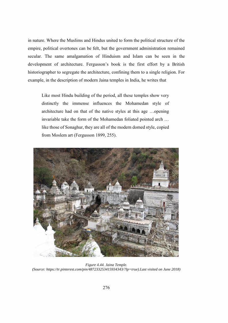
276
in nature. Where the Muslims and Hindus united to form the political structure of the
empire, political overtones can be felt, but the government administration remained
secular. The same amalgamation of Hinduism and Islam can be seen in the
development of architecture. Fergusson’s book is the first effort by a British
historiographer to segregate the architecture, confining them to a single religion. For
example, in the description of modern Jaina temples in India, he writes that
Like most Hindu building of the period, all these temples show very
distinctly the immense influences the Mohamedan style of
architecture had on that of the native styles at this age …opening
invariable take the form of the Mohamedan foliated pointed arch …
like those of Sonaghur, they are all of the modern domed style, copied
from Moslem art (Fergusson 1899, 255).
Figure 4.44. Jaina Temple. (Source: https://tr.pinterest.com/pin/487233253415934343/?lp=true).Last visited on June 2018)
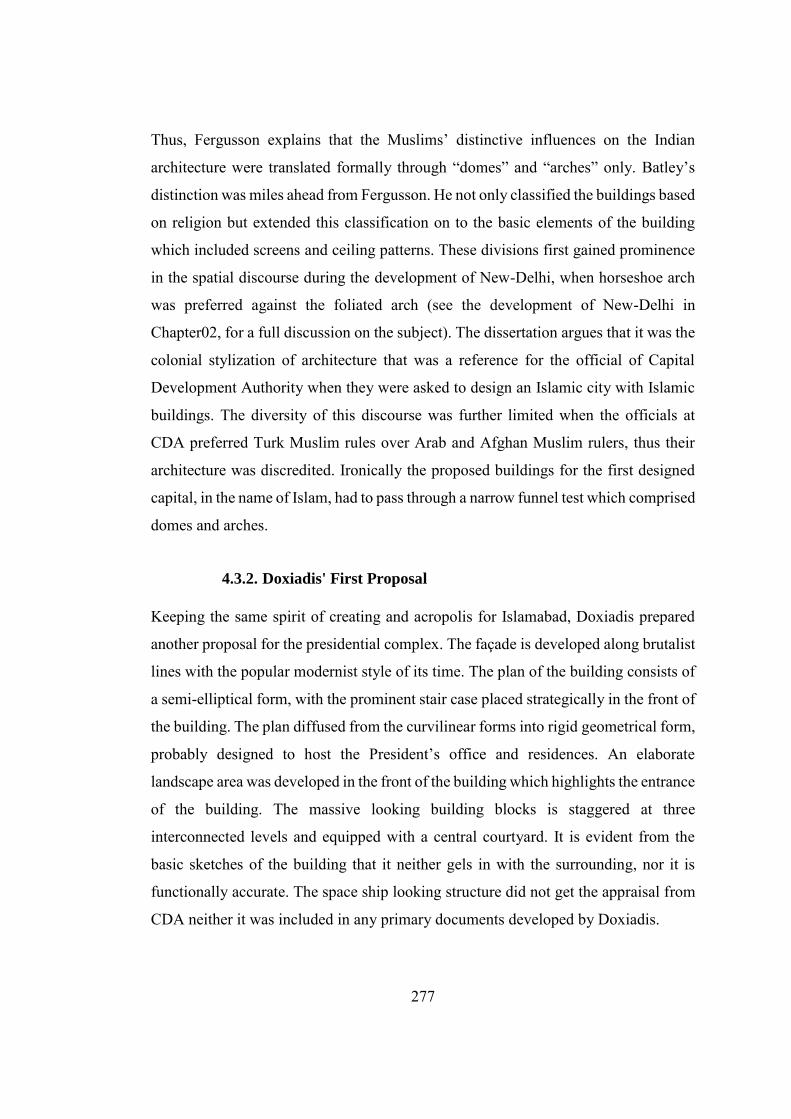
277
Thus, Fergusson explains that the Muslims’ distinctive influences on the Indian
architecture were translated formally through “domes” and “arches” only. Batley’s
distinction was miles ahead from Fergusson. He not only classified the buildings based
on religion but extended this classification on to the basic elements of the building
which included screens and ceiling patterns. These divisions first gained prominence
in the spatial discourse during the development of New-Delhi, when horseshoe arch
was preferred against the foliated arch (see the development of New-Delhi in
Chapter02, for a full discussion on the subject). The dissertation argues that it was the
colonial stylization of architecture that was a reference for the official of Capital
Development Authority when they were asked to design an Islamic city with Islamic
buildings. The diversity of this discourse was further limited when the officials at
CDA preferred Turk Muslim rules over Arab and Afghan Muslim rulers, thus their
architecture was discredited. Ironically the proposed buildings for the first designed
capital, in the name of Islam, had to pass through a narrow funnel test which comprised
domes and arches.
4.3.2. Doxiadis' First Proposal
Keeping the same spirit of creating and acropolis for Islamabad, Doxiadis prepared
another proposal for the presidential complex. The façade is developed along brutalist
lines with the popular modernist style of its time. The plan of the building consists of
a semi-elliptical form, with the prominent stair case placed strategically in the front of
the building. The plan diffused from the curvilinear forms into rigid geometrical form,
probably designed to host the President’s office and residences. An elaborate
landscape area was developed in the front of the building which highlights the entrance
of the building. The massive looking building blocks is staggered at three
interconnected levels and equipped with a central courtyard. It is evident from the
basic sketches of the building that it neither gels in with the surrounding, nor it is
functionally accurate. The space ship looking structure did not get the appraisal from
CDA neither it was included in any primary documents developed by Doxiadis.
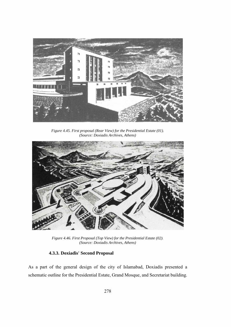
278
Figure 4.45. First proposal (Rear View) for the Presidential Estate (01). (Source: Doxiadis Archives, Athens)
Figure 4.46. First Proposal (Top View) for the Presidential Estate (02). (Source: Doxiadis Archives, Athens)
4.3.3. Doxiadis' Second Proposal
As a part of the general design of the city of Islamabad, Doxiadis presented a
schematic outline for the Presidential Estate, Grand Mosque, and Secretariat building.
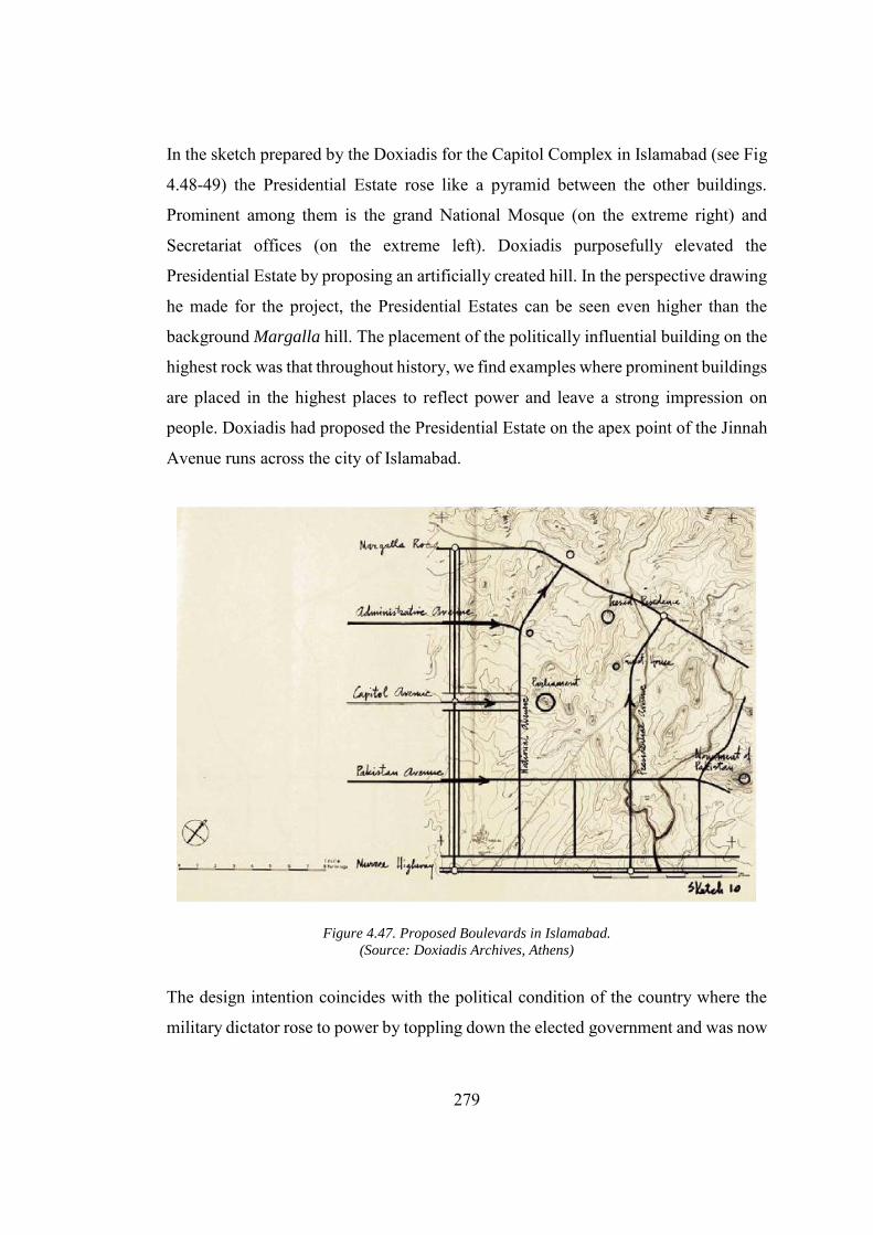
279
In the sketch prepared by the Doxiadis for the Capitol Complex in Islamabad (see Fig
4.48-49) the Presidential Estate rose like a pyramid between the other buildings.
Prominent among them is the grand National Mosque (on the extreme right) and
Secretariat offices (on the extreme left). Doxiadis purposefully elevated the
Presidential Estate by proposing an artificially created hill. In the perspective drawing
he made for the project, the Presidential Estates can be seen even higher than the
background Margalla hill. The placement of the politically influential building on the
highest rock was that throughout history, we find examples where prominent buildings
are placed in the highest places to reflect power and leave a strong impression on
people. Doxiadis had proposed the Presidential Estate on the apex point of the Jinnah
Avenue runs across the city of Islamabad.
Figure 4.47. Proposed Boulevards in Islamabad. (Source: Doxiadis Archives, Athens)
The design intention coincides with the political condition of the country where the
military dictator rose to power by toppling down the elected government and was now
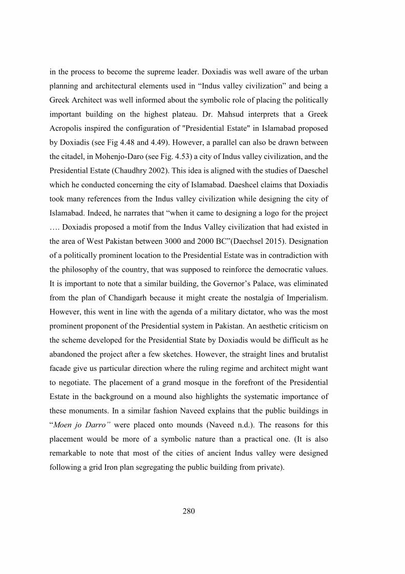
280
in the process to become the supreme leader. Doxiadis was well aware of the urban
planning and architectural elements used in “Indus valley civilization” and being a
Greek Architect was well informed about the symbolic role of placing the politically
important building on the highest plateau. Dr. Mahsud interprets that a Greek
Acropolis inspired the configuration of "Presidential Estate" in Islamabad proposed
by Doxiadis (see Fig 4.48 and 4.49). However, a parallel can also be drawn between
the citadel, in Mohenjo-Daro (see Fig. 4.53) a city of Indus valley civilization, and the
Presidential Estate (Chaudhry 2002). This idea is aligned with the studies of Daeschel
which he conducted concerning the city of Islamabad. Daeshcel claims that Doxiadis
took many references from the Indus valley civilization while designing the city of
Islamabad. Indeed, he narrates that “when it came to designing a logo for the project
…. Doxiadis proposed a motif from the Indus Valley civilization that had existed in
the area of West Pakistan between 3000 and 2000 BC”(Daechsel 2015). Designation
of a politically prominent location to the Presidential Estate was in contradiction with
the philosophy of the country, that was supposed to reinforce the democratic values.
It is important to note that a similar building, the Governor’s Palace, was eliminated
from the plan of Chandigarh because it might create the nostalgia of Imperialism.
However, this went in line with the agenda of a military dictator, who was the most
prominent proponent of the Presidential system in Pakistan. An aesthetic criticism on
the scheme developed for the Presidential State by Doxiadis would be difficult as he
abandoned the project after a few sketches. However, the straight lines and brutalist
facade give us particular direction where the ruling regime and architect might want
to negotiate. The placement of a grand mosque in the forefront of the Presidential
Estate in the background on a mound also highlights the systematic importance of
these monuments. In a similar fashion Naveed explains that the public buildings in
“Moen jo Darro” were placed onto mounds (Naveed n.d.). The reasons for this
placement would be more of a symbolic nature than a practical one. (It is also
remarkable to note that most of the cities of ancient Indus valley were designed
following a grid Iron plan segregating the public building from private).
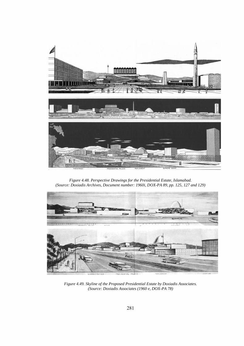
281
Figure 4.48. Perspective Drawings for the Presidential Estate, Islamabad. (Source: Doxiadis Archives, Document number: 1960i, DOX-PA 89, pp. 125, 127 and 129)
Figure 4.49. Skyline of the Proposed Presidential Estate by Doxiadis Associates.
(Source: Doxiadis Associates (1960 e, DOX-PA 78)
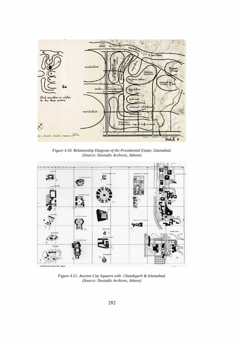
282
Figure 4.50. Relationship Diagram of the Presidential Estate, Islamabad. (Source: Doxiadis Archives, Athens)
Figure 4.51. Ancient City Squares with Chandigarh & Islamabad. (Source: Doxiadis Archives, Athens)
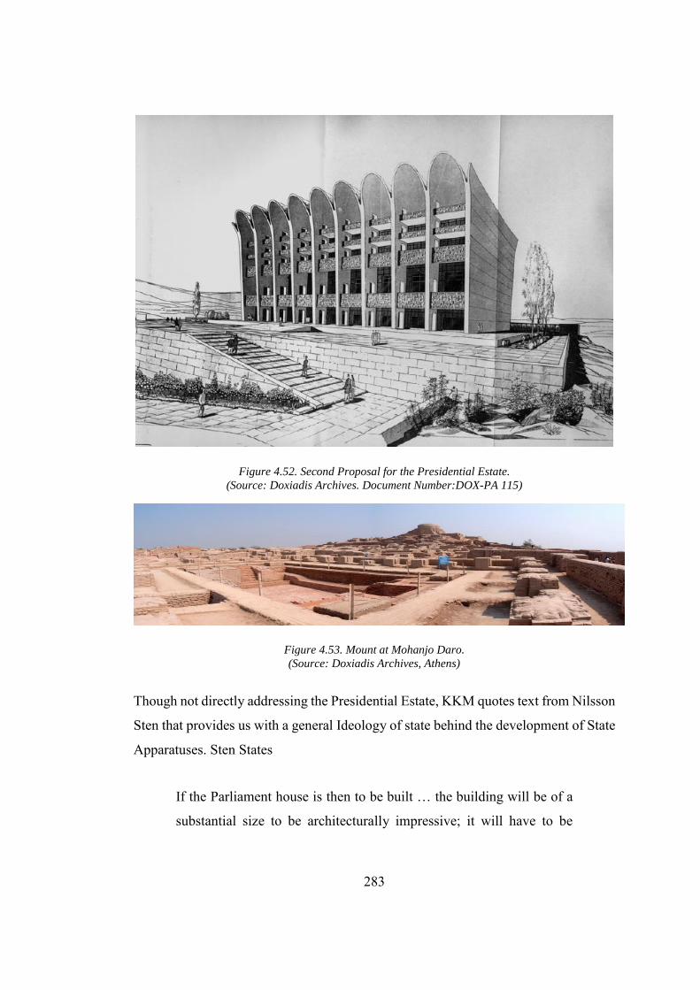
283
Figure 4.52. Second Proposal for the Presidential Estate. (Source: Doxiadis Archives. Document Number:DOX-PA 115)
Figure 4.53. Mount at Mohanjo Daro. (Source: Doxiadis Archives, Athens)
Though not directly addressing the Presidential Estate, KKM quotes text from Nilsson
Sten that provides us with a general Ideology of state behind the development of State
Apparatuses. Sten States
If the Parliament house is then to be built … the building will be of a
substantial size to be architecturally impressive; it will have to be
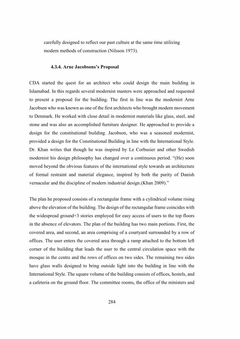
284
carefully designed to reflect our past culture at the same time utilizing
modern methods of construction (Nilsson 1973).
4.3.4. Arne Jacobsons’s Proposal
CDA started the quest for an architect who could design the main building in
Islamabad. In this regards several modernist masters were approached and requested
to present a proposal for the building. The first in line was the modernist Arne
Jacobsen who was known as one of the first architects who brought modern movement
to Denmark. He worked with close detail in modernist materials like glass, steel, and
stone and was also an accomplished furniture designer. He approached to provide a
design for the constitutional building. Jacobson, who was a seasoned modernist,
provided a design for the Constitutional Building in line with the International Style.
Dr. Khan writes that though he was inspired by Le Corbusier and other Swedish
modernist his design philosophy has changed over a continuous period. “(He) soon
moved beyond the obvious features of the international style towards an architecture
of formal restraint and material elegance, inspired by both the purity of Danish
vernacular and the discipline of modern industrial design.(Khan 2009).”
The plan he proposed consists of a rectangular frame with a cylindrical volume rising
above the elevation of the building. The design of the rectangular frame coincides with
the widespread ground+3 stories employed for easy access of users to the top floors
in the absence of elevators. The plan of the building has two main portions. First, the
covered area, and second, an area comprising of a courtyard surrounded by a row of
offices. The user enters the covered area through a ramp attached to the bottom left
corner of the building that leads the user to the central circulation space with the
mosque in the centre and the rows of offices on two sides. The remaining two sides
have glass walls designed to bring outside light into the building in line with the
International Style. The square volume of the building consists of offices, hostels, and
a cafeteria on the ground floor. The committee rooms, the office of the ministers and
285
interpreters, meeting hall, and libraries were placed on the first and second floors.
Jacobson also provided a mosque at the centre of the cylinder on the ground floor with
an intention to provide users with a spiritual linkage to God.
The cylindrical volume is designed to house the Upper House (Senate of
Constitutional Assembly) and Lower House (The Parliament) and the viewing
galleries. All the floors are provided with ample circulation space. The corridors are
designed for horizontal circulation whereas a staircase caters to the vertical circulation
(Nilsson 1973). The height of the Senate and the status quo followed by the senators
suggest that it also has access through elevators. The courtyard can also be accessed
from three sides. The central courtyard is planned to counter the hot weather and to
act as a circulation space. The entrances to the building are designed to cater many
users. As Dr. Khan writes, “The entrances were differentiated for a variety of users:
the main entry for members was placed at the east of this space, the entry for
ceremonies was planned on the west, the public entry was linked with the walking
places (Khan 2009).”The proposal was rejected for being too modern and for not
complying with Islamic architecture as envisioned by CDA officials. CDA
bureaucrats were trained by British Bureaucrats who had a responsibility to establish
colonial rule in British India and had inherited their arrogance from their British
masters. They had highly criticized the design approach of the Arne Jacobson’s and
Chairman of CDA “had the temerity to ask the professor to alter his
design to suit the wishes and whims of the Committee, but dedicated
and serious-minded architect that he was, Jacobson steadfastly and
firmly refused to change even a single line in his design (Khwaja 1998,
100).
CDA official has also passed some sarcastic comment about the design resembling it
as “oil storage tank for a local refinery.” Ultimately, he preferred to leave the project
instead of incorporating the demands to include the “arches” and “domes” in
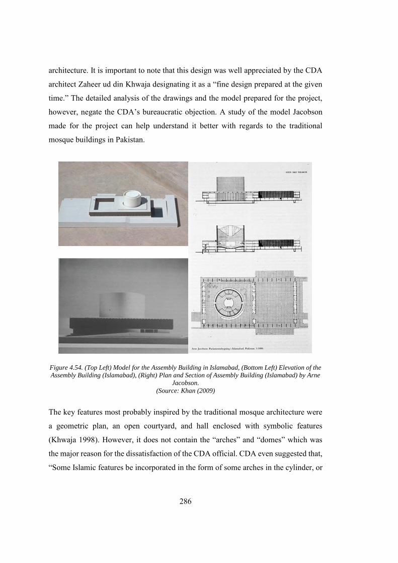
286
architecture. It is important to note that this design was well appreciated by the CDA
architect Zaheer ud din Khwaja designating it as a “fine design prepared at the given
time.” The detailed analysis of the drawings and the model prepared for the project,
however, negate the CDA’s bureaucratic objection. A study of the model Jacobson
made for the project can help understand it better with regards to the traditional
mosque buildings in Pakistan.
Figure 4.54. (Top Left) Model for the Assembly Building in Islamabad, (Bottom Left) Elevation of the
Assembly Building (Islamabad), (Right) Plan and Section of Assembly Building (Islamabad) by Arne
Jacobson. (Source: Khan (2009)
The key features most probably inspired by the traditional mosque architecture were
a geometric plan, an open courtyard, and hall enclosed with symbolic features
(Khwaja 1998). However, it does not contain the “arches” and “domes” which was
the major reason for the dissatisfaction of the CDA official. CDA even suggested that,
“Some Islamic features be incorporated in the form of some arches in the cylinder, or
287
a dome above the cylinder, or some addition to the four courtyards (Mumtaz 1989,
187).” This was the same time that the CDA got an idea to build a grand mosque near
the building of constitutional assembly. The building was proposed to be constructed
in the concrete with the cylindrical tower containing masonry joints on its exterior site.
The front elevation at the ground floor on two major sides is made from the glass walls
while the rest of the building contains glass windows fixed between intricately
designed concrete façade made from thin concrete pillars. The cylindrical volume is
proposed to be cladded with white marble both on the exterior and interior sides, while
the lower rectangular volume had black marble cladding. Another exciting feature of
the building was the hanging garden proposed between the hostel and the cylindrical
volume. Several parallels can be drawn between Jacobson's Assembly Building and
its competitor in Chandigarh. For example, the central space on the ground floor is
similar to the space provided for the meeting and labelled as a forum by Le Corbusier
in Chandigarh. Jacobson has also sued brise-soleil for almost the same functional use
as that of Chandigarh. However, instead of concrete, Jacobson has proposed them in
anodized aluminium. He also tried to protect the concrete slab from the sunlight by
providing a false roof over it. The roof is made from lightweight concrete slabs and
installed over the I-beams placed on the top of the roof (listed 1982). Furthermore,
Stein Nilsson relates Jacobson's proposal to that of Le Corbusier’s Assembly in
Chandigarh, “in principle, the solution is the same as Le Corbusier’s Assembly Hall
in Chandigarh, but the shell is free from expressionist overtones (Nilsson 1973).” He
quit the design for the building of the constitutional assembly and decided not to take
any further project in Islamabad under CDA. Arne Jacobson was regarded as “one of
the greatest and in the finest tradition of the profession” by Architect (late) Zaheer ud
Din Khawaja who enjoyed working with Jacobson’s (Khwaja 1998).
4.3.5. Louis Kahn’s Proposal
After the departure of the Arne Jacobson, Prof Louis Kahn was assigned to undertake
the project. Prof Kahn was a professor at the University of Pennsylvania. He was
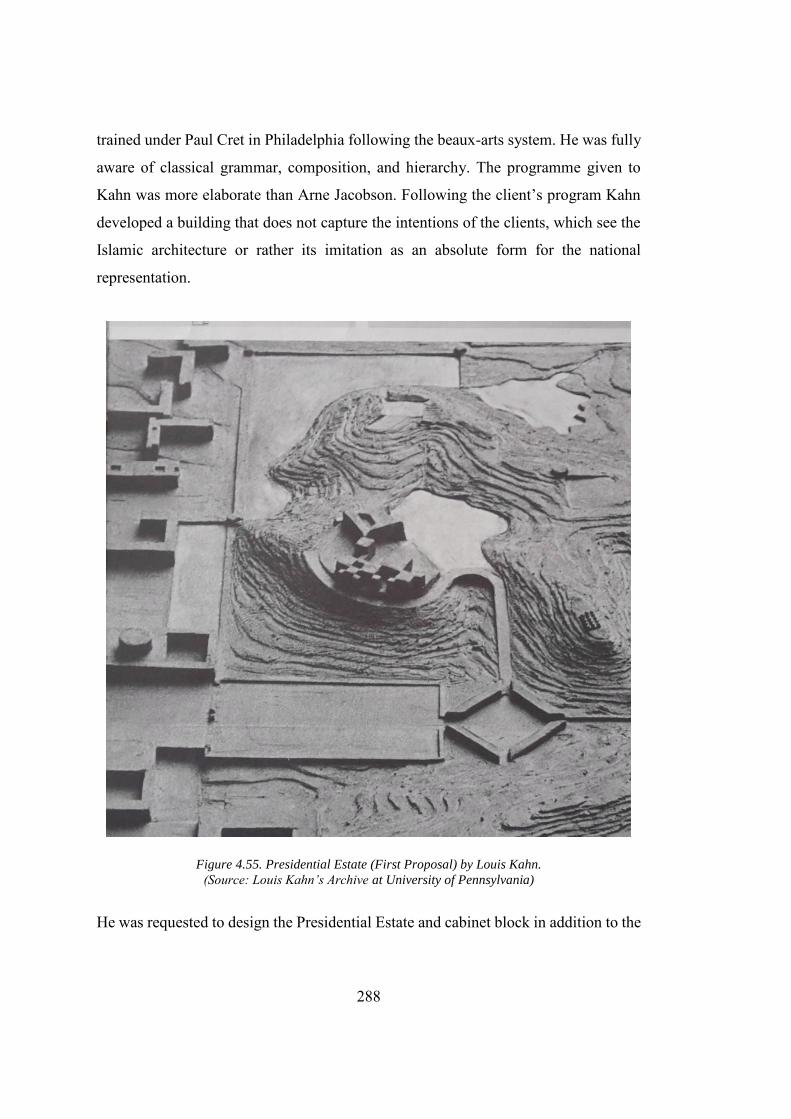
288
trained under Paul Cret in Philadelphia following the beaux-arts system. He was fully
aware of classical grammar, composition, and hierarchy. The programme given to
Kahn was more elaborate than Arne Jacobson. Following the client’s program Kahn
developed a building that does not capture the intentions of the clients, which see the
Islamic architecture or rather its imitation as an absolute form for the national
representation.
Figure 4.55. Presidential Estate (First Proposal) by Louis Kahn. (Source: Louis Kahn’s Archive at University of Pennsylvania)
He was requested to design the Presidential Estate and cabinet block in addition to the
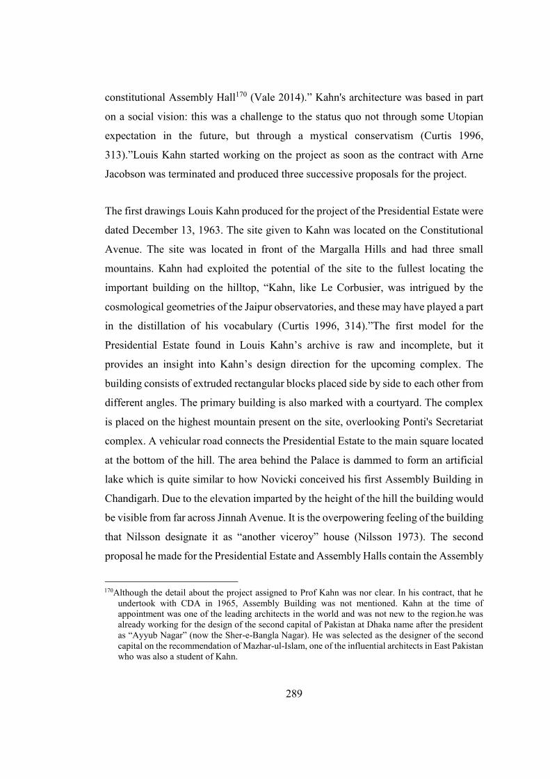
289
constitutional Assembly Hall170 (Vale 2014).” Kahn's architecture was based in part
on a social vision: this was a challenge to the status quo not through some Utopian
expectation in the future, but through a mystical conservatism (Curtis 1996,
313).”Louis Kahn started working on the project as soon as the contract with Arne
Jacobson was terminated and produced three successive proposals for the project.
The first drawings Louis Kahn produced for the project of the Presidential Estate were
dated December 13, 1963. The site given to Kahn was located on the Constitutional
Avenue. The site was located in front of the Margalla Hills and had three small
mountains. Kahn had exploited the potential of the site to the fullest locating the
important building on the hilltop, “Kahn, like Le Corbusier, was intrigued by the
cosmological geometries of the Jaipur observatories, and these may have played a part
in the distillation of his vocabulary (Curtis 1996, 314).”The first model for the
Presidential Estate found in Louis Kahn’s archive is raw and incomplete, but it
provides an insight into Kahn’s design direction for the upcoming complex. The
building consists of extruded rectangular blocks placed side by side to each other from
different angles. The primary building is also marked with a courtyard. The complex
is placed on the highest mountain present on the site, overlooking Ponti's Secretariat
complex. A vehicular road connects the Presidential Estate to the main square located
at the bottom of the hill. The area behind the Palace is dammed to form an artificial
lake which is quite similar to how Novicki conceived his first Assembly Building in
Chandigarh. Due to the elevation imparted by the height of the hill the building would
be visible from far across Jinnah Avenue. It is the overpowering feeling of the building
that Nilsson designate it as “another viceroy” house (Nilsson 1973). The second
proposal he made for the Presidential Estate and Assembly Halls contain the Assembly
170Although the detail about the project assigned to Prof Kahn was nor clear. In his contract, that he
undertook with CDA in 1965, Assembly Building was not mentioned. Kahn at the time of appointment was one of the leading architects in the world and was not new to the region.he was already working for the design of the second capital of Pakistan at Dhaka name after the president as “Ayyub Nagar” (now the Sher-e-Bangla Nagar). He was selected as the designer of the second capital on the recommendation of Mazhar-ul-Islam, one of the influential architects in East Pakistan who was also a student of Kahn.
290
Halls on the bottom left of the composition and the centre for Islamic study standing
in the form of a triangular mass in the centre of the composition revealing its inherited
artistry of Kahn.
Figure 4.56. (Left) Presidential Estate (Islamabad) 2nd Proposal, version 01, (Right) Presidential
Estate (Islamabad) 2nd Proposal, version 02 by Louis Kahn. (Source: Louis Kahn’s Archive at University of Pennsylvania)
Following the first proposal, Kahn placed the Presidential Estate at the top of the hill
overlooking the city. In this proposal, more visibility is imparted to the Presidential
Estate by bringing it to the centre of the composition, away from Ponti’s Secretariat
complex. The Presidential Estate thus in this building got the more central position
and more clear visibility making it monumental as a symbol of power. On the left side
of the Model, Gio Ponti Secretariat complex was shown in the form of rectangular
blocks. Kahn provided two version of this model to CDA with slight modifications in
the overall form of the Assembly Building. In the first version, the Assembly Building
was designed as a pyramid shape complex with the cube placed at the top of the
pyramid. This proposal reflects Kahn’s signature geometrical carvings that he had
already exhibited in the design of the national Assembly Building in East Pakistan
(present-day Bangladesh). In a conversation with Sir. Robert Matthew, official
architect of C.D.A. Kahn describes his initial idea as
It could be a new concept of minaret embodying a small chapel raised
291
above the level of a square, and a special platform from where one
could preach facing Mecca --- the sequence is being suggested as a
roofless hall of the meeting (Brownlee 2005).
Though these lines show Kahn's intention of integrating the spirit of Islam into the
building, he missed the materialistic demands from the CDA. In the second version of
the proposal the pyramidal shape assembly is replaced by a cuboid which was
subtracted using a cylinder and a smaller cube. Most probably, the Assembly Hall is
placed in the centre of the composition. The dominant cube is divided into four parts
by subtracting the mass along the two axial lines. The resultant smaller mass is
provided with the triangular courtyard. This overall composition looks very similar to
Kahn’s proposal for the constitutional Assembly Building in Pakistan’s second capital
at Dhaka. Another essential feature of the overall composition was the central square
located in the centre of the constitutional Assembly Building and museum of Islamic
history. In his discussion with the CDA official Kahn drew several parallels of this
square with the grand square with Red Square in Moscow and the Great Square in
Isfahan, Iran. The former square in Russia was the main square of Moscow, also
located next to the Presidential Estate. This square was often used to showcase
Russia’s power through military shows off. The great square in Isfahan was also in
the heart of MRV’s proposal for Pakistan's National Capitol in Karachi. A historical
feature of Persian architecture, this square was used as a people’s congregation place,
an idea that President Ayyub as a military dictator would not like.The building
complex is connected to Jinnah Avenue, and a small building is present at the bottom
left of this highway. Though not explicitly mentioned, keeping the present-day
function in mind, this building is most probably the office of the cabinet. Prof Kahn
also provided an expressive layout for vehicular movement by connecting the
Assembly Hall and museum through elaborate networks of roads, circular ramps, and
an underpass beneath the significant highway leading towards the Presidential Estate.
Thus Presidential Estate was provided with an unhindered access from the Jinnah
Avenue (Khan 2009). The third and final proposal Kahn developed for the Presidential
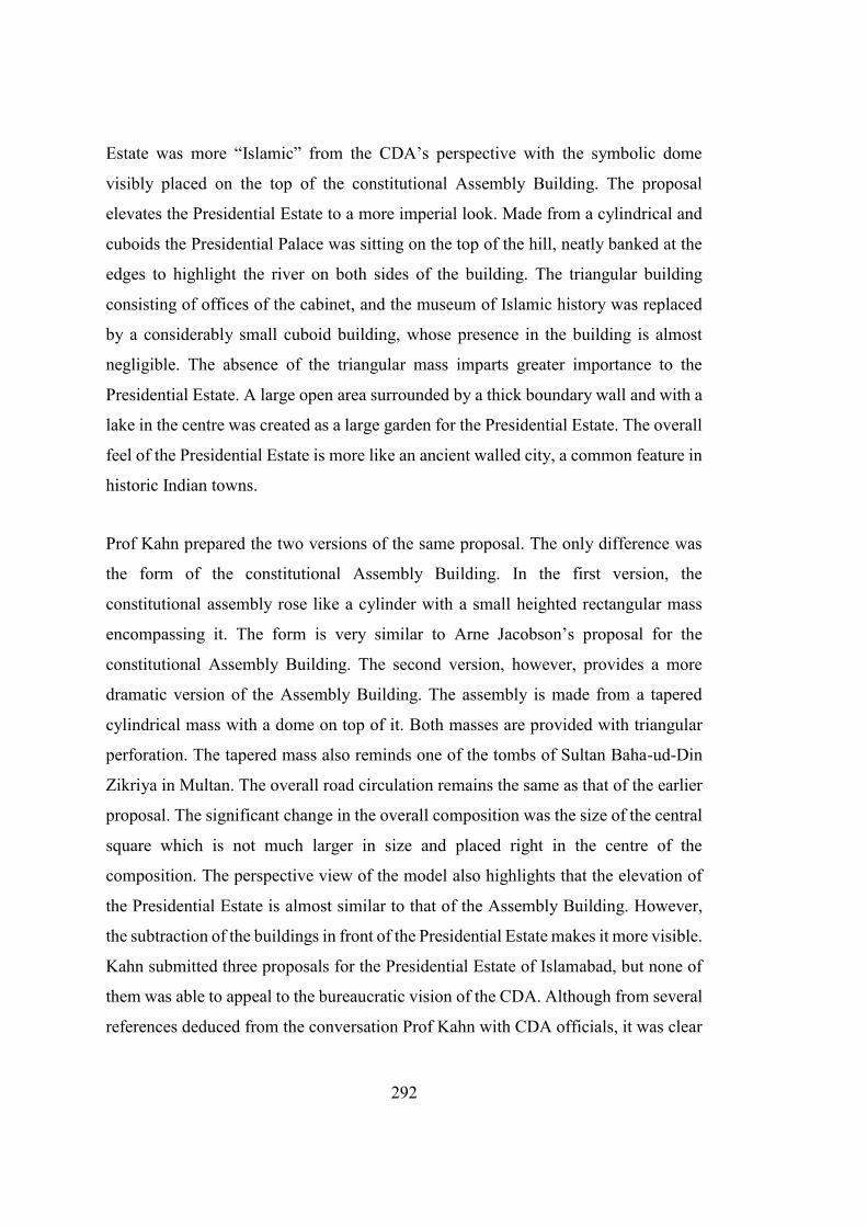
292
Estate was more “Islamic” from the CDA’s perspective with the symbolic dome
visibly placed on the top of the constitutional Assembly Building. The proposal
elevates the Presidential Estate to a more imperial look. Made from a cylindrical and
cuboids the Presidential Palace was sitting on the top of the hill, neatly banked at the
edges to highlight the river on both sides of the building. The triangular building
consisting of offices of the cabinet, and the museum of Islamic history was replaced
by a considerably small cuboid building, whose presence in the building is almost
negligible. The absence of the triangular mass imparts greater importance to the
Presidential Estate. A large open area surrounded by a thick boundary wall and with a
lake in the centre was created as a large garden for the Presidential Estate. The overall
feel of the Presidential Estate is more like an ancient walled city, a common feature in
historic Indian towns.
Prof Kahn prepared the two versions of the same proposal. The only difference was
the form of the constitutional Assembly Building. In the first version, the
constitutional assembly rose like a cylinder with a small heighted rectangular mass
encompassing it. The form is very similar to Arne Jacobson’s proposal for the
constitutional Assembly Building. The second version, however, provides a more
dramatic version of the Assembly Building. The assembly is made from a tapered
cylindrical mass with a dome on top of it. Both masses are provided with triangular
perforation. The tapered mass also reminds one of the tombs of Sultan Baha-ud-Din
Zikriya in Multan. The overall road circulation remains the same as that of the earlier
proposal. The significant change in the overall composition was the size of the central
square which is not much larger in size and placed right in the centre of the
composition. The perspective view of the model also highlights that the elevation of
the Presidential Estate is almost similar to that of the Assembly Building. However,
the subtraction of the buildings in front of the Presidential Estate makes it more visible.
Kahn submitted three proposals for the Presidential Estate of Islamabad, but none of
them was able to appeal to the bureaucratic vision of the CDA. Although from several
references deduced from the conversation Prof Kahn with CDA officials, it was clear
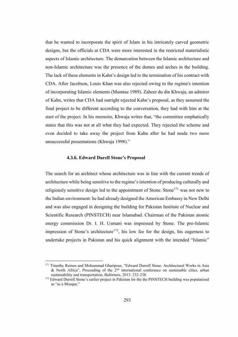
293
that he wanted to incorporate the spirit of Islam in his intricately carved geometric
designs, but the officials at CDA were more interested in the restricted materialistic
aspects of Islamic architecture. The demarcation between the Islamic architecture and
non-Islamic architecture was the presence of the domes and arches in the building.
The lack of these elements in Kahn’s design led to the termination of his contract with
CDA. After Jacobson, Louis Khan was also rejected owing to the regime's intention
of incorporating Islamic elements (Mumtaz 1989). Zaheer du din Khwaja, an admirer
of Kahn, writes that CDA had outright rejected Kahn’s proposal, as they assumed the
final project to be different according to the conversation, they had with him at the
start of the project. In his memoirs, Khwaja writes that, “the committee emphatically
states that this was not at all what they had expected. They rejected the scheme and
even decided to take away the project from Kahn after he had made two more
unsuccessful presentations (Khwaja 1998).”
4.3.6. Edward Durell Stone’s Proposal
The search for an architect whose architecture was in line with the current trends of
architecture while being sensitive to the regime’s intention of producing culturally and
religiously sensitive design led to the appointment of Stone. Stone171 was not new to
the Indian environment: he had already designed the American Embassy in New Delhi
and was also engaged in designing the building for Pakistan Institute of Nuclear and
Scientific Research (PINSTECH) near Islamabad. Chairman of the Pakistan atomic
energy commission Dr. I. H. Usmani was impressed by Stone. The pro-Islamic
impression of Stone’s architecture172, his low fee for the design, his eagerness to
undertake projects in Pakistan and his quick alignment with the intended “Islamic”
171 Timothy Reinen and Mohammad Gharipour, “Edward Durrell Stone: Architectural Works in Asia
& North Africa”, Proceeding of the 2nd international conference on sustainable cities, urban sustainability and transportation, Baltimore, 2013: 232-238.
172 Edward Durrell Stone’s earlier project in Pakistan for the the PINSTECH building was popularized as “as a Mosque.”
294
ambitions of CDA officials led him to complete and construct the project successfully.
Figure 4.57. Model of Presidential Estate, Islamabad’s 1st Proposal by Stone (Source: Edward Durrell Stone’s Archives at University of Arkansas)
Specific evidence suggests that the CDA official did not have a proper programme for
the Presidential Estate, nor the Government of Pakistan had any clear direction about
the future political structure of Pakistan. Both of these problems worsened the
situation. Khwaja writes that during the early phase of the development of the
Presidential Estate, upon my inquiry that whether the “future Parliament would have
a unicameral or bi-cameral legislature,” he got the reply from the president that it
would be a single house, which was not the case in the real sense. The decision had
affected the design of the constitutional Assembly Building and added expenditure.
The Presidential Estate was designed to host the official functions of the presidency,
accommodation for the state guests, president’s residence and a mosque. State
functions were to be hosted on the ground floor of the front block while the state
guests’ accommodation was placed on the first floor of the same block. He was quick
295
to understand the intention of the CDA officials and had prepared the first proposal of
the Presidential Estate (Khwaja 1998). Figure 5.57 highlights Stones clear direction
about incorporating the geometric pattern, borrowed from the tradition Muslim
architecture in the Indian Subcontinent.
Figure 4.58. . View of Shalimar Garden Lahore (Source: (Source: mapio.net.) Last visited on June 2018.)
Stone was not imitating the design from the traditional architecture but innovating it
by utilizing his experience as a modern architect. The proposed obelisk in front of the
Presidential Palace and the straight-line brutalist form of the building reinforces this
claim. Stone prepared a straightforward and economic proposal for the Presidential
Estate. Following Kahn’s footstep, the three buildings, constitutional assembly, the
cabinet block and Presidential Estate, was designed around a central square. An
obelisk was proposed in the centre of the square to provide a focal point to the user.
This obelisk was the only deliberate effort to impart monumentality to the
composition. Zaheer ud din Khwaja writes that Stone’s decision of creating a flat land
by filling the hilltop so he could place the Presidential Estate on the top of it, is
inappropriate.(Khwaja 1998, 118).
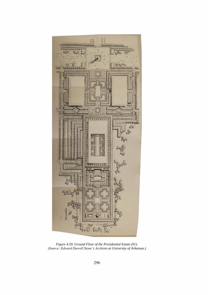
296
Figure 4.59. Ground Floor of the Presidential Estate (01). (Source: Edward Durrell Stone’s Archives at University of Arkansas.)
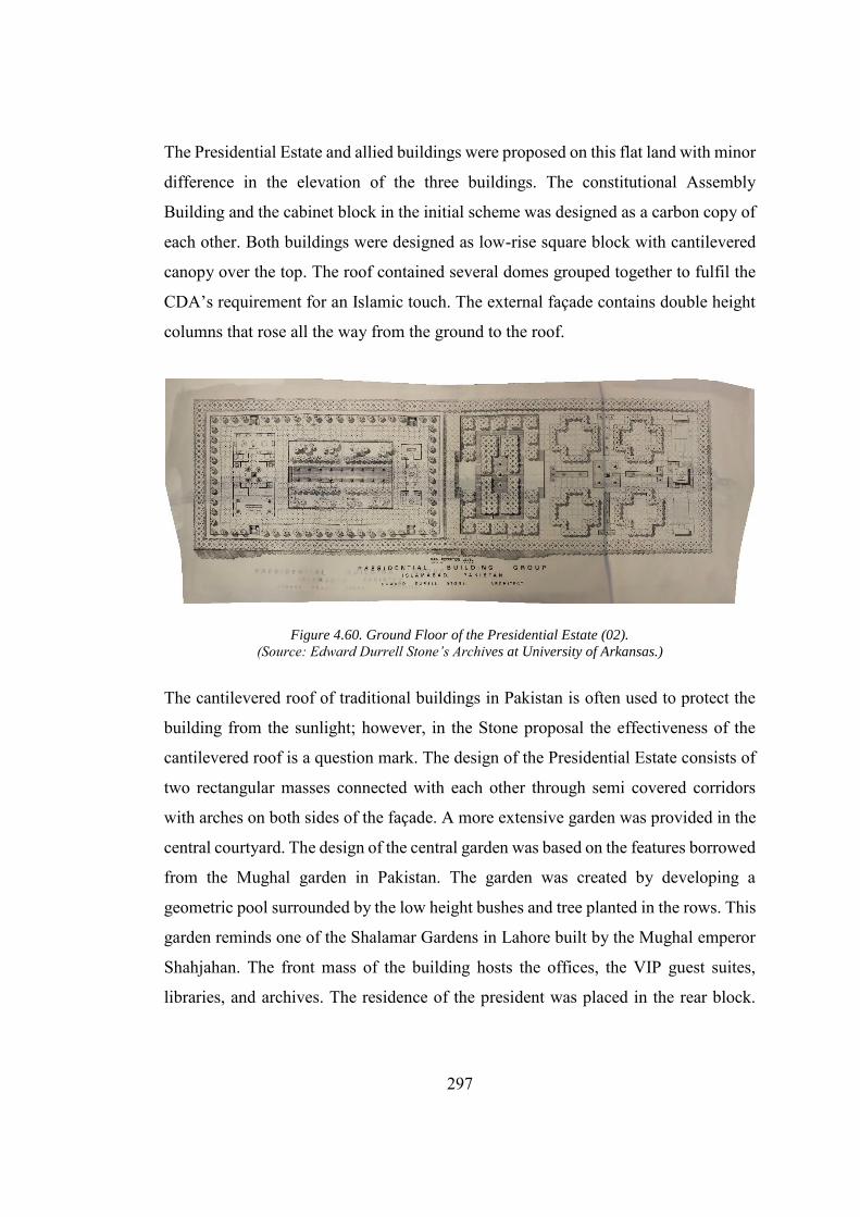
297
The Presidential Estate and allied buildings were proposed on this flat land with minor
difference in the elevation of the three buildings. The constitutional Assembly
Building and the cabinet block in the initial scheme was designed as a carbon copy of
each other. Both buildings were designed as low-rise square block with cantilevered
canopy over the top. The roof contained several domes grouped together to fulfil the
CDA’s requirement for an Islamic touch. The external façade contains double height
columns that rose all the way from the ground to the roof.
Figure 4.60. Ground Floor of the Presidential Estate (02). (Source: Edward Durrell Stone’s Archives at University of Arkansas.)
The cantilevered roof of traditional buildings in Pakistan is often used to protect the
building from the sunlight; however, in the Stone proposal the effectiveness of the
cantilevered roof is a question mark. The design of the Presidential Estate consists of
two rectangular masses connected with each other through semi covered corridors
with arches on both sides of the façade. A more extensive garden was provided in the
central courtyard. The design of the central garden was based on the features borrowed
from the Mughal garden in Pakistan. The garden was created by developing a
geometric pool surrounded by the low height bushes and tree planted in the rows. This
garden reminds one of the Shalamar Gardens in Lahore built by the Mughal emperor
Shahjahan. The front mass of the building hosts the offices, the VIP guest suites,
libraries, and archives. The residence of the president was placed in the rear block.
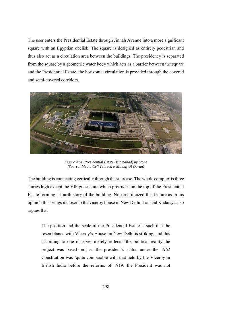
298
The user enters the Presidential Estate through Jinnah Avenue into a more significant
square with an Egyptian obelisk. The square is designed as entirely pedestrian and
thus also act as a circulation area between the buildings. The presidency is separated
from the square by a geometric water body which acts as a barrier between the square
and the Presidential Estate. the horizontal circulation is provided through the covered
and semi-covered corridors.
Figure 4.61. Presidential Estate (Islamabad) by Stone (Source: Media Cell Tehreek-e-Minhaj Ul Quran)
The building is connecting vertically through the staircase. The whole complex is three
stories high except the VIP guest suite which protrudes on the top of the Presidential
Estate forming a fourth story of the building. Nilson criticized this feature as in his
opinion this brings it closer to the viceroy house in New Delhi. Tan and Kudaisya also
argues that
The position and the scale of the Presidential Estate is such that the
resemblance with Viceroy’s House in New Delhi is striking, and this
according to one observer merely reflects ‘the political reality the
project was based on’, as the president’s status under the 1962
Constitution was ‘quite comparable with that held by the Viceroy in
British India before the reforms of 1919: the President was not
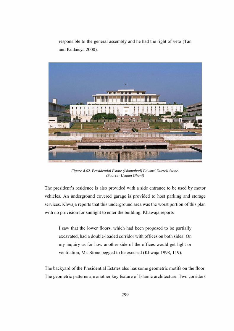
299
responsible to the general assembly and he had the right of veto (Tan
and Kudaisya 2000).
Figure 4.62. Presidential Estate (Islamabad) Edward Durrell Stone. (Source: Usman Ghani)
The president’s residence is also provided with a side entrance to be used by motor
vehicles. An underground covered garage is provided to host parking and storage
services. Khwaja reports that this underground area was the worst portion of this plan
with no provision for sunlight to enter the building. Khawaja reports
I saw that the lower floors, which had been proposed to be partially
excavated, had a double-loaded corridor with offices on both sides! On
my inquiry as for how another side of the offices would get light or
ventilation, Mr. Stone begged to be excused (Khwaja 1998, 119).
The backyard of the Presidential Estates also has some geometric motifs on the floor.
The geometric patterns are another key feature of Islamic architecture. Two corridors
300
connect the president's house with the jungle (most probably) dedicated to the
president house at the back. The overall landscaping in the model also follows an
organization widespread in the Mughal gardens. Though the first proposal got
significant appraisal from the CDA officials, Stone was instructed to develop a
detailed proposal with few additions in the building programme and drastic changes
in the vocabulary of architecture. The main buildings are placed according to the first
proposal. However, a small mosque is added to the back side of the Presidential Estate
over the back lawn. The back lawn is also provided with tennis courts. In stark contrast
to earlier precedents in Islamic architecture, “domes” were removed from the top of
the building. Edward Durrell Stone was appraised for his work for the landscape of
the building. Edward Durrell Stone designed the landscape of the building very
carefully. The inspiration from the Shalamar garden and landscaping inside Lahore
fort is evident. The user enters the main square from the Jinnah Avenue. The main
square is a garden with walkways in the centre along both the axes. The initial ideas
for providing the square as a mass congregation site was scrapped off by the military
regime. The president neither wanted nor could have afforded to provide people a
place to gather in front of the president house, as this could be utilized by political
activists to topple the government's function. Instead, the main square was divided
into four parts by introducing walkways on both the axes. The idea was directly
inspired by the Mughal gardens inside Lahore Fort and the Shalamar gardens in
Lahore. Following the Mughal tradition, on the centre point of the walkways, a small
pool of water with fountain was provided.
From here the user can go up to the president house by walking over several sets of
setups. These steps are provided after Stone decided to level the terrain of the site. Just
before the main entrance of the building, a small covered podium is provided with
water bodies on both sides. The podium was used to receive state guests. The inner
courtyard and backyard are also designed following a rigid pattern and loaded with
patterns inspired by the Mughal Gardens. It is important to note that this kind of
extensive landscaping with the trees and water bodies together with the courtyard can
301
also help to cool down the temperature within and around the building which becomes
very helpful in the harsh summers of Islamabad. The building is made of concrete and
is four stories high. The front elevation of the building has a solid mass with the slit
windows. The windows are covered with wooden louvers to protect the building
against the sun. The upper story is provided with a cantilevered roof attached to thin
columns that run at a considerable distance across the periphery of the building. In
order to light up the building, long rectangular windows were also provided.
The interior of the building is no less than an imperial mansion, which definitely brings
the question whether this suit the Supreme Leader of an Islamic welfare state or not?
The interior floor is cladded with expensive white marble. The white marble is one of
the most preferred material in the region, since it remains cold during the summers
times and extensively used in the Mughal building throughout Pakistan and India. The
walls are cladded with wood and have mouldings and wooden bands on it. Roman
columns are provided for aesthetic purpose. The interior of the building varies across
different rooms and were modified several times after the first proposal was given by
Stone. However, a standard feature of the interior is the extensive replication of
geometric patterns: the patterns mostly made from the eight-sided star are prominently
visible in all the spaces, suspended ceilings and doors. The corridors connecting the
president house with the main building also have the white marble cladding on the
floor with the roof supported by columns erected at equal distances (Khwaja 1998).
Doxiadis and MRV in their respective proposals proposed the Grand mosque right
next to the central square of the city. Due to undefined reasons, the location of the
grand mosque was shifted, but a small mosque is provided on the back side of the
building which is meant to serve the employees of the president’s office. The only
building with the “domes” in the entire complex, it is also made from white marble
with a minimalist design. The mosque lacks the intricate work that is present in the
historic mosques of the region. Stone’s work was much appreciated by the CDA
officials and critics (Mumtaz 1989). With reference to Stone’s principle of design, S.
Ali Hussain, Director of planning CDA explains
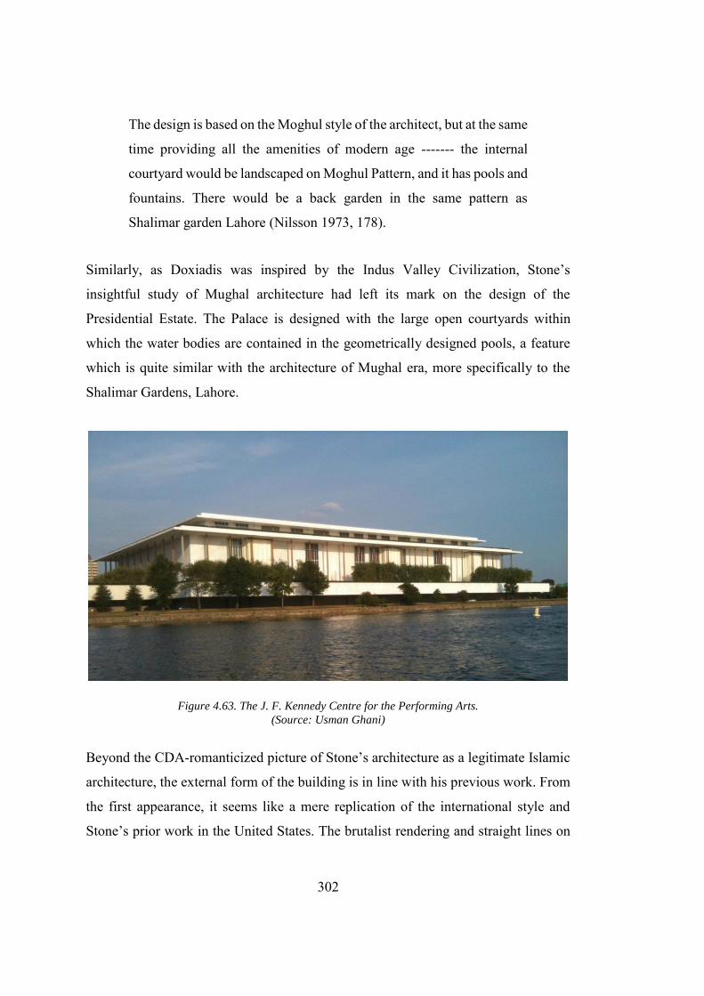
302
The design is based on the Moghul style of the architect, but at the same
time providing all the amenities of modern age ------- the internal
courtyard would be landscaped on Moghul Pattern, and it has pools and
fountains. There would be a back garden in the same pattern as
Shalimar garden Lahore (Nilsson 1973, 178).
Similarly, as Doxiadis was inspired by the Indus Valley Civilization, Stone’s
insightful study of Mughal architecture had left its mark on the design of the
Presidential Estate. The Palace is designed with the large open courtyards within
which the water bodies are contained in the geometrically designed pools, a feature
which is quite similar with the architecture of Mughal era, more specifically to the
Shalimar Gardens, Lahore.
Figure 4.63. The J. F. Kennedy Centre for the Performing Arts. (Source: Usman Ghani)
Beyond the CDA-romanticized picture of Stone’s architecture as a legitimate Islamic
architecture, the external form of the building is in line with his previous work. From
the first appearance, it seems like a mere replication of the international style and
Stone’s prior work in the United States. The brutalist rendering and straight lines on
303
the facade of the Presidential Estate bring it in comparison with the John F. Kennedy
Centre in the United States also designed by Stone (Stone 2011), See Fig. 4.63.
The colonial historiography played a critical role in the development of the
Presidential Estate in Islamabad. The segregation of Hindu and Islamic elements was
assimilated into postcolonial Pakistan through the British trained bureaucracy, which,
in the absence of the spatial discourse of Pakistani Islamic architecture, acted as a
foundation for this development. Doxiadis’ proposal corresponds to his conception of
the Islamic city. This is the only proposal that is more in line with the established
models of Islamic architecture. Furthermore, the Presidential Estate is designed like
an acropolis for Islamabad, on the top of the hill that provides a superiority to the
residence of the supreme leader in line with the intents of the military regime. The
other three proposals can be distinctively marked as the academic proposals by Arne
Jacobson and Louis Kahn, and a commercial proposal by Edward Durrell Stone. Both
Jacobson’s and Kahn’s proposal reflects the International Style echoing its new-
monumentality. However, it does not provide any trace of indigenous or Islamic
influences. Stone’s proposal, on the other hand, conforms to the client’s requirement.
The final plan is a result of an amalgamation of the “Domes and Arches” on the
persistence of CDA officials and inspiration from Mughal Garden traditions at his own
will that was blended with Stone’s design philosophy. Although Khwaja criticized it
as a weak project with functional difficulties, it corresponded to the political intention
of the military regime.
4.3.7. Shah Faisal Mosque
The grand National Mosque was removed from the final proposal for the Presidential
Palace developed by Edward Durrell Stone. A relatively small mosque was designed
at the back of the Presidential Estate which is not only isolated from the main complex
but hidden behind the colossal Presidential Palace. As earlier discussed, that relocation
of the grand National Mosque coincides with the Ayyub’s liberal agenda of the
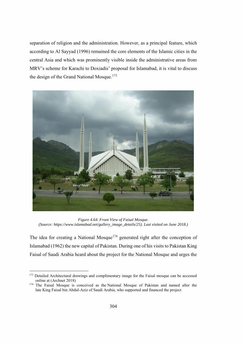
304
separation of religion and the administration. However, as a principal feature, which
according to Al Sayyad (1996) remained the core elements of the Islamic cities in the
central Asia and which was prominently visible inside the administrative areas from
MRV’s scheme for Karachi to Doxiadis’ proposal for Islamabad, it is vital to discuss
the design of the Grand National Mosque.173
Figure 4.64. Front View of Faisal Mosque. (Source: https://www.islamabad.net/gallery_image_details/25). Last visited on June 2018.)
The idea for creating a National Mosque174 generated right after the conception of
Islamabad (1962) the new capital of Pakistan. During one of his visits to Pakistan King
Faisal of Saudi Arabia heard about the project for the National Mosque and urges the
173 Detailed Architectural drawings and complimentary image for the Faisal mosque can be accessed
online at (Archnet 2018) 174 The Faisal Mosque is conceived as the National Mosque of Pakistan and named after the
late King Faisal bin Abdul-Aziz of Saudi Arabia, who supported and financed the project
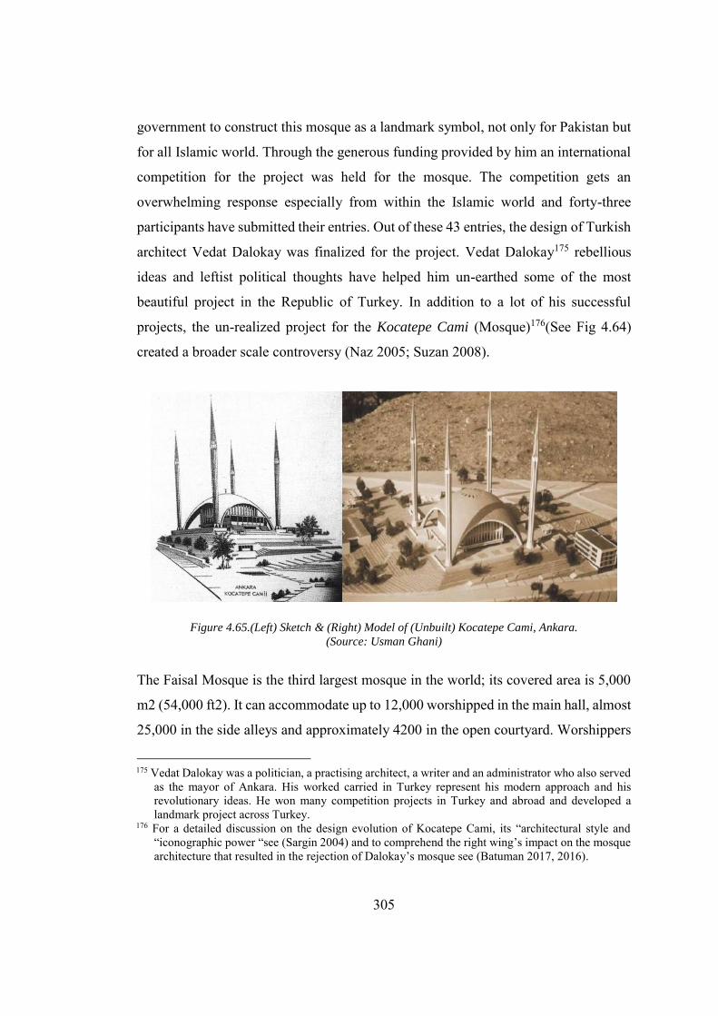
305
government to construct this mosque as a landmark symbol, not only for Pakistan but
for all Islamic world. Through the generous funding provided by him an international
competition for the project was held for the mosque. The competition gets an
overwhelming response especially from within the Islamic world and forty-three
participants have submitted their entries. Out of these 43 entries, the design of Turkish
architect Vedat Dalokay was finalized for the project. Vedat Dalokay175 rebellious
ideas and leftist political thoughts have helped him un-earthed some of the most
beautiful project in the Republic of Turkey. In addition to a lot of his successful
projects, the un-realized project for the Kocatepe Cami (Mosque)176(See Fig 4.64)
created a broader scale controversy (Naz 2005; Suzan 2008).
Figure 4.65.(Left) Sketch & (Right) Model of (Unbuilt) Kocatepe Cami, Ankara. (Source: Usman Ghani)
The Faisal Mosque is the third largest mosque in the world; its covered area is 5,000
m2 (54,000 ft2). It can accommodate up to 12,000 worshipped in the main hall, almost
25,000 in the side alleys and approximately 4200 in the open courtyard. Worshippers
175 Vedat Dalokay was a politician, a practising architect, a writer and an administrator who also served
as the mayor of Ankara. His worked carried in Turkey represent his modern approach and his revolutionary ideas. He won many competition projects in Turkey and abroad and developed a landmark project across Turkey.
176 For a detailed discussion on the design evolution of Kocatepe Cami, its “architectural style and “iconographic power “see (Sargin 2004) and to comprehend the right wing’s impact on the mosque architecture that resulted in the rejection of Dalokay’s mosque see (Batuman 2017, 2016).
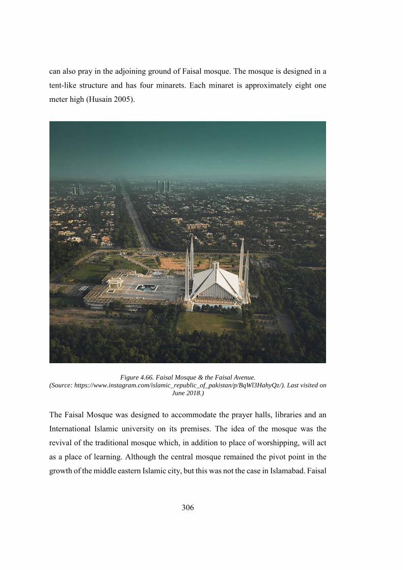
306
can also pray in the adjoining ground of Faisal mosque. The mosque is designed in a
tent-like structure and has four minarets. Each minaret is approximately eight one
meter high (Husain 2005).
Figure 4.66. Faisal Mosque & the Faisal Avenue. (Source: https://www.instagram.com/islamic_republic_of_pakistan/p/BqWl3HahyQz/). Last visited on
June 2018.)
The Faisal Mosque was designed to accommodate the prayer halls, libraries and an
International Islamic university on its premises. The idea of the mosque was the
revival of the traditional mosque which, in addition to place of worshipping, will act
as a place of learning. Although the central mosque remained the pivot point in the
growth of the middle eastern Islamic city, but this was not the case in Islamabad. Faisal
307
mosque was designed as a hybrid modern building. Dalokay intelligently
superimposed different socio-political aspect and combine them to design this
mosque. Due to limited budget for project, Dalokay preferred using the indigenous
materials so the project cost will coincide with the projects allocated budget (Holod
and Khan 1997). A key example is the marble flooring that |Dalokay used on floor
that has the capacity to remain cool in the hot weather of Islamabad.Like the other
buildings in Islamabad, Dalokay’s design was rendered in the hybrid language. The
overall composition contains the overtones of ottoman architecture and local mosque
architecture. He also kept in view the local climate and economic circumstances while
designing the mosque.
The “pencil-shaped” minarets of mosque were borrowed from Turkey, “where the
Muslim conquest of Istanbul was marked by the erection of slender and pointed
minarets (Naz 2005).” The open courtyard and central fountain which create a
pleasurable environment in the hot humid environment are the main features of Faisal
mosque were borrowed from the Badshahi Mosque, Lahore and Wazir Khan’s
Mosque, Lahore. The anomaly in the design was the use of pyramid shaped roof
instead of traditional tombs. The pyramid shaped mosque was not only new for
Pakistan, where the mosque architecture was dominated by onion shaped domed
(which was introduced into Indian mosque architecture by Mughals following a
central Asian and Persian influences), but also a unique form concerning the “Umma.”
Dalokay justified his new design as t
I tried to capture the spirit, proportion and geometry of Kaaba in a
purely abstract manner. Imagine the apex of each of the four minarets
as a scaled explosion of four highest corners of Kaaba – thus an
unseen Kaaba form is bounded by the minarets at the four corners in
a proportion of height to base (Jan 2013).
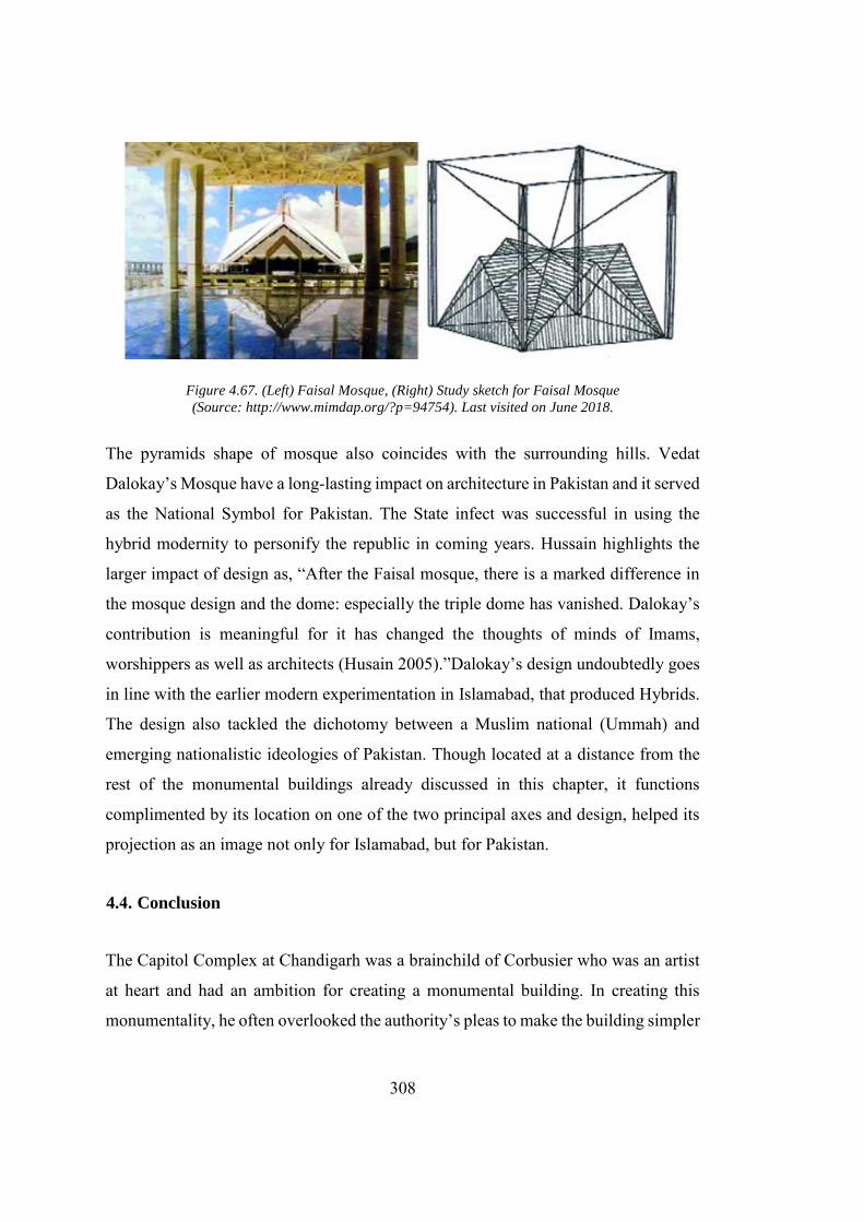
308
Figure 4.67. (Left) Faisal Mosque, (Right) Study sketch for Faisal Mosque
(Source: http://www.mimdap.org/?p=94754). Last visited on June 2018.
The pyramids shape of mosque also coincides with the surrounding hills. Vedat
Dalokay’s Mosque have a long-lasting impact on architecture in Pakistan and it served
as the National Symbol for Pakistan. The State infect was successful in using the
hybrid modernity to personify the republic in coming years. Hussain highlights the
larger impact of design as, “After the Faisal mosque, there is a marked difference in
the mosque design and the dome: especially the triple dome has vanished. Dalokay’s
contribution is meaningful for it has changed the thoughts of minds of Imams,
worshippers as well as architects (Husain 2005).”Dalokay’s design undoubtedly goes
in line with the earlier modern experimentation in Islamabad, that produced Hybrids.
The design also tackled the dichotomy between a Muslim national (Ummah) and
emerging nationalistic ideologies of Pakistan. Though located at a distance from the
rest of the monumental buildings already discussed in this chapter, it functions
complimented by its location on one of the two principal axes and design, helped its
projection as an image not only for Islamabad, but for Pakistan.
4.4. Conclusion
The Capitol Complex at Chandigarh was a brainchild of Corbusier who was an artist
at heart and had an ambition for creating a monumental building. In creating this
monumentality, he often overlooked the authority’s pleas to make the building simpler
309
and economical. Kalia argues that the Capitol Complex at Chandigarh was meant to
“be seen, not used” (Kalia 1999). Chandigarh had two cities within its material fabric:
city of people and city of the monument (the Capitol Complex). Both are different not
only in conception but are intentionally segregated from each other. The
incompleteness and unplanned interventions have almost taken away the Corbusian
soul from the scheme. The original scheme of the Capitol Complex reflects the
intricacy with which Corbusier designed the scheme. By utilizing his passion and skill,
he incorporated the contextual problems within its artistically carved structures.
The Presidential Estate designed by Edward Durrell Stone is an example of
commercially successful architecture. Following his client’s demands, Stone produced
an economical design with indigenous elements that got an approval from the clients
in the first go. However, a lot of criticism is laid on the aesthetics and functional
efficiency of the building (Khwaja 1998; Nilsson 1973). The building had a strong
tone of the gardens designed by the great Mughals while it can also be seen concerning
Stone’s earlier work in the United States. Both the Capitol Complex and the
Presidential Estate were designed in a similar fashion to the Acropolis to reflect power.
In the case of Chandigarh, the apex point of the Acropolis was not complete, thus
leaving the Capitol Complex incomplete. However, in the case of Islamabad,
Presidential power is completely in line with the desired intention and corresponds to
the political ideology of the regime. There is a mutual consensus among different
writers that the Capitol Complex at Chandigarh was constructed with an Indian spirit.
However, several interpretations are also made to locate Indian metaphors behind the
material conception of the Capitol Complex. Apart from several similarities, this
opinion also faced harsh criticism, especially from post-colonial authors. The
Presidential Estate in Islamabad, on the other hand, is produced by the amalgamation
of the indigenous and foreign architectural influences, thus resulting in what Jencks
referred as a “dual coded” building.
310
In Chandigarh, following the norms of the parliamentary democracy, Prime Minister
Nehru had ordered not to construct the Governor’s Palaceas it reminds of the British
imperial rule in India (Nehru 1961). In Pakistan, the story is altogether different.
President Ayyub Khan was a military general who came to power by overthrowing
the elected government, and he was the most prominent proponent of the Presidential
system. That is one of the reasons the president house was designed and located as
another “Viceroy House” as described by Nilsson. (Nilsson 1973). Doxiadis planned
the “forecourt of the nation” in the form of the Presidential Estate, connecting the
building with the city. Doxiadis’ main concern was the design of the city. Thus, he left
the design for the monumental and symbolic project on the other architecture.
Corbusier, on the other hand, was disappointed in the rejection of his high-rise scheme
for the city of Chandigarh. He not only physically segregated the Capitol Complex
from the city, but also create an artificial mountain to create a visual barrier between
the city and the Capitol Complex. Corbusier’s plan had successfully incorporated the
programme requirement of the buildings, but also cater to the climatic condition as
well. Although in the case of rainfall some of the buildings of the Capitol Complex
turned into nightmares for the users. In general, from the social habits to climatic
conditions Corbusier carefully tried to address the building’s requirements.
311
CHAPTER 5
5. CONCLUSION
5.1. Introduction
The central subject of the dissertation is the hybrid spatial modernity, which the
dissertation tries to appropriate by bridging the post-partitioned modern planned
capital cities with reference to the modern cities developed along the vertical
(historical) and horizontal (geographical) axes. The dissertation intends to classify
modernity by appropriating its pedigree, which in result develops an enriched
understanding of the architecture and urban development in the post-partitioned Indian
Subcontinent, within the modern capital cities developed from scratch. In lieu of this
research, the dissertation brings into discussion the dynamics regarding hybrid
modernity, nationalism and politics and how it helped in shaping up these cities.
The dissertation focusses on the architecture of the principal administrative sectors
that are the Capitol Complex (Chandigarh) and the Presidential Estate (Islamabad) and
the city planning in these two cities. Although to some extent the respective state
governments intended to disengage the problem of architectural and urban
development from the past, the resultant cities had somehow reinforced the new
nation’s connection with the past. Furthermore, the dissertation discusses that by
hiring the internationally acclaimed architects, respective nation wanted to construct
a city that can represent the new nation’s ideology at the national and international
level (Prakash 2002; Mahsud 2013). These cities are formed in connection with the
changing political, social and economic conditions, mainly produced as a result of the
partition of India, and the implementation of the state’s ambitious project of
modernity. The dissertation analyses the architectural and urban development in
312
Chandigarh and Islamabad by bringing into discussion each State’s vision, people’s
aspiration, architects’ ambition, political motivations and globalization which
highlights how the project of modernity was implemented within the operational
framework of the new nations, which are, India and Pakistan. The contestation
between Western concept and the traditional Indian ideas resulted in the setting a new
benchmark for architectural and urban development (Prakash 2002; Kalia 2006;
Mahsud 2009; Karim 2012; Sprague 2013). The dissertation also addresses that
although the new cities were not instrumentalized as an object of social change
(Holston 1989), yet they were perceived as a space for the inhabitants of the new
nations (Anderson 1983; Lefebvre 1992; Chatterjee 1993).
The main subject of this dissertation is the hybrid modernity which highlights the
critical exogenous and endogenous ideas involved in the material formulation of these
cities (Jairazbhoy 1963; Prakash 2002; Hosagrahar 2005; Karim 2012). This study is
important as it questions the very notion of how modernity was perceived in the west
and help in defining the Indian modernity as the “re-orientation” rather than “rupture”
of the past (Habermas 1997; Bozdogan and Kasaba 1997; Kalia 2006; Antonio 2003;
Hosagrahar 2005; Avermaete and Casciato 2014). The dissertation also questions the
viability of modernity as a singular entity. Charles Jencks declares the failure of public
housing project in St. Louis, as the death of Modern Western architecture. However,
the process started quite earlier during the construction of post-Independence cities,
mainly, Chandigarh where Le Corbusier, the greatest advocate of the modern
architecture, tried to bring in the historicism on a site that was a blank slate. The
dissertation starts by presenting the case of early modernity in India and how Western
theoretical concealments had undermined the whole subject (Marx 1853; Viyagappa
1980; Richards 1997; Fernée 2014; Rathore and Mohapatra 2017; Wire 2017). The
dissertation, in its first episode of planned modern capitals in Indian Subcontinent,
analyses the urban design of the cities developed during the early and colonial modern
period. This analysis highlights the process through which foreign and local ideas are
contextualized during the construction, the critical elements of the city design, and the

313
extent of urban design. The study is essential as these cities set a pattern for the
development of the post-independence cities, which are not the physical replication of
these cities, but belongs to the pedigree of these planned cities.
5.2. Early Modern and Colonial Modern Planned Cities
The dissertation provides a detailed analysis of the early and colonial modern planned
cities in order to connect to the missing fragment in the genealogical development of
these cities. In this regard capital cities, that were developed from scratch, like
Fatehpur Sikri, Shahjahan Abad, Madras, Calcutta and New Delhi are discussed with
reference to their urban design and architectural development. The analysis also
highlights how the different endogenous and exogenous ideas are appropriated and
grounded in the material form to produce the hybrids modern. This study is vital as it
not only provides the detail about the spatial development of these cities but also helps
in redefining the modernity. In the early capitals like Fatehpur Sikri and Shahjahan
Abad, the citadel, city walls and monumental buildings were the result of the extensive
planning exercise, however, the overall plan of these cities eventually grew
organically. Consequently, the mode of transportation also helped the city to grow
along an organic pattern (Blake 2002; Hurlimann 1965; Iizuka 1991; Metcalf 2002).
During the colonial period, the planning of the capital cities like Madras, Calcutta and
New-Delhi directly correspond to the political power of the colonizers. From a basic
city like Madras, to the extensively planned city like New-Delhi, the shift in the urban
agenda of the colonizer, from the appropriation of the “European classical
architecture” to producing “an Indian city”, was evident. The wheeled transport and
colonizers intention to control the space also forced them to impose a rigid gridiron
pattern in Madras and Calcutta which resulted in what is termed as “apartheid
urbanism. However, this idea was shifted towards more open plan of New-Delhi, due
to the fact that at the time of development of Delhi colonizer had begun to see
themselves as the native rulers of India rather than foreigners (Kippis, Godwin, and
314
Robinson 1810; Baker 1926; Irving 1981; Gupta 1993; Chatterjee and Kenny 1999;
Metcalf 2002; Chattopadhyay 2005)
5.3. Post-Independence Modern Development
The capital cities developed in the Indian Subcontinent abide by its definition as
advocated by Jairazbhoy, that integration of foreign influences resides within the roots
of modern development. The dissertation criticizes the viability of International style
and Post-1900, American project of modernity. The projects were either very
ambitious to be implemented at its fullest or could have only affected the outer core
of the society.
5.3.1. Islamabad and Chandigarh
The planning of Chandigarh and Islamabad also involved an extensive debate on
creating an Indian and Islamic city respectively (Kalia 1990; Yakas 2001; Kumar
2011). Architects tried to materialize these complex concepts using their own
understanding, which they borrowed from their own experiences and local conditions.
The search for the Indian ideals by the Western Architects had questioned the viability
of Western modernity, which celebrates its anti-historicism, yet unable to render the
material condition on the ideal space of new nations that was just like a blank slate
open for anti-historic interventions (Curtis 1996; Mahsud 2008). This inability of
Western modernity thus provides a solid footing for the evolution of hybrid modernity.
While Jencks’s announcement of the material side of the modernity is still debatable
(Jencks 1991), the dissertation reinforces the fact that the spirit of Western modernity
died in the Indian Subcontinent. In case of planning of Chandigarh, the pre-partitioned
ideas regarding the built environment excessive worked out by Ramchand Mohandas
Gandhi were openly rejected by the modernist vision of Pandit Nehru, the Prime
Minister of India (Gandhi 1909; Nehru 1961; Kalia 2004; Nehru 2015). The
Government of India hired Albert Mayer, who was assisted by Novicki, to undertake
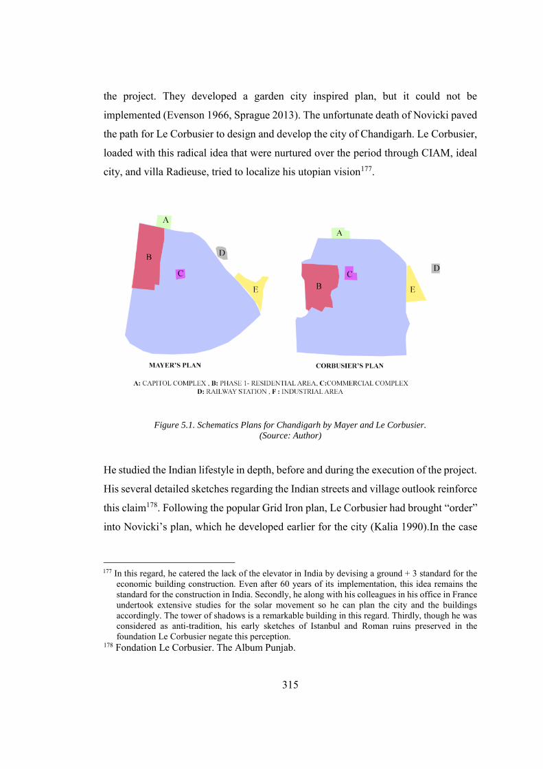
315
the project. They developed a garden city inspired plan, but it could not be
implemented (Evenson 1966, Sprague 2013). The unfortunate death of Novicki paved
the path for Le Corbusier to design and develop the city of Chandigarh. Le Corbusier,
loaded with this radical idea that were nurtured over the period through CIAM, ideal
city, and villa Radieuse, tried to localize his utopian vision177.
Figure 5.1. Schematics Plans for Chandigarh by Mayer and Le Corbusier.
(Source: Author)
He studied the Indian lifestyle in depth, before and during the execution of the project.
His several detailed sketches regarding the Indian streets and village outlook reinforce
this claim178. Following the popular Grid Iron plan, Le Corbusier had brought “order”
into Novicki’s plan, which he developed earlier for the city (Kalia 1990).In the case
177 In this regard, he catered the lack of the elevator in India by devising a ground + 3 standard for the
economic building construction. Even after 60 years of its implementation, this idea remains the standard for the construction in India. Secondly, he along with his colleagues in his office in France undertook extensive studies for the solar movement so he can plan the city and the buildings accordingly. The tower of shadows is a remarkable building in this regard. Thirdly, though he was considered as anti-tradition, his early sketches of Istanbul and Roman ruins preserved in the foundation Le Corbusier negate this perception.
178 Fondation Le Corbusier. The Album Punjab.
316
of Islamabad, Doxiadis’ design focus was the city and its inhabitants. He had already
designed cities in similar regions like Baghdad, Accra, and Riyadh and was quite
familiar with the Indian condition by thoroughly investigating the local condition and
detailed study visit to small town and Chandigarh179. He also made several
comparisons of historic towns of Pakistan with Islamabad to grasp the full control over
the planning of the city. In his earlier works, he provided schematic studies about the
relation of the vehicular transportation with the city and laid emphasis on the
underground transport system keeping in view both public and private transportation
systems (Doxiadis 1968). His earlier proposal for the Rio-de-Janeiro clearly depicted
this intention. On the contrary, Islamabad does not have any such provision. The
funding provided by Ford foundation for his schools of ekistics could be the possible
influencing agent for this planning (Nilsson 1973; Yakas 2001; Mahsud 2010;
Daechsel 2015; Karim 2016). His final design consists of the city based on the physical
implementation of Dynapolis (Doxiadis 1968). With a dual axial plan, the planning of
Islamabad revolves around the sector. However, he too has failed to provide the low-
cost housing solution that could provide the people with an opportunity to inhabit the
city.
5.4. CIAM and Ekistics
In order to cope up with the deficiency of the trained architects in the country,
respective governments of India and Pakistan hired Le Corbusier and Doxiadis to
design the respective cities. These architects also brought with them their planning
ideas which were theorized and well debated in the form of “CIAM” and “Ekistics”.
Seemingly coherent, as both the philosophies emphasize the decongestion of city
centres, organized traffic flow, and the relation of man with the society. A major
179 Doxiadis archive Athens. Document Number: “DOX-IA (10) India Regional Housing Centre (Vol
2), DOX-IA (10), Jan 1956 (5)”, “DOX PP 78 India Report and Photographs, Jan-Feb 1954 (1) DOX PP 78” & “DOX-IA Indian Diary, Part 1, DOX-IA 10 January 1956.”
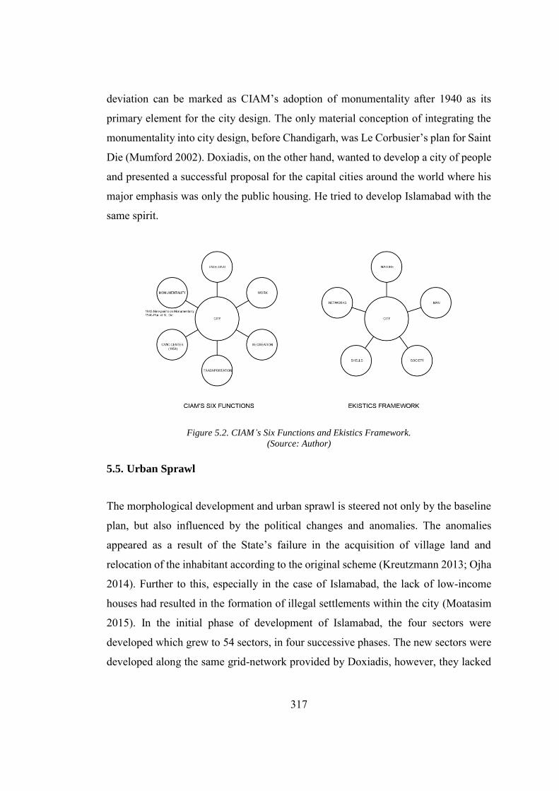
317
deviation can be marked as CIAM’s adoption of monumentality after 1940 as its
primary element for the city design. The only material conception of integrating the
monumentality into city design, before Chandigarh, was Le Corbusier’s plan for Saint
Die (Mumford 2002). Doxiadis, on the other hand, wanted to develop a city of people
and presented a successful proposal for the capital cities around the world where his
major emphasis was only the public housing. He tried to develop Islamabad with the
same spirit.
Figure 5.2. CIAM’s Six Functions and Ekistics Framework.
(Source: Author)
5.5. Urban Sprawl
The morphological development and urban sprawl is steered not only by the baseline
plan, but also influenced by the political changes and anomalies. The anomalies
appeared as a result of the State’s failure in the acquisition of village land and
relocation of the inhabitant according to the original scheme (Kreutzmann 2013; Ojha
2014). Further to this, especially in the case of Islamabad, the lack of low-income
houses had resulted in the formation of illegal settlements within the city (Moatasim
2015). In the initial phase of development of Islamabad, the four sectors were
developed which grew to 54 sectors, in four successive phases. The new sectors were
developed along the same grid-network provided by Doxiadis, however, they lacked
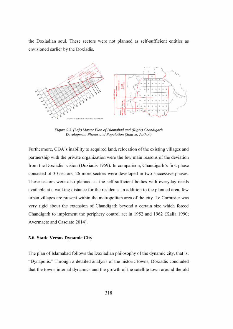
318
the Doxiadian soul. These sectors were not planned as self-sufficient entities as
envisioned earlier by the Doxiadis.
Figure 5.3. (Left) Master Plan of Islamabad and (Right) Chandigarh
Development Phases and Population (Source: Author)
Furthermore, CDA’s inability to acquired land, relocation of the existing villages and
partnership with the private organization were the few main reasons of the deviation
from the Doxiadis’ vision (Doxiadis 1959). In comparison, Chandigarh’s first phase
consisted of 30 sectors. 26 more sectors were developed in two successive phases.
These sectors were also planned as the self-sufficient bodies with everyday needs
available at a walking distance for the residents. In addition to the planned area, few
urban villages are present within the metropolitan area of the city. Le Corbusier was
very rigid about the extension of Chandigarh beyond a certain size which forced
Chandigarh to implement the periphery control act in 1952 and 1962 (Kalia 1990;
Avermaete and Casciato 2014).
5.6. Static Versus Dynamic City
The plan of Islamabad follows the Doxiadian philosophy of the dynamic city, that is,
“Dynapolis.” Through a detailed analysis of the historic towns, Doxiadis concluded
that the towns internal dynamics and the growth of the satellite town around the old
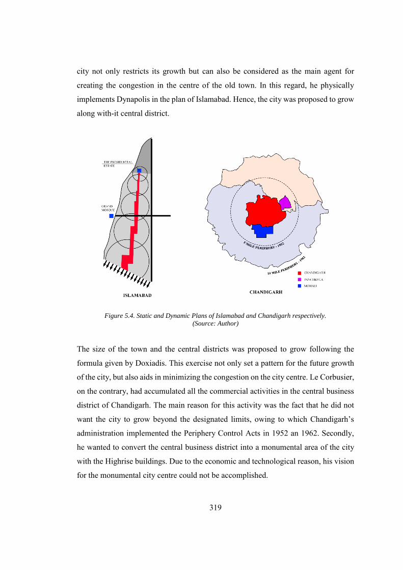
319
city not only restricts its growth but can also be considered as the main agent for
creating the congestion in the centre of the old town. In this regard, he physically
implements Dynapolis in the plan of Islamabad. Hence, the city was proposed to grow
along with-it central district.
Figure 5.4. Static and Dynamic Plans of Islamabad and Chandigarh respectively.
(Source: Author)
The size of the town and the central districts was proposed to grow following the
formula given by Doxiadis. This exercise not only set a pattern for the future growth
of the city, but also aids in minimizing the congestion on the city centre. Le Corbusier,
on the contrary, had accumulated all the commercial activities in the central business
district of Chandigarh. The main reason for this activity was the fact that he did not
want the city to grow beyond the designated limits, owing to which Chandigarh’s
administration implemented the Periphery Control Acts in 1952 an 1962. Secondly,
he wanted to convert the central business district into a monumental area of the city
with the Highrise buildings. Due to the economic and technological reason, his vision
for the monumental city centre could not be accomplished.
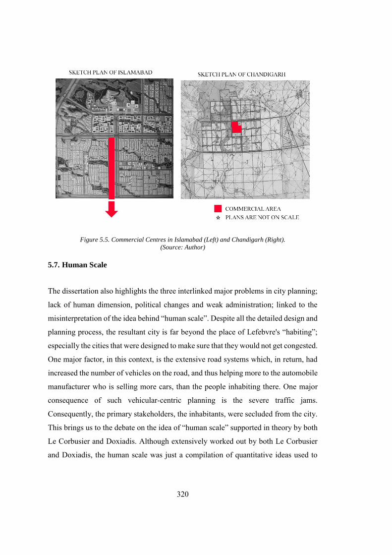
320
Figure 5.5. Commercial Centres in Islamabad (Left) and Chandigarh (Right).
(Source: Author)
5.7. Human Scale
The dissertation also highlights the three interlinked major problems in city planning;
lack of human dimension, political changes and weak administration; linked to the
misinterpretation of the idea behind “human scale”. Despite all the detailed design and
planning process, the resultant city is far beyond the place of Lefebvre's “habiting”;
especially the cities that were designed to make sure that they would not get congested.
One major factor, in this context, is the extensive road systems which, in return, had
increased the number of vehicles on the road, and thus helping more to the automobile
manufacturer who is selling more cars, than the people inhabiting there. One major
consequence of such vehicular-centric planning is the severe traffic jams.
Consequently, the primary stakeholders, the inhabitants, were secluded from the city.
This brings us to the debate on the idea of “human scale” supported in theory by both
Le Corbusier and Doxiadis. Although extensively worked out by both Le Corbusier
and Doxiadis, the human scale was just a compilation of quantitative ideas used to
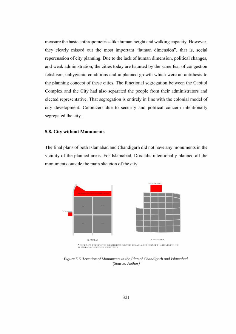
321
measure the basic anthropometrics like human height and walking capacity. However,
they clearly missed out the most important “human dimension”, that is, social
repercussion of city planning. Due to the lack of human dimension, political changes,
and weak administration, the cities today are haunted by the same fear of congestion
fetishism, unhygienic conditions and unplanned growth which were an antithesis to
the planning concept of these cities. The functional segregation between the Capitol
Complex and the City had also separated the people from their administrators and
elected representative. That segregation is entirely in line with the colonial model of
city development. Colonizers due to security and political concern intentionally
segregated the city.
5.8. City without Monuments
The final plans of both Islamabad and Chandigarh did not have any monuments in the
vicinity of the planned areas. For Islamabad, Doxiadis intentionally planned all the
monuments outside the main skeleton of the city.
Figure 5.6. Location of Monuments in the Plan of Chandigarh and Islamabad.
(Source: Author)
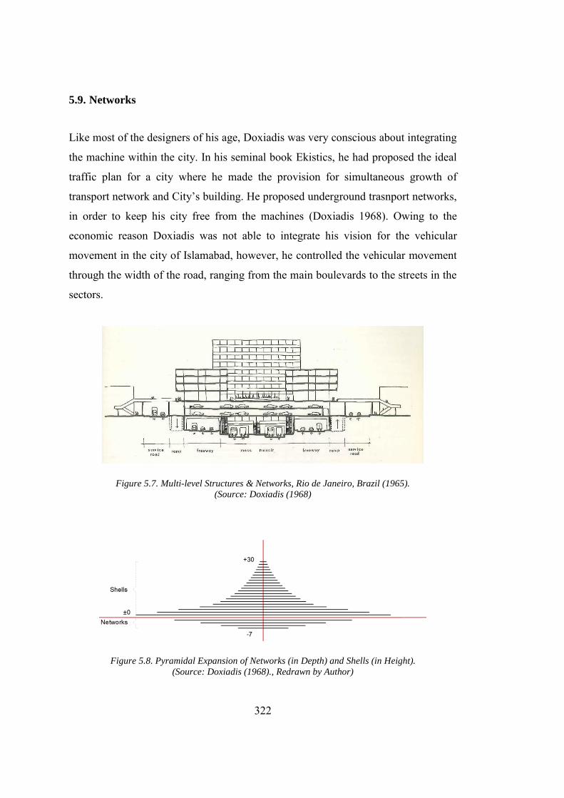
322
5.9. Networks
Like most of the designers of his age, Doxiadis was very conscious about integrating
the machine within the city. In his seminal book Ekistics, he had proposed the ideal
traffic plan for a city where he made the provision for simultaneous growth of
transport network and City’s building. He proposed underground trasnport networks,
in order to keep his city free from the machines (Doxiadis 1968). Owing to the
economic reason Doxiadis was not able to integrate his vision for the vehicular
movement in the city of Islamabad, however, he controlled the vehicular movement
through the width of the road, ranging from the main boulevards to the streets in the
sectors.
Figure 5.7. Multi-level Structures & Networks, Rio de Janeiro, Brazil (1965).
(Source: Doxiadis (1968)
Figure 5.8. Pyramidal Expansion of Networks (in Depth) and Shells (in Height). (Source: Doxiadis (1968)., Redrawn by Author)
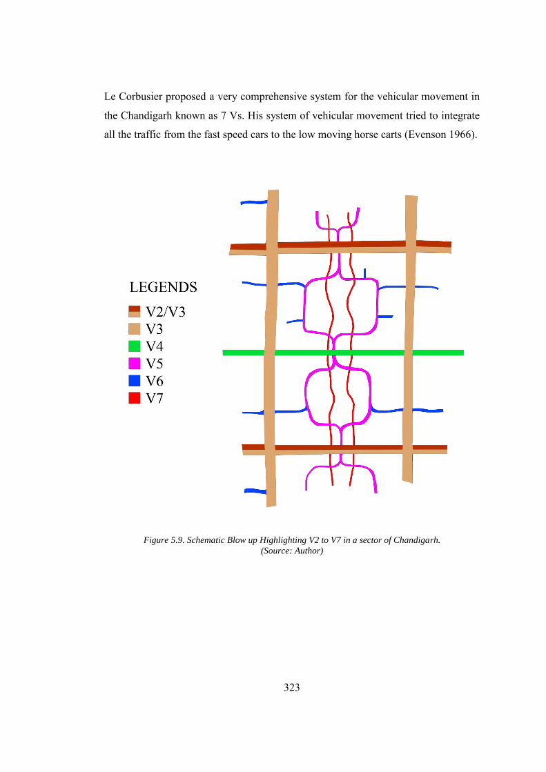
323
Le Corbusier proposed a very comprehensive system for the vehicular movement in
the Chandigarh known as 7 Vs. His system of vehicular movement tried to integrate
all the traffic from the fast speed cars to the low moving horse carts (Evenson 1966).
Figure 5.9. Schematic Blow up Highlighting V2 to V7 in a sector of Chandigarh. (Source: Author)
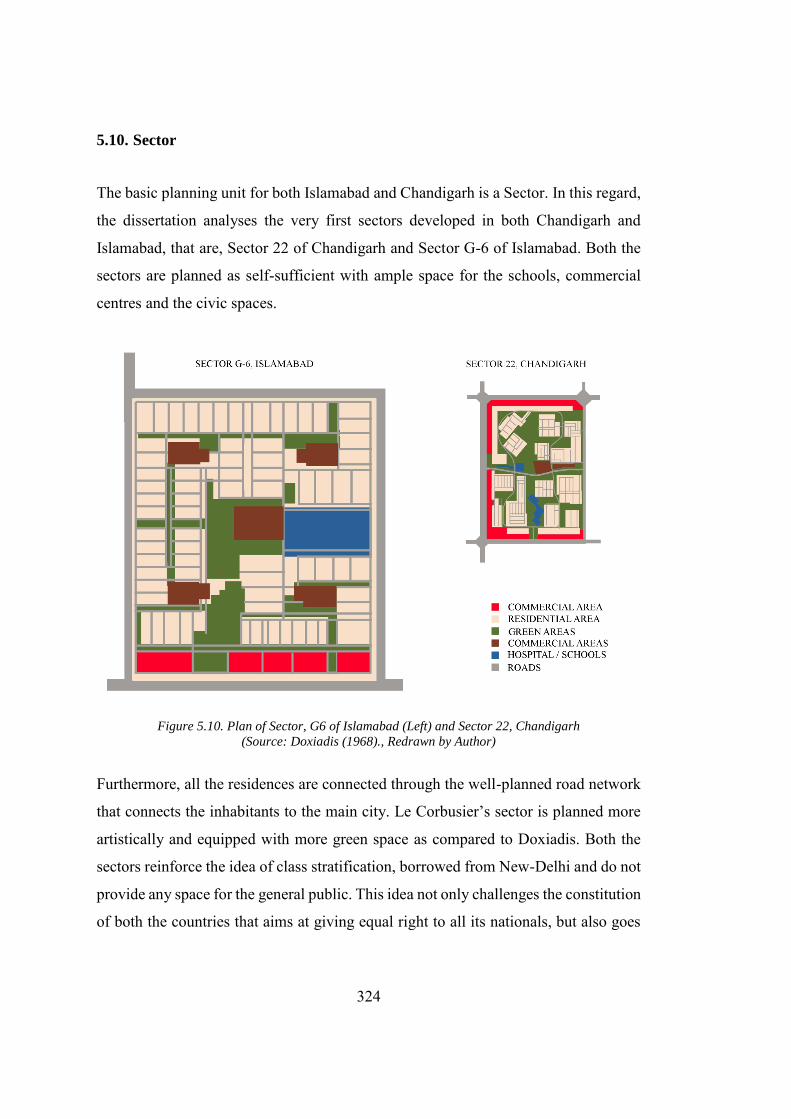
324
5.10. Sector
The basic planning unit for both Islamabad and Chandigarh is a Sector. In this regard,
the dissertation analyses the very first sectors developed in both Chandigarh and
Islamabad, that are, Sector 22 of Chandigarh and Sector G-6 of Islamabad. Both the
sectors are planned as self-sufficient with ample space for the schools, commercial
centres and the civic spaces.
Figure 5.10. Plan of Sector, G6 of Islamabad (Left) and Sector 22, Chandigarh (Source: Doxiadis (1968)., Redrawn by Author)
Furthermore, all the residences are connected through the well-planned road network
that connects the inhabitants to the main city. Le Corbusier’s sector is planned more
artistically and equipped with more green space as compared to Doxiadis. Both the
sectors reinforce the idea of class stratification, borrowed from New-Delhi and do not
provide any space for the general public. This idea not only challenges the constitution
of both the countries that aims at giving equal right to all its nationals, but also goes
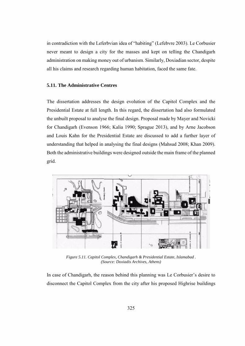
325
in contradiction with the Leferbvian idea of “habiting” (Lefebvre 2003). Le Corbusier
never meant to design a city for the masses and kept on telling the Chandigarh
administration on making money out of urbanism. Similarly, Doxiadian sector, despite
all his claims and research regarding human habitation, faced the same fate.
5.11. The Administrative Centres
The dissertation addresses the design evolution of the Capitol Complex and the
Presidential Estate at full length. In this regard, the dissertation had also formulated
the unbuilt proposal to analyse the final design. Proposal made by Mayer and Novicki
for Chandigarh (Evenson 1966; Kalia 1990; Sprague 2013), and by Arne Jacobson
and Louis Kahn for the Presidential Estate are discussed to add a further layer of
understanding that helped in analysing the final designs (Mahsud 2008; Khan 2009).
Both the administrative buildings were designed outside the main frame of the planned
grid.
Figure 5.11. Capitol Complex, Chandigarh & Presidential Estate, Islamabad . (Source: Doxiadis Archives, Athens)
In case of Chandigarh, the reason behind this planning was Le Corbusier’s desire to
disconnect the Capitol Complex from the city after his proposed Highrise buildings
326
were not deemed feasible to be erected in the city (Evenson 1966; Kalia 1990; Prakash
2002). Islamabad, The city of the Doxiadis, had no place for monumentality, although
he proposed a strong link between the city and the administration complex by
providing a vast square designed as a “forecourt of the nation”(Khwaja 1998; Mahsud
2010). It was, however, Edward Durrell Stone’s insensitive approach towards the
design of Administrative wing that had disconnected the building from the city
(Khwaja 1998).
5.12. Nationalism and State Building
The colossal projects developed for hosting the administrative function also meant to
project the progressive images of both India and Pakistan. In the early phase of the
development in India and Pakistan, like the other new nation states, creation of
monumental architecture was viewed as an integral condition of national expression.
That is one of the major reasons for hiring internationally acclaimed architects for
these projects. Hiring the foreign architects for the national building project seem more
like a paradox. Lu also points out the rhetoric and writes
It is rather ironic that modernist architecture, disseminated in the name
of “international” was employed in many third world countries –
Turkey... Pakistan among others to represent nationhood, which was
generally conceptualized as being rooted in remote antiquity and
grounded in cultural uniqueness. A careful dissection reveals that the
mechanism behind this is multi-layered (Lu 2011).
In both the projects local conditions had influenced the design of the buildings which
is symbolically manifested in Capitol Complex at Chandigarh. While in case of
Presidential Palace in Islamabad, it is imitation and formulation of historical formal
elements. The political orientation of the respective governments had influenced the
form of these buildings and in creating the national narrative for architecture. In
327
Chandigarh, Le Corbusier had deliberately used “Ashoka chakra” and “Swastika”, two
symbols which are visibly places in the central courtyard. These symbols belong to
the era of great Hindu king Ashoka, who ruled India before the advent of Muslims. In
case of the architecture of the Presidential Estate, buildings developed by Mughals (a
clan of central Asian Turkish tribes) are preferred over the buildings developed by
Pathan Muslims (originated from Afghanistan) in India. The seminal reason for this
classification was political, as Pakistan shares a close association with Turkey and had
a border dispute with Afghanistan. Following this classification, the Presidential
Palace in Islamabad was equipped with the onion shaped domes (which Babur Shah
brought with him through central Asia), geometric motives and landscape
arrangement borrowed mostly from the Shalamar Gardens in Lahore. Thus, in general
the building which were mean to represent the country at international level and create
a national narrative were developed by amalgamation of the local ideas steered by the
foreign architecture, bureaucrat and local conditions.
5.13. New Delhi, Chandigarh and Islamabad
The Presidential Estate in Islamabad reminds one about Viceroy’s Palace in New
Delhi. The Presidential Estate in Islamabad is situated right in the front of the central
axis the Jinnah Avenue, elevating its status to the most important building in
Islamabad, which coincides with the military regime’s intention. In New Delhi,
Viceroy’s Palace is also strategically placed on the top of the mountain at the end of
King’s Way (Raj Path). In Chandigarh, Nehru’s democratic vision had curtailed the
Governor’s Palace, that was placed at the symbolically prominent position and was
labelled as the reminiscent of the colonial ethos.
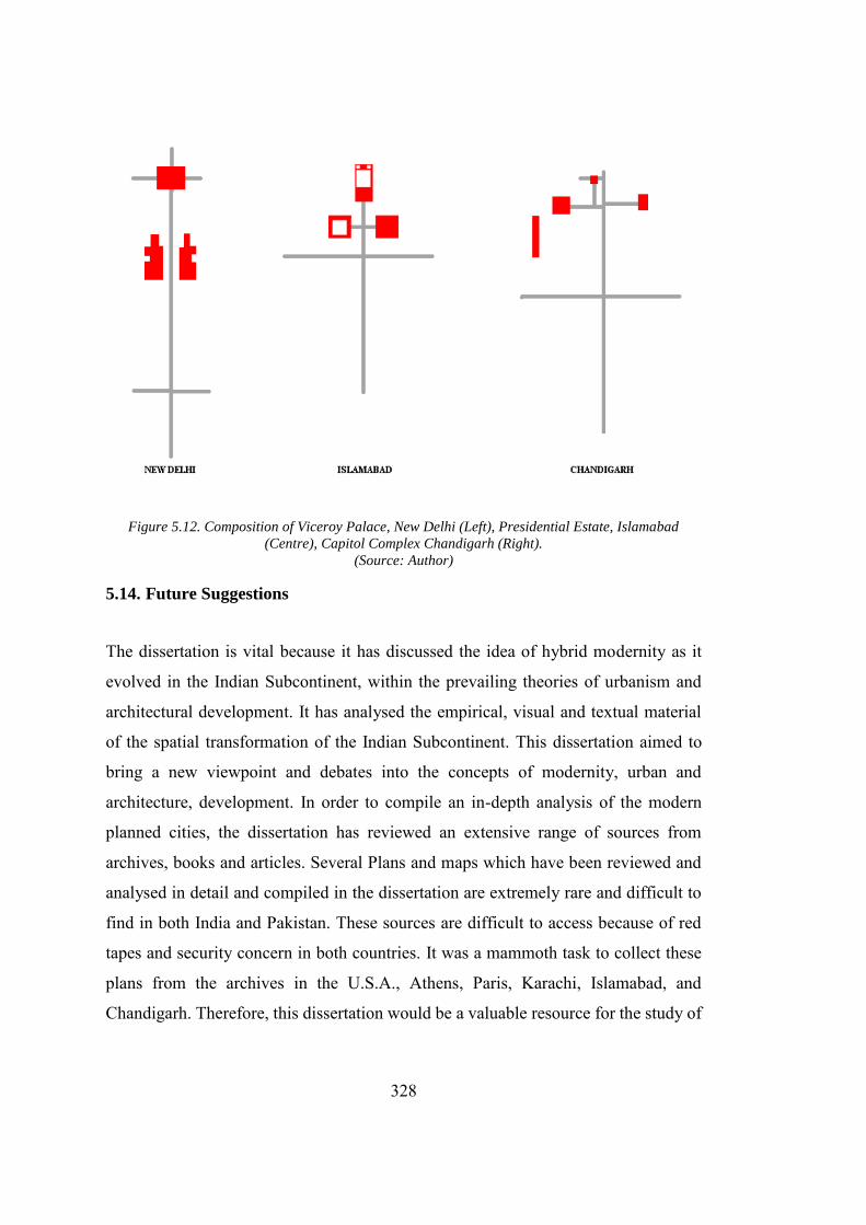
328
Figure 5.12. Composition of Viceroy Palace, New Delhi (Left), Presidential Estate, Islamabad
(Centre), Capitol Complex Chandigarh (Right). (Source: Author)
5.14. Future Suggestions
The dissertation is vital because it has discussed the idea of hybrid modernity as it
evolved in the Indian Subcontinent, within the prevailing theories of urbanism and
architectural development. It has analysed the empirical, visual and textual material
of the spatial transformation of the Indian Subcontinent. This dissertation aimed to
bring a new viewpoint and debates into the concepts of modernity, urban and
architecture, development. In order to compile an in-depth analysis of the modern
planned cities, the dissertation has reviewed an extensive range of sources from
archives, books and articles. Several Plans and maps which have been reviewed and
analysed in detail and compiled in the dissertation are extremely rare and difficult to
find in both India and Pakistan. These sources are difficult to access because of red
tapes and security concern in both countries. It was a mammoth task to collect these
plans from the archives in the U.S.A., Athens, Paris, Karachi, Islamabad, and
Chandigarh. Therefore, this dissertation would be a valuable resource for the study of
329
urban design and architectural development of the major administrative buildings of
Chandigarh and Islamabad. The dissertation is also vital in the sense that it broadens
the discussion on the architectural and urban processes in post-partition India by
bringing the two opposites together. Furthermore, it also provides a basis for the cross-
border study between the two politically different countries which shared a common
historical and cultural background yet wholly isolated from other for the past seventy
years. Cities cannot cease to grow. In case of Chandigarh and Islamabad, gridiron was
just a skeleton and the spirit of design lied in the self-sufficient communes. The
planning authorities should have developed the research wings, instead of just
extending the grid, to understand the spirit of these cities and save them from the
problems which the European cities faced hundred years ago. Traffic problem can be
resolved through efficient management and integration of the public transport system
in the city. By creating a city with an extensive boulevard, without management would
only result in the increasing number of vehicles, as evident in Chandigarh and
Islamabad and would not help in decongesting the cities. An overview of the vehicular
circulation in Islamabad and Chandigarh, in addition to New-Delhi and Karachi,
reinforces this fact.
The dissertation provides a brief discussion about the development of the capital cities
in post-partition India. The capital cities Chandigarh and Islamabad are developed not
only to cater the administrative function, but also help in the realization of the
“imagined communities.” However, these ideas were scrapped in the material
realization of the city. The study can be included in the studies already done
concerning architectural and urban development. Furthermore, it provides a new
dimension in these studies by adding a neglected perspective. The new perspective
this dissertation highlight is the study of two cities that share the cultural and historical
background yet separated by a border. Furthermore, the respective countries have
entrusted a similar ideology of Western Modernism to develop these cities. Therefore,
this dissertation is not only a contribution to the studies on city planning and
architecture development of Chandigarh and Islamabad, but it is also a theoretical and

330
methodological contribution in terms of understanding the planned city and,
architectural development. Furthermore, the city also helps in the development of real-
time understanding between the monumentality, politics and architectural
development.
Figure 5.13. Typical Traffic Flow in Chandigarh (Top Right), Islamabad (Top Left), New-Delhi
(Bottom Right) and Karachi (Bottom Left) on Monday at 0900. (Source: Google Maps)
The study which includes the comprehensive documentation of the planned cities
serves in opening up new horizons for the theories of the city planning especially in
the post-war period in the Indian Subcontinent. The study of the city and its
architecture through methodological interpretation of social formation, ideas,
materiality not only helps in understanding the material perspective but also widens
the scope of understanding of social formation that contributed to the overall shape of
331
the city. In this regard, the methodology developed for analysing the city can be seen
as a useful tool for analysing and comprehending the cities in the future. The research
can further be extended by focusing on the residential architecture and architecture of
the public buildings within the cities. A comparison between the houses in the planned
area and illegal settlements can be valuable. This type of research can highlight the
spatial practices and values planned and unplanned areas. It will also help to limits the
extent of the symbolic meanings, monumentality and architectural style which on the
one hand is forcefully integrated through a rigorous planning exercise and on the other
hand are evolved and integrated as the user was the builder himself. In addition, such
a study will also highlight the relationship between the different architectural
typologies and the residential quarters and will help in adding the human dimension
in the city. The urban villages in Chandigarh (for example “Burail”), and in Islamabad
like “Golra Shareef” as well as illegal settlements can be used for such study. In the
case of Islamabad, the dissertation highlights the new mega housing projects
developed by the private investors in the city of Islamabad. The author wishes to
pursue this research further by incorporating the economic and material aspect and
analyse the relation between the early and later settlements. The research undertaken
in the city and architecture development can be further enhanced by the analysis of
the extensive data acquired during the research with reference to the economic
development and stability of the city. This could include all the written and visual
documents. This discussion can definitely compliment in deepening our understanding
of the city and its architectural development and bring the city out of romantically
carved theories embedded within the planning theories of the 20th century.

332
333
REFERENCES
Architecture “AD Classics: Chandigarh Secretariat / Le Corbusier | ArchDaily.” n.d. Accessed
December 21, 2017. https://www.archdaily.com/162279/ad-classics-chandigarh-secretariat-le-corbusier.
“AD Classics: Palace of the Assembly / Le Corbusier.” 2011. ArchDaily. August 10,
2011. http://www.archdaily.com/155922/ad-classics-palace-of-the-assembly-le-corbusier/.
Al Sayyad, W., 2011. Contemporary Arab Architecture: Space, Form, and Function.
Lonnard Magazine. 2 (7), 49–75. Alford, J., 1955. Modern Architecture and the Symbolism of Creative Process.
College Art Journal. 14 (2), 102–23, https://doi.org/10.2307/773021. Al-Jasmi, A., and Michael H. M., 2004. Does an Islamic Architecture Exist? Revista
Portuguesa de Filosofia. 60 (1), 197–214. Archnet. 2018. “Faisal Mosque.” Archnet. 2018. https://archnet.org/sites/649. Baker, H., 1926. The New Delhi, Journal of the Royal Society of Arts. 74 (3841), 773–
93. Batley, C., 1934. The Design Development of Indian Architecture, Facsimile of 1934
(ed edition). New Delhi, Asian Educational Services. Batuman, B., 2017. New Islamist Architecture and Urbanism: Negotiating Nation and
Islam through Built Environment in Turkey, Routledge. ———. 2016. Architectural Mimicry and the Politics of Mosque Building:
Negotiating Islam and Nation in Turkey, The Journal of Architecture 21 (3), 321–47. https://doi.org/10.1080/13602365.2016.1179660
Blake, P., 1977. Form Follows Fiasco: Why Modern Architecture Hasn’t Worked.
Little Brown & Co. Boesiger, W., 1999. Le Corbusier 1910-65, Basel, Birkhauser Architecture. ———. 2006. Le Corbusier (Oeuvre Complete) 1952-57, 11th edition, Vol. 6, Basel,
Birkhauser Architecture.
334
Bozdogan, S., and Esra A., 2012. Turkey: Modern Architectures in History, London, Reaktion Books.
Brownlee, D., 2005. Louis I. Kahn: In the Realm of Architecture (1st edition), New
York, Rizzoli. Carroll, D., 1973. The Taj Mahal, Newsweek. Chandigarh, Administration. 2016. Official Website of Chandigarh Administration.
2016, http://chandigarh.gov.in/knowchd_gen_historical.htm. Chattopadhyay, S., 2005. Representing Calcutta: Modernity, Nationalism, and the
Colonial Uncanny, Routledge. Clark, E., 2011. The Art of the Islamic Garden, Wiltshire, Crowood Press. Cohen, J., 2004. Le Corbusier, 1887-1965: The Lyricism of Architecture in the
Machine Age. Taschen. Colquhoun, A., 1989. Modernity and the Classical Tradition: Architectural Essays
1980-1987 (1st Edition edition), Cambridge, The MIT Press. Colquhoun, A. and Kenneth F., 1985. Essays in Architectural Criticism: Modern
Architecture and Historical Change, Cambridge, The MIT Press. Corbusier, L., 1965. Towards a New Architecture, Connecticut, U.S.A., Martino Fine
Books. Creswell, K. A. C., 1953. Problems in Islamic Architecture, The Art Bulletin. 35 (1),
1–7. https://doi.org/10.2307/3047455. Curtis, W. J. R., 1996. Form and Meaning in the Late Works of Le-Corbusier, in
Modern Architecture Since 1900, 3rd Edition, London, U.K., Phaidon Press. Curtis, W. J.R., 1994. Le-Corbusier in India - The Symbolism in Chandigarh, in Le
Corbusier: Ideas and Forms, (Revised ed.), London, U.K., Phaidon Press. Curzon of Kedleston, Marquess G. N., 1925. British Government in India: The Story
of the Viceroys and Government Houses (Vol. 1), Cassell and Company, Ltd. Darden, W. D., 1956. City Planning Theories of Le Corbusier, Master’s in
architecture, Houston, U.S.A., The Rice Institute. https://scholarship.rice.edu/bitstream/handle/1911/89323/RICE0361.pdf?sequence=1.
335
Doxiades, K. A., 1964. Islamabad: Communication Centre, Ekistics. 17 (99), 121–25. Doxiadis, K. A., 1985. Architecture in Transition, New York, U.S.A., Oxford
University Press. Evenson, N., 1969. Le Corbusier: The Machine and the Grand Design. London,
England, George Braziller. Fergusson, J., 1876. Mughal Architecture, in History of Indian and Eastern
Architecture (Vol. 1–3), London, U.K., J. Murray. ———. 1899. History of Indian and Eastern Architecture. London, U.K., J. Murray. Fletcher, B., 1996. Sir Banister Fletcher’s A History of Architecture. edited by
Cruickshank D., Saint A., Frampton K., and Jones P.B., (20th edition), Oxford, U.K., Routledge.
“Fondation Le Corbusier - Buildings - Complexe Du Capitole.” n.d. Accessed
December 21, 2017. http://www.fondationlecorbusier.fr/corbuweb/morpheus.aspx?sysName=redirect64&sysLanguage=en-en&IrisObjectId=9192&sysParentId=64.
“Fondation Le Corbusier - Buildings - Palais de l’Assemblée.” n.d. Accessed
December 21, 2017. http://www.fondationlecorbusier.fr/corbuweb/morpheus.aspx?sysId=13&IrisObjectId=5024&sysLanguage=en-en&itemPos=44&itemCount=79&sysParentId=64&sysParentName=.
“Fondation Le Corbusier - Projects - Palais Du Gouverneur.” n.d. Accessed December
21, 2017. http://www.fondationlecorbusier.fr/corbuweb/morpheus.aspx?sysId=13&IrisObjectId=6106&sysLanguage=en-en&itemPos=140&itemSort=en-en_sort_string1%20&itemCount=215&sysParentName=&sysParentId=65.
Frampton, K., 2007. Modern Architecture: A Critical History (4th edition), London,
U.K., Thames & Hudson. Gans, D., and Le Corbusier. 2006. The Le Corbusier Guide, New York, U.S.A.,
Princeton Architectural Press. Gast, Klaus-Peter. 2000. Le Corbusier, Paris-Chandigarh, Basel, Switzerland,
Birkhäuser.
336
Giedion, S., 1956. Architektur und Gemeinschaft: Tagebuch Einer Entwicklung. Rohwohlt.
Giedion, S. and Sert J. L., 1943. “Nine Points on Monumentality.” In Architecture,
You and Me: The Diary of a Development, (First Edition), Massachusetts, U.S.A., Harvard University Press.
Glover, W. J. 2007. Making Lahore Modern: Constructing and Imagining a Colonial
City (1st edition). Minneapolis, U.S.A., Univ Of Minnesota Press. Heynen, H., 2000. Architecture and Modernity: A Critique, Cambridge,
Massachusetts, The MIT Press. Hillenbrand, R., 2004. Islamic Architecture: Form, Function, and Meaning, New
York, U.S.A., Columbia University Press. Hoiberg, D., 2000. Architecture in India, in Students’ Britannica India, Selected
Essays. Mumbai, India, Popular Prakashan. Holod, R., and Khan H.U., 1997. The Mosque and the Modern World: Patrons,
Designs and Buildings Since the 1950s. London, U.K., Thames and Hudson Ltd.
Hosagrahar, J., 2005. Indigenous Modernities: Negotiating Architecture and
Urbanism. Oxford, U.K., Routledge. Husain, H., 2005. Image of a City in Making: Dalokay’s Grand Mosque for Islamabad.
In. 22nd Congress of the International Union of Architects (UIA), Istanbul, Turkey.
Irving, R. G., 1982. Architecture for Empire’s Sake: Lutyens’s Palace for Delhi,
Perspecta. 18, 7–23. https://doi.org/10.2307/1567032. Jan, Y., 2013. My Favorite Building Faisal Mosque, Islamabad.” Construction Week
Online Middle East. September 13, 2013. https://www.constructionweekonline.com/article-24140-my-favourite-building-faisal-mosque-islamabad.
“Johannaesburg Museum, Johannesburg Exhibit - Satyagraha House | The Satyagraha
House.” n.d. Accessed July 8, 2018. http://www.satyagrahahouse.com/en/Museum-Johannesburg-exhibit.
337
June, 10, and 2011. n.d. “1964 June: Chandigarh, The Assembly.” Architectural Review. Accessed December 21, 2017. https://www.architectural-review.com/buildings/1964-june-chandigarh-the-assembly/8616228.article
Karim, F., 2016. Between Self and Citizenship: Doxiadis Associates in Postcolonial
Pakistan, 1958–1968, International Journal of Islamic Architecture. 5 (1), 135–64. https://doi.org/info:doi/10.1386/ijia.5.1.135_1.
Kausar, S., Brand M., and Wescoat J. L., 1990. Shalamar Garden Lahore: Landscape,
Form & Meaning, Lahore, Pakistan, Elite Publishers. Kezer, Z., 2016. Building Modern Turkey: State, Space, and Ideology in the Early
Republic, Pittsburgh, U.S.A., University of Pittsburgh Press. Khan, A. R., 2009. Contribution of International Architects in the Design of Capitol
Complex at Islamabad, Journal of Research in Architecture and Planning. 8, 1–13.
Khwaja, Z. D., 1998. Memoirs of an Architect, Z.D. Khwaja. McClarence, S. M., 2017. Chandigarh: India’s Happiest City, The Telegraph. March
3, 2017. https://www.telegraph.co.uk/travel/destinations/asia/india/articles/chandigarh-the-happiest-city-in-india/.
Metcalf, T. R., 2002. An Imperial Vision: Indian Architecture and Britain’s Raj, New
Delhi, India, Oxford University Press. ———. 2002. New Delhi, The Beginning of the End, in An Imperial Vision: Indian
Architecture and Britain’s Raj, New Delhi, India, Oxford University Press. Minkenberg, M., ed. 2014. Power and Architecture: The Construction of Capitals and
the Politics of Space (1st edition), New York, U.S.A., Berghahn Books. Moos, S. V., 2009. Le Corbusier: Elements of a Synthesis, Rotterdam, Netherlands,
nai010 publishers; Mumtaz, K. K., 1990. Architecture in Pakistan. London, U.K., Architectural Press. Mumtaz, K. K., 1989. Architecture After Independence, in Architecture in Pakistan,
London, U.K., Architectural Press —————. 1989. PostScript: The Islamic Debate, in Architecture in Pakistan,
London, U.K., Architectural Press.
338
Naz, N., 2005. Contribution of Turkish Architects to the National Architecture of
Pakistan: Veda Dalokay, METU JFA. 2, 51–77. Nilsson, S. A. 1973. The New Capitals of India, Pakistan and Bangladesh, Lund,
Sweden, Studentlitteratur. Omer, S. 2008. Towards Understanding Islamic Architecture, Islamic Studies. 47 (4),
483–510. Pevsner, N., 1972. An Outline of European Architecture, Penguin Books. Pieris, A., 2012. Architecture and Nationalism in Sri Lanka: The Trouser Under the
Cloth (1st edition), London, U.K., Routledge. Sagar, J., 1999. Celebrating Chandigarh in Retrospect, in Proceedings of Celebrating
Chandigarh: 50 Years of the Idea 9–11 January, 1999. Chandigarh, India, Chandigarh Perspectives.
Sargin, G. A., 2004. Displaced Memories, or the Architecture of Forgetting and
Remembrance, Environment and Planning D: Society and Space. 22 (5), 659–80. https://doi.org/10.1068/d311t.
Smith, V. A. 1917. Akbar’s ‘House of Worship’, or ’Ibadat-Khana, Journal of the
Royal Asiatic Society of Great Britain and Ireland. 715–22. Sprague, T., 2013. Expressive Structure: The Life and Work of Matthew Nowicki,
Washington D.C., U.S.A., Washington State University. Stone, H., 2011. Edward Durell Stone: A Son’s Untold Story of a Legendary
Architect. New York, U.S.A., Rizzoli. Suzan, B. 2008. The Architect: ‘Vedat Dalokay’ as a Social Agent, Ankara, Turkey:
Middle East Technical University. https://etd.lib.metu.edu.tr/upload/12610349/index.pdf.
Syala, N., Jahnkassim S., Fauzi M. K. B. M., and Mahmood S. 2016. “An
Architectural-Morphological Analysis of the Mughal Gardens of the 16 Th and 17 Th Centuries: Engaging Cultural Forms as Strategies for Passive Design for Urban Sustainability in the proceeding of International Conference on Urban Design And Cities Planning (ICUDCP 2016), Putrajaya, Malaysia. 1
Tafuri, M., and Francesco D. C., 1986. Modern Architecture, Volume 2, New York,
U.S.A., Rizzoli.
339
Tan, T. Y. and Kudaisya G., 2000. 7, ‘Capitol Landscapes’ the Imprint of Partition on
South Asian Capital Cities, in The Aftermath of Partition in South Asia. Psychology Press.
Vale, L. J. 1992. Architecture, Power, and National Identity, New Haven, U.S.A.,
Yale University Press. Vosko, R. S. 2009. The Search for Symbolism in Religious Architecture, EJournal of
the American Institute of Architects, Interfaith Forum on Religion, Art and Architecture.
Zucker, P, and Giedion S., 1944. The Need for a New Monumentality, in New
Architecture and City Planning: A Symposium, Philosophical Library.
History Ahmed, I., 2018. The Punjab Bloodied, Partitioned and Cleansed, Oxford University
Press. Ali, C. R., 1933. Now or Never: Are We to Live or Perish for Ever? Cambridge, UK:
The Pakistan National Movement. Andersen, W. K., and Shridhar D., 1987. Brotherhood in Saffron: Rashtriya
Swayarnsevak Sangh and Hindu Revivalism, Boulder, Westview Press. Asiatic Society of Bengal Calcutta, 1927. Amal i Salih Or Shah Jahan Namah Of
Muhammad Salih Kambo Vol. II. http://archive.org/details/in.ernet.dli.2015.280237.
Babaie, S. and Talinn G., 2015. Sacred Sites of Kingship: The Maydan and Mapping
the Spatial-Spiritual Vision of the Empire in Safavid Iran, in Persian Kingship and Architecture: Strategies of Power in Iran from the Achaemenids to the Pahlavis, 200–205, I.B. Tauris.
Bangladesh, 2018. Ethnologue, https://www.ethnologue.com/country/BD. Bansal, S., 2015. Mahabharat a Philosophy (1st edition), CreateSpace. Independent
Publishing Platform. Brand, M. and Glenn D. L., eds., 1985. Chapter 2: The Birth of Prince Salim in
977/1569 and the Founding of Fatehpur-Sikri, in Fatehpur Sikri: A Sourcebook, Cambridge, Massachusetts: The AKPIA at Harvard & MIT.
340
Braudel, F., 1991. The Identity of France: Volume Two: People and Production. Translated by Sian Reynolds (1st edition), New York, HarperCollins Publishers.
Chandra, S., 1992. Akbar’s Concept of Sulh-i-Kul, Tulsi’s Concept of Maryada and
Dadu’s Concept of Nipakh: A Comparative Study, Social Scientist. 20 (9/10), 31–37, https://doi.org/10.2307/3517714.
Chaudhry, N. A, 2002. Harappa: The Cradle of Our Civilization, Lahore, Sang-e-Meel
Publications. Chester, L. P., 2010. Borders and Conflicts in South Asia: The Radcliffe Boundary
Commission and the Partition of Punjab, Manchester University Press. Dale, S., 2004. The Garden of the Eight Paradises: Babur and the Culture of Empire
in Central Asia, Afghanistan and India, Boston, U.S.A., Brill. Eraly, A., 2000. Emperors of the Peacock Throne: The Saga of the Great Mughals.
Penguin Books India. Fremont-Barnes, G., 2014. The Indian Mutiny 1857–58, London, U.K., Bloomsbury
Publishing. Gandhi, M. K. 1909. Hind Swaraj: Indian Home Rule, Varansi, India, Sarva Seva
Sangh Prakashan. Hegel, G. W. F., 1837. Part I : The Oriental World (India), in The Philosophy of
History, 156–84, Massachusetts, U.S.A., Courier Corporation. History.com, Staff. 2010. Vasco Da Gama Reaches India - May 20, 1498,
HISTORY.Com. http://www.history.com/this-day-in-history/vasco-da-gama-reaches-india.
Hoveyda, A., 2010. Two Nation Theory, in Indian Government and Politics, New
Delhi, Indian, Pearson Education India. Hull, M. S. 2012. Government of Paper: The Materiality of Bureaucracy in Urban
Pakistan, Oakland, U.S.A., University of California Press. Hurry, K. F., trans. 2003. A Brief History of India (1st edition), Rochester, U.S.A.,
VT: Inner Traditions. Ali, C. R., 1947. Pakistan: The Fatherland of the Pak Nation. Pakistan National
Liberation Movement.
341
Iqbal, J., 1959. The Ideology of Pakistan and Its Implementation (1st Edition), Lahore,
Pakistan, Sh. Ghulam Ali. Iqbal, M., 1930. The Reconstruction of Religious thought in Islam, California, U.S.A.,
Stanford University Press. Irving, R. G. 1981. Indian Summer: Lutyens, Baker and Imperial Delhi, New Haven,
U.S.A., Yale University Press. Kalia, R., ed. 2011. Jinnah Pakistan, in Pakistan: From the Rhetoric of Democracy to
the Rise of Militancy, New Delhi, India, Routledge India. “India.” 2018. Ethnologue. 2018. https://www.ethnologue.com/country/IN. Kamal, A., 2006. Living with Water: Bangladesh since Ancient Times, in A History
of Water: Volume I: Water Control and River Biographies, edited by Terje Tvedt, Eva Jakobsson, and Richard Coopey. I.B. Tauris.
Khan, M. A., 1967. Friends Not Masters: A Political Autobiography, Karachi,
Pakistan, Oxford University Press. Khan, S. A., 1985. Two Nation Theory: As a Concept, Strategy and Ideology, Karachi,
Pakistan, Royal Book Company. Kudaisya, G. and Yong T. T., 2004. The Aftermath of Partition in South Asia. London,
U.K., Routledge. Kumar, B., 2011. Jawaharlal Nehru’s Speeches. New Delhi, India, Arise Publishers &
Distributor. Lang, J. T., 2002. The Second Generation: 1950-1980, in A Concise History of
Modern Architecture in India, 61–65. Hyderabad, India, Orient Blackswan. Macaulay, T. B. 1835. Minute on Education (1835) by Thomas Babington Macaulay,
February 2, 1835. http://www.columbia.edu/itc/mealac/pritchett/00generallinks/macaulay/txt_minute_education_1835.html.
Marx, K., 1853. The British Rule in India by Karl Marx, New-York Daily Tribune,
May 10, 1853. https://www.marxists.org/archive/marx/works/1853/06/25.htm.
342
———. 1853. The Future Results of British Rule in India, New-York Daily Tribune, August 8, 1853.
McClellan, J. E. and Harold D., 2006. Chapter 8: Indus, Ganges and Beyond, in
Science and Technology in World History, An Introduction. Maryland, U.S., JHU Press.
Mitchell, T., 1991. Colonising Egypt, Berkeley, U.S.A., University of California
Press. Mubarak, A. F., 1873. The Ain-i-Akbari, Indian, Rouse. Nath, R. 1982. History of Mughal Architecture, Delhi, India, Abhinav. National Gandhi Museum, 2018. “Sabarmati Ashram.” 2018.
http://gandhimuseum.org/site/gandian-institute/national/sabarmati-ashram/. Naveed, M. B. n.d., Harappa: An Overview of Harappan Architecture and Town
Planning, Ancient History Encyclopedia. Accessed April 20, 2016. http://www.ancient.eu/article/695/.
Nehru, J., 1946. The Discovery of India (New edition), Calcutta, India, The Signet
Press. ———. 1953. Nehru’s Speech in Madras On, The Hindu, Chennai, India. October 3,
1953. ———. 1961. India: Today & Tomorrow. New-Delhi, India, Indian Council for
Cultural relations. ———. 2015. The Discovery of India. New Delhi, India, Penguin India. Nelson, D., 2012. Pakistan Seeks Recording of Jinnah Calling for Secular State, June
5, 2012, sec. World. https://www.telegraph.co.uk/news/worldnews/asia/pakistan/9312149/Pakistan-seeks-recording-of-Jinnah-calling-for-secular-state.html.
Pakistan, 2018. Ethnologue. 2018. https://www.ethnologue.com/country/PK. Pande, R., 1985. The Social Context of the Bhakti Movement—A Study in Kabir,
Proceedings of the Indian History Congress. 46, 230–35. Pande, R., 1987. The Bhakti Movement—An Interpretation, Proceedings of the Indian
History Congress. 48, 214–21.
343
Parthasarathi, P., 2011. Why Europe Grew Rich and Asia Did Not: Global Economic
Divergence, 1600-1850 (1st Edition), Cambridge, U.S.A., Cambridge University Press.
“Plato, Theaetetus, Section 152a.” n.d. Accessed November 27, 2016.
http://www.perseus.tufts.edu/hopper/text?doc=Plat.+Theaet.+152a&redirect=true.
Platts, J. T., 1884. A Dictionary of Urdu, Classical Hindi, and English.”.
http://dsal.uchicago.edu/dictionaries/platts/. Rajagopalan, M., 2017. 1918: Rasul Numa Dargah, Interrupting the Archive:
Indigenous Voices and Colonial Hegemony, in Building Histories: The Archival and Affective Lives of Five Monuments in Modern Delhi, 70–71. University of Chicago Press.
Richards, J. F., 1997. Early Modern India and World History, Journal of World
History. 8 (2), 197–209. Rizvi, H. 2000. Military, State and Society in Pakistan, Gurgaon, India, Palgrave
Macmillan. Ryley, J. H., and Fitch R., 1998. Ralph Fitch, England’s Pioneer to India and Burma:
His Companions and Contemporaries, with His Remarkable Narrative Told in His Own Words, New-Delhi, India, Asian Educational Services.
Sansikrit, Spoken. 2018. “Sanskrit Dictionary for Spoken Sanskrit.” 2018.
http://spokensanskrit.org/index.php?tran_input=modern&direct=es&script=hk&link=yes&mode=3.
Scott, D., 1995. Colonial Governmentality, Social Text. 43, 191–220.
https://doi.org/10.2307/466631. Singh, M. K. 2009. Encyclopedia of Indian War of Independence, 1857-1947: Era of
1857 Revolt: Sepoy Mutiny. Anmol Publications. Singh, R., 2014. Bhakti and Sufi Movement in India, Important India (blog). January
7, 2014. https://www.importantindia.com/9517/bhakti-and-sufi-movement-in-india/.
Srivastava, A. L. 1964. Medieval Indian Culture, Uttar Pradesh, India, Shiva Lal
Agarwala.
344
Tharoor, S., 2017. The Partition: The British Game of ‘Divide and Rule, https://www.aljazeera.com/indepth/opinion/2017/08/partition-british-game-divide-rule-170808101655163.html.
Modernity, Other’s modernities & Post- Colonialism
Ali, M. Athar, and Ali. A. Akhtar, 1980. Sulhi Kul and the religious ideas of Akbar. Proceedings of the Indian History Congress. 41, 326–39.
Al-Jabri, M. A., 2011. Knowledge, Science and Politics in Arab Culture, in The
Formation of Arab Reason: Text, Tradition and the Construction of Modernity in the Arab World, London, I.B. Tauris.
Anderson, B., 1983. Imagined Communities: Reflections on the Origin and Spread of
Nationalism, London, U.K., Verso. Antonio, R. J., 2003. Introduction: Marx and Modernity, In Marx and Modernity,
edited by Robert J. Antonio, 1–50, Blackwell Publishing Ltd, https://doi.org/10.1002/9780470756119.ch1.
Appadurai, A., 1996. Chapter 5 “playing with Modernity: The Decolonization of
Indian Cricket", In Modernity At Large: Cultural Dimensions of Globalization, Minnesota, USA., University of Minnesota Press.
Arjomand, P., 2017. Persianate Islam and It Regional Spread, in Religions, Nations,
and Transnationalism in Multiple Modernities, 79–80, Springer. Avermaete, T., 2010. Colonial Modern: Aesthetics of the Past, Rebellions for the
Future, London, Black Dog Architecture. Avermaete, T., and Maristella C., 2014. Casablanca Chandigarh: A Report on
Modernization, edited by Canadian Centre for Architecture, Zurich, Park Books.
Baan, I., Lars M., Cees N., and Martino S., 2010. Brasilia-Chandigarh: Living with
Modernity, Baden, London, Lars Muller, Springer. Barnett, J., 2016. City Design: Modernist, Traditional, Green and Systems
Perspectives, Routledge. Berman, M., 1983. Preface to The Penguin Edition: The Broad and Open Way.” In
All That Is Solid Melts into Air: The Experience of Modernity. Verso.
345
Bernasconi, R., 2002. With What Must the History of Philosophy Begin? Hegel’s Role in the Debate on the Place of India within the History of Philosophy, in Hegel’s History of Philosophy: New Interpretations, edited by David A. Duquette (1st edition). Albany, N.Y., State University of New York Press.
Bhabha, H. K., 1994. Interrogating Identity: Frantz Fanon and the Postcolonial
Prerogative, in The Location of Culture, 57–93, London and Newyork, Routledge.
Blunt, A. and Cheryl M., 2003. Postcolonial Geographies, London, Bloomsbury
Academic. Bozdogan, S. and Resat K., eds. 1997. Rethinking Modernity and National Identity in
Turkey, Seattle, University of Washington Press. Browning, G., 2011. Marx and Modernity, in Global Theory from Kant to Hardt and
Negri, 61–81. International Political Theory Series, Palgrave Macmillan UK, https://doi.org/10.1057/9780230308541_4.
Calinescu, M., 1993. “Modernity, Modernism, Modernization: Variations on Modern
Themes.” Symplokē 1 (1), 1–20. Chakrabarty, D., 1992. Post coloniality and the Artifice of History: Who Speaks for
‘Indian’ Pasts? Representations, No. 37: 1–26, https://doi.org/10.2307/2928652.
Chatterjee, P., 1993. The Nation and Its Fragments: Colonial and Postcolonial
Histories, Princeton, N.J, USA, Princeton University Press. ———. 1997. Our Modernity, Rotterdam/Dakar, (SEPHIS) and (CODESRIA).
http://ccs.ukzn.ac.za/files/partha1.pdf. Clingingsmith, D. and Jeffrey G. W., 2004. India’s De-Industrialization Under British
Rule: New Ideas, New Evidence, Working Paper 10586, National Bureau of Economic Research, https://doi.org/10.3386/w10586.
Durkheim, E. and Halls. W. D., 1997. The Division of Labor in Society, New York,
U.S.A., Free Press. Dutta, K., 2003. Calcutta: A Cultural and Literary History, Oxford, England, Signal
Books. Fabian, J., and Matti B., 1983. Time and the Other: How Anthropology Makes Its
Object, New York, U.S.A., Columbia University Press.
346
Feng, Z. and Lijun X. 2006., A Contemporary Interpretation of Marx’s Thoughts on
Modernity, Frontiers of Philosophy in China. 1 (2), 254–68. Fernée, T., 2014. Akbar’s ‘Universal Peace’ (Sulh-i Kul): Relevance to the
Enlightenment, in Enlightenment and Violence: Modernity and Nation-Making, SAGE Publications India.
Foucault, M., 1973. Madness and Civilization: A History of Insanity in the Age of
Reason, New York, U.S.A., Vintage Books. ———. 1980. Power/Knowledge: Selected Interviews and Other Writings, 1972-
1977, New York, U.S.A., Pantheon Books. ———. 1995. Discipline & Punish: The Birth of the Prison, fNew York, U.S.A.,
Vintage Books. ———. 2012. The Order of Things: An Archaeology of Human Sciences, New York, U.S.A., Vintage. Foucault, M., Ewald F., Fontana A., and Davidson A. I., 2009. Security, Territory,
Population: Lectures at the Collège de France 1977--1978. Edited by Senellart M., translated by Graham Burchell, (1 edition), New York, U.S.A., Picador.
Ganeri, J., 2014. Introduction, in The Lost Age of Reason: Philosophy in Early
Modern India 1450-1700. Oxford University Press. Habermas, J., 1990. Modernity’s Consciousness of Times and Its Need for Self-
Reassurance, in The Philosophical Discourse of Modernity: Twelve Lectures, translated by Frederick G. Lawrence, Cambridge, Massachusetts, The MIT Press.
Habermas, J., 1997. Modernity: An Unfinished Project, in Habermas and the
Unfinished Project of Modernity: Critical Essays on The Philosophical Discourse of Modernity, edited by D’Entrèves M. P. and Ben-Habib S. Cambridge, Massachusetts, The MIT Press.
Habermas, J. and Ben-Habib S., 1981. Modernity versus Postmodernity, New German
Critique. 22, 3–14. https://doi.org/10.2307/487859. Halbfass, W., 1988. India and Europe: An Essay in Understanding, New York, U.S.A.,
State University of New York (SUNY) Press.
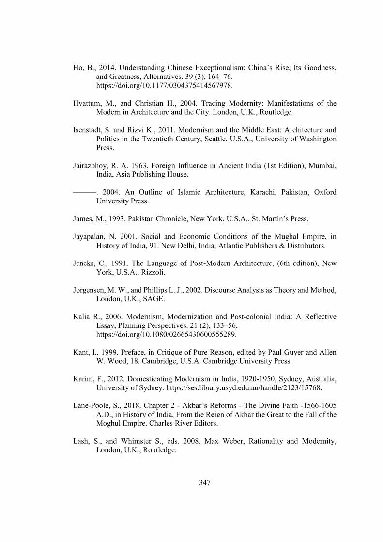
347
Ho, B., 2014. Understanding Chinese Exceptionalism: China’s Rise, Its Goodness, and Greatness, Alternatives. 39 (3), 164–76. https://doi.org/10.1177/0304375414567978.
Hvattum, M., and Christian H., 2004. Tracing Modernity: Manifestations of the
Modern in Architecture and the City. London, U.K., Routledge. Isenstadt, S. and Rizvi K., 2011. Modernism and the Middle East: Architecture and
Politics in the Twentieth Century, Seattle, U.S.A., University of Washington Press.
Jairazbhoy, R. A. 1963. Foreign Influence in Ancient India (1st Edition), Mumbai,
India, Asia Publishing House. ———. 2004. An Outline of Islamic Architecture, Karachi, Pakistan, Oxford
University Press. James, M., 1993. Pakistan Chronicle, New York, U.S.A., St. Martin’s Press. Jayapalan, N. 2001. Social and Economic Conditions of the Mughal Empire, in
History of India, 91. New Delhi, India, Atlantic Publishers & Distributors. Jencks, C., 1991. The Language of Post-Modern Architecture, (6th edition), New
York, U.S.A., Rizzoli. Jorgensen, M. W., and Phillips L. J., 2002. Discourse Analysis as Theory and Method,
London, U.K., SAGE.
Kalia R., 2006. Modernism, Modernization and Post‐colonial India: A Reflective Essay, Planning Perspectives. 21 (2), 133–56. https://doi.org/10.1080/02665430600555289.
Kant, I., 1999. Preface, in Critique of Pure Reason, edited by Paul Guyer and Allen
W. Wood, 18. Cambridge, U.S.A. Cambridge University Press. Karim, F., 2012. Domesticating Modernism in India, 1920-1950, Sydney, Australia,
University of Sydney. https://ses.library.usyd.edu.au/handle/2123/15768. Lane-Poole, S., 2018. Chapter 2 - Akbar’s Reforms - The Divine Faith -1566-1605
A.D., in History of India, From the Reign of Akbar the Great to the Fall of the Moghul Empire. Charles River Editors.
Lash, S., and Whimster S., eds. 2008. Max Weber, Rationality and Modernity,
London, U.K., Routledge.
348
Latour, B., 2012. We Have Never Been Modern, Massachusetts, U.S.A., Harvard
University Press. Malik, A., 2015. “Pakistan.” In an Introduction to South Asian Politics, London, U.K.,
Routledge. Mambrol, N., 2016. Homi Bhabha’s Concept of Hybridity, Literary Theory and
Criticism Notes (blog). April 8, 2016. https://literariness.org/2016/04/08/homi-bhabhas-concept-of-hybridity/.
University. https://plato.stanford.edu/archives/win2016/entries/hegel-dialectics/. Nietzsche, F. W., 2003. Thus Spake Zarathustra: A Book for All and None, New York,
U.S.A., Algora Publishing. Perera, Nihal. 2004. Contesting Visions: Hybridity, Liminality and Authorship of the
Chandigarh Plan, Planning Perspectives. 19 (2), 175–99. Raghuramaraju, A. 2010. Modernity in Indian Social Theory (1st edition), New Delhi,
India, OUP India. Rathore, A. S., and Mohapatra R., 2017a. Hegel’s India: A Reinterpretation, with
Texts, New Delhi, India, Oxford University Press. Rigney, A. and Fokkema D. W., 1993. Cultural Participation: Trends Since the Middle
Ages, Amsterdam, Netherlands, John Benjamins Publishing. Roy, T., 2002. Economic History and Modern India: Redefining the Link, The Journal
of Economic Perspectives. 16 (3), 109–30. Said, E. W., 2012. Culture and Imperialism, New York, U.S.A., Knopf Doubleday Saikia, Y., 2014. Ayyub Khan and Modern Islam: Transforming Citizens and the
Nation in Pakistan, South Asia, Journal of South Asian Studies. 37 (2), 292–305. https://doi.org/10.1080/00856401.2014.889590.
Schmidt, K. J. 1995. Economy of the Mughal Empire, in An Atlas and Survey of South
Asian History (1st edition), New York, U.S.A., Routledge. Seisun, C., 2012. Space Power Foucault - NSW Architects Registration Board,
https://www.architects.nsw.gov.au/public-resources/byera-hadley-travelling-scholarships1/33-past-reports/447-space-power-foucault.
349
Seth, V. K. 2014. Debate on De-Industrialization Revisited: The Process of Decline of Traditional Flexible Manufacturing, Global Business Review. 15 (3), 597–610. https://doi.org/10.1177/0972150914537932.
———. 2017. The Story of Indian Manufacturing: Encounters with the Mughal and
British Empires (1498 -1947). New York, U.S.A., Palgrave Macmillan. ———. 2017. Economic Environment of Manufacturing During the Mughal Empire,
in The Story of Indian Manufacturing: Encounters with the Mughal and British Empires (1498 -1947). New York, U.S.A., Palgrave Macmillan.
Sharma, U., and Sharma S.K., 2001. Indian Political Thought, New Delhi, India,
Atlantic Publishers & Distributors. Simmel, G. and Frisby D., 1990. The Philosophy of Money, London, U.K., Routledge. Smith, A. D., 1998. Nationalism and Modernism: A Critical Survey of Recent
Theories of Nations and Nationalism. London, U.K., Routledge. Spivak, G. C., 1987. In Other Worlds: Essays in Cultural Politics, London, U.K.,
Routledge. Subrahmanyam, S., 1997. Connected Histories: Notes towards a Reconfiguration of
Early Modern Eurasia, Modern Asian Studies. 31 (3), 735–62. ———. 2001. The Making of Early Modern Asia: A Polycentric Approach, New
York, U.S.A., The Perseus Books Group. Taylor, J. G. 1979. 9, Conceptualising Non-Capitalist Modes of Production: The
Asiatic Mode, in From Modernization to Modes of Production: A Critique of the Sociologies of Development and Underdevelopment, 1979 edition, 172–86. New Jersey, U.S.A., Palgrave Macmillan.
Tipps, D. C. 1973. Modernization Theory and the Comparative Study of Societies: A
Critical Perspective, Comparative Studies in Society and History. 15 (2), 199–226.
Toulmin, S., 1992. What Is the Problem About Modernity? in Cosmopolis: The
Hidden Agenda of Modernity, Chicago, U.S.A., University of Chicago Press. Viyagappa, I., 1980. Hegel’s Source of Information On India, In G.W.F. Hegel’s
Concept of Indian Philosophy, Rome, Italy, Gregorian Biblical Bookshop.
350
Weatherford, J., 2005. Their Golden Light, in Genghis Khan and the Making of the Modern World, Portland, U.S.A., Broadway Books.
Weber, M., 1991. From Max Weber: Essays in Sociology. Psychology Press. “What Is Political Islam | Middle East Research and Information Project.” n.d.
Accessed May 19, 2016. http://www.merip.org/mer/mer205/what-political-islam.
Williams, R. V., 2006. Postcolonial Politics and Personal Laws: Colonial Legal
Legacies and the Indian State, London, U.K., Oxford University Press. Wire, The. 2017. “Hegel’s Gita – A Philosopher Haunted by Indian Spirit.” The Wire.
November 4, 2017. https://thewire.in/books/hegels-india-bhagvad-gita. Urbanism Ahmed, Z. K. M., 2008. Constantinos A. Doxiadis’ Plan for Islamabad: The Making
of a ‘City of the Future’ 1959-1963, Katholieke Universiteit Leuven, Belgium. Al Sayyad, N., 1992. Forms of Dominance: On the Architecture and Urbanism of the
Colonial Enterprise, Avebury. ———. 1996. The Study of Islamic Urbanism: An Historiographic Essay, Built
Environment (1978). 22 (2), 91–97. ———. 1998. Contesting the Madinah: Dualities in the Study of Islamic Urbanism,
Islamic Culture 72 (3), 1–16. Al-Sayyad, N. 1998. Contesting the Madinah: Dualities in the Study of Islamic
Urbanism, Islamic Culture. 72 (3), 1–16. Bach, B. P., 2006. Calcutta’s Edifice: The Buildings of a Great City, Rupa & Co. Bennison, A. K., and Alison L. G., 2007. Fatehpur Sikri and Isfahan, the founding and
Layout of Capital Cities in Mughal India and Safavid Iran, in Cities in the Pre-Modern Islamic World: The Urban Impact of Religion, State and Society (1st ed edition). Milton Park, London, UK, New York, Routledge.
Bhalla, A. S., 2015. Summer Capital and Cantonments (Chapter 7), in Monuments,
Power and Poverty in India: From Ashoka to the Raj, I.B.Tauris. Bhatia, H., 1969. Fatehpur Sikri is a Hindu City, Surya Prakashan.
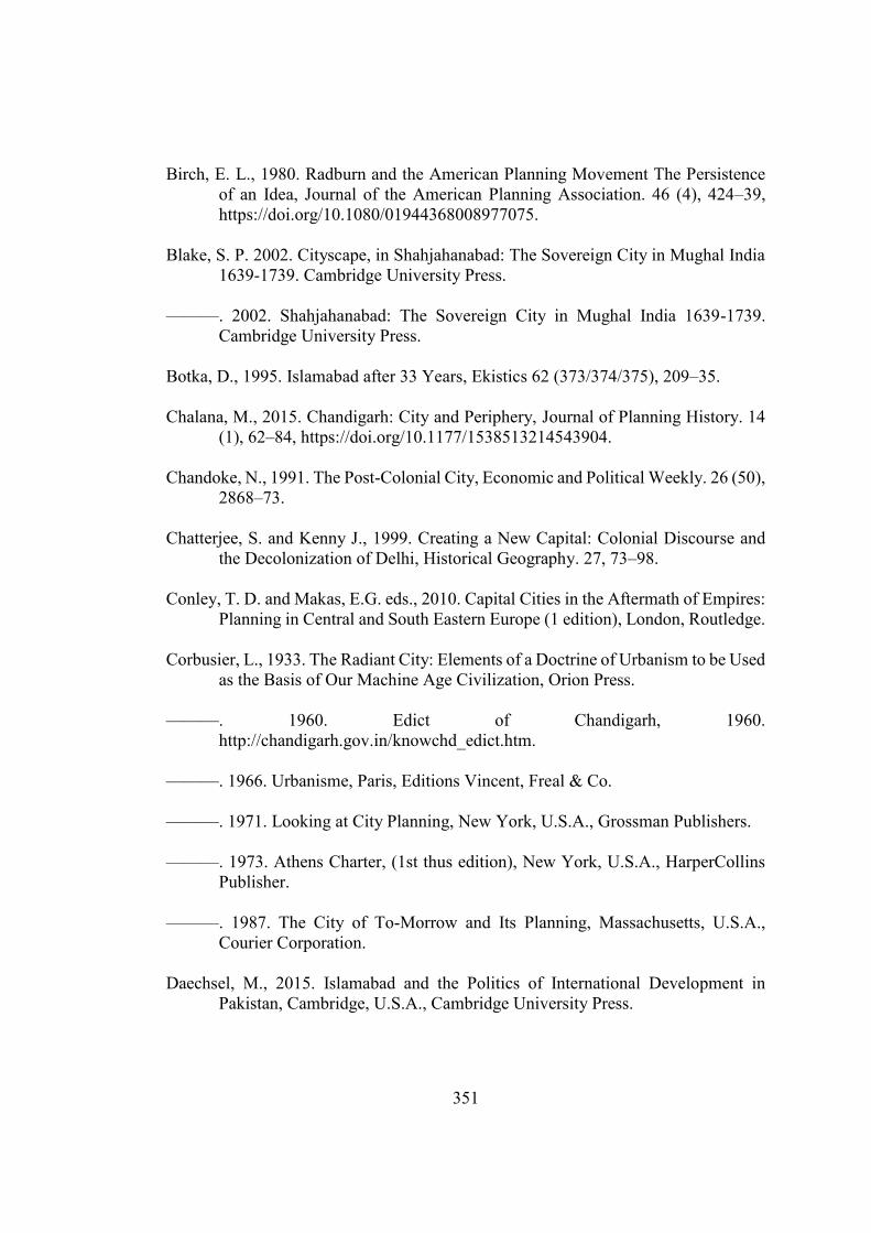
351
Birch, E. L., 1980. Radburn and the American Planning Movement The Persistence
of an Idea, Journal of the American Planning Association. 46 (4), 424–39, https://doi.org/10.1080/01944368008977075.
Blake, S. P. 2002. Cityscape, in Shahjahanabad: The Sovereign City in Mughal India
1639-1739. Cambridge University Press. ———. 2002. Shahjahanabad: The Sovereign City in Mughal India 1639-1739.
Cambridge University Press. Botka, D., 1995. Islamabad after 33 Years, Ekistics 62 (373/374/375), 209–35. Chalana, M., 2015. Chandigarh: City and Periphery, Journal of Planning History. 14
(1), 62–84, https://doi.org/10.1177/1538513214543904. Chandoke, N., 1991. The Post-Colonial City, Economic and Political Weekly. 26 (50),
2868–73. Chatterjee, S. and Kenny J., 1999. Creating a New Capital: Colonial Discourse and
the Decolonization of Delhi, Historical Geography. 27, 73–98. Conley, T. D. and Makas, E.G. eds., 2010. Capital Cities in the Aftermath of Empires:
Planning in Central and South Eastern Europe (1 edition), London, Routledge. Corbusier, L., 1933. The Radiant City: Elements of a Doctrine of Urbanism to be Used
as the Basis of Our Machine Age Civilization, Orion Press. ———. 1960. Edict of Chandigarh, 1960.
http://chandigarh.gov.in/knowchd_edict.htm. ———. 1966. Urbanisme, Paris, Editions Vincent, Freal & Co. ———. 1971. Looking at City Planning, New York, U.S.A., Grossman Publishers. ———. 1973. Athens Charter, (1st thus edition), New York, U.S.A., HarperCollins
Publisher. ———. 1987. The City of To-Morrow and Its Planning, Massachusetts, U.S.A.,
Courier Corporation. Daechsel, M., 2015. Islamabad and the Politics of International Development in
Pakistan, Cambridge, U.S.A., Cambridge University Press.
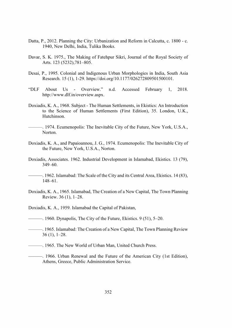
352
Datta, P., 2012. Planning the City: Urbanization and Reform in Calcutta, c. 1800 - c. 1940, New Delhi, India, Tulika Books.
Davar, S. K. 1975., The Making of Fatehpur Sikri, Journal of the Royal Society of
Arts. 123 (5232),781–805. Desai, P., 1995. Colonial and Indigenous Urban Morphologies in India, South Asia
Research. 15 (1), 1-29. https://doi.org/10.1177/026272809501500101. “DLF About Us - Overview.” n.d. Accessed February 1, 2018.
http://www.dlf.in/overview.aspx. Doxiadis, K. A., 1968. Subject - The Human Settlements, in Ekistics: An Introduction
to the Science of Human Settlements (First Edition), 35. London, U.K., Hutchinson.
———. 1974. Ecumenopolis: The Inevitable City of the Future, New York, U.S.A.,
Norton. Doxiadis, K. A., and Papaioannou, J. G., 1974. Ecumenopolis: The Inevitable City of
the Future, New York, U.S.A., Norton. Doxiadis, Associates. 1962. Industrial Development in Islamabad, Ekistics. 13 (79),
349–60. ———. 1962. Islamabad: The Scale of the City and its Central Area, Ekistics. 14 (83),
148–61. Doxiadis, K. A., 1965. Islamabad, The Creation of a New Capital, The Town Planning
Review. 36 (1), 1–28. Doxiadis, K. A., 1959. Islamabad the Capital of Pakistan, ———. 1960. Dynapolis, The City of the Future, Ekistics. 9 (51), 5–20. ———. 1965. Islamabad: The Creation of a New Capital, The Town Planning Review
36 (1), 1–28. ———. 1965. The New World of Urban Man, United Church Press. ———. 1966. Urban Renewal and the Future of the American City (1st Edition),
Athens, Greece, Public Administration Service.
353
———. 1966. Between Dystopia and Utopia (First edition), London, U.K., The Trinity College Press.
———. 1968. Ekistics: An Introduction to the Science of Human Settlements, Paris,
France, Hutchinson. ———. 1974. Ecumenopolis: The Inevitable City of the Future, New York, U.S.A.,
Norton. Evenson, N., 1966. Chandigarh, California, U.S.A., University of California Press. Evenson, N., 1989. The Indian Metropolis: A View Toward the West, New Haven,
U.S.A., Yale University Press. “Fatehpur Sikri: A Utopian Approach to Urban Planning and Design.” n.d.
ResearchGate. Accessed May 18, 2017. https://www.researchgate.net/publication/228990539_Fatehpur_Sikri_A_Utopian_Approach_to_Urban_Planning_and_Design.
Feiersinger, M., and Werner F. eds., 2015. Chandigarh Redux: Le Corbusier, Pierre
Jeanneret, Jane B. Drew, E. Maxwell Fry. Zurich, Switzerland, Scheidegger & Spiess.
Fishman, R., 1982. Urban Utopias in the Twentieth Century: Ebenezer Howard, Frank
Lloyd Wright, and Le Corbusier, Cambridge, M.A., U.S.A., MIT Press. Frampton, K. and Mumford E., 2002. CIAM and the Postwar World, in The CIAM
Discourse on Urbanism, 1928-1960, Cambridge, Massachusetts, U.S.A., The MIT Press.
———. 2002. The CIAM Discourse on Urbanism, 1928-1960. Cambridge,
Massachusetts, U.S.A., The MIT Press. Fynn, S., 2017. Chandigarh Revealed: Le Corbusier’s City Today, New York, U.S.A.,
Princeton Architectural Press. Gast, K., 2000. Le Corbusier, Paris-Chandigarh, Basel, Switzerland, Birkhäuser. George, R. V., 1997. A Procedural Explanation for Contemporary Urban Design,
Journal of Urban Design. 2 (2), 143–61. https://doi.org/10.1080/13574809708724401.
Gordon, D., ed. 2006. Planning Twentieth Century Capital Cities (1st edition),
London, U.K., Routledge.
354
Gupta, S. 1993. Theory and Practice of Town Planning in Calcutta, 1817 to 1912: An
Appraisal, Indian Economic & Social History Review. 30 (1), 29–55. https://doi.org/10.1177/001946469303000102.
Hambly, G. R. G., 2004. Chapter XIV: Towns and Cities, in the Cambridge Economic
History of India, c. 1200 - c. 1750: 1, by Raychaudhuri T. and Habib I., Hyderabad, India, Orient Blackswan Pvt Ltd.
Harvey, D., 2003. Paris, Capital of Modernity, London, U.K., Psychology Press. ———. 2009. Cities and Surplus, in Social Justice and the City, Athens, Greece,
University of Georgia Press. Hearn, G., 1928. The seven Cities of Delhi: A Description and History, Kolkata,
Indian, Thacker. Heitzman, J., 2008. The City in South Asia ( 1st edition),. London, U.K., Routledge. Herbert, S. and Carole L., 2015. Urban utopias: La Grande Motte, Brasilia,
Chandigarh. Paris, France, Somogy art. Holston, J., 1989. The Modernist City: An Anthropological Critique of Brasilia,
Chicago, U.S.A., University of Chicago Press. Home, R. K., 2011. Of Planting and Planning: The Making of British Colonial Cities
(1st edition), London, U.K., Routledge. Hurlimann, M. 1965. Fatehpur Sikri, in Delhi, Agra and Fatehpur Sikri. London, U.K.,
Thames & Hudson. ———. 1965. Shahjahanabad, Delhi, In Delhi, Agra and Fatehpur Sikri. London,
U.K., Thames & Hudson. Iftikhar, R., 2016. Urban Formation and Cultural Transformation in Mughal India, in.
Vol. 1, Ideas on the Move and Modernization. Delft, The Netherland. Iizuka, K., 1991. The Shah Jahan’s Concept of Town Planning in Delhi, edited by
Petruccioli A., Journal of the Islamic Environmental Design Research Centre. 1 (2).
Jackson, I. 2013. Maxwell Fry and Jane Drew’s Early Housing and Neighborhood
Planning in Sector-22, Chandigarh, Planning Perspectives. 28 (1), 1–26.
355
Jacobs, J., 1992. The Death and Life of Great American Cities, New York, U.S.A., Vintage.
Joardar, S. D. 2006. New Delhi: Imperial Capital to Capital of the World’s Largest
Democracy, in Planning Twentieth Century Capital Cities, London, U.K., Routledge.
Johnson, D., and Watson R., 2015. New Delhi: The Last Imperial City (2015 edition),
New York, U.S.A., Palgrave Macmillan. Joshi, K., 1999. Documenting Chandigarh, Ahmedabad, India, Mapin Publishing. ———. 1999. Documenting Chandigarh: The Indian Architecture of Pierre Jeanneret,
Edwin Maxwell Fry, Jane Beverly Drew, Ahmedabad, India, Mapin Pub. Kalia, R., 1987. Chandigarh: In Search of an Identity (1st edition), Carbondale,
U.S.A., Southern Illinois University Press. ———. 1990. Chandigarh: The Making of an Indian City. Delhi, India, Oxford
University Press. ———. 2004. Gandhinagar: Building National Identity in Postcolonial India, South
Carolina, U.S.A., University of South Carolina Press. Kennedy, H., 1985. From Polis to Madina: Urban Change in Late Antique and Early
Islamic Syria, Past & Present.106, 3–27. Kenoyer, J. M., 998. Ancient Cities of the Indus Valley Civilization (1st edition),
Karachi, Pakistan, Oxford University Press. Khan, H., Beinart J., and Correa C., eds. 2010. Le Corbusier: Chandigarh and the
Modern City, Ahmedabad, India, Mapin Publishing. King, A. D., 2004. Spaces of Global Cultures: Architecture, Urbanism, Identity,
London, U.K., Routledge. King, A. D., 2004. The Times and Spaces of Modernity, in Spaces of Global Cultures:
Architecture, Urbanism, Identity, London, U.K., Routledge. ———. 2004. Transnational Delhi Revisited: The Spatial Language of Three
Modernities, in Spaces of Global Cultures: Architecture, Urbanism, Identity, London, U.K., Routledge.
356
———. 2007. Colonial Urban Development: Culture, Social Power and Environment (1st edition). London, U.K., Routledge.
Kippis, A., William G. and George R., 1810. Description of Calcutta, in The New
Annual Register, or General Repository of History, Politics, and Literature for the Year 1819.
Kreutzmann, H., 2013. Islamabad – Living with the Plan, Südasien-Chronik - South
Asia Chronicle. 3,135–60. Kusno, A., 2000. Behind the Postcolonial: Architecture, Urban Space and Political
Cultures in Indonesia (1st edition), London, U.K., Routledge. Lefebvre, H., 1991. Critique of Everyday Life: Foundations for a Sociology of the
Everyday, London, U.K., Verso. ———. 1992. The Production of Space. Translated by Donald Nicholson-Smith.
Massachusetts, U.S.A., Wiley-Blackwell. ———. 2003. Urban Myths and Ideologies, in the Urban Revolution, Minneapolis,
U.S.A., University of Minnesota Press. ———. 2003. The Urban Revolution (1st edition), Minneapolis, U.S.A., University
of Minnesota Press. Lin, G. C. S., 2007. Chinese Urbanism in Question: State, Society, and the
Reproduction of Urban Spaces, Urban Geography. 28 (1), 7–29. https://doi.org/10.2747/0272-3638.28.1.7.
Liscombe, R. W., 2006. In‐dependence: Otto Koenigsberger and Modernist Urban
Resettlement in India, Planning Perspectives. 21 (2), 157–78. https://doi.org/10.1080/02665430600555305.
Lu, D.. 2006. Remaking Chinese Urban Form: Modernity, Scarcity and Space, 1949-
2005. London, U.K., Routledge. Mahsud, A. Z. K. 2005. Nature and the City: The Legacy of Doxiadis’ Plan for
Islamabad, in International PhD Seminar, Urbanism & Urbanization, 279–300. Barcelona, Spain.
———. 2008. Constantinos A. Doxiadis Plan for Islamabad : The Making of a ‘City
of the Future’ 1959-1963, Leuven, Belgium, Katholieke Universiteit Leuven.
357
———. 2009. Extrovert Synthesis in the Design of Islamabad: Doxiadis Ambition for an Evolutionary National Style of the New Capital, in Doxiadis C. A. and His Work, edited by Bogdanou M., Athens, Greece, Technical Chamber of Greece.
———. 2010. Urban Design of Islamabad: Historiographical Legacy of the
Framework for a Sustainable Metropolis of the Future, in , 61–76. Lahore, Pakistan, THAAP.
———. 2013. Representing the State, in the Politics of Making, edited by Swenarton
M., Troiani I., and Webster H., London, U.K., Routledge. ———. 2013. Representing the State: Symbol and Ideology in the Master Plan of
Islamabad, in The Politics of Making, 61–74, London, U.K., Routledge. ———. 2013. On Design and Politics of Co-Producing Public Space: The Long
Marches and the Reincarnation of the ‘Forecourt’ of the Pakistani Nation, International Journal of Islamic Architecture. 2 (1).
Malik, A. 1997. Post-Colonial Capitals of South Asia: A Critical Analysis of
Chandigarh, Dhaka and Islamabad, GBER. 3 (1), 68–80. Malm, L., 1952. Report on Greater Karachi Plan, Merz Rendel Vatten. Megarry, R. E., 1962. Town and Country Planning in England: A Bird’s Eye View,
Case Western Reserve Law Review. 13 (4), 619–38. Misra, R. P., 2013. Urbanization in South Asia: Focus on Mega Cities, Cambridge
University Press India Pvt. Limited. Mitter, P., 1986. The Early British Port Cities of India: Their Planning and
Architecture Circa 1640-1757, Journal of the Society of Architectural Historians. 45 (2), 95–114. https://doi.org/10.2307/990090.
Moatasim, F., 2015. Making Exceptions: Politics of Nonconforming Spaces in the
Planned Modern City of Islamabad, Michigan, U.S.A., University of Michigan.
Morris, A. E. J. 1975. Chandigarh: The Plan Corb Tore Up?, Built Environment
Quarterly. 1 (3), 229–34. ——————. 2013. History of Urban Form Before the Industrial Revolution,
London, U.K., Routledge.
358
Mumford, E. P., 2002. The CIAM Discourse on Urbanism, 1928-1960. Massachusetts, U.S.A., MIT Press.
Mumford, L., 1981. The Highway and the City, Connecticut, U. S.A., Greenwood
Press. ———. 1989. The City in History: Its Origins, Its Transformations, and Its Prospects.
New York, U.S.A., MJF Books. Nalbantoglu, G. B. and Wong C. T., 1997. Postcolonial Space(s), New Jersey, U.S.A.,
Princeton Architectural Press. Newcombe, V. Z. 1960. A Town Extension Scheme: At Karachi, The Town Planning
Review. 31 (3), 219–29. Nijman, J., 2007. Introduction—Comparative Urbanism, Urban Geography. 28 (1), 1–
6. Ojha, M., 2014. Nested Cohabitation: The Modern City and the Urban Villages, Issuu.
2014. https://issuu.com/mayankojha/docs/ojha-nested_cohabitation. Peixoto-Mehrtens, C. 2010. Urban Space and National Identity in Early Twentieth
Century São Paulo, Brazil: Crafting Modernity (2010 edition), New York, U.S.A., Palgrave Macmillan.
Pevsner, N., and Cherry B., 1973. London: The Cities of London and Westminster.
Penguin Books. Prakash, V., 2002. Chandigarh’s Le Corbusier: The Struggle for Modernity in
Postcolonial India, Seattle, U.S.A., University of Washington Press. Rabbat, N., 2010. The Islamic City: Historicity and Abstraction, Archnet.
http://archnet.org/syllabis/19. Rabinow, P., 1995. French Modern: Norms and Forms of the Social Environment,
Chicago, U.S.A., University Of Chicago Press. Radcliffe, S. A., 2005. Development and Geography: Towards a Postcolonial
Development Geography? Progress in Human Geography. 29 (3), 291–98. https://doi.org/10.1191/0309132505ph548pr.
Ray, A., 2016. Towns and Cities of Medieval India: A Brief Survey, London, U.K.,
Taylor & Francis.
359
Scheidegger, E., Moos S., and Casciato M., 2010. Chandigarh 1956: Le Corbusier, Pierre Jeanneret, Jane B.Drew, E. Maxwell Fry. Zurich, Switzerland, Scheidegger & Spiess.
Sert, J. L., 1944. The Human Scale in City Planning. Sharpe, J. 1997. Town and Villages, in Early Modern England: A Social History 1550-
1760, London, U.K., Bloomsbury Academic. Shaw, A., 2009. Town Planning in Postcolonial India, 1947–1965: Chandigarh Re-
Examined, Urban Geography. 30 (8), 857–78. Sinopoli, C. M., 1994. Monumentality and Mobility in Mughal Capitals, Asian
Perspectives. 33 (2), 293–308. Spodek, H., 1980. Studying the History of Urbanization in India, Journal of Urban
History. 6 (3), 251–95. https://doi.org/10.1177/009614428000600301. Srivastava, R., Pinto, J., Eds., 2008. Chandigarh: An Experiment in the Modern
Living, in Talk of the Town. Penguin Books India. Taylor, N., 1998. Urban Planning Theory since 1945, London, U.K., SAGE
Publications Ltd. Thai, W. C., 1997. Postcolonial Spaces (Edited by G. Nalbantoglu and W. Thai), New
York, U.S.A., Princeton Architectural Press. UNESCO, UNESCO World Heritage, 1986. Fatehpur Sikri, UNESCO World
Heritage Centre. 1986. http://whc.unesco.org/en/list/255/. Von G. G. E., 1958. The Muslim Town, Ekistics. 6 (36), 110–17. Woudstra, R., 2014. “Le Corbusier’s Vision for Fascist Addis Ababa.” Failed
Architecture (blog). October 9, 2014. https://failedarchitecture.com/le-corbusiers-visions-for-fascist-addis-ababa/.
Wright, G., 1991. The Politics of Design in French Colonial Urbanism. Chicago,
U.S.A., University of Chicago Press. Yakas, O., 2001. Islamabad: The Birth of a Capital. Karachi, Pakistan, Oxford
University Press. Yeoh, B. S. A. 2003. Contesting Space in Colonial Singapore: Power Relations and
the Urban Built Environment, Singapore, NUS Press.

360
Yiftachel, Oren. 1998. Planning and Social Control: Exploring the Dark Side, Journal
of Planning Literature.12 (4), 395–406. https://doi.org/10.1177/088541229801200401.
361
APPENDICES
A. GLOSSARY
Adhunik (Hindi: आधुननक): Modern, contemporary
Akalis (Hindi: अक निक): untimely
Ameers (Arabic: Amīr): A prince, commander, or head of state in some Islamic countries. Also, a title of honor of the descendants of Muhammad. Also used for a title of certain Turkish officials.
Aml-e-Salih (Urdu): Deeds which are good, beautiful and beneficial and are acted in accordance with Allah’s content and pleasure.
Apracin
Aqal (Urdu): sound practical judgment, a general conscious awareness
Bakht (Urdu baḵẖt): good fortune, luck, prosperity
Bazaar (Urdu): market, marketplace, mart, exchange; souk
Black Town: A colonial urban terminology used to describe residential quarters designated for the native populace.
British India: The 17 provinces of India formerly governed by the British under the British sovereign (1858-1947). It ceased to exist when after the creation of the independent states of India and Pakistan.
British Raj (or simply Raj): Refers to the period of British rule on the Indian Subcontinent between 1858 and 1947. The system of governance was instituted in 1858 when the rule of the East India Company was transferred to the Crown in the person of Queen Victoria (who in 1876 was proclaimed Empress of India).
Bungalows: Derived from the Hindi and Urdu word ba. glā which literally means “in the Bengal style (of a house).” In its original use bungalow referred specifically to a lightly-built single-story house, usually with a thatched roof. The term became popular
362
during colonial times and was used to refer to a type of cottage built for early European settlers in Bengal.
Calcutta (currently known as Kolkatta): It is the capital of India's West Bengal state. Founded as an East India Company trading post, it was India's capital under the British Raj from 1773–1911.
Chajja is the projecting or overhanging eaves or cover of a roof, usually supported on large carved brackets.
Chandni Chowk: (literally translates as Moonlight Square) is one of the oldest and busiest markets in Old Delhi, India. It is located close to Old Delhi Railway Station.
Charbagh: (literally four gardens) The quadrangular design of Islamic gardens.
Chattri (Urdu: umbrella): In Indian architecture, a rooftop kiosk or pavilion having a dome, usually supported on four columns.
Chishtiya Ribbat: It is a place of the station for all the seekers of the Sufi path – the path of the heart. The Chishti order was founded by Khwaja Abu Ishaq Shami Chishti. The name derived from the village of Chisht in Afghanistan, located near the city of Herat.
Darbar (Urdu): Term used in the Indian Subcontinent for an Imperial court.
Daulat Khana-e-Khas o Aam: (Urdu: literally Hall of Public and Private Audience), of the Mughal Emperor Akbar, located at Lahore Fort.
Dharmatala (archaic spelling Dhurrumtollah) is a neighborhood of central Kolkata, earlier known as Calcutta, in Kolkata district in the Indian state of West Bengal.
Deen-i-Elahi: The Dīn-i Ilāhī (lit. "Religion of God") was a syncretic religion propounded by the Mughal emperor Akbar in 1582 CE, intending to merge the best elements of the religions of his empire, and thereby reconcile the differences that divided his subjects
East Punjab: The Independence of Pakistan in 1947 led to the division of the Punjab Province of British India into two new provinces. The largely Sikh and Hindu East Punjab became part of the new nation of India while the largely Muslim West Punjab became part of the new nation of the Dominion of Pakistan.
363
Factory: In the British colonial context, this term was used to describe both the trading settlement as well as the building (factory-house) in which its activities were pursued. The land was granted as a concession from the local ruler and was generally a fortified piece of territory.
Fatehpur Sikri (or simply Sikri): Fatehpur Sikri is a small city in northern India, just west of Agra city, founded by Mughal emperor Akbar in the 16th century.
George Town: It is a neighbourhood in Chennai city, Tamil Nadu, India. It is near the Fort Saint George, Chennai.
Ghaznavid dynasty: Ghaznavid dynasty, (977–1186 CE), a dynasty of Turkic origin that ruled in Khorāsān (in north Eastern Iran), Afghanistan, and northern India. The founder of the dynasty was Sebüktigin (ruled 977–997), a former Turkic slave who was recognized by the Sāmānids (an Iranian Muslim dynasty) as Governor of Ghazna (modern Ghaznī, Afghanistan).
Hayat Baksh Bagh (literally Life-bestowing garden): It is the largest of the gardens in the Red Fort in Delhi. It was largely destroyed by the British colonial forces following the failed 1857 rebellion. Most of the garden was built over by stone barracks by the British colonialists after 1857. Lord Curzon had some elements of the garden restored.
Hindu (also Hindoo, Hindo): a follower of Hinduism.
Hybrid: a thing made by combining two different elements.
Ibadat Khana (Urdu: House of Worship): An institution erected by Akbar in 1575, was used as a debating hall for religious scholars. It is located at Fatehpur Sikri.
Ibkahat: An open symposium initiated by Mughal Emperor Akbar for members of all religions- Sunnis, Shi’as, Hindus, Jains, Zoroastrians and Christians. It was a dialogical public sphere within the composite nobility.
India: India is an ancient terms derived from the Indus river. The dissertation uses the term India for post-independence country formed after the partition.
Indian Subcontinent: Indian Subcontinent generally refers to India peninsula that after 1971 comprise of seven countries namely Pakistan, India, Nepal, Bhutan, Bangladesh, Lanka, and Maldives.
364
Indo-Saracenic: (also known as Indo-Gothic, Mughal-Gothic, Neo-Mughal, Hindoo
style) was an architectural style mostly used by British architects in India in the later 19th century, especially in public and government buildings in the British Raj, and the Palaces of rulers of the princely states.
Islamic Republic of Pakistan: generally, refers to as Pakistan
Jajamani system: (Hindi: जजम न from Sanskrit: यज्ञम न) or Yajman system was an Indian economic system in which lower castes performed various functions for upper castes and received grain in return.
Jalli: (Hindi:ज िी jālī, meaning "net"): It is the term for a perforated stone or latticed screen, usually with an ornamental pattern constructed through the use of calligraphy and geometry
Lal Bazaar: Literally meaning Red Market.
Madras (presently Chennai): Chennai, on the Bay of Bengal in Eastern India, is the capital of the state of Tamil Nadu. The city is home to Fort St. George, built in 1644 and now a museum showcasing the city’s roots as a British military garrison and East India Company trading outpost when it was called Madras.
Manesar: Manesar is an industrial town in Gurgaon district of the State of Haryana in India, and is a part of the National Capital Region of Delhi.
Mandu: Mandu is an ancient fort city in the central Indian state of Madhya Pradesh. It's surrounded by stone walls dotted with darwazas (gateways). It's also known for its Afghan architectural heritage.
Mansabdari system: The Mansabdari system was the administrative system introduced by Akbar in Mughal Empire during 1571. The word 'Mansab' is of Arabic origin meaning rank or position. Hence, Mansabdari was a system of ranking the government officials and determined their civil & military duties, along with their remuneration.
Maydan (Urdu literally meaning ground; Also spelled maidan): (in South Asia) open space in or near a town, used as a parade ground or for events such as public meetings.
365
Mehtab Bagh (Urdu literally “Moonlight Garden”): It is a charbagh complex in Agra, North India. It lies north of the Taj Mahal complex and the Agra Fort on the opposite side of the Yamuna River, in the flood plains.
Mughal dynasty: Also spelled Mogul, (Arabic: Mongol). A Muslim dynasty of Turkic-Mongol origin that ruled territories of India from the early 16th to the mid-18th century.
Nabya: The word has a Bengali origin and refers to something new
Naql: Imitations
Pardesi: Hindi word for foreigner.
Pietra dura (from Italian literally ‘hard stone’): A pictorial mosaic work using semi-precious stones, typically for table tops and other furniture. Called parchin kari or parchinkari in the Indian Subcontinent.
Raj Bhavan: (Hindi for "Government House") is the common name of the official residences of the State Governors in India.
Sati (Also Suttee): Sati or suttee is an obsolete funeral custom where a widow immolates herself on her husband's pyre or takes her own life in another fashion shortly after her husband's death.
Shahjahanabad / Delhi / Old Delhi/ Purani Dilli: Founded as a walled city of Delhi, India, founded as Shahjahanabad in 1638, when Shah Jahan, the Mughal emperor at the time, decided to shift the Mughal capital from Agra. The city was completed in 1648 and remained the capital of the Mughal Empire until its fall in 1857 when the British Raj took over a paramount power in India.
Shalamar Garden: A Mughal garden complex located in Lahore, Pakistan.
Sufi: A Muslim mystic.
Sulh-i-Kul: (an Arabic term literally meaning “peace with all,” “universal peace,” or “absolute peace,”) drawn from a Sufi mystic principle. As applied by the third Mughal Emperor of India, Akbar (who reigned 1556-1605), it described a peaceful and harmonious relationship among different religions.
366
Sultan of Delhi: Founded in 1206 by Qutb al-Din Aibak, a former Turkic Mamluk slave of Muhammad Ghori, Delhi Sultanate lasted till 1526 and ruled parts of Indian Subcontinent. Sultan was the official title for the ruler.
Vastu Sastra (vāstu śāstra literally "science of architecture"): is a traditional Hindu system of architecture. These are texts found on the Indian Subcontinent that describe principles of design, layout, measurements, ground preparation, space arrangement and spatial geometry.
Viceroys: The governor of a country or province who rules as the representative of a king or sovereign.
West Punjab: The Independence of Pakistan in 1947 led to the division of the Punjab Province of British India into two new provinces. The largely Sikh and Hindu East
Punjab became part of the new nation of India while the largely Muslim West Punjab became part of the new nation of the Dominion of Pakistan.
White town: A colonial urban terminology used to describe residential quarters reserved for the European colonizers/ settlers.
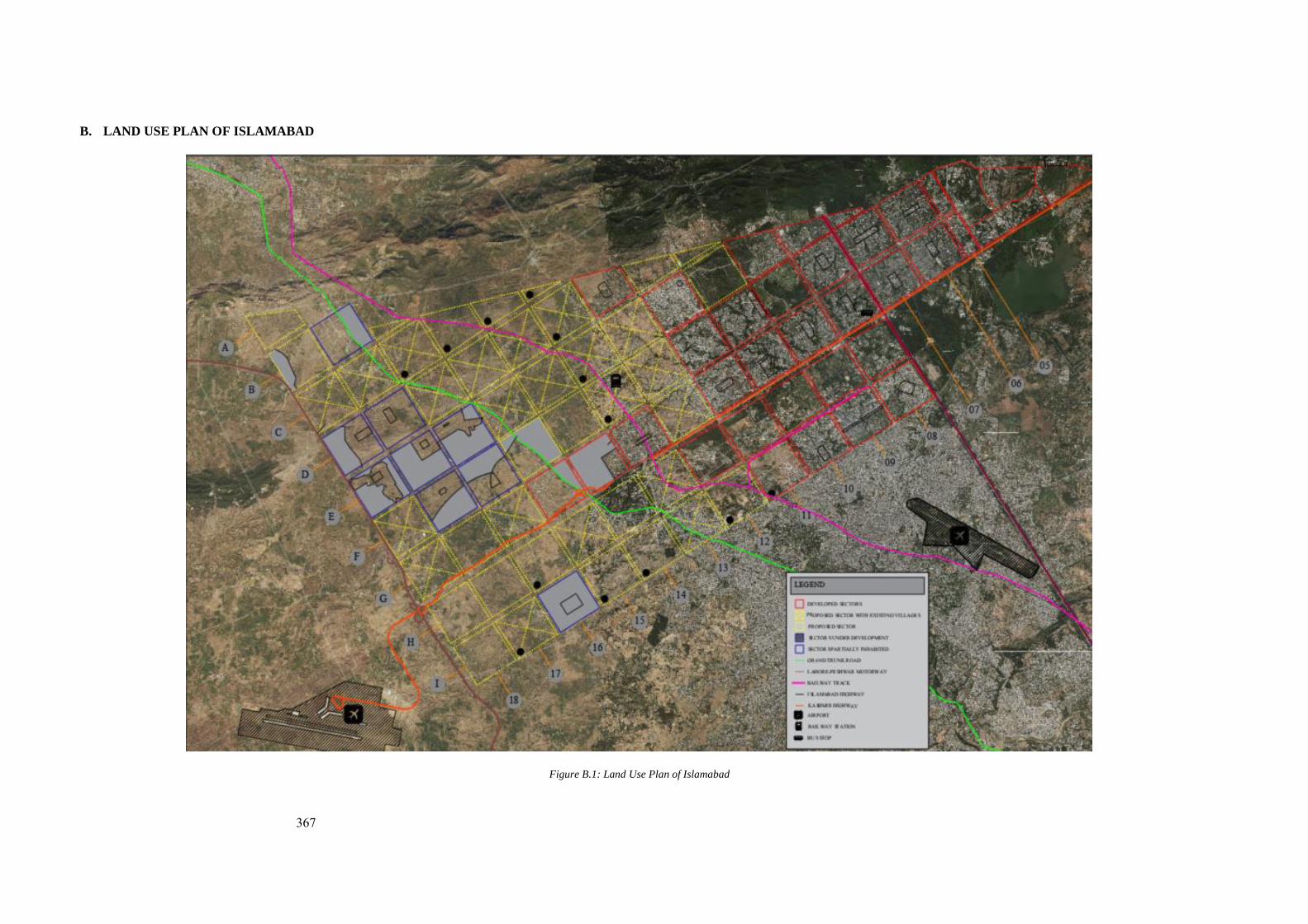
367
B. LAND USE PLAN OF ISLAMABAD
Figure B.1: Land Use Plan of Islamabad
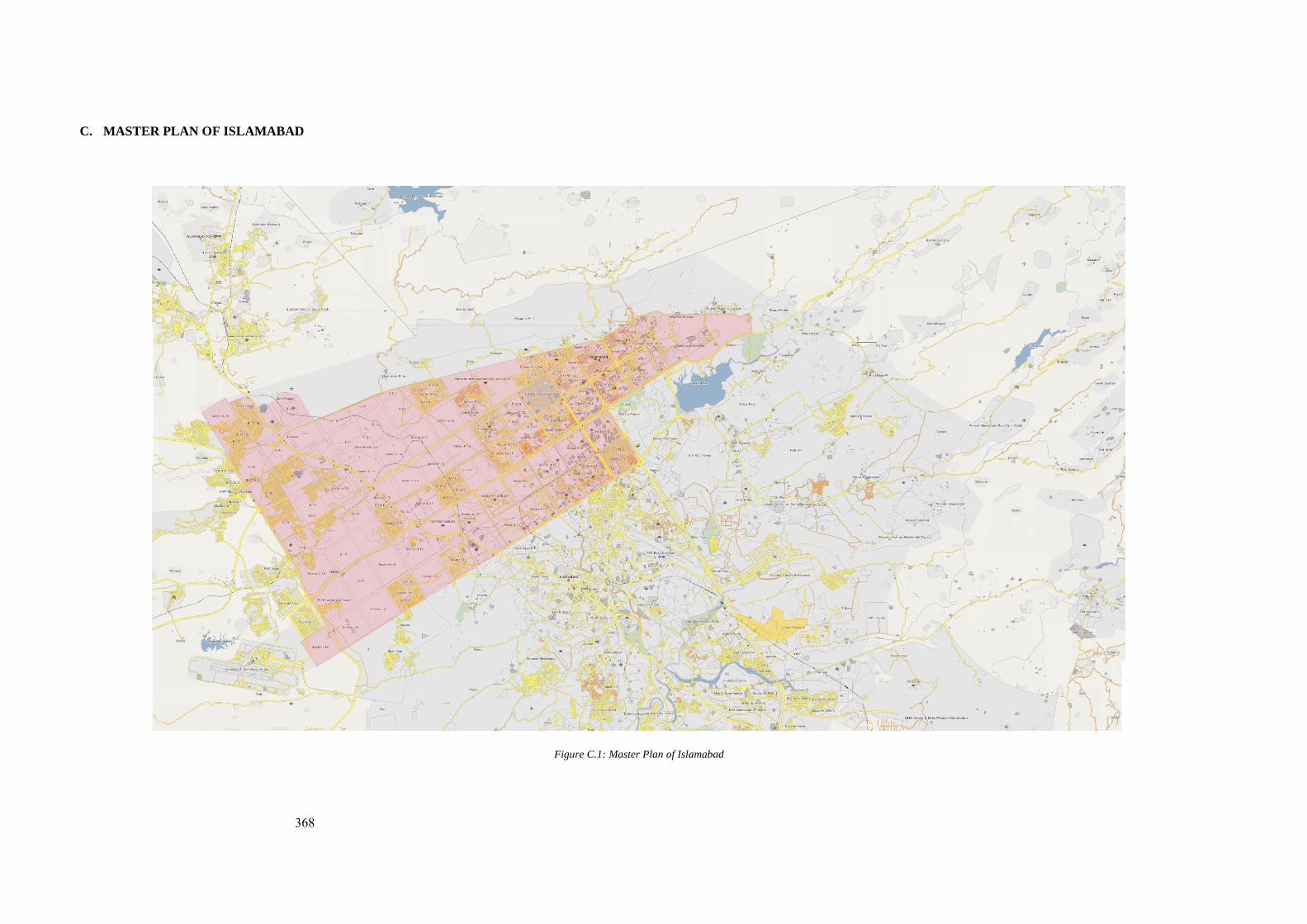
368
C. MASTER PLAN OF ISLAMABAD
Figure C.1: Master Plan of Islamabad
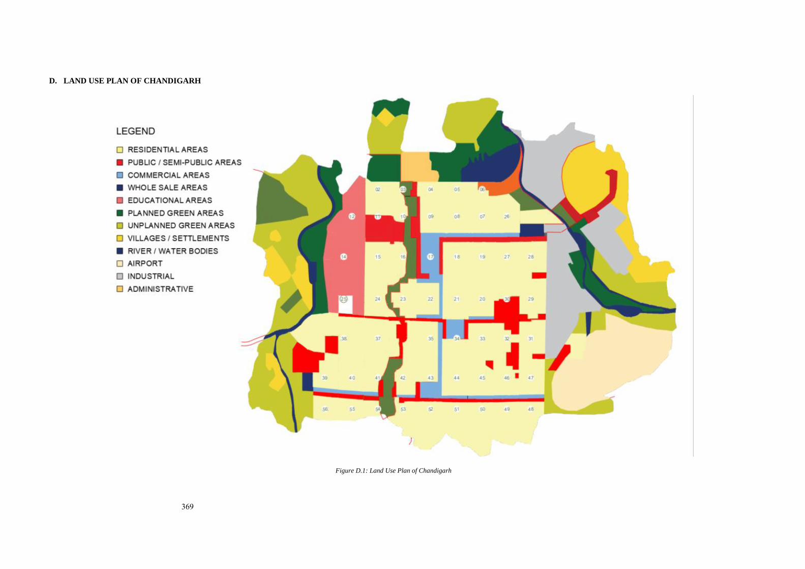
369
D. LAND USE PLAN OF CHANDIGARH
Figure D.1: Land Use Plan of Chandigarh
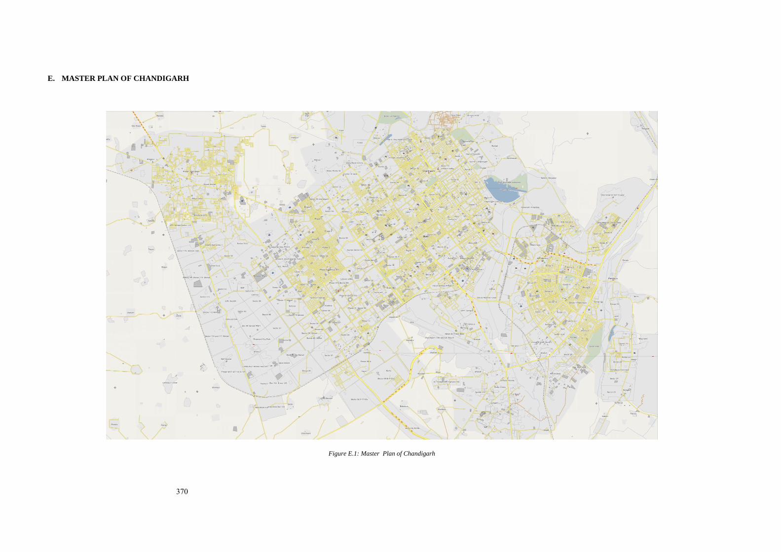
370
E. MASTER PLAN OF CHANDIGARH
Figure E.1: Master Plan of Chandigarh
371
F. DOCUMENTS AT FONDATION LE CORBUSIER, PARIS, FRANCE
NO. ARCHIVE CODE SUBJECT
1 P2-8-29-001 Minutes of the meeting of the planning commission held on Apr. 17, 1952 at 9.30 a.m. in the committee room to meet M. Le Corbusier.
2 P2-8-29-001 Minutes of the meeting of the planning commission held on Apr. 17, 1952 at 9.30 a.m. in the committee room to meet M. Le Corbusier. (Page 01)
3 P2-8-29-002 Minutes of the meeting of the planning commission held on Apr. 17, 1952 at 9.30 a.m. in the committee room to meet M. Le Corbusier. (Page 02)
4 P2-8-29-003 Minutes of the meeting of the planning commission held on Apr. 17, 1952 at 9.30 a.m. in the committee room to meet M. Le Corbusier. (Page 03)
5 P2-8-29-004 Minutes of the meeting of the planning commission held on Apr. 17, 1952 at 9.30 a.m. in the committee room to meet M. Le Corbusier. (Page 04)
6 P2-8-29-005 Minutes of the meeting of the planning commission held on Apr. 17, 1952 at 9.30 a.m. in the committee room to meet M. Le Corbusier. (Page 05)
7 P2-8-29-006 Minutes of the meeting of the planning commission held on Apr. 17, 1952 at 9.30 a.m. in the committee room to meet M. Le Corbusier. (Page 06)
8 P2-8-29-007 Minutes of the meeting of the planning commission held on Apr. 17, 1952 at 9.30 a.m. in the committee room to meet M. Le Corbusier. (Page 07)
9 P2-8-29-008 Minutes of the meeting of the planning commission held on Apr. 17, 1952 at 9.30 a.m. in the committee room to meet M. Le Corbusier. (Page 08)
10 P2-8-29-009 Minutes of the meeting of the planning commission held on Apr. 17, 1952 at 9.30 a.m. in the committee room to meet M. Le Corbusier. (Page 09)
372
11 P2-8-38-001 P.S. Thapar’s letter to Mr. Le Corbusier D.O
12 P2-8-38-004 (Attached Notes) P.S. Thapar’s letter to Mr. Le Corbusier D.O
13 P2-8-38-001 Letter from P. M. Thapar to Mr. Le Corbusier, Dated Apr 05, 1952
14 P2-8-38-004 Attached Notes to the Letter from P. M. Thapar to Mr. Le Corbusier, Dated Apr 05, 1952, written by Prime Minister Nehru
15 P2-8-38-005 Attached Notes to the Letter from P. M. Thapar to Mr. Le Corbusier, Dated Apr 05, 1952, written by Prime Minister Nehru
16 P2-12-7-001/003 Letter from E.L. Varma to Le Corbusier dated Dec 16th, 1951)
17 P2-12-14-001/003 Letter from E.L. Varma to Le Corbusier dated August 11, 1952)
18 P2-12-2-002 Notes of Meeting between Le Corbusier and Nehru on Date June 26th, 1957, from Le Corbusier’s Diary
19 P2-13-48-003 Letter of Corbusier to Mr. Nehru
20 P2-13-52-004 Le Corbusier Letter to Mr. Nehru Paris, September 30th, 1957
21 P1-20-140-001 National Emblem of India
22 P3-8-71-002 Cover Letter to the High-Level Advisory Committee of the Capital Project Control Board, Chandigarh from Mr. Le Corbusier
23 P3-8-71-003 Attached Document to the Letter to the High-Level Advisory Committee of the Capital Project Control Board, Chandigarh from Mr. Le Corbusier Title: Statue of the Land, City of Chandigarh (Page 01)
373
24 P3-8-71-004 Attached Document to the Letter to the High-Level Advisory Committee of the Capital Project Control Board, Chandigarh from Mr. Le Corbusier Title: Statue of the Land, City of Chandigarh (Page 02)
25 P3-8-71-005 Attached Document to the Letter to the High-Level Advisory Committee of the Capital Project Control Board, Chandigarh from Mr. Le Corbusier Title: Statue of the Land, City of Chandigarh (Page 03)
26 P3-8-71-006 Attached Document to the Letter to the High-Level Advisory Committee of the Capital Project Control Board, Chandigarh from Mr. Le Corbusier Title: Statue of the Land, City of Chandigarh (Page 04)
27 P3-8-71-007 Attached Document to the Letter to the High-Level Advisory Committee of the Capital Project Control Board, Chandigarh from Mr. Le Corbusier Title: Statue of the Land, City of Chandigarh (Page 05)
28 P3-8-71-008 Attached Document to the Letter to the High-Level Advisory Committee of the Capital Project Control Board, Chandigarh from Mr. Le Corbusier Title: Statue of the Land, City of Chandigarh (Page 06)
29 P3-8-71-009 Attached Document to the Letter to the High-Level Advisory Committee of the Capital Project Control Board, Chandigarh from Mr. Le Corbusier Title: Statue of the Land, City of Chandigarh (Page 07)
30 I1-1-185-001 Letter from P.M. Chaudhuri, Charge d’ Affaires, Embassy of Pakistan Paris to Mr. Le Corbusier January 12, 1956
31 I1-1-207-001 Sketch Plan to Shift Capital to Gadap, Abandoned
32 I1-1-208-002/003 Letter to Prime Minister Suhrawardy from Mr. Ecochard September 30th, 1956
374
33 I1-1-211-001 Sketch to Shift Pakistan’s National Capital from Karachi to Gadap
34 I1-18-269-002 Telegram to Mr. Le Corbusier on Sep 03, 1962 (Tittle Visit to the Site of National Parliament Building, Pakistan).
35 I1-18-275-001 Telegram from Mr. Le Corbusier to Pakistan on Sep 03, 1962
36 P2-13-35-003 Letter from Mr. Le Corbusier to P.M. Nehru February 17th, 1956 (Page 01)
37 P2-13-35-004 Letter from Mr. Le Corbusier to P.M. Nehru February
17th, 1956 (Page 01)
38 P2-13-39-001 Letter from Nehru to Le Corbusier February 23, 1956
39 P2-13-48-004 Letter from Le Corbusier to Mr. Nehru. Date June 26th, 1957.
40 P1-13-243-001 Letter to Le Corbusier from Pierre Jeanneret Chief Architect & Chief Town Planner, Capital Project Chandigarh. Dated Nov 30th, 1962
41 P1-13-243-004 Letter to the Chief Architect & Town Planner, Adviser to the Govt. of Punjab Chandigarh from the Brigadier Commander. Dated Nov 30th, 1962 (Page 01)
42 P1-13-243-004 Letter to the Chief Architect & Town Planner, Adviser to the Govt. of Punjab Chandigarh from the Brigadier Commander. Dated Nov 30th, 1962 (Page 02)
43 P1-13-243-004 Letter to the Chief Architect & Town Planner, Adviser to the Govt. of Punjab Chandigarh from the Brigadier Commander. Dated Nov 30th, 1962 (Page 03)
44 P2-13-47-001 Draft of Letter from Mr. Le Corbusier to Prime Minister Nehru. Circa 1958 (Page 01)
375
45 P2-13-47-002 Draft of Letter from Mr. Le Corbusier to Prime Minister Nehru. Circa 1958 (Page 02)
46 P2-16-46-001 Letter to Mr. Le Corbusier from N.S. Lamba. Date Apr. 16th, 1957.
47 P3-8-132-001 Letter from Mr. Le Corbusier to Pierre Jeanerette Chief Architect of Punjab and Chief Town Planned Capital Project Chandigarh. Dated Sep 03, 1962.
48 T1-4-374-001 Letter from Dr. C.A. Doxiadis to Le Corbusier. Dated Jan 08, 1938
49 P2-13-86-006 India Today and Tomorrow by Jawaharlal Nehru” in Azad Memorial Lectures (1959), Page 02 & 03.
50 P2-13-86-008 India Today and Tomorrow by Jawaharlal Nehru” in Azad Memorial Lectures (1959), Page 06 & 07
376
G. LIST OF DRAWINGS AT FONDATION LE CORBUSIER
NO. ARCHIVE CODE SUBJECT 1 Fondation Le Corbusier 06089 Periphery Control Plan of Chandigarh
2 Fondation Le Corbusier 29051 Comparative plan of Chandigarh and
New Delhi
3 Fondation Le Corbusier 29066 Sketch Plan of Chandigarh
4 Fondation Le Corbusier 29052 Plan of New Capital of Punjab
5 Fondation Le Corbusier 05297 Road Network
6 Fondation Le Corbusier 29060 Urban Plan Chandigarh
7 Fondation Le Corbusier 05104 Master Plan for the New Capital Chandigarh
8 Fondation Le Corbusier 05533 Sketch Plan Stadium
9 Fondation Le Corbusier 06000 Zoning Plan of Sector 15 C
10 P1-13-176-001 Blue Print of Master Plan of Chandigarh with the proposed Highrise residential apartment marked by Chandigarh Administration
377
H. DOCUMENTS AT CONSTANTINOS A. DOXIADIS ARCHIVES.
NO DOCUMENT
CODE
NAME OF DOCUMENT
1 DOX-PP (77-84) Pakistan Diaries and Reports, DOX-PP (77-84), Jan-Mar 1956
2 UNMARKED India Notes Vol 2
3 DOX-IA (10) India Regional Housing Centre (Vol 2), DOX-IA (10), Jan 1956 (5)
4 DOX PP 78
India Report and Photographs, Jan-Feb 1954 (1) DOX PP 78
5 DOX-IA Indian Diary, Part 1, DOX-IA 10 January 1956
6 (UNMARKED) Konstantinos A. Doxiadis, Texts, Design drawings, Settlements
7 DOX -IA 12 India Regional Housing Centre (Vol. 4) DOX -IA 12, JAN 1956 (7)
8 DIARY-PA, 96-99, PAKISTAN REPORTS, DIARY-PA, 96-99, DEC 1958-OCT 1959 (13)
9 GEN 1003 / 43 GEN 1003 / 43 Islamabad: A monumental Axis: Attached Department; Entrance to Islamabad
10 (UNMARKED) Letter to Mr. N.A. Farooqui, Chairman Capital Development Authority, Rawalpindi, Pakistan by Doxiadis. Date April 06 1966, C
11 DOX-PAK-A265 Consideration on Some Question Related to the Development of Islamabad (DOX-PAK-A265). April 5, 1966
12 22035 General Scientific Matters: Islamabad – A monumental Axis 22035
13 DA-PA 2060 The President’s Residence in Islamabad DA-PA 2060
14 DOX-PA-115 On Architecture in Islamabad (56) DOX-PA-115
15 (UNMARKED) Correspondence: Greece and Abroad (1936-1944)
378
16 DOX-PA
8,22,29,33,37 Pakistan Reports, Federal Capital, DOX-PA 8,22,29,33,37, MAY-DEC 1959, (16)
17 MR-PA 19,22 Pakistan Reports, Federal Capital, MR-PA 19,22, MAY-DEC 1959, (16)
18 R-PKH, 1-28 Pakistan Reports, R-PKH, 1-28, Jan. -Apr 1959
19 DIARY-PA, 100-102
Pakistan Reports, DIARY-PA, 100-102, FEB -OCT 1960 (41)
20 Doxiadis File (1963:32),
Doxiadis File (1963:32), Islamabad Public Building and Civic Centre Areas Plot, Layout Formation
CORRESPONDENCE
NO DOCUMENT TITLE
1 Pakistan Correspondence C-PAK-A, 9453-9987, 1960 (243)
2 Pakistan Correspondence C-PAK-LY, 1-29, 1960 (243)
3 Pakistan Correspondence A-PAK-A 9931960 (243)
4 Henry Ford Foundation correspondence (1958-1975) (ACE 5 Copies)
5 Ford Foundation Correspondence (1958-1969)
6 Correspondence (1959-1961)
379
I. CAPITAL DEVELOPMENT AUTHORITY. ISLAMABAD, ARCHIVES
NO. DOCUMENT TITLE
1 Report on Preliminary Suggestions, Rawalpindi (29), Prepared for Government of Pakistan, Capital Development Authority
2 Report on Preliminary Program and Plan, Islamabad (25) Document DOX-PA 77 (11-6-60) Prepared for Government of Pakistan, Capital Development Authority
3 Report on Landscape, Islamabad (76), Document DOX-PA (31.3.62), Prepared for Government of Pakistan, Capital Development Authority
4 Report on Landscape and Climate (77) Document DOX-PA 169 (31.3.62), Prepared for Government of Pakistan, Capital Development Authority
5 Federal Capital Commission President’s Secretariat, Government of Pakistan, Report on Islamabad
5a Appendix I Government Notification Dated 7th September 1959, Constitution the Commission
5b Appendix II List of Committees formed by the commission
5c Appendix III List of studies and survey made by the commission
5d Appendix IV Note on Timber resources in Pakistan
5e Appendix V Note on Marble Resources in Pakistan
5f Appendix VI List of Building Materials Industries in Pakistan
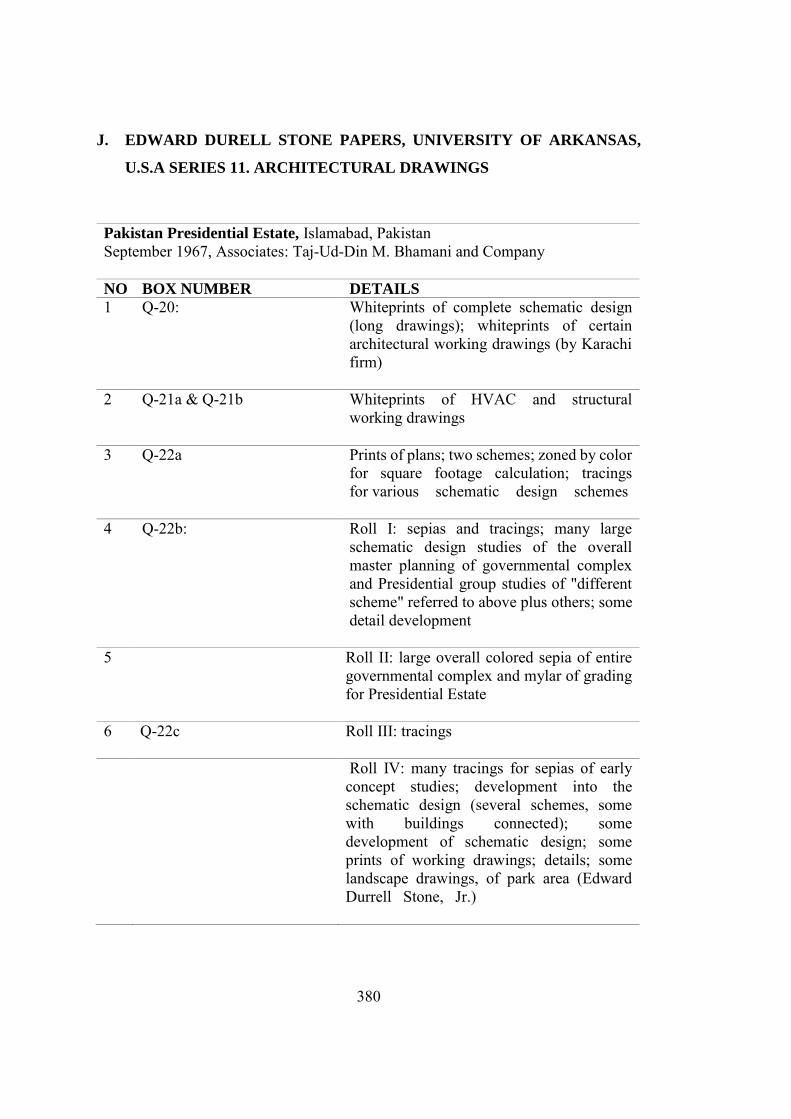
380
J. EDWARD DURELL STONE PAPERS, UNIVERSITY OF ARKANSAS,
U.S.A SERIES 11. ARCHITECTURAL DRAWINGS
Pakistan Presidential Estate, Islamabad, Pakistan September 1967, Associates: Taj-Ud-Din M. Bhamani and Company NO BOX NUMBER DETAILS
1 Q-20: Whiteprints of complete schematic design (long drawings); whiteprints of certain architectural working drawings (by Karachi firm)
2 Q-21a & Q-21b Whiteprints of HVAC and structural working drawings
3 Q-22a Prints of plans; two schemes; zoned by color for square footage calculation; tracings for various schematic design schemes
4 Q-22b: Roll I: sepias and tracings; many large schematic design studies of the overall master planning of governmental complex and Presidential group studies of "different scheme" referred to above plus others; some detail development
5 Roll II: large overall colored sepia of entire governmental complex and mylar of grading for Presidential Estate
6 Q-22c Roll III: tracings
Roll IV: many tracings for sepias of early concept studies; development into the schematic design (several schemes, some with buildings connected); some development of schematic design; some prints of working drawings; details; some landscape drawings, of park area (Edward Durrell Stone, Jr.)
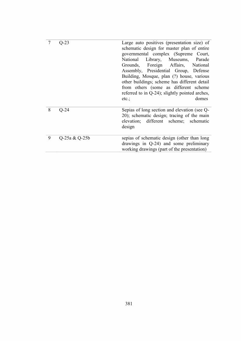
381
7 Q-23 Large auto positives (presentation size) of schematic design for master plan of entire governmental complex (Supreme Court, National Library, Museums, Parade Grounds, Foreign Affairs, National Assembly, Presidential Group, Defense Building, Mosque, plan (?) house, various other buildings; scheme has different detail from others (some as different scheme referred to in Q-24); slightly pointed arches, etc.; domes
8 Q-24 Sepias of long section and elevation (see Q-20); schematic design; tracing of the main elevation; different scheme; schematic design
9 Q-25a & Q-25b sepias of schematic design (other than long drawings in Q-24) and some preliminary working drawings (part of the presentation)
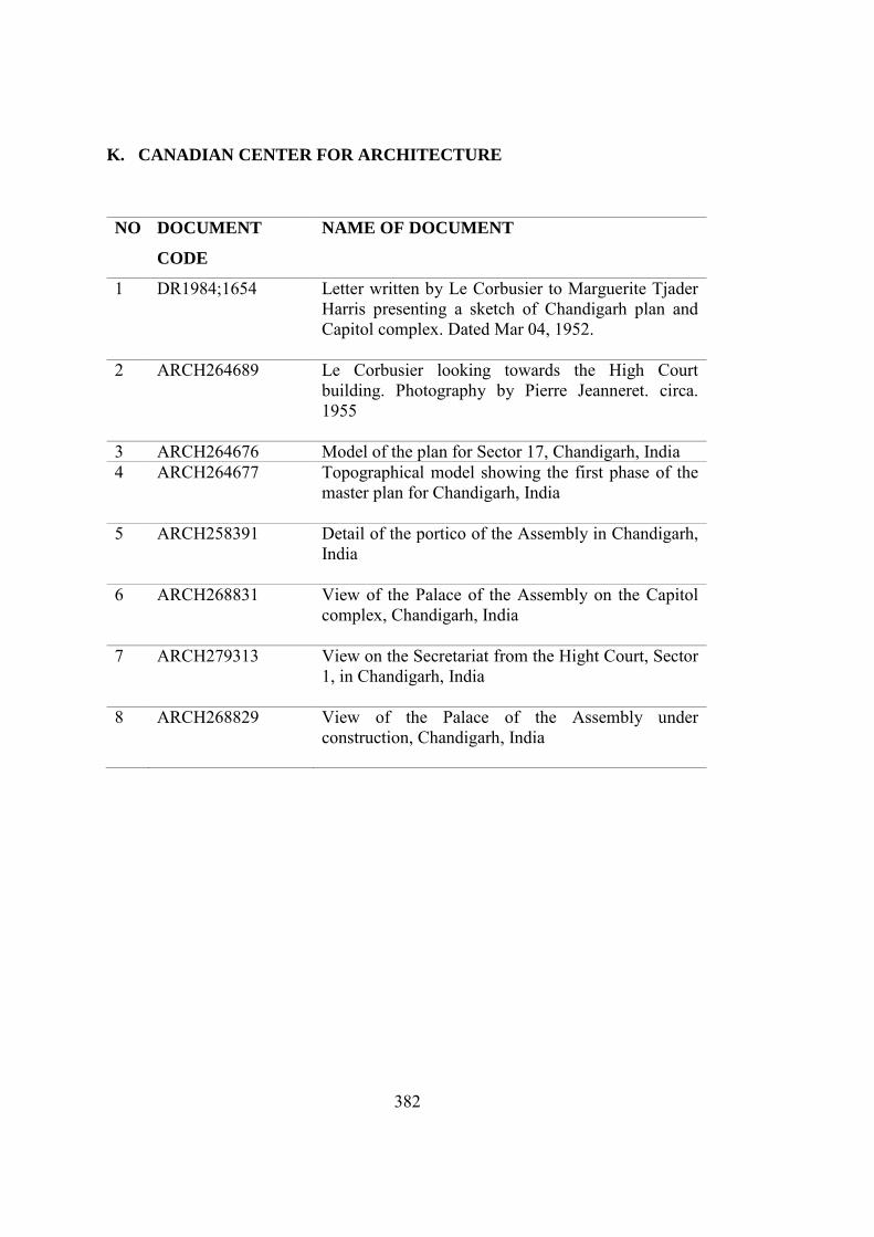
382
K. CANADIAN CENTER FOR ARCHITECTURE
NO DOCUMENT
CODE
NAME OF DOCUMENT
1 DR1984;1654 Letter written by Le Corbusier to Marguerite Tjader Harris presenting a sketch of Chandigarh plan and Capitol complex. Dated Mar 04, 1952.
2 ARCH264689 Le Corbusier looking towards the High Court building. Photography by Pierre Jeanneret. circa. 1955
3 ARCH264676 Model of the plan for Sector 17, Chandigarh, India 4 ARCH264677 Topographical model showing the first phase of the
master plan for Chandigarh, India
5 ARCH258391 Detail of the portico of the Assembly in Chandigarh, India
6 ARCH268831 View of the Palace of the Assembly on the Capitol complex, Chandigarh, India
7 ARCH279313 View on the Secretariat from the Hight Court, Sector 1, in Chandigarh, India
8 ARCH268829 View of the Palace of the Assembly under construction, Chandigarh, India
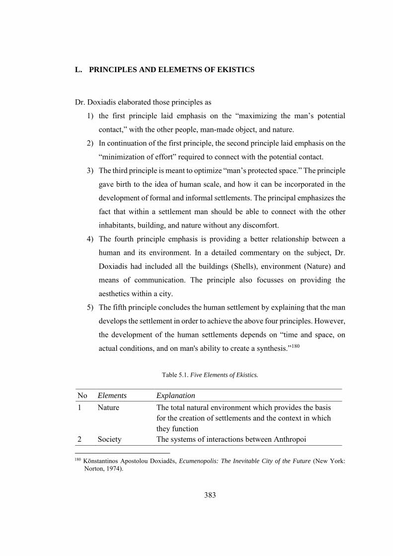
383
L. PRINCIPLES AND ELEMETNS OF EKISTICS
Dr. Doxiadis elaborated those principles as
1) the first principle laid emphasis on the “maximizing the man’s potential
contact,” with the other people, man-made object, and nature.
2) In continuation of the first principle, the second principle laid emphasis on the
“minimization of effort” required to connect with the potential contact.
3) The third principle is meant to optimize “man’s protected space.” The principle
gave birth to the idea of human scale, and how it can be incorporated in the
development of formal and informal settlements. The principal emphasizes the
fact that within a settlement man should be able to connect with the other
inhabitants, building, and nature without any discomfort.
4) The fourth principle emphasis is providing a better relationship between a
human and its environment. In a detailed commentary on the subject, Dr.
Doxiadis had included all the buildings (Shells), environment (Nature) and
means of communication. The principle also focusses on providing the
aesthetics within a city.
5) The fifth principle concludes the human settlement by explaining that the man
develops the settlement in order to achieve the above four principles. However,
the development of the human settlements depends on “time and space, on
actual conditions, and on man's ability to create a synthesis.”180
Table 5.1. Five Elements of Ekistics.
No Elements Explanation
1 Nature The total natural environment which provides the basis for the creation of settlements and the context in which they function
2 Society The systems of interactions between Anthropoi
180 Kōnstantinos Apostolou Doxiadēs, Ecumenopolis: The Inevitable City of the Future (New York:
Norton, 1974).
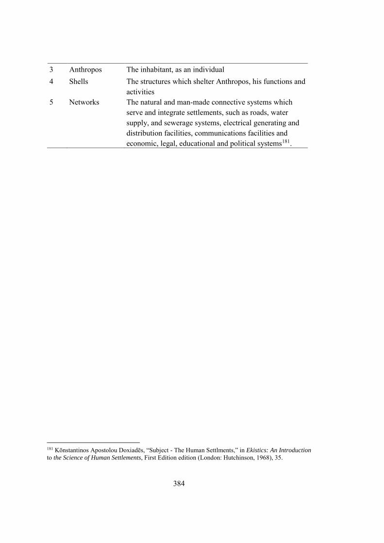
384
3 Anthropos The inhabitant, as an individual 4 Shells The structures which shelter Anthropos, his functions and
activities 5 Networks The natural and man-made connective systems which
serve and integrate settlements, such as roads, water supply, and sewerage systems, electrical generating and distribution facilities, communications facilities and economic, legal, educational and political systems181.
181 Kōnstantinos Apostolou Doxiadēs, “Subject - The Human Settlments,” in Ekistics: An Introduction
to the Science of Human Settlements, First Edition edition (London: Hutchinson, 1968), 35.
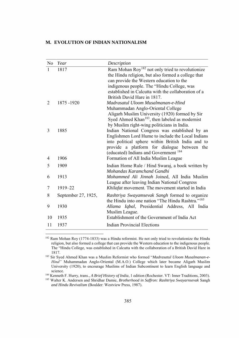
385
M. EVOLUTION OF INDIAN NATIONALISM
No Year Description
1 1817 Ram Mohan Roy182 not only tried to revolutionize the Hindu religion, but also formed a college that can provide the Western education to the indigenous people. The “Hindu College, was established in Calcutta with the collaboration of a British David Hare in 1817.
2 1875 -1920 Madrasatul Uloom Musalmanan-e-Hind
Muhammadan Anglo-Oriental College Aligarh Muslim University (1920) formed by Sir Syed Ahmed Khan183, then labeled as modernist by Muslim right-wing politicians in India.
3 1885 Indian National Congress was established by an Englishmen Lord Hume to include the Local Indians into political sphere within British India and to provide a platform for dialogue between the (educated) Indians and Government 184
4 1906 Formation of All India Muslim League 5 1909 Indian Home Rule / Hind Swaraj, a book written by
Mohandas Karamchand Gandhi 6 1913 Mohammed Ali Jinnah Joined, All India Muslim
League after leaving Indian National Congress 7 1919–22 Khilafat movement. The movement started in India
8 September 27, 1925, Rashtriya Swayamsevak Sangh formed to organize the Hindu into one nation “The Hindu Rashtra.”185
9 1930 Allama Iqbal, Presidential Address, All India Muslim League.
10 1935 Establishment of the Government of India Act 11 1937 Indian Provincial Elections
182 Ram Mohan Roy (1774-1833) was a Hindu reformist. He not only tried to revolutionize the Hindu
religion, but also formed a college that can provide the Western education to the indigenous people. The “Hindu College, was established in Calcutta with the collaboration of a British David Hare in 1817.
183 Sir Syed Ahmed Khan was a Muslim Reformist who formed “Madrasatul Uloom Musalmanan-e-
Hind” Muhammadan Anglo-Oriental (M.A.O.) College which later became Aligarh Muslim University (1920), to encourage Muslims of Indian Subcontinent to learn English language and science.
184 Kenneth F. Hurry, trans., A Brief History of India, 1 edition (Rochester. VT: Inner Traditions, 2003). 185 Walter K. Andersen and Shridhar Damie, Brotherhood in Saffron: Rashtriya Swayarnsevak Sangh
and Hindu Revivalism (Boulder: Westview Press, 1987).
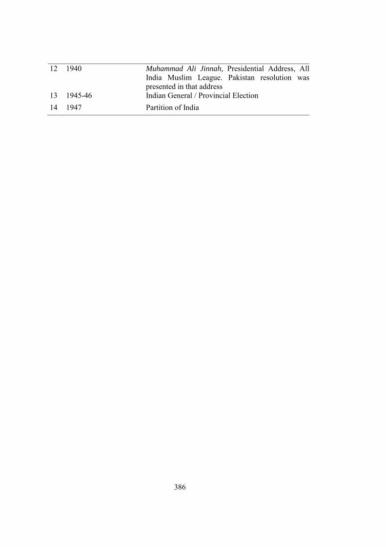
386
12 1940 Muhammad Ali Jinnah, Presidential Address, All India Muslim League. Pakistan resolution was presented in that address
13 1945-46 Indian General / Provincial Election
14 1947 Partition of India
387
CURRICULUM VITAE
PERSONAL INFORMATION
Surname, Name : Ahmed , Mansoor Nationality : Pakistan (PK) Date and Place of Birth : 19 August 1981, Rawalpindi, Pakistan Phone : +92 321 666 333 4 E-mail : [email protected]
EDUCATION
Degree Institution Year of Graduation
PGD. U.E.T., Lahore, Pakistan. Architecture 2010 B.Arch N.C.A., Lahore, Pakistan. Architecture 2004 High School Govt, Islamic College, Civil Lines, Lahore,
Pakistan. Pre-Engineering 1997
WORK EXPERIENCE
Year Place Enrollment
2012-Present COMSATS University Islamabad, Lahore Campus.
Assistant Professor
2010-2012 COMSATS University Islamabad, Lahore Campus..
Lecturer
2008-2010 Excel Construction Project Director 2006-2008 Wateen Telecom Architect
FOREIGN LANGUAGES
Advanced English, Native Urdu, Native Punjabi, Beginner Turkish.
PUBLICATIONS
1. Mansoor Ahmed. “Encapsulating the Translatory Attributes in the Formulation and Development of the Selected Modernist Building Constructed in Islamabad, Capital of Pakistan”, Creative Space, 4(2), 179–187. (2018).
2. Mansoor Ahmed. “Domesticating the Modernity: Architecture and Urban Development in the city of Islamabad.”, ICOMOS-GA, New-Delhi, India (2017).
388
3. Mansoor Ahmed. "Towards the development of a National Style: Encapsulating the Hybrid attributes in the (selected) works of Edward Durrell Stone in Pakistan," Urban and Architectural Translations in Modern Asia. Postgraduate Students Conference, The University of Hong Kong. (2016)
4. Mansoor Ahmed (2016) "Urban Myths and development of National Space," Political Imagination and the City, Santiago, Chile. (2016)
5. Mansoor Ahmed. "Lollywood and Lahore: A critical review of the cinema architecture in Lahore," THAAP Conference, Portrait of Lahore: Capital City of Punjab. (2011).
HOBBIES
Photography, Travelling, Sketching & Reading