e siege of the south pole - forgotten books
TRANSCRIPT


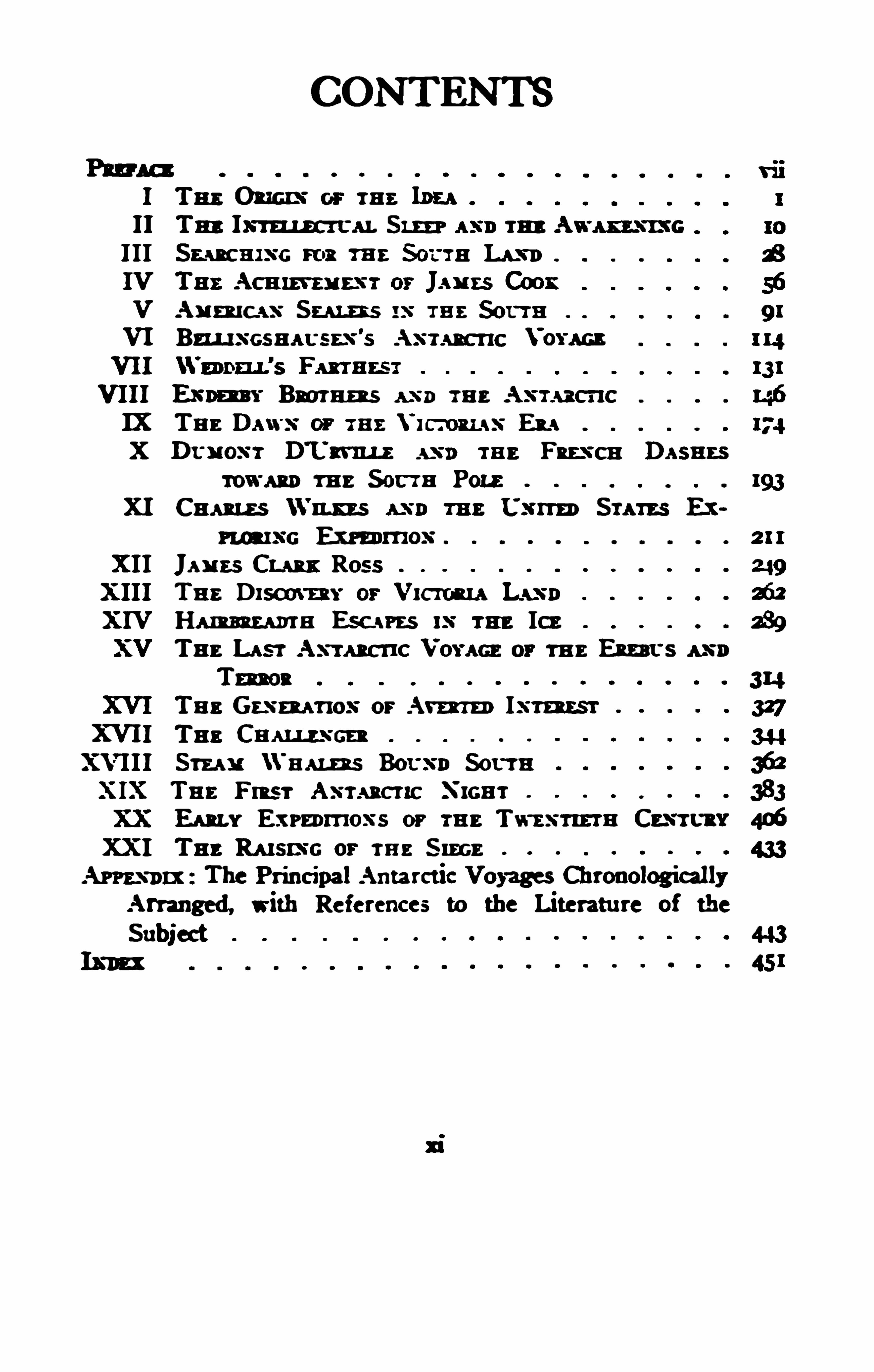
TH E RAMPARTS OP Tm: so0m Pow .
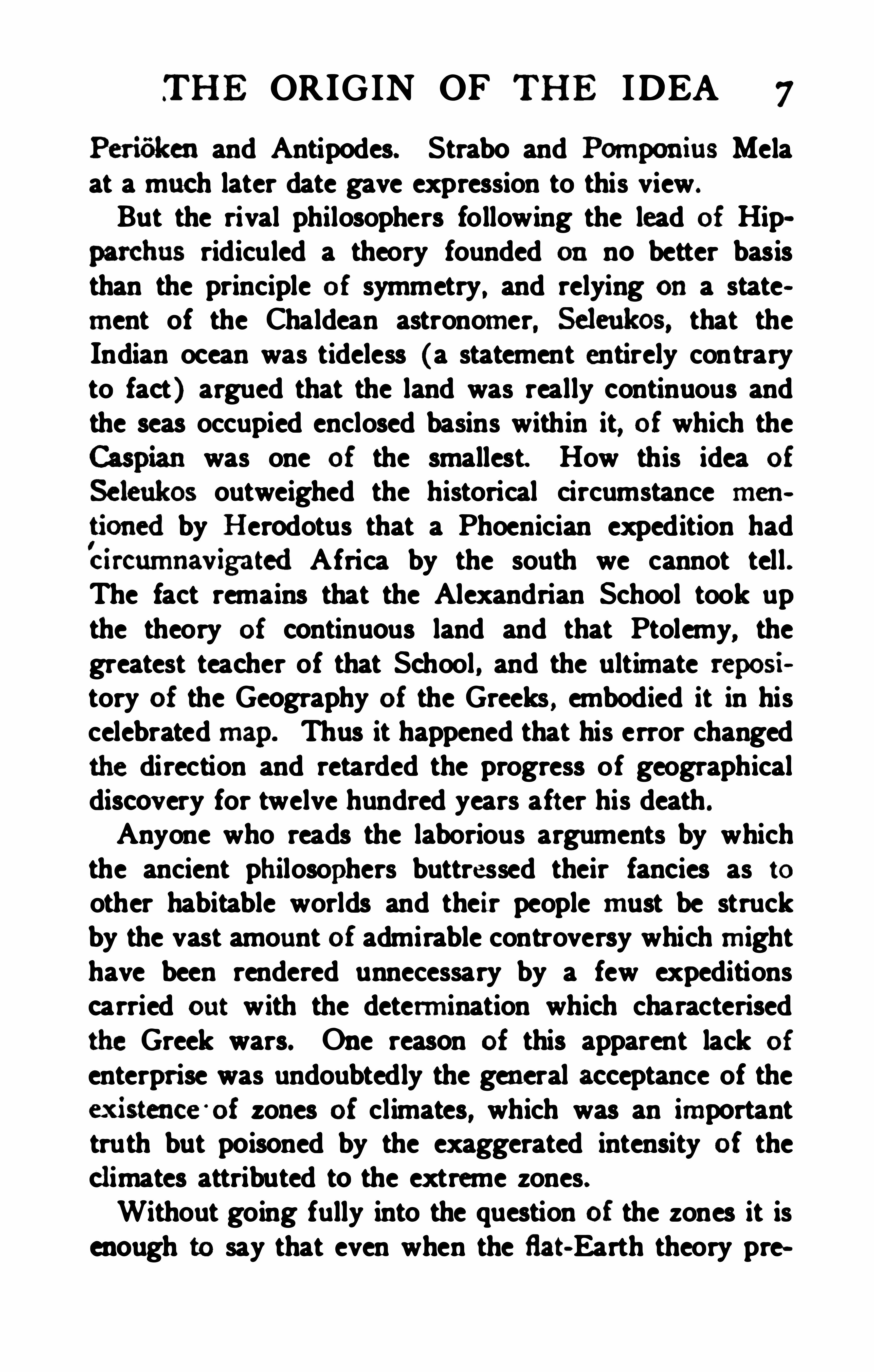
(Photograph suppliedby Professor PI. von Drygalski. )


E SIEGE OF THE
SOUTH POLE
THE STORY OF
ANTARCTIC EXPLORATION
HUGH ROBERT MILL,
B .Sc .
WITH MAPS . DIAGRAd, AND OTHER
ILL (l5d TION S
AND MAPS BY J. c . BARTHOLOMEW
LONDON
A L ST O N R I VE R S , L xmn'
zn
Amman. Srm '
r, W.C.
I90S


70
MY MOTHER
WHOSE LOVE OF NATURE LED ME TO SCIENTIFIC STUDY
AND TO
MY WIFEyou an UNFMU NG new
PRE FAC E
HIS book has been the bu rden of the holidays ofthree years—in Switzerland, in Scotland, and in
the United States—and it expresses the result of themding of thirty. Though I have never been withintwo thousand miles of the Antarctic Circle it has been
all, or almost all , the living ex plorers and promoters of
privileged to speed the parting ships of every Antarcticexpedition which left a British port, from the sailingof the Dundee fleet in 1892 to that of the Terra Nova, in1903 , though to my regret oneach occasion I shared theu fate of the stowaways, andwas landed beforemy nafive shores were left behind, or at the farthestbefore thetropics were reached.
I have based this history of Anc exploration as
donof the mm who themselves took part in it. In thisrespect I owe a special debt to three : to Sm JOSEPH
f the last survivor of the Erebus, who, in additionto much other ldndness, has read the proofs of the earlierchapters, including those dealing with Sir James Clark
lenger, whose friendship and scientific guidance for morethan twenty years have hem the most effective permof my
N EUMAYER, the charm of whose personality andthe
vii i PREFACE
enthusiasm of his devotion to South Polar problems havebeen a continual inspiration.
In trying to elucidate the origin as well as to describethe events of the various expeditions, I have assumed thatfrom the historical point of view the motive and the aimare as important as the resulting achievement or failure .The story is told to the best of my power with an impartialmind, and scrupulously follows the facts ; if any error hasbeen made as to the narrative it is a mistake and not dueto any bias. Where an opinion is expressed that Opinionis my own, and though I consider it right it may possiblyseem wrong to some.The two introductory chapters dealing with voyageswhich fell short of the Antarctic Circle are designedlybrief and uncritical. In them I have stated the viewsof those whom I consider to be the best authorities . Thedescript ions of exploration from the voyage of the Resolutionto that of the Challenger are more detailed because,ex cept for Cook’s voyage, the narratives drawn upon arealmost all out of print and difficult to consu lt. The latervoyages are touched on lightly, for each is described inone or several authoritative narratives recently published,and to be found everywhere. The names of these worksare given in the Appendix.
In selecting and arranging for the illustrations I havebeen greatly helped by the Editor of this series, my oldcolleague, DR. J . Scor'
r Kenna. The unique picture ofAdmiral Bell ingshausen was secured by the kind rept escutations made to the Head of the Russian Admiraltyby my friend Coroner. J. as S HOKALSKY of St. Petersburg. Cm a mR F. Scan of the Discovery. PnorsssonE . vowDnvoaw x r of the Gauss, Du. Or'ro Normans iiLo of the Antarctic, M. Aegrowsx x of the Belgica,
PREFACE ix
andMn. W . S. BRUCE. of the Scotia, have generouslyallowed photographs taken by them to be reproduced.Cm mu Soon and MR. Bnuca have also been kindenough to read the proofs of the portions of Chapter XXdealing with their expeditions. There are manyothers to whom I am grateful for help. especially my friends Ms. E. Hu wooo, Librarian of theRoyal Geographical Society, whose patience I have toofrequently called into lively exercise, and Mn. J . G.
a '
rnow u ew for his cooperation in the preparation ofthe maps ; to Cam-
x xx A. Mos'u mFIELD, the Hydrographer to the Admiralty, who kindly aided me in settlingseveral historical points, and to Me. P. L. DAVIS, of theNautical Almanac Office, for a copy of the valuable letterwritten by his father, the late Captain Davis, R. N . , whenon the Terror.This book does not profess or attempt to describe theAntarctic Regions or their pecul iar conditions ; it ismerely the record of an uncompleted episode in thehistory of geographical exploration.
H. R. M.
Camden Square,Lom u . N. W. ,

CONTENTS
I Tn: 02mm or rm: Inn11 Tm:1m m. Sam a x nrm:Awax zx ntcIII S eaman'
s ms nu : Sor t a Lam)IV Tm: Acnm nz x r or Janns CoonV Aum c x x S u m s xx rm: SerraVI Bzu ax csnac szx
’
s A x rncnc Voraca
VII
VIII E x pw r a ns a x a m a A x rn cnc
IX Tn: Dan'
s or 78 2 Vi cmu ss E u
X Dt nox r D'
L'
x rmz x x x: rnz Fnzx cn Dasnns
rowan m 2 S or t a PomXI Cum a zs x x nm 2 L
'
x rrm Su ms Ex
rumx c Exm mox
XII Janas Cum: Ross
X III Tm: Drsann r or m a LAN DXIV Ham mn Esc srzs rm; Icz 239
Tu e Lasr As t ana -
1c Voracz or m e Ent er s as»
Tm on
Tna s m ‘nox or Arm Ix m rs r
XVII Tn: Cnx u z x cn
XVII I Sm : “h am s 30a Sorrn
Tm»: Fmsr A x rncrxc N rcnr
Emu E x rznmox s or runTwas -man s t cmr
XXI Tn: Ru srx c or m e S ince
The P rincipalAntarct ic Voyages Chronologia llyArranged, with References to the Literatu re of the
SubjectIx m

ILLUSTRATION S
Polar Regima. Coloured Map byEndof Volume
Pole. (PhotographDrygalski. ) Frontirpiece
z
4
Awarding to
cs
Sphencal ith no Antxpodes.
According to Cosmas Indioopleustes .
of the Twelfth Century. (From Nor
24
Southern Hemisphere.Facsimile Atlas . )(Photograph 50991534
mm Cook'sFacing p. 7:
Isle of Georgia. (From.
Cook’sVoyage ”)of the Isle oi Georgia
sland. one of the South Shetlands.D'
Urville’s Atlas.)x iii
x iv ILLUSTRATIONS
Powell’s Chart of the South ShetlandsV The Meeting of Palmer andBellingshausen.
AdmiralBellingshausen. (From a Portrait intheLibrary of the ImperialNavalDepartment inS t. Petersburg. )
The Vostok andM imi off Macquarie Island.(From Bellingshausen
'
s Allan) .
Peter I. IslandandAlex ander I. Land. (FromBellingshausen
’
s A tlas . )
v James Weddell. (From a Painting m the Libraryoi the RoyalGeographicalSociety.)
Weddell's Seal, Laplanydwles Weddelli. (I)FromWeddell's “Voyage Towards the SouthPole.” (2) From the British Museum Re
ports on the Southern Cross Collections ”
V The Jane andBeau foy at Weddell’s Fartheet.(From Weddell’s “
Voyage Towards the
South Pole ”)V The Balleny Islands (From a Sketch by John
McN ab.)General S ir EdwardSabine, K. C. B. (From a
Painting inthe Rooms of the Royal Society. )
I BaronvonHumboldtSynoptic Diagram of the Early Victorian E x pedi
V Admiral Dumont D'
Urville. (From D’
Urville’
s
Atlas . )The Astrolabe andZelec in the Ice. (From
V D'
Urville'
s A tlas.)
VD
'
Urville’s E x pedition Arnongst the Ice Islands.(From D'
Urville'
s Atlas. )isting the French Flag on Adelie Land.(From D’
Urville’
s A tlas.)eutenant Charles Wilkes, U. 5. Na Command»ing the United S tates E x ploring Ex pedit ion.
(From the Narrative oi the Ex pedition)VRinggold’s Knoll. (From the Narrative of the U.

x vi ILLUSTRATION S
H . M. S. Challenger after Collision with an Iceberg. (From the Challenger Narrative. )
Lieu tenant A. de GerlacheTypical Landscape of the Palmer Archipelego.
(w aph by
.
the Belgian Antarctic Ex pe
by Messrs. Thomson, London. )Synoptic Diagram of the First Two E x peditionsWintering in the Antarctic
Penguins. near Cape Crazier. (Phbtograph sup
pliedby Captain Scott.)Bouvet Island. (Photograph Taken onBoardthe
S ir Clements R. Markham. K. C. B. (Photograph by Messrs. Thomson. London. )
(Photographby Messrs. Thomson, London. )
The Discovery Alongside the Barrier. (Photograph suppliedby Captain Scott.)
McMurdo S trait. (From a Photograph taken bythe NationalAntarctic Ex pedition.)
Professor Erich von Drygalslti. (Photographby Messrs. Thomson, Inndon.)
The Gauss under Sail. (Photograph suppliedby Professor E . van Drygalslri. )
The Gaussberg, Kaiser Wilhelm II. Land. (Photograph suppliedby Professor E vanDryv
Dr. Otto NorderiskjbldThe Antarctic in CumberlandBay. South Georgia.
(Photograph suppliedby Dr. Otto Nor
William S . Bruce. (Photograph by Messrs.Thomson. London)
The Scotia in the Pack. (Photograph supplied
Synoptic Diagram of the First Antarctic Ex peditions of the Twentieth Century
Siege of the Sou th Pole
CHAPTER I
“A wanderer is Man from his birth.
He m bornina ship on the breast ofn
the river of TimeBrimming with wonder andjoy
GES towards the Sou th Pole oommencedsoago. andthey have ex ercisedan influenee cm
the trendof ex ploration so continuously, that a eom~
plete history of the search for the Antarctic wmildahnostbe a history of geographicaldiscovery.
variedfmm age to age as the specialproblem it was ex
pectedto solve has changedwith the growth of lmowledge andthedevelopment of thought. Whenfirst stated
men. It grew to be a buming question in the struggle
It was a foree in empire- bu ilding , with the Conunon
wa ldl of Australia as a pr-oduct of its partial sohrfion.
ous lives of the circumnavigators ; but a time of renewedinterest of a quieter sort has eome whenit is particnlarlyappropriate to turn a backwardglanee towardthe be

2 S IEGE OF THE SOUTH POLE
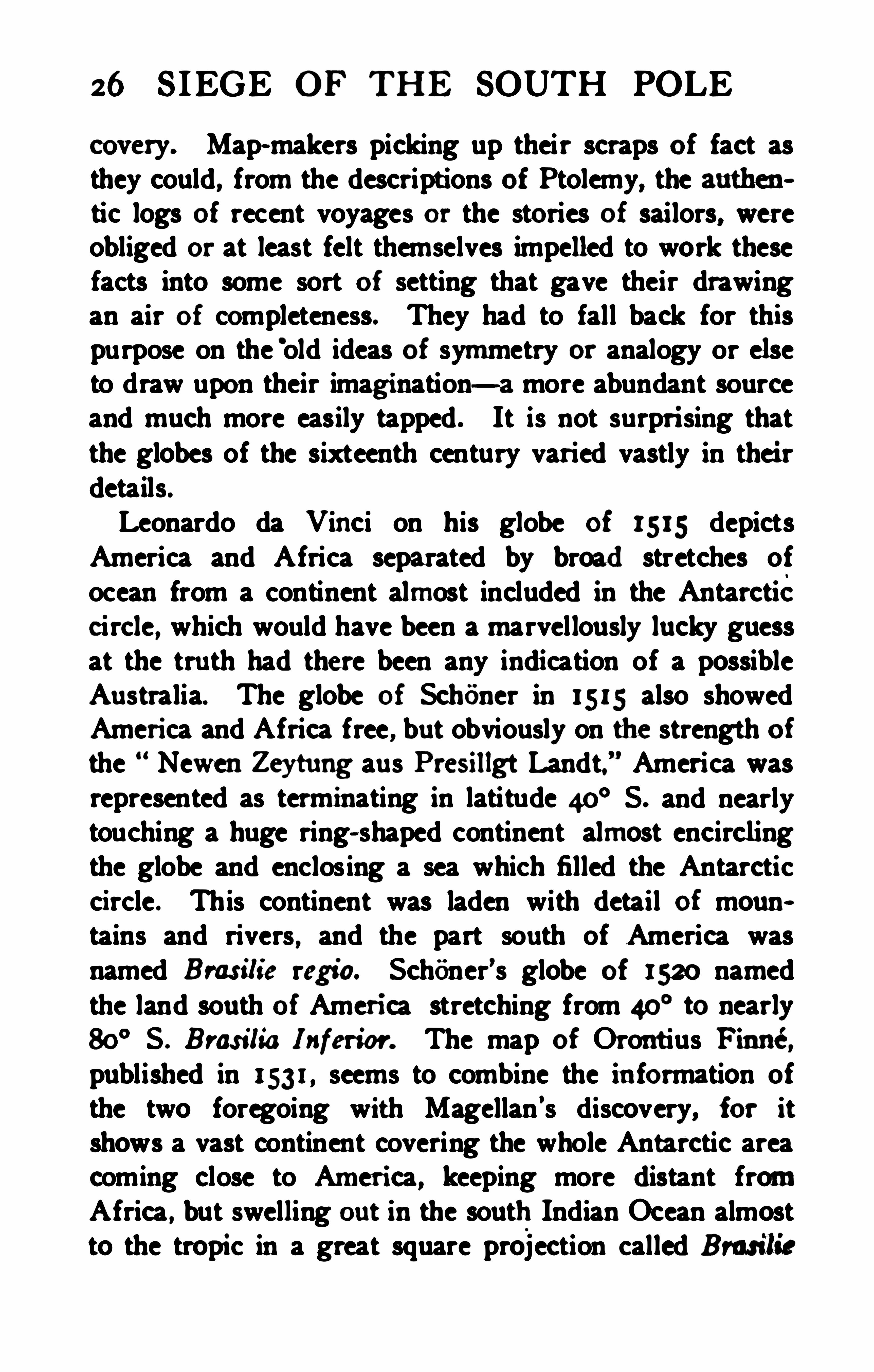
The Antarctic problem has now crystallised into . anobject of scientific research, the results of which mayindeed become practically useful , but in a manner toouncertain andremote to be a leading motive. Its solution has been reduced to the result of exploration in theice
,and the final result will round out the knowledge of
the globe into completeness and will leave no spot of
Tax Won.»Aoooamx c ro Hones. B.C. 1000.
Earth unknown . When the story of the Antarctic can befully told Terra Incognito will cumber the map no more .At the dawn of geographical history an antarctic problem was impossible because the Earth was viewed as aflat disc girdled by the Ocean River and bounded bydarkness. Curiously enough the name became possiblebefore the idea. When the early Greek students of thestars, looking ou t hour after hour and night after nighton the wheeling vault overhead , classified the brightest
(TH E ORIG IN OF TH E IDEA 3
points into groups or constellations they named the mostconspicuous of these which never set Anton—the Bearand the point round which it, in common with the rest ofthe heavenly host, appeared to turn was called the Arcticpole. The natural antithesis of an antarctic pole of theheavens, that is, a fix ed point opposite the arctic, musthave occurred to many minds , for it was easy in imagination to complete the sphere of the celestial vault, tracedout in part by the unseen portion of the circu it of thestars, but the flat cake of the habitable world stretchedbetween, separating the domain of light and possibleknowledge from that of darkness and the unknowable.The dark and gloomy space under the Earth traversedonly by the souls of the dead ontheir way to Hades, wasknown as E rebus, a place of terror, used ages later byShakespeare as a fit metaphor for the manthat hadnomusic in his sou l .We cannot attempt here to discuss all the modern viewsas to the growth and decay
‘
of the ancient theori es towhich we must refer, but from the immense literaturewhich has flourished upon the resulting soil we will attempt to show how the mind of all ages has exerciseditself upon this particular problem . The narrative is notcritically exact, for it claims only to afford a basis onwhich the efforts of modern explorers may be seen intheir relation to the gradual unfolding of human knowledge regarding the Earth.
Herodotus made merry over the absurdity of the rounddisc of the habitable Earth put forth in the descriptions ofHeeatz us. As a traveller and a lover of truth he knewthat travellers had been able to get farther from west toeast than from north to south about the Mediterranean asa centre, and he was content with this knowledge .
4 S IEGE OF THE SOUTH POLE
Th e apecnlations of the Pythagora nphiloaophers were
of the Earth being a sphere beeanse the sphere was the
moat perfect form, andthe ahode o m the perfecfionof
creationonght also to be perfect of its kind. Inthis oon
made large use of it intracing out the eourse of the rivers
of Africa by comparisonwith thoee of Europe. Ii the
Worldeouldoccupy only a smallport ionof its surfaoe.
Was the Oeu nRiver to be ex tendedinto a hnge eontinu
oua sbeet enveloping all the rest ? The idea was con
the mindeouldnot otherwisedwell in comfort. If the
new fonnof the Earth oouldbe entertainedby reasonable
people there was no reasonwhy there shouldnot be an
other Habitable Worldunder the Antarctic pole of the
heavens to balanee that which lay under the Arctic pole.
So with the possibility of a sphericalEarth the Antarctic
It is a far cry from a poetical fancy to anestablishedfact. Many minds could entertain the fancy, howevernovel it might be, but only one or two inall the ages of
humanhistory emxldtest the fancy as to whether it was
fact ornot. Aristofle the intenectualgiant who foundedso much of modern science, demonstrated the truth ofthe spherical form of the Earth andsome of his proofs
enunciatedthree anda half oenturies before the beginning of our era stillholdtheir place inthe school- booksof to-day. According to Aristotle the Earth was a sphere


6 S IEGE OF THE SOUTH POLE
at noon , there was no such easy method of finding longitude, because there was no time- keeper by which a traveller could carry with him the time of an initial meridian.The instruments for finding latitude were also clumsy inthe extreme, and the method most in use for centurieswas that of noting the length of the longestday. It wasdifficult, for these reasons , to lay out a line due north andsouth, the ends of which could be fixed with any precisionin order to measure the size of the Earth ; hence it isamazing how very near the estimate of such a mathematicianas Eratosthenes came to the truth .
When the shape and size of the Earth became knownthe main problem of geography was completely altered ;it was no longer the question of the possibility of anantarctic region existing ; but the possibility of reachingit. The problem, in fact, was the wider one of thedistribution of land and water, of cl imate and the meansof travelling, the antarctic problem of to- day being butthe unsolved residue of the larger problem.
The estimates of Eratosthenes (about 250 B. C.) madeit apparent that the Habitable World of the Greeks ocenpied only about one- quarter Of the surface of the sphere.It seems a limited World to us, though vast enough tothose whose swiftest means of transport were the horseand the galley. Controversy was active amongst theGreek philosophers as to the plan of the Earth. TheStoics upheld the continuity of the ocean and viewed theHabitable World as one out of four large islands placedsymmetrically upon the sphere, one to balance the other.Nature loved life , so those three unknown Worlds werealso inhabited and it was easy to fit the hypothetical peoples with appropriate and expressive names according totheir position with regard to the Old World, the Antc
'
ilcen,


TH E ORIG IN OF THE IDEA 7
Perir'
iken and Antipodes. Strabo and Pomponius Melaat a much later date gave expression to this view .
But the rival philosophers following the lead of Hipparchus ridiculed a theory founded on no better basisthan the principle of symmetry , and relying ona statement of the Chaldean astronomer, Seleukos, that theIndian ocean was tideless (a statement entirely contraryto fact) argued that the land was really continuous andthe seas occupied enclosed basins within it, of which the
was one of the smallest. How this idea of
Seleukos outweighed the historical circumstance mentionedby H erodotus that a Phoenician expedition hadbircumnavigatedAfrica by the south we cannot tell .The fact remains that the Alexandrian School took upthe theory of continuous land and that Ptolemy, thegreatest teacher of that School , and the ultimate repository of the Geography of the Greeks , embodied it in hiscelebrated map. Thus it happened that his error changedthe direction and retarded the progress Of geographicaldiscovery for twelve hundred years after his death .
Anyone who reads the laborious arguments by whichthe ancient philosophers buttressed their fancies as toother habitable worlds and their people must be struckby the vast amount of admirable controversy which mighthave been rendered unnecessary by a few expeditionscarried out with the determination which characterisedthe Greek wars. One reason of this apparent lack of
enterprise was undoubtedly the general acceptance of theex istence '
of zones of climates, which was an importanttruth but poisoned by the exaggerated intensity of theclimates attributed to the extreme zones.Without going fully into the question of the zones it isenough to say that even when the fiat-Earth theory pre
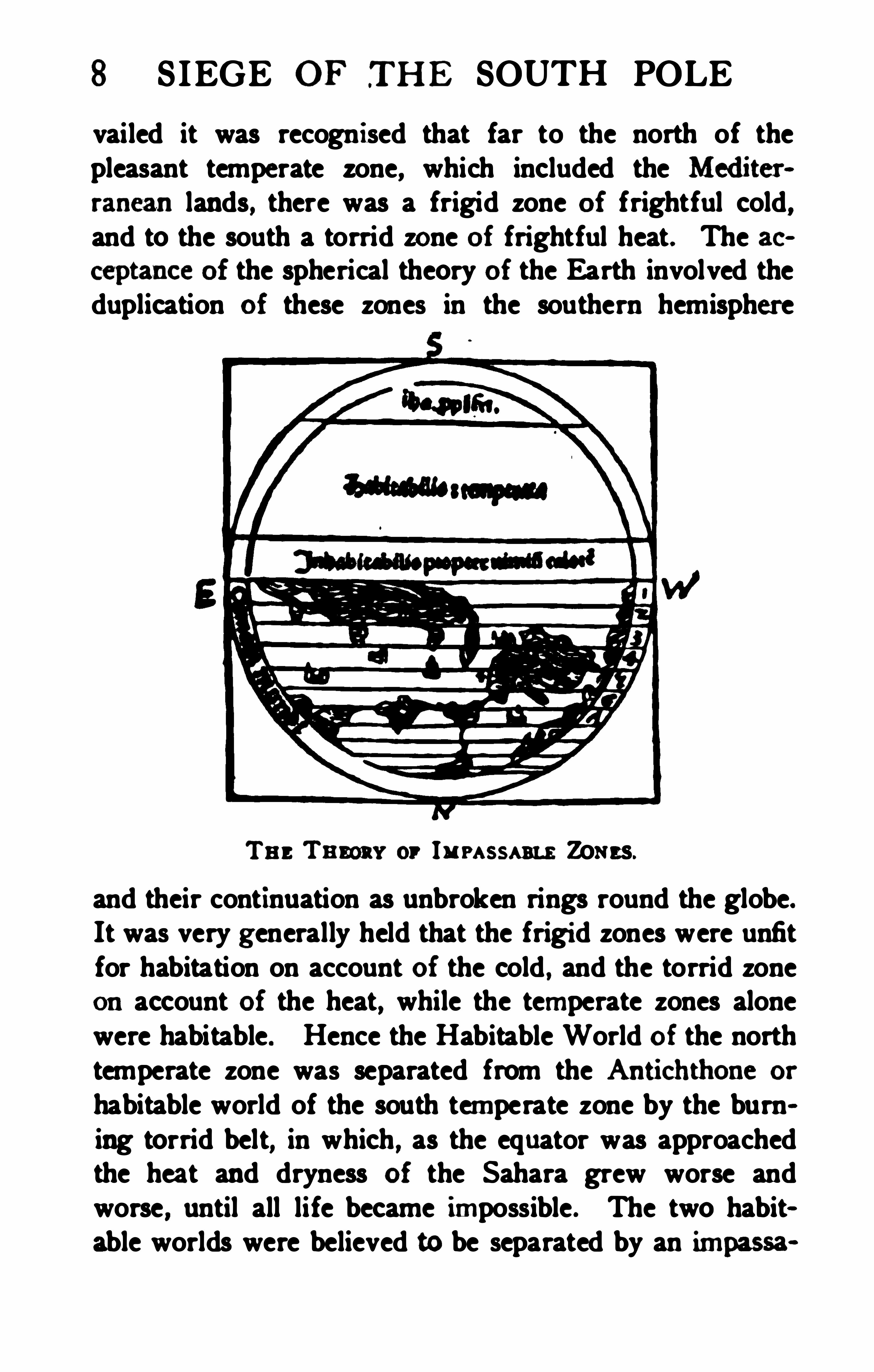
8 SIEGE OF TH E SOUTH POLE
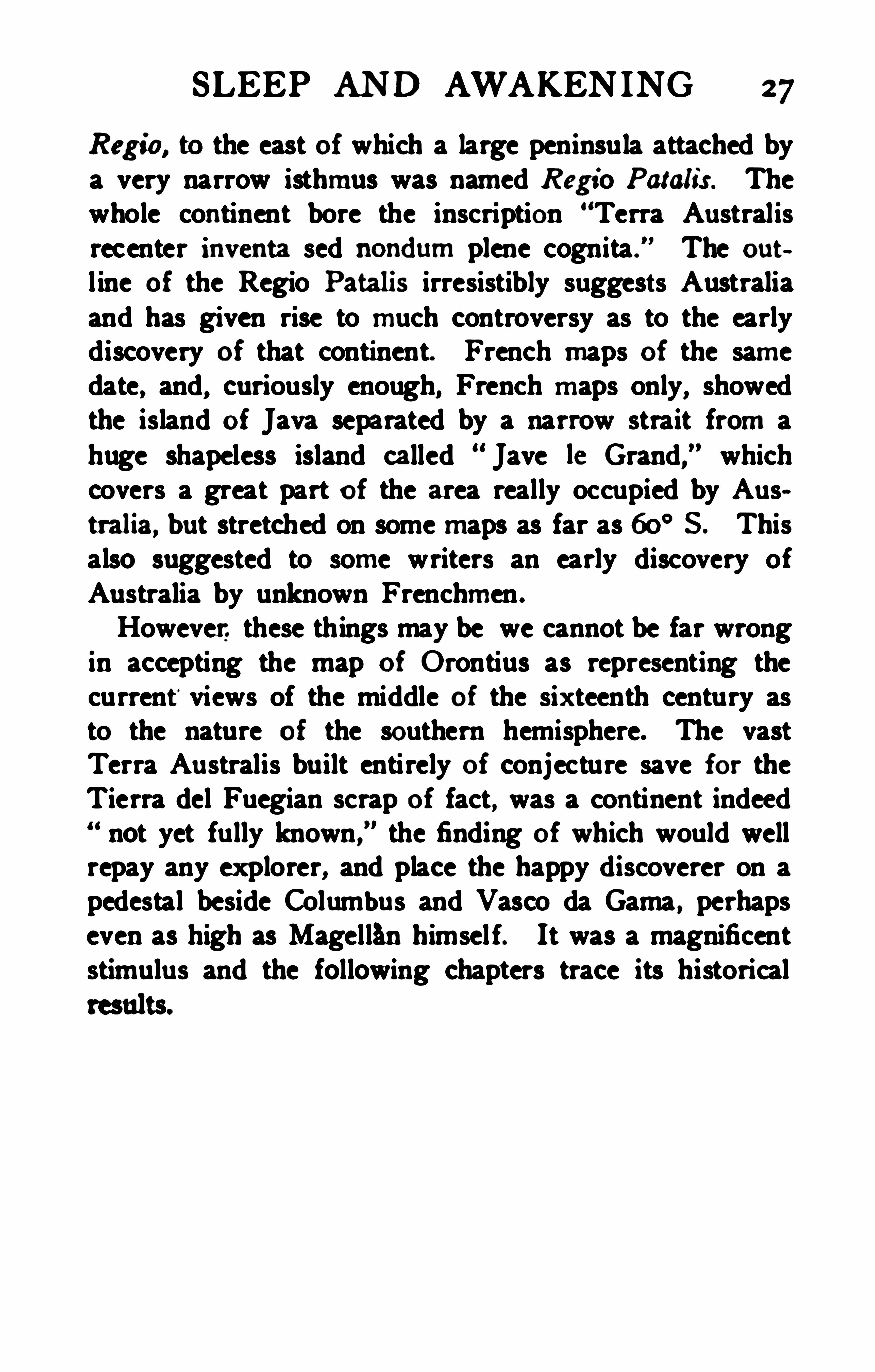
vailed it was recognised that far to the north of thepleasant temperate zone, which included the Mediterranean lands, there was a frigid zone of frightful cold,and to the south a torrid zone of frightful heat. The acceptance of the spherical theory of the Earth involved theduplication of these zones in the southern hemisphere
Tn: Tamar or lu rassam Zones.
and their continuation as unbroken rings round the globe.It was very generally held that the frigi d zones were unfitfor habitation on account of the cold , and the torrid zoneon account of the heat, while the temperate zones alonewere habitable. Hence the Habitable World of the northtemperate zone was separated from the Antichthone or
habitable world of the south temperate zone by the burning torrid belt, in which , as the equator was approachedthe heat and dryness of the Sahara grew worse andworse , until all life became impossible . The two habitable worlds were believed to be separated by an impassa


CHAPTER II
THE INTELLECTUAL SLEEP AND TH E AWAKEN ING
Let things be—not seem.
I council rather,—do, andnowisedream!Earth's young significance is allto learn :ThedeadGreek lore lies bu tiedinthe urn
Where who seeks fire finds ashes.—Roam Bnowmnc.
.THER interests filled the troubled Middle Ages, theGreek language with the works of Aristotle and
Ptolemy were almost forgotten in Christendom , andthe resu lts of Greek learning were kept alive only in theMoslem world . The Antarctic problem disturbed noman ’s rest, and fired the fancy or adventure of no one.The churchmen detected a fruitful source of heresy inthe idea of a spherical Earth, and after a while found itcontrary to Scripture ; but it is pleasant to note that theVenerable Bede maintained the true view in England .
In the first enthusiasm of Christianity worldly knowledgewas brushed aside as not being essential to salvation.
St. Basil , who did not himself deny the sphericity of theEarth , said :Of what importance is it to know whether the Earth
is a sphere, a cylinder , a disc or a concave surface ?What is of importance is to know how I should conductmyself towards mysel f, towards my fellowman andtowards God .
"
Perhaps it was the belief in Antipodes, human beingsinhabiting the side of the Earth opposite to the known
10
SLEEP AN D AWAKENING I I
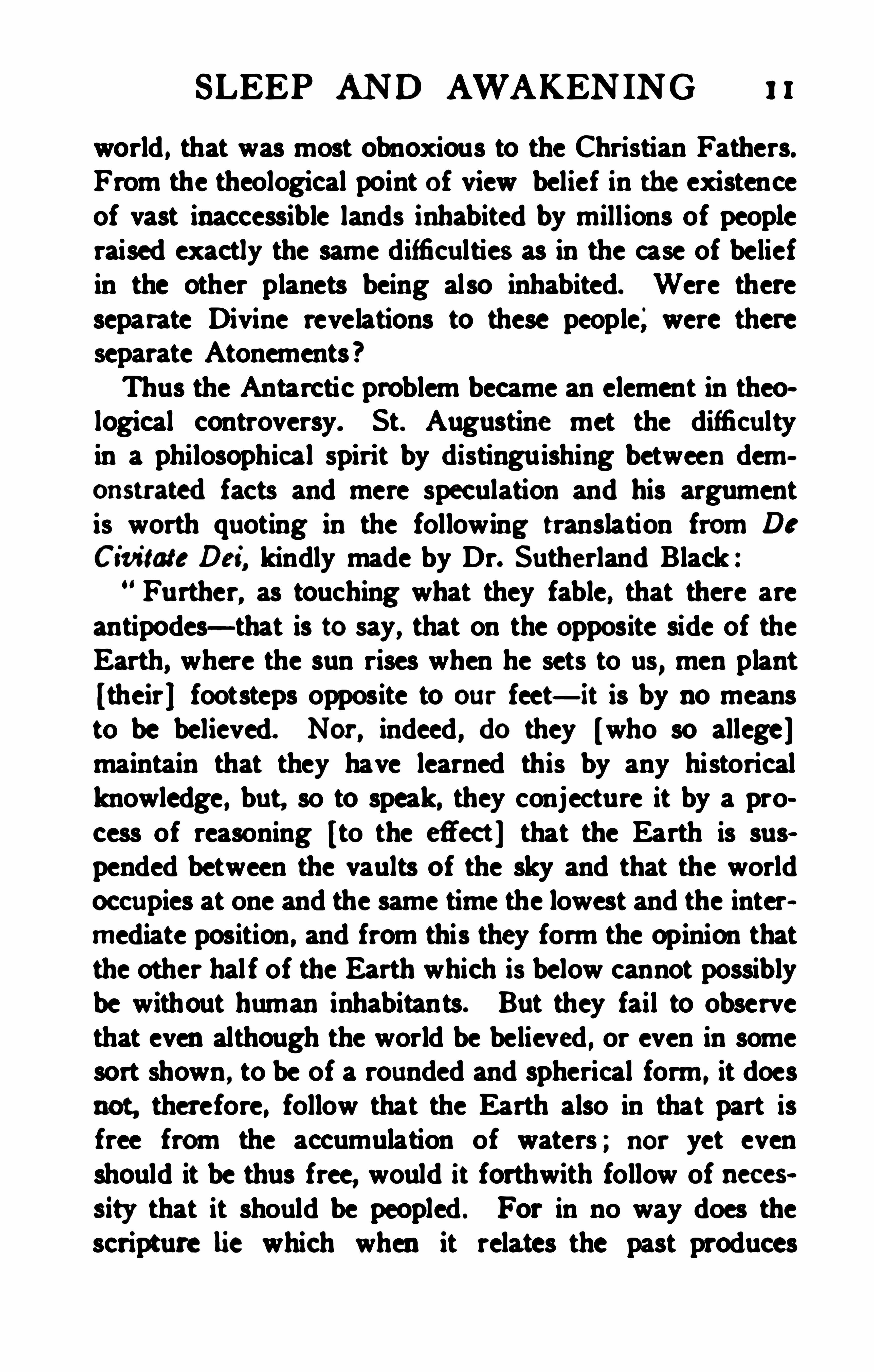
world , that was most obnoxious to the Christian Fathers.From the theological point of view belief in the existenceof vast inaccessible lands inhabited by millions of peopleraised exactly the same difficulties as in the case of beliefin the other planets being also inhabited. Were thereseparate Divine revelations to these people; were thereseparate Atonements ?Thus the Antarctic problem became an element in theological controversy. St. Augustine met the difficultyin a philosophical spirit by distinguishing between demonstratedfacts and mere speculation and his argumentis worth quoting in the following translation from DeCivitate Def, kindly made by Dr. Sutherland Black :Further, as touching what they fable, that there are
antipodes—that is to say, that on the opposite side of theEarth, where the sun rises when he sets to us, men plant!their] footsteps opposite to our feet—it is by no meansto be believed. Nor, indeed , do they !who so allege]maintain that they have learned this by any historicalknowledge, but, so to speak, they conjecture it by a process of reasoning !to the efiect ] that the Earth is suspended between the vaults of the sky and that the worldoccupies at one and the same time the lowest and the intermediate position , and from this they form the opinion thatthe other hal f of the Earth which is below cannot possiblybe without human inhabitants. But they fail to observethat even although the world be believed , or even in somesort shown , to be of a rounded and spherical form , it doesnot, therefore, follow that the Earth also in that part isfree from the accumulation of waters ; nor yet evenshould it be thus free, would it forthwith follow of necessity that it should be peopled . For in no way does thescripture lie which when it relates the past produces
12 S IEGE OF TH E SOUTH POLE
confidence inthat its predictions are being fulfilled, anditis too absurdthat it shouldbe saidthat certainmenhadbem ablq the hnmensity of Oca nmversedto sailfrom
world might mm
SLEEP AND AWAKEN ING 13
ological difficulty was arrived at the spherical Earth wasbanished from Christendom on the plea that it was incontradiction to Scripture.
ceptionas a spherical Earth, and without using any argummt save It is written he denounced the whole
monk who had travelled to India and could not reconci lehis ownobservations with a flat Earth, set himself in thesixth century to the hopeless task of constructing anEarth ou t of his ownhead on the model of thetabernacle with a prodigious conical mountainmidst for the sunto rise from and set behind.
Itthat inthe mind of Europe the Earth became once moreas flat as a pana ke, and the wheel-maps of the MiddleAges reverted to the ci rcular disc of the earliest Greeks.
u,SIEGE OF THE SOUTH POLE
had been crushed out of existence . How serious theheresy was m y be gathered from the fact that in theyear 74: Pope Zacharias excommunicated an Irish priestnamed Virgil because he taught the doctrine of Antipodes “ admitting the existence of sou ls who shared
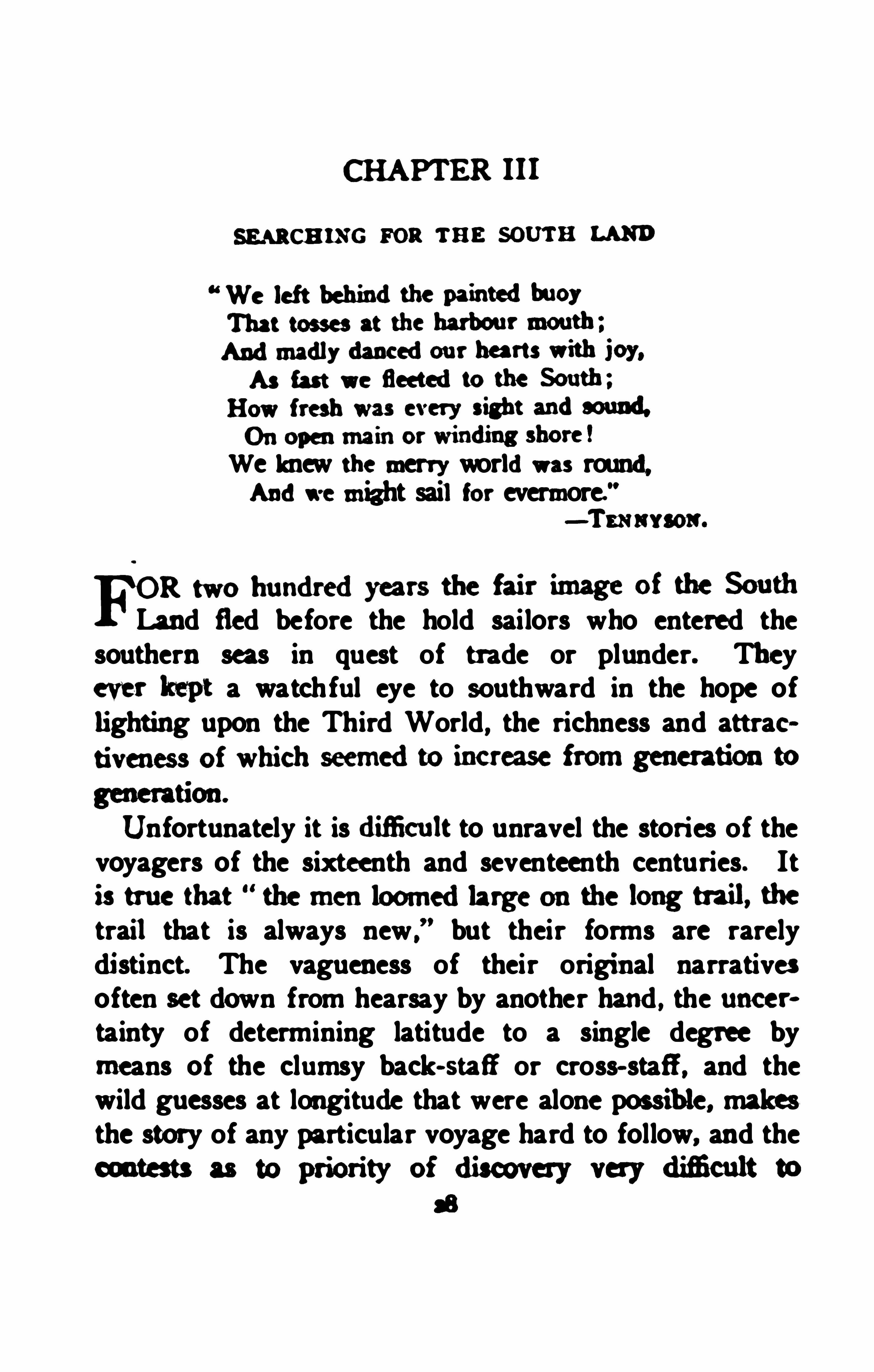
Wm Mu or m e Twun a Cam-
on.
(FromNordenskiéld’s Facs imile Atlas.)
neither the sin of Adam nor the redemption of Chri st ”
The bold Irishman probably recognised the truth ofAugustine's argument and thought it unnecessary to suf
SLEEP AN D AWAKENING 15
fer to the utmost in support of a speculative fancy , forafter twenty years he was consecrated Bishop of Salzburg, a pretty strong proof of his recantation .
The reign of Papal authority lasted long, but fromtime to time the ancient ideas found expression . P tol
emy’s views leaked back into current thought from thetenth century onward through the Arabic translationsbrought to Europe by the Moors and made known bythe writings of Isidore of Seville. Occasionally a speculative monk in drawing a wheel-map extended it far heyond the limits of the Old World, and like Macrobiusrepresented some possibility of a southern temperate andeven of a southern frigid zone. Speculation revived asto the existence of Antipodes to the west as well as Antipodes to the south. Roger Bacon , so far before his agein all that concerned natural science, openly declared hisbelief in them , andof course in the spherical form of the
The travels of Marco Polo opened the eyes of theawakening intellect of Europe to the immense eastwardextension of the Old World , and made it clear for thefirst time that the Torrid Zone was no barrier of fire, buta path for Chinese and Arab trade in the far east of As iaand along the east coast of Africa. Marco Polo preparedthe way for the translation of Ptolemy made by Angelesin 14 10. The world was ready for this revelation andthere is something of pathos in the sight of the first leadersof thought in modern Europe eagerly welcoming as thelatest advance the work of the last of the Greeks. Longbefore this, isolated writers , such as Moses , a convertedSpanish Jew, in the eleventh century , Michael Scott, theastrologer and reputed wizard, and Albert Trismegistus,the alchymist, had urged that the Torrid Zone was not
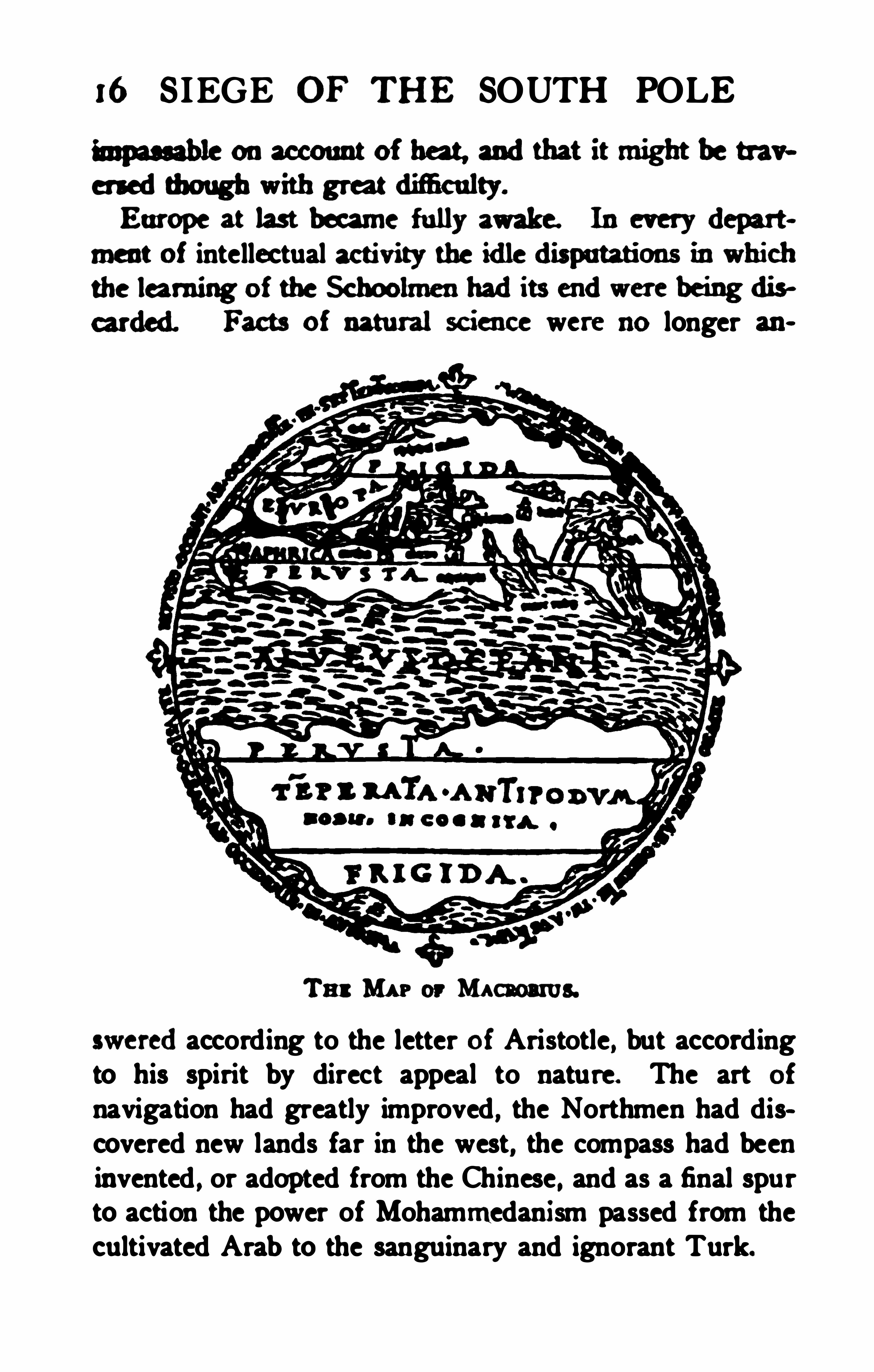
16 S IEGE OF THE SOUTH POLE
hnpau able onaccount of ha g andthat it might be traversedthough with grmtdmculty.
Europe at last becarne fully awake. Ineverydepartment of intellectual activity the idledisputations inwhichthe learning of the Schoolmenhadits endwere beingdis
Facts of natural science were longer
Tn: MAP or Macaoams.
sweredaccording to the letter of Aristotle, but accordingto his spirit by direct appeal to nature. The art of
navigation had greatly improved , the Northmen had discovered new lands far in the west, the compass had beeninvented , or adopted from the Chinese , and as a final spurto action the power of Mohammedanism passed from thecultivated Arab to the sanguinary and ignorant Turk.


18 S IEGE OF TH E SOUTH POLE
where every coast- line had been neatly and accuratelycharted there lay an infinite expanse of water, but southwardas the Torrid Zone was approached the sea becamecovered with darkness , the waves rose to mountain height,the wind dropped calm , the water itself evaporated into asaline mud in which dwelt monsters of indescribable sizeand variety. Blackest horror of all, the huge hand of
the Devil himself would be thrust up above the boilingsea groping for wandering ships ; one of the fantasticislands In the Atlantic on a medie val map bears the title ,de to mando S atanax io. We hear at the present day ofthe superstitions of sailors , and multiplying these superstitions by the centuries which have passed since PrinceHenry organised his pioneer exploration, we can dimlyapprehend what the courage of the old mariners was ,nerving them to contend against far greater obstaclesthan those interposed by Nature.Year after year, from 14 18 until he died in 1460, PrinceHenry sent out his ships under stout skippers trained athis naval observatory at Sagres in the lmowledge OfPtolemy and the Arabs, and posted up inall the information brought back by their contemporaries. The farthestsouth of these days was Cape Nun (28
°
46'N.) long held
impassable ; it was passed by Gil Eannes in 1433 or 1434.
Ten years later the dreary harbourless coast of the GreatDesert was passed and the name of Cape Verde, the GreenCape, testifies to the joy and surprise of the navigators inthei r discovery that the Torrid Zone was not allSahara,but contained ferti le and inhabited land. The Navigatordied long before the achievement of crossing the equatorby one of the ships which followed voluntarily in thetrack which he hadopenedwith the labour of a life- time.
This occurred about 1470.
SLEEP AND AWAKENING 19
In 1487 Bartholomew Diaz sailed from Lisbon withthree ships to look for the mythical Prester John inEthiopia. He crossed the whole breadth of the TorridZone and his crew, first amongst sailors, realised the truthof the scientific deduction that a second Temperate zoneby Voltas
Tn Sm Rom ro Isma. AnEm v MAP.
(From Nordenskiiild's Facsimile Atlas. )
(fi 5. Diaz wasdrivm by a storm far out into the Southandfor thirteen days his flot illa was at the mercyda. The weather grew bitterly cold and his
i! ht well believe they hadcrossed the Temperate
l Frigid Zone, for they were in the great currentof Antarctic , partly of abysmal oceanic water
20 S IEGE OF .THE SOUTH POLE
which wells up against the southwest coast of Africa andstreams northward along the land. When the storm'
was
over Diaz steered east to meet the coast, but after somedays seeingno landhe alteredhis course to thenorthwardandanchored in Algoa Bay. There is no doubt that he hadreached and passed the fortieth parallel of south latitudebefore making the south coast of Africa. To his delight,but to the alarm of his crew, the coast continued to trendeastward, and but for the inevitable mutiny that played apart in almost every voyage of the period Diaz wouldhave anticipated Vasco da Gama in discovering the sea»route to India. He opened the way to it, however , byshowing that Africa had undoubtedly a southern termination in a temperate climate, where there were livingpeople, those very Antipodes to believe in whom hadforcenturies been the rankest heresy.How far Prince Henry knew that Afrim was a greatpeninsula before he began his efiorts to sail round it wecannot say. There are rumours of a chart of orientalorigin showing the Cape of GoodHope anda route roundit to India ; there is little doubt that the Arab tradersonthe east coast of Africa knew that there was free watercommunication to the southwest ; and on Fra Mauro
’smap oi 1495Africa was shownfree to the south. Thereis, however, all the difference in the world between vaguereport andactual demonstration, and nothing that hasbeen discovered as to prior knowledge can detract fromthe credit due to the Portuguese for their magnificentperseverance in pu shing their way to the farthest south.They proved that long voyages were possible, that thedangers of navigation on the high seas were far less thanhad been supposed , and they brought home proofs of theform of the Earth that eventhe commonsailor andthe
SLEEP AN D AWAKENING 21
man in the street of those days could not fail to under
From the last years of the fi fteenth century the Churchencouraged maritime exploration and it would be hard tosay whether missionary sealor commercial enterprise orpolitical ambition was the strongest motive power in thegreat age of discovery which was now inaugurated.The voyage of Vasco da Gama in 1497gave a definiteoutline to Africa and shattered any lurking suspicion thatthe Terra Incognito of Ptolemy might possibly be at
tachedto that continent. Columbus had meanwhile sailedwestward and found what he believed to be a short cutto India , with some indications of an extensive land tothe south of the West Indies which be supposed to bethe extreme southeast of Asia. On his outward voyageVasco da Gama di scovered that by sailing southwest fromCape Verde he could make use of the northeast tradewinds and then turning southward, get across the beltof calms where it was narrow, and into the westerly aircurrent, which would carry him round the Cape of GoodHope
,and he advised his successor, Cabral, to take that
route. In following these instructions Cabral found himsel f farther west than he had intended and discoveredwhat he took to be a new island which he named TerraSanta Cruz. One of his ships returned to Lisbon withthe news while Cabral continued his voyage to India.Two expeditions were sent out in 1501 and 1503 bythe King of Portugal to explore the new island , and aFlorentine named Amerigo Vespucci took part in each.Vespucci wrote an account of the voyages and althoughhe was neither the leader of the expeditions nor a Portugua e his name became attached to the new land in theform America. Controversy has raged about the chap
22 SIEGE OF THE SOUTH POLE
acter of Vespucci, who is hailedon the one handas a
gifted discoverer, and on the other as a lying adventurer.Possibly he was only a very ordinary person writingwith the uncritical carelessness of an amateur on matterswhich interested him , but which he did not fully understand. Anyhow his letters are all that remain as a recordof the expeditions and from them we learn that on reaching the coast of the New World between 5
° and 8° S .
the first expedition in 1501 found that Santa Cruz wasno island but the coast of Brazil , evidently part of agreat continent, which was followed far to the south.
Vespu cci declared that he had reached 52° S being
driven by a great storm, and there discovered a bleak inhospitable land with steep cliff s, rendering a landing impossible, but the weather was too foggy to admit of further exploration . Unfortunately for himsel f Vespuccimade the remark that at that latitude the night was fifteen hours long ; but for a night of fifteen hours on Apriland(his assigned date ) it is necessary to be in latitude72
°S . , and he certainly was not there. It seems most
probable that the land seen was some part of the Pangoniancoast.On the second voyage of the Portuguese (in 1503 )their instructions were to follow the coast of Brazilsouthward and search for a passage to the west in orderto reach the much desired goal of the spice islands ofthe Moluccas ; but it was unsucces sful and reached nofarther south than 20° 5.
An interesting expedition followed the second voyageof Vespucci , the first in which a non - Iberian nation tookpart. A Norman noble the Sieur de Gonneville being atLisbon was fired with the stories of the wealth o f the
Far East, and, securing the services of two Portuguese
SLEEP AND AWAKEN IN G 33
sailors who hadalready made the voym to lndia. heset om for that brnfiamgml in the sspoir ot uonflem.
Two monflts after he hadcrw edthe equator he w
m ammching tbe Cape of GoodHope. A violentstorm sprang up anddrove the ship back into the mneof ealma andtwo months h terwresumably after resmning the southwardcourse) landwas s%htedanda
landing made. m this Southernh ndde Gonneville
fate picturesque tales are told. He is said to havemarried a French lady of noble family and his descendants more than two centuries later are reportedto haveset sai l in search of their remote fatherland. Theoreti~
cal geographers have located de Gonneville’s SouthernLand in Australia, Africa, Madagascar, North Americaand South America as it suited their views :the balanceof probability seems to point to southern Brazil as the
In 1514 two Portuguese ships returned to Lisbon fromthe coast of Ameri ca. They belonged to the great commercial house of Haro but their captains are unknown.The only recordof the voyage is a long report writtcnby the Lisbon agent of the famous German firm ofFugger in Augsburg in whose archives the original MS.
was recently found. It had been printed at the timeunder the title of Copia der Newea ytung aus
Presillgt Landt, and became widely known . The t ilt0f the
“new tidings fromBrazilland” is that the south
ernex tremity of America was foundby Haro's ships in40
° S . andthat to the south of the broadchannelm hingthe eape appearedthe coast of the great South h nd.There was naturally keen rivalry. political, commer
24 SIEGE OF TH E SOUTH POLE
to the Pope to settle theirdispum This the Popedid
m dlrongh the Athntic. The fatmns ljne of Demam fionwas not easily adjustedto snit both parfie
s
bu in its filnl form it was the ni elidianof 46° w. in
the Atlantic and134° E on the other side of the globeThus it came about that the fmits of Cabral
'
sdiscover-yso far as a route to the Spice Islands were coneemedfellto tbe share of Spain, andit was from Spain that the
greatest hero of this great age ofdiscovery set sail, “drough hewas himself a Portuguese, Ferdinand Magellan.Magellanaailedin September, 1519, foundthe c0ast
of Brazil inthe neighbourhoodof Rio de Janeiro in
aminedthe broadopening of theRiode la Plata bywhichhe hadhoped, probably onthe strength of the
“N ewen
c turtg aus Preeillgt landt,” to finda passage west
ward. Convincedby the shallowness andfreshness of
the waterdiat there was no passage there he pursuedhis course, searching every bay until the approach of thesouthern winter made it necessary to seek a secure
harbour. This he foundin Port S t j ulian49° 3dS .
where he stayed five months, and there he informed hisoficers that he wouldgo onseeking for a passage as far“ 75
° 5. i f necessary.
OnOctober axst, 1520, the squadr0n sighteda hesd~land , which was named, in accordance with the Roman
travela after the saint of theday, inthis case the ElevenThousandVirgins. It was situatedin52° S . the highest


SLEEP AND AWAKEN ING 25
south latitnde so far reachedwith eeminty. andby thefide of the a pe adumdopa edde g sah andwith astrong cu rrent running through. the iongk ed- forpassage to the wcs t. lVi th the further labours of Magehlanwe have little todo. He crossedthe wide Pacific ina voyage of three months
’ duration inwhich uo land
ship of his squadron, the Victoria . after his untimelydeath , threaded the maze of the Malay archipelego andcrossing the Indian Ocean returned to Spain by theCape of Good Hope . The Victoria turned a furrow ofblue water round the globe and taught Europe by thatsimple demonstration that the Earth was indeed a sphere.or at least that it was round. taught it also that the OldWorld and the New World alike were free to the southand that a third world , i f such existed , must be looked forin the vast unknown area about the Antarctic pole.That a third world did exist was a cherished belief,
no doubt derived from the old Greek speculations andm eaning based on the law of symmetry. Magellan didmuch to confirm the idea, for when he passed throughthe strait that bears his name he saw to the south of himland as continuous and as continental in appearance asthe territory of the Patagonians to the north. This
sou thern land he named Tierra del Fuego, the land offires, apparently from the fires carried by the natives in
While the question of the existence of an Antarcticregionhadbeen settleddefinitely by the acceptanee of
the sphericity of the Earth, andthe mode of acceu to
that regionhadbeenshownbyMagellanto be by tbe seaalone, it still rermineddoubt ful whetber it was anantarctic sea or anantarctic landthat lay invitingdis
26 S IEGE OF TH E SOUTH POLE
covery. Map-makers picking up their scraps of fact asthey could, from the descript ions of Ptolemy, the authentic logs of recent voyages or the stories of sailors, wereobliged or at least felt themselves impelled to work thesefacts into some sort of setting that gave their drawingan air of completeness. They had to fall back for thispurpose on the ‘old ideas of symmetry or analogy or elseto draw upon their imagi nation—a more abundant sourceand much more easily tapped . It is not surpri sing thatthe globes of the sixteenth century varied vastly in thei rdetails.Leonardo da Vinci on his globe of 1515 depictsAmerica and Africa separated by broadstretches ofocean from a continent almost included in the Antarcticcircle, which would have been a marvellously lucky guessat the truth had there been any indi cation of a possibleAustralia. The globe of Schoner in 1515 also showedAmeri ca and Africa free , but obviously on the strength ofthe Neweh Zeytung aus P resillgt Landt,
” America wasrepresented as terminating in latitude 40° S. and nearlytouching a huge ring- shaped continent almost encirclingthe globe and enclos ing a sea which filled the Antarcticcircle. This continent was laden with detail of mountains and rivers , and the part south of America wasnamed Brasilia regio. Schoner’s globe of 1520 namedthe land south of Ameri ca stretching from 40° to nearly80° S . Brasilia Inferior. The map of Oront ius F inné,published in 153 1 , seems to combine the information ofthe two foregoing with Magellan ’s discovery, for itshows a vast continent covering the whole Antarctic areacoming close to Ameri ca, keeping more distant fromAfrica , but swelling out in the south Indian Ocean almostto the tropic in a great square projection called Bron
'
lie

Tin: hi s ? or a rrrws. S ournes s H eu rsrms as .
(From S ordenskiold’s Facsimile Atlas .)
(To i s

SLEEP AN D AWAKENING 27
Regio, to the east of which a large peninsula attached bya very narrow isthmus was named Regio P atch}. Thewhole continent bore the inscription “Terra Australisrecenter invents sed nondum plene cognita .
” The out
l ine of the Regio Patalis irresistibly suggests Australiaand has given rise to much controversy as to the earlydiscovery of that continent. French maps of the samedate, and, curiously enough, French maps only, showedthe island of Java separated by a narrow strait from ahuge shapeless island ca lled Jave le Grand, whichcovers a great part of the area really occupied by Australia, but stretched on some maps as far as 60° 5. Thisalso suggested to some writers an early discovery ofAustralia by unknown Frenchmen .
However. these things may be we cannot be far wrongin accepting the map of Orontius as representing thecurrent views of the middle of the six teenth century asto the nature of the southern hemisphere. The vastTerra Australis built entirely of conjecture save for theTierra del Fuegian scrap of fact, was a continent indeednot yet fully known ,
” the finding of which would wellrepay any ex plorer, and place the happy discoverer on apedestal beside Columbus and Vasco da Gama , perhapseven as high as Magellan himself. It was a magnificentstimulus and the following chapters trace its historical
We knew the merry worldwas round,Andwe might sail for evermore."
—Tsnnvson.
FOR two hundredyears the fair image of the Sou th
Land fled before the hold sailors who entered thesouthern seas in quest of trade or plunder. Theyever lrept a watchful eye to southward in the hope oflight ing upon the Third World, the richness and att raetiveness of which seemedto increase from generationto
Unfortunately it isdifi cult to unravel the stories of thevoyagers of the sixteenth and seventeenth centuries. Itis true that
“the menloomedlarge onthe long trail, the
trail that is always new ,
” but their forms are rarelydistinct. The vagueness of their original narrativesoften set down from hearsay by another ha rd , the uncertainty of determining latitude to a single degree bymeans of the clumsy back- stafi or cross- staff , and thewild guesses at longitude that were alone possible, makesthe story of any particular voyage hard to follow, and theoontests as to priority of discovery very dificult to

30 S IEGE or THE SOUTH POLE
was inconvenient to those in authority. It is accordinglynot surprising to findthat many facts to which we now.
have access were unknown to the contemporari es of theactors themselves , whose efforts and discoveries werethus often left unproductive and lay outside the chain ofhistorical continuity.
The Emperor Charles V. sent out an expedition in1525 to repeat the voyage of Magellan and one of thecaravels, the San Lesmes , encountering one of the violentstorms that haunt the southern extremity of America ,was driven far to the southeastward of the entrance tothe strait, and in latitude 55
° found an open sea leadingthe captain to believe that he had come to the southernend of TierradelFuego. This fact never found its wayinto contemporary maps , but thedifi culties of the southwest passage to the Indies were fully apprec iated by theSpanish sailors. They had a much easier and safer routeby Mex ico, a route which obviated the storms of theSouthern Ocean and the tedious and hazardous navigation of the Strait, and which also reduced the voyagesof the Spaniardliving at hmne to the short andeasy tripto Mexico, while his colonial brother undertook the transPacific voyage from one of the ports on the west coast ofAmerica, all of which were bound together by a regularservice of coasting vessels. For forty years the Spaniards deserted the Strait, but diligently continued theirnavigations in the great South Sea.The Portuguese trader, Jorge de Meneses, _
while on a
out of his course andfell inwith the coast of a vast
projectionof the great Sou th Land. Thediscovery wasnot followed up andtwenty years later a Spaniard YaigoOrtiz de Retes , in the San Juan , after passing a number
FOR THE SOUTH LAND 3 1
of islands, met with an extensive land of which he followed the north coast for about 230 leagues withoutcoming to an end. Hencet this portion of theSou thern Continent appeared upon the maps under thename of New Guinea, which it still bears . It was easyto draw a continuous coast line across the Pacific to uniteit with the Magellanic Land, nor were there wantingadventurous sailors to visit portions of that coast andreturn with detailed descriptions. Thus Dr. Juan LuisArias some time between 1606 and 162 1 , no doubt animated by the stories of Quiros , wrote a Memorial toPhilip III King of Spain, in the true spirit of expansiveimperialism , urging that monarch to proceed to annexand colonise the new continent without delay, for it hadbeen discovered by the intrepid pilot, Juan Fernandez,abou t 40
° west of the coast of Chile, a pleasant land ,fertile, temperate in climate, watered by great navigablerivers , like nothing one could see in Chile or Peru , andto crown all, inhabited by white people. So, long beforeDefoe immortalised the adventures of Alexander Selkirkon the island really discovered by Juan Fernandez andnamed after h im, a romance was woven round somePolynesian island visited by the same navigator, and theprevai l ing belie f in a non- existent regi on strengthened
In 1567, Pedro de Sarmiento, succeeded in inducingthe Viceroy of Peru to fit out an expedition to explorethe South Land , but though he was made captain of oneof the vessels the command of the expedition was givento Alvaro de Mendafia, nephew of the Viceroy, who tooka course of his own, little dreaming that the route urgedby Sarmiento would have ledto the discovery of Australia. The only result of the voyage was to find a'
32 S IEGE OF THE SOUTH POLE
group of large islands, some of which the explorers believedto be connected by land with New Guinea. and assome gold was picked up, though neither apes nor peacocks were found , they called them the Solomon Islandson account of thei r resemblance to Ophir. This partialsuccess stimulated Mendaiia to continue his explorations.to the brilliant conclusion of which we shall referpresently.The scene of interest shi fts back to where wild meeting oceans boil besouth Magellan ,
” and for the first timean English explorer appears on the stage, no less heroica figure than Sir Francis Drake , the boldest buccaneerof the El izabethan age when the sphere of the ten commandments ” did not extend beyond the mouth of theChannel and every man who owned a ship was free tomake his fortune as seemed right in his owneyes on thehigh seas. Drake who cared nothing for the Pope'sLine of Demarcation.or the Spaniards
’ valour , much as heappreciated their galleons. set out in 1578
“ to seek thatstrait in which the vulgar believe not but the reality ofwhich is confirmed by many cosmographers. He foundthe strait, passed through into the Pacific in the remarkably short time of 18 days and after sailing some distanceto the northwest met with one of the gales of the regionand was driven far to the southwest. He was in latitude57
“or somewhat better before he recovered control of
his ship. He had reached the farthest south yet attained ,though still nine degrees north of the Antarctic circlewithin which a distorted report of his voyage in De Bry’sgreat compendium of travels represented him as havingbeen driven. Drake found himself soon after in the neighbourhoodof a group of islands which he named the Elizabethides after the Queen , and turning northward came on

FOR THE SOUTH LAND 33
the south coast of a land in 55° 5. These islands wereundoubtedly part of the insular labyrinth of Tierra delFuego , but they were shifted about on the map likepawns on a chess-board by the cartographers of the following generation until Drake Land figured as arespectable promontory of the great South Land itsel f.Although a pirate, Drake, in his own erratic way, wasa pious man and carried a chaplain , the Rev. FrancisFletcher, who as the author of The World Eucompassed,
” was also the chronicler of the voyage . Althoughhis master once set him in irons on board, with theinscription on his arm frances fletcher ye falsest knaveyt. liveth we may accept the chaplain’s statement : atlength wee fell with the uttermost part of land towardsthe South Pole, and had certamly discovered how farrethe same doth reach Southward from the coast of America aforenamed . The uttermost cape or hedland of allthwe Ilands stands neere in 56 deg., without which thereis no maine nor Ilandto be scene to the Southwards , butthat the Atlantiche Ocean and the South Sea
,meete in a
most large and free scope."
Richard Hawkins, (whose identity as a prisoner ofthe Spanish is quaintly veiled in DonRicardo Aqu inas ,and in German translations Reichard vonAquin) , also afamous buccaneer states his own view confirmed by a conversation wi th Drake , as follows :I f a man be furnished with woode and water and the
winde good, he may keepe the mayne sea, and goe roundabout the straits to the southwards and it is the shorter ‘
way ; for besides the ex perience which we made. that allthe south part of the straites is but ilands , many timeshaving the sea open , I remember that Sir Francis Draketold me. that having shott the straites , a storm first took
3
34 S IEGE OF THE SOUTH POLE
him at northwest, and after vered about to the southwest,which continued with him many dayes, with that extremitie, that he cou ld not open any sayle, and that at theend of the storme, he found himselfe in fiftie degrees“
which was sufi cient testimony and proofe that he wasbeatenroundabou t the straiter.
"
There.
is thus no manner of doubt that Drake hadproved Tierra del Fuego to be a group of islands andnot part of any Antarctic Continent ; but his record wasmisunderstood , he himsel f thought little of it and doesnot appear to have given a name to the “
extreme cape orclifi which probably enough was that which Le Maireand Schouten in 1615 after passing through Strait LeMaire and sighting Staten Land called Cape Hoorn afterone of their ships , a name s ince only too familiar to thedeep- sea sailor as The Horn.
The next important event in the history of the Antarcticpossibly occurred twenty-one years later, but whether itoccurred or not is one of those puzzling questions towhi ch an answer is difficult. The story, which has beenaccepted by many students of the history of discovery. isto the effect that a small Dutch vessel , the Blijde Boodschap (Blithe Tidings ) , under the command of DirkGerritsz , one of the famous Dutch squadron of
“ theFive Ships bound to the Indies for trade and plunder,after having cleared Magellan Strait and reached 50
° S .
in the Pacific , was driven back by a storm to 64° Swhere a mountainous snowy coast like that of Norwaywas discovered , extending apparently to the SolomonIslands . It has been generally believed on the strength
‘ Probably anerror of a copyist who mistook “
$6”for
“
so”;
it is scarcely probable though not impossible that longitude andnot latitude is meant.
FOR TH E SOUTH LAND 35
of this report that Dirk Gerritsz was the discoverer ofthe South Shetlands and his name has recently been at »
tachedby the leading German cartographers to the wholearchipelago lying south of 61° in the longitude of Tierradel Fuego. From the record of the other vessels of thesquadron , we learn that the leader , Olivier van Noort ,had received a letter from Dirk Gerritsz , stating that hehad missed the appointed meeting place at Santa MariaIsland, ran short of provisions, reached Valparaiso ingreat distress and was wounded and taken prisoner bythe Spaniards. Not a word was said as to any discoveryof landin the far south . This was fi rst heard of in somesupplementary notes incorporated in the introduction toHerrera’s History of the Doings of the Spaniards inAmerica , by Kasper Barlaeus, who translated thatSpanish work into Latin in 1622.
It seems likely that Gerritsz '
s name was associated bymistake with the report of quite another voyage, andtheorigin of the mistake , as pointed out by Mr. E. S. Balch ,is probably a manuscript dating from the end of the sewenwenth century. which is preserved in the RoyalArchives at The Hague. It commencesLaurens Claess of Antwerp , aged about 40years , has
served as boatswain on the Magellan ship Blijde Bootschap which sailed wi th other ships in 1598
has served under the Admiral DonGabriel deCastiglio with three ships along the coast of Chile towardsValparaiso and from there towards the Strait, and that inthe year 1603 , and he went in March to 64 degrees wherethey had much snow.
No mention is made of land, and it would seem thatDirk Gerritsz ’
s oldshipmate had really approached withina few degrees of the Antarctic circle on board a Spanish
36 SIEGE OF THE SOUTH POLE
ship. A confused report of this exploit may very wellhave inspired Barlaeus. The statement that the snowclad coast- l ine imputed to Dirk Gerritsz probably extended to the Solomon Islands , is plainly a speculationof an armchair geographer, and obviously emanates fromBarlaeus ; but we have now to follow the mythical coastline to the new land of Ophir, for the centre of interest inthe first hal f of the seventeenth century lies there.Mendar‘is was accompanied ona second voyage of exploration, with which we are not concerned , by a Portuo
guese pilot named Pedro Fernandez de Quiros, who ishailed by one authority as the true hero of the unknownSouth Land, and stigmatised by another as a lyingMiinchausen. In any case he was an interesting figureand he played a picturesque part in the history of exploration. On Mendafia’
s death, Quiros after a vainattempt to get the Peruvian viceroy to provide funds fora great expedition to the South Land , went to Spain likeColumbus , to whom he compared himself, to move theKing in the matter. He went first to Rome and laid before the Pope a touching pictu re of the untold millionsof South Land natives ready to be led into the fold ofthe Church ; the Pope recommended him to King PhihpIII. , to whom Quiros promised new lands greater in extent thanthose he already possessedandthe funds weresecured .
Quiros set out from Callao in December. 1605,with three ships to explore the coast of the South Land
a small island in the group, afterwards cal led the NewHebrides.which from its height, its inhabitants andother

38 S IEGE OF TH E SOUTH POLE
pau ea out of sight protesting loudly that his discoverywas a land of gold and si lver, cattle and grain , the ri chest fruit and the healthiest climate, a land without venomous beasts or insects , peopled by gentle natives, a landricher than Mex ico or Peru and as large as all Europeand hither-Asia as far as Pers ia.
Meanwhile the Dutch voyagers sailing south f rom theMalay archipelago had discovered the Gulf of Carpentaria, where Jansz arrived a few months before Torres ;and year after year the west coast of Australia was feltout ; and its bays and headlands bear testimony to this dayto the hardiness of the Dutch captains and the names oftheir ships . In 1627N uyt discovered that after passingCape Leeuwin the coast turned eastward , and Tasmancrowned the work by sailing round the coast and cuttingoff the great mass of New Holland from the dwindlinghypothetical continent. Continu ing on his way he discovered the west coast of New Zealand , which he namedStaten Land in honour of the Dutch States General .He thought that it might perhaps be continuous with theother Staten Land east of Cape Horn ; but in any casehe was of opinion that the new discovery formed partof the unknown South Land .
Except possibly in the middle of the three southernoceans it was now apparent that the Antarctic continentcou ld not reach very far into the temperate zone. Thiswas the utmost of the achievements of the six teenth century , and so far as attaining high latitudes is concerned,the best results were due to the tempests off Cape Horn ,such expeditions as set out with the professed intentionof pu shing on to the great South Land having usuallybeen well content to harbour in some tropical island.
In the Cape Horn region the hopes of meeting with
FOR TH E SOUTH LAND 39
the ooast of the South Iandwere g-
raduallydispelled.Hendrik Brouwer in1643 being tmable to maloe S trait uMaire tnrnedeastwardalong S tatenIandandfoundit tobe anislandof no great size. He also professedto bavefoundnew landfarflrer to the easu but his discoveriawere so vagnelydescribedthat they failedto gaingenenlbelief . In1675a merchant nanredAntony IA Roche re
ofi S trait Ix Maire which w riedhim far to the eest,
where he discovereda snow-coveredland, possibly the
Falkland Islands—one of the most frequently discovered,mnwdmdhm gmummmmem ut w hamit was South Georgia with which the snow-covering in
During the years towards the close of the seventeenth
century the English bu ccaneers made more use thanalrnost any other navigators of the seas abou t the Horn,andthe stories of their adventu rous voyages aboundinaccounts of stormsdriving them south amongst the icc.
They were forcedinto sucb positions sorely against their
willandalltheir efforts weredevotedto escaping nortb
ward again. Little in formation is to
o
be derivedfrom
“floe andsnow andblow.
”It may be that some of the
ships reachedhigh latimdes, but the totalabsence of ob
“ near 60° in 1681 , Ambrose Cowley 60° in 1684,
andEdwardDavis “verynear 63
° ”in1687inthe South
a new landin the South Pacific, far ofi the coast of
Chile. which although only the little Easter Island. gave

40 SIEGE OF THE SOUTH POLE
l ine of their illusive land.The only result so far as the search for the South Iandwas concerned was to warn intending discoverers thatthere was no prospect of success to the south of South
America. Cowley indeed draws a quaint moral of hisown, for the storm struck his ships while the menwerechusing of Valentines and discoursing on the Intriguesof Women one 14th of February. so that we concludedthediscoursing of womenat sea was very unlucky andcaused the storm.
The seventeenth century closed with the belief in aTerra Australis Incognita undiminished by the very substantial increase of the known world in the southernhemisphere ; but it closed with the first special expedition to investigate a purely scientific problem .
How the question was approached by the scholarsof the day, and to what extent their knowledge went, maybe judged by two extracts from the learned Dr. NathanaelCarpenter in his Geographic,
” second edition , publishedin 1635. The first illustrates the way in which suchscholars played with ideas :It hath beene a usuallkinde of speech amongst men
to teanne such things as are stronger , worthier or greater,Masculine; on the contrary side such things Feminineas are found deficient or wanting in these perfections ; bywhich kinde of Metaphor taken from the Sexes in living creatures they have ascribed to the Northerne Hemispheare a Masculine Temper in respect of the Southerne,which comes farre short of it.”
The second quotation is a goodsummary of knownfacts and a typically English view of foreign character :
“ Of the third and greatest, which is the South Con

FOR THE SOUTH LAND 4 1
tinent , no conjecture can be well-grounded , being in amanner all undiscovered, except some small quillets onthe borders of it ; by which if we may judge of all the
rest, we shall alrnost give the same judgment as of theother. The want of discovery inthis age of ours whereinnavigation hath beene perfected and cherished, is no smallargument to prove it inferiour in commodities to otherplaces :Neither had the slacknesse of the S paniardgiventhat occasion of complaint to Ferdinanddo Qu ir, the latediscoverer of some of these parts, hadnot the S panishking thought such an expedition either altogether fruitlesse or to little purpose. For who knowes not the S paniardto bee a nation as covetous of richesse as ambitionsto pursue forrane Soveraignty: as such who will morewi llingly expose the lives of their owne subjects, thenloose the least title over other Countreys.
”
Halley, the English Astronomer Royal, had spent thewhole year 1676 on St. Helena making systematicmagnetic observations with a view to completing histheory of terrestrial magnetism which was published inthe P hilosophicalTransactions in 1693 . The theory metwith keen opposition, and feeling the need of additionaldata to support his views, Halley applied to the government for the means of extending his observations fartherinto the Southern Hemisphere. This was granted, andthe astronomer, invested with a captain
’s commission,was placed in command of H. M . S. The Paramour Pinkin 1699, with instructions to study the variation of themagnetic needle in difierent latitudes and to discoverany of the new lands supposed to exist in the South Atlantic. The first purely scientific expedition by sea underthe British or any other flag was in some ways unfor
42 S IEGE OF THE SOUTH POLE
While the Royal Observatory at Greenwich wasand is very intimately associated with the Royal Navy ,it was not to be expected that the head of the Observatorycou ld at a moment's notice take command of a ship of
war. In those days of course the navy was not so spe»
cialiseda profession as it is now , and captaincies and evenhigherposts could then be bestowed without scandal onpersons who were not qualified to exercise the dutiesattached to their office . It was in fact a convenient wayin which a leading politic ian could reward his friends toplace them onthe books of a ship or of a regiment. Suchappointments were even given to children and servedmerely as an excuse for an annuity from the public funds.But Halley was called upon not only to draw the paybut to exercise the executive duties of a captain in command of a crew engaged upon uncongenial and to themincomprehensible work. It is not astonishing that di f~ficulties arose and that the rough sailors of those daysresented the efforts of thei r amateur captain to maintain discipline. The wonder is that any scientific workwas possible in the circumstances. Halley succeeded inmaking excellent magnetic observations, he landed at St.Helena and repeated his experiments there, and thensteered southward . In January , 1700, he met with hoating ice in latitude 52
° S . and longitude 167° W. of
Ferro. The vessel was not preparedfor ice- navigationand got into a position of considerable danger so that itbecame necessary to return northward immediately. Nonew land was seen but some indications of land appearedin latitude 43° 12 S . and longitude 49
°
33’ W. , while
the presence of birds in 43°
51'
S ., 25°
50’W. , suggested
the possibility of land existing in that neighbourhood.As one result of this voyage Halley was able to con
FOR THE SOUTH LAND 43
struct the first map of magnetic variation, and as anotherhe introduced a method of determining longitude by ohserving occultations of the fixed stars . These were twosubstantial gains to navigation , for hitherto the problemof the longitude had been practically insoluble.The solitary scientific expedition toward the south wasmerely an incident without any direct consequences toexploration . The mercantile or piratical adventurersof England continued to visit the southern seas andseveral times were driven south of Dampier in hisfamous circumnavigation , although attaining no highlatitudes, helped to cast doubt upon the ex istence of agreat southern continent by observing how frequentlythe coast- l ine marked on the charts was found to haveno basis in fact . One of his comrades , however, JohnWelbe by name, was convinced of the existence of sucha land , at least he addressed many memorials in 1713to the Admiralty and the Treasury asking for a shipwith 180men in which he could ex plore the coast of thecontinent between Cape Horn , the Land of Juan Fernandez and New Guinea ; but the Admiralty and Treasuryhad other things to think about and remained silent.It would serve no purpose to recall the names of all thesailors of this period who were driven south of 60'
while rounding the Horn , but George Shelvocke maybe mentioned because his particular storm in 1719 wasimputed by his superstitious mate to the presence of adisconsolate black albitross which followed the ship.and after several vain attempts the mate shot the bird .
It did not die in vain, for the report of the episodesuggested to Coleridge the poem of the Ancient Mariner.In 1721 Jacob Roggeveen submitted a scheme for avoyage of southern exploration to the Dutch East India
44 S IEGE OF THE SOUTH POLE
Company, similar to one proposed by his father fifty yw s
before , and accepted by the Company, bu t postponed iadefinitely on account of the war then in progress. Thepolitical conditions being now happier
.
the Company atonce accepted the proposal, and the younger Roggeveenwas granted three ships .to explore the Southern Seasand to search for the Isle of Gold, a half mythical , halftraditional is land in the neighbourhood of New Guinea.The Dutch expedition set out in August, 1721 , visitedthe Falkland Islands, naming them Belgia Australis, andtried to enter Strait Le Maire. Here the usual fateawaited them , a
' northerly storm sprang up and drovethe squadron far to the south beyond 62'
S . , one of theships , the Thienhoven, being reported to have reached64
“
58’ S. This position cannot be afii rmedwith any
certainty, and like all the high latitudes previously at
tained, it was made much against the will of the explorera, who never intended to seek that part of theirgreat continent which lay amongst the Antarctic ice .
The Dutch voyagers did not doubt that the southern continent lay to the south of them ; the abundance of ice.which was believed to form only near land, the birds,the direction of the currents in the sea were all takenas evidence of the proximity of land. The land theyconsidered might very possibly be inhabited, for theshores of Davis Strait were inhabited all the year roundat least as far as 70
' N.
Roggeveenproceeded to search in the Pacific for DavisLand, he sighted Easter Island, but not dreaming thatso insignificant a speck could cast so vast a shadow on
the map he continued sailing northwest,although his companion Behrens regretted that a southwesterly coursehadnot been taken. When at a laterdate Roggeveen

46 S IEGE OF THE SOUTH POLE
mannedby a carefully selectedcrew andplacedunder thecommandof Bouvet andHay. The instructions of the
company statedthat the object of the ex peditionwas thediscovery of southernlands which were to be sought for
in latitude 44° S. and i f not found the ships were to
proceedas far a8 55° S afterwards returning to 4f 5.
andpursu ing a sinuous track as far as 80°E of Paris
While insight of the southernlandthe ship ’
s companieswere to receive an increase of zs per cent intheir pay ;but the captains were forbidden to bring any Australians(that is, inhabitants of the Terra Australis Incognita)to France.
Bouvet sailed from Lorient onJuly 19th, 1738, and byDecember 15th he commencedto meet fioating ice in
latitude 48°
50’
S . , but no land was sighted where themaps showed the “ Terre de Vue ” five degrees farthernorth. Pushing on sou thward the expedition found the
good sign in Bouvet’s opinion, for it argued the proximity of an elevatedand extensive land, and, as heobservedin his log high lands are well known to be
the healthiest." The weather was bad with much fog,but Bonvet was a goodsailor andadeterminedmannotlikely to be baffled. At length on New Year’s Day, 1739,his perseverance was rewarded by the discovery of a highsnow- clad land thickly veiled in fog, but showing on itssteeply scarped coast a prominent headland which wasnamed , after the Church festival of the day, Cape Cirbcumcision. It was impossible to make a landing andalthough the two vessels remainedinsight of the cape fortwelve days the fog never completely li fted and it couldnot be determined whether it was an is land or partof a continent. The pilot of the Mariedifieredfrom his


FOR TH E SOUTH LAND 47
large one. Th e position ass ignedby Bouvet was be
East of Tenerife. Cape G rcnmcisionwill be heardofagainseveraltimes inthe course of onr narrative.
hadtheywishedto go farther they couldnot havedone so
onacoount of the ices pact e edge of which they fol
fievedto be a continent renderedinacoecsible by the
andeontinuedthe search for Gonneville Iandso s‘s’ E .
(of Tenerife) with no result. Hi s crews suffering muchfrom illness he retumedto France after a spiritedandpersevering efl‘ort to findwhatdidnot ex ist.He didvaluable work in freeing the South Atlantic
of themythicallandandinbringing home the first fairlycomplete description of the huge fiat- topped Antarct icicebergs amongst which he hadsailed. Some of these
hedescribedas from zoo to 3oo feet inheight andfromtwo to three leagues in circumference. The abundanceof pengu ins andseals observedon the ice appearedtomdkate me pmfinnWof hndforH as Bouvfi obaa wdthese are amphibious animals. Andwhether he was rightas to the prox imity of a coast -line or not he performeda
sailing along 48°of longi tude nearly inss' S .
The contrast between the far south andthe far northcouldnot fail to strike the ex plorers for here not longafter the southernmidsummer they foundthe sea filledwhh ice at a latitude corresponding to that of Belfast.
48 S IEGE OF THE SOUTH POLE
It began to be apparent that the approaches to theAntarctic circle were very efiectively guarded.
The next incident in Antarctic history is the discovery by the Spanish merchant ship Leon, returningfrom Chile in 1756, of a high mountainous land coveredwith snow in 55
°S . , and far to the east of Cape Horn.
This was named San Pedro after the saint of the day,and though the longitude assigned by the discoverer iswrong by ten degrees , there is no reason todoubt thatit was the island now known as South Georgia.The French natural philosophers of the middle of theeighteenth century, when passing in review the wholefield of natural knowledge could not avoid so urgenta question as the nature of the unknown parts of thesouthern hemisphere. They did not lay stress on the
popular idea that a great mass of land symmetrically arranged round the south pole was necessary to maintainthe equ ilibrium and uniform rotation of the Earth ; butthey showed a general tendency to believe in some suchcontinent. Thus the celebrated mathematician Maupertuis, in writing to his patron , Frederick the Great, pointedout the vastness of the unknown area which containsroom enough for a fifth part of the world larger than any
of land had been observed by Bouvet allalong the edgeof the ice. These lands must form as it were ' a worldapart which if they could only be reached would furnishgreat opportunities for commerce and marvellous spec
tacles in Physics and be summed up by saying thathe would rather have an hour’s conversation with a nativeof the Terra Australis Incognita than with the finest intellcct in Europe. Maupertuis was too gooda manof
FOR TH E SOUTH LAND 49
science nm to be stmck by the b ' latitnde to t bich
Am ra ie ice pmeu-nednu tbn ri andhe ac ignedas a
m son for it the fact tint th Antarct ic surmner occurredwhenthe Earth was inthe pu t ol its cllipticalorli t mostrunote from the sunandwhen its moticn in the orbit
is consoqnently slowest. so that the winter is not mlycolder, but eight days longer than that oi the northem
that if Bonvet hadhadex perience ol the arct ic regims
andthe methods of ice-navigation there he might havc
Buflon also dealt at some lengt h with the unknownSomh inh is em y onthe Theory oi the Earth where he
ex pressedviews as to the ex istence oi a gm t continmtwhich subsequent discoveries led him to modify. Heseemed somewhat credulous in accepting the stories ofpeople worthy of belief
" who hadtold him of an
English capta in named Monson who hadreached 88 °8 .
wi thout seeing ice, and of some unnamed Dutchmen whoclaimed to have reached 89
°S ., or within 70 miles of
the pole. One cannot help thinking of the Dutch sailorwho boasted to his boon- companions in a sea-port tavernthat he had once sailed so far north that he came twodegrees beyond the pole. though we would not for amoment compare Button with the simple-minded pm ,
phleteer who placedthe vaunt onrecordu a iact.
Buache, the eminent geographer who wi ll be rememberedas the first to use contour lines onmape for expressingdifierences of level’
reada paper to the Academy of Sciences in 1757 m which he suggested theexistence of a great Antarctic Sea nearly surroundedby land, but with two open ings whence vast quantitiesof ice from the rivers of th
at continent were discharged
50 S IEGE OF THE SOUTH POLE
into the ocean, one south of Cape Circumcision , the othersouth of the mythical Davis Land.
Bufion performed a notable service to Anu retic re
search by inducing M . Charles de Brosses , president ofthe Parlement of Dijon to compile his “ Histoire desNavigations aux Terres Australes ,
” published in 1756.
This work passed in review the details of all thevoyages of exploration to the south so far as the recordsknown at the time permitted, and the compiler stronglyurged the continuance of voyages of discovery. For
a king this would be an enterprise more glorious thma war or a victory,
” he exclaimed.
“ Thank God, saidKing Edward VII. in bidding farewell to the expeditionon board the Discovery, nearly a century and a halflater, this is no warlike ex pedition .
” De Brosses continued: The most celebrated of modern sovereigns willbe he who gives his name to the Southern World. Thisenterprise canonly be carriedout by a king or by a S ta te ;it is beyond the resources of an individual or of a com»
pany, for a company seeks before everything profit andimmediate profit.” He went on to point out that exploration ought to be carried out for its own sake ; the resultning advantages would appear later.De Brosses discussed the question of the southern ice,
the dimculties which it presented , however, he believedwould be found to diminish as one got further south ,and he strongly upheld the existence of a habitable andcolonisable continent in the unknown Southern Ocean.The u guments of De Bm a the tradition of De
Gonneville’
s voyage. and the poetical narrations of Quirosdid not fail to fire the ambition of French explorers ,who were also stimulated by the very laudable desire toanticipate the discoveries likely to be made by the British


FOR THE SOUTH LAND 5:
renewed under the command of Lieutenant Cook , R. N .
Nor was it the French alone who believed in and desiredto findthe Southern Continent. When Byron startedfor his voyage of circumnavigation in 1764, and WallisandCarteret two years later the British Admiralty instructed them to look for the land which “ there wasreason to believe might be found ” in the South Atlantic and South Pacific. Byron and Carteret bothsearchedinvain for the Davis Landof the charts andthe great French explorer Bougainville shortly afterwardswas naturally no more successful. The voyage of Carteret in particular was one of enormous difficulty onaccount of his being left by his colleagu e ina small andill - found ship with insufficient stores and a scurvystricken crew, and no British captain ever acquittedhimself with greater valour inhis command.When, in 1772, Marion-Du fresne was sent ou t by theFrench government with two small vessels for the purpose of taking a young Tahitian who had been brough tto France by Bougainville back to his home, he had instructions to visit the Southern Continent and New Zealand on the way. The former he failed to find thoughhe lighted on some small islands between 46
° and 47'
S . ,
now known as the Marion and Crozet Islands (Crozetbeing one of Marion’s officers) , but named at the timeTerred'Esperance, on account of the hope inspired thatthey lay off the coast of a continent.Yves Joseph de Kerguelen—Tremarec was the last ofthe explorers to find anything which could even for amoment strengthen the illusion of a temperate SouthernContinent. A noble of Brittany, he had long cherishedthe hope of visiting the fair sou th landof his fancy and
FOR THE SOUTH LAND 53
France. He returned with a very highly coloured description of his discovery, including these statementsThe lands which I have had the happiness to discover
appear to form the central mass of the Antarctic conand the land which I have called South
France is so situated as to command the route to India ,the Moluccas , China and the South Seas . SouthFrance can henceforth give new life to the Ile de Franceand Bourbon , tripling their sea - trade, provisioning andenriching them. The latitude in which it liespromises all the crops of the Mother Country fromwhich the islands are too remote to derive fresh supplies .
No doubt wood , minerals , diamonds, rubies , preciou s stones and marble will be found . If menof
a different species are not discovered at least there wi llbe people in a state Of nature living in their primitivemanner
,ignorant alike of Offense or remorse , knowing
nothing of the artifices of civilised society. In shortSouth France will furnish marvellous physical and moralspectacles ."
It seems that Kerguelen failed altogether to convincehis compatriots ; some were critical , others laughed atthe whole story as a tissue of lies ; but notwithstandingthe incredible assertions he had made two new shipswere provided for h im and he started on March a6th ,
1773 , for a new voyage . This time his instructions wereto return to the southern lands , to establish a post in asuitable place, and then to sail eastward between theparallels of 40
° and 60° S . ,coasting the Southern Con
t inent and landing wherever it appeared that useful ohservations could be made.Kerguelen reached the Ile de France with his ships
disabled and many of his crew seriously ill . His ofiicers
34 S IEGE OF TH E SOUTH POLE
were not equal to their work, and when he sailed forSouth France in bad weather all the conditions of theexpedition were about as unfavourable as they could be .He reached the land , went ashore at midsummer (December, and found the weather cold, with con
stant fogs and gales, the land sterile and uninviting. Itwas impossible to leave a party on shore, impossible inthe enfeebled state of the ships’ companies to pursuefurther ex ploration , and there was no alternative but toreturn to France. The leader had truly predicted thatSouth France would furnish marvellous physical andmoral spectacles, though be little thought that they wouldbe mani fested in his own body and mind. The disillusionwas complete . Kerguelen changed the name of SouthFrance to the Land Of Desolation , and he declared thathe would rather live in Iceland under the polar circle thanin the land of his owndiscovery ina latitude corresponding to that of Paris . He recognised even that xt was notpart of a continent, for Cook had meanwhile passed roundthe world through the open sea far to the southward.One cannot but feel sympathy for this man Of fine en
thusiasm, an enthusiasm which certainly let his imaginationdominate his reasonwhenat home, bu t which wasequally the motive of two long and hazardous voyagesfull of hardships and beset with difficu lties of every kind.Kerguelen
’
s narrative gave displeasure to those in au
thority and is said to have been suppressed. It is but
honour may accrue to its discoverer from the valuablesci entific observations for which it has been from timeto time the base.The last episode inthe search for the great South Land
FOR TH E SOUTH LAN D 55
was the beginning of real Antarct ic exploration and itsimportance requires the space Of a separate chapter. Theperiod of vague conjecture as to landfalls, andguessing at longitudes had come to an end. At last nauticalinstruments were perfected by the universal adoption Ofthe quadrant or sextant, andabove allby the inventionOf the chronometer. Scientific views were at last ableto assert themselves even in the presence Of political controversies at home andwars abroad, andthe greatestOf British maritime ex plorers, the one man who couldbe compared with Columbus and Magellan hadappearedin the personOf James Cook.
TH E ACH IEVEMENT or JAMES coon
My will is backedwith ResolutionThoughts are but dreams till their effects be tried.”
—Snax esrzm
N the middle Of the eighteenth century, as we haveseen , the southern hemisphere figured upon all maps
as the seat of a great continent awaiting discovery.
The tenacity of the hold of this continent on the mindsof geographers is somewhat remarkable and probablyno prepossession based on such inadequate data everdied a harderdeath . It is true that a good deal of funhad been made throughou t the centuries of this idea of
a southern continent. Bishop Hall Of Exeter in 1604
had written a book with a title too long to quote, commencing Mundus alter et idem , sive Terra Australisantehac semper incognito,
” in which he satirised thevices of Europe in an imaginary southern continent,giving, it is said , the idea to Swift of Gulliver’s Travels.Other authors , Dutch, French , and Italian at varioustimes enlivened literature with imaginary visits to theSouth Land, in which , however, they rarely outdid thefervid descriptions of Quiros .The last of the firm believers in the southern continent was the fiery tempered and indefatigable controversialist Alexander Dalrymple, a figure not withoutinterest in tbis bistory, though the part he playedwas
56

58 S IEGE OF THE SOUTH POLE
Government agreed to send ou t an expedition , givinginstructions to Captain Wallis, then about to start on hiscircumnavigation, to look out for a su itable place forthe observations . Mr. Dalrymple took a great interestin preparing the plans, selecting the vessels, i f we interpret one of his statements correctly, and drawing updraft instructions. He published in 1767a short résuméof the Spanish voyages in the Pacific in order to directpublic attention to the great continent awaiting discovery, and made himsel f SO thoroughly master Of thewhole subject that the Royal Society nominated him forthe leadership Of the astronomical expedition .
It would be tedious to trace the steps of an Old grievance, but it appears that Dalrymple expected the command of the sh ip as we ll as of the expedition , and tobe given the commission of Captain in the Royal Navylike Halley seventy years before. But the precedent ofHalley ’s voyage was not forgotten at the Admiralty,and mindful of the troubles that arose from the thrustingof a naval ofi cer
’
s dut ies upon a man of sciencethe First Lord , Sir Edward Hawke, swore roundlythat he would rather cut off his right hand than signa commission for anyone to command a king’s shipwho was not a naval Officer. Dalrymple wou ld go inno other capacity . Sir Hugh Palliser thereuponstrongly recommended that the appointment should begiven to James Cook, a Master in the Royal Navy, whohad seen much service as a surveying ofii cer on theNorth American coast and was fitted to undertake thesc ientific leadership as well as the naval command.Dalrymple became Cook’s enemy and critic from thattime. After the return of the expedition and the publication of its results he wrote :
JAMES COOK
I am very far from intending the most distant ins
sinuation of resentment to, or dissatisfaction with , theworthy and brave oldOfficer who was at the head of theAdmiralty when the Endeavour was purchased ; hisideas on the subject of discovery were clear and justin the only conference I ever hadwith him , and I havebeen told that afterwards, He lamented Ididnot gobut his open , honest, unsuspecting nature, I think, exposed him to the insinuations of cunning men , whowould have endeavoured to throw the odiicm onme i fthe expedition, in the mode it was proposed, hadnot beensuccessful, and attributed all the men
'
tr. to their owntools. The point is not yet determined “whether there
is or is not a SOUTHERN CONTINENT ? Althoughfour voyages have been made under their auspices, at thesame time I dare appeal , even to them, that I would nothave come back inIgnorance.
”
Cook accepted the appointment with the calmness of aman who knows his own powers. He had climbed fromthe very lowest rung of the ladder of sea service. Theson of a Northumbrian or Roxburghshire father and aYorkshire mother, he inherited no other advantage thanthat of the sturdy character and the undemonstrativetemperament of the borders , for his father was only a
Q .“ ‘h k M O O Q fl
ALE x ANDER DA LRYMPLE.
Irv/m ) 38.
60 8IBOE OF THE (WIT-I POLE
anag vhenmer'
t m by no m flle m lmadm
0“I“ m. 1769, m
Nor- to HiWho, from 20
° S ou th Lafimde,
DA
f’ EJ 4
.
To W flmm11m 50
° t ’
g it w omb“
Discovery ;
JAMES coox
Nor—to H imWho left the arms of a Calypso,
To amuse
For which he went Abroad.
And
By Virtue and Good- conduct
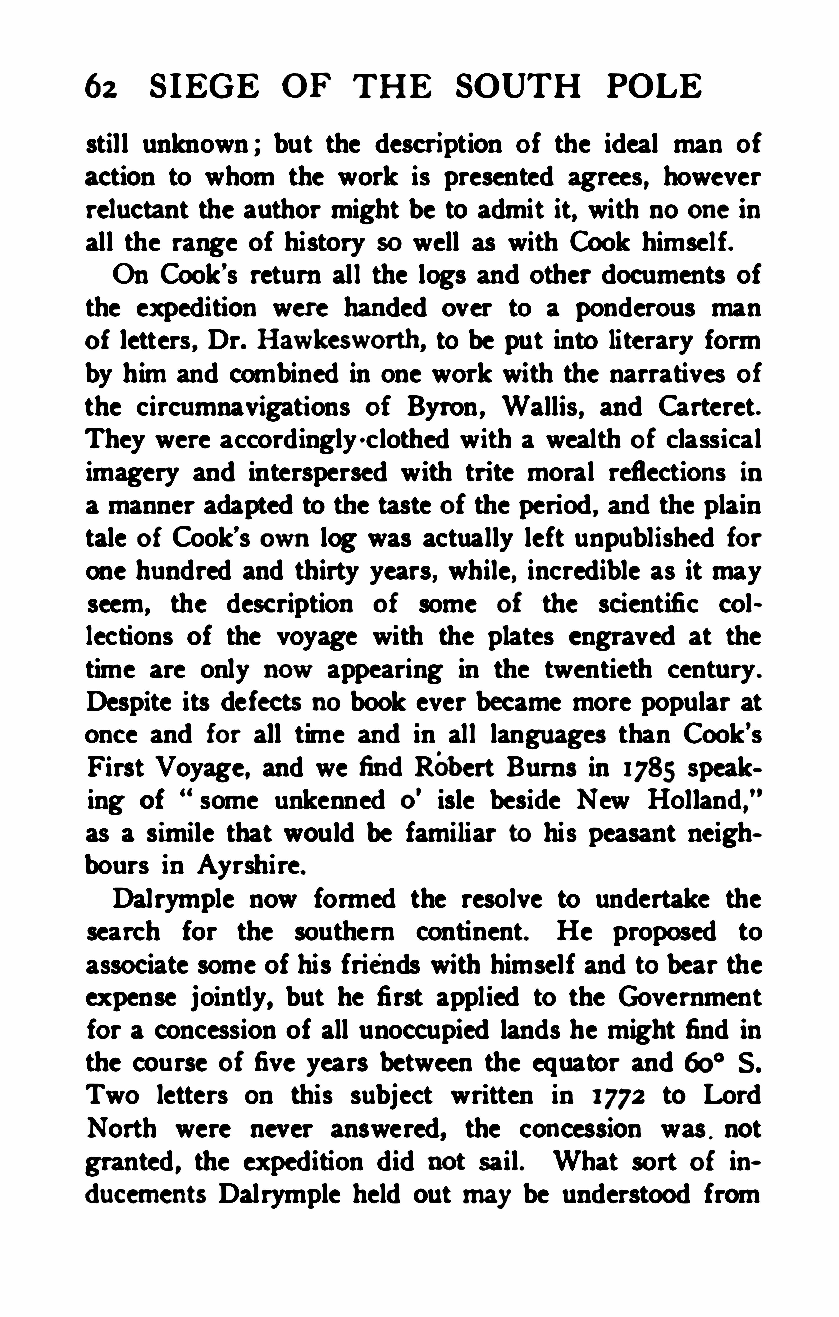
62 SIEGE OF THE SOUTH POLE
stil l unknown ; but the descri ption of the ideal man of
action to whom the work is presented agrees , howeverreluctant the author might be to admit it, with no one inall the range of history so well as with Cook himself.On Cook’s return all the logs and other documents ofthe expedition were handed over to a ponderous manof letters , Dr. Hawkesworth, to be put into literary formby him and combined in one work with the narratives ofthe circumnavigations of Byron , Wallis , and Carteret.They were accordingly -clothed with a wealth of classicalimagery and interspersed with trite moral reflections ina manner adapted to the taste of the period , and the plaintale of Cook’s own log was actually left unpublished forone hundred and thirty years, while , incredible as it mayseem, the description of some of the scientific collections of the voyage with the plates engraved at thetime are only now appearing in the twentieth century .
Despite its defects no book ever became more popular atonce and for all time and in all languages than Cook’sFirst Voyage, and we findRobert Burns in 1785 speaking of some unkenned o
' isle beside New Holland,
”
as a simile that would be familiar to his peasant neighbours in Ayrshire.Dalrymple now formed the resolve to undertake thesearch for the southern continent. He proposed toassociate some of his friends with himself and to bear theexpense jointly, but he first applied to the Governmentfor a concession of all unoccupied lands he might find inthe course of five years between the equator and 60° S .
Two letters on this subject written in 1772 to LordNorth were never answered, the concession was ,
notgranted , the expedition did not sail . What sort of in.
ducements Dalrymple held out m y be understood from
JAMES COOK 63
the following extract obviously based on the epistle ofArias which he had discovered and translated as animportant document.The American colonies are generally supposed to con
tain two millions of people, whose commerce with Britainis thought to give them an over- ruling influence. Thenumber of inhabitants in the Southern Continent is probably more than 50 millions , considering the ex tent,from the eastern part discovered by Juan Fernandez , tothe western coast seen by Tasman , is about 100 deg. of
longitude , which in the latitude of 40 deg. amounts to4596 geographic, or 5323 statute miles. This is agreater extent than the whole civilised part of Asia, fromTurkey to the eastern extremity of China. There is atpresent no trade from Europe thither, though the scrapsfrom this table wou ld be sufficient to maintain the power,dominion, and sovereignty of Britain, by employing allits manufacturers and ships .”
Hawkesworth’
s account of Cook's First Voyage waspubli shed in three quarto volumes in 1773 , and Dalrymple not caring to attack Cook directly, immediatelyfell upon the conscientious though infelicitous edi torwith a letter occasioned by some groundless and illiberalimputations made in the work. Hawkesworth repliedin the preface to the second edition, and Dalrymple re
spondedwith a force and vivacity that may be appre
cis ted from an extract“ Altho’ I believe in P rovidence, I am not a Roman
Catholic to give my confidence into the keep ing of Dr.Hawkesworth , or any other Doctor ; nor do I think mysel f bound to avoidevery man whose conduct and behaviour, in certaininstances, I condemn :altho
’ the deathof anIndian unnecessari ly may appear to me murder,
64 S IEGE OF TH E SOUTH POLE
it may not seem so to him, and therefore altho’ I think the
act, murder , I cannot deem him, absolutely, a murderer ;or perhaps he may have repented: at the same time, ifI thought I could obtain any information useful to thePublic by associating with the Devil or Dr. Hawkesworth ,I should have no scrnples of conscience to be in theircompany
,tho’ the one could not induce me wantonly to
destroy my fellow- creatures, nor the other, by all hiserudition and elocution, convince or persuade me thatin little more than seven years , Discoveries have beenmade for greater than those of all the navigators of theworldcollectively, from the ex peditionof Columbus tothe present time .’
While this unedifying strife was inprogress the Adomiralty had taken a shorter way to settle the questionin dispute. Cook, whose only ofiicial reward had beenthe simple promotion to Commander, received at least“ the glory of going on.
” He was appointed to command a new ex pedition intended to solve the problem ofthe Southern Continent finally, and he had scarcelywound up the affairs of his first voyage before he wasdeep in the preparations for the second. These preparations were of no ordinary kind. He had to procureships, and arrange for their stores and provisioning. The
latter was a matter to which he gave the minutest personalattention . In his previous voyage he had made successful experiments in the prevention of scurvy which in allearlier voyages of circumnavigation had played havocwith the crew. He determined to get rid of this bug- bearto exploration, and accordingly laid in quantities of preserved vegetables, mostly in the form of pickles and“sour krout,
” as well as malt and various extracts ofherbs. The necessity of cleanliness was also present


JAMES coox 65
with him and the regulations he made for the conductof his crew in this particu lar were very like those in forceat the present day, though a startling innovation in anaval ship of 1772. As to the vessels, Cook stated hisrequirements in these wordsA ship of this kind must not be of a great draught
of water, yet of a sufficient burden and capacity tocarry a proper quantity of provisions andnecessariesfor her complement of men, and for the term requ isite to perform the voyage. She must also be of
a construction that will bear to take the ground , andof a size which, in case of necessity, may be safelyand conveniently laid on shore to repair any accidentaldamage or defect. These properties are not to be foundin ships of war of forty guns, nor in frigates , nor inEast India Company’s ships, nor in large three-deckedWest India ships, nor indeed in any other but Northcountry-built ships as such are built for the coal trade,which are peculiarly adapted for this purpme.
”
Commander Cook on this ex pedition had two vessels ,both ship- rigged and of the stout north- country colliertype
,built at Whitby and nearly new—the Resolution ,
of 462 tons and 1 12 men under his own command , theAdventure , of 336 tons and 81 men, under that of Lieutenant Tobias Furneaux , who had been Wallis
’
s secondlieutenant. The appointments were dated on 28th November, 1771 . The Admiralty instructions were datedJune a5th , 1772. Lord Sandwich, who was at that timeFirst Lord, took the deepest personal interest in the expedition, visiting the ships again and again during theirequipment
,and coming on board in Plymouth Sound just
before the expedition sailed , to assure himself that everything had been done to Cool
s
r'
s satisfaction.
66 S IEGE OF TH E SOUTH POLE
The object of the voyage was to discover the grcatSouthern Continent if it existed or to disprove its existence definitely. The plan was in fact simi lar to that ofKerguelen
’
s second voyage, diff erent as was the result.Cook was instructed to proceed to Madeira, thence tothe Cape of Good Hope, then a Dutch possession , for itmust be remembered that at that date there was no Britishterritory in the Southern hemisphere and that Cape Town,the river Plate, Valparaiso and Batavia were the nearestports to the Antarctic circle where a ship could refit.From the Cape he was to proceed southward in search ofBouvet’s Cape Circumcision in 54
°
S . , 1 1°20
'E . , and if it
were discovered to determine if it were part of a continent. In case it should be so he was to explore as muchof the continent as possible, to land and make such
“oh
servations of every kind as might be useful either to navigationor commerce, or tend to the promotion of naturalknowledge.” H is attitude towards the inhabitants , if any,was laid down carefully and he was enjoined to invitethem to trade and show them every kind of civi lity andregar The continent was to be coasted either castward or westward and the exploration continued as nearto the South Pole as possible so long as the state of thevessels and the health of the crew permitted, and asufi ciency of provisions was in hand to enable the shipsto reach a port of supply. Shou ld Cape Circumcision befoundto be onan islandit was to be surveyed, and inthis case, or i f Bouvet
’s reported land could not be found,Cook was instructed to proceed southward as long as heconsidered that there was any likelihood of falling inwith the continent andthen to proceedeastwardin a
high latitude until he had circumnavigated the globe,making such discoveries as might be as near the pole as

68 S IEGE OF THE SOUTH POLE
sands of pounds in preparation .
‘ It was held to be ofpublic utility that some person skilled in NaturalH istory should accompany the ex pedition and , asCook drily observes in his preface,
“ Mr. John Reinhold Forster with his son were pitched upon forthis employment.” The choice turned ou t to be an un
happy one, but it proved valuable in a quite unexpectedway, as the eloquent expression the disappointed naturalists gave to their grievances supplies all the touches of human interest that are lacking in Cook’s impassive chroniele. The equipment of sc ientific instruments was slendersetting aside those for astronomical work and the ordinaryduty of navigation we find mention made only of anazimuth compass , a dipping needle , a marine barometerand two portable barometers, a wind-gauge, six thermometers, a theodolite, level and chain and an apparatusfor taking the temperature of the sea at various depths .There were chronometers of several patterns, the use ofwhich for determining longitude was then in an ex peri
mental stage , and these proved invaluable.The expedition left the Thames on June 22nd, and sailedfrom Plymouth on July 13th , 1772. Madeira was reachedonthe 29th , and after a stay of three days the voyagewas resumed , Cape Town being reached onOctober 3oth .
At Cape Town Cook was courteously received by theDutch governor, who informed him of the results of thevoyages of Kerguelen and of Marion and Crozet
,and
showed a chart of their discoveries. Here also he metAndrew Sparrmann, a Swedish naturalist, one of the
sentedwith a number of large glass Jars for preserving plants inspirits that hadbeen part of Bankr'a equipment for Cook’s secondvanes.
JAMES coox 69
many pupils of Linneus who were engaged in studyingnatural phenomena in all parts of the globe. Dr. Reinhold Forster was much attracted by the young Swede andfelt that he wou ld be a most valuable assistant in makingscientific observations. Sparrmannwas eager to extendthe sphere of his researches and after much importunityCook consented to take him on board , Forster paying forhis food and allowing him a salary at his ownexpense.The expedition left Cape Town on November 22nd,
1772. steering in the direction of Bouvet’s Cape Circumcision. On December 1oth, in 50
°
40’ S . and 20° E the
first ice was met with, a majestic berg perpendicular inthe sides, flat on the top, a veritable island of ice. Nextday the bergs had increased in number, the sea ran high ,a fierce storm was blowing and thick fog lay over everything. On the 1 1th Cook crossed the assigned latitudeof Cape Circumcision at a point ten degrees east of Bouvet’s longitude . All eyes were onthe outlook for the expectedland , and again and again the wreaths of sea- foglightened and the edge of some huge berg appeared , tobe mistaken for land for a few moments and then recognisedas a drifting island of ice. Yet some of the 051cers held to the belief that land had been sighted untilon the return voyage two years later the Resolutioncrossed the reported situation of Bouvet Island in clearweather and saw nothing. Cook, thanks to his chronometers, was able to keep a good account of longitude aswell as latitude. As he pursued his way southward hehad also to work eastward along the edge of a fieldof heavy floating ice ; but rounding that obstruction in57
° S . he turned to the W . S. W. until he crossed themeridian of 10
° E. in latitude 59° S. He now had
passed 300 miles to the south of Bouvet's position for
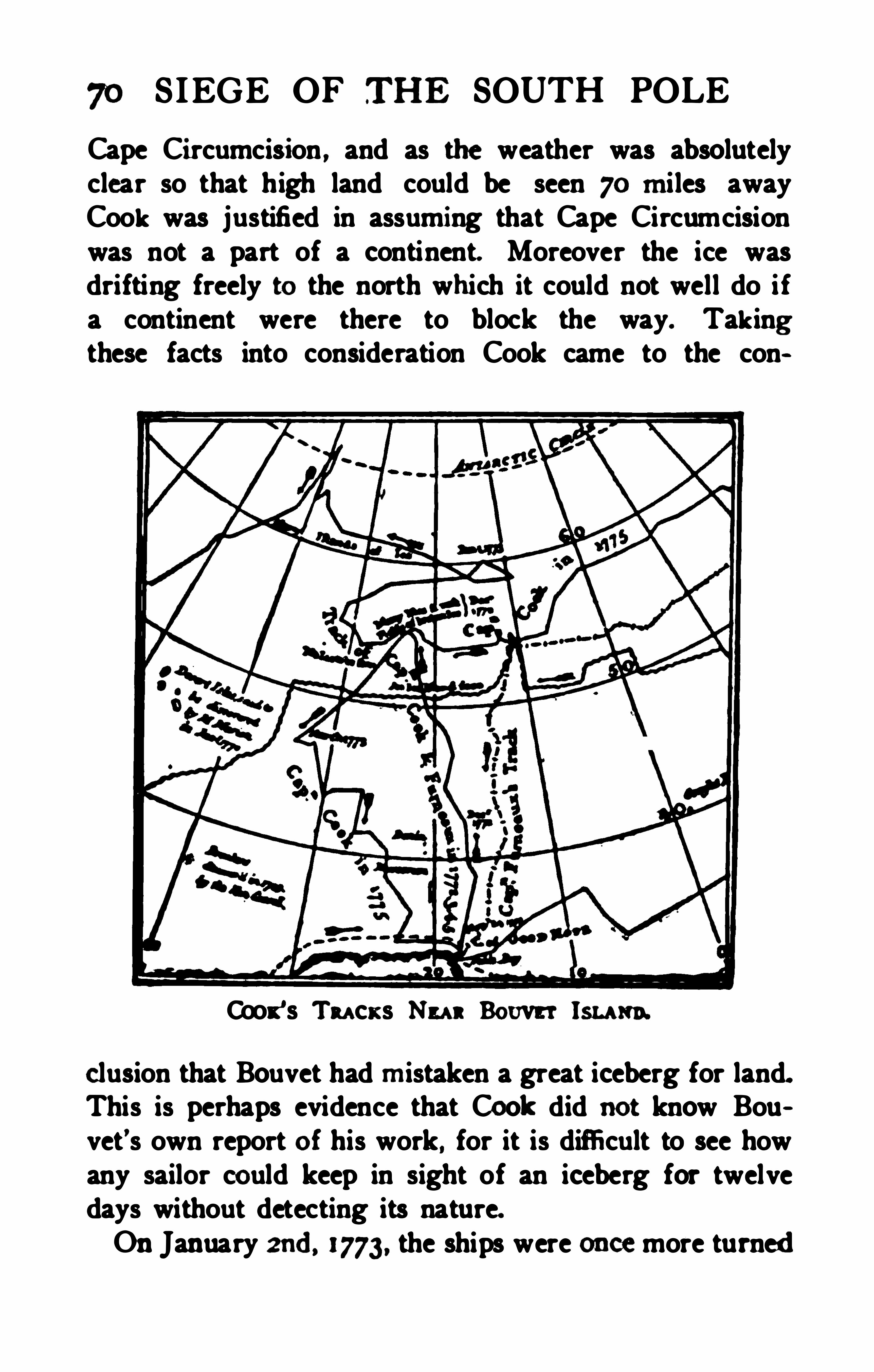
70 SIEGE OF THE SOUTH POLE
Cape Circumcision , and as the weather was absolutelyclear so that high land could be seen 70 miles awayCook was justified in assuming that Cape Circumcisionwas not a part of a continent. Moreover the ice wasdrifting freely to the north which it could not well do ifa continent were there to block the way. Takingthese facts into consideration Cook came to the con
Coot ’s Tu ck s Nu nBouvet lsu un.
elusion that Bouvet had mistaken a great iceberg for land.This is perhaps evidence that Cool: did not know Bouvet’s own report of his work , for it is difficult to see howany sailor could keep in sight of an iceberg for twelvedays without detecting its nature.On January zud, 1773, the ships were once more turned

72 S IEGE OF THE SOUTH POLE
southward was made impossible by the increasing thickness of the crowd of bergs and at 6 p. m . on the same daya vast expanse of solid ice appeared , rising only abouteighteen feet above the sea but stretching with a perfectlyuni form surface, as far as the eye could reach from thetop Of the mast. It was the signal for retreat. Theseason was too far advanced to try to turn the edge ofthis barrier andto the joy of all on board except thecaptain the Resolution’s head was turned northward inlatitude 67
°15
’ S . and 39°
35'E. due south of the Mosam
bique Channel . The supply of fresh water had givenou t some time before, but Cook was aware of somepreviou s researches on sea- ice and to the disgust of hissailors who expected an earlier refuge in some NewCytherea ” of the tropics , he ordered out the boats andfilled his barrels with blocks hewn from the nearestmass of floating ice.At the end of January the Resolution was cruising in
49°
N . , 59° E. looking for the lands discovered by the
French expeditions of the previous year of which Cookhad heard at Cape Town . It is curious that he wasexactly in the latitude of Kerguelen Land , but 10° toofar east, being in fact midway between that island andthe Crozets , and accordingly he saw nothing of either.The two ships parted company in a gale on February8th , and as a portion of the sununer still remained , Cookbore southeast once more , and fell in with icebergs in themiddle of February in 57
° S . On February a4th he wasin 61 ° 52
’ S. and 95°E , and once more fields of ice
blocked the way. Again and again the appearance ofpenguins and other birds seemed to indicate the vicinityof land , but Cook did not lay much stress on this prognostic and was convinced that far from being the north


74 S IEGE OF TH E SOUTH POLE
with the visionary continent of Quiros and Dalrymple,bu t no land of any kind was sighted.Toward the endof August the two ships cast anchor
in Matavai Bay, in the sailor’s paradise Tahiti , and there
the life for a few brief weeks would have justified thesternest moral censure of Dalrymple. The men hadworked hard and endured much , and sailors have alwayshad large license in the manner of their refreshment. "
Forster, with his usual spitefulness , Obu rvedthat thescenes of debauchery on board the ships at Tahiti almostmade him believe they were in Spithead. This brief ihterlude over, the stern discipl ine which Cook always ex ~ercisedwhen at sea was again imposed and the ships teturned toward New Zealand. The Adventure was lostsight of and not seen again until the return to England ,but the Resolution arrived at Queen Charlotte Soundon November 3d, 1773, and after catching and salting aquantity of fish, and gathering every green thing which byany possibility cou ld be eaten to keep away scurvy theysailed for the frozen seas on the a6th .
The 6oth parallel was crossed in 177° W. , whence a
course was held to the southeast and the first ice met withon December 12th in 62° 10
’S . , and 172
° farther south than was the case a year earlier to the south ofthe Cape of Good Hope. The ice, once met with , soonincreased in quantity and on the 1 sth it was necessary toturn northward , but on the 20th the Antarctic circle wasreached in 147
°
30’W. , and for three days the Resolution
pushed her way eastward within the circle, reachingthe farthest latitude of 67
°
3 1' S . on December 22nd. On
the 23rdit was found necessary on account of the ex haustion of the officers and men and the continued badweather to stand northward aga in in 135
°W. , after mak
JAMES COOK 75
ing twelve and a half degrees of casting south of thecircle. The ship reached 47
°
50’ S. in 123
° W. ,
a usefu l detour, since it showed that no continuous landstretched between New Zealand and Cape Horn
,but
affording lit tle rest to the jaded crew, who on January 18th were once more on the poleward side ofbound south . On January 20th icebergs appeared , one ofthem towering to a height of 200 feet , with a dome- shapedpeak, but as the ship got farther south the number ofbergs diminished and the air grew warmer.When the Resolution crossed the circle for the thirdtime in 109
°
3 1'W. onJanuary a6th, 1774, no ice was in
sight but fioes appeared next day and a thick fog cameon
,greatly hampering navigation. Every one onboard
was suff ering more or less from the salt food and the miscrable weather. George Forster we are sure did not exaggerate when he said
,A gloomy, melancholy air loured
on the brows of our shipmates, and a dreadful silencereigned amongst us. The hour of dinner was hateful to us." The captain alone , he said, seemed to growbetter as they advanced toward the pole. On January3oth, 1774, the weather was clear and the ship wasblocked in 71
°10
' S . and 106° 54'W. It was the farthest
south of the cruise and of the century. The situation isthus described by Captain Cook himselfOn the 3oth , at four o
’clock in the morning, we perceivedthe clouds. over the horizon to the sou th , to beof an unusual snow-white brightness, which we knewannounced ou r approach to field ice. Soon after it wasseen from the tOpmasthead, and at eight o ’clock we wereclose to its edge . It extended east and west far beyondthe reach of our sight. In the situation we were in, justthe southern half of our horizon was illum inated by the
76 SIEGE OF TH E SOUTH POLE
rays of light refiectedfrom the ice to a considerableheight. Ninety- seven ice hills were distinct ly seen withinthe field, besides those onthe outside—many of them very
large andlooking like a ridge of mountains rising one
above another till they were lost in the clouds. Theouter or northern edge of this immense field was composedof loose or broken ice close packedtogem“ , so
that it was not possible for anything to enter it. Thiswas about a mile broad, within which was solid ice inone continued compact body. It was rather low and flat(except the hills) , but seemed to increase in height asyou traced it to the south , in which direction it extendedbeyond our sight. Such mountains of ice as these , Ithink, were never seen in the Greenland seas, at least notthat I ever heardor readof , so that we cannot draw a
comparison between the ice here and there . It must beallowed that these prodigious ice mountains must addsuch additional weight to the ice fields which enclosethem as cannot but make a great difference between thenavigating this icy sea and that of Greenland .
I will not say that it was impossible anywhere to getfarther to the south ; but attempting it would have beena dangerous and rash enterprise , and which , I believe,no man in my situation would have thought of. It was.indeed , my Opinion, as well as the Opinion of most onboard, that this ice extended quite to the pole , or perhapsjoined on some land to which it had been fix ed from theearliest time , and that it is here , that is, to the south ofthis parallel , where all the ice we find scattered up anddown to the north is first formed
,and afterwards broken
off by gales of wind or other causes and brought to thenorth by the currents , which are always found to set inthat direction in high latitudes. As we drew near this

78 S IEGE OF THE SOUTH POLE
could move, and it must be remembered that the worsteff ects of scurvy were sti ll kept at bay and there were nodeaths .The Resolution sailed north between 100
° and 90° W. ,
looking for Juan Fernandez land , the report of whichhad been made known by Dalrymple ’s translation of thelong forgotten letter of Arias , but no such land had beenfound when on February.
21st , Cook reached the positionassigned to its northern coast, 37
°
54' S . and 90
° W. ,
and after several days satisfied himself that if there wasland at all, it could only be a small island, as there wasroom for nothing of any great size between his trackand those of the other circumnavigators . Having disposed of the Spanish myth , he turned westward to provethat the only kernel of truth in the great ex panse of DavisLand as shown on Dalrymple ’s chart was the quaintlittle Easter Island. The island was found none too soonto replenish the supply Of food
,and its marvellous
statues and terraces so unlike the work of any knownPolynesian race formed a welcome objec t of study anddescription for both Officers and naturalists . At length ,on April 22nd, the blissful island of Tahiti was reached ,all warmth and fruit and flowers, and the anchor droppedin Matavai Bay for a happy month amongst the gu ileless natives, when , as Foster observed, the poet
’s
Todress, to dance, to sing , our soledelight,The feast or bath byday, andlove by night,”
could be applied to the ship's company with peculiar
Not quite a month, however, for Cook, with restoredhealth and a robust crew set sail on May 15th, 1774, for
a fresh voyage of discovery. If heaping coals of fire on
him with a burning fiery furnace seven times heated.W'
nhmnnttering a wordof anger or rescnuuent he proeeededcahnly andsyfi ematically to wipe out of the mapof the Soudi Padfie as he lndalready wipedw t of theSou th Indian Ocean. every line of that imaginary conti
was now to share the fate of Juan Fernandez andlidward Davis. Proceeding to AustraliadelEspi ritu Santos, which had been so gloriously annexed to Spain.Cook and the Resolution resolved the dazzl ing continentinto a small , unhealthy archipelago inhabited by the
most hopeless savages . He named the group the NewHebrides . Then , adding New Caledonia to hisdiscoveries by the way, he regained New Zealand, ready to takeadvantage of the third Antarctic summer.On November 10th, 1774. Cook left New Zealandbound for home after one more campaign in the ice. lie
crossed the meridian of 160° W. in 56°S ., and held a
course eastward between 57° and 53
‘ S ., meeting littleice and encountering no land until the islands of Tierradel Fuego were sighted on December t7th. Coastingthose islands the Resolution found a favourable harbour,which received the name of Christmas Sound , for hereon Christmas eve a lucky shooting expedition broughthome a great bag of geese. Nomanprobably ever caredless for the pleasures of the table than James Cook :buteven he confessed that he hadgrown sick of the ancientsalt beef and pork that remained of their stores. Freshfood of any kind was welcomed, the puppy-seals weretri edandfoundpalatable, the meat of the females wasnot mnch amiss, but the oldbulls were votedabominable.
80 S IEGE OF THE SOUTH POLE
Penguins were thought disagreeable, but they were freshand that made them go down. However, the geese werea rare treat and as a little Madeira wine was left, theonly article of our provisions that was mended by keeping,
” Cook remarked “ our friends in England did not .perhaps, celebrate Christmas more cheerful ly than wedid.
”
The few days’ rest after the dull months of
Coox's Cu rr or runlsu or Gam a.
(From Cook’s SecondVoyage ”)
onous hardship did good to all hands . The captainlooked back with immense satisfaction to his proof thatno vast temperate continent lay in the South Pacific . andhe looked forward to yet another southward cruise beforeturning the bows of his weather- beaten ship homeward.
Cape Horn was doubled on December 29th, anda


JAMES coox 8:
andsounds. ThenCook set sail to the eastwardto eze
pime the Gulf of S t Sebastian, a great bay inthe eoastline of Dalrymple
’
s SouthernContinent. But past ex v
perience of Dalrymple s chart hadfilledCook s mind withdoubt as to the ex istence of any such coast -line, andwhenhe foundopen sea in fact , where landwas indicatedonpaper , he turned at once to a more hopefulquest. Thiswas the landdiscoveredby IA Roche in 1675, andseenagain by the ship Leon in 1756, which was reported to bein 54° 30
’S ., though the longitude was showndifl'ercntly
in vari ous maps . Land was sighted on January 14th.
1775; at first it seemed to be only an ice island. but asounding in 175 fathoms confirmed the opinion that itwas indeed land, and from its thick covering of snowit seemed to be of great extent. On the 16th the Resolutionwas close up to the north coast, and during thatday and the next cruised along it, naming the capes andbays. Three landings were made at different points.the British flag was hoisted and the captain took possession of the Isle of Georgia in his Majesty's name ,under a discharge of small arms."
This was the first discovery of a typical Antarctic land .
True, it lay in a latitude corresponding to that of thenorth of England , bu t even at midsummer it possessedthe climate of Greenland. Ice- cliff s came down at thehead of the bays and masses of ice were continuallybreaking off and floating out to sea. I f the coast wasrepellant, the inner parts of the country were not lesssavage and horrible. The wild rocks raised their loftysummits ti ll they were lost in the clouds. and the valleyslay covered with everlasting snow. Not a tree was tobe seen, nor a shmb evenl
zig enough to make a tooth
82 SIEGE OF THE SOUTH POLE
pick. The only vegetation we met with was a coarselong- bladed grass growing in tufts , wild burnet, and aplant like moss, which sprung from the rocks.
”
The shores swarmed with seals , especially at that season with females and innumerable cubs . It seemed toCook absu rd to call these creatures sea- lions , for he couldsee no resemblance in them to the king of beasts. Therewere great flocks of the largest size of penguins ; somethat were brought on boardweighed from 29 to 38 pounds,and there were other sea- birds innumerable. When hereached the eastern extremity of the land Cook got bearings of the same features along the south coast that hehad seen from the western end, and so he was obliged toconclude that despite its snows this was no continentbut a small island. I must confess
,
” he adds, thedi sappointment I now met with did not affect me much ;for to judge of the bulk by the sample it would not beworth the discovery. Nevertheless , a point on the southcoast was christened Cape Disappointment.Cook was greatly impressed wi th the discovery of asnow- clad island, and at once concluded that Bouvet
’sCape Circumcision might not have been an iceberg afterall and that the South Atlantic might have more lmdinstore for him than he would have time to explore. Theweather became foggy and the winds l ight and variable,so that it was the a3rdbefore the Rwolution left theneighbourhood of the Isle of Georgia and set out southeastward. The parallel of 60° 5. was crossed on themeridian of 30
° W. , but bergs and pack ice were foundso closely massed in that position that it was necessaryto tu rn again northeastward . On the way Cookdiscovered a rocky land which he named Southern Thule , because its lati tude, 59
°13
’
S ., was higher than that of any

84 S IEGE OF THE SOUTH POLE
Atlantic also was an error ; andso he wipedthat toofrom the map, leaving the far south of the globe a cleanslate for the insertion of real discoveries.At last , his labours over and well done, Cook bore upfor Cape Town. On March 18th and roth , when becalmed 06 the coast, he met a Dutch and a British ship,which supplied him with fresh provisions and the almostforgotten luxuries, tea and sugar. Old newspapers also,which were new to men three years away from civilisation , and the news that the Adventure had returned tothe Cape a year before, having come round the Hornandcrossed both Pacific and Atlantic nearly in 60° 5well to the south of the track of the Resolution. CapeTown was reached on March 22nd; there Cook metCrozet, of Marion
’s expedition and learnt from him ofthe discoveries of Marion and Kerguelen in detail. OnJuly 3oth , 1775, the Resolution dropped anchor atSpithead , and the most adventurous voyage since that ofMagellan came to an end. The expedition returned afteran absence of three years in good health , having lost onlyfour men, three by accident and one from a diseasewhich would probably have killed him sooner if he hadstayed ashore. This record was unique and inaugurateda new era in long voyages , for thanks to the unceasingvigilance of Cook and the insistence with which he administered preventatives and enforced cleanliness , scurvywas shown to be no necessary accompaniment of li feat sea.Cook returned, not as the discoverer of a new continent, but as one who had achieved the far moredifi culttask of proving a negative beyond the cavil of his hitterest cri tic Had we found out a continent there,
” hesaid , we might have been better enabled to grati fy curi
JAMES COOK 85
osity ; but we hope our not having found it, after allourpersevering searches, will leave less room for futurespeculations about unknown worlds waiting to be explored.”The vast masses of ice in the Antarctic region pro
foundly impressed the navigator and convinced him thatthere was indeed a frigid continent within the Antarcticcircle, though he had not caught sight of it. As to thelands he had seen , and the nature of those beyond, he concluded :Countries condemned to everlasting rigidity by Na
ture, never to yield to the warmth of the sun, for whosewild and desolate aspect I find no words ; such are thecountries we have discovered ;what then may those resemble which lie still further to the south ? Shouldanyone possess the resolution and the fortitude to ciucidate this point by pushing yet further south than I havedone, I shall not envy him the fame of his discovery, butI make bold to declare that the world will derive no benefit from it.”
Looking back on the hardships and the difficulties ofhis attempts to penetrate the Antarctic regions, Cookwas even ledto dec lare that he believed no man wouldever push farther south than he had done and that theregion round the southern pole would always remainscaledup in its ice, unknown to man. He consideredthat his proof of the possibility of preserving the healthof a ship’s company at sea throughout a long and tryingvoyage was the greatest of his achievements and enoughin itself to make the voyage memorable when the disputes about a southern continent shall have ceased toengage the attent ion and to divide the judgment ofphilosophers.” The Royal Society awarded him the

86 S IEGE OF THE SOUTH POLE
Copley medal , not for his discoveries in geography, butfor this demonstration in hygiene.Dalrymple was vanquished , but he held his peace ;he had returned to India in a high official podtion.
and on his retirement from the East India Company’s
service, he sunk his olddifferences with the Admiraltyand became its first hydrographer, when that ofii ce wasinstituted in 1795. Eleven years later he was dismissedfor some characteristic excess of zeal, and died of abroken heart .
It is interesting to speculate as to what the result mighthave been if instead of leaving the wide section south ofNew Zealand unvisited , because from the direction of thewind he believed there was no land there unless it layvery far to the south, Cook had endeavoured to pushsouth to the southward, say of Tasmania. He mighthave found a clear sea and discovered the coast of Victoria Land . He might, probably enough, have beenfrozen in the pack , and with his inadequate provision formeeting the added strain of cold and darkness, it is nottoo much to say that the chance of his escape would havebeen small indeed .
The only honour bestowed onCook by the governmentfor his stupendous service to science and to his country ,was a step in naval rank . But he also received the command of a new expedition to sail in the following yearand to attempt for the unknown north polar regions whathe had already done in the far south . To a man of hisnature, this was perhaps the greatest possible reward ,but the new work was his last, and his death left it uncompleted .
For nearly a generation no other vessel ventured intothe southern ice bent on exploration. But the merclnnts

88 S IEGE OF THE SOUTH POLE
many as seal - skins, and 2800 tons of sea- elephantoil
,the latter valued at and by 1801 the import
of oil from those regions reached 6000 tons, worthIn 1791 no less than 102 vessels, averaging
200 tons burden and manned by 3000 sailors , were engaged in secu ring fur- seals and oilin the Southern Ocean ,and the value of thei r cargoes in that year was estimatedat The voyage of Cook, which cost under
thus had proved a very profitable investment forthe nation as a mere matter of money, apart from theprestige acquired, especially in France, notwithstandingthe war, by Cook
's services to science and to humanity .
With so ri ch a harvest waiting to be gathered at the veryedge of the icy seas the sealers naturally felt little temptation to wander farther afield and incur certain dangersfor uncertain gain . Thus there is no sure knowledgeof any discovery having been made by British sealers upto the end of the eighteenth century.
When commerce begins to assert itself the history of
exploration inevitably becomes troubled and contradictory . The commercial explorer owes his first duty tothe firms employing him , and in order to safeguard theirinterests he must keep silence amongst outsiders as towhat he has seen . He may even cons ider it expedient topermit a suggestio fals i to arise in quarters where j udicions discouragement might secure him freedom fromcompetition. It is much to be regretted , says Weddell ,that any menshould be so ill advised as to propagatehydrographical falsehoods ; and I pity those who, whenthey meet with an appearance that is likely to throw somelight onthe state of the globe, are led through pusillanim~
ity to forego the examination of it. But the extremereluctance I have to excite pain ful feel ings anywhere
,
JAMES COOK 89
restrains me from dealing that just censure which is dueto many of my fellow- seamen, who by negligence, narrow views oi pecuniary interest, or timidity, have omittedmany practica ble investigations.” The evi l was evidentlyacutely felt at the time when this was written , about1824, Long after the monom of in formation has lostits values the logs of oldvoyages may sometimes be recovered in the archives of the business houses which hadcarried on the trade ; but too often they have been dest royed or lost sight of before the historian begins toinquire about them . This difficulty applies especially tothe beginnings of things, and so we cannot now speakwith certainty as to the first practical men who turnedCook’s second voyage to account.The last episode of the dwindling eighteenth century inthe southern seas was the repu ted discovery of the AuroraIslands , a group which for a time was the object ofalmost as much interest as Cape Circumcision itself,though they no longer figure on the chart. It was in1762 that the ship Aurora on her return from Lima ,sighted two islands about 35 leagues to the east of theFalklands ; the larger was several miles in extent, and theship passed between the two in latitude 53
°15
' S . Islandsin a similar position were seen in 1769 from the SanMiguel , and in 1774 the Aurora once more saw t wo
islands , one in 53°
38’
S ., about three leagues in length,separated from another at a distance of about three orfour leagu es to the E.S .E. The islands were seen againin 1779 and in 1790, and finally in 1794 the Spanish government sent the corvette Atrevida to fix their position.This ship, provided with chronometers, left the Falklandson January roth, 1794. After a slow voyage, muchprotracted by fog and bad weather , the Atrevida sighted
90 SIEGE OF TH E SOUTH POLE
a great
parts, one side white with snow, the other very darkthis was taken to be the islandin qnestion andwascoasted within a mile of the land, andnextday a secondisland was seen, not so high as the first , andabout tenmiles to the northea st. Several days were lost waitingfor the sun to appea r to make an observation possible,andat last the positions were obtainedas 53° 15’ S. and4 1
°
4'W. of Cadiz for the first island, and52°
37’ S.
and4 1 ' 26'W. of Cadiz for the second. The cru ise of
the Atrevida was a piece of simple marine surveying, ofno importance in exploration; bu t it is mentionedhere toshow how extremely uncertain the positions assignedtodiscoveries at sea often are, even in localities far re
moved from the atmospheric illusions peculiar to the
polar sees.

92 O
SIEGE OF THE SOUTH POLE
valuable article of trade.The whole question of American enterprise in theAntarctic regions has been discussed by Mr. Balch in hisAntarctica
,
” a work embodying a great deal of carefulresearch into old records , andto this we are much indebted . The first light on the subject comes from
Swain’s Island, which does not now appear on the chart,but it is reported on the authority of Edmund Fanningthat an island to which he gave that name wasdiscovered in 1800 in 59
°
30’S . , 100
°W. , by Captain Swain ,of Nantucket, and that it was
“ resorted to by manyseals .” It is probably Dougherty Island.According to a communication which was made byCaptain J . Horsburgh , Hydrographer to the East IndiaCompany, to Professor Heinrich Berghaus, the distingu ishedauthor of the Physical Atlas,
” American sealers had been at work in the South Shetlands since 1812,and had kept their field of operations a profound secretin order to exclude competitors . The shadowy formsof Captain Swain, of Nantucket , and his crew of phamtom Yankees may be imagined breaking in upon therookeries of those mist- wreathed island beachesslaying, skinning and boiling out the blubber of nuknown and now perhaps extinct species of seals. Wehave seen that so far as the trade in seal oil was concerned the Americans had no monopoly. To the laterexplorations initiated by the enlightened firm of EnderbyBrothers, we devote a special chapter ; but their association with the far southern trade began before the century. We first hear of their ships in the southern seasin October, 1808, when the Snow Swan under JamesLindsay , and the Otter under Thomas Hopper on a
AMERICAN SEALERS 93
whaling cruise in the South Atlantic, came upon Bouvet's
Cape Ci rcumcision . Fog and ice, the usual companionsof the mariner in those seas , did not allow them to landthough Lindsay stayed in the neighbourhood for a week,but they fixed the position of the Cape as 54
°15
'S . and4°
15'E. But during the first decades of the nineteenth
century the American interest in the seal -fisheries probably outweighed the British . How keen it must havebeen is shown by the fact that Edmund Fanning was appointed in 1812 commander of a United States expedition , in the Volunteer and H0pe, for a voyage ofdiscovery to explore the southern hemisphere and circumnavi
gate the globe . The unfortunate war between GreatBritain and the United States which broke out in thatyear made it impossible to proceed with the expedition .
Though the smoke of war now involved the whole of
Europe and North America, and the outlook for the tuture was black enough at home, the old Hanseaticmotto held its force N ecessare est navigarc andyear by year more and more ships sought the stormyneighbourhood of the Horn . After the final struggle of1815when the dist urber of the peace of Europe was himsel f enisled in the solitudes of the South Atlantic thetraders of the east and west sailed southward in increasing numbers.The first absolutely clear episode in the history of Antarctic discovery since Cook was due to a British seaman ,William Smith , captain of the brig Williams , of Blyth ,one of the north country craft so highly rated by Cook.
Trading between Montevideo and Valparaiso he broughthis ship round Cape Horn with a bold southward sweep inFebruary , 1819, believing that by keeping far 06 the landhe would find better weather for making what is always
94 S IEGE OF THE SOUTH POLE
an anxious passage under sa il. On the 19th, in latitude60
°
40' S. and longitude 60° W. he thought he saw land.
Night fell before he could make quite sure and he prudently hauled off to the north for the few hours of darkness of the southern summer night and stood south againnext day when the land appeared to him to be unmistakable.He happened to have a valuable eargo on board andbeing himself part owner of the ship he was afraid to runthe risk of a storm descending upon him when ofi an unknown coast ; being afraid too that the underwriters mightmake trouble about his insurances if he were to converta coasting trip into a voyage of discovery, be resumedhis course and reached Valparaiso in due time. Smithspoke of his discovery to the English residents at theChilean port , but was only laughed at for his pains, andit would appear that some of his ship’s company thoughtthat no land had been seen but merely icebergs. It wasabout mid-winter (June, 1819) before Smith obtained areturn cargo, and although he ran south to he sawnothing of the land and nearly got caught in the sea- icefrom which he was glad to escape even without confirmation of his discovery. At Montevideo as at Valparaiso incredulity andridicule were allhe received fromhis countrymen , but a partyhim desirous of further information and promising tocharter his brig for a sealing voyage on very favourableterms if he would only tell them the exact position of
the alleged new land.In order to understand the keenness of internationalrivalry at this period we must remember that three American whale- ships went round Cape Horn for every one
under the British flag. Reckless extermination was the


AMERICAN SEALERS 95
only method of seal- hunting resorted to on the islands ofSouth Georgia and the coasts of South America so thatthe first in the field at a new seal ing ground was su re ofan immense booty, and late- comers as likely as not wouldhave to go empty away. Smith was determined that hewould not part with his secret without an equivalent toanyone but a British subject and absolutely refused togive the American inquirers the information they wanted.
He off ered to take them to the southern land for a sealing voyage and if he could not find it to charge nothingfor the use of his vessel, but that remarkably liberal offerwas rej ected ; the inquirers wantedchiefly to know exactlywhere the land lay. Several months elapsed before hecould get a cargo together for another trip to Chile. Atlast he succeeded and on October 15th , 1819, came up withthe land in the position where he had seen it before, gotsoundings in 40 fathoms and nex t day sent a boat ashorewith the first mate to plant the Union Jack and take possession for Great Britain . He called the new land NewSouth Britain but afterwards changed the name to NewSouth Shetland because it was situated in the same latitude as the Shetland Isles of the northern hemisphere.The name did not imply any opinion as to the insularnature of the new land to part of which he refers as themainland, and the name of Antarctic Continent was evenrevived for it by some German geographers when thediscovery became known in Europe in the follow ingyear.Smith spent some days in cruising along the coast,standing out to sea at night and returning in the morning toward the land, picking out now a cape and now amountain in the fog and naming them more or less appr0priately, occasionally losing sight of the coast, and ap
96 SIEGE or THE SOUTH POLE
parently making no other landing. The scenery re
minded him strongly of Norway, so strongly that he evenimagined he could see pine trees waving on the distantslopes
,and he satisfied himsel f that the rocks and 05
lying islands swarmed with fur- seals, blubber- seals and
what he declared to be the true spermaceti whale.Altogether Smith saw the land more or less continuously along a course of 250 miles, and on reaching Valparaiso at the end of November he was able to give suchparticulars as convinced the British residents of thereality of the discovery. Apart from the enormousvalue for the seal and whale fishery the prospect of having some British possession , however desolate , within tendays’ sail was very welcome to Smith ’s compatriots whodid not feel too secure under the government of a newrepublic sti ll at war with its mother country. They re
sented the recent abandonment of the Falkland Islandsand were intensely anxious to have some outpost of theempire nearer than Cape Town on the one side and Sydney on the other. These feel ings were fully shared bythe Briti sh naval commander on the Pacific Station , Captain W. H . Shirrefi, who onhearing Smith ’s story re
solved to take immediate action . Mr. J . Miers , F. R . Sthe merchant to whom we are indebted for the firstdescription of the finding of New South Shetland , hadcommenced to load the Williams for her return voyagewhen Captain Shirrefi chartered her for a cruise ofexploration , and Miers , who was an enthusiastic naturalist, at once transferred his cargo to another vemel andgladly set the brig free for her more important work.
Edward Bransfield, Master R. N ., was put in charge, andthree midshipmen of H . M . S. Andromache accompanied

98 S IEGE OF THE SOUTH POLE
which we have definite information was due to the initiative of Mr. Edmund Fanning, who had before that timebeen in Sou th Georgia and formed theories as to theproximity of land to the south based on the drifting of
the ice . He had also read of Gerritsz ’
s reporteddiscovery and resolved that the matter was worthy of being putto the test ; moreover, he knew of the cruise of CaptainSwain of Nantucket in those waters, and he also knewa great deal more than he set down as to the doings ofearlier sealers . Anyhow, in July, 1819, the Hersilia sailedfrom Stonington under the command of James P. Sheffield with W. A . Fanning as supercargo. They visited theAurora islands, or some land which was taken for them,
and sailing south to 63° discovered what they took to be
the land of Dirk Gerritsz , naming several islands and landing on one at a place named Hersilia Cove in February,18a0. I f the latitude is correct these islands must havebeen members of the South Shetland group, and the Williams and Hersilia must for a time have been very nearneighbours though they did not sight each other. TheHersilia came home without delay
.
bringing a quantityof sealskins, including those of the valuable southernfur- seal . There was a flutter of excitement at Stonington , and energetic steps were taken to follow up thissuccessful voyage .
The southernsummer of 1820—21 was adark one for
the fur- seals whose ancestors had basked upon the shoresof the South Shetlands for untold centuries, followingtheir quaint semi-c ivi lised life and pursuing their patriarchal customs of war and love undisturbed by anybeing capable of contending with them. The sentrybul ls saw , with the stolid unconcern of ignorance . theapproach of a fleet of five sail ; certainly it was without


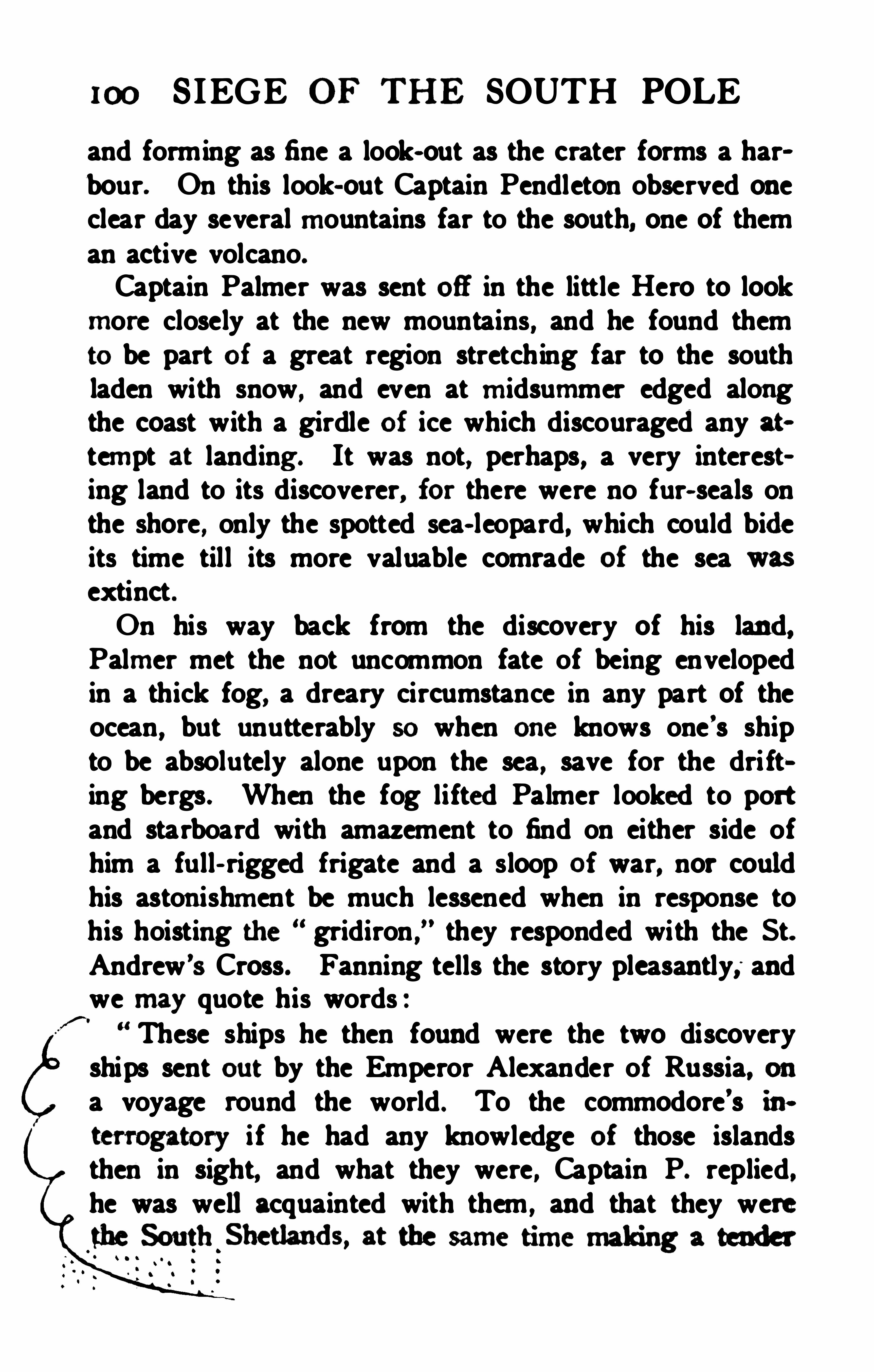
100 S IEGE OF TH E SOUTH POLE
and forming as fine a look- out as the crater forms a harbour. On this look- out Captain Pendleton observed oneclear day several mountains far to the south, one of theman active volcano.
Captain Palmer was sent off in the little Hero to lookmore closely at the new mountains, and he found themto be part of a great region stretching far to the southladen with snow
,and even at midsummer edged along
the coast with a girdle of ice which discouraged any attempt at landing . It was not, perhaps, a very interesting land to its discoverer, for there were no fur- seals onthe shore, only the spotted sea- leopard, which could bideits time till its more valuable comrade of the sea wasextinct .On his way back from the discovery of his land,Palmer met the not uncommon fate of being envelopedin a thick fog, a dreary circumstance in any part of theocean, but unutterably so when one knows one ’s shipto be absolutely alone upon the sea
,save for the dri ft»
ing bergs. When the fog lifted Palmer looked to portand starboard with amazement to find on either side ofhim a full - rigged frigate and a sloop of war, nor couldhis astonishment be much lessened when in response tohis hoisting the gridiron
,they responded with the St.
Andrew ’
8 Cross. Fanning tells the story pleasantly, andwe may quote his words :
“ These ships he then found were the two discoveryships sent ou t by the Emperor Alexander of Russia, ona voyage round the world . To the commodore’s in.
terrogatory i f he had any knowledge of those islandsthen in sight, and what they were , Captain P. replied.he was well acquainted with them , and that they werethe South Shetlands, at the same time making a tender


102 SIEGE OF THE SOUTH POLE
Land he made no reference to that fact in his own bookor in the atlas accompanying it.Palmer well deserved any kindly attention shown by
Bellingshausen , and we feel almost sorry that it was hisbrother
,Captain A. S. Palmer, who was the hero of the
pleasing little description by Dr. Webster of H . M . S .
Chanticleer,to which vessel a similar service was per
formed inTierra del Fuego eight years later :When he made his appearance on board the brig
with Captain Foster, we took him for another RobinsonCrusoe in the shape of some shipwrecked mariner. Hewas a kind and good- hearted man and, thinking thatthey would be a treat to us, had brought w ith him abasket of albatross’ eggs , which wereto us a most acceptable present.”
The Stonington fleet returned in the following year,when Palmcr in a stouter vessel, the James Monroe of
tinuedthe exploration of the land named
we know of, is deplorably vague as topositions, and it is hard to make sense of his statement :After proceeding to the southward, he met ice fast and
firmly attached to the shore of Pahner’s Land ; he thentraced the coast to the eastward, keeping as near the shoreas the ice would suffer ; at times he was able to come alongshore , at other points he could not approach within fromone to several miles, owing to the firm ices , although itwas in December and January, the middle summermonths in this hemisphere. In this way he coasted alongthis continent upwards of fifteen degrees, viz. , from 64
°
and odd, down below the 49th of west longitude. Thecoast, as he proceeded to the eastward, became moreclear of ice, so that he was able to trace the shore better ;
AMERICAN SEALERS 103
in 61 ° 4 1' south latitude, a strait was discovered, which
he named Washington Strait, this he entered and abouta league within came to a fine bay, which he named Monroe bay, at the head of this was a good harbor ; herethey anchored , cal ling it Palmer
’s Harbor.”s "
Tr-
Palmer followed the coast to 49°\V. be followed it
into what is certainly open sea, and if he found a harbour in 61° 4 1
' S . it could be in no known land. Fanning apparently suggests that Palmer's harbour lay in49
°W., which is far to the east of any land except theSouth Orkneys ; and from Powell
’s map there is no doubtthat what Palmer followed was the edge of the packwhich that season stretched unbroken to the South Orkneys where the strait he threaded and the harbour inwhich he anchored are duly charted. Nathaniel B. Palmer continued to follow the sea for many a year anddied
the age of seventy- eight.George Powell , apparently a British sealer,
accompanied Palmer in the sloop Dove for a considerablepart of his cru ise in 182 1 - 22, and gave a clear account ofhis track in an excellent chart published in London on hisreturn. This shows that he had not only improved thesurvey of the South Shetlands, but discovered and surveyedthe group of islands usually called the SouthOrkneys
, but originally known as the Powell Islands, aname to which it would seem only right to return .
Powell might have done much as an explorer , but heperished in a squabble with the natives of Tonga in 1824at the age of twenty- nine.For years to come the Americans regularly visited theSouth Shetlands, South Georgia and neighbouringislands and did not cease until the fur seal was extinct ,andeven the hair sealhad become scarce. The exploits
104 SIEGE or THE SOUTH POLE
of one other amongst their number must be referred to,Benjamin Morrell , who in 1832 published a book of hisvoyages resembling in many respects that published byEdmund Farming in the following year, from which wehave already quoted. Fanning was vague, but Morrellwas vaguer as to dates and places, and moreover, he wasintolerably vain and as great a braggart as any hero ofautobiographical romance . That he did sail to the Antarctic regions we cannot doubt, for he mentions thenames of too many men still living at the time of publication to leave that matter in question ; but the greaterpart of his most entertaining narrative concerns the
happy isles of the Pacific and the troubled coast of SouthAmerica. The incidents in his book are frequently verysimilar to those recorded by Weddell and other voyagers,whose published writings Morrell hadseen , but in everycase they are more remarkable and highly coloured , whilethe sheer absurdity of some of them shows that theauthor is romancing
.
regardless of fact.Morrell says he was a wild youth , running away to sea
in 1812, to be speedily taken by a British man-o f-warand detained for eight months a prisoner of war at St.John’s, Newfoundland , and after liberation back to thesea again , his valour no whit abated , though his secondvoyage landed him a prisoner of war onDartrnoor fortwo years. In June, 1821 , having heard much of theSouth Shetland Islands,
” which as we have seen , werediscovered three years before , though previou sly he hadonly sailed before the mast, he received the post of firstmate on the Wasp under Captain Robert Johnson, andstarted on a sealing voyage. Here remarkable adventures befell him in the way of hairbreadth escapes fromdrowning, from freezing to death in a gale in a small

106 S IEGE OF THE SOUTH POLE
Patagonia, and the first fortnight of November 1822 wasoccupied in a purposeless search for the Aurora Islands,although Morrell had just met his oldcaptain , Johnson ,at the Falklands , returning from the same hopeless quest,and knew of Weddell ’s exhaustive and conclusive searchmade two years before . He then visited South Georgiabut found no fu r- seals, and on December 6th , arrivedwithout any apparent difficulty at Bouvette
’
s Island,so called frombe ing first seen by that navigator in October
,Here the fore- shortening of time is pain
fully in evidence , since Bouvet’s Cape Circumcision of
1738 is run into Lindsay and Hopper's rediscovery in
1808, with a considerable flavour of Norris’s landing in1825. The only interesting fact is that this referenceproves that in 1832 , when Morrell
’s book was published ,the fact that the island had been seen in 1808 (and alsoin 1825) was known among the southern sealers. Ac
cording to Morrell , Bouvet Island was over 25 milesin c ircumference , situated in latitude 54
°15
’
S . , longitude6°1 1
'E . , and off the west end of the island where there
was a beach , a chain of grounded icebergs shut in atranquil harbour, in which the Wasp anchored in 17fathoms half a mile from shore. Rather fewer thantwo hundred skins were yielded by this beach , on which .the seals were so tame “ that they would come up andplay among the men who were skinning their companions .” A circumnavigation of the island showed thatthere was no other point save this beach on which a sealcould land. The island was of volcanic rock , the cl iffsin some parts presenting the appearance of blue andgreen glass ; the mountain, which rose some 3000 feetabove the sea- level , was covered with pumice- stone.with some patches of vegetation. Not a word is said as

BENJAMIN Mount-m a JR.
!TOM A ton.


108 SIEGE OF THE SOUTH POLE
being in lat. we crossed the meridian ofGreenwich in a fine clear day, and with the wind fromS . E. to S . S. W. , from which quarter it had blown forthe last four days . We now steered for the north andwest for Sandwich Land .
”
Sandwich Land was reached on February a8th, andthe interest of this part of the voyage makes a short discussionnecessary. Up to February 1st, the track fromKerguelen Land eastward lay to the north of Cook's,and the point where the westward voyage began is inwaters that have been frequently visited since 1823. Ifthe course from this point had been due west no onewould feel inclined to question it ; and if Morrell hadonly stated the longitude at which he steered a little tothe sou th and that at which he crossed the Antarcticcircle we could easily follow and criticise the track. Ob
servations made by all subsequent voyagers in those seasshow the extreme probability of southeasterly winds prevailing south of 64
°
S ., and so far as we can ascertain ,Morrellwas the only man except Balleny who ever triedto sail westward for any distance south of 60° S . with aview of penetrating the ice . All other explorers hadtried to get south when sailing from west to east againstthe prevailing winds of high latitudes. If Morrellsteered southward and crossed the Antarctic circle about1 15
°E he must have passed to the southward of the land
charted as Budd Land , Knox Land , Termination Land ,Kemp Land , Enderby Land , and Kaiser Wilhelm II .Land , proving them (i f they all exist) to be islands ;but between his position south of Enderby Land in
48°15
'E , and the meridian of Greenwich , where he
turned northward, his track lay so near the farthest southgained between those meri dians by Cook, Biscoe, Bell
AMERICAN SEALERS 109
ingshausen, and Ross , that it is easily credible. There isno inherent improbability in the insular character of thereported lands behind which Morrell seems to claim tohave passed ; but there is nothing in his narrative to showthat he may not have passed to the north of them ; thereis no improbability in a track of open water being foundsouth of the floating pack- ice. The speed of the voyageis indeed remarkable and some parts of it almost iacredible, but we are not disposed to place much confidencein the longitudes assigned, even if we allow that the cruiseis honestly reported .
After leaving Sandwich Land Morrell turned southwest again , passed through a heavy pack and came ou tinto an open sea in 64
°21
’
S . , 38°
51'W. , onMarch 10th ,
reaching 70°
14' S . in 40
°
3' W. onMarch 14th , 18a3.
Here, he says, he found the temperature of the air to be47
° and that of the water values certainly at leastten and perhaps fifteen degrees higher than we can believe possible in such a latitude and at such a date.
Weddell, a month before, had broken his only two thermometers a short distance to the north of the same position ; but said that the air and water were no colder thanthey were ten degrees (of latitude ) further north.Could Morrell have corrected Weddell ’s temperaturesfor 60° S . by ten degrees of temperature, and claimedthese figures as representative of the conditions in 70
°S . ?
It is curious to not ice that Morrell refers to Weddell ashaving reached a higher latitude in the same sea the yearbefore , whereas it was in the same year and only a monthearlier. From his farthest south , Morrell bore northwest and coasted some part of the land called New SouthGreenland by Johnson to its north cape, in 62° 4 1
' S .
This was probably intended for the land known later as
1 10 SIEGE OF THE SOUTH POLE
Louis Philippe Land and Joinville Land, bu t if so, itslongitude was wrong by Although a new ship several years later was built for this adventurous skipperand named the Antarctic, he never seems to have gonetowards the ice with her, and we leave Captain BenjaminMorrell , Jr., with his reflections at the farthest south.
I regret extremely that c ircumstances would not permit me to proceed farther south, when I was in lat.70
°14
'S .
, on Friday, the 14th day of March, 1823 , asI should then have been able , without the least doubt, topenetrate as far as the eighty-fifth degree of south latitude. But situated as I then was, without fuel , and withnot sufficient water to last twenty days , -destitute of thevarious nautical and mathematical instruments requisitefor such an enterprise , and without the aid of su chscientific gentlemen as discovery ships should always besupplied with ; taking all these things into consideration ,I felt mysel f compelled to abandon , for the present, theglorious attempt to make a bold advance directly to theSouth Pole. The way was open before me, clear andunobstructed ; the temperature of the air and water mild ;the weather pleasant ; the wind fair. The anguishof my regret, however, was much alleviated by the hopethat on my return to the United States, an appeal to thegovernment of my country for countenance and assistance in this (if successful ) magnificent enterprise wouldnot be made in vain . To the only free nation on earthshou ld belong the glory of exploring a spot of the globewhich is the ac plus ultra of latitude, where all the degrees oi longitude are merged into a single point, andwhere the sun appears to revolve in a horizontal circle.But this splendid hope has since been lost in the gloomof disappointment ! The vassals of some petty despot

1 12 SIEGE OF TH E SOUTH POLE
bordering the Antarctic circle , though with the exceptionof Morrell, we have not found that any of them claimedto have crossed the magic line that bounds the Antarcticregions properly ao- called . No doubt they accumulatedmuch information that has been lost to us, because atthat time no society existed in America which concerneditself with collect ing and preserving records of ex ploration or of encouraging geographical research . Thework was that of groups of individuals, amongst whomsome were fu lly alive to the importance of scientific observation, though to most the seal was more interestingthan the land it lived on.
The Antarctic summer of 1829- 30 saw Captain Pendletonin the brig Seraph , and Captain Palmer in the brigAnnawan once more in the South Shetlands and cruisingto the north and west of Palmer Land. On this occasion ,they were accompanied by two scientific men, Mr. J . N .
Reynolds and Mr. Watson, to whom the possib ilites of research in the vast unknown area onwhose verge theywere hovering, naturally appealed strongly. Mr. Reynolda states distinctly that several sealers had gone southof 70
° S . , had pursued their work on uncharted coasts,but declined from commercial motives to give anydefinite description of their discoveries . We are glad tolearn that the oldrecords and living memories at Stonington are being laid under contribution in order toproduce what cannot fail to be a fascinating work, thefull history of American sealers in the far sou th .
In 1833, Edmund Fanning presented a memorial toCongress “ praying that a national discovery and exploring expedition be sent to the South Seas ,
” and astrong effort was made to influence public Opinion in thematter. The Americans felt that they had been first in
AMERICAN SEALERS 1 13
the field andthey saw that they were indanger of losingthe credit of making new discoveries, for a formidablerivalry in their sealing ventures had sprung up. J. N .
Reynolds helped forward the cause in which he waskeenly interested, andin the course of an address to
Congress in 1836, he referred to the extensive group ofislands lying north of the coast of Palmer ’s Land, theextent of which neither wenor any subsequent navigatorshave as yet ascertained ; though a British vessel touchedat a single spot in 183 1 , taking from it the Americanandgiving it anEnglish name.
”
CHAPTER VI
m u x mnauszx ’
s w ru cnc VOYAGE
“To reside
Inthrilling regions of thick- ribbediee ;To be imprim din the viewless winds
The pendent world”—Snax zsm n.
EN the fog li fted from the deck of the little Heroin BransfieldChannel one morning in 182 1 the wor
thy Nathaniel B . Palmer of Stonington , Connecticut,gazed, we are told,with very natural surprise ontwo Russian men- of- war which loomed above him out of thedarkness. They appeared without notice and after themomentary intercourse with the sealers of Yankee Harbour they disappeared without a trace for many a day.
Even now the volumes which conceal the facts of thecru ise in the Russian language remain without a fullpublished translation into any tongue of western Europe,and it was many years before even a summary of the logof the expedition became known to sailors. The ex cellent abstract inGerman published by Professor Graveliusin 1902 gives the only really satisfactory account yetaccessible of one of the greatest Antarctic expeditions onrecord, a voyage well worthy of being placed beside thatof Cook , the only precursor in those waters.Early in 1819 the Emperor Alexander I. , probably act
ing on the advice of Baronde Traversey the headof1 14

1 16 SIEGE OF THE SOUTH POLE
The ships had already nearly completed their preparations for sea , and lay at Cronstadt where the new commander had scarcely six weeks at his disposal before setting out. He was personally to command the Vostok(Orient) a corvette barely 130 feet long and of ahnost 33feet beam
,built of pine at St. Petersburg the previous
year, and specially sheathed in copper below water.The moment Bellingshausen saw the lofty masts andslender spars of his ship he gave orders for them to becut down , the sail- area diminished , and the ship riggedand strengthened for rough weather.The secondin commandof the ex pedition, who had
received his commission on April sth, was LieutenantLazaretf , a promising oflicer who had served as a volunteer for four years in the British navy and then , entering the Russian service, had commanded a ship of theRussian-American company and had circumnavigatedthe world on his voyage to Alaska and back. H is shipwas an old Baltic trader, the Ladoga, of 530 tons, 120 feetlong and of 30 feet beam, also built of pine and speciallystrengthened for the cruise. Lazaroff had her mastsreduced and other changes made, and the Emperor issued a decree changing her name to M irni (Pacific ) :but Bellingshausen observed drily that despite the changeof name any naval ofiicer could see at a glance that shecould never keep pace with the Vostok. As a matterof fact the leading ship hadto make almost the whole
from her clumsy consort. While the repairs were beingcarried ou t with feverish haste Bellingshausen had a hardtime of it selecting his officers and crew. The numberof candidates was so great that the selection proved extremely difficult but at last the requisite reduction of the
Armre s t. Beccmosm uss x .
(From a portrait inthe Library of the ImperialNavalDepartmentinS t. Petersburg.)
I70 !are 1 16.


1 18 SIEGE OF THE SOUTH POLE
The two expeditions sailed from Cronstadt on July15th , 1819a~ the Vostok and the Mirni reaving first, boundfor the farthest south to supplement the voyage of Cook ;the Otkri tie and Blagonamerennii following, bound forthe farthest north with the special task of making theNorth West Passage from Bering Strait eastward .
The Antarctic ex peditionreached CopenhagenonJulya5th , when Bellingshausen and Lazaretf landed to pickup their German natu ralists and lay in a supply of rum,
wine and vinegar for the cruise . The latter purpose wasspeedily effected, but the naturalists did not appear. Theywrote explaining that a long voyage demanded muchtime for preparation , that they found the timemsumnentand so were sorry that they cou ld not come. A desperate efiort was made to find Danish substitutes bu t in va
'
m .
Bellingshausen says : We have lamented during thewhole course of the voyage and still lament that two Russians were not selected to carry out the natural historywork of the expedition , as we had wished at the beginning instead of depending upon unknown foreigners.”
Vice- admiral Lewenoren, a Dane, who was no friendof the English warned the captains against placing anyreliance onthe British Admiralty charts or the NauticalAlrnanack, the errors in which he assured them were thecause of many shipwrecks . However Lazarefi had hisfour years of service in the British navy to judge by ; andthe two ships made their way straight to Portsmouth tocomplete their equipment of charts and nautical instruments . On August 9th the Vostok anchored in Spithead,and three days later the two captains took coach forLondon to purchase charts, chronometers andsextants.The want of naturalists weighed heavily on Bellingshausen, the Emperor
’s plan was made imperfect by it, the
BELLINGSHAUSEN 1 19
ful l success of his voyage irnperilled; and in the hopeeven at the eleventh hour of filling the vacancies he ohtainedan introduction to the President of the Royal Society, the venerable Sir Joseph Banks, the oldfriend andcompanion of Captain James Cook.
All the enquiries were unavailing and the Russians returned to Portsmouth , whence after having completedtheir stores and waiting, hoping against hope for naturalists to be found the ships set sail on September sth . Theytouched at Tenerife and Rio de Janeiro, meeting the Russian Arctic expedition ou tward bound at the latter port,and then a straight run down the South Atlantic broughtSouth Georgia into s ight onDecember 27th . Two British sealing vessels were found at work here ; a running survey was made of the south coast to supplementCook’s work on the north , and two small off - lying isletswere given Russian names. Half way to the SouthSandwich Islands a sounding was made in 260 fathomswith no bottom , and a temperature observation at that
was met in 56°5. towering out of
the water for 180 feet and alive with penguins. . TheRussian sailors gazed with amazement at a sight soonto become the most familiar of every day appearances .Whales were observed in great numbers, and albatrossesescorted the ships on their way to the south. The firstdiscovery was made onJanuary 3rd, 1820, when a groupof three small islands was descried a short distance tothe north of the Sandwich group. It was appropriatelynamed after the Russian M inister of Marine , Baron deTraversey. One of the islands named after Savadofiski,the first ofi cer of the Vostok, was an active volcano risinginto a fantastic summit and emitting thick clouds of
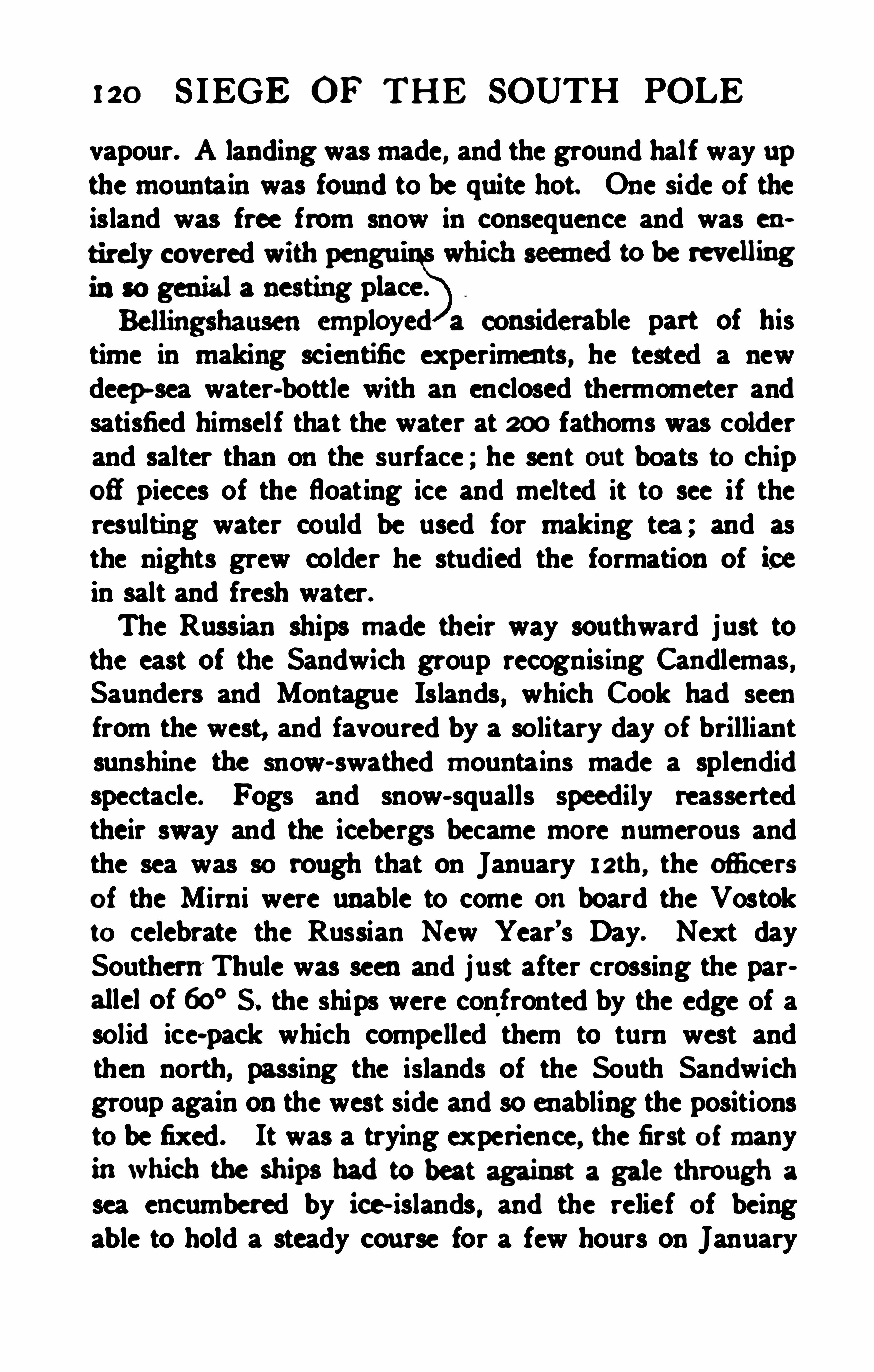
120 S IEGE OF THE SOUTH POLE
vapour. A landing was made, and the ground half way upthe mountain was found to be quite hot. One side of theisland was free from snow in consequence and was en
be revelling
part of histime in making scientific experiments, he tested a newdeep -sea water-bottle with an enclosed thermometer andsatisfied himself that the water at 200 fathoms was colderand salter than on the surface ; he sent ou t boats to chip03 pieces of the floating ice and melted it to see if theresulting water could be used for making tea ; and asthe nights grew colder he studied the formation of icein salt and fresh water.The Russian ships made their way southward just tothe east of the Sandwich group recognising Candlemas ,Saunders and Montague Islands, which Cook had seenfrom the west, and favoured by a solitary day of brilliantsunshine the snow- swathed mountains made a splendidspectacle. Fogs and snow- squalls speedily reassertedtheir sway and the icebergs became more numerous andthe sea was so rough that on January 12th , the ofiicersof the Mirni were unable to come on board the Vostokto celebrate the Russian New Year’s Day. Next daySouthernThule was seen and just after crossing the parallel of 60° S. the ships were conf ronted by the edge of asolid ice-pack which compelled them to turn west andthen north, passing the islands of the South Sandwichgroup again on the west side and so enabling the positionsto be fixed . It was a trying experience
,the first of many
inwhich the ships hadto beat against a gale through a
sea encumbered by ice- islands , and the relief of beingable to hold a steady course for a few hours on January

122 SIEGE OF TH E SOUTH POLE
The Russians might have been excused had they ceasedfrom their efforts at this point but Bellingshausen sailedeast
,south of latitude 65° for 20degrees of longitude and
then succeeded in crossing the Antarctic circle for a thirdtime in 36
° E. reaching 66° 53’ S. in 4 1 ° E. This was
an important point, for here Cook hadmade his first crossing of the Antarctic circle forty- seven years before, hadreached the same latitude and had been driven back bvjust such an impassable barrier of ice. The variation ofthe compass was found to have increased nearly 1 1 ° westerly since Cook ’s time. Since leaving the South Sandwich Islands the Russian ships had kept south of Cookz’strack and pushed the limits of human knowledge far tothe southward of any previou s explorer. The appeals»ance of birds again suggested the vicinity of land, andhad Bellingshausen been able to keep along the Antarcticcircle in clear water for a day’s sail to the eastward hewould probably have discovered Enderby Land . On the26th, however the worst storm of the voyage descendedsuddenly on the ships ; decks and rigging were coveredthick wi th snow, terrific seas broke over the vessels andthe greatest anxiety was felt as to the result. The galelasted for three days from north and north- northeast, thefurious snow - squalls hid the dri fting bergs which onlyloomed up as the ships were almost upon them. Theone hope of safety was to beat to the north into clearerseas, but every rope and spar was crusted an inch and ahalf thick with ice making it almost impossible to workthe sails, and it was little less than a miracle that bothships emerged still in company and without having sufferedany serious damage .At this point it will be remembered Cook had run tothe northward of the fiftieth parallel in order to search
BELLINGSHAUSEN 123
for the islands reported by Marion and had thus left avast stretch of the Antarctic area untraversed . No sailhad been in those seas since and Bellingshausen again hadthe honour of being the first to follow the edge of the icepack in latitudes of from 63
° to 60° for nearly 45° of
longitude, one- eighth of the circum ference of the Earth .
In all this stretch of unknown ocean nothing was seenex cept occasional floating ice, and gradually turning toward the north the Vostok and Mimi passed the sixtiethparallel on March 16th in 87
° E. close to the point whereCook had crossed it southward on his retu rn from thenorthern detour. A few days previously Bellingshausenhad celebrated his hundredth day out from Rio de Janeirowith immense satisfaction because the crews of bothships were in the best of health ; but supplies were running low and it was becoming important to seek someharbour where they could be replenished . On March15th an enormous iceberg had been seen the height ofwhich was given by two sextant measurements as 375and408 feet.Bellingshausen now resolved to quit the ice and dividehis forces for the voyage to Sydney so as to ex ploremore thoroughly the sea south of Australia. The twovessels were to meet again either at Royal CompanyIsland (which neither vessel could find for the best ofreasons ) , or in Sydney Harbour. As the ship
’s companyof the Vostok was by far the more numerous Bellingshausen thought it right to take the priest on board so
that as he could no longer minister to both crews hemight at least have the benefit of the larger congregation.
Then for the first time since she outpaced the Mirni incrossing the North Sea the Vostok spread her ful l can
124 SIEGE OF THE SOUTH POLE
vas and made speed to port, dropping anchor in SydneyHarbour onMarch 29th , 1820, 131 days out from Rio.
The two ships Otkritie and Blagonamerenii were foundhere again, having got no farther on their leisurely voyage to Bering Sea. The young colony of New SouthWales gave a most hearty welcome to the Russian odicers, and Bellingshausen very handsomely acknowledgesthe kindness he received from the governor General Macquarie and the leading citizens of Sydney andParamatta .
The governor drove the ofli cers out to see the new lighthouse on the South Head on April 18th, an auspiciousday, for as they approached the lighthouse they saw theMirni glide into the harbour with all well on board.The two ships remained in port undergoing a verynecessary overhaul only until May lgth, for the objects ofthe expedition were not exclusively polar
,andthe Russian
commodore and his crews spent the southern winter of1820 in cru ising through the tropical archipelagoes ofthe S outh Pacific. The Paumotu group, not yet fullycharted after the lapse of more than eighty years, wasthen scarcely known and amongst those islands the Vostok and Mirni spent much of thei r time. A bag of seventeen new islands rewarded the mighty hunters of the expedition. An interesting visit was also paid to Cook’sonly place of refreshment Tahiti , where the chief Pomareand the English missionaries received them with gracefu lhospitality.
hausenof the discovery of New South Shetland by William Smith in 1819, a fact of some little importance as


BELLINGSHAUSEN 125
which reference has already been made. The Vostok andMirni quitted Sydney onNovember 1 1th , 1820, and a fortnight later they reached Macquarie Island where they experiencedthe shock of a submarine earthquake while m50 fathoms of water. On December 7th , they crossedthe parallel of 60° S. in 163
° E. at dinner- time, and theofficers drank a toast to their friends at home in latitude60
° N. They remained south of that parallel for theunprecedented distance of 145 degrees of longitude andfor a period of no less than two months and three days.The first ice was met on December 8th in 62°
18’
S . , astately berg 80 feet high and a mile in circumference ,its sides carved by the weather so that it looked like acathedral wall enriched with statues ; and from that timeonwards the vessels never lost sight of the ice until theyleft South Georgia behind them ontheir homeward voyage. The advance guard of icebergs was soon succeededby heavy pack ice in which many huge bergs we refrozen , one of them more than five miles in circumference being at first mistaken for land . Along the edgeof this pack they cruised south of New Zealand , wherehadthey beena month or so later andhad their coursebeen directed sou thwest instead of southeast they mighthave anticipated the grea t discoveries of Ross. It isinteresting to note that at this point Bellingshausen takessome pains to explain why he did not enter the packand push southward, his reason being that his ships weretoo weak to stand any severe ice- pressure. The regionhad been avoided by Cook, hence the anx iety of his successor to attain a high latitude in it.As the ships proceeded the ice thickened and at one
time more than a hundred majestic bergs were in sight.It was necessary to make a detour to the northward to
126 SIEGE OF THE SOUTH POLE
get°
roundthe edge of the pack, which was followed fora distance of 380 miles, and just when the end of itseemed to be reached and open sea appeared to southand east, allowing a southerly course to be set, a frightfu lstorm came on. To add to the misery of the gale andthe darkness the wild rolling of the ships shook massesof frozen snow from the rigging which fell on the decksmaking it doubly dangerous to attempt to move about.The pet birds brought from the tropics were dying daily,but the denizens of the region of ice and storm cameround the ships in increasing number , always renewingthe hope of land not far beyond the barrier ice . OnDecember 24th the vessels for the fourth time succeededin getting within the Antarctic circle in 164
°
34'W. ; but
the high latitude could only be maintained for two daysa dense pack set with gigantic bergs put a stop to alladvance, one of the ice- islands being found to measure overeleven miles in length . A wide northward curve had tobe made keeping outside the edge of the pack throughthe same part of the ocean where Cook nearly a fortnightlater in the same month of 1773 had sailed for thirteendegrees of longitude south of the circle. Bellingshausenjust managed to get round the pack without going northof GO
°S . , and on the meridian of 135°W. , where Cook had
been driven north with his exhausted crew , he succeededin getting south again. On Christmas day (Russiancalendar) 244 icebergs were sighted , and the commander congratulated himsel f that both crews were enjoying the best of health, far better than in the tropics.On January 1 1th the circle was crossed for the fifth timeto 67
°
5din 120° W. Here the pack again presented tooformidable a front to face, and the two war ships hadonce more to make an honourable retreat, but not for

128 SIEGE OF TH E SOUTH POLE
Tsar who had rescued Russia from its fri gid isolationandthrown the world open to his country . The sea wasmuch discolou red, and the other indications of landfamiliar to Anta rctic voyagers were present in abundanceso that Bellingshausen was convinced that he was on thethreshold of some more important discovery ; the landmust come he wrote.Keeping as far south as possible, close on the edge of
a heavy pack, Bellingshausen held to the east andon January 28th , another high land came into view ; thistime a coast of cons iderable extent with a well markedcape
,the position of which was fixed as 68° 43
'S . , and
73°10
’ W. The weather was fortunately fine , in factit was the most beautiful day of the whole Antarcticvoyage , and the air was so clear that although the shipscould not approach within 40miles of the land , it couldbe seen distinctly and some parts appeared free fromsnow . The land seemed to extend a long distancetoward the southwest, and it was named Alexander I .Land , after the reigning Tsar.It was impossible to follow up the discovery. The insistent pressure of the ice forced the ships back to thenorthwest, and when an easterly course could be resumedthey crossed the circle northward in 76
°W. on January3 1st, after having sailed within the Antarctic ci rcle for afortnight over a continuous stretch of 28 degrees oflongitude, an unprecedented achievement. From thispoint the Russian ships made straight for the South Shetland islands ih order to see whether there was any connection between them and the conjectured AntarcticContinent.” Land was seen on February 4th, and identifiedas the South Shetlands. Bel lingshausen sailed alongthe south of the group and gave many Russian or at


130 3113012OF THE SOUTH POLE
This track alone is very instructive, for though it
shows that Cook’s highest latitude was not equalled bya degree and a quarter, it shows also that the Vostok andMimi sailed over 242 degrees of longitude south of 60° S .
,
of which 4 1 degrees of longitude were within the Antaretic circle ; while the Resolution and Adventure made only125 degrees sou th of 60
° S . , and 24 degrees south of thecircle. Not only so, but Bellingshausen
’
s care in crossing all the great gaps left by his predecessor demonstratedbeyond any doubt the of a continuousopen sea south of the parallelOn his return B usen wrote a full account ofthe voyage which was not published for several yearsand then only in Russian . He continued to serve inthe navy and rose to the rank of Admiral in 183 1 . Eightyears later he received the onerous appointment of PortCaptain and Governor of Cronstadt, the impregnablefortress that guards the entrance to the Neva. In thattown he died in 1852 , and there his memory is perpetuatedby a bronze bu st set ona granite pedestal inone of the
tree- lined avenues.
m om ’
s mam as?
“Give these, I ex hort you , their guerdonandgloryFordaring so much, before they welldidit,
The first of the new in our race’s storyBeats the last of the old ; ’tis no idle quiddit.”
ROBERT Bnowm c.
Rsh
EFERENCE has almdy been made to Enderby’
s'
ps and the rediscovery of Bouvet Island in 1808,
as well as to the discovery of the South Shetlands in 1819by a British ship, though she was trading at that timebetween foreign ports . We have now to follow up theconsequences of this discovery in the old country , and tointroduce an interesting personality who contributedmuch to the story of the Antarctic.James Weddell , the son of a Lanarkshire upholsterer,settled in London , being left an orphan at an early age,was bound apprentice on board a coasting vessel , probably a Newcastle collier. In 1808, after sail ing in amerchant ship trading with the West Indies for threeyears, he resented some actionof his captain and knockedhim down . The captain accordingly, judging him unfitfor the merchant service, handed him over to a man-of
war, as a subj ect for discipline. At that time when menwere scarce any recruit was welcome and Weddell cornmencing under such bad auspices nevertheless earned forhimself a character which makes one suspect that his oldca ptain fully deserved the treatment he received. Weddell was soon rated as midshipman and then as Master,
131
132 SIEGE OF TH E SOUTH POLE
wi th which rank he was paid off in 1816 when thestrength of the navy was reduced at the close of thewar.When the news of the discovery of the South Shetlands became known in 1819 Weddell accepted the command of the brig Jane of Leith , a sealer of 160 tons, andstarted for a sealing cruise in the southern seas. On thisfirst voyage be commenced the exploration and surveyof the South Shetlands , and he was the first mariner fromGreat Britain to visit them. He seems to have also dis~covered the South Orkneys on the same voyage, notknowing of the previous discovery by Powell, and hemade a most thorough search for the Aurora Islands midway between the Falklands and South Georgia . He foundno land whatever in that region and suggested that whatgave rise to the report and misled the officers of the Atrevida must have been icebergs dri fted around and adherent to the Shag Rocks, which when thus encased presented the appearance of snow- covered islands with rocky
A second cruise followed in which Weddell had, as wellas the Jane under his owncommand , a cutter of 65 tonsnamed the Beau foy of London , under Matthew Brisbane,the two vessels sailing together and keeping within sightwith few and short ex ceptions during the whole longand difficult voyage . The vessels were provisioned fortwo years and carried twenty- two men all told on theJane and thirteen on the Beau foy. Particular care wasgi ven to the nautical inst ruments , but although Weddel lhad scientific leanings he does not appear to have hadany scientific equipment, nor did his vessel follow the
usual custom of the Arctic whalers in carrying a sur


WEDDELL’S FARTHEST 133
The two little craft left the Downs on September lyth,1822, touched at Madeira onOctober 4th , at Bonavistain the Cape Verde group on the 14th , to take in a stockof salt, and crossed the equator on November 7th. Aweek later Weddell spoke and boarded a Portugueseslaver carrying 250 slaves and bitterly regretted that hehad no legal right to make a prize of her and liberateher wretched cargo. H is ship appears to have beenarmed, for he says he had force enough to take the slaver,and his officers urged him strongly to do so, but he felthe could not lay himself open to a charge of piracy, sothe slavers escaped and the slaves remained captive.Several stoppages were made onthe Patagonian coast forthe purpose of getting water, shooting guanacos formeat,repairing damage to the Jane , and making surveys ofsome harbours, and on the 12th of January , 1823 , theSouth Orkneys were sighted, andsome time was spent insurveying them. The centre of Saddle Island was fixed asin 60° 38
' S . and 44°
53’ W. Here Weddell captured
some sea- leopards , one of the skins of which presentedby him to the Edinburgh Museum was examined anddescribed by Professor Jamieson and was the first specimento be studied scientifically in Europe . Though grotesquely stuffed
,and still more grotesquely figured in
Weddell’s book it remains as the type specimen in the
The South Orkneys are described as even more ruggedand dreary than the South Shetlands. A few patches ofcoarse grass formed the only vegetation visible , and thefogs which usually hung over the land did not make itmore attractive. On January 22ndthe vessels sailedfor the south , keeping close together, the cutter on thewindward quarter of the brig, o to avoid separation in
:34 S IEGE OF THE SOUTH POLE
the fog. The constant heaving- to when the weather became too thick and the manmuvring to avoid floating icemade the progress very teasing and unprofitable .
” Bythe 27th the ships had reached 64
°
58’ S. in 39° 40
'W.
looking for new islands which might harbour seals ; bu tfinding none they stood northward in the same longitudeand then, w ishing to avoid known land and the tracksof former expeditions, tu rned back to the southeast. Areward of £10was offered to the man who first saw landand many were the disappointments which resulted , forfog
- banks, icebergs and once even a dead and much inflated whale gave rise to claims which a second glance
refers to the extremely narrow escape whichCook had of discovering both the Sou th Orkneys and theSouth Shetlands bu t nothing in the history of marine exploration is more remarkable than the way in which shipslooking for new land have passed just out of sight ofgreat masses and archipelagoes , while ordinary seafarershoping for nothing but a clear sea-way have lighted upm
ents which to them were mere4th , being then within 100miles
Land , Weddell proposed to Brisbane tostand as far south as they could go in the hope of findingsome entirely unknown land, and that officer read i assenting the two little vessels set 06 on the most interesting exploit of the voyage . Everything possible on suchsmall craft was done for the comfort of the men, but thedecks were always wet and the sailors suffered badly fromcolds, agues and rheumatism.
” As to diet WeddellsaysI had allowed them three wine- glasses of rum a day
per man, since we were in those seas ; and their allow


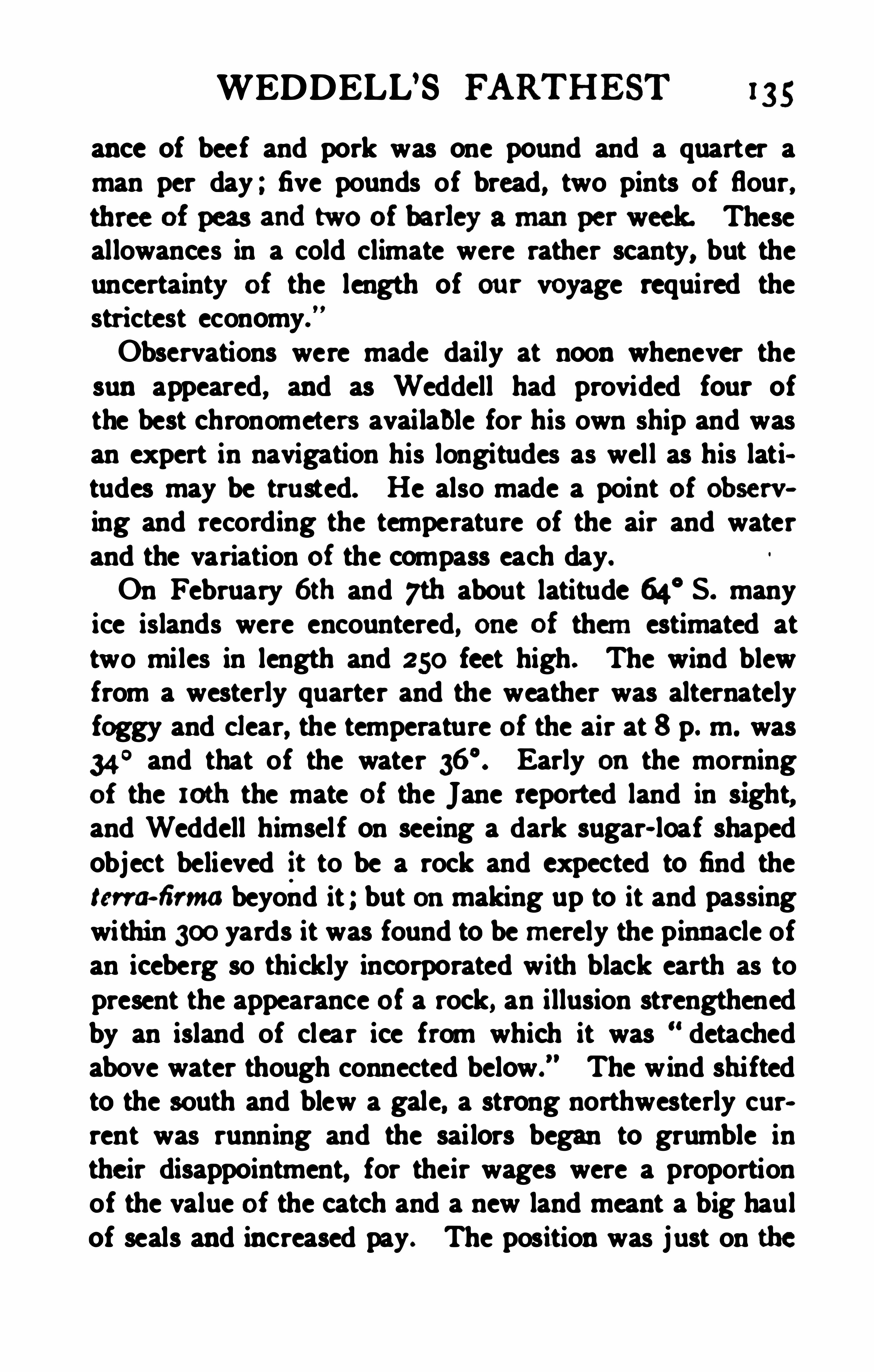
WEDDELL’S FARTHEST 135
ance of beef and pork was one pound and a quarter aman per day ; five pounds of bread, two pints of flour,three of peas andtwo of barley amanper week. Theseallowances in a cold climate were rather scanty, but theuncertainty of the length of ou r voyage required thestri ctest economy.
”
Observations were made daily at noon whenever thesun appeared, and as Weddell had provided four ofthe best chronometers available for his own ship and wasan expert in navigation his longitudes as well as his latitudes may be trusted. He also made a point of observing and recording the temperature of the air and waterand the variation of the compass each day.
On February 6th and 7th about latitude 64° S. many
ice islands were encountered, one of them estimated attwo miles in length and 250 feet high. The wind blewfrom a westerly quarter and the weather was alternatelyfoggy and clear, the temperature of the air at 8 p. m. was34
° and that of the water Early on the morningof the 10th the mate of the Jane reported land in sight,and Weddell himsel f on seeing a dark sugar- loaf shapedobject believed it to be a rock and expected to find thetm firma beyond it ; but onmaking up to it and passingwithin 300yards it was found to be merely the pinnacle ofan iceberg so thickly incorporated with black earth as topresent the appearance of a rock, an illusion strengthenedby an island of clear ice from which it was detachedabove water though connected below.
” The wind shiftedto the south and blew a gale, a strong northwesterly current was running and the sai lors began to grumble intheir disappointment, for their wages were a proportionof the value of the catch and a new land meant a big haulof seals and increased pay. The position was just on the
136 SIEGE OF THE SOUTH POLE
Antarctic circle and there was some temptation to re
turn ; but Weddell argu ing that the earth on the bergmust have come from some land to the south held on hiscourse against both wind and current. Ice- islands werenumerous ; for days over fifty were always in sight, andthe effort to avoid them made so many changes of coursenecessary that it was very difficult to keep account of theposition by dead reckoning.
By the 14th of February , 1823 , the high latitude of
68° was attained , and on the 16th the ships crossed theseventieth parallel going south . A great number of birdsof the blue petrel kind kept in sight and also manyhump and finned- back whales .” Here a disaster oc
curred in the breaking of the only two thermometers onboard so no more Observations of temperature could betaken ; but Weddell states that the weather was certainly not colder than that of midsummer (December ) inlatitude 61 ° S. The rapid changes in variation puzzledthe leader greatly, he compared all the compasses onboardbut could find nomaterial difference between them thoughthey were rather sluggish in action. On the 18th in73
° S . the weather was beautiful , not a particle of iceof any description was to be seen, many whales wereabout the ships and the sea was literally covered withb irds of the blue petrel kind .
” The carpenterpairing a boat, the sailrnaker was mending the sails ; itwas altogether a picture of summer at sea .
During the night of the 19th it fell calm ,but on the
morning of the 20th it blew fresh from south by westThe atmosphere now became very clear
,and nothing
like land was to be seen . Three ice - islands were in sightfrom the deck , and one other from the mast- head . Onone we perceived a great number of pengu ins roosted .

138 SIEGE OF THE SOUTH POLE
searching for seals not for the south pole and that his consort was a little vessel more like a pilot- boat than a seagoing craft. Neither vessel was protected in any way forice- navigation and to be compelled to winter south of thecircle would probably have been fatal to al l on board.
The men were but ill- clothed for bad weather and thesupply of fuel and food was not sufficient to justify anyserious risks being run . In similar circumstances Captain Cook would have acted in the same way.
Weddell looked out for the aurora australis, the sunbeing then below the horizon for s ix hours, but thetwi light all night was too strong to allow it to be seen.In order to cheer up his crew, whose repeateddisap
pointments in finding the seals that were to pay theirwages, was beginning to have a bad effect, Weddell madea little ceremony, hoisting colours and firing a salute inhonour of their having accompanied him to the farthestsouth point yet attained , 214 nautical miles nearer to thepole than Cook had reached. The mengave three cheers ,extra grog was served out and the sea was named afterKing George IV. ; but the name has been changed and itis now more appropriately known as Weddell Sea incommemoration of its first navigator.On returning northward various observations were
made, a sounding with 240 fathoms, all the line on board,found no bottom . A bottle conta ining a paper statingthe condition of the sea in74
° S. was thrown overboardto test the direction of the current, but it was neverpicked up.
As they proceeded northwards bad weather returned ,with much snow and fog, and after crossing the positionwhere a none xistent South Iceland ” was marked onthe chart, the Beau foy was separated from her consort .


140 SIEGE OF THE SOUTH POLE
and Beau foy sailed for the South Shetlands, and en
countered very heavy pack ice ia 62° S. Sometimesthey skirt ed the edge of the pack looking for an opening ,
sometimes they tacked about in a pool of open waterentirely surrounded by the pack and dri fting rapidly tothe eastward
,and when at last, with infinite labour, the
islands were sighted on October a8th, the ships werestruck by a hurricane from the southwest, accompaniedby bitter cold . Everything movable, including a whaleboat
,was swept from the deck of the Jane and speedily,
the deck,bulwarks, and lower rigging became a solid
mass of ice ; the rudder was frozen fast andcould notbe used. and the masses of frozen water on the forecastle made the brig rise sluggishly to the sea. In spiteof the danger thus occasioned , Weddell attributes hisescape to the ice binding the ship together and preventing, as he pu t i t, the fastenings from being distressed.
”
Many of the crew were hurt by being thrown down bythe wild rolling of the ship, and nearly all were frostbitten , for the clothing of the improvident Jacks was wornout, and many had not even a second pair of stockings ora shirt to change. The captain parted with everything hehad to make good deficiencies . H is blankets were cutup to make stockings, and the pump leather was usedto patch the shoes. But no complaints were made
,the
men well knowing that i f they went back to temperateseas without a cargo the form of paying off wouldtake place without any money changing hands. The littlecutter had stood the storm better than the brig, and bothcontinued to struggle to reach the South Shetlands untilNovember 17th, when , after having been in the utmostperil in the pack, they worked out in a sorely battered condition and made for Cape Horn. The vessels were far
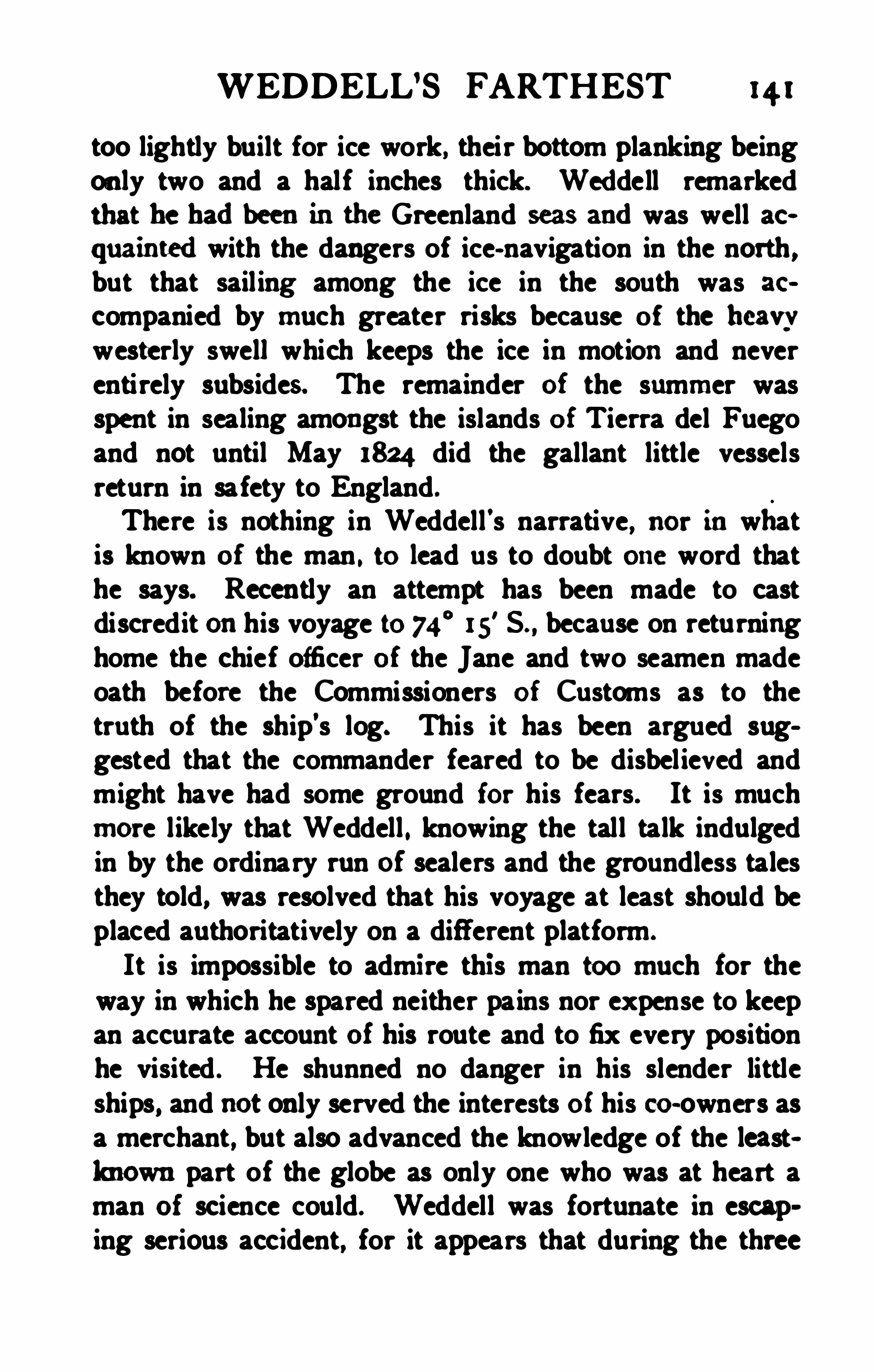
WEDDELL’S FARTHEST 14 1
too lightly built for ice work, their bottom planking beingonly two and a half inches thick. Weddell remarkedthat he hadbeeninthe Greenland seas andwas well acquaintedwith the dangers of ice- navigation in the north ,but that sail ing among the ice in the south was accompanied by much greater risks because of the heavvwesterly swell which keeps the ice in motion and neverentirely subsides . The remainder of the summer wasspent in sealing amongst the islands of Tierra del Fuegoand not until May 1824 did the gallant little vesselsreturn in safety to England .
There is nothing in Weddell's narrative, nor inwhatis known of the man . to lead us to doubt one word thathe says. Recently an attempt has been made to castdiscredit onhis voyage to 74
°15
' S because on returninghome the chief officer of the Jane and two seamen madeoath before the Commissioners of Customs as to thetruth of the ship’s log. This it has been argued suggested that the commander feared to be disbelieved andmight have had some ground for his fears. It is muchmore likely that Weddell . knowing the tall talk indulgedin by the ordinary run of sealers and the groundless talesthey told, was resolved that his voyage at least should beplaced authoritatively on a different platform.
It is impossible to admi re this man too much for theway in which he spared neither pains nor expense to keepan accurate account of his route and to fix every positionhe visited . He shunned no danger in his slender littleships, and not only served the interests of his co-owners asa merchant , but also advanced the knowledge of the leastlmownpart of the globe as only one who was at heart aman of science could. Weddell was fortunate in escaping serious accident, for it appears that during the three
142 S IEGE OF. THE SOUTH POLE
years, 1820-22, at least seven sealing vessels werewreckedonthe South Shetlands, andthe crew of one of
Whenthe landwas sodifi cult of access c tcept inthemiddle of the short summer, and the weather even duringthose few weeks so capricious and foggy, it is not surprising that very vague ideas prevailedas to the geog
raphy of the region to the south of the South ShetlandIslands . That a large mass of landex istedthere wasclearly understood. Fanning spoke of the “ continentof Palmer’s Land, which he believed did not extendfarther than 100° W. longitude. Morrell spoke of the eastcoast of the land which Captain Johnson had namedNew South Greenland, andFarming states explicitlythat this was Palmer Land, the first knowledge of whichhe had himself communicated to Johnson. Weddell inhis track- chart sketches a vague Trinity Land,
” but ina theoretical sketch-map of the circumpolar region helays down a large mass of land south of the South Shetland Islands andgives to it the name of “ South Shetland.
All that befell Weddell after his return we do notknow, apparently he made other voyages to the south asa sealer. He was certainly absent from England in183 1 to 1833 , and he died in London in the forty- seventhyear of his age on 91h October, 1834 . When Capnin B iscoe reached Hobart Town in May, 1831 , andagain when he left it in October of the same year, hementions a CaptainWeddellas being there incommandof the cu tter Eliza, andthere seems no reasontodoubtthat this was the hero of the voyage to 74
°5.
Although Bouvet Island can no longer claim to he a

SIEGE OF THE SOUTH POLE
ing but perpendicu lar rocks could be seen ; it bears evident marks of having been a volcano, as it is nothing lessthan a complete cinder, with immense veins of lava,which have the appearance of black glass, though someare streaked with white .”
When Liverpool Island was first sighted the centre wasseen to be covered with snow, but from the fact of itscomplete circumnavigation and no mention having beenmade of ice, it would seem that no glaciers reached thesea.
The work of the sealers may be interrupted for a moment to refer to a scientific expedition sent out by theBritish government for the purpose of carrying out ohservations onmagnetism and the force of gravity in theSouth Atlantic. Sir Edward Sabine, who did more thanany Eng lishman of his generation to advance the scienceof phys ical geography, had taken up the task of measu ring the force of gravity by swinging pendulums at different parts of the Earth ’s surface, the only methodknown by which the true form of the surface of the globecan be ascertained . In pursuance of these researchesthe Admiralty sent out an extremely talented and thoroughly scientific officer, Captain Henry Foster, in command of H . M . S. Chanticleer, to undert ake experimentsin the islands of the South Atlantic. H is instructionswere to‘ proceed to the most southerly known accessibleland, the South Shetlands, and there make a completeseries of pendulum and magnetic observations. Antarcticdiscovery was no part of the programme and the Ship wasnot fittedfor navigation inthe ice . The Chanticleer wentbeyond the Sou th Shetlands to a position in 63° 43
'S . ,
W where Foster found land,went ashore and
named Cape Possession. This appears to have been on
WEDDELL’S FARTHEST 145
Hoseason Island, its earlier name possibly perpetuatingthe memory of some American sealer , who otherwisewould be forgotten . The ship took up temporary headquarters in the vast crater of Deception Island, near theYankee Harbour of the Stonington fleet, renamed PortFoster. Captain Foster’s name deserves to be commemoratedin the Southern Seas, for his early death before the voyage was concluded, was .a loss not only tothe Royal Navy , but to science. It would, however, havebeen more appropriate to attach his name to Cape Possession than to overshadow so quaint and interesting alandmark in the history of the Antarctic as the YankeeHarbour of the oldNew England skippers. From January 9th to March 4th, the Chanticleer lay in this sa feand cornmodious harbour, while the observations werediligently carried on ashore, and then it was high time tomake for the north to escape the on- coming winter.The medical ofi cers of the ship studied the plant andanimal life of this strange shell of an island, and oneof them, the Dr. Webster who preservedfor us the wordportrait of Palmer wi th his
'
basket of alhatross eggs also
made some experiments on the floating of ice in sea
water with reference to the phenomena of icebergs. Aregistering thermometerwas left Onthe islandso that thesubsequent finder couldtellthé eietremes of temperature
CHAPTER VIII'
ENDERBY BROTHERS AND THE ANTARCTIC
We bring no store of ingots,Of spice or precious stones,
But that we have we gatheredWith sweat andaching bones
Inflame beneath the tropicsInfrost upon the floe,
Andjeopardy of every windM
ESSRS . ENDERBY, whose ships had visited theSouthern seas s ince 1785 and had already added
something to geographical knowledge, began to take adeeper interest in Antarctic exploration from the time ofthe foundation of the Royal Geographical Society. Mr.Charles Enderby became an original Fellow of that Soclety in 1830 and remained actively interested in its workfor forty- seven years. There is, perhaps ,no other instanceof a private mercantile firm undertaking so extensive aseries of voyages of discovery without much encouragement in the way of pecuniary returns. It was in the palmydays of the deep- sea whalers , when hundreds of shipssailed for a cruise of a couple of years round the worldand back again ” for a cargo of whale oil in tropical ortemperate waters, as the chance of success suggested , andmany shipmasters must have lighted on discoveries nowlost to the world and perhaps never treated as more thansailors’ yarns. Messrs. Enderby difleredfrom other
146

148 SIEGE OF THE SOUTH POLE
giving rise to huge icebergs , and he believed that the exceptional quantity of ice sighted in that year could bebest accounted for by the occurrence of great earthquakes
,which broke it 06 from the land. Thus Biscoe
set out with some ground for looking for land and notmerely fields of sea- ice in the far south .
Fortunately, Biscoe's log has been preserved, having
been presented to the Royal Geographical Society byMr. Charles Enderby, and the essential parts of it werepublished both in the English and French geographicaljournals of the period .
Biscoe’s command left Gravesend on July 14th, 1830,and sailed from Berkeley Sound in the Falklandson November 27th , to carry ou t his instructionsby visiting the southeast part of Sandwich Land. Onthe way he thought it advisable to cruise to the northward oi the position assigned to the Aurora Islands bythe Atrevida , so as to dispel any lingering suspicion o f
the possible existence of that troublesome group, Weddell ’s courses having lain to the southward. The searchproved fruitless and the Auroras will trouble us no more .On the voyage south the cutter was lost sight of in a
fog onDecember 1 1th , and the Tula lay- to until noon inthe hope that she would reappear. What made it worsewas that the carpenter had gone aboard the smaller vessel to repair a boat two days before , and had not beenable to return . It was a wretched day for Biscoe , for hisbarometer burst of itself,
” and left him without aweather-glass ; the brig then ran over something, probably only floating ice, but it scraped unpleasantly alongher keel , and to crown this day of misfortunes she wasin the position assigned on the chart to Traversey Islandand might strike upon it at any moment in the dark.
ENDERBY BROTHERS 149
Three days later the Lively reappeared , and after a longfight with fog and gales, the two vessels came in sightof Sandwich Land on the mat. Three islands weresighted , all of them small, rocky masses , descendingsteeply to the water’s edge, with no beach for a seal toland on , and covered with ice and snow ,
“so much so
that it was hardly possible to distinguish the rocks , thesnow and the clouds above these , one from the other.
"
It was hopeless to look for a cargo on such rocks, andthat will - o’
- the -wisp of the Antarctic seafarer, an ap
pearance of land being observed to the southeast,
Biscoe set sail in its pursuit. Field- ice soon appeared,and after much mancruvring the ships passed safelv
through the pack to the southward, where, instead of theopen sea , they found merely a great bay of about eightmiles diameter, from which they had much ado to escapenorthward again . Until the end of the month they continned fighting with wind and ice in the endeavour to reachthe main body of Sandwich Land by working back tothe westward . It was a hard time for both captains andcrews :Independent of the small seas of field- ice the whole
space was completely coveredwith dri ft pieces , someswimming very deep in the water, which a vessel strikingupon would most likely knock a hole in her bottom ,
sothat from the 26th to the 29th in the forenoon , we wereutterly prevented from steering on any one course formore than a few minutes at a time and never atany time had we less than fifty or a hundred ice islandsround us.On December 29th , two of the islands of Sandwich
Land were sighted and the boats sent to search a lo wlying reef for seals, but they returned empty, and Biscoe
150 SIEGE OF THE SOUTH POLE
resolved to keep on his voyage towards the east without more delay. The weather turned dazzlingly clea r ;but no land revealed itsel f, and the field- ice spreadsmooth and solid before the ships . They struggledthrough the pack and drift- ice along its edge, makingonly twelve miles on their course in a whole day, andnever at rest for an hour from the ceaseless tacking andshi fting of course to clear the dangerous ice-masses.The absence of li fe was remarkable, neither seals norpengu ins were to be seen , and only a few petrels re
deemed the scene from utter desolation. It was theseventeenth of January, 183 1 , before the parallel of
60°
5. was crossed in 70°W. , almost at the same point
where Bellingshausen crossed it eleven years before. Theedge of the pack was now turned and a clear sea lay tothe south , with only a few icebergs in sight, and a temperature of 35
° in the air. On the 22nd, the Antarcticcircle was crossed in 1
° E. So far the edge of the packhad been s imilar in outline, though about a hundred milesfarther to the north and east than Bell ingshausen hadfound it ; but from this point to 50
° E ., Biscoe was ableto sail for five weeks within or on the circle , often farto the south of the track which the ice had permittedthe Russian ships to follow. The farthest south reachedwas 69
° S. in 10°
43'E . , on January a8th . All this th e
the ship was pressing as closely on the ice-flees as shecou ld with safety ; the wind held mostly from easterlypoints , giving Biscoe a beating passage of it,
" and incommoding him very much ; and many anxious hourswere spent by all on board. The incidents are verycalmly treated by the captain , but even he must occasionally have felt a thrill . For instance , one day :At 6 p. m., whi le standing to the southward, we sud

152 S IEGE OF THE SOUTH POLE
this way at the end of summer, and he argued that whenthe summer temperature of the air fell at nights far below the freezing point the w inter temperature must bevery severe indeed, and consequently the surface of thesea may be frozen to a considerable depth . Thefrozen sea-water might be freshened, he thought, by thecontinuous addition of snow, and the outcome of his ohservations was to the eflect that the field- ice might beformed in the open sea, and that consequently its presence was not necessarily a sign of the prox imity of land.In this, he was no doubt substantially correct ; but hewent farther in his speculations as to the origin of icebergs. After brooding over the matter for a fortnighthe came to the conclusion that icebergs also werecreatures of the sea and not of the land, as had alwaysbeen held before. He knew that Captain Weddell hadreported a berg so impregnated with earth as to make itlook like a piece of rock, but he himsel f had seen hundreds of bergs, all of unsul lied purity and not one of thembore the least trace of any connection with the land .
They might, he thought, he the product of the perpetualfreezing of a tranquil sea accumulating with time.” Itwas the experience of February asth, 183 1 , that convincedBiscoe of the truth of this theory. An appearance ofland had been seen the night before in latitude66
°29
’S . , longitude 45
°17
'E but at noonThat which lately had the appearance of land now
bore from E. S. E. to W. S. W. (true bearing) . witha large range of field- ice stretching to the N . E.
Innumerable icebergs, and the vessels so encom
passed with straggling pieces we could proceed nofurther with safety owing to a strong N . E. swell , whichset towards the main body of ice, which it now proved to
ENDERBY BROTHERS 153
be ; the appearance of it was, I think, nearly similar tothe North Foreland, and I should think the cliff s of it,which bore the marks of icebergs having been brokenfrom ofi it, and which was exactly similar to their sidesin every respect, was as high, or nearly so, as the NorthForeland ; it then ran away to the southward with agradual ascent, with a perfectly smooth surface, and Icould trace it in extent to at least from 30 to 40miles from the foretop with a good telescope ; it was thenlost in the general glow of the atmosphere. As I Observed some two or three lumps, which had the appearance of land from the irregularity of their surface, I lowered a boat, and went mysel f to ascertain whether or notthere was any appearance of land on a nearer view ,
judging myself to be abou t 3 miles at his time fromthe main body ; but after pulling about half an hour ormore, I found we were rather more than half a milefrom it still , with the ice so thick we could at timesscarcely get the boat through it, and as both vesselswere hu ll down , and entirely at times hid from us by theice, the weather also having a black appearance fromthenorthward with a heavy N . E. swell, I deemed it mostprudent to return after having fully convinced myselfthis was nothing more than a solid body of ice.”
This barrier of solid ice rising like a wall 100 feet orso above the sea might very probably have been part of agreat ice- barrier simi lar to that found by Ross ten yearslater, and believed by him to be the edge of confluentglaciers or of an ice- cap completely covering an extensive land. Biscoe, however, had persuaded himself thatall Antarctic ice was sea- ice and he states boldlyI have not the least doubt that the whole spaces, from
the latitudes I have visited to the Pole, are one solid
154 SIEGE or THE SOUTH POLE
mass ; land may intervene, or winds, where they arestrong and prevalent, may have prevented its forming insome parts more than others, but I have found suchfrequent calms and light airs with smooth water, that Isee no reason why ice should not be formed to any extentduring the winter seasons.”
These views have recently been confirmed by freshevidence collected by Captain Scott on the Discoveryex pedition. Biscoe showed very clearly how thegrant masses of flat- torpedfloating ice accumulatedwi th time,
” could give rise to all the varieties of peakedand caverned bergs wh ich were to be met with by thesolvent action of the sea-water on the submerged portion ,altering their centre of gravity and causing them to turnover, exposing the fantastical ly water-worn parts tothe air.On February 6th , a patch of discoloured water wasseen , bu t no soundings were found with 250 fathomsof line. On the 14th a severe gale blew and the cuttergot out of sight again . The weather became so thickthat lumps of floating ice , col lision with which wouldhave sent the brig to the bottom, could hardly be seenuntil they were almost onboard, and the seas broke overthe deck and froze so that if some unknown bu t benevolent Captain Christie had not supplied the crew withboots at Gravesend , the captain declared that half thepoor fellows wou ld have been laid up. After fou r daysof anxious search the Lively was found again, and on
February 20th , when the days were beginning to shortenwith uncomfortable rapidity, a fine display of the auroraaustralis was seenby the ofi cer of the watch , who neglectedto report it to the captain before it disappeared
,
andis censuredinthe log accordingly. Onthe sameday


156 SIEGE OF THE SOUTH POLE
stove in, the bulwarks smashed, andthe crew so be~
numbed by the bitter cold that they could not hold on toa rope for two minutes at a time. The brig became com~
pletely unmanageable and drove before the wind ; the icedrove with it, and apparently at the same rate , for nocollisitm ensued, and when the weather moderated afterfive days of hurricane fu ry, the Tula was little betterthan a wreck
,and had been driven one hundred and
twenty miles before the wind.
Although five men out of his small crew wereon the sick list as the result of the storm and the mostserious anxiety was felt as to the safety of the cutter ,Biscoe tried yet again to get south with a southeasterlygale howling against him hal f the day and subsiding intocalm once in every twenty- four hours , until on March16th , Cape Annwas seenoncemore, andalso a very high
mountain. The icedidnot seem to have beendisturbedinits positionby the succa sionof heavy gales. Summerwas over, the air temperature had fallen to 22° F . , andsorely against his wi ll Biscoe had to give up all hope ofreaching Cape Ann or the coast that bore it, now namedafter his owners, Enderby Land. He had done his bestand cou ld do no more . The log states :The land inaccessible, heavy gales frequent every
day , some of the people getting sick , the carpenter forsome time past having lost the use of his legs, and twoothers at this time in the same situation , and two or threemore under medicine for the same complaint, althoughevery attention has been paid to their health and com
fort. The vessel is very uncomfortable in bad weatherand ships a great deal of water, and is now on her outside, both hullandropes, where the spray canreach, one
mass of ice."
ENDERBY BROTHERS 157
Yet with all this against him, Biscoe observes that asthe land seemed to trend toward the northeast he stillhopedto reach it insome part free from ice.The southeasterly gales continued, the fact could notbe overlooked that scurvy had broken out on board , theship was a mass of ice , although now in 6a
"S . ,
and at length , on April 4th , the hope of meetingthe land was abandoned in80° E .
,and a course laid for
New Zealand. By this time only three of the crew wereable to stand, and it was no longer possible to beatagainst head winds. The carpenter died on April a4th ,and on the a6th only one man of the crew was able tostand , and the ship had to be worked by him, the captainhimself, two mates and a boy ; it was hopeless to try tomake New Zealand , and to save the ship and the survivors of the crew , the Tula was headed for Van Diemen ’s Land. Next day a second man died. On May8th the brig was off the unfamiliar coast of Tasmania ,of which there were no proper charts , and things lookedvery black onboard. Biscoe confided to his log :I endeavoured all in my power to keep up the spirits
of those on board , and often had a smile on my face ,
with a very diff erent feeling within .
”
After all her batterings, the Tula was at last safelymoored ofl Hobart Town , on May roth, 183 1 ; the dyingmen were removed to a hospital on shore, and Biscoe wasat last able to rest for a time, though the absence of theLively was a heavy anxiety. As he entered the harbourhe met the E liza cutter, with Captain Weddell on board.When the Lively was separated from her consortin the storm she continued the cru ise in the icy seasuntil deaths had reduced the ship’s company to CaptainAvery, one scaman and a little boy whose hand had been
158 SIEGE OF THE SOUTH POLE
crushed by the boat fall ing on it. They could not makeTasmania but reached Port Philip, and when they landednot far from what is now Melbourne they nearly died ofstarvation , and the cutter drifted away. She was foundashore after a fortnight, and the party reached the Derwent on September 3rdto meet the Tula coming ou t.
Biscoe put back and waited until the cutter was refittedand her crew restored to health.
Wi th the southern spring in October, 183 1 , the Tulaand Lively were once more at sea ready for a fresh campaign, Captain Weddell coming on board to say farewell as they sailed . Three months were spent in scalingon the coasts of New Zealand and off the Chatham andBounty islands in order to get a cargo, and then the timecame to commence the homeward voyage by Cape Horn .
A course was shaped for the position assigned by thecharts to the Nimrod Islands , 56
°S . , 158
°W. ; but noland could be seen , and although there was an appearanceof shallow water the sounding- line showed no bottom .
Towards the end of January Biscoe resolved to crossCapta in Cook ’s track (he does not seem to have knownBellingshausen
’
s route ) . and steer south- eastward inorder to look for land to the W. S . W. of the South Shetlands, and Mr. Avery received instructions as to whathe should do in case the Lively lost sight of her consort.On the a8th they were south of the sixtieth parallel in131
°W. , and ice- islands appeared in great numbers, withsome loose drift- ice. An extraordinarily low barometerprevailed for several days, the mercury going as low as
inches, but the expected gale did not occur. UntilFebruary 14th , tne course was easterly with a littlesouth , bringing the ships gradually to the Antarctic circlealong which they sailed without making any attempt to

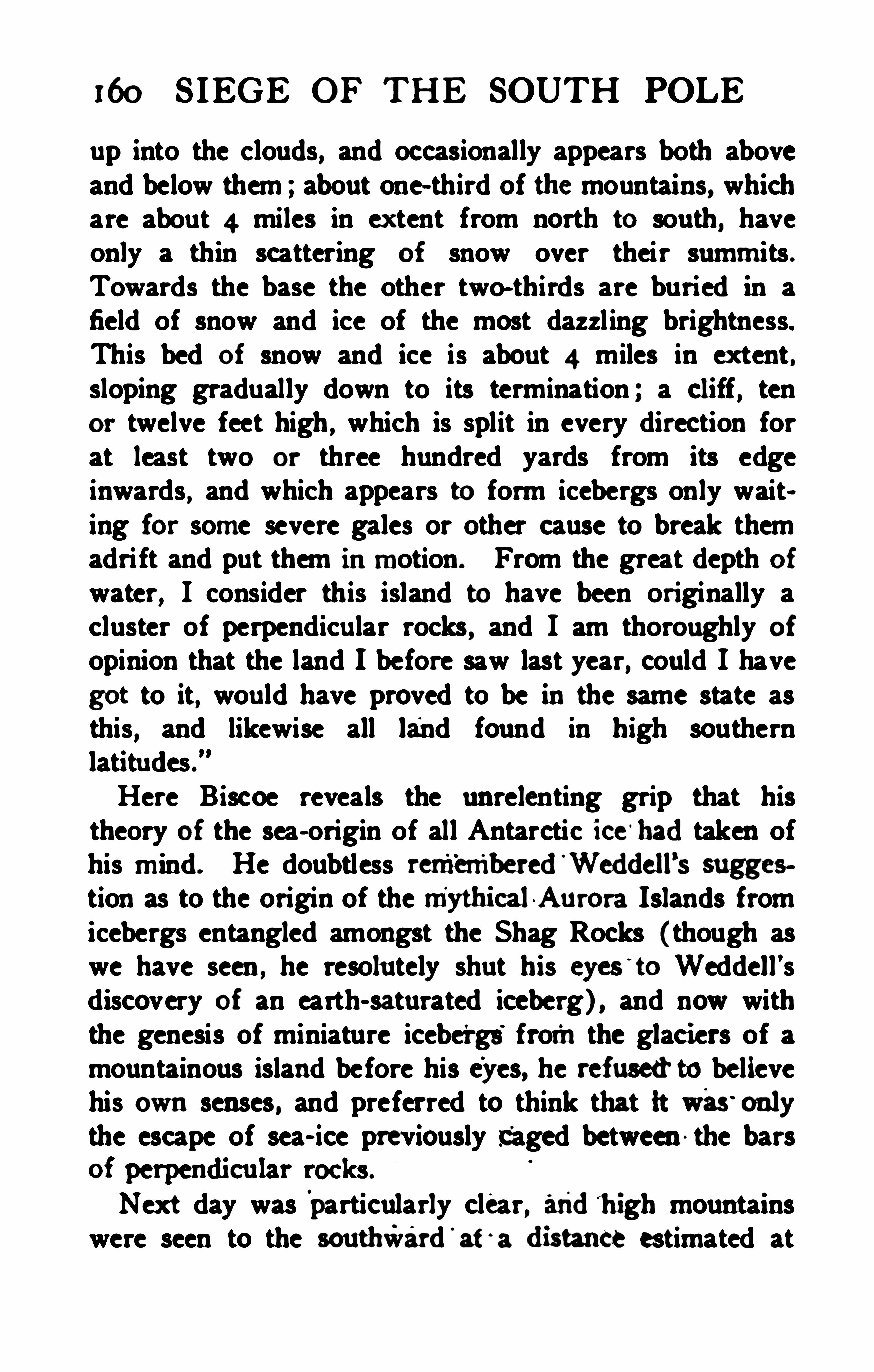
160 SIEGE OF THE SOUTH POLE
up into the clouds, and occasionally appears both aboveand below them ; about one- third of the mountains, whichare about 4 miles in ex tent from north to south, haveonly a thin scattering of snow over their summits .Towards the base the other two—thirds are buried in afield of snow and ice of the most dazzl ing brightness.This bed of snow and ice is about 4 miles in ex tent ,sloping gradually down to its termination ; a cliff, tenor twelve feet high , which is split in every direction forat least two or three hundred yards from its edgeinwards, and which appears to form icebergs only waiting for some severe gales or other cause to break themadri ft and put them inmotion. From the great depth ofwater, I consider this island to have been ori ginally acluster of perpendicular rocks , and I am thoroughly of
opinion that the land I before saw last year, could I havegot to it, would have proved to be in the same state asthis, and likewise all land found in high southernlatitudes .Here Biscoe reveals the unrelenting grip that histheory of the sea- origin of all Antarctic ice ‘
hadtaken ofhis mind . He doubtless reinbinbered'Weddell’s sugges
tion as to the origin of the myth icalAurora Islands fromicebergs entangled amongst the Shag Rocks (though aswe have seen , he resolu tely shut his eyes
’
to Weddell ’sdiscovery of an earth- saturated iceberg) , and now withthe genesis of miniature icebergs fromthe glaciers of amountainous island before his eyes, he refusedto believehis own senses , and preferred to think that it was'
onlythe escape of sea- ice previously Caged between - the bars
Next day was particularly clear, andh igh mountainswere seen to the southward'
at‘
a distai 1ce estimated at
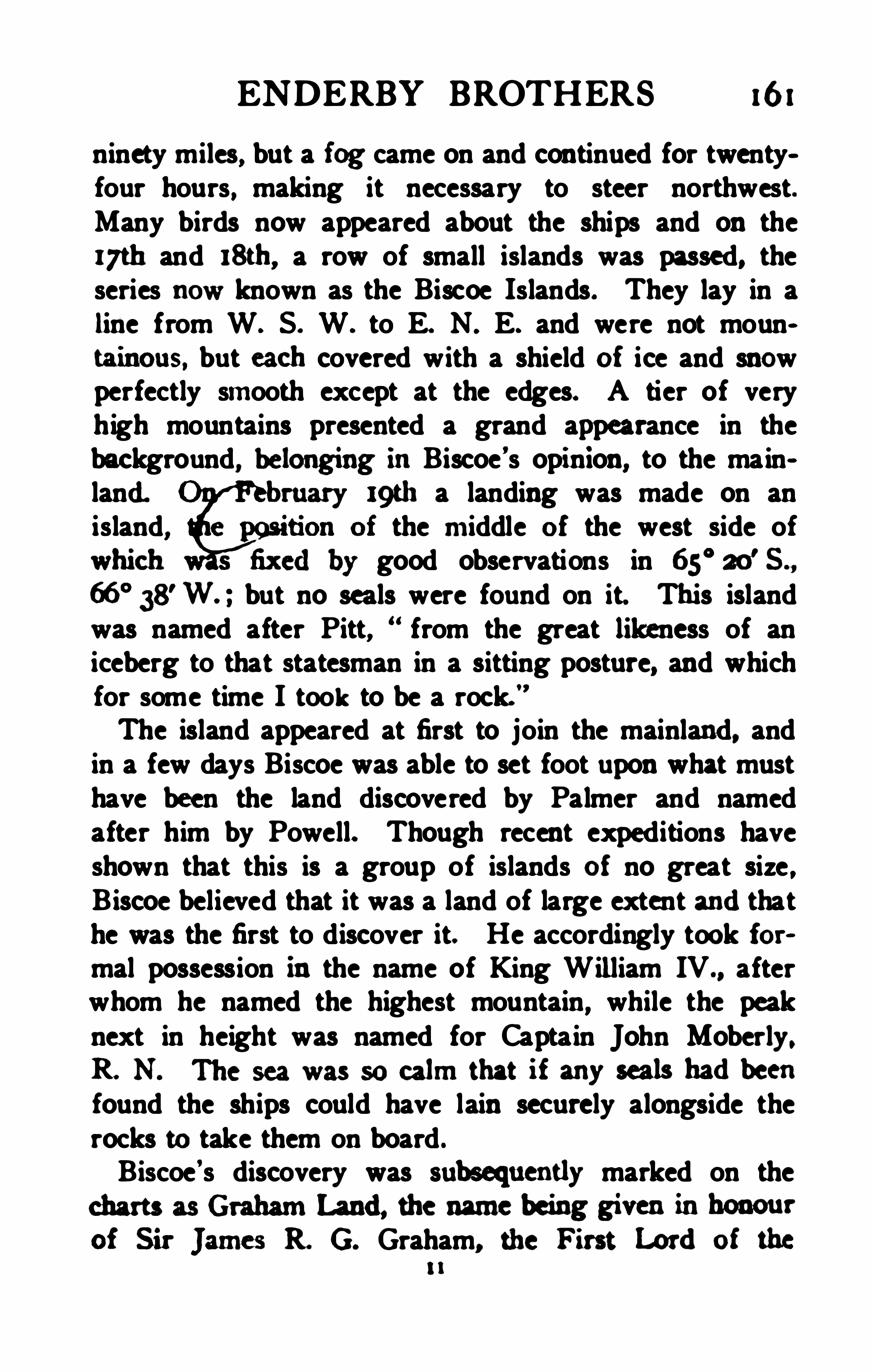
ENDERBY BROTHERS 161
ninety miles, but a fog came on and continued for twentyfour hours , making it necessary to steer northwest.Many birds now appeared about the ships and on thei7th and 18th, a row of small islands was passed, theseries now known as the Biscoe Islands. They lay in aline from W. S. W. to E. N. E. and were not mountainous, but each covered with a shield of ice and snowperfectly smooth except at the edges. A tier of veryhigh mountains presented a grand a
ppearance in the
background, belonging inBiscoe’s opinion, to the main
land. 9th a landing was made on anisland, the middle of the west side of
good observations in 65°20
’S .,
66° 38'W. ; but no seals were found on it. This island
was named after Pitt,“ from the great likeness of an
iceberg to that statesman in a sitting posture, and whichfor some time I took to be a rock.
”
The island appeared at first to join the mainland, andin a few days Biscoe was able to set foot upon what musthave been the land discovered by Palmer and namedafter him by Powell. Though recent expeditions haveshown that this is a group of islands of no great size ,Biscoe believed that it was a land of large extent andthathe was the first to discover it. He accordingly took formal possession in the name of King William IV., afterwhom he named the highest mountain, while the peaknext in height was named for Captain John Moberly ,R. N . Thc sca was so calm that if any seals hadbeenfound the ships could have lain securely alongside therocks to take them on board .
Biscoe ’s discovery was suwequently marked on thecharts as Graham Land, the name being giveninhonourof Sir James R G. Graham, the First Lordof the
i i
162 SIEGE OF THE SOUTH POLE
Admiralty at the time. The troubled career of this umpopu lar statesman lives unenviably in common memoryin England because as Home Secretary he ordered Mazzini
’
s letters to be opened in the Post Office and communicatedto the Austri an government. In Scotland his highhanded proceedings in connection with the ecclesiasticaldifliculties which led to the Disruption of the NationalChurch in 1843 are not yet forgotten.
easy after the lapse of many years to understand how far the names given to portions of newly discovered coasts were int ended by their sponsors to applyto the whole mass of land of which these coasts formedpart of the boundary. Fanning undoubtedly understood Palmcr Land to include the whole mass of land tothe southward of the South Shetlands, and referred toit as a continent. Biscoe ’s mainland,
" the GrahamLand of the British charts was no doubt meant to beequally inclusive , and so too, was Johnson
’s New SouthGreenland. Making allowance for the uncertainty oflongitudes determined even with the utmost care by shipswhose chronometers had not been rated for months, orperhaps even for years, we can easily understand the confusion wrought by the multip lication of over- lappingnames , and this confusion was made worse confoundedby the fact that as a rule each discoverer was ignorant ofthe work of his predecessor. As a matter of historicjustice, it seems to us that Powell
’s name of Palmer Landought to be retained for the whole group of islands, andpossible continental peninsula south of the South Shetlands , Graham Land might well be restricted to thesouthern part south of Adelaide Island
,
names be fixed to definite members of thethis subject we must return later.

164 S IEGE OF. THE SOUTH POLE
Biscoe's voyage won for him a well - deserved rewardfrom the Royal Geographical Society in the form of thesecond gold medal it ever awarded. Although thevoyage brought no pecuniary profit to the owners ,they were highly gratified at the magnificent featof sailing for 160
° of longi tude south of 60°S . , and
for alinost fifty degrees within the Antarctic circle itself,as well as at the discoveries of land. They gave Biscoevessels for another voyage without delay and made elaborate arrangements for combining geographical discovcry with commercial seal- hunting. The Admiralty alsointerested themselves in the matter and appointed Mr .Henry Rea, R. N to accompany the expedition as asurveying officer. Biscoe commanded the brig Hopefulin which Rea was a passenger and sailed from Londonon May 13th, 1833. N o narrative of the cruise has beenpreserved , so far as we can ascertain, and the facts mustbe pieced together from fragmentary notices. The Hopeful reached the Falklands onOctober 23d, and found thata terrible tragedy had occurred there. A party of SouthAmerican convicts transported to the islands had fallenupon and massacred the leading men of the little groupof British settlers, including Matthew Brisbane, thesu perintendent, who had been Weddell
’s companion onthe famous voyage of the Jane and Beau foy. From thetone of an ofl
'
icialletter in which Rea announces the factof the massacre it would seem as if he were then in command of one of the ships , i f not of the expedition , for hespeaks of his arrangements and his plans without mentioning anyone else. Biscoe met Captain Dumont D
'
Ur
ville at Hobart Town in 1839, and appears to have talkedfreely about the failure of this expedition , and D
'
Urville
says onthe direct authority Of this interview : Personal
ENDERBY BROTHERS 165
reasons made Biscoe give up this voyage , and anotherwas charged with the expedition.
" The two vesselsreached the South Shetlands in the southern summer of1833-
34 and appear to have found the ice conditions verysevere. They seem to have sailed toward AlexanderLand in the hope of making a circumnavigation westward ina high latitude, but they were beset in the iceand the Hopeful was crushed and sank, all hands beingsaved by the smaller vessel. Biscoe suggested to D'
Ur
ville that this was due to the inexperience of the commander. Biscoe returned to London about January ,1835, when Mr. Enderby handed to him the gold medalof the Paris Geographical Society awarded in April ,1834, for his Antarctic explorations . In acknowledgingthis award the explorer said ina letter to the President :Allow me to express my very hearty and sincere
thanks to the Society, and to assure you that i f an opportunity to revisit those latitudes again presents itsel f,neither difficulty nor danger will prevent me from resuming the exploration of a part of the world still alrnostunknown and now so interesting.
Biscoe continued in the employment of Messrs. Euderby, and while in command of the brig Emma he madeseveral attempts to push exploration to the southward ofNew Zealand , but had always been stopped by the iceabou t 63
° S. In January, 1839, he had been spoken byBalleny off Campbell Island , and at the close of the sameyear he met Wilkes in Sydney Harbour. Shortly afterwards he visited D'
Urville at Hobart Town , and thensaid that he knew of no land having been discoveredsouth of Tasmania. The interview with Wilkes inwhichhe informed the latter of the discovery of the BallenyIslands would thus seem to have occurred later, on
‘
166 SIEGE OF THE SOUTH POLE
Wilkes's return from his southern cruise. The wholematter is confused and difficult to follow .
When Biscoe subsequently returned to England hefell into poor circumstances and died in 1848 in suchdepth Of poverty that his widow and four children wereonly saved from starvation by a timely subscription gotup by seafaring men.
In 1893 Mr. J. G. Foxton communicated to the Melbourne Branch of the Royal Geographical Society ofAustralasia a paper entitled Notes of a long- forgottenAntarctic voyage in 1833 which were set down fromhis recollection of the expedition on which he himselfhad sailed . The expedition was in two ships , the Hopewell and the Rose, belonging to Messrs. Enderby , underthe command of Lieutenant Binstead , R . N . Theydiscovered land in 70
° S . between 10° and 20
° W. andthen the Rose was crushed in the ice and all handsescaped in the Hopewell . The land had been seen a fewyears earlier by a Russian expedition , the reports of whichBinstead had been sent out to confirm . The paper isinteresting as an example Of the tricks that memory canplay six ty years after the event. For Hopewell we mustread Hopeful and for Binstead we must read Biscoe,and we must add about fifty degrees to the longitudebefore we can realise that the long- forgotten voyage wasthat of Biscoe and Rea, a contemporary account ofwhich would be such interesting reading. Perhaps Mr.Foxton’s memory for incidents may have been strongerthan for names and positions , but we cannot trust it, andonly mention his account because it has already been citedin books of reference and at first sight it might appearas if the Coats Land discovered by Mr. W. S. Bruce in1904 had been seen seventy years before.

168 SIEGE OF THE SOUTH POLE
Fi eld- ice bounded the southern horizon, and numerousbergs were in sight. On February 1st the Eliza Scottand Sabrina were stopped in latitude 69° S ., longitude172
°E . ,by a large body of packed ice. They did not
attempt to penetrate the pack, but worked to the northwest along its edge against a strong westerly wind, whichthey had not expected to find so far south. No previousvoyagers had ever got so far south in these longitudes.For several days the weather was thick and foggy,with light w inds. The sea was discolou red ; there werefeathers floating about and many seals and penguinswere seen, while whales were also plentiful. Littleprogress was made and except the ice surrounding theships, nothing could be seen .
On February 9th, 1839, at 8 a. m. , the sky clearedand an observation for longitude was obtained whichgave the position as 164
°
30' E. At 1 1 o’clock, a dark
appearance was noticed to the southwest and the suncontinuing to shine brightly, allowed an observationfor latitude to be made at noon, giving the position as66° 37
’S ., while the appearance noted an hour previously
was seen to be land. A course was immediately setfor the land, and at 8 p. m . it was within five milesof the vessels, showing up as three large and very highislands , with a number of smaller ones. Next day theEliza Scott succeeded in getting to within a mile of
the middle island , but it was found to be closely investedwith ice and no landing possible. Fog soon came on andcontinued for two days, with occasional clear blinks. Aglimpse of the landobtainedinon
eof these showeda
ENDERBY BROTHERS 169
attempt to land in the Sabrina’s boat at the only se
cessible place on the island bearing the great mountain ,a beach of a few feet wide which was uncovered onlyfor a moment as each wave drew back. Balleny describ es the visit tersely and without any attempt at picturesque description, for he had no gi ft of languageCaptain Freeman jumped out and got a few stones ,
but was up to the middle in water. There is no landingor beach on this land ; in fact, but for the bare rockswhere the icebergs had broken from , we should scarcehave known it for land at first, but, as we stood in forit, we plainly perceived smoke arising from the mountaintops. It is evidently volcanic, as the specimens ofstones, or c inders, will prove. The cliffs are perpendicular, and what would in all probability have beenvalleys and beaches are occupied by solid blocks of ice.I could not see a beach or harbour or anything like one .”
The schooner and cutter held on their course to thenorthwestward and saw no more of the land. Therewere altogether five large and two small islands to whichthe names of five Of Mr. Enderby’s partners in the cruiseare attached , the other two being commemorated inthe peaks. The names given in Mr. Enderby’
s paper donot correspond exactly with those on the Admiraltycharts
,but there is no ofi cialtribunal to decide on these
matters and it is sufficient to say that the names to whomthe deserved honours were paid in 1839 were G. F.
Young, W. Borradaile, J. W. Buckle, T. Sturge , W.
Brown, J . Row , and W . Beale, together with CaptainFreeman of the Sabrina, who stands godfather to thegreat mountain on Young Island , where he landed .
Fortunately the second mate of the Eliza Scott, namedJohn MacNab, had some little ski ll with the pencil
170 SIEGE OF THE SOUTH POLE
andsucceededinmaking a sketch of all the islands of
the Balleny group from adistanee of about nine miles.
In this sketch the most prominent features are the loftycone of Peak Freeman on Young Island and the smokerising from an active volcano on Buckle Island. BealePinnacle, a rock off the eastern end of Borradaile Island ,is descri bed as rising from the water like a lighthouse .The course westward was made between the latitudesof 63
° and 65° S. without any incident to break the
usual succession of icebergs and fogs except a supposedsight of land on February a6th , which was afterwardsbelieved to be merely fog hanging over an iceberg .
Then on March 2nd, the ships being in 65° S. 12 1°E . ,
land was sighted to the south, but no further particularsare given , either in Balleny
’
s log or in that of WilliamMoore the chief mate of the Eliza Scott , the latterremarking only that the supposed land was not morethan one mile to windward. Next day an attempt wasmade to get towards the land through the ice, but thepack was too heavy to penetrate, and although the ap
pearance of land was logged as visible beyond the ice ontwo occasions that day it does not seem to have beenvery decided. Although the name of the cutter Sabrinahas been given to an appearance of land at this point, wecannot look upon its discovery as proved by the vaguereferences made bv the ex plorers.On March 13th an iceberg abou t 300 feet high waspassed within a quarter of a mile in 61 ° S. 103
°
40'
E . ,
the weather being particularly fine and calm. About 20feet up the side of this a block of dark stone, about12 feet high and 6 feet wide embedded in the ice , wasconspicuously visible, a circumstance that attracted thespecial attention of the artist mate MacNab and led


ENDERBY BROTHERS 17:
to an interesting note by Charles Darwin . The strongbelief of Biscoe that all Antarctic ice originated at sealed that explorer to ignore or explain away the reportsof earth - stained ice made by Weddell and others, butDarwin points out that a stone had once before been seenon an iceberg during a sealing cruise by a former boatswain of H . M . S . Beagle. The ex istence of these embedded rocks can only be accounted for on the hypothesisOf the origin of the icebergs as land- ice, and Darwinpoints out that the block seen by the Eliza Scott musthave dri fted certainly more than 100mi les , and probablymore than 450miles from the land of its origin , while itwas 1400miles distant from the nearest certainly- knownland, that of Enderby.
This day was diversified by another episode whichwas much more momentous for the two j unior members of the expedition than any discovery in naturalscience. The veil rises for a moment from the socialli fe of those two lonely little craft tossing amongst theice on the very verge of the known world, but it fallsagain so quickly that we can picture little from theglimpse. This morning Captain Freeman came onboard and brought the boy Smith with him and took theboy Juggins on board the cutter.” We can only speenlate whether the wretched Smith was brought on boardfor purposes of discipline and the proud Juggins promoted to his place, or whether the miserable Juggins wascondemned for some dereliction of duty to . the smallercraft and fortune smiled on the happy Smith . A gooddeal hinges on the question whether the boy Smith wasidentical with Smith the fisherman , for on the 16thMoore once
'
more refers to the life on board :At 10 Smith, the fisherman, being at the tiller, and
172 SIEGE OF THE SOUTH POLE
it getting dark andall hands busy shortening sail, the
captain conned the vessel , intending to hail the cutter,when giving directions to Smith to starboard and portthe helm as required, desired him to answer that he(the captain ) might know whether he heard him or not,when Smith became exceedingly insolent to the captain,
and at last let go the ti ller, hove the tiller- rope in thecaptain
’
s face andswore that he wouldnot take the
tiller any more whi le he was in the vessel, and was soabuseful that the capta in was obliged to take him by theneck and push him forward and beat him severely.
" Amarginal note on the log, probably in the captain
’s hand,states that the last three words were written many daysafterwards and in pure malice.” Next day we aretold that Smith remained below, refusing to do hisduty, and a day later that he was not well. Theremust have been many rough episodes in the strenuouslife of those vikings of the south, and the skippers had tobe men of action ready to repress insubordination bymethods that their semi-mutinous crews could understand.
The course was now alteredto a northerly one alongthe 95th meridian of east longitude, and untilthe ice wasleft behind fine displays of the aurora australis wereobserved every night. On March a4th a gale rose andthe Sabrina was evidently in distress, burning bluelights. At daybreak next morning the cutter was nowhere to be seen and Balleny, now very anxious for hersafety, had as much as he could do to enable his ownship to weather the storm. A heavy sea broke on board
and laying the vessel on her beam-ends so that for tenminutes she seemed to be settl ing in the water ; but the

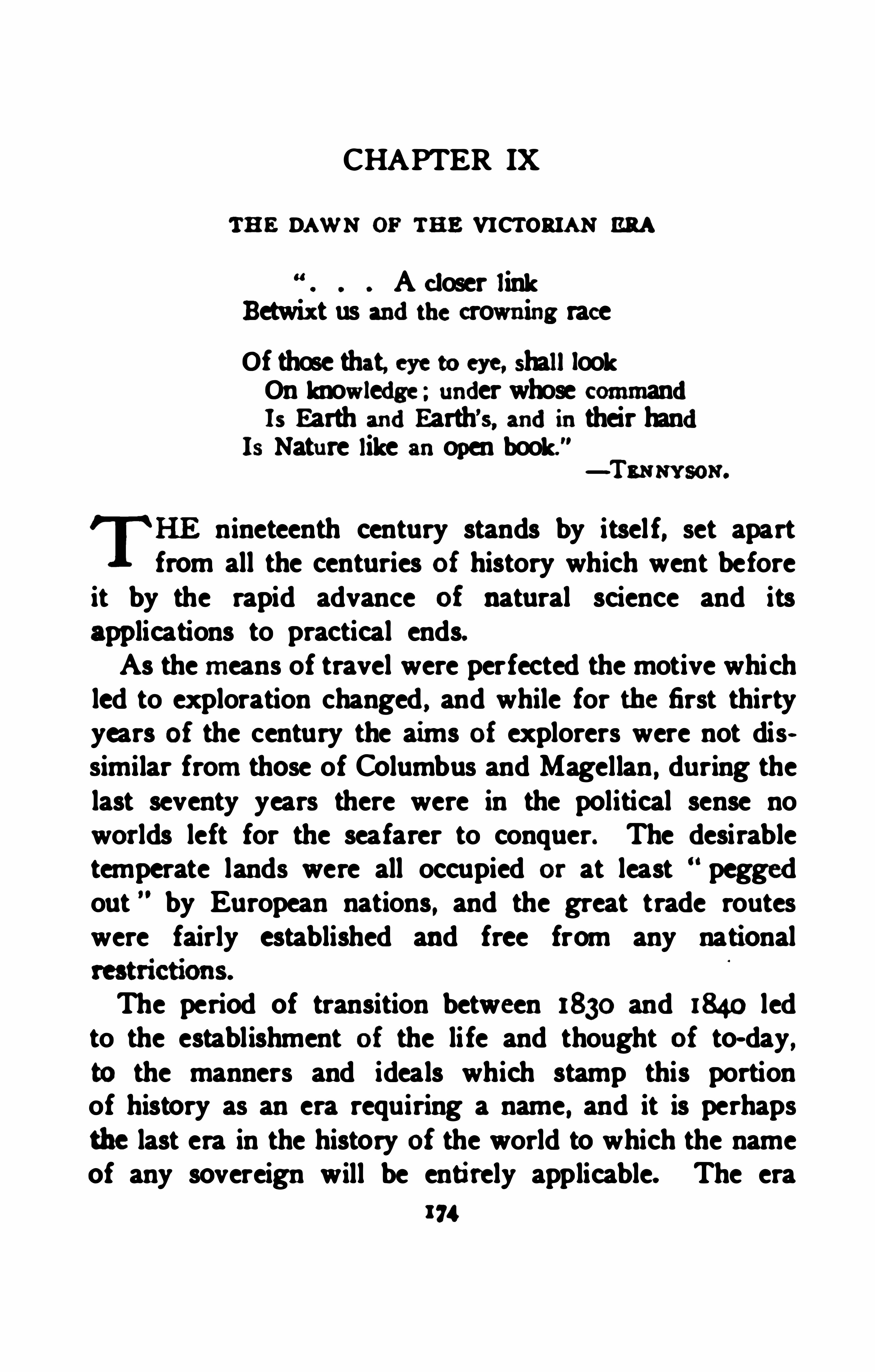
CHAPTER IX
TH E DAWN OF THE VICTORIAN ERA
A closer linkBetwix t us andthe crowning race
Of those that, eye to eye, shalllookOn knowledge ; under whose commandIs Earth andEarth’s, andin their hand
Is Nature like anopen book." —Tamw sox .
Tnineteenth century stands by itsel f, set apart
from all the centuries of history which went beforeit by the rapid advance of natural science and itsapplications to practical ends.As the means of travel were perfected the motive whichled to exploration changed , and while for the first thirtyyears of the century the aims of explorers were not dissimilar from those of Columbus and Magellan , during thelast seventy years there were in the political sense noworlds left for the seafarer to conquer. The desirabletemperate lands were all occupied or at least peggedout by European nations, and the great trade routeswere fairly established and free from any national
The period of transition between 1830 and 1840 ledto the establishment of the li fe and thought of to- day,to the manners and ideals which stamp this portionof history as an era requiring a name, and it is perhapsthe last era in the history of the world to which the nameof any sovereign will be entirely applicable. The era
174
THE VICTORIAN ERA 175
was one during which in science,trade
,and political
ascendancy the United Kingdom became and remainedgreater than any other nation Of the world. Towardsthe end other great Powers, and particu larly the UnitedStates and Germany, have come to the front by stridesso gigantic as to make it practically impossible thatany one Power can ever again be so far ahead of therest as Britain was in the zeni th of the Victorian Era.This is not the place to discu ss the causes of that preeminence or to specu late as to its duration, norwe claim the special field of the present volume as thatin which the preeminence was most strikingly displayed.
Sti ll without claiming for British explorers greater daring or a stronger sense of du ty or a more fervidpatriotism than animated the explorers of other nations ,we cannot shut our eyes to the fact that in the Britishsubject the elements are so kindly mixed as to havemade success a tradition of the flag.
The term Victorian Era is not used in any narrow or
merely national sense. It is intended to cover the periodfollowing the scientific renascence of the nineteenth century, which was restricted to no country , but inwhichone nation profited by and improved upon the thoughtand work of another. Partly by rivalry, partly by co
operation they made of modern science not so much afinished statue as a working engine, always being improved inone part or another.New learned bodies which expanded and multiplied
with the specialisation of science were everywherespringing into existence before Queen Victoria ascendedthe British throne, and spurring the august Academicsand Royal Societies out of their ancient calm . TheParis Geographical Society was founded in 1821 , that
176 S IEGE OF THE SOUTH POLE
of Berlin in 1828, and the Royal Geographical Societyin London in 1830. The last named claimed some sortof relationship it is true to the African Association of
1788 but to all intents and purposes it was new in scopeand in enthusiasm. The German gathering of Physiciansand Men of Science which met periodica lly in differentcentres for the purpose of stimu lating popu lar interestin the study of Nature had recently been founded andproved a great success. Sir David Brewster heard Ofit, visited one of its meetings , and returned to found in183 1 , with other active sc ientific men fu ll of the growingenthusiasm for natural knowledge , the British Association for the Advancement of Science. From the outsetthis Association , though sneered at by not a few of theolder hide- bound professors of the earlier period , setabout the exhaustive discussion Of pressing problems inpure and applied science.Gradually in every country of Europe and in theUnited States the need of a more exact and completestudy of the laws of terrestrial magnetism had beenrecognised , and a period of rapid advance in magneticObservation set in, accompanied by improvements of theinstruments employed in the field or in the observatory,and of the methods of calculation. The problem presented by terrestrial magnetism is by no means entirelysolved even now ; at the beginning of the nineteenth century it could hardly be propounded . In 1836 Humboldtdeclared that no other branch of science had advancedso far in a single generation.It is not necessary to tell anyone now-a- days that
poetic phrases such as“true as the needle to the pole ”
do not represent the fact. It is generally known that thefreely poised magnetic needle points in adifierent dirce

178'
SIEGE OF TH E SOUTH POLE
fidelity by the true- pointing compass—but year by yearthe declination continued to increase, this time towardthe west, until in 1815 it came to a maximum Of
West of North , the compass needle actually pointingN .W. by N QN . Since that time it has been steadilyreturning toward true north. These were facts so prominent that the roughest observations served to make themplain. It was only when the scattered data were col
lectedand critically compared that the difficulty of arriving at a general statement became Obvious.The astronomer Halley it will be remembered hadtaken command of a ship of war in 1700, when he conducted the first scientific expedition under the British orany other flag to study magnetic declination in theNorth and South Atlantic. The result was to enablehim to produce the first magnetic chart onwhich he hadthe happy inspiration to draw curves connecting all
places where the magnetic declination had equal values .This was the first use of that invaluable cartographicalmethod Of contour lines which has since proved, one
might almost say, the foundation of the science ofgeographical distribution, for it enables all phenomena,visible or invisible, to be represented on maps if they arecapable of being measured and expressed in figures.Following Halley’s advice ship-masters continued tonote the variation of their compasses from time to timeand to place their results on record, but for more thanhalf a century these results were so chaotic as to bepractically valueless. Then Captain Flinders discoveredthat the iron of a ship afiectedthe compasses in a diff erentway when the ship’s head pointed in diff erent directions,so that a great part of the observed variation was simply
THE VICTORIAN ERA 179
due to changes in local attraction. A method waseventually devised by the English physicist, Barlow , forgetting rid of this source of error by compensatingmasses of iron suitably arranged near the compasses , andthe Observations were thus improved in scientific value.The instruments were rough and the methods crude untilthe beginning of the nineteenth century, when terrestrialmagnetism assumed an importance never before attained.
H umboldt on his unparalleled scientific journey inSouth America had paid special attention to magneticwork, though he neglected no branch of human knowledge—being as he was the last man who couldgraspthe whole of the rapidly widening sheaf of naturalscience . The observatories he subsequently establishedin Europe showed that the minor perturbations of themagnetic needle were simultaneous over vast areas of
the Earth’s surface, and suggested the magnificent conception that their origin was not loeslbut cosmical , dueto some influence outside the Earth altogether, to thevariations of which all parts of the globe responded atthe same moment. On his geological expedition toSiberia in 1829 Humboldt, with the permission and indeedthe active assistance of the Russian Emperor, establisheda chain of magnetic observing stations from Moscowthroughou t Siberia to Peking and across the Pacific inS itlca. Distinguished physicists in the United States,amongst whom Bache deserves to be specially mentioned ,carried similar observations across America.The great Norwegian physicist Hansteen, and the
Russian explorer Erman, had conducted magnetic sur
veys throughout Siberia, north into the Arctic circle , andround the world through the Pacific and AtlanticOceans, bringing together an immense amount of new
180 SIEGE OF THE SOUTH POLE
data which Hansteen utilised in his great work on theMagnetismof the Earth, published in 1819. Like Halley,he endeavoured to find what possible arrangement ofmagnets
,hypoth etically supposed to exist within the
Earth, and to shift their position from time to time , wouldaccount for the varying phenomena observed on the surface and enable them to be predicted to the advancementof science and the advantage of navigation. Barlow ,
in 1833 , also compiled an elaborate chart of magneticdeclination and followed in the quest of a possible explanation, trying to fix what number of magneticpoles existed on the Earth or wandered over its surface. To him the problem appeared so insoluble thatneither four nor any number of poles were sufficient toaccount for the observations, but he thought that thereis no determinate pole to which all needles point, but thatea ch place has its ownparticular pole and polar revolution governed probably by some one general but unknowncause.”
Meanwhile, the British Association, in the pride of itsyouth, was appointing committees to report on the existing state of knowledge with regard to all branches Ofscience, and magnetism received a full share of attention.
EdwardSabine, an enthusiastic physicist rapidly gainingpromotion as an Artillery ofi cer in virtue of his scientihe discoveries, had already carried out magnetic andgeodetic surveys in many distant parts of the world ,from the Arctic regions to the poisonous swamps ofWest Africa. James Clark Ross, a no less enthus iasticnaval officer and tried Arctic explorer, had had the proudexperience of localising the North Magnetic Pole—usingthat name for the point at which the compass ceased tohave any directive force, but where the freely suspended


TH E VICTORIAN ERA 181
needle pointed with its north- seeking end vertically downwards. The Rev. Prof. Humphry Lloyd, of Dublin, hadperfected instruments formagnetic observations and mademany important researches on these subjects . All threewere associated on one of the British Association committees, the work of which cons isted of making a magnetic survey of the British Isles between 1833 and 1837,proceeding on the sound policy of beginning at home.At the same time in 1835Sabine presented to the Asso
ciationa full abstract of Hansteen ’s Magnetism of theEarth .
" Two years previously, Mr. S. Hunter Christie ,of Cambridge, in a survey of the existing views as tothe magnetic theory had introduced for the first time tomost British readers the name of a German mathematicalphysicist, Johann Karl Friedrich Gauss , who heldoriginal views on terrestrial magnetism, as to which theCambridge don pronounced an opinion so guarded thatwhether the views in question were ultimately approvedor buried in oblivion , his judgment would appear to havebeen justified by the event.In 1823 Johann Kaspar Homer, who had sailed round
the world with Krusenstern as magnetic and meteorological observer , revised and greatly improved a map bythe Swedish investigator Wilcke showing lines of equalmagnetic dip for the whole Earth so far as observationswent. This made it possible for Sabine to present tothe British Association a Report of epoch-making importance on the Distribution of Magnetic Intensity.The fact that the total intens ity of magnetic force variedfrom place to place had been known for some time, butunti l Sabine's experienced eye had inspected and discussed the records no systematic attempt had been madeto place these variations on a chart.
182 SIEGE OF THE SOUTH POLE
Not until 1837had it been possible to present in a comparable and trustworthy form the data of all three magnetic elements—the declination or degree of variation ofthe needle from the true north , the dip or incl ination of
the needle to the horizon , and the total intensity of themagnetic force. The time was opportune, and the manwas ready whose genius and training enabled him to combine these three elements, each elaborated by a bri lliantspecialist from the isolated labour of hundreds of observers , into one stately and harmonious theory. It would behopeless to attempt to describe the theoretical reasoningof Gauss in a popular book, and inthis volume the theoryof terrestrial magnet ism concerns us only in so far as itwas an incentive to Antarctic exploration. It must therefore suffice to say that Gauss deduced a formula by whichhe could calculate the magnetic elements for any spot onthe Earth’s surface at any time, and so far as Observationswere available by which this formula could be checked , itstood the test triumphantly. Amongst other cousequences Of the theory it was shown that a south magneticpole similar to the north magnetic pole found by JamesClark Ross in Boothia Felix must ex ist in or near thelatitude of 66° S. and the longitude 146
° E. It wouldnaturally be a triumph for the theory if the south magnetic pole were discovered in the
'
region assigned , forthe stations where magnetic observations were availablein the southern hemisphere were so few that there , i fanywhere, an error in calculation would be most likelyto arise.The importance of Obtaining observations to fill upthe gaps in the magnetic maps had often been urged, butduring the years from 1833 to 1837 the matter wasreceiving more and more earnest attention . The scien

184 S IEGE OF TH E SOUTH POLE
used at sea ; Sabine presented his translation of Hansteen ’s great work and referred to the blanks which re
mained to be fil led , and the committee on Magnetism inset terms adopted the following recommendation :That a representation be made to Government of the
importance of sending an expedition into the Antarcticregions
, for the purpose of making observations anddiscoveries in various branches of Science , as Geography ,Hydrography
,Natural H istory and especially Magnetism
with a view to determine precisely the place of the southmagnetic pole or poles, and the direction and inclinationof the magnetic force in those regions.”
The Council of the Association assumed a very cautiousattitude
,reserving any action until they had seen the
result of the report on magnetic intensity which theycalled upon Sabine to prepare. To this request he re
spondedwith splendid effect, but during the two yearswhile the Report was preparing he could not remainsilent as to the pressing need for an expedition , and weknow that he discussed the matter earnestly with BaronHumboldt, then the first man of science in Europe. OnApril zend, 1836, while the dispatch of an American expeditionwas a matter of lively dispute in Congress , andwhile a great French expedition to the Pacific was forming as a dream of ethnographical research in the mind ofDumont D’
Urville, Humboldt under the strong impression created by conversations with Sabine, addressed aweighty letter to the President of the Royal Society, atthat th e H . R. H . the Duke of Sussex . This letter appealed for the establishment throughout the British Empire of a series of magnetic observatories simi lar to thosewhich the Russian Emperor had established acrossSiberia. Committees were appointed to report upon the

BARON VON Huamou nz


186 SIEGE OF THE SOUTH POLE
the great exploring nations of the world . Captain Washingtonwas in close and constant communication with theParis Geographical Society , and transmitted to it all theinformation he received as to the forthcoming expeditions ; but as he could not stir his own Counci l to anyactive steps toward competition with the foreign ex pe
dition, the idea of cooperation could hardly yet be proposed.
Early in 1837 an anonymous pamphlet signed A. Z .
appeared in the form of a letter to the President andCouncil of the Royal Geographical Society on the subjcet of Antarctic Discovery. This was obviously thework of Captain Washington , and was indeed practicallyacknowledged by him a few years later. The pamphletcontained an able summary of Antarctic exploration witha map showing the tracks of Cook, Biscoe, Weddell, Morrell, and for the first time on any English chart the trackof Bellingshausen also. It contained a fervid appeal toBritish patriotism suggested by the announcement of theapproaching American Ex pedition , and urged the Council of the Royal Geographical Society to come forwardand press upon Government the necessity for a nationalexpedition , or i f need were to cooperate with the spiritedLondon merchants in fitting out a private expedition tothe farthest south . The appeal was supported by three arguments : the acquisition of scientific facts , the commercial results likely to accrue from the revival of scalingin the Southern Ocean , and the credit of the country asa pioneer of discovery. The letter of Humboldt was referred to and it was asserted that
AllEurope looks to this country to solve the problemof Terrestrial Magnetism ; andall Europe, nay all civilisednations, would unanimously point to that individual
THE VICTORIAN ERA 137
who has already planted the red cross Of England on oneOf the northern Magnetic Poles , as the man best fitted tobe the leader of an expedition , sent out for such apurpose."
This was the first suggestion in print of what musthave been an understood matter amongst the promotersOf the expedition , that James Clark Ross was the naturaland indeed the inevitable commander. The fervour ofthe appeal to patriotism may be judged by two quotations from A. Z.
’
s letterOh l let it not be said that more than half a century
elapsed since our immortal countryman Cook sacrificedhis life in the cause of discovery , and that no step wastaken to follow up the glorious track in which he ledthe way,—that all within the Polar ci rcle still remainsa blank on our charts ;—nay, infinitely more to our
disgrace, that we , who date a thousand years of navalsupremacy, allowed a nation but Of yesterday , albeit gigantic in her infancy, to snatch from us our birth- righton the ocean, and to pluck the laurels that have beenplanted and wau red by the toils Of our seamen .
“ I conclude with the earnest hope that throughyour exertions my wishes may be realised , and that erelong the Southern Cross may shine over an expeditionsailing to the Polar Seas—that Cross sung bv Dante andCamoens of old, which has servedas a banner ina far
more sacred cause—that cross which by its positionpoints out the hour of night to the Indian wandering o’erthe pathless desert of Atacama, or the mariners ploughing the trackless ocean—that Cross which brightlyshone o’er Diaz and Columbus andVasco da Gamaandthat Cross which I ardently hOpe will once again
shine o'er the ‘ Meteor Flag Of England,’ proudly wav
188 SIEGE OF THE SOUTH POLE
ing o’
er Antarctic land , discovered by the zeal and intrepidity of British seamen .
”
NO direct result followed the efiort Of A. Z the RoyalGeographical Society remained impervious to the ap
peals of its secretary, seconded as these no doubt were byMr. Enderby, and so it had no part in the great era ofAntarctic research. Dumont D’
Urville who was on thepoint of sailing with a French expedition , part of whoseprogramme was to attain a high southern latitude , translated the letter for the Paris Geographical Society anddoubtless laid to heart its patriotic appeals mu tatis mutan
The dispatch of Balleny onhis southern cruisewhich has already been described was also possibly inpart a result of the letter.The British Association , meeting at Liverpool in 1837,
received Sabine’s great Report on the variations of Magnetic Intensity, inthe course of which he again stronglyurged the dispatch of an Antarctic expedition. Hequoted a letter from Professor Hansteen who said thatthe poor Norwegian nation hadthrough its Storthingvoted a handsome sum towards a magnetic expeditioninto Siberia in the very session in which they had refuseda grant for a new royal palace in Christiania, and thisbeing so it was not too much to expect the wealthy British nation to make itsel f responsible for a magnetic survey of the whole southern part of the Earth. Sabineconcluded by saying that there was a naval officer available eminently fitted to be the leader and if fitt ing instruments make fitting times, none surely can be better thanthe present.”
In May, 1838, the Royal Society appointed a committeeonmathematics andpbysics todeliberate further on the
question of magnetic observatories and a South Polar

190 SIEGE OF THE SOUTH POLE
Cape Of Good'
HOpe ; and that they are will ing to supplyinstruments for their use.
4. That the Association considers it highly important that the deficiency, yet exi sting in our knowledge ofterrestrial magnetism in the southern hemisphere, sho uldbe supplied by Observations Of the magnetic directionand intensity
,especially in the high southern latitudes be
tween the meridians of New Holland and Cape Horn ;and they desi re strongly to recommend to Her Majesty ’sGovernment the appointment of a naval expedition ex
pressly directed to that obj ect.”
The committee lost no time in approaching Government for onSeptember 3rdthe Prime Minister, Lord Melbourne, wrote making an appointment to receive them on
November loth . On that day some informal conversation took place, the presentation of the memorial beingpostponed to November 29th , when the Chancellor of theExchequer was also present. The Prime M inister re
ferred the memorial to the Royal Society, then as now,
the acknowledg tdadvisor Of the Government onall scientific matters, and it seems to have excited some surpriseat the time that the President and Council of the ancientsociety casting behind them every feeling bu t an earnestdesire to render available to science the ancient and es
tablishedcredit of their institution ,” warmly supported therepresentations of the young Association which hadrushed in where the more august body hesitated to tread .
All was now plain sailing. Lord Melbourne decidedon the despatch of an expedition , the Lords of the Admiralty set apart two ships well suited for the purpose, theChancellor of the Exchequer supplied ample funds, theRoyal Society appointed a Committee on Meteorology
THE VICTORIAN ERA 191
and Physics which drew up an admirable programme ofscientific work, and before the American expedition hadreached the southern ice, ~though after D’
Urville hadcompleted his appointed ex ploration in the Antarctic t egions, the British expedition was being fitted out.The complete scheme sanctioned by Government ihcluded the establishment of magnetic observatories atToronto, St. Helena, the Cape of Good Hope and HobartTown, which were to remain in activity during the periodof the Antarctic cruise so as to obtain s imultaneous Observations over a large part of the southern hemisphere. Thescheme was thought out completely and full instructionsdrafted by the hearty cooperation of the whole scient ificworld. The British ex pedition diff ered from the othersalready in the field by the singleness of its aim and theperfect adaptation of the means employed to secure theends intended . No doubt the rivalry between the threeexpeditions made each the keener in its work ; but unfortunately it went too far to be altogether beneficial fromthe point of view of the advancanent of science. Hadthe three great expeditions of France, the United Statesand Great Britain been arranged to act s imultaneouslyand in concert, with similar equipment and according toa common plan , the results would unquestionably havebeen far greater than those which were actually obtained.There would also have been less room for the unfortunate criticism by each commander of the action of hiscontemporaries and their predecessors , a criticism whichdegenerated into personal charges of profess ional incompetence of a very painfu l kind, and somewhat obscuredthe substantial gains to human knowledge contributed bythe vari ous expeditions.To make it clear how the four ex peditions were en
192 S IEGE OF THE SOUTH POLE
gaged the dates between which each was in the field maybe set down in the form of a diagram , reference to whichis advisable when reading the narrative of each cruise.The diagram gives a vertical line for each month ofthe six years, and a double horizontal line is drawn foreach expedition across the months occup ied by the cruisefrom the date of leaving the home port to that of returning. The time spent in the Antarctic regions is distingu ishedby solid black. It will be observed that theFrench expedition was in Antarctic waters in 1837
-
38
and again in 1839- 40; the American expedition in 1838
39 and 1839-40; Balleny
’
s private voyage took place in1838
-
39 ; and the British expedition spent the three southern summers 18404 1 , 184 1 -
42 and 1842-
43 in active polarwork.
All three expeditions owed much to the revival in thestudy of Nature which aff ected all lands alike ; but eachhad its ownspecial characteristics, depending largely onthe individuality of the commander. Thus each must bedescribed separately and it may be that in touching onthe points of contact—points un fortunately that caused agood dealof friction—some repetitionof facts will arise .Each expedition gave occasion to numerous feats of endurance, each abounded in hairbreadth escapes and inopportunities for the display of consummate seamanship,and although success did not smile equally upon the threeit is matter for congratulation that none met with disasterbut every one achieved something for the honour of itsflag.


CHAPTER X
nuu onr n’
one LE AND TH E rss x cn oasnas TOWARDTH E SOUTH POLE
aAndas a lance
The fiery eyes of FranceTouchedthe world's sleep, andas a sleep made pass
Forth of men's heavier ears andeyesSmittenwith fire andthunder fromnew skies.
”
T the beginning of the nineteenth century the Britishwas less known onthe Pacific and in the South
fiags of the United States and France.The extraordinary value placed upon whale oil at thatperiod sent fleets of whalers to all parts of the ocean ; butBritish enterprise had marked the Arctic seas for its ownand comparatively few ships were engaged in the lengthyvoyages of the sperm whaler. This work employed manyFrench vessels and voyages of three or more years induration were common from the whaling ports of France.It was the custom of the French Ministry of Marine tosend a frigate on a tour of the world to visit the whalemenat thei r headquarters on the various desolate islandsin the south temperate zone, bringing them supplies,furnishing medical advice , punishing delinquents, huntingup shipwrecked mariners and in every possible way re
minding the wanderers that they were citizens of the republic , or subjects of the empire or monarchy as the casemight be, and that wherever they wandered they belonged
this way the countrymen of De Gonneville, Bouvet,193 13
194 SIEGE OF THE SOUTH POLE
Marion and Kerguelen preserved the historic continuityOf French interests in the southernhemisphere. And notin this way alone. More than one great expedition forscientific exploration of the Pacific Ocean was fitt ed outin France, a country which always—even when the worstpassions were raised against his land—cherished a devoted admiration for the work of James Cook such asone nation rarely extends to the subject of another.The expedition of La Perouse in 17858 8 and the mys
tery which enshrouded its fate increased the interest ofthe French people in the Pacific to a pitch not noweasy to realise, and the successive search expeditions ofBougainville andd’Entrecasteaux kept that interest alivefor many years.Amongst French naval officers of that period the glam
our Oi the Great Ocean seemed to dominate the li fe ofone in a preérninent degree. and indirectly led to an important step in Antarct ic ex ploration. At the age of sixteen Jules Sebastien César Dumont D’
Urville after failingto enter the Polytechnic, joined the navy. From childhood he had been devoted to the study of travels andespecially of voyages of exploration , and he rapidly distingu ishedhimself by his remarkable powers as a linguist, and his enthusiastic interest in various branches ofscience, especially ethnology. He was destined to touchhistory in several points curiously remote, but all embraced in the duties or opportunities Of a naval ofl
'
icer.
When engaged with the fleet in the eastern Mediterraneanin 1820 the French consul in the island of Melos tookhim to see anOld Greek statue recently unearthed , andDumont D’
Urville wrote home in terms Of such rapturousappreciation of its beauty that an order was sent to securethe statue for the Louvre at any cost. TO the majority of


DUMONT D’URVILLE 195
cultu red manldndthe discovery of the Venus de Milo willprobably be held the crowning glory of a li fe ; from thepoint of view Of this volume we can refer to it merely asa picturesque incident.Returning to Paris in 1821 D
’
Urville joined with Duperry and Others in founding the Paris Geographical Society, now the oldest association of the kind and alwaysone of the most active in promoting the sc ience Of theEarth. The two naval Officers drew up plans for a scientific voyage Of circumnavigation which were approvedand they were appointed to carry it out on board theCoquille , onwhich service D
'
Urville was at sea from 1822
to 1825. He was not altogether satisfied with the result.He considered that some branches of science in whichhe was particularly interested had been unduly neglectedand he planned another expedition to the islands Of thePacific by which this wrong would be redressed. This alsowas approved , but the Ministry of Marine imposed uponit the additional duty of seeking out the recently reportedtraces of the ships of La Pe'rouse. The Coquille wasagain placed under D'
Urville’
s command but at his urgentrequest she was rechristened Astrolabe in memory Of oneof La Pérou se's vessels. For three years, 1826 to 1829, Dumont D’
Urville was at sea on this great mission in whichhe was entirely successful discovering the wreck of LaPérou se
’
s ship and recoveri ng many relics of the exp lorer.On his return he settled down to prepare the descriptionof the voyage , a work extending to twenty volumes.When deep in the congenial task he was rudely inter
ruptedby the revolution of 1830 and had to perform theungrateful duty Of escorting King Charles X. fromFrance. By a strange coincidence D’
Urville had beenan ofi cer on the ship which brought the Orleans family
196 S IEGE OF THE SOUTH POLE
back to France on the fall of Napoleon. And so he spedthe parting King onhis way to the dignified seclusion ofHolyrood , where the banished monarch lived some yearsin the historic palace of those Stewarts whose exile inFrance had been brightened by the hospital ity of his ancestors. D
'
Urville executed his mission in a mannerwhich gave rise to much unpleasant criticism from theparties both Of the Old King and the new . The captainwas not a diplomatist ; his nature was acknowledged byhis friends to be brusque and morose , though lit by asou thern enthusiasm that laughed at real difficulties .From whatever cause there now intervened a periodOf eclipse i f not of disgrace. The seafarer retired in1835to Toulon where he brooded over his plans for completing the gi gantic task of studying the ethnology ofthe Pacific Islands and fell into such poor circumstancesthat he was compelled even to stop his subscript ion tothe Geographical Society. The Society chivalrously declinedto lose so distinguished a member and placed himon the honorary list.The Ministry Of Marine no longer favoured voyages
Of discovery and the explorer who had spent his lifeafloat felt himself stranded and deserted . A change occu rring inthe government Admiral Rosamel became M inister Of Marine and D’
Urville hearing a good report Ofhis character and disposition resolved to maloe another attempt to carry ou t his favourite scheme Of an anthropological ex pedition to study the Pacific Islands ; I havethe vanity,
" he said,“ to believe that few men to- day
know Oceania as I do, and in this he was right.The proposal was well received at the Marine and theplans prepared by D’
Urville were submitted to King LouisPhilippe in due course. We have D'
Urvillc'
s word for

198 SIEGE OF TH E SOUTH POLE
Some attempt to plate the bows with metal is recordedbut it proved ineffectual and the whole plan of a man-Of
war Of the period with the sides pierced by great squareports for guns was unfavourable for navigation with anydegree of comfort in high latitudes . The ships were twocorvettes , the Astrolabe , Of which D
’
Urville once moretook command and the Zelec , under the command OfCaptain Jacquinot. The Paris Academy of Sciencesgave elaborate instructions as to the scientific observations which it was most important to make throughout the voyage and espec ially in the far south ; but itwas evident that the sympathy of the commander waswith the human rather than t he physical group Of sciences ,
and that the honour of France was the leadingmotive thatled him to struggle with the polar ice. H is health wasnot good , indeed he was a martyr to gout ; and he him selftold with infinite humour how onthe first occasion whenhe hobbled down to his ship as she lay in harbour he overheard a sailor remark : Oh, that Oldchappie won't leadus very far,
"at and how he grimly resolved to lead hiscrew a greatdeal farther thanany of them wouldcareto go .
The ships sailed from Toulon on September 7th ,
1837and made their way southward through the Atlanticto Magellan Strait where they worked for some time atthe survey of that miserable channel , the despair Of everysailor who shunned the Scylla Of Cape Horn to fall intoits Charybdis . Early in January , 1838. D
'
Urville set outfor the south with the object of repeating Weddell ’s famou s voyage, and securing for France the glory of getting still nearer to the pole. This service had been specially put before him by the King andthe portion of the
“ ‘
Oh lcc bonhomme-la ne nous ménera pas loin !”
DUMONT D’
URVILLE 199
Antarctic region south Of South America was the onlypart which his instructions required him to explore.There was little to chronicle unti l January zand, 1838,
when the ships reached the edge Of the ice- pack in 63°
39'
S . and 44° 47’W . Unfortunately the ice- pack was very
close , or perhaps appeared so to the inex perienced eyesof the French Oflicers ; but at any rate the ships did notpenetrate the pack or approach within a considerabledistance Of the Antarctic circle between the meridians whereWeddel l had made his farthest south. D
'
Urville was nota little annoyed at th is check ; as he had failed , he beganto think that Weddell could not have succeeded , and hemade what old Dalrymple would have termed groundlessand illiberal irnputations onthe common honesty Of thedaring sealer. The Astrolabe and Zelée hovered aboutthe region for nearly two months, now and again finding their way northward to the South Orkney Islands ,now and again returning to the edge Of the pack, onceindeed being surrounded by ice and getting free withdifficulty , experiencing the usual miserable weather Of thoselatitudes and making a great number of minute and Ofteninteresting observations onthe appearance and movements Of the ice. An artist Of real talent was amongstthe staff and his drawings Of the icebergs and floessplendidly reproduced in the volumes describing thecruise are remarkably faithful and beauti ful.On February a7th , 1838, when to the southwest of theSouth Shetlands the ships sighted land in 63
°S . , unques
tionably part Of the same land that had been seen by Palmer and Biscoe although onaccount Of the frequent fogs,the general uncertainty of all determinations of positionin polar regions and the sketchy nature Of the charts inhis possession D'
Urville cannot altogether be blamed for
zoo SIEGE OF THE SOUTH POLE
supposing that it was a new discovery. However , his ownaccount Of the subsequent examination Of the coast showsa lack Of enterprise which cannot but be deplored. Theland was followed toward the northwest and found toconsist of two mounta inous snow- covered islands. Thelarger, which was dutifully named Lou is Philippe Land ,appeared to be separated from the Trinity or Palmer LandOf the charts by a strait called Orleans Channel whichwas seen but not navigated as the season was now faradvanced , although as far as can be gathered from thenarrative it was by no means blocked by ice. The twohighest mountains were named after the two captains Ofthe French expedition, and another af ter Bransfieldthefirst navigator of the channel between the South Shetlands and Louis Philippe Land . The smaller island tothe northwest was named Joinville Land ; but no landexploration was undertaken nor collections Of any kindprocured from the shore .OnMarch sth the seasonfor southernnavigationwas
so nearly over that D'
Urville felt fully justified in leavingthe icy waters and pursuing the main object of his ex pedition in the Pacific Ocea n. There in much more congenial surroundings he spent the greater part Of two yearsand gave a very good account of his time when so employed .
Before the end of his great voyage D'
Urville resolvedonce more to make an attempt to penetrate the Antarcticice. He took this task upon himself in excess of hisinstructions , being led to do so in the virginfield southof 60° S. between 120° and 160
°E . , by the probability of
finding the magnetic pole in that neighbourhood ; and ashe frankly states in his official report, by the competitionof the expeditions Of Ross and Wilkes directed to that par


DUMONT D’URVILLE 201
ticular area. The last motive, there is little reason todoubt ,was the strongest of the three . Although apparently fully informed as to Ross’s plans he says that hehad then no idea that Balleny had anticipated his intended voyage. France, he thought, might still be in timeto share the laurels.At the end of 1839 the Astrolabe and Zelec were lyingat Hobart Town and the Commodore formed his plan ofsail ing southward and exploring some part of the regionbetween 120
° and 160°E ., where the parallel Of 60° 5.
had not been crossed by Cook, Bellingshausen or Biscoe.D
’
Urville declared in his published journal that his onlyobject was to find at what latitude the solid ice- pack wasto be encountered and then to cruise along the edge of itreturning to the Auckland Islands or some port in NewZealand.
The corvettes sailed on January rst, 1840, the day of thedeath of M . Goupil , the artist, who died on shore wherea considerable number of the crew of both ships remainedin hospital . The vacancies were filled by English sai lorsobtained with great difficulty and ready in the Commodore’s opinion to desert at a moment's notice. The coursewas set S. E . in order to reach the magnetic meridian or
line of no variation and advance southward along thatline, for D
'
Urville was now filled with a burning desireto advance the science of terrestrial magnetism. On the1 1th, the fifty- first parallel was crossed close to the position assigned in the charts to Royal Company Island Ofwhich no sign was seen, and about this time the albatrosses which had convoyed the ships from Hobart Townceased to follow.
The first ice was met on the 16th in 60° S ., and twodays later in 64
° the Commodore,st ruck with the clearness
202 SIEGE OF TH E SOUTH POLE
Of the sea, was gratifying himself with the anticipationof reaching the seventieth parallel without obstructionwhen a number of ice- islands appeared and brought withthem a foreboding that land would be found to bar theway. The ice- islands were large , tabular, with unbrokenedges showing no marks of erosion by sea-water but asfresh as if only broken off yesterday from some icecovered land. Petrels, penguins, seals and a whale wereobserved , all hailed as signs of land. The weather hadturned fine, the sun shining with dazzling brilliancy onthe crystal walls Of a fleet of ice- islands produced magicaland charming eff ects, and there was not a man onthe sicklist in either ship when the corvettes crossed the S ixty»sixth parallel on January 20th and the crews prepared tocelebrate the passing of the circle in proper style. Captain Dumont D'
Urville had received a formal notice thatFather Antarctic would visit him next day. and lilec a goodfellow had replied that he would be the first to submit toany initiation ceremonies . A postillion mounted on aseal received the welcome answer amid adeluge of riceand beans in place of the ablutions which are only supportable under the torrid zone usual on crossing theline . However the night brought an event more remarkable than the preparations for the frivoli ties of the men .
nothing less than the discovery of land . The oficers
thought several times during the day that they saw anappearance of land more substantial than those whichhad often deceived them for a time, but at p. m. ,
when the sun at length touched the southern horizon itshowed up an unmistakable sharp outline on which theattention of everyone on board was riveted.Next day the weather was magnificent, but there wasno wind and the two ships lay with flapping canvas pow


DUMONT D’
URVILLE 203
erless to move though the sea was clear, dotted only byice- islands harmlessly drifting toward them across theunattainable circle . D’
Urville sufl'
eredthe tortures of Tantalus , he says , for the land stretched as far as the eye couldreach to the southeast and the northwest with an apparentaltitude of from 3000 to 4000 feet ; no prominent summitbroke the uniformity of the sky- line , no trace of earthor rock was visible and the shore was an unbroken vertical cliff of ice so like that of the floating ice- islandsthat no one on board could for a moment doubt that thebergs were simply broken 06 from the land ice. So clearwas the atmosphere that the snow covering the gentlyreceding slopes of the ice- covered land was seen to bethrown into waves like those formed by the wind in desertsand .
Father Antarctic evidently got tired of waiting for thecorvettes to enter his domain ; and during the idle calmof the forenoon he appeared on board in all his pomp surrounded by a retinue of penguins and seals.while a swarmof sea- birds flew screaming round the becalmed ships. Amock religious ceremony was held , including a blasphemou s sermon which would have horrified the commandersof the other expeditions had they known of it, and terminating in a banquet where wine flowedfreely and the shipsresounded with mirth, but everything
“ passed Off perfectly well and there
'
was not the least disorder." Everyofficer and man having paid his footing the portals of theAntarctic were thrown Open ; and with the rising sun ofJanuary at st a pretty little breeze conducted the shipsalong the newly discovered coast through an avenue ofthose palaces of crystal and diamonds so common infairy tales.” The rare days of perfect weather in the farsouth were never before so fu lly appreciated or so vividly
204 SIEGE OF THE SOUTH POLE
described as by the impressionable French commodore ,his official report being even more picturesque in its descriptive colouring than the more popular account of thevoyage edited by other bands .
The ships , wafted by a light breeze , steered eastward along the coast which was only five or six milesdistant, the sailors shouting at their best in reply to thehoarse cries Of the startled penguins . At noon a goodobservation gave the position as 66° 3dS . and 138
°2 1
'E.
The dipping needle showed an inclination of 86° andthecompasses were moving wildly, no two agreeing together .It seemed as i f the magnetic pole lay no great distanceinland from the coast which ran from east to west alongthe Antarctic circle. The fairy palaces of floating icesometimes came inconveniently near, and the shipsseemed to be threading the narrow streets of a city of
giants . The orders of the ofl'
rcers were echoed and re
echoed mockingly by the vertical walls of ice, the sea
rushed roaring into the ice- caves along the water- linesetting up eddies that would have seriously menacedthe vessels had the breeze dropped. The steady heat ofthe sun was melting the snow on the flat tops of thebergs and cascades of water poured down their sides .One floating berg was dark- coloured as if mixed withearth .
The magnetic oba rvcrs were impatient to land whilethe fine weather lasted either on the coast itself or onan ice island , and at last at 6 p. m . a berg was noticedsloping gently to the water’s edge to which MM. Dumoulin and Coupvent with their apparatus were safely conveyedin the whaleboat. They reported that the bergswere all afloat and the inst ruments showed that they weresubject to a very perceptible drift. This proved that the

206 SI EGE OF THE SOUTH POLE
eanposdt andflus suggesmdthe milisafinn of
birds inmch emditions as geologia leollecmrs.At gp p. m flse boats left fire islet andgot safely on
boardthe oorvettes two hours law , the sinking of tbe
oi z4‘Ffi which sha thedthe oars andthe ou tsides of
ph oe Pointe Géob giq andthe landas a whole was
namedTerre Adélie, as the gallant but garrulous leaderpun it in his oficial report :
“This name is destined
to perpetuate the memory of my profmmdregardfor
to a long andpainful separation in order m allow meto aecomphs
'
h my plans fordnstan’
t ex ploratsons.
’
I besethoughts alone have urgedme oninmynavalcareer sinoemy most tender childhood. Onmy mmmm this is
memly anact of jmficq a sort ofduty which lperform.
tion.
"
For twodays the ships slowly proceededto the east
wudalong the landto which closer observationnow
enabledthe more reasonable height of 1500 feet to beassignedas a max imum. In r35
°
3o'
E . the edge of the
the way many funher eastwardadvancq andon the
a4th. as the ships were working their way northwardbetweendwdfiffing bergmthey were struck by a suddengale andseparated. The Astrolabe hadher mainsailtorn to ribbons andthere was the greatest anx iety forthe safety of her masts, but both corvettes weathered thestorm , escaped collision with the bergs, and met againnex t day, though moredamage hadbeendone to tbeir


208 SIEGE OF THE SOUTH POLE
was not really the fact, although Wilkes’s instructions
actually enjoined such secrecy upon him ; and no doubtboth commanders were far better fellows than either supposed the other to be.In 131
° E. and 64°
30' S. a solid wall of ice was seen
to the southward and all day on January 3oth the shipssailed along a coast similar to that of Adelie Land. Froma distance of three or four miles it was secn to be a
l ine of vertical ice- cliffs from 120 to 130 feet high. Asounding was taken with 200 fathoms of line and nobottom found. The ice- barrier was perfectly horizontalon the top, showing no appearance of mounta ins behindit nor of rocks in front ; but judging from analogy withAde'lie Land D’
Urville decided that so grea t a mass offixed ice must either envelope land, or a group of rocks ,or at least must rest onan ex tens ive shoal lying ofi thecoast of a land existing farther to the south , and in thisbelief he named it cote Clarie after Madame Jaequinot.Next day, the course having been followed to the
westward, the ships lost sight of the solid barrier andwere confronted by an ordinary ice- pack through whichthere was no inducement to try to penetrate. A lastattempt was made to get magnetic observations on aniceberg, but it was impossible to effect a landing. D
'
Ur
ville felt that his ta sk was now fulfilled. He was himsel fin bad health and constant suff ering, and though he believedthat the greater part of the Antarctic circle wassurrounded by land which might be reached by anyonebold and fortunate enough to penetrate the surroundingice- pack, he thought it would be cruelty to force h isexhausted crews to fresh exertions . At any rate theyhad now learned that the oldchappie was able to leadthem farther than they wished to go . So on February
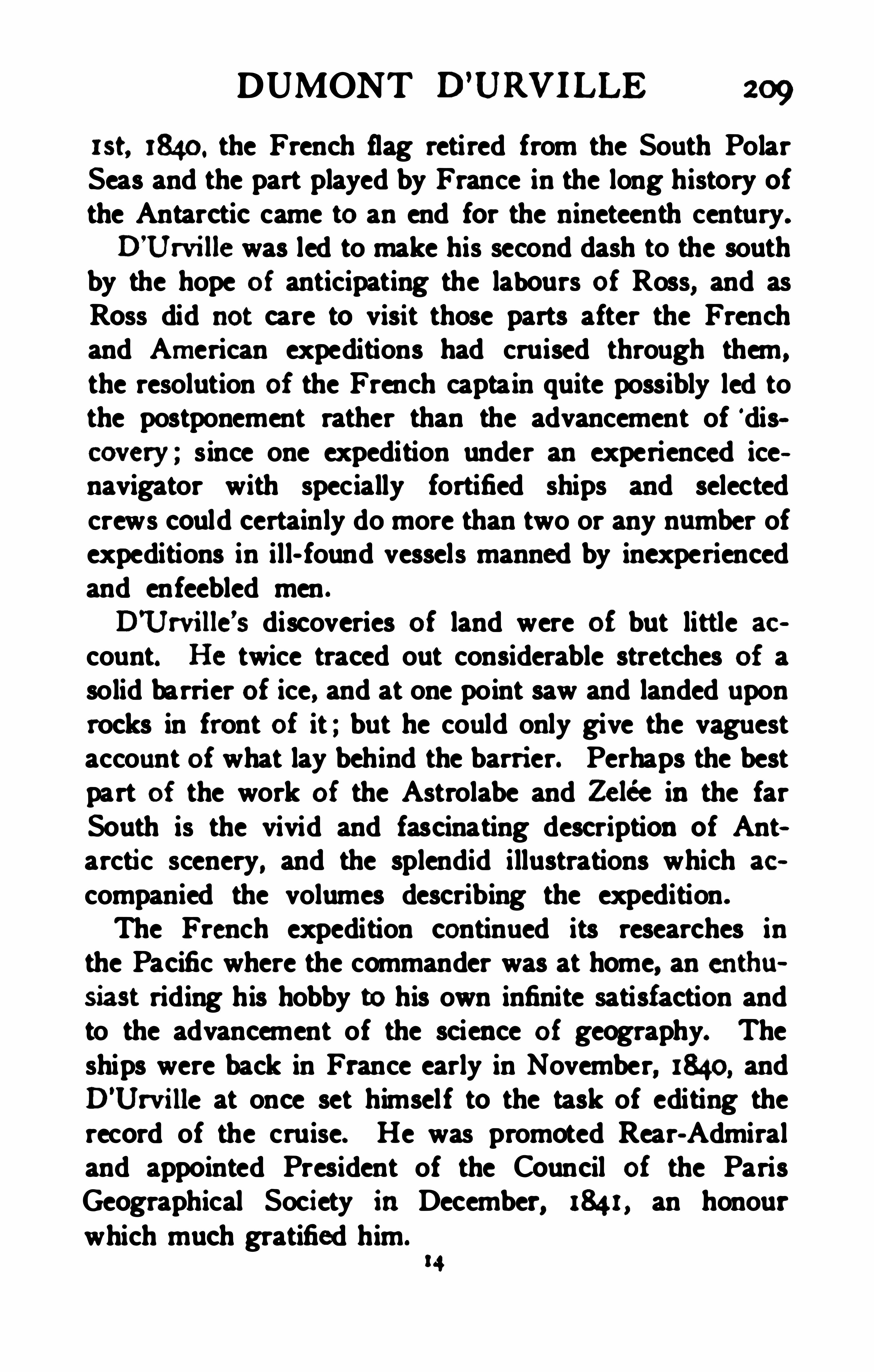
DUMONT D’
URVILLE 209
wt, 1840. the French flag retired from the South PolarSeas and the part played by France in the long history ofthe Antarctic came to an end for the nineteenth century.
D’
Urville was led to make his second dash to the southby the hope of anticipating the labours of Ross, and asRoss did not care to visi t those parts after the Frenchand American expeditions had cruised through them ,
the resolution of the French captain quite possibly led tothe postponement rather than the advancement of ‘discovery ; s ince one expedition under an experienced icenavigator with spec ially fortified ships and selectedcrews could certainly do more than two or any number ofexpeditions in ill- found vessels manned by inexperiencedand enfeebled men .
D'
Urville’
s discoveries of land were of but little ac
count. He twice traced out considerable stretches of asolid barrier of ice, and at one point saw and landed uponrocks in front of it ; but he could only give the vaguestaccount of what lay behind the barri er. Perhaps the bestpart of the work of the Astrolabe and Zelée in the farSouth is the vivid and fascinating description of Antarctic scenery, and the splendid illustrations which ac
companied the volumes describing the expedition.
The French expedition continued its researches inthe Pacific where the commander was at home, an enthusiast riding his hobby to his own infinite satisfaction andto the advancement of the science of geography. Theships were back in France early in November, 1840, andD
’
Urville at once set himself to the task of editing therecord of the cruise. He was promoted Rear-Admiraland appointed President of the Council of the ParisGeographical Society in December, 1841, an honourwhich much gratified him
2 10 SIEGE OF THE SOUTH POLE
On May 8th, he yielded very reluctantly to theentreaties of his wife andson to leave his work andtake a litt le holiday to see the fountains playing at Versailles. As the party was returning an accident happened, the traincaught fire andall three lost their lives,the charred remains being identified with the u tmostdifficu lty. It was remembered that half a century beforewhile an infant Dumont D’
Urville hadfallen into the
fire and been rescued not a moment too soon, a tragiccoincidence that caught the public fancy for a moment.


2 12 SIEGE OF THE SOUTH POLE
bly, only sanctioned a small expedition for surveyingwork in the Pacific.Reynolds made a cruise in the Pacific , circumnavigated the globe and returned more determined than everto obtain an ex pedition on an adequate scale for maritime exploration under the American flag, though on finding the greatest opposi tion shown to the part of thescheme relating to south polar research he laid morestress on the exploration of the Pacific. The practicalimportance of this appealed to the popular mind for onetenth of the American merchant tonnage was embarkedin whaling ventures and trade with China on those seas .The importance of having competent scientific men totake advantage of the opportunities for research likelyto be afforded by such a voyage, led the organisers of theexpedition to provide hh erally for such a stafi, on whichReynolds of course expected to have a leading place .
This part of the plan was naturally distasteful to theNavy Department, which was by no means sympathet icwith the expedition as a whole and adopted the instinctive attitude of the fighting man toward the merecivilian. Unable to prevent the nomination of a sc ientificstaff the Department could at least balk the one enthusiastof the opportunity for which he had worked so long, andfor the sake of harmony " Reynolds was not allowed
The Act of Congress authorising an American E xploring Expedition was at last passed on May 18th.
1836. A squadron was set apart for the service andCaptain Ap Catesby Jones . U. S . N . , appointed to command it. Lieutenant Charles Wilkes , an American (fi cer
of English parentage was dispatched to Europe toconsult with scientific men there and to make pur
CHARLES WILKES 213
chases of the necessary instruments for the expedition.In his absence troubles thickened round the promotersof the expedition , which it is now unnecessary even ifit were possible to particularise. On his return Wilkesfound that he was expected to act as a member of thescientfic corps and not as an executive oflicer. This hefelt, he could not do with honour to himself and hegave up all connection with the expedition , betaking himself to marine surveying.
The Navy Department, while compelled by the Act ofCongress to equip the ex pedition , did so without anyheart for the work. The friends of Mr. Reynolds feltthat they had a serious grievance, nor did they hesitateto say so, and for two years things went from bad toworse . Jones threw up the command, the next twoofficers to whom it was off ered declined or were unableto accept it. Captain Gregory who got the next offerrefused to have anything to do with it as he was a friendof Reynolds and resented the treatment that gentlemanhad received.
All this time supplies of all sorts were being aceumu
lated without supervision , the ships appointed for theservice were surveyed and overhauled in a perfunctorymanner
,and although the learned societies of the United
States , especially the Philosophical Society of Ph iladelphia, formulated plans for scientific work, there was noone to see that the arrangements necessary for theiraccomplishment were made.Discontent had already taken root amongst the idlecrews, tired with the long delay . The public were disgusted with the procrastination and vacillation of theauthorities and the expedition was denounced as an utterfailure before ever it started . At last on March 20th,
214 SIEGE OF TH E SOUTH POLE
M M Secretary of the Navy. mssing om several
thm fa ty yw s of m to nndenahe the m andand
w a mw m ma m g m a
shoddfirst be ofleredto allthe ofi eers abowe him inthe
serviee he aceeptedthe task, well-knowing tlnt it was beset with more tlnnordinarydificnhies. A month h er
he was informedtlnt the squadronas ignedto himwmfldeonsist of the sloops of war Vincennea aadPa eoch the
Two pilotbmtg the Sea Gullandthe Flying Fish were
the expedition were dated Augu st 1 1th , 1838, and signedby J. K. Paulding of the Navy Depa1
-nnent. The fol
to show how far the ships were intendedto work in the
Th e Congress of the UnitedStflemhaving inview
the important interests of our commerce embarlmdinthe whale-fisheries, and other adventures in the gra tSouthern Ocean , by an Act of the 18th of May, 1836.
authorizedanEx peditionto be fittedout for the purposeof exploring and surveying that sea, as well to determine the existence of all doubtful islands and shoals,as todiscover andaccurately fix the positionof those
which lie inor near the track of our vessels in that
quarter, andmay have escapedthe observationof scientific navigators. You willaccordingly take your


CHARLES WILKES 2 15
departure from Norfolk, and shape your course to RioJaneiro, determine the longitude of that place.as well as of Cape Frio ; after which you will either detach a vessel or proceed with your whole squadron, tomake a particular examination of Rio Negro.
Having completed this survey, you wi ll proceed to asafe port or ports in Terra del Fuego, where the members of the Scientific Corps may have favorable Opportunities of prosecuting their researches. Leaving thelarger vessels securely moored and the officers andcrews occupied in their respective duties , you will proceedwith the brig Porpoise, and the tenders, to explore theSouthern Antarctic , to the southward of Powell
’s Group,and between it and Sandwich Land, following the trackof Weddell as clw ely as practicable, and endeavoring toreach a high southern latitude ; taking care , however, notto be obliged to pass the winter there, and to rejoin theother vessels between the middle of February and beginning of March. The attention of the officers left atTerra del Fuego , will , in the meantime, be speciallydirected to making such accurate and particular examinations and surveys of the bays, ports , inlets, andsounds in that region as may veri fy or extend those ofCaptain King.
You will then on rejoining the vessels at Terra delFuego, wi th all your squadron , stretch towards thesouthward and westward as far as the Ne Plus Ultraof Cook, or longitude 105
° W. , and return northward toProceeding once more from that
port, you will direct your course to the Navigator’sGroup, keeping to the southward of the place of departure, in order to verify , i f possible. the existence of certainislands andshoals, laiddown inthe charts asdoubt
2 16 SIEGE OF THE SOUTH POLE
ful, and if they exist, to determine their precise position,as well as that of all others which may be discoveredin this unfrequented track. When you arrive in thoselatitudes where discoveries may be reasonably anticipated , you will so dispose your vessels as that they shallsweep the broadest expanse of the ocean that may bepracticable , without danger of parting company, lying~toat night in order to avoid the chance of passing anysmall island or shoal without detection. Fromthe Navigator’s Group, you will proceed to the FeejeeIslands. These objects wi ll , it is presumed,occupy you until the latter end of October ; andwhenattainedas far as may be possible, you will proceedtothe port of Sydney, where adequate supplies may beobtained. Front thence you willmake a secondattempt topenetratewithinthe Antarctic region, south of Van Diemen’s Land, and as far west as longitude 45° E ., or toEnderby’s Land , making your rendezvous on your returnat Kerguelen
’
s Land, or the Isle of Desolation, as it isnow usually denominated, and where you wil l probablyarrive by the latter end of March, 1840.
From the Isle of Desolation you will proceed to theSandwich Islands , by such route as you may judge best,from the information you may acquire from suchsources as fall in your way. Thence you willdirect your course to the Northwest Coast of America.
You wil l then proceed to the coast of Japan ,taking in your rou te as many doubtful islands as possible ; and you have permission to pass through theStrainof Sangar into the Sea of Japan
,where you may
spend as much time as is compatible with your arrivalat the proper season in the Sea of 500100 or Mindoro.
Having completed this survey, you w ill pro

2 18 SIEGE OF THE SOUTH POLE
of any kind which has reference to the objects andproceedings of the Expedition.the most efiective measures to prepare andpreserveall specimens of natural history that may be collected, and should any opportunity occur for sendinghome by a vessel of war of the UnitedS tates copies
of information or duplicates of specimensyou will avail yoursel f of the occasion at thesame time strictly prohibiting all communications except to this Departrnent, from any person attached tothe Expedition , referring to discoveries, or any circumstances connected with the progress of your enterprise.”
The services of Lieutenant Hudson as second incommand of the Expedition were only secured by theexpress declaration on the part of the government thatthe Ex pedition had no military character so that thatofficer, could without transgressing naval etiquetteserve under Wilkes, who was his junior. The scien~
tific stafi seems to have been frequently discontented ,the exclusion of Mr. Reynolds not appearing to havesecured the harmony that was expected. The causeof the discontent was largely due to the fact that thecivilians were kept entirely in ignorance of the essentialobjects of the expedition. Wilkes himself gi ves thisex planation. He scarcely conceals his contempt of civilian men of science, and he appears to have seennothing wrong in treating them like common sailors inso important a particular. What possible harm couldresult from the plans of a national expedition beinglmownto those who took part init isdifficult to imagine ;the eff ect of secrecy should have been easy to foresee .
A hint as to other troubles which heset the com
CHARLES WILKES 2 19
mander, andof the condi tion of the crews may be
obtainedfrom the following conspectus of the ofi cial
list of oflicers andmentaking part inthe ex pedition.
There were altogether 83 0fiicers and12 members
ists. In addition to these the five sh ips sailedwith a
total crew of 345men of whornonly 221 returnedtothe UnitedS tates with the ex pedition or were senthome on vessels of the Uni tedStates. Of the remain
der fia were dischargedabroad, 47desertedat various
ports andxsdiedor were lost in the Sea Gull. Totake the place of the losses 240 men were engagedatvarious ports andof these Sodeserted, 8died, 26 weredischarged and 126 were brought back to the UnitedS tates so that the number at the endof the long voyage
was practically the same as at the beginning. Thatthere were 127 desertions out of 585 men engaged , or22 per cent. of the ships’ companies , shows the serviceto have been far from w ular. Many of the ofi cers
also were notdevotedto their commander and some ofthem were almost openly antagonistic to him.
Captain Wilkes pointed out before sailing that hisrequisitions for many necessary stores had been totallydisregarded by the Navy Department, and that the vessels had not been properly inspected or repaired beforebeing sent out. The alternatives before him were extremely difficult, either to resign, as the commanderspreviously designated had done, to delay the expedition until the ships were properly overhauled andequipped and thereby further exasperate public opinionand increase the discontent of the crews, or finally tosail andtake the great andunnecessary risks pu t
upon him, in order to save the honour of his country .
220 S IEGE OF TH E SOUTH POLE
He chose the last as the least objectionable course, andhe found it hard enough.
The squadron was hastily got ready for sea andsailed on the date Wilkes had fixed shortly after hisappointment, August i 8th , 1838. The ships were as
The Vincennes was a sloop -of-war of 780 tons, originally single- decked, but for the purpose of the cruisea light upper deck was added thus increasing her accommodation to that of a small frigate. This was the
flag- ship of the squadron under the command of Lieutenant Wilkes. In addition to her officers she carriedsix of the civilian scientific stafi .
The Peacock was a sloop-o i—war of 650 tons, builtten yea rs before and provided with an extra deck likethe Vincennes. She had been so carelessly overhauledand so little prepared for a voyage involving exceptionalrisks that Lieutenant William L. Hudson , who commandedher, reported officially a month after sail ingTaken as a whole, the Peacock has been fitted out(so far as the navy- yard was concerned ) with less regardto safety and convenience than any vessel I ever hadanything todo with .
” She carried four of the civilianstafi, including James D. Dana, the mineralogist. Itcreates no surprise that she did not complete the voyage ;she was wrecked on July 18, 184 1 , though fortunatelywithout loss of li fe.The Porpoise, a gun -brig of 230 tons, had beenspecially fitted with a forecastle and poop—deck for thevoyage. She was under the command of Lieutenant Cadwalader Ringgold.
The Sea Gull was an old New York pilot- boat of 1 10tons, and served as a tender under the command of

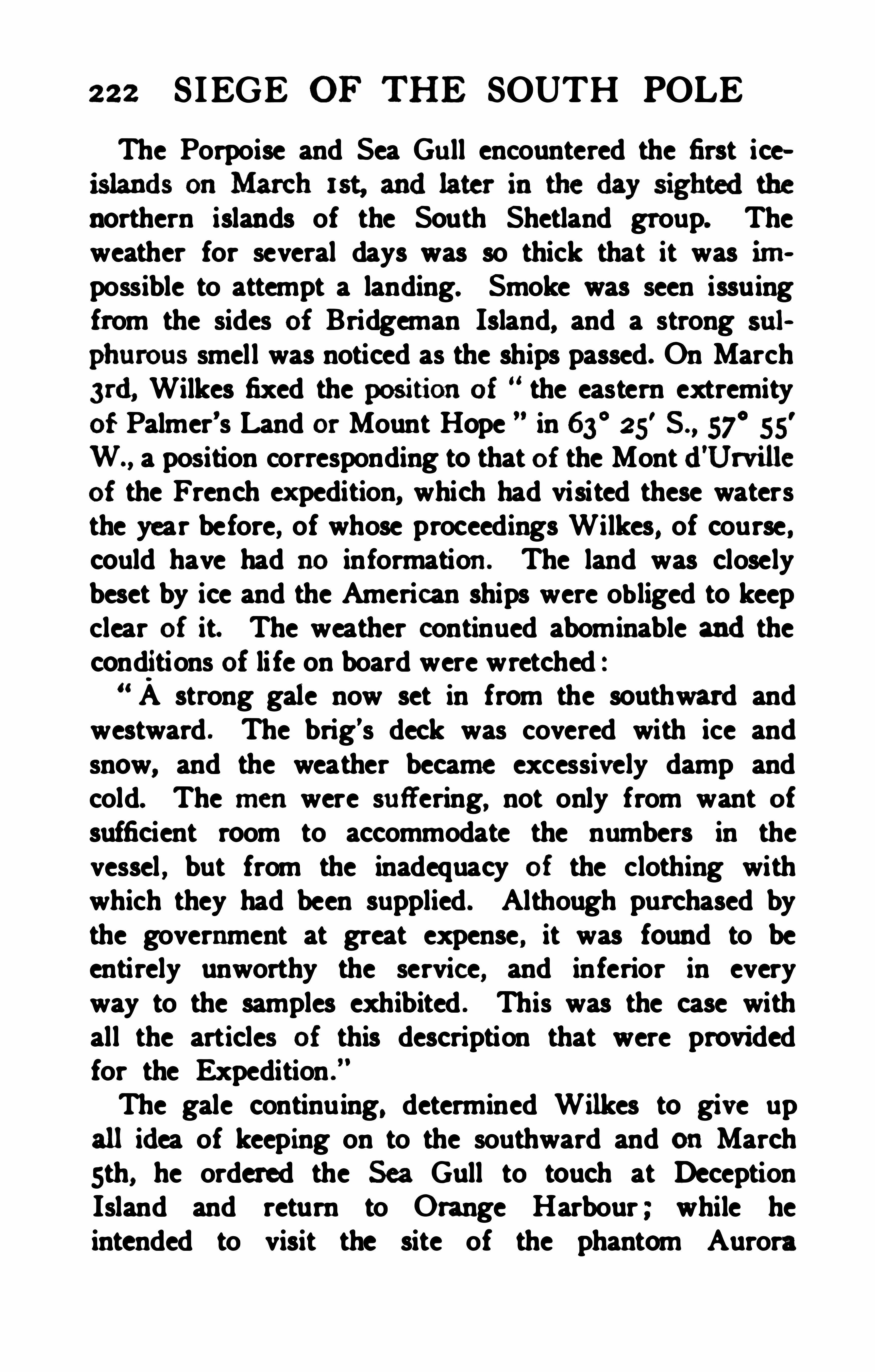
222 SIEGE OF THE SOUTH POLE
The Porpoise and Sea Gu ll encountered the first iceislands onMarch 1st, andlater in theday sightedthenorthern islands of the South Shetland group. Theweather for several days was so thick that it was impossible to attempt a landing. Smoke was seen issuingfrom the sides of Bridgeman Island, and a strong sul
phurous smell was noticed as the ships passed. On March3rd, Wilkes fixed the podtionof the eastern extremityof Palmer’s Land or Mount Hope in 63
°25
'
S . , 57°
55'
W., a pos ition corresponding to that of the Montd'Urvilleof the French ex pedition, which had visited these watersthe year before, of whose proceedings Wilkes, of course ,could have had no information. The land was closelybeset by ice and the American ships were obliged to keepclear of it. The weather continued abominable andtheconditions of li fe on board were wretched :“ A strong gale now set in from the southward andwestward . The brig’s deck was covered with ice andsnow, and the weather became excessively damp andcold. The menwere su ff ering, not only from want ofsufficient room to accommodate the numbers in thevessel , but from the inadequacy of the clothing withwhich they had been supplied . Although purchased bythe government at great expense , it was found to beentirely unworthy the service, and inferior in everyway to the samples exhibited . This was the case withall the articles of this description that were providedfor the Expedition .
The gale continu ing, determined Wilkes to give upall idea of keeping on to the southward and onMarchsth, he ordered the Sea Gull to touch at DeceptionIsland and return to Orange Harbour ; while heintended to visit the site of the phantom Aurora
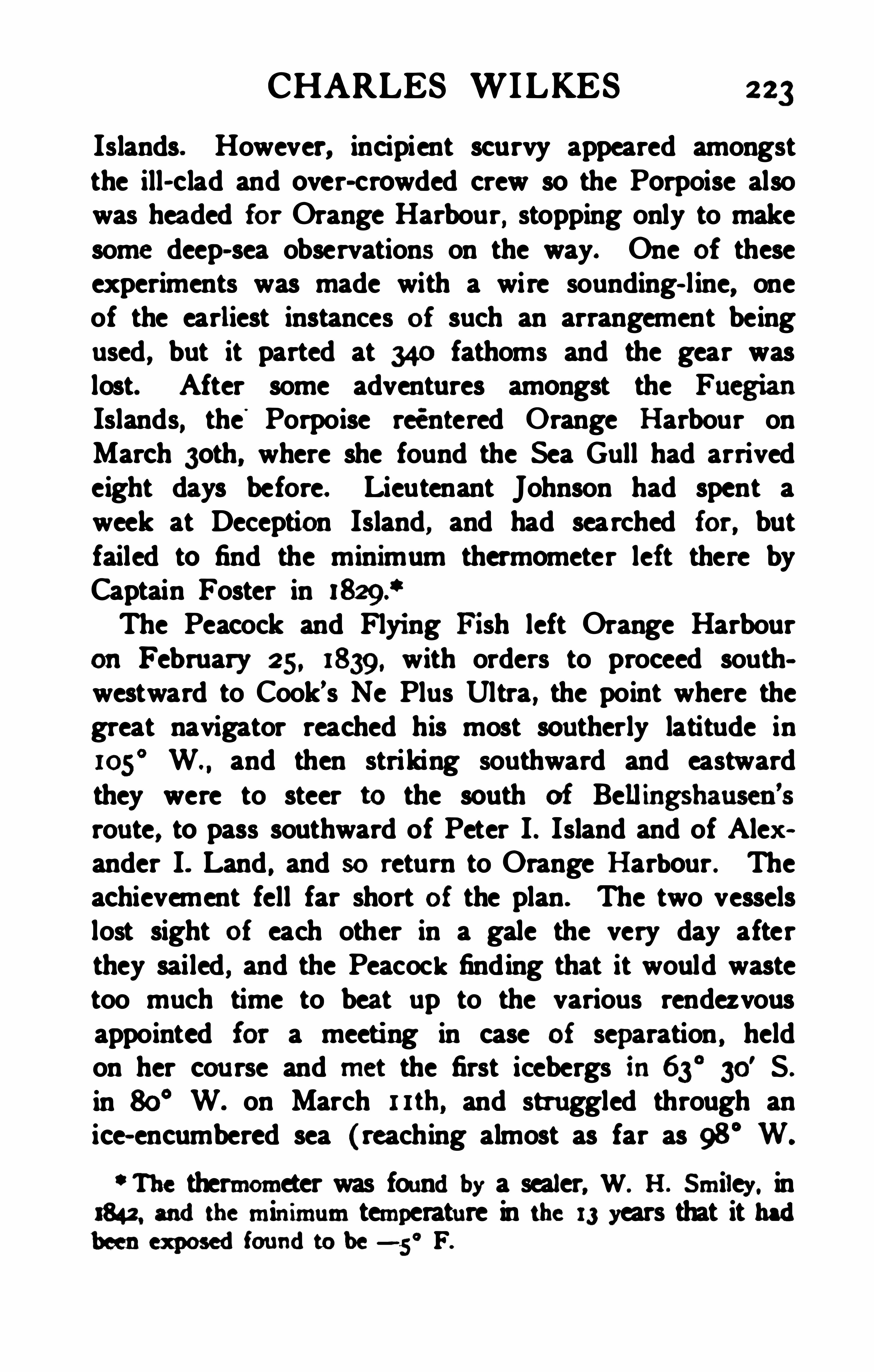
CHARLES WILKES 223
Islands. However, incipient scurvy appeared amongstthe ill- clad and over- crowded crew so the Porpoise alsowas hea ded for Orange Harbour, stopping only to makesome deep- sea observations on the way. One of theseexperiments was made with a wire sounding- l ine, oneof the earliest instances of such an arrangement beingused , but it parted at 340 fathoms and the gear waslost. After some adventures amongst the FuegianIslands, the
'
Porpoise reentered Orange Harbour onMarch 3oth, where she found the Sea Gull had arrivedeight days before. Lieutenant Johnson had spent aweek at Deception Island, and had searched for, butfailed to find the minimum thermometer left there byCaptain Foster inThe Peacock and Flying F i sh left Orange Harbour
on February 25, 1839, with orders to proceed southwestward to Cook’s Ne Plus Ultra , the point where thegreat navigator reached his most sou therly latitude in105
° W and then striking southward and eastwardthey were to steer to the south of Bell ingshausen
’
s
rou te, to pass southward of Peter I . Island and of Alexander I. Land , and so return to Orange Harbour . Theachievement fell far short of the plan. The two vesselslost sight of each other in a gale the very day afterthey sailed , and the Peacock finding that it would wastetoo much time to beat up to the various rendezvousappointed for a meeting in case of se
paration , held
on her cou rse and met the first icebergs in63°
30' S .
in 80° W. on March 1 1th, and stru ggled through anice- encumbered sea (reaching almost as far as 98
° W‘ The thermometer was foundby a sealer, W. H . Smiley. in
3842, andthe minimum temperature in the 13 years that it hadbeenex posedfoundto be—5° F.
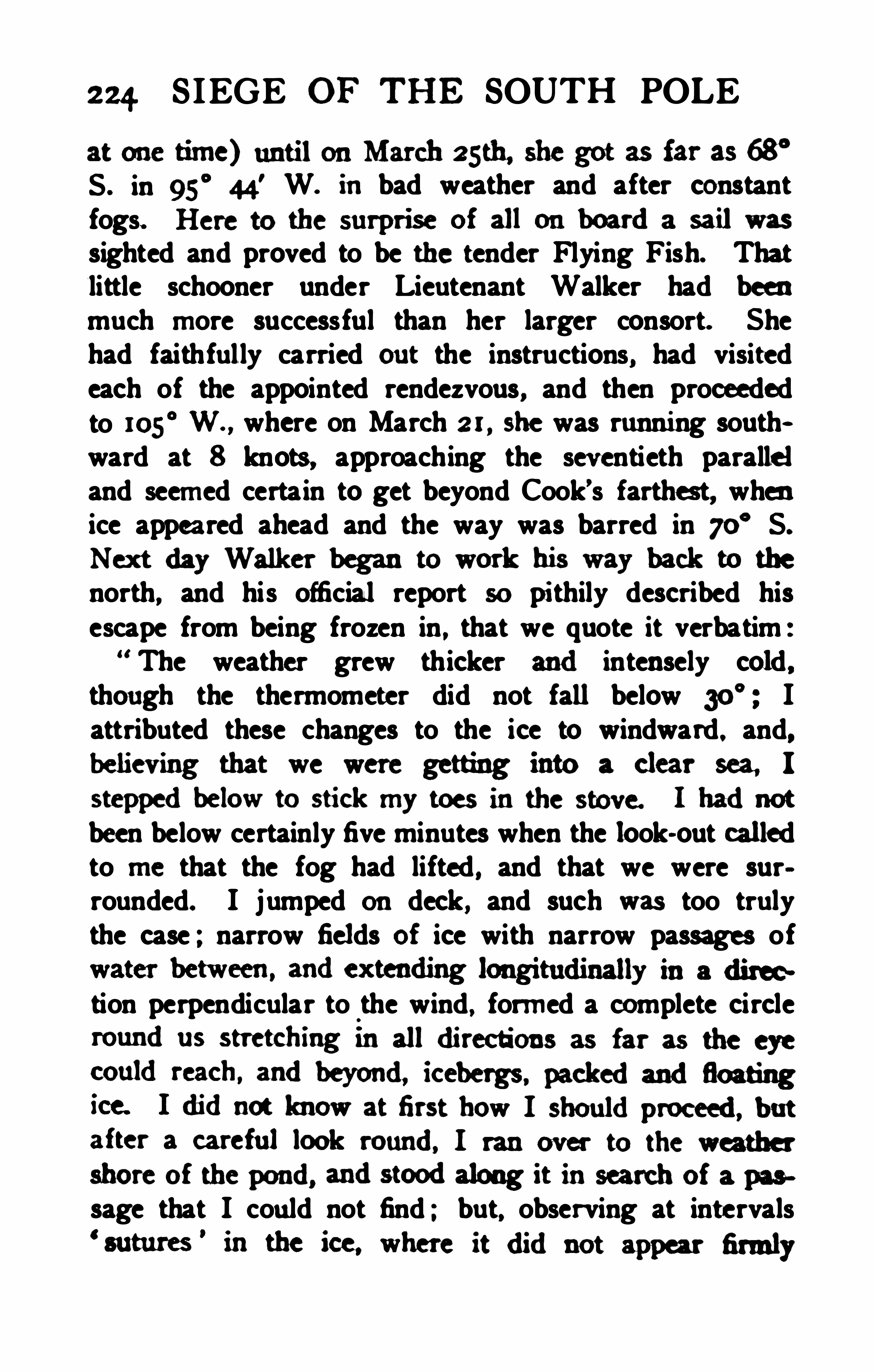
224. SIEGE or THE SOUTH POLE
at one time) untilonMarch 25th, she got as far a3 68°
S . in 95°
44' W. in bad weather and after constant
fogs. Here to the surprise of all on boarda sailwas
sighted and proved to be the tender Flying Fish. Thatlittle schooner under Lieutenant Walker had beenmuch more successful than her larger consort. Shehad faithful ly carried out the instructions, had visitedeach of the appointed rendezvous, and then proceededto 105
° W. , where on March 2 1 , she was running southward at 8 knots , approaching the seventieth paralleland seemed certain to get beyond Cook’s farthest, whenice appea red ahead and the way was barred in 70
° S.
N ex t day Walker began to work his way back to the
north, and his official report so pi thily described hisescape from being frozen in , that we quote it verbatim :
“ The weather grew thicker andintensely cold ,though the thermometer did not fall below Iattributed these changes to the ice to windward , and,believing that we were getting into a clear sea, I
steppedbelow to stick my toes in the stove. I hadnotbeen below certainly five minutes when the look-out calledto me that the fog had lifted , and that we were surrounded. I jumped ou deck, and such was too trulythe case ; narrow fields of ice with narrow passages of
tion perpendicular to the wind , formed a complete circle
shore of the pond, andstoodalong it insearch of a paa
sage that I cou ld not find ; but, observing at intervals

226 SIEGE OF THE SOUTH POLE
would bedifficult to find. The larger ships pierced forguns with large square ports could hardly be kept drybetween decks in any breeze. The ports were not tightfitting and in the case of the Peacock the sheer - strake towhich they were hung and the bulwarks attached was sorotten as to cause the greatest anxiety. All possible stepswere taken to keep the inside of the ships dry. All theopenings were cau lked, and the seams covered with tarredcanvas over which sheet- lead was nailed. On startingthe ships’ boats were filled with bread as there were notbags enough to contain it all nor proper space in whichto stow it.By this time particulars of the equipment of the BritishAntarctic expedition had been received at Sydney andthe American ships were visited by numbers of thecitizens anxious to see what Antarctic equipment was like.Wilkes describes the circumstance with a touch of thegrim humour that flickers now and then over the sternestfacts in his narrative.All seemed disappointed at not being able to see the
same complete outfits in our vessels as they had seen described inthe published accounts of those of the Englishexpedition commanded by Captain James Ross. Theyenquired whether we had compartments in our ships toprevent us from sinking ? How we intended to keep ourselves warm ? \Vhat kind of antiscorbutic we were touse ? And where were our great ice- saws ? To all ofthese questions I was obl iged to answer, to their greatapparent surprise, that we had none, and to agree withthem that we were unwise to attempt such service inordinary cruising vessels but we had been ordered to go,and that was enough ! and go we should. This want ofpreparation certainly didnot add to the character for
CHARLES WILKES 227
wisdom of our govennnennwith this community ; butthey saw ns afl cheerfuh yonng , andheulthy. andgavens the character, tltat l fmmdour counu'
ymengenerallyba r. of recklessness of li fe and limb. The tender FlyingFish excited their astonishment more than the ships,from her smallness andpeculiar rig ; and, altogether.as a gentleman told me, most of our visi tors consideredus doomedto be frozen todeath . 1didnot anticipatesuch a famaldwugh lmust confess l felt the chances
were much against us, in case we were compelled towinter within the Antarctic. From every calcu lation,we could not stow quite twelve months’ provision . evenupon short allowance ; our fuel was inadequate to lastus more thansevenmonths andthe means of protectingourselves in the ships for winter quarters, were anythingbut sufiicient. My mind naturally suff ered a great dealof anxiety on all these points , and I felt myself not alittle depressed by it, particularly when I considered thestate of the Peacock.We made up our minds that it was absolutely neces~
sary for the credit of the Expedition and the country forher to perform it ; for we were well satisfied that improper imputations and motives would be ascribed tous if she did not, and was detained undergoing repairs.in a state of inactivity, during the season for operationsin the high southern latitudes. The necessity I felt ofsubjecting so many lives in so unworthy a ship, causedme great anxiety during the whole cruise."
On December e6th, 1839, the day decided upon beforeleaving home. the squadron sailed from Sydney. OnJanuary zud, 1840, the little Flying Fish was lost sightof in a fog andthe opinion was general in the other
vessels that she had shared the fate that befell the Sea
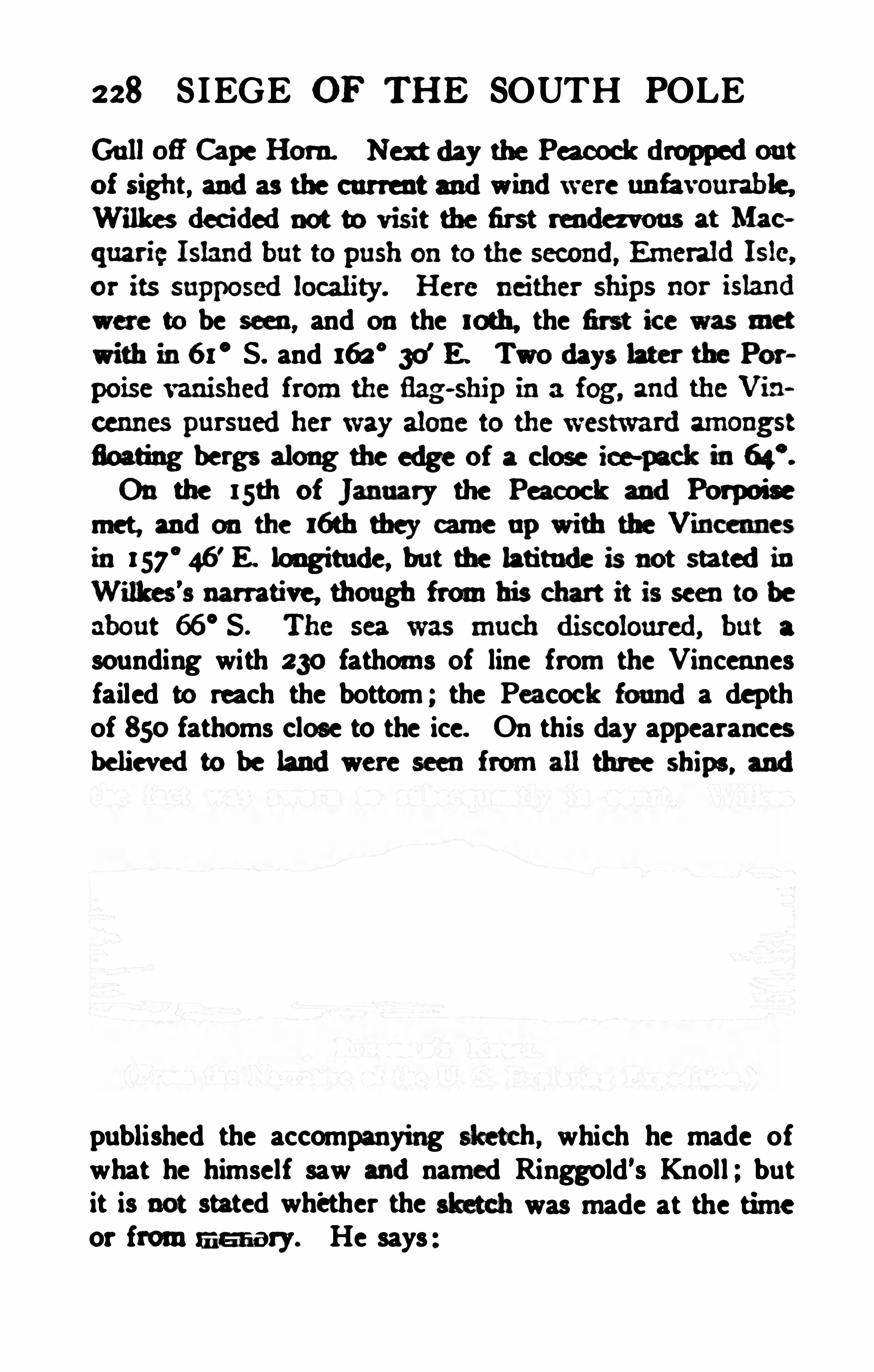
228 S IEGE OF THE SOUTH POLE
GulloflCape I-Iorn. Nex tday the Pa cockdroppedout
Wilkesdecidednot to visit the first renda vous at Mac
"m be M » and on the loth. the m ice was
wifi inti x ’ S. and 163 °
30'E . Twodays lacer the Por
floafing bergs along the edge of a close ice-mck infic".
On the lsth of January the Peacock andPorpoisemet , andon the xah tbey came up with the Vincennes'
m statedinWilhes’s narrative though frm his chart it is seento be
sounding with 230 fathoms of line from the Vincennesfailed to reach the bottom ; the Pa coch fomlda depthof 850 fathoms close to the ice. On this day appearancesbelievedto be landwere seen from all three ships, and
published the accompanying which he made ofwhat he himself saw mdnamed Ringgold's Knoll ; butit is not stated whether the ” all was made at the timeor from m u m 37. He says

230 SIEGE OF THE SOUTH POLE
known to the explorers , though they had been discoveredtwelve months before. The question of priority was mademuch of by Wilkes, not, indeed , in favour of Balleny,but against D'
Urville, who, as we have seen, unquestionably discovered land in the same locality within a fewdays of the Ameri cans . As the land would have beendiscovered in any case by one of the expeditions, even ifthe other had not been in the field, the question is one ofpurely personal, or at the highest, of national interest,the controversy is of no scientific importance whatever.The prior discovery by Wilkes or D’
Urville in no wayreduces the credit due to both explorers , although thenature of the new land was only ascertained by either ina vague way.
On the night of the 16th the fog fell thick and theVincennes suddenly ran from a rough sea into smoothwater to the great alarm of the watch below, who ,awakened by the sudden stil lness , knew that she hadcome inside a line of ice. She was, in fact, embayed, andit cost several hours of anxious navigation to work herinto the rough , open water again .
On the 17th the Peacock was ordered to proceed independently, as the attempt to keep the ships in companywas retarding exploration . Both vessels held on theirway westward along the edge of the barrier of closepack ice . On the 19th land was very distinctly seen,both to the south - southeast and the s outhwest , the Vincennes being then in 66° 20's. and 154
°
3o'
E . Theland appeared to rise to a height of about 3000 feet. Atnight the unusual spectacle was seen of the sun and thenearly full moon , both shining at the same time , the sunilluminated the icebergs anddistant continent with hisdeep golden rays,
” while the moon tinged with silvery
’
l'
he mttenstate of the
Hudsou for the msult :
ong which boundthcdavit to thc “li ra“.die stanchions todte plank‘ehccr u far es
was this shock it happened fortunatelyby as great a rcbound. '
l'
his gmto starboard. andby the thnely |ldof
andother sa ils. carried her clear of the lcevlnhml.
232 SIEGE or TH E a ura. POLE
panding mass of ice andsnow fellinher walne. Hadthis
For days the shiping frightfully m the troughofdie heavy w . grindingand “1103 8 against the w ees of ice, w
made desperate efiorts to plantme ice- anemi a to control


rose fra nhis bedandtnfledwith his nntes for four mdtwenty hours withou t intermiss ion to accomplish the
hamleantask. Onthe zsth the rndder was hung . thoogh
ma m m mfacmy mmm me slfip m s at h st
workedout of the lny inthe barrier inwhich she hadso
addition to the other damage, her stem was nearlygroundofi by collisions with the ice. It wonldhavebem madness mattunpt morg andthe only chance of
safety lay inaninnnediate retreat to the north by which.
if the elements were kind, she might ru ch 8ydney. OnFebruary z lst she arrivedat that port with allwellon
Captain Hudson hadshown himself a splendidsailor.
cooh resourcefuh andnever at a loss how to act in the
most trying emergencies ; and Wilkes gives him nustinted praise for his seamanship, courage, and devotion.
The Vincennes and Porpoise were left cru ising westward along the icy barrier. On January 22. 1840, the
Vincennes passed the place where the Peacock unfortmnately found an opening on the following day. andnobreak inthe line of the barrier was observed. The alter
nate opening andc losing of the ice was attributed byWilkes to a tide setting along the coast of the Antarcticcontinent. Onthe zzndthe sea was found clear to the
south and the Vincennes sailed into a wide bay. situatedin67
°
4’ S . and 147
°
30'E ., hoping this time to resch the
land, bu t at midnigbt it appearedthat there was no out
let to east or west anda solidice-barrier foflnedthe
234 SIEGE OF THE SOUTH POLE
bottom of the inlet which Wilkes namedDisappointmentBay. The weather was fine andclear, andnex tday, longafter leaving the bay, the commander foundthat one
of the oficers hadloggedwithout reporting to him the
discovery of a wide opening in the ice at the bottom of
the bay. Although su re that no such opening existed,“Wi lkes put the ship about and sailed back forty mi lesto convince the ofi cers that Disappointment Bay wasreally a cul -de-s ac in the ice. About this time Wilkesintroduced the practise of charting the large ice- islandsas he proceededas i f they hadbeen actual islands believing that thei r relative positions would not changemuch in the course of a few hours andthat the rough
chart might prove serviceable if he hadsuddenly to re
OnJanuary zsth a snow storm came onandthe windshiftedto the sou theast for the first time since the squadoron had reached the ice, a fact that surprised Wilkes , foron the strength of former voyages he had expectedeasterly winds to prevail in the neighbourhood of the Antarctic circle. The fair wind, come at last, could not betaken advantage of because the weather was unsu imblefor making an examination of the coast , which was nowfully believed to lie within the southern ice- barrier. ThePorpoise was sighted several times on the a6th and a7th ,
as the Vincennes continued to run to the westwardthrough the scattered ice- islands to about longitude 142
°
E. Land was distinctly seen on the a8th , and the shipran towards it for 40miles through an extraordinary number of ice- islands, varying from a quarter of a mile tothree miles inlength . At 2 p. m. the barometer began tofall and the weather looked so bad that Wilkes det erminedto regainthe opensea andtriedtodo so by aidof


236 SIEGE OF THE SOUTH POLE
a narrow passage between two bergs suddenly appearedand she shot into the treacherous calm of the narrowway, her sails almost thrown aback by the eddy windsfrom the wall of ice, and the roar of the storm stilledby the distance. The suspense was terrible, but thespirits of the captain rose as he heard the howling of thetempest once more and emerged into the furious seafrom the imminence of a terrible death . By 4 p. m.
the gale was over, the wind blew from the southwest,and the ship was in 140
°E , 63
°
30’ S . Wilkes at once
started retracing his track to the southward, once morehopeful of reaching the land. The sun rose on the 3othof January and shone brilliantly on a sea beset with iceislands and bergs of all sizes through which the shippursued her way easily under full sail , her crew amazedbeyond measure to see the labyrinth of ice through whichthey had rushed before the storm unharmed in the darkness .The wind quickly freshened and the ship ran into aclear space at the rate of nine or ten knots , finding herself ina bay partly enclosedby ice andpartly by rocks,
to which the ship approached within hal f a mile. Theland was seen rising beyond the rocks and the barrierto a height of about 3000 feet, and could be distinctlyseen extending fu lly sixty miles from east to west. Theposition was 66° 45
'S . , 140
°2’E , and soundings gave
a depth of only 30 fathoms. The wind had risen again tothe force of a gale and it was impossible to lower a boat.Now that all on board were convinced of its existence,Wilkes gave to the land the name of The Antarctic Continent, and to the indenta tion in which they were that ofFiner’s Bay , after the signal quartermaster . This wasthe land which D'
Urville also discovered.

238 S IEGE OF THE SOUTH POLE
much discoloured. Greatly to the regret of Wilkesthe deep- sea sounding line was in such a bad state that itcould only be used to the depth of 150 fathoms, and sofailed to reach the bottom . The position of the ship onthis day was 66° 12
’ S. and 137°2' E.
The number on the sick list increased to twenty, andthe nights were growing longer, thus increasing thestrain and anxiety on the navigating officers. A snowstorm and gale came on next day and the sick list roseto thirty. The weather remained wretched until the 7th.and the ship was slowly worked to the westward , sometimes running far to the north to round proj ections ofthe barrier or to escape from the proximity of dangerousicebergs. The 7th proved finer and the ship cru ised allday along a perpendicular wall of ice about 150 feet inheight, stretching without a break to 131
°
40' E. and 64
°
49’
S . , where it trended to the south. Behind it the outline oi high land could be distinctly seen , the Céte Clarieof D’
Urville. The ship lay- to till daylight at the bendin the coast to which Wilkes gave the name of CapeCarr, after the first lieutenant of the Vincennes, but it isnot stated whether the cape was the icy angle of the barrier or the assumed promontory within it, and it haseven been suggested by an American author that thename applied to the snowy heights of the mainland ,
”
but Wilkes was certainly too good a sailor to give thename of cape to any feature not touched by the sea .
Next day it was possible to get only a little farther southbut land was visible in the evening at a great distanceand the westerly course was continued.The next two days were the finest experienced on thatcoast, and fine vi ews of the barrier were obtained , thoughthe appearanoes of landwere neither so mnnerous nor so

240 S IEGE OF THE SOUTH POLE
ing this ice a vast su pply of the purest fresh water wasfound , from which the ship replenished her tanks. Asthis berg was nearly in the position of the last rendezvousappointed for the squadrona fiagstaff was erectedon it,and orders left for the other ships to continue to the westward unti l the I st of March .
OnFebruary 15th , the sea became so cahnthat Wilkessuspected that there might be a quantity of ice to thenorthward between him and the open ocean, especially ashe was 200 miles south of the latitude in which Cookhad found the barrier in 1773 , but he kept on in the hopeof reaching Enderby Land . Animal life was now exuberant, whales abounded, including right whales it
is stated , and there were seals and penguins in abundance though no mention is made of these being used forfood . Enormous numbers of shrimps were seen swimming around the icebergs. Many earth- stained icebergscame in sight andsome of them were visited. Themeridian of 100° E. had been passed , and the wind forseveral days showed a distinct diurnal periodicity, blow
dying away at
On the 16th about 10a. m., the barrier was seentrending to the northward , and next day it was found that therewas no possibility of getting farther to the west . The
position then was 64°1' S . and 97
°
37'E . , and an ap
peamnce of landwas seen to the southwesnapparentlytrending to the northward . This was charted as TerminationLand and gave rise to much controversy : it hasbeen proved not to exist inthe assignedposition, thoughDrygalski found land which might have been sighted inthe same direction from Wilkes’s farthest point to thewestward . As the windstill heldfrom the east it was


241 SIEGE OF THE SOUTH POLE
“ I have seldom seen so many happy faces, saysWilkes , or such rejoicings as the announcement ofmy intention to return produced. But although the crewwere delighted at the termination of th is dangerouscru ise, not a word of impatience or discontent had beenheard during its continuance."
The health of the crew was better than when they firstreached the ice, but the labour and anxiety had toldheavily onWilkes himself though he was always ableto attend to his duties.On March 1st the Vincennes reached the latitude ofRoyal Company Island and ran for eight degrees oflongitude along the parallel but without seeing any indication of land . The wind proving unfavourable forreaching Hobart Town, Wilkes set his course for PortJackson, and on the 1 lth he passed between the Headsand dropped anchor in Farm Cove, Sydney Harbour,the crew being in better condition than when they hadsailed. The Peacock was found in Mossman's Coveundergoing her necessary repairs, but there was no newsof the Porpoise or Flying Fish , which were not metuntil March 3oth in the appointed rendezvous, the Bay ofIslands, New Zealand .
The Porpoise, it will be remembered , was lost sight ofby the Vincennes on January a7th in 65
°
4 1’ S. and 142
°
3 1' E. Lieutenant Ringgold had formed the mistaken
idea that the prevailing wind in those latitudes waswesterly, and as it was blowing fresh from the east hethought it would save time to run straight to his westernlimit in 105
°E ., and then in more favourable circum
stances examine the barrier minutely as he returned.He accordingly, after a couple of days in the ice duringthe heavy gale that had so severely tried the Pa coch.
CHARLES WILKES 243
stood clear of the ice and held on his course . On the3oth as he was proceeding two strange vessels appearedand as they were smaller than the Vincennes or thePeacock Ringgold concluded that they must be the shipsof the British expedition under Ross which he knewwere expected in those seas. He hoisted his colours andwas “ preparing to cheer the discoverer of the NorthMagnetic Pole,
" when the strangers showed Frenchcolours and the Americans knew that they were D'
Ur
ville's. When almost up to the flagship his intentionstoo evident to excite a doubt Ringgold saw sail beingmade onD'
Urville’
s ship and jumping to the conclusionthat an insult was intended he instantly hauled downhis flag and bore on his course. Wilkes was much excited when he subsequently heard of the episode and saidhard things of D'
Urville ; but the explanation of thelatter has already been given. It is simply incrediblethat any commander meeting another ship in such aregion would wilfully insult a fri endly flag, and wemust conclude that the American captain was too quickto take ofience.
The barrier was occasionally sighted and the usualdifiiculties of navigation amongst the floating ice weresuccessfully overcome. NO land was reported, but discoloured ice was frequently observed and earth andstones were several times collected from the ice ; on the13th a number of stones were taken
‘‘ from an immensemass of black earth identified with the barri er, somehundreds of yards back from the margin .
” On February 14th the westward limit assigned had been passedand the Porpoise turned in 100
° E. and 64°15
' S . toexamine the edge of the barrier as she sailed eastward.
The crew were in good health and spirits and on Feb
244 SIEGE OF THE SOUTH POLE
ruary 22ndthey celebrated Washington's birthday,ceiveda number of compliments from the captaintheir good behaviour, and, what comes nearer to Jack
’sheart, an extra allowance. On the 24th , after havingoccasionally sighted the barri er, Ringgold felt that hehad fulfil led his commission and being then in 64
°29
’
S . ,
126° E . , he turned the brig’s head northward . The
Auckland Islands were sighted on March sth and onthe7th the Porpoise dropped anchor in the harbour of
Sarah ’s Bosom, where the sailors revelled on the limpetsand fish. After a short stay the Porpoise left andreached the Bay of Islands on March afith , finding thelittle Flying Fish there before her .The Flying Fish had been lost sight of by the squadron on the outward cruise onNew Years' Day long before reaching the ice. The little schooner had had amishap with her sails causing her to fall behind. She
had proceeded according to instructions to the two firstrendezvous without meeting the other vessels , and on January at st she had reached the icy barrier in 65
°20
' S.
159°
36' E. On the a3rdrocks had been seen in 65°
58’
S . , 157°
49' E. so closely beset by ice that it was im
possible to approach them. Until February sth shecontinued to cruise amongst the ice, encountering severalgales andhaving a number of menon the sick list.
As the crew was reduced by illness it was imk toreef the mainsail and more than once the schooner hadto lay- to with full canvas which caused her to labourfrightft and leak to an alarming degree . Everythingbelow deck was wet and when the pumps were stoppedfor a short time the water reached the cabin floor. The
men sent a letter to Lieutenant Pinkney , who was incommand for the cruise, pointing out the deplorable

246 SIEGE OF THE SOUTH POLE
W a mw a w wmm m mcm a
a chart showing the positionof the ice- barrier andindi
Ross receivedthe letter andclnrt andin the course of
lus voyage sa iledacross one of the lands repreaentedinabout 66
°
S . and165° E .. finding only opensea. Hav
of Wilkes'
sdiscovefies shownondus charg because it
was imposs ible for him todecide how far they representedlandactually seen, andhow far land, flie ex istence of
ha rdof Ross's voyage towards the endof 184 1 whenhetouchedat hu in the Sandwich Islands andthen ex
plainedthat the landRoss hadsailedover was no part
Balleny Islands , of thediscovery of which he hadheardin Sydney from Captain Biscoe whom he met there.
‘
Thisdiscovery of Balleny hadinthe'
hasty tracing bemleft without any statement that it was not an Amer-innclaim, andthe lands m lly claimedfor the ex pedifionalllay to the westwardof the meridianof beyondwhich Rossdidnot go. Ross however pointedout that
as“Briscoe,
"slips that give rise to confusioninAmericm writers
to thisday.


248 SIEGE OF THE SOUTH POLE
expedition was involved in trouble before ever it set out ,trouble of every kind dogged its track in tropical, ternperate and polar waters and the troubles did not endwhen the storm - tossed ships came home on June 10,
1842. The gold medal of the Royal Geographical Society, the highest distinction in the geographical world,was conferred upon Wilkes a few years later , sufficientevidence of the esteem in which his geographical resultswere held in Europe . It cannot be said that his owncountrymen received him with gratitude or unqualifiedapproval, for shortly after his return he was broughtbefore a court-martial on thedistinct and separate chargespreferred by his ownofficers of oppression , inj ustice tohis men, illegal and severe punishment of savages, falsehood and scandalous conduct, the last charge includingsuch mildly scandalous acts as wearing the uniformof a captain while still technically a lieutenant ! Thetrial lasted six weeks, and reference has already beenmade to the charge of falsely stating that land had beendiscovered onJanuary 19, 1840, the only one in any wayaff ecting the Antarctic cruise . The result of the trialwas acquittal , and Wilkes rose to a very high place in theUnited States Navy. He was a fine fighting officer anddid good service for the North in the Civil War. Oneof his notable exploits brought the United Kingdom andthe United States nearer war than they have ever beensince 1815. This was the stoppage of the British mailsteamer Trent on the high seas on November 8, 1861 ,
andthe arrest of two envoys from the ConfederateStates who were proceeding to Europe . He retired on
account of age in 1864 , and was appointed Rear-Admiralin 1866 ; he lived until February , 1877, when he died inWashington in his eightieth year.
CHAPTER XII
JAMES CLARK Ross
“With the tumultuous past the teeming future,Glorious with visions of a fullsuccess.”
- Rom r Baownrnc.
HE British Anta rctic Expedition, fitted out by theAdmiralty in accordance with the plan submitted by
the British Association and approved by the RoyalSociety, was designed for its commander, whose personalqualities and ex ceptional experience made him the oneman possible for the work. It wou ld be interesting togive details of the earlier li fe and training of James ClarkRoss, but unfortunately the data for such a memoir arevery scanty.
The Ross family possessed the property of Balsarroch.in the parish of Kilmalcolm, Wigtownshire, at least asearly as the begi nning of the eighteenth century, and in1761 the property came into the possession of the Rev.
Andrew Ross , minister Of the parish of Inch, who leftfour sons . The eldest of these was General Andrew Ross,who apparently predeceased his father, for the second son ,George Ross , merchant in London, succeeded to the estatein 1792. The fourth son was Admiral S ir John Ross,famous as an Arctic explorer , who was born in 1777, andafter a life of strenuous effort, died in 1856. GeorgeRoss left three sons, the eldest, Colonel Alexander Ross,who succeeded to the estate in 1800, while the youngestwas James Clark Ross , the hero of the South Polar expeditioh. He was born in London on April 1sth, 1800,
250 SIEGE OF TH E SOUTH POLE
and as we have seen came of a family of soldiers andsailors. At the age of twelve he entered the navy, beingplaced under the care of his uncle , in whose ships hesailed until 1818. In 1819 he served onboard H . M . S .
Hecla under Sir Edward Parry , and continued for eightyears with that great Arctic officer, taking part in severalexpeditions to the northern seas including the famou sattempt to reach the North Pole by travelling overthe ice beyond Spitsbergen in 1827. On returning fromthis expedi tion he was promoted to the rank of Commander, and sailed again in 1829, with his uncle S irJohn Ross in S ir Felix Booth ’s ship Victory. On thisoccasion the expedition spent four years in the Arcticregions and was almost gi ven up as lost. In the courseof it James Clark Ross did an immense amount of sledging work, and on June 1 , 1831 , he reached the Northmagnetic pole and had the pleasure of hoisting theBritish flag on that interesting spot. He was promotedto the rank of Captain in 1834, and was in command ofH . M . S. Cove in BaflinBay in 1836.
Ross, who was reputed to be the handsomest man inthe navy , was an excellent ofi cer with a rigid sense ofduty . There is a curiou s note by one of the membersof the expedition which proves the firmness of the commander’s character and may be viewed as a compliment, though intended as a censure. Notwithstanding my having some personal influence with CaptainRoss —so runs the complaint both of us havingserved together as youths under our mutual old commander and friend, Sir Edward Parry , I could not induce him to cancel any order he had once placed in theorder- book, so strong were his prejudices , and as asequence so difficult to reason with.


JAMES CLARK R088 25:
Another member of the expedition thought that thediscipline on board the Erebus was lax compared withthat on the Terror, and believed that Ross permitted toomuch fami liarity between the officers and men . The twocriticisms are not consistent, and stress need not be laidon either. Ross’s oldfriend. Sir John Franklin consideredhim to be an ambitious manwho tried to do everything himself, and was not ready to encourage any initiative on the part of his subordinates . Franklin , in the sameletter which contains this opinion , bears the strongesttestimony to Ross’s kindliness and generosity and to hishigh sense of honou r. He had , perhaps , a tendency tounderestimate the qualities of foreigners, but that is notunusual in the fighting services of all nations and is perhaps to some degree inseparable from the overmasteringdevotion which a naval officer ought to bear to his ownflag.
It is enough for us to know, and of this there cannotbe a shadow of doubt, that there was no other man, notonly in the British navy but in the British Empire, probably in the whole world, who was so thoroughly fittedto take command of a great polar expedition. And theresult proved the truth of the opinion of his contemporaries.Having taken part in the magnetic survey of the BritishIsles with Sabine and Lloyd, Ross was famil iar with thelatest developments of the science of terrestrial magnetismand so was in a position to be the scientific as well as theexecutive chief of an ex pedition designed mainly formagnetic work. The expedition was purely naval, thescientific equipment was utterly inadequate and no seientihe stafi was carried , although the naval surgeons at
tachedto the ships were selected on account of their
252 SIEGE OF THE SOUTH POLE
scientific tastes . At least one of the assistant surgeonsenteredthe navy for the ex press purpose of taking advantage of the scientific opportunities afiordedby thisVOWThe commandof the ex pedition was conferredon
Captain Ross on April 8th , 1839, when he was appointedto H. M . S. Erebu s, while his oldshipmate, CommanderFrancis Rawdon Moira Crozier, was a month later appointedto oommandH . M . S . Terror, the secondship set
apart for the expedition. Suggestions hadbeenmdeas to the desirability of employing steamers for polarexploration ; but steam power was sti ll new in the navyandnot to be thought of for anex pedition to such distant waters. The Erebus was , in naval parlance, abomb ” that is , a vessel specially made for carryingmortars designed to throw bombs of largediamfler at ahigh angle Of elevation. She was consequently verystrongly built, entirely of wood, as were all sailing shipsof that date and for long afterwards
,and possessed of a
capacious hold well adapted for the stowage of stores.She was a small vessel, only 37o tons bu rden, withclumsy rounded bows and a slow sailer excelling only tn
her power of rolling, but she had the compensa tingadvantage of light draught of water, and a small crewwas sufiicient to work her.The second vessel , the Terror. of 340 tons, was practically of the same size and bu ild and she hadalreadyproved herself capable of contending with polar 1cc. In1837she had been strengthened for the purpose anddispatched to the relief of the whal ing fleet which hadbeen frozen up in Baffin Bay the previous winter.Under Sir George Back she had made a vain attempt toreach Repulse Bay, sustaining somedamage inthe efiort.

254 SIEGE OF THE SOUTH POLE
in like manner charged with botanical observations, andfor this work the Erebus was singularly fortunate inhaving Dr. Joseph Dalton Hooker, son of Sir W. J .
Hooker,the eminent botanist. The youngest omcer on
the expedition (he was only Sir Joseph Hooker hasoutlived all his shipmates and risen to the first rankamongst British men of sc ience, always cherishing thememory of those years of unprecedented interest passedon the great voyage of discovery and largely instrumenta l sixty years later in securing the renewal of Antarctic research . The assistant surgeon on the Terrorwas Mr. David Lyall, and the second master of that ship,Mr. John E. Davis, was a skilled draughtsman who prepared the charts of the ex pedition , took advantage ofevery opportunity presented to him , and in his lettershome gave a very vivid account of the incidents of the
Sir John Franklin, whose ability to j udge of the qualities of polar explorers is not l ikely to be challenged, didnot think much of the subordinate officers of the expeditionwhen he met them in Tasmania there was scarcelyone, with the exceptionof Hooker, above the ordinaryrun of the service,
” he said , in a confidential letter whencomparing them with those whom he had selected to
accompany him on his last and fatal voyage. This ofcourse did not refer to Captain Crozier , whom Franklinsubsequently selected as his own second in command ,and Davis also might j ustly have been excepted.
The worst risk which the commander of a governmentexpedition of exploration runs is to be hampered by theminuteness of his instructions which he dares not disobeyeven when unforeseen circumstances turn them into aprohibition of all progress. Ross was fortunate in com

S 111 JOSEPH DALTON HOOKER .
(From a pen-and- ink sketch by T. B. Wirgman. )
lTfi /‘a f . 3 54


256 S IEGE OF THE SOUTH POLE
the instruments for the fixed magnetic observatory in
At the Cape of GoodHOpe the instruments andobservers for the second fixed magnetic observatory are tobe carefully landed ; and having cornpletedyour water,and replaced the stores which you have expended, youare to proceed to the eastward, touching at Marion andCrozet Isles for observations, if the weather and othercircumstances should be favourable for that purpose .As we have provided the expedition with invariable
pendulums , and all the necessary apparatus fordetermining the figure of the earth ; and as it is desirable thatthese observations should be made at several points , moreespecially in high sou thern latitudes , it is probable thatKerguelen Island w il l be found well su ited to that purpose, as well as to an extensive series of magnetic andother observations ; but the selection of these stations isfreely confided to your judgment.If the operations at Kerguelen Island, or at such
other places as you may select, should be completed before the end of February , 1840, you will possibly find thesea sufficiently open to proceed directly to the southward
,
to examine those places where indications of land havebeen noticed, and to make the requ isite observations onany out- lying islands that you may be able to discover ;but, at that advanced period of the season, you are cautiously to avoid being beset in the ice, as your earlyarrival at Van Diemen's Land is of far gra ter importance to the great object of the expedition than any re
sults you could hope there to obtain .
At Van Diemen’s Land you are to communicate withLieutenant-Governor Sir John Frankl in, who will havebeen instructed to prepare instruments for the third mag
JAMES CLARK ROSS 257
netic observatory, which you are to establish in the mostadvantageous position, and to place in charge of anofi cer. Having brought this observatory intoactive operation, you will lose no time in proceeding toSydney, which, according to the views contained in thebefore-mentioned report, will be a station eminently fittedfor the determination of all the magnetic elements , andwhich will hereafter be the centre of reference for everyspecies of local determination .
The remaining winter months may be advantageouslyemployed in visiting New Zealand and the adjacentislands. but taking care to return to Van Diemen’s Land by the end of October, to refit Her Majesty
'sships, and to prepare them for a voyage to the southward.In the following summer , your provisions having
been completed and your crews refreshed, you will proceed direct to the southward in order todetermine thepos ition of the magnetic pole, and even to attain to it i fpossible, which it is hoped will be one of the remarkableand creditable results of this expedition . In the ex ecution, however, of this arduous part of the service entru sted to your enterprise and to your resources , you areto use your best endeavours to withdraw from the highlatitudes in time to prevent the ships from being besetwith the ice Shou ld the expedition have beenable to avoid wintering in a high latitude. you will returnto Van Diemen’
s Land, availing yoursel f of every opportunity you can seize of pu rsuing there , or insuch otherplaces as your deliberate judgment may prefer. thoseseries of observations and experiments best adapted tocarrying ou t the leading objects of the expedition.
“On the breaking up of the succadlng wlnter. you
willresume the ex aminationof tlu Antarctlc u u intlu'7
258 SIEGE OF THE SOUTH POLE
highest latitude you can reach, and proceeding to theeastward from the point at which you had left ofi thepreceding year, you will seek for fresh places on whichto plant your observatory in all directions from thepole.In the event of finding any great extent of land, you
will , as far as may be practicable, lay down the prominent parts of its coast line ; and you will endeavour notonly to correct the positions of Graham Land and Euderby Land , and other places which have been seen onlyat a distance, but to obtain some knowledge of the natureof those yet unvisited tracts for geographical research ;and the magnetic objects of your voyage may be so conducted as mutually to assist each other.The South Shetlands, or the Orkneys, or perhaps the
Sandwich Islands, and lastly, the Falklands. will probably terminate your magnetic labours in the Antarcticseas ; and if at those latter islands you should not receivefurther orders from us, you will return to England bysuch a route as you may think most conducive to theru ling object of the expedition .
In an enterpri se of the nature which has been bri eflystated in these orders , much mu st be left to the discretion , temper, andjudgment of the commanding ofi cer ;and we fully confide in your combined energy and prudence for the successful issue of a voyage , which willengross the attention of the scientific men of all Europe.
We also cautionyou against allowing the two
vessels to separate ; and we direct you to appoint, not onlya sufi cient number of well- chosen rendezvous, but to keepup the most unreserved communication with the commander of the Terror, placing inhim every proper con

260 SIEGE OF TH E SOUTH POLE
flx dfipg andwlfich you are m endeam r wmas far asmay bedone v ith
ou t ine
onvemenee.
“
structions for scientific obsefl ations w he made on ter
ume of a hundredpages. It must be bome inmindthatallthat was enjoinedwas the eollectionof observatims
andof speeimens to be da lt with at bome after the
returnof the ex pedition; andthat the various scienees
were stillin such anunspecialisedstate in 1839 that the
acute observations of intelligent amateurs in the leian'
e
ca sedto be the case, andthe absence of a stafi of trained
wouldnow be as gross anabsurdity as the absence of a
skilledengineer, or electrician, or torpedo ofi eer. froma ship of war onactive serviee. In1839, li fe inthe navyandinthe laboratory was a simpler afiair thanit now is,andit was as possible then for a navalofioer of sciew
tific tastee to conduct a scientific ex peditionwith allthe
completenesadesirable u it is now for a scienfific nxan
with a taste for the sea to navigate his ownyacht . Thesurgeons. itmust also be remembered.weremenof scientifie training, and amongst them there was one whospeedily showed himself worthy to rank with CharlesDarwin , who had recently completed his circumnavigationonfL M. S . Beagle, andwith T. H . Hux ley whma
few years later. pursuedhis rwearches off the Australian
JAMES CLARK ROSS 26:
Still it cannot be denied that had the expedition of theErebus andTerror been organised on the lines subse
quently followed on that of the Challenger the gain tosc ience would have been enormous.As the Erebus and Terror lay in the Medway ready tostart on their momentous expedition the little Eliza Scottentered the Thames returning from her daring voyagein the seas to which the expedition was bound, and Rosswas made aware of the discovery of the Balleny Islands,which were hailed as a possible station for magnetic andpendulum work in the most interesting region.
One may assume that Smith, the discoverer of theSouth Shetlands , was acquainted with Weddell , whoknew Morrell . who was a friend of Palmer, who metBellingshausen in the most romantic way, and Weddellalso met Biscoe, who, in turn, knew Wilkes, D
’
Urville andBalleny, while Balleny returned in time to see Ross, andRoss’s assistant surgeon, Sir Joseph Hooker, was ac
quaintedpersonally with the leaders of the Antarctic expeditions of the remainder of the nineteenth, and of thetwentieth century.It might be possible to find some link connecting Smith
and Cook could one but penetrate the mist enveloping thehistory of the seal - trade of South Georgia, which beganon Cook ’s return and was not quite extinct forty yearslater when the record of the nineteenth century discovcries opened. The chain was indeed completed throughBellingshausen
’
s call for Sir Joseph Banks , the shipmateand constant friend of Cook ; a ndth us by the joinedhands of Russian , American and British explorers thegreat navigator was brought into living touch with Scott.Drygalski, Nordensltjoldand Bruce.
CHAPTER XIII
TH E DISCOVERY OF VICTORIA LAND
“The fair breeze blew, the goodship flewThe fu rrow followedfree.We were the first who ever burstInto that silent sea.”
F dark and lurid names could cast a gloom on theprospects of an ex pedition little harmony or satisfac
tion could have been ex pected when , onSeptember asth ,
1839, the steamer Hecate towed the Erebus, followed bythe Terror, into Margate Roads to await a favourablewind. In this case , however, there was nothing in names ,and when the wind came away from the east on September 3oth the Erebus and Terror set sail and beating roundthe Foreland dropped their pilots andmade their waydown Channel bound for the south magnetic pole.The ships were separated in a gale onOctober 3rd, andthe Erebu s proceeded alone , los ing sight of the Lizard onthe 5th , rejoicing to meet the open sea, all the worry ofpreparation safely over and Ross himsel f finding it noteasy to describe the joy and light- heartedness of beingfairly embarked on the enterprise he had so long de!sired to undertake. Scientific observations were at oncereduced to a system, and even in the Bay of B iscayattempts at deep- sea soundings with from 300 to 600
fathoms of line were made. Madeira was reached onOctober 20th and the Terror arrived four days later. Abarometric estimate of the height of Pico Ruivo was

264 SIEGE OF THE SOUTH POLE
portant problem of deep- sea sounding was approachinga su ccessful solution though it didnot reach it on thisvoyage. Ross had a sounding- line 3600 fathoms inlength prepared on board , strong enough to stand a leadweighing 76 pounds, and fitted with swivels to preventthe strands untwisting in the water. With this he gota sounding in 2425 fathoms onJanuary 3rd, though the
On January 3 I st, 1840, the two ships anchored inSt. Helena Roads, having had a hard time of it beating up to the island against the trade-wind . Steps wereimmediately taken to select a site for the magneticObservatory, and Lieutenant Lefroy, the young arti lleryOfficer who was sent ou t to take charge of it, landedwith his assistants . The ships sailed again on February oth and made their way leisurely to the Cape ofGood Hope, occasionally stopping to sound when thesea was calm and boats could be used, and always making magnetic Observations for the purpose Of determining the line of least intensity , to the exact positionof which Sabine attached much importance. On Marchlyth anchor was cast in Simon
’s Bay and the magneticinstruments were at once landed in order to securecomparisons that would enable the Antarctic observations to be properly interpreted . The fixed observatorywas set up close to the Astronomical Observatory andLieutenant Eardley Wihnot of the Royal Artillery withthree assistants who had come out with the Erebuswere landed to take charge of it.Light baffling winds made it a difficult matter to get
away from Simon’s Bay when the ships set out on April6th , 1840, but at night a succession of violent squallswith thunder and lightning separated the two vessels and
VICTORIA LAND 265
the Erebus pursued her solitary way to Prince EdwardIslands, where it was hoped a landing could be made.Marion Island, one of this group, was reached on the21st, but the weather was threatening ; it was impossible to land and the Erebus continued her course to theGrosets running before a heavy westerly gale. t TheCrozets were reached on the a6th , but the ship ran pastPossession Island, her rendezvous with the Terror andthe quarters of a sealing party to which Ross hadpromised a Cape Town merchant to convey some stores ;so that nearly a week was spent beating up against thewesterly winds of the roaring forties " and standing05 and on during gales in order to recover the groundlost in a few hours. At length on May t st it was possible to communicate with the shore and the sealers werefound looking more like Eskimos than civil ised beings ,but far filth ier than any members of that Arctic race thatRoss had ever seen. They had been eighteen months onthe island and were expecting a ship to bring themhome instead of the orders which now reached them tostay on for an indefinite time. No landing was madefrom the Erebus and she held on her course for Kerguelen Land, where she met the Terror in Christmas Harbour on May 14th.A magnetic andan astronomical Observatory were
fitted up on shore at the head of Christmas Harbourand the systematic observations made on May 29th and30th , two of the days set apart for s imu ltaneous observations at all the European and British stations, provedof exceptional interest. They happened to be days ofgreat magnetic distu rbance and it was subsequentlyproved that every movement of the needle at Kerguelenwas simultaneous with a similar movement of the needle
266 S IEGE OF THE SOUTH POLE
inToronto almost at its antipodes. The ships remainedat their anehorage for more than two months ; furiou s
gales were experienced on forty-five days in that time,and there were only two days on which neither rain norsnow fell, but the magnetic obu rvations were kept uphourly day and night without a break. An opportunitywas afi
'
ordedfor the ships’ companies to become ac
quainted with penguins as an article of diet, and Ross,who resembled his great predecessor Cook in his powerof digesting strange food
,experimented on other sea
birds also.The observatories were taken down , and on July 20th ,
1840, the Erebus and Terror left Christmas Harbour.The wea ther was exceedingly tempestuous, the boatswain of the Erebus was blown from the ri gging anddrowned , four men of the party who attempted to rescuehim nearly sharing the same fate, and the two shipswere soon separated not to meet again unti l they arrivedat Hobart Town on August 16th .
Sir John Franklin, the Governor of Van Diemen'
s
Land , was ready to receive the expedition and furtheredits progress in every possible way. He had all the materials ready for building a magnetic Observatory andthe day after the Erebus arrived he assisted CaptainRoss to select a site which received the appropriatename of Rossbank. By dint of hard work the Observatory was finished and ready for work a few hours beforethe international simultaneous observations of Augusta7th had to be commenced. The interest which everyone in the colony took in the work of the expeditionwas curiously shown by the gang of convicts who hadbeen engaged in roofing the observatory from 6 a. m. toto p. m. one Saturday, begging to be allowed to con

268 SIEGE OF THE SOUTH POLE
instructions, dated a year before his own, left that ofiicerno choice but to proceed on the course he followed, andin any case the high seas are free to all to sail wherethey will or can .
Ross however interpreted his instructions in the lightof the large discretion that had been left to him. H isreasoning was that of a sailor rather than a man ofscience, based on patriotic rather than scientific considerations and revealing incidentally that, spec ialist as hewas, his mind ran no less on geographical discovery thanon terrestrial magnetism. Fortunately in this case thereasoning led right. He says
“ Impressed with the feeling that England had everledthe way of discovery in the southern as well as in thenorthern regions, I considered it would have been inconsistent with the preeminence she has ever maintained ifwe were to follow in the footsteps of the expedition ofany other nation. I therefore resolved at once to avoidall interference with their discoveries and selected amuch more easterly meridian (170
° on which to endeavour to penetrate to the southward, and if possiblereach the magnetic pole.The reason he selected this meridian was that on itBalleny two years before had found an open sea in69
° S.
The new plans once adopted and the magnetic observations at Hobart being placed under the charge ofLieutenant Kay and two mates , preparations were madefor the expedition to put to sea. Stores hadbeen completed, ofi cers and menwere in the best of health andthe highes t of spirits , looking forward eagerly to the
adventures that lay before them. On November 12th,
1840, Sir John Franklin came on board the Erebus at
VICTORIA LAND 269
a. m . and accompanied the ships to the mouth of theriver, leaving at when the crews manned the rigging and saluted the Arctic hero with three cheers asthey passed out on their own great voyage. How gladlyFranklin would have left the troubles of his uncongenialgovernorship to face the lighter difficulties of navigating an unknown and ice encumbered sea was probably not suspected by his friends ; nor could he or theyforesee the tragic bond that was to associate him withthe ships which were now bound south. The AucklandIslands were reached on the 20th and a landing made toset up the magnetic observatory in readiness for the nextinternational term day. Two conspicuou s notices werefound recording the call of the Astrolabe, Zelec andPorpoise in March of the same year on their return fromtheir voyages along the Antarctic circle.Sail was made again on December 12th and next dayCampbell Island was reached and in getting the shipsinto Perseverance harbour there, both of them wentaground, but were soon got afloat again without damage ,the Erebus being warped off by hawsers made fast to the
trees on shore ; the Terror floated off by the rising tide.Both here andat the Auckland Islands Dr. Hooker madelarge botanical collections, working up the flora of theislands to a surprising extent considering the very shorttimc at hisdisposalandthe rough nature of the country
Ross now decided to proceed to the southward on themeridian of Campbell Island (169° instead of goingonto the meridian of Hobart.Campbell Island was left behind on December 17th,and joy and satisfaction beamed on every face as thecrews; knew that noth ing new lay between them and their
270 SIEGE OF THE SOUTH POLE
M u m m me sfi pe raisedbopa of the
following the custom of the navy.m edalone- m on
this oceasion the guest of the ofi cers in the gunmTwodays later the first iceherg was seen in63
'zo
'5"
to pass quite cloae to them. They were“the common
black kind, gra tly resembling, but sa idto be distinctfrom the Greenlandwhale,” andany number of themmight have beenkilled.On the 3oth the ships crossedBellingshausen's mdt
173°Io
’E ., andas it fell ealm in the
afternoon a sounding was takenwith sooo fathoms of
line onthe reel, andbottom was struck at 1560 fathoms .
Temperature observations were made ; but as the spe
cialthermometersdesignedto withstandthe pressure of
the water which hadbeenorderedto ra ch the ex peditionat Hobart Townhadnot beenreceived, the results
were of no value. This day the beautiful snow-petrelappeared. its body of spotless white with jet black beakandlegs. a pmnonitionof the approaeh of ice, for it
was soondiscoveredthat the birdnever strays far fromthe mainpack.
At 9 a. m. on the lastday of the year a long line of
ice appearedon the horizonwhich soon provedto bethe edge of the pack. The weather fell calm andthetwo ships lay in front of the low l ine of ice unable toapproach or to retire from it. 0ther Antarctic ex


to w -
ry them out of the m ch of tln iecs but not thmonboardthe Erehus andTesror. Never befomhedtheAntarctie eircle beenapproechedby ships lnr whlch theice- pack hadno terrors. Cook htdto retirc before thc
pack-edge inhis strong north-country colliem tlwm lenmtheir fiule crafu the circumnavigtm of Rust in.France andAmericadarednot venturewithiu it for theirships wouldhave been crushedlilce egg-shella ht thc
grinding ice. To allhis predecem n thm fore the cdwof the pack was as cffectuala barrier as the gliderfronts that girdle the Antarctic land. but to Ron it wasonly an encumbered path . Early on the morning ofNew Year’s Day. 184 1, a breeze rose andthe ahlpa
movedup towards the peck sndthe u mc aftcrnooncrossedthe Antarctic circlc . There was . heavy w ellandtoo little windto give the vessels otem ge wayamongst the ice, so they heldomwhilc thc mwo wementertainedby the issuc of ex tra ntiom endthc pnnntationto each manof the specialwmnclothlng provldedfor the polar eeanincluding the qualnt fonnolhudcovering knownas aWelsh wlg. Anlceberg wn um
w rying a large block of stonenpecimem of whlch mn
be a rock of volcanic origin. A lmh bmu opnng up.
but with it came fog andmow-ehoweu endflou otoodto the northwardnot anx ioue to commence nevlp tlcnin the ice inmfam nble confi tiou .
mok rnminutes to eh k fromoidx u kddnmdelm‘u m m m w wmw w
m m m u m om m mm d

27: S IEGE OF THE SOUTH POLE
Janw y fi fio ship hadever before beenable tom h” determinedananack ondle secret of dae sonflnpole.
iee of the pack edge the shipe forcedflseir u y mm:
seriee of openholee connectedby hnee of water. Host
of the ice was of one yeal’s growth, but here andthere
were hnnlnocky nnu es formed by pressure in much
the reports of w'lier ex plorers lndledRou to esqaect .
it was no longer pou ible to malce ont the opensenfrom
culty though collisions with the ice oca sionally occmredso violent as to have beenfatalto any ships leas strongly
wouldnot believe that it was merely a clondof a firm
Flocks of penguins followedthe ship, attractedby the
sailors’
imitationof their owncries , andthough the birdsfiounderedmore slowly over the ice thanthe ships couldu ilabng ig they sooncaught up whenthey took to the
water, playing roundthe vessels lilce porpoises. Thedark sky indicative of openwater now appearedinthemuthambut the mck grew closer andprogress wasvery slow. the whole packdri fting steadily to the norfiiward. By taking advantage of every opportunity of
progrm a s a m onj anuary gth the ships ranout of
the pack into the open sea to the south , reaching 69’
Ana sterly gale‘
sprang

274 SIEGE OF THE SOUTH POLE
upon a hne of heavy pack- icc making a landing im
opposite the positionof the ships was namedCape Adareafter Viscount Adare, MR , who had been one of thewarm supporters of the ex pedition. It stoodup inhighdark cliffs of apparently volcanic rock in strong con
trast to the snow - covered heights behind andthe whiteice~pack infront Two grea t ranges of mountains were
now plainly to be seen, for the evening was perfectlyclear andthe snowy summits stoodou t sharply against
the sky, their heights ranging from 7000 to feetabove sea level. Here and there black rocks brokethrough the covering of snow, here andthere from the
the sea andterminatedin perpendicular clifls of solidice.The range of mountains running to the northwest
andon each peak he enthronedthe name of one of the
Lords of the Admiralty under whose orders he wasserving. This happy Board of Admiralty which looksout forever over Ross Sea consisted as the map wi llalways remind us, of Earl Minto, First Lord, AdmiralSir Charles Adam and Admiral Sir William Parker, thetwo senior Naval Lords, Admiral S ir Edward Troubridge, Capfi inSir Samuel PechellandLord Dalmeny,the Junior Lords. Few indeed would now remember thesenames hadthey not been so commemorated. The ships
were full of jubi lation that for the first time since Bellingshausen
’
s voyage the most southerly known land ofthe globe was once more a British discovery.
The magnetic observations indicated that the pole forwhich the expedition was bound lay about 500 miles to


276 S IEGE OF THE SOUTH POLE
followed by the cheers of the landing party . PhssessionIsland was the name given, and its posit ion is 71
°
56’
S . ,
I7I°
7’ E. No trace of vegetation of any kind was
found, and the penguins must have felt they hadsuccess~fully repelled the invaders as amidst their hoarse cri esthe men got back into the boats, not a few bleedingfrom the attacks of the birds. The stench of the guanowas overpoweri ng and the boats’ crews were glad toget safe on board just before a thick fog andstrongnorth wind set in which, had they not pulled so lustily,would have made it impossible to regain the ships andnecessary to return andspendthe night among the
PenguinsA heavy storm came oncompelling the ships to stand
out to sa andthe captains were relievedto findin thegale and blinding snow storms that the vessels tossedviolently in a heavy sea , for that proved that they werenot lockedin by ice. The windchangedto the south
and blew for two days with unabated force so that itwas all the ships could do to keep their ground. On
the 14th it was again quiet and clear and the ships stoodin toward the new coast pass ing a great number ofwhales , amongst which Ross believed the spirited merchants of Great Britain would soon spread consternation.and tap for themselves and their country a new sourceofnationaland individual wealth. Next morning the
Adare formeda spectacle of the utmost grandeur and
hdghts of fivom2;000 t0 14,000 feet, 0ne sweep of spot
less snow from sea to sky. To these summits Ross withhappy instinct, gave the names of the leading membersof the Royal Society andthe British Association who
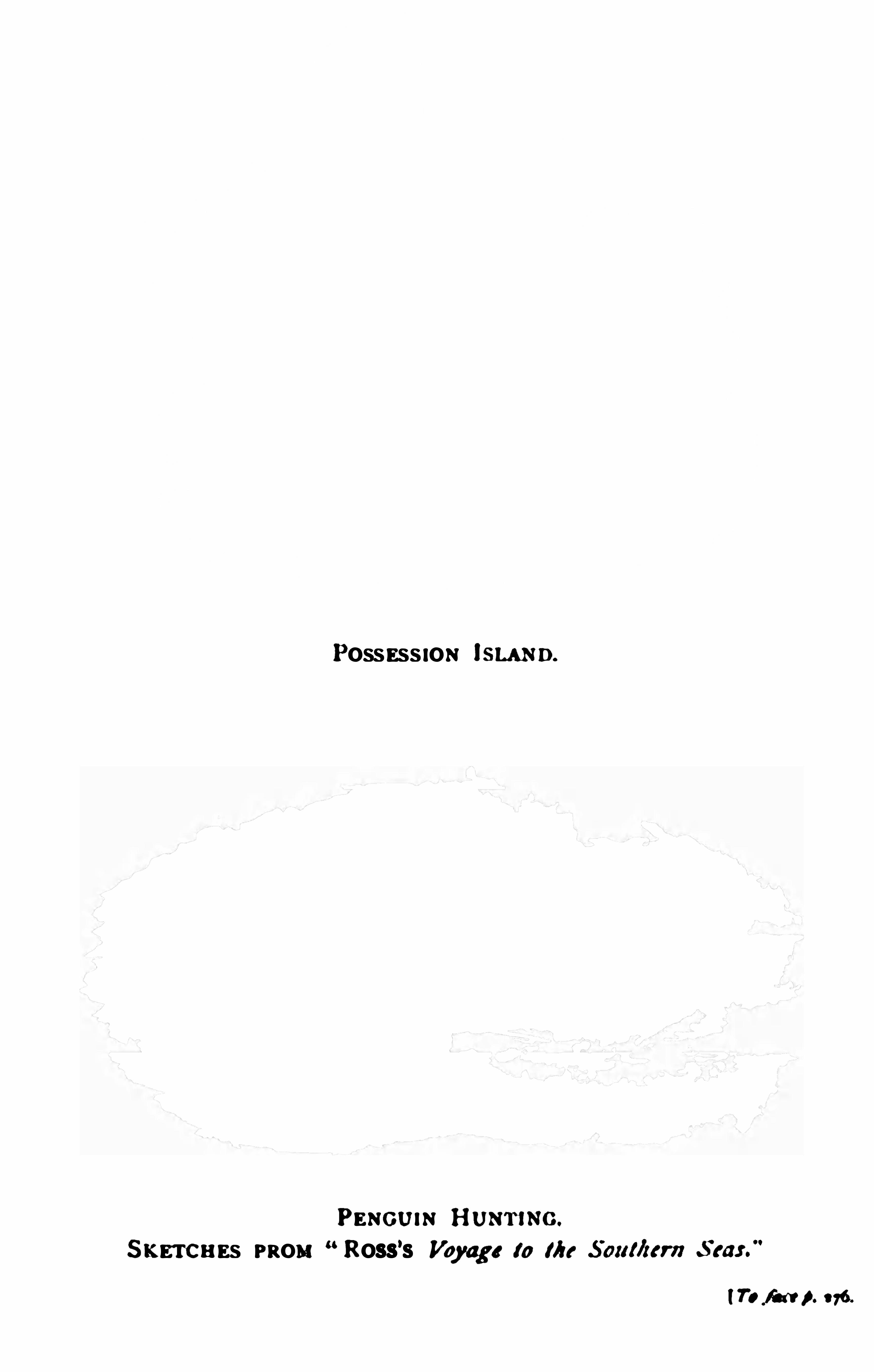
POSSESS ION i SLAND.
PENGUIN HUNTlNG.
S KETCHES PROH “ Ross’s Voyage to Me
(TOM A no


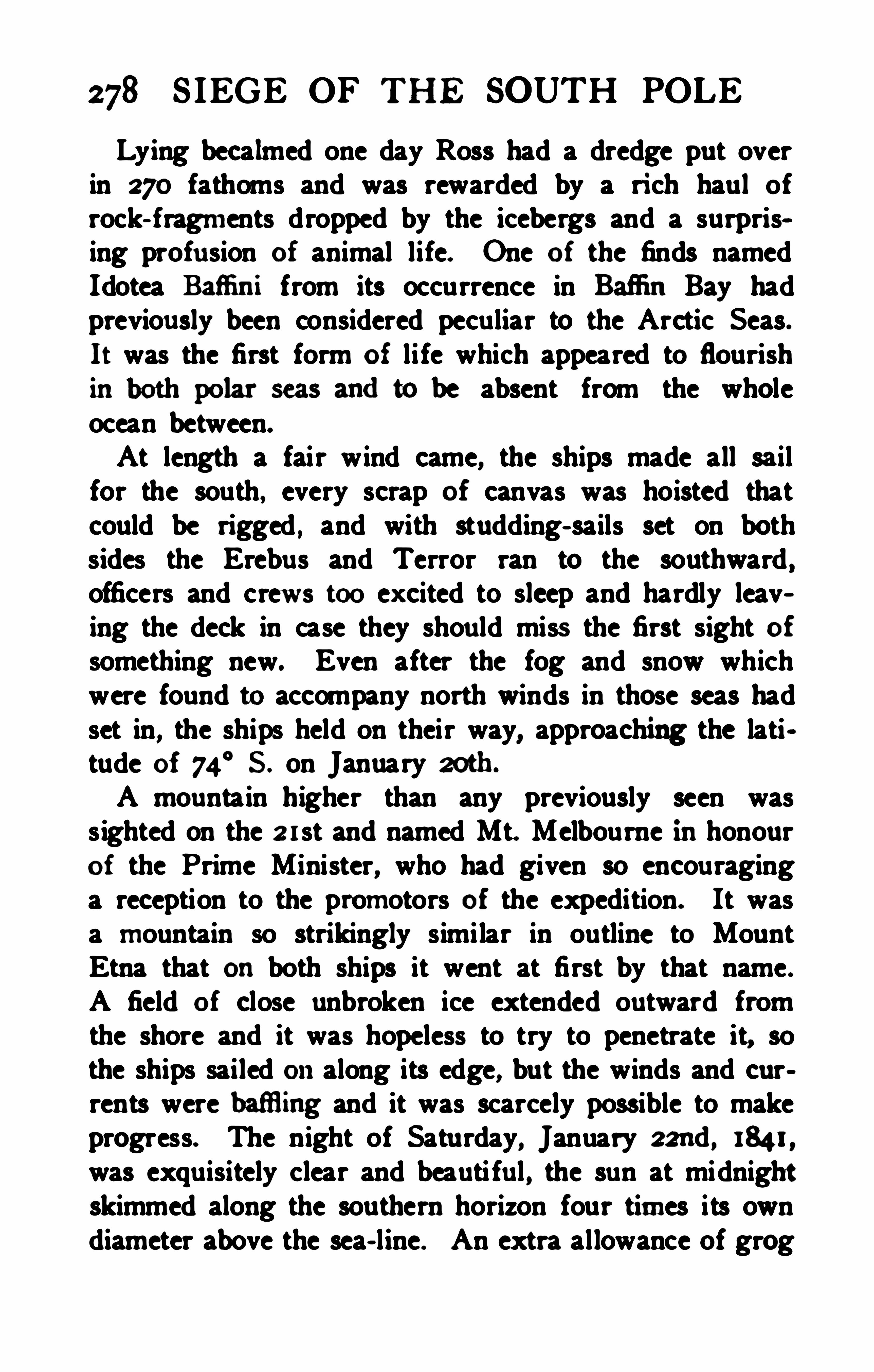
278 S IEGE OF THE SOUTH POLE
Lying becalmed one day Ross had a dredge put overin 270 fathoms and was rewarded by a rich haul ofrock- fragments dropped by the icebergs and a surprising profu sion of animal life. One of the finds namedIdotea Bafl
'
mi from its occurrence in Bafl‘in Bay hadpreviou sly been considered peculiar to the Arctic Seas.It was the first form of li fe which appeared to flourishin both polar seas andto be absent from the wholeocean between.At length a fair wind came, the ships made all sailfor the south, every scrap of canvas was hoisted thatcould be rigged , and with studding- sails set on bothsides the Erebus and Terror ran to the southward ,officers and crews too ex cited to sleep and hardly leaving the deck in case they shou ld miss the first sight ofsomething new. Even after the fog and snow whichwere found to accompany north winds in those seas hadset in, the ships held on their way, approaching the latitude of 74
°5. on January 20th .
A mountain higher than any previously seen wass ighted on the arst and named Mt. Melbourne inhonourof the Prime Minister, who had given so encouraginga reception to the promotors of the expedition. It wasa mountain so strikingly similar in outline to MountEtna that on both ships it went at first by that name.A field of close unbroken ice extended outward fromthe shore and it was hopeless to try to penetrate it, sothe ships sailed onalong its edge, but the winds and currents were baflling and it was scarcely possible to makeprogress. The night of Saturday, January 22nd, 184 1 ,
was exquisitely clear and beauti ful , the sun at midnightskimmed along the southern horizon four times its owndiameter above the sea- line. An extra allowance of grog
VICTORIA LAND 279
was served out to let the sailors rejoice that Weddell’sfarthest toward the south pole had been surpassed andthey were now at last the pioneers of the human race inthat di rection . Captain Ross spent the evening in thegun- room with his Officers and all drank the toast ofBetter luck still ." The ships continued along the edge
of the pack that fringed the land to the eastward ,the dip of the needle increased to 88° and the magnetic pole was now calculated to be less than 250 miles
On January a7th the latitude of 76° 8' S. was reached
and an island discovered which was called after Sir JohnFranklin . Here a landing was made with much dithculty and Dr. Hooker, whose tu rn it was to join thelanding party, slipped into the water in jumping ashoreand was in great danger of being crushed between theboat and the rocks. The ceremony of taking possessionwas hastened in consequence, and all in the party werethoroughly drenched by the spray before they got backto the ships. A large collection of rock specimens wassecured, but the island showed no sign of vegetationand from the absence of any plant li fe from PossessionIsland also Ross somewhat rashly concluded that thevegetable kingdom had no represet i on the Antarctic lands.It had been a memorable day and at midnight it
merged into one of still more remarkable achievement.Several distant islands were logged by the Erebus, butthey did not appear on the chart because a nearer approach made it evident that they were mountain summits on the mainland. As the light strengthened onJanuary a8th the summit of the loftiest peak, whichseemed to be veiled in driving snow dri ft was discovered
280 SIEGE OF THE SOUTH POLE
to be ru fly emitfiq dense vohnnes of smoke. The
fi ps appmadsednearer andthe umke was sem to be
shot vrith fiamu or lit np by thednllgh re of molten
rose was provisionally called“High Island," andbe
sideu the hnge vola no, t0wering to a height of 12,400
lower (30900 feet) , which received the name of MountTerror.
Thedisoovery was of a thrilling nature. A “ burningmounta in ” was the last phenommon of Namre that
was to be loolredfor amidst the eternal iee of the far
south, though indeedthe observat ionof Balleny on the
islands that bear his name two years before might ahnost
afloat approached the Erebus and Terror enthroned onHigh lslandit was wi th the hope of passing that island
tionthey werc alrady south of the eightieth parallelandthey had even appointed a rendezvous in that latitude incasc the ships shouldget separated. But this was only a
dream. In the clear sunshine a line of white clifl’s wasmade out running east from H igh Islandandwhenap
proaehedthis was foundto be a mighty wall of iceunlike anything that hadever beenseeu befm'
e by anyoneon board. To penetrate this barrier was as impossibleas to sai l through the cl iff s of Dover, all that could bedone was to try to get round it. Curious ly enough theopinion as to the nature of this most southerly landwhich was formed when it was first sighted was correct ;


VICTORIA LAND 281
but on approaching nearer Ross convinced himsel f thatH igh Island was no island, bu t part of the continentand he caught sight of high land over the wall of icewhich he believed to be a great range of mounta ins running southward from Cape Crozier, the point where therocks of the land and the ice of the barrier met. Yearsbefore Sir Edward Parry had given Rosa's name to themost northerly known land on the globe , and with a duesense of the fitness of things, Ross gave the name ofParry Mountains to this most southerly chain. Forsixty- three years this fine example of a grateful memory graced the map, though all that now remains isanother warning that in the polar regions the sense ofsight is apt to play sad tricks—for the Parry mountainsdo not exist, and Erebus and Terror after all are thepeaks of an island separated from the mainland ofAntarctica .
The clip and dec lination of the magnetic needleshowed that the ships were now south as well as east ofthe position of the magnetic pole towards which the heavyland- ice made it impossible to approach by steering tothe westward. The only thing that could be done was tofollow the edge of the ice- barrier to the eastward inthe hope that it would ul timately trend to the southward . The ships accordingly approached within threeor four miles of the perpendicular ice clifls, which rosesmooth and solid to the height of from 200 to 300 feetand formed a straight line against the sky. Even fromthe masthead it was impossible to see over the wall, andall that could be ascertained regarding it was that itwas flat - topped . The swell broke in a heavy surf uponthe ice , andthe sea was seent0 have hollowedcaves inthe lower part of the ice- wall. Mount Erebus, towering
282 SIEGE OF THE SOUTH POLE
throv hlg ont a a im of mnke m zoo andynfieet indiameter to a height of fru n lsoo to zooo feet .'
I'
be fi sph y eamnmeedabont 4 p m andonnfinm 2n
spa-nodie spurts of smohe at internls of abont lnlf an
hour.Not only tht naflfit m were fifledwith
admirationat the sightsdiey saw, thongb the working of
preesible Iri sh blacksmith of the Erebu s put it, when
ie ouldonly view andstudy the Subh ity of Natnre
but, lo, I hadto pull the brails l” Nevertheless be hadtime to burst into song :
“Awfnlandmblime, magnifioent andrare,No otber earthly obiect with the Barrier caneomparel
"
For five days the ships worlnedtheir way eastward.
times malcingdetours to the north to eseape the floating
thedepths foundto vary betweenzso andsoo fathorns.
At places it would appear that the great SouthernBarrier was resting onthe bottom, but at other places it was
undoubtedly afloat, and the huge flat- topped bergs whichdrifted northward with the current were obviously portions of the mass that hadbroken ofi. The sise of
the bergs may be realisedfrom the remark of a sailor
that the whole of London might float away on one of
them. E x periencedas Ross was in all the forms of
Arctic ice the giganticdimensions of the great SouthernBarrier were as amazing to him as to anyone onboard.When, onFebruary znd, the ships got close up to the

284 SIEGE OF TH E SOUTH POLE
for venturing so near. McCormick’s strictures on thecaptain, however, do not always bear critical examina
The farthest east reached had been 167°W. , on Feb
ruary sth, and, although the ships struggled for anotherweek to explore the edge of the barrier farther in thatdirection, they did not get so far again and Ross wasat length obliged very reluctantly to give up the attemptfor the season . On February 14th , the expedition turnedback toward the magnetic pole in order to seek a harbourin which they might lie safely for the winter. FranaIsland was sighted next day, for the wind had beenfavourable and the sea open. On the 16th, Mount Erebus was ih sight in magnificent eruption , and it was thenthat the island onwhich it is situated appeared to formpart of the continent. The deep bight to the southwestwas named McMurdo Bay, but instead of examining itclosely, Ross turned northwards in order to make onemore attempt to land in the latitude of the magneti cpole. The pack lay thick along the coast of VictoriaLand, and it was impossible to get nearer the shore thanI5 or I6 miles, so after consultation with Crozier, Rossdecided to gi ve up the attempt, and as he cou ld see noplace in which it seemed practicable to winter he resolvedto return to Hobart as speedily as possible.This decision was not an agreeable one to arrive at.He saysIt was, nevertheless , pain fully vexatious to behold
at an easily accessible distance under other circumstancesthe range of mountains in which the pole is placed , andto feel how nearly that chief object of our undertakinghad been accomplished ; and but few can understand thedeep feelings of regret with which I felt myself corn
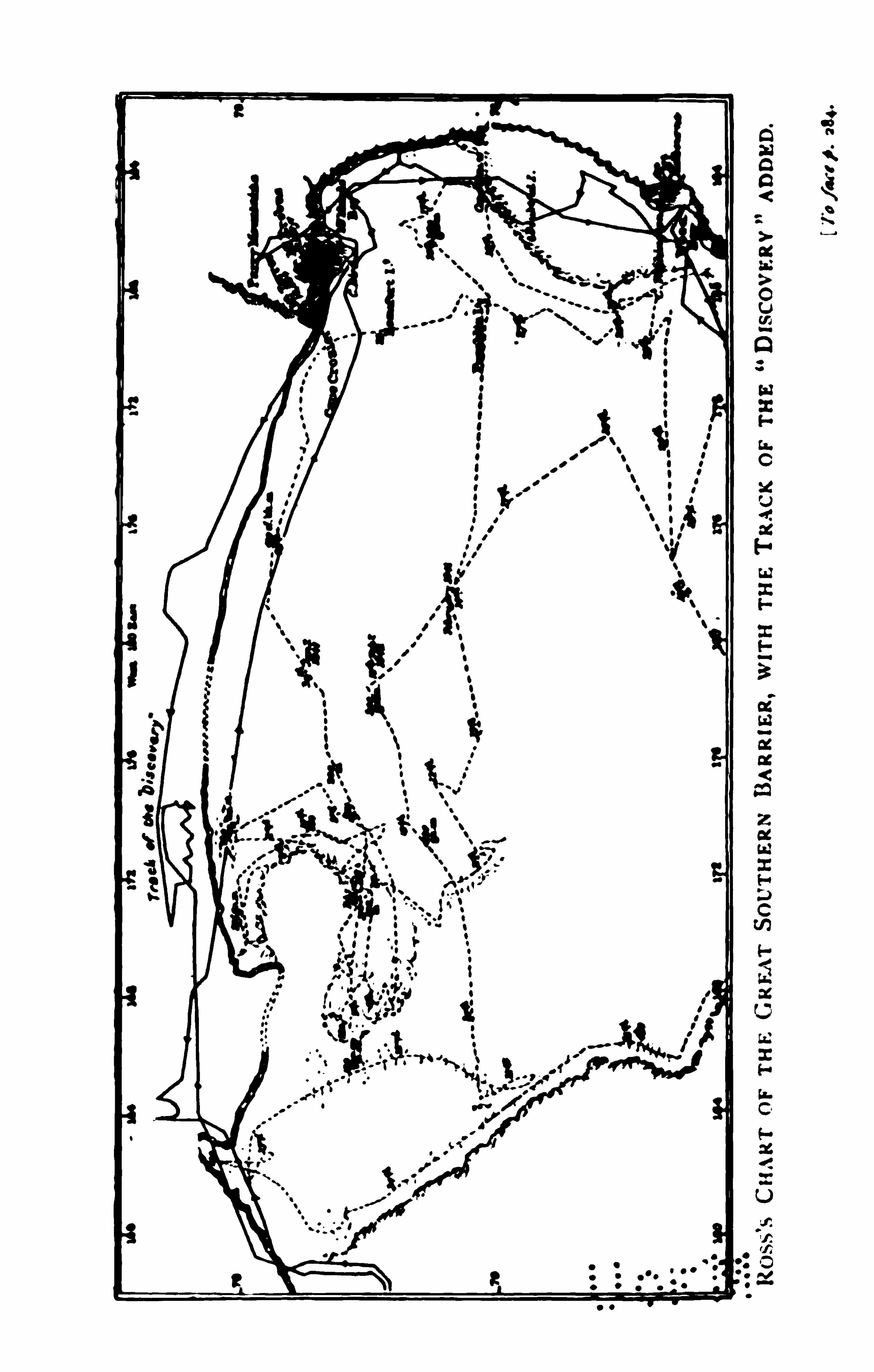


286 S IEGE OF THE SOUTH POLE
use of boamme wdght of which craclnedthe ice andopeneda way for the ships to m ch clear water.
OnFebruary zs the ships were once more ofi Cape
ice-boundeoast for a harbour inwhich it wouldbe possible to winter, or at least for a place where a landingcouldbe made, but neither couldbe seen, although the
weadi er was ckar andbfighh aflording fine views of the
land which was finally lost sight of on February 28th.
'
l‘
he approach of winter was now heraldedby the lengthcuing nights which allowedthe aurora austra lis to ap
pcar for the first time. Whales of grea t sice were very
numerous, and Ross believing them to be a valuablespecies looked on them as hopeful pioneers of explora
much more than half a century was destined to passaway before a whale~ship ventured within a thousandmiles of them .
The ships were steering northwestward, and on Marchandthey sighted two lofty islands or mountains at agrea t distance These were almost certainly part of theBal leny group, but they received new names on the occasion of their rediscovery- Russell Peak and SmythIsland. Two days later a third was sighted and namedFrancis Island. A strong appearance of land to thewestward, high and broken into islands, was also madeout before thick weather blotted out the distance. Inthe evening the Anu retic circle was crossed northwardsafter the expedition hadspent the unprecedented timeof sixty- three days continuously to the south of it. Agoodlook-ou t was now kept for the mountainous landon Wilkes’s chart, which Ross naturally supposed to rep
resent one of the discoveries of the American expedition,

VICTORIA LAND 287
though Wilkes, as we have seen , subsequently explainedit as a clumsy attempt to show the approximate positionof Balleny Islands. One of the ofi cers indeed reportedan appearance of land bearing in the exact directionof
the Balleny Islands, but these were seventy or eightymiles distant. Although Wilkes had claimed no personal discoveries so far to the east, the opinion prevailed on board the British ships that they had sailedover a part of the Antarctic Continent of the American exploring expedition. We have discussed the uh
pleasant episode oi the controversy in sufficient detail inan earlier chapter.It remained to traverse the belt of pack- ice which in
tervenedbetween the comparatively open sea to the southalong Victoria Land and the ocean. This was a task ofdanger and difi culty, but it was accomplished withoutdamage
,thanks to the skill born of long experience with
which the ships were handled , and by March 20th thepack was cleared.
A point of interest in magnetic theory remained to becleared up, and as his crews were in ex cellent health ,Ross sa iled along the pack to the westward in order todetermine the magnetic dip on the line of no variation inlongitude 135 E. This was done in a thorough mannerand on some days when the wind fell calm the insatiableexplorer had the boats out and took deep' sea soundings,one of them striking bottom in the depth very rarelymeasured in those days of 1540 fathoms.On April 6th , 184 1 , Ross had the pride and satisfac
tion of sailing into the Derwent River in Van Diemen’
s
Land, after an absence of 145 days in the Antarcticregi ons, with his ships in as good condition as when theystarted, with every man who sailed with him still on
288 SIEGE OF THE SOUTH POLE
board. andallinperfect healtb. Rarely, if ever, has an
ex plorerloadof discovery andso complete an absence of badnews as the Erebus andTerror brought back fmm the
first voyage beyond the 7sthdegree of south latitude.

290 S IEGE OF THE SOUTH POLE
The Antarctic Expedition was composed andperformed in their honour, a compliment kindly meant,though as one of the spectators remarked, it was butrather indifferently got up and not much better acted.
"
There were parties and picnics ashore, and in return theofiicers gave a grand ball on board the two ships. TheErebus connected with the shore for the purpose by acovered bridge of boats, was the ball - room, the Terrormoored close alongside her consort, and entered bycovered gangways, was the supper- room , and the entertainment lasted till 4 a. m .
Three months were spent in well - earned rest and re
freshment, but by no means in idleness, for the shipswere refitted , the magnetic observations kept up, and Dr .Hooker, with the few other members o f the expeditionwho were inclined to scientific studies
,made valu
able collections in the course of their excurs ions, whichthrew much light on the geology and botany of Tas
mania.On July 7th, the two ships sai led for a cruise in thewarmer Australasian seas, and a week later they enteredPort Jackson . The people of Sydney, who rememberedthe visit of Bellingshausen twenty years before , andhadso recently seen much of the French and M erican expeditions, were now, for the first time, able to examineships thoroughly equipped for service in the ice, whichhad in consequence been able to cross the Antarctic packand penetrate to the edge of the great barr ier. Whilethe Australians satisfied their curiosity and offered theirhospitality the Antarctic officers were hard at work ihstalling a magnetic observatory on Garden Island—forthe more desirable site at Fort Macquarie , where Wilkeshad made his observations in 1839 hadbeen rendered
HAIRBREADTH ESCAPES 291
useless for magnetic work by the erection of fortifieationscontaining such masses of metal in the guns and cannonballs as to disturb the needles. The preparations weredelayed by bad weather , and on one day a total rainfallof 8} inches was registered—one third of the quantitythat usually falls ina year in the east of England . Allwas ready, however, for the term- day on July arst ,when simultaneous magnetic observations were madeat hourly intervals in all parts of the world.
’
This workover, the expedition sailed as soon as the instrumentscould be dismounted and brought onboard .
They left Sydney on August sth , and the Erebus madegreat eff orts to keep ahead of a merchant ship whichleft the harbour at the same time ; but the usual fateof the leading ship of a squadron befell her and she hadto shorten sail to wait for the Terror to come up, allowing the merchantman to sail away to the great mortification of the man-of-war.For three months the Erebus and Terror lay at anchorin the Bay of Islands on the northeast coast of the NorthIsland of New Zealand . Much valuable collecting workwas done on shore, but the oflicers were not allowed tomake any long excursions from the ships onaccount ofthe growing discontent of the aboriginal Maoris with theways of the white man. It is not our province to chronicle the holiday tasks of Antarctic explorers ; however, twoincidents in the direct line of our narrative must be mentioned—the meeting of two foreign men -of-war. One
of these was the French corvette Heroine, whose commander gave Captain Ross a chart showing the discoveri es of D'
Urville , which he had not previously seen .
The other was the American corvette Yorktown, throughwhose commander , Captain Aulick, the circumstance of
292 SIEGE OF THE SOUTH POLE
the British ex pedition having sailed over what was repsented as land in Wilkes’s map, obtained premature curreney with unfortunate results.The approach of the southern summer at length madeit possible to return to Antarctic waters. Live stock andfresh prov isions of all kinds had been taken on boardunti l the deck looked like a farmyard, and on Novembera3rd, 184 1 , the Erebus and Terror sailed from the Bayof Islands , accompanied for a few hou rs by H . M . S.
Favourite, Commander Sulivan , who was stationed there.The weather proved fine and good progress was made tothe southeastward , the object being to endeavour to finda way to the ice- barrier beyond the farthest point reachedon the previous trip. Much time was spent on the wayin ascertaining the temperature of the sea at great depthsin order to find the point at which the temperature wasuniform from surface to bottom. It was believed thatalong a certain line in the Southern Ocean an invariabletemperatu re of 39 5
° F. was maintained from surface tobottom all the year round ; to the north of this line thesurface water was warmer, and to the south of it thesurface water was colder than the great mass of waterbelow . Ross located this circle of uni form temperaturein 55
°18
’ S . on December 13th ; bu t the thermometerswith which he was provided were probably not adequately protected against the excessive pressure whichprevails at great depths. and consequently the resultswere not to be trusted . There is , as a matter of fact, nopart of the openocean either in the south temperate oreven inthe tropical zone where water so warm asF. is fotmdat the bottom where the depth exceeds 1000fathoms.The weather grew coldandanintense fog set in, con~

294 S IEGE OF TH E SOUTH POLE
3oth the wind fell and the two ships were moored , oneon each side of the largest piece of floating ice, so thatthey might not drift against each other and get damaged . Twelve tons of ice hewn from the floe weretaken on board the Erebus to replenish the water supply,and some of the ship's company found it a very chillycargo as it gradually melted onthe deck. The magneticinstruments of both ships were tested onthe mass of icethat formed a fender between them, and when the fogclosed thickly around them one great source of anx ietywas removed for a collision between the two vessels wasimpossible. The mass of ice projecting beyond the shipsfore and aft also acted as a buff er against collision withother bergs, while its s ize was not so great as to prevent some way being made in a favourable wind withboth vessels under full sail . The crews of the ships hadan opportunity, which they much appreciated , of exchanging visits across the ice, as the Erebus and Terrorlay about fifty yards apart the ice became a sort of playground, and a unique ball- room was excavated in it,adorned with statuary hewn out of ice which , in that climate had the permanence of marble. The most ambitious efiort was a seated Venus , the combined work ofDr. Hooker and Mr. Davis, the versatile and accomplishedsecond master of the Terror. Here a great celebrationwas held to bring in the new year 1842. The refreshmentroom , equipped in true sailor fashion , was a conspicuousfeatu re of the ball - room , and was furnished by thebo’sun, who played the part of landlord of the AntarcticHotel with a highly symbolic sign depicting Bacchus ,Britannia, and other figures surrounding the proud ti tlePilgrims of the Ocean onone side, and onthe other,Pioneers of Science.” The arrival of the New Year
HAIRBREADTH ESCAPES an;m grededwith all the noise tlnt both the crews could
M inwith aflnnm of mnda landmumsiu lh
u tteredvery heartily into the mtertaimnent whidt ended
about for many a drearyday to come. Af ter the ball
m ova the ships dri ftedacross tbe Antarctic circle
andthe polar clothing was issuedto the men. By acurious ooincidence it was onthe sameday of the pre
voyage some 14aoomiles farther to the west.
OnJanuary4th the pack andthe ships wi th it were drivento the northwardfor twenty miles, so the piece of floe
wasdroppedandthe two vessels recommenced their unceasing tacking andwearing inthe smallpools of Open
water, scarcely a quarter of an hour passing withouthaving to go about. Then a gale from the south drovethem back to 65
°
59’ S. on the toth. In such circum
stances there was nothing to be done but to hope for afavourable change, and Ross was fortunately able tointerest himself in the opportunities of scientific workwhich abounded. Several of the gigantic pengu ins firstseen onCook’s expeditionwere killed . the weight of thelargest specimen being 75pounds . and the commander ofthe expedition skinned some of them and preserved othersin pickle with his own hands. The capture of these hugebirds was a constant delight to the sailors while in thepack, and two stalwart tars might sometimes be seenmarching a solemn penguin in custody toward the ship.
296 SIEGE OF THE SOUTH POLE
each grasping a flipper . Birds of other kinds, and seals,too, were secured ; but those respons ible for the expedi»tion must have had anxious thoughts for the future asweek after week of the short Antarctic summer went byandthe ships stilldri ftedwith the pack. There was
more immediate anxiety occasionally, for the pack wasso loose that itdidnot stop tli e oceanswelLandwhena
ga le blew the position of the ships amongst the massesof floating ice was peri lous in the extreme.On January 18th a gale sprang up while the two vesselswere slowly forging through the fog, towing
.
betweenthem the heavy mass of floe which held them apart. Atmidnight the wind went round to the northwest andtheplight of the expedition must bedescribed in Rosa’s ownwordsAll our hawsers breaking in succession, we made
sail on the ships, and kept company during the thick fogby firing guns, and, by means of the usual signals ; underthe shelter of a berg of nearly a mile in diameter, wedodged about during the whole day, waiting for clearweather , that we might select the best leads through thedispersing pack ; bu t at 9 p. m. the wind suddenly freshened to a violent gale from the northward, compelling usto reduce our sails to a close reefed main- top -sail andstorm - stay- sails ; the sea quickly rising to a fearful height.breaking over the loftiest bergs, we were unable anylonger to hold our ground , but were driven into the heavypack under our lee. Soon after midnight our ships wereinvolved in an ocean of rolling fragments of ice, hard asfloating rocks of granite, which were dashed againstthem by the waves with so much violence that their ma tsquivered as if they would fall at every successive blow ;andthe destruction of the ships seemed inevitable from


HAIRBREADTH ESCAPES 297
the tremendous shocks they received. By backing andfilling the sai ls, we endeavoured to avoid collision withthe larger masses ; but this was not always possible : inthe early part of the storm, the rudder of the Erebuswas so much damagedas to be no longer of any use ;
and about the same time I was informed by signal thatthe Terror’s was completely destroyed, andnearly tornaway from the stern- post. We had hoped that, as wedrifted deeper into the pack, we should get beyond thereach of the tempest ; but in this we were mistaken. Hourpassed away after hour without the least mitigation of
the awful circumstances in which we were placed . In
deed, there seemed to be but little probabil ity of ourships holding together much longer, so frequent andviolent were the shocks they sustained . The loud crashing noise of the straining and working of the timbersand decks, as she was driven against some of the heavierpieces, which all the activity and exertions of our peoplecould not prevent, was suflicient to fill the stoutest heart ,that was not supported by trust in H im who controlsall events, with dismay ; and I should commit an act ofinjustice to my companions i f I did not express myadmiration of their conduct on this trying occasion ;throughout a period of twenty- eight hours, during anyone oi which there appeared to be very little hope thatwe should live to see another, the coolness , steady obedience, and untiring exertions of each individual wereevery way worthy of British seamen.
The storm gained its height at 2 p. m., when thebarometer stood at inches , and after that timebegan to rise . Although we had been forced many milesdeeper into the pack, we cou ld not perceive that the swellhadat all subsided , our ship still rolling and groaning
298 S IEGE OF THE SOUTH POLE
amidst the heavy fragments of crushing bergs, over whichthe ocean rolled its mountainous waves, throwing hugemasses one uponanother, andthen againburying themdeep beneath its foaming waters , dashing and grindingthem together with fearful violence . The awful grandeurof such a scene can neither be imagined nor described ,far less canthe feelings of those who witnessedit be un
derstood. Each of us secured our hold, waiting the issuewith resignation to the will of H im who alone could preserve us, and bring us safely through this extreme danger ;watching with breathless anxiety the effect of each succeeding collision , and the vibrations of the totteringmasts, expecting every moment to see them gi ve waywithout our having the power to make an eflort to savethem .
Although the force of the wind hadsomewhat diminishedby 4 p. m. , yet the squalls came onwith unabatedviolence, laying the ship over on her broadside, andthreatening to blow the storm sails to pieces ; fortunatelythey were quite new, or they never could have withstoodsuch terrific gusts . At this time the Terror was so closeto us, that when she rose to the top of one wave , theErebus was on the top of the next to leeward of her ;the deep chasm between them filled with heavy rollingmasses ; and as the ships descended into the hollow between the waves , the main- top- sail yard of each could beseen just level with the crest of the intervening wave,from the deck of the other : from this some idea may beformed of the height of the waves , as well as of the perilous situation of our ships. The night now began todraw in, and cast its gloomy mantle over the appallingscene, rendering our condition, if possible, more hope»less and helpless than before ; but at midnight, the snow.

300 SIEGE OF TH E SOUTH POLE
ou r having their holds so stowed as to form a solid massthroughout.As soon as the gale had subsided the first care was tocaptu re another great fragment of the floe and make itfast between the two crippled ships, while all hands setto work to get the ruins of the ponderous rudders un~shipped and hauled up on deck. The carpenters andarmourers were at work almost without intermi ssion fortwo days making good the damage to the rudder of theErebus, and constructing an entirely new rudder for theTerror to keep in reserve while the spare rudder carriedon board was fitted to the ship. By the evening of January a4th the repairs were complete and full sail was madeonboth ships , but without making any progress throughthe pack which was now drifting bodily northward at therate of about half a mi le per hour. After all the effortsof the officers and men, all the bufl‘etings Of the ships ,they were again in almost the same position which theyhadgained three weeks be fore.On January 26th the pack loosened and a northerly
gale enabled the ships at last to move more rapidly thanthe gra t icebergs that had so long convoyed them intheir drift. Next day the ships unmoored from the flocand resumed their individual struggle with the ice , butwhen at last an Observation of the sun was possible onthe a8th , they were found only to have reached 67
°
39' S .
on the meridian of 156° W. After forcing their way
through more than 800miles Of pack- ice the Erebus andTerror were thus only half a degree, or 30 miles farthersouth than Cook had been on the same meridian withoutentering the pack at all. This is only anex ample of the
uncertainties of polar exploration in ignorance of thelaws of ice- drift or the causes which malm one season
HAIRBREADTH ESCAPES 30:
for it but to struggle on, trying to make way towardthe southwest where there was some appea rance of theexistence of open sea . The situationwas diflicult, andto addto the troubles of the Terror analarm of fire was
raised and two feet of water had to be pumped into herhold before it was extinguished, but fortunately no harmresulted, as the smoke had been caused by the roastingof some wood which had been stowed inside the pipesof the hot air stove and forgotten until the fire hadbeenlit.On February t st the appearance of water- sky grewclearer, and just at dark—for the brief days of the mid,night sun in those latitudes had passed—the edge of thepack was descried with the heavy swell of the oceanbeating against the close masses of floating ice and forming a line of fearful breakers. Either a storm or a eahnat this juncture might have been fatal . The commanderfelt that at all hazards he must get his ships through thebreakers into the open sea while the breeze held and theweather was good , for any delay in that zone of turmoilwould mean severe damage and perhaps destruction. Thewindwas rising and it was necessary to shorten sail , butat midnight the Erebus reached the belt of broken waterat the edge of the pack, and after two hours of terrificthumping and straining the two ships gained the opensea southwest of the pack in 67
°
29'S. and 159
° W. Theobject now was to advance southward and at the sametime keep as far to the east as possible so as to strike thegreat Southern Barrier beyond the point to which it hadbeen followed the previous year. The edge of the pack,however
,was found to run south and east, and as the
season was now far advanced it was hopeless to think
302 SIEGE OF THE SOUTH POLE
of penetrating it again in the ex pectation of gettingfarthermdie eash so the only course was to follow the
edge of the pack keeping as close to it as possible andlosing no opportunity of getting to the south .
0nFebruary 8th in7o°
3o'
s. and 173°xdW. a buge
diameter, andidentifiedby Ross with a berg which hadbeenseenonFebruary 13th , 184x , in76
°1 1
’ S. and 172°
7’W. If the identification was correct this proved anaveragedrift of nearly one mile perday for the year in
S trong winds, fofi anddriving snow made it impossibleto keep the course so that the sh ips were driven tothe westward of the 180th meridian before reaching75
°
5
It was now past the middle of February andthreedaysearlier in the previous year the formation of new ice hadforcedthe ex pedition to turn back from following the
great barrier towards its eastern termination. A iortnnate shi ft of the windto the northward enableda goodstretch to the southca st to be coveredandat last. onFcbmary xgth a strong iee- blink in the sou th proclaimedthe vicinity of the great barrier. Thedepth of the sea
was mly 250 fathoms , but still the barrier was not insight. The windshi ftedto the sou thwardandthe air
grew very cold , the thermometer dropping to 19°
F . :
yet this was y°
wanner than the year before andtheships were now inopenwater, thirty miles farther east
than the pack hadm chedin x84 x . Thedecks andrigging were encasedin frozen spray, andthe crews su f
feredseverely inthe endless work of brea king off the ice
from the hullto ease the ship, andfrom the tackle to let
the ropes runfreely.

304 S IEGE OF THE SOUTH POLE
considerably lower elsewhere, Ross concluded that it mustbe afloat.Towards the east the barrier trended northeastward.and in sailing along it the expedition found parts wherethe height was only about 80 feet, and it was possible toget a good view of the top of the ice from the mastheads.It was seen to rise to the sou th in such a manner as to
suggest the possible ex istence of land beneath the icycovering. This appearance must have been much lessmarked than the none xistent Parry Mountains wh ichRoss never doubted he had sighted the year before. Inview of the recent discovery of King Edward VII Landthe reasons which threw doubt on the existence of land inthis direction in 1842 deserve to be set forth in detail .Ross says :
We perceived from our mastheads that itgradually rose to the southward, presenting the appearance of mountains of great height , perfectly covered withsnow, but with a varied and undulating outline, which thebarrier itself could not have assumed ; still there is somuch uncertainty attending the appearance of land , whensea t at any considerable distance , that, although I , incommon with nearly all my companions, feel assured thatthe presence of land there amounts ahnost to a certainty,yet I am unwilling to hazard the possibility of being mistaken on a point of so much interest, or the chance ofsome future navigator under more favourable circum~
stances proving that ours were only visionary mountains.The appearance of hummocky ridges and different shades ,such as would be produced by an irregular white surface,and its mountainous elevation, were our chief groundsfor believing it to be land , for not the smallest patch ofclifi or rock couldbe seen pmtruding on any part of
fru nthe bottnm of the sea, or to the seveu la ses of ice~
wtfich be recordedfrom theneighbourhoodof his faflhest
right up to the edge of the barrier, andthe intensity of
work to bedone that seasou. The attempt to reach a high
Southernlatitude hadbeenfar less interesting inits oub
the previous yearflhenet result being anadvana of mmesix miles towards the pole andthedoubtfuldiscovery of
laudabout the mer'idianof 160’
VV. This result. slightas it m was not accomphshedwidiout gru t nsk andit was indeedvery nw ly too late to return. The se:as far as the eye couldreach from the mastheodwas a
tore through the ymmg ice fpr thirty miles to northwestwardandregainedthe open sea. The object nowwas to follow the edge of the pack northward. andtakethe shortest eourse across the South Pacific Oca n to

306 SIEGE OF THE SOUTH POLE
Fine weather favoured the northward run and onMarch I st the ships crossed the 180th meridian and the70th parallel still keeping to the northwest following theedge of the pack, which lay to the eastward studded witha range of gigantic icebergs. The ri se of air- temperature to 36
° F. was hailed with delight as if the summerhad come . The course was now set more easterly, andat 7p. m . on March oth, 1842, the two ships crossed theAnta rctic circle to the northward after having passedsix ty- four days battling with the ice within it, one daylonger than in the previous year, and far longer than anyother expedition before that time. The course to thenorthward had kept the ships wellou t of sight of VictoriaLand and ex cept for the appearance of land at theirmost southerly point not a clifl"or island had been seenduring the two months .The latitude of 60° 5. was reached onMarch oth and
as the sea was clear of ice Ross ordered a due easterlycourse so as to reach the Falklands as soon as possible.For three days the sea remained clear and good progresswas made, but onthe lath the wind rose and heavy snowshowers obscured the lookout. Many small pieces of icealso appeared and Ross had just made up his mind aboutmidnight to lay- to until daylight, when the greatestdanger of the whole expedition was suddenly encoun~
tared and for one terrible hour the total loss of both shipsand allon board appeared to be inevitable. Many of themembers of the expedition had been in positions ofdeadly danger before, but none had ever experienced amore appalling hour of suspense andfeet . When it wasover some even of those who had borne themselves mostealmly confessedthat they couldnot remember whatthey ha
'ddone or h’
ow'
the ships hatlbeenm Four

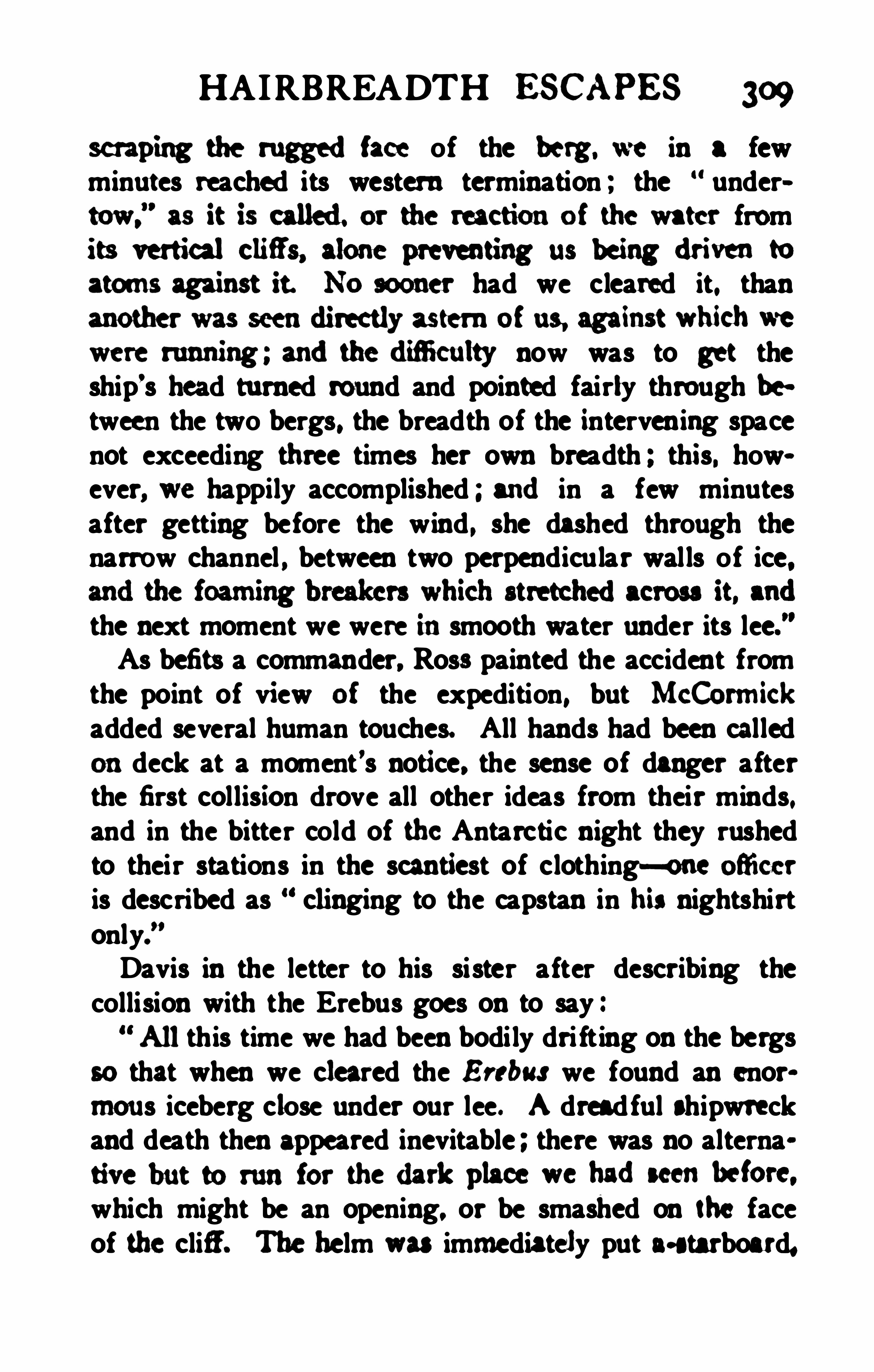
HAIRBREADTH escapes 309
scraping the ruggedface of the berg. we in a fewminutes reached its western termination ; the “ undertow,
”as it is called. or the reactionof the water from
its verfieal chfi’
nalone preventing us being driven to
atoms against it. No sooner had we cleared it. thanmother was seendimcdy astem of us against which we
were running ; andthedifi culty now was to get theship’s head tu rned round and pointed fairly through between the two bergs, the breadth of the interven ing spacenot exceeding three times her own breadth ; this. however, we happily accomplished ; andin a few minutesafter getting before the wind , she dashed through thenarrow channel , between two perpendicular walls of ice.
the next moment we were insmooth water under its lee.As befits a commander, Rosa painted the accident fromthe point of view of the expedition, but McCormickadded several human touches. All hands had been calledondeck at a moment’s notice. the sense of danger afterthe first col lision drove all other ideas from their minds.and in the bitter cold of the Antarctic night they rushedto their stations in the scantiest of clothing—one ofii cer
is described as clinging to the capstan in his nightshirtonly.”
Davis in the letter to his sister after describing thecollision with the Erebus goes on to say
“Allthis time we had been bodily dri fting on the bergs
so that when we cleared the Erebus we found an enormous iceberg close under our lee. A dreadful shipwreckand death then appeared inevitable ; there was no alternative but to run for thedark place we hadseenbefore.which might be an opening. or be smashed on the faceof the cliff . The helm was immediately put a-starboard,
3 10 S IEGE OF THE SOUTH POLE
and with the assistance of the sails she answered it verywell . We were immediately rushing past an enormousberg, the ship being perfectly covered with the foamcaused by the sea breaking against it. Every moment wewere expecting the ship to strike ice right ahead. Hard,a- port ' was screamed out from forward (then indeedhope died within us ) ;
‘ Hard -a- port ; brace round thehead- yards. ’ Shiver the main top- sail,
’ cried the Captain , as if he were steering into any harbour. The menflew to the ropes, although I shouldthink at that momentthat there was not one on board but thought all hope wastied. She came round, and passed through an openingbetween two bergs not twice the breadth of the ship, thefoam and spray dash ing over us on ea ch side as wepassed . Several other alarms were given owing to thebrash (small stufi washed from the bergs) looking likemore bergs in the darkness, but we were safe, but didnot know it. The next cry was ”Where s the Erebufl ’
—our own danger had made us entirely forget her forthe time. All eyes were immediately straining through
the gloom to findher. We burnt a blue light , andsoonafter badthe happiness of seeing her burn one which weimmediately answered ; we knew then that she was sa fe,which with her losses we never expected . We then lay—to,anxiously waiting for daylight to find the extent of herdamages . As soon as it could be distinguished she madethe signal that : All was well, and that they could repairall their damages.’ We answered : Thank God , we arethe same.
’ We might go a thousandtimesmore to the South Pole without experiencing one- half thedangers we have this time. The following diagram maygive you an idea of our situation, in which the arrowdenotes the direction of the wind , the red the Terror,


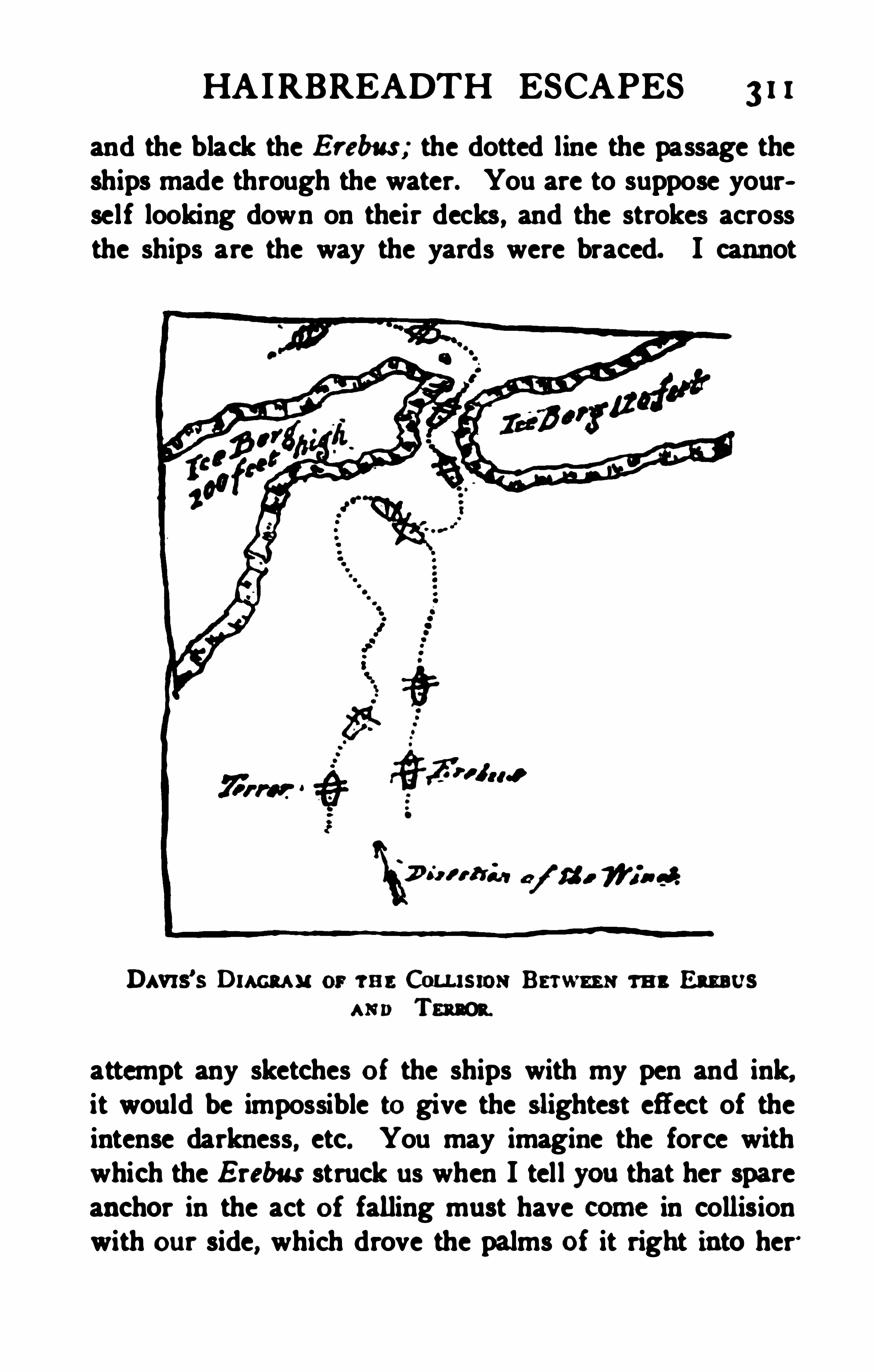
HAIRBREADTH ESCAPES 3 1 I
and the black the Erebus ; the dotted line the passage theships made through the water. You are to suppose yourself looking down on their decks , and the strokes acrossthe ships are the way the yards were braced. I cannot
Davrs’
s Draw s: or w e Conu smx Bsrwm m Em usu rn Tension.
attempt any sketches of the ships with my pen and ink,it would be impossible to give the slightest effect of theintense darkness, etc. You may imagine the force withwhich the E rebus struck us when I tell you that her spareanchor in the act of falling must have some in collisionwith our side, which drove the palms of it right into her‘
3 12 SIEGE OF TH E SOUTH POLE
through copper and all ; that in this way she conveyed it800miles, when it must have worked out.
"
No time was lost in getting the damage temporarilyrepaired, and although the crippled ships had to run before the wind into lower latitudes while the rigging wasbeing renewed, as soon as they could be handled properlyRoss turned south again to the sixtieth parallel tomakea series of observations at one of the foci of maximummagnetic intensity in 60°
5. and 125° W. This was suc
cessfullydone on March 18th and on that day also theanchor that had beendriven into the skin of the Erebusby the collision and had hung there for five days greatlyimpeding her progress, worked loose and sank in deepwater. The voyage was slow for the ships sailedheavily, but it was devoid of incident until April and,when one of the quartermasters of the Erebus fell overboardfrom the mainyard, andas the sea was runningtoo high for a boat to live had it been lowered an unsuccessfulattempt was made to bring the ship alongside theli fe- buoy onwhich the man had climbed, but before themanoruvre could be executed he lost hold and wasdrowned, the third to be so lost from this ship. Next dayoff Cape Horn a brig was sighted the first sail met withsince leaving New Zealand more than four months before, but it was blowing too hard to speak her. No landwas seen until Beauchene Island was made on April sth ,
and next day the ships dropped anchor in Port Lou is,Falkland Island, I37days after leaving the Bay of Islands .To the disappointment of all onboard there were no letters, but from a chance copy of the Navy List four of theofficers discovered that they had received promotion on theday when Captain Ross’s report on the first voyagereached the Admiralty.

‘ We h n hdm ughdacfim andof mot ionve.
Rofl'dw mrbu rt mn
‘dw hm m me mm m
the t a .
”
HE first care onarriving at Berkdey Soundin theFalklandlslands was to sendbmnedispatcha and
tbe ships. Both vessels were unloadedof all stores.
hauledup as iar as possflale on the shore at the top oi
oughly ex aminedandrepaired. At thatdate the small
settlanent in tt alklands couldofler little in the wayof its ownresources ex cept fresh meag andeventlntdxeblue- jackets hadto hunt for thanselves, ior thc herds ofa tflc andhorsec roamodthe islandinanabsolutely wildstate. No spar suitable ior making a ncw bowsprit for
tbe Erebus oouldbe obtained, but anurgent requcst hadbecnsent onto the hadquarters of tbe South Amerimsqadronat Riode Janeiro, andtowardthe endof JuneH . M. S . Carys fort commandedby LordGeorge Pauletan'ivedbringing all that was requ iredto refit the ex pe
difiom '
lt was the mdof j uly beiore the Erebus andTerror hadbeen refittedandwere ready for sea. An
other month hadstillto bedevomdto m gnetic observa
tions onshore, andit was no easy task for the commander
THE EREBUS AN D TERROR 3 15
to find exercise and occupation for the men. A piece ofunenclosed ground had hitherto served as the burialplace for the settlement, and this the blue- j ackets wereset to work to surround by a stone wall not likely soonto be destroyed, for it was seven feet high and seven feetthick. To the newly- enclosed cemetery the sailors re
moved the remains of Matthew Brisbane, who had beenin charge of the cutter which accompanied Weddell onhis great voyage to the south . The colony at that timehad a total resident population amounting to only 46.
While the Antarctic ships were lying in Berkeley SoundCaptain Allen Gardiner, a retired naval officer, with hisfamily arrived there in a schooner and waited for an opportunity to cross to Patagonia and prepare the way fora mission to the South American natives. The touchingstory of his efiorts to bring Christianity to the Patagonians and his tragic fate are amongst the classics ofthe history of missions. It so happened that forty yearsafterwards the mission vessel bearing his name rescuedfrom shipwreck the leader of a proj ected Italian Ant
At the request of the governor, Ross spent a week inexamining the harbour of Port Louis
,the site of the ex
isting settlement in Berkeley Sound and Port William ,
somewhat farther to the southeast. He strongly recom
mended the latter as in every way more suitable for theseat of government, and the present town of Stanley issi tuated inPort Will iam accordingly.
Dr. Hooker made a careful survey of the botany ofthe islands and drew attention particu larly to the giganticsea-weeds which fringe the harbours and the remarkabletussock grass characteristic of the rocky shores .
A magnetic station was left at Port Louis when the
3 16 SIEGE OF THE SOUTH POLE
ship sailedonSeptember 4th for a short ex ploring crmse
insearch of a protectedharbou r inthe inunediate neighbourhoodof Cape Horn. It was put under the charge ofLieutenant Sibbald, senior l ieutenant of the Terror insuccession to Lieutenant McMurdo whose health hadbroken down under the strain and who was now in
validedhome. He was a remarkably efi cient oflicer,
after Ross the best executive in either ship, and to j udgefrom the regretful comparison with the senior lieutenantof the Erebus which Mccormick was never tired of making, he was less out of sympathy wi th natural sciencethan most naval ofii
’
cers of his generation .
Cape Horn was passed onthe 19th on a fine day at thedistance of a mile and a hal f, and Ross acknowledgedthat he was disappointed with the appearance of a capewhich had won for itself so abominable a notoriety. AtSt. Martin ’s Cove in Hermite Island unmediately to thenorthwest of the Horn, the ships anchored and a magnetic observatory was landed on September z xst. SirJoseph Hooker recalls how on term days when all the executive oflicers were on shore with the magnetic instruments he was left onwatch on board with hourly reado
ings of the barometer to make for the twenty- four hours ,and he has never forgotten the hideous “f illie wawsor squalls that swept down the valleys and smote thewater of the cove with such violence that the ships werein danger of being torn from their anchors and driven todestruction on the Horn island. The mean level of thesea was ascertained at this station, as at other anchorages,by numerous observations and a permanent mark cut inthe rock to record it . The long stay at this anchoragewas enlivened to some extent by visits from the nativeFuegians ; but it must have beenadulltime at best for

3 18 SIEGE OF THE SOUTH POLE
Christmas Eve, and a gale of wind accompanied it whichlasted through Christmas Day though it did not disturbthe due celebrations. On the a6th the ships came up
with the edge of the pack in 52° W. longitude, and sailed
along it toward the west so as to get between the floating ice and the land. Joinville Land was sighted on December 28th , and the rugged forms of the mountainswere examined with great attention . Captain Crozierandthe officers of the Terror believed that they sawsmoke issu ing from one peak to the southward , but Captain Ross and the officers of the Erebus were of opinionthat it was merely a wreath of mist or possibly snowdrift flying before the wind. The probability is thatthe Terror was right, as active volcanoes were discovered fifty years later in the same direction , whichmight have been visible from the ships. The weatherwas unsatisfactory, so that the positionof the prominentpoints on the land could not be fixed by astronomical ohservations ; but the extraordinary extent of the snowand ice~covering for the latitude was plainly seen, andRoss called attention to the way in which the glaciersdescending to the sea broke off iniceo cliff s 100 feet high,a miniature copy of the great Southern Barrier. Astrong tide or current was surging sou thward along thecoast , swirling through a chainof gm ndedberga andmoving so rapidly as sometimes to hamper the steeringof the ships. A group of rocky i slets almost oonoealedby the grounded bergs suddenly appeared and made itnecessary for the ships to bear off to the eastward, andin so doing through the fog they nearly ranagainst thesouthernmost of the group appropriately named theDanger Islets. This partia tlar rock rose so perpendicu o
larly fmm the water that a ship cbmdhsve been lfi ii
THE EREBUS AND TERROR
alongside it, and Ross records I named it DarwinIslet, after Charles Darwin , Esquire, the talented com
age.Here again, as off Victoria Land, the number andtameness of the whales struck the explorers, and Rosswas never weary of expatiating on the great cargoes ofoil which might be obtained . In the present instancehe appears to have believed the opportunities for whalingto be of enormous importance , and to have attached tothe little chain of islets a value that one can hardly understand, for he says :Thus within ten days after leaving the Falkland
Islands, we have discovered not only new land, but avaluable whale- fishery well worthy the attention of ourenterprising merchants, less than six hundred miles fromone of our own possessions.
”
The enterpris ing merchants, however, took exactlyhalf a century before they made up their minds to senda ship to investigate the whale fisheries of Weddell Sea.On December 3oth the bold outline of J s inville Land,discovered by D
'
Urville, was clearly een and the mountains behind it , to a number of which Ross gave thenames of naval officers who had assisted the expeditionwhen at the Falkland Islands. A remarkable towershapedrock onthe south side of j oinville landhe afterwards named D’
Urville’
s Monument, in honou r of theversati le French Admiral who had discovered the land.On New Year’s Day, 1843, the ships were becalmedoff the land in 64
°14
'
S ., and the usual distribution ofwarm clothing was made to the men, although they hadnot the satis faction of crossing the Antarctic circle as onthe tvvo prefimls New Year
’s Days. A fine mounmfn
320 SIEGE OF THE SOUTH POLE
rising to 7050 feet was named Mount Haddington, afterthe First Lord of the Admiralty , and a small islandwas called Cockburn Island, after the senior Naval Lord.
The weather became thick and stormy and the ice wasvery troublesome, so that nearly a week was spentdodging about in the pack off Cockburn Island. On January 6th the two captains landed on the island, hoistedthe British flag and took formal possession in the name ofthe Queen . Dr. Hooker accompanied them and foundthat the only plants growing on the volcanic soil of thisland on the edge of the Antarctic were nineteen speciesof minute mosses, alga and lichens. McCormick thesenior surgeon remained onboard fuming and fretting,after vainly beseeching the captain to relax his inex orable rule never to leave the ships without one medicaloflicer on each . The white petrel , whose breeding placehad not been found previously, was discovered nestingon the island.The ships proceeded to grope their way southwardalong a narrow channel between the land and a chain ofgrounded bergs. It was an unfortunate choice, for thepack grew closer and the ships were beset before theyreached the 6sth parallel . After a week’s incessantstruggling to return or escape to the westward , in whichall hands were well nigh ex hausted , the ships forcedt heirway into open water on January 17th. The main packlay to the . east, . and, as it s eemedto involve too great adetou r. to attempt to turn it by
, the north , Ross’
decidedto run the ships into it in the hOpe of forcing a
way through to the southeast. The attempt was a complete failure, for the pack was too close to sail through,
and it .was dri fting north so rapidly that at the endof

322 SIEGE OF THE SOUTH POLE
the Erebus and Terror reached the meridian of 12° W.
and found at last that the edge of the pack trended southward. Following it up and working westward as wellas southward through fog and snow, Ross crossed theAntarctic circle onMarch lst, 1843. Next day the sunappeared unclouded for the first time for six weeks, andthe early part of the day was magnificent though thesea was rough . The latitude was found to be 68° 14
' S .
and the longitude 12°20
’ W. The following day wascalm , and the boats were got ou t with the longest sounding- lines to make a deep- sea sounding. Four thousandfathoms, or feet of line were coiled on a hugedrum in one of the boats and the whole length ran outwithout the bottom being found. It was the deepestsounding ever made up to that date, and as Ross wasexperienced in the work and the conditions were en
tirely favourable , it seemed not unreasonable to believethat a very great depth existed in that position. Therecent soundings of Mr. W. S . Bruce in the Scotia within one
_
mile of Ross ’s position however, make it plain thatthe thick hemp line, caught by the strong undercu rrentwhich runs there, floated the comparatively light sinkeremployed and so gave a fallacious reading. The realdepth proved to be fathoms. Temperatu res wereobserved down to fathoms, but as in the rest ofRosa’s deep- sea soundings what he measured was notthe temperature of the water but the compression of thethermometer bu lb, for his instruments were defective.On March 4th the 70th parallel was crossed aboutmidway between the tracks of Weddell and Bellingshausen . Nex tday the pack was sighted, andas the iceseemed open at the edge the ships were run into it foradistance of 27miles, when the pack became close and
TH E EREBUS AN D TERROR 323
heavy with new ice forming thickly in the pools andlanes of water. Farther progress was barred in latitude 71
°
30'
S ., longitude 14°
51'W., and the third at
tempt of the ex pedition to reach the south pole had tobe given up. The colours were hoisted ina last saluteto the southern ice, and a barrel was thrown over containing a statement of the position and date signed by allthe officers.The barometer was falling rapidly and the wind rising as the two ships picked their way out of the pack.Once outside a fierce gale dweendedupon them , andtwo days and nights of the greatest anxiety followed, forit was almost more than the ships could do to weatherthe pack, the front of which was now a roaring line ofsurf. But the danger passed as it had so often passedbefore , and on March 1 1th , 1843, the two ships recrossedthe circle and emerged from the Antarctic regions for thelast time. Their work was done.It cannot be said that the third season added much to
the success of the ex pedition , the chief glory of whichwas achieved in the first. The terrible strain of the lasttwo years had told heavily on the ofiicers. Ross himselfwas not the manhe hadbeen. It may be that the thirdseason was the worst of the three so far as ice andweather went ; but it is possible also that the jaded leaderhad lost something of the clear perception and quickintuition that had led him so triumphantly at the first.Not that he failed for a moment in courage or resolve,bu t from the tirne of leaving New Zealand circumstanceshadbeen all against him. A final disappointment re
mained in the unsuccessful issue of the attempt to locatethat child of the mist, Bouvet Island. It would ahnost
seem as if the island were invisible to naval ofi cers.
324 SIEGE OF THE SOUTH POLE
Cook could not find it, Ross could not find it, Moore onthe Pagoda failed to see it, but between these attemptsseveral of the Enderbys’ whaling skippers had visitedand even landed upon islands in that neighbourhood.On March loth the appearance of a remarkable beamof light in the sky attracted attention , and at first itwas taken for an auroral display, though its true natu reas the great comet of 1843 was speedily recognised .
Ross crossed the meridian of Greenwich in latitude54
°
8'
S . , and at noon on March 22ndhis latitude was54
°
1 1' S. and longitude 6° E. He says , Bouvet
Island should therefore ltave been in sight. bearing S.
55° E distant nine miles . We stood exactly towardsit until we had run twelve miles , but not seeing it westeered east to keep in its supposed latitude.Ross did not then know that Lindsay in the Swan hads ighted an island in 54
°
24'
S . , 3°15
'E. in 1808, but afterhearing of this from Mr. Enderby he was still of opinionthat the island did not occupy that position which he hadpassed so close as certainly to have seen any land thatmight be there. The island however does lie in 54
°
26' S. and 3
°24
" E. or only two miles sou th and aboutfive miles east of the position assigned by Lindsay sothat the Erebu s and Terror would seem to have passedin sight of it although
'
the island was not distinguishedfrom the bergs , sodifiieult is it even for the most praetisedeyes to recognise the diff erence between a distantisland of floating ice and one of ice- covered rock.
There was a great abundance of icebergs that seasonand the ships were never out of sight of them unti l theyreached the lati tude of 47
°
4dS . Land was sighted onApril 4th , 1843 . and by the evening of that day the Erebusand Terror dropped their anchors in Simon’s Bay, beside

326 SIEGE OF THE SOUTH POLE
mand of a stil l grea ter ex pedition thenunderdiscussionwhich hadfor its object the final solutionof the oldestof Arcti c problems, the ex istence of a N orth-West Pas
sage.
when he commanded H. M . S. Enterprise in the searchfor Franklin, Ross had nomore sea- service. He marriedimmediately after his return anddevoted himself toliterary work and the study of the collections of marineinvertebrates made by himsel f in the Antarctic regi ons.
He diedat Aylesbury onApril 3, 1862.
CHAPTER XVI
THE GENERATION OE AVERTED INTEREST
The best-laidschemes 0’ mice and menGang aft agley.
”
- Bunns.
MMEDIATELY after the return of the Erebus andTerror it became evident that the absence of magneticobservations in high latitudes south of the Indian Oceanwould detract from the value of the data brought backby the expedition , and the Admiralty resolved that havingdone so much they would complete the work.Orders were accordingly sent out in the summer of
1844 to Admiral Percy, Commander- in- Chief at the Capeof Good Hope, to select and equip a vessel for the purpose. H is choice fell on the Pagoda, a merchant barqueof 360 tons, which was hired , fitted out and manned by acrew of thirty-five volunteers from the flagship H. M . S .
Winchester. Most of the s ix officers came from thesame ship, but the command was given to Lieutenant T.
E. L. Moore, R.N . , who had been Mate on the Terrorduring the Antarctic Expedition , and he arrived fromEngland at the beginning of January, 1845. The shipwas ready for sea and left Simon ’s Bay without a day’sunnecessary delay on January 9th. Lieutenant (nowMajor~General) Henry Clerk, R.A. , joined the expeditionas magnetic observer. The Pagoda met the first icebergsonthe asth , in latitude 53
°
30' S. on her way to the as»
signed position of Bouvet Island, the search for whichwas the first incident in the voyage. As Bouvet Island
327
328 SIEGE OF THE SOUTH POLE
was looked for in 6° E ., naturally enough nothing wasseen of it. Moore knew from Ross’s failure that the positiou must be wrong and he might have deduced thefact that since Cook and Ross had proved that the Islanddid not lie east of 6° E. it would probably be found considerably farther west in or near the given latitude, forthe mistake in position would most likely be in longitude, but he turned southward before reaching 3
°E .,
and added one more to the list of unnecessary failures .The Admiralty sought no more for the island which hasnever been seen by a British naval officer, and it was leftto be picked up by a pertinacious German merchant captain under the direction of a German man of science half acentury later.When in latitude about 60° 45
' S . and longitude about4° E. a singular rock was seen capped by a mass of ice.It looked so like land that Moore sounded , and at firstthought that bottom had been found at 250 fathoms, butthe ship was drifting rapidly before a strong wind , and itremains uncertain whether this was an islet or merely analmost submerged iceberg carrying a great mass of rock.
The Pagoda proceeded southeastward, and at length, onFebruary sth, after seeing a strong ice- blink in the south,she crossed the Antarctic Circ le in 30
°
45' E. The edge
of the ice- pack was met with on the 1 1th ; it extended inan unbroken line along one- third of the horizon andchecked further progress to the south in latitude 67
°
50’
S . , longitude 39°
4 1'
E . , the farthest point toward thepole reachedon the cruise. A course was then sa for
Enderby Land, but a succession of calm'
s and contrarygales made it impossible to reach the assigned posit ion.
Moore had no choice but to try to obey orders, but itwouldalmost seem as if those inauthority hadissued

330 SIEGE OF THE SOUTH POLE
and there was some risk of her being carried pastAustralia and failing to beat back to it. She anchoredin King George’5 Sound, Western Australia on April 1st.She had been at sea for eighty- two days, making suchmagnetic observations as were possible m a small vesseltossing on tumultuous seas and battling with head - winds .Three weeks were spent at Albany, and on April 20ththe Pagoda set sail andproceeded across the IndianOcean to Mauritius, continuing
’the magnetic observations, and completed her voyage at Cape Town on June20th , 1845. During this voyage Moore remarks that moreicebergs were seen than in the three Antarctic trips ofthe Erebus and Terror, and he referred with satisfactionto the fact that he had run through more degrees of longitude south of 60° 5. than any previous voyager.The cruise of the Pagoda filled an important gap, andit remains memorable for the fact that it was the lastAntarctic expedition carried in a sailing ship without thehelp of steam . Thus terminated the greatest era in thehistory of maritime discovery, and the scroll on wh ichPrince Henry the Navigator began to write early in thefifteenth century was rolled up all unconsciously by Lieutenant Moore, R. N ., in the middle of the nineteenth.
Except for the short cruise of Enderby’
s ship, the Brisk,in 1850, and the momentary swoop of the Challenger in1874, it was more than sixty years before serious exploration in the southern ice was resumed .
In exploration as in physics there is a law of inertia .
It is invariably hard to start a new effort to extend knowledge inany direction , but when once begun the tendencyis to continue unless stopped by some external force.The bri lliant voyages of Ross and Winces seemed, bothfrom the discoveries that were made and from the acute
AVERTED INTEREST 33 1
ness of the controversies they initiated, to promise asuccession of South Polar expeditions . one stimulated bythe other and not l ikely to cease unti l the map of theAntarctic area was at least as clearly outlined as that ofthe Arctic.The heart of the American people, however, was nevergreatly in their Exploring Ex pedition , and the internalfriction within the expedition itself was perhaps sufficientto deter the naval authorities from repeating the ex periment, whilst the scientific element naturally preferred topursue researches in which they met with encouragementand even reward. Thus there was little reason to feelsurprised if America hadlet the threa d drop even had theviolent cleavage of the nation by the Civi l War not occurred . But the British people were at this period profoundly stirred with the spirit of polar discovery. Rosshad brought home his crews in a higher state of healthand contentment than any captain had perhaps ever donebefore from a voyage of great duration and difficulty.
A new expedition after a few years was the natural ,almost the inevitable result, yet for a generation the iaterest of the country and of the world was averted fromthe southern ice. The reason of this remarkable cir
cumstance was not the Russian War nor the IndianMutiny, for the British Navy has not been wont to letwar interfere with discovery when the right man hasbeen found to open up a worthy field. One cannot forget that Cook sailed on his last voyage of explorationnearly a year after the American War of Independencehad broken out. The real reason was the action of theman who of all men would have most indignantly denied the possibility of his proving a barrier to polar exploration—Sir John Franklin.
332 SIEGE OF THE SOUTH POLE
The Erebus and Terror were no sooner safe at homeagain than their services were required for a new ex pe
»
dition , this time to attempt the solution of the three- hundred- year-oldproblem of a North-West Passage from theAtlantic to the Pacific . The question of the commandreceived some anxious thought at the Admiralty. Un
doubtedly had Ross wished it he would have had the appointment, and his name was freely referred to in thenewspapers of the time as the one man for the post ; buthe declined it inadvance, though tempted by the offer ofa baronetcy and a good- service pension if he would comsent to go. It has been said that an agreement with hiswife’s family when he was married in 1843 preventedhim from taking the command . In any case the southernvoyage had been far more trying to the captain than tothe crews , and the wear and tear of the ceaseless reamsibility and anxiety made a prolonged rest desirable.Sir John Franklin had been recalled from his Governorship of Tasmania in a manner which incensed him deeplyand made him at the age of fifty- nine nervously anxiousto prove by some new achievement in his old field ofArctic exploration that he was indeed worthy of the confidence in which he was held by the public and by all departments of the Government except the Colonial Ofice.
No one can doubt now , and probably no one who knewthe facts of polar climate doubted then , that the willingspirit of Franklin caused him to underestimate the weakness of the flesh. The polar regions are fitted only forthe efl
'
orts of young men in the zenith of their strength,the only possible exceptions being tough old whalerswho have never hadtime to be softened by so much asa summer at home, and the fitness of whose select ion isattested by the fewness of their contemporaries. Frank

334 SIEGE OF THE SOUTH POLE
is enough to say that the halo of romance thrown roundthe Arctic regions by Franklin’s fate and his wife’s devotionturned the eyes of the few among the public whocared for these things from the more sombre south. Allpolar exploration and polar research clung round thenearer problem of the north, and the south was all butforgotten . The fasc ination of the valueless North -Westand North-East Passages had kept the world's attentionfor centuries while all the time the whole volume of tradeflowed in the South-East and South -West Passages by theCapes of Good Hope and Horn through the all butunknown Southern Ocean where no exploring ship wasdestined to sail again for yet thirty years.All the same there were not wanting men who, concerning themselves with the phenomena of nature andthe safety of sailors rather than the emotions of the general public , saw the immense importance of increasingour fragmentary knowledge of the remotest south. Firstamongst these stands Matthew Fontaine Maury , anofi cer of the United States Navy, a profound scientificinvestigator, and the most bri lliant writer who ever at
tempted to put into words the wonders of the sea as theyare revealed to an appreciative mind by the patientstudy of facts. Maury
’
s Physical Geography of theSea is so full of charm, so permeated by his own cathusiasm that even now, after the data have been correctedalmost beyond recognition by subsequent research , andthe theories shown to be fallacious or imperfect, the bookremains the most popular treatise on the oceans. AsSuperintendent of the United States Hydrographic OfficeMaury did much to improve the science of navigationand the study of oceanic and atmospheric phenomena notin his owncountry only but throughout the world. His
AVERTED INTEREST. 335
name was honoured in every Admiralty. be corresponded
sentedby the University of Candnidge alone.Inthe middle of tbe nineteenth century stw ners were
so far perfectedas to beginto come into rivalry with sail
ing ships as cargo-boats ; but they were stillso slow and
their coal- endurance so limited that a well- found clipper, commanded by a thoroughly trained navigator poasessed of a soundknowledge of winds and currents couldstil l beat them on long voyages. Every improvementinthe science of oceanmeteorology gave the sailing shipa fresh advantage and prolonged the struggle for an
premacy on the sea with the grow ing power of steam.
Thanks to Maury’a teaching American merchant captains were the first to adopt the shortest or great-circleroute on their voyages round the Cape of Good Hope andAustralia to China, and back by Cape Horn. Indoingso they necessarily reached high southern latitudes. The
common use of maps on Mercator's projection maker itdifii cult for the ordinary reader to understand how theshortest track frornthe Cape of GoodHope to New Zealand can poss ibly lead a vessel south of the Antarctic cirscle. The full explanation in words would fil l severalpages and form a wearisome digression. but a piece ofthread stretchedtight from Cape Town to Dunedin on acommon school globe will prove in half a minute that thefact 13 beyond controversy. One of the American ships,inspired by Maury, discovered Heard Island south ofKerguelen while pursuing such a course. A Britishship making a similar coursc lit onMcDonaldIsland
336 SIEGE OF THE SOUTH POLE
close to the same position, and the islands were independently discovered more than once before they ap
pearedon the chart. Many vessels encountered greatdanger from the floating ice and the contrary winds experiencedsouth of 60°
S ., and it was found before longthat the quickest passage was not to be made by theshortest route . Ships now take a composite course, hnding it more economical to sail a longer distance in theclear seas and favourable winds between 40
° and 50° S .
than to run the risk of long nights, floating ice and contrary winds that beset the shortest track.While these things were being discovered Maury feltthe need for a more detailed knowledge of the Antarcticseas and especially of Antarctic weather, so that the sailing directions could be amplified and corrected
,and he
gradually came to the conclusion that the time was ripefor the resumption of Antarctic exploration. He hadbeen successful in securing international cooperationin the study of maritime meteorology and knowing whatcould be done by voluntary association he felt that theex ploration of the Antarctic was too great a work for anynation to undertake single- handed , though this also heattempted to bring about. In the winter of 1860 hevisited England and read a paper to the Royal Geographical Society on the Physical Geography of the Seain connection with an Antarctic Expedition . He urgedthat the Admiralty should take the matter up in the interests of navigation . Many comfortable words werespoken in the discussion which followed. Captain Maurywas assured of the high esteem in which he was held , hewas reminded of the immense services he had renderedto all seafarers, and the President said that a Brit ishexpedition towards the South Pole would be as much

338 S IEGE OF THE SOUTH POLE
insteadof being far remote, as in the time of all pre~
vicus ex plorers they were, have, since exploration waslast attempted there, been actually brought within a fewdays' sail of a great commercial mart, with its stores, itssupplies, and resources of all kinds . The advantagesand facilities for Antarctic exploration are inconceivablygreater now than in the days of Cook and others. Theyare greatly enhanced by the joint system of national cooperation for the purpose of searching out the mysteriesof the sea , now recognised and practised by all maritimenations. In this beauti ful and beneficial cooperat ion,ofli cers of thedifierent nations have learned to pull andwork together for a common good and a common glory.
This habit would be carried to the South Pole by co
operation among the diff erent nations concerned in
sending out vessels for exploration there. Nay, thatgreat unexplored area lies at the very doors of one ofthe Powers that is most renowned in this field of discovery.
”
But the words were wasted . The British Associationtook no action , and we do not know what reply was sentto Washington . Probably there was no reply, for monthsbefore the letter had passed through diplomatic channelsto repose in the qu iet haven of the archives of the Parliament of Science , Maury had resigned his commiesion as Superintendent of the United States Hydrographic Department and thrown in his lot with the
Southern States . Those who knew the intensity of hisdevotion to the work of his omoe and who understood theunique posit ion he occupied as the centre of the world’smaritime research could alone estimate the strength ofthat sense of duty to his native State which bore himaway from all else he cared for. In the great convul


340 SIEGE OF THE SOUTH POLE
powerful maritime State of the German Confederation.
Failing in this , he gave a series of lectures in Hamburg onMaury
’
s theories of the ocean and on the recentimprovements in the science of navigation ; and s incehe could find no other way of gratifying his craving tosee the sou thern hemisphere, he shipped as a commonsailor andlanded at Port Jackson in Australia in1852. He spent two years in the Australian Colonies ,part of the time as a gold digger at Bendigo , and , whenthe digging was unfortunate, as a lecturer on navigation in a tent to audiences of sailors disappointed in thequest of gold . In 1854 he retu rned to Europe on a sail‘ing ship with a mutinous crew , and he came back re
solved to leave no stone unturned to get up a voyage ofscientific exploration toward the South Pole, or a journey into the then unknown interior of Austral ia.Neumayer was fortunate in making the acquaintance of Alexander von Humboldt, the chief mover as wehave seen , in the revival of Antarctic exploration twentyyears previously , and he also met Dove, the meteorologist,and the great chemist, Liebig. King Maximilian I I ofBavaria , an enlightened patron of science, who consultedLiebig as his chief scientific counsellor, considereda memorial drawn up by Neumayer onthe important results bearing on Antarctic research which would accruefrom the study of terrestrial magnetism at Melbourne
,
and granted the funds for establishing the well- knownFlagstafi Observatory. In August, 1856, before leavingfor Melbourne to take up this work, Neumayer laid hisplans for a physical observatory before the British As.sociation at Cheltenham, and received the approval ofWhewell , Airy and Faraday.
While carrying on the magnetic and meteorological
AVERTED INTEREST 34 1
observations at the Flagstaff Observatory, and collecting on Maury
’
s plan all possible data as to the navigation of the Southern Ocean, Dr. Neumayer took aprominent part on the Committee which directed theexploration of the interior of Australia ; but in 1862 heonce more returned to his favourite subject of Antarcticresearch. In a farewell address to his countrymen atMelbourne as he was leaving for Europe he said :It would be a glorious moment in the next period of
my career if I could seek the Antarctic regions in a German ship, and perhaps sometime you wil l see me returnto these shores accompanied by the pick of the youth of allGerman races, bound on a voyage to the South Pole.So far did the coming of the Gauss cast its shadowbefore.Dr. Neumayer urged the practical side of Antarcticresearch ; he showed how it would increase the certaintyof navigation , and how it would stimulate the spirit ofmaritime enterprise which, from his student days, he hadrecognised as an indispensable element of national greatness. Thus he took as the theme of his first serious appeal on returning to his fatherland , at Frankfort in 1865,
the importance of Antarctic exploration and the necessity for the foundation of a central institution for the systematic study of oceanography and marine meteorology .
The latter suggestion was acted on in a liberal spirit,and in his direction of the Deutsche Seewarte at Hamburg, Dr. von Neumayer has fu lfi lled his li fe-work andplaced his country in possession of an oceanographicalinstitution of which Maury himsel f would have beenproud, and which is the admiration , i f not the envy , of theoceanographers of other countri es. Not only has itproved of inestimable practical value to the seafarer, but
SIEGE OF THE SOUTH POLE
it has aff orded training to a number of scientific menwhose names , already well known, are destined to occupya high place on the roll of students of nature.The other design was not accomplished ; the prophet ofthe Antarctic was never to enter his land of promise.Dr. Neumayer suggested that an expedition for Antarctic research should be fitted out as a prel iminary to theTransit of Venus Expedition in 1874. The ViennaAcademy of Sciences took the matterup cordially ontheadvice Of Admiral Tegetthoff , and Dr. Neumayer waspromised the command of an exp edition to set out fromHamburg towards the end of 1870. The outbreak ofthe Franco- Prussian War and the birth of the GermanEmpire interrupted the expedition , but Admiral Tegctthofi
'
revived it in the following year and all was goingwell when the sudden death of the Admiral brought theplan to an untimely end. So Austria-Hungary 10mthehonour of renewing South Polar research, andDr. Neumayer the opportunity of becoming an explorer.War and death—the catastrophes of nations and of
men—broke the smooth run of the thread of our historynot once but many times. Yet, after each check, anothervoice was raised in support of a renewal of Antarctic research . The Astronomer Roya l , Sir G. B . Airy, hadpointed out the desirability of securing a station for ohserving the transits of Venus of 1874 and 1882 south of
the Antarctic Circle and somewhere near the meridianof 105
°E . , and the general voice of Arctic navigators
was in favour of this being done by dispatching a preliminary expedition to find a suitable spot. Staff Cornmander J . E. Davis, formerly Second Master on theTerror, whose vivid description of the collision with theErebus was quoted in an earlier chapter, read a paper to

'm m w m dm h m m—E B. a 1mrc.
A biologist , at any rate hedescribeda great nnmber of
dental apparatus of the sea - urchin is calledArifi otle'sLanternto th isday. Far back as the time is whenAriso
totle studiedthe see- creawres of the Greek Archipelago,
we have to go allthat way if we wish to trace to its origin
the line of thought whieh first brought steam to the Ant
Whenthe study of marine zofilogy beganto revive in
modern times the domain of the naturalist was for centuries restrictedto the shore between tide marks, unlesswhen rare occasions served and he was young and bold,he voyaged with the fishing boats and made great bootyof their rubbish.
” With the ex ception of some sharkfishers off the coast of Portugal who brought up by
their deep- see lines some s iliceous sponges rivalling inbeauty the Venus’s flower basinet
,
” even the adventurersin boats were limited to shallow waters near the shore.After the naturalist borrowed and adapted the imple~
ments of the oyster dredger and the trawler he st ill fixedhis attention on shallow water, coll ecting mainly with inwhat he knew as the littoral zone. He ascertained that
TH E CHALLENGER
as the depth inc the wa lth of animal li fe diminishedrapidly ; and at the time in the forties andfifties of last century when the records of the BritishAssociation bristle with Committees to promote theexploration of the British Seas by means of the dredge,that attractive expression the bathymetric zero of li fefigured not infrequently on scientific pages. There wassome reason for it, as there is for most attractive errors .In the Black Sea for instance, death reigns below thedepth of a few hundred fathoms, and the mud at thebottom is putrid, ex haling sulphuretted hydrogen . Moreover it had been supposed in the beginning of the nineteenth century that the temperature of the sea,diminishingrapidly, as it was known to do, must fall so low in greatdepths as to leave the bottom covered with eternal ice.Observations carried out with faulty thermometers ledlater explorers to the equally false and much less logicalconclusion that the great mass of the ocean below theupper skin of warm or cold water had a uniform temperature of 39
° F. right down to the bottom . This delusionmay possibly have originated in some person, whwe opinion carried too much weight to be lightly questioned , forgetting or never learning that on being cooled down , saltwater, unlike fresh water, does not attain its maximumdensity some degrees above the freezing point . Be thatas it may, the construction of thermometers adequatelyprotected against the enormous pressure of great depthsset the error right soon after the discovery was made thatlong submarine cables could be used for transmittingtelegraphic messages across the oceans .The contour of the bed of the North Atlantic was soon
felt out by lines of close andaccurate soundings. Cablesthat had been deposited for some years in very deep
346 S IEGE OF THE SOUTH POLE
water were hauled up for repairs and found to be crustedwith living shells . Then the authorities concerned withthe study of marine life remembered a number of confirmatory instances, how oldSir John Ross had got upsundry curious creatures from the mudat a great depthin the Arctic regions in 1818, and his nephew Sir JamesClark Ross using the same deep- sea clamms had secured very similar creatures ih the equally deep water ofthe Antarctic seas more than twenty years later ; and itwas recognised that after all there might be no zero of life.Indeed so far did the pendulum swing that while theresearches were still in th eir infancy learned biologiststhought and even spoke of the whole floor of the ocean,down to the depths of the profoundest abysses, beingclothed with a sheet of living protoplasm . No granderidea ever entered the human mind ; it was the girdlersnake of the Northern Mythology revived and extendedinto an all- embracing, pulsating being, without beginningor end. One could picture the edges of this livingsheet as it approached the shore - l ine breaking up intoprotozoa which as the ages ran on developed into everyorganism , so that the whole range of organic evolutioncould be traced by descending into the depths of the sea.
Bathybius haeckelii was the name of this hypotheticalprimordial being which figu red but for a little whileupon the stage of the microscope, and was relegated bylater research to the l imbo of the kraken and the me.
Dr. W. B . Carpenter from the time when he wrote histhesis for the degree of M . D. on the Nervous System ofInvertebrate Animals in 1839 took the keenest interestin the li fe of the sea. Not content with shallow waterdredging, and convinced of the value of deep- sea resmrch
in its bearings on the science of li fe, he induced the

348 SIEGE OF THE SOUTH POLE
magnitude of the work, and certainly could not have floreseen the immense prestige which that decision was tosecure to the British name amongst the intellectual ofall countries but the work once undertaken was earriedout in the most generous and ample spirit.The field of the expedition was so enormous that thechiefdifi culty in planning it lay in finding parts of theworld to exclude, rather than parts to include within itsscope. It was felt from the beginning that whatemmight be left out the border of the Antarctic regionsmust not be neglected , though a vessel adapted for ex ploration inthe ice would have been totally unsuited for thelong sojourns that were contemplated in tropical waters.The promoters of the deep- sea expedition kept a doubleend in view. They wished to secure a physical as well asa biological survey of all the oceans. The objects ofspecial study were to be the depth and configuration ofthe bed of the oceans, the nature, origin and distribution of the deposits resting upon it, the chemica l compositiou , salinity, temperature and movements of the waterfrom the surface to the bottom , and finally thedistrflmtion of organic li fe throughout al l depths and in everyaccessible latitude and longitude. As to latitude theArctic regions were left out of account fot the time, butthe Southern Ocean was to be ex plored “ as far as theneighbourhood of the great Ice Barrier.”
The Admiralty assigned to the service H. M. S. Challenger a roomy wooden corvette of 2306 tons , providedwith auxiliary steam power. She was not fortified forice navigation, but was thoroughly sound , and evenwithout steam she was. except for her size, probablybetter fitted for an Antarctic voyage than any of theships of Bellingshausen, Wilkes or D
'
Urville. The

S IR Jou x Munluw , or run“ CHALLnamnn.
”
(Photo byMessrs. Thomson, London.)


350 S IEGE OF THE SOUTH POLE
Probably investigations in those latitudes may be di fficult ; it must be remembered however that the marinefauna of those regions is nearly unknown, that it mustbear a most interesting relation to the fauna of highnorthern latitudes, that the region is inaccessible exceptunder such c ircumstances as the present, and that everyaddition to our knowledge of it will be of value.”
One more quotation may be allowed, this time fromthe detailed instructions given to Captain Nares in 1872
by the Admiralty,where, after telling him when on his
way fromKerguelen to Australia to “ look at Heard orMcDonaldIsland and then strike southward in the neighborhood of 90
°
E ., he is informed that :Captain Moore reached to the parallel of 65
° in thismeridian in 1845 and observed the appearance of land tothe westward . It is not desirable however that youshould pursue any extended hydrographical explorationin this region with a single unfortifiedship.
”
The Challenger sailed on alst December,1872, pursu
ing her course across the North Atlantic and back againseveral times , calling at most of the island groups on theway and gaining experience in the use of deep- sea instruments by the usual unroyal road. Then she crossedthe South Atlantic to Bahia and at length reached theCape of Good Hope on October a8th , 1873. After aninterval for rest and refitting the Challenger sailed fromSimon’s Bay onDecember 17th, for the portion of hervoyage to which the early part of this chapter has beenintroductory. It was scarcely an Antarctic expedition,yet more real knowledge of the nature of the Antarcticregions was obtainedinthe course of it thaninany othervoyage up to that time, Ross
'
s ex cepted. This was not
because the ship went far, but because the opportunifies

THE CHALLENGER 35:
which presented themselves were used to the full at thetime and discussed in the completest way possible afterwards.The ship stoppedat Prince Edward and MarionIslands and made a landing. There the naturalists ohserved for the first, and as it happened the only timeduring the cruise, the curious pouch- like arrangement ofthe skin on which the penguins carry their eggs or young
,
a feature which had led a mariner shipwrecked on theCrozets forty years before to compare the pengu ins tokangaroos . The next land to be explored was in theCrozets, but after bringing in the New Year, 1874,dodging about in the fog Off the inhospitable shores and vainlytrying to find a sheltered landing, the attempt wasabandoned. The ship pursued her way to KerguelenLand running before a strong northwesterly wind whichraised too much sea to allow of soundings being taken .
On January 7th the Challenger anchored in ChristmasHarbour, Kerguelen Land. Here a good deal of surveying was done , and three weeks spent in the harbour orcruising along the coast, for Captain Nares was chargedwi th the selection of a suitable site for observing thetransits of Venus in 1874 and 1882 .
The naturalists had a busy time in studying the faunaand flora of the island, while the Officers whose tastes laymore in thedirection of sport than science were no lessabsorbed by the ducks, penguins, and seals whichabounded . Ameriean sealers were met at Kerguelen,where they still continued to work, whaling also in theneighbouring seas. One party stayed on Heard Islandwhile the main body cruised from Kerguelen in smallvessels, a larger ship communicating once a year with aConnecticut port. The importance of the whale fishery
35: S IEGE OF THE SOUTH POLE
Ross paidhis visit thirty years before.
OnFebruary 1st the Challenger left Kerguelenandfourdays later passed McDonaldIsland and reached HeardIsland where Captain Nares landed, accompanied byMessrs. BuchananandMoseley. They were greaedby a
out of your reckoning,” for these men could not imagine
anymotive but the search for seals to bring a ship to such
a remote and uninviting spot of land, and the Challengerwas obviously no sealer. A dismal enough life the fortym l hunters led , housed in huts half excavated in thegroundso as to be easily coveredwith snow for warmthin winter. and scattered in groups along the coast seldmi
communicating with each other. Part of their work comsisted in watching the landing of the seals and drivingthem back to sea with whips made of sea- leopard skinwhen they tried to come ashore on beaches which couldnot be approached by the schooners on their annual visi t.The rest consisted in killing the poor beasts when theylanded at last in placeswhere the skins and blubber couldbe readily shipped . The glaciers creeping from the central mountain cut off the different segments of the islandfrom one another and made them verydiflicult of access.The attempt to travel on the beach round the coast waseven more hazardous than braving the crevasses andthefog on the glaciers of the higher slopes. The weatherwas so badthat the Challenger could not survey theisland , and it remains to this day uncharted save for therough sketches made by the sealers. They, too, have nowdeserted it after killing off the seals, and ships , as wehave seen, no longer enter upon those seas unless driven

354 SIEGE OF THE SOUTH POLE
m loweredinao the wacer the tv o bdex es wm set by
of a a:
ture at that moment. Hitherto the m h ce m r mbeenthe warmest andso when the thermometer retnmed
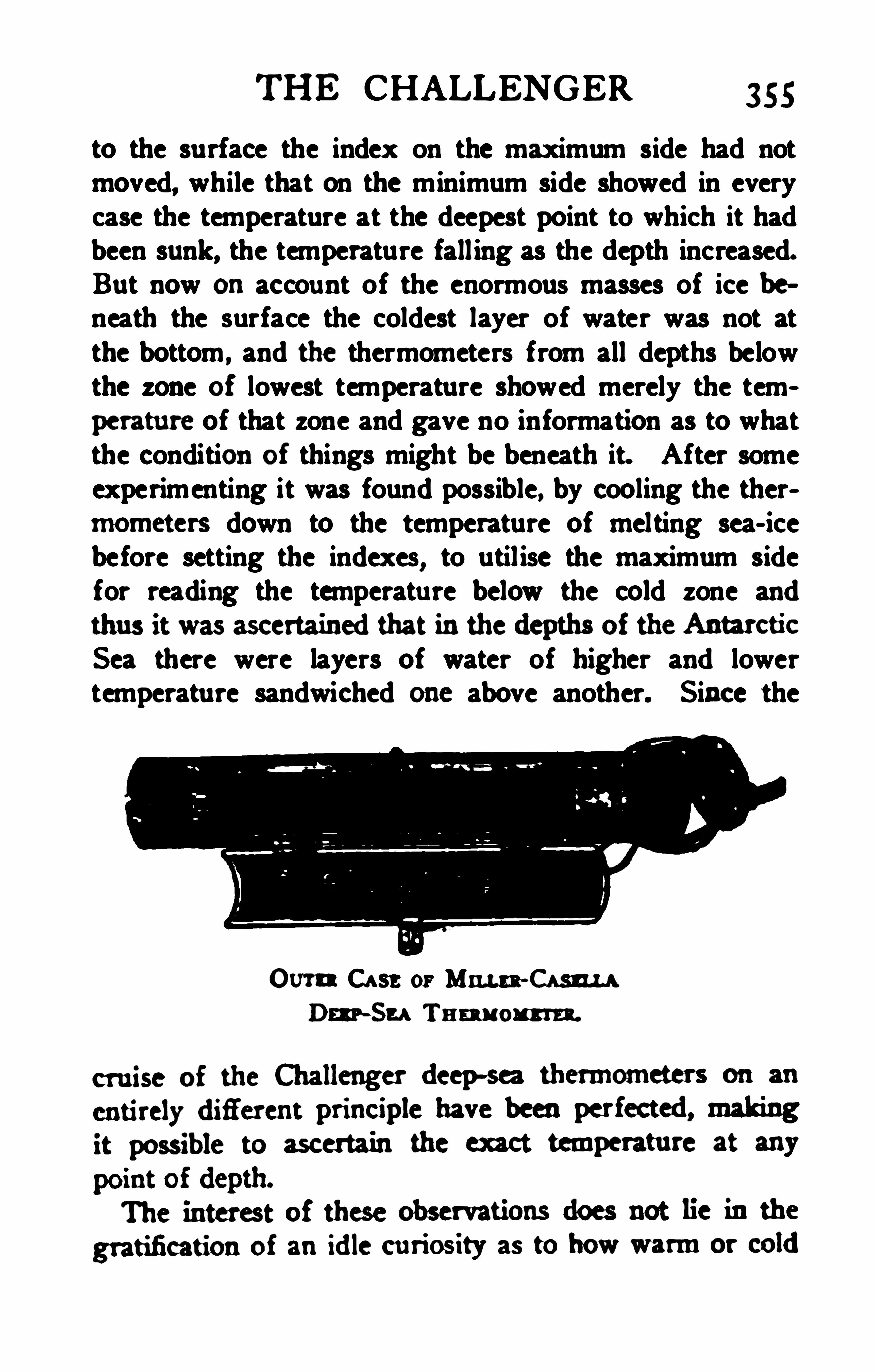
THE CHALLENGER 355
to the surface the index on the maximum side had notmoved, while that on the minimum side showed in everycase the temperature at the deepest point to which it hadbeen sunk, the temperature fall ing as the depth increased.But now onaccount of the enormous masses of ice beneath the surface the coldest layer of water was not atthe bottom
,and the thermometers from all depths below
the zone of lowest temperature showed merely the temperature of that zone and gave no information as to whatthe condition of things might be beneath it. After someexperimenting it was found possible, by cooling the thermometers down to the temperature of melting sea- icebefore setting the indexes
,to util ise the maximum side
for reading the temperature below the cold zone andthus it was ascertainedthat inthedepths of the AntarcticSea there were layers of water of higher and lowertemperature sandwiched one above another. Since the
Corn Case or Mann- Cam
Dm ~Su Tnm om n.
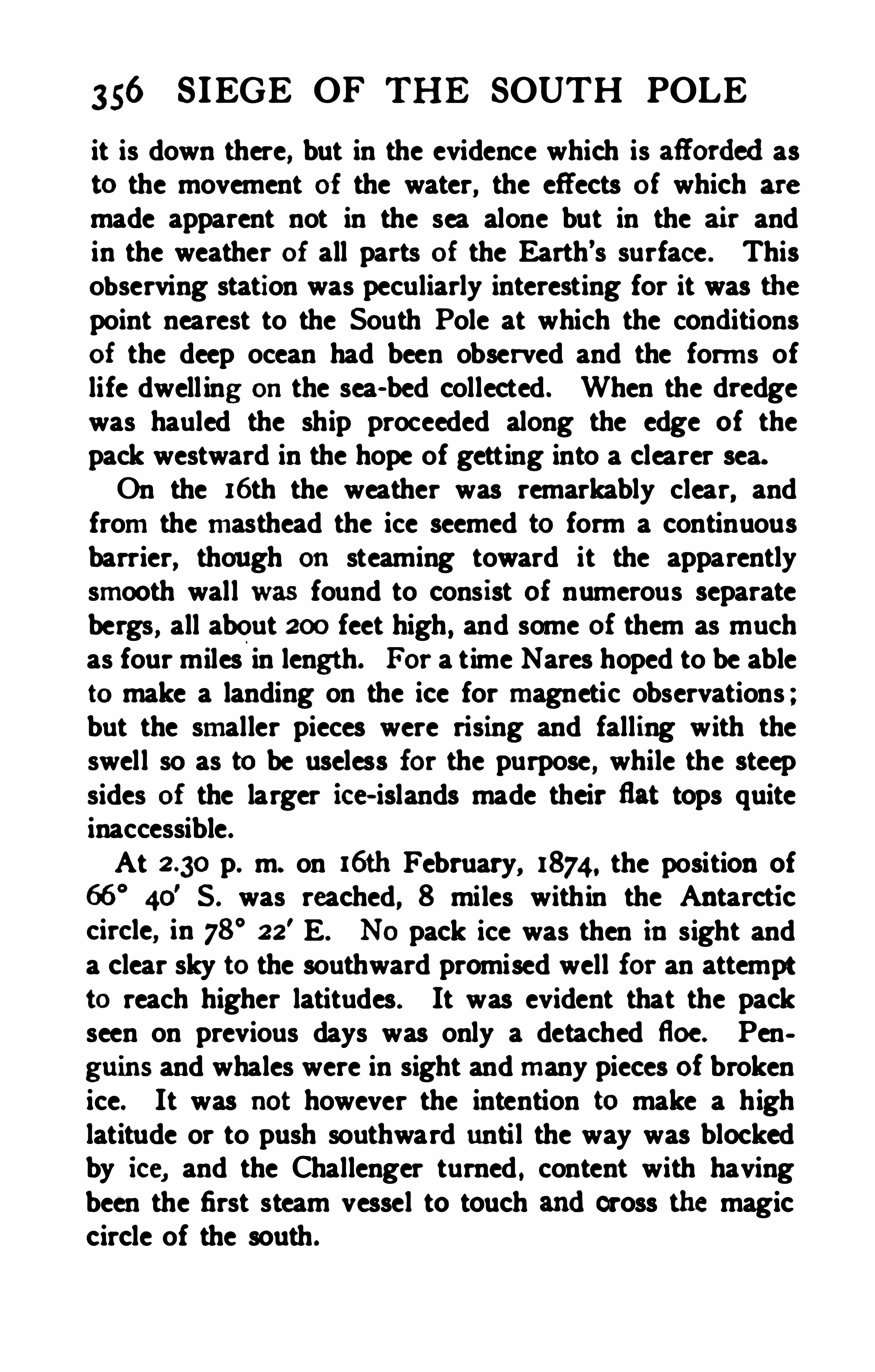
356 SIEGE OF THE SOUTH POLE
it is down there, but in the evidence which is afiordedasto the movement of the water, the eff ects of which are
made apparent not in the sea alone but in the air andin the weather of all parts of the Earth’s surface . ThisObserving station was peculiarly interesting for it was thepoint nearest to the South Pole at which the conditionsof the deep ocean had been observed and the forms oflife dwell ing onthe sea- bed collected . When the dredgewas hauled the ship proceeded along the edge of thepack westward in the hope Of getting into a clearer sea.On the 16th the weather was remarkably clear, andfrom the masthead the ice seemed to form a continuousbarrier, though on steaming toward it the apparentlysmooth wall was found to cons ist of numerous separatebergs , all about 200 feet high , and some of them as muchas four miles in length. For a time Nares hoped to be ableto make a landing on the ice for magnetic observations ;but the smaller pieces were rising and falling with theswell so as to be useless for the purpose , while the steepsides of the larger ice- islands made their flat tops quiteinaccessible.At p. m. on l6th February, 1874 , the position of
66°
40' S . was reached, 8 miles within the Antarctic
circle, in 78°22
' E. N O pack ice was then in sight anda clear sky to the southward promised well for an attemptto reach higher latitudes. It was evident that the packseen on previous days was only a detached floe. Penguins and whales were in sight and many pieces of brokenice. It was not however the intention to make a highlatitude or to push southward until the way was blockedby ice, and the Challenger turned , content with havingbeen the first steam vessel to touch andcross the magiccircle of the south .

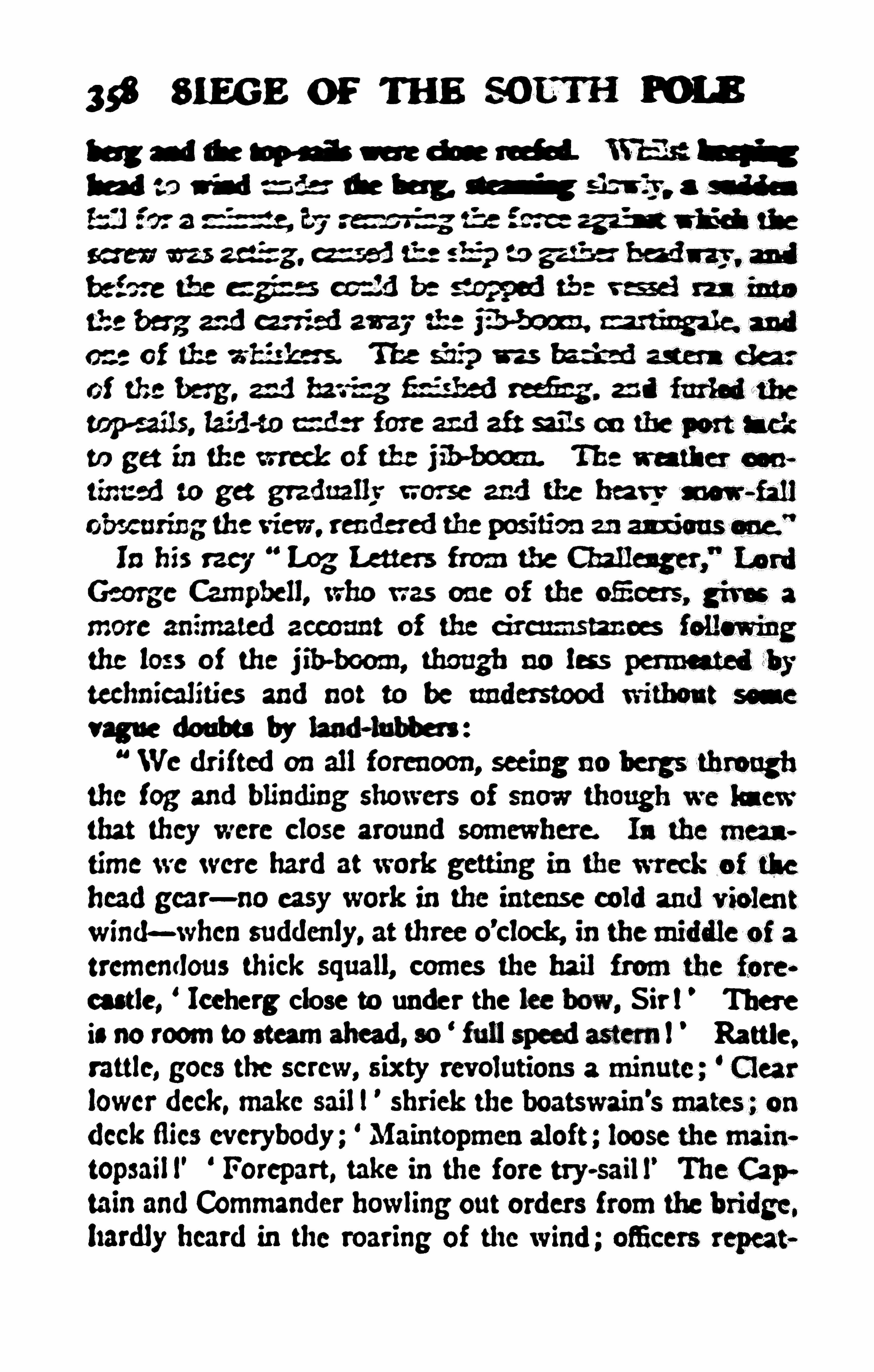
! we, Where closemunder the we i
i.“O rm tom mM w fun "
if; f. 7
”


360 SIEGE or THE SOUTH POLE
anticipated by Sir James Ross had the collection broughthome by that explorer been fully worked up, and it is thecompleteness with which every scrap of physical andbiological information obtained by the Challenger wassubsequently analysed and made use of which chie fly distinguishes the expedition from all that went before.With regard to one of the specific problems prescribedbefore the Challenger sailed, Sir John Murray pointedout, that no fewer than ninety species of animals knownin the northern seas were also found l iving south ofKerguelen , but had never been reported from any part ofthe tropical seas that lie between the two polar regions.For the rest, the study of the deposits showed conclusivelythat the Antarctic continent exists and though , as Cookasserted , it is eternally frost- bound it is a real continentthe rocks of which carried northward by the icebergs anddropped on the floor of the ocean are of a kind only foundoncontinental land. The glaciated rock fragments dredgedby the Challenger which clearly proved that continenta lland existed within the ice- bound region of the Antarcticwere gneisses , granites , mica- schists , grained quartzites ,sandstones, compact l imestones , and shales , none of whichoccur in any oceanic island. This is the discovery whichgives to the voyage of the Challenger its chief geographical importance, and it shows how unexpected are the lightswhich scientific research is always throwing on qu estionsthat seem at first sight very remote . It would be interesting to conjure up the flood of indignant yet dignifiedeloquence with which old Dalrymple would have overwhelmed anyone who dared to make the illiberal impu~tation that his great Southern Continent was to be discovered by the aid of a microscope in the mud from a
sounding lead !
THE CHALLENGER 361
The Challenger left the Antarctic question in this position : there is undoubtedly a continent within the Antarctic circle covered for the most part with an immenselythick coating of ice . Sir John Murray, taking account ofevery indication , drew a hypothetical outl ine of thatcontinent which subsequent discovery has not as yet
materially modified . More than this, the study of the
Challenger’s meteorological investigations indicated, as
was clearly shown by Sir John Murray and Dr. A. Eu
chan, that an area of permanently high atmospheric pressure lies over the ice bound continent around the SouthPole.We have seen how the researches of the mathe
maticianGauss in terrestrial magnetism led directly tothe great Antarctic expeditions at the dawn of the Victorian era. It is not too much to say that the work of theChallenger and the discussions of that work by variousmenof science, brought about the still greater expeditionsof the beginning of the twentieth century.
CHAPTER XVIII
STEAM WHALERS BOUND SOUTH
“The bergs like kelpies overside that girn andturn andshiftWhaur, grindin’ like the M ills 0’ God, goes by the big South
Drift.Hail, snow an’ ice that praise the Lord; I've met them at their
work,An’wishedwe hadanither route or they anither kirk.”
ALTHOUGH Dr. Georg von Neumayer was disappointed of the command of an Antarctic expedition
both in 187o andin1871 , he never ceasedto urge onhiscountrymen the importance of renewing exploration . Hisvoice perhaps received more attention abroad than athome, but in time the spirit of polar exploration wassti rred all the same in the ancient Hausa towns of Hamburg and Bremen. A German Society for Polar Navigation was founded in Hamburg to promote exploration as well as whaling and sealing in the northern seas.Its director, Herr Albert Rosenthal , provided large sumsof money for the work of the society, and in the words ofone of his countrymen he did more for German polarexploration than the Emperor or the Empire. His attention was turned to the southern as well as the northernpolar seas, and in 1873 he sent out one of the Arcticvessels to try her luck off the South Shetlands.On July 22nd, 1873 , the steam whaler Gronland, Captain Eduard Dallmann , sailed from Hambu rg andmadeher way southward along the South American coast,
360

364; SIEGE OF THE SOUTH POLE
whales though not of the most valuable kind . H is eonsmercial results were not encouraging enough to secu rethe' dispatch of other steamers , but t he first visit of theGerman flag to the edge of the Antarctic must be lookeduponall the same as a very creditable ex p loit.The recent researches Of Mr. Balch amongst the recordsOf Stonington , Connecticut, have revealed the fact thatAmerican sealers continued to visit the South Shetlands ,and
,before and after Dallmann , sailed along
'
thc coastof Graham Land and made landings to the sou th of
Gerlache Strait , but they kept their results to themselves ,or a careless public failed to see the interest and importance of the sealing cruises.Projects for the renewal of Antarctic whaling werefrequently mooted , and in 1875 it almost seemed as i fN ew Zealand and the Australian colonies would combinetheir resources and endeavour to establish the industryfrom one of the Australasian ports . It would be tediou sto cite the different rumours or to detail the variousschemes which were started during the following ten
years, for the subject was never ou t of sight . Dr. vonNeumayer continued both in Germany and in England tourge the dispatch of a scientific expedition, but on thereturn of the Challenger in 1876 the scientific director,Sir Wyville Thomson, deprecated anything of the kind .
In a lecture on the experiences of the Challenger in theAntarctic he referred to the long series of disasters andthe frightful hardships that had marked the history ofArctic exploration , and concluded We can only anticipate disasters multiplied a hundredfold should the SouthPole ever become a goal of rivalry among the nations .”
The argument is not a sound one , for the risk of disaster has ever been the finest incentive to the true explorer ,
STEAM WHALERS 365
and it has been happily falsified by the success andgoodfortune which have attended all expedi tions to the farsouth as compared with those to the far north . Thepessimistic view was not sharedby the members of theChallenger scientific stafl, and except Dr. von Neumayerhimself, no one has spoken more strongly and continuously in su pport Of Antarctic exploration than Sir JohnMurray, and he has been ably supported by Mr. J . Y.
Buchanan .
About 1 880 Lieutenant Bove of the Ital ian Navyplanned a sc ientific expedition which was to spend twowinters in the Antartic ice fol lowing up Dallmann'
s discoveries andmaking a Circumnavigation as far south aspossible by sailing wes tward , the direc tion which our
readers are now perhaps tired of hearing has been shownto be the most promising by the troubles which havebefallen everyone who followed tradition and the eastward route .The project was taken up with enthusiasm in Italy, andit seemed for a time as if the nation which now holds thedist inction of having carried its flag nearest the NorthPole would have anticipated that achievement by plantingit first nearest to the South Pole. The time was peenliarly appropriate. A great scheme of circumpolar t esearch had been elaborated on vonNeumayer’s initiative
, inwhich almost all civilised nations were takingpart, so that for twelve consecutive months in 1882-83
simultaneous meteorological and magnetic observationswould be made at the highest attainable latitudes rightround the North Pole . It was on one of these that Lieutenant Greely of the United States Army and his wholeparty nearly perished from that terrible danger of polarexploration—a relief expedition which failed to relieve .
366 SIEGE OF TH E SOUTH POLE
Similar observations were to be made simultaneously atall observatories in the south of the southern continents ,
supplemented by a body of French menof science at CapeHorn , and of Germans on South Georgia. LieutenantBove hoped to add another to these stations and to be ableto observe the transit of Venus of 1882 at some pointwithin the Antarctic circ le . Ital ian enthus iasm went far,but not far enough to raise sufficient funds, and Lieutenant Bove rather than not .go out at all accepted a postunder the Argentine government for the exploration ofSouthern Patagonia. On that inhospitable seaboard hemet with shipwreck, but was saved by the British missionship Allen Gardiner. The circumstance got reported inmany papers as a disaster to the Italian Antarctic ex pedition , and it is referred to here merely in order to freeAntarctic exploration from the responsibility of causingthe loss of a vessel which never sailed or was intended tosail beyond Cape Horn.
The rise and failure of one other attempt to renewexploration claims attention, for although it did notsucceed , it helped to arouse the sleeping spirit whichanirnatedthe latest and greatest attempt to wipe off thestain of ignorance from the South Polar regions. At themeeting of the British Association at Aberdeen in 1885a paper was read on the renewal of Antarctic research byAdmira l Sir Erasmus Ommanney, a veteran officer of theFranklin search whose active service at sea dated backto the battle of Navarino. He had followed the workof Ross with interest , had supported Captain J. E. Davisin his plea of 1869, and he lived just long enough to seethe triumphant return of the Discovery in 1904. Theresult of the paper, which was mainly based on Neumayer's work, was the appointment of a st rong com

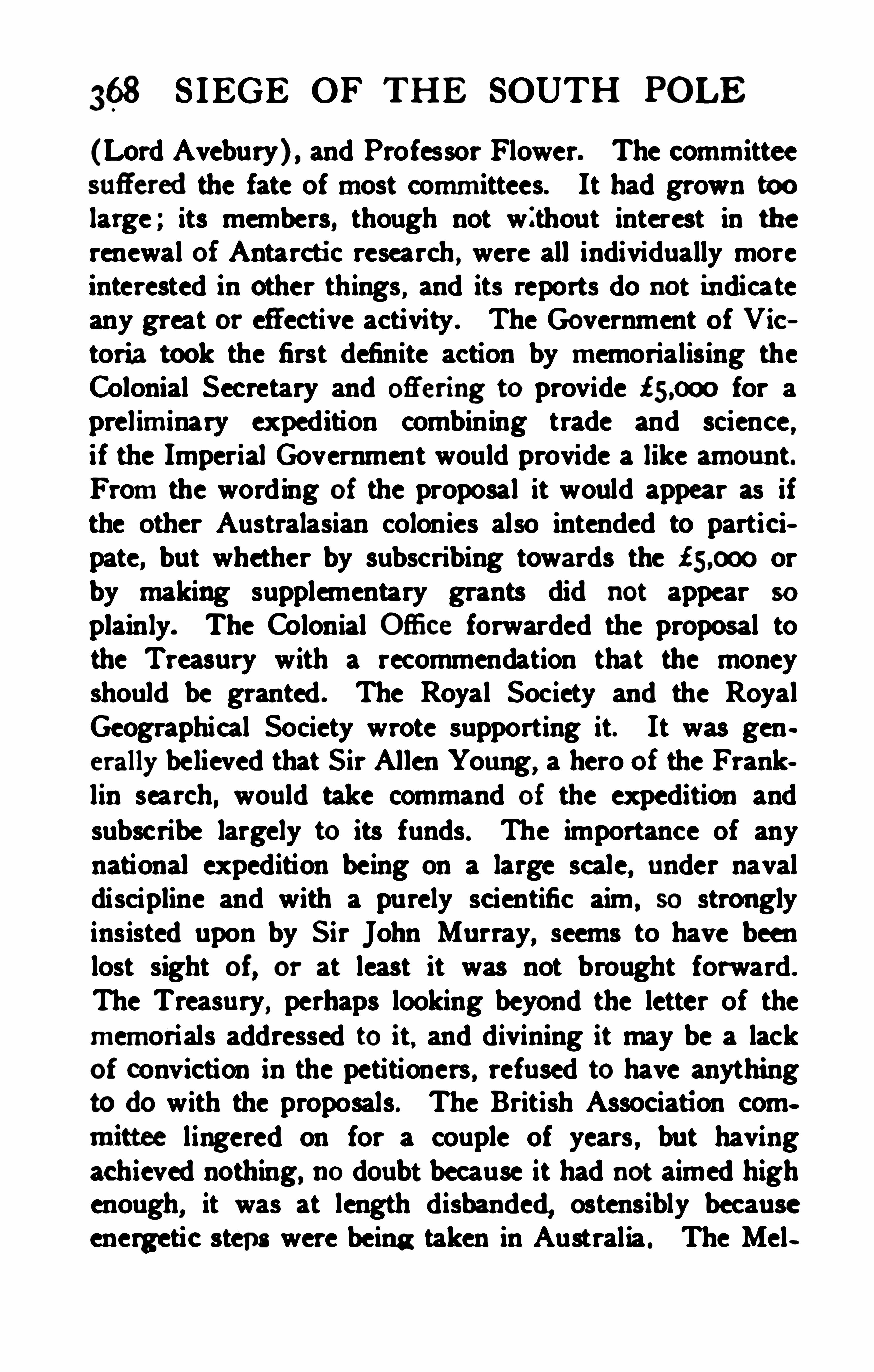
368 S IEGE OF THE SOUTH POLE
(Lord Avebury ) , and Professor Flower. The committeesufieredthe fate of most committees. It had grown toolarge ; its members, though not without interest in therenewal of Antarcti c research , were all individually moreinterested in other things , and its reports do not indicateany great or effective activity . The Government of Victoria took the first definite action by memorialising theColonial Secretary and ofiering to provide for apreliminary expedition combining trade and science ,if the Imperial Government would provide a like amount.From the wording of the proposal it would appear as ifthe other Australasian colonies also intended to participate, but whether by subscribing towards the orby making supplementary grants did not appear so
plainly. The Colonial Ofiice forwarded the proposal tothe Treasury with a recommendation that the moneyshould be granted . The Royal Society and the RoyalGeographical Society wrote supporting it. It was generally believed that Sir Allen Young, a hero of the Franklin search, would take command of the expedition andsubscribe largely to its funds. The importance of anynational expedition being on a large scale
,under naval
discipline and with a purely scientific aim, so strongly
insisted upon by Sir John Murray,seems to have been
lost sight of, or at least it was not brought forward.
The Treasury, perhaps looking beyond the letter of thememorials addressed to it. and divining it may be a lackof conviction in the petitioners , refused to have anythingtodo with the proposals. The British Association committee lingered on for a couple of years
,but having
achieved nothing, no doubt because it had not aimed highenough, it was at length disbanded, ostensibly becauseenergetic steps were being taken in Australia . The Mel
STEAM WHALERS 369
bourne societies were loath to give up an idea that hadbecome popular in the colony, and having been snubbedby the mother- country they tried to enlist sympathy inscientific circles abroad. Negotiations for a joint Swedish and Australian Antarctic ex pedition were enteredinto, and rumours circulated that the great geographerBaron Nordenskiold, the victor of the North-East Passage, would himself lead the expedition , while BaronOscar Dickson, who had munificently supported the voyage of the Vega around Asia, was understood to be readyto make the project financially possible. The name ofFridtjof Nansen, then famous for his crossing of Greenland, was also mentioned as a possible leader. Butnothing came of the efforts, and rumours of a German
by a German-American millionaire were justified nobetter by events.The renewal of Anta rctic research came neither from
the na lof menof science, the fostering care of Governments , nor the wealth of millionaires . It was due to
speculative voyage like the merchant adventu rers ofold.Seventy yeers ago fieets of whalers still sailedfrom
many ports along the east coast of EnglandandScotlandto the Greenland Seas , and much of the Arctic work ofthe Royal Navy in the earlier decades of the nineteenthcentury was called forth by the necessity for watchingover a considerable source of national wealth andsuccouring distressed crews. Twenty years ago the Green
ticefis ) hadgrownso scarce that the fleets haddwindledto a few steam- vessels sailing only from Peterhead and
u
370 SIEGE OF THE SOUTH POLE
Dundee andthe last of the famous whaling skippers of
Peterhead was David Gray. Capta in Gray had seen theGreenland whale fishery decline from its zenith until ithad almost disappeared from sight, so that the capture ofone whale had come to mean a successful voyage. Th e
value of the“b0ne
”hadrun up to analmost fabulous
figure, andit is now measuredby thousands of poundssterling per ton.
the expenses of a voyage, the reports of abundant black
whales inthe Anta rctic seas were worth enquiring into,
and if verified the new field might save the Scottishwhal ing industry from extinction. He extracted andclassified all the many references to right whales in
Ross’s book, and going back to the time of Cook, obtainednotes from the logs of various Kerguelen whalersof the temperate seas. He also secured fresh reportsfrom the survivors of the expedition in the Erebus andTerror, including the private log of Alexander Craig ofPeterhead who had served on board the latter ship andknew a whale when he saw it. Captain Gray issued aprospectus in 1891 inviting shareholders in the enterpriseand setting forth the facts onwhich he based his conclusions in a very frank and seamanlike way. The regionselected for the experiment was the portitm of the Antarctic between the meridian oi Greenwich and 90
° W.,
in other words the neighbourhood of Weddell Sea.While the ex peditionwas to be cornmerciaLCaptainGraywith his wel l-known interest in matters scientific hadprovided for the accommodation of a naturalist on boardeach ship, for two vessels were considered absolutelynecessary . Unfortunately the response of the public washalf- hearted, suficient shares being taken to provide


37: SIEGE OF THE SOUTH POLE
m k fl bfi dM fi b d
sfippu y gredseara the hnb m b mdby any pom a
su b un'
Mu ic m a-idw a pm m a m h
iasmu edfor croning the bdt of eahm andfor mvring inh h nik alone being trw w for mW a
poem in ordinary circumstance s a dfor the actu alpwsuit of wlnlea. The Balzna (4oo tons ) was buflt at
Drammenin187znbe was u r fieet lougmf 3r ieet ba m,
andunder the command of Captain Alexander Fairweather.was !” feet long, 29 £eet bmn, andsanedunder the
tons ) was built at Peterheadin r852 ; she was rr7feet
The Polar S tar (zr6 tons) was also bu ilt at Peterhead.andwas only 105 teet longnhe was under the commandof CaptainJames Davidson. Mr. William S . Bruce, an
geononthe Balzna andas he hadonseveraloceasions
takenpart inthe routine work of BenN evis Obsen/atory.he was a thoroughly trainedmeteorologicalobserver as
tunity presentedto him wouldbe takenadvantage of to
the full. Hewas accompaniedas a passenger onboardtheBalzna byMr.W. BumMurdoch , anartist whose ambi~tionwas to paint the Antarctic ice scenery, andwhobecame also the chronicler of the cruise. The snrgeonof the Active was Dr. C. W. Donald, who, although
STEAM WHALERS 373
uralscierm andhada Shetlander’s love of the sea.
18ga, amidst a scene of great ex citement, thedocks beirgcrowded with friends of the sailors, and members of the
uncertain a voyage as that contemplated is rare nowadays,andalthough many of the whalemenhadnever spent a
summer at home since they were boys, they had hardlyever spent a winter away from their families. A fewscientific friends accompanied Mr. Bruce down the Firthof Tay and were landed at Broughty Ferry in companywith half a dozen wretched stowaways. Those unhappyout -of -works were unearthed from various hidingplaces, andbeggedhardto be allowedto proceedonthevoyage on any terms before they obeyed the peremptoryorders to get into the boat. They had evidently no idea ofthe nature of the new whaling grounds, their one thoughtbeing that here was a chance of food at least for a yearto come. TheDiana sailedwith the same tide, the Activeand Polar Star followed a few days later, and all of themhad a wild burst of bad weather at the outset. Fivestowaways were landed from the Diana at S tomoway,no less than fifteen from the Polar Star, at Blyth, andtwo more were found on board long afterwards.The ships saw nothing of each other on the whole
long outward voyage, but the Balzna and Active reachedthe Falklands on the same day, December 8th, and sailedfor the fishing grounds onthe 1 1th, j ust before the Dianaarrived. On the way out the Active had sailed for a dayin company with an American whaler off the coast ofBrazi l . She had been twenty- seven months at sea hunting the sperm whale in tropical waters. Visits were
374 SIEGE OF TH E SOUTH POLE
exchanged, and amongst much interesting informat ionas to sperm-whaling the American skipper gave the newsthat aNorwegian whaler, the Jason, under the commandof CaptainC. A. Larsen, was also on the way to the
Antarctic.The ships searcheddiligently for the bowheadwhalein the northwestern part of Weddell Sea, but found none.
Other whales, especially finners, hunchbacks. bottlecnoses
and grampuses, were common enough ; but none of thw eyield any quantity of the valuable bone, and they werenot worth securing. The ships do not seem to have gonebeyond 65
° S . so that they did not enter the Antarct icregions properly so—called. The Balzena was never withinsix miles of any land except at the Danger Islands offJoinville Land , and what scientific work could be donehad to be done afloat. There was little opportunity al
lowed for scientific work, however, for the expeditionwas purely commercial ; the skippers had no mindtowaste time that could be turned to money, and as whalescould not be found, the crews were set to work to fill theships with the skins and blubber of seals, which werekilled by thousands onthe ice. A glimpse of the lif e onboardmay be given in the words of a member of the
expedition :It was with the produce of seals that we were des
tined to fill our ship, and till February 17th we wereliterally up to theneck inblood. Allthe sails are stowed;the captain sits in the crow’s nest from early morningtill late in the evening ; the two engineers, rel ieving one
another, take charge of the engines ; the cook or thesteward is on the lookout ondeck or on the bridge ; andthe doctor takes the helm ; unless he can manage to getaway in the boats, in which case some other non- com~

376 SIEGE OF TH E SOUTH POLE
paid a visit to the Jason when all five ships were lyingclose together
,on January a4th ,
1893, and found CaptainC. A. Larsen , who had been sent out by the Oceana Cornpany of Hamburg, ful l of interest in the geographicalproblems of the locality.
From the same ship some years before Larsen hadlanded Fridtjof Nansen on the east coast of Greenlandto make the first of his successful journeys on the boldprinciple of leaving no way open for retreat. The stimulus ofmeeting a scientific enthusiast like Nansen may wellhave left its influence
,and Larsen had landed on the
South Orkneys on his way to Weddell Sea , and again onSeymour Island at the south end of Erebus and TerrorGu l f, where he had picked up a number of fossils. Thiswas a discovery of great interest to geologists for theywere the first indisputable evidence of the exi stence ofsedimenta ry rocks on Antarctic land . Captain Larsenbelieved he had seen land to the westward when in latitude 64
°
40' S. and longitude 56
°
30'W. and this , which
was also noted from the Balx na as at least an appearance of land was undoubtedly the east coast of theland known on the west as Graham Land.The Dundee ships were fil led up with sealskins and oilbefore the end of February, the Balazna having securedabout 6000 seals, the Active and Diana about 4000 each,and the Polar Star about 2000. The fleet left the Falklands early inMarch , and by the middle of June , 1893,they were safely docked in Dundee. Without havingbeen an absolute failure the experiment was not so suc
cessfulas to lead to its repetition , nor was the experienceof the scientific observers altogether a happy one. Theycertainly made the best of their opportunities, but theopportunities were fewer and farther between than had
STEAM WHALERS 377
been expected , and the sealers were, naturally enough ,not particularly sympathetic with proceedings they didnot understand . It became quite clear that unless undera very exceptional captain a commercial voyage can yieldcomparatively little of scientific value.The Germans seem to have been better pleased with theresults of their seal - hunting, for the following year foundCaptain Larsen back again with the Jason in WeddellSea for the Oceana Company, while the Hertha, CaptainEvensen , and the Castor, Captain Pedersen, tri ed theirfortune on the other side of the land in the sea previouslytraversed only by Bellingshausen and Biscoe. Thesevoyages really advanced exploration , and Larsen inparticu lar made some interesting discoveries. Aftersealing for some time among the floes east of SeymourIsland , he steered southeastward, and onDecember rst ,1893, was close to high land covered with snow , in latitude 66° S . , longitude 60
° W. In accordance with custom he named it after his sovereign , Oscar II . Land ; theprominent cape was called Cape Framnes, and a loftvmountain , Mount Jason. This was to all appearance theeastern coast of Graham Land , and no doubt the NewSouth Greenland of the early Yankee sealers. Part ofthe slopes of Mount Jason were free from snow, and theland looked tempting to explore, with great glaciersrunning down from vast snowfields to the sea. Larsensighed for his ski and a clear conscience to land and travelover the snowy expanse , but duty kept him to his shipand the search for whales and seals . He continued tocoast southward along the broad strip of ice fast to theland
,the sea ice proving most favou rable to his advance,
and on December 3rdthe Jason had the honour of beingthe second steamer to cross the Antarctic circle. The
378 S IEGE OP THE SOUTH POLE
ship kept on a course nearly due south, along the edgeof the flat shel f or barrier Of ice that extended outwardsfrom the coast, until on the 6th , farther advance wasbarred by heavy ice in 68° 10
' S. The land appears tohave been continuous all the way, and to a very mountainous portion of it rising into four conspicuous peaksLarsen gave the name of Foyn
’
s Land, after the greatNorwegian whaler, who, had he lived, might have proveda secondEnderby in promoting Antarctic work.
On the return voyage an island was discovered lyingsome distance 06 the coast, in about 66° S . , and namedRobertson Island, from which a chain of smaller islands ,named collectively the Seal Islands, ran to the northwest.Immediately to the north , two active volcanoes camein sight in latitude 65
° S the larger on an islandcalled Chri stensen Volcano, and the smaller connectedto it by sea - ice. Captain Larsen landed on the ice closeto Christensen Island and travelled over the soft snowon ski for some distance. The surface Of the ice wasstrewn in places with blocks Of volcanic rock evidentlyrecently ej ected by the volcano. On the snowy marg inOf the island there were swarms of young seals, very fat,and friendly to the strangers, and luckily for themselves ,separated from the sea by so wide a stretch of soft snowthat they were left in peace. The interior was seen tobe nearly free from snow . but it was impossib le in the
time to get more than four miles from the edge Of thesea- ice surrounding the island, and the uncovered landwas not reached. Many other small islands were seenand charted, and after filling his ship with seals, visitingthe coast Of Tierra del Fuego in the unsuccessful searchfor whales , and discharging his cargo at Port Stanley,Larsen found time to make another trip to Erebus and

380 SIEGE OF THE SOUTH POLE
perseverance,courage and originality , whose genius had
grappled with the problem Of killing the hitherto invulnerable blue whale or firmer, and the creator by thatachievement of a great fortune for himsel f and a newindustry for Norway. When his countryman , Mr. H . J.Bull
,who had been captivated by the fascination of the
Antarctic,had tried and failed to induce Australian capi
talists to invest money in an attempt to renew Antarcticwhaling, he left Melbourne, returned to Europe , andapplied at once to Commander Foyn. The veteran waseighty- four years Old, and his li fe had been spent in perfecting the whale fishing Off his native coasts and in theArctic seas, but he was willing to help a new w terprise inthe other hemisphere ; and, entering keenly into the plans,he placed a vessel at the disposal Of Mr. Bul l.For this purpose he purchased the whaler Cap Nor,
bui lt at Drammen in 1871 , a vessel s imi lar in build to theBalzna and Active. For her new work she was re
christened Antarctic , and sailed under the command OfCaptain Leonard Kristensen, with Mr. Bull on board , inSeptember, 1893. On her way out she spent some t imeseal ing at Kerguelen , and reached Melbourne at the endOf January, 1894. Mr. W. S . Bruce, fresh from his experience on the Balz na, applied to Commander Foyn forpermission to accompany the Antarctic
.and the Director
of the firm publicly expressed his regret that the quickdespatch Of the ship made it impossible for Mr. Bruceto reach Melbou rne in time to join the vessel .Amongst others bitten by the fever of adventure was
a young colonist Of Norwegian birth, though partly Eng»lish in ancestry, Carstens Egeberg Borchgrevink, whohadhad some experience Of land- surveying and provedhimself Of the most irrepressible persistency in grati fying
STEAM WHALERS 381
his ambition . He tried hard to be taken on board theAntarctic as a passenger, but the captain would have nopassengers in his ship ; he ofieredto go inany capacity .and got his way at last by signing on as an ordinaryseaman . The voyage of the Antarctic has been describedby the promoter, Mr. Bull , the master, Captain Kristensen, and also by Mr. Borchgrevink, the various versionsagreeing as regards the events of the voyage, with whichalone we have to do.
The Antarctic left Melbourne in September,and spent
a few months sealing round Macquarie Island,and along
the edge of the Antarctic pack which was met in latitude58
°
5. After a visit to New Zealand to repair damagereceived in heavy weather, she sailed again on November28th , 1894, and in little more than a week, entered thepack ice in 63
°
S . , 171°
30’ E. The Balleny Islands were
sighted on the 14th, and the Antarctic circle touched onthe same day and crossed a week later. The midnightsun was visible on Christmas Eve, but the ship continueda prisoner in the pack, and it was not until January 14th,
1895, that she worked her way into open water in latitude 66° 55
' S . Two days later Cape Adare at thenorthern end of Victoria Land was sighted for the firsttime since Rosa’s voyage , and two more days brought theAntarctic up to Possession Island, where a landing wasmade , the party finding the place aswarm with penguinsex actly as Ross had found it fifty-five years before.Here Borchgrevink made a botanical discovery of considerable interest, a lichen growing on the rocks , thefirst evidence of plant life obtained within the Anta rcticcircle. Possibly enough this discovery would have beenmade onthe former visit had it been the turn of Hookerinstead of that of McCormick to land with Ross, the
382 SIEGE OF TH E SOUTH POLE
senior medical officer of the Erebus having more interestin birds than in plants. Coulman Island was sighted onJanuary 22nd, and then in latitude 74 ° S . Kristensendecided to turn back as no whales were to be seen. Nextday the ship was back at Cape Adare, and here the firstlanding upon the Antarctic continent was made ona lowbeach at the base of the cliff . The penguins were evenmore numerous than at Possession Is land, and the samelichen was found growing onthe rocks. Returning northward the Antarctic made her way through the pack insix days, and entering the open sea onFebruary 1st, shepu rsued her voyage in temperate waters and reachedMelbourne on March 14th.
The voyage was not a commercial success and has nOtbeen repeated. The right whale was not found , theship was too large, and the gear was perhaps too lightfor taking the finner ; but the voyage was an interestingdemonstration of the facility of visiting Victoria Land,and supplied a strong argument that the open sea foundby Ross south of the pack was not a temporary incident,but the normal feature of an ordinary year.The last efi‘ort of the whalers and sealers had donemuch to spread interest in Antarctic navigation, and ithad done more in training men who were destined totake leading parts in the great scientific expeditionswhich were to follow.

384 S IEGE OF THE SOUTH POLE
vians grew up with December, the rnonth without a sun
rise, as thedark backgroundof their life ; andwhalersliable to be eaught in the ice as they lingeredto the
endof their short working season, grew ex pert°
mde~vices for counteracting the efiects of intense cold andmonth- long darkness and inaction. But the wint er ofthe south remained absolutely unknown, the only clueto its severity being the solitary minimum ra ding of 5
°
on Deception Island when the registering thermometerleft by H . M . S. Chanticleer was recovered by CaptainSmiley. The importance of observing winter conditionsin the Antarcti c had become a plank in the platform ofthe few indefatigable enthusiasts who were still hopefulof securing the dispatch of a properly equipped expedition capable of util ising to the full opportunities whichwhalers, who had to pay their way, could only recogniseand pass unused.
The meeting of the Sixth International GeographicalCongress in London in 1895 under the presidency of S irClements Markham was made the occasion of an interesting discussion following a long historical paper by Dr.von Neumayer and an account by Mr. Borchgrevink ofCaptain Kristensen’s successful landing on the Antarcticcontinent. Sir Joseph Hooker, the last survivor ofRoss’s great voyage, Sir John Murray, representing theChallenger expedition , and Sir Erasmus Ommanney,
whose efforts at one time seemed likely to launch a newship for the sou th, took part inthe discussion. The Con
the formal beginning of the strenuous efforts to explorethe Antarctic at the close of the nineteenth and the opening of the twentieth centuries. It ran :That the Congress record its opinion that the explora

LI EUTENANT A. DE (Tsunami s .
384 .


386 S IEGE OF THE SOUTH POLE
sealer of about 250 tons , known as the Patria, and ap
propriately enough t e- named the Belgica.The nucleus of a scientific stafi was brought together,and these assisted heroically in the necessary but oftennearly hopeless task of endeavouring to raise funds ; thedeparture of the ship was delayed for a year in coh eequence of the difficulty of getting money. Gerlache wasfortunate in securing the cooperation at an early dateof H enryk Arctowski, a Russian Pole, whose ardour inthe pursuit of the sciences of chemistry, geology andmeteorology made him eager to seize the opportunity ofentering an absolutely virgin field. A Rumanian naturalist.Emile Racovitza, of equal enthusiasm 1nhis owndepartment, was also enlisted, and others were gradually added,for the intentionwas to make the Belgica a purely sciemtific expedition . In the summer of 1897a desperate efiortto raise additional funds by holding a sort of exhibitionand fancy fair was at last successful , thanks mainly tothe cooperation of Mme. Osterrieth who acquired therebythe friendly title of Mother Antarctica . After all only
had been obtained from start to finish , and onthat grotesquely inadequate sum the whole of the equipment and work of the Belgica was carried out.On August 16th, 1897, the ship left Antwerp, and onthe a4th finally departed from Ostend. M . de Gerlachewas in command of the expedition , with Lieutenant Lecointe , also a Belgian, as second in command and Roald
consi sted of Lieutenant Emile Danco, a Belgian, as magnetic observer, Emile Racovitza , the Rumanian naturalist.Henryk Arctowski and his assistant, Antoine Dobrowolski , both Poles ; but the surgeonhad given up his post atthe last moment and the ship sailed without one. The
FIRST ANTARCTIC NIGHT 387
two engineers were Belgians, and of the nine sailors fourwere Belgian andfive Norwegian.Dr. Frederick A . Cook, an American surgeon who hadaccompanied Peary in one of his Greenland journeysand had for years set his heart on seeing the Antarcticregions also , cabled to Gerlache, knowing nothing of thedifficulty as to a medicalman, but asking if he could byany means be taken with the expedition. He had himselftried and failed to get up an American expedition, andnow gladly responded to Gerlache’s cabled permission tojoin at Rio de Janeiro.
The Belgica, with her cosmopolitan company, proceededvery s lowly on her way , lingering unaccountablyin the channels of Tierra del Fuego, where any shipcould go at any season, and not leaving Staten Island untilJanuary 13th , 1898 It will be remembered that Larsenand Evensen had attained their highest sou thern latitudesin clear seas two months earlier in the season four yearspreviously. Even at that late date much work was donewhich certainly should not be neglected, but might quitesuitably have been lef t until the retu rn journey. Thisconsisted in running a line of soundings from Cape Hornto the South Shetlands, a tract of sea that had never beensounded before.On January 20th the South Shetlands were sighted,and the ship ran on a rock, giving rise to some alarm butno damage. The weather grew bad , and as the Belgicaproceeded southward she had the misfortune to lose oneof the Norwegian sailors, who fell overboard and couldnot be saved despite desperate efforts on the part of those
Proceeding into Hughes Gulf, Gerlache discovered awide channel running southwestward and separating
388 SIEGE OF THE SOUTH POLE
what appeared to be the mainland from an archipelago oflarge islands forming the remainder of Palmer Land .
Three weeks were spent in this stra it, to which the nameof the ship was first given , but afterwards that of thecommander. No less than twenty landings were madeand magnificent collections of geological and naturalhistory specimens secured. For the first time the subAntarctic land was invaded by men of science who cou ldtake full advantage of their opportunities. Too muchperhaps was attempted , but a great deal was done , anda double line of Belgian names scattered down the mapfrom 64
°to 65
° S . fixed the featu res of the coast, whichwas charted with enough care to give us more confidencein the positions of the various islands, headlands andchannels , than was possible before in any part of that
The scenery was typical of Antarctic land, black rocksprojecting from sweeping snow-fields which ran downinto a ledge of glacier ice along the shore, with here andthere a beach of pebbles where a landing couldbe made.During the excursions on the snowfields in brightweather the heat of the sun was so intense as to becomeahnost unbearable, a fact which makes the volume of thesnow the more remarkable. Near the sea, where therocks were bare and trickling with water, lichens andmosses were found in some abundance, and even a fewinsects of a very humble type. Never before had asingle degree of latitude inthe immediate neighbourhoodof the Antarctic circle received so minute an investiga»tion , but the scientific men were insatiable and remainedunsatisfied. Arctowski describes one of the landings inthese wordsThe commandant showed himself very obliging ; but


FIRST ANTARCTIC N IGHT. 389
with a little good -will we could have landed in manyother places and collected much more geological materialthan we did . For this eighteenth landing he conductedme himself but for ten minutes only. A few strokes ofthe oars brought us to the beach amid cries of Hurryup, Arctowski l
’ I gave a hammer to Tellefsen withorders to chip here and there down by the shore , wh ileI hurriedly climbed the moraine, picking up spec imens asI ran , took the direction with my compass , glanced to theleft and right, and hurried down again full speed to geta look at the rock insitu ; meanwhile Cook had taken aphotograph of the place from the ship—and that is theway geological surveys have to be carried out in theAntarctic.”
On February 12th , 1898, the Belgica left the strait andpassed southward along the coast of Graham Land at adate when all previous expeditions in these waters hadbeen making haste for home. Icebergs became morenumerous and the sea along the coast was beset withrocks which made navigation slow and difficult. OnFebruary 1 sth the Belgica crossed the Antarctic circlesteaming sou thwest. Next day Alexander I. Land camein sight, but could not be approached as the ice- packextended for twenty miles from the shore. It lay to thesouth and seemed an aggregate of mountains above whichsome lofty peaks rose boldly. The glaciers descendingfrom these mountains coalesced along the shore in abroad terrace or ice- foot which merged into the pack.
A large island or mountain was seen to the east, ap
parently forming the southern extremity of GrahamLand, which seemed to be separated from AlexanderLand by a strait or at least a gul f. Too much stress mustnot be laid on the features of land seen at so great a
390 SIEGE OF. THE SOUTH POLE
distance, and indeed different members of the Belgica’
s
company gave different descriptions of what they saw ,
which after all was little more than had been seen byBellingshausen when he first lit upon that lonely sentinelof the south .
The course was continued southwestward until onFebruary 28th the ship was in 70
°20
'S ., and 85
° W. Agale was blowing against the ice from seaward and greatgaps were torn in the edge of the pack, affording tempting openings toward the south . Despite the serious lateness of the season, and disregarding the views of thescientific stafi who were anxiou s to place the results oftheir work in safety before risking the ship in unknownperils, Gerlache thrust the Belgica into one of the openings, and pushing his way southward with increasingdifficulty he reached 71
°
30' S. onMarch 3rd. An at
tempt was then made to return, but it was too late. Afteradvancing a few miles to the northward the ship wasgripped fast in the pack, and for a year and a month she
lost all power of independent movement.The ship was not too well prepared for wintering inthe farthest south but everything poss ible was done tominimise the inevrtable hardships. Although the scien
tific stafi had not been anxious to enter the ice, eachmember seized the Opportunity which was thrust upon him ,
resolved to take the fullest possible advantage of the uniqueex perience. The ice gradually thickened, but holes couldeasily be cut in it, and through these holes theminute creatures living in the sea-water, the plankton, were caught byfine tow- nets ; the depth was ascertained and observationsof temperature were made at all depths in the water.It was soon apparent that although the Belgica could notmove away from the floe that held her, the ice itself was

392 SIEGE OF THE SOUTH POLE
spi te all efiorts to work and keep cheerful the darknessentered into the soul of the ship’s company, oppressingthem more than the cold and more than the inadequateand uninviting food. The food was abundant enough ,but much of it was in the form of special ly preparedex tracts and fibreless meats and fish , the condensed nourishment of which ceased to nourish , and for some un
explained reason the natural dislike to pengu in flesh wasvery slowly overcome. Dr. Cook attribu ted the low stateof health on board—a sort of polar anaemia—to the unsatisfactory diet as much as to the darkness. All su fferedfrom impaired circulation and deranged digestion,the heart seemed to lose its regu lating power, and gaverise to alarming symptoms , while the complexion becamedeathly pale, almost greenish. The groaning and crashing of the ice in the blackness of the endless night wasa horror to listen to and the sound could not be evaded ,nor the darkness dispelled , nor the cold resisted outsideor the damp within. Dr. Cook repeatedly refers to it allas hell ish .
”
Lieutenant Danco, whose heart had not been soundwhen he started, was unable to resist the accumulation ofmiseries which reduced the strongest to a state of lethargyand depression. He died onJune sth, before mid-winter, and was buried at sea through a hole cut in the ice ,the commandant making a few fitting remarks ,” for thesound of no religious service ever rose through the darkness of the first Antarctic night. Lecointe fell seriouslyill and everyone was affected more or less in mind or
body or both. We live in a mad- house,” said one of
the cabin party. Dr. Cook devised a treatment for polaranemia which seemed eff ective It consisted in tryingto do the work of the absent sun by exposing the pa
FI RST ANTARCTIC NIGHT 393
tient’
s skin to the glow of the hottest fire that could beobtained .
The winter passed . It was not without discovery, foras the ice was driven about, south , east, west and north,with apparently no serious check, it proved that the opensea ext ended far in all directions, and as Bellingshausen
’
s
Peter I . Island lay to the north of the drifting ship it wasclear that the first - found of all Antarctic land was a lonelyislet and not the immediate outpost of a continent.The light returned before the middle of July, when foran hour or two about noon the dawn day by day made iteasy to read for a longer and longer time. Each daythe colours of the sky at noon grew brighter on thenorthern horizon , and onJuly 22ndthe sun appeared . Thereturn of day brought life with it, the health of the ship
’scompany improved , and the scientific observations whichhaddragged heavily were resumed with a fresh zest.But the impulse was temporary. The sun brought ternpestuou s weather and the cold increased, the lowest temperature of the whole period being reached on September8th, when the thermometer registered 45 degrees belowzero Fahrenheit and the mercury froze .
Summer came on with its perpetual sun, ChristmasDay passed , New Year
’s Day 1899, passed , but the iceremained unchanged. The particu lar fioe in the centreof which the Belgica was frozen was about four milesin diameter, and unles s it broke up speedily the awfu lprospect of another winter would have to be faced. Allhands were set to work to blast and saw a passage forthe ship to the lane at the edge of the fioe, but thi s wasa seriou s matter with ice ten feet thick. The food supplywas running low, and , willing or unwilling, the workershad to support their strength on penguin and seal meat ;
394. SIEGE OF THE SOUTH POLE
but hard work and hope made the unsavou ry food sowelcome that seven meals were disposed of in the twentyfour hours . On the 14th , thanks partly to the cuttingand partly to the wind the ship broke loose and waswater- home once more, but another month elapsed beforeshe was able to win her way to the open sea, and it wasMarch a8th, 1899, before she steamed into Punta Arenas.Never before were the bleak shores of Magellan Straitso welcome to the seafarer, and the harsh autumn windfrom the forests of Tierra del Fuego was laden with al lthe perfumes of spring to the worn-out explorers who formore than a year had lived in a world of ice with nonatural odour more fragrant than a penguin rookery.
The Belgica had a splendid reception when after lingering in South American ports she returned to Belgiumearly in November. The expedition was of unprecedentedimportance from the duration and regularity of the routine scientific observations in the far south , the completeness of the collections and the zeal and courage of thecosmopolitan scientific stafi who toiled in greatdiscomfort without even the consolation of free conversation inany language equally understood by all. The BelgianGovernment undertook the elaboration and publication ofthe scientific results in the most generous manner, and thework of the Belgica will be an enduring monument ofscientific enthusiasm.
The Belgica had found no new land south of the Antarctic circle, bu t during most of the drift she had been inwater less than 250 fathoms deep, gradually shoal ingtoward the south , in fact on a continental shelf similarto that which belts about the sea-washed continents,though submerged to a somewhat greater depth. Thesuggestion is inevitable that somewhere not very far to


FIRST ANTARCTIC N IGHT 395
the south there is ex tensive land. The temperature of theair intbe Anu retic summer- south of yo
'S . was fonndto
average sg‘F q not half adegree higber thanwas found
by the Fram north of 84’
N . :the meantemperature forthe year was foundto be t5
° F. while the mean for July,the coldest month, was —8" andthat for Febru ary. thewarmest month,Mr. Borchgrevinkwho hadsailedbefore themast onMr.Bull's Antarctic whaling expedition of 1894-
95had on hisreturnto Europe triedhardto get up a trading ex peditionto proceed to Victoria Land in the hope of securing a remunerative cargo , perhaps guano from Possession Island ;but the scheme fell through. In 1898 however he succeededin inducing Sir George Newnes to fit out a scientific expedition in a single ship, and the plans were madewithout requesting any ofii cial recognition. The shipwas an oldNorwegian whaler, the Pollux , similar in sizeto the Balana, and she was provided with new enginesof unusual power for the occasion, as well as with a newname, the Southern Cross. Mr. Borchgrevink was singularly fortunate in the selection of his stafi. As captain ofthe ship he had Bernhard Jensen , whose interest in the Antarctic regions had led him to join the whaler Antarcticas second mate in 1894 , although for many years he hadcommanded his own ship in the Arctic whaling trade.William Colbeck, a sub- lieutenant in the Royal NavalReserve, and a first - rate navigator and sound surveyor,was chosen as magnetic observer. and Louis Bernacchi , aBritish subject of Tasmanian birth , who had been trainedin the Melbourne Observatory, went as meteorologist.Mr. Bernacchi had been promised a berth on the Belgianexpedition i f the original intention to call at Melbournehadbeencarried out ; but as time passed and it became
396 SIEGE OF THE SOUTH POLE
plain that the Belgica had been caught in the ice, he cameto London in order to apply for a post on the SouthernCross. The other members of the staff included Dr.
Herlof Kliivstadas surgeon, Anton Fougner, NicolaiHanson , an ex perienced natural history collector and ao
ologist employed at the time of his appointment at theNatural H istory Museum in London , and Hugh Blackwell Evans, a typical young Englishman and thoroughsportsman, as assistant zoologist. From such men muchwas to be expected . The expedition carried a number ofdogs with two Lapps as dog- attendants . Although theSouthern Cross had been equipped privately without consultationwith the National Antarctic Expedition, whichwas then taking shape , and without any definite schemefor cooperation or arrangements for relief in case ofdisaster , Mr. Borchgrevink laid his plans before the RoyalGeographical Society onthe eve of sailing, and receiveda hearty send-off from many individuals interested inscience as he left the Thames on August 22nd, 1898. Thevoyage to Hobart occupied ninety- eight days and after ashort stay there the Southern Cross left for the south onDecember 19th .
The ship soon fell in with the pack and had a long anddifi cult time in it . Despairing at last of getting thnoughin the neighbourhood of Balleny Islands the commanderworked northward again to the open sea after forty- eightdays in the ice, and re- entered the pack farther east, whereit was lighter. In six hours the pack was passed throughand the Southern Cross ran into open water onFebruarynth, 1899. in latitude 70° S . , longitude 174
° E. Landwas sighted on the 16th , and on February 17th the firstanchor ever dropped within the Antarctic circle struckground in Robertson Bay 06 the low peninsula where

398 SIEGE OF THE SOUTH POLE
the two !A pps in charge of the dogs and a Norwegiancook. Meteorological and magnetic observations werestarted and natural history collecting undertaken , but theexploration by land, of which much had been hoped, wasof very smal l account. The pioneers of the Antarcticland were after all closer prisoners than the wanderers inthe Antarctic pack. A few ex cursions along the shoresof Robertson Bay or across its ice, climbing the clifi ofCape Adare to a height somewhat exceeding feet,and looking at the coast to the south, summed up theex ploits. The interior ice- cap was not reached, and noland exploration in the ordinary sense of the word wasaccomplished. The scientific observations however wereinteresting, though had the commander of the expedi tionbeen more fully instructed in the method of getting thebest work from his expert assistants , by leaving them afree hand in their several departments , they might quitepossibly have been better still . In Antarctic explorationas in li fe generally, however, there is always the consolation that while things could have been better than theyare , they might also have been worse ; and despite somefau lts the expedition of the Southern Cross did excellentwork.
The winter proved terribly severe. The storms whichshook the little wooden house were of an altogether unexpectedfury, and fierce blizza rds drove the snow in blinding sheets which made it impossible to walk or even tocrawl onall- fours from the but to the thermometer screen.
The sun did not appear above the horizon from May 15thto July 29th , a period of seventy-five days, for Cape Adarein latitude 71
°15
' S. was practical ly the same distancefrom the Pole as the Belgica during her drift ; but therewas no day during the winter on which a glimmer of
F IRST ANTARCTIC NIGHT 399
twilight at noon failed to remind the watchful that thesun was shining far off over the round of the Earth.
A peculiarity of the storms was the occasional suddenrise of temperature with a sou th wind, the thermometersometimes leaping from —35
° to +20°
(a rise of 55degrees) in a few hours. The party got onno worse
than the majority of polar wintering parties, and theyprobably felt the melancholy- breeding monotony less thanmany, for they had excellent tinned foods and made apoint of eating seal and penguin flesh and penguin eggsat every opportunity. The general health was good,there was no heart trouble and the distressing symptomsfrom which the Belgian expedition suff ered were almostwholly absent.A terrible catastrophe was narrowly escaped towardsthe end of the winter. The hut caught fire from the careless placing of a candle, and the flames were ex tinguishedwith difficulty. However no great harm was done, andthe escape was a useful lesson in caution .
A more serious trouble of the long night was the illnesswhich attacked Mr. Hanson, the zofilogist. It presentedsome of the symptoms of scurvy, but if it were that discase it afiectedonly one of the party, though all faredalike. Mr. Hanson grew rapidly worse and died in thebeginning of spring, onOctober 14th, 1899, the day whenthe first sign of the new season appeared in the return ofthe penguins from their northern winter quarters to theirsouthern nesting places . He was buried in a grave blastedin the frozen so il and dug deep into the heart of the underlying ice of a buried glacier. The two Lapps, who weremuch affected , concluded the funeral service by chantinga hymn in their own strange language. Spring advancedand the summer of the Antarctic came with the never- dip
400 SIEGE OF TH E SOUTH POLE
ph g sm the swarms of hreetfing pengtfim crowdhg on
every spot of hare landmdnp the clifis fior a thousandfeet , andthe sesls basldng onthe shme. A bright look-mx
was hqnfor the retnrn of the ship, bnt mid~snm er
passedandthe first monflr of the last year of the nine
made thewatch slackmutmddenly onemoming the sleeping party inthe hnt was arousedby a fresh voice shout
ing“Post !
”andthere stoodCaptainJensenladenwith
SouthernCross, andthe hut was left by itself ingoodconditionwith stores enough to be of materialservice toany later travellers who might wander there.
’
I‘
he course was laidsouthwardalong the coast chartedby Ross, andsome fine photographs were obtainedof theislands and promontories as well as sketches, for Mr.Borchgrevink could draw well . The photographs show aremarkable similarity to the scenery of the Palmer archipelago, the snow from the upper s lopes accumulatingbelow the cliff s to form a confluent shore glacier fromwhich miniature icebergs break 06 . But m addition thecoast of Victoria landwas seamedby great glaciersdescending from the immense plateau behind, and sometimes thrusting their icy tongues far into the sea. A landing was made on Coulman Island in 73
°20
'S . , but the
stay on shore was limited to twenty minutes, the highlymagnetic basaltic rocks making it hopeless to attemptmagnetic observations. The Southern Cross was iortnnate in being able to enter Wood Bay. which was foundto run much farther into the land than Ross had supposed,anda lsndlng was made at the base of the grandcone ofMount Melbourne. Some thick reindeermoss was found


FIRST ANTARCTIC NIGHT
on shore at this point, indicating that Antarctica is not anabsolute blank to the botanist. A broad ice~ foot sweptsouthward along the coast from Cape Washington, butthe coast itself was easily visible beyond it, as the Southern Cross found the sea much more free from ice than didthe Erebus and Terror. On February 9th a landing wasmade on Frankl in Island where magnetic observationswere secured on a beach swarming with vociferouspenguins . Reindeer moss was discovered here again .
Next day the ship lay- to 06 Cape Crozier waiting for theclouds to disperse and reveal the forms of Mo unts Erebusand Terror, which had been hidden from human sightsince the ships that brought them their names carried Rossand Crozier back to the open ocean sixty years before. Alanding was made near the foot of Cape Crozier at greatrisk, the party who scrambled on the narrow ledge of
rocks being nearly washed away by the surge raised by amass of ice falling into the sea. When the ship, steeringeastward, had passed Cape Crozier a little before midnight the clouds dispersed and Mount Terror stood outplainly, a large part of its upper slopes free from snowand dotted with parasitic cones , each with its crater. Atthe foot of the mountain near Cape Crozier there stretchedthe largest penguin rookery yet seen, Mr. Bernacchi estimating the number of birds at millions. But the mostimpressive feature of allwas the great ice- barrier whichnow began to drag its slow length past the ship, commencing at Cape Crozier and running eastward for an indefinite distance.As the Southern Cross steamed along the face of thetowering wall of ice, much closer than the fear of findinghimself on a lee- shore ever allowed Ross to sail , theweather grew bitterly cold.
36Thoughit was sti ll summer
S IEGE OF THE SOUTH POLE
the temperature fell to - 8°F ., and the surface of the sea
was swathed in a freezing mist. Up aloft in the crow ’snest the sun was shining gloriously, and later, when themist lifted for a moment, there was an impressive glimpsefrom the deck of the great mass of Mount Erebus , a flagof smoke trailing from the summit. The glimpse wasmomentary and no photograph could be taken. OnFebruary 1 1 th the ship had out- distanced the Erebus andTerror toward the Pole
,and the party were farther south
than any man had been before , in latitude 78°21
' S .
There was much jubilation on board in consequence. Theweather was no party to the joy, and again the little shiphad a tempestuous time, toss ing about amongst the icebergs 06 the barrier. As she proceeded the skies smiledonce more, and the nature of the great barrier began tochange . It grew lower, the edge became indented byirregular inlets and in longitude 164
° W. the wall dippeduntil it was only a quay of ice inviting the traveller tostep ashore. The invitation was accepted , and the Southern Cross moored alongside as if she had been in dock .
Here she lay for a whole day waiting for clear weather.February 19th was one of the finest days of the Antarcticyear. The ice stretched beyond the reach of the eye inasmooth , uni form , snow- covered sweep over which ski
travell ing was a joy to men so long cramped up on shipboard . So firm and smooth was it that Mr. Bernacchidec lared that it would serve as a road for a motor car .Mr. Borchgrevink and Lieutenant Colbeck made a shortsledge trip southward over the ice, attaining 78
°
50"S . ,
and thus establishing a record for southward travel.No particulars of this trip have been published.At 1 p. m. on February 19th the Southern Cross cast
off from the barrier and not ' an hour '
too soon : the

404 SIEGE OF THE SOUTH POLE
or more carefully provided for, one detail being that thelife of every member of the large scientific smfl wasinsured for Of the stafl it is only necessary tomention here Professor VanhOfl
'
enof Kiel, one of the zoOlogists , and Dr. Gerhard Schott of Hamburg, the oceanographer. The Valdivia sailed from Hamburg on AugustI st, 1898, and after visiting the Firth of Forth to receivespecial advice from Sir John Murray, made extensiveobservations in the Atlantic. She left Cape Town on
November 13th , bound for Bouvet Island, which no eye
had seen for seventy-five years , and which had been soughtin vain by Cook , Ross and Moore. The Valdivia steamedslow ly westward in the assigned latitude, and although onthe morning of November asth, a sounding showed thedepth to be 1890 fathoms, the multitude of sea- birds madethe prox imity of land so probable that a very sharp lookout was kept, andat 3 p. m. Captain Krech had the satisfaction of hearing the welcome cry of Land ahead !"
and there seven miles 03 , rose the sharp ou tline of theelusive isle. It proved to be a small volcanic islandmeasuring about six miles by five, almost completelysheathed in ice, though it was then close onmid- summer ,and the latitude corresponded to that of Belfast. Theexact position of the centre was found to be 54
°26
' S .
and 3°24
' E. Ross must have passed eighteen milesnorth of the island , Moore must have turned back whileonly about fifteen miles east of it. The photograph takenon bomdthe Valdivia and here reproduced, shows thisspeck of land , a true child of the mists, the first report ofwhich had been hailed as proof of the existence of themythical Southern Continent. The Valdivia pursued herway southward and eastward from 8
° E. to 58°E . , as
near the edge of the southern ice pack as it was possible


CHAPTER XX
EARLY EXPEDITIONS OF TH E TWEN TIETH CENTURY
We askTo put forth just our strength, our human strengthAllstarting fairly, allequippedalike,Giftedalike, all eagle-eyed, true-hearted.”
EACH of the recent expeditions has happily its ownleader as its chronicler, and their volumcs, not this
chapter, are required to body forth the latest achievements. We must refer to these great efforts in order tocomplete ou r story, showing how the triumphs of thetwentieth century have sprung from the thought of the
edge which inspired them. We endeavour accordinglyto avoid detail and to supply only a skeleton to be completedby the official narratives of the various expeditions.Some questions as to the renewal of South Polarresearch must at present be handled with restraint. Whenthe plans for the various expeditions were being beateninto shape sparks flew about, not perhaps so hot as in thedays when the American flotilla was being manned, or asin those when the verbosity of Dalrymple evoked the curtprofanity of a free- spoken generation of Sea Lords ; yetuntil these sparks are cold in memory they are best leftunstirred.
The action which followed the International Geographical Congress in London in 1895 first took shape in aneffort by the Royal Geographical Society, supported by
406

Sm CLEMEN S R. MARKHAM,
(Photograph by Mes srs . Thomson,London. )
ITO/fi‘
f f 406.


408 SIEGE OF THE SOUTH POLE
already known as a student of Arctic ice in Greenland.
Steps were taken to collect funds, and plans were elaborated for an attack on the totally unknown region southof Kerguelen . Through much talk and endless delays thevarious Committees in both countries made progressslowly. The schemc for a British National Expeditionwas referred to a joint Committee of the Royal Societyand the Royal Geographical Society ; but the movingspirit was always Sir Clements Markham . Governmentwas approached and dec lined to help ; even the loan Ofofli cers was declared to be impossible in the Opinion of
those best acquainted with the resources of the navy.
The scheme might have dropped once more in Englandhad not two wealthy Fellows of the Royal GeographicalSociety come forward with magnificent donations, Mr.L. W. Longstaff giving (more than double thewhole cost of the Belgica expedition) and Sir AlfredHarmsworth giving Fortified with this promiseof success an influential deputation waited on the FirstLord of the Treasury and urged that the Governmentshould participate in the work. In July, 1899, the replycame ; it was entirely favourable and a sum of
was promised in aid of the expedition, and shortly afterwards the Admiralty agreed to allow lea ve to such ofi cersand men as might be selected from the Royal Navy.
Committees and sub- committees continued to meet continually, plans were proposed, rejected and modified ,appointments were made and cancelled , difl‘erences ofopinion arose and were silenced ; but at length in 1901
the British and German national expeditions were complete and ready for sea. For each a special vessel hadbeen built, and though the constitutions of the expeditionswere radically dissimilar, a basis for coo peration in sim

CAPTA I N R. F. S cor r, K N ”
(Photograph byMessrs. Thomson, London.
'
l


4 10 SIEGE OF TH E SOUTH POLE
staff,Mr. L. Bernacchi , who had been on the Southern
Cross expedition and had wintered at Cape Adare, wasmagnetician and physicist ; Mr. T. V. Hodgson , an indefatigable natural history collector, was zoiilogist , andMr. H . T. Ferrar, a young Cambridge graduate, wasgeologist. Mr. George Murray of the Briti sh Museum ,
who accompanied the ex pedition_as far as Cape Town
only, was appointed scientific director. The whole ship's
company of fifty composed a splendid body of young menall in the highest state of health and intensely interestedin the expedition onwhich they were bound.
A better set of fellows than the officers and scientificstaff were never afloat together, and whatever might havebeen the case on other expeditions harmony and good- willreigned on board the Discovery ; each was determined todo his very best and each did it. How much better theymight have done with a more thorough prel iminary training in scientific work we cannot tell, but as it was theOfficers and scientific stafl‘ of the Discovery were able todo more and better work than anyone could have anticipated when they set out.Leaving Cowes on August 6th , 1901 , and Madeira onthe 16th, the Discovery reached Simm
’s Bay onOctober3rd, and after a short stay sailed for New Zealand onthe14th. In the course of the passage a detour southwardwas made when south of Australia, inorder to carry outsome special magnetic work and to gi ve the ship herbaptism of ice . The pack was encountered in 62° S . , 140
°
E ., and was penetrated for a few'
miles on November 16th ,
but there was no time then to spare and the ship headedfor New Za land , calling for a few hours at MacquarieIsland , and reaching Lyttelton on November 29th . Certain repairs wcre necessary andfresh stores hadto be
THE TWENTIETH CENTURY 4 1 1
obtained . The people of New Zealand were much interestedand very enthusiastic , and when the Discoveryfinally sailed from Port Chalmers on December a4th ,
1901 , she was laden with welcome gifts in the form offresh mutton and vegetables.The main objects of the expedition were ofi cially statedto be to determine as far as possible the nature and extentof that portion of the Sou th Polar lands which the shipwould be able to reach , and to conduct a magnetic survey.
The question of wintering was left to the discretion ofthe commander, but a relief ship was arranged forto communicate with the expedition in the followingsummer.The Discovery met the pack onJanuary 1 , 1902, almoston the Antarctic circle , and worked her way through inexactly a week, finding open sea in 70
°25
'S .,
173°
44' E.
A landing was made at Cape Adare onthe 9th , and nextday the ship commenced her southward progress alongthe coast , though troubled occasionally by dri fting ice.Several landings were made and records set up on shoreto guide the relief ship in the following year. On January 22nd, a party landed at the base of Mount Terror nearCape Crozier. The ship then coasted the great barriereastward, finding soundings of about 300 fathoms , untilthe 29th, when in 165
° E. the water shoaled to 100
fathoms, and for two days’ journey farther east it varied
between 100 and 70 fathoms , a sure indication of the immediate proximity of land. Land was discovered stretching north-eastward from 155
° to 150° W. where a heavy
pack made it necessary to turn back. The bare rockswere seen projecting from the snow- covered hills, and inKing Edward VII . Land Scott had the good fortune toprove the truth of those signs which Ross had recognised
4 12 SIEGE OF THE SOUTH POLE
at h is farthest cast , but could not altogether trust. Returning along the barrier the ship was moored to a low quayof ice in 164
° W. , where the balloon was landed and acaptive ascent made in order to get a wide view towardthe south and Mr. Armitage made a sledge- trip across theundulating surface of the barrier to 78
°
50' S.
On February loth , the Discovery entered McMurdoBay and anchored a few miles to the south -west of MountErebus, in a sheltered harbour where it seemed safe towinter. She sailed over the slopes of the mountains aslaid down onRoss’s chart, almost the only instance inwhich that cautious navigator had drawn land from ih
sufficient evidence. Herc all possible precautions weretakento secure the ship andto ensure the safety of anyland party should the ice suddenly break away and carrythe Discovery out. Huts were erected on shore andmany short excursions undertaken , in the course of whichit was found that Ross's first impression that Mts. Erebusand Terror were onan island was correct , that the ParryMountains did not exist, and that McMurdo Bay was nota bay at all , but a strait leading southward betweenH igh Island,
" as Ross first called it, and the mainland , alofty mountain on which was named after the Discovery.
On one of the ex cursions the only fatal accident duringthe whole stay in the Antarctic regions occurred , a part ybeing overtaken by a blizzard when crossing a dangeroussnowfieldterminating in a vertical ice- cliff , over whichone of the sailors fell into the sea and was lost.Early inApril, 1902 , the cold became very severe, tem
peratures more than 40 degrees below zero being re
corded ; but even as late as the first week of May alltheice was blown out of the strait to within 200yards of theship. The winter passed cheerily, everyone was busy


THE TWENT IETH CENTURY 4 13
literary andartistic production, the S outh Polar Tia-u s.
No one before this date had ever wintered so far southby nearly 500miles, and although the night was long andsome cause for anxiety appeared in unmistakable symptoms of scurvy , no one gave way to melancholy, and thedisease yielded to treatment.In spring, early in September, the long sledge journeys
began, and they were gradually extended as depots werelaid down to the south. Finally with nineteen dogs ingood condition and pulling well , Scott , Shackleton andWilson set out from the ship on November 2nd, 1902,on the main journey over the sea~ice. T he w inter quarters were in 77
°
49'
S . , 166°E . , and the route lay due
south until the parallel of 80° was crossed on November27th, and then the course was altered for a time to southwest. Depots were laid down at intervals and provisionsleft to be picked up onthe return journey, but going wasdifiicult and progress very slow, for the whole load couldnot be earriedat once and every mile made to the southward entailed three miles of heavy marching. To thewest the land rose above the flat surface of the barrieron which the first Antarctic land travellers were toilingalong, and when the latitude of 80° 17
’ S. was reachedon December 3oth , Scott determined to make an effortto reach the base of the fine mountain range then in sight ,but toward the shore the ice became so broken and abruptthat the attempt had to be given up. Mount Markham
feet ) and Mount Longstatt' feet ) are situ
ated in about 83°S . , huge summits which have taken the
place so long heldbyMounts Erebus and’
l‘
error as the
modsou therly ever seen. It would be impossible to
SIEGE OF THE SOUTH POLE
overrate the importance of this splendid journey, andfrom the modest descriptions of those who made it wehave some difficulty in realising its tremendous nature.At the farthest point, after travelling 59 days , the threewere 380 miles from their ship, on sea- ice, although insight of the great range which continues the coast line ofVictoria Land to the southward. They had lost or exhansted most of the dogs and the stock of food had beennicely calcu lated to bring them back to the ship if theynever had a full meal all the way and picked up each ofthe depots left in the trackless waste. The return journey was a heroic achievement. The dogs were uselessand the weather very bad. The first depot was ap
proachedin a fog, with nothing to guide the travellers,and only two days’ provisions were left when it wasfound. Laden with the supplies left there Scott andWilson had to pull the sledges alone, for Shackleton hadbroken down, and only his indomitable wil l made itpossible for him to walk along without burdening hiscompanions further. The ship was reached on February3rd, 1903 , the return journey having been accomplishedin only 34 days, as with the lighter loads it was notnecessary to do the work by relays. The total absencefrom the ship had been 93 days, and results of startlingnovelty as to the nature of the great ice barrier had beensecured.Meanwhile Armitage and Skelton made a journey fromthe ship up one of the glaciers which descends from thewestern mountains , nearly in latitude 78
°5. They
reached the summit of a snow- clad tableland beyond thebare granite peaks of the mountains, and before theywere compelled to turn they were feet above the

4 16 SIEGE OF THE SOUTH POLE
consequence of previous experience. A vast additionto the happiness of li fe was brought about by the use ofbrilliant acetylene lamps in the living rooms. The winterpassed happi ly and surprisingly quickly, and there wasnot a single case of illness .With early spring sledge parties began to go out onexcursions of various length, and intensely bitter coldwas experienced , vying with any met with by Arctic explorers and rarely exceeded even in northern Siberia.The temperature for days together kept below —50
° F.
and once fell as low as After many preliminarytrips the main jou rney was started on October 26th, whenCaptain Scott led a party including Mr. Skelton and atfirst Mr. Ferrar. The route lay nearly due west, ascending one of the great though much shrunken glaciers tothe vast plateau beyond the mountains. The high altitudeand the fatigue told heavily on some of the party , and onNovember 22ndSkelton started back to the ship withseveral of the worn-out men , while Scott pushed forwardwith the two hardiest. Although about feet abovesea level the flatness of the ice- surface was hardlybroken, and the most careful Observations with a levelledtheodolite could just detect the sl ight inequalities. Therewere no dogs on this expedition and so everything hadto be hauled by hand on sledges . On November 3oth,1903 , Scott reached his farthest point and fix ed the position as 77
°
59' S. and 146
°
33’
E a distance of 300
miles from the ship, toward the centre of the continentof Antarctica . The return journey was rapid , andtheDiscovery was safely reached on Christmas Eve after anabsence of 59 days, the average daily journey havingthus been about 10miles, as compared with a daily avenage of 8 miles on the great southern journey over the


4 18 SIEGE OF. THE SOUTH POLE
miles from the imprisonedDiscovery. Theu
erews of all
order to form cracks andenahle the oceanswelltodo itswork more qu ickly. On the 12th the breadth of the
remaining ice was three miles, andonthe 14th it br0ke
away so rapidly that the relief ships came close up tothe Discovery, which was sealed into
'
a little bay with icefrom twelve to seventeen feet thick. On the 16th a finalexplosion set the ship free, too soon as it happened, for afurious ga le drove her ashore and for some time shebumped heavily on a shoal and was in great danger. Noreal harm was done , and when the storm blew over, therelief ships proceeded to supp ly coal to the Discoverythough the two vessels couldspare only 75 tons betweenthem , a ridiculously inadequate amount. On February18th, 1904 , the three ships started northward.On March 2ndland was sighted, which was thought at
first to be Ross’s Russel l Island, but Scott identified it asSturge Island of the Balleny group, and clearly recognisedthe other islands from MacNab’s drawing given inthe log of the Eliza Scott. The opportunity now pre
sented itself of verifying Wilkes’s discoveries of land,but the wretched modicum Of coal supplied by the reliefships barred a most interesting and quite practicablepiece of research. The relief ships had disappeared.Scott made the most of what coal he had, and for twoand a half days held on his course westward , well to thesouth of the Antarctic circle , in clear weather and opensea with icebergs in sight but no appearance of land, anda great ocean swell heaving in from the northward overthe positions assigned to Ringgold's Knoll and Eld 'sPeak. No appearance of Cape Hudson could be dis

PROFESSOR DR. E R1CH VON DRYGALSK I .
(Photograph by Messrs. Thomson, London)


420 S IEGE OF THE SOUTH POLE
taneous andcomparable during the whole of the firstyear in the ice.The work of organising the German ex pedition by Pro
fessor von Drygalski was greatly helped by the activeparticipation of Admiral COtmt Baudissinof the GermanAdmiralty, and by the enlightened action of Count Posadowsky, the Imperial Home Secretary, who secured inApril , 1899, a government grant to cover the wholeexpense. The plans provided for one ship with a supplementary station in Kerguelen Land where a scientificparty was to remain during the sojourn of the main bodyin the ice. The ship was built at Kiel , entirely of timber,was modelled somewhat on the lines of N ansen’s famousva sel, the Fram , and rigged as a barquentine . She receivedthe appropriate andinspiring name of Gauss inmemory of the great German mathematician who haddone so much to promote the theory of terrestrial magnetism, and indirectly to foster the international rivalryin south polar explorationsixty years before. The seien~tific staff included as naturalist, Professor VanhOfien,who had been with Drygalski on his Greenland expedition and also on the Valdivia as surgeon , Dr. Hans Gazerf ; as geologist, Dr. Emil Philippi , who had spent sometime with Sir John Murray in the study of deep- seadeposits ; and as magnetician and meteorologist, Dr.Friedrich Bidlingmaier. The captain of the ship wasunder the instructions of Professor von Drygalski
,as
leader of the expedition ; he was Captain Hans Ruser ofthe Hamburg-American line, andhad accompanied theValdivia as first ofiicer on her short but bril liant cru ise.
scientific staff, five officers, and twenty- two men.

THE “ Gauss ” UNDER S AlL.
(Photograph suppliedby~Professor E . vonDrygalski. )
(Tof url 0m


422 S IEGE OF THE SOUTH POLE
seemeddoubtful whether it could have been visible fromthe most westerly point reached by the Vincennes, andgives it no name onhis map. A severe stonn came on ;ice dri fted round the Gauss and held her fast ; great icebergs came up and ringed her round and it was impossible to get forward or to go back. Preparations hadto be made for wintering in the floe. A house was builtout of solid blocks of ice to serve as a magnetic observatory ; an astronomical observatory was also built, andmeteorological instruments set up on the ice. After themiddle of March when the position of the ship seemedunlikely to alter, sledging parties were sent out, and oneof these travelling southward over the ice reached theland in three days and a half, and discovered a hill risingblack and steep above the ice fifty miles from the ship.
The height of this hill was estimated at about feet,and it was named the Gaussberg. March 29th was abeauti ful day, cahn and clear. The captive balloon wasinflated , and Drygalski ascended to a height exceeding
feet. He remained aloft for two hou rs photographing the ice and examining the horizon . The highland to the cast was seen to be entirely ice- covered , andto the south the black cone of the Gaussberg stood upfrom the margin of an ice- clad land which rose behindit to a greater elevation and extended far to east andwes t. This was named Kaiser Wilhelm II. Land .
Before winter set in a band of emperor penguins appeared, floundering clumsily over the we to examine thestrange creatures who had invaded their domain. Othersledging parties went out and crossed the fioe in variousdirections to the land , just entering the Antarctic regionproper which the Gauss, sealed in the fioe north of thecircle , never penetrated. The winter was passed indili
THE TWENTIETH CENTURY 423
gent observations of all the phenomena that could bestudied. The days were short
,but the party were on the
sunward side of the ci rcle,and there was no week- long
darkness to contend with. The weather however wasvery bad ; tempestuou s winds raged for a week at a time,whirling the copiou s snowfall in fierce blizzards , andoften threatening to tear the ship to pieces , though thesea- ice was never cracked or even thrown into dangerouspressure- ridges .When spring came sledge - journeys were resumed , butthey were not for exploration so much as for research,and the results have an importance which cannot be statedat once. No bare land was seen except the solitarynunatak of the Gaussberg, and when summer came allthoughts turned to the freeing of the ship. The ice wasfrom 15to 20 feet thick, and blasting made no impressionon it. A deep trough was melted in the ice to the depthof six feet or more by the heat of the sun beating downupon the black surface of a path of c inders that had beenspread from the ship to the edge of the fioe for thatpurpose, and after many days a storm came which firstfreed the floe and set it adri ft, then cracked it along thesun -wrought line of weakness and the Gauss was free.
Burning the oily bodies of pengu ins as fuel, the shipbegan to move onFebruary 8th , 1903 . For two monthsshe struggled in the ice
,trying to work her way to the
westward through the drifting bergs and fioes, and atlength in longitude 80° E. she gave up the attempt andstruck northward into the open sea. Ooeanographical
work was continued and Cape Town wa's not reacheduntil June 9th. Drygalski was anxious to spend anotherseason in the Antarctic in order to investigate the conditions between the newly discovered Kaiser Wilhelm II.
424 SIEGE OF THE,SOUTH POLE
Land and Kemp Land ; but an appeal to the authorities athome brought in reply definite instructions to retu rn ,and the Gauss anchored in the Elbe on November a4th ,1903. The Kerguelen party had suffered severely onaccount of an outbreak of beri-beri , one of the scientificobservers died in the Isle of Desolation, and the life ofanother was saved with difi culty. But the expeditionshad amply fulfil led their primary obj ect of accumulatingcollections and observations which it will talee manyyears to work ou t fully.
The first real Antarctic voyage, that of Cook in 1772,included , it wil l be remembered, both German and Swedish men of science, and the renewal of national Antarcticresearch a century and a quarter later found the Britishflag accompanied in those waters by the German andSwedish also. Dr. Otto Nordenskjold, a nephew of the
hero of the North East Passage Baron A. E. Norden~skiold, planned an expedition in1899 and succeeded aftermany disappointments in securing from private donors inSweden funds sufi cient for his enterprise. He Mdalready travelled as a geologi st in the south of SouthAmerica and was anx ious to extend his researches to theland projecting from the unknown region toward CapeHorn . H e had procu red the ° Antarctic as his ship, thevessel which had been the first after the Erebus andTerror to revisit Victoria Land, and had since been en
gaged in scientific expeditions to the coast of Greenland .
As captain he was fortunate in securing the services ofC. A. Larsen who, when commanding the Jason, hadtwice visited the region for which he was again bound,and the scientific staff consisted of eight specialist s, towhom a ninth , Dr. J . Gunnar Andersson , was suhacquently added . The ex pedition left Goteborg on October


!I‘
HE TWENTIETH CENTURY 42;
16th, 1901 , visited Falrnouth and then proceeded to theSouth Shetlands, calling at Port Stanley in the Falklandsand at Staten Island. A young lieutenant in the Argentine navy had joined the party, and the Governmentof the Argentine Republic had previously undertaken toestablish an important magnetic and meteorological observatory near Cape Horn .
The first island of the South Shetland group wassighted on January roth , 1900, and after running downthe west coast of Louis Philippe Land and proving thatOrleans Channel did not extend through to Weddell Seaas D’
Urville had supposed , but was merely a part of Gerlache Strait, the Antarctic proceeded to Weddell Sea,and tried to get south along the coast of King Oscar I I.Land. The ice however was unfavourable, the shipcould not get near the coast, nor could she penetrate quiteas far as the Antarctic c ircle. On the way back Nordenskjold, accompanied by three members of the scientific staff and two sailors, landed on February 12th onSnow H ill Island in 64
°25
' S . with material for establishing a winter house. The ship went north to carry onresearches in the open sea and return in the followingspring
,and the leader saw her no more. The winter of
1902 was spent at this station, and several opportunitiesfor long sledge journeys with dogs were found. Thechief journey southward traversed the broad, fiat belt ofice attached to the shore of King Oscar II . Land , throughwhich the Seal Islands rise as nunataks. This ice wascompared by Nordenskjold to the great Southern Barrierof Ross, though of course on a small scale, andhe wasof opinion that it was formed insite by the freezing ofsea water and the accumulation of snow. The winterwas characterised by terrible weather, a combination of
426 SIEGE OF THE SOUTH POLE
great cold and tempestuous wind which for six monthspractically confined the party to their house, fortunatelya comfortable timber structure built in Sweden. Summer returned but not the ship, and a second winter, thatof 1903, had to be passed in the ice. When spring drewnear in October, 1903, N ordenskjc
’
ildstarted with a sledgeparty to explore the land to the westward round the baseof Mount Haddington . He found that the mountainwas situated on an island which he named after Ross,and while pursu ing his way along the ice of the channelseparating it from Louis Philippe Land , he suddenlyencountered two beings from whom the dogs fled howling, and the leader with difficulty recognised them ashuman . They were black from head to foot, with longblack hair hanging down over their shoulders and blackbushy beards . They were Dr. J. Gunnar Andersson andLieutenant Duse, who hadleft the ship Antarctic duringthe previous summer when it was clear that she couldnot reach the winter camp, and endeavoured to make theirway to it on foot. They had been obliged to build ahut to winter in, and to eke out their scanty provisionswith seal blubber which was also their only fuel . Theunited party returned to Snow H ill and resumed the diligent geological and natural history survey of the localitywhile waiting anx iously for the ship.
On November 8th , strangers were seen approaching.
They proved to be Captain Irizar and one of the officersof the Argentine naval vessel Uruguay who had come tooffer the party a passage home as no news of the Antarctic had been received. That very night , by one ofthose coincidences so improbable that fiction wouldhardly dare to copy them from fact, Larsen, the captainof the Antarctic, appeared at the camp with five of his


THE TWENTIETH CENTURY 427
men. The ship had been caught in the ice in Erebus andTerror Gulf in January O
and, after the struggle of amonth to get her free, she was found so much damagedthat there was nothing for it but to take to the land.The Swedish flag was left flying and the good ship Antarctic, sorely wounded, sank in the waters she had doneso much to explore. The crew had wintered on PauletIsland , the third of the isolated parties into which theexpedition had been broken up. At last on November1oth , 1903, all were reunited on the Uruguay, and aweek later Captain Irizar had the pride andsatisfactionof completing in Tierra del Fuego one of the shortestand most brilliantly successful relief expeditions in polar
From the day of Cook’s Highlander who roused thebergs to echo the skirl of the bagpipes. the bond betweenScotland and the Antarctic had been unbroken. Thenews of the discovery of the South Shetlands was firstpublished in Scotland ; Weddell and Ross, although bornin London, were of Scottish parentage and influenced byScottish traditions ; Thomson , Murray, Buchanan andseveral of the officers of the Challenger were Scotsmen,andthe Dundee fleet ledthe way inreopening those sw
in 189m. Mr. W . S. Bruce after the return of theBalzna took part in the Jackson-Ham w orth Arcticexpedition , but he always cherished the hope of returningwith a scientific ship to Weddell Sa . In 1898. Mr.Andrew Coats of Paisley, planned a summer expeditionto Spitsbergen, andinviteda scientific manmuch interestedinpolar research to accompany him, but the latter
dufies was reluctantly obligedto du line andrecommendee . Bruce in his place. Tbe friendship thus
428 SIEGE OF THE SOUTH POLE
started bore fruit in the organisation of the Scottish Antarctic expedition , the funds of which were mainly providedby Mr. Coats and his relatives , although the planand the organisation were due to Mr. Bruce alone. Asmall Norwegian whaler, the Hekla, was bought, andrepaired so extensively as to be practically rebu ilt atTroon. She was renamed the Scotia, and was the mostgracefu l and ship- shape of all the m sels which thebeginning of the twentieth century sent out toward theSouth Pole. Bruce secured as captain of the shipThomas Robertson of Dundee, one of the best ice- navi~gators alive , and keenly interested in exploration . Hissc ientific stafi
'
included Mr. R. C. Mossman, a meteorologist of high reputation, Mr. R. N . Rudmose Brown andMr. D. W. Wilton as naturalists, and Dr. J . H. H . Pirieas su rgeon andgeologist. The Scotia left the Clydeon November 2nd, 1902. On January 26th , 1903 , she leftPort Stanley in the Falklands , and on February andtheedge of the pack was met in 60°
20' S . and 43
°
5dW .
Next day the South Orkneys were sighted and a landingwas made on Saddle Island. There was a struggle withthe heavy pack, but on February 18th the Scotia slippedacross the Antarctic ci rcle in a sea entirely free from packice, and she went on until she met the pack and was besetonthe andin 70° 25
'S . , midway between the tracks of
Weddell and Ross . Soundings had beenmade at frequent intervals with a modern deep- sea sounding machine, which can be trusted to give correct resu lts , andat the farthest south the depth was fathoms. Thesea was freezing and it was necessary to retreat or beheld prisoner for the winter, and so the Scotia
’s head wasturned toward the South Orkneys and after a long huntalong the roughly charted coasts a good harbour was


THE TWENTIETH CENTURY 429
foundin Laurie Island. There the Scotia droppedanchor onMarch zfith andfonrdays later Scotia Baywas filledwith pack ice andthe wintering hadbegun.
A solidstone house was built onshore with walls four feetthick, and a magnetic observatory was also erected, whileMossman got the meteorological instruments installed atonce. Scientific work in all departments was soon in fullswing and was kept up all the w inter, and journeys ofconsiderable extent were carried out on the ice amongstthe islands. During the winter the chief engi neer died,but all the others retained the most robust health.
On November a7th, 1903, the ship was able to put tosea on her return to the Falklands , but Mossman withfive companions remained at the observatory on LaurieIsland. The Scotia went on to Buenos Aires where theArgentine Government showed the greatest kindness invarious respects, and when she left again on Januarya1st, 1904, a party of Argentine meteorologists went withher to continue the observations at Scotia Bay for anotheryear. They were landed on February 14th and Mr. Mossmanremained with them in charge of the station, whilstt he other Scotsmen went back onboard and made speedsou thward. No trouble was caused by the pack, andrepeated soundings showed that the ocean had a fairlyuniform depth exceeding fathoms, until in 72
° S18°W., the depth was found to be reduced tofathoms. On March 6th land was seen , undulating andice- clad , rising to a great height and fading in the distantsky, and although a close pack made it impossible to approach within two miles of the shore, the sea shoaled to159 fathoms, a sure indication that it was land indeed . Thefarthest south attained was 74° 1
'
S . in 22°W. , a posi
tion somewhat farther east than Weddell 's farthest point.
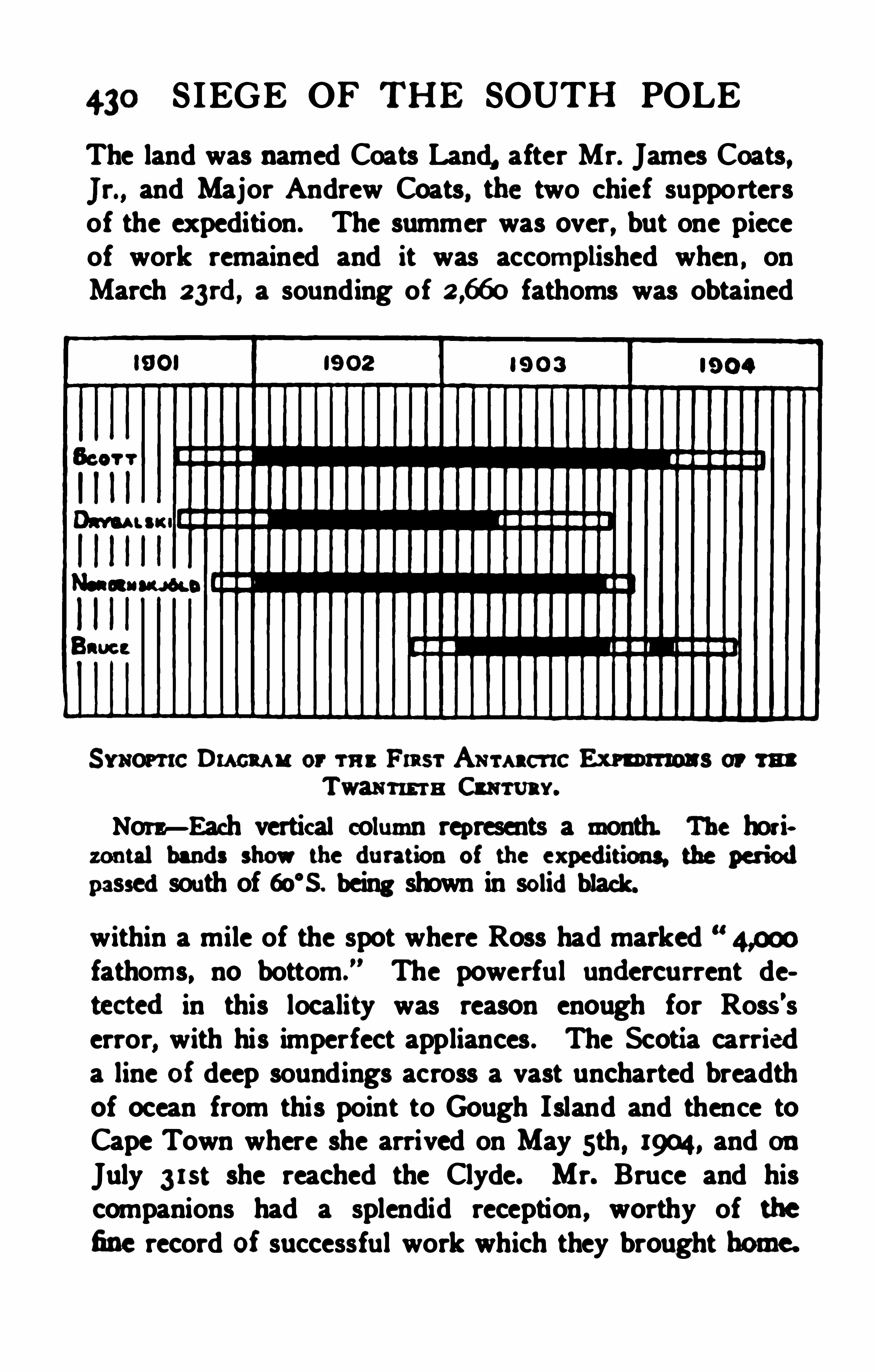
430 SIEGE OF THE SOUTH POLE
The land was named Coats Land, after Mr. James Coats,Jr., and Major Andrew Coats, the two chief supportersof the expedition. The summer was over, but one pieceof work remained and it was accomplished when , onMarch a3rd, a sounding of fathoms was obtained
S imona:Du cu u or rne Fmsr Amara-
xc Eno rmou s or mTwain-m a Cm uav.
Nora—Each vertical column represents a month. The horiozontal bands show the duration of the ex peditions the periodpassedsouth of 60‘s. being shown in solidblack.
within a mile of the spot where Ross had markedfathoms, no bottom .
” The powerful undercurrent detectedin this locality was reason enough for Rosa’serror
,with his imperfect appliances . The Scotia carried
a line of deep soundings across a vast uncharted breadthof ocean from this point to Gough Island and thence toCape Town where she arrived on May sth , 1904, and onJuly 3 xst she reached the Clyde. Mr. Bruce and hiscompanions had a splendid reception , worthy of thefine record of successful work which they brought home.


THE TWENTIETH CENTURY 43:
Mr. Mossman remained at OmondHouse, Scotia Bay,Laurie Island , unti l February , 1905, when an Argentinevessel brought him back to Buenos Aires after spendingtwo years in unbroken hourly observations in the desolateice- swept is land.
The relation between the various expeditions as regardsdate and duration may be shown in the form of a synopticdiagram, but it must be remembered that it was only theexpedition of the Discovery under Scott which winteredsouth of the Antarctic circle.The last expedition to which reference has to be madeis that equipped by Dr. Jean Charcot in the Francais, avessel built at St. Malo in 1903 for the purpose of Arcticexploration. When it became apparent that Nordensi ld had been obliged to pass a second winter in the farsouth Charcot resolved to go to his relief and had reachedTierra del Fuego when the Argentine gunboat Uruguayreturned with the rescued party. H is original objecthaving been attained by others, Dr. Charcot resolved toproceed onindependent exploration , and so for the secondtime the French flag entered the seas about the SouthShetlands. The Francais proceeded southward throughGerlache Strait, solved the problem of the BismarckStrait of Dallmann by proving it to be a bay, sightedAlexander I. Land but could not land upon it on accountof the ice, and did an important service in charting thewestern coast of the islands of Palmer Archipelago. Thework occupied the two Antarctic summers of 1903-04 and1904
-05, the intervening winter of 1904 having been spentin the ice. Some anxiety was felt as to the fate of theFrench expedition when she did not return in February,1905, and this was increased when the Uruguay, afterembarking Mr. Mossman at the South Orkneys , visited
432 SIEGE OF THE SOUTH POLE
Wiencke Island in Gerlache Strait andfound no news ata place where Dr. Charcot hadpromised to leave information as to his whereabouts . However the good shipFrancais, in spite of severe experiences inthe ice andofdamage which might easi ly have beenfatal, was destinedto prove another example of the good fortune which hasalways smuedonAntarctic ex ploration and, extricatingherself, she entered Puerto Madrin in the ArgentineRepublic, all well, onMarch 4th , 1905.
Thus ends the brilliant opening of the twentieth century onthe edge of Terra Incognita.

434 SIEGE OF THE SOUTH POLE
tiative. The Royal Society responded at intervals toexternal stimulus
,but its action was secondary to that
of the British Association in the case of Ross’s voyage,and in the Discovery expedition it was a partner with theRoyal Geographical Society, which itself had existed formore than s ixty years before taking any action to bringabout ex ploration in the Antarctic regions. Though anEnderby
,a Newnes, a Longstafi and a Coats did much
to make up for the sluggishness and lack of persistenceof the learned societies they by no means occupied theplace of a Prince Henry giving a life- long devotion tothe single cause of specific ex ploration.
When the Sixth International Geographical Congresslaid the foundation of the recent revival of Antarcticresearch there was some prospect of a new era of steadyadvance being entered upon through continuous effortunder an international arrangement. The condition of
things had vastly changed since the time of Cook or evenof Ross, both from the intellectual standpoint and inmateri al resources. The Antarctic circle is now onlya week’s easy steaming from British colonies or Argentine ports presenting all facilities for refitt ing, and forming convenient sites for permanent bases ; the value of
continuous observations of climatic conditions is fullyunderstood , and the existence of extraordinarydifi'
erences
in -the navigabil ity of polar seas from year to year hasbeen definitely ascertained. The recent ex peditions werehowever all pretty much on the old plan , spending threemonths in going to their points of attack and three morein coming back ; and as each came home it was held asdone with , the stores bought at a great price were soldby auction for what they would fetch , the fine ships builtor specially equipped at immense cost were disposed of
RAISING OF THE S IEGE 435
for a fraction , to be altered and put to any uses to whichthey could be adapted.
The Antarctic perished honourably m the field of herlast achievements . The Gauss was sold to the CanadianGovernment to be used as an Arctic exploring vesselunder the versati le French-Canadian Captain Bernier, sothat her destiny is being carried out according to theoriginal design though at the other end of the world.
The Terra Nova also remains an exploring ship in theservice of a private United States Arctic expedition ; theMorning has reverted to her old whaling li fe ; the fateof the Scotia is unknown to us ; but the magnificentDiscovery , built to her innermost fastenings as a scientificship, fitted in every detail of her structure for the onepurpose for which she was designed, has sunk to mercantile uses which could be as well served by any commonsealer. The fickle public has tired of the Antarctic Regions, the learned societies have folded their hands, gladto finish ; the explorers , trained and toughened to theirwork, are scattered in the pursu it of their earlier occupations, and the few men of science who were interestedin these matters before the spasm came are still as faras ever from the realisation of a plan for exploration atonce economical in men, money, and ships, continuous,thorough , and promising success.The International Geographical Congress at its meeting in New York in September, 1904 , before the dispersal , while there seemed yet time, recorded this resolution
The Eighth International Geographical Congressrealising that the only untouched fields for geographicaldiscovery are the regions immediately surrounding thepoles of the Earth, desires to place on record its sense
436 S IEGE or THE SOUTH POLE
of the importance of forthwith completing the systematicexploration of the polar areas . It is verydesirable thatthe ex perience gainedby men of science andofficers inthe recent Antarctic ex peditions shouldbe turnedto cc
count by following up withou tdelay the successes theyhaw obtained. The Congress recognises that the Arcticregions possess a more immediate interest for the peopleof North America , and expresses the confident hope thatthe expeditions now being prepared will be so supportedas to secure early and complete success.We have italicised the essential part of the resolutionso far as it affects the purpose of this book ; but there isno present prospect of the pious opinion being translatedinto action.
Recognising that there must be a breach of continuityin Antarctic exploration, and confident that it will revivein the future, we venture to suggest some leading principles that might tend to make the next crisis of theexploring fever less intense and more effective.The first imperative duty is to have the results of therecent expeditions worked up,
” a phrase that is perhapsmysti fying to the general reader. It means that allobservations of latitude, longitude , and altitude are to becalculated ou t and util ised in the construction of an se
curate map . It means in the case of meteorological ,magnetic and other physical observations, the checkingof original records ; the application of all necessary corrections for errors of instruments ; the reduction ofautomatic records to figures ; the comparison of thesewith those obtained by other ex peditions contemporaneousor previous, and finally the discussion of the combineddata by constructing maps anddiagrams so as to reveel
the conditionof things to be ex pectedthroughou t the area

438 SIEGE OF THE SOUTH POLE
responsibi lity of the scientific authorities lies in theeconomical and efficient expenditure of any funds thatmay be placedat their disposal. Perhaps they mightconsider that three or four vessels of about 500 tonseach, built on the whaler model, with engines capable ofdeveloping enough power to drive them at ten knots inan emergency
,would be a suitable fleet to be employed
on the service, and not for one cruise but for successiveyears . Two vessels might perhaps have their headquarters in Austral ia or New Zealand, the others in the Falkland Islands or in Magellan Strait , and neither coal nortime should be wasted in taking them back to Europe orNorth America between cruises.A suggested plan of operations might be to employ oneship in penetrating to a winter station, retaining one inreserve or working in the open sea at oceanographicalresearch . Two other ships might be used, starting fromthe neighbourhood of Kaiser Wilhelm II . Land, andfrom near Alexander Land, respectively, to cruise fromeast to west round the world in as high a southern latitudeas possible, keeping clear of the heavy pack, but pressingon the edge of the unknown whenever it can be done . I fone year yields little, a second might give better resultsin more favourable ice- conditions. This direction ofexploration has never been followed for any length oftime, although often recommended by the men who havetried to make a similar voyage in the opposite direction.
In every case the authorities at home have orderedvoyages to be made against the grain of the atmosphereand of the ice- drift. We believe that a vigorous eampaignof the kind indicated would cause a rapid shrinkage of the unknown area and reveal new openings forland exploration. It is time at any rate that someone
RAIS ING OF TH E SIEGE 439
should revisit the lands discovered by Biscoe, Balleny,D
'
Urville andWilkes , to see whether their sheathing of
ice has retreatedlilee the edge of Ross’s barrier, and toveri fy their pontions.Wintering parties might well be maintained at thehighest atta inable latitudes on the Victoria Land andGraham Land sides, while summer excursions seem to beinvited on the Great Barrier by means of light motorcars. These should not cost more andwould weigh lessthan balloons and their equipment, the inutility of whichwas shown by the successful ascents from the Discoveryand Gauss. If a motor car ran at the rate of only fivemiles an hour for a couple of days before it broke down ,it would give a sledge party a depot far from their mainbase and allow of the inspection of a much greater areathan could otherw ise be examined. Nor is it now toomuch to hope that continuous communication might bekept up by means of wireless telegraphy.While it is important to study every kind of natural phenomena minutely, we are inclined to lay moreimmediate stress on wiping the reproach of Terra Incognita from the surface of our little globe. We are notashamed to say that we would make the efi
'
ort to reachthe pole the chief purpose of exploration , until it isachieved. The pole once attained with difficulty wouldafterwards be reached with ease, and all needful observations of natural phenomena could be carried out there andon the way thither far better when the crude difficultiesof travelling in unknown surroundings have been overcome, and when there is no unscientific hankering afterrecord-breaking to distract attention from serious ifmonotonous work. We believe that the price of a battleship would conqu er all the secrets oi the South ; not with
440 S IEGE OF THE SOUTH POLE
out risk, but stillwith far less risk thanwouldbe metwithout a thought in a naval engagement, or in say, tenyears of football. The argument of risk to li fe is the mostcontemptible ever put forward to cover the deep- rootedindifierence to the advancement of knowledge underlyingmost excuses of the kind.
Whenever a m edplan of deliberate, systematicexp loration is undertaken , as some day it may be, it shouldbe a point of honour, after selecting a competent commander—and such men abound—to tell him in generalterms what he is to try to do, and then leave him a freehand as to how he is to do it. When such an explorerreturns, his work should be tested before he is eitherrewarded or blamed, and there should be no more scruplein blaming an explorer who does notdo his best than incensuring a naval officer who fails in his duty, while therewards for success should be at least as generous in thefuture as they have been in the past.Our plan for the completion of exploration is simplyto substitu te systematic for spasmodic methods ; to followup successes and retri eve failures, to make the accomplishment of the end in view more important than a saferetum, andabove allnot to buy a ship or hire amanuntilthemeans are provided for carrying out the whole schemewith every material promise of success. The old methodhas ceased to be satisfactory though it has led to magnificent incidents. The new method may be said to havebeen already introduced by Mr. Mossman's two years of
the South Orkneys which seem likely to be followed upby the most progressive and scientific of Spanish Americans , the people of the Argentine Republic.Now that the Antarctic ships which inaugurated the

A P P E N DIX
HISTORY OF ANTARCTIO EXPLORATION .
Ramaun. Ant /IND. Le Cont inent Austral, hypotheses et
dlconvertes. Paris, 1893.Fltcm , KARL. Antarktis. Berlin, 1898. Translated as TheAntarctic Regions . London, 1900.
Neon/urn, G. von. Au] sum S iidpol! 45 Jahre Wirkens sur
Ffirdemng der Erforsclmng der S iidpolar-Region, 1855~
1900. Berlin, 1901.
MILL, HUGH Roam . Antarctic Bibliography. In The Antarctic Manual, London, 1901.
Baton, Enwm Swnrr. Antarctica Philadelphia, 1903.Geocm mcu . Jam ar. London, 2 vol". yearly. (S ince 1893this Journal, which is the oficial publication of the RoyalGeographical Society, has given the fullest recordof Antarctic Ex ploration publishedin any language.)
VOYAGES BEFORE COOK.
Dm vune. Am w m H istori cal Collection of the several
Voyages andDiscoveries in the S outh Pacific Ocean. 2 vols.London, I770- I77I.
Cam x oea, J. Terra Australis Cognita, or Voyages to the
Terra Aus tralis or S outhern Hemisphere during the six
teenth, seventeenth, andeighteenth centuries. 3 vols. Edinburgh, 1766-68.
Bum“ , Janss. ChronologicalH istory of the Discoveries inthe S outh S ea or Pacific Ocean. 5 vols. London, 1803 - 17.
Ru sum u , Y. J.de. Relationdcden: Voyagesdans les rnmAustral“ etdes Indes. Paris, 1782.
444 APPENDIX
THE PRINCIPAL ANTARCTIC VOYAGES SINCE 1770.
In the following list the names of the leader andof h is shipare usedas an indication of the voyage. Thedescription of thevoyage willbe foundin the works whose titles follow.
Cook, James , with the Resolution andAdventure, 17711- 1775Coon, Jan a. A voyage towards the S outh P ole andRoundthe World, performedinhis Majesty’s S hips the ResolutionandAdventure in the years 1772-75 inwhich is includedCaptain Furneaux
’
s narrative of his proceedings in the
Adventureduring the separationof the ships. 3 vols. London, 1777.
(Th is work has beenrepublishedinmany editions andinvarious languages. )Possum, GEORGE. A voyage roundthe worldinH . M. S loopResolution commandedby CaptainCook, 177275. 2 vols.London, 1777.
Foasrn, JOH N REINBOLD. Observations, madeduring a voyage
roundthe World, onPhysical Geography, NaturalHistoryandE thic Philosophy. London, 1778
Su m m er, ANDREW. Voyage to the Cape of GoodHope,towards the Antarctic Circle androundthe World, butchiefly into the country of the Hottcntots andCafires from1772-76. Translatedfrom the Swedish. 2 vols. London,1785.
(This work ex ists inmany translations. In the Englisheditiononly sevenpages aredevotedto the Antarctic part ofthe voyage )
Smith, William, with the brig Williams, 1819-ao.
Mums , J. Account of thediscovery of N ew S outh S hetland,with observations of i ts importance ina geographical, cornrnercialandpoliticalpoint of view. (Inthe Edinburgh PhilosophicalJournal, vol. 3 , (1820) pp. 367-3811 )
(YOUNG, Du ] Notice of the Voyage of EdsvardBransficld,master of his Majesty’s S hip Andromache, to N ew S ou th
S hetland(in the Edinburgh Philoi ophical Journal, vol. 4.
(1821) pp

446 APPENDIX
Ma nn, Bu ry/mm. A narrative of four voyages to the
S ou th S ea, N orth andS ou th Pacific Ocean, Chinese S ea,
E thiopic andS ou thernA tlantic Ocean, IndianandAntarcticOcean. From the year 1822- 1831. New York, 1833 .
Footer, H enry, in H . M . 8. Chanticleer, M 30.
WEBSTER, W. H. B. Narrative of a voyage to the S ou thern
Atlantic Oceanin1828- 30, inH . M. Sloop Chanticleer, underthe commandof CaptainHenry Foster. 2 vols. London,1834.
Biscoe, John, with the Tula andLively (Avery) , 1830-32.
Bxsooe, Joan. Recent Discoveries inthe Antarctic Ocean, fromthe log- book of the brig Tula. (Inthe Journalof the RoyalGeographicalS ociety. London. Vol. 3 pp. 105
838003 . Joan. Journalof a Voyage towardthe South Pole onboardthe brig Tula, with the cutter Lively inCompany.
(Inthe AntarcticManual. London, 1903. Pp. 305
Balleny, John, with the Eliza Scott and Sabrina (H . Freeman) ,1838-39
M u ms, Joan. Discoveries inthe Antarctic Ocean inFebruo
ary, 1839. (Inthe Journalof the RoyalGeographicalS ociety,London. Vol. 9 (1839) pp. 517-526. Reprinted in the Antarctic Manual, 1901 , pp. 336
Mom , a au . E x tract from the log of the S chooner ElisaS cott while south of 55
° S . lat , 1839. (In the Antartic
Manual. London, 1901, pp. 348-359. There 13 nothing in the
originallog to show that it was written by John MacNab, towhom it is creditedin the Antarctic Manual.)
Dumont D’Urville, with the Astrolabe andZelée (Jacquinot ) ,
1837-4a.
Dunan‘
t D'
Uavnu t. J . S . C. Voyage ou Pdle S udet dansfOceanie sur les corvettes l
’Astrolabe et la Zelle es ecu ti
par ordredu Roi pendant 1837- 40. H istoire du voyage, 23
vols. A tlas , 6 vols. Paris,(The chaptersdealing with the Antarctic part of the cru iseare translatedin the Antarctic Manual. Loam
APPENDIX 447
Duu onr D'
Um u .z, J. S . C. Rapport a M. le M inistrede tomarine et des colonies. (In the Bulletinde la S ocietedeGeographic. P aris, ence Serie. Vol. 33 (3840) pp . 345
Wilkes, Charles, with the American Ex ploring Ex pedition in the
the last four vessels commandedon the Antarctic part of thecruise at one time or another by William L. Hudson, Cadwalader Ringgold, William M . Walker, James W. E . Reid,SamuelR. Knox , andR. F. P inkney.
Wa x es, Cannes. Narrative of the E x ploring Ex pedition, byAuthority of Congress, during the years 1838- 1842. 5 vols.Philadelphia, 1845.CALLAB AN , Jeans Mam a. AmericanRelations in the Pacificandthe Far East. (In Johns Hopkins Universi ty S tudies,Baltimore, 1901. Thisdescrib es the circumstances leading tothedispatch of the E x pedition. )Wa x es, Camu s. Defence !inthe Court-martial Proceedings] .(This pamphlet appears to have been printedfor presentationinCourt, andwas seen in the library of Columbia University,N ew York. )
Bacon, Enwxn Swm . Antarctica. Philadelphia, 1901.
M. Crozier) , in 1839- 43.
Ross, Ju les Cu nt . A Voyage ofdiscovery andresearch inthe S outhernandAntarctic Regionsduring the years 1839-43.
2 vols. London, 3847.
McCoau rcx , Rom r. Voyages of Discovery in the Arctic andAntarctic S eas androundthe World 2 vols. London,1334
Moore, T. E . in the P agoda. 1845.Moon, T. E. L. Magnetic Voyage of the Pagoda. (In theNauticalMagasine, London, 1846, pp. 23
Dtcx soa, Wanna. The Antarctic Voyage of H er Majesty’shiredbarque Pagoda. (In the UnitedS ervice Magazine,London,
Tapsell, in the Brink. 3850.Ennm v, Cam s. Note on Sabrina Land. (In the P ro
ceedings of the RoyalGeographicalS ociety, London. Vol. 3
91» 1714 73 )
448 APPENDIX
Nat-ea, George S ., in the Challenger, 1874.
Mum v, Joan (andothers) . Narrative of the Cruise ofH . M. S . Challenger. Vol. 1. (Chapters viii- x idealwith theAntarctic portionof the cru ise. ) London. 1885.
CAu PBnL, Loan Gm Log letters from the Challenger.London. 1876.
Sew , W. J. J. The Cruise of HerMajesty’s S hip Challenger.
Mosm r, H. N. N otes of a Naturalist on the Challenger.
Dallmann. Eduard, in the Gronland, 1873-74.
Scnvcx , A. Entwickelung unserer Kenntniss der Lander intS ilden vanAmerica. (In the Zeitschrift fi r wissenschaft
liche Geographic, Weimar. Vol. 6 pp.
Dundee Whaling Fleet . in 1893 -3. including the Balcna (Capt.Fairweather. with W. 8. Bruce andW. Burn Murdoch on
board) . and the Active (Capt. T. Robertson, with Dr. C. W .
Donaldonboard) .BURN Mum s , W. G. Front Edinburgh to the Antarctic, an
Artist'
s notes andsketches during the Dundee AntarcticE x pedition of 18924 3. with a chapter by W. S . Bruce.
London. 1894.
a cz, Wins/m S . Cruise of the Balcna andthe Active inthe Antarctic S eas, 1895 93. P art I. The Balcna. (In the
GeographicalJournal, London. Vol. 7 pp. 502
DONALD, Camu s W. Cruise of the Balana andthe Active inthe Antarctic S eas, 1892-93. P art 11. The Active. (In the
GeographicalJournal, London. Vol. 7 pp . 635
Lumen, C. A, inthe Jason. 1892-93.
(See references in accounts of the Dundee Whaling Fleetsupra.)
Larsen, C. A.. inthe Jason, along with the H ertha (Evensen)andthe Cantor (Pedereen) , in 1893 -94.
Lu ann, C. A. The voyage of the Jason to the Antarctic Regions. (In the Geographical Journal, London. Vol. 4
pp. 333 -
344. 466

450 APPENDIX
volumes. Jena, 1902 onwards.
Borchgrevink. Caratana Egeberg. in the Southern. Croa(Bernhard Jeam ) , 18984 900.
Boacacam nx , Cans-sens Ecu a c. First on the Antarctic
Continent, being anaccount of the British Antarctic E x pedition, 1898- 1900. London. 1901 .
Bau u cca x. 143018. To the S outh Polar Regions. Ex peditionof 18984 900. London, 1901.!Ban
-
13a Mam a . ) Report onthe Collections of NaturalH istory made in the Antarctic Regionsduring the voyage of the
Scott, Robert Falcon, in the D iscovery. followedby the H orning (Colbeck) andthe Terra N ova (Manny) , 1901- 1904.(See references in the GeographicalJournal. )
Drygalaki, E rich van, in the Gauss (Hans Runes) , 1901- 1903.
DavaALs , Eaten VON . Zuni Kontinent des eisigen S tidens.
Deutsche S iidpolarex pedition. FahrtenundForschungen ter
N ordenakjhld, Otto, in the Antarctic (C. A. Larsen) , 1901
1903Noanensuyow, 0110; J. (301mm Anm sson. C. A. LAW ,
andC. S x orrsnm . Antarctic. Zwei Jahre in S chnee andBis ant S iidpol. NachdernS chwedirhenOriginalins DeutschiibertragenvonMathilde Mann. 2 vols. Berlin, 1904.
Noant nsu j iiw . 0110. andJ . Gunnar Anm sson. Antarctica,or Two Years amongst the Ice of the S outh Pole. Londom1905.
Bmce William sn in the Scotia Whomaa Rohertaon) . 19m1904.
(See references in the S cottish GeographicalMagazine,
ou nce jm minthe l'm h ms-m
INDEX
Admiralty Range. 274Airy, S ir G. B., Astronomer
Royal. 342Alex ander I. Landd1seovered, 1d
American enterprise in the
Antarctic regions, 92American Ex ploring Ex pedi
Antarctic, The, 424, 435Antarctic circle, first crossed
Antarctic Continent. The, 236.
Antarctic nigbt. 391
Aristotle’s theory of the
earth's form. 4
Bache, 179
Balleny Islands. The. 169Balleny andRoss meet, 261Balleny. John. 167Banks, Mn, (afterwards S ir)Joseph. 67
Bay of Islands. Thc. 344Belgian Antarctic E x ploration. 385
10a. 115. 1ao
Biscoe, John, 147Borchgrevink, Carstens Egebers. 380. $4. 395
Bouvet Island. 143» 3270
Bouvet. Lozier, 45Bove, Lieutenant, 365Bransfield. Edward. 96
tee on the question of aSouth Polar voyage. 189
British South Polar E x pedi
Brosses. M. Charles de. 50Bruce. Mr. William S ., 372,
Buffets
4s2
Awardedthe Copley medal.by the Royal Society, 85
Hawkesworth’
s account of
Cook’s first voyage, 63Instructions for secondvoyage. 66Parentage and early life,
Prepares for his secondvoyage. 64
Reaches his most southerlyPoint. 75
Returnfrom his secondvoyage. 84
The log of his first voyage,611
Cook, Dr. F. A., 387Cosmas Indicopleu stes, 13Cowley, Ambrose, 39- 40
Crozier, Commander Francis,353
Dallman. Captain Eduard,36a
Dalrymple, Alex ander, 56-57Death of, 86
Imaginary lands, 79, 81Dana, James D., 220
Diaz, Bartholomew, 19—20Discovery, The start of the.
The fate of the, 435The retu rn of the, 419Drake, S ir Francis, 32Drygalski. Dr. Erich. 407. 420D
'
Urville, Captain Dumont,164. 194
D’Urville. Jules SebastienCésar Dumont, 194
INDEX
Earth's form,
mates, 4Enderby Brothers, The
of. 92
Enderby Brothers, 146
Erebus andTerror in a
Early
Incollision, 307
Fanning, Mr. Edmund, 98, 104,t 1a
Fernandez. Juan, 31Foster, CaptainHenry, 144Fox ton, J. G., 166
Franklin, S ir John. 254, 256,
266. 268-269. 289. 331 - 332
Gardiner, Captain Allen. 3 15Gauss, Johann K. E ., 181
Gauss. The. 420. 435
Geographical Congress, S ix thInternational, £4
GeographicalCongress at N ewYork, The Eighth International, 435
Geographical Society. The
Royal, founded. 176
Georgia, Isle of , 81Gerlache. Adrian de, 385German Antarctic E x peditionunder Drygalski, 407, 420
German Society for PolarNavigation, 360
Gerritsz, Dirk, 34-35
Graham Land, 161
Graham, S ir James, 161
Gravelius, Professor, Abstractof Russian cruise, 1 14

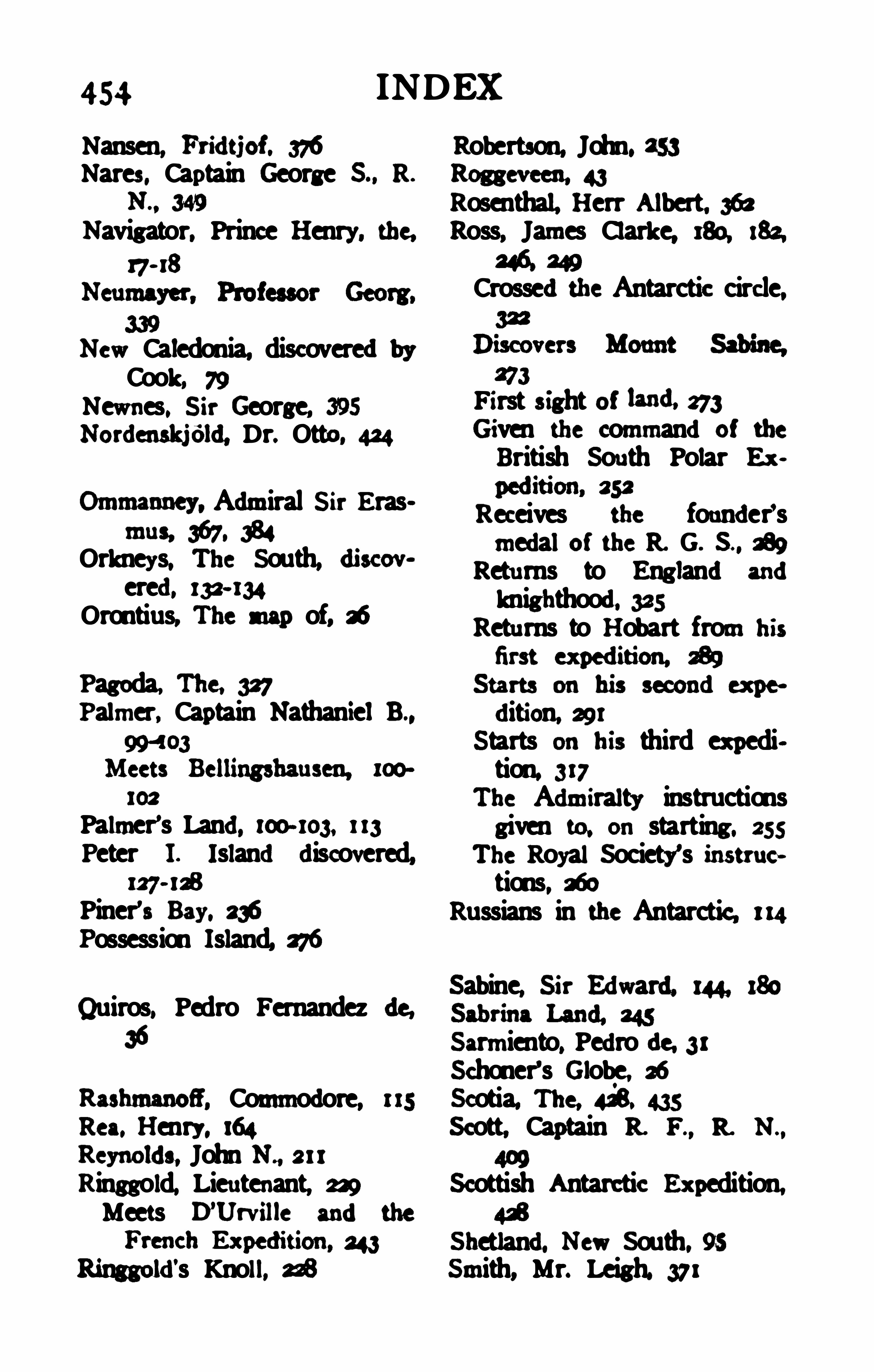
454 INDEX
Nansen, Fridtiof . 376 Robertson, John. 253Nares, Captain George S ., R. Roggeveen, 43
N . , 349 Rosenthal, Herr Albert. 362Navigator. Prince Henry. the, Ross, James Clarke, 180, 182.
17- 18Crossedthe Antarctic circle,
New Caledonia, discoveredbyCook. 79 273
Newnes, S ir George, 395 First fi ght Of “ML273Nordenskjéld, Dr, Otto, 434 Given the commandOf the
British South Polar E x
Ommanney, Admiral S ir Erasmus 367. 384
Orkneys, The South, discovered, 132- 134
Orontius, The map of, i
Pagoda. The. 327Palmer, Captain NathanielB.,
994 03
102
Palmer’s Land, 100- 103, 1 13
Peter I. Islanddiscovered,127- 1£
Piner’a Bay. 236Possession Island, 276
Sabin Sir Edward. 180
Quiros, Pedro Fernandez de,e, M
36 Sarmiento, Pedrode, 31Schoner’s Globe, 26
Rashmanofi, Commodore, Scotia, The, 423. 435Rea. Henry. 164 Scott, Captain R. F ., R. N .,
Reynolds, John N ., 211
Ringgold, Lieutenant, 229 Scottish Antarctic Ex pedition,Meets D’
Urville andthe
Shetland. New South. 95Ringgold's Knoll, M Smith, Mr. Leigh. 371
Receives the founder'smedalof the R. G. S . , 289
Returns to Englandandknighthood. 325
Returns to Hobart from his
dition, 291Starts on his third ex pedition. 317
The Admiralty instructionsgiven £0. on starting. 255
The Royal Society's instruc»tions, 360
Russians in the Antarctic, 1 14
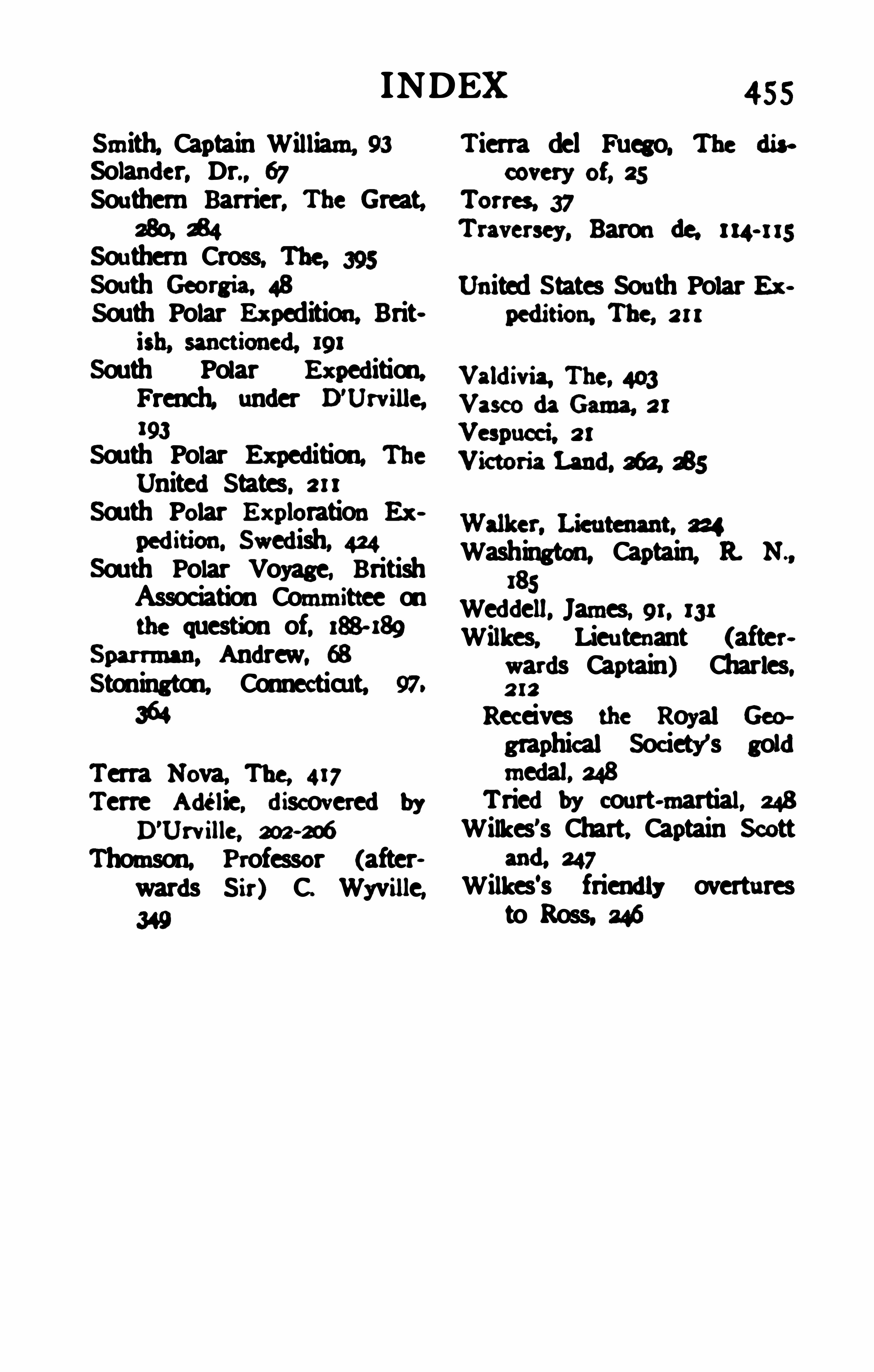
INDEX
Smith, Captain William, 93
Solander. Dr., 67Southern Barrier, The Great,
280. £4Southern Cross, The, 395South Georaia. 48South Polar Ex pedition. Brit
South Polar Ex pedition,French. under B
'Urville,
193
South Polar Ex pedition, TheUnitedStates, 211
South Polar E x ploration E x
pedition, Swedish, 424South Polar Voyage, BritishAssociation Committee onthe question of, 188- 189
Sparrman, Andrew, 68
Stonington. Connecticut. 97.
364
Terra Nova, The, 417Terre Adelie, discoveredby
D'
Urville, 202-206
Thomson, Professor (afterwards S ir) C. Wyville,
455
Tierra del Fuego, The discovery of. 25
Torres, 37Traversey, Baronde, 114- 1 15
United S tates Sou th Polar E xpedition, The, 211
Washington, Captain, 11 N .,
185Weddell, James, 91, 131Wilkes, Lieu tenant (after
wards Captain) Charles,212
Receives the Royal Geo
graphical Society’s goldmedal. 248
Triedby court-martial, 248
Wilkes’s Chart, Captain Scottand. 247
Wilkes‘s friendly overturesto Ross. 246