dobrogea: geography, history, geopolitics and geostrategy past, present and perspective
TRANSCRIPT
American Journal of Geophysics, Geochemistry and Geosystems
Vol. 1, No. 4, 2015, pp. 135-150
http://www.aiscience.org/journal/aj3g
* Corresponding author
E-mail address: [email protected]
Dobrogea: Geography, History, Geopolitics and Geostrategy Past, Present and Perspective
Romeo Bosneagu*
Navigation and Naval Transportation Department, Navigation and Naval Management Faculty, “Mircea cel Batran” Naval Academy, Constanta,
Romania
Abstract
As European country and NATO member, Dobrogea assures the interface of Romania with the Southeast of Europe as well as
with Near and Far East. Therefore, as a result of the political and military changes from the Black Sea’s basin, the geopolitical
and geostrategical importance of this geographical region raised up and in future it will develop more.
Keywords
Dobrogea, Geography, Romania, Geopolitics, Present, Perspective
Received: July 10, 2015 / Accepted: July 18, 2015 / Published online: August 2, 2015
@ 2015 The Authors. Published by American Institute of Science. This Open Access article is under the CC BY-NC license.
http://creativecommons.org/licenses/by-nc/4.0/
1. Introduction
The Romania's geostrategic importance and of Dobrogea,
implicitly, has determined Romania to adhere to NATO in
2004 and to be accepted in the EU in 2007. Today, Romania
is part of the eastern flank of NATO in Europe.
The sovereignty, independence and integrity of Romania are
conceived having in view the national geographical space,
where Dobrogea has its geographical, geopolitical and
geostrategical importance. The geopolitics and the
geostrategy are essential for the act of government of a state
and for Romania these have at the base the national and
international space geography, close and far off. The terms
having defined value from the political equation – the
military power of the states and the geographical factor
generate the geo-political and şi geo-strategical mediums
where the states are moving, they define the geographical and
military areas where the actions of political power,
economical, financial, ecological and military are designed,
respectively, the influence and interest areas. Particularly, the
geopolitics has in view the interferences with the political
medium, although, the influences of the geographical factor
to the human communities are more extensive. The
connection is not directly achieved, but, through the
significations associated with a multitude of factors, such as:
social, economical, demographic, military, cultural,
ideological, technical, etc. Coherently, it can be saying that
the geopolitics studies the political play between the states,
being conditioned and explicitly upon the geographical basis.
The geographical factor subordinates a multitude of elements
that implicitly generates a variety of political, military and
strategical significance, that directly depend of: the geogra-
phical settlement, population, the border lines and their
structure, the relief, the hydrographical network, the riches
and the efficiency of their utilization, the material resources
and the ecological condition. Currently, the concept of region
is not clear. The theoretical approaches are heterogeneous,
depending on the school that performs analyzes as regards
the regions, their political and geopolitical role, the factors
taken into consideration. Even from lexical point of view, the
approach of the terms region, "regionalization" reflects this
variety of meanings and approaches. For example, it talks
about the region, regionalization, regionalism, areas building,
regional integration, sub-regionalism, Region (regionness),
about the differences between the region and spaces that are
not and can not be considered regions (regionhood). Thus,
despite a rich literature on this topic, which attempts the

136 Romeo Bosneagu: Dobrogea: Geography, History, Geopolitics and Geostrategy Past, Present and Perspective
explanation, understanding, predicting the emer
regions growth and development, there is not a theory that
could encompass a credible explanation for the variety, the
specific of all the regions (Bogzeanu, 2012). In this work, we
approached the topic of Dobrogea as a geographically
distinct region with millennia history, with a geostrategic
Figure 1.
Source: https://ro.wikipedia.org/wiki/Organizarea_administrativ
%C4%83_a_Rom%C3%A2niei#/media/File:Greater_Romania.svg
b. the map of Romania between 1956-1964, with
Dobrogea as an administrative region (figure 2).
Figure 2.
Source: https://aliantadreptei.wordpress.com/2011/06/22/impartirea
administrativ-teritoriala-a-romaniei-1483-1995.
Romeo Bosneagu: Dobrogea: Geography, History, Geopolitics and Geostrategy Past, Present and Perspective
explanation, understanding, predicting the emergence, the
regions growth and development, there is not a theory that
could encompass a credible explanation for the variety, the
specific of all the regions (Bogzeanu, 2012). In this work, we
ached the topic of Dobrogea as a geographically
distinct region with millennia history, with a geostrategic
importance which has not diminished, but it had increased till
today. To illustrate the existence of Dobrogea as a Romanian
region we present below:
a. the map of Greater Romania (1920
provinces (figure 1)
Figure 1. Greater Romania Historical Provinces, 1920-1944.
https://ro.wikipedia.org/wiki/Organizarea_administrativ-teritorial
%C4%83_a_Rom%C3%A2niei#/media/File:Greater_Romania.svg
1964, with
Dobrogea as an administrative region (figure 2).
Figure 2. The administrative division of Romania during 1956-1964.
https://aliantadreptei.wordpress.com/2011/06/22/impartirea-
Romeo Bosneagu: Dobrogea: Geography, History, Geopolitics and Geostrategy Past, Present and Perspective
importance which has not diminished, but it had increased till
today. To illustrate the existence of Dobrogea as a Romanian
the map of Greater Romania (1920-1944) with its historic
American Journal of Geophysics, Geochemistry and Geosystems Vol. 1, No. 4, 2015, pp. 135-150 137
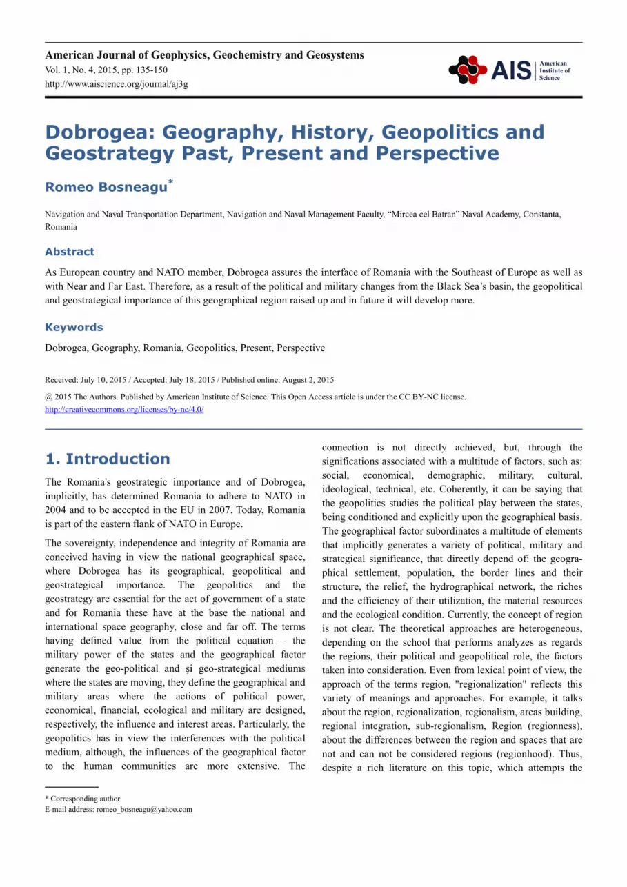
2. Dobrogea - Geography
Dobrogea is outlining as a distinct geographic space towards
the remainder Romania, having specific features, comprising
in an entity land, seaside, sea, river and delta, as well, each of
these geographic spaces having a specific history. This region
stretches between 45030’ latitude from north, 43040’ latitude
from south, 29050’ longitude at east and 27030’ longitude at
west and it has a surface of 15.571 km2 (figure 3).
Figure 3. Dobrogea Psysical Map.
Source: processing from http://www.geotutorials.ro/atlas-geografic-1980

138 Romeo Bosneagu: Dobrogea: Geography, History, Geopolitics and Geostrategy Past, Present and Perspective
Dobrogea is an ancient precincts of civilization, with distinct
influence as regards the Romanian nation forming and
development and of the Romanian political structures, as
well. The Romanian people millenary settleme
region was happened due to: its favourable geographic
characteristics found here, the lands' positioning among water,
circumstances that have encouraged the living, food
procurement, defence and trade in this region.
During its history, because of the geographic position, this
land was exploited by various peoples, and then, after the
independence war, Dobrogea became again a Romanian land.
Also, the necessity of its geographic knowledge, of the
development from political, social, economical poin
views, and of its defence, as well, became acutely. It can be
shown that this phenomenon is continued in present, too, but
in a new manner of approach. In the context of the
contemporary political and military phenomenon, considered
after the end of the cold war and of some doctrinary options
as regards the states' military policy, the conception regarding
the national defence includes the defence of Dobrogea region
in a new vision, as well.
For the Romanian state, Dobrogea and its sea
presenting political and economical interest, represent
through their importance, the exit gate to the Planet Ocean
that represents the future' s resources space. Romania can be
Figure 5. European inland corridor Danube
Source: https://upload.wikimedia.org/wikipedia/commons/8/87/Constanta
The European inland waterways network is characterized as
follows: it focuses the inland navigation from nine big rivers
(Danube, Main, Rhine, Rhone, Marne, Seine, Moselle, Saon,
Romeo Bosneagu: Dobrogea: Geography, History, Geopolitics and Geostrategy Past, Present and Perspective
Dobrogea is an ancient precincts of civilization, with distinct
influence as regards the Romanian nation forming and
development and of the Romanian political structures, as
well. The Romanian people millenary settlement in this
region was happened due to: its favourable geographic
characteristics found here, the lands' positioning among water,
circumstances that have encouraged the living, food
procurement, defence and trade in this region.
of the geographic position, this
land was exploited by various peoples, and then, after the
independence war, Dobrogea became again a Romanian land.
Also, the necessity of its geographic knowledge, of the
development from political, social, economical point of
views, and of its defence, as well, became acutely. It can be
shown that this phenomenon is continued in present, too, but
in a new manner of approach. In the context of the
contemporary political and military phenomenon, considered
he cold war and of some doctrinary options
as regards the states' military policy, the conception regarding
the national defence includes the defence of Dobrogea region
For the Romanian state, Dobrogea and its sea-borne space
enting political and economical interest, represent
through their importance, the exit gate to the Planet Ocean –
that represents the future' s resources space. Romania can be
integrated into the united Europe as an unitary territory from
physical, geographical, historical, ethnical, linguistic, cultural
and military point of views.
The best example is the integration of the Danube
Sea Canal in the European inland waterways network. The
river route between Rotterdam and Constanta is the shortest
link between North Sea and Black Sea, by the rivers Rhine,
Main, Main-Danube Canal, the Danube and the Danube
Black Sea Canal (figure 4, 5).
Figure 4. European inland navigable route Black Sea
Source: processing from http://www.ghidtransport.ro/
European inland corridor Danube - Rhin - Maine with major ports.
kimedia.org/wikipedia/commons/8/87/Constanta -Rotterdam_DE.PNG
The European inland waterways network is characterized as
follows: it focuses the inland navigation from nine big rivers
(Danube, Main, Rhine, Rhone, Marne, Seine, Moselle, Saon,
and Loire) and 18 inland canals; it liaises the inland
waterway between 18 European countries; crossing eight
European capitals; the river cargo ships perform the cargo
Romeo Bosneagu: Dobrogea: Geography, History, Geopolitics and Geostrategy Past, Present and Perspective
integrated into the united Europe as an unitary territory from
hical, historical, ethnical, linguistic, cultural
The best example is the integration of the Danube – Black
Sea Canal in the European inland waterways network. The
river route between Rotterdam and Constanta is the shortest
k between North Sea and Black Sea, by the rivers Rhine,
Danube Canal, the Danube and the Danube -
European inland navigable route Black Sea-North Sea.
Source: processing from http://www.ghidtransport.ro/harta-europei.html
and Loire) and 18 inland canals; it liaises the inland
ropean countries; crossing eight
European capitals; the river cargo ships perform the cargo
American Journal of Geophysics, Geochemistry and Geosystems Vol. 1, No. 4, 2015, pp. 135-150 139
and passenger traffic between 15 seaports and over 40 river
ports; provides water communications through inland
between the Atlantic Ocean, Mediterranean Sea, North Sea,
Baltic Sea and Black Sea.
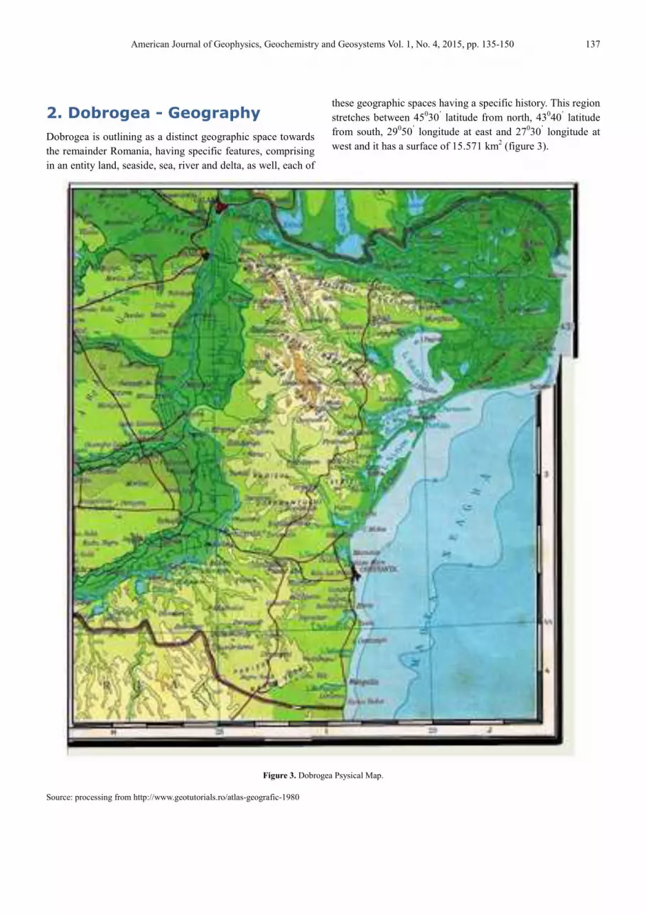
In brief, the European inland waterways has the following
configuration (Figure 6): Danube-Black Sea, Poarta Alba-
Midia Canal - Navodari or Sulina Channel; Danube to
Regensburg; from Rhine - Main-Danube Canal from
Regensburg to the North Sea (Rotterdam); from the Rhine-
Main-Danube canal by Central Canal German – Elba Canal –
North Sea – Kiel Canal – Kiel Bay; from Baltic Sea, or
through Oder-Spree and Odel-Havel Canals to Szczecin
(Baltic Sea); from Frankfurt by the Rhine-Rhone Canal and
the Marne-Rhine Canal to Le Havre (English Channel); by
the Rhine – Rhone-Rhine Canal, Moselle-Saone Canal,
Burgundy Canal, French Central Canal – Loire – Nantes-
Brest Canal to the Atlantic Ocean; by Rhine – Rhone-Rhine
Canal, Saone-Moselle Canal – Burgundy Canal, Rhone to the
Mediterranean Sea.
Figure 6. European inland waterways network.
Source:http://www.stratfor.com/sites/default/files/styles/stratfor_full/public/
main/images/Europewaterways_800.jpg?itok=UzpZk_mF
3. Dobrogea – History
Throughout its millenary history, Dobrogea has experienced
several periods of historical development that we can call sui
generis: Thracian Dobrogea period, Dobrogean Coasts Greek
colonization, Roman Dobrogea period, Byzantine Dobrogea
period, Ottoman Dobrogea period and modern Dobrogea - an
integral part of modern and independent Romania. Each of
these periods has its own characteristics, but which have
developed as a result of these places history integrating into
European history of the Black Sea Basin.
Thracian peoples were the first known ancient peoples who
lived on the present-day Romania territory, and on the
Romanian Dobrogea present territory, appointed by ancient
historians Gets or Dacians. Starting with the 7th century AC,
the Black Sea coasts (Pontus Euxinus), including Dobrogea
coasts are colonized by Greeks, who bilded major ports-cities
here: Aegyssos, Halmyris, Axiopolis, Argamum, Histria,
Tomis, Callatis. Then, this territory came under the control of
ancient Macedonians, Dacian Kings or Mitridates the VIth
Eupator (134-63 AC), King of Pontus in the 119-63 AC
period. In the year 28 AC, Dobrogea falls in the Roman rule
within the Roman province of Moesia Inferior. It should be
mentioned that, between 55-44 years AC, Dobrogea and the
Greek port-cities were included in the Dacian state of
Burebista. The first barbarian people appear in Dobrogea in
the 3rd century AD (Goths, Gepids, Avars, etc.). In 395,
Dobrogea enters in the Byzantine Empire structure (Eastern
Roman Empire), under the name of Scythia Minor (Boşneagu,
2004).
We present below a map of Dacia (figure 7), included by
Ortelius into the historical section of the book of maps
Theatrum Orbis Terrarum. This Ortelian work is distin-
guished by richness of information and texts inspired from
ancient authors (here, it is attempted for the first time the
geographical placing within the course of the river Sargetia,
of the place where ….king Decebal has buried his treasure,
being an information that will appear on the following maps,
too), but also, by insertion of Ovid's verses, liable for the
praise of the Getae's bravery (the presentation in English of
this map is taken from the website - National Museum of
Maps and Rare Books, http://www.muzeulhartilor.ro/). The
map was engraved in copper, hand-made coloured,
accompanied by an explicative text in Latin language. It
includes populations settled down on the Dacia's territory,
The Dacians' Hearth and on the right side of the Danube, too,
territory occupied and mostly controlled mostly by the
Getae-Dacians. At left, below, there is the title and, on the
bottom of the page, there is inserted a caption comprising
Dacian localities, waters and mountains with their old
naming. At right, on top, there is a dedication by which A.
Ortelius is mentioned as librarian to the Bavaria duke's court.
On the bottom of page, there are recorded 4 verses written by
Ovid in his 'Pontices'. The present map was also achieved in
1624 in the A. Ortelius' book of maps, included a Latin text
and published in Anvers (the map no. XXX), entitled Theatri
Orbis terrarus Parergon…Antverpiae (the presentation in
English of this map was taken from the website - Bucharest,
Romania, National Museum of Maps and Rare Books
http://www.muzeulhartilor.ro/).

140 Romeo Bosneagu: Dobrogea: Geography, History, Geopolitics and Geostrategy Past, Present and Perspective
Figure 7. DACIARVM, MOESSIARVM: QUE, VETVS DESCRIPTIO,
Anvers approx. 1595 chart. Source: http://altmarius.ning.com/profiles/blogs/muzeul
The emperor Justinian the Great, the Ist (525
Christian Byzantine emperor, who tried to bring together the
two Roman Empires, had fortified the fortresses located
along the Danube. There were restored over 90 fortresses, out
of which around 50 in Dobrogea: Abrittus, Aegyssus,
Axiopolis, Callatis, Carsium. Durustorum, Noviodunum,
Odessos, Tomis, Troesmis, Ulmetum, Bassidina, Diniscarta,
Padisara, Residina, Sacidava, Zaldapa, Zisnudava, A Silva,
Castellonovo, Gemellomuntes, Maurovalle). He made
changes in the church field once with the military
reorganization. In Scythia Minor, they were 15 bishoprics
subordinated to Tomis Metropolitan Church. A
534, Dobrogea is invaded by Huns, then by Avars and
Bulgarians, and the region gradually decades (Rădulescu,
Bitoleanu, 1998).
The Romanian academician Mircea Maliţa is among the first
Romanian scientists who speaks about the "
Road" hypothesis. He was among the first specialists who
Romeo Bosneagu: Dobrogea: Geography, History, Geopolitics and Geostrategy Past, Present and Perspective
DACIARVM, MOESSIARVM: QUE, VETVS DESCRIPTIO,
http://altmarius.ning.com/profiles/blogs/muzeul-national-al-hartilor
The emperor Justinian the Great, the Ist (525-563 AD), a
Christian Byzantine emperor, who tried to bring together the
the fortresses located
along the Danube. There were restored over 90 fortresses, out
of which around 50 in Dobrogea: Abrittus, Aegyssus,
Axiopolis, Callatis, Carsium. Durustorum, Noviodunum,
Odessos, Tomis, Troesmis, Ulmetum, Bassidina, Diniscarta,
ra, Residina, Sacidava, Zaldapa, Zisnudava, A Silva,
Castellonovo, Gemellomuntes, Maurovalle). He made
changes in the church field once with the military
reorganization. In Scythia Minor, they were 15 bishoprics
subordinated to Tomis Metropolitan Church. After the year
534, Dobrogea is invaded by Huns, then by Avars and
Bulgarians, and the region gradually decades (Rădulescu,
a is among the first
Romanian scientists who speaks about the "Dobrogean Silk
" hypothesis. He was among the first specialists who
were able to study a mysterious Chinese map which indicates
Dobrogea as a land crossed by one of the Chinese trade
routes. The map is now in the History Museum from Beijing
and comes from the Tang Dynasty, who ruled China between
618 and 907 AD. On this map it appears a mysterious route
belonging to the Silk Road, that detours the Caspian Sea and
the northern Black Sea and in the inferior side through
Dobrogea to Byzantium. It is not known exactly who
this map, which are its foundations, and for how long it func
tioned this secondary road. It is known that many Asian
merchants arrived in Crimean peninsula, where they often
descended to Constantinople on merchant ships board. But,
this map is the first evidence of a land route that would have
been part of the ancient Silk Road through the present
Dobrogea region. In figure 8 it is shown a map of the Silk
Road (300 BC-100 AD), where the author has traced “the
Dobrogean Silk Road”.
Romeo Bosneagu: Dobrogea: Geography, History, Geopolitics and Geostrategy Past, Present and Perspective
were able to study a mysterious Chinese map which indicates
Dobrogea as a land crossed by one of the Chinese trade
routes. The map is now in the History Museum from Beijing
nasty, who ruled China between
618 and 907 AD. On this map it appears a mysterious route
belonging to the Silk Road, that detours the Caspian Sea and
the northern Black Sea and in the inferior side through
Dobrogea to Byzantium. It is not known exactly who made
this map, which are its foundations, and for how long it func-
tioned this secondary road. It is known that many Asian
merchants arrived in Crimean peninsula, where they often
descended to Constantinople on merchant ships board. But,
irst evidence of a land route that would have
been part of the ancient Silk Road through the present
Dobrogea region. In figure 8 it is shown a map of the Silk
100 AD), where the author has traced “the

American Journal of Geophysics, Geochemistry and Geosystems
Source : processing from https://daciqum.files.wordpress.com/2013/02/
Between 1185-1320, Dobrogea falls under the domination of
Vlach-Bulgarian Tsarat (Regnum Bulgarorum et Valachorum)
Dobrogea becomes independent under the name
of Cărvuna, called into the modern historiography "The
Despotate of Dobrogea". During this time, in this area it was
spoken the "dician" idiom (Vâlsan, 1927), mentioned as
dialect of Romanian language and influenced by Greek
language (perceptible influence by some names of plants or
animals and particularly fishes, through naming of sailing
and fishing tools). In 1357, Dobrotici (Dobrotiţă) (figure 9)
declares itself despot of Cărvunei (1347-1386). The new
is named Dobrogea, after Dobrotici name. In 1366, the
Byzantine Emperor Ioan Paleolog the Vth
Buda and trying to obtain help in his campaign against
Dobrogea, is captured in Varna. A new campaign led by
Amedeo the VIth of Savoy and supported by Venice and
Genoa, attempts to free the emperor. After Amedeo’s
conquering of some southern cities, Dobrotici negotiates the
peace releasing the emperor and married his daughter with
Michael, the emperor’s son (Rădulescu, Bitoleanu, 1998).
In 1369, Dobrotici, together with his ally Vladislav the I
prince of Romanian Country helped Ivan Straţimir to return
to the throne of Vidin. On this occasion, Drârstor (Silistra)
and Chilia had been passed to the Romanian Country. In
1379, Muntenia and Dobrogea fleets blocked Genoese fleet
in front of Constantinople. The Despot of Dobrogea included
territories belonging today to Bulgaria (in the south) and to
Romania (in the north), with a mixed population in the
seaports, composed of Bulgarian, Romanian and
well as Greeks, Armenians and Genoveses. The capital was
in Cărvuna (Kavarna, Bulgaria) and the fortress at Kaliakra
(figure 10). Over the existence, its borders had been several
times modified, including Constanţa and Mangalia seaports
American Journal of Geophysics, Geochemistry and Geosystems Vol. 1, No. 4, 2015, pp. 135
Figure 8. Ancient Silk Road 300 BC – AD 100.
https://daciqum.files.wordpress.com/2013/02/ drumul-matasii.jpg
1320, Dobrogea falls under the domination of
Regnum Bulgarorum et Valachorum).
ea becomes independent under the name Principality
called into the modern historiography "The
Despotate of Dobrogea". During this time, in this area it was
" idiom (Vâlsan, 1927), mentioned as
influenced by Greek
language (perceptible influence by some names of plants or
animals and particularly fishes, through naming of sailing
and fishing tools). In 1357, Dobrotici (Dobrotiţă) (figure 9)
1386). The new state
is named Dobrogea, after Dobrotici name. In 1366, the
visited Rome and
Buda and trying to obtain help in his campaign against
Dobrogea, is captured in Varna. A new campaign led by
upported by Venice and
Genoa, attempts to free the emperor. After Amedeo’s
conquering of some southern cities, Dobrotici negotiates the
peace releasing the emperor and married his daughter with
Michael, the emperor’s son (Rădulescu, Bitoleanu, 1998).
69, Dobrotici, together with his ally Vladislav the Ist,
prince of Romanian Country helped Ivan Straţimir to return
to the throne of Vidin. On this occasion, Drârstor (Silistra)
and Chilia had been passed to the Romanian Country. In
ogea fleets blocked Genoese fleet
in front of Constantinople. The Despot of Dobrogea included
territories belonging today to Bulgaria (in the south) and to
Romania (in the north), with a mixed population in the
seaports, composed of Bulgarian, Romanian and Tatars as
well as Greeks, Armenians and Genoveses. The capital was
in Cărvuna (Kavarna, Bulgaria) and the fortress at Kaliakra
(figure 10). Over the existence, its borders had been several
times modified, including Constanţa and Mangalia seaports
(ancient cities Tomis and Callatis, as well), where the
Genoese had representatives.
Figure 9. Dobrotici (Dobrotiţă) Statue in Kavarna.
Photo: author, 2014.
Figure 10. Caliacra fortress entrance.
Photo: author, 2013
2015, pp. 135-150 141
cities Tomis and Callatis, as well), where the
Dobrotici (Dobrotiţă) Statue in Kavarna.
Caliacra fortress entrance.

142 Romeo Bosneagu: Dobrogea: Geography, History, Geopolitics and Geostrategy Past, Present and Perspective
In 1386, Dobrotici dies and Ivanko or Ioan
the throne, who accepted the peace with Sultan Murad the I
of the Ottoman Empire and signed a commercial treaty with
Genoa. Ivanko died in 1388 during the expedition of the
Great Vizier Çandarli Ali Pasha against Tarnovo Tsarat
Dârstor city belonging then to the Romanian Country). After
the expedition, more than a half of Dobrogea territory entered
under the domination of the Ottoman Empire, while the
Northern Dobrogea will be part of the Romanian Country.
Source: https://daciqum.files.wordpress.com/2013/01/harta
The third Ottoman occupation took place between 1397 and
1404. In 1402, it begins at Ankara a period of anarchy in the
Ottoman Empire after the defeat by Timur Lenk of Bayezid
the Ist. In 1403, Romanian king Mircea occupies the Genoese
fortress Licostomo from the Danube’s mouths, regaining
Dobrogea in 1404. After this event, he wil
dynastic struggles from the Ottoman Empire. After King
Mircea's death in 1418, his son Mihail the I
against the Turks and in 1420, he lost his life in a battle. In
that year, the Sultan Mehmed the Ist conquered Dobrogea, the
Romanian Country remaining only with Danube Delta, but
not for long time. A map of Johannis Baptista Homanni,
dated (1663-1724), is included within the context of that age
representations (figure 12).
The exaggeration as regards the Serpent’s Island remained till
now, and the delta is drawn like a large island, crossed by
several arms. The Dobrogea territory is designated as
Romeo Bosneagu: Dobrogea: Geography, History, Geopolitics and Geostrategy Past, Present and Perspective
dies and Ivanko or Ioan succeeds him to
the throne, who accepted the peace with Sultan Murad the Ist
of the Ottoman Empire and signed a commercial treaty with
Genoa. Ivanko died in 1388 during the expedition of the
Tarnovo Tsarat (and
or city belonging then to the Romanian Country). After
the expedition, more than a half of Dobrogea territory entered
under the domination of the Ottoman Empire, while the
Northern Dobrogea will be part of the Romanian Country.
Between 1352-1359, the Roman
possession the Danube’s mouths, with Obluciţa (Izmail) and
Chilia cities as well as the Serpent’s Island. In 1388/9, the
Romanian king, Mircea the Old joined Dobrogea to the
Romanian Country. In 1393, Bayezid the I
southern of Dobrogea and attacked the king Mircea in his
territory, but without success, and in 1395, Mircea regained
the lost territories with the help of the Hungarian King
(figure 11).
Figure 11. Iacopo Caftaldo Map.
https://daciqum.files.wordpress.com/2013/01/harta-rara.jpg
The third Ottoman occupation took place between 1397 and
gins at Ankara a period of anarchy in the
Ottoman Empire after the defeat by Timur Lenk of Bayezid
. In 1403, Romanian king Mircea occupies the Genoese
fortress Licostomo from the Danube’s mouths, regaining
Dobrogea in 1404. After this event, he will involve into the
dynastic struggles from the Ottoman Empire. After King
Mircea's death in 1418, his son Mihail the Ist, resumes battles
against the Turks and in 1420, he lost his life in a battle. In
conquered Dobrogea, the
Romanian Country remaining only with Danube Delta, but
not for long time. A map of Johannis Baptista Homanni,
1724), is included within the context of that age
Island remained till
now, and the delta is drawn like a large island, crossed by
several arms. The Dobrogea territory is designated as
Romania, many mistakenly interpreting this information,
respectively, the direct reference to Dobrogea having
affiliation to the Romanian area. The map was scanned from
Romulus Seişanu’s work - Dobrogea, the Mouths of the
Danube and Serpent’s Island
documents. Universul Newspaper Publishing House,1928, pg.
24 (Constantinescu, 2006).
As regards the entry moment of Dobrogea in the Turkish
definitive domination, the historians opinions are divided
(Iorga, 1898). The great Romanian historian, Nicolae Iorga
thinks that this territory had definitively come under Ottoman
rule in 1416. Also, there are a number of historians who
considered that Dobrogea fell gradually under Ottoman rule,
in multiple stages (figure 13). After the conquest of
Dobrogea, the Ottomans turned it into a
province, after that, in 1599, was establishe
which included (all) Dobrogea, Budjak and Edisan.
Romeo Bosneagu: Dobrogea: Geography, History, Geopolitics and Geostrategy Past, Present and Perspective
1359, the Romanian Country take into
possession the Danube’s mouths, with Obluciţa (Izmail) and
Chilia cities as well as the Serpent’s Island. In 1388/9, the
Romanian king, Mircea the Old joined Dobrogea to the
Romanian Country. In 1393, Bayezid the Ist conquered the
thern of Dobrogea and attacked the king Mircea in his
territory, but without success, and in 1395, Mircea regained
the lost territories with the help of the Hungarian King
Romania, many mistakenly interpreting this information,
respectively, the direct reference to Dobrogea having an old
affiliation to the Romanian area. The map was scanned from
Dobrogea, the Mouths of the
Island. Monograph. Studies and
Newspaper Publishing House,1928, pg.
As regards the entry moment of Dobrogea in the Turkish
definitive domination, the historians opinions are divided
(Iorga, 1898). The great Romanian historian, Nicolae Iorga
thinks that this territory had definitively come under Ottoman
there are a number of historians who
considered that Dobrogea fell gradually under Ottoman rule,
in multiple stages (figure 13). After the conquest of
Dobrogea, the Ottomans turned it into a Sangeac of Rumelia
province, after that, in 1599, was established Silistra Elayet,
which included (all) Dobrogea, Budjak and Edisan.
American Journal of Geophysics, Geochemistry and Geosystems
Figure 12. J.B.Homanni Map.
Source:http://www.geo-spatial.org/articole/ii-litoralul-
documente-cartografice-perioada-medievala II Romania shorelines in
cartographic documents, Ştefan Constantinescu
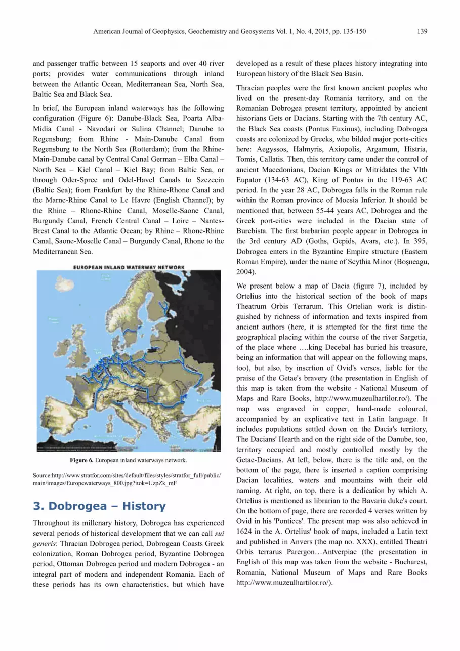
In the XVIIth century, they have been added much of
Bulgaria and European today Turkey to this Elayet. In 1864,
the territory remained from Silistra Elayet was converted into
the Danube Vilayet (northern Danube parts being annexed by
the Russian Empire) (Iorga, 1898).
Figure 13. W. Faden Chart, 1795, published in London
Dominions of the Ottomans, or Turkey in Europe.
Source: http://www.geo-spatial.org/articole/ii
documente-cartografice-perioada-medievala II Romania shorelines in
cartographic documents, Ştefan Constantinescu; this map was obtained from
W. F. Institute of Archaeological Research, being public domain
Under the Ottoman rule, Dobrogea, in addition to Muslim
Turks and Tatars settled here and increasingly numerous,
American Journal of Geophysics, Geochemistry and Geosystems Vol. 1, No. 4, 2015, pp. 135
-romanesc-in-
Romania shorelines in
century, they have been added much of
rkey to this Elayet. In 1864,
the territory remained from Silistra Elayet was converted into
the Danube Vilayet (northern Danube parts being annexed by
W. Faden Chart, 1795, published in London-European
nions of the Ottomans, or Turkey in Europe.
spatial.org/articole/ii-litoralul-romanesc-in-
Romania shorelines in
; this map was obtained from
, being public domain
Under the Ottoman rule, Dobrogea, in addition to Muslim
Turks and Tatars settled here and increasingly numerous,
further comprising a local population composed of Romanian,
Bulgarian, Spanish Hebrew, Armenian, Gagauz, Greeks,
Gypsies. The Romanian Dobrogea
themselves Dicieni (that name comes from Vicina fortress
and mentioned in the medieval chronicles), (figure 14), were
raia (the Ottomans’ subjects), and consequently, they had to
pay like everyone else, the
Muslim population), while, the Romanians came from the
city of Sibiu, Moldavia or Romanian Country, named
(shepherds) were partially exempted (Nicoară, 2006).
For the Ottoman Empire, Dobrogea had a high strategic
importance by: maintaining a perman
base against Poland and Russian states, being in process of
centralization; ensuring a permanent link with the Crimean
Khanate, provider of auxiliaries troops; control of the
commercial road passing through Dobrogea, coming from
Poland and crossing Moldavia; supervision of the Romanian
Principalities attitude, that were in a continual rebellion; the
control of the Danube River, an important trade route and
difficult obstacle, especially for a large army.
During more than four centurie
unverifiable but important number of Christians passed to the
Muslim religion, to escape of this tribute, thus, a part of
Dobrogean Turkish-Muslims are originally Christians, in fact.
Begining with 1840, the Germans were settled in Do
known as Dobrogean Germans and they have established a
number of new localities. In 1940, most of these inhabitants
having German origin, respectively, around 16,000, have left
the territory of Dobrogea.
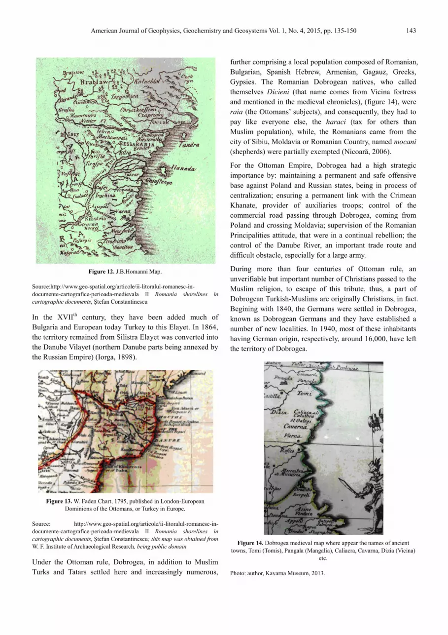
Figure 14. Dobrogea medieval map where app
towns, Tomi (Tomis), Pangala (Mangalia), Caliacra, Cavarna, Dizia (Vicina)
etc.
Photo: author, Kavarna Museum, 2013.
2015, pp. 135-150 143
further comprising a local population composed of Romanian,
Bulgarian, Spanish Hebrew, Armenian, Gagauz, Greeks,
Gypsies. The Romanian Dobrogean natives, who called
(that name comes from Vicina fortress
and mentioned in the medieval chronicles), (figure 14), were
subjects), and consequently, they had to
pay like everyone else, the haraci (tax for others than
Muslim population), while, the Romanians came from the
city of Sibiu, Moldavia or Romanian Country, named mocani
(shepherds) were partially exempted (Nicoară, 2006).
For the Ottoman Empire, Dobrogea had a high strategic
importance by: maintaining a permanent and safe offensive
base against Poland and Russian states, being in process of
centralization; ensuring a permanent link with the Crimean
Khanate, provider of auxiliaries troops; control of the
commercial road passing through Dobrogea, coming from
nd and crossing Moldavia; supervision of the Romanian
Principalities attitude, that were in a continual rebellion; the
control of the Danube River, an important trade route and
difficult obstacle, especially for a large army.
During more than four centuries of Ottoman rule, an
unverifiable but important number of Christians passed to the
Muslim religion, to escape of this tribute, thus, a part of
Muslims are originally Christians, in fact.
Begining with 1840, the Germans were settled in Dobrogea,
known as Dobrogean Germans and they have established a
number of new localities. In 1940, most of these inhabitants
respectively, around 16,000, have left
Dobrogea medieval map where appear the names of ancient
towns, Tomi (Tomis), Pangala (Mangalia), Caliacra, Cavarna, Dizia (Vicina)
etc.
Photo: author, Kavarna Museum, 2013.

144 Romeo Bosneagu: Dobrogea: Geography, History, Geopolitics and Geostrategy Past, Present and Perspective
In 9 th of May, 1877, after the Romanian’s Independence War,
Romania declared its independence. In 1878, Romania w
recognized as an independent state through the Peace Treaty
from Berlin and her authority over Dobrogea was restored, as
well. Also, through the port of Constanţa Romania realised
its exit to the Black Sea. Instead of these, Russia obtained the
Danube’s mouths and takes into possession the southern
Bessarabia counties, that had been previously returned to
Romania through the Peace Treaty from Paris, in 1856.
During the Romania's communist era (1947
Source: http://casa-regala.blogspot.ro/2009/01/impartirea
The geopolitical advantages of the modern Dobrogea consist
of its geographical position, its links with Europe, its
population, its economic strength, energy and mineral
resources.
Today, Dobrogea includes: 1) the Constanţa county, located
in the south-eastern part of Romania, having a surface of
7071 km2 (representing 3% from the total surface of
Romania), respectively, being the eighth largest counties of
the country. At December, 31th, 2012, the Constanta County
included: 8 cities and 3 municipalities, 54 communes and 189
villages, having a population of 684,082 inhabitants, a
turnover of 47.661 billion Romanian Lei, an agricultural
production of 2,747.5 Romanian Lei
Romeo Bosneagu: Dobrogea: Geography, History, Geopolitics and Geostrategy Past, Present and Perspective
Independence War,
Romania declared its independence. In 1878, Romania was
recognized as an independent state through the Peace Treaty
from Berlin and her authority over Dobrogea was restored, as
well. Also, through the port of Constanţa Romania realised
its exit to the Black Sea. Instead of these, Russia obtained the
mouths and takes into possession the southern
Bessarabia counties, that had been previously returned to
Romania through the Peace Treaty from Paris, in 1856.
During the Romania's communist era (1947-1989), the
economy of the region grows, new industries a
shipyards, maritime and river ports are being modernized, it
is constructed the Danube-Black Sea Canal, it is developing
an intensive agriculture, and it begins the mineral resources
exploitation of the Romanian Black Sea continental shelf.
Since 1989 (the year of the Romanian Anticommunist
Revolution), Dobrogea is part of the Romanian national
process of building of a democratic capitalist society in
Romania, in this process existing minuses and achievements,
as well.
Figure 15. Romania's administrative organization.
regala.blogspot.ro/2009/01/impartirea-administrativ-teritoriala.html.
The geopolitical advantages of the modern Dobrogea consist
of its geographical position, its links with Europe, its
economic strength, energy and mineral
Today, Dobrogea includes: 1) the Constanţa county, located
eastern part of Romania, having a surface of
(representing 3% from the total surface of
th largest counties of
, 2012, the Constanta County
included: 8 cities and 3 municipalities, 54 communes and 189
villages, having a population of 684,082 inhabitants, a
turnover of 47.661 billion Romanian Lei, an agricultural
production of 2,747.5 Romanian Lei
(http://www.constanta.insse.ro, 2011), and 2) the Tulcea
County, located in the northern part of Dobrogea, with an
area of 8,499 km2, a population of 213,083 people, a turnover
of 5.405 billion Romania Lei, an agricultura
1.496 billion Romanian Lei. At the same date, the Tulcea
County included: 5 cities, 1 municipality, 46 communes and
133 villages. (http://www.tulcea.insse.ro/,2011
The actual Romania's administrative organization,
tively in judeţe (counties), where appear the Dobrogean
Constanta and Tulcea counties, too, is shown in figure 15.
The Romanian Black Sea coasts (244 km), together with the
Bulgarian Black Sea Coasts (378 km), (out of a total of 4,047
km of Black Sea coastlines), is part of the EU's eastern
Romeo Bosneagu: Dobrogea: Geography, History, Geopolitics and Geostrategy Past, Present and Perspective
economy of the region grows, new industries appear,
shipyards, maritime and river ports are being modernized, it
Black Sea Canal, it is developing
an intensive agriculture, and it begins the mineral resources
exploitation of the Romanian Black Sea continental shelf.
989 (the year of the Romanian Anticommunist
Revolution), Dobrogea is part of the Romanian national
process of building of a democratic capitalist society in
Romania, in this process existing minuses and achievements,
(http://www.constanta.insse.ro, 2011), and 2) the Tulcea
County, located in the northern part of Dobrogea, with an
, a population of 213,083 people, a turnover
of 5.405 billion Romania Lei, an agricultural production of
1.496 billion Romanian Lei. At the same date, the Tulcea
County included: 5 cities, 1 municipality, 46 communes and
http://www.tulcea.insse.ro/,2011).
strative organization, respect-
(counties), where appear the Dobrogean
Constanta and Tulcea counties, too, is shown in figure 15.
The Romanian Black Sea coasts (244 km), together with the
Bulgarian Black Sea Coasts (378 km), (out of a total of 4,047
km of Black Sea coastlines), is part of the EU's eastern
American Journal of Geophysics, Geochemistry and Geosystems Vol. 1, No. 4, 2015, pp. 135-150 145
maritime facade, Dobrogea being a Europe's maritime border
region with Near East. The Romania's Black Sea exit is done
via its seaports, respectively: Constanţa (the eastern
extremity of the European transport corridor on European
inland waters of Danube-Rhine-Maine), Mangalia, Midia and
Sulina river port (the eastern extremity of the Danube
European corridor).
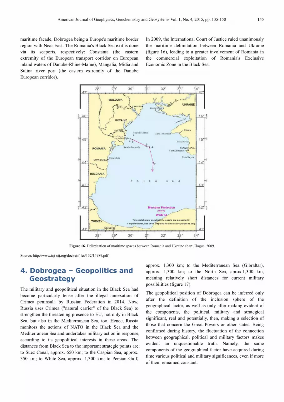
In 2009, the International Court of Justice ruled unanimously
the maritime delimitation between Romania and Ukraine
(figure 16), leading to a greater involvement of Romania in
the commercial exploitation of Romania's Exclusive
Economic Zone in the Black Sea.
Figure 16. Delimitation of maritime spaces between Romania and Ukraine chart, Hague, 2009.
Source: http://www.icj-cij.org/docket/files/132/14989.pdf
4. Dobrogea – Geopolitics and Geostrategy
The military and geopolitical situation in the Black Sea had
become particularly tense after the illegal annexation of
Crimea peninsula by Russian Federation in 2014. Now,
Russia uses Crimea ("natural carrier" of the Black Sea) to
strengthen the threatening presence to EU, not only in Black
Sea, but also in the Mediterranean Sea, too. Hence, Russia
monitors the actions of NATO in the Black Sea and the
Mediterranean Sea and undertakes military action in response,
according to its geopolitical interests in these areas. The
distances from Black Sea to the important strategic points are:
to Suez Canal, approx. 650 km; to the Caspian Sea, approx.
350 km; to White Sea, approx. 1,300 km; to Persian Gulf,
approx. 1,300 km; to the Mediterranean Sea (Gibraltar),
approx. 1,300 km; to the North Sea, aprox.1,300 km,
meaning relatively short distances for current military
possibilities (figure 17).
The geopolitical position of Dobrogea can be inferred only
after the definition of the inclusion sphere of the
geographical factor, as well as only after making evident of
the components, the political, military and strategical
significant, real and potentially, then, making a selection of
those that concern the Great Powers or other states. Being
confirmed during history, the fluctuation of the connection
between geographical, political and military factors makes
evident an unquestionable truth. Namely, the same
components of the geographical factor have acquired during
time various political and military significances, even if more
of them remained constant.

146 Romeo Bosneagu: Dobrogea: Geography, History, Geopolitics and Geostrategy Past, Present and Perspective
In Ancient times and Middle Ages, the Black Sea
for a long time a region with obvious geopolitical
significances. In the course of the history, it was controlled
by Greeks, Genoveses, Turkish and by Moldavians and
Russians, as well.
Figure 17. The distances from Black Sea to several importan
Source: processing from http://www.geotutorials.ro/atlas
In the Modern Age, it became again an area of major interest,
fact that led to the modification of the geopolitical position of
the Romanian Countries, too. In fact, the three geogra
elements, having a major importance, that define the position
of Romania in Europe are: the position to Danube's Mouths,
the access to Black Sea and the Carpathian Chain. These
three elements have major geopolitical significances and
their possession generates special advantages. Two of these
elements define and confer content for the geographical
space of Dobrogea: Danube's Mouths and Black Sea.
The Danube – Black Sea Canal became a very important
objective, particularly, it had been created a river
communication between North Sea and Black Sea, once, the
canal Rhin – Main – Danube was completed. Both terminals
of these, respectively, Danube Delta and the Canal are on the
Romanian state territory, namely, in the geographical space
of Dobrogea. Romania will dominate Danube's Mouths,
inclusively the Canal, only if it will keep Dobrogea in
possession. The Black Sea communicates to the Aegean Sea
and Mediterranean Sea through Bosphorus and Dardanelles
narrows, (also, to Azov Sea through Kerci na
in this way the access of Romania to the Planet Ocean.
Considering the geopolitical perspective and having in view
their strategical importance, these arguments will essentially
contribute to the increase of the share and importance of the
Romanian state and they simultaneously confirm as clear as
Romeo Bosneagu: Dobrogea: Geography, History, Geopolitics and Geostrategy Past, Present and Perspective
In Ancient times and Middle Ages, the Black Sea area was
for a long time a region with obvious geopolitical
significances. In the course of the history, it was controlled
by Greeks, Genoveses, Turkish and by Moldavians and
The distances from Black Sea to several important areas.
Source: processing from http://www.geotutorials.ro/atlas-europa/
In the Modern Age, it became again an area of major interest,
fact that led to the modification of the geopolitical position of
the Romanian Countries, too. In fact, the three geographical
elements, having a major importance, that define the position
of Romania in Europe are: the position to Danube's Mouths,
the access to Black Sea and the Carpathian Chain. These
three elements have major geopolitical significances and
n generates special advantages. Two of these
elements define and confer content for the geographical
space of Dobrogea: Danube's Mouths and Black Sea.
Black Sea Canal became a very important
objective, particularly, it had been created a riverine way of
communication between North Sea and Black Sea, once, the
Danube was completed. Both terminals
of these, respectively, Danube Delta and the Canal are on the
Romanian state territory, namely, in the geographical space
ea. Romania will dominate Danube's Mouths,
inclusively the Canal, only if it will keep Dobrogea in
possession. The Black Sea communicates to the Aegean Sea
and Mediterranean Sea through Bosphorus and Dardanelles
narrows, (also, to Azov Sea through Kerci narrow), assuring
in this way the access of Romania to the Planet Ocean.
Considering the geopolitical perspective and having in view
their strategical importance, these arguments will essentially
contribute to the increase of the share and importance of the
Romanian state and they simultaneously confirm as clear as
possible that Dobrogea could have its own statute, when we
talk about the geostrategical and geopolitical position.
The geographical space is only one of the defining elements
of the geopolitical position, the second element being
represented by the forms and political significances that
define it. From this perspective, too, the history demonstrates
in a convincing manner that, during time, the political
structures had been superposed over the geog
existing an obvious connection between them. The
geographical decisive moment was always doubled by a
political and military decisive moment. We are settled in a
region where the neighbouring influences had interfered from
three directions: from Central Europe, from South of Balkans,
from East, respectively from Euroasian steppes. In all the
situations, the history shows us that, the forces that have
penetrated from South and exerted influence, they had been
superposed and intersected. Conse
South had always begun through the Pontic Basin domination.
That who possessed the Black Sea had necessarily felt to
extend the domination over the Carpathian area, too. The
Romans had proceeded in this manner, Dobrogea being
transformed into a roman province, event closely followed by
the conquest of the proper Dobrogea. Later, during the
Middle Age, the Ottoman Gate had acted in the same manner,
in 1417, Dobrogea being transformed in
ottomans took over the fortresses Chilia and Cetatea Albă
(1484), and, finaly, at the end of the first reign of Petru Rareş
(1527-1538), they took over the South of Moldavia.
Continuing the historical retrospective, we can affirm that the
references are real and they demonstrate t
Romania's geopolitical advantages actually generate the
biggest dangers directly for it. First of all, the neighbouring
with the Russian Empire signified a source of insecurity for
the Romanian Countries and later then, for the Romanian
state. In 1812, through the Peace from Bucharest, Russia
annexed the Romanian territory between Nistru and Prut
rivers, named it Bessarabia, province that they had dominated
until 1918. In the political context, resulted after the events
happened between 1917-1922, the Soviet Union has abided
the same imperial aims and, between 26
it addressed to the Romanian state notes of the nature of an
ultimatum through which it claimed Bessarabia and North
Bucovina, too. At that moment, being isola
and military points of view, Romania was obliged to resign
and, thus, the soviet Russia had temporary deprived the
Romanian state of two key geopolitical positions: the
Danube's Mouths and North Carpathians. After the Second
World War, the Soviet Union had maintained these positions.
In 1947, through the Peace Treaty from Paris and clearing up
the state frontiers, a protocol, signed between Molotov and
Petru Groza, confirms the state frontier between the two
Romeo Bosneagu: Dobrogea: Geography, History, Geopolitics and Geostrategy Past, Present and Perspective
possible that Dobrogea could have its own statute, when we
talk about the geostrategical and geopolitical position.
The geographical space is only one of the defining elements
osition, the second element being
represented by the forms and political significances that
define it. From this perspective, too, the history demonstrates
in a convincing manner that, during time, the political
structures had been superposed over the geographical space,
existing an obvious connection between them. The
geographical decisive moment was always doubled by a
political and military decisive moment. We are settled in a
region where the neighbouring influences had interfered from
from Central Europe, from South of Balkans,
from East, respectively from Euroasian steppes. In all the
situations, the history shows us that, the forces that have
penetrated from South and exerted influence, they had been
superposed and intersected. Consequently, the conquest from
South had always begun through the Pontic Basin domination.
That who possessed the Black Sea had necessarily felt to
extend the domination over the Carpathian area, too. The
Romans had proceeded in this manner, Dobrogea being
nsformed into a roman province, event closely followed by
the conquest of the proper Dobrogea. Later, during the
Middle Age, the Ottoman Gate had acted in the same manner,
in 1417, Dobrogea being transformed in Pashalic, then, the
rtresses Chilia and Cetatea Albă
(1484), and, finaly, at the end of the first reign of Petru Rareş
1538), they took over the South of Moldavia.
Continuing the historical retrospective, we can affirm that the
references are real and they demonstrate the truth that the
Romania's geopolitical advantages actually generate the
biggest dangers directly for it. First of all, the neighbouring
with the Russian Empire signified a source of insecurity for
the Romanian Countries and later then, for the Romanian
tate. In 1812, through the Peace from Bucharest, Russia
annexed the Romanian territory between Nistru and Prut
rivers, named it Bessarabia, province that they had dominated
until 1918. In the political context, resulted after the events
1922, the Soviet Union has abided
the same imperial aims and, between 26th-28th of June 1940,
it addressed to the Romanian state notes of the nature of an
ultimatum through which it claimed Bessarabia and North
Bucovina, too. At that moment, being isolated from political
and military points of view, Romania was obliged to resign
and, thus, the soviet Russia had temporary deprived the
Romanian state of two key geopolitical positions: the
Danube's Mouths and North Carpathians. After the Second
he Soviet Union had maintained these positions.
In 1947, through the Peace Treaty from Paris and clearing up
the state frontiers, a protocol, signed between Molotov and
Petru Groza, confirms the state frontier between the two
American Journal of Geophysics, Geochemistry and Geosystems Vol. 1, No. 4, 2015, pp. 135-150 147
countries from the Black Sea area, meaning the Serpents’
Island passed by to the Soviet Union. The parliaments of
these two countries had never analysed nor ratified the
mentioned protocol.
The teasing of the Soviet Empire determined the creation of
some new entities and a new neighbouring for our country.
The Moldavia Republic and Ukraine formed up, Moldavia
Republic comprising only a part of the Romanian territory
ravished in 1940.
Based on the decree of the Supreme Soviet, signed by Stalin
on 2nd of August 1940, Ukraine inherits a series of Romanian
territories, respectively, the South of Bessarabia and the
North of Bucovina, in fact, the access to two important
geopolitical positions: the Danube’s Mouths, the access ways
to Central Europe, being added the Serpents’ Island, too.
Besides the economical availabilities, Ukraine owns a
military imposing arsenal, inclusively nuclear armament. The
geographical and political neighbouring of Romania have
influenced many times our destiny, fact confirmed by the
whole historical evolution. It is proper to point out the
influences and direct interests in Dobrogea, in the perspective
of the millennium end and the beginning of the next
millennium. The last years emphasize spectacular changes in
this sense. One of these changes, maybe the biggest one, is
directly neighbouring ceasing with Russia. But this maintains
Transnistria bridge head, the 14th Army in Moldavia Republic
and the strategical superiority in the Black Sea. The relations
between Romanian state and Ukraine are still in a beginning
phase – referring to the diplomatic terms – although they
passed over two decades from their establishment and, also,
in this period, respectively in 1997, it was signed „The
Convention regarding the relations of good neighbouring and
co-operation between Romania and Ukraine”. The relations
are still in a beginning phase because, not only of the
Romanian territories being under Ukraine’s jurisdiction, but
also, of other problem, not negligible at all, respectively, the
delimitation of the exclusive economical area from the Black
Sea (solved through the Decision of the International Justice
Court from Hague, in 2009).
The return of these territories into the natural border-lines
would strengthen very much the geopolitical and strategical
advantages of Dobrogea and, implicitly, the position of
Romania. In South, the relations with Bulgaria are going to
normality. In 1992, between the two countries, it was signed
“The Convention for friendship, co-operation and good-
neighbouring between Romania and Republic of Bulgaria”.
In this Convention is stipulated that do not exist mutual
territorial pretensions, although, they will follow new
meetings in order to find a definitive and correct solution as
regards the maritime frontier.
In order to outline the image of the political frame in the area,
it is shown that the respective countries are in a difficult
transition process, that generates many economical, social
and moral problems. In order to surpass the situation, these
are in a real race, that includes a fierce competition between
them, too. This is the reason why this geopolitical space is
considered rather precarious, still being in a dispute.
However, there are some encouraging co-operation signs and
the argument is consisting in the foundation of the Black Sea
Economical Community (C.E.M.N.).
In June 1992, at Istanbul, the six riparian states: Bulgaria,
Georgia, Romania, Russia, Turkey and Ukraine, to which
Albania, Armenia, Azerbaidjan, Greece and Moldavia
Republic have adjoined, signed the convention for
O.C.E.M.N. foundation, being similarly with U.E.O. Serbia
has adhered to O.C.E.M.N. through the decision of the
Ministers Council of External Affairs, held in Erevan (18th of
April, 2003). The observers to O.C.E.M.N. are: Austria,
Egypt, Israel, Italy, Poland, Slovakia, Tunisia, France,
Germany, the Conference of the Energy Chart, the Black Sea
Committee, the European Committee, the Black Sea
International Club, Czech Republic, Croatia and Belarus.
The partners for the sectorial dialogue with OCEMN are:
Hungary, Great Britain, Montenegro, Jordan, Iran, Slovenia,
Japan, the Danube Committee, the Conference of the
Maritime Regions, Outlying to Europe, the Union of the
Road Carriers Associations from OCEMN region and the
Black Sea Universities Network. In 1998, at Yalta, it was
signed ”the CEMN Chart”, that had come into force in 1st of
May, 1999 and became the fundamental document of the
organization.
This initiative is radically different towards the various
regional groups, formed and unfold under the pressure of
some powers from the inter-war period and, partly, post-war
period. The exchanges revival in a area that has about
340,000,000 inhabitants will assure an economical market,
without facing an unfavourable international competition.
These 11 states - members are considerably different, from
the point of view of population and economical potential, too.
At one pole is situated Russia, followed by Ukraine and
Turkey, those three countries representing approximately 3/4
from the entire population and over 85% from the raw
national product of the community. At the other pole are
situated other 7 states, meaning 12,5% from the entire
population and 14% from R.N.P., only Greece being evident
through a high R.N.P. per inhabitant. Romania is situated
between those two poles, and, excepting Turkey and Greece,
all the others states are in a phase of the economical wane.
Based on the co-operation of the states from O.C.E.M.N.,
among the main fundamental objectives (such as: bilateral
148 Romeo Bosneagu: Dobrogea: Geography, History, Geopolitics and Geostrategy Past, Present and Perspective
and multilateral co-operation development and
diversification according with the international legislation
principles and norms; improvement of the affairs
environment and the individual and collective initiative
promotion of the enterprises and companies directly involved
into the economical co-operation process; the development of
the economical co-operation; the intensification of the mutual
respect and of the trust, the dialogue and the co-operation
between states- members of O.C.E.M.N.), is the installation
for communications of an optical fibres network between
Istanbul-Varna-Constanţa-Odessa-Sevastopol harbours, that
will be connected with the underwater network EMOC (Est
Mediteranean Optic System) to Greece, Italy and Israel and
with subsequent extension to Western Europe, Near and
Middle East. In the energetic field, the goal is to realize the
interconnection between the western and eastern energetic
systems and those from the South of Russia, in order to
assure the advantages of the time difference. The main form
of co-operation is bilateral agreements. In the competition of
the great powers for the Eastern Europe control, the political
and geostrategical dowry of Romania confers itself a peculiar
statute, that might be consequently revaluated. In this context,
the geopolitical and geostrategical position of Dobrogea
acquires special significations, that might determine deep
changes in the military domain, too. In this sense, one of the
major conclusions resulted is the fact that Dobrogea is a
geographical space having a strategical importance, stated as
an area of military operations (a geographical military space,
having a special and complex structure, that offers three
environments for the military operations interference and
generates specific elements of the military art, as well). In
conclusion, it is framed into the south-east Operations Area,
that includes Dobrogea’s terri-tory, the aerial space and the
territorial waters, adjacent to this, and also, the maritime
space of national economical interest from the Black Sea.
The advantages offered by Dobrogea to the geopolitical and
geostrategical position of Romania, the interest interference
at the level of some great powers, and respectively of the
neighbours, as well as the evolution in the domain of military
art, in the theoretical plan and even actional, made evident by
some local strifes, determine a certain value of the statute of
this operations area.
The NATO’s interest increasing for Dobrogea space could
bring back of present interest this arena of the European great
powers disputes. The interest interference, generated by the
geopolitical and geostrategical enviable position of Dobrogea,
could determine an aggression having as political and
military purpose this territory conquering. In conclusion, we
can appreciate that the position of Dobrogea as regards the
independence, sovereignty and integrity defence of Romania
will be very important, with many shades of specificity, that
will determine in future many investigations in the plan for
territory preparing, the optimization of the fight systems'
organizational structure, the units training, endowments and
also, the logistics of these, as well as the improvement of the
military art's elements.
5. Conclusions
1. The concept of region is not clear. The theoretical
approaches are heterogeneous, depending on the school
that performs analyzes as regards the regions, their
political and geopolitical role, the factors taken into
consideration.
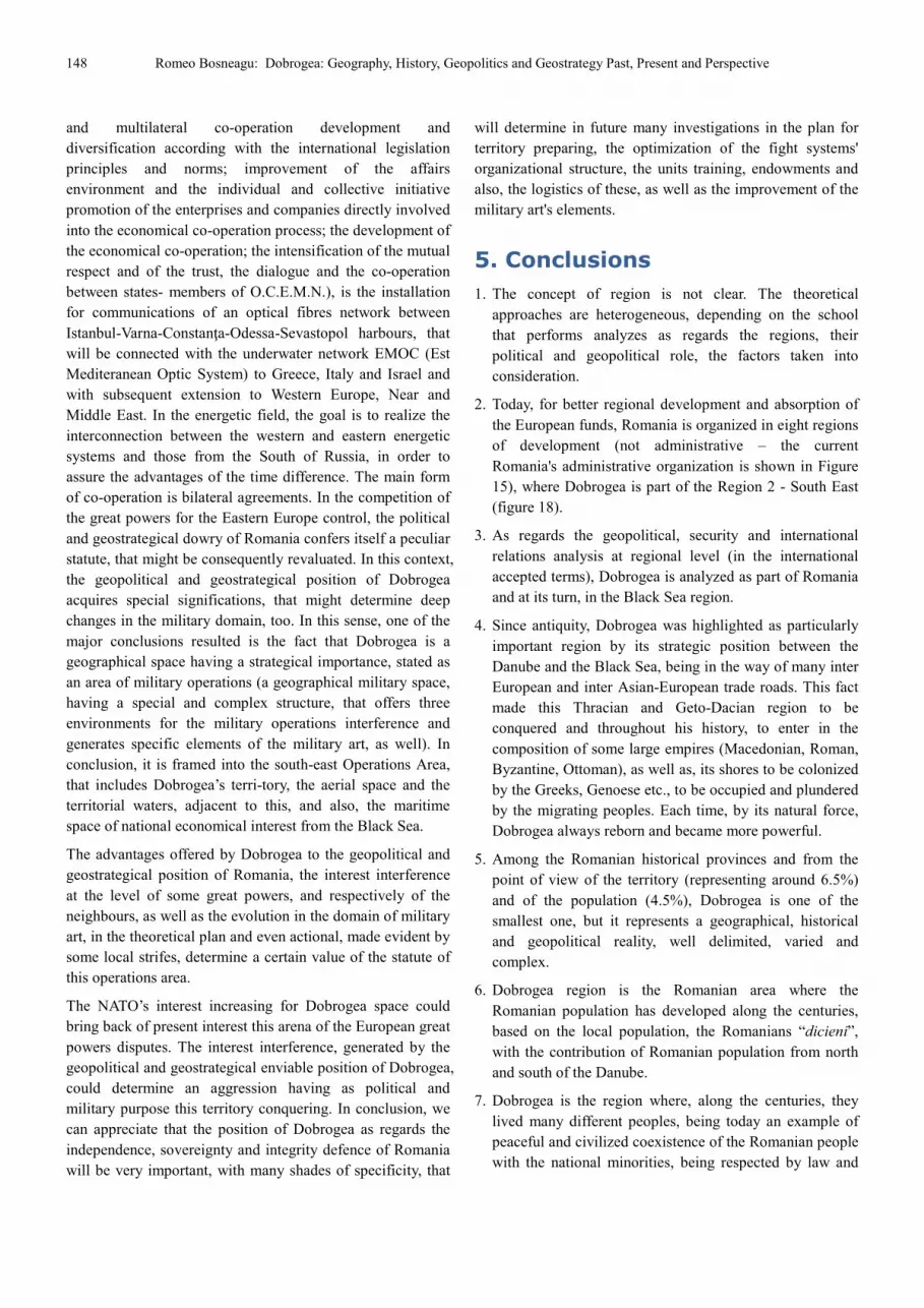
2. Today, for better regional development and absorption of
the European funds, Romania is organized in eight regions
of development (not administrative – the current
Romania's administrative organization is shown in Figure
15), where Dobrogea is part of the Region 2 - South East
(figure 18).
3. As regards the geopolitical, security and international
relations analysis at regional level (in the international
accepted terms), Dobrogea is analyzed as part of Romania
and at its turn, in the Black Sea region.
4. Since antiquity, Dobrogea was highlighted as particularly
important region by its strategic position between the
Danube and the Black Sea, being in the way of many inter
European and inter Asian-European trade roads. This fact
made this Thracian and Geto-Dacian region to be
conquered and throughout his history, to enter in the
composition of some large empires (Macedonian, Roman,
Byzantine, Ottoman), as well as, its shores to be colonized
by the Greeks, Genoese etc., to be occupied and plundered
by the migrating peoples. Each time, by its natural force,
Dobrogea always reborn and became more powerful.
5. Among the Romanian historical provinces and from the
point of view of the territory (representing around 6.5%)
and of the population (4.5%), Dobrogea is one of the
smallest one, but it represents a geographical, historical
and geopolitical reality, well delimited, varied and
complex.
6. Dobrogea region is the Romanian area where the
Romanian population has developed along the centuries,
based on the local population, the Romanians “dicieni”,
with the contribution of Romanian population from north
and south of the Danube.
7. Dobrogea is the region where, along the centuries, they
lived many different peoples, being today an example of
peaceful and civilized coexistence of the Romanian people
with the national minorities, being respected by law and
American Journal of Geophysics, Geochemistry and Geosystems
local traditions, as well.
8. The perpetuation of the frozen conflicts in the Black Sea
area and the Western Balkans instability creates additional
pressures for Romania. The inter-ethnic tensions and the
regional imbalances from the count
proximity, can lead to some regional conflicts.
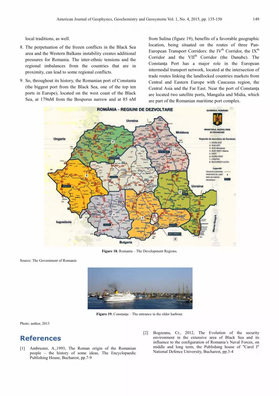
9. So, throughout its history, the Romanian port of Constanta
(the biggest port from the Black Sea, one of the top ten
ports in Europe), located on the west coast of the Black
Sea, at 179nM from the Bosporus narrow and at 85 nM
Source: The Government of Romania
Figure 19
Photo: author, 2013
References
[1] Ambruster, A.,1993, The Roman origin of the Romanian people – the history of some ideas, The Encyclopaedic Publishing House, Bucharest, pp.7-9
American Journal of Geophysics, Geochemistry and Geosystems Vol. 1, No. 4, 2015, pp. 135
The perpetuation of the frozen conflicts in the Black Sea
area and the Western Balkans instability creates additional
ethnic tensions and the
regional imbalances from the countries that are in
proximity, can lead to some regional conflicts.
So, throughout its history, the Romanian port of Constanta
(the biggest port from the Black Sea, one of the top ten
ports in Europe), located on the west coast of the Black
the Bosporus narrow and at 85 nM
from Sulina (figure 19), benefits of a favorable geographic
location, being situated on the routes of three Pan
European Transport Corridors: the IV
Corridor and the VIIth Corridor (the Danube). The
Constanţa Port has a major role in the European
intermodal transport network, located at the intersection of
trade routes linking the landlocked countries markets from
Central and Eastern Europe with Caucasus region, the
Central Asia and the Far East. Near t
are located two satellite ports, Mangalia and Midia, which
are part of the Romanian maritime port complex.
Figure 18. Romania – The Development Regions.
Figure 19. Constanţa – The entrance in the older harbour.
Ambruster, A.,1993, The Roman origin of the Romanian the history of some ideas, The Encyclopaedic
[2] Bogzeanu, Cr., 2012, The Evolution of the security environment in the extensive area of Black Sea and its influence to the configuration of Romania’s Naval Forces, on middle and long term, the Publishing house of "Carol I" National Defence University, Bucharest, pp.3
2015, pp. 135-150 149
from Sulina (figure 19), benefits of a favorable geographic
location, being situated on the routes of three Pan-
European Transport Corridors: the IVth Corridor, the IXth
Corridor (the Danube). The
a Port has a major role in the European
intermodal transport network, located at the intersection of
trade routes linking the landlocked countries markets from
Central and Eastern Europe with Caucasus region, the
Central Asia and the Far East. Near the port of Constanţa
are located two satellite ports, Mangalia and Midia, which
are part of the Romanian maritime port complex.
Bogzeanu, Cr., 2012, The Evolution of the security environment in the extensive area of Black Sea and its influence to the configuration of Romania’s Naval Forces, on middle and long term, the Publishing house of "Carol I"
versity, Bucharest, pp.3-4
150 Romeo Bosneagu: Dobrogea: Geography, History, Geopolitics and Geostrategy Past, Present and Perspective
[3] Boşneagu, R., 2004, The Influence of the geographical conditions to the transport routes in the basin of Black Sea (western sector), the Universitar Book Publishing House, Bucharest, pp. 14-18, 23-24
[4] Brătianu, I.Gh., 1999, The Black Sea from the origins till the Ottoman conquest, The Revised IInd Edition, Polirom Publishing House, Iași, p. 24, pp. 26-29
[5] Brezjinski, Z.,1999, The New chess table. The American supremacy and its geostrategical peremptories, The Encyclopaedic Univers Publishing House, Bucharest, pp. 134-136
[6] Calvocoressi, P., 2000, The World-wide politics after 1945, The VII th Edition, All Istoric Publishing House, Bucharest
[7] Fontaine, P., 1998, The European construction from 1945 till nowadays, The European Institute Publishing House, Bucharest
[8] Hlihor, C., 1998, The Geopolitics of XX th century, Bucharest, The Publishing house of High Military Studies Academy
[9] Iorga, N., 1898, Historical studies as regards Chilia and Cetatea Alba, Bucharest, pp. 70-71
[10] Ionescu, L, 2003, Diachronically considerations regarding the dobrogean localities denomination, Ovidius University Annals of Philology, vol.XIV, no.141-148, pp.61-62
[11] Kellog, Fr., 2002, The Romania way to independence, The European Institute, Iaşi, pp.78-80
[12] Mărculeţ, V., About the organization of the Byzantine territories from the Inferior Danube between X-XII centuries: thema, the Western Mesopotamia, strategatul Dristrei, thema Paristrion-Paradunavon, http://ebooks.unibuc.ro/istorie/ideologie/6.htm , p.7-8
[13] Nicoară, V., 2006, Dobrogea, cultural multicultural space, Muntenia Publishing House, Constanţa, pp. 6-7
[14] Rădulescu, A., Bitoleanu, I., 1998, The Hystory of Dobrogea, Ex PONTO Publishing House, Constanţa, pp. 102, 104
[15] Vâlsan, G., 1936, “The Romanian idiom”, I, 1927, nr. 7, p. 142 and Posthumpus writings, Bucharest, 1936, p. 49
[16] The Collection of the magazine Romanian military reflection, 1999-2014
[17] The Romanian military strategy in the modern age, Hymus Publishing House, 1999.
[18] http://casa-regala.blogspot.ro/2009/01/impartirea-administrativ-teritoriala.html
[19] http://www.constanta.insse.ro/main.php
[20] http://www.carpati.org/articol/tumulii_din_dobrogea/1047/
[21] http://dexonline.ro/definitie/Dobrogea
[22] http://www.presidency.ro/Strategia naţională de apărare a ţării pentru perioada 2015 - 2019, Bucureşti, 2015
[23] http://www.mae.ro/node/1501
[24] www.bsec-organization.org
[25] https://upload.wikimedia.org/wikipedia/commons/8/87/Constanta-Rotterdam_DE.PNG
[26] http://enciclopediaromaniei.ro/wiki/R%C4%83zboiul_de_Independen%C5%A3%C4%83
[27] http://www.elpis.ro/despre-dobrogea.php
[28] http://www.historia.ro/exclusiv_web/general/articol/minoritatea-german-n-dobrogea
[29] http://www.historia.ro/exclusiv_web/general/articol/voluntari-s-rbi-frontul-rom-nesc-dobrogea
[30] http://www.inlandnavigation.eu/home/
[31] http://www.ria.org.ro/ria/images/platina/danube/localizare%20dunare.pdf
[32] http://www.portofconstantza.com/apmc/portal
[33] http://ro.orthodoxwiki.org/Gherman_din_Dobrogea
[34] http://www.stratfor.com/sites/default/files/styles/stratfor_full/public/main/images/Europe_waterways_800.jpg?itok=UzpZk_
[35] http://www.mecanturist.ro/2014/01/28/dobrogea-scurta-istorie-migratiilor/
[36] http://www.naiades.info/news-and-events/infrastructure/new-connecting-europe-facility/
[37] http://www.tulcea.insse.ro/main.php
[38] http://www.zf.ro/ziarul-de-duminica/dobrogea-o-scurta-istorie-i-6425241
[39] http://www.ziare.com/cultura/istoria-culturii-si-civilizatiei/romanca-ce-a-descoperit-in-dobrogea-frontiera-pierduta-a-imperiului-roman-interviu-1261088
[40] http://www.voceatransilvaniei.ro/amintiri-despre-turcii-si-tatarii-din-dobrogea-expuse-la-muzeu/
[41] https://en.wikipedia.org/wiki/Dobruja
[42] https://ro.wikipedia.org/wiki/Dobrogea
[43] https://ro.wikipedia.org/wiki/Istoria_Dobrogei
[44] https://en.wikipedia.org/wiki/Mithridates_VI_of_Pontus
[45] http://www.eliznik.org.uk/RomaniaHistory/wallachia-dobrogea-history.htm
[46] https://www.google.com/maps/d/viewer?mid=ziJPLYUe8U2M.kC5xtDM1FuZU&hl=en_US