communications enabling the next generation of seismic ... - iris
TRANSCRIPT
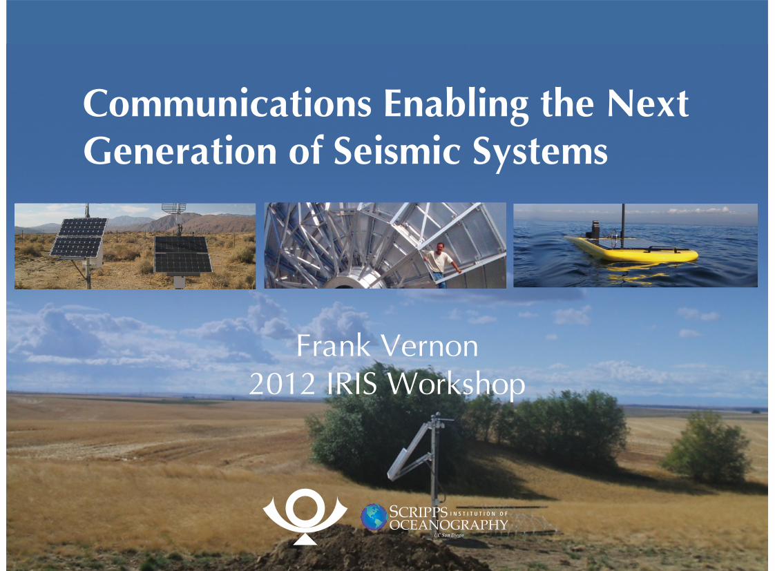
Communications Enabling the NextGeneration of Seismic Systems
Frank Vernon2012 IRIS Workshop
OverviewCurrent use of communications in
seismology
Technical requirements
Terrestrial communications
Marine communications
Summary
•
•
•
•
•
WANT
UOSS
COR
TARA
CMBPASC
PFO TUC
RSSD
FFC
COLA
KDAK
ANMO
HKT
CCM
TEIGSJG
DWPFBBSR
WCI
WVT
SSPA
KIP
POHAJOHN
XMAS
RARPTCN RPN
MSEY
DGAR
PALK
CHTOTATO
MIDWMAJO
PET
BILLTIXI
YAK MA2
TLY
ULN
LSA
HIA
BJT
XAN SSE
MDJ
KMI
INCN
YSSERM
ENH
COCO
SBA
CTAORAO
HNR
BTDF
KAPI
MSVF
GUMO
WAKE
KWAJ
FUNA
AFI
DAV
QSPA
CASY
SUR
LBTB
LSZ
MSKU
FURI
MBAR
KMBO
NWAOTAU
WRAB
SNZO
EFI
PMSA
HOPE
ASCN
SHEL
TRQALCO
NNA
PAYG
OTAVPTGA
JTSSDV
LVC
SAML
SACV
CMLAHRV PAB
SFJD BORG
ESK
TRIS
RCBR
TSUM
KOWA
ALEKBS
NRIL
ARU
BRVK
KURKMAKZ
WMQNIL
RAYN
ABKT
LVZ
OBN
KEV
KONO
KIEVBFO
GRFO
GNIANTO
AAK
PMG
KIV
QIZ
MBWA
ILAR
PDARNVAR
ADK
ATTU
VNDA
s
TXAR
SDDRBCIPTGUH BBGH
GRGR
ANWB
GTBY
ABPO
MCQ
KBL
GRTKMDTJSLBS
MACI
KNTN
HKPS
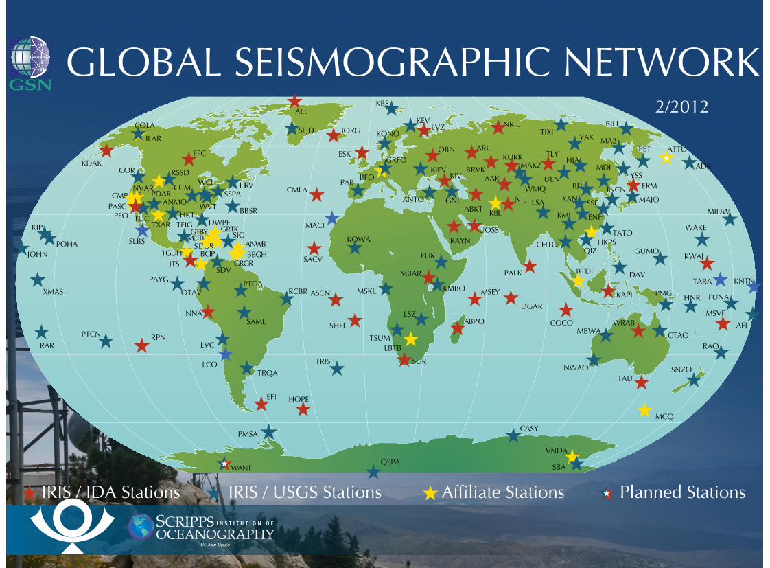
IRIS / IDA Stations IRIS / USGS Stations Affiliate Stations Planned Stations
2/2012
GLOBAL SEISMOGRAPHIC NETWORK
Global Seismic NetworkTelemetry
Essentially all stations have real timetelemetryData used for real time processing by
multiple usersRapid earthquake notificationSource parameter estimation (location,
magnitudes, ...)Tsunami warning
Telemetry to nearest Internet POPSatelliteDirect link
•
•
•
•
•
•
•
•
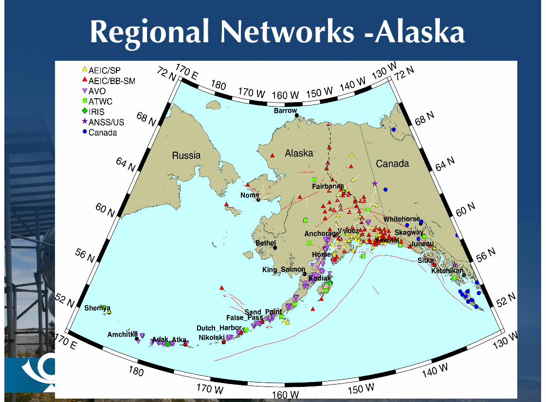
Regional Networks -Alaska
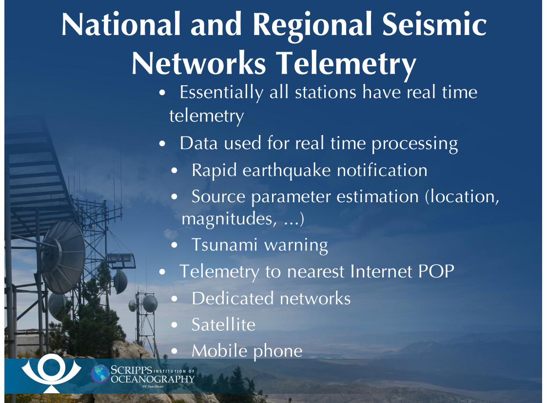
National and Regional SeismicNetworks Telemetry
Essentially all stations have real timetelemetryData used for real time processing
Rapid earthquake notificationSource parameter estimation (location,
magnitudes, ...)Tsunami warning
Telemetry to nearest Internet POPDedicated networks Satellite Mobile phone
•
•
•
•
•
•
•
•
•
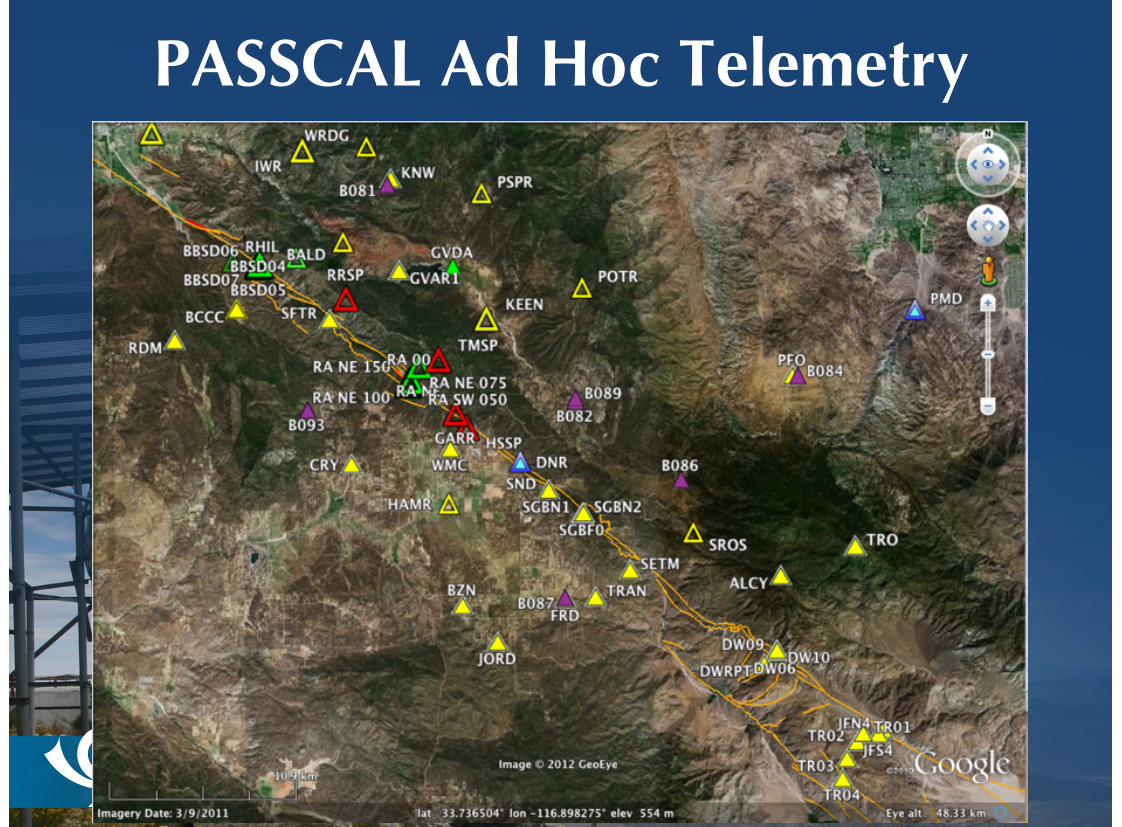
PASSCAL Ad Hoc Telemetry
PASSCAL AdHoc Telemetry
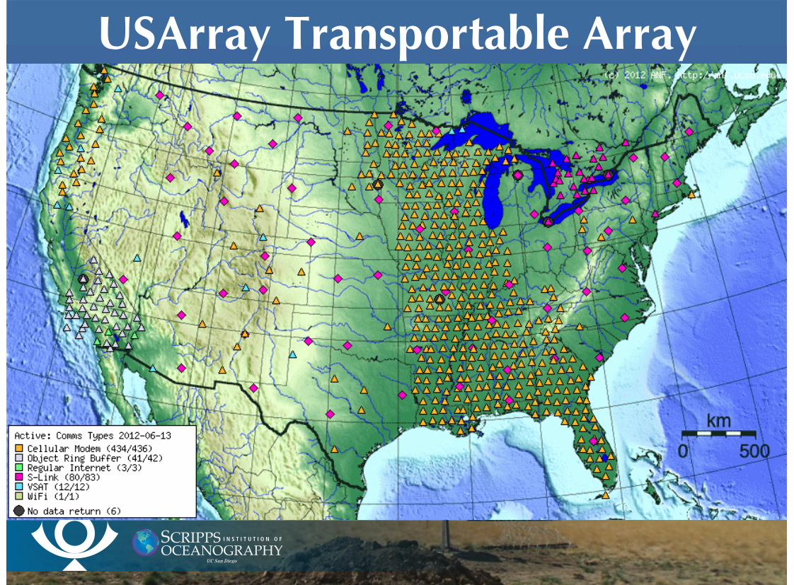
USArray Transportable Array
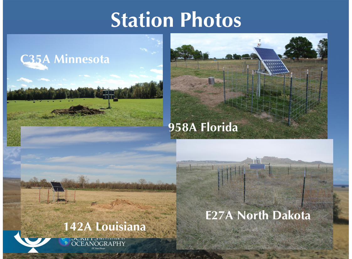
Station Photos
C35A Minnesota
142A Louisiana
958A Florida
E27A North Dakota
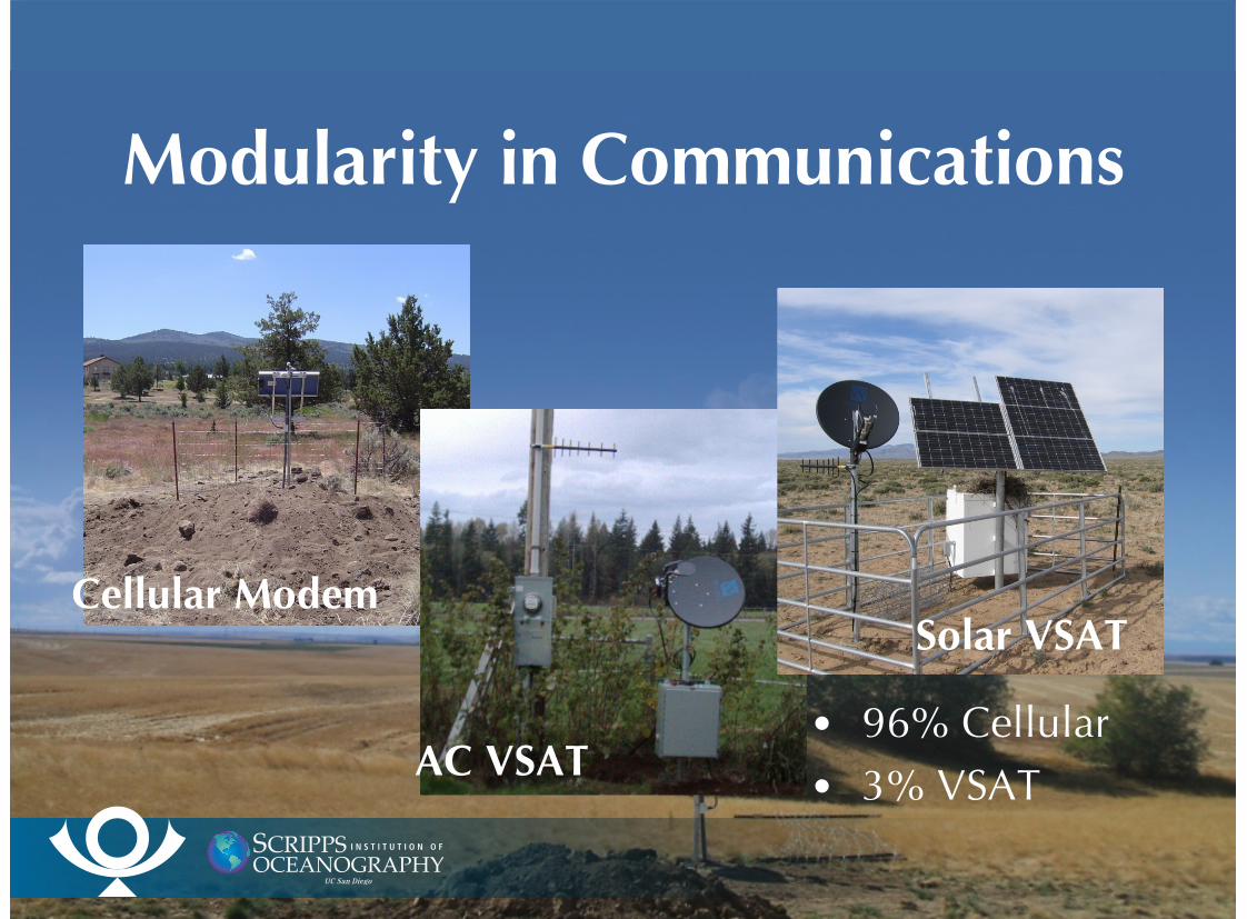
Modularity in Communications
96% Cellular3% VSAT
•
•
Cellular Modem
AC VSAT
Solar VSAT
Telemetry FeasibilitySites are selected with the telemetry option as part of the plan.
The available options in order of preference are;
Verizon digital service (EVDO)AT&T (GPRS / GSM)
Radio to a VSAT located near AC PowerRadio to a location with AC power that has DSL or Cable
Modem service available, not landowners.Radio to a VSAT powered by solar panels.Radio range is 20 km line of sight. It is most often a few hundred meters.
••
••
•
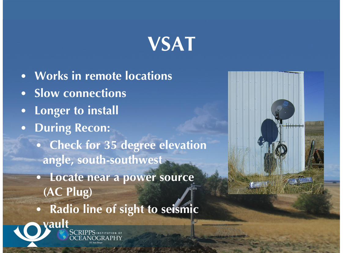
VSAT
Works in remote locations
Slow connections
Longer to install
During Recon:
Check for 35 degree elevationangle, south-southwest
Locate near a power source (AC Plug)
Radio line of sight to seismicvault
•
•
•
•
•
•
•
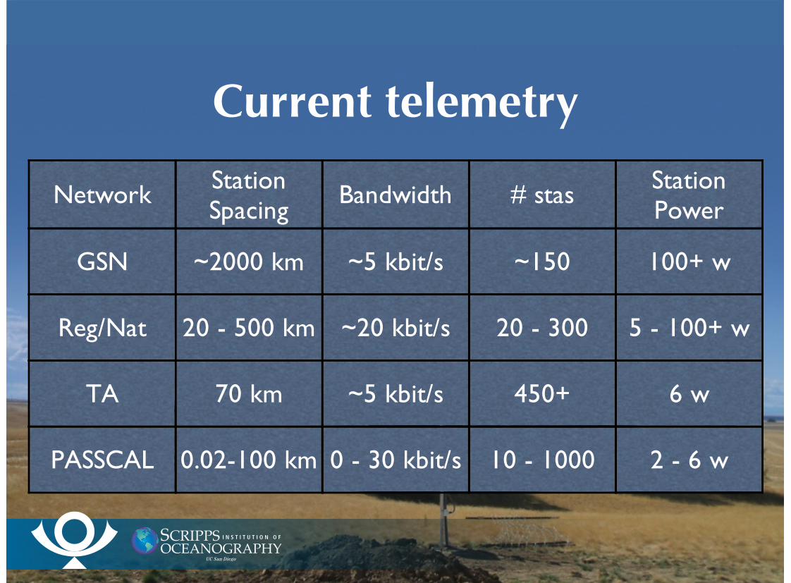
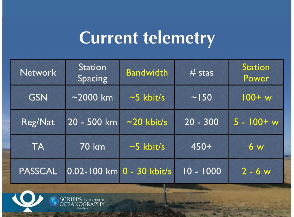
Current telemetry
Network StationSpacing
Bandwidth # stas StationPower
GSN ~2000 km ~5 kbit/s ~150 100+ w
Reg/Nat 20 - 500 km ~20 kbit/s 20 - 300 5 - 100+ w
TA 70 km ~5 kbit/s 450+ 6 w
PASSCAL 0.02-100 km 0 - 30 kbit/s 10 - 1000 2 - 6 w
Current telemetry
Network StationSpacing
Bandwidth # stas StationPower
GSN ~2000 km ~5 kbit/s ~150 100+ w
Reg/Nat 20 - 500 km ~20 kbit/s 20 - 300 5 - 100+ w
TA 70 km ~5 kbit/s 450+ 6 w
PASSCAL 0.02-100 km 0 - 30 kbit/s 10 - 1000 2 - 6 w
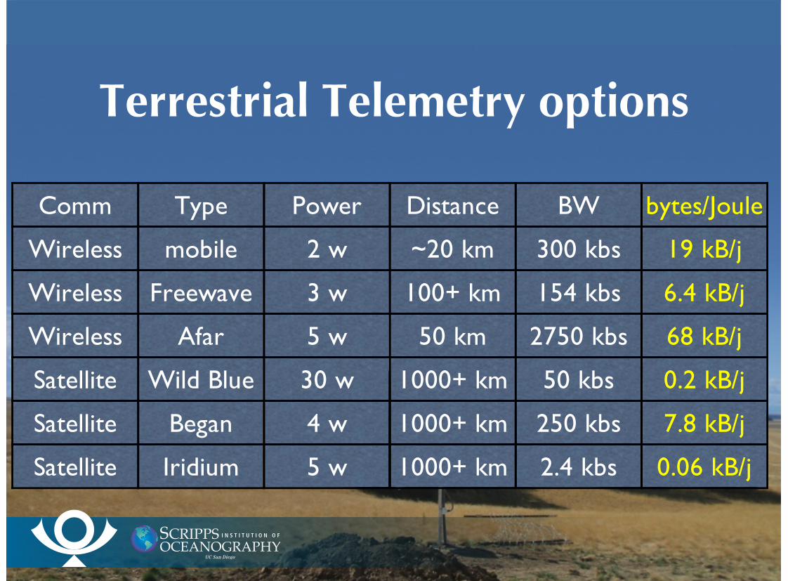
Terrestrial Telemetry options
Comm Type Power Distance BW bytes/Joule
Wireless mobile 2 w ~20 km 300 kbs 19 kB/j
Wireless Freewave 3 w 100+ km 154 kbs 6.4 kB/j
Wireless Afar 5 w 50 km 2750 kbs 68 kB/j
Satellite Wild Blue 30 w 1000+ km 50 kbs 0.2 kB/j
Satellite Began 4 w 1000+ km 250 kbs 7.8 kB/j
Satellite Iridium 5 w 1000+ km 2.4 kbs 0.06 kB/j
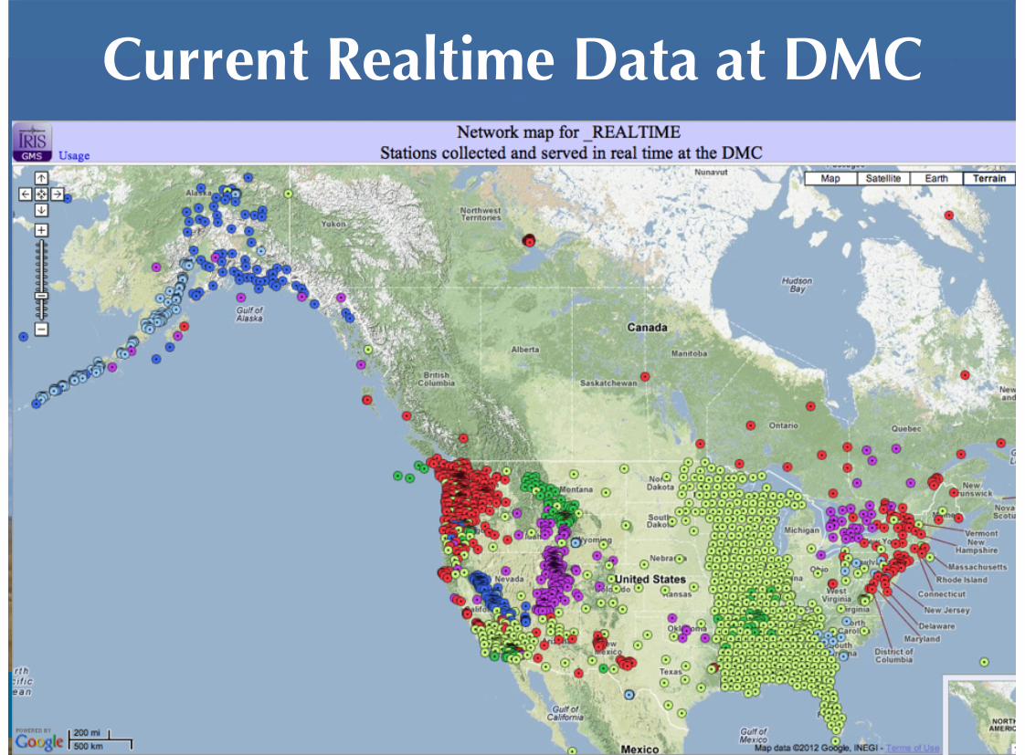
Current Realtime Data at DMC
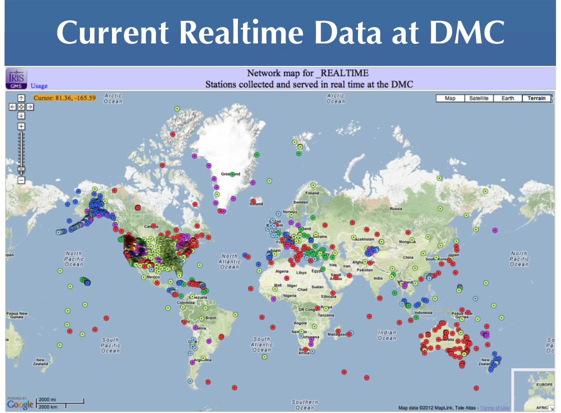
Current Realtime Data at DMC
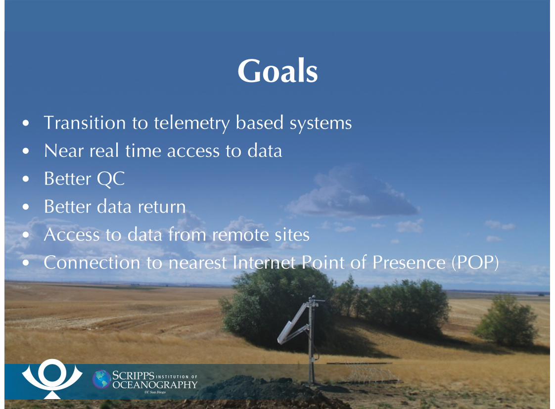
Goals
Transition to telemetry based systemsNear real time access to dataBetter QCBetter data returnAccess to data from remote sitesConnection to nearest Internet Point of Presence (POP)
•
•
•
•
•
•
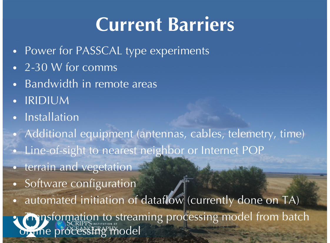
Current BarriersPower for PASSCAL type experiments2-30 W for commsBandwidth in remote areasIRIDIUM Installation Additional equipment (antennas, cables, telemetry, time)Line-of-sight to nearest neighbor or Internet POPterrain and vegetationSoftware configurationautomated initiation of dataflow (currently done on TA)Transformation to streaming processing model from batch
offline processing model
•
•
•
•
•
•
•
•
•
•
•
OpportunitiesRadio and Satellite technologies are mature
Improvements being made
power management
efficient use of bandwidth
duty cycling
Communications for interstation spacings > 10 km
mobile
ad hoc networking
satellite
controlled by physics - line of sight, power
•
•
•
•
•
•
•
•
•
•

Present Mobile Coverage

Present Mobile Coverage
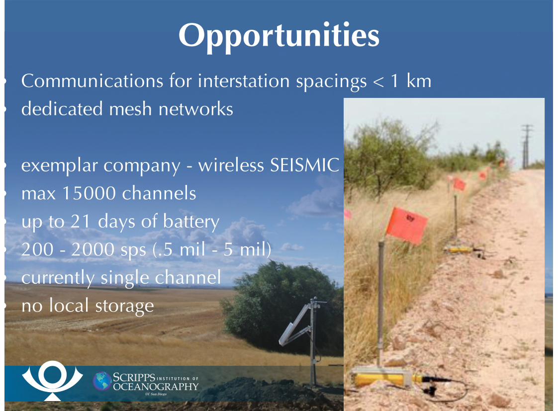
OpportunitiesCommunications for interstation spacings < 1 km
dedicated mesh networks
exemplar company - wireless SEISMIC
max 15000 channels
up to 21 days of battery
200 - 2000 sps (.5 mil - 5 mil)
currently single channel
no local storage
•
•
•
•
•
•
•
•
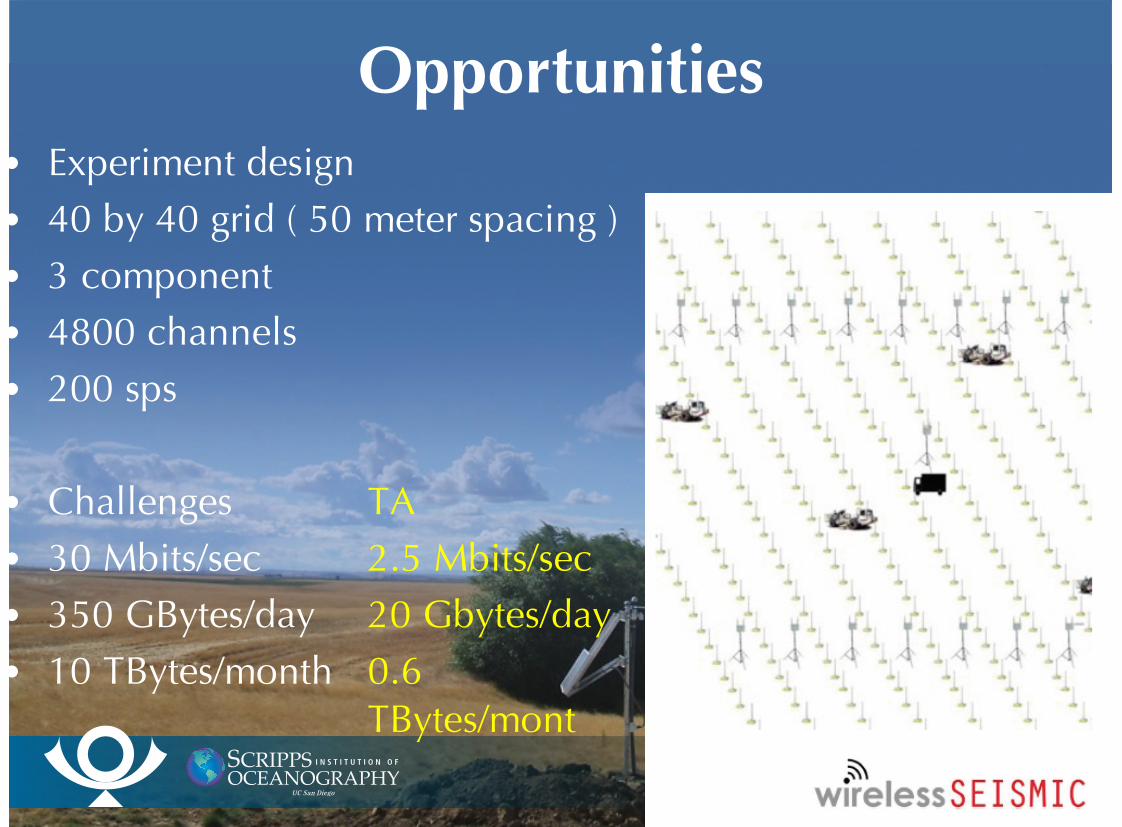
OpportunitiesExperiment design
40 by 40 grid ( 50 meter spacing )
3 component
4800 channels
200 sps
Challenges
30 Mbits/sec
350 GBytes/day
10 TBytes/month
•
•
•
•
•
•
•
•
•
TA
2.5 Mbits/sec
20 Gbytes/day
0.6TBytes/mont
Ocean Bottom GSN StationsThere are noneStill large areas of globe uncovered by GSNAppropriate technology
Broadband OBS technology fairly advancedSatellite telemetry mature technology
Principal reasons for little progressRequired sites are very remote and often extreme weatherReal-time data acquisition requires surface “gateway”Deep ocean buoys costly to deploy and maintain Cost of deployment and maintenance
•
•
••
•
••
•
•
•
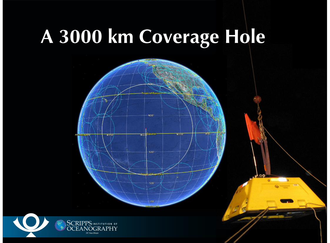
A 3000 km Coverage Hole
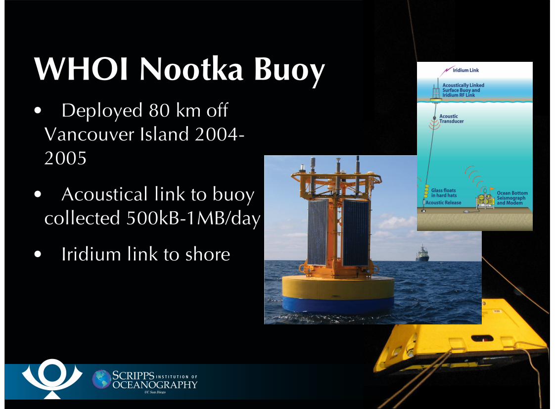
WHOI Nootka Buoy Deployed 80 km off
Vancouver Island 2004-2005
Acoustical link to buoycollected 500kB-1MB/day
Iridium link to shore
•
•
•
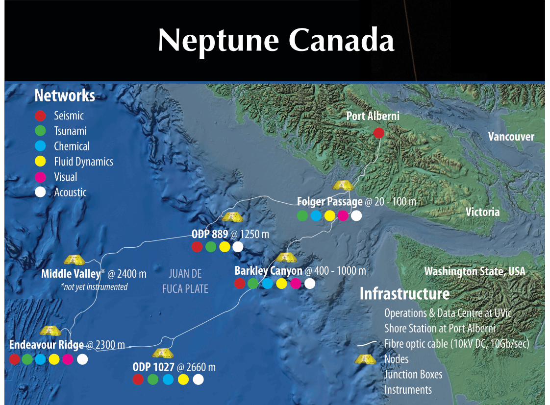
Neptune Canada
Axial Seamount RSN Science Workshop5-7 October 2011
OOI Regional Scale Network
0
Meters
3500
PortlandCyberPOP
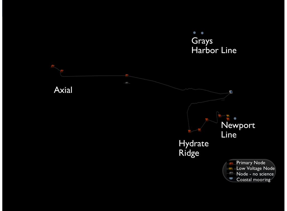
MidPlate
Hydrate Ridge
Axial
Grays Harbor Line
NewportLine
Primary NodeLow Voltage NodeNode - no scienceCoastal mooring
30
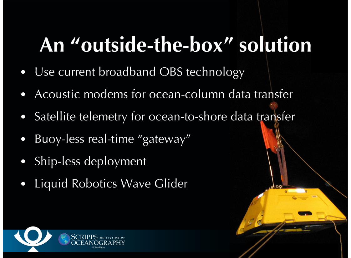
An “outside-the-box” solutionUse current broadband OBS technology
Acoustic modems for ocean-column data transfer
Satellite telemetry for ocean-to-shore data transfer
Buoy-less real-time “gateway”
Ship-less deployment
Liquid Robotics Wave Glider
•
•
•
•
•
•
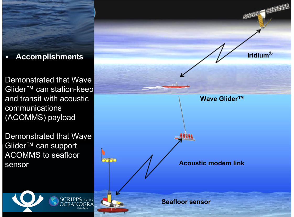
Accomplishments
Demonstrated that WaveGlider™ can station-keepand transit with acousticcommunications(ACOMMS) payload
Demonstrated that WaveGlider™ can supportACOMMS to seafloorsensor
•
Acoustic modem link
Iridium®
Seafloor sensor
Wave Glider™
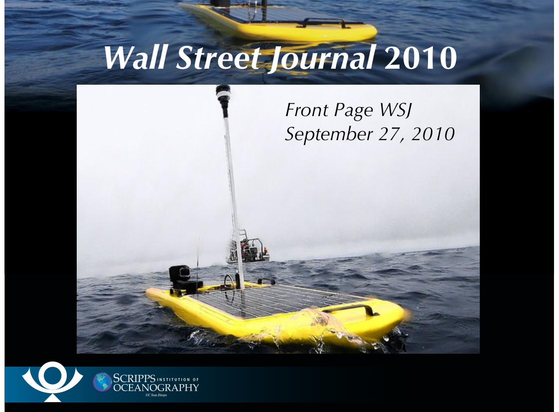
Wall Street Journal 2010Front Page WSJSeptember 27, 2010
Modem Power RequirementsData acquisition rate 3 chan x /sec x 16 bits/sample =
48 bps. Let’s use 100 bps as design goal.With 4 kbyte packet accumulate 1 packet in 320s, so
270 packets/day.At acoustic modem rate of 2400 bps each packet takes
13.65s to xmit + 1.2s startup overhead ~15s. So 270packets/day takes 4050 s/day xmit time.At 20 W xmit power power required ~ 25 W-hr/day or ~
average 1 W power draw.OBS takes about another 1 W average
•
•
•
•
•
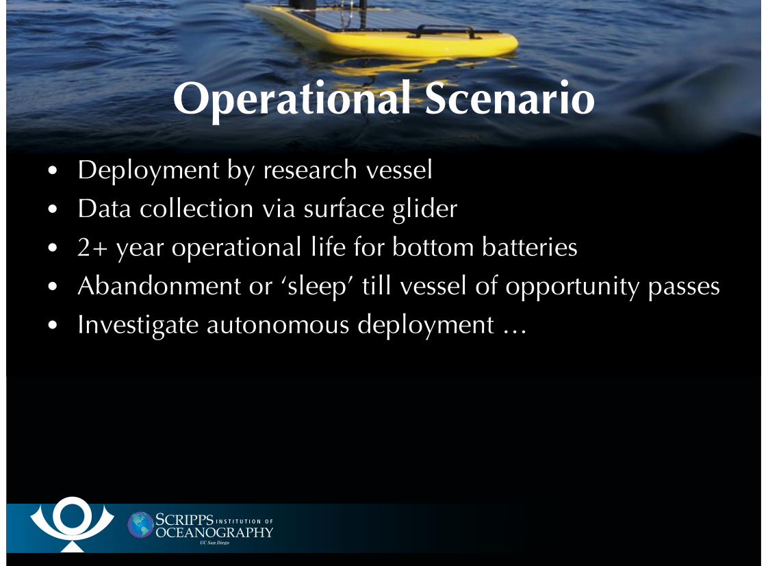
Operational ScenarioDeployment by research vessel
Data collection via surface glider
2+ year operational life for bottom batteries
Abandonment or ‘sleep’ till vessel of opportunity passes
Investigate autonomous deployment …
•
•
•
•
•
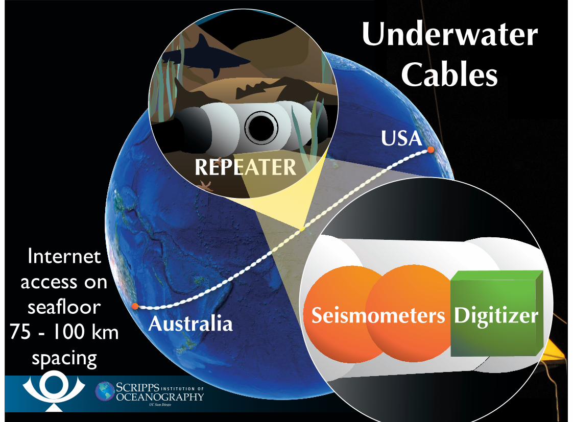
USA
Australia
USA
Australia
REPEATER
Seismometers Digitizer
UnderwaterCables
Internetaccess onseafloor
75 - 100 kmspacing
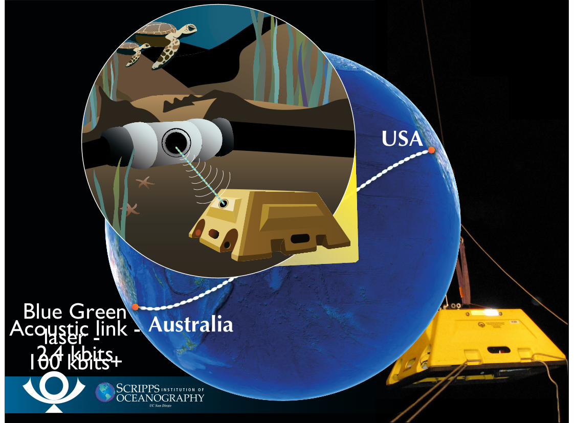
USA
AustraliaAcoustic link -2.4 kbits
Blue Greenlaser -
100 kbits+
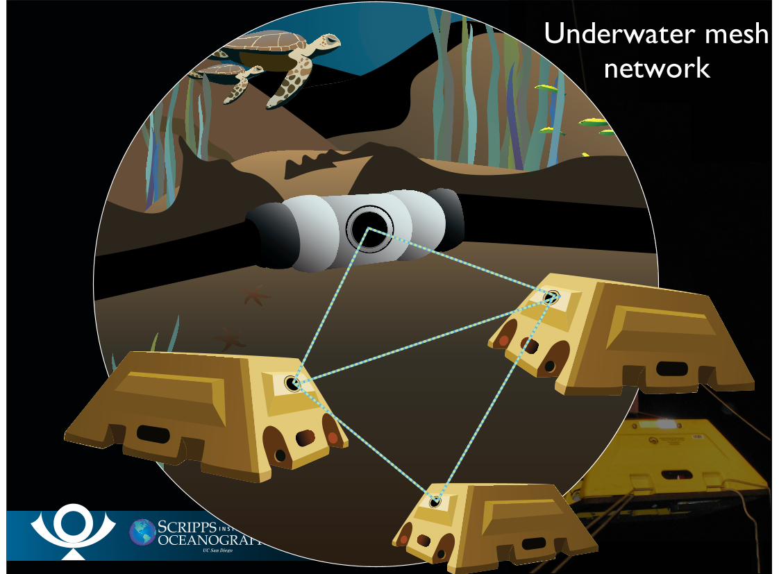
Underwater meshnetwork
SummaryNeed to acquire data from all regions on planetData rates and bandwidth scale inversely with station
spacingMesh and ad hoc networking are possible if stations have
line of sight with othersBandwidth to Internet POP a limitation
Internet POPs are spreading rapidly in terrestrialenvironmentInternet POPs may become available in marine
environmentBound by physical limits of power, distance, and
line-of-sight
•
•
•
•
•
•
•