clovis sites in the gulf coastal plain of southwest alabama. southeastern archaeological conference...
TRANSCRIPT

1
Clovis Sites in the Gulf Coastal Plain of Southwest Alabama
Steven M. Meredith
Panamerican Consultants, Inc. Southeastern Archaeological Conference
Greenville, South Carolina
November 14, 2014
[Cover Slide] Unlike some portions of the greater Southeastern coastal plain, such as
the lower Savannah River Valley and northern Florida, the Paleoindian period in the portion of
the Gulf Coastal Plain from the Mobile River Drainage to the Chattahoochee River has received
very little attention, apart from a few limited studies (Ensor 1981, Meredith 2009, Moon 1990).
Based on published literature, one might assume that this region had very limited occupation
during the Clovis Horizon. But we know that many of these sorts of blank spots are a record of
where archaeologists have or have not been, rather than where people have actually lived. The
purpose of this paper is to describe the geographic setting of three archaeological sites that
have significant Clovis components, and to describe those components themselves to help
bring this area with a rich Paleoindian record out of its “blank spot” status.
An overview of the environment and geology of the region is important for
understanding the potential for Paleoindian occupation. There are papers aimed to give a much
better environmental context than I can here, so I will simply say that for the Clovis period of
time the lower South is summarized by Halligan (2013) as having been largely a temperate
deciduous forest. There are some geological features specific to this study area, however, that
directly influenced the lives of the people who lived there roughly between 13,000 and 11,000
years ago (and later).
2
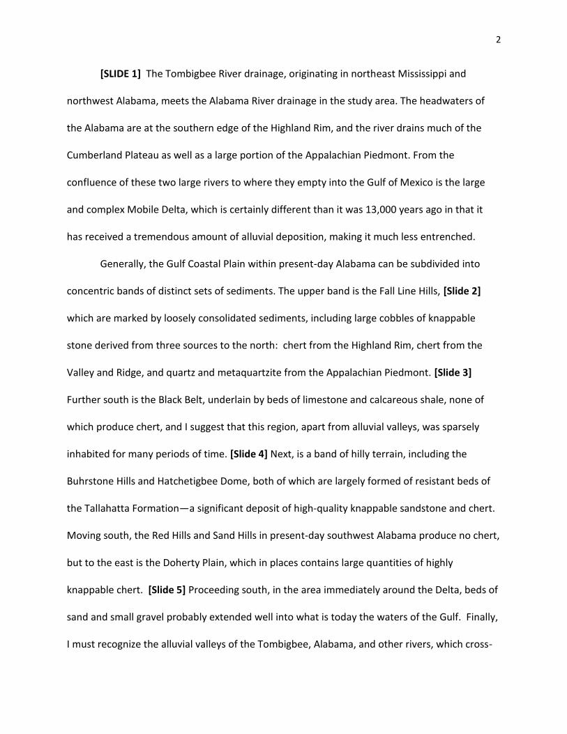
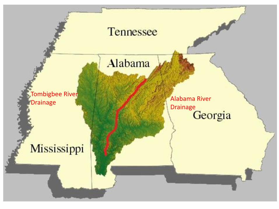
[SLIDE 1] The Tombigbee River drainage, originating in northeast Mississippi and
northwest Alabama, meets the Alabama River drainage in the study area. The headwaters of
the Alabama are at the southern edge of the Highland Rim, and the river drains much of the
Cumberland Plateau as well as a large portion of the Appalachian Piedmont. From the
confluence of these two large rivers to where they empty into the Gulf of Mexico is the large
and complex Mobile Delta, which is certainly different than it was 13,000 years ago in that it
has received a tremendous amount of alluvial deposition, making it much less entrenched.
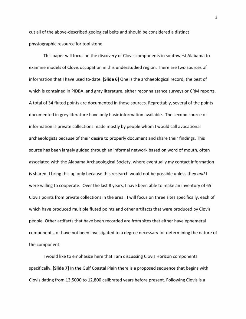
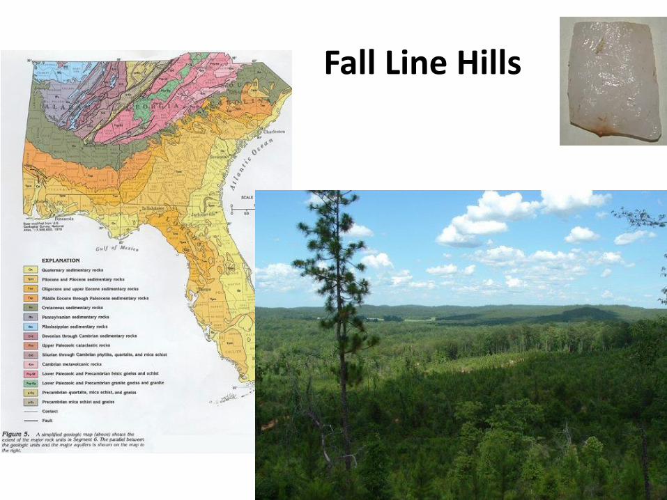
Generally, the Gulf Coastal Plain within present-day Alabama can be subdivided into
concentric bands of distinct sets of sediments. The upper band is the Fall Line Hills, [Slide 2]
which are marked by loosely consolidated sediments, including large cobbles of knappable
stone derived from three sources to the north: chert from the Highland Rim, chert from the
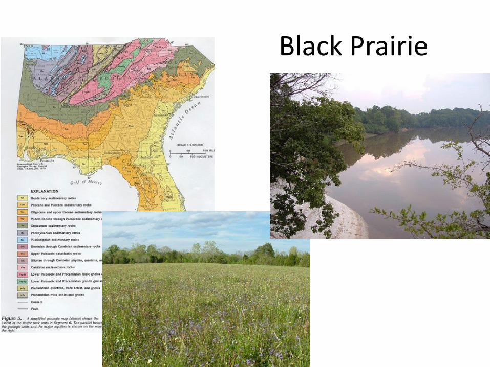
Valley and Ridge, and quartz and metaquartzite from the Appalachian Piedmont. [Slide 3]
Further south is the Black Belt, underlain by beds of limestone and calcareous shale, none of
which produce chert, and I suggest that this region, apart from alluvial valleys, was sparsely
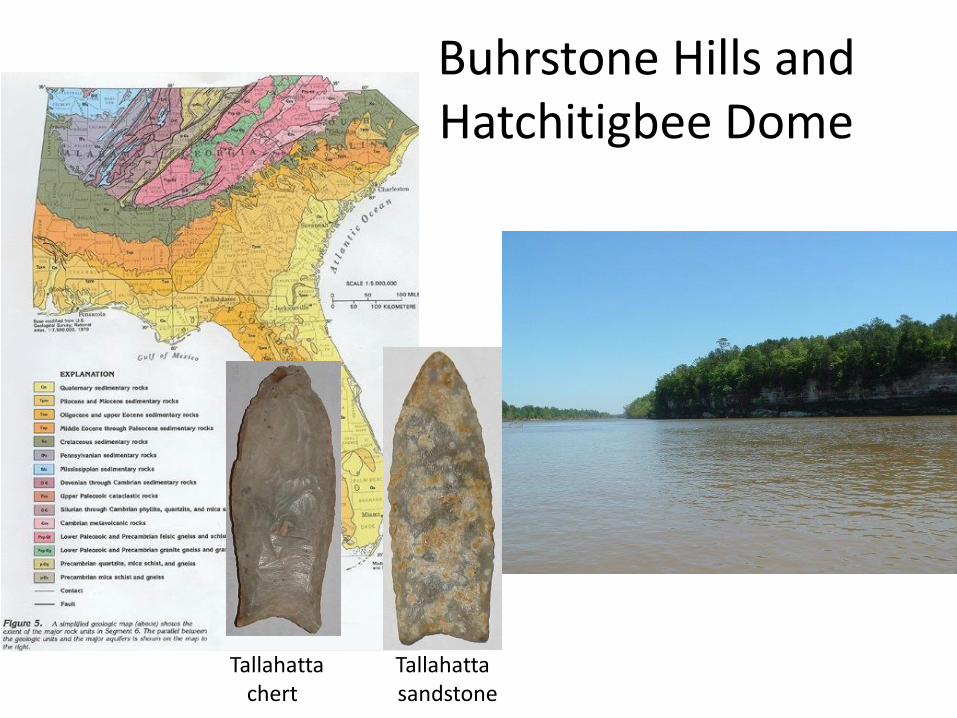
inhabited for many periods of time. [Slide 4] Next, is a band of hilly terrain, including the
Buhrstone Hills and Hatchetigbee Dome, both of which are largely formed of resistant beds of
the Tallahatta Formation—a significant deposit of high-quality knappable sandstone and chert.
Moving south, the Red Hills and Sand Hills in present-day southwest Alabama produce no chert,
but to the east is the Doherty Plain, which in places contains large quantities of highly
knappable chert. [Slide 5] Proceeding south, in the area immediately around the Delta, beds of
sand and small gravel probably extended well into what is today the waters of the Gulf. Finally,
I must recognize the alluvial valleys of the Tombigbee, Alabama, and other rivers, which cross-
3
cut all of the above-described geological belts and should be considered a distinct
physiographic resource for tool stone.
This paper will focus on the discovery of Clovis components in southwest Alabama to
examine models of Clovis occupation in this understudied region. There are two sources of
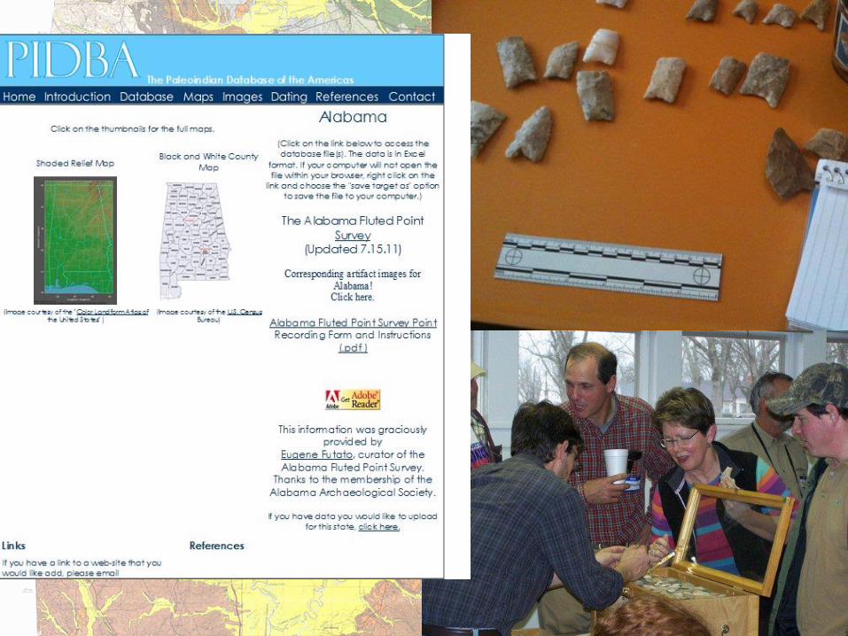
information that I have used to-date. [Slide 6] One is the archaeological record, the best of
which is contained in PIDBA, and gray literature, either reconnaissance surveys or CRM reports.
A total of 34 fluted points are documented in those sources. Regrettably, several of the points
documented in grey literature have only basic information available. The second source of
information is private collections made mostly by people whom I would call avocational
archaeologists because of their desire to properly document and share their findings. This
source has been largely guided through an informal network based on word of mouth, often
associated with the Alabama Archaeological Society, where eventually my contact information
is shared. I bring this up only because this research would not be possible unless they and I
were willing to cooperate. Over the last 8 years, I have been able to make an inventory of 65
Clovis points from private collections in the area. I will focus on three sites specifically, each of
which have produced multiple fluted points and other artifacts that were produced by Clovis
people. Other artifacts that have been recorded are from sites that either have ephemeral
components, or have not been investigated to a degree necessary for determining the nature of
the component.
I would like to emphasize here that I am discussing Clovis Horizon components
specifically. [Slide 7] In the Gulf Coastal Plain there is a proposed sequence that begins with
Clovis dating from 13,5000 to 12,800 calibrated years before present. Following Clovis is a
4
Middle Paleonindian horizon recognized by the presence of Redstone type points. It is
interesting to note that I have seen no Cumberland type points in the Alabama the coastal
plain, even though this type is relatively common in the Cumberland Plateau and Highland Rim
of north Alabama, Tennessee, and Kentucky. Late Paleoindian diagnostic artifacts include
Quad, Dalton, and a set of Plano-style projectile points. Present in the region but with
unestablished chronological placement are Suwanee and Simpson types. If there is a pre-Clovis
occupation of the region, we have not yet identified its diagnostic artifacts.
Today I’m going to describe the three sites in the Alabama coastal plain that have
produced recognizable Clovis components in good context. Each has produced several Clovis
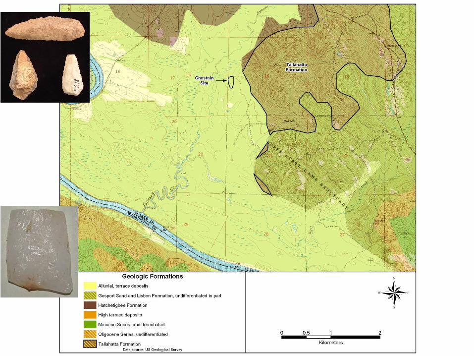
points and other artifacts attributable to that culture. [Slide 8] The Chastain Site was brought to
my attention by Clarke County native Walter Davis, who has carefully collected an assemblage
of artifacts from the surface, including a discrete Clovis component among other, later ones.
[Slide 9] The site is located on the second terrace near the edge of the alluvial bottom of the
Tombigbee River where it cuts through the Hatchetigbee Dome. [Slide 10] An exceptional
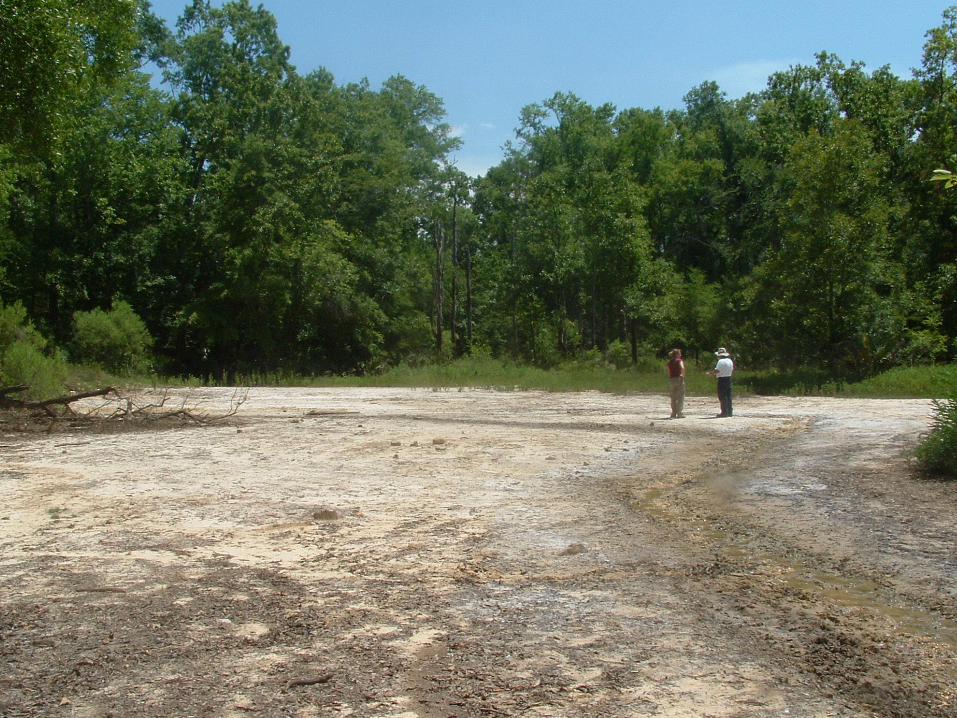
geologic feature associated with the site is a series of saline springs which are located at the
foot of the terrace. These salines are productive enough at points that no vegetation can grow
in the salt-saturated soil. Also significant is an outcrop of the Tallahatta Formation a short
distance to the east. To date, I have not found any knappable stone in that particular outcrop,
but based on the artifact assemblage there is a strong probability of a deposit of chert similar to
others that have been found two kilometers to the northwest.
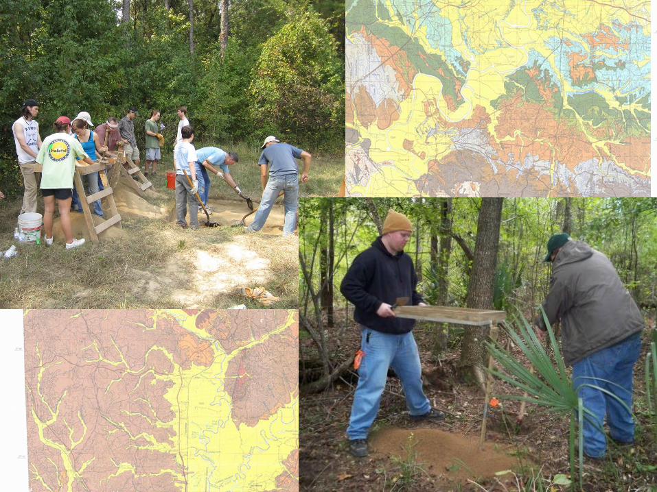
[Slide 11] On a Saturday in 2010, a group of volunteers and I shovel tested across the
portion of the site where Paleoindian artifacts occurred on the surface, hoping to better map
5
the component. On a second Saturday, another group of volunteers and I excavated two 2m2
units with the hope of finding intact features or deposits beneath the plow zone. [Slide 12] I did
not find any intact Paleoindian features or layers, although we did find plenty of late Archaic
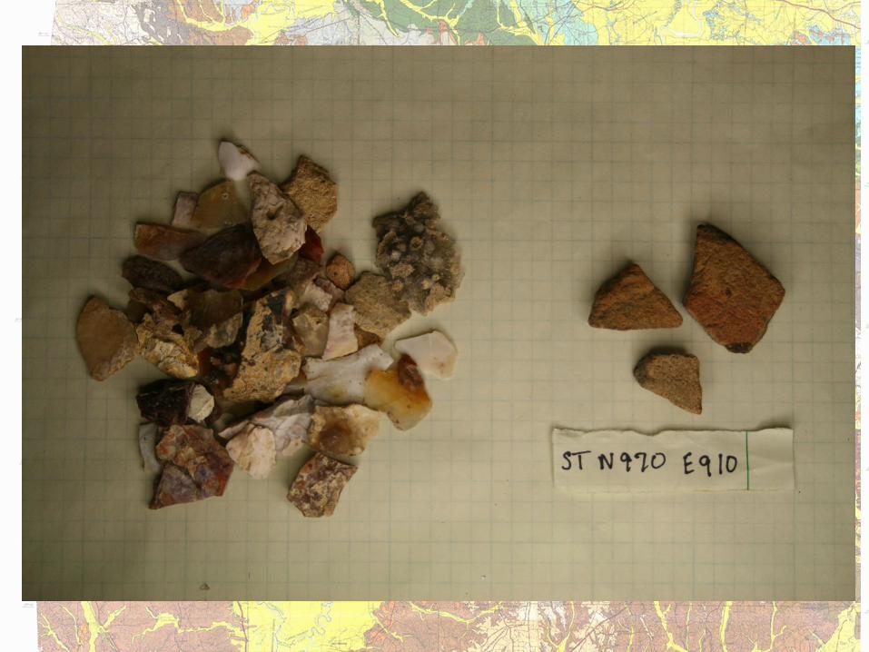
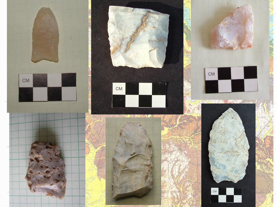
and terminal Woodland artifacts. [Slide 13] To date, the site has produced two Clovis points,
both with resharpened blade edges, one made of Tallahatta chert and one of Tallahatta
sandstone. There are also four Clovis preforms and [Slide 14] several uniface tools, three of
which are made on prismatic blades. There are also two formal blade cores [Slide 15]. All of
the Chastain assemblage is made from local Tallahatta formation rocks, primarily chert. Despite
the lack of success in the excavation, I believe that this site has the potential for either buried
deposits or features, and I think that more areas of the terrace as well as the salines themselves
should be investigated.
[Slide 16] In the addition to the Chastain site itself, there appear to be several other
early sites in the vicinity. Approximately 4 km to the southwest, another avocational
archaeologist, Tommy Hart, has found a Clovis point made of quartz eroding from deeply buried
soil on the banks of the Tombigbee River. A uniface endscraper has been found along with
debitage at another saline site half a kilometer to the south. Three uniface tools were found at
a third saline site in 1940 WPA excavations at Beckham Village (1Ck24), a Mississippi period salt
production site. I suspect that the Chastain site itself is a Clovis habitation, while the other loci
may represent specific activity areas, which may or may not be contemporaneous.
[SLIDE 17] The Salitpa Creek Sites are two multicomponent sites, each on a tributary of a
fifth order stream that empties into the Tombigbee River. The sites are located approximately
25 km north of the Chastain site. The majority of the Clovis artifacts from these sites were
6
brought to my attention by local retired soil scientist John Richburg. Over the last few years he
has been monitoring them and recording the coordinates of each artifact he finds. It is
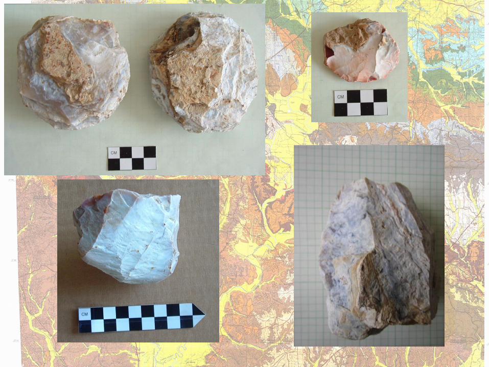
unmistakable that one of the functions of both sites was quarrying and chipping of sandstone
from the Tallahatta Formation. [Slide 18] You can see in this photo of Salitpa Creek 1 (Scotch
Quarry, 1Ck366) and this one taken at Salitpa Creek 2 (Morgan Creek, 1Ck393) a great deal of
gravel, nearly all of which is Tallahatta sandstone chipping debris and other artifacts.
[Slide 19] The sites are located in sandy, alluvial creek bottoms of the Buhrstone Hills.
Actively moving streams are cutting into the banks, which is how most of the artifacts are
found. I believe that one reason these sites are located directly on the creeks was to readily
access the large boulders of knappable sandstone found there.
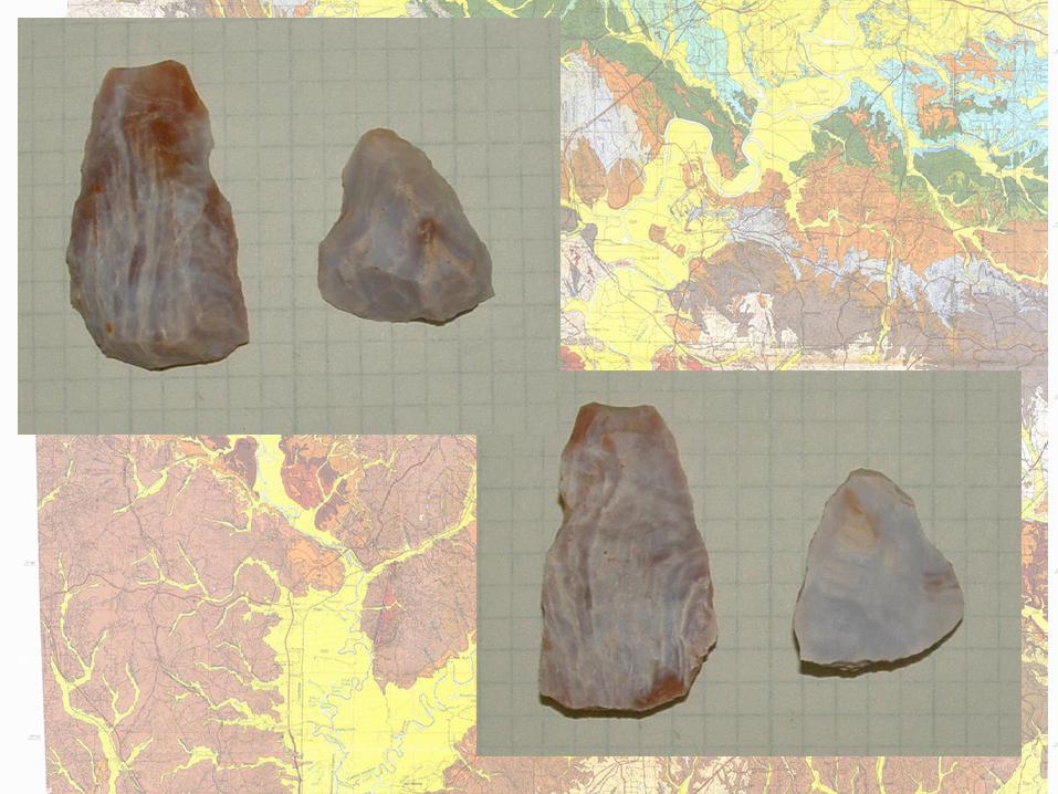
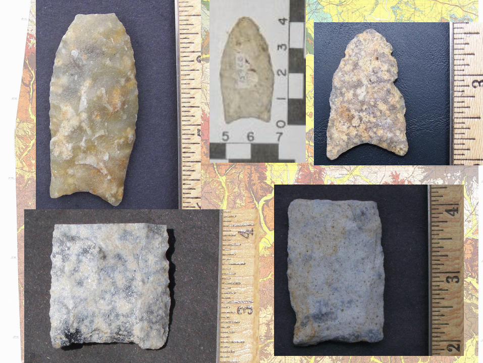
A vast number of Archaic points, a few Woodland points, and at least six Clovis points
have come from the Salitpa Creek sites. [Slide 20] Also likely associated with the Clovis
occupation are uniface tools and at least one unidirectional blade core. Of the six Clovis points,
five are made of Tallahatta sandstone, and one is made from Coastal Plain chert, the nearest
known source of which is approximately 240km to the east. Two of the Clovis points are late
stage preforms. The Clovis point made from chert is heavily resharpened. The presence of
Clovis points at all stages of use-life, in addition to other tools, suggests that quarrying was not
the only activity at the Salitpa sites.
[Slide 21] The next site is Johnson Ridge in Monroe County, also located in the
Buhrstone Hills physiographic section but within the Alabama River drainage. [Slide 22] It is on
an unassuming finger ridge 30 m in elevation above, and about 1.5 km north, of the fourth
order Limestone Creek alluvial bottom. Landowner David Johnson, Jr., contacted me about
7
some archaeological sites on his property from which he had been collecting artifacts. Many
different cultures have lived at this site over the millennia, including a group who left behind
Plano and Dalton type points during the late Paleoindian. At some period, the site was used for
primary reduction of Tallahatta sandstone, not to the extent of the Salitpa sites, but very large
core preparation flakes and preforms make up a good portion of the lithic assemblage. This is
despite the fact that the nearest surface outcrop of the Tallahatta formation is 3.2 km to the
north and 4 km to the east. That said, it is possible that, at some time in the past, the alluvial
bottom of Limestone Creek may have had large boulders of knappable sandstone. Currently,
the creek bottom is very marshy and in a muddy depositional cycle with no visible stone.
Nothing about the setting of the site makes it obvious to archaeologists as a place to find
evidence for Paleonindian activities.
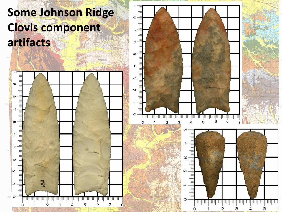
[Slide 23] The Clovis assemblage from the Johnson site consists of four Clovis points,
two of which show no signs of resharpening or breakage. The other two are broken across the
blade. Of the four, three are made of Coastal Plain chert, likely from the Byram Formation in
southeast Alabama. Several uniface tools have been found but because there is a late
Paleoindian component, these artifacts cannot necessarily be attributed to Clovis. I have not
been able to explore the area around the Johnson Ridge site, and there has been virtually no
archaeology done there, so I cannot comment on whether there are other Paleoindian sites
nearby. I have, however, documented three other Clovis points in Monroe County.
The sites described here demonstrate that Clovis artifacts on the Gulf Coastal Plain do
exist as parts of intensive occupation and not just scatters of “isolated” finds. From the Chastain
and Salitpa sites, we have learned that there were centers of concentrated activity with

8
possibly associated nearby sites. It’s important to keep in mind, however, that the Clovis
horizon persisted for several hundred years, so rather than many contemporaneous, related
activity areas, we may be looking at a long-term, multi-generational preference for a particular
place or resource.
One thing that all three sites described here have in common is a proximity to the
Tallahatta Formation. Chastain is close to Tallahatta chert, while Salitpa and Johnson Ridge are
close to Tallahatta sandstone outcrops. Their proximity to highly knappable stone certainly fits
a recognized pattern of Paleoindian settlement pattern elsewhere in eastern North America.
Additionally, Chastain and nearby loci are located immediately next to saline springs, whose
attraction as hunting spots may be significant.
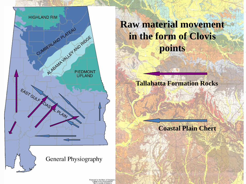
Looking at the raw materials of Clovis points, all of them are either made from
immediately available outcrops of rock or from rocks from southeastern Alabama. This pattern
applies to the points described here and the dozens of others I have documented on the Gulf
Coastal Plain. Conspicuously absent is any stone from the Highland Rim in north Alabama or
Tennessee, where there is a very well-documented concentration of Clovis sites [Slide 24].
The Clovis people in this portion of the Gulf Coastal Plain were not just making tools as
they passed through this toolstone-rich area. They were using them, resharpening them, and
apparently living at these sites. The settings of these sites are not unique; they are repeated
across this area of southwest Alabama, at both salines and places where streams cut through
the upper portion of the Tallahatta Formation. The potential for future research is huge. Over
the last several years, I have spent only one full weekend in excavations, and the avocational
archaeologists’ collections are made during their own free time. With a concentrated program
9
of research, I believe that there is a high probability of finding more sites like these and
developing robust models of Clovis life on the Coastal Plain.
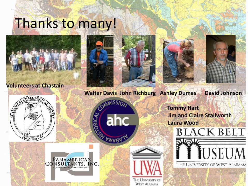
I have many people and organizations to thank. There have been several volunteers
who have put in a Saturday or two on the Chastain Site: thank you to them. Avocational
archaeologists Walter Davis, Tommy Hart, David Johnson, Jr., John Richburg, and Jim and Claire
Stallworth have been especially generous with access to time, collections, and land. Some
funding has been given by the Alabama Historical Commission and the Alabama Archaeological
Society. The Black Belt Museum has helped by providing equipment and curation.
Panamerican Consultants, Inc., my employer, has supported this study in the form of paid time,
computers and office space. Laura Wood has helped with mapping, and Ashley Dumas has
provided many forms of support, from labor to proofreading.
Clovis Sites in the Gulf
Coastal Plain of Southwest
Alabama
Paper presented to the 71st Southeastern Archaeological Conference
Greenville, South Carolina
November 12, 2014
Steven M. Meredith Panamerican Consultants, Inc.
Tombigbee River Drainage
Alabama River Drainage
Fall Line Hills
Black Prairie
Buhrstone Hills and Hatchitigbee Dome
Tallahatta Tallahatta chert sandstone
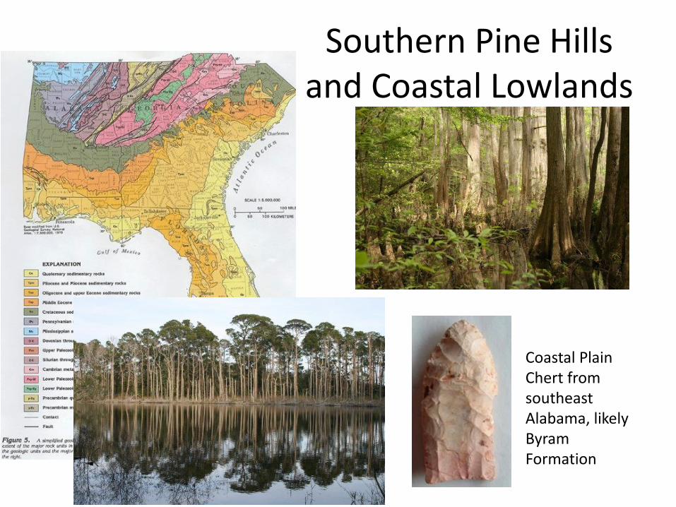
Southern Pine Hills and Coastal Lowlands
Coastal Plain Chert from southeast Alabama, likely Byram Formation
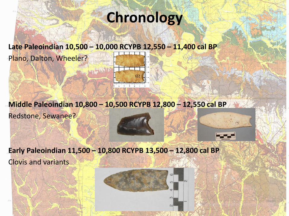
Chronology
Late Paleoindian 10,500 – 10,000 RCYPB 12,550 – 11,400 cal BP
Plano, Dalton, Wheeler?
Middle Paleoindian 10,800 – 10,500 RCYPB 12,800 – 12,550 cal BP
Redstone, Sewanee?
Early Paleoindian 11,500 – 10,800 RCYPB 13,500 – 12,800 cal BP
Clovis and variants
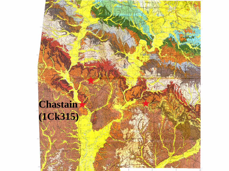
Chastain
(1Ck315)
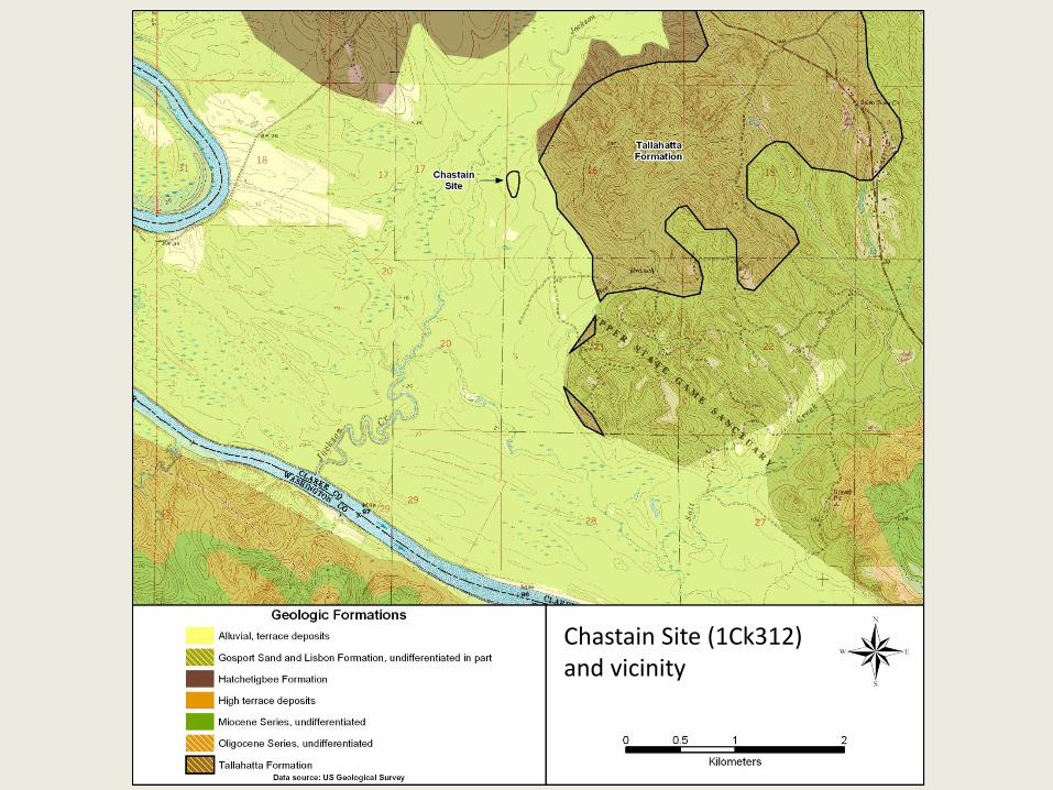
Chastain Site (1Ck312) and vicinity
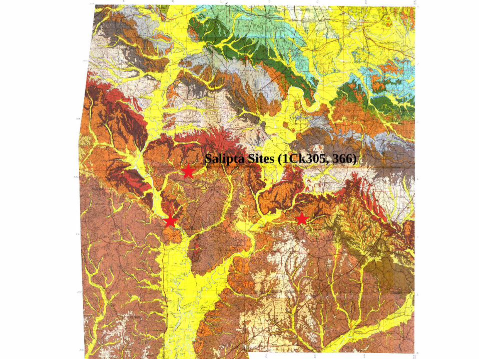
Salipta Sites (1Ck305, 366)
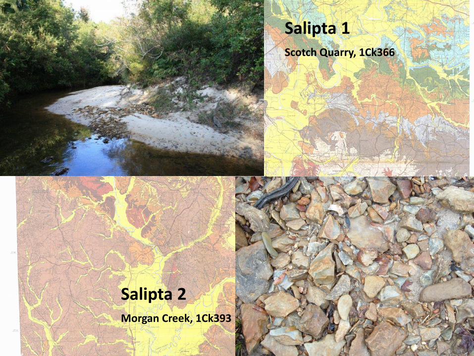
Salipta 1 Scotch Quarry, 1Ck366
Salipta 2 Morgan Creek, 1Ck393

Salipta 1
Salipta 2

Johnson Ridge 3
(1Mn97)
Some Johnson Ridge Clovis component artifacts
Raw material movement
in the form of Clovis
points
Tallahatta Formation Rocks
Coastal Plain Chert
Thanks to many!
Volunteers at Chastain Walter Davis John Richburg Ashley Dumas David Johnson Tommy Hart Jim and Claire Stallworth Laura Wood