archaeolog icai oceanography - (canvas.brown.edu). on
TRANSCRIPT
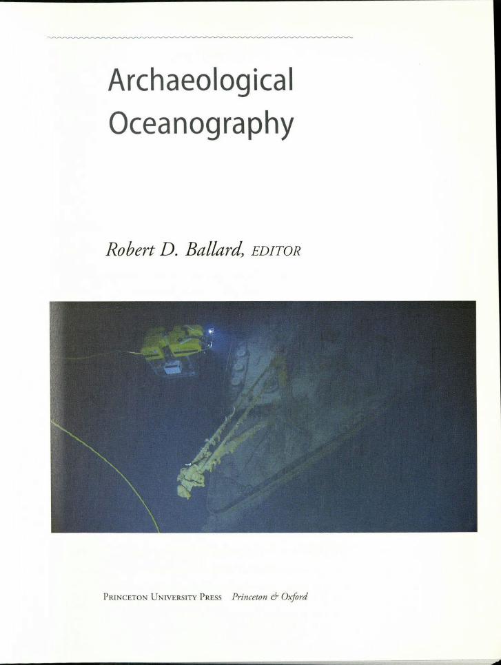
Archaeolog ica IOceanography
Robert D. Ballard, EDITOR
PRlNCETON UNIVERSITY PRESS Princeton & Oxford
Copyright © 2008 by Princeton University Press
Published by Princeton University Press, 41 William Street,
Princeton, New Jersey 08540In {he Unlrcd Kingdom: Princeton University Press, 3 Market Place,
Woodstock, Oxfordshire 0X20 1SY
All Rights Reserved
ISBN-13, 978-0-691-12940-2ISBN-IO, 0-691-12940-1
LmRARY OF CONGRESS CATALOGING-IN-PUBLICATION DATA
Archaeological oceanography I Robert D. Ballard, editor.p. em.
Includes bibliographical references and index.ISBN 978-0-691-12940-2 (doth: alk. paper)I. Underwater archaeology. 2. Coastal archaeology. 3. Excavations
(Archaeology). 4. Shipwrecks. I. Ballard, Robert D.CC77.U5A672008930.1 '028'04-dc22 2007017246
British Library Cataloging-in-Publication Data is available
This book has been composed in Adobe Garamond and Myriad
Printed on add-free paper. 00
press.pri nceron.ed uPrinted in China
10 9 8 7 6 5 4 3 2
The frourispiecc shows ROV Hercules investigating the bow of RMS Titanic,
copyright Institute for Exploration
Introduction IX
CONTENTS
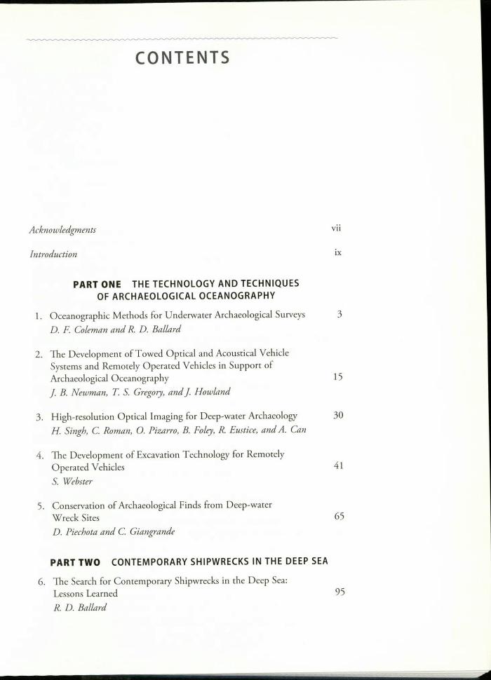
Acknowledgments vii
PART ONE THE TECHNOLOGY AND TECHNIQUESOF ARCHAEOLOGICAL OCEANOGRAPHY
1. Oceanographic Methods for Underwater Archaeological Surveys 3D. F. Coleman and R. D. Ballard
2. The Developmenr of Towed Optical and Acousrical VehicleSystems and Remotely Operated Vehicles in Support ofArchaeological Oceanography 15J B. Newman, T S. Gregory, and J Howland
3. High-resolution Optical Imaging for Deep-water Archaeology 30H. Singh, C. Roman, 0. Pizarro, B. Foley, R. Eustice, and A. Can
4. The Developmenr of Excavation Technology for RemotelyOpera red Vehicles 41S. Webster
5. Conservation of Archaeological Finds from Deep-waterWreck Sires 65D. Piechota and C. Giangrande
PART TWO CONTEMPORARY SHIPWRECKS IN THE DEEP SEA
6. The Seasch for Contemporary Shipwrecks in the Deep Sea:Lessons Learned
R. D. Ballard95
vi
CONTENTS
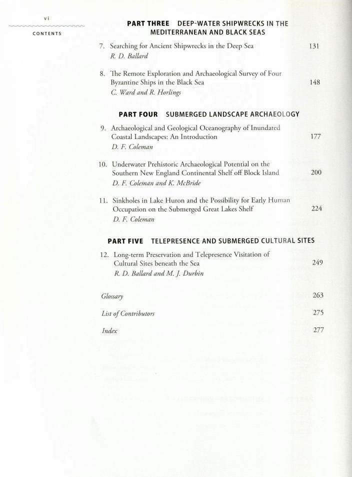
PART THREE DEEP-WATER SHIPWRECKS IN THEMEDITERRANEAN AND BLACK SEAS
7. Searching for Ancienr Shipwrecks in the Deep Sea 13\
R. D. Ballard
8. The Remote Exploration and Archaeological Survey of FourByzantine Ships in the Black Sea 148
C. Ward and R. Horlings
PART FOUR SUBMERGED LANDSCAPE ARCHAEOLOGY
9. Archaeological and Geological Oceanography of InundatedCoastal Landscapes: An Introduction 177
D. F Coleman
10. Underwater Prehistoric Archaeological Potential on theSouthern New England Continental Shelf off Block Island 200
D. F Coleman and K McBride
11. Sinkholes in Lake Huron and the Possibility for Early HumanOccupation on the Submerged Great Lakes Shelf 224
D. F Coleman
PART FIVE TELEPRESENCE AND SUBMERGED CULTURAL SITES
12. Long-term Preservation and Telepresence Visitation ofCultural Sites beneath the Sea
R. D. Ballard and M. j. Durbin249
Glossary 263
List of Contributors 275
Index 277
Oceanographic Methods forUnderwater Archaeological Surveys 1
Dwight F. Coleman and Robert D. Ballard
Geophysical prospecting techniques for land-based archaeological studies arefairly well established. For the most part this is true for marine archaeologicalstudies as well (Oxley and O'Regan 2001). Oceanographic survey techniquesthat focus on mapping and exploring the marine environment are also wellestablished, but tradirional oceanographic methodologies are not rypically ap-plied to marine archaeology. A major limiting factor that influences this is thehigh cost. For example, the current operational cost for using an ocean-classresearch vessel can be more than $20.000 per day. Deep submergence vehiclesystems and advanced geophysical survey equipmenr that are used with theseresearch vessels can cost more rhan $10,000 per day. The total cost for one dayof shipboard operations could be enough to fund an entire season of a terrestrialarchaeological site excavation. Bur this example really does not represent a faircomparison. Such daily costs associated with doing research at sea are typicallydevoted to the study of natural history phenomena in the oceans and on theocean floors. The following questions can be asked: Is [he study of human his-wry beneath the sea just as important as the study of natural history beneaththe sea? Are cultural resources as significant as natural resources? Should federaldollars be equally spem to protect these resources? Should archaeology be fed-erally funded to the same level as other oceanographic sciences? If the answeris yes to any of these questions, then we can justify the cost of conducting"archaeological oceanography." Many of the well-established geophysical toolsand techniques [hat have been employed by archaeologists in shallow water canalso be used on larger ships and in deeper water, thereby employing an oceano-graphic approach. Deep-water oceanographic techniques do nor differ greatlyfrom shallow-water techniques, but a focus here is to present methodologies forsurveying that optimize time on board expensive scientific research vessels.
Archaeologists have used side-scan sonar) subbottom profilers, magnet-ometers, and visual imaging techniques, although not nearly as extensivelyas scuba techniques, to search for and map submerged sites, especially ship-wrecks (Oxley and O'Regan 2001). For exploration and mapping of terrestrial
4sites, use of ground-penetrating radar (GPR) has become more widespread roacoustically image the subsurface details of sites. Collection of sediment coresro ground-truth the GPR data and ro characterize the depositional context ofterrestrial sites is also common in terrestrial sire surveys. In a similar manner to
the way these geological techniques have been employed ro investigate terres-trial archaeological sites. oceanographic techniques are now being employed to
investigate underwater archaeological sites. These techniques (discussed below)are all commonly used during oceanographic research and exploration cruisesand represent important methodologies employed to characterize underwaterarchaeological sites and landscapes.
OlEMAN AND BALLARD
Established Archaeological Survey
Archaeological survey strategies and techniques, particularly for terrestrialsites, are well established (Banning 2002) and include different approaches forexploration, reconnaissance surveying, and intensive site surveying. Regionalscale surveying techniques (Dunnell and Dancey 1983) and sampling strategies(Nance 1983) are also well established, but these are also mainly for terrestrialarchaeology. Archaeological survey can involve different techniques and meth-odologies, depending on the site. From a theoretical standpoint, there shouldbe almost no difference between surveying 011 land or under water, except forthe obvious logistical differences. For example, on land aerial photographs canbe used as a base map similar to the underwater use of side-scan sonar mosa-ics. From a practical standpoint, however, there are significant differences.Firstly, many underwater sites are in regions of velY poor visibility, so surveyorsmust rely more on acoustic strategies than visual strategies. Secondly, surveytechniques for shipwreck archaeology differ from the techniques for surveyingterrestrial (including inundated) sites. Ancient shipping trade routes or moremodern naval barrie locations-regions where shipwrecks would be expected,for example-would have well-defined boundaries that would bias the surveystrategy. Thirdly, and perhaps most importantly, underwater surveys are muchmore difficult logistically, and the rigid limits set by cost, time, and weather forwork at sea could significantly influence survey strategies.
To complete a well-planned archaeological survey, whether on land or underwater (shipwrecks or inundated terrestrial sites), the entire region of interestshould be mapped and investigated, even if there are no suspected sites in partsof the survey region. The absence of sites in particular locations provides scien-tific data and evidence to support the regional archaeological interpretation. Forexample, [Q search for shipwrecks along suspected trade routes, surveyors mustalso search away from me suspected trade routes to verify working hypothesesabout delineation of the suspected routes.
Established guidelines for underwater survey exist, primarily, for the pur-poses of cultural resource management. Several federal agencies in the UnitedStates, such as the Army Corps of Engineers, the Minerals ManagementService, the National Park Service, and the National Oceanic and AtmosphericAdministration, either suggest or require that survey operations follow theirguidelines. These guidelines vary depending on the particular archaeological sites
and the scope of work. For the most parr, the survey guidelines were establishedto protect submerged cultural resources from being damaged by activities thatinvolve disturbance of the seabed, such as dredging, construction projects, andoil well drilling. For these activities in U.S. waters) compliance with the NationalHistoric Preservation Act of 1966 is a requirement, and a complete site surveyand characterization is necessary and must be approved prior to further site activ-ity. Many individual coastal states have rules and regulations in addition to therequirements by federal law. Organizations such as UNESCO (United NationsEducational, Scientific and Cultural Organization) have worked to develop inter-national guidelines and codes of ethics for conducting archaeology under water.
A variety of geophysical methods have been used in land-based archaeologicalexploration and surveying, including, but not limited to, satellite remote sensing,airborne imaging, ground-penetrating radar, and magnetic techniques (Renfrewand Bahn 2000). These are primarily tools for prospecting. Other terrestrialarchaeological methods rhat involve geophysical techniques include archaeo-magnetism, radioisotope studies, dendrochronology, palynology, paleontology,and provenance studies. These are primarily analytical methods and are useful inabsolute dating and understanding past environmental conditions and archaeo-logical associations. For buried terrestrial archaeologicaJ sites, a regional samplingstrategy can be employed to resr for potential sites (Nance 1983). This couldinclude coring or excavating test pits situated in high-probability locarions.
For the marine environment, similar sets of prospecting and analytical tech-niques exist. The primary focus here will be on marine geophysical explorationand surveying techniques, but techniques analogous to those used on land canbe used once an archaeological site is identified for higher-resolution investiga-tions. Intrusive techniques have been employed as parr of the survey phase ofunderwater archaeology (Oxley and O'Regan 2001). This primarily involveslimited sampling of material from the site to better characterize and understandits nature, such as the collection of organic material for radiocarbon dating.Excavation, such as trial trenching on land to test whether a site exists, is intru-sive and can be very destructive, and this is not very practical for investigatingunderwater sites (Oxley and O'Regan 2001). Techniques for underwater siteexcavation are well esrablished (e.g., Green 1990), and typically involve inten-sive surveying to carefully map the site prior to excavation and subsequent sitedisturbance. New oceanographic merhodologies that employ remotely oper-ated vehicle systems for high-ptecision site surveys can now be utilized in bothshallow- and deep-water settings (Foley and Mindell 2002).
Archaeological Oceanographic Surveys
The nature of the survey strategy is dependent on whether archaeological sites areknown to exist within the region to be surveyed. Exploratory and reconnaissancesurveys can take many forms, bur for targeting inundated archaeological sites,certain methodologies work better than others. A full range of geophysical meth-ods can be applied to archaeological oceanography, and these methods help todefine this new field. Inrerpreration of the survey data will help to delineate sitesfor further exploration and detailed investigation. These oceanographic methods
5
Oceanographic Methods
for Underwater
Archaeological Surveys
- ---- -- -
6
llEMAN AND BALLARD
include bathymetric mapping, side-scan sonar surveying, high-resolution reAec-tion surveying (including subbottom profiling and lower-frequency seismicmethods), magnetometer surveys, and visual imaging surveys using remotelyoperated vehicle (ROY) systems (Oxley and O'Regan 200 l). Other geophysicalmethods, including electrical resistivity and marine gravimetry methods, can beused to explore for and characterize underwater archaeological sires.
For the survey of submerged terrestrial sites, the strategy must be differentfrom shipwreck mapping surveys because prehistoric sites are typically buriedin the shelf sediment. 1he process of coastal inundation due to rising sea level isgenetally destructive to archaeological sites. If sites are rapidly buried, there is agreater chance for preservation of delicate materials. But for the most part, whatsurvives are the nondelicate cultural and hwnan remains-lithic artifacts (stonetools, poinrs), kitchen middens (mammal and fish bones, shells), gravesite.(human bones and associated artifacts), stone foundations of dwellings, pottery,hearths, postholes, and other cultural features. Remote-sensing methods wouldnot typically be able to distinguish these cultural remains from natural featureson and in the sediments. Visual methods must be used to identify specific an-thropogenic features from natural features.
A new methodological approach is presented here that involves both remote-sensing and visual inspection techniques. The remote-sensing strategy is usedto identify potential archaeological environments on the seabed. For shipwreckexploration this involves using geophysical prospecting techniques to locateman-made targets on the seabed. For submerged terrestrial sites the remote sens-ing strategy is used to identify paleoshorelines, ancient river channels, tidal inlets,lagoons, and embaymenrs. Once these features are located through mapping andgeomorphologic analysis, a systematic approach to develop the visual survey isused to target regions where submerged archaeological sites are predicted basedon the environmental setting. One aspect of the archaeological oceanographicsurvey methods presented here that is common to all techniques is accurate andprecise navigation. By employing the Global Positioning System (GPS), naviga-tion can be accurate to within a couple of meters using differentially correctedsignals. For the shipwreck and submerged landscape studies presented in laterchapters, the geophysical techniques utilized are bathymetric mapping, side-scansonar imaging, subbottorn profiling, video and still camera photography, andgeological sampling. These are described below.
Side-scan Sonar Surveying
Side-scan sonar is commonly used to acoustically map the seafloor. A side-scansonar tow fish is rypically deployed off a survey vessel and towed behind the shipthrough the water at a given altitude above the seafloor (figure 1.1). Echo is anexample of a side-scan sonar rowfisb (see figure 2.7). For use of this particularsystem, which is capable of operating in deep water, the rowfish is tethered to
a depressor weight that acts as a heave compensator, thereby allowing the row-fish to be unaffected by the ship's vertical motion. The system emits acousticpulses at set intervals that are focused with a defined beam pattern according[Q the design of the sonar transducer. 1he range, or imaging distance to either
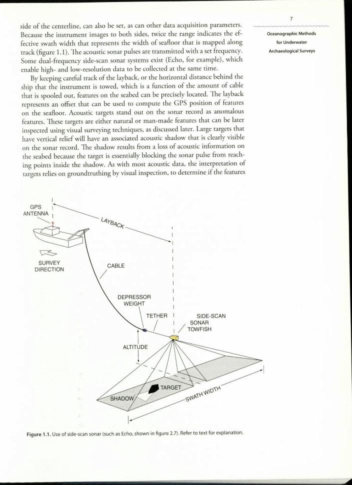
side of the centerline, can also be set, as can other data acquisition parameters.Because the instrument images to both sides, twice the range indicates the ef-fective swath width that represents the width of seafloor that is mapped alongtrack (figure 1.1). The acoustic sonar pulses are transmitted with a set frequency.Some dual-frequency side-scan sonar sysrems exisr (Echo, for example), whichenable high- and low-resolution data ro be collected at the same time.
By keeping careful track of the layback, or the horizontal distance behind theship that the instrument is cowed, which is a function of the amount of cablethat is spooled out, features on the seabed can be precisely located. The laybackrepresents an offset that can be used to compute the GPS position of featureson the seafloor. Acoustic targets stand out on the sonar record as anomalousfeatures. These targets are either natural or man-made features that can be laterinspected using visual surveying techniques, as discussed later. Large targets thathave vertical relief will have an associated acoustic shadow that is clearly visibleon the sonar record. The shadow results from a loss of acoustic information onthe seabed because the target is essentially blocking the sonar pulse from reach-ing points inside the shadow. As with most acoustic data, the interpretation oftargets relies on groundtruthing by visual inspection, to determine if the features
IGPS 1_____________
ANTENNA I ~~ l.<lY8.<1
Ck~;I
~SURVEY
DIRECTIONCABLE
/
DEPRESSORWEIGHT
\
TETHER SIDE-SCAN
/SONAR
1 ----- _/ TOWFISH
ALTITUDE
1
Figure 1.1 Use of side-scan sonar (such as Echo, shown in figure 2.7). Refer to text for explanation.
7
Oceanographic Methods
for Underwater
Archaeological Surveys
are natural or man-made. An exception [Q this is modern shipwreck targets thattypically can be recognized solely by rheir acousric character. To fully character-ize shipwreck targets, visual inspection is still required, however. For more infor-mation on side-scan sonar theory and operation, refer ro Fish and Carr (l991).
8
COLEMAN AND BALLARD
Bathymetric Mapping
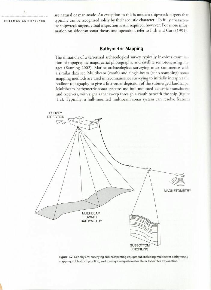
The initiation of a terrestrial archaeological survey typically involves exarninacion of topographic maps, aerial photographs, and satellite remote-sensing images (Banning 2002). Marine archaeological surveying must commence wirla similar data set. Multibearn (swath) and single-beam (echo sounding) sonarmapping methods are used in reconnaissance surveying to initially interpret th«seafloor ropography ro give a first-order depiction of the submerged landscapeMultibeam bathymetric sonar systems use hull-mounted acoustic transducersand receivers, with signals that sweep through a swath beneath the ship (figun1.2). Typically, a hull-mounted multibeam sonar system can resolve features
MULTIBEAMSWATH
BATHYMETRY
MAGNETOMETRY
SUBBonOMPROFILING
Figure 1.2. Geophysical surveying and prospecting equipment, including multi beam bathymetric
mapping, subbottom profiling, and towing a magnetometer. Refer to text for explanation.
9on the seafloor on the order of tens of meters in size, depending on the waterdepth, acquisition parameters, and characteristics of the sonar transducers.Advances in this technology, particularly with deep-towed and robotic systems,have resulted in much more detailed bathymetric maps, with centimeter-scalespatial resolution (Singh et al. 2000). ln addition to collecting new data, pre-existing bathymetric data from older surveys are useful and there are excellentresources for large data sets, although at much coarser resolution. The NOAANational Geophysical Data Center is an excellent resource for processed bathy-metric data sets. Global bathymetric grids based on satellite gravity data exist,but with a resolution of only a few kilometers (Smith and Sandwell 1997).Higher resolution grids from shipboard surveys exist for most U.S. waters.Once the general bathymetric features are determined, more detailed geophysi-cal work can commence.
Oceanographic Methods
for Underwater
Archaeological Surveys
Subbottom Profiling
High-frequency seismic reflection methods, also called subbottorn profiling(figure 1.2) typically use lower-frequency acoustic signals than side-scan sonarto map features below the seafloor. Very low-frequency seismic reflection meth-ods are used to image deep within the earth's sedimentary sequences and crust,but this will not resolve shallow buried features. Oil companies employ thistechnology for hydrocarbon exploration. Echo (figure 2.7) is equipped with ahigh-resolution (Chirp) subbottorn profiler. Typically these systems are rowedbehind a survey vessel. A sound pulse is transmitted vertically through the watercolumn, and any density changes within the seafloor sediments produce reflec-tions that are recorded to produce seismic-stratigraphic profiles. High-resolutionsubbottom profiling data can be used to map anomalous features buried belowthe modern sedimentary cover and to interpret the recent sedimentary history.Data collected in this manner typically need to be postprocessed to correct forship and rowfish navigational parameters, and to remove artificial noise. Theprocessed data, combined with seafloor mapping data (bathymetty and side-scan sonar), can be used [Q produce a complete three-dimensional picture of thegeological and archaeological landscape. 1hese systems do not have high enoughresolution [Q image sites that are buried in the shallow sediments, However, arecently developed ROV-mounted subbottom profiler has been successfullyemployed to investigate shipwrecks (Mindell and Bingham 2001). As with side-scan sonar targets that must be visually verified, seismic data can also be verifiedby grounduuthing. 1his typically involves the collection of marine geologicalsamples (usually sediment cores) along a seismic-stratigraphic profile that cor-relate to the subbotrom imagery. For more information on the application ofsubbortorn profiling to the investigation of submerged archaeological sites referto Suight (1986). Por theory and operational details of high-resolution (Chirp)subbotrorn profiling, refer ro Schock et a!. (1989).
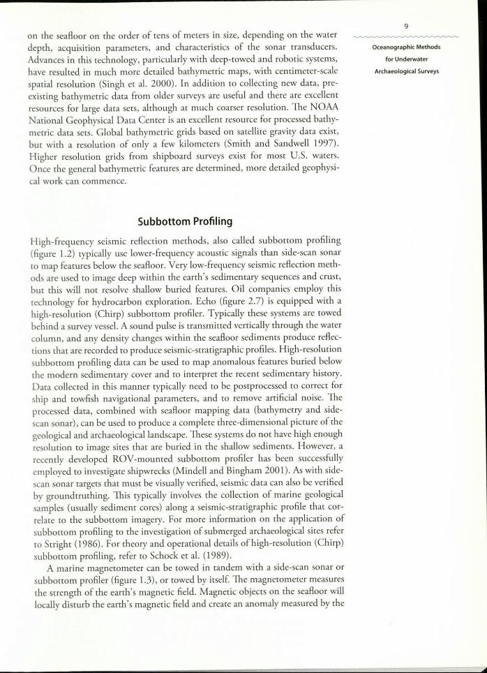
A marine magnetometer can be towed in tandem with a side-scan sonar orsubbortom profiler (figure 1.3), or rowed by itself. The magnetometer measuresthe strength of the earth's magnetic field. Magnetic objects on the seafloor willlocally disturb the earth's magnetic field and create an anomaly measured by the
'0
COLEMAN AND BALLARD
Figure 1.3. Magnetic field anom-aly measured by a magnetometer,created by a target on the seabed.Refer to text for explanation.
MAGNETOMETER
I~#-TA~GET
,,,i ANOMALY'/
~ fn \~~~U5ro L _::;
Distance along track
magnetomerer (figure 1.3). The anomaly is displayed on rhe shipboard acq' si-rion system, and the location of the object or feature on the seafloor rep res' ItS
the magnetic target, similar to a side-scan sonar target. Again. ground-trurL ngis important for target identification and characterization. For more informa-tion on the application of marine magnetometers to shipwreck archaeology,refer ro Clausen and Arnold (1976).
Visual Imaging Techniques
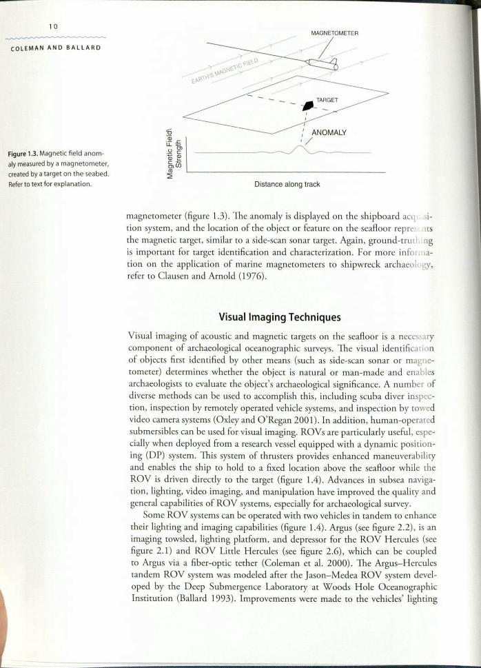
Visual imaging of acoustic and magnetic cargers on the seafloor is a necessarycomponent of archaeological oceanographic surveys. The visual identificationof objects firsr identified by other means (such as side-scan sonar or magne-rornerer) determines whether the object is natural or man-made and enablesarchaeologists ro evaluate the object's archaeological significance. A number ofdiverse methods can be used [0 accomplish this, including scuba diver inspec-tion, inspection by remotely operated vehicle systems, and inspection by [Owedvideo camera systems (Oxley and O'Regan 2001). In addition, human-operatedsubmersibles can be used for visual imaging. ROVs are particularly useful, espe-cially when deployed from a research vessel equipped with a dynamic position-ing (DP) sysrem. This sysrem of thrusrers provides enhanced maneuverabilityand enables rhe ship ro hold to a fixed location above the seafloor while theROV is driven directly ro the targer (figure 1.4). Advances in subsea naviga-rion, lighting, video imaging, and manipulation have improved the quality andgeneral capabilities of ROV sysrems, especially for archaeological survey.
Some ROV systems can be operated with two vehicles in tandem [0 enhancetheir lighring and imaging capabiliries (figure 1.4). Argus (see figure 2.2), is animaging rowsled, lighring platform, and depressor for the ROV Hercules (seefigure 2.1) and ROV Lirtle Hercules (see figure 2.6), which can be coupledro Argus via a fiber-optic tether (Coleman er a]. 2000). The Argus-Herculestandem ROY system was modeled after rhe Jason-Medea ROV system devel-oped by rhe Deep Submergence Laboratory ar Woods Hole OceanographicInstitution (Ballard 1993). Improvements were made ro the vehicles' lighring
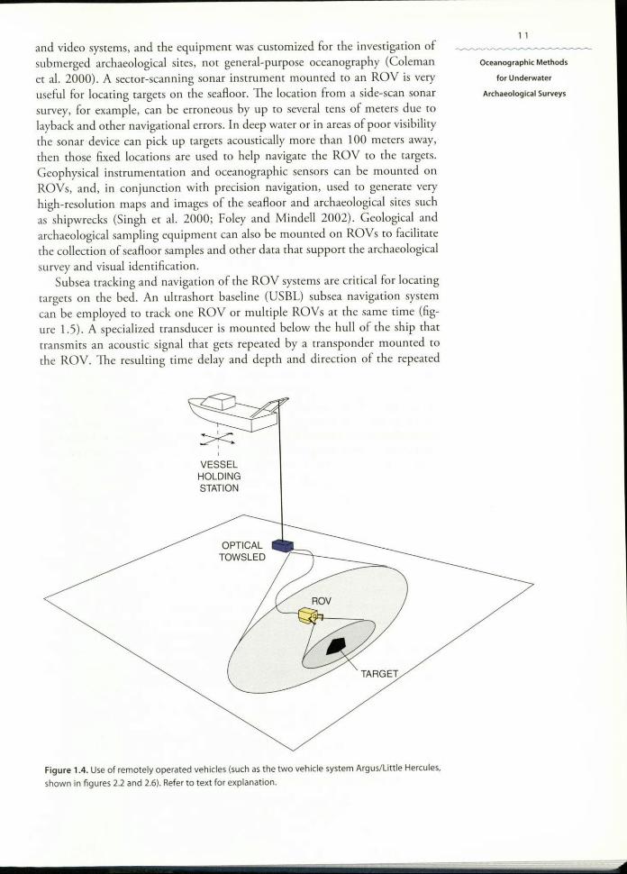
and video systems, and the equipment was customized for rhe investigation ofsubmerged archaeological sites, not general-purpose oceanography (Colemanet al. 2000). A sector-scanning sonar instrument mounted to an ROY is veryuseful for locating targets on the seafloor. The location from a side-scan sonarsurvey, for example, can be erroneous by up to several tens of meters due tolayback and other navigational errors. In deep water or in areas of poor visibilitythe sonar device can pick up targets acoustically more than 100 meters away,then those fixed locations are used to help navigate the ROV to the targets.Geophysical instrumentation and oceanographic sensors can be mounted onROYs, and, in conjunction with precision navigation, used to generate veryhigh-resolution maps and images of the seafloor and archaeological sites suchas shipwrecks (Singh er a!. 2000; Foley and Mindel! 2002). Geological andarchaeological sampling equipment can also be mounted on ROVs to facilitatethe collection of seafloor samples and other data that support the archaeologicalsurvey and visual identification.
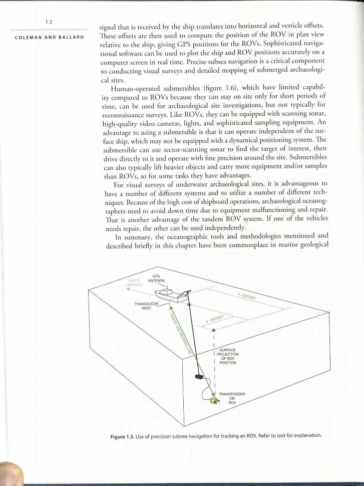
Subsea tracking and navigation of the ROV systems are critical for locatingtargets on the bed. An ultrashort baseline (USBL) subsea navigation systemcan be employed to track one ROV or multiple ROVs at the same time (fig-ure 1.5). A specialized transducer is mounted below the hull of the ship thattransmits an acoustic signal that gets repeated by a transponder mounted to
the ROV. The resulting time delay and depth and direction of the repeated
~ ,,VESSELHOLDINGSTATION
OPTICAL '"i'o:::)--:::::=====TOWSLED
ROV
TARGET
Figure 1.4. Use of remotely operated vehicles (such as the two vehicle system Argus/Little Hercules,shown in figures 2.2 and 2.6). Refer to text for explanation.
11
Oceanographic Methods
for Underwater
Archaeological Surveys
12
COLEMAN AND BALLARD
c
signal that is received by the ship translates into horizontal and verticle offsets.These offsets are then used to compute the position of the ROV in plan viewrelative to the ship, giving CPS positions for the ROVs. Sophisticated naviga-tional software can be used to plot the ship and ROV positions accurately on acomputer screen in real time. Precise subsea navigation is a critical componentto conducting visual surveys and detailed mapping of submerged archaeologi-cal sites.
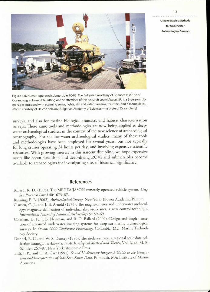
Human-operated submersibles (figure 1.6), which have limited capabil-ity compared to ROVs because they can stay on site only for short periods oftime, can be used for archaeological site investigations, but not typically forreconnaissance surveys. Like ROYs, they can be equipped with scanning sonar,high-quality video cameras, lights, and sophisticated sampling equipment. Anadvantage to using a submersible is that it can operate independent of the sur-face ship, which may nor be equipped with a dynamical positioning system. Thesubmersible can use sector-scanning sonar to find the target of interest, thendrive directly to it and operate with nne precision around the site. Submersiblescan also typically lift heavier objects and caflY more equipment andlor samplesthan ROVs, so for some tasks they have advantages.
For visual surveys of underwater archaeological sites, it is advantageous tohave a number of different systems and to utilize a number of different tech-niques. Because of the high cost of shipboard operations, archaeological oceanog-raphers need to avoid down time due to equipment malfunctioning and repair.That is another advantage of the tandem ROV system. If one of the vehiclesneeds repair, the other can be used independently.
In summary, the oceanographic tools and methodologies mentioned anddescribed briefly in this chapter have been commonplace in marine geological
SHIP'SHEADING
TRANSDUCE~MAST
~'"'i'1,~"""\
.«:~
I
I
I P~~~:~~~NOFROVPOSITION
TRANSPONDER0'ROV
Figure 1.5. Use of precision subsea navigation for tracking an ROV.Refer to text for explanation.
I
Figure 1.6. Human-operated submersible PC-88. The Bulgarian Academy of Sciences Institute ofOceanology submersible, sitting on the afterdeck of the research vessel Akademik, is a 3-person sub-mersible equipped with scanning sonar, lights, still and video cameras, thrusters, and a manipulator.(Photo courtesy of Delcho Solakov, Bulgarian Academy of Sciences-Institute of Oceanology)
surveys, and also for marine biological transects and habitat characterizationsurveys. These same tools and methodologies are now being applied to deep-water archaeological studies, in the context of the new science of archaeologicaloceanography. For shallow-water archaeological studies, many of these toolsand methodologies have been employed for several yeats, but not typicallyfor long cruises operating 24 hours per day, and involving expensive scientificresources. With growing interest in this nascent discipline, we hope expensiveassets like ocean-class ships and deep-diving ROYs and submersibles becomeavailable to archaeologists fat investigating sites of historical significance.
References
Ballard, R. D. (1993). 11,e MEDEA/JASON remotely operated vehicle system. DeepSea Research Part I 40: 1673-87.
Banning, E. B. (2002). Archaeological Survey. New York: Kluwer Academic/Plenum.Clausen, C. J., and J. B. Arnold (1976). The magnerometer and underwater archaeol-
ogy: magnetic delineation of individual shipwreck sites, a new control technique.International Journal of Nautical Archaeology 5:159-69.
Coleman, D. F., J. B. Newman, and R. D. Ballard (2000). Design and implementa-cion of advanced underwater imaging systems for deep sea marine archaeologicalsurveys. In Oceans 2000 Conference Proceedings. Columbia, MD: Marine Technol-ogy Society.
Dunnel, R. C., and W. S. Dancey (1983). The sireless survey: a regional scale data col-lection strategy. In Advances in Archaeological Method and Theory. Vol. 6, ed. M. B.Schiffer, 267-87. New York: Academic Press.
Fish, J. P., and H. A. Carr (1991). Sound Underwater Images: A Guide to the Genera-tion and interpretation of Side Scan Sonar Data. Falmouth, MA: Institute of Marine
Acoustics.
13
Oceanographic Methods
for Underwater
Archaeological Surveys
14
COLEMAN AND BAllARD
Foley, B. P., and D. A. Mindell (2002). Precision survey and archaeological methodol-ogy in deep water. ENALJA: The Journal of the Hellenic Institute of Marine Archaeol-ogy 6:49-56.
Green, J. (1990). Maritime Archaeology: A Technical Handbook. London: AcademicPress.
Mindell, D. A., and B. Bingham (2001). A high-frequency narrow beam sub bot-tom pro filer for archaeological applications. IEEE Oceans Engineering ConferenceProceedings.
Nance, J. D. (1983). Regional sampli ng in archaeological survey: the statistical perspec-tive. In Advances in Archaeological Method and Theory, VoL 6, ed. M. B. Schiffer,289-356. New York: Academic Press.
Oxley, I., and D. O'Regan (2001). The Marine Archaeological Resource. IFA Paper No.4. Reading, UK: Institute of Field Archaeologists.
Renfrew, C, and P. Bahn (2001). Archaeology-Theories, Methods, and Practice. Lon-don: Thames & Hudson.
Schock S. G., L. R. LeBlanc, and L. A. Mayer (1989). Chirp subbottom profiler forquantitative sediment analysis. Geophysics 54:445-50.
Singh, H., L. L. Whitcomb, D. Yoerger. and O. Pizarro (2000). Microbarhymemcmapping from underwater vehicles in the deep ocean. Computer Vision ant! ImageUnderstanding 79: 143-61.
Smith, W.H.F., and D. T. Sandwell (1997). Global seafloor topography from satellitealtimetry and ship depth soundings. Science 277:1957-62.
Srright, M. J. (1986). Evaluation of archaeological site potential on the outer continen-tal shelf using high resolution seismic data. Geophysics 51 :605-22.