agenda - wyre forest district council
TRANSCRIPT

Open
Planning Committee
Agenda
6pm Tuesday, 16th November 2021
Council Chamber Wyre Forest House
Finepoint Way Kidderminster
Planning Committee
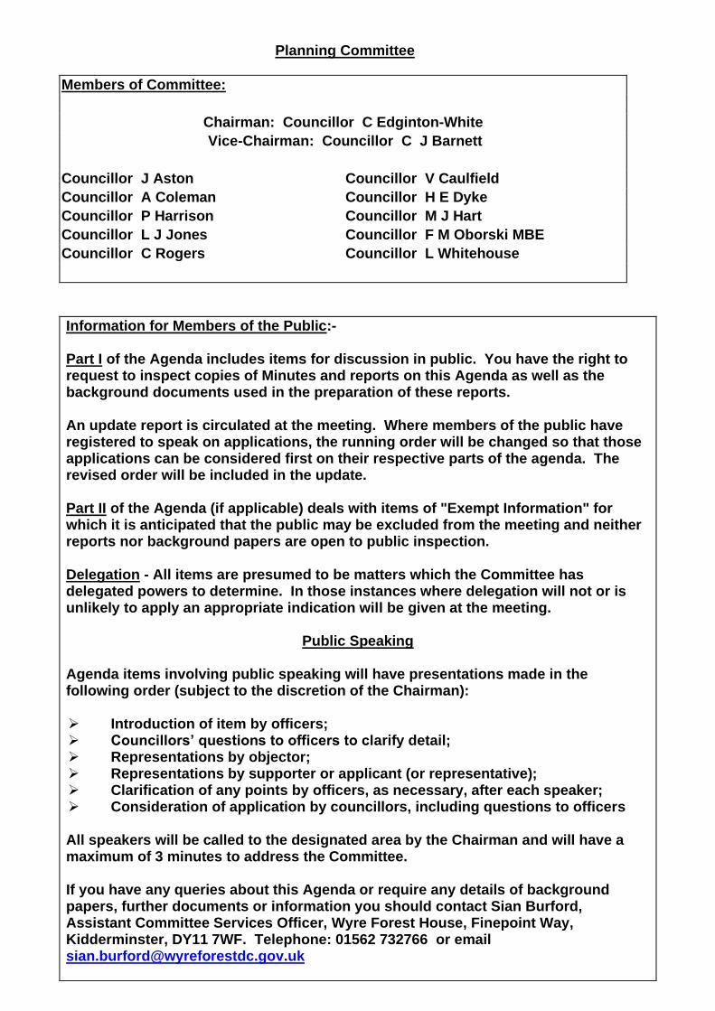
Members of Committee:
Chairman: Councillor C Edginton-White
Vice-Chairman: Councillor C J Barnett
Councillor J Aston Councillor V Caulfield
Councillor A Coleman Councillor H E Dyke
Councillor P Harrison Councillor M J Hart
Councillor L J Jones Councillor F M Oborski MBE
Councillor C Rogers Councillor L Whitehouse
Information for Members of the Public:- Part I of the Agenda includes items for discussion in public. You have the right to request to inspect copies of Minutes and reports on this Agenda as well as the background documents used in the preparation of these reports. An update report is circulated at the meeting. Where members of the public have registered to speak on applications, the running order will be changed so that those applications can be considered first on their respective parts of the agenda. The revised order will be included in the update. Part II of the Agenda (if applicable) deals with items of "Exempt Information" for which it is anticipated that the public may be excluded from the meeting and neither reports nor background papers are open to public inspection. Delegation - All items are presumed to be matters which the Committee has delegated powers to determine. In those instances where delegation will not or is unlikely to apply an appropriate indication will be given at the meeting.
Public Speaking
Agenda items involving public speaking will have presentations made in the following order (subject to the discretion of the Chairman): ➢ Introduction of item by officers; ➢ Councillors’ questions to officers to clarify detail; ➢ Representations by objector; ➢ Representations by supporter or applicant (or representative); ➢ Clarification of any points by officers, as necessary, after each speaker; ➢ Consideration of application by councillors, including questions to officers All speakers will be called to the designated area by the Chairman and will have a maximum of 3 minutes to address the Committee. If you have any queries about this Agenda or require any details of background papers, further documents or information you should contact Sian Burford, Assistant Committee Services Officer, Wyre Forest House, Finepoint Way, Kidderminster, DY11 7WF. Telephone: 01562 732766 or email [email protected]
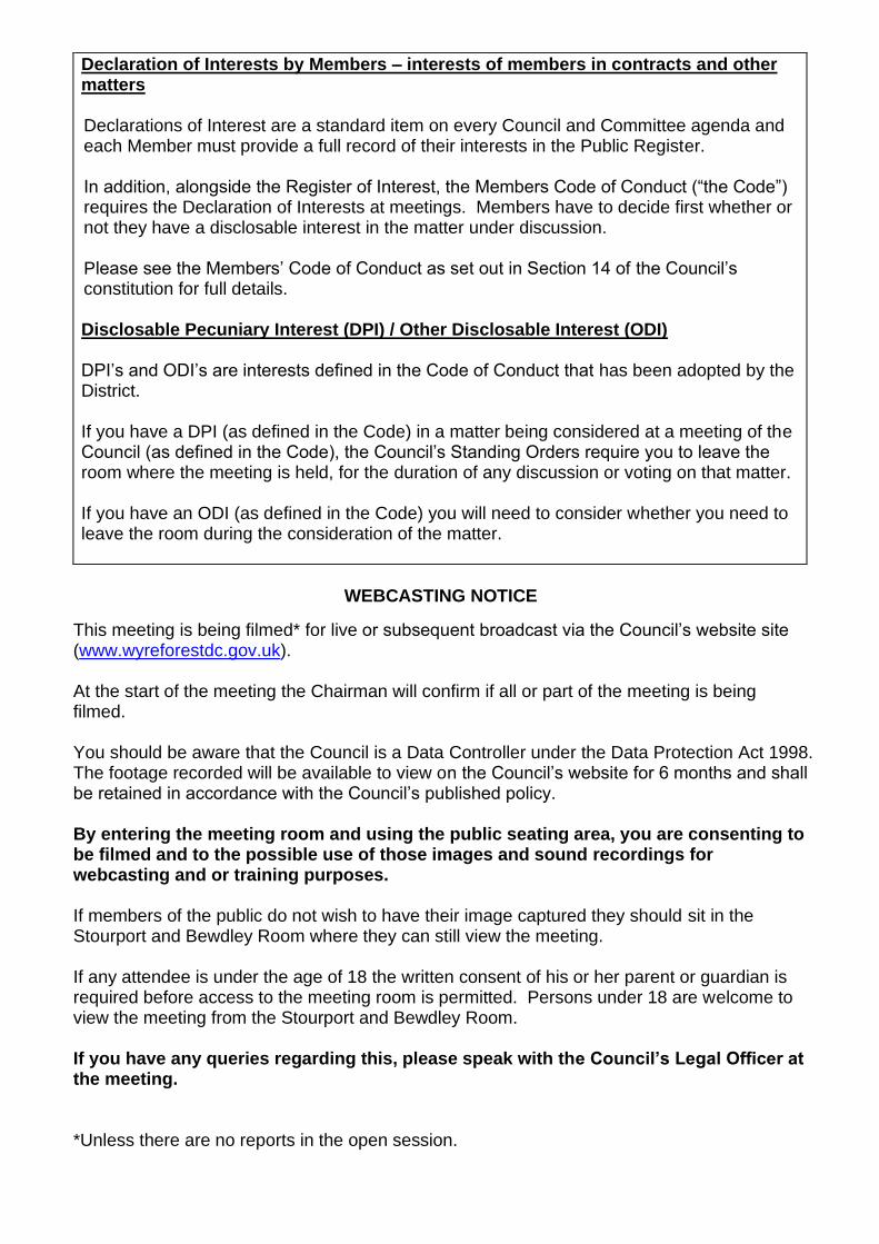
Declaration of Interests by Members – interests of members in contracts and other matters Declarations of Interest are a standard item on every Council and Committee agenda and each Member must provide a full record of their interests in the Public Register.
In addition, alongside the Register of Interest, the Members Code of Conduct (“the Code”) requires the Declaration of Interests at meetings. Members have to decide first whether or not they have a disclosable interest in the matter under discussion.
Please see the Members’ Code of Conduct as set out in Section 14 of the Council’s constitution for full details. Disclosable Pecuniary Interest (DPI) / Other Disclosable Interest (ODI) DPI’s and ODI’s are interests defined in the Code of Conduct that has been adopted by the District. If you have a DPI (as defined in the Code) in a matter being considered at a meeting of the Council (as defined in the Code), the Council’s Standing Orders require you to leave the room where the meeting is held, for the duration of any discussion or voting on that matter. If you have an ODI (as defined in the Code) you will need to consider whether you need to leave the room during the consideration of the matter.
WEBCASTING NOTICE
This meeting is being filmed* for live or subsequent broadcast via the Council’s website site (www.wyreforestdc.gov.uk). At the start of the meeting the Chairman will confirm if all or part of the meeting is being filmed. You should be aware that the Council is a Data Controller under the Data Protection Act 1998. The footage recorded will be available to view on the Council’s website for 6 months and shall be retained in accordance with the Council’s published policy. By entering the meeting room and using the public seating area, you are consenting to be filmed and to the possible use of those images and sound recordings for webcasting and or training purposes. If members of the public do not wish to have their image captured they should sit in the Stourport and Bewdley Room where they can still view the meeting. If any attendee is under the age of 18 the written consent of his or her parent or guardian is required before access to the meeting room is permitted. Persons under 18 are welcome to view the meeting from the Stourport and Bewdley Room. If you have any queries regarding this, please speak with the Council’s Legal Officer at the meeting.
*Unless there are no reports in the open session.
NOTES
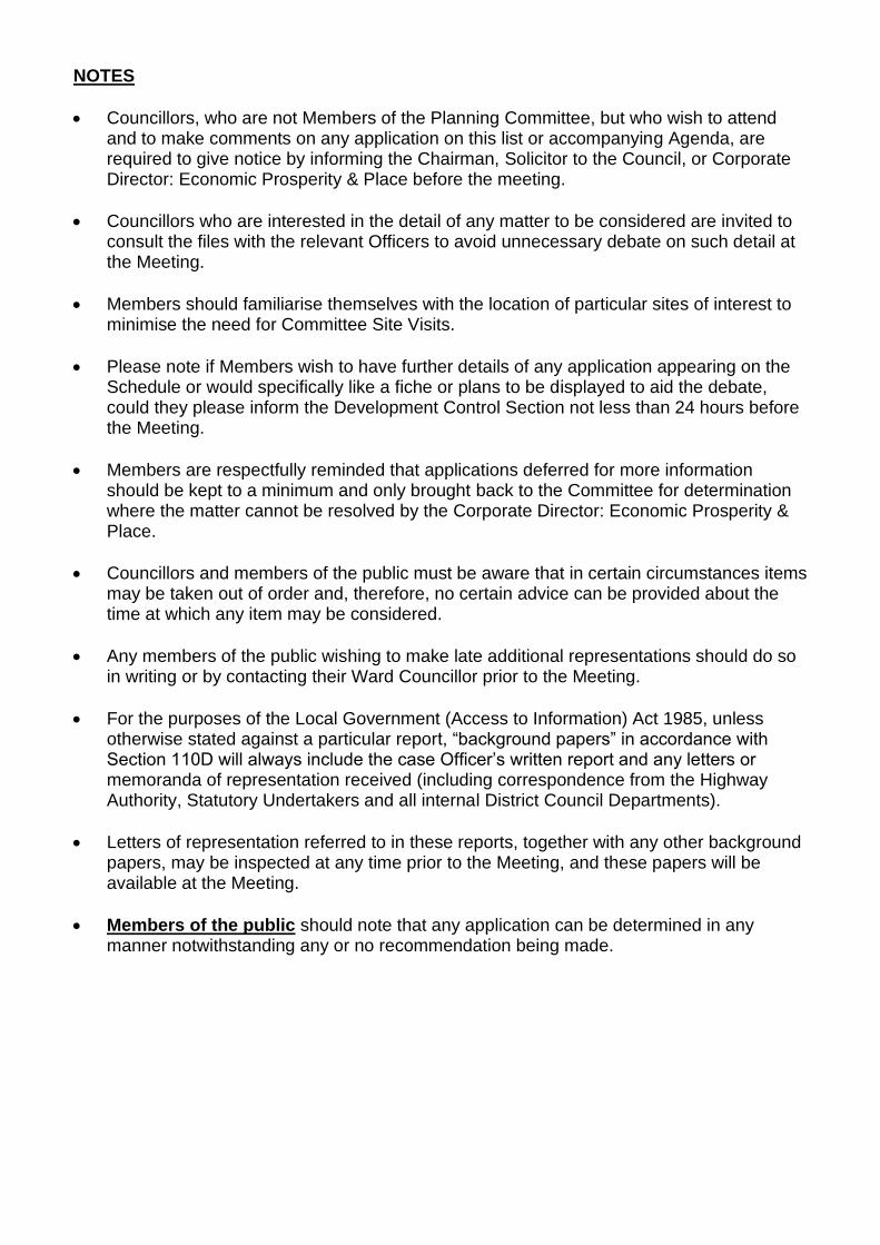
• Councillors, who are not Members of the Planning Committee, but who wish to attend and to make comments on any application on this list or accompanying Agenda, are required to give notice by informing the Chairman, Solicitor to the Council, or Corporate Director: Economic Prosperity & Place before the meeting.
• Councillors who are interested in the detail of any matter to be considered are invited to consult the files with the relevant Officers to avoid unnecessary debate on such detail at the Meeting.
• Members should familiarise themselves with the location of particular sites of interest to minimise the need for Committee Site Visits.
• Please note if Members wish to have further details of any application appearing on the Schedule or would specifically like a fiche or plans to be displayed to aid the debate, could they please inform the Development Control Section not less than 24 hours before the Meeting.
• Members are respectfully reminded that applications deferred for more information should be kept to a minimum and only brought back to the Committee for determination where the matter cannot be resolved by the Corporate Director: Economic Prosperity & Place.
• Councillors and members of the public must be aware that in certain circumstances items may be taken out of order and, therefore, no certain advice can be provided about the time at which any item may be considered.
• Any members of the public wishing to make late additional representations should do so in writing or by contacting their Ward Councillor prior to the Meeting.
• For the purposes of the Local Government (Access to Information) Act 1985, unless otherwise stated against a particular report, “background papers” in accordance with Section 110D will always include the case Officer’s written report and any letters or memoranda of representation received (including correspondence from the Highway Authority, Statutory Undertakers and all internal District Council Departments).
• Letters of representation referred to in these reports, together with any other background papers, may be inspected at any time prior to the Meeting, and these papers will be available at the Meeting.
• Members of the public should note that any application can be determined in any manner notwithstanding any or no recommendation being made.

Wyre Forest District Council
Planning Committee
Tuesday, 16th November 2021
Council Chamber Wyre Forest House, Finepoint Way, Kidderminster
Part 1
Open to the press and public
Agenda item
Subject Page Number
1. Apologies for Absence
2. Appointment of Substitute Members To receive the name of any Councillor who is to act as a substitute, together with the name of the Councillor for whom he/she is acting.
3. Declarations of Interests by Members In accordance with the Code of Conduct, to invite Members to declare the existence and nature of any Disclosable Pecuniary Interests (DPI’s) and / or Other Disclosable Interests (ODI’s) in the following agenda items and indicate the action that they will be taking when the item is considered. Please see the Members’ Code of Conduct as set out in Section 14 of the Council’s Constitution for full details.
4. Minutes To confirm as a correct record the Minutes of the meeting held on the 19th October 2021.
7
5. Applications to be Determined To consider the report of the Development Manager on planning and related applications to be determined.
17
6. To consider any other business, details of which have been communicated to the Solicitor to the Council before the commencement of the meeting, which the Chairman by reason of special circumstances considers to be of so urgent a nature that it cannot wait until the next meeting.
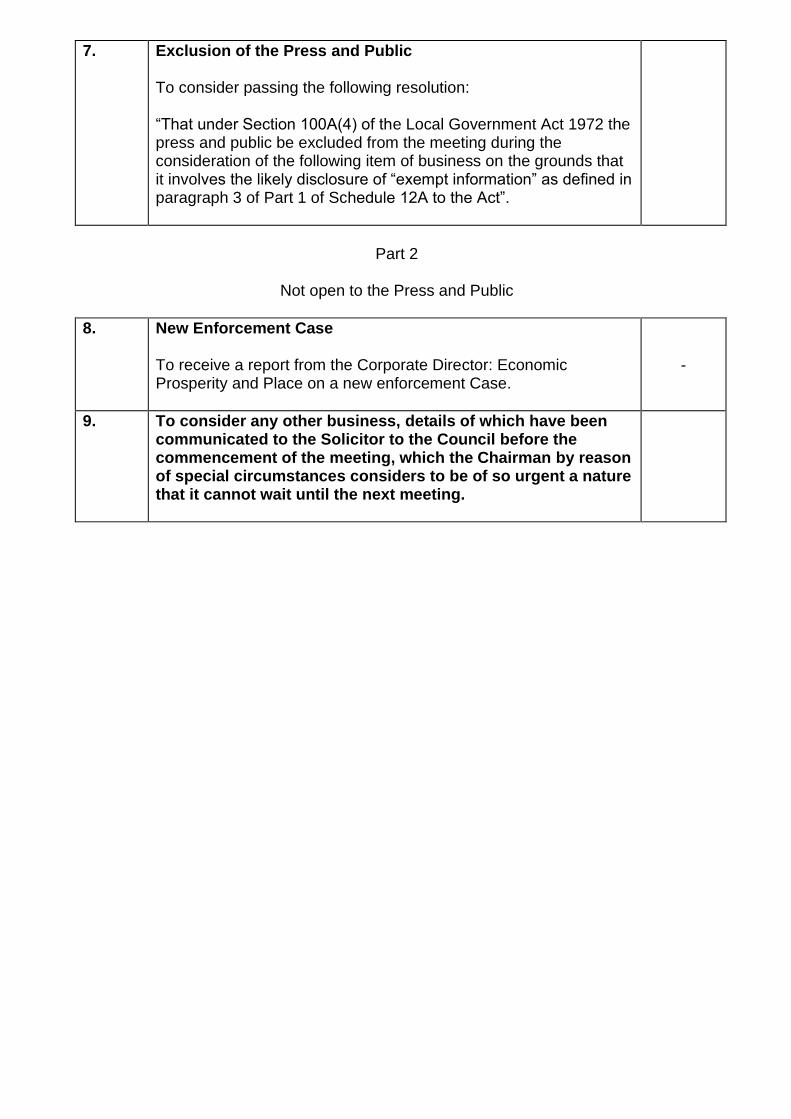
7. Exclusion of the Press and Public To consider passing the following resolution: “That under Section 100A(4) of the Local Government Act 1972 the press and public be excluded from the meeting during the consideration of the following item of business on the grounds that it involves the likely disclosure of “exempt information” as defined in paragraph 3 of Part 1 of Schedule 12A to the Act”.
Part 2
Not open to the Press and Public
8. New Enforcement Case To receive a report from the Corporate Director: Economic Prosperity and Place on a new enforcement Case.
-
9. To consider any other business, details of which have been communicated to the Solicitor to the Council before the commencement of the meeting, which the Chairman by reason of special circumstances considers to be of so urgent a nature that it cannot wait until the next meeting.

Agenda Item No. 4
7
WYRE FOREST DISTRICT COUNCIL
PLANNING COMMITTEE
COUNCIL CHAMBER, WYRE FOREST HOUSE, FINEPOINT WAY, KIDDERMINSTER
19TH OCTOBER 2021 (6 PM)
Present:
Councillors: C Edginton-White (Chairman), C J Barnett (Vice-Chairman), J Aston, V Caulfield, A Coleman, M J Hart, L J Jones, F M Oborski MBE, C Rogers and L Whitehouse.
Observers:
Councillor: R H Coleman.
PL.16 Apologies for Absence
Apologies for absence were received from Councillor H E Dyke.
PL.17 Appointment of Substitutes
No substitutes were appointed
PL.18 Declarations of Interests by Members
No declarations of interests were made.
PL.19 Minutes
Decision: The minutes of the meeting held on 21st September 2021 be confirmed as a correct record and signed by the Chairman.
PL.20 Tree Preservation Order on land at Friends Meeting House, Lower Park, Bewdley
The Committee considered a report to determine whether the Tree Preservation Order No 478 (2021) relating to a group containing a Sliver Birch and Fastigiate Hornbeam, within the grounds of the Friends Meeting House, Lower Park, Bewdley, should be confirmed or not.
Decision: The Tree Preservation Order (TPO) be confirmed without modification.
TPO to include Group 1 (G1) consisting of 1x Silver Birch 1 x Fastigiate Hornbeam
As the trees contributes to the amenity of the locality and they are considered worthy of protection.

Agenda Item No. 4
8
PL.21 Tree Preservation Order on land Adjacent to 60 Bark Hill, Bewdley, DY12 2BD
The Committee considered a report to determine whether the Tree Preservation
Order No 477 (2021) relating to a semi mature English Oak, on land adjacent to 60 Bark Hill, Bewdley, should be confirmed or not.
Decision: The Tree Preservation Order (TPO) be confirmed without
modification. TPO to include: T1 – Oak As the tree contributes to the amenity of the locality and is considered worthy of protection.
PL.22 Tree Preservation Order on Land Adjacent Mill Street & Bradley Thursfield
Court, Kidderminster The Committee considered a report to determine whether the Tree Preservation
Order No 476 (2021) relating to a woodland block, on land adjacent to Mill Street and Bradley Thursfield Court, Kidderminster, should be confirmed or not.
Decision: The Tree Preservation Order (TPO) be confirmed without
modification. TPO to include: W1 – Woodland with mixed species. As the woodland contributes to the amenity of the locality and is considered worthy of protection.
PL.23 Exclusion of Press and Public Decision: "Under Section 100A(4) of the Local Government Act 1972 the
press and public be excluded from the meeting during the consideration of the following items of business on the grounds that they involve the likely disclosure of "exempt information" as defined in paragraphs of Part 1 of Schedule 12A to the Act.
PL.24 New Enforcement Case The Committee received a report from the Corporate Director: Economic Prosperity
and Place on a new enforcement case. Decision: The Solicitor to the Council receive delegated authority to serve or
withhold and Enforcement Notice for the reasons detailed in the confidential report to the Planning Committee.
PL.25 New Enforcement Case The Committee received a report from the Corporate Director: Economic Prosperity
and Place on a new enforcement case. Members’ attention was drawn to the following typographical errors in the

Agenda Item No. 4
9
confidential report: Paragraph 3.7: Race Relations Act 1976 should read Equality Act 2010 Paragraph 5.1: Head of Legal and Democratic Services should read Solicitor to the Council.
Decision: The Solicitor to the Council receive delegated authority to serve or
withhold and Enforcement Notice for the reasons detailed in the confidential report to the Planning Committee.
There being no further business, the meeting ended at 6.46pm.

Agenda Item No. 5
10
EXECUTIVE SUMMARY TO REPORT OF DEVELOPMENT MANAGER
Planning Committee
Part A Applications
Ref: Address of Site Recommendation Page No.
21/0030/FUL Stourport High School and Sixth Form Centre And Playing Fields Coniston Crescent Stourport On Severn Worcestershire DY13 8JU
Delegated Approval
11
Part B Applications
Ref: Address of Site Recommendation Page No.
21/0389/OUT Land Adjacent Keys Meadow New Road Far Forest Kidderminster Worcestershire
Delegated Approval
41

Agenda Item No. 5
11
WYRE FOREST DISTRICT COUNCIL
PLANNING COMMITTEE
16 November 2021
PART A Application Reference:
21/0030/FUL Date Received:
13.01.2021
Ord Sheet: 380938 272564 Expiry Date:
21.05.2021
Case Officer Helen Hawkes Ward: Mitton
Proposal: Erection of 110 dwellings including 18 affordable units, together with
associated infrastructure, access and public open space and demolition
of caretaker's dwellinghouse and garage
Site Address: Stourport High School and Sixth Form Centre, And Playing Fields,
Coniston Crescent, Stourport On Severn, Worcestershire, DY13 8JU,
Applicant: Taylor Wimpey and SAET
Summary of Policy DS01, DS03, DS04, CP01, CP02, CP03, CP04, CP05, CP07, CP11,
CP12, CP13, CP14 (AWFCS)
DPL1, DPL2, CC1, CC2, CC6, CC7, UP1, UP4, UP5, UP7, UP9
(SAAPLP)
6B, 6E, 7A, 8A, 8B, 9, 11A, 11C, 11D, 14, 15A, 15B, 15C, 15D, 16A,
16C, 18A, 20B, 20C, 24B, 25, 27A, 27C, 33.16 (EWFLP)
Design Guidance SPD
National Planning Policy Framework
Planning Practice Guidance
National Design Guide
Recommendation DELEGATED APPROVAL
Reason for Referral ‘Major’ Planning Application
1.0 Planning History
21/0030/FUL
Erection of 110 dwellings including 18 affordable units, together with associated
infrastructure, access and public open space and demolition of caretaker's
dwellinghouse and garage
21/0694/FUL
Demolition of former caretakers house
Agenda Item No. 5
12
21/0030/FUL
19/2027/CR
Condition 4 of Planning Permission 18/0577/FULL
18/0577/FULL
Erection of two storey Science Block
18/0424/FULL
Single storey extension to dining hall
15/7180/PAE
Extensions and alterations including demolition to Sixth Form Block and extension of car park
14/0456/WCCR Proposed maintenance access gate to external fencing due to be installed as part
of Planning Approval Ref: 13/000047/REG3(13/0468/WCCR)
WF289/92
Town and Country Planning Act 1990. Town and Country Planning General
Regulations 1992. WF289/92 dated 13th August 1982 Provision of Garage and
P.E. Store at Bullish Middle School Coniston Crescent Stourport on Severn
WF532/81
Town and Country Planning Act 1971
WF532/81 dated 9th June 1981 Entrance lobby to changing rooms at Burlish Middle School Coniston Crescent Stourport on Severn
2.0 Consultations and Representations
2.1 Stourport-on-Severn Town Council – Recommend refusal. It is advised that the Town
Council Is not against this development, however will not approve the access off Coniston Crescent, in terms of safety. The local plan states the access should be off The Kingsway and this is where is needs to be. Also has allotment access been taken into account?
[Officer comment – The reference to the Local Plan refers to the emerging Local Plan that is currently being examined. Details of the emerging policy requirements are discussed under the Officer Comments section. Discussions have taken place with the allotment manager and the proposals have been amended to retain the existing gated access into the allotment from the site]
2.2 Highway Authority - No objection subject to conditions and financial obligations. The Highway Authority undertook a detailed review of the submitted documents and, on 26 February 2021, recommended that determination of the application be deferred pending receipt of further information to address the Authority’s concerns. Since then, discussions have been held with the applicant and their transport consultants. And a revised layout has been submitted which forms the basis of this response. The application site, which is currently vacant, is a broadly rectangular parcel of land extending to approximately 4.1 hectares. It is located approximately 1.5km northwest of Stourport-on-Severn town centre and is part brownfield, consisting of the site of a former sixth form centre, now demolished, and a former caretaker's house. Both are situated to the north east of Coniston Crescent. The remainder was formerly used as school sports pitches.
Agenda Item No. 5
13
21/0030/FUL
In the draft Wyre Forest District Council Local Plan, the Proposed Revised Policy AM33 – ‘Stourport-on-Severn Site Allocations’, identifies various allocations in Stourport, needed to meet the emerging Plan's housing requirement. The application site is identified as allocation MI/38 – School Site Coniston Crescent. It is suggested that the site has the capacity to deliver 115 dwellings. The policy also confirms that the site is to be removed from the Green Belt. The applicant seeks full planning permission for 110 residential dwellings, the demolition of the former caretaker’s house, a new vehicular access, green infrastructure, and associated works. Access to the site is currently via a gated access from Coniston Crescent, that used to serve the sixth form block. The Highway Authority has been clear that vehicular access from Kingsway would be preferred to serve the current proposal. Access The Applicant has submitted Drawing No. A928-01/I ‘Planning Layout’ showing access via the currently redundant access to the site which is situated alongside the unoccupied former caretaker’s house on the north east side of Coniston Crescent. This would be upgraded to adoptable standard comprising a 5.5m wide road with 6m junction radii at its junction with Coniston Crescent and 2.0m footways on both sides of the carriageway. This complies with the WCC Streetscape Design Guide (Supplementary Design Guide - SDG). Dropped kerbs and tactile paving should be provided at the mouth of the junction for pedestrians, also in accordance with the SDG. This should be secured by condition requiring their inclusion under the terms of the proposed S38 adoption agreement. The drawing shows visibility splays of 2.4m by 24m and 30m based on the 85th percentile approach speeds of vehicles and complies with current standards. A section of footway is proposed to be constructed along Coniston Crescent, in front of the existing car park. This would provide pedestrian access to the adjacent primary school, as well as a safer link to existing footways to the east of the access. As this is an alteration to the existing public highway, it will require the applicant to secure a S278 Agreement with the Highway Authority. Internal Layout Car Parking The proposed quantum of parking spaces is acceptable. Submission of details showing that their dimensions comply with the SDG and that spaces to the rear of footways or carriageways are sufficiently long to prevent overhang onto public space should be secured by condition and checked as part of the S38 process. The SDG strongly encourages all properties to be equipped with Ultra Low Emission Vehicle (ULEV) charging points, including provision where communal parking is provided. This is supported by the National Planning Policy Framework (NPPF). The Highway Authority request confirmation that ULEV charging facilities will be provided for each dwelling. This can be covered by a suitable condition, should planning consent be granted.
Agenda Item No. 5
14
21/0030/FUL
At the beginning and end of the school day, Coniston Crescent is used by parents and carers as a location to park due to its proximity to the western gate to Burlish Park primary school. Coniston Crescent is also used informally as a one-way route from west to east by parents, at the request of the school. The location of the proposed site access will result in the loss of 5-6 informal car parking spaces on Coniston Crescent and an inevitable displacement of parking. To mitigate this and provide a betterment to the current situation, the development will provide a 6-space parking area to the north of the access junction, for use at school pick up and drop off time. This proposed arrangement is acceptable to the Highway Authority. In addition, a financial contribution is to be provided to the Highway Authority to formally line the current car parking area, helping formalise the parking arrangements and making best use of the available space. This would be secured through a suitable legal agreement, should planning consent be granted. To discourage vehicles parking close to the proposed site and to ensure appropriate junction visibility waiting restrictions, in the form of double yellow lines, should be provided. The Applicant will be expected to fund the cost of processing the associated Traffic Regulation Order (TRO), as well as laying of the road markings. The cost of processing the TRO is estimated at approximately £4,500 and would be secured through a suitable legal agreement. Cycle Parking The Design and Access Statement advises that cycle parking will be provided within garages or where garages are unavailable, sheds will be provided within the rear gardens. Dwg. No. A928/01/G shows sheds provided for those plots that do not have garages. This is acceptable to the Highway Authority.
Walking and Cycling To encourage more active travel from the development and increase the safety and accessibility of the proposed development for pedestrians and cyclists, the Highway Authority initially requested a contribution towards a new Toucan crossing at the A451/Kingsway junction, given that no controlled crossing facilities are currently provided. However, subsequent discussions have focused on a contribution towards a new active travel corridor, proposed to run from Burlish Top (along Kingsway) to Stourport Road. This would have wider benefits to the development and the local community. It would be subject to a suitable legal agreement, should planning consent be granted. Highway Impact The Trip Rate Information Computer System (TRICS) database has been used to generate vehicle trip rates for the proposed development. The resulting trip rates have been based on a total of 118 dwellings which are forecast to generate 53 two-way trips during the AM peak and 53 two-way trips during the PM peak. In addition, person trip rates and the 2011 Census has been used to provide a comparison to the TRICS database. The results show a total of 92 two-way vehicle trips during the AM peak and 70 two-way vehicle trips during the PM peak. In order to provide a robust assessment, the higher trip rates have been used for junction assessment purposes.

Agenda Item No. 5
15
21/0030/FUL
The forecast residential traffic generation has been distributed onto the surrounding highway network using 2011 Census Journey to Work data. The Highway Authority considers this acceptable. Traffic counts were undertaken in September 2017, during school term times but, due to Covid restrictions, no further counts have been possible. The 2017 traffic counts have been factored up to a new base year of 2021 and a future year of 2026, using local TEMPRO growth factors, which include all known committed development not captured by the traffic count data. This is an acceptable method of analysis.
The impact of the development has subsequently been assessed on the following junctions:
• Windermere Way/A451 Minster Road priority junction; and • Burlish Crossing/Bewdley Road/Lickhill Road signalised crossroads.
The results of the junction modelling show that, in all future year scenarios, the operation of both junctions, in terms of development impact, is generally acceptable and do not justify any proposed mitigation measures or give grounds for refusal of the application.
Other local junctions, including the new site access, are considered to have relatively low background traffic flows and will continue to operate within theoretical capacity with the addition of the development traffic. No further assessment is, therefore, considered necessary.
It is acknowledged use of Coniston Crescent is likely to generate objections from existing residents and the local community. Whilst Coniston Crescent will experience an increase in traffic flows, the highway is of an appropriate standard to accommodate the increased traffic during school drop off and pick up periods. Motorists will be expected to exercise due care and attention at all times. [Officer Comment - As a result of the anticipated concerns the Council has commissioned its own report to validate or otherwise the County Council’s recommendations which are set out in the Officer Comments section of this report.
2.3 Worcestershire Regulatory Services (Air Quality) – No objections subject to conditions.
The assessment is appropriate and WRS agree with the methodology and conclusions, therefore WRS have no adverse comments to make for air quality for this development. Given the size of the proposed development air quality mitigation measures are required to be conditioned including, cycle parking, electric vehicle charging points and low NOx boilers.
2.4 Worcestershire Regulatory Services (Noise and Nuisance) – No objection to the
application subject to a condition to require replacement luminaires to the floodlights adjacent to Plots 80 and 81 are implemented prior to the occupation of these dwellings and that the replacement luminaires comply with Institute of Lighting Engineers Guidance. The submitted odour assessment concludes that odour from the school kitchen should not adversely impact future residents. Therefore, I have no objection to the application in terms of odour, noise and nuisance.

Agenda Item No. 5
16
21/0030/FUL
2.5 Design Out of Crime Officer - No objection to this application. My only area of concern
is the two footpaths that join existing paths down the side of the allotments and onto Kingsway. We have had issues with shed burglaries and theft on the allotments. My fear is that these paths will be used as an escape route off the estate for criminals. I therefore question if they are really required, if not can they be blocked off? [Officer comments – Following a meeting with the Allotment Manager it was requested that the development retains the two paths and gates for pedestrian access, which serve existing allotment holders who walk to the site from Burlish housing estate]
2.6 Housing Enabling Officer – No objection to the application and happy to make the shared ownership 10 units rather than 9 but would prefer 6 x 2 bed and 4 x 3 bed and for social rent units to comprise 4 x 1 bed, 8 x 2 bed, 4 x 3 bed and 2 x 4 bed.
2.7 Planning Policy – No objection. It is advised that this site is within the WFDC
submitted Local Plan as site allocation MI/38.
The site includes both Greenfield and Brownfield land. This means that the 40% Green Infrastructure (GI) should only be applied to the greenfield area of the site. For the brownfield area of the site, Policy 14 does not specify a specific GI figure, but brownfield developments are expected to include GI features such as SuDs, green roofs, green walls and biodiversity measures that will be deliverable wherever possible. Policy 14 also states that this requirement is subject to viability requirements which does build in some flexibility to GI requirements for new developments where viability issues have been evidenced. The council contacted the School who confirmed in August 2019 that site MI/38 had not been used or maintained for playing pitch purposes for a significant period of time, and that the council’s Playing Pitch Strategy was inaccurate in identifying it as such. This is evidenced in the Statement of Common Ground between WFDC and Sport England. The Council’s Playing Pitch Strategy has been updated accordingly. It will be prohibitively expensive for the school to maintain, and that monies raised from the development will fund the construction of one 3G pitch and essential repairs. The contribution to a 3G pitch provision must therefore be included. This will be required to be consistent with NPPF paragraph 97. This has been confirmed by the Department of Education, May 2020, within Appendix 2 of the full planning statement by the applicant. The access to the site should also be strongly encouraged from the Kingsway and not Coniston Crescent. If these conditions are met the application on balance should be supported.
2.8 WCC Children First – No objection subject to a planning obligation to secure £837,861 towards Primary, Secondary and SEND infrastructure.
2.9 Worcestershire Regulatory Services (Potential Contaminated Land Team) – No
objection subject to a condition to require adequate site investigations for potential contaminated land and to include proposals for any mitigation including land remediation. It is advised that WRS have read the Site Investigation Report ref 20088 (prepared by Travis Baker Geo Environmental for Taylor Wimpey West Midlands) and with reference to the contaminated soil removal and subsequent clean cover (minimum 600mm with hard / no dig barrier), WRS are in agreement with the report’s

Agenda Item No. 5
17
21/0030/FUL
methodology and outcomes. However, the gas monitoring has produced four results over a one month period and while some gas protection methods have been referred to, WRS would ideally like to see further gas monitoring (also referred to in the report) in line with BS8485. Given the above, WRS recommend a condition is applied to the application, should any permission be granted to the development, to ensure PCL issues on site are appropriately addressed.
2.10 WCC Sustainability Officer – There is very little information included within the
application documents detailing how this will be a ‘sustainable’ development. [Officer Comments – additional details have been submitted that include 10%
photovoltaics across the development]. 2.11 Natural England – No objection and advise that based on the plans submitted, Natural
England considers that the proposed development will not have significant adverse impacts on statutorily protected nature conservation sites or landscapes.
2.12 Arboricultural Officer - No objection subject to conditions to secure implementation of
the submitted Tree Protection Plan and a Landscape Management Plan. It is advised that the important arboricultural features within this application are suitably protected and will enhance the development without becoming a nuisance to the new home owners. Furthermore, that the new arboricultural features proposed around the site. The Hornbeam hedge around the perimeter of the site along with suitable tree planting within the development, will ensure the development will add to the urban forest of Stourport.
2.13 Sport England – Objects to the planning application. It is advised that the site contains
a large area of playing field and the slab of the former sixth form block and an associated caretakers house. The 6th form was re-built on another part of the school playing field. The relevant planning consent (15/0583/OUTL) requires the old 6th form block to be demolished and the area laid out to provide a replacement area of playing field. Subsequently, a Section 73 application (18/0352/S73) was submitted to vary the planning conditions, for which Sport England have objected. This application is presently still to be determined. The school have implemented the 6th form development and are therefore currently in breach of the conditions contained within the outline planning consent.
The proposed loss of playing field equates to an area of 3.4 hectares or thereabouts, being capable of providing two football or rugby pitches. I have previously explained in response to pre-application enquiries that there has previously been two cricket pitches at the school playing fields, including one of the pitches in the area of playing field loss and so this also needs to be taken into account. There have been two football pitches and a cricket pitch in the central part of the playing field in the past, however this area has since been sub-divided by a fence to enclose part of the playing field area within the curtilage of Burlish Park Primary School. This means that the cricket pitch can no longer be used and also affects the size of football pitches that can be accommodated in this part of the site. Nonetheless, the school site has previously been laid out to provide a total of 4 football/rugby pitches and two cricket pitches.

Agenda Item No. 5
18
21/0030/FUL
The application documents include an assessment of the works required to improve the quality of the school buildings and a letter from Secretary of State for Education in relation to the intended disposal of the site. This sets out the terms for the Secretary of State to agree the disposal of the site, including a condition to mitigate the loss of the playing field by building a full size hybrid all-weather pitch within 3 years and to a specification relevant for its main use as a rugby pitch. A sum of £926,000 has been identified by the applicant as being reserved to cover the cost of constructing this pitch At this stage, no details of the siting and design proposed pitch have been provided, though I expect this would be sited on an existing area of grass playing field, if so would then mean a further loss of grass pitches and loss of capacity to provide a range of winter and summer sports. Other considerations to highlight include the need for appropriate changing room provision, car parking, storage and access. We are aware that the current changing rooms at the school are of a poor condition. Ideally changing provision should be located as close as possible to the 3G. To meet the needs of football, we would require the following:
• Changing room toilets – A minimum of two w.c toilets, self-contained, per changing
room.
• Spectator toilets / disabled toilets – should be separate from player toilets.
• Showers – A minimum of four shower heads plus a dry-off area of 8m2.
• Officials - officials’ accommodation x 2 should be separate and self-contained with a
shower and toilet facility of a minimum of 6m2.
• Changing room size – changing rooms should be a minimum of 16 m2 (for
grassroots football) and 18 m2 (for football in the National League System) of usable
changing space (not including toilets and showers). We would need to understand
the proposed football club use here to align to the requirements.
2.14 WCC Archaeologist – No objection to the application and it is advised that due to the 20th century ground disturbance on the site it is felt that there is low potential for any archaeological remains to survive and therefore there are no archaeological concerns or issues with this application.
2.15 North Worcestershire Water Management Officer – No Objections subject to
conditions. It is acknowledged this site is not at risk of flooding from any source. Based upon the further information submitted (emails 30 September and 5 October 2021), I believe that there would no longer be a reason to withhold approval of this application on flood risk grounds.
2.16 Countryside and Parks Manager – No Objections, suitable survey work has been
undertaken. Suitable conditions are required to ensure no protected species are impacted and that identified mitigation/enhancement works are provided.
2.17 Severn Trent Water – No objection subject to conditions

Agenda Item No. 5
19
21/0030/FUL
2.18 Neighbour/Site Notice Representations
61 letters of objection received from nearby occupiers, and all comments have been fully taken into account in the consideration of this application and have been summarised as follows:
- Land should be developed for leisure facility not more housing
- Lack of road infrastructure
- Loss of parking and the proposal to provide 6 spaces would not have a significant
effect.
- Construction vehicles will harm pedestrian and vehicular safety.
- Unsafe pedestrian routes for school children due to increased traffic
- Traffic congestion, Coniston Crescent certainly cannot take this extra traffic
despite what the Transport Plan in the application says
- Impact on Highway Safety, as access would be close to two schools putting
children, parents and residents at risk with increased traffic volume.
- Coniston Crescent is often gridlocked and there are times when emergency
services would not be able to get through.
- Access should be from Kingsway to make it a completely separate new estate
with no access to the Burlish Park Estate.
- Conflict with local plan as the local plan requires access is required to be from
Kingsway.- Footpaths are so congested it is impossible to maintain Covid 19
social distancing and therefore it is sensible to access the development from
Kingsway to take some pressure off Windermere Way and also it would be
sensible to provide a new footpath to the Athletics Club.
- Increase of pollution.
- Noise nuisance.
- General dislike of proposal
- Lack of school places already in the area
- More open space needed on development
- Over development
- Out of keeping with character of area
- Strain on existing facilities
- Loss of privacy and light
- Inadequate public transport provision
- Affect ecology
- Close to adjoining properties and will impact residential amenity
- Development too high
- Increase danger of flooding
- Developer should have included in their costings for the site sufficient funding for
the provision of an access road from the Kingsway (about 100m) as per the Local
Plan. This is part of the financial viability assessment for building the site. Don't let
them get away with it.
- Loss of a perfectly good house (caretaker’s house)
- Ruin the nice community feel of the area and result in loss of the very little green
land left in the area.
- Development should provide self build homes and homes for Military Veteran
families and disabled Veterans with ground floor living accommodation.
- Development should provide open space for picnics and a play area for older
children.

Agenda Item No. 5
20
21/0030/FUL
- The proposed development on Pearl Lane is a far better location for new housing
not this site.
- As more houses are being built in the area we need additional surgeries, schools,
swimming facilities, hospitals, recycling centres to accommodate the exploding
population in Wyre Forest.
- The land should have been converted to playing fields following the demolition of
the Sixth Form College but the conditions have been ignored by the school.
- The school should have generated the monies elsewhere to repair the school
buildings and why has the school built three brand new buildings if they didn’t
have the funding. Also, there is no guarantee that the money generated from the
sale will be used for the designated purpose.
- The school would have no remaining land for future expansion.
- Once again we see land from a school site being sold off to help fund
maintenance and development at the school. This should be coming from central
government, not from the loss of school amenities.
- The school field once had 4 football pitches and 1 rugby pitch. If it loses this land it
will be reduced to just 2 grass pitches - 1 for football and 1 to be redeveloped as
an artificial grass rugby pitch. This means that the school could not host 2 home
football fixtures on the same day. As a school which fields at least one football
team from each year group this would seriously impact on its capabilities to offer
sport on the same level as it has in the past. It is my understanding that, despite
intending to sell this land for several years now, the Severn Academies
Educational Trust still does not have a detailed plan for how it will maintain the
school's sports provisions through this loss of land. Once land like this has been
lost it will never be recovered.
- There is plenty of land around Stourport upon which housing could be built, but
only one sports field for the school
24 letters of support received during the public consultation period, and it was expressed in the letters that this development would provide much needed housing for the community, the area and for our children. 70 letters of objection received following re-consultation of the planning application in June 2021, in relation to revised internal layout which included minor changes to the house types, landscaping provision and siting of buildings. The objections that have been received in this consultation mostly repeat the objections that have already been received.
3.0 Site Location and Description
3.1 The application site extends to 4.1 hectares and comprises a rectangular shaped
parcel of land with access off Coniston Crescent. It is relatively flat in ground levels and includes a row of trees within the site and around the periphery. The site is part brownfield having been previously developed for the former Sixth Form Centre, which has now been demolished to slab level and also includes the vacant caretaker’s house that fronts onto Coniston Crescent. The remaining part of the site is greenfield, which comprises unused school playing fields owned by Stourport High School and Wyre Forest District Council owned land that previously formed part of the Burlish Golf

Agenda Item No. 5
21
21/0030/FUL
Course, which has now ceased. The site is located within the Green Belt and is also entirely within Flood Zone 1. The site has one Tree Preservation Order (no. 441), which covers a group of trees fronting Coniston Crescent and 5 individual trees to the north western boundary, all which are to be retained.
3.2 The site lies adjacent to the urban edge of Stouport-on-Severn and approximately 4
miles south of Kidderminster. It is adjoined to the northeast by Kingsway allotments, with the Stourport Sports Club located beyond on the opposite side of the Kingsway. To the southeast of the site lies the existing playing fields and netball/hockey courts to the school. To the northwest of the site is the former Burlish Golf course and there is a public footpath that runs the length of the northern boundary of the site and provides access to the Kingsway Allotments. To the southwest, the site is adjoined by Burlish Park Primary School and to the west by Coniston Crescent, which includes a small number of detached dormer bungalows and two-storey dwellings. Coniston Crescent joins Windermere Way and heading east, links with the A451 Minster Road. The A451 is the main route from the north into the town centre of Stourport and south into Kidderminster. The Kingsway also provides access to the A451 Minster Road and to Burlish Crossing, where it meets Bewdley Road North and Lickhill Road North.
3.3 The site has been identified as a site allocation for up to 110 dwellings under draft
Policy 33.16 of the Emerging Local Plan, which if adopted, would remove the site from the Green Belt.
3.4 The application seeks full planning permission for the erection of 110 dwellings, the
demolition of the former caretaker’s house, a new vehicular access, children’s play area and associated works.
3.5 The site has been specifically promoted by the Severn Academy Education Trust in
order to fund essential maintenance works to Stourport High School and fund the delivery of an all-weather playing pitch.
3.6 The application has been supported with a Design and Access Statement, Tree
Survey Plan and Report, Tree Retention and Removal Plan, Arboricultural Impact Assessment, Tree Protection Plan, Drainage Strategy, Preliminary Ecological Assessment, Condition Report, Planning Statement, Financial Viability Assessment, Transport Assessment and Travel Plan, Site Investigation Report for Potential Contaminated Land, Lighting Assessment, Odour Assessment, Landscape Proposals, Sustainability Statement and a Flood Risk Assessment.
4.0 Officer Comments
THE NEED FOR THE DEVELOPMENT 4.1 It is important to set out at this stage, the Trust’s principle purpose and need for
promoting the development. This will assist in the consideration in respect of planning obligations and the planning balance.
4.2 A large proportion of the Stourport High School buildings date back to the 1950s. It
was the intention for the school to be demolished and replaced on the same site
Agenda Item No. 5
22
21/0030/FUL
during the mid-2000s, prior to the last recession. However, following the cancellation of the Building Schools for the Future Programme as part of the austerity measures, this opportunity was lost. There is now no prospect of the Trust receiving funding for a replacement school. They are having to make best use of the buildings that they have and undertake repair work as necessary. The Trust have commissioned a series of condition surveys of Stourport High School. The most recent of which was produced in October 2020 and forms an application document. This report confirms that approximately £4.9m needs to be spent on the school buildings. In addition, the school should budget for approximately £926,000 for the development of a synthetic all weather playing pitch, as required by the Secretary of State. As detailed in the condition survey, a series of work items have been identified that are of 'significant concern' that could cause full or partial closure of significant parts of the school unless urgent works are programmed.
4.3 As detailed in the Condition Survey the above work all needs to be undertaken in the
short-term, i.e. within five-years, with the majority of the work needing to be undertaken within two-years of date of the survey. The Trust has explored a variety of different options to fund this work. Whilst the Trust has been successful in obtaining grant funding in the past it no longer qualifies for further funding. Multi-academy trusts, such as Severn Academies Trust, receive a School Condition Allocation (“SCA”) and Developed Formula Capital (“DFC”) payment to deploy strategically across their estate to address priority maintenance needs. The Trust cannot apply for Condition Improvement Funding as it receives SCA funding. The amount of money received from SCA and DFC is primarily based on the numbers of pupils in the trust. It takes no account of the condition of the buildings under the care of the Trust. Under this system each year the Trust receives a set SCA payment of approximately £770,000 and a DFC payment of approximately £74,000. This money has to support all seven schools within the Trust and is required for routine maintenance.
4.4 The Trust are, therefore, in a position whereby the only way they can raise the
significant capital funds required for the essential repair works is to sell the surplus land for a higher value use, i.e. residential.
4.5 Given this position, the Trust has agreed with the Secretary of State that it is
appropriate for the application site to be sold for residential development. The Secretary of State endorses the sale of this parcel of land with the following stipulations:
• The Trust must achieve a minimum sale value of £4m and the sale cannot be
subject to overage.
• To mitigate the loss of playing field land the Trust are required to provide a full size
hybrid all-weather pitch within three-years, to a specification relevant to its main
use as a rugby pitch.
• All other proceeds will be spent on urgent condition work to the school, as
identified by a works schedule and prioritised by an independent surveyor.
• To commence works to the school buildings by 31st May 2022.
• The Trust is required to provide the Department for Education ('DfE') with an
update on the progress of the above actions every six-months from the date of its
letter.

Agenda Item No. 5
23
21/0030/FUL
4.6 These considerations are highly material in the consideration of the application and
the financial contributions to be sought through the planning obligations. It is evidently clear from the documentation received that the proposal under consideration is the only realistic way of the Trust generating the funds required to deliver the essential repair works to the school. Due to the tight deadlines set by the Department of Education there is no opportunity for the Trust to wait for the adoption of the Local Plan.
POLICY CONTEXT
4.7 Section 70(2) of the Town and Country Planning Act 1990 and section 38(6) of the Planning and Compulsory Purchase Act 2004 require that the determination of planning applications must be made in accordance with the Development Plan, unless material considerations indicate otherwise.
4.8 The development plan for Wyre Forest District comprises the Adopted Core Strategy
(2010), the Adopted Site Allocations and Policies Local Plan (2013), the Adopted Policies Map (2013), Adopted Planning Obligations SPD, Adopted Affordable Housing SPD, Adopted Design Guidance SPD and WFDC Playing Pitch Strategy.
4.9 The National Planning Policy Framework (the ‘Framework’) is a material consideration in the decision making of this application and was revised in July 2021. It sets out the Government’s planning policies for England and how these should be applied. It advises that the purpose of the planning system is to contribute to the achievement of sustainable development, which means that the planning system has three overarching objectives (economic, environmental and social) which are interdependent and need to be pursued in mutually supportive ways. The Framework emphasis that decisions should play an active role in guiding development towards sustainable solutions, but in doing so should take local circumstances into account, to reflect the character, needs and opportunities of each area.
4.10 The Framework seeks to support the Government’s objective in promoting sustainable
patterns of development across the country and this includes: the need to significantly boost the supply of homes; providing sufficient social and recreational facilities to meet community needs; protecting and minimising the impacts on the natural environment; and seeking to mitigate the impacts of climate change.
4.11 The Emerging Local Plan is a material consideration. Paragraph 48 of the Framework
advises that Local Planning Authorities can give weight to relevant policies in emerging plans according to:
the stage of preparation of the emerging plan (the more advanced its preparation, the greater the weight that may be given); the extent to which there are unresolved objections to relevant policies (the less significant the unresolved objections, the greater the weight that may be given); and the degree of consistency of the relevant policies in the emerging plan to this Framework (the closer the policies in the emerging plan to the policies in the Framework, the greater the weight that may be given).
4.12 The Emerging Local Plan underwent public examination in January/February this year
by the Planning Inspector appointed by the Secretary of State and public consultation

Agenda Item No. 5
24
21/0030/FUL
is currently being held on the Inspector’s main modifications. The Emerging Local Plan is very close to an advanced stage in its preparation and its policies, which are considered relevant to this application, are consistent with the revised Framework 2021.
4.13 The Emerging Local Plan sets out a site-specific allocation policy (33.16) for this site
for residential development, with a suggested capacity of 110 dwellings. The draft policy advises that the site would be removed from the Green Belt and that the policy requirements for development on this site would include:
1. Vehicular access should be taken from the Kingsway adjacent to the
allotments;
2. The existing trees on the site should be supplemented enhanced to develop
a buffer between the existing dwellings on Coniston Crescent and the new
development; and
3. An ecological appraisal should be submitted as part of any future planning
application and measures for the protection and enhancement of ecological
interests should be incorporated in the development
4.14 Whilst no objection has been received in relation to the allocation of the site for
housing in principle and the release of the land from the Green Belt, the Council have received two objections to draft policy 33.16: these being from Taylor Wimpey, the applicant for this application, and Sport England. The objection received from Taylor Wimpey relates to the access from the Kingsway and they have suggested to the Planning Inspector that ‘… part 1 of the policy should be amended to introduce additional flexibility. It should advise that vehicular access to the site can be taken from The Kingsway, or Coniston Crescent’. The Sport England objection is consistent with their objection to this application as outlined above.
4.15 I consider that the unresolved Taylor Wimpey objection relates wholly to the access
requirements of the site and do not go to the heart of the allocation. Following the hearing sessions, the Inspector’s main modifications to Policy 33.16 have introduced the wording ‘should’ as set out above. The change to this this wording of the policy is intended to give the flexibility to provide access off Kingsway or an alternative access from Coniston Crescent following evidence at the Local Plan Hearing Sessions. Members, will appreciate that the phrase ‘should’ does not set a definitive requirement but sets the desire of the Council. As the part of the policy is still to be resolved, the access requirement in the policy can only been given limited weight even though the main allocation can be given greater weight. Given that the County Council have found that access from Coniston Crescent has been proven to be technically acceptable, the Council could not maintain a policy position whereby access could only be gained from The Kingsway.
4.16 Sport England have expressed an objection concerning the loss of playing field
provision as a result of housing development on this site and the absence of any requirement for compensation or mitigation for this loss in the draft site allocation policy. The Council have taken a different view, agreeing with Stourport High School and the decision made by the Secretary of State to dispose of the school land, on grounds that the playing field provision is surplus to requirements. Whilst this is an

Agenda Item No. 5
25
21/0030/FUL
unresolved objection, the Inspector has fully considered Sport England’s objection at the hearing sessions and has not suggested any further modifications to the allocation policy. The objection does relate to the wider principle of allocation but does not dilute the weight that can be afforded to the policy, particularly as the compensatory sports provision is considered as part of this detailed application. Given that the Inspector has considered this matter at the hearing stage of the Examination of the emerging Local Plan and has not indicated support for the Sport England objections, the officer view is that they should not therefore be relied upon as a reason for refusing this application.
4.17 The site is situated within the Green Belt, which is a significant and weighty factor to
be considered in the context of this application. Whilst consideration is being given to removing this site from the Green Belt as part of the emerging Local Plan, this has not occurred at the point of consideration of this planning application. As such whilst weight can be given to emerging policies as a material consideration, it is Officers view that the adopted policy framework should be the primary consideration factor in the determination of this application.
4.18 The planning application is therefore to be primarily considered in the context of the
current development plan and the draft policies contained within the Emerging Plan which have not received significant unresolved objections. As such, the proposals relate to a major housing development within the Green Belt and includes the loss of playing fields.
WHETHER INAPPROPRIATE DEVELOPMENT IN THE GREEN BELT
4.19 The site lies within the Green Belt and according to Policy SAL.UP1 of the Adopted Site Allocations and Policies Local Plan and draft policy 25 of the Emerging Local Plan new developments within the Green Belt will only be permitted if very special circumstances exist unless the development meets one of the limited exceptions. Policy SAL.UP1 and 25 are consistent with Paragraphs 149 and 150 of the Framework which also contains a presumption against inappropriate development in the Green Belt and states that the construction of new buildings will be inappropriate unless the development meets a similar list of exceptions. The proposed development for 110 dwellings on land that is mostly unused playing field and a small area of previously developed land, would not fall within any of the exceptions listed and therefore would amount to inappropriate development. Paragraph 147 of the Framework advises that inappropriate development is, by definition, harmful to the Green Belt and should not be approved except in very special circumstances. The Framework further states in paragraph 148 that local planning authorities should ensure that substantial weight is given to any harm to the Green Belt. ‘Very special circumstances’ will not exist unless the potential harm to the Green Belt by reason of inappropriateness, and any other harm resulting from the proposal, is clearly outweighed by other considerations.
4.20 The principle of development is therefore unacceptable due to the inappropriateness
of the development in the Green Belt. This report focuses on whether there is any other harm resulting from the proposal and whether very special circumstances exist to outweigh the harm.
Agenda Item No. 5
26
21/0030/FUL
IMPACT ON LANDSCAPE CHARACTER
4.21 The application site falls within the Worcestershire County Council’s Landscape Character Type ‘Sandstone Estatelands’. In this part of the district, the ‘Sandstone Estatelands’ landscape type extends from the Staffordshire and Worcestershire Canal and covers the Green Belt area between the urban edge of Stourport-on-Severn and the urban edge of Kidderminster and includes the application site. The advice sheet for Sandstone Estatelands makes a number of recommendations to enhance the unique character of the landscape and advises that there is capacity to accommodate considerable areas of new woodland planting and scope for improving wildlife habitats and corridors, particularly the development of wide field margins.
4.22 I note that the site is allocated for Education use on the Adopted Policies Map and
therefore its present land use does not reflect the typical primary land use of this landscape which comprises mainly arable land and woodland. However, due to its location between existing open playing fields and the former golf course, the site does make a positive contribution in terms of providing a strong sense of visual unity with the wider landscape. However, I consider that the degree of harm to the landscape character and viewpoints will be adequately mitigated due to the location of the site being directly adjacent to the urban edge of Stourport, which will allow the development to appear as a logical urban expansion to Stourport and the proposed density and spatial composition of the development will reflect the existing housing development in Buttermere Road which also abuts the boundary to the former Burlish Golf Course, which is also proposed to be removed from the Green Belt for residential development as part of the emerging Local Plan.
4.23 Also, the design and layout of the proposed housing has resulted in development
being set back from the northern boundary to provide green infrastructure adjacent to the former golf course and would include new public open space within a central reserve, a formal play area and new tree planting to enhance the existing group of trees adjacent to Coniston Crescent in order to create a woodland with longevity. The proposed open space along the northern boundary would also act as a dark corridor for wildlife, in particular protected bat species and would contain the proposed housing development within the current application site, to prevent encroachment into the wider Green Belt, that is not allocated for housing in the Emerging Local Plan.
4.24 Overall, the proposals would inevitably bring about change to viewpoints in the
surrounding area, however, I am of the view that the impact on landscape character would be minimal due to the location of the site being well related to the existing urban edge and the new improved public open space provision and the woodland planting would help to retain a sense of unity with the wider landscape. I therefore consider that the proposed development would accord with Policy CP12 of the Adopted Core Strategy and draft Policy 11C of the Emerging Local Plan which both seek to ensure new developments protect and where possible enhance the unique character of the landscape.
LOSS OF PLAYING FIELD
4.25 The application site includes unused playing fields which previously formed part of the existing playing fields to Stourport High School and Sixth Form Centre. The unused playing fields within the application site have now been fenced off from the school grounds and are now only used by the general public for recreational use, dog walking

Agenda Item No. 5
27
21/0030/FUL
and to access the adjoining allotments. The site also comprises land that was previously occupied by the former Sixth Form Centre which has been replaced by a new building that was sited in a different location to be closer to the main high school buildings but on former playing field. As part of the Outline Consent for the new Sixth Form Centre, a planning condition was imposed on the decision notice (application reference 15/0583/OUTL) to require the land of the former Sixth Form Centre to be restored to playing fields to offset the loss of playing field as a result of the new Sixth Form Centre development and to provide a betterment to the quality of play provision as it created a more useable and larger playing area. The restoration has not occurred and an application is pending to vary this condition. The Trust have not carried out the work due to the discussions with the Department of Education in respect of the disposal of the land. The consideration of this application therefore needs to take account of the loss playing fields as though it had been restored.
4.26 Policy SAL.UP4 refers to Open Space and Play Provision advises that sites identified
in the Wyre Forest District Open Space, Sport and Recreation Assessment (October 2018) and the Wyre Forest District Playing Pitch Strategy (2012) as indicated on the Policies Map will be safeguarded from development unless it meets specific criteria.
4.27 Whilst the application site consists partly of unused playing field, it has only been
identified as Green Belt and not as Play Provision on the Adopted Policies Map (2013) and has been identified as being surplus to requirements in the addendum to the Playing Pitch Strategy. Furthermore, it has not been made available for use by the community by the school and there are no planning conditions that require the school playing fields to be used by the community. As such, apart from the playing field currently being used for recreational use by the public for walking, dog-walking and to access the adjoining allotments, it provides no other community benefit apart from being part of the school playing fields. I also note that there is no requirement within the draft site allocation policy or the main modifications of the Emerging Local Plan to provide compensation or mitigation for the loss of playing field.
4.28 The applicant has advised that in order for the Trust to be able to dispose of the site
for residential development they have had to demonstrate to the satisfaction of the Secretary of State for Education that the site is surplus to all educational requirements, including playing pitch provision.
4.29 Sport England have raised an objection on the grounds of loss of playing field,
contrary to Paragraph 99 of the Framework (previously paragraph 97). Policy 99 of the Framework advises that existing playing fields should not be built on unless:
• an assessment has been undertaken which has clearly shown the open space,
buildings or land to be surplus to requirements; or
• the loss resulting from the proposed development would be replaced by equivalent
or better provision in terms of quantity and quality in a suitable location; or
• the development is for alternative sports and recreational provision, the benefits of
which clearly outweigh the loss of the current or former use.

Agenda Item No. 5
28
21/0030/FUL
4.30 In my view, the land is currently playing field although it is not, and is unlikely to be,
made available for community use in the future. I also agree with the applicant that this part of the existing school’s playing field is surplus to requirements in accordance with Paragraph 99(a) of the Framework.
4.31 Paragraph 98 of the Framework also advises that access to a network of high quality
open spaces and opportunities for sport and physical activity is important for the health and well-being of communities and can deliver wider benefits for nature and support efforts to address climate change. Policy CP07 of the Adopted Core Strategy and draft Policies 9 and 20C of the Emerging Local Plan seek to ensure that new developments provide opportunities for formal and informal physical activity, exercise, recreation and play spaces that support healthy living environments. The supporting text under draft Policy 20C also states that the Council will require major developments to provide and contribute to the provision of multifunction open space which serves and meets the needs of the development as well as local needs. It also states in paragraph 20.18 that the Playing Pitch Strategy requires the District to provide two additional 3G pitches in the plan period.
4.32 As part of the agreement with the Secretary of State for the disposal of the school
land, the school will use part of the capital receipt from the land sale to provide a new 3G rugby pitch on the remaining playing field. The school are legally bound to provide this within 3 years (unless that date is extended by the Secretary of State).
4.33 Whilst a planning application would need to be submitted for the 3G pitch, the
applicant has submitted an indicative layout to show that the remaining playing field could accommodate a 3G pitch and that any associated floodlighting would not result in unacceptable light pollution for the future residents of the proposed development. In addition, and in anticipation of the school gaining planning permission for the 3G pitch, an acoustic fence is shown to be erected to safeguard future residents from any noise nuisance.
4.34 I note the comments received from Sport England about the indicative layout of the 3G
pitch not entirely providing sufficient run-off areas around the pitch, however, I consider that there is scope to make amendments to the siting of the 3G pitch to rectify the size of the pitch and to ensure an appropriate rugby pitch is provided that is available to the community. This will be dealt with as part of the necessary application for this provision.
4.35 I note that Sport England are also concerned that the provision of a 3G rugby pitch
would result in the loss of further playing field that is currently being used for grass sports such as rounders and cricket and that this would lead to an increase in the use of the existing all weather hockey pitch for school sporting provision. However, it is clear from the evidence provided by the school that the existing all weather hockey pitch is already well used especially during the winter months, and that there is unlikely to be any additional wear and tear on the existing all weather pitches. It is noted that Cricket games take place at Stourport Sports Club where the school have a long standing agreement to use their facilities. I therefore agree with the school that the provision of a 3G rugby pitch on the remaining playing field would not result in any loss of sporting provision for the school and instead would enhance their existing

Agenda Item No. 5
29
21/0030/FUL
sporting provision especially during the winter months when the grass playing field cannot be played on.
4.36 Overall, I consider that the provision to provide a 3G pitch at the school would help to
meet the additional sporting demand generated by the new residents of this proposed development and would cater for the needs of the local community.
DESIGN AND LAYOUT
4.37 A sensitive approach has been taken for the design and appearance of the proposed dwellings to ensure they reflect the housing styles within the local area and early discussions have been made with officers to ensure the external materials are in keeping with the local vernacular. The siting of the buildings and arrangement of plots would create a coherent building line and all roads, parking areas, public open spaces and the children’s play area would be well overlooked. The site layout has been designed to ensure rear gardens are enclosed or have solid boundary walls for additional security.
4.38 I note that there are areas within the site that would have frontages dominated by parked cars, and whilst this is often unavoidable across all of the site due to development constraints, the applicant has made amendments to the proposals to include: front projecting gables to some of the house types where frontage parking is an issue; repositioned the houses in the southeast corner; and introduced block paving in order to reduce the visual impact of parked cars on the street scene.
4.39 Initially, the proposals sought to retain one existing access route to the allotments and
provide a new one in the southeast corner of the site. However, following concerns raised by the allotment holders about the loss of the second access, the applicant has responded and amended the layout to retain both access routes to the existing gates within the west boundary of the allotments and to omit the one in the southeast corner. Whilst this has satisfied the allotment holders, I note that concern has been raised by the Designing Out of Crime Officer as one of the retained access routes would be between two gardens, which could potentially increase the potential of burglary of these properties. However, the access route is short and would be overlooked by the proposed dwellings on the opposite side of the road, along the boundary treatment to the gardens of these two properties which will be reinforced with boundary walls with trellis above to deter people from climbing over these boundaries. With these matters in place, I am satisfied that this is a suitable arrangement under these circumstances.
4.40 The proposals would provide 20% green infrastructure which is considered to be
appropriate for this site and will ensure the development remains viable, in accordance with draft Policy 14 of the Emerging Local Plan. The proposed landscaping scheme for the housing plots and within the public open space have been carefully considered and amendments have been sought to ensure a robust and good quality landscaping scheme is delivered. In addition, the applicant has sought the advice of officers in relation to the type of play equipment that is envisaged for the children’s play area and officers are satisfied that multi-functional equipment will be provided to stimulate play and provide variety and interest for young children.
4.41 I consider that the layout of the site is acceptable and that the development would
integrate well with the adjoining housing estate and that the provision of good quality public open space and play area would help to create a distinctive housing

Agenda Item No. 5
30
21/0030/FUL
development that would enhance the overall built environment in the area. The development is therefore in accordance with Policy CP11 of the Adopted Core Strategy, Policy SAL.UP7 of the Adopted Site Allocations and Policies Local Plan, draft Policy 27A of the Emerging Local Plan and the Framework.
RESIDENTIAL AMENITY
4.42 I note the concerns expressed in the objection letters to the proposal relating to noise, disturbance and light pollution. The application site was previously occupied by the Sixth Form College which would have been open to the public during the week and would have generated pedestrian and vehicular movements to and from the site via Coniston Crescent. No doubt the proposed development to construct 110 dwellings would result in an increase in activity over a greater period seven days a week compared to the previous use of the site. However, I am satisfied that there will there will be no adverse impact on amenity as a result of noise arising from the residential properties. Construction noise and disturbance is temporary and can be dealt with through a suitably worded condition.
4.43 The submitted noise assessment indicates that average (Leq) noise levels, in the rear
gardens of the nearest dwellings to the existing, fall below the Sport England guidance levels with the proposed acoustic fencing in place. However, this does not mean noise from the AGP would be inaudible in these areas especially maximum noise levels due to the noisiest of activities (whistle blowing, loud voices etc.). WRS originally expressed concerns that this would reduce amenity for future residents and could lead to complaints of noise nuisance being made. In response to these comments, the applicant has advised the following:
As WRS confirm, the noise assessment indicates that AGP noise levels, in terms of the relevant LAeq index, will meet Sport England guidance levels with the proposed acoustic screening in place. WRS note that this doesn’t necessarily mean that the AGP noise will be inaudible at all times. We agree: some noise may be audible at times, however based on the Sport England guidance (which draws on relevant WHO and BS guidelines), with the recommended acoustic screening in place, this will be within appropriate thresholds of noise. In other words, the noise will be consistent with what would normally be taken as being acceptable in a community environment where housing is in proximity of sporting facilities. WRS reference in particular the ‘maximum’ noise levels due to the noisiest components (whistle blowing, loud voices etc.) This alludes to the highest transient noise levels, normally measured using the LAmax index. However, there is no guideline in the Sport England guidance in this regard; indeed, there are no recommendations in any of the wider documentation in respect of daytime noise in terms of LAmax. Guideline thresholds of LAmax are conventionally applied only to night-time scenarios, and hence do not apply here. Moreover, where the is a proliferation of notable peaks of noise, in terms of LAmax, this will in turn result in higher ‘average’ noise levels in terms of LAeq. Therefore, as the LAeq noise levels will meet the appropriate threshold with the recommended acoustic screening in place, this effectively also indicates that peaks of noise will be adequately controlled.
4.44 The applicant would provide an acoustic fence along the boundary that adjoins the
remaining school playing fields, and further consideration will need to be made when the planning application is submitted for the AGP in terms of the impact on the amenity

Agenda Item No. 5
31
21/0030/FUL
of occupants of the proposed residences. Subject to this being fully provided, it is considered that the proposed residential properties will not be adversely impacted by the replacement 3G pitch.
4.45 On this basis, and in consideration of paragraph 185 of the Framework, along with the
Noise Policy Statement for England, it is concluded that the development will not result in any adverse impacts to existing or future residents.
HIGHWAY CONSIDERATIONS
4.46 As a result of the consultation process, highway matters are key in the concerns expressed by residents and the Town Council. In particular, the focus of concern surrounds the use of Coniston Crescent as the main access point for the development.
4.47 As noted above the Emerging Plan, as now proposed to be amended through the
Main Modifications, sets an aspiration that the access ‘should’ be provided via Kingsway. This is subject to a unresolved objection and as such this aspect of the policy can only be given minimal weight. However, the applicant has been willing to negotiate and has spent a significant amount of time throughout the life of this application to explore the extent and possibility of an access onto Kingsway. These investigations have result in a better understanding of the impact of such a proposal financially and in physical terms. Any access from the Kingsway would need to be over land in the ownership of the District Council and whilst discussions have been ongoing with the Council’s Estates Officer as to how this could be satisfactorily achieved, the works required to upgrade The Kingsway and the provision of new access requirements, along with the acquisition of, or agreement to use land from both the District Council and Stourport Sports Club would render the development unviable. It would also lead the loss of important biodiversity habitat which would require significant mitigation. Taking all matters into account the Applicant has chosen to revert to the access arrangements off Coniston Crescent.
4.48 The access arrangements will provide a simple ‘T’ junction onto Coniston Crescent.
As part of the proposal 6 car parking spaces will be provided to off-set any loss of on street parking for visitors or school pick-up and drop-off. The footway will be provided from the site through to Windermere Way and additional improvements made to the pedestrian routes surrounding the site.
4.49 Members are aware that the Framework at paragraph 111 states that “[d]evelopment
should only be prevented or refused on highways grounds if there would be an unacceptable impact on highway safety, or the residual cumulative impacts on the road network would be severe.”
4.50 As part of the submission a full Transport Assessment (TA) has been undertaken by
David Tucker Associates. This has assessed the impact of proposed development and its access on the surrounding highway network and key junctions. Traffic counts and surveys have been undertaken at peak times, including during school drop-off and pick-up, along with the general characteristics of traffic at normal times.
4.51 The TA seeks to provide a robust analysis of the highway impact and assessed the
number of trips based on 118 dwellings (Members will note the application seeks a lesser 110 dwellings) and has taken data from the TRICS database based on per

Agenda Item No. 5
32
21/0030/FUL
dwelling and per person data. This results in a trip generation between 53 and 90 trips during morning peak hours (0800 - 0900) and between 53 and 72 during evening peak (1700 -1800). The higher figure has been used in respect of analysis of the capacity of the network and functionality of junctions. The TA specifically considers the new access, the junction of Windermere Way/Minster Road and crossroad junction of Burlish Crossing/Bewdley Road North/Lickhill Road North.
4.52 The submitted TA concludes a safe access can be provided to Coniston Crescent with
appropriate visibility splays. That the existing junctions at Windermere Way and Burlish Crossing have the capacity to accommodate the traffic generated from the site without result in adverse harm. Vehicle speeds in the vicinity of the site are low due to the nature of the area and the design of the carriageway. It is therefore concluded “…the additional traffic would not have a material impact on the safety or operation on the local road network and it can clearly be concluded that the impact of the development will not be “severe” and overall there are no reasons for refusal on highway grounds.”
4.53 The Highway Authority has fully and robust examined the TA and the internal road
layout of the development. This has been subject to a number of amendments and points of clarification. The comments of the Highway Authority are set out at paragraph 2.2. Whilst recognising the policy desire, it is accepted that an access onto Coniston Crescent is appropriate means of accessing the site and that the surrounding network can accommodate the trip generation that is proposed in respect of the 110 dwellings. The TA is considered to be based on a worst case scenario and that its analysis provides a robust position of the highway impact. The Highway Authority agree with the conclusions reached and consider that no adverse impact will arise from this development and that there are no technical aspects that would allow a refusal reason to be tabled. Additional works are proposed in respect of footway improvements, TROs and lining on street parking bays in order to improve access arrangements, which have been agreed to by the Applicant.
4.54 It is understood that the access arrangements are controversial and have generated a
high level of concern. From a technical perspective the submitted TA has been assessed by the Highway Authority and their consultants (Jacobs) concluding that it is technically sound. Whilst the technical views of the Highway Authority are considered to be sound and both officers and Members rely on their expertise, under the circumstances, anticipating that this matter is expected to be the more controversial aspect of the determination of the application, officers commissioned an independent review of the highways situation and the County Council’s recommendations would be appropriate to provide Members and the public with confidence in the officer’s recommendation to approve the application.
4.55 Highway consultants Hub Transport Planning (HTP) were commissioned by the
District Council to undertake a review of the submitted TA, provide an assessment of the proposals and review the Highway Authority comments. In addition, their views were sought on the capacity Coniston Crescent/Windermere Way at peak times. Their assessment involved survey work during school drop-off and pick-up times in September and October 2021.
Agenda Item No. 5
33
21/0030/FUL
4.56 In consideration of the existing network, HTP state that “[i]n respect of the traffic flows
and observations of the highway network operation, other than the school traffic itself, there are very few traffic movements along Coniston Crescent during the peak hours; this includes the evening peak hour when there is no (or very limited) primary school traffic. The junction of Coniston Crescent with Windermere Way was observed to operate well within capacity at all times, with only occasional delays observed during the school drop-off and school pick-up times of up to 20 or 30 seconds for some vehicles at the give-way line. However, the vast majority of the traffic using Coniston Crescent does so with negligible delay. In respect of Coniston Crescent itself, delays to vehicles travelling along the road are also generally very limited as the majority of drivers observe the informal one-way operation; or, where two vehicles do meet, there are gaps in the parked vehicles where one vehicle can wait whilst the other passes.”
4.57 Upon consideration of the proposed access point HTP note “[t]he proposed site
access is appropriate to serve the proposed residential development, both in terms of geometry and capacity; with suitable visibility splays that are provided in line with the observed speeds. Pedestrian access is appropriate and the provision of the separate footway to the primary school is a positive proposal.”
4.58 Trip generation is critical to allow consideration and provide an understanding of the
way a development will impact on a highway network. HTP’s considerations conclude that “…the DTA TA report has assessed this in two different ways and then utilised the higher of the two sets of trip rates to derive the traffic flows for the proposed development. The resulting forecast traffic generation provided by DTA presents a very robust assessment of the traffic generation; the reality is more likely to be closer to the lower traffic generation, or at worst, somewhere in between the two sets of results. Therefore, the assessment of the development traffic impact is also very robust and is more likely to be lower than the junction assessment results suggest…In terms of how this relates to the traffic generation of the site, given the distances/time travelled to reach the destinations indicated (during peak hours), it is likely that at least 50% of the development traffic will have left the new residential estate prior to any traffic relating to the school drop-off period arriving at Coniston Crescent in the morning peak hour, i.e. before 8.30am. As such, there would only likely be 25 or so traffic movements associated with the development during the school drop-off times… Having visited the site and observed the traffic conditions during all peak periods (the school and highway network peaks), whilst standard practice would be to include a site access junction assessment using the relevant software (in this case TRL Junctions software), the qualitative assessment undertaken by DTA is understandable given the very low traffic flows along Coniston Drive and lack of issues observed at the junction with Windermere Way, save for the occasional vehicle waiting for 20 or 30 seconds at the give-way line. The additional development traffic would not materially impact this junction in capacity or safety terms and the site access junction would, as DTA state, operate well within capacity at all times.”
4.59 HTP conclude “…the proposed development accords with the NPPF. It would not have
an unacceptable impact on highway safety, nor would the traffic have a “severe” impact on the operation of the local highway network. Therefore, we would consider that the proposed development is acceptable in highways terms.”
Agenda Item No. 5
34
21/0030/FUL
4.60 This additional independent report provides a very robust position for consideration of
highway matters. It provides officers and Members with the confidence that in technical terms there are no aspects of the access arrangements that can be technically proven to be unacceptable. I agree the conclusions of the author of the audit from HTP who states “…[w]hilst it is understandable that there will be local concern with respect to the proposed development, and particularly from parents of children attending the local schools, the site is providing a separate pedestrian access to the primary school (reducing the impact on those walking along Coniston Crescent), and will take access from a part of the highway network that does not exhibit any significant issues in highways terms (either operationally or with respect to safety). Much of the development traffic will have left the area by the time the school traffic starts to arrive in the morning peak hour, and those parents from the development will walk their children so will not add to the parking issues in the vicinity of the school. Essentially, aside from about 20 minutes or so in the morning and 30 minutes in the afternoon when there is some minor delay, it is an exceptionally quiet access road and will remain so with the proposed development in place.”
4.61 I feel that having taken account of the submitted TA, the assessment from the
Highway Authority by Jacobs and the independently commissioned audit by Hub Transport Planning, that there are no unacceptable elements in respect of the access arrangements or network capacity that can be levelled at the application. The proposals are wholly acceptable and would not lead to any adverse impact, and certainly would not reach the bar of ‘severe’ as required by the Framework. Any objections or suggestions of refusal on highway technical grounds in respect of the access and network capacity are considered not be defendable.
4.62 In respect of the internal arrangements, the design provides an attractive layout with
suitable roadways that lead to cul-de-sacs or private driveways. Adequate parking is providing through driveways and garage provision. Where garages are not provided secure cycle parking is provided through the provision of sheds in rear gardens. Parking levels are at a suitable level and are wholly in accordance with the adopted County standards.
4.63 It is considered that the technical aspects of the highway proposals are wholly and
robustly sound, being verified by independent assessment. The emerging policy as now proposed to be modified states that ‘access should be from Kingsway’. Whilst this is in an attempt to resolve the objection to the access part of the policy it is a fact that it remains unresolved until the Inspectors final report and therefore can only be limited weight. In addition, the phrase ‘should’ is not dictatorial but is for guidance, showing a preference. As such there are no justifiable grounds to oppose the access from Coniston Crescent. OTHER MATTERS
4.64 Paragraph 163 of the Framework requires local planning authorities to ensure that flood risk is not increased elsewhere and that all new major developments incorporate sustainable drainage systems unless it can be demonstrated that this would be inappropriate for example due to specific site constraints. This is reiterated in Policy CP02 of the Adopted Core Strategy, Policy SAL.CC7 of the Adopted Site Allocations and Policies Local Plan and draft Policy 15B, 15C and 15D of the Emerging Local Plan. Discussions have taken place in respect of the drainage for the site, which
Agenda Item No. 5
35
21/0030/FUL
involve the provision of mains drainage connection for foul sewage and large scale soakaways for surface water. The site is not at risk of flooding, but is a greenfield site. The drainage arrangements as proposed will result in all drainage requirements being dealt with wholly within the site without result in any flooding or drainage issues to surrounding properties or land.
4.65 The purpose of the planning system is to contribute to the achievement of sustainable
development. Paragraph 8 of the Framework sets out the three overarching objectives and states within the environmental objective, that developments should seek to mitigate against and adapt to climate change. Policy CP01 of the Adopted Core Strategy required new developments to incorporate measures to help reduce energy consumption. In respect of sustainability, the Applicant has provided 10% of the properties with photovoltaics, which will be suitability conditioned, along with electric vehicle charging points being required by way of a condition. Such measures are importing in bringing forward sustainable development to the District.
S106 PLANNING OBLIGATIONS INCLUDING AFFORDABLE HOUSING
4.66 Policy CP04 of the Adopted Core Strategy sets out a requirement of 30% affordable housing provision to be provided on developments of 10 or more units. The draft Policy 8B of the Emerging Local Plan has reviewed this requirement and has set this at 25% for all major housing developments. As moderate weight can now be applied to the Emerging Local Plan and the site is included as one of the draft site allocations for housing, I consider that 25% should be sought in this instance.
4.67 The Council’s Cabinet report, dated 16th September 2020, sets out the priorities for
Section 106 planning obligations for sites where there is a shortfall in meeting the costs of all obligations following a viability assessment. It was agreed that the Council will prioritise in the following order:
1. On and/or off site infrastructure necessary to make the development acceptable
2. Affordable housing
3. Open space and recreation
4. Education
5. Other stakeholder contribution requests such as infrastructure costs associated with health provision or the police
4.68 Also, the legal tests for when a s106 obligation can be used are set out in regulation
122 and 123 of the Community Infrastructure Levy Regulations 2010 as amended and Paragraph 56 of the Framework. The tests are that an obligation must be:
• necessary to make the development acceptable in planning terms
• directly related to the development; and
• fairly and reasonably related in scale and kind to the development
4.69 The applicants have submitted a viability assessment to support the application. The
financial viability assessment has been reviewed by the Council’s independent Evaluation Officer (‘Cushman & Wakefield’) and in their final report they have concluded that the development would remain viable if it were to deliver 25% (28)

Agenda Item No. 5
36
21/0030/FUL
affordable housing provision, comprising 9 units which are rent and 19 shared ownership, the provision of a on site play area and financial contributions of £91,500 to be spent on other planning obligations in order to make the development acceptable in planning terms. A planning obligation that seeks a higher contribution would make the development unviable.
4.70 The Highway Authority have advised that in order to make the development
acceptable in planning terms, a contribution exceeding £183,500 would be required to addess all necessary off-site highway improvements. This includes provision of a TRO on Conniston Crescent, the lining of parking bays in proximity to the school and contributions to a active travel corridor to link Burlish Top and Stourport Road.
4.75 The provision of natural play space is included within the development which will
include 5 areas of play which links with the wider footpath network into the site. The obligations within the agreement will ensure the provision of area and equipment (to a minimum value of £40,335) along with future maintenance.
4.76 I therefore consider that a Section 106 Agreement to secure 25% affordable housing
provision, play area provision and a total contribution of £91,500 towards highway improvments would meet the test set out in Regulation 122 and 123 of The Community Infrastructure Levy Regulations 2010 (as amended), and that a robust review of the viability of the development has been undertaken to evident that no other stakeholder contributions can be secured without making the development unviable. I do appriciate the request for education contributions, but it is considered that any additional costs will make the scheme unviable. In any event the proceeds of the sale of the land will directly be utlised for educaltion purpouses, far in excess of the requested amount.
PLANNING BALANCE
4.77 The purpose of the application is to generate funding that will be used to undertake essential maintenance work at Stourport High School and to provide a new 3G pitch. It is clear that this highly important funding to secure the future of the school cannot be sought from any other source.
4.78 The consideration of the development has highlighted that the scheme would
represent inappropriate development of the Green Belt. Paragraph 147 of the Framework advises that inappropriate development is, by definition, harmful to the Green Belt and that substantial weight is given to any harm to the Green Belt. Additional harm is noted in respect of loss of openness, although this is considered to be moderate due to the association of the land in the context of educational facilities in which it sits. There is finally harm through the site being contrary to the adopted Local Plan, although such harm is limited and will be weighed against the emerging allocation.
4.79 All other aspects of the development have been found to acceptable in detailed and
technical matters. Having identified the harm through inappropriateness and ‘other harm’ it falls to consider the material circumstances in favour of the development. The Applicant has set out a number of considerations which are set out below;
Agenda Item No. 5
37
21/0030/FUL
• The development is essential to fund repair works to Stourport High School.
The Scheme represents the only realistic way of delivering this work and
protecting the only secondary school in Stourport on Severn.
• The Secretary of State for Education has declared the site surplus to
requirement and advised that he will support the release of the site for
redevelopment, on the basis that it will fund repair work to the school and
provide a 3G pitch, which is required as part of Playing Field Strategy.
• WFDC have decided to allocate the site for residential development in the
emerging Local Plan. The Plan is in the latter stages of the examination
process and is currently the subject of examination.
• Paragraph 95 of the Framework advises that “great weight” should be placed
on the need to create and expand schools through the determination of
planning applications.
• The development will assist in creating economic growth by creating jobs
through the construction of houses and in the repair of the school buildings.
Residents of the development will increase footfall in local shops, services
and facilities supporting their viability.
• The Application Site forms a component part of the Council’s five year
housing land supply. The Council’s most recent Five Year Housing Land
Supply report advises that the entirety of the site is expected to be delivered
within the five year period, with initial completions taking place in 2021/2022
monitoring year.
• New open space will be created on site to the benefits of all. This is a benefit
of the development.
• Provision of 25% Affordable Housing
4.80 I consider that the requirement to provide funding to the High School to provide
essential repair works is a unique situation. These circumstances have been well documented and are fully accepted. It is acknowledged that the need to retain the High School in accommodation that is fit for purpose is a fundamental consideration not just for the direct community but has wider implications for Stourport and the District as a whole. This cannot be underestimated and as such I attribute significant weight this. When added to the great weight that can be applied under paragraph 95 of the Framework, it is my consideration that this amounts to substantial weight in favour.
4.81 Other weight in favour can be directed to the economic, social and environment
benefits that the scheme will deliver as set out above. In addition, it is accepted that the allocation of the school site for development as part of the emerging plan, which is an integral part of the Council’s five year land supply. These considerations individually provide additional weight and when taken together it is my view that these amount to providing great weight in favour of the scheme.
4.82 It is clear in my view that the specific case being made for the essential repairs to the
school and the other benefits of the proposal result in a clear balance in favour of the development. The Framework further states in paragraph 148 that ‘very special circumstances’ will not exist unless the potential harm to the Green Belt by reason of inappropriateness, and any other harm resulting from the proposal, is clearly

Agenda Item No. 5
38
21/0030/FUL
outweighed by other considerations. The considerations that have been provided do provide a unique and special set of circumstances that do clearly outweigh the harm that has been identified and as such very special circumstances exist.
CONSULTATION WITH THE SECRETARY OF STATE 4.83 Under S.77 of the Town and Country Planning Act, the Secretary of State has set out
types of application that a local authority must consult following a resolution to grant planning permission. For this application the criteria and arrangements are set out in circular 02/99. As this application is a major development in the Green Belt and that there are unresolved objections from Sport England, if the Committee are minded to support the recommendation set out in paragraph 5.2 then the application will be referred to give the Secretary of State the opportunity to consider using the power to call in an application.
5.0 Conclusion and Recommendations
5.1 The proposed development is on a site allocated with the emerging Local Plan for
residential development being released from the Green Belt. Due to the urgent need to carry out essential repairs to the school, this application needs to be considered in advance of adoption. The scheme has been fully considered and is found to be sustainable development creating an attractive development that is commensurate with the surrounding area. Highways access and network capacity have been robustly scrutinised and found to wholly acceptable in technical detail, and will not result in any adverse impact on the surrounding network. The scheme will provide affordable housing and play space within the development and support highway infrastructure to improve connectivity and enhance transport opportunities. The proposal would be, at this stage of consideration, inappropriate development in the Green Belt, impacting on openness and contrary to the adopted plan. However, the specific unique circumstances of this application alongside other material benefits clearly outweigh the harm that has been established and in my view the test for ‘very special circumstances’ to allow the development to proceed have been met. It is an enabling development that will help ensure that Stourport High School can continue to function and provide the best possible educational environment to its pupils.
5.2 I therefore recommend delegated APPROVAL subject to;
a) Referral to the Secretary of State and notification being received that a decision
has been made not to call in the application;
b) Signing of S.106 to secure affordable housing, play area on site and highway
contributions; and
c) The following conditions
1. A6 (Standard Time)
2. B1 (External Materials)
3. Boundary Treatment
4. Site and Finished Floor Levels
5. Retention of all identified retained trees
6. Retention of all identified Allotment gates

Agenda Item No. 5
39
21/0030/FUL
7. Implementation of Arboricultural Method Statement and Tree Protection Plan
8. Arboricultural Pre-Start Meeting
9. Implementation of Landscaping Scheme
10. Landscape and Open Space Management Plan
11. Play Provision Implementation and Management/Maintenance Plan
12. Replacement luminaires to the floodlights adjacent to plots 80 and 81 to
comply with ILE Guidance and be replaced prior to the first occupation of
these plots.
13. Implementation of the acoustic screening prior to first occupation.
14. Implementation of the mitigation measures for Air Quality.
15. Electric Vehicle Charging Provision
16. Cycle Storage Facilities
17. Low Emission Boilers
18. Provision PV Panels
19. A reptile method statement
20. A walkover badger survey
21. An emergence survey of building 1 (caretaker’s house), in line with the
recommendations of the ecological report
22. A management plan to protect nesting birds and itinerant animals including
hedgehog
23. To secure recommended Ecological Mitigation and Enhancement Measures
and to require a letter of compliance from a suitably qualified ecologist.
24. External lighting scheme including letter from a suitably qualified ecologist to
demonstrate that the proposed lighting scheme will create dark corridors (pre-
commencement)
25. Foul Drainage
26. Surface Water Drainage
27. Require details of Defibrillator
28. Access and parking arrangements
29. Visibility Splays
30. EV Charging Points
31. Travel Plan
32. CEMP

Agenda Item No. 5
40
21/0030/FUL
Economic Prosperity and Place Directorate Stourport High School And Sixth Form CentreAnd Playing FieldsConiston CrescentStourport On SevernWorcestershireDY13 8JU Crown Copyright 100018317
Agenda Item No. 5
41
PART B Application Reference:
21/0389/OUT Date Received:
17.05.2021
Ord Sheet: 372920 274700 Expiry Date:
12.07.2021
Case Officer Helen Hawkes Ward: Bewdley And Rock
Proposal: Construction of 5 no. Bungalows (Outline with all matters reserved)
Site Address:
Land Adjacent Keys Meadow, New Road, Far Forest, Kidderminster, Worcestershire.
Applicant: Mr & Mrs Prince
Summary of Policy CC1 CC2 CC7 CP01 CP02 CP03 CP11 CP12 CP14 DPL1 DPL2 DS01
DS04 NPPF PFSD1 UP5 UP6 UP7 Design Guidance SPD National Planning Policy Framework Planning Practice Guidance
Recommendation Delegated Approval
Reason for referral to committee Statutory Consultee Objects and Recommendation is for Approval 1.0 Planning History 21/0389/OUT - Construction of 5 no. Bungalows (Outline with all matters reserved) 2.0 Consultation Responses 2.1 Rock Parish Council – Recommend refusal of the application on the grounds that the
site falls outside the approved settlement boundary and has not been considered as a site worthy of insertion into the Emerging Local Plan. In addition, the development would result in severe highway problems due to its proximity to the successful primary school and the local Severn Trent drainage system will not be able to withstand the added numbers on the current system.
2.2 Highway Authority – No objection subject to conditions. It is noted that the proposed
development has been submitted as an Outline application with all matters reserved, nonetheless the principle of safe and suitable access for all users must be established at this stage.
The submitted site plans are taken to be indicative only and detailed drawings of the access layout to include connection to the priority road, internal road width, and pedestrian footway connectivity at the access, will be required to demonstrate compliance with policy for a Private Shared Drive in the Streetscape Design Guide.
Agenda Item No. 5
42
21/0389/OUT
Visibility splays must be in accordance with actual vehicle speeds on New Road and must be drawn to the nearside edge of the carriageway in both directions. It is noted that there is minimal highway verge across the site frontage and a substantial expanse of hedgerow will need to be set back to achieve the required visibility.
New Road can be heavily trafficked at school times however this is seen as temporary traffic and the on street parking which takes place at other times, serves to reduce vehicle speeds on an otherwise straight section of carriageway from the A4117 to the junction with Church Lane and Sugars Lane.
The junction between New Road and A4117 has also been assessed as adequate for an additional 5 dwellings and based on information available to the Highway Authority, there are no recorded Police incidents associated with this junction and the route on New Road.
2.3 Worcestershire Regulatory Services (Noise Nuisance) - No adverse comments or
objection to make in relation to noise. Should permission be granted, there may be some short-term disruption from noise/dust emissions during the construction phase, as such we have provided guidance for the applicant and their contractor to review.
2.4 Housing Strategic Officer – This application is for 5 detached market homes on 0.52
hectares with no affordable provision, it is outside the settlement boundary in term of density current policy CP05 requires 30 dwellings / hectare and will raise to 35 dph in the Emerging Local Plan .
2.5 Worcestershire Regulatory Services (Contaminated Land) – No objection and it is
advised that the site has been reviewed for any potential contamination issues; the historical OS maps indicated the development site has been occupied by open farmland/pastures and woodland. As such we do not anticipate any significant contamination issues.
2.6 Arboricultural Officer – No objection and advises that the design of this site is very
encouraging as it shows the site can be developed in way that retains not only the recently protected trees on the site, but also the old fruit trees and hedgerows. My only concern is that the plot in the northern part of the site is a little tight up against the RPAs of the nearby trees. To allow for the construction scaffold and a better long term relationship between the trees are the proposed dwellinghouse, I feel the location of the house should be moved away by a couple of metres.
2.7 North Worcestershire Water Management – No Objection subject to condition as
additional detailed drainage details are required. As identified in the submitted Flood Risk Assessment, a low surface water flood risk has been identified for a small section of the site plus areas in the vicinity of the site. I note that flood risk and water log issues have also been mentioned in some of the consultation responses received from nearby residing members of the public. As the site is currently a green field, the development will increase the amount of surface water being generated on the site. This extra volume should be kept on site, in order to avoid increasing flood risk elsewhere. The information submitted with this application details that no expert advice has been sought yet regarding drainage and that ground investigations have not yet been undertaken either. I very much regret this as this means that we cannot

Agenda Item No. 5
43
21/0389/OUT
be certain what drainage methods will be reasonably practicable for the site. I acknowledge that the intention has been expressed to use infiltration SuDS (permeable pavements and swales in particular). I do unfortunately not share the optimism that drainage via infiltration will be possible (see below), nor that the layout is considered to have sufficient ‘green space’ in order to accommodate drainage requirements. It is not just the amount of green space that needs to be assessed, but also what other function this green space performs (not all uses are compatible with a drainage function; for instance trees and hedge rows generally aren’t) and where this green space is located (it needs to work with the topography of the site to ensure drainage under gravity is possible). The submitted design and access statement states that suitable infrastructure for storm water could be achieved on site through soakaways. I believe that it is possible that this site will not be suitable for infiltration drainage; according to this website: http://www.landis.org.uk/soilscapes/index.cfm the soils are generally classed as slowly permeable seasonally wet acid loamy and clayey soils. And as mentioned above, local water logging issues have been mentioned in consultation responses. On site permeability testing will therefore be necessary to confirm infiltration is indeed possible. If infiltration drainage is not possible then an alternative form of surface water disposal will need to be proposed, with appropriate attenuation to ensure that the development will not result in an increased amount of water leaving the site. We would want to understand, even as part of an outline application, how surface water will be disposed of given the beforementioned doubts about the site's suitability for infiltration drainage, the apparent absence of a ditch or watercourse in the vicinity that an attenuated discharge could be directed to and the sewer map not showing a surface water or combined sewer system nearby. A discharge of surface water to a foul sewer system is normally not permitted. If the applicant wanted to go down this route then in principle approval of STW for this discharge will need to be obtained and evidenced as part of the planning application. We require all development to use a 100 year return period plus an appropriate allowance for climate change, to ensure that the development does not increase flood risk elsewhere. Reviewing the sewer map I note that a foul sewer system is shown in New Road so understand the intention is that the properties to connect to this. Where possible a pumped connection should always be avoided. This new connection will require prior Severn Trent Water approval. I note they have been consulted on this application also. I have reviewed the latest detailed site Plan (20-3670/03b) which now shows 5 individual soakaways as option A and a 150 m3 pond with an outfall to the storm/foul drain subject to full investigation and STW approval as option B. I am concerned that the surface area shown for the pond (roughly 6 by 12 meters at the wides/longest part) would result in unrealistic depth (over 2 meters on average) to accommodate the required volume. In detailed design stage more accurate calculations will ned to be made, which might downgrade the amount of storage actually required. If the pond that can be incorporated is not voluminous enough, it might be possible to store some of the water on the plots (in rain gardens) or below ground elsewhere, for instance under the shared driveway.

Agenda Item No. 5
44
21/0389/OUT 2.8 Severn Trent Water - No objections to the proposals subject to the inclusion of the
following condition:
• The development hereby permitted should not commence until drainage plans for the disposal of foul and surface water flows have been submitted to and approved by the Local Planning Authority, and
• The scheme shall be implemented in accordance with the approved details before the development is first brought into use. This is to ensure that the development is provided with a satisfactory means of drainage as well as to prevent or to avoid exacerbating any flooding issues and to minimise the risk of pollution.
2.9 Conservation Officer – No objection and advises that there are no known heritage
assets within the site itself although there is unknown potential for archaeology. WAAS should provide advice about the timing and scope of any desk based archaeological assessment to identify potential for archaeology and inform discussions about the scope and scale of any preservation and mitigation. The applicant has submitted a heritage statement in accord with the NPPF paragraph 189. The most significant undesignated heritage asset in close proximity to the site appears to be the Lea Memorial School WSM71780 built in 1903 which sits to the east of the site on the opposite side of New Road. It is, however, set well back from the road with a substantial and mature hedge screening it from most of the application site. The impact of development on the application site on the setting of the school is likely to be minimal, provided that the height of any development is restricted to two storeys maximum which appears to be the norm for development (both historic and modern) in the centre of Far Forest village.
2.10 WCC Archaeologist – No objection and advises that this field was formerly part of Lem
Hill Farm, a small farmstead of probably 18th century origin. The historic mapping suggests that this field did not contain buildings associated with the farmstead to the west. It is likely that it was woodland prior to being assarted as part of the small holding. There is no evidence in the wider landscape of medieval or prehistoric settlement in this specific area and the site is set back from the Cleobury Road. It is considered that the potential for archaeological remains on this site is low.
2.11 Campaign to Protect Rural England – Objects to this application and the following
comments have been submitted which relates to this application and application 21/0565/OUT (Orchard House).
The applicant for the first of the above applications (21-0565) says that your council does not have a 5-year housing land supply. I am not sure if this is correct, but if it is. It must be compared to an inflated target, not that required by the current NPPF. This was aggravated by your Council frontloading its housing trajectory and planning for more housing in the early years of the plan and less in the later ones. Even if there is a lack of housing land, it does not mean that you plan should be thrown out of the window and ignored as if it did not exist. The adopted plan remains just such, but your council is required to grant planning consent sooner than it would have done. The question thus becomes which is the next category of land to become available for development. The answer to that must come from emerging planning policy.

Agenda Item No. 5
45
21/0389/OUT
In this case the local plan is subject to review. As you will well know the Inspector conducted an Examination of the Plan in February, at which the allocations for Rock Parish (including Far Forest) went uncontested. This is an allocated site near Far Forest, to which the Parish Council objected, but unfortunately it failed to attend the Examination to support its objection. Accordingly, the emerging planning policy is the Plan that was before the Examination. There are sites in Rock Parish allocated by the emerging plan to meet its needs. The sites proposed by the above applications are not among those allocated. At the stage the development of the Local Plan Review has reached, it should clearly be given great weight, not no weight as applicant 21-0565 asserts (planning statement, para 14). It is of course true that the Inspector has yet to publish her report, but this application must be judged against emerging policy to the extent that the existing Core Strategy can be ignored as out of date. Self-build houses are obviously houses. We would guess that they will end off as shared ownership housing, as a result of a developer providing the land and materials and the occupier labour to erect it. This shared ownership would no mean that it was classified as affordable housing, but whether market or affordable, it will still be housing, not some separate ejusdem generis category of development, omitted from the Plan. Core Strategy Policy DS04, requires new residential development to meet local housing needs “as established through Parish Surveys”. The applicant for 21-0565 alleges this through data on your council’s website. This seems to refer to an element of the housing list, but housing lists are a notoriously unreliable source for housing need, as applicants can apply for housing in a dozen locations, which is then recorded as a dozen applications when the need is for one house, not 12. No Parish Survey is cited. Indeed, we understand that there have been a very considerable number of windfall planning applications granted in Rock Parish in the last few years, all not to meet market demand, not local need. Local Housing Need does not appear to be further defined in the existing Core Strategy, but it was compiled to implement the (now revoked) West Midlands Regional Spatial Strategy. This explicitly defined “local need” as excluding demand generated by migration from elsewhere. The applicant has thus failed to establish that a local housing need exists. Both the above applications relate to sites outside the village envelope, though adjoining it. Policy DS04 requires sites to be “in” villages or hamlets. Their extents are carefully defined on the policies map by village envelopes. The policy could have said “in or adjoining” villages or hamlets, but it does not.
In the case of 21-0565 only, we would further suggest that it is unsatisfactory to make a new entrance on to an A-class road. Neither of the above applications conforms to the Adopted Development Plan. Nor does the emerging Plan provide any support. They should therefore both be refused.

Agenda Item No. 5
46
21/0389/OUT 2.12 Neighbour Notification / Site Notice
15 Letters of objection received from nearby occupiers/residents stating the following concerns:
- Affect local ecology - Close to adjoining properties - Conflict with local plan - Development too high - General dislike of proposal - Inadequate access - Inadequate public transport provisions - Increase danger of flooding - Increase in traffic - Increase of pollution - Loss of privacy - Noise nuisance - Not enough info given on application - Strain on existing community facilities - Traffic or Highways - Not enough info given on application - Information missing from plans - Conflict with local plan - Close to adjoining properties - Overdevelopment - Residential amenity - Inadequate parking provision -Loss of parking - Out of keeping with the character of area - Highway and pedestrian safety issue and will increase the risk of road accidents due to construction traffic and the site being located opposite a school, with many parents parking across driveways and letting their children run free when they come out of the school gates. Also, the road is a country lane with an awkward turn into it from the A4117 and is regularly used by tractors and trailers, by Brays heavy equipment hire and caravans being transported to and from the caravan site on Sugars Lane. - Unacceptable for school children who will be trying to learn in a noisy environment during the construction phase. -This small village has limited amenities and the village school is at full capacity and unable to sustain further influx of children generated from this development. -There is a very limited bus service and not a reliable transport network which would result in more residential vehicles as a result of this development. - The village is on area of Green Belt. - The site is habitat for deer, monk jack, bees, amphibians, grass snakes, toads, newts, hedgehogs, badgers and numerous other wildlife and wild plants/flowers and is a link across and through the village from the SSSI sites and Wyre Forest as a whole. - Development would not improve or enhance the village. - October 2019 the Far Forest councilors objected to a development at Lem Hill Nurseries or
Agenda Item No. 5
47
21/0389/OUT
Bill Whites nurseries. The main objection was that to build 20 houses on this land would open up the settlement boundary, which sets a strong president for further houses in adjacent fields across to New road and around Church Lane. The same argument can be made against development on the land next to Keys Meadow, New road, as this would open up the settlement boundary setting a president for development at Lem hill nurseries
- Fruit trees would be lost that have been there for many many years along with a very old hedgerow. We should be preserving them, planting more trees not discarding them. - The land itself is OUTSIDE the parish council BOUNDARY and, therefore, in the Wyre Forest itself. This would mean that the planning would not be allowed - This parcel of land is not infill and should not be classed as such, Any agreement to build would put distrust on any policy made by the Wyre Forest District Council, as it would demonstrate that any boundary as set means nothing and has no value. - Erosion of green space. - Detrimental and significant impact on humans and nature. - No positive gain for the village. - Increase drainage and surface water problems for neighbouring properties. - Only a few people have been consulted on this application. - The already strained sewage plant will not cope with added houses.
5 further letters of objection received following amended plans to show a change in the housing type proposed, the comments received are generally repeated with the only additional comments being:
- No access would be allowed for emergency services at peak times as
additional parking on New Road will make it more narrow and it will become
impassable.
- Lack of parking for visitors and will result in displacement of school parking
for parents and make them park in even more difficult and dangerous places
along New Road.
3.0 Site Location and Description 3.1 The application site is triangular in shape and is approximately 0.41 hectares in area.
It comprises an area of grassland with areas of dense scrub and a small building located in the northeast corner of the site. The site is bounded by hedgerows to the north, west and east and there is a wooden post and rail fence to the south, where the site shares a boundary with the residential property known as Key Meadows. The site includes a gated access to New Road that provides vehicular access. The site lies immediately adjacent to the defined settlement boundary for Far Forest and directly opposite is Far Forest Primary School. To the north, the site is adjoined by a dwellinghouse known as Lemcroft and to the west, the site adjoins open countryside.
Agenda Item No. 5
48
21/0389/OUT 4.0 Officer Comments 4.1 The main considerations are whether the proposed housing development is
acceptable in principle taking into account location, land use of the site and the amount of development proposed, and whether the proposals would have an acceptable impact on landscape character, ecology, drainage and flood risk and upon highway safety. All other details relating to external appearance, scale, layout and landscaping would be considered at reserved matters stage.
PRINCIPLE OF DEVELOPMENT
4.2 The site is located outside, though adjacent to, the defined settlement boundary of Far Forest village. Policies DS01 and SAL.DPL1 sets out the Council’s strategic approach to development and seeks to direct new homes on previously developed land within the urban areas of Kidderminster and Stourport-on-Severn before applying a sequential approach to other preferable sites. Policy SAL.DPL1 advises that when a site does not fall within one of the preferable locations for new residential development, it will not be supported unless it accords with Policy SAL.DPL2 for rural housing or SAL.UP1 for green belt developments. In this case, the relevant policy is SAL.DPL2 which permits new rural housing in exceptional circumstances providing the development safeguards the landscape character of the countryside. The site does not fall within a rural designated area.
4.3 The proposal would not replace an existing dwelling and is not subject to a community
right to build order or is for a rural worker’s dwelling. The only other exceptional circumstance which could apply is whether the development would be an acceptable exception site. However, I note that the Parish Council has recommended refusal of the application and has not identified the site as an exception site to meet an identified local housing need. Notwithstanding this, Policy SAL.DPL2 allows developments that would meet a local housing need that has been identified by a Housing Needs Survey for that area. The supporting text to Policy SAL.DPL2 also states that the “… housing development must seek to address the needs of the community by accommodating households who are existing residents or who have an existing family or employment connection to the area”.
4.4 The proposed development seeks to provide 2no. 2-bed bungalows and 3no. 3-bed
dwellinghouses for open market, which has been identified as being required within the Rock Parish Housing Needs Survey. Also, the applicant has agreed to enter into a S106 Agreement to ensure the bungalows are only occupied by people with a local connection to people already living within the Parish or are in full employment within the Parish, and that they will be sold at 20% discount of the open market price to make them affordable. The proposal would therefore comply with Policy DS04 of the Adopted Core Strategy which requires that within the rural settlements and other rural hamlets, new residential development will be to meet local housing needs only.
4.5 The principle of residential development is therefore considered to be acceptable and
the development is considered to be an acceptable rural exception site.
CHARACTER AND APPEARANCE 4.6 The site comprises open sloping arable land located immediately to the northwest of a
dormer bungalow known as Key Meadows, which lies within the settlement boundary

Agenda Item No. 5
49
21/0389/OUT
of Far Forest. The existing development on the east side of New Road and south of the development comprises a mix of two-storey and dormer bungalows set on deep building lines behind mature front gardens and front driveway, whilst the land to the northwest has a prevailing semi-rural character. There are several dwellings on the west side of New Road, to the north of the site, however, these are more scattered than the development to the northeast, east and north of the site. I note that the prevailing pattern of development in this settlement comprises a large cluster of dwellings on both sides of Cleobury Road and then a second cluster of dwellings around Oakleaf Rise which extends out to New Road. Although the site lies adjacent to the dwellinghouse at Key Meadows, it does have rural characteristics that makes a positive contribution to the setting of Far Forest. I also note that there are hedgerows and trees around the perimeter of the site, however, I acknowledge that views into the site can be obtained from the roadside fronting Key Meadows and from the adjoining fields to the northwest of the site.
4.7 The site falls within ‘Forest Smallholdings and Dwellings’ Landscape Type which is
described as having an intimate, densely settled landscape characterised by strings of wayside cottages and associated smallholdings. The advice note states that the conservation of the character, particularly the scale and detailing, of the cottages and smallholdings, and their pattern and setting should be a priority, through the enforcement of appropriate planning controls and design guidance. The retention and appropriate management of open spaces within the settlement matrix should be encouraged, paying particular attention to the areas of permanent pasture and hedgerow structure. It recommends that the location and orientation of new buildings can create intimate areas, particularly if regular patterns are avoided.
4.8 The proposed development would result in loss of openness and visual connection
with the open countryside and would amount to encroachment into the countryside, however, I consider that the harm to the rural character and landscape as a result of the proposed development would be appropriately mitigated by additional landscaping on the site, including new hedgerow planting and the location of the bungalows, set back behind private a driveway and dispersed within the site, would create intimate areas within the site and help to retain the rural characteristics of the area. Also, given the containment of the site by the existing hedgerows and trees, I am of the view that with additional landscaping to provide visual screening of the site, the urbanising effect of the proposals would be limited and that the proposed development would not result in any harm to the intrinsic character and beauty of the countryside. The development therefore accords with Policy 12 of the Adopted Core Strategy and Paragraph 174 of the Framework.
RESIDENTIAL AMENITY
4.9 The adjoining dwelling at Key Meadows is located approximately 8.6 metres from the application site. Key Meadows has first floor windows on its side elevation facing the application site and to protect the privacy of the residents of Key Meadows the proposed development has been amended to include a 2 metre landscaped buffer along the southern boundary adjacent to Key Meadows. The dwelling at Lemcroft is screened from the application site by tall mature trees and hedgerows and would not be overlooked by the development. The proposed development would therefore not result in any adverse impact on the neighbouring residents in terms of overlooking. The indicative site layout submitted with this application shows that the site can

Agenda Item No. 5
50
21/0389/OUT
accommodate 5 bungalows with good spacing between the buildings and adequate rear gardens to ensure an acceptable living environment can be provided for the prospective occupiers of the proposed bungalows.
HIGHWAY SAFETY
4.10 The Highway Authority have made a robust assessment of the application and I have taken into account all the objections raised by local residents and the Parish Council about the congested nature of the road during school pick up and drop off times and that this development would result in additional traffic on the road and undermine highway safety. As part of the application, a new pedestrian refuse would be provided to ensure pedestrians can cross the road safety and the site would have adequate parking provision to ensure no overspill of parking on the road. The proposed vehicular access provides acceptable visibility for vehicles and pedestrians. The Highway Authority are satisfied that no adverse impacts would result in respect of highway safety. Therefore, based on the views of the Highway Authority, I am satisfied that the development would not result in a significant adverse impact on highway safety and that there are no reasons to warrant a refusal on highway grounds.
DRAINAGE AND FLOOD RISK
4.11 I note that concern has been raised by local residents about the existing infrastructure within Far Forest and that this development would put pressure on foul drainage. The proposed development shows that a attenuation pond would be provided within the open space to the front of the site and whilst the North Worcestershire Water Management Officer has raised concerns about whether this would have sufficient capacity to store all of the surface runoff and whether Severn Trent Water would approve outfall from the pond to the store/foul drain, they are not of the opinion that this application should be refused on flood risk or drainage grounds and are satisfied that a condition can be attached to require a detailed surface water drainage strategy to be agreed which would ensure suitable drainage of the site is achieved. I concur with this view and consider that it is necessary and reasonable to attach a condition to finalise the surface water drainage of the site prior to the commencement of development.
BIODIVERSITY
4.12 The application has been submitted with an updated Preliminary Ecological Assessment by Focus which has identified that the site is within 1km of Wyre Forest Site of Special Scientific Interest (SSSI), Ranters Bank Pastures (SSI) and Buckeridge Meadows (SSSI). A number of local wildlife sites have also been identified within close proximity of the site. The Assessment advises that given the relatively small scale nature of the proposed development footprint and its separation from designated sites within the local area, it is considered that the provided standard construction procedures are followed during the works the proposed development is unlikely to impact on the functionality or integrity of these designated sites, or affect their conservation status. I consider that subject to further ecological surveys, mitigation and enhancement measures as recommended in the Assessment that there are no biodiversity reasons why a suitable layout for 5 properties cannot be accommodated on this site in principle and that further considerations will be made when the reserved matters details are submitted for landscaping and layout to ensure the development delivers net biodiversity gains on this site.

Agenda Item No. 5
51
21/0389/OUT 5.0 Conclusion and Recommendations 5.1 The applicant has agreed to enter into a S106 agreement to ensure the proposed
bungalows are occupied and only sold to people with a local connection and at a discounted price. This would ensure there is a mechanism in place to ensure that the proposed bungalows would meet a local housing need in the Parish or subsequently within the District. The proposed housing type meets a local housing need as set out in the Parish Council’s Housing Needs Survey and I am satisfied that the application site is well located in relation to the existing settlement and that the urbanising effect of the development would only result in moderate harm to the open countryside, however, I am satisfied that the harm would be appropriately mitigated by new planting to help reduce the visual impact on the side landscape and from public viewpoints. The proposal would therefore make a positive contribution towards providing housing within this part of Rock Parish to help meet an identified local housing need. The proposals would also result in economic benefits from spending from the occupants of the bungalows and construction jobs and expenditure. The proposals would also deliver ecological enhancements through new bat and bird boxes and other wildlife habitat provisions. Overall, I consider that the development would provide a sustainable development and would accord with the Development Plan.
5.2 I therefore recommend delegated APPROVAL subject to the signing of a S.106
agreement to secure Local Needs Housing and the following conditions;
1. A1 (Standard Outline Time)
2. A2 (Standard Outline – Reserved Matters)
3. A3 (Submission of Reserved Matters)
4. Access & Visibility Splays
5. Parking for vehicles and cycles
6. Surface Water Drainage Strategy
7. Detailed Foul and Surface Water scheme
8. Tree Protection
9. Hedgerow Protection
10. Additional Ecological Surveys
11. Lighting Management Plan and Details of Lighting
12. Ecological Mitigations and Enhancement
13. Removal of PD rights for domestic extensions
14. Electric Vehicle Charging Points
15. Details of Sustainable Energy Equipment