agenda - ri coastal resources management council
TRANSCRIPT
COASTAL RESOURCES MANAGEMENT COUNCIL
SEMI·MONTHL Y MEETING
TUESDAY,FEBRUARY27,2018
6:00 P.M.
AGENDA
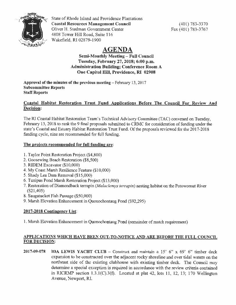
State of Rhode Island and Providence Plantations Coastal Resources Management Council Oliver H. Stedman Government Center 4808 Tower Hill Road, Suite 116 Wakefield, RI 02879-1900
AGENDA Semi-Monthly Meeting-Full Council Tuesday, February 27, 2018; 6:00 p.m.
Administration Building; Conference Room A One Capitol Hill, Providence, RI 02908
Approval of the minutes of the previous meeting-February 13, 2017 Subcommittee Reports Staff Reports
(401) 783-3370 Fax (401) 783-3767
Coastal Habitat Restoration Trust Fund Applications Before The Council For Review And Decision:
The RI Coastal Habitat Restoration Team's Technical Advisory Committee (TAC) convened on Tuesday, February 13, 2018 to rank the 9 final proposals submitted to CRMC for consideration of funding under the state ' s Coastal and Estuary Habitat Restoration Trust Fund. Of the proposals reviewed for the 2017-2018 funding cycle, nine are recommended for full funding.
The proiects recommended for full funding are:
1. Taylor Point Restoration Project ($4,800) 2. Goosewing Beach Restoration ($8,500) 3. RIDEM Excavator ($10,000) 4. My Coast Marsh Resilience Feature ($10,000) 5. Shady Lea Dam Removal ($15,000) 6. Tunipus Pond Marsh Restoration Project ($13,000) 7. Restoration of Diamondback terrapin (Malaclemys terrapin) nesting habitat on the Potowomut River
($21,405) 8. Saugatucket Fish Passage ($50,000) 9. Marsh Elevation Enhancement in Quonochontaug Pond ($92,295)
2017-2018 Contingency List:
1. Marsh Elevation Enhancement in Quonochontaug Pond (remainder of match requirement)
APPLICATIONS WHICH HA VE BEEN OUT-TO-NOTICE AND ARE BEFORE THE FULL COUNCIL FOR DECISION:
2017-09-078 IDA LEWIS YACHT CLUB - Construct and maintain a 15' 6" x 69' 6" timber deck expansion to be constructed over the adjacent rocky shoreline and over tidal waters on the northeast side of the existing clubhouse with existing timber deck. The Council may determine a special exception is required in accordance with the review criteria contained in RICRMP section l.3.l(C).3(t). Located at plat 42, lots 11, 12, 13; 170 Wellington A venue, Newport, RI.
CRMC Semimonthly Meeting - AGENDA February 27, 2018 Page Two
2017-11-054 McINNIS USA, INC. -- Construct and maintain a new 40,000 MT reinforced concrete containment/storage dome, a loadout structure, an electrical equipment building and utility work at various locations on the site. Located at plat 56, lots 350, 351, 352, 355; 39 New York Avenue, Providence, RI.
APPLICATIONS WHICH HA VE HAD A PUBLIC HEARING AND ARE BEFORE THE COUNCIL FOR FINAL DECISION:
2017-05-045 TOWN OF WARREN - BRIDGE STREET ROW -- Beginning at the northwesterly comer of North Water Street and Bridge Street, thence running westerly along the northerly boundary of Bridge Street one hundred and fifty-five and 25/100 (155.25') feet to the shore of the Warren River, thence running southerly along the shore of the Warren River for a distance of thirty (30') feet; thence turning and running easterly along the southerly boundary of Bridge Street two hundred twenty-eight (228') feet to a point in the southerly boundary of Bridge Street, thence turning northerly across Bridge Street to the point and place of beginning.
2017-05-046 TOWN OF WARREN - BEACH STREET ROW -- Beginning at the northwesterly comer of the East Bay Bicycle Path and Beach Street, thence running westerly along the northerly boundary of Beach Street three hundred and ninety-three and 20/100 (393.20') feet to the shore of the Warren River, thence running southerly along the shore of the Warren River for a distance of thirty-five (35') feet; thence turning and running easterly along the southerly boundary of Beach Street four hundred fifty-eight and 78/100 (458.78') feet to the southwesterly comer of the East Bay Bicycle Path and Beach Street, thence turning and running northerly along the westerly boundary of the East Bay Bicycle Path the point and place of beginning.
2017-05-047 TOWN OF WARREN - BAKER STREET ROW -- Beginning at the northwesterly comer of North Water Street and Baker Street, thence running westerly along the northerly boundary of Baker Street two hundred and eighty-two (282') feet to the shore of the Warren River, thence running southerly along the shore of the Warren River for a distance of forty ( 40') feet; thence turning and running easterly along the southerly boundary of Baker Street two hundred fifty-four (254') feet to the southwesterly comer of North Water Street and Baker Street, thence turning northerly across the intersection of North Water Street and Baker Street forty (40') feet to the point and place of beginning.
2017-05-048 TOWN OF WARREN - RIVER VIEW STREET ROW - Beginning at the northeasterly comer of Barker Avenue and River View Street, thence running easterly along the northerly boundary of River View Street eighty (80') feet to the shore of the Kickemuit River, thence turning and running southerly along the shore of the Kickemuit River for a distance of thirty (30') feet; thence turning and running easterly along the southerly boundary of River View Street eighty (80') feet to a point on the southerly boundary of River View Street, thence turning northerly across River View Street thirty (30') feet to the point and place of beginning.
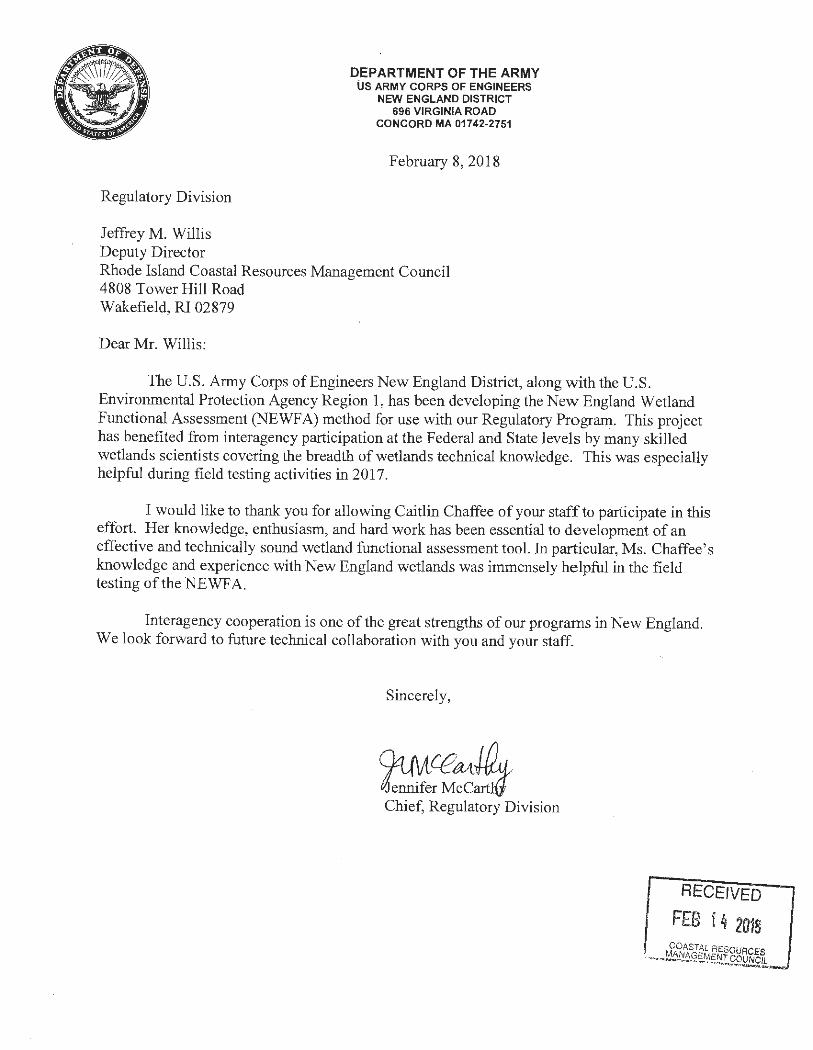
Regulatory Division
Jeffrey M. Willis Deputy Director
DEPARTMENT OF THE ARMY US ARMY CORPS OF ENGINEERS
NEW ENGLAND DISTRICT 696 VIRGINIA ROAD
CONCORD MA 01742-2751
February 8, 2018
Rhode Island Coastal Resources Management Council 4808 Tower Hill Road Wakefield, RI 02879
Dear Mr. Willis:
The U.S. Army Corps of Engineers New England District, along with the U.S. Environmental Protection Agency Region 1, has been developing the New England Wetland Functional Assessment (NEWF A) method for use with our Regulatory Program. This project has benefited from interagency participation at the Federal and State levels by many skilled wetlands scientists covering the breadth of wetlands technical knowledge. This was especially helpful during field testing activities in 2017.
I would like to thank you for allowing Caitlin Chaffee of your staff to participate in this effort. Her knowledge, enthusiasm, and hard work has been essential to de velopment of an effective and technically sound wetland functional assessment tool. In particular, Ms. Chaffee's knowledge and experience with New England wetlands was immensely helpful in the field testing of the NEWF A.
Interagency cooperation is one of the great strengths of our programs in New England. We look forward to future technical collaboration with you and your staff.
Sincerely ,
04 /\A cea{~I, Je~tf;r Mcc:m7 Chief, Regulatory Division
RECEIVED
FEB j 4 2018 COASTAL RESOURCES
~/IJ AGEMENT COUNCIL ...... ,_ ,·..-~ ~

Coastal Habitat Restoration Trust Fund Applications Before The Council For Review And · Decision: - -------- ·- --- ------ - -- ----
C
DATE: February27,2018
TO: Council Chair Jennifer R. Cervenka and members of the Council
Cc: Grover Fugate, Executive Director
FROM: Caitlin Chaffee, Coastal Policy Analyst, TAC Coordinator Projects Recommended for Funding Under the RI Coastal Habitat Restoration Trust
Re: Fund
The RI Coastal Habitat Restoration Team's Technical Advisory Committee {TAC) convened on Tuesday, February 13, 2018 to rank the 9 final proposals submitted to CRMC for consideration of funding under the state' s Coastal and Estuary Habitat Restoration Trust Fund. Of the proposals reviewed for the 2017-2018 funding cycle, nine are recommended for full funding.
The projects recommended for full funding are: I . Taylor Point Restoration Project ($4,800) 2. Goosewing Beach Restoration ($8,500) 3. RIDEM Excavator ($10,000) 4. My Coast Marsh Resilience Feature ($10,000) 5. Shady Lea Dam Removal ($15,000) 6. Tunipus Pond Marsh Restoration Project ($13,000) 7. Restoration of Diamondback terrapin (Malaclemys terrapin) nesting habitat on the
Potowomut River ($21,405) 8. Saugatucket Fish Passage ($50,000) 9. Marsh Elevation Enhance ment in Quonochontaug Pond ($92,295)
In addition, the committee has created a contingency list of projects to be funded in the event that a project recommended for funding is unable to go forward or the requested funds are not needed due to unforeseen circumstances.
2017-2018 Contingency List:
1. Marsh Elevation Enhancement in Quonochontaug Pond (remainder of match requirement)
All proposals are evaluated and ranked using standard criteria and an evaluation form developed by the TAC, available on the CRMC website at http://www.cnnc.ri.gov /habitatrestoration .html.
Technical Advisory Committee Members: Gary Casabona, USDA-Natural Resources Conservation Service Caitlin Chaffee, RI CRMC Philip Edwards, RI DEM Division of Fish and Wildlife Wenley Ferguson, Save The Bay Alan Gettman, RI DEM Mosquito Abatement Coordination Program Suzanne Paton, US Fish and Wildlife Service Margherita Pryor, US Environme ntal Protection Agency Jim Turek, NOAA Fisheries Restorat ion Center
Pl
In this agenda package , you will find:
• A summary showing all proposals , matching fund amounts , and the funding amount recommended by the TAC.
• A map showing the geographic distribution of Habitat Trust Fund funded projects • Narrative text of all proposals submitted to CRMC for consideration for fiscal year 2018. *
* Additional proposal support materials (photos , engineered plans , etc.) are available upon request.
P2
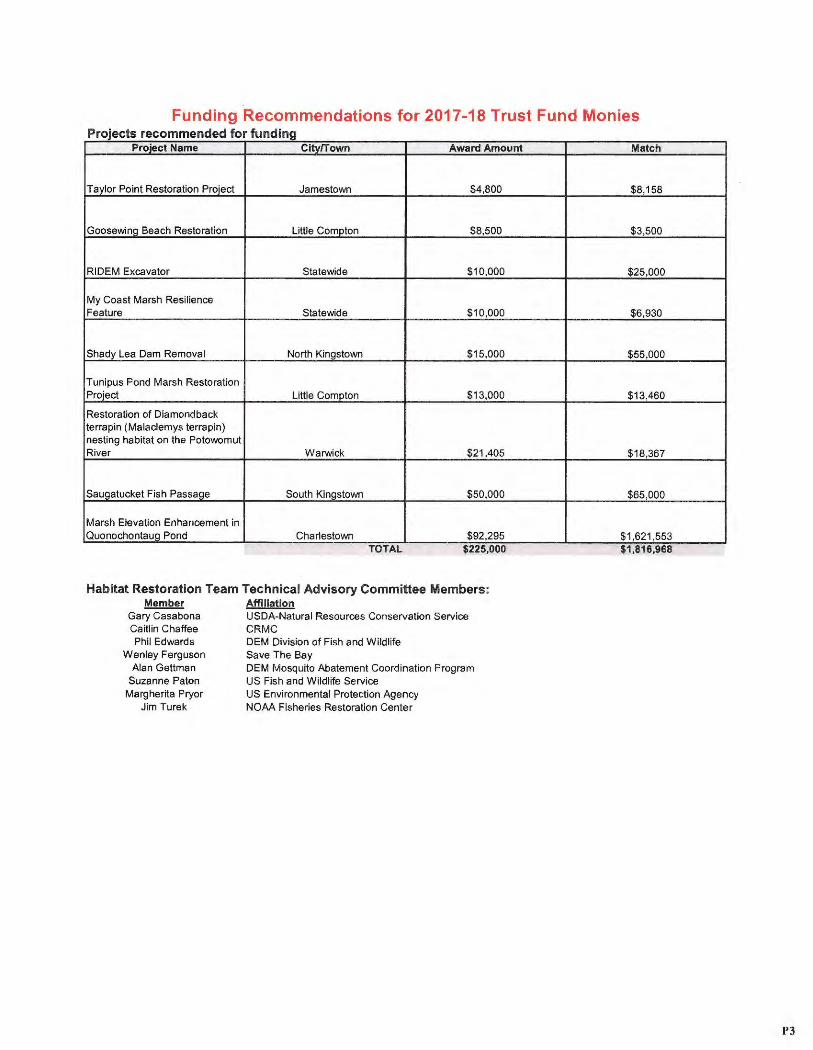
Funding Recommendations for 2017-18 Trust Fund Monies ProJects recommen d f f ed or unding
Project Name Citv!Town Award Amount Match
Taylor Point Restoration Project Jamestown $4,800 $8 ,158
Goosewing Beach Restoration Little Compton $8,500 $3,500
RIDEM Excavator Statewide $10 ,000 $25,000
My Coast Marsh Resilience Feature Statewide $10,000 $6,930
Shady Lea Dam Removal North Kingstown $15,000 $55 ,000
Tunipus Pond Marsh Restoration Project Little Compton $13,000 $13,460
Restoration of Diamondback terrapin (Malaclemys terrapin) nesting habitat on the Potowomut River Warwick $21,405 $18,367
Sauoatucket Fish Passage South Kingstown $50,000 $65,000
Marsh Elevation Enhancement in Quonochontaug Pond Charlestown $92,295 $1,621,553
TOTAL $225,000 $1,816,968
Habitat Restoration Team Technical Advisory Committee Members: Member Affiliation
Gary Casabona USDA-Natural Resources Conservation Service Caitlin Chaffee CRMC Phil Edwards DEM Division of Fish and Wildlife
Wenley Ferguson Save The Bay Alan Gettman DEM Mosquito Abatement Coordination Program
Suzanne Paton US Fish and Wildlife Service Margherita Pryor US Environmental Protection Agency
Jim Turek NOAA Fisheries Restoration Center
P3
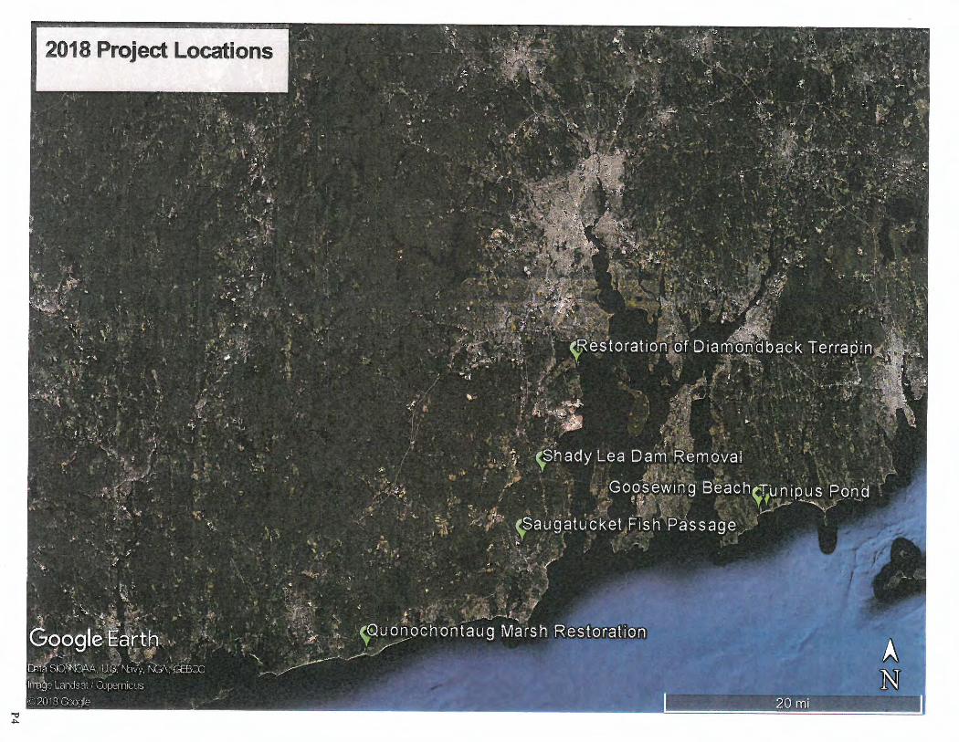
2018 Projed Locations
Rhode Island Coastal and Estuary Habitat Restoration Fund Full Proposal Form 2017/2018
**for planning projects please use Full Proposal Form for Planning Projects
I. PROJECT SUMMARY
1. Project Title: Taylor Point Restoration Project
2. Project Location and coordinates (include map) : Taylor Point Nature Preserve, Jamestown, RI N 41°30 ' 14.2", W 071 °21'34 .7"
3. Project type (Des;gn, Construction or Other) : Design and Construction
4. If other, please specify:
5. Habitat type (R;ver System, Salt Marsh, Seagrass, Shellf;sh Bed, other) : Other
6. If other, please specify: Freshwater wetlands, beach, salt marsh, maritime woodland, mar itime shrubland, thickets, rock cliffs
7. Restoration technique (e.g. re-vegetation, tidal restoration, etc.): Re-vegetation for the construction portion of the project (Task 3). Undetermined for the design portions of the project (Tasks 1 and 2).
8. Total acreage or miles(river systems) of habitat to be restored, or project area planning unit size: 20 acres, for the enti re project.
9. Project benefits: Establishment and maintenance of an ecologically robust coastal area and buffer zone of native species; creation of a valuable aesthetic and recreational resource accommodating well -planned, minimally intrusive access by the public , and offering appealing views of the Bay.
10.Project partners (organ;zations prov;d;ng financial or other support to the project) : Town of Jamestown
11. Is this is an ongoing project that has previously received funds from the CRMC Coastal and Estuarine Habitat Restoration Fund? Yes If yes, year(s) funding was awarded: 2016
II. PROJECT MANAGER CONTACT INFORMATION 1. Name: Dennis Webster
2. Organization: Taylor Point Restoration Association
3. Address: P.O. Box 21
4. City: Jamestown 5. State: RI 6. Zip: 02835 7. Phone: 401-423 -1808 8. Email: [email protected]
1 of 19
P5
9. Property Owner (s): Town of Jamestown
Applicant must document ownership of project site or permission to perform all proposed restoration, maintenance and monitoring activ ities Onclude appropriate documentation).
Ill. BUDGET SUMMARY (List individua ls or organizations providing financial or in-kind support to the project under Proj ect Partners)
Amount Requeste d from Trust Fund
Matc hing Funds Proj ect Partner( s)
Town of Jamestown
Taylor Point Restoration Assoc Volunteers (290 volunteer hours@ 24.34/hour)
TOTAL PROJECT COST
IV. PROPOSAL NARRATIVE (fiv e pages maxi mum)
1. Justificat ion and Purpose
$4,80 0
Amount of Mat ch
$500
$7,658
$12,358
Describe the human impacts and prev ious restoration activ i ties at the proposed projec t site . If multiple sites, please describe the impacts and prev ious restoration activ i ties at each). Briefly describe the proposed project , its restorat ion goals, long-term and short-term outcomes.
Taylor Point Restoration Association (TPRA), a RI non-profit corporation, was formed in 2015 to resto re 20 acres of Town-owned shorefront land in Jamestown . We received a CRMC Habitat Restoration Fund Planning Grant in February 2016, completed the Taylor Point Restoration Plan in May 2017, and received CRMC notice of Assent A2017-06-061 in September 2017 for Buffe r Zone Management of specified areas at Taylor Point. The Jamestown Town Council re-named the area the Taylor Point Nature Preserve in May 2017.
Human activity has impacted Taylor Point since pre-colonial times . Newport Bridge construction and tollboot h area operation and management, Jamestown sewer treatment plant and Highway Department operat ions, roads running through the Nature Preserve, and heavy recreational use all influence our restoration opt ions. Once cleared fa rmland , Taylor Point has grown in to a mix of native and non-native plants over the past 150 years. 27 species listed on the Rhode Island Invasive Plant List grow at Taylor Point.
The Taylor Point Restoration Association has begun removing invasive plants under the CRMC Assent, and continues to do so, mostly with voluntee r work parties.
The goals of the project , discussed in detail in the Restoration Plan, are to eliminate all invasive plant species and create a natu re preserve with only native plants; to incorporate shoreline erosion control ; to improve and maintain footpaths and views providing improved access to the shoreline in accordance with the RI Coastal Resources Management Program; and to provide minimum essential necessities to mitigate the impact of humans on the natural environment - t rash receptacles, outhouses, parking , and signage.
2 of 19
P6
The short-term outcome of this grant will be designs for footpath rehabilitation and restoration of the Phragmites Marsh/ Wooded Swamp. Both designs are necessary to apply for future CRMC Buffer Zone Management permission. The grant will also fund the purchase of native plants for restorative planting in areas where invasives have been removed.
The long-term outcome is the accomplishment of the Restoration Plan goals outlined above.
2. Project Activities, Schedule and Work Plan Describe the planned on-the-ground project activities , and explain how each activity will help to restore ecosystem functions . List specific project activities and when they will occur (month and year) . Indicate when annual and final project reports will be submitted .
Task 1. Design footpath rehabilitation from upper parking area to the the Taylor Point Cliffs. The existing 200 foot heavily -used path (with 4 side paths) is badly eroded. This task will include footpath design, including design of proper drainage to prevent future erosion, and the design of low-maintenance trailside meadows of native grasses and forbs along the sides of the path. Design work will be done between February and October 2018.
Task 2. Design restoration of the Phragmites Marsh, the Wooded Swamp, and the Back Beach subsections of Potter Cove Beach. Design work will be done between April and December 2018.
Task 3. Purchase of native Rhode Island plants for restorative planting in areas cleared of invasive vegetation under CRMC Buffer Zone ManagementAssentA20 17-06-061, issued September 5, 2017 (Black Cherry Woodland, Taylor Point Cliffs, and specified areas on Potte r Cove Beach.) This includes fencing supplies needed to protect new plantings from damage by deer and people . Planting will be done in spring and fa ll of 2018.
3. Minimizat ion of Adverse Impacts What are the potential impacts resulting from project activities (e.g. the disturbance of sensit ive species by construction activities), and how will these impacts be minimized (e.g. scheduling constructio n to avoid disturbance of sensit ive species) .
Tasks 1 and 2 consist entire ly of design effo rts and will have no adverse impacts. Minimization of adverse impacts during the future construction of these tasks will be incorporated into the designs. Task 3 consists of re-vegetation with native plants and no adverse impacts will result from this activity .
4. Public Support Demonstrate public support for the project by provid ing evidence of communication with adjacent landowners, community members and other stakeholders. Describe planned or completed communit y I stakeholder educat ion and outreach efforts .
Communication with the community is through the local newspaper (The Jamestown Press) which prints articles about the project and biweekly notices of volunteer work projects , and through the TPRA website (tay!orpoint org) and Facebook page. Occasional educational walks are scheduled in the spring and summer. The Taylor Point Restoration Project is an approved URI Master Gardner Project, resulting in widespread awareness and participation among the Master Gardner community .
5. Economic and Educat ional Benefits How will the proposed project provide direct economic and/ or educat ional benefits to a community and/o r the state?
TPRA Volunteer s will be deeply invo lved in the design of Tasks 1 and 2 and will learn fr om the expert consultants hired to provide advice. They wil l use this knowledge during the future construction of these tasks (especially task 2) and pass their knowledge on to volunteers from the Jamestown and Master Gardner communities. The knowledge wil l also be used to develop f utu re interp retive signage which will
3 of 19
P7
educate visitors to Taylor Point. Volunteers and Master GArdners will be educated during implementation of Task 3.
6. Climate Change and Coastal Resiliency How have the present and future impacts of climate change been considered during the project planning and design phases? What impact will the project have on resilience of coastal or estuarine habitat to climate change?
Rehabilitation of the degraded footpath will include drainage improvements that will accommodate increased runoff expected from future storms.
Restoration of the Phragmites Marsh and Wooded Swamp, both low-lying wetland areas, are complicated by future sea-level rise. This grant will allow consultation with experts to develop a design that will provide maximum resiliency with native plants over time as sea levels rise.
Restorative planting with native plants on Potter Cove Beach will help control beach erosion. Restorative planting in areas farther inland are necessary to prevent erosion and to prevent the return of invasive plants.
7. Planning Consistency and Restoration Priority Is the proposed project consistent w;th the goals of a local, state or regional planning initiative? Please specify initiative and explain (see CRMC website for guidance). Does the proposed project involve a state, regional or federal priority habitat restorat ion need or special consideration? Please specify and explain (see CRMC website for guidance).
The TPRA project is within the Narragansett Bay Resource Protection Area, as described in the Rhode Island Resource Protection Project. TPRA's efforts are consistent with the goals of that project . Our plans also are consistent with the 2014 Jamestown Comprehensive Community Plan (CCP), adopted by Jamestown's Planning Commission and Town Council , and approved by the State of Rhode Island.
The CCP stipulates that all Jamestown land use decisions must be consistent with its provisions and explicitly directs the protection of coastal and freshwater wetlands , scenic views, and unique and rare habitats . The CCP calls out Taylor Point in Section I.E.1: Conservation and Open Space and in Section I.E. 3. f.3: Inventory of Important Recreational Assets. Furthe r, Section 11.C: Goals/ Policy Implementat ion Action Plan calls for preserving and protecting unique, fr agile , and scenic coastal areas and protecting public shoreline accessibility, encouraging land management that provides opportunities for public wate rfront access, coastal water quality protection as well as planning fo r natural hazard vulnerability. TPRA goals are consistent with these objectives.
TPRA's program is consistent with the Rhode Island State Guide Plan's Goal 3: the protection and enhancement of scenic views, as well as Goal 4: preserving , developing, and where possible, restoring the resources of the coastal region. Our project goals are also consistent with the State Guide Plan's Land Use Element 121 which provides for protecting and enhancing those values of the coastal regions, including scenic values, which contribute to the State's quality of life . This element further provides for preserving and enhancing plant species diversity and stability through habitat protection , restoration , enhancement and prevention or mitigation of adverse impacts due to human activities . These directives are consistent with our restoration project .
TPRA's efforts are consistent with the State Coastal and Estuarine Habitat Restoration Strategy for coastal buffers which encourages efforts to establish the approximate biological, geological and physical conditions that existed in the indigenous ecosystem or habitat prior to human disturbance by, fo r example controlling non-native invasive species of plants and/or re-vegetating areas with native plants. Our plan to control and/ or remove invasive species and manage to protect and encourage native species addresses special considerations of the afo rementioned local and state planning guides.
4 of 19
PS
8. Species of Concern Will the project result ;n benefits to wUdUfe spedes Usted as federally or state endangered, threatened, or spedes of concern witMn Rhode Island? Please spedfy whkh spedes will benefit and how. For a Ust of spedes, see the Rhode Island Natfonal Heritage Program's lisUng of an;mals at : http:/ /www .rinhs.org/wp-content/up loads/ri rare animals 2006.pdf or a listing of plants at : http://www.rinhs.org/wp-content/uploads/r i rare plants 2007.pdf
Four species of concern occur at Taylor Point and will be protected as part of the restoration project. TPRA has consulted with RI DEM, RI Natural History Survey, and New England Wild Flower Society. Restrictions apply to disclosure of information about species of concern; please contact the Project Manager for more info rmation .
9. Permitting Ust any federal , state or local perm;ts required to complete the project and the permit appUcat;on status for each.
A. TPRA and the Town of Jamestown were issued CRMC Assent A2017-06 -061 for Buffer Zone Management in specified areas on September 5, 2017. Planting of native vegetation (Task 3) will be done under this assent.
B. Once Tasks 1 and 2 are designed, a CRMC Buffer Zone Management Permit application will be submitted for construction.
C. A Fresh Water Wetlands Permit from CRMC will be applied for when the design of the restoration in the wetlands behind Potter Cove Beach is complete . Funding for preparation of this permit application (but not for the design work) is available from the 2016 CEHRTF grant to the Taylor Point Restoration Association.
D. A Tree Removal/Trimming/Planting Permit fr om the Jamestown Tree Committee will be needed for tree planting under Task 3.
10. Capacity of Lead Organizati on (attach additional materials if necessary) Demonstrate the capacity of the lead and/or partner organizations to successfully complete the proposed project by providing any or all of the following : a) a description of the organization(s) b) resume(s) or summary of qualifications of involved personnel c) evidence of successfully completed habitat restoration or conservation projects.
The TPRA Board of Directors includes 3 individuals who 'd have been on the board since the organization began in 2015. They have spearheaded the development of the organization, prepared its mission statement, developed the Restoration Plan, recruited members, and led public outreach and volunteer work days. Two additional individuals joined the board in 2017. All five of these board members are certified Invasive Plant Managers.
Dennis Webster, Project Director, is a biologist and community environmental leader with more than 20 years of professional experience in environmental and engineering planning and cont ract management. As a member of the Jamestown Planning Commission, he was instrumental in the development of the Jamestown Community Comprehensive Plan, which provides key guidance for TPRA's proposed planning. Mr. Webster also served on the Jamestown Harbor Management Commission. He is a long-time Plant Conservation Volunteer for the New England Wildflower Society, the RI DEM Natural Heritage Program, and the RI Natural History Survey. Perhaps most illustrative of his value to the proposed effort is his leadership experience in the Conanicut Battery Historic Park Project in which the Friends of Conanicut Battery created a park fr om a 20-acre parcel of neglected Town-owned land - the site of a Revolutionary War earthwork . Mr. Webster chaired the Battery Planning Committee ; sought and won grant funding ; coordinated and led volunteer work days; supervised trail and park maintenance; and continues to involve and oversee Eagle Scouts conducting projects that enhance the Park. His leadership of this successful 19-year-long environmenta l restoration project and his high profile involvement in community
5 of 19
P9
activities, make him an idea l leader for this project . Mr Webster has also taken a Wetlands Delineation short course and a RI DEM Pesticide Application course.
Lois Migneault, Secretary of the Taylor Point Restoration Association, is a computer scientist, educator, and amateur coastal landscaper. Active in Jamestown's civic organizations , she has served for 7 years on the Jamestown Tree Protection and Preservation Committee . A decade-long member of the American Conifer Society, with five-years experience on the RI Tree Council, Ms. Migneault has also earned her Invasive Plant Management Certification under the URI Invasive Plant Management Certification Program. Ms Migneault has been inst rumenta l is launching the TPRA non-profit organization, has led numerous informationa l wa lks and meetings with stakeholders at Taylor Point, and has more than a decade of professional experience in project management and quality control. Her active role in the Jamestown Community and her leadership role in the founding of the TPRA, as well as her management acumen and knowledge of local plant communities and restoration priorities will enable her to enlist community support and keep a keen and practical project focus.
Ed Gromada, President of the Taylor Point Restoration Association, will serve as principal administ rative liaison with CRMC. He served as Secretary of the Jamestown Charter Review Committee, is Chairman of the Jamestown Housing Authority Board of Commissioners, and is a member of the Jamestown Board of Zoning review. Mr. Gromada has more than 25 years of fiscal and program management experience di recting multimillion dollar global marketing and business programs for Fortune 500 companies. Since retiring from corporate management, he has turned to local community enhancement opportunities. As Vice Chair of Rhode Island's SCORE Association , a nonprofit dedicated to helping small businesses get off the ground, grow and succeed, he has broad access to local resources. His understanding of organizational dynamics and community programs enhance his leadership of TPRA. Mr. Gromada also earned his Invasive Plant Management Certification .
Katherine Wineberg joined the board in mid-2017. She is a URI Master Gardner with many years of gardening experience and a long interest in wild plants. She has been instrumental in getting the Taylor Point Restoration Project approved as a Master Gardner project.
Nadine Mendel sohn joined the board in late-2017 . She is also a URI Master Gardner with many years of gardening experience. Before she joined the board of directo rs, she helped in the effort to get Taylor Point approved as a Master Gardner project .
V. SUSTAINABILITY (one page maximum)
1. Maintenance What is the estimated "Ufespan" of each planned restoration activity? What are the anticipated short-term and long-term (beyond the funding period) operation and maintenance requirements of the project? Specify who will be responsible for funding and carrying out each 0 Et M activity. Indicate when and with what frequency activities will occur.
The li fespan of the Footpath Rehabilitations (Task 1) and Restoration of the subsections at Potter Cove Beach (Task 2) will be determined during the design of those projects. The lifespan of the native restorative vegetation to be purchased and planted under task 3 (mostly trees and shrubs) will be many decades, depending on the species, and once established they should be self-sustaining, or should live until naturally replaced by other native species in then process of natural succession. The temporary fencing to prote ct the new planting has an expected life of two years (for bamboo fencing) and fi ve years (for wi re deer cages).
The new planting will require watering for one season. Weeding and removal of resprouting invasive vegetation will be required for fr om three to ten years, initially monthly, then with with decreasing frequency . Some maintenance, every one to five years, including removal of invasive vegetation, will be
6 of 19
PIO
required indefinitely. This work will be accomplished by the Taylor Point Restoration Association and the Town of Jamestown.
2. External Factors ldenUfy existing external (off-site) factors that could reduce the chances of achieving the project goals (e.g. stormwater inputs to the site from the surrounding drainage area). Explain how these external factors will be addressed. Describe any additional measures taken to help ensure long-term success of the project (e.g. installation of stormwater management practices or securing of conservation easements). What are the likely future effects of climate change and future sea level rise on the proposed project and how will these be addressed?
Footpath Rehabilitation (Task 1) will be affected by increased runoff from more severe storm events expected with climate change. This will be taken into account during the design phase.
Restoration of the marsh and other low areas behind Potter Cove Beach (Task 2) will be great ly affected by Sea Level Rise, and this will be a major factor in the design. Nevertheless, CRMC Stormtools maps show this area as completely inundated by 2100, so this task is expected to have a maximum life of 80 years.
The restorative planting (Task 3) will establish an all-native habitat that should persist indefinitely with some maintenance, although it is expected to undergo natu ral succession and, over time, consist of native species that may not grow there now. However, the unknowns of future climate change, such as altered rainfall and temperature, may affect the species that are now considered native. The CRMC forecast of 31 feet of sea level rise by 2200 would put most of Taylor Point under water.
VI. EVALUATING PROJECT SUCCESS (one page maximum)
1. Performance Measures How will the success of the project be measured in relation to the restoration goals set forth in this proposal? Ust performance measures and how they will be recorded. Include a detafled monitoring plan; ff applicable (see below).
Footpath Rehabilitation Design (Task 1) wil l consist of (1) surveying elevations of the existing footpath, (2) measuring cross sections at 25 foot intervals , (3) determining drainage requirements and designing drainage structu res, (4) calculating required fill, (5) designing transitions from the footpath to the cliff top , (6) designing native-plant landscaping bordering the footpaths, (7) developing plans and specificat ions and (8) incorporating the stamped footpath design into a CRMC Buffer Zone Management Application.
Design of the restorat ion of the Phragmites Marsh, Wooded Swamp, and Back Beach (subsections 1 D, 1 E, and 1 F) (Task 2) will consist of (1) selecting one or more consultants with the requisite background (2) Selecting a team of TPRA volunteers to participate in development of the restoration design (3) make site visit(s) with consultant(s) and volunteer design team (4) Determine invasive removal techniques (5) select native plant species for revegetation (6) determine a sequence of work and a schedule (7) develop a written restoration design (8) prepare a Wetland Permit Application (funds from the 2016 CEHRTF grant are available for preparation of this permit application) (9) incorporating the resto ration design into a CRMC Buffer Zone Management Application.
Restorative planting in areas recently cleared of invasive will consist of (1) Ordering native planting material and associated supplies (2) Planting by volunteers at the appropriate time of year (3) Protecting the plantings with temporary bamboo fencing to protect form human trampling and with wire deer cages to protect from deer browse (4) watering as needed (5) follow-up care and maintenance by TPRA voluntee rs
7 of 19
Pl 1
2. Monitoring Plan Describe any planned or completed pre- and post-project monitoring activities . For each monitoring activity list the frequency and month/year of start and end date and the parameters measured. List the entity or entities responsible for funding and carrying out each monitoring activity, and describe how results will be made available to CRMC and the public. If using an established monitoring protocol, please provide references (see CRMC website for information on established monitoring protocols).
Some restorative planting may take place in early spring 2018, but most will be done in the fall of 2018. Spring paintings will be watered as needed (probably every two days for the first 3 weeks, then tapering off, but continuing th rough dry weeks in the summer. Fall planting will be watered until fall rains and dormancy. Beyond watering, planting will be checked monthly and weeded, with any re-sprouting invasive removed from the restored area. Work will be done by TPRA volunteers with funding from the Town of Jamestown.
The public will be informed through The Jamestown Press, the TPRA Facebook page, and during occasional guided walks. CRMC will be sent an annual report.
This will be TPRA's first significant planting, and we aha not yet developed a formal monitoring protocol. The CRMC website will be consulted and we will develop one before planting .
8 of 19
P12
Rhode Island Coastal and Estuary H~bitat Restoration Fund Full Proposal Form 2017 /2018
••tor planning projects please use Full Proposal Form for Planning Projects
I. PROJECT SUMMARY
1. Project Title: Goosewing Beach Salt Marsh Restoration
2. Project Location and coordinates (include map): Goosewing Beach, Little Compton, RI 41°29 '47.45"N, 71° 7'55.40"W
3. Project type (Design, Construction or Other): Other
·4. If other~ plea$e specify: Habitat Restoration
5. Habitat type (River System, Salt Marsh, Seagrass, Shellfish Bed, other): Salt Marsh within Coastal lagoon. The project area includes the entire shoreline of Quicksand Pond, Little Compton, where it joins with the barrier beach and dune community known ~s Goosewing Beach Preserve.
6.· If other, please spedfy:
7. Restoration technique (e.g. re-vegetation, tidal restoration, etc.): herbicide application to control Phragmites to promote restoration of native vegetation.
8. Total acreage or miles(river systems) of habitat to be restored, or project area planning unit size: 16 acres extending over 4,000' of shoreline at Quicksand Pond.
9. Project benefits: Sustained increase in native plant diversity and perpetuation of rare plant species, improved habitat condit ions and forage quality of mudflats and native shoreline plant communities for migratory and breeding shorebirds, aquatic Invertebrates and fishes, and other w ildlife .
10. Project partners (organizations providing financial or other support to the project): _none
11. Is this Is an ongoing project that has previously received funds from the CRMC Coastal and Estuarine Habitat Restoration Fund? YES If yes, year(s) funding was awarded: 2011 & 2015
II. PROJECT MANAGER CONTACT INFORMATION 1. Name: Cheryl Wiitala, Preserves Manager
2. Organization: The Nature Conservancy
3. Address: 159 Waterman St.
4. City: Providence
7. Phone: 401-214-4525
S. State : RI 6. Zip: 02906
8. Email: cwiitala@tnc .org 1 of21
Pl3
9. Property Owner(s): The Nature Conservancy
Applicant must document ownership of project site or permission to perform all proposed restoration, maintenance and monitoring activities (include appropriate documentation).
Ill . ·euDGET SUMMARY (List indiv iduals or organizations providing financial or in-kind support to the project under Project Partners}
1--- ~unt Requested ___ from Tru~ Fun __ d_l _ _ $8,500 _J1.
J ··- - - Matching Funds Project Partner(s} . Amount of Match I 1 Project Coordination The Nature conservancy (in kind} - _-_ .....
1 -~~- -- -_-$3-,5-~- --_-_1 __
1
1
'.LI---_--___ - ___ 11~ ---·----· -- -TOTAL PROJECT COST j $12,000 ! ·- --- ---- ------ - -- .
IV. PROPOSAL NARRATIVE (five pages maximum)
1. Justification and Purpose Describe the human impacts and previous restoration activities at the proposed project site. If multiple sites, please ctescribe the impacts and previous restoration activities at each). Briefly describe the proposed project, its restoration goals, long-term and short-term outcomes.
The Nature Conservancy in Rhode Island has been managing Invasive Phragmites since 2009 with in its barrier beach preserve known as Goosewing Beach, for the stated goal of maintaining endemic plant communities and wildlife habitats along the shoreline of Quicksand Pond in this location .
The coastal lagoon ecosystem at Quicksand Pond is among the most pristine in Rhode Island, supporting migratory shoreb irds, waterbirds and waterfowl, and a robust population of invertebrates, shellfish, and marine and anadromous fishes. A natural breach over Goosewing Beach provides Quicksand Pond with its only connection with the sea, but this passage is infrequently open, so this pond fluctuates widely in its wate r depths, its salinity, and its suitability for passage by marine creatures. In response to this, the communities of emergent plants found at Goosewing have been historically very diverse, and this location remains both notable for its rare plants and a resource for botanists who appreciate this diversity .
Initially protected in 1989 through outright acquisition by The Nature Conservancy for its importance as a nesting area to listed species Piping Plover and Least Tern, Goosewing has since become a destination nature· preserve for visitors who care for a·n unspoiled environment, and who value the educational opportunities provided by Conservancy staff and volunteers from Its recent Benjamin Family Environmental Center at Goosewing.
Its Piping Plovers threatened w ith loss of mudflat feed ing areas in the mid~2000's to rampant invasion by Phragmites, and for concern highly diverse natural communities of the shoreline and emergent zone at
2of21
P14
Quicksand Pond were being lost to this plant, the Conservancy launched into a careful but aggressive herbicide treatment program intent upon managing the ·advance of this plant .
To date, 16 acres of brackish and salt marsh at Goosewing have been released from invasion by .Phragmites, the full variety of its endemic plant species have returned, and its bird-life, in particular, remains very diverse. This is an extremely vigorous invasive, however, and so even though .conditions have been improved overall for the plants which are native to Goosewing, continued oversight and direct herbicide treatment is called for into the future .
The levels of intervention called for in the near future are minimal and limited in their scope, but attending tci this work will be critical, or else there is risk of Phragmites re-invading the area where such gains have been made.
The Conservancy began restoring the Goosewing Salt Marsh with a controlled pilot project in 2009. Three acres of salt marsh infested with Phragmites were treated by contractors with herbicide applied with low volume backpack sprayers and hand wicking techniques . Pleased with the success of native plants becoming established in these tested"areas, the Conservancy moved to a broad scale approach of managing Phragmites over the entire 16-acre salt marsh within the Conservancy's Goosewing Beach Preserve.
· During 2011-2014 with funding from CRMC's CEHRTF program, control efforts were accomplished over the entire tract with herbicide applications that included low volume spraying via Argo Track Vehicle and Qackpack sprayers. The work during both the pilot and broad scale phases was performed by Aquatic Control Technology (now Solitude Lake Management).
The selected herbicide treatment formulation was specified by the Conservancy after diligent in-house review, with the goal of limiting harm to aquatic life by herbicide residue or wetting agent, and to desired woody vegetation by translocation of herbicides through root systems.
Results of this effort showed that Phragmites coverage and height has significantly decreased due to the cumulative herbicide treatments and that Phragmites has been replaced by a diversity of native grasses, rushes, forbs and shrubs. Concomitant losses of mature woody vegetation has been very minimal.
From 2015-2017, the Conservancy continued its Phragmites control efforts with support of CRMC's CEHRTF. Once-extensive stands of Phragmites became vast ly reduced in size and vigor. The broad scale approach to management was completed and the movement toward a maintenance effort approach to controlli ng the re-establishment of Phragmites began. Follow up treatments were performed on re-sprouting Phragmites or missed stands. These treatment methods involved only low volume backpack spraying.
A new contractor, Land Stewardship, Inc., was selected by the Conservancy in 2017 to perform this low volume maintenance treatment. Its ownerJ Chris Polatin, specializes in managing invasives with a very targeted approach to treatment.
To date, this project has been extremely successful. Eight years of monitoring and continued follow up treatments have yielded a significant decrease in Phragmites density and coverage. Native plant diversity has increased dramatically throughout the marsh since the initial plant inventory in 2007, prior to herbicide t reatment to Phragmites. Emergent areas that were formerly dominated by Phragmites are becoming well established with Spartina patens, with Spartina a/terniflora at the pond edge, more diverse emergent communities in depressions, and woody plants interspersed with panicum where the marsh borders upland areas of dune. Mudflats required as feeding areas by shorebirds are now fully restored to this use.
3 of21
Pl5
Although Phragmites is still present in the project area, it is now confined to small isolated patches ranging from sparse to medium density. Persistent Phragmites is now most prevalent along high marsh and dune edge areas. The brackish and low marsh areas are no longer invaded with Phragmites and have become well established with a broad spectrum of native plants.
It is apparent, however, this native emergent marsh community is not able to compete with Phragmites without sustained attention. The Nature Conservancy had anticipated this need and remains committed to the long-term management of this salt marsh community and will implement targeted herbicide treatments to sustain the long term success of this restoration project. These follow up ~reatments to missed stands or resprouting areas will involve methods of treatment that can be applied on foot using backpack sprayers and hand wicking techniqu~s.
Outcomes of this project include 1) improved habitat and forage quality of mudflats and native emergent shoreline plant commun iti es for migratory and breeding shorebirds, aquatic invertebrates and other wildlife; 2) restoration of the natural structure, composition and function of the native shoreline plant community including it s rare plants; and 3) the continued existence of an endemic coastal feature with all its attendant diversity of life as a resource for the Conservancy's purpose with nature ·education in this location.
2. Project Activities, Schedule and Work Plan Describe the planned on-the-ground project activities, and explain how each activity will help to restore ecosystem functions. List specific project activities and when they will occur (month and year). Indicate when annual and final project reports will be submitted.
The Conservancy will contract with Land Stewardship, Inc to perform herbicide treatments to Phragmites. Since t reatment areas are at a smaller scale due to prior management, methods need only include low volume backpack sprayer and hand wicking techniques. All methods will be performed on foot using a three-person crew. Documentation of the effect iveness of the herbicide treatments will continue the following growing seasons. Photo stations will continue to be utilized to document changes in vegetation structure. The control of Phragmites and the re-establishment or restora ti on of native vegetation will be carefully monito red, documented, and shared with the coastal restoration community as a potential model for future restoration projects.
2018:
• Spring: Obtain RIDEM Pesticide Permit and administer contract with Land Stewardship, Inc • July/August: Monitor results of the 2017 herbicide treatment • Early September: Conduct herbicide treatment of Phragmites
2019:
• Winte r: Re-new CRMC Assent for this project (the current Assent for this project expires July 2019) • April/May: Submit annual progress report to CRMC CEHRTF program
• Spring: Obtain RIDEM Pesticide Permit and administer contract with Land Stewardship, Inc • July/August: Monitor results of the 2018 herbicide treatme nt • Early September: Conduct herbicide treatment of Phragmites • Evaluate project objectives and cost for future management
2020:
• April/May: Submit final report to CRMC CEHRTF program
4 of21
Pl 6
3. Minimization of Adverse Impacts What are the potential impacts resulting from project activities (e.g. the disturbance a/sensitive species by construction activities), and how will these impacts be minimized (e.g. scheduling construction to avoid disturbance of sensitive species).
Because t he initial phases of work intent upon eradicating Phragmites are complete, there is no longer a need to use an amphib ious track vehicle for broadcast spraying. Herbicide applicatlon to Phragmftes will be comp leted on foot using low volume backpack sprayers and hand wicking methods. There is therefore little likelihood of herbicide damage to non-targeted plants from overspray .
The Conservancy will pursue t reatment methods that can be directly controlled at small scale, rather than broadcast. Herbi cides selected will be permitted on the basis of the ir safety for use in aquatic conditions. A larger effort to preserve the .band of woody shrubs (bayberry, red cedar, groundselbush) along the upper limit of the marsh will be undertaken to prevent herbicide from compromis ing the cover this edge provides to birds and other wildlife.
4. Public Support Demonstrate public support for the project by providing evidence of communication with adjacent landowners, community members and other stakeholders. Describe planned or completed community I stakeholder education and outreach efforts.
As efforts to manage Phragmites at Goosew ing Beach have shown success, t he Conservancy has been offering guided tours of the project area to interested visitors . Some of these visitors have had an academic interest in the plant life of the emergen t community at Goosewing, but most have been focal residents seeking to learn what they might expect from engaging in efforts to manage Phragmites along the shorelines of coastal ponds and estuaries in their own ne ighborhoods.
Current effo rt s to restore t he brackish marsh at Long Pond, Little Compton, and at Tunipus Pond, Little Compton , are the direct result of organized neighbors at t hose two coastal ponds becoming ent husiastic about the prospects for sim ilar success.
Some publ ic concern remains fo r the use of herbicides within out door environments like those presented by the coastal lagoon at Quicksand Pond .. Conservancy staff remain current on thi s topic, and have taken to prescribing the use of only those products which have been shown to be safest.
There has also been concern among some that removal of Phragmites from coastal lagoon ecosystems means loss of capacity for water filtration and nutrient sequestrat ion, with the result of compromised water quality in these closed systems. These concerns have been voiced by some at Quicksand Pond, but the water quality within its entire watershed is generally of higher quality than that foun d at many of Rhode Island 's simila r coastal ponds . As a safety measure, some .neighbors at Quicksand Pond have organized w it h the Coalition for Buzzards' Bay in order to effect regular wate r quality testing of pond waters.
The top ic of keeping invasive Phragmites from dominating coastal wetlands remains centra l in the coastal communities of Little Compton, but is of greatest interest to those who spend their days on property that is impacted by it . Those who appreciate coasta l waters, whether from a grand beach house, seasonal tra iler, te nt or canoe all have strong opinions on t he value of salt marsh views.
5 of21
P17
5. Economic and Educational Benefits How will the proposed project provide direct economic and/or educational benefits to a community and/or the state?
The restoration proj ect will cont inue to be used as a learning tool for education programs conducted by the Conservancy at Goosewing to educate visitors about native and invasive species, and to view an appropriately managed restoration project in the works and to observe its outcomes and benefits. It has been the Conservancy's experience that some marshfront landowners in Rhode Island have taken it upon themselves to manage Phragmites using over the counter herbicides and without regulatory oversight. Conducting this effort in a responsible manner is part of a bro ader message about the importance of preserving habitat function in these coastal wetland s.
The restorat ion of Goosewing's salt marsh has improved wildlife viewing opportunities for visitors to this preserve. Monolith ic stands of -Phragmites can permanen tly alter historic views and obstruc t opportunities to observe water bodies and the ir dependent life . Reducing stands of Phragmites to allow shorter nat ive mar~h vegetation has increased visibility and accessibility to visitors to the marsh and pond edge. Continue d management of invasive Phragmites will allow us to maintain these wild life viewing opportu nit ies. Removal of Phragmltes should improve biodive rsity with in Rhode Island's coastal habitats by increasing regional plant species diversity and enhancing habitat condit ions for invertebrate , fish, and wildl ife communitie s.
According to the State Coa·stal and Estuarine Habitat Restorat ion Strategy (Updated: July 2008):
"Rhode Island is home to an array of coastal and estuarine habitats including salt marshes, seagrass beds, river systems, dunes and barrier beaches. These habitats contribute greatly to the state 's biological integrity and diversity by supporting a wide variety of fish and wildlife species. Coastal and estuarine habitats provide economic benefits such as supporting finfish and shellfish stocks. These stocks contribute to the state commercial fishery valued at 75 million· dollars, and a recreational fishery valued at 150 million dollars. Coastal habitats also provide scenic beauty and recreational opportunities that are attractive to residents and visitors, as evidenced by a tourism and outdoor recreation industry valued at two billion dollars in Narragansett Bay alone.
The Conservancy with assistance from RIDEM is managing the breachway at Quicksand Pond by conducting manual breaching at Goosewing beach in the spring and fall to allow .for fish passage if the breachway has not opened. This is important for river herring and blue crabs. Both of these species are critically dependent upon quality shoreline habitat containing emergent plant communities.
6. Climate Change and Coastal Resiliency How have the present and future impacts of climate change been considered during the project planning and de_sign phases? What impact will the project have on resilience of coastal or estuarine habitat to climate change?
The endemic plant communities which colonize the shoreline and emergent zones of the coastal lagoon along the barrier beach at Goosewing collectively represent the target habitat of this restoration effort . These communit ies are known for their high degree of biodiversity , in terms of plant species composition and in terms of other life forms which are supported by these plants. This is the result of specific adaptation to the wide ranges of hydrology, salinity, and soil types which exist in these shoreline areas. Various forbs, grasses and woody shrubs, some long-lived and some ephemeral, occupy niche positions along the water's edge. Conditions
6 of21
P18
along the barrier beach are dynamic, and so t he plant communities which colonize this tract shift and modify over relative ly short periods of time.
Rhode Island's coastal lagoon ecosystems have become increasingly susceptible to invasion by Common Reed and this th reatens the patches of endemic shoreline or riparian plant communities which remain. Some causes of this invasion include outright removal of these native plant communities, disturbance of nearby soils associated with residential or recreational land uses, and nutrient loading into these hydrologica l systems. Regardless of agent, however, there is concern the plant communities which are endemic to these coastal lagoons, and therefore the habitat and support these provide to wildlife, will cease to exist If Phragmites is allowed to extend, unchecked, into the quality areas that remain. Conversely, if the conditions that promote rampant growth of invasives can be managed, these endemic plant commun ities may be rescued.
As possible further evidence of the inherent resilience in th is native ecosystem, it has been our experience t hrough this restoration effort the endemic species quickly recolonize areas freed of the suppressing effects of Phragmites. Controlling the spread of Phragm/tes at Goosewing will Improve habitat conditions and increase nat ural defenses to the effects of sea-level rise . Restoration of the salt mar:sh will Improve the longte rm health of the marsh vegetative commun ity, which may result In increased resistance to storm events.
7. Planning Consistency and Restoration Priority Is the proposed project consistent with the goals of a local, state or regional planning Initiative? Please specify initiative and e;plain (see CRMC website for guidance). Does the proposed project involve a state, regional or federal priority habitat restoration n,:ed or special consideration? Please specify and explain '(see CRMC website for guidance).
The Rhode Island Coastal and Estuarine Habitat Restoration Program identifies salt marshes as a priority habitat for state restorat ion activities . According to the State Coastal and Estuarine Habitat Restoration Strategy (Updated : July 2008):
"Rhode Island salt marshes are found along the shores of salt ponds, the Narragansett Bay estuary, small embayments (such as Allin's Cove in Barrington), and estuarine rivers (such as the Narrow River estuary}. Salt marshes provide nursery grounds and foraging habitat for hundreds of species of fish, shellfish, birds, and mammals. Fish of oil sizes, from mummlchogs to striped bass, feed in creeks .and ponds. Quahogs and oysters live beneath the surface, while mussels, fiddler crabs, and snails occupy intertidal areas. Many kinds of birds including osprey, herons, ducks, and mosquito-eating sparrows visit the marsh to feed on the fish and invertebrates and in some cafes use the marsh as nesting a;ea. In addition to their habitat value, salt marshes serve as natural pollution treatment systems by · filtering out pollutants from upland runoff. Solt marshes between developed coastal communities and coastal waters also provide storm water storage capacity and absorption of wave energy, helping to mitigate fiooding during storms."
Studies _completed QY the Nature Conservancy over the past 30 years consistently place Quicksand Pond among the top few of Rhode Island coastal lagoon ecosystems in terms of biological diversity and habitat quality. Deferring maintenance of this ecological treasure for future benefit is not an option for the Conservancy or for Rhode Island.
8. Species of Concern Will the project result in benefits to wildlife species listed as federally or state endangered, threatened, or species of concern within Rhode Island? Please specify which species will benefit and how. For a list of species, see the Rhode Island National Heritage Program's listing of animals at: http :lj www.rinhs .org/wp-
7of21
P l9
content/up foads/ri rare animals 2006.pdf or a listing of plants at: http://www.rinhs.org/wpcontent/uploads / ri rare plants 2007 .pdf
There are a number of rare plant species present In the Goosewlng Salt Marsh that have already benefited as a result from this ongoing restoration project. Continuing to control the spread of Phragmites will allow these species to flourish and to re-establish themselves in other areas dominated by Phragmites. Recently, four rare species were observed during 2017 site visits; all are listed as species of Concern in the State of Rhode Island :
Herbaceous Sea-blite (Sueda maritima) Atlantic . Mock Bishop's Weed (Ptilimnium cap/1/aceum) Sea-purslane (Sesuv/um maritimum} Saltmarsh Bulrush (Bolboschoenis maritimus)
Atlant ic Mock Bishop's Weed, Annual Sea-purslane and Saltmarsh Bulrush were found throughout the survey area, all occurring in wet, brackish areas previously dominated by Phragmites.
In 2007, a baseline inventory of native plants of Goosewing was completed by Hope Leeson for TNC prior to the start of this restoration project:
Sea Purslane (Sesuvium maritimum) - rare, new record for RI
Saltmarsh Bulrush (Scirpus marmmus, Schoenoplectus maritimus) - state species of concern Whorled Milkwort (Polygala verticiflata) - state species of concern Seabeach Knotweed (Polygonum glaucum)- state threatened Mock Bishop's Weed (Ptilimnium capi/laceum)- state threatened Sea-beach Sandwort (Honckenya peploides) - state species of concern
In addition, two rare birds utilize the Goosewing salt marsh and its mudflats for foraging and occasionally nesting: Piping Plover (Charadrius melodus) -federally threatehed, and Least Tern (Sterno antillarum ) - state threatened. Reducing stands of Phrqgmites will reclaim exposed mudflat and washout areas near the Quicksand Pond breach channel to increase breeding and foraging habitat for these species.
Other avian species that will benefit from this restoration project include Great Blue Heron, Great Egret, Snowy Egret, and Seaside Sparrow. Each of these species are listed as Concern in Rhode Island .
9. Permitting
List any federal, state or local permits required to complete tht! project and the permit application status for each.
Immediately following the notice of a grant award, TNC will obtain a pesticide permit from RIDEM. Our current CRMC Assent for th is project expires July 2019, so TNC will apply for modification of this Assent to continue the work. In addition, this project may be required to file for a federal National Pollutant Discharge Elimination System (NPDES) permit, as a recent US Circuit Court ruling has made aquatic pesticide applications subject to the Clean Water Act In addition to pesticide laws.
10. Capacity of Lead Organization (attach additional materials if necessary)
Demonstrate the capacity of the lead and/or partner organizations to successfully complete the proposed project by providing any or all of the following : a) a description of the organizatlon(s) b) resume(s) or
8 of21
P20
summary of qualifications of involved personnel c) evidence of successfully completed habitat restoration or conservation projects.
Globally, The Nature Conservancy is working to prevent and control the spread of invasive species in all 50 states and across more than 30 countries around the world . Together with our partners, we are focusing on prevention and early detection as the most effective strateg ies to combat invasive species. TNC has more than two decades of experience controlling invasive species and lessening their impact on native plants and animals . In Rhode Island, TNC has experience in a number of habitat restoration projects in conservation areas and on its nature preserves:
• Our most recent projects include:
o Completed a nine year (three phases) habitat restoration efforts of the Goosewing Salt Marsh to reduce Phragmites and restore its natural communities .
o collaboration with, and techn ical assistance to The Group. to Save Long Pond in their effort to manage Phr.agmites and resto re a 55-acre wetland tract at Long Pond, Little Compton .
• We have conducted efforts since 2006 to restore oysters and other shellfish for their habitat functions, working with Save the Bay, Salt Ponds Coalition and a number of other partners.
TNC personnel involved in this project are Cheryl Wiitala, Preserves Manager who is the project manager and John Berg, Sakonnet Landscape Manager.
V. SUSTAINABILITY (one page maximum)
1. Maintenance What is the estimated "lifespan" of each planned restoration activity? What are the anticipated short-term, and long-term (beyond the funding period) operation and maintenance requirements of the project? Specify who will be responsible for funding and carrying out each O & M activity. Indicate when and with what frequency activities w/11 occur.
Since controllin g populat ions of a vigorous invasive like Phragmites takes several years of effort requiring follow up treatments, a sustained commitment is planned. Larger, widespread monotypic stands of Phragmites have been greatly reduced (and eliminated In most areas) since the start of the project. Follow up spot treatment s on foot using backpack sprayers or hand wicking will be the method of treatment going forward . Some re-growth is expected so annual follow up treatments will continue in order to maintain the ecological integrity of the marsh.
The maintenance phase of thi s projec t will then be evaluated and decisions made as to its continuation into the future . TNC will seek funds from the CRMC CEHRTF or other funding opportunities to cont inue th is work. Annual long term monitoring through photo statiqns and vegetation surveys will continue. This funding request by the Conservancy to CRMC's CEHRTF is for direct project costs only and there are no operating or maintenance costs included. With future funding from CRMC's CEHRTF, TNC will continue its maintenance of the Goosewing Salt Marsh to ensure the Phragmites does not expand.
2. External Factors Identify existing external (off-site) factors that could reduce the chances of achieving the project goals (e.g. stormwater inputs to the site from the surrounding drainage area). Explain how these external factors will
9 of21
P21
be addressed. Describe any additional measures taken ta help ensure long-term success of the project (e.g. installation of storm water management practices or securing of conservation easements). What are the likely future effects of climate change andfuture sea level rise on the proposed project and how will these be addressed?
Aside from lack of adequate fund ing to undertake management actions needed to control invasive Phrpgmites, there are no existing external factors that could reduce the chances of achieving the project's goals.
TNC owns Goosewing Beach and its associated coastal marsh habitat outright, and manages the property as a nature preserve. Development along the shores of Quicksand Pond is limited and water quality in this coastal lagoon remains good. TNC and its partners have protected much of the shoreline outright and by means of conservation easements. To date, mo re than 800 watershed acres critical to the supp ly of fresh water to the coastal lagoon at Quicksand Pond have been protected. In addition , Goosewing Preserve and associated conservat ion lands along this barrier system account for an additional 180 acres protected.
The diversity of the endemic plant communities is the result of specific adaptations in wide ranges of hydrology, salinity and soil types. Conditions along the barrier beach are dynamic, and so the plant communities which colonize this tract shift. and modify over relatively short periods of time. Ensuring these native plant communities can remain viable is the first step to ensuring this barrier ecosystem will remain vegetated, even as it may change over time, and move in space.
VI. EVALUATING PROJECT SUCCESS (one page maximum)
1. Performance Measures
How will the success of the project be measured in relation to the restoration goals set forth in this proposal? List performance measures and how they will be recorded. Include a detailed monitoring plan; if applicable (see below).
1. Percent of Phragmites reduced
2. Percent increase in native plant community in areas treated- native plants, rare plants 3. Viability or ability of successive native plant communities to thrive, as these become est ablished
. 4. Increase in wildlife diversity - birds, aquatic life, w ildlife 5. Number of acres of restored area (long term)
Performance measures will be recorded through photos documenting presence of native and rare plants in areas where Phragmites was removed, photos showing reduction of Phragmites, and native and rare plant surveys. In addition, bird surveys may be completed during the project period.
2. Monitoring Plan Describe any planned or completed pre-and post-project monitoring activities. For each monitoring activity list the frequency and month/year of start and end date and the parameters measured. list the entity or entities responsible fo r funding and carrying out each monitoring activity, and describe how results will be made available to CRMC and the public. If using an established monitoring protocol, please provide references (see CRMC website for information on established monitoring protocols).
A baseline inventory of native and invasive plants was complet ed for TNC by botanist Hope Leeson in 2007, and TNC documented pre-treatm~nt con'ditions of the entire Goosewing salt marsh in 2011. Recently, a
10 of21
P22
follow up comparison survey was completed in 2017 by Carol Lynn Trocki. This su,vey documented the current vegetative community structure and presence of rare plant species following eight years of Phragmites treatment.
Photo stations have been implemented so that changes in vegetation structure can be documented . Photos taken during each year of the project will document the condition of the vegetation structure, presence/absence of rare and native plants in areas where Phragmftes has been treate d.
Annual documentat ion of the effective ness of the herbicide treatment will occur the follow ing growing seasons during the spring/summer of 2018 and 2019 after herbicide treatmen t. Results will be shared among t he landowners at Quicksand Pond and members of t he community so TNC can propagate methods and successes of restoring native pond shore plant communities. Annual summary reports of the project will be sent to CRMC.
11 of21
P23
Rhode Island Coastal and Estuary Habitat Restoration Fund Full Proposal Form 2017 /2018
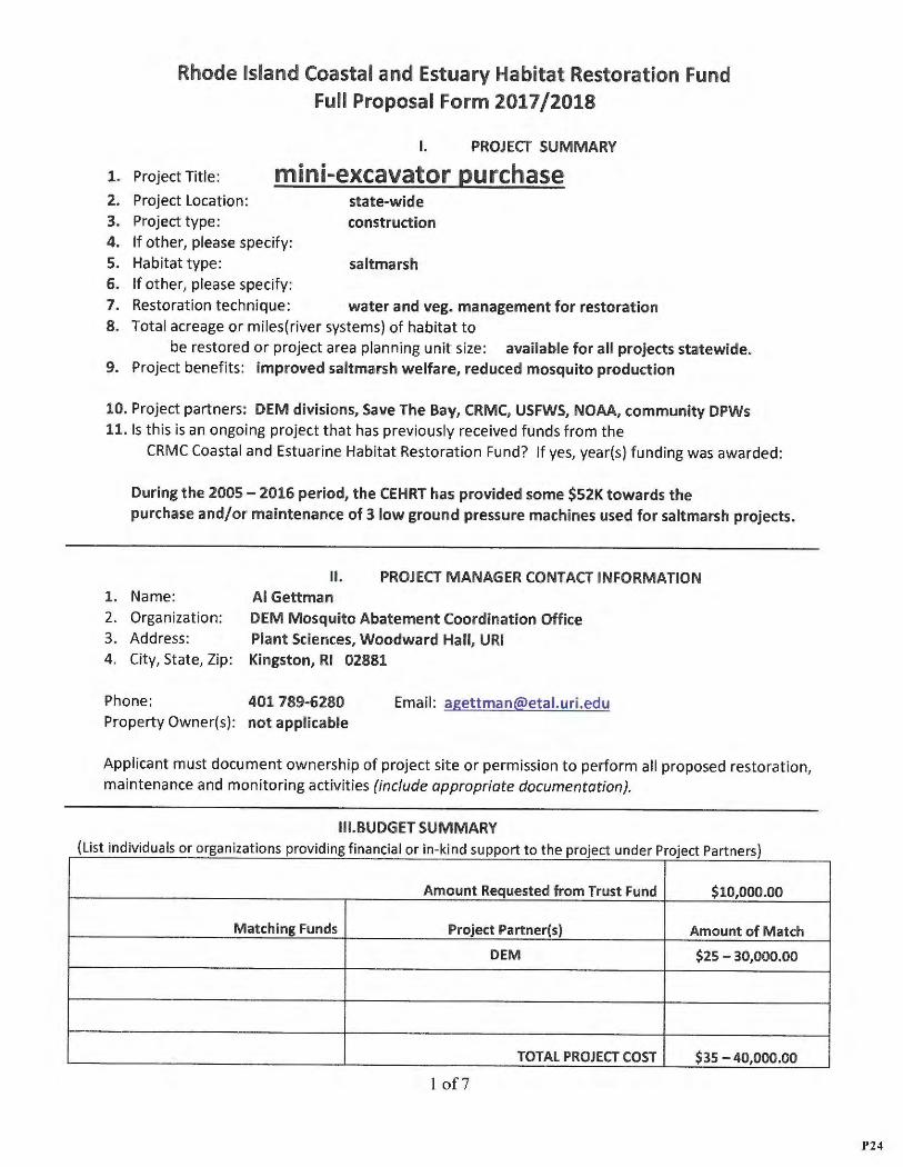
I. PROJECT SUMMARY
1. Project Title : mini-excavator purchase 2. Project Location: state-wide 3. Project type : construction 4. If other, please specify : 5. Habitat type: saltmarsh 6. If other, please specify: 7. Restoration technique: wat er and veg. management for restor ation 8. Total acreage or miles(river systems) of habitat to
be restored or project area planning unit size: availab le for all projects statew ide. 9. Project benefits: improved saltmarsh welfare, reduced mosquito production
10. Project partners : DEM divisions, Save The Bay, CRMC, USFWS, NOAA, community DPWs 11. Is this is an ongoing project that has previously received funds from the
CRMC Coastal and Estuarine Habitat Restoration Fund? If yes, year(s) funding was awarded:
During the 2005 - 2016 period, the CEHRT has provided some $52K tow ards the purchase and/or maint enance of 3 low ground pressure machines used for saltmarsh projects.
II. PROJECT MANAGER CONTACT INFORMATI ON 1. Name: Al Gettman 2. Organization : DEM Mo squito Abatement Coordination Office 3. Address: Plant Sciences, Woodward Hall, URI 4. City, State, Zip: Kingston, RI 02881
Phone: 401 789 -6280 Property Owner(s): not applicable
Email: [email protected]
Applicant must document ownership of project site or permission to perform all proposed restoration , maintenance and monitoring activities (include appropriate documentation).
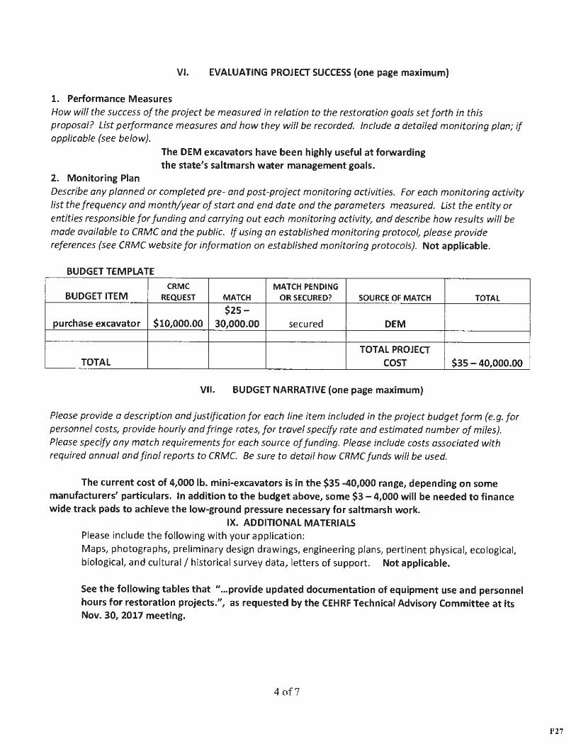
Ill.BUDGET SUMMARY (List individuals or organizations providing financial or in-kind support to the project under Project Partners)
Amount Requested from Trust Fund $10,000 .00
Matching Funds Project Partner(s) Amount of Match
DEM $25 - 30,000.00
TOTAL PROJECT COST $35 - 40,000.00
1 of7
P24
IV. PROPOSAL NARRATIVE (five pages maximum)
1. Justification and Purpose Describe the human impacts and previous restoration activities at the proposed project site. If multiple sites, please describe the impacts and previous restoration activities at each). Briefly describe the proposed project, its restoration goals, long-term and short-term outcomes.
Two DEM low-ground pressure (LGP) excavators (an 8,000 lb. IHI and a 4,000 lb. John Deere) have been used for numerous saltmarsh water management projects in RI (see below) . The IHI ($40K) was purchased in 2004 with EPA settlement funds provided to DEM. The John Deere ($33K) was purchased in 2014 with funds prov ided to CRMC from NOAA's "coasta l resiliency" program.
The Habitat Restoration Fund has granted $23.SK over the past 3 years to finance expensive repairs to both excavators, which suffer considerable damage from salt and sand when conducting saltmarsh water management projects . (For example, both machines have had all of the steel tracks rep laced during that period.) The conditions of both machines are currently sufficient for use on saltmarsh projects, but corrosion will continue . Looking forward, it is prudent to have a new 4,000 lb. machine (modified for LGP) availab le for 2019 projects.
IHI use during the 2006-2014 period: Used in 12 communit ies at 17 saltmarshes: Allin's Cove, Walker Farm, RISO, Silver Creek, Stillhouse Cove, Rocky Hill School, Round Marsh, Sachuest, Narrow River, Brenton Cove, Cardi Cove, Island Park, Prudence Island, Card's Pond , Jacob's Pt., Winnapaug, and Avalon.
John Deere use during the 2015-2017 period: Used in 7 communities at 10 saltmarshes: RI Country Club, Jacob 's Pt., Narrow River, Phillip's St. in Wickford, Sachuest, Ninigret, Dune's Club in Narr., Calf Pasture Pt., Winnapaug, and Fishing Cove.
2. Project Activities, Schedule and Work Plan Describe the planned on-the-ground project activities, and explain how each activity will help to restore ecosystem functions . List specific project activities and when they will occur (month and year). Indicate when annual and final project reports will be submitted .
The machine will be acquired in 2018, and the tracks fitted with wide pads,
so that it will be available for 2019 projects. 3. Minimization of Adverse Impacts What are the potential impacts resulting from project activities (e.g. the disturbance of sensitive species by construction activities}, and how will these impacts be minimized (e.g. scheduling construction to avoid disturbance of sensitive species). Machin es are modified for low-ground pressure, and
activities do not occur during the growing season. 4. Public Support
Demonstrate public support for the project by providing evidence of communication with adjacent landowners, community members and other stakeho lders. Describe planned or completed community / stakeholder education and outreach efforts. Improvements to saltmarsh habitats gain public support .
5. Economic and Educational Benefits
How will the proposed project provide direct economic and/or educational benefits to a community and/or the state? Saltmarsh improvements have indirect economic benefits .
2 of7
P25
6. Climate Change and Coastal Resiliency How have the present and future impacts of climate change been considered during the project planning and design phases? What impact will the project have on resilience of coastal or estuarine habitat to climate change? Sea level rise is factored into saltmarsh restoration designs.
7. Planning Consistency and Restoration Priority Is the proposed project consistent with the goals of a local, state or regional planning initiative? Please specify initiative and explain (see CRMC website for guidance). Does the proposed project involve a state, regional or federal priority habitat restoration need or special consideration? Please specify and explain (see CRMC website for guidance). Properly functioning saltmarshes aid coastal resiliency.
8. Species of Concern Will the project result in benefits to wildlife species listed as federally or state endangered, threatened, or species of concern within Rhode Island? Please specify which species will benefit and how. For a list of species, see the Rhode Island National Heritage Program's listing of animals at : http://www.rinhs .org/wpcontent/uploads/r i rare animals 2006.pdf or a listing of plants at: http ://www .rinhs.org/wp content/uploads/ri rare plants 2007.pdf
Native flora and fauna benefit from properly functionin g saltmarshes. 9. Permitting
List any federal, state or local permits required to complete the project and the permit application status for each. Not appli icable
10. Capacity of Lead Organization (attach additional materials if necessary) Demonstrate the capacity of the lead and/or partner organizations to successfully complete the proposed project by providing any or all of the following: a) a description of the organization(s) b} resume(s) or summary of qualifications of involved personnel c) evidence of successfully completed habitat restoration or conservation projects . The DEM low-ground-pressu re excavators have been used successfully at some
28 saltmar shes in 16 commun ities since 1998 .
V. SUSTAINABILITY (one page maximum) 1. Maintenance
What is the estimated "lifespan" of each plann ed restoration activity? What are the anticipated short-term and long-term (beyond the funding period) operation and maintenance requirements of the project ? Specify who will be responsible for funding and carrying out each O & M activity. Indicate when and with what frequency activitie s will occur. The state's excavators have been used, and will continue to be used
for maintaining and/or adjusting saltma rsh water regimes. 2. External Factors
Identify existing external (off-site) factors that could reduce the chances of achieving the project goals (e.g. storm water inputs to the site from the surrounding drainage area). Explain how these external factors will be addressed. Describe any additional measures taken to help ensure Jong-term success of the project (e.g. installation of storm water management practices or securing of conservation easements). What are the likely future effects of climate change and future sea level rise on the proposed project and how will these be addressed? Future sea level rise is considered when planning water managemen t projects .
3 of7
P26
VI. EVALUATING PROJECT SUCCESS (one page maximum)
1. Performance Measures How will the success of the project be measured in relation to the restoration goals set forth in this proposal? List performance measures and how they will be recorded. Include a detailed monitoring plan; if applicable (see below) .
2. Monitor ing Plan
The DEM excavators have been highly useful at forwarding the state's saltmarsh water management goals.
Describe any planned or completed pre- and post-project monitoring activities. For each monitoring activity list the frequency and month/year of start and end date and the parameters measured. List the entity or entities responsible for funding and carrying out each monitoring activity, and describe how results will be made available to CRMC and the public. If using an established monitoring protocol , please provide references (see CRMC website for information on established monitoring protocols). Not applicable.
BUDGET TEMPLATE
CRMC MATCH PENDING BUDGET ITEM REQUEST MATCH OR SECURED? SOURCE OF MATCH TOTAL
$25-purchase excavator $10,000.00 30,000.00 secured DEM
TOTAL PROJECT TOTAL COST $35 - 40,000.00
VI I. BUDGET NARRATIVE (one page maximum)
Please provide a description and justification for each line item included in the project budget form (e.g. for personnel costs, provide hourly and fringe rates, for travel specify rate and estimated number of miles). Please specify any match requirements for each source of funding. Please include costs associated with required annual and final reports to CRMC. Be sure to detail how CRMC funds will be used.
The current cost of 4,000 lb. mini-excava tors is in the $35 -40,000 range, depend ing on some manufacturers' particulars. In addition to the budget above, some $3 - 4,000 will be needed to finance wide t rack pads to achieve the low-ground pressure necessary for saltmarsh work .
IX. ADDITIONAL MATERIALS Please include the following with your application : Maps, photographs, preliminary design drawings, engineering plans, pertinent physical, ecological, biological, and cultural/ historical survey data, letters of support. Not applicable.
See the fo llowing tables that " ... provide updated documentation of equipment use and personnel hours for restoration projects.", as requested by the CEHRF Technical Advisory Committee at its Nov. 30, 2017 meeting.
4of7
P27
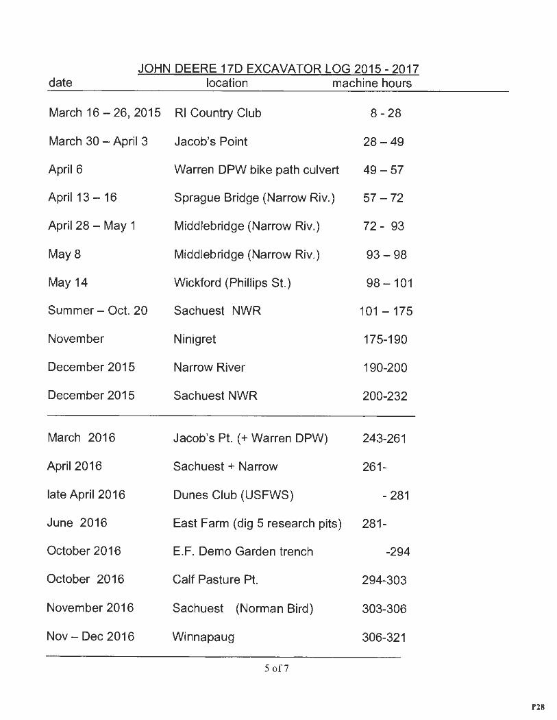
JOHN DEERE 170 EXCAVATOR LOG 2015-2017 date location machine hours
March 16 - 26, 2015 RI Country Club 8-28
March 30 - April 3
April 6
April 13 -16
April 28 - May 1
May8
May 14
Summer - Oct. 20
November
December 2015
December 2015
March 2016
April 2016
late April 2016
June 2016
October 2016
October 2016
November 2016
Nov- Dec 2016
Jacob's Point 28 - 49
Warren DPW bike path culvert 49 - 57
Sprague Bridge (Narrow Riv.) 57 - 72
Middlebridge (Narrow Riv.) 72 - 93
Middlebridge (Narrow Riv.) 93 - 98
Wickford (Phillips St.) 98 - 101
Sachuest NWR 101 - 175
Ninigret 175-190
Narrow River 190-200
Sachuest NWR 200-232
Jacob's Pt. ( + Warren DPW) 243-261
Sachuest + Narrow 261-
Dunes Club (USFWS) - 281
East Farm (dig 5 research pits) 281-
E. F. Demo Garden trench -294
Calf Pasture Pt. 294-303
Sachuest (Norman Bird) 303-306
Winnapaug 306-321
5 of7
P28
March-Apr . 2017 Ninigret 324-385
April 2017 Narrow River 385-397 Summer 2017 East Farm and DEM F&W 397-421
Sept-Oct 2017 Sachuest NWR 421-466
Oct 2017 Sachuest (Norman Bird) 466-469
Oct 2017 Calf Pasture Pt. 469-474
Nov 2017 CedarHurst (Fishing Cove) 474-481
Dec 2017 East Farm (bldg. 75 drainage) 481-498
DEM Mosquito Office personnel match 2015 - 2017 month/ year location days March 2015 RI Country Club 4
March-April 2015 Jacob's Point 5
April - May 2015 Narrow River 4
May 2015 Wickford (Phillips St.) 1
Oct. 2015 Sachuest NWR 1
Nov. 2015 Ninigret 4
Dec. 2015 Narrow River 2
March 2016 Jacob's Pt. 3
April 2016 Sachuest 1
Oct. 2016 Calf Pasture Pt. 2
Nov. 2016 Sachuest (Norman Bird) 1
Nov. - Dec. 2016 Winnapaug 2
6 of7
P29
March 2017
April 2017
Oct. 2017
Oct. 2017
Nov.2017
Ninigret
Narrow River
Sachuest (Norman Bird)
Calf Pasture Pt.
Cedarhurst (Fishing Cove)
TOTAL:
41 days x $400 / day (in-kind match) = $16.400
3
3
1
1
3
41 days
This table represents partial or full days of operation of the John Deere 170 excavator by Al Gettman. Omitted are hours spent on machine transportation logistics, site visits, rinsing, changing track pads, and minor maintenance and repairs.
AUTHOR IZED AGENT OF LEAD ORGANIZATION Al Gettman, DEM Mosg. Abate. Coord.
Signature
Narrow River saltmarsh restoration project .
7 of7
Jan. 24, 2018 Date
Wide pads fitted to 4,000 lb. John Deere excavator.
C
P30
Rhode Island Coastal and Estuary Habitat Restoration Fund
Full Proposal Form for Planning Projects 2017/2018 **for design or construction projects please use Full Proposal Form
I. PROJECT SUMMARY
1. Project Title: STORMTOOLS Analyses and Coastal Resilience using MyCoast tools
2. Project Location and coordinates (include map) : all of coastal Rhode Island that will be impacted by 1 to 7 feet of sea level rise, including the south coast salt ponds and Narragansett Bay coves {see attached) .
3. If other, please specify:
4. Habitat type (River System, Salt Marsh, Seagrass, Shellfish Bed, other) : existing salt marsh and low lying areas for potential marsh migration .
5. If other, please specify: Upland areas, particularly roads and parking lots that are frequently flooded by extreme high tides causing pollutants to flow into tidal waters, impacting marshes and benthic habitat .
6. Targeted restoration technique (e.g. re-vegetation, tidal restoration, etc.) : This project wil l assess sea level rise impacts on the natural and built environment using photographs submitted by citizen scientists, with simultaneous tidal and weathe r data. This will be used to ground truth STORMTOOLS flood modeling . This project will also include a component for training cit izen scientists on using the coastal resilience tool for documenting marsh condition and monitoring marsh migration.
7. Potential future benefits resulting from proposed planning project: Determining thresholds for nuisance flooding is important for assessing saltmarsh resiliency to sea level rise. Monitoring marsh condition and migration will help in accessing the SLAMM modeling . The ultimate goal is to increase confidence in the models for policy and planning init iatives to protect, adapt and restore coastal resources subjected t o sea level rise impacts .
8. Project partners (organizations providing financial or other support to the project) : The Northeast Region Association of Coastal and Oceans Observation System {NERACOOS), Blue Urchin, LLC
9. Is this is an ongoing project that has previously received funds from the CRMC Coastal and Estuarine Habitat Restoration Fund? No If yes, year(s} funding was awarded:
1 of 10
P31
II. PROJECT MANAGER CONTACT INFORMATION 1. Name: Janet Freedman
2. Organization: RI Coastal Resources Management Council
3. Address: 4808 Tower Hill Rd.
4. City: Wakefie ld S. State: RI 6. Zip: 02879
7. Phone: 401-783-3370 8. Email: [email protected]
9. Property Owner(s): generally publically owned property, some reporters may document their own property
The applicant must document ownership of project site or permission to perform all proposed project plann ing activities (include appropriate documentation) .
Ill . BUDGET SUMMARY (List individuals or organizat ions providing financial or in-kind support to the project under Project Partners)
Amount Requested from Trust Fund $10,000
Matching Funds Project Partner(s) Amount of Match Janet Freedman Coastal Resources Management Council $6930
TOTAL PROJECT COST $16930
IV. PROPOSAL NARRATIVE
1. Just ification and Purpose
Briefly describe the proposed planning project. What questions does it propose to answer? What are the restoration goals and anticipated long-term and short-term outcomes. Describe the human impacts and previous restoration activities within the proposed study area. If the project area includes multiple impacted sites, please describe the impacts and previous restoration activities at each.
MyCoast is a iphone or android phone application that has been used to document tidal flooding and storm surge in low lying coastal areas in RI. The app georeferences the photo location and links the time the photo was taken to weather and tide data from the closest NOAA tide gage automatically creating the metadata for download by MyCoast administrators. STORMTOOLS is an important tool for sea level rise and coasta l adaptation planning. The tool maps future inundation areas under 1 foot to 7 foot sea level rise scenarios. STORMTOOLS is a robust model , but it is still a model.
2 of 10
P32
This project proposes to use the existing MyCoast inventory of on-the-ground flood data to assess the accuracy of STORMTOOLS and to identify thresholds for nuisance flooding throughout Narragansett Bay and the RI south shore in order to determine how high and how often flooding occurs . Assessing the accuracy of STORMTOOLS flood levels is particularly important in the many ponds, embayments, and coves where there may be tidal restrictions and lags between the time of predicted high tide at the NOAA tide stations and the actual high tide at the location of interest. A second objective of this project is to use the MyCoast Coastal Resilience tool to identify areas where marshes are migrating into upland areas to support the SLAMM modeling . Both flood level mapping and marsh migration mapping will be conducted by enlisting the help of citizen scientist volunteers. There are currently 286 MyCoast subscribers, of which 125 have submitted at least 1 report since the app was developed in November 2014. More than 900 reports within Narragansett Bay and the RI south shore have been posted to the MyCoast website since that time.
Low lying coastal areas are important for coastal habitats both today and in the future . The goals of this project are to verify the flood extent of areas identified in the STORMTOOLS model and identify thresholds for nuisance coastal flooding for various location throughout the state ; to identify areas with high risk of mobilization of pollutants onto critical and vulnerable habitat; and to document conditions of upland areas ident ified for marsh migration in SLAMM modeling . Ultimately the goal is to increase understanding and confidence of the inundation models for state and local planning initiatives to further coastal resilience, habitat preservation and habitat restoration.
2. Project Activit ies, Schedule and Work Plan Describe the planned project activities, and explain how each activity will help to plan for restoration of ecosystem functions. list specific project activities and when they will occur (month and year). Indicate when annual and final project reports will be submitted.
This proposal requests funding for : 1) site maintenance in order to allow continued access to the photographs and metadata. Site maintenance will be done by Blue Urchin, LLC, the app developer, through the Northeastern Regional Coastal Ocean Observing Systems (NERACOOS). Maintenance will be continuous throughout the twelve month grant period. 2) analyzing the existing data for comparison to STORMTOOLS sea level rise modeling scenarios to assess the accuracy of STORMTOOLS flood modeling data. Photographs will be analyzed by location for flood levels onsite and events of interest will be selected . Metatdata for tide heights from the nearest tide gage and weather conditions, particularly wind will be used to determine threshold conditions for tidal flooding . RTK GPS may be used on select ed sites to hindcast flood depths for comparison with STORMTOOLS. A preliminary report documenting the results will be completed by October 2018, with th e final report due at the completion of this grant period . 3) continued data collection , particularly in low lying areas on restricted tidal water bodies and areas with conduits to tidal waters that are not necessarily apparent within th e STORMTOOLS model; Low lying areas that have not yet been documented in MyCoast will be targeted with priority going to areas adjacent to tidally restricted water bodies. MyCoast monitoring w ill be continuous throughout the year with a poten t ial for 10 King tides (ext reme tides without storm surge) and possibly some additional storm tides. Documenting marsh plant migration will be done when targeted vegetation is visible. 4) conduct a trial investigation of the utility of using the MyCoast Coastal Resilience tool to document salt marsh migration as identified in SLAMM mapping . This will entail recruiting new reporters and training current reporters on how to use the MyCoast Coastal Resilience Tool durin g 4 training events held in 2018.
3 of 10
P33
3. Coordinatio n and Public Support
How will the project lead organization coordinate with other stakeholder groups, and which groups will be included? Describe planned or completed community I stakeholder education and outreach efforts.
CRMC will coordinate with the Coastal Resources Center/Sea Grant (CRC/Sea Grant) at the University of Rhode Island on developing the workshops . Education and outreach for training for using the MyCoast tools are currently included in their coastal resilience toolbox and education and outreach is part of the CRC/Sea Grant 4 year Omnibus . Potential Education and Outreach opportunities for training in use of the Coastal Resilience Tool to monitor shoreline change are RIFMA Twilight Seminar, for professionals and practitioners in in flood mitigation, Coastweeks walking tour for the general public, and the Land and Water Summit, for resource managers and volunteer groups . Several coastal communities have expressed interest in the tool and have offered to help in recruiting volunteers. The Towns of Warren and North Kingstown in particular are potential partners for training workshops.
4. Planning Consistency and Restoration Priority Is the proposed project consistent with the goals of a local, state or regional planning initiative? Please specify initiative and explain (see CRMC website for guidance). Does the proposed project involve a state, regional or federal priority habitat restoration need or special consideration? Please specify and explain (see CRMC website for guidance).
The State Guide Plan policy is to preserve and enhance wildlife, fish, and plant species diversity and stability through habitat protection, restoration, enhancement, and prevention or mitigation of adverse impacts due to human activities. This project documents the impacts of sea level rise on coastal habitat and can be used in conjunction with STORMTOOLS to plan for mitigat ion to these impacts.
The Coastal Resources Mana gement Council has a legislativ e mandate to preserve, protect, and where possible, restore the coastal resources of the state through comprehensive and coordinated long-range planning. The Coastal Resources M anage ment Program (CRMP) identifies climate change and sea level rise as important policy issues and further states that in order to proactively plan for and adopt to climate change and sea level rise will integrate climate change and sea level rise scenarios into its programs in order to create coastal resilience under changing conditions (Section 1.1.10). In addition, the CRMP adopts the use of STORMTOOLS to evaluate the flood extent and inundation from sea level rise and storm surge. Shoreline Change Special Area Management Plan (BeachSAMP) developed STORMTOOLS as one of the resilience tools for climate change and sea level rise planni ng. The BeachSAMP website is one platform that is used to notify the public about upcoming King Tides.
The Narragansett Bay Estuary Program identifies nuisance flooding thresholds and field research for marsh migration sites identified in SLAMM as data gaps in State of Narragansett Bay and Its Watershed 2017 Technical Report.
5. Species of Concern
Does the planning project address threats to wildlife species listed as federally or state endangered, threatened, or species of concern within Rhode Island? Please specify which species will benefit and how. For a list of species, see the Rhode Island National Heritage Program's listing of animals at: http://ww .rinhs.org/ wp-co nt ent/uploads/ri rare animals 2006.pdf or a listing of plants at: http ://ww w.rinhs. org/w p-content/ u ploads/ri rare plants 2007 .pdf
4 of 10
P34
NA
6. Climate Change and Coastal Resiliency How will present and future impacts of climate change be considered during the project planning and design phases? What impact will the final project have on resilience of coastal or estuarine habitat to climate change?
The goal of MyCoast is to increase awareness of climate change using visua l documentation of coastal flooding in areas that are familiar to communities members. This promotes understanding of what the blue polygons mapped in STORMTOOLS actually means on the ground and how it will impact natural resources and the built environment in the f uture as flood ing becomes more and more frequent. Understanding of the issue is an important step for policy makers and planners to work towards creating more resilient communities and protecting valuable coastal resources.
NA
7. Permitting List any federal, state or local permits required to complete the project and the permit application status for each.
8. Capacity of Lead Organization (attach additional materials if necessary) Demonstrate the capacity of the lead and/or partner organizations to successfully complete the proposed project by providing any or all of the following: a) a description of the organization(s) b) resume(s) or summary of qualifications of involved personnel c) evidence of successfully completed habitat restoration or conservation planning projects.
The Coastal Resources Management Council policy is " ... to preserve, protect, develop , and where possible, restore the coastal resources of the state for this and succeeding generations through comprehensive and coordinated long-rang e planning and management designed to produce the maximum benefit for society from such coastal resources; and that the preservation and restoration of ecological systems shall be the primary guiding principal upon which environmental alteration of coastal resources shall be measured , judged and regulated ." CRMC has managed and continues to manage many habitat restoration projects in the state. CRMC also created the Shoreline Change Special Area Management Plan (BeachSAMP} whic h includes several tools for determining risk for climate change impacts including STORMTOOLS and CERI. Janet Freedman is the state administrator for the MyCoast project. She has also worked on various habitat restoration projects (Allin's Cove wetlands restoration, Ninigret Pond eelgrass restoration) and coastal resilience projects.
NERACOOS is part of the National Integrated Oceans Observing System (IOOS}. They produce, integrate and disseminate data rang ing from real-time tide and wave data, ocean forecasts, nutrient and sent inel monitoring, in the northeast region. They have the capacity to host the MyCoast sit e.
9. External Factors and Climate Change Identify existing external (off-site) factors that may be affecting habitat within the study area. How will external factors be considered? What are the likely effects of climate change and sea level rise within the study area and how will these be considered?
One goal of the project is to further understand how sea level rise will likely effect coastal habitats.
5 of 10
P35
V. EVALUATING PROJECT SUCCESS (one page maximum)
1. Performance Measures and Deliverables How will the success of the project be measured in relation to the restoration goals set forth in this proposal? List all deliverables (e.g. reports, updates, websites, etc .) associated with the project. .
A report of results of the data analysis will be delivered in October 2018. Four workshops will be held for training on the MyCoast Coastal Resiliency Tool. Website maintenance will allow for the continued use of the MyCoast app and website (https ://mycoast.org/r i) for submitting reports and downloading photographs and metadata.
2. Monitoring Plan Describe any monitoring activities that are part of the planning project. For each monitoring activity list the frequency and month/year of start and end date and the parameters measured. List the entity or entities responsible for funding and carrying out each monitoring activity, and describe how results will be made available to CRMC and the public. If using an established monitoring protocol, please provide references (see CRMC website for information on established monitoring protocols).
The monitoring will be done by MyCoast reporters through the app for extreme high tide flood ing. Photographs are available for download for stakeholders . The metadata will be made available to interested parties by contacting the RI site administrator .
Simple monitoring parameters are incorporated into the Coastal Resiliency Tool. These include dropdown menus for physical site characteristics, site stability, vegetation percent and vegetation cover, and structural integrity from human and natural impacts . The monitoring locat ions and protocol will be developed as part of the training workshops for the Coastal Resiliency Tool. Ongoing work by the URI Coastal Resource Center/Sea Grant to secure multi-year funding for site maintenance will insure that citizen scientists will be able to continue monitoring marsh migration sites after the completion of this grant .
6 of 10
P36
Rhode Island Coastal and Estuary Habitat Restoration Fund Full Proposal Form 2017/2018
**for planning projects please use Full Proposal Form for Planning Projects
I. PROJECT SUMMARY
1. Project Title: Shady Lea Dam Removal
2. Project Locati on and coordinates (include map): 215 Shady Lea Road, North Kingstown
3. Project type (Design, Construction or Other) : Construction
4. If other, please specify :
5. Habitat type (River System, Salt Marsh, Seagrass, Shellfish Bed, other): River
6. If other, please specify :
7. Restoration technique (e.g. re-vegetation , tidal restoration, etc.): Dam Removal
8. Total acreage or mile s(river systems) of habitat to be restored, or project area planning unit size:
2 acres riverfront area restored,½ mile of stream corr idor.
9. Project bene fits: Riparian area restorat ion, fish passage increased
10. Project partners (organizations providing financial or other support to the project) : US Fish and Wildlife Service, Save The Bay, NOAA, DEM
11. Is this is an ongoing project that has previously received funds from the CRMC Coastal and
Estuarine Habitat Restoration Fund? Yes If yes, year(s) funding was awarded : 2011, 2013, 2015
II. PROJECT MANAGER CONTACT INFORMATION 1. Name : Rachel Calabro
2. Organization: Save The Bay
3. Address: 100 Save The Bay Drive
4. City: Providence 5 . State: RI 6. Zip: 02905
7. Phone: 401-272-3540 x107 8. Email: rcalabro@savebay .org
9 . Property Owner(s): Lynn Krim, Reisert Realty
Applicant must document ownership of project sit e or permission to perform all proposed restoration , maintenance and monitoring activities (include appropriate documentation) .
1 of IO
P37
Ill. BUDGET SUMMARY (List individuals or organizations providing financial or in-kind support to the project under Project Partners)
Am ount Requested from Trust Fund $15,000
M atching Funds Project Partner(s) Amount of M atch
US Fish and Wildlife Service $30,000 Cash Patagonia $5,000 Cash
Bafflin Foundation $20,000 Cash
TOTAL PROJECT COST
IV. PROPOSAL NARRATIVE (five pages maximum)
1. Justificat ion and Purpose
Describe the human impacts and previous restoration activities at the proposed project site. If multiple sites, please describe the impacts and previous restoration activities at each). Briefly describe the proposed project, its restoration goals, long-term and short-term outcomes .
Save The Bay is partnering with RI DEM, NOAA and the US Fish & Wildlife Service to implement a dam removal and river restoration project on the Mattatuxet River in North Kingstown. The dam at Shady Lea Mill is located on the Mattatuxet River about 1.5 miles above the fish ladder at the Gilbert Stuart Birthplace on Carrs Pond. Removing the dam at Shady Lea would provide fish passage to .5 miles of rive r up to the Silver Spring Lake Dam.
Shady Lea dam was upgraded from significant hazard to high hazard after the 2010 floods. The project as designed will remove of most of the spillway but not the earthen embankment or abutments . This will preserve historic elements of the raceway and hydro turbine . The design includes small stone weir structures below the dam to assure fish passage during low flow .
The project has begun construction and the Section 106 historic preservation work has been completed. A final report will be submitted to Save The Bay and the RI Historic Preservation and Heritage Commission along with the archival photographs and other material. The US Fish and Wildlife Service was the lead federal agency on this project. The dam has been notched and water levels were lowered within the impoundment . Some sediment was removed and placed in the raceway next to the dam. The dam remova l will be comp leted in July and remaining sediment will be transported off site. Stones from the dam will be reused as weirs in the channel.
2 of 10
P38
2. Project Activities, Schedule and Work Plan Describe the planned on-the-ground project activities, and explain how each activity will help to restore ecosystem functions . List specific project activities and when they will occur (month and year). Indicate when annual and final project reports will be submitted.
During phase one of the project, the dam was lowered by removing a 4 foot by 2 foot section and allowing the impoundment to drain. Some sediment from behind the dam was removed and placed in the adjoining raceway. Public Archaeology labs has been out to document the dam and associated mill works for Section 106 of the Historic Preservation Act. Archival photographs and a report will be provided to the Rhode Island Historic Preservation and Heritage Commission. The impoundment will continue to drain over the winter and we will be back in July to fully remove the spillway and to remove more sediment from directly behind the dam. The impoundment will be allowed to naturally revegetate. Stone weirs will be installed below the dam to assist with fish passage. Stones from the dam will be reused in the weirs . Sediment will be trucked over to state property on Route 1 for disposal. Some additional modeling and survey will need to be done to satisfy the DEM Dam Safety program's requirements for downgrading the dam to low hazard. Post construction monitoring of fish passage and habitat restoration will also be completed . We will cont inue to work with DEM fisheries staff to ensure that the project meets fish passage goals. We will be able to file a final project report by December, 2018.
3. Minimization of Adverse Impacts What are the potential impacts resulting from project activities (e.g. the disturbance of sensitive species by construction activities), and how will these impacts be minimized (e.g. scheduling construction to avoid disturbance of sensitive species).
Our DEM wetlands permit required that no work be done in the stream from October 31, 2017 to July 1, 2018. We have phased the project appropriately to avoid this construction window and to allow revegetation of flood plain before construction begins in the summer. This will stabilize the sides of the impoundment. The wetlands permit also provides requirements for erosion control and dewatering at the construction site. All construction areas will be restored after the project.
4. Public Support Demonstrate public support for the project by providing evidence of communication with adjacent landowners, community members and other stakeholders . Describe planned or completed community / stakeholder education and outreach efforts.
We have provided outreach to the mill tenant s, the Shady Lea Woods neighborhood association, and the Narrow River Preservation Association. There has been interest in the project with the neighbor s, and many have been down to view the construction activities. While they don't all want to see the pond go away, they do understand the necessity of the project and are looking forward to seeing its completion.
S. Economic and Educational Benefits How will the proposed project provide direct economic and/or educational benefit s to a community and/or the state?
The Shady Lea Mill is leased to many artists and small businesses. The mill owner wants to keep rents affordable and to create a community of arti sts and businesses. This project will directly help her and all the mill businesses by lowering liability and flood risk. As an educational tool, the dam removal wi ll show habitat restoration in action and will be an area where folks should be able to view fish migrating through
3 of 10
P39
the weirs in the spring migration. Trout also use this area, and have already been observed moving through the system . Fishing will likely improve and the neighbors area already looking forward to trying out their favorite fishing spots.
6. Climate Change and Coastal Resiliency
How have the present and future impacts of climate change been considered during the project planning and design phases? What impact will the project have on resilience of coastal or estuarine habitat to climate change?
This project will improve the resiliency of this stream habitat by recreating a natural river corridor from a formerly impounded area. The stream is suitable trout habitat and restoration will remove a potential for thermal contamination from warm water in the mill pond . Trout have already been observed trying to leap into the impoundment through the new notch in the dam . It will also restore upstream passage and the ability for trout to move upstream for thermal refuge. It will allow migratory herring the ability to continue upstream and will increase their spawning area. As the climate warms and floods become more frequent, removal of this dam will also remove a failure hazard.
7. Planning Consistency and Restoration Priority
Is the proposed project consistent with the goals of a focal, state or regional planning initiative? Please specify initiative and explain (see CRMC website for guidance). Does the proposed project involve a state, regional or federal priority habitat restoration need or special consideration? Please specify and explain (see CRMC website for guidance).
This river system is listed in the DEM Strategic Plan for the Restoration of Anadromous Fishes to Rhode Island Coastal Streams, prepared in 2002. The Shady Lea Mill dam is listed as a removal candidate with a potential for a fish ladder at Silver Spring Lake. This project will support the goals of river restoration and fish passage within the Narrow River watershed . The National Fish and Wildlife Foundation created a river herring habitat restoration needs strategy for the Narrow River, and this project was identified as an important next step in increasing river herring habitat in the Narrow River watershed.
8. Species of Concern
Will the project result in benefits to wildlife species listed as federally or state endangered, threatened, or species of concern within Rhode Island? Please specify which species will benefit and how. For a list of species, see the Rhode Island National Heritage Program's listing of animals at: http ://www .rinhs.org/wpcontent/up loads/ri rare animals 2006.pdf or a listing of plants at: http://www.rinhs.org/wpcontent/up loads/ri rare plants 2007.pdf
This project does not directly benefit any threatened or listed species, but it does support habitat for both river herring and American eel, both of which have declined in Rhode Island. National Marine Fisheries Service (NMFS) lists alewives and blueback herring as species of concern. Currently there is a moratorium on the taking of river herring and American shad in RI fresh and marine waters. American eel are not listed, but they are an ASMFC managed species.
4 of 10
P40

9. Permitt ing List any federal, state or local permits required to complete the project and the permit application status for each.
All permits have been received and work has begun. An extension of the DEM wetlands permit was recently granted, so the permit is extended for another year.
10. Capacity of Lead Organization (attach additional materials if necessary) Demonstrate the capacity of the lead and/or partner organizations to successfully complete the proposed project by providing any or all of the following: a) a description of the organization(s) b) resume(s) or summary of qualifications of involved personnel c) evidence of successfully completed habitat restoration or conservation projects.
Save The Bay has a long track record of successful restoration projects funded through the Trust Fund. We have been project proponents as well as partner supporters . We have been partners on dam removal and fish passage projects on the Pawcatuck, Pawtuxet, Ten Mile, Kickemuit and Blackstone Rivers. We have also successfully completed salt marsh restoration and riparian restoration projects throughout the watershed. Rachel Calabro and Wenley Ferguson will be the project leads on the completion of this project. Our project engineer, EA Science Engineering and Technology also has a long track record of successful projects in Rhode Island.
V. SUSTAINABILITY (one page maximum )
1. Maintenance What is the estimated "lifespan" of each planned restoration activity? What are the anticipated short-term and long-term (beyond the funding period) operation and maintenance requirements of the project? Specify who will be responsible for funding and carrying out each O & M activity. Indicate when and with what frequency activities will occur.
This project is designed to provide fish passage into the future with little maintenance required. The dam will be reclassified as low hazard and most of the spillway will be removed. The dam owner will potentially need to remove wood or other debris that gets caught in the weirs, and she will need to continue to mow and maintain the earthen embankment. The channel walls and abutments will remain. Save The Bay in partnership with DEM Fish and Wildlife will continue to monitor the fish passage at this location and make adjustments as needed.
2. External Factors Identify existing external (off-site) factors that could reduce the chances of achieving the project goals (e.g. storm water inputs to the site from the surrounding drainage area). Explain how these external factors will be addressed. Describe any additional measures taken to help ensure long-term success of the project (e.g. installation of storm water management practices or securing of conservation easements). What are the likely future effects of climate change and future sea level rise on the proposed project and how will these be addressed?
5 of 10
P41
This site is not directly impacted by stormwater drainage, and there are stormwater swales located next to the mill that infiltrate and contain road drainage. The driveways and parking areas are not paved. There is a stormwater input from Route 1, but it is above the project area. There should not be any factors that affect the project goals.
VI. EVALUATING PROJECT SUCCESS (one page maximum)
1. Perfo rmance Measures How will the success of the project be measured in relation to the restoration goals set forth in this proposal? List performance measures and how they will be recorded. Include a detailed monitoring plan; if applicable (see below).
This project will be evaluated based on the success of fish passage and the shape of the low flow channel. Evaluation of fish passage will be conducted in coordination with DEM Fish and Wild life. Hydraulic modeling will be used to determine flood risk and to change the dam classification .
2. Monitor ing Plan Describe any planned or completed pre- and post-project monitoring activities . For each monitoring acti vity list the frequency and month/year of start and end date and the parameters measured. List the entity or entities responsible for funding and carrying out each monitoring activity, and describe how results will be made available to CRMC and the public . If using an established monitoring protocol, please provide references (see CRMC website for information on established monitoring protocols).
RI DEM Division of Fish and Wildlife monitors diadromous fish runs throughout the state by various methods . Adult anadromous fish returns are monitored during the spring migration and out migrating juveniles are monitored throughout the summer and fall. These results are available from RI DEM. The results from monitoring are used to set harvest regulations, determine the overall condition of the anadromous stocks, and to determine the efficiency of fish passage structures. The fish run will be monitored qualitatively on an annual basis for presence/absence of fish passing the mill property . Asbuilt plans will be used to determine the amount of new river channel and riparian area, and vegetation monitoring will take place for invasive species and habitat regrowth .
6 of 10
P42
Rhode Island Coastal and Estuary Habitat Restoration Fund Full Proposal Form 2017 /2018
**for planning projects please use Full Proposal Form for Planning Projects
I. PROJECT SUM MARY
1. Project Tit le : Tunipus Pond Marsh Restoration Project
2. Project Location and coordinates (include map) : Tunipus Pond is located in Little Compton south of John Sisson Road, east of Pond View Drive, and north of The Town of Little Compton's South Shore Beach on the Tunipus Pond barrier.
3. Project type (Design, Construction or Other): This project includes Planning, Design, Construction, Monitoring and Assessment, and Other.
4. If other, please specify: Additionally, native shrub plantings will be planted on the north side of the South Shore Beach barrier and to create buffer zones. Some of the plantings will include those attractive to native pollinators. Once the Phragmites is eliminated on the back barrier, these plantings will provide a buffer and help to stabilize soils on the pond side of the barrier shoreline. The Nature Conservancy anticipates educational opportunities stemming from this effort, and will incorporate this marsh restoration project into programs at its Benjamin Family Center facility at Goosewing Beach.
5. Habitat type (River System, Salt Marsh, Seagrass, Shellfish Bed, other) : Tunipus Pond is a Coastal Pond. The target habitat is its shoreline plant communities which comprise patches of upland and emergent vegetation . Brackish and Freshwater Wetland encircle portions of the pond shoreline. Much of the upland shoreline is wooded, some Wooded Swamp. The Coastal Barrier is comprised of beach and a gravel parking area for Little Compton's South Shore Beach with a very narrow back dune area. This barrier is subject to a CRMC Maintenance Assent (under Assent #2010-05-026 and issued as recently as 10/24/16) which provides for the Town of Little Compton to manage the barrier as a recreational area and bathing beach.
6. If other, please specify: Native plant communities on the eastern shore of Tunipus Pond have been protected with Conservation Easements and outright conservation interests associated with Goosewing Beach and Goosewing Farm. This was a recommended action in the RI Resource Protection Project that described this area as an important natural resource in East Bay and an area in good ecological health.
7. Restoration technique (e.g. re-vegetation, tidal restoration, etc.): Initial removal of tall reed (Phragmites australis) and purple loosest rife (Lythrum salicaria) by herbicide treatment to initiate native marsh restoration around much of the circumference of Tunipus Pond. This practice has already been employed successfully since 2009 at a number of coastal ponds in Little Compton. Native plantings will be proposed if future monitoring of the project success indicates that some wetland areas do not revegetate naturally with wetland plant species.
8. Total acreage or miles(river systems) of habitat to be restored, or project area planning unit size: 3-3.5 acres of the total 50+ acre pond
1 of27
P43
9 . Project benefits: Protection of existing shoreline plant communities at Tunipus Pond from invasion by tall reed (Phragmites australis) ; re-introduction of native plant communities, thus creating habitat diversity in areas that are presently a monoculture of Phragmites; restoration of open water areas within Tunipus Pond; establishment of a buffer along the back dune area of Little Compton's South Shore Beach (a recreational area receiving season heavy use by vehicles and beach-goers); estab lishment of a single access on the barrier to Tunipus Pond; and improved visual access of Tunipus Pond for the public using South Shore Beach.
10. Project partners (organizations providing financial or other support to the project) : The Friends of Tunipus Pond, Little Compton Agricultural Conservancy Trust, The Nature Conservancy in Rhode Island, Sakonnet Preservation Association, and the Town of Little Compton Beach Commission
11. Is this is an ongoing project that has previously received funds from the CRMC Coastal and
Estuarine Habitat Restoration Fund? No If yes, year(s) funding was awarded:
II . PROJECT MANAGER CONTACT INFORMATION
1. Name: Linda A. Steere
2. Organization: Applied Bio-Systems, Inc.
3. Address: 42 North Road (Mailing : PO Box 985; West Kingston, RI 02892)
4. City: Wakefield 5. State: RI 6. Zip: 02879
7. Phone: 401-783-6740 8. Email: [email protected]
12. Property Owner(s): The Friends of Tunipus Pond, Little Compton Agricultural Conservancy Trust, The Nature Conservancy in Rhode Island, Sakon net Preservat ion Association, and the Town of Little Compton Beach Commission (Documentation attached in Appendix B)
Applicant must document ownership of project sit e or permission to perform all proposed restoration, maintenanc e and monitoring activities (include appropriate documentation).
2 of27
P44
Ill . BUDGET SUMMARY (List individuals or organizations providing financial or in-kind support to the project under Project Partners)
1. Amount Requested from Trust Fund: $13,000.00
Source of Match Amount Cash or In-Kind?
NRCS EQIP Funding $5000 Cash
Town of LC. Beach Commission** $2500 Cash/In-Kind
Friends of Tunipus Pond** $1440 Cash/In-Kind
The Nature Conservancy** $3000 Cash/In-Kind
LC. Agricultura l Trust** $48 0 In-Kind
Sakonnet Preservation Association** $480 In-Kind
Applied Bio-Systems, Inc. $ 560 In-Kind
Total Match Amoun t $13,460.
** Project Partner
3. Total Project Cost: $26,460.00
IV. PROPOSAL NARRATIVE (five pages maximum)
1. Justification and Purpose Describe the human impacts and previous restoration activities at the proposed project site. If multiple sites, please describe the impacts and previous restoration activities at each). Briefly describe the proposed project, its restoration goals, long-term and short-term outcomes.
Similar Marsh Restoration projects have occurred at numerous coastal ponds in Little Compton. To date , successful projects are on-going or concluded in Round Pond, Briggs Marsh, Long Pond and both the northern and southern ends of Quicksand Pond. Each of these ponds is hydrologically independent, but they function as one ecological system of coastal lagoons along the shores of Buzzards Bay (USFWS). All have excellent water quality and each is being monitored in order to make informed management decisions. The Friends of Tunipus Pond have already had a habitat study and water quality testing completed for the pond in preparation for this restoration project. The reports from these studies are available for rev iew upon request.
3 of27
P45
In Tunipus Pond the growth of the invasives, common reed (Phragmites australis) and purple loosestrife (Lythrum salicaria), is slowly gaining a foothold along the shoreline of the pond. Beginning at the south end at the barrier beach they are overtaking freshwater and brackish wetland as the populations increase and move northward. Presently, the pockets of both plants along the shoreline are small, but restoring native wetlands will be easier now rather than after colonies of the invasives have completely encircled the pond. The Friends of Tunipus Pond and Partners propose to Design and carry out a Restoration Plan that would include a three-step process. In the short-term, the first step is a foliar herbicide treatment specific to the Phragmites by professionals . Second is the removal of the dead stalks, and finally, monitoring and assessment of the success of the regrowth of native wetland vegetation over a five-year period . After evaluation, the planting of native shrubs would be proposed in areas where native regrowth is lacking or where a native shrub buffer could be planted to improve wildlife habitat and aid in improving water quality by filtering stormwater flow to the pond. The pond side of the Tunipus barrier beach would be one location for the shrub plantings to replace the Phragmites and provide native wildlife habitat and some stabilization of the barrier. It is hoped that future dollars from the NRCS Native Pollinators program wil l help to fund some of the shrub plantings .
In the long-term, monitoring of the project area will continue, both for spot treatment of Phragmites as it occurs, as well as the successful revegetation of the freshwater/brackish wetland and barrier with native vegetation and/or planted natives. Finally, this effort will provide an improved one-point public access to the pond from the barrier beach at South Shore for public carry-in boating, fishing and bird watching. This is particularly significant as Tunipus Pond is one of the few coastal ponds in Little Compton with appreciab le public access available .
2. Project Activities, Schedule and Work Plan Describe the planned on-the-ground project activities, and explain how each activity will help to restore ecosystem functions. List specific project activities and when they will occur (month and year). Indicate when annual and final project reports will be submitted.
Year 1: Goal to treat and remove 90+% of the Invasive plants Obtain CRMC Assent for Tunipus Pond Marsh Restoration Project
- Obtain RIDEM Herbicide Permit (April-May) - Conduct Herbicide Treatment of Phragmites between August 15 and September 30
Year 2: Cut and mulch/remove dead Phragmites stalks resulting from Year 1 - Begin Monitoring and Assessment of Year 1 treatment during growing season by ABS - Annual Monitoring Reports submitted to CRMC (December- Year 2) - Spot treat Phragmites regrowth between August 15 and September 30
Year 3: Cut and mulch/remove dead Phragmites stalks from Year 2, as necessary - Monitor and Assessment of Year 3 by ABS, evaluating native wetland plant growth and areas needing planting of native wetland plants or shrub buffers to stabilize and provide wildlife habitat - Training of Partners by ABS to continue monitoring and Assessment in future years - Spot treat Phragmites regrowth between August 15 and September 30, as needed
Year 4 and forward: - Continue Monitoring and Assessment by Partners (Annual Submission to CRMC - December) - Spot treat Phragmites regrowth between August 15 and September 30, as needed - Monitor success of native plantings
4 of27
P46
- Final Report to CRMC CEHRTF Program (December Year 5)
3. Min imization of Adverse Impacts What are the potential impacts resulting from project activities (e.g. the disturbance of sensitive species by construction activities), and how will these impacts be minimized (e.g. scheduling construction to avoid disturbance of sensitive species).
The potential impact of herbicide damage from treatment of non-targeted species will be managed by enlisting the services of an experienced professional contractor who has access to appropriate equipment, formulation standards, and who will respect weather conditions during treatment periods. Selected herbicides will be chosen for their known safety in aquatic environments .
Herbicide treatment in the initial treatment year can be applied as a broadcast foliar treatment without concern for harm to native plants that may be embedded within the invasives. In later years, spot treatment of the invasives will be required to avoid harming the revegetating native plants.
Removal of tall reed from coastal ponds has been associated with loss of nutrient sequestration and is therefore ident ified as a potential cause of water quality impairment . Managing this plant and replacing its function before it comes to dominate the shoreline will be important to minimizing future water impairment associated with significant removal of this plant at a later date.
Finally, given the public nature of Little Compton's South Shore Beach, herbicide treatment w ill be scheduled just after Labor Day.
4. Public Support Demonstrate public support for the project by providing evidence of communication with adjacent landowners, community members and other stakeholders . Describe planned or completed community I stakeholder education and outreach efforts.
A meeting was held with the Friends of Tunipus Pond on May 14, 2016 and a second field meeting was held with the Partners and the NRCS on September 2016 and again in October 2017 to review the project and the applicability for EQIP funds. (Also, see Appendix B--Letters of Support from landowner 's belonging to the Friends of Tunipus Pond). Several discussions were held during the Town of Little Compton Beach Commission's regular meetings and subsequently, the Beach Commission became a Partner.
5. Economic and Educational Benefits
How will the proposed project provide direct economic and/or educational benefits to a community and/or the state?
The Tunipus coastal barrier is the site of Little Compton's Town Beach. Removal of the Phragmites on the back of the barrier will greatly improve the aesthetics for people from the community using the beach, giving them a better view of Tunipus Pond. The later introduction of native shrubs and grasses are intended to improve the stability of the barrier contrib uting to better coastal resiliency, as well as to provide vegetation suitab le for native pollinators.
5 of27
P47
The Nature Conservancy owns the adjacent barrier beach at Quicksand Pond as part of its Goosewing Beach Preserve, and has been attentive to managing and restoring shoreline areas of all the coastal ponds in Little Compton. TNC manages its Goosewing Beach preserve as a refuge for the Piping Plover and other threatened shoreb irds; for its top quality beach, dune, and coastal habitats ; and as a resource for provid ing visitors with nature education, especially as this relates to coastal ecology. TNC plans to use the restoration effort underway at Tunipus Pond as an opportunity to share goals, methods and outcomes among its Benjamin Center visitors who want to know more and seek out its nature center programs.
6. Climate Change and Coastal Resiliency How have the present and future impacts of climate change been considered during the project planning and design phases? What impact will the project have on resilience of coastal or estuarine habitat to climate change?
Rhode Island's coastal lagoon ecosystems have become increasingly susceptible to invasion by common reed and this threatens the patches of endemic shoreline or riparian plant communities which remain. Some causes of this invasion include outright removal of these native plant communities , dist urbance of nearby soils associated with residential or recreational land uses, and nutrient loading into these hydrological systems. That this plant is now even invading alpine systems in northern New England may be a sign this plant prefers warmer weather associated with climate change. Regardless of agent, however, there is concern t he plant communities which are endemic to these coastal lagoons, and therefore the habitat and support these provide to wildlife, wil l cease to exist if Phragmites is allowed to extend , unchecked, into the quality areas that remain. There is no evidence known to this wri ter that the plant species which are endemic to these coastal pond borders are indeed threatened by a warming climate or by sea level rise, and so if the conditions that promote rampant growth of invasives can be managed, these plant communities may be rescued.
Common Reed (Phragmites australis) has its proponents . It benefits coastal waters by effectively sequestering nutrients, and it provides by virtue of its sheer mass, an effective buffer to storm-driven waves in some areas. Managing Common Reed and restoring shore line plant communities is a relatively recent practice and the science associated with its practices and benefits continues to evolve.
The Tunipus Pond Marsh Restoration project will be implemented amid the unit of coastal ponds in Litt le Compton where this restoration work has been proceeding since 2009. Monitoring and management actions will consider the results obtained at these other ponds and elsewhere along the Rhode Island shoreline.
It is hoped the early start anticipated by this effort at Tunipus Pond might supply effective means to ensure the persistence of native shoreline plant communities in this location. Finally, addressing the habitat condition of the barrier beach at South Shore may provide an opportunity to create a dune or to introduce plants to foster dune development where none has existed in recent memory and to therefore provide the pond and its shoreline with some additional protection from storm surges.
7. Plannin g Consistency and Restoration Priority
Is the proposed project consistent with the goals of a local, state or regional planning initiative? Please specify initiative and explain (see CRMC website for guidance). Does the proposed project involve a state , regional or federal priority habitat restoration need or special consideration? Please specify and explain (see CRMC website for guidance) .
6 of27
P48
One of the Statewide Guide Plan, "Element 715 "Comprehensive Conservation and Management Plan for Narragansett Bay, as amended", goals is to "prevent further degradation and incrementally improve water quality in developing coastal areas with deteriorating water quality." Element 715 also has a goal to ' "Protect diminishing high quality critical resources throughout the Bay basin." This project proposes to restore a small high quality salt marsh as well as critical larval fisheries and wading bird feeding habitat. It also meets the policy goal of the Coastal Resources Management Council which is to "preserve, protect, develop, and where possible, restore the coastal resources of the state for this and succeeding generations ... "
In the Ocean State Outdoors: State Comprehensive Outdoor Recreation Plan {SCORP}, revised in 2009, Policy RCOS-2 reads, "Maintain natural diversity by preserving the integrity of Rhode Island ecosystems. Increase high quality habitat through protection and restoring fresh and saltwater wetlands , fish runs, sea grass beds, river shoreline, forests, and other natural areas, and by acquiring land for habitat protection." Tunipus Pond is listed in Table 152-8(3) as a Special Resource Protection Water.
All Salt Marsh and Freshwater Wetlands are identified as a critical habitat type by the Rhode Island Natural Heritage Program currently administered by the RI Natura l History Survey.
Tunipus Pond is one within a series of coastal lagoons which follow the shore of Rhode Island Sound from Sakonnet Point to Buzzards Bay. Taken as a unit, these lagoons were first identified in the 1990's as a Significant Habitat Complex by the United States Fish & Wildlife Service. Managing this entire unit of coastal ponds to maintain endemic plant communities, water quality, and species diversity has been and remains a goal for The Nature Conservancy in Rhode Island.
8. Species of Concern
Will the project result in benefits to wildlife species listed as federally or state endangered, threatened, or species of concern within Rhode Island? Please specify which species will benefit and how. For a list of species, see the Rhode Island National Heritage Program's listing of animals at: http://www.rinhs.org/wpcontent/up loads/ri rare animals 2006.pdf or a listing of plants at: http://www. rinhs.org/wp content/uploads/ri rare plants 2007 .pdf
There is a long list of state Species of Concern as well as Federally listed migratory shorebirds that this project will benefit by re-establishing native marsh and back barrier habitat. This list includes: blackcrowned night heron, great blue heron, great egret, little blue heron, snowy egret, osprey, and piping plover . The piping plover nest on the adjacent Goosewing barrier and their feeding habitat extends into Tunipus Pond, as does the osprey. The wading birds feed at the edges of the vegetation and native marshes will provide greater food productivity at those marsh/water edges. Also included are waterfowl such as the green-winged teal and black duck.
9. Permitting
List any federal, state or local permits required to complete the project and the permit application status for each.
Two state permits are required for the initiation of this project. The first is a Category A Application to the Coastal Resources Management Program for an Assent for the total marsh restoration project . This is permitted concurrent ly by the U.S. Army Corps of Engineers under the General Permitting , Level I. Following that Assent, an application is required to the RIDEM-Division of Agriculture, Herbicide Licensing Program to allow the selected Contractor to apply herbicide as described.
7 of27
P49
10. Capacity of Lead Organization (attach additional materials if necessary) Demonstrate the capacity of the lead and/or partner organizations to successfully complete the proposed project by providing any or all of the following: a) a description of the organization(s) b) resume(s) or summary of qualifications of involved personnel c) evidence of successfully completed habitat restoration or conservation projects.
The Sakonnet Preservation Association and the Little Compton Agricultural Trust will be the lead organizations and will be the financial managers for the project. Their EIN and Incorporation information is attached in Appendix A. Both the LC. Agricultural Conservancy Trust (Incorporated in 1985) and the Sakonnet Preservation Association (Incorporated in 1972) are land conservation organizations. Managing 1100 acres and 460 acres in Little Compton respectively .
The Nature Conservancy in Rhode island is also a Partner as owner of the Goosewing Preserve abutting the southeastern end of Tunipus Pond. TNC has previously received funds from the CEHRTF and from the US Fish & Wildlife Service to continue restoration work at Goosewing.
All three conservation groups are 501(c)3 organizations .
V. SUSTAINABILITY (one page maximum)
1. Maintenance
What is the estimated "lifespan" of each planned restoration activity? What are the anticipated short-term and long-term (beyond the funding period) operation and maintenance requirements of the project? Specify who will be responsible for funding and carrying out each O & M activity. Indicate when and with what frequency activities will occur.
Deliverables: Annual monitoring reports to CRMC for five years during restoration of the project Please see previous IV, 2 - Project Activities, Schedule and Work Plan
Outcomes: A short-term outcome (6 months to 1 year) will be the removal of the Phragmites and the ability for native marsh plants to begin revegetation in the following growing season. Concurrently, there will be an adverse impact upon Phragmites growth after herbicide spraying by Solitude Lake Management and there may be a reduction in mosquito larval habitat that was created within the dense Phragmites stands.
Long-term outcome (2 years+) will be elimination of the Phragmites and return of native marsh plant communities along the shoreline of Tunipus Pond. On-site monitoring will document the revegetation of native plant species. The result will be an improvement of habitat for avian Species of Concern (wading birds) and opening of scenic viewscapes. Preventing loss of species diversity to invasion by tall reed within this Significant Habitat Complex is paramount. Finally, the Tunipus barrier will be better stabilized by native plants which will also provide native pollinator habitat . Invasive management this early in the on-going colonization of tall reed and purple loosestrife will allow the partners to more easily control future small infestations of the plants.
2. External Factors
8 of27
PSO
Identify existing external (off-site) factors that could reduce the chances of achieving the project goals (e.g. storm water inputs to the site from the surrounding drainage area). Explain how these external factors will be addressed. Describe any additional measures taken to help ensure long-term success of the project (e.g. installation of storm water management practices or securing of conservation easements). What are the likely future effects of climate change and future sea level rise on the proposed project and how will these be addressed?
The most significant interruption to achieving the project goals within the anticipated time is that of a coastal storm or hurricane, bringing with it extreme tides and a storm surge that causes overwash of the coastal barrier . Such an action is not likely to affect establishment or success of endemic plant communities along the eastern and western shores of Tunipus Pond, as these plants have become adapted specifically to this niche. Redistribution of soils and stones which comprise the barrier beach may cause tranlocation or loss of certain plants from the planned buffer area. It may be worth installing temporary barriers such as snow fencing initially until the new plantings can assimilate to their surroundings. It is anticipated that this barrier will continue its northward migration. If plant establishment is unsuccessful, then exposed flats may be less visually appealing but no less important as feeding areas for migratory shorebirds.
Stormwater on the west side of Tunipus is primarily transported to the pond via sheetflow through residential yards and shrub buffers bordering the pond . The amount of stormwater entering the pond will not increase, and may lessen with the introduction of buffers on any properties that do not already have one. The east shore is bordered by the Goosewing Preserve and Goosewing Farm, both of which have vegetated borders along the pond shore. Direct stormwater imput from developed roadways is not an issue in this case.
VI. EVALUATING PROJECT SUCCESS (one page maximum)
1. Performance Measures How will the success of the project be measured in relation to the restoration goals set forth in this proposal? List performance measures and how they wi ll be recorded. Include a detailed monitoring plan; if applicable (see below) .
The marsh restoration will be monitored for a minimum three (3) year period by ABS after the complet ion of Year 1 of the herbicide treatment phase. The evaluation will be documented by photographs plus traverse lines will be setup and vegetative growth will be evaluated using the point intercept method. Expected is more wading bird feeding habitat; restorat ion of native wetlands; better stability of the Tunipus barrier; reduction of mosquito breeding areas; and the ability for future increased habitat for native pollinators.
2. Monitoring Plan
Describe any planned or completed pre- and post-project monitoring activities. For each monitoring activity list the frequency and month/year of sta rt and end date and the parameters measured. List the entity or entities responsible for funding and carrying out each monitoring activity, and describe how results will be made available to CRMC and the public . If using an established monitoring protocol, please provide references (see CRMC website for information on established monitoring protocols) .
9 of27
PSI
Pre-Construction Monitoring Year 1 (2018)
ABS has been involved with the Tunipus Pond marsh restoration project since January, 2016. A baseline vegetative survey will be performed during the growing season by ABS in Year 1 (2018) prior to herbic ide treatment. A suitable number of transect lines will be established along the pond and marsh borde rs and the Point Intercept Method will be used to evaluate the current vegetative cover of the Phragmites areas. Designated Photo Points will also be staked in the field. Then compar isons to the revegetation of the marsh after the Phragmites treatment and elimination wi ll be possible during the post-constructio n phase from Year 2 (2019) - Year 5 (2022).
Post-Con stru ction Monitor ing Year 2 (2019) - Year 5 (2022)
The Tunipus Pond Marsh Restoration Monitoring will be performed by ABS for at least two growing seasons after the completion of the initial construction port ion of the project and additional years by ABS and other Partners. Protocol will have already been established for this monitoring program. Once a year, during the growing season, photographs will be t aken from designated photo points in the marsh and on the Pond.
Transects will have already been set up in the pond and marsh and a vegetative baseline established in Year 1. The vegetative monitoring will foll ow the Vegetation Monitoring Protocol set up by the U.S. Department of Agriculture and recommended by the Natural Resources Conservation Service. The Point Intercept Method will be used to evaluate vegetation in the sample plots . ABS has used this method successfully on th e Long Pond Marsh restoration project in Little Compton ; in a 9 acre Phragmites control project for the Westerly Land Trust and in a 4 acre salt marsh restoration project in Newport.
All Monitoring Reports will be available to the CEHRTF administrator and submitted as part of the reporting requirements of a CRMC Assent in December of each year .
10 of 27
P52
Rhode Island Coastal and Estuary Habitat Restoration Fund Full Proposal Form 2017 /2018
**for planning projects please use Full Proposal Form for Planning Projects
I. PROJECT SUMMARY
1. Project Title : Restoration of diamondback terrapin (Malaclemys terrapin) nesting habitat on the Potowomut River
2. Project Location (include map): Potowomut River, East Greenwich, RI (maps and photos attached, Appendix I)
3. Project type (Planning, Design, Construction, Monitoring and Assessment or Other): Planning Grant
4. If other, please specify:
5. Habitat type (River System, Salt Marsh, Seagrass Bed, Shellfish Bed, Coastal Upland or Other): Salt Marsh system and River System
6. If other, please specify:
7. Tota l acreage of habitat to be restored : -38.8 -acres
8. X This is an ongo ing project that has previously received funds from the CRMC Coastal
and Estuarine Habitat Restoration Fund. If yes, year(s) funding was awarded: 2016-17
II. PROJECT MANAGER CONTACT INFORMATION 1. Name : Dr. Laura A. Meyerson
2. Organization : Univers ity of Rhode Island
3. Address: Coastal Institute, 9 East Alumni Avenue, Woodward 133
4. City: Kingston 5. State: RI 6. Zip: 02881
7. Phone: 401-874-7058 8. Email: [email protected]
9. Property Owner(s) : Rocky Hill School
X The applicant can document ownership of project site or permission to perform all
proposed restoration, maintenance and monitoring activities (Please see attached, Appendix 11.)
1
P53
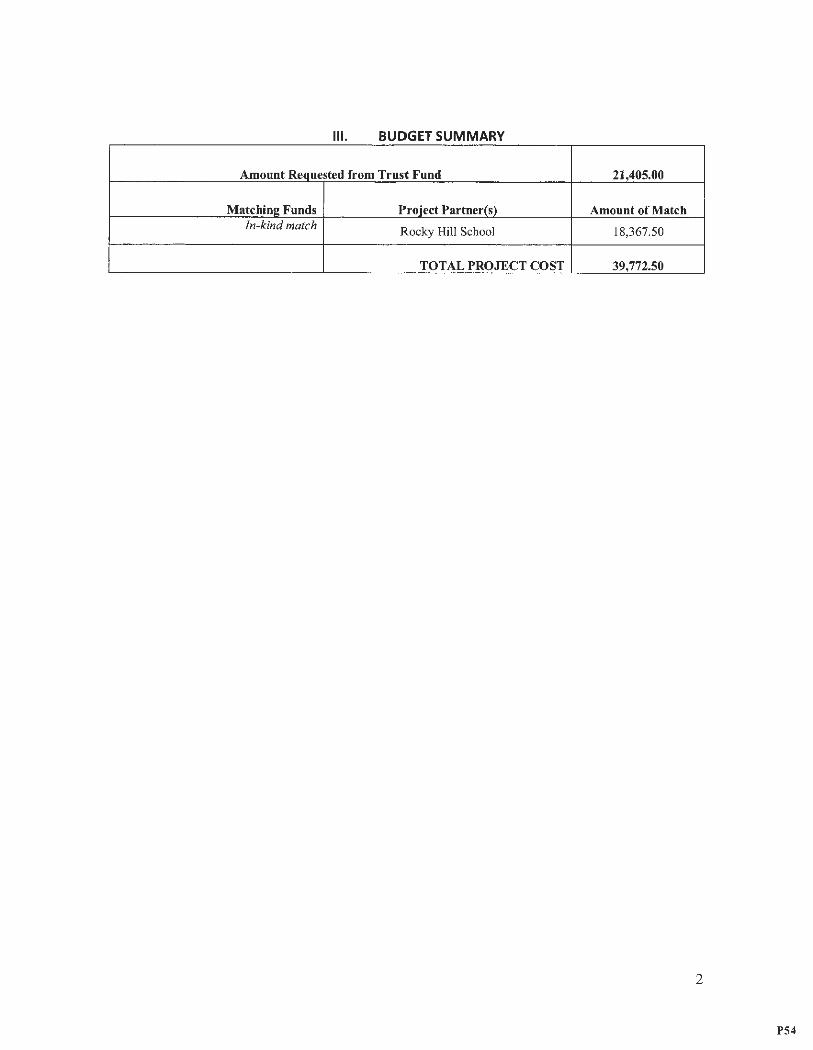
Ill . BUDGET SUMMARY
Amount Requested from Trust Fund 21,405.00
Matchin!!: Funds Proiect Partner(s) Amount of Match In-kind match Rocky Hill School 18,367.50
TOT AL PROJECT COST 39,772.50
2
P54
IV. PROPOSAL NARRATIVE
1. Justification and Purpose This proposal supports the goals of the RI Coastal and Estuarine Habitat Strategy by focusing on
priority saltmarsh and tidal river system habitats, by proposing activities to improve habitat value by reestablishing and improve physical substrate conditions for terrapins and native plants, by developing and implementing long-term resilience strategies for diamondback terrapins (Malaclemys terrapin) and native salt marsh habitat, and by planting local native Spartina alternfflora, a critical salt marsh foundation species. In 2015, URI and Rocky Hill School faculty and students documented a newly identified population of diamondback terrapins inhabiting the Potowomut River and nesting on the beach and saltmarsh habitat along the river. This turtle species is RI state-listed and the Potowomut River is only the third documented population of terrapins in RI (the others are a large population in Barrington and a small, recently discovered small population in Westerly, RI). As part of the planning grant awarded by CRMC in 2017, we monitored and protected terrapin nests, piloted kayak transect surveys to estimate terrapin population size (includes males unlike nesting surveys) , completed veg etation surveys, completed S. alterniflora genotyping, used camera trap surveys identify predators , Scott Rasmussen (URI EDC) completed a tidal elevation survey, and we worked with NRCS to refine the state soil survey for the site (should be uploaded to RIGIS by late January 2018). Locally sourced S. alterniflora seed is currently being propagated for planting at the Potowomut site. We engaged Rocky Hill School students and faculty and began establishing outreach efforts with the Warwick Neck community. A significant outcome is that the school agreed to the removal of the old seawall that restricting flow.
As noted by the Rhode Island Coastal Restoration Strategy (Kutcher et al. 2018), sites prioritized for restoration include "highly-valued ecosystem functions and services , vulnerabili ty to sea-leve l rise, feasibility and sustainability of the restoration , landward migration potential of coastal wetlands." The marsh at Rocky Hill School is a high priority site. The marsh is in poor condition for reasons includin g the presence of an historic seawall that runs parallel to the river that prevents sediment inputs to the marsh and prevents migration of dunes landward. The wall also constricts marsh drainage in multiple locations, and this restriction , coupled with sea-level rise , contributes to marsh subsidence. The S. alterniflora is mostly short-form and submerged much of the time , and the marsh edge is rapidly eroding. However , because there is no shoreline armoring or development on the landward side on schoo l property , there is opportunity for marsh migration as sea level rises. This marsh is also high priority because it protect s local residents from flooding and storms and because the state-listed diamond back terrapin uses it as a nesting site. Our intensive monitoring during 2017 made clear the necess ity to undertake an additional planning season to develop a two-pronged restoration plan to (1) enhance marsh health and resilience to climate change induced disturbance (i.e., sea-level rise) and to (2) conduct a diamondback terrapin nesting habitat restoration. This project is part of a long-tenn vision to restore /conserve marsh function and sustainability.
To accomplish this, the following steps are proposed: 1. Assemble a Technical Advisory Committee (biosketches Appendix VI) to develop a full restoration
plan. 2. Collect new hydrology and subaqueous soil grain size data (Append ix V). Model the effects of full or
partial seawall removal on tidal flow over the marsh using new data and those data collected under the 2017 CRMC planning grant. This is necessary to optimize marsh heal th, resilience and terrapin nest sites, to avoid negatively affecting terrapin habitat , and to ensure marsh accretion rather than subsidenc e result s when the sea wa ll is removed.
3. Engage URI undergraduate interns in local community outreach. 4. Develop a plan with Rocky Hill school to manage human impacts of dog wa lking, boating and
driving on the marsh during the nesting and hatching seasons .
3
P55
5. Design and deploy educational signage on marsh health and terrapins and plan deployment. 6. Plant 2017 stratified S. alterniflora seed at URI greenhouse for future restoration. 7. Develop a habitat suitability index (HSI) to identify high quality nesting habitat on the marsh and
explore feasibility for expanding nesting habitat for terrapins via soft substrate nourishment and Phragmites australis removal.
8. Develop pilot for living shoreline in concert with planting to mitiga te erosion at marsh edge. 9. Redesign blinds for less intrusive monitoring of natal activity. 10. Monitor and protect terrapin nests during nesting season (mid-June to mid-July) and expand nesting
female monitoring to the adjacent residential community. Engage community in monitoring and protection. Informal interviews with local residents indicated substantial nesting on lawns and fields;
11. Monitor predation using camera traps. 12. Conduct kayak surveys to estimate total male and female terrapin population size. 13. Conduct GIS analysis , finalize of models , develop a full restoration plan in conjunction with the
advisory committee. 14. Continue community outreach, education, and establishing citizen science to effectively accomplish
and sustain restoration of terrapins and salt marsh habitat.
Based on the plan outlined above, the following outcomes for this proposal are planned: • Establish and engage advisory committee for planning and future implementation of marsh
restoration. • Develop a detailed model to guide salt marsh restoration plan for Potowomut Marsh. • Protect and enhance terrapin nesting habitat. • Engage Rocky Hill School and surrounding community in restoration plan to foster long-term
success. • Develop full Potowomut marsh restoration plan.
2 p ro1ect A . . ' S ctlv1tles, chedule an dW kPl or an Date Planned Activitv How activity will help restore ecosvst ern function Mar '18 • First Advisory Committee Meeting. • Advisory committee will develop restoration
• Planning/ organizational activities. plan based on site visits, data, model outcomes, • Begin modeling. soil surveys, nest monitoring and terrapin • Engage interns to initiate outreach. activity.
• Design educational signage. • Intern s and signs will engage and educate community.
Apr - • Plant 2017 S. alterniflora seeds in greenhouse for • Locally sourced seed will be propagated and June ' l8 future restoration. later outplanted for restoration.
• Deploy educational signage. • Signage will educate students and community • Establish restricted areas for walkers and dogs . and help to protect the nests. • Schedule advisory committee field visit. • HSI will facilitate protection of current nesting • Begin developing HSI. sites, identify other areas with nesting potential, • Develop pilot for living shoreline to mitigate erosion and plan for restoration of nesting habitat that
of marsh edge. meet HSI criteria. • Living shoreline will reduce marsh erosion.
Apr - • Cont inue modelin g effects of wall removal. • Mode ling results will provide direction for full Aug ' 18 • Redesign of blinds for natal activity monitoring. restoration activities .
• Tend S. alterniflora plugs in greenhouse. • Propagated seed w ill be used to plant locally • Engage community members. sourced S. alterniflora at the site.
June - • Terrapin nesting season: Nest location marking and • Protecting and monitoring terrapin population. July ' 18 protection with exclosures.
• Nest site monitoring and mapping . Aug - • Nest monitoring hatchling emergence; kayak transect • Document successful nest and estimating total Sept '18 surveys to estimate total population size. terrapin population size.
4
P56
Sept '18- • Data analysis. • Final report will include full restoration plan Feb' 19 • GIS mapping, report writing, preparation of developed in conjunction with the advisory
educational materials. committee.
3. Minimization of Adverse Impacts Site visits by the advisory team, deployment of signage, marsh surveys and other activities will be scheduled outside of nesting (mid-June to mid-July). Nest monitoring and nest protection will necessarily occur during nesting season. However, interference will be minimized by maintaining at least 25-yard distance from terrapins coming ashore to nest, observing from behind a blind, and waiting until nesting is complete before approaching nest and terrapin.
4. Public Support Meyerson has been working closely with the Rocky Hill School faculty and students for the last three years on this project and Rocky Hill School students and faculty are fully engaged. Two faculty members , science teachers Michael Jedrey and Rochelle Devault were funded under Meyerson's past National Science Foundation grant to study P. australis at Rocky Hill and to monitor the terrapin populations for a summer. Rocky Hill School students and volunteer interns have helped with the project by volunteering time and helping to construct nest protection cages to prevent nest predation . Two Rocky Hill High School students, Jenna O'Del (2016) and Reese Jennings (2017) , served as summer interns on the project. The Rocky Hill School Interact Club (-20 students) has also been active in supporting this proj ect. The Interact Club carries out two service projects a year: one that helps their schoo l or commun ity and one that promotes international understanding. Last year the Club support ed work being done on the School's waterfront with students from URI on the terrapin salt marsh restoration proj ect and will continu e effo1is to suppo1i the Ten-apins in 2018-2019. The Rocky Hill School A1i Department produced Diam ondback te1npin mugs this year to rai se awar eness in the school community and families that included educational materials about the terrap ins (See Figure 5 in Appendix I). The Rock y Hill 5th grade is currently designing a sign to educate the school commu nity about the terra pins.
During the summer of 2017 , Meyerson began establishing outreach efforts with the public livin g on Warwick Neck and has contact information for multiple residents that live near and use the beach owned by Rocky Hill School along the Potowomut River. The project has also garnered attention from the Rocky Hill School newsletter (eCurrents), the URI CELS website , the local Warwick Neck community newsletter, EcoRI, and newspapers such The East Greenwich Pendulum and The Westerly Sun.
Meyerson will recruit URI interns and work with Rocky Hill School faculty to recrui t K-12 students to participate in the planning process and data collection during the summer of 2018. Meyerson will work with a URI intern to conduct outreach to the local community - adjacen t property owners to the Rocky Hill School and other property owners on both sides of the river and to plan an outre ach event hosted by the school. This outreach will provid e information to the community as well as seek input from neighbor s on their priorities, ideas and concerns. Additional meetings for additional community input will be planned if the proposal is funded and the restoration is planned. In addition, I will seek expert input from stakeholders (some on the advisory committee) such as Save the Bay , CRMC, DEM, The Nature Conservancy, the Barrington terrapin group, and the Rhode Island Natural History Survey.
5. Economic and Educational Benefits
Meyerson has given multiple lectures to students at the school and regularl y bring URI classe s to Rocky Hill School to learn about the terrapin population . In addit ion, Meyerson has recently engage d with the conservation genetics lab of Professor Tyler Katzinal at Brow n University to explore the possibility of future collaborations to investigate the genetic structure of the terrapin populations at the Potowomut site as well as at the Barrington and Westerly sites . These strong relationships will continue and provides
5
P57
excellent experiential learning and internship opportunities for Rocky Hill, URI and other students. Finally, the activities on the Potowomut marsh provide an excellent case study and the data that this project produces will be shared with my URI class - Conservation Biology , Restoration Ecology and Invasive Species Ecology, Policy and Management.
6. Climate Change and Coastal Resiliency
The major effect of climate change on the Potowomut marsh is sea-level rise. Rising seas and human alteration of the marsh surface ( ditching, concrete wall at seaward edge of marsh, see Appendix l) have apparently led to marsh subsidence. The data collected from the documentation of tide elevations and wetland surface elevations at the Potowomut marsh in 2017 gave us a better understanding of the future of the Potowomut marsh under sea level rise and global climate change and a particularly good understanding of the areas of the marsh that are under threat. Rocky Hill School owns the entire marsh and has recently given permission to remove the seawall that impounds and restricts tidal flow into the marsh. Additional data collection and modeling will be needed to determine what restoration actions will best improve marsh resiliency and ensure that there will be no net loss of terrapin habitat.
The land adjacent to the marsh is not armored in any way - it is one of the few marshe s in Rhode Island that has the opportunity to migrate landward as sea level rises. If funded, this second planning project and the follow-up design/implementation phase can provide useful guidance for marsh restoration efforts at other areas throughout RI, particularly where diamond back terrapins are found.
In addition, the Technical Advisory Committee that is part of this planning project will identify appropriate techniques for restoring the marsh hydrology, elevation and vegetation to increase resilienc y to sea-level rise. Potential approaches include removal of the perimeter stone wall, thin layer deposition, dredging a channel mouth that is partially blocked by a sediment sill at the eastern end of the marsh to enhance drainage, and S. alterniflora and the use of living shoreline to reduce erosion at the marsh edge where S. alterniflora is becoming increasingly fragmented.
The land across the river from the Rocky Hill School terrapin nesting site and marshes throughout the Potowomut system have significant populations of P. australis, which decreases terrapin habitat value Therefore , managing known high-quality terrapin nesting sites is critical. As described above, sea-level rise will force the landward migration of the marsh , and likely the landward migration of P. australis. This proje ct will assess all restoration and conservation actions that can be taken to ensure long-term, quality nestin g sites within the restoration areas, surrounding uplands, and throughout the Potowomut River system. We believe that the topography of this site holds great potential. The other significant terrapin nesting site in Barrington has a much different terrain with much steeper upland grades and there may be decreasing nesting site availability as sea-level rises (Pers. Comm. Charlotte Somborger).
7. Planning Consistency and Restoration Priority
This proposal supports the goals of the RI Coastal and Estuarine Habitat Strategy by focusing on priority saltmarsh and tidal river system habitats, by collecting data that will lead to activities to improv e habitat value for terrapins , by developing a long-term management and to facilitate S. alterniflora growth, health and resilience at the marsh edges and in the marsh interior, and by collecting and propag ating local S. alterniflora seeds in the URI greenhouse to re-vegetate native S. alterniflora habitat , an overwin tering habitat for juvenile diamondback terrapin. All aspects of this project will involve the faculty and student s of the Rocky Hill School and the local community. The school owns the property and is excited to incorporate restoration of this site and stewardship of the diamondback terrap ins into their curriculum (please see attached letters of support Appendix II).
6
P58
8. Species of Concern
This planning project addresses multiple threats to a Rhode Island state-listed wildlife species, the diamondback terrapin. This is only the third documented population of terrapins in Rhode Island. Currently, the population at Potowomut Marsh faces multiple threats: loss of nesting habitat due to sea level rise , invasion by P. australis that densely colonizes and makes impenetrable the substrate where the terrapins lay their eggs; diamondback terrapin nest predation by a suite of predators including raccoon, fox, crows, coyote, and local dogs; predation when hatchlings emerge from the nests; loss of S. a/terniflora habitat where the hatchlings overwinter in the S. alterniflora wrack. This project will address all of these threats by developing plans to enhance salt marsh resilience to sea level rise by identifying appropriate restoration techniques, assessing the value ofremoving P. australis, excluding the predators from nests, and restore salt marsh habitat.
9. Permitting List any federal, state or local permits required to complete the project and the permit application status for each.
• Peter Paton has IACUC permit for terrapin monitoring and Meyerson is listed on this permit. Meyerson has a scientific collector's permit from the Rhode Island Department of Environ mental Management (Permit# AN1415-013) • Other permits will be necessary for Stage 3 - the implementation phase of this project, but these will
not be needed for the second half of the planning stage of this project. All necessary permits needed for Stage 3 will be determined under the planning grant.
10. Capacity of Lead Organization (attach additional materials if necessary) a) Description of the organization A description of the facilities available at the University of Rhode Island can be found here: http://web .uri.edu/catalog/campus facilities/. b) Qualifications of involved personnel The technical advisory committee is comprised of the following people: Laura Meyerson, project manager (URI NRS), Charles Roman (URI NRS, Coastal Institute), Peter Paton (URI NRS), Mark Stolt (NRS) , Scott Rasmussen (URI EDC), Randy Chambers (College of William and Mary), David Burdick (University of New Hampshire), Scott Warren (CT College, retired), Cathy Wigand (US EPA) Annette Grilli (URI Ocean Engineering) , Mark Buckley (Rocky Hill School), Wenley Ferguson (Save the Bay), Caitlin Chaffee (CRMC), Tom Kutcher (RINHS), Kenny Raposa (NERRs) and Al Gettman (DEM) . Please see attached biosketches in Appendix VI.
c) Evidence of successfully completed habitat restoration or conservation planning proj ects. The technical advisory committee for this project represents a wealth of knowledge and experience (See Appendix VI). Many of the members have led or participated in salt marsh restorations and that experience will be invaluable for this project. Specific to the Potowomut Marsh , we monitored terrapin nesting and protected successful nest attempts during the 2017 breeding season, resulting in 13 hatchlings in September 2017. We also piloted kayak transect surveys to estimate terrapin population size (includes males unlike nesting) and primary river habitat in the Potowomut River, conducted systematic vegetation surveys and S. a/terniflora genotyping, conducted camera trap surveys to monitor predators, did a detailed tidal elevation survey across the marsh (Scott Rasmussen , URI) , worked with NRCS to refine the soil survey for the site, and are propagating S. alterniflora seed at Meyerson's URI greenhouse for future planting. In addition, we extensively engaged with the students and faculty of Rocky Hill School and began establishing outreach efforts with the public living on Warwick Neck. One significant outcome is that the school has agreed to remove an old stonewall on its property that blocks tidal flow to the marsh and starves it of sediments. The results of this first year of planning will be submitted to CRMC in a final
7
P59
report in February 2018. In addition , the following documentation is submitted as evidence of successfully completed habitat restoration projects: • Please see resumes of Advis01y council (Attached in Appendix VI) • Two poster Presentations at URI of results (Attached in Appendix JV)
V. SUSTAINABILITY Maintenance The lifespan of each activity proposed for this project is one year in preparation for developing and implementing a full-site restoration plan. The data and information generated for this project will be used for the future planned restoration. Meyerson will be responsible for all funding, coordinating the adviso ry committee and coordinating between Rocky Hill School and URI interns. The operation and maintenance requirements for this project will be met by Rocky Hill School volunteers and URI interns. These include maintenance and deployment of nest protectors as well as monitoring nests for predation and disturbance However, Meyerson is committed to protecting the nesting population s of Diamondback terrapins on the Potowomut Marsh and will continue to work with the Rocky Hill School community and URl interns to accomplish this for the foreseeable future.
Extern al Factors External factors that could affect the success of this project include sea-level rise and human activity on the marsh . This project is evaluating different approaches to marsh restoration beginn ing with assessing removal of a sea wall and will consider different restoration approaches including thin-layer deposition to make the marsh more resilient to sea-level rise and planting oflocally-sourced S. alterniflora. The effect s of human activities will be addressed by engaging with the local community , designing and deploying signs to educate the community about the marsh and the services that it provides, and developing recommendations to prevent activities on the marsh such as driving and mowing that has occurred in the past by some local community members .
8
P60
VI. EVALUATING PROJECT SUCCESS 1. Performance Measures Th f h. ·11 b d e success o t 1s pro1ect w1 e etermme ,y meetmg t e o owmg goa s: . db h fi 11
Goal Evaluation of success • Assemble Advisory Committee for planning meetings • Reports from meetings and site visits that result
and site visits. in defensible marsh restoration activities. • Model the effects of full or partial seawall removal. • Model Development of with defensible
recommenda tions on seawall removal. • Engage URI undergraduate interns in local outreach. • URI undergraduate internships resulting in
community meetings and outreach and a written plan for long-term community engagement.
• Plan to manage human impact via dog walking , • A written plan developed in conjunction with the boating and driving on the marsh during the nesting school. This plan will be implemented the and hatching seasons. following year.
• Design educational signage and plan deployment. • Signs will be designed and deployed during 2018.
• Plant 2017 S. alterniflora seed at URI greenhouse. • Plants will be germinated and cultivated for implementation of full restoration in 2019.
• Develop habitat suitability index (HSI) to identify high • HSI will be developed and tested. Results will be quality nesting habitat on the marsh and explore reported in CRMC final report to planning grant feasibilitv for expanding nesting habitat for terrapins. and incorpora ted into full restoration olan.
• Develop pilot for living shoreline to mitigate erosion • Coir log deployment and pilot S. alterniflora of S. alterniflora at marsh edge. plantin g at marsh edges during 2018 season.
Assess results over 2019 growin g season. • Redesign blinds for less intrusive monitoring of natal • Determine whether successful nesting activity is
activitv. increased as a result of redesigned blinds . • Monitor and protect nests during nesting season, • Determine whether successful nesting activity is
expand nesting female monitoring to the residential increa sed. commun ity.
• Monitor predation using camera traps. • Identify and monitor predator presence frequency.
• Conduct kayak surveys to estimate total terrapin • Complet e population size surveys. oooulation.
• Conduct GIS analys is, finalization of models , • Synthesis of data development resulting in a full development of full restoration plan. restoration plan for the Potowomut marsh.
• Report on results to CRMC. • Final report submitt ed to CRMC.
2. Monitoring Plan Under the 2017 planning grant awarded by CRM C, we moni tored and protected terrapin nest s (daily
mid-June to October 2017, resultin g in 13 hatchlings in summer 2017), piloted kayak transect surveys to estimate terrapin population size (August 2017) in preparation for full survey and analysis in 20 18, completed vegetation surveys (July 2017), completed S. alterniflora genotyping , used camera trap surveys to identify predators , completed a tidal elevation survey (March - October 2017), and worked with NRCS to refine the state soil survey for the site (uploaded to RIGIS by late January 20 18). S. alterniflora seed is currently being propagat ed at URI for future planting at the Potowomut site. We also engaged with the students and faculty of Rocky Hill School and began establishing outreach efforts with the public living on Warwick Neck. These same protocol s will be used for this current project. Results of these activities will be reported to CRMC in a final report in February 2018. Protocols used are include in the Appendix V of this application. Meyerson is responsible for all of these activities.
9
P61
Rhode Island Coastal and Estuary Habitat Restoration Fund Full Proposal Form 2017 /2018
**for planning projects please use Full Proposal rorm for Planning Projects
I. PROJECT SUMMARY
1. Project Title: Improving Fish Passage on the Saugatucket River
2. Project Location (include map): Wakefield
3. Project type (Design, Construction or Other): Construction
4. If other, please specify:
5. Habitat type (River System, Salt Marsh, Seagrass, Shel/fish Bed, other) : River system
6. If other, please specify :
7. Restoration technique: Fish passage improvement
8. Total acreage or miles(river systems) of habitat to be restored, or project area planning unit s!ze Improve diadromous fish access to 300 atres of spawning and rearing habitat
9. Project Benefits: Improve upstream and downstream passage for the diadromous fish runs in the Saugatucket River. Increase the size of the sustainable population and eventual supply offorage species to recreational and commercial fish in the coastal"stream, Point Judith Pond, arid Block Island Sound.
10. Project Partners: Rhode Island Department of Environmental Management, Division of Fish and Wildlife, USFWS Coastal Program, and NOAA Coastal Restoration Center .
11. Is this is an ongoing project that has previously received funds from the CRMC Coastal and Estuarine Habitat Restoration Fund? yes If yes, year(s) funding was awarded: 2010 and 2012
II. PROJECT MANAGER CONTACT INFORMATION 1. Name: John F. O'Brien
2. Organization: The Nature Conservancy In Rhode Island
3. Address: 159 Waterman Street
4. City: Providence
7. Phone: 401-331-7110 x4526
Property Owner(s):
s. State: RI 6. Zip: 02906
8. Email: jobrien@tn c.org
1 of18
P62
I
i
j
Applicant must document ownership of project site or permission to perform all proposed restoration, maintenance and monitoring activities (include appropriate documentation)
Ill. BUDGET SUMMARY (List individuals or organizations providing financial or In-kind support to the project under Project Partners)
Amount Requested from Trust Fund
Matchlnc Funds Project Partner(s)
TNC (lnkind)
DEM/Fish and Wildlife (lnkind)
TNC --
I TOTAL PROJECT COST
IV. PROPOSAL NARAATIVE (five pages maximum)
1. Justification and Purpose
$50,000 ! ' I Amount of Match
$25,000
$10,000
$30,000
I Ii $115,000 -- ·-
Describe the human impacts and previous restoration activities at the proposed project site. If multiple sites, please de$cribe the impacts and previous restoration activities at each}. Briefly describe the proposed project, its restoration goals, long-term and short-term outcomes.
The Saugatucket River is located In southern Rhode Island In the Town of South Kingstown. This small
coastal watershed (11,018 acres) flows into the northern end of Pt. Judith Pond. It is actually the largest
fluvial system contributing to Block Island Sound. Historic references report that runs of dladromous fish
(alewife , blueback herring, and American eel) were once very plentiful in the Saugatucket River but
disappeared from the watershed with the construction of inill dams in the 1800's. Efforts to restore
diadromous fish to the watershed began in the 1970's with the construction of the first fish ladder at the
Main Street Dam in Wakefield. Shortly after a second fish ladder was constructed at the Palisades Mill in
Peacedale providing access for .spawning fish into Peacedale Pond. A third ladder was eventually
2 of18
\
P63
constructed at th e outflow of Indian Lake in 2003. The DEM Division of Fish and Wildlife has executed
easements with the Main Street and Indian Lake landowners in order to maintain and operate each of the
ladders. A letter was received from the owner of the Palisades Mill Dam granting permission for the
improvement project.
Figure 1 shows the location of each of these fish ladders in the watershed. A healthy Saugatucket River
diadromous fish population will provide important ecological services to Pt. Judith Pond, other South Shore
Coastal Ponds, and Rhode Island waters . Diadromous fish provide an important forage base to support
sustainable populations of recreational and commercial fish. Based on the extent of the spawning and
nursery habitat in the Saugatucket River watershed, this system has the potential to support river. herring
populations of over 200,000 spawning adults. As part of the ongoing restoration program, the monitoring
of up and down stream fish passage through the existing fish ladders continues during each year's annual run.
Most recent observations and assessments by RIDEM, NOAA, and USFWS fish passage engjneers have
identified several problems as well as options to improve fish passage at both the Palisades Mill and the
Indian Lake fish ladders. The Nature Conservancy is working closely with the DEM Division of Fish and
Wildlife and is planning to schedule these modifications for improving fish passage at the Palisades Mill
ladder and the Indian lake ladder during the fall of 2018.
2. Project Activities, Schedule and Work Plan Describe the planned on-the-ground project activities, and explain how each ·activity will help to restore ecosystem functions. list specific project activities and when they will occur (month and year). Indicate when annual and final project reports will be submitted.
The USFWS Fish Passage Engineering Group is und er contract with The Nature Conservancy and has
surveyed both the Palisades Mill and the Indian Lake fi sh ladders. Based on the survey work, a number of
modifications to each ladder have been recommended . The following are short paragraphs of the
proposed work. A detailed scope of work, design recommendations, engineerin g drawings, plans, and
specifications have been prepared by USFWS and are included as Attachment A, "Survey and Design
Recommendations to Improve Fish Passage at the Indian lake and Palisades Mill Fish Ladders". The
modifications to each of these ladders will be scheduled for late summe r or early fall of 2018. A final report
of the work accomplished will be submitt ed one year after receiving the letter -of award.
Indian Lake Fish Ladder
Each spring, the upstream movement of herring has been delayed . . Fish have been observed stacking up in the ladder pools and have had to be manually netted out and released into the head pond (Indian Lake). Based on current USFWS Engineering criteria, modifications (design changes} will be made to the ladder to revise hydraul ic conditions and improve the upstream passage of fish through the ladder. These improvements will include increasing the number of concrete weirs in the ladder and revising the orientation of the low flow notches.
Palisades Mill Fish ladder
Modifications are necessary to improve attraction to the entrance to the ladder as well as·decreasing velocities in the fishway to meet acceptable levels for the passage of river herring. Modifications to the ladder will include revising and installing a new baffle system (48 new wooden baffles) to create a false 1:8
3 of 18
P64
slope and installing a steep pass at the fishway entrance to hydraulically connect the water within the
entrance channel to the tail water.
3. Minimization of Adverse Impacts What are the potential impacts resulting from project activities (e.g. the disturbance of sensitive species by construction activities), and how will these impacts be minimized (e.g. scheduling construction to avoid disturbance of sensitive species).
These activities are modifications to existing concrete fish ladders. No instream work will be done. All construction will occur after the spring spawn ing run.
4. Public Support · Demonstra.te public support for the project by providing evidence of communication with adjacent landowners, community members and other stakeholders. Describe planned or completed community I stakeholder edu~ation and outreach efforts.
Support: This project, as well as other projects improving fish passage, is strongly supporte d by both commercial and recreational anglers.
Education and Outreach: Both the Nature Conservancy and the Department of Environmental
management will carry a link on their web site that outlines the project and the conservatio n/habitat
restoration outcomes. RIDEM/Fish & Wildlife alS<i conducts educational fishway tours to area schools
and clubs and with the owner's permission these sites provide options in the South Kingstown area.
5, Economic and Educational Benefits How will the proposed project provide direct economic and/or educatio_nal benefits to a community and/or the state?
Recreational fishing in Rhode Island is an extremely popular and important outdoor recreation activity. Based on the 2011 National Survey, fishing-related expenses in Rhode Island totaled $130 million. Stream restoration, Improving connectivity, provides a direct benefit to this important recreational activity both in fresh and salt water. Both adult and juvenile river herr ing provide an important forage base for freshwater and saltwater game fish such as largemou th bass, chain pickerel, striped bass and bluefish. Increasing the diadromous spawning populations in the Saugatucket River will substantia lly enrich the main river as well · as the lower river estuary leading into Point Judith Pond.
6. Climate Change and Coastal Resiliency How have the present and future impacts of climate change been considered during the project planning and design phases? What impact will the project have on resilience of coastal or estuarine habitat to climate change? .
Fish ladders provide passage around dams and other obstacles to spawning and nursery grounds for Diadromous fish. Fish ladders are designed to operate over a specific stream flow range. Climate change
4ofl8
P65
2.Monitoring Plan Describe any planned or completed pre- and post-project monitoring activities. For each monitoring activity list the frequency and month/year of start and end date and the parameters measured. Ust the entity or entities responsible for funding and carrying out each monitoring activity1 and describe how results will be mode available to CRMC and the public. If using an established monitoring protocol, please provide references (see CRMC website for information on established monitoring protocols).
An increase in the abundance of the targeted diadromous species will serve as the metrics for
performance ofthe proposed restoration project. These results will be measured through monitoring
of the pre-spawned adult returns conducted by the Rhode Island DEM, Division of Fish and Wildlife at
each ladder throughout the spring run. In addition, the Division will also be sampling for juveniles in the
late summer and early fall, both in the river and in Point Judith Pond . The long term goal of the project
is to improve fish passage on the Saugatuck River Increasing the popu lation of self-sustaining
populations of diadromous fish.
7 ofl8
P66
Rhode Island Coastal and Estuary Habitat Restoration Fund
Full Proposal Form 2017/2018 **for planning projects please use Full Proposal Form for Planning Projects
I. PROJECT SUMMARY
1. Project Titl e : Salt Marsh Restoration and Enhancement in Quonochontaug Pond
2. Project Location and coordin ates (include map) : Quonochontaug Pond, Charlestown RI
3. Project typ e (Design, Construction or Other) : Construction
4. If oth er, please specify:
5. Habitat typ e (River System, Salt Marsh, Seagrass, Shellfish Bed, other): Salt Marsh and Seagrass
6. If oth er, please specify:
7. Restoration technique (e.g. re-vegetation , tidal restoration, etc.): M arsh elevation enhancement with dredged material
8. Tot al acreage or miles(river systems) of habitat to be restor ed, or project are a planning unit size: Appr oximately 30 acres of salt marsh and eelgrass habitat.
9. Project benefit s:
10. Project partn ers (organizati ons providing financial or other support to the proje ct):
11. Is thi s is an ongoing project that has previously received funds from the CRMC Coastal and Estu arine Habit at Restoration Fund? No If yes, year(s) funding was award ed:
II. PROJECT MANAGER CONTACT INFORMATION 1. Name : Caitlin Chaffee
2. Organization : RI Coastal Resour ces Management Council
3. Add ress: 4808 Tower Hill Road
4. City: Wakefi eld S. State: RI 6. Zip: 02879
7. Phone: 401-783-7350 8. Email: cchaffe e@crmc. ri.gov
9. Property Owner( s): RI Departm ent of Environmental Man agement, Tow n of Charlest own, Audubo n Society of RI
1 of 15
P67
Ill. BUDGET SUMMARY (List individuals or organizations providing financial or in-kind support to the project under Project Partners)
Amount Requested from Trust Fund $90,000
Matching Funds Project Partner(s) Amount of Match
NOAA $980,000
CRMC / Town of Charlestown/ Save The Bay $641,553
TOTAL PROJECT COST $1,711,553
2 of 15
P68
IV. PROPOSAL NARRATIVE 1. Justification and Purpose Multiple lines of evidence point to sea-level rise as a key driver of degradation in New England coastal marshes, as the rate of increase in relative sea-level rise in southern New England is significantly higher than the global average, nearly doubling over the last two decades (Watson et al. 2016). Raposa et al. {2016) found that from 1999 to 2015, high-marsh accretion rates at Rhode Island salt marshes averaged 1.40mm per year while the rate of sea-level rise in Newport, RI averaged 5.26mm per year, indicating that salt marshes are no longer accreting plant biomass and/or inorganic soils at a rate fast enough to sustain elevations relative to the tidal amplitude. A nation-wide study found that the salt marshes of southern New England are among the most vulnerable to sea-level rise in the U.S. (Raposa et al. 2016). Warren and Niering (1993) suggested that changes in marsh vegetation proportions favoring the more flood and salttolerant 5. alterniflora over high marsh species may be a result of increased inundation associated with sealevel rise. Loss of high marsh vegetation communities as well as salt marsh ponding, die-off, and drowning have been documented throughout Narragansett Bay and coastal Rhode Island, indicating a widespread accretion deficit (Raposa et al. 2015, 2016, Watson et al. 2016), and the growth, health and sustainability of the majority of southern New England salt marshes is now thought to be limited by inundation (Watson et al. 2014).
A statewide assessment of 39 salt marshes throughout Rhode Island based on metr ics designed to document impacts of sea level rise (vegetation loss, vegetation community composit ion and marsh substrate stability) classified the back-barrier marshes in the Salt Ponds Region as being in poor condition relative to many other marshes in the state (Cole Ekberg, 2014). Further analysis of average marsh surface elevation revealed that the Salt Ponds Region marshes have the lowest median marsh surface elevations statewide (relative to NAVD88 and Mean High Water) . Results of the Sea Levels Affecting Marshes Model (SLAMM ) for Rhode Island, which have been verified using historic rates of loss, show high rates of marsh loss for the Salt Ponds Region marshes under future sea level rise scenarios (CRMC 2014) . Because of their location on back barriers adjacent to coastal lagoons, there is little potenti al for t hese marsh comple xes to migrate to higher ground .
In addition to these traits, the marshes of the Quonochontaug back barrier have been observed to have increased density of fiddler crab burrows along creek edges and in the marsh interior . This has been observed elsewhere in Rhode Island, particularly with in the Estuarine Research Reserve marshes on Prudence Island and other marshes in Narragansett Bay where crab bur rows have been documented as increasing in density and contributing to accelerated marsh edge erosion . It is thought that increased inundation and subsequent vegetation die off due to sea level rise may be a driver of th is phenomenon. These biological modifications have been observed and documented in marshes throughout New England.
The CRMC is in the process of updating its statewide restoration strateg y, which recogni zes the multiple threats to coastal wetland ecosystems and identifies several management actions for preserving wetland functions and values. These range from hydrological reconnection improvements to the conserv ation of low-lying, low -sloped coastal uplands and removal of barriers to marsh migration. One of the management actions considered has been marsh surface elevation enhancement using dredged sub-aqueous soils, also referred to as th in layer placement (TLP). This technique has been applied successfully in the south and mid-Atlan t ic regions of the US t o increase the "elevation capital" of marshes with net subsidence. The technique has been determined by marsh restoration experts as having potent ial application in the Salt Ponds Region marshe s given thei r relatively high vulnerability to sea level rise, thei r lack of migration potential and recent proposals for dred ging activities related to eelgrass habitat enhancement , which have been identified as a potential source of material for TLP.
3 of 15
P69
In 2014, the CRMC was awarded $3.25 million from the National Fish and Wildlife Foundation's Hurricane Sandy Coastal Resiliency grant program to design and permit TLP projects in Ninigret, Quonnie and Winnapaug Ponds, and to implement a TLP project in Ninigret Pond (www.crmc.ri.gov/ habitatrestoration/npsaltmarsh.htm l). This effort involves a range of federal, state, local and non-governmental partners including US Fish and Wildlife Service, EPA, RI Department of Environmental Management, the towns of Charlestown and Westerly, the Salt Ponds Coalition and Save The Bay. Dredging and sediment placement has been completed for the marsh restoration effort in Ninigret Pond. Design and permitting are in progress under the NFWF award . A NOAA Coastal Resiliency Grant was awarded to CRMC in 2017 for project construction in Quonochontaug Pond. Funds from this request wo uld provide non-federal match for the NOAA award.
2. Project Activities, Schedule and Work Plan The funds requested in this proposal would be used as non-federal match for a NOAA Coastal Resiliency award for construction of a TLP project in Quonochontaug (Quonnie) Pond. Marsh surface elevations will be increased on approximately 30 acres of the degraded marsh areas of the Quonnie back-barrier marsh complex via the placement of subaqueous soil. Depths of deposition will depend upon final project design and target elevations, and are expected to average O.S to 1.2 feet . Areas receiving thicker depths of material will be planted with native salt marsh plant species in order to enhance natural recolonization. Soil will also be used to fill man-made mosquito ditches within the marsh so that a more natural creek and pool hydrology will be restored. The soil will also be used to restore eroded tidal flat areas and the adjacent breachway public access point and boat launch, which are heavily used by the public for activities such as recreational shellfishing .
The material needed for the marsh and public access enhancements will be obtained via hydraulic dredge from shoaled areas within the pond. Dredging will be done to depths suitable for eelgrass growth (based on light extinction depth), and to reestablish and deepen the channel that enters the pond from the breachway. Project funds will be used only to obtain that material which is necessary to enhance salt marsh and public access areas.
The expected outcomes of the project are: • An increase in the area and lifespan of healthy vegetat ed high and low marsh within the
Quonnie back-barrier marsh complex • An increase in the area of eelgrass habitat within the pond • Improvement in the condit ion and resilience of existing marsh areas • Restoration of natural marsh hydrology • Improved resilience of the back barrier marsh complex to sea level rise and more frequent
coastal storms • Increased nekton abundance and diversity within the pond-marsh complex, particularly
species of management concern such as summer and winter flounder, black sea bass, scup, river herring, American shad, American eel, striped bass and bluefish
• Improved recreational opportunities for the public, such as fishing, kayaking and birdwatching.
• Improved protection of the surrounding community from coastal flooding and storm events
3. Minimi zation of Adverse Impacts During the Ninigret TLP project, the CRMC worked extensively with the contractor to fine-tune the project approach in order to minimize adverse impacts to the sensitive habitats within the project area. Important lessons learned from the Ninigret, Narrow River NWR and Sachuest NWR TLP projects that will be applied
4 of 15
P70
to the project in Quonnie include:
• Pre-restoration topographic surveys will be required by the contractor to verify project design and controls .
• Use of an amphibious excavator for pipe management will be specified to avoid the need for installation of marsh channel crossings
• RTK-enabled low ground pressure equipment will be specified for in-marsh grading work.
Construction access and staging will be from the RIDEM public boat ramp and parking area adjacent to the Quonnie breachway. Time-of-year restrictions on dredging activities ensure that dredging would be completed during the winter months to minimize impacts to sensitive species such as winter flounder. This is also the time of year when pub lic use of the area is at its lowest . However, all necessary precaut ions will be taken to ensure that the dredging and restoration operation does not present a public safety hazard, and that the public is well-informed of any restrictions to access to the pond. The CRMC and selected contractor will coordinate with the town harbormaster, local police, and RI DEM Enforcement staff to keep them apprised of any issues that may arise. These working partnerships are well-established and greatly aided communications during the first phase of the Ninigret marsh TLP project.
The potential risks associated with this project are well understood. The material to be dredged is uncontaminated sand deposited within the pond by longshore currents. Placement locations will be selected to address existing degradation in the marsh restoration areas. Pre-and post-restoration topographic surveys will be performed to ensure target elevations have been met. Additional factors such as load bearing and settlement of deposited material will be accounted for through laboratory analysis of existing peat cores. The project partners have committed to implementing post-restoration adaptive management measures such as adjustments to grades, management of invasive plant species, additional planting or seeding or improvements to marsh drainage. Sea Level Affecting Marshes Model (SLAMM) results clearly indicate that the no action alternative for this project will result in a significant ongoing loss in salt marsh area to open water (see Supplemental Materials for SLAMM results).
4. Public Support The CRMC has partnered with the Salt Ponds Coalition (SPC) to enhance its outreach and public education efforts related to the project, and to document local support. The SPC has engaged their membership through their newsletter and public meetings and has provided the CRMC with letters of support from residents and local business owners (See Supplemental Materials). The CRMC has also been in contact with other local groups such as the Shelter Harbor Conservation Society, which has expressed support for the project.
Project information will be disseminated through various media outlets in the form of press releases, website and social media postings from the CRMC and partner organizat ions. Our coastal wetland resiliency efforts in Ninigret Pond have been highly publicized and the subject of several state and local newspaper articles. In addition, CRMC staff will present project information to the Charlestown Town Council and Salt Ponds Coalition. CRMC and our partners have also highlighted our efforts at events and conferences such as the Metcalf lnstitute 's Science Immersion Workshop for journalists, the Restore America 's Estuaries Summit, the Society of Wetland Scientists Annual Meeting and local and regional conferences. The CRMC's close partnership with the University of Rhode Island Sea Grant program and Coastal Resources Center will afford many additional opportunities for outreach and education. Signage describing the project, its benefits and partners involved will be permanently installed at the adjacent public access site.
5 of 15
P71
5. Economic and Educational Benefi ts
There are several sources that estimate valuation of key ecosystem services provided by salt marsh habitats, including coastal protection, erosion control, water purification, maintenance of fisheries, carbon sequestration, tourism, recreation, education and research. Barbier et al. (2011) estimate a value of $3,334/acre/year in reduced hurricane damages, up to $15,000 /acre/year in water purification services, and $30.50 /hectare/ year in carbon sequestration services. If these valuations were applied to the proposed Quonnie project, assuming a minimum area restored of 30 acres and project lifespan of at least 30 years, the return on investment from ecosystem services would be over $15 million . This figure does not include benefits to fisheries, wildlife habitat, recreation and tourism or property values. When the value of protected services to humans is added to the intrinsic value of the marsh as habitat for fish and wildlife, as well as the potential for the restoration methodologies developed to be used in other locations, this project represents a significant return on investment. Preserving and enhancing the water quality improvement and nutrient uptake function of the marsh is of particular importance as nutrient loading from increased residential and commercial development has been identified as a primary water quality problem in the salt ponds (RICRMC 1999).
Opportunities for community engagement and education during this project include assistance from volunteers with project tasks such as replanting salt marsh vegetation, installing goose exclosure fencing and adaptive management measures such as excavating marsh creeks by hand. Volunteers wi ll be coordinated by Save The Bay and Salt Ponds Coalition , both of whom have established volunteer programs. In addition to our collaboration with the New England Wildflower Society, we will use the existing partnership created by Save The Bay with local agricultural high schools called the "Grasses In Classes" program to collect seed and propagate salt marsh plant species for use in the restoration effort. These students will later plant their nursery-grown plants at the restoration area.
6. Climate Change and Coastal Resiliency
The goal of this project is to increase the surface elevation of the Quonochontaug back barrier marsh in order to make it more resilient to the increased rate of sea level rise. The exposed vulnerability of the Salt Ponds Region to coastal storm events has underscored the need to maintain the natura l protection of its population centers prov ided by the barrier salt marsh complex. By stabilizing sediment, increasing the intertidal height, and providing baffling vertical structures (grass), salt marshes reduce impacts of incoming waves by reducing their velocity, height and duration (Morgan et al. 2009). Marshes are also likely to reduce storm surge duration and height by providing extra water uptake and holding capacity in comparison to the sediments of unvegetated mudflats (Barbier et al. 2011). Eelgrass also functions to increase coastal storm protection by dampening wave energy and stabilizing marine sediments. Narayan et al. (2016) found that on average, census tracts in the Northeast US that contained wetlands had an average of 10% reduction in damages from Hurricane Sandy when compared to those without wetlands , and that coastal wetlands were predicted to have reduced wave heights during the storm across 80% of the Northeastern coastal floodplain. They also found that over 17km of roads were protected by coastal wet lands within Rhode Island. Improving the condition and resiliency of the wetlands within Quonnie Pond would provide increased protection for Charlestown and Westerly communities, particularly the in the areas of Shady Harbor, Shelter Harbor and Weekapaug.
7. Planning Consistency and Restoration Priority
Is the proposed project consistent with the goals of a local, state or regional planning initiative? Please specify initiative and explain (see CRMC website for guidance). Does the proposed project involve a state, regional or federal priority habitat restoration need or special consideration? Please specify and explain (see CRMC website for guidance).
6 of 15
P72
The proposed project will build upon years of ecosystem-scale planning and millions of dollars of investment by federa l, state and local entities to improve habitat quality, diversity and community benefits
in the Salt Ponds Region. It addresses potentia l
8. Species of Concern Rhode Island's coastal ponds provide habitat for over 100 species of finfish, cephalopods and crustaceans (CRMC, 1984). The salt marshes within the ponds provide habitat for forage fish species such as mummichog (Fundulus heteroclitus), Atlantic silverside (Menidia menidia), striped killifish (Fundulus majalis) and sheepshead minnow (Cyprinodon variegatus) . Other finfish species found within the ponds include winter flounder (Psuedopleuronectes americanus), summer flounder (Paralichthys dentatus), striped bass (Morone saxatilis), river herring (Alosa aestivalis, A. pseudoharengus), menhaden (Brevoortia tyrannus), tautog (Tautoga onitis), American eel (Anguilla rostrata), bluefish (Pomatomus saltatrix) and scup (Stenotomus chrysops). The marshes of the coastal ponds provide important habitat particularly for species such as mummichog, which have been shown to utilize the marsh surface for at least a portion of their energy intake, as food sources in subtidal areas are insufficient for fish at natural densities to grow at a normal rate (Weisberg, 1982). Eelgrass provides important habitat for bay scallops, winter flounder, several crab species, as well as many of the finfish species listed above.
Finfish surveys are conducted annually in Quonnie Pond by the RI Department of Environmental Management's Division of Fish and Wildlife to forecast recruitment in relation to the spawning stock biomass of winter flounder and other recreationally important species. These surveys have documented overall declines in the ponds of the more abundant species such as mummichog, striped killifish, and sheepshead minnow. Also observed has been a slight downward trend in winter flounder populations in recent years and slight upward trends in bluefish, black sea bass and scup populations (RIDEM, 2013). The proposed project will complement the RI Department of Environmenta l Management's recently approved plan to enhance fish habitat via the creation of oyster reefs within shellfish spawner sanctuaries in the pond, a project that is being supported by the NOAA Restoration Center. The proposed project would benefit numerous commercial and recreational finfish species by improving eelgrass and salt marsh essentia l fish habitat, and is therefore consistent with federal planning efforts such as NOAA Fisheries Management Plans for summer flounder, black sea bass and scup, and the Atlantic Coastal Fisheries Cooperative Management Act and Atlantic Striped Bass Conservation Act for its benefits to river herring, American shad, American eel, striped bass and bluefish.
The salt marshes of the coastal ponds also provide breeding and foraging habitat for important migratory bird species including salt marsh sparrow, which has been ranked by the US Fish and Wildlife Service as a bird of conservation concern. Saltmarsh sparrows are particularly susceptible to anthropogenic impacts such as sea level rise, coastal development, alterations in marsh tidal flows, and habitat degradation from invasions of non-native Phragmites australis (Field, 2016). In the absence of intervention and restoration efforts, it is predicted that a reduction in the Long Island Sound saltmarsh sparrow population may drop below 100 individuals as soon as 2040 and reproduction in Long Island Sound will become impossible between 2045 and 2065 (Field, 2016). Seaside sparrows and willets also nest in salt marsh habitat, making them vulnerable to salt marsh degradation resulting in habitat loss.
9. Permitting Anticipated required permits include:
• US Army Corps of Engineers Section 404 Category II General Permit , including NMFS EFH
consultation and recommendations
7 of 15
P73
• RI DEM Dredging permit (includes Section 401 Water Quality Certification)
• CRMC Dredging Permit/ Coastal Assent • NEPA compliance through NOAA Restoration Center's Programmatic EIS and collaboration with and
processing by NOAA RC regional staff (J. Turek}
• Section 106 SHPO and THPO consultations
Permit applications will be submitted to the RI CRMC, US Army Corps of Engineers and RI Department of Environmental Management. The permitting agencies have been involved during the project planning and design of the adjacent Ninigret salt marsh elevation enhancement project and will be similarly involved during the planning and design of the Quonnie project. The CRMC will continue to coordinate with the appropriate permitting agencies as the project design is finalized. In addition, CRMC will coord inate with EPA and NOAA Nat ional Marine Fisheries Service through the USACE General Permit review process and plans to conduct a site visit with interes ted federal and state permit staff in the spring of 2017. The CRMC will closely coordinate with staff at the NOAA Restoration Center in Narragansett, RI, to provide the information necessary to complete NEPA compliance review . In particular, information listed within Appendix A of the NOAA Restoration Centers Programmatic Environmental Impact Statement will be compiled during the design and permitting phases of the project and provided to NOAA. We anticipate working closely with Jim Turek at the NOAA RC during all phases of the project.
10. Capacity of Lead Organizat ion (attach additional materials if necessary) Project Manager : Caitlin Chaffee, Policy Analyst, RI CRMC; Technical Advisor and Construction Oversight: Dan Goulet, Marine Infrastructure Coordinator, RI CRMC; Post-Restoration Planting and Monitoring: Wenley Ferguson, Restoration Coordinator, Save The Bay
The applicant, RI Coastal Resources Management Council, is the state coastal zone management agency and lead coordinating agency for coastal habitat restoration within the State of RI. Caitlin Chaffee has over eleven years of experience managing the RI Coastal and Estuarine Habitat Restoration Trust Fund, which has supported over 100 projects leveraging over $20 million to restore coastal habitats such as salt marsh, eelgrass beds and passage for anadromous fish species. The CRMC was the local sponsor for the $2.7 million US Army Corps of Engineers RI South Coast Restoration Project that restored over 40 acres of eelgrass habitat in Ninigret Pond in 2007. In 2009, the RI CRMC was awarded over $3.5 million in American Recovery and Reinvestment Act habitat restoration funding through the NOAA Restoration Center that was allocated to six different fish passage restoration projects, which were successfully completed in 2015. The CRMC received a $1 million appropriation for habitat restoration in 2009 and Caitlin Chaffee worked in close partnership with Save The Bay to develop and implement a Shoreline Adaptation program . This program resulted in the completion of sixteen shoreline projects in seven communities, including habitat enhancement of a barrier beach and dune complex at Napatree Point in Westerly, RI, and multiple projects that removed damaged infrastructure and restored vegetation in the coastal zone. Most recently the CRMC received $3.25M in funding from the National Fish and Wildlife Foundation for its RI South Coast Habitat and Community Resilience Project, which included implementation of a thin layer placement project in Ninigret marsh and planning and design for the project described here in Quonnie Pond. Caitlin Chaffee and Dan Goulet have successfully managed the design, permitting, bidding , dredging and material placement phases of the Ninigret project, which were completed on schedule and significantly under-budget. Dan Goulet is a registered engineer with 29 years of professional marine and coastal engineering experience , including 15 years permitting and managing all dredging activities within Rhode Island. CRMC's grant management staff--as well as the state's Division of Purchases-were instrumental in ensuring smooth procurement processes for all phases of the Ninigret TLP project.
8 of 15
P74
Save The Bay staff has nearly 30 years of combined experience in salt marsh assessment, monitoring and restoration. STB coordinated the first assessment of salt marshes in Narragansett Bay in 1996 (i.e., the Narragansett Bay Method) . That assessment was the basis for the state salt marsh restoration strategy . Since then, STB has helped to restore over 270 acres of salt marsh in Narragansett Bay and the salt ponds. Wenley Ferguson has over 17 years' experience coordinating numerous salt marsh restoration projects and restoration monitoring associated with those projects as well as fish passage, eelgrass, and coastal buffer restoration projects . Save The Bay has an extensive network of volunteers and has coordinated and mobilized volunteers for many salt marsh restoration efforts, including plant ing for the TLP projects in the Sachuest National Wildlife Refuge and Ninigret Pond.
V. SUSTAINABILITY (one page maximu m)
1. M ainte nance The time it will take for the project to create functional salt marsh habitat will be dependent upon the depth of sediment applied and growth of vegetation. If restored marsh areas are planted with plugs of marsh vegetation or seeded, it would be expected that the replanted vegetation would enhance natural recolonization and within 3 to 4 years' time, a coalesced dense, healthy vegetat ion commun ity will be present. Benefits of the restored marsh would increase over time as organ ic matter accumulates and a peat layer develops. The benefit of increased area of eelgrass beds will likely be realized within the growing season immediately post-dredging, as was observed in Ninigret Pond after dredg ing for eelgrass restoration was completed in 2007.
Careful project design that accounts for future increased rates of sea level rise w ill bring the restored marsh areas back to a condition that is relatively self-sustaining . The project team will follo w guidance for wetland restoration planning developed by the NOAA Restoration Center (NOAA Restoration Center, Northeast Region 2011), which recommends using the Army Corps of Engineers sea level rise prediction methodology (USACE 2011) to predict future water elevations/tidal datums at the project site, keeping in mind updated NOAA's updated projections of Global mean sea level (GMSL) rise of 0.3 to 2.5 meter s by th e year 2100
. (NOAA 2017). In addition, high resolution elevation data will be combined with vegetation survey data to develop elevation growth ranges for target vegetation species. This information will be incorporated into the project design, and target elevations set at the higher end of the targeted vegetation community 's range. This will increase the "elevation capital" of restored areas and ensure sustained benefits of the project. This approach was used in developing a design for th e sedim ent placement project in Ninigret Pond.
Because the habitat t ype to be restored is one tha t is historically highly adaptive and resilient to ecosystem shifts, there should be minimal additional expenditure for project maintenanc e in the f uture . It is expected that with future increases in sea levels, the restored marsh will persist for a period of time whi le accretion rates are high enough to maintain marsh surface elevations. Without additional interventions , the marsh will transition to unvegetated intertidal flat then open water . However, the marsh may be targeted as a beneficial reuse site for future dredging efforts. Future project maintenance or adapt ive management costs are expected to be addre ssed by the state and the towns.
A robust post-restoration monitoring program that includes detailed elevation and sedimentation measurements over time will be necessary to showcase the project as effective in increasing resiliency to sea level rise. Such a plan has been developed in cooperation with project partner, and closely mirrors the monitoring program already established for the Ninigret marsh restoration project . A robust partnership with the URI Environmental Data cente r has been established by the project team , and will result in
9 of 15
P75
comprehensive online mapping and data sharing products. We believe that a successful project in Quonnie Pond will facilitate the use of this methodology elsewhere in the state where there are similarly degraded marshes and available sources of material for restoration . Current modeling of marsh response to sea level rise using SLAMM has identified many opportunities for future restoration efforts throughout the state .
2. External Factors The targeted marsh areas are within conservation lands owned by the RI Department of Environmental Management and the Audubon Society of RI, and are therefore protected from future development . Modeli ng indicates that the no action alternative for this project will result in a significant future loss of salt marsh area to open water . Without additional interventions, the marsh will transition to unvegetated intertidal flat then open wat er over time . However, the marsh may be targeted as a beneficial reuse site for future dredging efforts .
VI. EVALUATING PROJECT SUCCESS (one page maximum)
1. Performance Measures Short-term performance measures will include area of dredged material placement, post-restoration marsh surface elevations and tidal inundation frequency . A post-construction survey will be conducted to determine the accuracy of th e sediment placement with respect to target elevation and post-construction elevation maps produced . Water-level data loggers will be deployed to monitor marsh surface inundation frequency relative to Block Island Sound hydrology . Planted material will be monitored for survival and areas of vegetation regrowth documented to determine acres of salt marsh restored.
Pre and post-restoration monitoring will occur according to a Before / After, Control/ Impact (BACI) design to assess long-term performance measures related to function . A reference site on a similar back barrier marsh has been established within the Ninigret National Wildlife Refuge and will be used as the reference site for the Quonnie project. The monitoring plan developed for Quonn ie will follow the plan developed for the project in Ninigret Pond in cooperation with Save The Bay, US EPA and the Narragansett Bay National Estuarine Research Reserve. These groups comprise the project technical advisory team, which NOAA staff would be invited to join, and which serves to collect, process and analyze data, and make adaptive management recommendations based on monitoring results. The monitoring plan has been finalized and approved along with a corresponding quality assurance plan. Parameters and methodologies will be consistent between Ninigret and Quonnie Pond, allowing for comparison of results. In addition, the technical advisory team will work to ensure that the included parameters adequately address NOAA's Tier 1 and 2 evaluation metrics for tidal marsh restoration in the Northeast Region. To this end, monitoring parameters will include acreage and community type of SAV, salt marsh vegetation restored and abundance and diversity of avian and nekton species. In-marsh nekton sampling will occur in addition to the yearly finfish surveys conducted by the RI Department of Environmental Management to document measures such as abundance, diversity and recruitment success. Traditional marsh vegetation monitoring protocols and eelgrass dive surveys will be used to evaluate vegetative cover in the short-term along with innovative monitoring techniques such as spectral analysis of aerial imagery to assess landscape-scale changes. Concurrently, additional parameters indicative of marsh health such as above and below ground biomass product ion, will be assessed using clip plots and soil core analysis. Sediment accretion and subsidence rates will be monitored using feldspar marker horizons, sediment tiles and surface elevation tables {SETs) referenced to surveyed elevation benchmarks. Geochemical parameters such as salinity and sulfide levels will also be monitored.
10 of 15
P7 6
2. Monitoring Plan Pre and post-restoration monitoring will occur according to a Before/ After, Control/ Impact (BACI) design to assess long-term performance measures related to function. A reference site on a similar back barrier marsh has been established within the Ninigret National Wildlife Refuge and will be used as the reference site for the Quonnie project . The monitoring plan developed for Quonnie will follow the plan developed for the project in Ninigret Pond in cooperation with Save The Bay, US EPA, Narragansett Bay National Estuarine Research Reserve and the NOAA Restoration Center. These groups comprise the project technical advisory team, which serves to collect, process and analyze data, and make adaptive management recommendations based on monitoring results . The monitoring plan has been finalized and approved along with a corresponding quality assurance plan. Parameters and methodologies will be consistent between Ninigret and Quonnie Pond, allowing for comparison of results. The included parameters adequately address NOAA's Tier 1 and 2 evaluation metrics for tidal marsh restoration in the Northeast Region. To this end, monitoring parameters will include acreage and community type of SAV, salt marsh vegetation restored and abundance and diversity of avian and nekton species. In-marsh nekton sampling will occur in addition to the yearly finfish surveys conducted by the RI Department of Environmental Management to document measures such as abundance, diversity and recruitment success. Traditional marsh vegetation monitoring protocols and eelgrass dive surveys will be used to evaluate vegetative cover in the short-term along with innovative monitoring techniques such as spectral analysis of aerial imagery to assess landscape-scale changes. Concurrently, additional parameters indicative of marsh health such as above and below ground biomass production, will be assessed using clip plots and soil core analysis. Sediment accretion and subsidence rates will be monitored using feldspar marker horizons, sediment tiles and surface elevation tables (SETs) referenced to surveyed elevation benchmarks. Geochemical parameters such as salinity and sulfide levels will also be monitored. All pre-restoration monitoring efforts will be funded through an existing NFWF Resilience grant awarded to CRMC. Post-restoration monitoring efforts in 2019 will be funded through the NOAA resilience award, with in-kind match provided by CRMC, US EPA and Save The Bay. The project team will likely request additional funds from the state for future monitoring efforts beyond
2019.
11 ofl5
P77

2017-09-078 IDA LEWIS YACHT CLUB
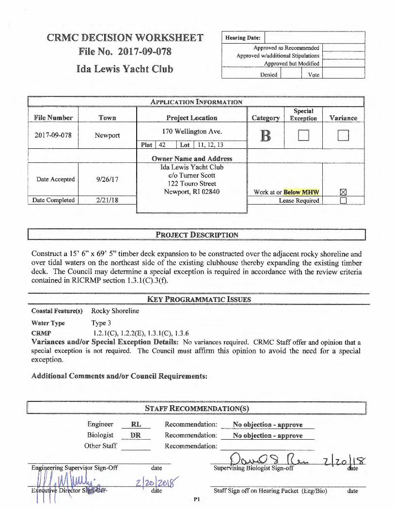
CRMC DECIS ION WORKSHEET
File No. 20 17-09-078
HeaTing Date: I Approved as Recommended
Approved w/additional Stipulations
Ida Lewis Yacht Club Approved but Modified
Denied J I Vote
APPLICATION INFORMATION
Special File Number Town Proiect Location Cate2ory Exception
2017-09-078 Newport 170 Wellington Ave. B D
Plat I 42 I Lot I 11, 12, 13
Owner Name and Address Ida Lewis Yacht Club
Date Accepted 9/26/17 c/o Turner Scott 122 Touro Street
Newport, RI 02840 Work at or Below MHW Date Completed 2/21/18 Lease Required
PROJECT DESCRIPTION
Variance
D
L8] 0
Construct a 15' 6" x 69' 5" timber deck expansion to be constructed over the adjacent rocky shoreline and over tidal waters on the northeast side of the existing clubhouse thereby expanding the existing timber deck. The Council may determine a special exception is required in accordance with the review criteria contained in RICRMP section 1.3.l(C).3(f).
KEY PROGRAMMATIC ISSUES
Coastal Feature(s) Rocky Shoreline
Water Type Type 3
CRMP 1.2.l(C), l.2.2(E), 1.3.l(C), 1.3.6 Variances and/or Special Exception Details: No variances required. CRMC Staff offer and opinion that a special exception is not required. The Council must affirm thi s opinion to avoid the need for a special exception .
Additional Comments and/or Council Requirements:
Engineer
Biologist
Other Staff
STAFF RECOMMENDA TION(S)
RL Recommendation: No objection - approve ---~---~-- -DR Recommendation: __ N_o_o_b~je_c_tt_· o_o_-_a_.p_.p_r_o_ve __
Recommendation: ----
Supervising Biologist Sign-off
Staff Sign off on Hearing Packet (Eng/Bio) date Pl
STATE OF RHODE ISLAND AND PROVIDENCE PLANTATIONS COASTAL RESOURCES MANAGEMENT COUNCIL
STAFF BIOLOGIST'S REPORT
TO: Grover J. Fugate DEPT: CRMC Executive Director FROM: David S. Reis DEPT: CRMC Biology/Permitting Section
RE: CRMC File No. 2017-09-078 Applicant's Name: Ida Lewis Yacht Club
DATE: February 20, 2017 PAGE: 1 of3
Project: Construct a 15' 6" x 69' 5" timber deck expansion to be constructed over the adjacent rocky shoreline and over tidal waters on the northeast side of the existing clubhouse thereby expanding the existing timber deck. The Council may determine a special exception is required in accordance with the review criteria contained in RICRMP section l.3 .l(C).3(f). Location: 170 Wellington Avenue Water Type/Name: Type 3 Waters, High Intensity Boating, Newport Harbor Coastal Feature: Rocky shoreline Freshwater Wetlands: Not applicable
A. Staff Summary: CRMC Staff offers an opinion that the proposed project meets the review criteria for commercial structures constructed over rocky shorelines and Type 3 tidal waters and on that basis, a special exception would not be required. The Council must affirm this opinion to avoid the need for a special exception. A public access plan has been provided, as required. No objections were submitted during the public notice period . Accordingly, CRMC Staff recommends approval of the project subject to the Council determining a special exception is not required.
B. Plans Reviewed:
1. "Ida Lewis Yacht Club Outside Deck Extens ion ... ", in 6 sheets by St. Jean Engineering, LLC, dated 11-8-2017
2. "Ida Lewis Yacht Club, Wellington Avenue, Newport, RI 02840 . .. ", in 3 sheets, by Christopher Arner, Architect, dated 09.20.17
C. Staff Analysis:
The proposed project will result in the construction of a 1075 sq. ft. (+/-) timber deck expansion to an existing timber deck connecting two of three existing buildings comprising the Ida Lewis Yacht Club at Lime Rock in Newport Harbor. Under current definitions, the entirety of Lime Rock would be considered a coastal feature and defined as "rocky shoreline" . However, CRMC records indicate the main pier connecting Lime Rock to the mainland and associated finger piers were approved "asbuilt" along with additional finger pier expansions approved by the CRMC in 1974 (ref. CRMC File No. 1974-03-019). Plans in the 197 4 file also indicate a yacht club building existed on Lime Rock at that time. Other information contained in the 1974 file indicates the facility had been operating for 45 years prior to the 1974 CRMC application. There are also 11 other application files for Ida Lewis yacht club in CRMC records. However, these files were not reviewed for purposes of this application. The principal point is the yacht club facility has existed on the coastal feature since prior to CRMC's jurisdiction.
Signed: ___ G ........... c .... ~x;;;;.;:=··;;.___~-=-X--.... Sl..:=b::z..-_________ Supervising Environmental Scientist
P2
Name: Ida Lewis Yacht Club CRMC File No. 2017-09-078 Staff Biologist's Report Page 2 of 3
Under existing regulations, the proposed deck extension is considered a "commercial structure" pursuant to RICRMP Section 1.3.l(C) which is to be constructed over a rocky shoreline and Type 3 tidal waters. The following RICRMP policies and requirements are central to this review:
1. For Rocky Shorelines (Ref. RICRMP Section 1.2.l(E).2.d): The construction of alterations to rocky shores adjacent to Type 3, 4, 5, and 6 waters may be permitted if:
(1) the construction is undertaken to accommodate a designated priority use for the abutting water area;
(2) the applicant has examined all reasonable alternatives and the Council has determined that the selected alternative is the most reasonable; and
(3) only the minimum alteration necessary to support the designated priority use is made.
2. For Commercial Structures (Ref. RICRMP Section 1.3.l(C)3.f): Decks associated with commercial properties are prohibited in or over Type 3, 4, 5, and 6 waters unless:
(1) the deck is to accommodate a designated priority use for that water area;
(2) the applicant has examined all reasonable alternatives and the council has determined that the selected alternative is the most reasonable; and
(3) the deck is the minimum necessary to support the priority use.
The applicant has provided responses to the above criteria (which are identical for decks/commercial structures over tidal waters and rocky shorelines). The applicant' s responses are contained in the Council's agenda packet. In summary, the applicant indicates the proposed deck is intended to accommodate a sailing program which is a designated priority use for Type 3 waters. And, there are no reasonable alternatives considering existing site constraints while attempting to accommodate an expanding sailing program. The applicant further claims the proposed deck is the minimum necessary considering the location and limitations of the existing facilities. In consideration of these responses, CRMC Staff agrees that the activity does serve a designated priority use (that is policies associated with high intensity boating) and the expansion proposed does seem reasonable considering site restnct10ns. On this basis, it is recommended that the project is NOT prohibited and is therefore NOT subject to a special exception.
3. Category B Requirements: The applicant has submitted the necessary responses to the Category B requirements . (Category B requirements are a series of 11 evaluation criteria which forms the basis for a brief environmental assessment.) The applicant's Category B responses are included in the Council ' s agenda package. CRMC Staff believes the responses to be reasonable and appropriate. There are no staff objections. The Staff Environmental scientist further offers that the affected environment is primarily an intertidal rocky shoreline containing an attached macro-algae
Signed: ___ ..,.0 ... -_C ... ~a..-..- ·~~.;:;.w._...~~m:;.:;;...;.._ _________ Supervising Environmental Scientist
P3
Name: Ida Lewis Yacht Club CRMC File No. 2017-09-078 Staff Biologist's Report Page 3 of3
community. While this habitat is valuable, it is not considered to be unique for this area and no submerged aquatic vegetation such as eelgrass will be impacted. Furthermore, staff experience is that there have been very few projects such as Ida Lewis project that meet the criteria contained in RICRMP Section 1.2.l(E ).2.d) which is intended to protect Rocky Shorelines. This is primarily due to the fact that the facility predates CRMC regulation and it is located on a rocky island surrounded by tidal waters. On this basis, cumulative impacts associated with additional projects of this type are not expected.
D. Public Access Plan Requirement: Pursuant to RICRMP Sections 1.3.l(C).2 .b and 1.3.6.B.2.a, a public access plan is required for commercial development particularly where such development specifically impacts coastal resources. In this case a deck is being constructed over a rocky shoreline and tidal waters thereby having direct impacts to coastal resources. Pursuant to discussions with Yacht Club representatives (Mr. Gary Lash), it was determined that providing public access within the private yacht club facility was not practical . On that basis, CRMC Staff suggested that off-site public access be enhanced as allowed by RJCRMP Sections 1.3.6.C.3 and 1.3.6.D (Guidelines for the development of public access plans). The public access plan proposed to satisfy these requirements consist of providing a kayak/small boat rack on City of Newport property to be turned over to the City. The proposed rack will accommodate approximately 30 kayaks or other small watercraft. (See the proposed public access plan contained in the Council's agenda package stamped CRMC approved dated February 20, 2018).
E. Public Notice: A 30 day public notice for the project was issued on January 8, 2018 and it expired on February 8, 2018. The City of Newport requested an extension until February 16, 2018 which was administratively granted by the CRMC. No objections were received during the public notice period. After requesting an extension to the public notice period to allow review by the planning board, waterfront commission and the City Council, the City of Newport a provided a letter of no objection dated February 15, 2018.
F. Recommendation: Based on the review contained herein CRMC Staff concludes that the project is not prohibited since it appears to satisfy the criteria contained in RICRMP Sectionl.3.l(C)3.f. The Council must affirm this opinion to avoid the need for a special exception. The project further appears to meet the Category B requirements and has provided an off-site public access plan enhancement consistent with RICRMP Sections 1.3.l(C).2.b and 1.3.6.B.2.a. Furthermore, there were no objections received during the public notice period and City of Newport provided a letter of no objection. Accordingly, CRMC Staff recommends approval of the project subject to the Council determining a special exception is not required. The following stipulations are recommended:
G. Recommended Stipulations:
1. Consistent with the proposed public access plan, the proposed kayak/small watercraft rack shall be constructed by Memorial Day 2018. Prior to construction, a site plan showing the rack location shall be provided to the CRMC and City of Newport for approval. The rack shall be adequately anchored to resist displacement during a storm. If required, construction/building plans shall be approved by the City of Newport Building official.
Signed: o~:?4 -' 12 Q., _ Supervising Environmental Scientist
P4
STATE OF RHODE ISLAND AND PROVIDENCE PLANTATIONS COASTAL RESOURCES MANAGEMENT COUNCIL
STAFF ENGINEER'S REPORT
TO: Grover J. Fugate DEPT: CRMC Executive Director FROM: Richard M. Lucia, P.E. DEPT: CRMC Engineering/Permitting Section
RE: CRMC File No. 2017-09-078 Applicant's Name: Ida Lewis Yacht Club
DATE: 2/16/18 PAGE: 1 of 2
Project: Construct a 15' 6" x 69' 5" timber deck expansion to be constructed over the adjacent rocky shoreline and over tidal waters on the northeast side of the existing clubhouse thereby expanding the existing timber deck. The Council may determine a special exception is required in accordance with the review criteria contained in RICRMP section 1.3 .1 (C).3(f).
Location : 170 Wellington Avenue Water Type/Name: Type 3 Waters, High Intensity Boating, Newport Harbor Coastal Feature: Rocky shoreline Freshwater Wetlands: Not applicable
A. Plans Reviewed :
1. "Ida Lewis Yacht Club Outside Deck Extension ... ", in 6 sheets by St. Jean Engineering, LLC, dated 11-8-2017
2. "Ida Lewis Yacht Club, Wellington Avenue, Newport , RI 02840 ... ", in 3 sheets, by Christopher Arner, Architect, dated 09.20.17
B. Staff Analysis:
This staff's analysis is limited to engineering review. Please refer to Supervising Environmental Scientist report regarding Biological impacts and RICRMP Policies/Requirements.
The proposed deck is located seaward of Mean High Water into tidal waters and in an area designated by FEMA as V-Zone, area subject to wave action (Base Flood Elevation 13' NAVD88)1. Furthermore, FEMA Flood Insurance Study, indicates a nearby transect having a Maximum Wave Crest at Elevation 16.1 ' , during a 1 percent annual chance storm2
. The top of deck will be set at 9.52' to match the existing deck and therefore will therefore be inundated in a storm event. In order to insure the integrity of the proposed structure , staff engineer recommends an additional stipulation added to the assent that states prior to construction the applicants engineer submit design calculations that address the loads from wave and tidal action and any necessary revisions to the plans .. Additionally, since the structure is in tidal waters, CRMC staff has contacted Daniel R. DeDentro of State of RI Building Official Office and he has stated that a review by their office may be required in lieu of the City of Newport Building Official review. The Staff engineer recommends a stipulation requiring the State Building Official review be attached to this Assent.
Signed: __ g..,.._ __ ---/Jf=-......... ..__~~~-..;;;....-..;;;........;;;;.· _______ Supervising Civil Engineer //
P5
Name: Ida Lewis Yacht Club CRMC File No. 2017-09-078 Page 2 of 2
With regard to RICRMP Section 1.1.10 Climate Change and Sea Level Rise, a review of the online mapping tool "STORMTOOLS" indicates that the structure will not be inundated with a 7 foot Sea Level Rise above Mean Higher High Water without an episodically storm event (i.e. 100 year, 50 year, 25 year, and 10 year reoccurrence). However, discussions with Teresa A. Crean (URI Coastal Community Planner, Coastal Resources Center) of the mapping of this site, it appears that this is an anomaly and most likely the proposed deck will be flooded in case of the sea level rise of 6' (deck is at 9.52' (MLW) or 6.06' (MHW). Which depending on the model used this could occur by 2070 which gives a design life for the deck of approximately 52 years.3
1. FEMA map 44005C0177J, effective on 09/04/2013 2. FEMA Flood Insurance Study, Newport County, September 4, 2013, transect #41 3. US Army Corp of Engineers sea level calculator (http://corpsclimate.us/ccaceslcurves.cfin.)
Recommendations and Conclusion:
Based on the above, there are no engineering objections to the proposed project. Additionally staff engineer concurs with Supervising Environmental Scientist report . On this basis, CRMC Staff recommends approval subject to Staff stipulations:
Recommended Additional Stipulations:
(RL) A design analysis of hydrodynamic and debris loads and any necessary revisions to the building structure shall be submitted to CRMC staff for approval prior to construction.
(RL) The applicant shall contact the State of Rhode Island Building Commission to determine if a Rhode Island State Building Permit (from their office) in addition to the Town Of Newport Building Permit is required prior to construction. If a RI State Building Permit is required, a copy of the Building official letter showing evidence that the State Building Official has seen the project and granted ( or will grant) approval of the construction project permit shall be submitted to the CRMC prior to construction .
Signed: _ __,._ /7..._ ..... 7 ......... ____ / __ . ·--E~_..,.~ ............ -~----= .......... ·,.._ _______ Supervising Civil Engineer µ~
P6
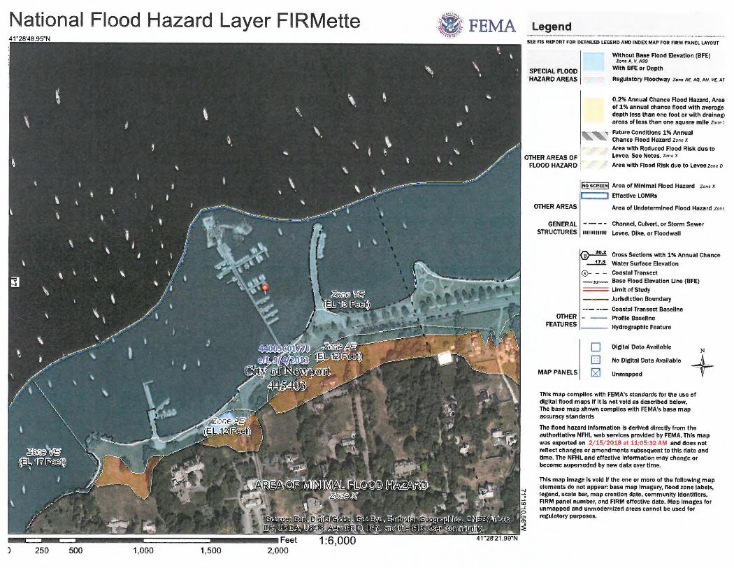
National Flood Hazard Layer FIRMette
) 250 500 1,000 1,500
Legend SEE FIS REPORT FOR DETAILED LEGEND AND INDEX MAP FOR FIRM PANEL LAYOUT
SPECIAL FLOOD HAZARD AREAS
OTHER AREAS OF FLOOD HAZARD
OTHER AREAS
Without Base Flood Elevation (BFE) Zone A, V1 A99
With BFE or Oepth
Regulatory Floodway Zon e AE, AO, AH . VE, AF
0.2% Annual Chance Flood Hazard, Area of 1 % annual chance flood with average depth less than one foot or with dralnag , areas of less than one square mile Zone >
.., Future Conditions 1% Annual Chance Flood Hazard Zone x Area with Reduced Flood Risk due to Levee. See Notes. z o11e x
Area with Flood Risk due to Levee Zone o
~o SCREEN! Area of Minima! Flood Hazard Zone x
C:==J Effective LOMRs
Area of Undetermin ed Flood Hazard Zon,
GENERAL Channel, Culvert , or Storm Sewer
STRUCTURES 1111111111111 Levee, Dike, or Floodwall
Cross Sections with 1% Annual Chance
OTHER FEATURES
--1!:! Water Surface Elevation
©- - - Coastal Transect _,.,_ Base Flood Elevation Une (BFE) = Umlt of Study
--- Jurisdiction Boundary
Coastal Transect Baseline
Profile Baseline
Hydrographlc Feature
Digital Data Available N
MAP PANELS
D D . 121
No Digital Data Available
Unmapped + This map complles with FEMA's standards for the use of digital flood maps If It Is not void as described below. The base map shown compiles with FEMA's base map accuracy standards
The flood hazard Information Is derived dlrecUy from the authoritative NFHL web services provided by FEMA. This map was exported on 2/ 15/ 2018 at 11:05 :32 AM and does not reflect changes or amendments subsequent to this date and time. The NFHL and effective information may change or become superseded by new data over time.
This map Image Is void If the one or more of the following map elements do not appear: base map Imagery , flood zone labels , legend, scale bar, map creation date , community Identifiers, FIRM panel number, and FIRM effective date. Map Images for unmapped and unmodernized areas cannot be used for regulatory purposes .
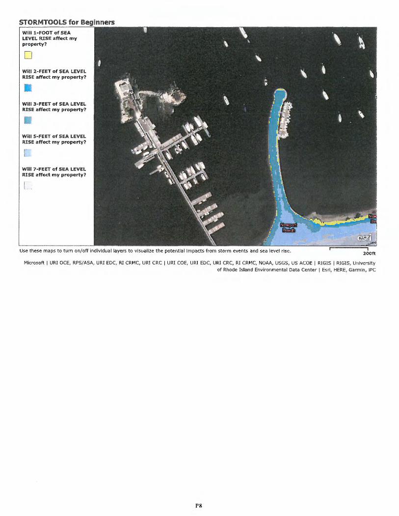
STORMTOOLS for Beginners Will 1-FOOT of SEA LEVEL RISE affect my property?
CJ Will 2- FEET of SEA LEVEL RISE affect my property?
W ill 5-FEE T of SEA LEVEL RISE affect my property?
Will 7-FEET of SEA LEVEL RISE affect my property?
Use thes e maps to turn on/off individual layers to visualize the potential impacts from storm event s and sea level rise. 200ft
Microsoft I URI OCE, RPS/ASA, URI EDC, RI CRMC, URI CRC I URI COE, URI EDC, URI CRC, RI CRMC, NOAA, USGS, US ACOE I RIG IS I RIGIS , University
of Rhode Island Environment al Data Cente r I Esri, HERE, Garmin, iPC
PS
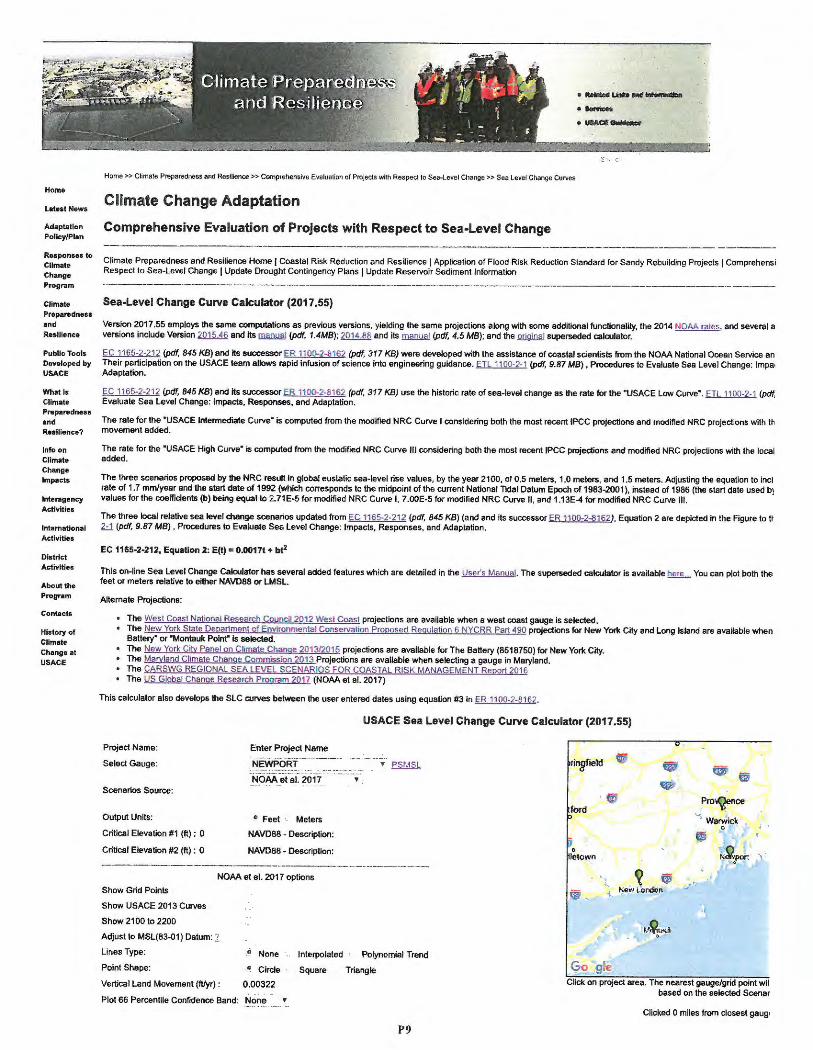
Home
Latest News
Adaptotlon Policy/Plan
Responses to Climate Change Program
Climate Preparedness and
Resilience
Public Tools Developed by USACE
What ls Climate Preparedness and Resilie nce?
Info on Climate Change Impacts
lnteragency Activltle&
lntematlonal Activities
District Activities
About the Program
Contacts
History of
Climate Change at USACE
Home>> Climate Preparedness and Resi6ence >> Comprehensive Evaluation of Projects with Res peel 10 Sea-Level Change>> Sea l e vel Change Curves
Climate Change Adaptation
Compre hensive Evaluation of Projects with Respect to Sea-Level Change
·-u.u-·-• UIACI:--
~ .
Climate Preparedness and Resilience Home I Coaslal Risk Reduction and Resil ience I Applicalion of Flood Risk Reduction Standard fo r Sandy Rebuilding Projects I Comprehensi Respect to Sea-Level Change I Update Drought Contingency Plans I Update Reservoir Sediment Informatio n
Sea-Level Change Curve Calculator (2017 .55)
Version 2017 .55 employs the same computations as previous versions, yielding the same projections along with some addit ional functionality , the 2014 NOAA rates, and several a versions include Version ~ end its .llliilll!i!.! (pd(, 1 .4MB); ~ and its .llliilll!i!.! (pdf. 4.5 MB); end the .Qllilina! superseded calculator.
EC 1165-2-212 (pdf, 845 KB) and its successor ER 1100-2-8162 (pdf, 317 KB) were developed with the assistance of coasta l scientists from the NOAA National Ocean Service an Their participation on the USACE team allows rapid infusion of science into engineering guidance. ETL 1100-2-1 (pdf, 9.87 MB) • Procedures to Evaluate Sea Level Change: lmpa , Adaptation.
EC 1165-2-212 (pdf, 845 KB) and its successor ER 1100-2-8162 (pdf, 317 KB) use the historic rate of sea-leve l change as the rate for the "USACE Low Curve·. Ell 1100-2-1 (pdf, Evaluate Sea Level Change: Impacts, Responses, and Adaptation.
The rate for the •usACE Intermediate Curve• is computed from the modified NRC Curve I considering both the most recent IPCC projections and modified NRC projections wtth th movement added.
The rate for the "USAGE High Curve· is computed from the modified NRC Curve Ill considering both the most recent IPCC projections and modified NRC projections with the local added .
The three scenarios proposed by the NRC result in global eustatic sea-level rise values, by the year 2100, of 0.5 meters, 1.0 meters. and 1.5 meters. Adjusting the equation to incl rate of 1.7 mm/yea r and the start date of 1992 (which corresponds to the midpoint of the current National Ttdal Datum Epoch of 1983-2001 ), instead of 1986 (the start date used bJ va lues for the coefficients (b) being equal to 2.71E-5 for modified NRC Curve I, 7.00E-5 for modified NRC Curve II, and 1.13E-4 for modified NRC Curve Ill .
The three local relative sea level change scenarios updated from EC 1165-2-212 (pdf. 845 KB) (and and its successor ER 1100-2-81621, Equation 2 are depicted in the Figure to It 2-1 (pdf, 9.87 MB). Procedures to Evaluate Sea Level Change: Impacts, Responses , and Adaptation.
EC 1165·2·212, Equation 2: E(t) = 0.0017t + bt2
This on-line Sea Level Change CalctJlator has several added features which are detailed in the User's Manual . The superseded calculator is available here You can plot both the feet or meters relative to either NAVD88 or LMSL.
Alternat e Projections:
• The West Coast National Research Council 20 12 West Coast projections are available when a west coast gauge is selected. • The New York State Department of Environme ntal Conservatio n Proposed Regulation 6 NYCRR Part 490 projections for New YOfk City and Long Island are available when
Battery• or "Montauk Poinr is selected. • The New York City Panel on C~mate Change 2013/2015 project ions are available for The Battery (8518750) for New York City. • The Maryland Climate Change Commission 2013 Projections are available when selecting a gauge in Maryland. • The CARSWG REGIONAL SEA LEVEL SCENAR IOS FOR COASTAL RISK MANAGEMENT Report 2016 • The us Global Change Research Program 2017 (NOAA et al. 2017)
This calculator also develops the SLC curves between the user entered dates using equation #3 in ER 1100-2-8162.
USACE Sea Level Change Curve Calculator (2017.55)
Project Name :
Select Gauge :
Scenarios Source :
Output Units :
Critical Elevation #1 (ft) : 0
Critical Elevation #2 (ft) : 0
Show Grid Points
Show USAGE 2013 Curves
Show 2100 to 2200
Enter Project Name
NEWPORT
NOAA et al. 2017 •
° Feet - Meters
NAVD88 • Description :
NAVD88 - Description :
NOAA et al. 2017 options
Adjust to MSL(83-01) Datum: 1 Lines Type: -'' None
,Q Circle
0.00 322
Interpolated · Polynomial Trend
Point Shape : Square Triangle
Vertical Land Move ment (ft/yr) :
Plot 66 Percentile Confidence Band: None •
P9
.'---- ~ rinatield ., • I ffi
,I • e,-' ,- ' Pro~nce t y
"') WafWick • 0
,, " 0 r ~~por. leto .. m r
. ~ (j ·' ij; -.: ls"ew Londcn
Go gle Click o n project area. The nearest gauge/grid point wil
based on the selected Scenar
Clicked O miles from closest gaug,
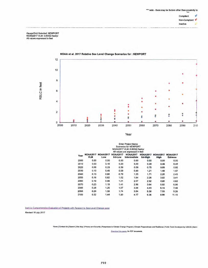
Gauge/Grid Selected: NEWPORT NOAA2017 VLM: 0.00322 feet/yr All values expressed in feet
••• note - there may be factors other than ~~?ximity to
Compliant r1 Non-Compl iant ti Inactive
NOAA et al. 2017 Relative Sea Level Change Scenarios for: NEWPORT
12
10
8 Q) ~ £ 6 t) ...J Cl) a:::
4
2 I •
I • 8 0 2000 2010 2020 2030
Year NOAA2017 NOAA2017 VLM Low
2000 0.00 0 .00
2010 0.03 0.16
2020 0.06 0 .33
2030 0 .10 0.49
2040 0.13 0.66
2050 0 .16 0.82
2060 0.19 0.98
2070 0.23 1.15
2080 0.26 1.25
2090 0 .29 1.38
2100 0.32 1.44
back to Comprehensive Evaluation of Projects with Respect to Sea-Level Change page
Revised 18 July 2017
• •
• • • I • • • • • I I II
• 2040 2050 2060
Year
Enter Project Name Scenarios for NEWPORT
NOAA2017 VLM: 0.00322 teet/yr All values are expressed in feet
NOAA2017 NOAA2017 NOAA20 17 lnt-Lciw Intermediate Int-High
0.00 0.00 .(l.00
0.20 0.30 0.39
0.39 0.59 0.75
0 .59 0.89 1.21
0.79 1.25 1.71
1 .02 1.64 2.26
1.21 2.07 2.92
1.41 2.56 3:64
1.57 3.08 4.49
1.74 3.64 5.38
1.90 4 .17 6.36
1 '
l •
l • •
• • 1 • •
• • •
• • • e
& • • • • • •
2070 2080 2090 210
NOAA2017 NOAA2017 tiigh Extreme
0.00 0 .00
0.46 0.49
0.95 0 .92
1.48 1.57
2.20 2 .43
3.02 3.41
4.00 4 .63
5.02 6.00
6.14 7.48
7.55 9.28
8.99 11.15
Home I Contad Us I Search I Site Map I Privacy end Security I Res ponses to C~mate Change Program I Climate Preparedness and Resifl6rlce I Public Tools Developed by USACE I Serv i
QownJosd ll]g ,egde, for PDF documents.
PIO
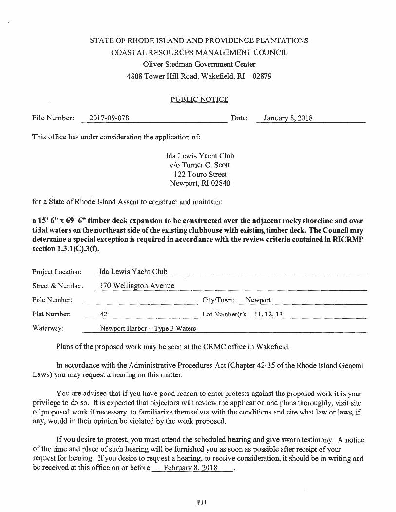
File Number :
STATE OF RHODE ISLAND AND PROVIDENCE PLANTATIONS
COAST AL RESOURCES MANAGEMENT COUNCIL
Oliver Stedman Government Center
4808 Tower Hill Road, Wakefield, RI 02879
PUBLIC NOTICE
2017-09-078 Date: January 8, 2018
This office has under consideration the application of :
Ida Lewis Yacht Club c/o Turner C. Scott
122 Touro Street Newport, RI 02840
for a State of Rhode Island Assent to construct and maintain:
a 15' 6" x 69' 6" timber deck expansion to be constructed over the adjacent rocky shoreline and over tidal waters on the northeast side of the existing clubhouse with existing timber deck. The Council may determine a special exception is required in accordance with the review criteria contained in RICRMP section 1.3.l(C).3(f).
Project Location: Ida Lewis Yacht Club
Street & Number: 170 Wellington Avenue
Pole Number: _____________ City/Town: _ N_e_wp_o_rt __________ _
Plat Number: Lot Number(s): 11, 12, 13 ------------- --'----'-----------42
Waterway: Newport Harbor- Type 3 Waters
Plans of the proposed work may be seen at the CRMC office in Wakefield.
In accordance with the Administrative Procedures Act (Chapter 42-35 of the Rhode Island General Laws) you may request a hearing on this matter.
You are advised that if you have good reason to enter protests against the proposed work it is your privilege to do so. It is expected that objectors will review the application and plans thoroughly , visit site of proposed work if necessary , to familiarize themselves with the conditions and cite what law or laws, if any, would in their opinion be violated by the work proposed .
If you desire to protest, you must attend the scheduled hearing and give sworn testimony. A notice of the time and place of such hearing will be furnished you as soon as possible after receipt of your request for hearing. If you desire to request a hearing, to receive consideration , it should be in writing and be received at this office on or before February 8, 2018
Pit
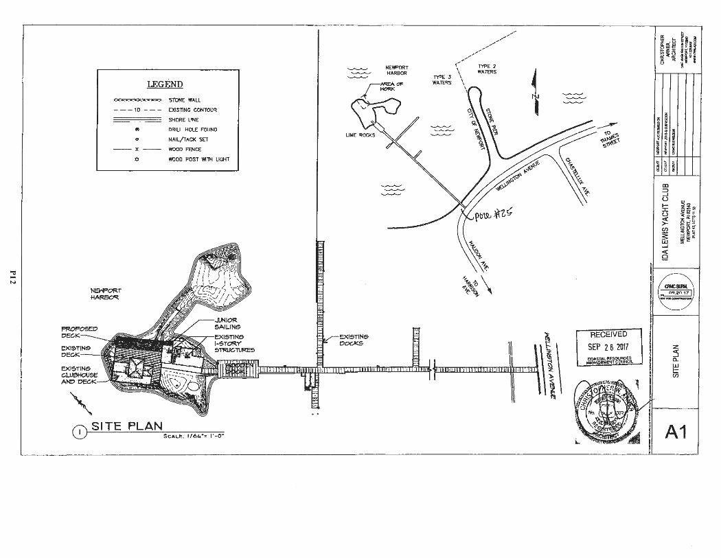
"d -N
LEGEND STONE WALL
- - - 10 - - - EXISTING CONTOUR
__ __ SHORE LINE
9 DRILL HOLE FOUND
o NAIL/TACK SET
-- X -- WOOD FENCE
¢ WOOD POST WITH LICHT
N&IPORT HARBOR
' 0 SITE PLAN _ ·- _ .. __
NEWPORT HARBOR
Til'EJ WATERS
,,,,,,. ... .,,
,,,,. ... .,,. ... /'
{///~[ 2
\ WATERS \ I \ \
-~ o 1:,,. >- \ ,~,
1
!
~\\
-----~o """~~ s~v-·
RECEIVED
SEP 2 6 2017 CQ,t.STAl. RESOURCES
MAN~~EM_iNf COU_NCn.
ffi .... if ffi El ~ ~5 ~<~ u
; I s i ~ I I I I ; ! ~
II) ::::, .J (.) I-::i:: u ~ Cl)
~ .J
~
~
z :5 a_ w !:: en
11 8 ~~i; Uiji 'g
ii ~s ; a::_ ~ ....
~I ~~
A1
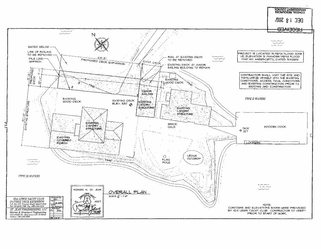
WATER ElELOII)
TYPE lll WATERS
IDA LEWIS YACHT CLUB OU1'SIDE DECK EXTENSION r.o. llltT 419, Ntll'port. Rllo« /,l ow,/ 018'0 Ttl: (40/J.116-1969 fa <: (#111) M6-&1H
N
®
EXl &TING WOOD D ECK
. .. .. , ...
RICHARD N. ST. JEAN
·'
\ \
OvERALL FLAN SCALE, ((;' • l'-e•
·------..
/
BRI CK WAL K
0 FLAG POLE
·' I
~ONOOO!N3W30VNY~ Si0YOOS3.., 1Y.lSVOO
LlOZ 8 l J30
PRO JECT 15 LOCATED IN FEMA FLOOD ZONE VE , ELE VATION 13 (NAVDOO) FEMA FLOOD MAP NO. 44t2>t2>5C~l11J, DATED ':l/4/2t2>13
CONTRACTOR SI-IALL VISIT Tl-IE SITE AND FAMILIARIZE I-IIMSELF UJITI-I Tl-IE EXI STING COND ITIONS, ACCESS , TIDA L CONDITIONS AND EX ISTING CONSTf.:IJCTlo-1 PR IOR TO
BIDDING AND CONSTRUCTlo-1 .
TYPE fl WATERS
TACK O SET
WOODEN DOCK
NOTE : CONTOURS AND ELEVATIONS 51-10\l.N WERE PROVIDE D ElY IDA LEWIS Y ACI-IT CLUB. CONTRACTOR TO VERIF Y
PRIOR TO ST ART OF WOF:K..
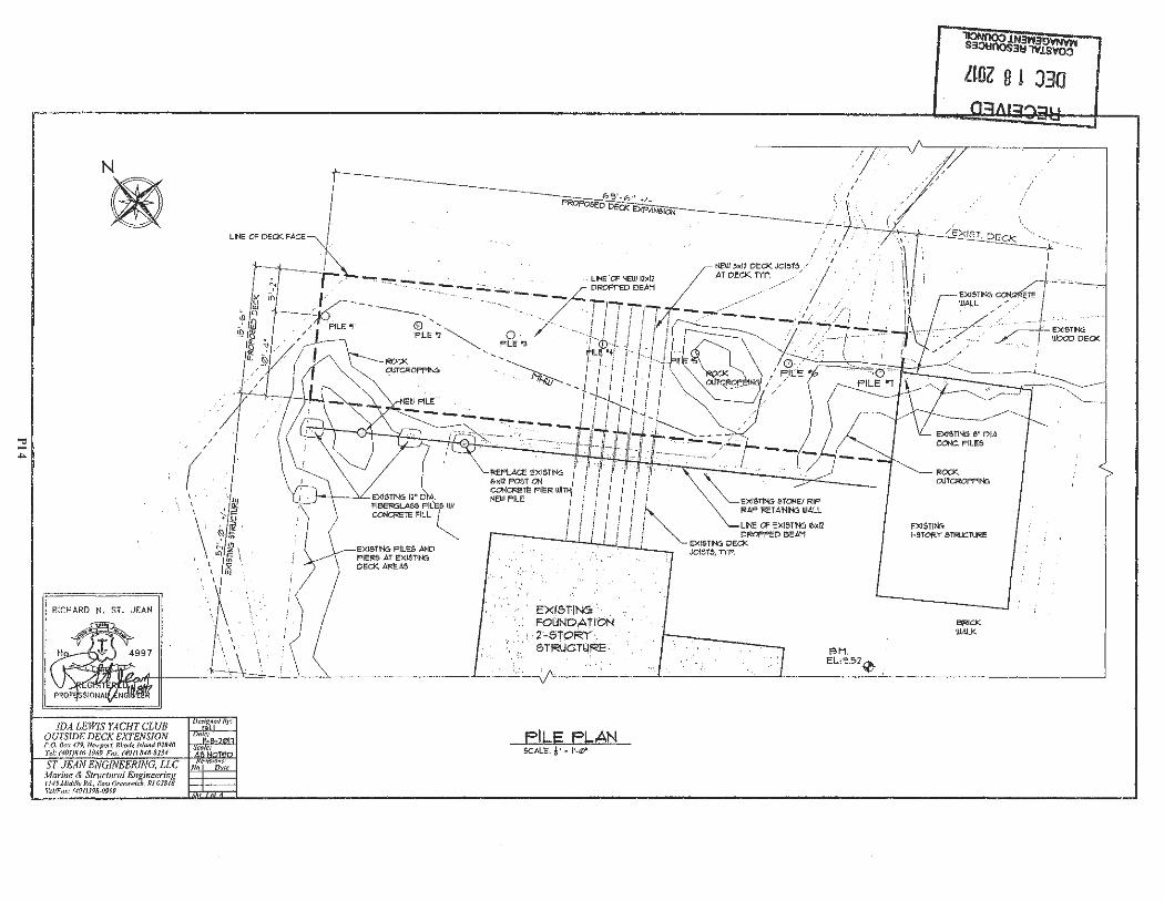
N
@
RICHARD N. ST. JEAN
IDA LEWIS YACHTCWB OUTSIDE DECK EXTENSION P.O. /ktY 479, Ne~,p,,rl, Rhf'f.ft l1lm1d ()2840 T,/ , (401/846-/969 Fo<.· (40 1) Ri6-81J4
' '
, ,
\ · EX1$,TIN5 . . . FOUNDATION
,,, .. ·2'~5TORf ", · 5TRUCT14~ :.
FILE FLAN 5C.dLE, A· • 1'·0'
BM. EL ,~52~
ltOl 8 t J3Q
ROCK OJTCROFPIN6
EXISTING l•STOR"r' STRUCTURE
BRICK WALK
TE
, ,'
EXl&TING WOOD DECK
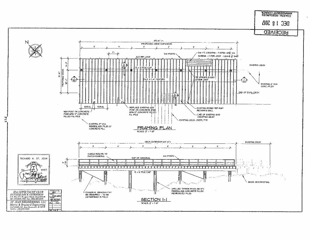
RICHARD N. ST. JEAN
IDA LEWIS YACHT CLUB OUTSIDE DECK EXTENSION P,0 , Bo:.: 419, N~upt)rl, Rlmd~ Mnmf 011UO Thi.· (4~/)8<6-1969 fl,,,: 1,0118•6-8?14
~ ;ii
N
;,,
~ lU Q Q
~ ~ ~ §!
llOZ 8 l J30 03/\13038
PROPOSED DECK EXPANSICN
n•
EXISTING DECK
:tj~Jtjt:lt:tj]tjt!jtj:Jtjt:Jtj~jjf
,._,_,._u.. ~-"fi-':.11--111--1~1-l/l-l!-ll-ll---ll---ll---ll---ll--ll--ll--ll--11--11-11-1 11-1~f-llf--ll--ll--ll--11---ll---l!---ll--ll--ll-*- ·'l-11-11-11-fl~f--ll--ll--1~--11--+-11---11--11--11--11---11-ll:~._...,.__1~3 .... \L,~ e o<A
CCNC. PILE&
i i 1'<1:PLACE EXl5TIN6 6~1l j POST ON CCNcF!ETE 'i'1Elj1 WITI-l I?' CCNCRETE F"iLEp F.6. PILE I i
! ! I
i I
i '
! LINE Cf EX1STIN6 E>X12 DROPPED 6EAM
j EX1STIN6 DECK JOISTS, TYP. i ""-EXISTINC, ll' DIA
FIBE~AeS PILES W/ CONCf<ETE FILL FFs,AMING FLAN
II' II'
L_,.,''·-··-·r~· ee REQJIRED - TO eE DETEF!11NED IN FIELD
SCALE, J• • 1'·0"
DECK EXl1:N51CN 1,9'-6 't
II' II'
SECTION 1-l SCALE, i• • l'-0'
II'
DRILLED TNeER PILES OR 1-4"• Fl6ERGI.AS5 CONCRETE FILLED l'<l:INFORCED PILES
11'
END a EXT6. DECK
EX1STN5 DECK
' '' ' I '--~-,--
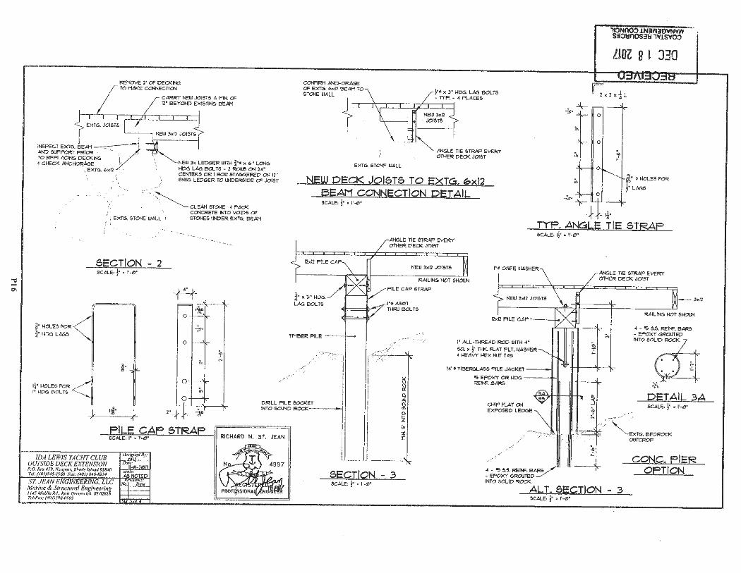
REMOVE 2' OF DECKING TO HAKE CONNECTICN
{ EXTG. JOISTS
INSPECT EXTG. iEAH ~v-: AND 5UPPOp;:T PRIOR ·. · . > TO REPLACING DEp(IN6 ,
1• , .
• CHECK ANCHORAGE ' . EXT6. 6xl2 • ·
/!
NEW 3x LEDGER WITH ¾•• x b" LCN6 HD6 LAG BOLTS - 2 ROUJ5 ON 24" CENTERS OR I ROJJ 5T A66ERED ON 12' &NUc:; LED6ER TO l.NDER5fDE OF JOIST
/\ _, ... :._·-~CL EAN STONE • PACK
~- HOLES l'OR< 3" f.100 LA65
= !
' i EXTG. STONE WALL \ f; i .
SECTION - 2 SCALE, j• , l'-0'
CONCRETE INTO VOIDS OF STONES UNDER EXTG. BEAM
+q 0 """ "'
~ r
0
~t' ;.
-
CONFIRM ANCHORAGE OF EXTG. 6xl2 SEAM TO STCNE WALL
EXTG. STONE WALL
j •• x 3" HD6. LAG BOLTS • TYF .• 4 PLACES
ANGLE TIE STRAP EVERY OTHER DECK JOIST
NEW DECK JOISTS TO EXT<=,. ~xl2 BEAM CONNECTION DETAIL SCALE, j• • 1'·0"
0
-=...-.->r--
,t 1¼·
llOZ 8 1 J30
~' • HOLES FOR
!• LAGS
ANGLE TIE STRAP EVERY OTHER DECK JOIST
TYF. ANGLE TIE STRAP SCALE, 1j• , l' -0'
i" )( :1• 1-10u. LAG 60LT5
TIMBEt:! PILE ---1-~
/
.. '"<".
,., .. ?:·:".l .,
,·;:,. .•./ _,,,;::, .. ·.
t' ·./,:'. r
NEW 3xl2 .JOISTS l' O 06EE WASHER
RAILING NOT s=
I' ALL-THREAD ROD WITH 4 "
SQ. x j• THK. FLAT FLT . WASHER I HEAVY HEX MJT T<B
WO FIBERGLASS PILE JAcKET
.oNc.LE TIE STJUp EV1:RY OTHER DECK JOIST
3xl2
RAILING NOT 5HOJJN
4 • ~ 5.5. REINF. BARS • EPOXY GROUTED
INTO eol..01~ - z . .
I¼' HOLE!:> FOR I' HDG 60LTS .....
0 ;.,
I DRILL PILE SOCKET / !
~ EPOXY CR HD6 ---+-ii REll'F.BAR5
CHIP FLAT CN EXP~DLED6E
;:;;,, I
DETAIL 3A SCALE, j• • 1'-0 '
k 1
1DA LEWIS YACHT CLUB OUTSIDE DECK EXTENSION
1 2"* FILE CAF 6TRAF SCALE, I' • f'•0"
P.O. B!)l' 4 79. Nt!1111m1. Rlmd~ Isla ml OlR.ffl Te/: ftl01)8..16-J969 Fll'C: (40/J,1'46-623'
r.=== === IN=T=0=50UN==DROCKI I I I ! i • .... - - .I -----' '!.-
RICHARD N. ST. JEAN
SECTION - .3 SCALE, j• , l'-0'
/ .. ( ··:
,,··"./
-4 • ~ 5.5. l<l:li'F . BARS / • EPOXY GROUTED ::_:;.,' INTO SOLID ROCK
'-EXT<,, eEDi<OcK COTCROF'
CONC. PIER OPTION
ALT. SECTION - 3 SCALE, j• • 1'-0'
STAINLESS NARINE GRADE CA6LE w/ lll-llTE COYER UI/ S.S. EXPOSED FITIINGS AT POSTS.
2>< SLOPED RAIL , PAINT .. ---- ~ ·-''----- ---.J<
t----1-------l
2x HORIZOOTAL RAIL
.,_ __ __ .,_ 4"x4" POST, EQJA LL Y SPACED
i--,--T------------ -- --- --------J -- -,--- ,---:=-=-=-=--=--:::J-1• PVC TRIM, lll-llTE.
RICHARD N. S T. J EAN
!DA LEWIS YACHTClUB OUTSIDE DECK EXTENSION P.O. Hn,;479, N~tipt)f'1.1Uwdc ltl,mJ02B40 Td: (,IOl}B,6- 1969 Fru: (40/J a,6--81.1'
· RAIL ELEVATION SCALE, j• • 1'-0"
4"x4' Po&T. ECIJALL Y SPACED
DECKING TO MATCH EXTc:i,,
~TE~UM< 60L T HEAD - -{11::::1==::Jf:)---~ ~--r-AND DOCK 11/A~R -= ••
3xl2 RIM OR EDGE JOIST 3~12
~.1
~· t HOG. H.H. eoLT5 UJJOOCKWASI-IERS
DECK F05T TO FRAMING SCALE, 1j• • l'-0 '
2X SLOP ED RA IL, PAINT
STAINLESS NARINE GRADE CA6LE w/ Ul-llTE COVER WI S.S. EXPOSED FITTINGS AT POSTS. CABLES EQJALL Y SPACED, TO NAT CH E><ISTING---1-_.
2x HORl:za.l T Al RAIL LET INTO POST, PAINT
4"><4" POST, EGlUAI.L 'f SPACED
2X8 Pls!:5SURE TREATED DECKING
CONT. BLOCK ING A5 REQUIRED
IX PVC TRIM, UJ.llTE.
031\13~3l:I
1•
3xl2 JOl&TS
SECTION 4 TYF. DECK RA IL SCALE, ij' • 1'-0'
..
~ State of Rhode Island and Providence Plantations Coastal Resources Management Council Oliver H. Stedman Government Center 4808 Tower Hill Road, Suite 3 Wakefield, RI 02879-1900
Mr. Joseph J. Nicholson, Jr. City Manager City Hall 43 Broadway Newport, RI 02840
(401) 783-3370 Fax (401) 783-2069
February 2, 2018
Re: CRMC File No. 2017-09-078 -- Request for Public Notice Extension end date.
Dear Mr. Nicholson:
Your request to extend the Public Notice Period End Date from February 8, 2018 to February 16, 2018 has been granted.
If you require additional information, please do not hesitate to contact me. Thank you.
e ely, "
y ,1~irector a ~esources Management Council
/ajt
cc: T . Scott, Esq.
P18
State of Rhode Island and Providence Plantations Coastal Resources Management Council Oliver H. Stedman Government Center 4808 Tower Hill Road. Suite 3 Wakefield , RI 02879 - 1900
(401) 783-3370 Fax ( 401) 783-2069
APPLICATION FOR STATE ASSENT To perfonn work reimlated by the provisions of Chapter 279 of the Public Laws of 1971 Amended.
File No. (CRMC use only): ;.io,1 -oq -07g,, Project Location: 11-v IN.el/,~~~~ /f/.e~r
Number Street City/fown
Owner's Name: Yd c,... Ltt,;1.t ft,. t:-hi C/t,,t, h Plat: t-/7-Lot(s): II) 12-f 13
(t;, / 1/4,Y Yl Pv C. )(t/ If Res. Tel. #: 4 o I N 9- l5V o Mailing Address: I 7,., '2 Tb U YO '5;<.r-ee t /V ./ w /J wt 12-1' Bus. Tel.#: 4v I ?"6 2. ~-o tJ 3
Contractor RI Lie. # U-;V t< Address: Tel. No.
Designer: ('. 4r n e v- Address : I WP'5))J;im-<'r /V..t V /7?-l / Tel. No. tt t> I 1-2.~6'-ltft-
Waterway: Est. Project Cost: / / t,? t'; t? () D Fee/Costs:$;:;- 5'tJ. c) D
Description of work proposed (a brief description of all elements of work MUST be included here, additional sheets may be attached):
}J.f cl£ t:-. ,I /4. /¼n.. ~ y ?--( L f. c,,te,_ I;, fr=-vt · /r 77 ft AC{oJAAo,:;,/~ ~,v/r~7 rd. e,,A-1 d (A vi, ~ ·1
Have you or any previous owner flied an application for and/or received an assent for any activity on this property? (If so please provide the file and/or assent numbers): ___ ..,.S::c....-U _ _ -=C.==--=-X--~ __ "b_,_r __ A ___ _ _ ____ _ _ _ __ _ _ Is this site within a designated historic district? /'E(YES Is this application being submitted in response to a coastal violation? DYES
O NO £(NO
IfYES, you must indicate NOV or C&D Number: ___ ___ __ _ _
Name and Addresses of adjacent property owners whose property adjoins the project site. (Accurate addresses will insure proper
notification. Improper addresses will result in an increase in review time.)
r .e..e c-~ /4.. h~t B
STORMTOOLS (Http:ljwww .beachsamp.org/ resources/stormtools /) is a planning tool to help applicants evaluate the impacts of sea level rise and storm surge on their projects. The Council encourages applicants to use STORMTOOLS to help th em understand the risk that may be present at their site and make appropriate adjustments to the project design.
NOTE: The applicant acknowledges by evidence of their signature that they have reviewed the Rhode Island Coastal Resources Management Program, and have, where possible,a&eredtothepoliciesand standards of the program. Where variances or special exceptions are requested by the applicant, the applicant will be prepared to meet and present testimony on the criteria and burdens of proof fur each of these relief provisions. The applicant also acknowledges by evidence of their signature that to the best of their knowledge the information contai11ed in the application is ttue and valid If the information provided to the CRMC for this review is inaccurate or did not reveal all necessa,y information or data, then the permit granted under this application may be fowtd to be null and void Aw!icant requires that as a condition to the granting ofthis assent, men1bers of the CRMC or its staff shall have access to the applicant's property to make on-site inspections to insure oompli1S1Ce with the- This~iaf:ionis made under oath and subject to the penalties ofperjwy . ~ 08/04
RECEIVED / !kn.-- ~yy,.,t,,v c_ 5: to Tr . SEP 2 6 2017 Owner's Signature (sign and print) ~#w7 r ~ -( ~
PLEASE REVIEW REVERSE SIDE OF APPLICATION FORM I ~ - .
Pl9
STATEMENT OF DISCLOSURE AND APPLICANT AGREEMENT AS TO FEES
The fees which must be submitted to the Coastal Resources Management Council are based upon representations made to the Coastal Resources Management Council by the applicant. If after submission of this fee the Coastal Resources Management Council determines that an error has been made either in the applicant's submission or in determining the fee to be paid, the applicant understands that additional fees may be assessed by the Coastal Resource s Management Council. These fees must be paid prior to the issuance of any assent by the Coastal Resources Management Council.
The applicant understands the above conditions and agrees to comply with them.
Signature
(
Print Name and Mailing Address
RECEIVED
01-2011-ajt SEP 2 6 2017 COASTAL RES0UFICE$
MANAGEMENT COUNCIL.
1/V /11 Date
P20
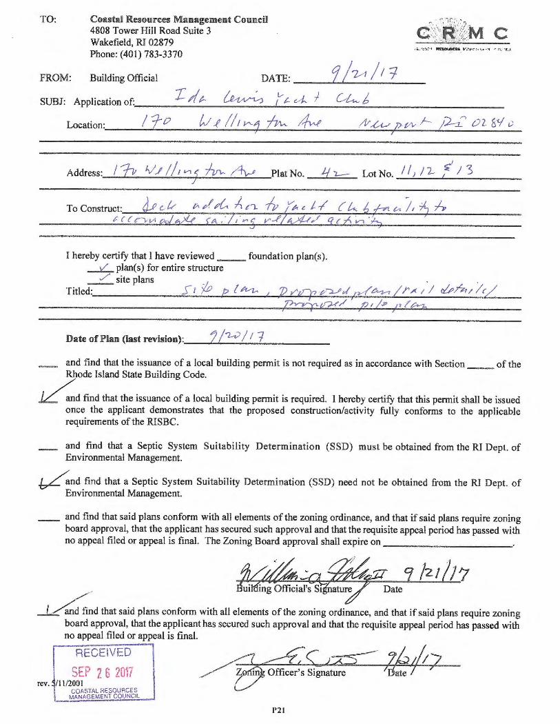
TO : Coasta l Resources Manage ment Council 4808 Tower Hill Road Suite 3 Wakefield, RI 02879 Phone : (401) 783-3370
FROM: Building Offic ial DATE : - --"'-9.._l~_t_/_l _i _ T 4t- /_ ' (Vt. J J C,ti..._ J SUBJ : Appl ication of:, ____ _ __ ~ _ __ _,,l., _ __ C/_;,... _ _ __ b _ _ _ _ _ __ ___ _
Location:. _ __ /_f'--o __ W_ -!_~_1/_,_Y'--+1-~'--- /r{w _____ _ /1/_£,v_-+;P""""-vv_ l--_.._Jh_ ,..,_ O_'l_W_ v_
Address:,__,.;./_p'- _1/_ /-..:../ :.../, _vi_..,.'l ..;;..~--- --/4,_p..--:; __ Plat No . j
I hereby certify that I have reviewed __ _ foundation plan(s ). __L plan(s) for entire structure
Lot No . I I J I 2- ~ / 3
~ site plans Titled:, ___ _____ s ___ , ..... P----ip---(_h,,-z,.._..,...,__,...,72 ..... r";_.q"-#-...:;.~-- "'--,,d ......... _~_ .... l _r_~_l_';_ (lj)_/4_ 1_!._· r~/ _ _
,'f?vrr;tf?!'/ / ? / fa> / ,, ~ M
Date of Plan (last r evision) :, _ _ ['-'-/ _"2-.;;>__;./_1_7.;__ ___ _
and find that the issuance of a local building permi t is not required as in accordance with Section _ of the Rhode Island State Building Code.
~d find that the issuance of a local building permit is required. I hereby cert ify that this permit shall be issued once the applicant demonstrates that the proposed constr uction/activity fully conforms to the applicable requirements of the RI SBC.
and find that a Septic System Suitabi lity Determination (SS D) must be obtained from the RI Dept . of Environmental Management.
~nd find that a Sept ic System Suitabili ty Determ ination (SSD) need not be obt ained from the RI Dept. of Environmental Management.
_ and find that said plans conform with all elements of the zoning ordinan ce, and that if said plans require zoning board approval, that the app licant has secure d such approval and that the requ isite appeal period has passed with no appeal filed or appeal is final. The Zoning Board approva l shall expire on __ ___ _ ____ _
,,,,.. uil ing Official's S1 ature Date
i ,/4find that said plans conform with all elements of the zoning ordinance, and that if said plans require zoning board approval , that the applican t has secured such approval and that the requisite appeal period has passed with
rev.
no appeal filed or appeal is fina l.
RECEIVED
SEP 2 6 2017 /ll/2001
COA STAL RESOURCES MANAGEMENT COUNC IL
/'"' <: ___ .---/4 ------,, )2 ::i t, Office r's Signature if/t:;_ 1 ate
P21
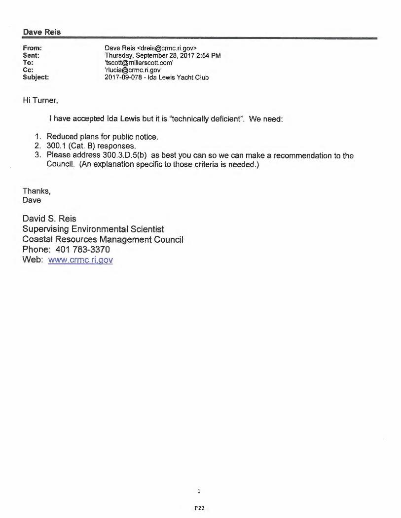
Dave Reis
From: Sent : To: Cc:
Dave Reis <dreis@crmc .ri.gov> Thursday, September 28, 2017 2:54 PM 'tscott@millerscott .com' '[email protected] .gov'
Subject : 2017-09-078 - Ida Lewis Yacht Club
Hi Turne r,
I have accepted Ida Lewis but it is "technically deficient". We need:
1. Reduced plans for public notice. 2. 300.1 (Cat. B) responses. 3. Please address 300.3 .D.5(b) as best you can so we can make a recommendation to the
Council. (An explanation specific to those criteria is needed.)
Thanks , Dave
David S. Reis Supervising Environmental Scientist Coastal Resources Management Council Phone: 401 783-3370 Web: www.crmc.ri.gov
1
P22
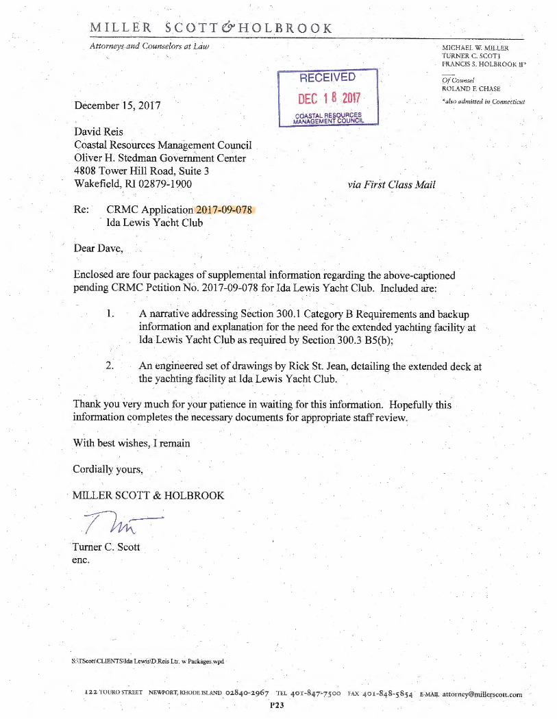
MILLER SCOTT& .H OLBROOK Auorneys and Counselors at Law
December 15, 2017
David Reis Goastal Resources Management Co~cil Olivei.H . Stedman Government Center 4808 Tower Hill Road, Suite 3 Wakefi,eld, RI 02879-1900
Re : CRMC Application 2017-09-078 Ida Lewis Yacht Club
Dear Dave,
RECEIVED
DEC 1 8 2017 COASTAL RESOURCES
MANAGEMENT COUNCIL
via First Class Mail
MICHAEL W. MILLER ·rtJRNER C. SCOT} FRANCIS S. HOLBROOK II"
()/Counsel ROLAND E CHASE
• also admitted in· Connectit ut
Enclosed are four packages of supplemental information regarding the above-captioned pending C~C Petition No. 2017-09-078 for Ida Lewis Yacht Club. Included are:
1. A .narrative addressing Section 300.1 Category B Reqµirements and backup information and explanation for the µeed for the extended yachting facility at Ida Lewis Yacht Club as.required by Section 300.3 85(b);
f.
2. An engineered set of drawings by Rick St. Jean, detailing the extended deck at the yachting facility at Ida Lewis Yacht Club. , ·
Thank you very much for your patience in waiting for this information. Hopefully this information completes the necessary documents for appropriate staff review ..
_Wit4 best wishes, .! remain
Cordially yours,
· MILLER SCOTT & HOLBROOK
Turner C. Scott enc.
S:ITScott\CLIENTSllda Lewis\D.ReisLtr. w Packages.wpd
I22 TOUROSTR EET NEWPORT, RHODEISLAND , 02840-2967 TEL 4or-847 s7500 !'AX 401 -848 -5.854 E-MAIJ, attomey@millcrscott,com
P23
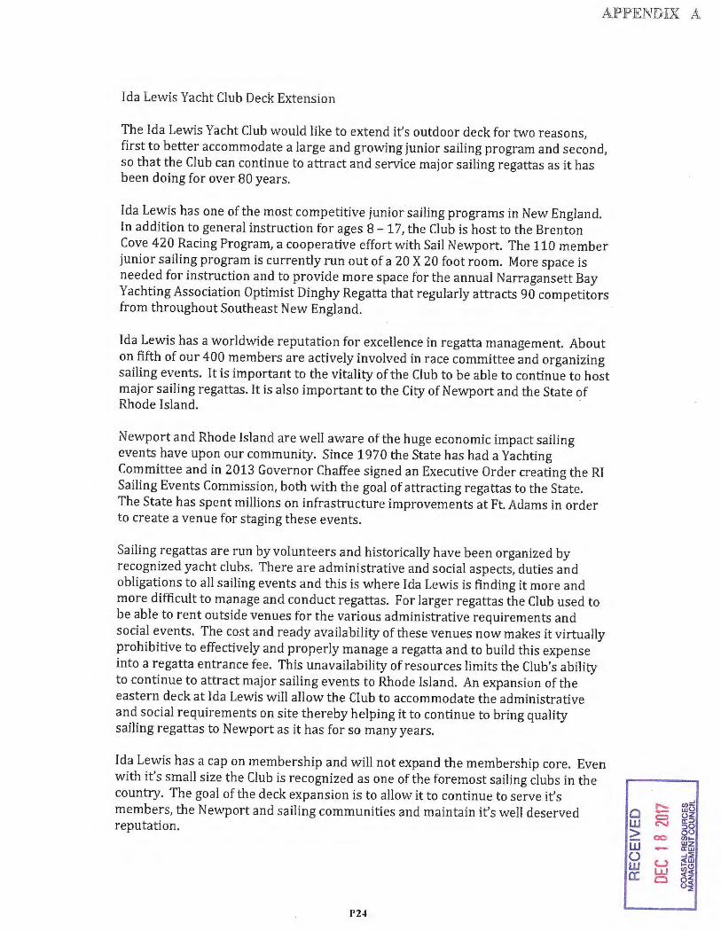
APPENDIX A
Ida Lewis Yacht Club Deck Extension
The Ida Lewis Yacht Club would like to extend it's outdoor deck for two reasons, first to better accommodate a large and growing junior sailing program and second, so that the Club can continue to attract and service major sailing regattas as it has been doing for over 80 years .
Ida Lewis has one of the most competitive junior sailing programs in New England. In addition to general instruction for ages 8 - 17, the Club is host to the Brenton Cove 420 Racing Program, a cooperative effort with Sail Newport. The 110 member junior sailing program is currently run out of a 20 X 20 foot room . More space is needed for instruction and to provide more space for the annual Narragansett Bay Yachting Association Optimist Dinghy Regatta that regularly attracts 90 competitors from throughout Southeast New England.
Ida Lewis has a worldwide reputation for excellence in regatta management. About on fifth of our 400 members are actively involved in race committee and organizing sailing events. It is important to the vitality of the Club to be able to continue to host major sailing regattas . It is also important to the City of Newport and the State of Rhode Island. ·
Newport and Rhode Island are well aware of the huge economic impact sailing events have upon our community. Since 1970 the State has had a Yachting Committee and in 2013 Governor Chaffee signed an Executive Order creating the RI Sailing Events Commission, both with the goal of attracting regattas to the State . The State has spent millions on infrastructure improvements at Ft Adams in order to create a venue for staging these events.
Sailing regattas are run by volunteers and historically have been organized by recognized yacht clubs. There are administrative and social aspects, duties and obligations to all sailing events and this is where Ida Lewis is finding it more and more difficult to manage and conduct regattas. For larger regattas the Club used to be able to rent outside venues for the various administrative requirements and social events. The cost and ready availability of these venues now makes it virtually prohibitive to effectively and properly manage a regatta and to build this expense into a regatta entrance fee. This unavailability ofresources limits the Club's ability to continue to attract major sailing events to Rhode Island . An expansion of the eastern deck at Ida Lewis will allow the Club to accommodate the administrative and social requirements on site thereby helping it to continue to bring quality sailing regattas to Newport as it has for so many years.
Ida Lewis has a cap on membership and will not expand the membership core. Even with it's small size the Club is recognized as one of the foremost sailing clubs in the country . The goal of the deck expansion is to allow it to continue to serve it's members, the Newport and sailing communities and maintain it's well deserved reputation .
P24
0 w > w () w a:
,..._ u,:! wO - oz c:::,
~ a:::> :::,0
00 Q(.) Ull-wz - a:w ..J::i,
u ~w L&J u,Cl
<~ 0 8~
APPENDIXB
December 13, 2017
Coastal Resources Management Council Oliver Stedman Government Center Wakefie ld, RI 02879-1900
Re: Ida Lewis Yacht Club; Proposed Deck Expansion, Newport Plat 42, Lot 11, 12 and I 3.
Dear Mr. Reis,
Please accept this revised letter as part of the Ida Lewis Deck Expansion Project. We received the engineering drawings after the initial submittal. In these drawings the engineer suggested drilling into the rock 5' -0" if required to place piles. The intent is to only drill 24" and pin the piles, in a few areas this may not be feasible. I have revised the "Description of Work" below.
The lighthouse at Lime Rocks was built in J 853 and incorporated as the Ida Lewis Yacht Club in 1928. Throughout the course of its history Ida Lewis Yacht Club (IL YC) has taught and developed young sailors and has hosted major sailing regattas. The intent of the proposed deck expansion is to provide much needed areas for the Junior Program and regattas hosted by TL YC.
ILYC is located in Newpo1t Harbor, the Club and surrounding waters are designated by CRMC as Type 3, High Intensity Boating waters. Due to the nature of the location there are limited locations for a deck expansion. Due to the topography, expandi11g to the North or South presents problems as the water depth is much greater. Because of this depth, it's not uncommon for tour boats or other mariners to come within 20-25 feet of the existing decks. Expanding on either of these sides pose constructability and safety issues. Locating the new deck on the Northeast side is preferred as it abuts the Junior Sailing Building , the area of land below this deck is accessib le duting low tides . A small deck extends 4' -1 O" from the NE side of the junior sailing building. The proposed new deck will align with the face of this existing deck, this allows for additional access into and out of the building. Cui,-ently, the existing deck is only accessible from the interior of the building. Creating this connection between the two allows for better utilization of this space and will improve young sailors movements into an out of the building. The new deck will extend 69' -5" in the East/Wes t direction , the same length as the existing. Expanding at this location allows for a single larger area that will accommodate groups of sailors who attend regattas.
Description of Work:
The existing decks on the No1th, West and South of the Club are typical deck construction, consisting of2x8 deck boards supported by 2x l O j oists and beams that span between piers. The proposed deck will be of the same construction and materials. The method for installing the piles will be to drill, using powered coring drills, 24" or 60" deep holes into solid rock. The location for these piles allow for work to be performed during low tide cycles. It is anticipated the drilling of these holes may take two weeks. Once drilled, a solid 2" diameter steel rod will be inse1ted and grouted into in place. Pearson fiberglass pi le covers will be installed over the rods , reinforcing bars installed and the hollow fiberglass column filled with concrete. The alternate method is to drill a 60" deep hole into the rock and install a timber pile. Once this work is complete, beams, joists, decking and rails can be installed. fLYC is a season club and is open from May until October. As to not dismpt activit ies for membe rs and those using Newport Harbor, the work will take place in the offseason, before Merno1ial Day or after Labor Day. The proposed method for
CHRISTOPHER W. ARNER, ARCHITECT I Washington Street, Newport, Rl 02840 t 40 1 .22:5.6497
P25
,..._ (I)• C - wt
c::::, 0• w "" cc:
> 00 8f (/)I-
w w ;;i - a:u (.) ..J:: w u ~~ cc LLJ (/),q
C ~:c o;
installing these piles will have the least impact on the surroundings. The work will have no impact on the public or navigable waters, equipment will be brought in by land and disassemb led at the end of the day. It anticipated that this project to take 2 months.
Thank you for taking the time review this application for the proposed deck expansion at Ida Lewis Yacht Club.
Please let me know if you have any questions.
Sincerely ,
Chr istopher W. Arner, Architect, AIA
0 w ~ w u w
CHRISTOPHER W. ARNER, ARCHITECT 1 Washington Street, Newport. RI 02840 t 401.225.6497 cc
P26
,..._ a,= - wO c::, oz c-...1 a::>
::>O
00 oo a,,-wz - a:w -'::::!: u .!W
LLJ 00
C ~~ 0~
SECTION 300.1 CATEGORY B and SECTION 300.3 B5(b) REQUIREMENTS FOR IDA LEWIS YACHT CLUB
CRMC FILE# 2017-09-078
1. The proposed project is an extension to the deck and sailing facility to Ida Lewis Yacht Club. Attached as Appendix A is an explanation prepared and approved by the Ida Lewis Yacht Club Board of Directors detailing the need for the proposed project.
2. The local building official has reviewed the proposed plans and signed the Building Official's form as attached to the application. The Newport Zoning Board of Review and the Newport Historic District Commission have reviewed and unanimously approved the proposed project. The Zoning Officer 's signature appears on the Building Official's form detailing that the plans conform with all elements of the zoning ordinance, that the Yacht Club secured approval from the Zoning Board of Review and Historic District Commission and the records and appeal period has passed with no appeal filed.
3. The proposed project is in Newport Harbor in an area designated as Type 3 Water, which area is identified as including intensely utilized water areas where recreational boating activities dominate and where the adjacent shorelines are developed as marinas, boatyards, and associated water-enhanced and water-dependant businesses.
4. The proposed activity will result in some minor temporary disturbance of the solid rock upon which the Ida Lewis Yacht Club clubhouse and sailing facility is already secured . The temporary disturbance due to drilling five feet into solid rock will be temporary. Shortly after the project is completed, the bottom, which is partially in the tidal flow area and partially outside of the tidal flow area will restore itself to the present conditions, which will not change the erosion or disposition process along the shore or in tidal waters.
5. Again, there will be some minor disturbance during construction , but the plant and wildlife will re-colonize shortly after construction is complete.
6. There is no public access to this location as the Ida Lewis Yacht Club owns Lime Rocks as the small island and adjoining rocks are commonly and historically known. The expansion of the deck area will greatly improve the Club's ability to host and attract sailing events and promote its junior sailing and yacht racing activities. Please see explanation in Appendix A.
7. The proposed deck will have 14" diameter piles spaced 11' on center. This insignificant displacement will not impede the natural flushing, sedimentation, turbidity, or water circulation characteristics in the area. Four ( 4) of the seven (7) proposed piles will be placed outside the mean highwater mark.
8. All of the materials and construction processes to be used during the project have been used throughout the state and have not caused any deterioration of the water quality elsewhere, therefore the water quality in this area will remain unchanged.
P27
Q w > w () w a:
"- (/)~ - wu c:, uz N a::>
:,Q
co OU <Ill-- wz a:w -1::;
u ;sw lJJ (/)(!)
0 0~ ui

9. There are no known areas of architectural significance other than the historic Ida Lewis Lighthouse on or adjacent to the site. The lighthouse at Lime Rocks was built in 1853 and incorporated as the Ida Lewis Yacht Club in 1928. The proposed dock extension does not impact the lighthouse structure, which the club has routinely maintained in excellent condition.
10. The proposed deck extension will be adjacent to an existing east side deck expanding briefly over the tidal waters at high tide. Due to rock outcroppings and the shallow depth at this location, there is no impact on or conflicts with water-dependant uses and activities such as recreational boating , fishing, swimming, navigation, and commerce.
11. The proposed deck is a minor addition to an existing deck which surrounds the lighthouse. The historic lighthouse will remain the focal point from the water and shore. Neither the existing deck, nor the proposed expansion, will impact or interfere with the familiar and pleasant massing and scale of the iconic Ida Lewis Lighthouse.
SECTION 300.3D5(b)
Requirements are addressed in Appendix A and a revised letter dated December 13, 2017 from the project architect and attached as Appendix B.
S:\TScott\CLIENTS\Ida Lewis\CRMC cat B.wpd
P28
Cl w > iii 0 w er
...... cn::J - wo c::, oz
"' a;::> :::>O
00 00 (1)1-- Wz a:w ...;:::;;
u ~IU
LU (/)Cl
0 g~ ()~
Ida lewis Yacht Club CRMC File# 2017-09-078
CRMC Section 300.3 D S(b)
(i) The deck is to accommodate a designated priority use for the water area.
The deck extension will abut an existing 20' X 20' junior sailing building and will align with the small deck off this building allowing for far better utilization of this area for junior sailing instruction . The additional space will also accommodate the admin istrative and social requireme nts on site for the numerous sailing regattas the Club hosts.
(ii) The applicant has examined all reasonable alternatives and the council has determined that the selected alternative is the most reasonable.
The Ida lewis Yacht Club is located on a small rock island in Newport Harbor. If the Club is to continue to have a strong junior sailing progra m and continue an eighty year history of hosting major sailing regattas there is no alternative except to expand its existing deck that surrounds the club house on three sides. Water depth off the west and north decks drops off quickly. The expansion of the deck on the east side is preferable as it will be over gravel and rock that is accessible at low tide and removed from any boating activity. It will also provide additional direct access to the junior sailing building.
(iii) The deck is the minimum necessary to support the priority use.
The width of the proposed deck extension is designed to tie in with the existing deck on the junior sailing buil ding. The length is the same as the existing deck on the east side on the main club house.
P29
Public Access Plan Proposal for the Ida Lewis Deck Extension
The Ida Lewis yacht Club, working with the Newport Harbor Master, Tim Mills, has an agreement with
the City of Newport to pay for the construction of a kayak rack in the Southeast corner of Newport
Harbor . The location of the rack will be the very east end of Kings Park, on the Newport Harbor Walk,
adjacent to the Wellington Resort. The rack will be the same as the existing rack maintained by the City
in the area of the Stone Pier, measuring approximately 36 feet in length and hold approximately 30
kayaks or other simple watercraft . The rack will be owned and maintained by the City of Newport.
Construction is expected to be completed by Memorial Day this year.
P30
RECEIVED
FEB 2 0 2018 COASTAL RESOURCES
MANAGEMENT COUtllCIL
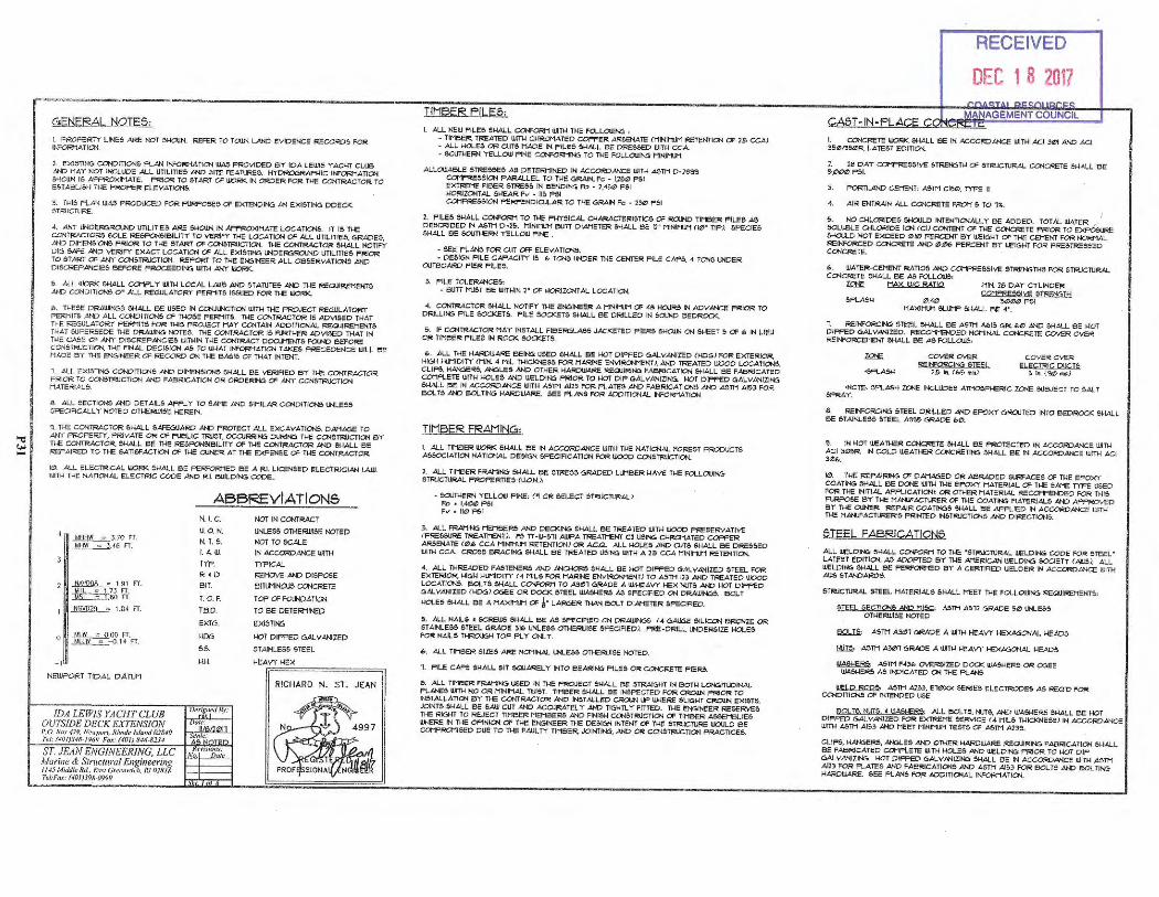
GENERAL NOTES,
I. FROFcRT Y LINES ARE NOT 5MCU.N.. REFER TO TOIJ.N.. LAND EVIDENCE RECORDS FOR lt>!'ORHATIC>l
2. EXISTlf-!G CONDITIONS R..AN n,..,:;Qr:f1ATION UJA5 PROV IDED BY IOA LEW15 YACHT CLUB AND HAY NOT INCLUDE AL L UTJLITJE5 .AND SITE FEATURES. HYOROGRAFHIC It-FORMATION 5HCUl,i 15 AFf'ROXIHATE. F'RIOR TO START CF WORK IN ORDER FOR TME CC><TRACTOR TO E&TABLIS~ r...ie PROPER E'LEVATIONS.
3. THIS PL AN WAS PRODUCED FOR RJRPOSES CF EXTENOINC, AN EXISTING DDECK $TR1.JCTURE.
4. ANY UNDERuROtND UTILIT IES ARE 61-lOl!N IN APPROXIMATE LOCATIC><S. IT 15 Tl-IE CCt ftRACTORS SOLE RESFGISIBILITY TO VERIFY THE LOCATION OF-ALL UllLITIES. GRADES, AND DIHENSICNS FRIO!< TO THE ST ART CF CONSTR!JCTIC><. THE CONTRACTOR 61-lALL NOTIFY Dlu SAFE AND VERIFY EXACT LOCAT IC>< CF AL L EXISTING UHDER6R0<1'1D UTILITIES PR10R TO ST ART CF ANY CONSTR1JCTIC><. REPORT TO THE EN61NEER AL L OBSERYATIOOS AND D ISCREPANc ll,5 BEFORE PROCEEDNc; WTH AN'r WORK.
S. ALL Uk)RJ< SHALL COHPL Y U,TH LOCAi. LAWS AND STATUTES AND THE REQJIREHENTS AND CONO/TloNS OF ALL REGULATORY FERNlT6 ISSUED FOR THE l1k:'.>RK
lb . THESE DRA IUNGS 61-lALL BE USED IN ~CTICN U!TH THE PROJECT RE6\JLATOl<T PE RMITS AND All_ CONOITIOOS CF T"GSE PERMITS. THE CONTRAC TOR 15 ADVISED TMAT TNE REGULATORY FEfcNITS FOR THIS P~JECT MAY CCNT AIN ADD ITIONAL f.?EQUIREMENTS Ti-lAT 6UPER5EDE TME DR,AlU/NG NOTES. Tl-IE C~ TRACTOR IS R.JRTl-lEfii! ADV1.5ED THAT IN THE CASE CF ANY Dl!lCREFANCIES WITl-!IN Tl-IE CONTRACT DOCt.NENTS FOUND BEFORE CON.STRJCTIOO, THE FINAL DECIS JCN A5 TO VJ-IAT INF~ATI~ TAKES FRECEDENCE WILL BE HADE B Y 'l'l-l!: l:.NG:INEER OF RECORD QN; THE BASl5 OF T14AT INTENT.
,. AL L E><ISTING COHDITIQ-t5 AND D 1NENe1a.:s SMALL 6E VEF?iflED BY' THE CONTRACTOR PR OR TO CONSTR1JCTION AND FABR ICATION OR ORDERING Of ANY CON5TRUCTIC>< MA TERI.AL.$.
8. ALL SEC TION$ )IND DETAILS AFPL Y TO SAHE .ANO S1Mll..AR CCINDITla-lS LNLESS SFECIFIC ALL 'T" NOTEO OTHEFal!SE HEREIN .
9. Tl-IE CONTRACTOR. SHALL 5AFE6\JARD AND PROTECT ALL EXCAVATIC><S. DAHA6E TO AN'T" FROFERTY, PRIVATE OR. Of RJ6LIC TRUST, OCQJRl<IN6 DURINu Tl-IE CC><STRUCTION 6Y THE Ga<TRACTOR. SMALL ee me RESPOOSIBILITY Of THE CONTRACTOR AND SI-IAI.L BE F<i:PAl~D TO THE SATISFACTION Cf' T...iE OlNER AT Tl-4E EXPENSE~ THE CONTRACTOR.
le>. AL L ELECTRICAi. WOl'K Sl-!AI.L 6E PERFOl'MED 6E A RJ. LICENSED ELECTRICIAN IAW. Ulln.4 rnE NATIONAL ELECTRIC CODE AND RI. SUILDI~ CODE.
~ 1.91 FT. J1~U .. _=..._J~ 7 J FT. ~.60FT
1 _!lfilW.!L...c; 1.04 FT.
- 1
~ .OOFT. ....Ml.Ll'L...:- 0.14 FT.
NEWPORT TIDAL DA1l.N
IDA LEWIS YACHT CLUB OUTSIDE DECK EXTENSION P.O. Jfo.Y 479. N,•U"po rl, Rhmle hloml 0] 840 l f.'l: (40/ )!146- /969 Far : (<ffl1J ,'t46-S:!34
sr JEAN ENGINEERING, LLC Marine & S1r11cwral Engineering I I.J5 Mi tMI,: Rd.. F.u1·1 Gn.:cnll'id1, RI OJ Rn ; 7'd1Fo:<: (,101)39S-0999
A66REVIATION5 N. I. C. NOT IN CCNTRAC T
u. 0 . N. N. T. S. I. AW .
TTP. R<D
BIT.
T. 0 . F.
T.B.D.
EXT6.
HOC.
5.5.
'1.H.
\H.ESS OTHERWISE NOTED
NOT TO SCALE IN ACCORDANCE WITH
T'T"PICAL
RENOYE AND DISPOSE
B IT\J11NOJS ca,ic;RETE
TOP Of F<X.NDATION
TO BE DETEF,?11NED
EXISTING
HOT Dlf'PED 6ALVANIZED
STAINLESS STEEL
HEAY'T" HEX
RICHARD N, ST. JEAN
TIH6ER F ILES:
L ALL NEW FILES SMALL CON1'0RH WITH TME FOI.LC'1JIN<: , - TIH6ER. TREATED WITl4 CMROHATED CCFFER ARSENATE (HINIHUH ~TENTION CF 25 CCAJ - ALL HOL.ES OR CUTS MADE. IN P ILES SHALL ee DRE~ED WITI-I CCA. - WUTHERN 'T"ELLOW FINE =<FCl'MING TO THE FOLLOIUNG HINIHUH
ALLOWAeu: $TRE~ES AS DETERM INED tN ACCORDANCE ll.llTl1 ASTH D-2B'.:!19 COHFRESS IC>< PARALLEL TO THE GRAIN. Fe - 1)50 PSI EXT,..,HE FIBER snoess IN BENDING Fb - 2,450 PSI l<ORIZOOT Al. SHEAR. Fv - 11, PSI cct1PRE55ION PERPENDICULAR TO Tl-le GRAIN Fe - '130 PSI
2. P ILES SHALL Ca<FOl'M TO THE PH'T"51CAI. CHARACTERISTICS OF RotND TIMBER FILES AS DESCRIBED IN AS-n1 0- 2~. N JNINJM eurr DIAMETER 51-4ALL BE 12· MINIHlN (k?>4 j jp). SPECIES 51-lAI.L BE 50UTHERN 'T"ELLOW POSE .
- SEE PLANS FOR CUT OFF ELEVATIOOS. - DESIGN PILE CAPACITY 15 6 T°"S UNDER THE CENTER F ILE CAPS. 4 TONS l.t<DER
OUTBOAAD PIER. P ILES .
3. P ILE TOLERANCES, - BUTT MU£,T 6E wmm ,. CF HORIZONTAL LOCATION.
4. Ga<TRACTOR SMALL NOTIF'T" THE ENu lNEER A HINll"U1 CF 48 HOURS IN ADVANCE PRIOR TO DRILL IN6 PILE SOCKETS. PILE SOCKETS SHALL. BE DRILLED IN 50L>lD BEDROCK.
S. IF CCNTRACTOR MAY INSTALL FIBE~A$5 JACKETED FfCRS 5MCUN ON SHEE'!' 5, CF b IN LIEU OR TINBER. PILES IN ROCK SOCKETS.
b. ALL Tl4E MARDWARE 6EIN6 USED 51-<ALL BE HOT DIFFED 6AI.YANIZED (flDG JFOR EXTERIOR, HIGM .....,IDITY CHIN. 4 MIL TMICl<NESS FOR MARINE ENYIRCN1ENTJ, AND TREATED WOOD LOCATIOOS. CLIP&, MANC:rERS, ~LES ANO OTJ4ER I-IARDWAfc'.E REQJIRJN6 FABRICATICN S>MALI... SE FA6R ICATED COMPLETE ~TM HOLES ANO WELD IN6 PRIOR TO HOT D IP 6ALVANIZING. HOT DIPPED 6ALVANIZING SMALL !SE IN ACCORDANCE Wlrn AS1H Al23 FOR Pl.ATES A\ID FABRICATIONS AND A5TM Al53 FOR 60L TS AND BOl. TINu HAADWARE. SEE PLANS FOR ADDITICNAL INFORMATIC><.
TIH6ER FRAMING:
I. ALL TIMBER WORK 61-!AI.L eE IN ACCORDANCE WITH THE NATl""AI. FOREST PRODUCTS ASSOCIATIOO NATlalAL DESIGN SPECIFICATIOO FOR WOOD COOS1l'i1JCTICN.
2. ALL TIHeER FRAMING SMALL BE STRESS GRADED LUH6ER 1-!AYE THE FOLLOWIN6 9T~RAL PROPERTIE~ (U.ON. );
- SOUTHERN YELLOW PINE, (~ OR SELECT STRUCTURAL! Fb • 1,400 PS I Fv • 110 PSI
3. ALL ffiAHINu HEM6ERS AND DECKING SMALL 6E TREATED IUTl4 WOOD l"l<fSERVATIYE (PRESSURE TflEATHENTJs FS TT-W-'1 1 AUPA TREATMENT Cl USI¼ CMROHATED COFF ER ARSENATE (01, CCA HINiM.11 RETENTION) OR AC,D._ All "OLES AND CUTS SMALL eE DflESSED WITM CCA CROSS BRACING S..,ALL BE TREATED USING WITM A 2.S CCA HINll"'U1 RETENTICN.
<. ALL THflEADED FASTENERS AND ANC"ORS 61-lAI.L BE HOT D IPPED GALVAN IZED STEEL FOR EXTERIOR. HIGH MUHIDITY (4 MILS FOR HAR"1E ENYIROOHENTJ TO ASTH 123 AND TREATED WOOD LOCATIOOS. 60L TS SMALL CONFOl'M TO .4301 GRADE A WIHEAY'T" HEX i'llTS AND HOT DIPPED G ALVANIZED <1-ID6) 06EE OR DOCK STEEL WASHERS AS SPECIFIED 00 DRAWINuS. BOLT
HOLES S~ALL BE A t1A><IM.t1 CR i• LARGER "T'l4.AN BOLT DIAMETER SPECIFIED.
5. ALL NAILS .t SCREWS SMALL BE AS &F'EC!FIED CN O~N6S ( -4 '7.Alk:.E SILICON BRQ.UE OR STAINLESS STEEL 6RADE 316 UNlE5S OTHERWISE SPECIFIED >. PRE-DRILL ~D ERSIZE "OLES FOR NAILS TMRO.J::",H TOP PLY ONLY.
b. Al l TIM6ER SIZES ARE NCMINAL l.NLESS OTHE~SE NOTED.
1. FILE CAPS SHALL SIT SQUAREL 'T" INTO 6EARINu PILES OR ca<CRETE FIERS .
.&. ALL TINBe"f': FRANrN:S USED IN TME ~ Jeer SMALL 6 E STRAIGHT IN eon., LONCslnJOINAI... FlA'-€9 l1KTH NO OR MINIMAL ruJIST. TINeER SHALL BE INSFECTED FOR CRC)UN PRIOR TO INSTALLATION BT TME CONTRACTOR AND INSTALLED~ Uf' llJ..ifiRE .$L16MT CROll.N EXISTS. JOINTS SHALL BE SAW CUT AND ACCURATELY AND Tl6MTL Y FITTED. THE t!NGINEER RESERVES me RIGHT TO REJECT TIM6ER MEMBERS AND FINISl-l CCN.5Tfa.JCTla.l OF TIMBER A5SEHBLIES WME~ IN THE OFINIOO a, THE ENulNEER THE DESIGN INTENT Cf' THE STRICTURE WOJLD ee COMPROMISED DUE TO THE FAUL TT TIMBER. JOINTIN6, AND OR. CONSTialCTICN PRACTICES.
RECEIVED
DEC 1 8 2017
CAST-IN-
I. CONcRETE WO""' SMALL 6E IN ACCORDANCE 111TH ACl 3<Zil AND ACI 350l3S0R, LATEST EDITICN.
2. ,a DAT Cet'1PRE551V1:: &TREN:::sTH OF 5Tf.!.Jen.JR.AL CONCRETE s.4ALL BE SP<')0 F51.
J.. PORTLAND CEMENT , ASTH CIS0 . TYPE If
4-. AlR ENTRAIN ALL CONCRETE FRON S TO 1%.
5. NO CHLORIDES SHOULD INTENTIC><ALL 'T" BE ADDED . TOTAi. WATER , SOL!J8L E CMLORIDE ION (Cl) COOTENT Of THE CC><CRETE PRIOR TO EXPOSURE 6MOULD NOT EXCEED <ZIJ0 PERCENT 6Y UJEIGl-{T OF THE CEMENT FOR N0@'1A L REINFORCED COOCRETE AND 0U PERCENT BY WEIGl<T FOR F~STflESSED CONCRETE.
6 . WATER-CEMENT RATIOS AND COHPRE551YE STRENGTH5 FOR 5TRUCTURAL COOCRETE SHALL BE AS FOLLOWS, ~ NAX W/C RAI!Q
5PLASH
MIN. 28 DAY CYLINOER C0MffiES:5IYE STREN@H
0.40 ~ PSI HAXIHUH SLUMP SMALL SE 4".
1. R.l:INFORCING STEEL SHALL 6E ASTH A615 GR 60 AND SHALL BE HOT DIPPED 6ALVArNIZED. fi!E"cott1a,.lOED NCMINAL CQ,IC~TE COYER OVER ~INFORCEMENT SHALL !!IE AS FOLLOWS,
COVER OVER BE1l£08C1Nu STEEL..
1.5 In. (.:i>S IMIJ
CO YER 0¥£:R El.~
3 In. (<;Y.Z> m,n}
•NOTE, 5q___AS+4 ZONE INCLUOCS ATMOSPHERIC ZO'>lE elJBJEC:T ro SALT SFRAY .
8. REINFORCINu STEEL DR.ILLED AND EPOXY GR.OUTED INTO BEDROCK 51-!AL L 8E 6T A!NLESS &TEEL AS9& GRADE 60 .
~- !N MOT WEATHER. CONCRETE SHALL BE PROTECTED IN ACCORDANCE UJTH AC I 30,R IN COL D WEATl-!ER COOCRETING SHALL ee IN ACCORDANCE 11.!TH ACI 306 .
10. TME REFAIR1N6 OF DAMAGED OR ABRADED 51.ll'ifACES Of THE EPOXY COATING $-+ALL BE DCNE WtTM fl.IE EPOXT" HATERIAL ClF THE SA.NE TTFE USED ?CIR TME INITIAL AFPllCATk;Nt. OR OTHER MATERIAL RECOMMENDED FOR THIS PURPOSE 6'T" THE MANUFACfURER CF THE COATINu HATERJAl.5 AND AFFROvE D BY T~ OJ.NER p.!f:PAIR COATIN65 S~ALL ee AFPL IEO IN .ACCORDANCE Win-I TI-IE NAH.JFACTURER'S PRINTED IN£ilf.!ICTI~ ANO DIReCTIC:t,!S .
STEEL FABRICATIONS
ALL WELD1N6 SHALL ~ TO THE •sTFa.JCTIJRAL WELDING CODE FOR STEEL• l-ATEST EDITIOO, AS ADOPTED BY THE AMERICAN WELDIN6 SOCIETY / AWSJ. ALL U.IELOIN6 $MALL eE FE~FMED 8Y A CERTIFIEO I.Llc:LDER IN. ACCORDANCE Win-I AWS 5TANDAADS .
STRUCTURAL STEEL MATERIALS SHALL MEET THE FOLLaLINu flEQJ IREMENTS,
STEEL SECTIQSS ANp Hrsc~ MlM A512 GRADE 5-0 ~LESS OT>JE1'1l11SE NOTED
~ A5TH A301 GRADE A WITH HEAY'T" HEXAGONAi. HEADS
~ ASTH A~0 1 GRADE A WITH HEAY'I" 1-!EXAGoNAI. HEADS
~ ASTH F,3i, OVERSIZED DOCK WASMER$ O R OSEE WASHERS AS INDICATED 00 THE PLANS
~: ASTN A233, Elctl:XX SER.IES ELECTRODES AS foi'EQ'O FDR. cctvlTICtU; ~ IN:TENDEO USE
BOLTS MJTS .. WASHERS: ALL SOLTS, NUTS, ANO UJA~E~ SHALL ee MOT D IFPEO 6ALYANIZEO ~ f:'><Tf.!EHE .&ERYICE (,4 NILS T~lc:KNE58 ) IN ACCORDANCE il.ftll-1 AS'TN AI.S.3 AND MEET HINM..N TEST& Cf' A5TN ABS.
CLIFS . HANGSR5. ANGLES AND OTHER 1-!ARDWARE REQJ lRING FABRJCA TICN SMALL 6E FABRICATED COMPLETE WITH "OLES AND WELDIN<= PRIOR TO HOT D IP 6Al.VAN IZ~ ~T DIF'FED 6ALVAN.IZING SHALL BE IN ACCORDANCE u.llTH A5 TJ1 Al23 FOR PLATES AND FA6RICATION5 AND ASTH Alo3 FOR 60L T5 AND 60L TING ~ARDWARE. SEE PLANS FOR ADDITIOOAL INFO!'MAT ICN.
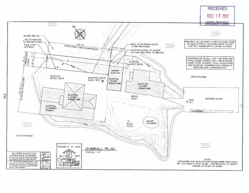
WATER 6ELOW
IDA LEWIS YACHT CLUB OUTSIDE DECK EXTENSION P.O. 8().t 479, N~uywrl, Rho<le l'flaml 01810 .fol: (40 1) ,'f.Jti- 1969 F.if: {401) M~8l14
EXISTING WOOD DECK
N
®
EXISTING DECK ELEV . S.52' "0
·/-i
/
RECEIVED
DEC t 8 2017
PROJECT 15 LOCATED IN FEMA FLOOD ZONE VE , ELEVATION 13 (NAVD88) FEMA FLOOD MAP NO . 4412>12>5Cl2>111J, DATED S/4/212>13
CONTRA CTOR SHALL VISI T THE SITE AND FAMILIARIZE HIMSELF WITH THE EXISTING CONDITIONS, ACCESS , TIDAL CONDITIONS AND EXI STING CONSTRUCTION PRIOR TO
BIDDING AND CONSTRUCTION .
TYPE JI WATERS
TACK O SET
WOODEN DOCK
NOTE, CONTOURS AND ELEVATIONS SHOUN WERE PROVIDED e,y IPA LEWIS 'T' ACH T CLU6. CONTRACTOR TO VERIFY
PRIOR TO START OF WORK.
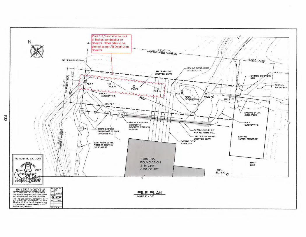
N
®
/
RICHARD N. ST. JEAN .
LINE a DECK FACE
Piles 1.2,3 and 4 to be rock drilled as per detail 3 on Sheet 5. Other piles to be pinned as per Alt Detail 3 on Sheet 5.
EXIS TING FOUNDATION 2-STOR'r STRUCTURE
FILE FLAN SCALE, i ' • l'-0 '
/
EXISTING 1-STORI' STl=ilJCTU~
BRICK WALK
EXISTING WOOPDECK
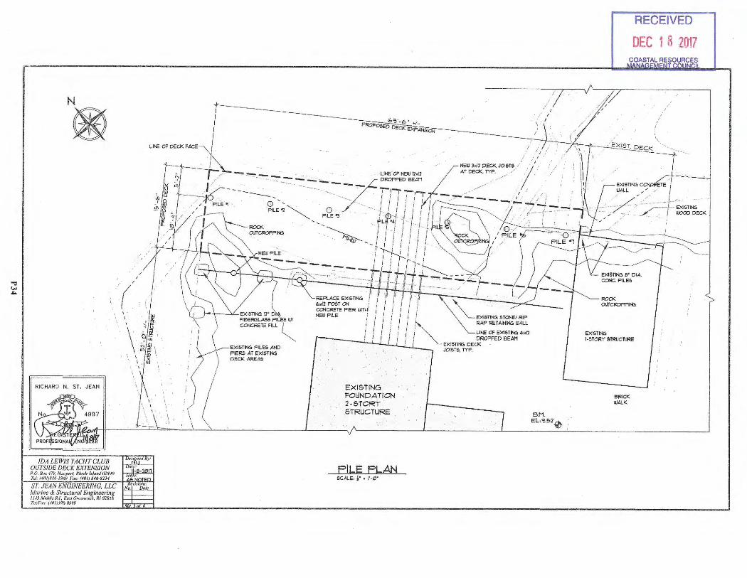
N
®
RICHARD N. ST. JEAN
oJ?s1J5'i W!S_Yf ~HT CLUB Po.11 ... ,. 479 £~CK EXTENSION J'd: (4(1/J,f.16-JY6r? mu1tl~ /.rlw"I OU.Jn ST J '"" r,o" s,6.s1J,
· EAN ENGINEER Morine & Str ING, LLC I us Mid,lle RI. 1f/1w·al Eugineerin , n,111•',u: (JOJJ)9s:~~
9~r-\•e1111·id1. RI 078l~
PILE PLAN SCALE, i' , I'-~'
/ /
!3M. EL'3.!:>2 0
RECEIVED
DEC 1 8 2017
ROCK OUTCROFPll'I:;
EXISTING 1-~TOF<Y s=ruf<E
BRICK WALK
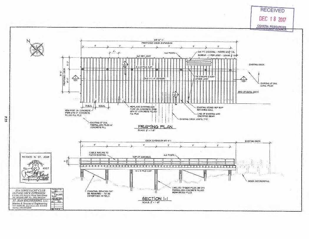
RICHARD N. ST. JEAN
!DA LEWIS YACHT CLUB OUTSIDE DECK EXTENSION P.O. B(tx 479, N.:••11i>rt. Rf1()(}c h'Jnm/02840 Tel; (40/JS.Jri-1969 Fa,·: (40JJIN6-82J4
~ !!l
69'-<!,' •!-
PROPOSED DECK EXPANSION II' II' II' II'
"' "-u w Q
0 !ll ,..
I ~
~ 4', ~ 4x4 POSTS 'I 'I 3xl1 RIM JOIST - -
Ti - -
11 II 1111 ll X l PILE CAP
.. • - I I II •
I Ill~ ~ · 3xl2 • l'-4" CENTERS
~
'
II' II'
T DECKJNG FASTEN W/3!' S.& /xbP.. • . SCREWS - 7 PE!< JOIST - LEAVE !• GAF> - - -..
II II II II II II IIG 11 ;J
..• _,
I\ 111111 TIE STl<APS EVERY OTHERJOl&T
I/
RECEIVED
DEC 1 8 2017 COASTAL RESOURCES
EXISTING DECK
~\1 \§I EXIS TING 8' DIA
c. PILES CON
,. ! ' ' !i.:: I END Cf' EXTG. DECK
'
I )11
I EQUAL EQUAL
OST ON ~CRETE _j NEWP PIER FILLED
WITH 11" CONCRETE F.G. PILE
~EXISTING fl ' DIA FIBE!<6LAilS PILE& W/ CONCRETE FILL
11'
I II\ I
II'
j I i i
l I i i~ ' ! ! ' ~ t ..: ' •. :~-..
,· . ., i i i I i .. RER.ACE EXISTING b~ll j I ! I EXISTING STONE/ RIP RAP
POST ON CONCRETE 'i'IE!f i I j RETAINING, WALL WITH 12" CONCRETE Fl~LEp j ! ~ LINE Cf' EXISTING bXll F.G. PILE j i I
I i i , · DROPPED BEAM
i i i I . : EXl&TING DECK JOISTS, T-rP. ; ; i '
FRAMING FLAN SCALE, ~· • 1'·0 "
DECK EXTENSION &9 '-b",
II' II' II' II'
~t-~ ,,
~---r,r,r-------rmr-;:;-~=-rrrn------.mr=-----.-m1;r------.;n,-, , r
BE REQUIRED - TO BE DETEl<t11NED IN FIELD
' .'. ~/ 1 ,, .. , ... / · ·11
, .>z DRILLED TM:: · ~L~~-~ 14"~ .. I .,< FIBEFIGLAilS CONCRETE FILLED
REINFORCED PILES
SECTION 1-1 SCALE, !" • l'-0 '
EXISTll'G DECK
., I:
,,.... i
\= · OJT~ING
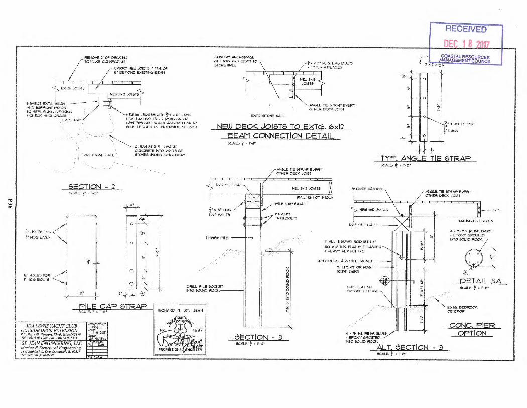
REMOVE 7' OF DECKING TO MAKE ~ECTION
CARRY NEW JOISTS A MIN. Of 12' BEYOND EXISTING BEAM
INSPECT EXT6. EAM -----.-----1 AND SUPPORT PRIOR .. v·· TO REPLACING DE.CKIN6 : • ..
\ ~NEW 3x LEDGER WITH ¾"• x 6" LONG HD6 LAG ElOLTS • 2 ROlJS ON 24" CENTERS OR I ROW STAGGERED ON 12" SNUG LEDGER TO ll-lDER51DE OF JOIST
, CHECK ANCHORAGE I '· \ EXTU . 0x12 :
i\ •• co: : ... ~ CLEAN STONE , PACK
J" HOLES FOR
l" HD6 LAGS
1¼• HOLES FOR I' l•DG SOL TS
/ E><TG. STONE WALL '
5ECTION - 2 SCALE, j• • 1'-0 "
~-
CONCRETE INTO VOIDS Of STONES LINDER EXTG. BEAM
A-""" "' 0
-p
0
".' "' -
0 :fi
CONFIRM ANCHORAGE OF EXT6. 6xll BEAM TO STONE WALL
EXTG. STONE WALL
j•o x 3" HDG. LAG BOLTS • TYP. • 4 PLACES
ANGLE TIE STRAP EVERY OTHER DECK JOIST
NEW DECK JOl5T5 TO EXTG. ~xl2 SEAM CONNECTION PET AIL SCALE, j• • l'-12>'
r:x ..;.., +-
0
"' 0
"'
2.,,..-'r-
_,j, 11·
•4
~
RECEIVED
DEC 18 0 COASTAL RESOURCES ANAGEMENT COUNCIL
ii" ,o HOLES FOR
!• LA65
TYP. ANGLE TIE 5TRAP
¾· x 5' HOO. LAG BOLTS
TIMBER PILE
,:"'":"··_-;·
,:
ANGLE TIE STRAP EVER Y OTHER DECK JOIST
NEW Jxll JOIST&
RAILING NOT SHOWN
1/P ILE CAP STRAP
SCALE, 1j• • l'·o?/"
I"• OGEE WASHER
I' • A301 i!l:::==:lb-7 THRU BOLTS
./,
··,
I
I" ALL-THREAD ROD WITH 4 '
SQ. x j• T>K FLAT FLT. WA&HER • HEAVY f.lEX NJT TCB
14"• FIBERGLASS PILE JACKET
'5> EPOXY CR HDG ___ ,._II REINF. BARS
~LE TIE STRAP EVERY OTHER DECK JOIST
3xl2
RAILING NOT &1-lOWN
4 • '5> 5.5. REINF. BARS • EPOX Y 6i<OUTED MO~a 1!
. . ';:f,. I
DETAIL 3A DRILL PILE =T CHIP FLAT ON
EXPOSED LEDGE SCALE, j• • 1'·0 '
INTO SOUND ROCK-----' 2" ,j,
FILE CAP 5TRAP _...JSC.__A,..LE"', -"',,"-,-,.:::, .0"-,'--'-'--_.,,c..!..i.....::::......:.__ __ II RICHARD N. ST. JEAN
!DA LEWIS YACHT CLUB OUTSIDE DECK EXTENSION f>,O. Rfl. t 479, N~up()rt. Rli"de Mu11<1018./(J Tc:/: (40JJ!N6-l9ti9 Fat: (40/J .''46-82.14 SECTION - 3
SCALE, j• • 1'·<2>"
4 · '5 5.5. REIN". BARS / • EPOXY GROUTED ~ INTO SOLID ROCK
-i "'-EXT6 . BEDROCK OUTCROP
CONC. FIER OPT ION
ALT. SECTION - 3 &cAl-E, j• • l'-12>"
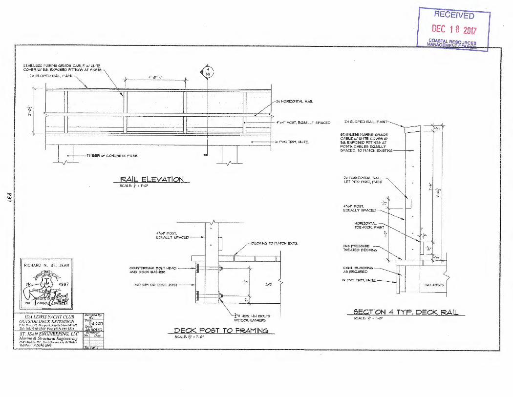
STAINLESS MAR INE GRADE CABLE wl \I.I-UTE COYER WI 5.5. EXPOSED FITIINGS AT F05T5.
2X SLOPED RAIL, FA INT
TIMBER or CONCRETE FILES
RICHARD N. ST. JEAN
IDA LEWIS YACHT CLUB OUTSIDE DECK EXTENSION
RAIL ELEVATION SCALE, j• • 1'·0 '
4"x4" POST. EQUALL '!' SF ACED
COUNTERSUNK eot.T HEAD -ANO DOCK WASHER
3xl2 RIM OR EDGE JOIST --
4
2x HORIZONTAL RAIL
!-----+ - 4'><4" POST, EQUALLY SPACED
• I "' I
DECKING TO MATCH EXTG.
3x12
~"~ HOG. H.H. OOL TS W/OOCK WASHERS
P. 0. Hn:,· 479, N,.,1q10rf, Rh(ide /)'Im)(/ 02840 Td: (4lJJJ846-l9 69 Fu..i : (40/J IH6-81J4 DECK POST TO FRAMINCEs
SCALE, 1j• , 1'·0 '
2X SLOPED RAIL, FAINT
STAINLESS MAR INE GRADE CABLE wl ~ITE COY!:R WI 5.5. EXPOSED FITIIN65 AT POSTS. CABLES EQUALLY SPACED , TO MATCH EXISTING- -+--"'
2x HORIZONTAL RAIL LET INTO POST, FAINT
4"x4" POST, EGIUALL Y SPACED
HORIZONTAL TOE•KICJ<, FAINT
2xe FRE5SURE TREATED DECKING
CONT. BLOCKING: AS REQUIRED
IX FVC T!<IM, \U-IITE.
I"
RECEIVED
DEC 1 8 2017
3xl2 JOISTS
SECT ION 4 TYF. DECK RA IL SCALE, ~· • 1'·0 '
Dave Reis
From: Sent : To: Cc: Subject: Attachments:
Hi Dave,
gary. h. [email protected] Wednesday, February 07, 2018 8:34 AM [email protected] [email protected] Ida Lewis Yacht Club Deck Extens ion Ida Lewis Yacht ClubCRMC File.docx
Attached are responses to the specific criteria requested in CRMC section 300.3 D S{b). Hopefully this is the format that you need. If not, please let me know and I will redo it or add to it . l tried to keep this brief as the need for the extension and reasons for the location have been addressed in additional correspondence that has been provided to you. Gary
Gary H. Lash First Vice President - Investment Officer The Yalanis/Lash Wealth Management Group of Wells Fargo Adviso rs Gary.La sh@well sfargoadvisors.com 21 John Clarke Road Middletown RI 02842 Office: 401-848-9949 Toll Free: 888-848-9738 Fax : 401-847-0329
ATTENTION : THIS E-MAIL MAY BE AN ADVERTISEMENT OR SOLICITATION FOR PRODUCTS AND SERVICES . To unsubscribe from marketing e-mails from :
o An individual Wells Fargo Advisors financial advisor: Reply to one of his/her e-mails and type "Unsubscri be" in the subject line. o Wells Fargo and its affi liates: Unsubscribe at www.wellsfargoadvisors.com/unsubscri be.
Neither of these actions will affect deliv ery of important service messag es regardi ng your accounts that we may need to send you or preferences you may have previous ly set for other e-mail serv ices.
For additio nal infonnation regarding our electronic communication policies , visit http://we llsfargoadvisors.com/disclosures/ema il-disclosure.html .
Wells Fargo Advisors , LLC is a separate nonbank affiliate of Welts Fargo & Company , Member FINRA/SIPC . 1 North Jefferson, St. Louis , MO 63103
j 0 ~~, Virus-free. www.avq.com
1
P38
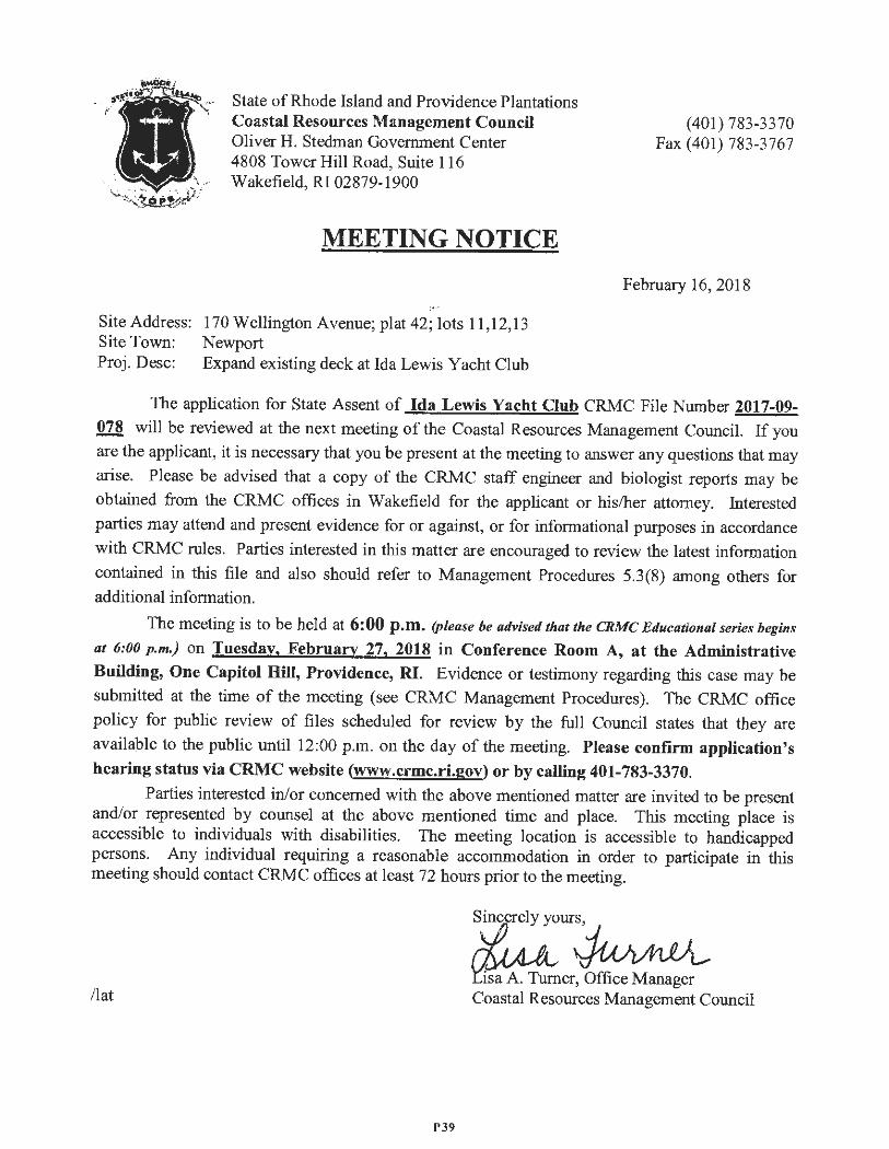
State of Rhode Island and Providence Plantations Coastal Resources Management Coun cil Oliver H. Stedman Government Center 4808 Tower Hill Road, Suite I 16 Wakefield, RI 02879-1900
MEETING NOTICE
(401) 783-3370 Fax (401) 783-3767
February 16, 2018
Site Address: 170 Wellington Avenue; plat 42; lots 11,12,13 Site Town: Newport Proj . Desc: Expand existing deck at Ida Lewis Yacht Club
The application for State Assent of Ida Lewis Yacht Club CRMC File Number 2017-09-078 will be reviewed at the next meeting of the Coastal Resources Management Council. If you
are the applicant, it is necessary that you be present at the meeting to answer any questions that may
arise. Please be advised that a copy of the CRMC staff engineer and biologist reports may be
obtained from the CRMC offices in Wakefield for the applicant or his/her attorney. Interested
parties may attend and present evidence for or against , or for informational purposes in accordance
with CRMC rules. Parties interested in this matter are encouraged to review the latest information
contained in this file and also should refer to Management Procedures 5.3(8) among others for additional information .
The meeting is to be held at 6:00 p.m. (please be advised that the CRMC Educational series begins
at 6:00 p.m.) on Tuesday, February 27, 2018 in Conference Room A, at the Administrative Building, One Capitol Hill, Providence, RI. Evidence or testimony regarding this case may be
submitted at the time of the meeting (see CRMC Management Procedures). The CRMC office
policy for public review of files scheduled for review by the full Council states that they are
available to the public until 12:00 p.m. on the day of the meeting. Please confirm application's hearing status via CRMC website (www.crmc.ri.gov) or by calling 401-783-3370 .
Parties interested in/or concerned with the above mentioned matter are invited to be present and/or represented by counsel at the above mentioned time and place. This meeting place is accessible to individuals with disabilities. The meeting location is accessible to handicapped persons. Any individual requiring a reasonable accommodation in order to participate in this meeting should contact CRMC offices at least 72 hours prior to the meeting.
/lat
Sincerely yours,
~fil~
Coastal Resources Management Council
P39
Mailing List for CRMC File No. 2017-09-078 Ida Lewis Yacht Club
Ida Lewis Yacht Club c/o Turner Scott 122 Touro Street Newport, RI 02840
Ida Lewis Yacht Club 1 70 Wellington Ave Newport , RI 02840
Halidon House Partners, LLC c/o Compass Management PO Box 684 Newport , RI 02840
Harbor Watch LLC PO Box 682 Newport, RI 02840
City of Newport Newport City Hall 43 Broadway Newport, RI 02840
CRMC (20 17-09-078) 0. S. Government Center 4808 Tower Hill Road, Rm 116 Wakefield, RI 02879
P40
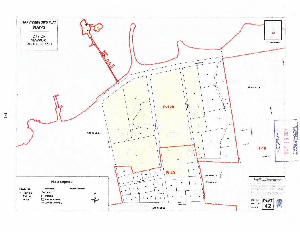
-= ~
TAX ASSESSOR'S PLAT PLAT42
CITY OF NEWPORT
RHODE ISLAND
Map Legend
~ ·' > Highways
- Railroad
water
Boildings
Parce ls
D Parcels
D Plat 42 Parcels
e,,i , Zoning Boundary
Histor ic District
N
+ -<I#"~ ~
SEE PLAT41
0
Location Inset
_---1 --- ___ .. _, __ ... ____ ... __ ... ____. ... -
\
.. \\ • ,,. .. ,.w,.,.........--...1.
t j
.. ........,._ ... ,8"',..~-·-........ ..
"
SEE PLAT 39
\ i
i ~1.\.~c• ,i;
' <; 0 ti::: ..J (J)u
wz fi?::, :,0 oo <ni-
~~ C'
J w (:) > ....
R-10
¢!:P'HC" "'" '"'
UJ () .w a:
Ric':'' I PLAT I m Newpoff G!S ~ May20 16 42 G l S
o wz a:w .... ::. <UJ 1-(.!) en< 'l"-1 U
( !) (52 {)~
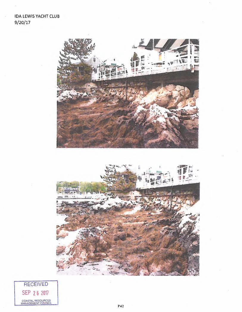
RECEIVED
SEP 2 6 2017 COASTAL RE MANAGEMENfOUACtiS COUNCIL
P42
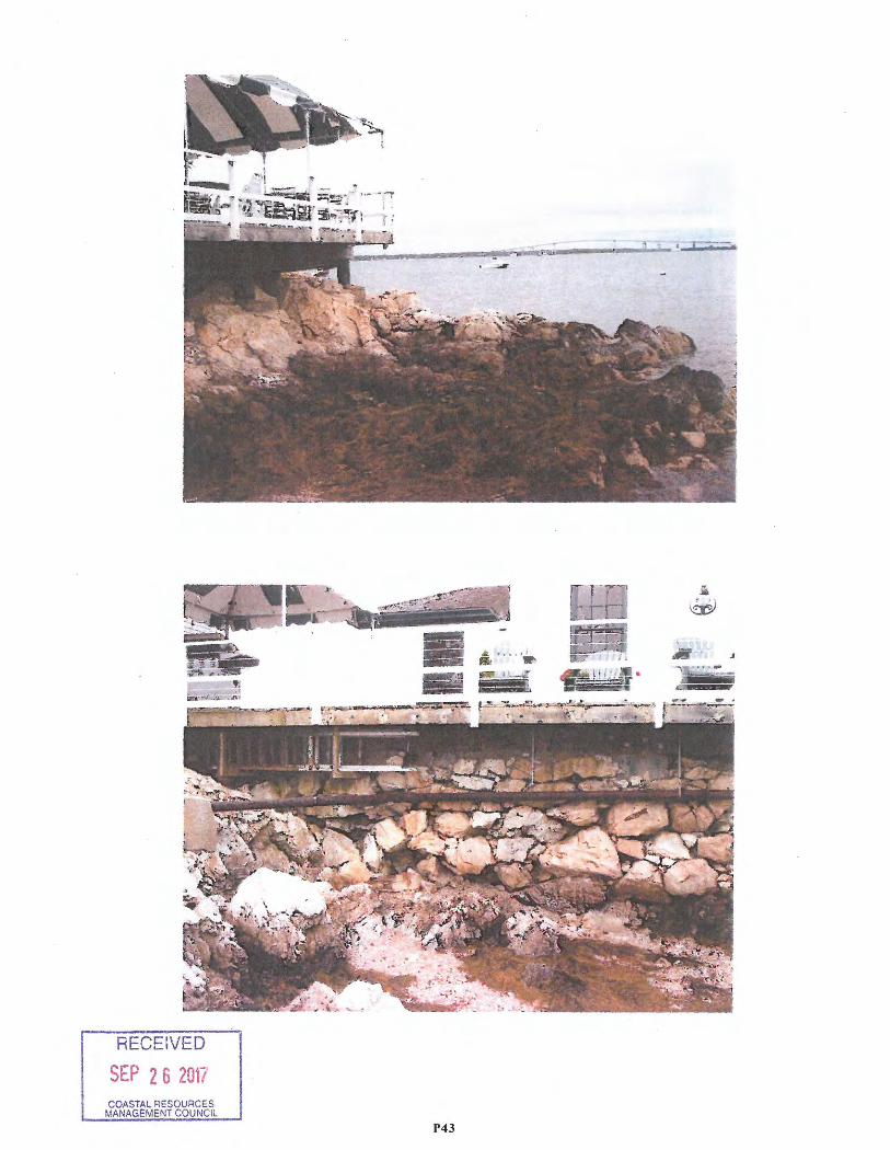
RECEIVED
SEP 2 6 2017
P43
a . . . . •'r.' • 8/i! , : ~
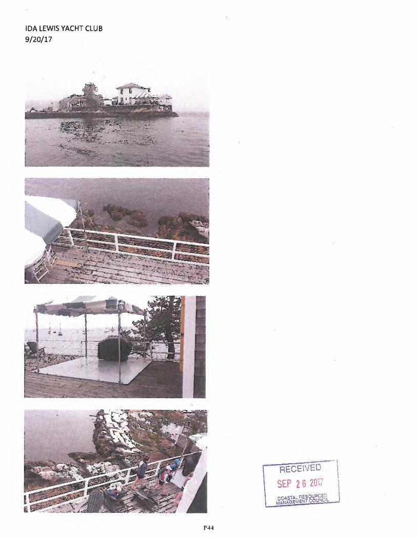
IDA LEWIS YACHT CLUB
9/20/17
RECEIVED
SEP 2 G 2or, URGES
COASTAL ne~~iouNClL MANAGEM
• I
I
\
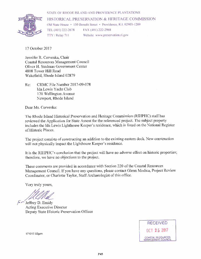
STATl--, OF RHODE ISLAND AND PROVIDENCE PLANTATIO N S
HISTORICAL PRESERVATION & HERJTAGE COMMISSION
Old State !--louse • l 50 Benefit Street • Providence , R.1. 02903 -1209
TEL ( 40 I) 222-2678 FAX ( 40 I) 222-2968
·ny ; Relay 711 Website www .prcservation.ri .gov
17 October 2017
Jennifer R. Cervenka, Chair Coastal Resources Management Counci l Oliver H. Stedman Government Center 4808 Tower Hill Road Wakefield, Rhode Island 02879
Re: CRMC File Number 2017-09-078 Ida Lewi s Yacht Club 1 70 Wellington A venue Newport , Rhode Island
Dear Ms. Cervenka:
The Rhode Island Historical Preserva tion and Heritage Commission (RIHPHC) staff has reviewed the Application for State Assent for the referenced project. The subject property includes the Ida Lewis Lighthouse Keeper's reside nce, which is listed on the Nationa l Register of Historic Places.
The project consists of constructing an addition to the existing eastern deck. New construction will not physically impact the Lighthouse Keeper's residence.
It is the RIHPHC's conclusion that the project will have no adverse effect on historic properties; therefore, we have no objections to the project.
These comments are provided in accordance with Section 220 of the Coastal Resources Management Council. If you have any questions , please contact Glenn Modica, Project Review Coordinator, or Charlotte Taylor , Staff Archaeologist of this office.
Very truly yours,
~~ fr- Jeffrey D. Emidy
Acting Executive Director Deputy State Historic Preservation Officer
171017.02grm
P45
RECEIVED
OCT 2 5 2017
COASTAL RESOURCES MAN.t.GEMENT COUNCIL
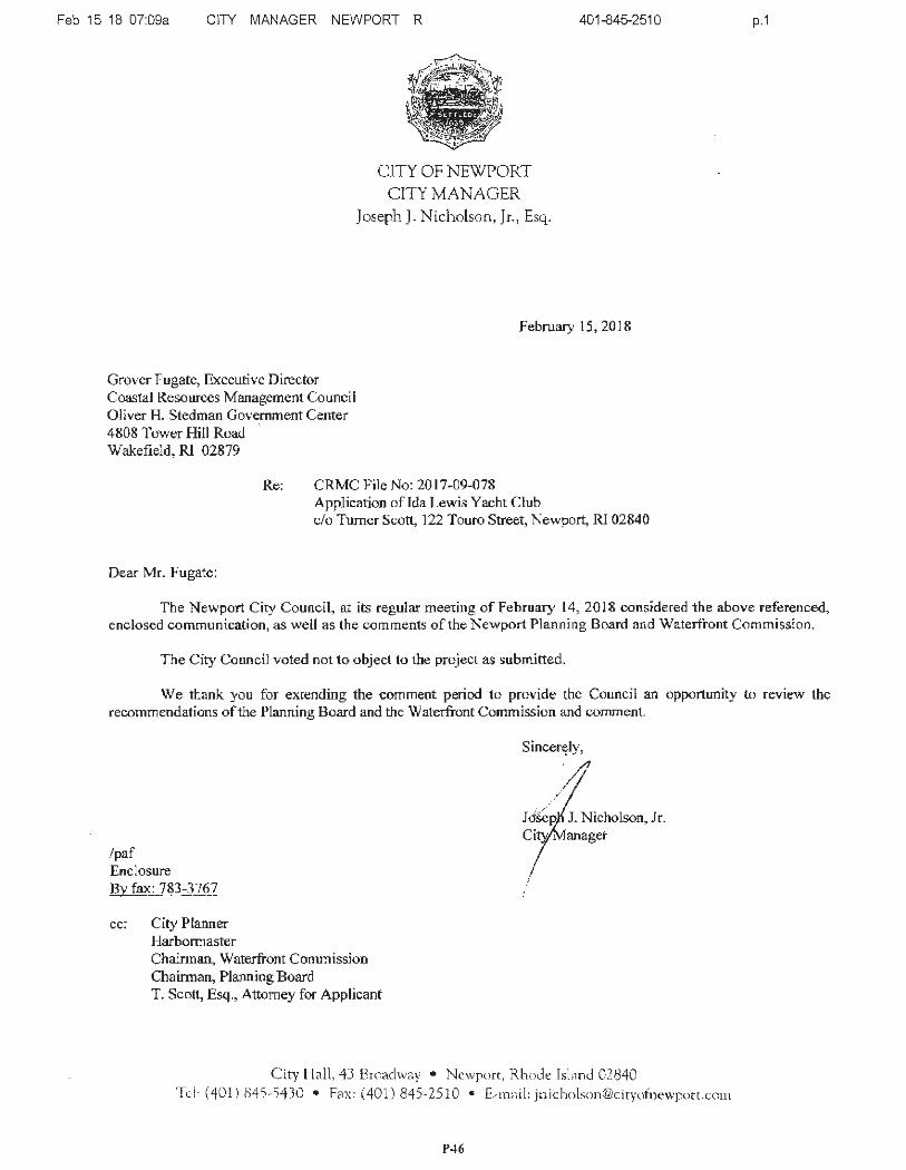
Feb 15 18 07:09a CITY MANAGER NEWPORT R
CITY OF NEWPORT CITY MANAGER
Joseph J. Nicholson, Jr., Esq.
401-845-2510
February 15, 2018
Grover Fugate, Executive Director Coastal Resources Management Council Oliver H. Stedman Government Center 4808 Tower Hill Road Wakefield, Rl 02879
Dear Mr. Fugate:
Re: CRMC File No: 20 17-09-078 Application oflda Lewis Yacht Club c/o Turner Scott, 122 Touro Street, Newport, Rl 02840
p.1
The Newport City Council, at its regular meeting of February 14, 2018 considered the above referenced, enclosed communication, as well as the comments of the Newport Planning Board and Waterfront Commission.
The City Counc il voted not to object to the project as submitted.
We thank you for extending the comment period to provide the Council an opportunity to review the recommendations of the Planning Board and the Waterfront Comm ission and comment.
/paf Enclosure By fax: 783-3767
cc: City Planner Harbonnaster Chairman, Waterfront Commission Chainnan, Plann ing Board T. Scott, Esq., Attorney for Applicant
Sincerf?ly,
>1 .,
J. Nicholson, Jr .
City Hall, 43 Broadway • Newport, Rhode Isl,m<l 02840 Tel: (401) 845 - 5430 • Fax : (40 1) 845-2510 • E-m,1il: jnic ho [email protected]
P46

2017-11-054 McINNIS USA, INC.
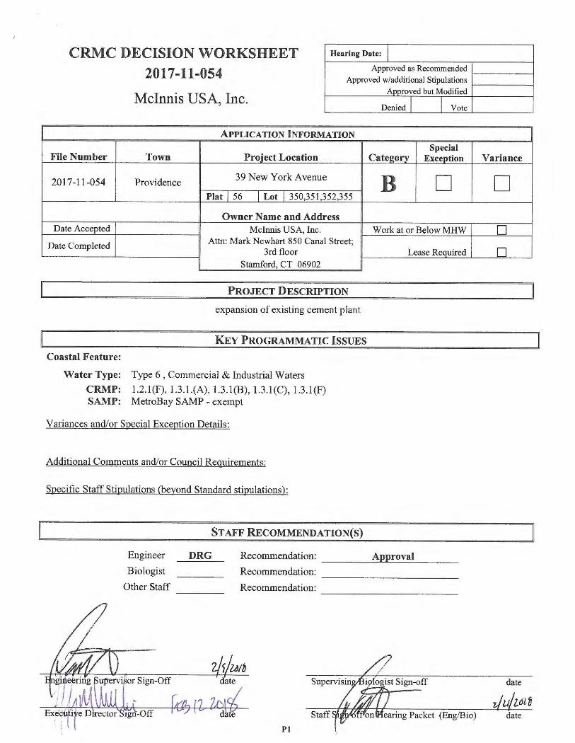
CRMC DECISION WORKSHEET 2017-11-054
Hearing Date: j
Approved as Recommended Approved w/additional Stipulations
Mcinnis USA, Inc.
APPLICATION INFORMATION
File Number Town Proiect Location
2017-11-054 Providence 39 New York A venue
Plat I 56 I Lot I 350,351,352,355
Owner Name and Address Date Accepted Mcinnis USA, Inc.
Date Completed Attn: Mark Newhart 850 Canal Street; 3rd floor
Stamford, CT 06902
PROJECT DESCRIPTION
expansion of existing cement plant
KEY PROGRAMMATIC ISSUES
Coastal Feature:
Water Type: Type 6, Commercial & Industrial Waters
CRMP: 1.2.l(F), 1.3.1.(A), 1.3.l(B) , 1.3.l(C) , 1.3.l(F) SAMP: MetroBay SAMP - exempt
Variances and/or Special Exception Details:
Additional Comments and/or Council Requireme nts:
Specific Staff Stipulations (beyond Standard stipulations):
STAFF RECOMMEND A TION(S)
Anoroved but Modified
Denied I I Vote
Special Cate2orv Exception
B D
Work at or Below MHW
Lease Required
Engineer
Biologi st
Other Staff
DRG Recommendation: __ ___ A_.p_.p_r...c..o_va_l _ _ _ _
Recommendation: --- - -- ---- -Recommendation: --- --- - - -- -
Pl
Variance
D
D
D
date
date
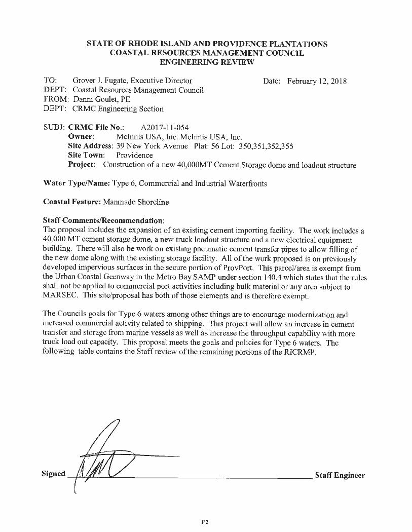
STATE OF RHODE ISLAND AND PROVIDENCE PLANTATIONS COASTAL RESOURCES MANAGEMENT COUNCIL
ENGINEERING REVIEW
TO: Grover J. Fugate, Executive Director DEPT: Coastal Resources Management Council FROM: Danni Goulet, PE DEPT : CRMC Engineering Section
SUBJ: CRMC File No.: A2017-11-054 Owner: Mcinnis USA, Inc. Mcinnis USA, Inc.
Date: February 12, 2018
Site Address: 39 New York Avenue Plat : 56 Lot: 350,351,352,355 Site Town: Providence Project: Construction of a new 40,000MT Cement Storage dome and loadout structure
Water Type/Name: Type 6, Commercial and Industrial Waterfronts
Coastal Feature: Manmade Shoreline
Staff Comments/Recommendation: The proposal includes the expansion of an existing cement importing facility. The work includes a 40,000 MT cement storage dome, a new truck loadout structure and a new electrical equipment building. There will also be work on existing pneumatic cement transfer pipes to allow filling of the new dome along with the existing storage facility. All of the work proposed is on previously developed impervious surfaces in the secure portion of ProvPort. This parcel/area is exempt from the Urban Coastal Geenway in the Metro Bay SAMP under section 140.4 which states that the rules shall not be applied to commercial port activities including bulk material or any area subject to MARSEC. This site/proposal has both of those elements and is therefore exempt.
The Councils goals for Type 6 waters among other things are to encourage modernization and increased commercial activity related to shipping. This project will allow an increase in cement transfer and storage from marine vessels as well as increase the throughput capability with more truck load out capacity. This proposal meets the goals and policies for Type 6 waters. The following table contains the Staff review of the remaining portions of the RICRMP .
P2
CRMC File Number 2017-11-054
Section Section Title Staff Review Comments Number
1.1.10 Climate Change and Sea Level The proposed structures are above the FEMA flood zone. The Rise structures are lower than 1954 huricane Carol water surface
elevations, however the structures will be impacted with 1 ' -2' feet of water. The proposed structures appear to be able to resume operations quickly after this modest level of flooding of non-critical portions. The proposal is for cement handling and loading, not a volatile material. It is staffs opinion that the proposal is appropriate for this area and meets the polices for this section of the RICRMP.
1.2.l(F) Type 6 Industrial Waterfronts and This proposed expansion of an existing bulk cement marine Commercial Navigation Channels terminal meets the policies for Type 6 water which is to support
modernization and increased commercial activity related to shipping.
1.3.l(A) Category B Requirements The applicant provided complete responses for this section of the RICRMP. It is the opinion of Staff that the responses provided meet the requirements of the program .
1.3.l(B) Filling , Removing, or Grading of The work proposed is set back form coastal feature more than Shoreline Features 200 feet. There is earthwork that will require excavation and
import of fill material but according to the information provided the total volume of materia l is less than 10,000 cubic yards.
1.3.l(C) Residential, Commercial, The proposal is to expand an existing load out facility for the Industrial, and Recreational cement import terminal. This will allow for increased load out Structures capacity . The facility has been designed to have critical
elements be above the FEMA flood elevation for this location. It is the opinion of staff that this proposed facility and the applicants response to the policies and standards of this section of the RICRMP has been met.
1.3.l( F) Treatment of Sewage and The applicant is working with RIDEM Offices of Waste Storm water Management and Wate r Resource s to insure that the proposed
storm water system meets the requirements of the storm water manual but in also in compliance with the land use restrictions of this industrial site . At the time of the report , the final plan was not yet determined, however a stipulation requiring this permit will satisfy the RICRMP and is in keeping with past practices for sites similar to this .
It is the opinion of the staff engineer that the proposal meets the requirements of the RICRMP and approval is recommended with the typical stipulations and a specific stipulation requiring RIDEM approval of the storm water plan prior to any work.
P3
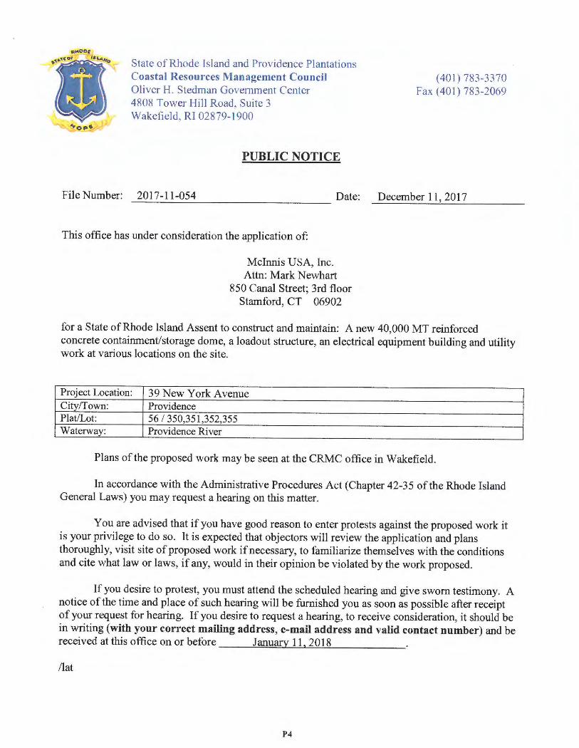
...
~ ·
State of Rhode Island and Providence Plantations Coastal Resources Management Council Oliver H. Stedman Government Cente r 4808 Tower Hill Road , Suite 3 Wakefield , RI 02879 -1900
PUBLIC NOTICE
( 401) 783-33 70 Fax(401)783-2069
File Number: 2017 -11-054 Date: December 11, 2017 ----------------
This office has under consideration the application of :
Mcinnis USA, Inc. Attn: Mark Newhart
850 Canal Street; 3rd floor Stamford, CT 06902
for a State of Rhode Island Assent to construct and maintain: A new 40,000 MT reinforced concrete containment/storage dome, a loadout structure , an electrical equipment building and utility work at various locations on the site.
Project Location: 39 New York Avenue City ff own: Providence Plat/Lot: 56 I 350,351,352,355 Waterway: Providence River
Plan s of the proposed work may be seen at the CRMC office in Wakefield.
In accordance with the Administrative Procedures Act (Chapter 42-35 of the Rhode Island General Laws) you may request a hearing on this matter.
You are advised that if you have good reason to enter protests against the proposed work it is your privilege to do so. It is expected that objectors will review the application and plans thoroughly, visit site of proposed work if necessary, to familiarize themse lves with the conditions and cite what law or laws, if any, would in their opinion be violated by the work proposed.
If you desire to protest, you must attend the scheduled hearing and give sworn testimony . A notice of the time and place of such hearing will be furnished you as soon as possible after receipt of your request for hearing. If you desire to request a hearing, to receive consideration , it should be in writing (with your correct mailing address , e-mail address and valid contact number) and be received at this office on or before January 11, 2018
/lat
P4
STATE OF RHODE ISLAND AND PROVIDENCE PLANTATIONS
HISTORICAL PRESERVATION & HERITAGE COMMISSION Old State House • 150 Benefit Street • Providence , R.l. 02903-1209
TEL (401) 222-2678
1TY / Relay 711
FAX (401) 222-2968
Website www.preservation.ri.gov
Jennifer R. Cervenka, Chair Coastal Resources Management Council Oliver H. Stedman Government Center 4808 Tower Hill Road Wakefield, Rhode Island 02879
CRMC File Number: )? It - 1 t .- oS"'f
Applicant: ~L-..-:J u..sl>,
Town:
Response Date:
Dear Ms. Cervenka:
The Rhode Island Historical Preservation and Heritage Commission (RJHPHC) staff has reviewed the above-referenced project. It is our conclusion that this project will have no effect on any significant cultural resources (those listed on or eligible for listing on the National Register of Historic Places).
These comments are provided in accordance with Section 220 of the Coastal Resources Management Council. If you have any questions, please contact Glenn Modica, Project Review Coordinator, or Charlotte Taylor, archaeologist, at this office.
(~ '· ¼ %-J Jeffrey Emidy Acting Executive Director, RIHPHC
---· ...--::\ R---=-Er-C\V\'.=D \\ ..._,,_. ·-
11 DEC 05 2.0'7 I
--,cf ,U"CES \ _ L ·- ~\ .-; i;' _n !~-:!L....-_.!
• , . .,. .._! __ ~ .....
PS
0 FUSS&O'NEILL
3 17 Iron Horse Way
Suite 204
Prov idence . RI
02908
t 401.861.3070
800.286.2469
f 401.861.3076
www.fa nd o .c om
Conn ectic ut
Massach usetts
Rhode Island
South Caronna
February 6, 2018
Mr. Dan Goulet, PE Coastal Resources Management Council
4808 Tower Hill Road Wakefield, RI 02879
RE: Assent Application - Respon se to Comments Mclnni s USA Tenninal Expan sion
Plat 56, Lots 350, 351,352, and 355 Providence , RI 02905
Dear Mr. Goulet:
On beha lf of Mclnnis USA, Fuss & O 'Neill has prepared this response to comment s letter in support of the Assent application for site improvem ents at the above referenced prope rty. The
respon ses in thi s letter reference the 2017 edition of the RICRMC Red Book, as you requested, while the original Assent Narrative references the 2012 edition that was in effect at the time of the application submi ssion. Our respon ses are detailed below.
1. Please specificaf!y address Section 1.3.1 (A) - Category B R equirements.
Res po nse : In accordan ce with Table lA, for an Industri al Activity in the 200-foot Area Contiguous to Shoreline Features , meeting the requirements of Footno te 3, a Category "A"
review may be permitted. We believed the proposed pro ject and application met the Table
l A requirements and did not specifically addre ss each topic outlined in Section 1.3.1 (A). As requested, Section 1.3.l (A) Category B requirements are addressed below:
a. D emonstrate the need for the proposed aaiviry or alteration;
The prop osed proj ect is an expansion of a water-dependen t, receiving and distribution cement terminal facility operated by Mclnnis USA for which Assent A2015-12-050 was granted.
\ \pri vate\d fs\ ProjectData\P 1995\9 5441\ C13\De liverables\ Civil\ CRMC Assent\R espon se to Comments\C RMC Assent Respon se to Commen ts_20180206.docx
P6
fJ FUSS&O'NEILL
Mr. Dan Goulet, PE February 6, 2018
Page2
b. Demonstrate that all applicable local zoning ordinances, building codes, flood hazard standards, and all safe!J codes, fire codes, and environmental requirements have or will be met; local approvals are required for
activities as specifical!J prescribed for nontidal portions of a prqject in§§ 1.3.1 (B), (C), (F), {H), (I), (K), (M), (0) and (Q) of this Part;for projects on state and, the state building official, for the purposes of this section, is the building official,·
The proposed project has been, or is in the process of being reviewed by, the
Department of Inspections and Standards, Planning and Development, Public Works, Environmental Management, and Waste Management. The project has
received Master Plan and Preliminary Plan approval by the Providence City Plan
Commission on October 17, 2017 (application #1 7-046). Application for Final Plan approva l, which will be issued administratively by the Planning Department ,
may not be issued until state permits are issued by CRMC and RIDEM . 111e building permit may not be issued until state permits are issued by CRMC and RID EM. The requirements of Sections 1.3.1 (B), (C), and (F) are addressed below .
c. Describe the boundaries of the coastal waters and land area that is anticipated to be affected;
The 3.1 acre limit of work is located entirely within previously developed,
in1pervious areas of the Port of Providen ce. The area currently consists of
bituminous concrete pavement and a loadout structure. No work is proposed
within the adjacent coastal waters .
d. Demonstrate that the alteration or activity will not result in significant inrpacts on erosion and/ or deposition processes along the shore and in tidal waters;
The limit of disturbance is located entirely within previously developed, in1pervious areas of the Port of Providence. Erodible soils \\<-ill not be exposed
within the 200-foot contiguous area of tl1e receiving waters, and the existing
coastal feature (i.e. bulkhead) will not be disturbed. A Soil Erosion and Sediment
Control Plan has been prepared to mitigate ilie potential of erosion and sediment deposition during construction. The site will be permanentl y stabilized as a result of building construction , pavement reconstruction, stone pervious areas, and the
installation of a surface stormwater treatment system.
e. Demonstrate that the alteration or activiry will not result in significant impacts on the abundance and diversiry of plant and animal life;
The limit of disturbance is located entirely within previousl y developed,
in1pervious areas of the Port of Providence. There is currently no vegetation or
habitat within or adjacent to the project area.
\ \priva te\dfs\ProjectData\P1995\95441 \C13\Deliverables\ Civil\C RMC Assent\R esponse to Comments\CRMC Assent Response to Com ments_20180206.docx Corres.
P7
IJ FUSS&O'NEILL
Mr. Dan Goulet, PE Febru ary 6, 2018
Page3
j Demonstrate that the alteration will not unreasonab/y inteifere with, impair, or significant/y impact existing public access to, or use of, tidal waters and/ or the shore;
The limit of disturbance is located entirely within the Port of Providence, an area
where there is no open public access due to U.S. Homeland Security and Coast Gu ard safety and security requirement s. No work is proposed that would alter or restrict public access to tidal waters.
g. Demonstrate that the alteration will not result in significant impacts to water circulation, flushing,
turbidity, and sedimentation;
No work is proposed within tidal waters or to the coastal feature. Eros ion and
sediment controls will be implemented in accord ance with the Gener al Permit for
the Rhode Island Discharge Elimination System (RIPDES) Stormwater Discharge Associated with Construction Activity, and site-specific Soil Erosion and Sediment Control Plan, in order to mitigate the risk of impacts to receiving waters. In
addition, the project will incorporate stormwater treatment measures and a
reduction in overall imperviou sness focused on improving water quality in stormwater discharges to the Providence River.
h. Demonstrate that there will be no significant deterioration in the quality of the water in the immediate vicinity as defined f?y DEM;
Structural stormwater management practice s are proposed to prov ide treatment of
stormwater runoff, and low-impact developme nt strategies are utilized to reduc e
pollutant loads discharged from the site, including reducing the site's
impervio usness. The stormwater management approach has been designed in accordance with the Rhode Island Stormwater Design and Installation Standards Manua l.
i. Demonstrate that the alteration or activi.ty will not result in significant impacts to areas of historic and archaeological significance;
The site is not located within the vicinity of any areas of historic or archaeologica l
significance.
j. Demonstrate that the alteration or activi.ty will not result in significant conflicts with water dependent uses and activities such as recreational boating, fishing, swimming, navigation, and commerce, and;
The proposed use is water-depen dent and relies upon access to the navigation
channel in the Providence River for the transport of the applicant's bulk products . Alteration s to the coasta l feature or tidal waters are not propo sed as part of this
project. The applicant will continu e to utilize the existing berth for unloading cargo, which is consistent with primary use s of Type 6 waters.
\ \privatc\dfs\ ProjectData\P1995\9544 1\C13\Deliverab les\Civjl\CRMC Assent\Response to Conunents\ CRMC Assent Response to Comments_20180206.docx Corres.
PS
fJ FUSS&O,NEILL
Mr. Dan Goulet, PE February 6, 2018
Page4
k. Demonstrate that measures have been taken to minimize a,ry adverse scenic impact (see §1.3.5 of this Pan).
The limit of disturbance is located entirely within the Port of Providence, an
industrial , artificial waterfront bordering a Type 6 water. In accordance with Section 1.3.5, proposed site improvements , including containment storage dome ,
loadout structure, and accessory utility improveme nts, are con sistent with uses of
surrounding sites and Type 6 waters. No work is propo sed within tidal waters or
to the coastal feature.
2. Please specifical/y address Section 1.3.1 (B) - Filling, removing, or grading of shoreline features.
Response: The proposal is consistent with Section 1.3.1 (B) with respect to excavation and
grading activities. The Port of Providence within the vicinity of the project is a manmade
bulkhead , which defines the shoreline feature. The prope rty leased by Mcinnis USA,
located on Lots 350,35 1, 352, and 355, is within the 200-foot area contiguous to the
shoreline feature. However , no grading is proposed within 250 feet of the bulkhead. Propo sed grading within the limit of disturbance will result in minor changes in finish
grade elevation (approximately 0.5 feet) to promote drainage towards storm drain inlets
and storrnwater treatment areas. In accordance with Section 1.3.1 (B)(l ), all grading and earthwork activities will be conducted in accordance with the Rho de Island Soil Erosion
and Sediment Control Handbook, site-specific Soil Eros ion and Sediment Contro l Plan,
and Section 1.3.1 (B)(3)a.
Wbile earthwork activities (excavation, filling, grading) will be condu cted on site, total imp ort and export of soil materials from the site will be less than 10,000 cubic yards. Excavated soil will be reused as fill within the containment storage dome to the maximum
extent practicable. Although the limit of work is 3 .1 acres, only 1.4 acres will be disturbed
to expose erodible surface s. The remaining 1.7 acres consists of staging areas and pavement that will be milled and overlaid with asphalt pavement . The project limit of
disturban ce is not located within or adjacent to an area of historic or archaeological
significance (Section 1.3.1 (B)(l )f).
\ \p rivate\ dfs\ ProjectData\Pl 995\95441\C13\Deliverables\Civi l\CRMC Assent\Response to Comments\C RMC Assent. Response to Comments_20180206.docx Corres.
P9
fJ FUSS&O'NEILL
Mr. Dan Goulet, PE February 6, 2018
Page 5
3. Please specijical/y address Section 1.3.1 (CJ- Residential, Commercial, Industrial, and Recreational Structures.
Response: As required by Sections 1.3.1 (C)(a), (b) and (e), a letter from the building official has been included in Appendix C of the Assent Narrative. The project is currently under review by the Department of Inspections and Standards. We understand the
building permit is ready to be issued upon receipt of state permit s from RIDEM and CRMC.
Public access, which is a requirement of the Metro Bay SAMP and Urban Coastal Greenway standards, is not permitted within the Port of Providence due to U.S.
Department of Homeland Security and Coast Guard safety and security requirements.
The latest FEMA FIRM was also included with the application. Portions of tl1e project's limit of disturbance are within Flood Zone AE, special flood hazard area inundated by the
1-percent-annual-chance flood event, with base flood elevation 12 feet (NA VD 1988). As
required by Section 1.3.1 (C)(6), proposed structures have been designed in accordance with the Rhode Island State Building Code. The lowest floor of the dome and electrical building
structures are above elevation 12, as depicted on the Grading and Drainage Plan, Sheet 160.00. Additionally, the lowest floor of tl1e loadout structure will be elevated above the flood elevation.
Existing sanitary sewer and water services will continue to be utilized for the proposed
structures. There is no existing or proposed on-site water withdrawal or sewage disposal
(Section 1.3.1 (C)(c) and (d)). As required by Sections 1.3.1 (C)(f) and (g), a copy of the
proposed permittin g documents was submitted to the Department of Public Works for their review.
None of the activities listed in Section 1.3.1 (C)(3) are proposed.
\ \private\dfs\ProjectData\P l 995\95441\C13\Deliverables\Civil\CRMC Assent\Response to Commeots\CRMC Assent Response to
Comments_20180206.docx Corres.
PlO
0 FUSS&O'NEILL
Mr. Dan Goulet, PE February 6, 2018
Pagc6
.f.. Please Jpea.fica//y address Seition 1.3.1 (F)-- Treatmenl [!/SeJ11a"~e and Stom1111aler
Response: The proposal is consistent with Section 1.3.1 (F) respect to the implementation
of stormwater treatment. A combination of imperviou s area reduction and structural Best
Management Practices (BMPs) is proposed as outlined in the Stormwatcr Management Plan submitted to the Rhode Island Department of Environmental Management (RJDEM.) as part of the Construction Stonnwater Permit application.
No onsite wastewater treatment or modifications to the existing sanitary sewer service are proposed .
Please contact me at (401) 861-3070 ext. 4540 if you have any additional questions.
Sincerely,
a.,(-~ Andy Glines , PE Civil E ngineer
c: Mark T. Newhart , Vice President, Mclnnis USA
\ \p ,i,· ,it,·\ Jf s\l'ro ic·cil >.,u\l' 1')95\'! 5441 \Cl. 'l\1Jdi "~r.1bks \ < :ivil\C:H~IC ,\ ss, ·111 \ lksrrnlSL' to ( :ommcn ts\C Hi\!C .\ sse111 Rcsl' " '" " to ( :{)fll llK 'll t t-_ 20 l 8ll 2(>(1 . .Jf)C~
( :urr1.:s.
PJl
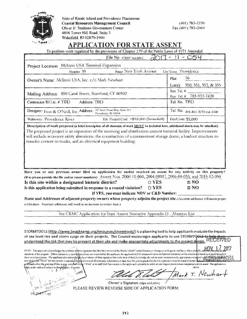
State of Rhode Island and ProYidcnce Plantations Coastal Resources Management Council Oli.,cr H. Stedman Government Center
(401) 783-3370 Fax (401) 783-2069
4808 Tower Hill Road. Suite 3 Wakefield. Rf 02879-1900
APPLICATION FOR STATE ASSENT o per onn war · reiru ate >Y e prov1s1ons o 1aptcr T k db th fCl 0 t1c u IC awso 279 f I P bl' L f 1971 A d d men c .
File No. (CRM C us .. only): rl(;l1 - I \ - o .sy Project Location: Mdnnis USA Terminal Expansion
Number 39 Street New 'York A venue City,To wn Providence
Owner's Name: Mclnnis USA, Inc. c /o l\fark New hart Plat: 56
Lot(s) : 350,351 , 352, & 355
Res. Tel.#: Mailing Address: 850 Canal Street, Stamford , CT 06902
Bus. Tel.# : 703-932 -2420
Contractor RI Lie. # Tl3D Address: ·m D Tel. No. TBD
Designer: Fuss & O'Neill, Inc. Address: 3 1i Iron Hors,, Way. Suit< 201 Tel. No. 4fJ1-861-3070 ex t 4540 Pcv vidt11cc. RI 029')8
Waterway : Pr ovidence River Est. Project Cos t: >$500,000 (Brownfield) Fee/Co sts : $5,000
Description of work proposed (a brief dl'Scription of all clements of work~ be includNI here, additional sheets may bc attached):
The pr oposed project is ;m expansion of the receiving ami distribution cement terminal facility. Impro vements will include accessory utility alterations, the constniction of a containment storage dome, a loadout structure to transfer cement to trucks, and an electrical equipment building.
Ha, ,e you or any previous owner filed an application for and/or received an assent for any acth ·ity on this propert:_\,'!
(If so please fll'O~ide die file and/or assent numbm): Assent Nos .. 2000 -11-060, 2004 -08017, 2006 -08-053 , and 2015 -12-050
ls this site within a designated historic district? o YES rn NO Is this a1)plication being submitted in response to a coastal , ,iolation? D YES Qil NO
If YES, you must indicate NOV or C&D Nwnber: ________ _ Name and Addresses of ad.iacent pro1,erty owners whose properl)' adjoins the pro,ject site. (Accura te addresses will insure proper
notitication . Impro per addres ses will result in 1111 increase in review time.)
See CR.MC Application for Stat e Assent Narrative Appendix D - Abutters List
STORMTOOLS (Http:llwww.beachsamp.org/resources/stormtools/) is a planning tool to help applicants evaluate the impacts of sea level rise and storm surge on the ir projects. The Council encourages applicants to use STORMT understand the risk that ma be resent at their site and make a ro riate ad'ustments to the ro·ect d
---·, NOTr,· The epphcant ocl:nowl~~~.b) ·cv,d,nce o,fy,,irsi!:7"'ture th.it they hal'c rovicw.:d the Rhode Island <:oa.,<tal Rcsourcr., ',,fanagcmcnt Prognun. and have, whcrc .
D
iNc • ...N.Q¼.,fllCLZ017 standard, ,,f the !'"<>gram. \}'here xarw\cel< on ,peci4) gxcepltOOS are rc4uested by the apphcon1., lhc opplta ull will be prcpar<d to mat and pr<sent test,muny on the cntcna the.e relief prov, siom ,The appliqmt ab~ ocl.1l<11',i/ shy evidence of their signature that to the best of their knowledge the information coni,incd in the opplicaiion is 1 prol'idc. J<>'t!lt'"G!U--tC' f';",.lhis r~vicw ,;. in.,cc'9' ~ \ir not reveal all necessary mfonnat K>n ,..- data, th,:n th,: p<m>il gr"&>l«i wider this appltcation may he found to be ooll
: it•m 10t h.; grantill; "ofthis~ssc I, mem~of CRMC ,.- i15 staff shall haveacces., totJ1< opphc...,t's property tomake<>n-s1te in,;p..'Cllons lo insurecanpliarce \\11hthc,=r1 This!ffliattio1is ~c under nath and sul>J<ct to tho· . tes of-l)ITT' . / ()ll /1)4 ,. ~ · "t · -;-'7/4, \.Y·, '~ · -, .. · .-:~~ew. ~~ µ,,fa,,.f T. /Ve,.,.Jharf-
\ \ .-:~·"· ;~, .~;~~.·':~;~~ · Owner· s Signature (s ign and print ) /
., '0~t J · \'~·<\;· _ _.-. PLEASE REVIEW REVERSE SIDE OF APPLICA TJON FORM
ohi~
Pt2
STATEMENT O F DISCLOSURE AND APPLICANT AGREEMENT AS TO FEES
The fees which must be submitted to the Coastal Resources Management Council are based upon representations made to the Coastal Resources Management Council by the applicant. If after submission of this fee the Coastal Resources Management Council determines that an error has been made either in the applicant ' s submission or in determining the fee to be paid, the applicant understands that additional fees may be assessed by the Coastal Resources Management Council. These fees must be paid prior to the issuance of any assent by the Coastal Resources Management Council.
The applicant understands the above conditions and agrees to comply with them.
Signature
Print Name and Ma iling Address
'350 ~VI~ } ~+reef ~+o.'".t,v-J er o,ora;i.
I
0 1-201 7 - ajt
PI3
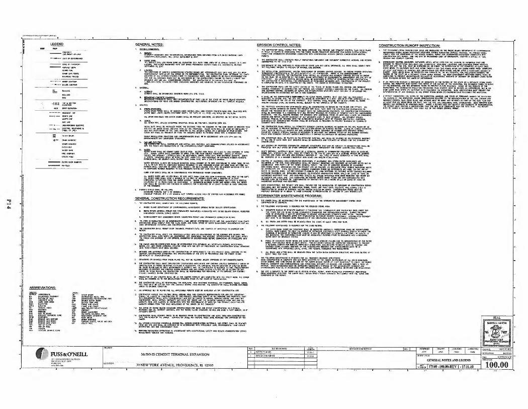
":I -""
, ... _, __ , .. ,.. .. ""..., ... _ I ' • -.I
I • I
·I i !
"i i I ! ' ,! i
i i j
- !
' ' ' ! I
. i ~ ! ! i ' J I
! ! I
'
f ~
- -~t-0f" - WA1'
-lMl(ll'OI$~
- -too:tor •A~1•UH
--- ... t•'IW w--lb
---- tlll-AOCll'C:
-1 - S(W!IUMC
tiO,.. ...... --~n.te1MC - ut-~~~·
I!!!) ,,_
--~QiOOO:~
--••tu s
r ~
ff) ~!5.!.?:~ll =;';.~'-IJ--.,.,...-
GENERAi. NOTES:
A. ~l1't<U«l.urY-~...,_ • -11tJ11:mtu.t0111Q11•"Vll'1'"•-lrl.1.Nt0 ~OIIIDIS. IMC.. D,lll(I) !ID'ff.MIOII: .. ~,.
I, ~QQQ,.,ffli ,il'[ Ul:S- toe M. tuvA- lf ,O, MA~, ... - · or 1,0 _,..._o,,;Ht((# fl.000 ~";:,.~~--....a:H'ICll~{faW)-.JoetOll<Nrr,uc111Q. _,..,~
"""""'" lHlU)CA-orl"'51"G-~- tJI( -Aff00..1'-HA>ll NOl'"!'l,-V, ~ l\ 7 - IT 1tC O'MCJII OIi lff IIO'MSDf'IAlM:. N CQ(nl~- 11</lll.l ~ 1'Mt tu(T l.OCAl!C9! or MJ. l "5111G UlUTl3 l'Mllt TO 0(MIOl(ltC-. - AGacU"' • ,i,,u.w ~ ,011
=~"!!vo:.,~ ~~~~~=n'~~.~~~~11: -~~3t~ - 'nl.1, 7t - ~ l"fllOII. txlJ.- ~ A11C1 IICIUOAlS. TO Al<Y D:e,li,V.O.IKJ<I ~ ON
,. ~ ·-COIIIMCtM,llt.l.k .. ~COtOllJl:ll(J!l,l(IUSm.l.~1).
·-= = = ~~i: '::11.~~~":. :"'.:X-~-i::c~~Ol:J 11111 AU. t« .... ~ NfO CAIOI .,,._ !IW..L K l'MCA S'T CDICM11:. AS Pfar,[I) ~ 1MI'. Cl:TM. ~
• OK& lrU. $1.ll(Jlt"'f:.UIU: HOPfDl!IP.il: SPl:Clnll),. IIUU N:PQ. ...... '!\~0flCI( ~ ,-,1,
Q..EAN 0U'fS 9WJ.. NS T-'ULD MIC lie DISTlolla'. ,,_ M. lull..o-o TO 1'C "'""" --- ISCCA- -1oornr011.,._lf.-~n;w "' ""'~ · -~ . cu:.-rul'SSMAU.«11,0,: n wstAl.LNllY IIHDOt«-(ltnlll[,e,stlfM(~CIA.llf:fflt"5Tllt~:IIPIV!.O!IIA-t$f'(UIIN>f'.S. 1lolC GlillOIJT$M.till(IIIOOCl11~fflQultC~1tlOIO~Oll,l«·fMA~T~
-Jtl'IITauA-M iOC11C:U__,Al'll'UIIJVUiNI.U,O.OU K•~"M .. QTl'Pl'1'ANIINt: N~n IA1'001M$!10W $f~
e. ~---lHI: CONJ!IACT1:III: vw.L 0DCllll»II.W:: - IOS'flill.l t..l'l. tl.LelNC,. - ~·- U'IIU'N:S,. ~ •™ flC 11\US - lllt(1.Ul'IONS or M ,.,,_...tC Ull.lrr ~- ..
DUCIUIIION . CUCJU-~N:Q..AU$t-~~·-• fO A.,,,,,At'°4UION A'<f:DCIUM.(1"IOO,(SS. .-tsum-. ~-,.:\.~c,~!,,::-,~:™1~...=1&~1$
TU -,. ~'"'A cno. •™ • n,o ,w -..w . tiltJI ~$. l-ail(tt()II Sl,l.l,LWI wwn 3"flil COl'!IS'10rfll: ""I: OCN'Oll!WNC TO A-C-,.111 IOIQ. U,l,O!IIU1;•Mfl't:C(lllPO.IIIIO.....cii11tOUIIICOlOc:M-flUN:~1N:HOf~-lto'90.M..I. '"1l!O\!I 91.ltl,. OONI'~ 10 •- ctOI:, IIOO{t T- OIi 9',ITT-.,,_ 1"11"1. "''" DIii ~ llA TOMO - ANO Pl:~ -- Mo«II 1'I) ~ l'fltSSUflt ltA'!IIIO llOl U:H 'KA,,111M l'SIO.
... ,M":IMt S'TMJ.S '"""' • '<l.l.OW!r $1AIO,oltCI ,.......,, ..., ..... ~. l'.AAICIICH'P'-.U'•11'-.., 'll/9' S 11W(0"'0CtS:SJJ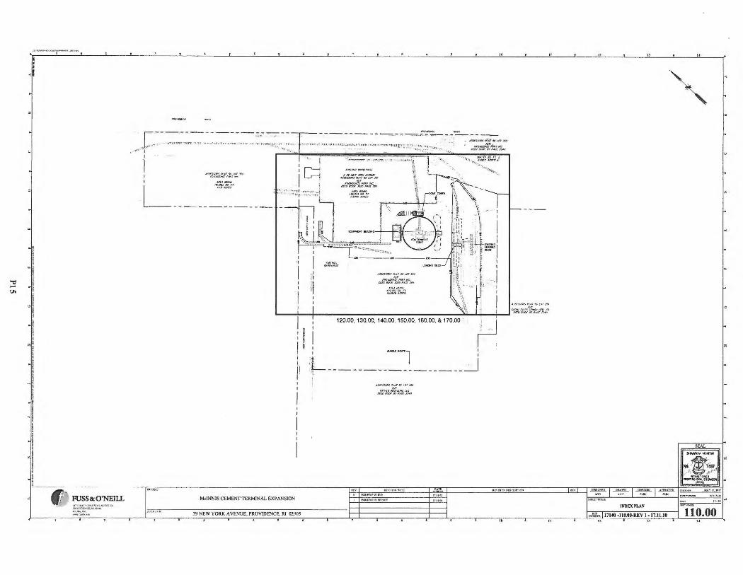
~ <JI
, ... -, .. --..... i ' I .,
l
' ' ! ·1 ' i ! I
0 I ' ! I ' i _, -, ! ! ! l
-I ' ! • n !
-! i i ! l !
"' l ! l l l
'
FUSS&:O'NEIIL )l? Jf:Otl-"""AT.11./n"'g)l:>, Pt.O\'ICD"e&k.l~ ,t)l ... ;!0'10 __ ,, __ _
"
- -- ------~ -~- ·· .. ,.~ .. ~ .-~ -- - --
120.00. 130.00 . 140.00. 150.00. 160.00. & 170.00 · .; I
I:! , r : :L:· ...., ... ~l _J: I' t' - ------- ·- -- ------
A~a"l.Af:J410f.J3J
cif/-:tx,,,:f,~'M.o
M,INNIS CEMENT TERMINAL EXPANSION
INDEXPl,AN
39 NEW YOlU< A VENUE. PROVIDENCE, RT 0290$ l'U~ ~ .. 17140 .. )10.00..REVl-17 .11.10 110.00
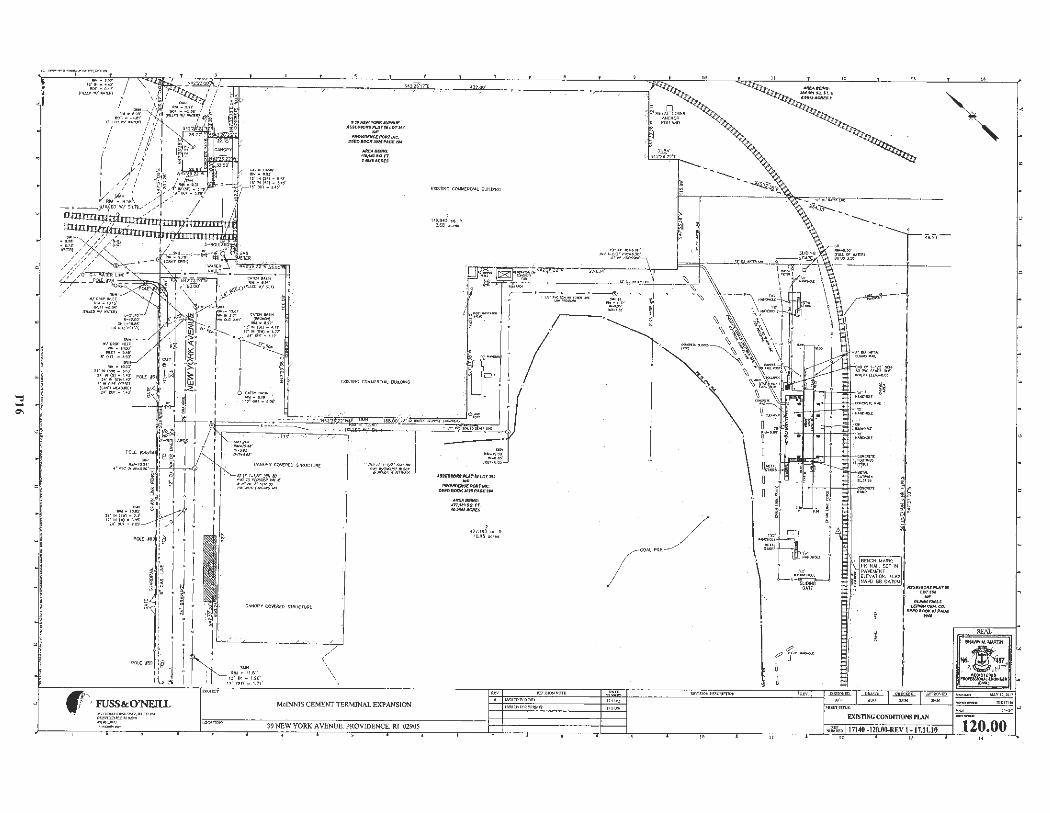
::;: 0\
, ........... ,..,, ...................... .,._ ... , .. I
I ' • <I
~1
I "' i ' I I '
=I
I ; -I
i j
! I
-i ' i ' ~ ! ! I
:d ! l l i
~
-lW • 10.23' U "IN(S "')• M .3'
2•• lN(S) • 1,,tJ' , . · ..,cn-,.•.r a·.,.,..,_~r
{t;.IH, WU 'IUU:) 1•· ov1- 1.• J"
-""" • 10.~· 2•"1+. (S"'l - u' 1J " l<l( W)• l.t$ '
U" OU'I • th'
""''"
fr ~~~i~ ---
•/
( \ \
.ffll'Pl''t'OIMA\IEMJII!' AUESSOl'IS,UTUlOT!51 -~#CE/l'OlfT/NC_ Dttl>800f(#ff,.A~1U --,, ..... , so,.,r,
.t#4fACltf'.S
MdNNIS CEMENT TERMINAL EXPANSION
39 NEW YORK A VENUE. PROVIDENCE. Rl 02905
,U SEHO" f ~ t! U.OTJJZ
~~twc. oao•OOl(~H,.AO.-n,i,
Altt'.Allf/HG : U1,1u,o.n. 1~.MHACltU
, 4' 7,1!13 aq. II,
10.9~ acre•
I
~1, ... -
BCNCH MARK;
i [l [I/ AT!OH, IU I~ • HA'v'O l\EI OATUl,4
Pl( NAI\. stT IN J ' ~ P 4\t'),1£NT
~ , .U.Sil!Uoitfil't.At ft'
,·· . ·r ••,::u flt.E""""'~' 1 U/flOHcotCC. !¥"'~.,,.~
I EXISTING CONDmm,s PLAN
~llin 17140 -ll0.00.RJ;V l -17.11.10
SEAL
120.00
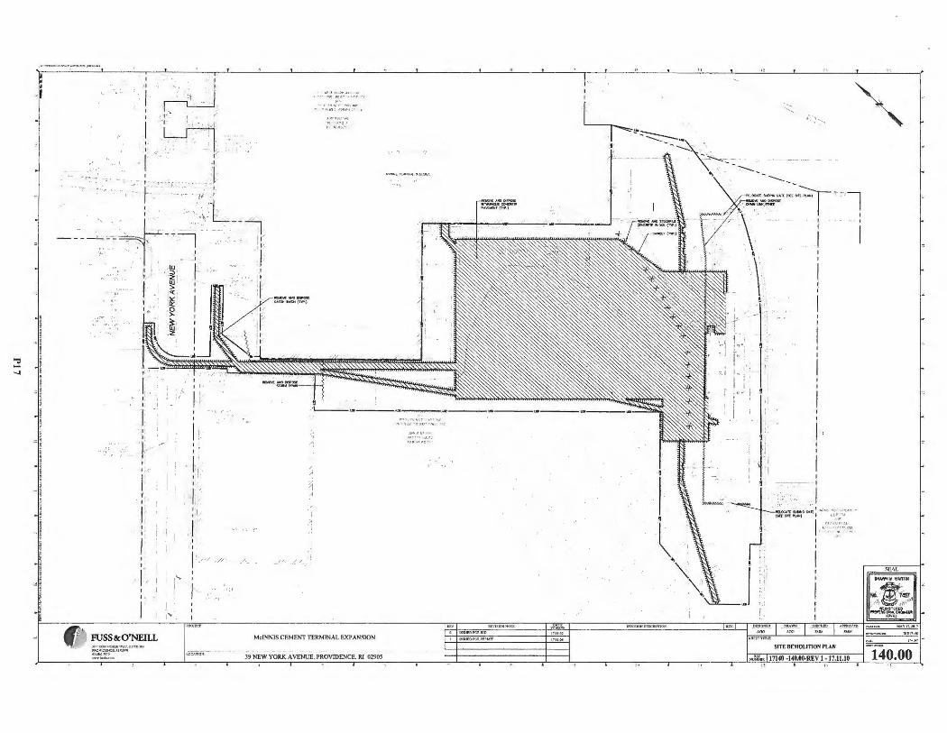
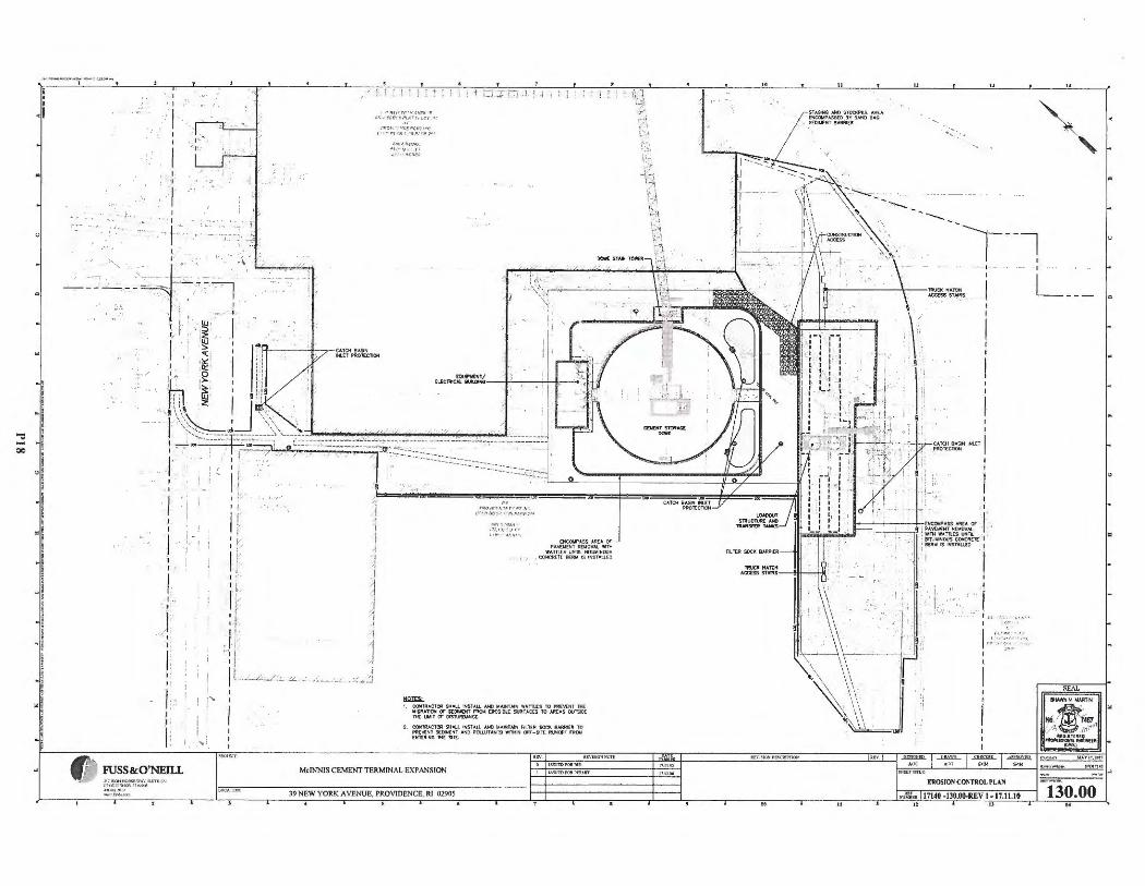
I_ ••
I ., . I
'. ;~ .: .
l I
I ·- ., .-
I '
0: I '
I.
i:
i -' I
-1.
• .J. ·,1 ,.. • .... ..j/
I' , 1 ' V,
1-:· 1- 1'
l ! ' ! : , -,--;-''-~- -' w :r r-=--, -;_,--:-, ____ ,
·, i j I ~ I
~ I
lj
·I
1
MdNNIS CEMENT TERMIN AL EXPANSION
J9NEW YORK AVE;:;;::--:- - - -• NUE, P~OV!DENCE. Rl-;;0::::290-:-l - - -II
;)_, i \ ; ,;,
·' ·:1
I I
- - 1 -I
CATCH 811.SIN I _PROT!:CTION IHl,..CT
I I
.,
L
=
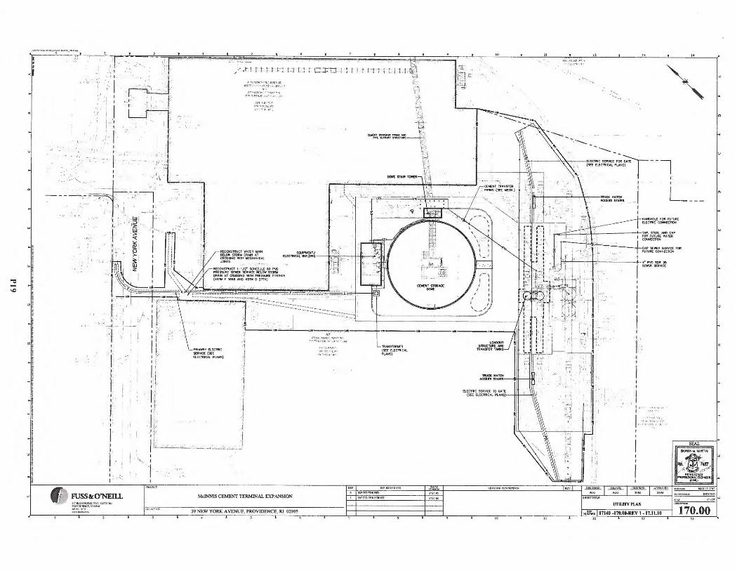
,'».,_....,....,,,...._~,_,,, ..,,,..H_
I ' I ., '
I ' l
'. ' I
ii I I I
I·
J ,, ,· ,. I
, ·-....., I
1-
,I
1 •
' i I,
:> 'J 'J!W I" <!'' C\1£~ .tr_
A,-•r• ~•: ;· ~~Cl.l•
t ~">·'.1100 ' ' Wrl• i, rr•, ro,:,l{ ;·; • ... 1,-:-••
1:c•,:,::;1 . r, .· • ... ~·.
McINNIS CEMENT TERMINAL EXPAN S[ON
39 NEW YORK A VENUE , PROVIDEN CE. RI 0290S
,., ..,,,,-r ,:~!::". ~,.
r i 1 ·ti ! 1.1-
~ AHSrOIM:R (S([£1.CCTAI CAL Pl.ANS)
iltv ~- »IQ:,11'<0 1'1.
l:ISVE:Oft*. 110
ElECl lllC SUl 'M:t TO GArt (Sl.:[ [lE.ClRICAl"l. ANS)•- -JII----'--'\\ \
"
' ~-.,.
El [ CTRIC StlNC£ ... r: ~Al£ - -1 (Sf;E EI..EC'fftl(:All'l 4N5)
,_. I · I
L __ _
-·,·. ·'
i · I,, , '
SEAL
UTILITY PLAN
:,iJ:fu. 17140 -170.00..REV 1-17.11.10 170.00
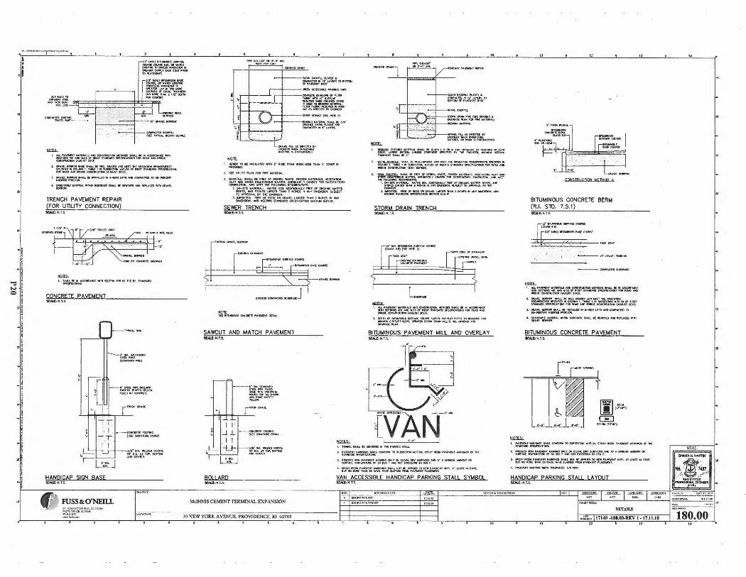
.,, .. .,..,.,..1<1...:,..,..,.._,,,vr,., .. ,
=
u• {WKJl!l\MIOIS ..-l« CCUIW(<UfSUJ,.OI\Ll~ (Ma«)ll!ICllJo( t, ~tS OllAM(.01 •,uTAO! COAl,._
m"""""'"
I. JU"A>Oll)ITv•1lfl!~t~~-SltM.I. KINAaatt:lolJICl!l'.(;l'(lHS ~ ~ 111.1» Of JIIIXlf ST-/IIIO 7'1:0J1CA 1101f5 f DII - .l,ICI ~ OCW'5Jl!UC1'IOOl('IIJGU5ll'Ol3).
2. OIi•""-9all!Oft -..st $MAU. K ICU Qlt.401:!t • ICI Ul:£1 fK QltlD•- IICQIIIDIDl'IS -«'lO • m...- I. TAIU. I. lil.9Sl!C'IION 11-0!,M Of IIO:)T S IAHO.Mtl 9'£0f'ICI.IIO>f! l'Oll.--i,tOCll:COISlllJellCN(AUGIJ5T~3 ).
1 ~ "=""JOl:~MJ.. a: Mt.otlffl II t-k>t lJn1; ~ COl#'.<,¢'rttl f¢ ~
4. :r-.J..M!U: WAffll!l~WIWN~SNAU.IClllnl!rMD-IIO'U,C(T) W!Wca.o.\lfl,.
TRENCH PAVEMENT REPAIR (FOR UTILITY CONNECTION)
SCAl.l:N.l .S.
= I. :.:~~~Al!Ct HI st(;:IION lie!- tJI M' IU $IAJC14J!O
CONCRETE PAVEMENT 1CAl..t: N.1. S
HANDICAP SIGN BASE
fr FUSS&:O'NEill
~ 0,A.c.\l ,,Aolrffl) S'ftlf"Oll (Sli.M!) __ ,
3/l'DIA.ICUICDMOOPS. 1r or .... , ,~. 10noi,i olM()(l(Mfl:~ .
CUN! IAOo:TIU. PUC:t0 • COW,,loCfflllllt"U Yll!S lOIOJtOl,I er,•"(ll(JIIT I I.St
,--+- --l)lltt!II DC11c1,a.t-1 MOt
COIIP'llftl:li\tl.Cl'tOf h. 1(11 ~~-~·~fflM tSll'Stl),t.SlfflDWI IIAmul .
~~l=n~..:U~ rr11F\--l---!ln(a :srJM:t.: !stc NOi[ r1
=
-- .. ~~ ~. J/ • ' ~Sn:,,c""-A(Ulcow,,J,t,m"' 1•u,'l'l::lt$ ,
I . ~9(t,ISI..IJl'ltO'J111 1'1t2' '1Gllt Ool.M~t!SS TH""'4 ' ~ tS
2. stt tmJ TYP\Mtroll ~ .. AllMAL ,
3 I~ ,-.,U k Nll'.l or 0[811!5,, ~.t,~Tt. fllOZEM .. AlUIIM.S. ~1•-. Q..t,'f NII OM llt DO.Ell '90U S W•TW:11, t..0£0U.U[l 'f Clt\Ofr) fOR So\TISf"AC'l{lltY COWPACT'OI, MfO wrrr 11-!C ra..u,.,ic M:~
l.00t - Slll: .. A1(JIIAI.;: MAJl\l[~AOOfflON.IUY,-C(C,OltCAJ,ICW,111"1'1'.k ~OOtt, ~ Sl'OHU LN!CU! nlM 3 INOCS !H 4NY Dlt,I0$0N. sua.t:CT 1tl APPIIOYM. IIY'IH[ (NCIN((llt,
2.N'Oltlm:: f11£1:0fMXXOltGll •'«L UMlC lltnl .ulJIMOt(:$t,l.lN't OIWCN90M: #40 liltttlrlC STN«lit.lltl s, •(Of'ICUI ON stC OOl'I 111.~ .ot .
SEWER TRENCH SCAU".:ff.T.S.
SAWCUT AND MATCH PAVEMENT tcM.r:M.U .
I 1· 'J .L
I I
t. ~ SM.u.L !II: -.o.J. - taMlm -WR! 11M -- 11!- fS "' c,,-,(0• ecu.- ,, t..,.C, N ~e"IICII w.vi .o, o, fllJOl"5 sn.,,.,_ Sl"l:'ClrlC•-s rort 11()',I) "-"> lll!OOl!:COOISTM!C11CN(,oc.ot:OIT'OIJ,
,. ~~ .~~ ~.~~n:-_:s.c:,,.~= ~'..,,~ ltC ~"f.~~
'-~~~~T .. ~~~~~~~~-1. -ftO: "'t(()J"IIIXJ(~Ol!;l\'ll.l.l,IM;VlltUo"'J- S NWf--.11/tJ
W(t'l'MtSUNO.olltl S,,W,,,:: 1.1'0I SCCfl(l<fll.tn.O, .
STORM DRAIN TRENCH 9CALC: N. T.S.
l '"(:l(CO,.J
fa$1N)l!ll-~ft ,. • ..oc,1 1
1, ..W. l"•'of;K.WT 1U.11;ll!*U .l"'0 ~,o. oot'l'r<OOS Stl-..L It II~ M1H ICC1W::tll 40! .of,0 11.~ tt llt(IOt tt~ pt;:ne..,.l!Qrd fOl'I 11/0o\ll' AICI --«CC,,.S""'-'C'ICll(M.OJSTI01l).
I . oc• n4 or·- ... ...a: COJll!l VIMS. !M;JU'f ~ n4 .u MG.MO'°' ::.:11.~t 31.c.t" 'fCMMDS 1,0,W DUN ""-'. TS. U GIIAOIIIO Al'C
B11UMINOUS PAVEMENT MILL AND OVERLAY SCAl.[:N ,1,$..
t. rn::~~=-OOWM>l lO ,_C _'*-.17 .~ ; t!'l'ro'IIC!IH l".O..n.rt,IT -ll()S(ft TIC
3. :fil ~~1,. 11: r-:.(Jrj..:~si:~~5,~ IT A - ~ OIi
BOLLARD SCAl..t:H .T.S.
MclNNlS CEMENT TERMINAL EXPANS ION
._ ~,..,,·~.:{;~i~~~~~~"'' IJIOl.•1ms,u DA"l"S, VAN ACCESSIBLE HANDICAP PARKING STALL SYMBOL $CML;N.T, S.
l,..,.lil01'1 N0 f't
t J~UU>P'OU; ft)
39 NEW YOR K AVENUE. PROVIDENCE . Rf 02905
=
811UMINOUS CONCRETE BERM (RJ. SID. 7.5.1) !CAIL N.T.S.
t!O]I,C I. AU. l"l',hOI T ll&fflltll.S MiO CC,,,,~--~ SIUU. K .. ~#ICC
•111src-• ...,11.1.Jo,-_., s,~ Sl'(crne.,.-, ,(11111o,,o...,..,, llll)Ot ~ (,ll,IIJJ9t 20U).
I , Ollli."(t~ '"-'t l K-nt CIIAtlfllA,l,IOl,l([1M!'GII M).la(l),IIIIO,IOl1Stl"tcflttl 11 ~ , , '*' , '"9Ull5CC1IOl'( ... ou,, rx 111001 fUNCM1>~1!01o1Sr01tMWt'ICIMIDOECOHS'NII.ICTOl (~t2013~
3, GIU.W\,~ 9<..W. l(lkS tolU.£0N~ U,11-COWl'A.C1COT1) ~,u enu-.ol"IIOC:l'Olt
' =~~--'IIJ9aqM)[1tWLK"l\llMO~ llltl'l.flCUl•N
BITUMINOUS CONCRETE PAVEMENT SCA&.t:N.T.$ .
·~· I ,_,. I
"
I. :~===--OIIIIO"ffi$,Jlti(C11(N 11,l1.~:0'(ll(TJ011Ulo{IPTll~O,k
! . ~~~· .-=-~~~°"'-~":=.1r~u1_.._01! l . P'OVY IIC5IN l"Al'[IIO!l ... _, !loUl.1 NOT IC -..im TC - l"•W:\itll1 Ulo'fll U l 0'1 , . OUS ,
M lt::l lfOllt: - :rt C.\l's. 1o1•,c [I.H'S(!>,_ l"AWW)ff ~t
4. l'A-,rt -tirl1lol~ ,/4~
HANDICAP PARKING STALL LAYOUT SCAl.[: H.T.S..
DETAII..S
"''~:u: 17140 ·180,00.REV 1 • 17.11.10
" 180.00
"
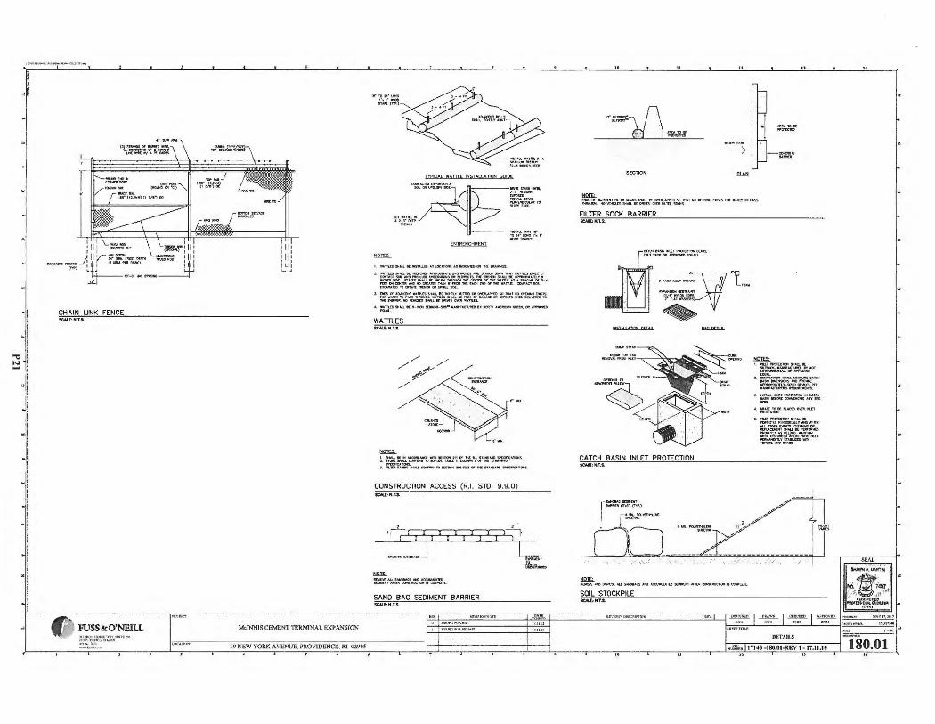
, ........... ,.. ... ..,.....,.,,. ...... _,_,.ro ,,-,
i • I .,
! ' !
·I ~ ~,
- , l
"! j
l I
.j 5
i ;
-I ! ! ,! ! I • !
. 1 I
I i
I
CHAIN LINK FENCE SCALE:N.T.S.
Mc!NNJSCEMENTTERMINAL EXPANSION
39 NEW YORK A VENUE. PROVIDENCE. RI 02905
''"'::.:~= SIAl!t (T"IP.)
T'fPIC,'L WAlUE INSlAll.ATION GUIDE
""'Tlll S -t(ll[..,.,-JMJ. ( ~UI.OC • 'PLOOIS•Sl141:1CA'll'Ctl Jl,llt"'t,I.~
2. ~~~.O::t:=:::-~::i',;":.c s=,.~;;=.,~c.,1'- ; l,Qfl"lll0(. st/ t,OX,PIMJ.1!11':D"r\Ol~fftOno ,r,11< .... 0U:UA Sl"~ f7-rt{fl)OIC()(ltJl#IOJ,IIQ~AOJl"~,--1>Cuo,~~IH( - f>l.t. ~-.er -. !.-¢AV U l~lOQOU.1'~tJII.....U. 111ll.
l, M S« ACJ,ott>rt- ntn SHAu, It 1IOM1\TMiTIDCft~ ~'MAT lolOCf'O-OCt!IISTS , 0111 ••ff.It 'N)l'i.U; tWl(lUl'I; . ..,. , .. n !IMAU.lt ntt (lf OArfAlllf 0111 Otf't:CIS -t'I< ~ lO MS>-atNOWMIQ.tS$M.olJ.K~e-.(ll• • t1\."-
•. ~~ !HIii.i. 9( t-"""" 9(0A,l.lJC- -,. w-..r•ClVllfll O IOOlll1"' •IOl!ll!IC,t.ll OlfOI , (flt .-o,i,(0
WATil ES SCAl.£:N.1.S.
= 1, ~ ...... tc 11 ~ 11"" xcncw :r11 or Mt tu. ,t.wc:,..,c 1'«lf'IC•"°"' ~ ~:'":::-~~:~=~~a,·: :;.,::·:Cfle ... -~
CONSTRUCTION ACCESS (R.I. STD. 9.9.0) SCAU:: N. r,S.
SAND BAG SEDIMENT BARRIER SCAl.t:N.U .
"
FILTER SOCK BARRIER
- ·~~~ 1•llltflt'tOIIIAC · , . -IIOIOV-.. tl!(N N(I • Cl'OINC;
·-~~~
CATCH BASIN INLET PROTECTION
.l!l2lt:. IIOIO\IC AMI CIIPO!!( loll. S lilfOl• OS NII> ~1CD i!DalOll "'1£111 CONS1IIJC1l0IOI ll ~
SOIL STOCKPILE SCALC:k T.S.
"
= I, NU ~ '4M.1. (II[ 9l.1SAO(, __,. ACf'..IICDnJ,O" £N',lilll;NIIOIAt,.C1111~ ·-z.. CCNTII~ 1l'IMJ. IOll[.:,,111( c.lTOI IASIN~ .....Ol'floo.o:: ~lD..T •SlD:I Ol:'CDPDt .. -..~~
s.~~~ 11.::~ .._ CllAff109(,v.cntO',(IIN,.tf
,-01[Cl'IOJII..
DETAILS
=~:,. 17140 -181!.0J-REV 1 -17.11.10
SEAL
180.01 ,.
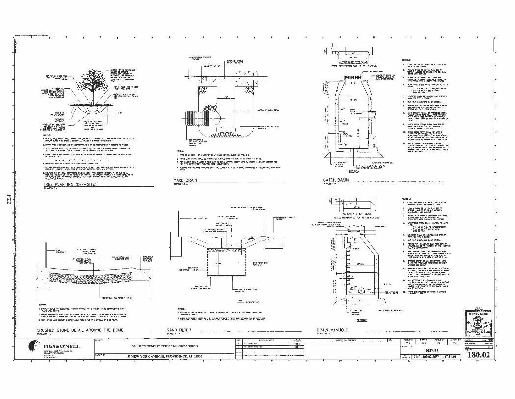
--~----., ...... ,
i . • . ,
! l I
· ! ~i • I ~;
;
! ! .i
I
l t
-! ! I
-1 i I ! ;
. ! I i ! !
I
= l , lil(l,IO',( 'lll(t-, 'lllllt. S1.ta(($, ~$1tl'!11(111CU1t'11111..t,JT Af/AY-.UCII lo, Nill C1I ........ . /r111.lllll'.IASIIU.~AUP\Nl'Tl'l'5""'°"IO~
LSJl'UY-~ .. ~-lt!Wlf'Sll<H~'ll r00C..:1S~ ,o ,.
l. rl!(I CIUl'tlt$11<,fru II( II(~ ,«OIIIOINC 10- no.1, ltND«, ~~,011 ritru.,_.lO •.-OC.S.IIHDU-NC>ll'S...,.,....(:a(llM)fOIIUIICVISIZl'S. "·=~511:o~ at D-"CnCll l'l.""111«: IIAffll!tAl.5 r'<OICAfftN NNM1a. a,
S.~ANCt"O'II00';1'1(,_fll(:MACCV'f.uQ. ... ~ / OMOI
I . IINIIUHl'T'(llll»;lt'l' .IJl,_~111N1W..«-'lt
J,-..il(:N,IMVIT --1JIU 1COWll'l- -- no. 1 • ~, u 1.1WY~ SYS'IDI!,, nuv """"°'°• -ll'IY ! TOOi '11{( C1I DISC..l !I[. -Cn. (IIOS, - -
~~~ 11~.*i=::J!~ .1l'::ft,.:,o TO
TREE PLANTING (OFF-SllE) SCAL£:N .T,S.
I. OiCIIUI' 1CA11S Of f.COTU'll..[ f l.llllte A -..W fS , 2 lllCtlC5 U AU. lON:II\ .Oto ,1. MD "l .1,IIS'•'l'lal:.oN II.
L=..':r5=·:/1C:.~::~~o~~~~~=-:S ,~~ l,.,te,, S,~.V,OCQO,ll,t(INIIQIIIIIOII A• Y '*""(IOl,l(A l A-0,6.11:1 n JfT.
CRUSHED STONE DETAIL AROUND JHE DOME SCAl.[:N ,T.S.
1, w.flO .... $NAU. 9( !l'll,,Cll'V-$f (lit .... ~ """..lf"'C'l\.fltt t1' .'(I$. NC.
2. nUiMC .UC, OIIM,t S1«U. K Nl!;Cll,I.Ttt, CIOCf'U 1110N 11\11 .1$1'11 »!Ill ca,.o.ot; 10-!0-~
l. .....: -n. w.v owa:: I'll .,,_ 10 nnc \l[M'tn l/1'.IT'I' ~-. U111.1n N'!l.01'\AJJ -!IT.I m fOlt,tll(CXINll£C110ft111(-f'GJIIOAJl1WOrn.
., ~-l-.lil:Xn.L IIA10U l-l KOJ..'lS ~,Oltlll lU.'IUl!Al(:CUl>N:lftll'IAC((lll(l'-"C( JR™A 1N
YARD DRAIN
~~
t~c::=
I.Oli'[IIU,P1tAAIS« «111D:11.LrA11111C ,._,,. or n NCt'C5 •r ..U.\OIIGI,,._,., ---~ z.~cr=·~::. ~~wl:.:0~M=:"~=:;T~~
SAND FILTER SCM.L: N.T.S.
ff FUSS&O'NEILL Mc!NNIS CEMENT TERMrNAL EXJ>ANSION
39 NEW YORK AVENUE. PROVIDENCE. RI 02905
At IfBNAJf TOP SLAB (STED. RONf'O!lat) rOft HS-25 LOAOINC)
CATCH BASIN
H ALitANAJI TAP 51 AA
(Stt:n ltfJNFORC(O J'OR MS-25 lOAOO+G)
DRAIN MANHOLE SCM.C:N .T.S.
'1tAW4HDCIU.ll:5tlril..l.M: IU1~ . l.3.0 Olt~ ( CIU/riL
:t. nv.nSMAU.W:st T l'IM.LlllmC11 __,#1.AO.&ISf'!QOltll«"MNIIOICLAY IMOU--""-
:,. ......o1DttJ>'1WIID~.ll.ll .,_IIOCJIIDlCl'fl'./ltlll('llv,t,.lll[,i{QUlllUICIN Sffll.lC1\11!CS •'II+ SMIUCI"' ""l ~
11£W(IIIQNQ SltU. $MIU. QCWOIIIIII 11;1 ASn1 •-•.et< -O.IJSO.k,ut. n. OIIIClM't!'!Ol""--:,.1:..~·(IIO'II'""'~)
:,. ~ W.11..L IE~ fllltNCrn< UIOOl"!llfl,i[.CD,tOIT.
~ N:~ IIO'OJIMt l .lll[ Sl:C'P!Olll
1, IWMl!I£ VIOIOCl(OU1'Sl'tlll "'f'S •'Ill r IIAX.(UNIAIC£1D(l)TSlt)(Off'll>t. - l M.ll.L~~CN;»IS
~ JCll'l'ISCM.M'ISHM.1.K'9IUClltlllmlUT'll 111.911[11 M~!lle l'II'{ 9UL 1'1,1,1 -.C'S - &,I,-M1N Olt ""' 1"( 111: IIUW(III C;a$1<(11NAT00111'\.U•!W .lS l!II C- '° ,J~ C•3'1 .
1.. euo,-- ti; .1,U,.-10
~1:~~~~ ,o. c•-- sftJ"S"'-.tilll:.UTIII •
~=~~~~ Ol'(NtoCw-sr11t•-r--d'f1IOlil$1(1'1,,
H . Al<Vl«a'S!Alh' ~ c:omllUC?Ol-.t.lEIIOMl:IY!olllJ...QffllNC e:s:~===-~s
, 11MllUIDCO"l[Jll 'IO IE IU S10.I.Z.IOII ~ (QVAl..lll!OIINQ;'tlll--
2. 1'11.....:SSMIUK stf lNMl..ltDOI IIIOllfAA. .l,(l,l,JST 100IIMIIE •1"11£0 a,..,y~-- TM.
l. ......aiiDa7r,w«S~ IUT .1-...cH DCD'l'!t-1 .. ATKN:Cl!ll!COCIN ST!l!JCTl.llllalll1"SMilll.UlWPPE-
<I. lliDWOlla!GlffU,...U.~'!0 1,,S'llll A-,e.
• 0.'2to.•,'U,1.n , OltQM'1JIDffl,IL -:.:::5:o~.(IOi.ew,..~)
:t.OONCltC'IISMAU.11!:~S~ UIODl'Sln,l[ ~ COl[Jq ,
lloCfO.lltllONOI.IMC~ !lf:C""'"'
~~~~~"""'""' I. .c:IIMT!lt,l,l.,Wfsi,u,u.Kl'NFOltl«l) aiT'fl.
...._..,, IUSIIC l'IP'I. !IUrl ., _, OCWUCS •JH "-ASITO IIIN Ol T'IW1M[llC ~ IIA,cn 'IMATCll:M'U'i•Nt.S"N C-~301t C- .)tl.
• . lfllloMU 01:SIOlll 9'1,.U. ~ TO A!N e-n1r01t._c:.r.fl_~Tt ~ ,CCIICINt."
10 ~ S'lll'S 9'1111..L K .S TIii • S,t,/MI~ ~==~~7: ·- r - fl'f'll('lll"A:"'5-
11 . .-v~~"~ ~Wl,l.-t)ONl: ..... U~ e:£~=~~
11. """"'" CGff1llllC'IUI C1I 9lloi: OIi ctlilOIT a,tO!f,lt,Q.AS'SO.
DETAILS
17140 -130.02-REV I -17.11.10
"
SEAL
180.02

201 7-05-045 Bridge Street
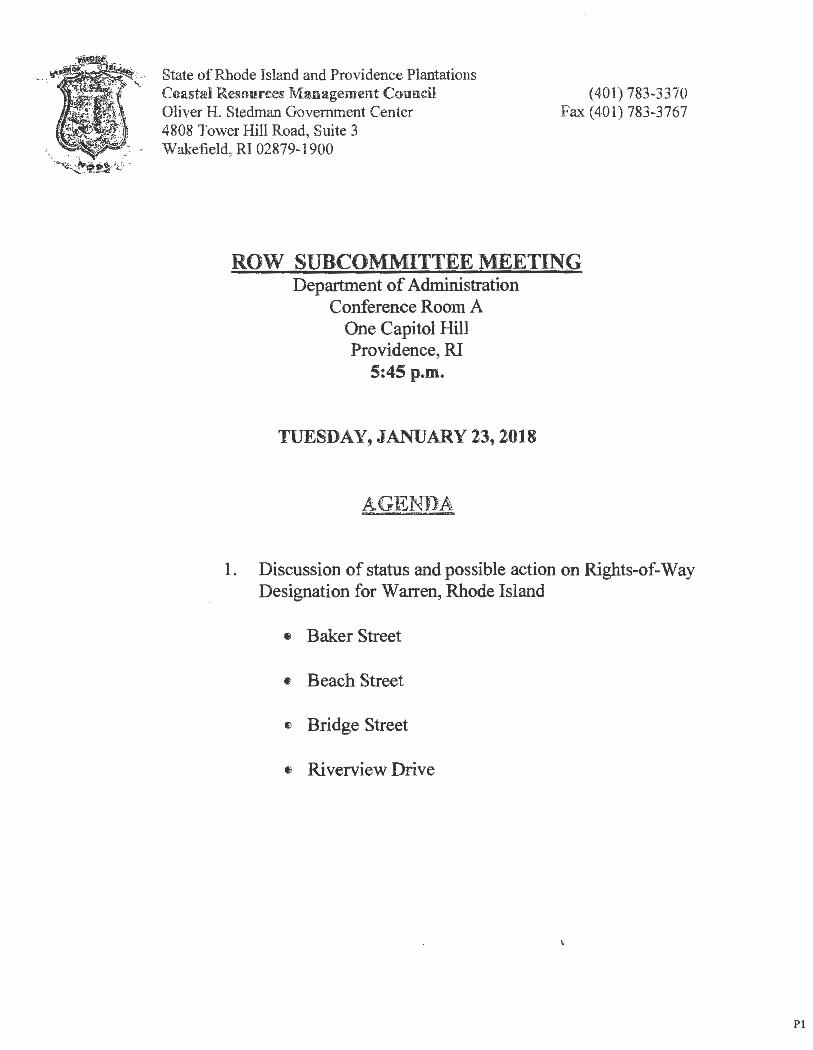
State of Rhode Island and Providence Plantations Coast:,d Resourtes Management Council Oliver H. Stedman Government Center 4808 Tower Hill Road, Suite 3 Wakefield , RI 02879-1900
(401) 783-3370 Fax (401) 783-3767
ROW SUBCOMMITTEE MEETING Department of Administration
Conference Room A One Capitol Hill Providence, RI
5:45 p.m.
TUESDAY, JANUARY 23, 2018
AGENDA
1. Discussion of status and possible action on Rights-of-Way Designation for Warren, Rhode Island
• Baker Street
• Beach Street
e Bridge Street
• Riverview Drive
Pl
) ,
RICRMC PUBLIC HEARING
Rights of Way
TOWN OF WARREN 2017-05-045 Bridge Street 2017-05-046 Beach Street 2017-05-047 Baker Street 2017-05-048 Riverview Street
Monday, June 19, 2017 7:00 p.m.
Warren Town Hall, Council Chambers 514 Main Street, Warren
Subcommittee Members: Anne Livingston
Ron Gagnon Paul Beaudette
Patricia Reynolds Anthony DeSisto, Legal Counsel
P2
State of Rhode Island and Providence Plantations Coastal Resources Mm:rn.gement Council Oliver H. Stedman Government Center 4808 Tower Hill Road, Suite 3
. _,,. Wakefield, R1 02879-1900 '\,~ -. -
NOTICE OF PUBLIC HEARING
(401) 783-3370 Fax (401) 783-2069
May 16, 2017
In accordance with and pursuant to the provisions of the "Administrative Procedures Act", (Chapter 42-35 et. seq. of the General Laws of Rhode Island), and the Rules and Regulations of the Coastal Resources Management Council, a hearing will be held relative to Title 46, Chapter 23, of Section 6 A, B, C, D, E, Title 46 Chapter 23 Section 18(b ), Title 46, Chapter 6, Section 1, Title 46, Chapter 6, Section 2 of the Rhode Island General Laws of 1956, as amended, for a State of Rhode Island Assent on potential Rights-of-Way located in the Town of Warren.
~ The Proposed Right-of-Way (ROW) CRMC File No. 2017-05-045 Description: Bridge Street Right of Way, Warren, Rhode Island
Beginning at the northwesterly comer of North Water Street and Bridge Street, thence running westerly along the northerly boundary of Bridge Street one hundred and fifty-five and 25/100 (155.25') feet to the shore of the Warren River, thence running southerly along the shore of the Warren River for a distance of thirty (30') feet; thence turning and running easterly along the southerly boundary of Bridge Street two hundred twenty-eight (228') feet to a point in the southerly boundary of Bridge Street, thence turning northerly across Bridge Street to the point and place of beginning.
The Proposed Right-of-Way (ROW) CRMC File No. 2017-05-046 Description: Beach Street Right ofWaiy, Warren, Rhode Isbmd
Beginning at the northwesterly comer of the East Bay Bicycle Path and Beach Street, thence running westerly along the northerly boundary of Beach Street three hundred and ninetythree and 20/100 (393.20') feet to the shore of the Warren River, thence running southerly along the shore of the Warren River for a distance of thirty-five (35') feet; thence turning and running easterly along the southerly boundary of Beach Street four hundred fifty-eight and 78/100 (458.78') feet to the southwesterly comer of the East Bay Bicycle Path and Beach Street, thence turning and running northerly along the westerly boundary of the East Bay Bicycle Path the point and place of beginning.
The Proposed Right-of-Way (ROW) CRMC File No. 2017-05-047 Description: Baker Street Right of Way, Warren, Rhode Island
Beginning at the northwesterly comer of North Water Street and Baker Street, thence running westerly along the northerly boundary of Baker Street two hundred and eighty-two (282') feet to the shore of the Warren River, thence running southerly along the shore of the Warren River for a distance of forty (40') feet; thence turning and running easterly along the southerly boundary of Baker Street two hundred fifty-four (254 ') feet to the southwesterly
Pl P3

comer of North Water Street and Baker Street, thence turning northerly across the intersection of North Water Street and Baker Street forty (40') feet to the point and place of beginning .
The Proposed Right-of-Way (ROW) CRMC File No. 2017-05-048 Description: River View Street Right of Way, Warren, Rhode Island
Beginning at the northeasterly comer of Barker A venue and River View Street, thence running easterly along the northerly boundary of River View Street eighty (80') feet to the shore of the Kickemuit River, thence turning and running southerly along the shore of the Kickemuit River for a distance of thirty (30') feet; thence turning and running easterly along the southerly boundary of River View Street eighty (80') feet to a point on the southerly boundary of River View Street, thence turning northerly across River View Street thirty (30') feet to the point and place of beginning.
The hearing will be held at 7:00 p.m. on Monday, June 19th, 2017 in the Warren Town Hall, Council Chambers, 514 Main Street, Warren, RI.
Parties interested in/or concerned with the above mentioned matter are invited to be present and/or represented by counsel at the above mentioned time and place. This meeting place is accessible to individuals with disabilities. The meeting location is accessible to handicapped persons. Any individual requiring a reasonable accommodation in order to participate in this meeting should contact CRMC offices at 401-783-3370 at least 72 hours prior to the meeting.
Plans of the proposed work may be seen in the office of the Coastal Resources Management Council, Oliver H. Stedman Government Center, 4808 Tower Hill Road, Wakefie ld, Rhode Island, between the hours of8:30 a.m . and 3:30 p.m., Monday through Friday.
Oral statements will be heard and recorded and statements may be submitted to the hearing officers at the time of hearing.
Signed this 16th day of May, 2017.
/lat
P2
Grover J. Fuga Executi e Director Coastal Resources Management Council
P4
Mailing List for 2017-05-045 Bridge Street ROW - Warren
Town of Warren Warren Town Hall 514 Main Street Warren, RI 02885
Andrew and Esther Scott 7 4 Bridge Street Warren , RI 02885
Robert and Helen Hawkinson, Trustees 72 Bridge Street Warren, RI 02885
John and Rosemary Lyons 65 Bridge Street Warren , RI 02885
Michael and Jane Swift 71 Bridge Street Warren, RI 02885
CRMC (2017-05-045 , 046, 047, 048) 0. S. Government Center 4808 Tower Hill Road Wakefield, RI 02879
P3 PS
The '[D086i IU!ht-of-Wty (RO CRMC Flit No. lb17- . ~f tion: &ack S1red Ri!M e
NOTICE OF·- WSW.r:rm, Rhode lil&icl PUWC BWUNG at lhe northwes!· In accordance. with an.d m· erlY. cooier o the East B,y B1-
suant to the provisiom or th! cyc\c Peth ~ ~ s-r, ttA~tve ~ }~ n:tng~ ~f Aef', {918Jter 42•3=> et. q Beach snJ three hundred of the General Laws of Rhode d • three and 20/100 Islan4),, mt the Rules and an~93~~ to the shore of Regnlatiom of the Coamal ~ W 11:.._ A.- run-sources ~einent Council, • arrell NY~, ll~ll\N
ab~ willoe held relative rung~~ the~ to ~itte 46: ~er 23t· of :e ,~~:Jr rs,r /:, Section 6 A, B, C1 D, E, ttle . . .·- . .• 46 Chapter 23 Section 18(b), thence tommg rmmqr Title 46. Olapter 6 Section 1 easterly aloJca the S®lherly Title 46"'
1qi}pter 6, Sectim 2 booldin'fi'J!., .f Streetd"°p1our00 of the MOOe Island Genm.l btmdred"1 '!l-ei&'1t an 101
Laws of 195~ as amended. (45S.78') feet to the souflr for a State 01 Rhode Island westC'fl:y eomer of the Est ~ on ~ial Ris!b~f- ~ Bicycle Path and Beach Way 1ocatid in the Town of ~ tlience tm'Ring ml nmWamn Bing northerly alor:ig the west-
the P!!£ooed Ri!trt-iJf. edy booodatv of the Fat Bay Way (Rq!\'J CRMC File Bicycle Patli the point mi No. lb11-0S-04S ~ nlat'e ofbe2inni:oo. tion: ~e 81reet Ritht of lhe t'~eit Rill&tFi-of: Wav, Wt~ Rhode Island W1y (RO CRMC~ -
Beginningatthenorthwest-No. fll7 7 ~'Y: erly comer of North Water ta: Baktr StffltJUat ef Street and Bridge Street, W11, 'Wt~~-~ thence~ westerly alon Heginning at the JIUWl"~ ..
the northerly ~ of edy comer of Nixtb Water Brids!e Street one htmdreti and Street and Baker Street, fifty:tive and 25/100 (155.25') thence rumnpg w5erly along feet to 1he shore of the Wmren the l)(lthedy ooundarY ol Ri\u, thence ttnming souther· 1 Baker Street two hwdted and ly al~ the sbore of the War· ' eighty-two (282') feet. to. the fell River for a dBtance of . l snore of the WaIIe!,l __ ~eder, th~ (30:)feet; thence tuming i thence naming wuul Y mtd runnmg wterly almg the , along the shore of the Warren ~ ~ of Bndge River for a distance 9f fortY. Street two hundred twenty- (401 feet; thence tummg an<I eight (228') feet. to a point m ~in& c;asrerly al~ the . the ~)y _bOUnelary of SOUtberlY ~ of 'Baker Brids!e Sm:et, thence turning Street two hundred fifty.four nmt&:dy acnm Bridge Street (254') feet to the southwestetW • t~ point and place ofbe- ~and of~ s::, g -.:.og. thence tumµtg ~rtherly
across the mtersecuoo of North Watrt Street and Baker Street forty (40') ~ t9 the point and place of beinmun~.
· The P ased Rizlrt.:ofWn mor:&GRGCRMC File. Ne.1 11ufM ~ · tion: River View SCrcd' IDght of Way, Wamc, Riodebiud
Beginning at dte northeast· edy oomer of Barker Avenue ana Rivtr View Street, thence
=. ~ly along_ .the · n L!Y ~ of ~ver View Street eig!lty (80') feet to the soore of the Kidcemuit Rivcrt thence tupJing and running so~ alonitbe shore of the Kickemuit River for a distan~ of . thirty (30') ~; . thence tornmg and rumung
l alon2 the 80Utherl ~ or River vJ Street eigh.ty (80') Ce.et to a P.Oint on the !lluttitrly ~ ~ of River View Street, thence turning northerly aero~ River View Street tru!tY (30') feet t~ the point and place ofbeginnma.
The hearing wrnife hetd a1 7:00 p.m. on Mmdat_ June 19th, 2017 in the Warren Town Hall, Cooncil Cbam:\f.14 Main Street, War-
hrties interested in/or concerned with the above mentioned matter arc invited to be present 11nd/or ~ted ·by comsel at 1he above men,. tioned time and pbce. This meet~~ace ts ~ible to indiv. l!i with disabilities. The roeeting 1ocation i., accessible to bandi-.-1 nP.r-
An indi ·~·r.~ ...... Ii., Vl ~J 8 ~li1llle accommwwruu in~ to ~c~te in tlm meetin__g sboulil conmct CRMC-office; at 401-783· 3370 at ~ 72 hours pri<r to the~eeting.
Pin of the~ wotk J!'1llY be seen in 11ie office of the Coastal Resoorces Mmr ~~ Counci~ Oliver ll Stedman Oovemmertt Center, 4808 Tower Hill Road. Wake. field. Rhode ls~ between the hours of 8:30 a.m. and 3~0 p:in., Mondly through Fnday.
Om ~atments will be heard and recotded and statements 1Dli!. ht mbmitted to the hearing!! officers at the time of hearin
Si~ this 16th day of May,"1017.
Grover J. F~te, Executive Director C~al Resoun:es
MRfflHIP.fflP.n.t r,..m,,il
lbt~i~tnrr)mmud MondayJ May 22, 2017
P4 P6
C2 Monday, Mayll,20l7 I PROVJDENCEJOURNAL I ~- _- ___ '-_____ __ ________________________________ ________________________________ -_:-_ __________ ________________________________ __ __ __ ______________ -.,
cv :i II) Cl)
~ :::3 0 II)
! ! II) m 0 0 ,:, C ca 1 a,
~ "0 0 ~ .t:. ~ Cl:: z 0
;..:._ 1/) -Q) C: 0 ";l Q) C) i:: i..: ca
Q) a.. .Q 1/)
~ I C. t C
0 ·;::
~ C: :;::: () Q) (.) 1/)
~ C) Cl) Q) <( Cl) Cl
.5 M ~ co
It) .... .... );( .... .5 u, en
~ M C) .... ~ .... z .... C)
i..: Q)
.Q E
i..: ::, (I) Q) z
.0 ~
E C ~ 0 ::, t ... z Q) ~ 0 -c 1/) 0 <( .E u5 (.)
I ~ '"" 0 N
l~t .. N
~ N = ~ w "= ffi 0- :il
' ~
-=',!j%. ~ ... ~ .,_, ... --• Al.U.Af,.'W,JlAHEB J:;o ........... ...,.."4U71.,.,. () ' ..t=~""E 3oiu'iil ~ ~ -lU -33TJ
PS P7
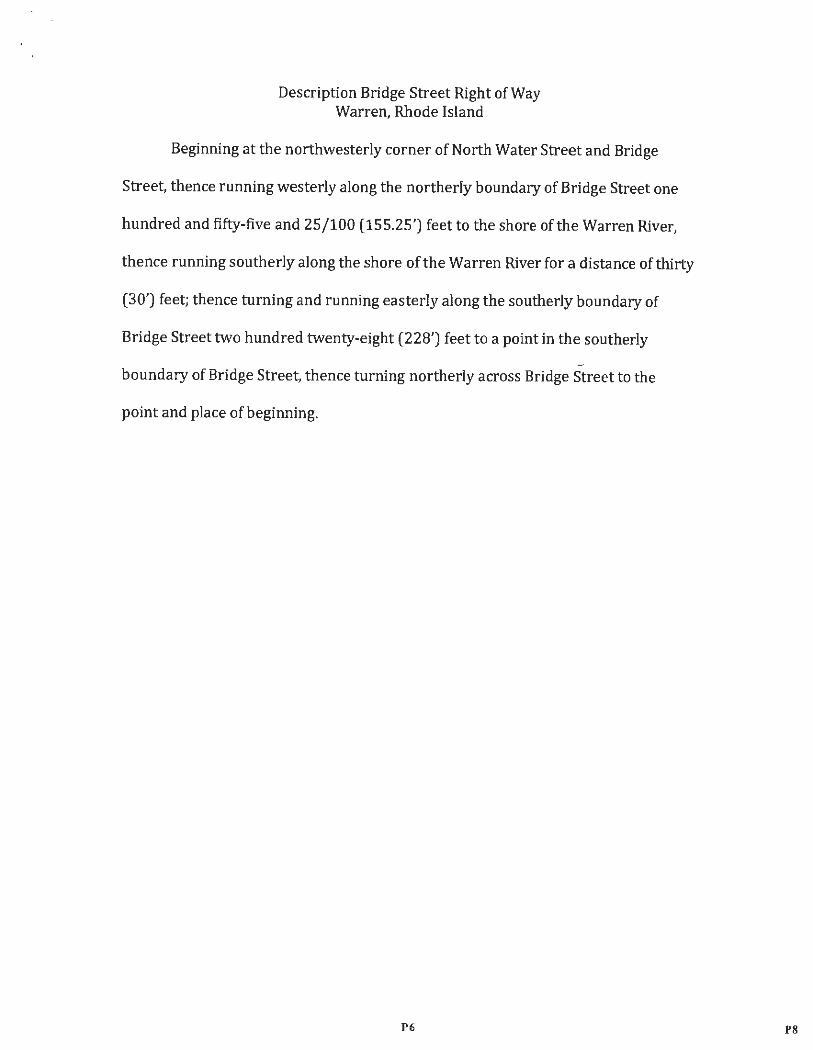
Description Bridge Street Right of Way Warren, Rhode Island
Beginning at the northwesterly corner of North Water Street and Bridge
Street, thence running westerly along the northerly boundary of Bridge Street one
hundred and fifty-five and 25/100 (155.25') feet to the shore of the Warren River,
thence running southerly along the shore of the Warren River for a distance of thirty
(30') feet; thence turning and running easterly along the southerly boundary of
Bridge Street two hundred twenty-eight (228') feet to a point in the southerly
boundary of Bridge Street, thence turning northerly across Bridge Street to the
point and place of beginning .
P6 PS
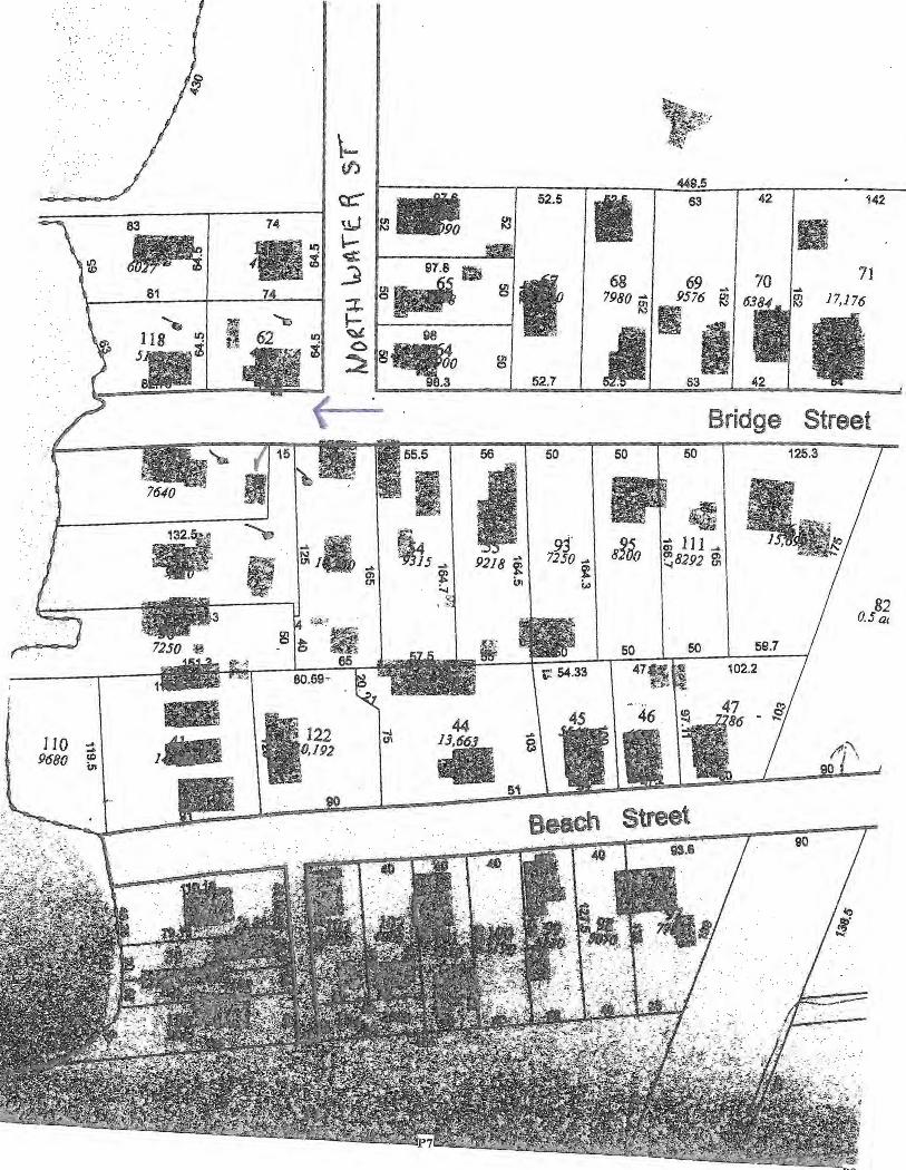
~ ; '
· ... ,~, ~ l,f/, . ~ :
\- I " Cl)
449.5
83
$ ~ 81
't, 118 ~
5 •. i! 8 . .
t:C' ~- 52.5
fl 63 42 142
74 ,~ l!3 • II) \.-. ¢ l'IWllli
i 3 97.8 Iii 68 69 -/ 70 / ....
71 g"' gl :r. 7980 i§ i.576 ~ 6384.. ~ 17,176 "t:)
"31 t 62 98 .,i
'I ~ 0 ~"f.o ~ g
8.3 52.7 -t Bridge Street 55.5 56 50
;.. 00 I 125.3
• Id -·
~ ~ I -- I I .\ ~ 93' a'ido ... 111 ... ' 4
!8292 ~ -1 15 ... 9218 f 7250 .... i ~ ~ "' to) ......
82 I 1 ~ - 1 I I I 0.5 a, t;,4-~
g1~ '~;; l!'f~~ I 50 I 50 I 59.7
I " . lj I 47ft' . t~ 102.2 1~ I 80.59-
- l \ ,H I -·46 1~ 47 {!} 77~,c • "" \1122 44
110 =:\ 1- a s1 •1•1• I ~-, .0,192
I ' 9680 : __jQ_
S1 ~
90
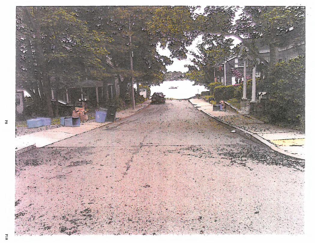
"
- ~ ..
~.
' ~ : t.,. 'r . • ( f., ... , -,#
t,.,~ ·:----. ;} ;i :. .. - '9A·,.:
'"'I:! --
-c:, -u,

2017-05~046 Beach Street

State of Rhode Island and Providence Plantations Cmtstd Resources M~nagement Council Oliver H. Stedman Government Center 4808 Tower Hill Road, Suite 3 Wakefield, RI 02879-1900
NOTICE OF PUBLIC HEARING
(401) 783-3370 Fax (401) 783-2069
May 16, 2017
In accordance with and pursuant to the provisions of the "Administrative Procedures Act", (Chapter 42-35 et. seq. of the General Laws of Rhode Island), and the Rules and Regulations of the Coastal Resources Management Council, a hearing will be held relative to Title 46, Chapter 23, of Section 6 A, B, C, D, E, Title 46 Chapter 23 Section l 8(b ), Title 46, Chapter 6, Section 1, Title 46, Chapter 6, Section 2 of the Rhode Island General Laws of 1956, as amended, for a State of Rhode Island Assent on potential Rights-of-Way located in the Town of Warren.
The Proposed Right-of-Way (ROW) CRMC File No. 2017-05-045 Description: Bridge Street Right of Way, Warren, Rhode Island
Beginning at the northwesterly comer of North Water Street and Bridge Street, thence running westerly along the northerly boundary of Bridge Street one hundred and fifty-five and 25/100 (155.25') feet to the shore of the Warren River, thence running southerly along the shore of the Warren River for a distance of thirty (30') feet; thence turning and running easterly along the southerly boundary of Bridge Street two hundred twenty-eight (228') feet to a point in the southerly boundary of Bridge Street, thence turning northerly across Bridge Street to the point and place of beginning.
The Proposed Right-of-Way (ROW) CRMC File No. 2017-05-046 Description : Beach Street Right of Way, Warren, Rhode Island
Beginning at the northwesterly corner of the East Bay Bicycle Path and Beach Street, thence running westerly along the northerly boundary of Beach Street three hundred and ninetythree and 20/100 (393.20') feet to the shore of the Warren River, thence running southerly along the shore of the Warren River for a distance of thirty-five (35') feet; thence turning and running easterly along the southerly boundary of Beach Street four hundred fifty-eight and 78/100 (458.78') feet to the southwesterly corner of the East Bay Bicycle Path and Beach Street, thence turning and running northerly along the westerly boundary of the East Bay Bicycle Path the point and place of beginning .
The Proposed Right-of-Way (ROW) CRMC File No. 2017 -05-047 Description : Baker Street Right of Way, Warren, Rhode Island
Beginning at the northwesterly comer of North Water Street and Baker Street, thence running westerly along the northerly boundary of Baker Street two hundred and eighty-two (282') feet to the shore of the Warren River, thence running southerly along the shore of the Warren River for a distance of forty (40') feet; thence turning and running easterly along the southerly boundary of Baker Street two hundred fifty-four (254') feet to the southwesterly
Pl Pl

comer of North Water Street and Baker Street, thence turning northerly across the intersection of North Water Street and Baker Street forty (40') feet to the point and place of beginning.
The Proposed Right-of-Way (ROW) CRMC File No. 2017-05-048 Description: River View Street Right of Way, Warren, Rhode Island
Beginning at the northeasterly comer of Barker A venue and River View Street, thence running easterly along the northerly boundary of River View Street eighty (80') feet to the shore of the Kickemuit River, thence turning and running southerly along the shore of the Kickemuit River for a distance of thirty (30') feet; thence turning and running easterly along the southerly boundary of River View Street eighty (80') feet to a point on the southerly boundary of River View Street, thence turning northerly across River View Street thirty (30') feet to the point and place of beginning .
The hearing will be held at 7:00 p.m. on Monday, June 19•\ 2017 in the Warren Town Hall, Council Chambers, 514 Main Street, Warren, RI.
Parties interested in/or concerned with the above mentioned matter are invited to be present and/or represented by counsel at the above mentioned time and place. This meeting place is accessible to individuals with disabilities. The meeting location is accessible to handicapped persons. Any individual requiring a reasonable accommodation i,n order to participate in this meeting should contact CRMC offices at 401-783-3370 at least 72 hours prior to the meeting.
Plans of the proposed work may be seen in the office of the Coastal Resources Management Council, Oliver H. Stedman Government Center, 4808 Tower Hill Road, Wakefield, Rhode Island, between the hours of 8:30 a.m. and 3:30 p.m., Monday through Friday.
Oral statements will be heard and recorded and statements may be submitted to the hearing officers at the time of hearing.
Signed this 16th day of May, 2017.
/lat
P2 P2
CRMC Mailing list for 2017-05-046 Beach Street ROW - Warren
Town of Warren Warren Town Hall 514 Main Street Warren,RI 02885
Christine Rodrigues 61 Beach Street Warren,RI 02883
Ronald Strickland Robert Strickland 123 Willow Road East Kingston, NH 03827
Donna Crowell 45 Beach Street Warren, RI 02885
Marilyn & Scott Mathison 41 Beach Street Warren,RI 02885
Matthew V anschalkwyk 3 7 Beach Street Warren, RI 02885
Tammy and Steven Botelho 44 Beach Street Warren, RI 02885
CRMC (2017-05-045, 046, 047, 048) 0. S. Government Center 4808 Tower Hill Road Wakefield, RI 02879
P3 P3
Description Beach Street Right of Way Warren, Rhode Island
Beginning at the northwesterly corner of the East Bay Bicycle Path and Beach
Street, thence running westerly along the northerly boundary of Beach Street three
hundred and ninety-three and 20/100 (393.20') feet to the shore of the Warren
River, thence running southerly along the shore of the Warren River for a distance
of thirty-five (35') feet; thence turning and running easterly along the southerly
boundary of Beach Street four hundred fifty-eight and 78 /100 ( 458. 78') feet to the
southwesterly corner of the East Bay Bicycle Path and Beach Street, thence turning
and running northerly along the westerly boundary of the East Bay Bicycle Path the
point and place of beginning .
P4 P4
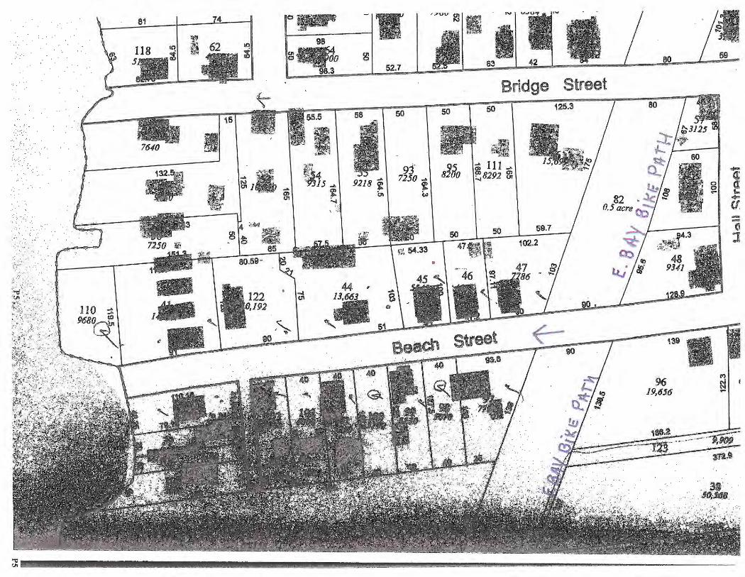
110 ... 968or\':
l~-
15
I
.{.,_. '\
80,59-
122 fJ,192
65
55.5
g
56
9218 f (11
52.7
50
63
Bridge 50
... 111 ~8292 m
50 50 59.7
Street 125.3
!ti
80
80
139
96 19,656
69
--<, :I
.~ ·. 186,l
··_· ';'~~---- ---~ ,n~, ' ' '
.,.,ll. ·.·
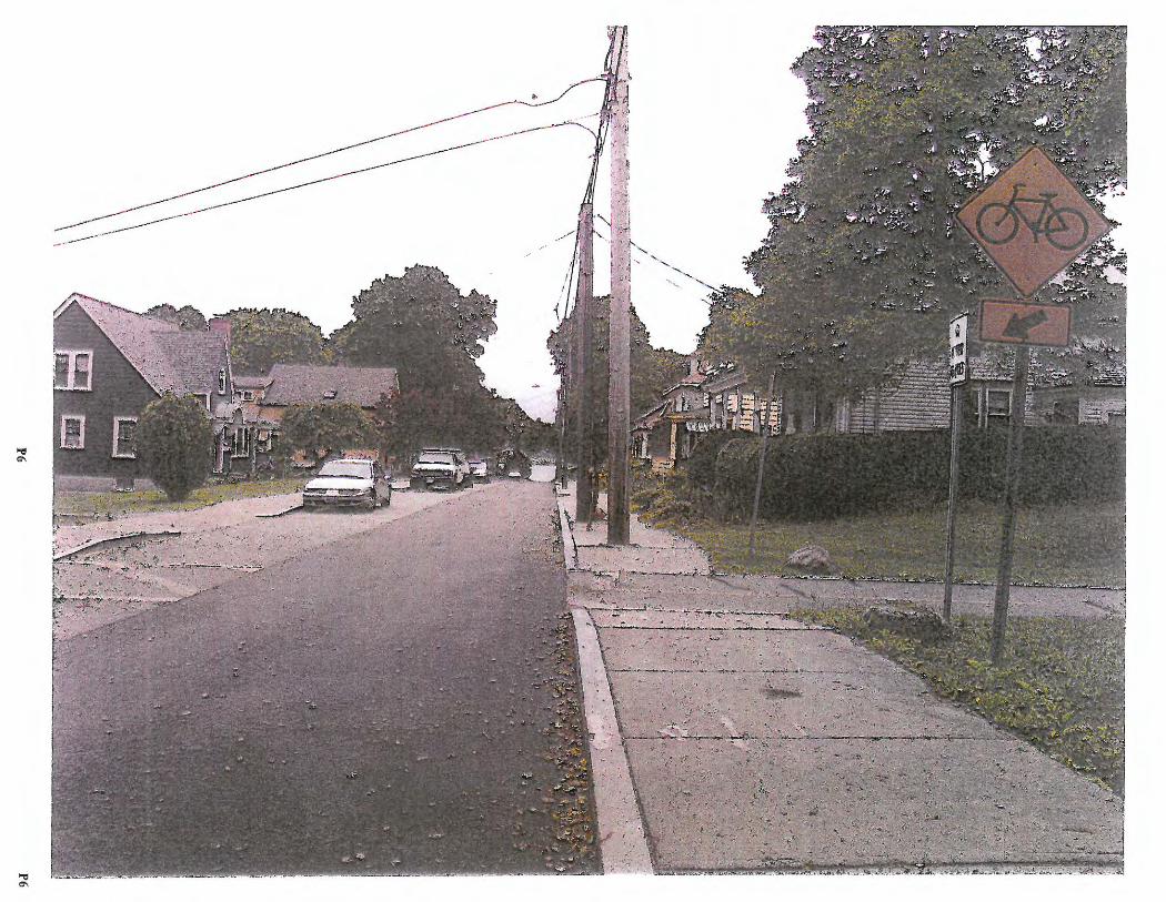
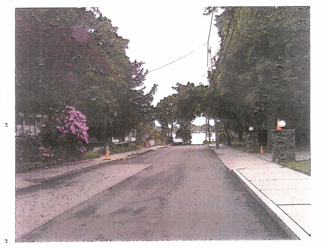
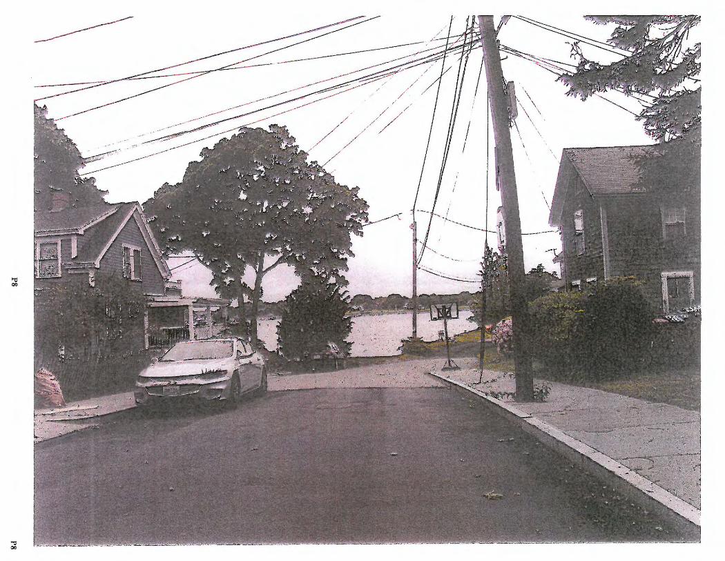
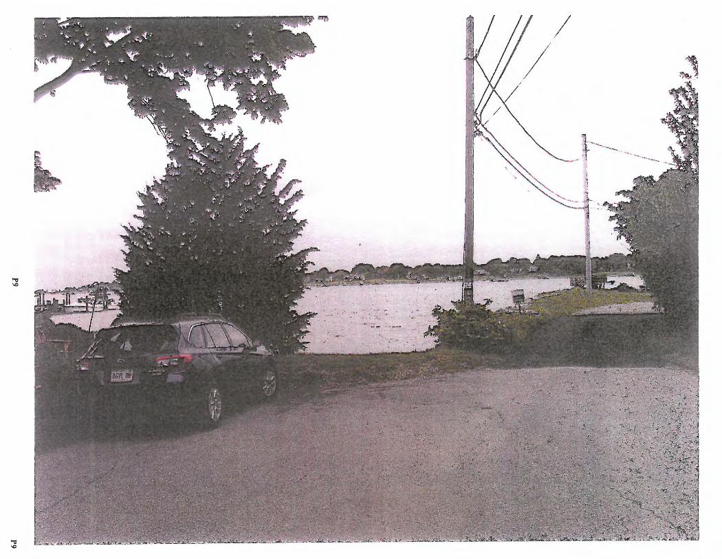
./
'L .
' ~~-
V.. ;r" ---- ~ .. ' ...... _, --..........
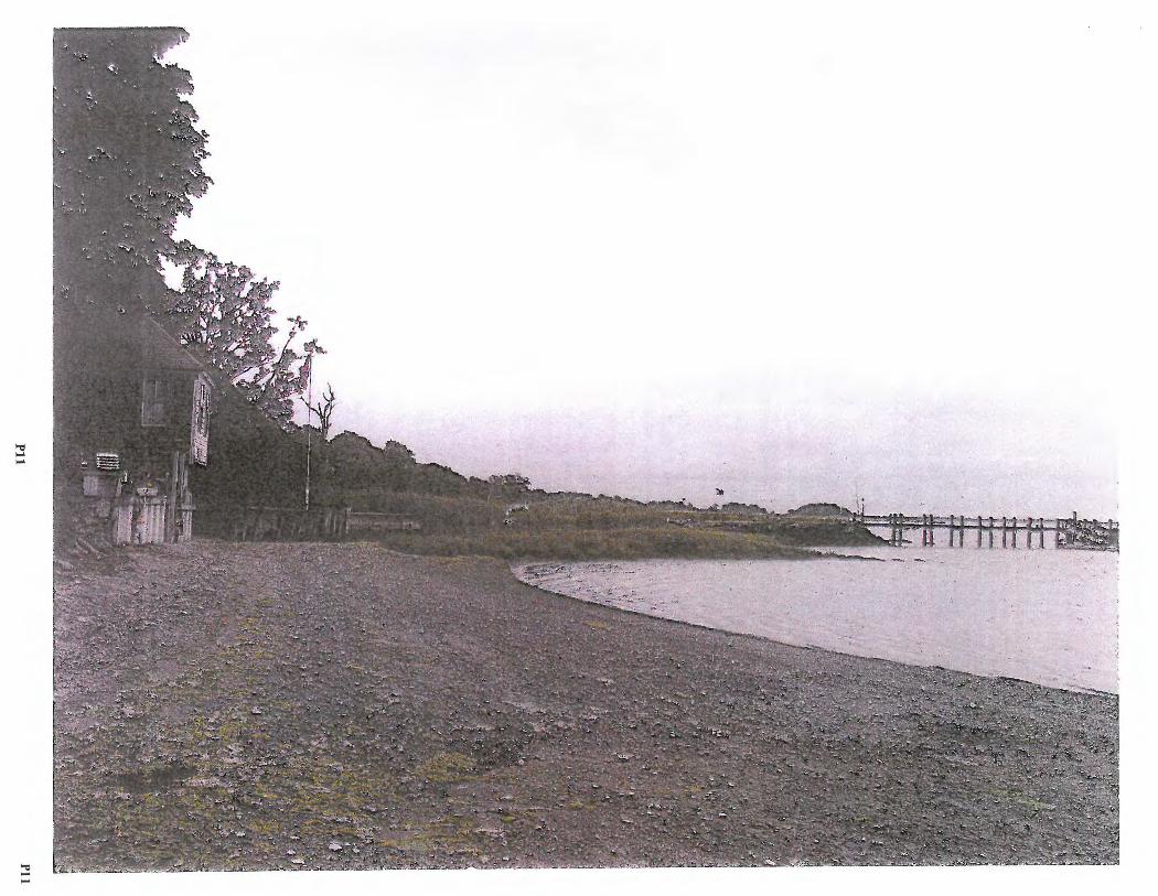
.,, -
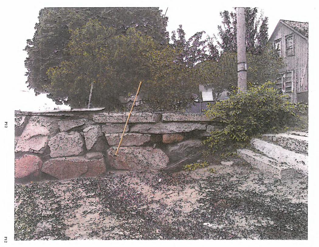
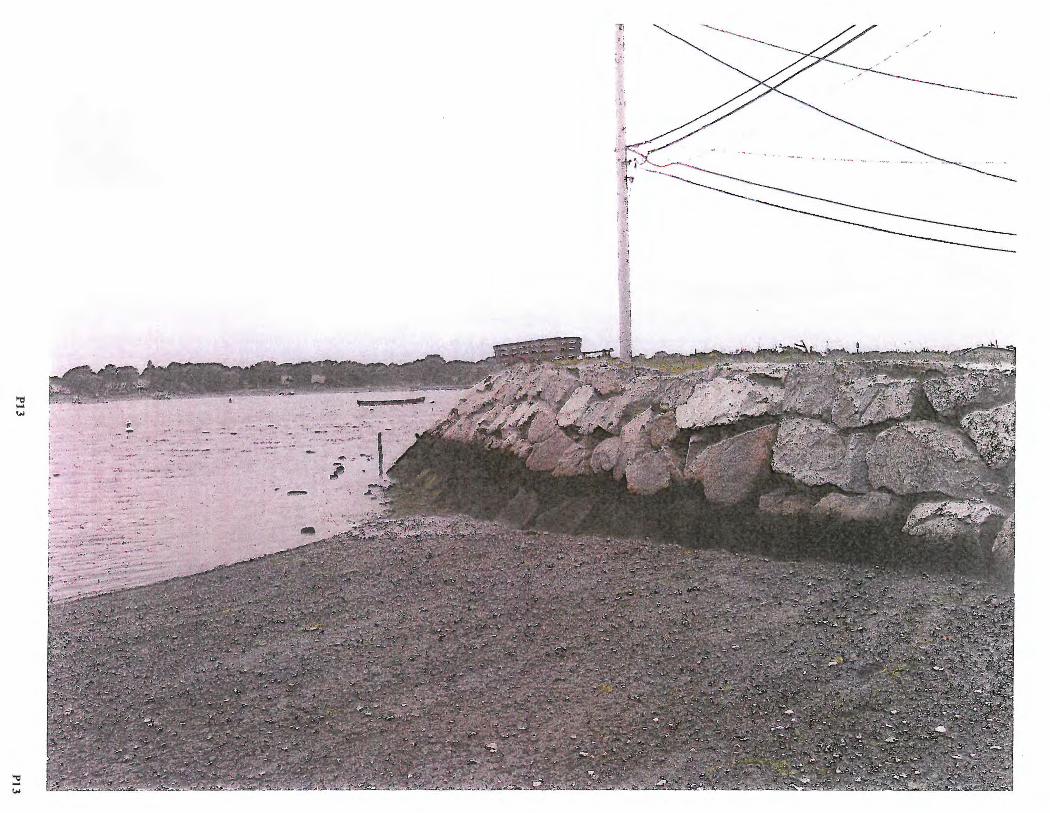
/
--.,
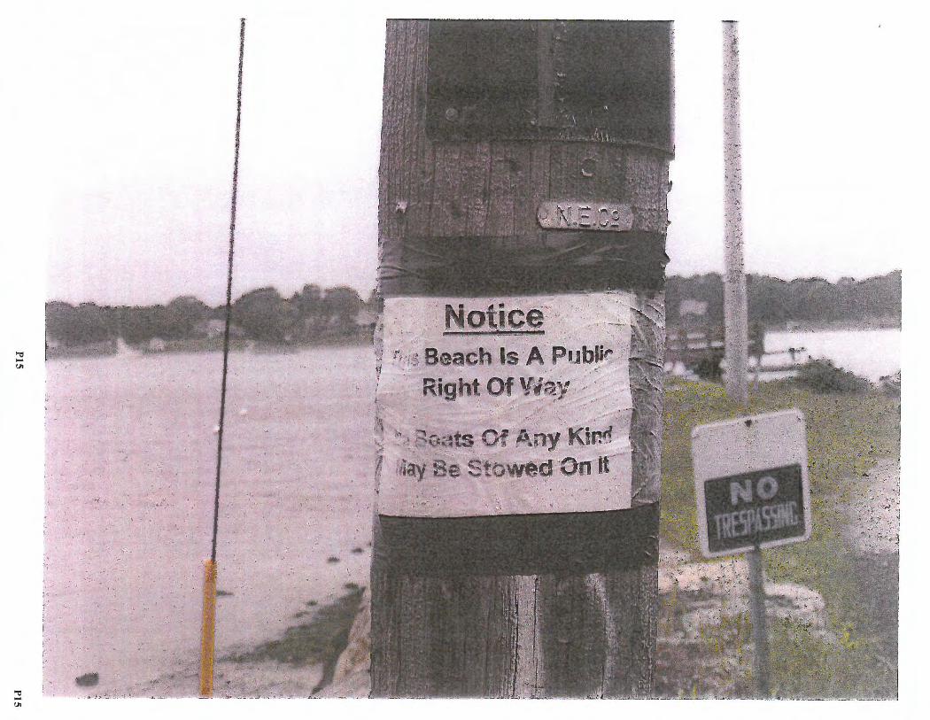
• . ·""' -".>:'._• ' 'i -~
, . '
Notice=·· Ji ' ias I 4fl,zti:aa-
\J !\ \ :. Beach Is A Publir :·· · r
· Right Of 'i'i1'i,Y . , ,
:i ./
·;] ~t~
.,, -"'
"Ci -"'
I
r· f l .. ' l . !
r L-.r
, .
f, T"
. . . -.:. ·-
. . ~~..,,'"'-·~
.,. J~--
I
{> .. }.-. t
-~ ~· t
;" ~,."'"! ..
'."< •
,:l'_
.. ..... , ....... 0,: ...... : .,....
...... .ii,, .. .
·,· 4;_.:-: ,:, 4 ~ • • • ~ , . : : • '
. . ~ .,.. - .«:-·

2017-05-047 Baker Street
State of Rhode Island and Providence Plantations Cozstal Resources Manag ement Council Oliver H. Stedman Government Center 4808 Tower Hill Road, Suite 3 Wakefield , RI 02879-1900
NOTICE OF PUBLIC HEARING
(401) 783-3370 Fax (401) 783-2069
May 16, 2017
In accordance with and pursuant to the provisions of the "Administrative Procedures Act", (Chapter 42-35 et. seq. of the General Laws of Rhode Island), and the Rules and Regulations of the Coastal Resources Management Council, a hearing will be held relative to Title 46, Chapter 23, of Section 6 A, B, C, D, E, Title 46 Chapter 23 Section 18(b), Title 46, Chapter 6, Section 1, Title 46, Chapter 6, Section 2 of the Rhode Island General Laws of 1956, as amended, for a State of Rhode Island Assent on potential Rights-of- Way located in the Town of Warren.
The Proposed Right-of-Way (ROW) CRMC File .No. 2017-05-045 Description: Bridge Street Right of Way, Warren, Rhode Island
Beginning at the northwesterly comer of North Water Street and Bridge Street, thence running westerly along the northerly boundary of Bridge Street one hundred and fifty-five and 25/100 (155.25') feet to the shore of the Warren River, thence running southerly along the shore of the Warren River for a distance of thirty (30') feet; thence turning and running easterly along the southerly boundary of Bridge Street two hundred twenty-eight (228') feet to a point in the southerly boundary of Bridge Street, thence turning northerly across Bridge Street to the point and place of beginning.
The Proposed Right-of-Way (ROW) CRMC File No. 2017-05-046 Description: Beach Street Right of Way, Warren, Rhode Island
Beginning at the northwesterly comer of the East Bay Bicycle Path and Beach Street, thence running westerly along the northerly boundary of Beach Street three hundred and ninetythree and 20/100 (393.20') feet to the shore of the Warren River, thence running southerly along the shore of the Warren River for a distance of thirty-five (35') feet; thence turning and running easterly along the southerly boundary of Beach Street four hundred fifty-eight and 78/100 (458.78') feet to the southwesterly comer of the East Bay Bicycle Path and Beach Street, thence turning and running northerly along the westerly boundary of the East Bay Bicycle Path the point and place of beginning.
The Proposed Right-of-Way (ROW) CRMC File No. 2017-05-047 Description: Baker Street Right of Way, Warren, Rhode Island
Beginning at the northwesterly comer of North Water Street and Baker Street, thence running westerly along the northerly boundary of Baker Street two hundred and eighty-two (282') feet to the shore of the Warren River, thence running southerly along the shore of the Warren River for a distance of forty ( 40') feet; thence turning and running easterly along the southerly boundary of Baker Street two hundred fifty-four (254') feet to the southwesterly
Pl PJ
comer of North Water Street and Baker Street, thence turning northerly across the intersection of North Water Street and Baker Street forty (40') feet to the point and place of beginning.
The Proposed Right-of·W&y (ROW) CRMC File No. 2017·05..048 Description: River View Street Right of Way, Wam-ren, Rhode Island
Beginning at the northeasterly comer of Barker A venue and River View Street, thence running easterly along the northerly boundary of River View Street eighty (80') feet to the shore of the Kickemuit River , thence turning and running southerly along the shore of the Kickemuit River for a distance of thirty (30') feet; thence turning and running easterly along the southerly boundary of River View Street eighty (80') feet to a point on the southerly boundary of River View Street, thence turning northerly across River View Street thirty (30') feet to the point and place of beginning.
The hearing will be held at 7:00 p.m. on Monday, June 19•\ 2017 in the Warren Town Hall, Council Chambers, 514 Main Street, Warren, RI.
Parties interested in/or concerned with the above mentioned matter are invited to be present and/or represented by counsel at the above mentioned time and place. This meeting place is accessible to individuals with disabilities . The meeting location is accessible to handicapped persons. Any individual requiring a reasonable accommodation in order to participate in this meeting should contact CRMC offices at 401-783-3370 at least 72 hours prior to the meeting.
Plans of the proposed work may be seen in the office of the Coastal Resources Management Council, Oliver H. Stedman Government Center, 4808 Tower Hill Road, Wakefield, Rhode Island, between the hours of 8:30 a.m. and 3:30 p.m ., Monday through Friday .
Oral statements will be heard and recorded and statements may be submitted to the hearing officers at the time of hearing .
Signed this 16th day of May, 2017.
/lat
P2 P2
Mailing List for CRMC File Number 2017-05-047 Town of Warren ROW - Baker Street
Town of Warren Warren Town Hall 514 Main Street Warren,RI 02885
Lawrence Dario 91 Baker Street Warren, RI 02885
Mark and Diane Greenbaum 81 Baker Street Warren,RI 02885
Dockside Properties LLC 73 Ferry Lane Barrington , RI 02806
Spencer Morris and Allison Newsome 100 Child Street Warren, RI 02885
CRMC (2017-05-047) 0 . S. Government Center 4808 Tower Hill Road Wakefie ld, RI 02879
P3 P3
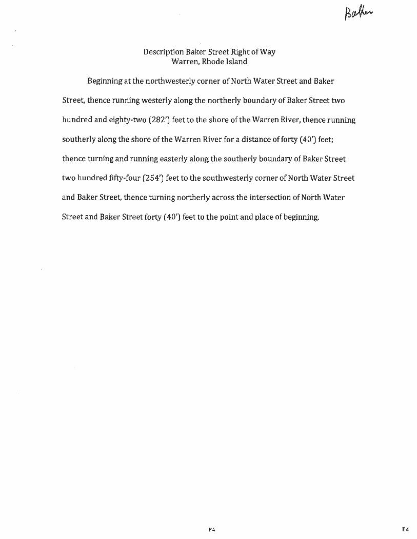
Description Baker Street Right of Way Warren, Rhode Island
Beginning at the northwesterly corner of North Water Street and Baker
Street, thence running wester ly along the northerly boundary of Baker Street two
hundred and eighty·two (282') feet to the shore of the Warren River, thence running
southerly along the sho re of the Warren River for a distance of forty ( 40') feet;
thence turning and running easterly along the southerly boundary of Baker Street
two hundred fifty.four (254' ) feet to the southwesterly corner of North Water Street
and Baker Street, thence turning northerly across the intersection of Noi:th Water
Street and Baker Street forty ( 40') feet to the point and place of beginning.
P4 P4
• {t . 4:528& .·
~.o 1 2S,301
133.9 117.2 e>-
4 S,712
. CD
·• 70
25,894
"
CD <'Ii CD
O> co It) ...
""' ,., (,)
62.0 ,
.,,
.... <'Ii ..
"' ~
, .
. ::~_~\ .. \~_~::, ?-\{ 1
3 12,397
172.1 126.8
g; 6 0 6,786
134.2
41 7,259
94.13
•
.2 133.2
z . 0 0 g 16;734 0 :t:: M ...
Q) en
~ C: (0
~ en (0 (I) ,._
'""' """ ~ (0 0 i:,, sa z
'""' ~\ (I)
~
Street 83.S
' ~ f.:-i; ·.-'.'· ' ; • ·"' ,
·, I
. .. .. ~~
~-.:. ••• .,11111'.r \ - . . . -:,.. . . ~~ ·... . ....
i ;
I ...
' '
I J
' J I
I
It I ,,
I ',:I 0C
'"'! ~ -, .., -- -·------- ~------ ~- .. ., .
................. ___ - -,-- - -________ _..._.~--
.,.,,,_ ..,.. __ _ r · l ( :_·· .: .
~-~ .. . :-[ < ,,,, '\\. .,.~ . ..
~ -....
',:i -
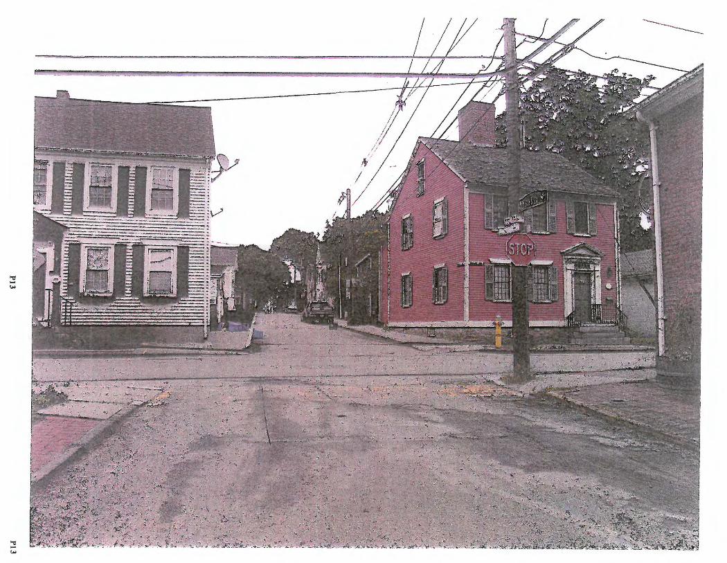

2017-05-048 Riverview Street
State of Rhode Island and Providence Plantations Coastal Resources Management Council 011ver H. Stedman Governmen t Center 4808 Tower Hill Road. Suite 3 Wakefield, RI 02879-1900
NOTICE OF PUBLIC HEARING
(401) 783-3370 Fax(40 1)783-2069
May 16, 2017
In accordance with and pursuant to the provisions of the "Administrative Procedures Act", (Chapter 42-35 et. seq. of the General Laws of Rhode Island), and the Rules and Regulations of the Coastal Resources Management Council, a hearing will be held relative to Title 46, Chapter 23, of Section 6 A, B, C, D, E, Title 46 Chapter 23 Section 18(b), Title 46, Chapter 6, Section 1, Title 46, Chapter 6, Section 2 of the Rhode Island General Laws of 1956, as amended, for a State of Rhode Island Assent on potential Rights-of-Way located in the Town of Warren.
The Proposed Right-of-Way (ROW) CRMC File No. 2017-05-045 Description: Bridge Street Right of Way, Warren, Rhode Island
Beginning at the northwesterly corner of North Water Street and Bridge Street, thence running westerly along the northerly boundary of Bridge Street one hundred and fifty-five and 25/100 (155.25') feet to the shore of the Warren River, thence running southerly along the shore of the Warren River for a distance of thirty (30') feet; thence turning and running easterly along the southerly boundary of Bridge Street two hundred twenty-eight (228' ) feet to a point in the southerly boundary of Bridge Street, thence turning northerly across Bridge Street to the point and place of beginning .
The Proposed Right- of-Way (ROW) CRMC File No. 2017-05-046 Description: Beach Street Right of Way, Wa rren, Rhode Island
Beginning at the northwesterly corner of the East Bay Bicycle Path and Beach Street, thence running westerly along the northerly boundary of Beach Street three hundred and ninetythree and 20/100 (393.20') feet to the shore of the Warren River, thence running southerly along the shore of the Warren River for a distance of thirty-five (35') feet; thence turning and running easterly along the southerly boundary of Beach Street four hundred fifty-eight and 78/100 (458.78') feet to the southwesterly comer of the East Bay Bicycle Path and Beach Street, thence turning and running northerly along the westerly boundary of the East Bay Bicycle Path the point and place of beginning .
The Proposed Right -of-Way (ROW) CRMC File No. 2017-05-047 Description: Baker Street Right of Way, Warren, Rhode Island
Beginning at the northwesterly corner of North Water Street and Baker Street, thence running westerly along the northerly boundary of Baker Street two hundred and eighty-two (282' ) feet to the shore of the Warren River , thence running southerly along the shore of the Warren River for a distance of forty (40') feet ; thence turning and running easterly along the southerly boundary of Baker Street two hundred fifty-four (254') feet to the southwesterly
Pl Pt
comer of North Water Street and Baker Street, thence turning northerly across the intersection of North Water Street and Baker Street forty (40') feet to the point and place of beginning.
~ The Proposed Right-of-Way (ROW) CRMC File No. 2017-05-048 Description: River View Street Right of Way, Warren, Rhode Island
Beginning at the northeasterly comer of Barker A venue and River View Street, thence rwming easterly along the northerly boundary of River View Street eighty (80' ) feet to the shore of the Kickemuit River, thence turning and running southerly along the shore of the Kickemuit River for a distance of thirty (30') feet; thence turning and running easterly along the southerly boundary of River View Street eighty (80 ') feet to a point on the southerly boundary of River View Street, thence turning northerl y across River View Street thirty (30' ) feet to the point and place of beginning .
The hearing will be held at 7:00 p.m. on Mond ay, June 19th, 2017 in the Warren Town Hall,
Council Chambers, 514 Main Street, Warren, RI.
Parties interested in/or concerned with the above mentioned matter are invited to be present and/or represented by counsel at the above mentioned time and place. This meeting place is accessible to individuals with disabilities . The meeting location is accessible to handicapped persons. Any individual requiring a reasonable accommodation in order to participate in this meeting should contact CRMC offices at 401-783-3370 at least 72 hours prior to the meeting .
Plans of the proposed work may be seen in the office of the Coastal Resources Management Council, Oliver H. Stedman Government Center , 4808 Tower Hill Road, Wakefield , Rhode Island, between the hours of 8:30 a.m. and 3 :30 p.m ., Monday through Friday.
Oral statements will be heard and recorded and statements may be submitted to the hearing officers at the time of hearing.
Signed this 16th day of May, 2017 .
/lat
P2 P2
Mailing List for CRMC File Number 2017-05-048 Town of Warren ROW - River View Street
Town of Warren Warren Town Hall 514 Main Street Warren, RI 02885
CRMC (2017-05-048) 0. S. Government Center 4808 Tower Hill Road Wakefield, RI 02879
P3 P3
Description River View Street Right of Way Warren, Rhode Island
Beginning at the northeasterly corner of Barker Avenue and River View
Street, thence running easterly along the northerly boundary of River View Street
eighty (80') feet to the shore of the Kickemuit River, thence turning and running
southerly along the shore of the Kickemuit River for a distance of thirty (30') feet;
thence turning and running easterly along the southerly boundary of River View
Street eighty (80') feet to a point on the southerly boundary of River View Street,
thence turning northerly across River View Street thirty (30') feet to the point and
place of beginning.
P4 P4
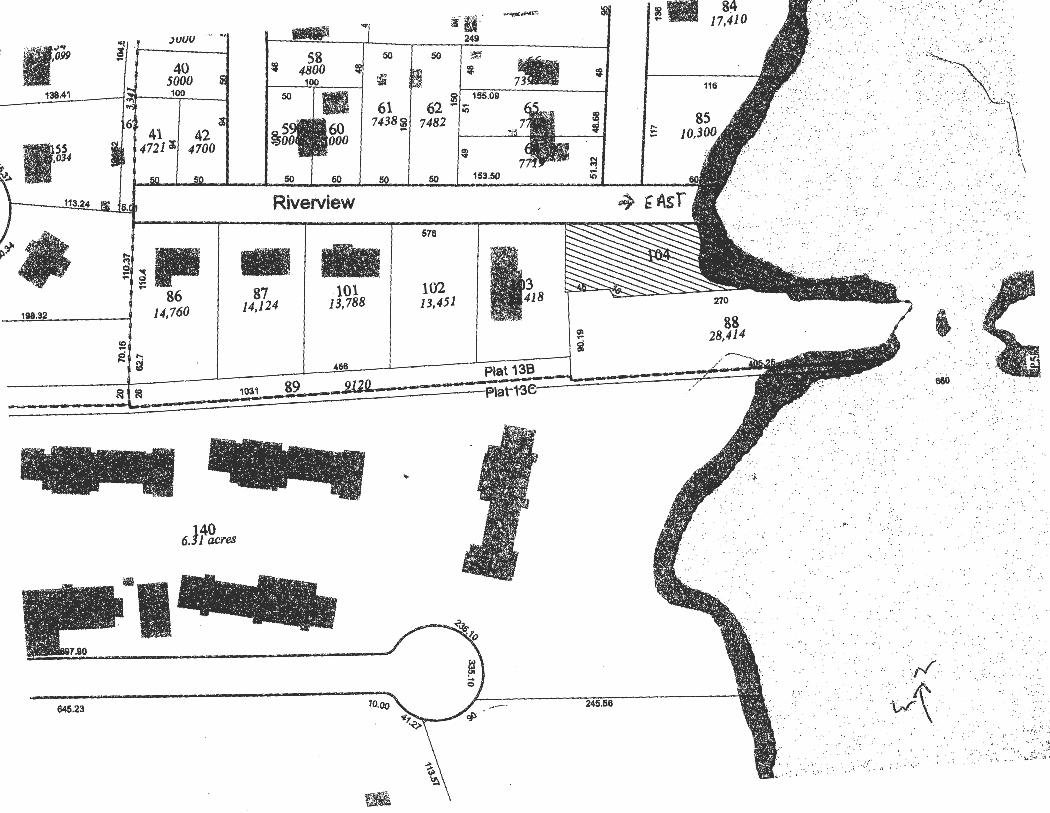
;: •. iw ii. :,uuu - -·
40 5000
138.41 100
42 I 4700 ~ • . . ~t
. ...,.> .
113~·
~~- jji .. 86
198.~ ~ 14,760
}40 6. 1 acres
·1 6'45.23
... .., ii(f 2451
.._. .... "'
58 i
50 50
4800 ~
100 ~ ! ' 7.
"" IMfJmi 61 I 62 i/~ 155.09
lio.~o I 7438 ~ 7482 "'
I
50 ~
Riverview
- -87 14,124
.101 13,788
456
1031 89
10.00
-
I
..
50
576
102 13,451
I~
153.50
Plat 13B
-F>lat-1-~e·
-
go
g
i
:8 i
~ ~
245.56
!. ::
/
84 17,410
116
..· .. ,
. :"'.
. !_;':'
.,.·, • . ,:·;,c{:, .···,
:·i ' ....... : ·.··· ... ,_
~·-=:·:;
,. ''. j ' : \&~t ... . . '\ ., . . . , ., . , '
·. ,. _,,. ', . ' '·i i :" '
.. ..
;_~: ..
. \
·-· ,,.• ' ... - ~ ··;·\ ..
' ·/ : .•• ..
, ..
. . ,
680.
. . . ..
:,_/ - ~ -.. . ·A' ··w,· ..
. ·-.. ~; .. ,: : :·, - :( .·
. , • '•
... ~ .
'1 • ••
_, ......
. ,
.' _,. ·. ; ·,:r:.·<~~ . ;.,'., :,:. ·: ~·\ .!,i?\ti
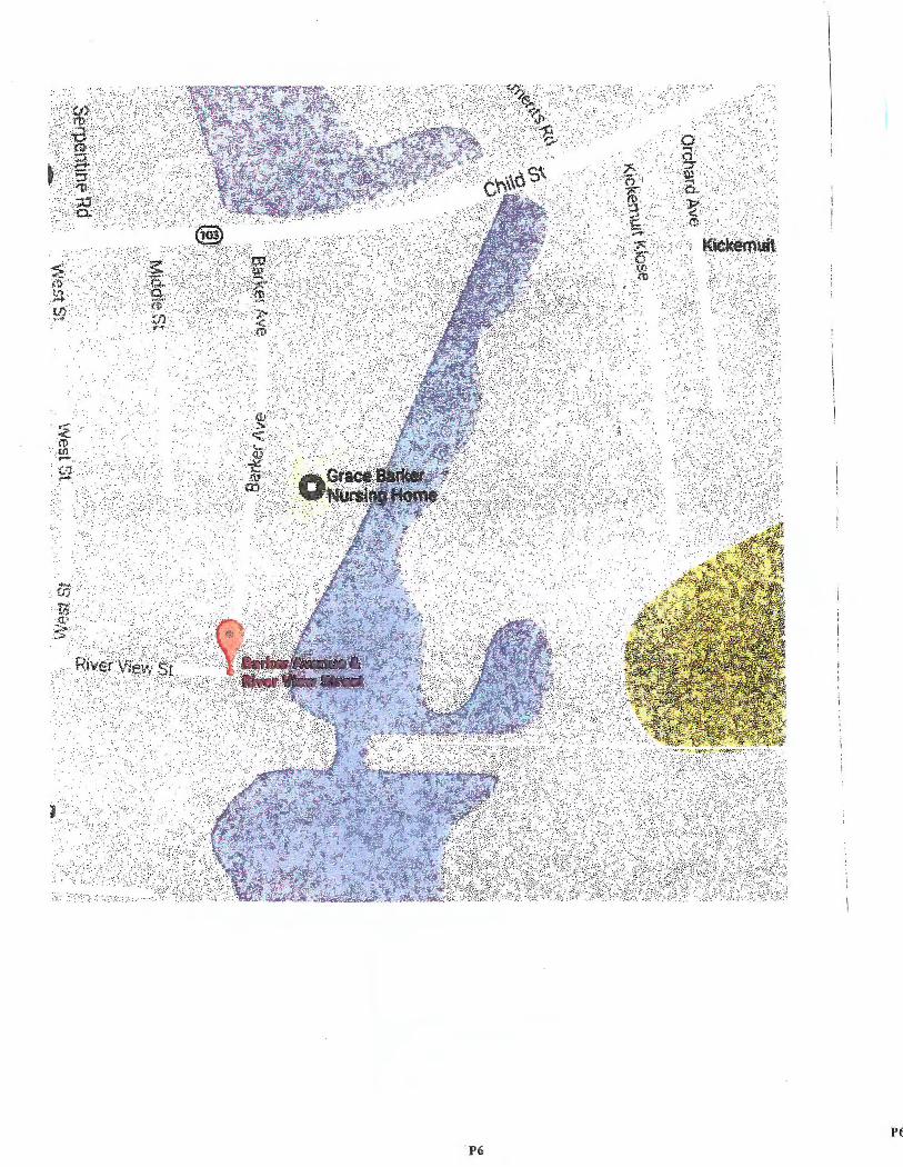
.·.· '!,•: .· . ! ·•\\
,,,_r,
.. ,.·.:.:-
..,·, ·,:,, ·
•• '; ·. ~· · , I
v(¥S:_~~t ::-.. ·:._, ...
\ . ,:
· .. : \ I '
P6 P6

5117/2017 Barker Ave & River Vtf!Ni St- Google Maps
Go ig[e Maps Barker Ave & River View St
@
Corner St01e
(§ ~ 0
Ja~s Hellew. Computer Consultant. PC Gur.
@426Fi1ness
::._:i .. ' , ,-:..,_ ~('"'i , 1i, 1 ~ @, ... , t·
~· El ,,. s
- .- . - - - . ~ .,.... -
Barker Ave & River View St Warren, RI 02885
A The Childrtns VWorl<shop • Werren "'
G -~=en
Warten Housino Authonty
@
.:, ·.• .'t'I . j \
·'· \
Kict<emuil ,, ~-
---· - \!l=hc:c.1
Map data @2017 Google 200 ft .. 1--____ ..,
https://www.google.com/maps/place/Barker+Ave+%26+River+Vtew+St,+Warr~~l+0288&@41.7265422,-71.2666946 ,17z/datF!3m1!4b1!4m5!3m4!1sOx89e . .. 1/2P7
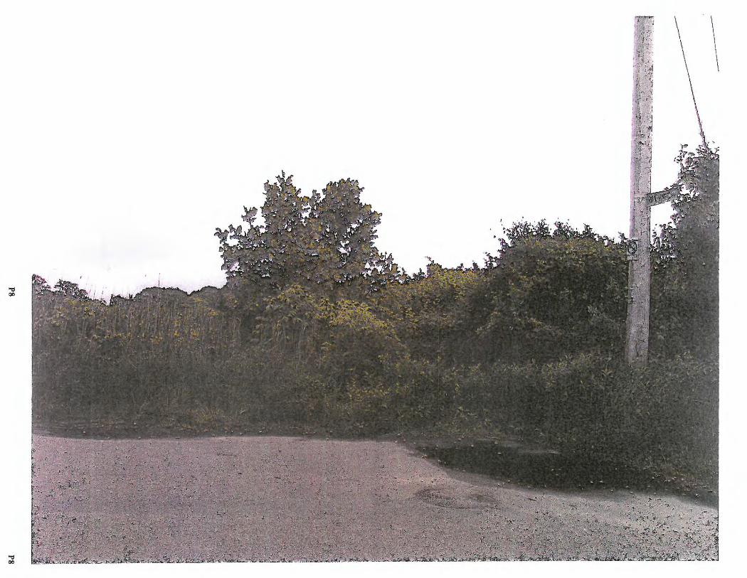
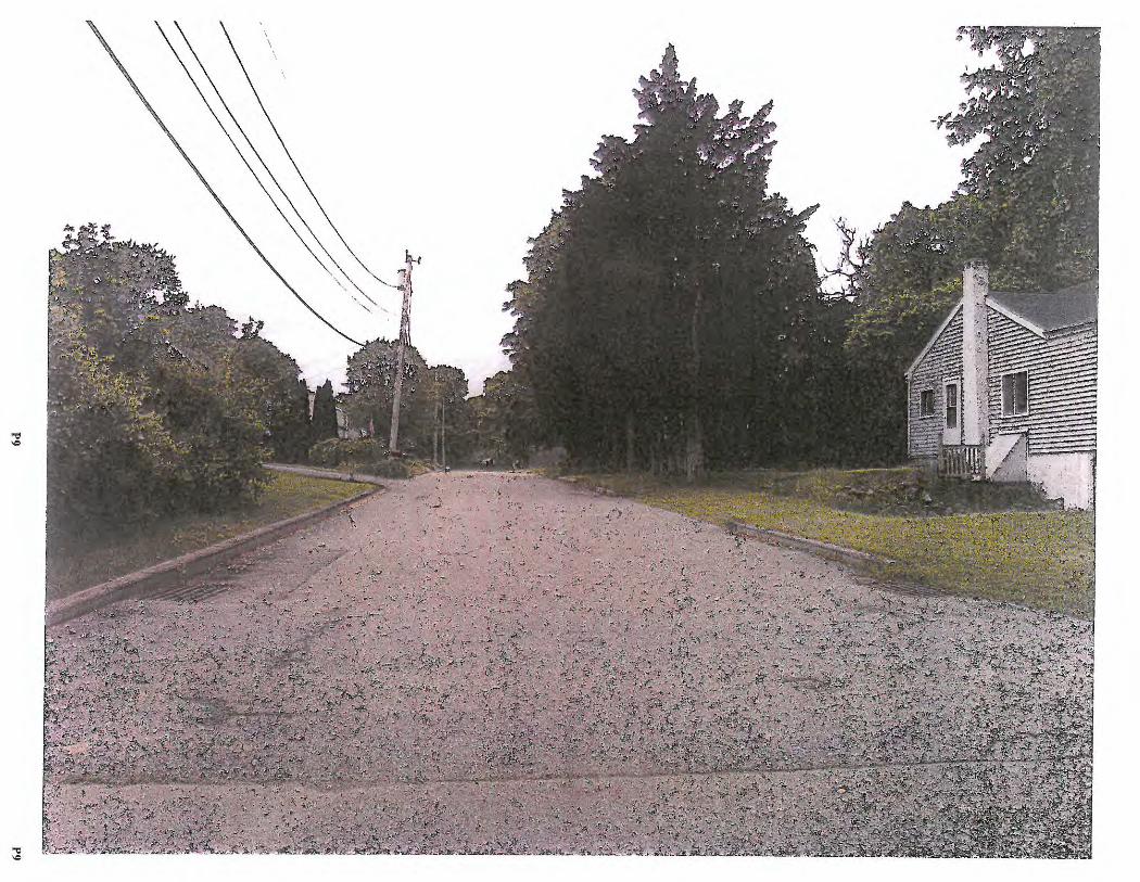
,.,.
"ti --t ..
"ti --
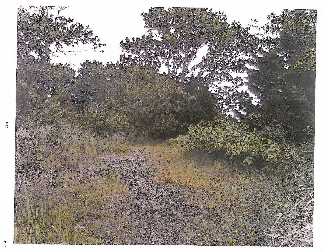
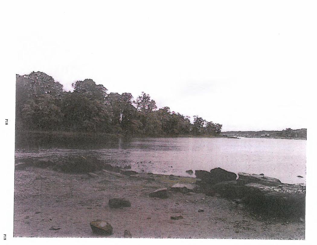
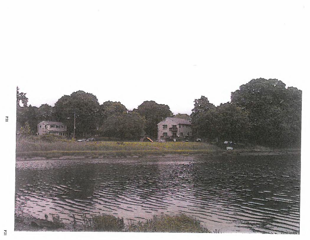
. ' .,
Subcommittee Meeting - June 19, 2017
STATE OF RHODE ISLAND AND PROVIDENCE PLANTATIONS
* * *
IN RE:
* * *
COASTAL RESOURCES MANAGEMENT COUNCIL
* * * * * * * * *
RIGHTS-OF-WAY TOWN OF WARREN 2017 - 05 - 045 Bridge Street 2017 - 05-046 Beach Stree t 2017 - 05 - 047 2017 - 05 - 048 * * * *
Baker Street River View Street
* * * * *
Date : June 19, 2017 Time : 7 : 0 0 p . rn. Pla ce: Warren Town Hall
Council Chambers 514 Main Street Warren, Rhode Isla nd
MEMBERS PRESENT Anne Maxwell Livingston, Patricia Reynolds Paul Beaudette Anthony Desisto , Esquire,
Chairwoman
Legal Counsel
STAFF PRESENT Willie Mosunic ORr Gf NAL
IRONS & ASSOCIATES CERTIFIED PROFESSIONAL STENOGRAPHERS
33 Rollingwood Drive Johnston, Rhode Island 02919
(401) 764 - 0108 RECE\VED
J\JN 2, 3 20\7
I ttft;d~ht~~i~1ic1L Irons & Associates Court Reporters (401)764-0108 [email protected]
1
P22
Subcommittee Meeting - June 19, 2017
I N D E X
APPLICATION PAGE NUMBER
2017 -05 -045 Bridge Street .. .. ...... . .... 6 20 17-0 5 -04 6 Beach Street .. . .. . . . . ... .... 9 2017 -05- 047 Baker Street ............. . .. 16 2017-05-048 River View Street . .......... 22
Irons & Associates Court Reporters (401)764-0 108 [email protected]
2
P23
1
2
3
4
5
6
7
8
9
10
11
12
13
14
15
16
17
18
19
20
21
22
23
24
everyone.
Subcommittee Meeting - June 19, 2017
(COMMENCED AT 7:00 P.M.)
CHAIRWOMAN LIVINGSTON: Good evening,
I am going to call this meeting to order .
I'm Anne Livingston . I am Chair of the CRMC. This is
Paul Beaudette and Patricia Reynolds, and we're here to
designate these rights-of-way in the Town of Warren.
I'm going to read this statement first, which will
explain what we're doing today and how this all works
and then we will look at each right-of-way one at a
time.
This public hearing is being conducted under the
rules and regulations of the Coastal Resources
Management Council and the Administrative Procedures
Act. This means that the subcommittee will be acting as
a quasi judicial body and will be taking evidence . We
are present to hear whatever comments for or against the
designation of the rights-of-way that are the subject of
this public hearing. There will be no decision at this
time.
After hearing all of your comments the
subcommittee will, on a separate date, deliberate on the
evidence and make written recommendations to the full
Coastal Resources Management Council. The full Council
will then vote on the subcommittee findings of fact and
Irons & Associates Court Reporters (401 )764-0108 [email protected]
3
P24
1
2
3
4
5
6
7
8
9
10
11
12
13
14
15
16
17
18
19
20
21
22
23
24
Subcommittee Meeting - June 19, 2017
recommend a tions, taking into account the testimony
received tonight.
For tonight the subcommittee will not answer any
questions except of a procedural nature. We are present
to hear testimony from the public , and we have a
stenographer h ere, so this will all be recorded, to hear
testimony from the public, and this is your opportun i ty
to be heard on the issue.
Anyone who wishes to be placed on the mailing list
to receive no t ification of t he full Council hearing may
do so whe n this hea ri ng is over, a l t h ough no testimony
will be taken at the fu ll Council meeting. Tonight is
the only chance for testimony about these rights-of-way.
The subcommittee wil l also take any wr i tten
statements that are provided tonight and they will be
made part of the record for these proceedings .
Four proposed rights - of - way are the subject of
tonight's publi c hearing. Each proposed right - o f-way
will be heard individually. A de sc ription of the
right - of -wa y will be read aloud and then public comment
will be taken on that right - of - way. After all
interested persons have testified, the hearing on the
right - of -wa y will be closed and the hearing on the next
right - of-way will be open.
Irons & Associates Court Reporters (401)764-0108 [email protected]
4
P25
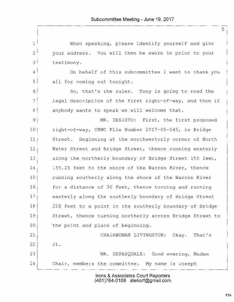
1
2
3
4
5
6
7
8
9
10
11
12
13
14
15
16
17
18
19
20
21
22
23
24
Subcommittee Meeting - June 19, 2017
When spea k ing, please identify yourself and give
your address. You will then be sworn in prior to your
testimony.
On behal f of this subcommittee I want to thank you
all for coming out tonight.
So, t h at' s the rules. Tony is going to read the
legal description of the first right - of - way, and then if
anybody wants to spea k we will welcome that.
MR. DESISTO: Fi rst, the first proposed
right - of - way, CRMC File Number 2017 - 05 - 045, is Bridge
Street. Beginning at the northwesterly corner of North
Water Street and Bridge Street, thence running westerly
along the northerly boundary of Bridge Street 155 fee t ,
155.25 feet to the shore of the Warren River, thence
running southerly along the sh ore of the Warren River
for a distance of 30 feet, thence turning and running
easterly along the southerly boundary of Bridge Street
228 feet to a point in the southerly boundary of Bridge
Street, thence turning northerly across Bridge Street to
the point and place of beginning.
CHAIRWOMAN LIVINGSTON: Okay. That's
it.
MR. DEPASQUALE: Good evening, Madam
Chair, members the corrunittee. My name is Joseph
Irons & Associates Court Reporters (40 1 )764-0108 [email protected]
5
P26
1
2
3
4
5
6
7
8
9
10
11
12
13
14
15
16
17
18
19
20
21
22
23
24
Subcommittee Meeting - June 19, 2017
DePasquale. I am the President of the Warren Town
Council. I am here to speak in support of this public
right-of-way. It's a street that dead ends at the
Warren River, it's extremely accessible, and the beauty
of this right-of-way is its proximity to the Warren
beach, as well as the public parking there, and it's an
asset to all, and if it wasn't for that right-of -wa y
many people would not be able to access the mooring
field that is located right there. The Town Council
voted unanimously to support this petition to the
committee as well as the recommendations from the Harbor
Commission, and I am speaking on behalf of the Town and
voice our support. Are there any questions?
CHAIRWOMAN LIVINGSTON: Thank you .
MR. DESISTO: Madam Chair, may I
actually ask a question?
CHAIRWOMAN LIVINGSTON: Sure.
MR. DESISTO: Joe, is it proper in the
description to refer to Water Street in this area as
North Water Street.
MR. DEPASQUALE: No. That would be if
you were not from this planet.
MR. DESISTO: That would be Water Street
or South Water?
Irons & Associates Court Reporters (401)764-0108 [email protected]
6
P27
1
2
3
4
5
6
7
8
9
10
11
12
13
14
15
16
17
1 8
19
20
21
22
23
24
Subcommittee Meeting - June 19, 2017
MR. DEPASQUALE: If you wanted to use an
actual geographical delineation, that's south, so .
MR. DESISTO: Thank you.
MR. DEPASQUALE: I always knew left
field is out there waiting to t hrow something at me .
MS. REYNOLDS: Mr. Chairman, I heard
your testimony that there's public parking in the area?
MR. DEPASQUALE: Yes.
MS. REYNOLDS: I can't see any on the
map that we have. How long of a distance is it from
this?
MR. DEPASQUALE: It's 175 feet, 200 feet
away. If you're familiar at all with this building
you're in today as you came here, it would be i n
proximity to the back parking lot where you -- did you
enter the front of the building or the back?
MS. REYNOLDS: The front.
MR. DEPASQUALE: So if you're here and
you see the top of the George Hill Library, it would be
about that distance.
MS. REYNOLDS: Yes .
MR. DEPASQUALE: It's very close.
CHAIRWOMAN LIVINGSTON: Thank you.
MR. DEPASQUALE: You're welcome . Thank
Irons & Associates Court Reporters (401)764-0108 [email protected]
7
P28
1
2
3
4
5
6
7
8
9
10
11
12
13
14
15
16
17
18
19
20
21
22
23
24
Subcommittee Meeting - June 19, 2017
you.
CHAIRWOMAN LIVINGSTON : Is there anybody
else who wanted to come forward in regards to this
Bridge Street right-of-way? This gentleman here .
Welcome.
MR. BLADE: My name is Henry Blade. I'm
a resident at 80 Baker Street, which we'll be discussing
in a moment. A friend of mine has a boat moored right
off of this locat i on, and that's , as was said, it is a
perfect place and designating it makes a lot of sense .
Hopefully, something can be done to kind of clean it up
a little bit, make it a little bit easier to access, but
it's a perfect place. I just want to support that.
CHAIRWOMAN LIVINGS TON: Thank you .
MR. BLADE: Thank you. Any questions at
all? All set.
CHAIRWOMAN LIVINGSTON: Okay . Yes.
Kendra Beaver.
MS. BEAVER: Kendr a Beaver. I am here
on behalf of Save the Bay. I am just here to say we
support the creation of additional lateral access to the
shoreline to preserve it for now and in the future, and
to support your efforts in going forward with
designating these r igh t s-o f -wa y.
Irons & Associates Court Reporters (401)764-0108 [email protected]
8
P29
1
2
3
4
5
6
7
8
9
10
11
12
13
14
15
16
17
18
19
20
21
22
23
24
Subcommittee Meeting - June 19, 2017
CHAIRWOMAN LIVINGSTON: Thank you.
Anybody else?
(NO RESPONSE)
CHAIRWOMAN LIVINGSTON: So, do I close?
I never opened the public hearing . Should I close the
public hearing ?
MR. DESISTO: Well, it's actually a
public hearing goes straight through.
CHAIRWOMAN LIVINGSTON: We could do t hem
one at a time?
MR. DESISTO: No.
CHAIRWOMAN LIVINGSTON: Moving o n to the
second o ne.
MR. DESISTO: That is proposed
right-of-way CRMC File Number 2017 -05- 0 46 Beach Street.
Beginning at the n o rthwesterly corner of the East Bay
Bicycle Path and Beach Street, thence running westerly
a l ong the northerly boundary of Beach Street 393.20 feet
to the shore of the Warren River , thence running
southerly along the shore of the Warren River fo r a
distance of 35 feet, thence turning and running easterly
along the southerly boundary of Beach Street 458.78 feet
t o the southwesterly corner of the East Bay Bicycle Path
at Beach Street, thence turning and running northerly
Irons & Associates Court Reporters (401)764-0108 [email protected]
9
P30
1
2
3
4
5
6
7
8
9
10
11
12
13
14
15
Subcommittee Meeting - June 19, 2017
10
along the westerly boundary of the East Bay Bicycle Path
to the point and place of beginning.
CHAIRWOMAN LIVINGSTON : That's really
long.
MR. DESISTO: Yes, it is.
CHAIRWOMAN LIVINGSTON: Yes, sir .
MR. DEPASQUALE: Good evening, Madam
Chair and members of the committee. The beauty of Rhode
Island's law is its access from the water to the
shoreline, and when you look at Beach Street, you really
get a great perspective on not only accessing this
location from the water, because it is, indeed, a beach,
it's a natural beach at the bottom, and what has
happened over the years is a berm has been built up, and
it's been very strategically blocked to the land access
-------------- 1-6------------w-erl-d -, and, .-a-gain 1 :tB-i--s- is a-1-se a clea-e. -- efle.- S'E:1:-eet··th -at
17
18
19
20
21
22
23
24
dead ends on the Warren River, and it's a beautiful
spot, and we als o support access to the public f rom the
land, as wel l as we know access from the shore and water
is legal up to the high tide, median high tide mark, and
this spot, once again, as well as Bridge, I err t o tell
you at high tide is inundated . So these areas are, in
my opinion, doubly secured in regards to public access
by land as well as by sea, because the high tide mark is
Irons & Associates Court Reporters (401)764 -0108 [email protected]
P31
1
2
3
4
5
6
7
8
9
10
11
12
13
14
15
16
17
18
19
20
21
22
23
24
Subcommittee Meeting - June 19, 2017
11
so high and the access is so literal that if you were to
stand there at moon tide you would be in the water. So,
again, we support this for numerous reasons, but also to
roll back the amount of blockage that has been put up,
and this was a State approved locat io n years ago. There
was a sign there and it was vandalized, so these efforts
are to --
CHAIRWOMAN LIVINGSTON: You mean you
think it was designated before ?
MR. DESIS TO: It may have been, but I'm
not positive. I do know that as a young lad I did see a
sign, because one day I was chastised and told to leave
and I pointed out and said, oh, yeah, well, what about
that . So, that's on the record .
you.
CHAIRWOMAN LIVINGSTON: Okay. Thank
MR. DEPASQUALE: You're welcome.
CHAIRWOMAN LIVINGSTON: What I don't
understand is why the whole street for so far, there are
many houses along there .
MR. DEPASQUALE: The street is probably
only 22 to 25 feet wide.
CHAIRWOMAN LIVINGSTON: Yeah .
MR. DEPASQUALE : I am not sure . I
Irons & Associates Court Reporters (401)764-0108 [email protected]
P32
1
2
3
4
5
6
7
8
9
10
11
12
13
14
15
16
17
18
1 9
20
21
22
23
24
Subcommittee Meeting - June 19, 2017
didn't - - I'm sor r y, I didn't pay as close attention as
I should have when you read the dimensions.
MR. DESISTO: May I ask the Council
president a question . The East Bay Bicycle Path is
r eally the closest pub l ic access to the shore on Beach
Street, isn't that correct?
MR. DEPASQUALE: Oh, no. Oh, no.
MR. DESISTO: It isn't?
12
MR. DEPASQUALE: It's interesting. When
yo u said that I thought you were just denoting , once
again, a geographical location wh ere the bike path was
and the distance where the bike path west which would
delineate where this pub l ic access began, when you
referenced the bike pa t h, that's what I thought you were
talki n g about because - -
MR. DESISTO : Tha t 's the start poin t of
this public right - of - way for CRMC purposes .
MR. DEPASQUALE: Well, that wou l d be
going one, two, three, you would be including 20 houses.
MR. DESISTO: Yes .
MR. DEPASQUALE: I mean, that's the
whole street. Basical l y , you're starting in a
geographi c al loca t ion of the bi ke path and just call i ng
the entire west side of the s t reet.
Irons & Associates Court Reporters (401)764-0108 [email protected]
P33
1
2
3
4
5
6
7
8
9
10
11
12
13
14
15
16
17
18
19
20
21
22
23
24
Subcommittee Meeting - June 19, 2017
13
CHAIRWOMAN LIVINGSTON: Yes, I hadn't
noticed that when I first looked this over. I'm
surprised that we didn't, usually it's just the end, you
know, that's closest to the water .
MR. DEPASQUALE: It would make sense to
me to double that . That may be a human input error.
Because the street dead ends at the bay.
MR. DESIST O: Do you mind coming forward
and taking a lo ok at the assess or's map?
MR. DEPASQUALE: Yes, that's accurate.
CHAIRWOMAN LIVINGSTON: Fr om here all
the way to there.
MR. DEPASQUALE: Yes, th is is where it
begins. Th is is where it ends, obviously. That's I
thought we were referring to , because when we looked at
Bridge Street, this is what I thought you were referring
to.
MR. DESISTO: It goes Water Street is
right here.
MR. DEPASQUALE: We wouldn't be able to
access Water unless you ca ll Dennis to go into the zone .
The same thing here. So, I mean, Bridge Street is the
bridge and you can go through the park and then down the
street, so that doesn't make sense to me, but I'm just a
Irons & Associates Court Reporters (401)764-0108 [email protected]
P34
1
2
3
4
5
6
7
8
9
10
11
12
13
14
15
16
17
18
19
20
21
22
23
24
Subcommittee Meeting - June 19, 2017
lone ly public servant.
CHAIRWOMAN LIVINGSTON: I think that, I
think that there's no specific -- that these have to be,
and I think if it is contiguous with a town street,
that's okay. All right. So, anybody want to come
forward?
MR. HUNT: Good evening. My name is
14
William Hunt. I live at 7 Beechwood Court in Warren . I
am a member of the Harbor Commissio n and a lso the Town's
representat ive to the CRMC. In f ormulat ing these
proposals to the CRMC, the Harbor Commission employed,
or got a volunteer, a law fellow from the Roger Williams
College to actually do the title research on all these
rights-of-ways, and the unique situation in Warren is
that when they did the title for the streets they ran
them all the way down to the water, they didn't block a
dead end with, you know, a deeded way beyond the street .
So, Bridge Street and Beach Street and a few others that
are already established right-of-ways are there because
of the way that the properties and the streets were
delineated back in, you know, when the Town was first
chartered.
CHAIRWOMAN LIVINGSTON: A long time ago.
MR. HUNT: A long time ago. Thank you.
Irons & Associates Court Reporters (401 )764-0108 [email protected]
P35
1
2
3
4
5
6
7
8
9
10
11
12
13
14
15
16
17
18
19
20
21
22
23
24
Subcommittee Meeting - June 19, 2017
15
MR. DEPASQUALE: Actually, that sparks a
memory . Thank you. I do believe, and this may be good
for you to know, that this was an oystering community,
and, interestingly enough, Carl Dennis' house, the
person that I mentioned, when he bought his house he had
a deed restriction to the bottom o f Green's Landing,
which is what is now the bottom of Beach Street, and I
believe it was because you were able to professionally
not be denied access to your boat and your livelihood
and the oyster industry. So, that is interesting,
because my memory was refreshed.
CHAIRWOMAN LIVINGST ON: That makes
sense.
MR. DEPASQUALE: Thank you.
CHAIRWOMAN LIVINGSTON: That's good to
have on the record.
MR. DEPASQUALE: And the Greens owned
all of this area that we're talking about, Charlotte
Green.
CHAIRWOMAN LIVINGSTON : Okay. Thank
you.
MR. DEPASQUALE: Oyster magnate.
CHAIRWOMAN LIVINGSTON: Anybody else
want to go on the record to support this right-of-way or
Irons & Associates Court Reporters (401)764-0108 [email protected]
P36
1
2
3
4
5
6
7
8
9
10
11
12
13
14
15
16
17
18
19
20
21
22
23
24
Subcommittee Meeting - June 19, 2017
16
oppose it?
MR. DESISTO: Can we ask Kendra for your
corrunents from Save the Ba y?
MS. BEAVER: They will, and I will also
have some written testimony that I can give you that
applies to all four of them .
MR. DESISTO: We'll make it so Kendra
does ha ve to keep coming back and forth .
CHAIRWOMAN LIVINGS TON: Thank you very
muc h . Nobody else?
(NO RESPONSE)
CHAIRWOMAN LIVINGSTON: Okay. Thank
you . We'll move on to the next one, which is Baker
Street.
MR. DESISTO: 2017-05 - 047, Baker Street.
Beginning at the northwesterly corner of North Water
Street and Baker Street, thence running westerly along
the northerly boundary of Baker Street 282 feet to the
shore of the Warren River, thence running s outherly
along the shore of the Warren River for a distance of
40 feet, thence turning and running easterly along th e
southerly boundary of Baker Street 254 feet to the
southwesterly corner of North Water Street and Baker
Street, thence turning northerly across the i n tersection
Irons & Associates Court Reporters (401)764-0108 [email protected]
P37
1
2
3
4
5
6
7
8
9
10
11
12
13
14
15
16
17
18
19
20
21
22
23
24
Subcommittee Meeting - June 19, 2017
of North Water Street and Baker Street 40 feet to the
point and place of beginning.
MR. DEPASQUALE: Good evening. Baker
Street is a unique location. It is higher than sea
le vel, and currently we maintain the Conservation
17
Commission maintains it as a public scenic overlook with
a bench and a nice area for rest and relaxation. It is
probably about maybe eight to ten -- eight feet higher
th an sea level, and it is also a spot that the East Bay
pipeline from Barrington to -- the Warren/Bristol County
Water Authority had a pipe that was there, under there,
and that is, I b el i eve, what raised the elevation,
ordinari ly it probably would have gone down over the
years, but it's been that way my whole life , and this
would be a great opportunity as well to have it State
recognized, the Council supports all of these as wel l,
and I want you to know that this is a great spot, and it
is in the location that allows access not , again , just
so you know , at t he sea level , access at the higher
level and possibly with approval or creative thinking
maybe there could be an actual egress point.
MR. BEAUDETTE: So there is no access
from the edge of the road down to the shoreline?
MR. DEPASQUALE: It dead ends, but it's
Irons & Associates Court Reporters (401)764-0108 [email protected]
P38
1
2
3
4
5
6
7
8
9
10
11
12
13
14
15
1 6
17
18
19
20
21
22
23
24
Subcommittee Meeting - June 19, 2017
higher than all of the othe rs. All of the others
actual ly are equal in elevation.
18
CHAIRWOMAN LIVINGSTON : That's up to the
Town, as to whether you want to put some steps in or
whatever.
MR. DEPASQUALE: That's what I like to
hear .
CHAIRWOMAN LIVINGSTON: We're just
assuring that it's open to the water.
MR. DEPASQUALE: I appreciate that
i nput . Thank you .
MR. BEAUDETTE: Excuse me?
MR. DEPASQUALE: Oh, sorry.
MR. BEAUDETTE: The map I'm looking at
has a h ouse lot that extends to Baker Street?
MR. DEPASQUALE: It does. It was
originally the Oyster House as well as The Wharf Tavern
and that is a private residence that is due north. It
jets right out into the water. It's built on a stone
pier .
CHAIRWOMAN LIVINGSTON: Is that what
you're talking about?
MR. BEAUDETTE: No .
MR. DEPASQUALE: Could I approach ?
Irons & Associates Court Reporters (401)764-0108 [email protected]
P39
1
2
3
4
5
6
7
8
9
10
11
12
13
14
15
16
17
18
19
20
21
22
23
24
Subcommittee Meeting - June 19, 2017
MR. BEAUDETTE: That's a house lot. It
belongs to, the way I read it, it belongs to this 139,
10,667 square foot lot, it goes along Baker Street, but
then has this little jog to the middle of the street.
This is fro m the Town Cou ncil' s plot maps.
19
MR. DEPASQUALE: I am not sure of the
accuracy. I do know that at the end of the street there
is a drop and there's water . Maybe Mr. Hunt can
approach .
MR. HUNT: I h ave a map that we have
f rom the Town assessor. I'm not sure if it's the same
that you have there .
CHAIRWOMAN LIVINGSTON: Pau l , do you
have any other question about this?
MR. DESISTO: No, but I c o uld address
that .
CHAIRWOMAN LIVINGSTON: Yes.
MR. DESISTO: As a matter of law, the
assessor's maps are used for taxing purposes, but
they ' re not conclusively legal, and I think what
Mr. Hunt is trying to say and what Council President
DePasquale was trying to say is that this map is not
reflective of the conditions on site, which has the road
going to the end. I know there is a gentleman here that
Irons & Associates Court Reporters (401)764-0108 [email protected]
P40
1
2
3
4
5
6
7
8
9
10
11
12
13
14
15
16
17
18
19
20
21
22
23
24
Subcommittee Meeting - June 19, 2017
20
actually lives on Baker and can probably address it,
too. We took a look at that anomaly in the maps, but
I'm not so sure that it's entirely accurate, given the
circumstances, and, again, t h ese are assessor's maps and
they're used for ta x ing purposes, and, of course,
they're helpful but not conclusively.
MR. BEAUDETTE: My concern is that if
either of the homeowners say, well, I own t hat land ,
then that would inhibit access to the shore from the end
of the street, and that' s derivat iv e of why I'm asking
the question.
MR. DESISTO: That's correct . What I'm
saying , I am not so sure, I will let t he public know
that , but I'm not so sure that there is intervening land
between the Warren River and the end of Baker Street. I
will le t these gentlemen address it because they're more
conversant.
MR. HUNT: If I may, just like the pas t
two right-of - ways , this right - of - way was researched by a
law fellow that did t h e title research, and his
conclusion that was reviewed and approved by the Harbor
Commission was that the right-of - way went all the way
down to the harbor, and that's my recollection at least
of what the situation is with that.
Irons & Associates Court Reporters (401)764-0108 [email protected]
P41
1
2
3
4
5
6
7
8
9
10
11
12
13
14
15
16
17
18
19
20
21
22
23
24
Subcommittee Meeting - June 19, 2017
MR. BEAUDETTE: Okay .
CHAIRWOMAN LIVINGSTON: Thank you.
Anybocty else want to speak about Baker Street? Okay.
MR. BLADE: William Henry Blade, 80
Baker Street . I can't really add much. I do believe
that you had it correct, in that the maps don't
necessarily reflect a surveyor's map. Sometimes the
projections are too much. I fully support this
initiative.
CHAIRWOMAN LIVINGSTON : Okay. Thank
you. Thank you.
MR. HUNT: We have a copy of t he
quitclaim deed for the property . And, if I may, and I
won't read the whole thing, but it go es , norther l y
direction bounding westerly on the Warren River 29 and
one -tenth f eet, thence in a weste rl y direction bounding
southerly on the Warren River 127 and th ree-tenth s feet
in the northerly direction. So, in the legal
description itself they 'r e using the Warren Riv er as the
boundary for the property. I'm happy to sha r e this wi t h
you.
MR. BEAUDETTE: No, tha t's fine.
MR. DESISTO: Actua ll y, c oul d you giv e
it to Mr . Mosunic so i t could be made part of the record
Irons & Associates Court Reporters (401)764-0108 [email protected]
21
P42
1
2
3
4
5
6
7
8
9
10
11
12
13
14
15
16
17
18
19
20
21
22
23
2 4
Subcommittee Meeting - June 19, 2017
of tonight's proceedings .
MR. LIPPMAN: Craig Lippman, 25 Shore
Drive. I'm the secretary of the Harbor Conunission in
Town, and this information was provided as part of the
original application to the CRMC, the maps and the deed .
CHAIRWOMAN LIVINGSTON: Thank you.
Thank you for providing them. Thank you for your input.
Anybody else?
(NO RESPONSE)
CHAIRWOMAN LIVINGSTON : Then we will
move onto the fourth one, which is River View Street,
which is different from the first three that all went
down to the Warren River . This one goes to the
Kickemuit River .
22
MR. DESISTO: This is CRMC File Number
2017-05-048, River View Street, beginning at the
northeasterly corner of Barker Avenue and River View
Street, thence running easterly along the northerly
boundary of River View Street 80 feet to the shore of
the Kickemuit River, thence turning and running
southerly along the shore of the Kickemuit River for a
distance of 30 feet, thence turning and running easterly
along the southerly boundary of River View Street
80 feet to a point on the southerly boundary of River
Irons & Associates Court Reporters (401)764-0108 [email protected]
P43
1
2
3
4
5
6
7
8
9
10
11
12
13
14
15
16
17
18
19
20
21
22
23
24
Subcommittee Meeting - June 19, 2017
View Street, thence turning northerly across River View
Street 30 feet to the point and place of beginning .
23
CHAIRWOMAN LIVINGSTON: So that's Barker
Avenue right there?
MR. DEPASQUALE: Correct, yes .
CHAIRWOMAN LIVINGSTON: Anybody want to
speak up?
MR. DEPASQUALE: Of course, Madam Chair .
CHAIRWOMAN LIVINGSTON: Welcome. Thank
you .
MR. DEPASQUALE: River View i s a very
important location in Warren wi th our interest in
ren ewing the original railway b ed. The bridge there was
blown out in the '38 Hurri cane, and we're in th e proce ss
of putting a new bik e path bridge over t hat , and the
ar ea that we're talking about here is northwest of the
bike path, th e lo catio n , and this would allow access
from Barker Avenue, and it's a perfect spot, o n ce again,
it's on th e inward side of the Kickemuit River, and what
I mean by that is the delineation woul d be what we refer
to as the broken bridg e, it was a tra in trestle, whic h
will no w b e the new bike path bridge wi l l be connecting
t h e East Bay bike pa th t o Touisset in Massachusett s, so
it's a green, and it is saf e for th e school.
Irons & Associates Court Reporters (401)764-0108 [email protected]
So this,
P44
1
2
3
4
5
6
7
8
9
10
11
12
13
14
15
16
17
18
19
20
21
22
23
24
Subcommittee Meeting - June 19, 2017
24
again, is supported by the Council, the commission, and
we look forward t o being able to claim this as a public
ri ght - of -wa y.
CHAIRWOMAN LIVINGSTON: It appears from
th e p i ctures that we have here that the other ones, the
concrete went just about down to the water, but this
one, there's a patch of --
MR. DEPASQUALE: It is a vegetated
buffer that over the years with the developmen t that
encroached on the western sid e, there was a drainage
swale allowed to be put in for that development, and
over the years, as you may hear in oth er public
right - of-way testimony, there have been some vegetated
nuisances t hat were allowed, or not sanctioned, and an
area of, I don't know how to say it, overgrowt h, and
with the lack of actual tit le d right-of - way we did the
best we could fro m the Town's perspect i ve and it's one
of the reasons why we're seeking this recognition.
CHAIRWOMAN LIVINGST ON: So you foresee
that the Town will clear out at least some of that to
make it?
MR. DEPASQUALE: Absolutely , absolutely.
It's just undergrowth, and once we, especi a lly with t he
bike path, and it will b e the positive connection that
Irons & Associates Court Reporters (401)764-0108 [email protected]
P45
1
2
3
4
5
6
7
8
9
10
11
12
13
14
15
16
17
18
19
20
21
22
23
24
Subcommittee Meeting - June 19, 2017
that dead end street needs to the water as well as
cleaning itself up as not just ending in a mess of
briars.
you.
CHAIRWOMAN LIVINGSTON: Okay. Thank
MR. DEPASQUALE: You're welcome.
CHAIRWOMAN LIVINGSTON: No questions.
Does anybody want to come forward to talk about this
River View Street?
(NO RESPONSE)
CHAIRWOMAN LIVINGSTON: Okay. We're
considering Kendra already here. Nobody?
25
MR. HUNT: Just as a younger resident of
the Town, someone who's looking to start a family, I
think it's very important, the vision of the bike path,
the i nc ompleted over the broken bridge. It will provide
very important access for children that are trying to
attend the Kickemuit Middle School to be able to, and
the parks and the other facilities that the Town has
over in that section of town, to access via that bike
path, along with the Town's ultimate vision to connect
that part of t he bike path with the remaining sections
of the East Bay Bike Path.
MR. DESISTO : May I ask Mr. Hunt a
Irons & Associates Court Reporters (401)764-0108 [email protected]
P46
1
2
3
4
5
6
7
8
9
10
11
12
13
14
15
16
17
18
19
20
21
22
23
24
Subcommittee Meeting - June 19, 2017
26
question. Actually, just to let the members of the
subcommittee know, the Kickemuit Middle School is on the
eastern bank of the Kickemuit River, so this connection
would allow for bike access to t he middle school.
MR. HUNT: Okay. Thank you.
MR. DEPASQUALE : I 'm sure yo u would like
to hear more from me. When you look at the geographies
and the soil co nditi ons there, this is the more solid
side, the oppos i te side is full of silt , and when you
look at an access point for kayaks or rowboats , no t -- I
wouldn't look at that location as , I don't want a boat
ramp, but what would be great, there is the abi l ity to
launch person powered, people powered craft, because
that side is hard so it gives a safe footing, and we
also have Hugh Cole as well as the Kickemuit Middle
School, as well as our elementa ry school, and that would
be a kind of great connectivity, not only on a bike but
also to the water.
CHAIRWOMAN LIVINGSTON: I don't quite
understand. I have pictures that show, I guess what
used to be the bridge?
little .
MR. DEPASQUALE: Yes.
CHAIRWOMAN LIVINGSTON: And it's down a
I mean, they would have to -- how does the
Irons & Associates Court Reporters (401)764-0108 [email protected]
P47
1
2
3
4
5
6
7
8
9
10
11
12
13
14
15
16
17
18
19
20
21
22
23
24
Subcommittee Meeting - June 19, 2017
27
right-of - way connect with the bridge?
MR. DEPASQUALE: It doesn't. It is an
indirect connection. The street basically dead ends to
what used to be the railway, so what you're looking at
is, when you look at the eastern side, that's the access
point which is right along the river.
CHAIRWOMAN LIVINGSTON: Oh, I see.
MR. DESISTO: This property is
immediately adjacent to the broken bridge property.
MR. DEPASQUALE: Correct . Like, the
other rights-of-ways went, the road went directly in to
the river, this road dead ends into the bike path, which
used to be the rail spur, and t he access poin t would be
to your left if you were driving down the street. And,
more importantly, let me add, that our senior center is
right on the other side of this, of the rail spur, so
when you're looking, if that delineates the bike path,
the opposite side of this is our senior center, and 80
is the new 60, so or 60 is the new 80, so we're
looking forward to getting as many people as possible
into the accessible points of our waterfron t .
CHAIRWOMAN LIVINGSTON: Okay.
MR. DEPASQUALE: Thank you.
MR. BEAUDETTE: So, in general, somewhat
Irons & Associates Court Reporters (401)764-0108 [email protected]
P48
1
2
3
4
5
6
7
8
9
10
11
12
13
14
15
16
17
18
1 9
20
21
22
23
24
Subcommittee Meeting - June 19, 2017
28
specific to this right-of-way, but to some extent, as
the Chair has asked, is the Town either, A, waiting for
this designation of righ t- of -wa y or needs it, or does
the Town have plans to cleanup, open up, remove
vegetation? Some of the photos we have for this site, I
would literally -- are we bush whacking through?
MR. DEPASQUALE: No. There are well
worn paths through the years of use that are still
there, and I would a lways defer to our planner,
Ms. Michaud, for her expert opinion on where we're
going, but what we're trying to do is create a five-year
plan and understand the fiscal needs as well as our
vision , and I wouldn't want to say that we're completely
waiting on this, but also by having it a deemed
r i ght - of - way it would allow us to move forward with
confidence as well as to continue to ask your support
and approval for our interactions with the coastline.
So, it's just one more, it's one more part of o ur
positive plan forward.
hearing .
CHAIRWOMAN LIVINGSTON : Okay.
MR. DEPASQUALE : Thank you .
CHAIRWOMAN LIVINGSTON: Anybody else?
MR. DESISTO: You can close the public
Irons & Associates Court Reporters (401)764-0108 [email protected]
P49
1
2
3
4
5
6
7
8
9
10
11
12
13
14
15
16
17
18
19
20
21
22
23
24
Subcommittee Meeting - June 19, 2017
CHAIRWOMAN LIVINGST ON: All right . I
hereby close the public hearing. I don't think I ever
o ff ic ial ly opened it. Do I have a motion to adjourn?
MR. BEAUDETTE: So moved.
MS. REYNOLDS: Second .
CHAIRWOMAN LIVINGSTON: Thank you very
much .
(VOICE VOTE TAKEN)
(UNANIMOUS)
(HEARING CONCLUDED AT 7 : 41 P.M.)
Irons & Associates Court Reporters (401)764 -0108 [email protected]
29
P50
Subcommittee Meeting - June 19, 2017
C E R T I F I C A T E
I, Rebecca J . Forte, a Notary Public in and for the
State of Rhode Island, hereby certify that the foregoing
pages are a true and accurate record of my stenographic
notes that were reduced to print through computer-aided
transcription.
In witness where of , I hereunto set my hand this
20t h day of June, 2017.
: .. \ J .'. ' f ' I C ~c"') t7 r ? -, t ( ' ( /L . . / (, "' I~ ,
I ,'
REBECCA J. FORTE, NOTARY PUBLIC
My Commission (RI) Expires on 7 /15/ 17 My Commission (MA) Expires on 1/26/18
Irons & Associates Court Reporters (401 )764-0108 [email protected]
30
P51