abstract of biblical geography
TRANSCRIPT

a star
-
of the -> --
ºf 6 3 +, +ADA P T E ID TO T H
PATRIARC HAI,

- --
----
--
-_-
----
-
*-
--
-
-
–
ſ-
I
TANCIENT -
(G ANſA.A3J. th"-
º
\ºº
o ** **, I
ºUz IM
a.º thel *ºn
~ Jerich, Nºsak
- * **
sºor
- zºniº MIM* †EB Us IT Es, º, . -
- --
-º
-
º-
-
-
-
-
-
-
-
-
-
-
-
-
-
-
--
-
-
-
-
- -
-
-
-
-
-
-
-
--
-
A B S T RA CT
or
BIBLIC A. L. G E O G RAPHY.
to which is ADDED,
3. Compenbious tſſem of the ſūobern Geograppy
OF
E U R O PE, A SIA, AND A FR I CA.
COMPILED
7.wºw, *- Rºc
BY M. L. R. PERRINE, D. D.
Spring Frof. of Eccl. Hist. and Ch. Polity, TheologicalSeminary,
Auburn.
AUBURN :
PU B L IS H E D B Y H. IV. Is O N & Co.
Oliphant & Skinner, Printers.

Entered according to act of Congress, on the thirty-first day of January, in
the year of our Lord one thousand eight hundred and thirty-five, by H. Ivison
& Co. as Proprietors, in the Clerk's office of the District Court of the Northern
District of New-York,
A DV E R T IS E M E N T.
THE following abstract was compiled with the design of af.
fording the Theological students at Auburn, the means of obtaining
as full and connected a view of Biblical Geography, as possible,
in the limited time allotted them for this study. It is printed, by
request, to save the time and labour, of transcribing, or taking
notes. It was never intended to supersede the reading of more
extensive works on this subject; but to render such reading more
interesting, and benefieial. No one can suppose that all the
names of places, and of people, mentioned in the Bible, will be
found on the following pages: still, it is thought, that by fixing
this sketch in the mind, the Biblical student, will not only be aided
in his geographical investigations, but will be enabled to locate
the most of the countries, nations, and families, that he meets
with, in reading the sacred volume.
It may not be improper to remark—that in locating the early
nations, and families of our race, particular respect has been paid,
in this abstract, to the opinion, that their settlements were made
under a special providence, and in a regular and orderly manner—
and that the plan of attempting to describe the extent and proba
ble boundaries of these settlements, has been pursued, principally
with a view to make the whole plot, or scheme, familiar to the
student. No geographical mistakes, of a serious nature, it is

iv.
thought, will result from supposing that the outlines of the allot
ment of a nation were extensive, and that they were filled up, by
the families of that nation. The location of some of the settle
ments may appear too hypothetical, and the description of their
probable boundaries, in some cases, too tedious; yet the plan
has been pursued, from a conviction that more may be gained
than lost by it. These remarks, it will be understood, relate par
ticularly to the Geography of the Patriarchal age.
In forming this summary of Biblical Geography, the compiler
has made free use, in every way that seemed best to answer his
views, of the valuable works of the following authors—Wells,
Taylor, Calmet, Paxton, Carpenter, Iahn, Horn, D. Anville, and
S. Butler.
As the limits of the eastern continent, or what is called the old
world, include all that pertains to Biblical Geography; and as
some information concerning its physical condition, and present
divisions, is essential, profitably, to commence the study of the
geography of the Bible; so a compendious view of the present
geographical state of that portion of the earth, is added to this ab
stract, that those who have not made themselves acquainted with
common geography, may, without turning to other books, obtain
such a knowledge of it, as not to be wholly unprepared to engage
in learning the geography of the sacred scriptures.
A word may be added concerning maps—One, adapted to the
Geography of the Patriarchal age, will be found in this volume—
V
For the other parts of the Biblical Geography, the Bible Atlas
engraved by Richard Palmer, and published in London, 1823, is
particularly recommended—but the maps contained in many
Bibles, Commentaries, Sacred Histories, and Books of Reference;
and in almost any Atlas of Sacred Geography may be profitably
used.* With respect to the Modern Geography of Europe, Asia,
and Africa, any modern maps of these countries will afford all
the assistance that is needed.
* The maps in the English Version of the Polyglot Bible, published, at
Boston, 1833, are very suitable; and so are those contained in Robinson's
Calmet. By adding a map of Palestine, formed for general use, to the Ancient
Atlas of Mrs. Willard, the great object of maps, in relation to this work,
may be in a good measure obtained.
1%
IN T R O DUCTION.
THE term Geography is from the Greek words GE,
earth, and GRAPHo, I write—and it means a treatise
concerning the earth, or more particularly, a descrip
tion of the divisions, or parts of the earth's surface, and
of their relative position.
Geogra
phy—Its
meaning.
By Biblical Geography is meant a description of Biblical,
those places, on the earth, that are mentioned in the
Bible.
A knowledge of Biblical Geography, besides afford
ing satisfaction to the student of scripture, will help
him to fix, in his memory, the events recorded in the
Bible; and to discover peculiar fitness, beauty, and
force, in many passages contained in the sacred volume.
Biblical Geography may be divided into three parts—
Patriarchal, Jewish, and Christian.
Geography.
Its use.
How di
vided.
I. PATRIARCHAL-By this is meant an account of Patriarchal.
the original location of the first families of our race;
and of countries, kingdoms, and cities, up to the time,
when the Isaelites took possession of the Promised
Land.
viii
Jewish.
Christian.
Land.
isle.
II. JEwish.--This may be considered, as containing
an account of the divisions of the Promised Land, at
different times; and of its physical condition.
III. CHRISTIAN.—By this may be understood, a des.
cription of the countries, and kingdoms, mentioned in
the New Testament, as they existed in the days of
Christ, and his apostles—or the Geography of the New
Testament.
GEOGRAPHICAL U S E OF WO R D S.
I. LAND.—This is used in several senses—
1. It sometimes means, the whole continent of earth,
as distinguished from sea—“Ye compass sea and land
to make one proselyte,” Mat. xxiii. 15.
2. Sometimes it means, a region of greater or less
extent—“The Lord liveth, that brought up the children
of Israel from the land of the north,” Jer. xvi. 15.
3. And sometimes it means, a particular district,
inhabited by a certain nation, tribe, or family—“And
Moses fled from the face of Pharaoh, and dwelt in the
land of Midian,” Exod. ii. 15.
II. IsLAND, or IsLE.—This has different meanings—
1. It is used to denote dry land, in opposition to water
“I will make the rivers islands, and will dry up the
pools,” Isa. xlii. 15.
ix
2. Sometimes it means, a portion of land surrounded
by water—“Howbeit, we must be cast upon a certain
island. And they knew that the Island was called
Melita,” Act, xxvii. 26. xxviii. 1. “I John was in
the Isle that is called Patmos,” Rev. i. 9.
3. It is thought, that it sometimes means, a portion
of the earth that is approached by water, whether it be
surrounded by water, or not. The district, allotted to
Japheth, is called isles, Gen. x. 5. because, as it is
supposed, it was first approached, from the east, by
water. See also Isa. xi. 10, 11. Ezek. xxvii. 3.
III. CoAst.—This term is used to denote—
1. The whole of a country. “The locusts rested in
all their coasts,” Exod. x. 14. See also Mat. ii. 16.
Judg. xix. 20.
2. A district, bordering on a particular country
“Sihon trusted not Israel to pass his coast, Judg. xi.
20. also Josh. xviii. 5.
3. More commonly, the margin of land, bordering
on the sea—“Ships shall come from the coast of
Chittim,” Num. xxiv. 24. also Mark, vii. 31.
IV. SEA.—This word is employed to express—
1. The general collection of water which encom.
passes the earth. Exod. xx. 11. Psalms, xcv. 5.
*
Coast.
Sea,
x
By particu
lar names.
By other
words and
phrases.
2. That part of this general collection of water,
which washes the shore of a particular country— .
“When we had sailed over the Sea of Cilicia, and
Pamphilia,” Act. xxvii. 5.
3. Any large collection of water, as lakes, and rivers—
“Sea of Galilee,” Mat. iv. 18. The river Euphates
is called a sea, “I will dry up her sea.” i. e. Baby
lon's—And again—“The sea is come up upon Baby
lon,” Jer. li. 36, 42. See also Isa. xxi. 1.
DESIGNATION OF THE DIFFERENT QUAR
TERS OF THE HEAVENS,
As to the manner in which the different quarters of
the heavens are designated, in the scriptures, it may
be remarked—
1. That particular names are given to the four car
dinal points—as, east, west, north, and south, 1. Chro.
ix. 24. Luke xiii. 29.
2. That the four quarters of the heavens are desig.
nated by other words, and phrases. When the people
of the east, would mark the different quarters of the
heavens, they considered themselves as facing the
rising sun. Hence, the east is designated by “rising
sun,” Num. ii. 3—by “the wings of the morning,”
Psal. cxxxix. 9—and by the words, “forward, front,
*
r xi
before,” Job. xxiii. 8. 2 King. xxiii. 13. The west is
designated by the words, “backward, behind,” Job
xxiii. 9—and also, by the “sea,” as the Great Sea was
on their back, when they viewed the rising sun. The
north, is designated by “the left hand,” Gen. xiii. 9.
xiv. 15. Job. xxiii. 9-–and the south, by the “right
hand,” 2 King xxiii. 13. Job. xxiii. 9—as the north,
and south, were on their left hand, and their right,
respectively, when they faced the east, or rising sun.
RU LES FOR AS C E RTA INING EARLY
SETTL EM E NT S.
In ascertaining the early locations of Noah's poster
ity, it may be useful to observe, something like the
following rules—
• 1. The descendants of Noah were distributed, by a
special providence; and in a regular, and orderly,
manner; according to their nations, and families,
Gen. x. 5, 20, 31.
2. When a district of country is ascertained to be
long to a nation, the families of that nation, may be
expected to be found in that district—So, when the
location of any family of a nation, is ascertained, the
rest of the families of that nation, may be expected to
be found, within a reasonable distance.
Fiist.
Second,

xii
Third. 3. When two, or more, nations, or families, are
mentioned together, in the Bible, they may be consid.
ered as neighbors.
Fourth. 4. The prophets, usually, speak of countries, ac
cording to their original settlers.
Fifth. 5. The opinions of ancient writers, with respect to
the location of nations, and familes, may throw some
light on the original settlements of countries.
Sixth. 6. The remainders of ancient names, may assist in
discovering by what nations, or families, certain dis.
tricts were originally settled.

P A R T I. *
A N A B S T R A C T
O F
P A TRIA R C H A L G E O G R A P H Y.
CHAPTE R l.
Countries before the Flood.
There are two districts of country, mentioned by
Moses—Eden and Nod. Gen. ii. 8, iv. 16.
E DE N.
EDEN.—This was a country distinguished for the
richness of its scenery; and the fertility of its soil.
The word Eden, or Delight, evinces this—see also
Gen. ii. 9.
With respect to the location of this country, there
are different opinions. The three following are, most
frequently met with, in writers on Biblical Geography.
H. It lay to the east of the Caspian Sea, including
the sources of the Indus—of the western—and the
eastern branches of the Oxus, Gihoon, or Jihon—and
of the Hermund; which are considered to be the Pison,
Gihon, Hiddekel, and Euphrates, mentioned by Moses.
II. It lay among the Armenian, or Gordiaean moun
tains, including the sources of the Euphrates, Tigris,
Phasis, and Araxes; which are supposed to be the
Euphrates, Hiddekel, Pison, and Gihon of Moses.
Countries
before the
flood.
Eden.
For what
distin
guished.
Location—
different o
pinions re
specting it.
First.
Second.

16
Third.
Paradise.
Situation.
Reasons
First.
Second.
III. It lay west of the Tigris, including a part of
Armenia, of Syria, and of Mesopotamia; and extend.
ing south, nearly, to the place where the Euphrates,
and Tigris, unite their waters.
The last of these opinions is preferred, as it appears
to agree best with the account given, of this country,
by Moses. In what he says concerning the situation
of Paradise, we have all the assistance we can expect,
in ascertaining the locations, and the relative position,
of the land of Eden, and of the Sacred garden.
PA R A D IS E.
This interesting spot was, probably, situated on the
river Perath, called by the Greeks Euphrates, in the
eastern border of the land of Eden, and not a great
distance above the place where the Tigris and Euphra
teS meet.
That this opinión is plausible, may appear from the
following considerations.
1. It lay in the eastern part of the land of Eden
Gen. ii. 8.
2. It was situated on a single channel, which was
common to four channels, or rivers, mentioned by
Moses—or upon a river, which, on leaving the land of
Eden, parted, and became four heads, or principal

17
channels”—“A river went out of Eden, to water the
garden; and from thence,” or beyond Eden, “it was
parted, and became four heads”—Gen. ii. 10. This
single channel, or river, was most likely, as it will
appear, to be the Euphrates of Moses; and the river
that has been long known by that name.
3. This single river, most probably the Euphrates,
soon after leaving the land of Eden, was parted, and
became four principal, or noble rivers. The first with
which it mingled its waters, or that changed it from a
single river, or channel, is generally supposed, on
strong probable evidence, as will be seen, to be the
Tigris. The point at which the Euphrates and Tigris
meet, was, according to this, in the eastern frontier of
the land of Eden—Gen. ii. 10—and of course, Paradise
was in the eastern border of Eden, and not far above
the junction of the Euphrates and Tigris.
The full amount of the probability which this opin
ion possesses will be seen in what Moses says con
cerning the four rivers, which he mentions in connection
with Eden.
*The word translated head, often means capital, chief, prin
cipal, most excellent—It cannot here mean source, or fountain
head, but river—for the second River, not head, or source, is
Gihon. Gen. ii. 13.
Third.
2*
18
Rivers.
Euphrates.
, Hiddekel.
Gihon.
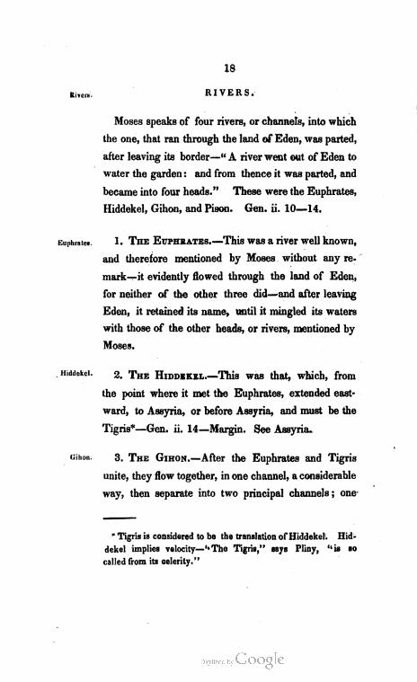
R IV E R S.
Moses speaks of four rivers, or channels, into which
the one, that ran through the land of Eden, was parted,
after leaving its border—“A river went out of Eden to
water the garden; and from thence it was parted, and
became into four heads.” These were the Euphrates,
Hiddekel, Gihon, and Pison. Gen. ii. 10–14.
1. THE EUPHRATEs.—This was a river well known,
and therefore mentioned by Moses without any re
mark—it evidently flowed through the land of Eden,
for neither of the other three did—and after leaving
Eden, it retained its name, until it mingled its waters
with those of the other heads, or rivers, mentioned by
Moses.
2. THE HIDDEKEL.—This was that, which, from
the point where it met the Euphrates, extended east
ward, to Assyria, or before Assyria, and must be the
Tigris"—Gen. ii. 14–Margin. See Assyria.
3. THE GIHoN.—After the Euphrates and Tigris
unite, they flow together, in one channel, a considerable
way, then separate into two principal channels; one
* Tigris is considered to be the translation of Hiddekel. Hid
dekel implies velocity—"The Tigris,” says Pliny, “is so
called from its celerity.”
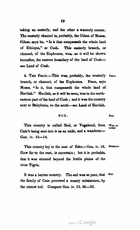
I9
taking an easterly, and the other a westerly course.
The easterly channel is, probably, the Gihon of Moses.
Gihon, says he, “Is it that compasseth the whole land
of Ethiopia,” or Cush. This easterly branch, or
channel, of the Euphrates, was, as it will be shown
hereafter, the eastern boundary of the land of Cush–
see Land of Cush.
4. ThE PIsoN.—This was, probably, the westerly
branch, or channel, of the Euphrates. Pison, says
Moses, “Is it, that compasseth the whole land of
Havilah.” Havilah, as it will be seen, was in the north
eastern part ofthe land of Cush; and it was the country
next to Babylonia, on the south—see Land of Havilah.
N O D.
This country is called Nod, or Vagabond, from
Cain's being sent into it as an exile, and a wanderer–
Gen. iv. 12–14.
This country lay to the east of Eden—Gen. iv. 16.
How far to the east, is uncertain; but it is probable,
that it was situated beyond the fertile plains of the
river Tigris.
It was a barren country. The soil was so poor, that
the family of Cain procured a scanty subsistence, by
the utmost toil. Compare Gen. iv. 12, 20–22.
Pison,
Nod.
Why so
called.
Situation.
Soil.
20
City. Cain built a city in some part of this country, and
called it after the name of his son Enoch, Gen. iv. 17.
There are no circumstances, mentioned in the scrip
tures, to assist us in discovering its site.
CHAPT ER II.
Countries after the Flood.
AFTER the flood, the descendants of Noah, and es
pecially those that settled in Shinar, manifested a
disposition to live together in one compact society: but
the Lord, by a special providence, scattered them abroad
upon the face of all the earth—Gen. xi. 1–9.
The sons of Noah with their respective descendants,
were planted in distinct tracts of country; and the
world may be considered as being, originally, divided
into three great parts, according to the number of
these sons.
These divisions may be thus designated—
I. The Allotment of Japheth.
II. 6& &&. “ Shem.
III. &é 66 “ Ham.
Japheth is here mentioned first, because he was the
eldest son of Noah. This may be shown thus—-
Noah begat his eldest son, one hundred years before
the flood–Compare Gen. v. 32—vii. 6.11. Shem was
one hundred years old, two years after the flood. Gen.
Dispersion
of man
kind.
Division of
the world.
Oldest sor:
of Noah.
22
xi. 10. Ham was the youngest son of Noah—Gen.
ix. 24. These considerations settle the meaning of
Gen. x. 21—that Japheth, and not Shem, is affirmed,
to be the elder.
CHAPTER III.
THE ALLOTMENT OF JAP H ETH.
THE descendants of Japheth settled, originally, in
Lesser Asia, and extended, in process of time, through
Europe, the north of Greater Asia,and perhaps, into
America—Gen. ix. 27. This extensive district is
designated by the Isles of the Gentiles—Compare Gen.
x. 5. Isa. xi. 11.
This Allotment was bounded on the east, by unde
fined regions—on the south, by the Allotment of Shem,
or the southern part of Greater Asia, and the Mediter
ranean Sea—on the west, by the Atlantic Ocean—and
on the north, by the Arctic Ocean.
The region granted to Japheth, was divided, accord
ing to his sons, into seven parts—Gen. x. 2–5. Their
portions, for the sake of convenience, may be contem
plated in the following order: and they may be thus
designated—
Japheth.
Location.
Boundaries.
1 The land of Tiras.
2 44 66 46 Madai.
3. 46 44 46 Gomer. c
4 44 44 “ Javan.
Division
24
‘Tiras,
Ilocation.
‘Boundaries.
First Emi
ºration.
The land of Meshech.
66 64 “ Tubal.
66 44. “ - Magog.
SECTION I.
L. A. N. D. O. F. T. I R A S.
The original settlement of the family of Tiras, has
been placed, with great probability, in the northwestern
part of Lesser Asia. It is thus located, because the
ancient Trojans inhabited that part. Tros, the ac
knowledged founder and king of the city of Troy, is the
same name as Tiras, or contains all the radicals of
that name. This Tros is considered, by some, to be
Tiras himself, the youngest son of Japheth, or one
of his early descendants. * . L. . . .”
This allotment of the family of Tiras, was bounded
on the east, by the land of Gomer—on the south, by
the land of Madai—on the west, by the AEgaean Sea—
and on the north, by the Propontis.
E M I G R A N T S F. R O M T I R A S.
As it is highly probable that the family of Tiras
settled in Lesser Asia, in the neighbourhood of their
brethren, before they passed over into Europe; so it
is reasonable to suppose, that some of them soon
crossed the strait between the Propontis, and the

25
AEgaean Sea; and settled in that country, which is
called Thrace. That this was the case—or that some
of the family of Tiras, did at an early period settle in
Thrace, may be shown from the following considera.
tions.
1. Tiras, is universally allowed to be the father of
the Thracians.
2. There is a resemblance between Thrace, and
Tiras which may be written Thiras.
3. Several ancient writers mention a district, in
the peninsula of Thrace, called Thrasus.
From Thrace, or from the land of Tiras in Lesser
Asia, or from both—some of the descendants of the
patriarch Tiras, emigrated to the north of the Euxine
Sea.—Greek and Latin writers mention a river, and
a city in that region, under the name of Tiras—and
they call the inhabitants of the same country, Tyrita',
or Tyragetae.
SECTION II.
L. A. N. D. O. F. M. A. D. A. I.e.
It is a very common opinion, that the family of
Madai, settled in the country south of the Caspian
Sea, called Media, as the Scriptures denote the
inhabitants of that country by the name of Madai.
But many learned, and judicious writers, on Biblical
Second,
Madai.
Location.
26
Boundaries.
geography, reject this view, and place them among
their brethren in Lesser Asia—in the western part of
it, on the AEgaean Sea. The following, are among the
reasons which they give in support of their opinion.
1. The inhabitants of the country south of the
Caspian Sea, and next to Persia, are not called
Madai, or Medes, in the early ages of the history
of the old Testament. See Media.
2. Madai belonged to the families, by whom the
Isles of the Gentiles were divided, in their lands,
&c.—Gen. x. 2–5. See Rules 1, 2.
3. A branch of Shem's family, will be found in
Asiatic Media, or in its neighbourhood, as the original
settlers of the country. See Arphaxad.
4. It is, generally, admitted that the Moesi, Maesi,
Mysi, or Mysians of Europe, and Lesser Asia, are
descendants of Madai, the son of Japheth, on account
of the affinity of names. The Moesi, Maesi, Mysi, or
Mysians, of Lesser Asia, are more likely to be the
original family, than the Mysians of Europe, or the
Madai of Greater Asia. See Rules 1, 2.
The land of Madai, in Lesser Asia, may be con
sidered as bounded on the east, by the land of Gomer
—on the south, by the land of Javan—on the west,
by the Egaean Sea—and on the north, by the land
of Tiras.

27
E M I G R A N T S F. R O M M A D A I.
Some of the family of Madai soon passed into
Macedonia, or had their original settlement in it.
The ancient name of Macedonia was AEmathia, or
AEmadia—supposed to be from AIA, land, and MADAI,
i. e. the land of Madai. An ancient people in that
country were called Medi, or Maedi. And Isocrates
mentions one Medus, a king in that quarter, before
the inhabitants became a Greek nation.
From Macedonia, or Lesser Asia, or from both—
a part of the posterity of Madai, is supposed to have
settled to the north of Macedonia, and to have given
name to the country called Moesia, or Maesia.
Some may have emigrated to Media, in Greater
Asia. See Media.
SECTION III.
L.A. N. D. O. F. G O M E R.
The posterity of Gomer, the eldest son of Japheth,
settled in that part of Lesser Asia, which compre
hends the central, northern, and northwestern parts
of this district. The following reasons are assigned
for this location of his family.
1. Josephus says, that the Galatians, who dwelt
in Lesser Asia, were called Gomerites, Antiq.-B. x.
c. 7. s. 1. Galatia lay towards the centre of this
district.
First Emi
gration.
Second.
Third
Gomer.
Location.
28
Boundaries.
Division.
Ashkenaz.
I,00&tion.
2. Phrygia, from the Gr. PHRUGEIN, to burn, or
parch, is supposed by some able critics, to be a name,
given, by the Greeks to this country, from its being
called Gomer, which signifies, consuming, or con
sumer. Phrygia included the central part of Lesser
Asia, and extended to the north, and northwest.
3. Ancient writers speak of a town in Phrygia
called Comara, or Cimmeris—and its inhabitants
Comari. These words may, obviously, be derived
from Gomer.
4. There are indications of the settlements of Go
mer's sons in this district.
The land of Gomer was bounded on the east, by
Armenia—on the south, by the land of Javan—on
the west, by the land of Madai, the land of Tiras,
and the Bosphorus of Thrace—and on the north,
by the Euxine Sea.
The plantation of Gomer may be divided according
to his sons—Gen. x. 3—and their divisions may be
designated thus—
1. The Land of Ashkenaz.
64 6& 6& Riphath.
44 << “ Togarmah.
l, A N n o ºr a s h K F. N. A 2.
The family of Ashkenaz, were located in the
northern part of the land of Gomer; and, probably,
29
spread along the borders of the Euxine Sea, from
the Bosphorus of Thrace to Armenia.
1. There is a bay on the coast of the Euxine Sea,
which was formerly called the Askanian, or Ascanian
Bay, also a lake which empties into the Propontis,
called the Ascanian Lake.
2. There was an ancient city, not far from the
Bosphorus of Thrace, called Askania, or Ascania.
3. Kings, and great men, in these parts, took the
name of Ascanius. Homer speaks of a king, by the
name of Ascanius, who came to the aid of Priam,
at the siege of Troy. Iliad B. II.
4. Ashkenaz is spoken of as being near to Minni,
which was a province, or kingdom in Armenia—
“Call together against her,” that is Babylon, “the
kingdoms of Ararat, and Minni, and Ashkenaz”—
Jer. li. 27. The land of Ashkenaz must have ex
tended a considerable distance to the east, on the
Euxine Sea.
It is very likely, that the district allotted to the
family of Ashkenaz, was bounded on the east, by
Armenia—on the south, by the land of Togarmah,
and the land of Riphath—on the west, by the
Bosphorus of Thrace—and on the north, by the
Euxine Sea.
Boundaries.
3* -
30
Riphath.
Location.
Boundaries.
i, A N D or . R. i. p. h. At tº .
The descendants of Riphath, may be considered
as settling south of the family of Ashkenaz, and in
the western part of the allotment of Gomer, for the
following reasons.
1. It appears probable, from what has been noticed
of the descendants of Ashkenaz, that they extended
from the Bosphorus of Thrace, along the Euxine
Sea, until they became neighbours to the inhabitants
of Armenia. And it will be seen that the family of
Togarmah settled in the eastern part of the land of
Gomer. The plantation of the family of Riphath
must, then, have had the location that is here given
to it.
2. Josephus speaks of a people, inhabiting some
portion of the plantation of Gomer, that were called
Riphateans, from Riphat. He thinks the Paphlago
nians were so called originally—Antiq. B. I. ch. 7.
It is easy to suppose that Paphlagonia embraced
a part of the plantation, that is here allotted to
the family of Riphath.
The land of Riphath was, probably, bounded on
the east, by the land of Togarmah—on the south,
by the land of Javan—on the west, by the land
of Madai, and the land of Tiras—and on the north,
by the land of Ashkenaz.
31
L.A. N. D. or ToGA R M A H.
This allotment joined that of Riphath, on the
east, and extended to Armenia, or Syria, including
the country that was, afterwards, called Cappadocia.
The Scriptures, seem, clearly, to settle this. Eze.
kiel speaks of “Gomer, and all his bands, the house
of Togarmah, of the north quarters, and all his
bands”—and also, of the house of Togarmah trading
with Tyre, in its fairs, with horses, and horsemen,
and mules—see Ezek. xxxviii. 6. xxvii. 14. To
garmah, then, lay north from Judea, and was noted
for horses, and mules, and horsemen. All that the
prophet here declares concerning Togarmah, is true
with respect to Cappadocia. It lay north from
Judea—and that it was well stocked with an ex
cellent breed of horses, and mules—and that its
inhabitants were expert horsemen—many ancient
writers fully establish.
The land of Togarmah was bounded on the east,
by Armenia and Syria—on the south, by the land
of Javan—on the west, by the land of Riphath—
and on the north, by the land of Ashkenaz.
E M I G RA N T S FR O M G O M E R.
Emigrants from the plantation of Gomer, may be
traced from the shores of the Euxine Sea, to the British
Isles.
Togarinah
Location.
Boundaries.
Emigranta.
32
First emi
gration.
Second.
Third.
fourth.
Herodotus speaks of a people, who originally dwelt
in Phrygia, in Lesser Asia, called Cimmerii, that settled
on the Maeotic lake, north of the Euxine Sea, and gave
the name of Bosphorus Cimmerius to the strait, between
the Euxine Sea, and that lake. Phrygia, as has been
seen, was, probably, the Greek name of Gomer—And,
it is thought, that there is an affinity between the names
—Cimmeri, Cimeri, and Gomeri, Gomerites, &c.
From the northern shores of the Euxine Sea, it is
reasonable to suppose, that the Cimmerii spread west
ward, along the banks of the Danube. Germany is
considered as receiving its name from Gomer. The
ancient inhabitants of that country, called themselves
Germen, which varies but little from Gomeren,
Gomerites, or Gomerasans. Diodorus Siculus says,
that the Germans had their origin from the Cimmerii.
From Germany this people spread into Gaul—Ap
pian says, that the Gauls were the same as the Cim
bri. The Cimbri of Appian, were the same as the
Cimmeri of Diodorus.
From Gaul, some emigrated to Britain. The Welch,
the oldest inhabitants of the island, call themselves
Cymro, and Kumeri, which, obviously, bear an affinity
to Cimeri, and Cimbri.
33
SECTION IV.
L. A N D 0 F J A W A N.
The plantation of Javan, the son of Japheth, lay in
the southern part of Lesser Asia, and extended from
the AEgaean Sea, along the Mediterranean, to the allot
ment of the families of Shem. This appears proba.
ble, from two considerations.
1. A portion of this district was called by the
Greeks, Ionia, which might easily have been formed
from Javan. The Seventy, and Josephus, wrote
Javan ſoouAN.
2. Monuments, of the plantations of his sons,
are scattered throughout the whole of this region.
The land of Javan was bounded on the east, by
the allotment of Shem—on the south, by the Medi
terranean Sea—on the west, by the Ægean Sea—
and on the north, by the land of Madai, and the
land of Gomer.
This district may be divided according to the sons
of Javan, Gen. x. 4; and the divisions may be thus
designated—
Javan
Location.
Bounda lies.
1. The land of Elishah.
2. “ 64 “ Dodanim.
3. “ 44. “. Kittim.
94. 44 “ Tarshish.
Division.
34
Elishah.
I.ocation.
Roundaries.
Dodaaim.
! .ocation.
I. A. N. D. O. ºf f. L i s in A h.
The AElisæans, says Josephus, descended from
Elisas, the name which he gives to Elishah, son
of Javan, Antiq. B. I, ch. 7. The AElisaeans of
Josephus, were the same as the AEolians of other
writers. The AEolians inhabited the western part of
Lesser Asia, on the AEgaean Sea. “The south
coast of Mysia,” says Dr. Samuel Butler, in his
Ancient Geography, “is called Æolis, or Æolia.”
The land of Elisha was bounded on the east, by
the land of Kittim or Cittim—on the south, by the
land of Dodanim—on the west, by the AEgaean Sea
—and on the north, by the land of Madai.
f, a n d or d O in A N i Mi.
This branch of Javan's family is supposed to have
settled, originally, in the southwestern point of Lesser
Asia, extending east on the Mediterranean Sea. In
this district there was an ancient province called,
by the Greeks, Doris, which, Dr. Wells, and others,
imagine might have received its name from Doda
nim. The Greeks often changed letters, in He
brew names, as Josephus informs us, Antiq. H. I. ch.
3—for the sake of sound. The Seventy read in
Gen. x. 4, Rhodanim for Dodanim. If some, for
the sake of sound, changed the first D into R, others
might the second; and read Doranim for Dodanim.
35
Doris might easily be derived from Doranim. What.
ever force there may be in this, it is reasonable
to look for the first location of Dodanim, on the
east of the AEgaean Sea, and in the neighbourhood
of his brethren.
This settlement, was bounded on the east, by the
land of Kittim or Cittim—on the south by the Medi
terranean Sea—on the west, by the AEgaean Sea—
and on the north, by the land of Elishah.
L. A N D or k 1 TT I M.
The settlement of Kittim lay on the Mediterranean
Sea, east of the land of Dodanim. This will ap
pear probable, from the following considerations—
1. In this quarter, according to Ptolemy, was the
country of Cetis.
2. Homer speaks of a people in this district, by
the name of Cetii.
3. The Septuagint render the name of Kittim,
by Kittii or Cittii; which is strong evidence that the
Hebrew Kittim, and the Greek Cetii, were the same.
Kittim, or as it is also called Chittim, and Cittim,
in Lesser Asia, was, probably, bounded on the east,
by the land of Tarshish—on the south, by the Medi
Boundaries.
Kittim.
Location.
Boundaries,
36
Tarshish.
kocation,
Boundaries.
Emigrants
terranean Sea—on the west, by the land of Doda
nim, and the land of Elishah—and on the north,
by the land of Gomer.
M. A. N. D. O. F. T. A R S h i & H.
This lay in the southeastern corner of Lesser
Asia. Josephus says, that the whole of the coun
try of Cilicia, was anciently called Tarshish, from
the founder of the Kingdom—Antiq. B. I. ch. 7. sec.
2. Tarsus, a chief town in Cilicia, carries in its name
evident marks of its being in the country, once inha
bited by the descendants of the Patriarch Tarshish.
The land of Tarshish was bounded on the east,
by the allotment of Shem—on the south, by the
Mediterranean Sea—on the west, by the land of
Kittim, or Cittim—and on the north, by the land of
Gomer.
E M I G R A N T S F. R O M T H E L A N D OF J A W A N.
The Ionians, and whole race of Greeks, says Jo
sephus, came from Javan—Antiq. B. I. ch. 7. An
ciently, the people of Macedonia, Attica, Boeotia, and
Achaia, were called Ionians.
As we find, to the west of Lesser Asia, names of
places, and people, that were given in honour of the
Patriarch Javan, so we find those, that were given in
honour of each of his sons—which may show the
places, to which portions of these families emigrated.
37
F. R O M T H E L A N D OF E L I S. H. A. H.
The Isles of the AEgaean Sea, or the Grecian
Archipelago, which were celebrated, by ancient
writers, for the richness and brilliancy of their blue
and purple dyes, are supposed to be called by Ezekiel,
the Isles of Elishah. Ezek. xxvii. 7. And in the
province of Elis, in the Peloponnesus; in the city of
Eleusis, in Attica; and in the river Elissus, in the
same province, we may trace the name of Elishah.
F. R O M T H E L A N D OF DO D A N I. M.
As Dodanim, Gen. x. 4, was read by some, Rho
danim, so it is thought, that the Island Rhodes, took
its name from this son of Javan. And the Dorians
in the western part of Greece and Epirus, were,
probably, descendants of Dodanim.
PR o M T H E L A N D of K 1 TT 1 M.
From this, the first emigrants, probably, passed over
to the Island of Cyprus. According to Josephus,
and others, Cyprus was called Citium.
In process of time, from Cyprus, or the mother
country, or from both—some of the posterity of Kit
tim or Chittim settled in Macedonia. In the book of
Maccabees, it is said, that Alexander, son of Philip,
the Macedonian, came out of the land of Chittim, I
Macc. i. 1.
From Eli
shah.
From Do
danim.
From Kit
tim.
First.
Second.
4

38
Third.
From Tar
shish.
Meshech.
Location.
A number of this family, may have settled, at a
very early period, in Italy. Traces of this name
may be found, in Cetia, a city in Latium; and in
Cetus, a river near Cumae. And commentators,
generally, admit that by Chittim the Romans are
meant, in Dan. xi. 29, 30.
. F. R O M T H E L A N D OF T A R S H IS H.
As the descendants of Tarshish became distin
guished for trading in ships, so, it is probable, that
when any portion of them emigrated, they sought
some favourable location on the coast of the Medit
erranean. In the most distant country, on this sea,
we find traces of the name of their progenitor. Near
the pillars of Hercules, according to the most ancient
writers, there was a city, or country, called Tartessus,
or Tarseium, celebrated for its riches. This is
considered to be the Tarshish mentioned, Ezek.
xxvii. 12.
SECTION V.
LAN d of M e s H E ch.
The setttlement of this son of Japheth, lay to the
north of Armenia. In this district were the Moschi
cian, or Moschic mountains, and a people called, by
the Greeks, Mosci, or Moschoi. By the Seventy,
Meshech was written Mosoch. In the names of these

39
mountains, and people, we can trace the name of
Meshech, or Mosoch.
The land of Meshech" was bounded on the east,
by the land of Tubal—on the south, by Armenia—
on the west, by the Euxine Sea—and on the north,
by undefined regions.
E M I G R A N T S FR O M T H E L A N D OF ME SHE C H .
The descendants of Meshech, or the Mosci, or
Moschoi, are supposed to have spread to the north,
and to have given name to the province, of Moscovy,
and the city of Moscow.
SECTION. VI.
L. A. N. D. O. F. T. U B A L •
This is placed on the east of Meshech. Meshech
and Tubal, were neighbours, Ezek. xxvii. 13. xxxviii.
2. Josephus says, that the Asiatic Iberians were
originally called Thobeli from Tubal, or Thubal,
Antiq. B. I. ch. 7. sec. 1. Iberia lay amidst the
Caucasian mountains, and west of the Caspian Sea.
The land of Tubal was bounded on the east, by
the Caspian Sea—on the south, by Armenia—on the
west, by the land of Meshech—on the north, by
undefined regions, and on the northeast, by the land
of Magog.
Boundaries.
Emigrants.
Tubal.
Location.
Boundaries.
40
Emigrants.
Magog.
Location.
Boundaries.
E M I G R A N T S FR o M T H E LAN D o F TU B.A. L.
Many of the descendants of Tubal, no doubt,
emigrated to the north, and mingled with the de
scendants of Meshech. And the Iberians in the
western parts of Europe, are supposed to be de
scendants from the Asiatic Iberians. Iberia in
Spain, so called from the river Iberus, was, probably,
settled by a colony from the land of Tubal.
SECTION V II.
. T H E L A N D OF M A G O G.
“Magog,” says Josephus, “was the head of the
Magogians, called by the Greeks Scythians,” Antiq.
B. I. ch. 7. sec. 1. Ezekiel mentions Magog in
connection with Meshech and Tubal, and speaks of
Magog as the head of Meshech and Tubal ; or the
most powerful nation of the three, Ezek. xxxviii. 2.
From these considerations the land of Magog is
placed in the neighbourhood of Tubal and Meshech,
and to the northeast of Tubal, extending on the north
of the Caspian Sea.
The land of Magog was bounded on the east, by
unknown regions—on the south by the Caspian Sea—
on the southwest, by the land of Tubal—on the
west, northwest, and north, by unknown regions.
41
" E M I G R A N T S F. R O M T H E L A N D 0 F M A G O G.
Gog, and Magog, may be the same ; and that Emigrants.
Gog embraced the Scythian tribes, which spread
through the northeastern parts of Asia, is supposed
to be evinced, from Ezek. xxxix. 3. where speaking
of Gog, he says, “I will smite thy bow out of thy
left hand, and will cause thine arrows to fall out
of thy right hand.” The Scythians were remark
able for their skill in Archery.
The Magogians, spreading, with the descendants
of Meshech and Tubal, to the northeast, in Asia,
may have passed over Bhering's straits into Amer.
ica; and the aborigines of this country, may be
the descendants of the Scythian archers.
*
4’s
Shem.
Location.
Boundaries.
Division.
C H A PT E R. I W.
A L LOTM ENT OF S H EM .
The descendants of Shem, the second son of Noah,
settled in the Greater Asia; and their allotment may
be considered as extending from the Mediterranean
Sea, to the Pacific Ocean. Through this extensive
district, we shall find his posterity scattered.
The allotment of Shem was bounded on the east,
by the Pacific Ocean—on the south, by the Indian
Ocean—on the west, by the Persian Gulf, Arabia,
Canaan, the Mediterranean Sea, and the Lesser
Asia—and on the north, by the Asiatic part of the
allotment of Japheth.
It may be considered as divided, according to his
sons, Gen. x. 22.
1. The land of Elam.
2 &g “ “ Ashur.
3. 46 “ “ Arphaxed.
4 &&. “ “ Lud.
5 64 66 46 Aram.
43
SECTION I.
L. A. N. D. O. F. E. L. A. M.
This lay in the Southern part of the allotment of
Shem, embracing ancient Susiana, and the Hebrew
Paras or Peres, called by the Greeks, Persis—by the
Latins, Persia—and by its inhabitants, Phars or Fars.
Both of these districts, and perhaps the chief of
the allotment of Elam, was, after the days of Cyrus,
called Persia. The reasons for thus locating the
land of Elam, are as follows.
1. Ptolemy speaks of a people in Susiana, or not
far from Babylonia, on the east of the waters of
the Euphrates, whom he calls the Elimaei. And
several profane authors, mention a country, near the
Persian gulf, called Elymais.
2. Daniel speaks of a palace, in Shushan, in
the land of Elam, Dan. viii. 2. Shushan, now
Chuzistan, was the capital of ancient Susiana; and
in the days of Nehemiah, it was the royal city of
Persia, Neh. i. 1.
The land of Elam, was, probably, bounded on the
east, by the river Indus—on the south, by the
Erythraean Sea—on the west, by the Persian Gulf,
and Arabia—and on the north, by the land of Ar
phaxad, or Media and Aria.
Elam.
Location.
Boundariet,

44
River.
Ulai.
Ashur.
Location.
Boundaries.
Cities.
* Nineveh.
The river Choaspes, or Regia lympha choaspes,
whose waters were so pure that the kings of Per
sia would drink no other, run by Shushan, or Susa.
This, or one a little to the south of it, was the river
Eulaeus, the Ulai of Daniel, Dan. viii. 2.
SECTION II.
L. A N D OF A S H U R .
There is no difficulty with respect to the location
of the land of Ashur. It lay to the north of Persia,
on the river Tigris, and was the same as Assyria.
Ashur, says Josephus, was the founder of Nineveh,
and thence came the Assyrians, Antiq. B. I. ch. 7.
See also Gen. x. 11, 12.
It was bounded on the east, by Media, or the land
of Arphaxad—on the south, by Persia, or the land
of Elam—on the west, by the river Tigris—and on
the north, by Armenia.
The principal cities of the land of Ashur as men
tioned Gen. x. 11, 12.
1. NINEveh.-This was the capital of Assyria,
and was one of the most ancient, potent, and largest
cities in the world—comp. Gen. x. 11. Jonah, iii. 3.
It was situated on the eastern bank of the Tigris,
opposite to the present city, Mozul, or Mozil,
45
2. REHOBETH.-Its site is unknown.
3. CALAH.—This is supposed to have been situated
on the greater Zab, or Lycus, not far from where it
joins the Tigris.
4. RESEN.—This was a great city, and lay be.
tween Nineveh and Calah, Gen. x. 12.
SECTION III.
L.A. N. D. O. F. A R P H. A X A D .
This lay on the northern frontier of the allotment
of Elam, embraced the kingdom of Media, and
extended to the east of the Caspian Sea. The rea
sons for this location, are the following.
1. The Hebrew of Arphaxad is Arpachshad. See
Gen. x. 22, margin. A country east of the Tigris,
joining to Assyria, was known to the ancients, by
the name of Arrapachitis, which is obviously, from
Arpachshad.
2. The kings of Media, were called Arphaxad–
Apocry. Jud. i. 1.
3. The family of Joktan, the great grandson of
Arphaxad, as will be seen, settled east of Media.
The land of Arphaxad was bounded on the east,
by the mountains of Kedem, or mountains in the
Rehobeth,
Calah,
Resen
Arphaxaq.
Location.
Boundaries.
46
Division.
Saluh.
Situation.
Ebor.
Sittitution.
east—on the south, by the allotment of Elam, or
Persia—on the west, by Assyria—and on the north,
by Armenia, the Caspian Sea, and the land of Magog.
As the division of the earth, was made in the days
of Peleg, the great grand-son of Arphaxad, a sep
arate portion was granted to the family of Salah, the
son of Arphaxad—to that of Eber, the son of Sa
lah—to that of Peleg, the son of Eber—and to that
of Joktan, the brother of Peleg, Gen. x. 24, 25.
These may be thus designated.
1. The settlement of Salah.
2. 66 66 “ Eber.
3. 66 “ “ Peleg.
66 66 “ Joktan.
S ET T L E M E N T 0 F S A. L. A. H. . .
This is supposed to have been located in the
southwestern part of the allotment of Arphaxad.
Within the province of Susiana, or near its borders,
according to some ancient writers, there was a city
called Sela.
S ET T L E M E N T OF E B E R .
Eber, it is probable, had his allotted settlement
near his father; and there is some reason to suppose,
that it lay north of Salah's, bordering on Assyria.

47
From this district, it would have been very easy for
Terah, the descendant of Eber, and father of Abra
ham, to have emigrated to Mesopatamia. Terah
lived in Mesopatamia when Abraham was called.
Comp. Gen. xi. 31. Act. vii. 2–4.
S ET T L E M E N T OF P E L E G .
-
With respect to Peleg, we cannot discover any
traces of his settlement. It was, no doubt, in the
neighbourhood of his kindred; and most likely, it lay
on the east of Eber's, and between that, and Joktan's,
which was situated in the eastern part of the plantation
of Arphaxad.
S ET T L E M E NT OF J O K.T A. N.
This lay east of the Caspian sea. Joktan, with his
thirteen sons—Almodad, Sehleph, Hazarmaveth, Je
rah, Hadoram, Uzal, Diklah, Obal, Abimael, Sheba,
Ophir, Havilah, and Jobab–had “their dwelling
from Mesha, as thou goest unto Sephar, a mount in
the east,” or of Kedem, Gen. x. 26–30. Traces
of Mesha and Sephar, may be discovered in
Meshed, a city east of the Caspian Sea; and in
the mountains Saraphi or Sariphi, that lay still far.
ther east. Josephus, speaking of the sons of Joktan
says, “they had their habitation from the river
Peleg.
Situation.
Joktan
Situation.
48
Ophir.
Situation.
Havilah.
Situation.
Media.
Countries it
embraced.
Cophene,” in India, to the neighbouring part of
Syria, alias, Aria.” Antiq. B. I. ch. 7.
O P H I R A N D H A V IL. A. H.
With respect to the settlement of Ophir, many
have placed it on the head waters of the Indus.
To this country Solomon is supposed to have traded,
1 Kings ix. 26–28. Travellers speak of gold being
found in the sands of this district.
As to the settlement of Havilah, the brother of
Ophir, and son of Joktan, it is supposed to have been
in Cabul. Some think that Cabul was formerly
written and pronounced Chabila, or Chavilah, which
bears a resemblance to Havilah. The country of
Cabul is noted for its fine gold.
In regard to the other sons of Joktan, there are
no circumstances which seem to point out their
settlements.
M E D I A .
The probable allotments of Salah, Eber, and Peleg,
did, in process of time, form the kingdom of Me
dia. This country is called Madai, in the Bible,
-
* Cophene was a branch of the Indus.
49
and for this reason, it is supposed, that it was the
original settlement of Madai, the son of Japheth.
That it was settled by emigrants from the family of
Madai, in Lesser Asia, is very probable. The
Greeks make Medus, the son of Jason and Medea.
the founder of this kingdom. With the fable of
the argonautic expedition, of Jason and Medea, and
of their son Medus, it well agrees, to suppose, that
emigrants from the MEgaean Sea, and from the north
of the Euxine Sea—or descendants of Javan and
Madai, did make their way through Colchis, and
Armenia, and lay the foundation of the Median empire.
This might have taken place about 40 years before
the taking of Troy; and about 1240 before the
coming of Christ.
Media was bounded on the east, by Aria—on the
south, by Persia—on the west, by Assyria—and on
the north, by Armenia, and the Caspian Sea.
The cities of Media, mentioned in the Bible, were
Halah, Habor, and Hara. See I. Chron. v. 26. II.
King. xvii. 6.
The only river belonging to this District, mentioned
in the Bible, is Gozan, I. Chron. v. 26.
Major Rennel supposed that he discovered traces
of the cities, and of the river, named above, in
Probably a
colony from
Madai.
Boundaries.
Cities.
River.
Supposed
traces of
these cities
and river.
5
50
the northern part of Media, near the Caspian Sea.
He found in that district, a river called Ozan, which
he thinks is only a variation of Gozan. On a branch
of this river; he found a city, by the name of Abhar,
or Habar—and bordering on the river Ozan, he found
a place very fertile, having in it a very strong
position, called Calchal. This Abhar or Habar, and
Calchal, he thinks, by allowing for the change of
pronunciation, and spelling, through so many ages,
may have once been called Habor and Halah. And
in another district, called Tarom, or Tarim, he thinks
he can trace the name of Hara.
Royal city. EcBATANA.--Now Hamdan, was the ancient
capital of Media, Apocry. Jud. i. 1. Achmetha,
mentioned by Ezra, was probably the name of this
city, in his day; but some think that Achmetha,
means a chest, or coffer, in which were kept the
records of the nation. See Ezra vi. 2, margin.
SECTION IV.
Lud. L. A. N. D. O F L U D.
situation. There are difficulties, in ascertaining the allotted
Notin Les. settlement of this son of Shem. It seems out ofser Asia. - ---
place, to look for it among those of the families of
Japheth, or Ham. All attempts to fix it in Europe,
or Africa, merely, on account of the resemblance of
names, is by no means satisfactory. It is said that
51
London, and Lud-gate, received their names from
a very ancient king called Lud—but it will not do
to place the son of Shem in the British Isles, on
account of this agreement of names. Josephus made
the Lydians, in Lesser Asia, the descendants of
Lud, on account of the similitude of names; and he
has been, commonly, followed by Christian writers.
It appears more consistent to look for the plantation
of Lud, in the neighbourhood of his brethren. To
the probability of his settling in the allotment of
his father, the resemblance of names may, possibly,
be added. On several maps of Asia, a distinguished
place will be found, on the head waters of the
Indus, or Ganges, in Thibet or Tibet, by the name
of Ludack, or Luddack. These circumstances may
favour the opinion of his settling east of his brother
Arphaxad. But all is conjecture, with respect to
the place of Lud's settlement.
SECTION V.
L. A. N. D. O. F. A R A M .
The land of Aram, usually called Aramea, lay
in the western part of the Greater Asia. “From
Aram,” says Josephus, “came the Arameans—the
Greeks call them Syrians,” Antiq. B. I. ch. 7. With
respect to this, there can be no doubt. Syria, in
our version of the Bible, is Aram in the Hebrew.
Probably
in Thibet.
Aram.
Location.
52
Boundaries.
Division.
Syria.
Location.
Boundaries.
This allotment was bounded on the east, by the
Caspian Sea, Media, and Assyria—on the south, by
Babylonia, Arabia, and the land of Canaan—on the
west, by the Mediterranean Sea, and the Lesser
Asia—and on the north, by the land of Meshech.
Aramea, was divided, into the following districts
of country.
1. Syria Proper.
2. Mesopotamia.
3. Armenia.
S Y R.I.A. P R O P E R .
This district lay in the western part of Aramea,
and is designated in Scripture, by Syria, without any
epithet.
It was bounded on the east, by Mesopotamia—on
the south, by Arabia, and the land of Canaan—on
the west, by the Mediterranean Sea—and on the
north, by Armenia.
Aram, or Syria Proper contained seven kingdoms,
as will be seen by comparing II. Sam. x. 6, 8, xiii.
37. viii. 5, 6, 9, which may be distinguished, as
follows:
Division.
1. The Kingdom of Beth-Rehob, or Rehob.
2. 46 44 “ Hamath.
3. 44 6% “ Zobah.

53
4. The Kingdom of Damascus.
5. 66 64 “ Maachah.
6. $g 66 “ Geshur.
7. & “ “ Ish-Tob or Tob.
K in u Do M or B Et h-R E h o B.
The kingdom of Beth-Rehob, called also Rehob,
II. Sam. x. 8, lay in the western part of Syria, on
the Mediterranean Sea, and extended east, to the
neighbourhood of Laish, as the following consider.
ations will clearly show.
1. The inhabitants of Beth-Rehob dwelt on the
border of that part of Canaan, which fell to the
tribe of Asher—Judg. 1. 3. Asher, as we shall
see, had his allotment in the northwestern corner
of Canaan, including the city of Sidon.
2. The valley in which Laish lay, was the eastern
boundary of Beth-Rehob. “The children of Dan
built a city, in the valley that lieth by Beth-Rehob,
and called it Dan: but the place before that was
Laish, Judg. xviii. 28, 29.
Beth-Rehob.
Location.
It was bounded on the east, by the kingdom of Boundaties.
Hamath—on the south, by Canaan—on the west,
by the Mediterranean Sea—and on the north, by
unknown districts.
5*
54
Hamath
Location.
Boundaries.
Cities.
Riblah.
Hamath.
Zobah.
Loeation.
M. I. N. G. D. O. M. O. F. H. A. M. A. T H .
The kingdom of Hamath lay on the northern
frontier of Canaan, and east of Rehob. This
opinion is supported by Num. xiii. 21. “So they,”
the spies, “went up, and searched the land from
the wilderness of Zin unto Rehob, as men come
to Hamath.” The meaning seems to be, that the
spies went through the whole land of Canaan, to
the point where Rehob and Hamath meet, or to
the entering in to Hamath.
It was bounded on the east, by the kingdom of
Zobah, on the south, by Canaan—on the west, by
the kingdom of Rehob—and on the north, by un
known districts.
The cities belonging to this kingdom, were—
1. RIBLAB.—This was a city of Hamath, II. King.
xxiii. 33, and lay on the southern border, as the
northern line of the land of Promise ran by it.
Num. xxxiv. 11.
2. HAMATH.—This was situated in the southern
border, I. King. viii. 65.
K 1 N G D o M OF Z O B A H .
This kingdom lay on the northeastern frontier of
Canaan, as may appear from the following con
siderations.
55
1. It adjoined Hamath, II, Sam, viii. 3.
2. It was probably, composed in part, of a territory
taken from the kingdom of Hamath, II. Chron. viii. 3.
3. It was in the neighbourhood of Damascus–
Compare II. Sam. viii. 5, 6, I. King. xi. 23.
It was bounded on the east, by the kingdom of Boundaries.
Damascus—on the south, by the kingdom of Maachah
—on the west, by the kingdom of Hamath—and on
the north, by unknown regions.
There were two cities supposed to belong to this cities.
kingdom—
1. Helbon—afterwards Aleppo. This was pro- Holbon.
bably in Zobah. Ezek. xxvii. 18.
2. Tadmor, 11. Chron. viii. 3, 4, afterwards called Tadmor
Palmyra, Joseph. Antiq, B. viii. ch. 2. This lay in
the northeastern part of the kingdom.
K I ºf G D O M 0 F D A M A SC U.S. Damascus.
This kingdom, as we have seen, lay in the neigh. Location.
bourhood of Zobah. Perhaps it rose out of Zobah,
in the time of David; or included the southeastern part
of that kingdom, as it existed before David, I. Kings, .
xi. 23. It probably extended from the borders of
Zobah, east, to the river Euphrates.
It was bounded on the east, by the river Euphrates a -oundaries.
—on the south, by the kingdoms of Ish-Tob, and
56
City.
Maachah.
Boundaries,
City.
Geshur.
Location.
Geshur—on the west, by the kingdom of Zobah—and
on the north, by unknown regions.
DAMAscus was the principal city of this kingdom.
K iN G in O M of M. A. A. C. H. A. H.
The kingdom of Maachah, lay on the east of Jordan,
having the country of Bashan, on its southern frontier,
as the following considerations will show.
1. Abel-Beth-Maachah, a city in this kingdom,
seems to have been within the lot of the tribe of
Naphtali, II. Sam. xx. 14. I. Kings xv. 20. II. Kings
xv. 29.
2. To provide for the allotment of the half tribe
of Manasseh, beyond Jordan, the country of Bashan
was subdued from the river Jabbok to the kingdom
of Maachah, and Geshur, Deut. iii. 11, 14, 16. Josh.
xii. 5. Num. xxi. 24. -
It was bounded on the east, by the kingdom of
Geshur—on the south, by the country of Bashan—
on the west by Canaan—and on the north, by the
kingdom of Zobah. -
ABEL-BETH-MAACHAH.—This was a city which
lay in the western part of the kingdom.
K I N G D o M. O. F. G E S h U. R.
The kingdom of Geshur, lay east of Maachah,
having the country of Bashan on the south. This
may by thus shown,
57
1. Maachah, and Geshur, evidently joined together,
and lay on the northern frontier of the country of
Bashan, Deut. iii. 11, 14, 16. Josh. xii. 5. Num.
xxi. 24.
2. Maachah was the western kingdom, as it joined
on Canaan. See Maachah.
It was bounded on the northeast and east, by the
kingdom of Ish-Tob—on the south, by the country of
Bashan——on the west, by the kingdom of Maachah—
and on the north, by the kingdoms of Zobah, and
Damascus.
k 1 N G D o M of 1 s h - to b , o R To B.
The kingdom of Ish-Tob, called also the land of
Tob, Judg. xi. 3, lay east of the mountains of Gilead,
and south of Damascus. This appears probable,
from the locations that have been given to the other
kingdoms of Syria; and from the inhabitants of
Ish-Tob appearing to be neighbours to the children
of Ammon. Compare Judg. xi. ch. II. Sam. x. 6, 8.
Josh. xiii. 1–5.
It may be considered as bounded on the east, by
the river Euphrates, or a country bordering upon
it—on the south, by Arabia—on the west, by the
mountains of Gilead—and on the north, by Damascus.
Boundarics.
Ish-Tob.
Location.
Boundaries.
58
Rivers
Abana
Phal par.
Mount Itas.
R IV E R S OF S Y R I A P R O P E R ,
There are but two rivers mentioned in Scripture,
that appear to belong to Aram, or Syria Proper,
II. Kings v. 12. -
1. ABANA.—This run by Damascus, and emptied
into a small lake, east of that city. It is supposed
to be the same as the ancient Chrysorroas, or modern
Baradi.
2. PHARPAR.—This united with the Abana, as it
is thought, near the city of Damascus.
Volney observes that the city of Damascus, is fur
nished with three branches of the same river, which
flows into a hollow, southeast, called Behairet el
Mardi—Lake of the Meadow. Two of these
branches are supposed to be the Abana and Pharpar.
Trav. vol. II. p. 269.
M O U N T A I N S O F S Y R I A P R O P E R.
The most famous, lay in the western part, and
were designated by the name of Lebanon, from a
Hebrew word meaning white, on account of their
tops being covered with perpetual snow.
While the Scriptures speak only of Lebanon, there
were two ranges, which were distinguished by Leba
non, and Anti-Lebanon.
59
1. LEBANoN.—This was the western range. It
commenced in the northwest of Aram, or Syria,
Proper—run south a number of leagues—then east
—and then north, forming a kind of horse-shoe.
2. ANTI-LEBANON.—This was the eastern range.
3. MoUNT HoR.—This ought to be called Hor
ha-hor, mountain beside the mountain. It was a
southern peak of Lebanon, on the frontier of Canaan,
Num. xxx. 7, 8.
4. HERMoN.—This was a southern peak of Anti
Lebanon, and lay to the west of the kingdom of
Geshur.
5. GILEAD.—This name designated a range of
mountains, extending south, from mount Hermon.
6, HILLs of BASHAN.—These were peaks of the
mountains of Gilead, between the kingdoms of
Maachah and Ammon.
M. E. S. O. P. O. T A M I A ,
This is called in Scripture, ARAM-NAHARAIM,
Aram between the rivers—hence the Greeks called
it Mesopotamia, from MEsos, between, and PotAMos,
river. It lay between the rivers Euphrates, and
Tigris.
It was bounded on the east, by the river Tigris,
which separated it from Assyria—on the south, by
Lebanon.
Anti-Leba.
Ilon.
Hor.
Hermon.
Gilead.
Bashan.
Mesopota
mia.
Location.
Boundaries.

60
Bivision.
Chaldea.
A Province,
Situation.
Why called
Chaldea.
Babylonia—on the west, by the Euphrates, which
separated it from Syria—and on the north, by
Armenia.
Mesopotamia may be considered as having, very
early, been divided, into Chaldea, and Padan Aram.
C H A L D F A .
That this was a district belonging to Mesopotamia,
when Abraham was called, is thus evinced—Abra
ham who dwelt in Mesopotamia, Act. vii. 2–is
said to have come out of the land of Chaldea,
Act. vii. 4.
This district was situated in the eastern part of
Mesopotamia. Compare Act. vii. 4. Gen. x. 31.
It is supposed, by some, to have been called
Chaldea" from Chesed, a son of Nahor, brother of
Abraham, Gen. xxii. 22. This, in after ages, grew
into a distinct kingdom, II. chron. xxxvi. 17. Isa.
xiii. 19.
Ur, was a noted place in this province, Gen. xv.
7. Ammianus Marcellinus mentions a city of this
name, between the city Nisibis, and the river Tigris.
City.
* Hebrew Chasdim.
61
P A D A N - A R A M .
This was the northwestern district of Mesopota
mia. Compare Gen. x. 31. Act. vii. 4.
Padan-Aram, means the plains of Aram, or Syria—
or the cultivated and fruitful Aram, being more
fertile than the interiour parts of Mesopotamia.
A city, or noted place in this district, was Haran,
Gen. xi. 31—called in the New Testament, Charran.
Act. vii. 4. This lay in the western part of the
district, as it is thought, on a river, that is called
by the same name, in Greek writers, running into
the Euphrates.
Haran is supposed to have taken its name from
Haran, the son of Terah, and father of Lot.
A R M E N I.A.
This division of Aramea, lay to the north of Syria,
and on the southern frontier of the allotments of
Meshech and Tubal, sons of Japheth.
It is supposed to have received its name from
Aram, and Minni which was the name of a province
in this district, meaning Aram, or Syria of Minni.
It was bounded on the east, by the Caspian sea—
on the south, by Media, Assyria, Mesopotamia, and
Padan
Aram.
Why so
called.
City.
Origin of
its name.
Armenia.
Location.
Origin of
the name.
Boundaries.
6
62
Division.
Minni.
A Province.
Syria,-on the west, by Lesser Asia, or the land
of Javan, and Gomer—and on the north, by the
land of Meshech and Tubal.
It may be considered as having been, very early,
divided into the two following provinces.
1. The Province of Minni.
2. &g 46 “ Ararat.
M 1 N N 1.
The reasons for making Minni a province of
ancient Armenia, are as follows.
1. Josephus, quoting from Nicholaus of Damascus,
has these words. “In the province of Minyas, in
Armenia, there is a high mountain called Baris,”
Antiq. B. I. ch. 4.
2. The prophet Jeremiah calls upon the kingdoms
of Ararat, Minni, and Ashkenaz, to war against
Babylon, Jer. li. 27. The Minni of Jeremiah, is
evidently the same, as the Minyas of Josephus.
Minni lay in the western part of Armenia. As
the prophet calls upon Ararat, Minni, and Ashkenaz,
to war against Babylon, so it is reasonable to sup
pose, that Minni lay adjoining Ashkenaz. Ash
kenaz had his allotment, as we have seen, along
Situation.
the southern shores of the Euxine Sea.
63
A R A R A T. Ararat.
That Ararat was a district, distinct from Minni, A Province.
is manifest from the prophet's calling upon the
kingdoms of Ararat and Minni, Jer. li. 27. And
that it lay in Armenia is probable. Ararat, is
rendered Armenia, Gen. viii. 4. by the Syriac ver
sion—and what the Seventy call Ararat, II. King.
xix. 37. they call Armenia, Isa. xxxvii. 38.
As Minni lay in the western, so Ararat lay in Situation.
the eastern, or northeastern part of Armenia.
M 0 U. N. T. A. I. N S OF A R M E N I A. Mountains.
MoUNTAINs of ARARAT, Gen. viii. 4.—These are Ararat.
generally believed to be that range of mountains,
known to the ancients, by the name of mount Taurus,
which run through Armenia, and stretched to the
East Indies. It may be said that the mountains of
Ararat lay in Armenia, but were not limited by that
country.
The particular peak, of the “mountains of Ararat,” ‘. .
on which the ark of Noah rested, might have be- ark rested.
longed to a country south of the Caspian Sea. This
opinion is favoured by the saying of Moses, respecting
the first emigrants of Noah's family. “As they
journeyed from the east, they found a plain in the
land of Shinar,” Gen. xi. 2. Shinar was the valley
in which Babylon was situated.
64
Sons of
Aram.
Uz.
Situation.
Hul.
Situation.
S E T T L E M E N T S O F T H E S O N S OF A R A M .
In Aramea, or in this allotment of Aram, em
bracing Syria, Mesopotamia, and Armenia, the four
sons of the patriarch, had suitable shares—viz.
Uz, Hul, Gether, and Mash. Gen. x. 23.
S e T tº L e M E N tº o ºr u ze
Josephus says that Uz, whom he calls Ousos, was
the founder of Trachonites, and Damascus, Antiq.
B. I. ch. 7. He is followed by Jerome and others.
It is probable, that he settled in the south of Syria,
adjoining Arabia, for he is spoken of in connection
with Edom, Lam. iv. 21. Jer. xxv. 20, 21. It is
also probable, that his descendants spread through
the greater part of Aram, or Syria Proper. As the
prophet speaks of the “Kings of Uz,” Jer. xxv. 20.
he may mean the kings of Damascus, Maachah,
Geshur, and Ish-Tob.
S ET T L E M E N T or H U L.
Hul, may be written Chul—Josephus calls him
Oulos, and places him, in Armenia, Antiq. B. I. ch. 7.
Traces of the name of Hul or Chul, are supposed
to be found in names of cities, and districts,
throughout this part of Aramea—as, in Colchis,
Chol, Cholua, Cholobetene.
65
s E t T L E M E N T OF GET H E R.
Gether, or Geter, may have settled on the Caspian
Sea—Ptolemy mentions a city near the shores of the
Caspian, by the name of Getara, and a country
called Getras—which are supposed to bear an affinity
to Gether.
s E t T L e M en T of M A s h .
“Mash, or Mes, called Meshech, I. Chron. 1. 17.
and Mosoch by the Seventy, Bochart believes
inhabited Mount Masius, in Mesopotamia; and gave
his name to the river Mazecha, whose source is
there. Stephanus names the inhabitants of this
district Masieni, or Masiani.” Calmet, Dict, word
Mash.
6*
Gether.
Situation.
Mash.
Situation.
Location.
C H APTE R V.
A L LOTMENT OF H. A. M.
The country settled by Ham and his descendants,
included the southwestern part of Greater Asia, or
the modern Arabia; and the whole of Africa. The
evidences of this, are as follows.
1. The settlements of various branches, of the
family of Ham, can be discovered, in the names of
places, scattered through this vast territory.
2. Historical notices, of different kinds, both in
sacred, and profane writers, as will be seen, clearly,
show that the posterity of this patriarch, received
this extensive district for their inheritance.
It was bounded on the east, by the waters of the
Euphrates, and the Persian Gulf—on the south,
by the Indian, and the Atlantic Oceans—on the
west, by the Atlantic Ocean—and on the north, by
the Mediterranean Sea, Syria, and Mesopotamia.
Boundaries.
Division.
This country was divided according to the sons
of Ham. Gen. x. 6.
1. The land of Cush.
2. “ “ “ Mizraim.
3. ég 66 « Put.
4. “ “ “ Canaan.
67
SECTION I.
L. A. N. D. O. F. C U S H .
The settlement of Cush, is designated by the
land of Cush, and also by the name of Cushan,
Hab. iii. 7. And as Cush in Hebrew means black,
so the Greeks have named Cushan, Ethiopia, from
AITHo black, and ops, face—Cush, in our English
Bible, is rendered Ethiopia.
The Land of Cush, or Ethiopia, included Arabia,
in Asia; and extended into Africa, south of
Egypt. The following considerations will make
this plain.
1. Miriam and Aaron reproached Moses, on ac.
count of the Ethiopian, or Cushite, woman, whom
he had married, Num. xii. 1. This woman was
of the country of Midian, on the eastern shore of
the Red Sea. Exod. ii. 15.
2. Thus saith the Lord, “I will make the land
of Egypt desolate from the tower of Syene, even
unto the border of Ethiopia,” or Cush. Ezek.
xxix. 10. This was designed to express the whole
extent of Egypt. Syene according to Ptolomy,
Strabo, Herodotus, and Pliny, lay in the southwest
of Egypt.
Cush,
His settle.
ment—how
designated.
Location
and extent,
68
Boundaries.
General
Division.
Cush in
Asia.
Boundaries.
3. The original settlements of the sons of Cush
will be found in the southwestern part of Greater
Asia.
4. We shall also find a country of Cushites,
or Ethiopians, in Africa, south of Egypt.
Cushan, or Ethiopia, was bounded on the east,
by the eastern branch of the Euphrates, and the
Persian Gulf—on the south, by the Indian Ocean—
on the west, by unknown regions in Africa, and
by Egypt—and on the north, by Egypt, Canaan,
and Syria.
The land of Cush, may be divided into two great
portions—Cushan, or Ethiopia, in Asia; and Cush
an, or Ethiopia, in Africa.
c U S H A N, OR ETH I O PIA IN A s I.A.
This portion was bounded on the east, by the
eastern branch of the Euphrates, and the Persian
Gulf—on the south, by the Erythraean, or Arabian
Sea—on the west, by the Red Sea, and Egypt—
and on the north, by Canaan, and Syria.
Cush in Asia, may be divided according to the
sons of this patriarch, Gen. x. 7, 8, who appear
to have had their original settlements, in this
Bivision.
district.

69
1. The land of Nimrod.
2 66 “ “ Havilah.
3 46 &g “ Sabtah.
4. 46 “ “ Raamah.
5 6& “ tº Seba.
6 6& “ “ Sabtecha.
L. A. N. D. O. F. N. I. M. R O D .
The beginning of Nimrod's kingdom, was ancient
Babylon, Gen. x. 10. This, in process of time,
became the capital of a mighty empire. The
probable boundaries, of the ancient kingdom of
Babylon, were as follows. On the east, it was
bounded by the Tigris—on the south, and on the
west, by unknown districts—and on the north, by
Mesopotamia.
The ancient cities of Babylonia, or the kingdom
of Nimrod, were Babylon, Erech, Accad, and Cal
neh-Gen. x. 10.
I. BABYLON.—It is a remarkable circumstance,
that the site of this renowned city, is now un
known. All that can be said concerning it is—that
it was situated on the Euphrates, some considerable
distance above its confluence with the Tigris.
II. ERECH.-Ptolemy places on the common
channel of the Euphrates and Tigris, a city which
Nimrod.
Situation—Boundaries.
Cities.
Babylon.
Erech.
70
Acad.
Calneh.
Pavilah.
5ituation.
Productions.
he calls Arecca, and which is supposed by some,
to be the ancient Erech.
III. AccAD.—Site of it is unknown.
IV. CALNEH.-No satisfactory traces of it, have
been discovered.
I, A. N. D. O. F. H. A. V. I I, A H .
This lay some distance to the south of Babylonia—
and on the eastern border of the land of Cush. In
I. Sam. xv. 7. it is said, that “Saul smote the
Amalekites, from Havilah until thou comest to
Shur, that is over against Egypt.” The Amalekites,
according to this, lay between Havilah and Shur.
Shur adjoined Egypt—the Amalekites extended from
Shur, along the southern frontier of Canaan, to
wards the east. Havilah, of course was in the
eastern part of the allotment of Cush, and very
probably, lay on the head waters of the Persian
Gulf, and chiefly within the western, and eastern
branches of the Euphrates.
That part of Cush, or Arabia, in which Havilah
was situated, abounded with the chief of all spices,
and with all precious stones, and gold. Diodorus
says, “that in Arabia, was found natural gold of
so lively a colour, that it very much resembled the
brightness of fire; and so fixed, that it wanted

71
neither fire, nor refining, to purify it.” And he,
and also, Strabo, asserts, that the riches of Arabia,
consisted in precious stones, and excellent per
fumes. That these accounts of Arabia, are applicable
to that part of it, in which Havilah was situated, is
evident, from Ezek. xxvii. 22.
L. A. N. D. O. F. S. A. B. T. A H .
This adjoined the land of Havilah, on the south,
and lay on the Persian Gulf. Ptolemy mentions a
city in this district, by the name of Saphtha, which
is supposed to bear a strong affinity to Sabtah.
L. A. N. D. O. F. R A A M A H .
This lay south of Sabtah on the Persian Gulf.
Raamah is written Regma in the Septuagint. Ptole
my mentions a city on this gulf, by the name of
Regma.
Raamah had two sons, Sheba and Dedan.
1. SHEBAH.—This lay adjoining Raamah, on the
south or southwest. Shebah and Raamah, are men
tioned together, Ezek. xxvii. 22. and were, probably,
neighbours.
2. DEDAN.—This probably, joined to Sheba on
the southeast, and lay in the southeastern point of
the allotment of Cush on the Gulf of Ormus. As
Sabtah,
Situation.
Raamah.
Situation.
Division.
Sheba.
Dedan,
72
Situation.
Sabtecha.
Situation.
Sheba and Raamah, are mentioned together, so are
Sheba and Dedan, Ezek. xxxviii. 13. And Bochart,
according to Wells, says, that there was an ancient
city, near the Gulf of Ormus, called Dedan. This
country, according to some writers, is still called
Dadena. See Calmet Dict. word Dadan.
L. A. N. D. O. F. S. E. B. A.
Seba joined to Sheba on the south or west; for
they were neighbours—“The kings of Sheba and
Seba,” said the Psalmist, “shall offer gifts.” Psal.
lxxii. 10. See Rule 3. It of course, lay on the
Erythaean or Arabian Sea. Thus Seba and Sheba
were in the uttermost parts of the earth, with respect
to Palestine. Compare Psal. lxxii. 10. I. King. x.
1. Mat. xii. 42.
L.A. N. D. O. F. S. A. B.T. E. C. H. A.
There are difficulties in locating the settlement
of this son of Cush. Traces of his name, sup
posed to be found in Armenia, or Carmania, do not
afford satisfactory evidence of his having settled in
either of those countries, as it would remove him
too far from his brethren. He, more likely had
his allotment, on the eastern shores of the Red
Sea; or he crossed over to Cushan or Ethiopia,
in Africa, and gave to a district there the name
of his father.
73
o T H E R Dw E L L E R S IN C Us H A N, 1N As I A,
D U R IN G T H E P A T R I. A R C H A L A G E .
Passing northward from the allotments of Seba and
Sabtecha, along the Red Sea to Egypt—then east
ward along the frontier of Canaan—and then, again,
northward, to the country of Syria, we shall meet
with a number of settlements, in Cushan, or Arabia,
that belonged to nations and families, of the Patri
archal age. Among these we may notice the fol
lowing.
L. A. N. D. O. F. M I D I A N.
The district here contemplated, was occupied by
the descendants of Cush; for the daughter of Jethro,
the priest of this country, whom Moses married, was
a Cushite, or Ethiopian. Num. xii. 1.
Midian lay west of north from Seba, and Sabtecha,
on the eastern shore of the Red Sea. It, probably,
embraced the mountains of Sinai, and Horeb, which
stood on the peninsula, formed by the two arms of
the Red Sea, called the Elanitic Gulf, and the Sea of
Suez. Jethro lived in the neighbourhood of Horeb.
Exod. iii. 1.
L.A. N. D. O. F. I S. H. M. A. E. L.
Passing from the land of Midian, on the Red Sea,
to the north, we come to a country, in which the
Districts in
the north of
Arabia.
Midian.
By whom
settled.
Situation.
Ishmael.
Location.
7
74
Boundaries.
City.
Horites.
Location.
Boundaries.
Ishmaelites, the descendants of Ishmael, son of Abra
ham and Hagar dwelt. Gen. xvi. 15.
The land of Ishmael was bounded on the east, by
Havilah—on the south, probably, by the land of
Midian, and of the Horites—on the west, by the
land of Egypt—and on the north, by Canaan, and
the country of the Emim, or Moabites. Compare
Gen. xvi. 12. xxv. 17, 18. Deut. ii. 10. 18. xxxiv. 5.
Within the borders of the Ishmaelites, was the
city of SHUR, which gave name to the wilderness
of Shur. This lay on the Isthmus of Suez, the
eastern frontier of Egypt. Ptolemy speaks of the
city of Suratte, in Arabia Petraea, which, probably
was the ancient Shur. And that it lay near to
Egypt, is evident, from Exod. xv. 22.
C O U N T RY OF T H E H O RIT E S.
The Horim, or Horites, so called, as it is thought
from their being Troglodites, or dwellers in caves,
and holes of the rocks, had their habitations, in
mount Seir, and the country around it. Deut. ii.
12. Gen. xiv. 6.
This country was bounded on the east, by the
deserts of Arabia—on the South, by the deserts of
Arabia, or the land of Sabta, or Seba—on the south
west and west by the land of Midian—and on the north
75
by the country of the Ishmaelites, which separated
it from Canaan.
C O U N T R Y 0 F T H E A M A L E K IT E S. Amalekites.
The Amalekites were descendants of Amalek, grand Their origin.
son of Esau. Gen. xxxvi. 10–12.
They appear to have taken possession of the situation.
country of the Ishmaelites; for they were scattered
through the same district which they inhabited.
Compare 1. Sam. xv. 7. Gen. xxv. 17, 18.
The Kenites and Kenizzites—dwelt in the same ºº::We wn
district. them.
1. THE KENITEs.-These were the children of Kenites—
their origin.
Moses' father-in-law. Judg. i. 16. I. Sam. xv. 6.
2. THE KENIzzITEs.-These were of doubtful *:::::
origin.
L. A. N. D. O. F. E. D. O. Me Edom.
“Esau is Edom” Gen. xxxvi. 1. and his descen- situation.
dants conquered, and took possession of the coun
try of the Horim, or, Horites. “The Horim dwelt
in Seir, beforetime, but the children of Esau suc
ceeded them, when they had destroyed them from
before them, and dwelt in their stead.” Deut. ii. 12.
The Country of the ancient Edomites was the same
then, as that of the Horites. Compare, also, Deut.
ii. 5. Gen. xxxvi. 9, 43. See Horites.

76
Mountains.
Seir.
Moab.
Location.
Boundaries.
*Jity.
The land of Edom was rocky and mountainous.
1. THE MoUNTAINs of SEIR.—These commenced
east, or southeast, of the Dead Sea, extended to
wards the Elanitic arm of the Red Sea, running
through the whole country of Edom. Compare,
Gen. xxxii. 3. xxxiii. 13. Josh. xi. 17. xii. 7.
2. MoUNT HoR.—This was one of the peaks of
Mount Seir, on the border of the land of Edom.
Num. xx. 23. xxxiii. 37. On this mount Aaron
died. Num. xx. 26, 28.
L. A. N. D. O. F. M. O. A. B.
The descendants of Moab, the son of Lot, Gen.
xix. 37, dwelt in the country that had been pos.
sessed by the Emim, a people of gigantic stature,
Deut. ii. 9, 10. This country lay north of the
Amalekites, and on the east of the Dead Sea.
Compare, Judg. xi. 18. Num. xxi. 13. I. Sam. xv. 7.
It was bounded on the east, probably, by the land
of the Midianites, the descendants of Abraham and
Keturah—on the south, by the Amalekites—on the
west, by the Dead Sea—and on the north, by the
river Arnon, which separated it from the land of
Ammon.
The capital of the land of Moab, was Ar, or
Aroer on the river Arnon. Num. xxi. 28. Judg. xi.
26. Deut. ii. 29, 36.

77
L. A N D o F M I D I A N, S ON OF A B R A H A M.
The descendants of Midian, son of Abraham and
Keturah, settled “eastward, in the east country.”
Gen. xxv. 1–6, and were neighbours to the Moab
ites, Num. xxv. 1–6. The Moabites, as we have
seen, dwelt upon the eastern shore of the Dead Sea.
The country of these Midianites, most probably, lay
on their eastern frontier.
This land of Midian, was, probably, bounded on
the east, by the desert of Arabia, on the south, by
the country of the Amalekites—on the west by the
land of Moab–and on the north, by Syria.
L AND o F A M M o N. *
The Ammonites, descendants of Ammon, son of
Lot, Gen. xix. 38, destroyed the Zuzim, or Zam
zumim, a robust, and warlike people, and possessed
their country, Deut. ii. 20, 21. This lay east of the
Dead Sea, and Jordan, and extended from these
waters, east, to the mountains of Gilead. Compare
Judg. xi. 13. Numb. xxi. 24.
* The greater part of the country of the Moabites, and Am
monites, was conquered by the Amorites, from the west of
Jordan. Moses retook this country from the Amorites. Sihon,
and Og, were called two Amoritish Kings, Deut. iii. 8. See
Amorites.
Midian.
Location.
Boundaries.
Ammon.
Location.
7+

78
Boundaries.
Cities.
Heshbon.
Bezer.
Succoth.
Ramoth.
Bashan.
The country of Ammon was bounded on the
east, by the mountains of Gilead—on the south, by
the river Arnon, which separated it from the coun
try of Moal—on the west, by the Dead Sea, and
the River Jordan—and on the north, by the River
Jabbok, which separated it from the kingdom of
Bashan.
The principal cities which belonged to the coun
try of Ammon, were the following.
1. HESHBON.—This was the royal city. Num. xxi.
25, 26, and lay twenty miles east from Mount Pisgah.
2. BEzER.—Deut. iv. 43. Josh. xx. 8. This lay
in the southeastern part, and was afterwards a city
of refuge.
3. Succoth.—This lay on the river Jabbok. Gen.
xxxiii. 17. Josh. xiii. 27.
4. RAMOTH.—This lay in Gilead. Deut. iv. 43.
In after ages it was a city of refuge. Josh. xx. 8.
L. A. N. D. O. F. B A S H A N.
The land of Bashan,” lay north of Ammon, and
extended from Jabbok north to Mount Hermon, or the
Location.
* Og, an Amoritish king, possessed Bashan when Moses
conquered it. Josh. xii. 4, 5.
79
Syrian kingdoms of Maachah and Geshur. Josh.
xii. 1–5. Deut. iii. 11—17.
It was bounded on the east, by Mount Gilead—
on the South, by the river Jabbok—on the west,
by the waters of Jordan—and on the north, by the
Syrian kingdoms or Maachah and Geshur.
A noted district, or province, in this Kingdom,
was, Argob. Deut. iii. 13–5.
Among the cities of Bashan, were the following.
1. GoLAN, Deut. iv. 43. Josh. xx. 8. xxi. 27.
This lay in the northern part of the kingdom, and
was afterward a city of refuge.
2. EDREI, Josh. xii. 4.—This lay in the southern
part of Bashan.
3. AsHTAROTH, Josh. xii. 4.—The situation of
this city is unknown.
C US H A N, O R. E. T H I O PIA IN A F RIC A.
That some of the descendants of Cush passed
into Africa, at an early period, and settled south of
Egypt, is universally admitted. Some think that the
family of Sabtecha had its original allotment in this
country, as no traces of his settlement on the east
of the Red sea, are discovered. The Cush or Ethi
Boundaries.
Province.
Cities.
Golan.
Ediei.
Ashtaroth.
Cush in
Africa.
Location.
S{}
opia, referred to in Ezek. xxix. 10. Jer. xiii. 23,
Psal. lxxiv. 13—many suppose must be Cush, or
Ethiopia south of Egypt.
Boundaries. Cush, or Ethiopia, in Africa, was bounded on the
east, by the Red Sea—on the south, and on the
west, by unknown regions in Africa—and on the
north by Egypt, and Lybia.
SECTION II.
Mizraim. Ł, A N D OF M I Z RA I M.
Location The allotment of this son of Ham, is universallyund extent.
placed, by writers on Biblical Geography, in the
northeastern part of Africa, joining to the land of
Cush in Asia. We shall consider it, as including
the countries of Egypt, and Libya, for the following
reaSOnS
1. The name Mizraim in the Hebrew Bible is
translated by the word Egypt, in our version—and
this country is still called Masr, by the Arabians;
and Misr, by the Turks—which are either the sin
gular forms of Mizraim, or words derived from it.
2. Libya, a country joining to Egypt, on the
west, and probably, in ancient times, a part of the
same dominion ; took its name, most likely, from a
son of Mizraim, the same, as Egypt, and different
parts of it, are supposed to have taken their names,
as will be seen, from different sons of this patriarch.
81
It was bounded on the east, by the Isthmus of Boundaries.
Suez, and the Red sea—on the south, by Ethiopia,
or Cush in Africa—on the west, by the land of Put
—and on the north, by the Mediterranean Sea.
The allotment of Mizraim may be divided into
Egypt, and Libya.
E G Y PT.
The word Egypt is from Caphtor, son of Mizraim;
Greek AIA cAPHTos, land of Caphtor, or AIGOPHTos
—Latin, Egyptus—English, Egypt.
Egypt was bounded on the east, by the Isthmus
of Suez, and the Red Sea—on the south, by Cush,
or Ethiopia in Africa—on the west, by Libya—and
on the north by the Mediterranean Sea.
Egypt was very anciently divided, into Upper and
Lower Egypt—but it is difficult to fix the separ.
ating line. It was sometimes divided into Upper
Egypt—Heptanomis, containing seven of those
Nomes, or provinces, into fifty three of which, the
whole country was divided—and Lower Egypt.” The
former division will answer the purpose of the pre
Division.
Egypt.
Origin of
the name.
Boundaries.
sent abstract.
* According to this division, Lower Egypt extended south
to the apex of the Delta, or stem of the pear. Heptanomis,
from this to Hermopolis Magna, now Ashmuneim, about mid
way between the Delta and the city of Thebes—and Upper
Egypt, from Hermopolis Magna to Ethiopia in Africa.
Division.
82
Upper
Egypt.
Situation.
How called
by the
Greeks.
How by the
Prophets.
Cities.
Cyene.
Pathros.
No.
Lower
Egypt.
Situation.
U P P E R E G Y PT.
Upper Egypt was the southern part of the coun
try, and joined to Cush, or Ethiopia in Africa.
This part of Egypt was called by the Greeks
Thebais, from the noted city Thebes, in this district.
By the prophets Isaiah, Jeremiah, and Ezekiel, it
was called Pathros, as we shall see, in contemplating
the probable allotments of the Sons of Mizraim.
Among the cities of upper Egypt, were the fol
lowing.
1. CyenE.—This lay on the extreme Southern
border of the country. Ezek. xxix. 10.
2. PATHR0s.—This is thought to be a distinguished
city, in the south of Egypt, giving name to the
whole of the southern district. See Wells—and
compare Jer. xliv. 1. 15. Ezek. xxix. 14. xxx. 13.
3. No, or AMMON-No.—No, in Jer. xlvi. 15.
Ezek. xxx. 16.-the Seventy call Diospolis, city of
Jove—the name which the Greeks gave to the mag
nificent city of Thebes. No is considered by many
to be the same as Thebes. See Wells.
L 0 W E R E G Y PT.
Lower Egypt extended along the Mediterranean
Sea, from the River of Egypt, which separated it
from Canaan, on the northeast, to the border of Libya
83
on the west. Among the cities, in Lower Egypt, the
following may be noticed.
1. ZoAN.—Isa. xix. 11. called by the Seventy
Tanin, or Tanis, was situated on the second chan
nel, or branch, of the Nile, counting from the east ;
or on the Tanitic branch; and not far from the sea.
Zoan, or Tanis, was the oldest city in Egypt, and
the residence of the ancient princes of that country.
Num. xiii. 22.
2. Noph.—Isa. xix. 13. Jer. ii. 16. Ezek. xxx.
13, 16—called by Hosea, Moph. ix. ch. 6. ver, and
by the Seventy, Memphis. Noph, Moph, or Mem
phis, was situated a few miles south of where the
Nile divides into different branches. According to
Strabo, it was eleven miles from the Delta.
3. TAHPANHES, Tahapanhes, Tapanhes, or Hanes,
Jer. xliv, 1. Isa. xxx. 4. called by the Seventy,
Taphnas—is supposed to be the Daphne of the
Greeks. If so, it was situated on the eastern, or
Pelusiotic branch of the Nile.
4. SIN.—Ezek. xxx. 15, is thought to be the
Pelusium of the Greeks, which they so called, from
PELos, mud. Sin, in Arabic, means mud, or dirt. If
Sin be, the same as Pelusium, it was situated on
the eastern, or Pelusiotic branch of the Nile.
Cities,
Zoan.
Noph.
Hanes.

84
Migdol.
Rameses
and Pithom.
Rivers.
5. Migdol—This was a border city on the Red
Sea. Exod. xiv. 1.
6. ON, Gen. xli. 45.—This was called by the
Seventy, Heliopolis, a city of the Sun. Heliopolis
was situated at the apex of the Delta.
7. RAMESEs AND PITHoM.—These were treasure
cities, built by the Israelites, Exod. i. 11. and they
were situated in the land of Goshen, which lay on
the eastern side of the Nile, and the Pelusiotic
branch. That Rameses lay on the eastern side of
the Nile is evident; for the Israelites, on leaving
Egypt, did not cross the waters of the Nile. Com
pare Gen. xlv. 10. xlvii. 11. Exod. xii. 37. xiii. 20.
xiv. 2.
The following were the principal rivers belonging
to Egypt.
1. THE RIver of EGYPT.-This is mentioned as
the river which separated Egypt, on the northeast,
from Canaan, Gen. xv. 18. By the river of Egypt,
some understand the Nile; but there are difficulties
attending this opinion. The Seventy, call the stream
of Egypt, Isa. xxvii. 12, which may be the same
as the river of Egypt, Gen. xv. 18, Rhinocorura.”
River of
Egypt.
* Sometimes written Rhinocolura.
85
Dr. Butler places on his map of ancient Egypt, a
town by the name of Rhinocorura, in the extreme
northeast of that country, about twenty miles south
of Gaza; but no river. Modern travellers, who
have visited this district, have not discovered any
river. They have, however, visited this part, only in
the dry seasons. One, speaks of a bed of a river.
Perhaps, the River of Egypt is a small stream, near
the town Rhinocorura, now, El-Arish, that dries up
in mid-summer; or it may be the Torrens Ægypti that
runs into the Sirbonian Bog, which lay some dis
tance west of the town Rhinocorura, and east of
the Pelusiotic mouth of the Nile, near Mount Casius.
2. THE NILE.*—This, in a sense, is the only
river of Egypt. It rises south of Egypt—runs north
through the whole length of the country, about six
hundred miles, from Syene, to the Mediterranean Sea;
and formerly emptied into it, by the seven following
branches, or mouths, as designated by the Latins.
Beginning at the east—
Nile.
1. Ostium Pelusiacum—from the city Pelusium.
2. Ostium Taniticum “ “ “ Tanis. -
3. Ostium Mendesium, “ “ “ Mendes.
4. Ostium Phatniticum.
5. Ostium Sebennyticum, “ “ “ Sebennytus.
* Called by Jeremiah, Sihor. Jer. ii. 18.
Mouths of
the Nile.
- 8
86
Rahab or
Delta.
Situation.
Why so
called.
Libya.
Location.
Boundaries.
6. Ostium Bolbitinum, from the city Bolbitine.
7. Ostium Canopicum “ “ “ Canopus.
Some of the above mouths, or channels, are at
present nearly lost.
B. A. H. A B O R D E L T A.
The country which lay between the eastern, and
western branches of the Nile, was called, as is Sup
posed, Rahab, Psa. lxxxvii. 4, by the Hebrews, on
account of its resembling a pear, in its shape—from
RAAB, or RAHAB, a pear. The Egyptians call it
Rib, or Riph, a word meaning a pear. The Greeks
called this district DELTA, because it was triangular,
and resembled, in shape, their letter Velta.
L I B YA,
This district, in the allotted settlement of Mizraim,
lay to the west of Egypt. This country is included
in the plantation of Mizraim, for the following rea
SOIAS,
1. Josephus says, that Labim, the way in which
he writes the name of Mizraim's son Lehabim,
erected a colony, and gave it the name of Libya.
2. There is a strong affinity between Lehabim, or
Labim, and Libya.
Libya was bounded on the east, by Egypt—on
the south, by Cush, or Ethiopia, in Africa—on

87
the west, by the land of Put—and on the north, by
the Mediterranean Sea.
For the sake of description, Lybia may be divided
into Upper, and Lower Libya.
U P P E R L I B Y A.
This may be viewed as bounded on the east, by
Upper Egypt—on the south, by the Cushanic, or
Ethiopic Country—on the west, by the allotment of
Put—and on the north, by Lower Libya.
This district, probably, extended into the interiour
of Africa, and its inhabitants mingled with the Ethi
opians. See Jer. xlvi. 9. Ezek. xxx. 5.
low * * * : * x a.
This lay on the shore of the Mediterranean Sea,
and it may be viewed as bounded on the east, by
Lower Egypt—on the south, by Upper Libya—on
the west, by the allotment of Put—and on the north,
by the Mediterranean Sea.
S ET T L E M E N T S OF T H E S O N S OF MII Z RA I M.
Through the extensive country, that we have con
templated, embracing Egypt and Libya, the settle
ments of the sons of Mizraim were scattered. In
noticing the probable locations, and relative position,
Division.
Upper
Libya.
Boundaries.
Extent.
Lower
Libya.
Boundaries.
Settlements
of the sons
ofMizraim.
S8
Casluhim.
Situation.
of the settlements of these sons of the patriarch, we
may observe the following order,-beginning at the
north of Egypt—proceeding south, through this coun
try—and then north, through Libya, to the Mediter.
ranean Sea.
- - Casluhim.
Caphtorim.
:-
-
- Ananim.
- - Pathrusim.
Ludim.
- - Naphtuhim.
- - Lehabim.:- -
C A 8 L U h 1 M.
Casluhim, it is thought, settled in the northeastern
part of Egypt, or between the Delta, and the River
of Egypt, for the following reasons.
1. In this district is found a mount, that, in an
cient times, was called Casius, a town called Casium,
and a country called Casiotis—all retaining some
what of the name Casluh, or Casluhim.
2. Out of Casluhim, came Philistim, Gen. x. 14.
The Philistim, or Philistines that spread along the
Mediterranean Sea, in the west of Canaan, were from
Caphtor. Amos iz. 7. Jer. xlvii. 4, a name that was
more particularly given to the district of Lower
Egypt. It is very probable, that Casluhim settled in
that part of Egypt which adjoined Canaan.
89
C A Ph. To R. I. M.
For the following reasons, the original settlement
of Caphtorim is placed in the Rahab, or Delta.
1. Caphtorim and Casluhim, were evidently neigh
bours, Gen. x. 14. and they seem to have intermix
ed, in such a way, as to be spoken of as one and
the same people. Compare Gen. x. 14. Amos. ix. 7.
2. Vitringa thinks the word Caphtorim denotes
the pomegranate, quince, or other round fruit; hence,
it has been taken for the Rahab–others think this
word denotes island, or islands; and hence it has
been supposed to be the same as the Rahab, or Delta.
3. It is said, that Caphtor is what the Arabians
call Damietta—Damietta is believed to be the an
cient Pelusium, which lay on the Pelusiotic branch
of the Nile.
4. In Jer. xlvii. 4. it is said, “The Lord will
spoil the Philistines, the remnant of the country,”
margin, isle, “of Caphtor;” meaning, as is thought, the
Rahab, or Delta, which was surrounded by water.
A N A N 1 M.
It is difficult to say, in what part Ananim origi
nally settled. Saadias, in his Arabic version, calls
the Ananim, Alexandrians. Biblical geographers,
generally, place Ananim west of the Rahab, or Delta,
on the Mediterranean Sea.
Q*
Caphtor in
Situation.
Ananim
Situation.

90
Pathrusim
Situation.
Ludim.
Situation.
P A T H R U S I M.
The Pathrusim, most likely settled in Upper Egypt.
This district, seems to be distinguished, in Scripture,
from the northern, or lower part, properly called
Caphtor, or Egypt, by the name of Pathros. Compare
Isa. xi. 11. with Ezek. xxix. 14, and Jer. xliv. 1.
with Ezek. xxx. 14–16. Deut. ii. 23. Jer. xlvii. 4.
L J D H M.
For the following considerations, Ludim is placed
in Upper Libya.
1. Ludim and Pul, or Phul are mentioned together,
Isa. lxvi. 19. and likely, were neighbours. Phul is
supposed to be the father of the ancient Philae. The
Philae are placed, in Contra Syenen—opposite Syene,
on the borders of Upper Libya. They no doubt,
gave name to the Island Philae, in the river Nile, on
the southern boundary of Egypt, and were the an
cestors of the present Pholeys of Africa.
2. Ludim, and Cush, or Ethiopia in Africa, and
Put, or Phut, are mentioned together. Compare Jer.
xlvi. 9. Ezek. xxvii. 10. xxx. 5. From these con
siderations, it appears probable, that Ludim originally
settled on the frontier of Upper Egypt, in Libya,
and that the family extended west, and southwest,
into the interiour of Africa, having the Ethiopians on
one side, and the descendants of Put, or Phut, on
91
she other. Put, as we shall see, settled in the west,
and northwest of Africa.
NA PHT U H. I. M.
Naphtuhim is placed, in Lower Libya, and on the
western frontier of Lower Egypt. Wells agrees with
Bochart in this situation of Naphtuhim; and thinks
that it is rendered very probable, from the obvious
remainder of the name, in a place, in this district,
called by Ptolemy, Aptuchi Fanum.
Le H A B 1 M.
Lehabim is placed in the northwestern part of the
district that we have contemplated under the name
of Libya.” Josephus says, “Labim,” the way he
writes Lehabim, erected a colony, and gave it the
name of Libya. Antiq. B. I, ch. 7. The Labim of
Josephus, is supposed to be the Lubim of the Prophet
Nahum. In Nahum, iii. 9. Lubim is mentioned as
a neighbour to Put or Phut. Put, or Phut, as it
will be seen, was situated on the Mediterranean Sea,
Naphtuhim.
Situation.
Lehabim.
and the Atlantic Ocean.
* Libya, at first, was a name that belonged to the district
west of Lower Egypt; but, in after ages, it was extended to
the whole country west of Egypt.
Situation.
92
Put.
Location.
Boundaries.
USanaan.
J.ocation.
SECTION III.
* L A N D o F P U T.
Put, or as the name may be written, Phut, son of
Mizraim, made, as it is supposed, his first settlement,
within the borders of Libya, but his descendants
extended their plantations into the country, since
called Mauritania.
Josephus says—“Phut was the conductor of Libya,
whose settlements were from him called Phutai.
And we read in divers Greek historians of a river
in Mauritania of this name,” ie. Phut, “ and of a
country bordering upon it which is called Phute.”
Antiq. B. I. ch. 7. St. Jerome establishes what Jo.
sephus relates, respecting the river, and country, in
Mauritania. He says, that, in his day, there was
a river, in Mauritania, called Phut ; and that, from
this, the adjacent country was called, Regio Phytensis,
the land of Phut. -
The settlements of Phut, were bounded on the
east, by Libya—on the south, by undefined districts,
on the west, by the Atlantic Ocean—and on the
north, by the Mediterranean Sea.
SECTION IV.
L AND OF CAN A A. N.
The allotment of Canaan, the youngest son of
Ham, lay in the western part of Greater Asia, on
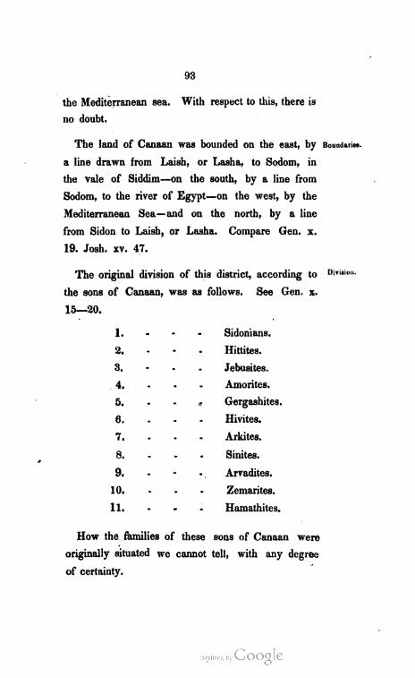
93
the Mediterranean sea.
no doubt.
With respect to this, there is
The land of Canaan was bounded on the east, by Boundaries.
a line drawn from Laish, or Lasha, to Sodom, in
the vale of Siddim—on the south, by a line from
Sodom, to the river of Egypt—on the west, by the
Mediterranean Sea—and on the north, by a line
from Sidon to Laish, or Lasha.
19. Josh. xv. 47.
Compare Gen. x.
The original division of this district, according to Pi".
the sons of Canaan, was as follows.
15–20.
1. - - -
2. - - -
3. - - -
. - -
s
:- - -
10. - - -
11. - a- -
How the families of these
originally situated we cannot
of certainty.
See Gen. x.
Sidonians.
Hittites.
Jebusites.
Amorites.
Gergashites.
Hivites.
Arkites.
Sinites.
Arvadites.
Zemarites.
Hamathites.
sons of Canaan were
tell, with any degree
94
'Some of
these fam
ilies soon
emigrated.
Families
that emi
giated.
Arkites.
Situation.
Soon after their original settlements, they extended
their plantations, or sought new ones. Gen. x. 18.
In further examining the plantations of the descend
ants of Canaan, we may notice—
1. Which of his sons appear to have left the
original allotment, before it was given to the descend
ants of Shem, as intimated, Gen. ix. 25, 26.
2. What families, or tribes, were settled in it,
when the Israelites subdued, and took possession of it.
S O N S OF CAN A A N T H A T L E FT HIS
A L L O T M E N T.
The descendants of five of the sons of Canaan,
appear to have formed settlements beyond the limits
of the country assigned him.
1. - The - Arkites.
2. - - * - Sinites.
3. - - * - Arvadites.
4. - - - Zemarites.
5. - - - Hamathites.
A R K IT. F. S.
These, as it is supposed, moved into the moun
tains of Lebanon, and settled about the city of Arce,
mentioned by Ptolemy, and other geographers. Arce,
is thought to be retained in Arka, which is situated
in the mountains, little north of east from Tripoli.
95
s 1 N I T E 3.
The Sinites, are considered to have settled near
the Arkites, and their situation to be indicated by a
city, near the Arkite plantation, called Sin. The
district in which the city of Sin lay, retained this
name, in the days of Jerome, as he informs us, though
the city itself had disappeared.
A R v A d 1 T. E. S.
In the Island Aradus, now Ravad, lying on the
coast of Syria, is preserved, as it is thought, the
Hebrew Arvad. It can easily be imagined that the
children of Arvad, being disturbed in their original
settlement, moved to this Island; and, in process of
time, passed into the country over against it.
Z E M A. R. I. T. E. S.
On the coast, near Aradus, there was an an
cient city, called Simyra. This is supposed to
have received its name from the father of the Zem
arites, who might be called Zemar. The Zemarites,
Arvadites, Sinites, and Arkites, were, probably neigh
bours, on the coast, and in the adjoining mountains,
of Syria.
H A M A T H IT E S ,
The Hamathites, as we have seen, formed a Syrian
Kingdom, which lay between Beth-Rehob, and
Sinites.
Situation.
Arvadites.
Situation.
Zemarites.
Situation
Hamathites"
Situation.

96
Families
that remain
ed in Ca
naan.
Sidonians.
Location.
Boundaries.
Zobah, on the northern frontier of Canaan. See
kingdom of Hamath.
Dw E L L E R S IN C A N A A N, w H E N T H E
I S R A E L IT E S S U B D U E D IT .
There were, at the time, when the Israelites sub
dued and took possesion of Canaan, nine communi
ties, or societies of people, within its limits, that
were of Canaanitish origin, except one. Compare
Josh. iii. 10. xiii. 2, 3. xix. 28. xxiv. 11. Judg. i.
31. iii. 3.
1. - The - Sidonians.
2. - - - Hivites.
3. - - - Gergashites.
4. - - - Canaanites.
5. - - - Amorites.
6. - - - Jebusites.
7. - - - Perrizzites.
8. - - - Hittites.
9. wº - - Philistines.
SI DO N I A N 8.
There can be no doubt with respect to their canton,
as it is marked by the noted city Sidon, which lay
in the northwest corner of Canaan. Gen. x. 19.
It was bounded on the east and south, by the
canton of the Hivites—on the west, by the Mediter

97
ranean Sea—and on the north, by the Kingdom of
Beth-Rehob in Syria.
H I v I. T. E. S.
The canton of the Hivites, lay in the northeastern
borders of Canaan. “The Hivites dwelt in Mount
Lebanon, from Baal-Hermon, unto the entering in
of Hamath.” Judg. iii. 3.
It was bounded on the east, by the kingdom of
Maachah, in Syria—on the south, by the cantons of
the Gergashites, and Canaanites—on the west, by
the canton of the Sidonians—and on the north, by
the Kingdom of Hamath, in Syria.
G E R G A s h 1 T. E. S.
The canton of the Gergashites, is supposed to
have been small, and to have adjoined the Sea of
Gennezareth. We read of a people called Gergasens,
as late as the days of our Saviour. Mat. viii. 28.
which seems to preserve some remainder of the name
of Gergash, the father of the Gergashites. This
people, at the time of our Lord, dwelt on the east
of Gennezareth, but it is easy to suppose, that they
crossed over this sea, when their country, on the
west of it, was subdued by the Israelites.
It was bounded, on the east, by the Sea of Gen
nezareth—on the South, by the canton of the Ca
Hivites.
Location.
Boundaries.
w
Gergashites.
Location.
Boundaries.
9
98
Canaanites.
Who they
were.
Location.
Boundaries.
naanites—and on the west, and north, by the canton
of the Hivites.
C.A. N. A. A N IT. E. S.
When the spies returned from examining the coun
try of Canaan, they reported that the Hittites, Jeb
usites, and Amorites, dwelt in the mountains; and
that the Canaanites dwelt by the Sea, and by the
coast of Jordan. Numb. xiii. 29. Thus they spoke
of the Canaanites, as a people, composing a part
of the Canaanitish nation; or as different families
dwelling together, in one canton. By this general
name, it is thought that they spoke of a mixed mul
titude of the descendants of Canaan, who had been
driven from their homes, probably by the Philistines,
and were now settled together, without distinction
of family names, as a single community.
This mixed people, of several families of Canaan,
dwelt by the Mediterranean Sea, and the coast of
Jordan, and north of the Hittites, Jebusites, and
Amorites. Numb. xiii. 29. Josh. xi. 3.
The canton of the Canaanites, was bounded on
the east, by the river Jordan—on the south, by the
canton of the Amorites, and country of the Philis
tines—on the west by the Mediterranean Sea—and
on the north, by the cantons of the Hivites, and
Gergashites.
99
A M or IT E S .
This Canton, lay in the mountainous parts of the
country of Canaan, and as we should conclude from
Numb. xiii. 29, between the Canaanites and Jebusites.
It was bounded on the east, by the river Jordan
—on the South, by the canton of the Jebusites—on
the west, by the country of the Philistines—and on
the north, by the canton of the Canaanites.
The Amorites seem to have extended their do
minions beyond the limits of their canton, in the land
of Canaan. Before the Israelites entered Canaan,
they had conquered and possessed the country of
the Ammonites east of Jordan, from the river Arnon
to the river Jabbok; and from Mount Gilead, to the
river Jordan. Deut. ii. 24–37. Judg. xi. 21, 22.
They had also conquered, and possessed the country
north of Jabbok, up to Mount Hermon. So, at the
time the Israelites took possession of their promised
inheritance, the Amorites had the dominion of the
whole of the country east of Jordan, from the river
Arnon, to Mount Hermon—and from Mount Gilead,
to the river Jordan. Deut. iii. 8, 17.
J E B U S I T E S.
The Jebusites, dwelt in the country about Jebus,
afterwards called Jerusalem, I. Chron. xi. 4. and
their canton lay between those of the Amorites,
and Hittites. Numb. xiii. 29.
Amonites.
Location.
Boundaries.
Extended
their do
minion.
Jebusites.
Location.
100
Boundaries.
Perrizzites.
Location,
Boundaries.
Hittites.
Location.
Boundaries.
It was bounded on the east, by the river Jordan–
on the south, by the cantons of the Hittites and Per
rizzites—on the west, by the country of the Philis.
tines—and on the north, by the canton of the Amorites.
P E R R i Z Zi T E S.
The Perrizzites, are, generally, admitted to be of
Canaanitish origin, and they are located, by many,
between the Jebusites and Hittites, on the hills, near
the Dead Sea. Josh. xvii. 15. Some think, that
their origin is doubtful—that, as their name seems
to import separated, or dispersed, they were the
nomads of Canaan, and had no settled habitations.
Allowing them to possess a canton—it was, pro
bably, bounded on the east, by the Dead Sea—on the
south, by the canton of the Hittites—and on the
west, and north, by the canton of the Jebusites.
HIT TI T E S.
The Hittites, dwelt about Kirjath-arba, which
was called Hebron. Gen. xxiii. 2. This was in the
south of Canaan. The Hittites occupied the northern
frontier of the Amalekites, who dwelt, as we have
seen, in the northern border of Arabia. Numb. xiii. 29.
Their canton, was bounded on the east, by the
plains of Siddim, or the Dead Sea—on the south, by
Arabia—on the west, by the country of the Philis
* 101
tines—and on the north, by the cantons of the
Jebusites, and Perrizzites.
P H 1 L IST in Ese
The Philistines, were descendants of Mizraim.
They came out of Egypt, and spread along the
shores of the Mediterranean Sea. Deut. ii. 23.
The country of the Philistines, was bounded on the
east, by the cantons of the Amorites, Jebusites, and
Hittites—on the south, by the River of Egypt—on
the west, by the Mediterranean Sea—and on the north,
most probably, by the canton of the Canaanites.
The country of the Philistines, was divided, into
five principalities. Josh. xiii. 3.
1. The Principality of Gaza.
2. 44 44. “ Ascalon.
3. 44. 44 “ Ashdod.
4. <& 4& “ Ekron.
5. 49 &g “ Gath.
p Rix C I PA. L. 1TY of G.A. 2 A.
Gaza, was in the southwestern part of Canaan—
lay on the Mediterranean Sea—and extended, with
her towns, and villages, unto the River of Egypt.
Josh. xv. 47.
PRI N C 1 P A L IT Y of A 8 C A Lo N.
This lay north of Gaza, and upon the shore of
the Mediterranean Sea. Josephus says, that it was
Philistines.
Location.
Boundaries.
Division.
Gaza.
Situation.
A scalon.
Situation.
9%

102
Ashdod.
Situation.
Ekloſt.
Situation.
Gath.
Situation.
five hundred and twenty furlongs from Jerusalem,
about sixty-five miles. Jew. War. B. iii. ch. 1.
P B 1 N. c 1 P A L I T Y o F A S h D O D .
Ashdod, called by the Greeks, and in Act. viii.
40. Azotus, lay north of Ascalon; and was also
situated on the Mediterranean Sea.
P R I N c 1 F A L L T W o y F. K R O N.
Ekron, called by the Greeks, Accaron, was the
most northerly of the five cities, or principalities of
the Philistines, that lay upon the Mediterranean Sea.
P R 1 N c 1 P A L1 t y o y G A T H .
Gath, was situated in the interiour; perhaps a
little to the north of east from Ashdod. There is
no certain knowledge of its local position.
P A R T II.
AN AB S TRA C T
O F.
J E W I S H G E O G R A P H Y.

C H A PT E R I.
H IS TO RIC A. L. G E O G RA PHY OF T H E
P R O M I S E D L A N D.
By the Promised Land, is meant, that district of
country, which the Lord promised to Abraham, that
his posterity should possess. Heb. xi. 9. Gen. xii.
7. xiii. 15.
This district of country, has been designated, by
different names, besides that of the Promised Land.
1. By the Land of Canaan—because the allotment
of Canaan, the youngest son of Ham, formed, the
most distinguished part of it. Gen. xii. 5.
2. By the Land of Israel—because the descend
ants of Jacob, who possessed it, were called Israel
ites. Ezek. xii. 19. Gen. xxxii. 28. I. Sam.
xiii. 19.
3. By the Land of Judah—perhaps, because Ju
dah, was a distinguished tribe, in obtaining possession
of the country. Deut. xxxiv. 2. Ruth. i. 7. 1.
Chron. v. 1, 2.
4. By the Land of Judea—because, the province
of Judah, or Judea, was the country to which the Is.
raelites first returned after the captivity. Ezra v. 8.
Promised
Land.
Why so
called.
Designated
by other
natines.
Caſmaan.
Israel.
Judah.
Judea.
106
Palestine. 5. By the name of Palestine—from the Philistines,
who dwelt in the western part of ancient Canaan,
on the Mediterranean Sea. Exod. xv. 14.
Holy Land. 6. By the Holy Land—because it was chosen by
God to be the dwelling place of the people, whom
he set apart, to be his worshippers. Zech. ii. 12.
II. Chron. xxxvi. 15.
Extent. With respect to the extent of this country, it may
be remarked, that according to the original promise
to Abraham, and to what was afterwards agreed
upon and settled, it comprised ancient Canaan; and
extended southward, to the eastern arm of the Red
Sea; and eastward, to the river Euphrates. But
the eastern, and southern, boundary lines, cannot
now, be drawn with any degree of certainty. Com
pare Gen. xv. 18, 21. Numb. xxxiv. 1, 2. Deut.
xi. 24. Josh. i. 4. xi. 16, 17. xii. 1, 7. xv.
Boundaries. While we cannot, accurately, draw the entire
eastern, and southern, boundary lines; it may be said
in general, that the Promised Land, was bounded on
the east, by the river Euphrates—on the south, by
the Elanitic Gulf, or eastern arm of the Red Sea—
on the west, by the Mediterranean Sea—and on the
north, by Syria.
Among. The Promised Land was divided into twelve porwhom di
* tions, one to each of the tribes of Israel, except to
107
that of Levi. To this tribe were given forty-eight
cities, as places of residence; and they were sup.
ported by the tythes of the other tribes. Numb.
xxxv. 1, 6. Josh. xvii. 7. xxi. Jacob gave to
Joseph, as his first-born, two portions, and adopted
his two sons Ephraim and Manasseh, each of which
became a head of a distinct tribe. Gen. xlviii. 5.
Josh. xvi. xvii. 1, 2. The tribes that had a por.
tion of the country allotted to them, were—Reuben,
Simeon, Judah, Zebulon, Asher, Issachar, Dan,
Gad, Naphtali, Manasseh and Ephraim in the place
of Joseph, and Benjamin.
These portions, for the sake of convenience, may
be divided into the Northern, Middle, Southern, and
Eastern Allotments.
S E CT I O N I.
N OR T H E R N DIVISION.
I N c L U DI N G T H E A L L o TM E N T S o F A s H E R,
NA PHT A L I, Z E B U L ON, A N D I S S A C H A R.
A S H E R .
The allotment of Asher, fell in the northwestern
corner of ancient Canaan, extending from Sidon, on
the north, to Mount Carmel, on the south; and to
the allotments of Naphtali and Zebulon, on the east.
Josh. xix. 24, 30. Judg. v. 17.
General
Division.
Northern
Division.
Asher.
Location.
108
Boundaries.
Cities.
Sidon.
Tyre.
Accho.
Rehob.
Hebron.
Aphek.
Naphtali.
Location.
It was bounded on the east, by the allotments of
Naphtali and Zebulon—on the south, by the allotment
of Zebulon, and Mount Carmel—on the west, by
the Mediterranean Sea—and on the north, by the
kingdom of Rehob.
Twenty-two ancient cities fell within the limits
of this allotment. Among these were the following.
See Josh. xix. 24, 30. Judg. i. 31.
1. SIDON.—Sidon was situated in the northwestern
corner, on the Mediterranean Sea.
2. Tvre.—This lay South from Sidon, on the
Mediterranean.
3. AccHo, AFTERwards ProLEMAs.-This lay south
of Tyre, on the same coast.
4. REHoB.—This lay about east from Sidon.
5. HEBRON.—The Hebron in this allotment, lay
about east from Tyre.
6. APHEK.—This was situated about northeast
from Tyre, and southwest from Sidon.
in A. P. H. T. A. L. I.
The allotment of Naphtali was in the north of
ancient Canaan, between Asher, and the waters of
the Jordan. Josh. xix. 32, 34.
109
It was bounded on the east, by the Kingdom of Boundaries.
Maachah—on the south, by the allotment of Zebu
lon—on the west, by the allotments of Zebulon and
Asher—and on the north, by the kingdom of Hamath.
Nineteen ancient cities fell within the limits of
this allotment—among these the following may be
noticed. See Josh. xix. 35–38.
1. KEDESH.—This was situated in the western
part of the allotment, about half way between the
northern, and southern boundaries. This was made
a city of refuge. Josh. xx. 7.
2. CINNEROTH.—This lay in the southeastern
corner, of the allotment—near the Sea of Gen
nezareth.
3. Judah.—The city of this name in Naphtali, lay
on the waters of the Jordan. Josh. xix. 34.
z E B U L on .
This allotment, joined those of Asher and Naphtali,
and extended south, to Sarid, and Mount Tabor, or
the allotment of Issachar. It also extended from
Mount Carmel on the west, to the Sea of Gennez
areth on the east. Compare Josh. xix. 10, 15, 22.
Mat. iv. 13.
It was bounded on the east, by the Sea of Gen
mezareth, and the river of Jordan—on the south, by
Cities.
Kedesh.
Cinneroth.
Judah.
Zebulon.
Location.
Boundaries.
10
110
Cities.
Bethlehem.
Chisloth
Tabor.
Sarid.
Jokneam.
Issachar.
Loeation.
the allotment of Issachar—on the west, by the allot
ment of Issachar, and Mount Carmel—and on the
north, by the allotments of Asher and Naphtali.
Twelve ancient cities fell within the limits of this
allotment. The following were of their number.
See Josh. xix. 10–16.
º
1. BETHLEHEM.—Bethlehem in Zebulon, was sit
uated near the centre of the allotment.
2. CHIsLoth-TABOR.—This was situated on the
southern side of Mount Tabor.
3. SARI.D.—The location of Sarid, was on the
southern border, west of Tabor.
4. JokNEAM.–This lay on the western border.
I 8 8 A C H A R •
Mount Carmel, was the northern, and the western
limit of this allotment. It lay between Zebulon and
Manasseh-and from the Jordan it extended west,
towards the Mediterranean, but did not reach that
Sea. A part of the allotment of Manasseh stretched
along the shores of the Mediterranean, to Mount
Carmel. Josh. xvii. 10. xix. 18–22.
It was bounded on the east, by the river Jordan–
on the south, by the allotment of the half tribe of
Manasseh-on the west, by the half tribe of Manas
seh, and Mount Carmel—and on the north, by the
Situation.
allotment of Zebulon.
111
Sixteen ancient cities fell within the allotment of
Issachar. Josh. xix. 17–22. Of these we may notice,
1. BETH'shemesH.—This lay in the northeastern
part, between Mount Tabor and the Jordan.
2. SHUNEM.—The situation of this city, was about
the centre of the allotment.
3. ANAHARATH...-This lay on the western border.
SECTION II.
M ID D L E DIW ISION.
I N C L U D I N G T H E A L L O T M E N T S O F T H E
H A L. F T R IB E O F M A N A S S E H , A N D
O F. E. P. H. R. A. I. M.
H A 1, ºf T R I B E O - M A N A S S E H .
The allotments of the half tribe of Manasseh, and
of Ephraim, were in one appointment. The portion
of the half tribe of Manasseh, was evidently north
of Ephraim's ; and west, and south, of Issachar's.
Compare Josh. xvi. 1, 4, 8, xvii. 7–11.
It was bounded on the east, probably, in part, by
the allotment of Issachar, and in part, by the Jordan–
on the south, by the Allotment of Ephraim—on the
west, by the Mediterranean Sea—and on the north,
by Mount Carmel, and the allotment of Issachar.
Some of the ancient cities, which belonged to the
allotments of other tribes were given to the children
Cities.
Beth-she
mesh.
Shunem.
Anaharath
Middle
Division.
Manasseh.
Location.
Boundaries
Cities.
112
Ephraim.
Location.
Roundaries
Cities
Shechem.
Timnath
Serah.
of Manasseh. They had several cities in the allot.
ments of Asher and Issachar—as those of Dor,
Migiddo, Endor, &c. Some of the cities of the
land of Tappua, in the southwestern part of this al
lotment, belonged to them; while others, that lay on
the border, were given to the children of Ephraim.
Josh. xvi. 5–8. xvii. 7–11.
e P H R A 1 M .
This allotment, lay south of that of the half tribe
of Manasseh, and extended from the Jordan, to the
Mediterranean. See the passages referred to, in
locating the allotment of the half tribe of Manasseh.
The allotment of Ephraim, was bounded on the
east, by the river Jordan—on the south, by the allot.
ments of Benjamin and Dan—on the west, by the
Mediterranean Sea—and on the north, by the allot
ment of the half tribe of Manasseh.
Some of the ancient cities, which fell within this
allotment, were as follows. Josh. xvi. 1–8. xvii. 9.
xix. 50. xxi. 20–22.
1. ShechEM.—This was afterwards a city of
refuge, Josh. xx. 7. and lay in the northern part of
the allotment, about midway between the Jordan, and
the Mediterranean.
2. TIMNATH-SERAH.—Joshua's inheritance. Josh.
xix. 50. This lay southwest, from Shechem.

113
*g 3. Upper-BETH-HoRoN.—This was situated about
midway between Shechem and Timnath-Serah.
4. NETHER-BETH-HoRoN.—This lay nearly south
from Upper-Beth-horon.
5. SHILoh.—This lay a little east of south, from
Shechem.
SECTION III.
SOUT H E R N DIVISION.
I N C L U D IN G T H E A L L O T M E N T S OF B E N -
J A M I N, D AN, J U D A H A N D S IM E O N.
B E N J AM in .
The allotment of Benjamin was between Ephraim
and Judah, and extended from Jordan, to the allot
ment of Dan. Compare Josh. xvii. 10. xviii. 11–14.
xix. 40–46.
It was bounded on the east, by the river Jordan–
on the south, by the allotment of Judah—on the west,
by the allotment of Dan—and on the north, by the
allotment of Ephraim.
Among the ancient cities which fell within this
allotment were the following. Josh. xviii. 21–28.
1. JEBUSI, which is JERUsALEM. Jerusalem was
situated on the southern border, about midway be.
tween the river Jordan, and the Mediterranean Sea.
Beth
Horon.
Southern
Division.
Benjamin.
Location.
Boundaries.
Cities.
Jebusi.
10+

114
Ramah.
Gibeon.
Bethel.
Jericho.
Dan.
Location.
Bonndaries.
2. RAMAH.—The Ramah in Benjamin,” lay north
of Jerusalem, about eight miles. Judg. xix. 13. I.
King. xv. 17.
3. GIBEoN.—This was the chief city of the Gibe
onites, Josh. ix. 17. x. 2. and lay about four miles
north of Ramah.
4. BETHEL.-This lay about six miles northeast
from Gibeon.
5. HAI.—This lay east from Bethel, about two
miles.
6. JERIcho.—The city of Jericho was situated in
the plains of Jericho, and lay northeast from Jeru
salem, about fifteen miles.
D. A. N. .
The allotment of Dan, most probably, lay on the
western frontier of Benjamin. We find that Ekron
was within its limits, and that its border was before
Japho, which is thought to be the same as Joppa.
Joppa lay on the Mediterranean, a number of miles
north of Jerusalem. Josh. xix. 40–46.
It was bounded on the east, by the allotment of
Benjamin—on the south, by the allotment of Simeon
—on the west, by the Mediterranean Sea—and on the
north, by the allotment of Ephraim.
* There was a Ramah in Mount Ephraim. 1. Sam, i. 19. ii. ſ.1.
115
Among the ancient cities which fell within the limits
of this allotment, we may notice—Josh. xix. 41–46–
1. JAPHo on Joppa.-Joppa was situated in the
northwestern corner of this allotment, near the line
between Dan and Ephraim.
2. EKRoN.——This lay near the coast of the Med
iterranean, south of Japho, or Joppa.
3. GIBBEThon.—Gibbethon, was, probably, an in
land city, and lay little east of south, from Ekron.
E M I G R A N T S F. R O M D A N .
After the death of Joshua, some of the Danites
emigrated, and formed a settlement, in the kingdom
of Hamath, on the head waters of the Jordan. To
the principal city, in their tract, they gave the name
of Dan, which before, was called Laish, or Lasha.
Josh. xix. 47. Judg. xviii. 29.
J U D A H.
The original allotment of Judah included the whole
of ancient Canaan, south of Benjamin—and perhaps,
the greater part of the allotment of Dan. Compare
Josh. xv. 11, 12. xix. 1, 9, 40, 48.
As the limits of the allotment of Judah were finally
arranged and settled, it was bounded on the east, by
the Dead Sea—on the south, by Arabia, or Asiatic Ethi
opia—on the west, by the allotments of Simeon and
Dan—and on the north, by the allotment of Benjamin.
Cities.
Emigrants.
Principal
City.
Judah.
Location.
Boundaries.
116
Cities.
Hebion.
Debir.
Engedi.
Gibea.
Maon.
Simeon.
Location.
Situation.
Among the many ancient cities, which fell within
this allotment, we may notice, in this place, the fol
lowing. Josh. xv.
1. KIRJATH-ARBA.—Called Hebron, and one of the
cities of refuge. Josh. xx. 7. This was situated
nearly in the centre of the allotment.
2. KIRJATH-sepher, KIRJATH-sANNAH, or DEBIR.
This lay on the western border, nearly southwest
from Hebron.
3. ENGED1,–This lay southeast from Hebron
not far from the Dead Sea.
4. GIBEA.—Gibea in Judah,” lay southeast from
Hebron, about half way between it, and Engedi.
5. MAON.—This lay a few miles southeast from
Gibea.
8 i M E O N.
This allotment, was taken from that which origi
nally fell to Judah; and it adjoined the Mediterranean
Sea. Josh. xix. 1, 9.
It was bounded on the east, by the allotment of
Judah—on the south, by Arabia—on the west, by
the Mediterranean Sea—and on the north, by the
allotment of Dan.
* There was a Gibea, in Benjamin, the royal seat of Saul.
117
Among the ancient cities, which fell within this al
lotment, we may notice the following. Josh. xix. 1–9.
1. BEERSHEBA.—Beersheba, was situated, on the
southern border, about midway between the allotment
of Judah, and the Mediterranean Sea.
2. SHEBA.—This lay a few miles east from Beer
sheba.
3. HoRMAH.—This lay northeast from Sheba, on
the eastern border.
4. ZIKLAG.—Ziklag was situated on the eastern
border, and lay north from Hormah.
5. REMMON, or EU-REMMON.—This lay north of
Ziklag, near the allotment of Judah.
6. AIN.—This lay north of Remmon.
S E CT I O N IV.
EA S T E R N DIW IS I O N.
I N C L U D I N G T H E A L L O T M E N T 8 O F T H E
H A LF T R IB E of M A N A s s E. H., A N D OF THE
T R IB E S O F. G A D A N D R E U B E N .
H A L R T R IB E o y M A N A S S E H .
This allotment adjoined the Kingdoms of Maachah
and Geshur, on the north, and lay to the east of
ancient Canaan. It extended south to the river Jab
bok. See Kingdoms of Maachah and Geshur.
Cities.
Beersheba.
Sheba.
Hormah
Ziklag.
Remmon.
Fastern
Division.
Manasseh.
Location.
118
º
Boundaries.
Cities.
Golan.
Ashtaroth.
Edrei.
Gad.
Location.
Boundaries.
It was bounded on the east, by the Mountains of
Gilead, which separated it from Syria—on the south,
by the allotment of Gad—on the west, by the waters
of Jordan—and on the north, by the Kingdoms of
Geshur and Maachah.
Some of the ancient cities, which fell within this
allotment, were as follows. See Josh. xiii. 2–931.
1. GoLAN.—This was made a city of refuge, Josh.
xx. 8. and it lay nearly in the centre of the al
lotment, amidst the hills of Bashan.
2. AsHTAROTH.—This lay south from Golan, in
the Mountains of Gilead.
3. EDREI-This lay northeast from Ashtaroth.
G. A D .
This allotment, was evidently between those of
the Half tribe of Manasseh, and of Reuben. It had
Jordan on the west ; and the northwest corner of
it adjoined the Sea of Gennezareth. See Josh. xiii.
24–28.
It was bounded on the east, by the Mountains of
Gilead, which separated it from the country of the
Amorites”—on the south, by the allotment of Reu
* When Moses conquered Sihon and Og--the Amorites set
tled on the east of Gilead. See Ammon.
119
ben—on the west, by the river Jordan—and on the
north, by the Sea of Gennezareth, and the allotment
of the half tribe of Manasseh.
Some of the ancient cities, which fell within this
allotment, were the following. Josh. xiii. 24–27.
1. RAMoTH-GILEAD.—This was made a city of
refuge, Josh. xx. 8, and was situated, nearly, in
the centre of the allotment.
2. Succoth.--This lay near the point, where the
river Jabbok, falls into the Jordan, and west from
Ramoth-Gilead.
3. JAZER.—Jazer was situated on the eastern
border, and lay about southeast from Ramoth-Gilead.
4. RAMATH-MIzPEH,-This lay on the border, in
the northeastern part of the allotment.
rt r u b e n .
This allotment lay south of that which fell to Gad,
and on the waters of Jordan. See Josh. xiii. 15–21.
It was bounded on the east, by the Mountains of
Gilead, which separated it from the country of the
Ammonites, and of the Moabites—on the south, by the
river Arnon—on the west, by the Dead Sea, and
the river Jordan—and on the north, by the allot
ment of Gad.
Cities.
Ramoth
Gilead.
Succoth.
Jazer.
Ramath
Mispeh.
Reuben.
Locatiºn.
Boundaries.
120
Citics,
Bezer.
Aroct.
Among the ancient cities that fell within this al
lotment we may notice the following. Josh. xiii.
15–21.
1. BezER.—This, was made a city of refuge,
Josh. xx. 8, and was situated in the southeastern
part of the allotment.
2. ARoSR.—This lay in the southern border, on
the river Arnon, southwest from Bezer.
Heshbon.
Beth-Jese
moth.
Ashdoth
Pisgah.
Division ofthe kingdom.
3. HESHBon.—Heshbon, had been the royal city
of the Amorites, who conquered it from the Moabites ;
and it lay in the northeastern border.
4. BETH-JESEMOTH,--This was situated in the
western part, not far from the place where the river
Jordan falls into the Dead Sea.
5. AsHDoTH-PIsGAH.—This city lay southwest from
Heshbon, in the midst of the mountains of Abarim.
SECTION V.
D I V I S I O N A FT E R T H E R E V O L T.
After the death of Solomon, a contention arose
respecting a successor, when the kingdom was
divided. Ten Tribes revolted from Rehoboam the
son of Solomon, and set up Jeroboam, the son of
Nebat, as their King. Two tribes adhered to Reho
boam. The latter formed the Kingdom of Judah—
the former, the Kingdom of Israel.
121
KingdomK in G D o M OF J U DAH - of Judah.
Those who composed this Kingdom, were the §º.
tribes of Judah and Benjamin, and such as dwelt
in the cities of Simeon and Dan, on the borders of
the allotments of these two tribes. Compare 1. King.
xii. 17. 23. xi. 13, 31, 35.
The Kingdom of Judah was bounded on the east, Boundaries.
by the Dead Sea—on the south, by Arabia—on the
west, by what remained of the allotments, of Simeon
and Dan—and on the north, by the allotment of
Ephraim.
Jerusalem, in the allotment of Benjamin, was the Royal city.
residence of the Kings.
- KingdomK I N G D OM OF 1 S R A E L . of Israel.
The Kingdom of Israel, included the northern, Extent.
middle, and eastern allotments, together with the
greater part of the allotments of Simeon and Dan.
Samaria, in the allotment of Ephraim, about forty Royal city.
miles north from Jérusalem, was the royal city.
The royal city, or capital of this kingdom, being How some.times desig
in the allotment of Ephraim, Ephraim, and Joseph nated.
the father of Ephraim, is often used to denote the
whole of the kingdom of Israel, or of the ten tribes.
11

Promised
Land.
Moses' ac
count of its
physical
condition.
Mountains.
C H A PTER II.
PHY S I C A L G EO G R A PHY OF THE PROM IS ED
LAN D.
The following description is given, by Moses, of
the physical condition of this country. “It is a land
of hills and valleys, and drinketh water of the rain
of heaven; a good land; a land of brooks of water,
of fountains, and depths that spring out of valleys
and hills; a land of wheat, and barley, and vines,
and fig-trees, and pomegranates; a land of oil-olive
and honey; a land whose stones are iron, and out
of whose hills thou mayest dig brass.” Deut. viii.
7, 8, 9. xi. 11.
SECTION I.
M O U N T A IN S.
There are two ranges of mountains, running north
and south, through the whole length of the country.
One of these ranges is on the west, and the other
on the east, of Jordan; and both run parallel with
that river. The different ridges, and peaks, whichº
-
compose these ranges, were known by different names.
* Brass, in this passage ought to be translated copper. Brass
is a mixture ofCopper and Zinc, and is not found in mines. See
Job xxviii. 2.
123
W E S T E R N R A N G E .
I. LEBANON.—This mountain, which was princi
pally in Syria, as has been seen, extended into the
allotment of Asher. Josh. xi. 17. xii. 7.
II. MoUNTAINs of NAPHTALI.—These extended
south from Anti-Lebanon through the allotment of
Naphtali. Josh. xx. 7.
III. MoUNT CARMEL.-This was a noted mountain,
and often mentioned in the Scriptures. It begins to
rise a few miles south of Accho, or Ptolemais, and
ends in the cape which forms the bay of Accho.
Its circumference is between forty and sixty miles.
It is rocky, and contains many caves, where persons
may easily hide. Jer. xlvi. 18. Amos. ix. 3.
Mic. vii. 14.
There was another Mount Carmel in the allotment
of Judah. Josh. xv. 55. I. Sam. xxv. 2. II.
Sam. iii. 3.
IV. MoUNT TABOR.—This is about eleven miles
east of Carmel, on the northern side of the plain of
Jezreel, or Esdraslon. It is of a conical form, about
one mile in height, and between twelve and fifteen
miles in circumference, at the base. At the top, it
has a plain area, fertile and pleasant. On this mount,
our Lord, as it is supposed, was transfigured.
Western
range.
Lebanon.
Naphtali.
Carmel.
Tabor.

124
Gilboa.
Ephraim.
Noted
Peaks.
Samaria.
Ebal.
Gerizim.
Zalmon.
Rimmon.
About Je
rusalem.
There was a place called Tabor, not far from
Jerusalem. I. Sam. x. 3.
V. MoUNTAINs of GILBoA.—These are supposed to
be the hills which lie east, and southeast from Tabor,
extending north and south, through the district,
which formed the allotment of Issachar.
VI. MoUNTAINs of EPHRAIM.–These run north
and south through the allotment of Ephraim. An
cient Shechem was in this mountainous district.
Josh. xx. 7.
Different tops, or peaks of this ridge, were known
by different names—
1. A northern peak was known by the name of
the Mount of Samaria. I. King. xvi. 24.
2. A peak south of Samaria, and not far from an
cient Shechem, was called Mount Ebal. Josh. viii. 30.
3. A peak to the south of Ebal, was distinguished
by the name of Mount Gerizim. Josh. viii. 33.
4. One of the peaks, near Shechem, was called
Zalmon. Judg. ix. 47, 48.
VII. Rock RIMMon, now Mountains of Quaran
tania.—This was in the allotment of Benjamin.
Judg. xx. 45, 47.
VIII. MoUNTAINs Round ABouT JERUsALEM.–
These will be noticed hereafter.
125
IX. MoUNTAINs of JUDAH.—These lay in the al
lotment of Judah, and were numerous. In these
mountains were large caves. Among these, was the
cave of Adullam, II. Sam. xxiii. 13, 14. and that
of Engedi. I. Sam. xxiv. 1–7. Josh. xv. 62.
E A S T E R N R A N G E .
I. HeRMon.—This was the southeastern peak of
Anti-Lebanon, and stood on the line between the
Promised Land and Syria. Deut. iv. 48.
II. HILLs of BASHAN.—These were the hills,
which continued south from Mount Hermon, and
some of them were of considerable height. Compare
Psal. lxviii. 15. Deut. iii. 10, 12, 13.
III. MIzAR.—This hill was one of the peaks of the
Bashanic range, or of Mount Hermon. Psal. xlii. 6.
IV. GILEAD.—The whole of the eastern range,
from Hermon southward, was sometimes called Gil
ead—but in a stricter sense, it was the name given
to the middle portion of this range. Deut. iii. 12.
V. ABARIM.–These belonged to the southern part
of the range, as it respected the Promised Land,
and were in the allotment of Reuben. Several noted
peaks were found among them—as Mount-Peor, Nebo,
and Pisgah. Numb. xxvii. 12. Deut. xxxiv. 1.
Judah.
Caves.
Eastern
range.
Hermon.
Bashan.
Mizah.
Gilead.
Numb. xxiii. 28. Deut. xxxii. 49.
Abarim.
Noted
Peaks.
11*
126
Philistines.
t
Plains and
Valleys.
Sharon.
Jezreet.
Jurdan.
SECTION II.
P L A I N S A. N. D. V. A. L. L. e. Y S .
Although the Promised Land, may be called moun
tainous, yet the ridges are interrupted, in various
places, by level tracts and valleys. Some of these
are particularly designated in the Bible, and others
do not appear to be noticed, except, by some occa
sional and general allusion.
I. PLAIN of THE PHILISTINEs.-This was on the
shores of the Mediterranean, extending from the river
of Egypt, to Mount Carmel. In the southern part
of it lay the five principalities of the Philistines.
Josh. xiii. 3.
II. SHARoN.—This was a fertile plain adjoining
Mount Carmel, and extending to the south, perhaps,
as far as Joppa. Isa. xxxv. 2. Act. ix. 35.
i II. WALLEY of Jezreel, or Esdr ELON.—This com
menced at Mount Carmel, and extended eastward
through the middle of ancient Canaan, to the waters
of Jordan. The western part was called the valley
of Megiddo, or Megiddon. Judg. vi. 33. II. Chron.
xxxv. 20–25. Compare, Zech. xii. 11. This was
the Apocalyptic Armageddon. Rev. xvi. 16.
IV. PLAINs of Jordan.—These extended, on each
side of the river Jordan, from the Sea of Genneza

127
reth, to the Dead Sea. I. King. vii. 46. A part of
this plain, on the west of Jordan, near the city of
Jericho, was called the plain of Jericho, II. King.
xxv. 5. and a part of it, on the east of Jordan, op
posite Jericho, was called the plain of Moab. Numb.
xxii. 1. xxvi. 63. Deut. xxxiv. 1, 8, also the plains
of Shittim. Compare, Numb. xxv. 1. and xxxiii.
49. margin.
V. PLAIN of MAMRE.—This was south from Je
rusalem. In this plain, Kirjath-arba, called Hebron,
was situated. Gen. xviii. 1.
VI. WALLEY of ELAH.—This lay to the south of
Jerusalem, in the allotment of Judah, I. Sam. xvii.
1–3. perhaps, not far from Bethlehem. Josh.
xvii. 12–19.
VII. THE v.ALLEYs of JehoshAPHAT, AND HIN
NoM.—These will be noticed hereafter.
SECTION IV.
LA K E S A N D R IV E R S.
L. A K E S -
1. WATERs of MEROM.–Josh. xi. 5, 6.—This is
a small marshy lake, in the northeastern part of
ancient Canaan. In the spring, when the snows
melt upon the mountains of Lebanon, it is about
seven miles long, and three wide. In the dry season,
it is nothing but a marsh.
Jericho,
Moab.
Mamre.
Elah.
Jehosha
phat, and
Hinnom.
Lakes.
Merom.
128
Talmudic
name.
Gennez
areth.
Other
names.
Salt Sea.
Other
names.
Janer.
It is called by the Talmudists, Samacho, and by
many, Samachonitis.
2. SEA of GENNEzARETH.-This is about thirteen
miles south of Merom. It is about sixteen miles
long, and five wide—its waters are sweet, and pel
lucid—and it abounds in fish.
In Joshua, this sea is called Cinneroth. Compare
Numb. xxxiv. 11. Deut. iii. 17. Josh. xii. 3. In
the days of the Maccabees, it was called the waters
of Gennezar. I. Mac. xi. 67.
3. THE SALT SEA.—Gen. xiv. 3. Numb. xxxiv. 12.
This occupies the place of the ancient Siddim, which
contained five cities—Zoar, Sodom, Gomorrah, Ze
boam, and Admah. Gen. xix. 20–23. Deut. xxix.
22–24. and lies about sixty miles south of Gennez
areth. It is about sixty-seven miles long, and seven
teen wide—its waters are intensely salt, and extremely
bitter and nauseous.
This sea is called the Sea of the Plain. Deut. iv.
49. By the Greeks it is called Asphaltites, as the as
phaltum, a bituminous substance, rises from its bottom,
and floats on its surface. It is also called the Dead
Sea, as its waters are not favourable to animal, or
vegetable life.
4. SEA of JAZER.—This is mentioned in Jer. xlviii.
32. and is a small lake near the ancient city Jazer,
129
in the allotment of Gad—or a river, on which that
city was situated, and which empties into the Jordan.
R I W E R S .
1. The JoRDAN.—This is the principal river of
the Promised Land—its source is the pool, or lake
of Phiala, at the foot of Anti-Lebanon, or Hermon—
Whence, it passes under ground about thirteen miles,
and makes its appearance near Paneas, or Caesarea
Philippi—thence, it runs south, through the waters
of Merom, and the Sea of Gennezareth; and empties
into the Dead Sea. Its length is little upwards of
one hundred miles—its breadth and depth are various.
It overflows its banks, in harvest, or in the spring.
Josephus, Jew. War. B. i. 21. B. iii. 10. Josh. iii.
15. iv. 18. I. Chron. xii. 15.
This River is supposed, by some, to have taken
its name from two rivers, Jor and Dan, which uni
ted north of the waters of Merom—by others, from
YAR river, and DAN, i. e. river Dan, which takes
its rise near the city Dan.
JABBok.-This has its source in Mount Gilead––
runs westerly, and empties into the Jordan, near
Succoth. Gen. xxxii. 22. Josh. xii. 2.
ARNoN.—This rises in Mount Gilead, runs south
west, and then west, and empties into the Dead Sea.
Deut. ii. 24. Josh. xii. 2. xiii. 16.
Rivers.
Jordan.
Origin of
its name,
Jabbok.
Arnon.
130
Kishon.
Kanah. .
Kedron.
Soil.
4. Kishon.—This, it is thought, rises near the foot
of Tabor—is soon divided into two branches—one
runs east, through the valley of Jezreel, and falls into
the Jordan—the other runs west, and falls into
the Mediterranean Sea, near Mount Carmel——the
westerly branch, is, probably called the waters of
Megiddo. 1. King. xviii. 40. Judg. v. 19–21.
5. KANAH--or BRook of REEDs.—This runs from
east to west, and enters the Mediterranean, south of
Caesarea. Josh. xvii. 8, 9, 10.
6. KEDRON, or KIDRON, or CEDRON.—This takes its
rise in the valley, between Jerusalem and the Mount of
Olives—its course is southeasterly; and it falls into the
Dead Sea. II. Sam. xv. 23. I. King. xv. 13. II.
King. xxiii. 6, 12. II. Chron. xxix. 16. Jer. xxxi. 40.
* SECTION V.
8 O IL AND PRO DU CT I O N S .
This favoured country, may be considered as con
sisting of five strips of land. The first, stretching
north and south, on the shores of the Mediterranean.
The second, upon the western range of mountains.
The third, between the western, and eastern ranges.
The fourth, upon the eastern range. And the fifth,
between the eastern range and the Euphrates.
All these, it is said, vary as to the nature of their
soil; but, it is agreed, that the soil of all, is fertile.
131
The soil of the low interval land, is mostly a fine
mold, free from stones. The mountainous and rocky
parts, are, in spots, so favourable for forest and fruit
trees, and for aromatic plants and grass, that, in the
poetic language of Scripture, “Israel sucked honey
out of the rock, and oil out of the flinty rock. Deut.
xxxii. 14. I. Sam. xiv. 25. Psal. lxxxi. 16. The
hills rejoiced on every side, the pastures were clothed
with flocks, the valleys were covered with corn.”
Psal. lxv. 11—13.
The cultivated parts produced, wheat, barley, ºOn8.
grapes, figs, and pomegranites, in abundance. Deut.
viii. 8, 9. and from the same text, it is evident, that
iron, and copper ore, were contained in the mountains.
The fertility of the Promised Land is confirmed .
by modern travellers of great reputation. Should it
be said that it is now, far from being as fruitful,
as it is represented, in the Scriptures to have been,
in ancient days, it may be replied—Moses foretold
this, Deut. xxix. 20–24. See also Psal. cvii. 34.
And it is not marvellous, as it has often been laid
waste; and has long been under the dominion of
those who discourage the agriculturalist.
SECTION V I.
C L I M A T E A N D S E A S O N S.
There is a great variety, in the temperature of climate.
the air, in the Promised land, as its surface is di
132
Division of
seasons.
Harvest.
versified with mountains and plains—with hills and
valleys. At the same season of the year, different
states of the atmosphere exist in different parts. In
the low grounds, it is often warm, while it snows
on the mountains—and in some of the valleys, the
heat is oppressive, while the air is cool upon the
hills. But viewing the country, at large, the atmos.
phere may be said to be mild, during the greater
part of the seasons, and more uniform, than it is
commonly found, in other parts of the world, between
the same degrees of latitude.
It was common in that part of the country, as it
is still among the Arabians, to divide the year into
six seasons, as stated in Gen. viii. 22. Seed time
and harvest, cold and heat, summer and winter.
1. Harvest, from middle of April to mid. of June.
2. Summer, “ “ “ June “ “ August.
3. Hot season, “ “ August “ “ October.
4. Seed time, “ “ October “ “ December.
5. Winter, “ “ “ December “ February.
6. Cold season, “ “ February “ April.
1. HARVEST.-During the former part of this season,
there are frequent and copious showers, which are
esteemed of great service in maturing the crops of
grain. These vernal showers, are called the latter
rain, Jer. v. 24. Joel, ii. 28. Towards the latter
part of this season, the sky is serene, and the tem
133
perature of the air warm and pleasant. Sometimes,
the heat is oppressive, in some places, at the close
of this, and at the commencement of the following
SeaSOn.
II. SUMMER.—This is the hottest season of the
year—the effects of the sun, during the day, are
felt through the night; and the inhabitants sleep in
the open air. There is no rain during this season.
III. Hot SEAson.—This is so called, because the
heat of the summer season continues during the
former part of it. Towards the latter part, the heat
abates, and the nights become chilly. Seldom any
rain falls during this season, except a week or two
before its close. The dews are copious, but vegeta
tion ceases. The country generally presents a squalid
appearance—the fountains and brooks are dried—and
the ground becomes hard, and splits open into fis
Sures.
IV. SEED TIME.--About the beginning of this
season the autumnal, or former rains commence,
Joel ii. 28. which are welcomed by the sower.
They descend, at first, in gentle showers, and in
crease during the season. The weather becomes
colder, as the season advances. At the close of this
division of the year, snow is often seen upon the
Summer,
Hot.
mountains.
Seed time.
12
134
Winter.
Cold.
W. WINTER.—Snow, and hail, and ice, and thun
der, and lightning, are common during this season.
The snow and ice rarely continue through the day,
except upon the mountains. At the close of this
season, the grain fields begin to flourish, and the
trees to put forth their foliage.
VI. Cold SEAson.—This, perhaps, is so called,
as the season at its commencement is wet and chilly.
The rains, hail, thunder and lightning, continue, but
the temperature of the air becomes gradually, more
mild.
The winds that accompany the snow, or hail, or
rain during the winter, and cold season, are, indeed,
at times, very tempestuous. These are called by
the sailors, in the Mediterranean, Levanters, *
and they are, perhaps, the same that Paul speaks of,
Act. xxvii. 14.
This account of the seasons of the Promised Land,
agrees with various allusions of the Bible, and with
the information given of them, by many writers of
respectability. But, it may be remarked, that although
this country is subject to extremes, at times, and in par
ticular places, with respect to the weather; yet, the
temperature of the air, during the seasons in general,
is mild and pleasant.
* As they are most violent in the Levant.
135
SECTION V II.
C A L A M IT I E S T O W H I C H T H IS C O U N T R Y
I S S U B J E C T .
I. PESTILENCE.—This destructive evil, though not
very common, yet made its way, at times, in a sly,
imperceptible manner, from Egypt, and other coun
tries at the south. Alluded to, Psal. xci. 3, 6.
II. EARTHQUAKEs.—These were accompanied by
land-slips—or portions of hills, or mountains, sliding
down. These are alluded to, Isa. xxiv. 20. Psal.
xlvi. 2. cxiv. 4, 6. Against these, Jerusalem was
guarded. Psal. xlvi. 3—5.
III. HAIL, RAIN AND wiND.—These storms, ac
companied by terrific thunder and lightning, are
common in winter. The effects of these are dis.
tressing on land and sea. To these, references are
often made in the Scriptures. Psal. xviii. 8–15.
xxix. 1–10. xlii. 7. Isa. v. 30. viii. 7, 8. xi. 15.
xxviii. 2. xxix. 6. e
IV. LocusT.—These are much larger, than in many
countries, being five or six inches long, and an inch
and a half thick—they go in immense numbers, Isa.
xlvi. 23. often occupying a space of ten or twelve
miles in length, and four or five in breadth; and are so
deep that the sun cannot penetrate through them.
When they descend upon the earth, they cover a vast
Calamities.
Pestilence.
Earth
quakes.
Jerusalem
protected.
Hail and
wind.
Locust.
136
* Famine.
Samoon.
tract, from six to eighteen inches high. They devour
everything which is green; strip off the bark of trees;
and break their branches with their weight. Joel, i.
4–12. ii. 1–11. Exod. x. 12–15. Harmer's Ob
servations, vol. iii. p. 319.
V. FAMINE,--This is at times severe, occasioned by
the devastations of the locusts, and by the failure of
the former and latter rains. Deut. xxviii. 23, 24, 42,
48. II. Sam. xxi. II. King. vi. 25, 28. xxv.
VI. PESTILENTIAL wind.—This is called by the
Arabians, samoonſ, by the Turks, SAMYEL–and per
haps, by the Hebrews, RUACH, as this RUAcH, or blast,
was the messenger of the Lord, that destroyed Sen
nacherib's army. Compare, Isa. xxxvii. 7. and 36. and
it may be referred to Jer. iv. 11. This wind destroys,
in a moment, every person who receives any of it into
his lungs. Its approach can be discovered, by the red
appearance of the air; and its effects avoided, by fall
ing on the ground, and keeping the mouth close to the
earth. It seldom continues over eight minutes in the
same place, and does not descend below the height of
two feet from the ground.
P A R T I 11.
A N AB S T RA CT
0 F T H E
G E o G R A P H y o F T H E N E w
T E S T A M E N T.
12*

--
--:)
-------

C H A PT E R I.
PR IN C IP A L C O U N T R I E S A. N. D. I. S L A N D S .
In treating on this part of Biblical Geography, we ...,
may make the following general destribution of the **
subject; or divide the countries and islands, mentioned
in the New Testament, in the following manner—
1. The countries belonging to Greater Asia.
2. 44 {< sº &é Africa.
3. “ 44 64 “ Lesser Asia.
4 sº 40. sº 64 Europe.
5. The islands found in the Mediterranean Sea.
6 44 44 & 4 4& 66. AEgaean Sea.
C H A PTE R II.
G R E A T E R A S I A . Greater
Asia.
By comparing Act. ii. 9–11. xv. 23, 41. xviii. 18.
Mat. iv. 24. Luke, ii. 2. Gal. i. 17, 21. it will be seen,
that this extensive country may be divided into the
following districts—
1. Parthia. 4. Mesopotamia. Division
2. Media. 5. Arabia.
3. Elam, or Persia. 6. Syria.
140
Parthia.
Origin.
Extent.
Media.
Its condi
tion.
Present
iname.
Elam.
Its con
dition.
SECTION I.
P A R T H I A •
A part of Hyrcania, which lay along the southeast
ern coast of the Caspian Sea, was called Parthiene.
The inhabitants of this district, of Scythian origin, be.
came mighty in arms; and under the name of Parthians,
extended their conquests south and west, and founded
an empire, including Hyrcania, Aria, Media, Assyria,
and Persia. About the beginning of the Christian era,
it was in its splendor; and nobly resisted the Roman
forces.
SECTION II.
M E D I A .
The inhabitants of ancient Media, seem to have
retained the name of Medes, in the days of the apostles,
but their country belonged to the kingdom of Parthia.
Their ancient capital, Ecbatana, was now the resi
dence of the Parthian kings.
The district of ancient Media, is now called Irak
Ajami, or Persian Irak, to distinguish it from Irak-Arabi,
or Babylonian Irak.
SECTION III.
E L A M, O R P E R S 1 A.
Persia, as has been noticed, was at the commence.
ment of the Christian dispensation, under the dominion
of the Parthians; but it had its particular kings, though
141
in a state of dependence. This continued to be the
case until the third century, when Persia threw off the
Parthian yoke.
SECTION IV .
M E S O P 0 T A M I A .
This country, between the rivers, as its name imports,
was the same, in its outline, as when we contemplated
it, in the Patriarchal age.
About one hundred and twenty years B. C. Osroes,
a warlike prince, wrested from the Seleucidae, the
northwestern part of Mesopotamia, and set up an in
dependent principality, called Osroene. Its capital was
called Edessa, now Orha, or Orfa. Southwest of
Edessa, at the pass of Zeugma, was a city called
Apamea—southeast of Apamea, was Carrhae, the
ancient Charran, and the fatal spot, at which Crassus,
the Roman triumvir, lost his life, in his expedition
against the Parthians, B. C. 53.
The name of Abgar, was given to a succession of
Osroene princes. These were kindly treated by Au
gustus, and by some of his successors.
SECTION W.
A R A B I. A.
Arabia was the same country as Cushan in Asia,
whose location and boundaries have been noticed. See
Land of Cush, in Patriarchal Geography.
Mesopo
tamia.
To what
country
now ap
plied.
A new prin
cipality.
Some of
its cities.
Name of
its kings.
Arabia.
Situation.
142
Origin of
its name.
Division.
Petraea.
Why so
called.
Royal city.
The origin of this name is uncertain. Some derive
it from a word meaning west; and view it as designa
ting the country west of the Euphrates. Such suppose
that Cushan in Asia, was called Arabia, before the
settlement of the Israelites in Canaan. Others consider
Arabia to be a more modern name, and derive it from
words, of different meanings, according to their notions
of etymology. The first we find this word used, is in
the days of Solomon. I. King. x. 15. II. Chron. ix. 14.
Arabia was divided into the three following districts.
1. The district of Arabia Petraea, or Stony Arabia.
2. “ 66 “Happy, or Fertile Arabia.
3. “ 66 “ Desert, or Deserted Arabia.
A R A B I. A P E T R AE A.
This was bounded on the east, by Desert Arabia—on
the south, by the two gulfs, which form the extremity
of the Red Sea—on the west, by the Isthmus of Suez—
and on the north, by the Promised Land.
This part of Arabia was called Arabia Petraea, from
the noted city Petra, the capital of all this region,
situated in the Idumaean mountains; or from PETRA,
a stone, on account of the stoniness of the country.
About the time of Augustus, this district, or a great
portion of it, was governed by a king, who resided at
the city of Petra.
143
The part adjoining Judaea, was distinguished by the
name of Idumara—which will be noticed in another
place.
H A PPY A R A B I. A.
This was bounded east, by the Persian Gulf—on the
south, by the Erythraean Sea—on the west, by the Red
Sea—and on the north, by Desert Arabia.
This district was called Happy, or Fertile Arabia,
from the pleasantness of its scenery, richness of its
soil, and fragrance of its atmosphere. Pliny, calls
Africa, opoRIFERA—Strabo,calls it, AROMATOPHoRos—
and Herodotus describes it, as wonderfully scented
with reviving odours. This character can appertain
to no part of Arabia, so well as to this southern part of
it. In travelling east from the Red Sea, along the
coast of the Erythraean Sea, there was a place called
Arden, or Eden, a word denoting pleasure and delight.
This southern part of Arabia is now called Yemen.
D E S E R T A R A B I.A.
This district extends from Happy Arabia on the
south, to Syria, and the Euphrates, on the North. The
line between Arabia and Syria is not well defined. It
may be considered as running from the head waters
of the river Arnon, northeast, until it reaches the
Euphrates.
Idumea.
Happy.
Boundaries.
Why so
called.
Present
Ilaine.
Desert.
Extent.

144
Boundaries.
Soil and
productions.
Origin of
its name.
Syria.
Boundaries.
Bivision.
Desert Arabia, may be said to be bounded on the
east, by Chaldaea, and the Persian Gulf—on the south,
by Happy Arabia—on the west, by Arabia Petraea—
and on the north, by Syria, and the river Euphrates.
Little can be said in favour of the soil and produc
tions of this district. The greater part of it, is a sandy
desert. From this circumstance, or from its not being
inhabited, it is called Desert, or Deserted.
SECTION VI.
S Y RIA .
After the death of Alexander, Syria fell to Seleucus
Nicator, and was held by him, and his successors,
called the Seleucidae, for a number of years. The
kingdom of the Seleucidae becoming weak through in
ternal contentions, Tigranes King of Armenia, took
possession of Syria. When Pompey carried the Ro
man arms into the east, he obliged Tigranes to retire
within his own limits, and made Syria a Roman
province.
Syria, as a Roman province, in the days of our Lord
and his apostles, was bounded on the east, by the river
Euphrates, and Desert Arabia—on the south, by Arabia
Petraea—on the west, by the Mediterranean Sea—and
on the north, by Cilicia, or the mountains of Taurus.
Syria, as we are now contemplating it, may be di
vided into the following districts. Compare Act. xv.
145
23. xxi. 2, 3, Mark, vii. 26. I. Macc. iii. 5, 8. iv. 4.
Josephus, Jew. War. B. I. ch. 15. &c.
1. Upper Syria, or Syria Proper.
2. Coele-Syria, or Hollow Syria.
3. Syro-Phoenicia, or Phoenicia.
4. Syria-Palestina, or Palestine.
U P P E R S Y R.I.A. Upper
Syria.
It was bounded on the east, by the river Euphrates— Boundaries.
on the south, by Desert Arabia, Coele-Syria, and Syro
Phoenicia—on the west, by the Mediterranean Sea—
and on the north, by Mount Taurus, or Cilicia, in
Lesser Asia.
There are two noted places belonging to it, mention
ed in the New Testament. Antioch and Seleucia.
Act. xi. 19, 20, 26. xiii. 4.
1. ANTIoch.—It was built by Seleucus Nicator, son
of Antiochus, and called Antiochia, or Antioch, in
honour of his father. After the prevalence of Chris.
tianity, it was called Theopolis, or the divine city. It is
known at present by the name of Antakia. It was
situated on the river Orontes, or El-Aesi, about four
teen miles from the sea. It is now almost depopulated.
2. SELEUCIA—This was built by Seleucus Nicator,
and called after his own name. It lay near the mouth
of the Orontes, and is now called Savedia.
Noted
places.
Antioch.
{’resent
name.
Seleucia.
13
146
Division.
Comagene.
City.
Palmyrene.
City.
Damascus.
City.
Coele-Syria.
Why so
called.
Boundaries.
Principal
city.
Upper Syria, may be considered as containing the
three following districts. Comagene, Palmyrene, and
Damascus.
I. CoMAGENE, KAMASH, or MARASH.—This lay in
the northeastern part of it. The principal city was
Samosata.
II. PALMYRENE.—This lay in the southeastern part;
and the chief city was Palmyra, or Tadamora, now
Tadmore.
III. DAMAscus.—This lay in the southwestern part;
and the chief city was Damascus.
C OE L E - S Y R I A .
It was called AULoN by the Greeks, or hollow, as
it lay between two parallel ridges of Lebanon—also
Koile-Syria, i.e. Coele-Syria, from KIOLOs, a hollow.
It was bounded on the east, by Anti Lebanon, which
separated it from Traconites—on the south, by Pales
tine—on the west, by Lebanon, which separated it
from Syro-Phoenicia—and on the north, byUpper Syria.
The principal city of this District was Heliopolis,
now Balbec. It was situated in the northern part of
the valley. The ruins of a most magnificent temple of
the sum, is still to be seen in this place.
Neither is Coele-Syria, or any of its cities, mentionedNot named
in
in the New Testament.
147
sy Ro-P H E N 1 c 1 A.
It was confined to a margin of land, between the
Mediterranean Sea, and the mountains of Lebanon;
and extended, from the neighbourhood of Tripolis, now
Tripoli, on the north, to a little south of Tyrus, now
Sur. Hence it included a part of ancient Canaan, or
the coasts of Tyre and Sidon. Compare Mat. viii. 12.
Mark. vii. 24–26, 31.
. It was bounded on the east, by Mount Lebanon,
which separated it from Coele-Syria—on the south, by
Palestine—on the west, by the Mediterranean Sea—
and on the north, by Upper Syria.
There are three places, in this district, mentioned in
the New Testament—Tyre, Sarepta, and Sidon. Com
pare Act. xxi. 2, 3. Luke iv. 26. Mat. xv. 21, 22.
Mark. vii. 26. -
North of Sidon, was Berytus, now Berut, or Bey.
root–north of it, was Byblus, now Gebail—and north
of it, was Tripolis, now Tripoli. How far Phoenicia
extended north of Tripolis, is not certain.
PA L E S T IN E .
This district, so called from the Philistines, who
dwelt on the coast, was bounded on the east, by
Desert Arabia—on the south, by Arabia Petraea—
on the west, by the Mediterranean Sea—and on
the north, by Phoenicia, and Coele-Syria.
Syro-Phoe
nicia.
Location.
Boundaries,
Cities.
Palestine.
Boundaries.
148
Division.
Galilee.
Boundaries.
Palestine was divided into four general districts.
Mark i. 9. iii. 8. Act. i. 8. ix. 31. Josephus, Jew.
War. B. iii. ch. 2, &c.
1. Galilee. 3. Judaea.
2. Samaria. 4. Peraba.
G A L I L E E .
It was bounded on the east, by the head waters
of the Jordan, and sea of Gennezareth, also called
the sea of Tiberias—on the south, by Samaria—on
, the west, by the Mediterranean Sea—and on the
Division.
Upper
Galilee.
Situation,
Origin of
its mainG8.
No cities
named in
N.T.
north, by Phoenicia and Coele-Syria.
It was divided, according to Josephus, into Upper,
and Lower Galilee. Jew. War. B. iii. ch. 2. In
the New Testament, we find the distinction of Galilee
of the Gentiles, and Galilee. Mat. iv. 15. xxi. 11.
John xii. 21. Act. x. 37.
G. A. L I L E E O F T H E G E N T I L E S .
This was rather a narrow piece of land, on the
frontier of Phoenicia, and Coele-Syria. It was called
Galilee of the Gentiles, on account of its inhabitants
being from different nations—and it was called Upper
Galilee, because it formed the northern border of
Galilee.
No cities belonging to this district, appear to be
mentioned in the New Testament.

149
G A L I L E E .
This was the southern part of the whole district
bearing the name of Galilee, or what Josephus called
Lower Galilee.
The principal places, belonging to this part of Gali
lee, mentioned in the New Testament, are the fol.
lowing—
1. ProLEMAIs, Act. xxi. 7.—This was the ancient
Accho, situated on the shore of the Mediterranean,
north of Mount Carmel. It was called Ptolemais, from
the Ptolemies of Egypt. In the times of the crusades,
it was noted, under the name of Acre.
2. CANA, John ii. 1.-This lay little north of east
from Ptolemais.
3. NAzARETH, Luke ii. 39.-This lay south, from
Cana; and southeast, from Ptolemais.
4. NAIN, Luke vii. 11.-This lay south from Naz
areth.
5. TIBERIAs, John vi. 23.-Herod Antipas gave this
name to a city, in honour of Tiberius Caesar, that lay
on the southwestern shore of the Sea of Gennezareth,
or as it was, sometimes, called from this city, Tiberias.
6. MAGDALA, Mat. xv. 39.-This lay north of Tibe.
Galilee.
Situation.
Citics.
Ptolemais.
Origin of
its name.
Cana.
Nazareth.
Nain.
Tiberias.
rias, on the same Sea.”
* Some place it east of the Sea of Tiberias.
Magdala.
13*
150
Bethsaida.
Capernaum. "
Chorazin.
Samaria.
Boundaries.
Cities.
Sychar
Samaria.
Caesarea.
7. BETHSAIDA, John xii. 21.-It was called Beth
saida in Galilee, as some think, to distinguish it from a
city of the same name, east of Jordan, Mark. viii. 22.
It lay north from Magdala, some miles from the shore
of Gennezareth. See Batanaea.
8. CAPERNAUM, John. ii. 12.-This was situated on
the northwestern shores of the Sea of Tiberias.
9. Chorazin, Mat. xl. 21.—This lay at the northern
point of the Sea of Tiberias—perhaps east of Jordan.
See Batanaea.
S A M A R I A .
It was bounded on the east, by the river Jordan—on
the south, by Judapa–on the west, by the Mediter
ranean Sea—and on the north, by Galilee.
The principal cities of Samaria were—
1. SychAR, John. iv. 5.—This had been the royal
city; it was afterwards called Neapolis, now Nablous.
It lay north of Jerusalem, in a valley having Mount
Ebai on the north, and Mount Gerizim on the south.
2. SAMARIA, Mat. x. 5.—This lay north from Sychar.
The ancient city, had been destroyed, by the Asmonaean
princes; but it had been, in some respects, rebuilt,
fortified, and embellished, by Herod, who called it
Sabaste. -
3. CESAREA, Act. xxiii. 23.−This was the seat of
the Roman governours. It was made a magnificent city
i51
and port, by Herod, who gave it the name of Caesarea,
in honour of Augustus Caesar. It was situated in the
valley of Megiddo, on the coast of the Mediterranean.
4. Joppa, Act. x. 5.—This lay considerably south
of Caesarea on the coast; and is now known by the
name of Jafa.
5. Lynda, Act. ix. 38.—This lay inland, east from
Joppa; it was called by the Greeks Diospolis: now Lod.
6. ARIMATHEA, Mat. xxvii. 57.-This was south of
Lydda, a few miles.
7. ANTIPATRIs, Act. xxiii. 31.—This lay southeast
from Caesarea.
J U D AE A .
It was bounded on the east, by the river Jordan and
the Dead Sea—on the south, by Arabia Petraea—on
the west, by the Mediterranean Sea—and on the north,
by Samaria.
Among the principal cities of Judaea, we may
mention—
1. HIERosolyMA, or JERUsALEM, Mat. xx. 18.-This
was the chief city, and was situated, nearly in the
centre of Judaea. It was utterly destroyed by Titus,
Sep. 8. A. D. 70. Adrian built a new city, nearly, in
the same place of ancient Jerusalem, and called it
Aelia, from Aelius, a name which he bore; hence Jeru
Joppa.
Lydda.
Arimathea.
Antipatris.
Judaea.
Boundaries.
Cities.
Hierogo
lyma.
152
Gasa.
Jerieho.
Idumaa.
Jerusalem
and vicinity.
salem, appears, in some ancient maps, under the name
of Ælia, and Ilia. This city bears among the Arabi
ans, the names of BEIT-EL-MAKDEs, that is, the
House of the Sanctuary.
A more particular view of Jerusalem and its vicinity,
will be taken, after noticing some distinguished places,
scattered through the district of Judaea.
2. Gaza, Act. viii. 26.-This lay in the southwestern
part of Judea, on the sea coast, about forty-six miles
southwest from Jerusalem.
3. JERICH0, Mark x. 46.-This lay about fourteen
miles northeast from Jerusalem, and five from the
river Jordan. In the time of our Lord it ranked
next to Jerusalem, among the cities of Judaea.
The southern part of Judaea, was called Idumaea,
at the time of Christ. Mark iii. 7, 8. During the
Babylonish captivity, the Idumaeans took possession
of the southern part of Judaea. The Asmonaean
princes subdued them; and they became incorporated
into the body of the Jewish nation. The southern
part of Judaea, however, retained, for a considerable
time, the name of Idumaea.
J E R U S A L E M A N D I TS VI C IN IT Y.
Eusebius, of Caesarea in Palestine, and Jerome,
who dwelt in the same country, in the fourth century,
endeavoured to search out the places, mentioned in
153
the Scriptures; but they found a very few, that ap
peared satisfactory to them. It is only a general
knowledge of ancient Jerusalem, and of the places
round about it, that can, at present, be presumed.
JERUsALEM.–This venerable city, was built on
several hills—
1. MoUNT SIon, which formed the southern part
of this city, was the highest. This part was called
the upper city.
2. ACRA, lay to the north of Sion, and was sep
arated from it by a valley. This was not so high
as Sion; and the part of the city built upon it, was
called the lower city.
3. MoUNT MoRIA, lay to the east and north, of
Acra. This was the site of the Temple.
4. BEZETHA, or BETHESDA, lay north of Moria.
P L A C E S IN, A N D N E A R T H E CITY .
I. ForT ANTONIA.—This was a large building,
and stood near the northwestern corner of the Temple.
It was guarded by Roman soldiers—and supposed to
be the place where the supreme judge resided and
held his courts; or the Proetorium. Mat. xxvii. 27.
John xviii. 28–33. xix. 9. Mark xv. 16.
II. MoUNT of Olives.—This lay east from Jerusa.
lem, separated from it, by a valley, through which
Site ofJe
rusalem.
Acra.
Moria.
Bezetha.
Noted
places.
Antonia.
M. Olives.
154
Bethany,
Bethpage.
Hinnom.
Calvary.
Siloam.
Ramah.
Ernmaus.
Bethlehem.
Peraba.
Origin of
its name.
How used.
Division.
the brook Kedron ran, and which is supposed to be
the valley of Jehoshaphat. On this mount, were
BETHANY and BETHPAGE. Near the foot of it,
opposite the city, was GETHSEMANE.
III. HINNoM, or GEHENNA.—This valley lay south
of Jerusalem, and joined that of Jehoshaphat, at the
southeast of the city.
IV. CALvARY.-This mount lay west of the city,
near Acra.
W. Fountain, AND Pool of SILOAM.–These were
situated southeast of the city, in the valley of Je
hoshaphat.
VI. RAMAH.—This lay north from Jerusalem.
VII. EMMAUs.-This lay northwest from Jerusa
lem, and a little to the south of west, from Ramah.
VIII. BETHLEHEM.—This lay nearly south from
Jerusalem.
P E R de A .
Peraea, so called perhaps from PERAN, beyond, is
sometimes used to denote the whole of Palestine be
yond the river Jordan—but more particularly, that
part of it, which lies between the river Arnon, on
the south, and the river Jabbok, on the north. Ta
ken in its most extensive sense, it may be consid
ered as divided into the following districts,
155
! 1. Trachonitis. 4. Auranitis.
2. Ituraea. 5. Peraea Proper.
3. Batanaea.
Trachomitis.T R A C H O N IT IS . tachoantis
- - - - - - - - Loeation
The limits of Trachonitis are uncertain. This dis- and ºnt.
trict lay on the northern confines of Palestine, adjoining
Coele-Syria. A part of it belonged to the tetrarchy of
Philip, son of Herod. Luke iii. 1.
The chief city of that part of Trachonitis, which cities.
belonged to the tetrarchy of Philip, was Caesarea Phil Cesarea
- - - --- - Philippi.ippi. Mat. xvi. 13. Mark. viii. 27. This was Paneas, 111ppi
anciently Laish, which Philip adorned, and called
Caesarea, in honour of Tiberius Caesar. The name
Philippi was added, to distinguish it from the Caesarea
on the Mediterranean, in Samaria, which was rebuilt
by Herod.
In the northwestern part of this district, was the city Abila.
Abila, and the country around it was called Abilene.
This belonged to the tetrarchy of Lysanias. Luke iii. 1.
Trachonitis was a mountainous country, received origin ofthe name
its name from two mountains, called duo TRAchones. "
ITU R E A . Ituraba.
This formed a part of the tetrarchy of Philip. Luke same,
iii. 1. It lay on the northeastern border of Palestine,
and formed the southwestern frontier of Trachonitis.
156
Origin of
its name.
No cities
named in
Batanaea.
Situation.
Origin of
its name.
w
Districts.
Gaulonitis.
Situation.
Origin of
its name.
Cities.
Chorasin.
It is supposed by some, that it took its name from
Jetur, one of the sons of Ishmael, whose descendants
once occupied this district. Gen. xxv. 15. 1. Chron.
i. 31. v. 19.
No cities belonging to this district, are mentioned in
the New Testament.
B.A. T A N AE A .
This country was the same as the allotment of
the half tribe of Manassah, or the more ancient
Kingdom of Bashan. “And there is reason to be
lieve,” says D'Anville, “that of the primitive Basan,
was afterwards formed, the name of Batanea.” If
this be correct, its location and boundaries can be
defined. See Land of Bashan.
Batanaea included the districts of Gaulonitis, and
Decapolis.
G. A U L O N IT I S.
This lay on the eastern shore of the Sea of Ti
berias, and received its name from the ancient city
of refuge, Golan. Deut. iv. 43. Josh. xx. 8. xxi.
27. I. Chron. vi. 71.
In this district were the following cities mentioned
in the New Testament.
1. CHORAZIN, or JULIAs.-This, as some suppose,
was situated at the northern extremity of the Sea of
w

157
Tiberias, where the Jordan enters it—was the Chorazin
mentioned, Mat. xi. 21. Luke, x. 13—and was called
Julias, by Philip, in honour of Julia, daughter of Caesar.
Others suppose that the city which Philip called Julias,
was Bethsaida. See Josephus, Antiq. B. xviii. ch. 3.
2. GERGESA, city of the Gergesenes. Mat. viii. 20.
This lay to the southeast of the Sea of Tiberias.
3. DALMANUTHA, Mark. viii. 10. Its site is un
certain.
4. GADARA, city of the Gadarens. Mark v. 1.
Luke viii. 26, 37. Mat. iv. 25. Mark v. 20. vii. 31.
This lay in the neighbourhood of Gergesa.
D E C A P O L I S.
This was a confederation of ten cities, that were not
inhabited by Jews, to guard their common interests
against the arms of the Asmonasan princes. The most
of these cities lay in Batanaea—one or two, were situ.
ated west of Jordan. But what cities composed
Decapolis is uncertain.
A U R A N IT I S.
This is supposed, by some, to be the Hauran which
Ezekiel, xlvii. 16. speaks of, as being in the neighbour
hood of Damascus. They, of course, place it south of
Damascus; and east of Batanaea, extending to the
desert of Arabia ; and make Bostra, now Bosra, the
chief city.
Gergesa
Dahman
utha.
Gadara.
Decapolis.
Its mean
ing.
Auranitis.
Situation.
Chief city.
14

158
Persea
Proper.
Situation,
Cities.
Bethabare.
Machaetus.
P E R AE A P R O P E R .
This was the same as the ancient allotments of Gad,
and Reuben—and was bounded on the east, by the
mountains of Gilead—on the south, by the river Ar
non–on the west, by the Dead Sea, and the river Jor
dan—and on the north, by the river Jabbok.
Some of the cities of this district were—
1. BETHABARA, John i. 28.-This is the only city in
this district, that is mentioned in the New Testament.
It is supposed to have been situated on the Jordan, about
midway between the Dead Sea, and the river Jabbok.
2. MACHAERUs.—This was a fortified city, a few
miles northeast from the Dead Sea. In the castle of
this city, John the Baptist was confined, and beheaded,
by Herod Antipas, who was tetrarch of Galilee and
Pera»a. Joseph. Antiq. B. xvii. 13. R. xviii. 7. Mat.
xiv. 3. Mark vi. 17–27.

CHAPTER III.
A FRIC A. Africa.
The countries belonging to Africa, mentioned in Division.
the New Testament, are the following. Mat. ii. 13,
14. Act. ii. 10. viii. 27.
1. The district of Egypt.
2. “ “ “ Libya.
3. “ 6& “ Ethiopia.
SECTION I.
E G Y P T • Egypt.
The boundaries, and divisions, of Egypt, at the Situation.
time we are now contemplating it, were not mate
rially different, as far as can be discovered, from
the view which has already been taken of them.
See Patriarchal Geography.
The cities that may here be noticed, were Alex- cities.
andria, and Babylon.
1. ALEXANDRIA.—Act. xviii. 24. xxvii. 6. This Alexandria.
noted city, built by Alexander the Great, was situ
ated on the Mediterranean, about forty miles west
of the Nile. It is famous for the light-house erect.
ed on the opposite Island of Pharos; and for the
library which it contained.
160
Babylon.
Libya.
Boundaries.
Division.
Marmarica.
Boundaries.
Not named
in N. T.
2. BABYLoN.—During the Persian power, in
Egypt, as it is supposed, a city was built, upon the
site of ancient Cairo, a little south of the Delta,
called Babylon. Some think, that this is the Baby
lon, from which Peter sent his first general epistle.
1. Pet. v. 13.
SECTION II.
L I B Y A .
This lay on the Mediterranean, adjoining Egypt.
It was bounded on the east, by Egypt—on the south,
by undefined regions—on the west, by Syrtis” Ma
jor, now Gulf of Sidra, and Tripolis—and on the
north, by the Mediterranean Sea.
It was divided into Marmarica and Cyrenica—to
gether with an extensive country in the interiour, that
was little known.
M A R M A. R.I.C. A .
It was bounded on the east, by Egypt—on the
south, by Libya Interior—on the west, by Cyrenica,
and on the north, by the Mediterranean Sea.
We do not find Marmarica, mentioned in the New
Testament, nor any places belonging to it.
* From Gr, sureIN, to draw in, as by the motion of the
waters, vessels were drawn in and ingulfed.
161
C Y RE N I C A .
It was bounded on the east, by Marmarica—on
the south, by Libya Interior—on the west, by Syr.
tis Major—and on the north, by the Mediterranean
Sea.
This country took its name from a noted city
called Cyrene, Mat. xxvii. 32. Act ii. 10. which
lay on the Mediterranean, east of Syrtis Major. It
is now called Curin.
SECTION III.
E T H I O P I A .
This was the same as the country now called Nu
bia. It was bounded on the east, by the Red Sea—
—on the south, by Abyssinia—on the west, by regions
unexplored—and on the north, by Egypt.
South of Syene, now Assouan, which lay on the
Nile, near the line between Egypt and Ethiopia,
was a city called Arbos. South of this, on the
same river, was the city Napata.
“An insult offered to the Roman name on the
frontier of Egypt, under the reign of Augustus,
occasioned a Roman army to pass as far as Napata,
which was the residence of a queen named Con
dace, and distant from the Arabic Gulf by a journey
of only three days.” D'Anville. See Act. viii. 27.
Cyrenica.
Boundaries.
City.
Ethiopia.
Boundaries.
Cities.
Arbos.
Napata.
Residence
of Queen
Condace.
14*
Lesser Asia.
How called
in N. T.
Present
name.
Boundaties.
Division.
CHA PTE R IV.
LESS E R A S.I.A.
The country that has been denominated Lesser
Asia, is supposed, by some, to be the district that
is called Asia, in the New Testament. Compare
Rev. ii. and iii. chapters, and Act. xix 26, 27.
The Lesser Asia of the ancients, is now called
Anatolia, from ANATOLE, the east.
It was bounded on the east, by Armenia, and
Syria—on the south, by the Mediterranean Sea—on
the west, by the AEgaean, or Archipelago Sea—and
on the north, by the Propontis, or Sea of Marmara,
and the Euxine, or Black Sea.
Owing to almost continual wars, the divisions of
this district, were constantly changing. Different
divisions of it, do we find, in different writers of the
same age.
According to the geographical arrangement, that
seems to be followed in the New Testament, the
whole country may be viewed as divided into three
parts—the northern—the middle—and the southern—
and each of these, into five districts.
163
S E CT I O N I.
N O RT H E R N DIVIS I O N .
1 N c L UD IN G T R o As, M. Y S 1 A, B I. T H Y NIA, PA PH LA
Go N IA AND P on T Us. See Act. xvii. 8. xvi. 7.
1. Pet. i. 1. Act. ii."9.
T R O A. S.
Northern
division.
Troas.
This district, lay in the northwestern corner of Boundaries.
Lesser Asia; and was bounded on the east, by
Mysia—on the south, by the Gulf of Adramyttium—
on the west by the AEgaean Sea—and on the north,
by the Propontis.
The following cities belonged to this district.
1. TroAs, Act. xvi. 8, 11.—This was a seaport on
the AEgaean Sea, about four miles from ancient Troy.
2. Assos, Act. xx. 13—now Asso. This lay south
of Troas, on the point between the AEgaean Sea, and
the Gulf of Adramyttium.
M. Y S I A .
It was bounded on the east, by Bithynia—on the
south, by Lydia—on the west by the Gulf of Adramyt
tium, and Troas—and on the north, by the Propontis.
The following cities belonged to Mysia.
Cities.
Troas.
Assos.
Mysia.
Boundaries
1. ADRAMYTTIUM, Act. xxvii. 2, now Adramytti.-
This was situated at the head of the Gulf of this name.
Cities.
Adramyitium.
164
Pergamos.
Bithynia.
Boundaries.
No citiesnamed in
Cities of
note, a
Chalcedon.
Nicaea.
PaphlagoIlia.
Boundaries.
Not uamed
in N. T.
Capital.
2. PERGAMos, Rev. ii. 12, now Bergamo.—This lay
southeast from Adramyttium.
B I T H Y N I.A.
It was bounded on the east, by Paphlagonia—on the
south, by Phrygia and Galatia—on the west, by My.
sia and the Propontis—and on the north, by the Eux
ine Sea.
No cities belonging to Bithynia, are mentioned in
the New Testament.
Two cities noted in Ecclesiastical History, belonged
to this district.
1. CHALCEDoN, now Kadikeni.-This lay on the
Bosphorus of Thrace, or Straits of Constantinople.
NICEA, now Isnik.-This was situated on the banks
of the lake Ascanius, east from the southern arm of the
Propontis.
P A P H L A G O N IA .
It was bounded on the east, by Pontus—on the south,
by Galacia—on the west, by Bithynia—and on the
north, by the Euxine Sea.
- ****
Paphlagonia is not mentioned in the New Testament,
nor any of its cities.
The noted city SINope, now Sinub, the capital of
Paphlagonia in the reign of the great Mithridates, is

165
on the coast of the Euxine, nearly in the centre be
tween the eastern and western boundaries of this
district.
P O N T US .
It was bounded on the east, by Armenia—on the
south, by Cappadocia—on the west, by Galacia and
Paphlagonia—and on the north, by the Euxine Sea.
No cities of Pontus are mentioned in the New
Testament.
SECTION II.
M I D D L E D I V I S I O N .
1 N G L U D 1 M G L Y D 1 A, P H R Y G 1A, LY CA on 1 A, G A L.A. c 1 A,
A N D c AP P A Doc 1A. Act. ii. 10. xiv. 6. xvi. 10.
L Y DIA .
It was bounded on the east, by Phrygia—on the
south, by Caria—on the west, by the AEgaean Sea—and
on the north, by Mysia.
The northern part of the coast of Lydia, was called
AEolia; the southern part, Ionia.
The following cities belonged to Lydia.
1. THYATIRA, Act. xvi. 14. now Akhisar.—This lay
on the northern border, about midway between the sea,
and Phrygia.
2. SARDIs, Rev. iii. 1. now Sart.—This lay south
from Thyatira. It is now a small village.
Pontus.
Boundaries.
No cities
named in
s
N. T.
Middle
Division.
Lydia.
Situation.
Noted
districts.
cities.
Thyatira.
Sardis.
166
Philadelphia.
Smyrna.
Ephesus.
Trogillium.
Phrygia.
Boundaries.
Noted
districts.
Cities.
Heirapolis.
Colosse.
3. PHILADELPHIA, Rev. iii. 7. now Alahshehr.—This
lay south from Sardis, and about east from Smyrna.
4. SMYRNA, Rev. i. 11. now Ismur.—This lies at
the eastern extremity of the Gulf of Smyrna.
5. EPHEsus, xix. 26.-This lay south from Smyrna,
on the river Cayster. It is now a mass of ruins, under
the name of Aiosoluc.
6. Trogillium, Act. xx. 15.-This lay south of
Ephesus, at the foot of the promontory Trogillium, op
posite the Island of Samos. See Samos.
P H R Y G.I.A.
It was bounded on the east, by Lycaonia—on the
south, by Pisidia, and Lycia—on the west, by Caria,
and Lydia—and on the north, by Bithynia, and Galacia.
The northeastern part of Phrygia, was sometimes
called Phrygia Salutaris—and the southwestern part,
Phrygia Pacatiana. See postscript to the first epistle
to Timothy.
The following cities belonged to this district.
1. HeLRAPOLIS, Col. iv. 13. now Bambuk-kalasi.-
This lay in the southwestern part of Phrygia, on the
frontier of Lydia; and about east from Ephesus.
2. ColossE, Col. i. 1. now Chonos.—This lay to the
east of south, from Heirapolis.
167
3. LAodice.A, Col. iv. 13, 15, now Ladik—This
lay south from Heirapolis, and nearly southwest from
Colosse.
I, Y CA O N IA .
It was bounded on the east, by Cappadocia—on the
south, by Cilicia—on the west, by Pisidia and Phry
gia—and on the north, by Galatia.
The following cities belonged to Lycaonia.
1. IconIUM, Act. xiii. 51, now Konieh.-Strabo
places this city in Lycaonia—and it was situated on
the western border, about midway between the northern
and southern boundaries.
2. LystEA, Acts xiv. 6.-This lay south from
Iconium.
3. DERBE, Acts xiv. 6.—It lay to the east of
south from Lystra.”
G. A. L. A C I A . .
It was bounded on the east, by Pontus—on the
south, by Cappadocia, Lycaonia, and Phrygia—on
the west, and southwest, by Phrygia—and on the
north, by Bithynia, and Paphlagonia.
No cities belonging to Galatia, are mentioned in
Laodicea,
Lycaonia.
Boundaries.
Cities.
Iconium.
Lystra.
Derbe.
Galacia.
Situation.
the New Testament.
* Lystra and Derbe are placed by some, on the borders ofPisi
dia, in one of the passes ofMount Taurus.
No cities
in N. T.
168
Cappadoeia.
Boundaries.
No cities
in N. T.
Southern
division.
Caria.
Boundaries.
C APP A D O C I A .
It was bounded on the east, by Armenia—on the
south, by Cilicia—on the west, by Lycaonia—and
on the north, by Galacia, and Pontus.
No cities belonging to this district, are mentioned
in the New Testament.
SECTION III.
S O U T H E R N DIV IS I O N .
I N C L U D IN G C A R I.A., L. YC I A, PA M PHY L I A, P 1 s 1 D I A ,
An D C I L I c 1 A. Act. xxvii. 9. xv. 38. xvi. 24. vi. 9.
C A R I. A .
It was situated on the southwestern part of Les.
ser Asia; and was bounded on the east, by Phry.
gia—on the southeast by Lycia—on the south by
the Mediterranean Sea—on the west, by the AEgaean
Sea—and on the north, by the river Maeander, which
separates it from Lydia.
The southwestern part, or the peninsula formed byNoted
districts.
Cities.
Miletus.
Cnidus.
the Gulfs of Ceramus, and Doridis, was called Doris.
The following cities belonged to this district.
1. MILETUs, Act. xx. 18.--This was situated in the
northwestern part of Caria; but the particular place
in which it was situated, is now uncertain.
2. CNIDUs, Act. xxvii. 7.-This lay at the extreme
point of the Dorian peninsula.
169
L Y C I A.
It was bounded on the east, by Pamphilia—on the
south, by the Mediterranean Sea—on the west, by
Caria—and on the north by Phrygia.
The following cities belonged to Lycia.
1. PATARA, Act. xxi. 1. now Patara.-This was
situated in the southwestern corner of the district, on
the Mediterranean Sea.
2. MYRA, Act. xxvii. 5. now Myra.—This lay east
of Patara, on the same coast.
P A M P H Y L. I. A .
It was bounded on the east, by Cilicia—on the south,
by the Mediterranean Sea—on the west, by Lycia, and
Phrygia—and on the north, by Pisidia.
The following cities belonged to Pamphylia.
1. ATTALIA, Act. xiv. 25. now Adalia.-This was
situated on the coast of the Mediterranean Sea, in the
southwestern part of the district.
2. PERGA, Act. xii. 13. now Karahisan.—This lay
north of east, from Attalia, on the river Cestrus.
PI SI DIA .
It was bounded on the east, by Lycaonia—on the
south, and southwest, by Pamphylia—on the west, and
north, by Phrygia.
Lycia.
Boundaries.
Cities.
Patara.
Myra.
Pamphylia.
Boundaries.
Cities.
Attalia.
Perga.
Pisidia.
Boundaries.
15

170
Noted
district.
City.
Antioch.
Cilicia.
Situation.
City.
Talsus.
The northwestern part of Pisidia was called Isauria,
to which belonged the cities of Lystra, and Derbe.
But in the Acts of the Apostles, this part was included
in Lycaonia. See Act. xiv. 6.
CITY..—“Antioch in Pisidia, Act. xiii. 14.—This is
placed by some in Phrygia. Considering it as belong
ing to Pisidia, it lay in the northwestern part of the
district; and a little north of west, from Iconium, in
Lycaonia.
C I L I C I A .
It was bounded on the east, by Syria, on the south,
by the Mediterranean Sea—on the west, by Pamphylia
—and on the north, by Cappadocia.
The only city belonging to Cilicia, mentioned in the
New Testament is—
TARSUs, Act. xxiii. 29. now Tarsous-This was
situated at the mouth of the Cydnus, about midway
between the eastern, and the western border.
* - C H A PTE R W.
E U RO PE. Europe.
If the following passages be laid together and com- $.
pared, Act. xviii. 27. xix. 21. xx. 2. xvi. 9, Rom. xxv.
19. Act. xxvii. 1–5. Rom. xv. 24–28. it will be
seen, that the principal countries of Europe, as men
tioned in the New Testament, may be thus divided–
1. Greece, or Achaia. 4. Italy.
2. Macedonia. 5. Spain.
3. Illyricum.
SECTION I.
Greece, in
G R E E c E, A S Co MM o NL Y UN DE R S TO O D. its common
meaning.
GREECE, called, among the pure Greeks, HELLAs, Extent.
comprised Thessaly and a part of Epirus, and the
whole country south, including the Peloponnese. But,
by common writers, it included Macedonia, Epirus,
Thessaly, Hellas or Greece properly so called, and the
Peloponnese. A different geographical arrangement
of provinces, was made by the Romans, which #.
appears to be adopted, by the writers of the New
Testament. They divided the whole of what was
commonly called Greece, into two provinces, Macedo.
t 172
Achaia.
Boundaries.
Division.
Greece.
Boundaries.
nia, and Achaia.” To this division, allusion seems to
be made, Act. xix. 21.
A C H A IA .
It was bounded on the east, by the AEgaean Sea—on
the south, by the Mediterranean Sea—on the west, by
the Adriatic Sea, now Gulf of Venice—and on the
north, by Epirus and Thessaly.
Achaia, may be divided into two parts, Greece, or
Achaia out of the Peloponnese; and the Peloponnese.
G R E E CE, G R A C H A IA o UT o F T H E PE Lo -
P o N N Es E.
Greece, f or Achaia out of the Peloponnese, was
bounded on the east, by the AEgaean Sea—on the south,
by the Saronic Gulf, now Gulf of Egina, the Isthmus
of Corinth, and the Corinthiac Gulf, now Gulf of Le
panto—on the west, by the Adriatic Sea—and on the
north, by Epirus and Thessaly.
* One was called Macedonia when Paulus Aemelius defeated
Perseus, king of Macedon, B. c. 168. The other, Achaia, when
Mummius defeated the Achaeans, and captured Corinth. B. c. 145.
f Graecia was not legally recognized by the Romans; but it
was sufficiently familiar among them in writing and conversation.
While Paul makes mention of the Roman division of ancient
Greece, Act. 'Yix. 21. he also uses the term Greece, Act. xx. 2.
by which it is supposed, that he meant Graecia Proper, or Achaia
out of the Peloponnese.
173
Before the defeat of the Achaean league by Mum
mius, this district was divided into a number of inde
pendent states. One of the most noted, was Attica,
which derived its name from the Greek ACTE, shore,
or beach, and it lay in the southeastern part of
Achaia out of the Peloponnese.
The chief city of Attica was—
ATHENs, Act. xvii. 15.-This was situated, rather
inland, between two rivers, the Ilissus on the south,
and Cephissus on the north.
Near the centre of the city, was the Acropolis, or
the citadel; and the northwestern part of it, was Mars
hill, on which was held the court of the Areopagus,
Act. xvii. 19, 22.
P. E. L. O. P. O N N E S E .
The Peloponnese was so called from PELopos and
NEsos, the Island Pelops. Pelops son of Tantalus
reigned in this district, and gave name to it. It is now
called Morea” from its being famous for mulberry-trees.
It was bounded on the east,by the AEgaean Sea—on
the south, by the Mediterranean Sea—on the west, by
the Adriatic Sea—and on the north, by the Gulf, and
Isthmus, of Corinth ; and the Saronic Gulf.
* Morea is the Italian name for mulberry.
Attica, an
ancient
State.
City.
Athens.
Mars-hill.
Pelopo
Ilese.
Boundaries.
15*
174
Achaia, an
ancient state.
Cities.
Corinth.
Place of the ,
Isthmian
games.
Cenchrea.
Macedonia.
Boundaries.
Before the conquest of Mummius, it was divided into
a number of independent states.
Achaia, the most noted, lay to the north, along the
Corinthiac Gulf, and included a part of the Isthmus of
Corinth.
The cities belonging to the Peloponnese, mentioned
in the New Testament, are Corinth and Cenchrea.
1. CoRINTH, Act. xviii. 1–This city lay a little in
land between the Corinthiac and Saronic Gulfs. It was
destroyed by Mummius, but rebuilt by Caesar. It is
now a mere hamlet, by the name of Corito.
Near this city, on the Isthmus of Corinth, now called
Hexamili, from its being six modern Greek miles in
breadth, were celebrated the Isthmian games, alluded
to I. Cor. ix. 24, and onward.
2. CENCHREA, Act. xviii. 18.-This was one of the
ports of Corinth. It had two—Lechaeum, on the Cor
inthiac Gulf; and Cenchrea, on the Saronic.
SECTION II.
M A C E D O N IA .
It was bounded on the east, by Thrace, and the
AEgaean Sea—on the south, by Achaia—on the west,
by the Adriatic Sea, and Illyricum—and on the north,
by Moesia, now Serva and Bulgaria.
175
It may be divided into Macedonia Proper, Epirus,
and Thessaly,
M A C E D ON IA PRO P E R .
This district, it is thought, is particularly spoken of
Act. xvi. 9–12. It was bounded on the east, by
Thrace and the AEgaean Sea—on the south, by Thes
saly and Epirus—on the west, by the Adriatic Sea and
Illyricum—and on the north, by Moesia.
The Macedonian cities, mentioned in the New Tes
tament, are as follows.
1. NEAPOLIS, Act. xvi. 11. now Carvale or Caval
la-This lay on the AEgaean Sea, near the boundary
line, between Macedonia and Thrace.
2. PHILIPPI, Act. xvi. 12. now in ruins.—This lay,
inland, west of Neapolis.
3. AMPHIPOLIS, Act. xvii. 1. now Jamboli...—This
was situated at the mouth of the river Strymon, which
emptied into the Strymonic Gulf, now Gulf of Contessa.
Strymon was formerly the line between Macedonia
and Thrace.
4. APOLLONIA, Act. xvii. 1. now Polina.-This lay
south of Amphipolis, between the Strymonic, and
Thermaic Gulfs; and nearly west from Stagyra, now
Stauros on the Strymonic Gulf, the birthplace of
Aristotle, who is hence called the Stagyrite.
f}ivision,
Macedonia
Proper.
Boundaries.”
Cities.
Neapolis,
Philippi. '
Amphipolis
Apollonia.
176
;: 5. ThessaLoNica, Act. xvii. 1. now Salonica–This
lay northwest from Apollonia, and was situated at the
head of the Thermaic Gulf, now the Gulf of Salonica.
Berea. 6. BEREA, Act. xvii. 10. now Cara Weria.—This lay
west of Thessalonica, and a few miles from the Ther
maic, or Salonic Gulf.
Epirus. EP I R U S .
situation. This was bounded on the east by Thessaly—on the
south, by Greece—on the west, by the Adriatic Sea—
and on the north, by Macedonia Proper.
Not named Epirus is not mentioned in the New Testament.in N. T.
City. A city in this district supposed, by some, to be men
tioned in the New Testament, is—
NicoPolis. NicoPolis, Tit. iii. 12. now Prevessa Wecchia.-
This lay in the western part of the district, on the
Ambracic Gulf, now the Gulf of Arta. Some think
the Nicopolis spoken of in Tit. iii. 12. was the city
Nicopolis, now Nicopoli, near the line between Mace
don and Thrace.
Thessaly. T H E S S A. L. Y.
Boundaries. It was bounded on the east, by the AEgaean Sea—on
the south, by Greece—on the west, by Epirus—and on
the north, by Macedonia Proper.
§§§" This district is not mentioned, by name, in the New
Testament; and we do not recollect any city, belonging
to it, that is spoken of, by the sacred writers.
177
The chief city of Thessaly was Larissa—and Paul, Chief city.
probably passed through it, if he travelled, by land,
from Berea to Athens, Act. xvii. 13–15. or from
Greece to Macedonia, Act. xx. 2, 3.
SECTION III.
I L I, Y R. I C U M . Illyricum,
It was bounded on the east, by Moesia, now Serva, Boundari”
and Bulgaria—on the south, by Macedonia Proper—on
the west, by the Adriatic Sea—and on the north, by
Pannonia, now part of the Austrian dominions.
It was divided into Liburnia, and Dalmatia. Division.
1. LIBURNIA.—This was the northwestern part, and Liburnia.
is now a part of Croatia.
2. DALMATIA.—This was the southeastern part of P*.
this district, and retains its name.
Paul travelled to the borders of Illyricum, Rom. xv.
19. And Titus visited Dalmatia, II. Tim. iv. 10.
These are all the notices of Illyricum, that we find in
the New Testament.
SECTION IV.
IT A L. Y. Italy.
It was so called from a prince of the name of Italus. Origin ofits name.
It was bounded on the east, by the Adriatic Sea, or boundaries.
Gulf of Venice—on the south, by the Mediterranean
178
Noted
places.
Regium.
Puteoli.
Appii
Forum.
Three
Taverns.
Roſne.
Situation.
Sea—on the west, by the Lower Sea, now not distin
guished from the Mediterranean—and on the north, by
the Alps.
The following places belonging to Italy are mention
ed in the New Testament.
1. REGIUM, Act. xxviii. 13. now Regio.—This
city lay quite in the toe of Italy, on the strait which
divides it from Sicily.
PUTEoLI, Act. xxviii. 13. now Pozzuolo.—This city
was celebrated for the residence of the Roman nobility;
and it lay upon the coast, a few miles from Neapolis,
now Naples.
3. APPII FoRUM, Act. xxviii. 15.-This forum, al
place for distributing justice, or holding a market, was
built, as it is supposed, by the same Appius, who con
structed a great road, that was called, after him, the
Appian way. It stood a little inland, about midway
between Rome and Puteoli.
4. The three Taverns, Act. xxviii. 13.-These were,
probably, places of entertainment, and stood in the
way, between Rome, and the Appii Forum.
5. Rome, Act. xxviii. 14, 16. now the same name.—
This was the metropolis of Italy, and capital of the
Roman empire. It stood on the river Tiber, about
179
twenty miles from Ostia, which was situated at the
mouth of this river. Rome was built on seven hills.”
SECTION V.
S PA I N .
Little is said, in the New Testament, respecting this
country. Paul speaks of his intention to visit it, Rom.
xv. 24. but we have no account of his accomplishing
his purpose.
Spain, at the time of Christ and his apostles, cor
responds, in its outline, very nearly, with the country
that is now called by that name.
The physical boundaries of Spain are as follows. On
the east, it is bounded by the Mediterranean Sea—on
the south, by the Mediterranean Sea and Straits of
Gibraltar—on the west, by the Atlantic Ocean—and
on the north, by the Bay of Biscay and Pyrenean
Site.
Spain.
Little said
of it in 24
Nººr" “
Mountains.
* 1. Palatinus, in the centre. 2. Coelius, S. E. 3. Aventinus,
S. 4. Capitolinus, N. E. 5. Quirinalis, N. 6. Wiminalis, N.
and by E. 7. Esquilinus, N. E.
Physical
Boundaries,

Isles nf the
*Egtean Sea.
SamothraCla.
No places
in N. T.
Lesbos.
City.
Mitylene.
Chios.
Samos
C H A PT E R V [.
I S L A N D S IN T H E ME G AE A N S E A.
In noticing these we shall begin at the north—
I. SAMOTHRACIA, Act. xvi. 11. now Samothraki.-
This lay northwest from Troas, and southeast from
Neapolis, in Macedonia.
No places on this island, are mentioned in the New
Testament.
II. LEsBos, now Mytilene, not mentioned in the
New Testament.—This lay little south of west from
Gulf of Adrimyttium.
On the isle of Lesbos, was the city—
MITYLENE, Act. xx. 14, now Mytilene.—This was
situated in the southeastern part of the island.
III. CHIos, Act. xx. 15. now Scio.—This lay south
of Lesbos, and west from Smyrna, in Lydia.
IV. SAMos, Act. xx. 15. now Samos.-This lay
west from the promontory Trogillium, now Cape Sainte
Marie, or Samson, which was the southwestern point
of Lydia.
We might be led to conclude from Act. xx. 15, that
Trogillium was a city, or town, belonging to Samos
181
but there is reason to believe that Trogillium stood on
a point of land, in Lydia, a few miles east of the Island
of Samos. See Trogillium in Lydia of Lesser Asia.
W. PATMos, Rev. i. 9, now Patmos.—This was a
small island; and lay southwest from Samos, and west
from Miletus in Caria.
No places belonging to this island, are mentioned in
the New Testament.
VI. Coos, Act. xi. 1. now Stancho, or Cos.—This
island lay southwest from Patmos, west from Cnidus in
Caria, and northwest from Rhodes.
No places belonging to Coos, are mentioned in the
New Testament.
VII. Rhodes, Act. xxi. 1. now Rhodes.—This lay
south of Caria in Lesser Asia.
The chief city of this island is—
Rhodes.—The ship, in which Paul sailed, probably,
touched at this city, Act. xxi. 1.
Patmos.
No places
in N. T.
Coos.
Not name
in N. T.
Rhodes.
Chief city.
16
Mediter
ranean.
Cyprus.
Cities.
Salamis.
Paphos.
Crete.
Places.
Salmone.
Fair
Havens.
CHA PTE R W II.
ISLANDS IN THE MED ITERRA NEAN SEA.
I. CYPRUs, Act. xiii. 4. now Cyprus.—This lay in
the eastern part of the Mediterranean Sea, off the coast
of Cilicia.
The cities, belonging to this island, that are mention
ed in the New Testament, are Salamis and Paphos.
Act. xiii. 5, 6.
1. SALAMIs, now Famagousta.—This was the chief
city of the island, and was situated, in the southeastern
part of it.
2. PAPHos, now Paso.—This lay in the western part
of the island.
II. CRETE, Act. xxvii. 7. now Candia.-This lay
southeast from the Peloponnese, or Morea; and south
west from the Island of Rhodes.
The following are the places, mentioned in the New
Testament, as belonging to this island. .
1. SALMone, Act. xxvii. 7. now Cape Solomon.—
This was a promontory in the northeastern part of Crete.
2. FAIR HAvens, Act. xxvii. 8.-This lay south of
Salmone, and is supposed to have been a bay which
afforded good anchorage.
183
3. LASEA, Act. xxvii. 8, now unknown.—It was
situated on the Fair Haven Bay.
4. PHENICE, Act. xxvii. 12. now Port Stacchia.—
This lay in the westerly part of the island.
III. CLAUDA, Act. xxvii. 16.—It was a small island
off the southwestern coast of Crete, or Candia.
No places on this island are mentioned in the New
Testament.
IV. MELITA, Act. xxviii. 1. now Malta.—This lay
south of Sicily.
No places belonging to Melita or Malta, are mention
ed in the New Testament.
V. SICILY.—It lay to the southwest of Italy, and
was separated from the toe of it, by the Fretum Sicu
lum, now Strait of Messina. This island is not men
tioned in the New Testament.
The chief city of Sicily was Syracuse. Act. xxviii.
12. now Syracusa, or Syracuse.
Syracuse lay in the southeastern part of the island.
Lasea.
Phenice.
Clauda.
Melita.
Sicily.
City.
Syraeuse.
A C O M P E N ID I O U S W I E. W.
of the
M O D E R N G E O G R A P H Y
OF
EURO PE, ASIA, AND A FRIC A.
16*
A Compendious View, &c.
The map of the terrestrial globe is, usually, divided
into two Hemispheres—the Western—and the Eastern.
I. The Western Hemisphere, may be subdivided, into
North America, South America, and Polynesia—from
Polus, many, and NEsos, isle—comprising the islands
of the Pacific Ocean.*
II. The Eastern Hemisphere, may be subdivided,
into Europe, Asia, Africa, and Australasia—from AUS
TRALIs, southern, and Asia—containing New Holland,
New Guinea, and some neighbouring islands.t
That portion of the earth, which includes all the
natural and artificial divisions, that appertain to the
Geography of the Bible, is comprehended in Europe,
Asia, and Africa. A bird’s-eye view, of the geograph
ical state, of these three divisions of the earth, as it
now exists, will be given in the following pages.
* A few of the islands, comprehended under the name of
Polynesia, as the Ladrone, and Carolinas, will be found in the
northeastern border of the Eastern Hemisphere.
t The New Hebrides, Caledonia, and New Zealand, belonging
to the division of Australasia, lie on the southwestern border of
the Western Hemisphere.
Division of
the map of
the world.
Western
hemisphere.
Eastern
hemisphere.
What apper
tains to Bib.
Geography.
--------
C H A PTE R I. - *
Europe. F U R OPE.
Roundaries. Europe is bounded on the east, by an imaginary line
Countries.
Russia.
Turkey in
Europe.
running through the Archipelago Sea, Sea of Marmara,
Black Sea, and the Sea of Azoph: thence along the
rivers Don, Wolga, and Kama: thence along the Ura.
lian Mountains: and thence to the Arctic Sea, at a
point, south of Nova Zembla, which separates it from
Asia—on the south, by the Mediterranean Sea, which
separates it from Africa—on the west, by the Atlantic
Ocean, which separates it from America—and on the
north, by the Arctic Ocean.
SECTION I.
E U R O P E A N C O U N T R I E S .
I. Russia.-A part of this extensive empire, lies in
the northeast of Europe, between the Black Sea on the
south, and the Arctic Ocean on the north.
II. TURKEY IN EUROPE.—This lies on the south
west of Russia; and extends from the Black Sea on
the east, to the Mediterranean on the south, and the
Gulf of Venice on the southwest. That part of it,
which lies on the north of the Archipelago is Rumalia.
To the south of this, is Greece; the southern part of
which, is called the Morea.
189
HII. Austria.-This lies to the northwest of Tur
key in Europe, including the kingdom of Hungary, and
part of Poland. The other part of Poland has been
divided between Prussia and Russia.
IV. ITALY.—To the southwest of Austria, lies Italy,
which resembles a boot. In the northeast of Italy, is
Venice, which gives name to the Gulf of Venice. In
the north, is Piedmont, in which is Turin the capital of
the King of Sardinia's continental dominions. In the
northwest, is Genoa. The southern part of Italy, is
called the kingdom of Naples.
W. SwitzERLAND.—This lies to the northwest of
Italy. In the southwestern part of it, is the lake of
Geneva, the ancient Lemanus; and the city of Geneva.
VI. FRANCE.-This lies adjoining Switzerland, on
the west, extending to the Atlantic Ocean, or Bay of
Biscay.
VII. SPAIN.—This lies to the south of France.
VIII. PoETUGAL-This lies to the west of Spain.
IX. BRITISH EMPIRE-This lies to the north of
France; and is separated from it, by the British
channel and strait of Dover. In the southwestern
part of the island of Great Britain, is the kingdom
of England; and in the western part of England,
is the Principality of Wales. At the north of England
Austrist
Italy
Switzer
land
Spain.
Portugal.
British
Empire.

190
is the kingdom of Scotland. To the west of the
island of Great Britain, is Ireland.
*7. X. GERMANY.—This lies to the east of France,
north of Switzerland, and west of Austria. It in
cludes a number of newly erected kingdoms, and
principalities—the chief of which are Saxony and
Hanover, in the north; and Wirtemberg and Ba
varia, in the south.
flººd XI. BELGIUM AND Holland.—To the north of
olland. -
France, and on the coast, are the Netherlands, now
called Belgium; and to the north of Belgium, is
Holland.
Denmark. XII. DENMARK.—To the north of Germany, lie
Holstein, Sleswick, and Jutland, which, with some
neighbouring islands, form the kingdom of Denmark.
Pruasia. XIII. PRUssIA.—This lies on the Baltic Sea, to the
east of Germany, and the north of Austria; including
a part of the kingdom of Poland.
sº XIV. SwedEN AND Norway.—To the north, of
Prussia, and on the west of the Baltic Sea and
gulf of Bothnia, is Sweden—and to the west of
Sweden, is Norway. Sweden and Norway, were
united into one kingdom, A. D. 1814.
Hº." XV. LAPLAND AND FINLAND.—In the northern
parts of Norway, Sweden, and Russia, is Lapland;
divided into Danish or Norwegian, Swedish, and
191
Russian Lapland. And between the gulfs of Bothnia
and Finland, is Finland, divided between Russia and
Sweden.
SECTION II.
S E A S, G U L FS, A N D S T R A IT s.
I. SEAs.-Sea of Azoph, is at the southwestern part
of Russia in Europe—south of this, is the Black
Sea—southwest of this, is the Sea of Marmara—to
the west of this, is the head of the Archipelago Sea,
which extends south to the Mediterranean. The
Mediterranean, which lies between Europe, Asia, and
Africa, is two thousand miles long, and it extends
west, to the Atlantic Ocean. The North Sea, or
German Ocean, lies between Great Britian, on the
west; and Denmark, on the east. The Baltic, lies
between Russia, on the east; Prussia, and Germany
on the south; Sweden, on the west; and Lapland,
on the north. The White Sea, is in the northeastern
part of Russia.
II. GULFs.-The Gulf of Venice, is in the Medi
terranean Sea, between Turkey in Europe, and Italy.
The Gulfs of Bothnia, Finland, and Riga, are arms
of the Baltic Sea.
III. STRAITs.—The strait of Jenikale, connects
the Sea of Azoph and the Black Sea. The strait
of Constantinople, connects the Black Sea, and Sea
Gulfs.
Straits.
192
Islands.
Archipelago.
Mediterra
thean.
Atlantic.
of Maimara. The Dardanelles, connect the Seas
of Marmara and Archipelago. The strait of Gibral.
tar, connects the Mediterranean Sea with the Atlantic
Ocean. The strait of Dover, connects the English
Channel with the North Sea, or German Ocean.
SECTION W.
E U RO P E A N IS LA. N. D. S.
I. IN THE ARCHIPELAGo SEA.—In the northwestern
part of this sea, off the coast from Carvale, or Car
valla, is Thasso–southeast from this, is Samothraki–
south of this, is Lemnos—and a little west of south
from Lemnos, is Skiro—west of Skiro, and near the
Grecian shore, is Egripo, sometimes called Negropont.
To the southwest of Egripo or Negropont, are the
ancient Cyclades, a cluster of islands, which spread,
in a semicircular form, round Delos, as the centre.
II. IN THE MEDITERRANEAN SEA.—To the south
of the Morea, is Candia. At the toe of Italy, is Sicily;
and to the south of Sicily, is the small, but noted Island
of Malta. South of Genoa, and west from Rome, is
Corsica; and south from Corsica, is Sardinia. To the
east of Spain, are Ivica, Majorca, and Minorca.
III. IN THE ATLANTIc OceAN.—About midway
between Europe and America; west from Portugal,
and east from New-York; are the Azores. The Islands
of Great Britain and Ireland, lie to the north of France.
193
North of Great Britain, are the Orkney Islands; and
north of these, the Shetland.
IV. IN THE NorthERN SEAs.—The principal is.
lands in these seas, are Iceland, to the north from
Ireland—Zeland, in the Baltic, in which is Copenha
gen, the capital of Denmark—and Nova Zemba, in the
Arctic Ocean.
SECTION IV.
P R IN C I PA L R IV E R S .
1. THE Wolga, or Wolga.—This rises in the Val
dai Mountains—its course is south and east—receives
the Kama, which rises in the Uralian Mountains; and
after running about three thousand miles, falls into the
Caspian Sea.
2. THE DoN.—This rises near Moscow, and flow
ing about eleven hundred miles, empties into the Sea
of Azoph.
3. THE DNIEPER.—This rises in the government of
Smolenco, west of Moscow; and running twelve hun
dred miles, falls into the Black Sea.
4. THE DNIESTER.—This rises in Austria; and
flowing about seven hundred miles, empties into the
Black Sea.
5. The DANUBE.—Perhaps the noblest river in
It rises in Germany—flows about eighteenEurope.
Northern
Seas.
Rivers.
Volga and
Kama.
Dnieper.
Dniester.
Danube.
17

194
Rhone.
Loire.
Seine.
Rhine.
Elb.
Qder.
Wiesel.
hundred miles—receives a number of rivers in its
course, as Iser, Lech, and Inn; and falls into the
Black Sea. -
6. THE RHoNE.—This rises in Switzerland; and
running through the lake of Geneva, proceeds south
west until it receives the Saone from the north—thence
it flows south, and falls into the Mediterranean Sea.
7. THE LoIRE.–The Loire rises in the south of
France—runs, first to the north, then turns to the west,
and after a course of four hundred and fifty miles, falls
into the Atlantic Ocean.
8. The Seine.—This rises in Burgundy; and run
ning by Paris, falls into the English Channel.
9. THE RHINE.—The most distinguished of the
western rivers, rises in Switzerland—runs a northwest
erly course; and empties into the North Sea, or
German Ocean.
10. THE ELB.—The Elb rises in Austria; flows a
northwesterly course; and empties into the North Sea.
11. THE ODER.—This rises in the mountains of
Moravia; and flowing northerly, falls into the Baltic,
after a course of about six hundred miles.
12. The WIESEL, or WISTULA.—This rises in Aus
tria; and flowing about six hundred and fifty miles,
enters the Baltic.
195
13. THE Dw1NA.—This rises amidsts the sources
of the Volga and Dnieper; and receiving a number of
large streams from the Ural Mountains, falls into the
White Sea, at Archangel, after a course of eight
hundred miles.
SECTION V .
PRI N C I PA. L. M. O U N T A I N S .
1. THE URAL MoUNTAINs.—These are in the north
east, and form a part of the line that separates Europe
from Asia.
2. THE CARPATHIAN MoUNTAINs.-These are in
Austria. Formerly they separated Hungary from
Poland. *
3. THE ALPs.-These are the loftiest mountains in
Europe. They separate Italy from France, Switzer.
land, and Austria.
4. THE APPENNINEs.—These run along the coast
of Genoa, and then pass through the whole length of
Italy. -
5. The PyRENEEs.—These separate Spain from
France.
6. THE SCANDINAVIAN MoUNTAINs.—These lie to
the north, and separate Norway from Sweden.
Dwina.
Mountains.
Ural.
Carpathian.
Alps.
Appenines.
Pyrenees.
Scandina
vian.
Asia.
Boundaries.
Countries.
Chinese
Empire.
Farther
India.
C H A PTE R II.
A S I A .
Asia is bounded on the east, by the Pacific Ocean—
on the south, by the Indian Ocean—on the west, by
the Red Sea, the Isthmus of Suez, the Mediterranean
Sea, and Europe—and on the north, by the Arctic
Ocean.
S E CT I O N I. .
A S I A TI C C O U N T R I E S .
I. CHINESE EMPIRE.-This great empire extended
on the coast from the Sea Okhotsk, on the north, in the
fiftieth degree north latitude, to the Gulf of Tonquin,
on the south, in twentieth degree north latitude. The
northern part of this is Chinese Tartary—and the
southwestern part is China Proper, which has a wall
running on its northern border fifteen hundred miles.
This wall is twenty-five feet high, and fifteen
wide at the top ; and every hundred yards, is a tow
er forty-eight feet high, and forty wide. In the
southern part of China Proper, is the trading city
of Canton. Its royal city is Pekin.
II. FARTHER INDIA, or INDIA BEYond THE GAN
Ges.—This lies south of China Proper, on the coast.
197
In the northeastern part, on the China Sea, and ad
joining China Proper, is Tonquin. South of Ton.
quin, on the coast, is Cochin China. West of Co
chin China, and east of the Gulf of Siam, is Cambodia.
Northwest of Cambodia, and on the head of the Gulf
of Siam, is the Kingdom of Siam. To the west of this,
and on the Bay of Bengal, is the Birman empire; the
chief towns of which, are the Unitenaroons, the cap
ital, which lies on the Irawaddy, four hundred miles,
from its mouth; PEGU on a branch of the same river;
and RANGooN, on one of the outlets of the Irawad.
dy, near the Bay of Bengal. South of the Birman
empire, is the peninsula of Malacca, or Malaya.
III. THIBET.-This lies northwest of the Birman
empire, and east, of the Himmaleh Mountains. To
the northwest of this, is Little Thibet.
IV. HINDoosTAN.—This lies between the Ganges
and Indus; and on the peninsula, between the Bay
of Bengal, and the Sea of Arabia. At the mouths
of the Ganges, is Bengal, the capital of which is
Calcutta. The eastern side of the peninsula of Hin
doostan, on the Bay of Bengal, is called the Cor.
omandel coast; the western side, on the Sea of
Arabia, is called the Malabar coast; the extreme
southern point of Hindoostan, is called Cape Como.
rin. On the Coromandel coast, are the cities of
Madras and Pondicherry; and on the Malabar coast,
Goa, Bombay, and Surat.
Thibet.
Hindoos
tan.
17+

198
Beloochis
tän.
Cabul.
Persia.
Arabia.
Turkey.
independent
Tartary.
Russia.
Seas and
gulfs.
Eastern
$05St.
W. BELoochistan.—This lies west of Hindoostan
on the coast.
VI. CABUL–This lies north of Beloochistan.
VII. PERSIA.—The Persian empire adjoins Beloo.
chistan and Cabul on the east, and the Persian Gulf
on the west.
VIII. ARABIA.—This lies west of Persia, between
the Persian Gulf on the east, and the Arabian Gulf,
or Red Sea, on the west.
IX. TURKEY IN Asia.—This lies north of Arabia.
The part of it at the eastern extremity of the Med
iterranean Sea, is Syria: and the part between the
Mediterranean and Black Seas, is Anatolia.
X. INDEPENDENT TARTARY.—This lies east of the
Caspian Sea, and extends east, to the great Chi
nese empire.
Xſ. Russia. IN Asia.—This embraces the whole
northern part of Asia, beyond the provinces already
described, and is included under the general name
of Siberia. It extends northeast to Bhering's Straits.
The peninsula at the northeast, is called Kamtschatka.
SECTION II.
s E A s , A N D G U L FS O R B A Y.s.
I. ON THE EASTERN coast.—The Sea of Okhotsh
at the northeast, between the peninsula of Kamt
199
schatka and the Chinese empire. South of this, the
Sea of Corea or Japan, between the Japan Islands
and the continent. South of this, the Yellow Sea,
between the peninsula of Corea and China Proper.
Gulf of Tonquin, between China Proper and Cochin
China. Gulf of Siam, between Cambodia, and the
peninsula of Malaya.
II. ON THE souTHERN coAst.—The Bay of Ben
gal, between the Birman empire and Hindoostan.
West of this, the Sea of Arabia, between Hindoostan
and Arabia. Northeast of this, the Persian Gulf,
between Persia and Arabia. West of this, the Ara
bian Gulf, or the Red Sea, between Arabia and
Africa.
III. ON THE NoFTHERN coast.—The Sea of Kara,
between the Island of Nova Zembla and the conti
nent. East of this, the Sea of Oby, or Ob, exten
ding south into the country of Siberia, or Russia in
Asia.
SECTION III.
S T R A IT 8.
The Channel of Tartary connects the Seas of Ok
hotsk and Corea or Japan—the Strait of Sangar con.
nects the Sea of Corea or Japan, with the Pacific
Ocean—the Strait of Corea, connects the Sea of Corea,
or Japan with the Yellow Sea—the Strait of Malacca
Southern
Coast.
Northern
eoast.
Straits.
200
Lakes.
Caspian.
Aral.
Durrah.
Rivers.
Amour.
Hoang-ho,
&c.
connects the Bay of Bengal with the Pacific Ocean—
the Strait of Ormus connects the Persian Gulf with
the Indian Ocean, or Sea of Arabia—and the Strait of
Babelmandel connects the Red Sea or Arabian Gulf,
with the Sea of Arabia.
SECTION IV.
LA K E S, OR IN L, A N D S E A S .
1. THE CASPIAN SEA.—This is a large salt water
lake, lying east from the Black Sea. It is upwards
of six hundred miles long. It has no outlet.
2. SEA of ARAL.-This lies east of the Caspian
Sea, and is nearly three hundred miles long. The
water of this, is salt like the Caspian. The Caspian
Sea, and Aral, are supposed to have been once united.
3. SEA of DURRAH.—This is in Persia, southeast
from the Caspian Sea, and on the frontier of Cabul.
SECTION W.
PR IN C IP A L R IV E R S.
1. THE AMoUR.—This rises on the south side of the
Altay Mountains, runs upwards of two thousand miles,
and empties into the Sea of Okhotsk.
2. THE HoANG-Ho, and YANG TSE KIANG.-These
rise near each other in the mountains of Tartary, and
after flowing, each, above two thousand miles, and
201
sometimes at a distance of one thousand miles from
each other, at last both empty into the Yellow Sea.
3. THE IRAwaddy.—This rises in Thibet, flows
southward, and falls into the Bay of Bengal. It has a
course of about thirteen hundred miles.
4. The BRAHMAPootRA, or SAMPoo.—The sources
of this river are unknown. It forms a junction with
the Ganges near its mouth. It is supposed that its
course cannot be less than two thousand miles.
5. The GANGES.—It has been lately discovered that
this river rises in an arch, or cavern of snow, in the
Himmaleh Mountains, thirteen thousand feet above the
level of the sea. After a course of fifteen hundred
miles, it falls into the Bay of Bengal.
6. THE SIND, or INDUs.-This rises in the Thibetian
Mountains, and flows into the Arabian Sea, having a
course of about sixteen hundred miles.
7. THE OxUs, or GIHooN.—This rises near the
sources of the Indus—runs nearly north to Balk,
where it is met by a large stream from the east—thence
it runs in a northwestern course, about nine hundred
miles, and falls into the Sea of Aral.
8. THE HERMUND.—This has its source near that
of the Indus, and flows southwest, and west, and emp.
Irawaddy.
Brahma
pootra.
Ganges.
Indus,
Oxus.
ties into the Sea of Durrah.
Hermund,

202
Euphrates.
Orcates.
Oby.
Lena, &e.
Islands.
Eastern
coast.
9. EUPHRATEs, and TIGR1s.-These rise in the Ar.
menian or Gordiaean Mountains, unite their waters,
after flowing nearly one thousand miles, and fall
into the Persian Gulf.
10. The ORonTEs.-This is in Syria—rises in
Anti-Lebanon—runs east to Antioch—thence west, and
falls into the Mediterranean Sea.
11. THE OBY, or OB.--This rises in the Altay Moun
tains, flows north, and empties into the Sea of Oby, or
Ob. Its course is two thousand five hundred miles.
12. The YENISEI, and LENA.—These are large
rivers emptying into the Arctic Sea after a course of
two thousand four hundred miles.
SECTION V I.
A S I A TIC I S. L. A. N. D. s.
I. NoFTH EASTERN AND SouTHERN CoAsT.—Some
of these, that are not included in Australasia,
are as follows. Between the Sea of Okhotsk, and
the Pacific ocean are the Kurile Islands. South
of the Kurile, and east of the peninsula of Corea,
are the Japan Islands, the chief of which is Niphon.
The Island Formosa lies directly east from Canton.
South of Formosa, and east of the Gulf of Tonquin,
lie the Philippines, sometimes called the Manillas,
from Manilla their capital, in the island of Luzon.
203
Hainan lies in the gulf of Tonquin. Borneo is a
large island, and lies east from the peninsula of Ma
lacca, or Malaya. East of this, are the Moluccas.
The Sumatran, or Sunda Isles, lie south and south
east of the peninsula of Malaya; the largest of which
is Sumatra ; but the capital of these Isles is Bata
via, in Java. Ceylon lies to the southeast of cape
Comorin, and at the entering in of the bay of Bengal.
II. ON THE WESTERN CoAST.—Cyprus lies to the
west of Syria, in that part of the Mediterranean Sea,
which is called the Levant, and about midway between
Europe and Africa. The Ancient Sporades, so called
from the Greek spoRAs, scattered. These lie in the Ar
chipelago Sea, off the coast of Lesser Asia. Among
these we may mention—Rhodes, which lies near the
southwestern point of Lesser Asia. To the northeast of
this, is Stancho, or Cos. Patmos lies to the north of
this—and to the northeast of Patmos, is Samos. To the
northwest of Samos, is Scio-and a little to the east of
north from Scio, is Mytilene.
SECTION V II.
D Is TI N G U 1 s H E D M o UNTA IN s.
1. THE ALTAY MoUNTAINs.-This range commen.
ces near the Sea of Aral, or perhaps, is a continu
ation of the Ural Mountains, that here bend to the
“east. From near the Sea of Aral, under various
Western
coast.
Sporades.
Mountains,
Altay.

204
Himmaleh.
Sinai,
*ebanon.
names, it runs a northeasterly course to the Pacific
Ocean, separating Siberia, or Russia in Asia, from
the Chinese empire. Its highest summit is Bogdo
Alim, or Almighty Mountain, on the border of Mon
gul Tartary, which is about ten thousand seven
hundred feet in height. The part of this range in
Independent Tartary, called Belen Tag, is the northern
Imaus of the ancients.
2. THE HIMMALEH MoUNTAINs.—These may be
considered as the southwestern range of the Ural,
or Altay Mountains. The Uralian, Altaic, and
Himmalean ranges, may be considered as meeting in
Independent Tartary. The southern Imaus of the
ancients, is to be traced in the Himmalean range.
In Thibet, and the adjacent countries, these moun
tains are of prodigious height. The Dwawala-giri,
or White Mountain, is twenty-six thousand eight
hundred and sixty-two feet above the level of the sea.
3. MoUNT SINAI.-This mountain is of no re
markable height, but is distinguished as the mount on
which God delivered to Moses the moral law. It is in
the southern part of Arabia, between the Elanatic Gulf,
and the Sea of Suez. Near Sinai, is Horeb, and near
this, is St. Catharine—or these three form one moun
tain, having three tops, or peaks.
4. LEBANoN.—Lebanon and Anti-Lebanon belong
to Turkey in Asia.
205t
i5. TAURUs.—This range runs along the southern "a"
coast of Lesser Asia; and stretches eastward, towards
the Caspian Sea.
6. CAUCASIAN MoUNTAINs.-This range commen- caucasiºn.
ces near the Sea of Asoph, and runs to the Caspian
Sea. Several branches proceed from this range south
east; and uniting with branches of the Taurus, they
continue through Persia, Beloochistan, into Hin
doostan.
18
Afriea.
Boundaries.
Countries.
On the
Border.
Eastern
Bolder.
CHAPTER III.
AFRIC A.
Africa is bounded on the east, by the Isthmus of
Suez, the Red Sea, and the Indian Ocean, which
divide it from Asia—on the south, by the Southern
Ocean—on the west, by the Atlantic Ocean, which
separates it from America—and on the north, by the
Mediterranean Sea, which separates it from Europe.
SECTION I.
A FR I C A N C O U N T R I E S ,
In the present rapid survey of the countries of
Africa, we may notice—those that lie on its border;
and those that are inland.
C O U N T R I E S O N T H E B O R D E R •
I. ON THE EASTERN BoRDER.—Egypt is in the
northeast, having the Mediterranean on the north,
and the Red Sea on the east. South of Egypt, on
the coast of the Red Sea, is Nubia, comprising Don
gola and Sennaar. South of Nubia, on the same
coast, and west of the straits of Babelmandel, is
Abyssinia. On the southern coast of Babelmandel,
is Adel—and south of Adel, on the shores of the
Indian Ocean, is Ajan. From this, the coast bears

207
to the southwest: and proceeding from Ajan, to the
southern point of Africa, called the Cape of Good
Hope; we meet with Zanguebar, Mosambique, Mo
nomotapa or coasts of Sofala and Sabia, Caffraria,
and the Cape Colony. At this southern point of Africa,
is the country of the Hottentots.
II. ON THE WESTERN BoRDER.—From the Cape
of Good Hope, the coast runs nearly north to the
Bight, or Gulf of Biafra, which is about half way
from the Cape of Good Hope, to the straits of Gib.
raltar, in a direct line. Proceeding from Cape-Town,
in the Cape Colony, to the Bight of Biafra, we meet
with Zimbebas which has no fresh water, Bengu
ela, Angola, Congo, Loango, and Biafra.
From the Bight, or Gulf of Biafra, the coast runs
nearly west, to Liberia. Proceeding from the Bight
of Biafra to Monrovia, in Liberia, we meet with
Guinea, including what has been called the Slave
coast, now the kingdoms of Benin and Dahomy;
the Gold coast or Ashantees; and the Ivory and
Grain coasts, now comprised, in part, in Liberia.
From Monrovia in Liberia, the coast runs nearly
northwest, then north, then nearly northeast to the
straits of Gibraltar. Proceeding from Monrovia, along
the coast, we meet with Sierra Leone; Cape Verde
in Senegambia, the country between the rivers Sene.
gal and Gambia; Sahara, or Great Desert; and Mo
Western
Border. '
208
Northern
Border.
Inland.
Rivers.
Nile.
rocco, which extends to the straits of Gibraltar.
The northern part of Morocco is called Fez.
The whole coast from Fez to Egypt, is called the
Barbary Coast. Proceeding from Fez, eastward, is
Algiers; then Tunis; then Tripoli; where the shore
takes a southern direction, and then Barca, which
extends to Egypt.
I N L A N D C O U N T R I E S .
West of Egypt is Libya. West of Nubia and Abys
sinia, is Darfoor, or Darfur. The interiour of the
peninsula of Africa, is Ethiopia, an unexplored country,
occupied by the Gagas, and other barbarous tribes.
On the north of Guinea, and northeast from Liberia,
is the country of Soudan, or Nigritia, comprising the
following districts, beginning in the interiour and pro
ceeding towards the western coast—Bornou, Haoussa,
and Bambara. Northeast from Sierra Leone, and east
of Senegambia, are the Faulahs, or Pholeys. North of
Soudan or Nigritia, are the Tibboos, and Tauricks.
And south of Tripoli, is the country of Fezzan. But it
may here be remarked, that the interiour of Africa, is
almost wholly unexplored, and unknown.
S ECTION II.
PRIN C I P A L R IV E R S .
1. THE NILE.—This rises in the Gibel Kumra, or
Mountains of the Moon—runs east, then northeast,
209
then north through Nubia, and Egypt, and empties by
two principal channels, or mouths, into the Mediterra
nean—one at Rosetta, on the west—and the other at
Damietta, on the east. Of the seven ancient mouths,
these two are the most important at present.
2. THE CoNGo, or ZAIRE.-This rises in Ethiopia,
south.of the Mountains of the "Moon, runs west, be.
tween Congo and Loango, and falls into the Atlantic.
3. THE NIGER.—This rises in Soudan, or Nigritia,
north of the mountains of Kong—runs northeast to
Tombuctoo—then southeast—and then southwest, and
falls into the gulf of Guinea.
4. THE MEsuRADA.—This rises south of the Moun
tains of Kong—runs southwest, and empties into the
Atlantic Ocean, at Monrovia.
5. THE GAMBIA.—This rises near the sources of
the Niger—runs west, and empties into the Atlantic
Ocean, south of Cape Werde.
6. THE SENEGAL-This rises north of the sources
of the Niger, runs northwest, and then west, and falls
into the Atlantic Ocean, north of Cape Verde.
SECTION. III.
A FR I C A N IS LA. N. D. S.
The Madagascar, lies off the coast of Mozambique,
and is eight hundred and forty miles long, and two hun
Congo.
Niger.
Mesurada.
Gambia.
Senegal.
Islands.

210
Mountains.
Of the Moon.
Chakha.
Kong.
dred and forty broad—its interiour is little known. East
of this are the small islands of Bourbon, and Mauritius.
St. Helena is a small, but of late years, a noted island,
lying west from Benguela, about 15° south latitude.
St. Thomas, lies in the Gulf of Guinea. The Cape
Verde Islands, lie off Cape Verde—ten in number–
the chief of which is St. Jago. The Canary Islands,
or Fortunatae Insulae of the ancients, lie southwest
from Morocco–the chief is Teneriffe—on this, is the
noted mountain called the Pike of Teneriffe, which is
an almost extinct volcano, about eleven thousand four
hundred and twenty-four feet above the level of the sea.
The Madeira Islands, lie north of the Canary, and west
from Morocco.
SECTION IV. .-)
P R IN C I PA. L. M. O U N T A I N S .
1. THE GIBEL KUMRA, or MoUNTAINs of THE
Moon.—This range commences near Cape Verde, in
the western extremity of the continent; and runs east,
as it is supposed, through the whole country of Africa.
2. CHAKHA MoUNTAINs.-These lie south of Abys
sinia, and are considered to be the eastern peaks of
the Gibel Kumra, or Mountains of the Moon.
3. MoUNTAINs of Kong.—These lie between Sou
dan or Nigritia, and Guinea—and are viewed as the
western peaks of Gibel Kumra, or Mountains of the
Moon.
211
4. THE LUPATA MoUNTAINs.—These lie on the
western border of Zanguebar, and Mozambique.
5. THE CHRYSTAL MoUNTAINs.—These lie on the
eastern border of Angola, Congo, and Loango.
6. MoUNT ATLAs.—This chain commences in Mo
rocco—and runs north of east, along the coast through
Algiers and Tunis. Some of the highest peaks, are
supposed to be twelve thousand feet above the level of
the sea.
NOTE TO THE READER.
In the preceding pages a few oversights may be discovered;
but none, it is thought, will embarrass, or mislead the learner,
in his pursuit of Geographical knowledge.
Lupata.
Chrystal |