(2010) toledo regional interaction project: 2010 annual report
TRANSCRIPT
Toledo Regional Interaction Project 2010 Annual Report
UCSD Mesoamerican Archaeology Laboratory, Occasional Paper No. 4
Geoffrey E. Braswell, Nancy Peniche May, Kiri L. Hagerman, and Megan R. Pitcavage

Copyright © 2010 The Regents of the University of California. All rights reserved.
i
TABLE OF CONTENTS
1. Introduction: 2010 Investigations at Lubaantun and Nim li Punit.................................... 1
2. Operation 4: Exploration of Lubaantun Plaza IV............................................................ 12
3. Operation 5: Exploration of Lubaantun Structure 34....................................................... 29
4. Operation 6: Exploration of Lubaantun Structure 45......................................................110
5. Test Excavations at Nim li Punit.....................................................................................158
6. References Cited.............................................................................................................236

1
Chapter 1
2010 Investigations at Lubaantun and Nim Li Punit
Geoffrey E. Braswell
This report describes excavations conducted by the Toledo Regional Interaction
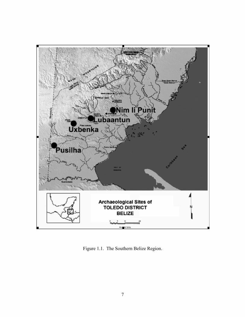
Project (TRIP) at the major centers of Lubaantun and Nim li Punit during April to June 2010 by staff from the University of California, San Diego. Staff members included Geoffrey E. Braswell (Director), Nancy Peniche May, Kiri L. Hagerman, and Megan R. Pitcavage (graduate students). In 2009, we began the Toledo Regional Interaction (TRIP) with the goals of: (1) understanding political relations between three of the five major sites in the Southern Belize Region (Figure 1.1); (2) identifying economic interaction among these three sites; (3) finding similarities and differences in exchange relations with more distant sites and regions; and (4) determining the historical trajectories of each small polity. We envision our work as consisting of three sub-projects: TRIP-L, which has conducted two field seasons of excavations at Lubaantun; TRIP-N, which began a test-pitting program in 2010 at Nim li Punit; and TRIP-P, which in future years will build upon six field-seasons of research at Pusilha (Braswell et al. 2004, 2005, 2008; Pitcavage and Braswell 2010). Our work complements current investigations conducted by our colleagues at Uxbenka (Prufer 2005; Prufer et al. 2006, 2008). We hope that between our two projects we will be able to form a comprehensive and processual model of the how inland Toledo District functioned as a region.
After just two field-seasons at Lubaantun and a short season at Nim li Punit, our work is not yet sufficiently advanced to answer the questions that motivate our project. In this introduction, we discuss unique aspects of site planning principles at Lubaantun, and summarize our excavation and consolidation of three structures at Lubaantun conducted in 2010. We also briefly describe a series of 17 test-pits at Nim li Punit dug during the same season.
SITE PLANNING AT LUBAANTUN
Despite important similarities between Uxbenka and Nim li Punit, MacKinnon
(1991) points out that the site planning principles of the major centers of the Southern Belize Region are remarkably different. The major architecture of Pusilha, for example, is built along a northwest to southeast axis, and several of the most imposing groups share a unique orientation and plan. We call these “Special Function Groups.” As at many other Classic Maya sites, the direction north is associated with the heavens, ancestor worship, and the sun at noon. In contrast, ballcourts are found at low elevations. The largest ballcourt at Pusilha is located at the southern end of a sacbe. This probably reflects an association with the underworld. Pusilha, too, has a very large royal acropolis, certainly the most complex in the Southern Belize Region.
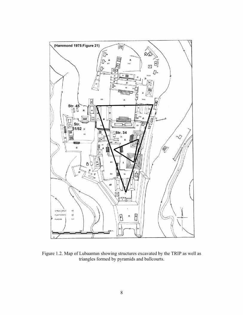
Lubaantun, like Nim li Punit, is built along a north-south axis (Figure 1.2). At both of those sites, the highest points are the north and the lowest in the south. There is scant evidence, however, that north is associated exclusively with ancestor worship at either site. At Nim li Punit, the northernmost group is residential in character. This is probably the
2
case at Lubaantun, but Hammond (1975) did find a cache containing the teeth of two individuals in one of the northernmost platforms at that site. A similar double tooth cache was recovered in Burial 3/1 of Pusilha in a context that strongly suggests ancestor veneration (Pitcavage and Braswell 2010).
The center of Lubaantun is defined by two triangles. Three pyramidal platforms—Structures 10, 12, and 33—lie at the center of the site and are arranged in a roughly equilateral triangle. Only one—Structure 33—contains stairs that climb to the top of the platform. We suspect that these three structures represent the three hearthstones of Maya creation, thought to be in the constellation Orion, and for that reason are the tallest platforms built at the site. A larger triangle surrounds the epicenter of the site and is formed by three ballcourts—Structure 4, Structures 21 and 22, and Structures 39 and 40. These ballcourts occupy a much lower position than the three pyramidal platforms and are probably associated with the underworld. This precise pattern of two inscribed triangles is unique in the Maya world, but may serve to mark Lubaantun as an ox te tun, or three stone place, one of many in the Maya area. It is important to note that if our interpretation of site planning principles at Lubaantun is correct, this plan probably emerged late in the construction history of the site. According to Hammond (1975), the ballcourt formed by Structures 21 and 22 were built during the last Terminal Classic phase of construction at the site, and the ballcourt formed by Structures 39 and 40 appears to be unfinished.
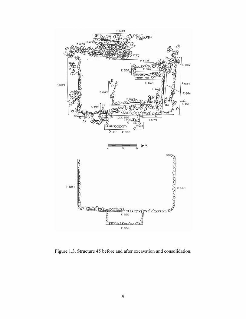
EXCAVATIONS CONDUCTED IN 2010 Structure 14 In 2010, we began work by excavating on the southwest side of Structure 14 at Lubaantun, an east-west range structure that defines the north end of Plaza IV. Our goal was to dig into the plaza and look for previous and versions of the artificial platform that forms the center of the site. Our excavations revealed that this portion of Plaza IV was built up from ground level in a single construction phase. Moreover, the construction technique consisted of building diagonal cell corrals, made of carefully stacked flat stones, for the placement of fill. The use of fill retaining features—sometimes built using cut and even dressed stones—is particularly diagnostic of Lubaantun. Although very few artifacts were recovered from the fill of Plaza IV, we did find a few eroded sherds on the palaeosurface below the plaza. Structure 45 In 2010, we also excavated Structure 45, a low platform 15 m northeast of Structure 51/52 (described in our 2009 TRIP report). In Hammond’s (1975) map of Lubaantun, Structure 45 is shown as two low, parallel mounds, perhaps forming a very small ballcourt. He dates construction of this small patio group to Phase II, that is, well before Plaza VII and Structure 51/52. We excavated Structure 45 in order to recover ceramics and other artifacts dating to the Late Classic period, and also to determine its function. Our excavations quickly revealed that Structure 45 consists of a single platform (Figure 1.3). The low saddle running north-south in the middle of the platform was probably created by root action and tree fall. We found no evidence of looting. In any

3
event, Structure 45 is clearly not a ballcourt. The earliest construction stage was contemporary with the building of the patio called Platform 84 by Hammond (1975). As in Structure 51, we found an uninterrupted layer of fill beginning at the buried ground surface and continuing to the top of the first stage of the platform. The patio floor does not run underneath the substructure of Structure 45. This first stage platform was rectangular and supported a rectangular superplatform. The second stage of construction consisted of raising the plaza level almost to the top of the Structure 45 substructure. The third stage is a raised extension to the north and south, and the addition of a stair block. Round corners characterize this stage of the platform. Finally, a rough extension made of cobbles was added to the north of the platform during the fourth stage of construction. Artifacts recovered from Structure 45 differ somewhat from those found associated with Structure 51/52. Here, we recovered relatively few ceramics, but a large proportion of them are cream-slipped polychrome serving vessels. As at Structure 51/52, no censers were found. Curiously, no figurines were found during the excavation of Structure 45, although one was recovered from the terraces west and below the platform. Finally, the obsidian of Structure 45 consists of material from El Chayal and a small but significant percentage of material from the Ixtepeque source. Structure 45 yielded twice as much obsidian as we found in Structure 51/52, implying a social distinction in access or, more likely, a difference in the availability of material during distinct periods. On the basis of the ceramics and obsidian, we tentatively date the construction of Structure 45 to the Late Classic period, but occupation seems to have continued into the early Terminal Classic. Like Structure 51/52, Structure 45 probably supported an elite residence where food was served but only infrequently prepared. Structure 34 Our greatest efforts this field season concentrated on Structure 34, the largest unlooted and unexcavated platform at the center of Lubaantun (Figure 1.4 top). Hammond (1975) argues that it was built during Phase II of his sequence, that is, during the Late Classic, at the same time that this portion of Plaza IV was built. He also suggests that it served as a “minor religious structure” (Hammond 1975:Figure 32). Our excavations of Structure 34 reveal that it was built in at least six major stages, with several minor moments of construction. Stage I was contemporary with the construction of Plaza IV, on which Structure 34 stands. It is represented by Structure 34A, a well-built east-west platform consisting of a vertical wall with both stepped insets and an outset molding that—at the risk of re-opening a long settled debate—might be called an example of the “In-and-out” style. We encountered this outset molding in both deeply buried and currently exposed contexts, and are positive that it is deliberate rather than the result of root action or fill expansion (see Hammond 1975; Joyce et al. 1927; Larios 1998). During Stage II, a two-bodied extension was added to the east of Structure 34A, and another structure containing a preserved plastered bench—was built to the north. Stage III consisted of dismantling this northern structure and covering it with a shrine that supported a low stone superstructure. This shrine is nearly identical in form and size to a consolidated structure near the southwest corner of Structure 33. During Stage IV, the final footprint of Structure 34 was established and covered these early buildings. Stage IV consists of three distinct moments or substages, when the top of the platform supported first a rectangular superplatform and then

4
two later successive C-shaped superplatforms. During Stage V, Structure 34 reached its current height and was expanded significantly to the west. At this time, Structure 34 appears to have been surmounted by a rectangular superplatform. Stage VI consists of minor additions to the southern end of the structure that greatly changed its function. Low walls were added to the southeastern corner of the platform and connecting it to Structure 33. A bench was added to the narrow corridor between Structures 33 and 34. We suspect that a perishable roof spanned the gap between the two buildings. We found enormous quantities of pottery, animal bones, jute shell, and lithic artifacts within this space. This material dates to at least the early facet of the Terminal Classic period. Thus, although the construction sequence of Structure 34 began in the Late Classic with one or more religious structures, during the Terminal Classic the south end of the platform was transformed into a residence. Our consolidation of Structure 34 preserves it as it stood during this sixth and final stage (Figure 1.4, bottom). Test Pits at Nim li Punit
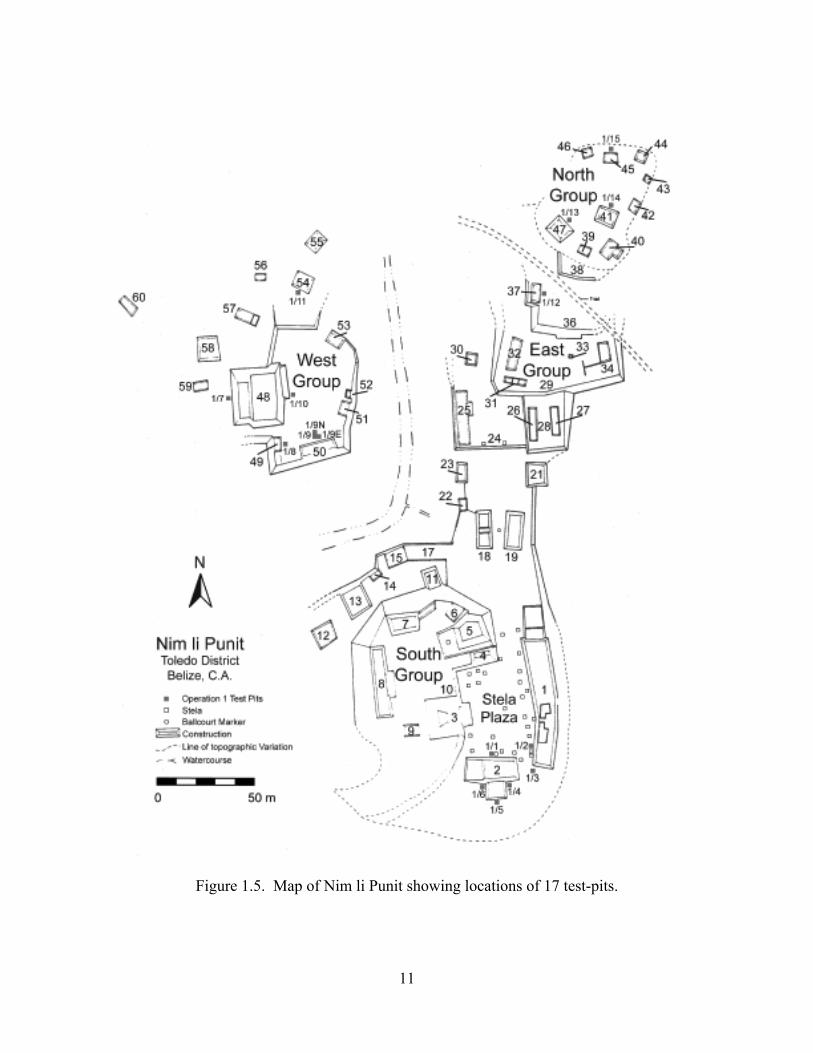
The 2010 field season was the first season of archaeological investigations by TRIP at Nim li Punit. Our investigations consisted of 17 2-m by 2-m test pits located in the Stela Plaza, the West Group, and the North Group (Figure 1.5)—three of the four major architectural groups in the ceremonial core of the site. The main purpose of this work was to acquire a representative sample of artifacts with which to make interpretations about the temporal extent of occupation at the site, to reconstruct the ancient life ways of its residents, and to track the economic relationships between Nim li Punit and the other major ancient sites of the Southern Belize Region.
Although the hieroglyphic stelae at Nim li Punit record only a 76-year period of dynastic history during the Terminal Classic period (A.D. 734 – A.D. 810), we encountered an earlier occupation surface in three test pits in the West Group—Op. 1/9, Op. 1/9E, and Op. 1/9N. It is possible that this early context could indicate an Early Classic date of initial occupation at Nim li Punit. Additional investigations are necessary in order to confirm these provisional findings.
Our test pits reveal that Nim li Punit likely had ties to its southern Belize neighbors, but it also appears to have retained its own local construction, ritual, and material traditions. For instance, there appears to be a complete lack of prepared plaster floors at the site indicating a distinct method of plaza construction from Pusilha and Lubaantun. Secondly, the funerary rituals at Nim li Punit involved the interment of human remains in an East-West orientation, with the head to the east, in prone position along the central North-South axes of buildings. Grave goods were also important to the funerary ritual at Nim li Punit, especially the inclusion of ceramic goods and the burning of copal. By contrast, mortuary treatment at Pusilha generally involved the inclusion of paired funerary vessels and orienting the bodies North-South, with the head to the north, and in an extended, supine position.
Finally, like Pusilha and Lubaantun, Nim li Punit was a Tepeu-sphere site with ceramic ties to the southeast Peten. Nonetheless, there are significant material differences between these site and Nim li Punit. First, the ceramics at Nim li Punit appear to be more finely made, which may be due to different resource procurement practices and production techniques (especially firing techniques). Second, although we recovered two “Lubaantun-style” figurines at Nim li Punit, in general, the figurines at Nim li Punit are stylistically
5
different than those typically recovered from Lubaantun. Third, there is relatively little obsidian at Nim li Punit as compared to Pusilha and there is as yet no evidence of the importation of Mexican obsidian to Nim li Punit. By contrast, the residents of Pusilha had access to obsidian from multiple central Mexican obsidian sources. Finally, Nim li Punit appears to have had greater access to greenstone than Lubaantun. In sum, although the material culture at Nim li Punit, especially the ceramic assemblage, shows many consistencies with Lubaantun and Pusilha, it retains its own distinct local character. This suggests that although economic interaction between the sites was likely, the economy of Nim li Punit did not appear to be managed by a centralized regional hierarchy.
CONCLUSIONS After two seasons of fieldwork at Lubaantun, we are turning now to artifact analysis in order to answer our questions about regional integration in southern Belize. Moreover, we can now make provisional comments about the relationship between Pusilha and Lubaantun—two of the three sites studied by TRIP project members. First, site-planning principles are different at the two sites. Pusilha has a distinct northwest-southeast axis and contains a unique architectural configuration that we call the “Special Function group.” In contrast, the center of Lubaantun is built on a north-south axis and has a unique pattern of inscribed triangles formed by pyramids and ballcourts.
Second, our working ceramic chronology for Lubaantun contains three phases: one corresponding to Tepeu II and two to Tepeu III times. We have yet to identify a Tepeu I component, and it seems probable, as Hammond (1975) argues, that the site was not occupied before A.D. 700. We have not yet identified a Postclassic component. This contrasts with Pusilha, which was occupied not only in early Late Classic times, but also into the Postclassic period. Third, Lubaantun and Pusilha are both Tepeu-sphere sites with ceramic ties linking them to the Peten. In some ways, the ceramics of the two sites are similar, but in others they are quite different. The comal is a common form at Pusilha, but we have so far found just two possible griddle sherds at Lubaantun. This suggests that the food ways of the two sites were different, and—by extension—that the inhabitants of the two nearby kingdoms may not have shared a regional identity. Zoned stamping is common on jars at Lubaantun, but jars from Pusilha are generally striated. Lubaantun-style coarse vessels of the type Puluacax Unslipped are found at Pusilha (and also at Nim li Punit), but are much less common at those two sites and date largely to the Terminal Classic period. Fourth, the external connections exhibited by Lubaantun and Pusilha are different. Belize Red was first traded to Lubaantun during the Late Classic. It does not appear at Pusilha until the Terminal Classic. The dominant source of obsidian at both Pusilha and Lubaantun is El Chayal, but the inhabitants of Pusilha had much greater access to obsidian than did their neighbors at Lubaantun. To date, we have recovered just 200 pieces of obsidian at Lubaantun, but more than 4,400 have been found at Pusilha. Moreover, Ixtepeque obsidian is proportionally more common at Lubaantun and Nim li Punit than at Pusilha, perhaps indicating that these sites had more significant ties with the southeastern Maya periphery than did Pusilha. Access to Mexican source obsidian is also different. During the Terminal Classic, green obsidian from Pachuca and black material from the Zaragoza source reached Pusilha. So far, the only exotic obsidian found at Lubaantun
6
appears to come from the Ucareo source. We have found no Mexican obsidian at Nim li Punit. Finally, the inhabitants of Pusilha used local Toledo sandstone to make manos and metates, but also imported finished grinding stones made of Guatemalan lava stone, green and pink tuff from the highlands of eastern Guatemala or western Honduras, and various materials from the Mountain Pine Ridge. In contrast, all the groundstone from Lubaantun is either local or made of Guatemalan lava stone. Pusilha, Lubaantun, and Nim li Punit do not appear to have procured groundstone from sources in the Maya Mountains. As work progresses at all three sites studied by the Toledo Regional Interaction Project, we will map out exchange connections between the sites in Southern Belize with the goal of determining whether or not they participated in the same regional system. Despite some similarities in architecture and ceramics, at present it seems as though the ancient inhabitants of inland Toledo District had distinct identities, historical roots, and political affiliations. We currently wonder, as did MacKinnon (1991), precisely how Southern Belize was integrated, and whether or not it should be considered as a unified region. Acknowledgments. The Toledo Regional Interaction Project is generously supported by the National Geographic Society (grant # 8654-09) and the Faculty Senate of the University of California, San Diego. We thank the members of the communities of San Pedro Columbia and Indian Creek who have worked on our project, as well as the custodians of both Lubaantun and Nim li Punit. Finally, we thank the Institute of Archaeology for their continuing support.
7
Figure 1.1. The Southern Belize Region.
8
Figure 1.2. Map of Lubaantun showing structures excavated by the TRIP as well as
triangles formed by pyramids and ballcourts.
9
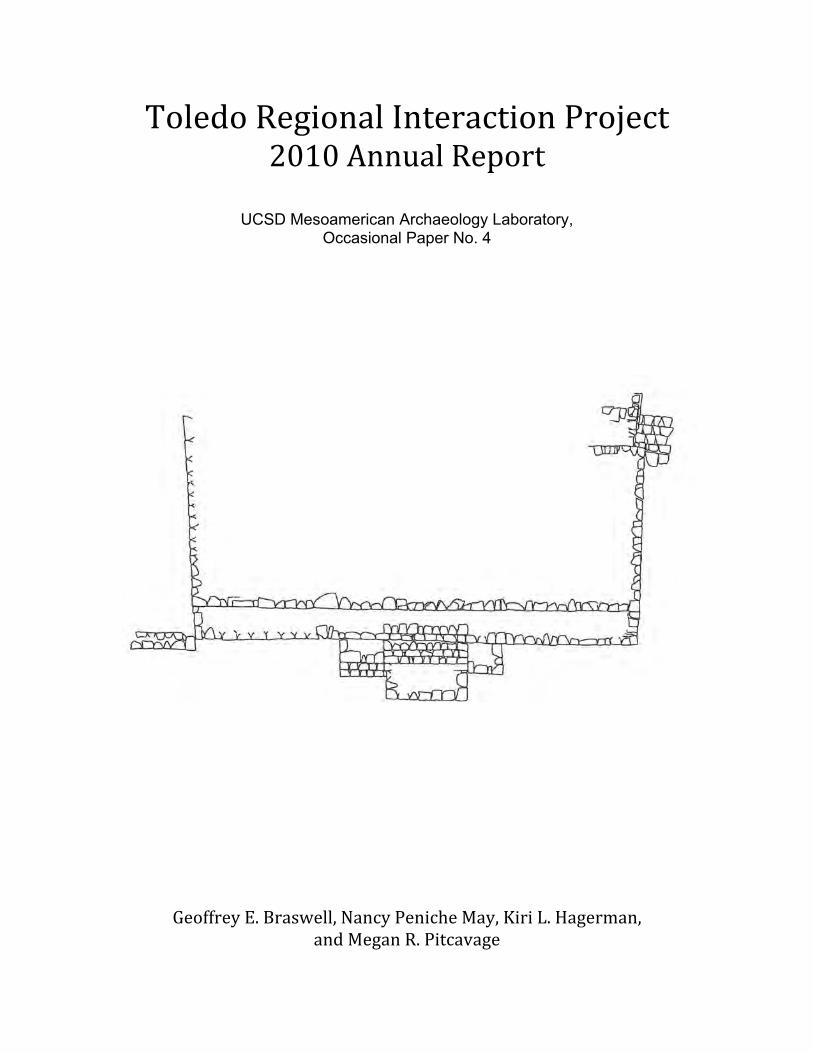
Figure 1.3. Structure 45 before and after excavation and consolidation.

10
Figure 1.4. Structure 34 before excavation and after consolidation.
11
Figure 1.5. Map of Nim li Punit showing locations of 17 test-pits.
12
Chapter 2
Operation 4: Exploration of Lubaantun Plaza IV
Nancy Peniche May As it is known, the core of Lubaantun, Toledo District, Belize is Plaza IV. The first
explorations conducted at this plaza were carried out by Thomas Gann in 1903, amateur archaeologist and medical officer who was sent by the Governor of British Honduras. According to his report to the Governor, Gann explored the area of Plaza IV from the descendent of Structure 14—a long narrow low platform at Plaza IV northern edge—into Plaza V south as far as the north margin of Plaza III. He noted the extent of Platform 13 and its southern extensions, the main temple pyramids Structures 10, 12, and 33, Structure 14, Structure 34 and Structure 32. He carried out excavations at Structure 32, Structure 33 and Structure 14. Excavations at Plaza IV continued during Gann’s 1925 expedition. As a result of his excavations, Gann proposed three phases of occupation at Lubaantun that would be later modified by Hammond (1975). The main merit of Gann, however, was to establish that the final state of the site dated to the Late Classic period. Later expeditions conducted by Joyce (1926) and Thompson (Joyce et al. 1927) also conducted explorations at several areas of Plaza IV.
In 1970, Norman Hammond (1975) carried out excavations in diverse areas of Lubaantun. Among these areas, he excavated the area of Plaza IV, which is located at the civic-ceremonial center of the ancient site. Hammond (1975) stated that Plaza IV was stratigraphically the earliest to be occupied in the southern part of the site and where the earliest-known platforms and structures—domestic and non-domestic—were built (Hammond 1975:50, Figure 24). Hammond’s (1975) explorations revealed that this occupation did not begin before the Late Classic period.
As result of his explorations, Hammond (1975) identified five stages of construction of the archaeological core of Lubaantun. In phase I, all the construction activities were focused on the south section of Plaza IV. The earth-filled platform below Platform 6 was constructed, followed by the construction of Structures 100 and 102 along the northern edge of Platform 6. Structure 7 may have been constructed at the south end of Platform 6. The second phases of Structure 100 and 102, the first phase of Structure 101 and the construction of Structure 107 extended building north of Platform 6.
During Phase 2, Plaza IV also saw a major activity of construction, although other areas had a major construction activity too. The construction activity at Plaza IV started with the building of Platform 13 to the north of Platform 6. Platform 13 covered the northern walls of Structure 100 and 102 and completely buried Structure 107. Structure 12i standing on Platform 13 and Structure 10i may also have been built on it at this time. The first phase of Structure 103 would probably have faced it across the open plaza formed on Platform 6. Structure 32 and the vault below it and Structure 34 may have been constructed with Platform 13. On its north side Platform13 was retained by the stepped wall of Structure 14i—the first stage of Structure 14.
During Phase 3, Plaza IV was also focus of construction activity. This phase started with the first invasion of the raised level of Plaza IV on to the lower level of Platform 6. Structure 102, most of Structure 100 and the steps between them were buried in the fill of
13
Platform 13 ext W (southwest quadrant of Platform 13), on which stood Structure 33i and Structure 103—located immediately south of Structure 33i. Later on, another extension of the Plaza IV level was added to the south side of Platform 13 as Platform 13 ext E. This covered the remaining north portion of Platform 6. Since this moment Platform 6 and Platform 13 functioned as a single platform. Structure 10o and 12o were built during this phase.
During Phase 4 no major construction work was done south of Structure 14 in the main group. Construction activity during Phase 5 at Plaza IV was the building of Structure 14o as part de remodeling of Plaza V and the final southward extension of the Plaza IV. Hammond (1975:66) stated that the entire history of the site falls within the Late Classic: “its foundation seems to have occurred early in the eight century A.D. by analogy with Pasion and Peten sites at a time equivalent to the first half of Tepeu 2 at Uaxactun, and that the final expansion took place towards the middle of the ninth century A.D., probably circa A.D. 850.”
As part of 2010 season, we decided to explore the area below Plaza IV, immediately south of Structure 14 and west of the modern staircase that divides Structure 14 in eastern and western halves. Our objectives were twofold. We wanted to refine the construction sequence of Plaza IV and to search for any substructure below Plaza IV and Structure 14. We determined that exploration should be conducted through test pits. That is, we conducted a vertical exploration of Plaza IV. In addition, we also sought to recover cultural material objects down the level of Plaza IV to define the construction chronology of Plaza IV.
We organized our excavations according to the Tikal system. We conceptually and spatially divide our work into Operations, Suboperations and Lots. Operation 1 and 2 are reserved for test-pits that may be dug in the future and for any salvage excavations that may be conducted, respectively. Operation 3 denotes the excavations of Structure 51 and 52 during 2009. Therefore, we assigned the name of Operation 4 to the test-pits located at Plaza IV to the south of Structure 14.
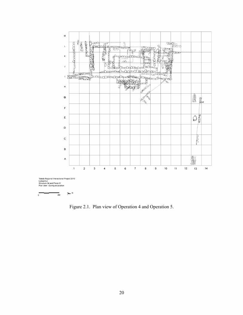
Previous to the excavation, we created a grid that included the entire area of Structure 34 and the area of Plaza IV between Structure 14 and Structure 33 and west of the modern staircase mentioned above. The grid was oriented parallel to a visible eastern wall that would be labeled as the first upper-body of Structure 34, that is, approximately North-South. It covered an extension of 26-m in a North-South axis by 32-m in an East-West axis. We located the cero point at the southeastern corner of the grid. Each unit measured 2-m by 2-m and we labeled them following an alphanumeric system with numbers in the North-South axis and letters in the East-West axis. According to this grid, the suboperations related to Operation 4 were the Suboperation 4/13 and 4/12 (Figure 2.1).
Excavations within each test-pit were conducted in lots. In this specific Operation, lots correspond with natural stratigraphic layers. A feature number was assigned to each architectural and cultural feature that it was revealed during the explorations. The feature numbers include the Operation, the suboperation in which the feature was first observed, and a feature number.
For the excavation of Operation 4 we employed five teams of two workmen. Excavation was conducted using hang trowels, and all soils were screened through ¼ inches mesh. Materials recovered during the excavations were immediately separated by material (pottery, jute shell, other faunal remains, chert, obsidian, groundstone, figurines, human bone, and marine shell artifacts). These were all washed, counted, noted on out lot
14
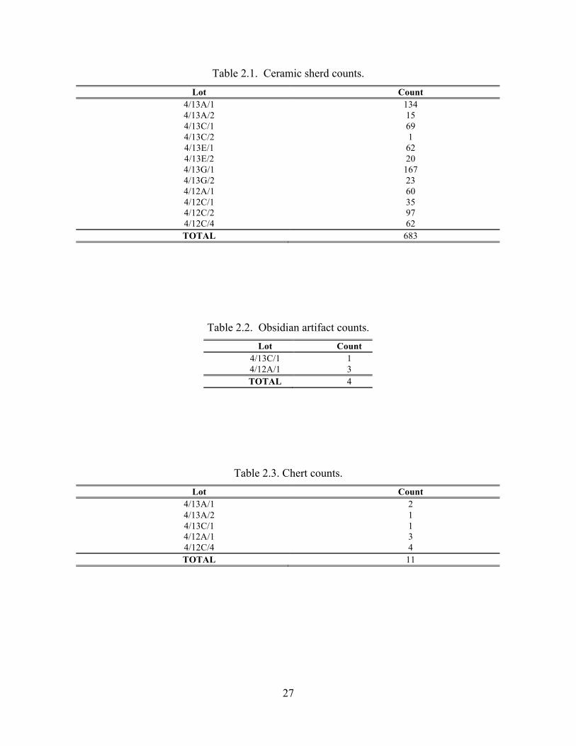
forms, and rebagged in the field as each lot was closed. Tables 2.1, 2.2, 2.3, 2.4, 2.5 and 2.6 contain counts of these artifacts by lot. In the case of jute shells, we classified each shell as a whole or fragmentary, determine their species, and discarded them. All other artifacts are curated in our laboratory and will be turned in to the Institute of Archaeology.
We decided to carry out test pits in an alternative manner and if it was necessary to open the rest of the units of the Suboperation. Thus, we opened Units 4/13A, 4/13C, 4/13E and 4/13G. Later on we decided to expand the explorations southwards and we open Suboperation 4/12 in which Units 4/12A and 4/12C were explored. The decision of expanding excavations southwards was taken because at some moment during the exploration of Units 4/13A and 4/13C it was difficult to continue digging down due to a lack of space. Therefore, Units 4/12A and 4/12C were opened in order to facilitate the exploration. Originally, we wanted to excavate the test-pits to bedrock. However, the bedrock was located deeper than we thought. Thus, we decided that only Unit 4/12C was going to be excavated to bedrock. We based this decision on the fact that the context in each test-pit was similar enough. Our register of the excavations included the drawing of one or more sections of each test-pit, as well as the drawing of the plan. Likewise, each photographed the test-pits during the course of the excavation.
EXCAVATION OF OPERATION 4
As stated above, Operation 4 is located at Plaza IV immediately south of Structure
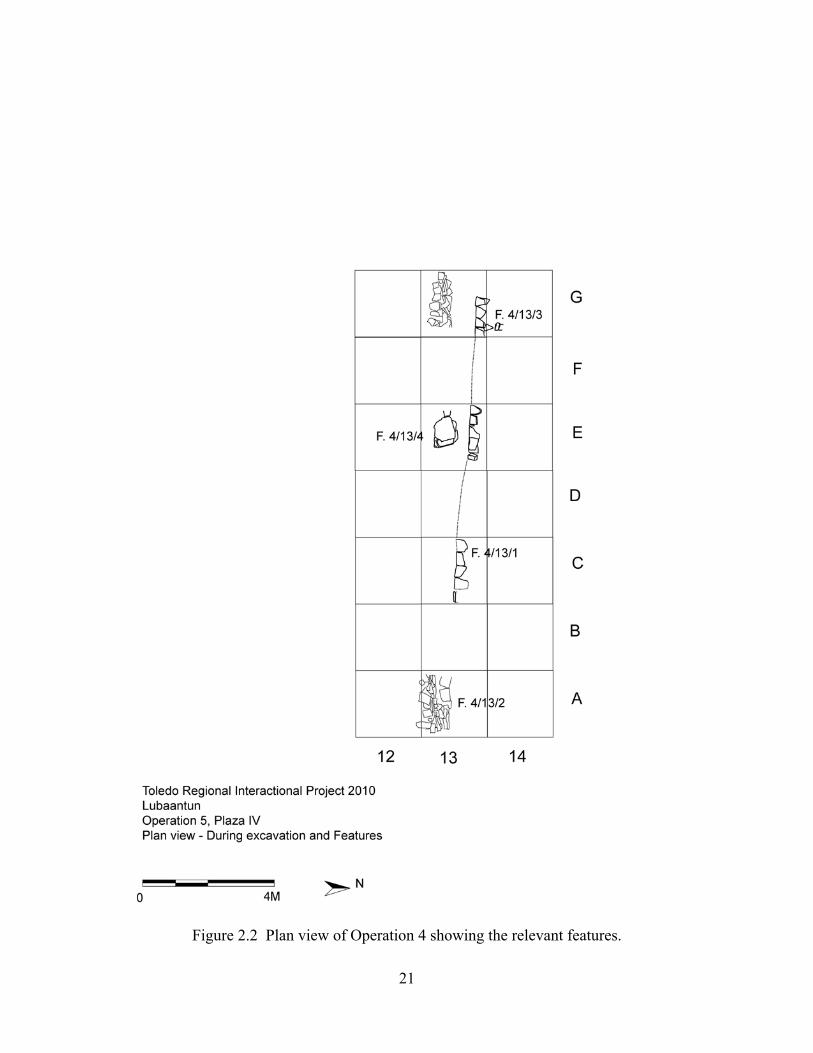
14 and west of the modern staircase that divides into east and west sections. Two Suboperations—Suboperation 12 and Suboperation 13—were opened, which include a total of six units and discover a total of four features (Figure 2.2). The objectives of the exploration of those units were to define the constructive sequence of the northern section of Plaza IV, adjacent to Structure 14 and to recover archaeological materials that permit to establish the chronology of this section of Plaza IV.
Suboperation 4/13
Suboperation 4/13 was located immediately south of Structure 14 and west of the
modern staircase that crosses Structure 14. In this suboperation we reported Features 4/13/1 (terrace of Structure 14), 4/13/2 (retaining wall of Plaza IV fill), 4/13/3 (south-facing stone alingment) and 4/13/4 (lajas part of retaining wall).
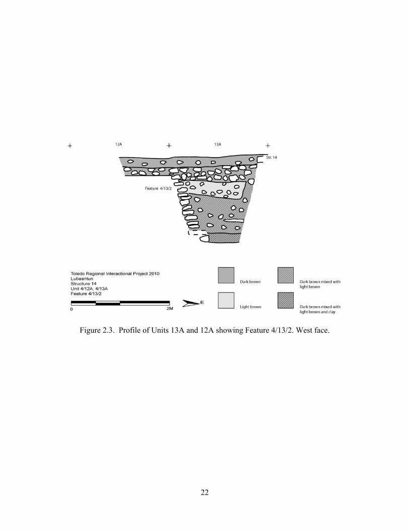
Unit 4/13A. Unit 4/13A is a 2-m (North-South) by 2-m (East-West) unit that is located to the south of Structure 14 in Plaza IV, immediately west of the modern staircase that transects Structure 14 from north to south. We excavated this unit in three lots: Lots 4/13A/1, 4/13A/2, and 4/13A/3 (Figure 2.3).
The purpose of Lot 4/13A/1 was to expose the bottom step of the modern staircase (which was buried) and come down to the level of the plaza. In order to achieve this we cleared the modern overburden, which consists of grass and dark brown A-horizon soils mixed with small stones. At this level, the bottom step of Structure 14 was registered at the north side of the unit, which was partially pushed down into the subfloor ballast. The lot finishes at the subfloor ballast of Plaza IV. There was no evidence of the final stucco floor. During the exploration of this context, we recovered 134 pieces of ceramic, two pieces of chert, two fragments of figurine, one shell and one fragment of human bone. The lot depth ranged between 6 and 28 cm.
15
Lot 4/13A/2 consists of the exploration of Plaza IV subfloor ballast. This ballast was a mixture of small- and medium-sized stones (10cm-15cm and some 30cm in diameter) and sediments derived from dark brown A-horizon soils. The bottom step of Structure lies immediately on top of Plaza IV subfloor ballast. At this level and at the southern edge of the unit we located Feature 4/13/2, which consists of a flat stone surface. We terminated this lot at the level of mixed A- and C-horizon soils. We unearthed 15 pieces of ceramic, one piece of chert, four Pachychilus glaphyrus (P. glaphyrus) shells and 13 Pachychilus indiorum (smooth jute) shells. The lot depth ranged between 24 and 48 cm.
The third lot, Lot 4/13A/3, corresponds to excavation of sediments that consist of light brown C-horizon and dark brown A-horizon soils. In some areas of this level, light brown and dark brown soils mix together and, at the deepest zones, both types of soils combine with clay. These sediments intermingled with stones of increasing size as we excavated farther into the unit. We uncovered Feature 4/13/2 in this lot. This feature was built with raw-slab stones (laja) to work as a containment wall for Plaza IV fill. We did not reach bedrock in this unit due to the fact that the unit was becoming narrower the deeper we excavated and there was a complete absence of cultural material at this depth. The lot depth ranged between 1.13 and 1.25 m.
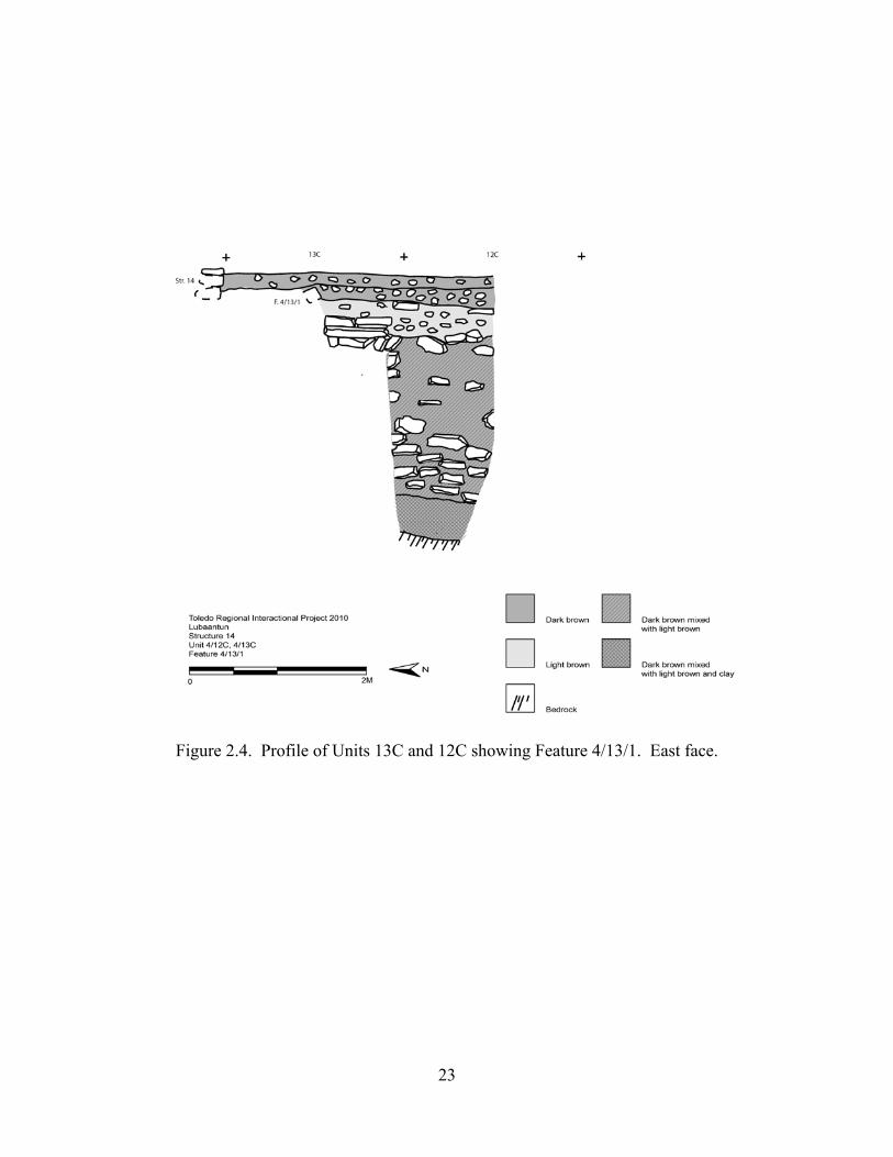
Unit 4/13C. Unit 13C is a 2-m x 2-m unit situated above Plaza IV, immediately south of Structure 14 and 4-m west of the modern stair that crosses North-South through the axis of Structure 14. Our purpose in excavating this unit was to explore the existence of substructures below Plaza IV. We excavated this unit in three lots, each corresponding to a different stratigraphic level (Figure 2.4)
Lot 4/13C/1 involved excavating down to the level of Plaza IV. We removed the organic surface material and modern overburden consisting of dark brown A-horizon soils mixed with small stones. In the course of clearing this matrix we discovered Feature 4/13/1 in the center of the unit. Feature 4/13C/1 is a terrace made of a single course of cut stones from Structure 14 that collapsed on the subfloor ballast of Plaza IV. The level terminated at Plaza IV subfloor ballast. We found no evidence of a plaster floor corresponding to the level of the plaza. Archaeological artifacts recovered at this lot include 69 pieces of ceramic, one piece of chert, two pieces of obsidian, six P. glaphyrus, 29 P. indiorum and one fragment of figurine. The lot depth ranged between 10 and 23 cm.
Lot 4/13C/2 involved the excavation of Plaza IV subfloor ballast located to the exterior or south of Feature 4/13/1. Due to the fact that this lot explored only the exterior of Feature 4/13/1, our excavation was limited to a 2-m x 1-m area. Plaza IV subfloor ballast is comprised of small stones and broken slab stones, which are mixed with sediments derived from dark brown A-horizon soils. We terminated this lot as the level of sediment consisting of light brown A-horizon soils and dark brown C-horizon soils. We only recovered one piece of ceramic. The lot depth ranged between 21 and 32 cm.
The excavation of Lot 4/13C/3 was similar to Lot 3 in Unit 4/13A with the exception that cut stones are reported among the fill. This context consists of sediments compounded with light brown C-horizon soils and dark brown A-horizon soils mixed with stones whose size increases as we excavated deeper. At some point Lot 4/13C/3 merged with Lot 3 of Unit 4/12C, that is they were considered as the same lot due to the need of going deeper (see below). Cut stones in this level allow us to conclude with absolute certainty that soils were artificially put in this context and, therefore, they are sediments deposited as Plaza IV fill. The lot depth ranged between 28 and 43 cm.

16
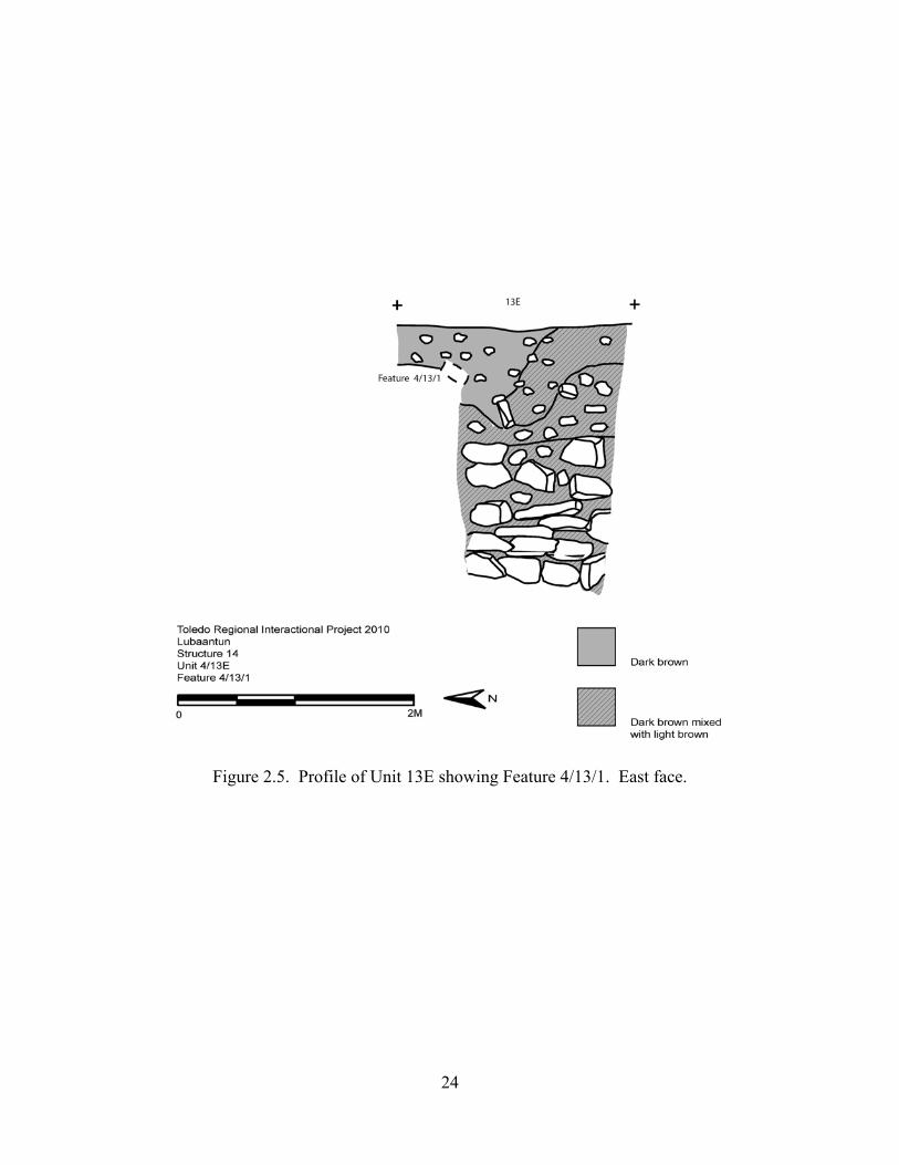
Unit 13E. This unit is located south of Structure 14, above Plaza IV and 6-m west of the modern stair that crosses Structure 14. We encountered 3 levels during the exploration of this 2-m x 2-m Unit (Figures 2.5 and 2.6).
Lot 4/13E/1 is characteristically different from the first lots in Units 4/13A and 4/13C. This is because it is a disturbed context in which dark brown A-horizon and light brown C-horizon soils appeared since this level. Feature 4/13/1 is located at the northern side of the unit and separates the types of soils. Inside of Feature 4/13/1 (northern side of unit) we excavated dark brown A-horizon soils and small stones (5–15-cm). The matrix to the south of Feature 4/13/1 behaves differently. In the southwest corner of the unit (outside of Feature 4/13/1) we found brown A-horizon soil mixed with small stones, while light brown C-horizon soil mixed with small stones appeared in the southeastern corner. Further disturbance is evidenced by the fact that stones of Feature 4/13/1 had collapsed. We encountered no signs of plaster floor or subfloor ballast. We terminated this lot at the level of Feature 4/13/1. We reported 62 pieces of ceramic, five P. glaphyrus and two P. indiorum. The lot depth ranged between 32 and 38 cm.
Lot 4/13E/2 corresponds to the exploration of the area located exterior to or south of Feature 4/13/1. It covers an area of 2-m x 1.30-m. The matrix of this unit is composed of light brown C-horizon soils and dark brown A-horizon soils mixed with small stones and broken slab stones. This stratigraphic level is similar to Lots 4/13A/3 and 4/13C/3. Our explorations recovered 20 pieces of ceramic, four P. glaphyrus and one P. indiorum. The lot depth ranged between 81 and 89 cm.
Lot 4/13E/3 involved the excavation of light brown C-horizon soils intermingled with small stones and big slab stones. We did not reach bedrock in this context due to limited space. At the bottom of this level we discovered Feature 4/13/4, which consists of several slab stones stacked one above the other in a way that looked like a possible cist when we first unearthed it. Further excavation revealed, however, that Feature 4/13/4 is in fact slab stones that were deposited as part of Plaza IV fill. We recovered no cultural materials. The lot depth ranged between 56 cm and 1.14 m.
Unit 4/13G. This unit is situated south of Structure 14, above Plaza IV and 12-m west of the modern stair that crosses Structure 14. We recorded three levels during the exploration of this 2-m x 2-m unit (Figure 2.7).
Lot 4/13G/1 involved the removal of grass and other surface organic material, and the excavation of modern overburden consisting of dark brown A-horizon soils and small stones (5cm-15cm) down to the level of Plaza IV subfloor ballast. We recovered some stones from Feature 4/13/1, but most of them were covered by the subfloor ballast. Like in the other units, we did not encounter any trace of a plaster floor. We reported 167 pieces of ceramic and eight P. glaphyrus. The lot depth ranged between 20 and 29 cm.
Lot 4/13G/2 corresponds to our exploration of Plaza IV subfloor ballast exterior to Feature 4/13/1. Plaza IV subfloor ballast is composed of stones ranging from 10-cm to 20-cm and sediments derived from dark brown A-horizon soils. We uncovered Feature 4/13/1 during the removal of this modern overburden. This feature terminates in an abrupt manner, therefore the southwestern corner of Feature 4/13/1 was not found. We also discovered a new feature—Feature 4/13/3—to the north of Feature 4/13/1. Feature 4/13/3 is a stone alignment that faces east. Further exploration of this feature proved impossible due to the fact that it moves towards and is obscured by Structure 14. Likewise Feature 4/13/2 appears at the southern edge of the unit. We terminated this lot at the level of light brown C-horizon and dark brown A-horizon soils. Archaeological artifacts recovered at this lot include 23
17
pieces of ceramic, one P. glaphyrus and one fragment of figurine. The lot depth ranged between 21 and 36 cm.
Lot 4/13G/3 is the excavation of the third level of the unit, whose matrix was light brown C-horizon soils and dark brown A-horizon soils combined with stones and slab stones whose size increased as we excavated deeper. We located Feature 4/13/2 in this level, which can be described as stacked, raw slab stones forming a retaining wall for Plaza IV fill. We did not reach bedrock due to the limited space at the bottom of the test pit. This context lacks cultural materials. The lot depth ranged between 96 cm and 1.36 m Suboperation 4/12
Suboperation 4/12 consists of Units 4/12A and 4/12C were excavated as extensions
of Units 4/13A and 4/13C, respectively. In this suboperation we followed the continuation of Feature 4/13/2.
Unit 4/12A. This unit is located immediately south of Unit 4/13A. Our purpose in excavating this unit was to explore Feature 4/13/2, located at the southern edge of Unit 13A, which covers an area of 2-m x 1-m (Figure 2.3).
The first and only lot in this unit—Lot 4/12A/1—involved the removal of modern overburden and organic surface material, and excavating dark brown A-horizon soils mixed with small stones. We terminated this lot at the level of Plaza IV subfloor ballast, which is composed of broken slab stones and dark brown A-horizon soils. We located Feature 4/13/2 at the northern edge of this unit as it runs North-South from Suboperation 4/13 into 4/12. Our exploration of it confirms that Feature 4/13/2 is a retaining wall for Plaza IV fill. We reported 60 pieces of ceramic, three pieces of chert, three pieces of obsidian, two P. indiorum and one fragment of animal bone. The lot depth ranged between 28 and 38 cm.
Unit 4/12C. This unit covers an area of 1-m x 2-m and our purpose in excavating it was to extend Unit 4/13C in order to explore Plaza IV fill and determine how deep the bedrock is in this area. We excavated a total of 4 lots in this unit (Figure 2.4).
Lot 4/12C/1 corresponds to the removal of organic surface material and the excavation of dark brown A-horizon soils mixed with small stones. The lot terminated at the level of Plaza IV subfloor ballast. The cultural materials we recovered include: 35 ceramic sherds, four P. glaphyrus, four P. indiorum and one groundstone fragment. The lot depth ranged between 26 and 38 cm.
We continued our exploration of Plaza IV subfloor ballast in Lot 4/12C/2. The ballast is composed of small stones and sediment that consists of dark brown A-horizon soils. We terminated the lot when we reached a layer of dark brown A-horizon soils mixed with light brown C-horizon soils. We recovered 97 ceramic sherds and one P. indiorum. The lot depth ranged between 3 and 14 cm.
Lot 4/12C/3 involved the excavation of Plaza IV fill that is made up of dark brown A-horizon soils and light brown C-horizon soils and stones (small stones and slab stones at the bottom of the context). At some point, this context joined with Lot 3 of Unit 4/13C. This context is sterile in terms of cultural materials. We ended this lot when cultural material started to appear and sediments change to dark brown A-horizon soils mixed with clay. This context lacked of archaeological artifacts. The lot depth ranged between 2.07 and 2.60 m.
Lot 4/12C/4 corresponds to our continued exploration of Plaza IV fill by excavating dark brown A-horizon soils intermingled with clay and stones. The cultural materials we
18
recovered include 62 ceramic sherds, four pieces of chert, one P. glaphyrus shell, and eight P. indiorum. The lot terminated at the level of bedrock. The lot depth ranged between 28 and 38 cm.
CONCLUSIONS
The main purpose of Operation 4 was to explore beneath Plaza IV, immediately
south of Structure14 in order to test the hypothesis of the existence of a substructure. Operation 4 did not confirm the existence of this substructure. Nevertheless, this operation provided data about the construction of Plaza IV.
During the excavation of Operation 4, we observed that Plaza IV was built using retaining walls made of undressed cut stones and laja-like stones. The interior of these retaining walls was filled with sediments derived from a mixture of light brown C-horizon soils and dark brown A-horizon soils. Small and medium stones were also mixed with the sediments. Cut stones found at Lot 4/13C/3 allow us to affirm that soils were artificially put in this context and, therefore, they were sediments deposited as Plaza IV fill. The same pattern of construction was recorded at the units of Operation 5 located at the east of Structure 34.
During Hammond’s (1975) excavations, a pattern of cell construction was also reported. Hammond (1975:145; Figure 53c), for instance, pointed out that Platform 15 was built using a cellular network of stone wall ‘boxes’ filled with loose rubbles of diverse sizes. In most of the cases the rubbles were siltstone but, sometimes, limestone fill was also used. Based on the evidence we obtained together with Hammond’s (1975) data, we can affirm that the entire Plaza IV was built using the system of cell construction. However, the fill might have differed from area to area. On south of Plaza IV, Hammond (1975) reported that fill was consisting of siltstone and limestone rubbles. In our explorations in the northern section of Plaza IV, we found out that rubbles were used but in low frequency. Fill consisted mainly of sediments derived from a mixture of light brown C-horizon soils and medium-brown A-horizon soils. This might mean that those sections were built in different times. The difference in the type of fills might be due to the fact that different groups of people were in charge of the construction of Plaza IV, each group chosen different materials.
The system of cell construction was wide-use in Maya Area since Preclassic times. According with Muñoz Cosme (2003) the cell construction system was an important technological innovation. The building of small ‘boxes’ with limited high that contained the fill allowed the construction of large buildings because the cells gave inner solidity to the constructions. Temple IV of Tikal, in Guatemala was built using this construction system. Structures with domestic function were also built using this pattern of cell construction. In northern lowlands, for instance, a large elite house platform was built using large limestone rocks to create cells that contained stones of diverse sizes—bigger at the bottom, smaller at the top (Padilla Dorantes 2009). Plazas were also built using this construction system. For instance, the Great Terrace at Chichen Itza, Mexico was a great artificial terrace that was raised between 1-m to 4-m from the bedrock. In the deeper areas, retaining walls were used to contain the large limestone-rock fill (Peniche May et al. 2010). Briefly, ancient Maya employed the cell construction system in order to construct large buildings or plazas. The size and material of the stones used to create the retaining walls varied, perhaps according to what was available. Likewise, the fill was diverse.

19
Our excavations also revealed that Plaza IV was built in a single phase of construction. In addition, we observed that the bottom step of Structure 14 was resting on top of Plaza IV ballast. According to Hammond (1975) the northern section of Plaza IV or Platform 13 was built during his Phase 2. Structure 14 or its first version (Structure 14i) was also built during this phase. In fact, Hammond (1975) pointed out that Platform13 was retained by the stepped wall of Structure 14i. During the Phase 5, Structure 14 was modified as part of the remodeling of Plaza V and Structure 14o was built. Based on our limited exploration of this area, we cannot affirm that Structure 14 was built at the same moment that the northern section of Plaza IV neither if it was rebuilt later on. We were only able to establish that the bottom step of Structure 14, in its last stage of construction, rested on top of Plaza IV ballast. From this we can conclude that, at least the stair block of Structure 14 was built after Plaza IV was constructed.
At the western edge of the northern section of Plaza IV—Hammond’s (1975) Platform 13—Structure 34 is located. This building is the largest unlooted and unexcavated platform at the center of Lubaantun. As part of our goals for the 2010 field season, we were interested in refining the construction sequence of Plaza IV. Therefore, we carried out a exploration of Structure 34 during 2010 field season. Our excavations revealed that Structure 34 was built in at least six major stages, with several minor moments of construction. In addition, we obtained data to assure that only Stage I of our sequence corresponds to the moment in which Plaza IV was built. Stages II through VI were later constructions, being Stages IV and V probably related to Hammond’s (1975) Phase 5. In addition, we determined that Structure 34 was a public building during Stages I to V. During Stage VI, Structure 34 had a domestic function.
20
Figure 2.1. Plan view of Operation 4 and Operation 5.
21
Figure 2.2 Plan view of Operation 4 showing the relevant features.
22
Figure 2.3. Profile of Units 13A and 12A showing Feature 4/13/2. West face.
23
Figure 2.4. Profile of Units 13C and 12C showing Feature 4/13/1. East face.
24
Figure 2.5. Profile of Unit 13E showing Feature 4/13/1. East face.
25
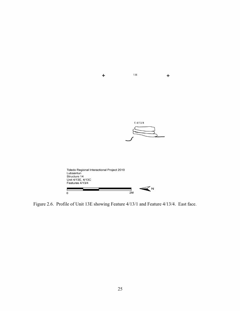
Figure 2.6. Profile of Unit 13E showing Feature 4/13/1 and Feature 4/13/4. East face.

26
Figure 2.7. Profile of Unit 13G showing Feature 4/13/1 and Feature 4/13/2. East face.
27
Table 2.1. Ceramic sherd counts. Lot Count
4/13A/1 134 4/13A/2 15 4/13C/1 69 4/13C/2 1 4/13E/1 62 4/13E/2 20 4/13G/1 167 4/13G/2 23 4/12A/1 60 4/12C/1 35 4/12C/2 97 4/12C/4 62 TOTAL 683
Table 2.2. Obsidian artifact counts. Lot Count
4/13C/1 1 4/12A/1 3 TOTAL 4
Table 2.3. Chert counts. Lot Count
4/13A/1 2 4/13A/2 1 4/13C/1 1 4/12A/1 3 4/12C/4 4 TOTAL 11

28
Table 2.4. Pachychilus (Jute) shell counts.
Lot P. glaphyrus (spiky) Whole
P. glaphyrus Fragment
P. indiorum (Smooth) Whole
P. indiorum Fragment
4/13A/2 4 0 13 0 4/13C/1 5 1 22 7 4/13E/1 5 0 2 0 4/13E/2 4 0 1 0 4/13G/1 7 1 0 0 4/13G/2 1 0 0 0 4/12A/1 0 0 2 0 4/12C/1 3 1 4 0 4/12C/2 0 0 1 0 4/12C/4 1 0 8 0 TOTAL 30 3 53 7
Table 2.5. Figurine counts. Lot Count
4/13A/1 2 4/13C/1 1 4/13G/2 1 TOTAL 4
Table 2.6 Miscellaneous artifact counts. Material Lot Count
Groundstone 4/12C/1 1 Animal bone 4/12A/1 1 Marine shell 4/13A/1 1 Human bone 4/13A/1 1
29
Chapter 3
Operation 5: Exploration of Lubaantun Structure 34
Nancy Peniche May
As part of our goals during the 2010 field season at Lubaantun, we explored Structure 34 of Lubaantun, the largest and unlooted structure of the architectural center. Structure 34 is located at the western edge of the northern section of Plaza IV. As stated above, Hammond (1975) suggested that Structure 34 was built during the Phase 2 of his construction sequence, at the same moment when Platform 13 was built. However, he did not conduct any excavation at this structure and the hypothesis that Structure 34 belongs to Hammond’s (1975) Phase 2 has remained untested. In addition, there are several questions about Structure 34 that are unresolved, such as the function that could have had and the architectural style that this structure represents.
Hammond (1975) argued that the function of the structures at Lubaantun could be deduced by visual discrimination, based on dimensions and morphology. Hammond (1975:75-76) affirmed that this discrimination could also be expressed in graphic form by relating the height of a structure to its basal area. He then pointed out that the structures of the core fall into three groups: one with a basal area exceeding 500-m2 and height exceeding 5-m, one with basal area not exceeding 100-m2 and height not exceeding 1.2-m, and an intermediate group with basal area between 150-m2 and 330-m2 and height between 1.3 and 3.6-m. Hammond (1975) argued that, when an assessment of function based solely on visual discrimination was related to the graph, it was possible to observe that the first group consisted of temple pyramids; the second was integrated by house platforms and the third group included both large house platforms set on free-standing basal platforms and measuring less than 2-m high and ceremonial structures measuring between 2 and 3.6-m high. According to this system, Hammond considered that Structure 34 fit into the third group, more specifically into the ceremonial subgroup. Because Structure 34 is located in Plaza IV, the religious center of Lubaantun, Hammond (1975:76, Figure 32) classified Structure 34 as a minor religious structure.
In regard the architectural style of Structure 34 is a topic that has not been discussed, although the identification of architectural styles at Lubaantun has been a topic of discussion among the archaeologists who have worked at this ancient site (Hammond 1975; Joyce 1926; Thompson 1931). According to Hammond (1975), the architecture of the platforms and structures alike at Lubaantun is based on a fill of rubble, ranging from small fragments (10-cm diam.) to large boulders (60-cm diam.), which is contained within retaining walls built of trimmed or dressed blocks of Toledo sandstones and limestone. Therefore, any variation in the style of the architecture would be focused on these retaining walls.
In 1915 Merwin of the Peabody Museum at Harvard visited the site and described four types of masonry: simple vertical walls, sloping walls and two apparent varieties of stepped wall (Hammond 1975). In 1926 Joyce identified four masonry styles at Lubaantun: megalithic, recessed perpendicular, in-and-out and debased perpendicular. The megalithic style was characterized by using large blocks to built terraces. The recessed perpendicular style was characterized by having a regular set-back every second course and using blocks
30
that were extremely well-cut, well matched and well-fitted. Corners in this style were built in sharp angles. The in-and-out style used well-cut and well-matched facing stones. According to Joyce (1926:210) this style “appears to be peculiar to this particular region of the Maya area. While each tier is built with a definite ‘batter’, every second course projects slightly beyond the course immediately below it.” The courses in ascending order alternatively project slightly and recess considerably. Round corners were also diagnostic of this style of masonry, which was also characterized for not being covered with stucco. Finally, Joyce (1926) identified the debased perpendicular that used badly cut and badly fitting blocks to build the retaining walls. Joyce (1926) argued that the stepped-perpendicular, in-and-out and debased perpendicular styles represented three successive periods and, although, the relation of the megalithic style to the rest could not be determined, it was clear that the megalithic style was earlier than the in-and-out style and perhaps the earliest of all.
The real existence of the in-and-out style was a topic of debate since 1926 expedition. Joyce (1926) established this style during the 1926 season but, according to Thompson (1931:338), Joyce’s observations were based on surface findings that “would certainly lead one to believe that the ‘In-and-out’ was artificial.” In 1927 season, Thompson (1931) conducted excavations at Lubaantun revealing buried sections of buildings. Thompson (1931:338) concluded that the ‘In-and-out was not artificial, but was due to natural causes such as roots forcing the stones out of position.” Thompson (1931) then concluded that the so-called in-and-out style was merely recessed perpendicular in a state of incipient collapse.
Joyce disagreed with Thompson’s conclusions arguing that: (1) buildings in the “in-and-out” style were sometimes provided with a base in the perpendicular style; (2) in the Court IV, one wall was found to be in “in-and-out” style, whereas the other wall was in “recessed perpendicular” style; and (3) there is a extreme regularity of the “out” tiers and to the fact that this style occurs only in Lubaantun area (Joyce et al. 1927). Thompson (1931) dismissed Joyce’s arguments. He came back to Lubaantun in 1928 and he found evidence to sustain his conclusion that the in-and-out style “never existed, and is merely the result of the action of roots of the ‘Recessed Perpendicular’ style (Thompson 1931:343).”
Hammond (1975) would agree with Thompson’s (1931) argument in later years. In fact, Hammond (1975) argued that the Merwin’s and Joyce’s four styles of architecture can be reduced to two. The first style was an early vertical-walled style using cut but undressed masonry of Toledo sandstones and limestones. This style would develop first into the recessed or stepped-perpendicular style and, later, would adopt finer quality stone. According to Hammond (1975) this style was present at Lubaantun from Phase 2 through the end of Phase 5, and was used on a variety of scales. For specific purposes of embellishment, from Phase 3 to 5, the stepped perpendicular style was associated with the use of large blocks dressed with a curved battered face as the treads of broad stairs. In Phase 5, it was associated with the use of small blocks dressed to a batter to form buttress-like attachments flanking several such stairs.
Because there are several unresolved topics regards Structure 34 and because this is the largest and unlooted structure in the core of Lubaantun, we decided to explored it during our 2010 field season. Our excavations of Structure 34 were focused on: (1) establishing the construction sequence of Structure 34; (2) determining its relation to the construction sequence of Plaza IV; (3) resolving the architectural style(s) that was used to build Structure 34; and (4) finding out the function(s) that this structure could have had.
31
Our excavations were organized according to the Tikal system. Our work was conceptually and spatially divided into Operations, Suboperations and Lots. As stated above, Operation 1 and 2 are reserved for test-pits that may be dug in the future and for any salvage excavations that may be conducted, respectively. Operation 3 denotes the excavations of Structure 51 and 52 during 2009. Operation 4 corresponds to the exploration of the area below Plaza IV and immediately south of Structure 14. We assigned the name of Operation 5 to the exploration of Structure 34.
Previous to the excavation of Operation 4, we set a grid up that included the entire area of Structure 34 and the area of Plaza IV between Structure 14 and Structure 33 and west of the modern staircase that divides Structure 14 into western and eastern halves. The grid was oriented parallel to a visible eastern wall that would be termed as the first upper-body of Structure 34 (Feature 5/6/26), that is, approximately North-South. The entire grid covered an extension of 26-m in a North-South axis by 32-m in an East-West axis, but Structure 34 grid only covered an area of 22-m (North-South) by 10-m (East-West). We located the cero point at the southeastern corner of the grid. Each unit measured 2-m by 2-m and we labeled them following an alphanumeric system with numbers in the North-South axis and letters in the East-West axis. According to this grid, the suboperations related to Operation 5 were 5/1 to 5/11 (Figure 2.1).
Excavations within each unit were conducted in lots. In most of the cases, a lot corresponded to a particular context. Nevertheless, due to the needs of the excavation more than a lot could have been used to control a particular context. A feature number was assigned to each architectural and cultural feature that it was revealed during the explorations. The feature numbers include the Operation, the suboperation in which the feature was first observed, and a feature number (Figure 3.1).
The number of workers employed for the exploration of Structure 34 varied through time. We started with three teams of two workmen, and one team of three men. An extra person was employed to help during the process of register of the excavation, especially for drawing. Excavation was conducted using hang trowels. All soils were screened through ¼ inches mesh. Materials recovered during the excavations were immediately separated by material (pottery, jute shell, other faunal remains, chert, obsidian, groundstone, greenstone, figurines, human bone, and marine shell artifacts). Archaeological artifacts were all washed, counted, noted on out lot forms, and rebagged in the field as each lot was closed. Tables 3.1, 3.2, 3.3, 3.4, 3.5, 3.6, 3.7, 3.8, 3.9 and 3.10 contain counts of these artifacts by lot. Table 3.11 describes the stage and type of context of each lot explored. In the case of jute shells, we classified each shell as a whole or fragmentary, determine their species, and discarded them. All other artifacts are curated in our laboratory and will be turned in to the Institute of Archaeology. Our register of the excavations included the drawing of the plan, sections and profiles. Likewise, we photographed the entire process of excavation. As the excavation developed, workers were commissioned to conduct the process of consolidation. The entire area of Structure 34 that we explored was consolidated. We do not use any kind of mortar during the process of consolidation. Basically, we consolidated the structure as it was during the last stage of construction, Stage VI (Figure 3.2, 3.3 and 3.4).
As mentioned above, our excavations of Structure 34 were focused on: (1) establishing the construction sequence of Structure 34; (2) determining its relation to the construction sequence of Plaza IV; (3) resolving the architectural style (s) that was used to build Structure 34; and (4) finding out the function(s) that this structure could have had. Our excavations revealed that Structure 34 was built in at least six major stages, with
32
several minor moments of construction. In addition, we obtained data to assure that only Stage I of our sequence corresponds to the moment in which Plaza IV was built. Stages II through VI were later constructions, being Stages IV and V possibly associated with Hammond’s Phase 5. We obtained data to suggest that although the construction sequence of Structure 34 began in the Late Classic with one or more religious structures, during the Terminal Classic the south end of the platform was transformed into a residence. Finally, we observed that three different architectural styles were used during the construction sequence of Structure 34. The most interesting data that our excavations provided regards the styles of Lubaantun is the evidence of some architecture that it is similar to the controversial “in-and-out” style proposed by Joyce (1926).
EXCAVATION OF STRUCTURE 34
The particular objectives of the exploration of Structure 34 were to: (1) establish the construction sequence of Structure 34; (2) determine its relation to the construction sequence of Plaza IV; (3) resolve the architectural style(s) that was used to build Structure 34; and (4) find out the function(s) that this structure could have had. In order to achieve our objectives, we conducted horizontal and vertical excavations at Structure 34. In total, we explored 50 units and opened 137 lots. Suboperation 5/1
Suboperation 5/1 is located immediately north of Structure 33 and 2 m south of the
southern wall of Structure 34. At this suboperation we reported Feature 5/1/11 (an alignment facing south), Feature 5/1/18 (The stucco floor of Plaza IV), Feature 5/2/20 (the double wall built to join Structure 33 and Structure 34), Feature 5/1/26 (the west-facing wall that is located below Feature 5/2/20).
Unit 5/1I. This unit is located about 3-m south of southeast corner of Structure 34. The unit was explored in a single lot, labeled as Lot 5/1I/2.
Lot 5/1I/2 corresponds to the exploration of the area located west of Feature 5/2/20 (the double wall built to join Structure 33 and Structure 34) in order to the expose the walls related to Structure 34 and Structure 33. During the exploration of this context, we removed modern overburden, which consisted of dark brown A-horizon soils and cut and uncut stones from current ground level down to the level of Feature 5/1/18 (the stucco floor of Plaza IV). During the exploration we were able to observe several facts. First, the consolidated section (the south section) of Feature 5/2/20 was made in a wrong angle. This is the consolidated section and the portion of the wall that we uncovered during our explorations is not aligned with this previously consolidated feature. In addition, the investigations previously conducted in this section of Plaza IV did not unearth Feature 5/1/26. This feature consists of a wall composed of one course of dressed cut stones that faces west. Feature 5/1/26 is separated vertically from Feature 5/2/20 (at least the consolidated section). That is, it is located below F. 5/2/20 by about 15 to 20-cm. Only three stones of this feature are uncovered. This feature does not continue northwards. Both Features 5/2/20 and 5/1/26 are built on top of Feature 5/1/18, the stucco floor of Plaza IV. During the exploration of this context, we recovered 130 fragments of ceramic, two pieces of chert, one piece of obsidian, five P. glaphyrus shells, six P. indiorum shells and 4 animal bones. Lot depth ranged from 29 to 47 cm.
33
Unit 5/1J. This unit located 2-m south of Structure 34 and immediately north of the northern platform of Structure 33. This unit was partially explored because only an area of 2-m by 80-cm was excavated. This area corresponds to the space between the north terrace of Structure 33 and the south side of Structure 34. We excavated a single level corresponding to Lot 5/1J/1 (Figure 3.5).
The purpose of Lot 5/1J/1 is threefold: (1) to find the stucco floor of Plaza IV; (2) to determine if the alignment found in Unit 1L (Feature 5/1/11) is an architectural feature; and (3) to locate the wall of the northern platform of Structure 33. Lot 5/1J/1 corresponds to removal of the cut stones collapsed from Structure 34 or Structure 33 and the modern overburden consisting of dark brown A-horizon soils and small stones. The level finishes at the level of the well-preserved stucco floor of Plaza IV, Feature 5/1/18. This stucco floor was replastered at least once. At the southern edge of this unit we observed the southern wall of the northern platform of Structure 33. Additionally, we observed that the south wall of the northern platform of Structure 33 is built on top Feature 5/1/18, indicating that it was built after the construction of Plaza IV. Nonetheless, the replastering of Feature 5/1/18 (the stucco floor of Plaza IV) covers the northern platform wall of Structure 33 except for the three easternmost stones, which were built 10-cm south of the original platform. These three stones are built on top the replastering of Feature 5/1/18 (the stucco floor of Plaza IV). This indicates that they are a latter addition. There is no evidence of Feature 5/1/11 (south-facing wall), which we first observed in Unit 1L. We recovered a large amount of charcoal immediately above the stucco floor of Plaza IV (Feature 5/1/18). In addition, we reported 1216 sherds, 28 artifacts made of chert, 34 P. glaphyrus shells, 32 P. indiorum shells, three groundstones, 19 animal bones and two fragments of marine shells. Lot depth ranged from 15 cm to 1.02 m.
Unit 5/1K. This unit is located 2-m south of Structure 34 and immediately north of the northern platform of Structure 33. We excavated this unit only in part in an area measuring 2-m by 80-cm. The portion excavated corresponds to the north half of the unit. This area corresponds to the space between the north terrace of Structure 33 and the south side of Structure 34. This unit was explored in a single level corresponding to a single lot, Lot 5/1K/1 (Figure 3.6).
The purpose of Lot 5/1K/1 was to find the stucco floor of Plaza IV and to determine if the alignment of stones found in Unit 1J (labeled as Feature 5/1/11) is a real feature. During the exploration of this lot, we removed modern overburden consisting of dark brown A-horizon soils with small stones and cut stones. We did not find any evidence of Feature 5/1/11 in this unit, indicating that this alignment of stone is not a real feature or fallen stones from Structure 34 or Structure 33. This lot terminates at the stucco floor of Plaza IV, Feature 5/1/18. We recovered 419 sherds, five pieces of chert, nine pieces of obsidian, six P. glaphyrus shells, two P. indiorum shells, two groundstones, three animal bones, and one fragment of figurine. Lot depth ranged from 17 to 79 cm.
Unit 5/1L. This unit is located 2-m south of Structure 34 and immediately north of the north terrace of Structure 33. We excavated only an area of 2-m (East-West) by 1-m (North-South) in this unit. This area corresponds to the space between the north terrace of Structure 33 and the south side of Structure 34. This unit was explored in a single level corresponding to a single lot, Lot 5/1L/1, the purpose of which was to find the subfloor ballast.
Lot 5/1L/1 involved the removal of slump and modern overburden consisting of dark brown A-horizon soils with small stones. As we removed the cut stones and modern
34
overburden we revealed Feature 5/1/11, which consists of a south-facing alignment made of a single course of undressed cut stones. This feature might represent a terrace located south of Structure 34, however, it is difficult to confirm this hypothesis due to the fact that the alignment is in a bad state of preservation due to the destruction of this section of the feature by the roots of a large mango tree. The lack of evidence of Feature 5/1/11 in Units 5/1J and 5/1K leads us to conclude that this feature is not originally placed architecture, but rather stones that collapsed from Structure 34 or Structure 33. This context terminated at the level of a dense concentration of mango tree roots. We did not uncover the subfloor ballast of Plaza IV in this unit. During the exploration of this lot, we recovered 78 sherds, one piece of sherd, two pieces of obsidian, four P. glaphyrus shells and six P. indiorum shells. Lot depth ranged from 18 to 58 cm.
Suboperation 5/2
Suboperation 5/2 is located 2 m north of Structure 33 and immediately south of the
southern wall of Structure 34. Explorations at this suboperation revealed the following features: Feature 5/1/12 (a south-facing wall), Feature 5/2/13 (the northern bench), Feature 5/1/18 (the stucco floor of Plaza IV) Feature 5/2/20 (the double wall built to join Structure 33 and Structure 34), Feature 5/2/22 (a ceramic concentration located directly atop the stucco floor of Plaza IV and the base of the south double wall of Structure 34), Feature 5/3/23 (the south double wall of Structure 34), Feature 5/2/24 (the south inset-outset style wall of Structure 34-A) and Feature 5/2/25 (west facing-crude wall).
Unit 5/2I. This unit covers a 2-m by 2-m area and it is located 50-cm south of Structure 34 and 1-m north of the north platform of Structure 33 (Figure 3.7). This unit was explored in four lots (Lots 5/2I/1, 5/2I/2, 5/2I/3, and 5/2I/4), which correspond to three contexts: the removal of modern overburden and collapsed stones, the removal of soils and stones inside of Feature 5/2/20 and the excavation of overburden and the fall related to Feature 5/2/25 (the west-facing crude wall) down to the level of Feature 5/1/18 (the stucco floor of Plaza IV).
Lot 5/2I/1 was opened with the goal of exposing Feature 5/2/12, Feature 5/2/13 and the southeast corner of Structure 34. During the exploration, cut stones were removed from the surface. These stones were deposited or had collapsed above modern overburden, which consists of dark brown A-horizon soils with small stones. The cut stones more likely collapsed from Structure 33 rather than Structure 34. Among the modern overburden we found more cut stones, which may have collapsed from Structure 34.
The exploration of this unit provides interesting data about Structure 34 and Structure 33. First, we uncovered, Feature 5/2/20, which consists of a double wall made of dressed cut stones of several sizes built to join the northern platform of Structure 33 with the southeast corner of Structure 34 and to close the space between Structure 33 and Structure 34. Feature 5/2/20 was built on top of the stucco floor of Plaza IV (Feature 5/1/18). At first we speculated that Feature 5/2/20 was constructed in order to join the northern platform of Structure 33 and the eastern terraces of Structure 34 in order to create a bigger platform, which could have been achieved by filling the southern exterior part of Structure 34 to reach the same level of the northern platform of Structure 33. Nonetheless, we later concluded that Feature 5/2/20 was built in order to create a residential space protected by a roof made of perishable material. This conclusion is based on the fact that if the southern exterior portion of Structure 34 had been filled the bench (Feature 5/2/13)
35
would have been almost completely covered. Secondly, we did not recover any evidence of fill within Units 5/2I, 5/2J, 5/2K or 5/2L. Finally, we exposed cut stones from possibly the southern wall of Structure 34 throughout the level, some of which were resting directly on Feature 5/1/18, which could indicate that the stucco floor was uncovered when the southern wall of Structure 34 started to collapse. Additionally, we discovered a west-facing crude wall (Feature 5/2/25), just south of southeast corner of Structure 34 and Feature 5/2/20 (the double wall built to join Structure 33 and Structure 34). In this context, we recovered 3506 sherds, 22 pieces of chert, 22 pieces of obsidian, 105 P. glaphyrus shells, 49 P. indiorum shells, four pieces of greenstone, three groundstone artifacts, 61 fragments of animal bone, six fragments of figurines and ten fragments of shells. Lot depth ranged from 56 to 92 cm.
Lot 5/2I/2 and Lot 5/2I/3 involved the removal of soils and stones inside of Feature 5/2/20 in order to clear the slumped fill so that we could reset the unconsolidated portion of Feature 5/2/20. While we excavated the fill material we encountered Feature 5/1/18 (the stucco floor of Plaza IV), which verified that Feature 5/2/20 was built on top of the floor. In this context, we reported 38 pieces of ceramic, three P. glaphyrus shells, one P. indiorum shells and one groundstone artifact. Lot depth ranged from four to 60 cm.
Finally, Lot 5/2I/4 consisted of the excavation of overburden and the fall related to Feature 5/2/25 (the west-facing crude wall). The purpose of this lot was to excavate down to the level of Feature 5/1/18 (the stucco floor of Plaza IV) in order to dismantle Feature 5/2/25. We decided to dismantle this feature because it rested directly on top of approximately 30-cm to 40-cm of accumulated dark brown A-horizon soils with small stones on top of Feature 5/1/18 (the stucco floor of Plaza IV) rather than a solid foundation. Additionally, because it did not rest on a solid foundation we could not consolidate this feature. We conclude that this wall represents the latest phase of construction of Structure 34. During the removal of overburden and fall, we recovered 368 pieces of ceramic, two pieces of chert, two pieces of obsidian, seven P. glaphyrus shells, 15 P. indiorum shells, six fragments of animal bone and two fragments of figurines.
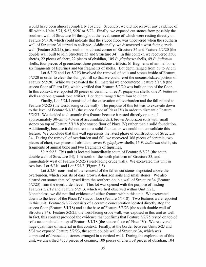
Unit 5/2J. This unit is located immediately south of Feature 5/3/23 (the south double wall of Structure 34), 1-m north of the north platform of Structure 33, and immediately west of Feature 5/2/25 (west-facing crude wall). We excavated this unit in two lots, Lot 5/2J/1 and Lot 5/2J/3 (Figure 3.5).
Lot 5/2J/1 consisted of the removal of the fallen cut stones deposited above the overburden, which consists of dark brown A-horizon soils and small stones. We also cleared cut stones that collapsed from the southern double wall of Structure 34 (Feature 5/2/23) from the overburden level. This lot was opened with the purpose of finding Features 5/2/12 and Feature 5/2/13, which we first observed within Unit 5/2L. Nonetheless, we did not find evidence of either feature within this unit. We excavated down to the level of the Plaza IV stucco floor (Feature 5/1/18). Two features were reported in this unit. Feature 5/2/22 consists of a ceramic concentration located directly atop the stucco floor (Feature 5/1/18) and at the base of Feature 5/3/23 (the south double wall of Structure 34). Feature 5/2/25, the west-facing crude wall, was exposed in this unit as well. In fact, this context provided the evidence that confirms that Feature 5/2/25 rested on top of soils accumulated on top of Feature 5/1/18 (the stucco floor of Plaza IV). We recovered huge quantities of material in this context. Finally, at the border between Units 5/2J and 5/3J we exposed Feature 5/2/23, the south double wall of Structure 34, which was composed of dressed cut stones arranged in a vertical wall. During the exploration of this unit, we unearthed 4753 pieces of ceramic, 109 pieces of chert, 38 pieces of obsidian, 104
36
P. glaphyrus shells, 96 P. indiorum shells, four groundstone artifacts, 132 fragments of bone, four fragments of figurines, 22 fragments of shell and one human bone. Lot depth ranged from 76 to 176 cm.
Lot 5/2J/3 consisted of the removal of soils and stones inside of Feature 5/2/20 in order to clear the slumped fill so that we could reset the unconsolidated portion of Feature 5/2/20. While we excavated the fill material we encountered Feature 5/1/18 (the stucco floor of Plaza IV). This context lacked of archaeological materials.
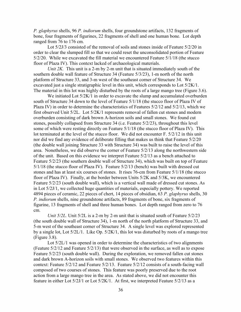
Unit 2K. This unit is a 2-m by 2-m unit that is situated immediately south of the southern double wall feature of Structure 34 (Feature 5/3/23), 1-m north of the north platform of Structure 33, and 3-m west of the southeast corner of Structure 34. We excavated just a single stratigraphic level in this unit, which corresponds to Lot 5/2K/1. The material in this lot was highly disturbed by the roots of a large mango tree (Figure 3.6).
We initiated Lot 5/2K/1 in order to excavate the slump and accumulated overburden south of Structure 34 down to the level of Feature 5/1/18 (the stucco floor of Plaza IV of Plaza IV) in order to determine the characteristics of Features 5/2/12 and 5/2/13, which we first observed Unit 5/2L. Lot 5/2K/1 represents removal of fallen cut stones and modern overburden consisting of dark brown A-horizon soils and small stones. We found cut stones, possibly collapsed from Structure 34 (i.e. Feature 5/2/23), throughout this level some of which were resting directly on Feature 5/1/18 (the stucco floor of Plaza IV). This lot terminated at the level of the stucco floor. We did not encounter F. 5/2/12 in this unit nor did we find any evidence of deliberate filling that makes us think that Feature 5/2/20 (the double wall joining Structure 33 with Structure 34) was built to raise the level of this area. Nonetheless, we did observe the corner of Feature 5/2/13 along the northwestern side of the unit. Based on this evidence we interpret Feature 5/2/13 as a bench attached to Feature 5/2/23 (the southern double wall of Structure 34), which was built on top of Feature 5/1/18 (the stucco floor of Plaza IV). Feature 5/2/13 (bench) was built with dressed cut stones and has at least six courses of stones. It rises 76-cm from Feature 5/1/18 (the stucco floor of Plaza IV). Finally, at the border between Units 5/2K and 5/3K, we encountered Feature 5/2/23 (south double wall), which is a vertical wall made of dressed cut stones. As in Lot 5/2J/1, we collected huge quantities of materials, especially pottery. We reported 4894 pieces of ceramic, 22 pieces of chert, 14 pieces of obsidian, 63 P. glaphyrus shells, 30 P. indiorum shells, nine groundstone artifacts, 89 fragments of bone, six fragments of figurine, 13 fragments of shell and three human bones. Lot depth ranged from zero to 76 cm.
Unit 5/2L. Unit 5/2L is a 2-m by 2-m unit that is situated south of Feature 5/2/23 (the south double wall of Structure 34), 1-m north of the north platform of Structure 33, and 5-m west of the southeast corner of Structure 34. A single level was explored represented by a single lot, Lot 5/2L/1. Like Op. 5/2K/1, this lot was disturbed by roots of a mango tree (Figure 3.8).
Lot 5/2L/1 was opened in order to determine the characteristics of two alignments (Feature 5/2/12 and Feature 5/2/13) that were observed in the surface, as well as to expose Feature 5/2/23 (south double wall). During the exploration, we removed fallen cut stones and dark brown A-horizon soils with small stones. We observed two features within this context: Feature 5/2/12 and Feature 5/2/13. Feature 5/2/12 consists of a south-facing wall composed of two courses of stones. This feature was poorly preserved due to the root action from a large mango tree in the area. As stated above, we did not encounter this feature in either Lot 5/2J/1 or Lot 5/2K/1. At first, we interpreted Feature 5/2/13 as a

37
terrace located outside of Structure 34, however, our excavation of Lot. 5/2K/1 provided evidence that confirms that Feature 5/2/13 is a bench built on top of Feature 5/1/18 (the stucco floor of Plaza IV) and attached to Feature 5/2/23 (the south double wall of Structure 34). At Lot 5/2L/1, we were able to identify only three courses of stones of Feature 5/2/13 (the northern bench). In addition, at the border between Units 5/2L and 5/3L, we uncovered Feature 5/2/24 (the south inset-outset style wall of Structure 34) in good condition. This wall was built with dressed cut stones in an in-and-out style. We were not able to identify the base of this feature due to the fact that Feature 5/2/13 (the northern bench) covers it by at least 50-cm. The excavation of Lot 5/2L/1 provided 203 pieces of ceramic, 11 pieces of chert, three pieces of obsidian, four P. glaphyrus shells, five P. indiorum shells, one greenstone artifact and three groundstone artifacts. Lot depth ranged from 64 cm to 114 m.
Suboperation 5/3
Suboperation 5/3 is located 4-m north of Structure 33, atop of Structure 34 and
along Feature 5/3/23 (Structure 34’s south double wall) and Feature 5/2/24 (the south inset-outset style wall of Structure 34). During the exploration of this suboperation we reported Feature 5/8/14 (the lower body of Structure 34), Feature 5/8/15 (the retaining wall of Feature 5/8/14), Feature 5/1/18 (the stucco floor of Plaza IV), Feature 5/3/23 (the south inset-outset style wall of Structure 34-A), Feature 5/3/24 (the south double wall of Structure 34-A), Feature 5/6/27 (the upper-body first of Structure 34), Feature 5/3/55 (the stucco floor of Structure 34-A) and Feature 5/3/56 (the stucco floor of Feature 5/8/14).
Unit 5/3I. This 2-m by 2-m unit is located at the southeast corner of Structure34. It was explored in three lots—Lots 5/3I/1, 5/3I/2, and 5/3I/3—which correspond to two different contexts (Figure 3.7).
Lot 5/3I/1 involved the clearing of fallen stones and modern overburden (consisting of dark brown A-horizon soils with small stones) from the talus down to the level of the subfloor ballast of Plaza IV in order to expose the corner and the bottom courses of Feature 5/8/14 (the lower body of Structure 34) and Feature 5/8/15 (retaining wall). During the removal of the overburden and fallen cut stones, we uncovered the southeast corner, which was found in good condition with four courses of stones in situ, although slightly stumped forward. After the excavation of this lot, we observed that foundation of Feature 5/8/14 rested on the subfloor ballast of Plaza IV. Many of the stones belonging to the foundation of Structure 34 were slumped to the east but the cornerstone remained in situ. Three courses of stones had also collapsed eastwards. At the western edge of this unit and rising at least 2-m above the subfloor ballast of Plaza IV there is an alignment of dressed cut stones that likely collapsed from Feature 5/6/27 (the upper-body first of Structure 34). We also encountered Feature 5/8/15 during our excavation of this unit. This feature is a retaining wall made of undressed cut stones. We supposed that this feature was built to retain the platform fill, reinforce Feature 5/6/27 (the upper-body first of Structure 34), and served as a support for this last feature. This feature was badly preserved and slumped forward. During the exploration of this lot, we recovered 557 pieces of ceramic, seven pieces of chert, three artifacts made of obsidian, 63 P. glaphyrus shells, 64 P. indiorum shells, 16 fragments of bone and four fragments of shell. Lot depth ranged from zero to 1.37 m.

38
Lots 5/3I/2 and 5/3I/3 consisted of the removal of collapsed stones from Structure 34 and dark brown A-horizon soils and small stones used as fill within Feature 5/8/14 (the lower body of Structure 34). We focused our excavation of these two lots behind Feature 5/8/14 (the lower body of Structure 34), although we also removed some material east or in front of Feature 5/8/14 (the lower body of Structure 34). The purpose of this exploration was to uncover the foundation of Feature 5/8/14 and allow its stones to be reset. This exploration was part of the consolidation process. In this context, we recovered 217 pieces of ceramic, four pieces of chert, two pieces of obsidian, ten P. glaphyrus shells, one P. indiorum shells, one groundstone artifact, six fragments of animal bone fragments and one fragment of figurine. Lot depth ranged from 1 cm to 1.42 m.
Unit 3J. This unit is located atop of Structure 34, along Feature 5/3/23 (the south double wall of Structure 34) and Feature 5/6/27 (the upper-body first of Structure 34) and 1-m west from Feature 5/8/14 (the lower body of Structure 34). This unit was explored in three lots—Lots 5/3J/1, 5/3J/2, and 5/3J/3—which correspond to three different contexts (Figure 3.5).
We excavated Lot 5/3J/1 with the goal of removing heavy overburden consisting of dark brown A-horizon soils with small stones and collapsed cut stones that were endangering Feature 5/3/23 (the south double wall of Structure 34). During the excavation of this unit, we revealed the north face of Feature 5/3/23. We excavated into dry fill only far enough to stabilize top of wall. The exploration of this lot provided 173 pieces of ceramic, four pieces of chert, 12 P. glaphyrus shells, four P. indiorum shells, and five fragments of animal bone. Lot depth ranged from 30 cm to 1.08 m.
We opened Lot 5/3J/2 with the purpose of identifying the location of the foundation of the inner wall of Feature 5/3/23 (the south double wall of Structure 34). Additionally, we wanted to explore the fill of Feature 5/6/27 (the upper-body first of Structure 34). This fill consisted of uncut and cut big stones mixed with dark brown A-horizon soils and small stones. Exploration revealed that the foundation of foundation rested on dry fill, at the level of surface of Feature 5/8/14. That is, the foundation of Feature 5/3/23 did not go down to the level of Plaza IV. In fact, we affirm that this inner wall consisted of four courses of stones rising approximately 50-cm from the surface of Feature 5/8/14. We suggest that Feature 5/3/23 (the south double wall of Structure 34) was built in order to create an interior space at the north. When the structure was built or expanded to its final size, the north side of this wall was filled. A second possibility is that the double wall was built as a mechanism of reinforcement for the outer vertical wall. During the exploration, we also uncovered the foundation of Feature 5/6/27, which was found in a state of poor preservation and slumped forward. We reported 26 pieces of ceramic, one artifact made of groundstone and one fragment of shell. Lot depth ranged from 27 to 67 cm.
Lot 5/3J/3 corresponds to the removal of stones and dark brown A-horizon soils used as fill in order to clean the space between Feature 5/3/23’s inner and outer walls to reset them. During the exploration of this context, we unearthed 30 pieces of ceramic and 1 groundstone artifact.
Unit 3K. This unit is located atop of Structure 34, along Feature 5/3/23 (the south double wall of Structure 34), 2-m west from Feature 5/6/27 (the upper body first of Structure 34), and 3-m west from Feature 5/8/14 (the lower body of Structure 34). This unit was explored in two lots—Lots 5/3K/1 and 5/3K/2—which correspond to two different contexts (Figure 3.6).
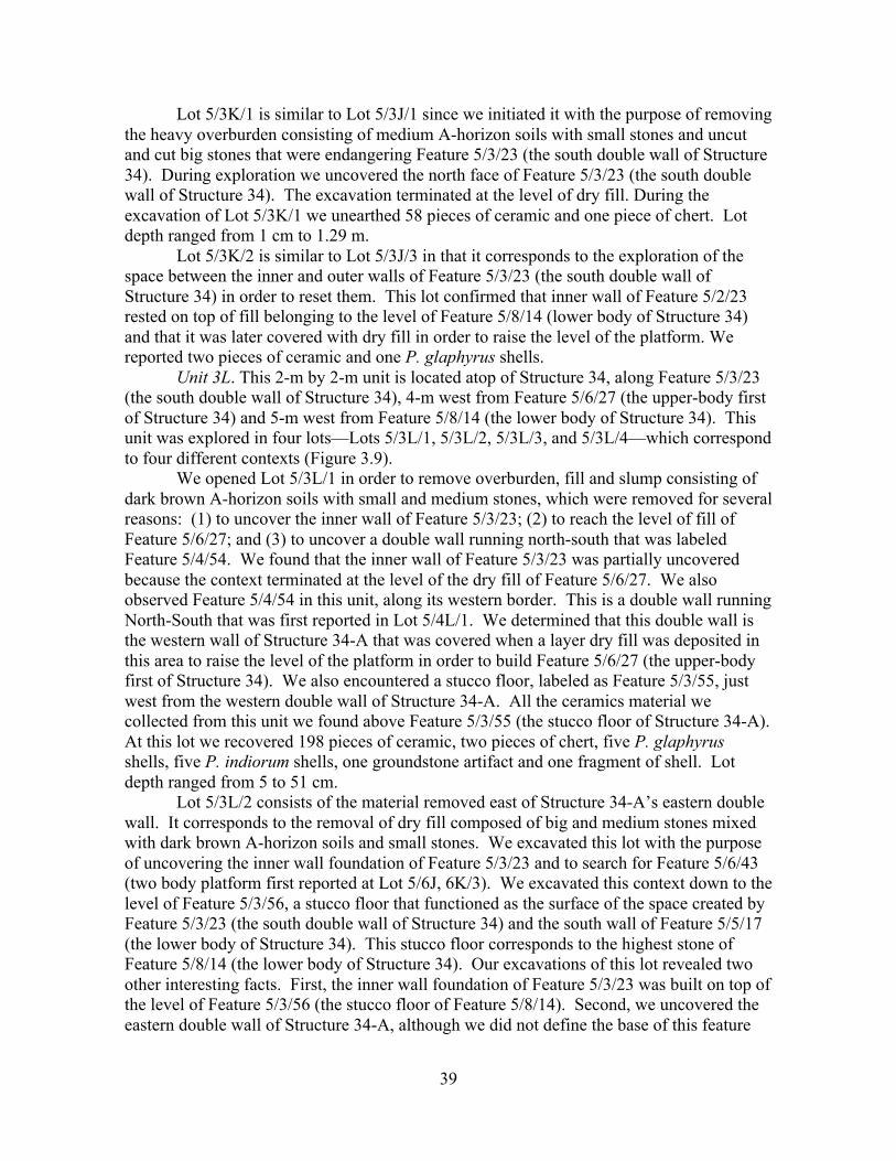
39
Lot 5/3K/1 is similar to Lot 5/3J/1 since we initiated it with the purpose of removing the heavy overburden consisting of medium A-horizon soils with small stones and uncut and cut big stones that were endangering Feature 5/3/23 (the south double wall of Structure 34). During exploration we uncovered the north face of Feature 5/3/23 (the south double wall of Structure 34). The excavation terminated at the level of dry fill. During the excavation of Lot 5/3K/1 we unearthed 58 pieces of ceramic and one piece of chert. Lot depth ranged from 1 cm to 1.29 m.
Lot 5/3K/2 is similar to Lot 5/3J/3 in that it corresponds to the exploration of the space between the inner and outer walls of Feature 5/3/23 (the south double wall of Structure 34) in order to reset them. This lot confirmed that inner wall of Feature 5/2/23 rested on top of fill belonging to the level of Feature 5/8/14 (lower body of Structure 34) and that it was later covered with dry fill in order to raise the level of the platform. We reported two pieces of ceramic and one P. glaphyrus shells.
Unit 3L. This 2-m by 2-m unit is located atop of Structure 34, along Feature 5/3/23 (the south double wall of Structure 34), 4-m west from Feature 5/6/27 (the upper-body first of Structure 34) and 5-m west from Feature 5/8/14 (the lower body of Structure 34). This unit was explored in four lots—Lots 5/3L/1, 5/3L/2, 5/3L/3, and 5/3L/4—which correspond to four different contexts (Figure 3.9).
We opened Lot 5/3L/1 in order to remove overburden, fill and slump consisting of dark brown A-horizon soils with small and medium stones, which were removed for several reasons: (1) to uncover the inner wall of Feature 5/3/23; (2) to reach the level of fill of Feature 5/6/27; and (3) to uncover a double wall running north-south that was labeled Feature 5/4/54. We found that the inner wall of Feature 5/3/23 was partially uncovered because the context terminated at the level of the dry fill of Feature 5/6/27. We also observed Feature 5/4/54 in this unit, along its western border. This is a double wall running North-South that was first reported in Lot 5/4L/1. We determined that this double wall is the western wall of Structure 34-A that was covered when a layer dry fill was deposited in this area to raise the level of the platform in order to build Feature 5/6/27 (the upper-body first of Structure 34). We also encountered a stucco floor, labeled as Feature 5/3/55, just west from the western double wall of Structure 34-A. All the ceramics material we collected from this unit we found above Feature 5/3/55 (the stucco floor of Structure 34-A). At this lot we recovered 198 pieces of ceramic, two pieces of chert, five P. glaphyrus shells, five P. indiorum shells, one groundstone artifact and one fragment of shell. Lot depth ranged from 5 to 51 cm.
Lot 5/3L/2 consists of the material removed east of Structure 34-A’s eastern double wall. It corresponds to the removal of dry fill composed of big and medium stones mixed with dark brown A-horizon soils and small stones. We excavated this lot with the purpose of uncovering the inner wall foundation of Feature 5/3/23 and to search for Feature 5/6/43 (two body platform first reported at Lot 5/6J, 6K/3). We excavated this context down to the level of Feature 5/3/56, a stucco floor that functioned as the surface of the space created by Feature 5/3/23 (the south double wall of Structure 34) and the south wall of Feature 5/5/17 (the lower body of Structure 34). This stucco floor corresponds to the highest stone of Feature 5/8/14 (the lower body of Structure 34). Our excavations of this lot revealed two other interesting facts. First, the inner wall foundation of Feature 5/3/23 was built on top of the level of Feature 5/3/56 (the stucco floor of Feature 5/8/14). Second, we uncovered the eastern double wall of Structure 34-A, although we did not define the base of this feature
40
within this lot. During the exploration of this lot, we only unearthed nine pieces of ceramic. Lot depth ranged from 7 to 67 cm.
We opened Lot 5/3L/3 in order to explore the ballast and fill of Feature 5/3/56 (the stucco floor of Feature 5/8/14), which consisted of small and medium stones mixed with sediments derived from a mixture of dark brown A-horizon soils and light brown C-horizon soils. This lot was opened with the purpose of exploring the level below Feature 5/4/56 (the stucco floor of Feature 5/8/14) and to see if Feature 5/1/18 (the stucco floor of Plaza IV) continues underneath Feature 5/3/23 (the south double wall of Structure 34). After we removed the fill we observed that that Feature 5/1/18 did, in fact, continue under Feature 5/3/23 (the south double wall of Structure 34). Finally, these excavations revealed that Structure 34-A was a well-built platform that consisting of vertical walls with both stepped insets and an outset molding that might be called an example of the “In-and-out” style. Materials recovered during the explorations of this context are four pieces of ceramic, one piece of chert and one fragment of figurine. Lot depth ranged from 1.16 to 1.36 m.
Lot 5/3L/4 consists of the removal of ballast and fill from below Feature 5/1/18 (the stucco floor of Plaza IV) in order to investigate whether the eastern double wall of Structure 34-A was built before Plaza IV or afterwards. This lot was only explored in an area of 20-cm (East-West) by 40-cm (North-South). The matrix of this context consisted of a layer of white lime plaster overlying sediments derived from a mixture of dark brown A-horizon soils and light brown C-horizon soils with small stones. After the removal of this material we observes that Structure 34-A was built previous to the construction of Feature 5/1/18 (the stucco floor of Plaza IV) due to the fact that the foundation stone of Feature 5/3/23 went below this stucco floor, which did not continue westwards. In other words, Structure 34-A corresponds to the moment in which Plaza IV was built. This context did not report archaeological artifacts.
Suboperation 5/4
Suboperation 5/4 is approximately located 6-m north of Structure 34 and 2-m north
of the south wall of Structure. Features reported at this suboperation are Feature 5/8/14 (the lower body of Structure 34), Feature 5/8/15 (the retaining wall of Feature 5/8/14), Feature 5/5/17 (the upper-body second of Structure 34), Feature 5/6/27 (the upper-body first of Structure 34), Feature 5/4/32 (south-facing wall, superstructure of Feature 5/6/27), Feature 5/6/50 (terrace of Feature 5/5/17), Feature 5/6/52 (the stucco floor of Feature 5/6/50), Feature 5/4/54 (the east double wall of Structure 34-A) and Feature 5/4/56 (the stucco floor of Feature 5/8/14).
Unit 4H. This unit is explored to remove slump coming from Structure 34. It consists of a single level corresponding to a single lot, Lot 5/4H/1. It is located east of Structure 34, above Plaza IV.
Lot 5/4H/1 involved the removal of slump and modern overburden consisting of dark brown A-horizon A with small stones. The level finishes at the subfloor ballast of Plaza IV.
Unit 4I. This unit is located alongside Feature 5/8/14 (the lower body of Structure 34), immediately east of Feature 5/6/27 (the upper-body first of Structure 34) and approximately 2-m north of the southeast corner of Structure 34. The unit was explored into three lots—Lots 5/4H/1, 5/4H/2, and 5/4H/3—which correspond to two contexts.
41
We excavated Lot 5/4I/1 with the goal of uncovering Feature 5/8/14 (The lower body of Structure 34) and Feature 5/8/15 (the retaining wall of Feature 5/8/14) first observed in Unit 8I. It corresponds to the removal of the cut stones that had collapsed from the walls and the modern overburden consisting of dark brown A-horizon soil with small stones. We also encountered Feature 5/8/14 (the lower body of Structure 34) in this unit, although it was in poorly preserved. Upon exposure, we observed that many courses of stones from this feature were collapsed eastward and that even foundation was not in place. We also found Feature 5/8/15 (the retaining wall built to reinforce Feature 5/8/14) to be in bad condition. Finally, we exposed collapsed stones from Feature 5/6/27 (the upper-body first of Structure 34) at the western border of the unit. Apparently, features situated south of Feature 5/8/7 (the stair of Structure 34) are in bad condition because all of them were collapsed eastward. During the explorations of this lot, we reported 215 pieces of ceramic, two artifacts made of obsidian, 20 P. glaphyrus shells and one fragment of shell. Lot depth ranged from 7 to 65 cm.
Lots 5/4I/2 and 5/4I/3 consisted of the removal of the fill (dark brown A-horizon soils with small stones) behind Feature 5/8/14 (the lower body of Structure 34) with goal of resetting the stones that constitute this feature. During the excavation we revealed Feature 5/8/15 (the retaining wall of Feature 5/8/14). In addition to excavating inside Feature 5/8/14 (the lower body of Structure 34), we also removed soils from the Plaza IV floor outside of this feature in order to completely reveal the bottom course of stones. Materials unearthed in this lot are 206 pieces of ceramic, 11 pieces of chert, four pieces of obsidian, 17 P. glaphyrus shells, three groundstone artifacts and one fragment of figurine. Lot depth ranged from 7 to 64 cm.
Unit 4J. This unit is located atop Structure 34, alongside Feature 5/8/14 (the lower body of Structure 34), immediately west from Feature 5/6/27 (the upper-body first of Structure 34), and approximately 2-m north from the southeast corner of Structure 34. The unit was explored in three lots—Lots 5/4J/1, 5/4J/2, and 5/4J/3—which correspond to three different contexts (Figure 3.5).
Lot 5/4J/1 corresponds to the removal of overburden consisting of dark brown A-horizon soils with small stones and fallen big cut stones in order to expose the southeastern corner of Feature 5/5/17 (the upper-body second of Structure 34). Excavation revealed that Feature 5/5/17 (the upper-body second of Structure 34) had at least four courses of dressed cut stones, which were slightly bigger than later constructions. During the explorations of this lot, we unearthed 28 pieces of ceramic, two pieces of chert, two P. glaphyrus shells, two P. indiorum shells and one fragment of animal bone. Lot depth ranged from 6 cm to 1.08 m.
Lot 5/4J/2 corresponds to the clearing of overburden and fill consisting of dark brown A-horizon soils with small stones in order to uncover the foundation of Feature 5/6/27 (the upper-body first of Structure 34) and reset this wall. The foundation is the single course of stones that is almost in situ. We reported seven pieces of ceramic, one groundstone artifact and two fragments of animal bone. Lot depth ranged from 0 to 17 cm.
Lot 5/4J/3 involved the excavation of fill made of dark brown A-horizon soils with small stones and big uncut stones. The goal of this exploration was to identify the base of Feature 5/5/17 (the upper-body second of Structure 34) in order to determine if Feature 5/5/17 is a substructure or an upper-body second. Exploration revealed that Feature 5/5/17 is not a substructure but a previous version of Feature 5/6/27 (the upper-body first of Structure 34). This is demonstrated by the fact that the wall of Feature 5/5/17 (the upper-

42
body second of Structure 34) rests on top of fill at the level of Feature 5/8/14 (the lower body of Structure 34). It does not extend into the lower body, therefore, we suggest a partial construction sequence in which Feature 5/8/14 (the lower body of Structure 34) was constructed. Feature 5/5/17 (the upper-body second of Structure 34) was built on top of the lower body and Feature 5/6/27 (the upper-body first of Structure 34) was built as an expansion of Feature 5/5/17 at the same basal level on top of Feature 5/8/14 (the lower body of Structure 34). In addition, during the excavation of this lot we also revealed Feature 5/6/50, which is composed of a course of dressed cut stones and is located 60-cm south from the south wall of Feature 5/5/17. This feature likely functioned as a terrace of the upper-body first. The lot terminated at the level of light brown soils that correspond to Feature 5/4/56 (the stucco floor of Feature 5/8/14). During the exploration of this lot, we unearthed 60 pieces of ceramic, one piece of chert, two P. glaphyrus shells, four P. indiorum shells, one groundstone artifact and three fragments of animal bone. Lot depth ranged from 5 to 25 cm.
Unit 4K. This unit is located atop Structure 34, 2-m west of Feature 5/6/27 (the upper-body first of Structure 34), and approximately 2-m north of Feature 5/3/23 (the southern double wall of Structure 34). The unit was explored in a single lot, Lot 5/4K/1, which corresponds to a single level (Figures 3.6 and 3.10).
Lot 5/4K/1 consists of the removal of dark brown A-horizon soils with small and big uncut stones in order to expose the south wall of Feature 5/5/17 (the upper-body second of Structure 34). This context consists of overburden, slump and fill. During the exploration we found a high south-facing wall approximately 1-m south of the southern wall of Feature 5/5/17. This wall is composed of four courses of stones and is labeled Feature 5/4/32. This feature was built on top of large, blocky and unstacked fill. In addition, we revealed three courses of the southern wall of Feature 5/5/17. The lot terminated at the level of fill composed of big uncut stones that were deposited on top of Feature 5/4/56 (the stucco floor of Feature 5/8/14). Feature 5/4/32 likely corresponds to the superplatform of Feature 5/6/27 (the upper-body second of Structure 34). This context provided 55 pieces of ceramic, three pieces of chert, one piece of obsidian, one P. indiorum shells, one groundstone artifact and three fragments of shell. Lot depth ranged from 0 to 82 cm.
Unit 4L. This unit is located atop of Structure 34, 4-m west of Feature 5/6/27 (The upper-body first of Structure 34), and approximately 2-m north of Feature 5/3/23 (Structure 34’s southern double wall). The unit was explored in three lots—Lots 5/4L/1, 5/4L/2, and 5/4L/3—corresponding to three different contexts (Figure 3.6).
Lot 5/4L/1 involved the removal of fill and slump in order to liberate the southern wall of Feature 5/5/17 and to reach the level of large fill composed of uncut stones that was deposited directly on top of Feature 5/4/56 (the stucco floor of Feature 5/8/14). We removed cut stones from surface followed by dark brown A-horizon soils with small and medium-sized stones. During this exploration, we revealed Feature 5/4/32 (south-facing wall, superstructure of Feature 5/6/27). The bottom stone of this two-course wall was at the same level that the uppermost stone of Feature 5/5/17. Feature 5/4/32 and Feature 5/9/53 (see Operation 5/9K/1) might correspond to the southern and northern walls of the platform of Feature 5/6/27. Additionally, we exposed Feature 5/4/54 in this unit. This feature consists of a double wall (around 90-cm thick) that was built with dressed cut stones. According to the information obtained in Lot 5/3L/1, this feature is part of the eastern double wall of Structure 34-A. Finally, our excavations of this unit revealed that the
43
southwestern corner of Feature 5/4/32 rests on top of Feature 5/4/54 (the eastern double wall of Structure 34-A). Lot depth ranged from 0 to 47 cm.
Lot 5/4L/2 involved the clearing of dry fill made of uncut stones mixed with a little bit of dark brown A-horizon soils and small stones in order to uncover Feature 5/4/56 (the stucco floor of Feature 5/8/14) and related features. First, we exposed the southwestern corner of Feature 5/5/17 (the upper-body second of Structure 34), which was built on top of the uppermost stone of the eastern wall of Structure 34. This confirms that a section of the eastern wall of Structure 34-A was covered when Feature 5/5/17 was constructed. We also uncovered Feature 5/4/56 (the stucco floor of Feature 5/8/14), which was well preserved. In addition, we also revealed Feature 5/6/50 (the terrace of Feature 5/5/17) and its stucco floor labeled as Feature 5/6/52. We observed that the westernmost stone of this feature was attached to the eastern wall of Structure 34 at the level of the first outset. That is, the eastern wall of Structure 34-A was used as an architectural element of Structure 34 during the stage of construction related to Feature 5/8/14 and Feature 5/5/17. Lot depth ranged from 59 to 84 cm.
Lot 5/4L/3 corresponds to the exploration of the level below Feature 5/6/52 (the stucco floor of Feature 5/6/50) in order to see if Feature 5/4/56 (the stucco floor of Feature 5/8/14) continues under Feature 5/6/50 (the terrace of Feature 5/5/17). We removed the white lime plaster followed by sediments derived from a mixture of dark brown A-horizon and light brown C-horizon soils with small stones and uncovered Feature 5/4/56 (the stucco floor of Feature 5/8/14). Based on this data, we assert that Feature 5/6/50 and Feature 5/6/52 (the stucco floor of Feature 5/6/50) are latter additions of Feature 5/5/17 (the upper-body first of Structure 34). Lot depth ranged from 3 to 24 cm.
Suboperation 5/5
Suboperation 5 is situated 8-m north of Structure 33, about 4-m north of the south
wall of Structure 34 and approximately 1-m south of Feature 5/8/7 (the stair of Structure 34). During the explorations of this suboperation, we reported the following features: Feature 5/8/7 (the stair of Structure 34), Feature 5/8/14 (the lower body of Structure 34), Feature 5/8/15 (the retaining wall of Feature 5/8/14), Feature 5/5/17 (the upper-body second of Structure 34), Feature 5/1/18 (the stucco floor of Plaza IV), Feature 5/6/27 (the upper-body first of Structure 34), Feature 5/6/38 (the stepped stair outset of Feature 5/8/7), Feature 5/6/39 (the second bench of Feature 5/5/17), Feature 5/6/40 (the stucco floor of Feature 5/5/17, outside of Feature 5/6/39), Feature 5/6/42 (the stucco floor of Feature 5/6/39), Feature 5/6/43 (the two-body platform), Feature 5/6/44 (the stucco floor below Feature 5/1/18), Feature 5/6/45 (the first stucco floor of Feature 5/6/39), Feature 5/7/47 (the retaining wall of the western wall of Feature 5/5/17), Feature 5/4/54 (the eastern wall of Structure 34-A), Feature 5/5/61 (the stucco floor of Feature 5/6/43).
Unit 5H. This 2-m by 2-m unit is located about 1-m east of Feature 5/8/14 (the lower body of Structure 34) and, therefore, is located outside of Structure 34. We explored a single level (Lot 5/5H/1), which terminates at the level of the subfloor ballast of Plaza IV.
Lot 5/5H/1 consists of the removal of cut stones collapsed from Structure 34 (i.e. lower body and upper-bodies) and modern overburden (dark brown A-horizon soils with small stones) in order to uncover what we thought was the southern corner of Feature 5/8/7 (the stair of Structure 34). Nonetheless, according to the data we obtained at Units 5I and 6I, we affirm that this corner belonged to Feature 5/6/38, a stepped stair outset located
44
south Feature 5/8/7 (the stair of Structure 34). During the exploration, we observed that this feature was built on the subfloor ballast of Plaza IV, however, a prepared stucco floor is absent. We recovered several types of artifacts during the explorations of Lot 5/5H/1: 116 pieces of ceramic, two pieces of chert, five P. glaphyrus shells, and one groundstone artifact. Lot depth ranged from 11 to 64 cm.
Unit 5I. This 2-m by 2-m unit is located 4-m north of the southeastern corner of Structure 34 and atop Feature 5/8/14 (the lower body of Structure 34). Three lots were opened at this unit, which correspond to two different contexts.
The goal of Lot 5/5I/1 was to remove fallen cut stones and overburden consisting of dark brown A-horizon soils and small stones in order to uncovered Feature 5/6/38 (although we thought it was the southern edge of Feature 5/8/7), Feature 5/8/14 (the lower body of Structure 34), and Feature 5/8/15 (the retaining wall of Feature 5/8/14). During the explorations, we uncovered the southern edge of Feature 5/6/38 (the stepped-stair outset of Feature 5/8/7), which was well preserved. This feature consists of three steps and its foundation rests on the subfloor ballast of Plaza IV. We also observed that Feature 5/6/38 (the stepped-stair outset of Feature 5/8/7) was built attached to Feature 5/8/14 (the lower body of Structure 34) as a mechanism of reinforcement. In fact Feature 5/6/38 avoided that Feature 5/8/14 collapsed completely. This is, south of Feature 5/8/7 (the stair of Structure 34), Feature 5/8/14 collapsed almost entirely forward except near to Feature 5/6/38 (the stepped-stair outset of Feature 5/8/7). We did not expose Feature 5/8/14 completely due to the fact that it was unstable. We did not find any evidence of Feature 5/8/15 in this unit, although it might be covered by fill and collapsed stones coming from Feature 5/6/27 (the upper-body first of Structure 34). We unearthed 127 pieces of ceramic, four pieces of chert, two pieces of obsidian, 14 P. glaphyrus shells, five P. indiorum shells and one fragment of figurine. Lot depth ranged from 6 to 41 cm.
Lot 5/5I/2 and Lot 5/5I/3 involved the removal of slump and fill. This is, we removed the cut stones collapsed from the upper bodies and platform fill (dark brown A-horizon soils with small stones) in order to uncover the foundation of Feature 5/8/14 (the lower body of Structure 34), which was found in situ. Two courses of stones were collapsed eastward. Our excavations also uncovered Feature 5/8/15 (the retaining wall of Feature 5/6/27). Additionally, we found that the foundations of Feature 5/8/14 and Feature 5/8/15 were resting on top of Feature 5/1/18 (the stucco floor of Plaza IV), which was well preserved inside Feature 5/8/14. This confirms that Feature 5/8/14 was constructed after Plaza IV. The explorations only provided 30 pieces of ceramic and 2 fragments of shell. Lot depth ranged from 1 to 96 cm.
Unit 5J. This unit is located atop Structure 34, alongside Feature 5/6/27 (the upper-body first of Structure 34), 4-m north of Feature 5/3/23 (the southern double wall of Structure 34), and immediately north of the southern wall of Feature 5/5/17. Three lots were opened at this unit, which correspond to two contexts (Figure 3.5).
Lot 5/5J/1 and Lot 5/5J/3 consisted of the removal of cut stones, overburden and fill (consisting of dark brown A-horizon soils with small stones). We opened Lot 5/5J/1 in order to stabilize excavations below and to the east of this unit. We terminated Lot 5/5J/1 when we judged that enough soils had been removed in order to stabilize the other excavations. Lot depth ranged from 8 to 42 cm. Lot 5/5J/3 is a continuation of these explorations, although its goals were to explore the interior of Feature 5/5/17 (the upper-body-second of Structure 34), find Feature 5/6/39 (the second bench of Feature 5/5/17), and reach the levels of Feature 5/6/42 (the stucco floor of Feature 5/6/39) and Feature 5/6/40
45
(the stucco floor outside Feature 5/6/39 but inside Feature 5/5/17). Both Lot 5/5J/1 and Lot 5/5J/3 correspond to level 1 inside Feature 5/5/17 (the upper-body second of Structure 34). Exploration of this context revealed the southern section of Feature 5/6/39 (the second bench of Feature 5/5/17) and its corresponding stucco floor, labeled as Feature 5/6/42. This finding allows to affirm that Feature 5/5/17 had a C shape at some moment of its history. We also uncovered Feature 5/6/40, the stucco floor located outside of Feature 5/6/39 and at the same level as the uppermost stone of Feature 5/5/17 (the upper-body second of Structure 34). Lot depth ranged from 14 to 90 cm. Lots 5/5J/1 and 5/5J/3 only provided 23 pieces of ceramic.
Lot 5/5J/2 involved the excavation east of Feature 5/5/17 within the fill of Feature 5/6/27 (the upper-body first of Structure 34) in order to expose the foundation of Feature 5/6/27 so that it could be reset. As we also observed in Operation 5/4J/2, Feature 5/6/27 was resting on top of Feature 5/4/56 (the stucco floor of Feature 5/8/14). The eastern wall of Feature 5/5/17 was exposed up to four-courses of stones. The bottom stone rested on top of Feature 5/8/14. We reported 88 pieces of ceramic, one piece of chert, and two fragments of animal of bone. Lot depth ranged from 0 to 60 cm.
Unit 5K. This unit is located atop Structure 34, 2-m west of Feature 5/6/27 (the upper-body first of Structure 34), 4-m north from Feature 5/3/23 (the southern double wall of Structure 34), and immediately north of the southern wall of Feature 5/5/17. We opened a single lot in this unit, Lot 5/5K/1 (Figures 3.6 and 3.11).
Lot 5/5K/1 involved the removal of fill and overburden. First, we removed cut stones on the surface followed by the clearing of dark brown A-horizon soils with small and medium uncut stones and cut stones. The purpose of excavating this unit was to explore the interior of Feature 5/5/17 (the upper-body second of Structure 34), find Feature 5/6/39 (the second bench of Feature 5/5/17), and reach the levels of Feature 5/6/42 (the second bench of Feature 5/6/39) and Feature 5/6/40 (the stucco floor outside Feature 5/6/39 but inside Feature 5/5/17). Our exploration of this context revealed the southern section and part of the central section of Feature 5/6/39 (the second bench of Feature 5/5/17) and its corresponding stucco floor (Feature 5/6/42). Based on this evidence we conclude that Feature 5/5/17 had a C shape at some moment in its construction history. Finally, we also exposed Feature 5/6/40 (the stucco floor located outside of Feature 5/6/39 and at the same level as the uppermost stone of Feature 5/5/17) in this unit. Archaeological materials were scarce because we recovered 25 pieces of ceramic, one groundstone artifact and one fragment of bone. Lot depth ranged from 15 to 83 cm.
Unit 5L. This unit is located atop Structure 34, 4-m west of Feature 5/6/27 (the upper-body first of Structure 34), 4-m north of Feature 5/3/23 (the southern double wall of Structure 34), and immediately north of the southern wall of Feature 5/5/17. We excavated a single lot in this unit, Lot 5/5L/1 (Figure 3.11).
We opened Lot 5/5L/1 in order to find the western wall of Feature 5/5/17 (the upper-body second of Structure 34). We focused our excavations in an area measuring 2-m (North-South) by 1-m (East-West). We removed cut stones from the surface and the underlying dark brown A-horizon soils with small stones and big uncut stones used as fill. As we removed the overburden and fill we revealed the western wall of Feature 5/5/17 (the upper-body second of Structure 34). We terminated the lot when we found the uppermost stone of this feature, as well as Feature 5/6/42 (the stucco floor of Feature 5/6/39). The explorations of this lot only provided 19 pieces of ceramic and one P. indiorum shells. Lot depth ranged from 19 to 52 cm.

46
Units 5K, 5L. This was a 2-m by 2-m unit located atop Structure 34, 4-m west of Feature 5/6/27, immediately north of Feature 5/5/17. In other words, it is located inside Feature 5/6/39 (the second bench of Feature 5/5/17). The objective of our excavation of this unit was to explore the area below Feature 5/6/39 in order to look for Feature 5/6/43 (the two-body platform) or another earliest phase of construction. We opened four lots in this unit, which correspond to four different contexts (Figure 3.11).
We opened Lot 5/5K, 5L/3 with the purpose of exploring the level below Feature 5/6/42 (the stucco floor of Feature 5/6/39) and, therefore, inside of Feature 5/6/39 (the second bench of Feature 5/5/17). The matrix included sediments derived from a mixture of dark brown A-horizon soils with light brown C-horizon soils with small stones used as fill. We revealed another stucco floor (Feature 5/6/45) during the excavation of this lot, which might be the original stucco floor of Feature 5/6/39 (the second bench of Feature 5/5/17). The explorations of Lot 5/5K, 5L/3 provided 25 pieces of ceramic, one piece of chert, three P. glaphyrus shells, one P. indiorum shells and one fragment of bone. Lot depth ranged from 29 to 58 cm.
The goal of Lot 5/5K, 5L/4 was to explore the area below Feature 5/6/41 (the first stucco floor of Feature 5/6/39) in order to look for Feature 5/6/43 (the two-body platform). In order to achieve this objective, we removed fill consisting of sediments derived from dark brown A-horizon and light brown C-horizon soils with big uncut stones. We exposed two features in this context. The first feature is Feature 5/7/47, which is a retaining wall that was built to reinforce the western wall of Feature 5/5/17 (the upper-body second of Structure 34). The second feature is Feature 5/5/61, a stucco floor, that we uncovered after removing the fill. According to the levels, this surface might correspond to the surface of Feature 5/6/43, however, we were not able to verify this suspicion. We also noticed that Feature 5/7/47 rests directly on top of Feature 5/5/61. Due to the fact that we had to dismantle Feature 5/7/47 in order to ensure the stability of our excavations, we were able to observe that the western wall of Feature 5/5/17 was built resting on top of the eastern wall of Structure 34-A (Feature 5/4/54), which we also revealed in this lot. Archaeological artifacts were also scarce in this lot due to the fact that we only recovered 56 pieces of ceramic, three pieces of chert and one P. indiorum shells. Lot depth ranged from 48 to 62 cm.
Lot 5/5K, 5L/3/5 includes the material cleared below Feature 5/5/61 (the stucco floor of Feature 5/6/43). We opened this lot with the purpose of obtaining materials inside Feature 5/6/43 (the two-body platform). The matrix of this context consisted of big uncut stones mixed with gray soils used as fill. After removing the fill, we revealed Feature 5/1/18 (the stucco floor of Plaza IV), which was broken in one section. We uncovered more of the western wall of Structure 34-A and were able to see that the foundation stones of this feature continued going below Feature 5/1/18 (the stucco floor of Plaza IV). We reported 140 pieces of ceramic and three pieces of chert. Lot depth ranged from 1.13 to 1.78 m.
We excavated Lot 5/5K, 5L/3/6 in order to explore the area below the broken area of Feature 5/1/18 (the stucco floor of Plaza IV). We originally suspected that this disturbed area could have contained an offering or burial before Feature 5/6/43 (the two-body platform) was built. During excavation we also revealed a section of Feature 5/6/44 (the stucco floor below Feature 5/1/18), which was also broken and we were not able to determine its relation to Structure 34-A. Ultimately, we did not find any burial or offering and we conclude that the stucco floors we broken during the deposition of fill. The matrix

47
of this fill consisted of dark brown A-horizon soils mixed with light brown C-horizon soils and small stones. Archaeological materials unearthed in Lot 5/5K, 5L/3/6 are 13 pieces of ceramic, two pieces of chert, two P. glaphyrus shells, 13 P. indiorum shells, and one fragment of shell. Lot was 1.26 m depth.
Suboperation 5/6
Suboperation 5/6 is located 10-m north of Structure 33, 6-m north of the south wall
of Structure 34 and 8-m south of the north wall of Structure 34 (Figure 3.12). This is it is situated at the middle section of the structure. Features reported at this suboperation are Feature 5/8/7 (the stair block of Structure 34), Feature 5/8/14 (the lower body of Structure 34), Feature 5/5/17 (the upper-body second of Structure 34), Feature 5/1/18 (the stucco floor of Plaza IV), Feature 5/6/21 (the stoop added to Feature 5/8/7), Feature 5/6/27 (the upper-body first of Structure 34), Feature 5/6/38 (the stepped-stair outset of Feature 5/8/7), Feature 5/6/39 (the second bench of Feature 5/5/17), Feature 5/6/40 (the stucco floor of Feature 5/5/17, outside of Feature 5/6/39), Feature 5/6/41 (the stucco floor of Feature 5/5/17, outside of Feature 5/6/48), Feature 5/6/42 (the stucco floor of Feature 5/6/39), Feature 5/6/43 (the two-body platform), Feature 5/6/44 (the stucco floor below Feature 5/1/18), Feature 5/7/47 (the retaining wall of Feature 5/5/17 western wall), Feature 5/6/48 (the first bench of Feature 5/5/17), Feature 5/6/49 (the retaining wall of Feature 5/6/48), Feature 5/6/50 (the terrace of Feature 5/5/17), Feature 5/6/51 (latter addition to the eastern wall of Feature 5/5/17), and Feature 5/6/52 (the stucco floor of Feature 5/6/50).
Unit 6H. This 2-m by 2-m unit is located about 1-m east of Feature 5/8/14, along the central axis of Structure 34. The general purpose of the unit was to explore the main stair block (Figure 3.12).
Lot 5/6H/1 consisted of the removal of slump and overburden (cut stones collapsed from the top of Structure 34 and dark brown A-horizon soils and small stones). The goal was to explore and determine the characteristics of Feature 5/8/7, or the stair block of Structure 34. During explorations, we revealed Feature 5/6/21. This feature appears to be a “stoop” that was built as a later addition to Feature 5/8/7 (the stair block of Structure 34), covering one or two steps of this original stair block. In order to better understand the stair, we partially uncovered a section of Feature 5/8/7 in this unit because the slump in Unit 5/6I obscured this feature. In addition, we observed a section of Feature 5/6/38 (the stepped-stair outset of Feature 5/8/7) in this unit. Features 5/8/7, 5/6/21 and 5/6/38 were built resting on top of the subfloor ballast of Plaza IV. Finally, we exposed a retaining wall at the level of the subfloor ballast. It runs Southeast-Northwest, parallel to Feature 5/8/5. During the removal of slump and fill in this unit, we reported 159 pieces of ceramic, seven pieces of chert, five pieces of obsidian, six P. glaphyrus shells, two P. indiorum shells, four groundstone artifacts and four fragments of figurine. Lot depth ranged from 13 to 67 cm.
Lot 5/6H/3 involved the removal of the fill of Feature 5/6/21 in order to uncover the foundation of Feature 5/8/7 (the stair block of Structure 34). The fill consisted of dark brown A-horizon soils with small stones. During our exploration, we revealed the southeastern corner of Feature 5/8/7. At first we believed that Feature 5/6/38 was part of the stair block, however, once we exposed the southeast corner of Feature 5/8/7 we realized that Feature 5/6/38 is actually a stepped-stair outset. Feature 5/6/21 (the stoop added to Feature 5/8/7) covered only the first step of Feature 5/8/7. Archaeological materials recovered during the removal of fill are 33 pieces of ceramic, three pieces of chert, two
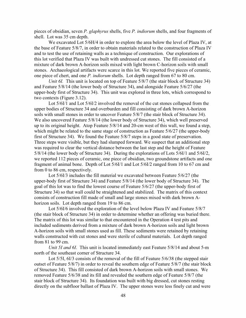
48
pieces of obsidian, seven P. glaphyrus shells, five P. indiorum shells, and four fragments of shell. Lot was 35 cm depth.
We excavated Lot 5/6H/4 in order to explore the area below the level of Plaza IV, at the base of Feature 5/8/7, in order to obtain materials related to the construction of Plaza IV and to test the use of retaining walls as a technique of construction. Our explorations of this lot verified that Plaza IV was built with undressed cut stones. The fill consisted of a mixture of dark brown A-horizon soils mixed with light brown C-horizon soils with small stones. Archaeological artifacts were scarce in this lot. We reported five pieces of ceramic, one piece of chert, and one P. indiorum shells. Lot depth ranged from 67 to 80 cm.
Unit 6I. This unit is located on top of Feature 5/8/7 (the stair block of Structure 34) and Feature 5/8/14 (the lower body of Structure 34), and alongside Feature 5/6/27 (the upper-body first of Structure 34). This unit was explored in three lots, which correspond to two contexts (Figure 3.12).
Lot 5/6I/1 and Lot 5/6I/2 involved the removal of the cut stones collapsed from the upper bodies of Structure 34 and overburden and fill consisting of dark brown A-horizon soils with small stones in order to uncover Feature 5/8/7 (the stair block of Structure 34). We also uncovered Feature 5/8/14 (the lower body of Structure 34), which well preserved up to its original height. Atop Feature 5/8/14 and 20-cm west of this wall, we found a step, which might be related to the same stage of construction as Feature 5/6/27 (the upper-body first of Structure 34). We found the Feature 5/8/7 steps in a good state of preservation. Three steps were visible, but they had slumped forward. We suspect that an additional step was required to clear the vertical distance between the last step and the height of Feature 5/8/14 (the lower body of Structure 34). During the explorations of Lots 5/6I/1 and 5/6I/2, we reported 112 pieces of ceramic, one piece of obsidian, two groundstone artifacts and one fragment of animal bone. Depth of Lot 5/6I/1 and Lot 5/6I/2 ranged from 10 to 67 cm and from 0 to 86 cm, respectively.
Lot 5/6I/3 includes the fill material we excavated between Feature 5/6/27 (the upper-body first of Structure 34) and Feature 5/8/14 (the lower body of Structure 34). The goal of this lot was to find the lowest course of Feature 5/6/27 (the upper-body first of Structure 34) so that wall could be straightened and stabilized. The matrix of this context consists of construction fill made of small and large stones mixed with dark brown A-horizon soils. Lot depth ranged from 19 to 86 cm.
Lot 5/6I/6 involved the exploration of the level below Plaza IV and Feature 5/8/7 (the stair block of Structure 34) in order to determine whether an offering was buried there. The matrix of this lot was similar to that encountered in the Operation 4 test pits and included sediments derived from a mixture of dark brown A-horizon soils and light brown A-horizon soils with small stones used as fill. These sediments were retained by retaining walls constructed with cut stones and were sterile of cultural materials. Lot depth ranged from 81 to 99 cm.
Unit 5I and 6I. This unit is located immediately east Feature 5/8/14 and about 5-m north of the southeast corner of Structure 34.
Lot 5/5I, 6I/3 consists of the removal of the fill of Feature 5/6/38 (the stepped stair outset of Feature 5/8/7) in order to reveal the southern edge of Feature 5/8/7 (the stair block of Structure 34). This fill consisted of dark brown A-horizon soils with small stones. We removed Feature 5/6/38 and its fill and revealed the southern edge of Feature 5/8/7 (the stair block of Structure 34). Its foundation was built with big dressed, cut stones resting directly on the subfloor ballast of Plaza IV. The upper stones were less finely cut and were
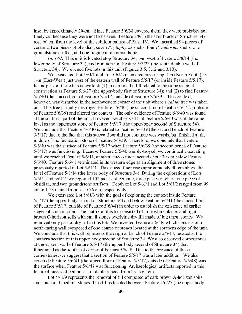
49
inset by approximately 20-cm. Since Feature 5/6/38 covered them, they were probably not finely cut because they were not to be seen. Feature 5/8/7 (the stair block of Structure 34) rose 60 cm from the level of the subfloor ballast of Plaza IV. We unearthed 94 pieces of ceramic, two pieces of obsidian, seven P. glaphyrus shells, four P. indiorum shells, one groundstone artifact, and one fragment of animal bone.
Unit 6J. This unit is located atop Structure 34, 1-m west of Feature 5/8/14 (the lower body of Structure 34), and 6-m north of Feature 5/3/23 (the south double wall of Structure 34). We opened five lots in this unit (Figures 3.5, 3.12 and 3.13).
We excavated Lot 5/6J/1 and Lot 5/6J/2 in an area measuring 2-m (North-South) by 1-m (East-West) just west of the eastern wall of Feature 5/5/17 (or inside Feature 5/5/17). Its purpose of these lots is twofold: (1) to explore the fill related to the same stage of construction as Feature 5/6/27 (the upper-body first of Structure 34); and (2) to find Feature 5/6/40 (the stucco floor of Feature 5/5/17, outside of Feature 5/6/39). This context, however, was disturbed in the northwestern corner of the unit where a cahun tree was taken out. This tree partially destroyed Feature 5/6/40 (the stucco floor of Feature 5/5/17, outside of Feature 5/6/39) and altered the context. The only evidence of Feature 5/6/40 was found at the southern part of the unit, however, we observed that Feature 5/6/40 was at the same level as the uppermost stone of Feature 5/5/17 (the upper-body second of Structure 34). We conclude that Feature 5/6/40 is related to Feature 5/6/39 (the second bench of Feature 5/5/17) due to the fact that this stucco floor did not continue westwards, but finished at the middle of the foundation stone of Feature 5/6/39. Therefore, we conclude that Feature 5/6/40 was the surface of Feature 5/5/17 when Feature 5/6/39 (the second bench of Feature 5/5/17) was functioning. Because Feature 5/6/40 was destroyed, we continued excavating until we reached Feature 5/6/41, another stucco floor located about 30-cm below Feature 5/6/40. Feature 5/6/41 terminated in its western edge as an alignment of three stones previously reported in Lot 5/6J/3. This stucco floor rises approximately 40-cm above the level of Feature 5/8/14 (the lower body of Structure 34). During the explorations of Lots 5/6J/1 and 5/6J/2, we reported 102 pieces of ceramic, three pieces of chert, one piece of obsidian, and two groundstone artifacts. Depth of Lot 5/6J/1 and Lot 5/6J/2 ranged from 99 cm to 1.23 m and from 61 to 76 cm, respectively.
We excavated Lot 5/6J/3 with the goal of exploring the context inside Feature 5/5/17 (the upper-body second of Structure 34) and below Feature 5/6/41 (the stucco floor of Feature 5/5/17, outside of Feature 5/6/48) in order to establish the existence of earlier stages of construction. The matrix of this lot consisted of lime white plaster and light brown C-horizon soils with small stones overlying dry fill made of big uncut stones. We removed only part of dry fill in this lot. We revealed Feature 5/6/48, which consists of a north-facing wall composed of one course of stones located at the southern edge of the unit. We conclude that this wall represents the original bench of Feature 5/5/17, located at the southern section of this upper-body second of Structure 34. We also observed cornerstones at the eastern wall of Feature 5/5/17 (the upper-body second of Structure 34) that functioned as the southeast corner of Feature 5/6/48. Due to the presence of those cornerstones, we suggest that a section of Feature 5/5/17 was a later addition. We also conclude Feature 5/6/41 (the stucco floor of Feature 5/5/17, outside of Feature 5/6/48) was the surface when Feature 5/6/48 was functioning. Archaeological artifacts reported in this lot are 4 pieces of ceramic. Lot depth ranged from 23 to 67 cm.
Lot 5/6J/9 represents the removal of fill composed of dark brown A-horizon soils and small and medium stones. This fill is located between Feature 5/6/27 (the upper-body

50
first of Structure 34) and the eastern wall of Feature 5/5/17 (the upper-body second of Structure 34). Additionally, we dismantled the upper stones of Feature 5/6/27 in order to reset them. After dismantling approximately 80-cm (6 stones) of Feature 5/6/27 we exposed Feature 5/6/52. Feature 5/6/52 is a stucco surface that covered Feature 5/6/50, the terrace located in front of Feature 5/5/17 that rises approximately 40-cm from the basal level of Feature 5/8/14. This finding means that Feature 5/6/27 was built using Feature 5/6/50 as its foundation. In addition, we were able to corroborate the hypothesis emerged during the exploration of Lot 5/6J/3. This is, we determine that about 40-cm or two to three courses of stones of the eastern wall of Feature 5/5/17 were a later addition. This later addition started exactly at the southern edge of Unit 5/6J. This feature, Feature 5/6/51, can be differentiated from the original wall because its stones are smaller and thinner than those of the original Feature 5/5/17 wall. Thus, we confirm that the stucco floor (Feature 5/6/41) found inside Feature 5/5/17 corresponds to the construction of Feature 5/5/17, but was built before the construction of Feature 5/6/51. This last feature is related with Feature 5/6/40 and Feature 5/6/39. The Lot 5/6J/9 was sterile of cultural materials.
Lot 5/6J/10 involves the removal of fill below Feature 5/6/52 (the stucco floor of Feature 5/6/50) in order to obtain materials and uncover the foundation of Feature 5/5/17. Additionally, this exploration was part of consolidation work aimed at resetting Features 5/6/50 and 5/6/27. The matrix consisted of white lime plaster overlying dark brown A-horizon soils mixed with small stones. In this lot we determined that the foundation of Feature 5/5/17 rests on top of Feature 5/8/14 (the lower body of Structure 34). Materials recovered during these explorations include 44 pieces of ceramic, one piece of chert, and one groundstone artifact.
Unit 6K. This unit is located atop Structure 34, 6-m north of Feature 5/3/23 (the south double wall of Structure 34), 2-m west of the eastern wall of Feature 5/5/17 (the upper-body second of Structure 34), and 3-m west of Feature 5/8/14 (the lower body of Structure 34). That is, it is inside Feature 5/5/17. We opened four lots in this unit, which correspond to four different contexts (Figure 3.6, 3.12, 3.13 and 3.14).
Lot 5/6K/1 involved the removal of the overburden and fill. We cleared small stones and cut stones from the surface and the underlying large uncut stones and small stones with dark brown A-horizon soils. The goal of this lot was to explore the fill related to Feature 5/6/27 (the upper-body first of Structure 34) and uncover Feature 5/5/17 (the upper-body first of Structure 34). During the exploration, we revealed Feature 5/6/39, which consists of an east-facing wall, located approximately 2-m west of the western wall of Feature 5/5/17. Between the eastern wall of Feature 5/5/17 and Feature 5/6/39, we found the poorly preserved remains of a stucco floor (Feature 5/6/42). This feature was the surface of Feature 5/6/39 (the second bench of Feature 5/5/17). This lot ended at the level of Feature 5/6/42. This lot only provided 34 pieces of ceramic. Lot depth ranged from 3 to 66 cm.
Lot 5/6K/2 is continuation of Lot 5/6K/1. It corresponds to the exploration of the fill east of Feature 5/6/39 (outside) but inside Feature 5/5/17 and below the level of Feature 5/6/42. The purpose of this lot was to determine the height of Feature 5/6/39 and its nature. We removed small stones and cut stones from the surface followed by uncut big and small stones and dark brown A-horizon soils. Based on these excavations we were able to determine that Feature 5/6/39 was an east-facing bench. This bench was built with four courses of cut stones built directly on fill. We encountered Feature 5/6/40 for the first time in this unit. This is a stucco floor at the middle of Feature 5/6/39 foundation. Feature
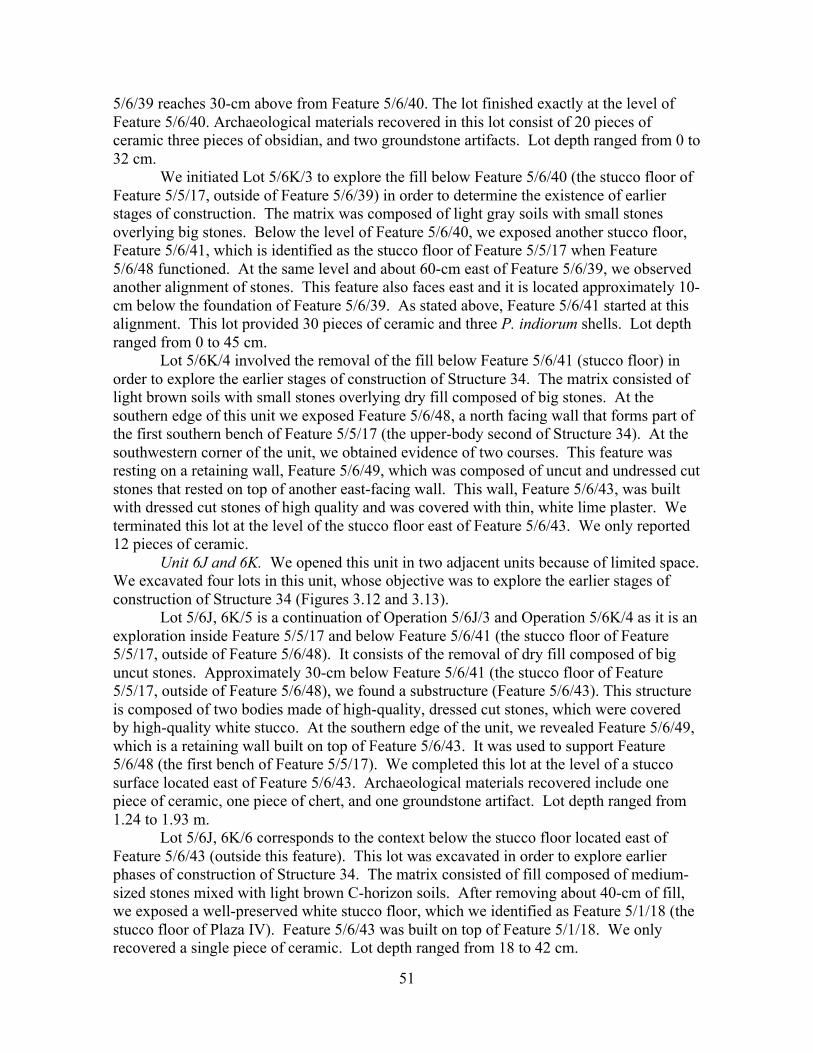
51
5/6/39 reaches 30-cm above from Feature 5/6/40. The lot finished exactly at the level of Feature 5/6/40. Archaeological materials recovered in this lot consist of 20 pieces of ceramic three pieces of obsidian, and two groundstone artifacts. Lot depth ranged from 0 to 32 cm.
We initiated Lot 5/6K/3 to explore the fill below Feature 5/6/40 (the stucco floor of Feature 5/5/17, outside of Feature 5/6/39) in order to determine the existence of earlier stages of construction. The matrix was composed of light gray soils with small stones overlying big stones. Below the level of Feature 5/6/40, we exposed another stucco floor, Feature 5/6/41, which is identified as the stucco floor of Feature 5/5/17 when Feature 5/6/48 functioned. At the same level and about 60-cm east of Feature 5/6/39, we observed another alignment of stones. This feature also faces east and it is located approximately 10-cm below the foundation of Feature 5/6/39. As stated above, Feature 5/6/41 started at this alignment. This lot provided 30 pieces of ceramic and three P. indiorum shells. Lot depth ranged from 0 to 45 cm.
Lot 5/6K/4 involved the removal of the fill below Feature 5/6/41 (stucco floor) in order to explore the earlier stages of construction of Structure 34. The matrix consisted of light brown soils with small stones overlying dry fill composed of big stones. At the southern edge of this unit we exposed Feature 5/6/48, a north facing wall that forms part of the first southern bench of Feature 5/5/17 (the upper-body second of Structure 34). At the southwestern corner of the unit, we obtained evidence of two courses. This feature was resting on a retaining wall, Feature 5/6/49, which was composed of uncut and undressed cut stones that rested on top of another east-facing wall. This wall, Feature 5/6/43, was built with dressed cut stones of high quality and was covered with thin, white lime plaster. We terminated this lot at the level of the stucco floor east of Feature 5/6/43. We only reported 12 pieces of ceramic.
Unit 6J and 6K. We opened this unit in two adjacent units because of limited space. We excavated four lots in this unit, whose objective was to explore the earlier stages of construction of Structure 34 (Figures 3.12 and 3.13).
Lot 5/6J, 6K/5 is a continuation of Operation 5/6J/3 and Operation 5/6K/4 as it is an exploration inside Feature 5/5/17 and below Feature 5/6/41 (the stucco floor of Feature 5/5/17, outside of Feature 5/6/48). It consists of the removal of dry fill composed of big uncut stones. Approximately 30-cm below Feature 5/6/41 (the stucco floor of Feature 5/5/17, outside of Feature 5/6/48), we found a substructure (Feature 5/6/43). This structure is composed of two bodies made of high-quality, dressed cut stones, which were covered by high-quality white stucco. At the southern edge of the unit, we revealed Feature 5/6/49, which is a retaining wall built on top of Feature 5/6/43. It was used to support Feature 5/6/48 (the first bench of Feature 5/5/17). We completed this lot at the level of a stucco surface located east of Feature 5/6/43. Archaeological materials recovered include one piece of ceramic, one piece of chert, and one groundstone artifact. Lot depth ranged from 1.24 to 1.93 m.
Lot 5/6J, 6K/6 corresponds to the context below the stucco floor located east of Feature 5/6/43 (outside this feature). This lot was excavated in order to explore earlier phases of construction of Structure 34. The matrix consisted of fill composed of medium-sized stones mixed with light brown C-horizon soils. After removing about 40-cm of fill, we exposed a well-preserved white stucco floor, which we identified as Feature 5/1/18 (the stucco floor of Plaza IV). Feature 5/6/43 was built on top of Feature 5/1/18. We only recovered a single piece of ceramic. Lot depth ranged from 18 to 42 cm.
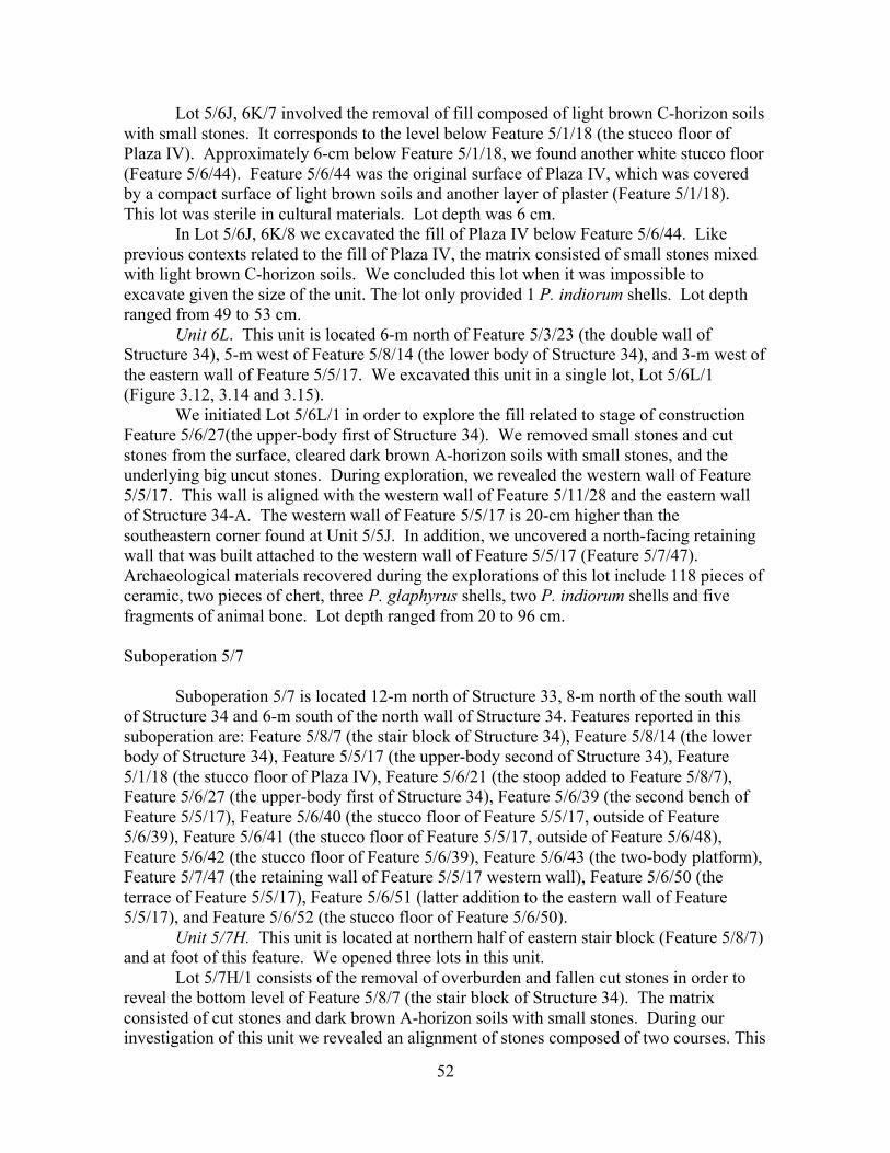
52
Lot 5/6J, 6K/7 involved the removal of fill composed of light brown C-horizon soils with small stones. It corresponds to the level below Feature 5/1/18 (the stucco floor of Plaza IV). Approximately 6-cm below Feature 5/1/18, we found another white stucco floor (Feature 5/6/44). Feature 5/6/44 was the original surface of Plaza IV, which was covered by a compact surface of light brown soils and another layer of plaster (Feature 5/1/18). This lot was sterile in cultural materials. Lot depth was 6 cm.
In Lot 5/6J, 6K/8 we excavated the fill of Plaza IV below Feature 5/6/44. Like previous contexts related to the fill of Plaza IV, the matrix consisted of small stones mixed with light brown C-horizon soils. We concluded this lot when it was impossible to excavate given the size of the unit. The lot only provided 1 P. indiorum shells. Lot depth ranged from 49 to 53 cm.
Unit 6L. This unit is located 6-m north of Feature 5/3/23 (the double wall of Structure 34), 5-m west of Feature 5/8/14 (the lower body of Structure 34), and 3-m west of the eastern wall of Feature 5/5/17. We excavated this unit in a single lot, Lot 5/6L/1 (Figure 3.12, 3.14 and 3.15).
We initiated Lot 5/6L/1 in order to explore the fill related to stage of construction Feature 5/6/27(the upper-body first of Structure 34). We removed small stones and cut stones from the surface, cleared dark brown A-horizon soils with small stones, and the underlying big uncut stones. During exploration, we revealed the western wall of Feature 5/5/17. This wall is aligned with the western wall of Feature 5/11/28 and the eastern wall of Structure 34-A. The western wall of Feature 5/5/17 is 20-cm higher than the southeastern corner found at Unit 5/5J. In addition, we uncovered a north-facing retaining wall that was built attached to the western wall of Feature 5/5/17 (Feature 5/7/47). Archaeological materials recovered during the explorations of this lot include 118 pieces of ceramic, two pieces of chert, three P. glaphyrus shells, two P. indiorum shells and five fragments of animal bone. Lot depth ranged from 20 to 96 cm.
Suboperation 5/7
Suboperation 5/7 is located 12-m north of Structure 33, 8-m north of the south wall
of Structure 34 and 6-m south of the north wall of Structure 34. Features reported in this suboperation are: Feature 5/8/7 (the stair block of Structure 34), Feature 5/8/14 (the lower body of Structure 34), Feature 5/5/17 (the upper-body second of Structure 34), Feature 5/1/18 (the stucco floor of Plaza IV), Feature 5/6/21 (the stoop added to Feature 5/8/7), Feature 5/6/27 (the upper-body first of Structure 34), Feature 5/6/39 (the second bench of Feature 5/5/17), Feature 5/6/40 (the stucco floor of Feature 5/5/17, outside of Feature 5/6/39), Feature 5/6/41 (the stucco floor of Feature 5/5/17, outside of Feature 5/6/48), Feature 5/6/42 (the stucco floor of Feature 5/6/39), Feature 5/6/43 (the two-body platform), Feature 5/7/47 (the retaining wall of Feature 5/5/17 western wall), Feature 5/6/50 (the terrace of Feature 5/5/17), Feature 5/6/51 (latter addition to the eastern wall of Feature 5/5/17), and Feature 5/6/52 (the stucco floor of Feature 5/6/50).
Unit 5/7H. This unit is located at northern half of eastern stair block (Feature 5/8/7) and at foot of this feature. We opened three lots in this unit.
Lot 5/7H/1 consists of the removal of overburden and fallen cut stones in order to reveal the bottom level of Feature 5/8/7 (the stair block of Structure 34). The matrix consisted of cut stones and dark brown A-horizon soils with small stones. During our investigation of this unit we revealed an alignment of stones composed of two courses. This
53
east-facing alignment, Feature 5/6/21, is 40-cm high and 3-m long (North-South) and is a later addition to Feature 5/8/7 (the stair block of Structure 34). We terminated this lot at the level of the top of Feature 5/6/21 (the stoop added to Feature 5/8/7). We reported 118 pieces of ceramic, four pieces of chert, nine P. glaphyrus shells, six P. indiorum shells, one groundstone artifact and three fragments of animal bone. Lot depth ranged from 3 to 66 cm.
Lot 5/7H/3 involved the removal of fill of Feature 5/6/21 in order to reveal the foundation of Feature 5/8/7 (the stair block of Structure 34). The fill consisted of small stones with dark brown A-horizon soils. Feature 5/6/21 was built over the bottom two steps of Feature 5/8/7 (the stair block of Structure 34). This later addition covers most of the stair block except for both corner stones. This lot finished at the level of the subfloor ballast of Plaza IV. During the explorations of this lot, we unearthed 32 pieces of ceramic, two pieces of chert, five P. glaphyrus shells, and four P. indiorum shells. Lot depth ranged from 0 to 10 cm.
We opened Lot 5/7H/4 to explore the area below the subfloor ballast of Plaza IV in order to test the presence of offerings and burials. The matrix consisted of sediments derived from a mixture of dark brown A-horizon soils with light brown C-horizon soils and small stones. We observed retaining walls running Northwest-Southeast through the unit. This lot was almost sterile in cultural materials. We only reported 17 pieces of ceramic, one piece of chert, and one P. glaphyrus shells. Lot depth ranged from 77 cm to 1.20 m.
Unit 5/7I. This unit is located over the northern section of Feature 5/8/7 (the stair block of Structure 34) and over Feature 5/8/14 (the lower body of Structure 34). Two lost were opened in this unit.
Lot 5/7I /1 consisted of the removal of slump and overburden consisting of cut stones, small stones and dark brown A-horizon soils in order to reveal Feature 5/8/7 (the stair block of Structure 34) and Feature 5/8/14 (the lower body of Structure 34). We revealed Feature 5/8/7, which consisted of two steps (plus two more covered by Feature 5/6/21). In addition, we uncovered Feature 5/8/14, upon which we discovered a fifth step. The explorations provided 142 pieces of ceramic, one piece of chert, ten pieces of obsidian, four P. glaphyrus shells, one groundstone artifact, one fragment of animal bone, and one fragment of figurine. Lot depth ranged from 9 to 71 cm.
We opened Lot 5/7I /3 with the purpose of exploring the fill below the stucco floor of Plaza IV. We started this lot after Feature 5/8/7 was dismantled. The matrix consisted of sediments derived from a mixture of dark brown A-horizon soils with light brown C-horizon soils and small stones. We observed retaining walls running Northwest-Southeast through the unit. This lot did not provide cultural materials. Lot depth ranged from 32 to 46 cm.
Unit 5/6I and 7I. This unit is located alongside Feature 5/8/14, directly over Feature 5/8/7 (the stair block of Structure 34). It covered the entire area of the stair block. We excavated this unit in two lots.
We opened Lot 5/ 6I, 7I /4 (as a continuation of Lot 5/7I/3) with the purpose of exploring Feature 5/8/7 (the stair block of Structure 34). This lot corresponds to the fill of Feature 5/8/7, which we dismantled in order to reset the wall for consolidation. During the exploration, we removed small and medium stones mixed with dark brown A-horizon soils. This context confirmed the fact that Feature 5/8/7 was built attached to Feature 5/8/14. We also determine that the interior of Feature 5/8/7 was filled with uncut stones and soils. During the removal of Feature 5/8/7 fill, we reported 148 pieces of ceramic, one piece of

54
chert, three pieces of obsidian, five P. glaphyrus shells, seven P. indiorum shells, one groundstone artifact, and one fragment of human bone.
In Lot 5/6I, 7I/5 we excavated Feature 5/8/14 (the lower body of Structure 34) in order to reset its stones as part of the consolidation process. We conducted this exploration before resetting Feature 5/8/7 (the stair block of Structure 34). This exploration only provided 16 pieces of ceramic.
Unit 5/7J. This unit is located atop Structure 34, alongside Feature 5/6/27 (the upper-body first of Structure 34), 8-m north from Feature 5/3/23 (the south double wall of Structure 34), and 6-m south from Feature the northern wall of 5/11/28. We excavated three lots within this unit (Figure 3.1).
Lot 5/7J/1 involved the removal of overburden and fill in order to reach the level of Feature 5/6/40 (the stucco floor of Feature 5/5/17, outside of Feature 5/6/39) and to find its eastern wall. The matrix consisted of cut stones on top of the surface and the underlying dark brown A-horizon soils mixed with small and medium uncut and cut stones. We revealed the eastern wall of Feature 5/5/17 and Feature 5/6/40 (the stucco floor of Feature 5/5/17, outside of Feature 5/6/39), which was badly preserved. We reported 59 pieces of ceramic, three pieces of chert, six P. glaphyrus shells, 2 groundstone artifacts, and ten fragments of figurines. Lot depth ranged from 61 to 85 cm.
We opened Lot 5/7J/2 with the purpose of removing the fill between Feature 5/6/27 (the upper-body first of Structure 34) and the eastern wall of Feature 5/5/17 (the upper-body second of Structure 34). We dismantled of Feature 5/6/27 in order to strengthen it and reset it. The matrix consisted of small and medium stones with dark brown A-horizon soils. After dismantling approximately 80-cm (6 courses) of Feature 5/6/27, we revealed Feature 5/6/52. This is a stucco surface that covered Feature 5/6/50, a terrace located in front of Feature 5/5/17 (the lower body of Structure 34) that rises about 40-cm from the basal level of Feature 5/8/14 (the lower body of Structure 34). Therefore, Feature 5/6/27 was built using Feature 5/6/50 as a foundation. In addition, these explorations confirmed that around 40-cm (or 2-3 stones) of the eastern wall of Feature 5/5/17 are a later addition. This expansion of Feature 5/5/17, Feature 5/6/51, is differentiated from the original wall because its stone were thinner and smaller than those that comprise Feature 5/5/17. Materials recovered include 29 pieces of ceramic and 1 fragment of shell.
Lot 5/7J/3 entailed the exploration of the level below Feature 5/6/52 (the stucco floor of Feature 5/6/50) in order to obtain materials and uncover the foundation of Feature 5/5/17. The excavation of this lot was part of the consolidation of Feature 5/6/50 and Feature 5/6/27. The matrix consisted of white lime plaster and the underlying dark brown A-horizon soils mixed with small stones. Based on this excavation, we were to confirm that the foundation of Feature 5/5/17 was resting on top of Feature 5/8/14 (the lower body of Structure 34). We reported 23 pieces of ceramic and one fragment of shell.
Unit 5/7K. This unit is located 8-m north of Feature 5/3/23 (the southern double wall of Structure 34), 6-m south of Feature 5/11/28’s northern wall, and 1-m west of Feature 5/5/17 eastern wall. We opened just a single lot within this unit (Figures 3.6 and 3.14).
Lot 5/7K/1 involved the removal of overburden and fill in order to reach the level of Feature 5/6/40 (the stucco floor of Feature 5/5/17) as well as to find Feature 5/6/39 (the second bench of Feature 5/5/17) and uncover Feature 5/6/42 (the stucco floor of Feature 5/6/39). The matrix consisted of cut stones on top of the surface followed by dark brown A-horizon soils mixed with small and medium uncut and cut stones. Our excavations
55
uncovered Feature 5/6/39 (the second bench of Feature 5/5/17). In addition we unearthed Feature 5/6/40, the stucco floor of Feature 5/5/17 when Feature 5/6/39 was in function, as well as Feature 5/6/42, the stucco floor that functioned as surface of Feature 5/6/39. This section of the structure was sunken. Exploration provided 38 pieces of ceramic and one groundstone artifact. Lot depth ranged from 25 to 48 cm.
Unit 5/7L. This unit is located 8-m north of Feature 5/3/23 (the southern double wall of Structure 34), 6-m south of the northern wall of Feature 5/11/28, and 3-m west of the eastern wall of Feature 5/5/17. We excavated this unit in a single lot (Figure 3.14 and 3.15).
Lot 5/7L/1 entailed clearing the overburden and platform fill in order to reach the level of Feature 5/6/42 (the stucco floor of Feature 5/6/39) and to find the western wall of Feature 5/5/17 (the upper-body second of Structure 34). The matrix consisted of cut stones on top of surface and the underlying dark brown A-horizon soils mixed with small and medium uncut and cut stones. Our excavations revealed the western wall of Feature 5/5/17 and Feature 5/6/42 (the stucco floor of Feature 5/6/39), which was poorly preserved. Materials recovered include 29 pieces of ceramic, two pieces of chert, three pieces of obsidian, and two groundstone artifacts. Lot depth ranged from 31 to 73 cm.
Unit 5/6K, 6L, 7K, and 7L. This is a 2-m by 2-m unit located at along the central East-West axis of Feature 5/6/39 (the second bench of Feature 5/6/17). It is situated 3.50-m north of the southern wall of Feature 5/6/17 and between the eastern wall of Feature 5/6/39 and the eastern wall of Feature 5/5/17. We excavated five lots in this unit that corresponded to three different contexts, which are a continuation of the lots explored in units 5/6K, 5/6L, 5/7K and 5/7L. This lot was sterile in cultural materials (Figure 3.14).
We opened Lot 5/6K, 6L, 7K, 7L/2 and Lot 5/6K, 6L, 7K, 7L/3 with specific purpose of exploring Feature 5/6/39 below Feature 5/6/42 (the stucco floor of Feature 5/6/39). The matrix consisted of white lime plaster and the underlying medium stones mixed with light brown soils used as ballast and fill. We exposed another stucco floor (Feature 5/6/45) below Feature 5/6/42 (stucco floor), which we found in poor condition. In fact, we found evidence of burning at the northwestern corner of this unit. However, further explorations allow to find out that Feature 5/6/42 and Feature 5/6/45 were, in fact, the same stucco floor. The impression of being two different features was due to the fact that the area was sunken. We reported five pieces of ceramic and one P. indiorum shells. Depth of Lot 5/6K, 6L, 7K, 7L/2 and Lot 5/6K, 6L, 7K, 7L/3 ranged from 4 to 29 cm and from 6 to 12 cm, respectively.
Lot 5/6K, 6L, 7K, 7L/4 consisted of the clearing of the fill below Feature 5/6/42 in order to find Feature 5/6/43 (the two-body platform). The matrix consisted of sediments derived from a mixture of light brown C-horizon soils and dark brown A-horizon soils with small and big stones. During our excavations, we found another west-facing retaining wall (Feature 5/6/47) at the western edge of the unit. This feature was used as a wall to retain the fill of Feature 5/5/17. It was collapsed in antiquity and only the foundation was found in situ, however, it was possible to observe at the profile of unit that this wall had four courses of undressed cut stones. In addition, we revealed the second-body northern wall of Feature 5/6/43 at the southern edge of the unit, approximately 80-cm below Feature 5/6/42. The quality and preservation of the building is good. The lot finished 30-cm below the top of Feature 5/6/43 where we detected chunks of white lime plaster that were the remains of a stucco floor. The explorations of this lot provided 50 pieces of ceramic, one piece of chert and one P. indiorum shell. Lot depth ranged from 54 cm to 1.13 m.
56
Lot 5/6K, 6L, 7K, 7L/5 is a continuation of Lot 5/6K, 6L, 7K, 7L/4. It consisted of
the removal of fill consisting of big uncut stones mixed with sediments derived from a mixture of light brown C-horizon soils and dark brown A-horizon soils and clay. We found the first body of Feature 5/6/43. The first body of Feature 5/6/43 was located 40-cm below the top of the second body of Feature 5/6/43 and 1.10-m north of the second body. Atop the first body of Feature 5/6/43, we found a huge concentration of charcoal and chunks of white lime plaster, but we did not detect a prepared plaster surface in this area. This lot also included the exploration of the area north of (outside of) the first body of Feature 5/6/43’s first body. Nonetheless, we had to terminate this lot before we exposed Feature 5/1/18 due to lack of space in the unit. We reported few materials: 14 pieces of ceramic and five pieces of chert. Lot depth ranged from 43 to 87 cm.
We opened Lot 5/6K, 6L, 7K, 7L/6 in order to explore the fill located south of (inside) the second-body north wall of Feature 5/6/43. The goal of this lot was to determine the height of the second body of Feature 5/6/43. The matrix consisted of big uncut stones with sediments derived from a mixture of light brown C-horizon soils and dark brown A-horizon soils. During our excavations we were able to determine that the second body of Feature 5/6/43 is composed of eight courses of high-quality dressed cut stones that rest directly on top of Feature 5/1/18 (the stucco floor of Plaza IV). This wall has stucco floor covering some bottom stones. Based on this evidence we suggest that the first body was a later addition. This lot was sterile in cultural materials. Lot depth ranged from 6 cm to 1.83 m.
Suboperation 5/8
Suboperation 5/8 is situated 14-m north of Structure 33, 10-m north of the southern
wall of Structure 34 and 4-m south of the northern wall of Structure 34. Features reported in this suboperation include Feature 5/8/5 (the retaining wall of Plaza IV), Feature 5/8/6 (the square-stair outset of Feature 5/8/7), Feature 5/8/7 (the stair block of Structure 34), Feature 5/8/8 (the retaining wall of Plaza IV), Feature 5/8/9 (the retaining wall of Plaza IV), Feature 5/8/10 (the retaining wall of Plaza IV), Feature 5/8/14 (the lower body of Structure 34), Feature 5/8/15 (the retaining wall of Feature 5/8/14), Feature 5/5/17 (the upper-body second of Structure 34), Feature 5/1/18 (the stucco floor of Plaza IV), Feature 5/8/21 (the stoop added to Feature 5/8/7), Feature 5/6/27 (the upper-body first of Structure 34), Feature 5/11/28 (the shrine platform), Feature 5/6/39 (the second bench of Feature 5/5/17), Feature 5/6/40 (the stucco floor of Feature 5/5/17, outside Feature 5/6/39), Feature 5/6/41 (the stucco floor of Feature 5/5/17, outside Feature 5/6/39), Feature 5/6/50 (the terrace of Feature 5/5/17), Feature 5/6/51 (the later addition to the eastern wall of Feature 5/5/17), Feature 5/6/52 (the stucco floor of Feature 5/6/50), Feature 5/8/57 (the first north bench of Feature 5/5/17), Feature 5/8/58 (the retaining wall of Feature 5/5/17), Feature 5/8/59 (the stucco floor used to cover Feature 5/8/62), Feature 5/8/60 (the polychrome sherds above Feature 5/8/59), Feature 5/8/62 (the superstructure of Feature 5/11/28) and Feature 5/8763 (the stucco floor of Feature 5/8/62).
Unit 8G. This 2-m by 2-m unit is located east of Structure 34. Its purpose is to explore the Plaza IV adjacent to Structure 34. We excavated this unit in two lots.
Lot 5/8G/1 entailed the excavation of the modern overburden above the level of Plaza IV. This modern overburden consisted of grass and dark brown A-horizon soils with

57
small stones. We found three features during the removal of this layer. Feature 5/8/5 consists of a single course of uncut stones that faces northeast. Features 5/8/9 and 5/8/10 are also built with uncut stones and are attached to the northeastern face of Feature 5/8/5. Feature 5/8/9 faces northwest and Feature 5/8/10 faces southeast. That is, they face each other. We interpret these features as retaining walls for Plaza IV fill. We terminated this lot at the level of the subfloor ballast of Plaza IV. This lot provided 42 pieces of ceramic and three P. glaphyrus shells. Lot depth ranged from 38 to 47 cm.
In Lot 5/8G/2 we excavated the fill between Features 5/8/9 and 5/8/10. Initially, we thought this area contained a cist burial, however, we did not find any human remains or evidence of a burial. Instead, we found that Features 5/8/5, 5/8/9 and 5/8/10 are contention walls similar to Feature 4/13/2 reported in Units 13A and 13G. The matrix of the subfloor ballast of Plaza IV consists of small stones and light brown C-horizon soils. We did not find any cultural materials within this context. We terminated this lot when we encountered large fillstones of the plaza fill. Lot depth ranged from 56 to 65 cm.
Unit 8H. This unit covers an area of 2-m by 2-m and is located about 1-m east of Feature 5/8/14 (the lower body of Structure 34) and immediately north of Feature 5/6/21 (the stoop added to Feature 5/8/7). The purpose of this unit was to find the northern edge of Feature 5/8/7 (the stair block of Structure34), as well as to determine if Structure 34 had an outset stair. We excavated this unit in a single lot.
Lot 5/8H/1 consisted of the removal of cut stones coming from elsewhere and overburden consisting of dark brown A-horizon soils with small stones and some cut stones that had collapsed from Structure 34. We identified three features within this context. Feature 5/8/6 is located immediately north of Feature 5/8/7 and is attached to Feature 5/8/14 (the lower body of Structure 34). Because of this characteristic, we suggested that Feature 5/8/6 might have been a stair outset. We were able to uncover only the northeastern corner of Feature 5/8/7, which is very poorly preserved as most of its cornerstones had collapsed. Feature 5/8/6 and Feature 5/8/7 rested on the subfloor ballast of Plaza IV. Feature 5/8/8 corresponds to a retaining wall composed of uncut stones within the fill of Plaza IV. The uppermost course of this feature rests on the subfloor ballast of Plaza IV. We terminated this lot at the level of the subfloor ballast of Plaza IV. During the explorations of this lot, we reported 60 pieces of ceramic, one piece of obsidian, four P. glaphyrus shells, and three P. indiorum shells. Lot depth ranged from 15 to 63 cm.
Unit 5/8I. This unit is located atop Feature 5/8/14 and Feature 5/8/8, and is situated immediately north of Feature 5/8/7. We opened two lots within this unit, which correspond to two contexts.
Lot 5/8I/1 involved the removal of slump and overburden consisting of dark brown A-horizon soils in order to confirm that Feature 5/8/6 was a stair outset. The dimensions of this feature are 1.10-m by 1.20-m. The foundation of this feature rests on the subfloor ballast of Plaza IV. We identified at least three courses of stones (two collapsed eastward), which rise approximately 60-cm above the subfloor ballast of Plaza IV. We first observed Feature 5/8/14 and Feature 5/8/15 in this unit. Feature 5/8/14 is the lower body of Structure 34, which was built with east-facing dressed cut stones that rest on the subfloor ballast of Plaza IV. This wall raises 1-m above the subfloor ballast Plaza IV, but may have been higher. Feature 5/8/15 also faces east. It is located 70-cm west of Feature 5/8/14 and is composed of three courses of undressed stones. This feature rises 70-cm higher than Feature 5/8/14. Feature 5/8/15 is a wall constructed of undressed cut stones that was placed in order to support Feature 5/6/14. Archaeological materials reported during the
58
explorations of this lot include 104 pieces of ceramic, ten P. glaphyrus shells and four P. indiorum shells. Lot depth ranged from 18 to 86 cm.
Lot 5/8I/2 and Lot 5/8I/3 entailed the exploration of the fill inside the stair outset (Feature 5/8/6). The goals of these excavations were to reveal the northern edge of Feature 5/8/7 and to explore the area inside Feature 5/8/6. The lot covers an area of 90-cm by 90-cm. The matrix consists of dark brown A-horizon soils with small stones. We uncovered both the northern edge and foundation of Feature 5/8/7 (the stair block of Structure 34). The foundation stones of this feature are dressed cut stones that rest directly on top of the subfloor ballast of Plaza IV. The upper stones of the northern edge were smaller and less finely cut. Additionally, these stones were deposited 12-cm south of the edge of the foundation and covered by Feature 5/8/6. We terminated this lot at the stucco floor Feature 5/1/18, which was well preserved in this location. The excavation of the Feature 5/8/6 fill provided 69 pieces of ceramic, one piece of chert, two pieces of obsidian, four P. glaphyrus shells, and five P. indiorum shells. Lot depth ranged from 2 to 92 cm.
Unit 5/8J. This unit is located immediately west of Feature 5/6/27 (the upper-body first of Structure 34) and 4-m south of the northern wall of Feature 5/11/28. We opened three lots in this unit (Figures 3.5 and 3.16).
Lot 5/8J/1 involved the removal of the overburden and slump in order to reach the level of the eastern wall of Feature 5/5/17. The matrix consisted of small and cut stones above the surface and the underlying dark brown A-horizon soils with small stones, uncut big stones, and cut stones. In this lot we revealed the eastern wall of Feature 5/5/17 and Feature 5/6/40 (the stucco floor of Feature 5/5/17, outside Feature 5/6/39). At the northern edge of this unit, we uncovered a south-facing wall, which we interpret as the northern section of Feature 5/6/39. This evidence confirms our suspicion that that this feature was a C-shaped bench. Cultural materials unearthed include 35 pieces of ceramic, one piece of chert, one P. indiorum shells and one fragment of shell. Lot depth ranged from 53 to 96 cm.
Lot 5/8J/2 is similar to Lot 5/7J/2. We initiated this lot with the purpose of removing the fill between Feature 5/6/27 (the upper-body first of Structure 34) and the eastern wall of Feature 5/5/17 (the upper-body second of Structure 34). We dismantled Feature 5/6/27 in order to stabilize it as part of our consolidation efforts. The matrix was composed of small and medium stones with dark brown A-horizon soils. After we dismantled some stones of Feature 5/6/27, we exposed a portion of Feature 5/6/52, which is the stucco surface that covered Feature 5/6/50. Feature 5/6/50 is a terrace located in front of Feature 5/5/17 (the lower body of Structure 34) that rose approximately 40-cm from the basal level of Feature 5/8/14 (The lower body of Structure 34). Based on this evidence we determined that Feature 5/6/27 was built using Feature 5/6/50 as its foundation. In addition, these explorations confirmed that about 40 cm (or 2-3 stones) of the eastern wall of Feature 5/5/17 were a later addition. This extension of Feature 5/5/17 is labeled as Feature 5/6/51. As mentioned above, Feature 5/6/51 is contemporaneous with the Feature 5/6/39 (the second bench of Feature 5/5/17). This addition could be differentiated from the original wall because its stones were thinner and smaller than the original wall of Feature 5/5/17. The corner stones belonging the northeastern corner of Feature 5/8/57 (the first northern bench of Feature 5/5/17) were identified at the middle of this unit. We only recovered 20 pieces of ceramic.
Lot 5/8J/3 is similar to Lot 5/7J/3 in that it corresponds to exploration of the level below Feature 5/6/52 (the stucco floor of Feature 5/6/50). We initiated this lot in order to
59
obtain materials and uncover the foundation of Feature 5/5/17. Moreover, this exploration was part of our consolidation efforts aimed at stabilizing Feature 5/6/50 (the terrace of Feature 5/5/17) and Feature 5/6/27 (the upper-body first of Structure 34). The matrix consisted of white lime plaster followed by dark brown soils A-horizon mixed with small stones. Based on the evidence drawn from this context we concluded that the foundation of Feature 5/5/17 was resting on top of Feature 5/8/14 (the lower body of Structure 34). Materials reported in this lot are 18 pieces of ceramic and one P. glaphyrus shell.
Unit 5/8K. This unit is located 4-m south of the northern wall of Feature 5/11/28, 10-m north of Feature 5/3/23 (the south double wall of Structure 34), and about 3-m west of Feature 5/8/14 (the lower body of Structure 34). We opened a single lot in this unit (Figures 3.6 and 3.16).
We opened Lot 5/8K/1 to remove the fill and overburden in order to find Feature 5/6/39 (the second bench of Feature 5/5/17) and reach the level of Feature 5/6/40 (the stucco floor of Feature 5/5/17, outside of Feature 5/6/39) and Feature 5/6/42 (the stucco floor of Feature 5/6/39). The matrix consisted of small and cut stones on the surface and the underlying dark brown A-horizon soils mixed with big uncut stones and cut stones. In the middle of the unit we uncovered the eastern and northern walls of Feature 5/6/39. In addition, we exposed Feature 5/6/42 (the stucco floor of Feature 5/6/39) inside Feature 5/6/39, although it was poorly preserved. Outside of Feature 5/6/39 (east and south) we encountered Feature 5/6/40 (the stucco floor of Feature 5/5/17, outside of Feature 5/6/39), which we also found in a state of poor preservation. This stucco floor terminated at Feature 5/6/39. We reported a few archaeological artifacts: 17 pieces of ceramic, seven pieces of chert, one P. glaphyrus shells, one P. indiorum shells, two fragments of animal bone and one fragment of shell. Lot depth ranged from 37 to 68 cm.
Unit 5/8J and 8K. We placed this unit inside Feature 5/5/17 and outside of Feature 5/6/39. We excavated this unit in four lots that are related to four different contexts. They are a continuation of the lots opened in the Units 8J and 8K (Figure 3.16).
Lot 5/8J, 8K/5 involved the exploration of the level below Feature 5/6/40 in order to determine if Feature 5/5/17 was a C-shaped structure since its initial construction. The matrix included white lime plaster and the underlying sediments derived from a mixture of dark brown A-horizon soils and light brown C-horizon soils with small stones. We revealed Feature 5/6/41 (the stucco floor of Feature 5/5/17, outside of Feature 5/6/48). This context only provided three pieces of ceramic. Lot depth ranged from 15 to 26 cm.
In Lot 5/8J, 8K/6 we explored the level below Feature 5/6/41 (the stucco floor of Feature 5/5/17, outside of Feature 5/6/39) with the goal of testing if Feature 5/5/17 (the upper-body second of Structure 34) was a C-shaped structure since its first moment of construction. The matrix consisted of sediments derived from a mixture of dark brown A-horizon soils and light brown C-horizon soils with small and medium stones. Below Feature 5/6/41, we uncovered Feature 5/8/57, a south-facing wall that was first reported at Lot 5/8K, 8L/3. This wall is an alignment of a single course of stones. This feature is similar to Feature 5/6/48. We interpret this feature as the first bench of Feature 5/5/17, therefore, we conclude that there were two moments of construction of Feature 5/5/17, however, this feature was C-shaped throughout its occupation history. We unearthed 25 pieces of ceramic and one piece of obsidian. Lot depth ranged from 25 to 37 cm.
Lot 5/8J, 8K/8 consists of the removal of material from the area below Feature 5/8/57 (the first northern bench of Feature 5/5/17). The goal of this lot was to uncover Feature 5/11/28 (the shrine platform), which we discovered previously in Suboperation 11.
60
This context corresponds to fill, which is composed of yellow soils with small stones. We terminated this lot at the level of Feature 5/8/59, a well-preserved stucco floor that was used to cover Feature 5/11/28 (Feature 5/8/62). This lot provided two pieces of ceramic. Lot depth ranged from 6 to 21 cm.
Lot 5/8J, 8K/9 involved the clearing of materials below Feature 5/8/59 in order to uncover the southeastern corner of the superstructure of Feature 5/11/28 (Feature 5/8/62). The matrix consisted of small and medium uncut stones with yellow soils. After we removed the fill, we exposed the southeastern corner of Feature 5/8/62 (the superstructure of Feature 5/11/28). The eastern wall of this superstructure is a double wall. The southern wall was not visible due to the fact that Feature 5/8/59 (the stucco floor covering Feature 5/8/62) rested on top of this wall. We also uncovered the interior of Feature 5/8/62 (the superstructure of Feature 5/11/28). We terminated this lot at the level of Feature 5/8/63 or the stucco floor of Feature 5/8/62. This lot was sterile in cultural materials. Lot depth ranged from 23 to 52 cm.
Unit 5/8L. This unit is located atop Structure 34, 4-m south of the northern wall of Feature 5/11/28, 10-m north of Feature 5/3/23 (the south double wall of Structure 34), and approximately 5-m west of Feature 5/8/14 (). We excavated (the lower body of Structure 34) this unit in a single lot (Figures 3.16 and 3.17).
Lot 5/8L/1 consists of the removal of small stones and cut stones on the surface and the underlying dark brown A-horizon soils mixed with uncut and cut stones. The goal of this lot was to explore the fill related to the stage of construction of Feature 5/6/27 and to find the northwestern corner of Feature 5/5/17. After removing the fill, we exposed the western wall of Feature 5/5/17, which continued to the north. This feature followed the western wall of Feature 5/11/28 (the shrine platform). It is possible that the western wall of Feature 5/5/17 (the upper-body second of Structure 34) was built on top of the western wall of Feature 5/11/28 (the shrine platform). We reported seven pieces of ceramic. Lot depth ranged from 29 to 91 cm.
Unit5/ 8K and 8L. This unit is located inside Feature 5/6/39 (the second bench of Feature 5/5/17). We opened this unit specifically to explore Feature 5/11/28 (the shrine platform) and Feature 5/8/62 (the superstructure of Feature 5/11/28). We excavated this unit in four lots, which is a continuation of the lots opened in the Units 5/8K and 5/8L (Figure 3.16).
Lot 5/8K, 8L/2 consisted of the removal of the ballast and fill below the level of Feature 5/6/42 (the stucco floor of Feature 5/6/39) in order to explore earlier phases of construction, especially the first moment of Feature 5/5/17. The matrix consisted of white lime plaster followed by small stones with sediments derived from dark brown A-horizon soils with light brown C-horizon soils. Our excavations revealed what we thought was a poorly preserved stucco floor below Feature 5/6/42 (Feature 5/6/45). Further excavations showed that this stucco floor was the same that Feature 5/6/42. Feature 5/6/45 appeared to be a different surface due to the fact the area was sunken. Therefore, Lot 5/8K, 8L/2 must be considered as the same context that Lots 5/8K/1 and 5/8L/1. In addition, at the southern edge of the unit we uncovered a two-course alignment composed of three stones. This feature (Feature 5/8/58) is a retaining wall built to reinforce Feature 5/5/17 fill. Lot 5/8K, 8L/2 provided 54 pieces of ceramic, two pieces of chert and two fragments of human bones. Lot depth ranged from 20 to 28 cm.
We excavated Lot 5/8K, 8L/3 in order to explore the level below Feature 5/6/45 or Feature 5/6/42 (the stucco floor of Feature 5/6/39) and expose the southern wall of Feature
61
5/6/62 (the superstructure of Feature 5/11/28). The matrix consisted of small and medium stones with sediments derived from a mixture of dark brown A-horizon soils and light brown C-horizon soils. After we removed the fill, we revealed a south-facing wall. This wall, F. 5/8/57, consisted of a single course of stones resting on fill. Based on these excavations we interpret this feature as part of the first northern bench of Feature 5/5/17. In addition, we observed that Feature 5/8/58 (the retaining wall of Feature 5/5/17) was resting directly on fill. We unearthed 73 pieces of ceramic, two pieces of chert, one piece of obsidian and one fragment of figurine. Lot depth ranged from 20 to 40 cm.
We opened Lot 5/8K, 8L/4 to explore the area below Feature 5/6/42 (the stucco floor of Feature 5/6/39) and north of (inside of) Feature 5/8/57 (the first northern bench of Feature 5/5/17). After we removed the fill, which consisted of light brown C-horizon soils with few small stones, we revealed a stucco floor (Feature 5/8/59). Just above Feature 5/8/59, we found an offering consisting of 12 polychrome sherds (Feature 5/8/60). Those sherds were the only artifacts recovered in this lot. Lot depth ranged from 3 to 26 cm.
We initiated Lot 5/8K, 8L/7 to explore the level below Feature 5/8/59 (the stucco floor covering Feature 5/8/62) in order to look for the southern wall of Feature 5/8/62 (the superstructure of Feature 5/11/28). The excavated material consisted of yellow soils with large amount of small stones used as fill. Below the level of Feature 5/8/59 (the stucco floor covering Feature 5/8/62), we exposed the southwestern corner of Feature 5/8/62 (the superstructure of Feature 5/11/28). Feature 5/8/62 had double walls (approximately 90-cm thick). The inner walls were covered with stucco about 5-cm thick. Also visible was the stucco floor of this superstructure (Feature 5/8/63). Near the northwestern corner of this unit, we found the jamb of the western access, which was blocked off by cut stones. Based on this evidence, we conclude that Feature 5/11/28 had a superstructure built of low double-walls. At a later time, Feature 5/8/62 was filled with small stones and yellow soils and the accesses were blocked off with large cut stones. Finally, the entire superstructure was covered with a surface of white lime plaster. Exploration of the fill below Feature 5/8/59 and inside Feature 5/8/62 provided 40 pieces of ceramic. Lot depth ranged from 16 to 43 cm.
Suboperation 5/9
The suboperation 9 is situated 16-m north of Structure 34, 12-m north of the
southern wall of Structure 34 and 2-m south of the northern wall of Structure 34. Features reported in this suboperation include Feature 5/8/14 (the lower body of Structure 34), Feature 5/8/15 (the retaining wall of Feature 5/8/14), Feature 5/5/17 (the upper-body second of Structure 34), Feature 5/6/27 (the upper-body first of Structure 34), Feature 5/11/28 (the shrine platform), Feature 5/10/30 (the retaining wall of Feature 5/6/27), Feature 5/6/39 (the second bench of Feature 5/5/17), Feature 5/6/42 (the stucco floor of Feature 5/6/39), Feature 5/6/50 (the terrace of Feature 5/5/17), Feature 5/6/52 (the stucco floor of Feature 5/6/50), Feature 5/9/53 (the northern wall of Feature 5/6/27 superplatform), Feature 5/4/56 (the stucco floor of Feature 5/8/14), Feature 5/8/62 (the superstructure of Feature 5/11/28) and Feature 5/8763 (the stucco floor of Feature 5/8/62).
Unit 5/9I. This unit is situated 2-m north of Feature 5/8/7 (the stair block of Structure 34) and immediately east of Feature 5/6/27 (the upper-body first of Structure 34). We excavated two lots in this unit.
62
Lot 5/9I/1 consisted of the removal of slump and modern overburden. We exposed the foundation of Feature 5/8/14 (the lower body of Structure 34), which we found in situ resting on the subfloor ballast of Plaza IV. Nonetheless, we found two courses of stones founding a semi-collapsed condition. Two more courses were collapsed on top of subfloor ballast, but we were able to clearly identify them as part of this wall. We also encountered the well-preserved remains of Feature 5/8/15 (the retaining wall of Feature 5/8/14). This wall was made of undressed cut stones and is as high as the first upper course of Feature 5/8/14. We conclude that Feature 5/8/15 was constructed to support the eastern wall of Feature 5/8/14. Additionally, we found that the foundation of Feature 5/6/27 rests on top of fill rather than directly on the subfloor ballast of Plaza IV. This lot provided 100 pieces of ceramic, 11 P. glaphyrus shells and two fragments of shell. Lot depth ranged from 8 cm to 1.03 m.
Lot 5/9I/2 involved the excavation of the fill behind Feature 5/8/14 (the lower body of Structure 34) and east of Feature 5/8/15 (the retaining wall of Feature 5/8/14) down to the Plaza IV level. The goal of this lot was to remove the fill in order to consolidate Feature 5/8/14. The matrix consisted of small fill stones and dark brown A-horizon soils mixed with B-horizon soils. We only recovered 8 pieces of ceramic, 1 P. glaphyrus shells and 1 fragment of shell.
Unit 5/9J. This unit is located atop Structure 34, 2-m south of the northern wall of Feature 5/11/28 (the shrine platform), and 1-m west of Feature 5/8/14 (the lower body of Structure 34). We excavated this unit in five lots (Figure 3.5).
Lot 5/9J/1 involved the removal of the fill between Feature 5/6/27 (the upper-body first of Structure 34) and the eastern wall of Feature 5/5/17 in order to reset Feature 5/6/27 and stabilize Structure 34. This context also includes material between Feature 5/6/27, which was dismantled. The matrix consisted of small stones and dark brown A-horizon soils that were used as fill. In this unit, Feature 5/6/27 consisted of three courses of stones. During the removal of the fill and slump, we revealed the northeastern corner of Feature 5/5/17 (the upper-body second of Structure 34). We also uncovered Features 5/6/50 (the terrace of Feature 5/5/17) and 5/6/52 (the stucco floor of Feature 5/6/50), although the latter was found in very poor condition. From this context we recovered 11 pieces of ceramic.
Lot 5/9J/2 is similar to Lots 5/7J/3 and 5/8J/3. It involved the clearing of the fill below Feature 5/6/52 (the stucco floor of Feature 5/6/50) in order to obtain materials and to uncover the foundation of Feature 5/5/17. Additionally, this lot included the material removed during the consolidation of Feature 5/6/50 (the terrace of Feature 5/5/17) and Feature 5/6/27 (the upper-body of Structure 34). The matrix consisted of white lime plaster and the underlying dark brown A-horizon soils mixed with small stones. Upon excavation, we found that the foundation of Feature 5/5/17 (the upper-body second of Structure 34) rests directly on top of Feature 5/8/14 (the lower body of Structure 34). In addition, we were able to observe that Feature 5/6/50 (the terrace of Feature 5/5/17) continued toward the west, 80-cm away from the northern wall of Feature 5/5/17 (the upper-body second of Structure 34). The explorations provided 26 pieces of ceramic, four pieces of chert and one fragment of human bone.
Lot 5/9J/3 consists of the exploration of the area inside Feature 5/5/17 (the upper-body second of Structure) with the purpose of finding the northern wall of Feature 5/6/39 (the second bench of Feature 5/5/17) and Feature 5/6/42 (the stucco floor of Feature 5/6/39). The matrix consisted of the small and cut stones on surface and the underlying dark brown A-horizon soils with small and medium stones and cut stones. This material
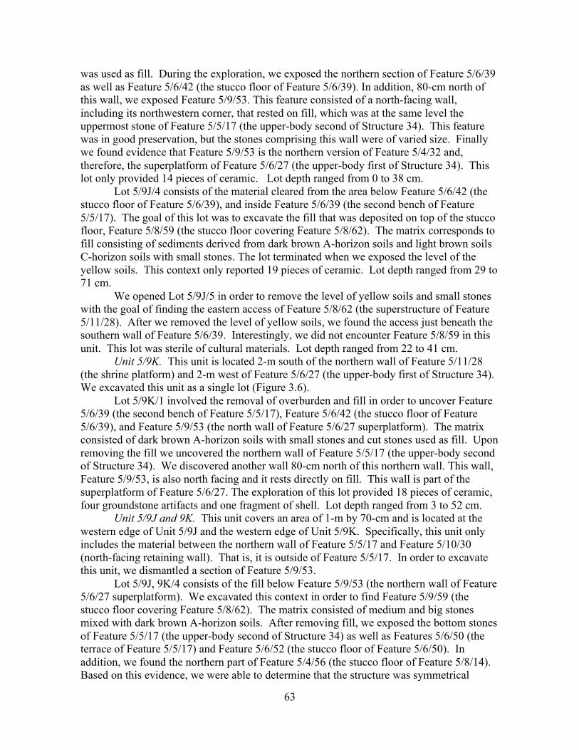
63
was used as fill. During the exploration, we exposed the northern section of Feature 5/6/39 as well as Feature 5/6/42 (the stucco floor of Feature 5/6/39). In addition, 80-cm north of this wall, we exposed Feature 5/9/53. This feature consisted of a north-facing wall, including its northwestern corner, that rested on fill, which was at the same level the uppermost stone of Feature 5/5/17 (the upper-body second of Structure 34). This feature was in good preservation, but the stones comprising this wall were of varied size. Finally we found evidence that Feature 5/9/53 is the northern version of Feature 5/4/32 and, therefore, the superplatform of Feature 5/6/27 (the upper-body first of Structure 34). This lot only provided 14 pieces of ceramic. Lot depth ranged from 0 to 38 cm.
Lot 5/9J/4 consists of the material cleared from the area below Feature 5/6/42 (the stucco floor of Feature 5/6/39), and inside Feature 5/6/39 (the second bench of Feature 5/5/17). The goal of this lot was to excavate the fill that was deposited on top of the stucco floor, Feature 5/8/59 (the stucco floor covering Feature 5/8/62). The matrix corresponds to fill consisting of sediments derived from dark brown A-horizon soils and light brown soils C-horizon soils with small stones. The lot terminated when we exposed the level of the yellow soils. This context only reported 19 pieces of ceramic. Lot depth ranged from 29 to 71 cm.
We opened Lot 5/9J/5 in order to remove the level of yellow soils and small stones with the goal of finding the eastern access of Feature 5/8/62 (the superstructure of Feature 5/11/28). After we removed the level of yellow soils, we found the access just beneath the southern wall of Feature 5/6/39. Interestingly, we did not encounter Feature 5/8/59 in this unit. This lot was sterile of cultural materials. Lot depth ranged from 22 to 41 cm.
Unit 5/9K. This unit is located 2-m south of the northern wall of Feature 5/11/28 (the shrine platform) and 2-m west of Feature 5/6/27 (the upper-body first of Structure 34). We excavated this unit as a single lot (Figure 3.6).
Lot 5/9K/1 involved the removal of overburden and fill in order to uncover Feature 5/6/39 (the second bench of Feature 5/5/17), Feature 5/6/42 (the stucco floor of Feature 5/6/39), and Feature 5/9/53 (the north wall of Feature 5/6/27 superplatform). The matrix consisted of dark brown A-horizon soils with small stones and cut stones used as fill. Upon removing the fill we uncovered the northern wall of Feature 5/5/17 (the upper-body second of Structure 34). We discovered another wall 80-cm north of this northern wall. This wall, Feature 5/9/53, is also north facing and it rests directly on fill. This wall is part of the superplatform of Feature 5/6/27. The exploration of this lot provided 18 pieces of ceramic, four groundstone artifacts and one fragment of shell. Lot depth ranged from 3 to 52 cm.
Unit 5/9J and 9K. This unit covers an area of 1-m by 70-cm and is located at the western edge of Unit 5/9J and the western edge of Unit 5/9K. Specifically, this unit only includes the material between the northern wall of Feature 5/5/17 and Feature 5/10/30 (north-facing retaining wall). That is, it is outside of Feature 5/5/17. In order to excavate this unit, we dismantled a section of Feature 5/9/53.
Lot 5/9J, 9K/4 consists of the fill below Feature 5/9/53 (the northern wall of Feature 5/6/27 superplatform). We excavated this context in order to find Feature 5/9/59 (the stucco floor covering Feature 5/8/62). The matrix consisted of medium and big stones mixed with dark brown A-horizon soils. After removing fill, we exposed the bottom stones of Feature 5/5/17 (the upper-body second of Structure 34) as well as Features 5/6/50 (the terrace of Feature 5/5/17) and Feature 5/6/52 (the stucco floor of Feature 5/6/50). In addition, we found the northern part of Feature 5/4/56 (the stucco floor of Feature 5/8/14). Based on this evidence, we were able to determine that the structure was symmetrical

64
during Stage IV of construction. We reported 26 pieces of ceramic, one groundstone artifact and one fragment of human bone. Lot depth ranged from 10 to 61 cm.
Lot 5/9J, 9K/5 involved the excavation of the area below Feature 5/4/56 (the stucco floor of Feature 5/8/14) in order to reach the level of Feature 5/6/59 (the stucco floor covering Feature 5/8/62). Nonetheless, after removing the fill, which consisted of yellow soils with small stones, we uncovered Feature 5/8/63, the stucco floor of Feature 5/8/62 (the superstructure of Feature 5/11/28). As in Lot 5/9J/5, we did not encounter Feature 5/8/59. Apparently, the access to Feature 5/8/62 (the superstructure of Feature 5/11/28) was not covered by Feature 5/8/59 (the stucco floor covering Feature 5/8/62) nor was it broken since we did not find any evidence of stucco in this location. This context was sterile in cultural materials. Lot depth ranged from 54 to 71 cm.
Lot 5/9J, 9K/6 includes the materials excavated from the fill below Feature 5/8/63 (the stucco floor of Feature 5/8/62). The matrix consisted of medium and big uncut stones that were mixed with gray soils. The lot terminated when it was not possible to continue our excavation because space was too narrow. Like Lot 5/9J, 9K/5, this lot was sterile in cultural materials.
Unit 5/9L. This unit is located 2-m south of Feature 5/11/28’s northern wall and 2-m west of Feature 5/6/27. We excavated this unit in two lots (Figure 3.17).
Lot 5/9L/1 consisted of the removal of the fill related to Feature 5/6/27 (the upper-body first of Structure 34) in order to uncover the northwestern corner of Feature 5/5/17 (the upper-body second of Structure 34). The matrix consisted of small stones and cut stones on the surface, followed by dark brown A-horizon soils mixed with uncut stones. After we removed the fill, we exposed Feature 5/5/17. We terminated this lot at the level of the uppermost stones of Feature 5/5/17. The exploration of this lot provided two pieces of ceramic and one piece of chert. Lot depth ranged from 24 cm to 1.67 m.
We opened Lot 5/9L/2 in order to remove fill outside Feature 5/5/17 (the upper-body second of Structure 34) and to uncover Feature 5/6/50 (the terrace of Feature 5/5/17). This context provided evidence that Feature 5/6/50 (the terrace of Feature 5/5/17) continued at least to the northwestern corner of Feature 5/5/17. We terminated this lot at the level of Feature 5/6/50. Archaeological materials recovered in this lot are 15 pieces of ceramic and two pieces of chert and one P. glaphyrus shell.
Suboperation 5/10
Suboperation 5/10 is situated 18-m north of Structure 33, 14-m north of the southern
wall of Structure 34 and immediately south of the northern wall of Structure 34. We reported the following features: Feature 5/8/14 (the lower body of Structure 34), Feature 5/8/15 (the retaining wall of Feature 5/8/14), Feature 5/1/18 (the stucco floor of Plaza IV), Feature 5/11/28 (the shrine platform), Feature 5/10/29 (the retaining wall of Feature 5/6/27), Feature 5/11/33 (the northern bench of Structure 34), Feature 5/8/62 (the superstructure of Feature 5/11/28) and Feature 5/8/63 (the stucco floor of Feature 5/8/62).
Unit 5/10I. This unit is situated 4-m north of Feature 5/8/7 (the stair block of Structure 34) and 2-m south of the northeastern corner of Feature 5/8/14 (the lower body of Structure 34). We excavated this unit in two lots.
Lot 5/10I/1 entailed the removal of the collapsed cut stones and dark brown A-horizon soils and small stones in order to uncover Features 5/8/14 (the lower body of Structure 34) and Feature 5/8/15 (the retaining wall of Feature 5/8/14). We found Feature
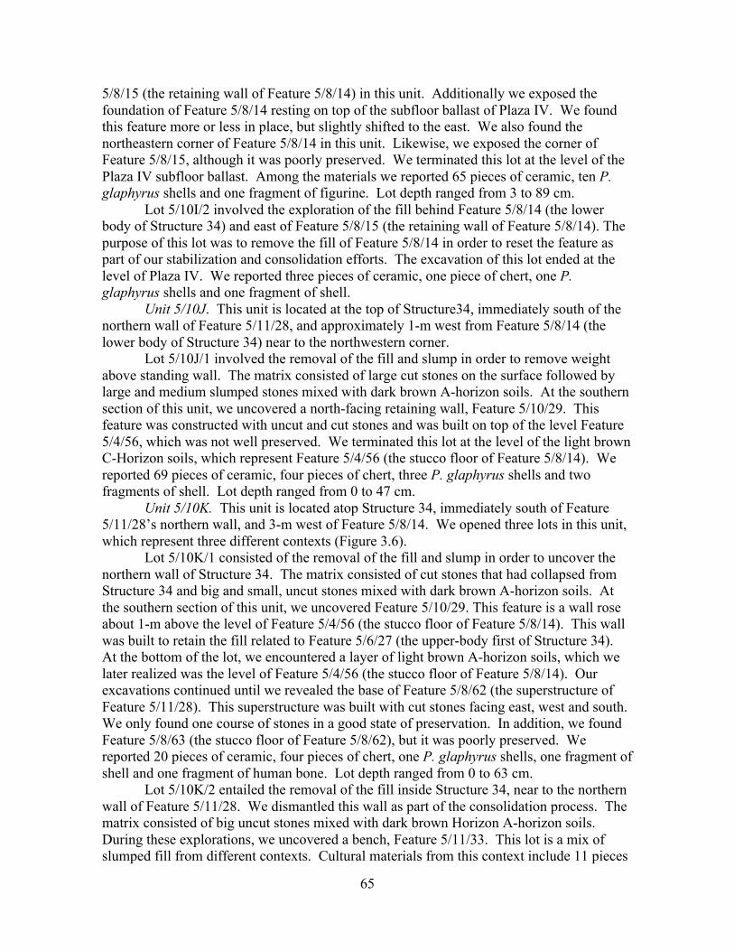
65
5/8/15 (the retaining wall of Feature 5/8/14) in this unit. Additionally we exposed the foundation of Feature 5/8/14 resting on top of the subfloor ballast of Plaza IV. We found this feature more or less in place, but slightly shifted to the east. We also found the northeastern corner of Feature 5/8/14 in this unit. Likewise, we exposed the corner of Feature 5/8/15, although it was poorly preserved. We terminated this lot at the level of the Plaza IV subfloor ballast. Among the materials we reported 65 pieces of ceramic, ten P. glaphyrus shells and one fragment of figurine. Lot depth ranged from 3 to 89 cm.
Lot 5/10I/2 involved the exploration of the fill behind Feature 5/8/14 (the lower body of Structure 34) and east of Feature 5/8/15 (the retaining wall of Feature 5/8/14). The purpose of this lot was to remove the fill of Feature 5/8/14 in order to reset the feature as part of our stabilization and consolidation efforts. The excavation of this lot ended at the level of Plaza IV. We reported three pieces of ceramic, one piece of chert, one P. glaphyrus shells and one fragment of shell.
Unit 5/10J. This unit is located at the top of Structure34, immediately south of the northern wall of Feature 5/11/28, and approximately 1-m west from Feature 5/8/14 (the lower body of Structure 34) near to the northwestern corner.
Lot 5/10J/1 involved the removal of the fill and slump in order to remove weight above standing wall. The matrix consisted of large cut stones on the surface followed by large and medium slumped stones mixed with dark brown A-horizon soils. At the southern section of this unit, we uncovered a north-facing retaining wall, Feature 5/10/29. This feature was constructed with uncut and cut stones and was built on top of the level Feature 5/4/56, which was not well preserved. We terminated this lot at the level of the light brown C-Horizon soils, which represent Feature 5/4/56 (the stucco floor of Feature 5/8/14). We reported 69 pieces of ceramic, four pieces of chert, three P. glaphyrus shells and two fragments of shell. Lot depth ranged from 0 to 47 cm.
Unit 5/10K. This unit is located atop Structure 34, immediately south of Feature 5/11/28’s northern wall, and 3-m west of Feature 5/8/14. We opened three lots in this unit, which represent three different contexts (Figure 3.6).
Lot 5/10K/1 consisted of the removal of the fill and slump in order to uncover the northern wall of Structure 34. The matrix consisted of cut stones that had collapsed from Structure 34 and big and small, uncut stones mixed with dark brown A-horizon soils. At the southern section of this unit, we uncovered Feature 5/10/29. This feature is a wall rose about 1-m above the level of Feature 5/4/56 (the stucco floor of Feature 5/8/14). This wall was built to retain the fill related to Feature 5/6/27 (the upper-body first of Structure 34). At the bottom of the lot, we encountered a layer of light brown A-horizon soils, which we later realized was the level of Feature 5/4/56 (the stucco floor of Feature 5/8/14). Our excavations continued until we revealed the base of Feature 5/8/62 (the superstructure of Feature 5/11/28). This superstructure was built with cut stones facing east, west and south. We only found one course of stones in a good state of preservation. In addition, we found Feature 5/8/63 (the stucco floor of Feature 5/8/62), but it was poorly preserved. We reported 20 pieces of ceramic, four pieces of chert, one P. glaphyrus shells, one fragment of shell and one fragment of human bone. Lot depth ranged from 0 to 63 cm.
Lot 5/10K/2 entailed the removal of the fill inside Structure 34, near to the northern wall of Feature 5/11/28. We dismantled this wall as part of the consolidation process. The matrix consisted of big uncut stones mixed with dark brown Horizon A-horizon soils. During these explorations, we uncovered a bench, Feature 5/11/33. This lot is a mix of slumped fill from different contexts. Cultural materials from this context include 11 pieces
66
of ceramic, two pieces of chert, one fragment of animal bone and one fragment of shell. Lot depth ranged from 0 to 18 cm.
Lot 5/10K/3 involved the removal of the fill consisting of big uncut stones mixed with a little bit of light brown C-horizon soils. Our excavations of this lot focused on the area located east of Feature 5/11/33 (the northern bench). The goal of this lot was to remove the fill in order to uncover the eastern wall of 5/11/33 (the northern bench). Our explorations did reveal the eastern wall of Feature 5/11/33 (the northern bench), although only partially because the bench continues southward through Feature 5/10/29 (the retaining wall of Feature 5/9/53). We found Feature 5/11/33 resting directly on top of Feature 5/1/18 (the stucco floor of Plaza IV), which rises 1-m high in a total of five courses of stones. Additionally, we found white lime plaster (around 0.5-cm to 3-cm thick) still visible at its surface. Among the cultural materials, we only recovered one piece of ceramic and one piece of chert. Lot depth ranged from 22 cm to 1.09 m.
Unit 5/10L. This unit is located atop Structure 34, immediately south of Feature 5/11/36 (the latter northwestern addition to Feature 5/11/28), and 5-m west of Feature 5/8/14 (the lower body of Structure 34). We opened two lots in this unit.
Lot 5/10L/1 involved the clearing of the cut stones that had collapsed from the top of Structure 34 and the uncut stones mixed with overburden consisting of dark brown A-horizon soils. The goal of this lot was to reveal the northern wall of Feature 5/11/28. During our investigation of this unit, we revealed a platform (Feature 5/11/28) with its superstructure (Feature 5/8/62). In this unit, we encountered the western double wall of this substructure (around 1-m thick) and its northwestern corner. At the southern side of this unit we found the remains of Feature 5/10/29, however, most of its upper courses were had collapsed to the north. This wall is resting on top of the level of Feature 5/4/56 (the stucco floor of Feature 5/8/14) and it was built with uncut stones and dressed cut stones, some of which still retained plaster on their surface. We reported 24 pieces of ceramic, four pieces of chert, one P. glaphyrus shell, and two groundstone artifacts. Lot depth ranged from 6 to 48 cm.
We initiated Lot 5/10L/2 with the goal of revealing the western wall of Feature 5/11/28 (the shrine platform). The matrix consisted of big uncut stones mixed with dark brown A-horizon soils near the surface followed by big uncut stones mixed with sediments derived from light brown C-horizon soils. Those materials were used as fill. We excavated this lot down to the level of Feature 5/1/18 (the stucco floor of Plaza IV). We found the western wall of Feature 5/11/28 (the shrine platform). It was well preserved with at least seven courses of cut stones. Additionally, we uncovered the northwestern corner of this platform near the northern wall of Structure 34. We were unable to find the western end of Feature 5/11/33 (the northern bench) because this feature was dismantled in antiquity, probably when Feature 5/11/28 (the shrine platform) and its superstructure (Feature 5/8/62) were built. We did not recovered cultural materials in this lot. Lot depth ranged from 13 cm to 1.03 m.
Suboperation 5/11
Suboperation 5/11 is located 20-m north of Structure 33, 16-m north of the southern
wall of Structure 34 and immediately north of the northern wall of Structure 34. We reported the following features: Feature 5/8/14 (the lower body of Structure 34); Feature 5/11/37 (the stair block of Feature 5/11/28); the northern wall of Feature 5/8/15 (the
67
retaining wall of Feature 5/8/14); Feature 5/1/18 (the stucco floor of Plaza IV); Feature 5/11/28 (the shrine platform); Feature 5/11/35 (a west-facing alignment of stones running North-South); and Feature 5/11/36, the northern wall added to Feature 5/11/28 when Feature 5/6/27 was built.
Unit 5/11I. This unit is located at the north side of Structure 34, above Plaza IV, and immediately north of the northeastern corner of Feature 5/8/14 (the lower body of Structure 34). We excavated this unit with the goal of exposing the northeastern corner of Structure 34. We opened two lots in this unit (Figure 3.18).
Lot 5/11I/1 consists of the removal of the fallen cut stone and modern overburden (dark brown A-horizon soils mixed with small stones). We found collapsed corner stones on the surface of this unit; however, it is impossible to determine their original location. We exposed more of the northeastern corner of Feature 5/8/14 in this unit and determined that Feature 5/8/14 (the lower body of Structure 34) continues to the north. We reported 85 pieces of ceramic, five pieces of chert, two pieces of obsidian, four P. glaphyrus shells, three P. indiorum shells, one greenstone artifact and one groundstone artifact. Lot depth ranged from 8 to 60 cm.
Lot 5/11I/2 entailed the excavation of the fill of Feature 5/8/14 (the lower body of Structure 34) at its north side in order to reset this feature. More specifically, we excavated between the northern wall of Feature 5/8/14, the northern side of Feature 5/8/15 (the retaining wall of Feature 5/8/14), and east of Feature 5/11/37 (the stair block of Feature 5/11/28). The matrix consisted of dark brown A-horizon and light brown C-horizon soils with small and medium stones used as fill. Our exploration revealed the northern wall of Feature 5/8/15. We finished this lot at the level of Plaza IV. Strictly, most of the area explored in this lot belonged to Unit 10I but it was considered as part of Unit 11I during the excavation. These explorations only provided five pieces of ceramic.
Unit 5/11J. This unit is located immediately north of Feature 5/11/28’s northern wall, approximately 1-m west of Feature 5/8/14’s northeastern corner. We opened three lots in this unit (Figures 3.6 and 3.18).
Lot 5/11J/1 included the removal of the cut stones that had collapsed from Structure 34, slump and modern overburden consisting of dark brown A-horizon soils. The goal of this lot was to reveal the northern wall of Structure 34. We found the foundation and another course in situ and two or three courses of stones collapsed forward. This northern wall was a continuation of Feature 5/8/14. We unearthed 141 pieces of ceramic, three pieces of chert, 11 P. glaphyrus shells, one P. indiorum shell, one groundstone artifact, one fragment of animal bone, and two fragments of shell. Lot depth ranged from 27 to 89 cm.
The material we excavated as Lot 5/11J/2 included the fill behind the northern wall of Feature 5/8/14, east of the eastern wall of Feature 5/11/28, and above Feature 5/11/37. Strictly speaking, this context belonged to Unit 10J but it was started at Unit 11J. The matrix consisted of medium and large stones mixed with dark brown A-horizon soils. These large stones were used to cover Feature 5/11/37 (the stair block of Feature 5/11/28). This stair consists of four steps, which retained the remains of white lime plaster. The bottommost step of Feature 5/11/37 rests on top of Feature 5/1/18 (the stucco floor of Plaza IV). The exploration provided 21 pieces of ceramic, two P. indiorum shells and one fragment of shell.
Lot 5/11J/3 included the excavation of the fill behind (inside of) the northern wall of Feature 5/11/28 in order to reset the stones. The matrix is composed of dry fill made of medium and big stones mixed with a small amount of sediments derived from dark brown
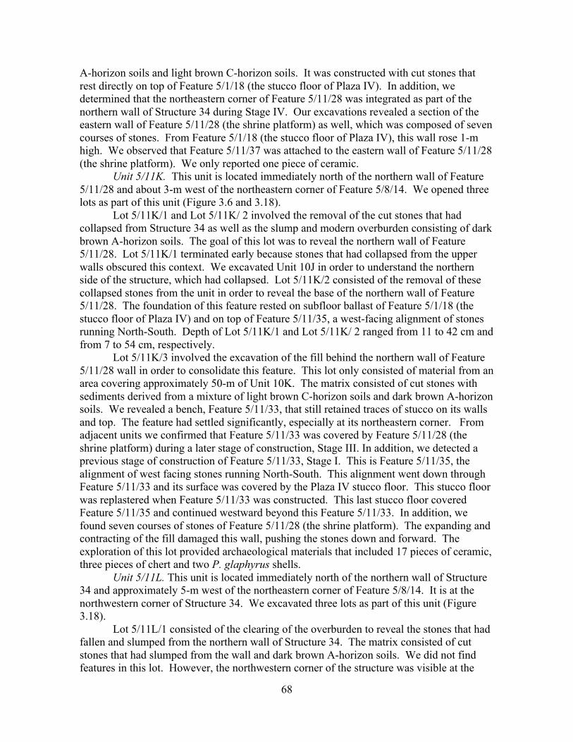
68
A-horizon soils and light brown C-horizon soils. It was constructed with cut stones that rest directly on top of Feature 5/1/18 (the stucco floor of Plaza IV). In addition, we determined that the northeastern corner of Feature 5/11/28 was integrated as part of the northern wall of Structure 34 during Stage IV. Our excavations revealed a section of the eastern wall of Feature 5/11/28 (the shrine platform) as well, which was composed of seven courses of stones. From Feature 5/1/18 (the stucco floor of Plaza IV), this wall rose 1-m high. We observed that Feature 5/11/37 was attached to the eastern wall of Feature 5/11/28 (the shrine platform). We only reported one piece of ceramic.
Unit 5/11K. This unit is located immediately north of the northern wall of Feature 5/11/28 and about 3-m west of the northeastern corner of Feature 5/8/14. We opened three lots as part of this unit (Figure 3.6 and 3.18).
Lot 5/11K/1 and Lot 5/11K/ 2 involved the removal of the cut stones that had collapsed from Structure 34 as well as the slump and modern overburden consisting of dark brown A-horizon soils. The goal of this lot was to reveal the northern wall of Feature 5/11/28. Lot 5/11K/1 terminated early because stones that had collapsed from the upper walls obscured this context. We excavated Unit 10J in order to understand the northern side of the structure, which had collapsed. Lot 5/11K/2 consisted of the removal of these collapsed stones from the unit in order to reveal the base of the northern wall of Feature 5/11/28. The foundation of this feature rested on subfloor ballast of Feature 5/1/18 (the stucco floor of Plaza IV) and on top of Feature 5/11/35, a west-facing alignment of stones running North-South. Depth of Lot 5/11K/1 and Lot 5/11K/ 2 ranged from 11 to 42 cm and from 7 to 54 cm, respectively.
Lot 5/11K/3 involved the excavation of the fill behind the northern wall of Feature 5/11/28 wall in order to consolidate this feature. This lot only consisted of material from an area covering approximately 50-m of Unit 10K. The matrix consisted of cut stones with sediments derived from a mixture of light brown C-horizon soils and dark brown A-horizon soils. We revealed a bench, Feature 5/11/33, that still retained traces of stucco on its walls and top. The feature had settled significantly, especially at its northeastern corner. From adjacent units we confirmed that Feature 5/11/33 was covered by Feature 5/11/28 (the shrine platform) during a later stage of construction, Stage III. In addition, we detected a previous stage of construction of Feature 5/11/33, Stage I. This is Feature 5/11/35, the alignment of west facing stones running North-South. This alignment went down through Feature 5/11/33 and its surface was covered by the Plaza IV stucco floor. This stucco floor was replastered when Feature 5/11/33 was constructed. This last stucco floor covered Feature 5/11/35 and continued westward beyond this Feature 5/11/33. In addition, we found seven courses of stones of Feature 5/11/28 (the shrine platform). The expanding and contracting of the fill damaged this wall, pushing the stones down and forward. The exploration of this lot provided archaeological materials that included 17 pieces of ceramic, three pieces of chert and two P. glaphyrus shells.
Unit 5/11L. This unit is located immediately north of the northern wall of Structure 34 and approximately 5-m west of the northeastern corner of Feature 5/8/14. It is at the northwestern corner of Structure 34. We excavated three lots as part of this unit (Figure 3.18).
Lot 5/11L/1 consisted of the clearing of the overburden to reveal the stones that had fallen and slumped from the northern wall of Structure 34. The matrix consisted of cut stones that had slumped from the wall and dark brown A-horizon soils. We did not find features in this lot. However, the northwestern corner of the structure was visible at the
69
edge of the stair leading down to the west. We reported 20 pieces of ceramic. Lot depth ranged from 0 to 61 cm.
Lot 5/11L/2 was a continuation of Lot 5/11L/1. It was opened in order to remove the cut stones and overburden and uncover Feature 5/11/36, the northern wall added to Feature 5/11/28 when Feature 5/6/27 was built. The matrix consisted of dark brown A-horizon soils with small stones and cut stones slumped from the Structure 34 walls. During our excavations we found the northwestern corner of Feature 5/11/28. The foundation of this northern wall was in situ. This exploration provided 30 pieces of ceramic, two pieces of chert, two P. glaphyrus shells, one P. indiorum shells and two fragments of animal bone. Lot depth ranged from 0 to 35 cm.
Lot 5/11L/3 corresponded to the excavation of the fill behind the northern wall of Feature 5/11/28 in order to consolidate this feature. It covered approximately 50-cm of Unit 10L. The matrix consisted of cut stones with a small amount of dark brown A-horizon soils. During the excavation, we found a west-facing wall at the eastern part of the unit. This wall is the western wall of Feature 5/11/28 (the shrine platform). The fill was part of Feature 5/11/36 (the northwestern addition to Feature 5/11/28). We reported 17 pieces of ceramic and one piece of obsidian.
CONCLUSIONS Structure 34 of Lubaantun is located at the northern edge of Plaza IV. Hammond
(1975) dated to the Phase 2 of his construction sequence but he never undertook excavations at this platform. In fact, Structure 34 can be considered as the largest, unlooted structure at the core of this ancient site. Our excavations of this building were conducted with the aim of establishing its construction sequence, determining its relation to the construction sequence of Plaza IV, resolving the architectural style(s) that was used to build it and finding out the function(s) that this structure could have had. Excavations conducted at Structure 34 during the 2010 field season revealed that it was built in at least six major stages. Some stages had several minor moments of construction as well.
Stage I is contemporary with the construction of Plaza IV (Figure 3.19). It is represented by Structure 34A, an East-West oriented platform. This platform consists of a vertical wall with both stepped insets and an outset molding that may be considered to be an example of the “In-and-out” style (Figures 3.8, 3.9 and 3.20). We encountered this outset molding in both deeply buried and currently exposed contexts and are positive that it is deliberate rather than the result of root action or fill expansion. In addition, its eastern wall is a double wall, although we cannot say anything else about this feature (Figures 3.8 and 3.9). Its dimensions are unknown due to the fact that it was not completely uncovered. Stage I may also include Feature 5/11/35, which marks the original western extent of Plaza IV or Hammond’s (1975) Platform 13 (Figure 3.6). Our excavations provided data about the construction of Plaza IV itself. As stated in Operation 4 report, Plaza IV was built with retaining walls made of undressed cut stones and “lajas.” These retaining walls contained sediments derived from dark brown A-horizon soils and light brown C-horizon soils. Plaza IV had two stucco floors, Features 5/6/44 and 5/1/18 (Figure 3.12). Feature 5/1/18 is a replastering of the first stucco floor of Plaza IV, Feature 5/6/44.
During Stage II two features were added (Figure 3.21). First, Feature 5/6/43 was built. This is a two-bodied extension that was constructed to the east of Structure 34A (Figures 3.9 and 3.15). This feature was built in two moments. The second body was

70
constructed first and was composed of dressed cut stones that rest on top of Feature 5/1/18 from which rises 1.10-m (Figure 3.14). The first body was added at a later date. We can affirm that the second body was the first because lower stones had stucco on their surface. The second body rises approximately 76-cm from Feature 5/1/18 (the stucco floor of Plaza IV). The other dimensions are unknown.
The second feature that was added during Stage II is another structure containing a preserved plastered bench, which was built to the north (Figure 3.6 and 3.15). The bench, or Feature 5/11/33, is the only evidence of this structure because it was dismantled. We did not find any evidence of the western side of Feature 5/11/33. This bench was built on top of Feature 5/1/18 (the stucco floor of Plaza IV) and rises approximately 80-cm above this plastered surface. The bench was built on top of Feature 5/11/35, the west facing terrace that functioned as the western edge of Hammond’s (1975) Platform 13.
Stage III consisted of dismantling this northern structure and covering it with a shrine that consisted of a platform (Feature 5/11/28) that supported a low stone superstructure (Feature 5/8/62) (Figures 3.16, 3.17, 3.18 and 3.22). This shrine measures 6.40-m (North-South) axis by 3.40-m (East-West). A three-step staircase (Feature 5/11/37) was attached at the eastern wall of this platform. The superstructure has double walls, which were between 60-cm to 86-cm thick. This shrine is nearly identical in form and size to a consolidated structure near the southwest corner of Structure 33. During this stage, Structure 34A and Feature 5/6/43 were still in use. Later, the interior of the superstructure was blocked off with stones and yellow soils. In addition, the superstructure was partially covered by a stucco floor (Feature 5/8/59). This event was part of the remodeling process that included covering of Feature 5/11/28 and Feature 5/8/62 in order to built the next structure that represents Stage IV.
During Stage IV, the final footprint of Structure 34 was established and covered the earlier buildings (Feature 5/6/43 and Feature 5/11/33) (Figure 3.6, 3.12 and 3.23). Structure 34A was integrated as part of the new building. This stage is represented by an east-facing platform (Feature 5/8/14), which was rectangular in shape. This platform was at least 6-m (East-West) by 16-m (North-South) in area and 1.10-m in height. A five-step stair block (Feature 5/8/7) was attached to its eastern wall. Two stair outsets were attached to each side of the stair block and the eastern wall of the platform. The northern stair outset (Feature 5/8/6) was a rectangular block, while the southern stair outset (Feature 5/6/38) was stepped. During the first substage this platform supported a rectangular superplatform (Feature 5/5/17), whose dimensions were 4.20-m (East-West) by 9-m (North-South). This was a C-shape superplatform with benches at the southern (Feature 5/6/48) and northern (Feature 5/8/57) edges. These benches were 2.30-m in width. The superplatform was 90-cm high, but the section of the eastern wall that was not related to the benches was 30-cm high (Figure 2.5). A stucco floor (Feature 5/4/56) covered the surface of the platform (Feature 5/8/14). Likewise, the superplatform (Feature 5/5/17) was plastered (Feature 5/6/40). During the second substage, a terrace (Feature 5/6/50) was built around the superplatform (Figure 3.24). The third substage is represented by a modification of the superplatform (Figure 3.25). The eastern wall was completely leveled with smaller and thinner stones (Feature 5/6/51) and the northern and southern benches were covered. Another C-shaped bench (Feature 5/6/39) was built, which was covered with a stucco floor (Feature 5/6/42). Another stucco floor (Feature 5/6/40) was located outside C-shape bench (Feature 5/6/39).
71
During Stage V, Structure 34 reached its current height (Figure 3.6, 3.12 and 3.26). The lower body or platform (Feature 5/8/14) was modified and its southern and northern walls were raised. At least the southern wall was raised as a double wall, which rested on top of stucco floor Feature 5/4/56. Stucco floor Feature 5/4/56 was covered with dry fill and small stones in order to reach the current height. We believe that Structure 34 was significantly expanded to the west, but this section has not been explored. At this time, Structure 34 appears to have been surmounted by a rectangular superplatform, which was poorly preserved (Figure 3.10). In order to reach this superplataform, additional steps were built on top of Feature 5/8/14 (the lower body of Structure 34).
Stage VI consists of minor additions to the southern end of the structure that greatly changed its function (Figure 3.27). Low walls were added to the southeastern corner of the platform and connecting it to Structure 33. A bench was added to the narrow corridor between Structures 33 and 34 (Figure 3.6). We suspect that a perishable roof spanned the gap between the two buildings.
Our excavations also provided data about the architectural styles that were used to build the different constructions of Structure 34. Most importantly, Structure 34 provided evidence about the “long settled debate” related to the in-and-out style of Lubaantun (Braswell et al. 2010). As it was mentioned above, Structure 34-A consisted of a vertical wall with both stepped insets and an outset molding, this is, it is similar to the in-and-out style proposed by Joyce (1926) and dismissed by Thompson (1931) and Hammond (1975). We argued that Joyce (1926) was correct. The outset molding was deliberate rather than the result of root action or fill expansion (Thompson 1931). Our affirmation is based on the fact that we found this architectural style in both currently exposed and deeply buried contexts. Moreover, the molding outset was extremely regular. As Joyce (1926) pointed out this style was related to round-angle corners. In addition, we registered two styles of vertical walls. Feature 5/6/43 of Stage II, Stage IV and Stage V had vertical walls made of cut and dressed stones. Feature 5/11/33 of Stage II and Stage III had vertical walls made of cut and undressed stones.
Based on the location of Structure 34 at Plaza IV and its morphology and dimensions, Hammond suggested that Structure 34 was a minor ceremonial platform. We agree with him. During Stages I to V, Structure 34 performed a non-domestic function. In the fill associated to buildings of Stages I to V, we did not did evidence of archaeological materials that could suggest domestic activities. In fact, the fill, the interior and exterior of the structures were almost lacking of archaeological materials. We must point out we did not find any archaeological artifact that could be considered as “ritual” or “ceremonial.” On basis of the location of Structure 34 in the “religious center” of Lubaantun, we agree with Hammond (1975) that during the Late Classic, Structure 34 had religious or ceremonial functions. During Stage VI, Structure 34 had a change of function. We argue that Stage VI had a domestic function. We based our claim on the enormous quantities of pottery, animal bones, jute shells, marine shell, and lithic artifacts that we found in the southern end of the structure (Tables 3.1 to 3.10, Suboperations 5/1 and 5/2) and on the modifications that underwent this section of Structure 34 during this period. As we stated, low walls were added to the southeastern corner of the platform connecting it to Structure 33, a bench was built in the narrow corridor between Structures 33 and 34 and a perishable roof probably spanned the gap between the two buildings. Further analysis of the materials recovered during our explorations will corroborate or refute our arguments.
72
Analysis of the materials are still in process, however, we can make some claims based on observations made in the field. Ceramics recovered at Structure 34 dated to the Late Classic and Terminal Classic period. This later period was confined to the southern end of the structure where modifications related to Stage VI were indentified. Basically, Lubaantun is a Tepeu-sphere site. Braswell et al. (2010) has stated that the ceramic of Lubaantun is, in some ways, similar to the nearby site Pusilhá but they are in other ways different. Braswell et al. (2010) point out that comales are a common form at Pusilhá, but they are underrepresented at Lubaantun. In addition, zoned stamping is common on jars at Lubaantun, but jars from Pusilha are generally striated. Lubaantun-style coarse vessels of the type Puluacax Unslipped are found at Pusilha, but are much less common at Pusilha and date mainly to the Terminal Classic period. Braswell et al. (2010) has showed that the dominant source of obsidian at Lubaantun is El Chayal. Ixtepeque and Ucareo obsidian were also represented but in minor percentages. Comparison made between Lubaantun and Pusilha shows that Pusilha had much greater access to obsidian than Lubaantun (Braswell et al. 2010). In addition, the groundstone used to make manos and metates from Lubaantun is either local or made of Guatemalan lava stone. At Pusilha, local Toledo sandstone was used to make manos and metates, finished grinding stones made of Guatemalan lava stone, green and pink tuff from the highlands of eastern Guatemala or western Honduras, and various materials from the Mountain Pine Ridge were also imported (Braswell et al 2010).
Based on data obtained during our excavations we can answer the question of how the construction sequence of Structure 34 is related to Hammond’s (1975) sequence of Lubaantun. We can partially corroborate Hammond’s (1975) suggestion that Structure 34 was built during Phase 2 of his construction sequence. Structure 34-A that represents Stage I of our sequence was built when Plaza IV was constructed. Stages II to VI, however, are difficult to correlate with Hammond’s (1975) construction sequence but we can assure that they are later modifications to the construction of Plaza IV. However, data as chronology and architectural styles can help us to suggest certain correlations. Based on the ceramic data, we can affirm that Stage VI, when the platform was transformed into a residence, dated to the Terminal Classic period, that is, it corresponded to a later phase than Hammond’s (1975) Phase 5. Stages II to V, when Structure 34 had a religious function, dated all from the Late Classic period. They could have been constructed during any Hammond’s (1975) phase. If Hammond’s (1975) was correct about the fact that the stair-outset dated exclusively to his Phase 5, then we can suggest that Stages IV and V were constructed during Hammond’s (1975) Phase 5. Briefly, the constructive sequence of Structure 34 and its chronology suggest that this large platform underwent construction activities since the Late Classic to the Terminal Classic, in Hammond’s terms, since Phase 2 to Phase 5 and later.
73
Figure 3.1. Plan view of Structure 34 during excavations showing the relevant features.
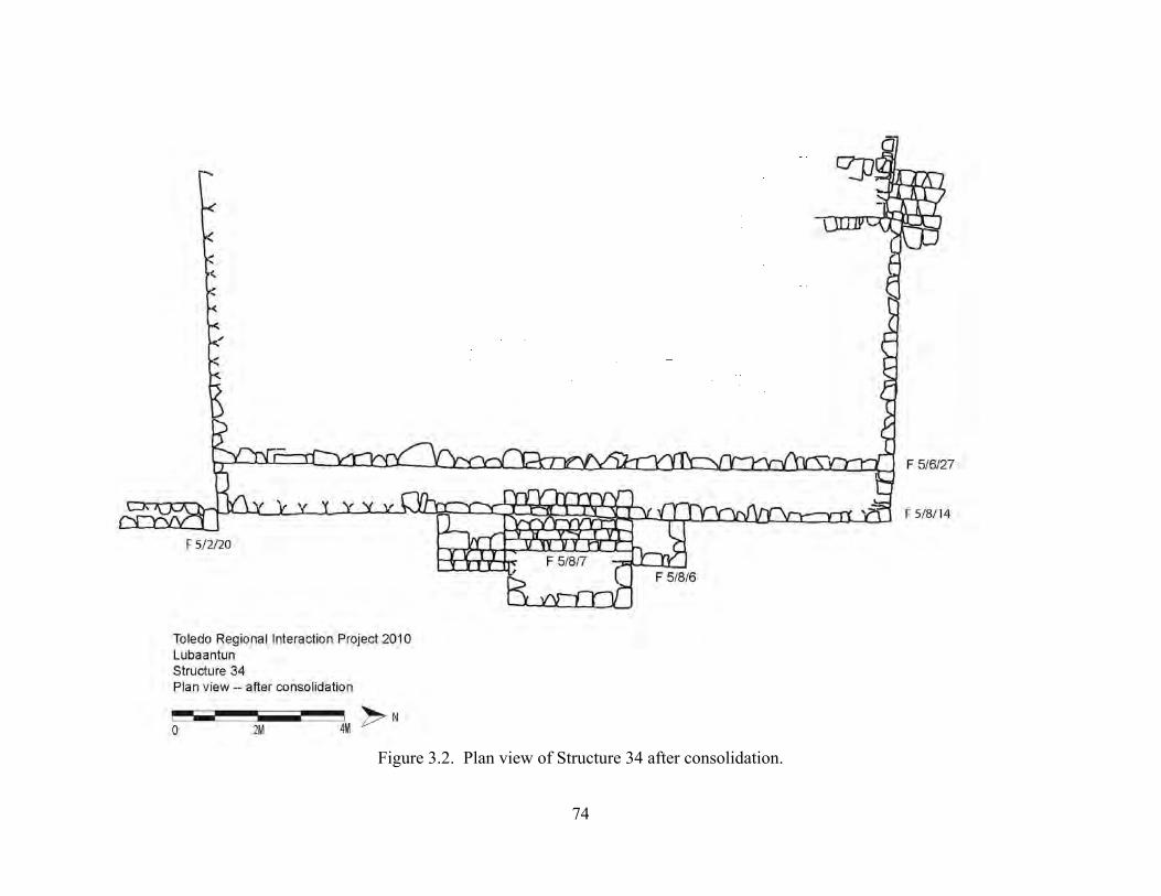
74
Figure 3.2. Plan view of Structure 34 after consolidation.
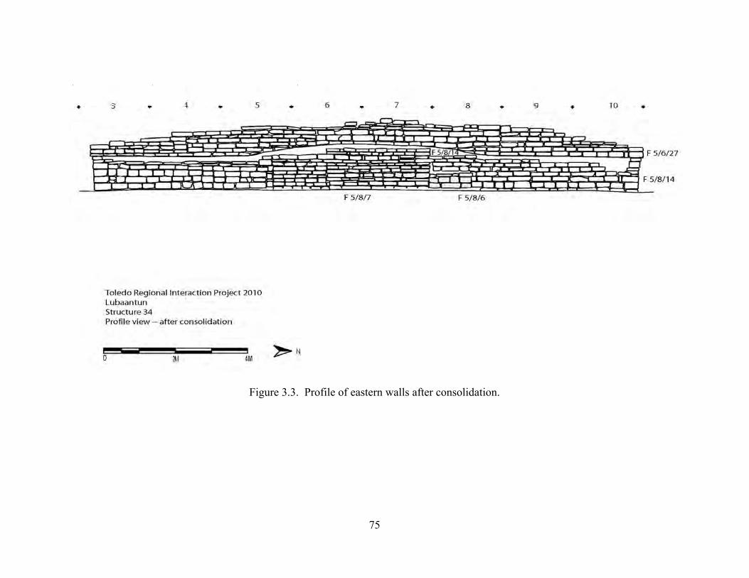
75
Figure 3.3. Profile of eastern walls after consolidation.
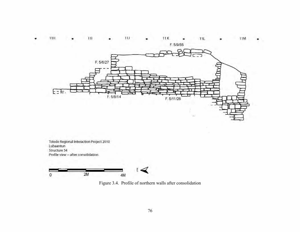
76
Figure 3.4. Profile of northern walls after consolidation
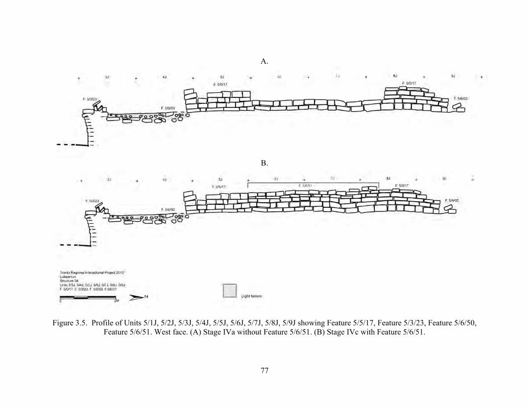
77
A.
B.
Figure 3.5. Profile of Units 5/1J, 5/2J, 5/3J, 5/4J, 5/5J, 5/6J, 5/7J, 5/8J, 5/9J showing Feature 5/5/17, Feature 5/3/23, Feature 5/6/50, Feature 5/6/51. West face. (A) Stage IVa without Feature 5/6/51. (B) Stage IVc with Feature 5/6/51.
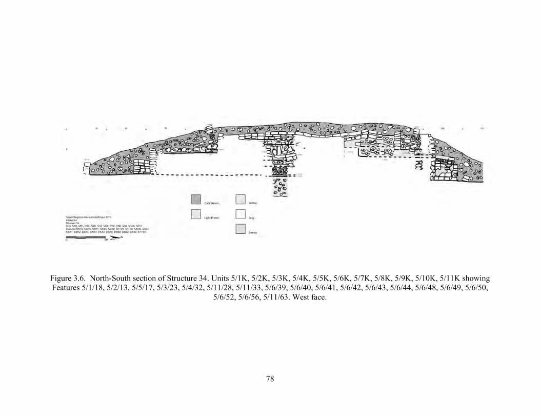
78
Figure 3.6. North-South section of Structure 34. Units 5/1K, 5/2K, 5/3K, 5/4K, 5/5K, 5/6K, 5/7K, 5/8K, 5/9K, 5/10K, 5/11K showing Features 5/1/18, 5/2/13, 5/5/17, 5/3/23, 5/4/32, 5/11/28, 5/11/33, 5/6/39, 5/6/40, 5/6/41, 5/6/42, 5/6/43, 5/6/44, 5/6/48, 5/6/49, 5/6/50,
5/6/52, 5/6/56, 5/11/63. West face.

79
Figure 3.7. Profile of Unit 5/2I showing Feature 5/2/25.
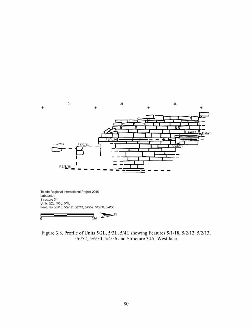
80
Figure 3.8. Profile of Units 5/2L, 5/3L, 5/4L showing Features 5/1/18, 5/2/12, 5/2/13, 5/6/52, 5/6/50, 5/4/56 and Structure 34A. West face.
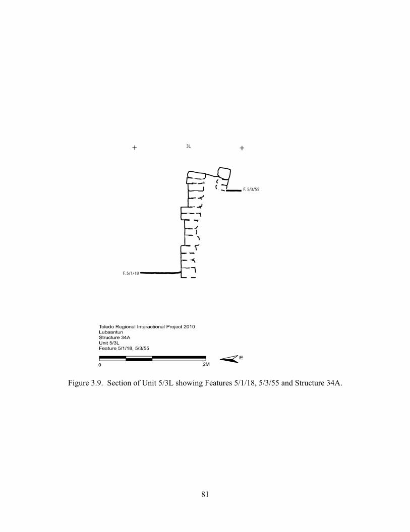
81
Figure 3.9. Section of Unit 5/3L showing Features 5/1/18, 5/3/55 and Structure 34A.
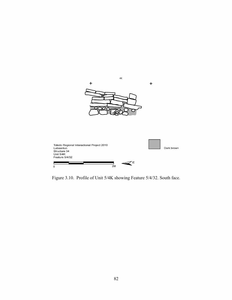
82
Figure 3.10. Profile of Unit 5/4K showing Feature 5/4/32. South face.

83
Figure 3.11. Section of Units 5/5K, 5/5L showing Features 5/1/18, 5/6/39, 5/6/41, 5/6/42,
5/6/44, 5/7/47, 5/5/61 and Structure 34A. South face.
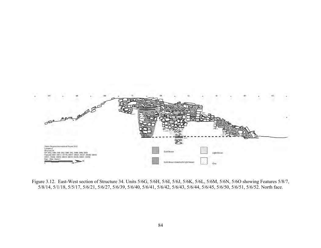
84
Figure 3.12. East-West section of Structure 34. Units 5/6G, 5/6H, 5/6I, 5/6J, 5/6K, 5/6L, 5/6M, 5/6N, 5/6O showing Features 5/8/7, 5/8/14, 5/1/18, 5/5/17, 5/6/21, 5/6/27, 5/6/39, 5/6/40, 5/6/41, 5/6/42, 5/6/43, 5/6/44, 5/6/45, 5/6/50, 5/6/51, 5/6/52. North face.
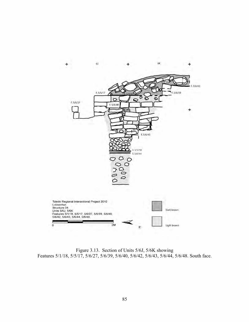
85
Figure 3.13. Section of Units 5/6J, 5/6K showing
Features 5/1/18, 5/5/17, 5/6/27, 5/6/39, 5/6/40, 5/6/42, 5/6/43, 5/6/44, 5/6/48. South face.
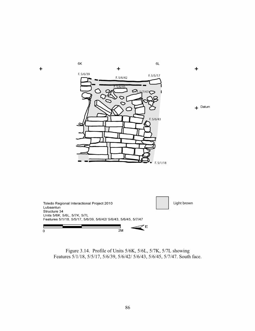
86
Figure 3.14. Profile of Units 5/6K, 5/6L, 5/7K, 5/7L showing Features 5/1/18, 5/5/17, 5/6/39, 5/6/42/ 5/6/43, 5/6/45, 5/7/47. South face.
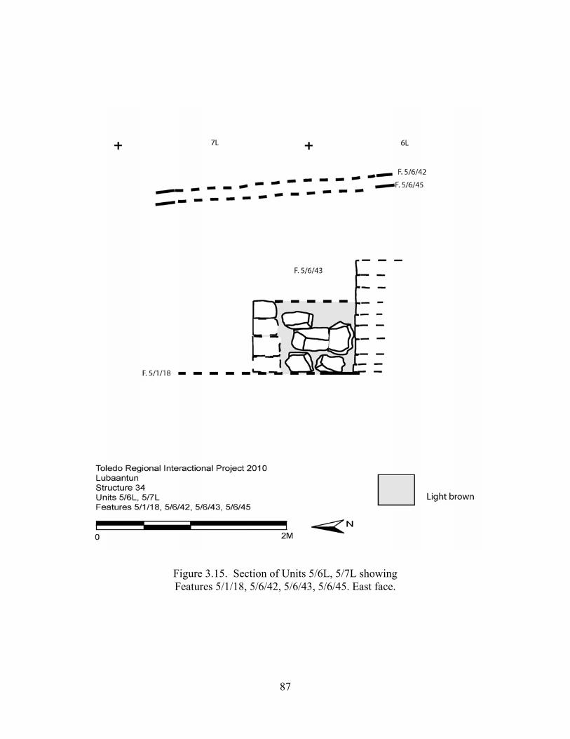
87
Figure 3.15. Section of Units 5/6L, 5/7L showing Features 5/1/18, 5/6/42, 5/6/43, 5/6/45. East face.
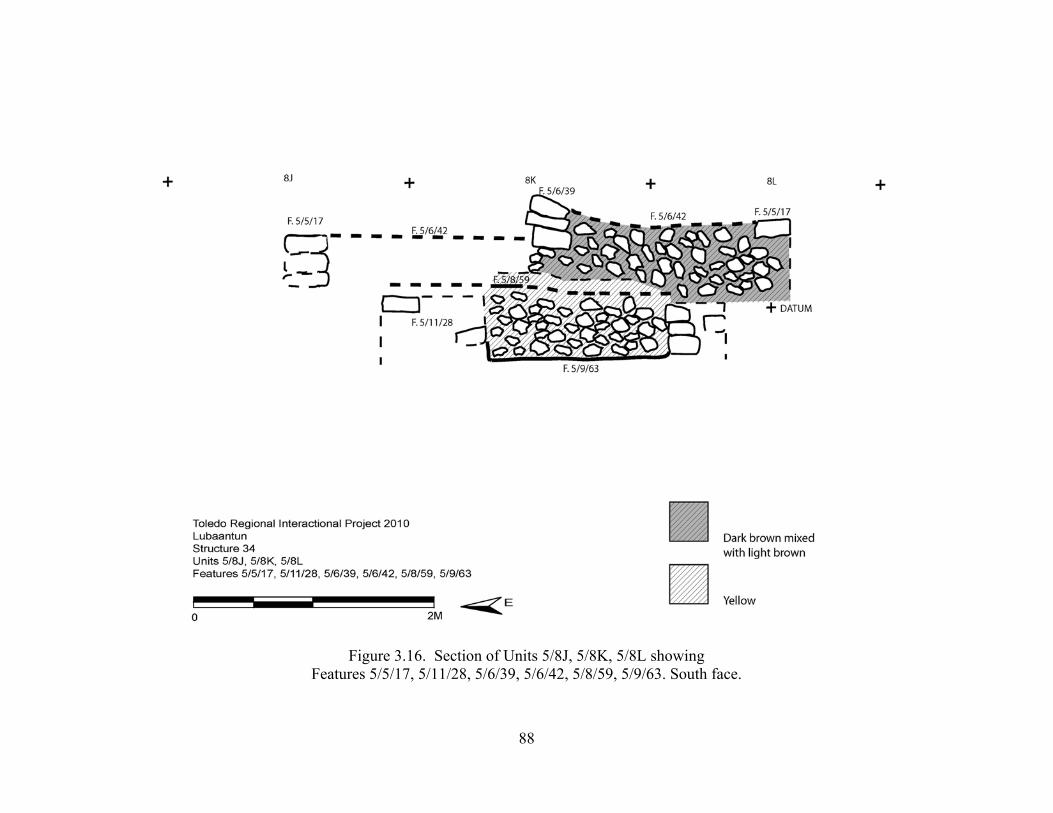
88
Figure 3.16. Section of Units 5/8J, 5/8K, 5/8L showing Features 5/5/17, 5/11/28, 5/6/39, 5/6/42, 5/8/59, 5/9/63. South face.
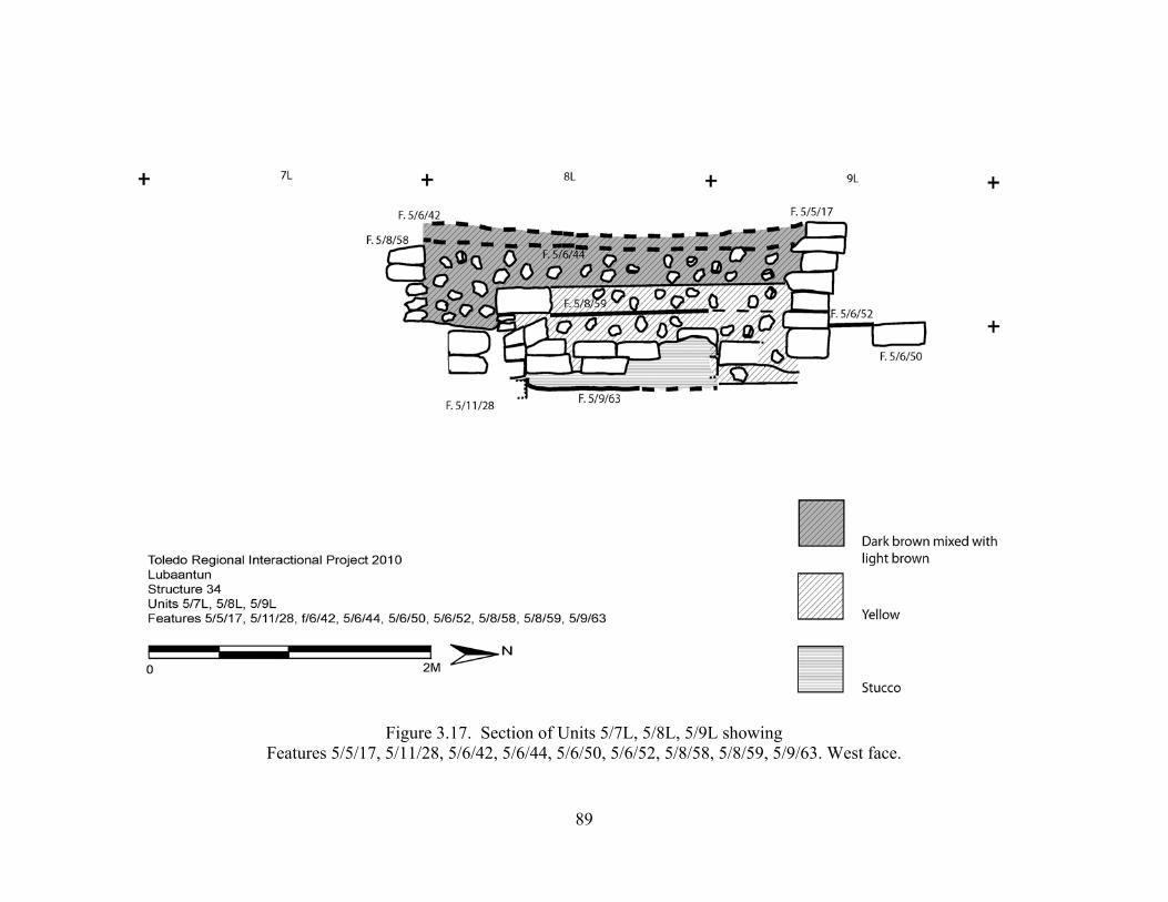
89
Figure 3.17. Section of Units 5/7L, 5/8L, 5/9L showing Features 5/5/17, 5/11/28, 5/6/42, 5/6/44, 5/6/50, 5/6/52, 5/8/58, 5/8/59, 5/9/63. West face.
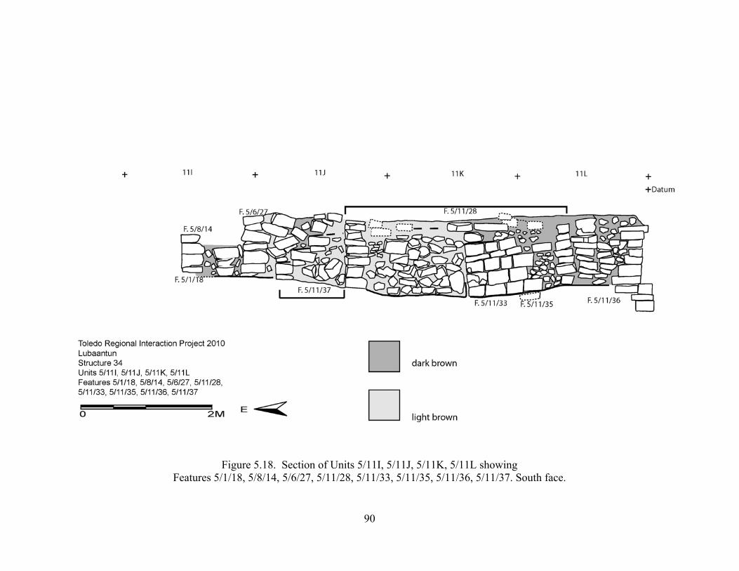
90
Figure 5.18. Section of Units 5/11I, 5/11J, 5/11K, 5/11L showing Features 5/1/18, 5/8/14, 5/6/27, 5/11/28, 5/11/33, 5/11/35, 5/11/36, 5/11/37. South face.
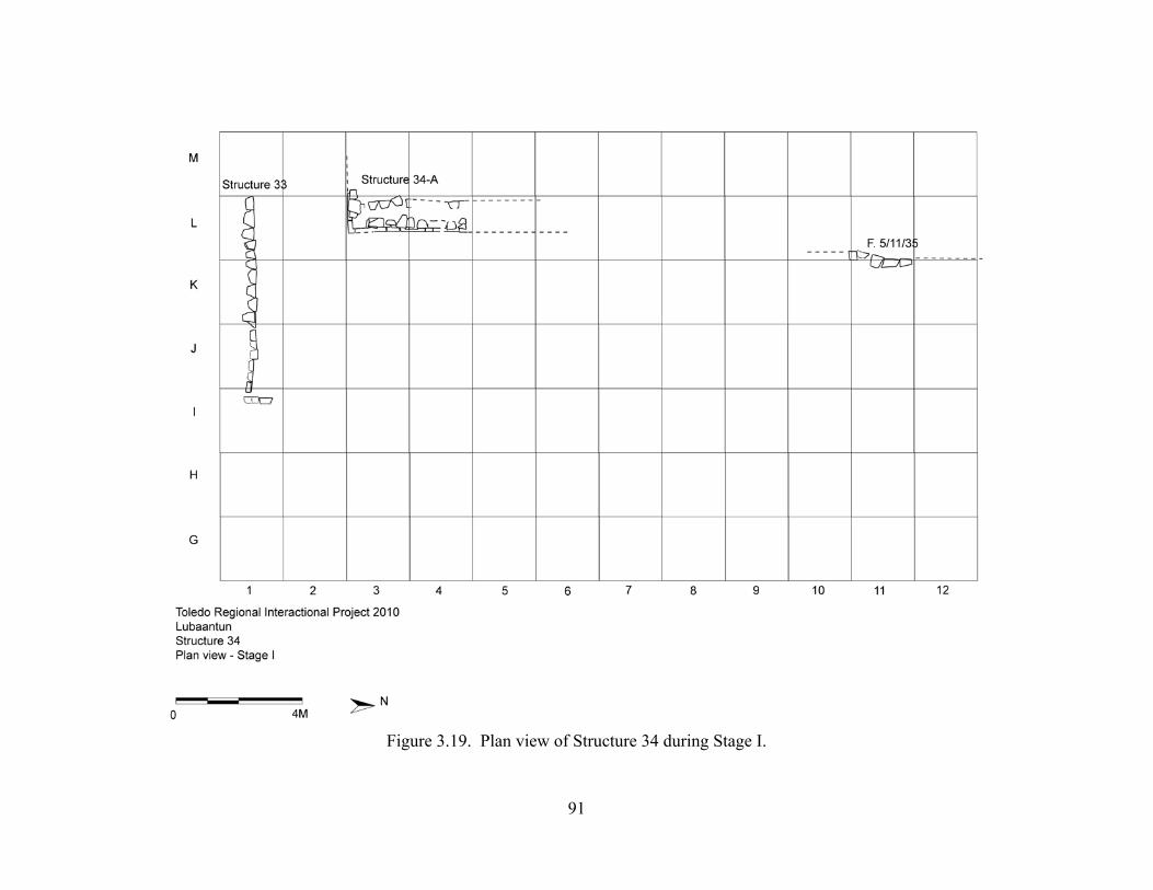
91
Figure 3.19. Plan view of Structure 34 during Stage I.
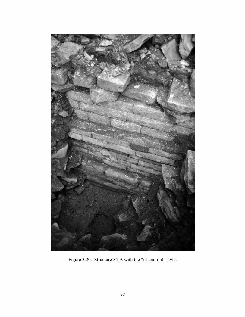
92
Figure 3.20. Structure 34-A with the “in-and-out” style.
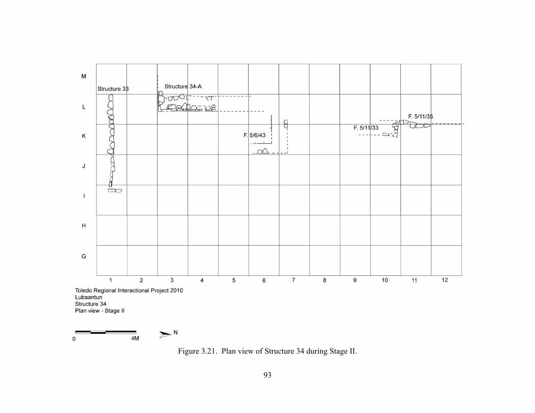
93
Figure 3.21. Plan view of Structure 34 during Stage II.
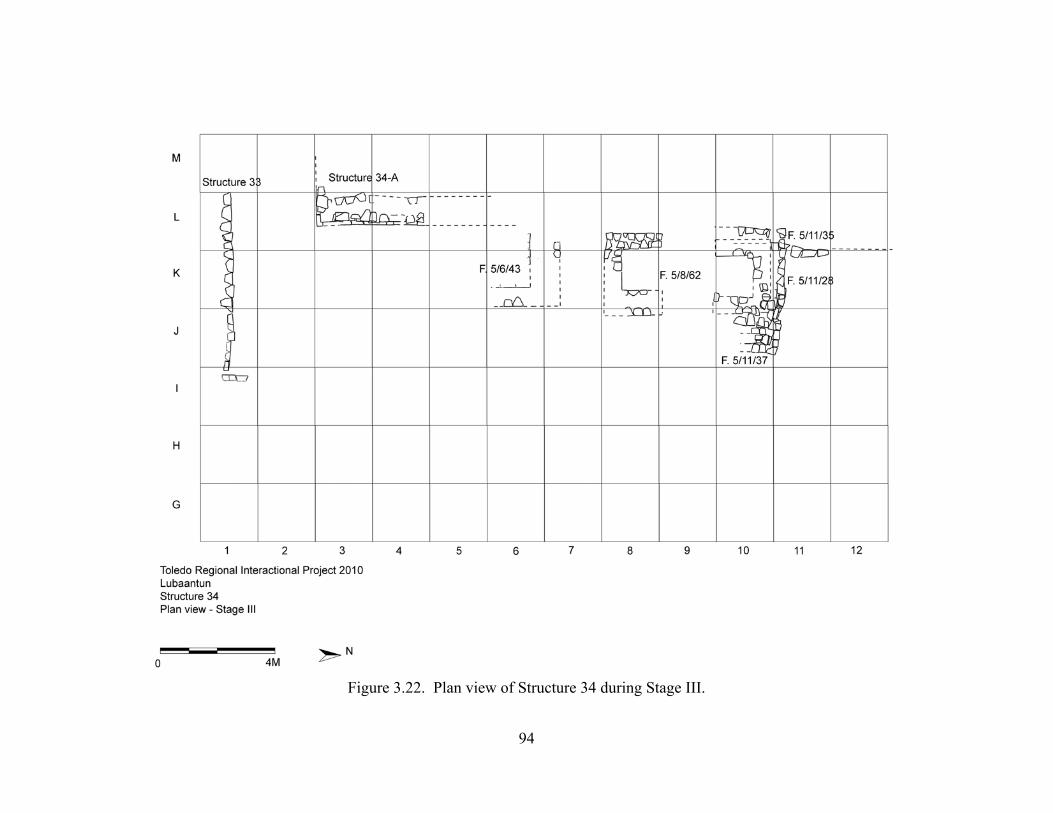
94
Figure 3.22. Plan view of Structure 34 during Stage III.
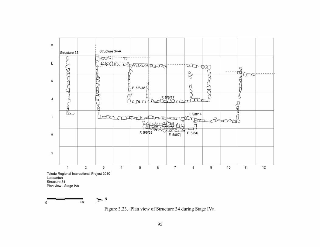
95
Figure 3.23. Plan view of Structure 34 during Stage IVa.
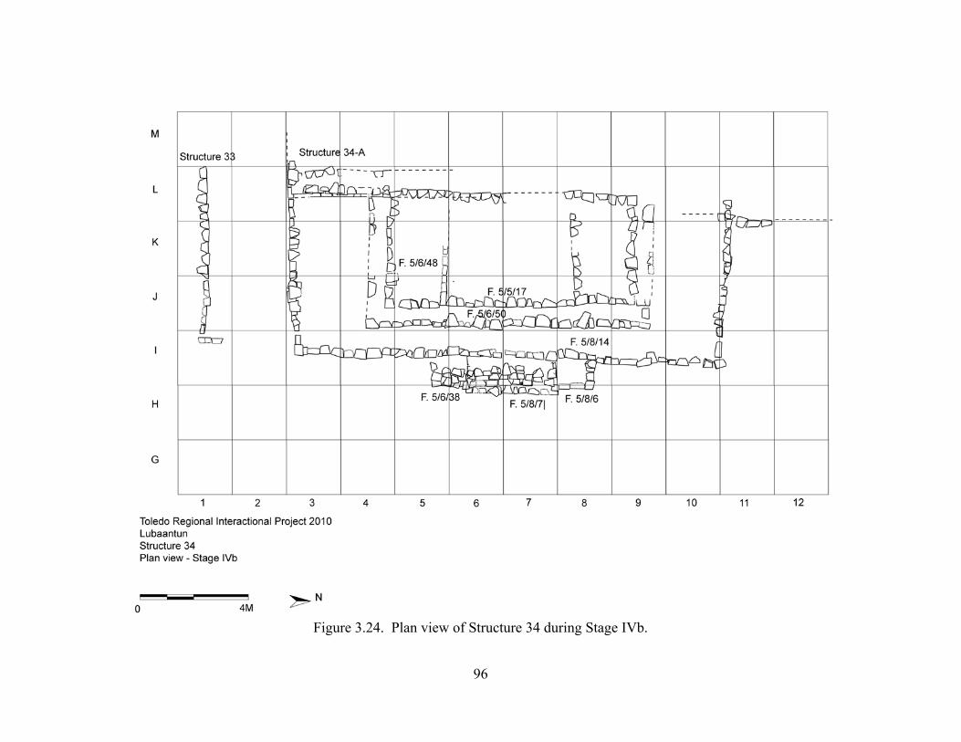
96
Figure 3.24. Plan view of Structure 34 during Stage IVb.
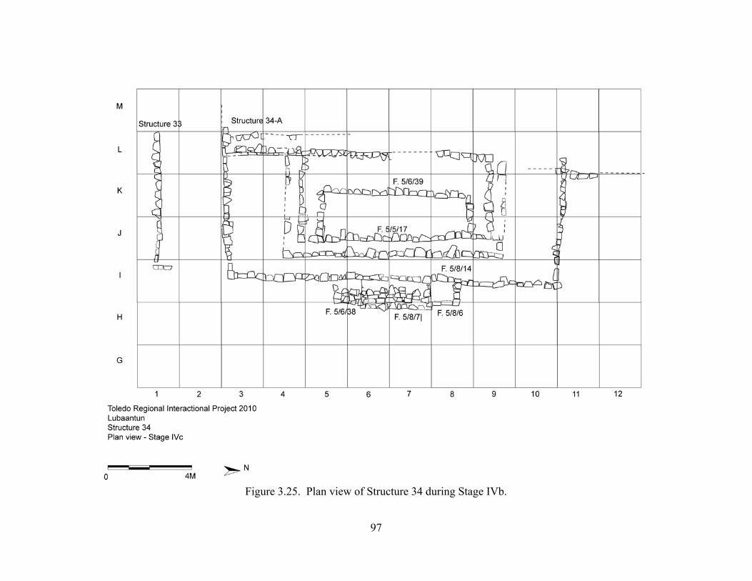
97
Figure 3.25. Plan view of Structure 34 during Stage IVb.
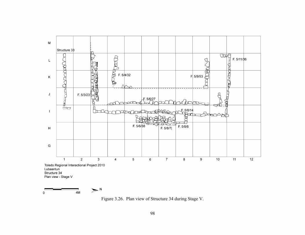
98
Figure 3.26. Plan view of Structure 34 during Stage V.
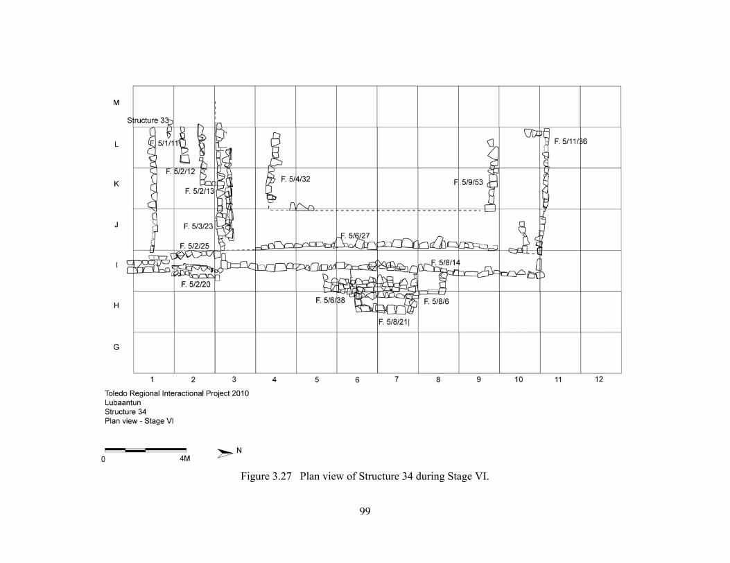
99
Figure 3.27 Plan view of Structure 34 during Stage VI.
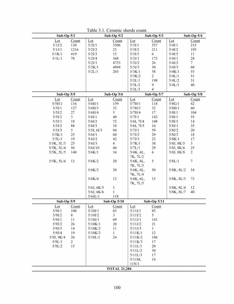
100
Table 3.1. Ceramic sherds count. Sub-Op 5/1 Sub-Op 5/2 Sub-Op 5/3 Sub-Op 5/4
Lot Count Lot Count Lot Count Lot Count 5/1I/2 130 5/2I/1 3506 5/3I/1 557 5/4I/1 215 5/1J/1 1216 5/2I/2 23 5/3I/2 211 5/4I/2 195 5/1K/1 419 5/2I/3 15 5/3I/3 6 5/4I/3 11 5/1L/1 78 5/2I/4 368 5/3J/1 173 5/4J/1 28
5/2J/1 4753 5/3J/2 26 5/4J/2 7 5/2K/1 4894 5/3J/3 30 5/4J/3 60 5/2L/1 203 5/3K/1 58 5/4K/1 55 5/3K/2 2 5/4L/1 51 5/3L/1 198 5/4L/2 31 5/3L/2 9 5/4L/3 40 5/3L/3 4 Sub-Op 5/5 Sub-Op 5/6 Sub-Op 5/7 Sub-Op 5/8
Lot Count Lot Count Lot Count Lot Count 5/5H/1 116 5/6H/1 159 5/7H/1 118 5/8G/1 42 5/5I/1 127 5/6H/3 33 5/7H/3 32 5/8H/1 60 5/5I/2 27 5/6H/4 5 5/7H/4 17 5/8I/1 104 5/5I/3 3 5/6I/1 40 5/7I/1 142 5/8I/1 55 5/5J/1 18 5/6I/2 72 5/6I, 7I/4 148 5/8I/3 14 5/5J/2 88 5/6I/3 10 5/6I, 7I/5 16 5/8J/1 35 5/5J/3 5 5/5I, 6I/3 94 5/7J/1 59 5/8J/2 20 5/5K/1 25 5/6J/1 60 5/7J/2 29 5/8J/3 18 5/5L/1 19 5/6J/2 42 5/7J/3 23 5/8K/1 17
5/5K, 5L/3 25 5/6J/3 4 5/7K/1 38 5/8J, 8K/5 3 5/5K, 5L/4 56 5/6J/10 44 5/7L/1 29 5/8J, 8K/6 25 5/5K, 5L/5 140 5/6K/1 34 5/6K, 6L,
7K, 7L/2 6 5/8J, 8K/8 2
5/5K, 5L/6 13 5/6K/2 20 5/6K, 6L, 7K, 7L/3
5 5/8L/1 7
5/6K/3 30 5/6K, 6L, 7K, 7L/4
50 5/8K, 8L/2 54
5/6K/4 12 5/6K, 6L, 7K, 7L/5
15 5/8K, 8L/3 73
5/6J, 6K/5 1 5/8K, 8L/4 12 5/6J, 6K/6 1 5/8K, 8L/7 40 5/6JL/1 118 Sub-Op 5/9 Sub-Op 5/10 Sub-Op 5/11
Lot Count Lot Count Lot Count 5/9I/1 100 5/10I/1 65 5/11I/1 85 5/9I/2 8 5/10I/2 3 5/11I/2 5 5/9J/1 11 5/10J/1 69 5/11J/1 141 5/9J/2 26 5/10K/1 20 5/11J/2 21 5/9J/3 14 5/10K/2 11 5/11J/3 1 5/9J/4 19 5/10K/3 1 5/11K/1 12
5/9J, 9K/4 26 5/10L/1 24 5/11K/2 186 5/9L/1 2 5/11K/3 17 5/9L/2 15 5/11L/1 20
5/11L/2 30 5/11L/3 17 5/11M,
11N/1 14
TOTAL 21,284
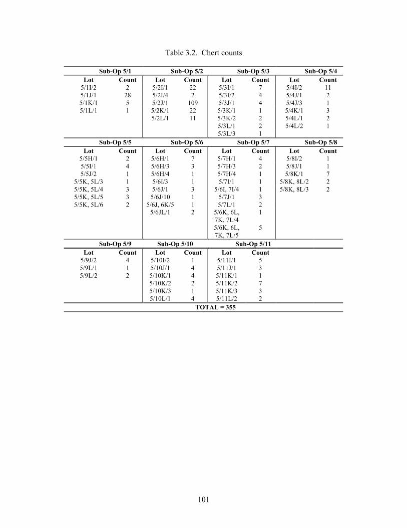
101
Table 3.2. Chert counts
Sub-Op 5/1 Sub-Op 5/2 Sub-Op 5/3 Sub-Op 5/4 Lot Count Lot Count Lot Count Lot Count
5/1I/2 2 5/2I/1 22 5/3I/1 7 5/4I/2 11 5/1J/1 28 5/2I/4 2 5/3I/2 4 5/4J/1 2 5/1K/1 5 5/2J/1 109 5/3J/1 4 5/4J/3 1 5/1L/1 1 5/2K/1 22 5/3K/1 1 5/4K/1 3
5/2L/1 11 5/3K/2 2 5/4L/1 2 5/3L/1 2 5/4L/2 1 5/3L/3 1 Sub-Op 5/5 Sub-Op 5/6 Sub-Op 5/7 Sub-Op 5/8
Lot Count Lot Count Lot Count Lot Count 5/5H/1 2 5/6H/1 7 5/7H/1 4 5/8I/2 1 5/5I/1 4 5/6H/3 3 5/7H/3 2 5/8J/1 1 5/5J/2 1 5/6H/4 1 5/7H/4 1 5/8K/1 7
5/5K, 5L/3 1 5/6I/3 1 5/7I/1 1 5/8K, 8L/2 2 5/5K, 5L/4 3 5/6J/1 3 5/6I, 7I/4 1 5/8K, 8L/3 2 5/5K, 5L/5 3 5/6J/10 1 5/7J/1 3 5/5K, 5L/6 2 5/6J, 6K/5 1 5/7L/1 2
5/6JL/1 2 5/6K, 6L, 7K, 7L/4
1
5/6K, 6L, 7K, 7L/5
5
Sub-Op 5/9 Sub-Op 5/10 Sub-Op 5/11 Lot Count Lot Count Lot Count
5/9J/2 4 5/10I/2 1 5/11I/1 5 5/9L/1 1 5/10J/1 4 5/11J/1 3 5/9L/2 2 5/10K/1 4 5/11K/1 1
5/10K/2 2 5/11K/2 7 5/10K/3 1 5/11K/3 3 5/10L/1 4 5/11L/2 2
TOTAL = 355
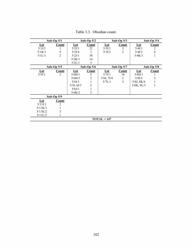
102
Table 3.3. Obsidian count.
Sub-Op 5/1 Sub-Op 5/2 Sub-Op 5/3 Sub-Op 5/4 Lot Count Lot Count Lot Count Lot Count
5/1I/2 1 5/2I/1 22 5/3I/1 3 5/4I/1 2 5/1K/1 9 5/2I/4 2 5/3I/2 2 5/4I/2 4 5/1L/1 2 5/2J/1 38 5/4K/1 1
5/2K/1 14 5/2L/1 3 Sub-Op 5/5 Sub-Op 5/6 Sub-Op 5/7 Sub-Op 5/8
Lot Count Lot Count Lot Count Lot Count 5/5I/1 2 5/6H/1 5 5/7I/1 10 5/8H/1 1
5/6H/3 2 5/6I, 7I/4 3 5/8I/2 2 5/6I/1 1 5/7L/1 3 5/8J, 8K/6 1 5/5I, 6I/3 2 5/8K, 8L/3 1 5/6J/1 1 5/6K/2 3 Sub-Op 5/9
Lot Count 5/11I/1 2 5/11K/1 1 5/11K/2 3 5/11L/3 1
TOTAL = 147
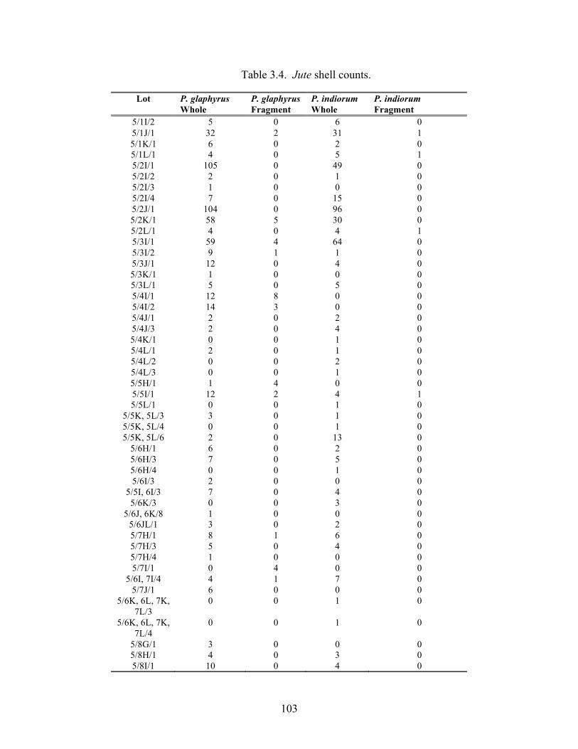
103
Table 3.4. Jute shell counts.
Lot P. glaphyrus Whole
P. glaphyrus Fragment
P. indiorum Whole
P. indiorum Fragment
5/1I/2 5 0 6 0 5/1J/1 32 2 31 1 5/1K/1 6 0 2 0 5/1L/1 4 0 5 1 5/2I/1 105 0 49 0 5/2I/2 2 0 1 0 5/2I/3 1 0 0 0 5/2I/4 7 0 15 0 5/2J/1 104 0 96 0 5/2K/1 58 5 30 0 5/2L/1 4 0 4 1 5/3I/1 59 4 64 0 5/3I/2 9 1 1 0 5/3J/1 12 0 4 0 5/3K/1 1 0 0 0 5/3L/1 5 0 5 0 5/4I/1 12 8 0 0 5/4I/2 14 3 0 0 5/4J/1 2 0 2 0 5/4J/3 2 0 4 0 5/4K/1 0 0 1 0 5/4L/1 2 0 1 0 5/4L/2 0 0 2 0 5/4L/3 0 0 1 0 5/5H/1 1 4 0 0 5/5I/1 12 2 4 1 5/5L/1 0 0 1 0
5/5K, 5L/3 3 0 1 0 5/5K, 5L/4 0 0 1 0 5/5K, 5L/6 2 0 13 0
5/6H/1 6 0 2 0 5/6H/3 7 0 5 0 5/6H/4 0 0 1 0 5/6I/3 2 0 0 0
5/5I, 6I/3 7 0 4 0 5/6K/3 0 0 3 0
5/6J, 6K/8 1 0 0 0 5/6JL/1 3 0 2 0 5/7H/1 8 1 6 0 5/7H/3 5 0 4 0 5/7H/4 1 0 0 0 5/7I/1 0 4 0 0
5/6I, 7I/4 4 1 7 0 5/7J/1 6 0 0 0
5/6K, 6L, 7K, 7L/3
0 0 1 0
5/6K, 6L, 7K, 7L/4
0 0 1 0
5/8G/1 3 0 0 0 5/8H/1 4 0 3 0 5/8I/1 10 0 4 0
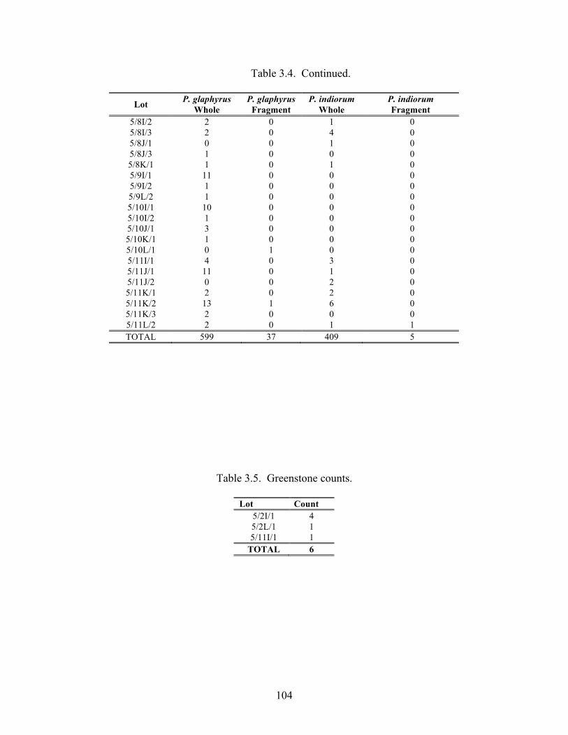
104
Table 3.4. Continued.
Lot P. glaphyrus Whole
P. glaphyrus Fragment
P. indiorum Whole
P. indiorum Fragment
5/8I/2 2 0 1 0 5/8I/3 2 0 4 0 5/8J/1 0 0 1 0 5/8J/3 1 0 0 0 5/8K/1 1 0 1 0 5/9I/1 11 0 0 0 5/9I/2 1 0 0 0 5/9L/2 1 0 0 0 5/10I/1 10 0 0 0 5/10I/2 1 0 0 0 5/10J/1 3 0 0 0 5/10K/1 1 0 0 0 5/10L/1 0 1 0 0 5/11I/1 4 0 3 0 5/11J/1 11 0 1 0 5/11J/2 0 0 2 0 5/11K/1 2 0 2 0 5/11K/2 13 1 6 0 5/11K/3 2 0 0 0 5/11L/2 2 0 1 1 TOTAL 599 37 409 5
Table 3.5. Greenstone counts.
Lot Count 5/2I/1 4 5/2L/1 1 5/11I/1 1
TOTAL 6
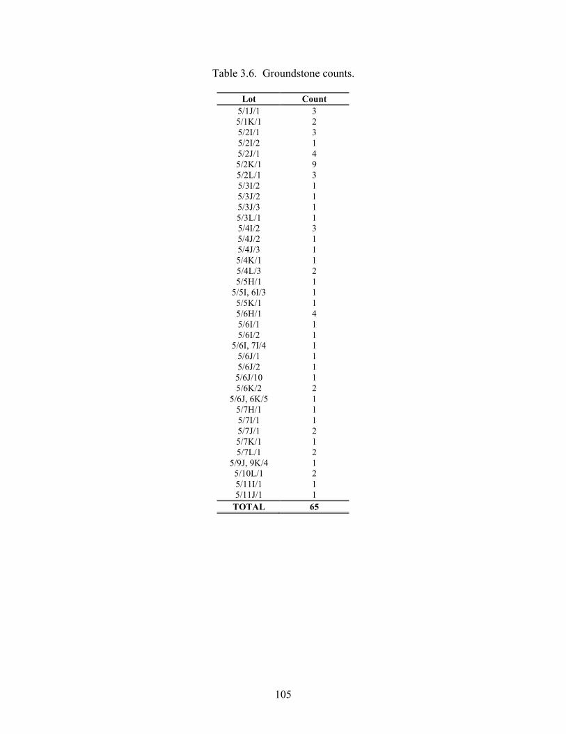
105
Table 3.6. Groundstone counts.
Lot Count 5/1J/1 3 5/1K/1 2 5/2I/1 3 5/2I/2 1 5/2J/1 4 5/2K/1 9 5/2L/1 3 5/3I/2 1 5/3J/2 1 5/3J/3 1 5/3L/1 1 5/4I/2 3 5/4J/2 1 5/4J/3 1 5/4K/1 1 5/4L/3 2 5/5H/1 1
5/5I, 6I/3 1 5/5K/1 1 5/6H/1 4 5/6I/1 1 5/6I/2 1
5/6I, 7I/4 1 5/6J/1 1 5/6J/2 1
5/6J/10 1 5/6K/2 2
5/6J, 6K/5 1 5/7H/1 1 5/7I/1 1 5/7J/1 2 5/7K/1 1 5/7L/1 2
5/9J, 9K/4 1 5/10L/1 2 5/11I/1 1 5/11J/1 1
TOTAL 65
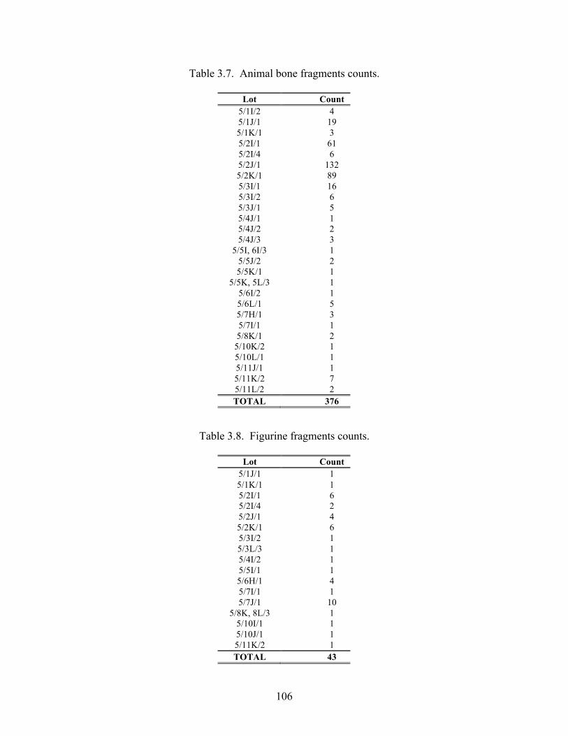
106
Table 3.7. Animal bone fragments counts.
Lot Count 5/1I/2 4 5/1J/1 19 5/1K/1 3 5/2I/1 61 5/2I/4 6 5/2J/1 132 5/2K/1 89 5/3I/1 16 5/3I/2 6 5/3J/1 5 5/4J/1 1 5/4J/2 2 5/4J/3 3
5/5I, 6I/3 1 5/5J/2 2 5/5K/1 1
5/5K, 5L/3 1 5/6I/2 1 5/6L/1 5 5/7H/1 3 5/7I/1 1 5/8K/1 2
5/10K/2 1 5/10L/1 1 5/11J/1 1 5/11K/2 7 5/11L/2 2 TOTAL 376
Table 3.8. Figurine fragments counts.
Lot Count 5/1J/1 1 5/1K/1 1 5/2I/1 6 5/2I/4 2 5/2J/1 4 5/2K/1 6 5/3I/2 1 5/3L/3 1 5/4I/2 1 5/5I/1 1 5/6H/1 4 5/7I/1 1 5/7J/1 10
5/8K, 8L/3 1 5/10I/1 1 5/10J/1 1 5/11K/2 1 TOTAL 43
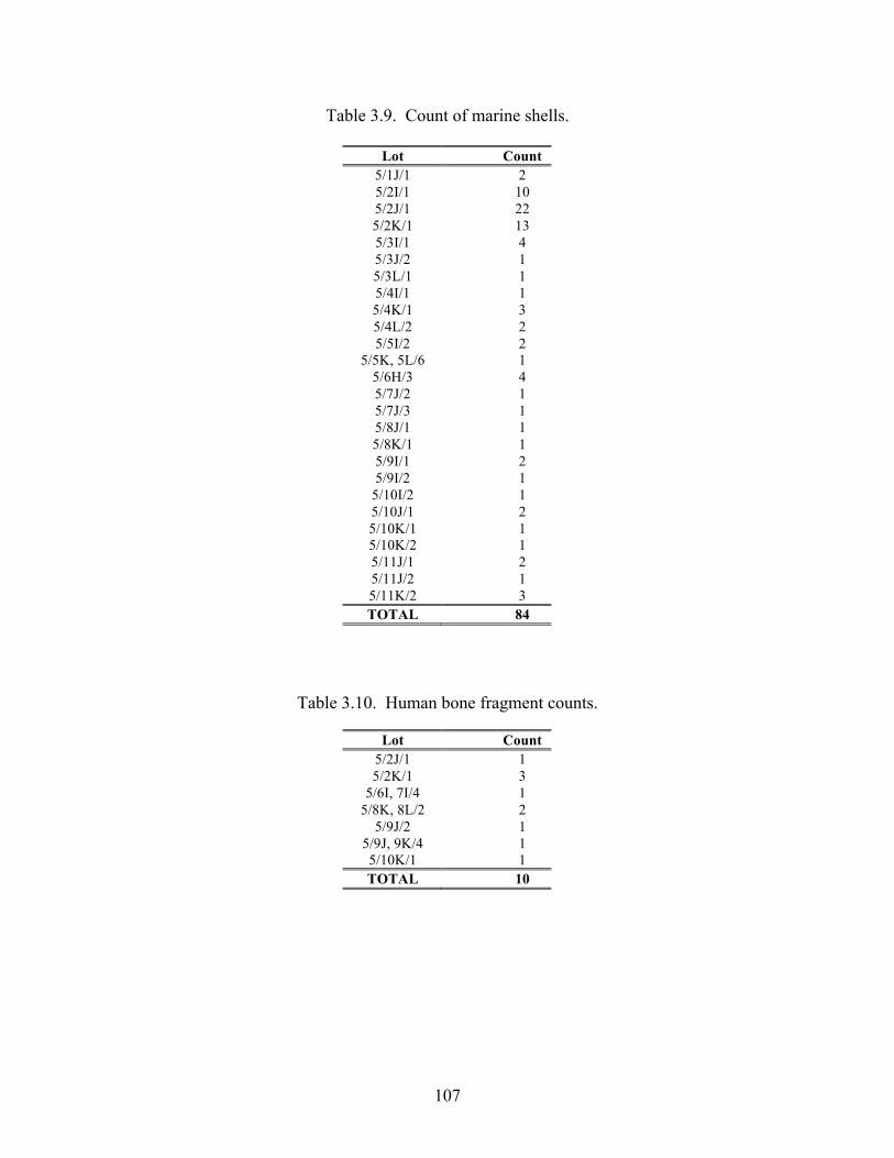
107
Table 3.9. Count of marine shells.
Lot Count 5/1J/1 2 5/2I/1 10 5/2J/1 22 5/2K/1 13 5/3I/1 4 5/3J/2 1 5/3L/1 1 5/4I/1 1 5/4K/1 3 5/4L/2 2 5/5I/2 2
5/5K, 5L/6 1 5/6H/3 4 5/7J/2 1 5/7J/3 1 5/8J/1 1 5/8K/1 1 5/9I/1 2 5/9I/2 1
5/10I/2 1 5/10J/1 2 5/10K/1 1 5/10K/2 1 5/11J/1 2 5/11J/2 1 5/11K/2 3 TOTAL 84
Table 3.10. Human bone fragment counts.
Lot Count 5/2J/1 1 5/2K/1 3
5/6I, 7I/4 1 5/8K, 8L/2 2
5/9J/2 1 5/9J, 9K/4 1 5/10K/1 1 TOTAL 10
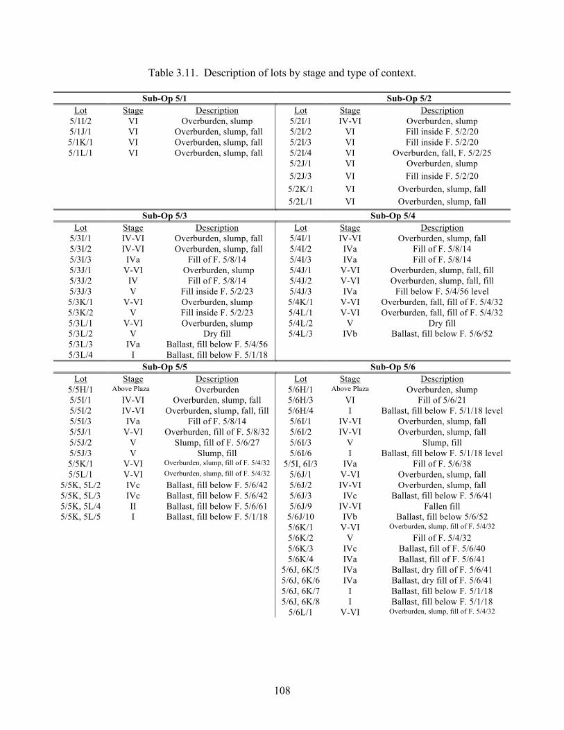
108
Table 3.11. Description of lots by stage and type of context.
Sub-Op 5/1 Sub-Op 5/2 Lot Stage Description Lot Stage Description
5/1I/2 VI Overburden, slump 5/2I/1 IV-VI Overburden, slump 5/1J/1 VI Overburden, slump, fall 5/2I/2 VI Fill inside F. 5/2/20 5/1K/1 VI Overburden, slump, fall 5/2I/3 VI Fill inside F. 5/2/20 5/1L/1 VI Overburden, slump, fall 5/2I/4 VI Overburden, fall, F. 5/2/25
5/2J/1 VI Overburden, slump 5/2J/3 VI Fill inside F. 5/2/20 5/2K/1 VI Overburden, slump, fall 5/2L/1 VI Overburden, slump, fall
Sub-Op 5/3 Sub-Op 5/4 Lot Stage Description Lot Stage Description
5/3I/1 IV-VI Overburden, slump, fall 5/4I/1 IV-VI Overburden, slump, fall 5/3I/2 IV-VI Overburden, slump, fall 5/4I/2 IVa Fill of F. 5/8/14 5/3I/3 IVa Fill of F. 5/8/14 5/4I/3 IVa Fill of F. 5/8/14 5/3J/1 V-VI Overburden, slump 5/4J/1 V-VI Overburden, slump, fall, fill 5/3J/2 IV Fill of F. 5/8/14 5/4J/2 V-VI Overburden, slump, fall, fill 5/3J/3 V Fill inside F. 5/2/23 5/4J/3 IVa Fill below F. 5/4/56 level 5/3K/1 V-VI Overburden, slump 5/4K/1 V-VI Overburden, fall, fill of F. 5/4/32 5/3K/2 V Fill inside F. 5/2/23 5/4L/1 V-VI Overburden, fall, fill of F. 5/4/32 5/3L/1 V-VI Overburden, slump 5/4L/2 V Dry fill 5/3L/2 V Dry fill 5/4L/3 IVb Ballast, fill below F. 5/6/52 5/3L/3 IVa Ballast, fill below F. 5/4/56 5/3L/4 I Ballast, fill below F. 5/1/18
Sub-Op 5/5 Sub-Op 5/6 Lot Stage Description Lot Stage Description
5/5H/1 Above Plaza Overburden 5/6H/1 Above Plaza Overburden, slump 5/5I/1 IV-VI Overburden, slump, fall 5/6H/3 VI Fill of 5/6/21 5/5I/2 IV-VI Overburden, slump, fall, fill 5/6H/4 I Ballast, fill below F. 5/1/18 level 5/5I/3 IVa Fill of F. 5/8/14 5/6I/1 IV-VI Overburden, slump, fall 5/5J/1 V-VI Overburden, fill of F. 5/8/32 5/6I/2 IV-VI Overburden, slump, fall 5/5J/2 V Slump, fill of F. 5/6/27 5/6I/3 V Slump, fill 5/5J/3 V Slump, fill 5/6I/6 I Ballast, fill below F. 5/1/18 level 5/5K/1 V-VI Overburden, slump, fill of F. 5/4/32 5/5I, 6I/3 IVa Fill of F. 5/6/38 5/5L/1 V-VI Overburden, slump, fill of F. 5/4/32 5/6J/1 V-VI Overburden, slump, fall
5/5K, 5L/2 IVc Ballast, fill below F. 5/6/42 5/6J/2 IV-VI Overburden, slump, fall 5/5K, 5L/3 IVc Ballast, fill below F. 5/6/42 5/6J/3 IVc Ballast, fill below F. 5/6/41 5/5K, 5L/4 II Ballast, fill below F. 5/6/61 5/6J/9 IV-VI Fallen fill 5/5K, 5L/5 I Ballast, fill below F. 5/1/18 5/6J/10 IVb Ballast, fill below 5/6/52
5/6K/1 V-VI Overburden, slump, fill of F. 5/4/32 5/6K/2 V Fill of F. 5/4/32 5/6K/3 IVc Ballast, fill of F. 5/6/40 5/6K/4 IVa Ballast, fill of F. 5/6/41 5/6J, 6K/5 IVa Ballast, dry fill of F. 5/6/41 5/6J, 6K/6 IVa Ballast, dry fill of F. 5/6/41 5/6J, 6K/7 I Ballast, fill below F. 5/1/18 5/6J, 6K/8 I Ballast, fill below F. 5/1/18 5/6L/1 V-VI Overburden, slump, fill of F. 5/4/32
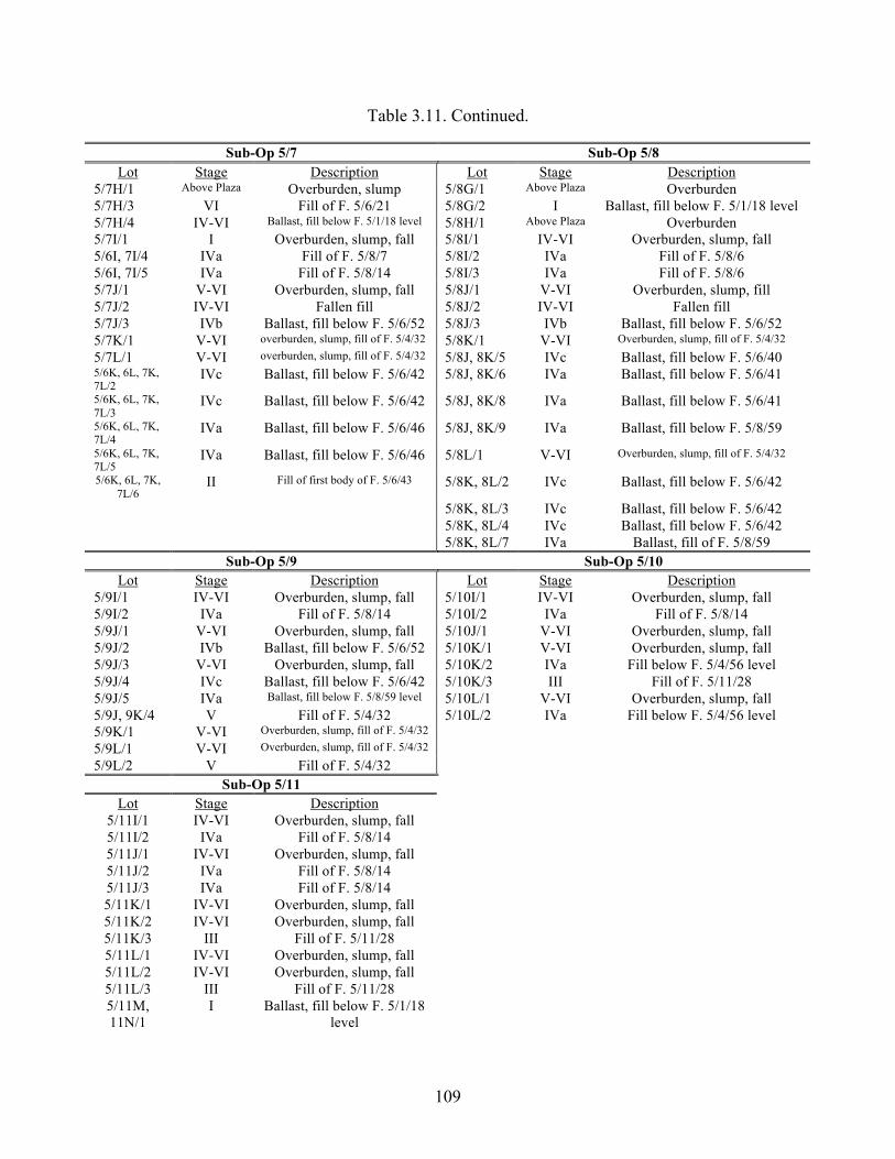
109
Table 3.11. Continued.
Sub-Op 5/7 Sub-Op 5/8 Lot Stage Description Lot Stage Description
5/7H/1 Above Plaza Overburden, slump 5/8G/1 Above Plaza Overburden 5/7H/3 VI Fill of F. 5/6/21 5/8G/2 I Ballast, fill below F. 5/1/18 level 5/7H/4 IV-VI Ballast, fill below F. 5/1/18 level 5/8H/1 Above Plaza Overburden 5/7I/1 I Overburden, slump, fall 5/8I/1 IV-VI Overburden, slump, fall 5/6I, 7I/4 IVa Fill of F. 5/8/7 5/8I/2 IVa Fill of F. 5/8/6 5/6I, 7I/5 IVa Fill of F. 5/8/14 5/8I/3 IVa Fill of F. 5/8/6 5/7J/1 V-VI Overburden, slump, fall 5/8J/1 V-VI Overburden, slump, fill 5/7J/2 IV-VI Fallen fill 5/8J/2 IV-VI Fallen fill 5/7J/3 IVb Ballast, fill below F. 5/6/52 5/8J/3 IVb Ballast, fill below F. 5/6/52 5/7K/1 V-VI overburden, slump, fill of F. 5/4/32 5/8K/1 V-VI Overburden, slump, fill of F. 5/4/32 5/7L/1 V-VI overburden, slump, fill of F. 5/4/32 5/8J, 8K/5 IVc Ballast, fill below F. 5/6/40 5/6K, 6L, 7K, 7L/2
IVc Ballast, fill below F. 5/6/42 5/8J, 8K/6 IVa Ballast, fill below F. 5/6/41
5/6K, 6L, 7K, 7L/3
IVc Ballast, fill below F. 5/6/42 5/8J, 8K/8 IVa Ballast, fill below F. 5/6/41
5/6K, 6L, 7K, 7L/4
IVa Ballast, fill below F. 5/6/46 5/8J, 8K/9 IVa Ballast, fill below F. 5/8/59
5/6K, 6L, 7K, 7L/5
IVa Ballast, fill below F. 5/6/46 5/8L/1 V-VI Overburden, slump, fill of F. 5/4/32
5/6K, 6L, 7K, 7L/6
II Fill of first body of F. 5/6/43 5/8K, 8L/2 IVc Ballast, fill below F. 5/6/42
5/8K, 8L/3 IVc Ballast, fill below F. 5/6/42 5/8K, 8L/4 IVc Ballast, fill below F. 5/6/42 5/8K, 8L/7 IVa Ballast, fill of F. 5/8/59
Sub-Op 5/9 Sub-Op 5/10 Lot Stage Description Lot Stage Description
5/9I/1 IV-VI Overburden, slump, fall 5/10I/1 IV-VI Overburden, slump, fall 5/9I/2 IVa Fill of F. 5/8/14 5/10I/2 IVa Fill of F. 5/8/14 5/9J/1 V-VI Overburden, slump, fall 5/10J/1 V-VI Overburden, slump, fall 5/9J/2 IVb Ballast, fill below F. 5/6/52 5/10K/1 V-VI Overburden, slump, fall 5/9J/3 V-VI Overburden, slump, fall 5/10K/2 IVa Fill below F. 5/4/56 level 5/9J/4 IVc Ballast, fill below F. 5/6/42 5/10K/3 III Fill of F. 5/11/28 5/9J/5 IVa Ballast, fill below F. 5/8/59 level 5/10L/1 V-VI Overburden, slump, fall 5/9J, 9K/4 V Fill of F. 5/4/32 5/10L/2 IVa Fill below F. 5/4/56 level 5/9K/1 V-VI Overburden, slump, fill of F. 5/4/32
5/9L/1 V-VI Overburden, slump, fill of F. 5/4/32
5/9L/2 V Fill of F. 5/4/32
Sub-Op 5/11 Lot Stage Description
5/11I/1 IV-VI Overburden, slump, fall 5/11I/2 IVa Fill of F. 5/8/14 5/11J/1 IV-VI Overburden, slump, fall 5/11J/2 IVa Fill of F. 5/8/14 5/11J/3 IVa Fill of F. 5/8/14 5/11K/1 IV-VI Overburden, slump, fall 5/11K/2 IV-VI Overburden, slump, fall 5/11K/3 III Fill of F. 5/11/28 5/11L/1 IV-VI Overburden, slump, fall 5/11L/2 IV-VI Overburden, slump, fall 5/11L/3 III Fill of F. 5/11/28 5/11M, 11N/1
I Ballast, fill below F. 5/1/18 level
110
Chapter 4
Operation 6: Exploration of Lubaantun Structure 45
Kiri. L. Hagerman
Operation 6 of the 2010 excavation season at Lubaantun in the Toledo District of
Belize consists of the horizontal and vertical excavations of Structure 45. Structure 45 is a single, low platform located on the western edge of Platform 84, elevated above and to the north of the Butterfly Plaza (Plaza VII). On its westernmost edge, the Butterfly Plaza contains Structures 51 and 52, which were excavated during the 2009 field season. Structure 45 lies just northeast of Structures 51 and 52 (Figure 4.1).
Norman Hammond (1975:58) describes Platform 84 as a “freestanding hill platform unconnected with the rest of the site…” and attributes it to the second of five major construction and expansion phases of Lubaantun. In his map of the civic-ceremonial center of Lubaantun (1975: Figure 21), Hammond shows Platform 84 to contain four separate structures, which were originally all residences. Structures 43 and 44, which are located on the eastern and southern edges of the platform, were at first probably modest residences but then 44 was converted into a minor temple pyramid with a set of steps leading down into the Butterfly Plaza, and Structure 43 was converted into a larger house platform (Hammond 1975:59). The third of these structures is not given an identifying number and is located between Structures 43 and 44 in the southeast corner of the platform. The fourth and final structure is Structure 45, which is situated along the western edge of the platform.
Hammond suggested that the only part of the site that had been occupied during Phase I was the area immediately around Platform 6 in the civic-ceremonial core (containing Structure 10). Phase II—to which Hammond believed Structure 45 and Platform 84 to belong—represents a massive both horizontal and vertical expansion of plaza groups and architecture in the site core of Lubaantun. Later Hammond says that the development of Platform 84 and its structures could have just as easily fallen into Phase III of construction, which would make them contemporary to Plaza VII and Structures 51 and 52, but for reasons to be discussed later, we believe that his earlier view is correct.
We conducted our excavations on this platform in order to expose the architecture associated with Structure 45 with the primary goal of determining its form, and occupation and use history. Norman Hammond’s (1975:59) settlement map shows Structure 45 as a small ballcourt consisting of two low, North-South oriented, parallel platforms, although in his text he refers to it as a possible residence. Prior to excavation the Structure 45 mound resembled two parallel mounds due to a depression running along its central north-south axis. Nonetheless, it became apparent after only two days of excavation that Structure 45 is actually a single low platform measuring approximately 8-m (East-West) by 13-m (North-South). It is likely that the depression observed in the unexcavated mound was created by tree fall and is not a feature of the underlying architecture. Having realized that what we were excavating was not, in fact, a ballcourt, we continued excavations in order to determine the construction and use history of the Structure 45 platform.
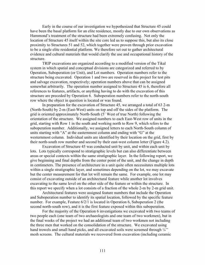
111
Early in the course of our investigation we hypothesized that Structure 45 could have been the basal platform for an elite residence, mostly due to our own observations as Hammond’s treatment of the structure had been extremely confusing. Not only the location of Structure 45 itself within the site core led us to suppose this, but also its close proximity to Structures 51 and 52, which together were proven through prior excavation to be a single elite residential platform. We therefore set out to gather architectural evidence and cultural materials that would clarify the use and occupational history of the structure.
TRIP excavations are organized according to a modified version of the Tikal system in which spatial and conceptual divisions are categorized and referred to by Operation, Suboperation (or Unit), and Lot numbers. Operation numbers refer to the structure being excavated. Operation 1 and two are reserved in this project for test pits and salvage excavation, respectively; operation numbers above that can be assigned somewhat arbitrarily. The operation number assigned to Structure 45 is 6, therefore all references to features, artifacts, or anything having to do with the excavation of this structure are preceded by Operation 6. Suboperation numbers refer to the north-south row where the object in question is located or was found.
In preparation for the excavation of Structure 45, we arranged a total of 63 2-m (North-South) by 2-m (East-West) units on top and off the sides of the platform. The grid is oriented approximately North-South (5˚ West of true North) following the orientation of the structure. We assigned numbers to each East-West row of units in the grid, starting with Row 1 in the south and working north to Row 9, which refers to the suboperation number. Additionally, we assigned letters to each North-South column of units starting with “A” at the easternmost column and ending with “G” at the westernmost column. Individual units are identified by their location on the grid, first by their north-south row number and second by their east-west column letter (Figure 4.2).
Excavation of Structure 45 was conducted unit by unit, and within each unit by lots. Lots typically correspond to stratigraphic levels but can also differentiate between areas or special contexts within the same stratigraphic layer. In the following report, we give beginning and final depths from the center point of the unit, and the change in depth in centimeters. The presence of architecture in a unit quite often necessitates multiple lots within a single stratigraphic layer, and sometimes depending on the lot, we may excavate but the center measurement for that lot will remain the same. For example, one lot may consist of excavating outside of an architectural feature while another lot involves excavating to the same level on the other side of the feature or within the structure. In this report we specify when a lot consists of a fraction of the whole 2-m by 2-m grid unit.
Architectural features were assigned feature numbers that include the Operation and Suboperation number to identify its spatial location, followed by the specific feature number. For example, Feature 6/2/1 is located in Operation 6, Suboperation 2 (the second north-south row), and it is the first feature exposed within this suboperation.
For the majority of the Operation 6 investigations we excavated with two teams of two people each (one team of two archaeologists and one team of two workmen), but in the final weeks of the project we had an additional team of two workmen not including the three men that worked on the consolidation of the structure. We excavated using hand trowels and small hand picks, and all excavated soils were screened through ¼’’ mesh screens. The cultural materials we recovered from excavation (including ceramic
112
sherds and figurines, obsidian, chert, jute shells, faunal bones, marine shells, groundstone, etc.) and the screened soils were immediately separated according to artifact material or type and placed in plastic bags that were given identification tags. All materials were counted on site after the completion of a lot and their numbers recorded on the lot forms. Afterwards, we washed and rebagged the artifacts for analysis and storage. Jute shells were the only exception to this process, and instead of storing them we counted them and discarded them in the nearby stream. Tables 4.2 through 4.7 list the count of all artifacts we recovered by lot.
Structure 45 was excavated almost in its entirety, the exceptions being due to time constraints. After excavation of each unit (and sometimes after each lot, if necessary) we photographed and drew all architecture and cut stones, whether still in situ, or slumped and fallen. Stones and features related to the final phase of construction (Phase III) were then taken out, a level surface was prepared, and then the stones were reset using carpenter’s levels, strings, and line levels. No mortar was used in the consolidation of Structure 45 although the Institute of Archaeology may wish to do so in the future. We completed a second set of drawings of the architectural features after consolidation and rephotographed the structure.
We organize the following account of our investigation of Structure 45 by suboperations and detail the excavation of each unit (or suboperation) by lot. We discuss the location of each unit and the progression of our excavation within it, including the description of the soil matrix, architectural features encountered within the unit, and a record of all the cultural materials recovered from each lot.
EXCAVATION OF STRUCTURE 45 Structure 45 is a low platform oriented roughly North-South along the
westernmost edge of Platform 84. The western edge of Platform 84 is a steep slope leading down to a small raised plaza located immediately north of Structure 51/52. The western slope (as it shall be referred to throughout this report) was terraced in several stages, the uppermost being the west-facing wall of Platform 84 itself. Operation 6 is not entirely limited to the excavation of Structure 45 alone. Several units (Units 6/2F, 6/3F, 6/3G, 6/4F, 6/4G, 6/5F, 6/5G, 6/6G) were excavated on the western slopes where we exposed three terrace walls in addition to the west-facing wall of Structure 45 (Figure 4.10).
Excavation of Structure 45 proceeded unit by unit, always beginning with the removal of organic surface material followed by the careful excavation of the underlying soil matrix. We started our investigation at the southern end of the structure in Suboperation 6/1. We employed both clearing and penetrating excavations in order to understand the full construction history of the structure. First, we conducted horizontal excavations to expose the terminal architecture of the structure (Phase III). Second, we employed vertical excavations of two test pits in the center of the structure to expose the earlier Phase I and Phase II architecture (Figure 4.9). The test pits yielded valuable information about the sequence of architectural features and construction activities associated with both Platform 84 and Structure 45. The purposes of our excavations were threefold: (1) to explore and understand the occupation and use history of Structure 45; (2) we to gather chronologically diagnostic evidence that would clarify the building
113
sequence of the structure; and (3) to recover and analyze cultural materials from the structure that would both impact our specific knowledge of the structure and more broadly our cultural knowledge of Lubaantun and the greater Terminal Classic Toledo District population. Suboperation 6/1 We placed Suboperation 6/1 along the southern edge of Structure 45, where its south-facing wall (F. 6/2/1) was visible at its northern edge. The excavated units included in this Suboperation are 6/1B, 6/1C, 6/1D, 6/1E, and 6/1F. We excavated these units in succession, with the exception of 6/1D. Originally, we decided not to excavate Unit 6/1D due to the presence of a large tree in the middle of the unit, which we initially believed destroyed the portion of south wall in that location. Nonetheless, upon further excavation in adjacent units (Units 6/1C and 6/1E) it was apparent that the roots of the tree, in fact, preserved the wall and we excavated Unit 6/1D towards the end of our excavations of Structure 45. While no features were found within this Suboperation, the southern face of F. 6/2/1 (located in Suboperation 6/2) was exposed during the excavation of this Suboperation (Figures 4.2 and 4.6).
Unit 6/1B. This unit is located 2-m south of the south wall of Structure 45 and directly south of the southeast corner of the structure. It contains the easternmost extension of F. 6/2/1, the south-facing wall of Structure 45. This unit was excavated in two lots: Lots 6/1B/1 and 6/1B/2.
The first lot consisted of clearing the organic surface material and underlying soils in order to expose the remains of the southern face of F. 6/2/1 to its bottommost course of stones, which corresponds to the surface of Platform 84. This material included O- and A-horizon soils composed of organic material and black/brown colored soil with small stones. We also excavated the slumped southeast corner of Structure 45. The wall is composed of three courses of stones in situ with just a few cut stones fallen just to the south outside the platform. The stones comprising the southeast corner of the structure have curved faces indicating that the platform contains round corners like those found on other structures in the site core such as the monumental Structures 10 and 12 on Plaza IV. At the base of F. 6/2/1 we found flecks of eroded plaster and small stone ballast, which comprised the surface of Platform 84 and indicates that both Structure 45 and Platform 84 were once plastered. We recovered one piece of chert and two obsidian prismatic blade fragments. The beginning depth in the center of the lot was -124-cm from our datum, and the final depth after excavation was -148-cm, with a change in depth of 24-cm.
The second lot involved removing the few cut stones that had fallen from the wall and excavating the A-horizon soil mixed with some small stones and platform ballast underneath. We recovered no cultural materials from this unit, and there was no change in depth in the center of the lot.
Unit 6/1C. Unit 6/1C is located immediately south of the south-facing wall of Structure 45 and approximately 1-m west of the southeast corner of the structure. We excavated this unit in four separate lots. The first lot (Lot 6/1C/1) was comprised of clearing away the surface material and the soil matrix down to the level of ballast associated with Platform 84 in order to expose the south-facing wall of Structure 45 and the fallen stones. The matrix was black earth composed of O- and A-horizon soils mixed
114
with small to medium ballast, small stones, and cut stones from the wall. Four courses of the wall were discovered in situ with a possible fifth course found directly on top of the wall, although this may have been placed there in modern times. There was a gap in the wall in the western portion of the unit, which is likely the result of root action from a large tree in 6/1D. Small plaster fragments still adhere to some of the faces of the stones that are in situ, and the sparse remains of a highly eroded plaster floor were located above the level of ballast. We recovered the following cultural materials from this lot: six ceramic sherds, one obsidian fragment, and five fragments of chert. The beginning depth in the center of the lot was -123-cm from our datum, and the final depth after excavation was -145-cm, with a change in depth of 22-cm.
The second lot (Lot 6/1C/2) involved removing the cut stones fallen from Feature 6/2/1 and excavating the soil matrix beneath them in order to expose the top of Platform 84. The matrix we excavated included A-horizon soil mixed with small stones and some platform ballast. We recovered 78 ceramic sherds, two whole and one fragmentary P. indiorum shells (smooth jute). The majority of the ceramics in this lot came from a concentration near the northern edge of the unit (just south of the south-facing wall, F. 6/2/1) where a large portion of a vessel had been smashed and some of the sherds were still in situ on the ballast of the platform. The depth of the center remained the same from the previous lot.
In order to excavate Lot 6/1C/3, we had to remove the large tree roots that had trapped some of the fallen stones, after which we were able to remove the cut stones and excavate the soil matrix beneath them in order to expose the western continuation of Feature 6/2/1 and its bottom course. The matrix was comprised of A-horizon soil mixed with small stones and some ballast, and the only cultural materials we found in this lot were one piece of chert, and one P. indiorum (smooth jute) shell fragment. Similarly, there was no change in depth from the previous lot.
Lot 6/1C/4 involved the clearing of material while we were consolidating the wall. We only excavated a little A-horizon soil mixed with small stones underneath the stones of the wall. We recovered only one ceramic sherd from this lot, and again there was no change in depth in the center of the unit.
Unit 6/1D. Unit 6/1D is located 2-m south of the south-facing wall of Structure 45 and along the central North-South axis of the structure. We excavated this unit in only one lot (Lot 6/1D/1) due to the presence of a very large tree in the middle of the unit. Complete removal of the tree and its root ball proved impossible since it extended too deep into Platform 84. While attempting to remove it we excavated a little ways into the ballast layer of Platform 84. We were unable to leave any of the fallen stones in situ as they were all tangled up in the roots and the removal of the roots required their immediate removal as well. Unexpectedly, the tree inflicted hardly any damage to the wall (F. 6/2/1), and the section of the south-facing wall we exposed during the excavation of this unit was the most well-preserved of any we discovered during the excavation of Structure 45. There were five courses of the wall in situ. Three stones in the uppermost course were recessed about 15-cm, which parallels our findings from our excavations of the east-facing wall of the structure (F. 6/2/2). We recovered 32 ceramic sherds, two obsidian fragments, five pieces chert, and one whole P. indiorum shell. The beginning depth measurement in the center of the lot was -110-cm, and we excavated 62-cm to a final depth of -172-cm.
115
Unit 6/1E. Unit 6/1E is situated 2-m south of the south-facing wall of Structure 45 and 5-m west of the southeast corner. This unit was excavated in two lots. The first lot, Lot 6/1E/1, involved clearing surface material and excavating down to the level of Platform 84 to expose the south-facing wall (F. 6/2/1) of the structure. The matrix was black and brown earth of O- and A-horizons mixed with small stones, ballast, roots, and cut stones. We exposed three courses of the wall in situ with a possible fourth course that sits on the surface in the organic material, although this course could have been placed during modern times. There were fragments of plaster from the plaster floor of Platform 84, however, extensive damage was done to this and to the wall by the roots of the tree in Unit 6/1D. Several of the roots had to be removed to continue excavation. In the northeast corner of this unit there is an approximately 50-cm by 50-cm square that was excavated too deeply and went about 20-cm into the ballast level of the platform. Cultural materials recovered from this lot include: 19 ceramic sherds, two obsidian fragments, and two groundstone fragments (one fragment from the foot of a metate, and one other possible metate fragment). The beginning depth in the center of the lot was -132-cm from our datum, and the final depth after excavation was -161-cm, with a change in depth of 29-cm.
Lot 6/1E/2 involved removing the cut stones left in place after the excavation of lot 6/1E/1 and excavating the soil pedestals beneath them. For this reason, the matrix and cultural materials are virtually identical to Lot 6/1E/1. We recovered five ceramic sherds, one obsidian fragment, two pieces of chert, and two whole P. indiorum shells. There was no change in depth in this lot.
Unit 6/1F. Unit 6/1F is located 2-m south of the south wall of Structure 45 and is aligned with the west wall of the structure. It is situated on the western slope of Platform 84, leading to the small plaza immediately north of Structure 52. Since the southwest corner of the structure is just to the northeast of this unit, it contains no features. The unit was excavated in one lot, Lot 6/1F/1. Lot 6/1F/1 consisted of the removal of the surface material in order to reveal the collapsed remains of the southwest corner of Structure 45 and the west terrace of Platform 84. The matrix was composed of O- and A-horizon soils mixed with small stones. The excavation of this lot exposed jumbled cut stones with no discernible fall pattern. Additionally, we did not encounter an intact west-facing terrace feature representing the western edge of Platform 84. In the course of excavation we collected 26 ceramic sherds, two pieces of chert, three whole P. indiorum shells, and one groundstone fragment (possibly a fragment of a metate foot). The beginning depth measurement in the center of the lot was -190-cm, and we excavated 11-cm to a final depth of -201-cm.
Suboperation 6/2
Suboperation 6/2 is located directly north of Suboperation 6/1 following an East-West axial transect. It is situated immediately north of and containing the south wall of Structure 45, F. 6/2/1. During the course of excavation we exposed three additional features, F. 6/2/1 (the southern wall of Structure 45), F. 6/2/2, F. 6/2/3, and F. 6/2/4. Feature 6/2/2 is the east-facing wall of Structure 45. It is a vertical wall composed of five courses of stones, which extends through Units 6/2B, 6/3B, 6/4B, 6/5B, 6/6B, 6/7B, and
116
6/8B. In Suboperation 6/2 we uncovered Feature 6/2/2 for the first time and exposed the rest of its articulation with F. 6/2/1 (Figures 4.3 and 4.5).
Feature 6/2/3 is the west-facing wall of Structure 45 first discovered in Unit 6/2F and extending through Units 6/3F, 6/4F, 6/5F, and briefly into 6/6F. It is a vertical wall composed of five courses of cut stones. We did not excavate Units 6/6F or 6/7F, but the topmost course of F. 6/2/3 is visible on the surface of Unit 6/6F and most likely extends northward through both of these units. Additionally, we expect that it once articulated with F. 6/2/1 in a rounded corner, but has since completely collapsed.
Feature 6/2/4 is the vertical, west-facing wall of Platform 84 first discovered in Unit 6/2F. We uncovered nine courses in situ, however, we were unable to locate the bottom course indicating that it extends deeper than our excavations revealed. Feature 6/2/4 extends through Units 6/2F, 6/3F, 6/4F, and a few centimeters into 6/5F, where it appears to end in a corner. We were unable to locate its southernmost extent as it was not our primary object of exploration and we were limited by time constraints. Feature 6/2/4 probably extended beyond our grid to the south ending somewhere to the east of Structure 52.
Unit 6/2A. This unit is located 3-m east of the east wall of Structure 45 in line with the south-facing wall and 3-m from the southeast corner of the structure. This unit was excavated in a single lot, Lot 6/2A/1. Since this unit is located off-structure and a few meters east of the east-facing wall of Structure 45 (F. 6/2/2), no features were encountered.
Lot 6/2A/1 involved clearing away organic debris from the surface and excavating black/dark brown soil in order to expose any fallen cut stones from the east-facing wall (F. 6/2/2) down to the level of the surface of Platform 84. The matrix consists of organic material and black earth of O- and A-horizon soils mixed with small stones, roots, and fallen cut stones. We excavated down to the level of the platform and encountered two fallen cut stones from the east-facing wall lain atop the small stone ballast and fragments of a highly eroded plaster floor of the surface of Platform 84. Most of the plaster flecks were found in the northwest corner of the unit nearest to the east-facing wall while relatively few fragments of plaster were found at the eastern edge of the unit. Cultural materials recovered from this lot include: 14 ceramic sherds, one obsidian blade fragment, 12 chert fragments, and one groundstone fragment (likely from a metate). The beginning depth in the center of the lot was -120-cm from our datum, and the final depth after excavation was -138-cm, with a change in depth of 18-cm.
Unit 6/2B. Unit 6/2B contains the corner and point of articulation between the two features F. 6/2/1 (the south-facing wall) and F. 6/2/2 (the east-facing wall). It is located at the southernmost extent of Structure 45. This unit was excavated in five lots: Lots 6/2B/1, 6/2B/2, 6/2B/3, 6/2B/4, and 6/2B/5. Lot 6/2B/1 consists of the organic surface material cleared and the black earth of A- and O-horizons mixed with small and medium stones, cut stones, roots, and plaster fragments that were excavated in order to expose the southeast corner of Structure 45 and the continuation of the east-facing wall. We excavated down to the level of a highly eroded plaster floor sitting atop a layer of ballast, and all stones from the fall sit on or above this layer. This plaster floor, interestingly, was at a higher level than the bottom course of the wall and seems instead to correspond with the second course (four courses total were found in situ). This could be the result of a later replastering, root action, or settling of the structure itself. The
117
southeast corner, which has since slumped, was rounded and multiple stones with rounded faces were uncovered. The east-facing wall in the northernmost section of the unit was in very poor condition. Cultural materials recovered from this unit are mostly from the eastern half of the unit, as the western half falls inside the structure and was only shallowly excavated in Lot 6/2B/3. The cultural materials recovered from this lot are: 19 ceramic sherds, one obsidian fragment, and ten chert pieces. We opened this lot at a starting depth of -99-cm and closed the lot at a depth of -138-cm, giving us a change in depth of 39-cm. Lot 6/2B/2 involved excavating the plaster floor and black earth mixed with ballast and plaster fragments down to the level of the bottom course of stones of the wall. What appeared to be a second plaster floor was located about 10-cm under the first floor found in Lot 6/2B/1, and it seems to correspond to the bottom course of the wall. The southeast corner of the structure has sunken into the ground deeper than the rest of the bottom course, and beneath it there was black soil mixed with plaster. We recovered only a few cultural materials in this lot, including four ceramic sherds and one fragment of chert. The beginning depth in the center of the lot was -138-cm from our datum, and the final depth after excavation was -146-cm, with a change in depth of 8-cm. Lot 6/2B/3 consisted of clearing the overburden from a 1-m (East-West) by 2-m (North-South) plot inside the southeast corner of Structure 45 to expose the top course of the east-facing wall (F. 6/2/2). This course of stones is offset approximately 15-cm west of the vertical bottom courses of the feature. After excavating a matrix of organic matter and black soil mixed with small stones from the lot we found no evidence of the offset top course extending into this unit, apart from one cut stone that was vaguely in line with the rest of it in Unit 6/3B. The wall is very disturbed in this unit and root action may have destroyed evidence of this aspect of the wall. The cultural materials recovered from this lot are: two ceramic sherds and three chert fragments. The beginning depth measurement in the center of the lot was -100-cm, and we excavated 15-cm to a final depth of -115-cm.
In Lot 6/2B/4 we removed the cut stones that had fallen from the wall and excavated the pedestals beneath them down to the level of platform ballast. The matrix was the same as that found in Lot 6/2B/2 and we found no cultural materials. There was no change in depth during this lot.
Feature 6/2/2 had a small gap in it in the southernmost half of the unit. Lot 6/2B/5 was comprised only of clearing away a small amount of A-horizon soil mixed with small stones in the course of resetting fallen cut stones back into the gap in the wall that was most likely a result of root action. We recovered one ceramic sherd and five pieces of chert from this lot. As in the previous lot, there was no change in depth in the center of the unit. Unit 6/2C. Unit 6/2C lies inside Structure 45, less than 1-m north of the south-facing wall and about 1-m northwest of the structure’s southeast corner. We excavated the northern half of the unit in Lot 6/2C/1. In this lot we excavated a 2-m (east-west) by 1-m (north-south) test pit down to the level of the plaza in an attempt to locate any architectural features that predate the construction of Structure 45. In Suboperation 6/7 (which will be fully discussed later) we found a buried north-facing wall that is part of an earlier phase of construction of Structure 45, and in Lot 6/2C we were searching for a south-facing wall that corresponded to that construction phase. No new architectural

118
features were found in this unit. We excavated a matrix of dark brown/black O- and A-horizon soil mixed with small stones. Nonetheless, we found no cut stones or any other signs of construction. We recovered eight ceramic sherds, one piece of chert, and one whole P. indiorum shell. The beginning depth in the center of the lot was -103-cm from our datum, and the final depth after excavation was -135-cm, with a change in depth of 32-cm.
Unit 6/2E. Unit 6/2E is located inside Structure 45, including and to the north of Feature 6/2/1, and 5-m west of the southeast corner of the structure. This unit was only excavated partially in one lot (Lot 6/2E/1) for the purposes of reconstructing the south-facing wall of Structure 45. We excavated directly north of F. 6/2/1 to make room to replace and consolidate the wall. The matrix consisted of organic surface material and dark brown/black soil of O- and A-horizon material mixed with small stones and some ballast. During excavation we uncovered a small yet intact piece of plaster floor about 22-cm across that was located a little less than 20-cm north of the back of F. 6/2/1. When we removed the bottom course of the wall during consolidation we found a similar section of plaster floor which was much more fragmentary. The presence of plaster underneath F. 6/2/1 indicates that this feature does not correspond to the earliest phase of construction. The final stage of Structure 45 had been built later and on top of a plaster floor that was associated with an earlier stage of construction. In this lot we recovered one ceramic sherd, one piece of chert, and one whole P. indiorum shell. We opened this lot at a starting depth of -94-cm and closed the lot at a depth of -156-cm, giving us a change in depth of 65-cm.
Unit 6/2F. Unit 6/2F is located along the west-facing wall (F. 6/2/3) of Structure 45, just north of and including the area where the southwest corner of the structure should be. Lot 6/2F/1 consisted of clearing away the organic surface material and excavating the black earth of A- and O-horizons mixed with small stones in order to expose the remains of F. 6/2/3, to locate the southwest corner of Structure 45, and uncover the western terraces. We exposed three courses in situ of the west-facing wall, however the southwest corner is not in place and no corner stones were visible in the unit. The corner probably collapsed at some point, and the corner stones slid down the slope of the mound. Thus, the three excavated courses of F. 6/2/3 are only visible in the northern 50-cm of the unit. Feature 6/2/3 sits atop the west terrace face of Platform 84, or Feature 6/2/4, which we also discovered in this unit. The terrace is a well-preserved wall of at least nine courses of stones in place, some of the faces of which still retains traces of plaster. The cultural materials recovered from this unit include: eight ceramic sherds, ten chert fragments, and one whole P. indiorum shell. Since this unit falls on a slope, the central depth measurement did not change during this lot.
Suboperation 6/3
Suboperation 6/3 is an east-west line of units located immediately north of Suboperation 6/2 and approximately 2-m north of the south-facing wall of Structure 45. Clearing excavations were undertaken within Units 6/3A, 6/3B, 6/3F, and 6/3G in order to expose the terminal and earlier phases of architecture of Structure 45 and the western terrace walls of Platform 84. This architecture includes features from multiple building phases of Structure 45 and the western terraces. We exposed four new architectural

119
features in Suboperation 6/3. Feature 6/3/1 is the east-facing outset stairblock first discovered in Unit 6/3A and extends into 6/3B, 6/4A, 6/4B, 6/5A, 6/5B, 6/6A, and 6/6B (Figure 4.5). Feature 6/3/2 is a western terrace wall composed of six courses that we first located in Unit 6/3G about 1-m west of the west-facing wall of Platform 84. This feature extends from Unit 6/3G into 6/4G, 6/5G, and 6/6G. Feature 6/3/3 is the westernmost terrace wall first exposed in Unit 6/3G, located 50-cm west of F. 6/3/2, and which continues into Units 6/4G, 6/5G, and 6/6G (Figure 4.10). Finally, Feature 6/3/4 is the south-facing wall of the substructure we discovered in Unit 6/3B (Figure 3.8). Additional architectural features include a portion of the east wall of Structure 45 (F. 6/2/2), the west wall of Structure 45 (F. 6/2/3), and the west-facing wall of Platform 84 (F. 6/2/4). Unit 6/3A. Unit 6/3A is situated approximately 3-m east of the east-facing wall of Structure 45 and 2-m north of the southeast corner of the structure. This unit was excavated in two lots and contains F. 6/3/1, the east-facing outset stair block of Structure 45. Excavation of Lot 6/3A/1 consisted of the removal of the surface organic matter and black O- and A-horizon soils mixed with small stones in order to expose the fall from the east-facing wall (F. 6/2/2). During this process we encountered the southeast corner and southern edge of the outset stair (F. 6/3/1) protruding approximately 2-m eastward from F. 6/2/2 at the very northern edge of the unit and about 4-m north of the southeast corner of the structure. The stair retained three courses of stones in situ. We terminated the lot at the level of the bottommost course of stones of the stair feature where we encountered evidence of an eroded plaster floor and platform ballast, above which we exposed several cut stones that had fallen from the wall and stairblock. Within this lot we also encountered a large amount of charcoal concentrated primarily in the southern half of the unit, just 10-15 cm below the surface in an unsealed context. Within this lot we collected 60 ceramic sherds, two obsidian blade fragments, 22 chert pieces, and one whole P. indiorum shell. The beginning depth in the center of the lot was -100-cm from our datum, and the final depth after excavation was -122-cm, with a change in depth of 22-cm. In the second lot (Lot 6/3A/2) we removed the cut stones that had been left in place after the previous lot, and excavated the soil beneath them. The soil matrix was identical to that of the previous lot. We recovered only two ceramic sherds from this lot. The central depth did not change during this lot. Unit 6/3B. Unit 6/3B is located along the east-facing wall (F. 6/2/2) approximately 2-m north of the SE corner of Structure 45, and was excavated in five lots. The first lot (Lot 6/3B/1) consisted of clearing away the organic surface material and excavating a matrix of black A- and O-horizon soils mixed with small stones, plaster fragments, and ballast to the east of Feature 6/2/2 in order to expose both its face and the eastern staircase (F. 6/3/1). We exposed the corner where the two features join. Both features have four courses of stones in situ. The staircase appears to have been composed of two steps, both of which were made up of two courses of stones. The uppermost course of the wall is recessed approximately 15-cm in the northern half of the unit but completely disappears in the southern half, which may be due to root action. The bottommost course of the staircase is at a slightly higher level than the corresponding course of the east-facing wall, and we discovered fragments of what we believe to be a plaster floor on the level of the bottom course of the stairs. Under the plaster fragments was a layer of ballast, both of which had to be excavated in order to locate the bottom
120
course of the east-facing wall of Structure 45. The east-facing wall at the very southern edge of the square is destroyed, again, most likely as a result of root action. Cultural materials found in this unit are: 49 ceramic sherds, 48 chert fragments, two whole P. glaphyrus shells, five whole P. indiorum shells, one P. indiorum fragment, and one miscellaneous marine shell. The beginning depth in the center of the lot was -81-cm from our datum, and the final depth after excavation was -114-cm, with a change in depth of 33-cm.
Lot 6/3B/2 involved excavating the soil beneath stones fallen from Features 6/2/2 and 6/3/1. The soil matrix was the same as in the first lot. We recovered 17 ceramic sherds, three pieces of chert, and one whole P. glaphyrus shell. The depth did not change during this lot.
Lot 6/3B/3 was the superficial excavation of a 1-m (north-south) by 50-cm (east-west) area within Structure 45, immediately west of F. 6/2/2. The goal of this excavation was to clear the organic surface material and dark brown/black O- and A-horizon soil mixed with small stones for the purpose of resetting three slumped stones from the two uppermost courses of the wall. We recovered five ceramic sherds and 18 pieces of chert. Similar to the previous lot, the central depth did not change. In Lot 6/3B/4 we excavated the western half of the unit in order to expose the continuation of Feature 6/5/1 (the superplatform of the Phase I substructure), and learned that it does not continue into this unit as we originally suspected. We excavated the same soil matrix as described in the previous three lots, finding no signs of architecture. Since we were only working in half of the unit, the central depth did not change. Lot 6/3B/5 involved excavating a 1-m by 1-m square inside Structure 45 (in the northwest corner of the unit), about 5-m north of the south-facing wall and 1-m west of the southern wall of F. 6/3/1. We excavated this lot on the very last day of our excavation of Structure 45 in the hopes of exposing the southern wall of the substructure and the continuation of its east-facing wall (F. 6/7/3). First, we encountered a thin layer of soil mixed with fragments of a highly eroded plaster floor at the same depth as the bottom of Feature 6/5/1 (the superplatform of the Phase I substructure). Approximately 20-cm beneath this layer we exposed five stones that formed two courses of the south-facing wall of the substructure (F. 6/3/4) and that extended to the east and west. The uppermost course was set back about 9-cm, but it is impossible to determine whether it was intentionally placed in this manner or whether it slipped back. One stone extended east, underneath F. 6/2/2, and could possibly have been a corner stone marking the articulation of F. 6/3/4 and F. 6/7/3. Due to space and time constraints we were unable to excavate this feature any further or determine its final depth, however, this excavation allowed us to determine the overall dimensions of the substructure. We recovered one ceramic sherd and three pieces of chert. The beginning depth in the center of the lot was -87-cm from our datum, and the final depth after excavation was -130-cm, with a change in depth of 43-cm.
Unit 6/3F. This unit is located along the west-facing wall of Structure 45 and approximately 2-m north of its southwest corner. A portion of the west wall of the structure (F. 6/2/3) runs north-south through the center of the unit. Additionally, this unit contains the west wall of Platform 84 (F. 6/2/4). The purpose of Lot 6/3F/1 was to expose the west wall of Structure 45 and to determine how it articulates with Platform 84. We cleared O- and A-horizon soils and small stones in order to reveal these features.
121
After exposure, it was clear that F. 6/2/3 retained three courses of stones in situ and continued northward into Unit 6/4F. Additionally, we determined that the west wall of Structure 45 sits directly atop the west wall of Platform 84 and is offset to the east by approximately 15-cm. Feature 6/2/4 plunges from the base of the west wall of Structure 45 and is composed of at least ten courses of stones, however, we were unable to define its base due to restricted space within the unit. Nonetheless, this lot determined that F. 6/2/4 is not a totally vertical wall, rather every three courses of stones is outset by approximately 5-cm to the east creating a very slight stepped appearance. Some of the stone faces of the platform wall also retain traces of plaster on their faces. After excavating this unit it became apparent that this wall was later partially covered by terrace features built just to the west, therefore, much of the cultural material collected from this unit came from terrace fill rather than the outside (west) of Platform 84. These materials include: two chert pieces, two whole P. glaphyrus shells, nine whole P. indiorum shells, one P. indiorum shell fragment, one unidentifiable jute fragment, one groundstone artifact (likely a mano fragment), and 55 ceramic sherds, including fragments of a “face pot”. The beginning depth measurement in the center of the lot was -153-cm, and since the unit falls on a slope the central depth did not change during this lot.
Unit 6/3G. Unit 6/3G is located approximately 1-m west of the western wall of Platform 84 (F. 6/2/4) and 2-m north of the southwest corner of Structure 45. Lot 6/3G/1 involved clearing the organic surface material and excavating the underlying O- and A-horizon soil mixed with small stones and large cut stones in order to explore the rest of the western slope of Platform 84. We found two new features in this unit: (1) F. 6/3/2, which is a crudely-constructed terrace wall composed of six courses of stones located 1-m west of F. 6/2/4; and (2) F. 6/3/3, which is the westernmost terrace wall that runs North-South approximately 50-cm west of F. 6/3/2. We exposed eight courses of F. 6/3/3 in situ (some plaster fragments still adhere to the faces of the stones), however, we were unable to locate its bottommost course due to space constraints within the unit. We recovered a lot of cultural material from this unit, mostly from the excavation to the west and below F. 6/3/3. These materials include, 115 ceramic sherds, ten pieces of chert, one whole P. glaphyrus shell, and two whole P. indiorum shells. The beginning depth measurement in the center of the lot was -229-cm, and we excavated 10-cm to a final depth of -239-cm. Suboperation 6/4
Suboperation 6/4 is directly to the north of Suboperation 6/3, and runs East-West
approximately 4-m north of the south-facing wall of Structure 45. During excavation we exposed F. 6/4/1, which is the south-facing wall of the superplatform belonging to Phase I of construction (Figure 4.8). We first encountered this feature in Unit 6/4C and it extends west into 6/4D. Additional architectural features present in this suboperation are Features 6/2/2, 6/2/3, 6/2/4, 6/3/1, 6/3/2, 6/3/3, and 6/5/1 (the east-facing wall of the Phase I superplatform). Unit 6/4A. Unit 6/4A is situated about 4-m northeast of the southeast corner of Structure 45, and was excavated in one lot. Lot 6/4A/1 involved cleaning away the surface organic material and excavating the matrix of dark brown/black soil with small
122
stones in order to continue exposing the east face of Feature 6/3/1. We uncovered one course of this eastern face, and to the west of this (within the stairs) were some large, uncut fill stones and dry fill. We recovered 98 sherds of ceramics, one obsidian blade fragment, 30 chert pieces, two P. glaphyrus fragments, three whole and one fragmentary P. indiorum shells, nine faunal bones (from an unidentified small mammal), and one crab claw. The beginning depth measurement in the center of the lot was -85-cm, and we excavated 35-cm to a final depth of -120-cm.
Unit 6/4B. Unit 6/4B is located 4-m directly north of the southeast corner of Structure 45 with F. 6/2/2 running along the central North-South axis of the unit. This unit was excavated in two lots. The first lot, Lot 6/4B/1, was comprised of clearing the organic surface materials and excavating black soil of O- and A-horizons mixed with small stones in order to expose the continuation of F. 6/2/2 and F. 6/3/1. We exposed the rest of the corner where the southern wall of the stairblock articulates with the east wall of Structure 45. In the southern half of this unit Feature 6/2/2 rises an additional three courses above the four courses we already uncovered in Unit 6/3B, all of which are recessed 15-cm. In the north of the unit, however, root action knocked out this upper section of the wall. We opened this lot at a starting depth of -50-cm and closed the lot at a depth of -80-cm, giving us a change in depth of 30-cm.
Lot 6/4B/2 covered the western half of the unit and was excavated with the purpose of following Feature 6/5/1, the eastern wall of the Phase I superstructure. We removed a matrix of black A-horizon soil mixed with small stones and exposed a maximum of five courses of F. 6/5/1 in the northern half of the unit. Feature 6/5/1 terminates in a corner (of which only two courses survived in situ) in the middle of the unit along its western edge, articulating with F. 6/4/1. Initially we paused after having exposed only four courses of the feature because there appeared to be a concentration of plaster flakes signaling the presence of a floor, but further excavation revealed the presence of the fifth course. Cultural materials we found in this lot include ten ceramic sherds, and one piece of chert. There was no change in depth in the center of the unit during this lot.
Unit 6/4C. Unit 6/4C is located inside Structure 45, approximately 1-m west of Feature 6/2/2 and 5-m northwest of the southeast corner of Structure 45. Lot 6/4C/1 consisted of excavating the organic surface material and underlying black, A-horizon soil mixed with small stones in order to expose the rest of the southeast corner of the Phase I superplatform and see whether there was another feature that articulated with it. We uncovered two courses of the south-facing wall of the superplatform, Feature 6/4/1, in situ. Some cut stones had fallen from the wall where it had been pushed out by root action, but there were not enough present in the fall to have made the wall as high as F. 6/5/1. Therefore, we speculate that it must have either been lower, or have had stones removed in antiquity, perhaps during the building of Structure 45. We recovered 25 ceramic sherds, two obsidian blade fragments, 32 pieces of chert, and one P. indiorum fragment. The beginning depth in the center of the lot was -85-cm from our datum, and the final depth after excavation was -92-cm, with a change in depth of 7-cm.
Unit 6/4D. This unit lies within Structure 45, 4-m north of its south-facing wall and on the structure’s central North-South axis. The purpose of Lot 6/4D/1 was to expose the continuation of Feature 6/4/1 and consisted of the removal of a matrix composed of the organic surface material and dark brown/black O- and A-horizon soils
123
mixed with small stones. We uncovered an alignment of three stones (forming one course) that continued from the portion of F. 6/4/1 we discovered in Unit 6/4C, and three stones of fall, but lost all trace of the wall in the western half of the unit. In the course of excavation, we never located the southwest corner of the Phase I superplatform, which appears to have been destroyed. We recovered 30 ceramic sherds, three fragments of obsidian blades, ten pieces of chert, one whole and one fragmentary P. indiorum shell. The beginning depth measurement in the center of the lot was -109-cm, and we excavated 18-cm to a final depth of -127-cm.
Unit 6/4F. Unit 6/4F is located on the terraces of the western slope about 4-m directly north of the southwest corner of Structure 45. Lot 6/4F/1 was excavated with the purpose of exposing the west wall of Structure 45 and the western terraces. We removed the organic surface material, excavated the underlying black O- and A-horizon soils mixed with small stones, and uncovered the continuation of Features 6/2/3 and 6/2/4 (the western walls of Structure 45 and Platform 84 respectively) along with a large amount of fallen cut stones. Five courses of F. 6/2/3 were still in situ, but due to space constraints within the unit we were only able to expose the upper two courses of F. 6/2/4. We recovered 15 ceramic sherds, three whole P. indiorum shells, and one groundstone fragment that is likely from a mano. We opened this lot at a starting depth of -83-cm from our datum and closed the lot at a depth of -104-cm, giving us a change in depth of 21-cm.
Unit 6/4G. Unit 6/4G is situated near the base of the western slope, approximately 1-m west of the west-facing wall of Structure 45. We excavated this unit in one lot (Lot 6/4G/1) for the purpose of exposing the continuation of Features 6/3/2 and 6/3/3. We removed organic surface material and excavated a matrix of dark brown/black O- and A-horizon soils mixed with small stones and some large, cut stones. We exposed 11 courses of the westernmost terrace wall (F. 6/3/3), which was beautifully constructed with stones carved to lock together. The wall is almost completely vertical, with the exception of the seveth course from the bottom, which is outset by 5-cm. Due to limited space within the unit we were unable to find the bottom of the wall, and it is possible that it continues deeper. We also exposed another meter of the 5-course terrace wall (F. 6/2/3), which was badly disturbed in the southern half of this unit and disappears in the northern half. We recovered 68 ceramic sherds, one obsidian blade fragment, three pieces of chert, two whole P. indiorum shells, and three small figurine fragments. The beginning depth in the center of the lot was -187-cm from our datum, and the final depth after excavation was -315-cm, with a change in depth of 128-cm. Unit 4-5A/B. Unit 4-5A/B lies in the center of the eastern stairblock and is a 2-m (North-South) by 1.5-m (East-West) unit created out of corners from four distinct units (the northwest corner of 6/4A, northeast corner of 6/4B, southwest corner of 6/5A, and southeast corner of 6/5B) in order to explore inside the eastern stairs of the structure. In Lot 6/4-5A/B/1 we excavated through a layer of black/dark brown soil mixed with small stones, dry fill, and large, stacked fill, down to the level of the top of Platform 84. Interestingly, we found no traces of a plaster floor underneath the stairs. We did expose the continuation of F. 6/2/2 (the east-facing wall) behind the staircase, which was beautifully preserved. We recovered 42 ceramic sherds, two obsidian fragments and 17 pieces of chert. The beginning depth measurement in the center of the lot was -100-cm, and we excavated 28-cm to a final depth of -128-cm.
124
Suboperation 6/5
Suboperation 6/5 is an east-west line of seven units located directly north of Suboperation 6/4, which falls on the central East-West axis of Structure 45. During the course of excavation we discovered two new features in addition to the continuations of several known features. The first newly discovered feature, F. 6/5/1, is the east-facing wall of the Phase I superplatform first located in Unit 6/5B (Figure 4.8). The feature continues into Units 6/4B, 6/4C, and 6/6C. Feature 6/5/2 is a meter-long north-facing retention wall located in Unit 6/5E that articulates with Features 6/7/2 and 6/7/5 (discussed later). Other features present in this suboperation are Features 6/2/2, 6/3/1, 6/2/3, 6/7/2 (only briefly), and 6/7/5, although F. 6/3/2 and 6/3/3 also undoubtedly continue through it as well (Figure 4.3).
Unit 6/5A. Unit 6/5A is located 3-m east and 6-m north of the southeast corner of Structure 45 and was excavated in one lot. Lot 6/5A/1 consisted of the removal of organic surface materials and black O- and A-horizon soils mixed with small stones in order to expose the continuation of the eastern stairblock. The line of the east face of the stairs continues into this unit from the south, but completely disappears by the middle of the unit. Within the stairs we uncovered some rough, uncut stones stacked on top of one another, which we thought at the time of excavation to be the second step of the stairs, but we now know to be merely stacked fill. We recovered 40 ceramic sherds, one obsidian blade fragment, six chert fragments, and two whole P. indiorum shells. The beginning depth in the center of the lot was -94-cm from our datum, and the final depth after excavation was -125-cm, with a change in depth of 31-cm.
Unit 6/5B. Unit 6/5B lies on the east-facing wall of Structure 45 6-m north of its southeast corner and was excavated in three separate lots. In the first of these lots (Lot 6/5B/1) we cleared the organic surface material and underlying black/dark brown earth mixed with small stones in order to follow the continuation of F. 6/2/2. This lot terminated the lot at the bottom of the third course of this feature. We did not find any trace of its recessed courses, nor any cut stone fall from the feature. We did, however, discover the uppermost course of another east-facing wall running parallel to it about 1-m to the west. This new feature, named F. 6/5/1, is the east-facing wall of the Phase I superplatform. We recovered 41 ceramic sherds, 17 pieces of chert, two whole P. glaphyrus, and ten whole P. indiorum shells. The beginning depth measurement in the center of the lot was -61-cm, and we excavated 25-cm to a final central depth of -86-cm.
Lot 6/5B/2 involved excavating the west half of the unit (west of F. 6/2/2) in order to continue exposing the face of Feature 6/5/1 and its fall. The matrix we excavated was virtually identical to that of the previous lot, and we terminated this lot at the level of a poorly preserved plaster floor that corresponded to the fourth course of Feature 6/5/1. Both the plaster floor and the fourth course of the wall were well below the level of the top of F. 6/2/2, and we began to realize that this feature pertained to a completely different phase of construction than the rest of Structure 45 (F. 6/2/1, 6/2/2, 6/2/3, and 6/8/1). With the exception of one limestone block, Feature 6/5/1 is built exclusively out of sandstone, whereas Feature 6/2/2 was built out of a relatively even mix of limestone and sandstone. We recovered 11 ceramic sherds, one obsidian blade fragment, four pieces of chert, four whole P. indiorum shells, and one P. indiorum fragment. We

125
opened this lot at a starting depth of -86-cm and closed the lot at a depth of -103-cm, giving us a change in depth of 17-cm.
The third lot, Lot 6/5B/3, consisted of removing a few fallen, cut stones and excavating dark brown A-horizon soil beneath the layer of plaster in order to determine whether Feature 6/5/1 continued beneath it. We exposed the final, bottommost course of the wall and recovered no cultural materials. There was no change in depth in the center of this lot.
Unit 6/5C. Unit 6/5C falls within Structure 45 and the Phase I superplatform approximately 1.5-m west of Feature 6/2/2, and immediately west of and containing F. 6/5/1. We excavated a test pit in this unit down to bedrock to better understand the construction phases of Structure 45. The first of four lots, Lot 6/5C/1, involved clearing the organic surface material and excavating dark brown/black O- and A-horizon soils mixed with small-medium fill stones. We also had to remove a large tree and its root ball in this lot, and as a result we accidently excavated a little further than we had originally intended in this lot. The roots of the tree reached all the way down into B-horizon soil, and so some of this material was excavated before we changed lots. For the most part, however, the material we excavated in this lot was dark illuviated soils mixed with small-medium fill stones that was all part of structure and platform fill and continued vertically and without interruption for almost a meter. A few cut stones were found in the fill, but they were in the minority. Beneath the fill was a very thin layer of buried A-horizon soil (no more that 10-cm thick) that abruptly changed to B-horizon. In this lot we recovered 20 ceramic fragments, 17 pieces of chert, one P glaphyrus shell fragment, and one whole P. indiorum shell. The beginning depth in the center of the lot was -81-cm from our datum, and the final depth after excavation was -160-cm, with a change in depth of 79-cm.
In Lot 6/5C/2 we continued our excavation of the test pit within Structure 45. We excavated a layer of reddish-brown, B-horizon clay mixed with a few small stones that eventually gave way to a layer of mixed C- and R-horizon where we stopped to change lots. Excavation of the test pits was complicated by heavy rain that week, changes in strata were very difficult to determine. They only became clear after excavation and the matrix in the pit walls had a chance to dry out. We recovered 112 ceramic sherds, three fragments of obsidian, and 19 fragments of chert. The beginning depth measurement in the center of the lot was -160-cm, and we excavated 19-cm to a final depth of -179-cm.
Lot 6/5C/3 was the continuing excavation of the test pit down below the level of platform fill. In this lot we excavated a matrix of mixed C- and R-horizons that appeared as orange-yellow clay mixed with brittle gray stones. We recovered no cultural materials. We opened this lot at a starting depth of -179-cm and closed the lot at a depth of -225-cm, giving us a change in depth of 46-cm.
We stopped to change lots, it turns out, approximately 10-cm above the level of bedrock. Lot 6/5C/4, therefore, involved the quick excavation of the remaining mixed C- and R-horizon matrix, stopping when we reached bedrock (R- horizon). Similarly, we recovered no cultural materials. The beginning depth in the center of the lot was -225-cm from our datum, and the final depth after excavation was -234-cm, with a change in depth of 9-cm.
Unit 6/5E. Unit 6/5E falls within Structure 45 approximately 5-m southwest of the structure’s northeast corner. The purpose of Lot 6/5E/1 was to follow the
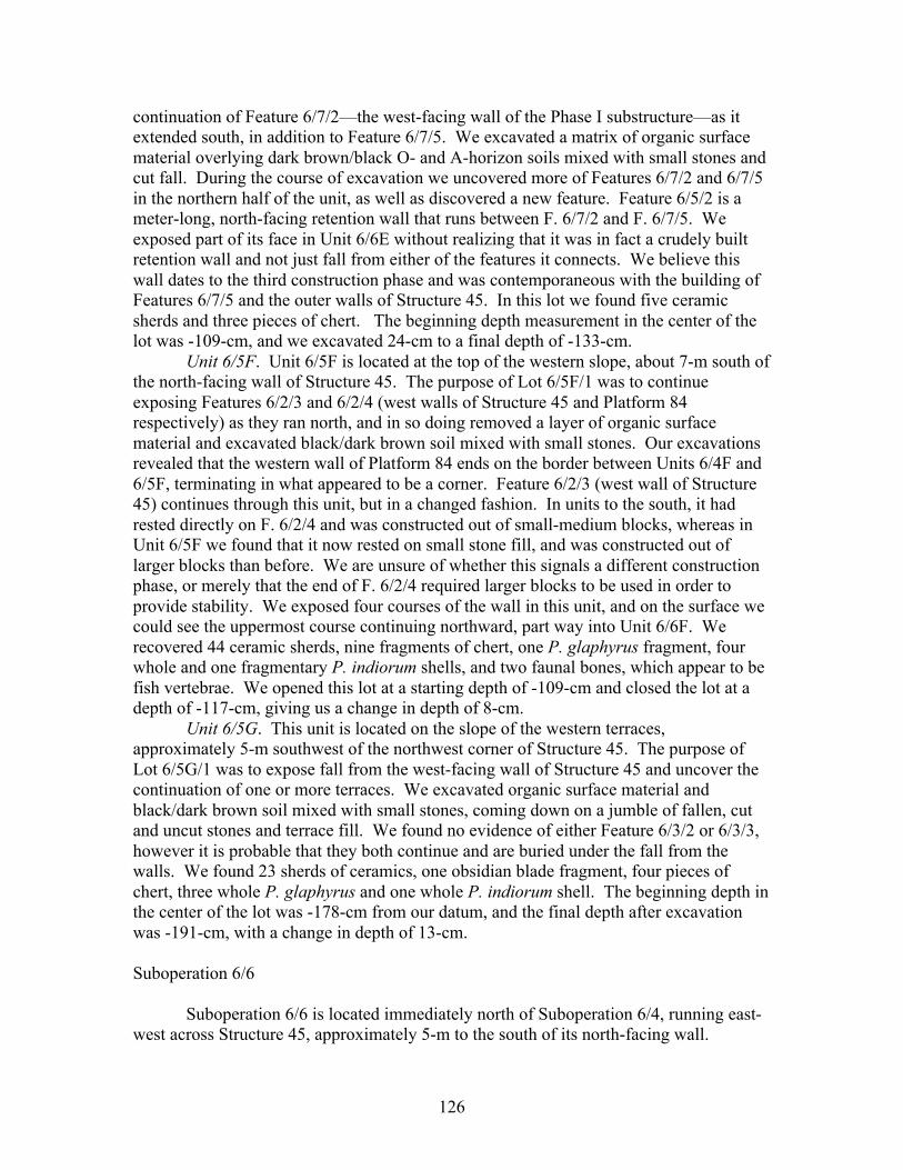
126
continuation of Feature 6/7/2—the west-facing wall of the Phase I substructure—as it extended south, in addition to Feature 6/7/5. We excavated a matrix of organic surface material overlying dark brown/black O- and A-horizon soils mixed with small stones and cut fall. During the course of excavation we uncovered more of Features 6/7/2 and 6/7/5 in the northern half of the unit, as well as discovered a new feature. Feature 6/5/2 is a meter-long, north-facing retention wall that runs between F. 6/7/2 and F. 6/7/5. We exposed part of its face in Unit 6/6E without realizing that it was in fact a crudely built retention wall and not just fall from either of the features it connects. We believe this wall dates to the third construction phase and was contemporaneous with the building of Features 6/7/5 and the outer walls of Structure 45. In this lot we found five ceramic sherds and three pieces of chert. The beginning depth measurement in the center of the lot was -109-cm, and we excavated 24-cm to a final depth of -133-cm.
Unit 6/5F. Unit 6/5F is located at the top of the western slope, about 7-m south of the north-facing wall of Structure 45. The purpose of Lot 6/5F/1 was to continue exposing Features 6/2/3 and 6/2/4 (west walls of Structure 45 and Platform 84 respectively) as they ran north, and in so doing removed a layer of organic surface material and excavated black/dark brown soil mixed with small stones. Our excavations revealed that the western wall of Platform 84 ends on the border between Units 6/4F and 6/5F, terminating in what appeared to be a corner. Feature 6/2/3 (west wall of Structure 45) continues through this unit, but in a changed fashion. In units to the south, it had rested directly on F. 6/2/4 and was constructed out of small-medium blocks, whereas in Unit 6/5F we found that it now rested on small stone fill, and was constructed out of larger blocks than before. We are unsure of whether this signals a different construction phase, or merely that the end of F. 6/2/4 required larger blocks to be used in order to provide stability. We exposed four courses of the wall in this unit, and on the surface we could see the uppermost course continuing northward, part way into Unit 6/6F. We recovered 44 ceramic sherds, nine fragments of chert, one P. glaphyrus fragment, four whole and one fragmentary P. indiorum shells, and two faunal bones, which appear to be fish vertebrae. We opened this lot at a starting depth of -109-cm and closed the lot at a depth of -117-cm, giving us a change in depth of 8-cm.
Unit 6/5G. This unit is located on the slope of the western terraces, approximately 5-m southwest of the northwest corner of Structure 45. The purpose of Lot 6/5G/1 was to expose fall from the west-facing wall of Structure 45 and uncover the continuation of one or more terraces. We excavated organic surface material and black/dark brown soil mixed with small stones, coming down on a jumble of fallen, cut and uncut stones and terrace fill. We found no evidence of either Feature 6/3/2 or 6/3/3, however it is probable that they both continue and are buried under the fall from the walls. We found 23 sherds of ceramics, one obsidian blade fragment, four pieces of chert, three whole P. glaphyrus and one whole P. indiorum shell. The beginning depth in the center of the lot was -178-cm from our datum, and the final depth after excavation was -191-cm, with a change in depth of 13-cm.
Suboperation 6/6
Suboperation 6/6 is located immediately north of Suboperation 6/4, running east-
west across Structure 45, approximately 5-m to the south of its north-facing wall.
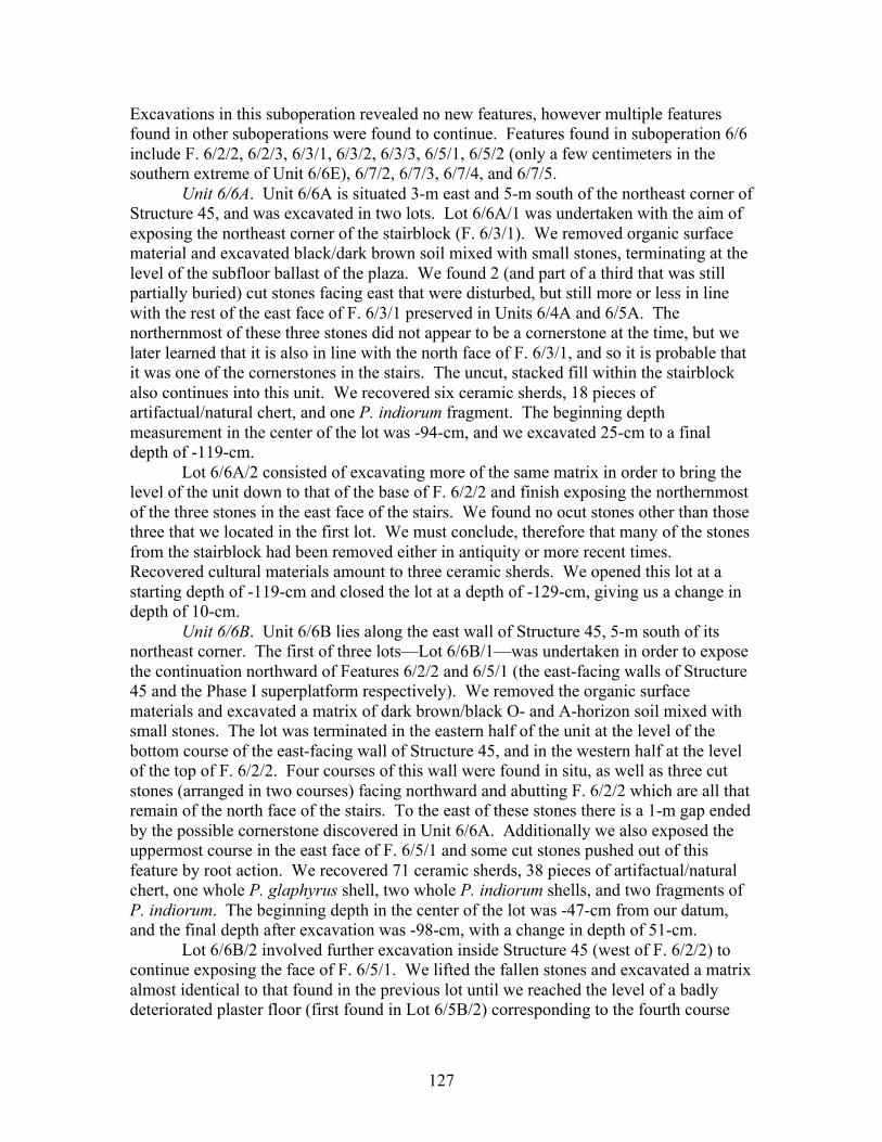
127
Excavations in this suboperation revealed no new features, however multiple features found in other suboperations were found to continue. Features found in suboperation 6/6 include F. 6/2/2, 6/2/3, 6/3/1, 6/3/2, 6/3/3, 6/5/1, 6/5/2 (only a few centimeters in the southern extreme of Unit 6/6E), 6/7/2, 6/7/3, 6/7/4, and 6/7/5.
Unit 6/6A. Unit 6/6A is situated 3-m east and 5-m south of the northeast corner of Structure 45, and was excavated in two lots. Lot 6/6A/1 was undertaken with the aim of exposing the northeast corner of the stairblock (F. 6/3/1). We removed organic surface material and excavated black/dark brown soil mixed with small stones, terminating at the level of the subfloor ballast of the plaza. We found 2 (and part of a third that was still partially buried) cut stones facing east that were disturbed, but still more or less in line with the rest of the east face of F. 6/3/1 preserved in Units 6/4A and 6/5A. The northernmost of these three stones did not appear to be a cornerstone at the time, but we later learned that it is also in line with the north face of F. 6/3/1, and so it is probable that it was one of the cornerstones in the stairs. The uncut, stacked fill within the stairblock also continues into this unit. We recovered six ceramic sherds, 18 pieces of artifactual/natural chert, and one P. indiorum fragment. The beginning depth measurement in the center of the lot was -94-cm, and we excavated 25-cm to a final depth of -119-cm.
Lot 6/6A/2 consisted of excavating more of the same matrix in order to bring the level of the unit down to that of the base of F. 6/2/2 and finish exposing the northernmost of the three stones in the east face of the stairs. We found no ocut stones other than those three that we located in the first lot. We must conclude, therefore that many of the stones from the stairblock had been removed either in antiquity or more recent times. Recovered cultural materials amount to three ceramic sherds. We opened this lot at a starting depth of -119-cm and closed the lot at a depth of -129-cm, giving us a change in depth of 10-cm.
Unit 6/6B. Unit 6/6B lies along the east wall of Structure 45, 5-m south of its northeast corner. The first of three lots—Lot 6/6B/1—was undertaken in order to expose the continuation northward of Features 6/2/2 and 6/5/1 (the east-facing walls of Structure 45 and the Phase I superplatform respectively). We removed the organic surface materials and excavated a matrix of dark brown/black O- and A-horizon soil mixed with small stones. The lot was terminated in the eastern half of the unit at the level of the bottom course of the east-facing wall of Structure 45, and in the western half at the level of the top of F. 6/2/2. Four courses of this wall were found in situ, as well as three cut stones (arranged in two courses) facing northward and abutting F. 6/2/2 which are all that remain of the north face of the stairs. To the east of these stones there is a 1-m gap ended by the possible cornerstone discovered in Unit 6/6A. Additionally we also exposed the uppermost course in the east face of F. 6/5/1 and some cut stones pushed out of this feature by root action. We recovered 71 ceramic sherds, 38 pieces of artifactual/natural chert, one whole P. glaphyrus shell, two whole P. indiorum shells, and two fragments of P. indiorum. The beginning depth in the center of the lot was -47-cm from our datum, and the final depth after excavation was -98-cm, with a change in depth of 51-cm.
Lot 6/6B/2 involved further excavation inside Structure 45 (west of F. 6/2/2) to continue exposing the face of F. 6/5/1. We lifted the fallen stones and excavated a matrix almost identical to that found in the previous lot until we reached the level of a badly deteriorated plaster floor (first found in Lot 6/5B/2) corresponding to the fourth course

128
(from the top) of F. 6/5/1. We opened this lot at a starting depth of -98-cm and closed the lot at a depth of -102-cm, giving us a change in depth of 4-cm.
Lot 6/6B/3 consisted of excavating the layer of plaster fragments and the underlying soil which was a light brown color and mixed with small stones. Removal of this matrix revealed a fifth and final course in Feature 6/5/1. This feature appeared to continue north into Units 6/7B and 6/7C. We only recovered one whole P. indiorum from this lot. The beginning depth measurement in the center of the lot was -102-cm, and we excavated 2-cm to a final depth of -104-cm.
Unit 6/6C. Unit 6/6C is located within Structure 45 approximately 4-m southwest of its northeast corner, immediately west of and including F. 6/5/1. The unit was excavated in four lots for the dual purpose of locating the north wall of the Phase I superplatform and digging a second test pit within the structure. Lot 6/6C/1 involved the clearing of organic surface material and dark brown/black O- and A-horizon soil mixed with small stones, terminating at the level of the top of Feature 6/5/1. We found no trace of a north-facing wall continuing from F. 6/5/1’s northeast corner. The cultural materials we recovered include 12 ceramic sherds and four pieces of artifactual/natural chert. We opened this lot at a starting depth of -88-cm and closed the lot at a depth of -98-cm, giving us a change in depth of 10-cm.
Lot 6/6C/2 consisted of further excavation to determine whether there were any traces of the superplatform’s north-facing wall buried deeper down. We excavated down to the approximate level of the bottom of Feature 6/5/1 and again found no trace of a north-facing wall. On the very northeastern edge of the unit there was an arrangement of stacked stones that appeared to join the northeast corner of F. 6/5/1, but we believe that they were not part of any wall, and instead were either fall or stacked fill stones. We must conclude, therefore, that the north-facing wall of the Phase I superplatform was dismantled in antiquity, perhaps during the construction of Structure 45. The beginning depth in the center of the lot was -98-cm from our datum, and the final depth after excavation was -139-cm, with a change in depth of 41-cm.
In the third lot—Lot 6/6C/3—we began to excavate with the purpose of digging a test pit. We excavated approximately 60-cm of Phase I structure and platform fill consisting of small-medium fill stones, occasional cut stones, and dark illuviated soils. This rested directly above a layer of buried A-horizon soil, which due to heavy rains and muddy conditions in the test pit was virtually indistinguishable from the illuviated soils in the fill. We therefore did not stop to change lots until reaching the layer of B-horizon. The cultural materials we found include 156 ceramic sherds, four obsidian fragments (3 from El Chayal and one from Ixtepeque), and 17 pieces of artifactual/natural chert. The beginning depth measurement in the center of the lot was -139-cm, and we excavated 49-cm to a final depth of -188-cm.
Lot 6/6C/4 involved continuing to excavate the test pit through the layer of reddish-brown B-horizon clay and the underlying orange-yellow mixed C- and R- horizon. Similarly, rain and bad conditions in the test pit made it impossible to distinguish between the two layers, and the lot terminated when we reached bedrock. Examining the profile of the test pit after it had had a chance to dry out revealed the different strata more fully. In this lot we only recovered two ceramic sherds. We opened this lot at a starting depth of -188-cm and closed the lot at a depth of -205-cm, giving us a change in depth of 17-cm.
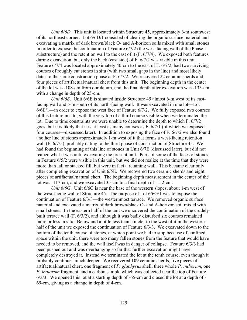
129
Unit 6/6D. This unit is located within Structure 45, approximately 6-m southwest of its northeast corner. Lot 6/6D/1 consisted of clearing the organic surface material and excavating a matrix of dark brown/black O- and A-horizon soils mixed with small stones in order to expose the continuation of Feature 6/7/2 (the west-facing wall of the Phase I substructure) and the retention wall to the east of it (F. 6/7/4). We exposed both features during excavation, but only the back (east side) of F. 6/7/2 was visible in this unit. Feature 6/7/4 was located approximately 40-cm to the east of F. 6/7/2, had two surviving courses of roughly cut stones in situ (with two small gaps in the line) and most likely dates to the same construction phase at F. 6/7/2. We recovered 22 ceramic sherds and four pieces of artifactual/natural chert from this unit. The beginning depth in the center of the lot was -108-cm from our datum, and the final depth after excavation was -133-cm, with a change in depth of 25-cm.
Unit 6/6E. Unit 6/6E is situated inside Structure 45 almost 6-m west of its east-facing wall and 5-m south of its north-facing wall. It was excavated in one lot—Lot 6/6E/1—in order to expose the west face of Feature 6/7/2. We fully exposed two courses of this feature in situ, with the very top of a third course visible when we terminated the lot. Due to time constraints we were unable to determine the depth to which F. 6/7/2 goes, but it is likely that it is at least as many courses as F. 6/7/1 (of which we exposed four courses—discussed later). In addition to exposing the face of F. 6/7/2 we also found another line of stones approximately 1-m west of it that forms a west-facing retention wall (F. 6/7/5), probably dating to the third phase of construction of Structure 45. We had found the beginning of this line of stones in Unit 6/7E (discussed later), but did not realize what it was until excavating the present unit. Parts of some of the faces of stones in Feature 6/5/2 were visible in this unit, but we did not realize at the time that they were more than fall or stacked fill, but were in fact a retaining wall. This became clear only after completing excavation of Unit 6/5E. We recovered two ceramic sherds and eight pieces of artifactual/natural chert. The beginning depth measurement in the center of the lot was -117-cm, and we excavated 35-cm to a final depth of -152-cm.
Unit 6/6G. Unit 6/6G is near the base of the western slopes, about 1-m west of the west-facing wall of Structure 45. The purpose of Lot 6/6G/1 was to expose the continuation of Feature 6/3/3—the westernmost terrace. We removed organic surface material and excavated a matrix of dark brown/black O- and A-horizon soil mixed with small stones. In the eastern half of the unit we uncovered the continuation of the crudely-built terrace wall (F. 6/3/2), and although it was badly disturbed six courses remained more or less in situ. Below and a little less than a meter to the west of it in the western half of the unit we exposed the continuation of Feature 6/3/3. We excavated down to the bottom of the tenth course of stones, at which point we had to stop because of confined space within the unit, there were too many fallen stones from the feature that would have needed to be removed, and the wall itself was in danger of collapse. Feature 6/3/3 had been pushed out and was overhanging so far that further excavation might have completely destroyed it. Instead we terminated the lot at the tenth course, even though it probably continues much deeper. We recovered 109 ceramic sherds, five pieces of artifactual/natural chert, one fragment of P. glaphyrus shell, three whole P. indiorum, one P. indiorum fragment, and a carbon sample which was collected near the top of Feature 6/3/3. We opened this lot at a starting depth of -65-cm and closed the lot at a depth of -69-cm, giving us a change in depth of 4-cm.
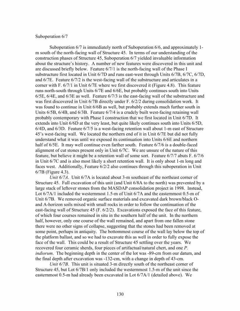
130
Suboperation 6/7
Suboperation 6/7 is immediately north of Suboperation 6/6, and approximately 1-
m south of the north-facing wall of Structure 45. In terms of our understanding of the construction phases of Structure 45, Suboperation 6/7 yielded invaluable information about the structure’s history. A number of new features were discovered in this unit and are discussed briefly below. Feature 6/7/1 is the north-facing wall of the Phase I substructure first located in Unit 6/7D and runs east-west through Units 6/7B, 6/7C, 6/7D, and 6/7E. Feature 6/7/2 is the west-facing wall of the substructure and articulates in a corner with F. 6/7/1 in Unit 6/7E where we first discovered it (Figure 4.8). This feature runs north-south through Units 6/7E and 6/6E, but probably continues south into Units 6/5E, 6/4E, and 6/3E as well. Feature 6/7/3 is the east-facing wall of the substructure and was first discovered in Unit 6/7B directly under F. 6/2/2 during consolidation work. It was found to continue in Unit 6/6B as well, but probably extends much further south in Units 6/5B, 6/4B, and 6/3B. Feature 6/7/4 is a crudely built west-facing retaining wall probably contemporary with Phase I construction that we first located in Unit 6/7D. It extends into Unit 6/6D at the very least, but quite likely continues south into Units 6/5D, 6/4D, and 6/3D. Feature 6/7/5 is a west-facing retention wall about 1-m east of Structure 45’s west-facing wall. We located the northern end of it in Unit 6/7E but did not fully understand what it was until we exposed its continuation into Units 6/6E and northern half of 6/5E. It may well continue even farther south. Feature 6/7/6 is a double-faced alignment of cut stones present only in Unit 6/7C. We are unsure of the nature of this feature, but believe it might be a retention wall of some sort. Feature 6/7/7 abuts F. 6/7/6 in Unit 6/7C and is also most likely a short retention wall. It is only about 1-m long and faces west. Additionally, Feature 6/2/2 also continues through this suboperation in Unit 6/7B (Figure 4.3).
Unit 6/7A. Unit 6/7A is located about 3-m southeast of the northeast corner of Structure 45. Full excavation of this unit (and Unit 6/8A to the north) was prevented by a large stack of leftover stones from the MASDAP consolidation project in 1998. Instead, Lot 6/7A/1 included the westernmost 1.5-m of Unit 6/7A and the easternmost 0.5-m of Unit 6/7B. We removed organic surface materials and excavated dark brown/black O- and A-horizon soils mixed with small rocks in order to follow the continuation of the east-facing wall of Structure 45 (F. 6/2/2). Excavations exposed the face of this feature, of which four courses remained in situ in the southern half of the unit. In the northern half, however, only one course of the wall remained, and apart from one fallen stone there were no other signs of collapse, suggesting that the stones had been removed at some point, perhaps in antiquity. The bottommost course of the wall lay below the top of the platform ballast, and so we had to excavate this as well in order to fully expose the face of the wall. This could be a result of Structure 45 settling over the years. We recovered four ceramic sherds, four pieces of artifactual/natural chert, and one P. indiorum. The beginning depth in the center of the lot was -89-cm from our datum, and the final depth after excavation was -132-cm, with a change in depth of 43-cm.
Unit 6/7B. This unit is situated 3-m directly south of the northeast corner of Structure 45, but Lot 6/7B/1 only included the westernmost 1.5-m of the unit since the easternmost 0.5-m had already been excavated in Lot 6/7A/1 (detailed above). We
131
removed organic surface material and excavated black/dark brown soil mixed with small stones in order to expose the top of Feature 6/2/2. Originally we were seeking the possible continuation of F. 6/5/1, but excavations later revealed to us that this terminates on the border between Suboperations 6/6 and 6/7. We finished exposing the top of the east-facing wall of Structure 45 and the area immediately west of it. In the western half of the unit we encountered a large amount of fallen cut stones and large fill stones. We only recovered seven ceramic sherds and two pieces of artifactual/natural chert in this lot. The beginning depth measurement in the center of the lot was -73-cm, and we excavated 37-cm to a final depth of -110-cm.
Lot 6/7B/2 involved the removal of some of the fallen stones in the western half of the unit and further excavation, but no sooner had we begun to excavate than we found the northeast corner of the Phase I superplatform directly under the southwest corner of the unit (and the southeast corner of Unit 6/7C). North of this corner there was a large amount of fill stones, probably dating to the third phase of construction, and we terminated the lot at this point. We recovered two ceramic sherds and one figurine fragment. There was no change in the center depth of this unit from the previous lot.
Unit 6/7C. Unit 6/7C is located within the structure 3-m southwest of Structure 45’s northeast corner. Lot 6/7C/1—the first of two lots—consisted of clearing organic surface material and black/dark brown O- and A-horizon soils mixed with small rocks in order to locate and expose the north-facing wall of the Phase I superplatform. We were unable to locate any signs of such a wall (indeed all further excavation within Structure 45 yielded the same result), however we did expose a meter-long west-facing wall situated on the southern half of the unit’s central north-south axis. Feature 6/7/7 has two surviving—yet badly jumbled—courses and was most likely a retention wall from Phase III construction. The rest of the northern half of the unit was still obscured by many fall and fill stones and so had to be excavated in a separate lot. We recovered 13 ceramic sherds, one blade fragment of El Chayal obsidian, five pieces of artifactual/natural chert, and one P. glaphyrus fragment. We opened this lot at a starting depth of -89-cm and closed the lot at a depth of -119-cm, giving us a change in depth of 30-cm. Lot 6/7C/2 was undertaken to remove the large cut and uncut stones in the northern half of the unit with the dual purpose of exposing the continuation of F. 6/7/1 (which had been found in Unit 6/7D to the west, discussed below), and also to investigate the other features in the unit. We removed many of the large stones and excavated the dark brown/black soil matrix beneath them. Feature 6/7/1 was exposed on the east and west sides of the unit, but in the middle it was still obscured by more stones. We uncovered a new feature in the middle of the unit (F. 6/7/6), which is a double-sided alignment of stones, three courses high, that runs east-west along the central axis of the unit. It extends several stones in either direction past F. 6/7/7 which abuts it from the south. Originally, and for lack of a better explanation, we thought that the two of these walls might have formed some sort of bench, but we have concluded that both of these walls (F. 6/7/6 and 6/7/7) are retaining walls for fill, constructed during the third phase of construction of Structure 45. We recovered five ceramic sherds and one piece of artifactual/natural chert. The beginning depth in the center of the lot was -116-cm from our datum, and the final depth after excavation was -119-cm, with a change in depth of 30-cm.
132
Unit 6/7D. Unit 6/7D is located within Structure 45, directly on its central north-south axis approximately 3-m south of its north-facing wall. The original purpose for Lot 6/7D/1 was to continue our search for the north wall of the Phase I superplatform; to that end we removed organic surface material and excavated dark brown/black O- and A-horizon soil mixed with small stones. Again, we found no trace of the superplatform’s northern wall, but we did encounter two new features. Feature 6/7/1 is the northern wall of the Phase I substructure and runs east-west along the northern edge of the unit. We eventually exposed the upper four courses of this wall, the bottommost of which was outset approximately 6-cm. Due to time constraints we were never able to explore to the bottom course of this feature and therefore do not know how deep it runs; however from the portion of the wall we could see it became apparent that F. 6/7/1 was cleanly and beautifully constructed out of well-cut sandstone blocks. Feature 6/7/4 is a crudely made west-facing retention wall that runs north-south along the western edge of the unit. Initially we thought they might be fill stones, before we followed their continuation into Unit 6/6D and it became clear that they were in fact part of a feature. We recovered two sherds of ceramics, two obsidian blade fragments visually sourced to El Chayal, and 12 pieces of artifactual/natural chert. The beginning depth measurement in the center of the lot was -107-cm, and we excavated 28-cm to a final depth of -135-cm. Unit 6/7E. This unit is located within Structure 45, 5-m west of its east-facing wall and 3-m south of the north-facing wall. Lot 6/7E/1 involved the removal of organic surface material and excavation of dark brown/black O- and A-horizon soil mixed with small stones in order to continue following the north wall of the substructure (F. 6/7/1). We exposed the top course of this feature, its northwest corner, and the newly discovered west-facing wall of the substructure (F. 6/7/2). Feature 6/7/2 runs north-south along the eastern half of the unit, and although we only exposed its first two courses, undoubtedly it extends at least as deep as F. 6/7/1’s four exposed courses if not deeper. In the northern and western halves of the unit there was a large amount of cut stones, some of which formed alignments that appeared to be badly preserved section of walls. Feature 6/7/5 (Phase III retention wall) begins in the south of the unit, but we did not fully understand what it was until excavating Unit 6/6E. The stones in the northern half of the unit may well have belonged to another retention wall, but if that is the case then it has deteriorated to such an extent that it is hardly recognizable as one. We recovered one ceramic sherd, two blade fragments of El Chayal obsidian, and 10 fragments of artifactual/natural chert. We opened this lot at a starting depth of -116-cm and closed the lot at a depth of -153-cm, giving us a change in depth of 37-cm.
Suboperation 6/8 Suboperation 6/8 is an east-west line of units located immediately north of
Suboperation 6/7 and contains the northern wall of Structure 45. The east-facing wall of Structure 45 (F. 6/2/2) continues northward into this suboperation for approximately 1-m before forming a northeast corner and articulating with the newly discovered north-facing wall of Structure 45 (F. 6/8/1). Feature 6/8/1 is a 5-course wall that was first located in Unit 6/8B where it forms a rounded corner with F. 6/2/2. From there it continues west into Units 6/8C, 6/8D, 6/8E, and 6/8F where there is evidence of another rounded corner that has partially collapsed (Figure 4.7). Feature 6/8/2 was discovered in Unit 6/8E where it abuts F. 6/8/1. This feature contains only three stone cobbles arranged in a 2-
133
course west-facing wall, and is nearly all that is left of the fourth phase of construction (Figure 4.3).
Unit 6/8A. Unit 6/8A is located 3-m directly east of Structure 45’s northeast corner, but again due to the pile of stones left by the MASDAP consolidation project, Lot 6/8A/1 included the westernmost 1.5-m of Unit 6/8A and the easternmost 0.5-m of Unit 6/8B. We removed the layer of organic material on the surface and excavated the dark brown/black O- and A-horizon soil beneath it, terminating at the base of F. 6/2/2. Only one course of the east-facing wall of Structure 45 survives in this area, and it had sunk so low that we excavated slightly into the layer of platform ballast in order to fully expose it. In the center of the unit F. 6/2/2 begins to form a rounded corner where it turns west. We recovered eight ceramic sherds (5 Turneffe Unslipped and three Remate Red) and 13 fragments of artifactual/natural chert. The beginning depth in the center of the lot was -96-cm from our datum, and the final depth after excavation was -130-cm, with a change in depth of 34-cm.
Unit 6/8B. Unit 6/8B is directly on the northeast corner of Structure 45. Lot 6/8B/1 included only the westernmost 1.5-m of the unit (the easternmost 0.5-m was excavated in Lot 6/8A/1—see above) and was excavated for the purpose of continuing to expose the rounded corner and locate the north-facing wall of the structure. We removed the surface organics and excavated a matrix of black/dark brown soil mixed with small stones in order to uncover the architecture. Similarly, only one course of the stones in the corner and of the north-facing wall (F. 6/8/1) that leads away from it remains in situ. In this unit we only discovered one fallen cut stone from Feature 6/8/1 and so must conclude that many of the stones have been removed. We recovered eight ceramic sherds, two whole P. indiorum, and two fragments of artifactual chert. The two pieces of chert are both biface fragments (1 point and one medial fragment) that could potentially be from one very large blade, but more probably are from two separate ones. The beginning depth measurement in the center of the lot was -81-cm, and we excavated 41-cm to a final depth of -122-cm.
Unit 6/8C. Unit 6/8C is situated on the north-facing wall of Structure 45, 1-m directly west of the northeast corner, and was excavated in two lots. Lot 6/8C/1 involved clearing the organic surface material and excavating a matrix of dark brown O- and A-horizon soils mixed with small stones in order to expose the westward continuation of Feature 6/8/1. At one point there was a large tree in this unit (that has since fallen and mostly decayed), and the exposed section of Feature 6/8/1 has a large gap in it where root action pushed out some of the stones. Beneath the matrix of dark A-horizon soil we found a layer of large stacked fill mixed with light brown (almost yellowish) soil that was right up against the wall. Later we learned this stacked fill pertains to Phase IV of construction. We recovered 22 ceramic sherds, 18 of which were Remate (1 with a stamped bird impression, two with red slip), one cream slipped Polychrome, and three Turneffe. Additional cultural materials include one El Chayal obsidian blade fragment, five pieces of artifactual/natural chert, one whole P. glaphyrus, three whole P. indiorum, and one fragment of P. indiorum. We opened this lot at a starting depth of -82-cm and closed the lot at a depth of -119-cm, giving us a change in depth of 37-cm.
Lot 6/8C/2 consisted of excavating the southern half of the unit (within Structure 45) in order to create space in which to continue the excavation of the north wall of the Phase I substructure (in the north of Suboperation 6/7). We removed a matrix of dark
134
brown/black soil mixed with small and large stones, which were all fill from the construction of Structure 45. Excavation terminated at the approximate level of the outset fourth course of F. 6/7/1, and we exposed no architectural features within this lot. After excavation we noticed in the northern profile of this lot a thick band of plaster dust and fragments belonging to what was most likely an old level of the plaza floor outside of the structure. The level of this floor corresponded to the second course from the top of Feature 6/7/1, indicating that at one point the plaza floor was raised almost to the top of the substructure. In this lot we found one ceramic sherd, one El Chayal obsidian blade fragment, four pieces of artifactual/natural chert, two whole P. glaphyrus, and two whole P. indiorum. The beginning depth in the center of the lot was -119-cm from our datum, and the final depth after excavation was -160-cm, with a change in depth of 41-cm.
Unit 6/8D. This unit lies on the north-facing wall of Structure 45, about 3-m west of the northeast corner of the structure. The purpose of Lot 6/8D/1 was to continue following the westward progression of the north-facing wall of the structure (F. 6/8/1). To that end we removed the organic surface material and excavated a matrix of dark brown/black O- and A-horizon soil mixed with small stones. Beneath this layer we again encountered the layer of large, flat, stacked fill mixed with light brown soil abutting the north wall of the structure. Our excavations terminated at the level of the bottom course of the wall in the northern half of the unit after having exposed the top and a maximum of four courses of the wall still in situ. We recovered 14 ceramic sherds and one obsidian blade fragment from this lot. The beginning depth measurement in the center of the lot was -83-cm, and we excavated 18-cm to a final depth of -101-cm.
Unit 6/8E. Unit 6/8E is situated on the north-facing wall of Structure 45 near the western slope, approximately 5-m west of the northeast corner of the structure. In Lot 6/8E/1 we removed the organic surface matter and excavated a matrix of dark brown/black O- and A-horizon soil mixed with small stones. Below this layer we encountered the same large, stacked fill mixed with a light brown soil that we observed in Units 6/8C and 6/8D. This lot terminated at the base of the north-facing wall of Structure 45 (F. 6/8/1) after we exposed its two remaining courses in situ. We found no fallen cut stones from the wall in this unit, but at the westernmost edge of the unit we located a new feature. Feature 6/8/2 is a low cobble wall composed of two courses that faces west and directly abuts Feature 6/8/1. The large stacked fill we found in the unit led right up to this wall and we concluded that these were all part of a later addition to Structure 45. We recovered 20 ceramic sherds, 27 pieces of chert, and two faunal bone fragments from the mandible of an unidentified animal. We opened this lot at a starting depth of -102-cm and closed the lot at a depth of -132-cm, giving us a change in depth of 30-cm.
Unit 6/8F. This unit is located on the western slope, directly on the northwest corner of the structure. We excavated Lot 6/8F/1 in order to follow Feature 6/8/1 as it continued west and in hopes of locating the northwest corner of the structure. The organic surface material was removed and we excavated the dark brown/black O- and A-horizon soil mixed with small stones. We located the northwest corner, which had slid a little ways down the slope. In order to expose all of the stones we had to remove some of the small stone fill on which the corner used to rest. The corner only retains one course of rounded stones. Although these stones moved down the slope a little, they are still more or less in alignment with each other and also with Features 6/8/1 and 6/2/3. The rest of the unit was filled with large jumbled stones, some of which were cut and had collapsed
135
either from Structure 45 or one of the terraces. The other large stones in this unit were uncut and most likely fill stones that collapsed down the slope from the structure. We located a possible cornerstone and alignment of stones that may have been a north-facing wall, but it was so badly disturbed and obscured by fall that it is impossible to say whether or not it was a feature. The cultural materials we recovered from this unit include two ceramic sherds and four whole P. indiorum shells. The beginning depth in the center of the lot was -179-cm from our datum, and the final depth after excavation was -200-cm, with a change in depth of 21-cm.
Suboperation 6/9
Suboperation 6/9 is an East-West line of units located immediately north of
Suboperation 6/8 and off-structure. Parts of three units were excavated together in one large lot for reasons detailed below. We discovered the only feature present in this suboperation in Unit 6/9C, part of the larger Unit 6/9CDE. Feature 6/9/1 is a low cobble wall composed of two courses that faces west and runs North-South in the eastern half of Unit 6/9C of the grid (Figure 4.3). This feature, together with Feature 6/8/2, corresponds to the construction of Phase IV. We are unsure how far north it extends, and although we do not have evidence of it abutting the north wall of the structure, we are convinced it must have done so as all the large stacked fill mixed with light brown soil we found north of the wall in Suboperation 6/8 did not extend east of Feature 6/9/1.
Unit 6/9CDE. This unit is located off-structure and approximately 1-m to the north of the north-facing wall of Structure 45. On the final day of excavation we excavated a drainage trench that would drain excess rainwater off the western slopes away from Structure 45 in order to preserve the consolidated structure. Lot 6/9/CDE/1 involved the excavation of a triangular unit made from parts of Units 6/9C, 6/9D, and 6/9E. We excavated these units south of a diagonal taken from the southeast corner of Unit 6/9C to the northwest corner of Unit 6/9E. The organic surface material was removed, followed by the underlying dark brown/black O- and A-horizon soil mixed with small stones. Once again we encountered the layer of large stacked fill mixed with light yellowish-brown soil beneath the layer of A-horizon soil. Feature 6/9/1 was found in the very eastern part of Unit 6/9CDE (or the eastern half of grid Unit 6/9C). It is constructed of uncut cobbles. The three stones remaining in situ form two low courses. We were unable to locate its northernmost extent. We recovered 54 sherds of ceramics from this lot and no other cultural materials. We opened this lot at a starting depth of -130-cm and closed the lot at a depth of -170-cm, giving us a change in depth of 40-cm.
CONCLUSIONS
We concluded Operation 6 of the 2010 Toledo Regional Interaction Project after
having fully excavated Structure 45 in the civic-ceremonial center of Lubaantun. Our excavation included the horizontal and vertical exploration of the structure itself, as well as parts of the western slope of Platform 84 on which the structure is situated. We have not yet completed the systematic analysis of the cultural materials we recovered from excavation (with the exception of the obsidian collection that has been analyzed by Dr.
136
Braswell), however, we are able to make some general conclusions about the construction and use history of Structure 45.
Initial investigations of Structure 45 immediately revealed that it was not, nor ever had been, a ballcourt. Structure 45 is a low, 8-m by 13-m platform that had been constructed in four separate phases. Phase I of construction was contemporaneous with the building of Platform 84 and includes Features 6/7/1, 6/7/2, 6/7/3, and 6/7/4 belonging to the substructure, and Features 6/3/4, 6/4/1, and 6/5/1 of its superplatform (Figure 4.8). Both test pits (Units 6/5C and 6/6C) showed an uninterrupted layer of platform fill reaching from the top of Feature 6/5/1 and the superplatform all the way down to the level of the ancient, buried A-horizon soil (Figure 3.9). The complete absence of a patio floor or any other type of break underneath Phase I construction of Structure 45 indicates that Platform 84 and Structure 45 were built at the same time.
Phase II of construction involved raising the level of the outside plaza floor almost to the top of the Phase I substructure. The badly deteriorated layer of plaster discovered in Unit 6/8C that corresponded to the level of the second course from the top of Feature 6/7/1 indicates that at some point after the construction of Phase I and before the construction of Phase III the plaza floor was raised. We also found evidence in a number of units that the top of the substructure and the sides of its superplatform were covered in a layer of plaster.
Phase III of construction consisted of a vertical and horizontal extension of Structure 45 and the addition of an eastern staircase (F. 6/3/1). This phase of construction is characterized by rounded corners and is comprised of Features 6/2/1, 6/2/2, 6/2/3, 6/3/1, 6/7/5, 6/7/6, and 6/8/1. Phase III of Structure 45 is the phase we chose to consolidate, and so all of Phase I and II have been preserved and buried in backfill following consolidation (Figure 4.4).
Phase IV consisted of a northward, cobblestone expansion some time after the construction of Phase III had been completed. Features 6/8/2 and 6/9/1 were the bounding, east and west walls of this expansion and contained the large, flat, stacked fill mixed with light brown soil that we found abutting the north-facing wall of Phase III Structure 45. Due to time constraints we were unable to explore this fourth phase fully and do not know how far to the north it extends.
At this time we are unable to date any of the western terraces to these phases with any certainty. The most we can say is that the west-facing wall of Structure 45 (F. 6/2/3) rests directly on top of Feature 6/2/4, which we call the west-facing wall of Platform 84. Either these two features are contemporary or F. 6/2/3 was built later (Figure 4.10). We know from the test pits that Platform 84 was contemporaneous to the Structure 45 substructure, which was built in Phase I. The western terrace walls might also be contemporaneous to this stage or they could be the result of later expansions.
Based on Structure 45’s phases of construction, we believe that the earliest phase did indeed fall into Hammond’s Phase II of construction for the overall site. Since Plaza VII was built later than Platform 84 (if we hold to his original phases of construction) it makes sense why the residents of Structure 45 would want to raise their own platform and rebuild Structure 45, perhaps to assert their own superiority. The modification of Structure 43 into a small temple with steps running down to Plaza VII also supports this reconstruction.
137
In the final phases, Structure 45 was a low, rectangular platform that most likely served as the base of a perishable superstructure. Its proximity to the site core, other elite residences, and the size of the household all indicate that it was most likely an elite residence. Ceramic evidence suggests that very little cooking or storage of food took place there, but rather food was cooked somewhere else and served at Structure 45 for consumption. We recovered relatively few ceramics compared to both our own expectations and the 2009 TRIP excavation of nearby Structures 51 and 52. Yet of the ceramics we did recover, most of them appear to be finer serving vessels with a good number of examples of cream-slipped polychromes.
In the final analysis, we are surprised to have found no evidence of burials or caching. The site of Lubaantun so far has shown almost a complete lack of burials (with a few exceptions found by Hammond; see Hammond 1975 Appendix I:239, 257) which is anomalous not only for the Maya region at large, but also on a local scale. Hammond did find evidence of teeth-caching practices during his excavations, of which we similarly found none. Nor did we find any offering caches in Structure 45. It is true that the structure was not exhaustively excavated, but enough of it was probed to make us think our chances of discovering evidence for one of these practices relatively high. Caches were found during the 2009 excavation of Structures 51 and 52. The only tentative explanation we can offer for this is perhaps a change in caching practices over the course of the site’s history.
When all of the cultural materials we had recovered were tallied, we observed that Structure 45 yielded twice as many obsidian fragments as Structures 51 and 52 and more than four times the amount of chert. On the other hand, excavation of Structures 51 and 52 yielded more than two times the amount of ceramic sherds and five times the amount of jute recovered from Structure 45. We cannot explain these differences with any certainty but can offer a few possible scenarios that could account for them. Assuming that the dietary patterns of both households were the same, a difference in the length of occupation would explain both the small numbers of ceramics and jute at Structure 45. It may have been occupied for a shorter length of time, and a shorter occupation would produce less refuse. The differences in the numbers of obsidian and chert could possibly indicate a difference in status and, therefore, access to luxury goods such as obsidian. There is a lack of evidence for any sort of stone tool production taking place at Structure 45. Therefore, we speculate that the inhabitants of Structure 45 were not manufacturing obsidian and chert tools but simply consuming them. The difference in amount of lithics between Structure 51/52 and Structure 45 could imply differential access to luxury imports between the two households, or more probably, that their periods of occupation were slightly different and the varying amounts of obsidian reflect abundance or scarcity of the material during certain time periods. The majority of the obsidian artifacts we recovered from Structure 45 were prismatic blade fragments that have been visually sourced to the El Chayal, Guatemala. Only three of the fragments were flakes, which came from the test pit in Unit 6/5C. Additionally, a small, but not insignificant portion of our obsidian assemblage came from Ixtepeque, Guatemala and was found both outside of the structure and within it (specifically from inside the test pits), indicating that Ixtepeque obsidian was found—albeit in small amounts—throughout the building and occupation history of Structure 45.
138
We recovered extremely few figurine fragments from Structure 45, which is consist with our findings from the excavation of Structures 51 and 52, but contrary to Hammond’s (1975) report that figurines were frequently found during his excavation and survey of Lubaantun. This could be the result of declining figurine production and use throughout Lubaantun’s history. Our ceramic assemblage has not been fully analyzed as of yet, but we can make some general conclusions based on our observations thus far. We have few examples of polychromes and even fewer of the Puluacax type. Most of the polychrome sherds come from the western slope below the various terraces, although a few were recovered from the eastern side of the structure. The virtual lack of Puluacax led us to our conclusion that there was very little food storage or preparation at Structure 45. The rest of our assemblage is mostly made up of Remate, Turneffe, and some Belize Red. We recovered no ceramic sherds that appeared to belong to censors, which we would expect to find if Structure 45 served a ritual or religious purpose rather than residential.
Based on the architectural and artifactual evidence that has been discussed thus far we can make some tentative conclusions about the occupation and use history of Structure 45. Architectural evidence points to four separate construction phases (Phase I-IV) of Structure 45. The ceramic and lithic assemblages suggest that Structure 45 was an elite, residential structure where food was served but not prepared, and the Phase I substructure and superplatform were built and occupied during the Late Classic. Phases II-IV of construction occurred at some undetermined time after this, with occupation of the structure lasting into the Terminal Classic period. Structure 45 most likely supported a perishable superstructure in which people lived. Unfortunately, no evidence of this has survived. The ongoing analysis of the cultural materials we recovered will shed even more light on the history of Structure 45.
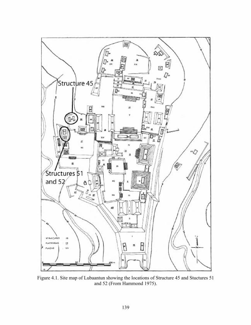
139
Figure 4.1. Site map of Lubaantun showing the locations of Structure 45 and Stuctures 51 and 52 (From Hammond 1975).
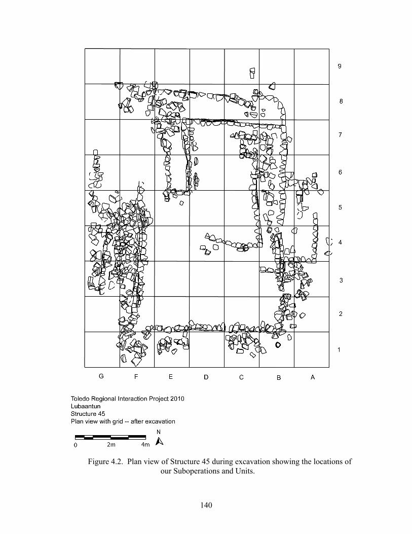
140
Figure 4.2. Plan view of Structure 45 during excavation showing the locations of our Suboperations and Units.
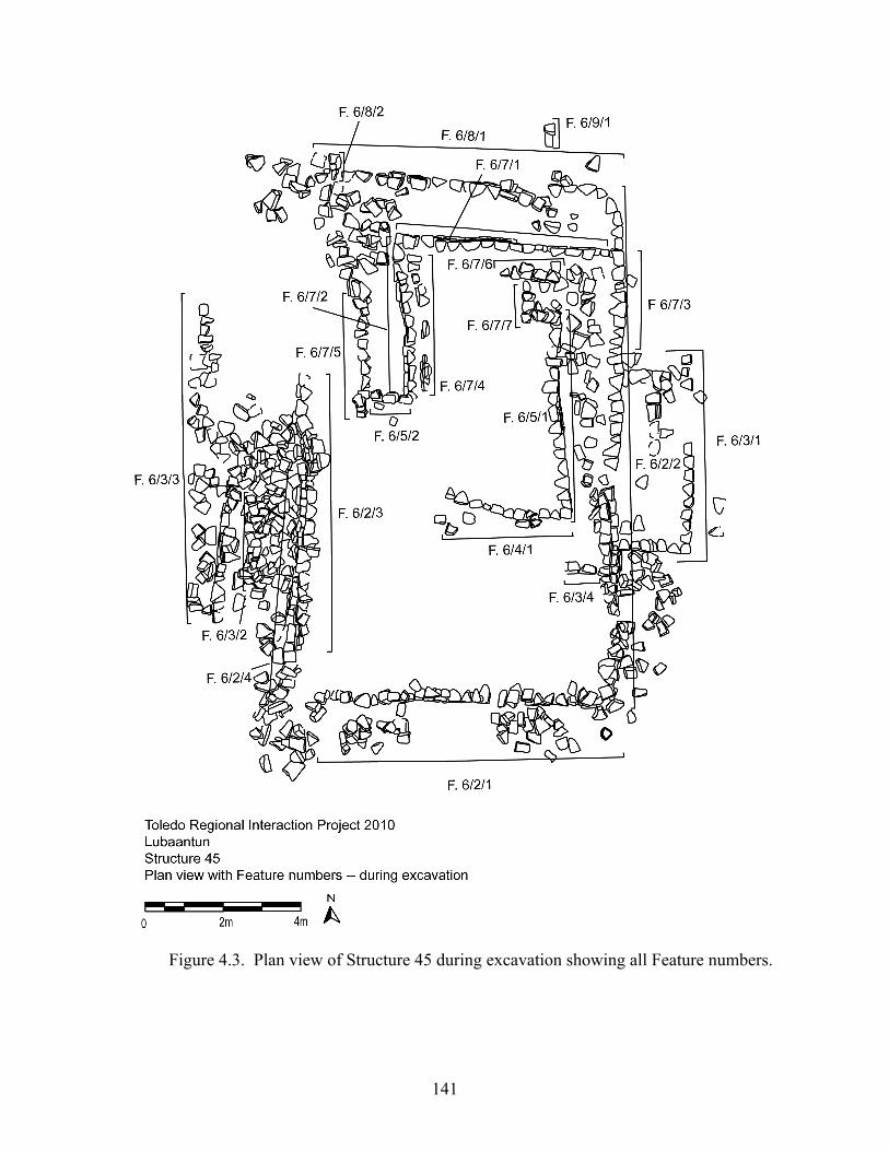
141
Figure 4.3. Plan view of Structure 45 during excavation showing all Feature numbers.
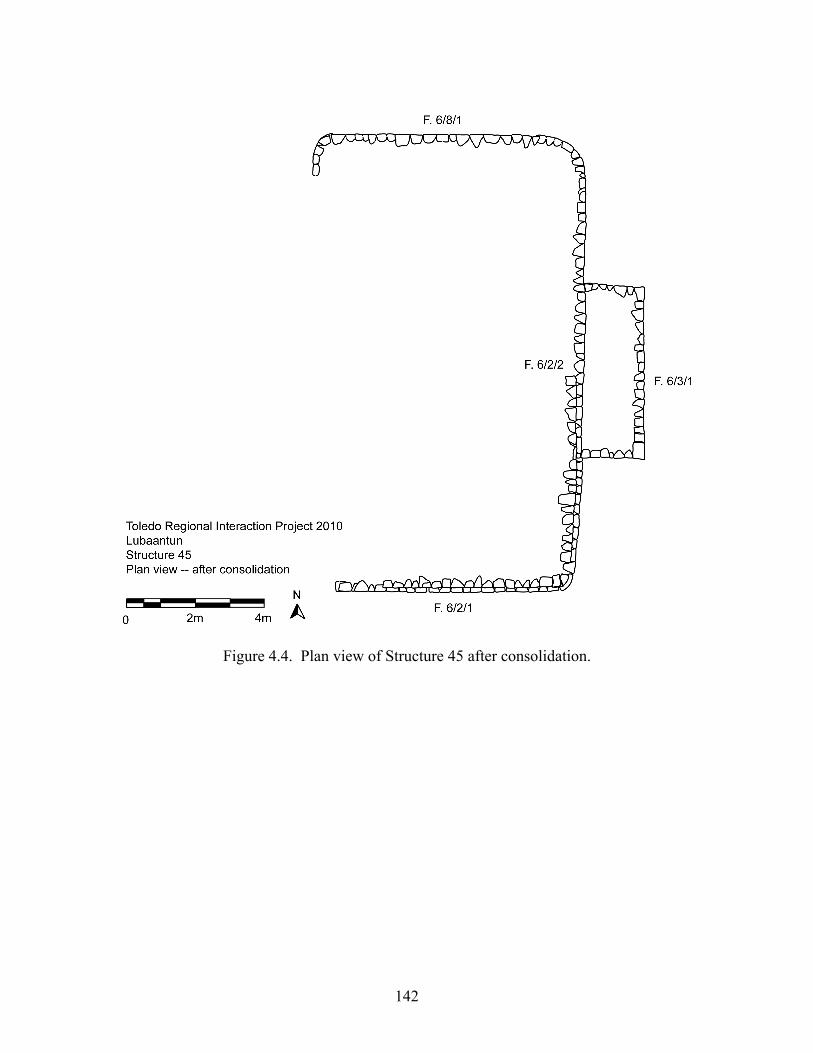
142
Figure 4.4. Plan view of Structure 45 after consolidation.
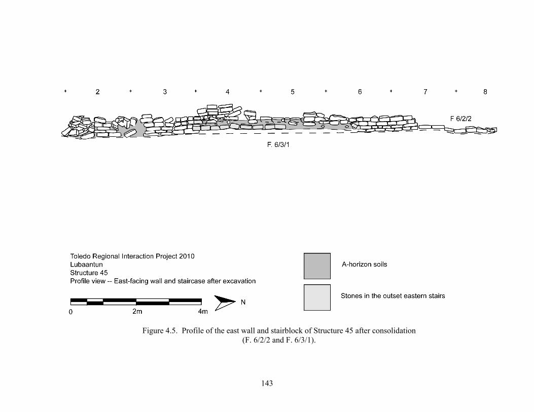
143
Figure 4.5. Profile of the east wall and stairblock of Structure 45 after consolidation (F. 6/2/2 and F. 6/3/1).
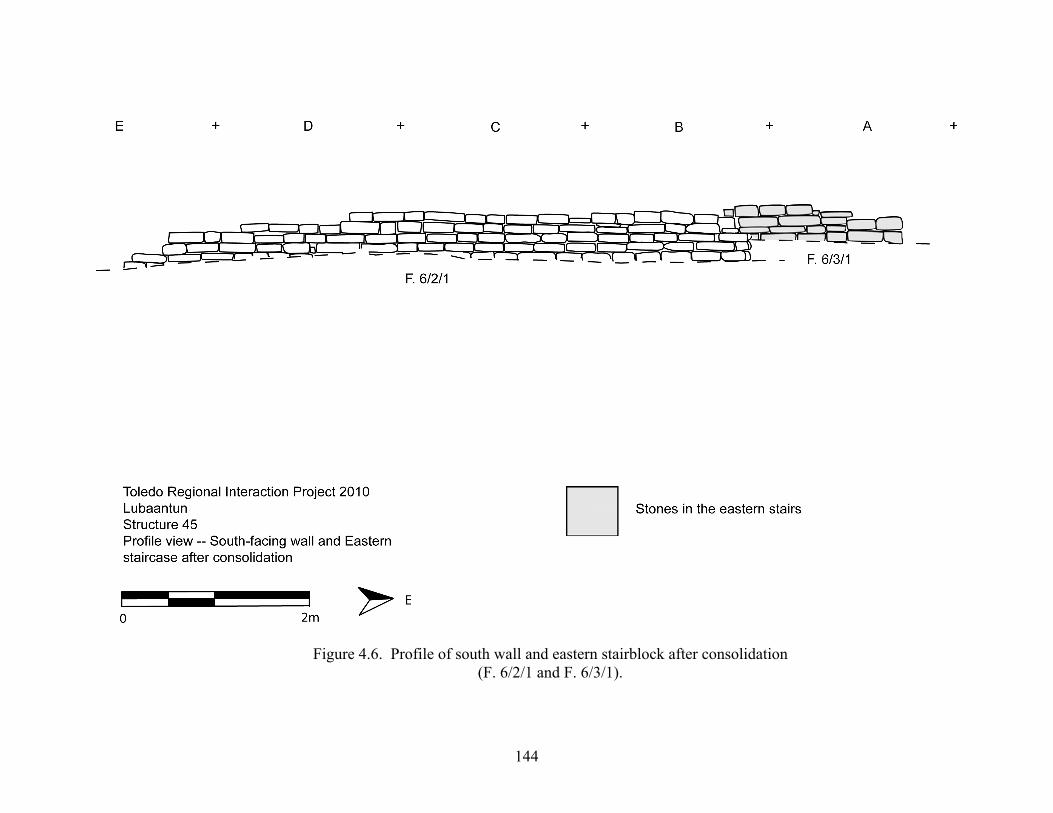
144
Figure 4.6. Profile of south wall and eastern stairblock after consolidation (F. 6/2/1 and F. 6/3/1).
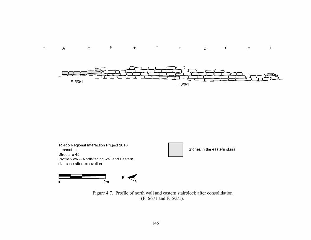
145
Figure 4.7. Profile of north wall and eastern stairblock after consolidation (F. 6/8/1 and F. 6/3/1).
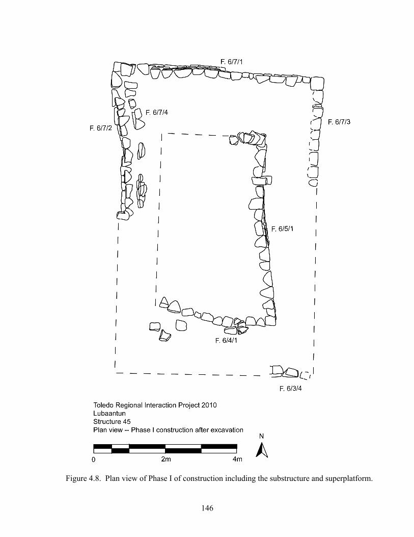
146
Figure 4.8. Plan view of Phase I of construction including the substructure and superplatform.
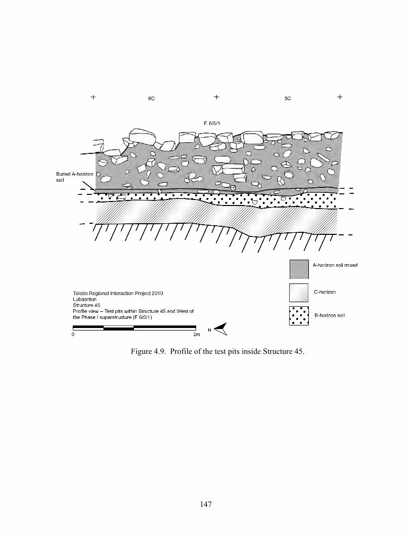
147
Figure 4.9. Profile of the test pits inside Structure 45.
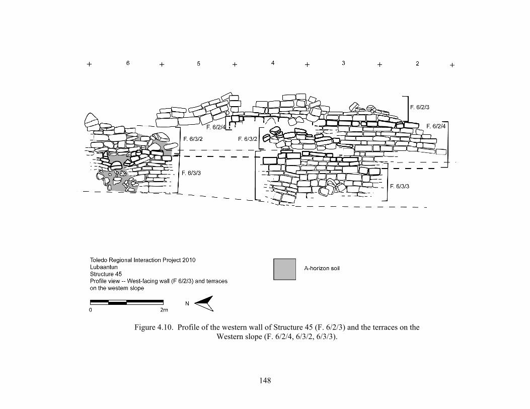
148
Figure 4.10. Profile of the western wall of Structure 45 (F. 6/2/3) and the terraces on the Western slope (F. 6/2/4, 6/3/2, 6/3/3).
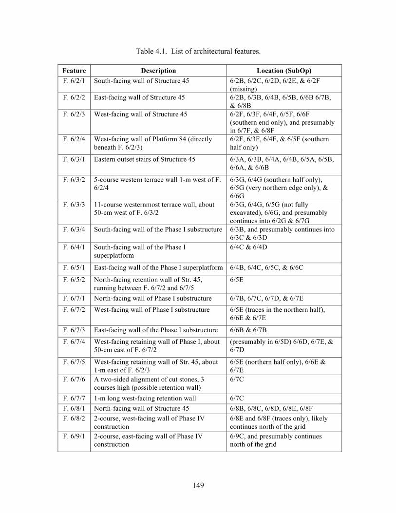
149
Table 4.1. List of architectural features.
Feature Description Location (SubOp) F. 6/2/1 South-facing wall of Structure 45 6/2B, 6/2C, 6/2D, 6/2E, & 6/2F
(missing) F. 6/2/2 East-facing wall of Structure 45 6/2B, 6/3B, 6/4B, 6/5B, 6/6B 6/7B,
& 6/8B F. 6/2/3 West-facing wall of Structure 45 6/2F, 6/3F, 6/4F, 6/5F, 6/6F
(southern end only), and presumably in 6/7F, & 6/8F
F. 6/2/4 West-facing wall of Platform 84 (directly beneath F. 6/2/3)
6/2F, 6/3F, 6/4F, & 6/5F (southern half only)
F. 6/3/1 Eastern outset stairs of Structure 45 6/3A, 6/3B, 6/4A, 6/4B, 6/5A, 6/5B, 6/6A, & 6/6B
F. 6/3/2 5-course western terrace wall 1-m west of F. 6/2/4
6/3G, 6/4G (southern half only), 6/5G (very northern edge only), & 6/6G
F. 6/3/3 11-course westernmost terrace wall, about 50-cm west of F. 6/3/2
6/3G, 6/4G, 6/5G (not fully excavated), 6/6G, and presumably continues into 6/2G & 6/7G
F. 6/3/4 South-facing wall of the Phase I substructure 6/3B, and presumably continues into 6/3C & 6/3D
F. 6/4/1 South-facing wall of the Phase I superplatform
6/4C & 6/4D
F. 6/5/1 East-facing wall of the Phase I superplatform 6/4B, 6/4C, 6/5C, & 6/6C
F. 6/5/2 North-facing retention wall of Str. 45, running between F. 6/7/2 and 6/7/5
6/5E
F. 6/7/1 North-facing wall of Phase I substructure 6/7B, 6/7C, 6/7D, & 6/7E F. 6/7/2 West-facing wall of Phase I substructure 6/5E (traces in the northern half),
6/6E & 6/7E
F. 6/7/3 East-facing wall of the Phase I substructure 6/6B & 6/7B
F. 6/7/4 West-facing retaining wall of Phase I, about 50-cm east of F. 6/7/2
(presumably in 6/5D) 6/6D, 6/7E, & 6/7D
F. 6/7/5 West-facing retaining wall of Str. 45, about 1-m east of F. 6/2/3
6/5E (northern half only), 6/6E & 6/7E
F. 6/7/6 A two-sided alignment of cut stones, 3 courses high (possible retention wall)
6/7C
F. 6/7/7 1-m long west-facing retention wall 6/7C F. 6/8/1 North-facing wall of Structure 45 6/8B, 6/8C, 6/8D, 6/8E, 6/8F F. 6/8/2 2-course, west-facing wall of Phase IV
construction 6/8E and 6/8F (traces only), likely continues north of the grid
F. 6/9/1 2-course, east-facing wall of Phase IV construction
6/9C, and presumably continues north of the grid
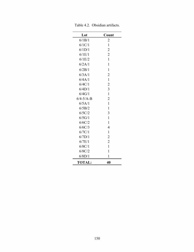
150
Table 4.2. Obsidian artifacts.
Lot Count 6/1B/1 2 6/1C/1 1 6/1D/1 2 6/1E/1 2 6/1E/2 1 6/2A/1 1 6/2B/1 1 6/3A/1 2 6/4A/1 1 6/4C/1 2 6/4D/1 3 6/4G/1 1
6/4-5/A-B 2 6/5A/1 1 6/5B/2 1 6/5C/2 3 6/5G/1 1 6/6C/2 1 6/6C/3 4 6/7C/1 1 6/7D/1 2 6/7E/1 2 6/8C/1 1 6/8C/2 1 6/8D/1 1
TOTAL: 40

151
Table 4.3. Non-Jute Faunal Remains
Lot Count Description 6/3B/1 1 marine shell fragment? 6/4A/1 10 9 small mammal bones
1 crab claw fragment 6/4D/1 1 faunal bone 6/5F/1 2 fish vertebrae 6/8E/1 2 mammal mandible fragments
TOTAL: 16
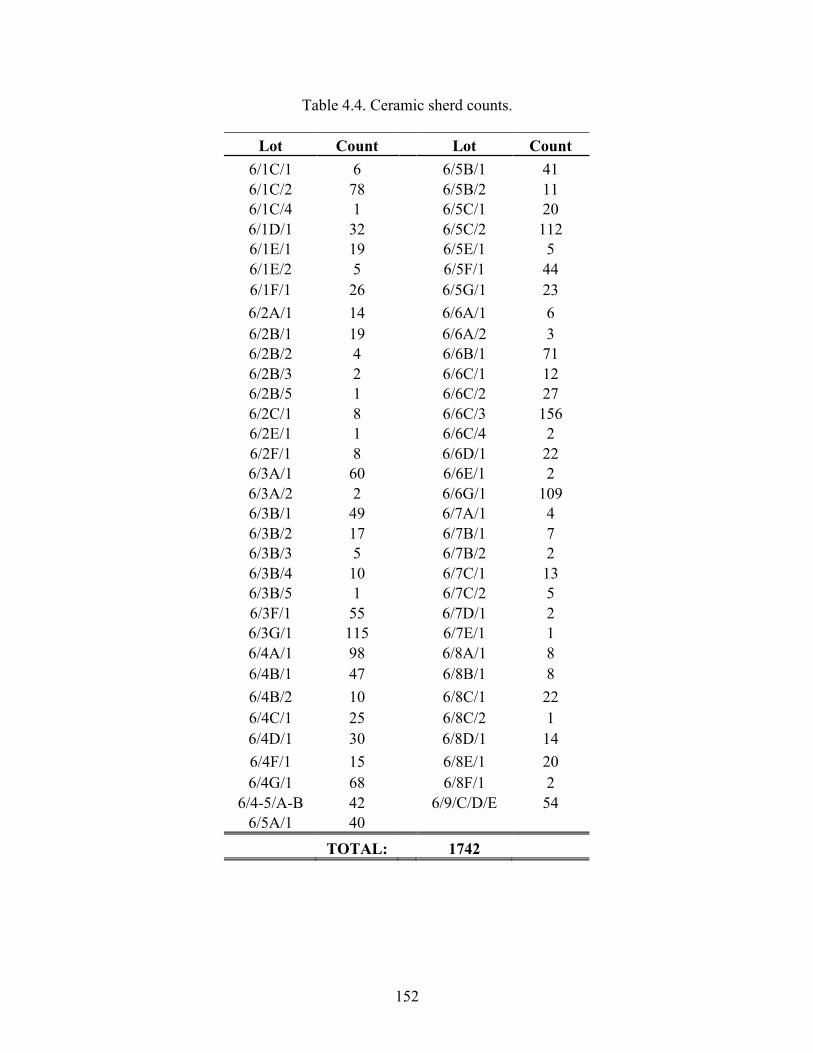
152
Table 4.4. Ceramic sherd counts.
Lot Count Lot Count 6/1C/1 6 6/5B/1 41 6/1C/2 78 6/5B/2 11 6/1C/4 1 6/5C/1 20 6/1D/1 32 6/5C/2 112 6/1E/1 19 6/5E/1 5 6/1E/2 5 6/5F/1 44 6/1F/1 26 6/5G/1 23 6/2A/1 14 6/6A/1 6 6/2B/1 19 6/6A/2 3 6/2B/2 4 6/6B/1 71 6/2B/3 2 6/6C/1 12 6/2B/5 1 6/6C/2 27 6/2C/1 8 6/6C/3 156 6/2E/1 1 6/6C/4 2 6/2F/1 8 6/6D/1 22 6/3A/1 60 6/6E/1 2 6/3A/2 2 6/6G/1 109 6/3B/1 49 6/7A/1 4 6/3B/2 17 6/7B/1 7 6/3B/3 5 6/7B/2 2 6/3B/4 10 6/7C/1 13 6/3B/5 1 6/7C/2 5 6/3F/1 55 6/7D/1 2 6/3G/1 115 6/7E/1 1 6/4A/1 98 6/8A/1 8 6/4B/1 47 6/8B/1 8 6/4B/2 10 6/8C/1 22 6/4C/1 25 6/8C/2 1 6/4D/1 30 6/8D/1 14 6/4F/1 15 6/8E/1 20 6/4G/1 68 6/8F/1 2
6/4-5/A-B 42 6/9/C/D/E 54 6/5A/1 40
TOTAL: 1742
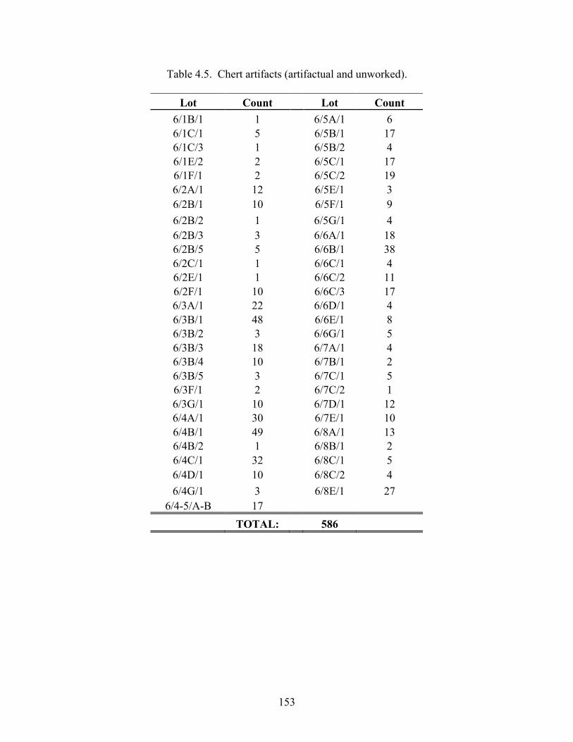
153
Table 4.5. Chert artifacts (artifactual and unworked).
Lot Count Lot Count 6/1B/1 1 6/5A/1 6 6/1C/1 5 6/5B/1 17 6/1C/3 1 6/5B/2 4 6/1E/2 2 6/5C/1 17 6/1F/1 2 6/5C/2 19 6/2A/1 12 6/5E/1 3 6/2B/1 10 6/5F/1 9 6/2B/2 1 6/5G/1 4 6/2B/3 3 6/6A/1 18 6/2B/5 5 6/6B/1 38 6/2C/1 1 6/6C/1 4 6/2E/1 1 6/6C/2 11 6/2F/1 10 6/6C/3 17 6/3A/1 22 6/6D/1 4 6/3B/1 48 6/6E/1 8 6/3B/2 3 6/6G/1 5 6/3B/3 18 6/7A/1 4 6/3B/4 10 6/7B/1 2 6/3B/5 3 6/7C/1 5 6/3F/1 2 6/7C/2 1 6/3G/1 10 6/7D/1 12 6/4A/1 30 6/7E/1 10 6/4B/1 49 6/8A/1 13 6/4B/2 1 6/8B/1 2 6/4C/1 32 6/8C/1 5 6/4D/1 10 6/8C/2 4 6/4G/1 3 6/8E/1 27
6/4-5/A-B 17 TOTAL: 586
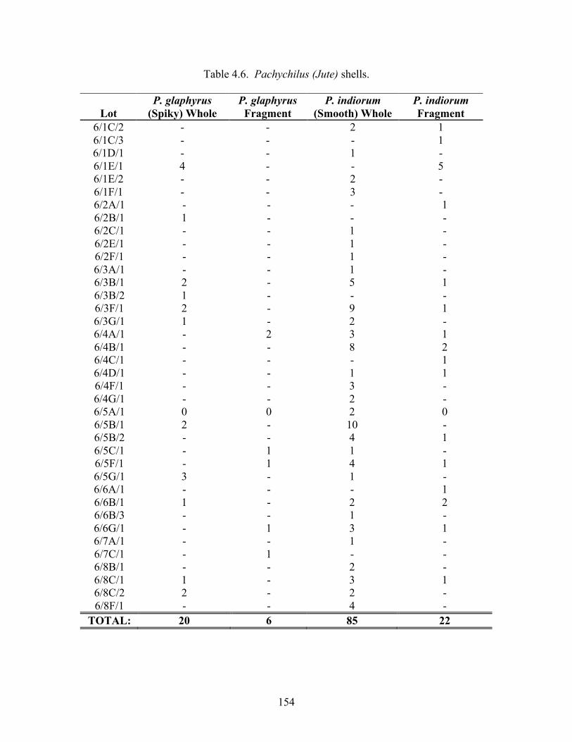
154
Table 4.6. Pachychilus (Jute) shells.
P. glaphyrus P. glaphyrus P. indiorum P. indiorum Lot (Spiky) Whole Fragment (Smooth) Whole Fragment
6/1C/2 - - 2 1 6/1C/3 - - - 1 6/1D/1 - - 1 - 6/1E/1 4 - - 5 6/1E/2 - - 2 - 6/1F/1 - - 3 - 6/2A/1 - - - 1 6/2B/1 1 - - - 6/2C/1 - - 1 - 6/2E/1 - - 1 - 6/2F/1 - - 1 - 6/3A/1 - - 1 - 6/3B/1 2 - 5 1 6/3B/2 1 - - - 6/3F/1 2 - 9 1 6/3G/1 1 - 2 - 6/4A/1 - 2 3 1 6/4B/1 - - 8 2 6/4C/1 - - - 1 6/4D/1 - - 1 1 6/4F/1 - - 3 - 6/4G/1 - - 2 - 6/5A/1 0 0 2 0 6/5B/1 2 - 10 - 6/5B/2 - - 4 1 6/5C/1 - 1 1 - 6/5F/1 - 1 4 1 6/5G/1 3 - 1 - 6/6A/1 - - - 1 6/6B/1 1 - 2 2 6/6B/3 - - 1 - 6/6G/1 - 1 3 1 6/7A/1 - - 1 - 6/7C/1 - 1 - - 6/8B/1 - - 2 - 6/8C/1 1 - 3 1 6/8C/2 2 - 2 - 6/8F/1 - - 4 -
TOTAL: 20 6 85 22
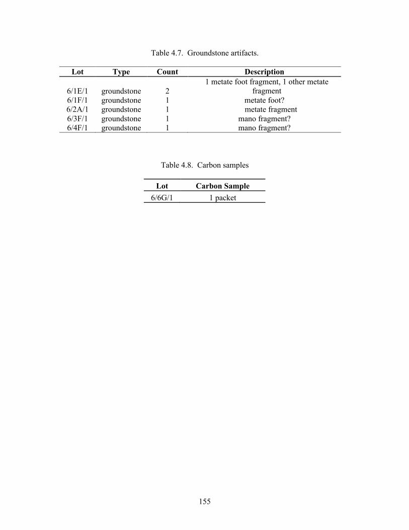
155
Table 4.7. Groundstone artifacts.
Lot Type Count Description
6/1E/1 groundstone 2 1 metate foot fragment, 1 other metate
fragment 6/1F/1 groundstone 1 metate foot? 6/2A/1 groundstone 1 metate fragment 6/3F/1 groundstone 1 mano fragment? 6/4F/1 groundstone 1 mano fragment?
Table 4.8. Carbon samples
Lot Carbon Sample 6/6G/1 1 packet
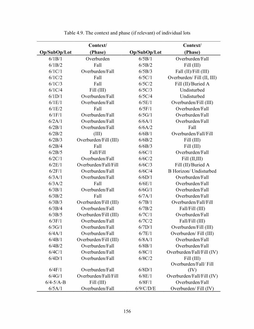
156
Table 4.9. The context and phase (if relevant) of individual lots
Context/ Context/ Op/SubOp/Lot (Phase) Op/SubOp/Lot (Phase)
6/1B/1 Overburden 6/5B/1 Overburden/Fall 6/1B/2 Fall 6/5B/2 Fill (III) 6/1C/1 Overburden/Fall 6/5B/3 Fall (II)/Fill (III) 6/1C/2 Fall 6/5C/1 Overburden/ Fill (II, III) 6/1C/3 Fall 6/5C/2 Fill (II)/Buried A 6/1C/4 Fill (III) 6/5C/3 Undisturbed 6/1D/1 Overburden/Fall 6/5C/4 Undisturbed 6/1E/1 Overburden/Fall 6/5E/1 Overburden/Fill (III) 6/1E/2 Fall 6/5F/1 Overburden/Fall 6/1F/1 Overburden/Fall 6/5G/1 Overburden/Fall 6/2A/1 Overburden/Fall 6/6A/1 Overburden/Fall 6/2B/1 Overburden/Fall 6/6A/2 Fall 6/2B/2 (III) 6/6B/1 Overburden/Fall/Fill 6/2B/3 Overburden/Fill (III) 6/6B/2 Fill (III) 6/2B/4 Fall 6/6B/3 Fill (III) 6/2B/5 Fall/Fill 6/6C/1 Overburden/Fall 6/2C/1 Overburden/Fall 6/6C/2 Fill (II,III) 6/2E/1 Overburden/Fall/Fill 6/6C/3 Fill (II)/Buried A 6/2F/1 Overburden/Fall 6/6C/4 B Horizon/ Undisturbed 6/3A/1 Overburden/Fall 6/6D/1 Overburden/Fall 6/3A/2 Fall 6/6E/1 Overburden/Fall 6/3B/1 Overburden/Fall 6/6G/1 Overburden/Fall 6/3B/2 Fall 6/7A/1 Overburden/Fall 6/3B/3 Overburden/Fill (III) 6/7B/1 Overburden/Fall/Fill 6/3B/4 Overburden/Fall 6/7B/2 Fall/Fill (III) 6/3B/5 Overburden/Fill (III) 6/7C/1 Overburden/Fall 6/3F/1 Overburden/Fall 6/7C/2 Fall/Fill (III) 6/3G/1 Overburden/Fall 6/7D/1 Overburden/Fill (III) 6/4A/1 Overburden/Fall 6/7E/1 Overburden/ Fill (III) 6/4B/1 Overburden/Fill (III) 6/8A/1 Overburden/Fall 6/4B/2 Overburden/Fall 6/8B/1 Overburden/Fall 6/4C/1 Overburden/Fall 6/8C/1 Overburden/Fall/Fill (IV) 6/4D/1 Overburden/Fall 6/8C/2 Fill (III)
6/4F/1 Overburden/Fall 6/8D/1 Overburden/Fall/ Fill
(IV) 6/4G/1 Overburden/Fall/Fill 6/8E/1 Overburden/Fall/Fill (IV)
6/4-5/A-B Fill (III) 6/8F/1 Overburden/Fall 6/5A/1 Overburden/Fall 6/9/C/D/E Overburden/ Fill (IV)
157
Chapter 5
Test Excavations at Nim li Punit
Megan R. Pitcavage
The 2010 excavation season at Nim li Punit consisted of 17 test pits in three plaza groups within the civic-ceremonial center of the site: the South Group, the West Group, and the North Group. The locations of the test pits were chosen in consultation with Dr. John Morris and Dr. Jaime Awe of the Institute of Archaeology. This work builds upon the preliminary investigation of the site conducted by the Southern Belize Archaeological Project directed by Richard Leventhal in the 1980s. The purpose of this test-pitting program was to acquire artifacts, especially ceramics, in order to pursue three major project goals: (1) to define the occupation history of Nim li Punit; (2) to track intersite economic interaction with the other major sites within the Southern Belize Region—Lubaantun, Uxbenka, and Pusilha; and (3) to define long distance trade connections between Nim li Punit and other Maya polities farther afield. This report details these investigations. As described in the 2008-2009 TRIP annual report, our excavation strategy follows a modified Tikal system involving Operations, Suboperations, and Lots. Within this system, Operation 1 is reserved for test excavations; therefore, our test pits were excavated within this operation assignment. Suboperation numbers refer to specific test pit locations. Since we excavated test pits in each architectural group in turn, the suboperation locations cluster by plaza group. Specifically, Operations 1/1 through 1/6 are located in and around the Stela Plaza of the South Group, Operations 1/7 through 1/11 (including the northern and eastern extensions of Op. 1/9, designated Op. 1/9N and Op. 1/9E respectively) are located within the West Group, and Operations 1/12 through 1/15 are situated in the North Group (see Figure 5.1). Finally, Lots were excavated according to the natural stratigraphy, however, where stratigraphic levels were not apparent they were excavated in arbitrary 20-cm levels. Therefore, a single stratigraphic level is often comprised of multiple lots. Equivalent lots by Suboperation are recorded in Tables 5.1 through 5.3. We recorded starting and final depth measurements at the center and at each corner of the unit in order to track lot depths and the volume of material excavated per lot. For the purposes of this report, we only record the final depth of each lot from the center measurement in centimeters below the surface (See Table 5.4 for the raw starting and ending depths for each lot in centimeters below the arbitrary datum and the calculated depths below the modern surface). Additionally, except where noted, the starting depth for each lot is the ending depth for the previous lot. We designated any architectural or cultural features that we encountered during this test-pitting program with feature numbers. Such features may include deposits such as burials and caches as well as architectural walls and stairs. We assigned feature numbers according to the Operation, the Suboperation (which refers to the test pit location where the feature was first observed), and the order in which they were found. We photographed and drew all features in plan view. All of the features that we uncovered this season are described in Table 5.5.
158
All the test pits were laid out in 2-m by 2-m units oriented North-South. We placed the units adjacent to architectural mounds (see Figure 5.1) in order to acquire materials in association with these structures and to ensure that we recovered well-preserved materials that may have been protected by fallen architectural stones from the structures. We proceeded with excavations in three teams of two workmen using hand trowels. Most test pits were excavated down to the level of bedrock. Nonetheless, in a few cases we abandoned unproductive test pits early, but only after we had determined the natural stratigraphy of the plaza group. Since one of our main goals of this test-pitting program was to recover a sample of material culture from the site, test pits were only abandoned in cases where we had reached sterile natural C-horizon soils lacking artifacts. We photographed the test pits before and after excavation and whenever we encountered a feature. Additionally, we drew all four profiles of each unit after excavation. These drawings are included in this report (Figures 5.2 - 5.4, Figures 5.7 - 5.14, Figure 5.16, Figure 5.19 - Figure 5.21, and Figures 5.23, 5.25, 5.27, and 5.29). After each test pit was photographed and drawn it was backfilled.
We sifted all soils through 1/4” screen and separated all the artifacts by material class (pottery, obsidian, chert, human bone, jute shell, other marine shell, figurines, ground stone, greenstone, faunal bone, carbon, and special finds that include beads and bark beaters). These artifacts were washed, counted, and recorded on our lot forms as we closed each lot in the field. Tables 5.6 through 5.14 record counts of each artifact class by lot. With the exception of jute shells (which were counted and speciated in the field, then discarded), we are currently curating all the artifacts in our laboratory in Big Falls, Toldeo District, Belize and will turn them over to the Institute of Archaeology once we conclude our laboratory analysis.
SOUTH GROUP TEST PITS The South Group is located at the southern end of the civic-ceremonial center at Nim li Punit. It is composed of two plaza groups: an upper terrace plaza level to the west and the Stela Plaza to the east. These two plaza groups represent the divide between private and public space. We consider the upper terrace to be a royal residential complex due to: (1) its proximity to the important ceremonial center of the site (the Stela Plaza); (2) because access to this area is restricted in comparison to the Stela Plaza; and (3) two elite tombs were found in the upper terrace plaza. The first burial is a royal tomb that was discovered by Leventhal’s Southern Belize Archaeological Project team to the west of Structure 5 (1986:11). It contained the remains of multiple individuals and numerous elite grave goods along with evidence that the tomb was revisited on several occasions. In 1998, the Mayan Archaeological Sites Development Program uncovered a double tomb immediately south of the east stair of Structure 8 in the upper terrace. In contrast, the Stela Plaza is the ritual complex of the site. It contains all the carved hieroglyphic discovered at Nim li Punit as well as many blank stelae (See Figure 5.6). Additionally, it is easily accessible to the north, where it connects to the ballcourt and a series of open terraces that lead to the Stela Plaza, and to the southeast and southwest. Two blank stelae each entrance into the area, which marks the Stela Plaza as ceremonial space.
We did not place any test pits in the upper terrace of the South Group in order to avoid encountering any additional tomb contexts. Nonetheless, in order to ensure we
159
obtain a sample of the material culture from the South Group we placed six test pits in the Stela Plaza. These test pits are concentrated at the southern end of the plaza around Structures 1 and 2. Structure 2 is an unconsolidated mound and Structure 1 is partially consolidated. The locations of our test pits were chosen in order to gather information about the construction history of the Stela Plaza and locate midden contexts to collect a sample of the material culture from the group, but also to avoid contexts that had already been excavated by the MASDP team.
The first test pit, Suboperation 1/1, is situated along the central north-south axis of Structure 2, immediate north of the structure within the Stela Plaza. Suboperation 1/2 is also located within the Stela Plaza along the west side of Structure 1 toward the southern end of the structure. With these two test pits we hoped to understand the construction history of the Stela Plaza. We placed Suboperation 1/3 at the southwest corner of Structure 1 in order to determine if this area functioned as a major southeast access point to the Stela Plaza. Both Suboperation 1/4 and Suboperation 1/6 were placed along the south side of the East-West oriented body of Structure 2 to the east and west of the southern apron, respectively. Finally, we placed Suboperation 1/5 directly south of Structure 2, along its central North-South axis. These three test pits were initiated in order to recover any cultural materials that had been thrown off the back of Structure 2. Suboperation 1/1 Suboperation 1/1 is located at the base of Structure 2, on the northern extreme of the talus slope and within the South Group Stela Plaza (Figure 5.1). The southeast corner of the unit is situated approximately 1.8-m west of and 40-cm south of the stela butt of the central stela. Structure 2 is the southernmost structure in the Stela Plaza of the South Group. Due to its location in the Stela Plaza, we speculate that this structure held ceremonial significance rather than functioning as a residence, however, more testing is needed in order to confidently determine its function.
We excavated this unit in five lots (Lots 1/1/1 to 1/1/5) to an approximate final depth of 88 cm below the modern surface level. We identified three stratigraphic levels during excavation (Figure 5.2). Level 1 corresponds to the layer of overburden (Lots 1/1/1 to 1/1/3) overlying Level 2, a ballast floor preparation layer (Lot 1/1/4). Finally, we found natural C-horizon soils (Lot 1/1/5) located beneath the floor layer and directly above the level of bedrock. Level 3 comprises this natural soil level. We did not expose any architectural features during the excavation of this unit. Lot 1/1/1. Lot 1/1/1 consisted of the removal of the surface grass and overburden with the goal of leveling the unit and locating the plaza floor of the South Group. This lot terminated at 9 cm below the surface. We did not encounter any evidence of a floor during our excavation of this lot. The matrix of Lot 1/1/1 included grass and dark brown (Munsell 7.5YR 3/2) O- and A-horizon soils. Small pebbles were also sparsely scattered throughout the matrix. Additionally, we encountered a lens of dark gray/black ash less than 10 cm from the surface in the northeast sector of the unit, which continues through all the lots comprising Level 1 (Lots 1/1/1 to 1/1/3). Due to its shallow depth this ash lens likely represents a modern burning event. Finally, we exposed a few fallen cut stones from Structure 2 in the southeast corner of the unit. Nonetheless, these stones they did not exhibit any recognizable fall pattern and could not be identified as part of a
160
particular architectural feature. The cultural materials we collected from this lot include: 110 ceramic sherds, a single obsidian blade fragment, and 23 chert artifacts and geofacts. Lot 1/1/2. The material removed during our excavation of Lot 1/1/2 is also part of the overburden material of Level 1, which consisted of dark brown (7.5 YR 3/2) A-horizon soil mixed with a few small stones and fallen cut stones. As with Lot 1/1/1, this we terminated this lot arbitrarily at a final depth of 25 cm below the surface. Within this lot we recovered 226 ceramic sherds, nine obsidian-blade fragments, 12 chert artifacts and geofacts, two whole Pachychilus indiorum (smooth jute) shells, and one small ceramic bead. Lot 1/1/3. Lot 1/1/3 involved the clearing of the bottommost layer of the overburden (Level 1), which was composed of dark brown (7.5 YR 3/2) A-horizon soil with a few small stones. We terminated this lot at a depth of 46 cm below the surface where we uncovered a level of small to medium-sized cobbles arranged in a single layer. We encountered the fallen cut stones from Structure 2 throughout Lots 1/1/1, 1/1/2, and 1/1/3. These architectural stones appear to sit atop this cobble layer indicating that Level 2 represents the final floor preparation surface of the Stela Plaza. During the excavation of this lot we collected 531 ceramic sherds, five obsidian pieces, 11 chert artifacts and geofacts, one whole small conch shell, and one ceramic bead. Lot 1/1/4. The material we removed as part of Lot 1/1/4 consisted of a layer of small and medium-sized cobbles and densely packed small pebbles. The matrix also included A-horizon soils that graded from dark brown (7.5 YR 3/2) to brown (7.5 YR 4/3) in color. We completed this lot at a depth of 65 cm below the surface at a level of yellow brown C-horizon soils composed of eroding siltstone bedrock. We recovered 588 ceramic sherds, six obsidian blade fragments, four chert artifacts and geofacts, one whole small conch shell, and one unpolished greenstone pebble from this lot.
Although there is no indication of plaster within this layer we believe that it represents the plaza floor of the South Group (Level 2) since none of the fallen architectural stones from Structure 2 intrude into this level. In other words, the ballast layer is likely the ancient occupation surface upon which the cut stones fell as the north wall of Structure 2 collapsed. The stone ballast layer may have been finished with a layer of packed earth, however, this is not certain. A more thorough discussion of floor preparation practices at the site will be included in the conclusion of this report.
Lot 1/1/5. The final lot of this test pit, Lot 1/1/5, consists of natural C-horizon soil derived from the breakdown of the underlying siltstone bedrock. This lot terminated at bedrock at a depth of 88 cm below the surface. The matrix includes yellowish brown (10YR 5/4) soil packed with eroding and very friable siltstone slabs. The artifacts that we recovered from this lot were removed mainly from the upper portion of the lot rather than from throughout the C-horizon soil, therefore, they were likely deposited along with the cobble floor preparation layer excavated as Lot 1/1/4. These materials include 108 ceramic sherds, one obsidian fragment, one chert artifact or geofact, and one P. indiorum shell fragment. Suboperation 1/2 Suboperation 1/2 is located to the west of Structure 1 approximately 5-m north of the southernmost stela in the southeastern sector of the Stela Plaza (Figure 5.1). Structure
161
1 is a very long range-structure dominating the eastern edge of the Stela Plaza. We excavated Suboperation 1/2 in seven lots (Lots 1/2/1 to 1/2/7) representing five cultural and natural stratigraphic levels (Figure 5.3). Level 1 is the overburden layer removed in Lots 1/2/1 and 1/2/2, which overlies a cobble and gravel floor (Level 2) excavated as Lot 1/2/3. In Lot 1/2/4 we encountered a possible second packed cobble and pebble floor (Level 3) directly below Level 2. Level 4 consists of mixed depleted A- and C-horizon soil fill (Lots 1/2/5 and 1/2/6). In some areas we found Level 4 materials directly above bedrock, and in others it directly overlies Level 5. This last level is composed of dark brown A-horizon soil fill (Lot 1/2/7) packed into the crenulations in the bedrock. We speculate that Level 5 was deposited in order to create an even surface before the construction of the South Plaza subfloor. We uncovered the siltstone bedrock at a final depth of 83 cm below the modern surface level. This test unit contained no features. Lot 1/2/1. Lot 1 of Suboperation 1/2 involved the initial removal of the overburden material of Level 1 to a depth of 14 cm below the surface. The matrix consists of grass and brown (7.5YR 4/2) O- and A- horizon soils mixed with dispersed small stones and pebbles. This lot yielded a high concentration of artifacts that likely washed into this location after abandonment. These artifacts include: 513 ceramic sherds, six obsidian tool fragments, 16 chert artifacts and geofacts, one whole P. indiorum shell, one whole small conch shell, and one groundstone fragment. Lot 1/2/2. In Lot 1/2/2 we continued to clear the remaining overburden level, which we concluded at a depth of 34 cm below the surface where we encountered a packed cobble and pebble floor. This lot consists of dark grayish brown (10YR 4/2) soil mixed with small stones. We did not encounter any cut stones during the removal of this level. As with the lot above, Lot 1/2/2 contains a high density of artifacts including: 843 ceramic sherds, 40 obsidian tool fragments, 13 chert artifacts and geofacts, 11 whole P. glaphyrus (spiky jute) shells, four P. glaphyrus shell fragments, 218 whole P. indiorum shells, 169 P. indiorum shell fragments, one metate fragment, one faunal bone, two pieces of coral, four unworked greenstone pebbles, one figurine fragment, four small conch shell fragments, and six whole small conch shells. Lot 1/2/3. Lot 1/2/3 represents Level 2, the uppermost plaza floor level of the South Group. Like the floor level encountered in Op. 1/1/4, the floor in this location does not appear to have been finished with plaster. Instead, the floor consists of a 10- to 15-cm thick layer of small cobble and pebbles densely packed within a brown (7.5YR 4/3) depleted A-horizon soil matrix. In contrast to the high density of cultural materials we encountered in Lot 1/2/2, we found relatively few materials in Lot 1/2/3, which terminated at a depth of 38 cm below the surface. Additionally, it was apparent during excavation that the artifacts that we collected as part of this lot are actually from the remains of the A-horizon overburden material rather than the floor layer itself. Therefore, these artifacts should be considered to be part of the overburden context that we excavated as Lot 1/2/2. We collected 50 ceramic sherds, a single obsidian blade fragment, one P. glaphyrus shell fragment, four whole P. indiorum shells, two P. indiorum shell fragments, one whole small conch shell, and two faunal bones. Lot 1/2/4. We removed a second 10- to 15-cm thick gravel floor (Level 3) during the excavation of Lot 1/2/4, which terminated at a depth of 46 cm below the surface. Like the floor above it (Level 2), this floor consists of a layer of small cobbles densely
162
packed with pebbles and yellowish brown (10YR 5/4) C-horizon soil. This lot is virtually sterile of cultural materials except for a single ceramic sherd. Lot 1/2/5. Lot 1/2/5 involved the removal of a layer of mixed A- and C-horizon soil fill (Level 4) to a depth of 52 cm below the surface. This layer consists of yellowish brown (10 YR 5/4) soil atop packed, eroding siltstone bedrock stones. We recovered 61 ceramic sherds, three obsidian blade fragments, six chert artifacts and geofacts, two P. indiorum shell fragments, three small conch shell fragments, and one greenstone pebble from this lot. Lot 1/2/6. We continued to remove the siltstone and C-horizon soil fill of Level 4 to a depth of 76 cm below the surface during the excavation of Lot 1/2/6. This lot consists of yellowish brown (10 YR 5/4) soil packed with extremely friable siltstone bedrock stones. In the northern and western sectors of the unit this layer was deposited directly above bedrock, however, in the southern and eastern portions of the unit this layer overlies a shallow layer of dark brown A-horizon soil. The cultural materials that we recovered from this lot include: 68 ceramic sherds, four obsidian fragments, three chert artifacts and geofacts, one small conch fragments, and one faunal longbone fragment. Lot 1/2/7. Lot 1/2/7 and Level 5 are coterminous and consist of pockets of dark brown (7.5YR 3/2) soil fill within the dips and valleys of the underlying siltstone bedrock. This lot terminated at a depth of 83 cm below the surface. It is important to note that this lot did not spread evenly across the entire unit, but rather it was restricted to the deeper areas of the bedrock. It appears that prior to the construction of the South Group plaza, the bedrock was swept clean and then dark brown soil fill was added in order to create an even surface. Despite the small amount of soil that we removed during the excavation of this lot, we recovered many artifacts, which include: 63 ceramic sherds, one obsidian blade fragment, five chert artifacts and geofacts, five P. indiorum shell fragments, one faunal bone fragment, one greenstone pebble, and two packages of carbon. Suboperation 1/3 We placed Suboperation 1/3 at the southeast corner of the Stela Plaza on the slope down to the lower (or outside) level. The northwest corner of the unit is approximately 3 m south and 1 m west of the apparent southwest corner of Structure 1 (Figure 5.1). We excavated this unit in five lots (Lots 1/3/1 to 1/3/5), which represent two stratigraphic levels (Figure 5.4). Level 1—consisting of Lots 1/3/1 to 1/3/4—is the overburden layer that accumulated since the abandonment of the site. Beneath the overburden is Level 2, which is composed of natural C-horizon soil derived from the underlying siltstone bedrock (Lot 1/3/5). We exposed the bedrock at a final depth of 77 cm. We did not observe any evidence of a prepared floor surface during excavation.
We encountered a single feature, F. 1/3/1, during our excavation of Lot 1/3/3 of this unit. This feature is a southeast-facing stair running through the northwest corner of the unit (Figure 5.5). We uncovered two steps of the stair, which are composed of large sandstone blocks lain directly on the bedrock surface. It is likely that this stair continues northward and leads directly into the Stela Plaza and constitutes one of the main access points to the South Group. This interpretation of F. 1/3/1 is supported by the presence of

163
two blank stelae flanking the southeast entrance to this group (Figure 5.6:Stelae 18 and 19). Similar blank stelae are found on both sides of the main northern entrance to the Stela Plaza (Figure 5.6:Stelae 8 and 9). The installation of stelae at the access points to this plaza, which contains carved dynastic monuments, sets the Stela Plaza apart as sacred space and conceptually separates this area from the residential patio groups within the site core. Lot 1/3/1. Lot 1/3/1 entailed the removal of the upper layer of the overburden (Level 1). This lot is composed of O- and A-horizon soils, which we removed in order to level the unit on the slope exiting the southeast corner of the Stela Plaza. The material we removed included organic matter and dark brown (7.5YR 3/2) soils. Additionally, a large, natural boulder intrudes into the unit and dominates its western half. Most of the material was removed from the north end of the unit where the slope is highest, therefore, the center measurement after the excavation of this lot was the same as the modern surface level. Additionally, we left the southern end of the unit relatively untouched in order to achieve a level unit. In the north end we uncovered a layer of large fallen stones, likely from the south wall of Structure 1, however, they did not exhibit a recognizable fall pattern. We collected 54 ceramic sherds, one obsidian blade fragment, and 18 chert artifacts and geofacts from this lot. Lot 1/3/2. We continued to remove the overburden layer (Level 1) in Lot 1/3/2, which mainly consists of brown (10YR 4/3) A-horizon soils mixed between large, uncut sandstone rocks in the northern half of the unit. We also encountered a large concentration of dark grayish brown (10YR 4/2) ash located on the surface in the southern half of the unit. This location is currently used as a leaf disposal area, therefore, the ash is likely the result of modern burning. This lot terminates arbitrarily at a center depth of 12 cm below the surface. The cultural material we recovered from this lot include: 70 ceramic sherds, five obsidian fragments, 19 chert artifacts and geofacts, one whole P. glaphyrus shell, and one animal bone fragment. Lot 1/3/3. The material that we removed during the excavation of Lot 1/3/3 is also part of Level 1, the overburden layer that washed into the area after abandonment. This lot terminated at a center depth of 33 cm below the surface. The matrix is little different from the previous lot and contains brown (10YR 4/3) A-horizon soils among large sandstone rocks in the northern half of the unit and dark grayish brown (10YR 4/2) ash in the southern half. Our excavation of this lot yielded 140 ceramic sherds, five pieces of obsidian, and 25 chert artifacts and geofacts including one proximal biface fragment.
Within this lot we also encountered F. 1/3/1, an alignment of southeast-facing cut stones running through the northwest corner of the unit (Figure 5.5). This feature is part of the southeast-facing stair that leads into the Stela Plaza and comprises the main southeast access into the South Group. In all, we uncovered two steps during the excavation of this unit (in Lots 1/3/3 and 1/3/4), which were built directly on top of the bedrock surface. These steps are the bottom two steps of the stair, which likely continues northward to allow easy access up the southeast slope into the Stela Plaza. Lot 1/3/4. Lot 1/3/4 consists of the remaining overburden material (Level 1), which is composed of dark yellowish brown (10YR 4/4) depleted A-horizon soils mixed with C-horizon material and small stones. In this lot we uncovered the bottommost step of F. 1/3/1, which was lain directly on top of bedrock. This lot terminated in the northern
164
half of the unit at the level of bedrock, however, in the southern half we concluded this lot when we exposed a level of naturally derived C-horizon soil. The center ending depth for this lot was 44 cm below the surface. The artifact assemblage we recovered from this lot includes 129 ceramic sherds, ten obsidian tool fragments, nine chert artifacts and geofacts, and one human skull fragment. Lot 1/3/5. This lot involved the final clearing of naturally derived dark yellowish brown (10YR 4/4) C-horizon soils and eroding siltstone bedrock fragments from the bedrock surface, which slopes to the southeast. This natural soil layer constitutes Level 2. The final center depth for this unit was 77 cm below the surface. We recovered just a single ceramic sherd from this lot. Suboperation 1/4 We placed Suboperation 1/4 to the southeast of Structure 2 on the slope where the stair and the body of the mound meet (Figure 5.1). Excavation of this unit took place in six lots (Lots 1/4/1 to 1/4/6) and terminated at bedrock, which we unearthed at a depth of 58 cm below the modern surface. These lots span two stratigraphic levels, Levels 1 and 2 (Figure 5.7). The uppermost level, Level 1, consists of overburden composed of soils that washed down the slope of Structure 2 since abandonment. We removed Level 1 during the excavation of Lots 1/4/1 to 1/4/5. Level 2, which is the same as Lot 1/4/6, consists of the natural C-horizon soils produced from the erosion of the underlying siltstone bedrock. We excavated this unit until we reached bedrock. We did not observe any evidence of a prepared floor in this location nor did we expose any architectural features during the excavation. Lot 1/4/1. In the first lot of Suboperation 1/4 we removed the surface organic material and topsoil as part of the initial leveling of the unit. The matrix consisted of dark brown (7.5 YR 3/2) O- and A-horizon soils among sparsely scattered small stones. We did not encounter any fallen architectural stones from Structure 2. We concluded this lot arbitrarily at a depth of 10 cm below the surface. We collected 80 ceramic sherds and a single obsidian blade fragment from this lot. Lot 1/4/2. Lot 1/4/2 involved continuing to clear the overburden and level the unit. The matrix is little different from the previous lot and is composed of dark brown (7.5YR 3/2) A-horizon soil with a few small stones and large roots. We closed this lot at a depth of 16 cm below the surface. In total, we collected just 58 ceramic sherds from this lot. Lot 1/4/3. This lot involved the final leveling of the unit, which consisted of the removal of another arbitrary layer of overburden material. We terminated this lot at a depth of 34 cm below the surface. Brown (7.5YR 4/3) A-horizon soils characterize the matrix, within which we found 256 ceramic sherds, four pieces of obsidian, and 11 chert artifacts and geofacts. Lot 1/4/4. Lot 1/4/4 entailed continuing to clear the brown (7.5YR 4/3) A-horizon soils of the overburden level (Level 1). We closed this lot at a depth of 47 cm below the surface. This lot contains a high concentration of artifacts including 451 ceramic sherds, eight obsidian tool fragments, 17 chert artifacts and geofacts, six figurine fragments, and one metate leg.
165
Lot 1/4/5. This lot involved the final removal of the overburden layer, which terminated just above a layer of C-horizon material at a depth of 50 cm below the surface. The matrix of Lot 1/4/5 consisted of brown (7.5YR 4/3) A-horizon soil from which we collected 133 pottery sherds, one obsidian blade fragment, and three chert artifacts and geofacts. Lot 1/4/6. Finally, Lot 1/4/6 entailed clearing the C-horizon material from the surface of the siltstone bedrock, which we reached at a final depth of 58 cm below the surface. This material included yellowish brown (10YR 5/4) soil and eroding fragments of bedrock, however, this lot was completely sterile of artifacts. Suboperation 1/5 Suboperation 1/5 is located immediately south of (or directly behind) Structure 2 at the base of the apron/stair (Figure 5.1). We fully excavated this unit, down to the level of bedrock, in just three lots—Lots 1/5/1 to 1/5/3. These three lots represent two stratigraphic levels (Figure 5.8). The first, Level 1 (Lots 1/5/1 and 1/5/2), consists of the overburden composed of A-horizon soils and cultural materials that washed down the southern slope of Structure 2. Level 2 (Lot 1/5/3) is a layer of natural C-horizon soils derived from the underlying siltstone bedrock, which we encountered at a final depth of 42 cm below the modern surface. Although we exposed some fallen cut stones from the Structure 2 apron/stair, we did not reveal any in situ architectural features in the unit nor is there any indication of a prepared floor surface behind (to the south of) Structure 2. Lot 1/5/1. The first lot involved the initial clearing of the overburden level and leveling of the unit. We concluded this lot arbitrarily at a depth of 10 cm below the surface. The matrix consisted of dark brown (7.5YR 3/2) O- and A-horizon soils mixed with a few small stones. Additionally, in the north end of the unit we encountered fallen cut sandstones from Structure 2. Nonetheless, these stones did not exhibit any recognizable fall pattern. We collected the following cultural materials collected from this lot: 54 ceramic sherds and a single chert artifact or geofact. Lot 1/5/2. Lot 1/5/2 represents the final clearing of the overburden (Level 1), which we terminated when we exposed the underlying level of yellowish brown C-horizon material at a depth of 24 cm below the surface. This lot contained dark brown (7.5YR 3/2) A-horizon soil among a few small stones and artifacts including 161 ceramic sherds, one obsidian fragment, and five chert artifacts and geofacts. Lot 1/5/3. The final lot in this unit consisted of the removal of the layer of yellowish brown (10YR 5/4) mixed A- and C-horizon soils (Level 2) among loose siltstone fragments that had eroded from the underlying bedrock. We reached bedrock at a final depth of 48 cm below the surface. Although we recovered 70 ceramic sherds and two chert artifacts and geofacts from this layer, the majority of these artifacts were collected from the upper portion of this lot where the A-horizon soil was grading into the C-horizon material. Thus, these materials are considered to be from the overburden level. Suboperation 1/6 We positioned Suboperation 1/6 southwest of Structure 2 along the slope where the stair and body of the mound meet (Figure 5.1). We excavated this suboperation in
166
four lots—Lots 1/6/1 to 1/6/4—representing a single natural stratigraphic level (Figure 5.9). Level 1 corresponds to the thick layer of overburden that was likely produced from the accumulation of material that had washed down the southwestern slope of Structure 2. The overburden was deposited atop a sandstone bed, which lies directly on top of siltstone bedrock, yet in the northern portion of the unit there is a shallow deposit of eroding siltstone material above the large sandstone boulders. This unit, therefore, illustrates the varied underlying geomorphology of the site, which includes interbedded sandstone and siltstone deposits. We excavated this unit to a final depth of 114 cm below the modern surface. We encountered no architectural features or prepared floor surfaces during excavation. Lot 1/6/1. Lot 1/6/1 entailed the removal of the surface organic matter and topsoil during the course of the initial leveling of the unit. The matrix consisted of dark brown (7.5YR 3/2) O- and A-horizon soils mixed with small stones. We terminated this lot arbitrarily after removing material exclusively from the north end of the unit for leveling purposes. Thus, the final center depth for this lot is 1 cm below the surface. We recovered just 38 ceramic sherds from this lot. Lot 1/6/2. The second lot of Suboperation 1/6 involved the continuing to clear the overburden and level of the unit. The matrix was little different from Lot 1/6/1 and was mainly composed of brown (7.5YR 4/3) A-horizon soil among a few small stones. Nonetheless, in the north end of the unit there was a thin layer of packed siltstone fragments. This lot also represents an arbitrary layer, which we terminated after we excavated to an ending depth of 20 cm below the modern surface. We recovered 115 ceramic sherds and two chert artifacts and geofacts from this lot. Lot 1/6/3. Lot 1/6/3 consisted of the removal of the overburden from the upper surfaces a natural sandstone bed and the final leveling of the unit. We cleared brown (7.5YR 4/3) A-horizon soil and recovered the following artifacts: 208 ceramic sherds, two obsidian tool fragments, two chert artifacts and geofacts, and a single figurine fragment. We terminated this lot when we exposed the tops of the sandstone boulders comprising the sandstone bed at a depth of 45 cm below the surface. Lot 1/6/4. The final lot of this suboperation involved clearing the brown (7.5YR 4/3) A-horizon soils of the overburden from between the sandstone boulders and removing some of the smaller boulders to reveal the level of the siltstone bedrock, which we exposed at a final depth of 114 cm below the surface. This lot yielded 108 ceramic sherds, one obsidian tool fragment, and one chert artifact or geofact.
WEST GROUP TEST PITS The West Group is located directly west of the East Group and northwest of the South Group. It is situated on a natural hill across a seasonal creek that separates the West Group from the other architectural complexes of the civic-ceremonial center. It is composed of six structures organized around a main plaza and a low upper terrace area scattered with several individual structures. Structure 48 dominates the West Group and is the largest and tallest structure at the site. It is located along the western edge of the main plaza opposite Structures 51 and 52. Due to the great size of the platform and its location in a residential patio we interpret this structure, and the West Group in general, as an elite residential complex. Additionally, the artifact assemblage recovered from
167
around Structure 48, which contains a higher proportion of elite goods such as polychrome sherds, greenstone artifacts, and a hematite bead, seems to support this interpretation. We initially planned to place six test pits in separate locations within the West Group, however, after encountering a possible earlier occupation surface in Op. 1/9 we decided to add an additional test pit and expand Op. 1/9 to the north and the east (Suboperations 1/9N and 1/9E) (Figure 5.1). The first test pit, Suboperation 1/7, is located immediate west of (behind) Structure 48 along its main East-West axis. With this test pits we sought to recover artifacts in association with the largest structure of the site. Similarly, we opened Suboperations 1/8, 1/9, and 1/10 on the east side (in front) of Structure 48 to gather evidence related to the construction history of the main plaza of the West Group. Suboperation 1/8 is located immediately east of the central East-West axis of Structure 49. We placed Suboperation 1/9 (and the eastern and northern extensions of the unit, Op. 1/9E and Op. 1/9N) just north of Structure 50 along its central North-South axis. Suboperation 1/10 is located to the east of Structure 48 along its central East-West axis. Finally, we opened Suboperation 1/11 to the south of Structure 54 to gather a sample of the material culture from the single structures located on the upper terrace. Suboperation 1/7 The first test pit placed in the West Group was Suboperation 1/7, which is situated just west of (or behind) Structure 48, at its base and near the central East-West axis of the structure (Figure 5.1). We excavated this unit in four lots: Lots 1/7/1 to 1/7/4. These four lots constitute two stratigraphic levels (Figure 5.10). The first level, Level 1, represents the overburden layer (Lots 1/7/1, 1/7/2, and 1/7/3). The second level, Level 2, is a layer of natural soil derived from the erosion of the siltstone bedrock (Lot 1/7/4). We excavated this unit to the level of bedrock in the eastern half of the unit, which we uncovered at a final depth of 115 cm below the modern surface level. Nonetheless, we did not complete the excavation of this unit to the level of bedrock in the western half of the unit. We made this decision in order to save time and because, due to our understanding of the geomorphology of the site and the West Group, we knew this C-horizon layer to be sterile of cultural artifacts. Although we uncovered a few cut sandstone facing stones that had fallen from the west wall of Structure 48, no architectural features were encountered during our excavation of this suboperation. Lot 1/7/1. This lot entailed clearing the surface organic matter and topsoil and terminated arbitrary at a depth of 17 cm below the modern surface. The matrix included dark brown (7.5YR 3/2) O- and A-horizon soils that had accumulated in this area since the abandonment of the site. This overburden layer (Level 1) contained cultural materials that washed down the western slope of the Structure 48 mound. These artifacts include 597 ceramic sherds, seven obsidian tool fragments, 35 chert artifacts and geofacts (including one whole bifacial point), two small polished greenstone celts, five figurine fragments, and one small package of unidentified bones. Lot 1/7/2. Lot 1/7/2 involved continuing to remove the overburden layer (Level 1). We concluded this lot arbitrarily at a depth of 30 cm below the modern surface level. The matrix included brown (7.5YR 4/3) A-horizon soil among some large cut sandstone blocks that had fallen from the west wall of Structure 48. These blocks did not follow
168
any recognizable fall pattern and likely tumbled far west of the original west wall of the structure. This lot contained a high concentration of artifacts including 563 ceramic sherds, two obsidian tool fragments, 58 pieces of chert, one figurine fragment, and one hematite bead. Lot 1/7/3. The third lot of Suboperation 1/7 represents the final clearing of the overburden level (Level 1). Our excavation of this lot commenced in brown (7.5YR 4/4) A-horizon soils with a few scattered small stones and concluded at a depth of 43 cm below the surface when we had exposed a layer of yellowish C-horizon soils. We did not encounter any evidence of a prepared plaster floor, ballast subfloor, or paving stones on this side of the structure, which suggest that there is no prepared floor behind (to the west of) Structure 48. The slumped cut sandstone blocks apparent in the eastern profile of the unit appear to be resting on the yellowish soil, which indicate that the original occupation surface was likely prepared from these C-horizon soils. During our excavation of this lot we recovered 327 ceramic sherds, three obsidian-tool fragments, and 34 pieces of chert. Lot 1/7/4. Finally, Lot 1/7/4 consisted of the removal of natural soils in order to expose the bedrock at a final depth of 115 cm below the surface. These C-horizon soils were sandy, ochre in color (7.5YR 4/6 “strong brown”) and comprised the soft eroding bedrock layer found directly above solid bedrock. The cultural materials that we retrieved from this lot were collected from the uppermost portion of the lot, where the A-horizon soils graded into the C-horizon soils. These artifacts include 65 ceramic sherds, four pieces of obsidian, 16 pieces of chert, one unworked greenstone pebble, and one metate fragment. Suboperation 1/8
We established Suboperation 1/8 immediately east of (in front of) Structure 49, at its base and near the central East-West axis of the structure (Figure 5.1). Structure 49 is a small, west-facing residential platform located at the southwest corner of the West Group main plaza. We excavated Suboperation 1/8 in seven lots—Lots 1/8/1 through 1/8/7—which constitute three stratigraphic levels (Figure 5.11). The first level, Level 1, is the overburden layer that had accumulated since the abandonment of the site. We excavated Level 1 in a single lot, Lot 1/8/1. Lots 1/8/2 through 1/8/6 comprise Level 2. This level consisted of a deep layer of large stone plaza-fill. Finally, Lot 1/8/7 represents the final stratigraphic level, Level 3, which was composed of natural C-horizon soils produced from the underlying eroding bedrock. We reached the bedrock at a final depth of 178 cm below the surface. We did not encounter any architectural features while excavating this unit. Lot 1/8/1. This first lot consisted of the clearing of the overburden, which was composed of surface humus and topsoil. These dark brown (7.5YR 3/2) O- and A-horizon soils were overlying the large stone fill of the West Group plaza. We concluded this lot at a depth of 21 cm below the surface where we exposed the layer of large, plaza fill-stones. From this lot we collected 177 ceramic sherds, four obsidian fragments, 19 chert artifacts and geofacts (including one proximal fragment of a bifacial point), one fragment of a bark beater, one unworked greenstone pebble, one polished red stone, and two metate fragments.

169
Lot 1/8/2. Lot 1/8/2 involved the initial removal of the large stone plaza-fill. We did not detect any sign of either a prepared plaster floor or ballast subfloor. This lot terminated arbitrarily at a center depth of 25 cm below the surface. The fill is composed of large uncut sandstone blocks and brown (7.5YR 4/3) A-horizon soils that contained relatively few artifacts. The artifacts recovered from this lot are 89 ceramic sherds, two obsidian tool fragments, six chert artifacts and geofacts, and one figurine whistle (ocarina) fragment. Lot 1/8/3. In this lot we continued to clear the large stone plaza-fill, which we concluded arbitrarily at an ending depth of 57 cm below the surface. The matrix was little different from the lot above and consisted of brown (7.5YR 4/3) A-horizon soil among large, uncut sandstone slabs. We found even fewer cultural materials within this lot: just 25 ceramic sherds and a single piece of chert. Lot 1/8/4. In Lot 1/8/4 we continued to remove the large stone plaza-fill to an arbitrary depth of 77 cm below the modern surface level. The matrix was little different from the above two lots and included brown (7.5YR 4/3) A-horizon soil mixed between large sandstone rocks. From this lot we recovered 38 ceramic sherds, one piece of chert, one small conch fragment, one whole bivalve shell and two bivalve fragments. Lot 1/8/5. Lot 1/8/5 entailed continuing to remove the plaza fill, which was composed of large sandstone slabs and brown (7.5YR 4/3) A-horizon soils. We terminated this lot at a depth of 93 cm below the surface. We recovered a relatively higher concentration of artifacts from this lot than in the previous lots. The artifacts that we collected include 188 ceramic sherds and three bivalve shell fragments. Lot 1/8/6. This lot represents the final clearing of the large sandstone plaza-fill, which we terminated once we exposed a layer of yellowish brown natural soil at a depth of 104 cm below the surface. The matrix consisted of brown (7.5YR 4/3) A-horizon soil loosely packed between large sandstone slabs. We collected 292 ceramic sherds, 18 pieces of chert, and one unidentified animal bone from this lowest fill level. Lot 1/8/7. The final lot of Suboperation 1/8 involved the clearing of the final layer of natural soil from the level of bedrock, which we exposed at a final depth of 178 cm below the surface. The soil was composed of yellowish brown (10YR 5/4) C-horizon soil derived from the underlying siltstone bedrock. This layer also included a large sandstone boulder that sat directly on top of the bedrock in the northwest portion of the unit. This lot was completely sterile of cultural materials. Suboperation 1/9 Suboperation 1/9 is located immediately north of Structure 50, at its base and near its central North-South axis. Structure 50 occupies the southern edge of the West Group plaza and likely functioned as a residential platform (Figure 5.1). This unit was excavated in a total of eight lots. We concluded our excavation of this unit at the level of bedrock, which we reached at an approximate depth of 234 cm below the modern ground surface. We encountered five stratigraphic levels during our investigation of this unit. These levels include a layer of overburden (Level 1) that we removed in Lots 1/9/1 and 1/9/2, small stone and soil plaza fill (Level 2) that we removed in Lots 1/9/3 and 1/9/4, large rubble plaza-fill (Level 3) that we cleared as Lot 1/9/5, a buried earlier occupation surface (Level 4) removed as Lots 1/9/6 and 1/9/7, and finally a natural soil layer (Level

170
5) derived from the underlying siltstone bedrock that we cleared as Lot 1/9/8 (Figures 5.12 to 5.14).
We encountered one burial, Bu. 1/9/1, during our excavation of Lots 1/9/6 and 1/9/7, which consisted of the very fragmentary remains of a child. The poor condition of the bones precluded any observation regarding body position, however, we did recover a fragmentary upturned annular base bowl and four large fragments of a single cream-slipped polychrome plate in association with the child. Additionally, we recovered 13 teeth, including four permanent tooth buds, which allowed us to determine the approximate age for this individual based on dental development. The child was between the ages of two and three years old at the time of death. Bu. 1/9/1 is one of four buried that we encountered north of Structure 50 (Figure 5.15). We recovered the remains of three other individuals—in Bu. 1/9N/1 and 1/9N/3 (which are likely part of the same individual), 1/9N/2, and 1/9N/4—to the north in Suboperation 1/9N. These burials will be described in the following section of this report. Lot 1/9/1. Lot 1/9/1 consisted of the removal of the surface humus layer and topsoil and represents the initial clearing of the overburden level. We terminated this lot at an arbitrary depth of 14 cm below the ground surface. We exposed several cut sandstone blocks representing the collapsed north wall of Structure 50. Additionally, we revealed several large flat stones lain in a single layer throughout the unit. The matrix surrounding these stones was composed of very dark gray (7.5YR 3/1) O- and A-horizon soils mixed with a few small stones. We recovered 232 ceramic sherds, one obsidian blade fragment, nine pieces of chert, one metate fragment, and one whole small conch shell from this lot. Lot 1/9/2. This lot represents the final clearing of the overburden layer composed of brown (7.5 YR 4/3) A-horizon soil. We concluded this lot at a depth of 19 cm below the surface once we had removed the overburden from a distinct layer of large, flat sandstone slabs extending throughout the unit. We initially suspected that these stones were capstones to a tomb, however, upon the excavation of Lot 1/9/3 we realized that these stones constitute the Structure 50 “patio” floor. Since we did not find a similar floor preparation treatment during the excavation of Operations 1/8 or 1/10, we believe that such flagstone paving stones were not used to pave the entire West Group plaza. Instead, a paved patio was constructed only in front of some of the residential platforms. We collected the following artifacts from this lot: 459 ceramic sherds, one piece of obsidian, 24 pieces of chert, one small conch shell fragment, one slate artifact fragment, and four metate fragments. Lot 1/9/3. During the excavation of Lot 1/9/3 we removed the flagstone pavers uncovered in Lot 1/9/2 and the underlying brown soil preparation layer. We terminated this lot at a level of small cobbles loosely packed in brown soil at a depth of 28 cm below the surface. The matrix included brown (7.5YR 4/3) A-horizon soil and contained the following artifacts: 216 ceramic sherds, three pieces of chert, one whole P. glaphyrus shell, one whole P. indiorum shell, and one metate fragment. Lot 1/9/4. Lot 1/9/4 consisted of the removal of the small stone fill under the flagstone pavers and the soil floor preparation layer. This fill layer was composed of brown (7.5YR 4/3) A-horizon soil with numerous small to medium sized sandstone rocks packed between large sandstone fill stones. Once we exposed a level of relatively dry stacked flat sandstone fill at a depth of 63 cm below the surface, we changed lots. From
171
this lot we recovered 120 ceramic sherds, two pieces of chert, one P. glaphyrus shell fragment, one whole P. indiorum shell, three P. indiorum shell fragments, and two unidentified groundstone fragments. Lot 1/9/5. The fifth lot involved the removal of relatively dry-stacked, large sandstone fill stones with some yellowish brown (10YR 5/4) soil sifted between them. This lot was almost entirely sterile of cultural materials except for four crab claw fragments and one small conch shell fragment. We terminated this lot at once we exposed a layer of buried A-horizon soils at a depth of 155 cm below the modern ground surface. Lot 1/9/6. Lot 1/9/6 involved the initial clearing of a thick layer of dark brown 7.5YR 3/2) A-horizon soil. We suspect that this layer may be a buried occupation surface this is significantly earlier than the construction of the West Group plaza platform, however, more analysis is needed to confirm this suspicion. Within this lot we also uncovered a very poorly preserved burial, Bu. 1/9/1, containing the fragmentary remains of a child and associated grave goods including four broken pieces of a cream-slipped polychrome plate and an upturned annular base bowl. Based on the subsequent analysis of the dentition we were able to estimate the age at death for this individual to be between two and three years of age (based on dental development).
This lot also contained a high density of cultural materials including 1,048 ceramic sherds, six pieces of obsidian, nine pieces of chert, six whole P. indiorum shell, three P. indiorum shell fragments, one metate fragment, one figurine whistle (ocarina) fragment, one ceramic disc, six bivalve shell fragments, two figurine mold fragments, and two packages of carbon. We concluded this lot at a depth of 172 cm below the surface Lot 1/9/7. Lot 1/9/7 represents the final clearing of the buried brown (7.5YR 3/2) A-horizon occupation surface, which terminated at a natural stratum of yellowish brown C-horizon soil at a depth of 190 cm below the surface. This lot is little different from Lot 1/9/6 and contained a similarly dense concentration of artifacts, which included 714 ceramic sherds, nine pieces of chert, and one package of carbon. Additionally, we recovered a few more fragments of human bone from Bu. 1/9/1 within this lot. Lot 1/9/8. Finally, Lot 1/9/8 consisted of a deep, natural layer of yellowish brown (10YR 5/4) C-horizon soil, which directly overlies the siltstone bedrock (at a final depth of 234 cm below the modern surface level). We collected 38 ceramic sherds, one piece of chert, one package of carbon, and some fragments of human bone from Bu 1/9/1 as part of this lot, however, but we collected them from the very top of the lot where the A-horizon soil of Lot 1/9/7 intermixed with the C-horizon soil from this lot. Therefore, we consider these to have come from the buried A-horizon context removed as Lot 1/9/7 rather than this natural C-horizon level. Suboperation 1/9N Due to our discovery of a possible early occupation surface in Lots 1/9/6 and 1/9/7, we decided to extend Suboperation 1/9 to the north and to the east in order to increase our sample of cultural materials from this buried A-horizon level. Suboperation 1/9N represents the northern extension of Suboperation 1/9 (Figure 5.1), which we excavated in a total of eight lots. These lots represent five stratigraphic levels (Figures 4.13, 4.16) corresponding to: (1) a layer of overburden (Level 1) removed as Lot 1/9N/1;
172
(2) the flagstone floor preparation layer and underlying soil and cobble subfloor (Level 2), which we excavated as Lot 1/9N/2; (3) the large stone plaza-fill (Level 3), which correspond to Lots 1/9N/3 and 1/9N/6; (4) a buried A-horizon level (Level 4) containing a high density of cultural materials that we cleared as Lots 1/9N/4, 1/9N/5, and 1/9N/7; and (5) a final layer of natural C-horizon soil (Level 5) overlying siltstone bedrock, which was coterminous with Lot 1/9N/8. We terminated this unit at the level of siltstone bedrock, which we exposed approximately 228 cm below the modern surface level.
We recovered four burials during the excavation of this unit—Bu. 1/9N/1, Bu. 1/9N/2, Bu. 1/9N/3, and Bu. 1/9N/4—representing a total of three individuals. After a cursory analysis of the human remains we tentatively conclude that Burials 1/9N/1 and 1/9N/3 together comprise one individual. Bu. 1/9N/1 was removed from the subfloor as part of Lot 1/9N/2. It was located in the northwest corner of the unit lying on the very top of a crude plaza fill retaining wall running North-South through the unit (see Figures 5.15 and 5.17). This burial consisted of well-preserved, but fragmentary elements from the upper portion of the skeleton, including longbones and hand bones from the upper appendages, skull fragments, 11 permanent teeth and four deciduous teeth. By contrast, Bu. 1/9N/3 included the well-preserved, fragmentary skeletal elements from the lower appendages (see Figures 5.15 and 5.18). This burial was also located in the northwest corner of the unit, yet it was excavated as part of Lot 1/9N/6, which consisted of the removal of the crude plaza fill retaining wall. No grave goods were found in association with either of these burials.
The disarticulation of the human remains in Burials 1/9N/1 and 1/9N/3 suggests a secondary burial context associated with the construction of the West Group platform. Nonetheless, the lack of repeating skeletal elements and the clustering of the remains into upper and lower portions suggests that these remains likely represent a single individual. Although we conducted the dental analysis this season, estimating the age of the Bu. 1/9N/1-Bu. 1/9N/3 individual proved complicated. If we assume that all the teeth recovered from Bu. 1/9N/1, both permanent and deciduous, are from this individual then we estimate the age of the individual to be between 10 and 11 years of age based on dental development. Nonetheless, this age assignment is complicated by marked dental attrition on the permanent dentition that, without the presence of deciduous dentition, would suggest that the individual lived until middle adulthood. Bu. 1/9N/2 is a primary burial containing the remains of a single child between the ages of three and four years (based on dental development). This individual was interred within the buried A-horizon surface in the south-central portion of the unit (see Figure 5.15). Although the remains are very poorly preserved and fragmentary, an in-the-ground analysis of the mortuary context indicates that the child was buried face down with the head to the east. The skull and dentition were recovered from Lot 1/9N/5, while portions of the rest of the body were recovered from the Lot 1/9N/7, skeletal elements from the thorax and upper appendages. We found a whole, upturned flaring-walled bowl in association with this burial. The bowl, removed as Feature 1/9N/1, was placed just to the north of the head of the child and was covered with a very dark black soil. We speculate that this dark stain corresponds with a burning event. Since no carbon was present in this area, we believe that perhaps copal or incense was burned during the mortuary ritual. We did not encounter any other grave goods in association with this individual.
173
Finally, Burial 1/9N/4 (Figure 5.15) was located within the buried A-horizon surface within Lot 1/9N/7 toward the southwest corner of the unit. It consists of the remains of an infant who died between the ages of nine months and one year. The bones are very poorly preserved and fragmentary, making an assessment of the mortuary context impossible. In fact, the only elements that we were able to recover were the dentition, allowing for the age estimation based on dental development. Lot 1/9N/1. Lot 1/9N/1 consisted of the removal of the overburden from the flat sandstone pavers that comprise the north patio floor of Structure 50. This material was composed of very dark gray (7.5YR 3/1) O- and A-horizon soils that accumulated since abandonment. We concluded this lot at a depth of 14 cm below the surface. We recovered the following the cultural materials from this lot: 460 ceramic sherds, three obsidian fragments, 25 chert artifacts and geofacts (including one whole tanged point), one P. indiorum shell fragment, and two figurine fragments. Lot 1/9N/2. This lot entailed removing the flagstone patio floor and underlying soil subfloor level. The subfloor was composed of dark brown (7.5YR 3/2) soil mixed with small cobbles among a few larger fill stones. We concluded this lot at a depth of 84 cm below the surface when we exposed a crude fill retaining wall running North-South through the center of the unit (see Figure 5.15). In the northeast corner of the unit directly above the retaining wall feature we unearthed a secondary burial, Bu. 1/9N/1, consisting of only skeletal elements from the upper appendages and skull (see Figure 5.15). We did not find any grave goods in association with this burial, however, this lot yielded a total of 902 ceramic sherds, ten pieces of obsidian, 51 chert artifacts and geofacts (including three medial biface fragments and two distal point tangs), seven whole P. glaphyrus shells, two P. glaphyrus shell fragments, four whole P. indiorum shells, three P. indiorum shell fragments, eight bivalve shell fragments, one greenstone chisel fragment, two animal bone fragments, and one ceramic tube artifact. Additionally, we collected three packages of human remains from Burial 1/9N/1. Lot 1/9N/3. In this lot we removed the large, plaza fill stones east of the crude retaining wall. The matrix consisted of dark brown (7.5YR 3/2) soil sifted between large stacked fill stones. We terminated this lot at a depth of 127 cm below the surface when we encountered a level of dark brown A-horizon soil. From this lot we recovered 28 ceramic sherds, eight whole P. indiorum shells, and a single P. indiorum shell fragment. Lot 1/9N/4. The fourth lot of this unit involved removing the upper half of a buried dark brown (7.5YR 3/2) A-horizon level containing a high concentration of artifacts. These materials include: 1,448 pieces of pottery, five obsidian fragments, five pieces of chert, 11 whole P. indiorum shells, eight P. indiorum shell fragments, one package of carbon, ten bivalve shell fragments, one small conch-shell fragment, one whole small conch shell, one shell bead, eight animal bone fragments, one ceramic bead, seven figurine fragments, two ceramic discs, and human bone fragments from Bu. 1/9N/1. Additionally, we uncovered a whole vessel in the south central portion of the unit, which we collected as Feature 1/9N/1 (Figure 5.15). This vessel was a flaring-walled, red-slipped bowl that was found upturned and covered with a layer of dark black earth. During the excavation of Lot 1/9N/5 we encountered a burial in this location, Bu. 1/9N/2, and we now believe that F. 1/9N/1 was deliberately placed at the head of the deceased as a grave offering. As a result, we now suspect that the lens of dark soil represents a burning event initiated as part of a mortuary ritual. Since we did not find any
174
carbon within this lens, we suspect that copal or incense was burned rather than wood. We speculate that this lot, together with Lot 1/9N/5, represents an earlier occupation surface that was buried when the West Group platform was constructed. We ended this lot at a depth of 159 cm below the modern surface level. Lot 1/9N/5. In this lot we cleared the remaining buried A-horizon material until we exposed the level of natural C-horizon soil at a depth of 178 cm below the surface. Compared to Lot 1/9N/4 we found a similarly high density of artifacts in this lot including 1,908 ceramic sherds, nine pieces of obsidian, eight pieces of chert, 30 whole P. indiorum shells, 23 P. indiorum shell fragments, one package of carbon, two bivalve shell fragments, one whole small conch shell, two small conch shell fragments, two animal bone fragments, and three packages of human remains from Bu. 1/9N/2. We uncovered Bu. 1/9N/2 just west of the whole vessel (or F. 1/9N/1) that we encountered in Lot 1/9N/1. This burial consisted of a skull placed face down (Figure 5.15). The individual was oriented East-West with the head to the east. The post-cranial remains were buried underneath the crude platform fill retaining wall uncovered in Lot 1/9N/3. These post-cranial remains were collected as part of Lot 1/9N/7. Lot 1/9N/6. In order to recover the post-cranial remains of Bu. 1/9N/2 we removed the crude plaza fill retaining wall as Lot 1/9N/6. This lot began at a depth of 77 cm below the surface and ended at 127 cm below the surface. The matrix consisted of dark brown (7.5YR 3/2) A-horizon soil loosely sifted through large stacked fill stones. During the removal of the wall we encountered an additional secondary burial, Bu. 1/9N/3, which was located in the northwest corner of the unit. Upon examination it became clear that the remains from this burial and Bu. 1/9N/1 likely represent a single individual due to its location directly north of Bu. 1/9N/1 (Figures 5.15 and 5.17) and because the skeletal elements present as part of Bu. 1/9N/3 do not repeat those found in Bu. 1/9N/1. We did not find any grave good in association with Bu. 1/9N/3. Nonetheless, this lot yielded the following artifacts: 139 ceramic sherds, three pieces of obsidian, 15 pieces of chert, 6 whole P. indiorum shells, one P. indiorum shell fragment, one sandstone metate leg, one package of carbon, six bivalve shell fragments, and one package of human remains representing Bu. 1/9N/3. Lot 1/9N/7. Lot 1/9N/7 began at a starting depth of 127 cm below the modern surface and consisted of the buried A-horizon occupation layer underneath the fill retaining wall (in the western portion of the unit), which corresponds to the material recovered in Lots 1/9N/4 and 1/9N/5. Lot 1/9N/7 consisted of dark brown (7.5YR 3/2) A-horizon soil and a high density of artifacts including: 3,320 pieces of pottery, 20 obsidian fragments, 13 chert artifacts and geofacts (including one tanged blade), two P. indiorum shell fragments, three figurine fragments, one greenstone chisel, one small conch-shell fragment, one package of animal-bone fragments, and two packages of human remains corresponding to Bu. 1/9N/2 and Bu. 1/9N/4. We found Bu. 1/9N/4 in such poor condition that we could not assess the body positioning, however, we noted the approximate location of the very fragmentary remains (Figure 5.15). We did not encounter any grave goods associated with this burial. Additionally, we located the post-cranial remains of Bu. 1/9N/2, but they too were in such extremely poor condition that only the bones of the thorax could be documented in their position through an “in-the-ground analysis” of the remains (Figure 5.15). This lot terminated at a depth of 179 cm below the surface at a natural layer of sterile C-horizon soil.
175
Lot 1/9N/8. The final lot of Suboperation 1/9N involved the removal of natural soil from the surface of the siltstone bedrock, which we exposed at a final depth of 228 cm below the surface. The matrix consisted of yellowish brown (10YR 5/4) C-horizon soil derived from the eroding bedrock. This layer was virtually sterile of cultural remains except for a single piece of obsidian. Suboperation 1/9E Suboperation 1/9E is the 2-m eastern extension of Suboperation 1/9 (Figure 5.1). We excavated this unit in a total of five lots to a final depth of 250 cm below the modern surface level. These five lots correspond to the five stratigraphic levels observed in this unit (Figures 5.14 and 5.19). The uppermost stratum (excavated as Lot 1/9E/1) represents the overburden that accumulated on top of the flagstone pavers of the Structure 50 patio. Level 2 consists of the paved flagstone patio floor and underlying subfloor composed of packed soil and cobbles, which was excavated as Lot 1/9E/2. Level 3 represents the large stone plaza-fill, which included two North-South running crude fill stone retaining walls (Figure 5.15). This layer was excavated as Lot 1/9E/3. Under the large stone fill lay an earlier occupation surface (Level 4) composed of dark A-horizon soil and a high density of artifacts (excavated as Lot 1/9E/4). Finally, Level 5 was at the very bottom of the unit and consisted of a layer of natural C-horizon soil derived from the underlying siltstone bedrock (excavated as Lot 1/9E/5). Lot 1/9E/1. Lot 1/9E/1 involved the removal of the surface humus and topsoil from the ancient occupation surface, which was composed of flagstone paving stones. We terminated this lot at a depth of 10 cm below the modern surface level. The matrix of the overburden included very dark gray (7.5YR 3/1) O- and A-horizon soils and a few dispersed stones. We collected 192 pieces of pottery, five obsidian tool fragments, 15 pieces of chert, and one figurine fragment from this lot. Lot 1/9E/2. This lot represents the floor preparation layer and involved removing the flagstone pavers and underlying subfloor, which was composed of dark brown (7.5YR 3/2) A-horizon soil mixed with small cobbles among a few larger fill stones. We terminated this lot at a depth of 92 cm below the surface once we exposed the level of relatively dry large stone fill. The cultural materials that we recovered from this lot include: 388 ceramic sherds, one piece of obsidian, 20 pieces of chert, three whole P. glaphyrus shells, four whole P. indiorum shells, two P. indiorum shell fragments, one ceramic phallus, one figurine whistle (ocarina) fragment, 11 bivalve shell fragments, and two whole small conch shells. Lot 1/9E/3. Lot 1/9E/3 consisted of the removal of the relatively dry stacked large stone plaza-fill and ended at a depth of 206 cm below the surface. This included two crude fill retaining walls oriented North-South through the unit. One wall ran along the western margin of the unit and the other ran through the center of the unit (Figure 5.15). These walls were separated by approximately 50 cm and were constructed from dry stacked, irregularly shaped siltstone and sandstone slabs set atop a layer of dark brown A-horizon soil. This lot yielded few artifacts, which include 12 pieces of pottery, one piece of chert, and one metate fragment. Lot 1/9E/4. Directly underneath the large plaza fill we encountered a buried A-horizon layer, which we removed during the excavation of Lot 1/9E/4. We ended this lot
176
at a depth of 208 cm below the surface. This stratum contained dark brown (7.5YR 3/2) soil and a very high concentration of artifacts including: 1,448 ceramic sherds, eight pieces of obsidian, 14 chert artifacts and geofacts (including one distal fragment of a biface), one human tooth, two P. glaphyrus shell fragments, 72 whole P. indiorum shells, 18 P. indiorum shell fragments, one figurine fragment, two whole small conch shells, three bivalve shell fragments, and four animal bone fragments. We speculate that this stratum represents an earlier occupation surface and perhaps that there were people living in this location before the construction of the West Group platform. Nonetheless, we will not be able to determine the chronological position of this stratum until we analyze the ceramics. Lot 1/9E/5. The final lot, Lot 1/9E/5, involved the removal of a layer of natural C-horizon soil from the surface of the siltstone bedrock, which we encountered at a depth of 250 cm below the surface. The soil was dark yellowish brown (10YR 4/6) in color and contained small fragments of eroded bedrock. We collected 70 pieces of pottery, one piece of obsidian, three pieces of chert, and one ceramic whistle fragment from this lot, however, these artifacts can more accurately be considered part of Lot 1/9E/4 since they were collected from the very top of Lot 1/9E/5 where the A- and C-horizon soils were mixed. Suboperation 1/10
We placed Suboperation 1/10 east of (or in front of) Structure 48, at the base of the east stair and near its central East-West axis (Figure 5.1). We excavated this unit in two lots—Lots 1/10/1 and 1/10/2—representing a single stratigraphic level (Figure 4.20). For the most part, all of the material we removed during excavation was part of the overburden layer that collected in this area since the abandonment of the site. We excavated this layer in its entirety to a final depth of 63 cm below the modern surface. We terminated our excavation of this unit when we reached a sandstone bed, which in some parts was overlain by a shallow layer of natural siltstone deposits. We observed similar natural interbedding of sandstone and siltstone deposits in Suboperation 1/6. Although we uncovered some cut sandstone facing stones that fell from the east stair of Structure 48, we did not encounter any architectural features during our excavations of this unit.
In contrast to the areas north of Structure 50 (see Suboperations 1/9, 1/9N, and 1/9E) where we encountered bedrock at an approximate depth of 231 cm below the surface, in front of and behind (see Suboperation 1/7) Structure 48 we exposed the bedrock at a relatively shallow depth. It is likely that Structure 48 was constructed on top of a natural rise in order to minimize the labor investment needed to construct such a large building. Curiously, we did not encounter any floor preparation layer of plaster, ballast, or flagstones. This is odd given the fact that Structure 48 is the largest structure at the site. It may be that the floor immediately east of the Structure 48 stair was made of packed earth since the fallen cut stone blocks from the stair appear to be sitting on top of earth (Figure 5.20). Lot 1/10/1. The uppermost lot of Suboperation 1/10 involved the clearing of the surface organic matter and topsoil down to a depth of 15 below the surface. The matrix was composed of O- and A-horizon material characterized by dark brown (7.5YR 3/2)
177
soil. In the western portion of this unit we exposed several fallen cut sandstone blocks from the east stair of Structure 48, however, they do not exhibit any recognizable fall pattern. The cultural materials we collected from this lot include: 81 ceramic sherds, two obsidian tool fragments, 14 pieces of chert, and a worked red stone cobble. Lot 1/10/2. The second lot consisted of the overburden material cleared from the level of a natural sandstone bed, which we uncovered at a final depth of 63 cm below the surface. The matrix consisted of brown (7.5YR 4/3) A-horizon soils grading into a thin layer of mixed A- and natural C-horizon soils in the western portion of the unit. The C-horizon soil was derived from siltstone parent material. The artifacts we recovered from this lot include: 703 ceramic sherds, 15 pieces of obsidian, 105 chert artifacts and geofacts (including one proximal and one distal point fragment from different tools), two human teeth, one metate fragment, one polished greenstone pebble, and one pyrite mirror fragment. Suboperation 1/11 Suboperation 1/11 is located south of Structure 54, at its base and along its central North-South axis (Figure 5.1). Structure 54 is situated in the north end of the West Group on an upper platform, but it is not part of the main plaza group. Additionally, it is not part of a formal plazuela group, which makes made difficult for us to determine which side was the “front” of the structure. This structure likely functioned as a residential platform. Our excavation of this unit was carried out in five lots representing two stratigraphic levels (Figure 5.21). The first level represents a deep deposit of overburden that spans Lots 1/11/1 to 1/11/4. The last lot, Lot 1/11/5, marked the transition from pure A-horizon soils to the underlying natural C-horizon soils and may be a prepared earth-floor surface. Because the materials collected from this unit were poorly preserved and very fragmentary we decided to abandon this unit at a depth of 72 cm below the surface rather than continue to bedrock when we encountered the pure C-horizon soil. Additionally, based on our knowledge of the stratigraphy of the West Group, we were confident that the C-horizon layer would be extremely poor of artifacts if not completely sterile. We did not encounter any architectural features during the excavation of this unit, nor did we find any evidence of a prepared plaster or ballast floor. It is likely that the occupation surface in this area was composed of a shallow layer of mixed A- and C-horizon soils. Lot 1/11/1. Lot 1/11/1 involved the initial clearing of the overburden and leveling of the unit. We excavated this lot to an arbitrary depth of 14 cm below the surface. The matrix consisted of O-horizon surface organics and dark brown (7.5YR 3/2) A-horizon soils among medium-sized stones. This lot contained 381 ceramic sherds, five pieces of obsidian, 40 pieces of chert, two figurine fragments, and one bark beater fragment. Lot 1/11/2. We continued to excavate the overburden layer in Lot 1/11/2, which we terminated at a depth of 24 cm below the surface. The matrix in this lot was little different from Lot 1/11/1 and consisted of brown (7.5YR 4/3) A-horizon soil among some larger sandstone rocks. This lot yielded the following cultural materials: 442 ceramic sherds, three obsidian-tool fragments, 58 chert artifacts and geofacts, and one figurine fragment.
178
Lot 1/11/3. This lot also involved continuing to clear the overburden, which contained the same brown (7.5YR 4/3) A-horizon soils as the lot above. We concluded this lot at a depth of 38 cm below the surface. From this lot we collected 387 ceramic sherds, ten pieces of obsidian, 36 pieces of chert, and one unworked greenstone pebble. Furthermore, within this lot we uncovered a loose alignment of cut sandstone blocks running Northwest-Southeast through the center of the unit. We do not consider this alignment an architectural feature due to the fact that it is composed of a single course of loosely arranged stones (see Figure 5.22). Similarly, these stones do not appear to be fall from the south wall of Structure 54. Ultimately, the function and intentionality of this alignment are unknown. Lot 1/11/4. Lot 1/11/4 represents the final clearing of the overburden layer, which consists of a brown (7.5YR 4/3) A-horizon soil matrix. We ended this lot at 46 cm below the surface. Within this lot we also encountered a lens of black (10YR 2/1) earth and small fragments carbon in the west-central area of the unit. We found this ash lens that was laid directly on the layer of mixed A- and C-horizon soils, which we excavated as Lot 1/11/5. This ash layer may represent an ancient burning event. In all we collected 175 ceramic sherds, two obsidian tool fragments, and 20 chert artifacts and geofacts from this lot. Lot 1/11/5. The final lot of this suboperation involved the clearing of mixed A- and C-horizon soils. The matrix was composed of brown (7.5YR 4/3) soil speckled with large flecks of yellowish brown soil. We speculate that this layer may represent a packed earth floor surface since the alignment of stones observed in Lot 1/11/4 was laid directly atop this stratigraphic layer. We terminated this lot, and the unit, at a level of 72 cm below the surface once we exposed the pure C-horizon layer, which we decided not to excavate because similar stratigraphic levels in other test pits at the site proved to be sterile of cultural remains. Within this lot we recovered 538 ceramic sherds, three pieces of obsidian, 31 chert artifacts and geofacts, one package of carbon, and one unworked greenstone pebble.
NORTH GROUP TEST PITS We labeled the very northern architectural complex of the civic-ceremonial center
the North Group (see Figure 5.1). This area was originally considered part of the East Group, however, the arrangement of the structures north of Terrace 38 is markedly different than south of this terrace suggesting that the North Group served a different function than the open terraces of the East Group. We speculate that the North Group likely functioned as a residential compound whereas the East Group was public space that led to the Stela Plaza, the ceremonial complex of the site.
Although we originally intended on excavating six test pits in the North Group, given time constraints, we were only able to open four units after we discovered a possible early context in the West Group. Suboperation 1/12 is located immediately east of Structure 37 along the central East-West axis of the structure. This area is on a lower terrace below the main plaza of the North Group and may represent a transitional area between private and public space. The purpose of this test pit is to investigate the construction history of this transitional terrace. We excavated Suboperations 1/13 and 1/14 in order to understand the construction history of the North Group main plaza and
179
obtain a sample of the material culture from this group. Suboperation 1/13 is located along the northeastern edge of Structure 47 and Suboperation 1/14 is situated immediately north of Structure 41. Finally, we opened Suboperation 1/15 just north of (behind) Structure 45. With this test pit we hoped to encounter a midden context in order to gather a large sample of artifacts from this area of the site. Suboperation 1/12
Suboperation 1/12 is situated immediately east of Structure 37, at its base, and
along its central East-West axis (Figure 5.1). Structure 37 is located at the western edge of the lower terrace of the North Group and is the only platform constructed on top of this terrace level. This structure appears to be transitional between private and public space as it occupies the area between the North Group main plaza, which was likely the locus of a residential compound, and the lower terraces of the East Group, which are comprised of a series of open terraces that lead southward to the ballcourt and, ultimately, to the ceremonial complex centered at the Stela Plaza. We excavated this suboperation in a total of five lots representing three stratigraphic levels (Figure 5.23). Level 1 constitutes the overburden stratum, which was excavated as Lots 1/12/1 and 1/12/2. The second level is large stone plaza-fill and comprises Lots 1/12/3 and 1/12/4. Finally, a layer of small pebble fill overlies the siltstone bedrock and represents the final stratigraphic level (Lot 1/12/5). We excavated this unit down to the level of bedrock, which we encountered at final depth of 162 cm below the modern ground surface. During excavation we unearthed a single architectural feature, F. 1/12/1, which is the east outset stair of Structure 37 (Figure 5.24). F. 1/12/1 is composed of two courses of cut sandstone blocks. Finally, we did not find any evidence of a prepared plaster floor nor did we encounter any flat flagstone pavers, therefore, the floor treatment for the terrace surface remains unknown. Lot 1/12/1. The first lot consists of the initial removal of the overburden material, which we terminated at a depth of 16 cm below the modern surface. The matrix included surface organic matter and dark brown (7.5YR 3/2) A-horizon soil with a few small stones intermixed between the large cut sandstone blocks of the east-facing outset stair of Structure 37 (Figure 5.24). This feature, F. 1/12/1, is composed of two courses of stones, however, we only exposed the upper course during the excavation of Lot 1/12/1. This lot included the following cultural materials: 226 ceramic sherds, five obsidian fragments, 14 pieces of chert, eight whole P. indiorum shells, and one P. indiorum shell fragment. Lot 1/12/2. Lot 1/12/2 involved the final removal of the overburden level. We terminated this lot at a depth of 22 cm below the surface when we exposed a level of large plaza fill stones. The matrix consisted of dark brown (7.5YR 3/2) A-horizon soil mixed with small stones and included the bottommost course of the east stair of Structure 37 (F. 1/12/1). The stair was constructed on a thin preparation layer composed of tightly packed small stones. We recovered 174 ceramic sherds, two obsidian tool fragments, three pieces of chert, 21 whole P. indiorum shells, four P. indiorum shell fragments, one whole small conch shell, two greenstone pebbles, and three animal bone fragments in this lot. Lot 1/12/3. This lot involved the initial clearing of a level of the large plaza fill stones-of the lower North Group terrace. We ended this lot at a depth of 76 cm below the
180
surface. The fill was composed of brown (10YR 4/3) A-horizon soil and small stones loosely packed around large, uncut sandstone slabs. We collected the following artifacts from this lot: 105 ceramic sherds, two pieces of chert, one whole P. glaphyrus shell, 25 whole P. indiorum shells, one P. indiorum shell fragment, three whole small conch shells, one small conch fragment, eight bivalve shell fragments, and one unidentified marine shell fragment. Lot 1/12/4. Lot 1/12/4 entailed the final removal of the large stone terrace-fill. We concluded this lot at a depth of 113 cm below the surface where we reached layer of hard-packed small pebble fill. The matrix consisted of brown (10YR 4/3) A-horizon soil loosely packed among large plaza fill stones. We collected 91 ceramic sherds, one obsidian tool fragment, three whole P. glaphyrus shells, 17 whole P. indiorum shells, two P. indiorum shell fragments, six whole small conch shells, one small conch fragment, and 17 bivalve shell fragments. Lot 1/12/5. In this lot we cleared small stone plaza-fill to the level of the siltstone bedrock, which we encountered at a final depth of 162 cm below the modern surface. The matrix was composed of yellowish brown (10YR 5/4) soil hard packed within a dense layer of small pebbles and some larger cobbles. This layer rested directly on top of bedrock rather than overlying a layer of natural C-horizon soil, as was the case in the majority of the test pits we excavated this season. We speculate that this stratum represents an initial preparation level that was deposited over the bedrock as part of the terrace construction. This lot contained relatively few artifacts, which include 17 ceramic sherds, two whole P. indiorum shells, one figurine fragment, and four bivalve shell fragments. Suboperation 1/13 We established Suboperation 1/13 immediately northeast of Structure 47, at its base and in line with its central Northeast-Southwest axis (Figure 5.1). Structure 47 is a residential structure located at the southwest corner of the upper platform of the North Group. We excavated this unit in seven lots representing five stratigraphic levels (Figure 5.25). The uppermost level, Level 1, consists of overburden, which is composed of O- and A-horizon soils that have accumulated since abandonment. During the removal of Level 1 as Lots 1/13/1 and 1/13/2, we exposed the poorly preserved remains of Feature 1/13/1. F. 1/13/1 is the northeast stair of Structure 37, which is composed of two courses of cut sandstone blocks (Figure 5.26). We did not reveal any other architectural features during the excavation of Suboperation 1/13, however, we encountered a ballast floor preparation layer underlying the overburden. Level 2 (Lot 1/13/3) consists of this cobble subfloor. Under the subfloor lies Level 3, which consists of soil fill composed of mixed A- and C-horizon soils (excavated as Lots 1/13/4 and 1/13/5). Level 4 is a buried A-horizon surface (Lot 1/13/6). Finally, Level 5 is a thick layer of hard packed soil and pebble fill, which we cleared during the excavation of Lot 1/13/7. We concluded our excavations at a depth of 200 cm below the modern surface. Due to time constraints, we abandoned this unit before we exposed bedrock. Lot 1/13/1. This lot involved clearing the surface organic material and topsoil of the overburden level. The matrix was composed of dark brown (7.5 YR 32) O- and A-
181
horizon soils with few small stones included. We concluded this lot arbitrarily at a depth of 17 cm below the modern surface level. During the excavation of this lot we exposed a Northwest-Southeast running architectural feature composed of two courses of cut sandstone blocks. This feature, F. 1/13/1, represents a portion of the northeast-facing stair block of Structure 47 (Figure 5.26). At the base of the bottommost course of stones we encountered a layer of small cobbles, which did not appear to extend across the entire unit in an even layer. After further exploration in Lot 1/13/2, we concluded that this cobble layer represents the platform subfloor. This lot was densely packed with artifacts. We recovered a total of 2,151 ceramic sherds, 25 obsidian tool fragments, 71 pieces of chert, and one figurine fragment from this lot. Lot 1/13/2. Lot 1/13/2 represents the remaining overburden cleared from the top of the uneven surface of the cobble subfloor, which we reached at a depth of 31 cm below the surface. The matrix was little different from the lot above and consisted of dark brown (7.5YR 3/2) A-horizon soil mixed with a few small stones. Lot 1/13/2 also included a dense concentration of artifacts including: 2,503 ceramic sherds, 12 pieces of obsidian, 50 pieces of chert, and one figurine fragment. Lot 1/13/3. Lot 1/13/3 entailed clearing the cobble subfloor and underlying soil fill. We terminated this lot at the level of a layer of flat, interlocking sandstone slabs that we observed only in the northwest corner of the unit at a depth of 49 cm below the modern surface (Figure 5.26). At first we speculated that these slabs may have been part of an earlier floor preparation surface, however, we now suspect that they were included as part of the fill since they do not extend throughout the entire excavated area to the north of Structure 47. The subfloor was found at the very top of this lot and was composed of a single loosely packed layer of small cobbles within a brown (10YR 4/3) A-horizon soil matrix. A similar floor preparation treatment was utilized in the South Group and was observed in Operations 1/1 and 1/2. Underneath the cobbles we encountered pure brown (10YR 4/3) A-horizon soil fill. From this lot we recovered 454 ceramic sherds, ten pieces of chert, and one metate fragment. Lot 1/13/4. This lot consisted of the removal of the soil fill underneath the level of the sandstone slabs. The fill was composed of dark yellowish brown (10YR 4/4) mixed C-horizon and depleted A-horizon soils with very few stones included. In this lot we encountered three upright, flat, sandstone slabs running Southwest-Northeast through the northwest corner of the unit (Figure 5.26). At first we speculated that these stones were part of a cyst tomb wall, however, we did not find human remains or any change in the matrix within (to the west of) this alignment. We now believe that these stones were placed in order to retain the soil fill. We terminated this lot arbitrarily at a depth of 79 cm below the surface. This lot yielded 63 ceramic sherds, one piece of obsidian, five pieces of chert, and one package of carbon. Lot 1/13/5. This lot entailed the removal of the remaining soil fill. We concluded this lot at a layer of dark brown buried A-horizon soil, which we encountered at a depth of 103 cm below the surface. The matrix was similar to the above lot and contained dark yellowish brown (10YR 4/4) mixed C-horizon and depleted A-horizon soils with very few small stones included. We collected relatively few artifacts from this unit, which include 35 ceramic sherds, nine pieces of chert, one unworked greenstone pebble, and one animal bone fragment.

182
Lot 1/13/6. This lot represents the clearing of an earlier, buried occupation surface. The soil was a very dark brown (10YR 3/2) A-horizon color that contained very few stones. This stratigraphic level was deposited above a layer of yellow brown soil that was hard packed between small pebbles and cobbles. We terminated this lot at a depth of 122 cm below the surface once we exposed this underlying stratum. We recovered 105 ceramic sherds, four pieces of obsidian and 38 chert artifacts and geofacts from this lot. Lot 1/13/7. The final lot of Suboperation 1/13 involved the partial removal of a deep layer of either small stone fill or natural sediment underlying the earlier occupation surface excavated in Lot 1/13/6. This stratigraphic level was not removed in its entirety due to time constraints. Therefore, we did not expose the level of bedrock. We terminated this lot, and this unit, at a depth of 200 cm below the surface. The matrix consisted of a deep yellowish brown (10YR 5/4) C-horizon soil tightly packed between small and medium sized cobble and small pebbles. This lot was completely sterile of cultural materials, however, 12 ceramic sherds and two chert artifacts and geofacts were collected from the remaining A-horizon soil of the previous lot that was packed between the cobbles. Therefore, these artifacts should be considered part of the buried occupation surface context (excavated in Lot 1/13/6). Suboperation 1/14
Suboperation 1/14 is situated just north of Structure 41. Structure 41 is centrally located in the upper platform of the North Group (Figure 5.1). We tentatively interpret this building as a residential platform. We placed the Suboperation 1/14 unit at the base of the platform and near its main North-South axis. We excavated this unit to a final depth of 152 cm below the modern surface. Due to time constraints we did not reach the level of bedrock. We excavated this unit in seven lots representing four stratigraphic levels (Figure 5.27). The first level constitutes the overburden that has accumulated since abandonment, which we excavated as Lots 1/14/1 and 1/14/2. Underneath the overburden we found a deep level of soil fill that we removed in Lots 1/14/3, 1/14/4, and 1/14/6. Lot 1/14/5 was composed of a thin layer of A-horizon soil within (to the west of) F. 1/14/1. F. 1/14/1 is a cut stone feature that ran roughly Southwest-Northeast through the eastern half of the unit (Figure 5.28). This feature is composed of two courses of stones and faces east. It may be the remains of an earlier structure or a fill retaining feature, however more excavation is need in order to more confidently determine the nature of this feature. Lots 1/14/3 and 1/14/4 represent the material cleared from above F. 1/14/1, while Lot 1/14/6 represents the soil fill that we continued to remove from the outside (or east of) this feature. Underlying Lot 1/14/4 inside of (west of) F. 1/14/1 was a layer of dark A-horizon material, which we excavated as Lot 1/14/5. This level, Level 4, was very shallow and may represent either soil fill or an occupation surface associated with F. 1/14/1. We did not find a similar level to the east of (or outside) F. 1/14/1. The final level (in Lot 1/14/7) that we were able to excavate was a small stone and dark soil fill layer deposited underneath the buried A-horizon material inside (west of) F. 1/14/1. At this point we do not know how deep Level 5 extends because we were unable to complete the excavation of this unit down to the level of bedrock.
183
Lot 1/14/1. Lot 1/14/1 involved the initial removal of the organic surface material and topsoil of the overburden layer. We concluded this lot at a depth of 22 cm below the modern surface level. The matrix was composed of dark brown (7.5YR 3/2) O- and A-horizon soils and a few small stones. Additionally, we exposed a few cut sandstone blocks in the southwest corner of the unit, which are part of the collapse from the north portion of Structure 41. From this lot we collected 810 ceramic sherds, 11 pieces of obsidian, 40 pieces of chert, one polished greenstone bead fragment, and two unpolished greenstone pebbles. Lot 1/14/2. This lot represents the clearing of the remaining overburden material and, thus, is little different from the above lot. We terminated this lot at the bottom of the fallen stones from Structure 41 where we exposed a level of soil fill, which we exposed at a depth of 55 cm below the modern surface level. The matrix includes dark brown (7.5YR 3/2) soil with few stones. This layer contains a high density of cultural materials including 1,262 ceramic sherds, 11 pieces of obsidian, 47 pieces of chert, two figurine fragments, and a slate artifact, perhaps part of a slate mirror backing. Lot 1/14/3. Lot 1/14/3 is the first of two lots involving the excavation of soil fill. We terminated this lot arbitrarily at a depth of 81 cm below the surface. The upper portion of this lot likely served as the North Group plaza floor surface, which is composed of packed soil fill. Although we did not find any evidence for a formal floor preparation layer, the collapsed cut stone blocks from Structure 41 appear to have fallen on this surface indicating that this was the ancient occupation surface. The soil fill is composed of dark yellowish brown (10YR 4/4) depleted A-horizon soil with very few stones. Additionally, within this layer we encountered a few dispersed patches of very dark gray (5YR 3/1) soil, which likely represent ash from burning events. From this lot we recovered 77 ceramic sherds, three pieces of obsidian and nine pieces of chert. Lot 1/14/4. This lot involved the clearing of the soil fill down to the level of a cut stone feature, which we encountered at a depth of 124 cm below the surface. F. 1/14/1 is an east-facing wall composed of two courses of sandstone blocks running roughly Southwest-Northeast through the eastern portion of the unit (Figure 5.28). The matrix consisted of brown (10YR 4/3) depleted A-horizon soil and artifacts including 92 ceramic sherds, one obsidian fragment, and 15 pieces of chert. Lot 1/14/5. We removed Lot 1/14/5 from the area west of (inside) F. 1/14/1. This lot represents a shallow level of A-horizon soil that terminated at a depth of 135 cm below the surface. We speculate that this layer may constitute an occupation surface associated with F. 1/14/1, however, more testing is necessary to confirm this suspicion. The matrix consisted of dark grayish brown (10YR 4/2) soil with small stones and included a higher density of artifacts than the soil fill layer excavated in the above lot, Lot 1/14/4. The artifacts we recovered from this lot include 85 ceramic sherds, two chert artifacts and geofacts, one package of carbon, and two unworked greenstone pebbles. Lot 1/14/6. This lot is a continuation of Lot 1/14/4 because it involved the removal of the soil fill from the outside (east of) F. 1/14/1. This lot started at a depth of 124 cm below the surface and ended at a depth of 135 below the surface. This fill was composed of yellowish brown (10YR 5/4) depleted A-horizon soil, however, it also contained some flecks of dark brown soil. The purpose of this lot was to determine the height of the wall feature (F. 1/14/1), which we found is composed of just two courses of cut stones. We ended this lot just below the bottommost course of F. 1/14/1, where we

184
encountered a layer of grayish brown clay-like soil densely packed with small stones. We did not find a buried A-horizon layer corresponding to Lot 1/14/5 in this area to the east of F. 1/14/1. We collected six ceramic sherds and one chert artifact or geofact from this lot. Lot 1/14/7. Finally, Lot 1/14/7 corresponds to a fill layer composed of dark grayish brown (10YR 4/2) soils with small stones and pebbles. The soils had a clay-like consistency and were completely sterile of cultural materials. This lot only included material removed from west of (or inside) F. 1/14/1, however, a similar stratigraphic layer was observed at the termination of Lot 1/14/6. Therefore, we believe that this layer extended underneath F. 1/14/1 and may have served as a preparation layer for this architectural feature. Unfortunately, due to time constraints we were unable to explore this unit any further and we terminated this lot, and the unit, at a depth of 152 cm below the surface before we exposed the level of bedrock. Suboperation 1/15 The final suboperation excavated during the 2010 field season is located immediately north of (or behind) Structure 45 near its central North-South axis (Figure 5.1). Structure 45 is centrally located along the northern edge of the North Group main plaza and likely functioned as a residential platform. Unfortunately, due to time constraints we terminated Suboperation 1/15 before we exposed bedrock. We excavated five lots—Lots 1/15/1 through 1/15/5—and concluded our excavation at a final depth of 82 cm below the modern surface level. These lots represent two stratigraphic levels corresponding to the overburden (Lots 1/15/1 to 1/15/4) and an underlying cobble fill layer (Lot 1/15/5) (Figure 5.29). The cobble fill may represent a floor preparation layer or plaza fill, however more testing is needed to determine the nature of this stratigraphic layer. Lot 1/15/1. Lot 1/15/1 involved clearing the overburden and the initial leveling of the unit. The matrix included the surface organic material (O-horizon) and very dark brown (10YR 2/2) A-horizon soils among a few large sandstone rocks. Additionally, we found two large tree roots running through the upper surface of the lot. We terminated this lot arbitrarily at a depth of 8 cm below the surface. We did not encounter any cut stones during the removal of this lot, however, we collected 99 ceramic sherds, one obsidian blade fragment, and four chert artifacts and geofacts. Lot 1/15/2. In Lot 1/15/2 we continued to removed the overburden level. The matrix was very similar to the material removed as Lot 1/15/1 and consisted of very dark brown (10YR 2/2) soil among large stones and some small cobbles. We concluded this lot at a depth of 27 cm below the modern surface. This lot was densely packed with cultural materials including: 727 ceramic sherds, eight pieces of obsidian, 17 chert artifacts and geofacts, nine faunal bones, two figurine fragments, and a single human tooth filed according to Romero’s II, 4 (or B4) style of dental modification. Lot 1/15/3. This lot represents another arbitrary level consisting of overburden material. We terminated this lot at a depth of 53 cm below the surface. The matrix was composed of brown (10YR 4/3) A-horizon soil among some large stones and cobbles. We recovered 285 ceramic sherds, four obsidian tool fragments, and ten chert artifacts and geofacts from this lot.
185
Lot 1/15/4. Lot 1/15/4 involved the final clearing of the overburden layer. The soil matrix is consistent with the previous lot and is composed of brown (10YR 4/3) A-horizon soil among some large stones. We terminated this lot once we had exposed a layer of densely packed cobbles (at a depth of 65 cm below the surface), which we speculate to be the ancient, packed earth floor surface. This lot yielded fewer cultural materials then the previous lot. We collected 96 ceramic sherds, four pieces of obsidian, ten pieces of chert, six animal bones, two unworked greenstone pebbles, and one bivalve shell fragment. Lot 1/15/5. The final lot of this unit consisted of the removal of a portion of a cobble fill layer underlying the overburden. The matrix was composed of brown (10YR 4/3) A-horizon soil packed among small to medium-sized cobbles. This level may represent the ballast subfloor of the North Group platform surface, yet we were unable to complete the excavation of this suboperation down to the level of bedrock due to time constraints. We ended this lot and the unit at a depth of 82 cm below the surface. We recovered just 15 ceramic sherds, one piece of chert, and one conch-shell fragment from this lot.
CONCLUSIONS The 2010 field season of TRIP-Nim li Punit contributed to two specific research goals. First, we performed a test-pitting program within the site core of Nim li Punit. Second, we collected a sample of material culture from three of the major architectural groups at the site. Those data will form the basis of interpretations about the temporal extent of site occupation and the political and economic role of Nim li Punit in the larger regional landscape. Additionally, this sample will contribute to a regionally comparable collection, which will allow for broader interpretations about the political and economic organization of the Southern Belize Region as well as reveal connections between the Southern Belize Region and other areas of the Maya world. Although we have yet to conduct systematic analyses of the artifacts recovered during the 2010 test-pitting program, we offer a few preliminary and tentative interpretations with regard to site chronology, plaza construction methods, mortuary treatment, and possible material connections to Lubaantun and Pusilha. First, some of our test pits in the North Group (Suboperations 1/9, 1/9N, and 1/9E) provide evidence of a possible Early Classic occupation surface, however, we will not be able to confirm an early date until we analyze the ceramic assemblage and send out carbon samples for AMS dating. Alternatively, this stratum could date to the Late Classic Period. Second, the most notable aspect of plaza construction is the lack of prepared plaster floors in each of the tested groups at the site. In fact, we observed a variety of plaza construction methods throughout the site core. Third, the mortuary treatment practices at Nim li Punit seem to follow different principles than those recorded at Lubaantun and Pusilha. Finally and most provisionally, although the material culture at Nim li Punit, especially the ceramic assemblage, shows many consistencies with Lubaantun and Pusilha it retains its own distinct local character. This suggests that economic interaction between the sites was likely, but that they were not part of a single regional polity with a centrally managed economy.
186
Site Chronology
Based on hieroglyphic data, the height of occupation at Nim li Punit fell within a narrow time frame during the Terminal Classic period. All seven of the carved dynastic monuments at the site (Stelae 1-4, 7, 14, and 15) exhibit dates within this period. The earliest recorded date of 9.14.10.0.0 (A.D. 721) is inscribed on Stela 15 (Hammond et al. 1999:14) and the latest is Stela 7, which displays an initial series date corresponding to A.D. 810 (9.19.0.0.0) (Wanyerka 2003:61). Additionally, ceramics visible on the surface at Nim li Punit appear to be consistent with Tepeu II/III sphere ceramics from the Late to Terminal Classic period (Cassandra Bill, personal communication). Nevertheless, this data does not directly address the question of when Nim li Punit was first occupied or when it was abandoned.
During our excavations of the West Group we encountered the deepest stratigraphic profiles of all our test pits. Operations 1/9, 1/9N, and 1/9E contain our best evidence for a lengthier site chronology than originally posited by Dunham et al. (1989), Hammond (1982; Hammond et al. 1999), or Leventhal (1990, 1992). This level consists of a thick buried A-horizon stratum containing a high density of cultural debris as well as four human burials (see Figures 5.12-5.14, 5.16, and 5.19). Large stone plaza construction fill buried this layer in order to raise the level of the plaza to its current height. Underneath the buried A-horizon is natural C-horizon soil derived from the underlying siltstone bedrock. We suspect that the A-horizon stratum is an earlier occupation surface, however, we are as yet unable to determine just how early. Nevertheless, the presence of sherds from basal flange bowls in this stratum may suggest a date as early as the Early Classic period. Once we collect a large enough sample for a comprehensive ceramic analysis we will be better able to address this question. This will entail further excavations within the West Group. Ultimately, we have not found any clear evidence of a Preclassic or Postclassic occupation at Nim li Punit. Plaza Construction Methods
We observed different plaza construction methods in each of the three major architectural groups at the site—the South Group (the Stela Plaza only), the West Group, and the North Group (or the northern portion of the East Group) (Figure 5.1). This involved the use of different construction materials in each of the plaza areas. In the South Group, the Stela Plaza was constructed of layers of soil fill and hard packed gravel. Large stacked fill stone retaining walls were utilized to build the West Group platform. Finally, in the North Group we observed both of these construction methods—the deposition of a thick layer of soil fill in the main plaza and dry stacked fill stones in the lower terrace. Despite these differences, these architectural groups are similar in two important ways: (1) the plaza floors were not plastered; and (2) the groups were constructed with conscious attention to natural topography.
During the excavation of the South Group we discovered that the southern end of the Stela Plaza was raised approximately 1 m from the surface of the bedrock, which drops considerably to the east and to the south. Thus, the South Group was deliberately placed on a natural hill and the structures were incorporated into the natural landscape.
187
This creates the illusion of massive monumental architecture with a minimal amount of labor investment.
Accordingly, the Stela Plaza was constructed with relatively little labor investment. This was accomplished by evening the surface of the bedrock through the deposition of thin layers of fill. First, the cracks in the bedrock were packed artificially with a small amount of A-horizon soil fill (see Figure 5.3). This fill contains cultural debris indicating that this is not a natural soil level. We found similar bedrock infilling in the West Group (Op. 1/10). Additionally, during the 1985 field season of the SBAP, Leventhal (1985:7) and his team also found evidence that the inhabitants of Nim li Punit filled in the cracks of the bedrock in the upper platform of the South Group in order to prepare the surface to create the raised plaza area. Next, a shallow layer of soil fill was deposited on top of this leveled bedrock surface (see Figures 5.2 and 5.3). Finally, we did not find any evidence that the Stela Plaza was finished with a layer of plaster. Instead, the plaza floor consisted of a layer of hard packed gravel. We found two distinct layers of gravel, perhaps corresponding to two separate construction episodes (Figure 5.3). The uppermost gravel layer likely represents a minor refurbishment of the plaza surface sometime after the initial construction episode. Leventhal’s team (1986:6) discovered a similar gravel floor in the upper platform of the South Group.
By contrast, the West Group was constructed primarily of large, uncut stacked fill stones (in Ops. 1/8, 1/9, 1/9N, and 1/9E). The bedrock in this group rises steeply from southeast to northwest indicating that Structure 48, the largest structure at the site, was strategically placed in order to take advantage of the natural slope. This construction plan allowed the inhabitants of Nim li Punit to economize on both raw resources and labor. Crude walls composed of stacked siltstone and sandstone slabs were constructed running North-South through the plaza in order to retain the plaza fill (see Figure 5.15). We did not encounter any East-West oriented retaining walls during our investigations, however, such walls may have been also been utilized to stabilize the plaza fill. Plaza IV at Lubaantun was constructed with similar cellular fill retaining features (see Chapter 2 of this report). Above these large stone retaining walls we encountered a subfloor composed of small stones and soil that was capped with a layer of large flat, sandstone slabs. These paving stones served as the plaza surface and formed a small patio area or stoop adjoining the north side or stair of Structure 50 (in Ops. 1/9, 1/9N, and 1/9E). This floor treatment does not extend throughout the entire plaza as we did not encounter similar flagstone pavers in Op. 1/10, which is located just to the east of Structure 48 (and approximately 15-m northwest of the Op. 1/9 test pits).
Although we did not find any evidence of plaster in the West Group plaza, Leventhal’s team (1986:7-8) reported a plaster surface in their Op. 54 test unit. Nonetheless, the exact location of this unit within the West Group is unclear. Given the general lack of evidence for plaster floors in all 17 of our test pits, it is likely that if plaster was used at the site, it was limited to the areas around certain structures rather than used extensively throughout the site. Additionally, traces of plaster still visible in the double tomb in the upper terrace of the South Group indicate that it may have been subject to preferential access by the elite class.
It is possible that the scarcity of plaster at Nim li Punit can be explained by poor preservation, however, we believe that the underlying geology of the site more convincingly explains the lack of plaster noted during our 2010 test-pitting program. The
188
bedrock in this area is composed of siltstone, which is interbedded with sandstone in some areas. The lack of a readily available supply of limestone may account for the scarcity of plaster at Nim li Punit. Additionally, this data may also indicate that the inhabitants of Nim li Punit did not (or could not) obtain lime through trade or that they chose not to use imported lime to make plaster. Given the scarcity of limestone at the site, perhaps any lime that was brought into the site was used to process maize rather than to produce plaster. Supporting this hypothesis is the relatively few jute shells recovered during the 2010 field season. It may be that lime was in such scarcity at the site that the residents of Nim li Punit needed to utilize jute shells for food processing as well.
Similarly, we did not find any evidence of a plaster floor in either the main plaza of North Group or the lower terrace. Our test pits indicate that the North Group was built with two distinct construction methods. The main plaza of the North Group was raised to its current height by a large amount of mixed A- and C-horizon soil fill (see Figures 5.25 and 5.27). In some areas the bedrock surface was first leveled with a layer of gravel hard packed with C-horizon soil (see Figure 5.25). The main plaza floor was finished with a layer of packed earth. By contrast, the lower terrace level of the North Group was constructed mainly of large stacked fill stones (see Figure 5.23) overlain by a packed earth floor. Mortuary Treatment
We encountered four burials during the 2010 field season at Nim li Punit, all of which were located in front of Structure 50 in the West Group. We found these burials both within the large stone plaza-fill and underneath the plaza fill retaining walls in a buried A-horizon matrix. Although the small mortuary sample and the general poor preservation of the human remains precludes a complete analysis of mortuary treatment at Nim li Punit, we can provide a few general interpretations about body positioning and grave furnishings.
Burial 1/9N/2 is the only clear example of a primary burial that we uncovered this season. The individual was interred in an East-West orientation, with the head to the east, in prone position. The orientation of the body in Burial 1/9N/2 is in stark contrast with the general pattern observed at Pusilha, where the majority of the principal individuals within primary burials are oriented North-South, with the head to the north, and in an extended, supine position (Braswell et al. 2004; Braswell and Gibbs 2006; Pitcavage 2008). The Op. 9 burials were placed along the central North-South axis of Structure 50 in front of the northern stair of the structure. This pattern is also common at Pusilha.
Grave goods seem to have played an active role in mortuary ritual at Nim li Punit. Accompanying the body in Burial 1/9N/2 we recorded an upturned red-slipped flaring-walled bowl placed immediately east of (or above) the head. As part of the funerary rite, copal or other incense was burned on top of the upturned bowl. Additionally, Burial 1/9/1 contained the remains of a young child of two to three years of age accompanied by four large fragments of a single, incomplete cream-slipped polychrome plate. At this time we cannot speculate about the possible significance of this burial practice.
Another facet of mortuary treatment at Nim li Punit was uncovered by the SBAP in the 1980’s. Leventhal’s (1986:11) team discovered a large elite tomb in the upper
189
plaza of the South Group of Nim li Punit that was clearly revisited several times. Sequential burials are also noted at Pusilha (Pitcavage and Braswell 2010) and Lubaantun (Hammond et al. 1975), which may indicate a broader regional pattern of elite funerary practice (Schwake 2008). Material Culture During the 2010 test-pitting program at Nim li Punit we collected material culture from over eight artifact classes including ceramics, chert, figurines, obsidian, marine shell, jute shell, groundstone, greenstone, and carbon samples (see Tables 5.6 through 5.14). Additionally, we recovered special find artifacts, such as pyrite mirror fragments, barkbeaters, ceramic discs, and beads. Despite the fact that we have yet to conduct systematic analyses of these artifacts, it is clear that although Nim li Punit had economic ties to its southern Belize neighbors, it retained its own local tradition. At first glance, the pottery collected this season from the Nim li Punit test pits appears to be very different from the ceramic assemblages from both Pusilha and Lubaantun. In general, the Nim li Punit ceramics are more finely built than those from the neighboring sites. Nonetheless, they share many features with the comparative collections from Pusilha and Lubaantun. First, the Nim li Punit assemblage includes cream-slipped polychrome plates that appear to be related to the Louiseville Polychromes defined at Lubaantun (Hammond 1975:315-322). Orange-slipped and buff-slipped polychrome vessels also appear at Nim li Punit. Second, all three sites contain a variation of Puluacax Unslipped, which was first defined at Lubaantun (Hammond 1975:299). This type is a very crude utilitarian ware with distinctive large grit temper. At Nim li Punit, the Puluacax-like sherds are thinner than those from Lubaantun and Pusilha and are also less friable. Third, another common occurrence in the ceramic assemblages from all three sites are jars with decorative elements around the shoulder (Bill and Braswell 2005:306; Hammond 1975:301-305). At Nim li Punit, we collected several sherds from red-slipped jars displaying both unit-stamped and punctated designs along the shoulder. These jars are similar to the unit-stamped Remate Red jars at Lubaantun that are primarily decorated with stylized animal and dot-and-S motifs (Hammond 1975:301-305). At Nim li Punit, however, there are higher proportions of jar sherds stamped with geometric shapes and punctated decorations, although there are a few examples with stylized bird designs. Thus far the Nim li Punit collection does not contain any examples of striated jars, which are very common at Pusilha (Bill and Braswell 2005:306). We also noticed sherds of orange-slipped orange paste vessels at both Nim li Punit and Lubaantun. Finally, we collected a significant amount of Belize Red sherds from the Op. 1 test pits at Nim li Punit. Belize Red did not appear at Pusilha until the Terminal Classic period (Bill and Braswell 2005:310), however, at Lubaantun this type persists through the entire occupation history of the site (Hammond 1975:312). We collected a total of 44 figurines at Nim li Punit from two of the three tested architectural groups (Table 5.5). We did not recover any figurines from the North Group test pits. Most of the figurines were ocarina-style aerophones with a three-note whistle piece attached to the back of a mold-made figurine plaque. Lubaantun is noted for a high concentration of figurines and its own distinctive tradition that includes images of ball players with distinctive visor helmets (Hammond 1971:28-29; 1975:371-374). At Nim li
190
Punit we found two examples of Lubaantun-style ball player figures. Many of the other figurines found at Nim li Punit display chubby human characters and women carrying out domestic activities. We also found fragments of figurines molds at Nim li Punit indicating that figurine production took place on site.
The Nim li Punit test pits yielded a total of 130 marine shells and shell fragments from all three of the tested groups (Table 5.8). In general, the shells were recovered from fill contexts and included bivalve fragments and a variety of small conch shells. Small conch shells were also recovered the Op. 5 excavations conducted by the TRIP-Lubaantun team (see Chapter 2 of this report). During these investigations, Nancy Peniche May collected several examples of cut conch shells in a midden context located immediately south of Lubaantun Structure 34. This evidence may indicate that shell artifacts were produced at this nearby site. Nonetheless, to date we have not found any evidence of shell working at Nim li Punit.
Differences in the obsidian assemblages from Nim li Punit, Lubaantun, and Pusilha indicate that either Nim li Punit participated in a different long-distance obsidian procurement network than Pusilha and Lubaantun or that Pusilha controlled the flow of obsidian into the Southern Belize Region. These differences are apparent in both the density of obsidian material at each site and access to material from particular sources of obsidian. Pusilha appears to have the greatest access to obsidian in the Southern Belize Region. During the Pusilha Archaeological Project (PUSAP) Brawell and his team collected over 4,400 obsidian artifacts. By comparison, obsidian artifacts at Lubaantun and Nim li Punit are rare. During two seasons of TRIP at Lubaantun we recovered a total of 213 obsidian artifacts and we collected 344 pieces of obsidian at Nim li Punit this field season (see Table 5.2). Additionally, Pusilha enjoyed greater access to central Mexican obsidian. By contrast, we did not recover any central Mexican obsidian at Nim li Punit. The dominant source was El Chayal, Guatemala, but we also found a significant amount of obsidian from Ixtepeque, Guatemala.
Finally, a striking feature of the artifact assemblage from Nim li Punit is the relatively high occurrence of greenstone as compared to the neighboring sites. In all, we recovered 26 pieces of greenstone from the Nim li Punit test pits, including unworked greenstone pebbles as well as carved artifacts such as small chisels/celts and a single bead fragment (Table 5.9). By contrast, just six greenstone artifacts were recovered from Lubaantun during the 2010 field season.
SUMMARY
In sum, the Operation 1 excavations of the 2010 field season at Nim li Punit
successfully fulfilled the main research goal of acquiring artifacts with which to make interpretations about the full occupation history of the site, reconstruct the ancient life ways of its residents, and track intersite material interactions between the major centers of southern Belize. The test pits and material culture collected this season indicate a possible Early Classic date of initial occupation at Nim li Punit, the scarce use of plaster in major constructions at the site, the practice of distinct mortuary rituals from Lubaantun and Pusilha, and tentative material connections between Nim li Punit and these two neighboring site. Nonetheless, additional investigations are necessary at Nim li Punit in order to confirm these provisional findings.
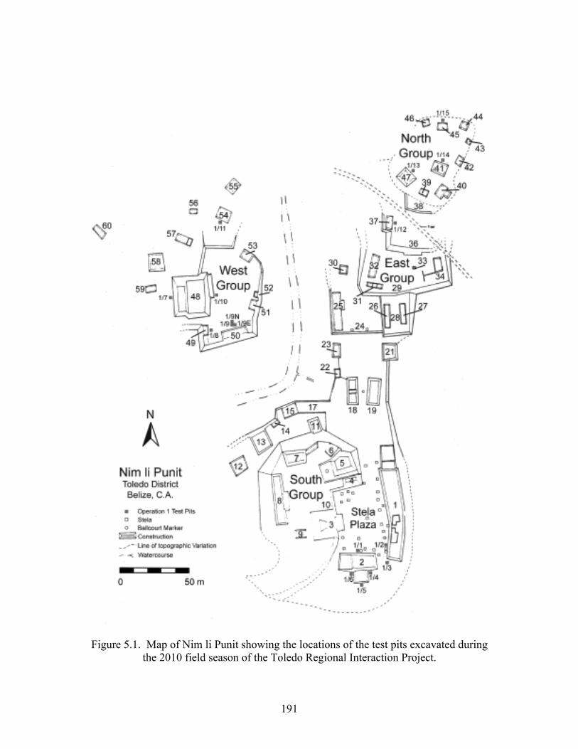
191
Figure 5.1. Map of Nim li Punit showing the locations of the test pits excavated during the 2010 field season of the Toledo Regional Interaction Project.
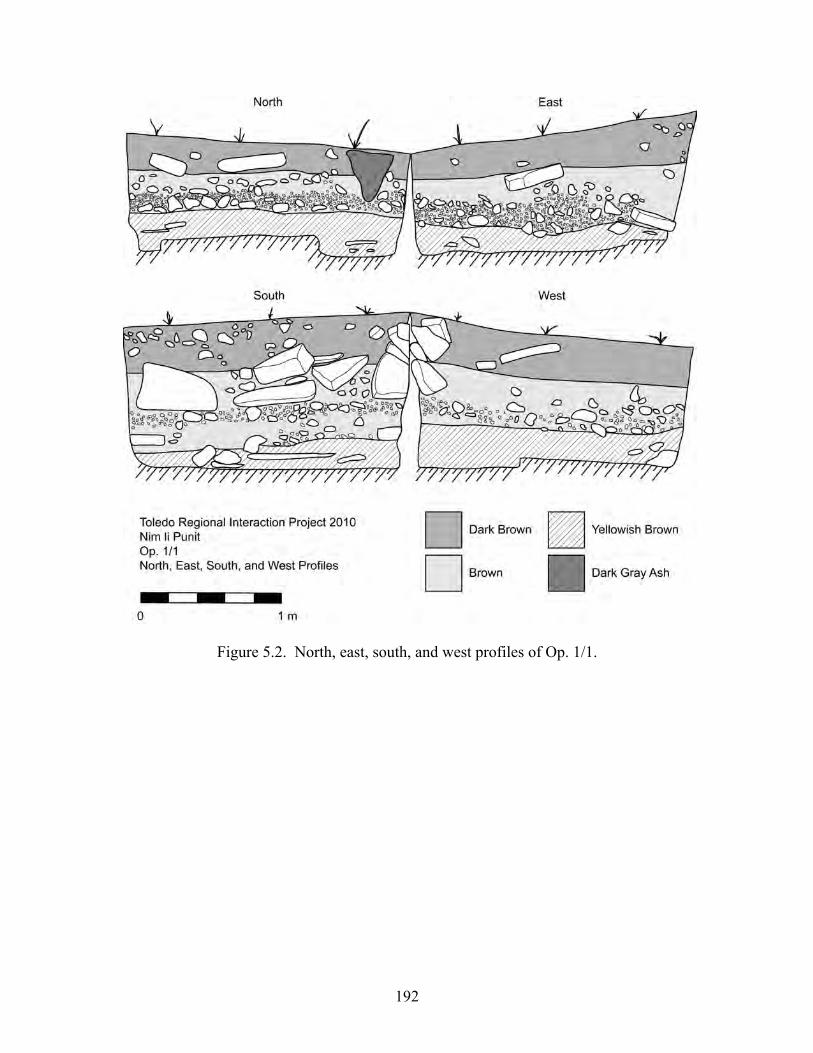
192
Figure 5.2. North, east, south, and west profiles of Op. 1/1.
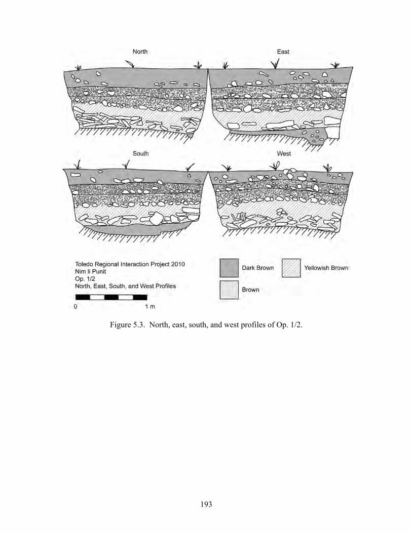
193
Figure 5.3. North, east, south, and west profiles of Op. 1/2.
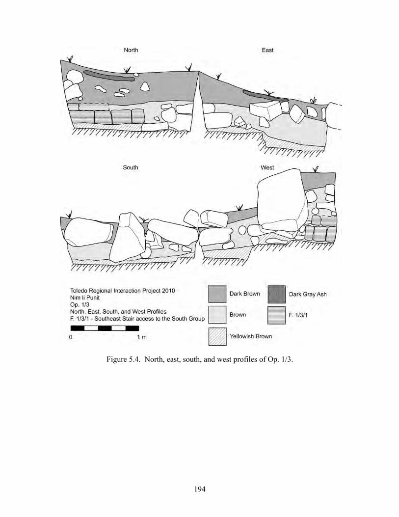
194
Figure 5.4. North, east, south, and west profiles of Op. 1/3.
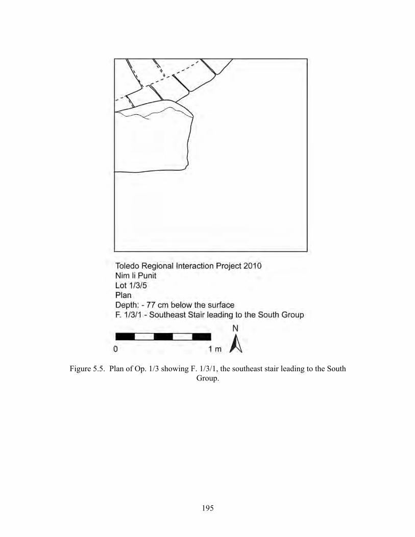
195
Figure 5.5. Plan of Op. 1/3 showing F. 1/3/1, the southeast stair leading to the South Group.

196
Figure 5.6. Map of the Stela Plaza including the locations of the stelae (modified from Hammond et al. 1999:Figure 2).

197
Figure 5.7. North, east, south, and west profiles of Op. 1/4.
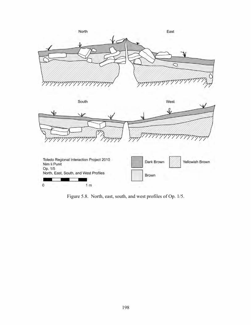
198
Figure 5.8. North, east, south, and west profiles of Op. 1/5.
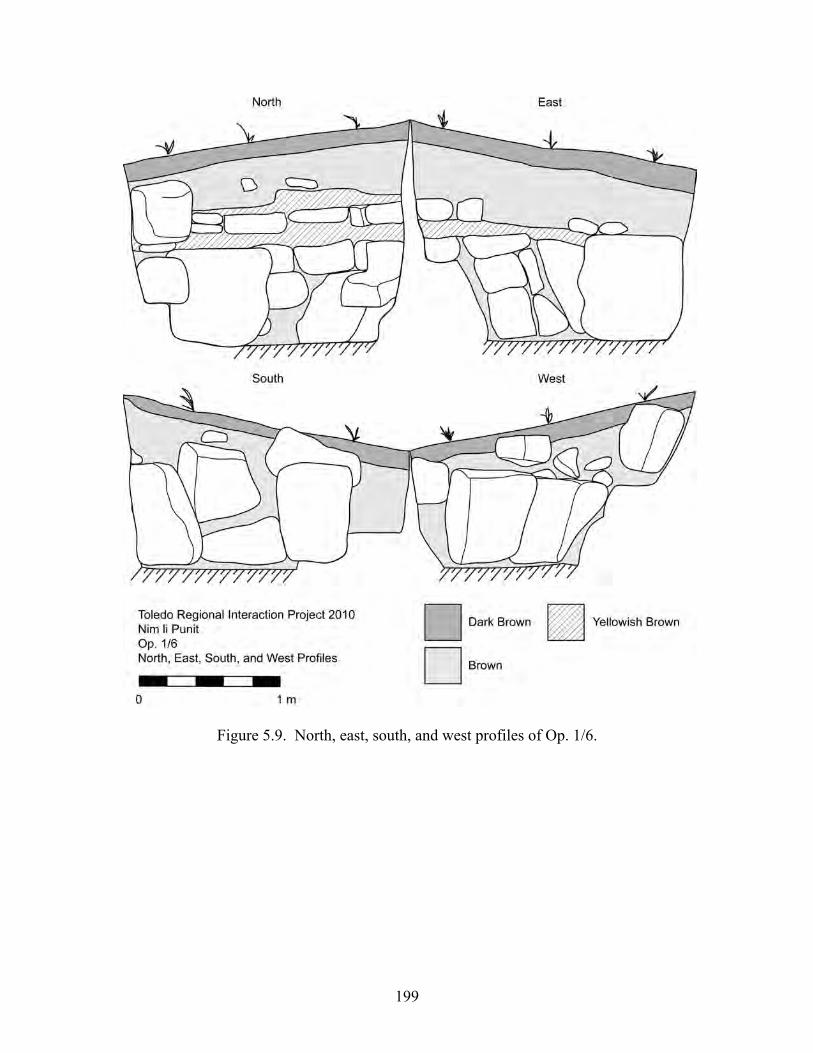
199
Figure 5.9. North, east, south, and west profiles of Op. 1/6.
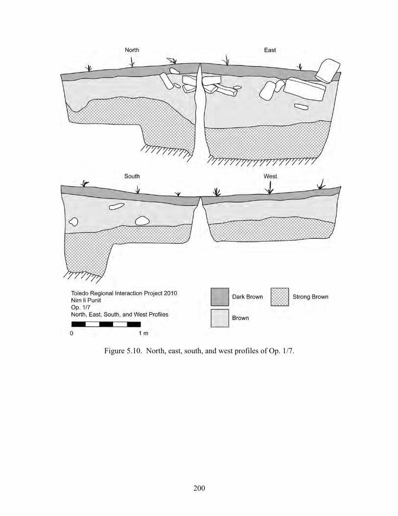
200
Figure 5.10. North, east, south, and west profiles of Op. 1/7.

201
Figure 5.11. North, east, south, and west profiles of Op. 1/8.
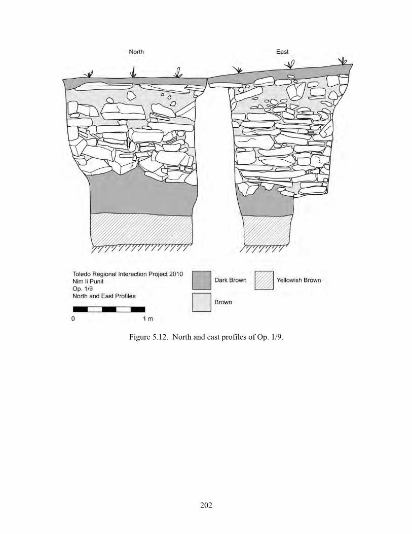
202
Figure 5.12. North and east profiles of Op. 1/9.
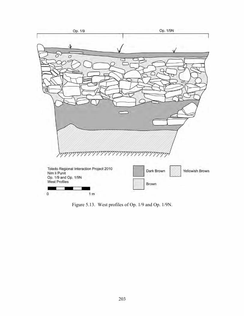
203
Figure 5.13. West profiles of Op. 1/9 and Op. 1/9N.
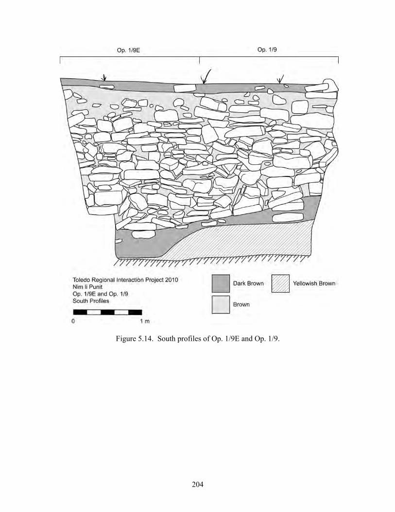
204
Figure 5.14. South profiles of Op. 1/9E and Op. 1/9.
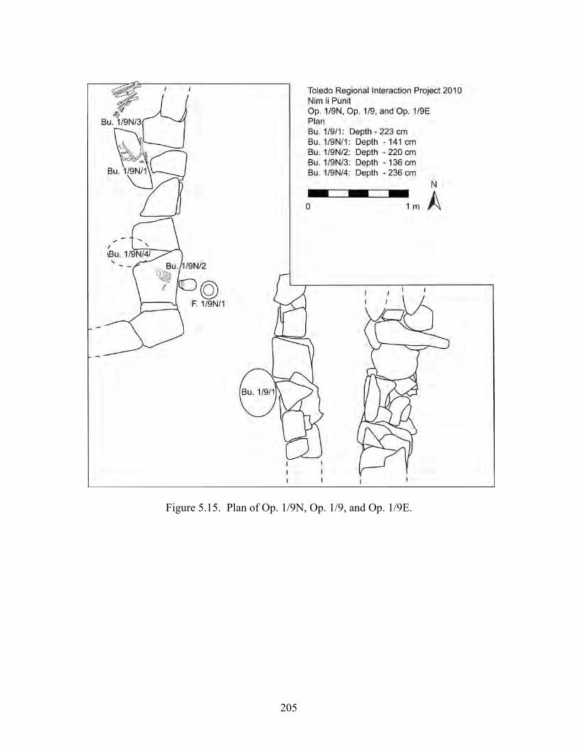
205
Figure 5.15. Plan of Op. 1/9N, Op. 1/9, and Op. 1/9E.

206
Figure 5.16. North and east profiles of Op. 1/9N.
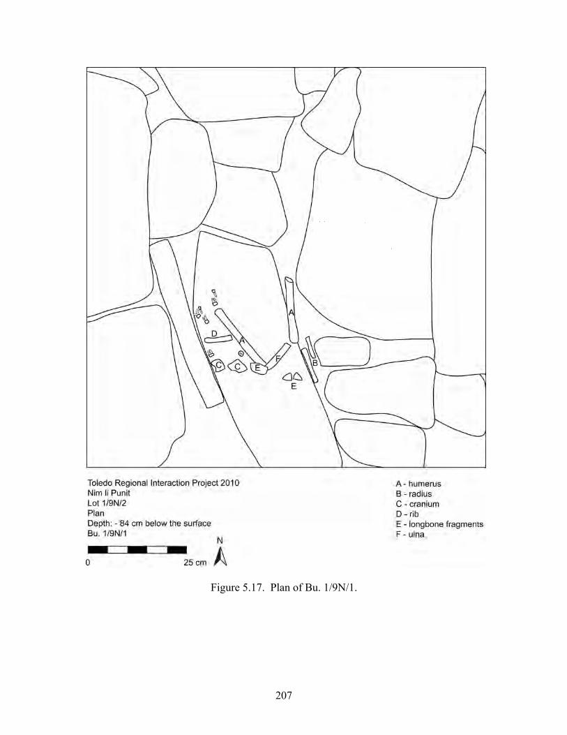
207
Figure 5.17. Plan of Bu. 1/9N/1.

208
Figure 5.18. Plan of Bu. 1/9N/3.
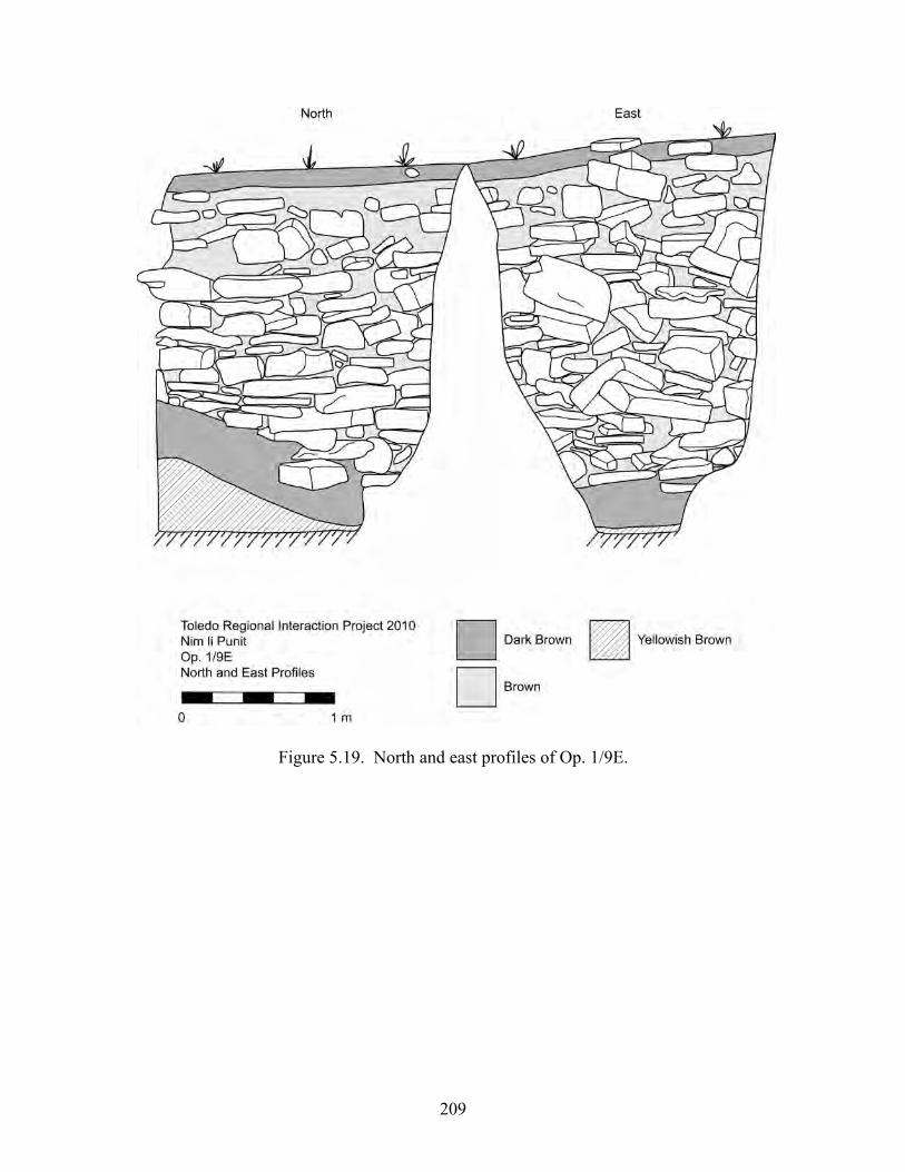
209
Figure 5.19. North and east profiles of Op. 1/9E.
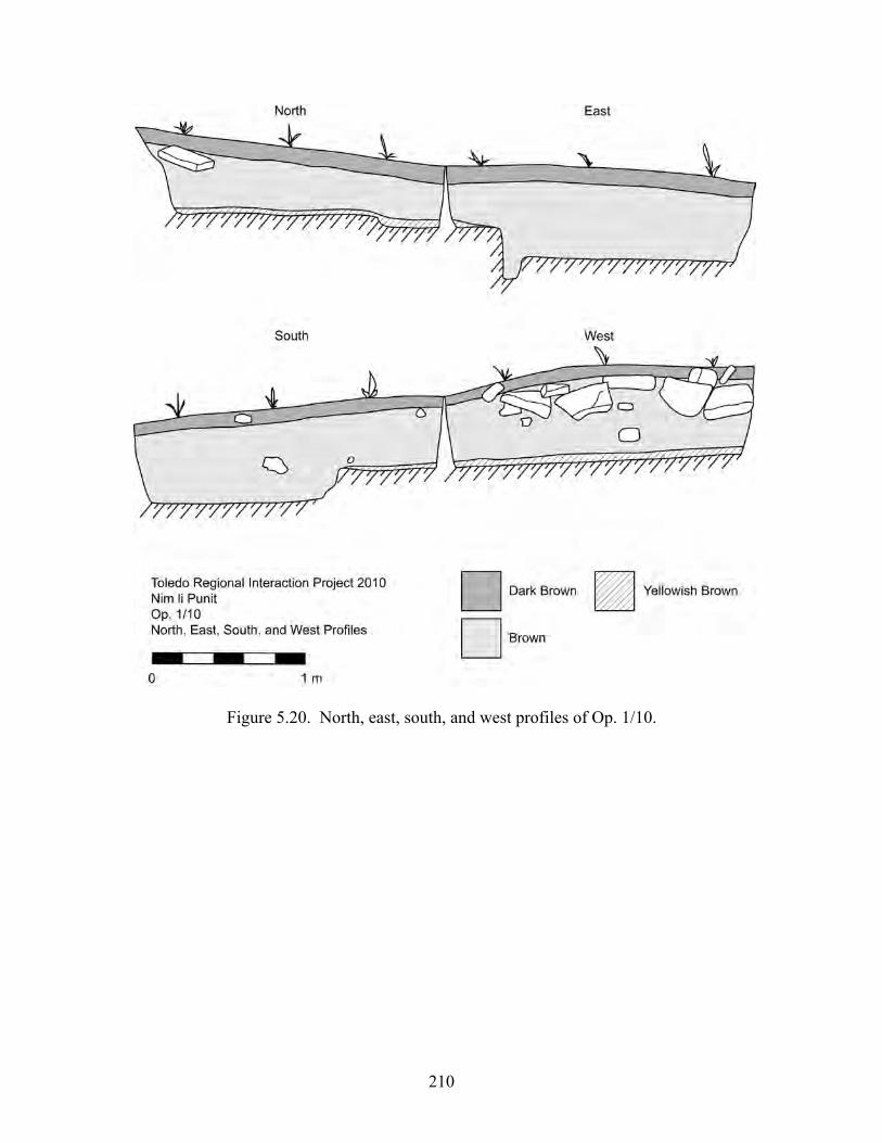
210
Figure 5.20. North, east, south, and west profiles of Op. 1/10.

211
Figure 5.21. North, east, south, and west profiles of Op. 1/11.
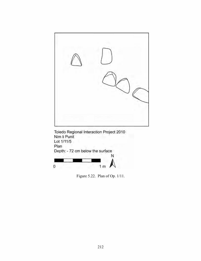
212
Figure 5.22. Plan of Op. 1/11.

213
Figure 5.23. North, east, south, and west profiles of Op. 1/12.

214
Figure 5.24. Plan of Op. 1/12 showing the east stair of Structure 37.
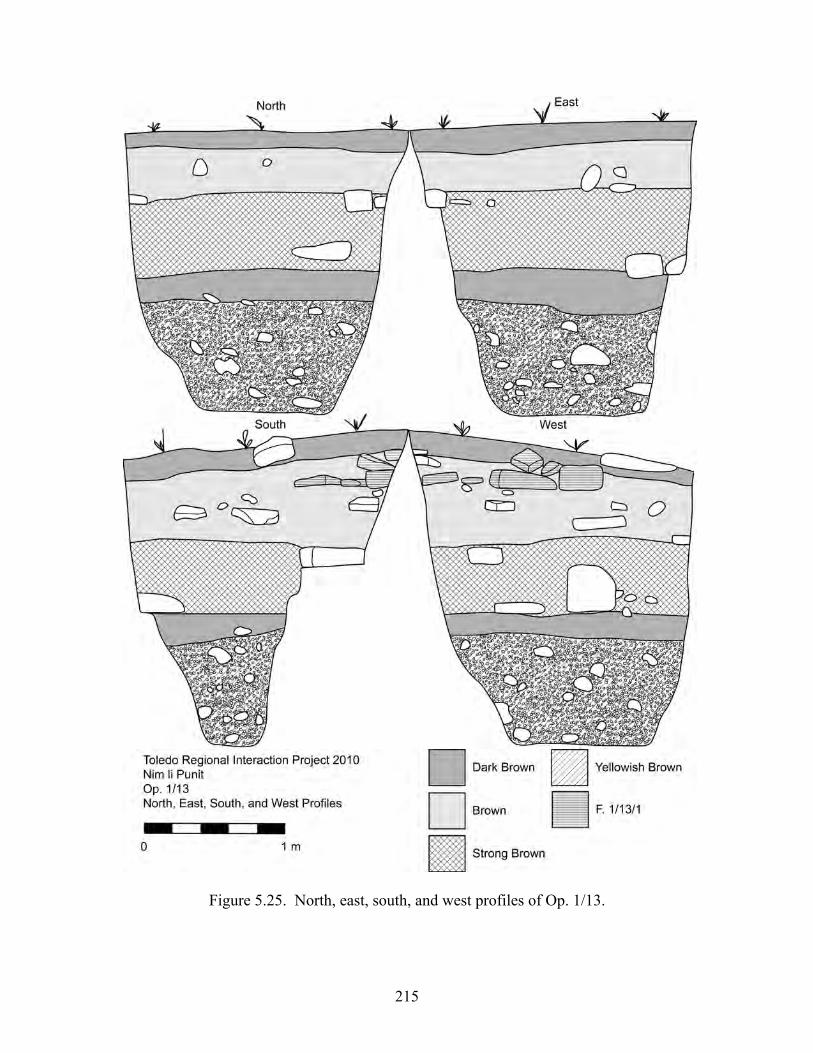
215
Figure 5.25. North, east, south, and west profiles of Op. 1/13.
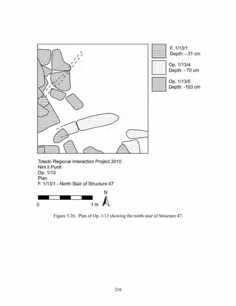
216
Figure 5.26. Plan of Op. 1/13 showing the north stair of Structure 47.

217
Figure 5.27. North, east, south, and west profiles of Op. 1/14.
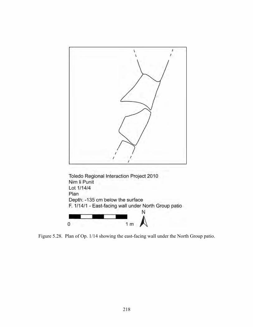
218
Figure 5.28. Plan of Op. 1/14 showing the east-facing wall under the North Group patio.

219
Figure 5.29. North, east, south, and west profiles of Op. 1/15.
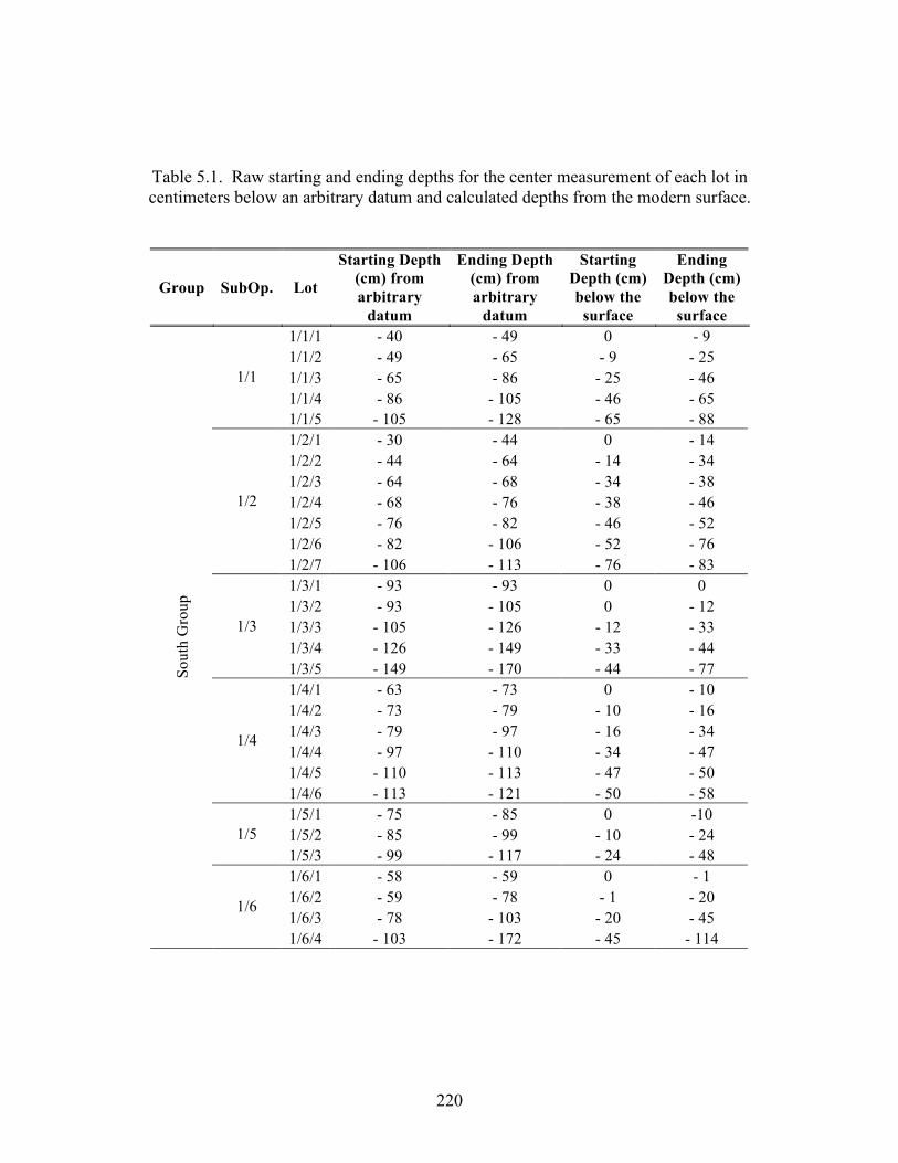
220
Table 5.1. Raw starting and ending depths for the center measurement of each lot in centimeters below an arbitrary datum and calculated depths from the modern surface.
Group SubOp. Lot
Starting Depth (cm) from arbitrary
datum
Ending Depth (cm) from arbitrary
datum
Starting Depth (cm) below the surface
Ending Depth (cm) below the surface
1/1/1 - 40 - 49 0 - 9 1/1/2 - 49 - 65 - 9 - 25 1/1/3 - 65 - 86 - 25 - 46 1/1/4 - 86 - 105 - 46 - 65
1/1
1/1/5 - 105 - 128 - 65 - 88 1/2/1 - 30 - 44 0 - 14 1/2/2 - 44 - 64 - 14 - 34 1/2/3 - 64 - 68 - 34 - 38 1/2/4 - 68 - 76 - 38 - 46 1/2/5 - 76 - 82 - 46 - 52 1/2/6 - 82 - 106 - 52 - 76
1/2
1/2/7 - 106 - 113 - 76 - 83 1/3/1 - 93 - 93 0 0 1/3/2 - 93 - 105 0 - 12 1/3/3 - 105 - 126 - 12 - 33 1/3/4 - 126 - 149 - 33 - 44
1/3
1/3/5 - 149 - 170 - 44 - 77 1/4/1 - 63 - 73 0 - 10 1/4/2 - 73 - 79 - 10 - 16 1/4/3 - 79 - 97 - 16 - 34 1/4/4 - 97 - 110 - 34 - 47 1/4/5 - 110 - 113 - 47 - 50
1/4
1/4/6 - 113 - 121 - 50 - 58 1/5/1 - 75 - 85 0 -10 1/5/2 - 85 - 99 - 10 - 24 1/5 1/5/3 - 99 - 117 - 24 - 48 1/6/1 - 58 - 59 0 - 1 1/6/2 - 59 - 78 - 1 - 20 1/6/3 - 78 - 103 - 20 - 45
Sout
h G
roup
1/6
1/6/4 - 103 - 172 - 45 - 114
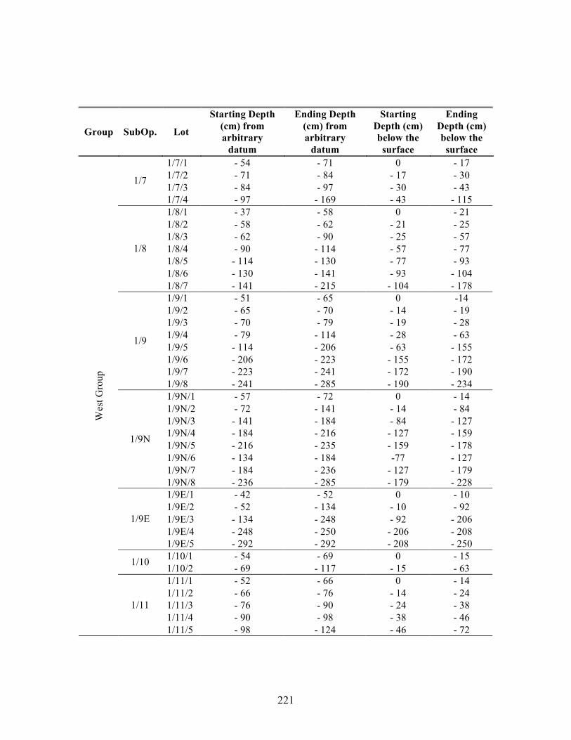
221
Group SubOp. Lot
Starting Depth (cm) from arbitrary
datum
Ending Depth (cm) from arbitrary
datum
Starting Depth (cm) below the surface
Ending Depth (cm) below the surface
1/7/1 - 54 - 71 0 - 17 1/7/2 - 71 - 84 - 17 - 30 1/7/3 - 84 - 97 - 30 - 43
1/7
1/7/4 - 97 - 169 - 43 - 115 1/8/1 - 37 - 58 0 - 21 1/8/2 - 58 - 62 - 21 - 25 1/8/3 - 62 - 90 - 25 - 57 1/8/4 - 90 - 114 - 57 - 77 1/8/5 - 114 - 130 - 77 - 93 1/8/6 - 130 - 141 - 93 - 104
1/8
1/8/7 - 141 - 215 - 104 - 178 1/9/1 - 51 - 65 0 -14 1/9/2 - 65 - 70 - 14 - 19 1/9/3 - 70 - 79 - 19 - 28 1/9/4 - 79 - 114 - 28 - 63 1/9/5 - 114 - 206 - 63 - 155 1/9/6 - 206 - 223 - 155 - 172 1/9/7 - 223 - 241 - 172 - 190
1/9
1/9/8 - 241 - 285 - 190 - 234 1/9N/1 - 57 - 72 0 - 14 1/9N/2 - 72 - 141 - 14 - 84 1/9N/3 - 141 - 184 - 84 - 127 1/9N/4 - 184 - 216 - 127 - 159 1/9N/5 - 216 - 235 - 159 - 178 1/9N/6 - 134 - 184 -77 - 127 1/9N/7 - 184 - 236 - 127 - 179
1/9N
1/9N/8 - 236 - 285 - 179 - 228 1/9E/1 - 42 - 52 0 - 10 1/9E/2 - 52 - 134 - 10 - 92 1/9E/3 - 134 - 248 - 92 - 206 1/9E/4 - 248 - 250 - 206 - 208
1/9E
1/9E/5 - 292 - 292 - 208 - 250 1/10/1 - 54 - 69 0 - 15 1/10 1/10/2 - 69 - 117 - 15 - 63 1/11/1 - 52 - 66 0 - 14 1/11/2 - 66 - 76 - 14 - 24 1/11/3 - 76 - 90 - 24 - 38 1/11/4 - 90 - 98 - 38 - 46
Wes
t Gro
up
1/11
1/11/5 - 98 - 124 - 46 - 72

222
Group SubOp. Lot
Starting Depth (cm) from arbitrary
datum
Ending Depth (cm) from arbitrary
datum
Starting Depth (cm) below the surface
Ending Depth (cm) below the surface
1/12/1 - 66 - 82 0 - 16 1/12/2 - 82 - 88 - 16 - 22 1/12/3 - 88 - 142 - 22 - 76 1/12/4 - 142 - 179 - 76 - 113
1/12
1/12/5 - 179 - 228 - 113 - 162 1/13/1 - 66 - 83 0 - 17 1/13/2 - 83 - 97 - 17 - 31 1/13/3 - 97 - 115 - 31 - 49 1/13/4 - 115 - 136 - 49 - 70 1/13/5 - 136 - 169 - 70 - 103 1/13/6 - 169 - 188 - 103 - 122
1/13
1/13/7 - 188 - 266 - 122 - 200 1/14/1 - 65 - 87 0 - 22 1/14/2 - 87 - 120 - 22 - 55 1/14/3 - 120 - 146 - 55 - 81 1/14/4 - 146 - 189 - 81 - 124 1/14/5 - 189 - 200 - 124 - 135 1/14/6 - 189 - 200 - 124 - 135
1/14
1/14/7 - 200 - 217 - 135 - 152 1/15/1 - 64 - 72 0 - 8 1/15/2 - 72 - 91 - 8 - 27 1/15/3 - 91 - 117 - 27 - 53 1/15/4 - 117 - 129 - 53 - 65
Nor
th G
roup
1/15
1/15/5 - 129 - 146 - 65 - 82
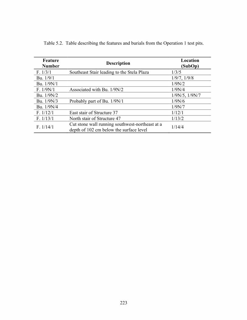
223
Table 5.2. Table describing the features and burials from the Operation 1 test pits.
Feature Number Description Location
(SubOp) F. 1/3/1 Southeast Stair leading to the Stela Plaza 1/3/5 Bu. 1/9/1 1/9/7, 1/9/8 Bu. 1/9N/1 1/9N/2 F. 1/9N/1 Associated with Bu. 1/9N/2 1/9N/4 Bu. 1/9N/2 1/9N/5, 1/9N/7 Bu. 1/9N/3 Probably part of Bu. 1/9N/1 1/9N/6 Bu. 1/9N/4 1/9N/7 F. 1/12/1 East stair of Structure 37 1/12/1 F. 1/13/1 North stair of Structure 47 1/13/2
F. 1/14/1 Cut stone wall running southwest-northeast at a depth of 102 cm below the surface level 1/14/4
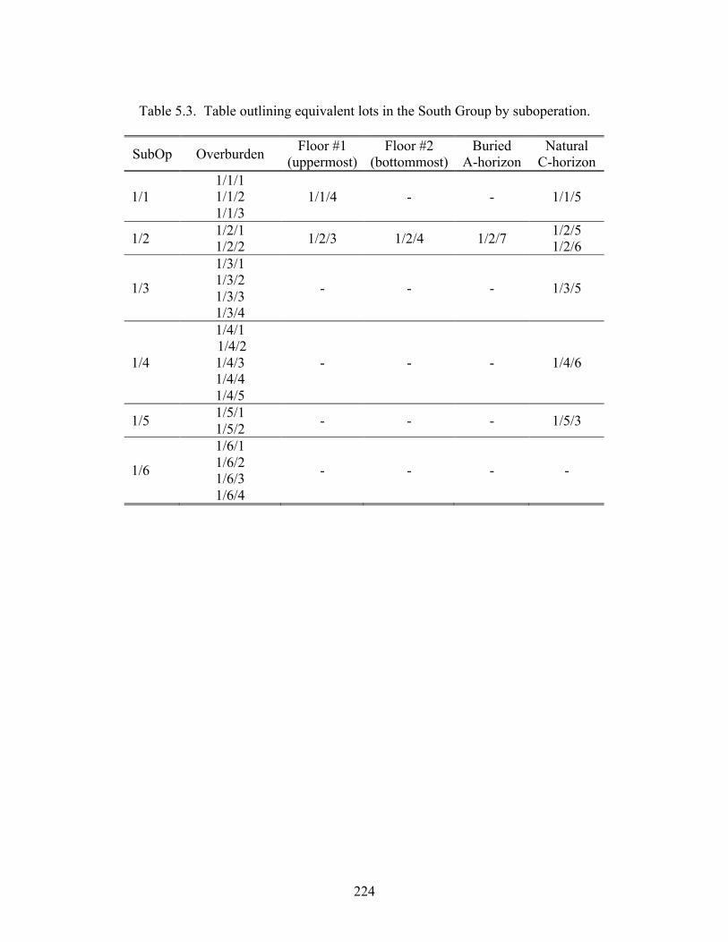
224
Table 5.3. Table outlining equivalent lots in the South Group by suboperation.
SubOp Overburden Floor #1 (uppermost)
Floor #2 (bottommost)
Buried A-horizon
Natural C-horizon
1/1 1/1/1 1/1/2 1/1/3
1/1/4 - - 1/1/5
1/2 1/2/1 1/2/2 1/2/3 1/2/4 1/2/7 1/2/5
1/2/6
1/3
1/3/1 1/3/2 1/3/3 1/3/4
- - - 1/3/5
1/4
1/4/1 1/4/2 1/4/3 1/4/4 1/4/5
- - - 1/4/6
1/5 1/5/1 1/5/2 - - - 1/5/3
1/6
1/6/1 1/6/2 1/6/3 1/6/4
- - - -

225
Table 5.4. Table outlining equivalent lots in the West Group by suboperation.
SubOp Overburden Flagstone Floor
Small Stone and Soil Fill (Subfloor)
Large Stone Dry
Fill
Buried A-horizon
Natural C-horizon
1/7 1/7/1 1/7/2 1/7/3
- - - - 1/7/4
1/8 1/8/1 - -
1/8/2 1/8/3 1/8/4 1/8/5 1/8/6
- 1/8/7
1/9 1/9/1 1/9/2 1/9/3 1/9/3
1/9/4 1/9/5 1/9/6 1/9/7 1/9/8
1/9N 1/9N/1 1/9N/2 1/9N/2 1/9N/3 1/9N/6
1/9N/4 1/9N/5 1/9N/7
1/9N/8
1/9E 1/9E/1 1/9E/2 1/9E/2 1/9E/3 1/9E/4 1/9E/5
1/10 1/10/1 1/10/2 - - - - -
1/11
1/11/1 1/11/2 1/11/3 1/11/4
- - - - 1/11/5

226
Table 5.5. Table outlining equivalent lots in the North Group by suboperation.
SubOp Overburden Cobble Subfloor
Soil Fill
Large Stone Fill
Buried A-
horizon
Small Pebble
Fill
Clay and
Small Stones
Natural C-
horizon
1/12 1/12/1 1/12/2 - - 1/12/3
1/12/4 - 1/12/5 - -
1/13 1/13/1 1/13/2 1/13/3 1/13/4
1/13/5 - 1/13/6 1/13/7 - -
1/14 1/14/1 1/14/2 -
1/14/3 1/14/4 1/14/6
- 1/14/5 - 1/14/7 -
1/15
1/15/1 1/15/2 1/15/3 1/15/4
1/15/5 - - - - - -
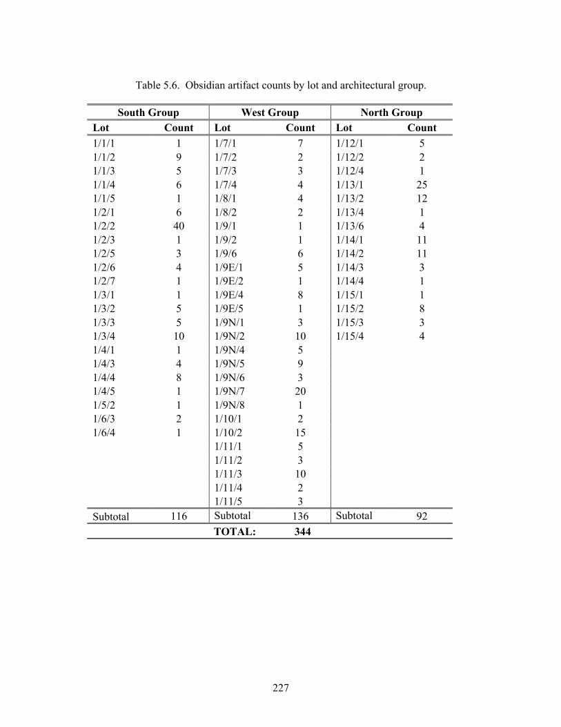
227
Table 5.6. Obsidian artifact counts by lot and architectural group.
South Group West Group North Group
Lot Count Lot Count Lot Count 1/1/1 1 1/7/1 7 1/12/1 5 1/1/2 9 1/7/2 2 1/12/2 2 1/1/3 5 1/7/3 3 1/12/4 1 1/1/4 6 1/7/4 4 1/13/1 25 1/1/5 1 1/8/1 4 1/13/2 12 1/2/1 6 1/8/2 2 1/13/4 1 1/2/2 40 1/9/1 1 1/13/6 4 1/2/3 1 1/9/2 1 1/14/1 11 1/2/5 3 1/9/6 6 1/14/2 11 1/2/6 4 1/9E/1 5 1/14/3 3 1/2/7 1 1/9E/2 1 1/14/4 1 1/3/1 1 1/9E/4 8 1/15/1 1 1/3/2 5 1/9E/5 1 1/15/2 8 1/3/3 5 1/9N/1 3 1/15/3 3 1/3/4 10 1/9N/2 10 1/15/4 4 1/4/1 1 1/9N/4 5 1/4/3 4 1/9N/5 9 1/4/4 8 1/9N/6 3 1/4/5 1 1/9N/7 20 1/5/2 1 1/9N/8 1 1/6/3 2 1/10/1 2 1/6/4 1 1/10/2 15 1/11/1 5 1/11/2 3 1/11/3 10 1/11/4 2 1/11/5 3 Subtotal 116 Subtotal 136 Subtotal 92 TOTAL: 344
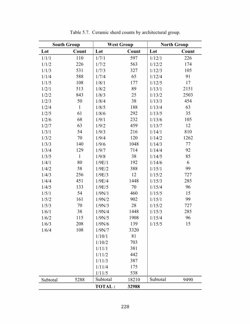
228
Table 5.7. Ceramic sherd counts by architectural group.
South Group West Group North Group Lot Count Lot Count Lot Count 1/1/1 110 1/7/1 597 1/12/1 226 1/1/2 226 1/7/2 563 1/12/2 174 1/1/3 531 1/7/3 327 1/12/3 105 1/1/4 588 1/7/4 65 1/12/4 91 1/1/5 108 1/8/1 177 1/12/5 17 1/2/1 513 1/8/2 89 1/13/1 2151 1/2/2 843 1/8/3 25 1/13/2 2503 1/2/3 50 1/8/4 38 1/13/3 454 1/2/4 1 1/8/5 188 1/13/4 63 1/2/5 61 1/8/6 292 1/13/5 35 1/2/6 68 1/9/1 232 1/13/6 105 1/2/7 63 1/9/2 459 1/13/7 12 1/3/1 54 1/9/3 216 1/14/1 810 1/3/2 70 1/9/4 120 1/14/2 1262 1/3/3 140 1/9/6 1048 1/14/3 77 1/3/4 129 1/9/7 714 1/14/4 92 1/3/5 1 1/9/8 38 1/14/5 85 1/4/1 80 1/9E/1 192 1/14/6 6 1/4/2 58 1/9E/2 388 1/15/1 99 1/4/3 256 1/9E/3 12 1/15/2 727 1/4/4 451 1/9E/4 1448 1/15/3 285 1/4/5 133 1/9E/5 70 1/15/4 96 1/5/1 54 1/9N/1 460 1/15/5 15 1/5/2 161 1/9N/2 902 1/15/1 99 1/5/3 70 1/9N/3 28 1/15/2 727 1/6/1 38 1/9N/4 1448 1/15/3 285 1/6/2 115 1/9N/5 1908 1/15/4 96 1/6/3 208 1/9N/6 139 1/15/5 15 1/6/4 108 1/9N/7 3320 1/10/1 81 1/10/2 703 1/11/1 381 1/11/2 442 1/11/3 387 1/11/4 175 1/11/5 538 Subtotal 5288 Subtotal 18210 Subtotal 9490 TOTAL : 32988
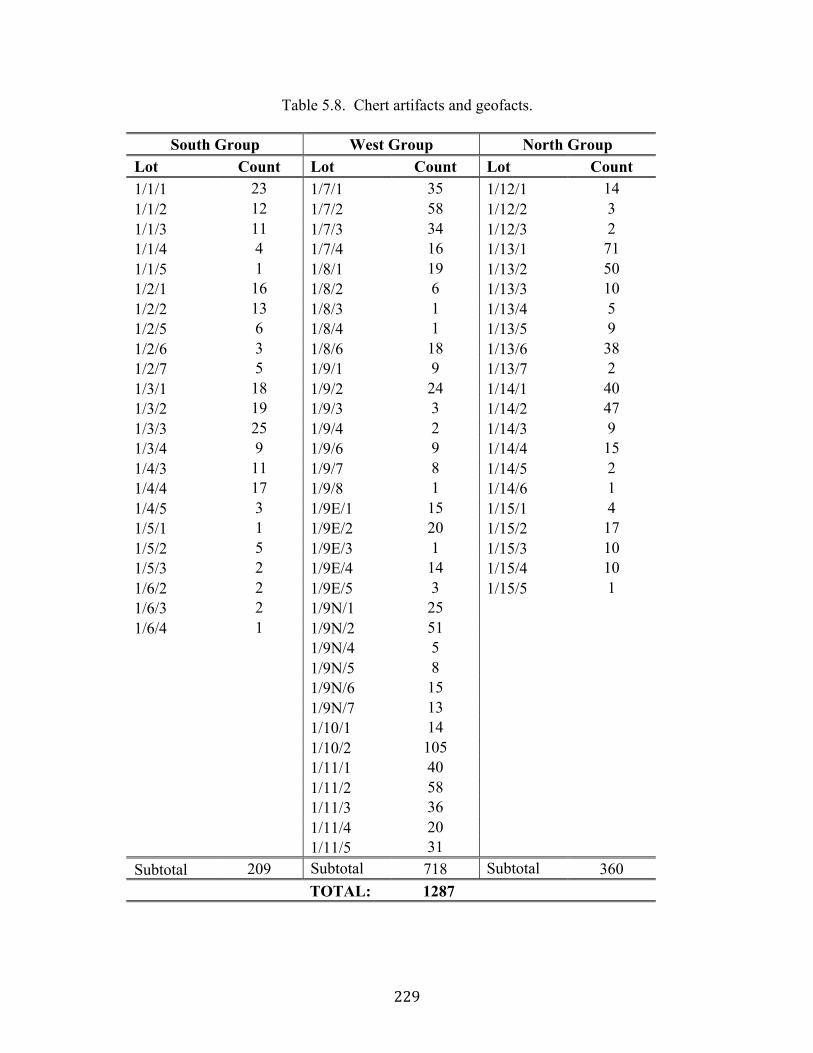
229
Table 5.8. Chert artifacts and geofacts.
South Group West Group North Group Lot Count Lot Count Lot Count 1/1/1 23 1/7/1 35 1/12/1 14 1/1/2 12 1/7/2 58 1/12/2 3 1/1/3 11 1/7/3 34 1/12/3 2 1/1/4 4 1/7/4 16 1/13/1 71 1/1/5 1 1/8/1 19 1/13/2 50 1/2/1 16 1/8/2 6 1/13/3 10 1/2/2 13 1/8/3 1 1/13/4 5 1/2/5 6 1/8/4 1 1/13/5 9 1/2/6 3 1/8/6 18 1/13/6 38 1/2/7 5 1/9/1 9 1/13/7 2 1/3/1 18 1/9/2 24 1/14/1 40 1/3/2 19 1/9/3 3 1/14/2 47 1/3/3 25 1/9/4 2 1/14/3 9 1/3/4 9 1/9/6 9 1/14/4 15 1/4/3 11 1/9/7 8 1/14/5 2 1/4/4 17 1/9/8 1 1/14/6 1 1/4/5 3 1/9E/1 15 1/15/1 4 1/5/1 1 1/9E/2 20 1/15/2 17 1/5/2 5 1/9E/3 1 1/15/3 10 1/5/3 2 1/9E/4 14 1/15/4 10 1/6/2 2 1/9E/5 3 1/15/5 1 1/6/3 2 1/9N/1 25 1/6/4 1 1/9N/2 51 1/9N/4 5 1/9N/5 8 1/9N/6 15 1/9N/7 13 1/10/1 14 1/10/2 105 1/11/1 40 1/11/2 58 1/11/3 36 1/11/4 20 1/11/5 31 Subtotal 209 Subtotal 718 Subtotal 360 TOTAL: 1287
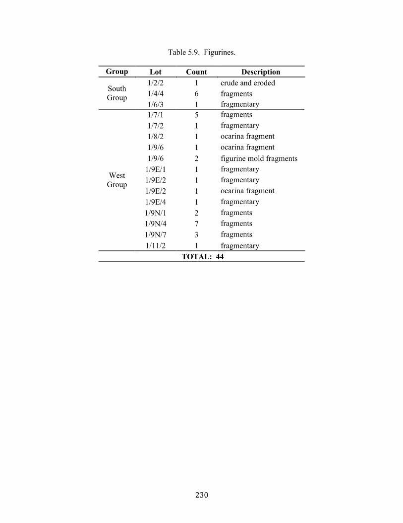
230
Table 5.9. Figurines.
Group Lot Count Description 1/2/2 1 crude and eroded 1/4/4 6 fragments South
Group 1/6/3 1 fragmentary 1/7/1 5 fragments 1/7/2 1 fragmentary 1/8/2 1 ocarina fragment 1/9/6 1 ocarina fragment 1/9/6 2 figurine mold fragments
1/9E/1 1 fragmentary 1/9E/2 1 fragmentary 1/9E/2 1 ocarina fragment 1/9E/4 1 fragmentary 1/9N/1 2 fragments 1/9N/4 7 fragments 1/9N/7 3 fragments
West Group
1/11/2 1 fragmentary TOTAL: 44
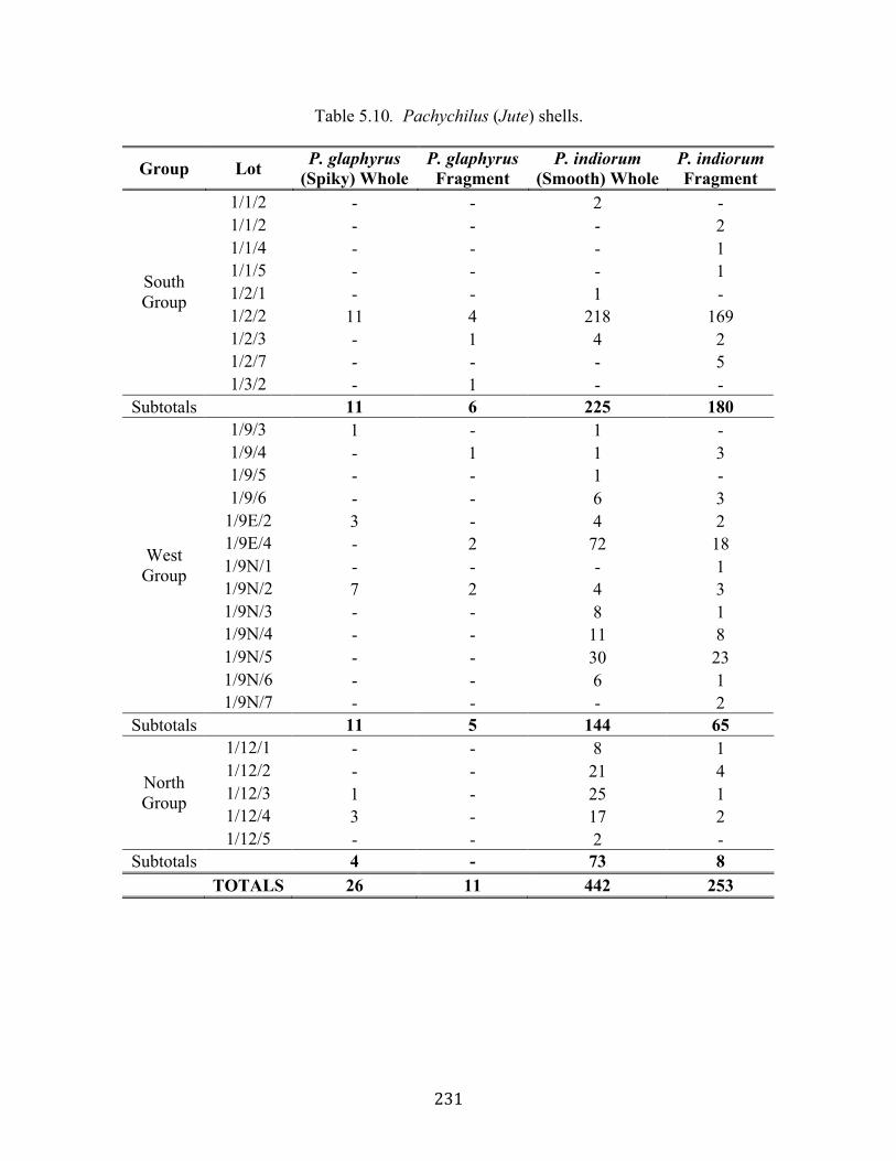
231
Table 5.10. Pachychilus (Jute) shells.
Group Lot P. glaphyrus (Spiky) Whole
P. glaphyrus Fragment
P. indiorum (Smooth) Whole
P. indiorum Fragment
1/1/2 - - 2 - 1/1/2 - - - 2 1/1/4 - - - 1 1/1/5 - - - 1 1/2/1 - - 1 - 1/2/2 11 4 218 169 1/2/3 - 1 4 2 1/2/7 - - - 5
South Group
1/3/2 - 1 - - Subtotals 11 6 225 180
1/9/3 1 - 1 - 1/9/4 - 1 1 3 1/9/5 - - 1 - 1/9/6 - - 6 3
1/9E/2 3 - 4 2 1/9E/4 - 2 72 18 1/9N/1 - - - 1 1/9N/2 7 2 4 3 1/9N/3 - - 8 1 1/9N/4 - - 11 8 1/9N/5 - - 30 23 1/9N/6 - - 6 1
West Group
1/9N/7 - - - 2 Subtotals 11 5 144 65
1/12/1 - - 8 1 1/12/2 - - 21 4 1/12/3 1 - 25 1 1/12/4 3 - 17 2
North Group
1/12/5 - - 2 - Subtotals 4 - 73 8 TOTALS 26 11 442 253
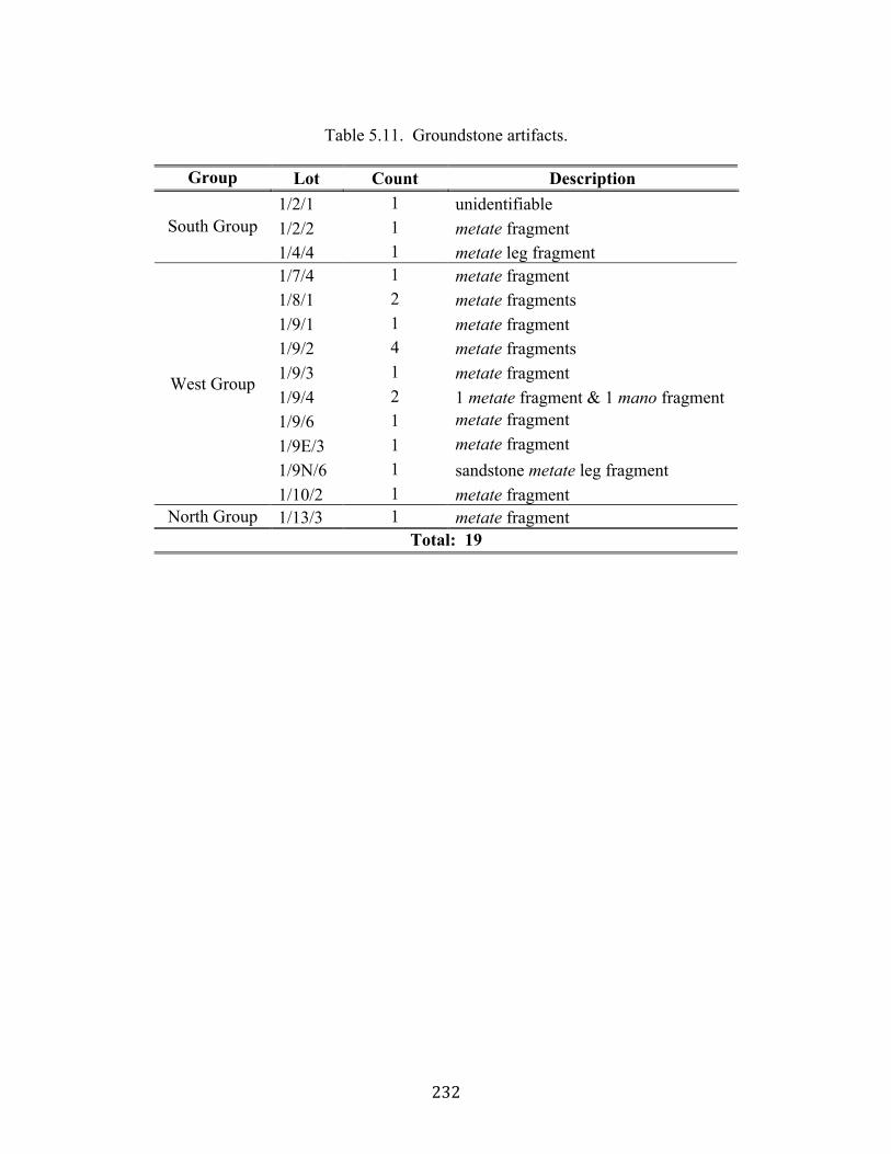
232
Table 5.11. Groundstone artifacts.
Group Lot Count Description
1/2/1 1 unidentifiable 1/2/2 1 metate fragment South Group 1/4/4 1 metate leg fragment 1/7/4 1 metate fragment 1/8/1 2 metate fragments 1/9/1 1 metate fragment 1/9/2 4 metate fragments 1/9/3 1 metate fragment 1/9/4 2 1 metate fragment & 1 mano fragment 1/9/6 1 metate fragment 1/9E/3 1 metate fragment 1/9N/6 1 sandstone metate leg fragment
West Group
1/10/2 1 metate fragment North Group 1/13/3 1 metate fragment
Total: 19

233
Table 5.12. Marine shell.
Group Lot Count Description Condition 1/1/3 1 small conch whole 1/1/4 1 small conch whole 1/2/1 1 small conch whole 1/2/2 10 small conch 6 whole, 4 fragments 1/2/3 1 small conch whole 1/2/5 3 small conch fragments
South Group
1/2/6 1 small conch fragments 1/8/4 3 bivalve 1 whole, 2 fragments 1/8/4 1 small conch fragments 1/8/5 3 bivalve fragments 1/9/1 1 small conch whole 1/9/2 1 small conch fragments 1/9/5 1 small conch fragments 1/9/6 6 bivalve fragments
1/9E/2 11 bivalve fragments 1/9E/2 2 small conch fragments 1/9E/4 2 small conch whole 1/9E/4 3 bivalve fragments 1/9N/2 8 bivalve fragments 1/9N/4 11 bivalve fragments 1/9N/4 1 shell bead whole 1/9N/4 2 small conch 1 whole, 1 fragment 1/9N/5 3 small conch 1 whole, 2 fragments 1/9N/5 2 bivalve fragments 1/9N/6 6 bivalve fragments
West Group
1/9N/7 1 small conch fragments 1/12/2 1 small conch whole 1/12/3 4 small conch 3 whole, 1 fragment 1/12/3 9 bivalve fragments 1/12/4 7 conch 6 whole, 1 fragment 1/12/4 17 bivalve fragments 1/12/5 4 bivalve fragments 1/15/4 1 bivalve fragments
North Group
1/15/5 1 small conch fragments TOTAL: 130
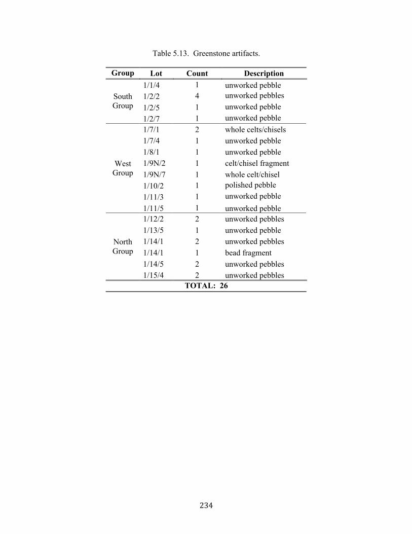
234
Table 5.13. Greenstone artifacts.
Group Lot Count Description 1/1/4 1 unworked pebble 1/2/2 4 unworked pebbles 1/2/5 1 unworked pebble
South Group
1/2/7 1 unworked pebble 1/7/1 2 whole celts/chisels 1/7/4 1 unworked pebble 1/8/1 1 unworked pebble 1/9N/2 1 celt/chisel fragment 1/9N/7 1 whole celt/chisel 1/10/2 1 polished pebble 1/11/3 1 unworked pebble
West Group
1/11/5 1 unworked pebble 1/12/2 2 unworked pebbles 1/13/5 1 unworked pebble 1/14/1 2 unworked pebbles 1/14/1 1 bead fragment 1/14/5 2 unworked pebbles
North Group
1/15/4 2 unworked pebbles TOTAL: 26
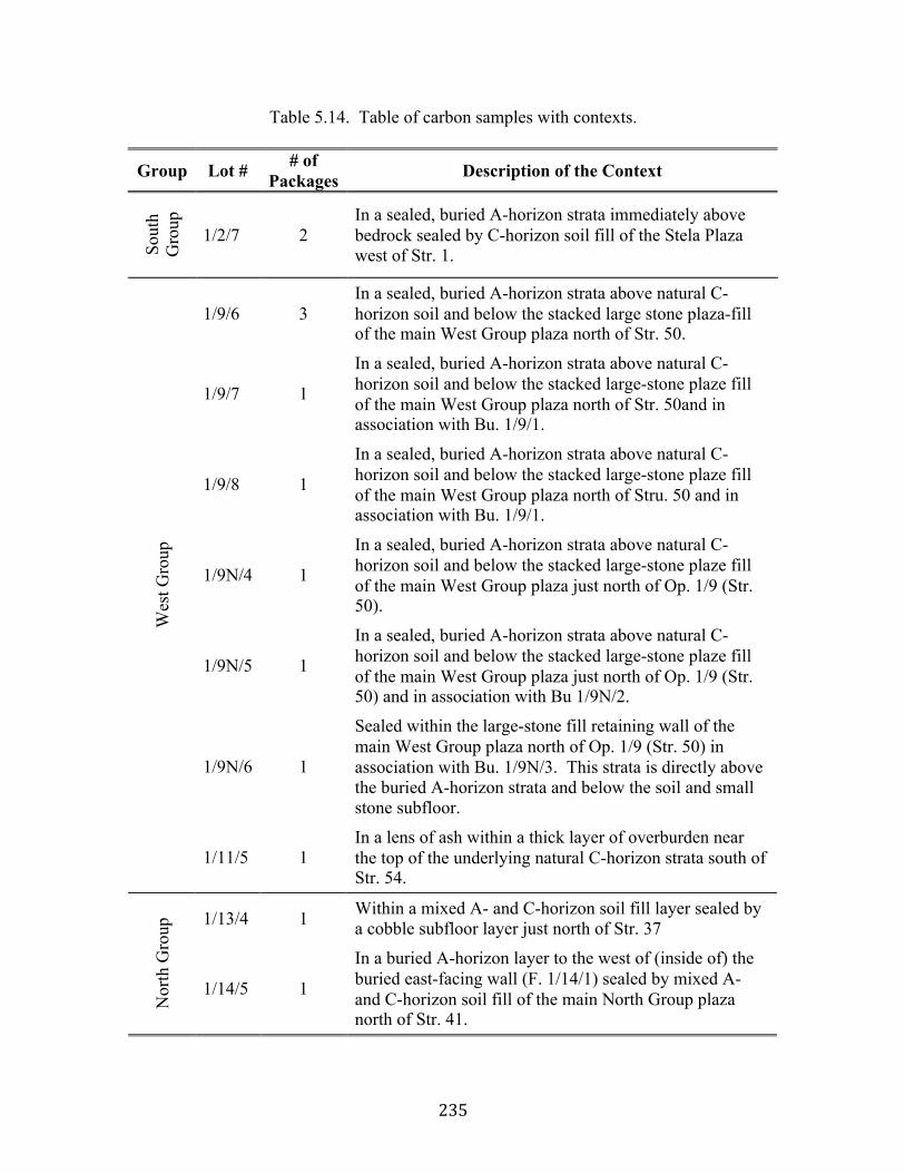
235
Table 5.14. Table of carbon samples with contexts.
Group Lot # # of Packages Description of the Context
Sout
h G
roup
1/2/7 2 In a sealed, buried A-horizon strata immediately above bedrock sealed by C-horizon soil fill of the Stela Plaza west of Str. 1.
1/9/6 3 In a sealed, buried A-horizon strata above natural C-horizon soil and below the stacked large stone plaza-fill of the main West Group plaza north of Str. 50.
1/9/7 1
In a sealed, buried A-horizon strata above natural C-horizon soil and below the stacked large-stone plaze fill of the main West Group plaza north of Str. 50and in association with Bu. 1/9/1.
1/9/8 1
In a sealed, buried A-horizon strata above natural C-horizon soil and below the stacked large-stone plaze fill of the main West Group plaza north of Stru. 50 and in association with Bu. 1/9/1.
1/9N/4 1
In a sealed, buried A-horizon strata above natural C-horizon soil and below the stacked large-stone plaze fill of the main West Group plaza just north of Op. 1/9 (Str. 50).
1/9N/5 1
In a sealed, buried A-horizon strata above natural C-horizon soil and below the stacked large-stone plaze fill of the main West Group plaza just north of Op. 1/9 (Str. 50) and in association with Bu 1/9N/2.
1/9N/6 1
Sealed within the large-stone fill retaining wall of the main West Group plaza north of Op. 1/9 (Str. 50) in association with Bu. 1/9N/3. This strata is directly above the buried A-horizon strata and below the soil and small stone subfloor.
Wes
t Gro
up
1/11/5 1 In a lens of ash within a thick layer of overburden near the top of the underlying natural C-horizon strata south of Str. 54.
1/13/4 1 Within a mixed A- and C-horizon soil fill layer sealed by a cobble subfloor layer just north of Str. 37
Nor
th G
roup
1/14/5 1
In a buried A-horizon layer to the west of (inside of) the buried east-facing wall (F. 1/14/1) sealed by mixed A- and C-horizon soil fill of the main North Group plaza north of Str. 41.
236
REFERENCES CITED Bill, Cassandra R., and Geoffrey E. Braswell 2005 Life at the Crossroads, New Data on Pusilha, Belize. In Archaeological
Investigations in the Eastern Woodlands: Papers of the 2004 Belize Archaeology Symposium, edited by J. Morris, S. Jones, and C. Helmke, pp. 301-312. Institute of Archaeology, Belmopan, Belize.
Braswell, Geoffrey E., Cassandra R. Bill, and Christian M. Prager 2008 Exchange, Political Relations, and Regional Interaction: The Ancient City of
Pusilha in the Late Classic Maya World. Research Reports in Belizean Archaeology 5:51-62. Institute of Archaeology, National Institute of Culture and History, Belmopan, Belize.
Braswell, Geoffrey E. and Sherry A. Gibbs 2006 In the Land of the Avocado: Recent Archaeological Investigations at Pusilha,
Toledo District, Belize. In Archaeological Investigations in the Eastern Maya Lowlands: Papers of the 2005 Belize Archaeology Symposium, Vol. 3, edited by J. Morris, S. Jones, J. Awe and C. Helmke, pp. 257-268. Institute of Archaeology, National Institute of Culture and History, Belmopan, Belize.
Braswell, Geoffrey E., Nancy Peniche May, Megan Pittcavage, and Kiri Hagerman 2010 Revisiting the Kingdom of the Crystal Skull: New Investigations at Lubaantun.
Paper presented at the Belize Archaeological Symposium. San Ignacio, Belize. Braswell, Geoffrey E., Megan R. Pitcavage, and Andrew Somerville 2009 Toledo Regional Interaction Project: 2008-2009 Annual Report. Manuscript on
file, Institute of Archaeology, National Institute of Culture and History, Belmopan, Belize.
Braswell, Geoffrey E., Christian Prager, and Cassandra R. Bill 2005 The Kingdom of the Avocado: Recent Investigations at Pusilhá, a Classic Maya
City of Southern Belize. Notebooks of the Slovene Anthropological Society 11:59-86.
Braswell, Geoffrey E., Christian M. Prager, Cassandra R. Bill, Sonja A. Schwake and Jennifer B. Braswell 2004 The Rise of Secondary States in the Southeastern Periphery of the Maya World.
Ancient Mesoamerica 15:219-233. Dunham, Peter S., Thomas R. Jamison, and Richard M. Leventhal 1989 Secondary Development and Settlement Economics: The Classic Maya of
Southern Belize. In Prehistoric Maya Economies of Belize, edited by P. A. McAnany and B. Isaac, pp. 255-292. Research in Economic Anthropology, Supplement 4. JAI Press, Greenwich, CT.
237
Hammond, Norman 1971 The Arts and Trade of Lubaantun. In The Illustrated London News February 20,
1971:28-29. 1975 Lubaantun: A Classic Maya Realm. Peabody Museum Monograph No. 1.
Harvard University Press, Cambridge. 1982 The Prehistory of Belize. Journal of Field Archaeology 9(3):349-362. Hammond, Norman, Kate Pretty, and Frank P. Saul 1975 A Classic Maya Family Tomb. In World Archaeology 7(1):57-78. Hammond, Norman, Sheena Howarth, and Richard R. Wilk 1999 The Discovery, Exploration, and Monuments of Nim li Punit, Belize. In Research
Reports on Ancient Maya Writing, No. 40. Center for Maya Research, Washington, D.C.
Joyce, Thomas A. 1926 Report on the Investigations at Lubaantun, British Honduras, in 1926. Journal of
the Royal Anthropological Institute 56:207-230. Joyce, Thomas Athol, J. Cooper Clark, and J. Eric S. Thompson 1927 Report on the British Museum Expedition to British Honduras 1972. Journal of
the Royal Anthropological Institute 57:295-323. Larios Villalta, Carlos Rudy 1998 Maya Archaeological Sites Development Programe, Archaeology Department,
Belize, C.A. January-July 1998: Final Report. Technical report, Institute of Archaeology, Belmopan, Belize.
Leventhal, Richard M. 1990 Southern Belize: An Ancient Maya Region. In Vision and Revision in Maya
Studies, edited by F. S. Clancy and P. D. Harrison, pp. 124-141. University of New Mexico, Albuquerque.
1992 The Development of a Regional Tradition in Southern Belize. In New Theories on the Ancient Maya, edited by E. C. Danien and R.J. Sharer, pp. 145-153. University Museum Symposium, Vol. 3. The University Museum, University of Pennsylvania, Philadelphia.
Leventhal, Richard M., Peter Dunham, Lisa Van Eysden, Thomas Jamison, Elizabeth Herbert, and Randi Cowel 1985 Southern Belize Archaeological Project-1985. Manuscript on file, Institute of
Archaeology, Belmopan, Belize. MacKinnon, J. Jefferson 1991 Preliminary Reconnaissance of the Quebrada de Oro Site: Implications for a
Regional Model of Maya Civilization in Southern Belize. Mexicon 13:87-92.

238
Muñoz Cosme, Gaspar 2003 La arquitectura Maya. El Templo I de Tikal. Tesis doctoral. Universidad
Politécnica de Valencia, Valencia. Padilla Dorantes, Ana María 2009 Estructura 1729. In Proyecto Arqueológico Xamán Susulá. Informe de las
temporadas de campo 2006 y 2008, edited by Fernando Robles Castellanos, Nancy Peniche May and Ana María Padilla Dorantes. Informe para el Consejo Nacional de Arqueología de México. Centro INAH Yucatán, México.
Peniche May, Nancy, Lauren Hahn, and Geoffrey E. Braswell 2010 Excavaciones de la UCSD en Chichén Itzá. La Gran Nivelación y la Muralla.
Informe de la temporada de campo 2009 al Proyecto Chichén Itzá. Pitcavage, Megan R. 2008 Companion Burials in the Kingdome of the Avocado: Indirect Evidence of
Human Sacrifice in Late and Terminal Classic Maya Society. Unpublished Masters thesis, Department of Anthropology, University of California, San Diego.
Pitcavage, Megan R., and Geoffrey E. Braswell 2010 Diet, Health, and Death at Pusilha, Belize. In Archaeological Investigations in the
Eastern Maya Lowlands: Papers of the 2009 Belize Archaeology Symposium, Vol. 7, edited by J. Morris, S. Jones, J. Awe, G. Thompson, and M. Badillo, pp. 65-72. Institute of Archaeology, National Institute of Culture and History, Belmopan, Belize.
Prufer, Keith M. 2005 The Early Classic in Southern Belize: A Regional View from Uxbenka and Ek
Xux. Research Reports in Belizean Archaeology 2:169-178. Institute of Archaeology, National Institute of Culture and History, Belmopan, Belize.
Prufer, Keith M., Andrew Kindon, and Douglas Kennett 2008 Uxbenká and the Foundation of Sedentary Communities in Southern Belize.
Research Reports in Belizean Archaeology 5:241-250. Institute of Archaeology, National Institute of Culture and History, Belmopan, Belize.
Prufer, Keith M., Andrew Kindon, and Phillip Wanyerka 2006 Uxbenka Archaeological Project (UAP): Site Settlement in the Rio Blanco
Valley, Toledo District, Belize. Research Reports in Belizean Archaeology 3:257-270. Institute of Archaeology, National Institute of Culture and History, Belmopan, Belize.
Schwake, Sonja A. 2008 The Social Implications of Ritual Behavior in the Maya Lowlands: A Perspective
from Minanha, Belize. Unpublished Ph.D. Dissertation, Department of Anthropology, University of California, San Diego
239
Thompson, J. Erick S. 1931 Archaeological Investigations in the Southern Cayo District, British Honduras.
Field Museum of Natural History, Chicago. Van Eysden, Lisa, Thomas Jamison, Peter Dunham, Richard M. Leventhal, Mary Bane Stevens 1986 Southern Belize Archaeological Project 1985 Field Season: Preliminary Report.
Manuscript on file, Institute of Archaeology, NICH, Belmopan, Belize. Wanyerka, Phil 2003 The Southern Belize Epigraphic Project: The Hieroglyphic Inscriptions of
Southern Belize: Final Report Submitted to the Foundation for the Advancement of Mesoamerican Studies, Inc. and the Institute of Archaeology, Belmopan, Belize, http://www.famsi.org/reports/00077/index.html.