development maps onur durukal adnan menderes university public administration bialystok, 2010
Post on 21-Dec-2015
219 views
TRANSCRIPT

DEVELOPMENT MAPSOnur DURUKAL
ADNAN MENDERES UNIVERSITYPUBLIC ADMINISTRATION
Bialystok, 2010

Original Project Name Local Civil Service forBetter Presentations
Strengthening Communities
The project known as;Good Governance – Quality
of Life
Project Finance SourcesWorld Bank
“Japon Social Development Fund”
Project OwnersThe Turkish Economic And Social Studies
Foundation

Aim of Project
They help to the decision-makers, civil society organizations about the city they live and they can manage the information more effectively and they can be used to provide the benefits of visualization.
In the subject of Governance,using maps as a tool for widespread development, one of the most important trigger was the World Bank’s beginning to give special attention to this issue. "Poverty Maps" under the heading of projects supported, in order to better understanding poverty and provide for the use of maps.

Kars-Diyarbakır
“East Anatolia”
Sivas-Ankara“Central Anatolia”
Yalova-Çanakkale
“West Anatolia”
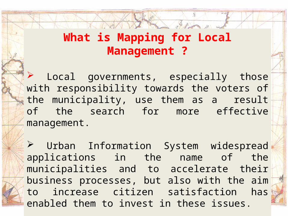
What is Mapping for Local Management ?
Local governments, especially those with responsibility towards the voters of the municipality, use them as a result of the search for more effective management.
Urban Information System widespread applications in the name of the municipalities and to accelerate their business processes, but also with the aim to increase citizen satisfaction has enabled them to invest in these issues.
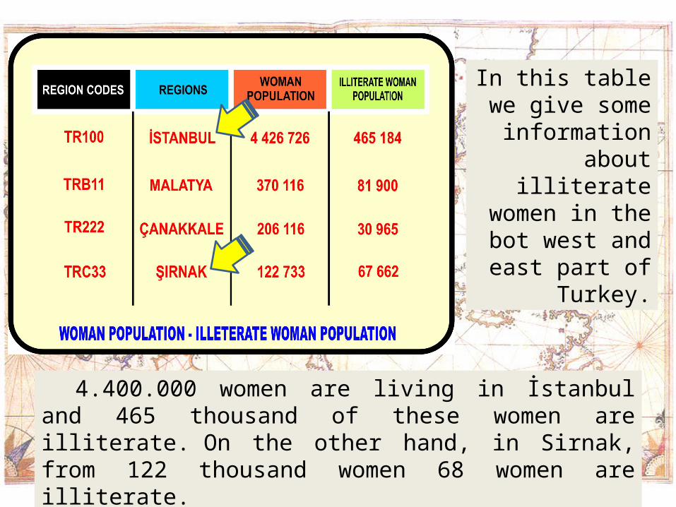
In this table we give some
information about illiterate women in the bot west and
east part of Turkey.
4.400.000 women are living in İstanbul and 465 thousand of these women are illiterate. On the other hand, in Sirnak, from 122 thousand women 68 women are illiterate.

This datas should have used in public administration to be more effective to change the current situation.
!

In Istanbul the persentage of
illeterate women are %11 of all women but
in Şırnak it is %55.
Only with a splitting process we can
compare the data which is in in our
hands and only with this way it would make
a sense.
Turning into information and the
data splitting process may constitute a basis
for policy proposals which is neded.

MAPPING INFORMATION
Illeterate Woman Population Map
This map is provided with a sound decision.

MAPPING INFORMATION
Rate for Illeterate Woman
This map can be interpreted better.

Example of World Map
Rate of Education

MAPPING SOFTWARE
Professionel Software:MAPINFO, NETCAD, ARCGIS
Amateur Software:EPIMAP, ARCVIEW, MAPWINDOW
The output of the project as the largest emergingIRW-GIS software for decision makers and
academics to put forward their own mapping technique offers.

SOFTWARE VIEW

IRW – GIS FEATURES
Comparable map of the pilot provinces.
Be focused on any point, that point can be selected and detailed information can be obtained.
Data produced by local or global scales (rulers) can be converted into maps using.
Maps produced by the Microsoft Office applications is available.
A database of maps that can be achieved with the previously mentioned software, and users can generate maps.

FOR DEVELOPMENT MAPS;
Decision makers should be able to collect local information.
Digital map of municipalities in hand should be open to the public.
Diversification should be accelerated with the formation of the map data.

THANks