depraetere c 20150709_1500_upmc_jussieu_-_room_103
TRANSCRIPT

The Global Island Database (GID)
as a strategic asset for
island biodiversity issues
Christian Depraetere
Institut de Recherche pour le Développement, UMR Espace/DEV, Maison de la Télédétection, Montpellier, France
Arthur L. Dahl
International Environment Forum, Geneva, Switzerland
Jon Hutton
World Conservation Monitoring Centre, Cambridge, United Nations Environmental Program, United Kingdom
Conference 'Our Common future under Climate Change’, Thursday 9th July at Jussieu – Room 103 – Session
4418b

Island biodiversity
as a priority for the international community
Islands as
« unique sense of place ».
The triple diversity :
biodiversity, geodiversity and
cultural diversity.
Conference 'Our Common future under Climate Change’, Thursday 9th July at Jussieu – Room 103 – Session
4418b

The“island data gap” put at a disadvantage a
macroecological approach of island biodiversity
*Holger Kreft, Walter Jetz, Jens Mutke, Gerold Kier and Wilhelm Barthlott:
“Global diversity of island floras from a macroecological perspective”,
Ecology Letters, (2008) 11: 116–127
“We found that climatic and environmental characteristics
were much harder to determine for islands than for mainland
regions, because smaller islands are not well represented in
most global environmental data sets that are frequently used
in macroecological studies”.
Kreft et al., 2008*

GID in the context of the
Convention on Biological Diversity (CBD):
The CBD/CoP9 in Bonn may 2008 gave a mandate to UN
agencies to work on island biodiversity *.
At this occasion, the World Conservation Monitoring
Centre** took the initiative of developing and hosting a
GID in collaboration with the international scientific
community and funding from the Italian government.
The GID is one of the international initiative of the
Global Island Partnership*** since 2008
•Document UNEP/CBD/COP/9/19 and INF/6
** WCMC Cambridge UK
*** GLISPA Head Office, New York, USA

Purposes of GID
The GID supports the Global Island Partnership by making spatial data available
on as much islands as possible around the world including the smallest islets that
may have a high ecological values.
The GID aims to enhance the role of islands in international decision-making
through identifying and bringing together existing sources of data and information.
The GID must contribute to develop linkages, partnerships and collaborations with all
stakeholders involved in island conservation and decision-making to ensure a
global platform for scientific assessment, communication and networking.
The specific “validation tool” of GID encourages the participation of individuals to
help improve on the accuracy of this information through the Global Island Database
Validation Tool (“participative science”).
*
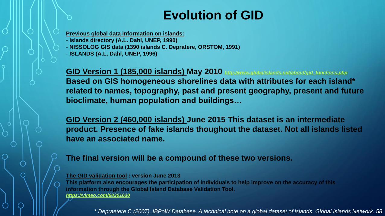
Evolution of GID
Previous global data information on islands:
- Islands directory (A.L. Dahl, UNEP, 1990)
- NISSOLOG GIS data (1390 islands C. Depratere, ORSTOM, 1991)
- ISLANDS (A.L. Dahl, UNEP, 1996)
GID Version 1 (185,000 islands) May 2010 http://www.globalislands.net/about/gid_functions.php
Based on GIS homogeneous shorelines data with attributes for each island*
related to names, topography, past and present geography, present and future
bioclimate, human population and buildings…
GID Version 2 (460,000 islands) June 2015 This dataset is an intermediate
product. Presence of fake islands thoughout the dataset. Not all islands listed
have an associated name.
The final version will be a compound of these two versions.
The GID validation tool : version June 2013
This platform also encourages the participation of individuals to help improve on the accuracy of this
information through the Global Island Database Validation Tool. https://vimeo.com/68301630
* Depraetere C (2007). IBPoW Database. A technical note on a global dataset of islands. Global Islands Network. 58
pp.

Expected applications of GID
- Exhaustive and homogenous dataset for comparison purpose at global scale
at least for islands greater than 1 hectare.
- Providing CC scenario at island scale.
- Developing Potential biodiversity indexes (PBI) based on past and present
human occupation of the island, present land cover, diversity of ecological
niches, paleogeography…
- Optimizing and priotorizing survey and conservation actions. For instance,
optimal exploration of small islands potentially hosting relictual populations
(“Lazarus effect”) within an archipelago.
* Depraetere C (2007). IBPoW Database. A technical note on a global dataset of islands. Global Islands
Network. 58 pp.

Expected applications of GID
“Lazarus effect” within an archipelago:
The emblematic case of the Lord Howe giant stick insect
on the Ball’s Pyramid islet
*
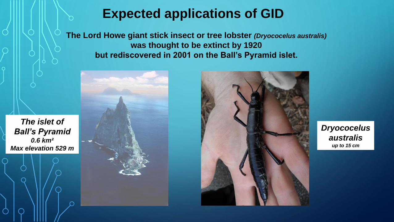
Expected applications of GID
The Lord Howe giant stick insect or tree lobster (Dryococelus australis)
was thought to be extinct by 1920
but rediscovered in 2001 on the Ball’s Pyramid islet.
Dryococelus
australis up to 15 cm
The islet of
Ball’s Pyramid 0.6 km²
Max elevation 529 m

A glimpse on the GID

Frequencies of island according to latitude
Latitude
* Depraetere and Dahl 2007
Frequencies
of island (> 6 hectares)
Max frequency 61°N

Geodiversity of (is)landscapes
* Depraetere 2008
The unique (is)landscape of the Aaland archipelago in Finland (highest density of islands in the world*, 4769 islands > 6 hectares on 17 000 km²)

Climate Change on islands
Rise of temperatures in 2050*
* From WorldClim Dataset, scenario 2A, for islands > 1km² (Depraetere 2014)
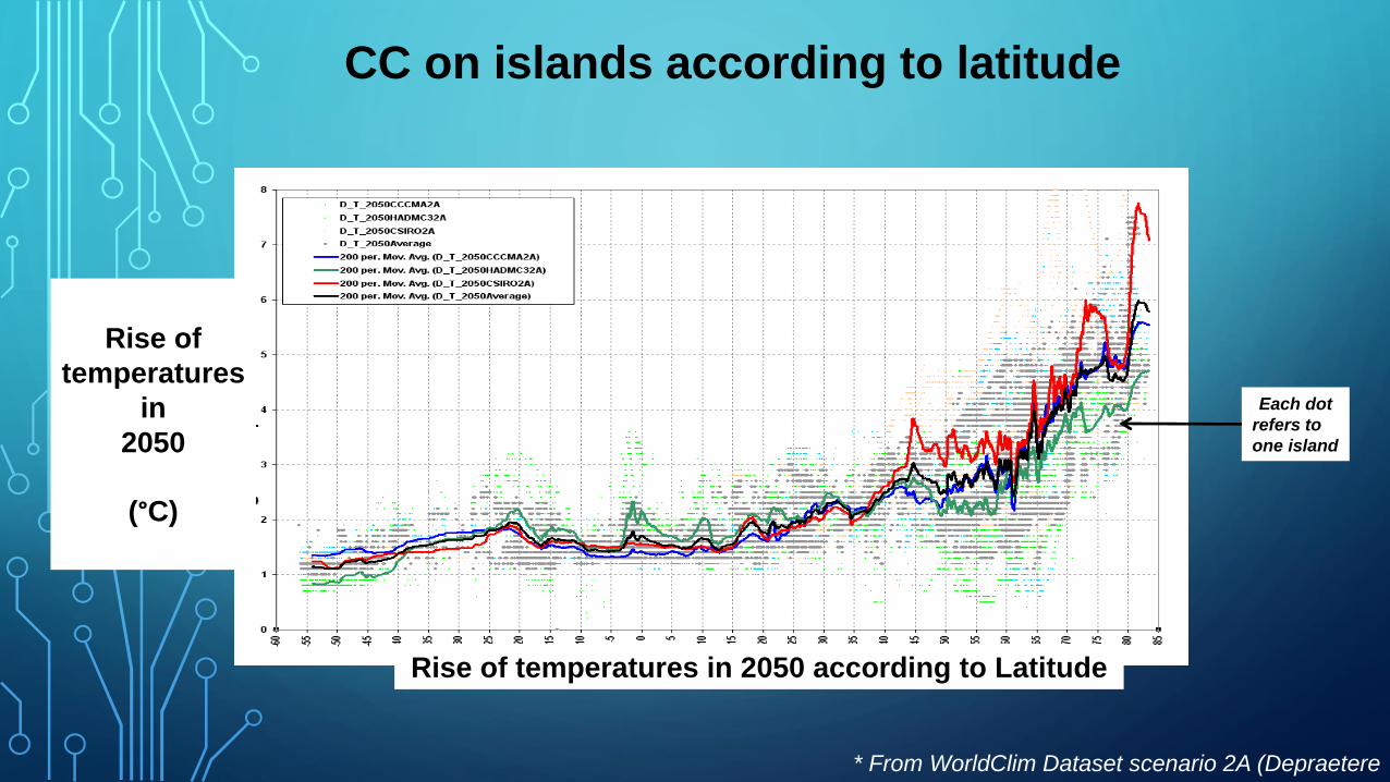
CC on islands according to latitude
Rise of temperatures in 2050 according to Latitude
* From WorldClim Dataset scenario 2A (Depraetere
2014)
Rise of
temperatures
in
2050
(°C)
Each dot
refers to
one island

Regional CC on islands
* Depraetere et al.
2015
Rise of temperatures in 2050
on the Mediterranean islands North
Aegean
Islands
+3°C

Conclusion
GID is one element in the process to create partnership and technical
platform to support enhancing data for decision making for islands and
especially for SIDS.
Combined with other initiatives at local and global scales such as
“Eye on Earth” leaded by GLISPA, this should generate momentum around
addressing data for decision making gaps in support of the SAMOA
Pathway and sustainable development efforts.
* Eye on Earth http://www.eyeonearth.org/
Thanks