department for environment and heritage cape … gantheaume conservation park d’estrees bay...
TRANSCRIPT

Cape Gantheaume Conservation Park D’Estrees Bay Self-guided Drive
Department for Environment and Heritage
www.environment.sa.gov.au

This self-guided nature drive on Kangaroo Island begins at the second boat ramp seven kilometres from the junction of Elsegood Road and D’Estrees Bay Road. It will take you to the end of D’Estrees Bay Road adjacent to Sewer Beach. The drive is approximately eight kilometres in length.
Follow the map in this guide to explore and gain a greater understanding of the natural and cultural history of D’Estrees Bay in Cape Gantheaume Conservation Park. The trail symbol of an Osprey and the stop number mark designated stops at points of interest along the drive.
In 1803 the French explorer Nicolas Baudin circumnavigated Kangaroo Island. He named this long, sweeping bay after Jacques D’Estrees (1660–1737), a French author, Marshall of France, Vice-Admiral and Minister of State.
Please note this drive is along a narrow and winding dirt road. Road conditions vary. The surface may be loose and corrugated or have unexpected ‘pot-holes’. Reduce your speed and watch out for wildlife and other vehicles.
Introduction
Friends of Cape Gantheaume Conservation Park are acknowledged for their contribution to this self-guided drive.
Osprey
1

2
Stops
Walking Trail
0 km 2
Cape Gantheaume
Wilderness Protection Area
Cape Gantheaume Conservation Park
D'Estrees
Second Boat Ramp
Wrights Ruin
Osmanli Reef
Point Tinline
Wreckers Beach
Threshing FloorTadpole Cove
Wheatons Beach
Sewer Beach
First Boat Ramp
D'Estrees Bay Road
Seagers Road
Els
egoo
d R
oad
D'Estrees Bay Drive
Unsealed Road
23
456
7
8
8
Bay
Park Boundary
1
Location
Wilderness Protection AreaConservation Park
WPA
D'Estrees Bay Drive
CP

Welcome to D’Estrees Bay
Australia's temperate waters contain some of the largest and most diverse seagrass beds in the world. Often described as the lungs of the ocean, these meadows are vulnerable. Many thousands of hectares of seagrasses have died over the last century, smothered by the increased loads of sediments and nutrients entering our oceans, which reduce the intensity of light reaching the grasses. Once damaged, the dominant temperate seagrass Posidonia may take hundreds of years to regrow and recolonise.
3
Along the beaches of D’Estrees Bay you will see large deposits of seagrass washed ashore. Extensive seagrass meadows flourish in D'Estrees Bay due to the low wave energy and shallow, sunlit waters of the bay.
Seagrass meadows play a vital role in the food chain of near shore marine ecosystems, providing a home for many animals including fish, crabs, sponges, sea snails and octopus. Many fish also use the meadows as areas in which to breed.

Regenerative wildfiresAs you drive, look at the roadside vegetation. The last major fire to burn through this area was in late 1996. The fire started with a lightning strike near Seal Bay Conservation Park and burnt through to D’Estrees Bay – an area of more than 24 500 hectares.
Years later you can still see how the bush is regenerating. The eucalyptus trees here grow in mallee form – they have many stems growing from a large underground rootstock (lignotuber). After fire they shoot very quickly from buds on the lignotuber, and it takes many years before the trees reach their full height. The understorey heath plants either regenerate in a similar way or from seeds released by the heat of the fire.
Fire has been a part of the Australian environment for thousands of years. Native plants and animals have evolved with fire and have a number of different survival strategies. No particular fire regime favours all organisms. The effect of fire on natural communities depends on many factors including:
Fire frequencyAll plants need to mature, flower and set a store of seed to be able to survive fire. Plants that take a long time to do this die out if fires are too frequent. Similarly mammals, reptiles, birds and insects all need different fire regimes, some thriving with frequent fires while others are only found in areas with a longer fire frequency.
Fire intensityAs with fire frequency, different fire intensities are needed by different plant and animal species. Usually summer and autumn fires are of high intensity, burning hot and fast. Winter and spring fires are cooler and slower moving, leaving a patchwork effect in the plants that they burn or miss. Many Australian plants with woody cones (such as banksias and hakeas) need high intensity fire to release their seed.
4

5
STOP 1 – The second boat ramp
Looking out from here between 1841 and 1844 you may have witnessed a Sperm or Southern Right Whale being hauled ashore.
In the early years of European settlement in South Australia, among the first goods exported were barrels of whale oil and stiff bales of salted sealskins. The whaling industry at D’Estrees Bay was short-lived – only four years – and there are no records of the number of whales caught.
‘The whales were sighted from high look-outs overlooking the coast; the whalemen gave chase in fast clinker built, cedar boats that were about ten metres in length. Once a whale was secured it was towed back to the shore for boiling down or ‘trying out’. The whale was hauled ashore up a timber ramp or into a natural stone platform where the ‘cutting in’ took place.
The blubber removed was thrown into large iron ‘try-pots’ in which the oil was extracted by heating. Try-pots were originally fuelled by wood but as the process progressed, the ‘scraps’ of tried out blubber and other material were used as fuel.’
(Whaling & Sealing Sites in South Australia, Kostoglou & McCarthy, 1991 Department of Environment and Planning.)

There are few traces today of the whaling industry. Try-pots and other relics were removed decades ago.
Whales and dolphins are now protected in Australia and whale products can not be imported into the country. Today Humpback Whales and Southern Right Whales are making a slow but encouraging recovery.
Between May and October you could be ‘in the right place at the right time’ and glimpse the tail of a Southern Right Whale rising from the ocean’s surface, before splashing to the depths below. These whales migrate from the Antarctic to the warmer southern Australian coastal waters to give birth and mate. During this season they fast, and feed again on krill, when they return south.
Southern Right Whale and calf
6

7
STOP 2 – Wrights ruin
Take a walk around the ruins of this two-roomed house. John and Emma Wright lived here with their five children around 1876. They farmed the D'Estrees Bay area, planting malting barley and wheat, and hunting wallaby, kangaroo and possum for their skins and meat. Try to imagine the well-defined, cultivated paddocks, gardens, yards, sheds and huts that maps from 1883 show of this area. If visiting in winter, you will see apatch of yellow and white jonquils flowering, a reminder of the life and times of our pioneering forebears.
John and Emma Wright lived in luxury compared to the first European family living at D’Estrees Bay.
John Bates is recorded as the first D’Estrees Bay agriculturalist (1872–1874). It is said that he and his family were rendered homeless after a disagreement with a drunken sailor who burnt down their Hog Bay (Penneshaw) home. They walked to D’Estrees Bay and set up home in an abandoned whaler’s cave.
‘Bates built up the front of the cave and put a chimney in it. In summer water had to be carried two miles. Bates sometimes walked to Kingscote, about 28 miles, and returned next day, carrying a 50 pound bag of flour and other stores.’ (This Southern Land, Jean Nunn, 1989)
As you drive from the entrance to Cape Gantheaume Conservation Park you will notice a narrow strip of cleared land that peters out just before Wheatons Beach. Due to poor soil and dense bush this is the only area that was ever farmed here, even though cropping was later supplemented with sheep for wool and meat.
Before the 1996 bushfire Kangaroo Island Kangaroos and Tammar Wallabies could be seen grazing here. Today you may see the smaller Tammar Wallaby, however the Kangaroo Island Kangaroo has been slow to re-populate the area.
Circa 1950 Ruins of John and Emma Wright’s house

8
Hundred of Haines 1883 – 1884

9
STOP 3 – Osmanli Reef
Walk to the lookout. Can you see waves breaking over a reef? Just before midnight on 25 November 1853 the Osmanli, an iron-screw steamer en route to Port Adelaide, struck this reef with great force. The 48 passengers and 35 crew members made it safely to shore where they spent a cold night on the beach, before building a makeshift camp the following day.
Two days later in heavy seas, Chief Officer Mr Gooch and a party of volunteers set off in a lifeboat for Port Adelaide. Just after sundown they arrived at Cape Willoughby Lightstation, where they organised for food and water to be sent to the stranded survivors. The lifeboat then continued across Backstairs Passage where it met with the Tamar, a schooner that towed the small boat to Port Adelaide.
While the lifeboat was away, Mr Nathaniel Walles (Nat) Thomas and Betty, a Tasmanian Aboriginal woman, both from Hog Bay, carried fresh provisions to the shipwreck survivors. Betty also located a freshwater soak nearby, greatly enhancing the shipwreck victims’ chances of survival.
During the first few days following the disaster, the wreck was visited several times to salvage provisions and clothing. Gold bars belonging to a passenger were never found, however, and although some of the crew were accused and tried, they were later released due to lack of evidence. The Osmanli was auctioned in Adelaide for £230, but the wreck was destroyed in heavy seas before a successful salvage could be completed. The government schooner Yatala was dispatched to aid the survivors, arriving on 1 December 1853.

10
Today the reef bears the name of this ill-fated iron-screw steamer. The Captain and crew of the Osmanli were adamant that the Cape Willoughby light was not visible on the night of the wreck. On several occasions in the first few years of operation, it was reported that the light was not visible. This was attributed to the quality of oil used, which caused excessive smoking, reducing the efficiency of the lamp.
Encampment after the wreck of the Osmanli in D’Estrees Bay, Kangaroo Island, 29 November 1853. (Drawing by Osmanli passenger W. Leigh)

11
Osprey
STOP 4 – Point Tinline
As you admire the view from this point, keep a watch for Osprey (Pandion haliaetus) plunging feet first into the sea to catch fish. Ospreys are coastal raptors that hunt close to the shore – along cliff lines, in sheltered bays and river estuaries.
Each year two to four eggs are laid in September–October in a bulky nest constructed of sticks, on the cliff-top close to here.
The Osprey is listed as a ‘vulnerable’ species. In spring and summer both eggs and chicks are at threat from inquisitive people. Eggs can die in the cold air if the incubating parent is forced to leave the nest. Once hatched, chicks are less likely to be fed if the parents or nest are disturbed.

12
The Hawk’s Nest, D’Estrees Bay, Kangaroo Island, SA, 30 November 1853, pencil drawing, W. Leigh.
Observe, don't interact Please consider your impact on wildlife:
• keep your distance
• use binoculars for that close-up view
• be especially quiet
• if you see two adult Osprey circling and calling above you, move away until the birds stop circling.
This point was named after Mr George Tinline, acting manager of the Bank of South Australia, who was on board the Osmanli at the time it was wrecked. While stranded on the beach, one passenger, W. Leigh, drew many sketches of the encampment and the beach. The sketch below, titled The Hawk’s Nest, was drawn from the rescue ship the Yatala. It indicates that this Osprey nest has been in use for at least 150 years, and almost certainly much longer!

13
STOP 5 – Wreckers Beach
Take a stroll along this beach. New Zealand Fur-seals and Australian Sea-lions are sometimes seen swimming here. While walking, look for the great variety of driftwood that can be found washed ashore here. Keep an eye on the ocean too and you may be lucky enough to see the flash of a seal's flipper as it swims past.
Old Threshing Floor (Stop 6)
14
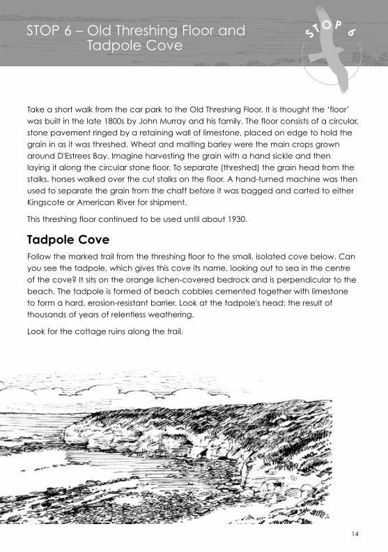
STOP 6 – Old Threshing Floor and Tadpole Cove
Take a short walk from the car park to the Old Threshing Floor. It is thought the ‘floor’ was built in the late 1800s by John Murray and his family. The floor consists of a circular, stone pavement ringed by a retaining wall of limestone, placed on edge to hold the grain in as it was threshed. Wheat and malting barley were the main crops grown around D'Estrees Bay. Imagine harvesting the grain with a hand sickle and then laying it along the circular stone floor. To separate (threshed) the grain head from the stalks, horses walked over the cut stalks on the floor. A hand-turned machine was then used to separate the grain from the chaff before it was bagged and carted to either Kingscote or American River for shipment.
This threshing floor continued to be used until about 1930.
Tadpole CoveFollow the marked trail from the threshing floor to the small, isolated cove below. Can you see the tadpole, which gives this cove its name, looking out to sea in the centre of the cove? It sits on the orange lichen-covered bedrock and is perpendicular to the beach. The tadpole is formed of beach cobbles cemented together with limestone to form a hard, erosion-resistant barrier. Look at the tadpole's head: the result of thousands of years of relentless weathering.
Look for the cottage ruins along the trail.

15
STOP 7 – Wheatons Beach
D'Estrees Bay is home and refuge to many birds. Wheatons Beach is a good place to observe the birds that frequent the area. Some of these birds live here all year round, while others arrive seasonally. There are also nomadic birds of ‘no fixed address’ and the occasional vagrant, far from its normal home.
See if you can find some of the following birds.
Rock Parrot
Rock Parrot Neophema petrophila
Watch for flashes of olive-green and blue along the high tide zone. Small flocks of Rock Parrots forage for seeds here amongst the sea-rocket, saltbush, Nitre-bush and samphire. You might also see mixed flocks of adults and juveniles as you drive along the D'Estrees Bay Road. Here they feed on seeds of the Biddy-biddy (Acaena novae-zelandiae) that grows in abundance in the areas previously used for agriculture. Rock Parrots are mainly observed between January and March. They arrive here in December, after breeding on offshore islands to the west, and stay until about August.

16
Sooty Oystercatchers
Sooty Oystercatcher Haematopus fuliginosus
Look along the sandy shore and the rocky tidal pool. Can you see any black birds with pink legs? Sooty Oystercatchers are often found here feeding on limpets, periwinkles and mussels that they pick off the rocks. You may see them hammering shells against a stone to free their food. Walk carefully along the beach because between June to January, Sooty Oystercatchers lay their eggs in depressions in the sand, generally among rocks, seaweed, pigface and shells.
Ruddy Turnstones
Ruddy Turnstone Arenaria interpres
Can you see some thickset, well-camouflaged black, white and brown birds with short orange legs, turning over kelp and stones along the beach in their search for food? Their short, strong beak is well adapted to this activity. When feeding, these birds walk or run from one spot to the other, sometimes quarrelling noisily over the perceived ownership of intended food supplies. In autumn most of these birds leave here and migrate to their breeding quarters in Siberia and Alaska, returning again in late spring.

17
STOP 7 – Wheatons Beach
Australasian GannetMorus serrator
Between April and September, keep an eye out for large black and white birds with yellow heads, soaring and gliding over the ocean. These may be Australasian Gannets patrolling the waters, watching for a glimpse of a fish. On sighting a fish, gannets fold their wings back and plunge into the ocean from up to 30 metres away, like speeding arrows. Turning to rise out of the water, the gannets catch and swallow their fish, before ascending into the air. Sadly, these birds are too frequently found washed ashore, after becoming entangled in carelessly discarded fishing line.
Australasian Gannet

18
Crested Tern Sterna bergii
Is there a large group of black and white birds congregating along the shore? These could be Crested Terns, which are common around Australian coastlines. Look out over the ocean and you may glimpse them plunging into the sea after small fish. You may also see a mating pair twisting and spiralling in a spectacular aerial display. Crested Terns nest in large colonies on offshore islands right around the coast.
Crested Terns
Hooded Plover
Hooded Plover Thinornis rubricollis
These small black, white and grey birds have a distinctive red beak and eye rim. They are often seen racing the tide in pairs or small groups, as they feed on insects and other invertebrates trapped on the wet sand amongst the drift. Hooded Plovers lay their two or three eggs from late winter to summer in small scrapes in the sand, just above the high tide mark. Car, bike and human traffic often accidentally trample nests. These birds are listed as vulnerable under the Endangered Species Protection Act 1992. Please take care when walking along the beach.

Kangaroo Island Spyridium
19
STOP 8 – Sewer Beach
Kangaroo Island Spyridium Spyridium halmaturinum var. halmaturinumFamily: Rhamnaceae
Spyridium is from the Greek spyridion, meaning a little basket, alluding to the tiny white flowerheads. The white petals surrounding the flower are actually ‘floral leaves’ designed to attract pollinating insects to the otherwise unappealing flower. Halmaturinum means 'island'. This plant is endemic (found nowhere else) to Kangaroo Island.
Common Boobialla
Common BoobiallaMyoporum insulareFamily: Myoporaceae
This plant is commonly found in coastal sand dunes. The foliage is fire resistant and the leaf litter minimal. Tammar Wallabies often browse on this shrub, even standing on their hind legs to reach the higher leaves.
Coast Daisy-bush
Look for the following plants around the car park and as you walk to the beach.
Coast Daisy-bushOlearia axillarisFamily: Compositae
This common grey-green, aromatic coastal plant acts as a sand binder. The undersides of the leaves are white and woolly. Strongly scented, inconspicuous flowers appear between February and April and the seeds are dispersed by wind.

20
Slender Honey-myrtle
Coast Beard-heath
Coast Beard-heathLeucopogon parviflorusFamily: Epacridaceae
This shrub is known locally as ‘native currant’ for the edible white berries it produces in summer. The single seed is surrounded by juicy flesh which many birds find palatable. At fruiting time it is common to see flocks of Silver Gulls hovering above the shrubs, plucking off berries.
Slender Honey-myrtle Melaleuca gibbosaFamily: Myrtaceae
The Slender Honey-myrtle is widespread in both coastal and swampy areas. In late spring and summer the pink or mauve flowers that cluster on the stems look like mini bottlebrushes.
Dryland Tea-tree Melaleuca lanceolataFamily: Myrtaceae
In such an exposed site Dryland Tea-trees hug the ground, much reduced in size by the salt-laden winds. On your return drive look out for the same species growing in the form of a large shrub, its canopy dense enough to provide wallabies with effective shelter from the cold, wind and rain.
Dryland Tea-tree

21
STOP 8 continued – Sewer Beach
Sea Spurge Euphorbia paraliasFamily: Euphorbiaceae
Originating in the Mediterranean region, Sea Spurge has become a weed of coastal sand dunes in Australia. Herbs from the Euphorbia family have a poisonous milky white sap in the stems and leaves, that is a skin irritant.
Sticky Goodenia Goodenia variaFamily: Goodeniaceae
This shrub grows to waist high in mallee and coastal areas and flowers for much of the year. The lime green leaves are round and thick and the new growth is often sticky.
Coast Cushion Bush
Sticky Goodenia
Sea Spurge
Coast Cushion Bush Leucophyta browniiFamily: Compositae
The dense, rounded Coast Cushion Bush is often found facing the sea on cliffs and dunes. ‘Leucophyta’ means ‘white leaves’. The tiny leaves that are pressed against the white stem are covered in a mass of white hairs, giving the bush its silvery appearance.

22
Round-leaf Correa Correa backhouseana var. orbicularisFamily: Rutaceae
This round-leaved subspecies is endemic to Kangaroo Island. The tubular bell-shaped flowers face the ground inthe winter, allowing rain to run off. However, in summer the 'bells' invert to face the sky to allow for easier fertilisation by birds such as honeyeaters as they search for nectar.
Coast Velvet-bush Lasiopetalum discolorFamily: Sterculiaceae
The dense leaves on this shrub are rusty coloured on their undersides. Pale pink flowers with hairy insides appear from winter to early summer.
Drooping Velvet-bush Lasiopetalum schulzeniiFamily: Sterculiaceae
Lasiopetalum means ‘hairy petal’, but on this plant the drooping, heart-shaped leaves are also hairy. This plant grows on a range of soils and is therefore found in many different habitats on Kangaroo Island.
Coast Velvet-bush
Round-leaf Correa
Drooping Velvet-bush

For further information contact:
Kingscote Regional OfficeDepartment for Environment and Heritage37 Dauncey StKingscote Kangaroo Island SA 5223
© Department for Environment and Heritage Illustrations by Nicholas Pike June 2006 FIS 2473.06 ISBN: 1 921238 54 2 Printed on recycled paper
Wildlife Watching Guidelines
Always remember to:
• stay on the trail
• put the animals’ welfare first
• move slowly and quietly
• observe from a distance
• use binoculars for a close-up view.
Observe, don't interact