delineating geomorphic landscape units to assess · pdf filepapantzin cid university of...
TRANSCRIPT
Papantzin CidUniversity of Redlands
Delineating Geomorphic Landscape Units to assess sediment supply in
the San Diego River Watershed

Objectives
• Review of Original Geomorphic Landscape Units (GLUs) Approach
• Revised GLUs Approach• San Diego River Watershed
• Limitations

Original Approach to GLUs
• Classification of Slope, Geology and Land Cover
• Planning tool to predict effects of hydromodification based on sediment changes due to landscape alteration
• Rapid assessment technique that could inform management decisions
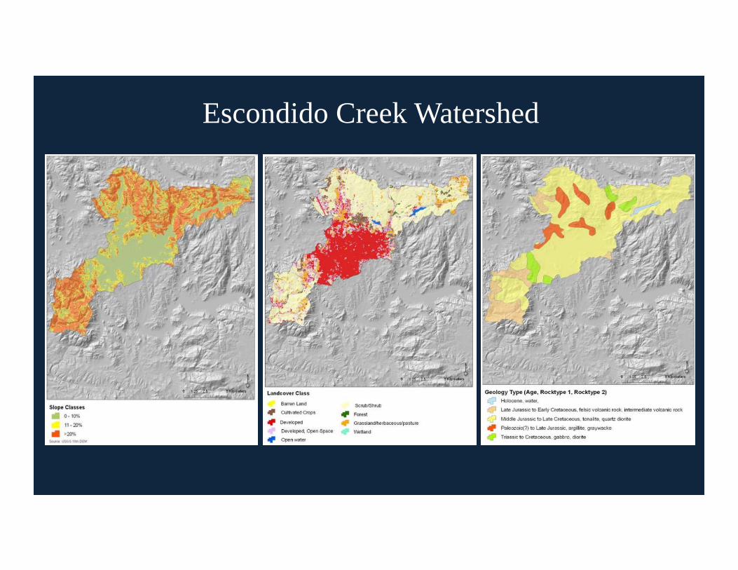
Escondido Creek Watershed
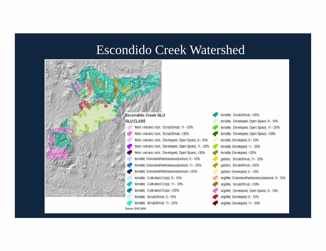
Escondido Creek Watershed
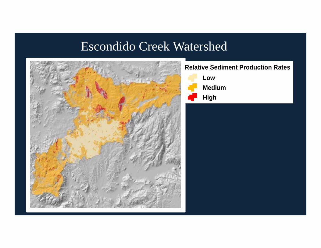
Escondido Creek WatershedRelative Sediment Production Rates
LowMediumHigh
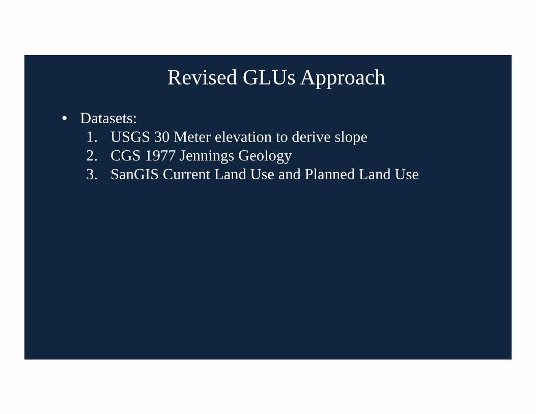
Revised GLUs Approach
• Datasets:1. USGS 30 Meter elevation to derive slope2. CGS 1977 Jennings Geology3. SanGIS Current Land Use and Planned Land Use

San Diego River Watershed
• Second Largest
• 433 Sq. Mile
• Highest Population
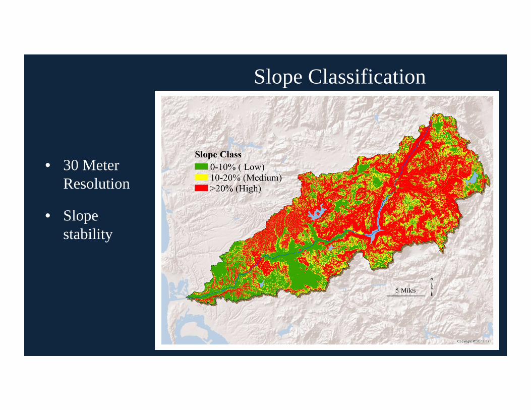
Slope Classification
• 30 Meter Resolution
• Slope stability
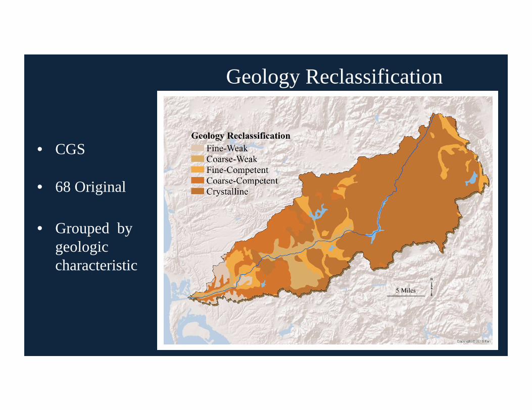
Geology Reclassification
• CGS
• 68 Original
• Grouped by geologic characteristic

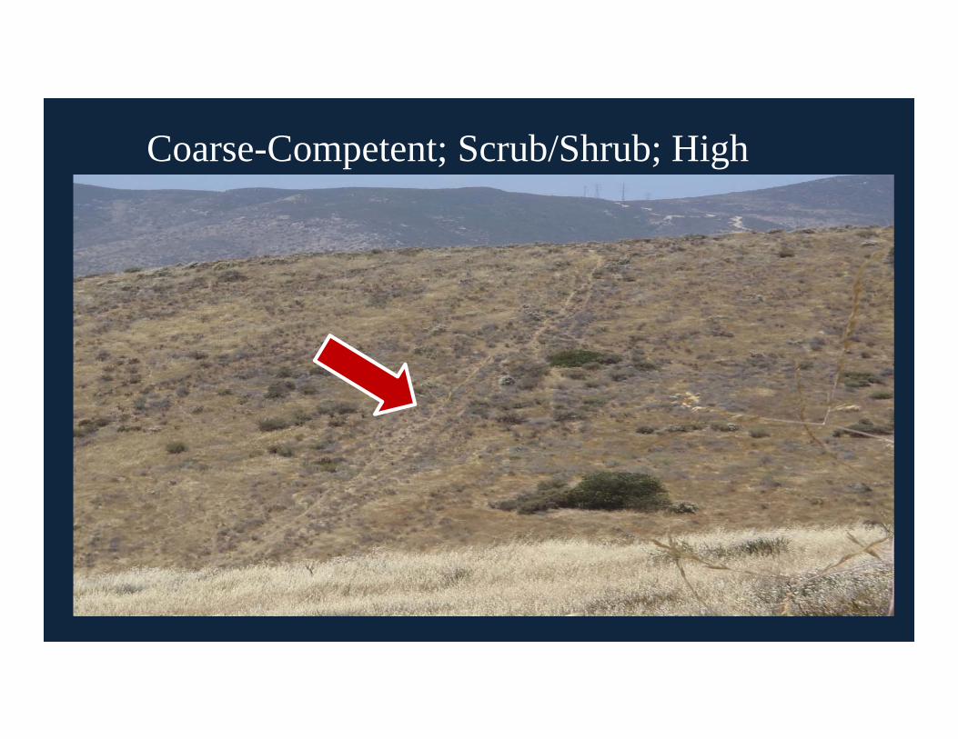
Coarse-Competent Classification
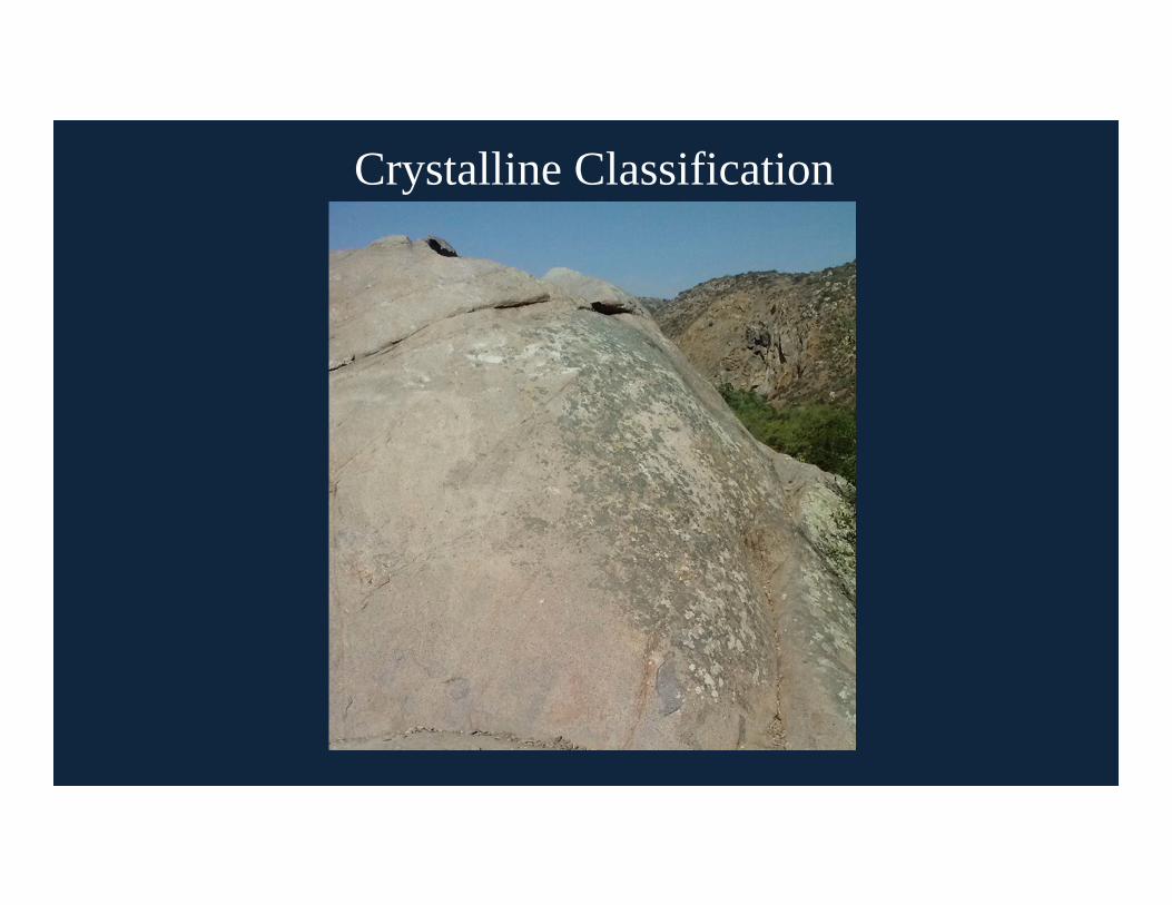
Crystalline Classification

Geology Reclassification
66%13%
10%
7%
3%1%
Geology ReclassificationFine-WeakCoarse-WeakFine-CompetentCoarse-CompetentCrystalline

Land Use Classification
• General & Community Plans
• 90 Original
• 3 Reclassified

Land Use Classification
1%
53%45%
1%2%
30%
67%
1%
Current 2012 Land Use Planned 2050 Land UseAgricultureDevelopedScrub/ShrubWater
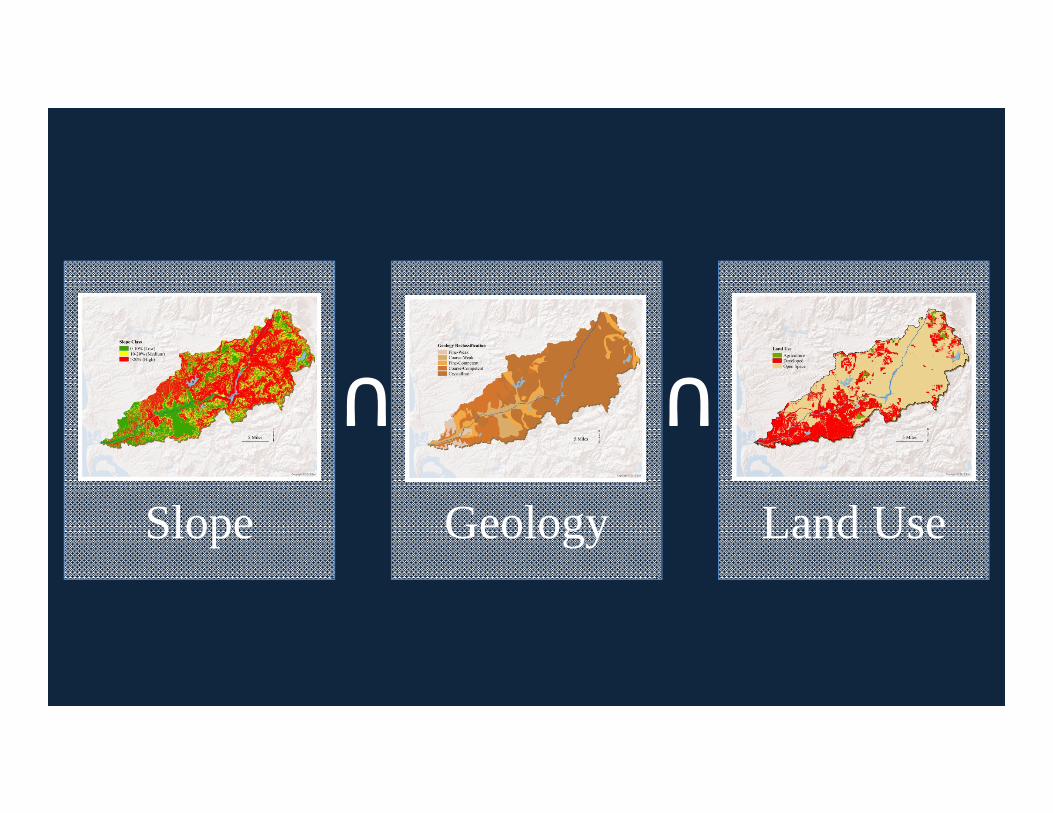
Slope Geology Land Use
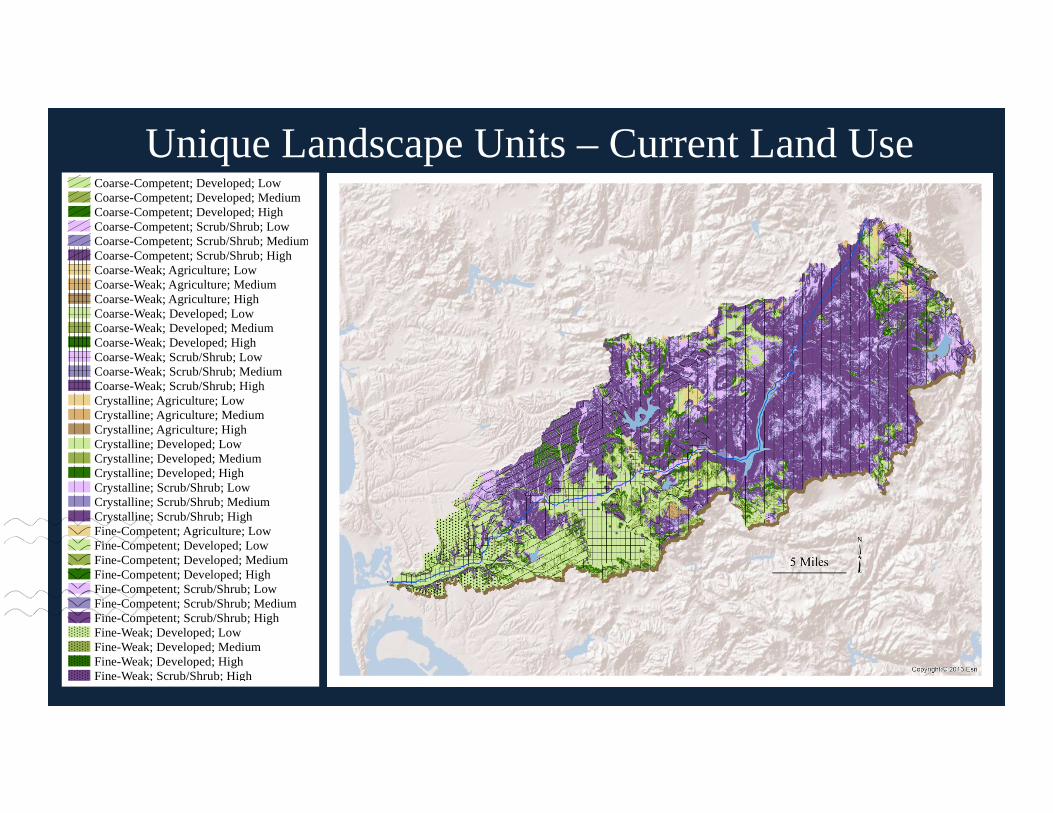
Unique Landscape Units – Current Land UseCoarse-Competent; Developed; LowCoarse-Competent; Developed; MediumCoarse-Competent; Developed; HighCoarse-Competent; Scrub/Shrub; LowCoarse-Competent; Scrub/Shrub; MediumCoarse-Competent; Scrub/Shrub; HighCoarse-Weak; Agriculture; LowCoarse-Weak; Agriculture; MediumCoarse-Weak; Agriculture; HighCoarse-Weak; Developed; LowCoarse-Weak; Developed; MediumCoarse-Weak; Developed; HighCoarse-Weak; Scrub/Shrub; LowCoarse-Weak; Scrub/Shrub; MediumCoarse-Weak; Scrub/Shrub; HighCrystalline; Agriculture; LowCrystalline; Agriculture; MediumCrystalline; Agriculture; HighCrystalline; Developed; LowCrystalline; Developed; MediumCrystalline; Developed; HighCrystalline; Scrub/Shrub; LowCrystalline; Scrub/Shrub; MediumCrystalline; Scrub/Shrub; HighFine-Competent; Agriculture; LowFine-Competent; Developed; LowFine-Competent; Developed; MediumFine-Competent; Developed; HighFine-Competent; Scrub/Shrub; LowFine-Competent; Scrub/Shrub; MediumFine-Competent; Scrub/Shrub; HighFine-Weak; Developed; LowFine-Weak; Developed; MediumFine-Weak; Developed; HighFine-Weak; Scrub/Shrub; High
Coarse-Competent; Scrub/Shrub; Medium
Coarse-Competent; Developed; LowCoarse-Competent; Developed; MediumCoarse-Competent; Developed; HighCoarse-Competent; Scrub/Shrub; Low
Coarse-Competent; Scrub/Shrub; HighCoarse-Weak; Developed; LowCoarse-Weak; Developed; MediumCoarse-Weak; Developed; HighCoarse-Weak; Scrub/Shrub; LowCoarse-Weak; Scrub/Shrub; MediumCoarse-Weak; Scrub/Shrub; HighCrystalline; Agriculture; LowCrystalline; Developed; LowCrystalline; Developed; MediumCrystalline; Developed; HighCrystalline; Scrub/Shrub; LowCrystalline; Scrub/Shrub; MediumCrystalline; Scrub/Shrub; HighFine-Competent; Developed; LowFine-Competent; Developed; MediumFine-Competent; Developed; HighFine-Competent; Scrub/Shrub; LowFine-Competent; Scrub/Shrub; MediumFine-Competent; Scrub/Shrub; HighFine-Weak; Developed; LowFine-Weak; Developed; MediumFine-Weak; Developed; HighFine-Weak; Scrub/Shrub;High
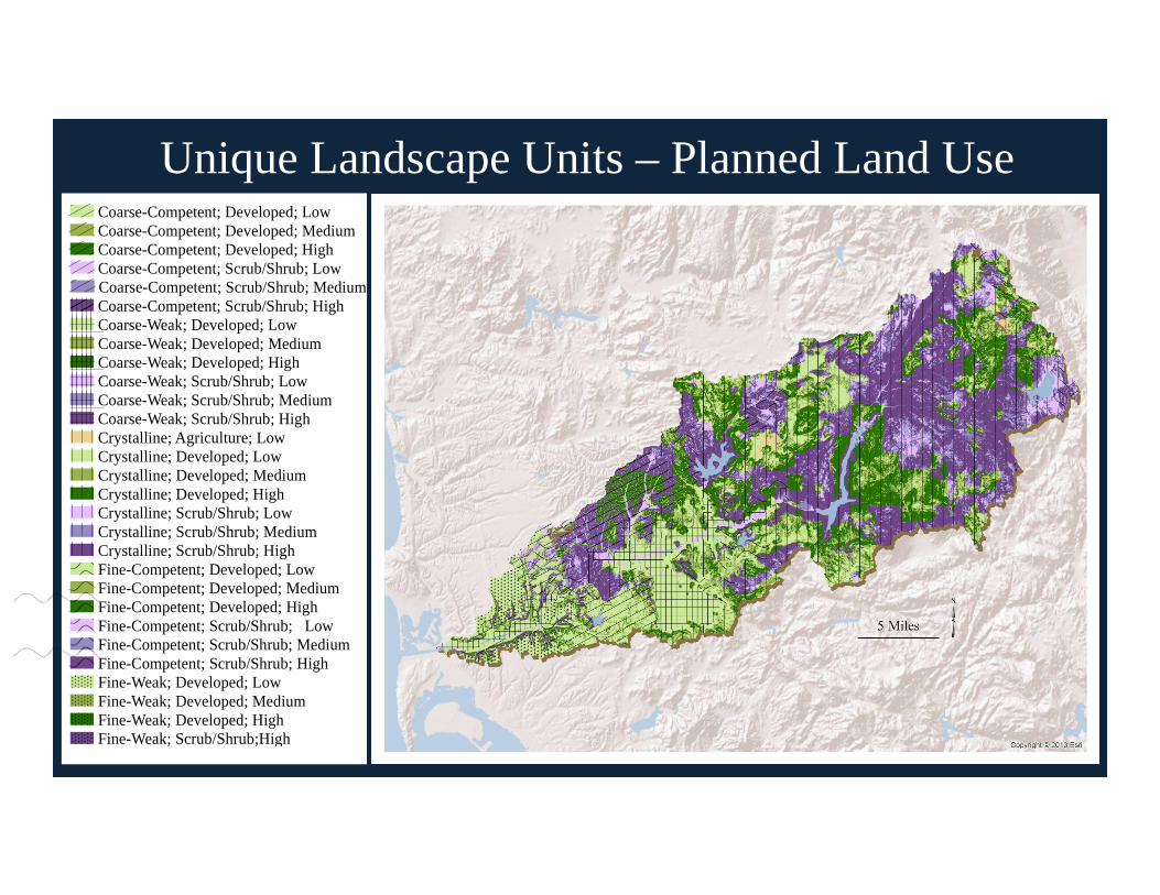
Unique Landscape Units – Planned Land Use
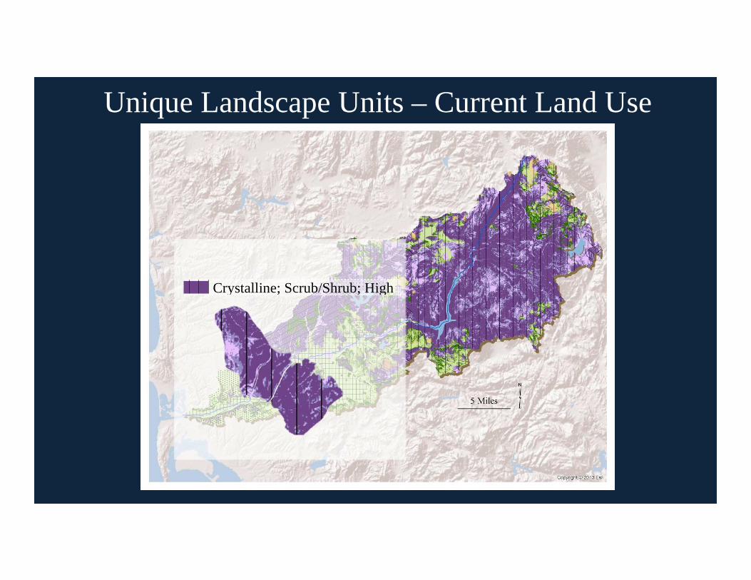
Unique Landscape Units – Current Land Use
Crystalline; Scrub/Shrub; High

Crystalline; Scrub/Shrub; High

Crystalline; Scrub/Shrub; Low
Coarse-Competent; Scrub/Shrub; High

Potential2050 Land
Use
Developed
Scrub/Shrub
Scrub/Shrub
Scrub/Shrub
Developed
Scrub/Shrub
Difference in Percent
-6.6
-8.1
-3.1
-0.7
-1.2
-0.2
Geology
Crystalline
Crystalline
CrystallineCoarse-
CompetentCoarse-
Competent
Coarse-Competent
Slope
Medium
Medium
High
Low
High
Medium
Current2012 Land
Use
Agriculture
Scrub/Shrub
Scrub/Shrub
Scrub/Shrub
Scrub/Shrub
Scrub/Shrub
Relative Sediment
Production
Low
Low
Low
Low
Medium
Medium
Legend

20122050
A predicted reduction in sediment could be used to identify areas of hydromodification
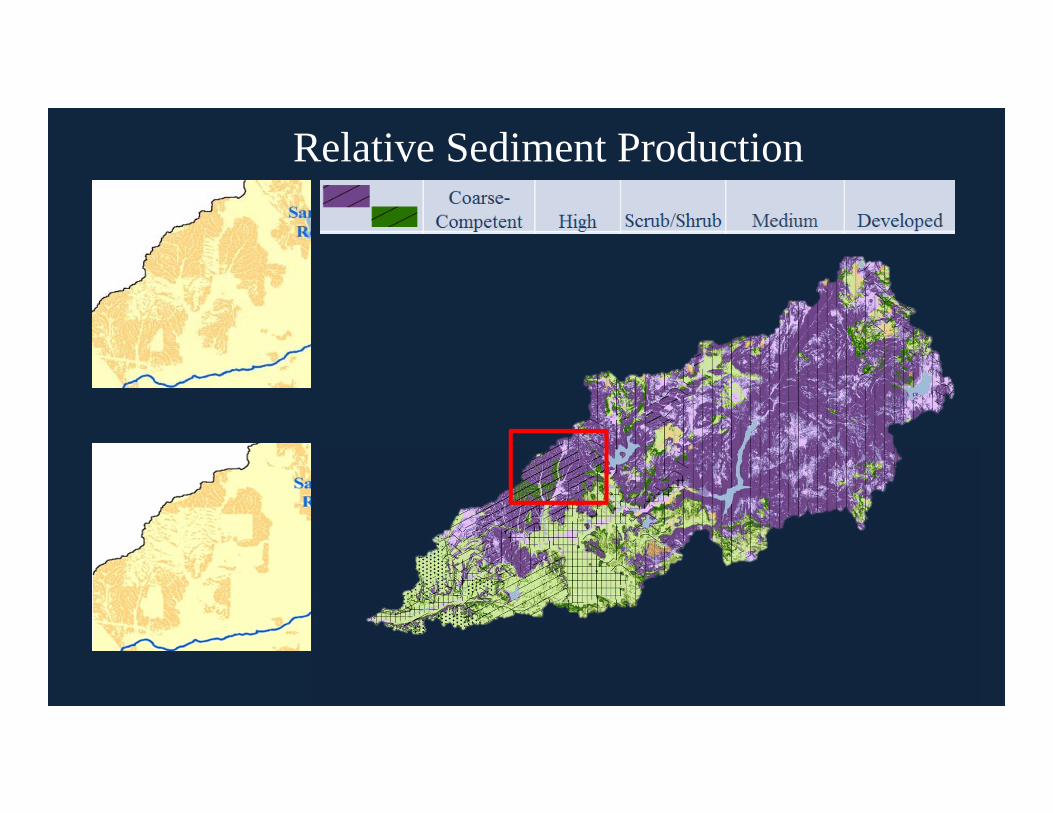
Relative Sediment Production

Limitations
• Defined by the coarsest dataset – Jennings Geology
• Reclassification of Categories
• Assessment of relative sediment production rates

Summary
• Goal was to identify unique landscape units that could be used in a rapid assessment of the watershed
• 3 indicators of potential sediment production
• Dataset and Classification limitations
• Predicted reduction in sediment could be used to identify areas of hydromodification and assist decision makers