dd form 2993, aug 2015 - esd.whs.mil · (obtain from the incinerator and burn pit operator the...
TRANSCRIPT

ENVIRONMENTAL BASELINE SURVEY (EBS) CHECKLIST For use of this form, see ATP 3-34.5/MCRP 4-11B; the proponent agency is TRADOC.
Classification:
Classification:
Note: Do not leave any blanks empty. If they do not apply to the current site, enter not applicable (NA) or nothing significant to report (NSTR) to show the section has been investigated. The section numbers in the checklist correspond to the section numbers in the report format. *Items that are completed in DD Form 2994, Environmental Baseline Survey (EBS) Report. These items are shown in the EBS Checklist to ensure that item numbers are matched between the checklist and the report.
1. ADMINISTRATIVE DATA
a. LOCATION NAME
(Official name and legal address of the location being assessed. Name of country, city, township, or area of operation for the site location.)
b. LOCATION ALIASES (Other names the base is currently or was previously known as.)
c. START DATE AND TIME d. END DATE
e. ORGANIZATION CONDUCTING SURVEY(Name of the unit or activity conducting the assessment.)
f. SURVEYOR’S NAME, RANK, GRADE, AND TITLE
g. SURVEYOR’S TELEPHONE
h. SURVEYOR’S E-MAIL
i. GEOGRAPHIC LOCATION
Note: If this information is classified, enter it in Section 14 of this checklist. The 8-digit military grid coordinates are mandatory for the site using the center of the camp for reference. Coordinates may also be taken from the outside corners of the site to provide site boundaries. A global positioning system may be used in addition to the grid coordinates. The 8-digit military grid coordinates will always include the 3-character zone designator and the 2-character grid square identifier.
NOTES (Enter notes associated with the geographic location; for example, the datum associated with the location, map type, map number, global positioning system used, and so forth.)
2. EXECUTIVE SUMMARY *(Completed after information gathered is analyzed and recommendations developed. This is a synopsis of significant findings, conclusions, and recommendations based on the data analysis with the ultimate recommendation being to use or not use the site.)
3. INTRODUCTION
a. LIMITATIONS OF ASSESSMENT
(Enter the physical obstructions, limiting conditions (such as weather), mission restrictions, and the lack of equipment and supplies encountered during the assessment.)
Coordinate 4
Coordinate 2
Coordinate 3
Coordinate 1
Page 1 of 20 PagesDD FORM 2993, AUG 2015
Click this button to add a continuation page if more space is needed for any item.
Adobe Designer 9.0

b. GENERAL DATA GAPS
(Enter data that was either not obtainable at the time of the survey or that will be received in the future; for example, awaiting analytical data, personnel not available to be interviewed, and locations of key facilities may be unknown or may move before occupation.)
4. SITE CHARACTERISTICS (Attach site maps and photographs to the survey. Take at least one photograph per section or area of concern. Photographs can be used to document conditions before and after occupation. Create a photograph log that documents the date, time, location, and a brief description of each photograph.)
b. CAMP FIXED POPULATION Note: If this information is classified, enter it in Section 14 of this checklist. Enter the population of the location, if known. Separate by military and civilian categories.
c. ROTATION SCHEDULE
Note: If this information is classified, enter it in Section 14 of this checklist.
(What is the unit rotation schedule [months, years, and so forth]).
d. NUMBER OF UNITED STATES TROOPS IF NOT A UNITED STATES CAMP
Note: If this information is classified, enter it in Section 14 of this checklist.
e. PHYSICAL SETTING
(Provide a description of the general geography, topography, geology, hydrology, vegetation, raw materials, natural resources, and urban and rural settings. Make note of any obvious damage caused by natural and manmade events such as earthquakes, flooding, tornadoes, hurricanes, tsunami, or mining.)
f. CLIMATE AND WEATHER
(Provide information regarding the climate and weather in the area; for example, temperature range, predominate wind direction, or normal rainfall. Identify if the area is prone to seasonal or periodic events such as hurricanes, tornadoes, tsunamis, or monsoons. Attach five recent previous years of meteorological data (if possible, in an electronic format), the source of the data, and a point of contact for the source.)
a. UNITS AND DETACHMENTS, TEAMS, AND ELEMENTS PRESENT Note: If this information is classified, enter it in Section 14 of this checklist. Include as much detail as possible and include all Services.
Page 2 of 20 PagesDD FORM 2993, AUG 2015
Classification:
Classification:
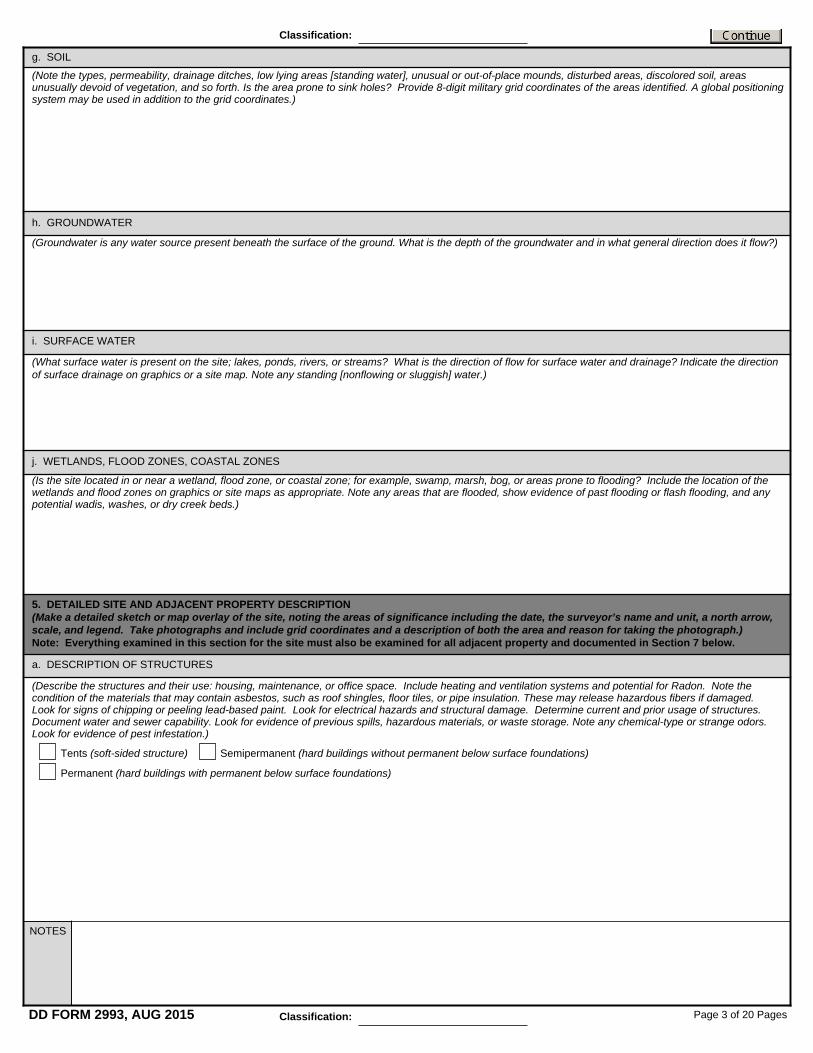
g. SOIL
(Note the types, permeability, drainage ditches, low lying areas [standing water], unusual or out-of-place mounds, disturbed areas, discolored soil, areas unusually devoid of vegetation, and so forth. Is the area prone to sink holes? Provide 8-digit military grid coordinates of the areas identified. A global positioning system may be used in addition to the grid coordinates.)
h. GROUNDWATER
(Groundwater is any water source present beneath the surface of the ground. What is the depth of the groundwater and in what general direction does it flow?)
i. SURFACE WATER
(What surface water is present on the site; lakes, ponds, rivers, or streams? What is the direction of flow for surface water and drainage? Indicate the direction of surface drainage on graphics or a site map. Note any standing [nonflowing or sluggish] water.)
j. WETLANDS, FLOOD ZONES, COASTAL ZONES
(Is the site located in or near a wetland, flood zone, or coastal zone; for example, swamp, marsh, bog, or areas prone to flooding? Include the location of the wetlands and flood zones on graphics or site maps as appropriate. Note any areas that are flooded, show evidence of past flooding or flash flooding, and any potential wadis, washes, or dry creek beds.)
5. DETAILED SITE AND ADJACENT PROPERTY DESCRIPTION (Make a detailed sketch or map overlay of the site, noting the areas of significance including the date, the surveyor’s name and unit, a north arrow, scale, and legend. Take photographs and include grid coordinates and a description of both the area and reason for taking the photograph.) Note: Everything examined in this section for the site must also be examined for all adjacent property and documented in Section 7 below.
a. DESCRIPTION OF STRUCTURES
(Describe the structures and their use: housing, maintenance, or office space. Include heating and ventilation systems and potential for Radon. Note the condition of the materials that may contain asbestos, such as roof shingles, floor tiles, or pipe insulation. These may release hazardous fibers if damaged. Look for signs of chipping or peeling lead-based paint. Look for electrical hazards and structural damage. Determine current and prior usage of structures. Document water and sewer capability. Look for evidence of previous spills, hazardous materials, or waste storage. Note any chemical-type or strange odors. Look for evidence of pest infestation.)
Tents (soft-sided structure) Semipermanent (hard buildings without permanent below surface foundations)
Permanent (hard buildings with permanent below surface foundations)
Page 3 of 20 PagesDD FORM 2993, AUG 2015
NOTES
Classification:
Classification:
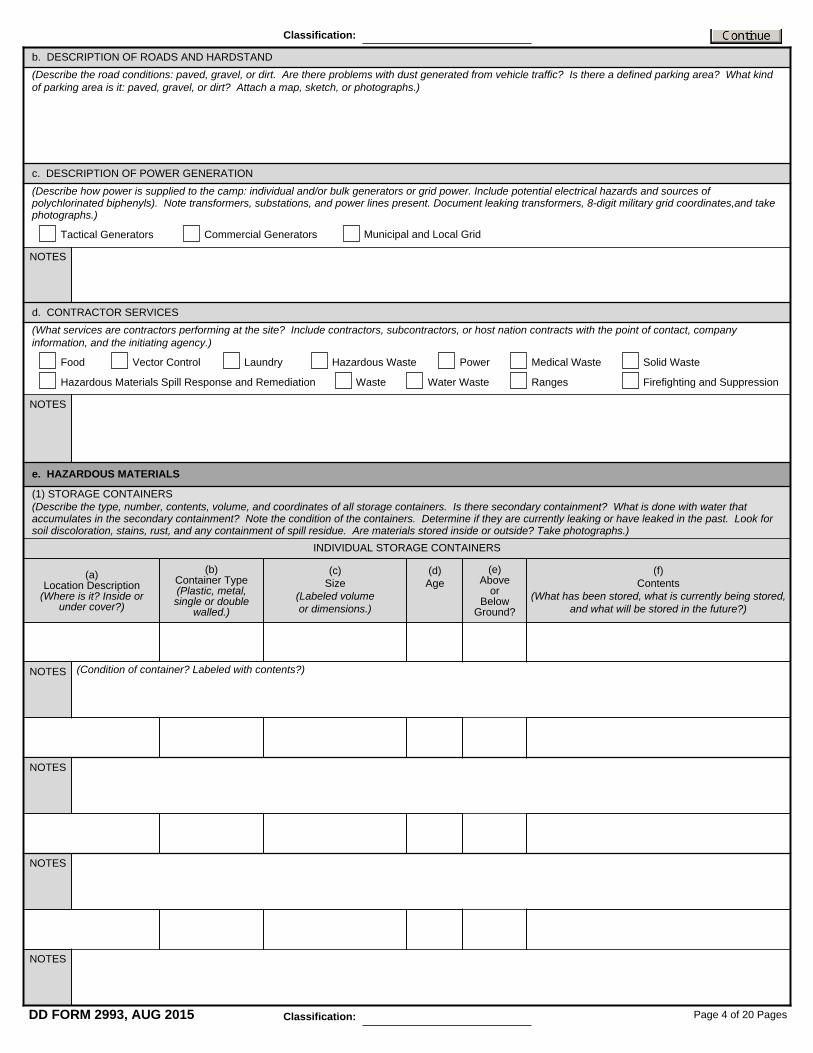
b. DESCRIPTION OF ROADS AND HARDSTAND(Describe the road conditions: paved, gravel, or dirt. Are there problems with dust generated from vehicle traffic? Is there a defined parking area? What kind of parking area is it: paved, gravel, or dirt? Attach a map, sketch, or photographs.)
c. DESCRIPTION OF POWER GENERATION
(Describe how power is supplied to the camp: individual and/or bulk generators or grid power. Include potential electrical hazards and sources of polychlorinated biphenyls). Note transformers, substations, and power lines present. Document leaking transformers, 8-digit military grid coordinates,and take photographs.)
Tactical Generators Commercial Generators Municipal and Local Grid
NOTES
NOTES
NOTES
d. CONTRACTOR SERVICES(What services are contractors performing at the site? Include contractors, subcontractors, or host nation contracts with the point of contact, company information, and the initiating agency.)
Food Vector Control Laundry Hazardous Waste Solid WasteMedical WastePower
Hazardous Materials Spill Response and Remediation Waste Water Waste Ranges Firefighting and Suppression
e. HAZARDOUS MATERIALS
(1) STORAGE CONTAINERS (Describe the type, number, contents, volume, and coordinates of all storage containers. Is there secondary containment? What is done with water that accumulates in the secondary containment? Note the condition of the containers. Determine if they are currently leaking or have leaked in the past. Look for soil discoloration, stains, rust, and any containment of spill residue. Are materials stored inside or outside? Take photographs.)
INDIVIDUAL STORAGE CONTAINERS
(a) Location Description
(Where is it? Inside or under cover?)
(b) Container Type (Plastic, metal, single or double
walled.)
(c) Size
(Labeled volume or dimensions.)
(d) Age
(e) Above
or Below
Ground?
(f) Contents
(What has been stored, what is currently being stored, and what will be stored in the future?)
(Condition of container? Labeled with contents?)
NOTES
NOTES
NOTES
Page 4 of 20 PagesDD FORM 2993, AUG 2015 Classification:
Classification:

(g) General Notes
(Are shelf-life requirements being met? List any occurrences of spills. Are safety data sheets available? Are containers properly labeled?)
(2) PETROLEUM DISTRIBUTION POINTS (PETROLEUMS, OILS, AND LUBRICANTS) (Are there any existing or former fuel points? Take photographs.)
INDIVIDUAL DISTRIBUTION POINTS
(a) Location Description
(Where is it?)
(b) Container
(Type, single- or double-walled, size in volume or dimension, age or installer, above or below ground, and number of containers. If more than one, describe all.)
(c) Fuel Type
(d) Contractor Operated
Gas
Diesel
Jet Propulsion
(Include information related to the specific distribution point. For example, availability of spill response and prevention equipment, personal protective equipment, posted spill plan and procedures, use of drip pans, alarm systems, and protective measures. Annotate signs of obvious ground contamination.)
(Add notes related to petroleum, oils, and lubricants distribution in general.)
(3) PAST RELEASES
(Annotate any information concerning past releases of petroleum, oils, and lubricants products. Describe the details of those past spills if known: location (8-digit military grid coordinates, date, type of spill, amount spilled or size of the resulting stain, and any remedial actions taken. If unknown, state “unknown.” Take photographs.)
YES
NO
NOTES
Gas
Diesel
Jet Propulsion
YES
NO
NOTES
(e) General Notes
Page 5 of 20 PagesDD FORM 2993, AUG 2015 Classification:
Classification:
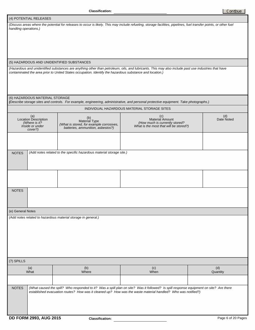
(4) POTENTIAL RELEASES
(Discuss areas where the potential for releases to occur is likely. This may include refueling, storage facilities, pipelines, fuel transfer points, or other fuel handling operations.)
(5) HAZARDOUS AND UNIDENTIFIED SUBSTANCES
(Hazardous and unidentified substances are anything other than petroleum, oils, and lubricants. This may also include past use industries that have contaminated the area prior to United States occupation. Identify the hazardous substance and location.)
(6) HAZARDOUS MATERIAL STORAGE (Describe storage sites and controls. For example, engineering, administrative, and personal protective equipment. Take photographs.)
INDIVIDUAL HAZARDOUS MATERIAL STORAGE SITES
(a) Location Description
(Where is it? Inside or under
cover?)
(b) Material Type
(What is stored, for example corrosives, batteries, ammunition, asbestos?)
(c) Material Amount
(How much is currently stored? What is the most that will be stored?)
(d) Date Noted
(Add notes related to the specific hazardous material storage site.)
(e) General Notes
(Add notes related to hazardous material storage in general.)
(7) SPILLS
(a) What
(b) Where
(c) When
(d) Quantity
(What caused the spill? Who responded to it? Was a spill plan on site? Was it followed? Is spill response equipment on site? Are there established evacuation routes? How was it cleaned up? How was the waste material handled? Who was notified?)
NOTES
NOTES
NOTES
Page 6 of 20 PagesDD FORM 2993, AUG 2015
Classification:
Classification:

(e) General Notes
f. WASTE MANAGEMENT
(1) SOLID AND HAZARDOUS WASTE (General description of solid and hazardous waste disposal practices. Describe whether burn pits, composting, landfills, or incinerators are used. Note any signs of dumping and determine what might have been dumped. Take photographs.)
INDIVIDUAL SOLID AND HAZARDOUS WASTE DESCRIPTIONS
(a) Type of Waste
(What is the waste? For example, is it residential, industrial, agricultural, or
explosive ordnance?)
(b) Source of Waste
(For example, is it dining facility, housing, office, or construction debris?)
(c) Disposal Method
(For example, open dumping, incineration, open burning, landfill, or
composting?)
(d) Contractor Operated
Defense Reutilization and Marketing Office
United States
Local
Defense Reutilization and Marketing Office United States
Local
Defense Reutilization and Marketing Office United States
Local
Defense Reutilization and Marketing Office United States
Local
(Add notes related to specific types of waste. Include contractor information, host nation and local company point of contact and telephone number, the name of the individual who picks it up, the method of pickup, the frequency of pickups, where it goes, the location with grid coordinates, and how long it remains on site. How is it stored? Take photographs.)
(Include contractor and subcontractor information, point of contact, telephone number, storage locations, quantities, and frequency of removal. Who is responsible for removing waste? Methods used to remove, such as dumpsters or trucks. If disposal is by burn pit, are wastes segregated? What is the frequency of burning in the pit? How far away is the nearest occupied area? Who lives and works in the area and is there any record of complaints or concerns associated with the burn pits? Take photographs.)
(a) What
(b) Where
(c) When
(d) Quantity
NOTES
NOTES
NOTES
(e) General Notes
NOTES
NOTES
Page 7 of 20 PagesDD FORM 2993, AUG 2015
Classification:
Classification:

(2) NONHAZARDOUS WASTE
(i) REUSE, RECYCLING, AND COMPACTION FACILITIES
(a) Location(Where is it located and the distance from living areas. Provide grid coordinates.)
(ii) LANDFILLS
(a) Location
(Where in the camp is it located? Note the distance from living areas and nearest airfield. Provide 8-digit military grid coordinates.)
(e) Daily Cover
(General size, how long in use, materials excluded, such as medical waste, batteries, tires, or petroleum, oils, and lubricants. Are there monitoring wells for gas or leachate? Describe the landfill construction.)
(f) Description
(Document the type of incinerator. For example, hazardous or nonhazardous waste. Are there scrubbers in place? What are the procedures for ash disposal ? Are the incinerators dual chambered?)
(i) General Notes
(Is daily cover applied?)
(c) Disposal Volume/Day(In weight or volume, obtain from the landfill coordinator.)
(b) Material Disposed(Types of material disposed.)
(iii) INCINERATORS AND BURN PITS
(a) Location
(Where in the camp is it located and the distance from living areas. Provide grid coordinates and prevailing wind direction of the area.)
(b) Material Disposed(Types of material disposed.)
(d) Operator
(Make note of any problems or issues that exist with the current process or procedures.)
(e) General Notes
(Name and contact information.)
(d) Operator(Name and contact information.)
(c) Disposal Rate Per Day(Obtain from the incinerator and burn pit operator the weight or volume. For incinerators, note the unit’s capacity from the specification plate on the unit.)
(d) Operator(Name and contact information.)
(c) Equipment Utilized
(Types and quantity of materials reused and recycled. Document procedures for collection, management, and disposition.)(b) Materials and Volume Managed
(List all equipment and containers used.)
Incinerator
Burn pit
(e) Manufacturer(Obtain from the specification plate on the unit. Describe the unit.)
(f) Hours of Operation Per Day(Obtain from the operator.)
(g) Frequency of Burning (Days per week, hours per day, time of day.)
(h) Supplemental Fuel(For example, diesel, propane, or waste oil.)
Page 8 of 20 PagesDD FORM 2993, AUG 2015
Classification:
Classification:

(Where is it located and the distance from living areas. Provide grid coordinates.)(a) Location
(d) Operator
(e) General Notes
(c) Disposal Rate/Day
(b) Materials Disposed
(Name and contact information.)
(Note the date the operation began. Document the turning schedule. Is the turn conducted by hand or by mechanical means? How is the composted material used? If land farming, what microbes are being used?)
(Types of material disposed.)
(Obtain the weight or volume from the composting operator.)
(iv) COMPOSTING AND LAND FARMING
g. MEDICAL WASTE
(a) Type of Waste
(What is the waste? Red bag [gloves, dressings, tubing, cultures, and so forth],
pathological [body parts], or Sharps?)
(b) Source of Waste
(Clinic, humanitarian assistance, and so forth?)
(c) Disposal Method
(Incineration, open burning, landfill, autoclave, and so forth?)
(d) Contractor Operated
Defense Reutilization and Marketing Office United States
Local
(Add notes related to the specific types of waste. Include contractor and subcontractor information, point of contact, telephone number, and how the medical waste is managed, collected, stored, and disposed. Is there a medical waste incinerator? Has the waste been buried and marked for future removal? Provide the location of disposal facilities and grid coordinates. Refer to the information collected above for landfills and ensure that information is collected here.)
NOTES
Defense Reutilization and Marketing Office United States
Local
NOTES
(Add notes related to medical waste in general.)
(e) General Notes
Page 9 of 20 PagesDD FORM 2993, AUG 2015
(1) INDIVIDUAL MEDICAL WASTE DESCRIPTION
Classification:
Classification:

(2) MEDICAL WASTE INCINERATORS
(Where in the camp is it located and the distance from living areas. Provide grid coordinates.)
(i) General Notes
(b) Location
(a) Identification
(c) Material Disposed
(d) Disposal Rate Per Day
(e) Operator
(Enter general notes regarding wastewater activities.)
(5) General Notes
(f) Manufacturer
(g) Hours of Operation Per Day
(h) Supplemental Fuel(Diesel, propane, waste oil, and so forth.)
(Add notes related to medical waste incineration in general. Document the type of incinerator such as hazardous or nonhazardous waste. Are scrubbers in place? How is ash disposed of? Are there dual chambers?)
(Black water such as latrines, urinals, kitchen, or other and explain; grey water: hand washing, laundry, brine from reverse osmosis concentration, or other and explain; industrial wastewater such as wash racks, oil water separators, or other and explain. The volume of wastewater.)
(Black water such as burn-out latrines and portable or chemical toilets; tank trailers and holding tanks or ponds (capacity); and pipes and pump stations. Grey water such as water not collected, tank trailers, and holding ponds (capacity); pipes; and pump stations. Include collection system design or sketch.)
(How is it being disposed of? Discharge methods: subsurface such as septic drain field, dry wells, seepage pits; land applied such as ground discharge, infiltration, evaporation ponds, beds, fields, spray irrigation; stream discharge, trucked off-site to known or unknown location and explain; piped off-site to known or unknown location and explain.)
(Obtain from the operator.)
(Obtain from the specification plate on the unit.)
(Name and contact information.)
(In weight or volume, obtain from the incinerator or burn pit operator. For incinerators, note unit’s capacity from specification plate on unit.)
(Types of material disposed.)
h. WASTEWATER (What are the sources and types? How is it collected, treated, discharged, or disposed?)
(1) Source and Type of Wastewater
(2) Collection Method
(3) Disposal Method
(4) Contractor Operated Defense Reutilization and Marketing Office United States Local
INDIVIDUAL WASTEWATER DESCRIPTIONS
Page 10 of 20 PagesDD FORM 2993, AUG 2015
Classification:
Classification:

(Is wastewater treated or untreated, on-site or off-site, upwind or downwind-of troop areas? Methods: burn-out latrines; septic systems such as solids settling tank or drain field; package such as portable or modular; wastewater treatment facility; constructed wastewater treatment facility. If lagoon or pond, list the number of ponds, number of cells per pond, surface area, depth, freeboard [above water level], aerated, discharge, provide sketch, inlet, and outlets. If a package wastewater treatment facility, list the type such as activated sludge, or other and explain. If other constructed treatment plant, list the type such as trickling filter, activated sludge, or other. If a constructed wastewater treatment facility describe the unit process, flow equalization [none, storage tank, pond], preliminary treatment [none, screening, grit removal, other], tertiary [for example, after secondary] treatment [none, filtration, membrane, other], disinfection [such as none, liquid chlorine, sodium hypochlorite – liquid bleach, calcium hypochlorite – dry or liquid, ultraviolet or other]. Describe the treatment design to include gallons per day, obtain the designs, plans, and reports, and add a sketch. If more than one exists, use separate blocks to identify treatment methods.)
(Gather available wastewater treatment monitoring data, such as flow and physical or chemical data. Include contractor or subcontractor, point of contact, telephone number, and method of collection. Is it dumped on-site or removed from the property? Include the location of the dump site. Is it characterized as grey water and removed by sanitation personnel in honey buckets or grey water pumpers? Is it taken out the gate, dumped, and found running back on the property? If collecting on-site, is it treated and used as a dust abatement source or other? Military operation or contractor? List influent and effluent data - biochemical oxygen demand, chemical oxygen demand, total suspended solids, fecal coliform, total residual chlorine, pH, or other. Include the unit of measure; for example, milligrams per liter and obtain data and monitoring frequency, if available. Also note if data is not being collected or not available.)
(Is the site grading adequate or inadequate? Describe any open ditches, storm ditches and underground piping, storm water collection in detention or retention ponds or tanks. Is the storm water collection system collocated with sanitary water and/or the main water lines? Obtain storm water system designs if available, Is it treated or untreated? If untreated, is it characterized as black or grey water? Is it reused? If it is reused, describe how and for what purpose such as dust control, vehicle washing, crop irrigation, construction, toilet flushing, laundry, showers, or other.)
Managed Not managed
(6) WASTEWATER TREATMENT METHODS
General Notes
(7) HOW IS STORM WATER MANAGED?
(8) IS WASTEWATER OR STORM WATER REUSED FOR BENEFICIAL PURPOSES? (If Yes, explain.)
Page 11 of 20 PagesDD FORM 2993, AUG 2015
Classification:
Classification:

(Document historical buildings, monuments and artifacts on display in buildings or museums. Look for clues in the landscape regarding undocumented artifacts, ancient features, ruins, rock art, and ancient writing or pictographs. Note the presence of artifacts in the ground or undisturbed as part of an archeological site, such as ancient pottery, stone tools or jewelry, decorative art or beads, carved bone, or wood. Note earthen mounds that are not part of the natural topography, caves, or rock shelters often containing archeological remains. Note ancient storage and trash pits. Note remnants of walls, floors, and collapsed ceilings which will typically be constructed of mud-brick or stone as wood disintegrates in a few years in most environments. Note rock surfaces that are decorated with paint, pecked renderings, or inscriptions.)
(Anything that is significant to the local population is a cultural resource. Document individual burials, burial grounds, and cemeteries which may be marked or unmarked. Document areas of religious significance. List and describe all known parks, forests and/or animal preserves, and recreational areas in or around the site. Interviews with the local nationals are imperative to this documentation.)
Level 1: No impact. There are no resources present or the proposed mission would avoid them if present. Level 2: Less than significant impact. Resources are present but proposed mission would only have minor effects without the need for mitigating actions. Level 3: Less than significant impact with mitigation incorporation. Resources are present but with the implementation of mitigating actions effects can be minimized to an acceptable level, such as power lines to be installed can be routed around sensitive resource concentrations. Level 4: Potentially significant impact. The proposed action would likely cause a substantial adverse change in the significance of a historical or archeological resource, disturb a known religious, traditional, or cultural resource or disturb any human remains, including those interred outside of formal cemeteries.
(a) Cultural Resource (Describe resource.)
(b) Assess Impact Level (Enter level and explain.)
(Enter general notes regarding historical and cultural resources. List any host nation or local subject matter expert and point of contact information for cultural properties or resources from academia, museums, government agencies, local citizens, and so forth.)
(3) ASSESS IMPACT LEVEL
(2) CULTURAL RESOURCES
i. HISTORICAL AND CULTURAL RESOURCES (Take photographs and note the location using grid coordinates or global positioning system. Note the areas of significance on the site sketch or map overlay. Describe the general surface appearance and disturbances such as irregular holes and trenches from vandalism and looting or regular emplacements from recent military or other use.) Note: If it is determined that the historical or cultural resource must be protected to prevent damage or looting by pot-hunters or black market antiquities dealers, it is likely that documentation of the site should be annotated in Section 14 as classified information.
(4) General Notes
Page 12 of 20 PagesDD FORM 2993, AUG 2015 Classification:
Classification:
(1) HISTORICAL RESOURCES

(Enter general notes regarding endangered species or habitat. List any host nation or local subject matter expert and point of contact information for natural resource management, from academia, government agencies, local citizens, and so forth.)
(List diseases prevalent.)
(Is surveillance for the vectors of these diseases being conducted? If yes, describe what is being done and what has been found. Are conditions favorable for vectors or pests? If yes, describe. Are Soldiers being bitten by vectors or pests? If yes, list and describe what is being done about it. Do Soldiers report seeing other pests? If yes, list. Are disease vectors present? If yes, complete specifics below if possible. Are conditions favorable for breeding vectors and pests? Is standing water present? Describe location and condition. Are habitats of disease vectors and carriers present? Specify and explain. Are potential vectors and pests such as filth flies, rodents, stray dogs or cats, snakes, or scorpions present? Specify and explain. Are seasonality or weather conditions favorable for breeding pests? Are there locations where wastes have been disposed of incorrectly and which may attract pests? Is the deployment site drainage adequate? Have personnel seen other pests, such as rodents, spiders, or snakes?)
(Are living and work facilities pest proof? If no, describe. Is waste being handled in environmentally sound manner that protects human health and does not provide breeding for pests? If no, describe. Are uniforms properly worn? Are individuals practicing good personal and unit area sanitation? Is education on avoidance of pests and pest habitats provided? Is personal information distributed to Soldiers, such as tick and rodent cards and staying healthy guides?)
j. ENDANGERED AND THREATENED SPECIES AND HABITATS
k. LOCAL DISEASES AND HEALTH FACTORS
(Identify all endangered and threatened species or sensitive habitats that could be in or around the site. This may be done through an internet search. Make note of any significant habits or species sensitivities that could be directly affected by the mission. During the site reconnaissance make note of and document the presence of habitation and species sightings. Document the presence of endangered species in the area that could be affected by the mission or occupation. Identify habitat areas using grid coordinates or global positioning system. Note the areas of significance on the site sketch or map overlay. Document the existence of any environmental controls or restrictions already in place. Make note of manmade damage or disturbance of the area and any signs of previous occupation by military or civilian entities.)
Level 1: No impact. There are no endangered and threatened species present or the proposed mission would avoid them if present. Level 2: Less than significant impact. Resources are present but proposed mission would only have minor effects without the need for mitigating actions. Level 3: Less than significant impact with mitigation incorporation. Resources are present but with the implementation of mitigating actions effects can be minimized to an acceptable level. Level 4: Potentially significant impact. The proposed action would likely cause a substantial adverse impact to an endangered and threatened species or their habitat.
(a) Endangered and Threatened Species (Describe resource.)
(b) Assess Impact Level (Enter level and explain.)
(1) ASSESS IMPACT LEVEL
(2) GENERAL NOTES
(1) DISEASE THREATS
(Enter known causes and/or vectors such as insects, animals, or organisms that carry the diseases known to be present in the area of operation.)(2) CAUSES AND VECTORS
OF DISEASE
(3) VECTORS PRESENT
(4) ENVIRONMENTAL HEALTH ASSESSMENT
Page 13 of 20 PagesDD FORM 2993, AUG 2015
Classification:
Classification:
(a) Location Description
(Where is it?)
(b) Source
(Generator, industrial operations, air field, and so forth.)
(c) Noise Level
(Ambient noise level obtained from a noise meter measured in decibels.)
(Add notes related to the specific noise source.)
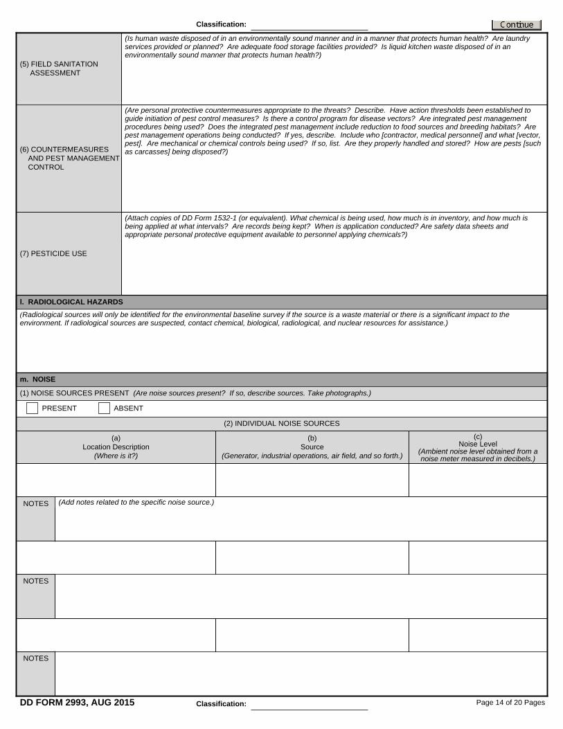
(Is human waste disposed of in an environmentally sound manner and in a manner that protects human health? Are laundry services provided or planned? Are adequate food storage facilities provided? Is liquid kitchen waste disposed of in an environmentally sound manner that protects human health?)
(5) FIELD SANITATION ASSESSMENT
(Are personal protective countermeasures appropriate to the threats? Describe. Have action thresholds been established to guide initiation of pest control measures? Is there a control program for disease vectors? Are integrated pest management procedures being used? Does the integrated pest management include reduction to food sources and breeding habitats? Are pest management operations being conducted? If yes, describe. Include who [contractor, medical personnel] and what [vector, pest]. Are mechanical or chemical controls being used? If so, list. Are they properly handled and stored? How are pests [such as carcasses] being disposed?)
(Attach copies of DD Form 1532-1 (or equivalent). What chemical is being used, how much is in inventory, and how much is being applied at what intervals? Are records being kept? When is application conducted? Are safety data sheets and appropriate personal protective equipment available to personnel applying chemicals?)
(6) COUNTERMEASURES AND PEST MANAGEMENT CONTROL
(7) PESTICIDE USE
l. RADIOLOGICAL HAZARDS
m. NOISE
PRESENT ABSENT
(2) INDIVIDUAL NOISE SOURCES
NOTES
NOTES
NOTES
Page 14 of 20 PagesDD FORM 2993, AUG 2015
Classification:
Classification:
(Radiological sources will only be identified for the environmental baseline survey if the source is a waste material or there is a significant impact to the environment. If radiological sources are suspected, contact chemical, biological, radiological, and nuclear resources for assistance.)
(1) NOISE SOURCES PRESENT (Are noise sources present? If so, describe sources. Take photographs.)

(3) NOISE SENSITIVE AREAS OR ACTIVITIES AND NOISE CONTROLS (Are there noise sensitive activities present that may be negatively impacted by military operational noise?)
(a) Location Description
(Where is it?)
(b) Noise Sensitive Area or Activity
(Describe the noise-sensitive areas or activities such as hospitals, nursing homes, tourism areas or sites,
animal habitat, agricultural, or animal husbandry operations.)
(c) Noise Control
(Are noise controls present? If noise controls are present, describe the type such as avoidance,
engineering controls such as barriers or keeping a specified distance from the noise sensitive area or activity. If noise controls are not present, describe
recommended or potential noise solutions.)
(Add notes related to noises in general.)
n. AIR QUALITY
(1) AMBIENT (OUTSIDE) AIR QUALITY (Describe sources that impact ambient air and/or introduce potential hazards. Provide locations. Survey landscape and note presence of storage tanks. Identify contents. Note all combustion sources that create exhaust, fumes, or smoke; for example, flares, incinerators, generators, burn pits or boxes, welding operations, idling vehicles, or aircraft. Note sources of dust, such as concrete plants, mining operations, tank or convoy trails, roads or highways, helipads or runways, and agricultural fields or operations. Describe sources that produce odors such as a landfill, military painting and/or solvent use, or refueling points. Note any terrain and elevation differences between the camp and air sources. Is the source affected by the season or weather? Is it weather dependent?)
(2) INDOOR AIR QUALITY (Do occupants complain about dust, odors, stale air, or have symptoms of eye, throat, and nose irritation? Are generators placed near building openings? Is the presence of visible mold noted? Take photographs. Do personnel occupy newly built structures? Does the ventilation system allow fresh, filtered, and conditioned air into the building or shelter? Take photographs.) Note: Carbon monoxide and other combustion by-products should be controlled to as low as reasonably achievable.
Present Absent
NOTES
Present Absent
NOTES
(4) GENERAL NOTES
Page 15 of 20 PagesDD FORM 2993, AUG 2015
Classification:
Classification:
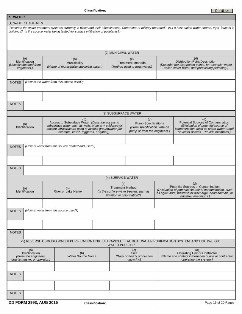
(a) Identification
(Usually obtained from engineers.)
(d) Potential Sources of Contamination (Evaluation of potential source of
contamination, such as storm water runoff or vector access. Provide examples.)
(c) Pump Specifications
(From specification plate on pump or from the engineers.)
(b) Access to Subsurface Water (Describe access to
subsurface water such as wells. Note any evidence of ancient infrastructure used to access groundwater [for
example, karez, foggaras, or qanat]).
(a) Identification
(d) Potential Sources of Contamination
(Evaluation of potential source of contamination, such as agricultural wastewater discharge, dead animals, or
industrial operations.)
(c) Treatment Method
(Is the surface water treated, such as filtration or chlorination?)
(b) River or Lake Name
(a) Identification
(b) Municipality
(Name of municipality supplying water.)
(c) Treatment Methods
(Method used to treat water.)
(d) Distribution Point Description
(Describe the distribution points; for example, water trailer, water blivet, and preexisting plumbing.)
(How is the water from this source used?)
(How is water from this source treated and used?)
o. WATER
(Describe the water treatment systems currently in place and their effectiveness. Contractor or military operated? Is it a host nation water source, taps, faucets in buildings? Is the source water being tested for surface infiltration of pollutants?)
(1) WATER TREATMENT
(2) MUNICIPAL WATER
(3) SUBSURFACE WATER
(4) SURFACE WATER
(d) Operating Unit or Contractor
(Name and contact information of unit or contractor operating the system.)
(c) Size
(Daily or hourly production capacity.)
(b) Water Source Name
(a) Identification
(From the engineers, quartermaster, or operator.)
(5) REVERSE OSMOSIS WATER PURIFICATION UNIT, ULTRAVIOLET TACTICAL WATER PURIFICATION SYSTEM, AND LIGHTWEIGHT WATER PURIFIER
NOTES
NOTES
(How is water from this source used?)NOTES
NOTES
NOTES
NOTES
NOTES
NOTES
Page 16 of 20 PagesDD FORM 2993, AUG 2015
Classification:
Classification:

(Complete this section if nonpotable water is used for dust abatement, construction, or other operations.)
p. GENERAL SANITATION
(1) GENERAL FACILITIES (Describe the type, location, status of facility, and so forth. Take photographs.)
(6) WATER DISTRIBUTION SYSTEM
(7) WATER STORAGE TANKS (Describe the water storage areas on the property, materials of tanks and containers, amount of storage tanks, and general condition of these tanks.)
(d) Type of Water Stored
(Potable, nonpotable, raw water, disinfected, fresh or brine, grey water, and so forth.)
(c) Size
(b) Tank Type
(Metal, fiberglass, fabric, and so forth.)(a)
Identification
(8) BOTTLED WATER (Describe the sources of bottled water and whether it is used as the primary source for drinking water and are the brands Veterinary Command approved? Note if bottles are recycled.)
(9) NONPOTABLE WATER
(Add notes related to sanitation in general.)
(d) General Notes
(Add notes related to sanitation in general. Who inspects the dining facility? What is the inspection interval and frequency? Are there any current food vulnerability concerns? Does review of the dining facility inspections reports reveal any continuing concerns or food vulnerabilities?
(d) General Notes
(d) Notes
(c) Bottle Size
(b) Brand
(Dasani®, Ice Mountain®, and so forth.)(a)
Identification
(c) Notes
(Describe contractor or military operated; point of contact, how long they have been at this location.)
(b) Building Number
(a) Type
(Gymnasium, barber shops, laundry, detainee facility, and so forth.)
(2) DINING FACILITIES (Describe the location and general condition of the facility, status of facility, and so forth. Take photographs.)
(c) Notes
(Add notes specific to the dining facility; for example, contractor, population served, meals served.)
(a) Building Number
(b) Contractor Operated?
Page 17 of 20 PagesDD FORM 2993, AUG 2015
(Describe the water distribution system. How is water transported around the camp: tactical water distribution system, water trucks, trailers, existing distribution system, or constructed distribution system? Are the sanitary system pipes together with the water distribution pipes? Is there possible cross contamination? Is the water tested for possible infiltration of sanitary water? How is water stored?)
Classification:
Classification:

6. SITE USE
Vehicle Maintenance Aircraft Maintenance Power Generation Petroleum Distribution Waste Incineration
Other and Explain
North of Site
South of Site
East of Site
West of Site
(Anything that does not fit in above sections.)
q. OTHER ENVIRONMENTAL CONCERNS
(What is the proposed usage of the site, especially if assessment is being conducted before usage determination or occupation?)
a. PROPOSED SITE USAGE
7. ADJACENT PROPERTY USE
(Describe the current and historical use of adjoining properties. Document agricultural activities such as the types of crops grown, pesticide application -insecticides/herbicides - water usage and animal ranching or herding activities. Everything that was investigated for the proposed base camp location must also be investigated and documented for the adjacent properties.)
a. CURRENT AND PAST USES OF ADJACENT PROPERTY
(What was the past usage of the site such agricultural, industrial, or military. For what duration were these uses active?)
b. CURRENT AND PAST USES OF PROPERTY
(Are there any existing onsite industrial operations? Give information on scope of activities, size of facilities, who performs the operations, hazards present.)
c. ONSITE INDUSTRIAL AREAS
NOTES
Page 18 of 20 PagesDD FORM 2993, AUG 2015
Classification:
Classification:

8. INFORMATION SOURCES AND SUPPORTING DOCUMENTS (Document sources of information gathered. Provide summaries of environmental sampling and studies, aerial photographs, topographic maps, previous environmental baseline survey or Occupational and Environmental Health Site Assessment referenced, base camp master plans, and other documents reviewed. Document personnel interviewed by providing their name and contact information for verification, if necessary, as well as the name of the interpreter if one was used.)
b. INDUSTRIAL OPERATIONS IN SURROUNDING AREA
(Describe nearby industrial operations [for example, power plant or factories]. What is approximate distance from camp boundary? What can be observed from camp: smoke, odors, and so forth? Include 8-digit grid coordinates of each facility, name of industry, type of industry, and active or inactive. Provide a description of the facility - if processes are present, material used and stored, operating schedule, and environmental impacts. Take photographs.)
North of Site
South of Site
East of Site
West of Site
c. SPECIFIC NEARBY INDUSTRIAL FACILITIES
a. SOURCES OF INFORMATION (Who did you talk to or interview? How can they be contacted again? Attach interview notes.)
PERSONNEL CONTACTED
(1) Location
(8-digit grid coordinates.)
(5) Description
(Describe facility, processes present, material used and stored there, operating schedule, environmental impacts, and so forth.)
(4) Active?
(3) Type of Industry
(For example, power production, petrochemical,
or agricultural. )
(2) Name
(4) Location
(3) Title
(2) Contact Information
(Address, telephone number, e-mail, and so forth.)
(1) Name
Page 19 of 20 PagesDD FORM 2993, AUG 2015
Classification:
Classification:

b. OTHER SOURCES OF INFORMATION
(Enter all classified information that is significant to the report. The classification must be added as a header and footer for each page. All classified information will be added in this section as a separate addendum to the report with a reference to its appropriate section number. Classified data must be sent via SECRET Internet Protocol Router Network.)
9. SITE RECONNAISSANCE INFORMATION* (Completed as part of the analysis of the information gathered during the site reconnaissance.)
11. FINDINGS AND CONCLUSIONS* (Completed after information gathered is analyzed.)
13. RECOMMENDATIONS* (Completed after findings and conclusions have been developed.)
12. JUSTIFICATION AND DISCUSSION* (Completed after findings and conclusions have been developed.)
10. ENVIRONMENTAL AND HEALTH SAMPLING DATA
14. CLASSIFIED DATA
Page 20 of 20 PagesDD FORM 2993, AUG 2015 Classification:
Classification:
(Document all source of information received. Provide enough information that the sources may be used by other to verify the information if necessary.)
(Identify sampling requirements; why, where, and what needs to be sampled. Provide 8-digit grid coordinates, a description and a photograph, if possible, for all areas to be sampled.)