~daa ~age l ij:z. - californiaarchives.slc.ca.gov/meeting_summaries/1990_documents/01-17-90/... ·...
TRANSCRIPT

A 26 I 10
s 5
CALENDAR ITEM
2 4
ISSUANCE Of A NEGOTIATED SUBSURFACE STATE OIL ONO GAS LEASE,
SAN JOAQUIN COUNTY
01/17/90 W 40593 PRC 7375 Hamilton
APPLICANT/PROPOSED LESSEE: Sun Operating limited Partnership c/o Oryx Energy Company P.O. Box 2880, Attention C & LA Dallas, Texas 75221-2880
AREA, TYPE ANO LOCATION OF STATE LANDS: Sun Operating Limited Partnership has applied for a negotiated subsurface (no surface use) State oil and gas lease on the parcel of State land described in Exhibit "A 11 • The State parcel proposed for lease contains approximately 33 acres of tide ~nd submerged land in the bed of Beaver Slough in San Joaquin County, California. ·
PROPOSED LAND USE: Because the State parcel is a waterw~y, surface locations for oil and/or gas operations (drill sites) are not available. However, the State parcel can be developed by slant drilling from approved drill sites located on the adjacent lands or by inclusion in a Commission-approved pooled area or unit as provided under the Commission's negotiated sµbsurface State oil and gas lease.
-1-
(ADDED pgs. 145-145.11)
, ~DAA ~AGE ... l iJ:z.2 2 MJNUTEPAGE~~·-· -·--, ~-----------..;.....;....:.-.~---~

,CALENDAR ITEM NO .. J~ t.l (CONT 1 D)
Sun Operating Limited Partnership has oil and gas leases and a f armout agreement on all of the private land$ adjacent to the State parcel (see Exhibit 11 C11
) and has received approval (Exhibit 11 D11
) from San Joaquin County Department of Planning and Building ~nspection to drill for gas and/or oil from a drill site locQted on private lands about 200 feet north of the State Parcel.
STATUTORY AUTHORITY:
,\
P.R.C. 6815(a) authorizes the Commission tb negotiate and ~nter into oil and gas leases on State lands if any of the following circumstances exists: wells drilled on private or public lands are draining or may drain oiland/or gas from th~ State lands, the Commission determines the State lands to be unsuitable for competitive bidding because of such factors as their small size or irreg~lar configuration or their inaccessibility from surface drill sites reasonably available or obtai~able, the State owns a fractional interest in the lands, or the Commission determines a negotiated oil and gas ~ lease to be in the best interes~s of the St~te. ~
Because the State parcel can be developed only from adjacent lands that are currently under lease to the applicant (drill sites are not available on the State parcel because it is a· waterway) and because the applicant intends to drill a well near the State parcel, staff has concluded that the criteria of P.R.C. 6815(a) would protect oil and gas resources that may underlie the State parcel and be in the best interests of the State.
AB 884: 05-01-90.
PREREQUISITE CONSIDERATIONS: Filing fee, processing costs, first year's rental, performance bond or other security and. executed negotiated subsurface State oil and gas lease have been received and are on file in the Commission's Long Beach office.
-2-

CALENDAR ITEM NO. (CONT'D)
NON~NEGOTIABLE PROVISIONS: 1. The lease will be for a primary term of
twenty years and for so long thereafter as oil or gas is produced in paying quantities from the leased lands, or sc long as the lessee is diligently conduc~ing producing, drilling, deepening, repairing, redrilling or other necessary lease or well maintenance operations in the leased lands.
2. No right to use any portion of the leased lands to a depth of SOO feet for dril1ing locations, producing facilities or related oil and gas operations.
3. All development of the leased lands shall· be accomplished from surface locations on the adjacent lands.
4. A~l drilling into the leased lands shall be by slant drilling from surface locations on the adjacent lands and shall be on & course and to an objective approv~d in writing by the State prior to the cornmen·cem~n~ of drilling.
5. Compliance with all applicable laws, rules and regul~tions of Federal, State and local governments and receipt of all necessary permits or approvals prior to slant drilling into the leased lands.
NEGOTIATED PROVISIONS: 1. Drilling term of three years. However, if
all or part of the leased lands are included in a Commission-approved pooled area or unit, then drilling operations on, and production from lands pooled or unitized with the leased lands shall be deemed to be drilling operations on' and production from, the leased lands thal are included in the Commission-approved pooled area or unit.
-3-
CALENDAR PAGE · j ~~ lJ 2
MINUTE PAGE ... -------1

£ALENDAR ITEM NO. ~~ :'.:~ (CONT'D)
2. Annual rental of $125 per acre ($4,125 for approximately 33 acres).
3. Royalty of 22-1/2% on gas and oil.
4. Performance bond or other security in the sum of $5,000.
OTHER PERTINENT INFORMATION: 1. CEQA Guidelines Section 15~78(a)(3)
identifies an activity involving the issuanc2 to a person of a lease as a 11 project 11 • However, if the site of t:he project or area in which the major environmental effects will occur is located on private lands within the coun~y, that county will have jurisdiction by law over the project pursuant to CEQA Guidelines Section 15366.
2. As Lead Agency under CEQA, the San Joaquin County Department of Planning and Building Inspection approves development plans to drill for gas and/ot oil on proper~Y' located in the County. Developmen·t plans are processed by San Joaquin County as ministerial projects.
3. Pursuant to the Commission 1 s delegation o'f authority and the State CEQA Guidelines (14 cal. Code Regs. 15061), the staff. has determined that this activity is exempt. from the requirements of the CEQA as a categorically exempt project. The project is exempt under Class 4, Mino~ Alter~tions to Land, l~ Cal. Code Regs.15304.
Authority: P.R.C. 21084 and 14 Cal. Code Regs. 15300.
APPROVALS REQUIRED AND OBTAINED: On Septemb_er 14, 1989, the San Joaquin County Department of Planning and Building Inspectibn (Lead Agency) approved Oryx Energy Company's (managing general partner of Sun Operating Limited Partnership) Development Plan No. OP-90-14 (Exhibit non) to permit Sun to
-4-
CALENDAR PAGE
MlNUTE PAGt:

;.~,~-~~~~~?~r~1~;:.:±~:--,~;~?: .. -' l
: .·-··;i ;,,,._::~-,':?!11"f~~!""'-~1'.? . '\ ... -~r>~>-~;l ,:·~~~".:-<,:·,J'"
•
•\ A
CALENDAR ITEM-NO. (CONT'D)
drill for gas and/or oil from a drill site located on private property about.200 .feet north of the State parcel (see Exhibit 11 C 11 ).
EXHIBITS: A. Land Description. B. General Location. C. Site Map. D. Deue~opment Plan No. DP-90-14.
IT IS RECOMMENDED THAT THE COMMISSION:
1. FIND THAT THE ACTIVITY rs EXEMPT FROM THE REQUIREM~NTS OF THE CEQA PURSUANT ro 14 CAL. CODE REGS. 15061 AS A CATEGORIC~LLY EXEMPT PROJECT, CLASS 4, MINOR ALTE~ATION TO LAND, 14 CAL. CODE REGS. 1530~.
2. DETERMINE THAT :THE CRITERIA OF P.R. C. 6815 (a) li~WE ·BE-EN MET, THAT THE STATE LAND DESCRTBED IN EXlfIB-IT 11 A11 IS UNSUITABLE FOR COMPETITIVE BIDQJ.NG ·BECAUSE SURFACE DRILL SITE$ ARE -NOT -AVAILAB!:E, THAf. WEL!::~ DRILLED UPON THE . ADJACENT PRIVATE L~NDS MAY DRAIN OIL nND/OR GAS FROM THE STATE LAND DESCRIBED !'N EXHIBIT ·'1A11 AND THAT A NEGOTIATED SUBSURFACE STATE OIL AND GAS LEASE WILL PROTECT OIL AND GAS RESOURCES THAT MAY UNDERLIE STATE LANDE DESCRIBED IN EXHIBIT' 11 A II. •
':) ...
4.
PURSUANT TO P.R.C. 681S(a), ENTER INTO A NEGOTIATED SUBSURFACE STATE OIL AND GAS LEASE WITH SUN OPERATING LIMITED PARTNERSHIP. THE LEASE WILL CONTAIN THE STATE LAND DESCRIBED IN EXHIBIT 11 A11 (APPROXIMATELY g3 ACRES), A DRILLING TERM, OF THREE YEARS, ANNUAL RENTAL OF $125 PER ACRE ($4,125 FOR APPROXIMATELY 33 ACRES), ROYALTY ON GAS SUBSTANCES AND OIL FIXED AT 22-1/2 PERCENT AND .PERFORMANCE BOND OR OTHER ScCURITY IN THE SUM OF $5,000.
AUTHORIZE THE EXECUTION OF THE DOCUMENT NECESSARY TO EFFECT ' . THE COMMISSION'S ACfION.
-s-
' CALENDAR PAGE ... ..;!.~' . L .. ~6 MINUTE PAGE-..- · . , - •• -
,~~.~,«~.~~~,~·~ r•>''"~---~'~"""~"'~•••v~.~~,~W~•' -~~=·""'''h•··~· <~A·~~;.,~-·-~'!'~~ r~°"· -~ 0"''' ~·~·--»·»~~,_~_.. ~-~~ ~· < • ~-~~- r, '•~·~~~-·~--~-'·'·~'-W''-~••~,~~-~:-~'"'~.'''~~,~~~:~A·~·«
,; - :'l,f~">;t;1tlfJ~~·; ·-' ··.-~_,,:i_~%~~1;\ -~~'i'"l'f-· ·¥·)';~-'}~:;'.'?!'>, ~">~;~%~1~';>::;"- -' -<~ ;~~\:;~~:~~t-- :f: ! _,', ~~~~:r~~.,:k~~:h,~:.;\, · .... : · : -~\,{ :~~~::::";~;~r.t :\\;~,,/- --~l.I~~1r0Jt::.0;~<:~,~·-- ·"
• ..,, ~ - >:. - q
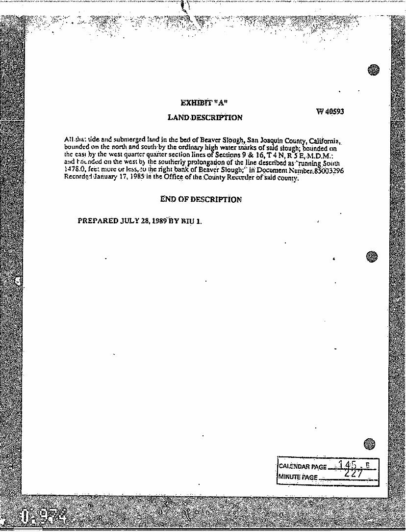
EXHiEIT"A"
LAND,DESCRIPTION
' /''(
W40S93
AH .&ha: tide an<! submerged land !n the bed cf Be~ver Sl?ug~.., San Joaquin County, California,_ bounded ,.,n the no~ and south by the ordinal)' h1sh ~tcr marks of said slough; bounded nn the c:is_1 by the west quancr quaitcr section lines of Seeti~s 9 ·& 16, T 4 N, R..S.E,.M.D.M:: a:id t- ri1. nd~ on the west b} t~e southerly prolongation 9f the _line described as "running,~oi1th 1478.0, fee~ murc:: ur lc~s,,_!o tpc: right_bank~of f!cavefr Slough;'· in DQCument_Number1.85003~96 Rec·ord~~Hariuary 17, 198~· in the Offi~~ of the.County Rcrun!~fr of'Smd counJy;
END OF DF..SCRJPTION
PREPARED JULY 28, 198~fBY RJ11 l.
: CAld:No~ PAGE~ 1-~~ ~ E MINUTE PAGE -· . · 7 .~
' ~ : "';;_ '' ..... ,. -·----..


-I
I I
/
-~?1:
'~ . .,
- -
z
:
I
. '
....
r
I
' I ' I . _, •
~-• ' r I • • -·+-1 I • • I•
LOCATION MAP
"STATB L.~NDS COHM.188ION •. .
rGpoaed Negotiated Bubeurfac S'tiate Oil 4' G&s Lease
B0aver Slough, San J.oaqu~n Co. W .o . .i&OIS98
BOAU 1 ••1000' 'so
I
' I • • • •
\' :1 ., r"- I
r~ .. I i r i-. .· . -
.1. .IS9
... s ... '.'[ . .. .. I
~~ LANDS CONTROLLED BY APPLICANT • a • '
; ·1
. , • I •
·~~ABE ARSJJ • ~ I • • , • • :-
'\ ' • ·- - • I • •
AR PAGe;
:PAGE • D
-· •

State of Cabf.ornin StntP niv\r-ion o~ Oil and. C~~ l 41 fi r:i nth Street, Room 1 :1 l G Sacram~nto, Ch 95614
Ce n l. l e?;nc n:
September 14, l.989 ' .
P.!:: Oc'r~lonmnnt Plan lio. DP-90 :.;
'ttllT 0AVlt$0H, 0.-
llMY lftlUIC!<
~-HNlJAClSOH ~~
10MWAlllR
°'"''"'-·
On S£PT£HRF.R 14, 1~8~, the San JoHqu:n county Department of T'l~1,nif!-:J nnd nuildin9 In:Jpection t1pp.t.~'l"'!C an Application ·r:o. OP-90-14 to drill ~~r 9a~ and/or oil ~n prcperty lo~ate~ 2es.12 1 t;-a!lt end 254~_.ge· n"1rth of the southwest. corner of Section 17, T·i::, P.5E, rtDS!lM, nt""u~hwc:;: o.i: Thcrnton (12525 w. Kile nood). !he p~oncr~y i~ ownod ~y Sanko~ Stockton, a~~ :h~ ap?lic~nt wa~ Oryx energy Cumpany, f.O. Box 5506Q, Val~ncia, CA 9!355-0560
Dc~clcpment plans J oaqu i :o Cv .. nty·.
arc nrocen~~d as m~~is~or!a~ ?rojocts by San
! ! :,.tO\.l have l\ny th~s c!!ice.
~uestion~,
• ......... . .... '-' to cori tact.
s;a:~
DLT:gt
DOM DE 'LI:. TORRE Scnio: Planne:-
Attachment~: Conditinns o! Approva~ ~ Map
cc: Local Health District oeptn:tmcr.t of Public Works ~..+v-:ZP.u i\di ng Tnspcction Divi~~on )\,..._, Bureau of. Fire Prevention hir Pollut!on'Contrnl Di~tri~l Bank o:· 'Stoc'k ton Oryx Ener~y Company
'D-l

DEV&LOPHENT PLAN COUDITIONS FOR
GAS ANO OIL
COUOITIOtlS OF Al>PROVAL: APPLICATiOU HO; i>P-90;..1'1 ...._ __ _ DATE l~PPROVED; 9-l 4-89,
1. i:'!'--n:-c t:lu:lt be proof that Ll1t! applicant ha~· ~posted the sure:.y b:~d as required by the 5talc o~ Cali!ornti Di~ision of Oi! and
A . -.
'Gas.
A~ cpp!ic~tion ~c~ a dtilling permit for test holes shall ~e "-:.::::::-:i~tcc to the Local He<slth District bcgore drilling c~~,cnce~. The ~pplicbLian shall cpntaln a map showing test h:-:~e location, depth, .?Ind methocl of test hole destruction.
7~~ sit~ plan ~hall ~how ~11 structures, equipment, sumps, enc ~::::css :-oads •
.; . -::-.e p::oje~t ahall confor.m to the approved site, plan.
s. ':.'!":~ peri.d. t sh~l l become, voic shoulc! the use o! the property e ~c=?~e e nuisance hs de~ined by Se~tio~ 9-3113 of the Plann~ng ~:.:.:.c.
6. u~a~ten~cd slumps ~hall be ~nclu~ed by a six-!oot (6') htgh c~:in link fence.
7. /' ~~=ure encroachment permit~ for any ace~~~ points to the public :i;h~· o!-way fro~ the Department o! Public ~orK•.
e. 7~~ ?e=~!t ~h~l1 expire ei9hleen (18) months a~ter the date o: ~~?:-ov~l unless all permits necessary lo ccmplete the project 1".a·:e b~e:n sccu:ecl and ·actual dt" i l ling ::.hall be d 1 liaent'lY p..::-sued to completion, o~ the perm.r.-t. zhall be corne void ••. Any c~~sation !o: one·hundred-eighly (lGO) ~ays or more shall vo1~ ~r.:s per:nit.
9,, ":'his pcrmi t moy be trans£ erred pi::ov idec;
a. The tran3fcree provid~s the Planning Div~sion with proof o~ a surety bond, ns required by tho California Division of Oil ond Cas, two weeks prior to the Lr~nsf~r.
b. The transferee complies with all conditions o! the approved permit.
. . ' ~'45 <l 9 CALENDAR PAGE-;.:.,.2'\"'-T'3 "11',----MINUTE PAGE~',.;.;.',,_..._ _____ ,

.:''.·. :~:;,..~--~~·~,~-~:,::~.,~~--.~.~~·~:_:_:_:~;f._~."':::~~ .. -~~W:.;_~-~r.~ .. ~:~?~_:~{~_;_~~~f~_f~:~_~-~.? __ :·_:· ~·:;~,~":'t .:~~;!;· ·:;\t~:·_':_! _. -·~ ·1%~~l~:~ · t~ · "~. :''.. . '· . . ·'.:'~'f. :,-.f·:'·"' : _-;~·- '. · .. ",~· -~::·:":;i::\~:~%'~i' ~,;_{"'~
~.,
w 40593
OEVELOPM&t~T PLAH CONDITTOUS FOR CAS AUD OIL WELL PAGE 2
l 0 •
11. ..
I':;nvi<fo r.nnitory facilities for all einolov~<!o. as reauircd .b\' th~ California Occupational Safety anu.Health Administra:ion:
Provide a potable water ~upply approved ~y the ~an Joaquin Cou~ty Local Health District for all employees. '
12. All unu.setl or abandonod hole:; shall be filled with bentonite or· othar approved grout material as specified in San J~aquiri County Ordinonee 1862, and th~ surface is to be l~~t in ir.s n~ioinal condition.
' ! 3. /,1) Qas o:- ciil dri llin9 opet"ations shall be .l'~rformed in
acc:ordonce with the rules and re:gulations sc.t torth.·Dy the California Divi~iqn o= Oil and Gas.
14. Adequate fire fighting equipmenL shall be llidintaine~ on the premises in con::o::-mity wiLh all Stat~ antl local regulati.Of?~·
15. Mud ond wastes from the drilling ~nd prouucticin shall be dlspo~ed of at a site approved by the San Jq~quin County Local Health District. .
16. Any derricks shall be removed within ninety (90) days o~ completion or ahand6nment of the well unloss a ~~eat~r tim~ is approved by the Pl~nnin9 Director in writing, ~a~~~ on a ~howin~ of goorl cnu5e.
2. 7·. Tlie !iu::ety bond shall remain in J:orce until dri·lling 1$ completed and the $ite is restored. On completion or abandonr.1cnt of the' w~ll, ·al~ sumps shal-1 t>e f.illed to na~ural 9rade and sito resto~ed to its origin~l co~dilion.
18. Secure a permit fr6rn the San Joaquin C6unly ,8ur~au of Fire Prevention before drilling commences.
19. Secure an ~uthorily to Con5truct from the San Joaquin County Air rollution Control Di~trict or a v~riance from the San Joaquin County Air Pollution Conlrol District Hearin~ Board.
• 0-3
CALENDAR PAGE-..:.1 ....1.4-=i~.c.A1~o.,...· -L32 MINUTE PAGE---~--~1
'"

Fee --~---7-~_._..u __ _ Receipt No. /<t,'?1,..,.,.
Pre-App. Receipt------
Descript ~on of Project:_ D12-\-..\.- -n:- ~ /\No./6"-;;...__0 ... 11... _______ _
t.oca ti on : _jb .;-. J"l..' ~T AN p z, 5''1 S'. ~ t/ ~ <J? 1¥'f S:oJ\rtY"fit: cc11.«~'7:.- ~ s~-t.no:J. \::t 1 :r*,.., 7 ~$"):! .1 Mos;; M, ~
. f!f J)tt:\<t.~-;...i~--------
J',ddr ess: 1~2525 VJ· ._ ~1~E' ~ .. 1 .. ~ --Number Street City Zip
f,$sesso= Parcel NumberCs> CY-:>•-05<.> .. 6'7 --~~~~~~----~~~~--~~~--~~--
G~ n e: al Plan Designation: ~.~...r Conunun it~·: __ __.;.._ __ _
i c . .., Zon ng Map: ___ .;:. ___ Overlay Zone: _______ _
East: West.:
100 Ye.u Flood: 0 No
Williarr.son Act:. B No
Speci!ic Road Pl~n: [t:l No
it ,, g]
Yes
·o Super.visorial Oiat~ict:___:y,._ ____ __ Yes
D Yes
Name:~-----~~-
Uistory: @ No
D Files: __ , ____ ~------~~-----Yes
--~---'-'-----'~·--~~-~-
Rernar·ks : _________ _
Enforcement File:~-I .. --i rLENDAR PA~ : ~ ,
1 = :